Given what’s in the recent news regarding the fires on the same day of October 17th of 2026 at CFB Wainwright in Alberta, Camp Pendleton in California, and the burning of the historic city hall in Limoges, France, I decided to bring forward what I discovered when I was researching the Great Lakes Region about the six Great Fires in our historical narrative that took place on October 8th and 9th of 1871.
The best-known fire was the Great Chicago Fire which started on October 8th of 1871, but there were several others that took place in Illinois, Wisconsin and Michigan that altogether claimed thousands of lives and devastated millions of acres.
First, the Great Chicago Fire.
The Great Chicago Fire was considered one of the most destructive urban fires in American history.
It began on the evening of October 8th of 1871, and continued into October 10th, devastating much of Chicago, Illinois.
The disaster destroyed thousands of buildings, and left tens of thousands of people homeless.
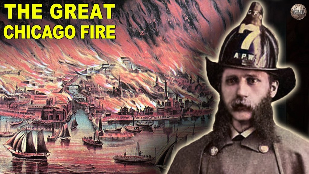
Here is an infographic that nicely summarizes all of the data points surrounding the Great Chicago Fire, right down to who is given the credit for re-building after the fire.
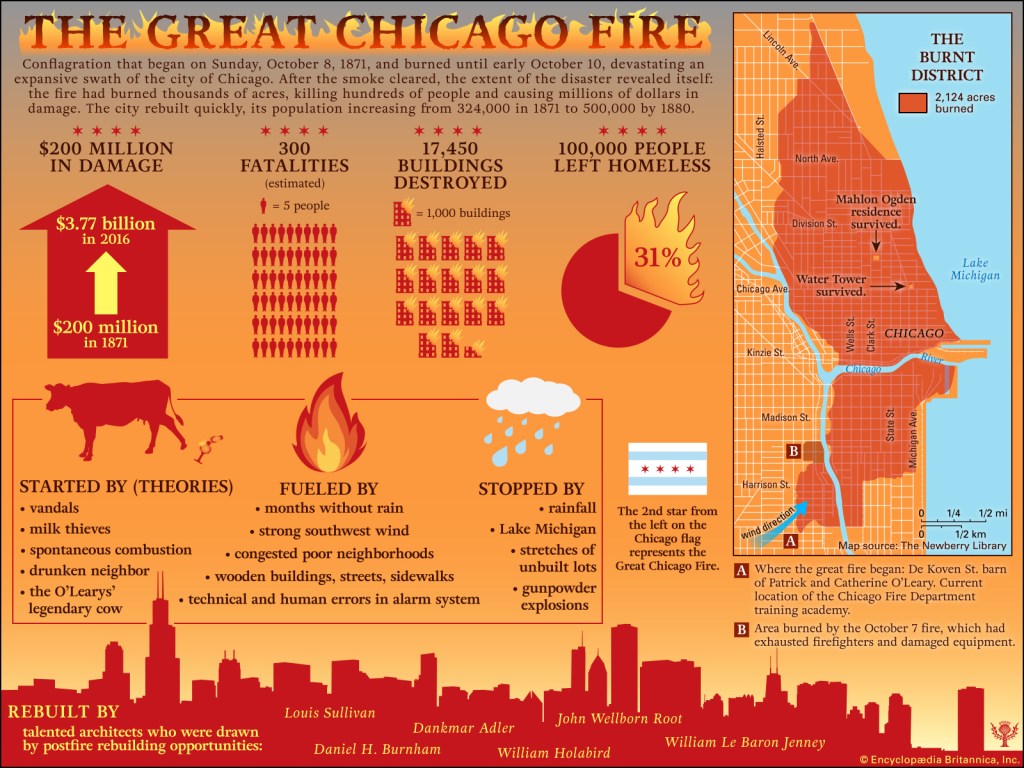
The most enduring reason in popular culture that has come down to us for how the Great Chicago Fire started was that around 9 pm on October 8th, a cow kicked over a lantern when it was being milked in a small barn belonging to the O’Leary family, and that the shed next to the barn was the first building consumed before it spread to consume a large percentage of the city.
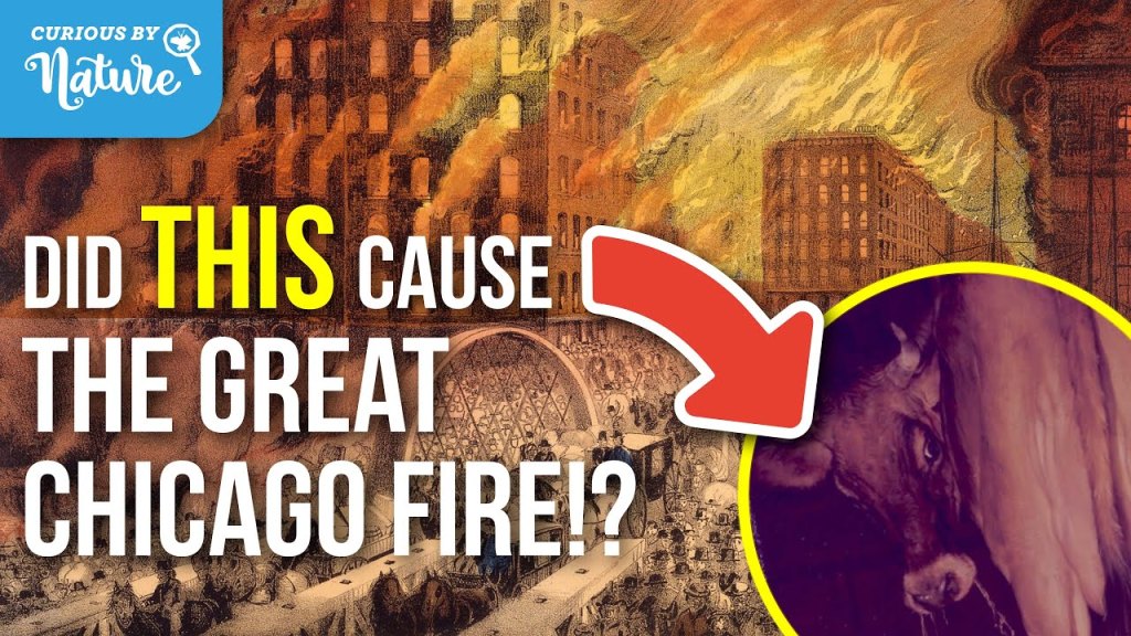
As the story goes, the fire broke out on the city’s southwest side.
Dry weather, wooden buildings, wooden sidewalks, and combustible roofing helped flames spread rapidly and strong winds carried burning embers into neighboring blocks.
The fire swept through the commercial district, destroying businesses, hotels, churches, homes, and public buildings.
The city’s water infrastructure and firefighting resources proved inadequate to contain it.
Then on October 10th, rain and changing weather helped bring the disaster to an end.
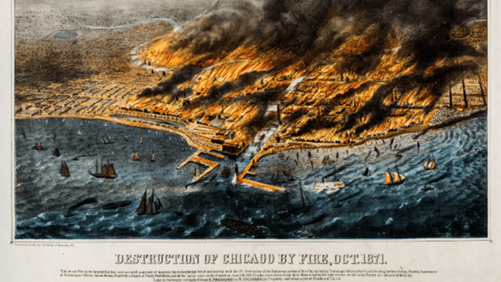
Much of the burnt district lay in ruins.
The fire burned for roughly 27 hours.
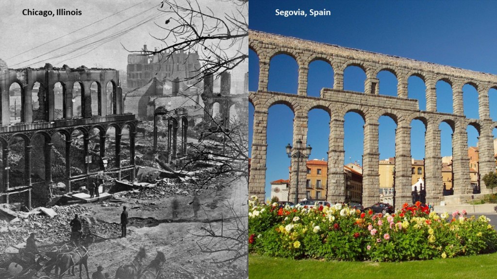
As just seen, the predominance of wood buildings was one of the explanations given for creating the flammable conditions that fueled the fire.
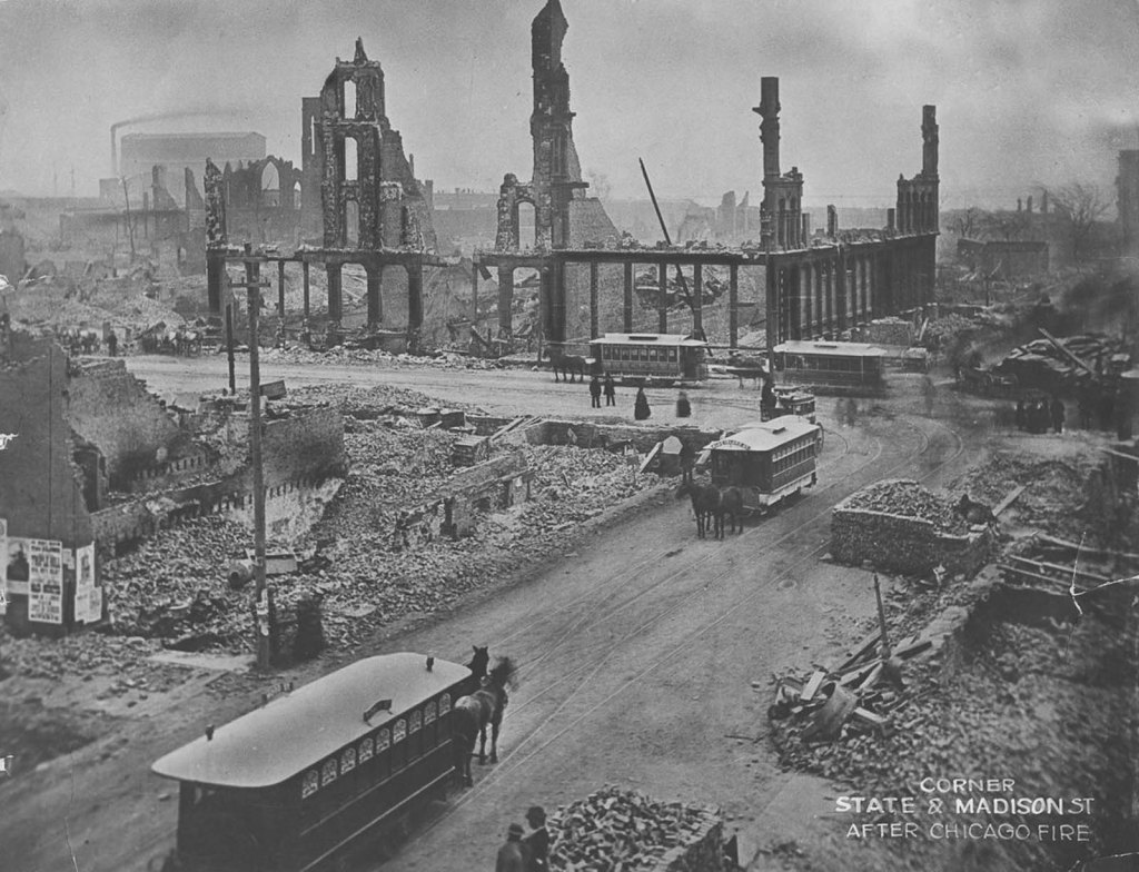
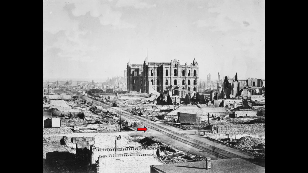
Yet, here are some photographs taken after the Chicago fire showing what remained.
This first one shows a ruined, yet still beautiful stone aqueduct, on the left, compared with the famous aqueduct in Segovia, Spain, on the right, said to have been built by the Romans in the 1st-Century AD.
This photo shows city blocks with smoldering masonry ruins, oddly juxtaposed with mule-drawn streetcars in the same scene.
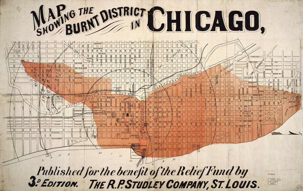
The estimated property damage was about $200-million in 1871 dollars, an enormous sum at the time.
Reasons given for the rapid spread of the fire also included:
–The preceding summer and autumn had been exceptionally dry, leaving buildings and surrounding materials highly susceptible to fire.
–Strong and gusty winds carried sparks and burning debris across streets and into buildings well ahead of the main fire…
–And firefighting limitations. due to the fire department facing difficulties with water supplies, equipment, and the sheer speed and scale of the blaze.
Given Chicago’s importance in American railroad history, the fire’s effects on transportation are particularly interesting.
By 1871, Chicago had become a major railroad hub, connecting the Great Lakes region with the American Midwest and routes extending westward.
Railroad depots, freight facilities, warehouses, and other transportation-related structures were located in or near the burned district.
The fire damaged railroad property and disrupted the movement of goods, but it did not erase Chicago’s underlying geographic advantages as its location on Lake Michigan and its extensive rail connections remained valuable.
The city rebuilt its commercial and transportation facilities, helping it retain and expand its position as a national distribution center.
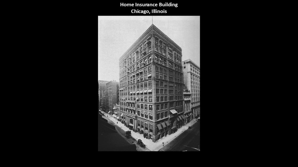
The Home Insurance Building in Chicago was said to have been designed by Chicago architect William LeBaron Jenney and completed in 1885.
It was often described as the first skyscraper because of its innovative metal-frame construction, and said to be a milestone in the architectural transformation that followed the fire.
Interesting to note that this massive innovative building was demolished in 1931, less than 50-years after it was said to have been constructed.
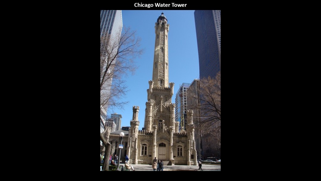
The Chicago Water Tower was said to have been completed in 1869, only four-years after the American Civil War ended.
This water tower survived the fire and became one of the city’s best-known surviving landmarks from the pre-fire era.
Located on Chicago’s Magnificent Mile, this 182.3-foot, or 56-meter, -tall limestone tower was said to have been designed in the Gothic Revival-architectural-style by William Boyington.
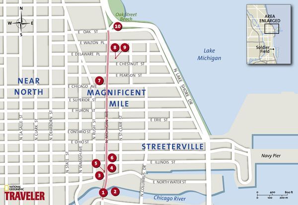
The Magnificent Mile is the primary commercial corridor on Michigan Avenue between the Loop, Chicago’s Central Business District, and the Gold Coast, an historic district in Chicago.
Other famous buildings on the Magnificent Mile include the Wrigley Building on the left, said to have been constructed in the Beaux-Arts Architectural-style roughly between 1920 and 1924 for chewing gum magnate William Wrigley Jr as the headquarters for his company and is used as retail and commercial space today.
The building on the right in this photograph is the neo-Gothic Tribune Tower, said to have been built between 1923 and 1925 for Chicago Tribune owner Robert McCormick, and today is a luxury residence.

We are told the Chicago World’s Fair, also known as the “World’s Columbian Exhibition,” was held in 1893 to celebrate the 400th-anniversary of Christopher Columbus’ arrival in the New World in 1492, and said to have been designed by many prominent architects of the day.
We are told the Fair also served to show the world that Chicago had risen from the ashes of the Great Chicago Fire of 1871, only 22-years earlier.

The Museum of Science and Industry in Chicago is said to be in what was originally the Palace of Fine Arts, and one of the few surviving structures from the 1893 Chicago World’s Fair.
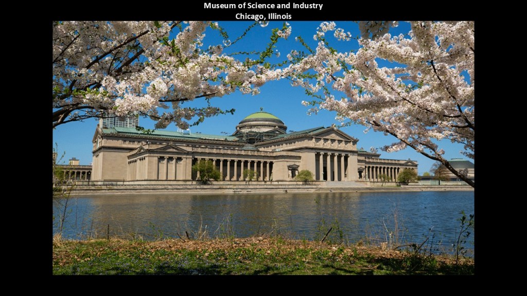
Similar kinds of things were said many years later about the 1906 Great Fire of San Francisco and the 1915 San Francisco Panama-Pacific Exposition.
The Great Fire of San Francisco was preceded by the San Francisco Earthquake of 1906, which took place on the morning of April 18th that year.
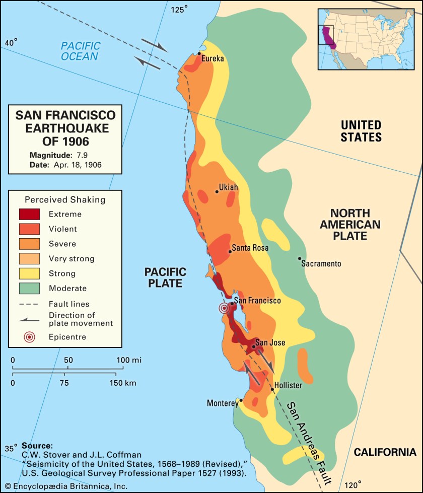
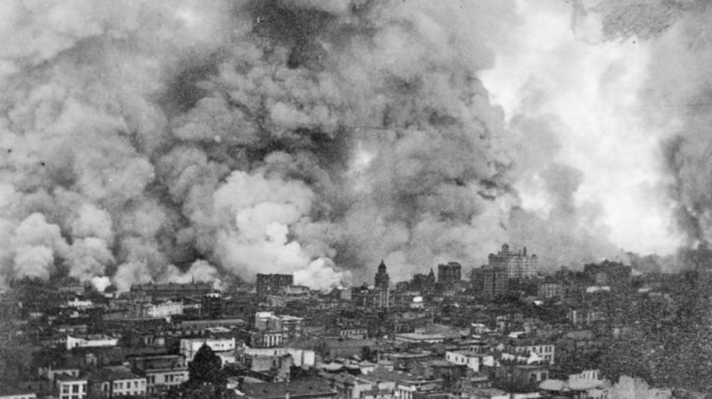
We are told after the earthquake, fires soon broke out in San Francisco, and lasted for several days, and as a result, up to 3,000 people died, and over 80-percent of San Francisco was destroyed.
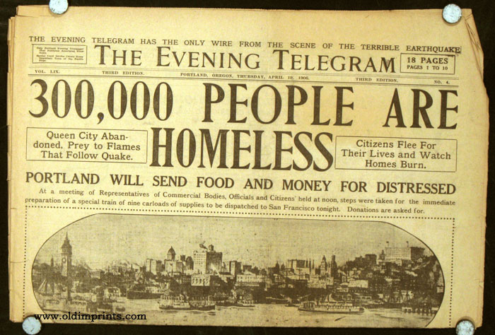
We are told that up to 300,000 people were left homeless out of a population of 410,000.
Like Mrs. O’Leary’s Cow coming down to us in lore about the start of the Great Chicago Fire, the “Ham and Eggs Fire” was one of the causes given in our narrative for the destruction of San Francisco.
We are told ninety-percent of the total destruction of San Francisco was caused by out-of-control fires.
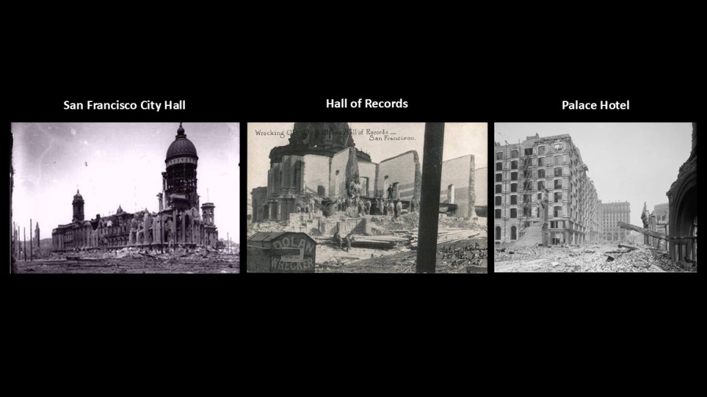
One of the largest fires, called the “Ham and Eggs Fire,” was said to have started on April 18th of 1906, the same day as the earthquake, and caused by a woman making breakfast for her family.
The “Ham and Eggs Fire” was said to have caused the destruction of the San Francisco City Hall on the left; the Hall of Records in the middle; and the Palace Hotel on the right.
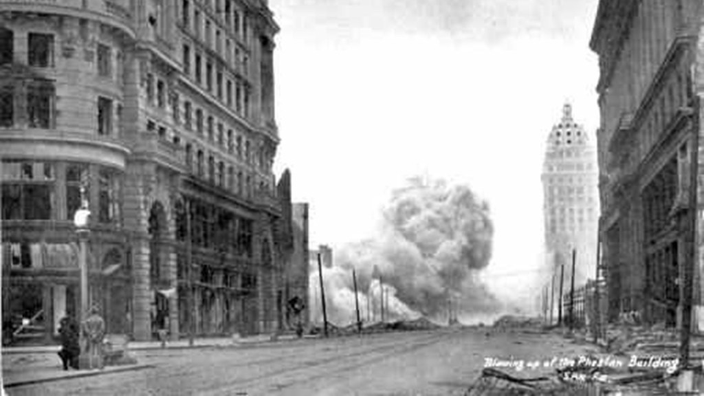
Another cause of the destructive fires in San Francisco was attributed to firefighters who were untrained in the use of dynamite.
We are told they were trying to dynamite strategic buildings to create a firebreak, which instead caught-on fire from the dynamite itself.
Like the Museum of Science and Industry in Chicago being called the “Palace of Fine Arts” from the 1893 Chicago World’s Fair, this magnificent structure in the Marina District of San Francisco, not far from the Presidio, is still known as the “Palace of Fine Arts” today.
It was said to have been built for the Panama-Pacific Exposition of 1915, an exposition which celebrated the city and its rise from the ashes. and one of its few surviving structures.
Interesting to note such a massive engineering feat and event like this taking place during World War I, which took place between 1914 and 1918 in our historical narrative.

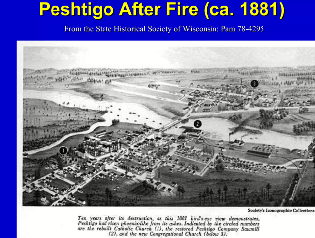
Now I am going to return to the Great Fires of October of 1871, and next talk about the Peshtigo Fire that was primarily in the Green Bay region of Wisconsin.
Interestingly, this Bird’s Eye View map of Peshtigo is dated September 1871.
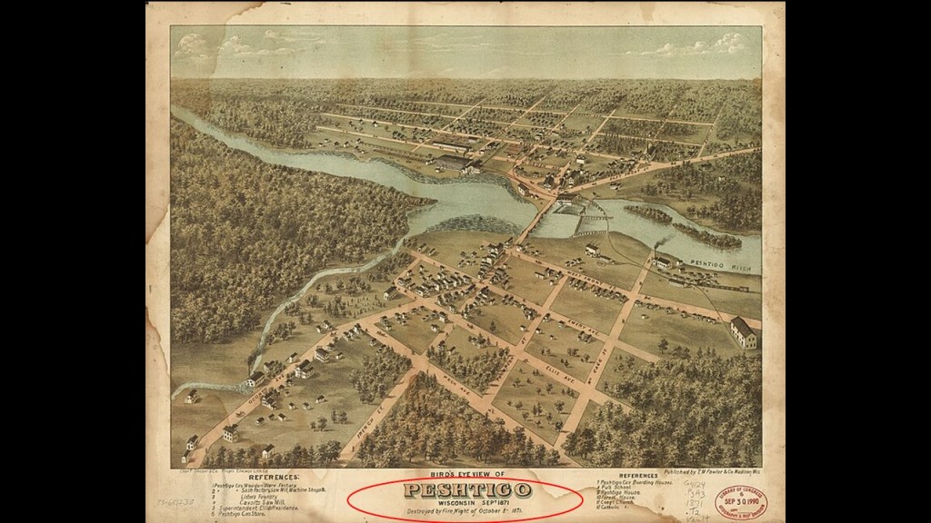
The Great Fire of Peshtigo was the deadliest wildfire in recorded United States history.
On the night of October 8, 1871, an enormous firestorm swept through northeastern Wisconsin and on up into Michigan’s Upper Peninsula, destroying entire communities and killing at least 1,200 people, with some estimates reaching 2,400.
The disaster is often overshadowed by the Great Chicago Fire, which began on the very same night, yet the Peshtigo Fire killed far more people and devastated a vast region.
What makes this event especially noteworthy was that the fire was not simply a forest fire moving toward a town.
Under extreme conditions, multiple fires combined into a violent, wind-driven inferno capable of destroying buildings, uprooting trees, and trapping people who tried to escape.
It burned somewhere around 1,500,000-acres, or 6,000-kilometers-squared, of land on both sides of Green Bay in northeastern Wisconsin and on up into Michigan, and considered the deadliest wildfire in American History.
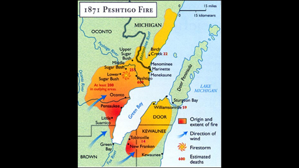
Though we are given the number of estimated deaths ranging between 600 to 2,500 people, there is no way of knowing the actual number, and we are told things like the unidentifiable remains of hundreds were buried in a mass grave at the Peshtigo Fire Cemetery.
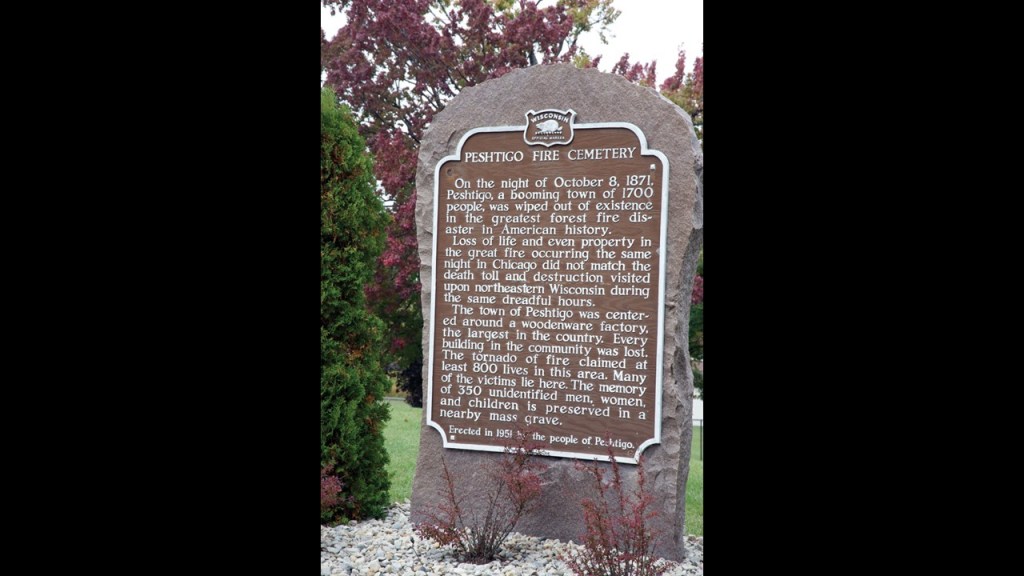
The fire reached Peshtigo on the evening of Sunday, October 8th.
The fire’s behavior is one of the most frightening aspects of this disaster.
We are told the town’s wooden buildings and industrial facilities provided abundant fuel, and the flames spread with terrifying speed.
Residents fled in different directions.
Some ran toward the Peshtigo River, while others sought refuge in wells, ponds, or other water-filled places.
For many, the river became the only possible refuge.
The fire was so intense that people sheltering in the water could still suffer burns or succumb to smoke and heat.
Survivors described a deafening roar, violent winds, and burning material swirling through the air.
The Peshtigo Fire developed into a firestorm in some locations.
Extreme heat, strong winds, and turbulent air created conditions in which the fire could advance rapidly and unpredictably.
People attempting to flee encountered burning roads, collapsing buildings, smoke, and showers of embers.
Others became separated from their children or spouses in the darkness.
The Peshtigo Historical Society preserves numerous family stories describing these experiences.
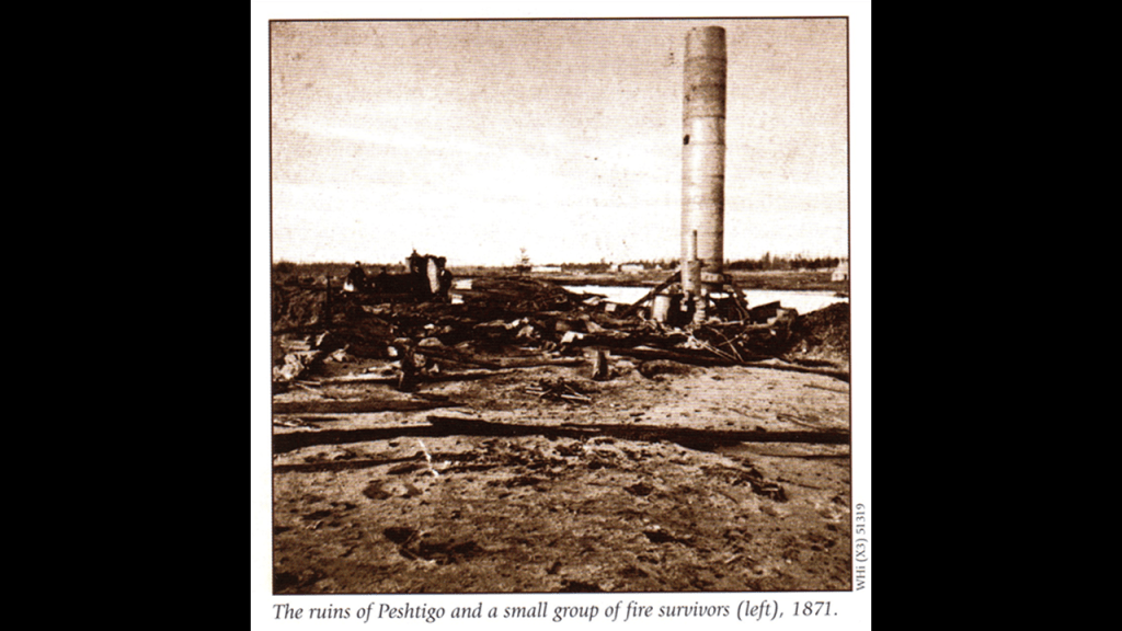
The morning after the fire revealed a landscape that survivors scarcely recognized.
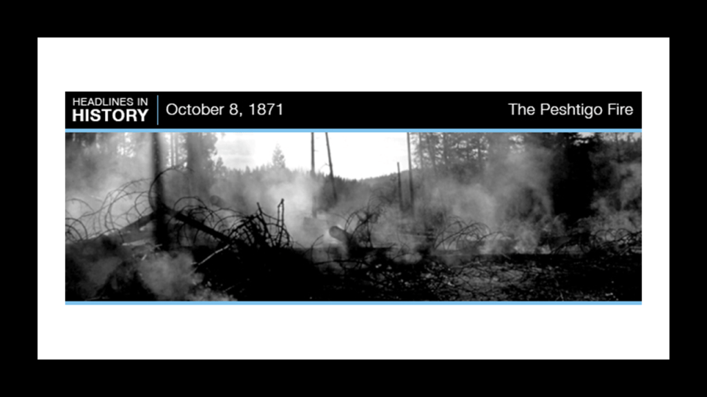
The town had been largely destroyed. The fire had consumed homes, businesses, industrial buildings, and much of the surrounding vegetation.
The heat was sufficient to melt some materials and damage objects that would ordinarily be expected to survive a building fire.
Despite the devastation from the fire, the community rebuilt.
Peshtigo continued as a lumber and manufacturing center, and the fire became a defining event in the town’s identity.
Next, I am going to talk about the Manistee Fire in Michigan .
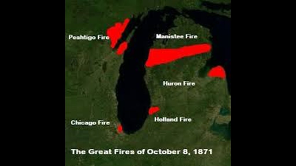
The Manistee Fire was one of the fires that constitute what is known as the “Great Michigan Fire” of October 8th of 1871, along with the Holland Fire and the Port Huron Fire, in Michigan, and the same day as the Great Chicago Fire and the devastating Great Peshtigo Fire in Wisconsin.
Manistee was a booming lumber town on the eastern shore of Lake Michigan.
Its sawmills, timber yards, docks, wooden buildings, and surrounding forests made it particularly vulnerable when dry conditions and powerful winds turned local fires into a major catastrophe.
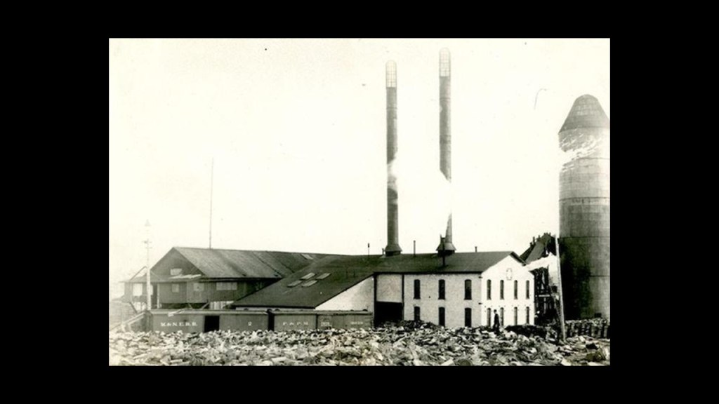
The The Great Fire of Manistee of 1871 destroyed approximately half to two-thirds of the city, including numerous lumber mills, homes, businesses, and waterfront facilities.
Contemporary accounts describe a town almost wiped off the map. Remarkably, the community recovered and went on to become an important center of both lumber production and salt manufacturing.
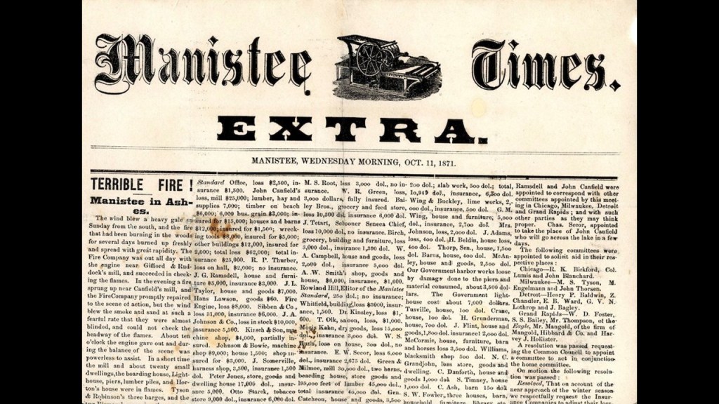
According to historical accounts, the disaster unfolded in several stages.
The first major alarm happened around 9 am when a fire threatened a mill near Manistee Lake.
Firefighters responded with the city’s single steam fire engine and managed to contain the immediate danger.
Then around 2 pm, another mill caught fire, and the mill, docks, lumber piles, boarding house, stables, and other buildings were rapidly destroyed.
The main conflagration started around 9:30 pm as fire approached from the southwest along Lake Michigan.
Gale-force winds scattered burning sawdust and embers, igniting the lumber yards and waterfront.
Flames crossed the Manistee River and destroyed the government lighthouse, and by later that night, the city was engulfed in flames,
The fire engine broke down, leaving firefighters without their principal piece of equipment.
Burning debris was carried through the air, igniting buildings across the city, and residents fled as the flames spread into residential neighborhoods.
The fire left a substantial portion of the population homeless and destroyed workplaces on which local families depended.
The population of Manistee at the time was estimated to be 3,500, and property loss was estimated to be valued at $1 million in 1871 dollars.
Over half of Manistee’s buildings were destroyed, with some accounts estimating roughly two-thirds of the city.
The major local industry of lumber was affected with the fire’s impact on sawmills, lumber yards, docks and shipping.
The community began rebuilding almost immediately, and the lumber economy recovered.
Manistee continued to grow as a lumber center, and salt production became another important industry after salt was discovered beneath the city in the late nineteenth century.
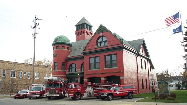
The City of Manistee wasn’t incorporated until 1882, 11-years after the Great Fire, and this is the Manistee Fire Department, said to be the oldest continuously manned fire station in the world.
Interesting to note that this fire station was said to have been built in 1888, seventeen years after the Manistee fire of 1871.
Next, the Great Fire of Holland in Michigan.
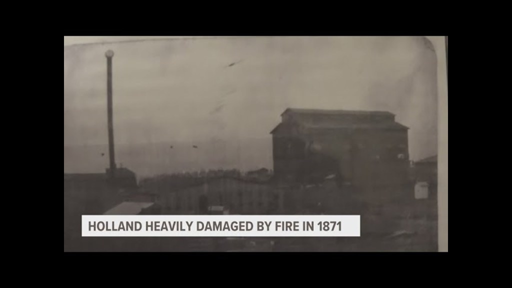
The Great Fire of Holland was a devastating conflagration that struck Holland on October 8, 1871.
We are told it was fueled by months of drought, strong winds, and the abundance of wooden buildings and forest debris, and that the fire destroyed much of the young city’s residential and commercial districts.
In our historical narrative, Holland had been established by Dutch immigrants only a few decades earlier, and the city had to rebuild homes, businesses, churches, and community institutions almost from scratch.
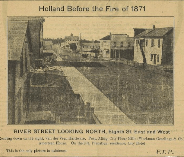
The Holland fire unfolded starting on the afternoon of Sunday, October 8th.
We are told that small fires had been burning in the surrounding countryside during the exceptionally dry season.
At approximately 2 p.m., a fire approached Holland from the southwest.
Church bells sounded the alarm, and residents left services and joined efforts to fight the flames along the wooded outskirts.
The fire overwhelmed attempts to contain it, and flying sparks and burning debris carried the flames into additional neighborhoods.
As evening progressed, the wind strengthened dramatically.
Residents later recalled that by midnight it was blowing with hurricane force, and flames raced through the city, with residents struggling to save their families and whatever possessions they could carry, and an estimated 150- 200 families were left homeless.
By the fire’s end, much of the city was reduced to smoldering ruins.
The vast majority of downtown Holland burned in the fire, and the cause of the fire remains unknown, though suggested causes have included burning embers from the Chicago fire crossing Lake Michigan, to burning methane gas from a passing comet.
After the fire, the value of the property damage was estimated to be $800,000 –$1 million in 1871 dollars.
Next, the Port Huron Fire on October 8th of 1871 was not confined to the city itself.
It affected the surrounding Thumb region of Michigan, including St. Clair, Sanilac, and Huron counties.
We are told the scale of the rural destruction is one reason the event remains difficult to reconstruct precisely.
Records of deaths and property losses were incomplete, so reported figures varied.
Some accounts estimate that at least 50 people died in the Port Huron Fire and surrounding districts, but the precise number is uncertain.
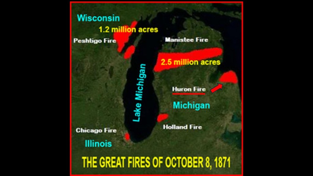
This is what we are told about the 1871 Port Huron Fire.
Four conditions combined to make the disaster especially severe.
–There were months of drought, where rainfall had been far below normal
–The lumber industry left behind logging debris like branches, bark, stumps, and other waste that could readily ignite.
–Strong winds spread flames and burning embers over large distances, allowing individual fires to merge or ignite new fires.
–Limited firefighting capacity with rural settlements and logging camps having few resources to fight large, wind-driven fires
We are also told the precise ignition source was unknown.
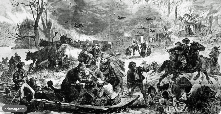
The wind-driven fires were so severe, residents of the area jumped into whatever water source was at-hand, like wells or in nearby Lake Huron if they could.
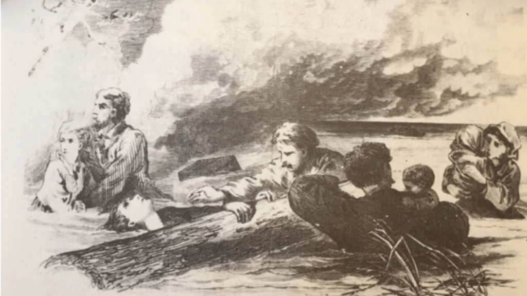
Then, almost ten-years later to the day, on on September 5th of 1881, the Michigan Thumb Fire started, with hurricane-force winds and hot and dry conditions.
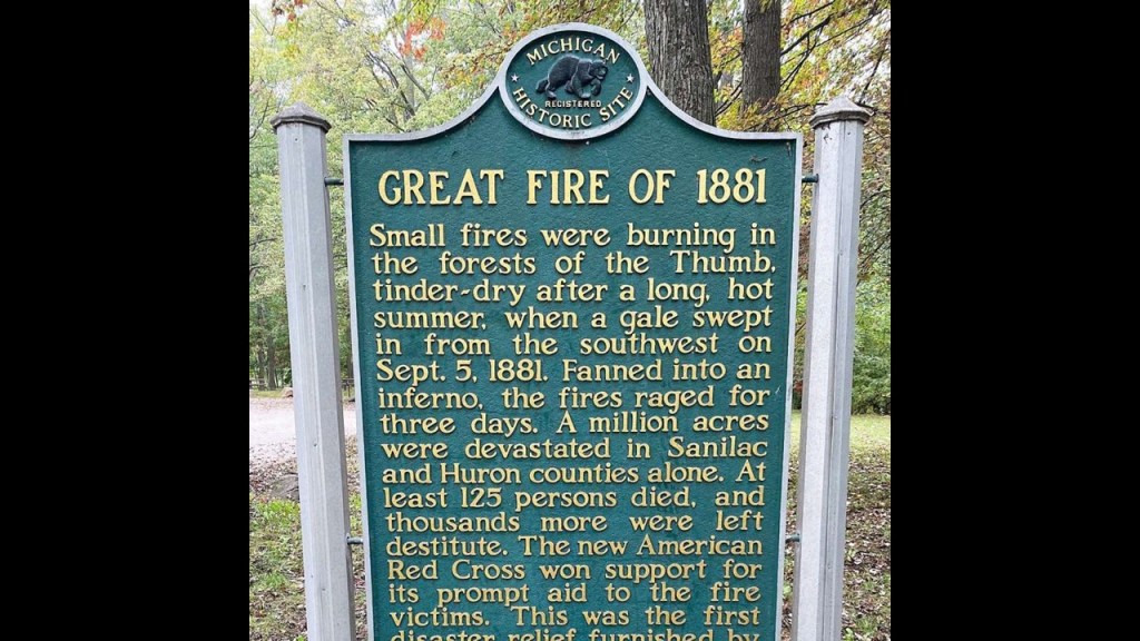
Interesting to note the following descriptions that accompanied the 1881 Michigan Thumb Fire.
Soot and ash from the fire caused sunlight to be obscured in places on the U. S. East Coast and in New England, the sky had a yellow appearance, and which caused a strange luminosity in and on buildings and vegetation, and Tuesday, September 6th of 1881, became known as “Yellow Tuesday” because of this unsettling event.
The first official disaster relief operation of the American Red Cross was responding to the Thumb Fire less than four months after the establishment of the American Red Cross in May of 1881.
The American Red Cross was founded by Clara Barton as a non-profit humanitarian organization that provides emergency assistance, as well as disaster relief and disaster preparedness education.
Clara Barton had been a hospital nurse during the American Civil War.
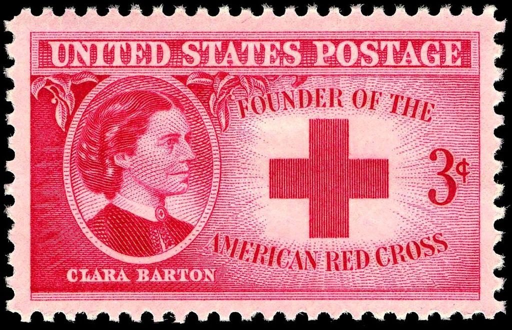
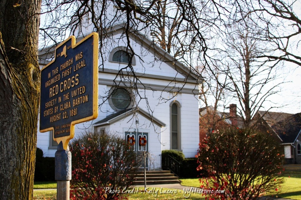
She had connections in upstate New York, and the American Red Cross was established on May 21st of 1881 in Dansville, New York, and the first local chapter was at the English Evangelical Lutheran Church of Dansville.
Other names involved in the establishment of the American Red Cross included Senator Omar D. Conger, who had a home in Dansville where its founders met…
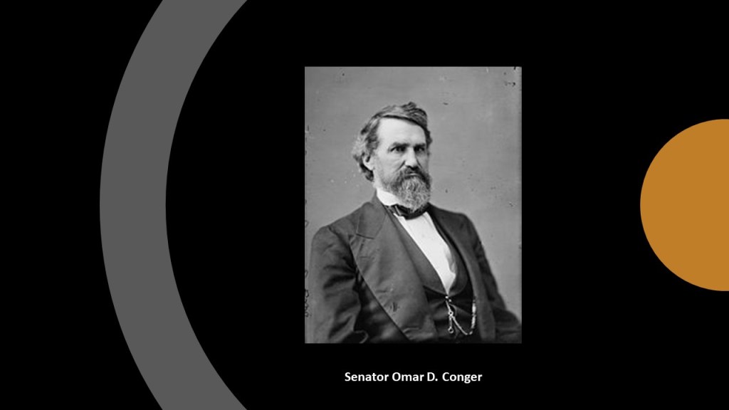
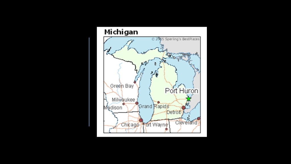
….even though he was one of the Senators for Michigan and had lived and worked in Port Huron, in Michigan’s region known as “The Thumb.”
Was this an early example of Problem – Reaction – Solution?

Did they actually create the disasters, and then provide the response to the disasters?

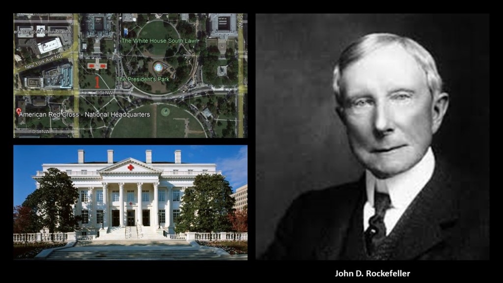
John D. Rockefeller was amongst several that donated to create a national headquarters for the American Red Cross near the White House in Washington, DC, that was said to have been built between 1915 and 1917.
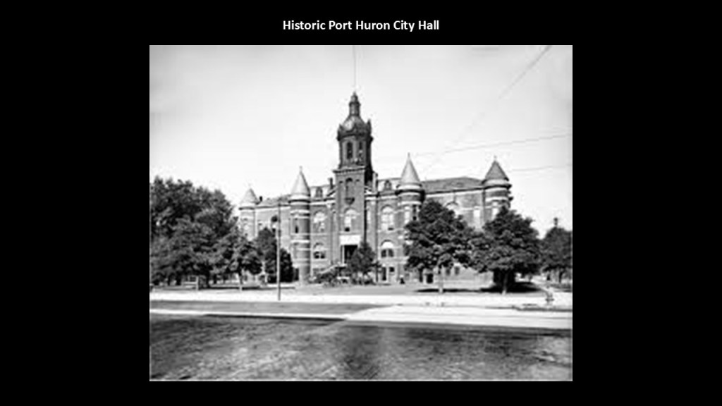
Just for pictorial reference of the architecture in Port Huron, this was an historic picture of the Port Huron City Hall…
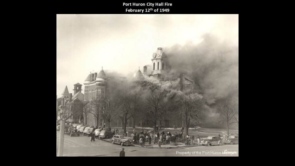
…which caught on fire in February of 1949, for the given reason of a janitor accidently leaving a pot of floor wax on the heater for too long.
There was one more Great Fire that happened in October of 1871, and that took place in Urbana, Illinois, on the following day of October 9th.
Urbana is 126-miles, or 202-kilometers, to the southwest of Chicago.

In our historical narrative, Urbana’s Great Fire was a smaller but consequential disaster that destroyed much of the town’s wooden downtown, and we are told it prompted a shift toward brick commercial construction, and helped shape the development of the city’s fire department.
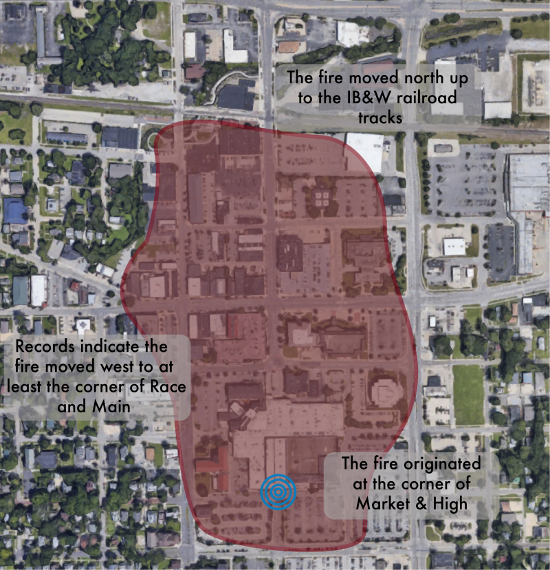
Just one year prior to the fire, Urbana’s Babcock Fire Company had been organized in 1870 with approximately 40 volunteers and 12 buckets.
In 1871, the city acquired a hose reel and hand pump, but its firefighting resources remained limited compared with what was needed to combat a rapidly spreading downtown fire.
We are told the 1871 disaster helped spur the development of a more formal municipal fire service.
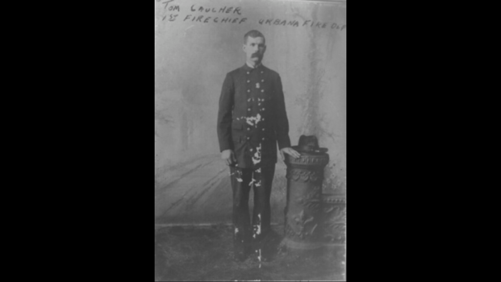
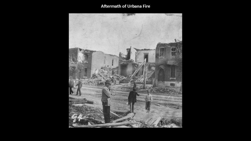
The Urbana fire was much smaller in scale than Chicago’s, but illustrated an important feature of the 1871 fire season: multiple communities suffered destructive fires during the same period of drought and dangerous weather.
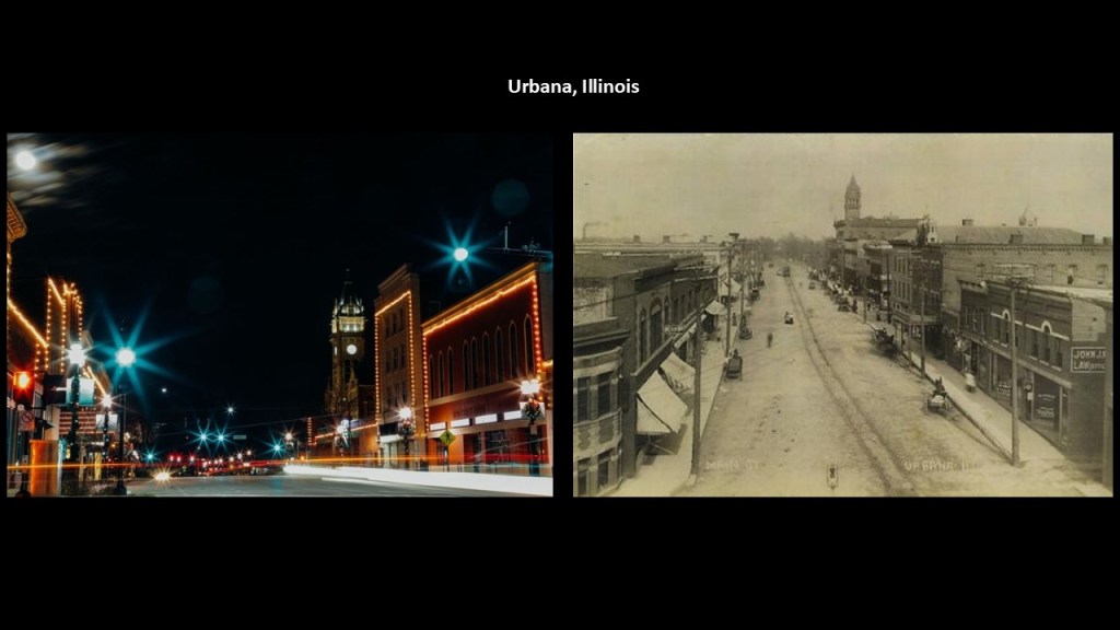
Interesting to note that here is a picture of Main Street in Urbana’s downtown today on the left and an historical picture of the same place on the right, with what look to be very similar buildings.
Next, I am going to take a look at examples of more recent fires with similar characteristics that make one pause and go “hmmmm”: the 2018 “Camp Fire” that took place in California; the 2023 Lahaina fire in Hawaii; and the 2025 firse in the Pacific Palisades and the Eaton Fire in California.

First, the 2018 Camp Fire in California.
The 2018 Camp Fire was a catastrophic wildfire that swept through Butte County in Northern California in November 2018.
It destroyed much of the town of Paradise and devastated surrounding communities, becoming the deadliest and most destructive wildfire in California’s recorded history at the time.
The fire is remembered for its extraordinary speed, the large number of people who lost their lives, and the near-total destruction of an established American town.
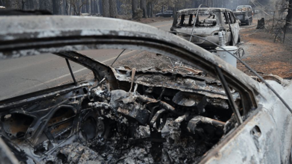
It is also remembered for what didn’t burn during the fires, like homes and trees that were left standing next to homes that were burnt to the ground.
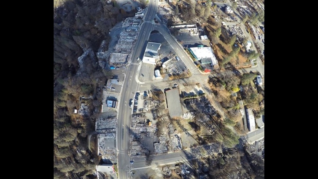
The Camp Fire of 2018 took place over the period of time between November 8th and November 25th of 2018, in Butte County in the Sierra Nevada foothills of Northern California.
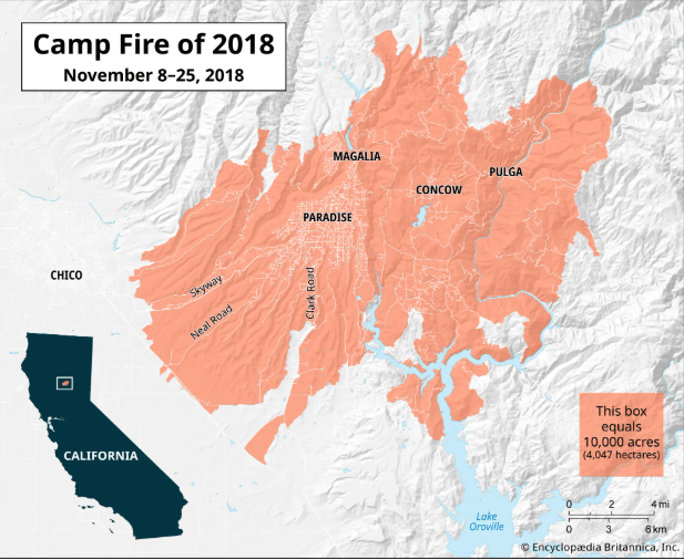
The Camp Fire began on the morning of Thursday, November 8, 2018, near Pulga, a small community northeast of Paradise.
Several environmental factors made the situation especially dangerous, including strong dry winds that carried burning embers rapidly across the landscape and dry vegetation, just like we saw with the Great Fires of 1871.
The combination of these conditions allowed a relatively small ignition to develop into a massive wildfire in a very short period of time.
According to one investigation, the fire traveled from its origin to Concow in about an hour and reached Paradise, roughly seven miles, or 11-kilometers, away, in less than an hour and a half
Researchers documented wind-driven fire spread and embers traveling as far as 4-miles, or 6-kilometers, ahead of the main fire front, which meant that homes could ignite well ahead of the approaching flames.
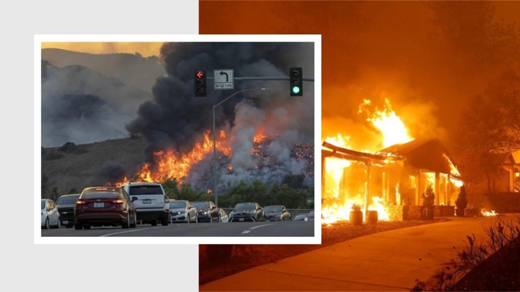
Paradise had approximately 27,000 residents before the fire.
Many people were beginning an ordinary Thursday morning when evacuation orders and the advancing flames transformed the town into a disaster zone.
The emergency unfolded rapidly:
The fire ignited in the early morning when the fire ignited near Camp Creek Road, and subsequently strong winds drove flames and embers toward Concow and Paradise.
Roads became heavily congested during evacuation, as thousands of residents attempted to escape, and later that day, fire spread through neighborhoods, destroying homes, businesses, vehicles and public facilities.
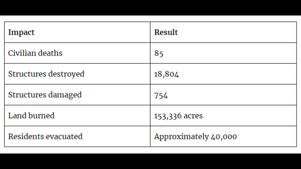
The official toll was devastating, with 85 civilian deaths, almost 20,000 structures destroyed or damaged; 153,336-acres, or 62,053-hectares, of land burned and around 40,000 residents evacuated.
The destruction extended beyond Paradise to the communities of Concow and Magalia.
Paradise lost much of its residential housing, commercial district, schools and other community infrastructure.
Thousands of families lost their homes and possessions. Survivors were displaced to nearby cities and other parts of California, while emergency shelters, temporary housing and relief organizations worked to meet immediate needs.
Investigators determined that faulty electrical transmission equipment owned by Pacific Gas and Electric Company (PG&E) caused the fire, with the utility’s equipment igniting vegetation during conditions that favored rapid fire spread.
The disaster had major legal and financial consequences for the PG & E Utility, who faced extensive litigation from people and businesses affected by the fire.

Next, the catastrophic Lahaina wildfire occurred on August 8th and 9th of 2023.
The fire destroyed much of historic Lahaina on the western coast of the island of Maui in the State of Hawaii.
It became one of the deadliest U.S. wildfires in more than a century with at least 102 deaths, and thousands were displaced.

Lahaina was not just another Hawaiian town.
It had been the capital of the Hawaiian Kingdom during the reign of Kamehameha III and remained an important place for Native Hawaiian history and culture.
The fire destroyed or damaged historic buildings, homes, religious sites, businesses, and cultural resources.
The famous Lahaina Banyan Tree survived, although it was badly damaged. Its recovery became an important symbol of the community’s efforts to restore life to the town.
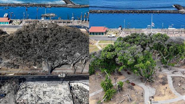
According to investigators, the fire began near Lahainaluna Road around 6:30 am on August 8, 2023.
Investigators concluded that broken overhead electrical lines were re-energized, ejecting molten metal and sparks that ignited dry vegetation.
Firefighters contained the morning fire, and the scene appeared extinguished, however, embers remained undetected and were reignited by strong winds at approximately 3:00 pm.
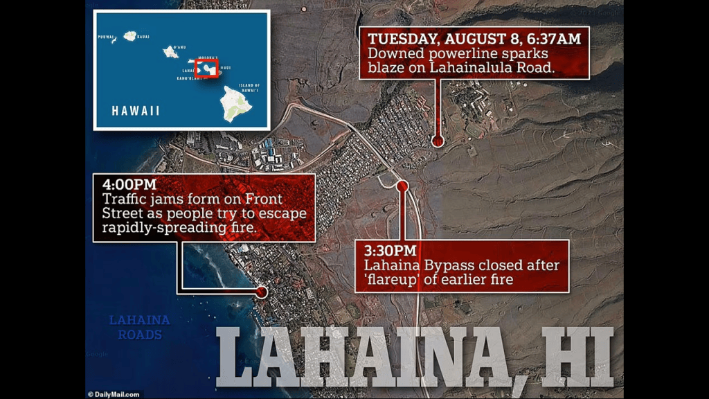
We are told several factors combined to turn a vegetation fire into an urban catastrophe.
Powerful winds associated with Hurricane Dora passing far to the south of Hawaiʻi, combined with exceptionally dry conditions, helped drive the flames and spread embers, making firefighting more difficult.
Once the fire entered Lahaina, flames spread between structures.
Dense development, combustible materials, and the close proximity of buildings allowed the fire to move rapidly through residential and commercial areas.
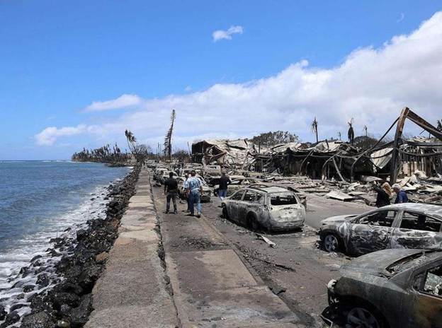
Residents trying to evacuate encountered blocked roads, smoke, flames, and limited escape options.
Some people fled by car, others on foot, and some entered the ocean to escape the advancing fire.
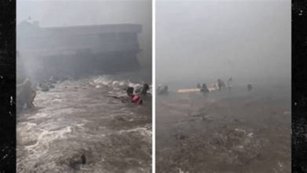
Communication difficulties and the speed of the disaster complicated emergency response.
Later investigation found that no single factor explains the scale of the disaster, and that weather, infrastructure, preparedness, emergency coordination, and the physical characteristics of Lahaina interacted to produce the devastating outcome.
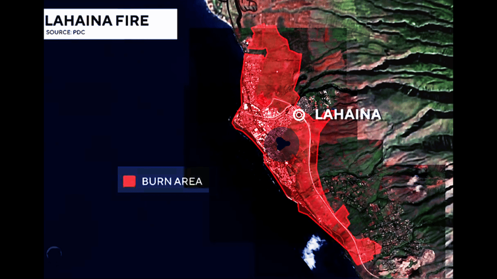
As a result of the Lahaina fire, there were 102 confirmed deaths; over 2,200 structures destroyed; over 8,000 people displaced, and roughly 2,170-acres, or almost 900-hectares, of land burned.
These numbers are approximate and reflect commonly reported totals from the disaster and its immediate aftermath.
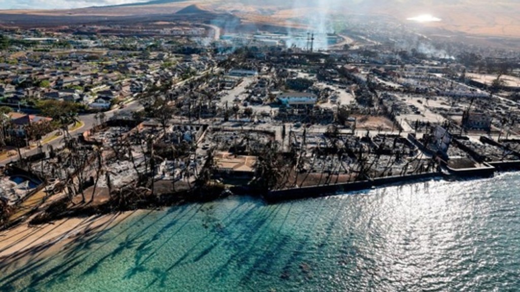
The main area destroyed by the fire was historic Lahaina and the surrounding area, destroying historic properties, commercial buildings, churches and residential neighborhoods.
Entire blocks were reduced to ash, foundations and twisted metal.

Though, as was seen in the Camp Fire, not everything was turned to ash, as the remnants of some buildings and trees remained standing in the fire’s aftermath.

Lahaina’s losses were particularly significant because the town was central to Hawaii’s history, as the former royal capitalof the Hawaiian Kingdom during much of the early nineteenth century, before Honolulu became the principal capital and the area contains important places associated with Hawaiian history, governance, traditional land use and community life.

Next, I am going to take a look at the 2025 Pacific Palisades Fire in California.
The Pacific Palisades Fire, which began on January 7, 2025, was one of the most destructive wildfires in California’s history.
It devastated large parts of Pacific Palisades, a coastal neighborhood in Los Angeles, and spread into surrounding communities in the Santa Monica Mountains.
The fire was part of a series of major Southern California wildfires that erupted in January 2025 during exceptionally dangerous fire-weather conditions.

The disaster destroyed thousands of structures, forced widespread evacuations, and caused extensive loss of life and property, though like we have seen with other fires, not everything burned to the ground.
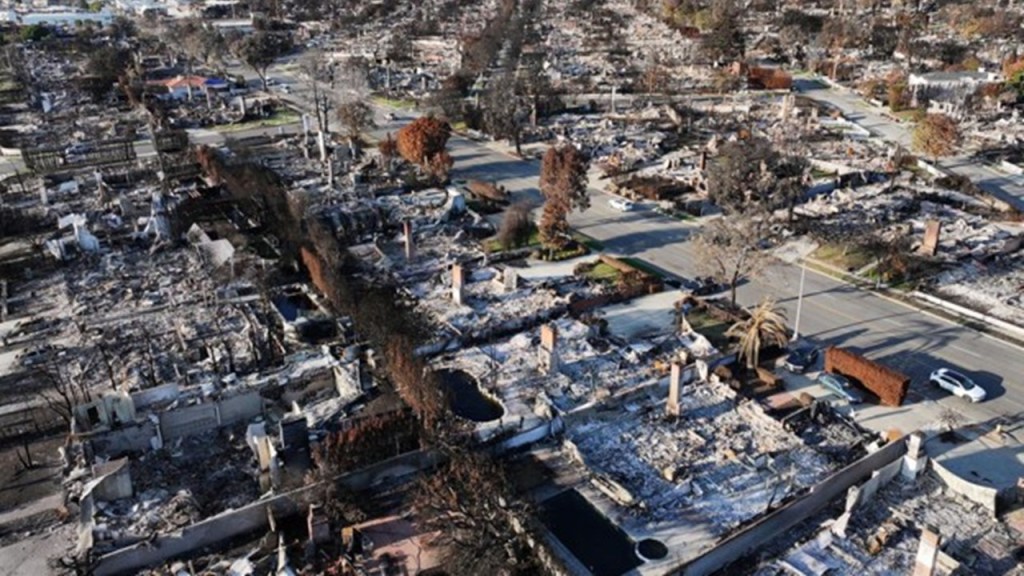
The fire started on January 7th of 2025 in the Pacific Palisades in western Los Angeles, near the Pacific Ocean.
The fire affected the Pacific Palisades; the Santa Monica Mountains; and areas extending toward Malibu and neighboring communities, and lasted until January 31st of 2025, when it was declared fully contained.
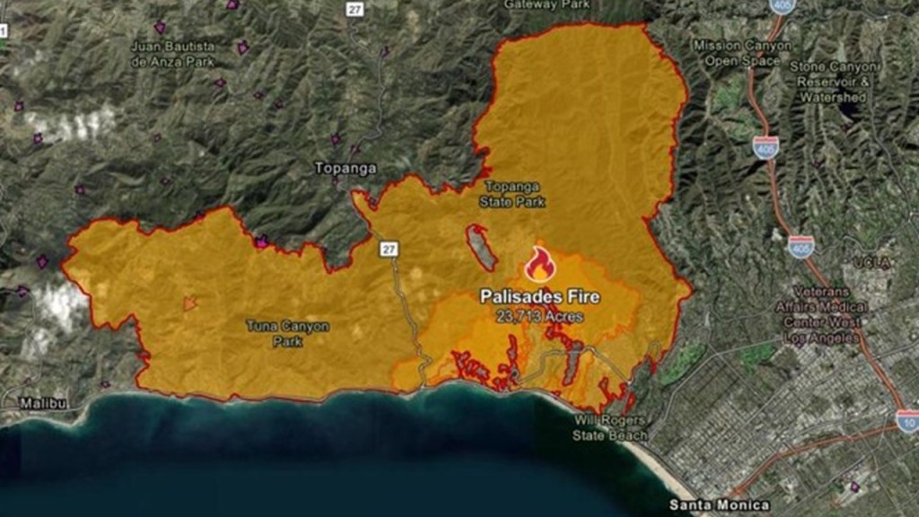
Before the fire, Pacific Palisades was known for its expensive hillside homes, coastal scenery, and canyons.

As a result of the fire, there were 12 confirmed deaths; around 8,000 structures destroyed or damaged; and 23,448-acres, or almost 10,000-hectares, of land burned.
The destruction was especially severe because the fire moved through densely developed neighborhoods where houses stood close to hillsides and natural vegetation.
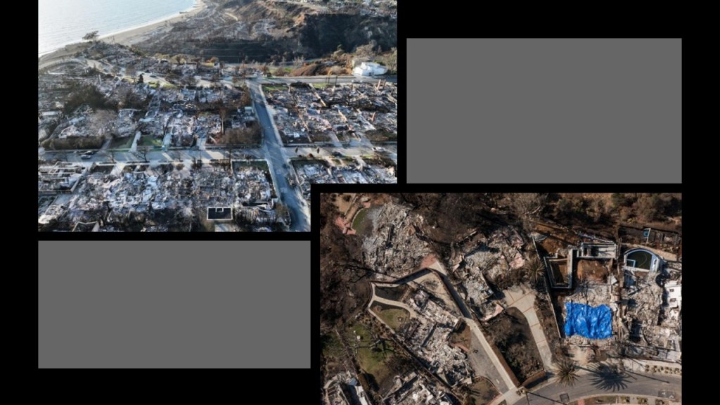
We are told that three major factors combined to create exceptionally dangerous conditions.
One factor was the powerful Santa Ana Winds.
The Santa Ana winds are strong, warm winds that occur in southern California from September to May.
In the 2025 Pacific Palisades Fire, the Santa Ana Winds drove flames and embers across the landscape, igniting new fires well ahead of the main fire front, and allowed wildfires to jump roads and spread into residential neighborhoods.

We are told another factor was dry vegetation and prolonged dry weather, with southern California’s chaparral, grasses and shrubs providing abundant fuel, and that after a prolonged dry period preceding the fire, vegetation was particularly susceptible to ignition.

Another factor was difficult firefighting conditions.
Extreme winds limited the safe use of firefighting aircraft at critical times, and rapid fire growth, difficult terrain and evacuation demands placed enormous pressure on emergency crews.
The combination was particularly dangerous: even when firefighters contained flames in one area, wind-driven embers could ignite new fires elsewhere.

With regards to what caused the 2025 Pacific Palisades Fire, according to the U.S. Department of Justice, a small brush fire known as the Lachman Fire began in the Pacific Palisades area shortly after midnight on January 1, 2025.
Although firefighters suppressed it, investigators alleged that burning material continued smoldering underground in vegetation roots and powerful winds on January 7th allegedly brought the fire back to the surface, starting the much larger blaze.
The criminal investigation led to the arrest of a former Pacific Palisades resident in October 2025, who was accused of deliberately starting the initial Lachman Fire.
In June 2026, the federal trial ended in a mistrial after jurors could not reach a unanimous verdict, though prosecutors said they intended to retry the case.
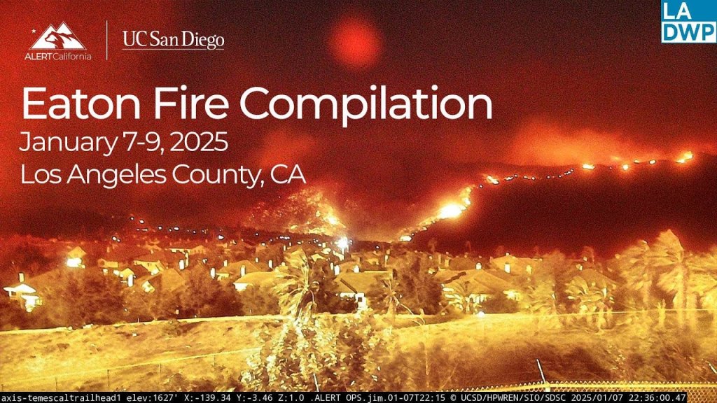
There was another major fire that took place in the Los Angeles area on January 7th.
Known as the Eaton Fire, it began near Altadena, northeast of Los Angeles and became the other catastrophic wildfire of the disaster.

The Eaton Fire burned approximately 14,021-acres, or 5,674-hectares, of land; destroyed 9,414 structures, and caused 19 confirmed civilian deaths.
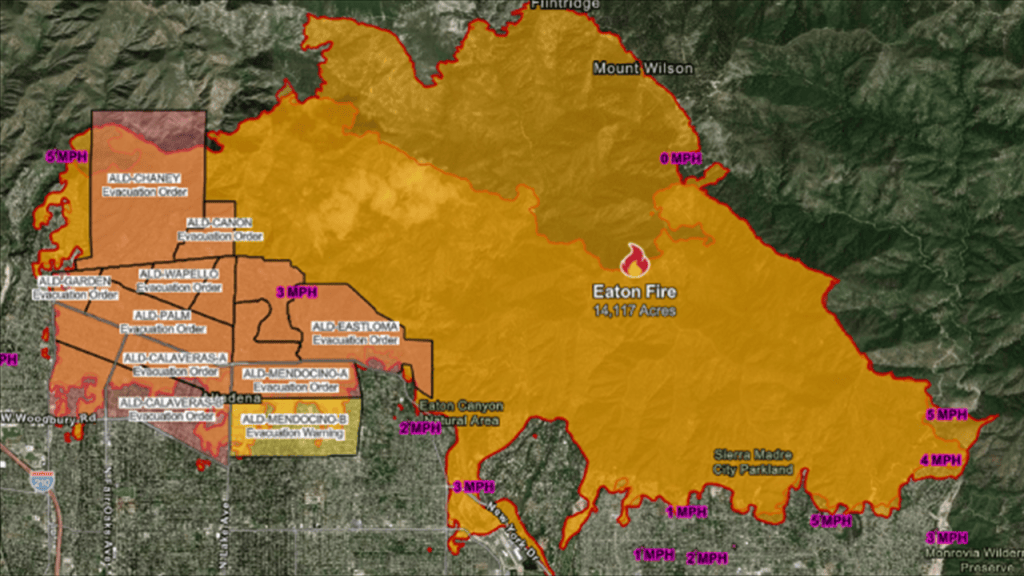
These fires occurred amid a broader outbreak of Southern California wildfires in January 2025.
The combination of strong winds, widespread evacuations and simultaneous emergencies made the disaster particularly challenging for regional emergency services.
This brings us up to the present day and the reason I decided to do the subject matter in this blog post right now.
Last weekend, on Saturday, October 17th, the following things came up on my social media feed in relatively quick succession.
The first was that a wildfire in California was threatening Camp Pendleton, the major West Coast base of the Marine Corps and one of the largest Marine Corps bases in the United States.
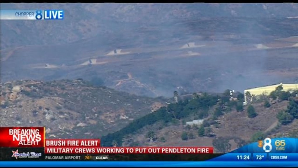
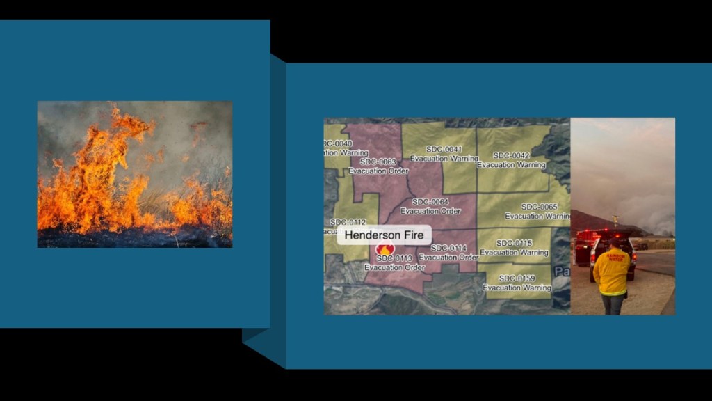
The fire that threatened Camp Pendleton was part of the Henderson Fire, a major October 2026 fire that burned in northern San Diego County.
It was described as spreading rapidly through dry vegetation, threatened parts of the military installation, and forced temporary closures of Interstate-5.
This fire is officially 100-percent contained after burning approximately 3,260-acres, or 1,214-hectares of land, with one structure being destroyed.
The cause is still under investigation.
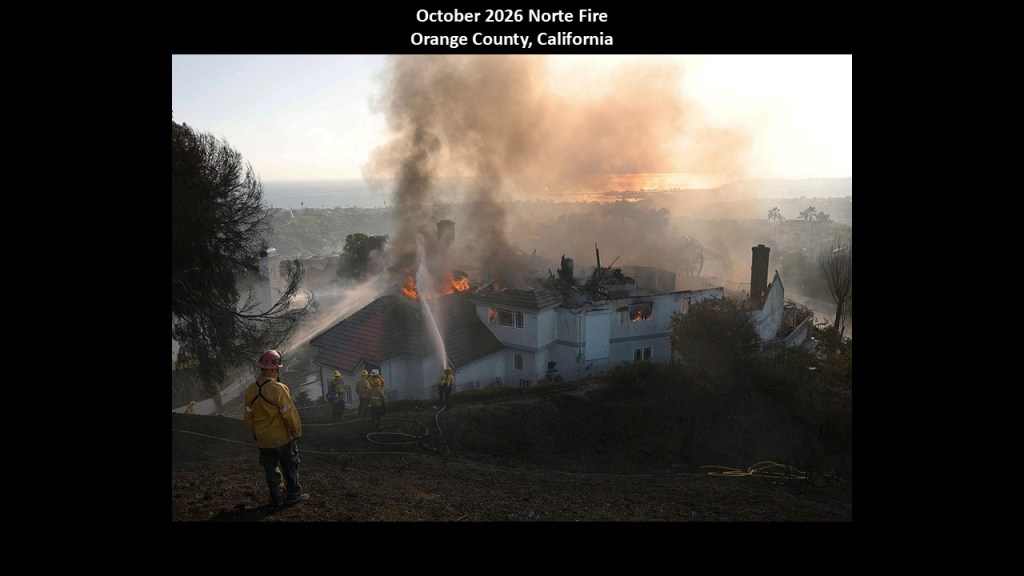
The Norte Fire was also burning in California during this time.
The Norte Fire was a fast-moving fire that broke-out on October 16th of 2026 in southern Orange County, California, near the communities of San Clemente and San Juan Capistrano.
Fueled by the powerful warm and dry Santa Ana winds, the fire spread rapidly to residential neighborhoods, and damaged and destroyed homes in its path and forced evacuations.
It was reported as 100-percent contained as of October 23rd.
The total area burned was 570-acres, or 231-hectares.
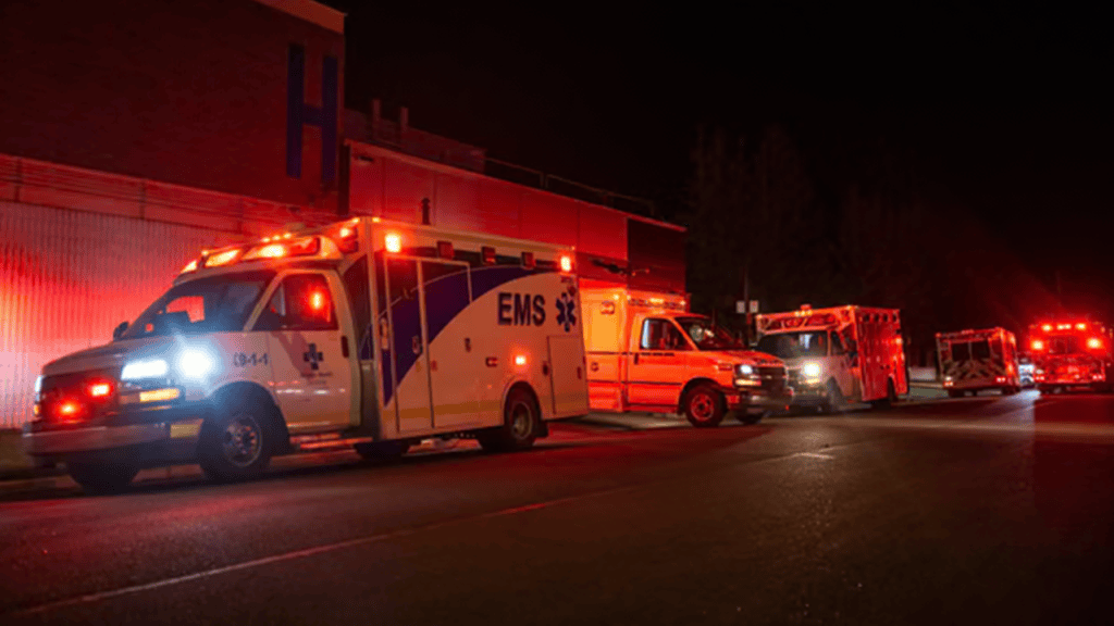
Shortly after I saw the news about the fire threatening Camp Pendleton, I saw the news about what happened at CFB Wainwright in Alberta.
This is the information that is available to find in an internet search, and important to note that there is not a whole lot of information on it available to find.
At approximately 4 pm MDT on Saturday, October 17th of 2026 a devastating fire broke out during military training at Canadian Forces Base (CFB) Wainwright in Alberta, Canada, a major Canadian Army training installation about 125-miles, or 200-kilometers, east of Edmonton.
The disaster killed four Canadian soldiers and injured 39 others.
Officials later said that strong, shifting winds caused the fire to spread extraordinarily quickly through the training area.
The fire was monitored until changing wind conditions dramatically accelerated its spread, with winds reaching up to 60 miles/hour, or 96 kilometers/hour.
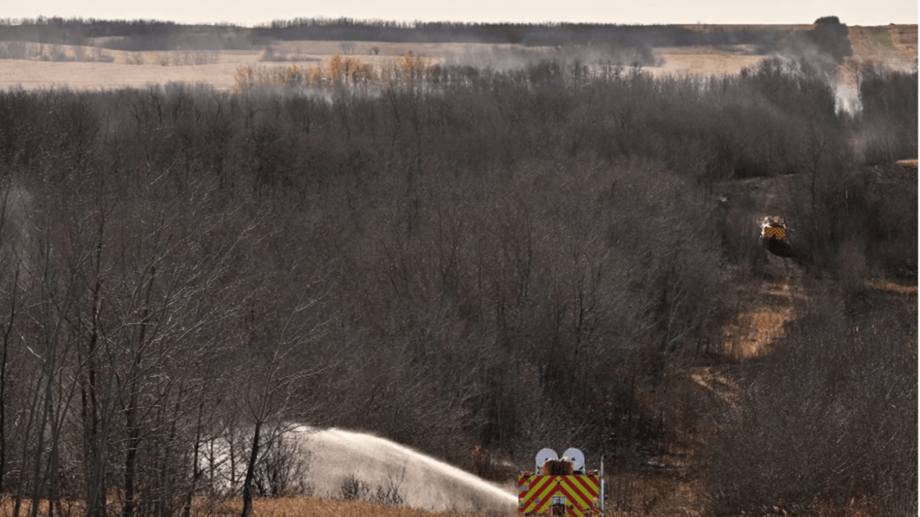
Here’s how the tragedy unfolded, according to Canadian military statements and news reporting:
–A fire started during training, where soldiers were participating in a live-fire exercise involving grenades and simulated combat operations.
–The fire spread rapidly, with high-winds changing direction and increasing the fire’s intensity, allowing it to advance toward an area where soldiers were gathered.
–Personnel were overtaken by flames spreading so quickly that soldiers in the training and administrative areas had little time to react.
–Emergency services were mobilized with military responders, local emergency crews, ambulances and aircraft helping treat and evacuate the injured, with the fire also spreading beyond the base into surrounding rural areas.
The latest official account, released on October 22nd, says the fire began on an automatic grenade launcher range during routine training and rirefighters initially could not directly attack the blaze because the range was inside a designated permanent danger area.
The other fire that came up on my social media feed on Saturday, October 17th, was the deliberate torching of the Limoges City Hall in France.
While apparently different in nature from the other fires I have been talking about, it still bears mentioning as a fire that came up on the same day as the fires in California and Alberta.
The fire at Limoges City Hall on October 17, 2026, was a major act of suspected arson that severely damaged one of the French city’s most important historic buildings.
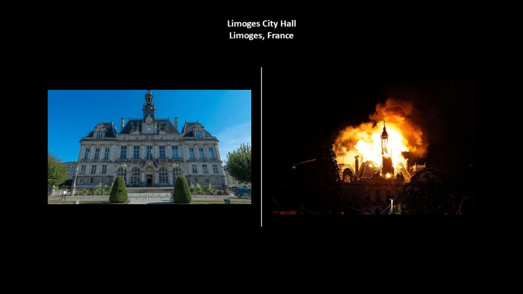
We are told the blaze broke out during violent unrest surrounding demonstrations over the rising cost-of-living.
The building’s roof was largely destroyed, its clock tower collapsed, and much of its exterior was lost.
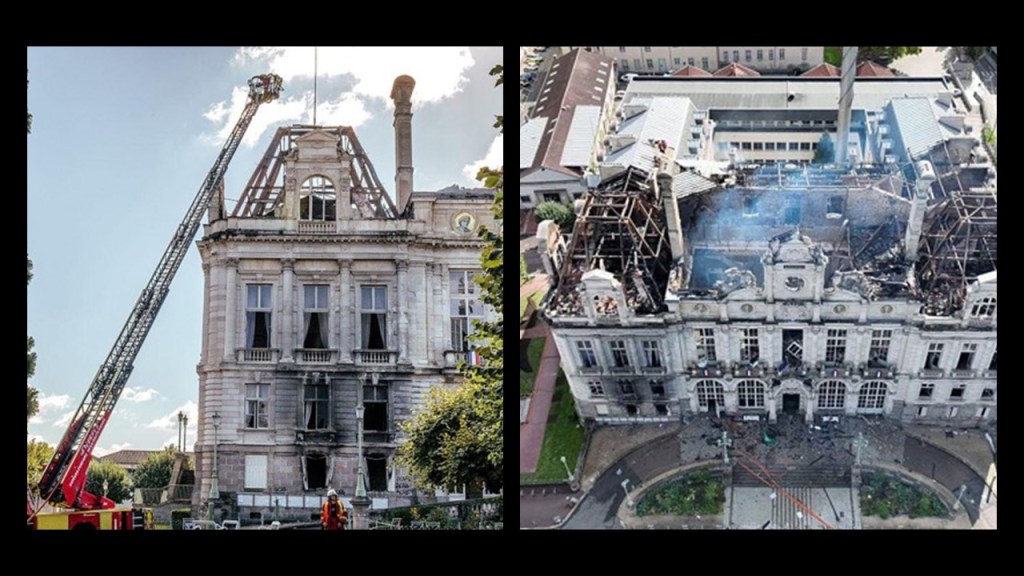
Reportedly, the building was attacked on Saturday, October 17th, by a group of masked individuals who reportedly smashed windows and forced their way into the town hall amid unrest associated with demonstrations against the high cost of living.
A police car was also set alight, and shops elsewhere in central Limoges were looted.
The fire spread from one wing into the roof and upper portions of the building.

Firefighters worked to contain the blaze, but the damage became catastrophic.
The regional prefect described the town hall as largely lost.

After the fire, French authorities opened a criminal investigation into the attack., and by October 24, two suspects, aged 34 and 66, had been formally charged and placed in pretrial detention.
The investigation included allegations of suspected arson and attempted homicide involving a police officer.
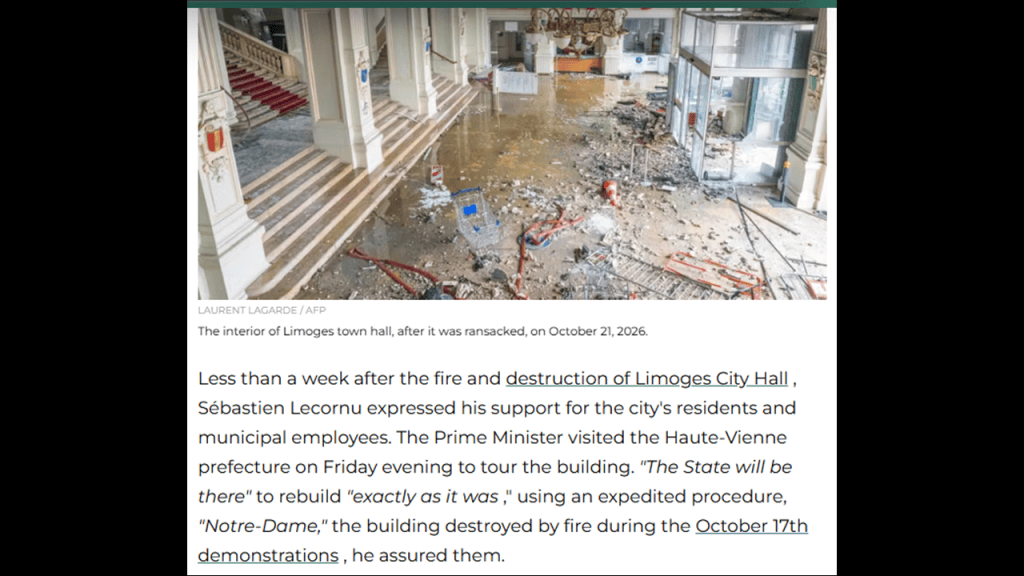
The French Government is promising reconstruction to match its original appearance.
I have just given a fraction of many examples of great fires to show you the patterns that show up when you look into them.
With the exception of the last one mentioned on October 17th with the burning of the Limoges City Hall, all the fires mentioned in this post share strikingly similar characteristics over time of things like:
–Extremely dry conditions;
–Strong winds fanning uncontrolled, fast-moving fires;
–The creation of one big inferno that overwhelms existing fire fighting capacities and sends survivors into the nearest water source to escape the flames;
–Loss of Life and property; the displacement of people from their homes and workplaces;
–Left some trees and structures sstanding while completely burning others to the ground, and so on.
Are we looking at nature wreaking all of this havoc, or could something else possibly be going on?
The definition of Statistical Significance is a determination that a relationship between two or more variables is caused by something other than chance, and I have just listed five bullet points of commonalities between the fires.

The definition of random includes, among others, “lacking a definite plan, purpose, or pattern.’
There are definitely patterns surfacing with these horrendous fires!

If the causes and conditions aren’t random, then what could it possibly be?
On the weather modification-end of creating the conditions for these fires to happen, HAARP is a candidate, and has long been suspected of being used to control the weather.
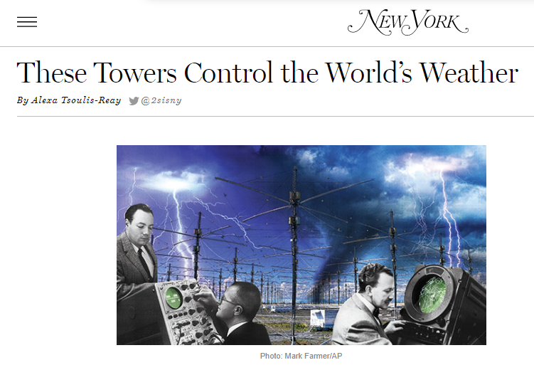
The High-Frequency Active Auroral Research Program, better known as HAARP, is described as the most high-power, high-frequency transmitter for the study of the ionosphere.
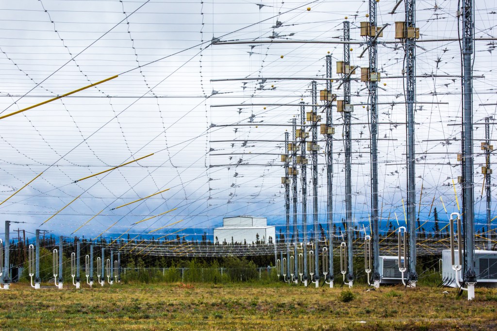
The ionosphere forms the boundary between space and the lower atmosphere of the Earth.
The operation of HAARP was transferred by the United States Air Force to the Geophysical Institute of the University of Alaska Fairbanks in 2015.
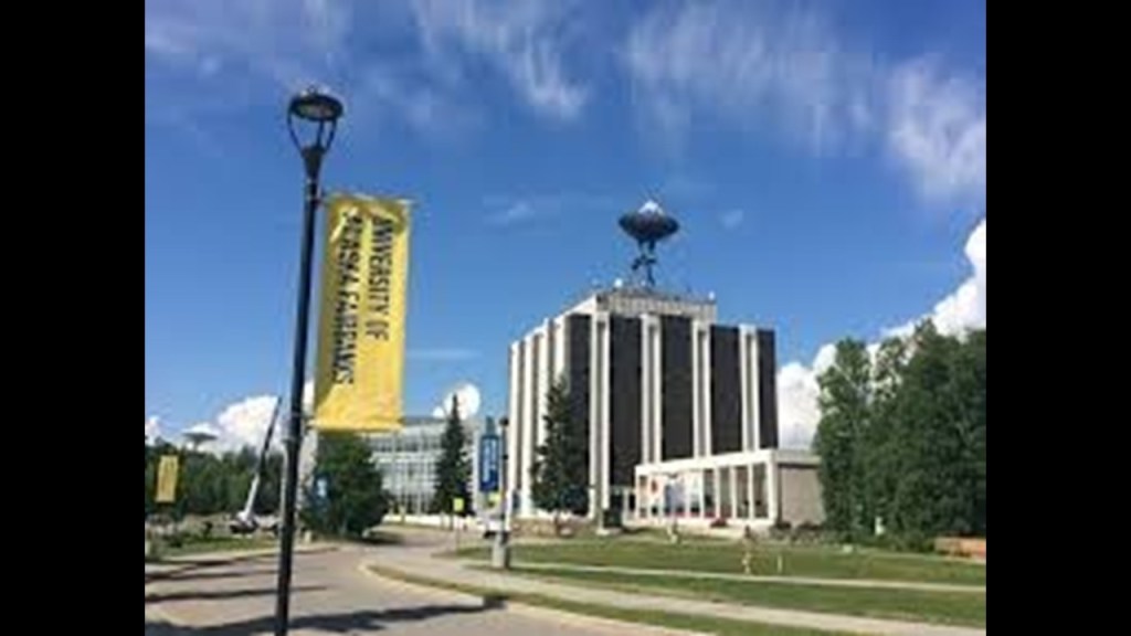
Whether or not HAARP has anything to do with weather modification programs, it has certainly generated a lot of wild speculation about its role in a lot of things!

And while Directed Energy Weapons, also known as DEWS, are thoroughly debunked for causing these wildfires when you go to look it up on the internet, there are persistent images out there that suggest there might be something to this belief.
Whatever the case may be, we are not going to be told in the mainstream media whether or not this is true, because of course they don’t want us to know if these fires are intentional, but things of this nature do come up on alternative media, especially as they are happening.
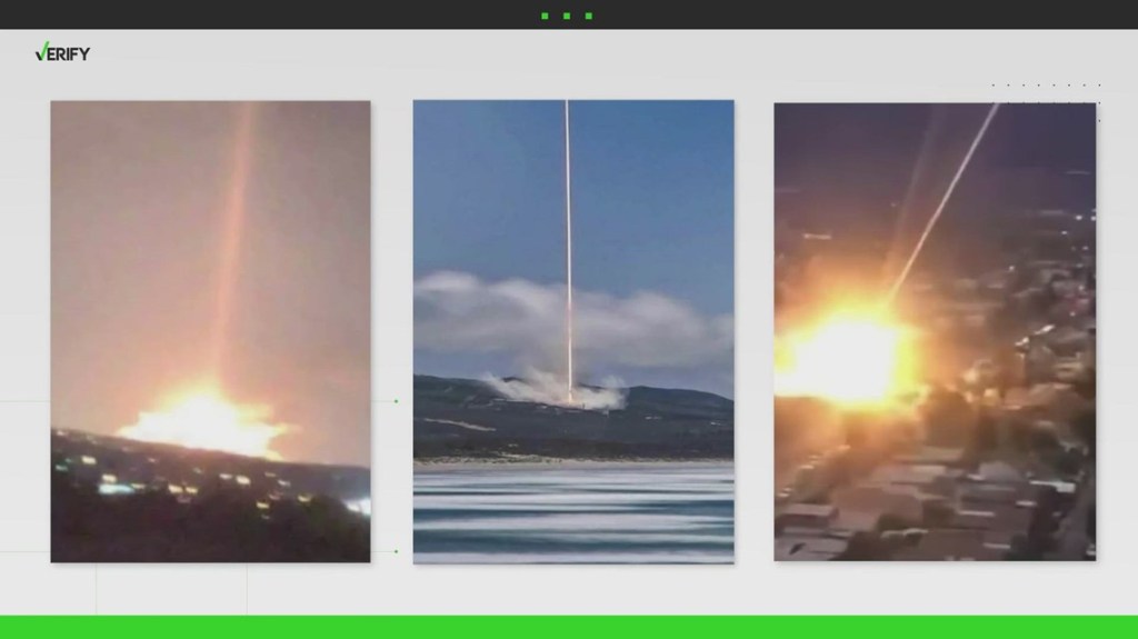
Instead we get this narrative, as we have already seen throughout this post.
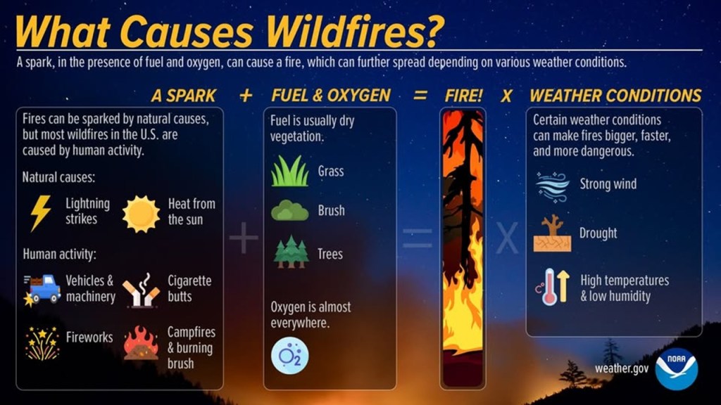
Like I said at the beginning of this post, the reason I am doing this right now is because I saw three fire events happening in quick succession on October 17th of 2026, and I already knew about the Great Fires of October of 1871 that I discussed in detail, as well as the more recent fires in California and Hawaii.
Just wondering what the odds of all these events happening randomly happen to be?