Circle Alignments on the Planet Washington, DC – Part 4 Sayreville, New Jersey to Bay Ridge, Brooklyn

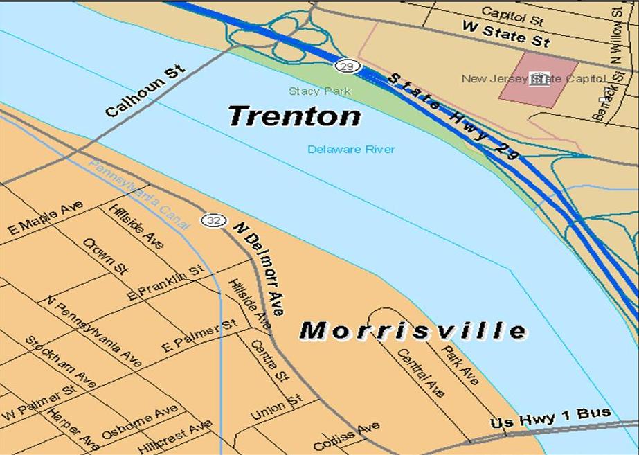
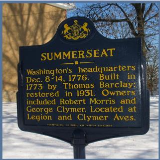
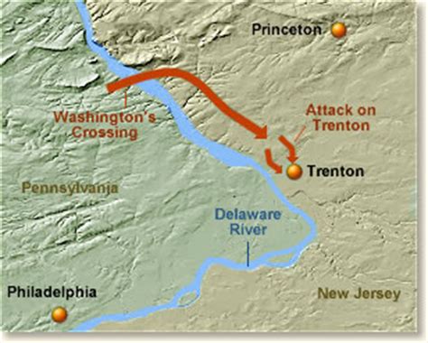
In the last post, I took a close look at Morrisville Borough in Pennsylvania on one side of the Delaware River, and Trenton, New Jersey, the capital of New Jersey, directly across from Morrisville on the other side of the River.

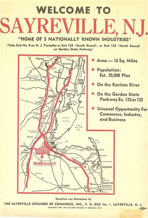
The starting point on the circle alignment for this post is Sayreville, a borough in New Jersey located in Middlesex County New Jersey…

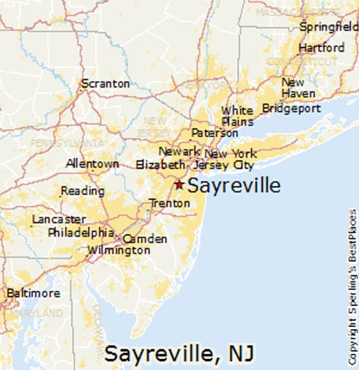
… near the Raritan Bay…

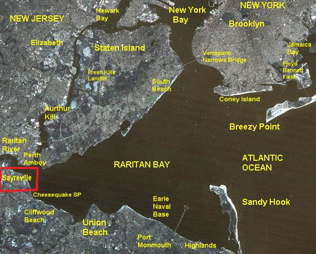
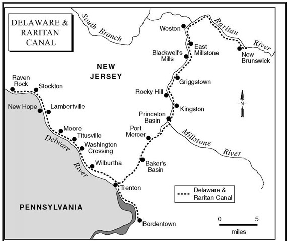
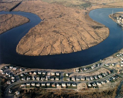
…at the Raritan River, long a transportation and trade route pre-dating colonial times. This S-shaped river bend at Sayreville…

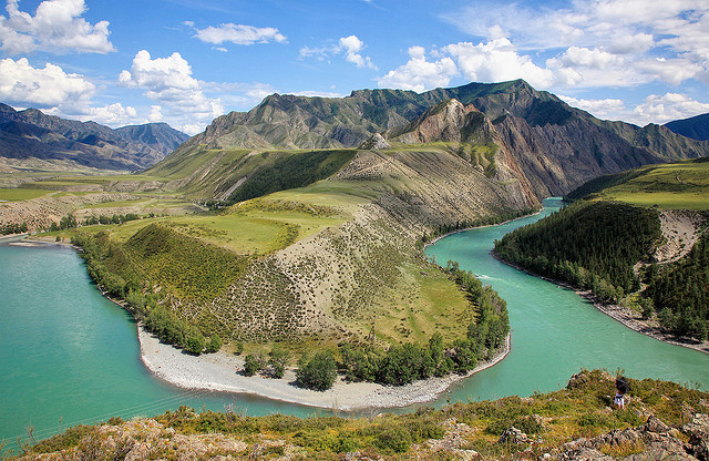
…compared with the S-shaped river bend shown here in the Ukok National Park in the Altai Mountains of Central Asia…

…the Big Bend of the Rio Grande River in South Texas…

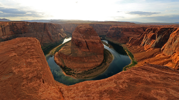
…and the Horseshoe Bend of the Colorado River near Page, Arizona.

Charles Morgan III and the Morgan Clan were said to have arrived from New York in the early 1700s to settle the 645-acres granted to them by New Jersey’s first proprietors, John, Lord Berkeley of Stratton and Sir George Carteret. This land became known as the Morgan section of Sayreville.

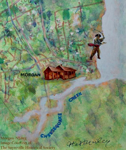
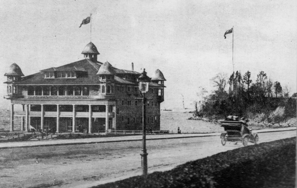
Members of the Morgan family were the proprietors of the Morgan Inn, which was established sometime around this same time in 1703. The Morgan Inn later became somewhat known infamous as the Old Spye Inn, as this place saw a lot of activity during the Revolutionary War.


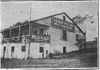
It was believed to be haunted, and the Old Spye Inn burned down in 1976.

The Welsh pirate Henry Morgan was mentioned as having a possible connection to these New Jersey Morgans, but the dates didn’t check out when I looked into it. Henry Morgan was said to have died in 1688, so he could never have gone to the Inn as he was purported to have done on occasion.

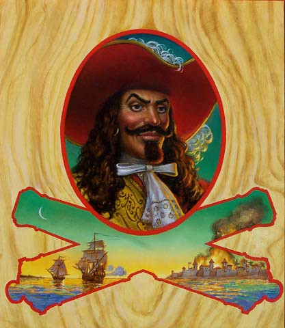
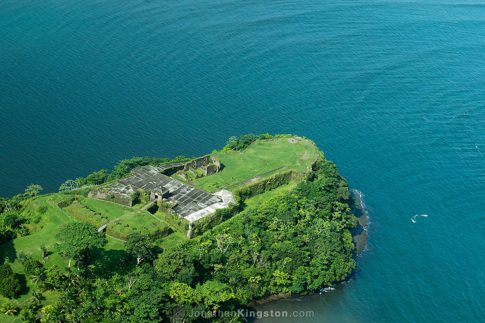
However, I will take this opportunity to mention that Henry Morgan was given the credit historically for the sacking of star Fort San Lorenzo in Chagres, Panama, near Colon, in 1670…

…and the sacking and destruction of Old Panama City the following year in 1671.

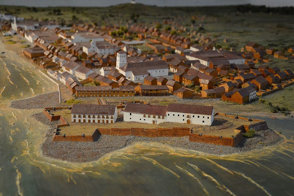
Old Panama City before, with a star fort depicted in this diorama here…

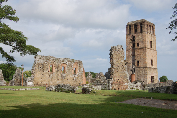
Old Panama City after, without a star fort left standing….

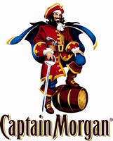
You know, the Captain Morgan’s Rum Captain Morgan. Exactly the same historical character.

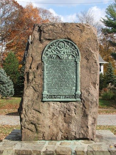
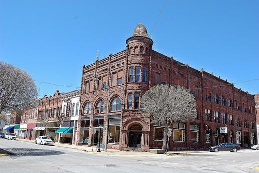
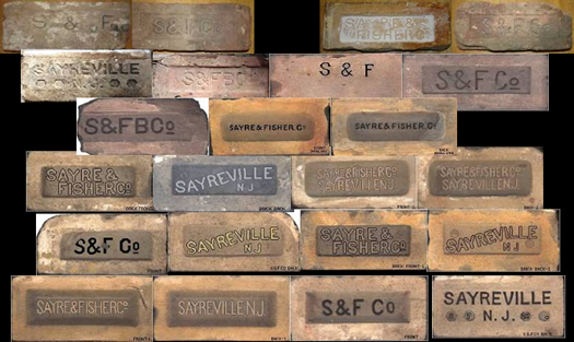
Sayreville received its final naming from James Sayre, Jr, of Newark, one of the two co-founders of the Sayre and Fisher Brick Company in 1850.

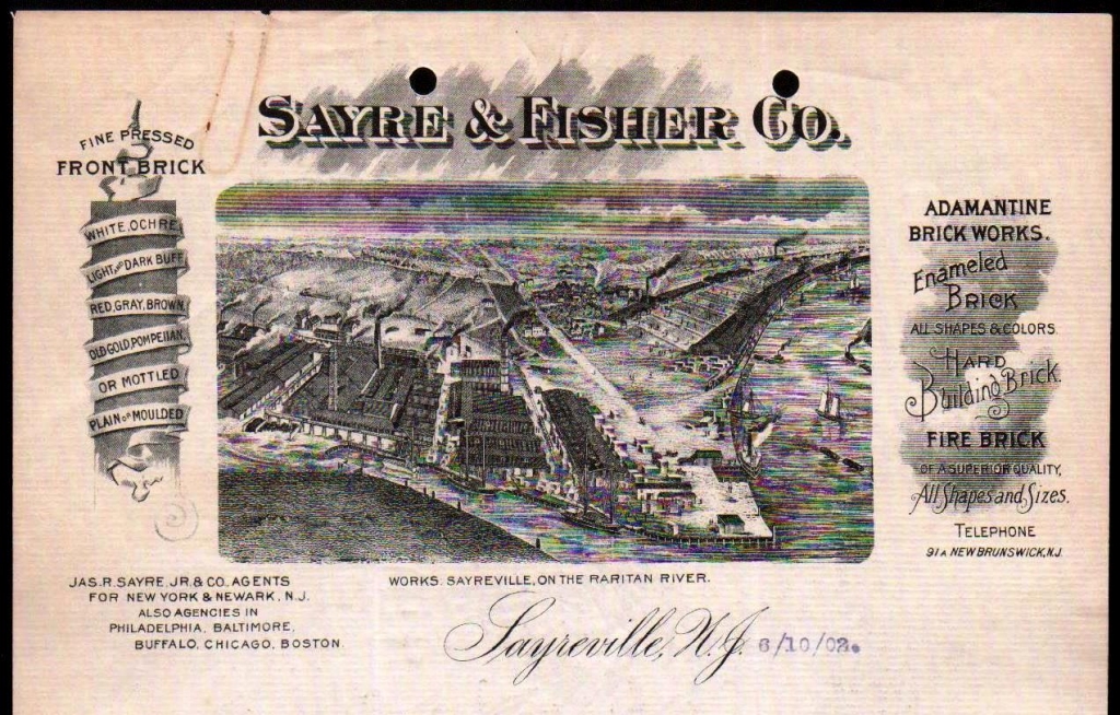
There are extensive clay deposits in the area, and the Sayre and Fisher Company quickly became one of the largest brick-making companies in the world.

Big companies including, but not limited to, DuPont established plants in Sayreville for gunpowder production initially in 1898, and later for paint and photo products.

The Raritan River Railroad operated freight and passenger service through here between 1888 and 1980, after which time Conrail took over rail operations.

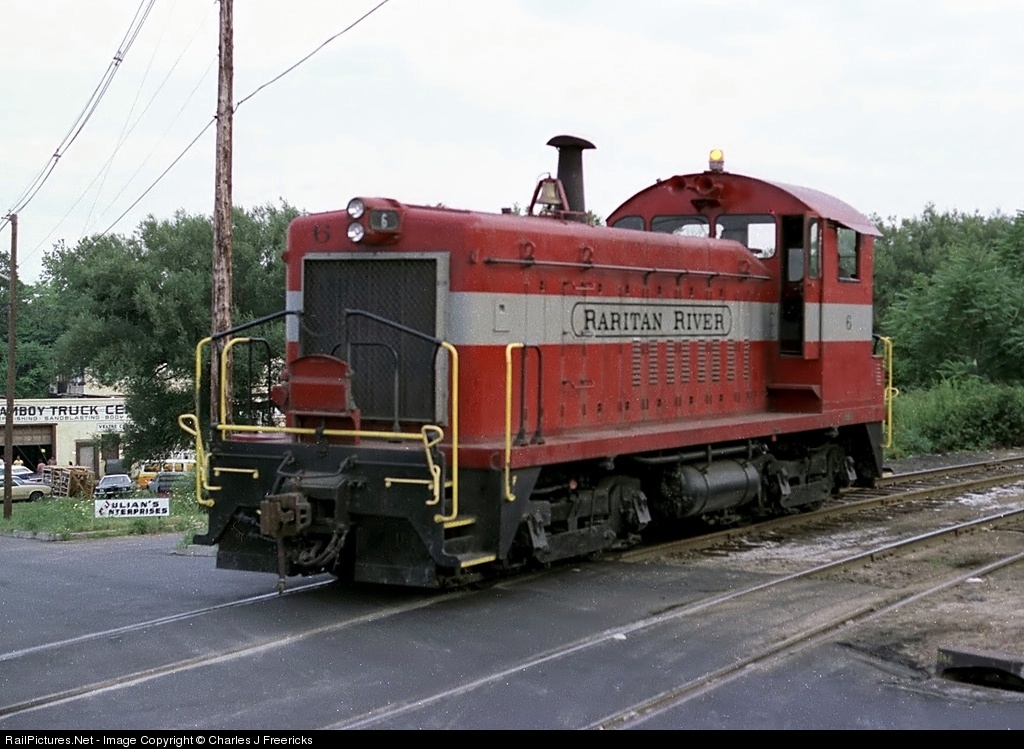
This the logo for the Raritan River Railroad…

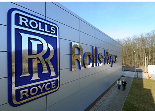
…and this is the logo for Rolls Royce.

The similarity between these two logos tells me these two companies were connected in some way. Besides the fact the logos look virtually identical, it brings to mind what I found in Derby, England.

I found Derby near the Algiers’ Circle Alignment as I was tracking it through England in the last series. Derby is the geographic center of England, and the Derwent River Valley in Derbyshire is considered the Birthplace of the Industrial Revolution.

Rolls-Royce is a global aerospace, defense, energy, and marine company focused on world-class power and propulsion systems, and its civil aerospace and nuclear divisions are in Derby…

…as well as the Railway Technical Center, the technical headquarters of British Rail, and considered the largest railway research complex in the world…

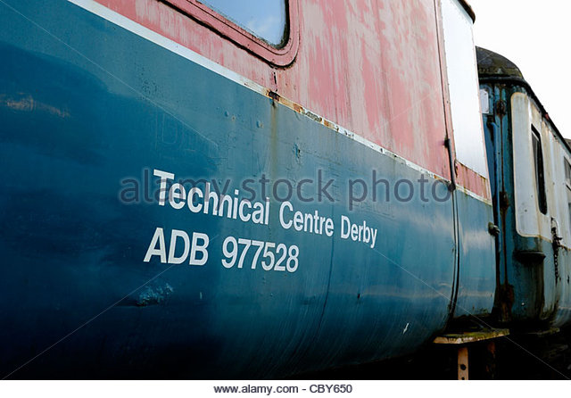
…and Derby is the location of Bombardier Transportation, the rail equipment division of the Canadian company Bombardier, and for many years the United Kingdom’s only train manufacturer.

There are certainly interconnecting pieces of the puzzle to be found lying around these tidbits of otherwise disconnected information.

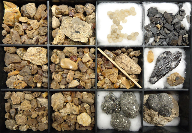
Back to Sayresville. The extensive clay deposits here include the Crossman Clay pit…

… having gained recognition as a premiere source for amber, as well as pyrite and a diversity of fossils.

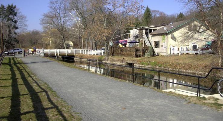
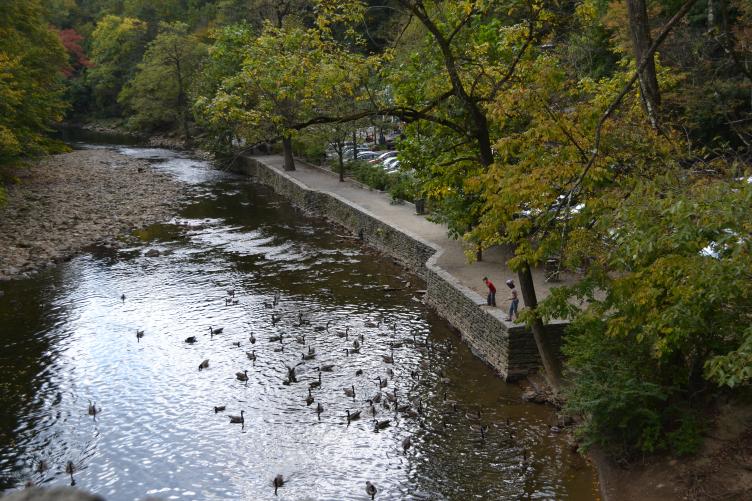
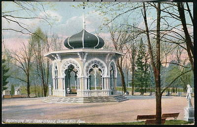
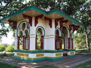
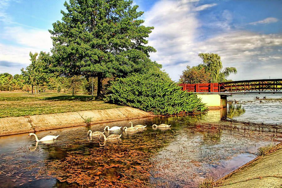
The John F. Kennedy Memorial Park is adjacent to the Crossman Clay pit.

Look at all the swans and koi fish here at the park! And pay no attention the man-made water’s edge….

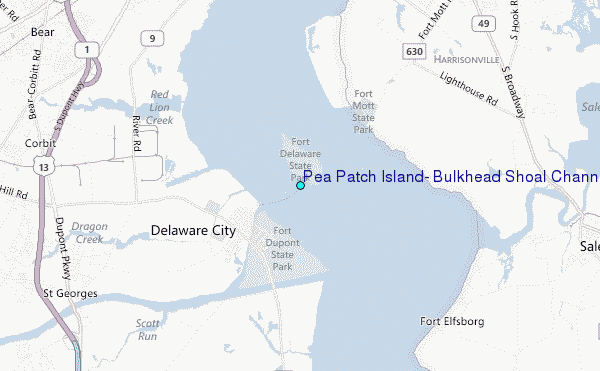
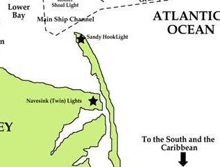
Moving on from Sayreville, the alignment enters the Raritan Bay, which has a number of places at which to look.

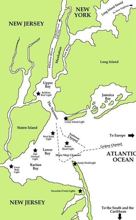
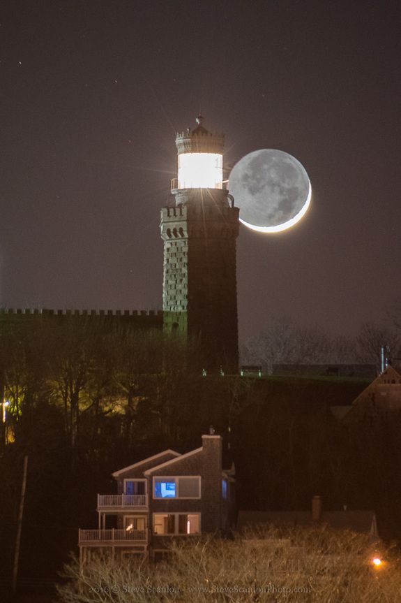
I am going to start by looking at the Navesink Twin Lights, next to a long and narrow land feature called Sandy Hook Island. While these two places are a distance east off of this particular alignment, they are both noteworthy.

The Navesink Twin Lights are on the headlands of the Navesink Highlands, overlooking Sandy Hook Bay, the entrance to the New York Harbor and the Atlantic Ocean.

Navesink was also the name of the Lenni Lenape people who inhabited the Raritan Bayshore near Sandy Hook, and Mount Mitchill in the scenic highlands in eastern New Jersey.

We are told, however, that the Twin LIghts were built in 1862.

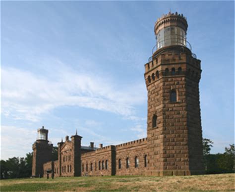
The American Civil War is said to have taken place between 1861 to 1865, so we are expected to believe this solid masonry structure was built during war-time, and we will keep seeing similar attributions given to many structures.

Sandy Hook is described as a barrier spit in Middletown Township, which is located in Monmouth County, New Jersey.

It is 6-miles, or 10-kilometers long, and at its widest, 1-mile, or 2-kilometers, across. It encloses the southern entrance of the New York Bay, and provides protection from the open waters of the Atlantic to the East.

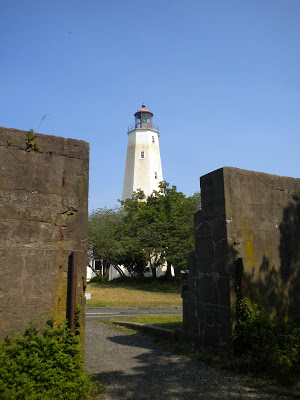
Fort Hancock, and the Sandy Hook Lighthouse, is located at the northern end of Sandy Hook.

The lighthouse on Sandy Hook at Fort Hancock is said to be the oldest working lighthouse in the United States, and we are told it was  built in 1764.

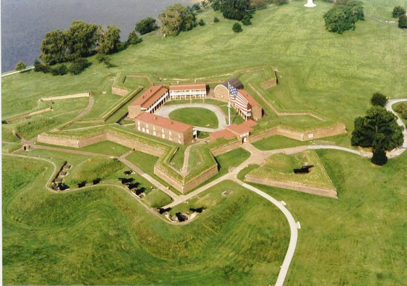
The construction of the Fort of Sandy Hook was said to have started in 1857 and ended in 1867, without completing the building of the fort under the supervision of then-Captain Robert E. Lee of the Corps of Engineers, and was designed as a five-bastion irregular pentagon (describing a star fort perhaps?), built primarily of granite (which rates as 7 – 9 on the Mohs scale of relative hardness to other minerals scale).

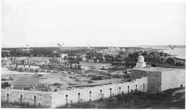
Not only was the fort said not to have been completed, it was also said to have had most of its surviving parts taken down by the U. S. Army after World War II.

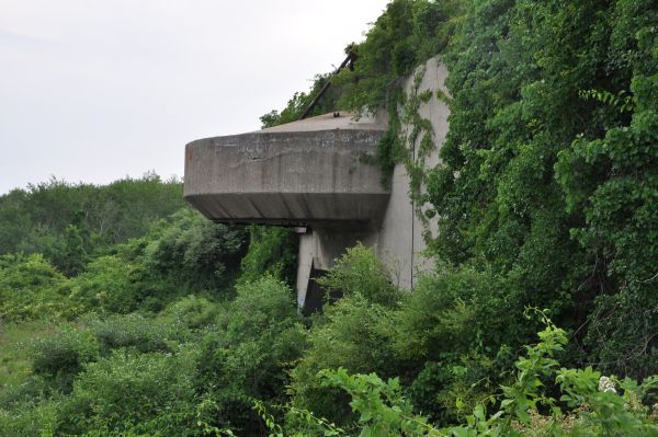
The batteries of the now designated Fort Hancock were said to have been constructed starting in 1890 as part of the Sandy Hook Proving Ground for the testing of coastal defensive weapons, like Battery Potter.

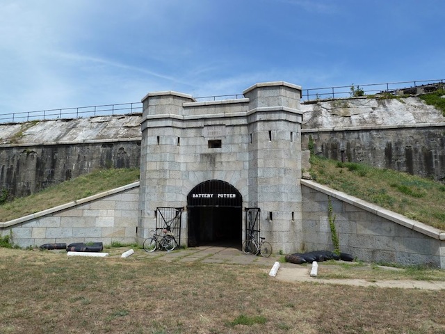
Battery Potter is described as the prototype for a steam-hydraulic, gun-lift carriages, otherwise known as “disappearing guns.”

Fort Hancock is said to have become inactive in 1974, and is now part of the National Parks of New York Harbor, and the Gateway Recreation Area, under the National Park System.

Just north of Sandy Hook is the Ambrose Channel, the main shipping channel in and out of the Port of New York and New Jersey.

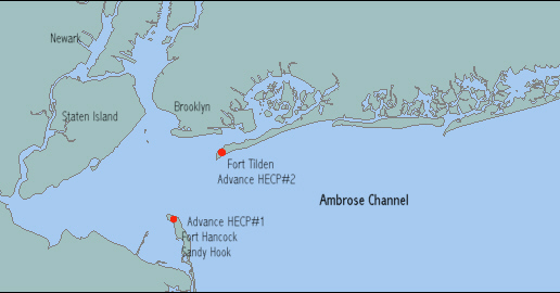
On the other side of the Ambrose Channel from Fort Hancock on Sandy Hook is Fort Tilden on the Rockaway Peninsula in New York, a now abandoned Army installation that was said to have been built in 1917, and in use until 1995. It is now part of the Gateway National Recreation Area, and administered by the National Park Service, like Fort Hancock.

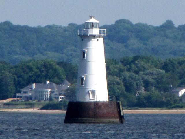
Now back to Raritan Bay, where the Great Beds Lighthouse is on the alignment I am tracking, just offshore from the northwestern New Jersey coast, located at the Great Beds Shoal near the mouth of the Raritan River. It was said to have been built in 1880, and manned until 1945.

The Old Orchard Lighthouse is said to have been built in 1883, and is three-miles south of the center of Staten Island.

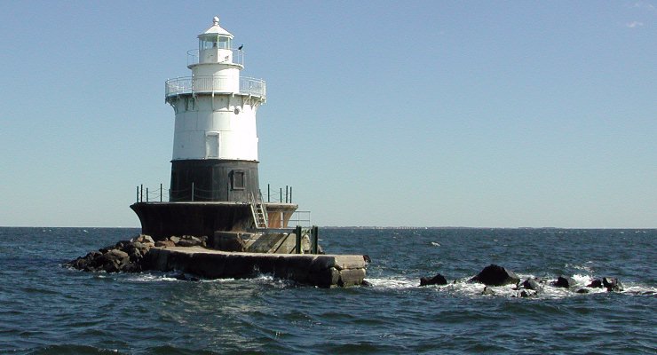
This is the West Bank Lighthouse, which serves as the front-range light for the Ambrose Channel, which is used in navigation to indicate safe passage, or position fixing. It was said to have been built in 1901.

The Staten Island Lighthouse is on Richmond Hill is the rear-range light for the Ambrose Channel, a 90-ft-high, or 27-meter, tower said to have been built in 1912, and is 141-feet, or 43-meters, above sea-level.

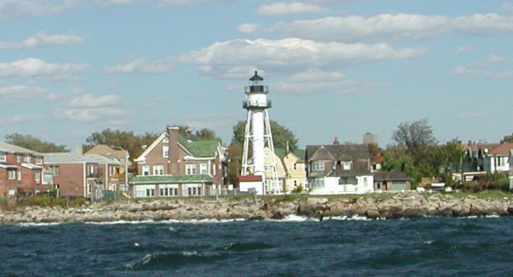
This is the Coney Island Lighthouse on the western end of Coney Island, in Seagate, and situated east of the Ambrose Channel of New York Harbor. It was said to have been built in 1890.

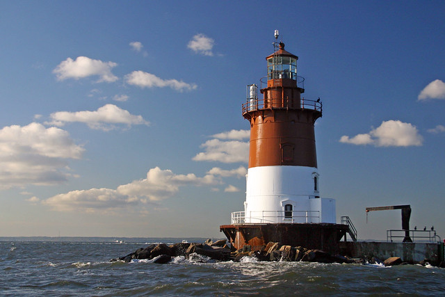
The Romer Shoal Lighthouse is situated between the ship channels of Ambrose, Swash, and Sandy Hook, and is approximately 3-miles, or 5- kilometers, north of the Sandy Hook Lighthouse. It was badly damaged by Hurricane Sandy in 2012. It was said to have been built in 1838.

My personal position after 3-years of intensive study of this subject is that the lighthouses around the world were built by the maritime Ancient Advanced Civilization that has been removed from our collective awareness.

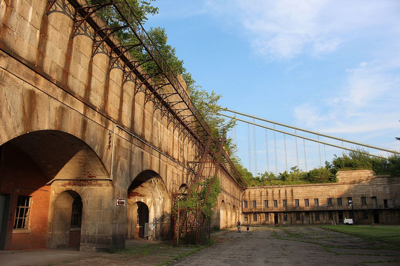
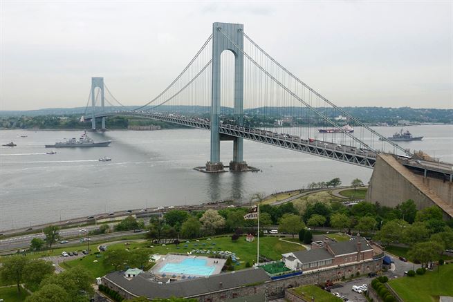
This alignment tracks very close to, if not directly over, Fort Wadsworth on Staten Island.

It is described as a former United States Military Installation on Staten Island, situated on The Narrows, which divides New York Bay into upper and lower halves, said to have been established before the War of 1812, as well as between 1845- 1861. I could not find clear reference dates on its construction.

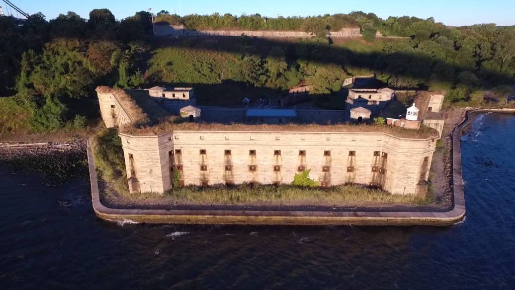
…and a natural defense point for the Upper Bay of Manhattan and beyond.

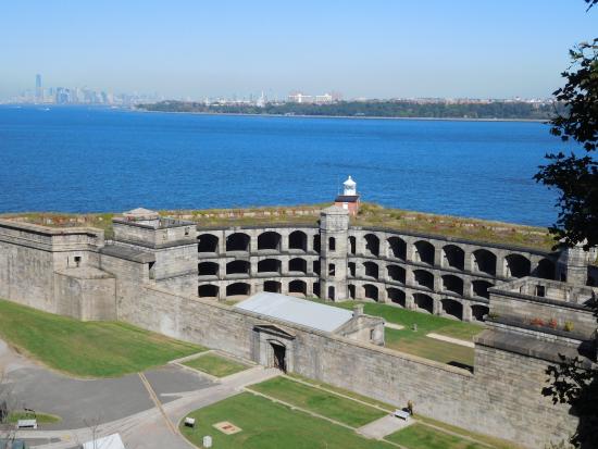
This sturdy structure was closed in 1994, and is now also administered by the National Park Service’s Gateway National Recreation Area.

On the southern side of the other end of the Verrazzano-Narrows Bridge from Fort Wadsworth on Staten Island is Fort Hamilton in Brooklyn. Fort Hamilton is an active United States Army installation.

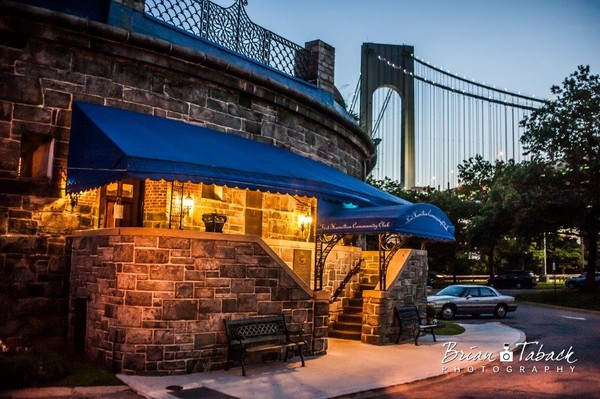
This is the Fort Hamilton Community Club…

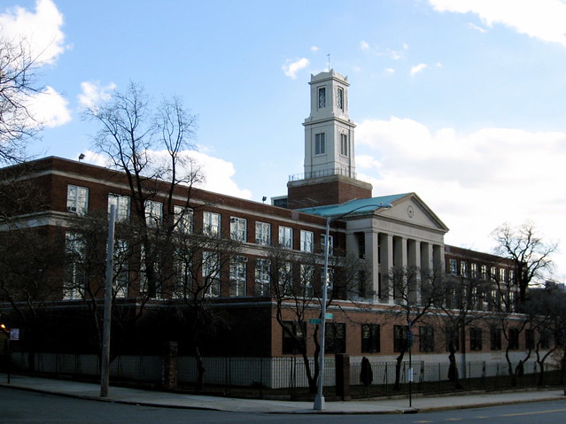
…the high school for the community of Fort Hamilton…

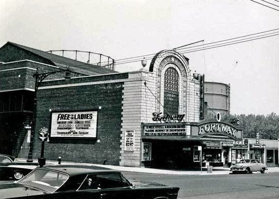
…the historic Fortway Theater of Fort Hamilton, which was said to have opened in 1927, and closed in 2005, to become a supermarket in 2007…

…and Fort Hamilton community real estate for sale.

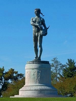
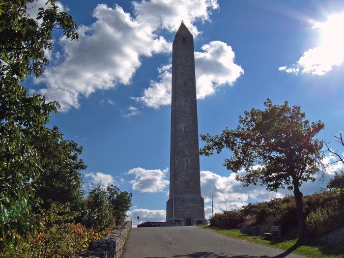
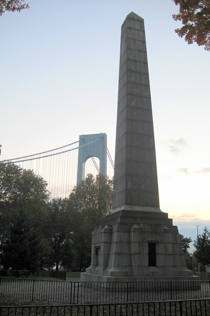
John Paul Jones Park, named for the Naval hero of the American Revolution, is on the northern side of the Verrazzano-Narrows Bridge, with its cannon…
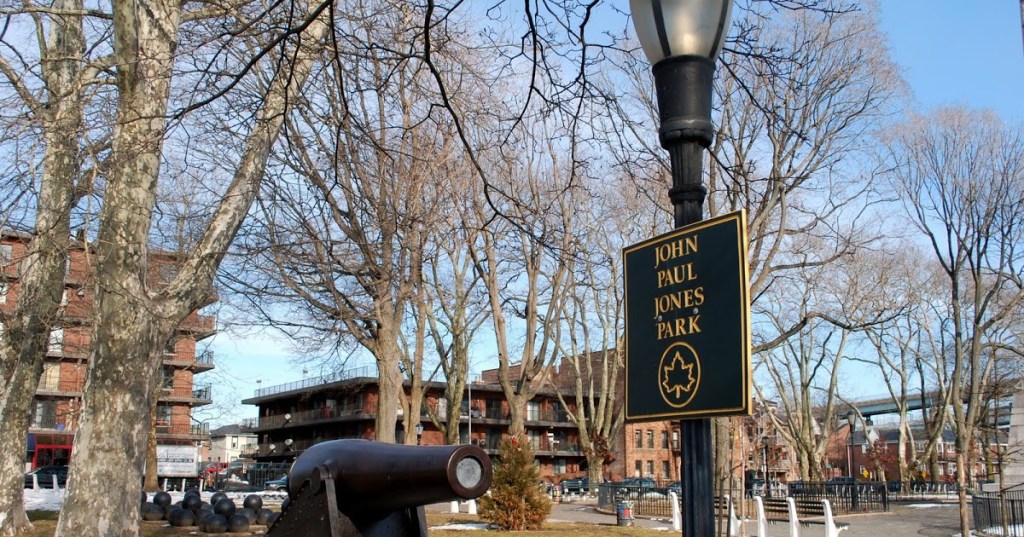
…and obelisk.

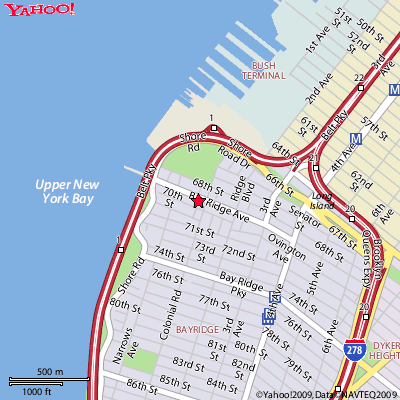
The rest of the southwest corner of Brooklyn is the neighborhood of Bay Ridge.

This was Bliss Castle on the Bliss Estate, said to have been built by the wealthy manufacturer Eliphalet Bliss…

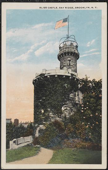
…and after he died, his will stipulated it could be sold to New York City at less than market prices if it was used as park land.

So his former estate became first Bliss Park, and then later Owl’s Head Park, and all of the original infrastructure on it has long-been removed, having been demolished in 1940.

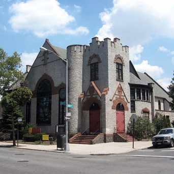
This is the Union Church of Bay Ridge, with cornerstones said to have been laid in 1896 for two church congregations, one Presbyterian and the other Dutch Reformed, with its beautiful heavy masonry…

…and this was the historic Crescent Athletic Club Boathouse in Bay Ridge. It burned down in 1904.

I will pick up the alignment in Upper New York Bay in the next post.

Circle Alignments on the Planet Washington, DC – Part 3 Morrisville Borough, Pennsylvania to Trenton, New Jersey

So far, this circle alignment has been tracked through the metropolitan areas of Washington, DC; Baltimore, Maryland; Wilmington, Delaware; and Philadelphia, Pennsylvania.

Next on the alignment, we come to Morrisville, a borough in Bucks County, located just below the Delaware River Falls, opposite the Delaware River from Trenton, New Jersey.

In the State of Pennsylvania, a borough is considered a self-governing municipal entity, best thought of as a town, and usually smaller than a city, but with fewer powers and responsibilities than full-fledged cities.

Pretty close to sounding like the word Moorish…think that might be a stretch? Let’s take a look at this more closely.

We are told Morrisville was named after Robert Morris, an English-born merchant and Founding Father. He was a businessman turned politician, and is best known for being the Financier of the American Revolution. He campaigned unsuccessfully for Morrisville to become the new Nation’s Capital.

This is a portrait of him painted by Charles Willson Peale in 1782, originally hung in Independence Hall in Philadelphia.

I wonder what he is holding in his right hand…and interesting that there is a view of a classical-looking building through the window he is sitting next to. In the United States in 1782?

When I looked up the Coat-of-Arms of Robert Morris, Founding Father, this is what I found:

I looked up the Morris Coat-of-Arms, and while there are several versions, this is one of them…

…compared with the flag of Sardinia, a large island in the Mediterranean off the coast of Italy, which is nicknamed the Four Moors flag…

…and the flag of Corsica, an island just north of Sardinia in the Mediterranean Sea.

Then there are Morris Dancers in England, who practice a group dance form of choreographed steps, with bells on the knees, and wielding sticks, swords, or handkerchiefs.

It is said the name of Morris Dance is first recorded in the 15th-century as Moorish Dance. Here is a 1480 statue of a Moorish Dancer at the Old Townhall in Munich.

Graystones in Morrisville is where William Penn is said to have purchased the first Pennsylvania land in 1682 from the Lenni Lenape…

…and here is the massive gray stone at the top of the land purchase on Crown Street in Morrisville, to the left of that historical marker.

It is interesting to note that both of these important men in the historical narrative, Wllliam Penn and Robert Morris, are said to have ended up in debtor’s prison before they died because of financial problems.

The Lincoln Highway, the one of the nation’s earliest transcontinental highways, goes through Morrisville.

The Lincoln Highway starts in Times Square in New York City, and ends up in Lincoln Park in San Francisco. It is said to have opened in 1913.

The Calhoun Street Toll Supported Bridge is between Morrisville and Trenton. It was said to have been constructed in 1884 by the Phoenix Bridge Company.

This bridge helps connect segments of the 3,000-mile-long East Coast Greenway, which runs from Calais, Maine, to Key West, Florida.

The Calhoun Street Bridge was part of the Lincoln Highway until 1920, at which time the Lincoln Highway was re-routed to the toll-free Lower Trenton Bridge.

A portion of the Delaware Canal State Park is in Morrisville.

The canal that runs through Morrisville was said to have been built in the 1830s between Easton to the North and Bristol to the South…

…and a crushed-stone towpath, upon which mules pulled cargo-laden boats.

So, somehow the technology existed in the 1830s to build a sophisticated canal system, and they had the ability to crush stone into tiny, tiny pieces, but that the boats themselves had to be pulled by mules?

This is certainly what we are taught, but does this make sense?

I checked out Core Creek Park in Morrisville because I always find things in parks, and sure enough, it has a folly…

…that is similar to the one in Nemours Gardens in Wilmington, Delaware.

Robert Morris lived at Summerseat in Morrisville. Note the windows going underground, like there is more of this building below the ground…

…and which was a busy place during the American Revolutionary War…

Morrisville is where Washington established his camp in the winter of the famous crossing of the Delaware River, and where the British Garrison in Trenton was defeated, marking a turning point in the war in favor of the American forces.

So this brings us to Trenton, the capital of New Jersey, and briefly the U. S. Capital in 1784.

The New Jersey State Capitol Building is just right across the Delaware River from Morrisville, said to have been built in 1790, and the oldest state house in continuous legislative use in the United States. Built 7 years after the end of the Revolutionary War in 1783?

How? We can’t build like this even today.

And the beginning of the Industrial Revolution wasn’t said to have really gotten underway in the United States until approximately the mid-1800s.

There were a number of mills in Trenton, New Jersey.

The paper mill on Assunpink Creek in Trenton was already described as old in the 1870s. With the guy in the top hat standing in the mid-ground; the two guys underneath the bridge in the background; the group of four on the bridge itself; and with no other activity going on, this photo seems really odd to me. What were they doing there?

Assunpink Creek was also the location of the Second Battle of Trenton between British and American forces on January 2nd, 1777, which the Americans won.

Here are structures of the Assunpink Creek today.

Nothing out-of-the-ordinary to see here, right?

Here is a close-up of the foundation of the building, showing what appears to be large blocks of masonry.

This building in Trenton was the Exton Mill on the left, compared with the design features of what is called an old church at the abandoned settlement of Ushakovskoye, on Wrangel Island on the East Siberian Sea in the middle; and that of the building in Jerome, Arizona, on the right.

The Delaware and Raritan Canal connects the Delaware River at Bordentown, New Jersey, and the Raritan River at New Brunswick, New Jersey. This a distance of 44 miles, or 71 kilometers.

It goes through Trenton…

…on its way to the New Brunswick Terminus. We are told the canal was built between 1830 and 1834. Again, the sophistication of the engineering of these canals does not match the low technology of the times in which they are said to have been built.

Here is one of the locks on the Delaware and Raritan Canal.


This building is in Trenton’s West End…

…compared with this one in Fort Madison, Iowa…

…and this one in Kherson, Ukraine.

I found this historic photo of the Orpheum Theater on the left side of this street in Trenton.

Orpheum was the name of many theaters at one time, and the root of this goes back to the Greek god Orpheus. He had the ability to charm all living things through his music, which essentially means casting a spell.

Here is a historic photo of the Orpheum Theater in Springfield, Illinois.

This is the Orpheus Statue at Fort McHenry, said to be the winning design by Charles Niehaus in a contest held in 1916 to come up with a monument to commemorate the centennial of the writing of the “Star Spangled Banner” by Francis Scott Key.

This 40-foot statue of Orpheus is said to have been greeting visitors to Fort McHenry in Baltimore since 1922.

Just want to put this out as food for thought as to why Orpheus could possibly be commemorated in ways like these in our relatively recent past.

One last place in New Jersey that I would like to visit before I finish this post are the Kittatinny Mountains. They are roughly 70 miles, or 110-kilometers, north-northwest of Trenton, and slightly northeast of the Delaware River Gap.

This obelisk serves at the High Point Veterans’ Memorial in the Kittatinny Mountains…

…and this is a photo of the Kittatinny Ridge, with some very geometric-looking blocks of stone, and straight-edges seen throughout the blocks of stone pictured.

I will be picking up the alignment in the New York Bay area in the next post.

Circle Alignments on the Planet Washington, DC – Part 2 Wilmington, Delaware to Philadelphia, Pennsylvania

I started this new Circle Alignment in Washington, DC, in the last post, and tracked it as far as Baltimore. This alignment pretty much travels through cities on the east coast along I-95, and comes to Wilmington, Delaware next.

Wilmington is the largest and most populous city in the State of Delaware.

These were the lands of the Lenni Lenape people, also called the Delaware Indians, which also historically included: present-day New Jersey; eastern Pennsylvania along the Delaware River watershed; New York City; western Long Island; and the Lower Hudson Valley.

According the history we have been taught, everything changed for the Lenni Lenape after Henry Hudson sailed up what is now called the Delaware River in 1609.

Twenty-nine years after Henry Hudson came through, came the Swedish South Company’s settlement of Fort Christina, named after Queen Christina of Sweden.

It was built in 1638, the first Swedish settlement in North America, and the principal settlement of the New Sweden Colony. Here’s an early map showing a star fort at this location flying a Swedish flag.

This is an old post card showing Fort Christina’s location, with a monument, and arrows are pointing towards a feature known as The Rocks, as well as the nicely-shaped masonry shoreline.

Twelve miles south of Wilmington, Fort Delaware is located on Pea Patch Island in the Delaware River.

Fort Delaware was said to have been built starting in 1819.

This is a close-up view of one of the points of this star fort.

Wilmington is built out around the confluence of the Christina and Brandywine Rivers. I am seeing what is actually a canal system here, like I have seen in other places.

Brandywine Creek State Park is three-miles north of Wilmington. Much of this park was part of the duPont family’s Winterthur Estate. In 1965, the State of Delaware purchased 433-acres (or 175 hectares) of it, and established the park.

This impressive and huge stone bridge is also found in Brandywine Creek State Park…

…as well as this feature, called the Third Dam.

One of Wilmington’s nicknames is “Chemical Capital of the World.”

The Edgemoor Chemours Chemical factory operated here until 2015.

It was purchased by the Port of Wilmington. I was drawn to look at Edgemoor because of the moor in the name. The memory of the people is retained in the name. Then there is a moor sound going on in Chemours…

…as well as Nemours, the 300-acre, or 120-hectare, country garden estate of the late industrialist Alfred I. duPont.

This architectural style is called a folly, which is defined as a decorative building that doesn’t serve much of a purpose, even if it is meant to look like it does. That’s interesting. I wonder what they are not telling us they are telling us. Sounds like a cover-up code word to me, like the use of the word bluff being used to disguise ancient infrastructure.

At any rate, the folly in Wilmington at Nemours Gardens on the left is similar in appearance to the two follies in England on the right.

Here is a comparison of a very similar-looking building design detail in Wilmington, Delaware on the top, and in Jerome, Arizona on the bottom.

This Edgemoor neighborhood home on the left has an impressive and sturdy stone tower right next to it, and for comparison is the Grimstone Park Tower in North Yorkshire in England on the right.

Close to Wilmington, on the other side of the Delaware River in Penns Grove, I would like to share another architectural similarity to Jerome, Arizona, which is an ancient mining town close to where I live.

Compare the similarities between these three homes in Penns Grove on the left; Jerome, Arizona in the middle; and Providence Rhode Island on the right.

Next on the alignment, we come to Philadelphia, the largest city in Pennsylvania, and the 6th-largest in the United States.

I consistently find interesting things at reservoirs.

So I looked into the Upper Roxborough Reservoir, and found out that it is an abandoned watershed project in northwest Philadelphia. These stately structures are described as filters of the reservoir.

It brought to mind the fort the Portuguese are said to have built on Hormuz Island after they captured the island between the United Arab Emirates and Iran in 1507 – the interestingly named Fort of Our Lady of the Conception (for a fort?)…

…and I first learned of this pedestrian underground located for the Crystal Palace in London from a recent video on “Metaphysical Alignments Across London and Britain” made by the Moorish Culture Classes’ YouTube Channel.

I have talked about the Crystal Palace in past posts because the story we are told about it makes no sense, but I didn’t know about the underground or advanced geometries associated with the Crystal Palace.

These next three photos were taken at the Wissahickon State Park just below the Upper Roxborough Reservoir.

The Schuylkill River flows past near here on its way through Philadelphia to the Delaware River.

The Schuylkill River flows past Fairmount Park.

The Smith Memorial Arch is a gateway to West Fairmount Park, said to be an American Civil War monument…

…on the grounds of the 1876 Centennial Exposition, the first official World’s Fair in the United States.

This is the Memorial Hall in Fairmount Park, said to have been built for the 1876 Centennial Expo, and the only major structure from that exhibition to survive.

This is the original Horticultural Hall, no longer standing, that was said to be designed for the 1876 Exposition in the Moresque style of the twelfth-century…

…and looks a lot on the outside like some Oklahoma High Schools to me, like this historic photo of the original Central High School in Tulsa.

The Shofusa Japanese House and Garden is just across the Schuylkill River from Fairmount Park, with its peaceful appearance, and what looks like ancient stonework next to the water.

The Schuylkill River enters the Delaware River in the neighborhood of the Philadelphia Navy Yard.

The Philadelphia Navy Yard, or the Philadelphia Naval Shipyard, has been an important naval shipyard of the United States for over two centuries, said to have begun in 1776.

The Philadelphia Navy Yard was also the location for the Philadelphia Experiment in 1942, which I have speculated on as a causal factor for the creation of a new time-loop between 1492 and 1942 in my “An Explanation for What Happened to the Positive Timeline of Humanity & Associated Historical Anomalies and Events” post.

This is the Delaware River on the Philadelphia waterfront, with its nice masonry banks.

This building on the municipal pier is now the front for condominiums on the Delaware River, but I see the signature features for Moorish architecture here as well.

And this is a view of the Philadelphia Museum of Art from the Schuylkill River. Ummmhhh, this looks like ancient Greco-Roman architecture to me…

…and for comparison, this is the Museum of Art in Budapest, Hungary. What is going on here?

I want to leave you with images from Benjamin Rush State Park, on the far northeastern edge of Philadelphia.

Benjamin Rush was considered a Founding Father of the United States, a physician, politician, social reformer, humanitarian, educator, and founder of Dickinson College.

This is Benjamin Rush State Park in the far northeast corner of Philadelphia….

I will pick up the alignment in the area around Trenton, New Jersey in the next post.

Circle Alignments on the Planet Washington, DC – Part 1 Washington, DC, to Baltimore, Maryland

This is the start of a brand new circle alignment, and I will start the tracking of it from Washington, DC.

I grew up in suburban Maryland, in Montgomery County, Maryland, first in Gaithersburg, then Rockville. I have seen the sights around Washington, DC, many, many times. Field trips, out-of-town family visits, you name it.

I started to notice unusual, or out-of-place, features living here starting from a very young age.

The preparation that I had that helped me find all of these alignments was a passionate interest in megaliths, in long-distance alignments discovered by other researchers, and earth mysteries, and knowledge about sacred geometry. 

This map was given to me by one of my travel buddies in Oklahoma in 2014 or 2015 – she thought I needed it. So, it just sat there on my table where I studied it for quite some time while eating before I started noticing major cities lining up in lines in North America.

Early in 2016, I found this familiar figure of sacred geometry when I literally started connecting North American cities.  All of the research and work that I am doing in this blog is based on my discovery of what appears to be the terminus/key of a worldwide grid, and on what I found after I tracked many, many alignments that I found emanating off of the star tetrahedron.

Around the same time in 2016, I figured out that there was a code of key words used to cover up ancient infrastructure, by calling them natural features, and by seeing architectural similarity worldwide by following these lines.  It has been, and still is, a remarkable journey

Washington, DC, formally the District of Columbia, is the capital of the United States. It was created as a capital district in 1790, a federal district with its own municipal government, and not under the jurisdiction of any state.

I am drawn first to look at the area around the Tidal Basin. I am amazed at all that is happening here at this location in this one glance, from the amazing geometries, to the monumental importance to the identity of the United States.

This is photo from Google Earth of the same relative area as the above map shows the exact linear North-South relationships between the White House and the Jefferson Memorial, located on the southeast corner of the Tidal Basin, and the exact line between the Lincoln Memorial to the west, through the Washington Monument, and to Capitol building on the East side of the alignment.

I find it interesting that the alignment between the White House and the Jefferson Memorial goes right through the center of the feature known as the Ellipse, just south of the White House.

The Ellipse is also known as President’s Park South, and is the home of the National Christmas Tree, and where the annual Easter Egg Roll is held. It is also interesting to note that the exact geographic center of Washington, DC, is said to be 400 meters to the west of, and very slightly south of, the center of the Ellipse Park.

You can rent a paddle boat at the Tidal Basin…

…where you can get a close-up view of its masonry walls, like this view with the cherry blossom tree on top…

…and the masonry walls in this great view of the cherry blossom trees and the White House from the Tidal Basin.

In the Algiers Circle Alignment series I just finished, I found masonry associated with water features occurring throughout Scotland, like the River Clyde going through Glasgow shown here…

… throughout England like the River Aire in Leeds…

…throughout France, like the Ile de la Cite, the center and oldest part of Paris, and which also happens to be the location of the famous Cathedral of Notre Dame Cathedral…

…and throughout Spain, like this view of the River Ebro at Tortosa.

Coincidental…or intentional?

Comparing Google Earth photos, the one on the left is taken in the section of Washington, DC, that is just north of the White house, and on the right is Ho Chi Minh City, formerly known as Saigon, the largest city in Viet Nam by population. Of particular note are the similar geometries seen in the city lay-outs in two very different parts of the world.

This is London from Google Earth, with interesting geometries happening in the street lay-out as there well.

So I picked out this section from the above picture at which to take a closer look, and it turns out to be the city of Dagenham, voted in 2015 as the worst place to live in the United Kingdom.

Yet the Ford Motor Company chose Dagenham, of all places, to be the location of a major automotive factory here. What is up with that?

This brings me to Anacostia, historically considered one of the poorest areas of Washington, DC. Currently the waterfront area of Anacostia is undergoing a massive redevelopment project. I believe this area is of great significance with respect to the Advanced Ancient Civilization.

This is a Google Earth image of the Anacostia River, and the Fort Circle Park just to the right of the river. I am going to be looking at both.

Here is a map showing the locations of shafts for the tunnel system of the Anacostia River Tunnel System…

…owned by the DC Water and Sewer System.

And just in picking one place on the Tunnel System map, at Poplar Point where there is a Deep Shaft and Tunnel Junction Shaft, all of this shows up in close vicinity – Bolling Air Force Base, the Navy Yard, and Fort Stanton Park.

This presents a good lead in to the Fort Circle Park, where there is a 7-mile hiker-biker trail around the remains of what are called Civil War-era forts…

…with end-points at Fort Stanton, which was described at one time as a massive earthwork…

…to which Fort Ricketts was near…

…and the other end-point of the Fort Circle Trail is where Fort Mahan was located.

This is an historic photo of Benning, the residential neighborhood where Fort Mahan Park is located. Note the massive size and style of the architecture.

There were four other historic forts on the Fort Circle Park Trail, and with only one exception, there is only signage to mark the one-time existence of these structures.

The exception is Fort Dupont…

…which has the only intact structure that I can find from looking at images.

The other forts in the area of the Fort Circle Park were Fort Chaplin…

…where you now find the Fort Chaplin Park Townhomes, one of many such examples.

The location of Fort Davis is also located in the Fort Circle Parks Trail.

And these are just a few of what were called the Civil War Defenses of Washington, described as a complex system of Fortifications, said to have been built in 1861. There were 68 major enclosed forts said to have been built, and 93 batteries for field guns. I read where they were considered temporary structures at the time they were built.

This is Fort Reno, where it sits on top of an earthwork, AKA mound. It is located on the highest point in Washington, and said to be the site of the only Civil War battle fought in Washington, during the Battle of Fort Stevens in 1864.

It was said to have been built in the winter of 1861, after the defeat of the Union Army at the Battle of Manassas. Does this look like a hastily built, temporary structure, in the middle of winter?

I was also drawn to look at the Georgetown Channel of the Potomac River, where it connects to the Anacostia River…

…and the Washington Channel.

There are two features that I would like to highlight in this location.

The first is comparing this location at the mouth of the Anacostia River near the Washington and Georgetown Channels…

…with what you see in Hong Kong…

…in Perpignan, France, near the Mediterranean Sea…

…and Omis Beach in Croatia.

The other feature is found on Hains Point, the spit of land between the Washington Channel, the Georgetown Channel, and the Potomac River.

This is the East Potomac Park Golf Course on the top left; a golf course visible from Google Earth in Nairobi, Kenya; and the Indian Mounds Golf Course on Jekyll Island off the coast of Georgia.

The Indian Mounds Golf Course gave me my first clue several years ago that golf courses cover-up mound sites.

The next place on the alignment is Baltimore, the largest city in Maryland. It is an Independent city, which means that it is not considered part of any county.

The tidal portion of the Patapsco River forms the Baltimore Harbor…

…including the Inner Harbor, which is located at the mouth of the Jones Falls, creating the wide and short northwest branch of the Patapsco River.

Jones Falls is described as an 18-mile, or 29 kilometer, major North-South stream that runs from the North through Baltimore City before it empties into the Inner Harbor.

This is the Lake Roland Dam in Baltimore County, north of Baltimore City, described as a defunct reservoir since 1915, and said to have been built between 1854 and 1861. Jones Falls flows in to, and out from, Lake Roland.

They sure put an enormous amount of effort into building something that wasn’t used for very long….

Jones Falls skirts the eastern edge of Druid Hills Park…

…over which I-83 was built over top of and is known as the Jones Falls Expressway. I attended the University of Maryland Baltimore County (UMBC) from 1986 – 1989, and I was shocked when I lived there to find out that the Jones Falls Expressway was literally built over Jones Falls, and this didn’t sit well with me even then.

This is Druid Lake, said to have been constructed in 1863 (in the middle of the Civil War?), and is called one of the country’s largest earthen dammed lakes. It served at one time as a reservoir for the Baltimore metropolitan area public water system.

This structure is located at the southeast corner of Druid Lake, and is actually called the Moorish Tower, but said to have been designed and built by George Frederick in 1870…

…and also sits atop an earthwork. The tower itself is 30-feet high, and is said to have 18-inch wide marble walls. The entrance was sealed at some point in the 1900s, so entry is no longer possible. It has also been referred to as the Baltimore Tower.

The Maryland Zoo, formerly the Baltimore Zoo, is in Druid Hill Park as well. It is said to be the third oldest zoo in the country, with construction starting in 1876.

This is the old elephant house, with its heavy masonry and port-hole windows.

This location is part of the elephant exhibit, with its big block-y rocks with flat faces and straight edges in the foreground…

…and same block-y rocks at the penguin venue.

This is a postcard circa 1910 showing the Moorish-looking band stand at Druid Hill Park, with its unique arches and columns, which was demolished for some reason in the 1950s…

…and this is the Latrobe Pavillion in Druid Hill Park, with its interesting arches and double-columns.

This is the 12th-century Sant Pau del Camp Cloister in Barcelona, Spain, where the arches are described as reminiscent of the Moorish style, where on some arches there are 3-lobes, and on others, 5-lobes…and double-columns, too.

Jones Falls also passes close to Baltimore’s Pennsylvania Station (originally known as Union Station), called the main transportation hub in Baltimore.

It is described as sitting on an island between two open trenches, one for the Jones Falls Expressway…

…which would have originally looked like this with Jones Falls in the foreground before it was covered over…

…and on the other side, the tracks of the Northeast Corridor (NEC) as its westernmost stop.

Hawkins Point is the location of the tide station for the Patapsco River.

This is an aerial view of Hawkins Point before the Key Bridge construction was started in 1972…

…and after.

Fort Carroll is a short distance on the other side of the Key Bridge from Hawkins Point. It is described as an artificial island and abandoned hexagonal sea fort, in the middle of the Patapsco River, just south of Baltimore, and said to be named for Charles Carroll of Carrollton, a signer of the Declaration of Independence.

Here I have compared Fort Carroll on the top left and right, with Fort Jefferson, located west of Key West, Florida, now Dry Tortugas State Park, on the bottom left and right

Compare the insides of these forts for similarity with the Fort de la Bastille in Grenoble, France, and the Bazaar-e-Sartasari in Kerman, Iran.

Fort McHenry is the best known fort in Baltimore. The Star Spangled Banner was said to have been written by Francis Scott Key after he witnessed the bombardment of Fort McHenry during the Battle of Baltimore in 1814, a battle that took place in what is called the War of 1812. It is a star fort, like Fort Jefferson, and likely Fort Carroll.

Compare the appearance of Fort McHenry with Kastellet, a star fort in Copenhagen, Denmark…

…and the star fort called the Castle of Good Hope in Cape Town, South Africa. Star forts with this type of configuration exist all over the world.

I am going to end this post here, and pick up the alignment in Philadelphia, Pennsylvania.