
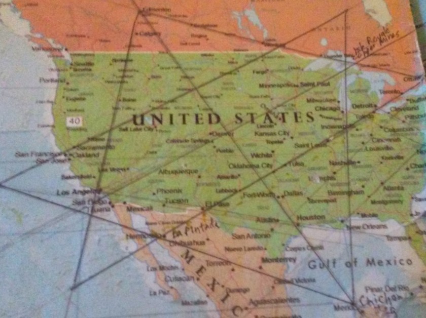
I ended part 1 of this series in Portland, Maine, where this alignment emanating off the North American Star Tetrahedron leaves North America and crosses over the Atlantic Ocean and heads towards North Africa. I will be starting this post on the island of Tenerife in the Canary Islands.
For me personally, this journey started here in 2016, when I started noticing major cities lining up in lines in North America on a map beside my dining room table. Then I found a familiar figure of sacred geometry when I literally started connecting them. After that, I extended the lines out on a map, then a globe. I am sharing with you what I have found along the way.
This blog is dedicated to providing compelling evidence for a highly advanced lost global civilization that existed up until relatively recent times. It was geometrically aligned with itself, the planet, and the stars, and in this spirit in addition to what I have found in the specific locations on this alignment, I will be including comparison pictures of other places with astonishing similarities in places you would not expect to find them.
For the purposes of simplification, in these posts I am going to focus on striking similarities in building styles and design features, and landscape features. I will say this whole region is rich in unknown and unacknowledged history, but it is beyond the scope of this blog and my expertise to delve much into it. Suffice it to say I will be scratching the surface of it with what I am about to share with you.
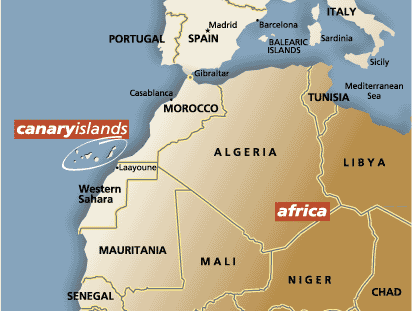
Tenerife is largest and most populated island of the Canary Islands, and its capital is Santa Cruz de Tenerife. The Canary Islands are an Autonomous Community Province of Spain, and are located off the coast of Morocco.
Here are photos comparing a building configuration – that I have found throughout these alignments – in Tenerife on the left; Burlington, Vermont in the middle; and Summerside, Prince Edward Island on the right.


In this comparison of roof styles, on the left is the Circulo de Amistad XII de Enero Building in Tenerife; the building on the top right is in Montpelier, Vermont; and the one on the bottom right is in Yalta, Crimea (the Crimea is a peninsula on the Black Sea).


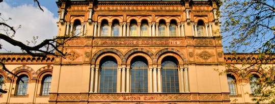
Here are those triple and double windows yet again – on the left is a view of Santa Cruz de Tenerife; and on the right is the Victoria and Albert Museum in London.


The Pyramids of Guimar are located in the town of Guimar on the island of Tenerife. Terraced structures that were built from lava stone without the use of mortar.
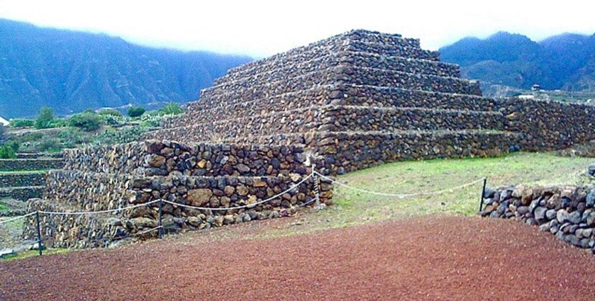
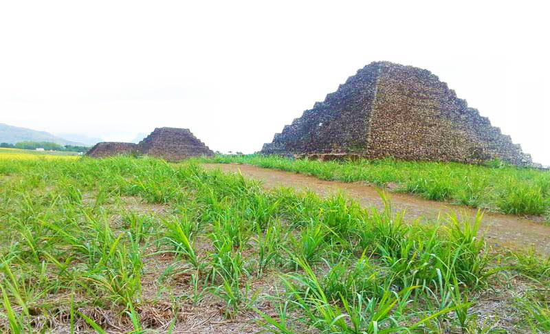
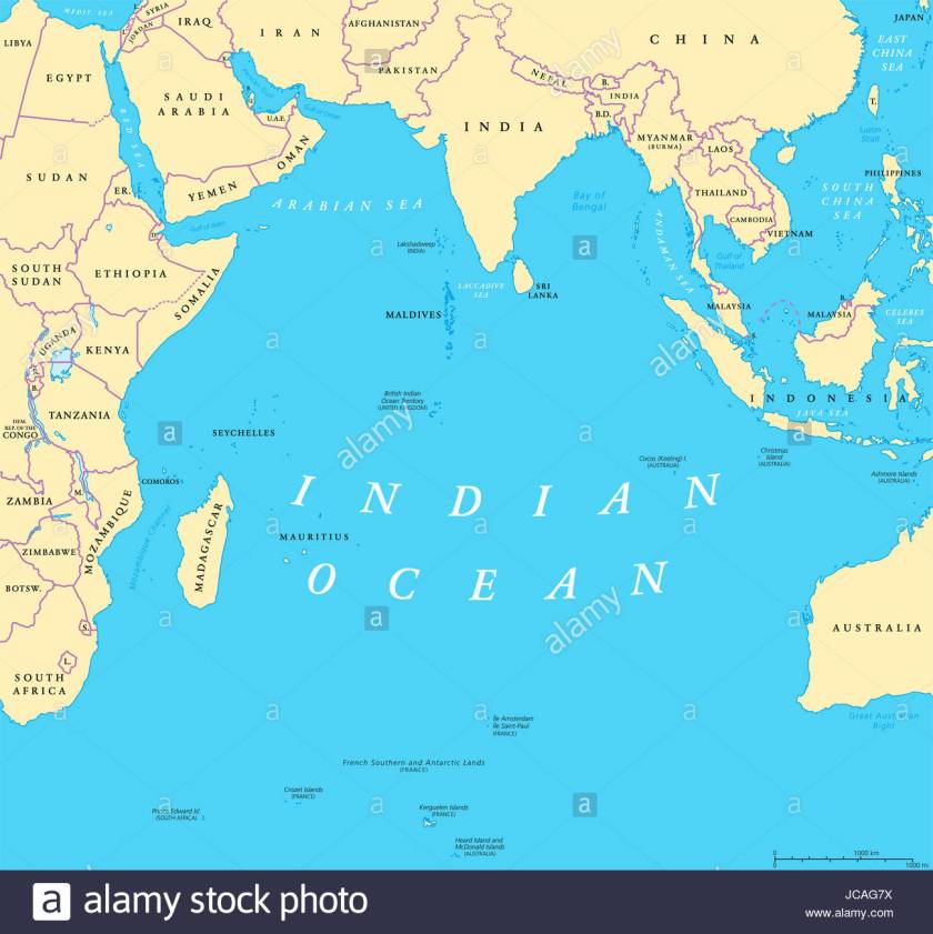
Compared with the Pyramids of Mauritius in the Indian Ocean, also terraced structures made of lava stone. There are seven terrace pyramids in Mauritius and six in Guimar. In both places they are in perfect astrological alignment with the winter and summer solstice.
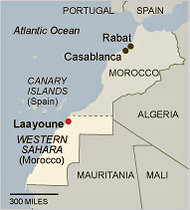
From the Canary Islands, the alignment enters the continent of Africa at Laayoune, Morocco, or El Aaiun, the meaning of which refers to water springs.
Here I would like to interject that I have found springs of all kinds, including hot springs, located in places on the alignments I have found in my work.
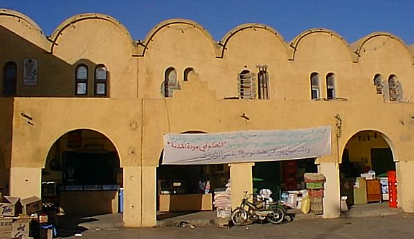
Top two photos are buildings in Laayoune. Next, in order is: the Milan Natural History museum in Italy; Georgetown University in Washington, DC; and the photo on the bottom is the Moscow State Historical Museum in Russia.


The alignment crosses into the Tamanrasset Province, the largest in Algeria.


There are two two national parks in Tamanrasset Province – the Ahaggar (also known as Hoggar) Mountains; and Tassili n’ajjer.
First, photos of the Ahaggar Mountains. These are considered a highland region of the Central Sahara in Southern Algeria that cover 212,000 square miles (550,000 square kilometers) along the Tropic of Cancer:


Second, here are some photos from the other national park – Tassili n’ajjer, which means “Plateau of the Rivers.” It is a UNESCO World Heritage Site.
It is known for its distinctive rock artwork, some of which is pretty much recognizable from our reality as we know it: bull – charioteer – giraffe…


…and some of it not of this world as we know it – ? – ?? – ???.


And here a photos of the landscape of Tassili n’ajjer.


Let me be clear that I believe all of the landforms I am showing you in this post are ruins of ancient infrastructure, and not natural features.
Whether or not you are able to believe this, throughout this post I intend to provide compelling evidence as to why I believe it.
For example, the landform on the left is in Tamanrasset Province, and the one pictured on the right is Chimney Rock in Sedona, Arizona.


Also this image on the left taken in Tamanrasset Province is very much like what is pictured on the right in Heavener Runestone State Park in Heavener, Oklahoma.


A few more things before I leave Algeria.
The first is that I would like to point out a few things in Constantine, Algeria – which is in northeastern Algeria, close to the Mediterranean Sea. Whoever built this place is comfortable with stone and heights ~ this is what a City on the Rocks looks like!
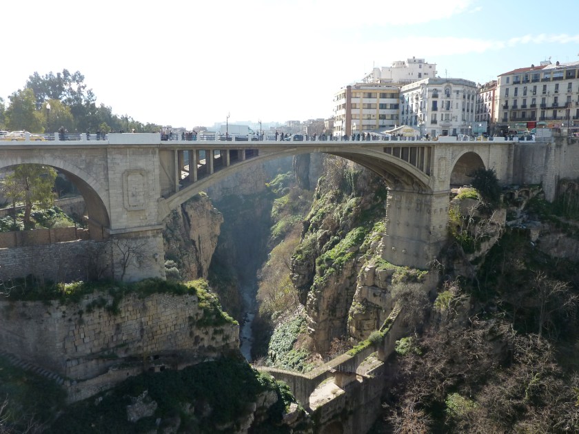
For a direct comparison to illustrate one of the points I want make, here is a series of three pictures. The photo on the left is called in English “Natural Arch” in Constantine; the middle one is what is called the “Arch Bridge” in Constantine; and on the right is taken of a building in Grozny way over in Chechen Republic in Russia, not close to here by any stretch of the imagination, but which is located on another planetary alignment.


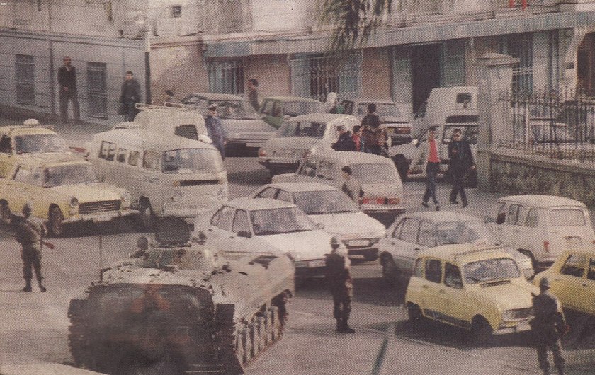
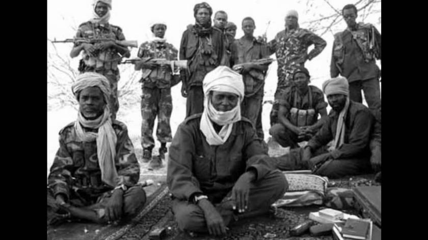
The other point that I would like to make is about the Algerian Civil War, the duration of which was between 1991 and 2002. It involved an armed conflict between the Algerian government and various Islamic rebel groups. It began after a coup negating an Islamist electoral victory in which the government was trying to crush the Islamist movement, but armed groups emerged to fight against the government, and many Algerians were killed.
From Algeria, the alignment crosses into the country of Niger, where it goes through the Air and Tenere National Nature Reserves. Pictured top and bottom to the right of the map shows a good example for me what are actually under sand dunes, but that is a future post in and of itself….


The Air and Tenere National Nature Reserve is a UNESCO World Heritage Site, and covers 29,870 square miles (77,360 square kilometers), and is the eastern half of the Air Mountains, and the western half of the Tenere Desert.


From there, the alignment crosses through Bilma, Niger.
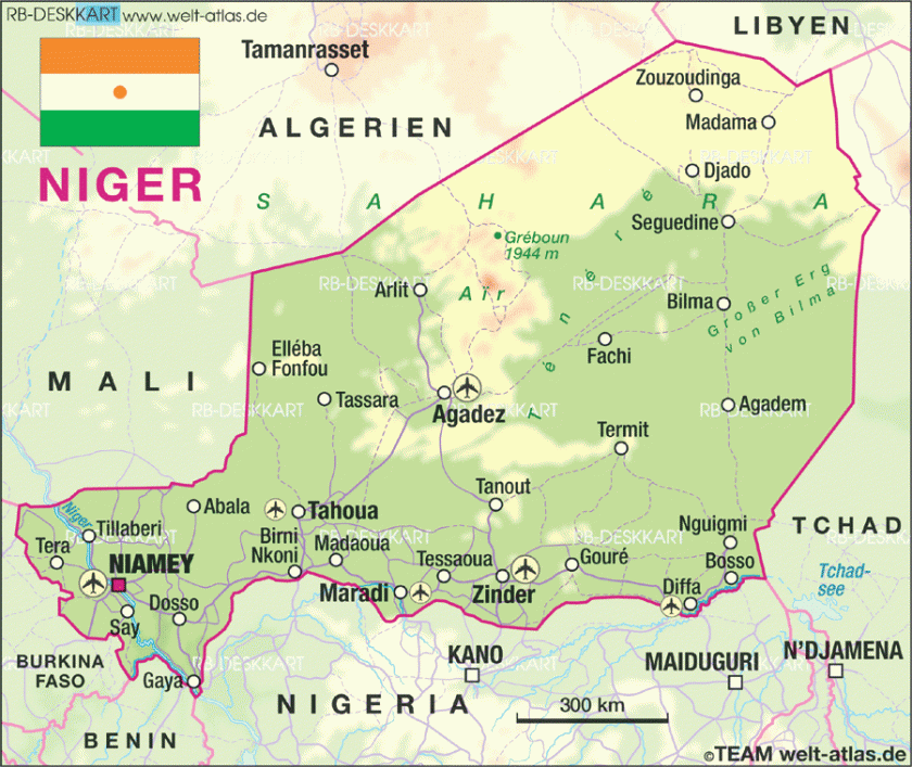
Bilma is an oasis town, and used to be a key stop in the Trans-Saharan caravan route. It is protected from sand from the desert dunes by the Kaouar escarpment. Escarpment is another key code word that covers-up ancient infrastructure.


To this day, it produces salt in salt pans, sold for livestock use throughout West Africa.


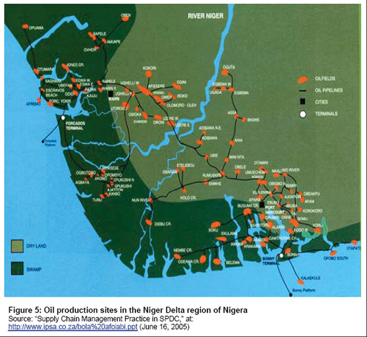
Lastly, I would like to point out the Niger Delta Civil War and Boko Haram.
There has been conflict in the Niger Delta since the early 1990s as well, mostly between foreign oil companies and minority ethnic groups, and has been on-going in one form or another since that time.
The Islamic State in West Africa has been active in Niger, Nigeria, Chad, and Northern Cameroon since 2002, and has been known as Boko Haram since 2015. It is a militant jihadist group that advocates for Sharia Law, and has been particularly noteworthy for militant insurgency and child kidnappings, among many other things.

Moving on into Chad, a land-locked country in Central Africa.
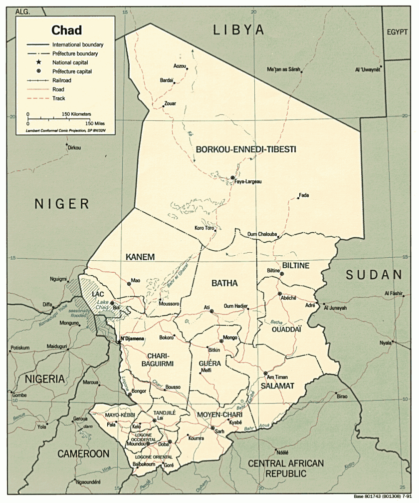
The Bodele Depression and Koro Toro are both on the alignment in the Borkou-Ennedi-Tibesti Region of Chad.
The Bodele Depression is the lowest point in Chad, and is best known for its dust storms which deliver fertile dust, said to be essential for places like the Amazon rainforest.
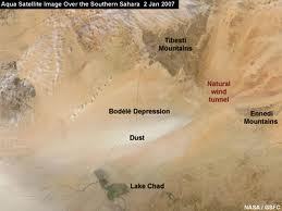
The Bodele Depression lies between Lake Chad to the south of it (note the pyramidal shapes in the background)…


Here are Tibesti Mountains on the left and in the middle, Bell Rock in Sedona, Arizona on the right:


Here are more photos taken of the Tibesti Mountains:


Here is a photo comparing a rock formation in this region of Chad on the left, and one in the Tamanrasset Province in Algeria on the right that called “No Arch.” They both look like a lot like elephants to me.

")
Koro Toro is also on the alignment and is an archeological and anthropological site in Chad, best known for the discovery of an Australopithecus fragment in 1995, which is described asone of the first Hominid in the ancestry of human evolution.
There have been roughly four Civil Wars in Chad since independence from France in 1960. The last one started in 2005 between Muslims in the North and Christians in the South, and is continuing on some form or another to the present day.
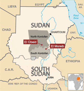
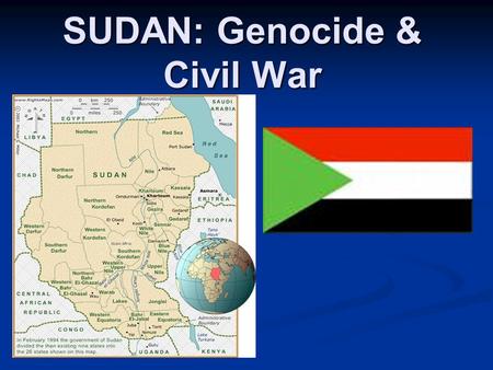
From Chad, the alignment crosses through El Obeid, Sudan, which is the capital of North Kurdafan.
Here is a comparison of a mosque in El Obeid, Sudan on the left, and the Signoria, was was the government building of medieval and renaissance Florence, Italy:


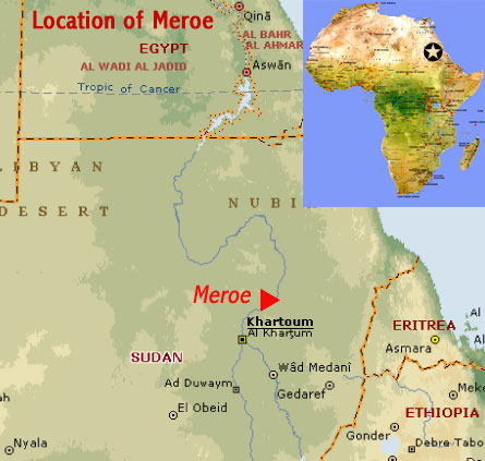
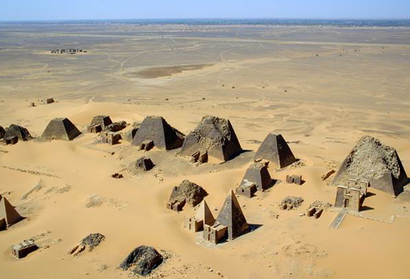
Also, there are Pyramids in Sudan – located in Meroe which is northeast of the country’s capital of Khartoum. As the map shows, Sudan is due south of Egypt. Meroe is an ancient city that sits on the east bank of the Nile River as well. This region is considered part of the Kingdom of Kush.
Here is an aeriel view of the Meroe Pyramids…
…and a comparison of the Meroe Pyramids on the left, and similar-looking pyramids in Tamanrasset Province back in Algeria on the right:


The first Sudanese Civil War started in 1955 between North and South Sudan, (Sudan Civil Wars start in 1962), with a state of civil war existing in Sudan to the present-day.
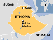
From here the alignment goes on into Ethiopia, on which we find Lake Tana, Gondar, and Lalibela, Ethiopia.
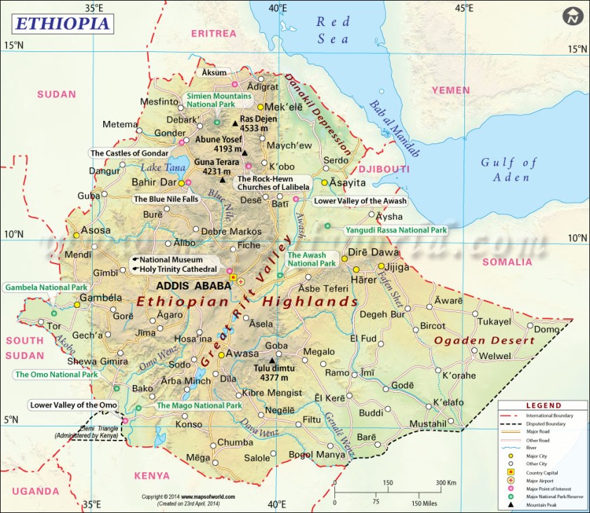
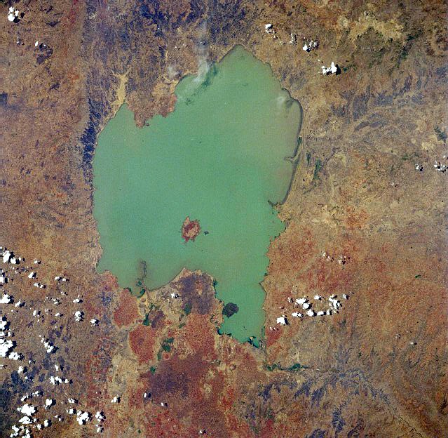
Lake Tana is the source of the Blue Nile, and the largest lake in Ethiopia. It is a sacred lake.
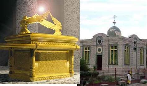
Among other things, the heart-shaped Lake Tana has living traditions about being a place where Joseph, Mary, and Jesus stayed on their way back to Israel after fleeing Herod, and also as a place where the Ark of the Covenant was kept for 800 years before going to Axum, where it is said to currently be (more on this shortly).
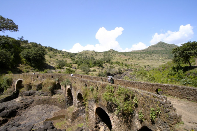
This first set of two photos is a comparison of a bridge near Lake Tana on the top, with the old bridge near Loch Sligachan on the Isle of Skye, off the coast of Scotland on the bottom:
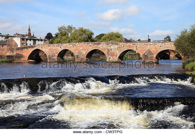
This next set of two bridges is a comparison of the River Nith Old Bridge in Dumfries, Scotland on the left, with the Burnside Bridge at Antietam in Maryland, the site of a major battle of the American Civil War:


Gondar is a royal and historic city of Ethiopia, and the Imperial Seat from the 1200s to the 1900s. It is a city of castles and palaces.


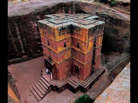
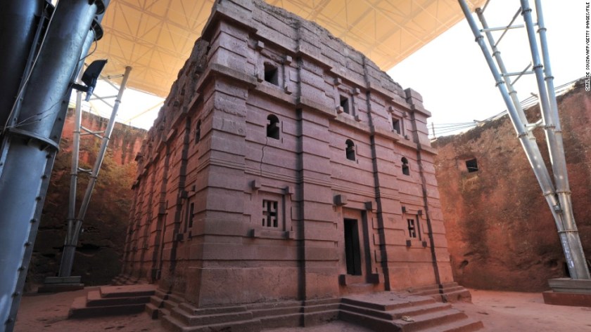
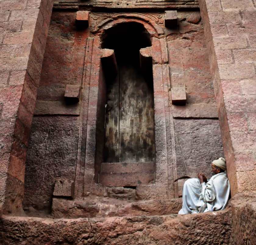
Lalibela is the second holiest of Ethiopia’s cities, after Axum. It is famous for its monolithic churches, meaning cut out of one rock. The population of Lalibela is almost completely Ethiopian Orthodox Christian.
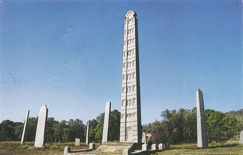
Axum, Ethiopia is one of the twelve primary nodal points of the Planetary Grid. A nodal point is a place where numerous leylines and planetary alignments connect.
It is believed to be the home of the Ark of the Covenant at the Saint Mary of Zion Church.
Though there is more than one obelisk here, this is the granite Obelisk of Axum. It is 24 meters high, and weighs 160 tons. Like the churches of Lalibela, it is also monolithic in that it was crafted from a single piece of stone.
Civil War started in Ethiopia in 1974, with a coup initiated by a Marxist-Leninist faction leading to the overthrow of the Imperial Government in 1975, and formally ending in 1991. The war left at least 1.4 million dead.

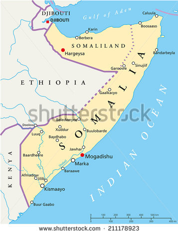
From Ethiopia this alignment goes through Hargeysa, Somalia. Hargeysa is the largest city and capital of the self-declared province of Somaliland (it is not recognized internationally).
So, as is typical of so many places, this is the fate of the much of the beautiful historic architecture of Somalia…
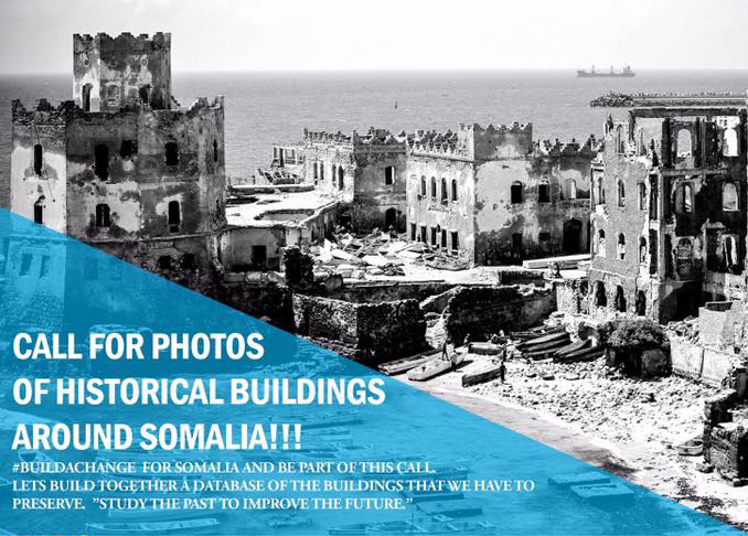
…to be replaced by what you see now in 21st-century Hargeysa…
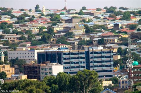
…Contrasted with the building in the background in this historic photo of Hargeysa.
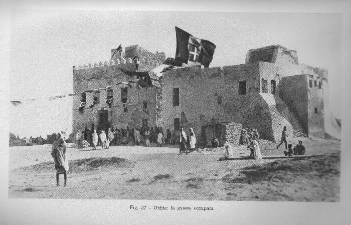
Here are some historic photos and locations around Somalia that may or may not still be standing:


Lastly, the alignment leaves Somalia at the city of Eyl. This region of Somalia is known as Puntland, which was established in 1998.
Somalia itself is more than likely the ancient Land of Punt, which was a trading partner with Egypt.
This is the Dervish Castle at Eyl…
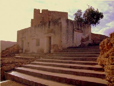
…as well as the building in this historic picture.
The Somali Civil War started in the 1980s, and is on-going. It is estimated that at least 500,000 people have been killed as a result of it.

I will be ending this post here at the Horn of Africa and next stop will be following the alignment on to the Maldive Islands in the Indian Ocean.
I will leave you here these thoughts.
It sure looks like to me that a rich, vibrant & unacknowledged history of Humanity has been plundered and destroyed through this region, only to be replaced with violence, death and destruction.
I bring these things up because of these are types of things that have been happening on planetary gridlines, or the proximity thereof, which is also happens to be our consciousness grid.
Finding out things like this is why I believe the planetary grid has been deliberately manipulated to lower our collective consciousness since so many, many horrific atrocities and crimes against Humanity have been committed at significant places on the grid, not only here in Africa, but all over the world.
Knowledge of the planetary system was deliberately removed from our collective awareness by beings who definitely do not have humanity’s best interest at heart, our history was revised, and the truth became shattered and fragmented.
It is time to return this knowledge to the collective awareness and together choose to create a new reality for our planet that is based on love, kindness and cooperation.

Wonderful work, thank you. You are brilliant!
LikeLike