I am highlighting places, concepts, and historical events that people have suggested that I research in a new multi-volume series that is a compilation of work I have previously done.
This is the third volume of what will be a lengthy new series.
My starting point for this video is from a viewer who lives in coastal North Carolina.
He commented, “I live in a place called Fort Fisher, North Carolina. One of the last battles of the civil war took place right here on my Beach.”

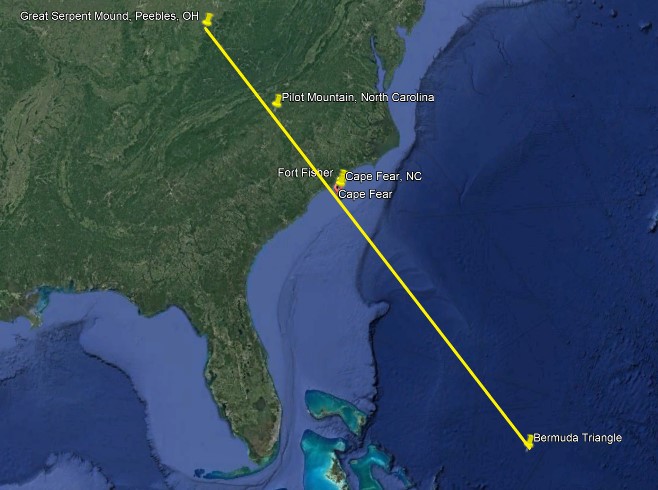
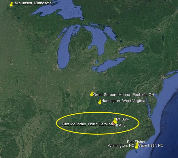
He continued, “Anyways, there’s a lot of energy here. I started researching it about a year ago and found that there is a ley-line (Serpent lei) that harvest magnetic energy from the center the Bermuda triangle and comes right through my bedroom (Cape Fear) up through Pilot Mountain in North Carolina, then continuing up through “Serpent Mound” in Ohio. Anyways, there’s much more. I was just curious if you had ever tapped into this knowledge. Thank you and take care.”
I didn’t know about this particular ley-line, so thank you for sharing!
This ley-line/alignment is starting in the southeast, at the Bermuda Triangle, and the pin is marked where Google Earth took me when I searched for it.
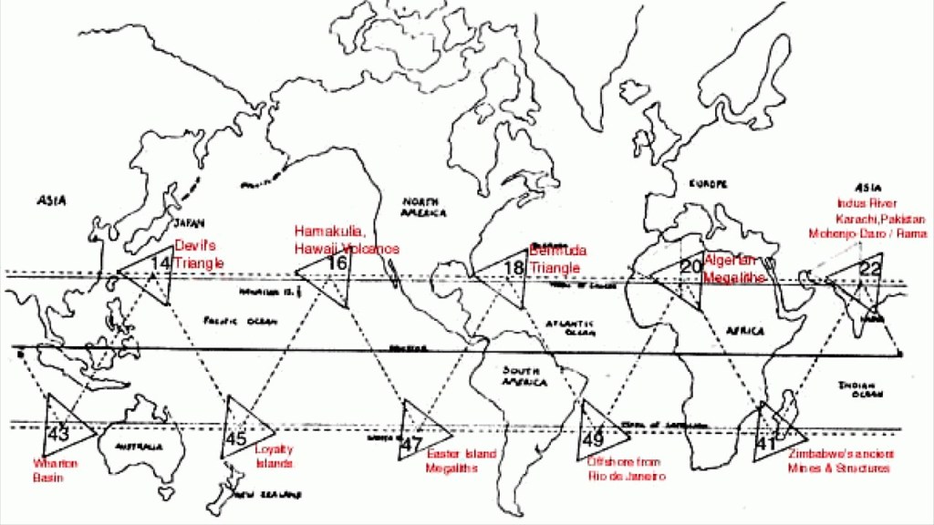
The Bermuda Triangle is best known as being a section of the North Atlantic Ocean where people, planes, and ships were said to have disappeared under mysterious circumstances.

Ivan T. Sanderson, a British biologist and researcher of the paranormal, wrote about “vile vortices,” of which the Bermuda Triangle and Devil’s Sea, a region in the Pacific, south of Tokyo, were two of ten regions on the Earth known for such anomalous occurrences.
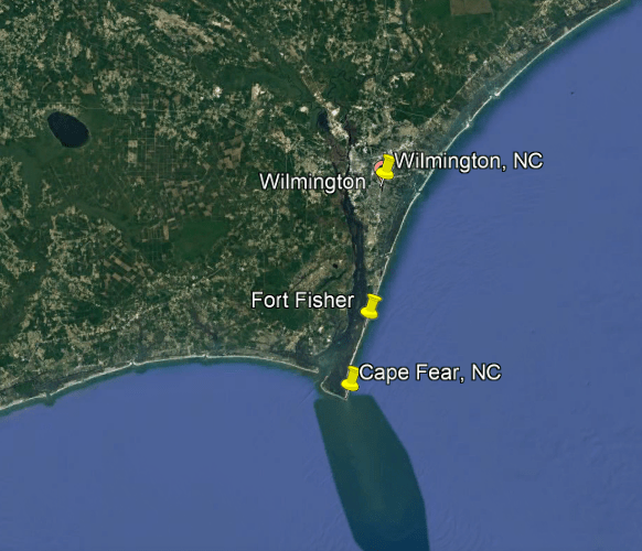
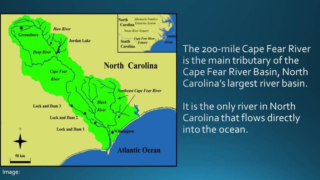
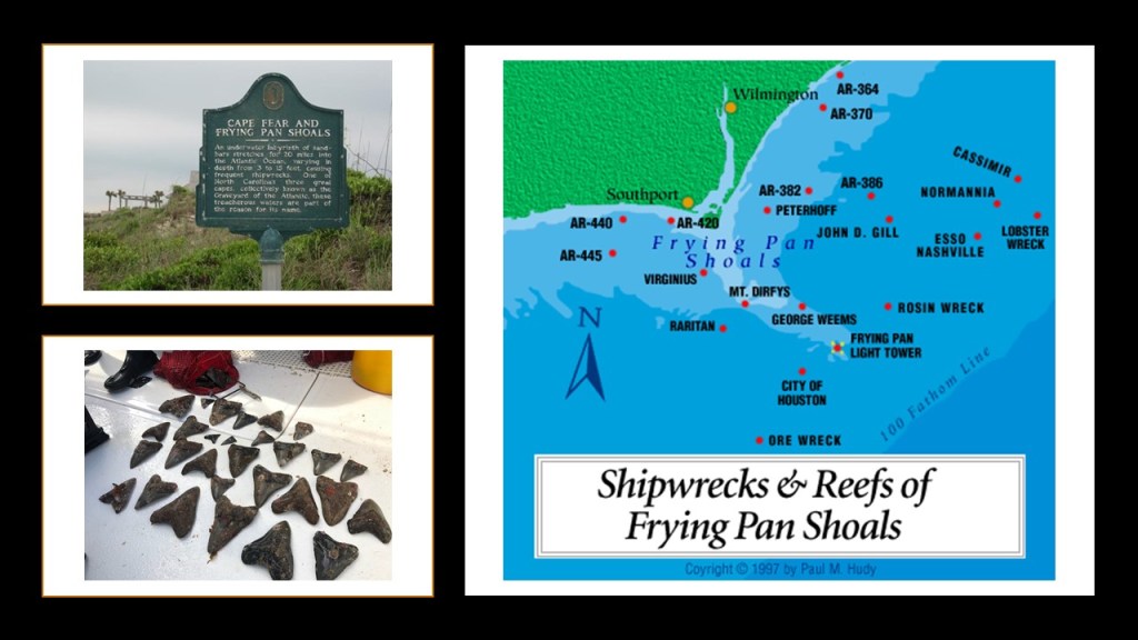
Cape Fear and Fort Fisher are south of the port city of Wilmington, North Carolina, which is located on the Cape Fear River.
Notably, today Wilmington is the home of EUE/Screen Gems, the largest domestic television and movie production outside of California.
Now, that’s interesting. I wonder why Wilmington was the preferred choice for this location….

Cape Fear is described as a prominent headland on Bald Head Island jutting into the Atlantic Ocean, and is predominately an estuary, which is a partially enclosed coastal body of brackish water, with one or more rivers or streams flowing into it, and a connection to the open ocean.
And the Cape Fear region, besides Fort Fisher, had a whole bunch of coastal defenses, AKA star forts, which I typically find around water, in pairs or clusters.
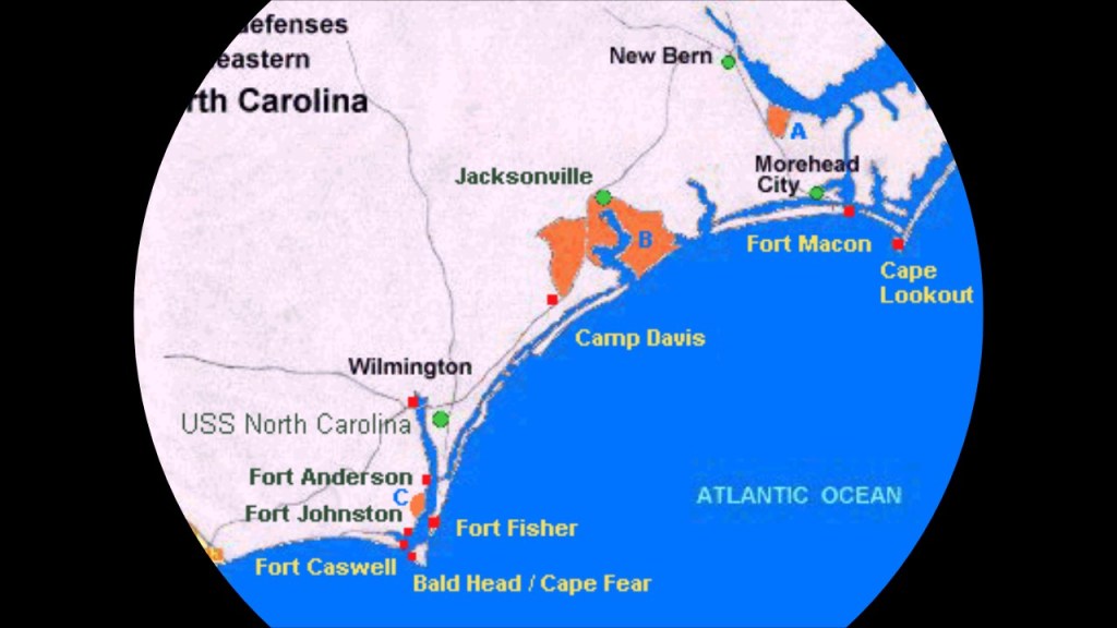
I promise to keep these short, so I am going to look specifically at Fort Fisher.
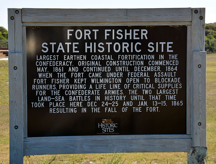
The first batteries of Fort Fisher were said to have been placed there in 1861, on one the Cape Fear River’s two outlets to the Atlantic Ocean, to protect the vital port of Wilmingon for Confederate supplies, and as the war progressed was overhauled with more powerful artillery to withstand a Union blockade.
With all the work that was done on it, it became the Confederates largest fort.
Even with all of that reinforcement, there were two battles – one at the end of the 1864 and the other at the beginning of 1865, after which Fort Fisher fell, and the Union army came to occupy Wilmington.
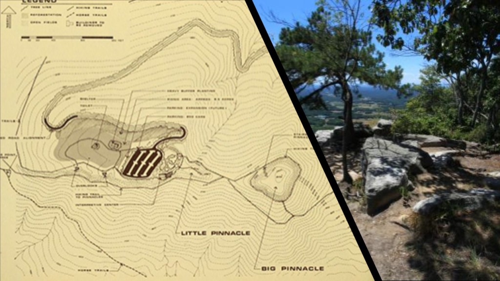
Next on this alignment is Pilot Mountain, described as one of the most distinctive natural features in the State of North Carolina…
…with two distinctive features, one named “Big Pinnacle…”
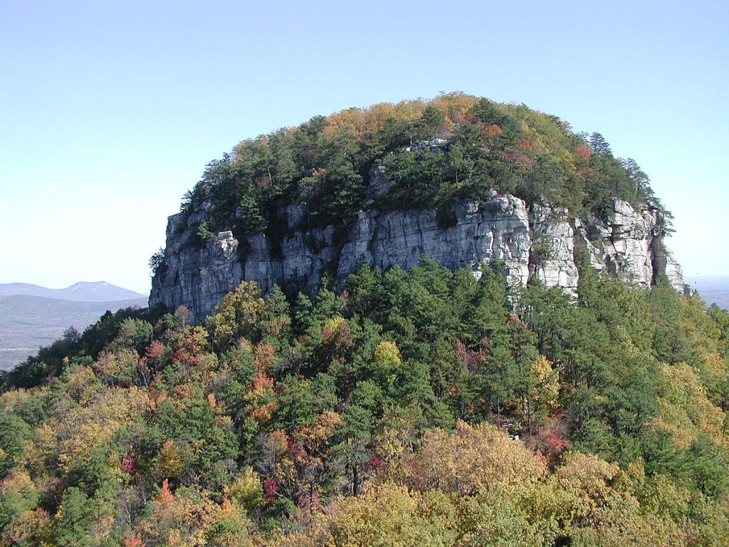
…and the other “Little Pinnacle.”
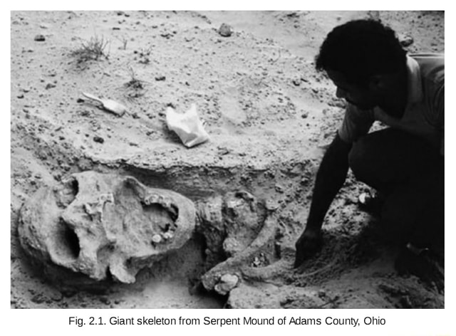
And the last place mentioned by the viewer on this alignment is the Great Serpent Mound in Peebles, Ohio, described as an effigy mound that is 1,348-feet-, or 411-meters-, long, and 3-feet-, or almost one-meter-, high.

Two points of information I am going to bring forward about the Great Serpent Mound, before I move on to the next commenter’s suggestion, are the following:
One is the many astronomical alignments of the Great Serpent Mound…

…and the other is the historical giants’ skeletons that have been found in the area.
Next, Stephen H. commented:
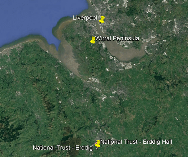
“…turn your mind to the North West of England.
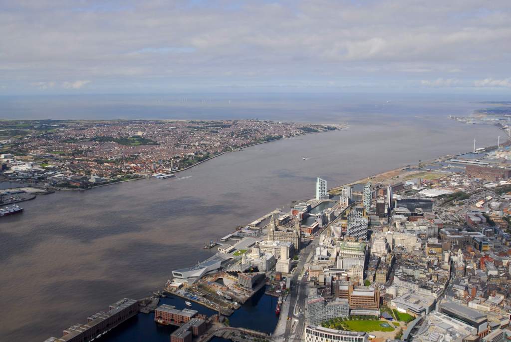
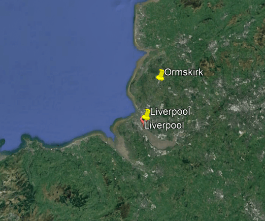
In particular Liverpool…

…Chester…

…and the Wirral, the name of the Peninsula and Borough in this part of North West England…
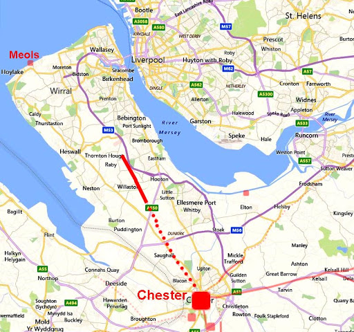
…with the River Mersey, separating the Wirral Peninsula and Liverpool…
…with Liverpool and Birkenhead on the Wirral connected by the “Queensway” Tunnel running underneath the River Mersey, said to have opened in 1934…

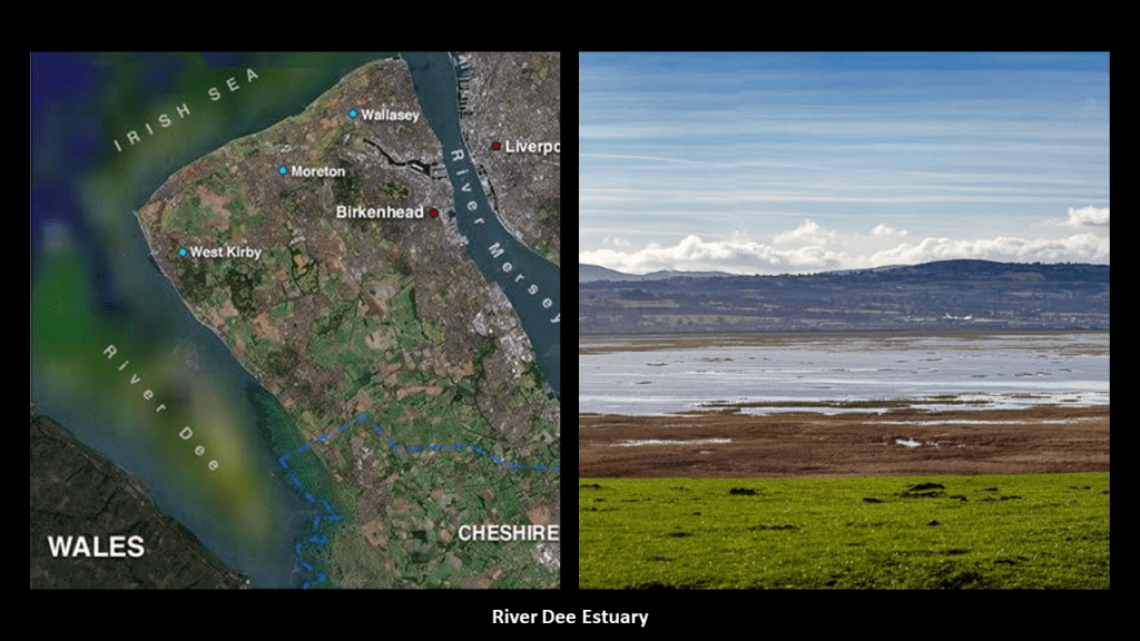
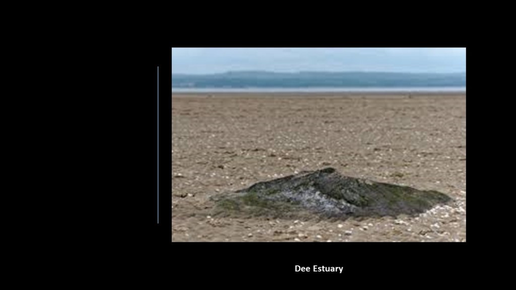
…and the River Dee estuary is between the Wirral Peninsula and Wales, a place where comparatively little water occupies such a large basin.
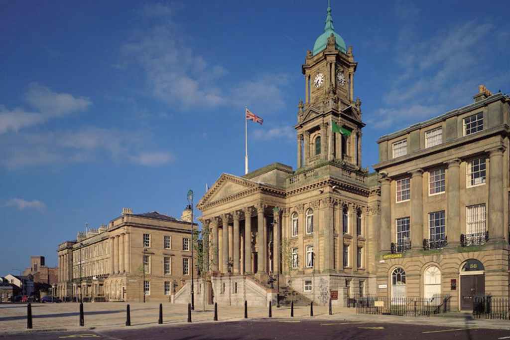
On the Wirral Peninsula, Birkenhead expanded greatly, we are told, as a result of the Industrial Revolution…
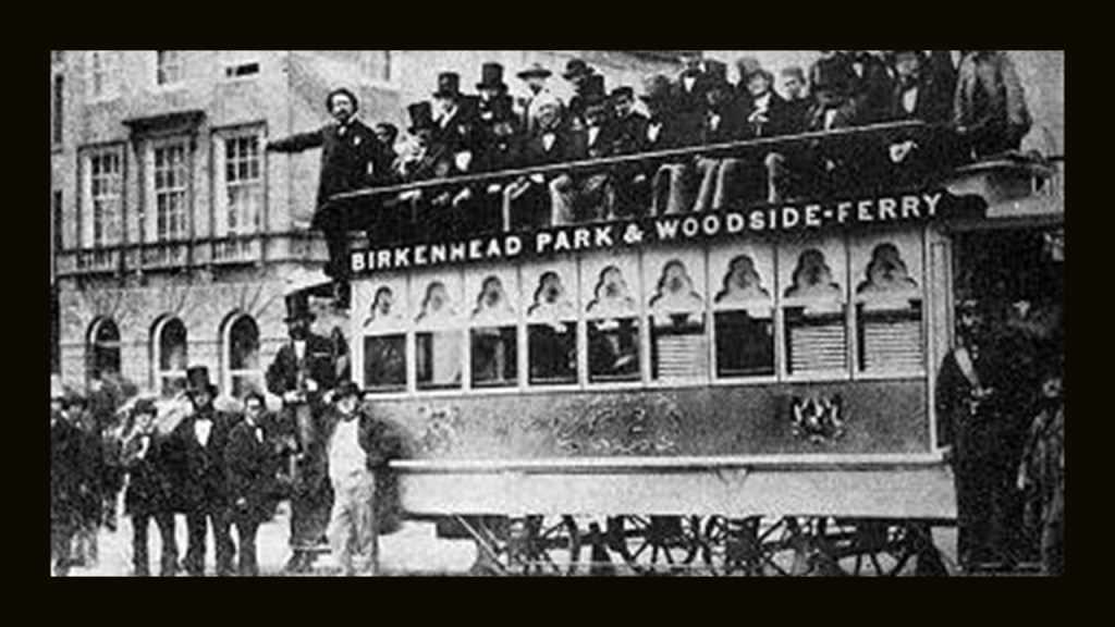
…and was the location of the first street tramway in Great Britain in 1860, and trams in Birkenhead ran until 1937.
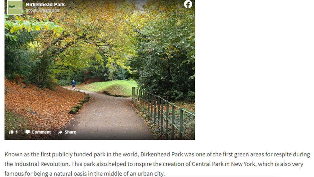
When I was looking for pictures of Birkenhead, I saw this one, which I have seen before.
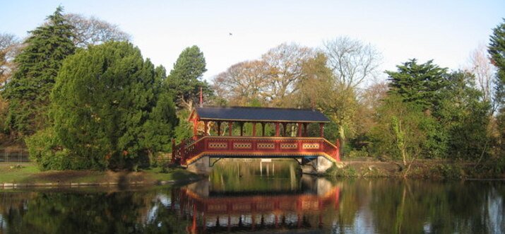
Birkenhead Park, said to have been designed by Joseph Paxton, a gardener and greenhouse builder by trade, opened in April of 1847 and was said to be the first publicly funded civic park in the world, and visited by Frederick Law Olmsted in 1850, who was a journalist at the time, and later was credited, with no formal education, as being the “Father of American Landscape Architecture,” starting with his design, along with Calvert Vaux, of Central Park in Manhattan, of which Birkenhead Park was said to have been an inspiration for it.

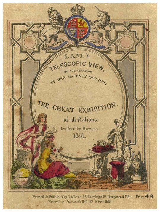
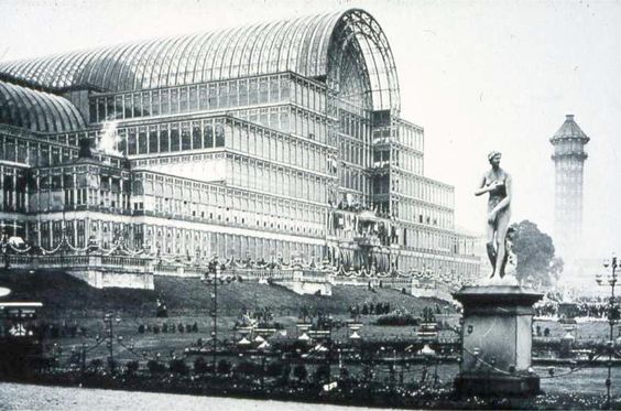
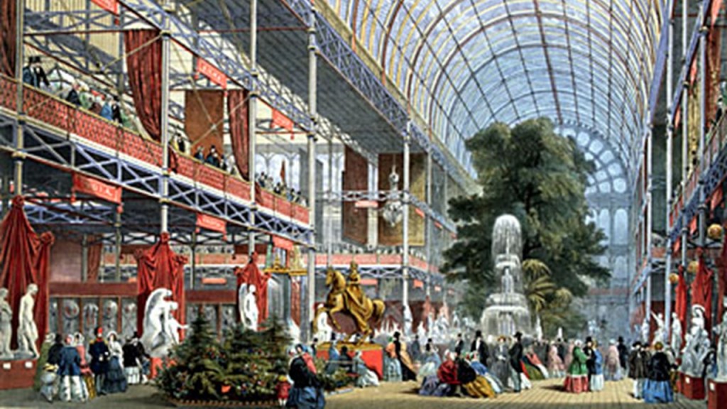
Joseph Paxton was also credited with being the designer of the Crystal Palace for the 1851 Exhibition.

I firmly believe Paxton and Olmsted were both credited with feats way beyond their actual abilities as part of the new re-set historical timeline.
Other places on the Wirral Peninsula Stephen mentioned included Port Sunlight, a model village said to have been founded by a Victorian Era entrepreneur to house his factory workers…

…Eastham Woods, and Eastham Country Park, next to the River Mersey, in a location where two ferries used to operate…

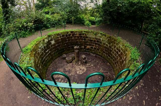
…and where there used to be a zoo during the Victorian era.
This circular stone structure in the Eastham Country Park is called the Bear Pit because it was where the zoo’s bears were held…
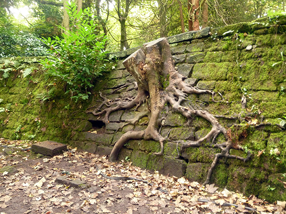
…and here is an old stone wall at the Park where an old tree used to grow!
He mentioned the New Brighton Tower, in the seaside resort of New Brighton in the town of Wallasey in Merseyside on the Wirral Peninsula, said to have been built between 1898 and 1900, and demolished in 1919, with its metal being sold for scrap.
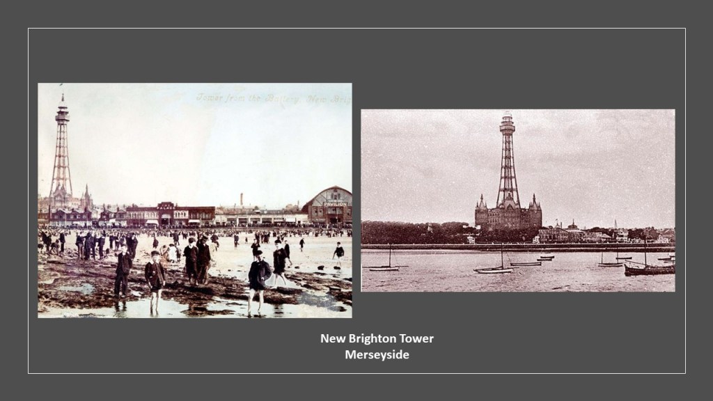
The building at the base of the tower is where the “Tower Ballroom” was located, which continued to be used until it was damaged by fire in 1969.

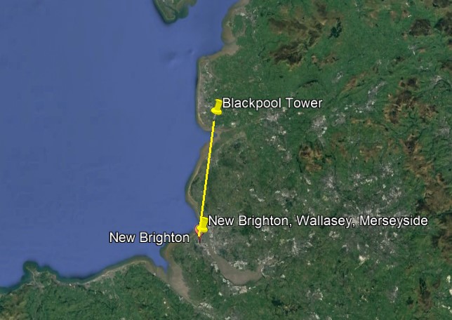
He also mentioned the very-similar-looking Blackpool Tower, said to have been inspired by the Eiffel Tower in Paris, and built starting in 1891, opening in 1894, and still remains standing in Blackpool …

…which also has a ballroom associated with it, that was fortunate enough to be restored after it was damaged by fire in 1956…
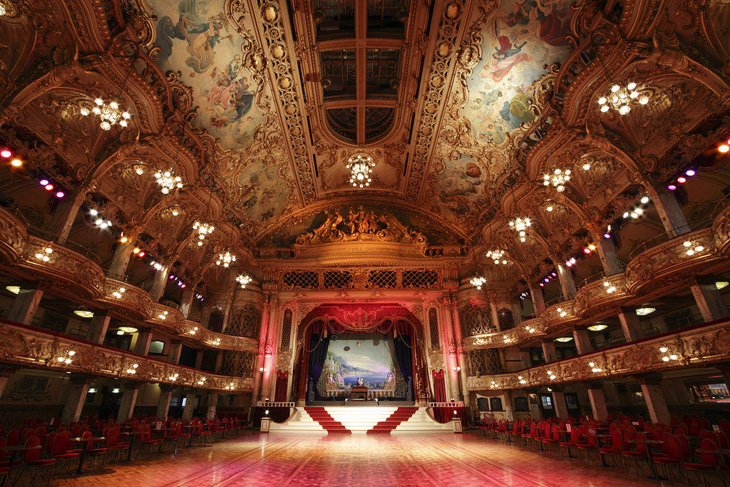
…and stands in relatively close proximity to New Brighton and the location of the other tower.
He believes that irrefutable evidence for the mudflood is available to be found in North West England, and the area is very well-documented.

A viewer suggestion the song “Stranger in Moscow” from Michael Jackson’s “HIStory” album.

D. C. sent me an email suggesting I look at this song released in the mid-1990s on Michael Jackson’s 9th album.
He said he came across my work about a year ago, and has been aware of the Moorish Paradigm for about 5 years now.
While he said the music video for “Stranger in Moscow” says much more, and has an ominous vibe to it, he told me about the images at several points in the video to look at.
Here are the lyrics to “Stranger in Moscow,” with the images he points out inserted at the lyric referenced.
I was wandering in the rain
Mask of life, feelin’ insane
Swift and sudden fall from grace
Sunny days seem far away
Kremlin’s shadow belittlin’ me
Stalin’s tomb won’t let me be
On and on and on it came
Wish the rain would just let me be
How does it feel? (How does it feel?)
How does it feel?
How does it feel?
When you’re alone
And you’re cold inside
Here abandoned in my fame
Armageddon of the brain
KGB was doggin’ me
Take my name and just let me be
The quarter flipping to the backside (displaying the Tartarian eagle or TURKey) shown during choice lyrics being sung.

Then a begger boy called my name
Happy days will drown the pain
On and on and on it came
And again, and again, and again…
Take my name and just let me be.
The coffee (also known as “mud”) spills.

How does it feel? (How does it feel?)
How does it feel?
How does it feel?
How does it feel?
How does it feel? (How does it feel now?)
How does it feel?
How does it feel?
When you’re alone
And you’re cold inside
The glass breaks (firmament reference) before the downpour of rain.

How does it feel? (How does it feel?)
How does it feel?
How does it feel?
How does it feel?
How does it feel? (How does it feel now?)
How does it feel?
How does it feel?
When you’re alone
And you’re cold inside
Like a stranger in Moscow
Lord have mercy
Like a stranger in Moscow
Lord have mercy
We’re talkin’ danger
We’re talkin’ danger baby
Like a stranger in Moscow
We’re talkin’ danger
We’re talkin’ danger baby
Like a stranger in Moscow
I’m livin’ lonely
I’m livin’ lonely baby
A stranger in Moscow
The viewer D.C. said he had never heard another mention of this anywhere (on the internet or otherwise) and it crossed his eyes and consciousness at least 3 years ago, and wanted to share, and that Michael Jackson made many references to the Moorish Paradigm in his body of work.
Curious that the name of this particular album of Michael Jackson’s was “HIStory,” with the “HIS” emphasized in all caps.

I share it with you to raise the very real possibility that Truth about our world and its history is frequently shared in music, movies, television, visual arts, etc, and in a form which the real meanings are obscured so we are not aware, at least on a conscious level, that something hidden is being communicated with us.
Peter Champoux, the author of the “serpent lei” that a viewer mentioned between the middle of the Bermuda Triangle in the western part of the North Atlantic Ocean and the Great Serpent Mound in Peebles, Ohio, left a comment that it continues on to Lake Itasca in Minnesota, which is the headwater of the Mississippi River…

…and he also mentioned there were meteor strikes on this ley-line, and you can visit his website, http://www.geometryofplace.com, for more information about the meteor strikes, and many other things…
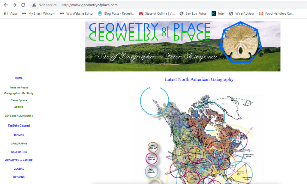
…and he also has a YouTube Channel for those who are interested in learning more about Peter’s work.

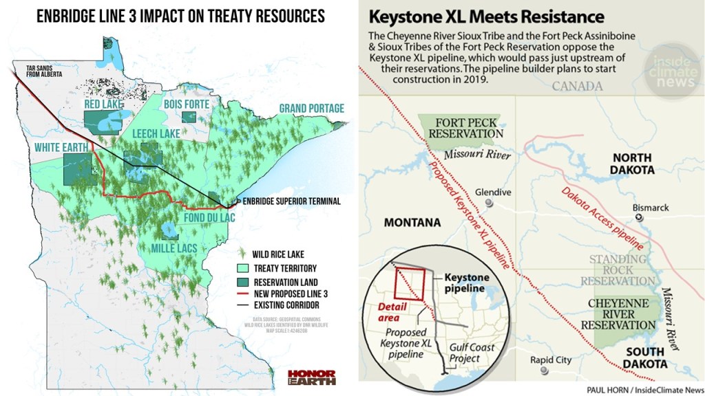
SF replied to the comment with Peter’s information that he worked on a pipeline project over the winter that went right through this specific area of Minnesota…
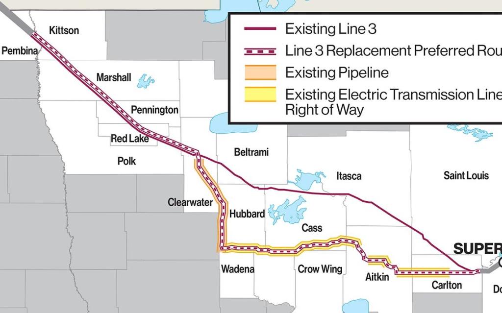
…and he observed in the years he’s done this kind of work that there is a common thread of Indian Reservations and land formations beyond a coincidence in relation to oil and gas exploration.
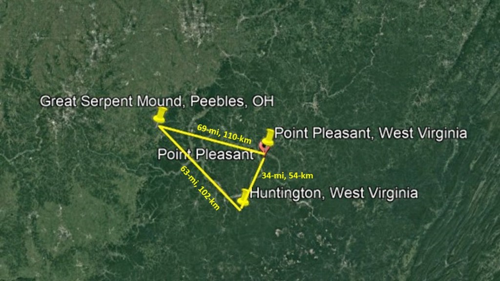
Another viewer commented that the ley line leading to the Great Serpent mound also passes through Huntington, West Virginia, near the location of the Mothman Prophecies.

Huntington is geographically close to Point Pleasant, at a straight-line distance of 34-miles, or 54-kilometers, apart, which was the setting of “The Mothman Prophecies,” the 2002 supernatural horror-mystery film starring Richard Gere as John Klein, a Washington Post columnist who researched the legend of the Mothman, where there had been sightings of an unusual creature and unexplained phenomenon, and said to have been based on a true story from the late 1960s.

It is important to note that the Great Serpent Mound in Peebles, Ohio is only a straight-line distance of 63-miles, or 102-kilometers, from Huntington, and 69-miles, or 110-kilometers, from Point Pleasant.
There are two other things that come to my mind from past research regarding Huntington, West Virginia.
One is that Huntington is the location of Marshall University, the Old Main Hall on the top of which was said to have been completed in 1868; which reminds me in appearance of the Westcott Building at Florida State University in Tallahassee, said to have been completed in 1910; the Benedictine Hall at the former St. Gregory’s University in Shawnee, Oklahoma, now the Green Campus of Oklahoma Baptist University, said to have been completed and opened in 1915 on the bottom left; and Trinity College at Cambridge University in England on the bottom right, which was established in 1546 by King Henry VIII.

The other is that there is only one, Camden Park, of thirteen remaining trolley parks that remain open in the United States in Huntington.
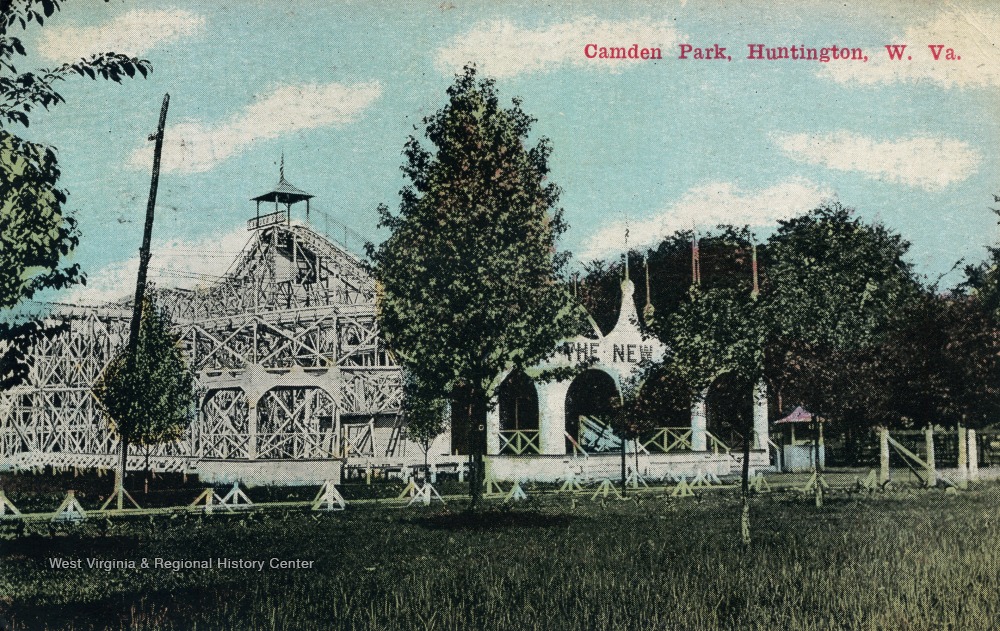
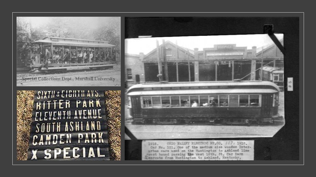
It was said to have been established as a “picnic spot” by the Camden Interstate Railway Company in 1903, which was a street railway and interurban system that ran between Huntington, West Virginia, and Ashland, Kentucky, and which by 1916 was the Ohio Valley Electric Railway, who became new owners of the park.
Where did all the trolleys go? And why did they leave?
Today, Camden Park is in the 4th-generation of family-ownership, and the only operating amusement park in West Virginia.

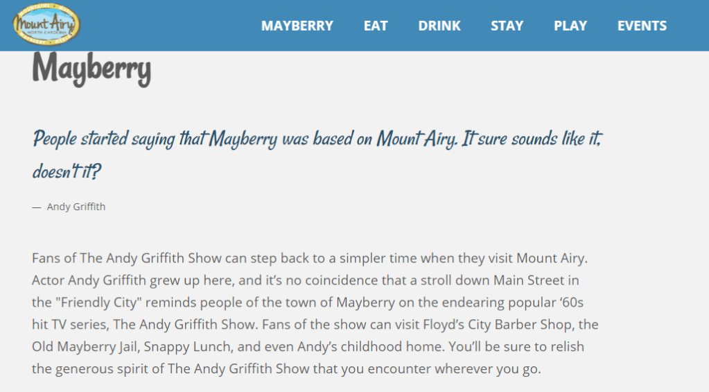
Next, going back down the alignment, from northwest to southeast, was a comment from Sarah saying that Pilot Mountain in North Carolina was nearby Mt. Airy, which was the hometown of Andy Griffith.
Basically, it’s “Mayberry.”
And someone replied to her comment: “Yes! Was looking for this comment!! ‘Goin’ over to Mount Pilot’ or something to that effect – said on the show all the time.
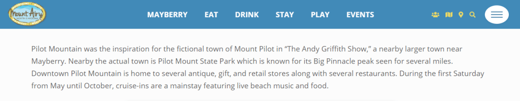
Pilot Mountain was the inspiration for the fictional Mt. Pilot in “The Andy Griffith Show,” for all of those old enough to remember Andy, the lovable, widowed Sheriff of Mayberry, his kooky deputy Barney Fife, his matronly Aunt Bea, his young son Opie, and his girlfriend Miss Ellie.
Hey, I named all of those characters from memory!

So back-tracking down the alignment from the original video, we come to Wilmington, North Carolina.
I had mentioned that Wilmington is the home of EUE/Screen Gems, the largest domestic television and movie production facility outside of California, and a viewer pointed out that Bruce Lee’s son, Brandon, died after being shot in the abdomen by a gun with defective blank ammunition at the Wilmington movie studios on the set of “The Crow” in March of 1993.

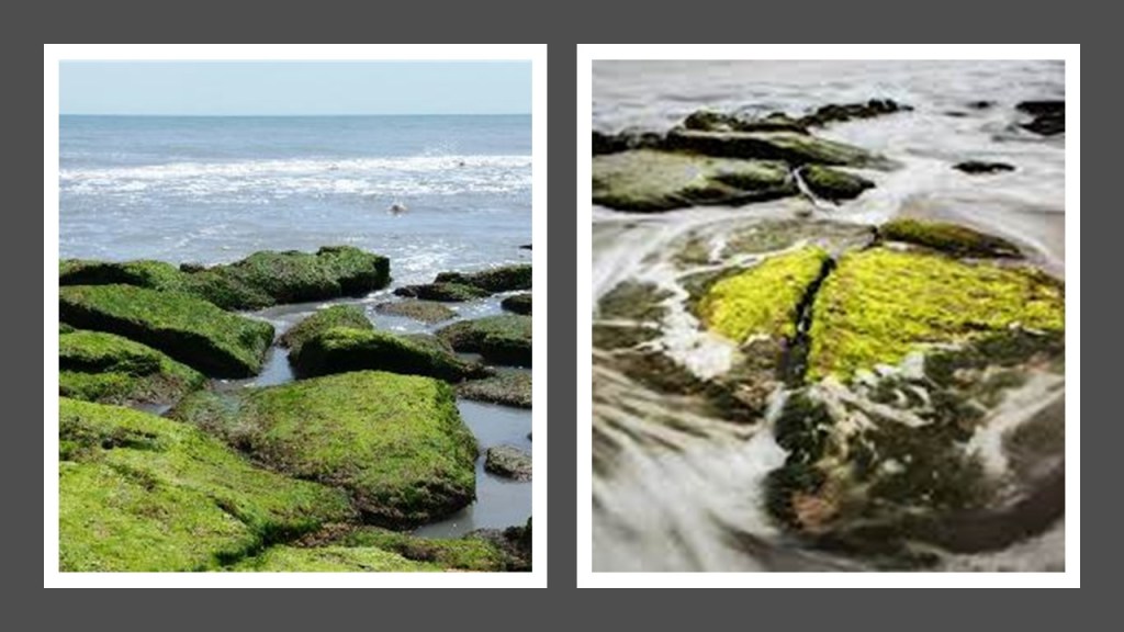
Another viewer, Josh, lived in Wilmington for ten years, where he used to surf right in front of Ft. Fisher in the cove, and a spot next to it that was a coquina rock reef at the southside of Kure Beach where Ft. Fisher is located…

He said he would observe shells and different fossilized corals and rocks that still have color and wonder how could that be millions of years old.
He said that Cape Fear is 5- miles, or 8-kilometers, south at Bald Head Island, and Frying Pan Shoals there is a hot-spot for megalodon teeth.
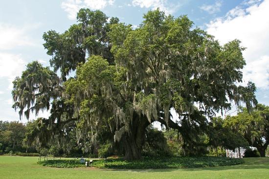
He also mentioned the Airlie Gardens in Wilmington,next to the intercoastal waterway.

The Airlie Gardens were said to have been created starting in 1886 by the Pembroke Jones family, and named after their family home in Scotland, and designed by German landscape architect Rudolf Topel as a lush flowing Southern garden with azaleas, camellias, magnolias, palms, and wisteria.

The Airlie Oak is on the garden grounds is believed to be 500-years-old, and in 2007 was designated the largest live oak in North Carolina at the time.
Now, back on over to the Wirral Peninsula.
LL, a viewer who lives on Park Road South in Birkenhead…

…just a short-walk from the Swiss bridge in Birkenhead Park…

…said that Merseyside and the Wirral peninsula is special place.
He said the river Dee to the west of tbe peninsula subsides to reveal sinking mud stretching miles and walkable sand…
…and the Tobacco building, formally known as the Stanley Dock Tobacco Warehouse, in the North Liverpool docks was said to be the largest bricked building in terms of area on earth, built 130 years ago, in 1901, with over 1 million bricks and was said to have been built in 1 year, with 27-million bricks, 30,000 panes of glass, and 8,000 tons of steel used in its construction.
The warehouse fell into disuse and disrepair in the 1980s, with trade declining through Liverpool.
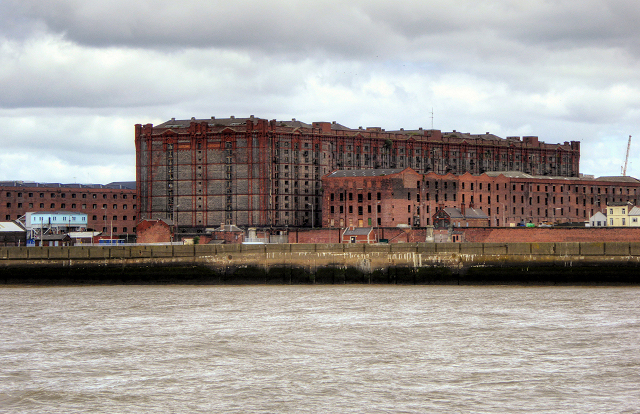
The tobacco building has been transformed into luxury apartments in the present-day.

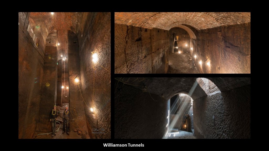
The viewer from Birkenhead also mentioned the Williamson tunnels, in the Edge Hill area of Liverpool, have been a mystery to him, as the narrative of why they were built doesn’t make sense.
The Williamson Tunnels were said to have been built under the direction of tobacco merchant Joseph Williamson between 1810 and 1840, and to this day the purpose of the work remains unclear.
The majority of what are called “tunnels” are comprised of brick or stone vaulting over excavations in the underlying sandstone, as the tunnels were said to have gradually become in-filled with rubble in the late 19th- and early 20th-centuries, with excavations starting in 1995.
The excavations revealed a large network of tunnels, chambers and voids.
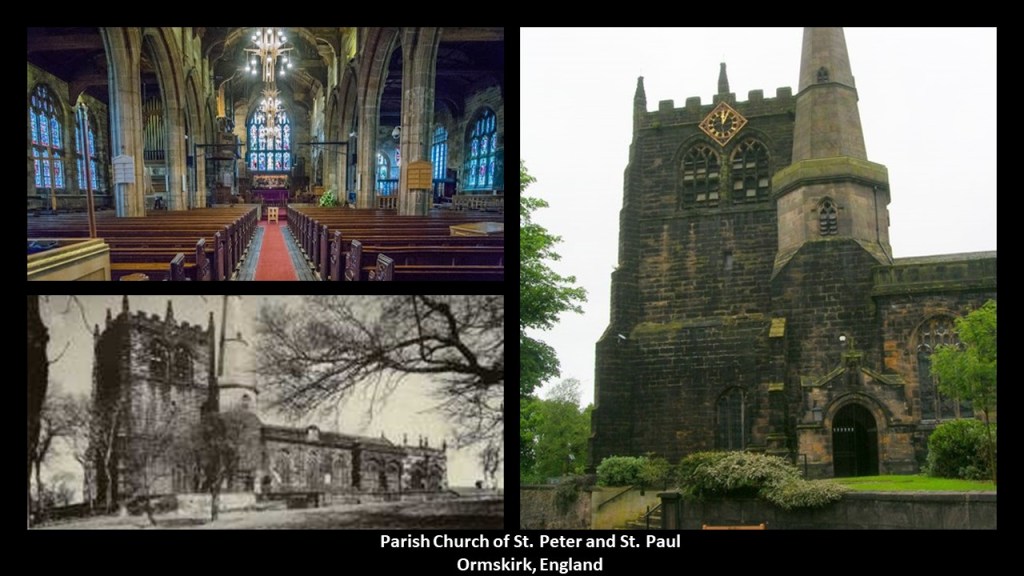
Another viewer, JC, mentioned Ormskirk, which translates to “Serpent – Dragon Church,” which is near Liverpool, on what is described as the sloping ground of a ridge in the center of the West Lancashire Ridge, and said to be a planned community dating back to the 13th-century.
…and the oldest building in Ormskirk is said to be the Parish Church of St. Peter and St. Paul, with an unknown exact age.
There were other topics JC said to look into are:
One was the Watkins Tower at Wembley Park, also known as Watkins Folly, was described as a partly-completed iron-lattice tower that was designed to surpass the height of the Eiffel Tower in Paris.
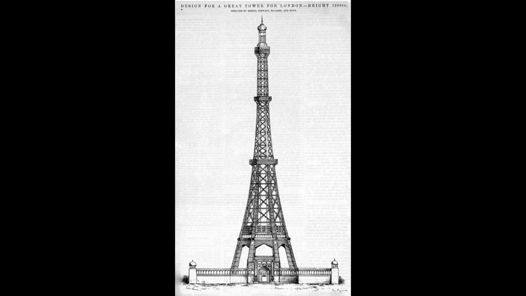
Never completed, and demolished in 1907, its location became the site Wembley Stadium, the English National Football ground.
The old Wembley Stadium opened in 1923…

…only to be demolished in 2002, to make way for the new Wembley Stadium, which opened in 2007.

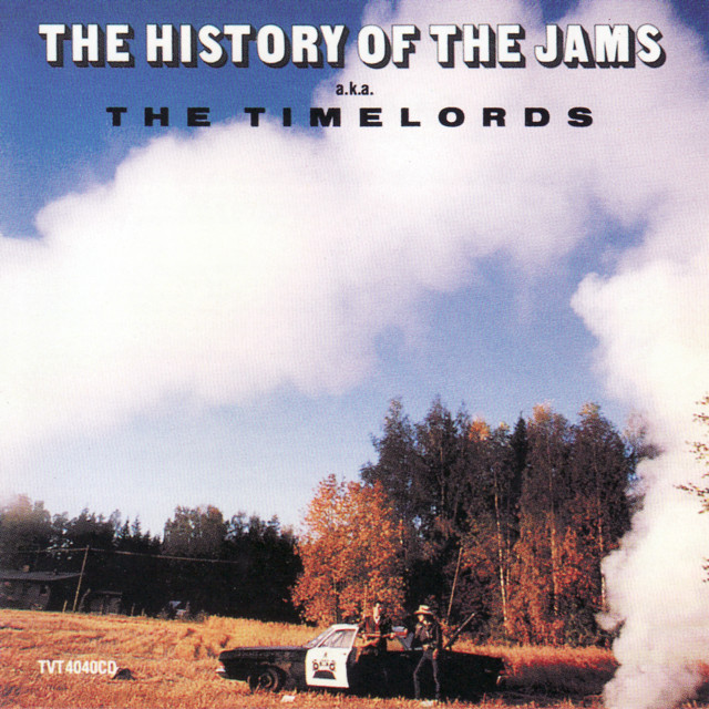
The other topic he mentioned was a single called “Justified and Ancient” by the British band The KLF that was featured on their 1991 album “The White Room.”

The original name of “The KLF” band was “The Justified Ancients of Mu Mu” or “JAM.”
The original name of the band was taken from “The Illuminatus! Trilogy,” a series of three novels by American authors Robert Shea and Robert Anton Wilson published in 1975.
Kind of a weird name choice not to have any meaning!

Skip commented that Aztalan State Park in Wisconsin is on the same Serpent Lei line identified by Peter Champoux.

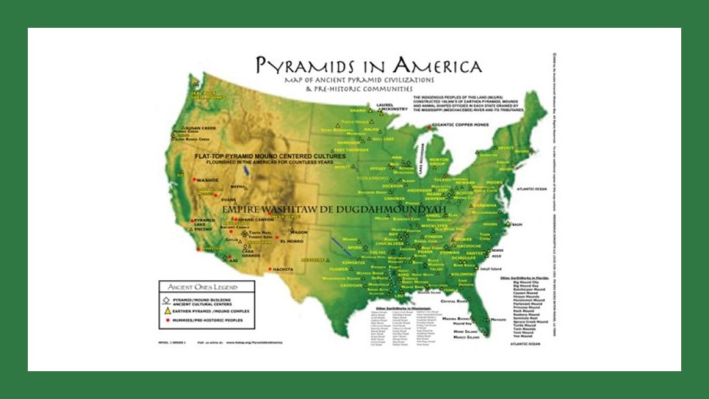
Aztalan State Park is a National Historic Landmark of what is called by historians as part of the Mississippian culture of moundbuilders, and was part of a widespread culture throughout the Mississippi and its tributaries, with a vast trading network extending from the Great Lakes Region, to the Gulf Coast, to the Southeast.
This is described as the largest platform mound at Aztalan…
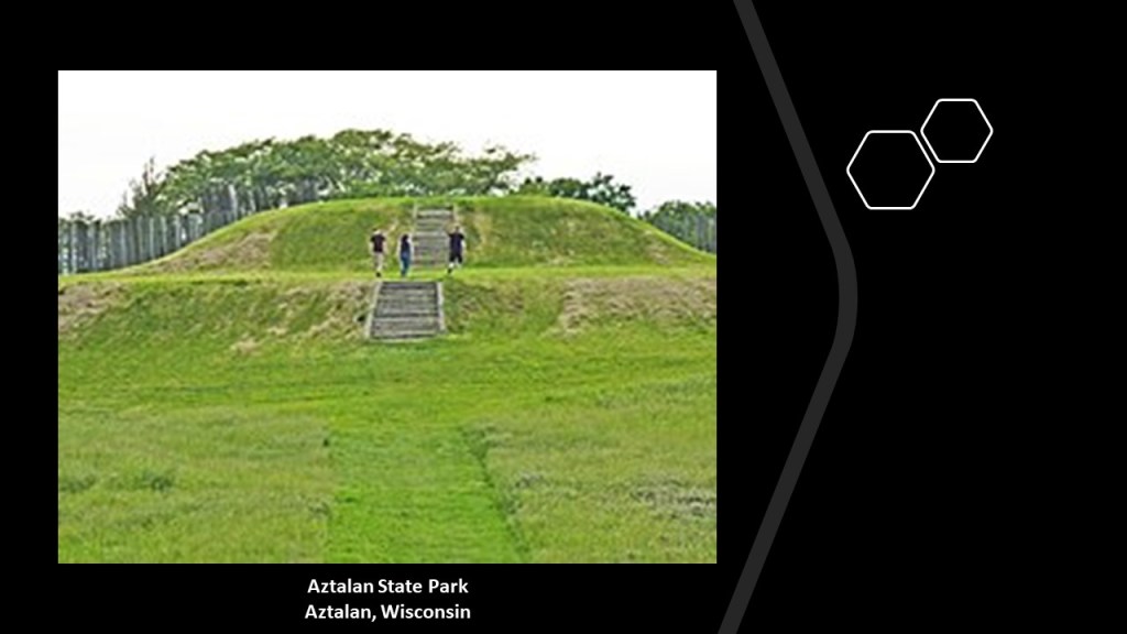
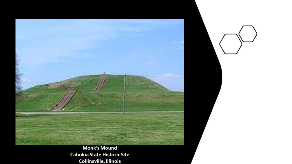
…which is very similar in appearance to Monk’s Mound at Cahokia State Historic Site in Collinsville, Illinois, which was considered to be a chief center of the Middle Mississippian culture.
Aztalan is near Lake Mills and Madison.

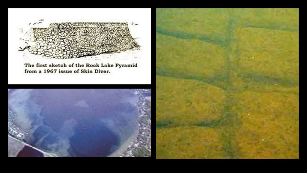
Lake Mills is the location of Rock Lake, described as a fishing hole east of Madison.
There is a legend there are ancient pyramids at the bottom of Rock Lake, on land that was flooded in the 19th-century, and researchers have investigated for evidence, but critics claim the legend is nothing more than fable.
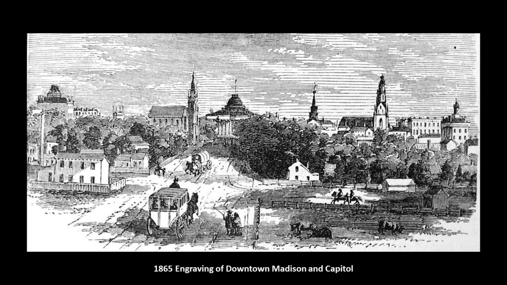
The nearby city of Madison is Wisconsin’s state capital.

Here is an engraving of downtown Madison and the Capitol building attributed to the year of 1865, which would have been the year the Civil War ended.
There sure is a lot of classical-looking architecture in the background of this engraving!
Another viewer commented that Fort Bragg is on Peter’s Serpent Lei alignment as well.

Fort Bragg is home to the Army’s 18th Airborne Corps and the U. S. Army Special Operations Command, as well as the U. S. Army and Army Reserve Commands, and two airfields as well.
It is the largest military installation in the United States, and one of the largest military installations in the world.

JA made a reference to the research universities in North Carolina, which is a good place to bring in the region known as the “Research Triangle,” which is midway between, and east, of Pilot Mountain and Fort Bragg on this leyline.

The “Research Triangle” refers to a metropolitan area in North Carolina which is anchored by three-major research universities:
North Carolina State University in Raleigh; Duke University in Durham; and the University of North Carolina in Chapel Hill; with the Research Triangle Headquarters centrally-located, which is where numerous tech companies and enterprises are located near the research facilities of these Universities.
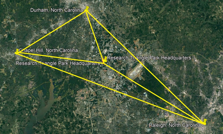
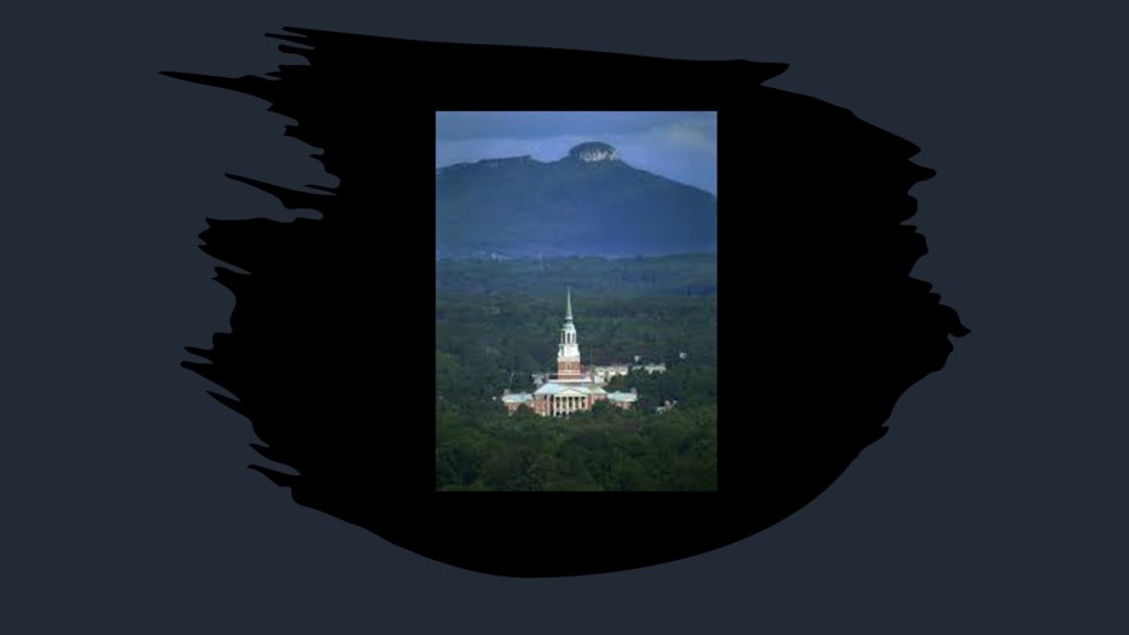
It is interesting to note that Wake Forest University in Winston-Salem is more directly on the alignment than the three major research universities…

…and better known for the sports’ championships of its “Demon Deacons” Teams, winning National Championships in five different sports…

…and in this photo of the Wake Forest Campus, you can see Pilot Mountain, also on this alignment, in the background.

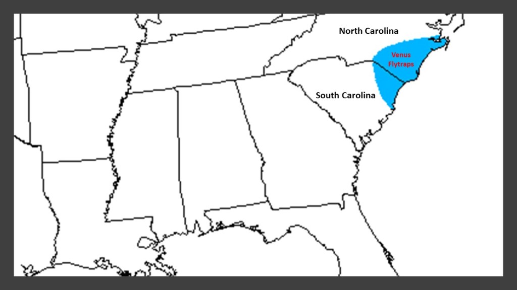
JA also left a comment connecting Venus Flytraps and Wilmington, North Carolina, saying that the Venus Flytrap is Native to Wilmington.
And sure enough, the only place in the world the carnivorous Venus Flytrap is native to is a 90-mile, or 145 -kilometer, radius around Wilmington, North Carolina…

…and which includes part of South Carolina in its radius as well.
JA said supposedly asteroids hit in the specific area where Venus Flytraps are native.
So my reply to JA was that the first thing that came to my mind was the “Little Shop of Horrors.”
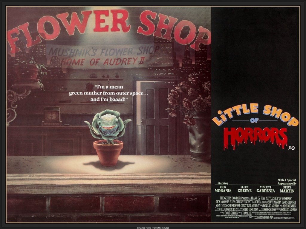
Apparently the carnivorous Venus Flytrap occupies a special niche in the horror genre, no matter where it came from!

With regards to what I mentioned about the band “The KLF,” known prior as “The Justified Ancients of Mu Mu,” I got quite a bit of feedback. Here are some examples:
Joe P. said that KLF burned £1 million on August 23rd of 1994, on the Isle of Jura, in the early hours of the morning.

BH said they were silent from that time until August 23rd of 2017, 23-years to the day after they burned the million pounds, when they returned as JAM, launched a novel called “2023: A Trilogy,” and staged a three-day event called “Welcome to the Dark Ages.”

The JAMS were also known as the Timelords.
On a similar note, a comment from another viewer, LL, said that it was very interesting what Bill Drummond, a founding member of JAMS, said about Mathew Street in Liverpool.
The commenter related that Bill Drummond said it was on the interstellar ley line, which comes careening in from outer space, hits the Earth in Iceland, bounces back up, writhing about like a conger eel, then down Mathew Street in Liverpool, where the Cavern Club is, and from there it goes back up, twisting, turning, and wriggling across the face of the earth until it reaches the uncharted mountains of New Guinea, where it shoots back into Deep Space, and that this interstellar ley line is a mega-powered one, with too much power coming down it for it not to writhe about, and that the only three-fixed points on earth it travels through are Iceland, Mathew Street in Liverpool and New Guinea. Wherever something creatively or spiritually-mega happens anywhere else on earth, it is because this interstellar ley line is momentarily powering through the territory.
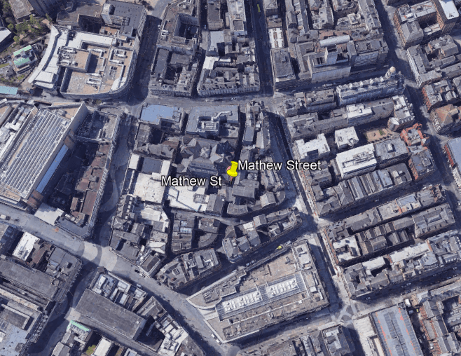
The world-famous Cavern Club on Mathew Street is where the Beatles got their start in 1961, becoming the center of Liverpool’s rock and roll scene in the 1960s.

The Beatles are regarded as the most influential band of all time, and were integral to the development of the counterculture of the 1960s, and pop music’s recognition as an art form.

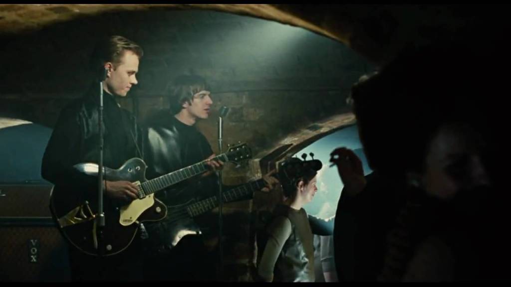
In light of Bill Drummond’s belief that a powerful interstellar leyline travels down Mathew Street, it is interesting to note that a similar-looking club was featured in the opening sequence of the 2007 musical romantic drama movie “Across the Universe…”

…in homage to the Beatles’ beginnings, where the filming for the scene actually took place at the Cavern Club.
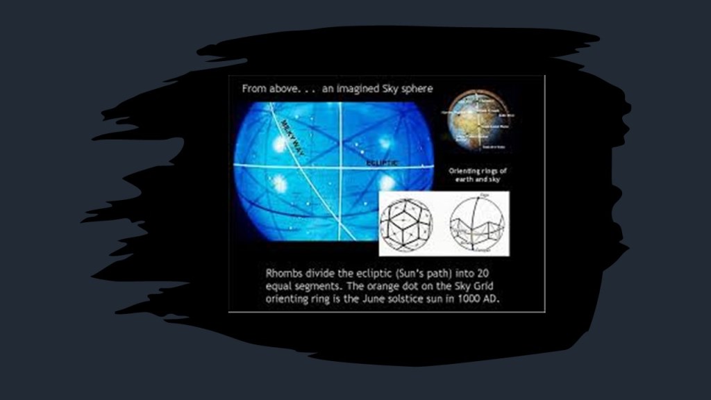
In my journey of learning about the earth grid and leylines over the years, I encountered the work of Bethe Hagens, in a presentation she gave at the 2011 Megalithomania Conference in Glastonbury, Connecticut.

In this fascinating lecture that I encountered very early in my journey down this road, Bethe talks about not only earth grids, but celestial grids as well.
We have literally been kept in the dark about so many things.
This is just the tip of the iceberg.
And what are leylines?
Leylines are energy lines of places in alignment with each other composed of natural energies that link and connect distant places and sacred sites, which many believe in a way that is metaphysical, as well as physical.

I really think the Earth’s Controllers, of the last couple of hundred years, have reverse-engineered the Earth’s grids from a positive, life-enhancing system, into a control system to support their goals of power and control, and to lower our collective consciousness at the same time, to keep us in fear, and not in our higher states of consciousness of love, joy, and Unity!
It seems like whatever happens on the Earth’s grid-lines, for positive benefit or negative outcome, has an enhanced effect.

Now I will move on to comments about other places I have received.
Another viewer, MP, who grew up in North Wales near the Wirral Peninsula, remembers a place he went to as a child called “The Cup and Saucer” and said it was a diverted bit of the river.
It went along what looked like a stone-cut, or concrete canal about 6-feet in width, but long…
…and which ran into a round pool with a hole in the centre where the water dropped around 8-feet, or about 2.5-meters.
He said you could access a tunnel to get underneath and he used to play in there with other kids, then run a few miles to a water mill, then go back the the river.

It belongs to the National Trust Site of Erddig, in Wrexham in North Wales, and Erddig Hall is considered one of Great Britain’s finest stately homes.

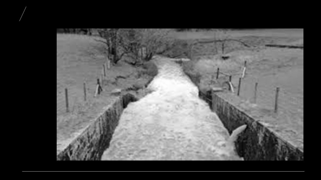
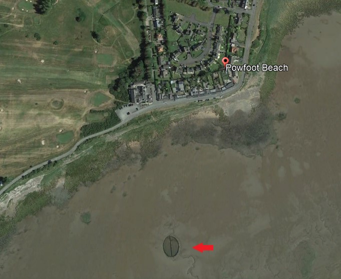
A different commenter asked me look at the tidal pool at Powfoot Beach in Scotland.
Powfoot Beach is a stretch of coastline along the Solway Firth consisting of mud flats and a salt marsh.

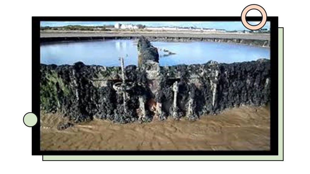
The Powfoot Beach pool is described as an “old Victorian tidal pool,” where Scots could learn to swim, enjoy family days out, and relax in seawater pools “penned in by rocky boundaries.”
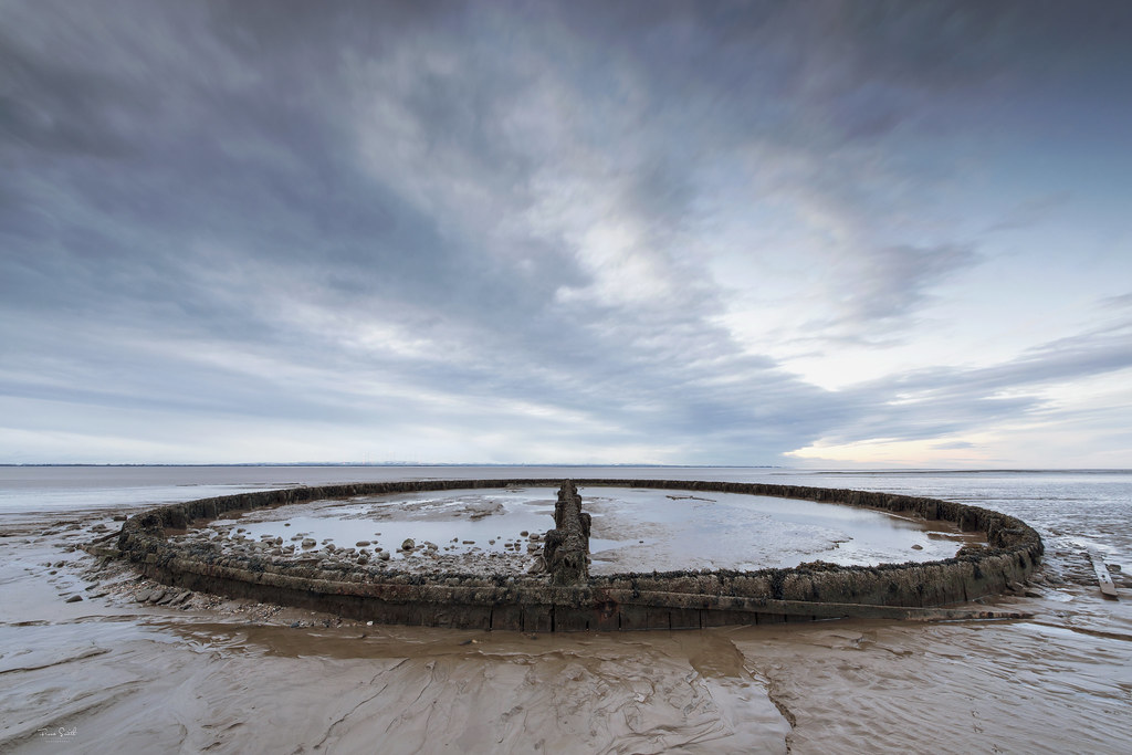
Problem is this idyllic beach scenario is complicated by the unpredictably bad Scottish weather, and sinking mud at low tide.
The Powfoot Beach tidal pool was said to have been built, from what I could find, in 1903, split in half to divide one side for men, and the other side for women.
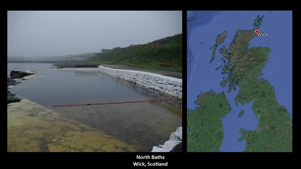
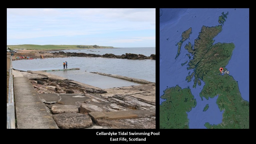
Other “Victorian- and Edwardian-era tidal swimming pools” on the coast of Scotland include:
The North Baths in Wick, Scotland…
…and in the vicinity of Fife, the Cellardyke tidal swimming pool in East Fife, Scotland…
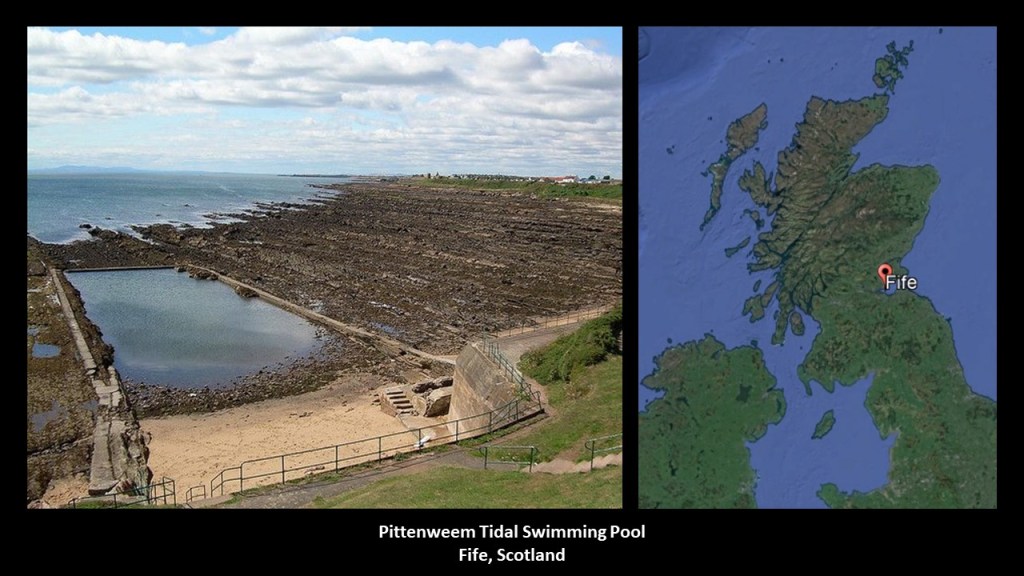
…the Pittenweem Tidal Swimming Pool in Fife…
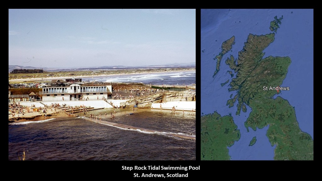
…and the Step Rock Tidal Swimming Pool in St. Andrews, near Fife, to name a few.
Another viewer suggested that I look into the Infomart Building in Dallas, Texas.
The Infomart is the one of the largest buildings in Dallas, and is the world’s first, and only, information processing marketing center.
It is home to more than 110 technology and communications companies.

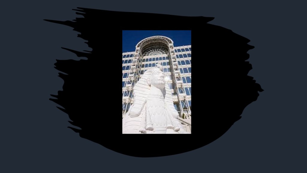
It opened in 1985, and was developed by Trammell Crow, with the design based on the 1851 Crystal Palace in London.
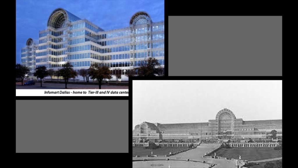
The Infomart building itself has hospital-grade electrical power, which is supplied by five-independent electrical feeds to three separate electric substations, resulting in a very reliable electric source that hasn’t ever experienced a 100% outage.

There is a miniature Sphinx statue in front of the Infomart…
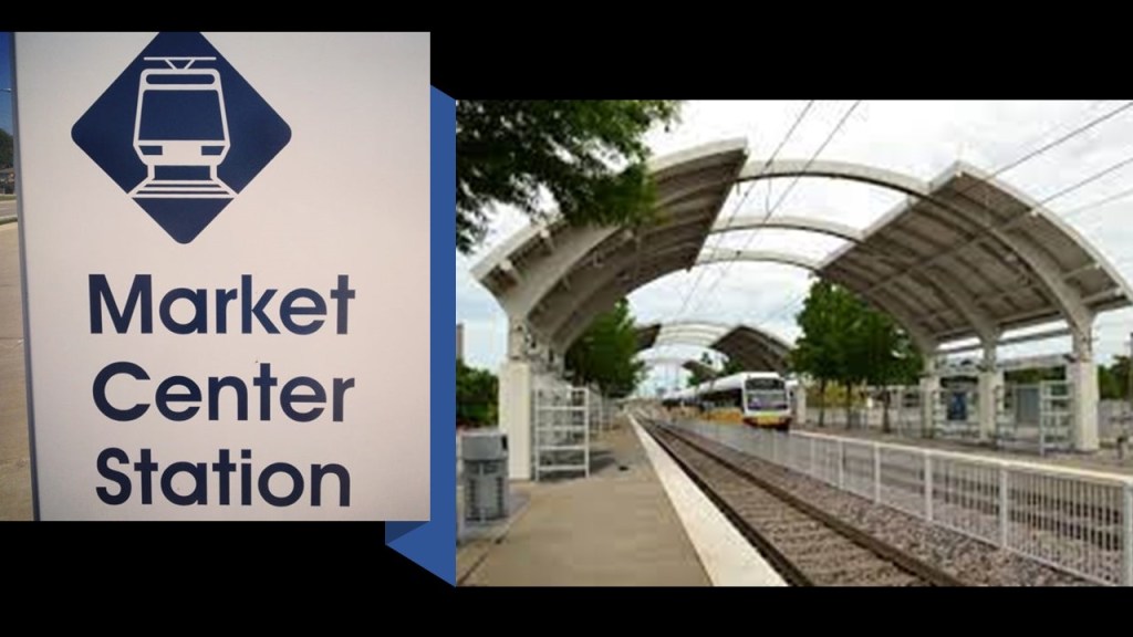
…and it is served by the Dallas Area Rapid Transit (DART) System’s “Market Center Station,” so there is a light-rail presence nearby as well.
Trammell Crow developed the Dallas Market Center as well, a 5-million-square-foot, or 460,000-meters-squared, wholesale trade center, that is closed to the general public, with showrooms for all manner of consumer products.
It is the most complete wholesale trade resource in the world.

At the time known as the Dallas Trade Mart, it was the destination of President John F. Kennedy’s motorcade when he was assassinated in Dallas’ Dealey Plaza, on November 22nd, of 1963.

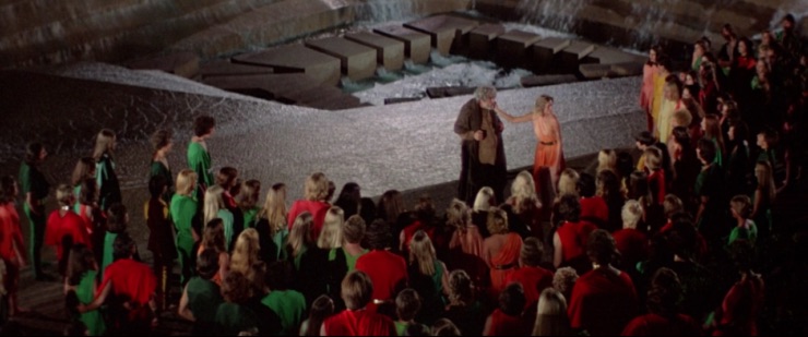
It is also interesting to note that some scenes from the 1976 film “Logan’s Run” were filmed in the Dallas Market Center’s Apparel Mart.

This caught my attention because I remember this movie well.
I would have been 13 in 1976 when the movie came out, and saw it at the theater with a same-age friend.
It was one of those movies where we both left the theater asking “What did we just watch?”
The basic plot is about a pleasure-filled world…

…where its inhabitants live their entire lives inside a sealed city of geodesic domes, with every pleasure imaginable available.
That is, at least, until you reach the age of 30, at which time you are required to undergo a group ritual called “Carousel” that ended in your death.
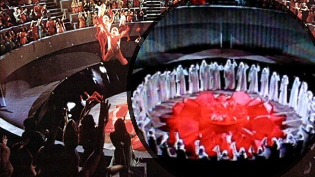
Those who chose to “run” to freedom, which was outside of the sealed, domed, world, and not go through the ritual, were immediately targeted to be terminated by what were known as “Sandmen.”
Logan’s Run was about a Sandman who chose to run, who eventually made it to the world outside the domes with another runner…

…and the end of the movie culminated with the destruction of the sealed city and escape of its citizens, who see the “old man” and realize they can live much longer than 30.
I saw “Logan’s Run” 45-years-ago.
Just interesting the kind of dystopian subject matter about our future that Hollywood has been filling our brains with for quite awhile now.
And is Dallas situated on a leyline?
I do know of one big ley-line that the Dallas – Fort Worth area is situated near, on my own finding of the North American Star Tetrahedron, which I found back in 2016, when I noticed major cities lining up in lines in North America, and which the original research I have done is based on.
At any rate, there is certainly a lot that has gone on in Dallas over the years!

I received a comment from SC, who said:
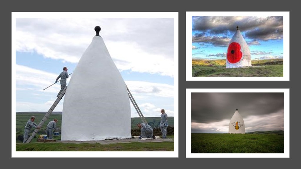
“My mum used to live in the valley below a “folly” called ‘White Nancy’ in Cheshire NW England.”
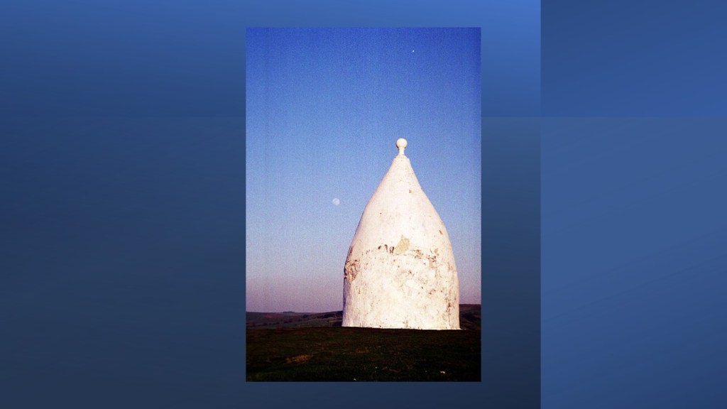
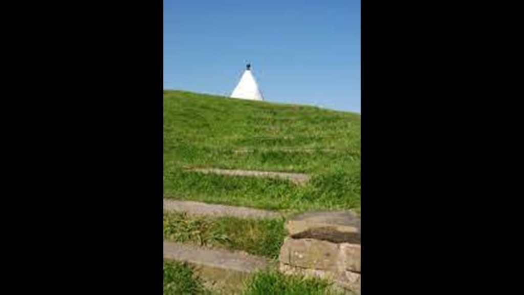
“It’s bizarre and looks like the top of a building and is on top of a weird grass sloped hill.”

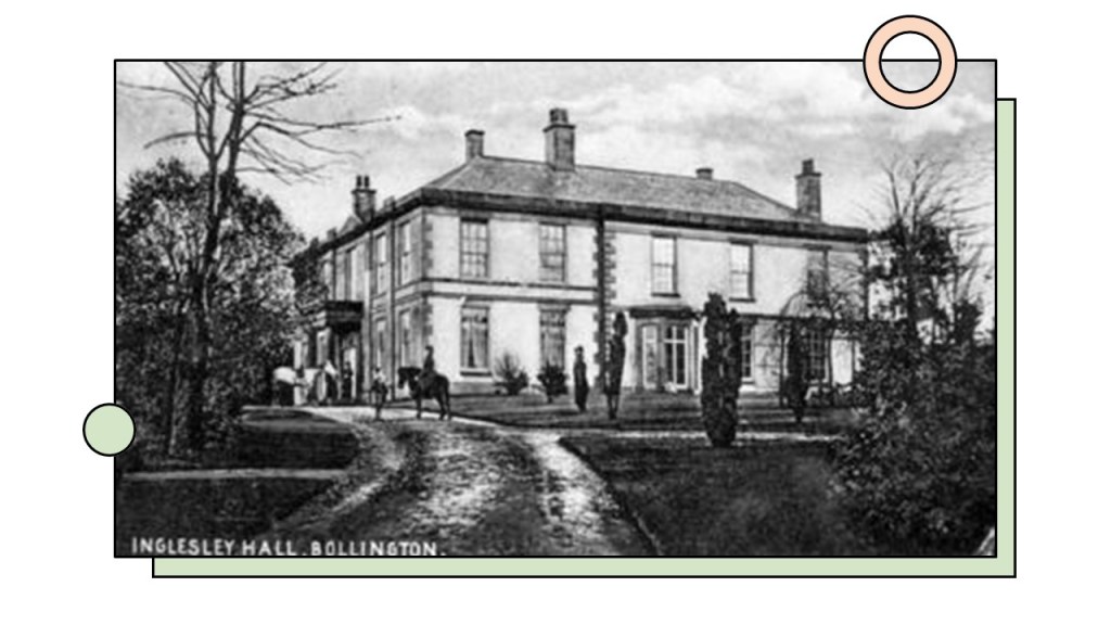
“The narrative is it was built by a family who owned a nearby Hall (Ingersley)…”
“…to commemorate the Battle of Waterloo.”

“I’ve walked up to it as an adult. it’s a a bit steep and knowing what I do now I definitely think there is more there than meets the eye.”
“My dad as a kid told me about follys & white Nancy etc. as there were so many about & explained it as “people do strange things“ which didn’t make much sense even as an 8 year old.”
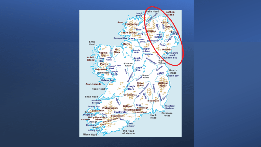
Another viewer asked that I look into Antrim Lough.
The Antrim Lough Shore Park is located in Antrim…
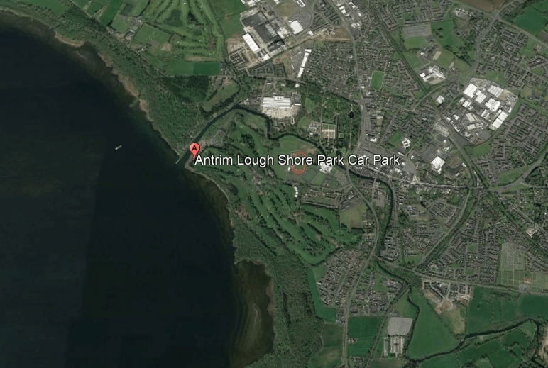
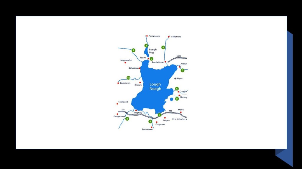
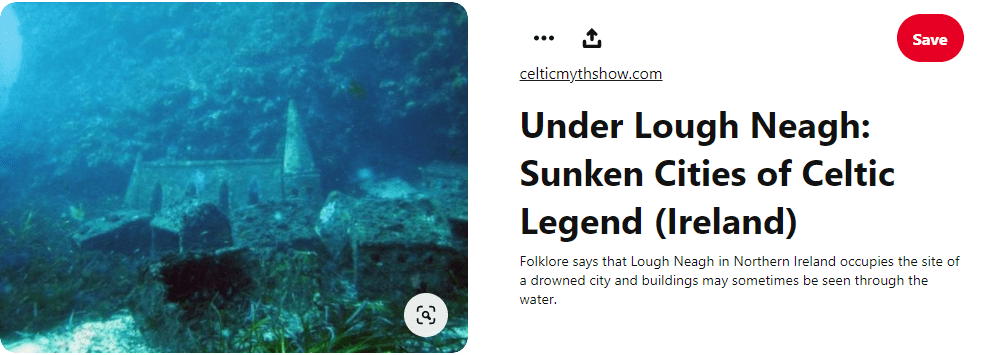
…on the shore of Lough Neagh, a large, freshwater lake in Northern Ireland, and the largest lake by area in the British Isles.
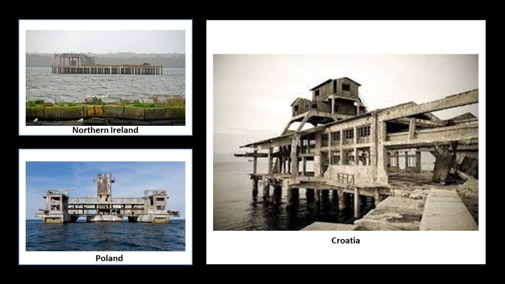
The remains of what was called the Lough Neagh Torpedo Test Platform are in the Lake, where the best view is from the Antrim Lough Shore Park.
This is where Mk Torpedoes were tested during World War II, which has been a nesting site for migratory birds, like cormorants and terns, since then.
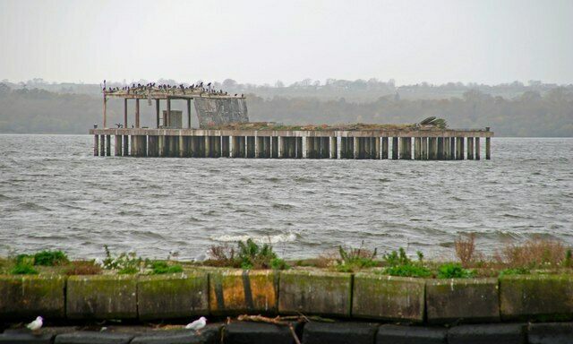
There used to be a torpedo factory on Randlestown Road in Antrim.

Apparently these “torpedo test facilities” were a thing for both sides during World War II, as there is another abandoned and derelict one that the Germans used for their torpedo tests that stands just off the coast of Poland in the Bay of Puck.
Known locally as “Torpedownia…”
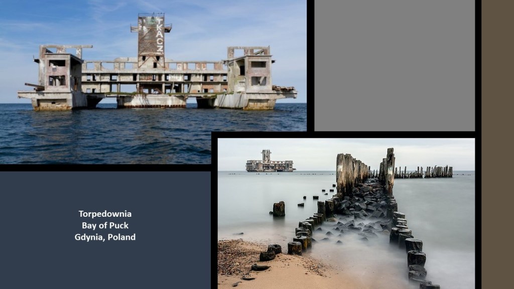
…the Germans fired their “test torpedoes” at Jastarnia and Jurata on the Polish Hel Peninsula between 1942 and 1945.
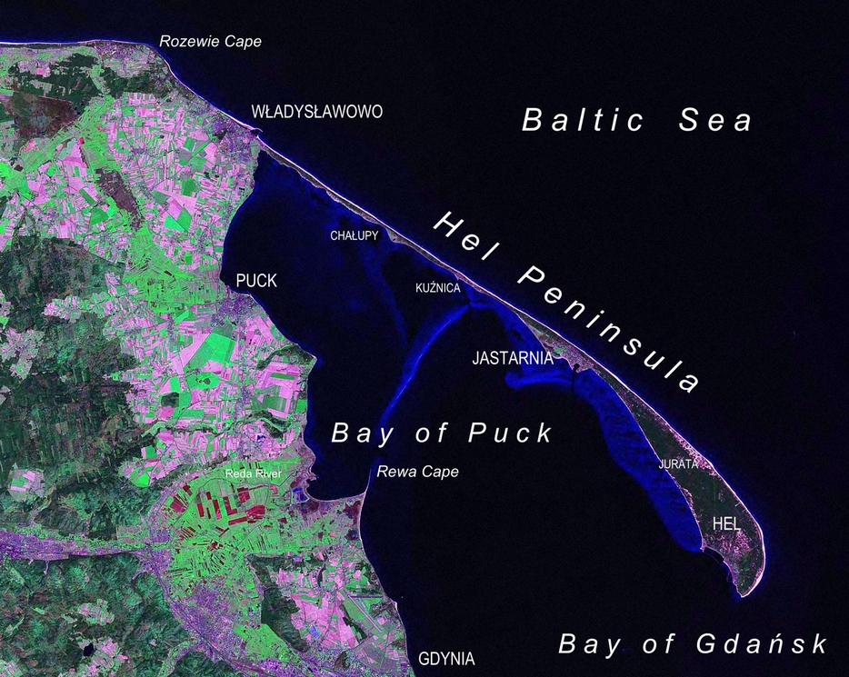
The Polish Hel Peninsula is a popular tourist destination in the present-day, with a road and railroad, and one-busline, number 666, running along the peninsula from the mainland to to the town of Hel at the furthest point.

Boy-oh-boy, LOTS of rabbit-holes to go down around here!
Not going there now, but look up the World War II “Battle of Hel” in 1939 if you would like to learn more about this place of interest.

There is one more torpedo test site to look at in Europe before I head back to Antrim Lough.
There is yet another abandoned torpedo launch factory in Rijeka, Croatia.
And this one was the location of the world’s first torpedo factory, where the first torpedoes were assembled and tested back in the 1860s, allowing Rijeka to become a major spot for torpedo manufacture and testing for 100-years, with the factory closing in 1966, and…then…left to rot.
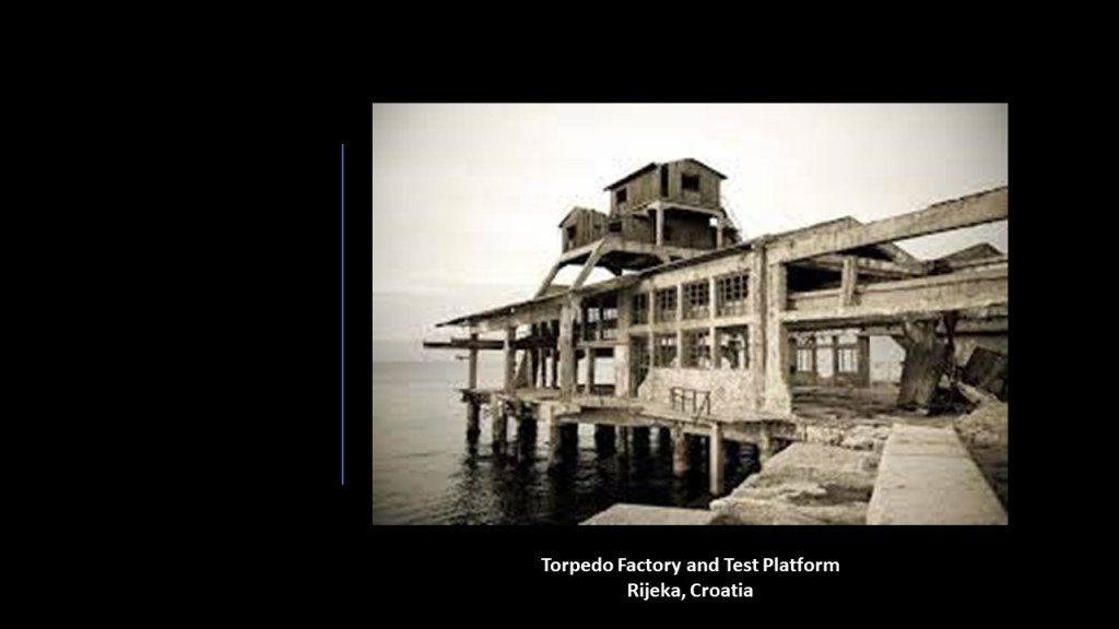
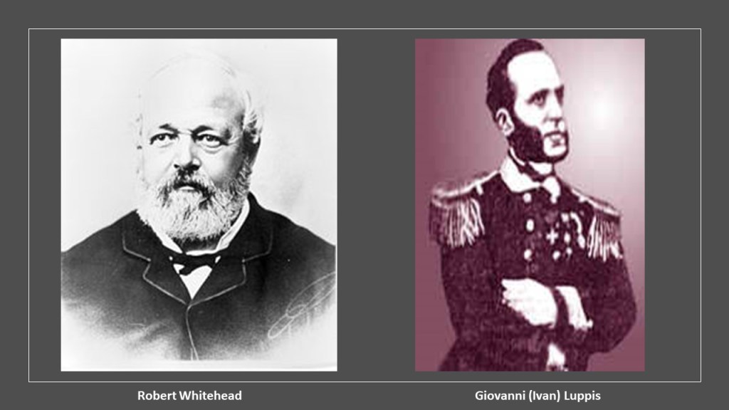
This is where Robert Whitehead, an English engineer, developed the first effective, self-propelled, naval torpedo, based on the prototypes of Giovanni Luppis (Ivan Lupis), an Austro-Hungarian naval officer who was born in Rijeka.
I really wonder if these three “torpedo test” platforms in very different places were re-purposed from their unknown original use, and all abandoned to the same fate, still standing but rotting in place.
The Antrim Lough Shore Park is located around the mouth of, and along, what is called the Sixmilewater River…

…with its shaped- and canal-looking appearance on the top-left, like what I found in Venice, Florida, on the top right; the Grand Lucayan Waterway on Grand Bahama Island on the bottom left; and at Port Mansfield on the bottom right, on the Gulf of Mexico in South Texas.

The Antrim Castle, also known as the Massareene Castle after the Anglo-Irish nobility, the Clotworthys, said to have built it and live there, was located on the banks of the Sixmilewater River, said to have been built first in the 1600s, and rebuilt in 1831, with the design by Dublin architect John Bowden.
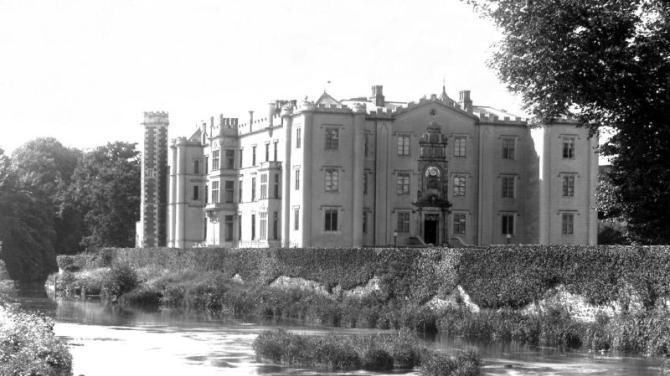
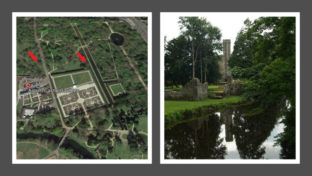
Alas, it was destroyed by fire that took place during a grand ball in 1922, and the burnt-out structure demolished in 1970, and all that remains of it is the “Italianate Tower,” said to have been built in 1887, and part of the ruins that can be seen in the Antrim Castle Gardens today…

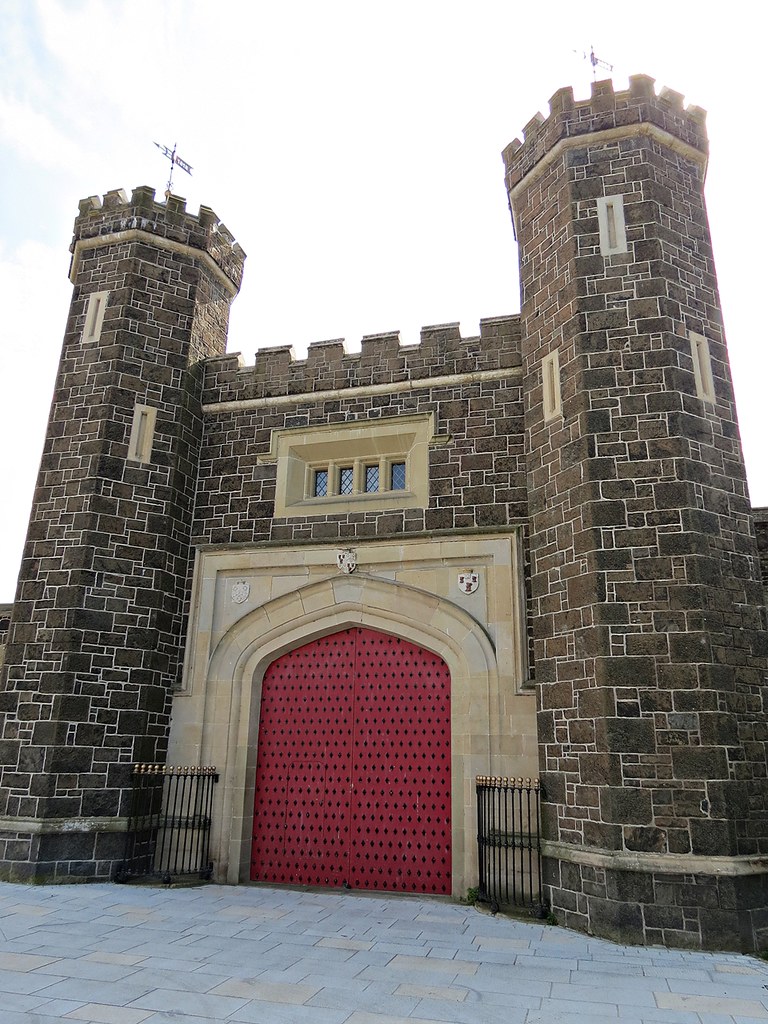
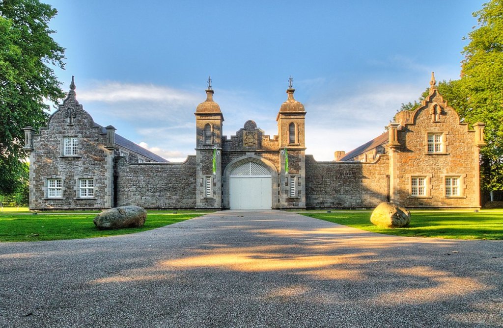
…along with the Barbican Gatehouse of the Antrim Castle, said to have been built in 1818.
It is interesting to note, that within the Antrim Castle Gardens, you can find canals…
…and Clotworthy House, a stable block and coach house said to have been built by the 10th-Viscount Massareene in 1843, with the creation of “Her Ladyship’s Pleasure Gardens.”
One more thing about Lough Neagh and this part of Northern Ireland before I look elsewhere.
The River Bann is one of the main inflows of Lough Neagh, winding its way from the southeast coast to the northwest coast of Northern Ireland, and we are told that the River Bann “pauses in the middle to widen into the enormous Lough Neagh.”
So, let’s see how big Lough Neagh widens between the Lower and the upper River Bann.
Again, keep in the mind this is the largest lake by area in the British Isles, with a surface area of 151-square-miles, or 392-square-kilometers.
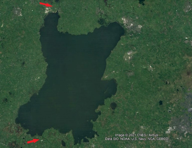
Lough Neagh also supplies 40% of Northern Ireland’s drinking water.

Now, I can’t speak from personal experience for this part of the world, but I have long believed that man-made lakes serve at least two purposes: 1) creating a water supply; and 2) covering up ancient infrastructure.
Where I do have personal experience is my own field research in the State of Oklahoma, where I first started waking up to all of this.
In Oklahoma alone, there are more than 200 lakes created by dams, which is the largest number in any state in the U. S.

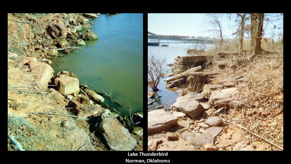
The first place I went to test my idea that man-made lakes covered up ancient infrastructure was Lake Thunderbird outside of Norman.
I knew what to look for, so was not surprised when I found it.
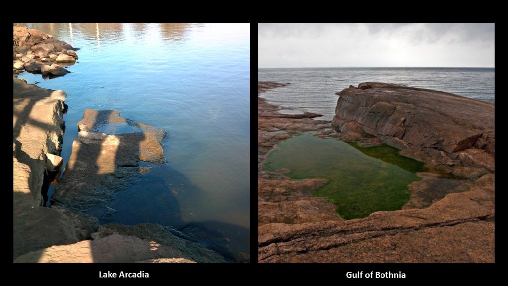
Same thing at Lake Arcadia, in Edmond Oklahoma.
Both of these lakes are located near Oklahoma City that I visited when I lived there.

And Lake Arcadia reminded me in appearance of what I saw in pictures of the Gulf of Bothnia, which is between Sweden and Norway, that I found on an alignment I was tracking.
There aren’t many examples saying this on the internet, but you can find the same idea regarding Lough Neagh if you look for it.
This is a great lead-in to the request of another commenter, DD.
He asked if I could into the cities buried under lakes in the United States such as Lake Lanier, in Georgia, and many many more?
Lake Lanier is a reservoir in northern Georgia…
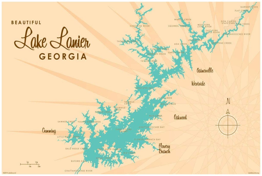
…and was created primarily by the Buford Dam on the Chattahoochee River, which was completed in 1956, and is maintained by the U. S. Army Corps of Engineers for flood control and water supplies.
Buford Dam also provides 250-million KWH of hydroelectric power to the area surrounding Atlanta every year.

We are told the land the lake now occupies was predominantly forest and farmland prior to its creation.
One landmark under the lake was the former Gainesville Speedway, also known as the Looper Speedway.
Sometimes the grandstands of the speedway are visible in Laurel Park when the waters are low.

So, what else might the lake-waters be covering?
Let’s take a look around and see what is there.
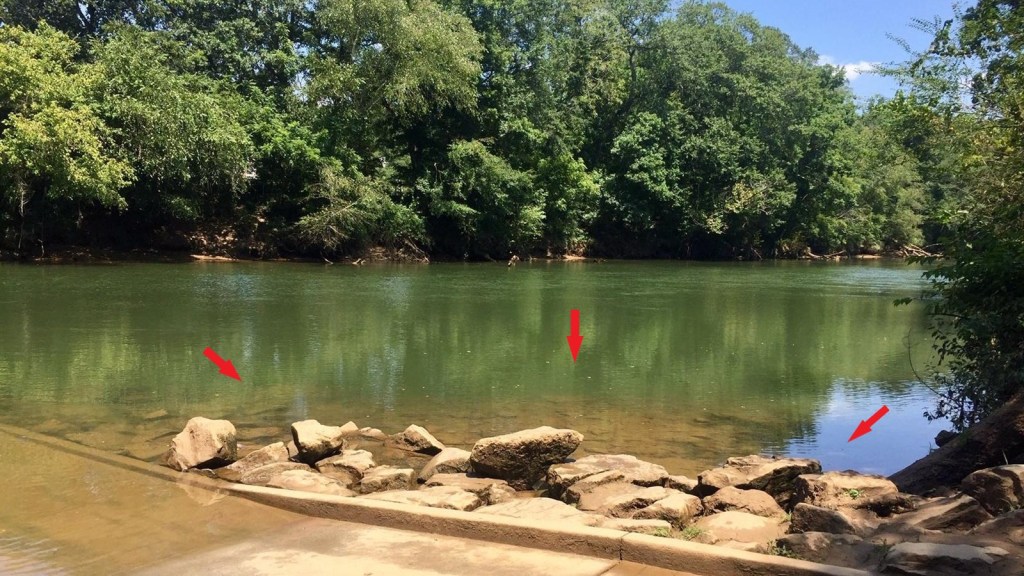
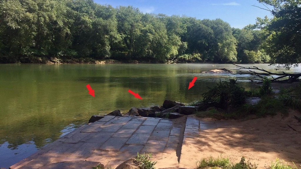
This is the Abbotts Bridge Boat, Canoe, and Raft Launch in the Chattahoochee River National Recreation Area.
Until we pay attention to them, we don’t even notice that the stones in the water are cut-and-shaped, with angles and straight-edges, and assume they are natural, and just “there.”
I didn’t start noticing them until about 2014 or 2015, and after I started noticing them, I started seeing them literally everywhere!
Here at the Settles Bridge Canoe and Raft Launch, there are more of the cut-and-shaped stones to the side, and some really nicely-made large-brick steps leading down to the water.
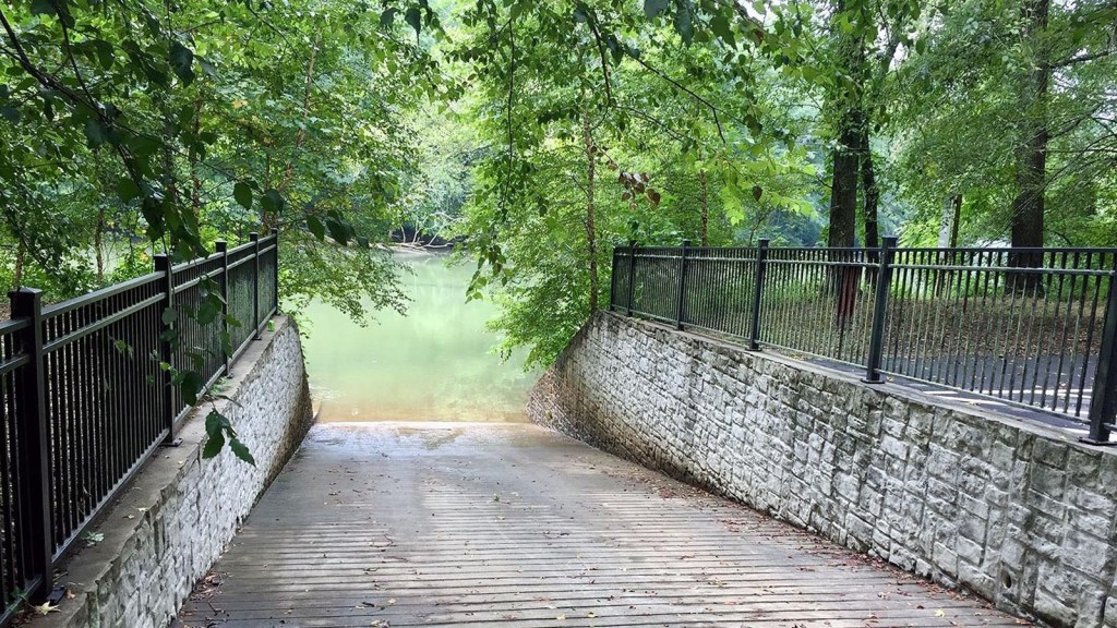
Then, there is the Jones Bridge Boat, Canal, and Raft Launch, with beautifully-made stonework and ironwork, that goes straight down into the Chattahoochee…
…and the Whitewater Creek Canoe and Raft Launch as well has some interesting stonework going on.

There are all kinds of parks dotted around the shores of Lake Lanier.
I am going to take a look at one of them – Sawnee Mountain Preserve.
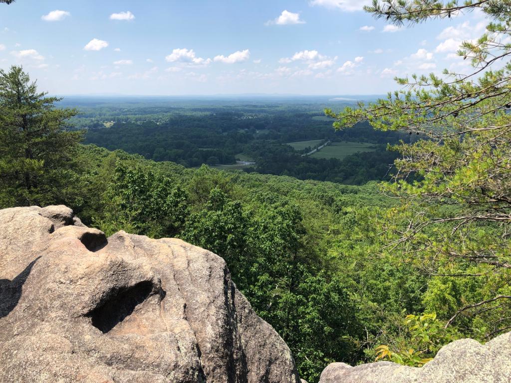
The Sawnee Mountain Preserve in Cummings, Georgia, is almost 1,000 acres, or 405-hectares, of hiking trails, and picnic areas…

…and other sites to see, including rock formations…
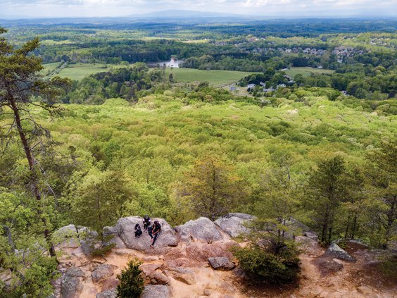
…with names like the “Indian Seats…”
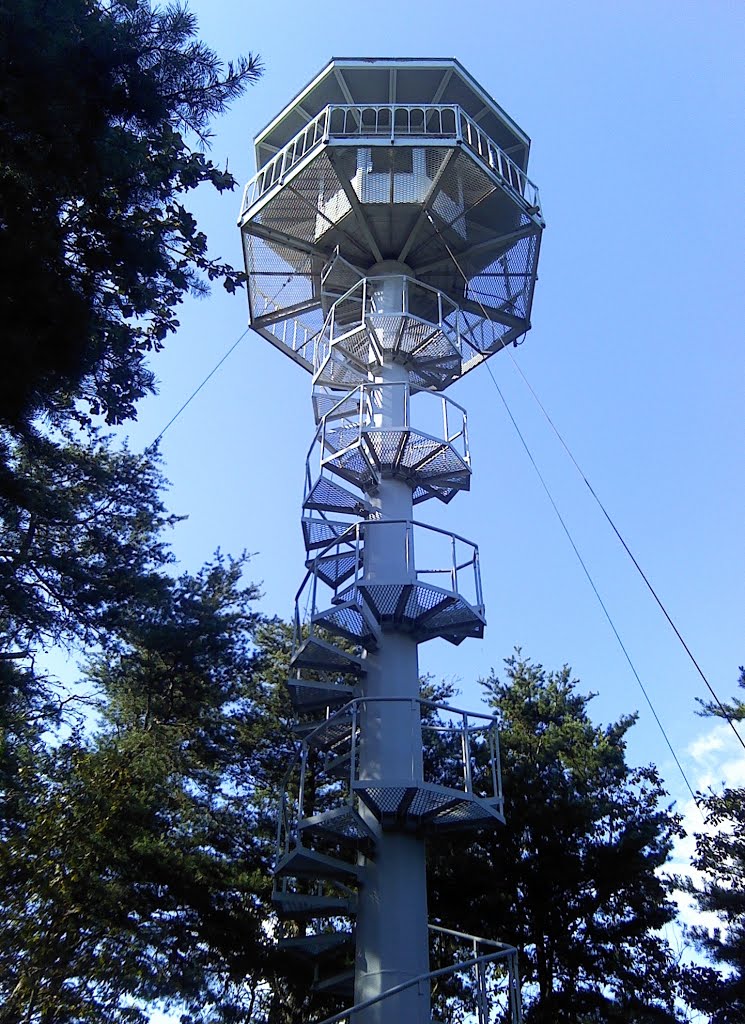
…and the old fire tower.
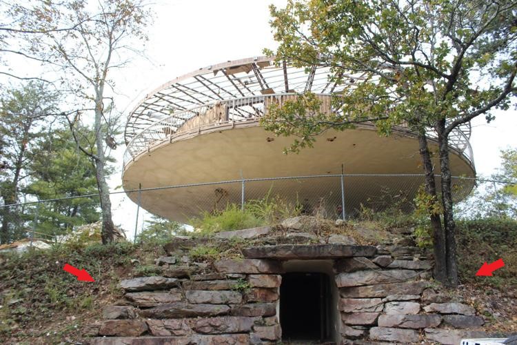
The remnant of the Barker House, a futuristic, UFO-shaped house said to have been built in the 1960s by architect Jim Barker for his family, was demolished in 2017.
It appears to have been built on top of a megalithic-stone entryway.
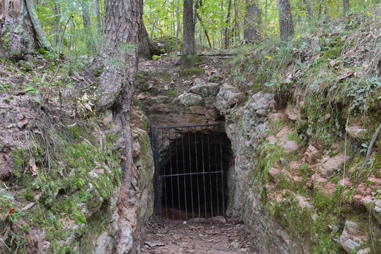
Abandoned gold mines like this one dot Sawnee Mountain.
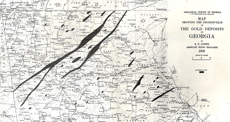
The Georgia Gold Rush was the second-significant gold rush in U. S. history, after the first North Carolina Gold Rush that started in 1799.

It started in the present-day Lumpkin County in the late 1820s, of which Lake Lanier is a small part, and quickly spread through the North Georgia Mountains, following the Georgia gold belt from eastern Alabama to northeast Georgia, which was said to have had close to 24-karat, or 100%, purity.
By the early 1840s, gold was becoming harder to find, and many Georgia miners…

…headed west when gold was found in California’s Sierra Nevada mountains, so the story goes.
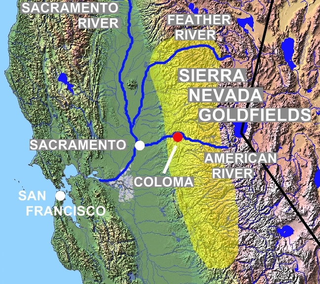
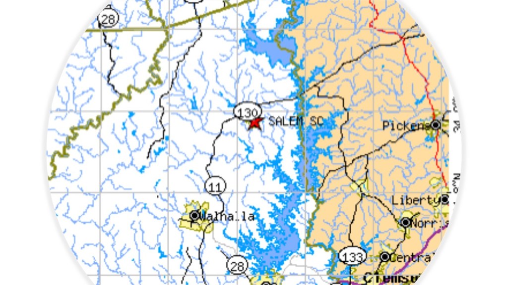
The hilly area in the northwestern corner of South Carolina, near the state’s border with North Carolina and Georgia, is known as the gateway to the Blue Ridge Mountains.
Lake Keowee and Keowee-Toxaway State Park is found here, east of Salem, South Carolina.
Lake Keowee is a man-made reservoir formed in 1971…
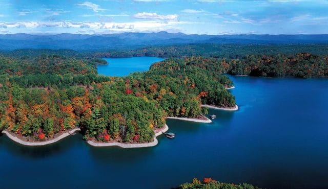
…that we are told was constructed for the needs of Duke Energy, which it uses for things like cooling three nuclear reactors at the Oconee Nuclear Generating Station…

…and for public recreational purposes.

The historic Cherokee Keowee Town had been located on the bank of the Keowee River and was part of what was known as the Lower Town Regions, all of which were inundated by the formation of Lake Keowee, its artifacts and history lost.

Keowee-Toxaway State Park on Lake Keowee was created from lands previously owned by Duke Power, all part of the historical lands of the Cherokee.

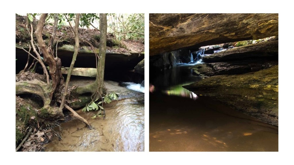
There is a feature called Natural Bridge in Keowee-Toxaway State Park.
Lake Jocassee is also a man-made lake northeast of Salem, South Carolina.

It was formed in 1973 in a partnership between the state and Duke Power, and also flooded areas where there was pre-existing infrastructure, like the Mt. Carmel Baptist Church Cemetery, which was the setting for a scene in the movie “Deliverance,” which had been filmed there in 1972, and the following year was covered by 130-feet, or 39-meters, of water.

This feature at Lake Jocassee is called “The Wall,” which is only accessible by boat.
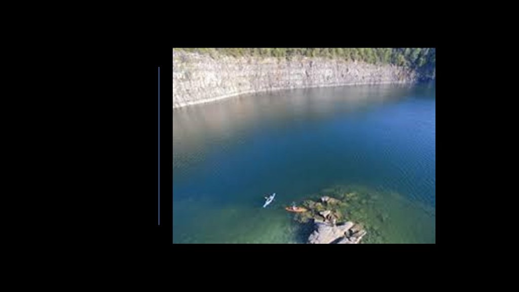
All of these lakes I have mentioned were part of the historical territory of the Cherokee.
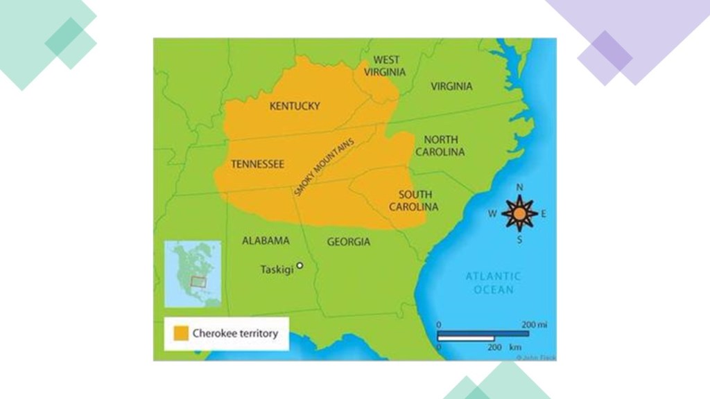
The Cherokee, one of the “Five Civilized Tribes…”

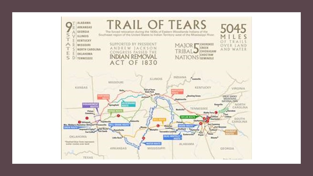
……were, along with the other four civilized tribes, forced to move west…
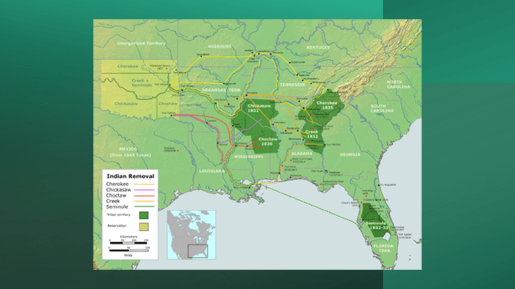
…in what were multiple “Trails of Tears.”
So the question begs to be asked ~ what was really going on here?
Perhaps something different than what we have been told?
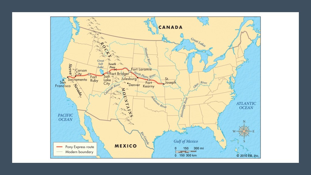
Next, TL and JM wanted me to look into the Pony Express.
The Pony Express was the first fast mail-line across the North American continent, between St. Joseph, Missouri, and Sacramento, California.
The Pony Express only operated for 18-months, from April of 1860 to October of 1861.
Its parent company was the Central Overland and Pike’s Peak Express Company, which was a stagecoach company that operated in the American West starting in 1859.

The owners of the parent stagecoach company, the freight business partners of Russell, Majors, and Waddell, were said to have spared no expense in obtaining and equipping new stations for the Pony Express.
The Pony Express Home Station in Marysville, Kansas, was the first station the riders came to after leaving St. Joseph, said to have been leased by its 1859 builder, Joseph Cottrell, to the Pony Express in 1860.

The mail service utilized relays of horse-mounted riders.
I came across this ad seeking Pony Express riders…interestingly worded!!
Wanted: Young, skinny, wiry fellows not over eighteen. Must be expert riders, willing to risk death daily. Orphans preferred!
Orphans preferred?

The headquarters of the Pony Express in St. Joseph were housed in the Patee House, built by John Patee, the construction of which we are told was completed in 1858, and was a 140-room, luxury hotel.
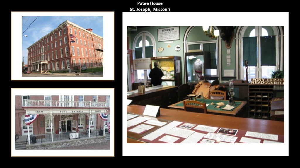
The Patee House was said to have been built as development around the Hannibal and St. Joseph Railroad, the first railroad to cross Missouri, and the construction of the railroad was said to have been started in 1851 and completed in 1859, and the railroad carried the first letter to the Pony Express on April 3rd of 1860.

In spite of all the money and effort spent on the Pony Express, between its operating expense, and the new transcontinental telegraph service, it ended on October 26th of 1861.
It did prove, we are told, that a year-round transcontinental communication system could be established and work.

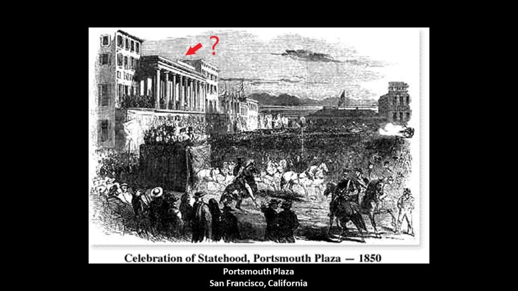
This was important with the need for mail and other communications to get west faster after the 1848 discovery of gold in California, since thousands of businessmen, investors, and prospectors went to live there…
…and, by 1850, California was admitted to the Union as a State.
I am going to end “Places & Topics Suggested by Viewers – Volume 3” here.
Lots more to come!