
This is fifth volume of what will be a long new series in which I am highlighting places, concepts, and historical events that people have suggested, and is a compilation of work I have previously done presented in a multi-volume format.
There are a few mentions of comments about things related to the last videos that I would like to make, however, before I head on to the next stop in Indiana.
I covered the suggestion of Kansas City, Missouri, and SN left an interesting factoid about it.
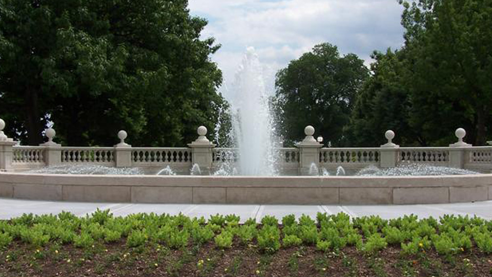
Kansas City is called the City of Fountains, and is reputed to have more fountains than Rome!
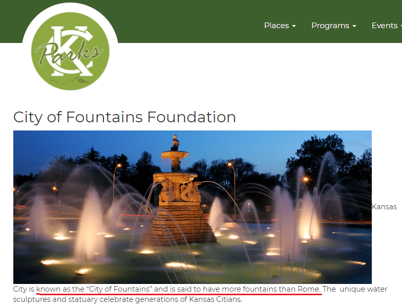
There are 200 officially-registered fountains in the Greater Kansas City Metro area.
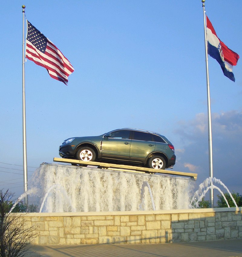
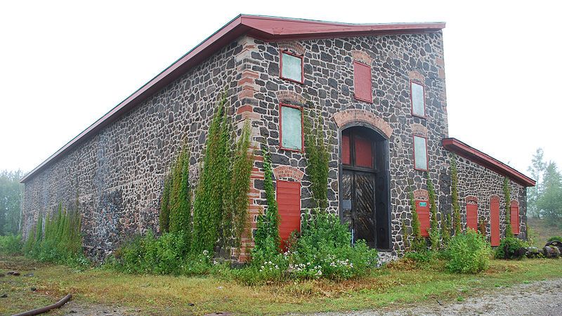
That number does not include fountains at corporation and sub-division entrances; office atriums; and private gardens and homes; or like this one at a Kansas City Auto Dealership.
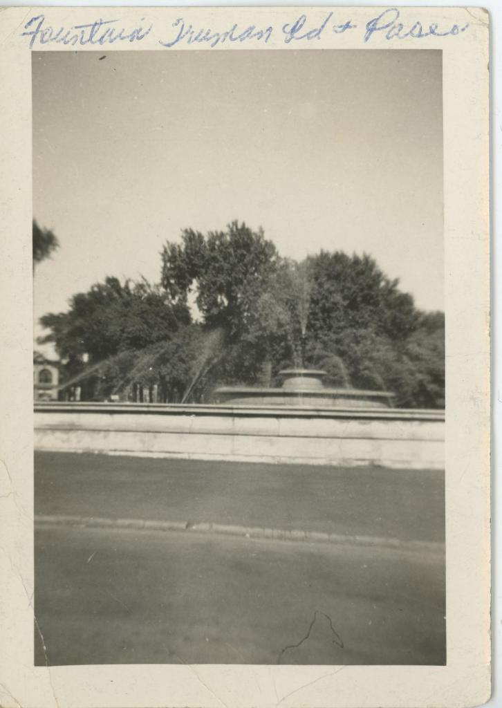
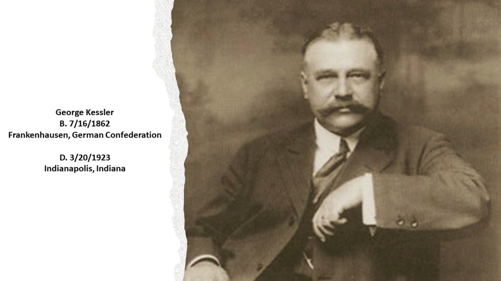
The first fountain built was said to have been designed by George Kessler and built in Kansas City in 1898 at 15th (now Truman Road) and the Paseo, though it was destroyed in 1941, with no reason given.
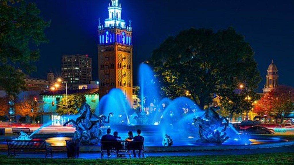
But, hold on, the second-fountain designed and built originally in Kansas City in 1899, by George Kessler, along with John Van Brunt, is still in operation today, and known as the “Women’s Leadership Fountain.”
George Kessler was a German-born American city-planner and landscape architect, and in the course of his 41-year-career, was said to have completed over 200 projects, and prepared plans for 26 communities; 26 park and boulevard systems; 49 parks; 46 estates and residences; and 26 schools, which can be found in 23 states; and 100 cities, including Shanghai, New York, and Mexico City.
Interesting to note that George Kessler was also mentioned as being a 32nd-degree Freemason.
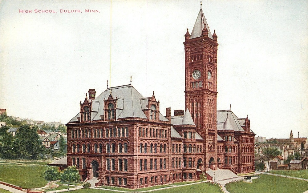
In the last video, I mentioned the Central High School in Duluth…
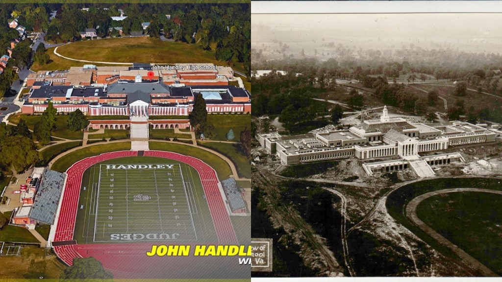
…and BM gave John Handley High School in Winchester, Virginia, as an example of ridiculous architecture for a high school.
He said that there is also a strange mound in the front, and there is a park in the back that reminded him of the mall in Washington, D. C.
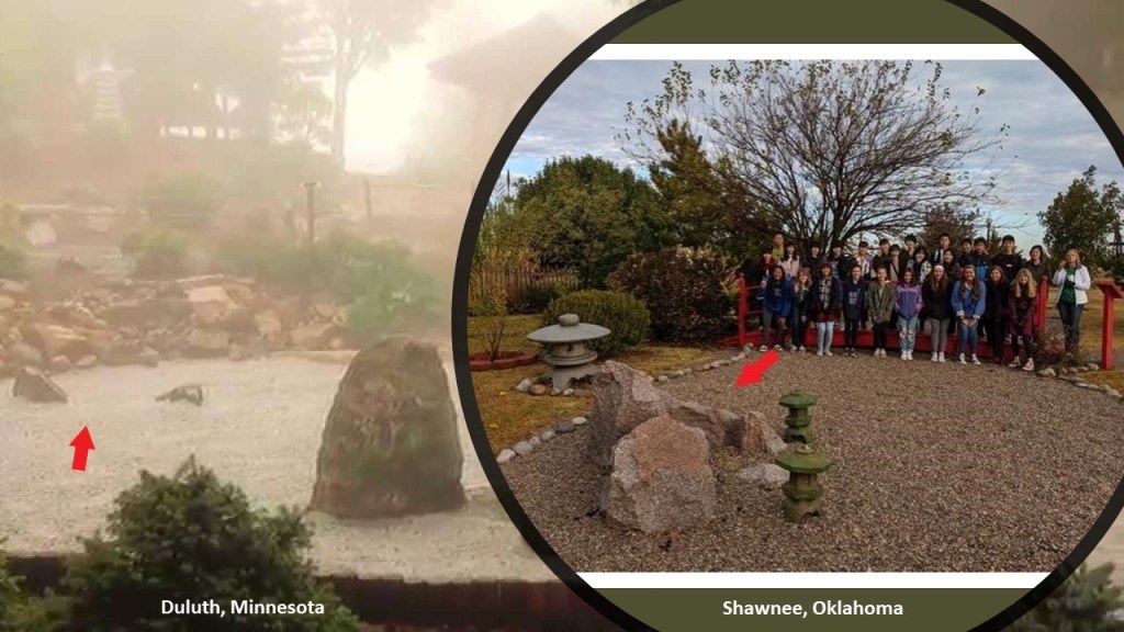
Also in the last video, I talked about the Japanese Peace Bell Garden in Duluth that someone had commented on, as well as the Japanese Sister City Peace Garden that I had first-hand knowledge of Shawnee, Oklahoma.
Places like these I have come to believe are yet another way to provide cover to hide the original ancient civilization right in front of our eyes.
Other sister cities that were mentioned by viewers included the Japanese Bell of Peace and Friendship on the Iowa State Capitol grounds in Des Moines, Iowa…
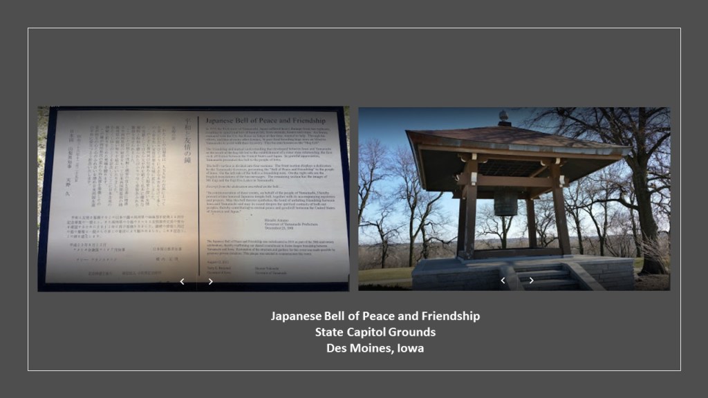
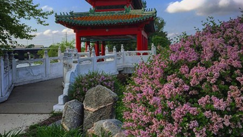
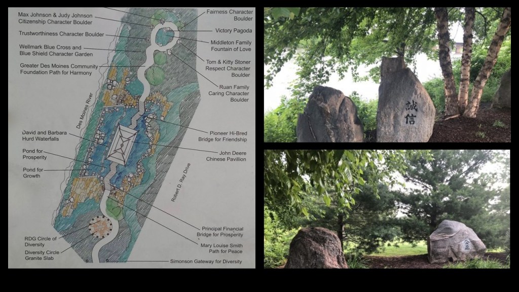
…though it was the Robert D. Ray Asian Gardens in Des Moines that featured the old megalithic stones I keep an eye out for.
As a matter of fact, they even have names here.
We typically know of them as “boulders.”
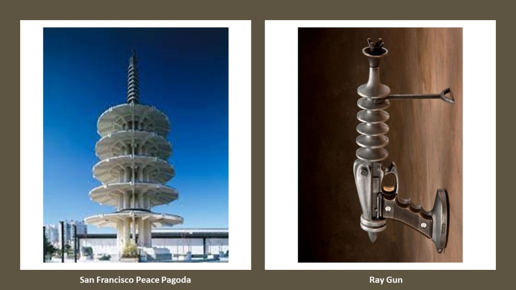
NH mentioned the San Francisco Peace Pagoda in Japantown, which immediately reminded me of a ray gun.
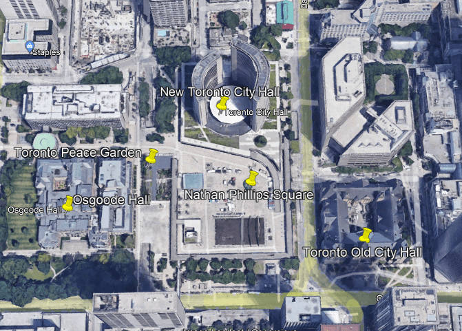
Several viewers mentioned the Peace Garden in Toronto.
I am grateful to LH for the time she took to go on a special trip for me to downtown Toronto to check out the Toronto Peace Garden at Nathan Phillips Square because neither she nor I could find out any information about the possibility of similar set-up at Ontario Place on Toronto’s waterfront.
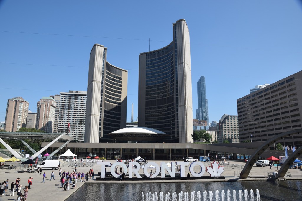
There is a back-story to the Toronto Peace Garden at Nathan Phillips Square, so the story about this one is a wee bit complicated.
Nathan Phillips Square is an urban plaza in Toronto, with the Old City Hall directly to the east of it…
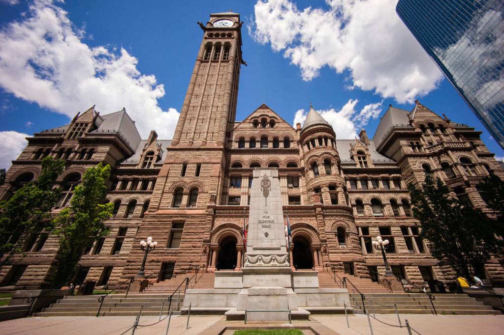
…the New City Hall on the north-side of Nathan Phillips Square…
…and Osgoode Hall just to the west of the square, which serves currently as an office building and court house.
It was said to have been built between 1829 and 1832 as a law school.
The Toronto Peace Garden today is situated in the northwest corner of Nathan Phillips Square.
The original Toronto Peace Garden was in front of the New City Hall between 1984 and 2010, at which time it was decommissioned, and moved to the west- side of Nathan Phillips Square during the massive revitalization of the entire square.
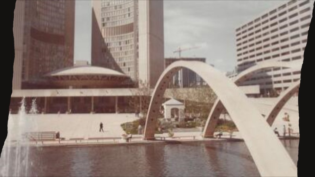
The new Toronto Peace Garden was re-dedicated on May 18th of 2016, six-years later.

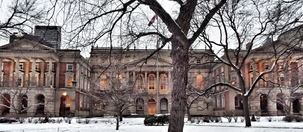
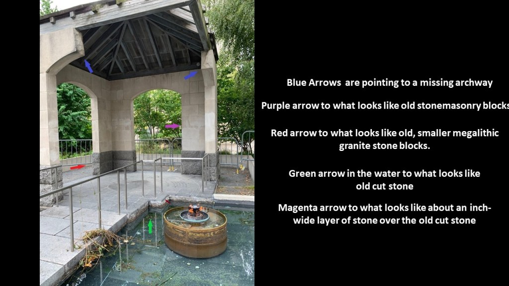
I studied the photo LH had taken of the stone structure at the Peace Garden.
Could this be the remnants of an old stone masonry structure?
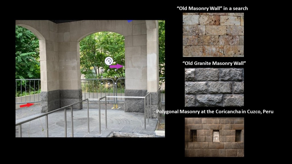
This stone structure looks like it has missing archways, pointed out by the blue arrows; old stonemasonry blocks, as shown by the purple arrow; and a red arrow is pointing to what looks like old, smaller megalithic granite stone blocks.
Then in the pool of water surrounding the predominantly stone structure appears to be cut rock as shown by the green arrow, and a small magenta arrow is pointing towards what looks like an inch-wide layer of stone tiles over the old cut stone.
To provide a comparison of the stonework seen in the Peace Garden structure, I searched for examples of an “old masonry wall;” “old granite masonry wall;” and “polygonal masonry.”
One more thing, when I was looking for a good photo of the New Toronto City Hall, I found this one of it being constructed…and the classical-looking “Registry of Deeds and Land Titles Building” sitting right next to next to it in what appears to be a busy excavation scene of some kind.
The old “Registry of Deeds and Land Titles Building” was demolished in 1964 to allow the New City Hall to be completed, and would have been in the general vicinity of the Toronto Peace Garden today.

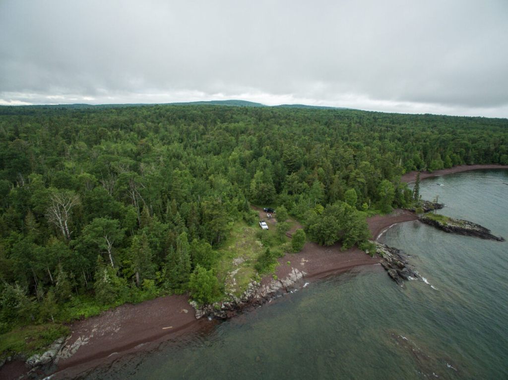
Lastly before I move on, there were some more points-of-interest that came from viewers about the Keweenaw Peninsula of Michigan.
DV shared a link and information about the Keweenaw Rocket Range.
We are told it was used by NASA between 164 to 1971 to send rockets into the atmosphere to collect information about electron density; solar x-rays; energetic electron precipitation; and other scientific measurements.
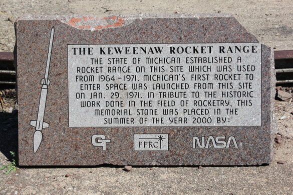
He said he was there last July, and that the odd thing is that getting there is difficult because the road is frequently a complete mess.
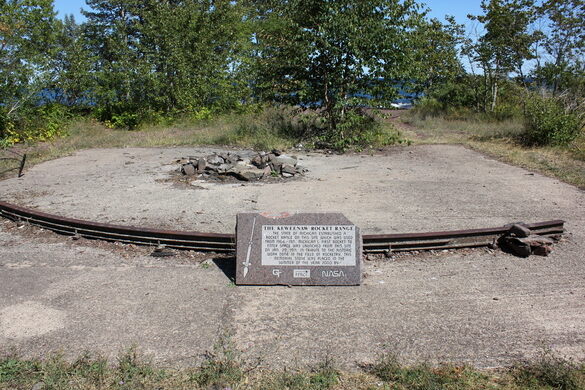
He indicated it is only 7-miles away from Copper Harbor, which is at the tip of the Keweenaw Peninsula, but takes an hour to get there because of the poor road condition.
Recently, viewer LH sent my a photo of a giant from the early 1900s who lived in Calumet, a city on the Keweenaw Peninsula.
He said that the giant was well-known and everyone loved him, and is spoken very highly of to this day.
LH said that his tall height has been attributed in the official narrative to a very rare birth defect that caused him to grow like that…
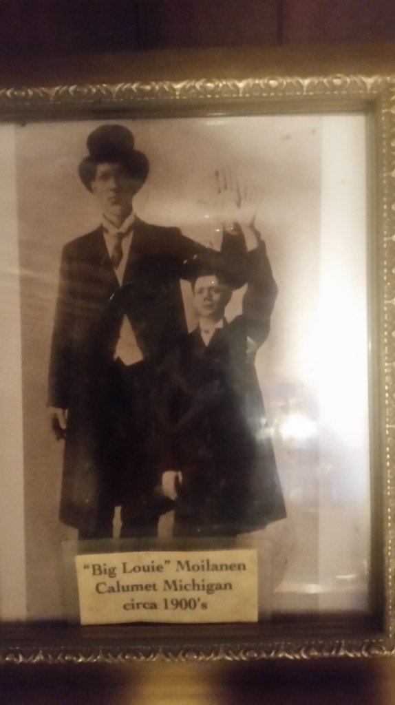
…and that he matches the size of the doors of most of the buildings in Calumet.
Now I am going to move along into new places and topics that have been suggested to me.
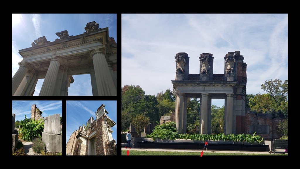
DK sent me photos of what are known as “The Ruins” in Holliday Park and the Ruins in Indianapolis, Indiana.
Starting this tour of Holliday Park at “The Ruins…”
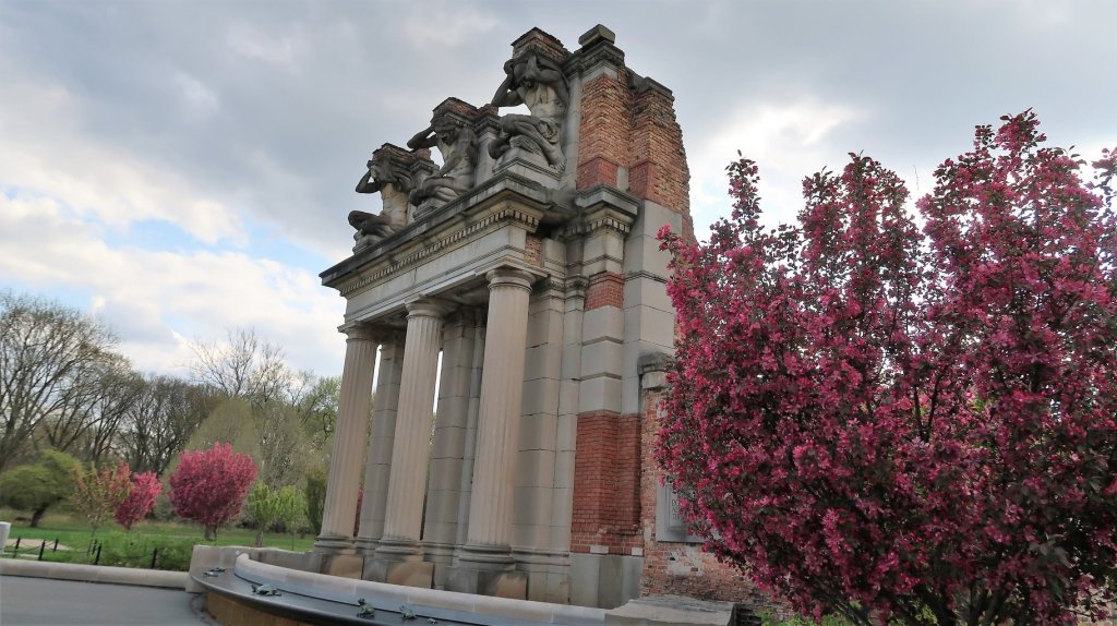
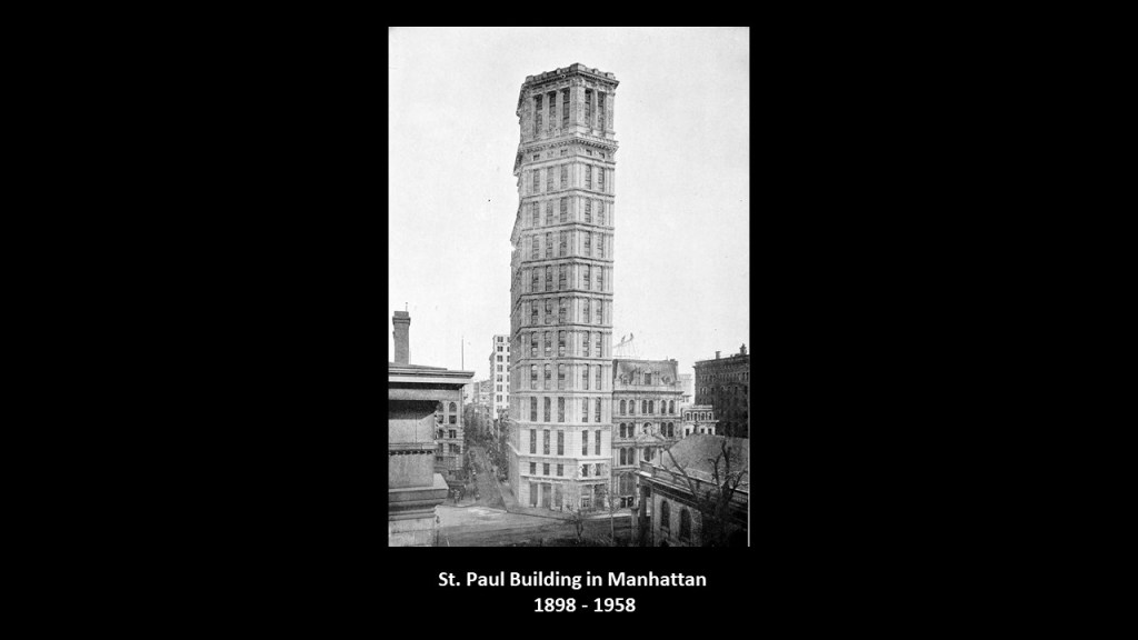
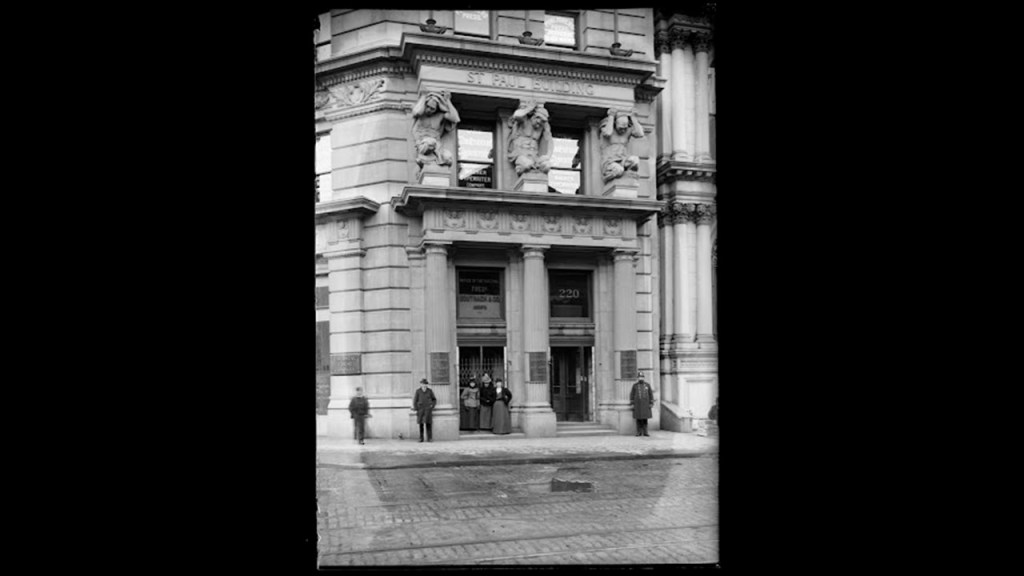
…they are described as the remains of the facade of a New York skyscraper, the St. Paul Building in Manhattan, the building of which was said to have been completed in 1898, and then one of the tallest skyscapers in New York was demolished only 60-years later in 1958.
The facade of the St. Paul building contained several sets of ionic-style colonnades, as well as a group of three sculptures known as “Atlantes,” the term given to an architectural supports sculpted in the form of people.
Hmmm. Atlantes…Atlantis? Atlantes…Atlanteans?
These marble statues known as “Atlantes” are at the portico entrance of the Hermitage Museum in St. Petersburg, Russia…
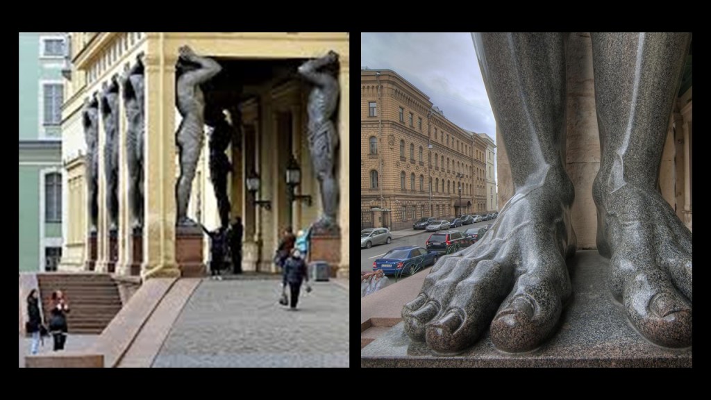
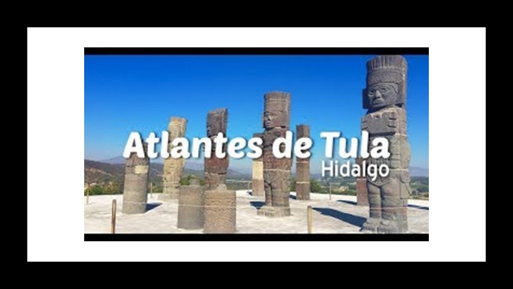
…and these statues are known as the “Atlantes of Tula” in Mexico.
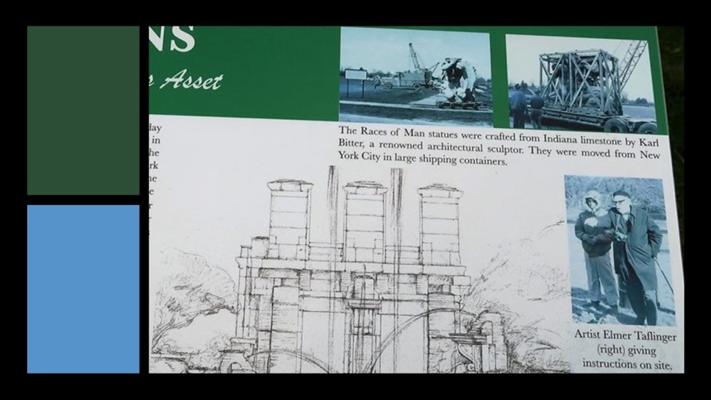
At any rate, the atlantes sculptures currently residing in Holliday Park were said to have been designed by Karl Bitter, an Austrian-born American sculptor known for his sculptures for architecture, memorials and residences.

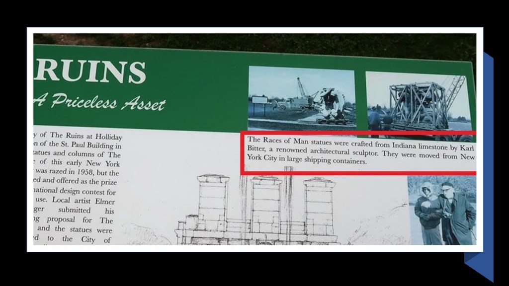
According to the sign about “The Ruins” at Holliday Park, the sculptures were originally crafted from Indiana limestone.
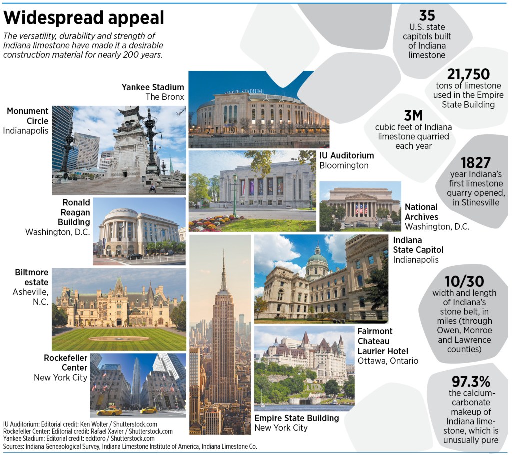
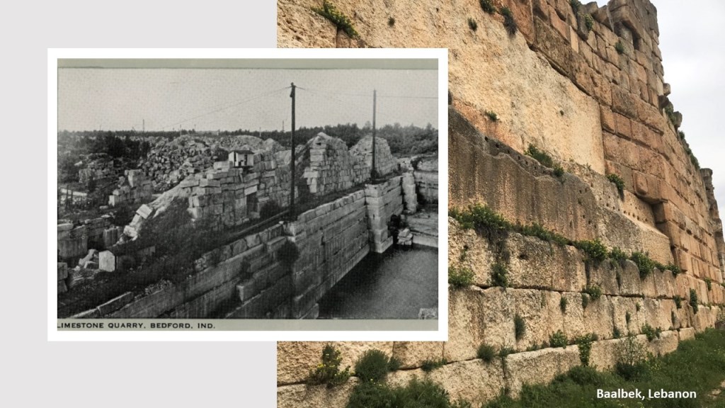
Indiana Limestone, also known as Bedford Limestone, comes from a geological formation primarily quarried in southcentral Indiana, between the cities of Bloomington and Bedford, and is considered to have the highest-quality quarried limestone in the United States, and used in the U. S. and Canada in the construction of prominent architecture.
In addition to this information about Indiana Limestone, I have an old photo on the left of one of the limestone quarries in Bedford, Indiana, and for comparison of appearance, on the right is a photo of one of the megalithic stone walls found at the archeological site of Baalbek in Lebanon.
Also according to the sign about “The Ruins” at Holliday Park, the preserved statues and columns of the razed St. Paul Building were offered as the prize in a national design contest for their use.
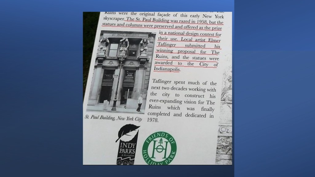
They came back to Indiana when local artist Elmer Taflinger submitted the winning bid, and over the course of the next 20-years, worked with the city to construct his vision for “The Ruins” in Holliday Park, which was finally completed and dedicated in 1978.
We are told that since the initial installation of the St. Paul Facade at Holliday Park, other features have been added to the scene…
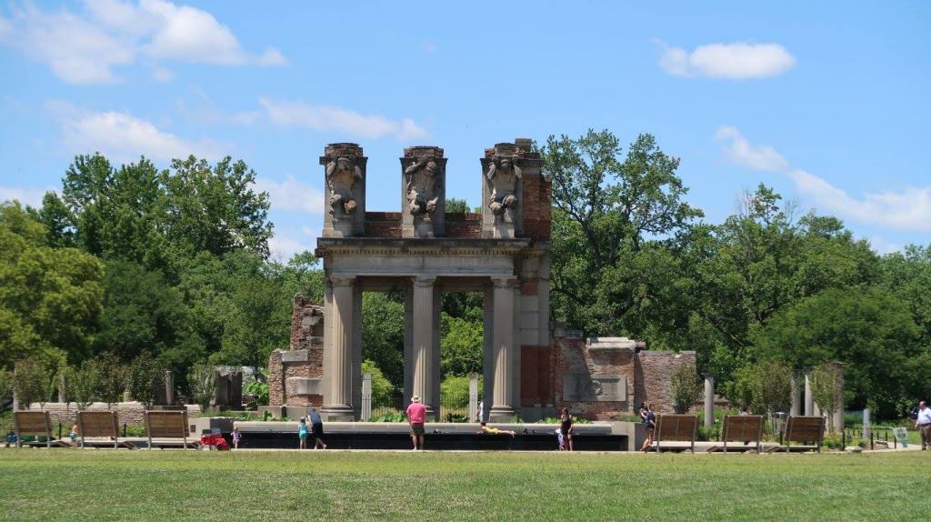
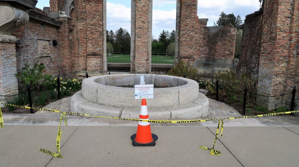
…including a ring of classical columns surrounding the imported stone work; pieces of other buildings…
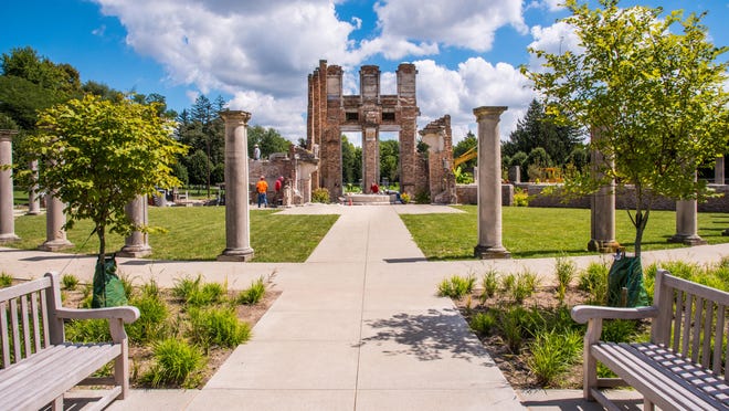
…and water features such as fountains and reflecting pools.
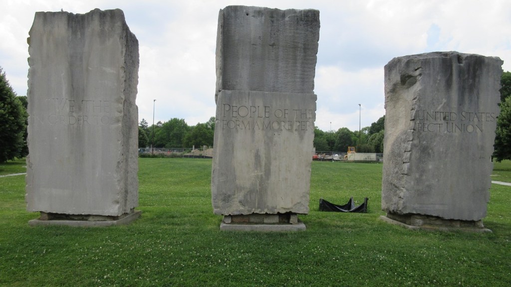
Other sights in Holliday Park include “We the People,” giant slabs of rough Indiana limestone that were inscribed with the word to the Preamble of the U. S. Constitution…
…hiking trails…
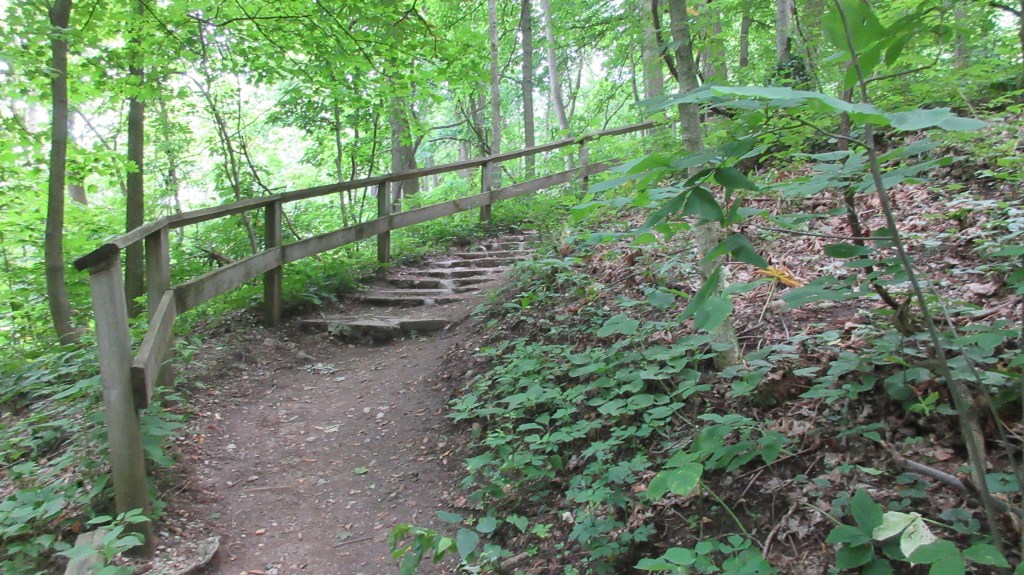
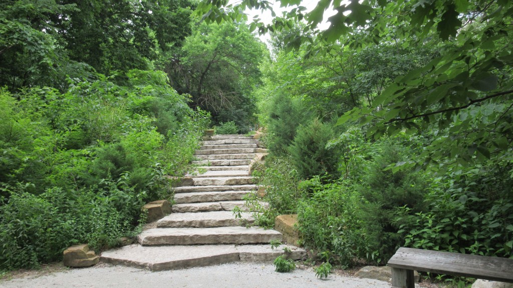
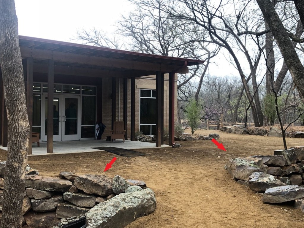
…and a nature center.
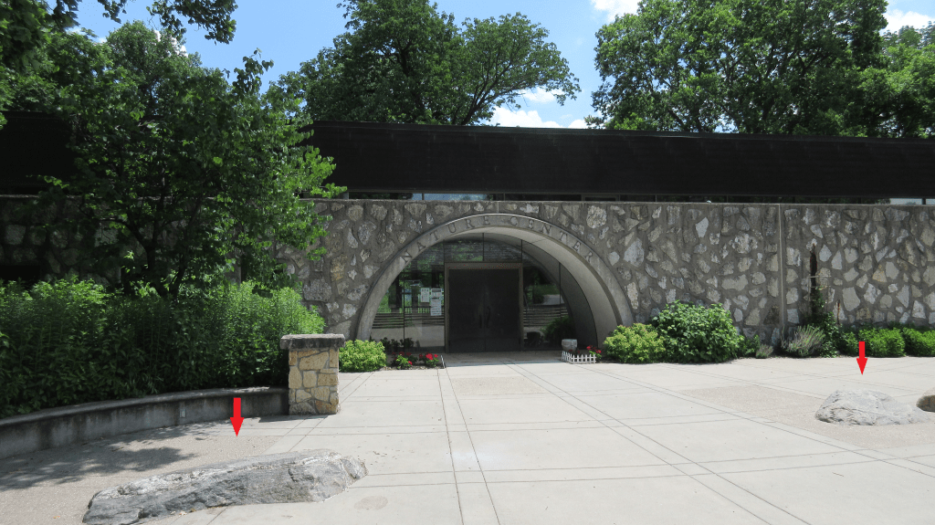
These big cut-and-shaped stones are in the environment everywhere around us, but there is no attention drawn to them, and there is no explanation given to them, so they are overlook until you realize they are there.
These are near the Nature Center at Holliday Park in Indianapolis…
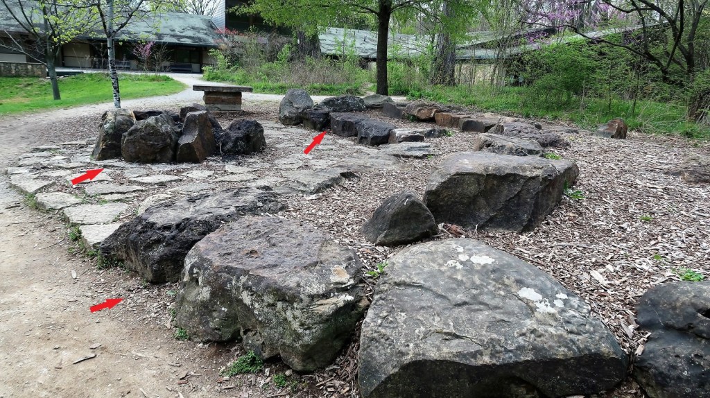
…and these line the hiking trails near the Nature Center and around Martin Nature Park in Northwest Oklahoma City, and this was one of the places where I started waking up to all of this.
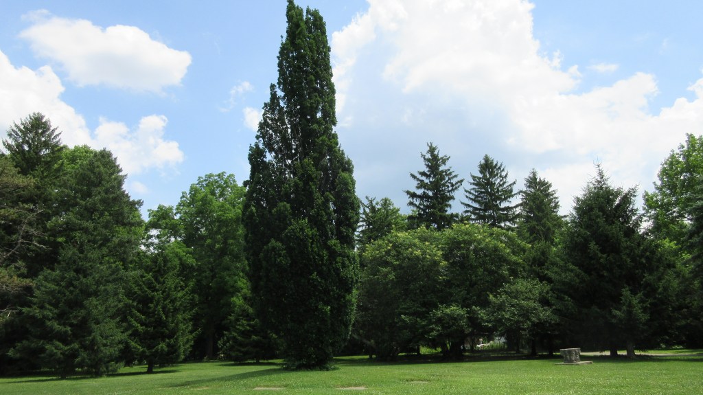
One more thing I found interesting at Holliday Park before I move on is what is seen from the aerial lay-out of the park, where the trees outling the park are lined-up in an organized way, and that a straight line drawn from the tip of the compass shape at the entrance to the park, goes through the middle column and sculpture of what we are told once was the facade of the St. Paul Building; on through the middle slab of the three “We the People” limestone slabs; to the middle of a circle of stones with what appears to be a tall structure casting a shadow, like a sun-dial…
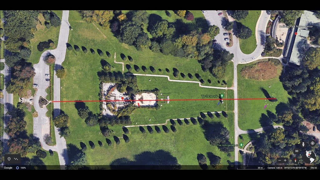
…which turns out to be a lone, tall, skinny evergreen tree.
Obviously it was intentional…but who did that?
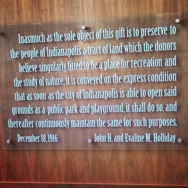
According to the history we have been taught, it would have been the planners and builders of Holliday Park, the land for which was given to the city in 1916.
But was it?
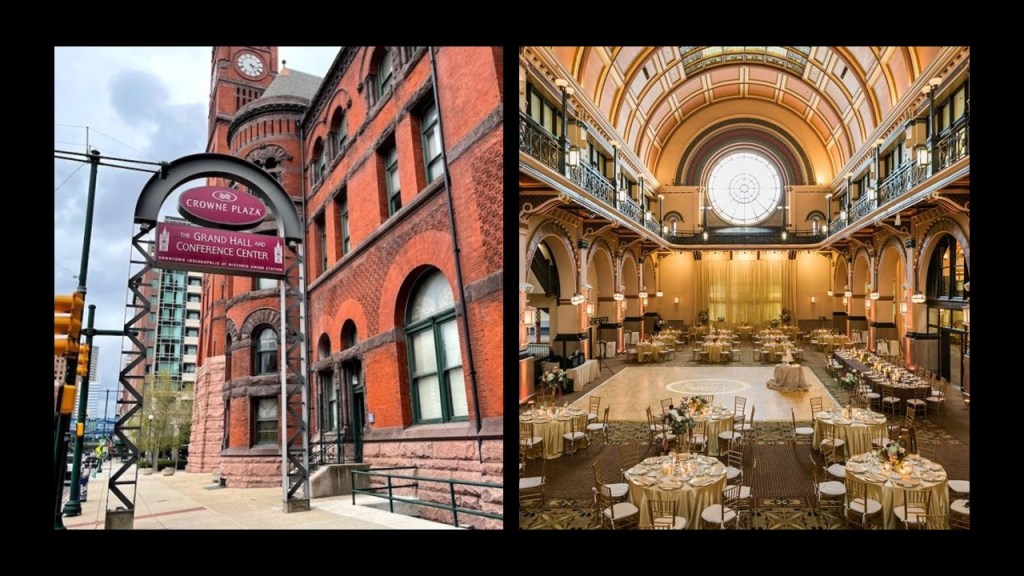
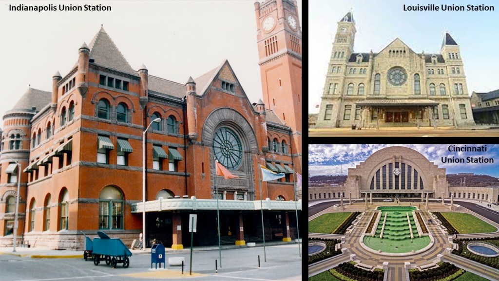
DM suggested that I look at the Indianapolis Union Station.
We are told that in 1848, Indianapolis was the first city in the world to devise a Union Station, a kind of railway station at which the tracks and facilities were used by two or more separate railway companies, allowing passengers to conveniently connect between them.
The current Union Station building in Indianapolis was said to have been constructed started in 1886 at the location of the city’s original train station, which opened in 1853.
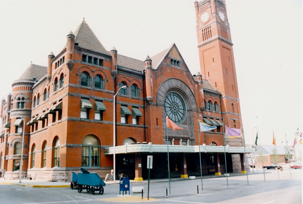
While the building is stilled used by Amtrak as a train station and Greyhound as a bus station…
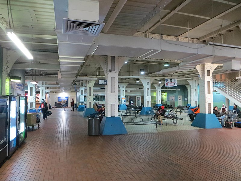
…it is also now the Crowne Plaza Indianapolis at Historic Union Station, a hotel and conference center.
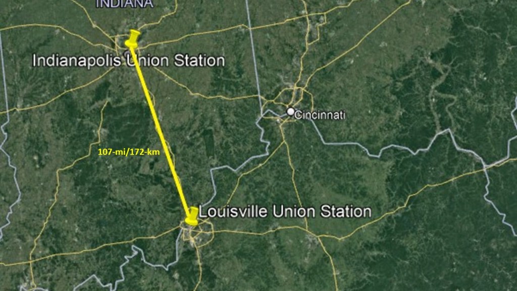
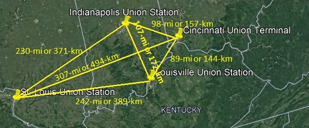
The Indianapolis Union Station on the left compared with the Louisville Union Station in Kentucky on the right.
Why do train stations look like cathedrals?
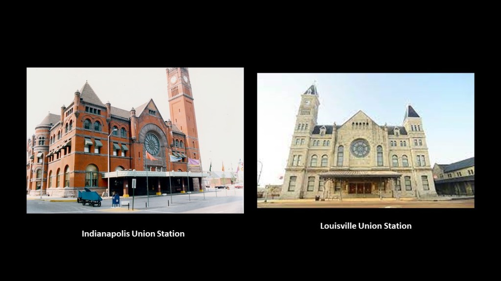
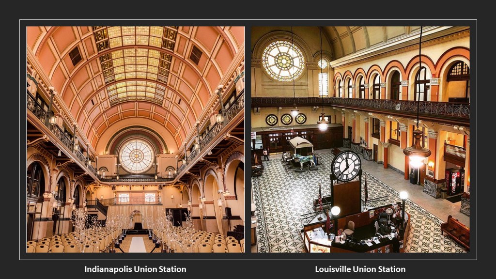
There are approximately 107-miles, or 172-kilometers, in a straight-line distance between Indianapolis and Louisville, and I do know from looking at the street-view on Google Earth, that the Indianapolis Union Station has a cathedral rose window that faces in a southerly direction, and the Louisville Union Station has a cathedral rose window that faces in a northerly direction.
What I can’t tell is whether or not they are facing each other directly.
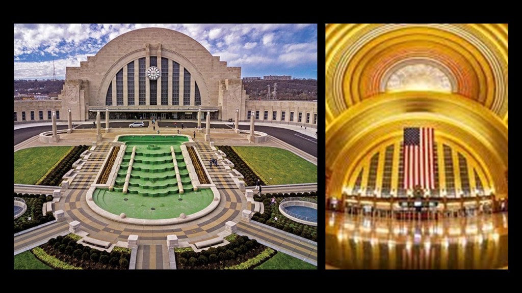
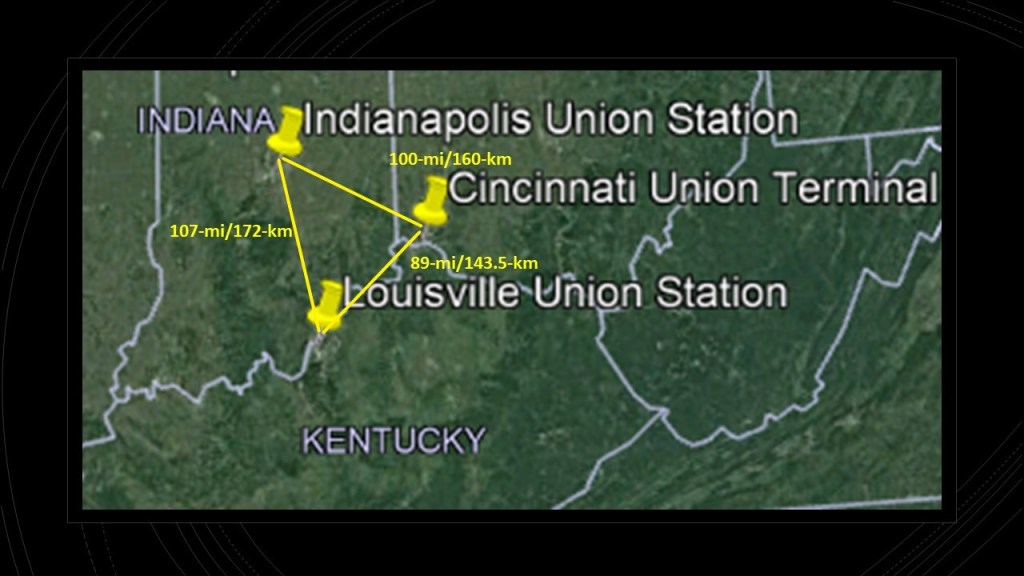
When I was looking at the Google Earth map showing the close linear relationship between Indianapolis and Louisville, I couldn’t help but notice Cincinnati in the mix.
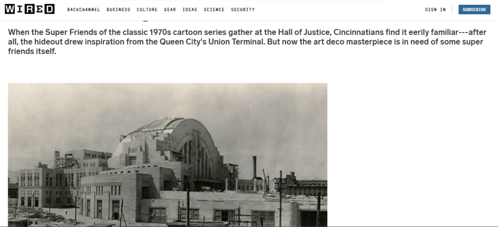
Cincinnati’s Union Station is a wonder to behold, with the largest half-dome in the western hemisphere, and at one time it was the largest half-dome in the world.
It was said to have been built starting in 1930, and opening in 1933.
Between Cincinnati and Indianapolis there is a straight-line distance of 100-miles, or 160-kilometers; and between Louisville and Cincinnati, 89-miles or 143.5-kilometers.
Now, these are approximate distances between the Union Station terminals because they reflect the distances between the cities themselves, but even with that, the distances, or length of the leg of what appears to be a triangle, between these three cities in relationship to each other are close to being equal.
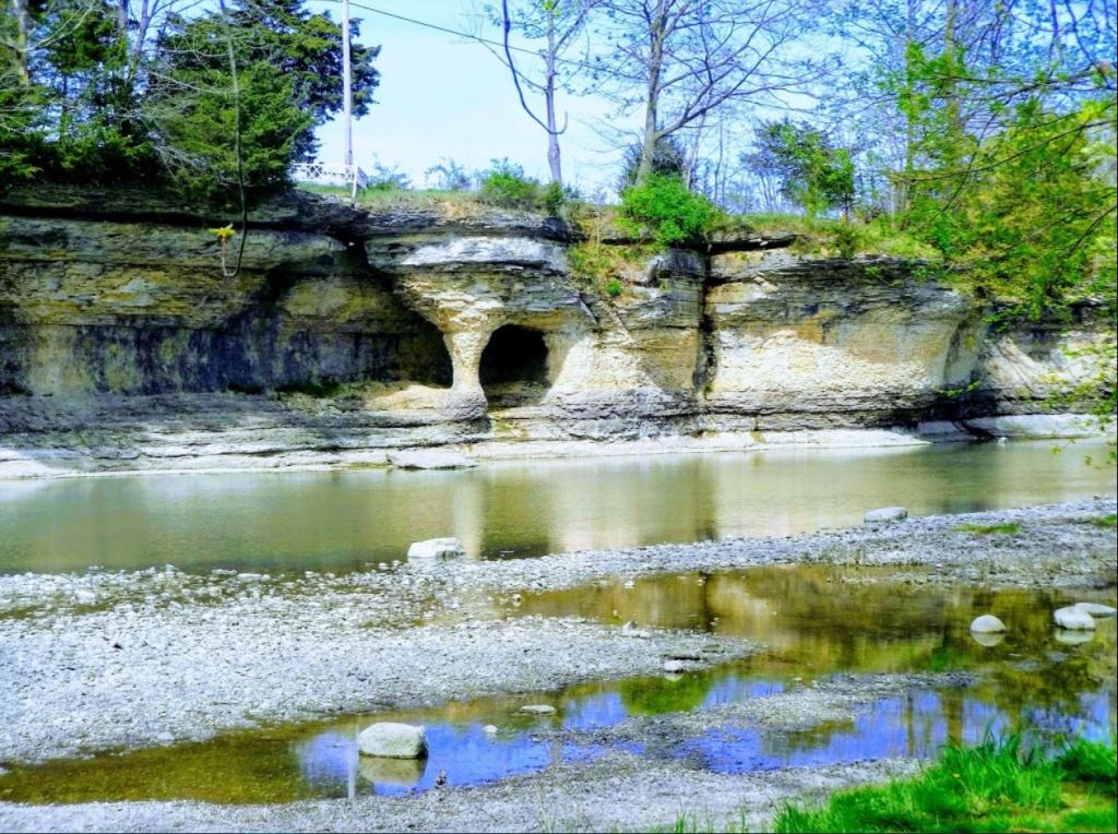
In a city named Peru in Indiana that is due north of Indianapolis, in Miami County…
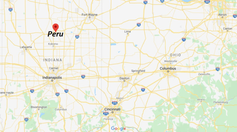
…a cliff formation called “The Seven Pillars” was brought to my attention by NS awhile back.
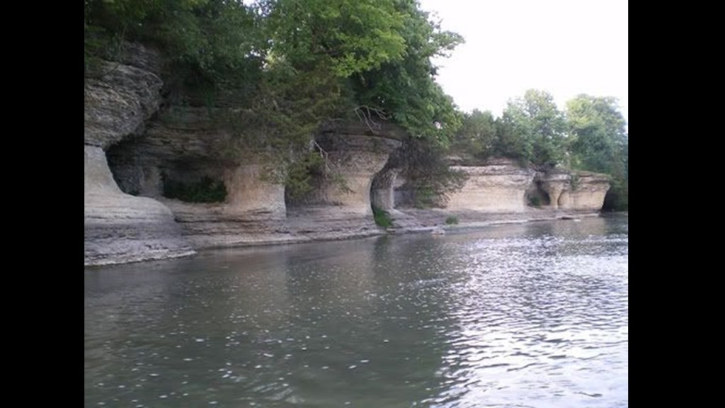
Also called “The Cliffs,” they are a limestone formation located along the Mississinewa River, and have been voted #1 of the “7 Wonders of Miami County” in the past by local residents, and are held sacred by the Miami Nation of Indiana, which owns land on the south bank of the Mississinewa River, directly across from The Seven Pillars where they hold sacred ceremonies and heritage days.
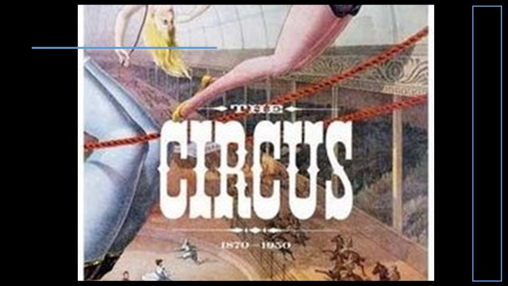
The other interesting thing that popped out when I was looking up information on Peru, Indiana, is that it is nicknamed the Circus Capital of the World.

Peru was the off-season headquarters of several famous circuses, including the Ringling Brothers, Hagenbeck-Wallace; Buffalo Bill’s Wild West Show and others, after the Golden Age of the American Circus began in 1870, and ended around 1950.
One last thing in Indiana.
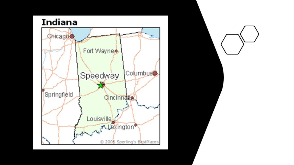
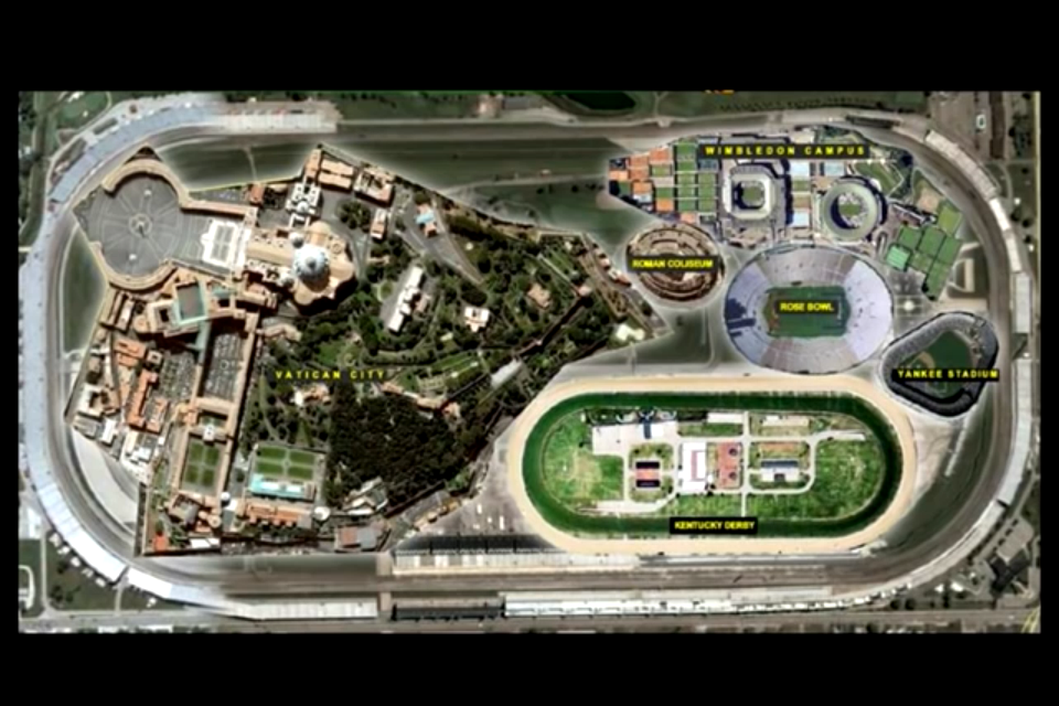
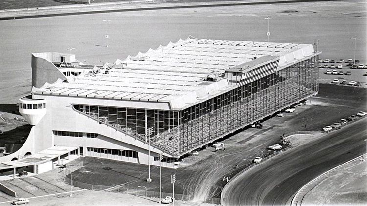
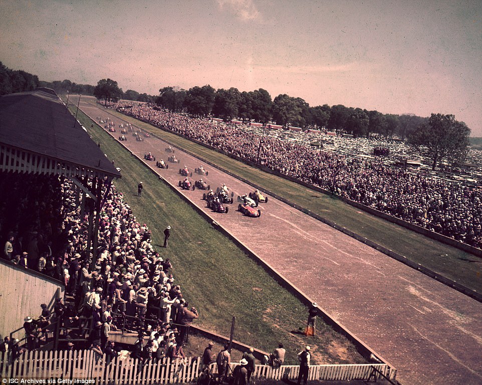
The Indianapolis Motor Speedway is the largest sports’ venue in the world, said to have been constructed in 1909, is located in Speedway, Indiana, a short-distance west of downtown Indianapolis, said to be an early example of a residential community planned for the nearby industrial plants that was laid out in 1912, three-years after the Indianapolis Speedway was constructed.
I mentioned this graphic a viewer sent me this awhile back in past post, and as the viewer had said the following:
“If you haven’t yet researched the Indianapolis Motor Speedway, I think it’s worth a glance…Balloon racing and monorail aeroplanes being used there before there were race cars…Check this out: Vatican City, the Wimbledon Campus, the Roman Colosseum, the Rose Bowl, Yankee Stadium, and the Kentucky Derby all fit inside the automobile racing CIRCUIT.”
It was the second-purpose built, banked oval racing circuit after Brooklands in Surrey, England, which opened in 1907 and closed in 1939.
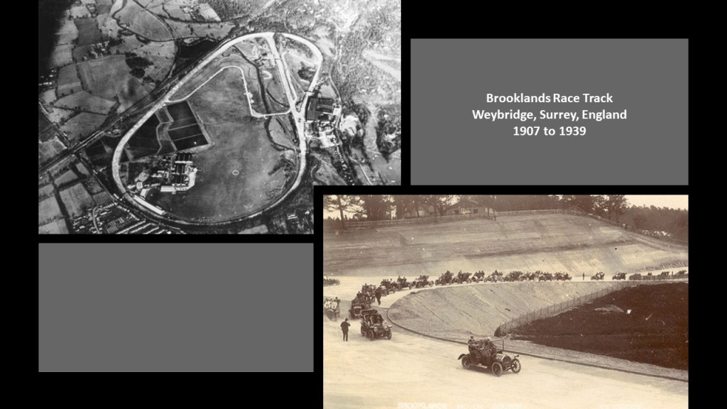
The reason given for the Brooklands Track having closed down was safety due to the frequent accidents that were happening on it.
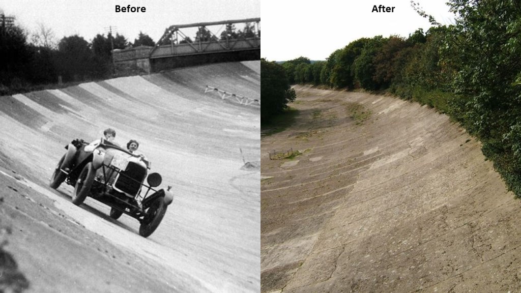
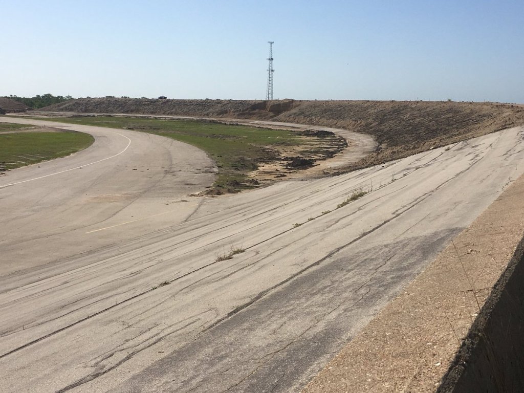
In the “after” picture, though while abandoned since 1939, the part of the track pictured still seems to be in a similar condition as to what it was in the “before” pciture.
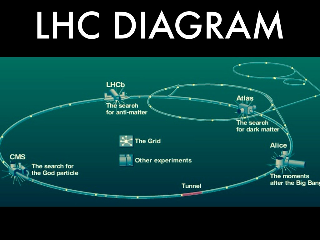
I have speculated that these racing circuits originally functioned as electrical circuitry on the Earth’s grid system, and I am re-visiting this subject because MdS in Manitoba was wondering about early racetracks as well, that possibly the tracks were for power generation or old versions of the CERN particle accelerator, also known as the Large Hadron Collider (LHC), for the Old World.
I am going to look at several other early race tracks and see what comes up about them.
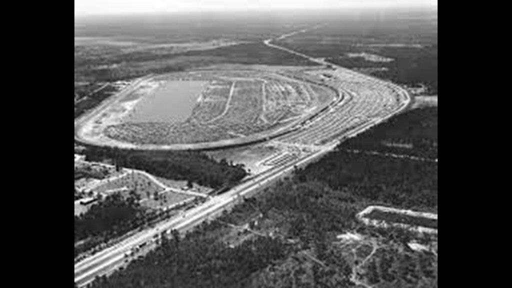
Another track that is now abandoned was called the Texas World Speedway.
It was an entire racing complex with a circuit track as well.
The Texas World Speedway opened in November of 1969…
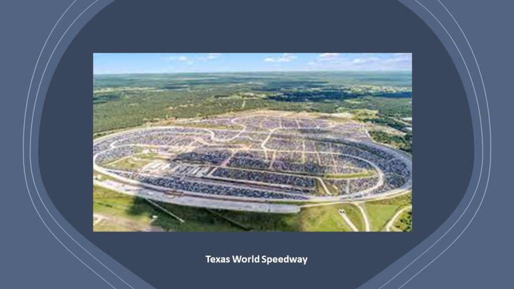
…and officially closed in 2017.
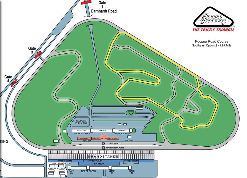
It was one of eight superspeedways of 2-miles, or 3.2-kilometers, or greater used in the United States for racing, which includes well-known speedways like the ones in Indianapolis and Daytona, and lesser-known ones like Pocono Speedway in Pennsylvania…
…and the Michigan Speedway in southeastern Michigan, which opened in 1968, and of which the Texas World Speedway was said to be a copy and sister track.

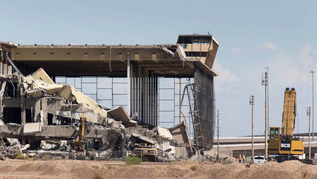
We are told the Phoenix Trotting Park was built for horse-racing in 1964 in Goodyear, Arizona, a community just west of Phoenix, and opened in 1965.
It was apparently constructed at a cost of $10-million, $7-million over the original projected cost of $3-million, and only operated as such for 2-and-a-half seasons before it was closed, never to be used for horse-racing again, and abandoned for the most part.
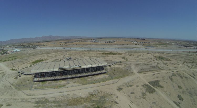
After a deal fell through to sell the Trotting Park property after being put on the market in 2015 for $16.5 million, the Phoenix Trotting Park facilities were demolished in 2017.
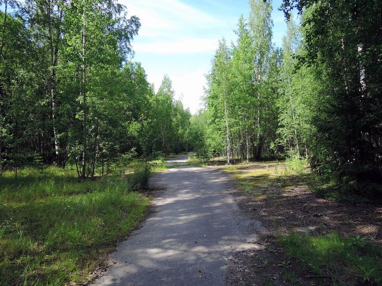
The last track I would like to take a look at was the Keimola Motor Stadium in Vantaa, Finland.
Considered at one time one of the best tracks in the world for Formula racing, it was said to have been constructed starting in 1965, and opening in June of 1966.
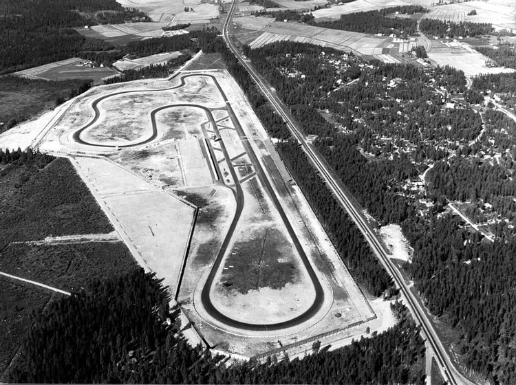
The track was abandoned by professional racing, however, in 1978, after years of financial difficulties, and while it was used for illegal racing while the track was still in good condition, it has been unsuitable for driving for many years.
The plans at some point in the future are to turn the property into a residential area.
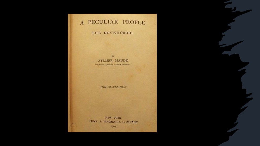
MdS in Manitoba also brought the subject of Freedomites to my attention.
This was a movement of what were called “Spiritual Christians” that began in Saskatchewan in 1902 and spread to British Columbia.
“Spiritual Christianity” was a reference to folk protestants, or non-Eastern Orthodox, that were indigenous to Russia and regarded as heretics, as the non-Orthodox groups believed in the direct revelation of God to the inner man as opposed to needing priestly intermediaries.
While the Russian government deported some folk protestant groups to internal exile in Central Asia, a small percentage escaped suppression by emigrating to North America, starting in 1898, after which they eventually separated into subgroups of the movement.
By 1930, almost 9,000 Doukhobors had emigrated to the Provinces of Saskatchewan, Manitoba, and Alberta in Western Canada, and adapted to life in agricultural communes.
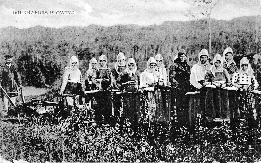
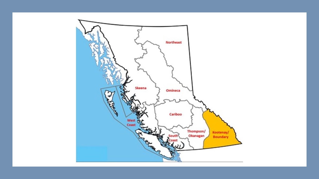
Within a few years after arriving in Canada, the Freedomites separated from the Doukhobors, and made their way to the Kootenay and Boundary Districts of British Columbia to land they had purchased there under the leadership of Peter V. Verigin.
Self-named “God’s People” or “Sovereign People,” the Freedomite group opposed land ownership and public schools, in contrast to the Doukhobors, who obtained citizenship, registered their land, and attended public schools.
So here is where is where the controversy begins.
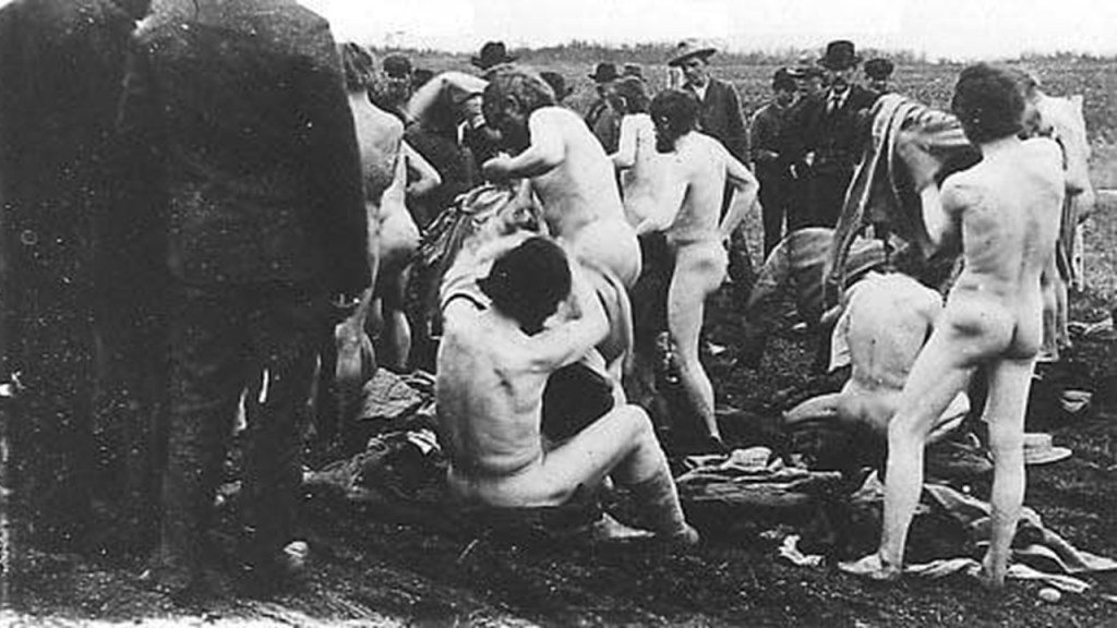
While on the one-hand, Freedomite ideals were said to emphasize basic Russian traditional communal living and action and living in peace, on the other hand having an ecstatic religious doctrine when agitated for protest, and anarchic attitudes towards external regulation.
Conflict soon developed between the government and Freedomites over the issue of generally refusing to send their children to government-run schools.
The governments of Saskatchewan, and later British Columbia, legally charged many of the parents for not sending their children to school.
The Freedomites became known for engaging in various kinds of protests, like burning their money in public and possessions, and parading in the nude, with the underlying belief that our birthday suits as God’s creation are perfect as is.
My initial thought on a really quick read-through after MdS first sent me the link about the Freedomites was that they were living on the lunatic fringe of society, but MdS encouraged me to look deeper into their story, and sure enough, there were deeper issues at play here concerning government rights versus human rights.
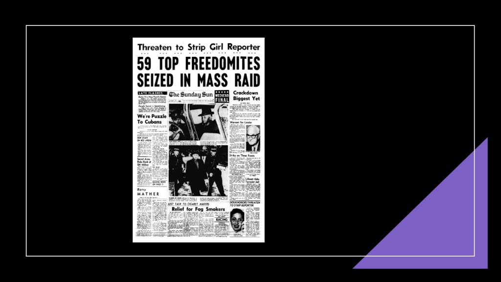
Along those lines, Operation Snatch was implemented by the British Columbia government, the RCMP and the federal government between 1953 and 1959, in which around 200 Freedomite children between the ages of 5 and 15 were seized.
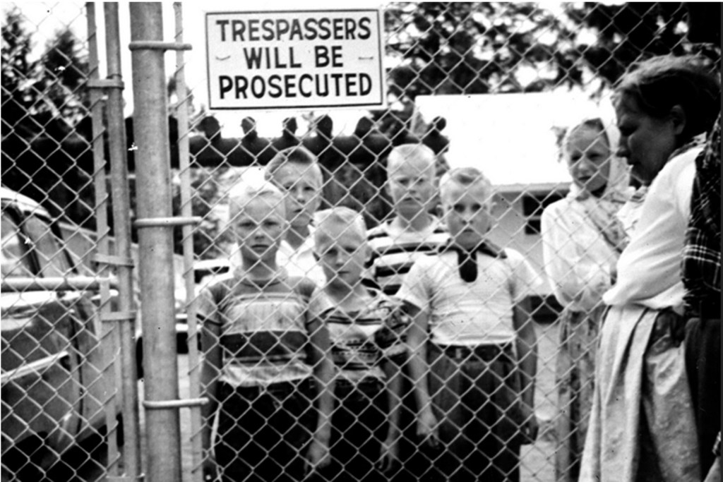
For starters in 1953, a law called the British Columbia School Act was passed, making state-run education for all children mandatory, and soon after the government started shipping students to residential schools.
After initial raids and arrests at Freedomite gatherings in 1953…
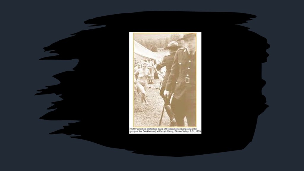
…the beginning of the removal of Freedomite children started in earnest in January of 1955, when a government raid commenced on the village of Krestova, where homes were stormed, parents and grandparents beaten, and children were removed form their homes and taken to a place called New Denver on Slocan Lake, and the taking of Freedomite children and placing them in the New Denver residential school continued over the next four-years.
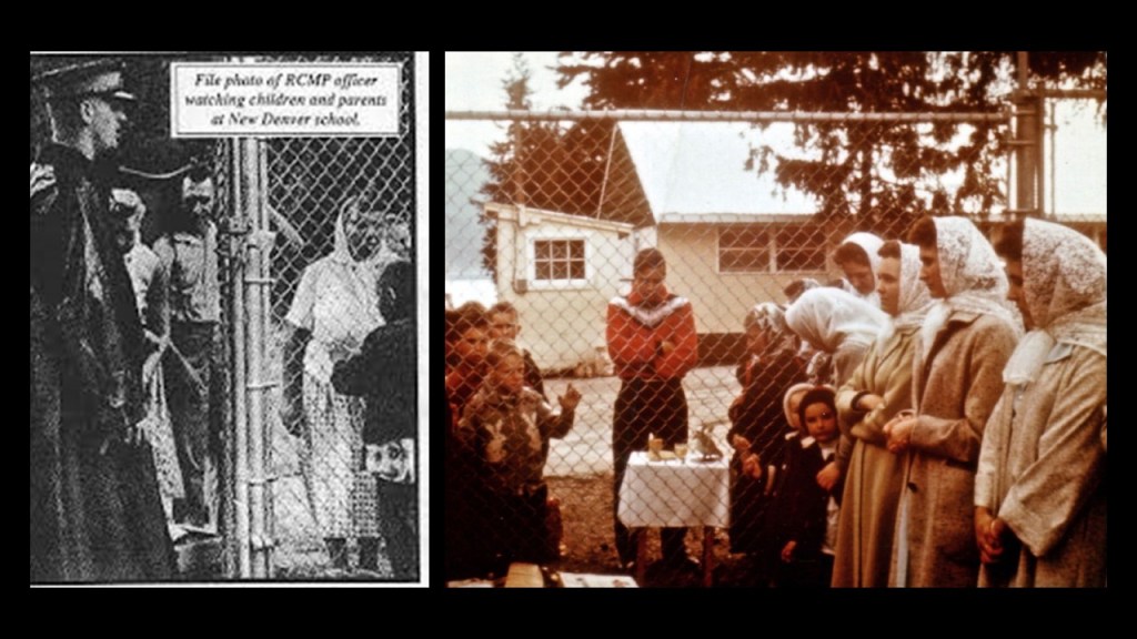
These children lost their human rights at the New Denver school, and were treated like prisoners.
Parents had to swear before a magistrate to send their children to school on July 31st of 1959, before the remaining 77 children were released from New Denver on August 2nd of 1959.

Over the next decades, there were many confrontations between the government seeking to control them and the Freedomite community seeking to follow their beliefs, being considered terrorists at the same time.
And is this kind of situation still happening today between governments, parents, and children?

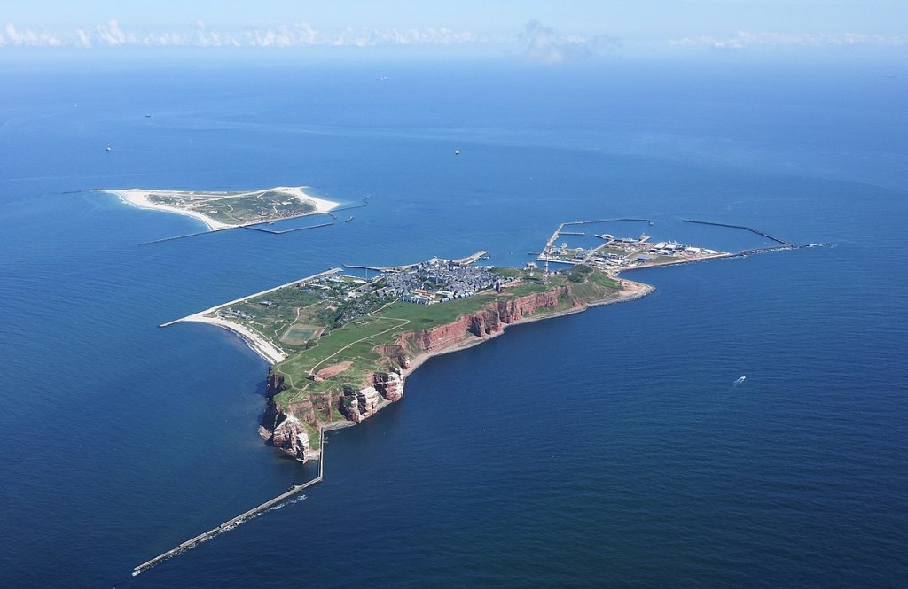
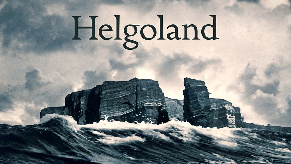
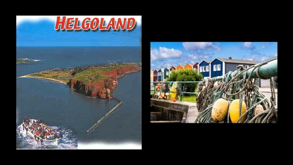
Another viewer sent me information about the North Sea archipelago of what is known as both Heligoland and Helgoland – meaning either Holy Land or Hell Land – in the hopes it could add to my research.
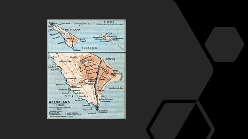
The small two islands are located in what is called the Heligoland, or German, Bight in the southeastern corner of the North Sea, and has been part of the German state of Schleswig-Holstein since 1890.
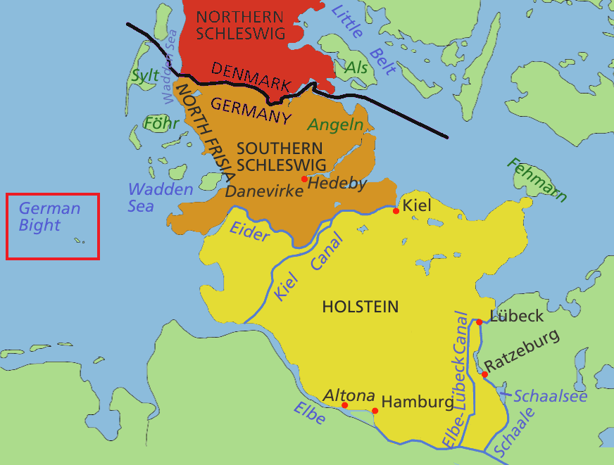
The larger of the two islands has a permanent population of somewhere around 1,000 people.
The smaller of the islands is called Dune, which is not permanently inhabited, but is the location of Heligoland’s airport.
Heligoland was historically part of Denmark.
Great Britain had attacked Copenhagen in August of 1807 in what was called the “Siege of Copenhagen” during the Napoleonic Wars, using the pretext of the fear that Napoleon was going to attempt to attack the Danish-Norwegian Fleet.
Britain then proceeded to seize the Danish-Norwegian Fleet in September of 1807, assuring the use of the sea lanes in the North Sea and Baltic Sea for the British merchant fleet.
The “fleet robbery” drew Denmark-Norway into the war on the side of Napoleon.
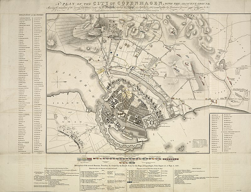
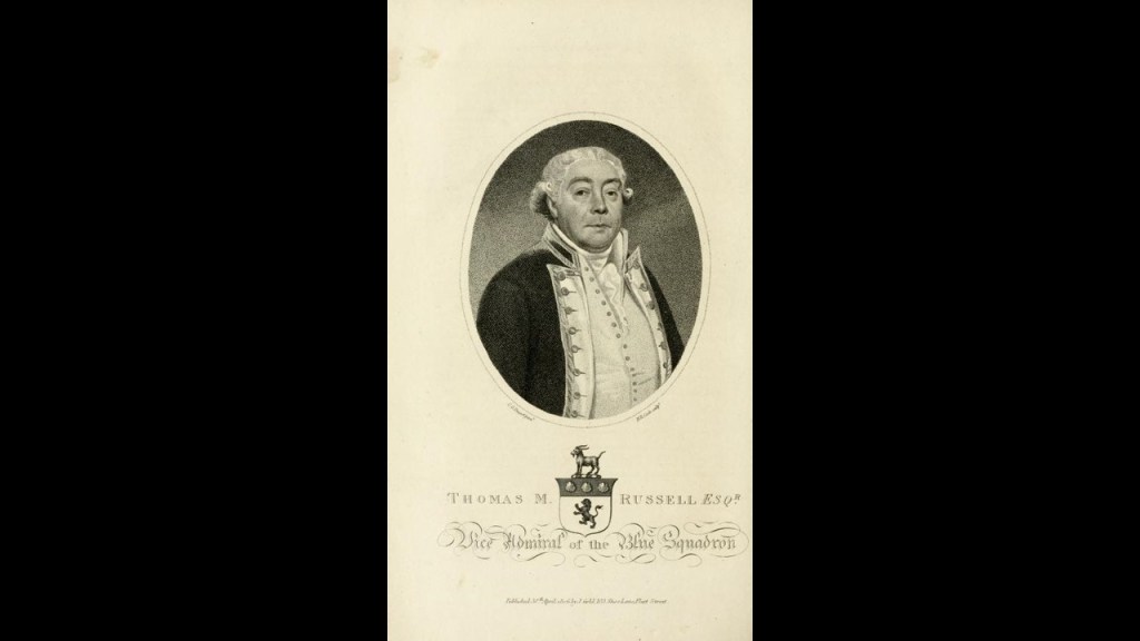
On September 11th of 1807, Heligoland surrendered to the British Navy’s Admiral Thomas McNamara Russell, it became a center of intrigue and resistance against Napoleon.
Then, Heligoland was ceded by Denmark to Great Britain as part of the terms of the 1814, Treaty of Kiel between the United Kingdom and Sweden on the anti-French-side, and Norway and Denmark on the French-side.
The reason given for the Treaty of Kiel was to end the hostilities between the parties in the on-going Napoleonic Wars, which didn’t officially end until November of the following year, but the Treaty also officially ended the ruling Oldenburg Monarchy of Denmark-Norway when Norway was transferred to the King of Sweden.
We are told that the main reason the British retained the small Heligoland Archipelago was to inhibit any future French naval aggression against the Scandanavian or German states, though nothing was really done to fortify it during this time.
What it did become in 1826 was a seaside spa and popular tourist destination for Europe’s upper class, and attracted artists and writers like August Heinrich Hoffman, a German poet best-known for writing “Das Lied der Deutschen” in 1841, the third verse of which became the national anthem of Germany in 1922.
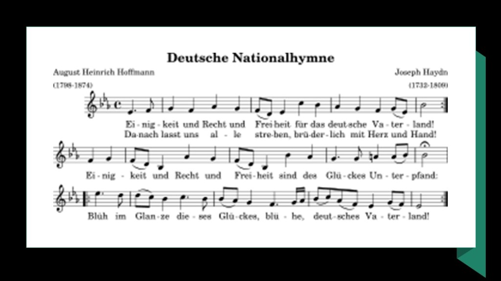
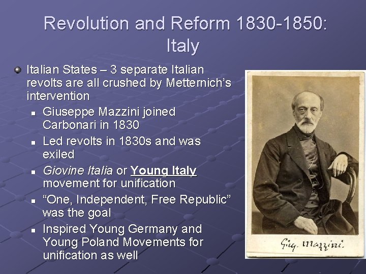
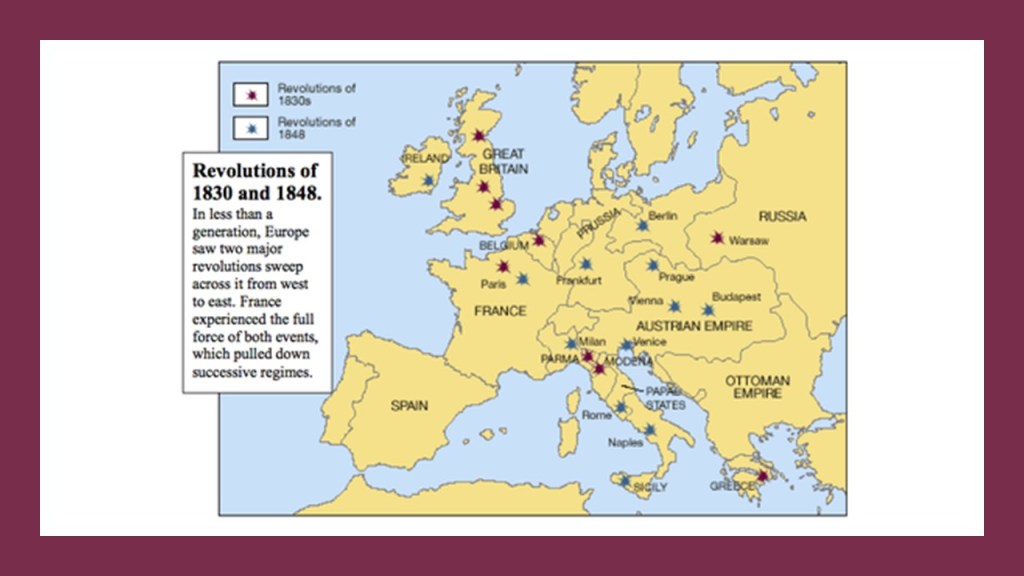
It is interesting to note that August Heinrich Hoffman was also a member of the Young Germany movement, a group of German writers which existed from 1830 to 1850, a youth revolutionary progressive ideology that included socialism which was sweeping Italy, Poland, France, Ireland, and the United States during this time as well.
It is also interesting to note that Heligoland was said to become a refuge for the revolutionaries of the 1830 and 1848 that were responsible for taking down the old ruling houses of Europe.
Great Britain ceded these two small islands to the German Empire in the signing on June 1st of 1890 of the Heligoland-Zanzibar Treaty, also known as the Anglo-German Agreement of 1890.
The accord between the two countries, in addition to the Heligoland Archipelago, gave Germany control of the Caprivi Strip, a ribbon of land in the southeastern corner of Namibia, surrounded by Botswana to the South; and Angola and Zambia to the North…
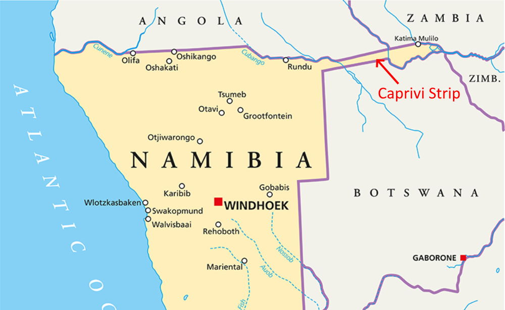
…and gave access to the Zambezi River to German south-west Africa, and giving Germany control of the heartland of German East Africa.
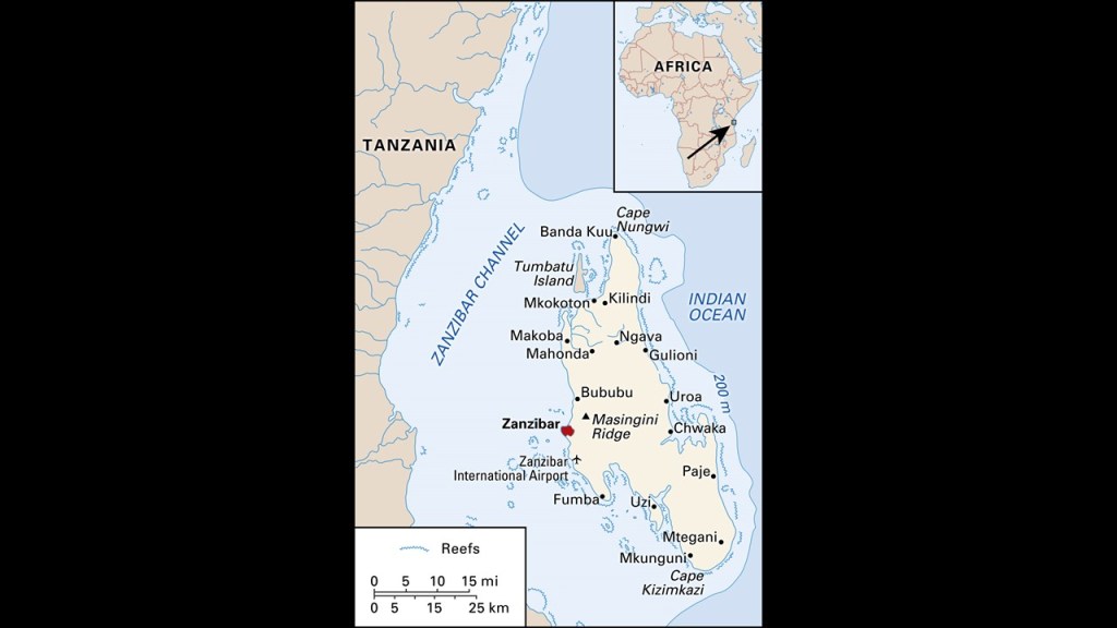
In return for Heligoland in the North Sea and the Caprivi Strip in Africa, Germany recognized British Authority in Zanzibar, an island archipelago in the Indian Ocean off the coast of Tanzania in southern East Africa, which was a key link in British control of East Africa.
The Germans turned the islands into a major naval base, and the civilian population was evacuated during World War I.
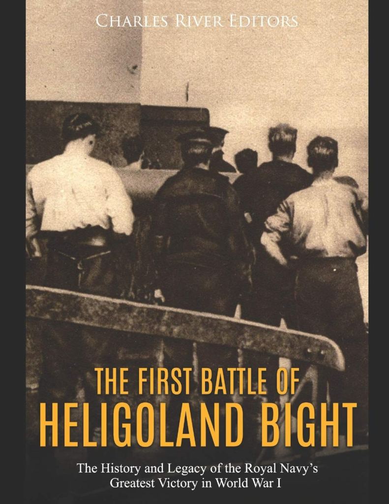
The first naval battle of World War I, the Battle of Heligoland Bight, was fought on August 28th of 1914 between British ships and German ships.
By the end of the day, the Germans had lost three light cruisers and a torpedo boat, with three more light cruisers and torpedo boats each damaged, and 712 men killed in battle; and the British only had 35 killed, and four ships damaged – one light cruiser and three destroyers.
The battle was regarded as a great victory in Britain.
In between World Wars I and II, physicist Werner Heisenberg first came up with the equation underlying his picture of quantum mechanics while on Heligoland in the 1920s.

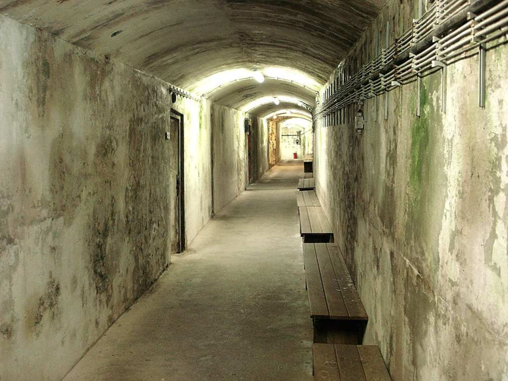
The Germans were also said to have fortified Heligoland, remember also known as Helgoland…
… as a sea fortress, with fortifications above-ground…
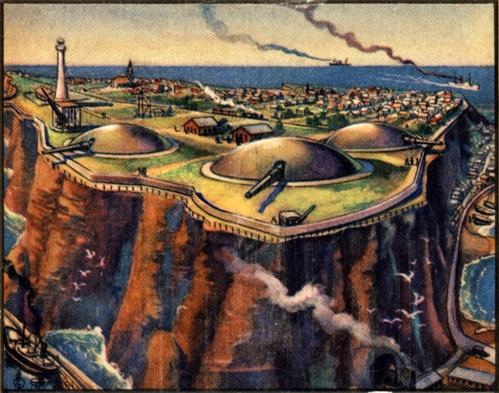
…and extensive bunker tunnels below ground, as there are 6-miles, or 10-kilometers, of tunnels, that go down five-stories, and are parallel to, and above, each other.
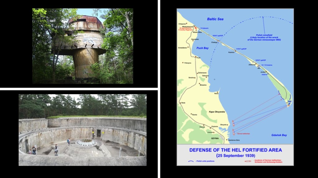
The second Battle of Heligoland took place on December 18th of 1939, and was the first named air battle of World War II, with the Royal Air Force bombing German Navy ships, but this time the victory at the end of the day was called for the Germans, and the biggest loss for the RAF Bomber Command up to that point in World War II, with regards to which Great Britain had declared war on Germany on September 3rd of 1939, right after Germany had invaded Poland, on September 1st.

It is very interesting to note that the very first battle of the German invasion of Poland was the Battle of Hel, which took place from September 1st to October 2nd of 1939 between the invading German forces and the defending Polish forces on Poland’s Hel Peninsula, taking place primarily around the Hel Fortified Area, said to be a system of Polish fortifications constructed between World War I and World War II in the 1930s near Poland’s border with Germany.
Between 1945 and 1952, Heligoland or Helgoland, whichever you prefer, was used as a bombing range.
On April 18th of 1947, the Royal Navy detonated 6,700 metric tonnes, or almost 7,400 tons, of explosives in an attempt to destroy the island completely and remove it as a fleet base for the Germans, resulting in one of the biggest, non-nuclear explosions in history, shaking the main island down to its base and creating what is called the “Mittelland.”

On March 1st of 1952, Heligoland was returned to German control, and its former inhabitants were allowed to return after the German authorities cleared a significant quantity of undetonated ammunition and rebuilt the houses.
Today, it is once-again a holiday resort like it was back in the 19th-century, and enjoys a tax-exempt status.
What in the holy hell is really going on here??!!
That’s what I would like to know!!!
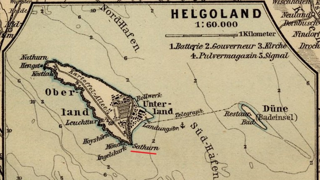
One more thing before I move on. The viewer who pointed me in the direction of this place brought to my attention that the name of the southern point of Helgoland, which was “Sathurn” as seen in the 1900 map.
The viewer BJ sent me some old photos and asked me to guess where they were from, but that they were all from the same place from the mid-1800s to the early-1900s.
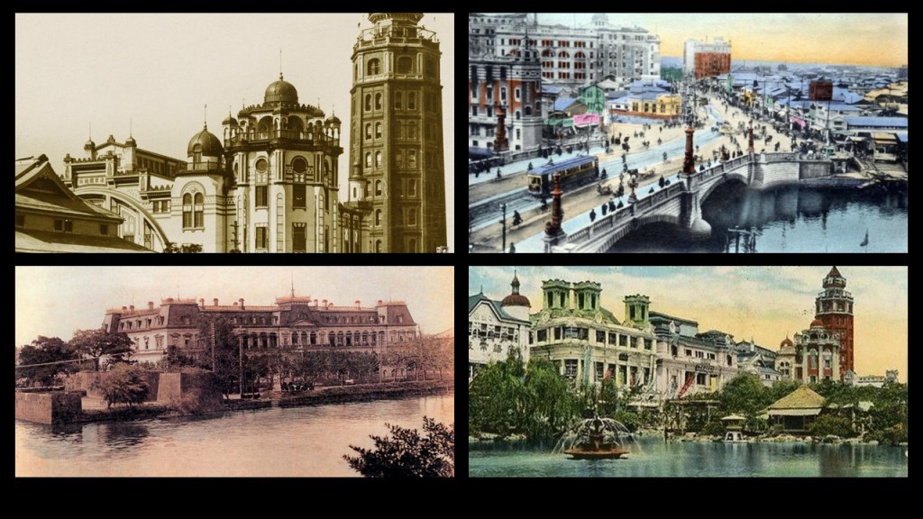
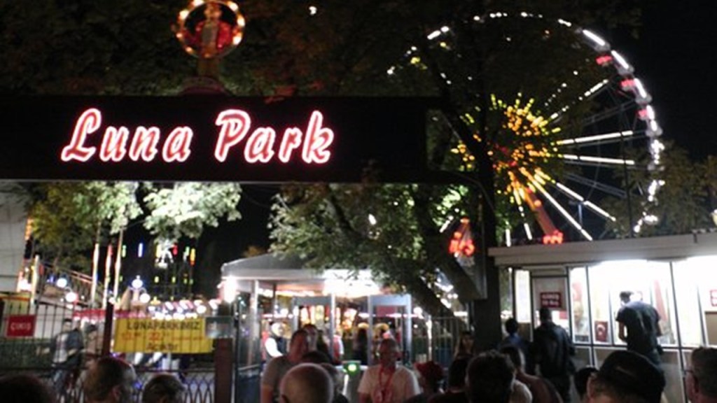
The easiest way to do an ID of photographs is to search by image, and these images were from Tokyo, Japan.
These two photos were of the Asakusa Luna Park in Tokyo, the first park of that name to open in Tokyo, though it was only in operation for eight-months, between 1910 to 1911.
It burned down under mysterious circumstances in April of 1911.
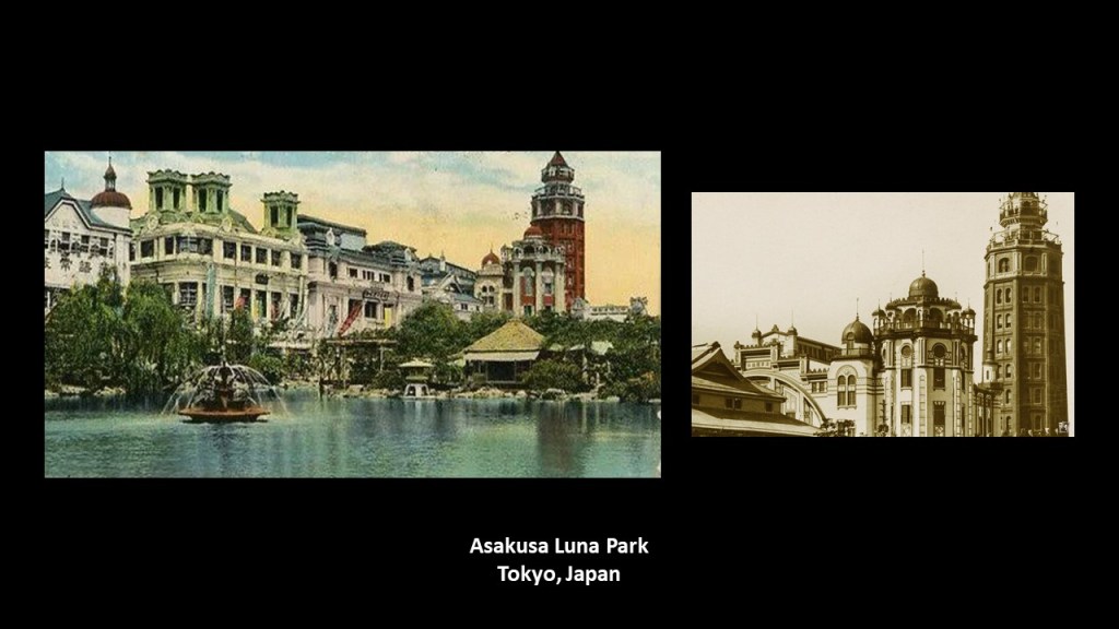
It was said to have been designed to mimic the original Luna Park in Brooklyn, New York, built in 1903; closed in 1944 after being mostly destroyed by a fire; and demolished two-years later.
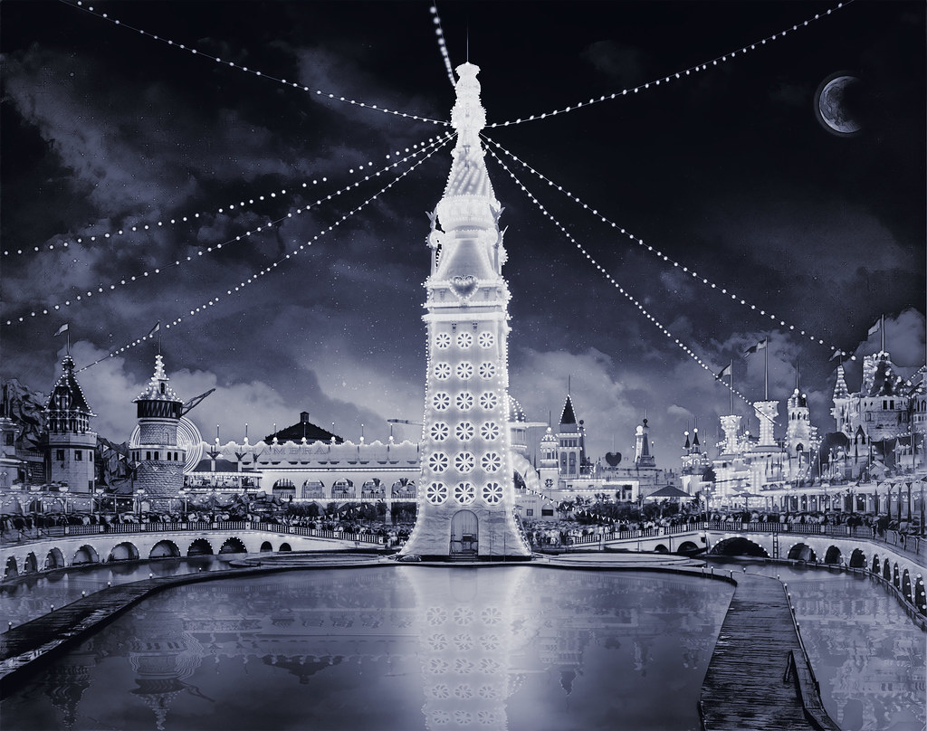
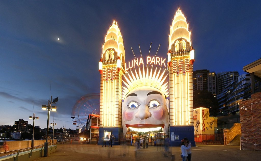
Historically, there were many Luna Amusement Parks, and there are some still in operation today.
There are two out of four still in operation in Australia, one in Melbourne…
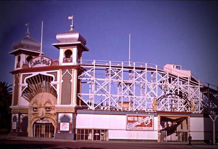
…and the other in Sydney…
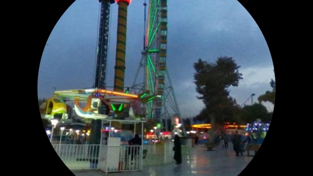
…but in the process of tracking cities and places in alignment, I have found Luna Amusement Parks in unexpected places while tracking alignments, including the one in Mashhad, Iran…
…and the one in Ankara, Turkey.
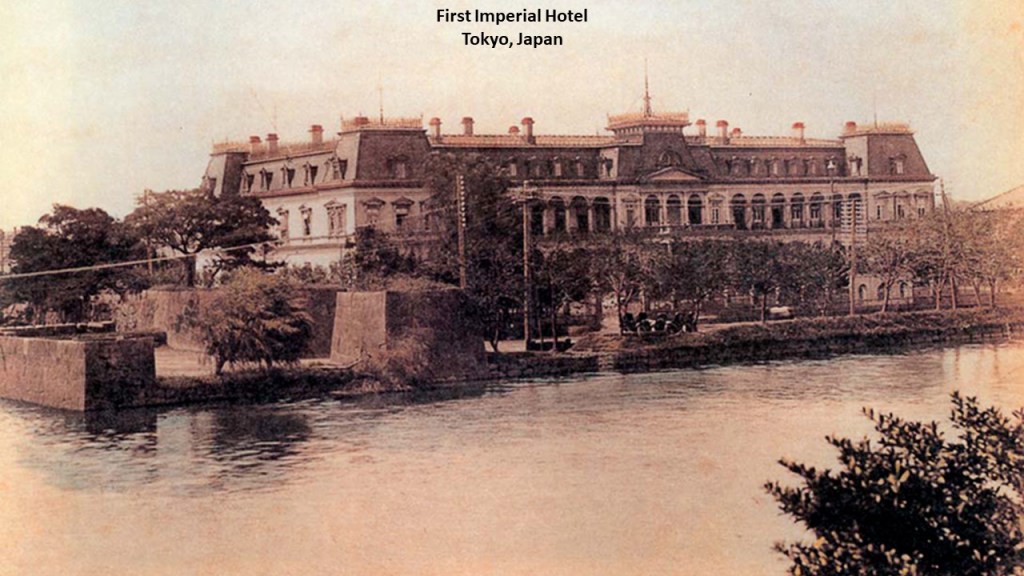
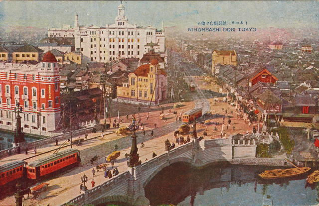
This was the First Imperial Hotel in Tokyo.
It was said to have been opened in 1890.
We are told the building was situated in a north-facing direction, with imperial palace moats north and east of it.
It was destroyed by fire on April 16th of 1922, while Edward, Prince of Wales was visiting Japan.
Most of the guests were out of the building at an imperial garden party, and no lives were lost in the fire.
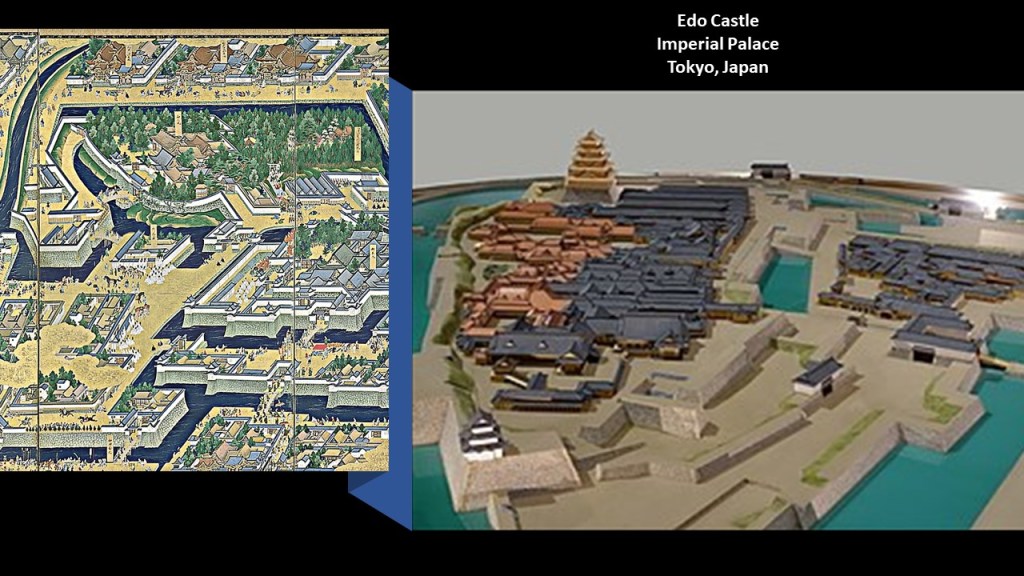
Edo Castle was the name of the imperial Palace in Tokyo.
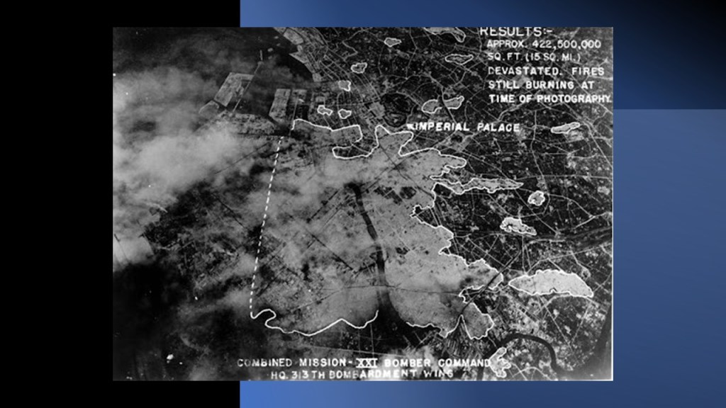
While the bombing of Tokyo was on-going by American bombers between 1942 and 1945 during World War II, the bombing raid that took place on the night of March 9th and 10th was considered the single-most destructive bombing raid in human history.
As a result of this particular raid, 16-square-miles, or 41-kilometers-squared of central Tokyo were destroyed, leaving an estimated 100,000 civilians dead and 1,000,000 homeless.
The Imperial Palace was not spared the wrath of bombs from the new at the time Boeing B-29 Superfortress bombers, and suffered substantial damage from the campaign.
This last picture I remembered seeing before…
…when I was following a long-distance alignment through Tokyo awhile back.
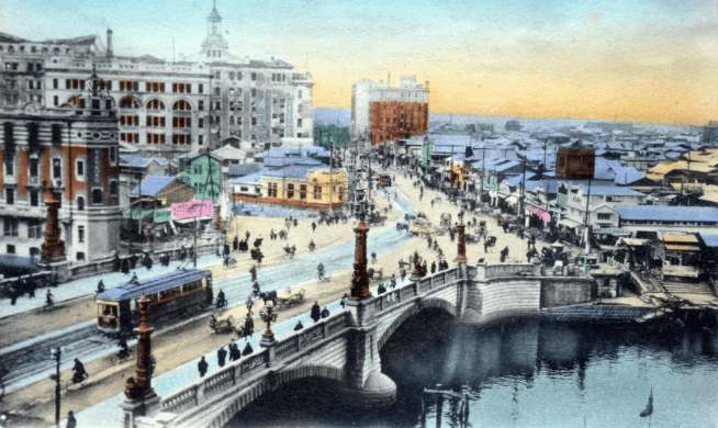
This is the same image of the last scene in Tokyo on a 1922 postcard, featuring the Nihonbashi, or Japan Bridge, in the foreground, with more gigantic onion-domed buildings in the background.
This bridge survived the Great Kanto Earthquake of 1923, but didn’t survive urban development when it was buried underneath a massive expressway that was built in the 1960s.
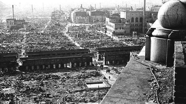
One last photo sent to me by BJ was this one of the location of Hiroshima Castle, taken after the atomic bomb was dropped on there on August 6th of 1945.
If you look closely at the picture you can make out star fort points.
A concrete and wooden replica of Hiroshima Castle was built in 1958, which was originally built of stone, and now houses a museum of the city.
I have previously mentioned the Indianapolis Motor Speedway, and other historical speedways that no longer exist, and explored the idea that these racing circuits originally functioned as electrical circuitry, power generators, and/or particle accelerators on the Earth’s original energy grid system.
ME commented that the Indianapolis Motor Speedway was originally paved in all red brick…
…which he pointed out is highly conductive.

The Indianapolis Speedway is nicknamed “The Brickyard,” and there still to this day is a strip of the original brick at the Start-Finish line, which the winning racer ceremonially kisses after the race.

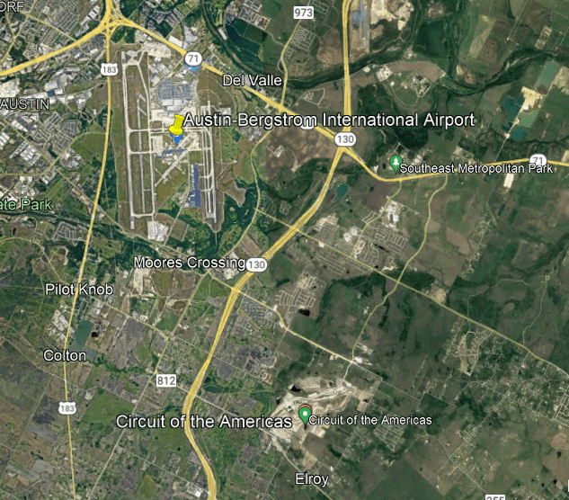
Another viewer BBB mentioned the “Circuit of the Americas” Grand Prix Racetrack in Austin, Texas, and home to the “Formula One United States Grand Prix…

…the Indy Car Classic…

…and the Motorcycle Grand Prix of the Americas.

The racing circuit is almost 3.5-miles, or 5.5-kilometers, in length, and was built starting in 2010.
It bills itself as the ultimate destination for racing and entertainment…

…and is near the Austin-Bergstrom International airport, related to which there is a recurring of pattern of airports and racing circuits in very close proximity to each other all over the world…
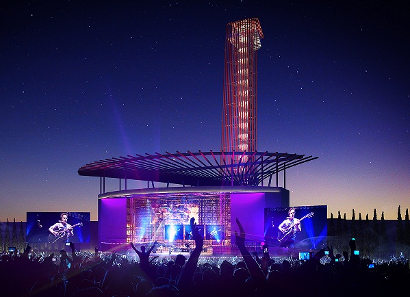
BBB said that the racetrack has this creepy-looking observation tower that looks like a snake head coming up out of a basket.
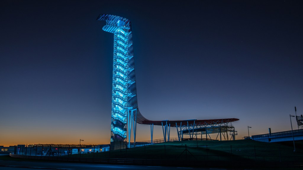
What’s really interesting to me about that snake imagery is what the “Circuit of the Americas” complex looks like from above, where there is clearly an eye-shape that is part of the complex that looks like that shape of a snake, or reptile, eye.
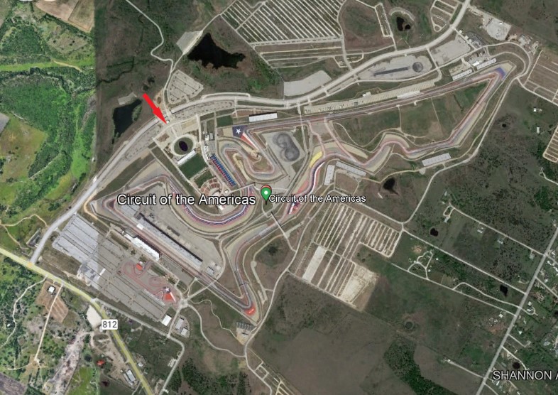
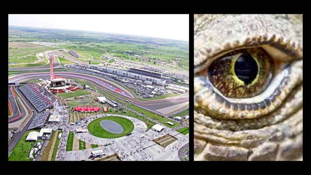
The Germania Insurance 360-degree Amphitheatre for big-name entertainment events is situated between the eye-shape and the Observation Tower, at which it is situated at the base.
Nothing to see here…right?
TN left a comment about what was known as the Beltsville Speedway in Laurel, Maryland, for which we are told ground was broken in 1964, and it was closed permanently in 1978.
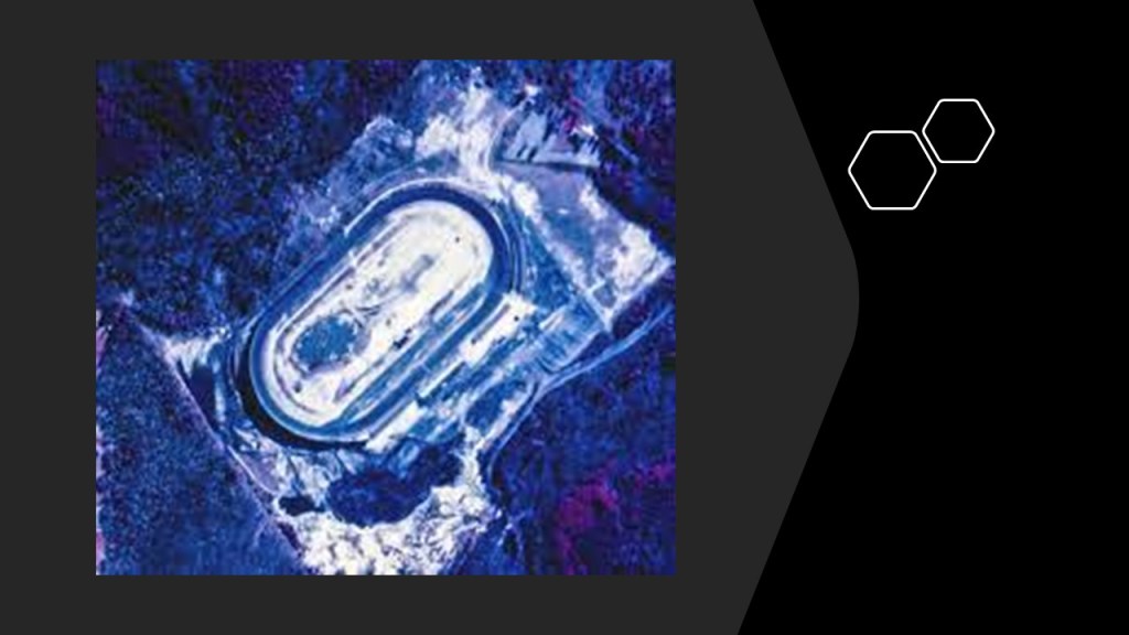
He indicated it was modelled after the Daytona Speedway, which has annually held the Daytona 500, the premier race in NASCAR, since 1959.
After the Beltsville Speedway in Laurel was closed in 1978, the land was turned into the location for the Capitol Technology University…
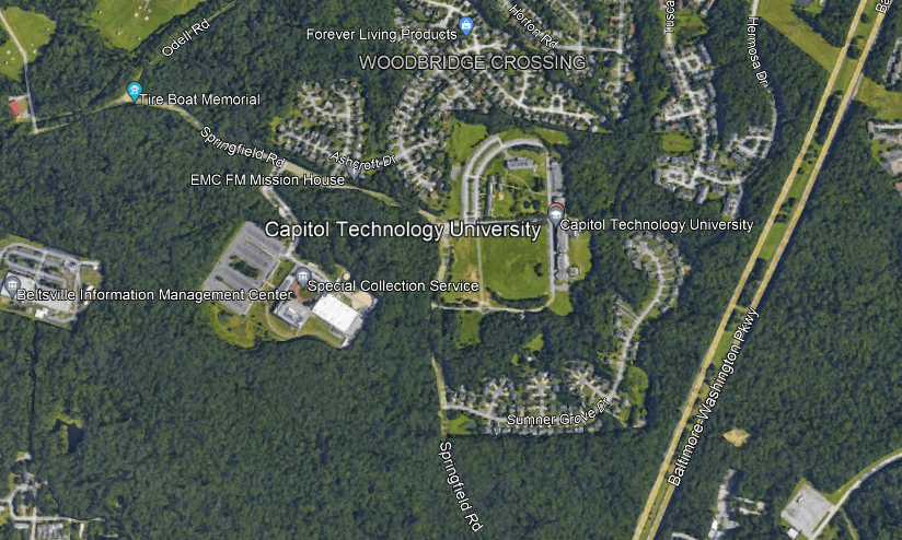
…which is close to Baltimore/Washington International Airport, and Fort Meade, which is home, to several major Intelligence agencies, including, but not limited to…
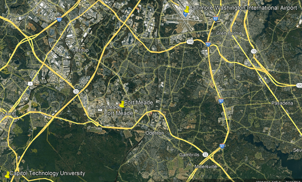
…the National Security Agency.

I already highlighted the Indianapolis Union Station, to which I added the one in Louisville and Cincinnati for comparison of their grandeur and location relative to each other.
TL commented that the Cincinnati Union Station looked like the Hall of Justice in the Super Friends cartoon in the 1960s and 1970s, which was an excellent catch…
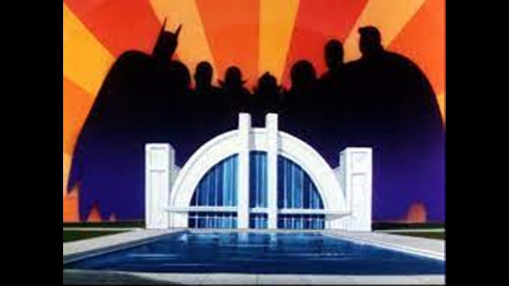
…because the cartoon’s Hall of Justice was said to have been inspired by the Cincinnati Union Station.
Someone else suggested I should take a look at the St. Louis Union Station.
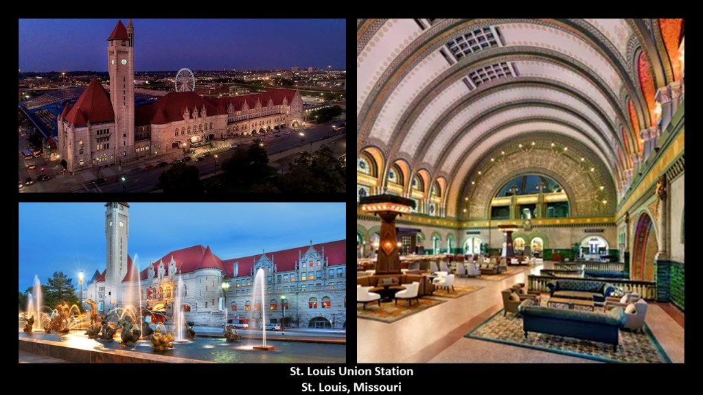
Once gain, the distances between the legs of the triangles between these four major cities with the incredible architecture of these Union Stations, are still remarkably close to each other in a geometric configuration, considering what we have been led to believe in our historical narrative was seemingly random settlement and construction.
This time I calculated the distance between them using address-to-address instead of city-to-city, which I did in the last post.
And ONGO was curious if Toronto’s union station happened to be missing its tower… saying the interior looks the same, but no tower of its own?
Interesting to note that the CN Tower, though, is located close to it!
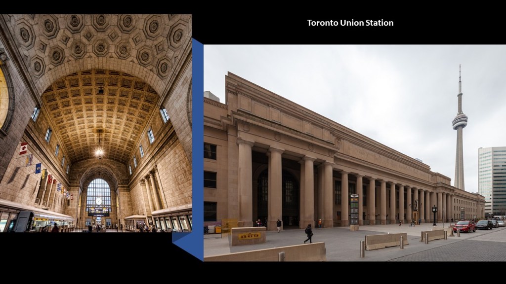
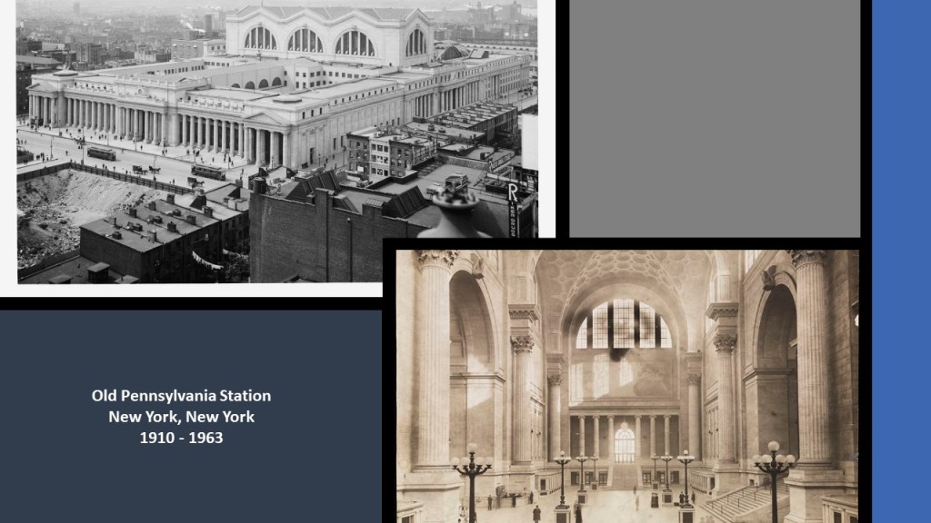
The Toronto Union Station has a style of architecture which reminds me of the original Pennsylvania Station in New York City, which was said to have been built between 1904 and 1910 and demolished between 1963 and 1968.
I also mentioned what you can find in Holliday Park in Indianapolis, and I got too much feedback about Indianapolis, and other Indiana cities, to include here, like these Indianapolis and Indiana suggestions from MO…
…who also sent me these photos he took recently of “The Ruins” at Holliday Park.
Keep in mind, the official narrative tells us this was once a facade of the St. Paul building in Manhattan; and that it was transported to Indianapolis as the result of a winning entry in a design contest; and that the winning designer, Elmer Taflinger, and the city, spent the next 20-years constructing his vision for “The Ruins” in Holliday Park.
The red arrows in the bottom right point to the man and little girl in the photo for comparison of their size to that of “The Ruins.”
There is one other place near Holliday Park that I would like to mention from viewers.
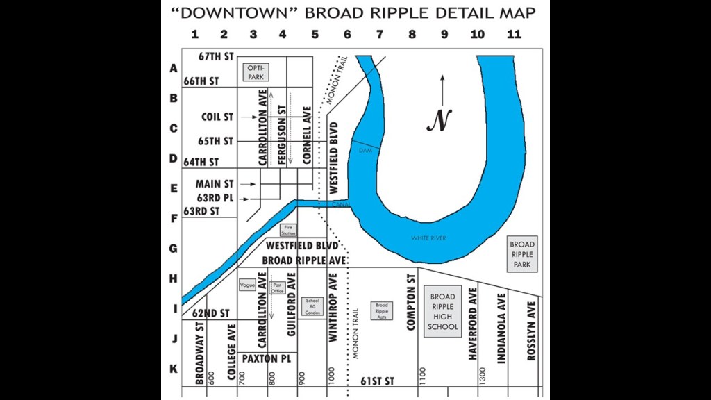
Broad Ripple Village is one of Indianapolis’ seven-designated cultural districts.
Established in 1837, today it is best-known for being a socially, economically, and ethnically-diverse neighborhood, filled with art galleries; specialty shops; restaurants; and night clubs.
I am very interested in Broad Ripple’s location on a U-shaped bend, known as an “oxbow” of what is known as the White River; its connection to the Central Canal; its connection to the railroad; and the trolley line and amusement park in its history.
We are taught these river shapes are natural occurrences…
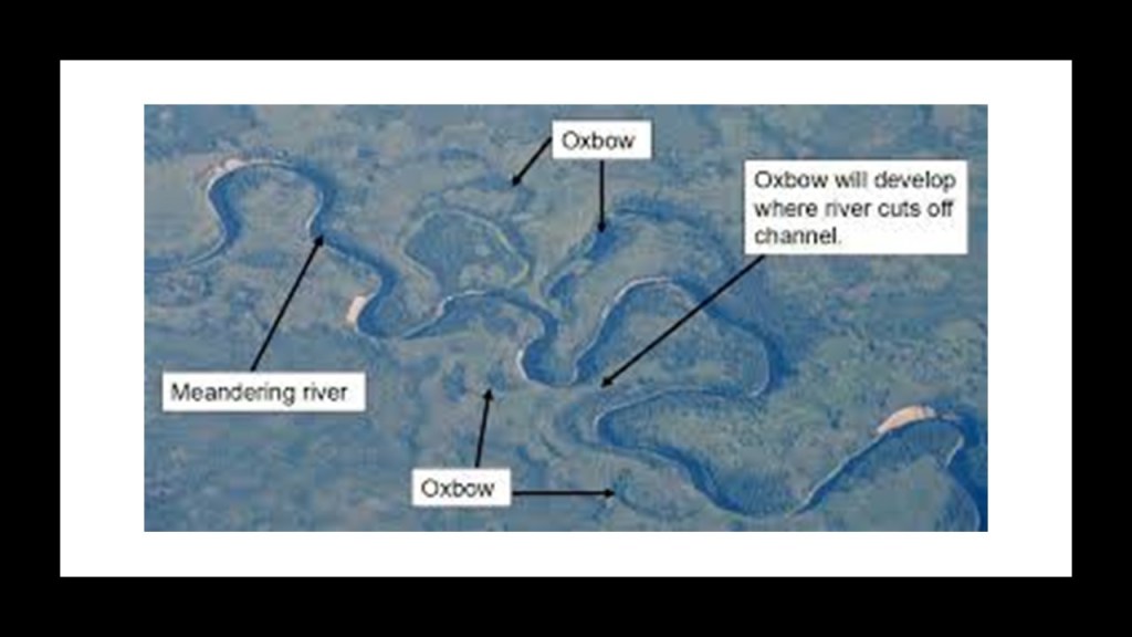
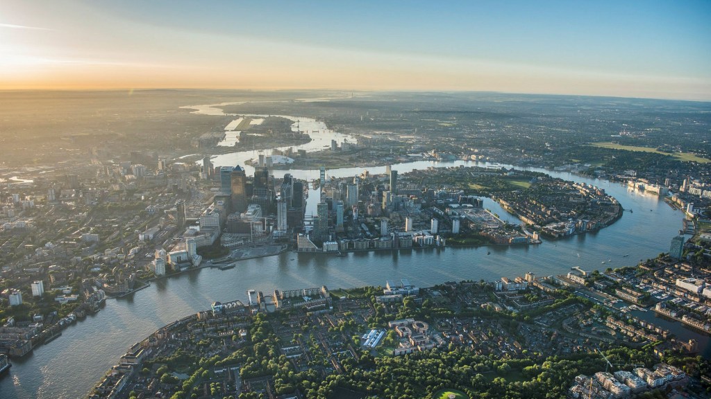
…but these exact same river shapes are found all over the world…including London on the River Thames.
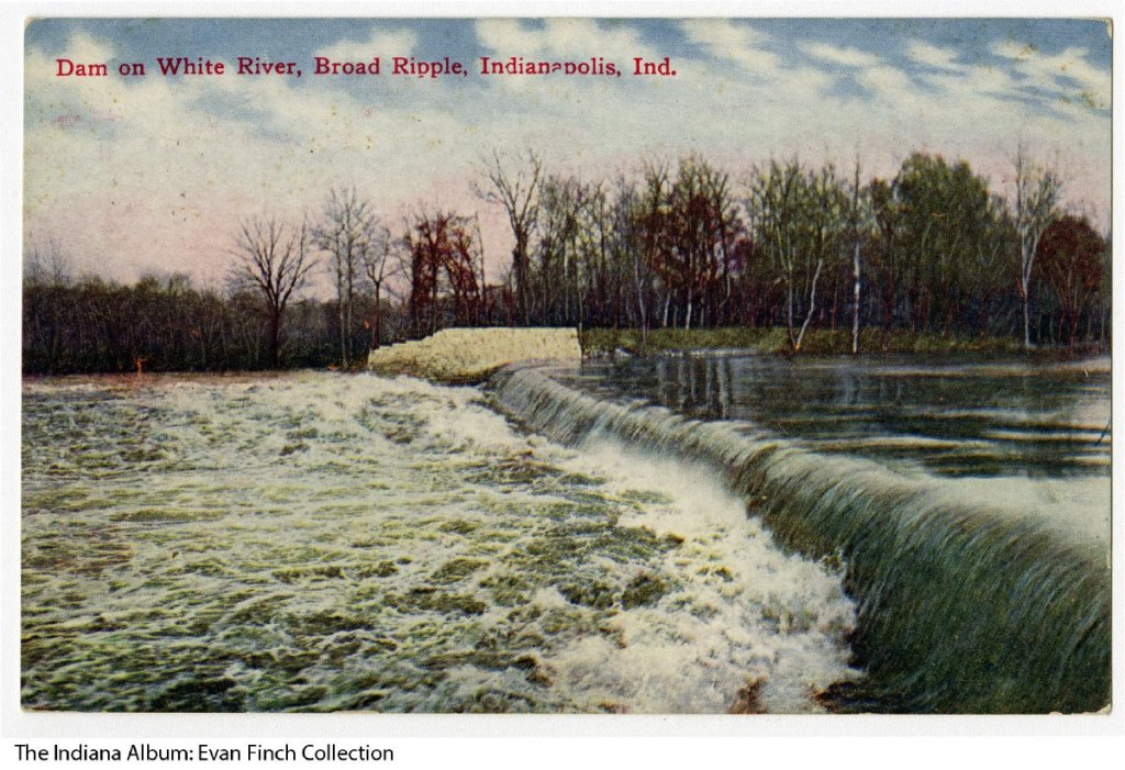
The Central Canal was said to have been constructed in Indianapolis starting in 1836, and that water was first drawn into the Central Canal by the feeder dam on the White River in Broad Ripple starting in 1839.
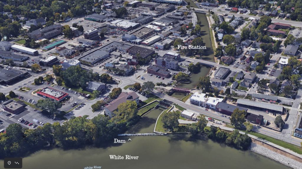
This is a 1909 postcard of the dam.
So on the one-hand, we are told that life in America in the 1830s was largely rustic and full of social ills in need of reform…

…and on the other hand, we are told the North American Canal Age of canal-building was dated from 1790 to 1855.
Same thing with the construction of railroads starting in the same period, and simultaneously the railroads were already making the canals they were constructing obsolete according to the historical narrative.
Only eight-miles of the Central Canal within Indianapolis were completed, starting at Broad Ripple. It was originally intended to connect the Wabash and Erie Canal with the Ohio River…
…but construction was said to have stopped in 1839 because of financial difficulties due to the Panic of 1837, which was said to have touched off a major depression which lasted until the mid-1840s.

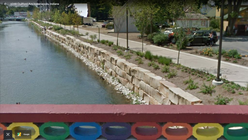
This is a view of the Central Canal, with cut-and-shaped large stones, and the Monon railroad bridge crossing over it, on the left, and on the right is a photo for comparison of an ancient megalithic stone wall in Delphi, Greece.
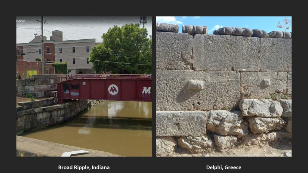
Here’s another view of the large stonework of the Central Canal from Broad Ripple’s Rainbow Bridge.
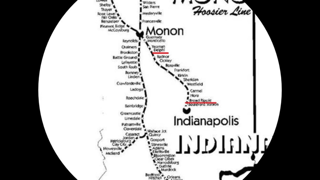
The Monon Trail used to be the Monon rail-line between Indianapolis and Delphi, Indiana, that was abandoned in 1987, and which was part of a larger rail-line that connected Chicago and Indianapolis.
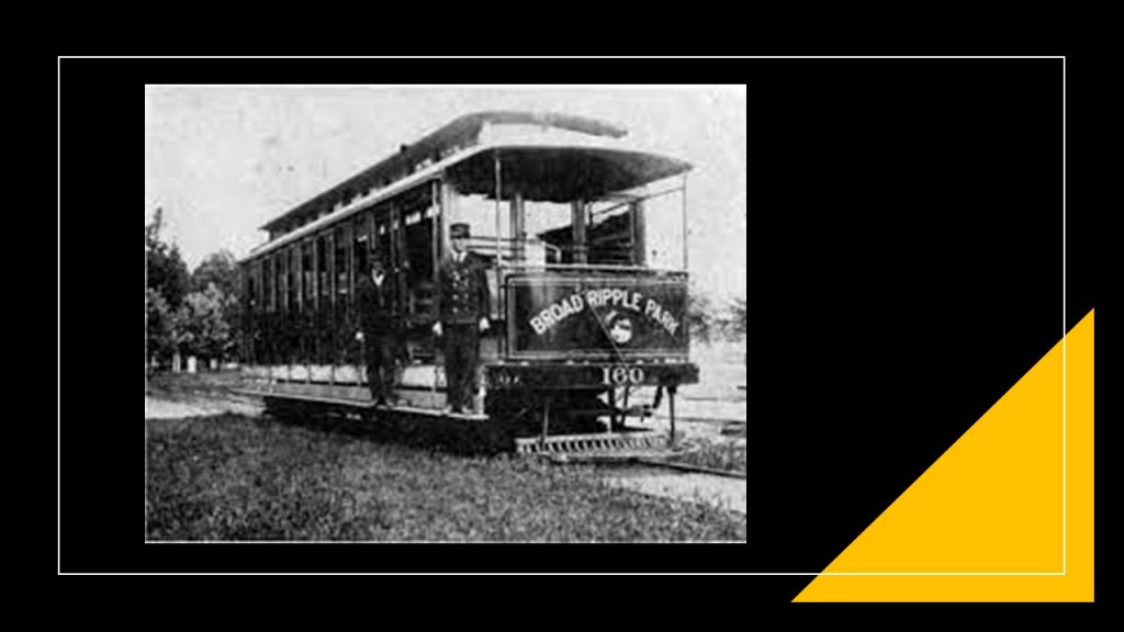
Before I leave Broad Ripple, I would like to mention that it was a summertime retreat for Indianapolis from 1890 to 1930.
The organizers of the Broad Ripple Transit Company in 1894, what was called the first electric interurban railway to be constructed and put in operation in the United States, created the White City of Indianapolis Company in 1905, with the stated goal of developing an amusement park at the end of the Broad Ripple Transit Company’s College Line.
The White City Amusement Park, said to have been named in honor of Chicago’s 1893 Columbian Exposition, which was also known as the White City, opened officially on May 26th of 1906.
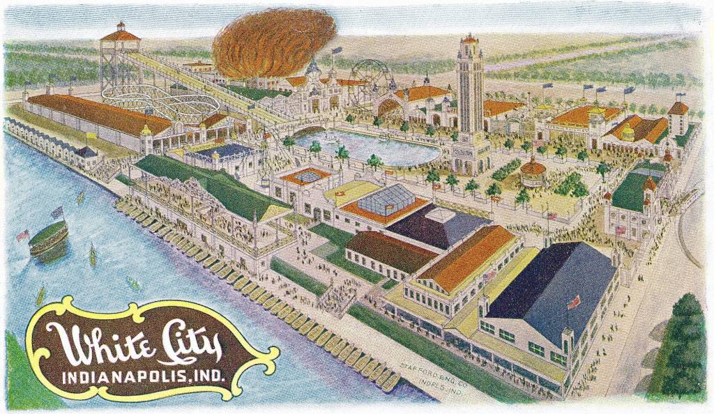
The 4-acre pool was scheduled to open to the public on June 27th of 1908, but on June 26th, 2 years and a month to the day, nearly the whole amusement park was burned to the ground, allegedly taking less than 10-minutes to engulf the park.
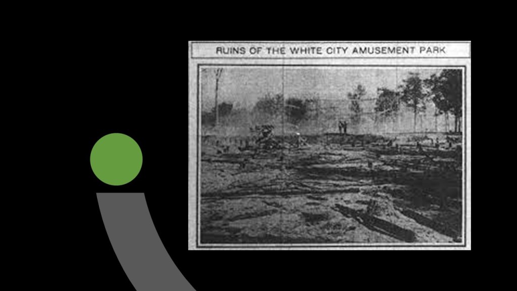
The pool, however, remained unscathed by the fire.
The Union Traction Company purchased the park in 1911, and continued on as the Broad Ripple Amusement park until around 1945…
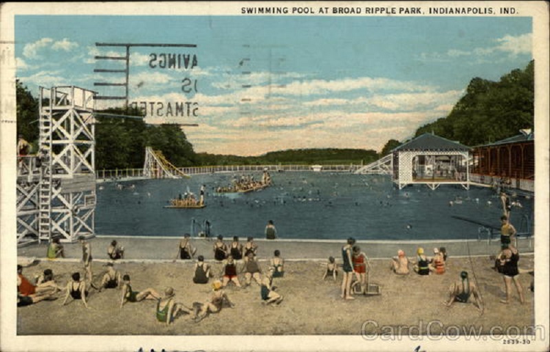
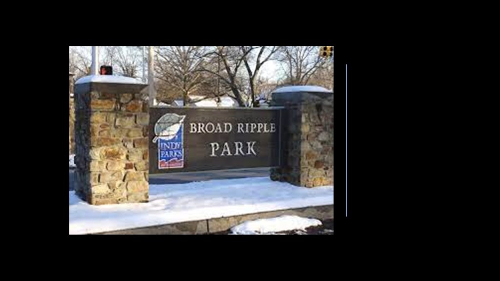
…and the location was Broad Ripple City Park today.
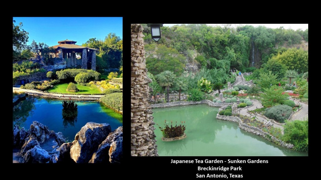
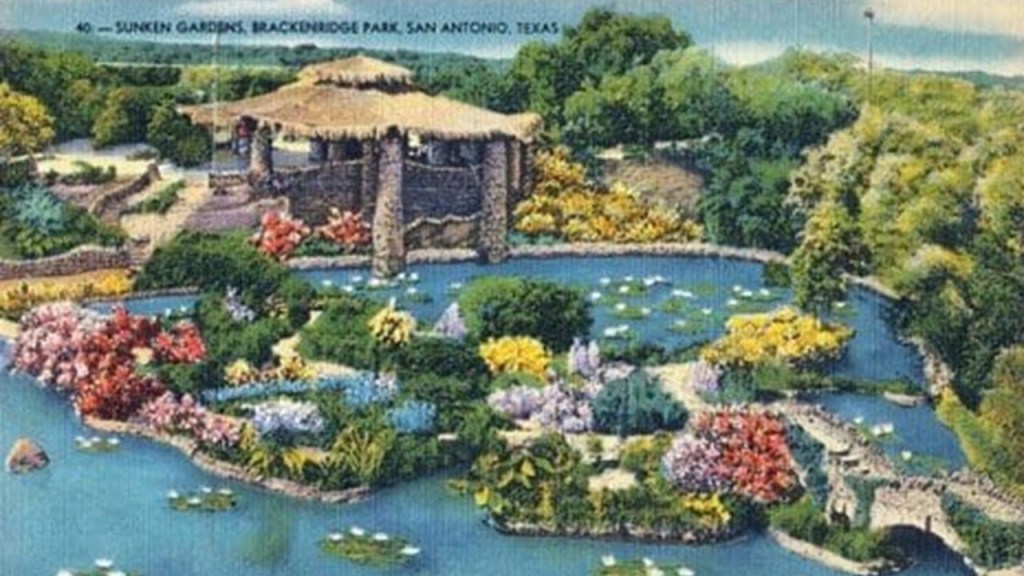
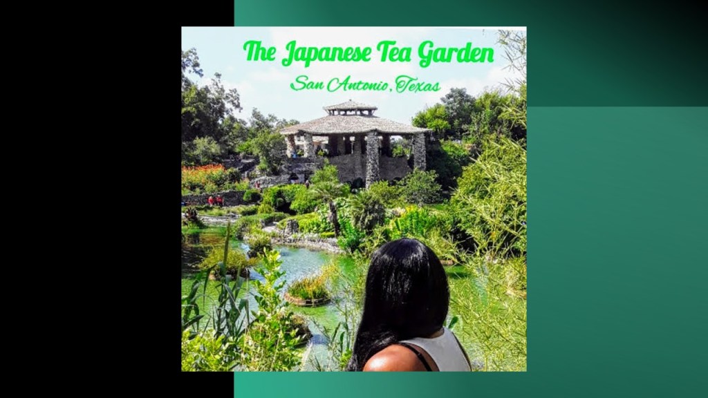
Next, DeR mentioned the Japanese Tea Garden, also known as the Sunken Gardens, in a rock quarry in Breckinridge Park in San Antonio, Texas.
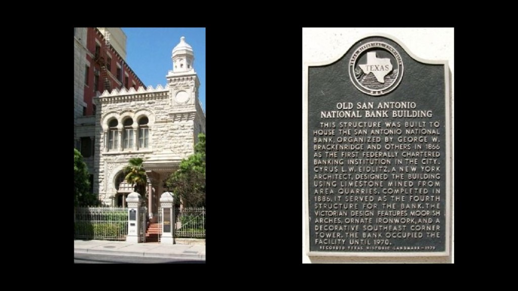
We are told it was developed on land donated to the city in 1899 by George Washington Breckinridge, a businessman who made his initial wealth as a war profiteer during the civil war, water works president, and philanthropist…
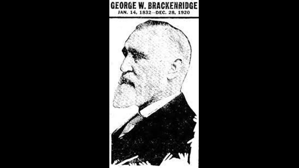
…who was the organizer of the first federally-chartered banking institution in the city, and the San Antonio National Bank on Commerce Street was said to have been completed in 1886, using limestone from local quarries.
The formation of the quarry as a Japanese Tea Garden started in 1917, we are told, under the guidance of the City Parks Commissioner at the time, who envisioned an oriental-styled garden in the quarry’s pit, and work began in 1918 with the use of prison-labor after several donors’paid for the cost of developing the quarry into a complex that included stone arch bridges, walkways, an island, and a Japanese Pagoda.
Long story short, the garden eventually sat neglected for many years, becoming a target for vandalism and grafitti, and it was slated for closure by the city.
Various groups in the community rallied, and it was renovated starting in 2009 and re-opened to the public in 2011.
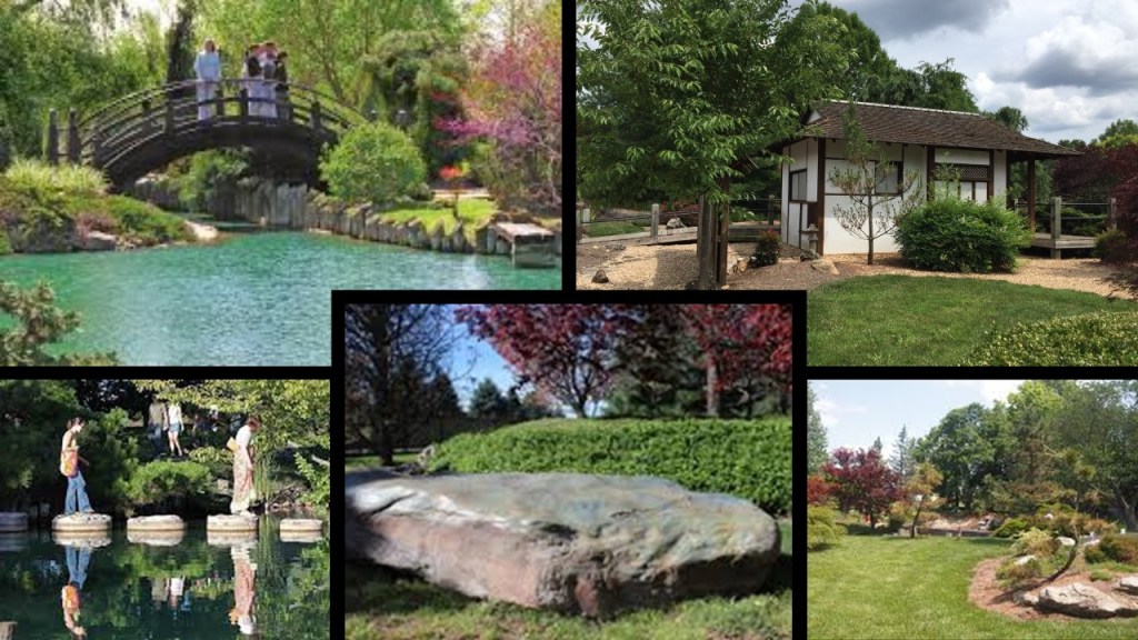
AM mentioned the Japanese Garden in Springfield, Missouri, which is named the Mizumoto Japanese Stroll Garden and is the oldest attraction of the Springfield Botanical Gardens, and was established in 1986 in partnership with the Springfield Sister Cities Association and its Sister City of Isesaki, Japan.
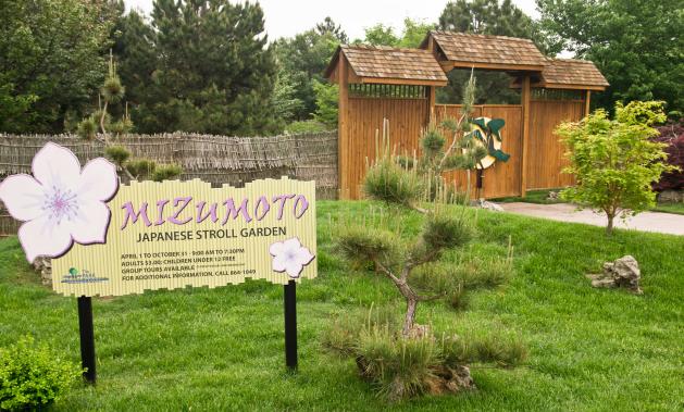
The Mizumoto Japanese Stroll Garden is on 7.5-acres of land, and includes a moon bridge, meditation garden, large koi lake, tea house, and traditional Japanese Garden landscaping.
CG sent me these photos he took of a particular Odd Fellows bench on the garden grounds near the Japanese Stroll Garden in Springfield.
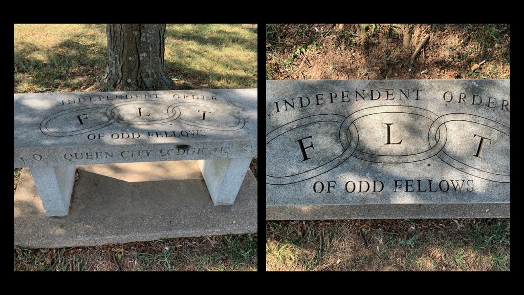
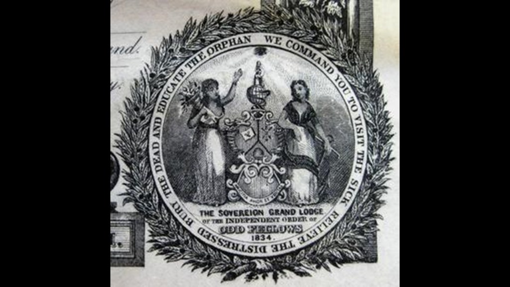
The American Independent Order of Odd Fellows was founded by Thomas Wildey in 1819 at the Seven Stars in Baltimore, Maryland, which had evolved from the Order of the Odd Fellows founded in England in the 1700s.

The command of the IOOF is to “visit the sick, relieve the distressed, bury the dead and educate the orphan.”
Would be interesting to know what was really going on here.
It seems…well…odd….
Another viewer left a comment regarding this image of the Seven Pillars in Miami County in Peru, Indiana, directly north of Indianapolis.
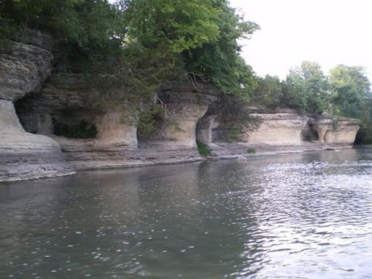
The Seven Pillars are held sacred by the Miami Nation of Indiana, which owns land on the south bank of the river directly across from The Seven Pillars, where they hold sacred ceremonies and heritage days.
The viewer said that Cambell, on his Autodidactic 2 YouTube channel, showed very similar “ruins” to the Seven Pillars in Indiana supposedly created by indigenous Australians at the Nawarla Gabarnmung in Australia.
I found this photo of Nawarla Gabarnmung in Australia on the right that looks very similar to the formation and view of the Seven Pillars on the left.
I have arrows pointing to the several layers of stone at the top of the formation in both structures, which both photos show a combination of the thick pillars and skinny pillars, with the second arrow pointing to skinny pillars that are visible at both locations.
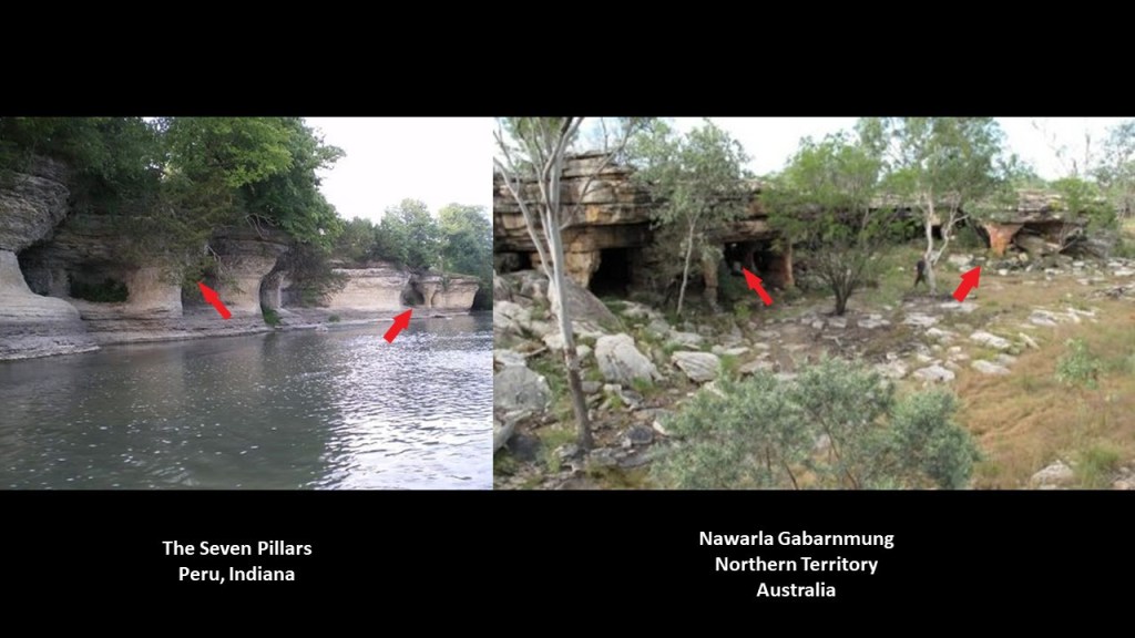
Here’s a photo with a better view of a skinny pillar in Indiana.
I couldn’t find a photo of the inside of the Seven Pillars site on the internet, but here is one of the similar site in Australia.
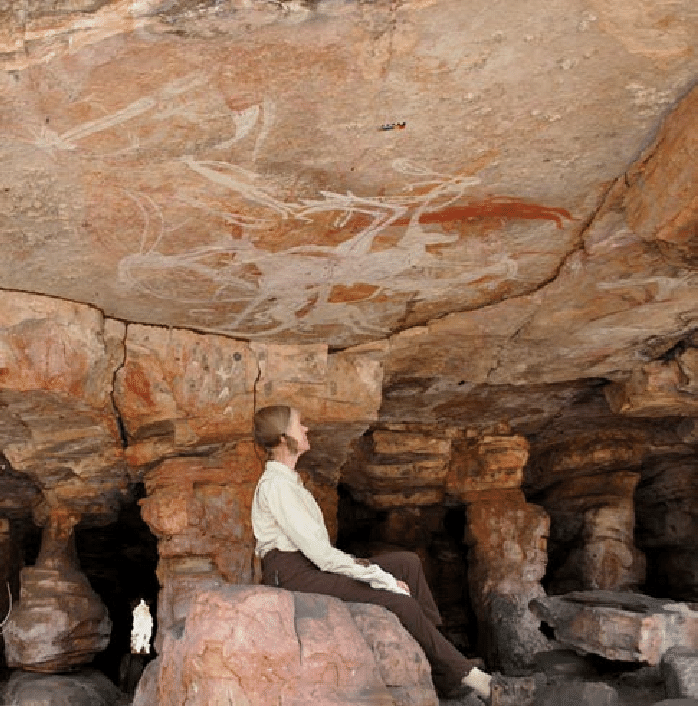
I can make an indirect connection based on what I have found in past research between the people and the places to support the idea that these two ancient sacred places on different continents could very well have been created by intelligent design and are not natural formations.
I started coming across people who identified as lost tribes of Israel all over the world from early on in my research.
This includes the Australian Aborigines identified as the Tribe of Reuben…

…and the Seminole Indians identified as the Tribe of Reuben, and are considered to be a Native American people originally from Florida…

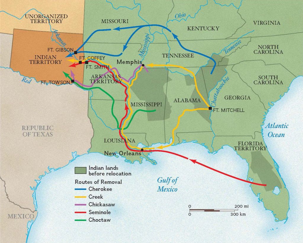
…until the Seminole Wars starting in 1816 and ending in 1858…
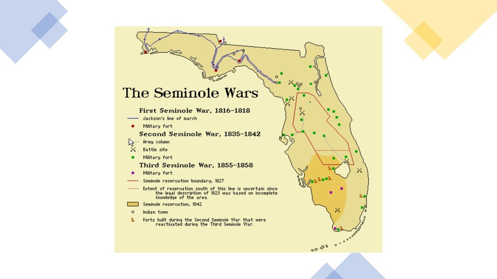
…forced the Seminoles either to Indian Territory in Oklahoma…
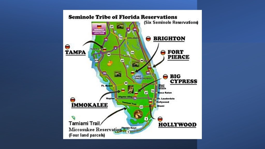
…or onto six reservations in Florida.
What is interesting about that is that the well-known city of Miami, located at the southern tip of the east coast of the Florida peninsula, is the starting point for Highway 41, and Highway 41, known as “Tamiami Trail” where it crosses over northern border of Everglades National Park in South Florida, to Florida’s west coast is where Seminole reservation land is as well…
…and this same Highway 41 goes all the way up to the very tip of Michigan’s Keweenaw Peninsula on Lake Superior, and passes through Indiana on its way.
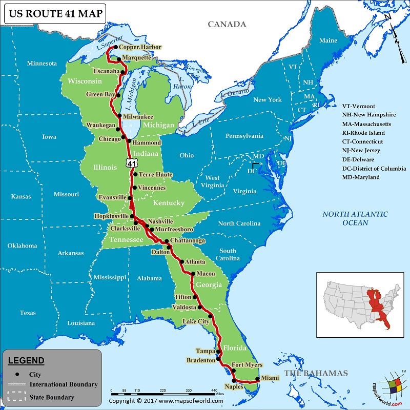
The Miami Nation of Indiana hails from the Great Lakes region.
So then why is there a Miami at the southern tip of Florida in historic Seminole lands?
Possibly unrelated pieces of information which circumstantially connects the Seminoles, the Miami Nation of Indiana, and the Australian Aborigines, but then again, possibly not unrelated pieces of information….
With regards to the subject of Heligoland/Helgoland, a viewer commented that Heligoland was indeed a sacred and holy place, and is the only place in the world that a certain type of blood red silex, or flint, can be found.
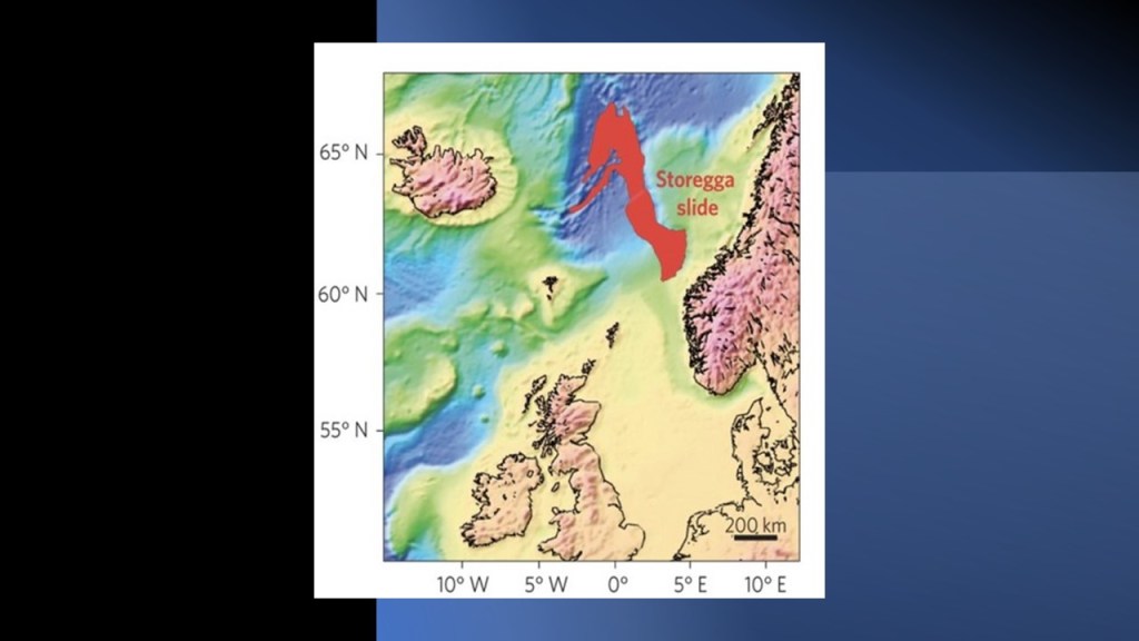
Also that Heligoland is a remnant of Doggerland, believed by some to be part of Atlantis, and that it once connected Great Britain to Continental Europe.
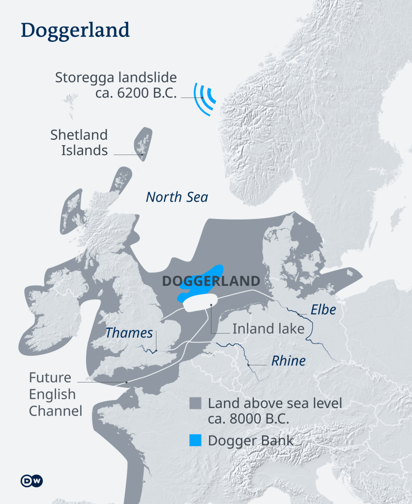
Doggerland was said to have been submerged beneath the southern North Sea 8,000 years ago after the Storegga landslide, which took place off the coast of Norway between Bergen and Trondheim, and generated a tsunami strong- enough, and high-enough, to take out what was called the “True Heart of Europe.”
PS left a comment with lyrics from a song by Massive Attack in their 2010 Album, “Heligoland.”
These lyrics were from the song “Saturday Come Slow”:
In the limestone caves
In the south west lands
What towns in the kingdom
Beneath us understand?
Is Humanity under Massive Attack? I think so.

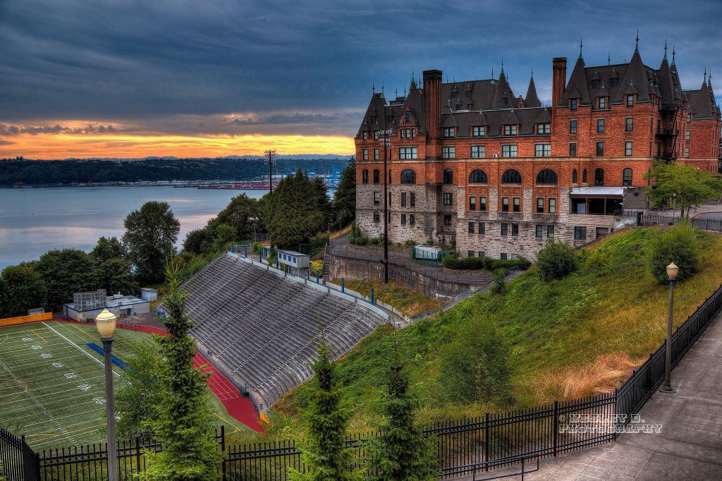
Lastly, I received some suggestions of places to look with regards to over-the-top architecture for schools, like the Central High School in Duluth, Minnesota, and the John Handley High School in Winchester, Virginia, two viewer suggested another example of Stadium High School, near downtown Tacoma, Washington.
It was said to have been constructed as a luxury hotel resembling a French Chateau for the Northern Pacific Railroad Company starting in 1891…
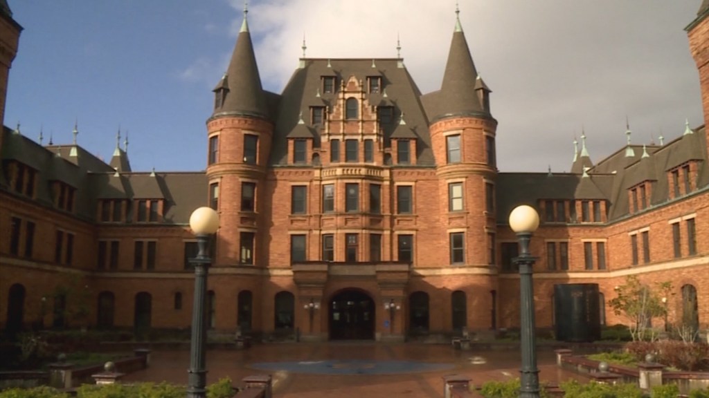
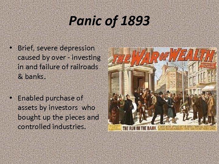
…but the Panic of 1893 brought its construction to a sudden halt when the Northern Pacific Railroad was faced with financial disaster.
The Panic of 1893 resulted in an economic depression which lasted until 1897.
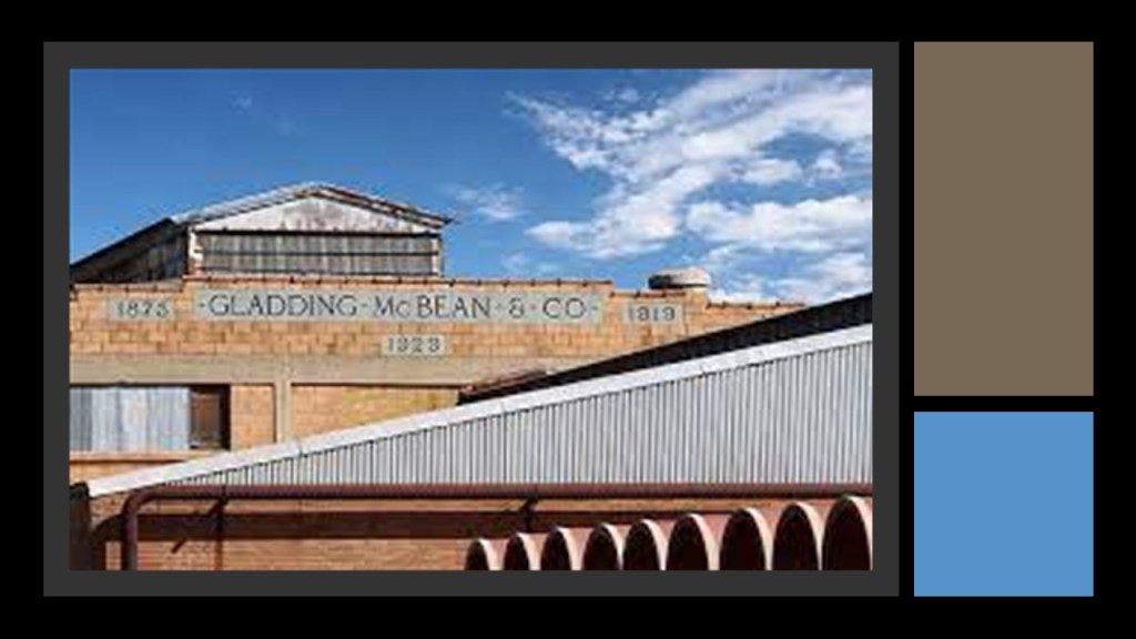
We are told the unfinished hotel building subsequently became a storage facility until it was gutted by a fire in 1898, after which the Northern Pacific Railroad began dismantling it, and removing 40,000 unique Roman bricks said to have been manufactured by the California ceramics company Gladding, McBean in order to use them for the building of two other train stations, one in Montana and the other in Idaho.
Then, the Tacoma School District purchased the gutted building in 1904, and the redesign was planned by the school’s architect, Frederick Heath, with the reconstructed building opening in September of 1906.
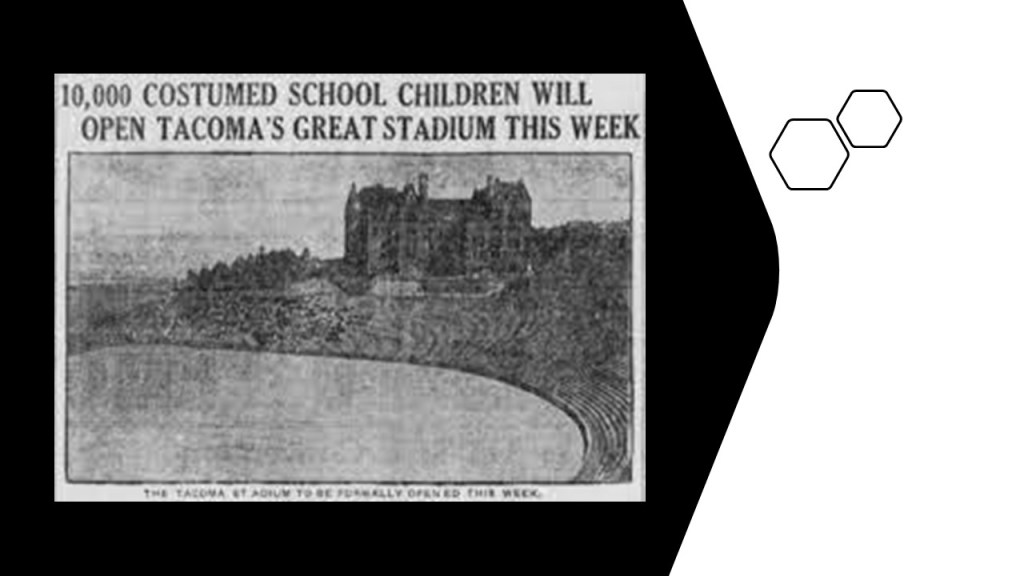
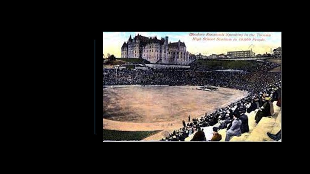
In 1911, the future President Theodore Roosevelt spoke at the high school’s Stadium Bowl to a huge crowd, and said at the time that he had never seen anything like it in the world.
It is still in use as a high school today.
Viewer IG mentioned an abandoned school in Detroit that was once Cooley High School, and a very elaborate building said to have been constructed in the architectectural style of Mediterranean Revival.
It opened in 1928, and was closed at the end of the 2009 – 2010 academic year for the given reason of budget constraints and declining enrollment.
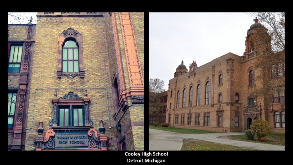
A suspected arson fire severely damaged the auditorium and rooms surrounding it in the building on September 30th of 2017.
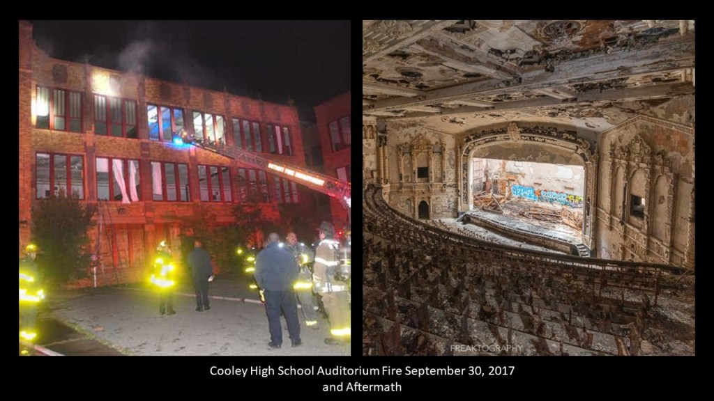
That didn’t get it demolished, as it still sits abandoned in an old Detroit neighborhood and is considered Michigan’s largest abandoned school!

I am going to end “Places & Topics Suggested by Viewers – Volume 5” here.
Lots more to come!


I would like to donate to your wonderful work by check. Could you please provide a mailing address. Thank you.
LikeLike
PO Box 4772
Sedona, AZ 86340
LikeLike