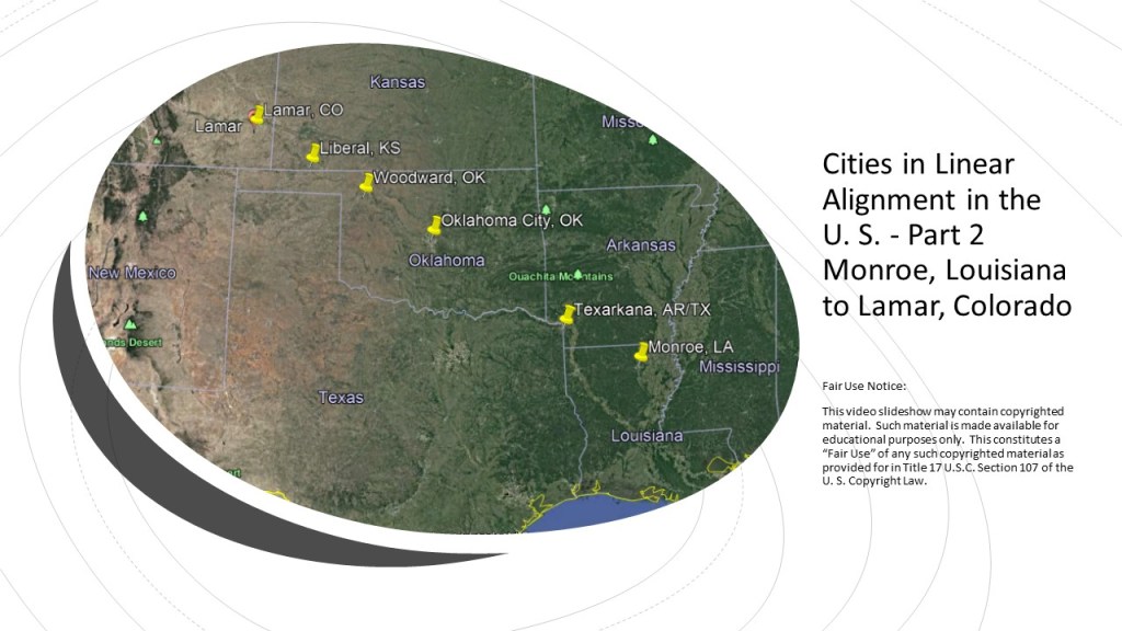
This is the second-part of a four-part series on cities that I found in linear alignment in the United States.
I am showcasing linear alignments I identified while looking at a map on the internet of the region where I was living in Oklahoma City several years ago during the time I was waking up to all of this.
I am sure there are more cities…and alignments…. that could be added, but each part of this series will be a snapshot of whatever longer alignment this represents, and complete in itself for the purpose of this series.
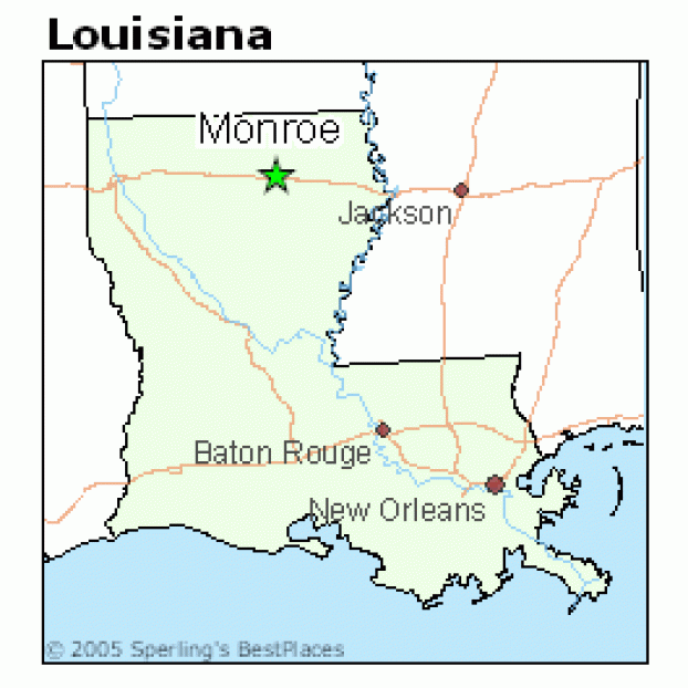
My starting point is Monroe, the parish seat of Louisiana’s Ouachita (pronounced Washitaw) Parish.
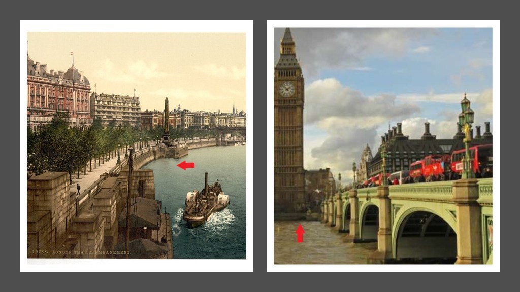
Monroe and West Monroe, which together are called the Twin Cities of northeast Louisiana, are situated on either side of the snaky, S-shaped Ouachita River, on the top left, which looks like the snaky, s-shapes of the Wichita River in Wichita Falls, Texas, on the top right; the Thames River in London on the bottom left; and the Rio Platano in Honduras on the bottom right.
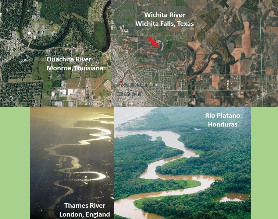
These are just a few examples of the countless rivers and creeks all over the world that have the same S-shaped river bends.
I do not believe this is a random or natural occurrence.
I believe these S-shaped waterways are signatures of the ancient civilization, and artificially-made canal systems.
We are taught these are natural so we don’t see and understand the truth.
Here are the earthwork-banks of the Ouachita River in downtown Monroe next to the city’s Riverwalk…

…and the masonry banks of the River Thames in downtown London.
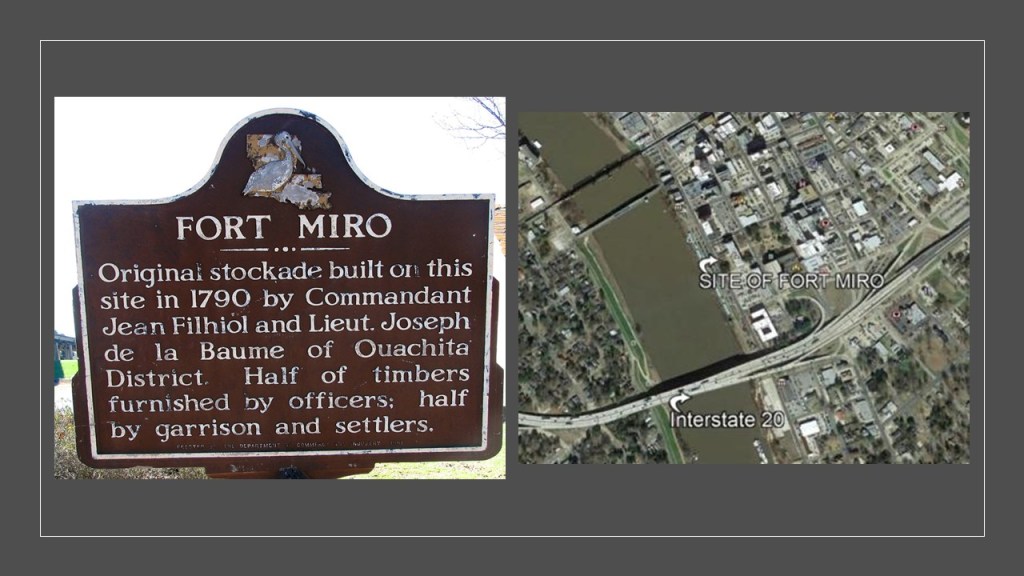
Fort Miro was located on the site of present-day Monroe, described as a late-18th-century Spanish outpost that served the Ouachita River valley, said to have been named after Esteban Miro, the governor of the Spanish provinces of Louisiana and Florida from 1785 to 1791.
The settlement became known as Monroe in 1819, we are told, with the arrival of the steam-powered paddle-wheeler “James Monroe,” named for the 5th President of the United States.

Apparently, the arrival of the paddle-wheeler had such a profound effect on the settlers that the name of the settlement was changed to Monroe.
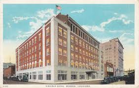
Now a retirement community, the Frances Tower in downtown Monroe, the city’s tallest building at a height of 179-feet, or 55-meters, was said to have been built between 1931 and 1932 (which would have been during the Great Depression) because the city needed more hotel rooms, and the owner wanted to compete wth the top meeting location of the time in Monroe…
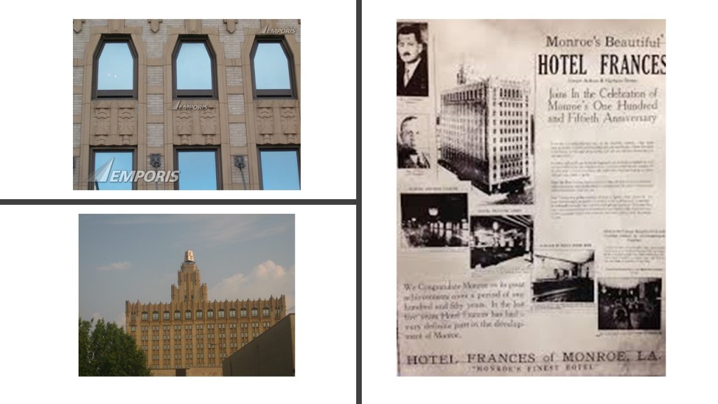
…The Virginia, which was said to have been built in 1925, and had three ballrooms.
The hotel was closed in the 1960s, and it became a state office building.
The building was restored in 2016, and became the Vantage State Building.

Joseph Biedenharn was a German-American businessman who was born in Vicksburg, Mississippi, to parents who had immigrated to the United States following the Revolutions of 1848, a series of revolts against European monarchies that affected over 50 countries, including Germany, and one of the factors of a huge wave of immigration to America that took place during the mid-1800s.

The German immigrants were said to typically have come to America with money and greater ability to be mobile than immigrants from other countries.
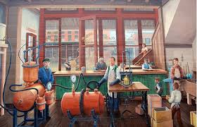
Joseph was a candy-maker, the first bottler of coca-cola, and the first to develop an independent network of franchise bottlers to distribute the drink.
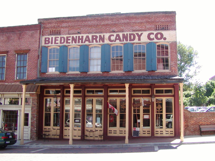
He moved his manufacturing and bottling operations to Monroe, Louisiana, from Vicksburg, Mississippi in 1913.
Along with his son, Malcolm and other investors, Joseph bought a crop-dusting business in 1925, along with his son and other investors, and added eighteen planes to the fleet, moving the company headquarters from Macon, Georgia, to Monroe.

This was the origin of Delta Airlines, which was incorporated in December of 1928.
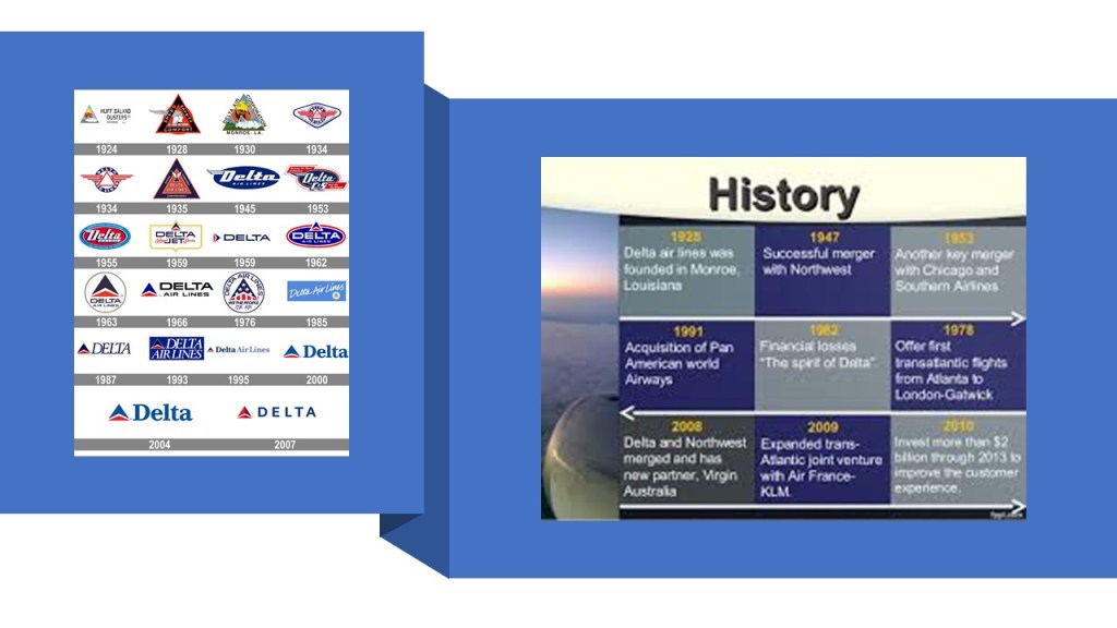
Delta’s headquarters moved from Monroe to Atlanta in 1941.
The First Baptist Church in downtown Monroe was said to have been built in Neo-Palladian style, with an octagonal dome, columns, and pediments, which is the triangular upper-part of a building in classical style, typically surmounting columns.
The church congregation was founded in 1854, and the present church was said to have been built in 1911.
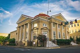
Palladian architecture was a European architecture was said to have been derived from Venetian architect Andrea Palladio, who lived between 1508 and 1580, whose work was based on the formal classical temple architecture of the ancient Greeks and Romans.
In downtown Monroe?

Similarly, St. Matthew’s Catholic Church was founded in 1851, and this building was said to have been built starting in 1897 with a large frontal tower that also echoes European architecture.

The old Monroe City High School was said to have been built between 1900 and 1901 as the first school in the Monroe City school system…
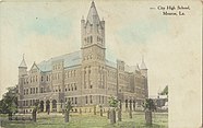
…and was located where the Anna Grey Noe Park is today, named after a former first lady of Louisiana.

Why destroy beautiful architecture like this in the heart of downtown Monroe, only to create a building-less public park?
Here is a comparison of the old Monroe City High School on the left, and Parliament Hill pre-1916 in Ottawa, the national capital of Canada on the right.

This was the original Ouachita National Bank, which opened in Monroe in 1906.

Before closing in 1933, the Ouachita National Bank printed six different types of national currency, and moved twice, during that 27-year-period.

It is important to note that Monroe was the ancient Imperial Seat of the Washitaw Empire, in an area known as Washitaw Proper.

This is a picture of the relatively recently deceased Empress of the Washitaw, Verdiacee Washitaw Turner Goston El Bey, who passed away in 2014.

Empress Verdiacee passed away in 2014, and her granddaughter Wendy Farica Washitaw succeeded her as the Washitaw Empress.
You are not going to find the memory of the Washitaw anywhere in our history books, but they are found everywhere in place-names – Wichita, Ouachita, Hatchita, Washa, Wabash, Washoe, Waxhaw, to name a few off the top of my head.
In 1993 Empress Verdiacee published the book “The Return of the Ancient Ones,”on the true history of the Washitaw Empire.

The Washitaw Mu’urs were formally recognized by the United Nations in 1993 as the “Oldest Indigenous Civilization on Earth.”

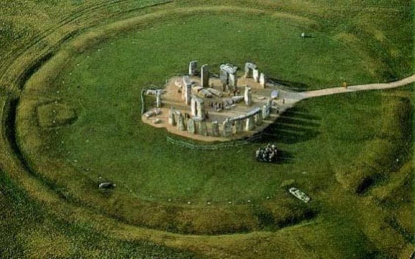
The Watson Brake Mounds are in the vicinity, and are located south of Monroe in Richwood, Louisiana.

Watson Brake is an archeological site in Ouachita Parish, Louisiana, dated to 5,400 years ago, and is the oldest earthwork mound complex in North America, acknowledged to be older than the Egyptian Pyramids and Stonehenge in England. It is located on private land, so is not available for public viewing.
Stonehenge, which has an earthwork very similar to Watson Brake around its perimeter, according to what we are told, dates from starting at 3,100 BC, about 5,100 years ago.
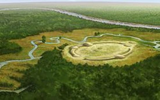
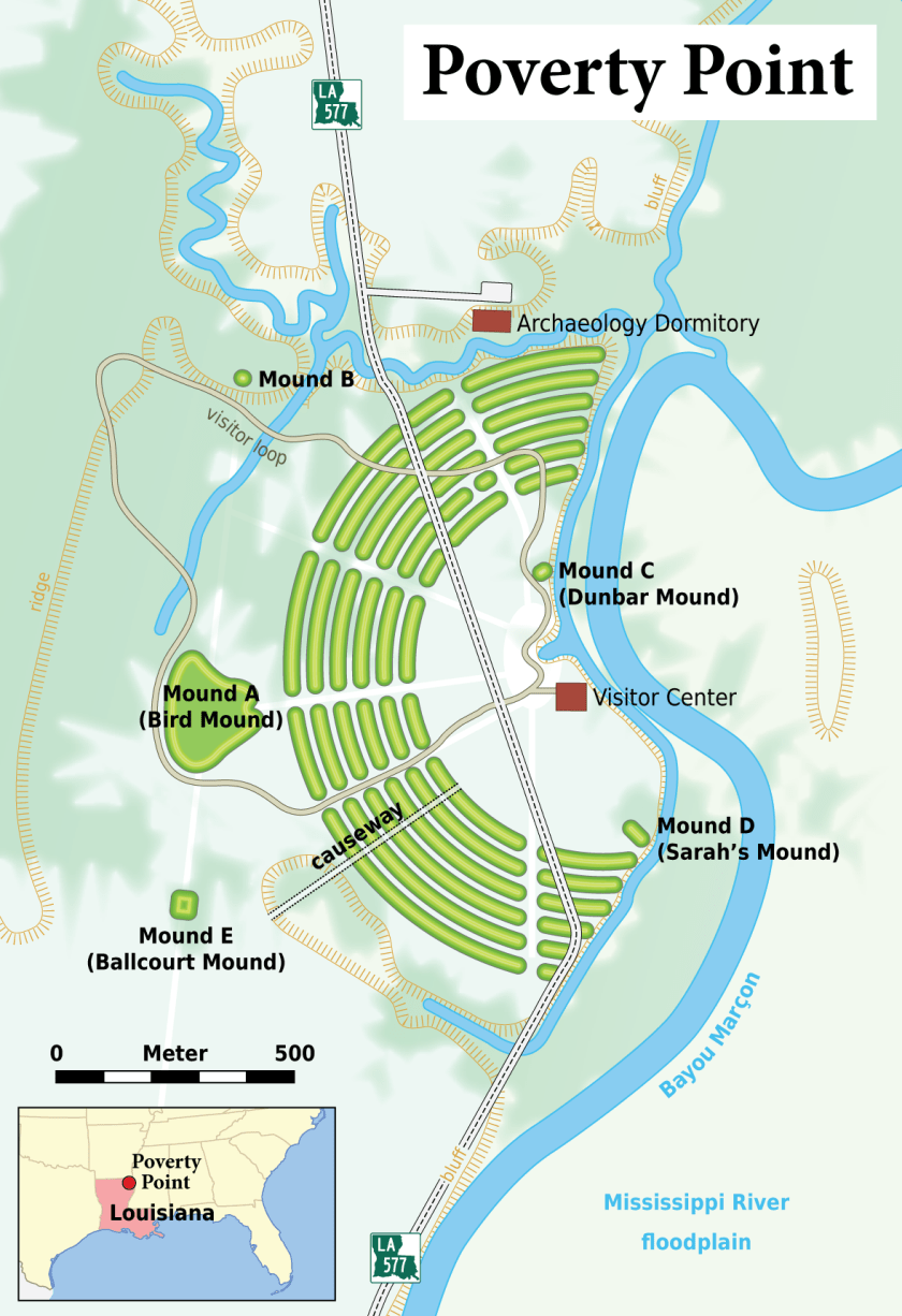
Thirty-eight miles northeast of Monroe, near the town of Epps, Louisiana, is Poverty Point.
It is said to have become known as Poverty Point because the farming was terrible here.
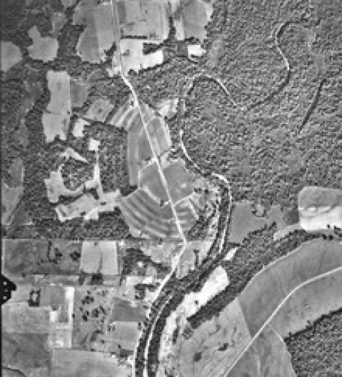
Its name was actually Awulmeka, and was an ancient sacred city of the Washitaw Mu’urs.
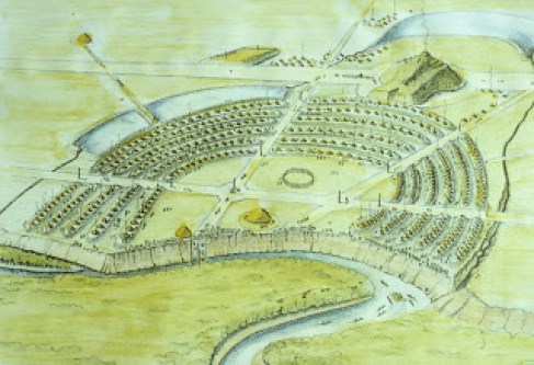
The story that we are told about all the mound sites is that indians wearing loincloths were responsible for building the perfectly geometrically- and astronomically-aligned mounds and earthworks, one basketful of dirt at a time. This is not the truth, and does not hold up with any scrutiny whatsoever.

These are the kinds of artifacts on display at Poverty Point as being representative of what was found here. While perhaps they were found here, I don’t think these were representative of the highly advanced and sophisticated ancient civilization that lived here.

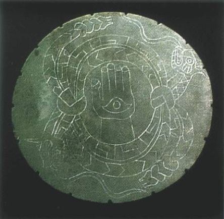
The artifacts on display at Spiro Mounds in Oklahoma, like this one here, would be more representative of what was found at Poverty Point.
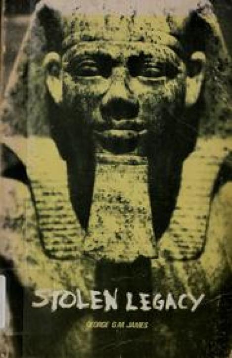
According to George G. M. James, in his book “Stolen Legacy,” the Moors were the custodians of the Ancient Egyptian mysteries…
…and in the present-day, Muurish-American Master Adepts and Teachers are wisdom-keepers of ancient sacred Kemetic Mysteries and Knowledge about all Creation.
They are living practitioners of Egyptian Yoga…

…and Medju Neter, or Meroitic, the language of the Egyptian Hieroglyphs..
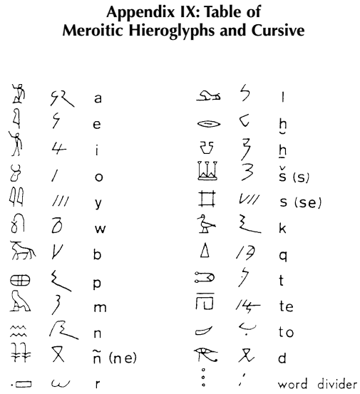
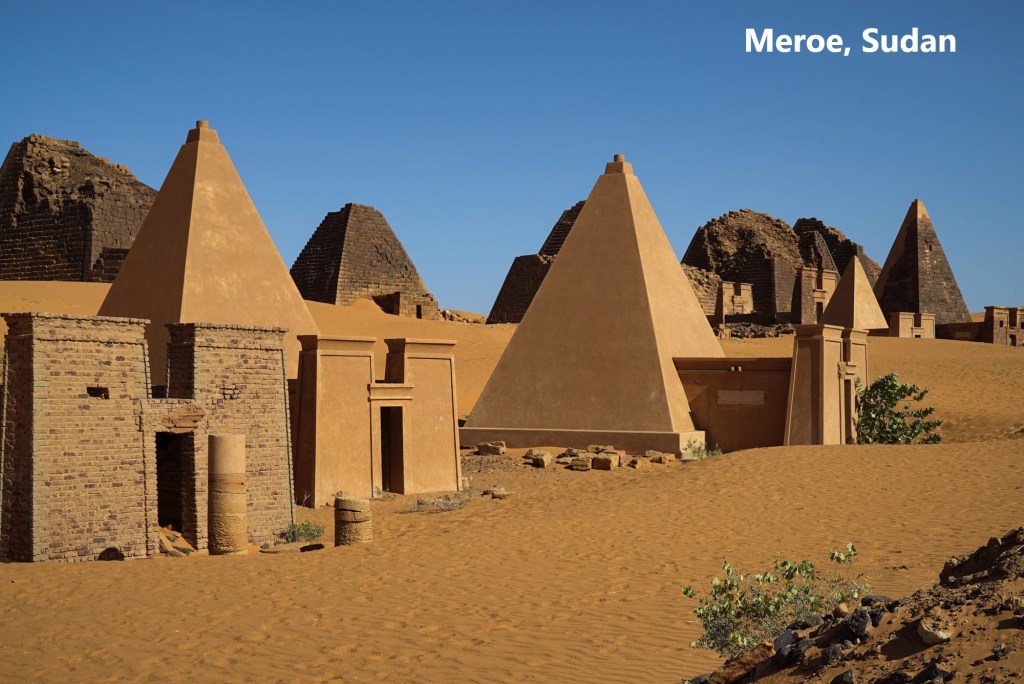
The Meroitic language and script are named after Meroe, the royal capital of the Kingdom of Kush, and located on the Nile River where it flows through in northeast Sudan in northeastern Africa.
We are told that Fort Miro was the original name of the settlement that became Monroe.
Is it just a coincidence that these two place-names, one in Sudan and one in Louisiana, sound phonetically identical, or is there something else going on here that we are not being told about?

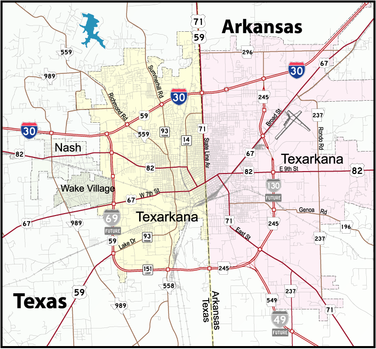
The next stop on this linear alignment is the Texarkana Metropolitan Area, a region anchored by the Twin cities of Texarkana, Texas and Texarkana, Arkansas, and which also shares a state line with Louisiana.
The story goes that the Cairo and Fulton Railroad, reached present-day Texarkana from St. Louis in the early 1870s, and that the Texas and Pacific Railroad had reached across Texas to the Arkansas state line, where it had been decided the border was the logical place for the different railways to connect.

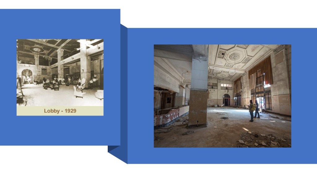
On December 8, 1873, the Texas and Pacific sold the first town lots for the future city. The first to buy was J. W. Davis, who purchased the land where the Hotel McCartney, said to have been built in 1929, now stands, opposite Union Station.

The Hotel McCartney has been abandoned since the mid-1970s.
Why build a massive building like this, to use it for only 50-years?
Similar idea with the Union Station across the street from it.
It is described as a grand Renaissance station built in 1928 across the Arkansas – Texas state line and placed on the U. S. National Register of Historic Places in 1978.
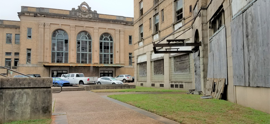
Amtrak still uses a small portion of the station for its Texas Eagle Line, but otherwise the station has been abandoned.

State Line Avenue follows the Texas-Arkansas state line throughout much of Texarkana.
Thousands of locals actually live in one state and work in the other.
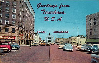
In the distance in the center of this post card is the Texarkana U. S. Post Office and Courthouse.
The Texarkana twin cities are home to the only federal building in the U. S. that straddles a state line and houses federal courts in two jurisdictions.
The two sides of Texarkana share a federal building, courthouse, jail, post office, labor office, chamber of commerce, water utility, and several other offices, however two mayors and two sets of city officials.
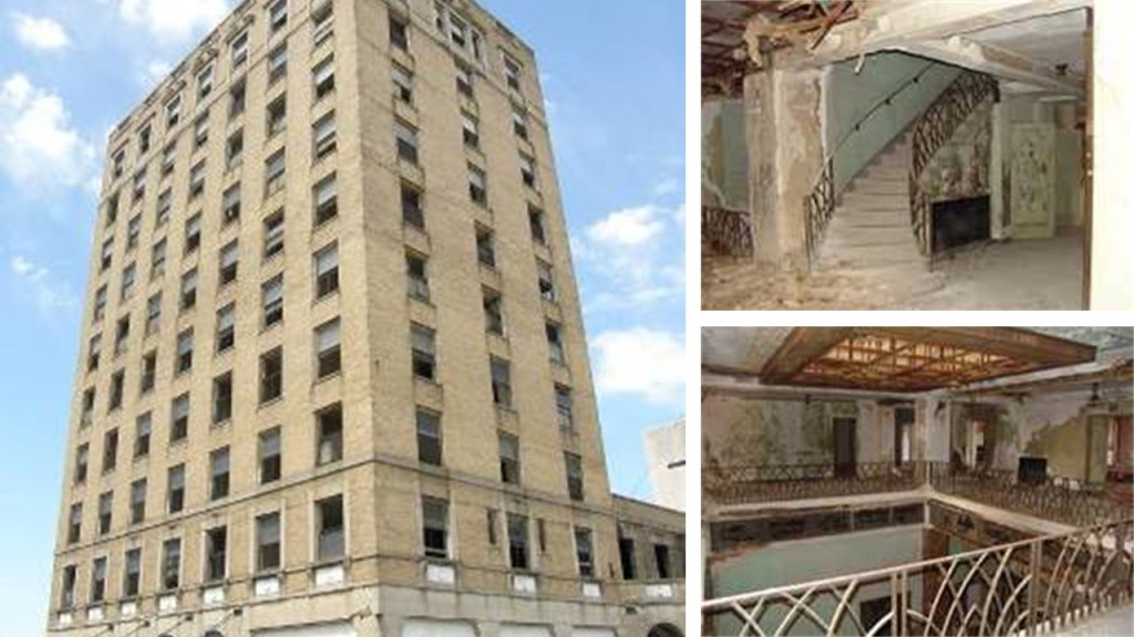
The Hotel Grim on the Texas side of the city was said to have been completed in 1925, and in its hey-day was known as the “Crown Jewel” of Texarkana.

While like the Hotel McCartney, the Hotel Grim was closed and also abandoned in the 1970s…
…it is in the process of being restored and redeveloped as commercial space and residential apartments.

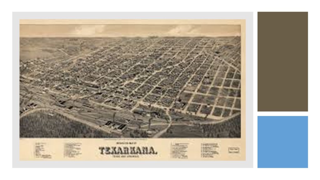
So we have an official founding date of Texarkana by the railroad in 1873, and here is an historic map of the city circa 1888.
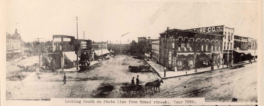
Here is an 1892 photo of Texarkana showing big masonry buildings, not many people in it, what appear to be dirt-covered streets, and mule-drawn transportation…
…and that in 1902 the first electric street-cars appeared in Texarkana, after having had a mule-drawn streetcar system having been established there in the 1880s…
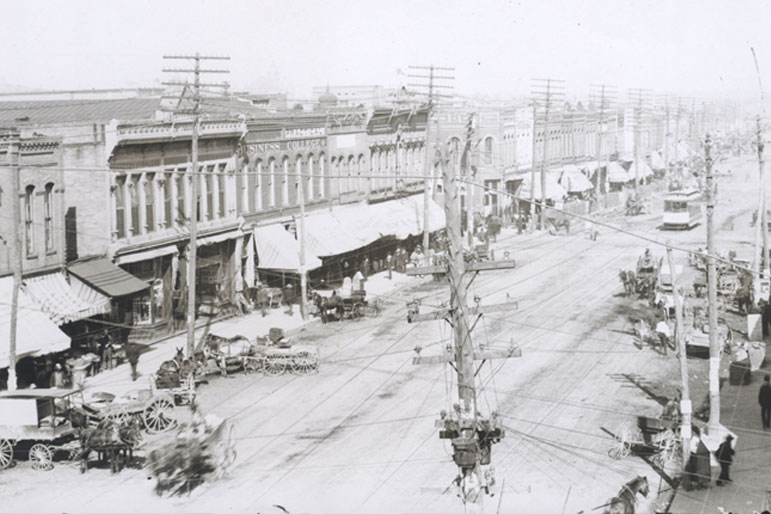
…only to have the electric street-car system there discontinued in 1934 after only 32-years.
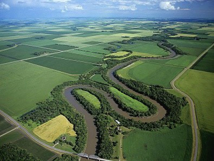
I have circled where the Red River of the South passes through the Texarkana region on its way into Louisiana.
I have also circled the names of the Wichita River in Texas, the Washita River in Oklahoma, and the Ouachita River in Arkansas and Louisiana that are all tributaries of the Red River of the South.

Here is an aerial photo of some of the snaky, s-shapes of the Red River of the South…

…and of the some of the same of the Red River of the North at Grand Forks in North Dakota.
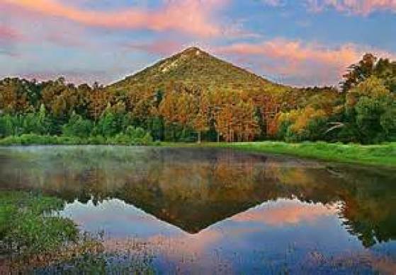
With a straight-line distance roughly of 135-miles northeast of the Texarkana Metropolitan area, just slightly west of the state capital in Little Rock, in Roland, Arkansas, there is a special site known as Pinnacle Mountain that hasn’t been brought forward into public awareness, and represents how sacred ancient sites are deliberately covered-up.
This is a picture of Pinnacle Mountain, which is only viewable like this from the Education Pond at Pinnacle Mountain State Park.
I had first heard of Pinnacle Mountain when I learned about a conference that was held there in 2012.
I didn’t think much of the name Pinnacle Mountain until several years later, in 2015, when finding this image on-line. This was the beginning of my “looking” and then “finding” out more and more. It really got my attention!!!
So I had to go there! It was about a 3 – 4 hour drive from where I was living at the time, and I went twice with friends.
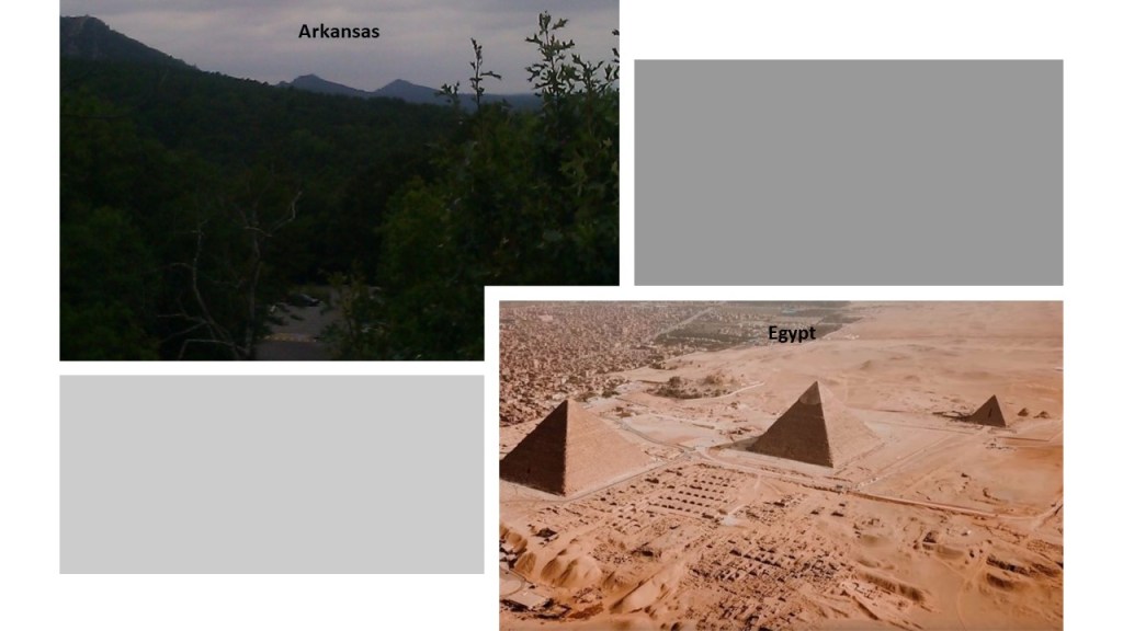
There are two more what appear to be pyramids next to Pinnacle Mountain, and this view is only obtainable from the Visitor Center Observation Deck on a relatively clear day, which I was lucky enough to photograph.

Otherwise, access to all other views is completely cut off by private property and fences, and these are certainly not advertised as pyramids.
Here is a comparison of what is seen from the Pinnacle Mountain Visitor Center Observation deck on the left, and the pyramids on the Giza Plateau in Egypt on the right, in which they all seem to be facing in the same direction.
Here is another connection between America and Egypt.
I have drawn a red line on this world map to demonstrate that there is a straight, west-to-east, linear relationship between the location of the Mississippi River Delta in Louisiana, and that of the Nile River Delta in Egypt.

Also, this is an aerial view of the Mississippi Delta, which is on the southeastern coast of Louisiana, on the top, showing what appear to be man-made channels, compared with the same type of straight, man-made looking channel is also found in the Nile Delta.

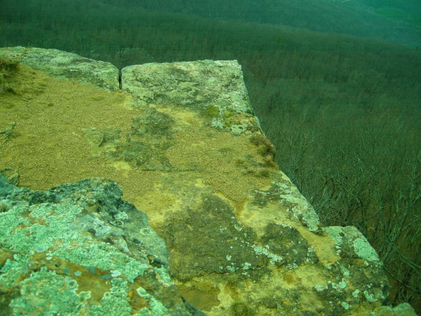
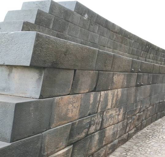
The alignment next crosses over the Ouachita Mountains of eastern Oklahoma and western Arkansas between Texarkana and Oklahoma City.
This is Cameron’s Bluff at Mount Magazine, the highest elevation in Arkansas, in the Ouachita Mountains of western Arkansas and eastern Oklahoma.
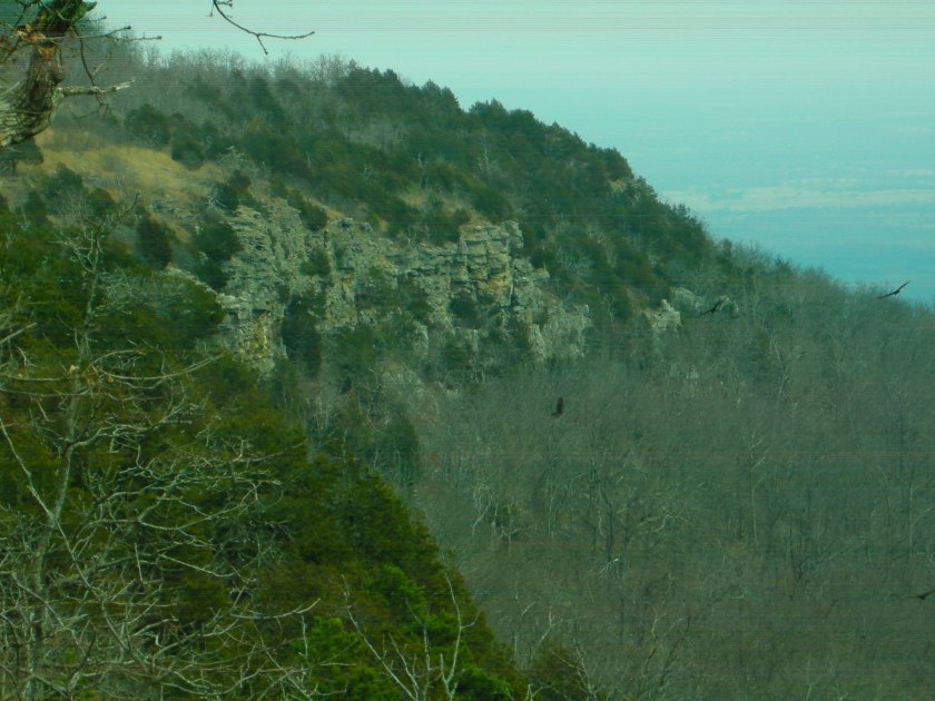
I visited Mount Magazine several times, and this is where I started waking up to seeing what was really in the environment around me.
As soon as I took to the turn-off for the road that skirts the bluff, I started seeing a wall.

It is such an ancient wall that there is some element of doubt.

But there are some places you can really tell it is a built structure.
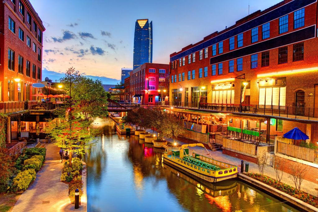
The next place in this alignment is Oklahoma City, Oklahoma, the state capital and county seat of Oklahoma County.

It is a major economic and transportation hub with its central location in the country, and on the nation’s interstate highways, sitting at the convergence of I-35 and I-40 and I-44.
This is also where I was living when I started to put together what I am sharing with you, where I started to see what was really in the environment around me, and where I first learned about the advanced Ancient Moorish Civilization that has been removed from our awareness.
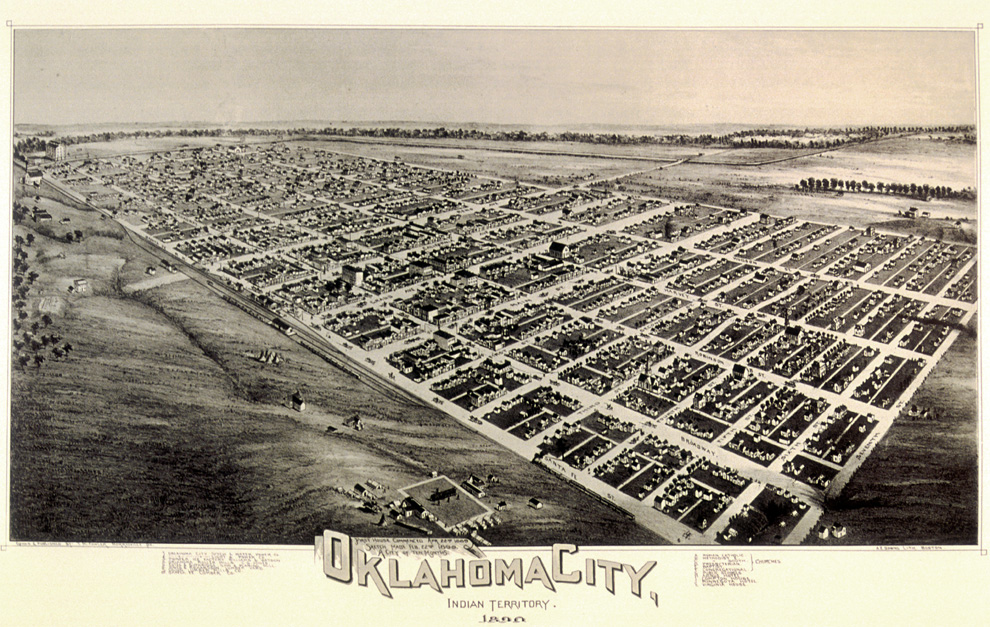
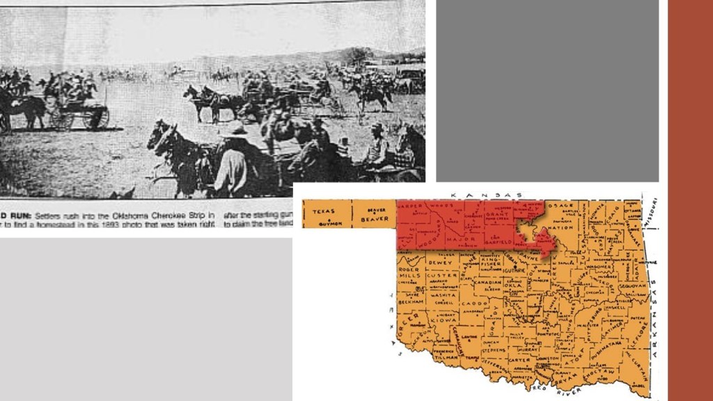
Oklahoma City was said to have “sprang” into existence on April 22nd of 1889, the day that approximately 50,000 participants of the land run that day claimed their land in the first land run in what was known as the Unassigned Lands.

This lithograph dated from 1890 was said to have been prepared 10-months after the 1889 land run…
…and this postcard of Broadway in Oklahoma City is circa 1910, twenty-years later, with the same big, elegant masonry buildings, dirt-covering the street, mule-drawn buggies, and electric streetcar system that we saw back in Texarkana.
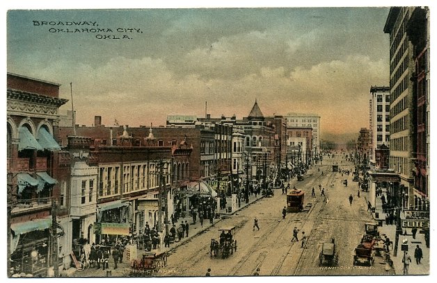
The electric streetcar system in Oklahoma City was ended in 1947.
I am going to focus on unknown canal systems in Oklahoma, because this is where I have studied it the most.
Canal systems were very important to the Ancient Civilization as a transportation system, in addition to a land-based road system, because it was in fact a Maritime Civilization.
They were as comfortable on the waters as on land.
There is an acknowledged canal in Oklahoma City.
This is the Bricktown Canal, a mile-long canal that links downtown, Bricktown, a lively entertainment district, and the Oklahoma River.
Now to some unrecognized canal systems.
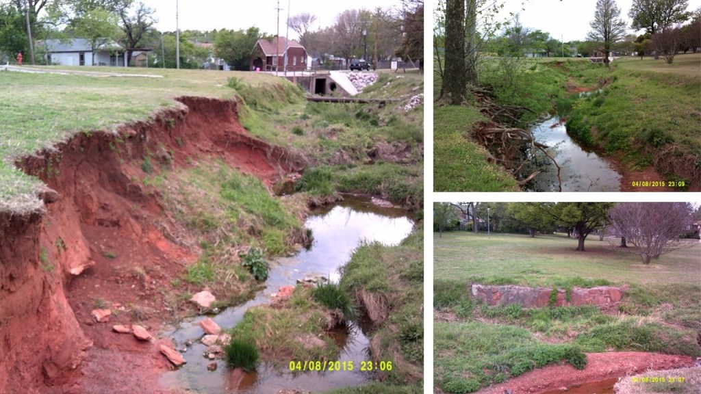
I took these three photos all at the same location at 36th Avenue & Shartel Avenue in Northwest Oklahoma City.
The first photo on the left is very reminiscent of what the river beds look like in Oklahoma – ugly red clay gashes. In the top right photo, there is a root system that appears to be growing out over air, and on the bottom right, what remains of masonry is still in place.
This is as good a place as any to assert my belief that the cement industry is built upon pulverizing ancient masonry. It’s not supposed to be there in our historical narrative, so we don’t even conceive of it, so certain industries can do whatever they want because it doesn’t exist.
The Dolese Brothers Company of Oklahoma is a major company providing aggregates, concrete, and products used for building.

They are not the only example, but the first that I became aware of.
And where exactly do they get their stone material from?

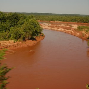
I don’t know if all of the waterways called rivers in Oklahoma look like red clay cuts in the land, but so many of them do!
This is a photo I took of a roundabout, with ancient masonry blocks in the foreground; the road sign saying Cement Plant Road in the middle of the picture; and in the distance in the right of the photo, the Cement Plant in Clarkdale, Arizona, is visible.
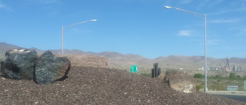
There’s plenty of ancient masonry everywhere in this area, so they will never, ever run out of raw material.
The advanced Ancient Civilization was so massive that there is an inexhaustible supply of unrecognized masonry for the cement industry all over the world!
This is a picture I took of the Oklahoma River in Oklahoma City, where it flows, very straight…
…until it abruptly ends at Martin Luther King Jr. Boulevard, at which point there is only a red clay bed from there on out.
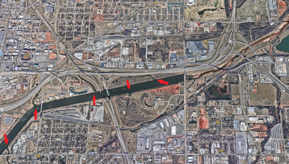
I have marked with arrows the places along the Oklahoma River where there appear to be canal entrances.
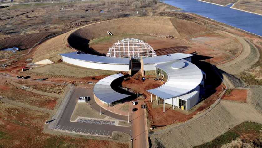
At the corner of I-40 and Martin Luther King Jr. Boulevard, right where the river stops flowing, is what I call the “The Thing.”
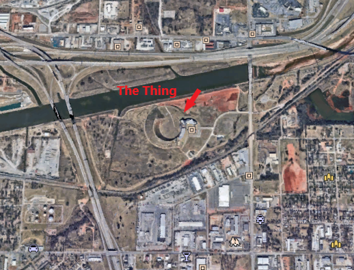
I noticed it at some point after driving past it a bazillion times, and I remember thinking “What the heck is that thing?”
So, I tried to find out more information.
I drove the short way up to the entrance.
Right next to the entrance, there was a billboard that said something to the effect of “Your American Indian Cultural Center and Museum.”

The entrance, however, had several no unauthorized entry signs.
Well, apparently this project has been in the works for many years, and now they are saying will be completed in several years, but that looks like a very, very sophisticated and very geometric earthwork to me.
And you can’t get close to it unless you are on an Oklahoma River Cruise ship or are a rowing crew member.
I drove around the block, and it is all locked up with businesses and an industrial park.
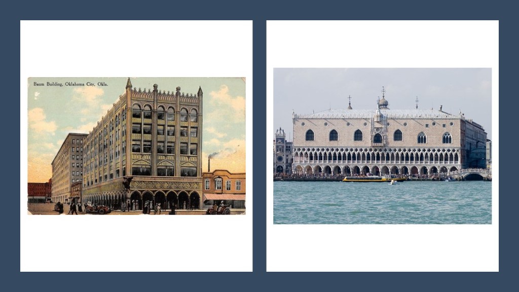
Here is an old postcard on the left depicting The Baum Building in Oklahoma City. It was razed in 1973, supposedly as part of an Urban Renewal project. In its day, the Baum Building was compared to the Doge’s Palace in Venice, shown here on the right.
This is Capitol Hill High School in South Oklahoma City…
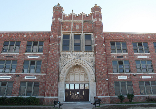
…and the Central High School in Oklahoma City.

Pretty fancy places to have been built for high school kids!
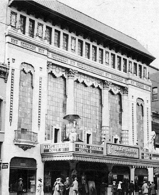
This is the old Criterion Theater in Oklahoma City, with its ornate styling, which was demolished in 1973 to make way for a shopping mall that was never built.
Moving along the alignment north-westward from Oklahoma City, in Okarche, there is a massive wind-farm spread across the landscape.

These turbines, however, are not just placed anywhere – they are placed in a relatively linear fashion within a defined space.
So their placement appears to be intentional, and not random.
Also, all of the wind turbines that are running go at the same speed, regardless of whether the wind is blowing.
I really question whether they are actually being powered by wind, or by some other technology.
Wind turbine farms have popped up in different places in Western Oklahoma, and the Texas Panhandle.
I came to realize that the wind turbine line-up in Okarche approximates with the lines in the star tetrahedron, and as you can see, Oklahoma and Texas are located where two major lines cross.
Roman Nose State Park is located in Watonga, Oklahoma, northwest of Okarche and southeast of Woodward, named for a Cheyenne Warrior known as Roman Nose.
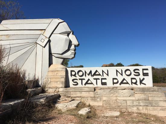
For part of the year they have a teepee set up on the grounds, and we are told that this location was the winter camping grounds for his Cheyenne tribe.
It was one of the many Depression-era Civilian Conservation Corps, or CCC, projects in Oklahoma… when you go to the part of the park that has springs, this is what you find…This is where you enter the area.

Then, as you walk along the path that takes you by the water, you find that the embankment looks like this.


The further down the path you go, the more intact you find the stonework:
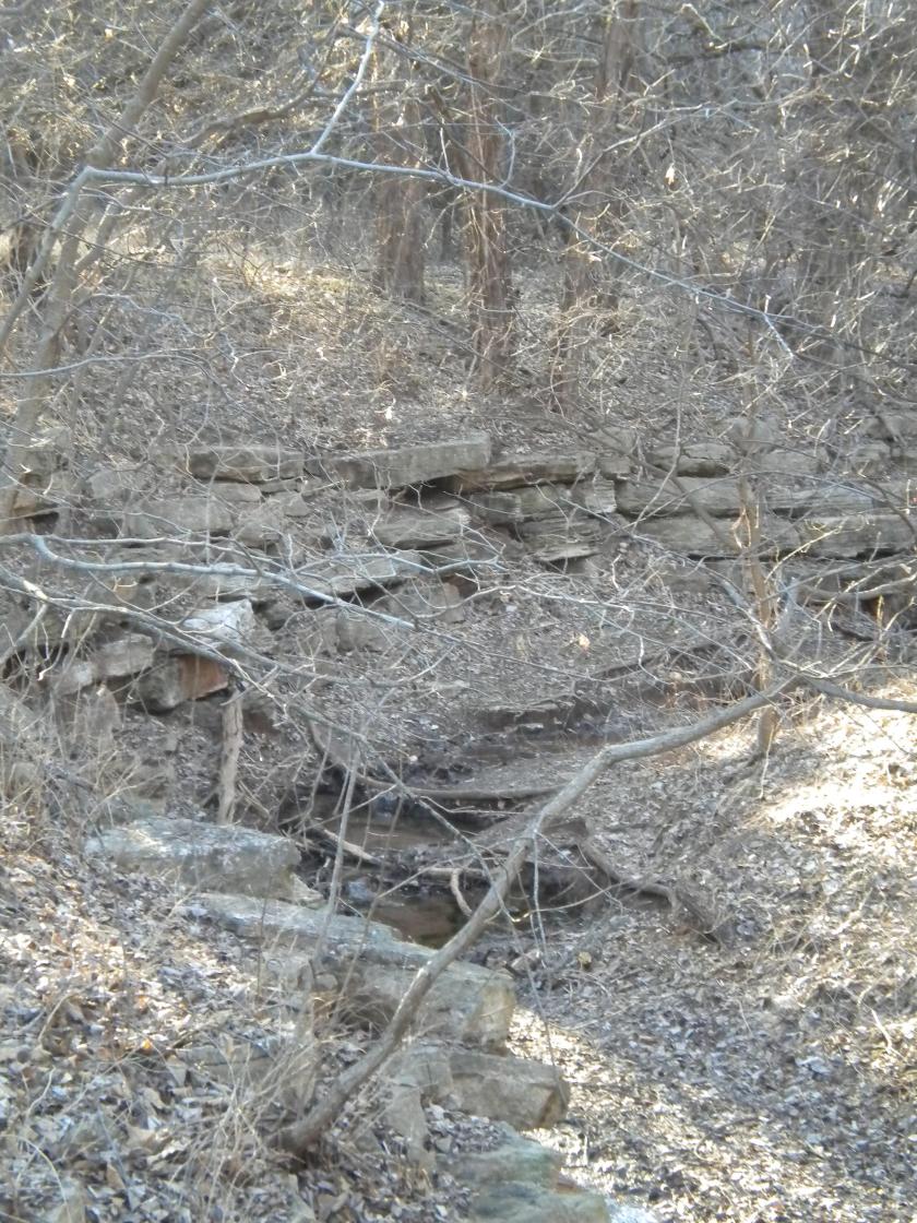
Until you finally come to this exquisitely peaceful spring:

The stonework pictured is clearly of the same design, and built out in a purposeful way.
The CCC operated from 1933 to 1942 in the U.S. for unemployed, unmarried men to help them weather the Great Depression. Originally for young men ages 18–25, it was eventually expanded to ages 17–28. Does it make sense that they could have done the original stone work?
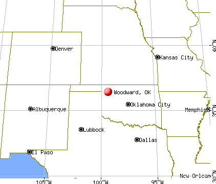
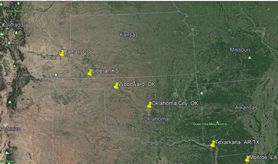
Okarche and Roman Nose in Watonga are on the way to Woodward, Oklahoma.
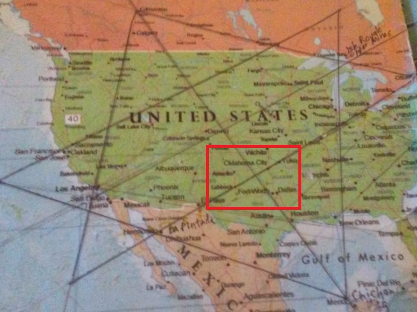
At some point in 2016, I noticed that Woodward, OK, fell on this alignment: Houston, Dallas, Woodward, Denver, and Edmonton, Alberta.
This observation got me wondering about what was in Woodward. It is off the beaten track as far as the National Highway System goes.
The town was on the Great Western Cattle Trail, and we are told that Woodward was established in 1887 after a railroad was constructed to that point for shipping cattle to markets.
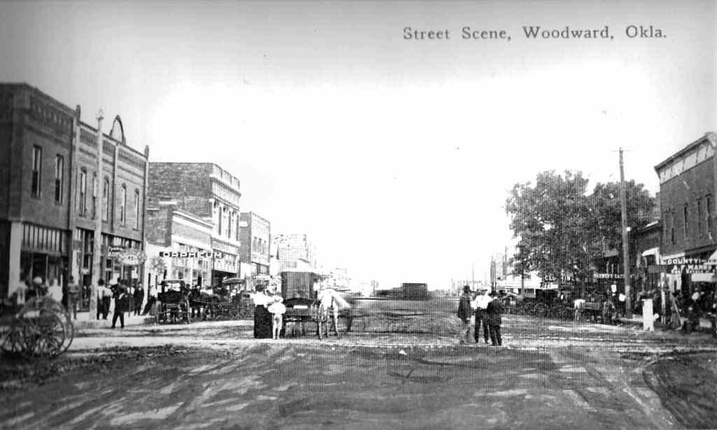
It was one of the most important depots in the 19th-century for shipping cattle East.
Like Ponca City in my last post, Woodward was in the Cherokee Strip region that was opened up by the United States government for settlement during the Land Run of 1893.
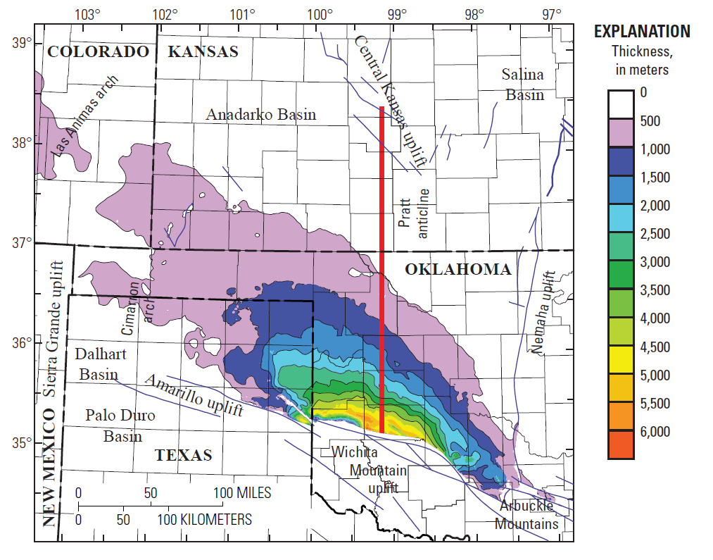
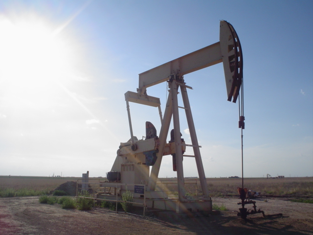
Woodward lies in an oil and natural-gas area on the shelf of Oklahoma’s Anadarko Basin.
In 1956, natural gas was discovered in Woodward County.

Thereafter, Woodward enjoyed significant growth due to the opening and location of oil field service and drilling companies in Woodward.
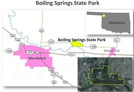
When I drove to Woodward, I stopped by Boiling Springs State Park, located east of Woodward, between Woodward and Mooreland.
This is just one section of a fairly large area containing masonry at Boiling Springs.

The masonry here is very similar to the masonry at the Roman Nose State Park.
I took these pictures of large, white, pink, and gray cut-stone blocks on the state park grounds when I visited there.

Then, after a trip I took to Cusco in Peru in 2018, I trotted out the photos of Boiling Springs State Park, and saw white, pink, and gray granite stone material there, similar to what I saw in Peru.
Like at Qenko, just outside of Cusco…
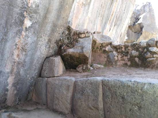
…and at the Coricancha in Cusco.
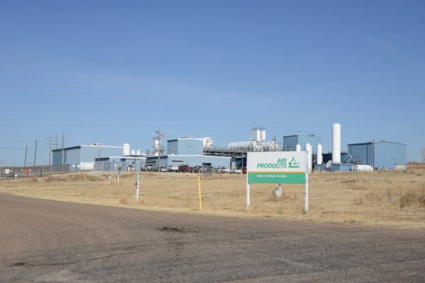
After I left Boiling Springs, I came to Mooreland, and saw a facility that looked something like this:

Turns out Mooreland is a hub of the energy industry, including natural gas resources, and connecting energy resources to end-use markets.
I continued driving east on Highway 412 towards Enid, Oklahoma.
It goes all the way across the top of Oklahoma, and then on into Arkansas. Lots of ancient infrastructure all through there.
All along the way, I saw features in the landscape that looked like these at Gloss Mountains State Park near Enid, a city which is 84-miles, or 135-kilometers, east of Woodward.
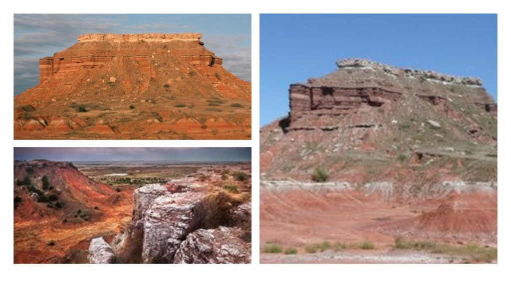
At many places along the way in this drive, I saw what looked like fracking wells in the distance next to these features.

For many reasons, I have come to firmly believe that there is a direct connection between the modern energy industry, ancient energy technology, and the Earth’s grid system.
Other places you can visit in this part of northern Oklahoma between Woodward and Enid include the Little Sahara State Park in Waynoka…

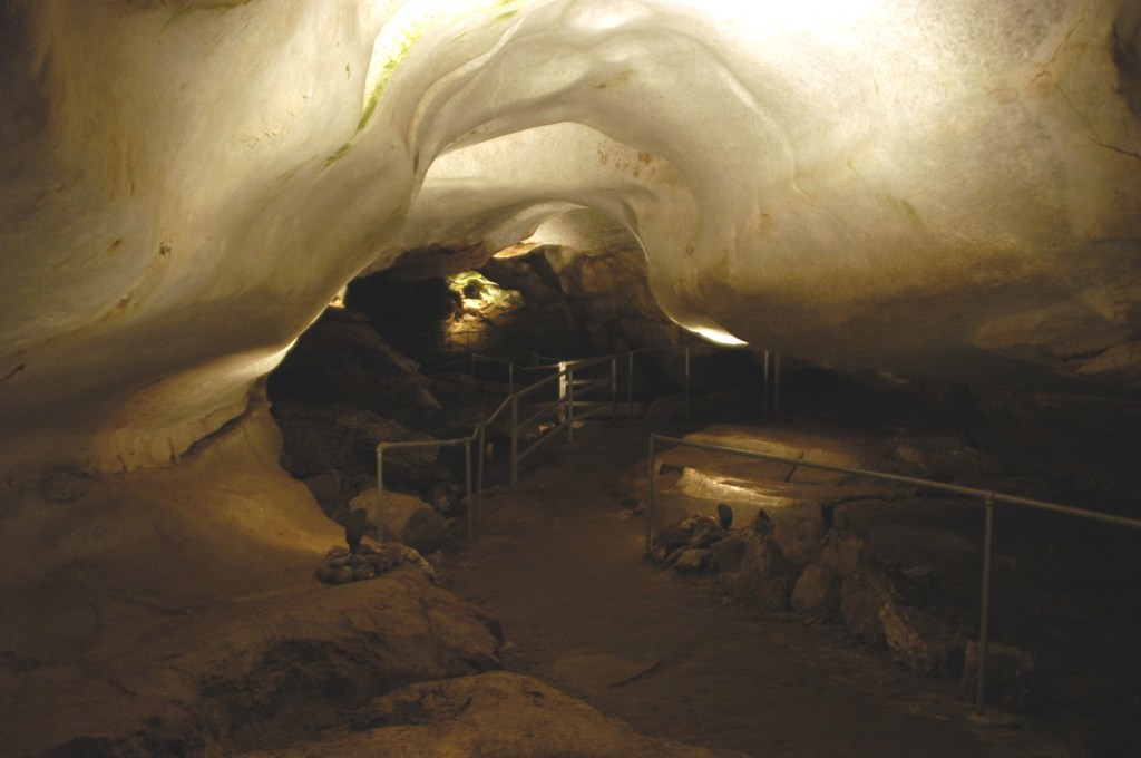
…and the Alabaster Caverns State Park in Freedom, Oklahoma, in Woodward County.
This is a view inside one of the largest gypsum caves in the world here.
The Alabaster Caverns Bridge apparently collapsed in 1992…
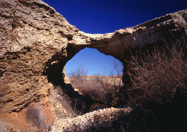
…and when I was doing research on Chimney Rocks, I found out that we are told the one that used to be in Freedom was worn away so much over thousands of years, that one day in 1973, big winds caused it to fall without anyone seeing it happen.
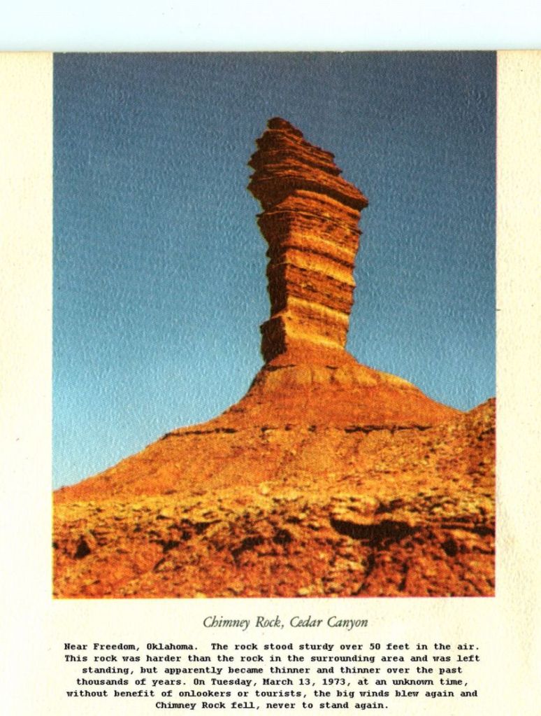
Nothing strange about that statement, right? Hmmmm.
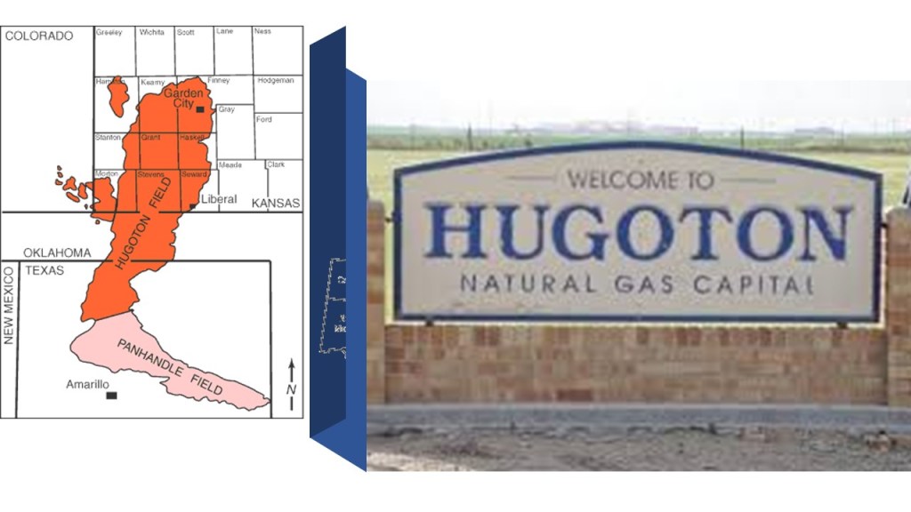
The next stopping place on this linear alignment is Liberal, the county seat of Seward County in Kansas.
It was incorporated in 1888, we are told, after the railroad came by this small settlement in Kansas near the Oklahoma state line where S. S. Rogers had built the first house in 1872, and where he built general store and post office in 1885.

From the arrival of the railroad, so the story goes, the town’s growth began.
The plot on the townsite of Liberal opened on April 13th of 1888.
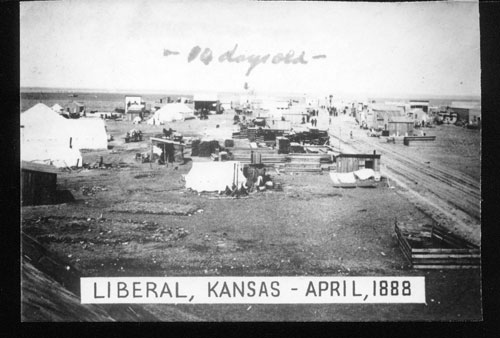
The sale of lots in the next twenty-four hours, we are told, totalled $180,000, and within a week, there were 83 constructed wooden houses, and within a year there was a boom, at which time Liberal was incorporated as a city.
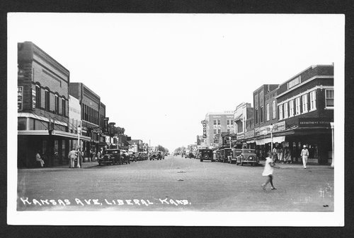
This is a picture of Kansas Avenue in Liberal taken sometime in the years between 1928 ad 1938.
In 1920, natural gas was discovered west of Liberal in what became the huge Panhandle-Hugoton gas field, which contains one of the world’s largest known natural gas fields…
…oil was discovered southwest of town in 1951…
…and in 1963, National Helium opened there, the largest helium plant in the world.
The last place on this alignment that I am going to be taking a look at is Lamar, the county seat of Prowers County in Colorado.
Lamar was founded in 1886, and Prowers County was established in 1889.
The Atchison, Topeka, and Santa Railroad railroad was said to have arrived through this part of Colorado in 1873, and the first station was established in 1886. The existing station was built in 1907, and in addition to being an Amtrak stop, houses the local Chamber of Commerce and a Colorado Visitors’ Center.
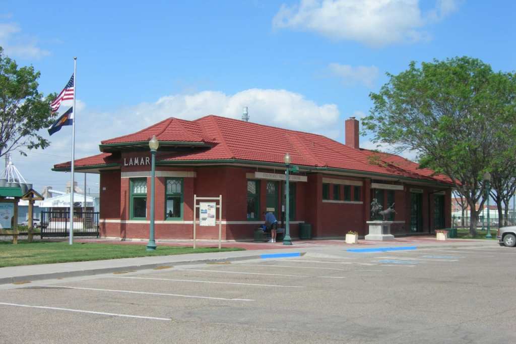
We are told the railroad allowed Lamar to become an important farming and ranching community.
This is the first county courthouse building in Lamar, with a construction date of 1890, said to have been designed by Bulger & Rapp, an architectural firm that worked together in Colorado for five years before dissolving in 1892.

The present Prowers County Courthouse was said to have been built in 1928 in Classical Revival style by Colorado architect Robert K. Fuller and A.E.Danielson & Sons.
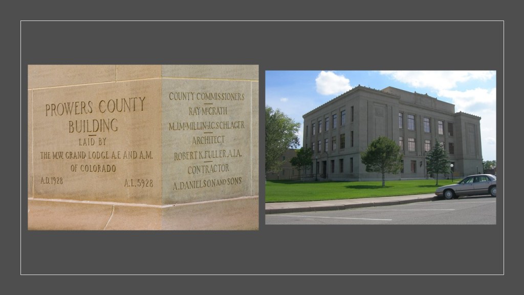
It is easier to carve words into stone than build out of stone.
The Carnegie Library in Lamar was said to have been completed in 1908…and demolished in 1975.

The Carnegie Corporation of New York was said to have provided 27 grants between 1899 and 1917 to build 35 public libraries in Colorado.
As of 2010, 30 of these buildings were still standing, and 18 still operate as libraries.

This is Pike’s Tower in Lamar.

It is 40-feet, or 12-meters, tall, and was designed to commemorate Zebulon Pike’s 1806 expedition across Colorado, during which time they allegedly stayed at Willow Creek, near Lamar, where Pike’s Tower is located.
It was said to have been developed in 1933 as the first project in Colorado of the Works Progress Admininstration, or WPA, another of FDR’s New Deal agencies like the CCC, which I believe served multiple purposes: 1) To create Depression-era jobs; 2) To build park infrastructure; and 3) to cover-up ancient sites/infrastructure.
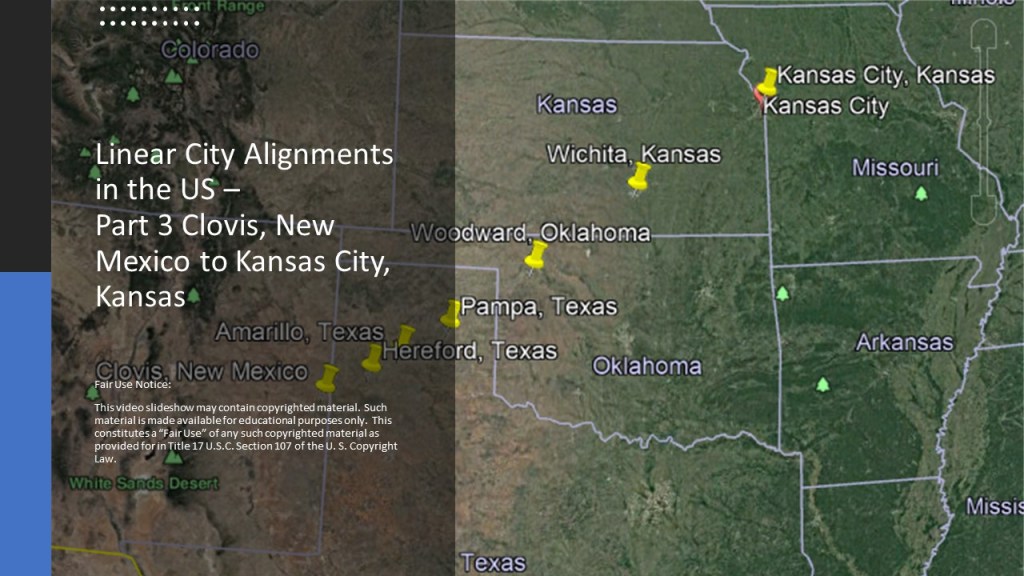
I am going to end this post here, and in the next part will be looking at a linear alignment that begins in Clovis, New Mexico, and ends in Kansas City, Kansas.