America’s Driftless Region

The Driftless Region came into my awareness several years ago when I worked in a Rock Shop in Sedona.

There were pieces of galena in the display case from the Driftless Region.

Galena is the natural mineral form of lead sulfide, and the most important ore of lead and an important source of silver.

I found the name “Driftless” to be intriguing, so I looked into it briefly at the time.

This would have been sometime during 2017 or 2018.

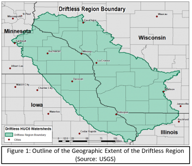
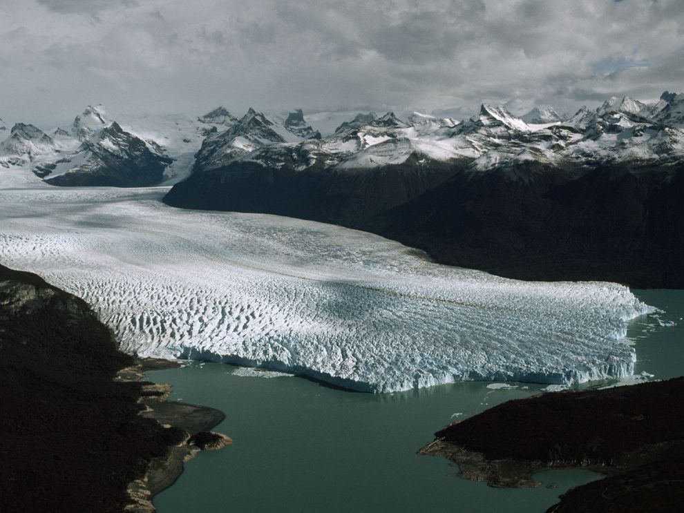
We are told it was called the “Driftless Region” because it was by-passed by the last glacier on the continent and lacks glacial drift.

The last ice age is known to us as the Pleistocene Epoch, defined typically as a period of time beginning about 2.6-million-years-ago and lasting until about 11, 700 years ago, and the epoch during which homo sapiens evolved.

We are told that during the Pleistocene Epoch, the continents had moved to their current positions on the Earth, and glacial sheets of ice covered Antarctica, as well as large parts of Europe, North America, South America, and small parts of Asia.

The glaciers didn’t just sit there, as we are given the explanation that there was much movement over time, apparently with 20 cycles of the glaciers advancing and retreating as they thawed and refroze.

The name Pleistocene first came into use, a combination of the Greek words for “most recent,” with Sir Charles Lyell, a Scottish geologist who was said to have demonstrated the power of known natural causes in explaining Earth’s history.

In his books, “The Principles of Geology,” published in three volumes between 1830 and 1833, he presented the idea that the Earth was shaped by the same natural processes that are still operating today at similar intensities, and a s such a proponent of “Uniformitarianism,” a gradualistic view of natural laws and processes occuring at the same rate now as they have always done.

This theory was in contrast to “catastrophism,” or theory that Earth has been shaped by sudden, short-lived violent events of a worldwide nature.

At any rate, as a result of Lyell’s work, the glacial theory gained acceptance between 1839 and 1846, and we are told during that time, scientists started to recognize the existence of ice ages.

The concept of “glacial erratic” has come to be the explanation for large masses of rock that have been moved by glacier ice and lodged in glacier valleys or scattered over hills.

Examples include the rectangular Madison Boulder in New Hampshire is considered to be one of the largest glacial erratics in the world, at 83-feet, or 25-meters, long, and 23-feet, or 7-meters, high, and upwards of 5,000 tons, with one part of it said to be buried to a depth of up to 12-feet, or 4-meters.

It is interesting to note the number of glacial erratics that end up either perfectly balanced by themselves…

…or as a large block of stone balanced on top of smaller stones.

The exact same idea is called a dolmen in other parts of the world, and is considered the the most common megalithic structure in Europe, believed to be a tomb or burial space.

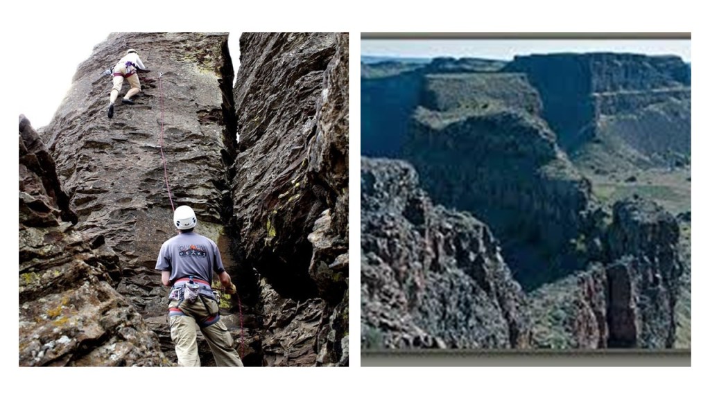
Cataclysmic flooding during the the last ice age was given the credit for creating the “Channeled Scablands” in the southeastern part of Washington State…

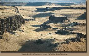
…but I really think these geologic explanations were a way to falsely attribute natural forces to explain and cover-up ancient, man-made stonework.

So, since we are told it was called the “Driftless Region” because it was by-passed by the last glacier on the continent and lacks glacial drift, lets see what we find here.

Thanks in advance to all who left suggestions of places to look here in the comments section.

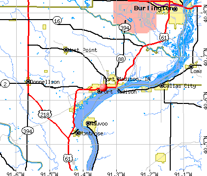
I am going to start my journey through the Driftless Region in Nauvoo, Illinois.

Nauvoo was the main gathering place for Joseph Smith and the Mormons after their expulsion from Missouri.

Joseph Smith was the founder of Mormonism.

In 1830, he published “The Book of Mormon” and organized his church in New York, the same year Sir Charles Lyell published the first volume of “The Principles of Geology.”

Joseph Smith had a series of visions as a young man, and in one of the visions, he was directed by an angel to a buried book of golden plates engraved with a Judeo-Christian history of an ancient American civilization, of which The Book of Mormon was his translation of the information contained on the golden plates.

Joseph Smith and his followers left New York, and moved west in 1831 to build an American Zion, which within Mormonism has multiple meanings, including the central physical locations the Mormons have gathered, including Kirtland, Ohio; Jackson County, Missouri; Nauvoo, Illinois; Zarahemla, Iowa; and the Salt Lake Valley in Utah.

…and according to Joseph Smith, the entirety of the Americas was Zion.

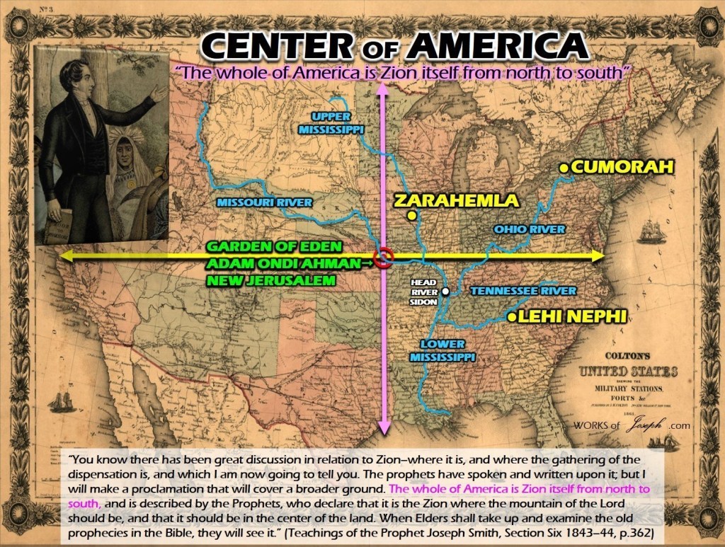
Zarahemla refers to a large city in the Ancient Americas described in The Book of Mormon.

While the exact location of Zarahemla is not known, there was a Mormon settlement named Zarahemla in Iowa directly across the Mississippi River from Nauvoo, and where there is an excavation of what might be Zarahemla.

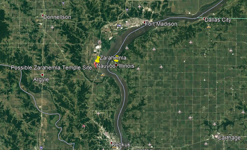
There appear to be geometric and astronomical alignments between the possible location of the Zarahemla temple and the city of Nauvoo, with an equinoctial alignment between the proposed Zarahemla Temple site and the Nauvoo Temple.

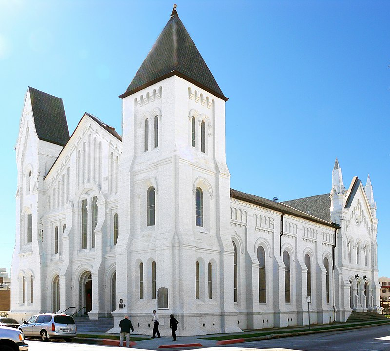
This is what we are told about the Nauvoo Temple.

It was the second temple constructed by the Mormons, with its cornerstone being laid on April 6th of 1841, and it was designed in the Greek Revival style by architect William Weeks under the direction of Joseph Smith.

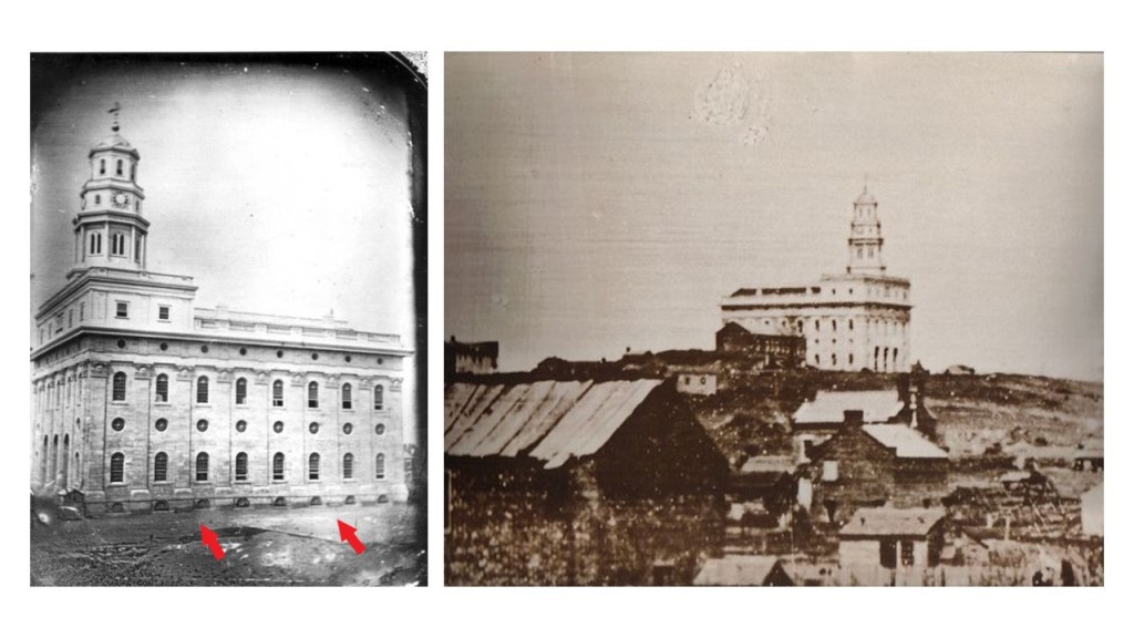
Its construction was said to have been completed under the leadership of Brigham Young and in use by the winter of 1845.

Interesting to see the windows at ground-level in the photo of the temple on the left, and the wooden shacks in the foreground in contrast to the limestone building in the background.

On June 27th of 1844, Joseph Smith and his brother Hyrum were in jail in Carthage, Illinois awaiting trial on charges including inciting a riot in Nauvoo, when they were both killed by an armed, anti-Mormon mob that stormed the jail building.

The Nauvoo Temple was only in use by the Mormons for three months, as they Mormons ended up leaving Nauvoo under Brigham Young’s leadership for the Salt Lake Valley in Utah because of increasing anti-Mormon violence and sentiments in that part of Illinois.

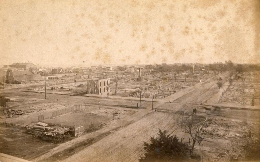
The Nauvoo Temple was said to have set on fire an unknown arsonist around midnight of October 8th and 9th of 1848, gutting the temple.

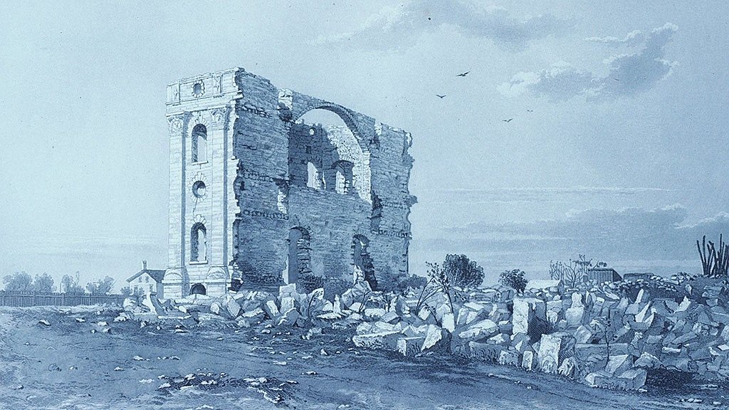
Whatever was left standing of the temple was said to have been completely demolished in 1865.

Then in 1999, the Mormon Church president at the time announced that the Nauvoo Temple would be built on its original footprint, and by June of 2002, a replica of the original temple was dedicated.

Interesting to note that in the 2010 census, Nauvoo’s population was only 1,149.

The stone arch bridge in Nauvoo was said to have been built by Mormon settlers in 1850.

Keokuk in Iowa is just a short-distance southwest of Nauvoo, and is the location of the Des Moines Rapids Canal, located on the Mississippi River.

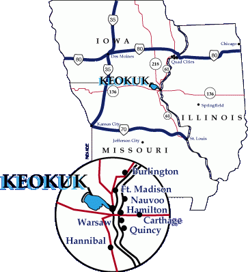
The construction of the 12-mile-long Des Moines Rapids Canal was said to have started in 1866, one year after the end of the American Civil War, and completed in 1877.

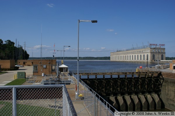
Then it is said to have been in use for only 36 years, closing in 1913.

Like what we are told about the Nauvoo Temple, does any of this make sense with the amount of effort and expertise that would be needed to construct a massive engineering project like this?

Fort Madison, Iowa is just a short-distance up the Mississippi River from Nauvoo.

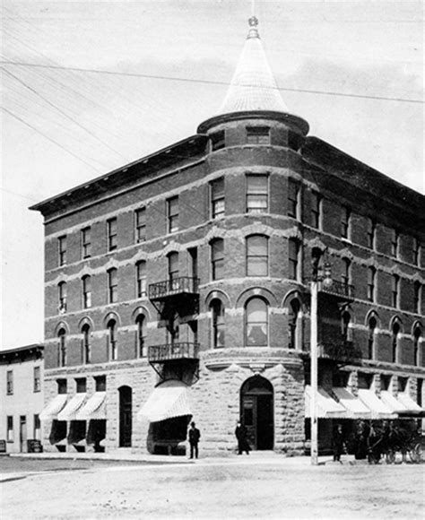
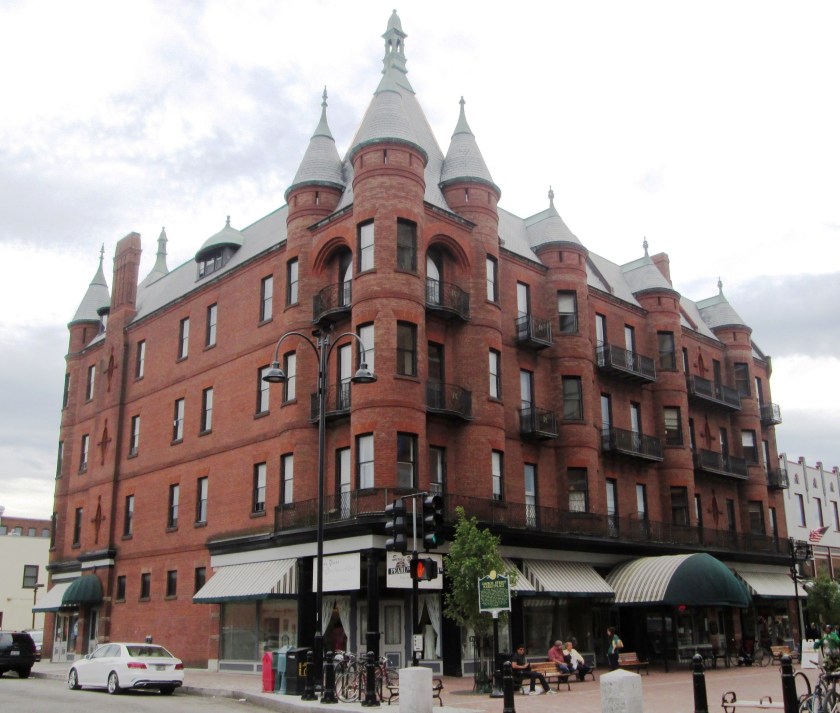
Here is a historic bank building in Fort Madison…

…compared with the historic Alberta Hotel in Edmonton, Alberta…

…and the Richardson Building in Burlington, Vermont.

This is a wall of the Iowa State Penitentiary at Fort Madison…

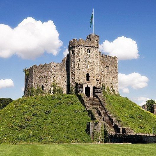
…compared with this wall of the Cardiff Castle in Wales.

This is said to be the original fortification on the grounds of Cardiff Castle, which is said to have been built in the late 11th-Century, after the Norman Conquest by William the Conqueror in 1066.

It is what is called a motte-and-bailey castle, but looks suspiciously like a mound to me.

For comparison, this is Silbury Hill, called a prehistoric artificial chalk hill in Wiltshire.

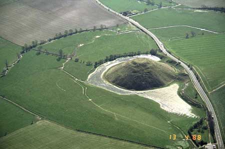
It is part of a complex of Neolithic monuments, and located a short driving distance from the Avebury Stone Circle.

It is considered the largest man-made structure in Europe, believed to date back to 2,400 BC…

…and a popular place for crop circles…

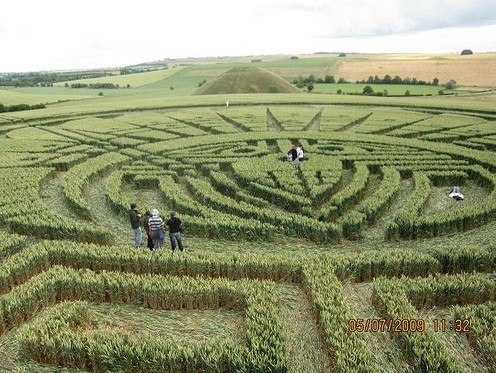
…and other geometric shapes to appear.

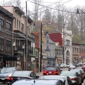
Galena is further upriver from Nauvoo in Illinois.

It is the largest city in, and county seat of, Jo Daviess County.

Charles Mound, called the highest natural point in the state of Illinois, is 11-miles, or 18-kilometers, northeast of Galena, in Jo Daviess County.

The city is named for the lead ore Galena, which formed the basis for the region’s early mining economy.

Galena was the location of the first big mineral rush in the U. S.

By 1828, Galena’s population of 10,000 was said to rival Chicago at the time, and it developed into the largest steamboat hub on the Mississippi River north of St. Louis.

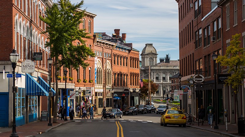
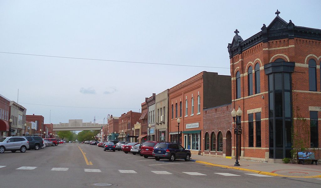
The Galena Historic District is listed on the National Register of Historic Places…

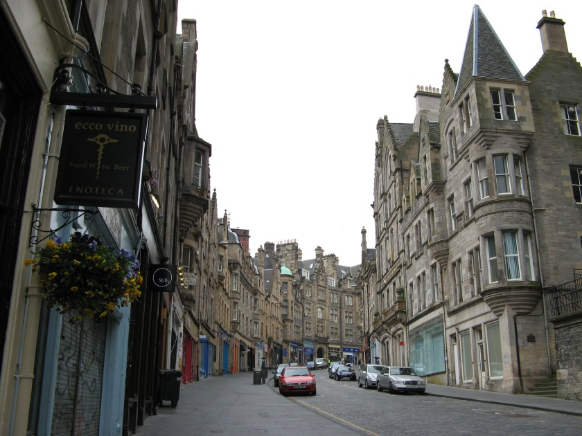
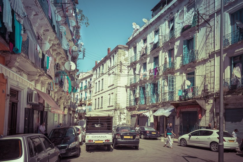
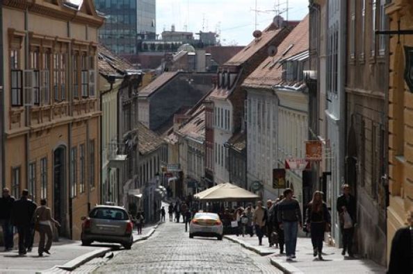
…and it immediately reminded me of Portland, Maine…

…Edinburgh, Scotland…

…the Casbah in Old Algiers in Algeria.

…Old Zagreb in Croatia…

…and Ellicott City outside of Baltimore, Maryland.

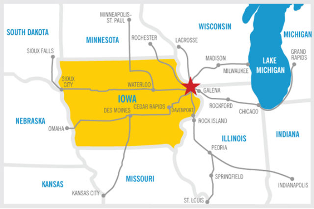
Dubuque, Iowa is located at the junction of the states of Iowa, Illinois, and Wisconsin, in a region known as the Tri-State Area.

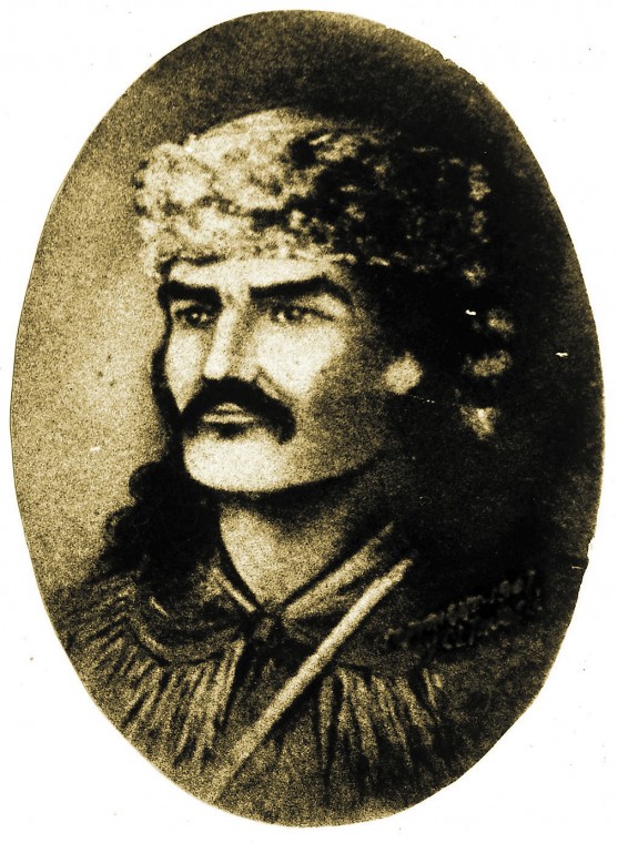
We are told the first permanent European settler here was a French-Canadian by the name of Julien Dubuque, who arrived in 1785.

In 1788, he received permission from the Spanish government, who controlled the Louisiana Territory to the west of the Mississippi River at the time, and the Meskwaki, also known as Fox ,tribe to mine the area’s rich lead deposits.

The Julien Dubuque Monument, located in Dubuque’s Mines of Spain Recreation Area, was said to have been constructed in the Late Gothic Revival style in 1897 at his grave-site.

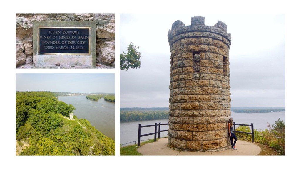
The Mines of Spain Recreation Area has a network of trails to choose from.

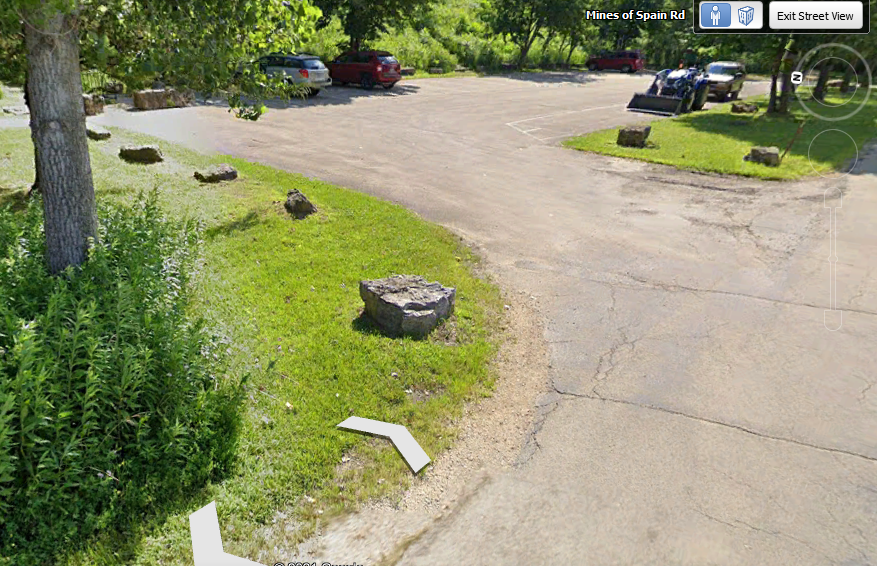
This is the recreation area’s Horseshoe Bluff.

If there weren’t supposed have been any glaciers freezing and thawing over-and-over-again in the Driftless Region, what is the explanation for the existence of this wall-like-looking rock formation with the Mississippi River on top of it?

And why are there large cut-and-shaped stones seen around a parking area for Horseshoe Bluff on a street-view from Google Earth?

Elsewhere in Dubuque, the Fenelon Place Cable Car is found in the Cathedral Historic District, described as the world’s steepest, shortest scenic railway, said to have been built in 1882 for the private-use of J. K. Graves, a local banker and State Senator.

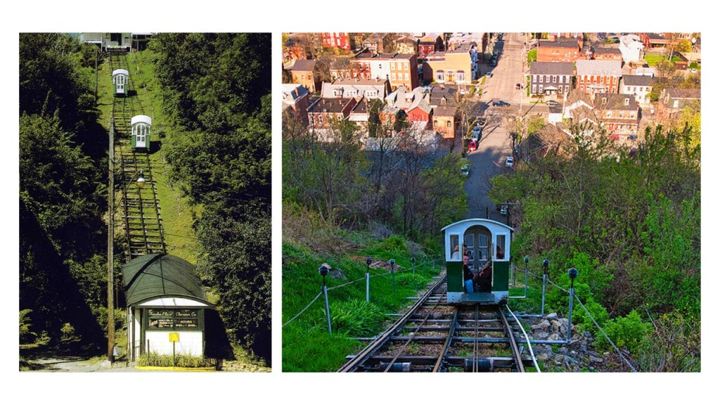
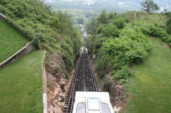
It is a funicular, also known as incline, railway, a transportation system that uses cable-driven cars to connect points along a steep incline, using two counterbalanced cars connected to opposite ends of the same cable, and found in diverse places like Look-out Mountain Incline Railway in Chattanooga Tennessee, said to have been constructed in 1895…

…the Budapest Castle Hill Funicular in Hungary, said to have opened in 1870…

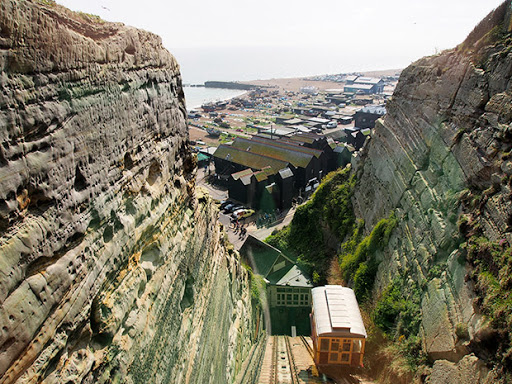
…the East Hill Cliff Railway in Hastings, England, said to have opened in 1902…

…and two operating funiculars in Pittsburgh, the Duquesne Incline, said to have been completed in 1877…

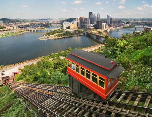
…and the Monongahela Incline, said to have opened in 1870.

A couple of more things back in Dubuque before moving along.

The Dubuque Star Brewery was established by Joseph Rhomberg in 1898, which became one of the largest businesses of its kind in Iowa.

Starting in 1885, Joseph Rhomberg was also the General Manager and Superintendant of the Dubuque Street Railway Company, which at that time was still powered by horses as streetcar service had started there in 1868.

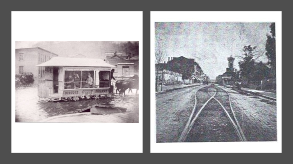
Electrification of the streetcar system in Dubuque came in sometime around 1892, and the system was only in use until 1932.

Dubuque’s North End was first settled by working-class German immigrants in the late-19th-century…

…and the South End of Dubuque was settled by working-class Irish immigrants.

Pike’s Peak State Park is upriver from Dubuque, and features a 500-foot, or 105-meter bluff located at the confluence of the Upper Mississippi and the Wisconsin Rivers.

Pike’s Peak State Park is part of a larger system of Parks that includes the Effigy Mounds National Monument; the Yellow River State Forest; the Upper Mississippi River National Wildlife and Fish Refuge; and the Driftless Area National Wildlife Refuge.

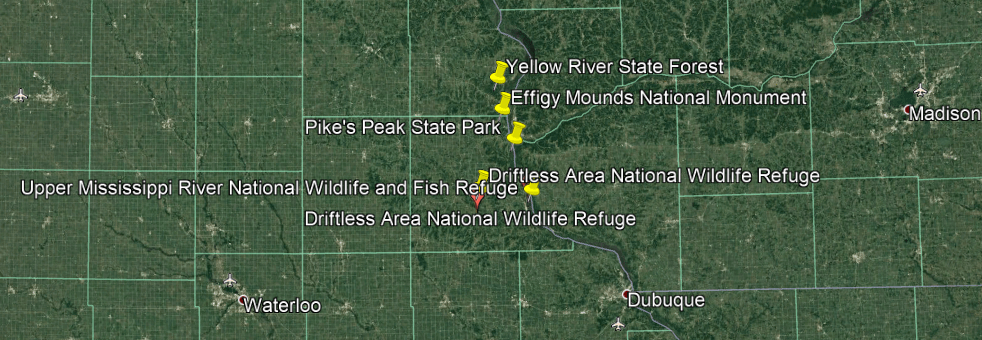
The Effigy Mounds National Monument has more than 200 mounds, of which many are animal effigies, which we are told a hunter-gatherer culture built for unknown reasons.

The Yellow River State Forest is just north of the Effigy Mounds National Monument, and was said to have been established by the Civilian Conservation Corps in 1933, one of the New Deal programs established by President Franklin Roosevelt during the Great Depression.

The Upper Mississippi River National Wildlife and Fish Refuge is one of only two in the United States the spans parts of four states – Minnesota, Wisconsin, Illinois, and Iowa, all the states of the Driftless Area – running from Wabasha, Minnesota to Rock Island in Illinois.

These land-forms are found in the Upper Mississippi River National Wildlife and Fish Refuge.

In the historical narrative we have been given, we are clearly told there were not glaciers here during the last Ice Age, a typical explanation for features in the landscape.

Then…how might these have been created?

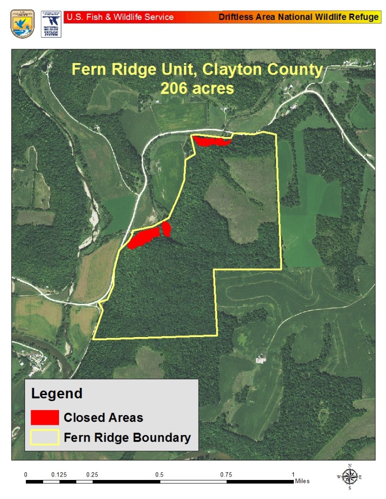
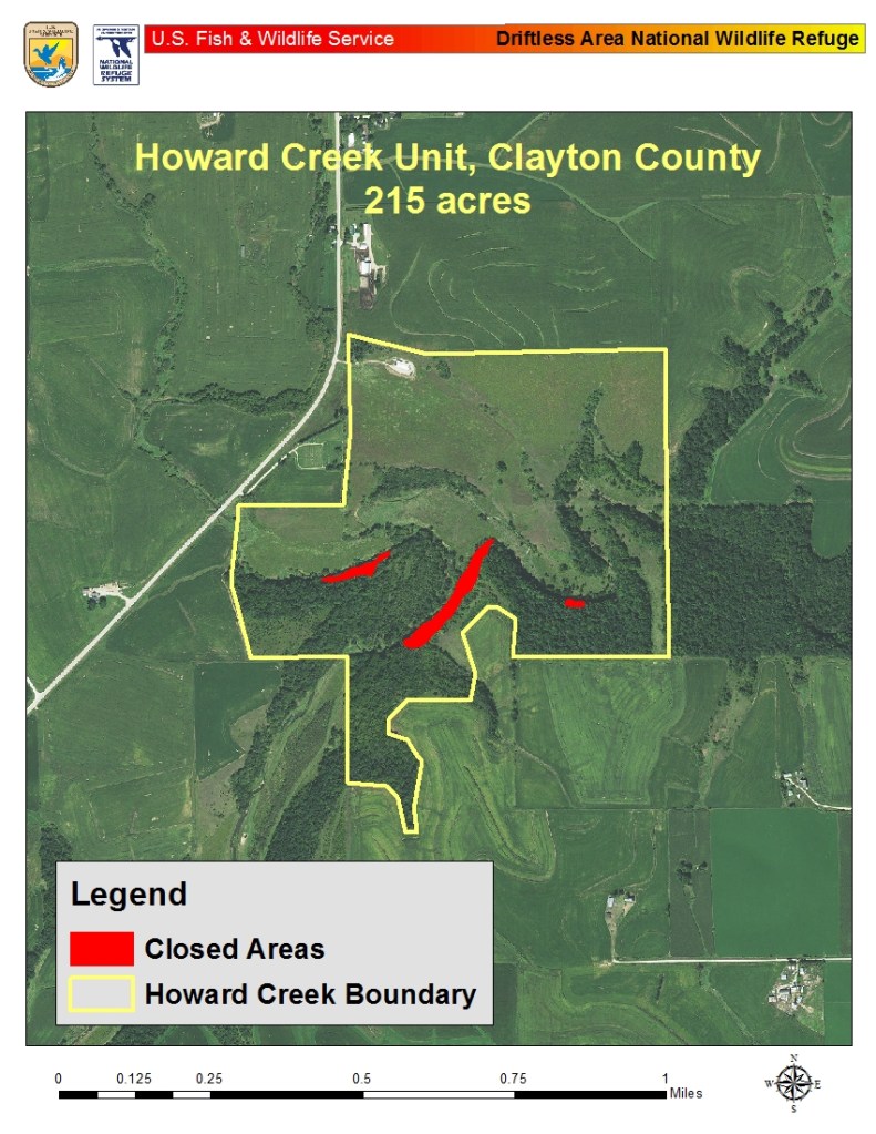
The Driftless Area National Wildlife Refuge is in both Iowa and Wisconsin, and there are only three units open for public use: Fern Ridge; Howard Creek; and Pine Creek.

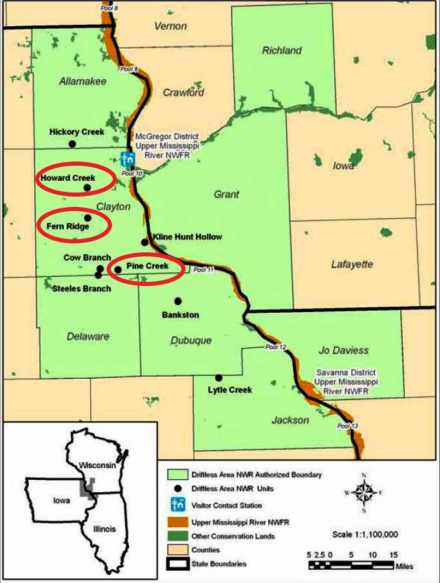
Makes me wonder why they would limit the public’s access here.

There are even closed areas within the units open to the public.

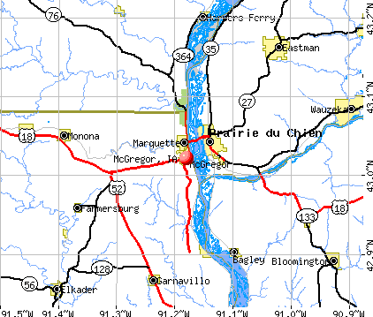
Let’s take a look-see at the Driftless Area National Wildlife Refuge. Not finding a lot of pictures taken there, but here is one that was clearly marked as such.

The cities of McGregor and Marquette in Iowa and across the Mississippi River in Prairie du Chien, Wisconsin, are nestled between these parks.

Alexander McGregor established a ferry-landing in what became known as McGregor in 1837 after the end of the Blackhawk War in 1832, and the United States government opened up the expansion of land west of the Mississippi for settlement.

The City of McGregor was incorporated in 1857.

McGregor quickly became a commercial hub, after the Milwaukee and Mississippi Railroad finished the railroad track for a line running from Milwaukee to Prairie du Chien in 1857, and grain from Iowa and Minnesota was transported across the river for to send by railroad to Milwaukee.

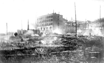
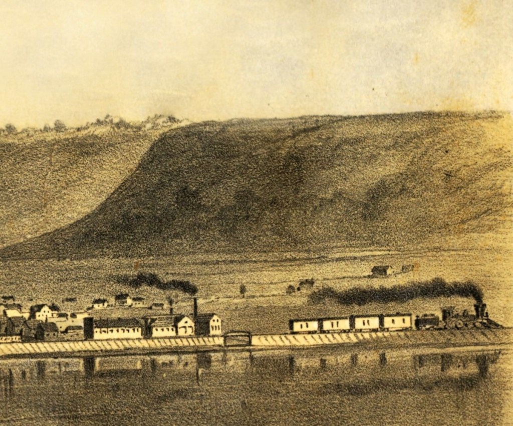
This photo is notated as McGregor in the mid-1860s.

We are told more railroads were built to connect McGregor with cities further west.

This hand-drawn map illustrated what appears to be the explosive growth of McGregor circa 1869.

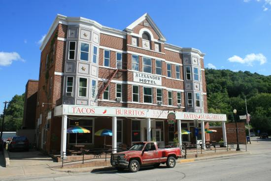
The Lewis Hotel was said to have been built starting in 1899, with the lead architect being the Austrian-born Hugo Schick of Schick & Roth, based out of LaCrosse, Wisconsin.

The Lewis Hotel still stands today, only it’s now called the Alexander Hotel, minus the domes it had originally.

More on LaCrosse shortly.

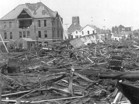
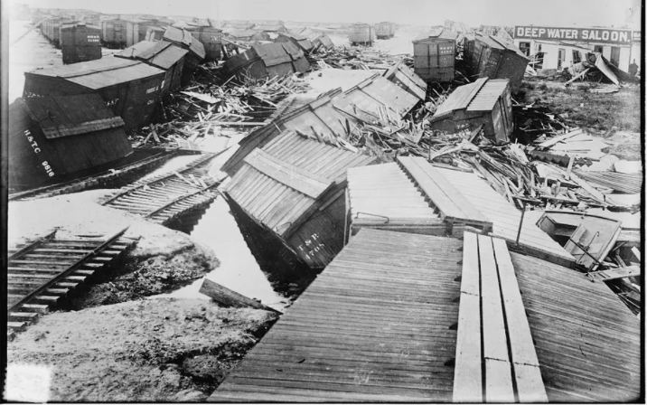
I found this interesting-looking historical picture of McGregor with the Lewis Hotel seen in it.

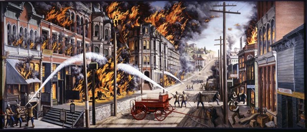
Apparently the destruction pictured here in McGregor was the result of an electrical storm in which lightening caused a fire, and the same storm produced a heavy-downpour, causing a flood of mud and water, on May 19th of 1902.

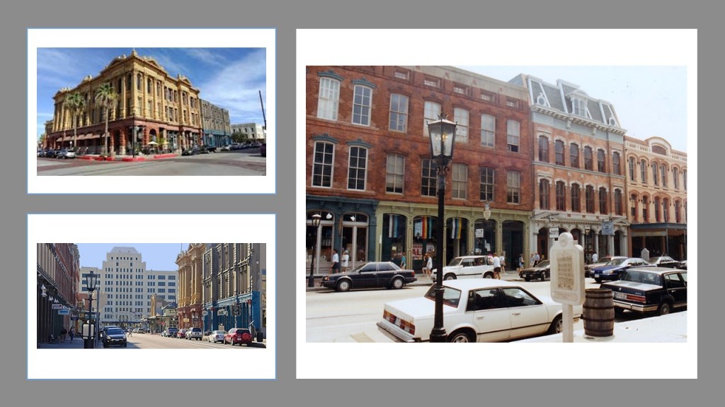
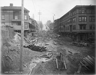
Here is an historic photograph of MacGregor’s Main Street…

…and Main Street today.

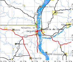
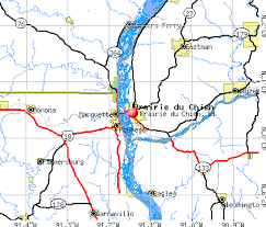
Marquette, Iowa, is located just a short-distance north of McGregor, and across the river from Prairie du Chien in Wisconsin.

Named for the Jesuit Jacques Marquette, who along with Louis Joliet, was said to have discovered the Mississippi River through here in 1673, it was originally incorporated as North McGregor in 1874.

It served as a railroad terminus for McGregor.

The Riverboat Casino Queen is a popular attraction in Marquette, and I can’t help but notice the distinctive conical shape it sits right next to it.

Marquette is connected to Prairie du Chien via the Marquette-Joliet Bridge, taking U. S. Route 18 from Iowa to Wisconsin.

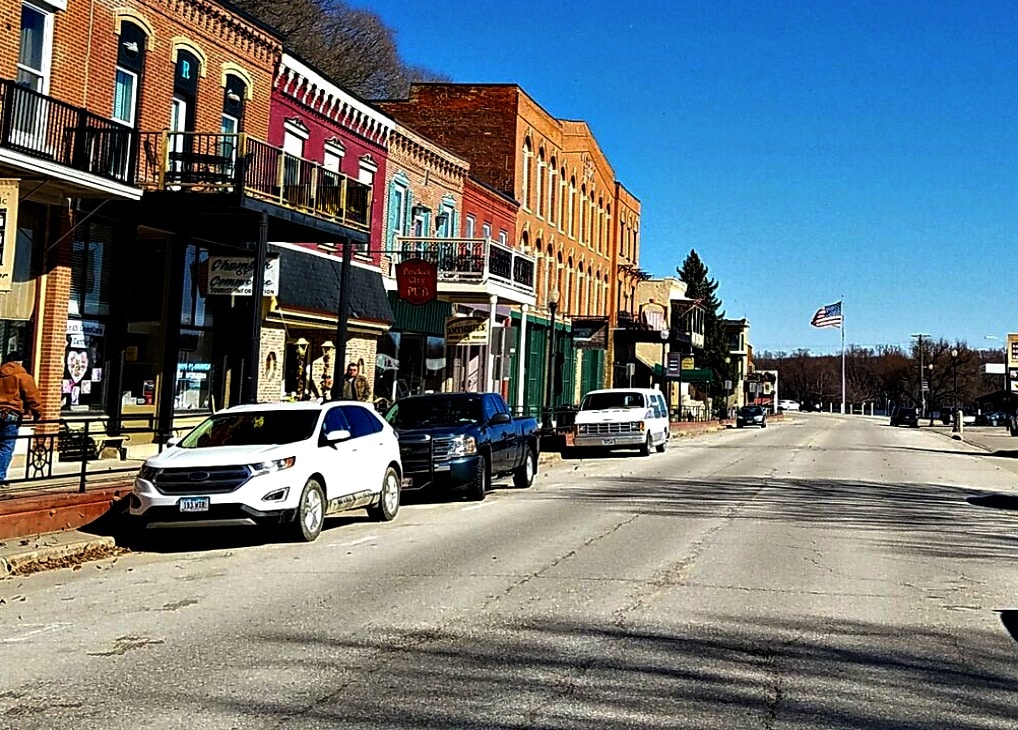
Prairie du Chien was established in the late 17th-century…

…by French Voyageurs, French Canadians who transported furs by canoes during the fur trade years between the early-17th-century and mid-19th-century.

A fur-trading post was established in the area in 1685 by Nicholas Perrot.

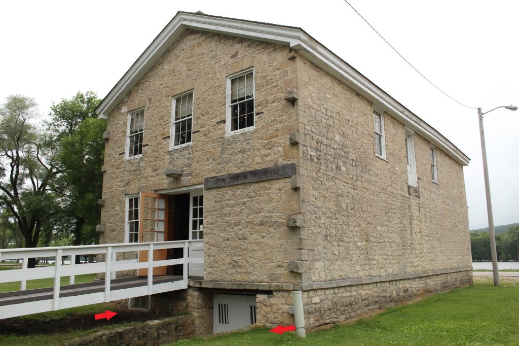
Then in the 19th-century, German-immigrant John Jacob Astor, the first prominent member of the Astor family and America’s first multi-millionaire, established the Astor Fur Warehouse, said to have been built in 1828, and was an important place for the regional fur trade for which Astor established a monopoly out west.

The Astor Fur Warehouse has a mud-flooded appearance with the ground-level window, and the below-ground-level entranceway.

During the 19th-century, Fort Crawford was an outpost of the U. S. Army at Prairie du Chien.

The first Fort Crawford was said to have been occupied between 1816 and 1832…

…and the second was occupied between 1832 and 1856, and has been preserved as the Fort Crawford Museum in what was the Fort’s military hospital.

Fort Crawford was said to have been part of a series of fortications along the Upper Mississippi River that included Fort Snelling, located in Minnesota near St. Anthony Falls, with its construction said to have been completed in 1825…

…and Fort Armstrong, in Rock Island, Illinois, said to have been constructed between 1816 and 1817.

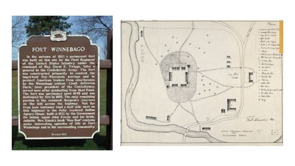
…and Fort Crawford was part of a string of forts in the Fox-Wisconsin Waterway, which included Fort Howard, near the mouth of the Fox River in Green Bay, and said to have been the first fortification built in what became Wisconsin…

…and Fort Winnebago in what is now Portage, Wisconsin, and said to have been constructed in 1828.

The next place we come to heading north on the Mississippi River is LaCrosse, Wisconsin, the largest city on Wisconsin’s western border.

A regional hub, companies based in LaCrosse include:

Kwik Trip, a family-owned chain of convenience stores founded in 1965…

…City Brewing Company, established in 1999…

…after investors purchased the former brewery buildings belonging to the G. Heileman Brewing Company which had been originally founded in 1858 by two German immigrants – Gottlieb Heileman and John Gund.

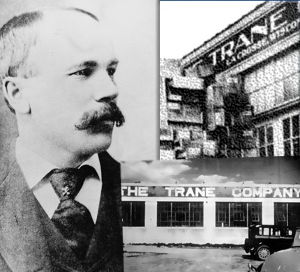
…and Trane is based in LaCrosse, a manufacturing company of HVAC systems and building management systems and controls…

…the origins of which apparently date back to 1885, when an immigrant from Tromso, Norway, James Trane, first established a plumbing and pipe-fitting shop in LaCrosse.

The Losey Memorial Arch at the entrance of LaCrosse’s Oak Grove Cemetery was said to have been designed by the same architectural firm responsible for designing the Lewis Hotel back in McGregor, Schick and Roth, and built in 1901.

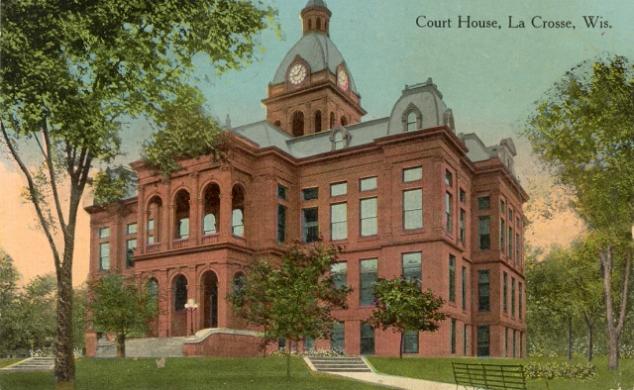
Schick and Roth are also given the credit for designing other buildings in LaCrosse, including the:

The old County Courthouse in 1904…

…and the Holway House 1892, now the Castle LaCrosse Bed & Breakfast.

LaCrosse is surrounded by bluff-lands, towering around 500-feet, or 150-meters over an otherwise flat plain.

The next place I am going to look at is Winona in Minnesota…

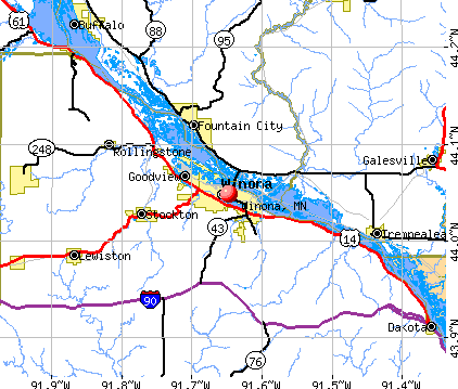
…in the Mississippi River Bluff Country.

It has a notable landscape feature is called “Sugar Loaf,” described as a rock pinnacle that was created by quarrying in the 19th-century, towering over Lake Winona.

Sugar Loaf in Winona reminds me of Chimney Rock in Sedona, where I live and see it every day.

This image has an empty alt attribute; its file name is Chimney-Rock-1024x576.jpg

Lake Winona has a really massive band-shell…

…which we are told was dedicated as a new structure in June of 1924.

Europeans arrived to settle Winona in 1851, laying out the town in lots in 1852 and 1853.

The first settlers were said to have been Yankees from New England, and then in 1856 German immigrants arrived to settle the area, and later immigrants from Poland.

…with the construction of the Winona-St. Peter Railroad from Winona to Stockton, Minnesota, being completed in 1862, which would have been during the American Civil War.

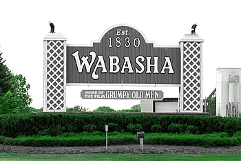
Wabasha, Minnesota is my next stop.

It was founded in 1830, and apparently wants the world to know, and only know, it was the setting for the 1993 movie “Grumpy Old Men.”

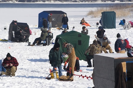
The only thing that I remember about “Grumpy Old Men”…

…is that there was ice-fishing in it.

That’s about all I remember from it!

What else comes up for Wabasha?

This is what we are told.

Wabasha was first settled by Europeans in 1826, and is Minnesota’s oldest city and longest continually inhabited River town.

It was recognized as a city in 1830, when Chief Wabasha II of the Mdewakanton Dakota Sioux tribe, and representatives of other tribes of the region, signed the Treaty of Prairie du Chien in 1830, ceding territory to the United States.

Then Chief Wabasha III, signed the 1851 and 1858 treaties that ceded the southern half of what is now the State of Minnesota to the United States, beginning the removal of his tribe to several reservations further and further away from Minnesota, ending up at the Santee Reservation in Nebraska, where Chief Wabasha III died.

In the 1830s, Augustin Rocque established a fur trading post there, and the community grew around his trading post, with the city being platted in 1854 and incorporated in 1858.

Wabasha became a bustling town, with industries like trading, clamming, factories, shipping, and flour-milling, and it became a rail transportation hub in 1857, with three railroads intersecting here – the Minneapolis, St. Paul & Chicago Railroad; the Minnesota Midland Railroad; and the Lake Superior & Chippewa Valley Railroad.

Here are some historic photos of Wabasha, with nice masonry buildings, dirt-covered streets, not very many people, and possibly a pyramidal-shape in the background in the lower-left photo.

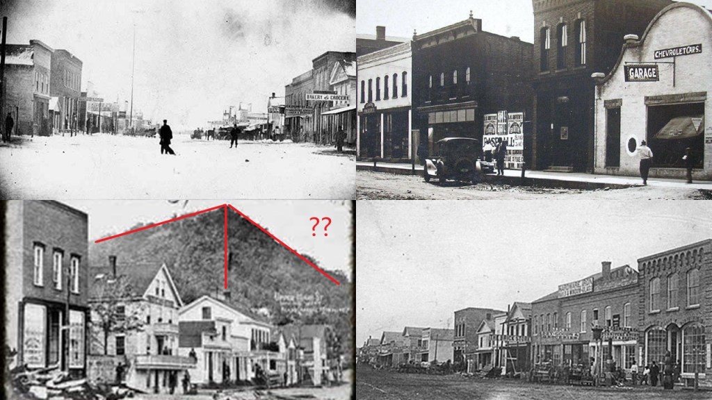
And here is downtown Wabasha today.

The last place I want to look for the purposes of the post on the Driftless Region is Red Wing, Minnesota.

Trails from Red Wing lead up to the massive landmark above the city known as Barn Bluff.

I have to say that one of my first a-ha’s in this journey of waking up to the ancient civilization in the environment around me was realizing the code of how they managed to cover it up by calling everything natural, and leaving it out of our historical narrative.

The light-bulb about this came on for me when I visited Mt. Magazine in Arkansas several years ago where “Cameron’s Bluff”  is located.

Cameron’s Bluff is such an ancient wall that there is some element of doubt. 

But there are some places you can really tell it is a built structure. 

I took these photos of Cameron’s Bluff in Arkansas. 

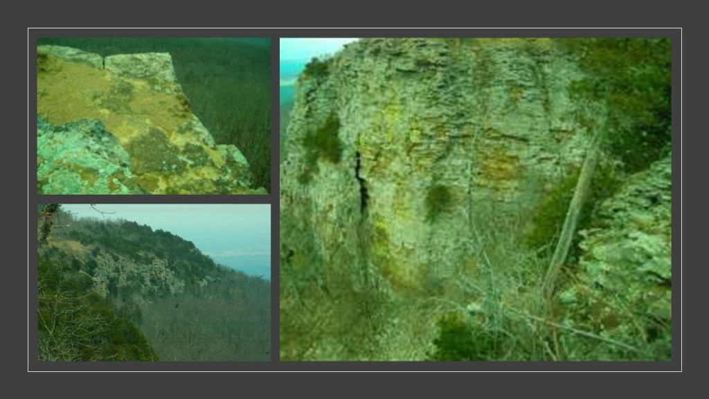
I think the definition of bluff meaning high cliff is actually a bluff, meaning an attempt to deceive someone.

Bluffs, canyons, mesas and the like are actually really ancient infrastructure.

The St. James Hotel in Red Wing is described as Italianate architecture that was built between 1874 and 1875, the year that it opened for business as…

…one of the most elaborate hotels on the Mississippi River.

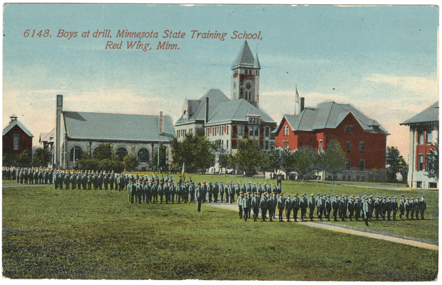
The Minnesota Correctional Facility in Red Wing, said to have been constructed in 1889…

…used to be known as the Minnesota State Training School once-upon-a-time.

And, in case you are wondering, Red Wing, Minnesota, is the home of the Red Wing Company, Museum and Store, where you can find the perfect shoe for the giant in your life.

Again, I really appreciate everyone’s suggestions, as I had a good list of places to look into in the Driftless Area.

I ended up sticking to places along the Mississippi River because that is the direction my research happened to unfold when I realized the Mississippi River runs through the heart of the Driftless Region.

I am noticing a recurring pattern coming up in my research, so my next blog post will be about German entrepreneurs and settlements in the Mississippi and Ohio River Valleys in the 19th-century.

The Destructive Forces of the 1900 Great Galveston Hurricane & Hurricane Camille in 1969 and Other “Natural Disasters”

My attention was drawn recently to so-called “natural” disasters like the 1900 Great Galveston Hurricane and the 1969 Hurricane for the several reasons.

A commenter on my YouTube channel drew my attention to the ending scene of the 1944 musical “Meet Me in St. Louis,” starring Judy Garland.

Interesting that a musical like this would be made during wartime, as World War II was in progress that year, not ending until 1945.

In the very last scenes of the movie, the cast of characters were at the St. Louis World’s Fair enjoying the sights and sounds and cotton candy of the fair together.

Out of absolutely nowhere, with no context for it whatsoever, the little girl who was the youngest member of the group, in the strangest outburst, talked about big waves that flooded the city of Galveston, and when the water went back it was muddy and full of dead bodies.

The context for her outburst came up when I was putting together a video slideshow from photocopies a viewer had sent me of a book he had purchased about the 1904 St. Louis World’s Fair…

…but that she was talking about an exhibit at the fair wasn’t even mentioned by the little girl.

On the stage of the large Galveston Flood Hall, the fairgoers could view the city of Galveston reproduced in grand scale.

Miniatures were masterly combined with murals to join  a quite realistic look.

Boats sailed, trains crossed Galveston bridge via bridge, the sun was shining, electric cars passed through the streets.

All was calm. 

Then, the clouds gathered, and the wind and the rain began their bombardment of the city-island.

Through dramatic narration, miniatures, water lighting and special effects, attractions illustrated the enormous power of mother nature. 

The city was in ruins.

But the show did not end on a sad, bleak note, as a better and brighter new Galveston was depicted for the audience, rebuilt by American resources and courage.

At the very end of “Meet Me in St. Louis,” when the buildings of the World’s Fair were lit-up, here were some of the things that were said by different characters:

“Never been anything like it in the whole world.”

“We don’t have to come here on a train or stay in a hotel. It’s right in our own home town.”

“Grandpa, they will never tear it down, will they?”

“Well, they’d better not.”

“I can’t believe it…right here where we live…right here in St. Louis!”

The media of cinematography and music were powerfully-utilized to shape the narrative in the minds of the collective, and are a vehicle for soft disclosure without the public’s knowledge that information is being disclosed within it, in this case the advanced ancient civilization that was everywhere, literally “in our own home towns,” and as is the case with world fairs, they were showcasing the technology and architectural wonders of the original civilization before being hidden away or forever destroyed.

Hurricane Camille came up from someone in email contact with me who pointed me in the direction of researching Camille because she said that it had absolutely devastated Nelson County in Virginia and for me to research and see what came up, and to also look into Norfolk, Virginia and Hampton Yards.

I will be looking at other so-called natural disasters in the 20th- and 21st-centuries.

My starting point is taking a look at Galveston’s early history.

It is a port city off the coast of southeast Texas on Galveston and Pelican Islands, and the seat of Galveston County.

The present-day city of Galveston was said to have been named for Bernardo de Galvez y Madrid, Count of Galvez, who was the Colonial Governor of Spanish Louisiana and Cuba from 1777 to 1783, and later the Viceroy of New Spain from 1785 to 1786.

Galvez aided France and the fledgling United States in the defeat of the international war against Britain, defeating the British at the Siege of Pensacola in 1781 and conquering west Florida, after which time the whole of Florida was returned to Spain in the Treaty of Paris of 1783.

In 1825, the Congress of Mexico established the Port of Galveston following its independence from Spain in 1810, but became the main port for the Texas Navy during the Texas Revolution in 1836.

Galveston later became the temporary capital of the Republic of Texas, a sovereign state in North America that existed from March 2nd of 1836 to February 19th of 1846.

Galveston’s old Fort San Jacinto, located on the northeast tip of Galveston Island at the entrance to the southern portion of Galveston Bay.

Four batteries were said to have been built during the Endicott Period between (1890 and 1910): Croghan, Mercer, Hogan, and Heileman.

We are told an additional two batteries were added during World War II: Battery #235, and the Anti-Torpedo Motor Boat (ATMB) shown here.

Here is a view of downtown Galveston from Battery #235, also with a view of mud-flats in Galveston Bay, which has a complex mixture of sea water and fresh water.

Here is a screenshot of Google Earth showing the entrance to Galveston Bay between Fort San Jacinto on Galveston Island, the western tip of the Bolivar Peninsula, and Pelican island.

In the course of my research, I have found star forts in pairs or clusters, so I look for this now.

Sure enough, the location of the tack marked “Star Fort #3” turns out to be the location of Fort Travis Seashore Park at the western tip of the Bolivar Peninsula, with Fort Travis said to have been originally established in 1836, and federal construction starting in 1898, and ending in 1943, and was declared war surplus in 1949 and turned over to a private developer.

The Bolivar Peninsula has been devastated by hurricane activity.

This was picture of it was taken notated as having been taken after Ike, a massive hurricane that hit there in 2008.

Pelican Island, the location of the tack named “Star Fort 2,” was said to have been merely a narrow spit of marsh in 1815, and that in 1859, we are told the federal government began to construct a fort on Pelican Island.

After Texas seceded from the Union in 1861, apparently the Confederate Army promptly finished the fort by building barracks, adding five guns, and storehouses.

Then, Union Army re-took Pelican Island in 1862.

By 1872, the City of Galveston had recorded the deed to Pelican Island in the County Clerk’s Office.

Galveston’s historic Beach Hotel was said to have been built in 1882 by Nicholas J. Clayton, a prominent Victorian-era architect in Galveston.

The historic Beach Hotel didn’t even make it to the 1900 hurricane, as it was destroyed by a mysterious fire in 1898.

Mr. Clayton was also the architect credited with the First Presbyterian Church of Galveston, considered one of the best examples of Norman Revival architecture in the region, and constructed in 1872.

Apparently the First Presbyterian Church was unscathed by the 1885 Great Fire of Galveston, which took place on November 14th of 1885 and said to have destroyed forty blocks worth of mostly wood-framed buildings that were primarily residential.

I found this historical photograph that was notated to be taken in 1956, showing the Buccaneer Hotel, Hotel Galvez, and the Mountain Speedway Rollercoaster in Galveston.

A stand-alone roller coaster in a city-scape?

It was said to have been built in 1921 , and once surrounded by a small amusement park.

The rollercoaster was demolished after it sustained damage as a result of Hurricane Carla in 1961.

The Buccaneer Hotel was said to have been built on the seawall in 1929, and used as a hotel until 1962, at which time it was donated by the Moody Foundation to the Methodist Church and turned into the Edgewater Methodist Retirement Community campus.

The building was demolished, 1999, only 70-years after its supposed 1929 construction date, for the given reason of the structure being unsound.

The Buccaneer Hotel was the home of Radio Station KFUL from 1924 to 1933.

It is interesting to note that in August of 1929, KFUL broadcast a special program about the world flight of the German Airship Graf Zeppelin, called the only airship to fly around the world, and funded by the multimillionaire newspaper publisher, William Randolph Hearst, known in history for yellow journalism, sensationalism, and emotional human-interest stories.

A local concert orchestra would play “appropriate” music, and an announcer would give details about each of the countries being traversed.

Do we have yet another example of how the masses were programmed with the narrative about the world in which we live?

In contrast to the fate of the Buccaneer Hotel, the Hotel Galvez, a luxury hotel and spa, remains standing as the only historic beachfront hotel on the Gulf Coast of Texas, said to have been built starting in 1910 by the architectural firm of Mauran and Russell in Mission/Spanish Revival Style, and first opened for business in 1911.

I want to look at a few more historic buildings in Galveston before I jump into the 1900 Great Hurricane to see what was said to have been built before and after the devastating event to establish what was still standing after the onslaught of the Hurricane.

The Bishop’s Palace, also known as the Gresham Mansion, was said to have been built between 1887 and 1892 for lawyer and politician William Gresham, the U. S. Representative from Texas, and his family by the same prominent Galveston architect, Nicholas J. Clayton, that was credited with the Beach Hotel and First Presbyterian Church I highlighted early in this post.

It later became the home of the Bishop for the diocese, until the diocesan offices were moved to Houston.

On the outside, we find colored stonework, intricately-carved ornaments, and decorative wrought-iron balustrades.

The 7,500-square-foot, or 697-square-meter, interior boasts floors and wall paneling of rare woods, stained glass windows, bronze dragons, expensive sculptures, and exquisite imported fireplaces including one lined in pure silver.

It was cited by the American Institute of Architects as one of the 100 most important buildings in America.

More on the Bishop’s Palace when we get to the 1900 Hurricane.

The Ashbel Smith Building in Galveston, also known as “Old Red,” was also said to have been credited to architect Nicholas J. Clayton, and was built in 1891.

It was the first University of Texas Medical System building.

Though it was one of the few buildings to survive the 1900 Hurricane and flood, Hurricane Ike flooded it with six-feet, or 2-meters, of water in 2008.

The ground-breaking for the construction of St. Mary’s Cathedral Basilica was said to have taken place in 1843 and completed by 1847, under the supervision first of architect Theodore E. Giraud, and a later addition by Nicholas J. Clayton.

Designated by Pope John Paul II as a minor basilica in 1979, it is the Mother Church of the Catholic Church in Texas, and the primary Church of the Diocese of Galveston-Houston.

Like “Old Red,” St. Mary’s Cathedral Basilica survived the 1900 Hurricane, but sustained significant water damage during the 2008 Hurricane Ike, and was closed for restoration until 2014.

This is what we are told about surrounding the Great Galveston Hurricane of 1900.

By 1900, Galveston was a prosperous port of 37,000, and the location of a number of firsts in Texas: first medical college; first electric lights and streetcars; and the first public library…until its history was changed forever by the deadliest hurricane in United States history.

This image was notated as a Bird’s Eye View of Galveston circa 1888.

So how commonplace was the ability to obtain aerial views in 1888, which would have been before what is generally-recognized as the beginning of the Age of Aviation starting in the 1900s?

In research for a recent post, I found this even earlier “Air View of Memphis,” circa 1870.

How was this even possible based on the history we have been taught?

The hurricane that became known to history as the Great Galveston Hurricane made landfall in the United States there on September 8th of 1900 as a Category 4 on the Saffir-Simpson Scale, with estimated winds of 140 mph/hr, or 220 km/hour, at the time of land-fall.

The death toll from the storm surge of the hurricane was estimated to be between 6,000 and 12,000 people, with 8,000 being the most cited number officially.

The big variance in the death toll numbers was attributable to a large number of victims having been washed away by the surge and never seen again.

We are told that the loss of life was attributed to Weather Bureau officials in Galveston brushing off the incoming weather reports because they did not realize the threat.

In Galveston alone, there was an estimated $30 million worth of damage, out of $34 million dollar in damage throughout the United States on the hurricane’s path.

The following photos record the destruction of Galveston in the aftermath of the hurricane and its storm surge.

We are told that the few buildings that survived in Galveston were mostly the solidly built Victorian-era mansions and houses in the Strand District, a National Historic Landmark District which today houses restaurants and shops.

As a result of the devasting effects of the hurricane on Galveston, the early years of its prosperity came to an end, and its citizens were faced with the difficult task of rebuilding their city.

We are told the process of bringing Galveston back to life was one of the most complicated and extensive feats of civil engineering in American history, with efforts including raising buildings that had survived the storm, and the creation of temporarily-functioning canals by which the city was able to transport millions of tons of dirt into the eastern half of the island.

We are told dredge-material was pumped onto Galveston Island following the hurricane, with residents enduring years of pumps, sludge, canals, stench, and miles of cat-walks during the project.

Now where have I heard about that before?

Oh yes, I have heard that about Seattle.

The streets here were said to have been elevated after the Great Fire of Seattle in 1889, thereby creating the underground spaces of Seattle’s vast underground network.

In the aftermath of the 1889 fire, we are told new construction was required to be of masonry…and the town’s streets were regraded one to two stories higher.

At any rate, we are told after the fire, for the regrade, streets were lined with concrete walls that formed narrow alleys between the walls and the buildings on both sides of the street…with a wide alley where the street was.

Then, the naturally steep hillsides were used to raise the streets to the desired new level by washing material into the wide alleys through a series of sluices, and raising the street level by at least 12-feet (or 3.7-meters), and in some places, by 30-feet (or 9.1-meters) high.

I was able to find this picture labelled as the Seattle re-grade. 

We are told pedestrians in Seattle during this time climbed ladders to go-between street level and the sidewalks in front of the building entrances.

I am just relaying what they are telling us is going on here, and the similarity of the narrative and photos concerning the two very different disasters.

Are we talking about weather and fire as covers for a different event involving mud?

As a matter of fact, why would the Galveston Flood even have been show-cased at the 1904 St. Louis Exposition?

One of the meanings of the word “exposition” is a device used to give background information to the audience about the setting and characters of the story.

Exposition is used in television programs, movies, literature, plays and even music.

What better way to tell your audience the story you want them to believe than the other definition of exposition, a large exhibition of art or trade goods.

Something to ponder.

Coney Island in New York had a permanent exhibit on the Great Galveston Flood, housing a mechanical cyclorama depicting the devastating flood, complete with real and fake water, large sheets of painted cotton fabric, and intricate lighting and mechanical effects.

Back to Galveston after the flood.

Galveston’s seawall was also said to have been built after the 1900 flooding.

The next chapter in Galveston’s history started in 1910, when the Maceo brothers, Rosario and Salvatore, arrived there from Sicily.

While the Maceos had legitimate business and real estate holdings, the are best-known as the leaders of the “Beach Gang,” a group of bootleggers that owned and operated numerous clubs across the island during the Prohibition-era.

Galveston went from being called a “Victorian Playground on the Gulf,” and “The Wall Street of the South” before the 1900 hurricane, to becoming the “Sin City of the Gulf” under the Maceos influence.

The most famous of their clubs in Galveston was “The Balinese Room,” which served as the center of their operations in bootlegging and gambling.

It was shut-down by the Texas Rangers in 1928.

It became known after that as the Sui Jen Restaurant, until 1942, when it was remodelled and reopened as the Balinese Room once-again, and during its hey-day was considered to be one of the most popular, if not the most popular, big-name entertainment venues in the American Southwest.

Texas Rangers raided Galveston in 1957, and shut down the illegal operations going on there, and “Sin City” was out-of-business.

The last artifact of the period was the Balinese Room, surviving as a legitimate night-club until it was destroyed by Hurricane Ike in 2008.

Now I am going to turn my attention to Hurricane Camille, a Category 5 hurricane which first made landfall in the United States on the Gulf Coast on August 17th of 1969.

Originating from a tropical wave off the western coast of Africa on August 5th of 1969, it tracked quickly along the 15th-parallel north, and four-days later appeared as a tropical disturbance on satellite imagery.

It reached tropical storm status in the western Caribbean.

By the time it reached the Gulf of Mexico, it briefly weakened to a Category 4 storm because of an “eyewall replacement cycle.”

I remember doing a double-take when I first heard the phrase several years ago, because it struck me as mechanical wording.

We are told that “eye-wall replacement cycles,” which are also known as “concentric eye-wall cycles,” occur naturally in intense tropical cyclones of greater than 115 mph, or 185 kmh.

With this intensity, when the inner eye-wall is sufficiently small, some of the outer rain-bands may strengthen into an outer eye-wall that slowly moves inward and takes the moisture of the inner eye-wall, potentially causing the re-intensification of the storm.

The U. S. government operated a hurricane modification experiment named Project Stormfury, which ran from 1962 to 1983.

During Project Stormfury, aircraft were flown into hurricanes to seed them with silver iodide, to see if this process would weaken the hurricane.

Researchers reported that unseeded hurricanes often undergo the eyewall replacement cycles that were expected from seeded hurricanes, so the Project Stormfury was eventually ended.

Camille entered the United States between Bay St. Louis in Mississippi…

…and Plaquemines Parish in Louisiana.

Hurricane Camille devastated the entire Mississippi Gulf Coast.

This photo was taken of Beach Boulevard and Main Street in Bay St. Louis in the aftermath of the hurricane.

The strength of Camille’s winds caused the Mississippi river flow backwards for a distance of 125-miles, or 201-kilometers, from its mouth to a point above New Orleans.

One of the Camille’s most prominent architectural victims was the Episcopal Church of the Redeemer, said to have been designed by New Orleans architect Thomas Sully and built in 1892.

While the bell-tower of the 1892 church remained still-standing, both it, and the said-to-be older church building behind it, which were spared by Hurricane Camille…

…were destroyed by Hurricane Katrina in 2005.

Here is a before-and-after picture of the Richelieu Apartments in Pass Christian, Mississippi.

After devastating the Mississippi Gulf coast, the storm tracked across the rest of Mississippi, the Ohio Valley, West Virginia, and entered the State of Virginia.

By the time the weather-system that was Camille entered Virginia, it was no longer a hurricane, but carried high-amounts of moisture, and contained sufficient strength and low-pressure to pull in additional moisture.

Much of western and central Virginia received 8-inches, or 200-millimeters, of rain from the storms remnants, which led to significant flash floods across the state, and landslides occurring on hillsides.

To this day, Hurricane Camille is on the record as Virginia’s deadliest natural disaster, with 153 deaths, of which 123 were in Nelson County alone.

Virginia’s Nelson County was devastated with twenty-six-inches, or 660-millimeters, of rain, one of the heaviest rainfalls ever recorded, causing flooded rivers, mudslides, prolonged power-outages, and washed out roadways and structures.

The storm was still strong enough to cause the James River to flow backwards for 8-miles, or 13-kilometers, the same effect Camille had on the Mississsippi River.

Some of the Nelson County communities that sustained the worst of the damage include: Massies Mill, Roseland, Lovingston, Bryant, and Tyro.

I am going to poke around to see what is available to find out about these communities.

Massies Mill is an unincorporated community next to the headwaters of the Tye River.

We are told that a company incorporated in 1914 to build the Virginia Blue Ridge Railway, a 16-mile, or 26-kilometer, -long short-line railroad in Central Virginia, connecting Massies Mill to the interchange with the Southern Railway at the Tye River Depot in Nelson County.

Known as Th’ Blue Ridge locally, it was said to have been constructed to haul American chestnut trees from the heavily-forested region, which also contained oak and poplar trees, to lumber mill towns like Massies Mill.

This was the Bee Tree Lumber Mill in Massies Mill in 1920.

The laying of track for the short-line was said to have begun in 1915 at the town of Tye River in Nelson County, at the location where the interchange with the Southern Railway was.

There was even Civil War activity here in 1864, when a Confederate Army battery was said to have prevented the union army from destroying the Orange and Alexandria Railroad Bridge crossing the Tye River.

Jeepers, I found this creepy- and posed-looking photograph taken at the Orange and Alexandria bridge…

…that looks like others I have seen like this one taken in Trenton, New Jersey sometime in the 1870s…

…and this one taken in front of the Machinery Hall in Cincinnati…

…at the 1888 Centennial Exposition of the Ohio Valley and the Central States.

This photo is notated as “Construction Steam Shovel 8-1916 in Lowesville, Virginia” regarding the construction of the Virginia Blue Line.

A blight emerged that affected the chestnut lumber industry, so the railroad’s primary utilization turned into support of mining & processing operations like Piney River, which got shut-down in 1971 because of waste management issues, and was designated as a superfund site in 1983 …

… and supplies and transportation for the region’s many fruit orchards.

Hurricane Camille damaged some of the Virginia Blue Line’s bridges and twisted miles of track.

Although the necessary repairs were made to keep the line operational, ultimately, the historic short-line railroad ended its run in 1980.

Nelson County is a fertile farming and fruit-tree growing region…

…and Massies Mill was no exception here.

The Drumheller Orchard in Lovingston was first established in 1937, and is operational to this day with apple and peach trees, as well as blackberries, raspberries, plums, and pluots, a type of plum.

Interestingly, Nelson County has suffered from the effects of heavy flooding more than once, as it did with the tropical depression Florence causing the Tye River to overflow its banks, flooding out its rich farm-lands.

I want to share one more picture I found in Nelson County before moving on from here – of the cathedral-like-facade of the “Voter Registration and Elections Office” in Massies Mill.

After causing major flooding on its way across the rest of Virginia, washing out bridges and leaving entire communities underwater and effectively cutting off communication between the Shenandoah Valley from Richmond, where flood waters from the James River even reached the steps of Main Street Station…

…Camille emerged into the Atlantic east of Norfolk.

Incorporated in 1705, Norfolk is one of the oldest cities in the Hampton Roads Metropolitan area, of which it is the core.

Hampton Roads is described as the world’s largest “natural” harbor, with all of its straight-edges, located at the mouth of the Chesapeake Bay.

Hampton Roads has the largest concentration of military personnel in the nation, including Naval Station Norfolk…

…Fort Monroe…

…Joint Base Langley Air Force Base – Fort Eustis Army Base…

…and Joint Expeditionary Base Little Creek – Fort Story.

In addition to its extensive military presence, Norfolk has a long history of being a strategic transportation point, the place where many railway lines started, and having an extensive network of interstate highways, bridges, tunnels, and three bridge-tunnel complexes.

In 1907, the Jamestown Exposition was held in Sewell’s Point in Norfolk, located at the mouth of the Hampton Roads port, commemorating the 300th- Anniversary of the founding of Jamestown in the Virginia Colony.

Some of the exposition buildings were taken over by Naval Base Norfolk on Sewell’s Point, primarily for use as Admirals’ Quarters, thirteen of which are on what has been called “Admirals Row” like the exposition’s Maryland House…

…the Missouri House…

…and the Georgia House.

I am not finding any information on Camille’s effects on the Norfolk – Hampton Roads area itself, but it certainly looks to have been a prominent place throughout Earth’s history – both known and unknown.

While I have a whole list of hurricanes to choose from…

…I am going to focus next on, and last regarding the subject of hurricanes, the destructive 2017 Hurricanes Harvey, Irma, and Maria that took place, one right after the other, during the very busy 2017 hurricane season.

Harvey made landfall as a Category 4 hurricane in Texas on August 25th of 2017.

The flooding it caused was catastrophic, and 106 deaths were attributed to Harvey.

The cost of the damage in the Houston Metropolitan Area and Southeast Texas was in the $125-billion-range, and is tied with the 2005 Hurricane Katrina as the costliest hurricanes on record.

In a four-day period, slow-moving Harvey dumped more than 40-inches, or 1,000-millimeters, of rain in many areas, and, in combination with adjacent waters, caused unprecedented flooding.

Harvey was the wettest tropical cyclone on record in the United States.

As the monster storm moved across Texas and Louisiana, thousands of homes were flooded, displacing 30,000 people, and more than 17,000 were rescued.

Hurricane Irma formed off Africa’s Cape Verde islands on August 30th of 2017, just as Hurricane Harvey was dissipating.

Irma caused widespread damage throughout the Caribbean, and was the first Category 5 hurricane to hit the Leeward Islands, which include the Virgin Islands, St. Martin, and Antigua and Barbuda, among others.

Hurricane Maria arrived there two-weeks later, and became the second Category 5 hurricane on record to hit the Leeward Islands. More on Maria to come.

At the time, Irma was considered the most powerful hurricane ever in the open Atlantic, until surpassed by Hurricane Dorian two-years later.

Irma had an “eyewall replacement cycle” as she moved through the Caribbean, weakening to a Category 4 as she passed south of the Turks and Caicos Islands, after having maintained Category 5 intensity for 60 consecutive hours, the second-longest on record in the Atlantic, maintaining winds above 156-mph, or 251-km/h, during that time.

When the “eye replacement cycle” ended, Irma reintensified to a Category 5 storm, and she hit the island of Little Inagua in the Bahamas.

Irma made landfall again in Cayo Romano, Cuba sustaining winds of more than 165-mph, or 265-km/h, and then weakening shortly thereafter to a Category 2 hurricane.

From Cuba, Irma turned northwest towards Florida, and regained strength over the warm waters, and hit Cudjoe Key in the Florida Keys as a Category 4 storm…

…and from there making its 7th-landfall at Marco Island, Florida, with winds of 115-mph, or 185-km/h.

From there, Irma tracked northwest into the Gulf of Mexico, passing east of Tampa, growing weaker as it entered the United States in the State of Georgia, eventually becoming a remnant low.

From the beginning to end of Irma’s trek, 134 deaths were reported.

Next I am going to look at Maria, a hurricane which caused catastrophic destruction across the northeastern Caribbean, ultimately doing upwards of $91.61 billion in damages in the course of its life, mostly in Puerto Rico.

Hurricane Maria formed on September 16th of 2017, east of the Lesser Antilles, and reached Category 5 strength on September 18th, just before making first- landfall on Dominica, bringing destruction to the whole island.

The hurricane was said to have an “eyewall replacement cycle” on September 20th, and as a high-end Category 4 storm, hit Puerto Rico, where it devastated the whole island and caused a major humanitarian crisis.

The heavy rains, storm surge, and wind gusts of over 100-mph, or 160 km/h, crippled the island’s power grid and flattened neighborhoods.

The storm weakened after it left Puerto Rico, and it moved northeast of the Bahamas, and gradually dissipated into a tropical storm over the Atlantic by September 28th, and was completely dissipated by October 2nd.

The official death toll from Hurricane Maria in Puerto Rico was revised to 2,975 in August of 2018…

…and a total of 3,059 from across all the Caribbean islands in its path.

I have just given a few of many examples of modern weather-mayhem. Are we looking at nature wreaking all of this havoc, or could something else possibly be going on?

If it is not natural, then what could it possibly be?

Besides hurricane-seeding weather modification projects like the Project Stormfury that I mentioned earlier, HAARP is another candidate, and has long been suspected of being used to control the weather.

The High-Frequency Active Auroral Research Program, better known as HAARP, is described as the most high-power, high-frequency transmitter for the study of the ionosphere.

The ionosphere forms the boundary between space and the lower atmosphere of the Earth.

The operation of HAARP was transferred by the United States Air Force to the Geophysical Institute of the University of Alaska Fairbanks in 2015.

While HAARP may have absolutely nothing to do with weather modification programs, it has certainly generated a lot of wild speculation about its role in a lot of things!

I ask these kinds of questions, especially with three of the most powerful and damaging storms on record forming one right after the other in the late summer, early-fall of 2017, during a hurricane season with 18 named-storms, with Hurricanes Irma and Maria hitting some of the same places two-weeks apart, as well as the exact locations I have encountered that have gotten hit more than once, like Nelson County in Virginia with at least more than one tropical cyclone flooding event; and the historic Episcopal Church of the Redeemer in Biloxi being partially destroyed by Hurricane Camille in 1969 and later completely destroyed by Hurricane Katrina in 2005.

Statistically, what are the odds of all of this occurring as a result of natural events?