
So far, this circle alignment has been tracked through the metropolitan areas of Washington, DC; Baltimore, Maryland; Wilmington, Delaware; and Philadelphia, Pennsylvania.
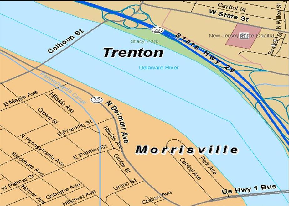
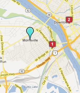
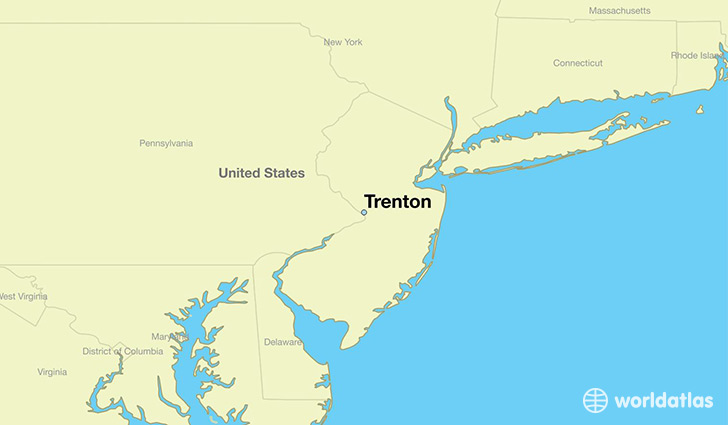
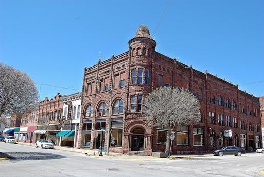
Next on the alignment, we come to Morrisville, a borough in Bucks County, located just below the Delaware River Falls, opposite the Delaware River from Trenton, New Jersey.
In the State of Pennsylvania, a borough is considered a self-governing municipal entity, best thought of as a town, and usually smaller than a city, but with fewer powers and responsibilities than full-fledged cities.
Pretty close to sounding like the word Moorish…think that might be a stretch? Let’s take a look at this more closely.
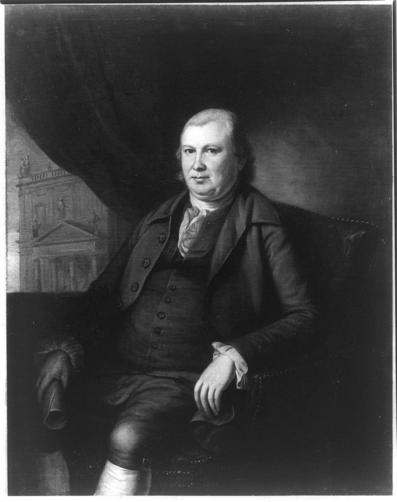
We are told Morrisville was named after Robert Morris, an English-born merchant and Founding Father. He was a businessman turned politician, and is best known for being the Financier of the American Revolution. He campaigned unsuccessfully for Morrisville to become the new Nation’s Capital.
This is a portrait of him painted by Charles Willson Peale in 1782, originally hung in Independence Hall in Philadelphia.
I wonder what he is holding in his right hand…and interesting that there is a view of a classical-looking building through the window he is sitting next to. In the United States in 1782?
When I looked up the Coat-of-Arms of Robert Morris, Founding Father, this is what I found:
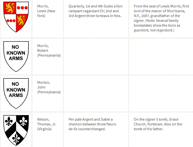
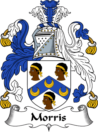
I looked up the Morris Coat-of-Arms, and while there are several versions, this is one of them…
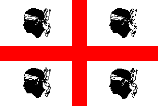
…compared with the flag of Sardinia, a large island in the Mediterranean off the coast of Italy, which is nicknamed the Four Moors flag…
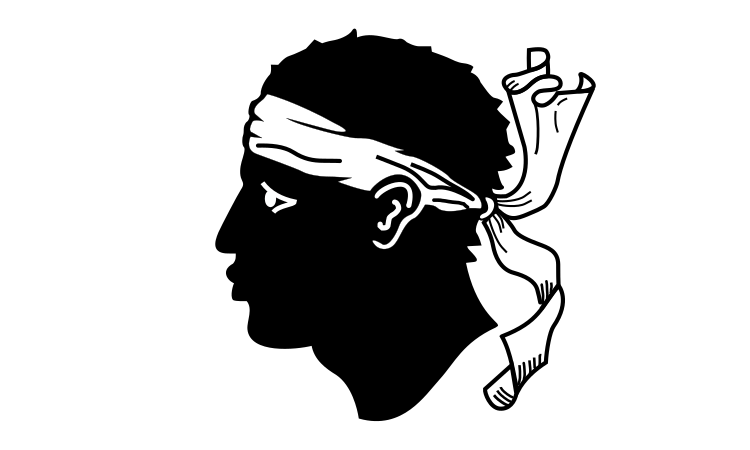
…and the flag of Corsica, an island just north of Sardinia in the Mediterranean Sea.
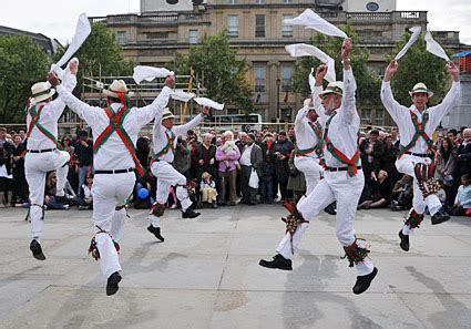
Then there are Morris Dancers in England, who practice a group dance form of choreographed steps, with bells on the knees, and wielding sticks, swords, or handkerchiefs.
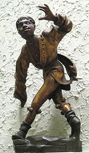
It is said the name of Morris Dance is first recorded in the 15th-century as Moorish Dance. Here is a 1480 statue of a Moorish Dancer at the Old Townhall in Munich.
Graystones in Morrisville is where William Penn is said to have purchased the first Pennsylvania land in 1682 from the Lenni Lenape…
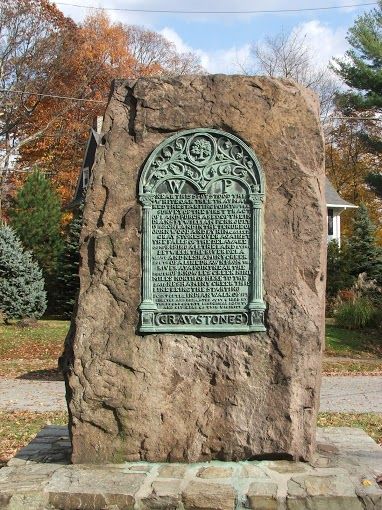
…and here is the massive gray stone at the top of the land purchase on Crown Street in Morrisville, to the left of that historical marker.
It is interesting to note that both of these important men in the historical narrative, Wllliam Penn and Robert Morris, are said to have ended up in debtor’s prison before they died because of financial problems.
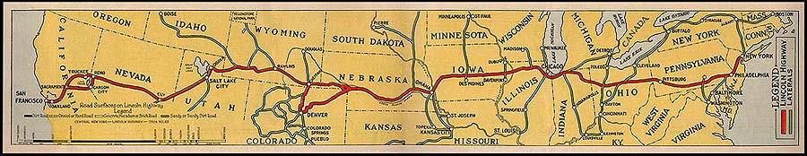
The Lincoln Highway, the one of the nation’s earliest transcontinental highways, goes through Morrisville.
The Lincoln Highway starts in Times Square in New York City, and ends up in Lincoln Park in San Francisco. It is said to have opened in 1913.
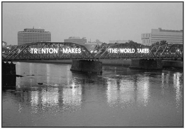
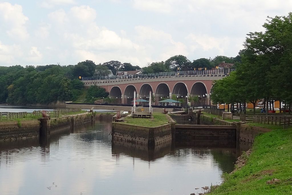
The Calhoun Street Toll Supported Bridge is between Morrisville and Trenton. It was said to have been constructed in 1884 by the Phoenix Bridge Company.
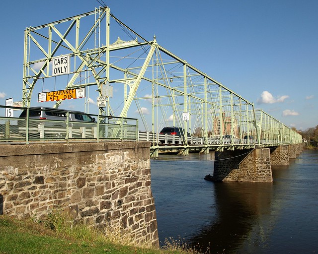
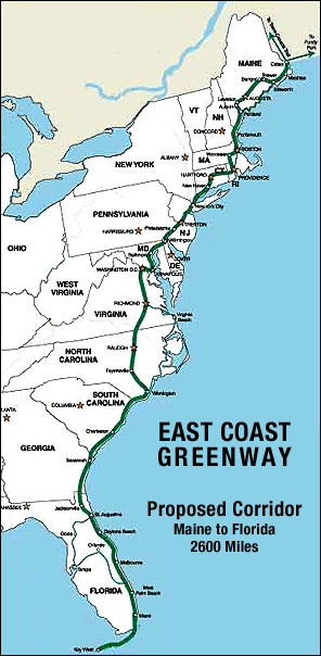
This bridge helps connect segments of the 3,000-mile-long East Coast Greenway, which runs from Calais, Maine, to Key West, Florida.
The Calhoun Street Bridge was part of the Lincoln Highway until 1920, at which time the Lincoln Highway was re-routed to the toll-free Lower Trenton Bridge.
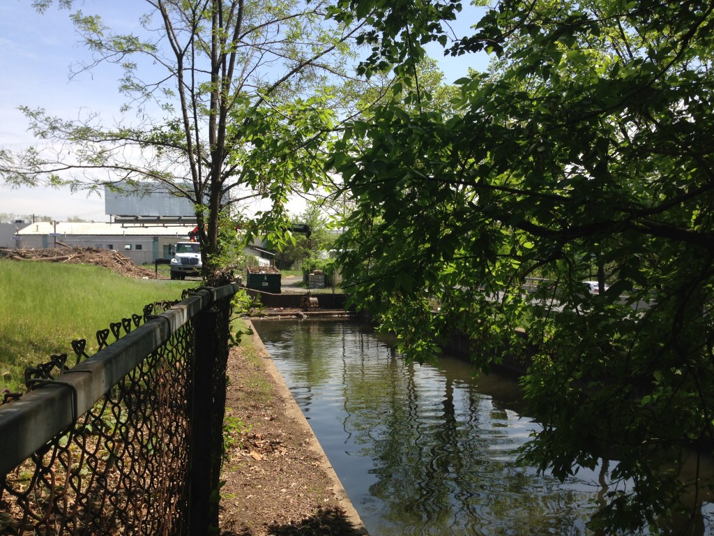
A portion of the Delaware Canal State Park is in Morrisville.
The canal that runs through Morrisville was said to have been built in the 1830s between Easton to the North and Bristol to the South…
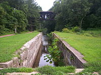
…and a crushed-stone towpath, upon which mules pulled cargo-laden boats.
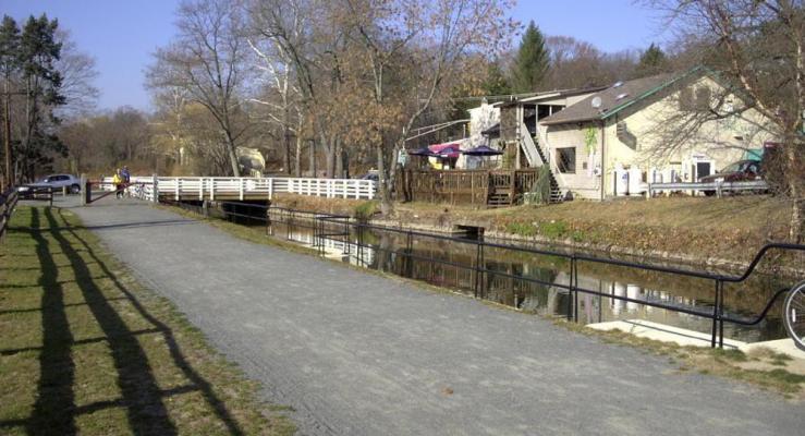
So, somehow the technology existed in the 1830s to build a sophisticated canal system, and they had the ability to crush stone into tiny, tiny pieces, but that the boats themselves had to be pulled by mules?
This is certainly what we are taught, but does this make sense?
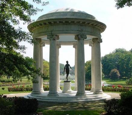
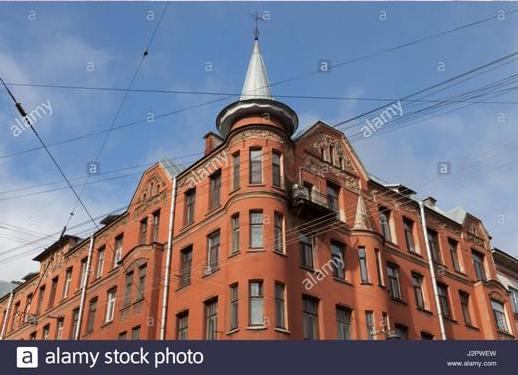
I checked out Core Creek Park in Morrisville because I always find things in parks, and sure enough, it has a folly…
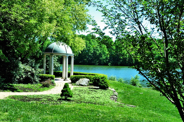
…that is similar to the one in Nemours Gardens in Wilmington, Delaware.
Robert Morris lived at Summerseat in Morrisville. Note the windows going underground, like there is more of this building below the ground…
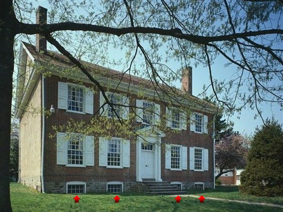
…and which was a busy place during the American Revolutionary War…
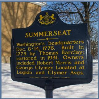
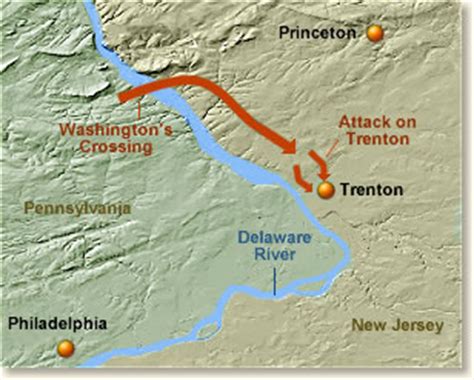
Morrisville is where Washington established his camp in the winter of the famous crossing of the Delaware River, and where the British Garrison in Trenton was defeated, marking a turning point in the war in favor of the American forces.
So this brings us to Trenton, the capital of New Jersey, and briefly the U. S. Capital in 1784.
The New Jersey State Capitol Building is just right across the Delaware River from Morrisville, said to have been built in 1790, and the oldest state house in continuous legislative use in the United States. Built 7 years after the end of the Revolutionary War in 1783?
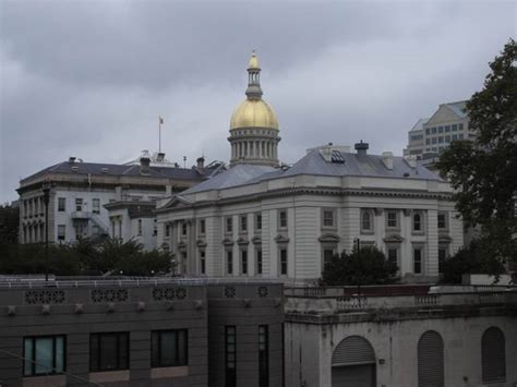
How? We can’t build like this even today.
And the beginning of the Industrial Revolution wasn’t said to have really gotten underway in the United States until approximately the mid-1800s.
There were a number of mills in Trenton, New Jersey.
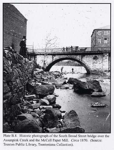
The paper mill on Assunpink Creek in Trenton was already described as old in the 1870s. With the guy in the top hat standing in the mid-ground; the two guys underneath the bridge in the background; the group of four on the bridge itself; and with no other activity going on, this photo seems really odd to me. What were they doing there?
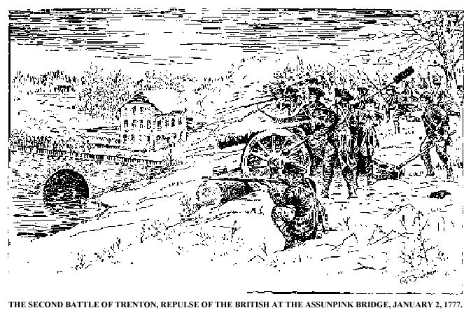
Assunpink Creek was also the location of the Second Battle of Trenton between British and American forces on January 2nd, 1777, which the Americans won.
Here are structures of the Assunpink Creek today.
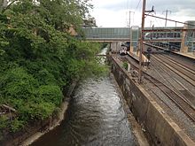
Nothing out-of-the-ordinary to see here, right?
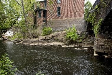
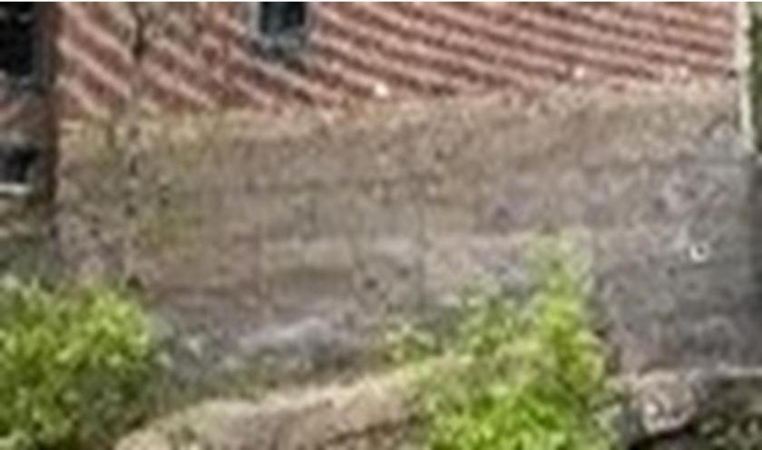
Here is a close-up of the foundation of the building, showing what appears to be large blocks of masonry.
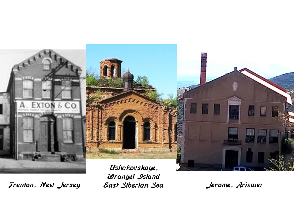
This building in Trenton was the Exton Mill on the left, compared with the design features of what is called an old church at the abandoned settlement of Ushakovskoye, on Wrangel Island on the East Siberian Sea in the middle; and that of the building in Jerome, Arizona, on the right.
The Delaware and Raritan Canal connects the Delaware River at Bordentown, New Jersey, and the Raritan River at New Brunswick, New Jersey. This a distance of 44 miles, or 71 kilometers.
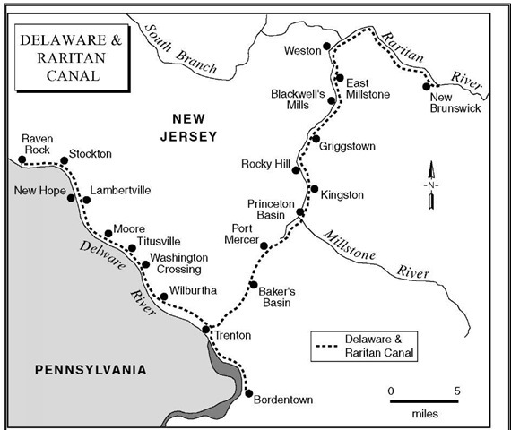
It goes through Trenton…
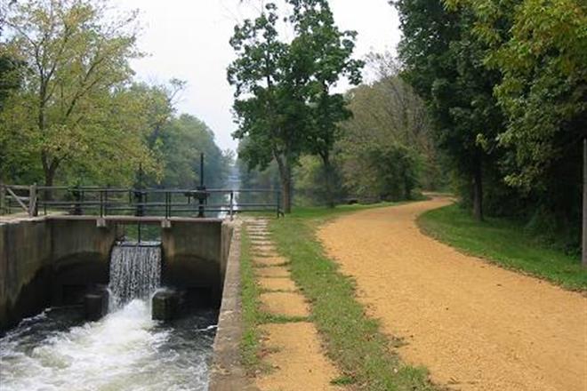
…on its way to the New Brunswick Terminus. We are told the canal was built between 1830 and 1834. Again, the sophistication of the engineering of these canals does not match the low technology of the times in which they are said to have been built.
Here is one of the locks on the Delaware and Raritan Canal.
This building is in Trenton’s West End…
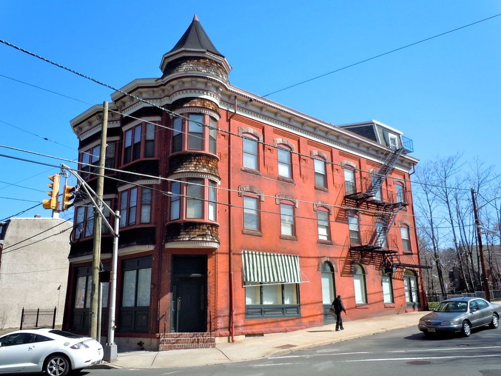
…compared with this one in Fort Madison, Iowa…
…and this one in Kherson, Ukraine.
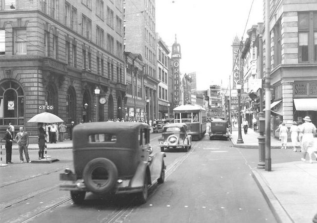
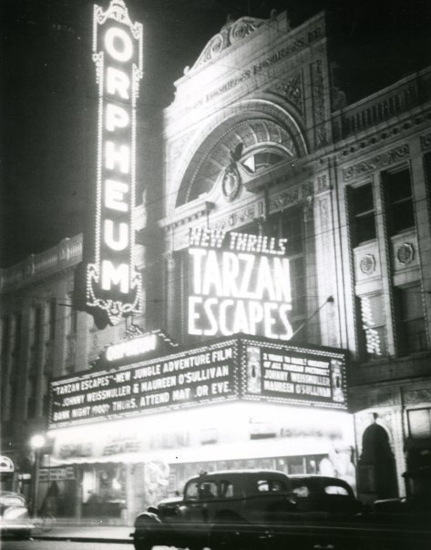
I found this historic photo of the Orpheum Theater on the left side of this street in Trenton.
Orpheum was the name of many theaters at one time, and the root of this goes back to the Greek god Orpheus. He had the ability to charm all living things through his music, which essentially means casting a spell.
Here is a historic photo of the Orpheum Theater in Springfield, Illinois.
This is the Orpheus Statue at Fort McHenry, said to be the winning design by Charles Niehaus in a contest held in 1916 to come up with a monument to commemorate the centennial of the writing of the “Star Spangled Banner” by Francis Scott Key.
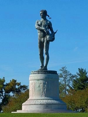
This 40-foot statue of Orpheus is said to have been greeting visitors to Fort McHenry in Baltimore since 1922.
Just want to put this out as food for thought as to why Orpheus could possibly be commemorated in ways like these in our relatively recent past.
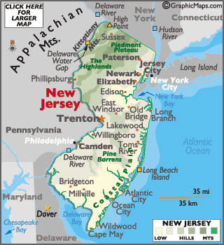
One last place in New Jersey that I would like to visit before I finish this post are the Kittatinny Mountains. They are roughly 70 miles, or 110-kilometers, north-northwest of Trenton, and slightly northeast of the Delaware River Gap.
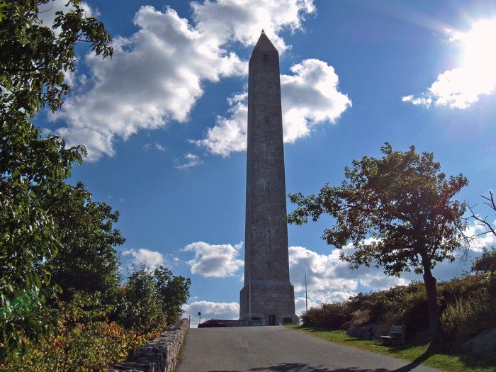
This obelisk serves at the High Point Veterans’ Memorial in the Kittatinny Mountains…
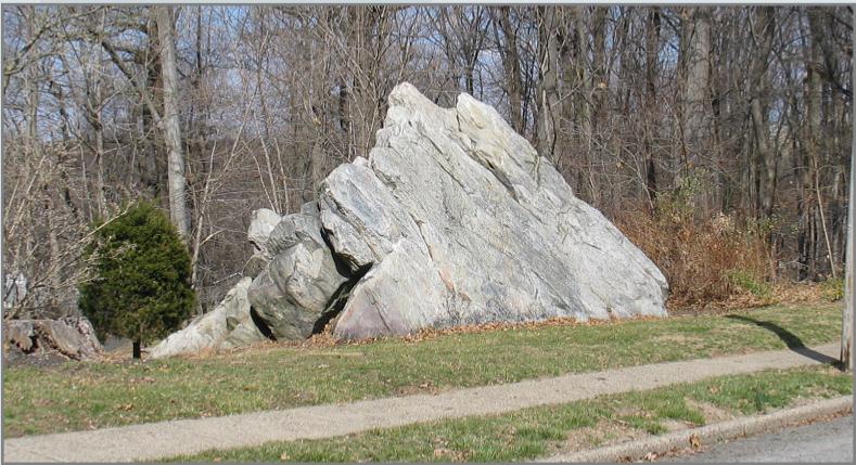
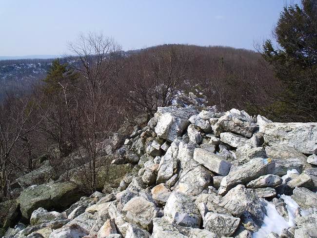
…and this is a photo of the Kittatinny Ridge, with some very geometric-looking blocks of stone, and straight-edges seen throughout the blocks of stone pictured.
I will be picking up the alignment in the New York Bay area in the next post.

The Orpheus statue looks very similar to the coat of arms in your previous post.
LikeLike