
I am highlighting places, concepts, and historical events that people have suggested that I research in a new multi-volume series that is a compilation of work I have previously done.
My starting point is the recommendation of the Balmoral Cairns in Scotland.
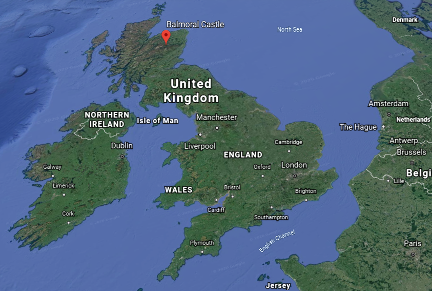
The Balmoral Castle on the Balmoral Estate has been one of the residences of the British Royal Family since 1852, at which time the castle and estate was purchased from the Farquason family by Prince Albert, Queen Victoria’s husband.

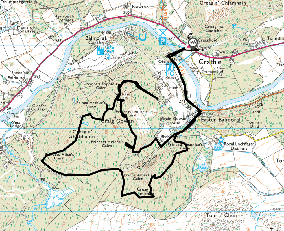
There are eleven, what are called “stone cairns,” erected on the Balmoral Estate to commemorate members of the British Royal Family and events in their lives, the majority of which were said to have been erected by Queen Victoria.
At this point, it is really important to get the definition of “cairn” and “pyramid” before I look at some of the “Balmoral Cairns” in Scotland.
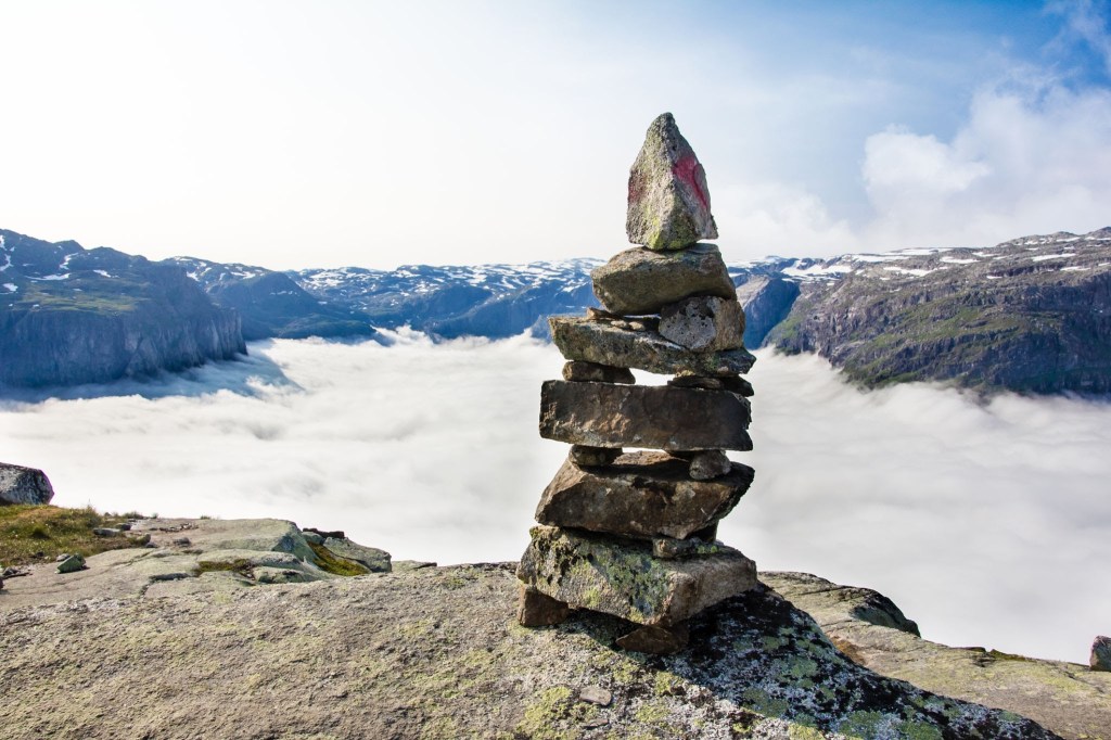
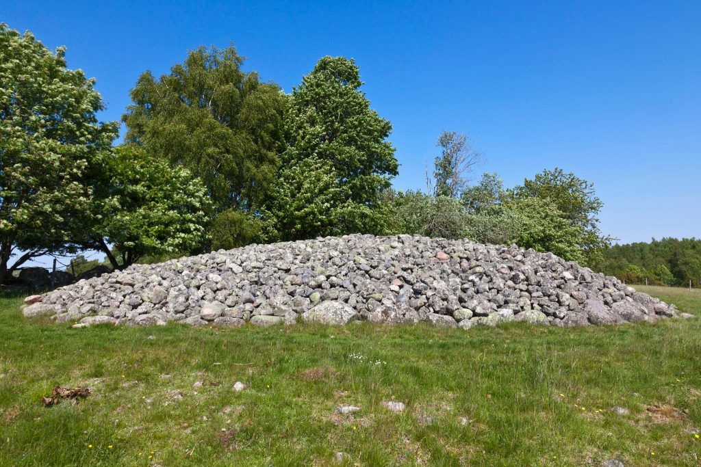
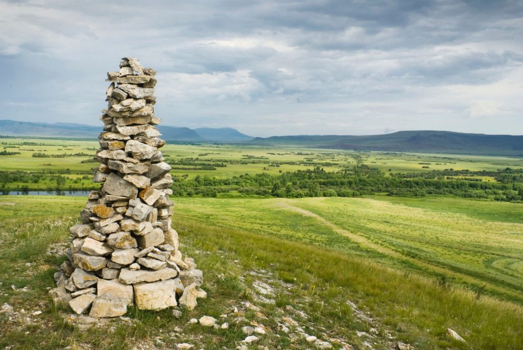
A cairn is defined as a “mound or heap of rough stones built as a memorial or landmark on a hilltop or skyline.”
The following examples are identified as cairns:

The definition of a pyramid according to the Merriam-Webster Dictionary (established in 1828) is:
- “an ancient massive structure found especially in Egypt having typically a square ground plan, outside walls in the form of four triangles that meet in a point at the top, and inner sepuchral chambers.
- “A structure or object of similar form”
- “A polyhedron having for its base a polygon, and for faces, triangles with a common vertex.
Now back to the “Balmoral Cairns.”
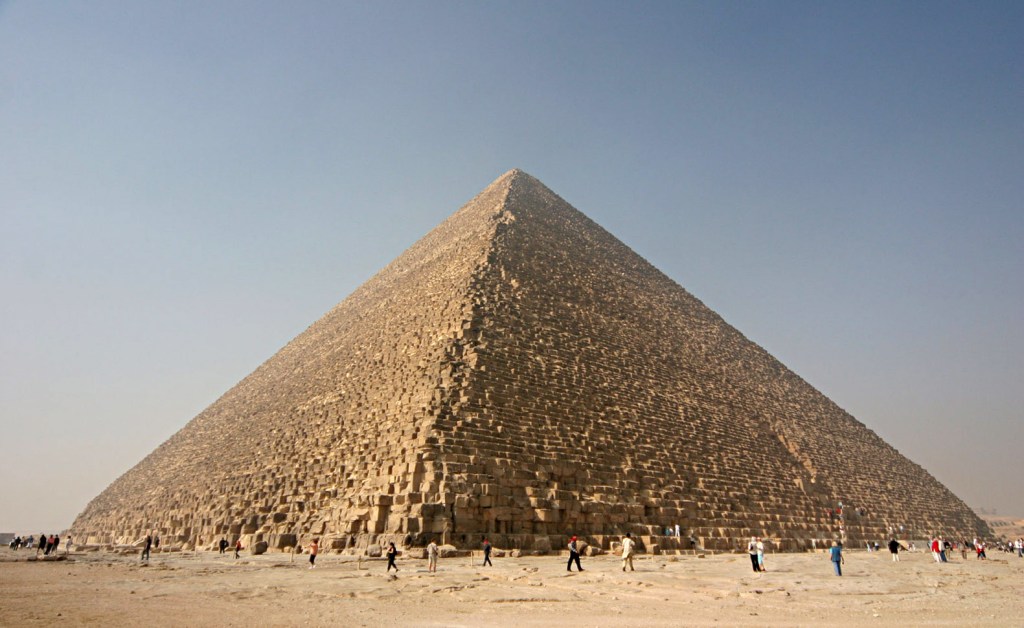
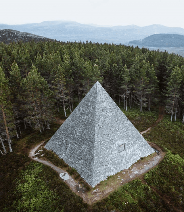
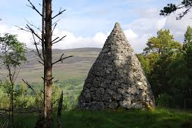
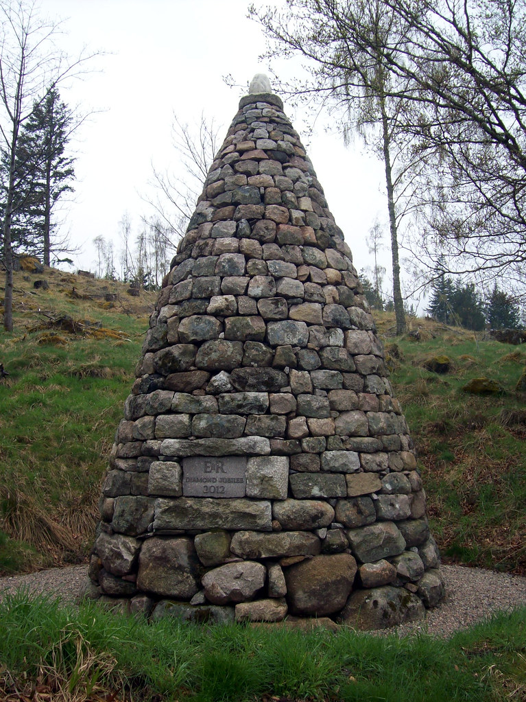
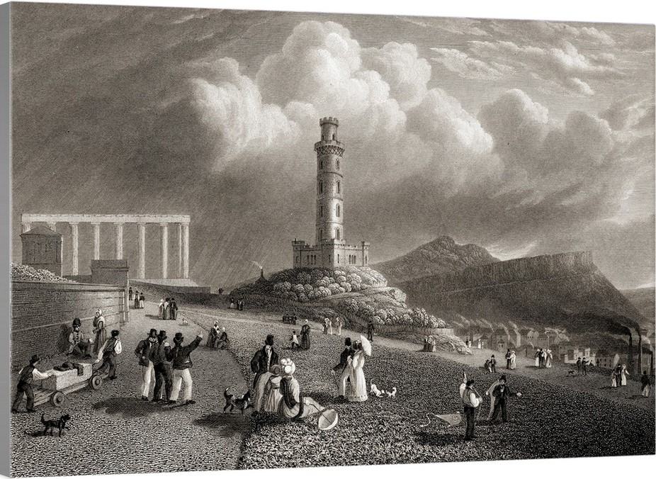
We are told that the largest of the “Balmoral Cairns,” shown here, was erected in memory of Queen Victoria’s husband, Prince Albert, after his death on December 14th of 1861.
It certainly looks like the definition of a pyramid!
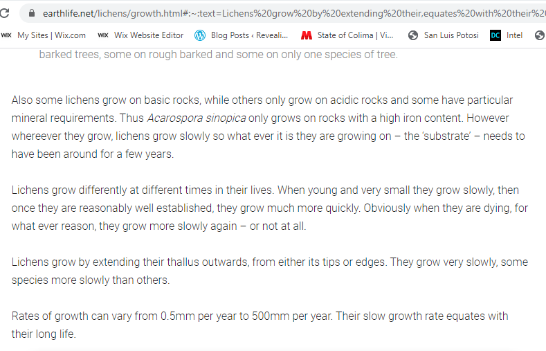
Look at the all the lichen growing on Prince Albert’s Cairn!

Somewhere in the past I remember hearing that lichen grows very slowly, so I looked it up to be certain.
Other cairns on the Balmoral Estate include:
Princess Helena’s cairn, the fifth child of Victoria and Albert, said to have been erected to commemorate her marriage to the Marquis of Lorne in 1871…

…the cairn of Prince Leopold, the eighth child and youngest son of Victoria and Albert, erected in 1882 to commemorate his marriage, and who died in March of 1884, at the young age of 30 from hemophilia, an inherited bleeding disorder in which the blood does not clot properly.
The presence of the hemophilia gene in Queen Victoria was said to have been caused by a spontaneous mutation, as she is considered the source of the disease in modern cases of hemophilia among her descendents.

This is Prince Arthur’s cairn, the seventh-child of Victoria and Albert, said to have been erected to mark his marriage in 1870.
In addition to other cairns marking events in the lives of Queen Victoria’s family, we are told that a cairn was constructed in 2012 on the Balmoral Estate to mark the Diamond Jubilee of Queen Elizabeth II in 2012.
While these last four of the “Balmoral Cairns” seem to have more of the appearance of what are called cairns than what can also be called Prince Albert’s Pyramid, the question becomes this:
Were the “Balmoral Cairns” built when they were said to have been built by who was said to have built them?
Or were they built by an ancient, advanced civilization of Master Builders missing from our collective awareness for purposes unknown to us in the present-day?
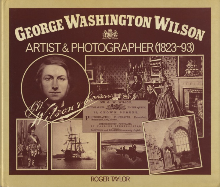
I am seeing notation of obelisks as well on the map I just showed of the Balmoral Estates, and one of them is another monument to Queen Victoria’s husband, the Prince-Consort Albert, said to have been erected in 1862, and photographed by George Washington Wilson…

…a pioneering Scottish photographer, who got his start as a portrait miniaturist in 1849, and switched to portrait photography in 1852, and received the contract to photograph the Royal Family of Queen Victoria and Prince Albert.
What role do photographers and artists play in programming our perception away from what is actually in the environment into seeing only the preferred narrative?
From what I am seeing, photographers and artists play a substantial role in this process of reinventing history.
This is a photo of George Washington Wilson’s of Prince’s Street in Edinburgh, circa 1860, with the contrast of massive, stately columned architecture, cobbled streets and horse-and-buggies in the foreground, and Calton Hill in the background…
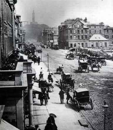
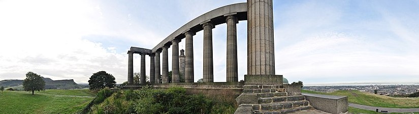
…with a view of what is called the Nelson Monument and the National Monument of Scotland.
The Nelson Monument was said to have been built on the highest point on Calton Hill between 1807 to 1816 to commemorate the British Vice-Admiral Horatio Nelson’s victory over the French and Spanish fleets at the Battle of Trafalgar in 1805.

The National Monument of Scotland is a national memorial to the Scottish soldiers and sailors who died fighting in the Napoleonic Wars, which took place between 1803 and 1815.
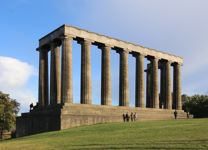
With a design by Charles Robert Cockerell and William Henry Playfair based on the Parthenon in Athens, construction was said to have started in 1826, and that it was left unfinished in 1829 due to lack of funds.
It is interesting to note that in this view of Calton Hill, you see the Nelson Monument perfectly-framed through the center of the front colonnade of the National Monument.
Another commenter from Scotland mentioned Glasgow in particular.
Glasgow called itself the second city of the British Empire, passing Edinburgh in population by 1821, and that in the 1830s it started to become a major industrial center.
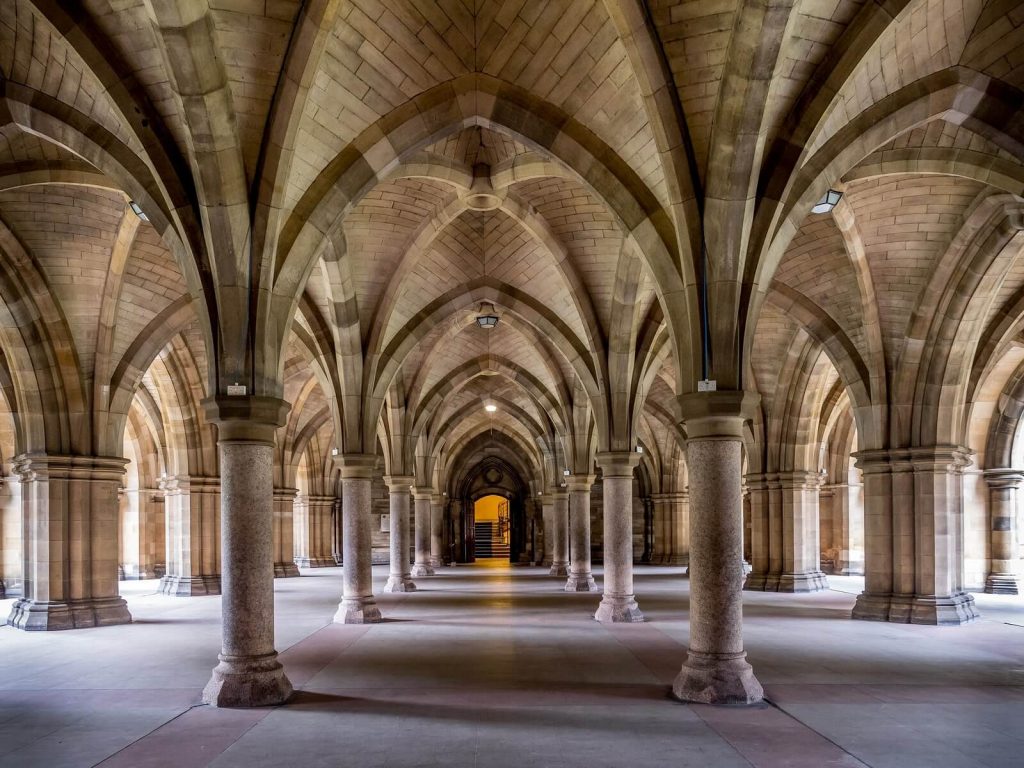
The University of Glasgow, established in 1451, is one of Scotland’s four Ancient Universities, along with Edinburgh, Aberdeen, and St. Andrews.
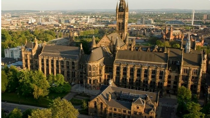
Universities that receive the designation “Ancient Universities” in Great Britain were founded before the year 1600, and considered among the oldest existing universities in the world.
For some reason, I have consistently found that the word “Ancient” is used to describe places that are not associated with “the far distant past” that the word ancient is defined as.
The oldest, currently functional, universities in the world are in North Africa.
The Al-Karaouine University in Fez, Morocco, dates to 859 AD.
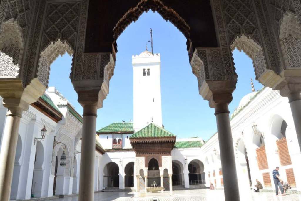
Interesting to note that the archway shown here at the University in Fez on the left frames the larger building in much the same way that the archway does here at the University of Oxford in England on the right.
The University of Oxford was established in 1096, and is the oldest of the Ancient Universities of Great Britain.

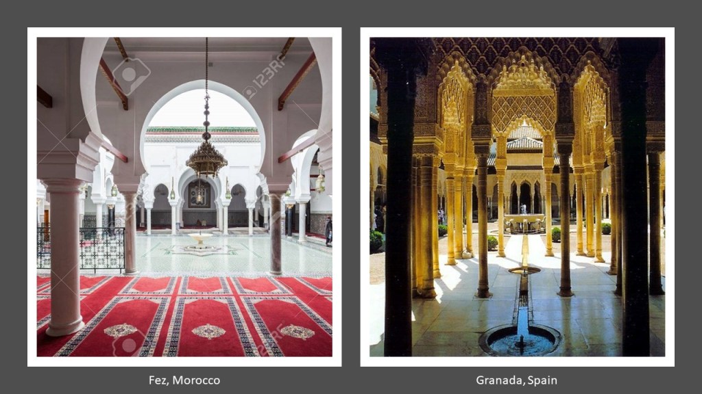
Also, the colonnaded courtyard at the University in Fez in Morocco on the left looks very similar in appearance to the courtyard in the Alhambra in Granada, Spain on the right, which is architecture that the Moors are actually given credit for.
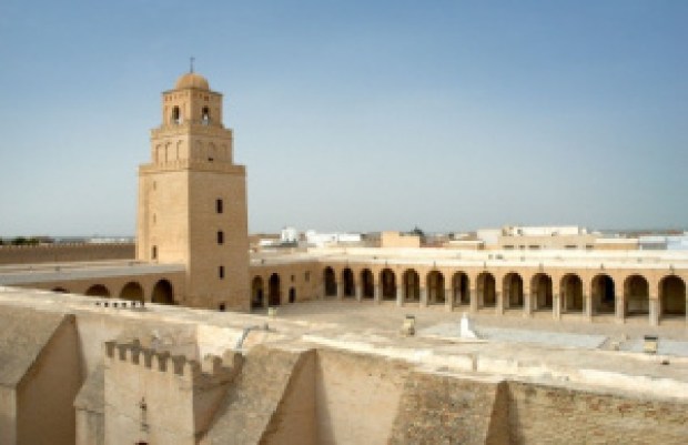
Tunisia’s still-functioning University in Kairouan is said to date from between 800 AD and 909 AD.
Back to the University of Glasgow.
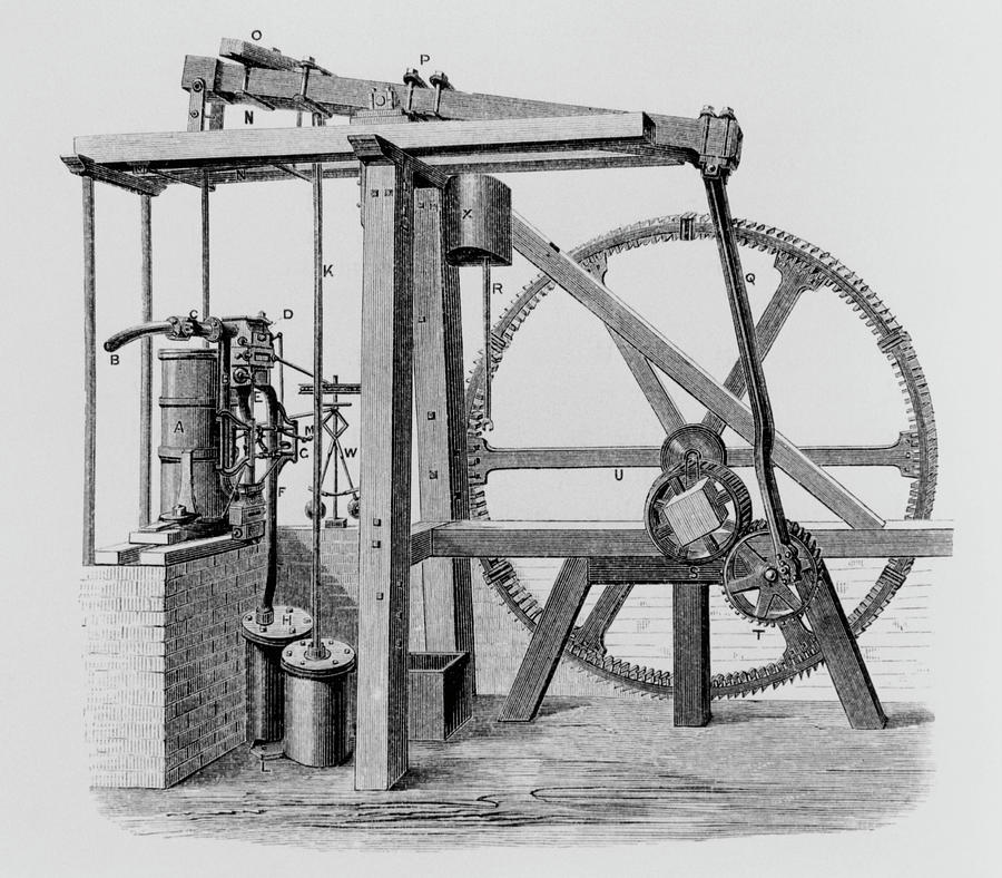
James Watt was a mathematical instrument-maker at the University of Glasgow before he became interested in the technology of steam engines.

His improvement of the steam engine invented by Thomas Newcomen in 1712…
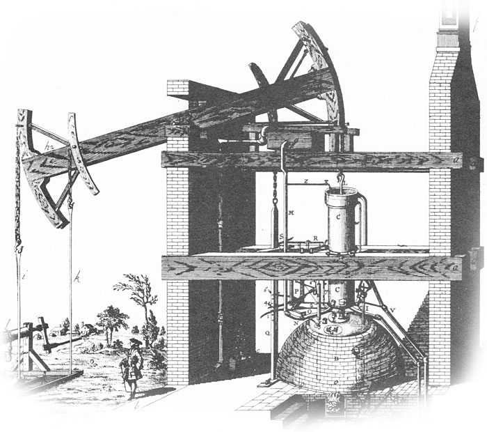
…with his Watt steam engine in 1776 was said to have been crucial to the changes brought by the Industrial Revolution in Great Britain and the rest of the world.
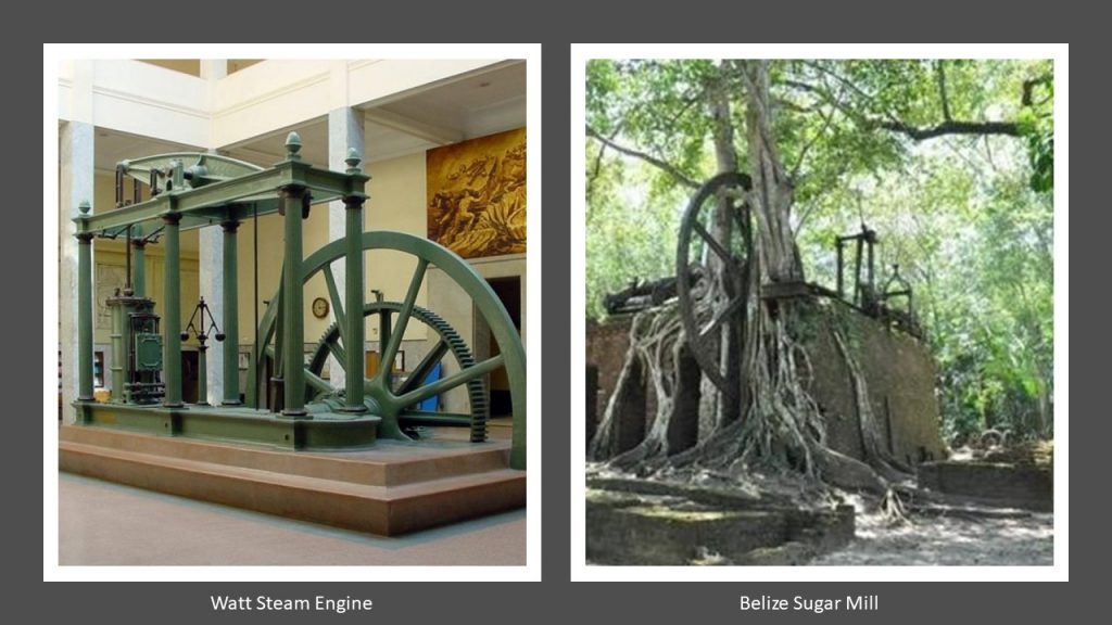
You know, I can’t help but wonder about the origin of steam engine technology when I see examples of the big gear-wheel showing on the right, compared with the Watt Steam Engine on the left, at what is called a sugar mill in Belize with what appears to be an ancient tree firmly rooted inside the structure.
Adam Smith was a student at the University of Glasgow.
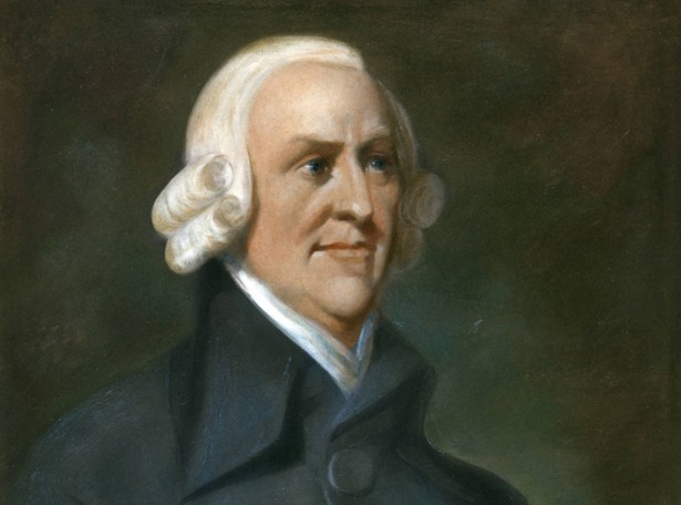
He was a key figure of the Scottish Enlightenment, a period during the late 18th- and early 19th-centuries during which time there was an outpouring of Scottish intellectual and scientific accomplishments.

Known as “The Father of Capitalism” and “The Father of Economics,” Adam Smith is best known for his famous work on modern economics, the title of which is commonly abbreviated to “The Wealth of Nations.”
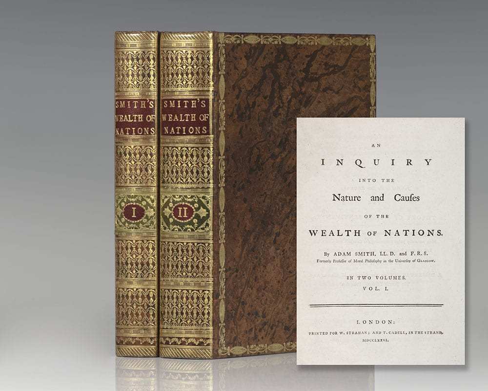
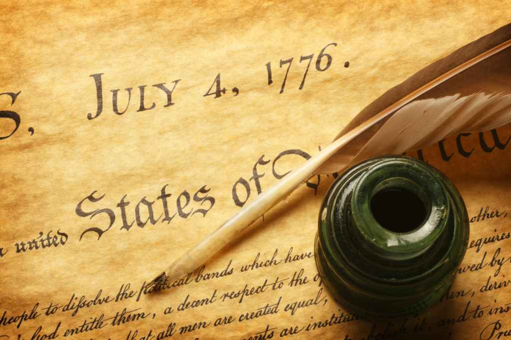
“The Wealth of Nations” was first published in 1776, the same year that James Watt brought forward his improved steam engine and the American Colonies declared their independence, as well as the founding of the Bavarian Order of the Illuminati by Adam Weishaupt on May 1st of that year.
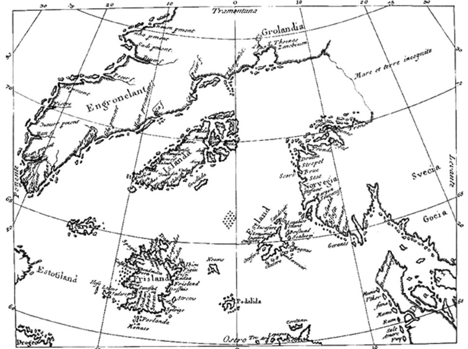
The next place I am going to look into from a comment is the isle of Frisland, also known as Frislant, the specific awareness of which is new to me.
The isle of Frisland appeared on virtually all maps of the North Atlantic between the 1560s through the 1660s.
Nonetheless, it has come down to our historical time period as a “phantom island,” meaning that it was removed from later maps as it was proven not to exist.
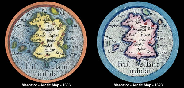
This is Gerardus Mercator’s depiction of Frisland that a appears on a map that was published in 1606 by Jocodus Hondius, a few years after his death in 1594, in the lower left corner between Iceland to the northeast, and Greenland to the northwest…

…which I found on the National Geographic website seriously doubting Frisland’s existence.
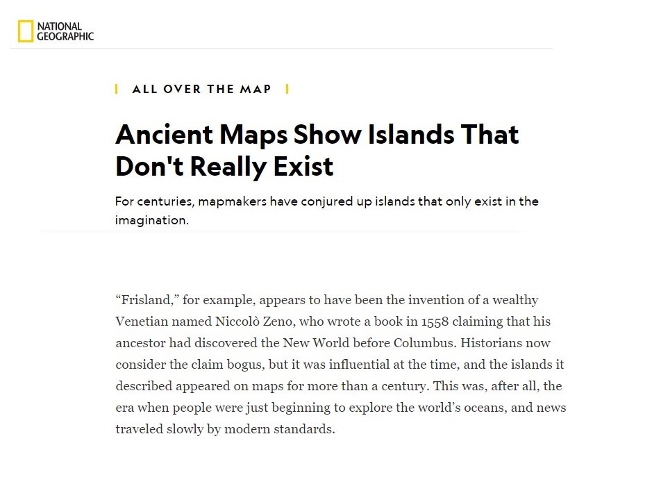
The Zeno map that the article is referring to was said to have been first published in a book 1558, after having been found in the family home, by a direct descendent of the Zeno Brothers, Nicolo and Antonio Zeno, Venetian noblemen famous during the Renaissance for exploring the Arctic in the 1390s with an explorer-prince named Zichmni, a Lord of the islands off the southern coast of Frisland.
We are told that the existence of the isle of Frisland as identified by the Zeno Brothers was given credibility by in manuscript maps in the 1560s by the Genoan Maggiolo family, and accepted by leading cartographers and publishers of the 1500s and 1600s, Mercator and Hondius, even though the charting of Frisland on the Zeno map was later deemed incorrect.
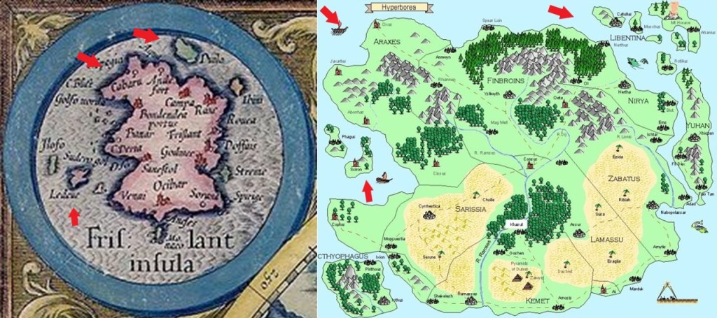
The isle of Frisland has been identifed with a lost ancient land named Hyberborea by the Greeks, considered to have been in the general vicinity of Greenland; identified as Atland by the Frisians, a Germanic ethnic group indigenous to coastal parts of the Netherlands and northwestern Germany; and, and again, identifed as “Frisland” by Mercator.
In Greek mythology, Hyperborea was a fabulous world of eternal spring located in the far north, beyond the home of the north wind.
Hyperboreans were giants, with blessed and long lives untouched by war, hard work, old age and disease.

At any rate, there are some interesting similarities between the coastline of the now-called phantom isle of Frisland in Mercator’s depiction on the left, and this depiction I found of the island of Hyperborea on the right.
The Oera Linda Bok, or Book, is a manuscript that is written in Old Frisian, and said to provide historical, mythological, and religious themes of remote antiquity.
Like the doubt about the isle of Frisland itself, the Oera Linda Book is widely considered a hoax.
The manuscript first came into public awareness, we are told, in the 1860s.
The book is still occasionally brought up in esotericism and Atlantis literature.
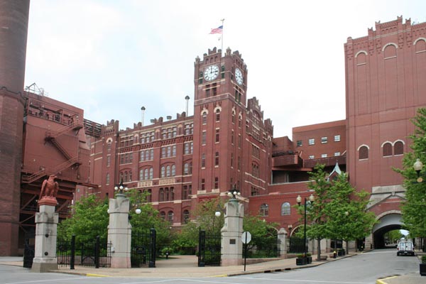
I received a comment from someone who lives in St. Louis, where there are industries for beer, like the castle-looking Anheuser-Busch Brewery…
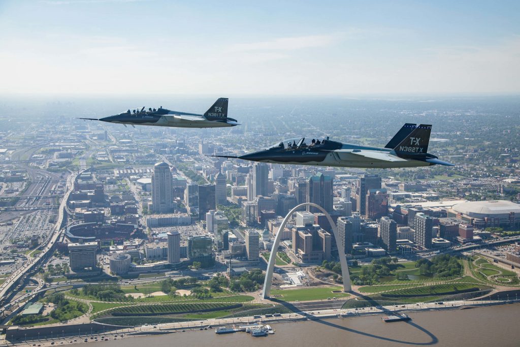
…the Aerospace industry, like Boeing…
…and starting in 1942, St. Louis was an integral part of the Manhattan Project, for which Mallinckrodt Chemical Works processed a majority of the uranium needed for the first atomic bomb in their plant north of downtown St. Louis…

…and which continued to process uranium until 1957.
When the chemical company ran out of space to store its nuclear waste on-site, nuclear waste was dumped in places like a site near the St. Louis airport…
…and the West Lake Landfill, a Superfund clean-up site.

Needless to say, St. Louis has a nuclear waste problem.
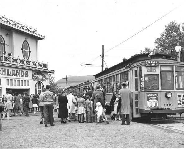
There was an electric streetcar system in St. Louis that ran from the mid-1800s through the early 1960s, starting with horse-drawn streetcars in the late 1850s.

This is a map depicting the streetcar lines in St. Louis by 1884.
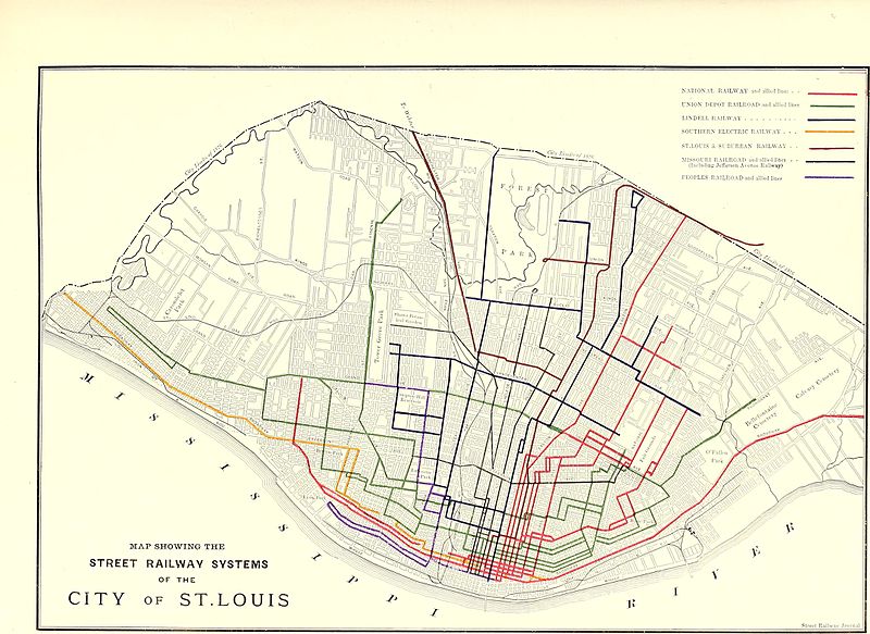
…with the first cable-driven streetcars in 1886, and the first electrified streetcars came to St. Louis in 1889.

The Forest Park Highlands Amusement Park opened as a beer garden in St. Louis in 1896.
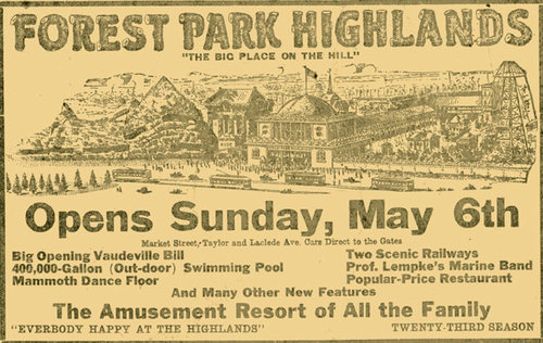
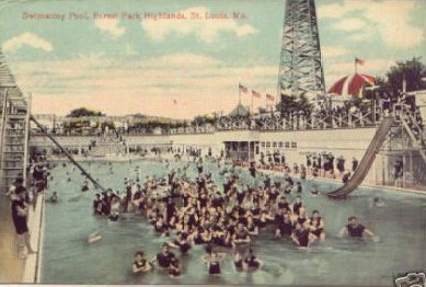
…and was on a trolley line.
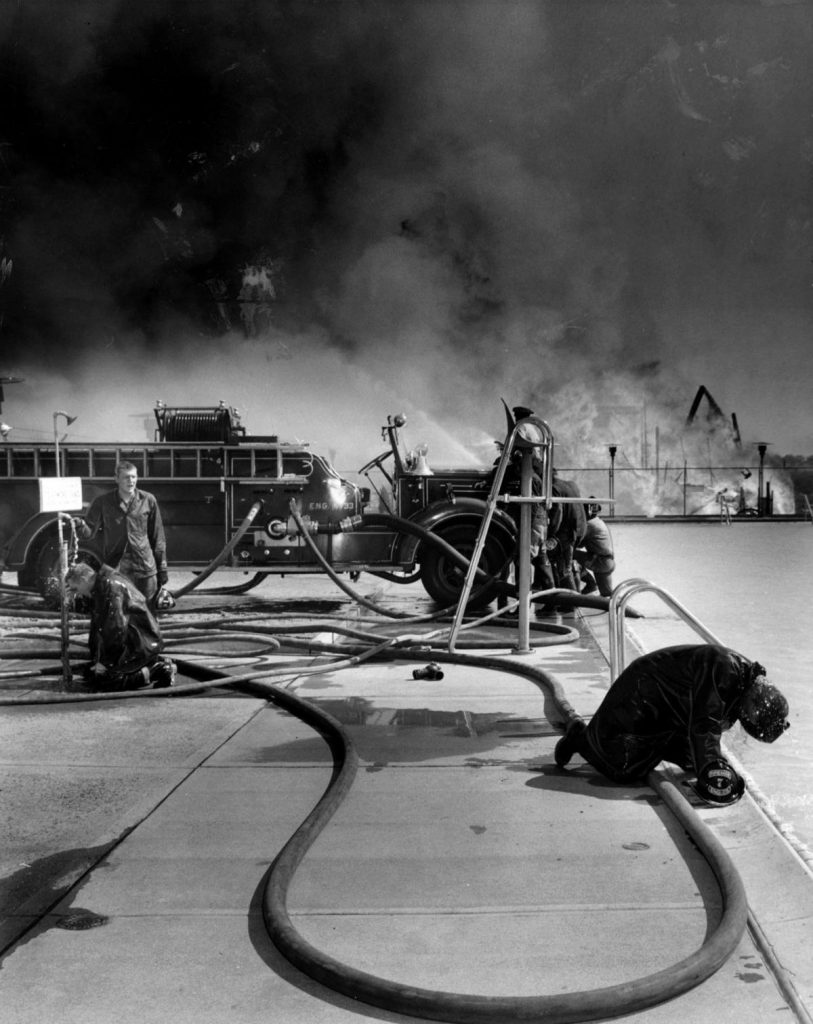
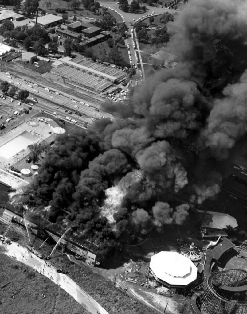
On July 19th of 1963, all of the Forest Park Highlands Amusement Park was destroyed by fire except for the swimming pool and the frame of the roller coaster.
With regards to streetcars, starting in the early 1930s through the 1960s, the St. Louis Public Service ended all streetcar service, as well as other regional streetcar operators.
The last day of St. Louis streetcar operation was May 21st of 1966.

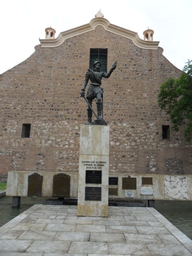
Next, a commenter from Argentina suggested that I look into Cordoba.
Cordoba was said to have been founded on July 6th of 1573 by Jeronimo Luis de Cabrera, a Spanish conquistador who became a colonial governor over much of what is now northwestern Argentina.
The National University of Cordoba was said to have been founded by the Jesuits in 1613, and is the oldest University in Argentina, and the third oldest in South America.

The Jesuit Block in Cordoba was declared a UNESCO World Heritage Site in the year 2000, and consists of what are described as a block of buildings dating back to the 17th-century.

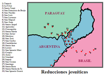
The complex was said to have started by the Jesuits in 1615 as a Jesuit Reduction, which we are told was a type of settlement for indigenous people in Argentina, Brazil, and Paraguay.
Named a “Reduction”? Which also means the act of making something smaller or less in size or amount?
Say what?!
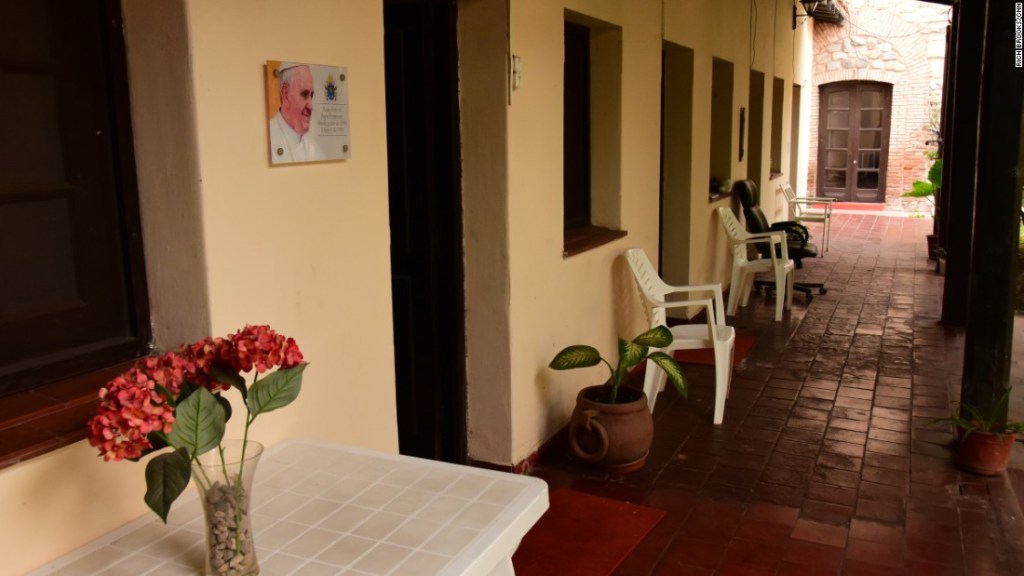
The current Pope Francis is from Argentina, and spent two years in the 1990s in a small room number 5 in the Jesuit Block.
As Jorge Mario Bergoglio, he entered the Jesuit order in 1958, and is the first Jesuit pope.
It is interesting to note that the Jesuits were expelled from South America by the 1767 Decree of King Charles III of Spain, which was part of the “Suppression of the Society of Jesus,” in which the Jesuits were removed from most of the countries of western Europe and their colonies, we are told for political reasons.
The Suppression began in 1759, and ended in 1814 by Pope Pius VII, in which he restored the Jesuits to their previous provinces, and the Jesuits returned to the Americas in 1853.

Next, I am going to be looking at places in the Nashville area that were suggested by a commenter.
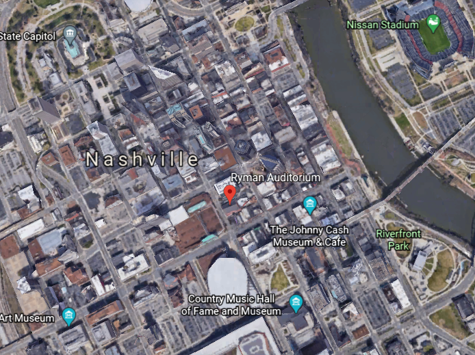
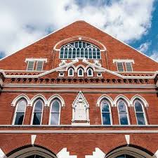
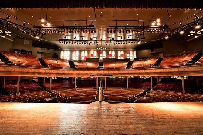
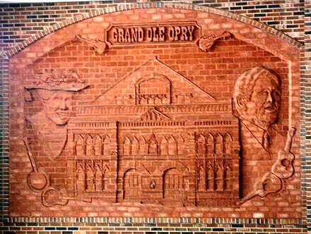
The Ryman Auditorium in downtown Nashville was the home of the Grand Ole Opry from 1943 to 1974.
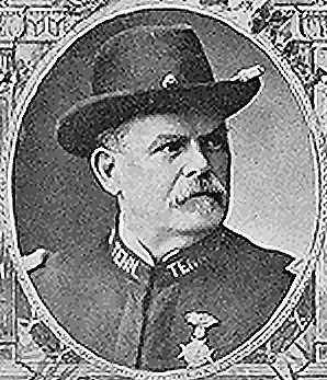
Its construction was said to have been promoted by Thomas Ryman, a Tennessee business man who was a riverboat captain as well as the owner of a riverboat company…
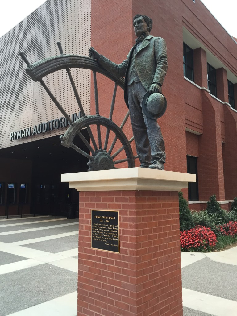
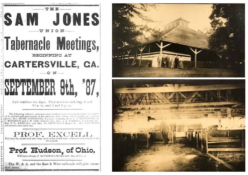
…as an auditorium and tabernacle for Samuel Porter Jones, an influential revivalist of the day, after Ryman was converted to Christianity in 1885 after attending a tent-revival held by Jones.
Opening in 1892 as the Union Gospel Tabernacle, it was not only used as a house of worship, it was also rented out as a venue for different types of events, including, but not limited to concerts, speaking engagements, boxing matches.
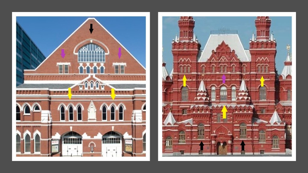
There are two things I would like to point out about the physical appearance of the Ryman Auditorium.
The first is to show the similarity of architectural features of the Ryman Auditorium on the left and the Moscow State Historical Museum in Russia on the right.
In particular the occurrence in both buildings of triple windows (the yellow arrows); double-windows (the purple arrows); and the intricate patterning of sections of windows (the black arrows).
The other thing is the classic mud flood feature of the slanted pavement in front of the building, and the ground-level windows on the side of the building that are level with the not-ground-level windows of the front of the building.

Also known as the “Mother Church of Country Music”…
…the Ryman Auditorium became the home of the “Grand Ole Opry” show in 1943 until March 15th of 1974…
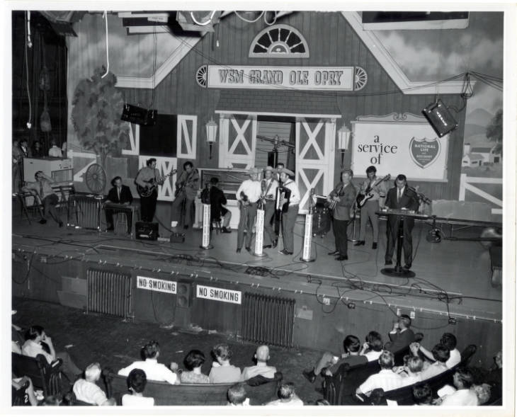
…at which time the “Grand Ole Opry” was moved to its current venue, the massive “Grand Ole Opry House.”

It is interesting to note that the Ryman Auditorium was almost demolished by the owners of the “Grand Ole Opry,” with the reason given that it was in poor condition.
Though it was not demolished because of the outcry against this, the Ryman Auditorium sat dormant until 1989, and has been utilized as an event venue since then.

The Tennessee State Capitol building was said to have been designed by architect William Strickland, one of the architects credited with establishing the Greek Revival movement in the United States.
…and built between 1845 and 1859.

It was added to the National Register of Historic Places in 1970, and named a National Historic Landmark in 1971.
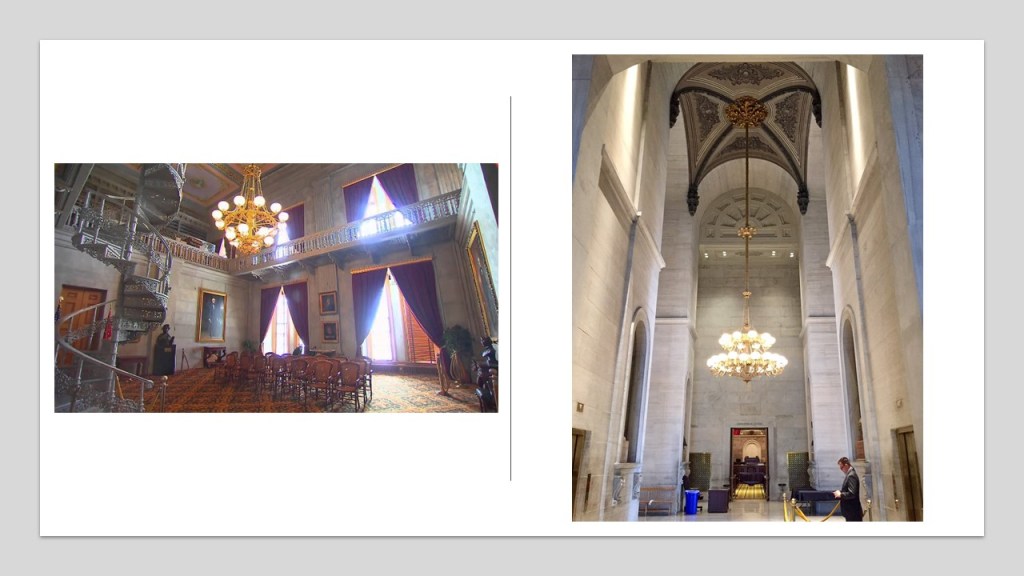
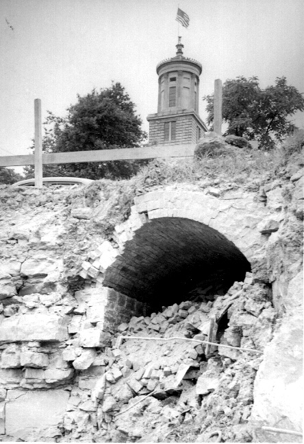
It is interesting to note the entrance to an old tunnel was unearthed near the State Capitol building in 1951, under 6th Street.
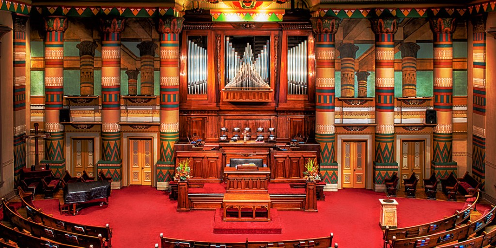
Formerly known as the First Presbyterian Church, the Downtown Church in Nashville was also said to have been designed by William Strickland and completed in 1846.
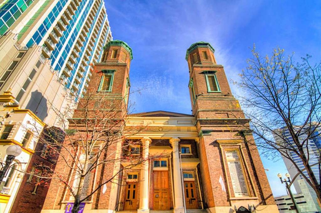
The Downtown Presbyterian Church is considered the best-surviving ecclesiastical example of what is called Egyptian Revival architecture.
Egyptian Revival architecture too?
The Nashville Parthenon was also said to have been built for the 1897 Tennessee Centennial Exposition.
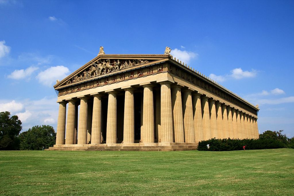
We are told that Nashville’s nickname of “Athens of the South” influenced the choice of an exact replica of the Parthenon in Athens, Greece, as the centerpiece of the Exposition.
The architect of Nashville’s Parthenon was said to be the former confederate soldier, William Crawford Smith.
It was said to have been originally built as a temporary structure out of plaster, wood, and brick, but it was left standing after the Exposition because of its popularity, and that it was rebuilt with concrete in the 1920s.
Now I am going to go quickly through some of the places people have commented about.
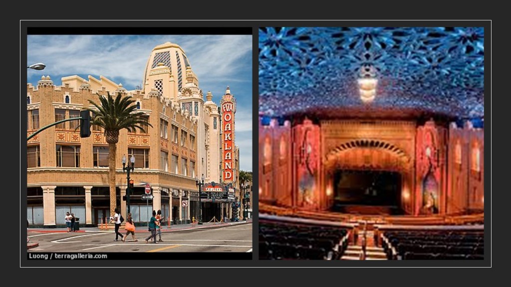
The Fox Theater in Downtown Oakland California, said to have been opened in 1928, and designed by the American architectural firm of Weeks and Day.
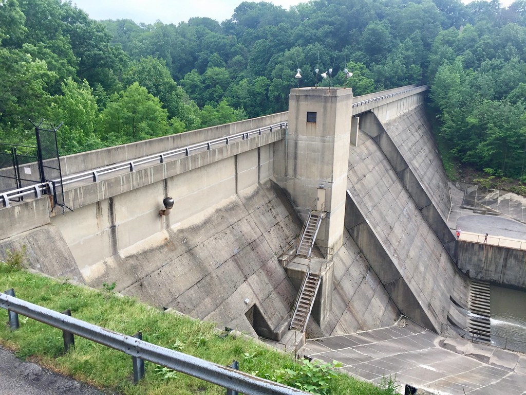
In Akron, Ohio, there is the Edison Dam…

…and the trails of the Gorge Metro Park in Akron.

The Buenos Aires Water Company Palace in Argentina was said to have been designed as a water pumping station in 1877 and completed in 1894…

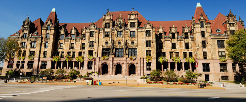
…and the similar-looking St. Louis City Hall in Missouri, said to have been designed in 1898, modeled after the city hall in Paris, France, and completed in time for the St. Louis World’s Fair in 1904.
The Town Creek Indian Mound in North Carolina, attributed to the Pee Dee people of the South Appalachian Mississippian Culture…
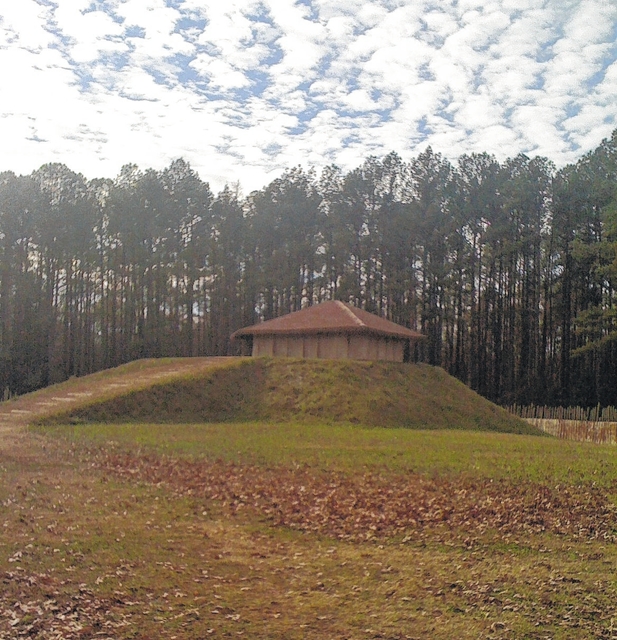
…that thrived in that Pee Dee River region of North and South Carolina before Columbus…
…near the town of Mt. Gilead, North Carolina.
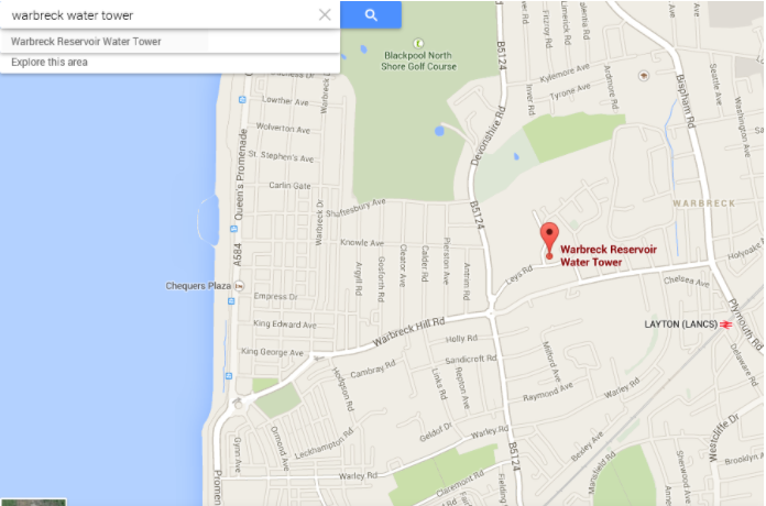
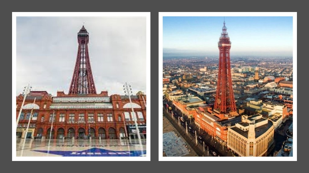
The Warbreck Water Tower in Blackpool, England, said to have been built in 1932 to serve the heavily residential areas of central Blackpool and high-rise homes…

…is located on Leys Road.
Another tower in Blackpool, the Blackpool Tower, was said to have been inspired by the Eiffel Tower in Paris, and that at the time it was opened to the public in 1894, it was the tallest, man-made structure in the British Empire.
In Cleveland, Ohio, the West Side Market, which is classified as a Neo-Classical/Byzantine building, the construction of which was said to have been completed in 1912…

…and Lakeview Cemetery in Cleveland, with its the dam…
…and the James A. Garfield Memorial, said to have been constructed in a combination of Byzantine, Gothic, and Romanesque Revival styles between 1885 and 1890 for the 20th-President of the United States who was assassinated in 1881 who had expressed a desire to be interred in the Lakeview Cemetery.

Castle Rushen, the construction of which was said to have started in the 10th-century, in Castletown on the Isle of Man, located in the Irish Sea between England and Ireland…

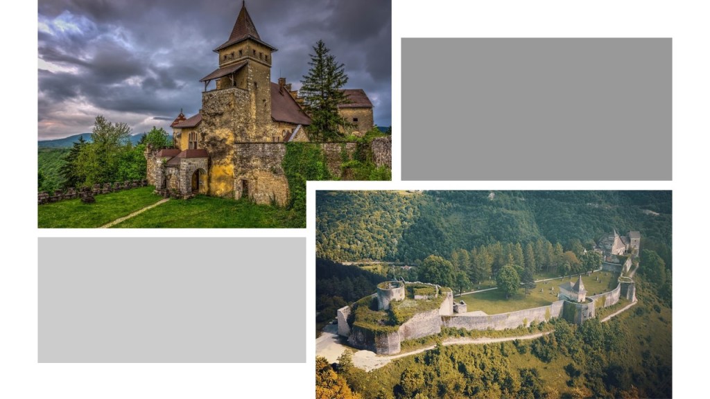
…and the Ostrozac Castle of Bosnia, a medieval castle called a fairy tale for every visitor.
I was asked to look into the Tuckahoe-Corbin City Fish and Wildlife Management Area, located in southern New Jersey…

…at a size of over 17,000 acres, or 6,880-hectares, of marshes, rivers, and Pine Barrens woodland located adjacent to the Great Egg Harbor.
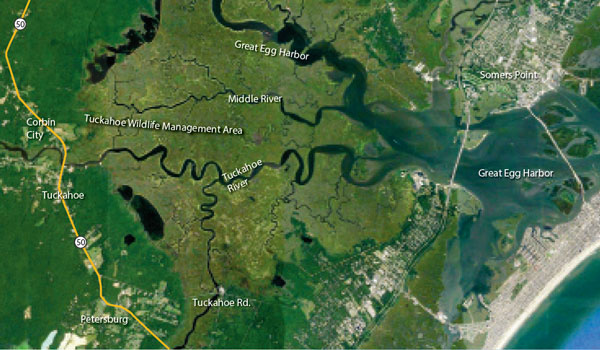
The Beasley Point Generating Station, a coal-fired power-plant which operated from 1961 to 2019, was situated right at the edge of the Wildlife Management area, where several rivers flow into it from the Great Egg Harbor.
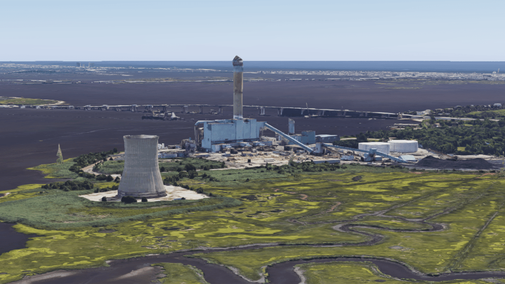
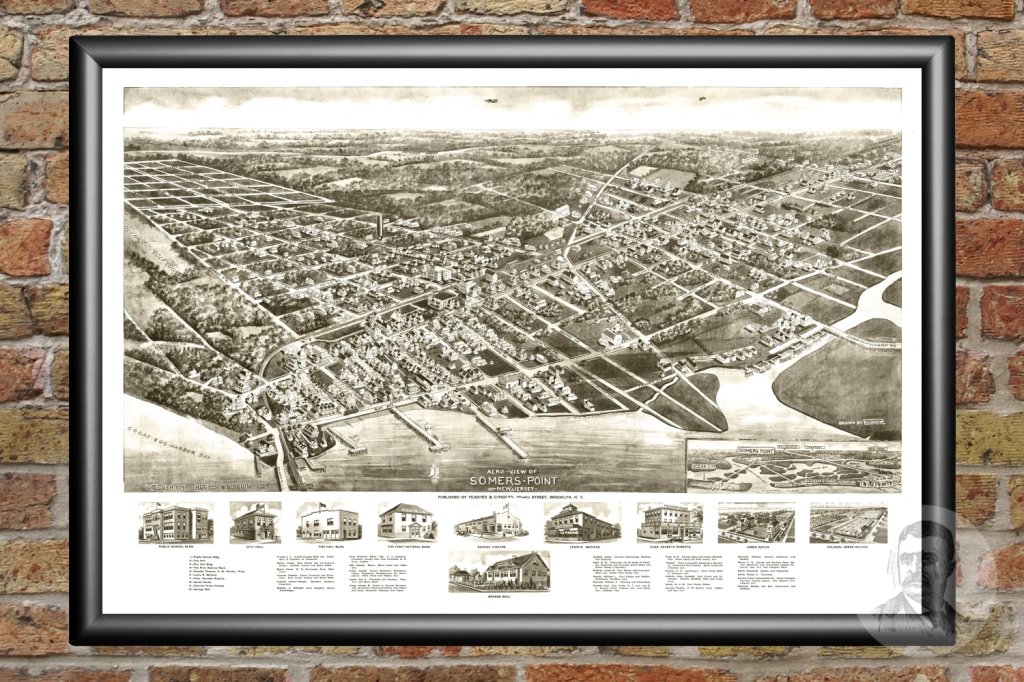
Somers Point, a city located on the other side of Great Egg Harbor from where the power plant was on Beasley Point, is the oldest settlement in Atlantic County, New Jersey, said to have been first settled in 1693 and incorporated as a borough in 1886.
The Atlantic City and Shore Railroad was a type of streetcar system in New Jersey called an interurban that served Somers Point and several other cities between Atlantic City and Ocean City in the years between 1907 and 1948.

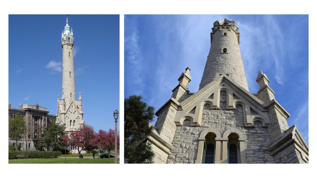
Next, The North Point Water Tower in Milwaukee was said to have been built between 1873 and 1874 in the style of Victorian-Gothic as part of Milwaukee’s first public waterworks…
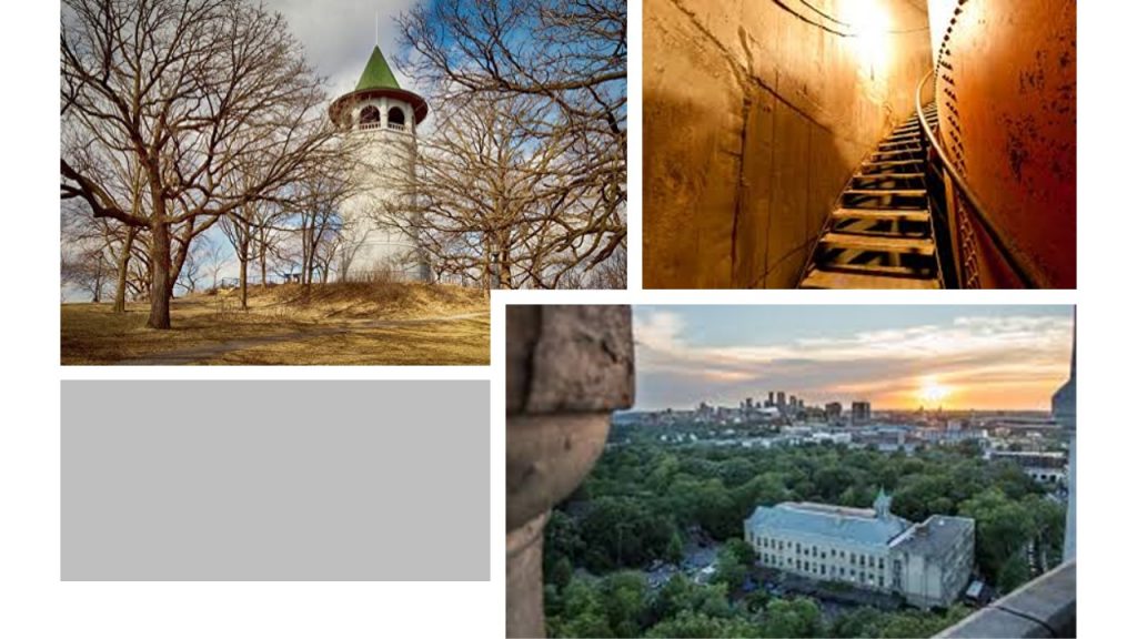
…and the Prospect Point Water Tower in Minneapolis, Minnesota, also known as the Witch’s Hat Tower, was said to have been built on Tower Hill Park in 1913, which was a hilltop park established in 1906.
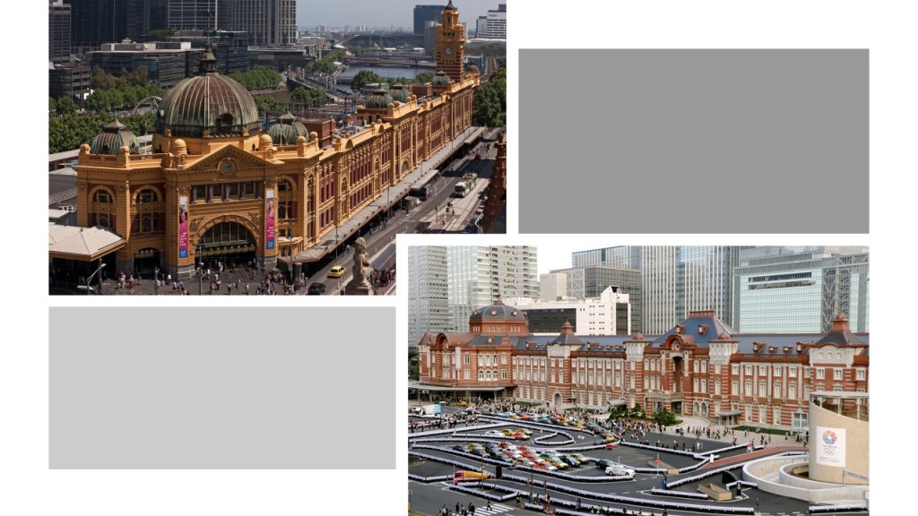
A comment was made to look at the Flinders Street Station in Melbourne, opened in 1854, and the first railway station in Australia on the top left, compared for size and scope with the Marunouchi Station in Tokyo, opened in 1914.
These photographs came from a trek across Ebbetts Pass, in the Sierra Nevada range east of Sacramento in California were sent to me from a viewer.

I have talked about the Leeds Town Hall in Leeds, England, in past posts.
The Leeds Town Hall was one of the first examples I found in my research of the use of contests and competitions to explain how what we would consider relatively modern, monumental architecture came into being.
It was said to have been completed in 1858, and opened by Queen Victoria.

This gentleman, Cuthbert Brodrick, was given the credit for designing it, after winning a design competition for it, when he was 29-years-old, in 1852, and is considered his most famous architectural work.

A viewer from Leeds ordered the map of Leeds from 1847, and said it cuts of just where Leeds town hall should be…
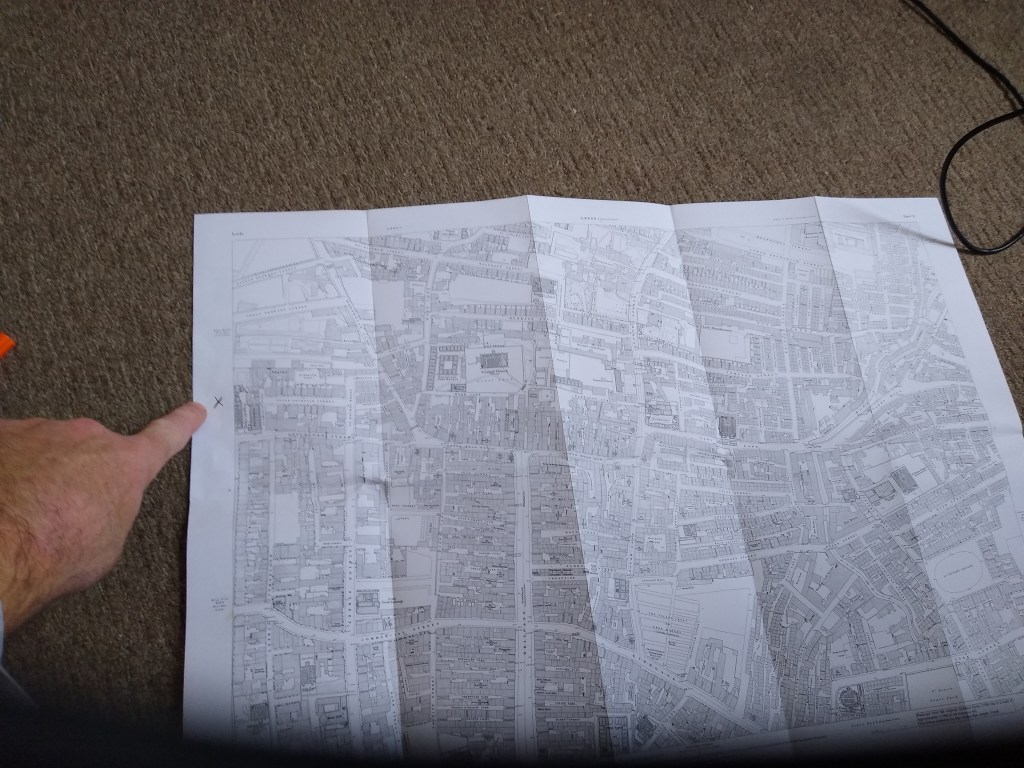
…and also said that the town hall is a main feature of Headrow, so that for the map to be missing this section is noteworthy.

He also sent me pictures of the entrance of the Leeds Town Hall…
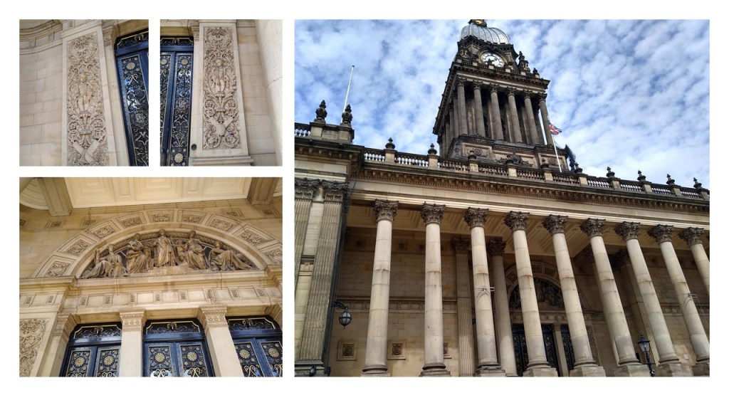
…and said that it is a popular venue for weddings and graduations…
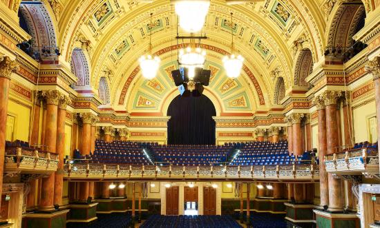
He mentioned that it contains an organ that is considered the biggest musical instrument in the World, with 6,600 pipes weighing 70 tons and 50 feet high!
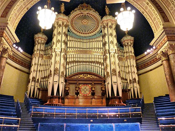
He also included a photo of the Temple Mill in the Leeds Temple Works Complex,said have been built between 1838 and 1840.
A former flax-spinning mill, when it was completed it was considered to be one of the largest factories in the world, with 7,000 steam-powered spindles.

Next, I was contacted by someone with these photos he had taken in West Dundas, Ontario.

Dundas is a community in Hamilton, Ontario, and was formerly a town in its own right.
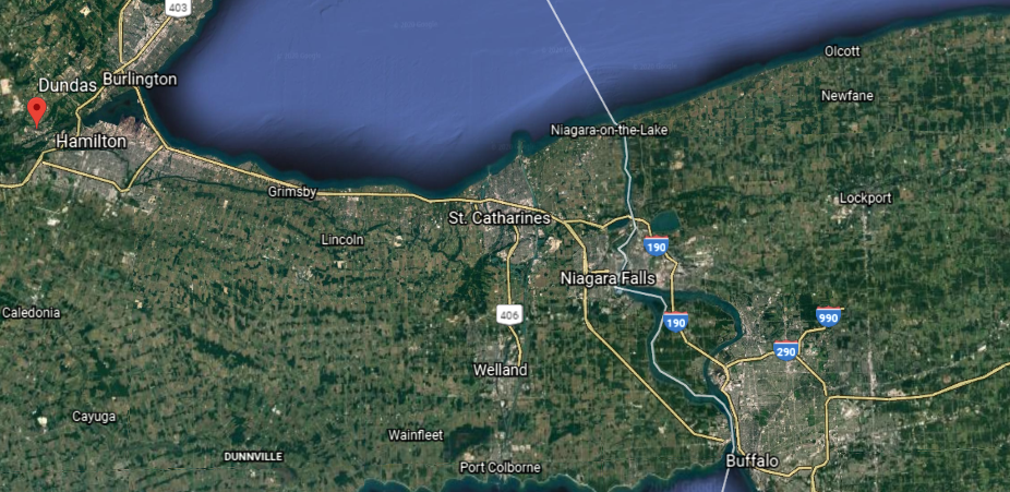
It is at the bottom of the Niagara Escarpment and on the western edge of Lake Ontario.
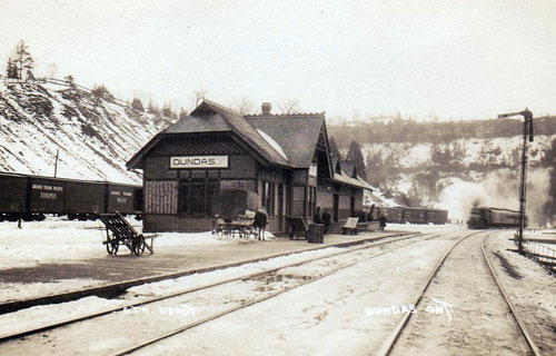
Known originally as “Coote’s Paradise,” the community that had settled here became known as Dundas in 1814, which was incorporated in 1847.

Its construction said to have been authorized in 1823, the Desjardins Canal opened in 1837, and was said to have greatly contributed to the development of the region, until the canal fell into disuse…

…when the Great Western Railway put its line through Dundas in 1853.
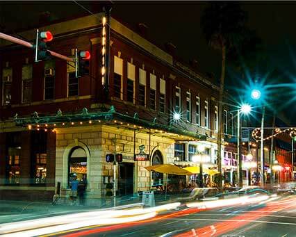
Another viewer directed my attention to the following places in Tampa:
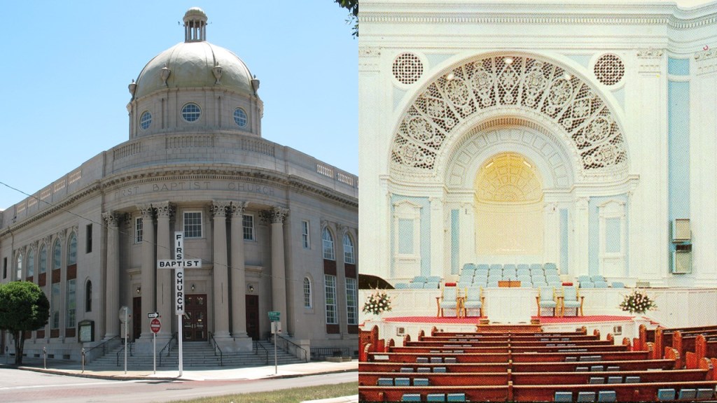
The congregation of the First Baptist Church of Tampa was said to have organized in 1859, and the church at its present-location built in 1923.
Old cigar factories in Tampa, including the Santaella…

…and the historic Pendes & Alvarez Cigar Factory.
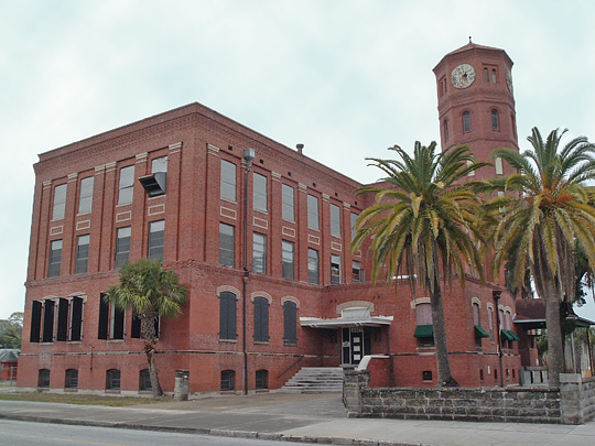
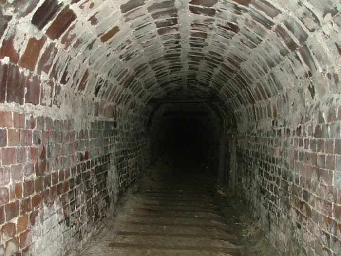
And Ybor City, a historic neighborhood in Tampa said to have been founded in the 1880s by cigar manufacturers…
…known to have miles of tunnels running underneath it.
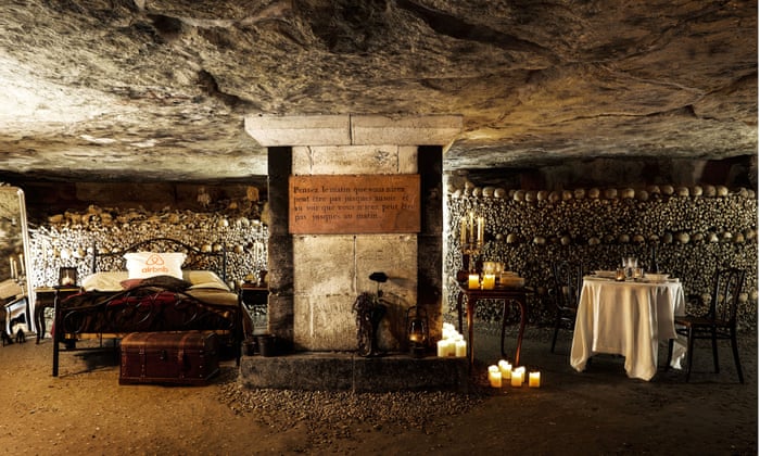
He also asked that I look into the catacombs of Paris, where millions of bones and skulls are neatly stacked underground in tunnels, and catacombs were said to have been created in an effort to eliminate the city’s overflowing cemeteries that was started in 1786.

The Paris Catacombs have been a concert venue since the 19th-century…

…and an Airbnb in the 21st-century.
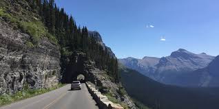
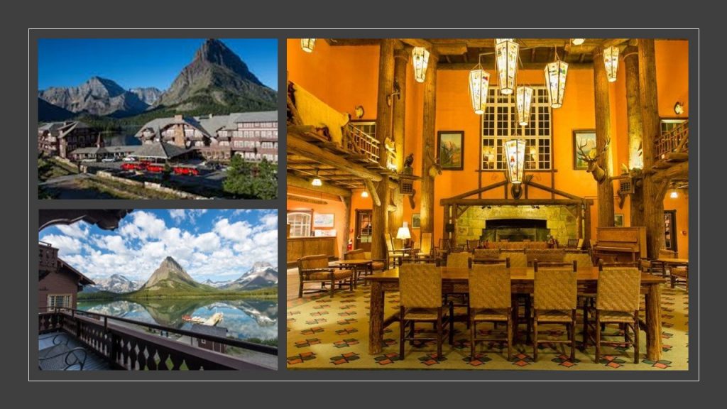
Another viewer recommended I look into Lake McDonald…

…in Montana’s Glacier National Park.

The Going-to-the-Sun Road provides access to many locations and activities within the park…
…including the Lake McDonald Lodge, considered one of the finest examples in the nation of the Swiss-Chalet-Style of architecture, and was said to have been built in 1913.
We are told the mountains of Glacier National Park started forming 170-million years ago, when glaciers forced ancient rocks eastward up and over much younger rock strata.
That’s a beautiful old stone bridge on the Going-to-the-Sun Road!

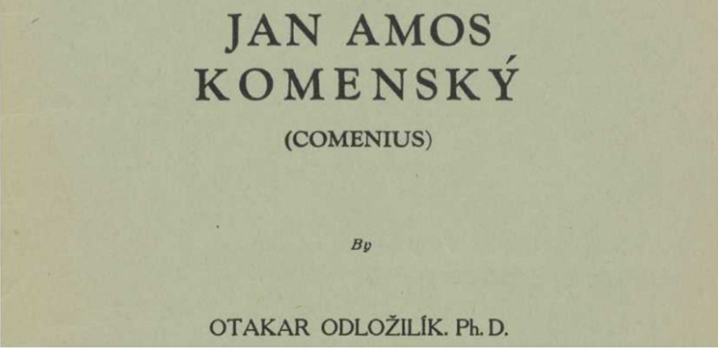
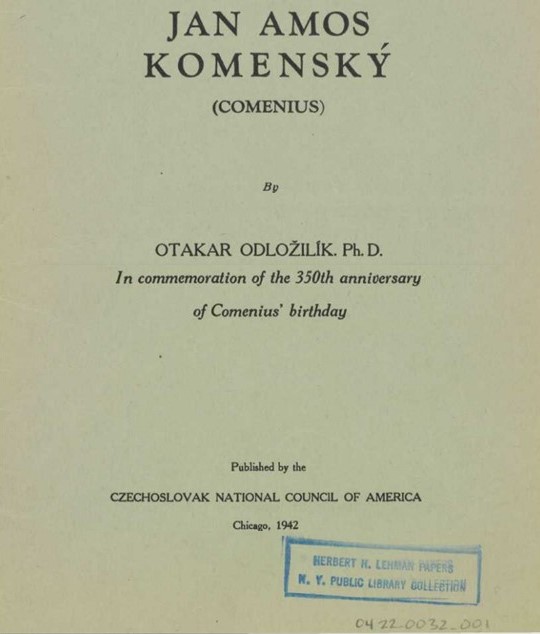
Next, one of my viewers provided me with a link to take a look at and see what I thought regarding a historical person.
The person was Jan Amos Komensky, also known as John Amos Comenius.
Have you ever heard of him?
I sure hadn’t!

Not being known to the general public is interesting to note, given that he has been credited with introducing and dominating the whole modern movement in the field of elementary and secondary education, first notated in the forward of this publication.

I didn’t have to look any further than the front page of the publication to have several things jump-out at me.
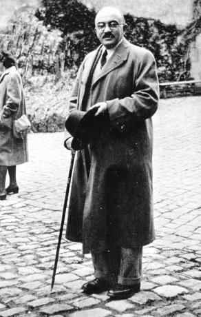
The publication was written by Otakar Odlozilik, PhD.
Dr. Odlozilik became an American citizen in 1955, and taught his specialized knowledge of influential Czechoslovak history in American universities.
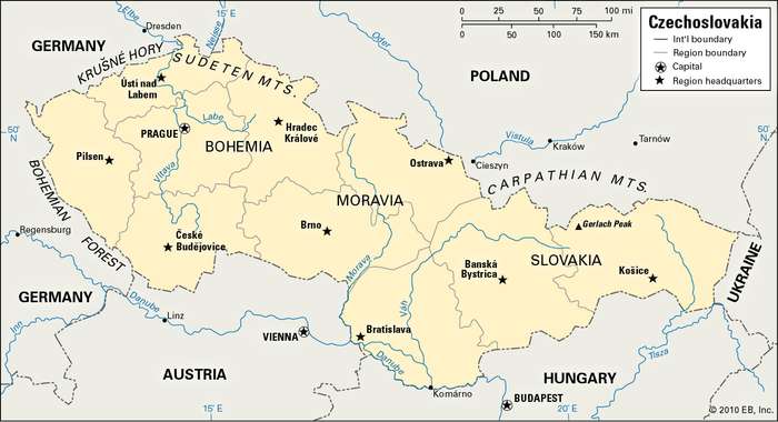
He was .a Czechoslovak professor who specialized in things like Reformation currents of thought, the emigration of the Czech Brethren, and the influence of Bohemia, a historical region of Czechoslovakia today, but historically Bohemia referred to the entire Czech territory of Moravia and Silesia, called the “Lands of the Bohemian Crown,” historically ruled by the Bohemian Kings.
The publication is “In commemoration of the 350th anniversary of Comenius’ birthday.”

I have found that many World Fairs, Expositions and Exhibitions were held in commemoration of specific events in history, like the “World’s Columbian Exhibition,” also known as the Chicago World’s Fair, held in 1893 to celebrate the 400th-anniversary of Christopher Columbus’ arrival in the New World in 1492, and said to have been designed by many prominent architects of the day.

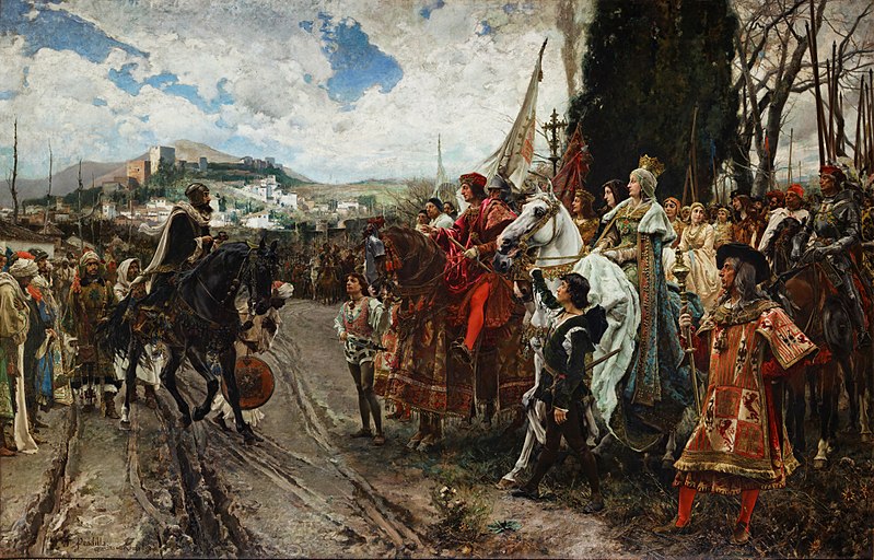
Christopher Columbus first set sail for the “New World” from Spain on August 3rd of 1492.
In the same year, on January 2nd of 1492, the Sultan of the Emirate of Granada, Muhammad XII surrendered to Queen Isabella I of Castile and King Ferdinand II of Aragon, signalling the end of Moorish rule in Spain in our historical narrative.
We are told that after the World’s Columbian Exposition ended, all of the structures built for the Exhibition were destroyed except for the Palace of Fine Arts, now Chicago’s Museum of Science and Industry.

Dr. Odlozilik’s publication about Comenius was published in Chicago by the Czechoslovak National Council of America in 1942 .

The Austro-Hungarian Empire was a constitutional monarchy and great power in central Europe between 1867 and 1918 that was dissolved after its defeat at the end of World War I.
Part of the Austro-Hungarian Empire until the end of World War I, Czechoslovakia was founded as a sovereign state on October 28th of 1918, and existed until it was dissolved into the separate countries of the Czech Republic and Slovakia on January 1st of 1993.
Its government was communist from 1948 to 1989.
The Czechslovak National Council of America was founded in Chicago in 1910 to support the Czech and Slovak cause in its fight against the Austro-Hungarian Empire.
According to Dr. Odlozilik, Comenius was born on March 28th of 1592, almost 100-years to the day that the Alhambra decree was issued on March 31, 1492, where we are told Spanish Jews were given the choice of converting to Catholicism, or leaving the Kingdoms of Castile and Aragon.
This decree may have originally applied to the Moors as well.
It is out there somewhere in the field of information that the next day, April 1st, became known as April Fools Day because while the Moors were told they had the same option, their ships and homes were burned, and many were killed. While this may or may not be true, it would not surprise me at all if it was true.
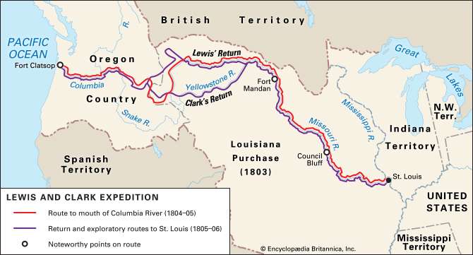
I am going to end this video with the Lewis and Clark Expedition, as suggested in a comment by a viewer.
This is what we are told about the Lewis & Clark Expedition.
Also known as the Corps of Discovery, the Lewis & Clark Expedition started on August 31, 1803 and lasted until September 25, 1806, with a mission to explore and map the newly acquired western portion of the country after the Louisiana Purchase.

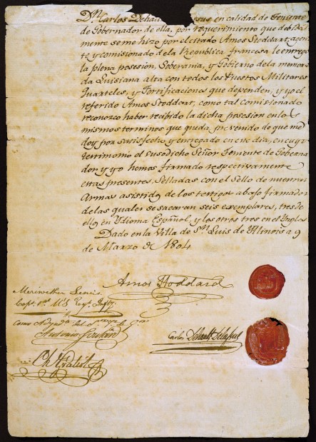
We are told the Louisiana Purchase was the acquisition of the Territory of Louisiana by the United States from France with the signing of the Louisiana Purchase Treaty on April 30th of 1803, which was officially announced on July 4th of 1803.
It was said to have doubled the size of the United States and paved the way for the nation’s westward expansion.
One of the negotiators with France for the terms of the Louisiana Purchase in 1803 on behalf of President Jefferson was the minor French nobleman Pierre Samuel Dupont de Nemours, who was living in the United States at the time.

His son Éleuthère Irénée du Pont, a chemist and industrialist, founded the E. I. du Pont de Nemours and Company to manufacture gunpowder and explosives in 1802, with the du Ponts becoming one of America’s richest families, with generations of influential businessmen, politicians and philanthropists.
Under the command of Captain Meriwether Lewis and his close friend Lieutenant William Clark, the expedition was comprised of a select group of United States Army and civilian volunteers.
They were commissioned by President Thomas Jefferson to find: 1) a practical route across the western half of the country; 2) to establish an American presence in this Territory before European powers tried to claim it; 3) to study plants, animal life, and geography; and 4) to establish trade with the local American Indian tribes.
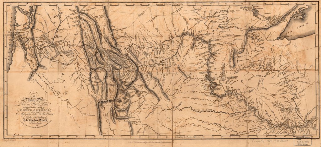
This map is attributed to Captain Lewis and Lieutenant Clark from their expedition.
After Jefferson chose Meriwether Lewis as the expedition’s leader in 1803, he made sure Lewis was educated in medicinal cures by Dr. Benjamin Rush in Philadelphia…

…in navigational astronomy by American land surveyor Andrew Ellicott…
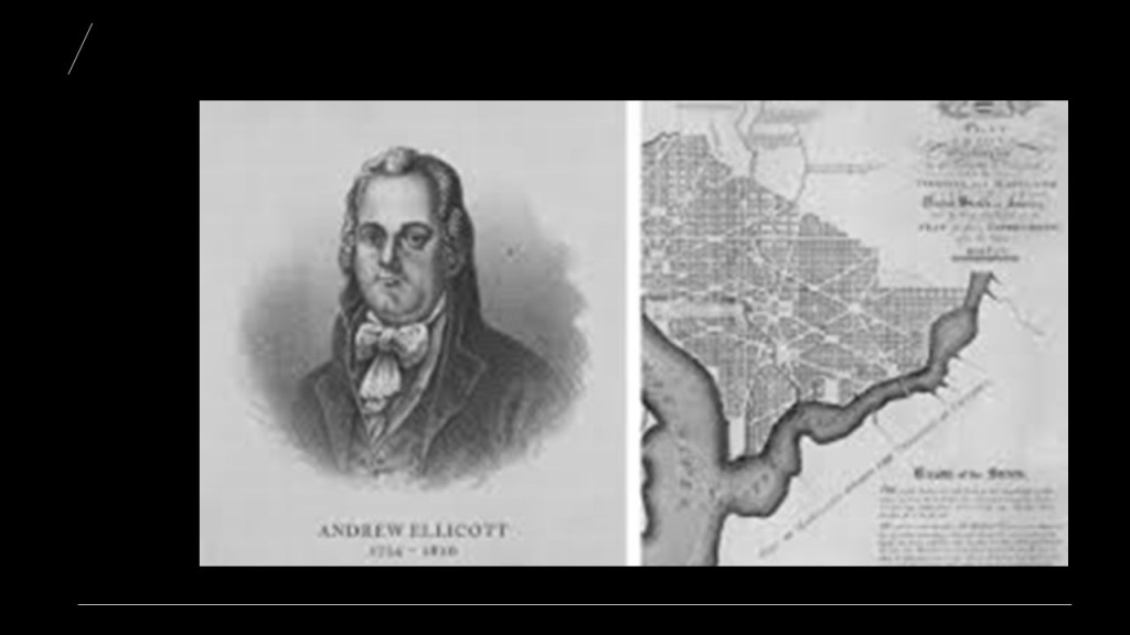
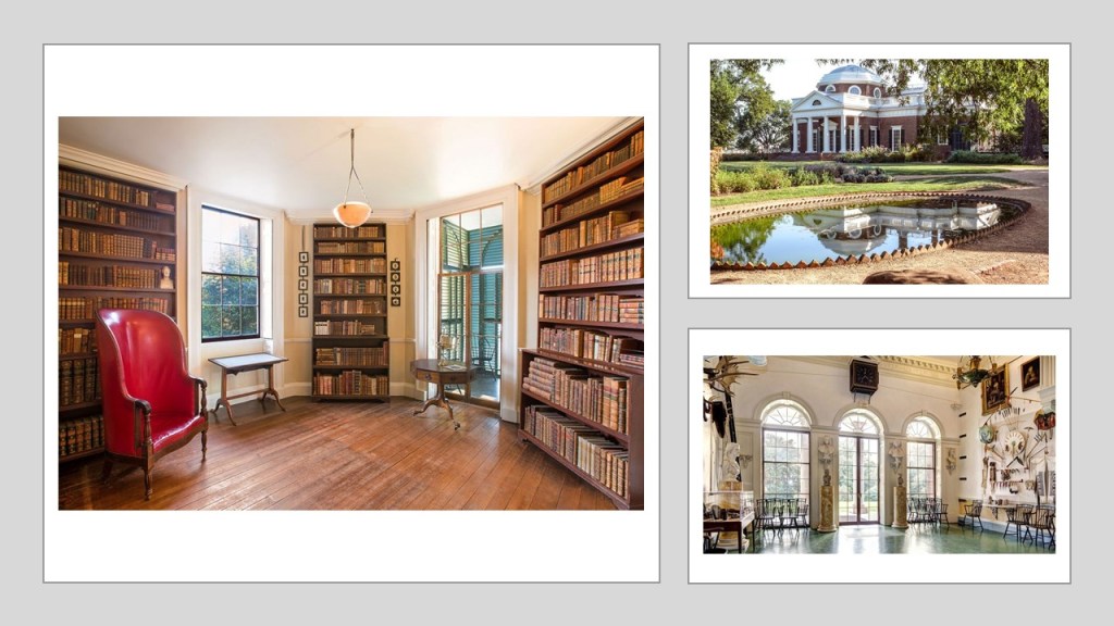
…and Jefferson gave Lewis full access to his extensive library on the subject of the North American continent at his home in Monticello in Charlottesville, Virginia, which Jefferson is credited with designing and building between 1768 and 1772.
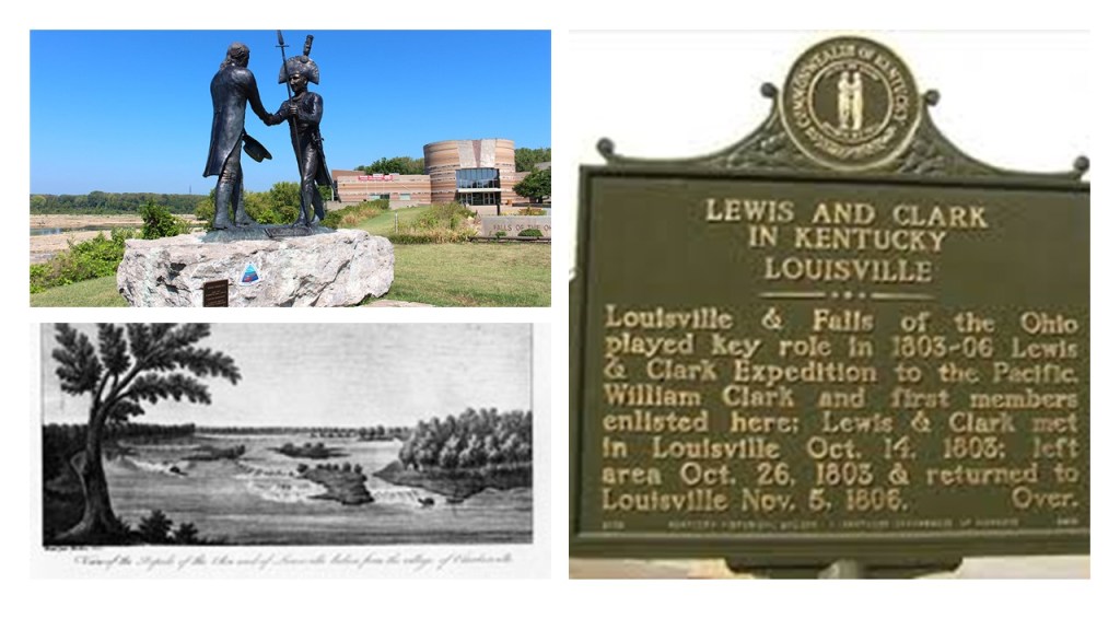
In the summer of 1803, a keelboat said to have been built to Lewis’ specifications near Pittsburgh, Pennsylvania…

…and that Lewis and his crew travelled in it immediately after it was finished in August down the Ohio River to meet up with Clark at what is now Clarksville, Indiana in October of 1803 at the Falls of the Ohio, across the river from Louisville, Kentucky.
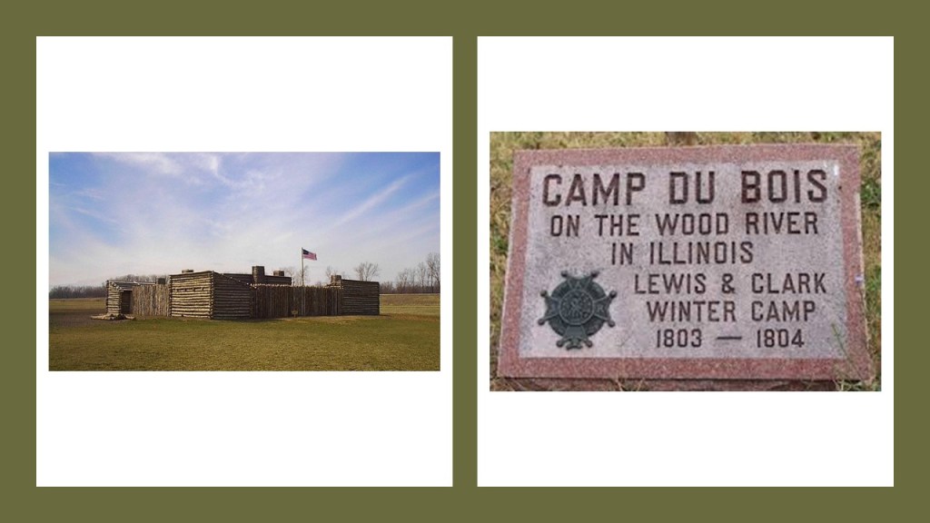
We are told that in 1803, Lewis and Clark met a well-known Frenchman at Cahokia by the name of Nicholas Jarrot, who agreed to let them camp on his land on the Wood River, at that time known as the Riviere du Bois.
Known today at the Cahokia Mounds State Historic Site, it is the site of a pre-Columbian Native American city that is considered the largest and most complex archeological site north of the great pre-Columbian cities of Mexico…
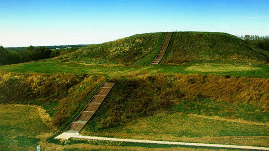
…and is located directly across the Mississippi River from St. Louis, Missouri.
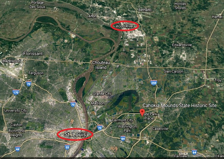
The location of Camp Dubois at Wood River is almost directly north of Cahokia, both on the Illinois side of the Mississippi River.
While I am not seeing the remnants of a star fort in this Google Earth screenshot of the area surrounding Ft. Dubois in Wood River…
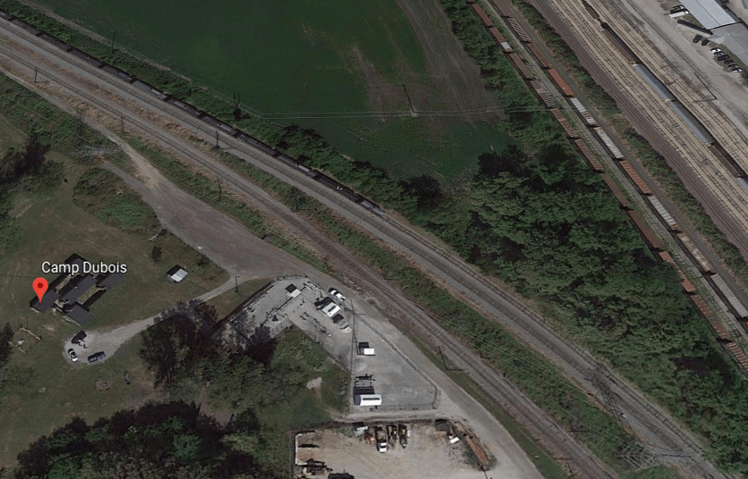
…I am seeing that it is situated beside a location where two railroad lines merge into one, as well as a landscape filled with huge lots and huge tanks…
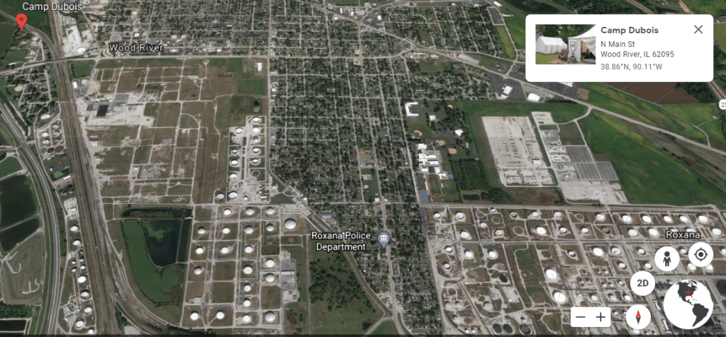
…that are apparently connected to the oil refineries in Wood River.
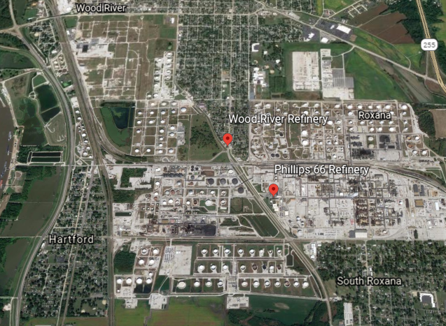
Apparently, the city of Wood River was founded in 1907 with the establishment in the vicinity of a refinery for John D. Rockefeller’s Standard Oil Company.
Interesting that this would also be the historical location of the actual launch point for the Lewis and Clark Expedition.

The expedition members stayed through the winter at Camp Dubois in present-day Wood River, awaiting the transfer of the lands of the Louisiana Purchase to the United States, which did not occur until March 9th & 10th of 1804.
Jefferson’s instructions to the expedition, we are told, were stated thus:

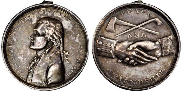
While the US mint prepared special silver medals for the expedition called “Indian Peace Medals” with a portrait of Jefferson and inscribed with a message of friendship and peace distributed by the soldiers in it…
…they also had advanced weapons to display their military firepower, like the .46 caliber Girandoni air rifle, a repeating rifle with a 20-round tubular magazine that was invented in 1779 by the Italian Bartolomeo Girandoni.

They also carried flags, gift bundles, medicine, and other items that they would need for their journey.

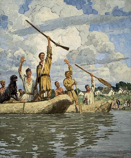
The Corps of Discovery of approximately 45 members left Camp Dubois on May 14, 1804.
Under Clark’s command, they traveled up the Missouri River in their keelboat and two smaller vessels…

…to St. Charles, Missouri.
Founded in 1765, it is called the third oldest city west of the Mississippi River.
Lewis joined them six days later.
The expedition set out the next afternoon, on the 21st of May.
From St. Charles, the expedition followed the Missouri through what is now Kansas City, Missouri, where they camped at Kaw Point on June 26th of 1804, where the Kansas River runs into the Missouri River…The way these two rivers merge together into one at Kaw Point is another example of the many reasons I believe that so-called natural rivers are in actuality canal systems.
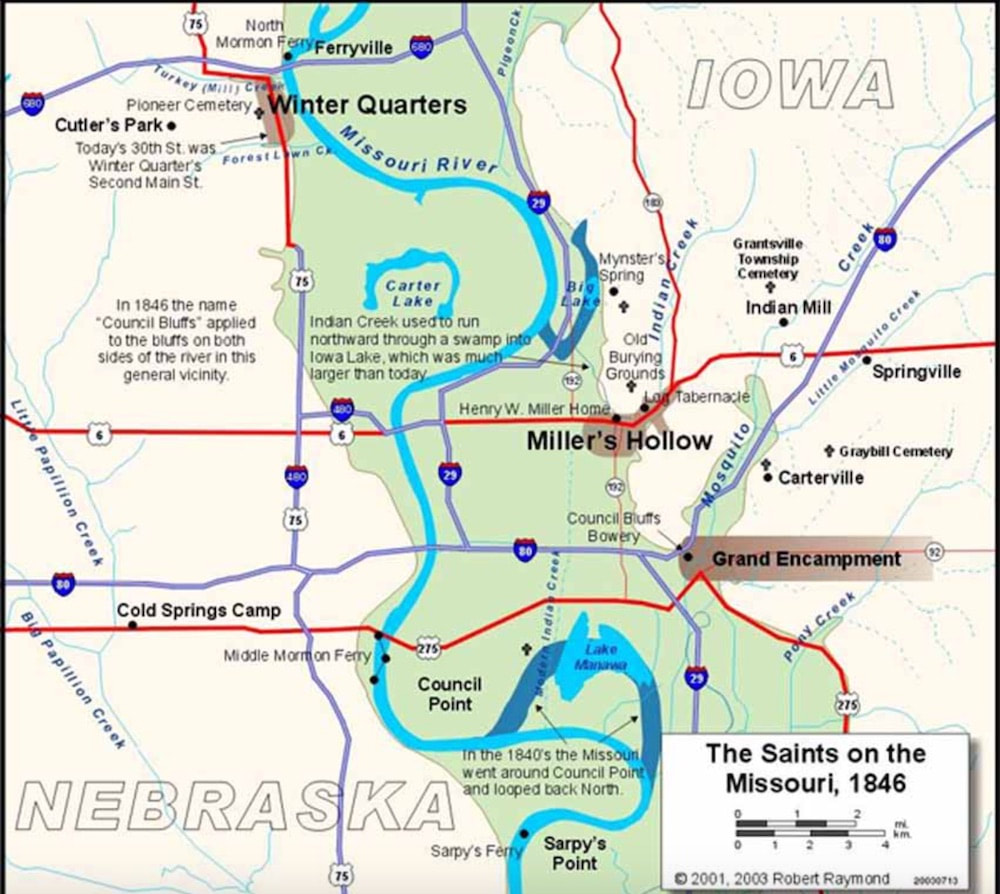
The Corps of Discovery famously landed next in the area surrounding the Missouri River of what is now Omaha, Nebraska, and Council Bluffs, Iowa.

Here in this landscape of tall prairie grass and river, we are told, the Lewis and Clark expedition traveled, camped, hunted, and fished, met with the Native people, and held council with the Indian chiefs of the area.
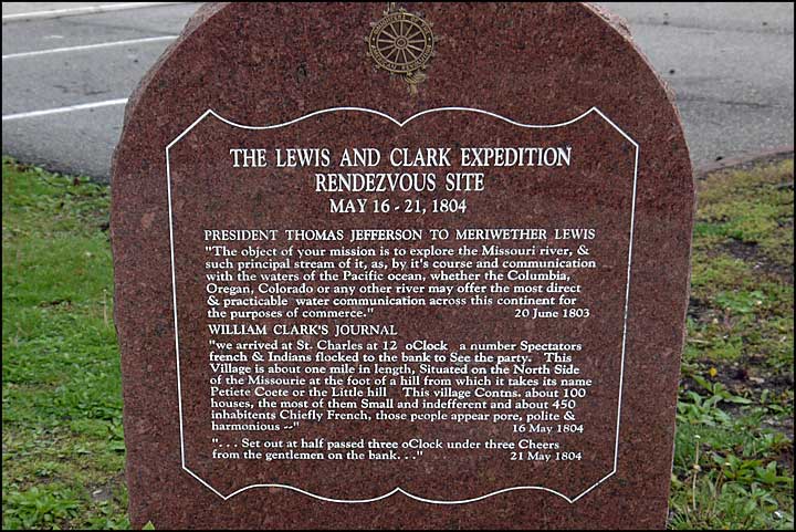
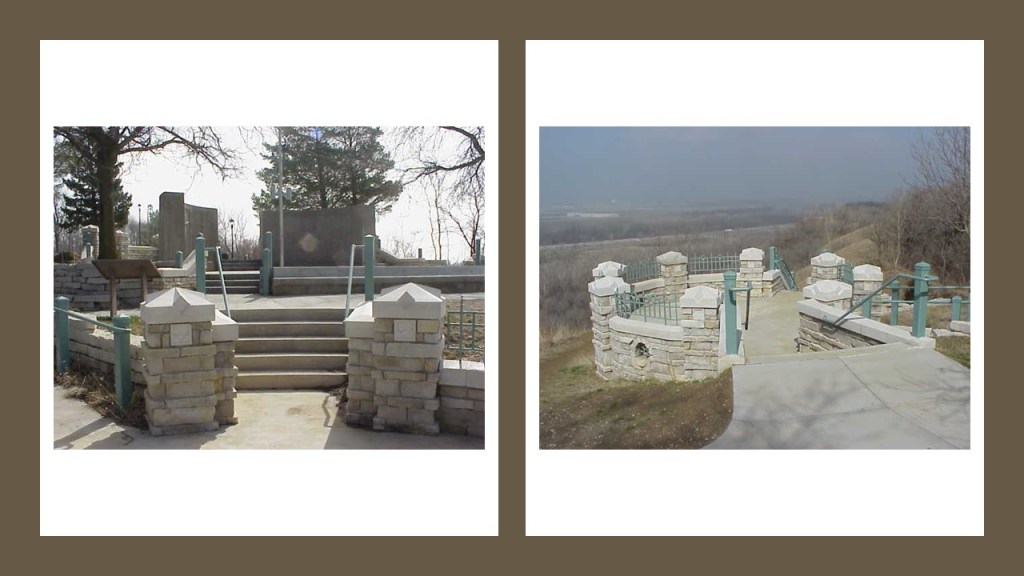
The Lewis and Clark Monument Park in Council Bluffs, Iowa, memorializes what was said to be a historic meeting between the expedition and the Otoe and Missouri Indians in 1804.
It is important to note the old stonework seen on the memorial grounds.
Council Bluffs was incorporated in 1853, receiving its name from this historic meeting.
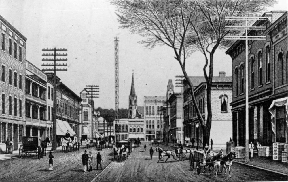
There is a 150-foot, or 46-meter, tall moontower that was used for city-lighting in this historic picture of Council Bluffs.
We are told there were seven of what were called moontowers erected in Council Bluffs starting in 1887, and by 1908 they were all removed for a variety of given reasons – too expensive, safety, etc.
Council Bluffs was the historic starting point of the Mormon Trail, which was in use between 1846 and 1869.
Next they came to Omaha, said to have been founded in 1854 by speculators from Council Bluffs, and that a river-crossing called the Lone Tree Ferry gave the city its nickname “Gateway to the West.”

We are told that Omaha introduced this “New West” to the world when it hosted the 1898 Trans-Mississippi Exposition to showcase the development of the entire West, from the Mississippi River to the Pacific Coast.
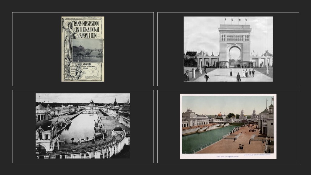
And, as with what I have seen with regards to what was called the “temporary” nature of all of the massive and ornate architecture associated with Exhibitions, Expositions, and World Fairs, starting with the Crystal Palace Exposition of 1851 in London, Omaha is no exception to this story.

Just up the Missouri River from Omaha, in present-day Fort Calhoun, Nebraska, is the location of Fort Atkinson State Historical Park, said to have been the first fort established west of the Missouri River, in 1819, in what was called the “unorganized region of the Louisiana Purchase of the United States.”
In use for only 8-years, it was abandoned in 1827.

Back to the Corps of Discovery.
The only death to occur on the expedition was said to have taken place on August 20th, of 1804, when Sgt. Charles Floyd died, allegedly from acute appendicitis.
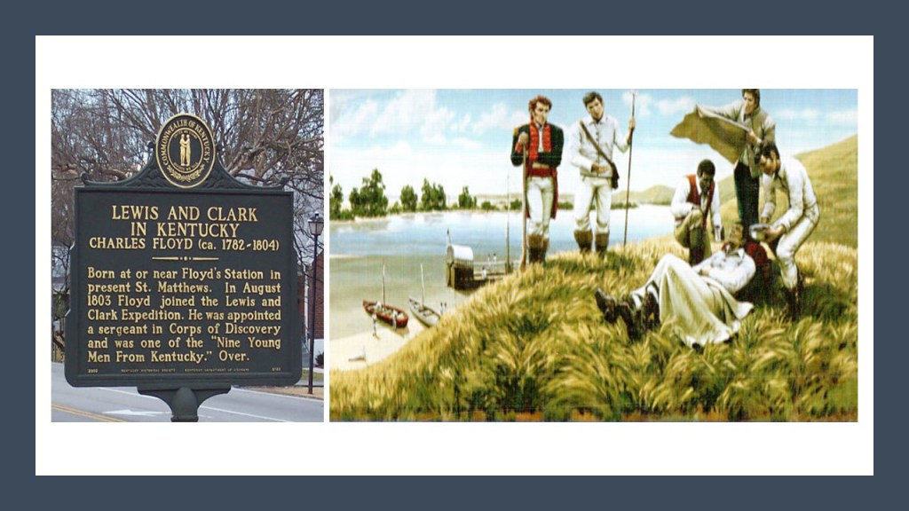
He had been among the first to sign up with the Corps of Discovery and was buried at a bluff by the river that was named after him in what is now Sioux City, Iowa.
We are told that his burial site was marked with a cedar post on which was inscribed his name and day of death, but that by 1857, the ground around the cedar post had eroded, and slid into the river, and concerned citizens were said to have rescued his skeleton.
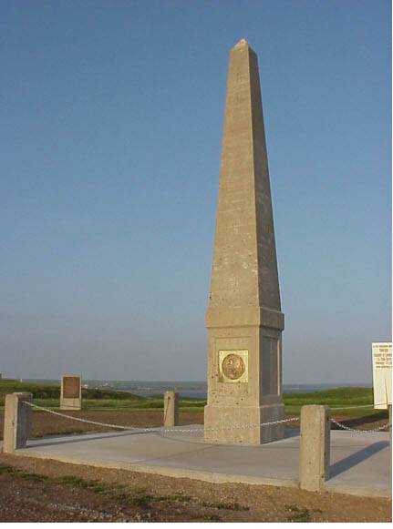
This is the Floyd Monument today in Sioux City.
We are told the concrete-base of the monument was poured in 1900, at which time Floyd’s remains were reinterred almost on the hundredth-anniversary of his death, on August 20th of 1900, and that the obelisk was completed in 1901.
A minor historical character memorialized with an obelisk?

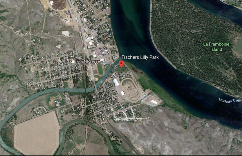
The expedition held talks with the Sioux Nation near the confluence of the Missouri and Bad Rivers in what is now Fort Pierre, South Dakota.
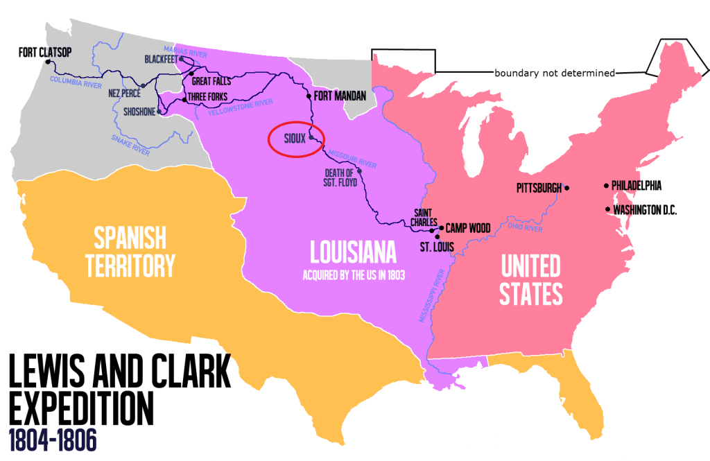
The meeting, which verged at one time on serious hostilities, took place in what is now Fischers Lilly Park in Fort Pierre…
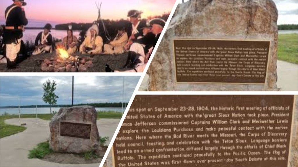
…right where the Bad River enters the Missouri River in Central South Dakota.
Fort Pierre was the location of Fort Pierre Chouteau, one of the most important fur trade forts of the western frontier.

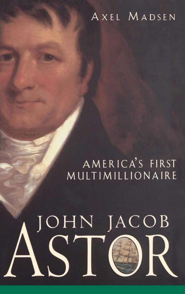
Fort Pierre Chouteau was said to have been built in 1832, after John Jacob Astor, head of the American Fur Company, decided to expand operations into the Upper Missouri River region in the 1820s.
The German-born John Jacob Astor was the first prominent member of the Astor family and the first multi-millionaire in the United States. He made his fortune after establishing a monopoly in the fur trade out West, and real estate investment in and around New York City.

From Fort Pierre, the expedition continued up the Missouri River between present-day South Dakota and North Dakota.
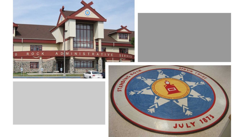
The Missouri River forms the eastern boundary of the Standing Rock Sioux Reservation, which straddles these two states.

Fort Yates is the tribal headquarters for the Standing Rock Sioux.
This is the memorial for Sacagawea, also known as Sakakawea, in Fort Yates.
More on Sacagawea in a bit.
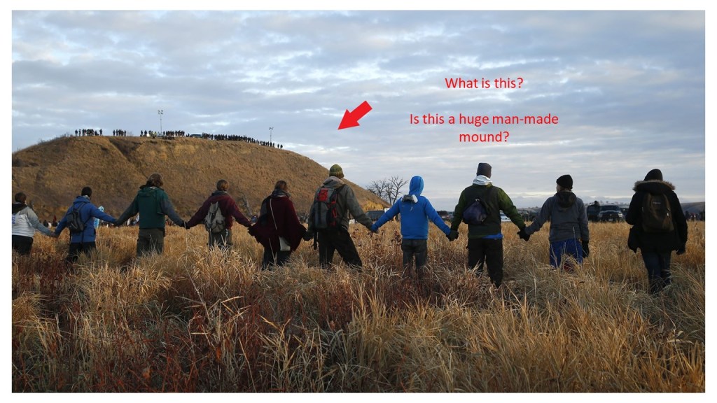
The Standing Rock Reservation was the location of a major stand-off between the Sioux and the Dakota Access Pipeline Project in 2016 and 2017.
Standing Rock looks like a huge man-made mound or earthwork to me.
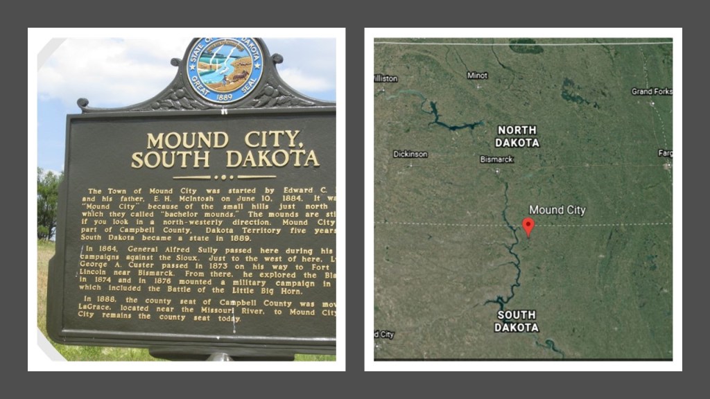
Interestingly, there is a Mound City in South Dakota a short-distance east of the reservation’s boundary on the Missouri River.
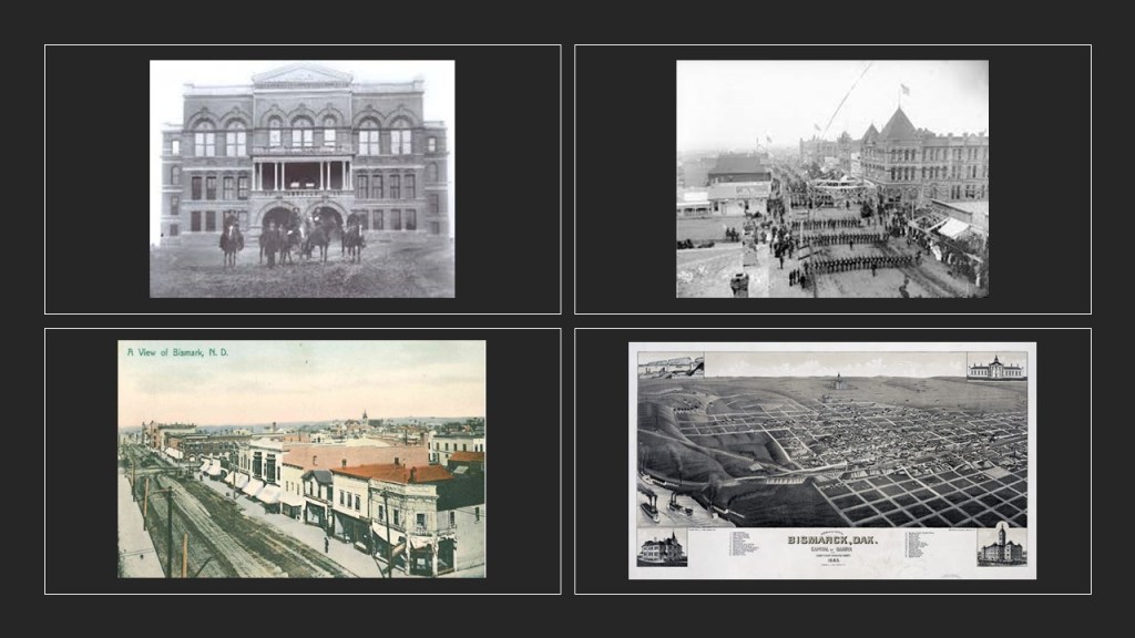
I am not finding a mention of the Lewis and Clark Expedition doing anything of note in what is present-day Bismarck, the State Capital of North Dakota, which the Missouri River passes through.
Bismarck was said to have been founded in 1872, and North Dakota’s capital city since 1889.
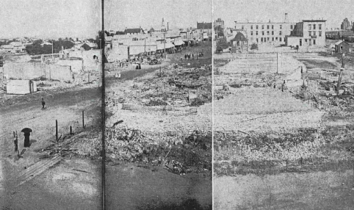
Apparently there was a fire in Bismarck in 1898 that devastated the city, especially the downtown area.
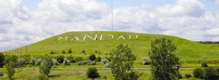
The city of Mandan, across the river from Bismarck, was founded in 1879, and named after the indigenous Mandan people of the region.
Crying Hill is a sacred Native American heritage site located in Mandan. It overlooks the Missouri River basin and is the highest place in the area.
Like Standing Rock, Crying Hill has the appearance of a large mound or earthwork of some kind.
The old Morton County Courthouse in Mandan was said to have been built in 1885, and gutted by fire in 1941.

The next place we find the Corps of Discovery landing was near present-day Washburn, North Dakota, where they built Fort Mandan to live in during the winter of 1804 – 1805.
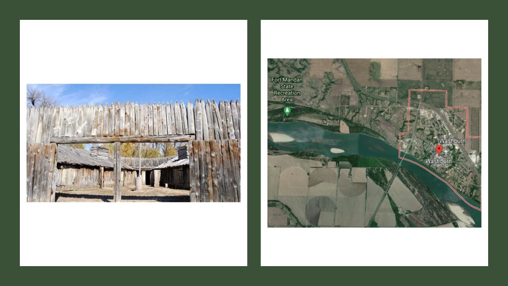
The town of Washburn was founded in 1882 and named after entrepreneur, politician and soldier Cadwallader C. Washburn, who founded a mill that later became General Mills.
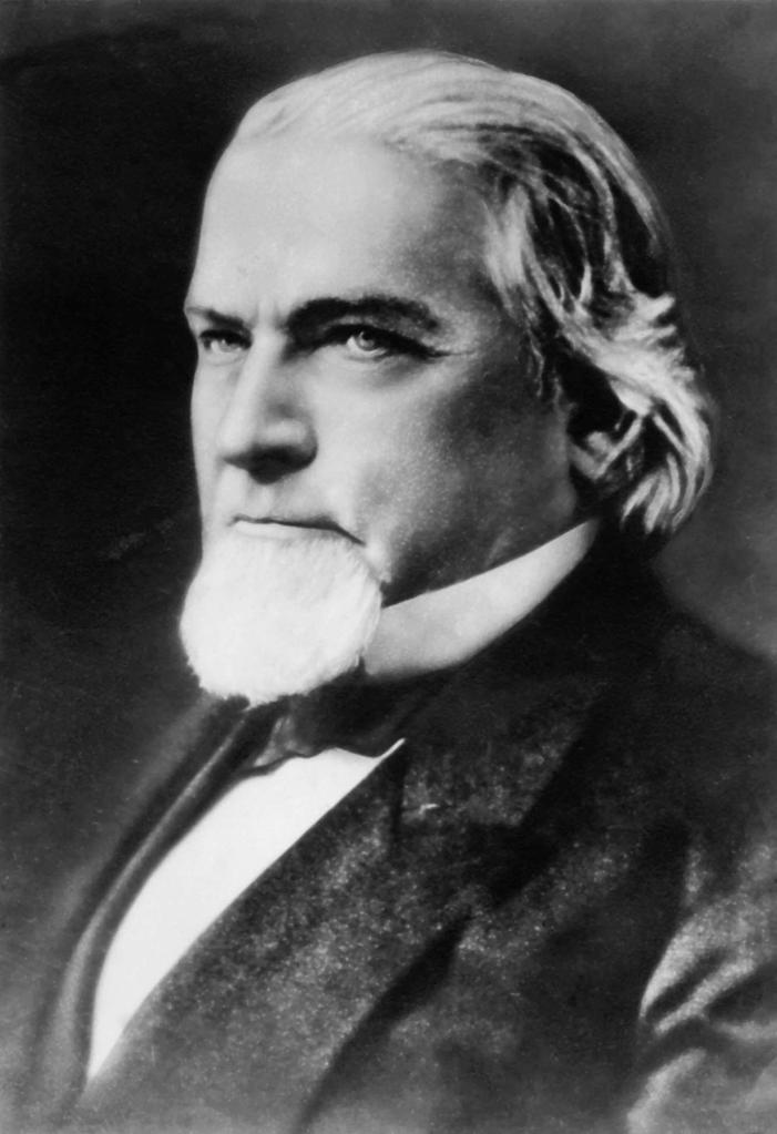
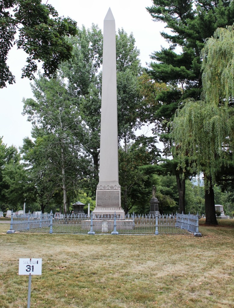
A former governor of Wisconsin, this is the Cadwallader C. Washburn Monument and grave site at Oak Grove Cemetery in La Crosse, Wisconsin.
So we find yet another obelisk…..
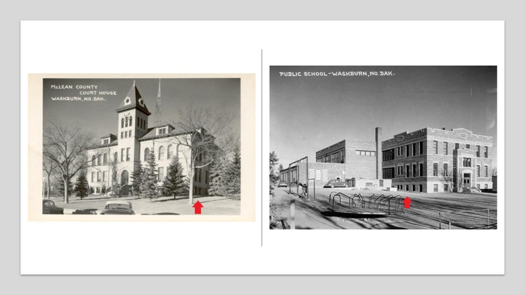
The McLean County Courthouse in Washburn on the left was said to have been built in 1907, and I can’t find a construction date given for the historic public school in Washburn on the right.
Lewis & Clark continued on up the Missouri River in the territory of the Mandan Nation, where, we are told, they managed not to fight each other.

Historically, the lands of the Mandan nation were primarily in North Dakota around the Upper Missouri River, and its tributaries, the Heart and the Knife River.
While at Fort Mandan, Lewis and Clark met the French-Canadian fur trapper Toussaint Charbonneau, and his 16-year-old, pregnant Shoshone wife, Sacagawea, who both joined the expedition, and served as translators for the expedition.

Sacagawea, another minor historical character memorialized with an obelisk, and later, starting in 2000, the Sacagawea dollar coin?
The Lewis and Clark Expedition met with the Salish in Ross’ Hole, September 4, 1805…
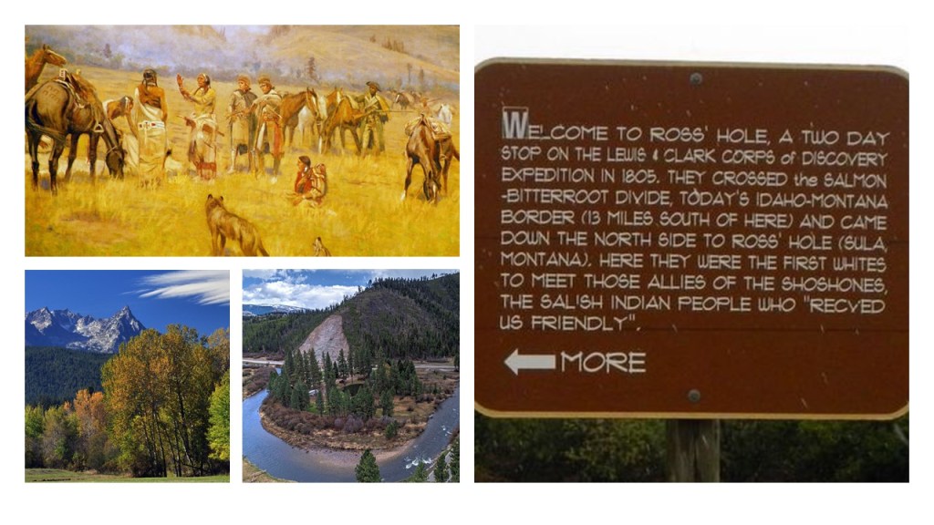
…near Sula on the Bitterroot River in the Bitterroot Valley of Montana, near what is now Idaho.
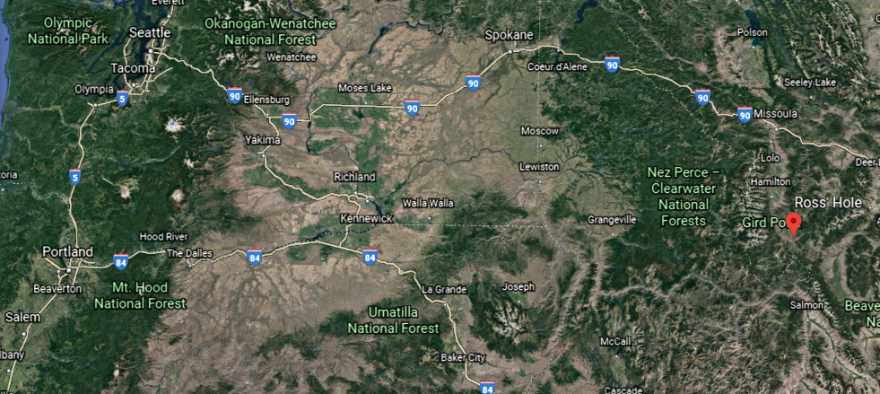
From there, they followed the Missouri River to its headwaters, and went over the Continental Divide at Lemhi Pass on the now Idaho-Montana border in the Beaverhead Mountains of the Bitterroot Range of the American Rockies, and from 1803 until the time of the Oregon Treaty, Lemhi Pass marked the western border of the United States.
The Corps of Discovery then descended from the mountains by way of the Clearwater River…
…the Snake River…

…and the Columbia River.
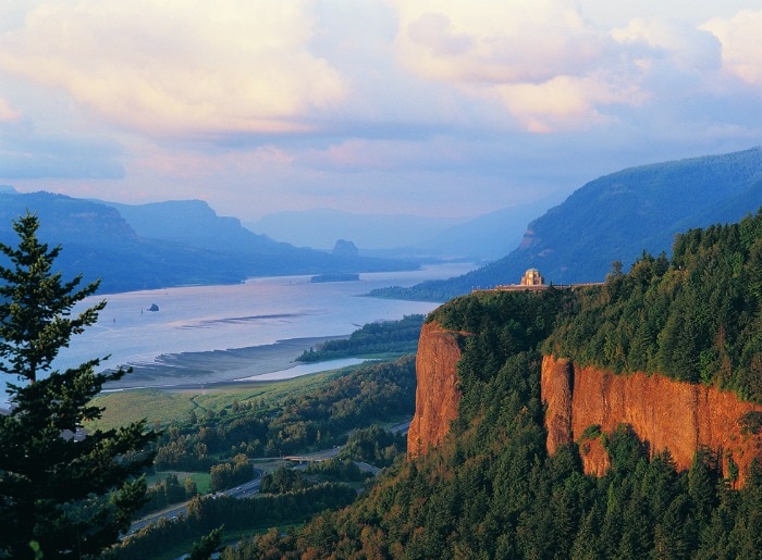
They would have passed right by the physical location of the Maryhill Stonehenge, on a bluff on the Washington-side of the Columbia River, though…
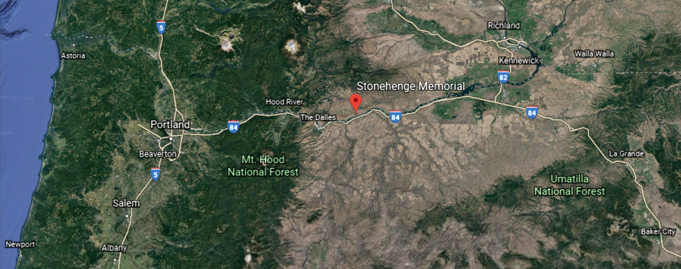
…this stonehenge was said to have been commissioned in the early 20th-century by the wealthy entrepreneur Sam Hill, and dedicated on July 4th, 1918, as a memorial to the people who died in World War I, so it wouldn’t have been there in the early 1800s.
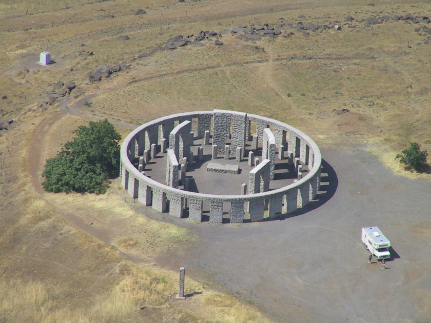
In addition to having a solstice alignment…

…it also has a nice alignment going on with the Milky Way.

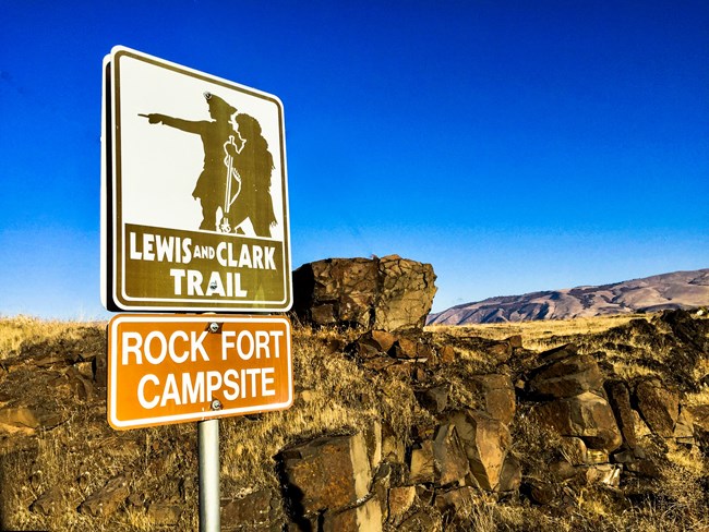
The Lewis and Clark Expedition was said to have camped for three nights on the Columbia River near Celilo, at the Rock Fort Campsite, described as a natural fortification, in late October of 1805.
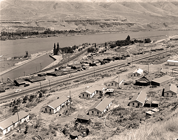
The nearby city of The Dalles was said to be a major Native American trading center for at least 10,000 years, and that the general area is one of North America’s most significant archeological regions.
The rising water filling The Dalles Dam submerged the Celilo Falls, and the village of Celilo, in 1957…
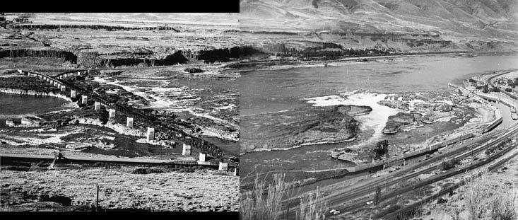
…which was the economic and cultural hub of Native Americans in the region, and said to be the oldest continuously inhabited settlement in North America.
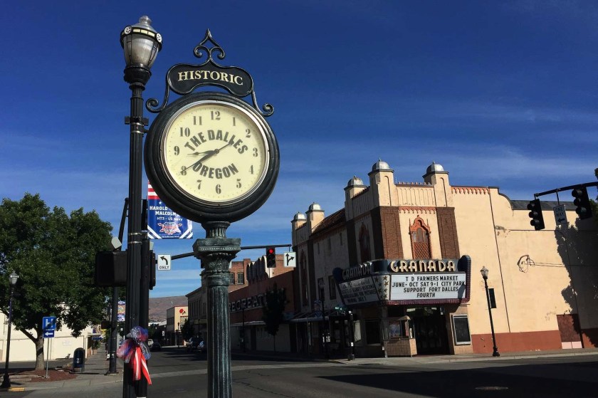
As a matter-of-fact, the historic Granada Theater in the nearby city of The Dalles…
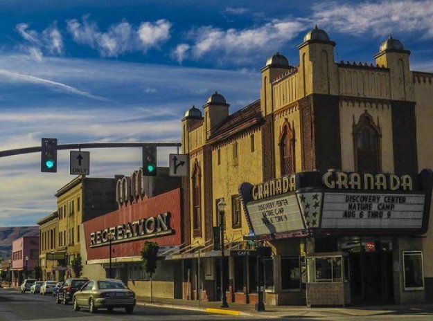
…is on the Lewis and Clark Trail, and still in use as a theater today.
It was said to have been built in the Moorish Revival style, between 1929 and its opening in 1930, and is famous for having been the first theater west of the Mississippi to show a “talkie.”
The Corps of Discovery arrived at the Pacific Ocean around November 21st of 1805, near the location today of Astoria, Oregon (which was named after John Jacob Astor).
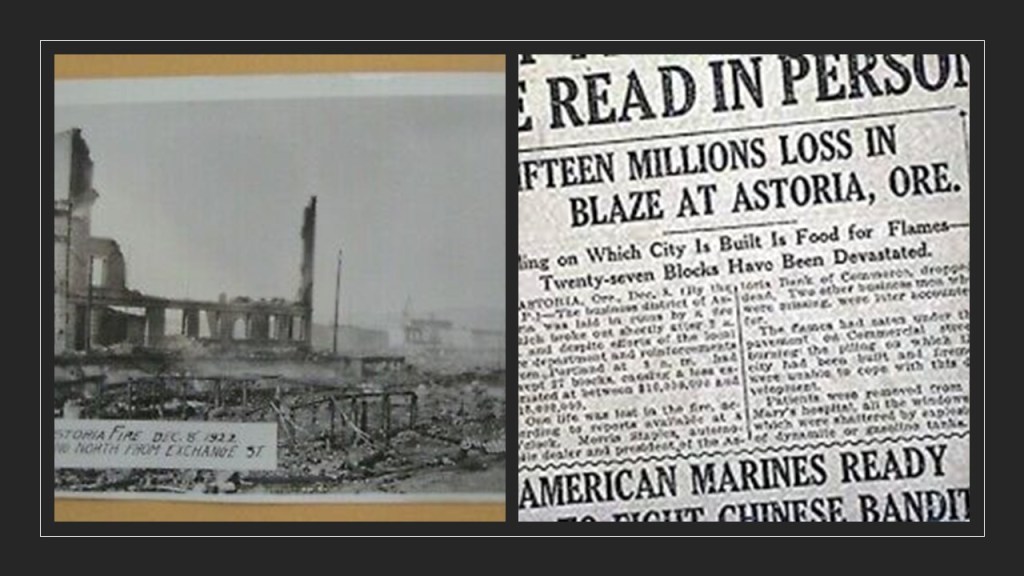
This is the John Jacob Astor Hotel in Astoria, said to have been constructed between 1922 and 1923, and opened in 1924, and is one of the tallest buildings on the Oregon Coast.
Interesting to note, the world’s first cable television system was set up in 1948 using an antenna on the roof of the Hotel Astoria.

Also, during the same time period the hotel was said to have been built, on December 8th of 1922, a fire destroyed almost all of downtown Astoria.
Back in the winter of 1805, the members of the expedition built Fort Clastrop for shelter and protection, and to officially establish the American presence there, with the American flag flying over the fort.
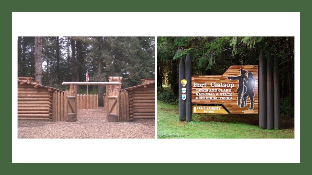
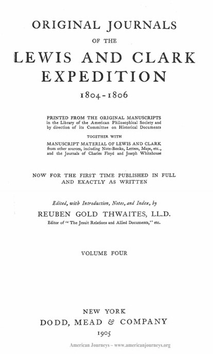
During the winter at Fort Clatsop, Lewis committed himself to writing. He filled many pages of his journals with valuable knowledge.
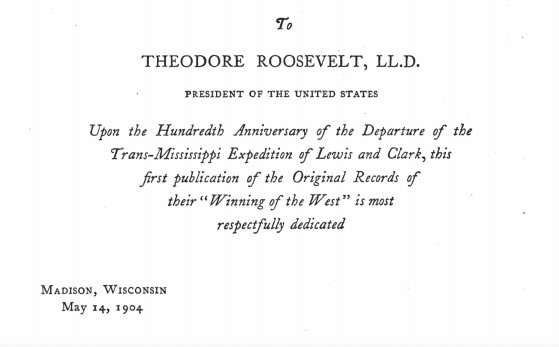
So when I looked up a graphic for Lewis about this writing, I came upon the title page to this publication on the journals of Lewis and Clark…
…as well as a dedication to President Theodore Roosevelt on the 100th-Anniversary of the departure of the Lewis and Clark Expedition.
Are we talking about faithful reproduction of actual journals, or historical fiction to back-fill the history in the new historical narrative that we have been taught?
Additionally, the title page for the Lewis and Clark expedition journals is similar in format and wording to the title page of the publication about Comenius that I shared in the last post, most notably being “Anniversary” publications.
More on other anniversary “occasions” coming up soon.
We are told Lewis was determined to remain at the fort until April 1, but was still anxious to move out at the earliest opportunity.
By March 22, the stormy weather had subsided and the following morning, on March 23, 1806, the journey home began.
The Corps of Discovery arrived back in St. Louis on September 23rd of 1806.
We are told their visit to the Pacific Northwest, maps, and proclamations of sovereignty with medals and flags were legal steps needed to claim title to each indigenous nation’s lands under the Doctrine of Discovery, a concept of public international law expounded by the United States Supreme Court in a series of decisions in 1823.
Under it, title to lands lay with the government whose subjects travelled to and occupied a territory whose inhabitants were not subjects of a European Christian monarch.
In other words, the Supreme Court ruled that the Native Americans didn’t own their land.
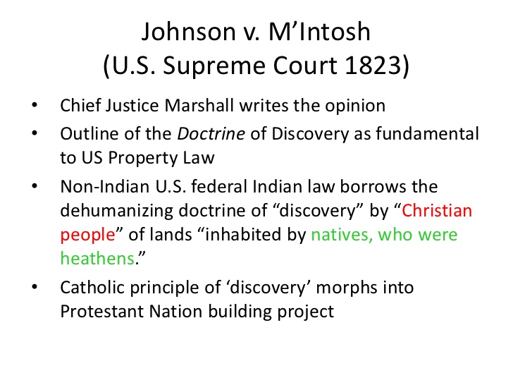
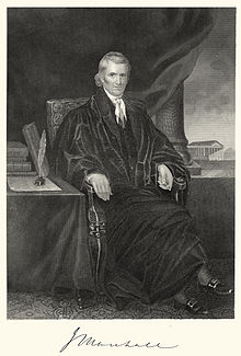
Chief Justice John Marshall explained and applied the way that colonial powers laid claim to lands belonging to foreign sovereign nations during the Age of Discovery, and Chief Justice Marshall noted, among other things, the 1455 papal bull Romanus Pontifex and the 1493 Inter Cetera bull in the Court’s decisions to implement the Doctrine of Discovery.
Meriwether Lewis had returned from the Lewis & Clark Expedition in 1806; was made Governor of Louisiana Territory in 1807 by Thomas Jefferson; and had made arrangements to publish his Corps of Discovery Journals.
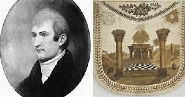
For a point of information, he was initiated into freemasonry between 1796 and 1797, from where he was born and raised in Ablemarle County, Virginia Colony, shortly after he joined the United States Army in 1795.
Being Governor of the Louisiana Territory didn’t work too well for Lewis for a variety of reasons, and on September 3rd of 1809, he set out for Washington, DC, to address financial issues that had arisen as a result of denied payments of drafts he had drawn against the War Department when he was governor…and he carried with him his journals for delivery to his publisher.
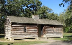
He decided to go overland to Washington instead of via ship by way of New Orleans, and stayed for the night at a place called Grinder’s Stand, an inn on the historic Natchez Trace, southwest of Nashville, Tennessee.
Gunshots were heard in the early morning hours, and he was said to have been found with multiple gunshot wounds to the head and gut.
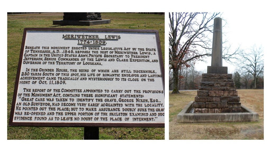
His remains were interred here at Grinder’s Stand.
We are told that Thomas Jefferson and some historians generally accepted Lewis’ death as a suicide.
What did he know?
Who would have wanted him silenced?
What happened to his journals?
Did someone nicely get them along to his publisher for him as was?

So far I have found references to some of the wealthiest families in history in my research of the Louisiana Purchase and along the route of Lewis and Clark Expedition, and I wasn’t even trying – they were just there:
The du Ponts involvement in negotiating the terms of the Louisiana Purchase from France, which coincided with the very beginnings of their gunpowder, explosive, and chemical empire…

…the Rockefellers and the Standard Oil Refinery in Wood River at the location of Camp Dubois, the official starting point of the expedition…

John Jacob Astor and the American Fur Company’s fur-trading fort at Fort Pierre, a stopping point of the expedition in Sioux country in present-day South Dakota, and the beginning of the wealth and influence of the Astor family…
…and other beginnings of the corporatocracy in which we have been living under…

…like the namesake of Washburn, North Dakota, the location of the expedition’s Fort Mandan for their first winter, Cadwallader C. Washburn, being a founder of General Mills.

I think these are all clues found in the journey of the Lewis and Clark Expedition about how a small number of families took control of the resources and wealth of the Earth.
I found three of the thirteen names on this chart in the little bit of digging I have done here.
If the Lewis and Clark actually took place, what was its true purpose?
I am going to end this first volume of the “Interesting Comments & Suggestions I have Received from Viewers” here.

