
In the last post, I tracked this alignment from the Ganges Delta in the Bay of Bengal, where it enters the country of Bangladesh, through its capital city of Dhaka, and into India to the Holy City of Varanasi, a spiritual and cultural center for thousands of years.
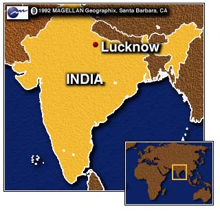
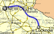
In this post, I am picking up the alignment in Lucknow, the capital of the State of Uttar Pradesh in India.
It is an important center of governance, administration, education, aerospace, commerce, finance, pharmaceuticals, and technology, and a hub of North Indian culture and art.
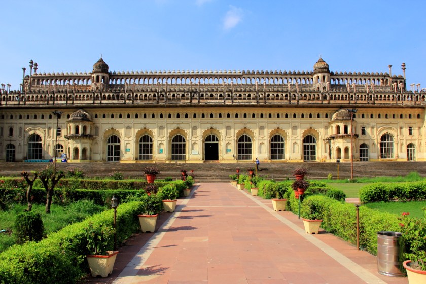
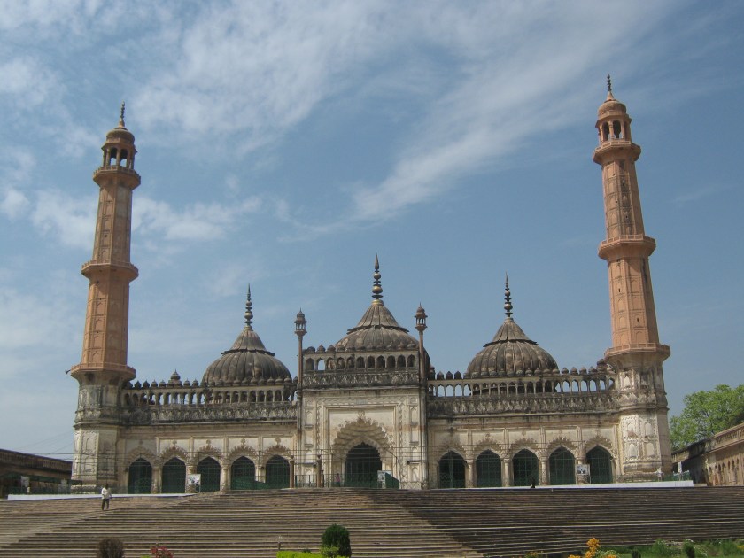
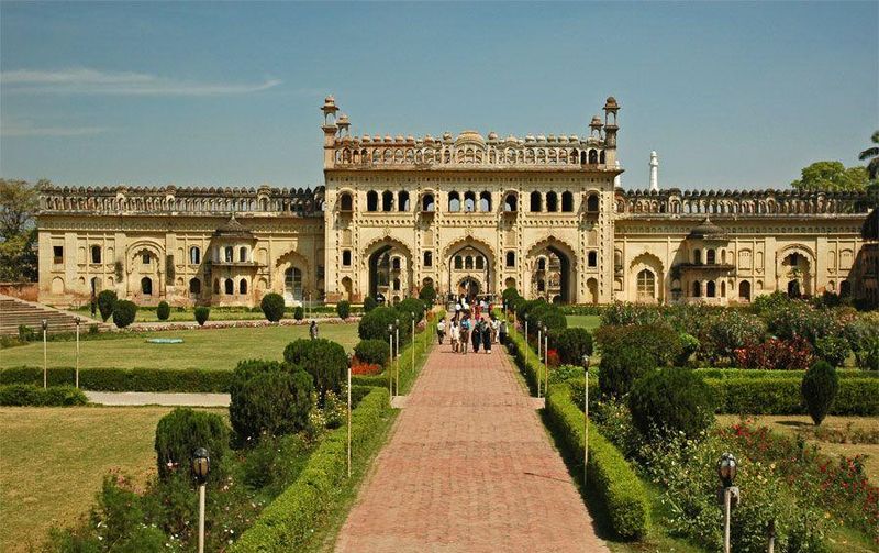
The Bara Imambara complex was said to have been built by the Nawab of Awadh, Asaf-ud-Daula, in 1784.
The complex includes the Afsi Mosque…
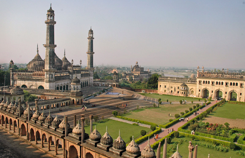
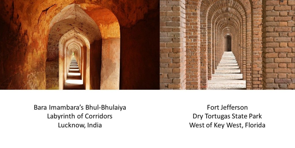
…a labyrinth of approximately 1,000 interconnected corridors and doors called the Bhul-Bhulaiya that circles around the upper part of the Bara Imambara, compared on the right with brick archways having the same geometric effect found at Fort Jefferson, on Dry Tortugas State Park on Garden Key in the furthest west part of the Florida Keys…
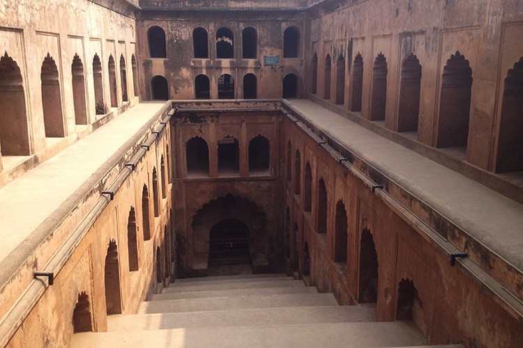
…and the Bowli, a step-well with running water.
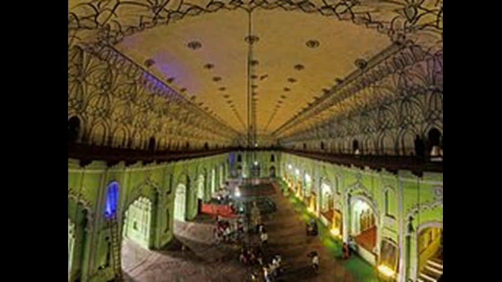
The main chamber of the Imambara, which contains the tomb of Asaf-ud-Daula, consists of a large, vaulted central chamber, which is 50 x 16-meters, or 164 x 52-feet, wide, and over 15-meters, or 50-feet, high, and is one of the largest arch constructions in the world without beams supporting the chamber.
The construction of the Bara Imambara was said to have been conceived of by this Nawab of Awadh to provide employment for people in the region for almost a decade during a time of famine.
I found this story in more than one place. We are consistently told starving, unskilled labor, built this amazing complex.
Not only is the architecture of the Bara Imambara in Lucknow colossal and beautiful, there are said to be passages beneath the complex leading to places like Agra 180-miles or 291-kilometers away, where the Taj Mahal is located, and for comparison on the right is the Hui Mosque in Yinchuan, China…
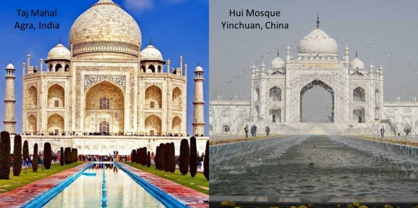
…and to New Delhi, the national capital of India, and 259-miles, or 417-kilometers, from Lucknow.
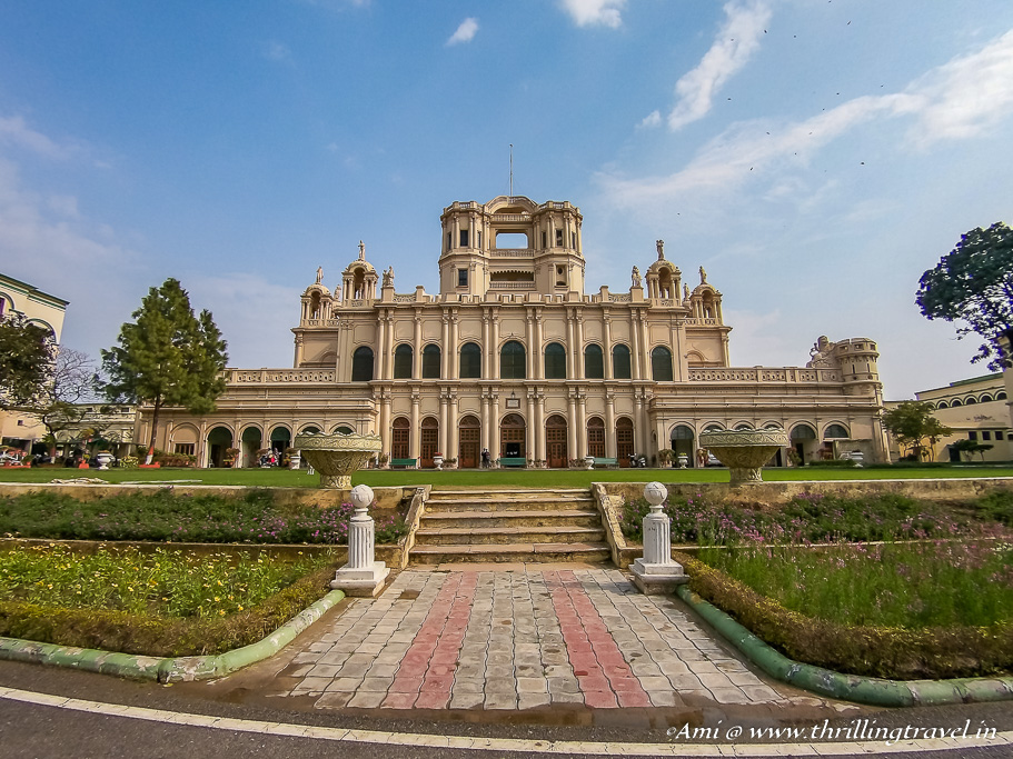
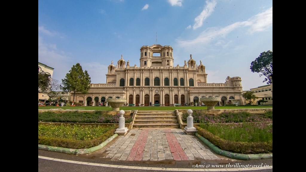
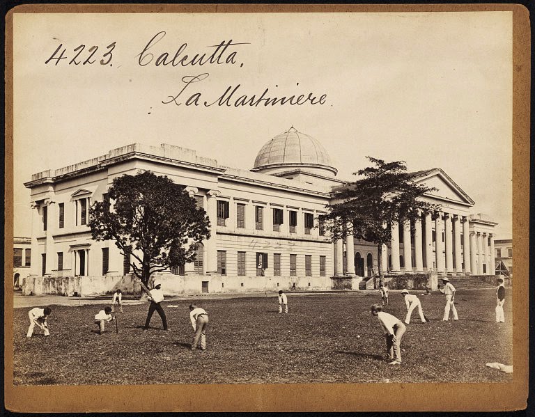
La Martiniere College in Lucknow has a college for boys that was founded in 1845, and a college for girls in 1869.
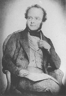
We are told Major-General Claude Martin, the wealthiest Frenchman in 18th-century India…
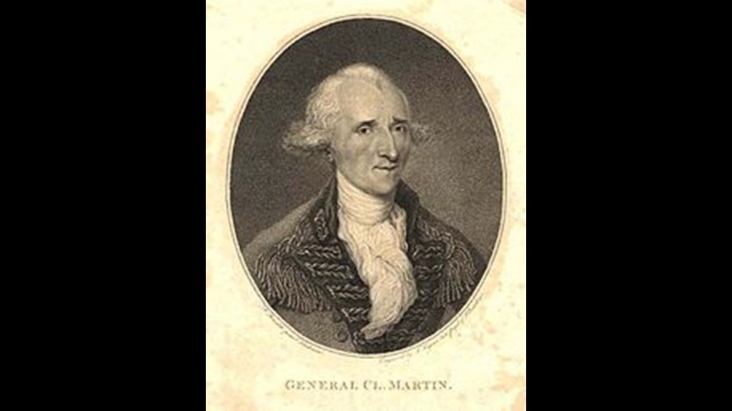
…endowed the founding of the La Martiniere Boys College, and that the building which houses it today was originally built for him as his country residence starting in 1785 and completed in 1802.
Martin was an officer in the French East India Company…

…and later in the British East India Company…

… where he rose to the position of Major-General in the Bengal Army, the army of the Bengal Presidency, one of three presidencies of British India within the British Empire, and the Bengal Presidency was formed following the dissolution of Mughal Bengal in 1757.
Inserting an interesting, historical side-note here.
The Bengal Presidency was the economic, cultural, and educational hub of the British Raj, and its governor was concurrently the Viceroy of India for many years.

In 1905, Bengal Proper was partitioned, separating largely Muslim areas eastern areas from largely western Hindu areas.
In 1912, British India was reorganized and the Bengal Presidency was reunited with a single Bengali-speaking province.
Could this first partitioning of Bengal have been a human- and social-engineering project, and a practice run for the 1947 Boundary partition of India, where Bengal – primarily in the form of Bangladesh – and India, into West Pakistan and East Pakistan?
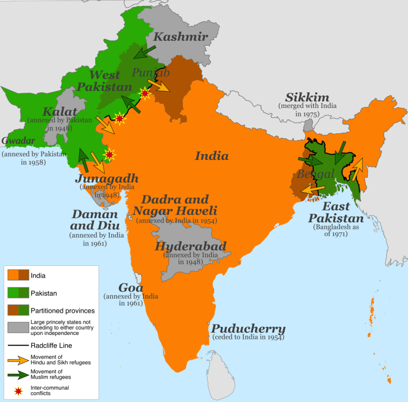
The Partition of India in 1947 divided British India into the Union of India and the Dominion of Pakistan along religious lines, displacing 10 – 12 million people and creating overwhelming refugee crises in the newly constituted dominions, as well as large-scale violence. This created the conditions for suspicion and hostility between these two countries into the present-day.
A couple of more things about Major-General Claude Martin before moving on.
First are the facial similarities between Claude Martin on the left; in the middle, Thomas Gilbert, captain of the British East India Company’s East Indiaman vessel Charlotte, and for whom the Gilbert Islands were named; and on the right John Molson, Canadian brewer and entrepreneur, who looks like an older version of the other two men.
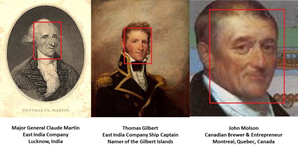
There are only two possibilities I can reasonably come up with to explain the similarity of their eyes, noses, and chins.
One possibility is that they were very closely related.
The other is that the artists that were providing the faces in these portraits for the new faked history were using some kind of universal template as a model face.
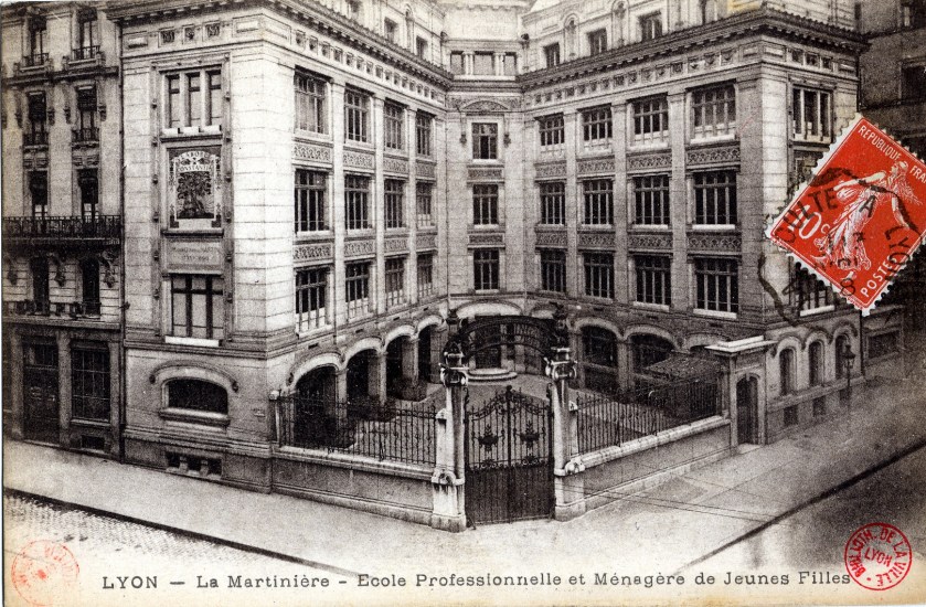
Second, Claude Martin was said to have acquired his fortune in the service of the Narab of Awadh, Asaf-ud-Daula, and that he arrived in India as a common soldier. Having never married, he willed his estate to the establishment of three La Martiniere schools in his memory. Besides Lucknow, there is one in Lyon, France, his birthplace…
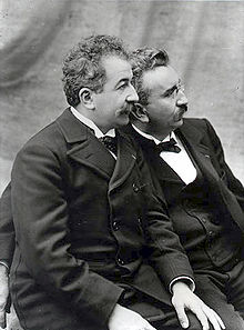
…where the Lumiere Brothers, two of the first film-makers in history, were said to have attended (see my post “Following the Money & Influence – Part 2 The Ways We Were Kept Asleep ~ Distractions”)…

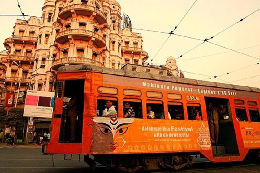
…as well as a third La Martiniere School in Kolkata (previously Calcutta), the capital of the Indian State of West Bengal.
By the way, Kolkata is the only city in India with a public tram service that is still in operation.
We are told that Tram Transport in India was established in the late 19th-century by the British…
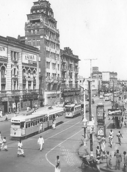
…and that between the 1930s and 1960s, the other acknowledged electric tram services in Madras, Cawnpore, Delhi, and Bombay were discontinued.
Since Bombay, which is now called Mumbai, came up, I would like to bring up places there that were recommended for me to look into by someone in a comment. Mumbai is not on this particular alignment. Sometime in the future, I will have to do a post dedicated to India by itself as there is a treasure trove to see and find out here about the ancient advanced civilization.
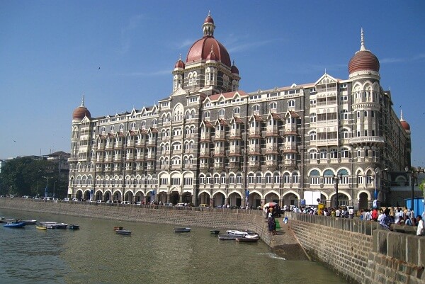
The first was the Hotel Taj Palace in Mumbai, which is shown here located next to a massive stone archway called the “Gateway of India.”
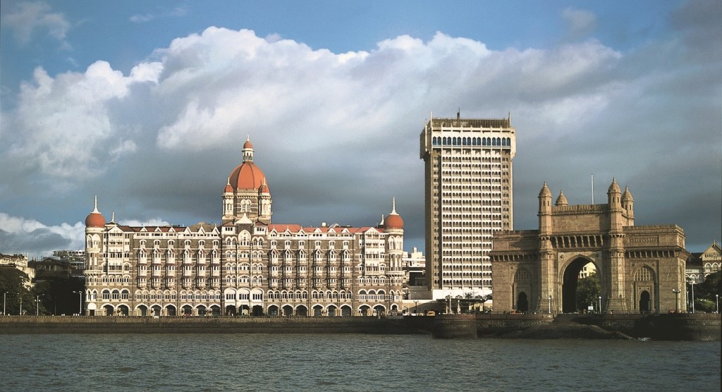
The Hotel Taj Palace in Mumbai was said to have opened in 1903, as India’s first luxury hotel, and the first hotel to have electricity, American fans, German elevators, Turkish baths, and English butlers.
The Gateway of India next to it was said to have been erected starting in 1913 to commemorate the landing in December 2011 of King-Emperor George V and Queen-Empress Mary at the Apollo Bunder pier in then Bombay.
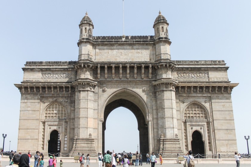
King-Emperor and Queen-Empress were the titles used by the British monarchs in India between 1876 and 1948
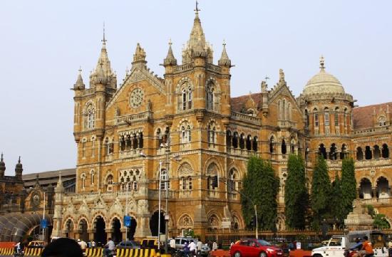
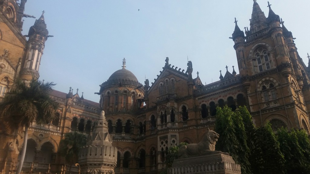
The other place I would like to bring up in Mumbai per recommendation is the Victoria Terminus Railway station, officially now called the Chhatrapati Shivaji Terminus. It is a UNESCO World Heritage Site.
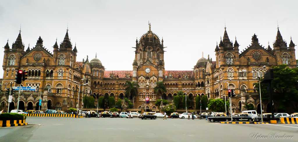
The terminus was said to have been designed by British architectural engineer Frederick William Stevens in the style of Victorian Italianate Gothic Revival architecture, with construction starting in 1878 and completed in 1887, marking the fifty-year anniversary of Queen Victoria’s rule.
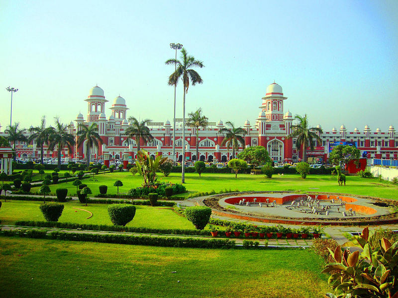
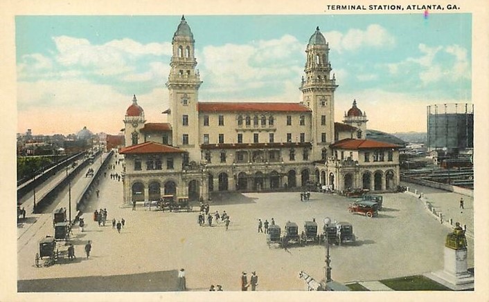
Back in Lucknow, this is the Charbaugh Railway Station, one of the two main railway stations in Lucknow, on the left, said to have been designed by J. H. Hornimen (for whom I can find no biographical information) and built between 1914 and 1923.
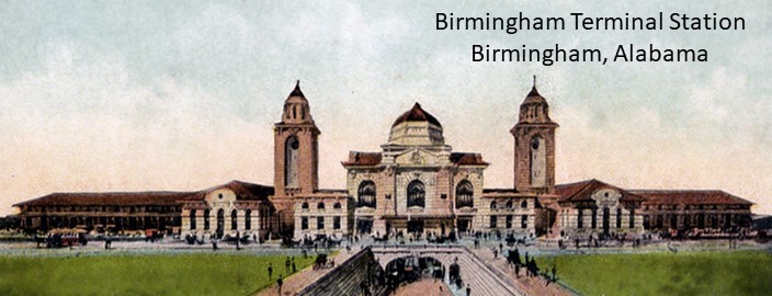
For comparison of similaries in architectural style is firstly the historic Birmingham Terminal Station in Alabama, said to have been designed by Georgia-based architect P. Thornton Marye, who does have biographical information available, and completed in 1909, only to be demolished in 1969…
…and secondly the Atlanta Terminal Station, also said to have been designed by P. Thornton Marye, with a 1905 opening-year, and a 1972 demolition-year.
Next on the alignment is the city of Bareilly, also in the Indian State of Uttar Pradesh, and 157-miles, or 252-kilometers, northwest of Lucknow.
It is called the main gate of the Himalayas.
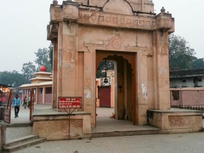
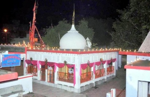
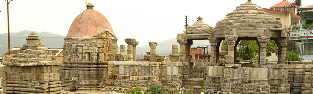
Bareilly is also known as Nath Nagri, or the city of temples, due to the location of seven ancient Shiva temples here. Some of the temples include the Dhopeshwar Nath, of which this is the gate…
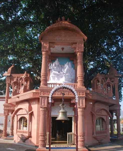
…the Trivati Nath Temple…
…and Tapeshwar Nath Temple, said to be the oldest temple in Bareilly.
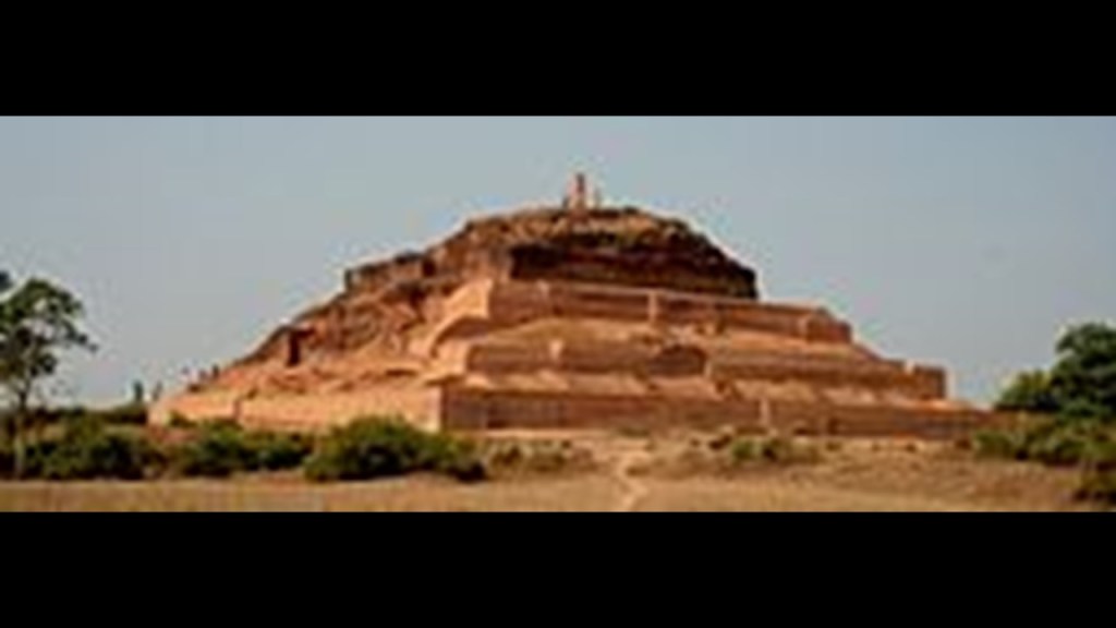
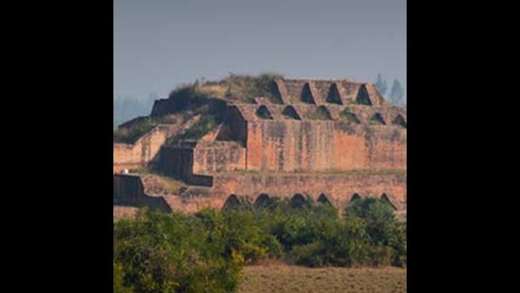
The folklore says that Gautama Buddha had once visited the ancient fortress city of Ahichchhatra, the ancient capital of Northern Panchala in the Bareilly region, where what is popularly called the fort there looks like a step-pyramid to me.
The Tulsi Math temple in Bareilly is dedicated to Tulsidas, a Hindu spiritual author who translated the Ramayan, one of the two major Sanskrit epics of Ancient India along with the Mahabharata, into the language of the masses.
Tulsidas was said to have lived here in the 1600s.
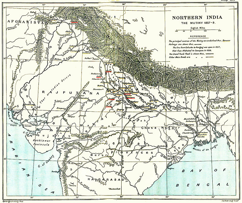
Bareilly was a center of the ultimately unsuccessful Indian Rebellion of 1857.
At this time a major uprising took place in northern India, which lasted between 1857 and 1859 against the rule of the British East India Company, which functioned as a sovereign power on behalf of the British Crown.
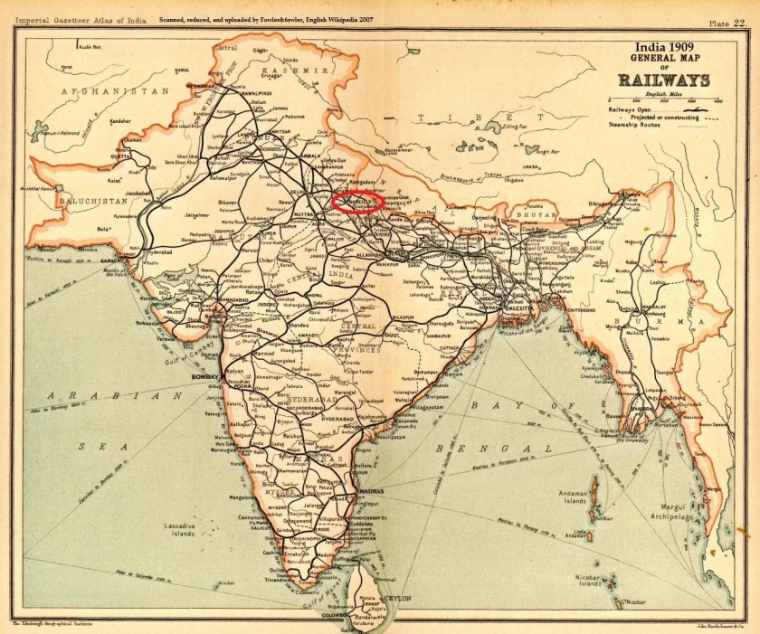
Bareilly is a railway junction, with six rail-lines intersecting the city.
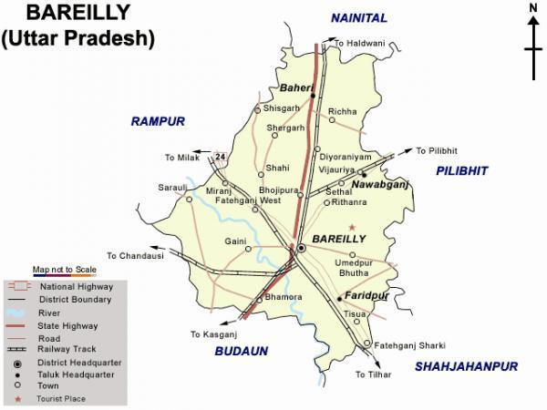
This 1909 map of the railway system in India shows Bareilly as a junction.
One of the earliest railways said to have been constructed in India was the Solani Aqueduct Railway in 1851, which we are told was built for…
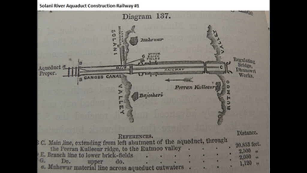
…the purposes of tranporting construction materials for the Solani River Aqueduct.
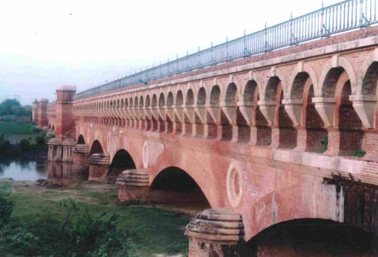
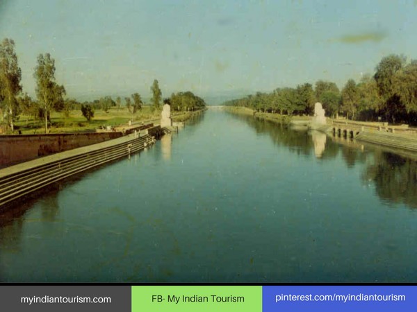
Proby Cautley, an English engineer and paleontologist, and an officer in the British East India Company, was given the historical credit for the building of the Solani Aqueduct…
…as well as the 350-mile, or 563-kilometer Ganges Canal between 1843 and 1854,which the aqueduct crosses, said to have had the greatest discharge of any irrigation canal in the world at the time of its construction, and described as an engineering marvel.
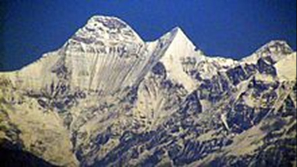
I am going to move along the alignment from Bareilly to Nanda Devi, called the second-highest mountain in India, and the highest that is completely within the country’s boundaries.
This is a view of Nanda Devi from Kausani.
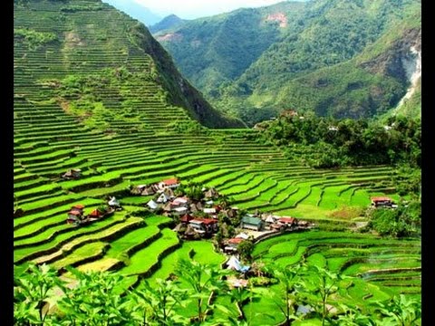
Nearby Kausani is described as a picturesque hill-station in India, and contains wonderful terrace-farming like what is seen around resorts there…

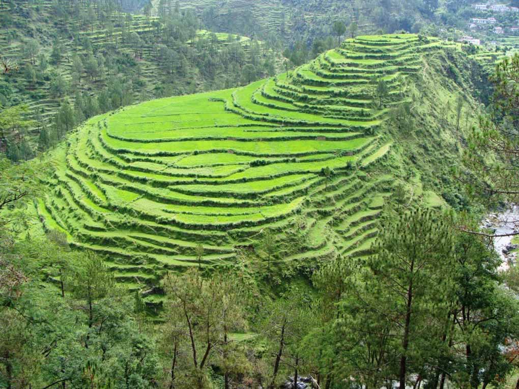
…and which look like the rice terraces in places like the Phillipines, like these at Banaue, for one example of many in diverse places
Baijnath Temple is near Kausani, with one reference saying that it was built thousands of years ago…
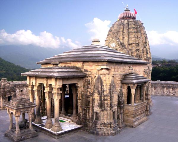
…and another reference saying it was built starting in 1204 AD by two merchants, one named Ahuka, and the other Manyuka, and dedicated to Shiva as Vaidyanath, “Lord of Physicians.” This particular reference does say there was a previous, older temple to Shiva here.
Someshwar Temple, also dedicated to Shiva, is also near Kausani, said to have been built by Raja Som Chand, founder of the Chand Dynasty in the 10th-century AD in the…
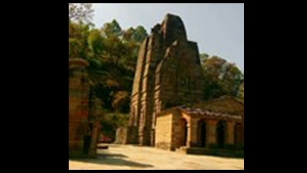
…Kumaon Region of Uttarakhand.
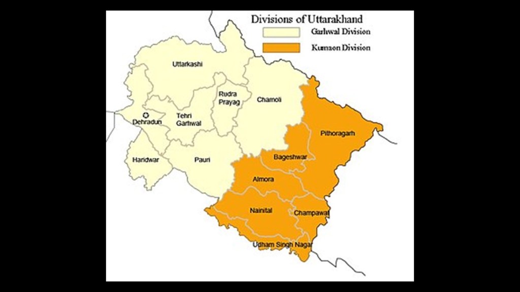
Chand and Kumaon sound close to Cham and Khem, as well as places on this map with actual Cham-prefixes, like Chamoli and Champawat, which was the capital of the Chand Dynasty rulers of Kumaon, and Champawat is where the Baleshwar Temple is located, also either said to be ancient, or built during the Chand Dynasty in the 10th- to 12th-centuries.
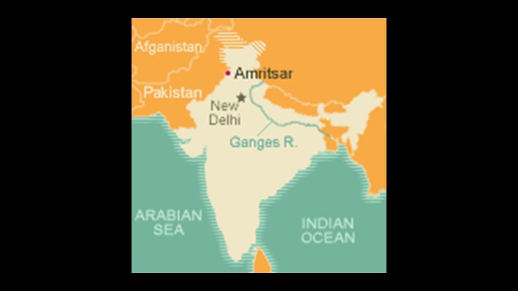
The last place I am going to look at on this alignment in this post is Amritsar, in northwestern India in the State of Punjab, close to the country’s border with Pakistan.
Amritsar is home to the Harmandir Sahib, or the “Abode of God,” otherwise known as the Golden Temple…
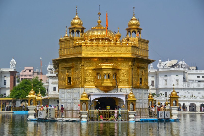
…where it sits on an artificial island in the middle of a perfectly square, definitely manmade-looking, water configuration.
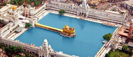
For Sikhs, it is the holiest Gurdwara, a place of assembly and worship, and most important pilgrimage site, with construction initiated in 1581 by Guru Ram Das, the fourth of the ten gurus of Sikhism, and founder of the Holy City of Amritsar in Sikh tradition.
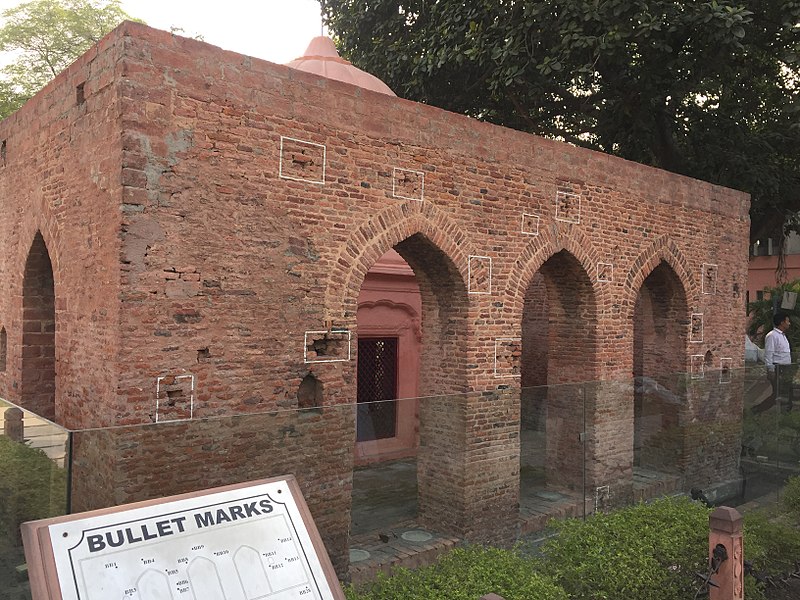
The Jallianwala Bagh in Amritsar, an historic garden and memorial of national importance located in the vicinity of the Golden Temple complex, was the location of the famous massacre in Amritsar in 1919…
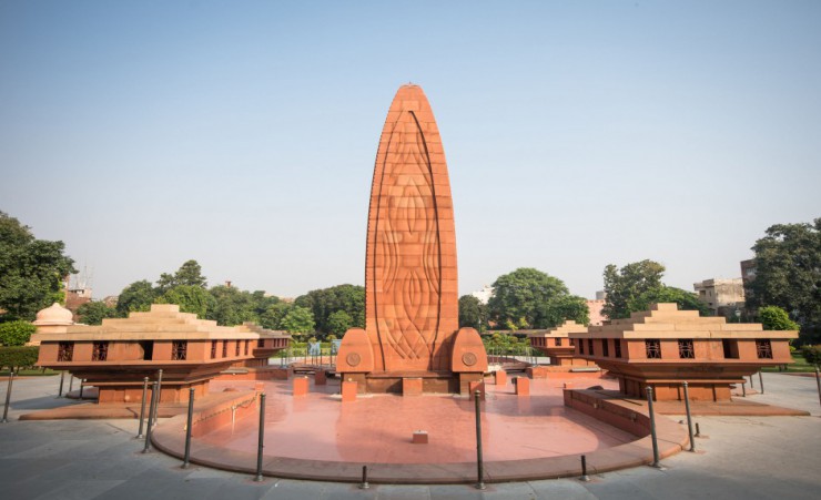
…when a British commander ordered troops of the British Indian Army to fire their rifles into a crowd of unarmed civilians during a festival time, killing at least 400 and injuring over 1,000.

Some historians considered the massacre at Jallianwala Bagh a decisive step towards the end of British rule in India.
Khalsa College was established in Amritsar in 1892 during the British Raj as an educational institution in the State of Punjab for Sikhs and Punjabis.
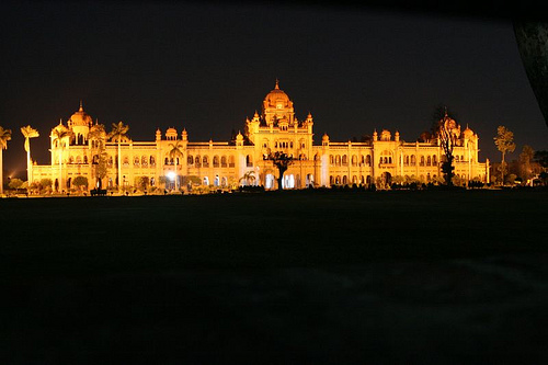
Its architectural design was said to have been created by Ram Singh, a prominent Punjabi architect, and built between 1911 and 1912.
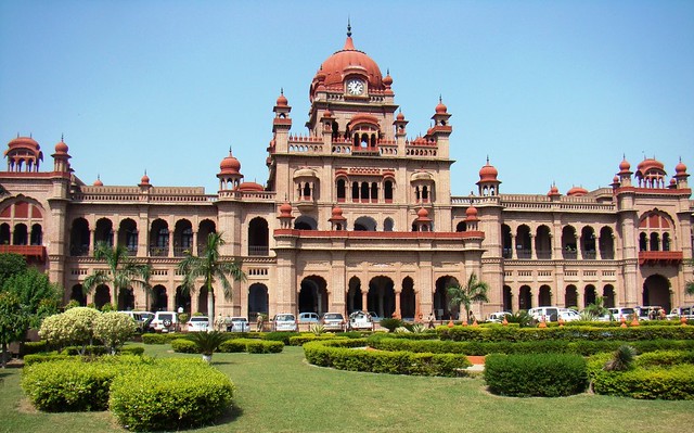
The main building is considered a gem of the Indo-Saracenic style.
I am going to end the alignment portion of this post here.
I would like, however, to further share some thoughts and ideas about different pieces of information I have picked up along the way, and how they might tie into some of the mysteries of our existence on Earth.
I bring these forward for your consideration as points to ponder, and not necessarily as definitive answers. I am not an expert in the following subjects, but I am intuitive, and this information resonates with me. It is out there to look into if you are interested in finding out more for your own research.
First, I came to this level of awareness by following sacred geometrically-based alignments, and I have received a ton of information in return. I already understood there was a missing ancient advanced Moorish civilization from our history books…
…and that something major in a negative way towards Humanity has taken place here. Humanity is far from the positive evolutionary path that it once on.
Several years, before I discovered the key which unlocked the physical lay-out of the planetary grid system and the suppressed ancient global civilization, which was finding a star tetrahedron when I connected major cities of North America I saw lining-up in lines, extending the lines,following up on what I found, and which forms the basis of all of my research…
…I learned about the holographic Universe, primarily from Gregg Braden’s work, but also from Drunvalo Melchizedek’s work, the man who brought sacred geometry back into the collective awareness starting in the late 1970s, as well as Humanity’s direct connection to the Universe and Earth. It was from Drunvalo’s work that I learned about Sacred Geometry in around 2007 – 2008.
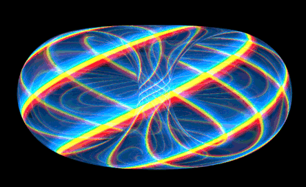
Our energy bodies contain heart- and brain-toroidal fields, of which the heart is by far the stronger of the two, and which are shaped like a torus, like that of the Earth and the Universe.
We are intrinsically connected with all that is in existence. For the purposes of this post, I will leave it at this level, yet the reality of who we really are goes so much deeper than that.
The torus is a core-level sacred geometry form, and a process by which all energy, when correctly aligned is perpetually cycling – up, down, and around – without stopping, between Spirit and Matter.
I came to this level of awareness in the process of discovering how sacred geometry relates to earth’s ley-lines and ancient advanced civilization.
My interest is in bringing back the gridlines and knowledge about the ancient advanced civilization to the collective awareness.
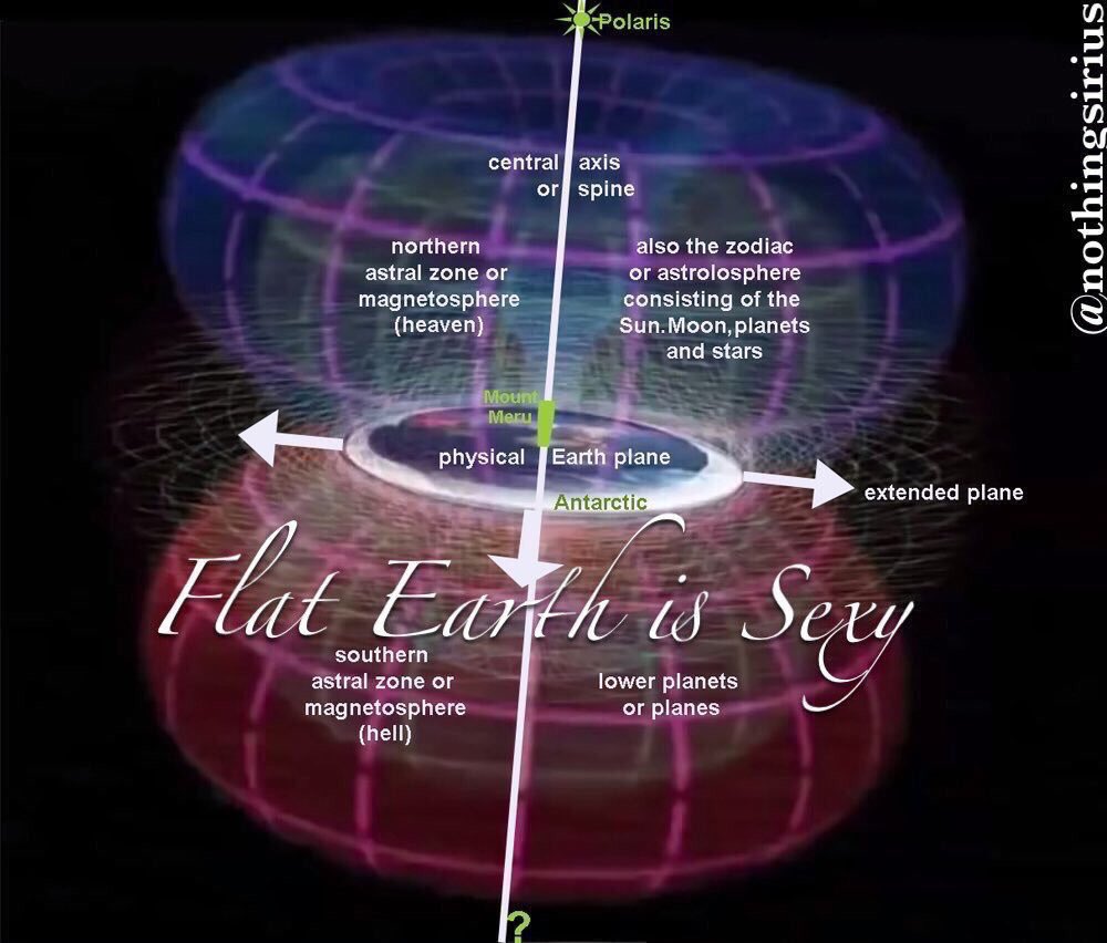
I did not start out from a flat earth perspective. As such, proving or disproving whether the earth is flat is not the focus of my research. However, I have been comfortable with the concept of earth as a torus, which can be pictured as a sphere…
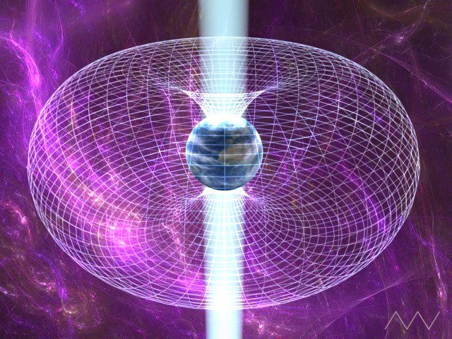
…or as a plane. More on this shortly.

In the research for my last post, I found what I would consider the first hard evidence for me that supports flat earth.
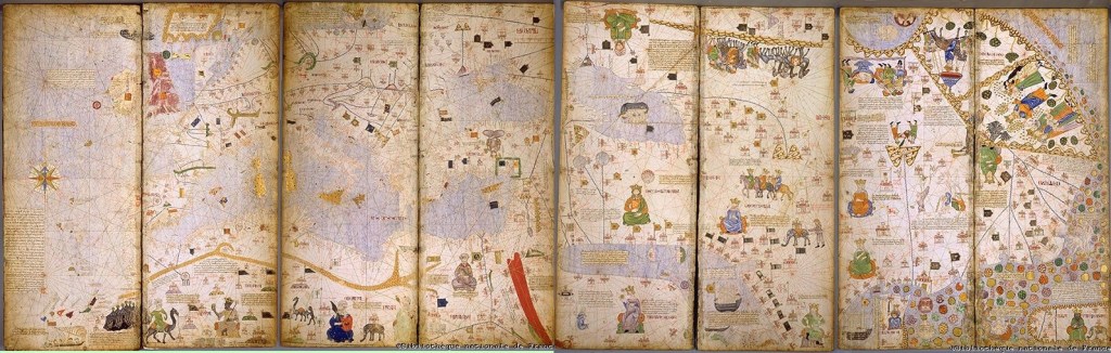
The depiction of ley-lines on land and sea were present on the flat projections of the Catalan Atlas of the Majorcan Cartographic school, said to have been made by a cartographer named Abraham Cresques in 1375.
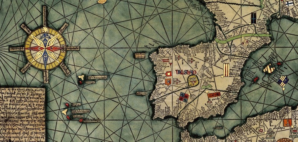
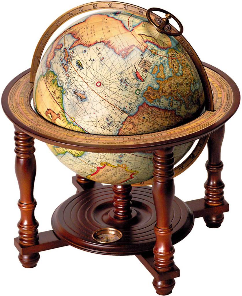
Then in the 1500s, Gerardus Mercator comes along with a world map that is considered to be the first where sailing courses on the sphere were mapped to the plane map, allowing for a “correction of the chart to be more useful for sailors…”
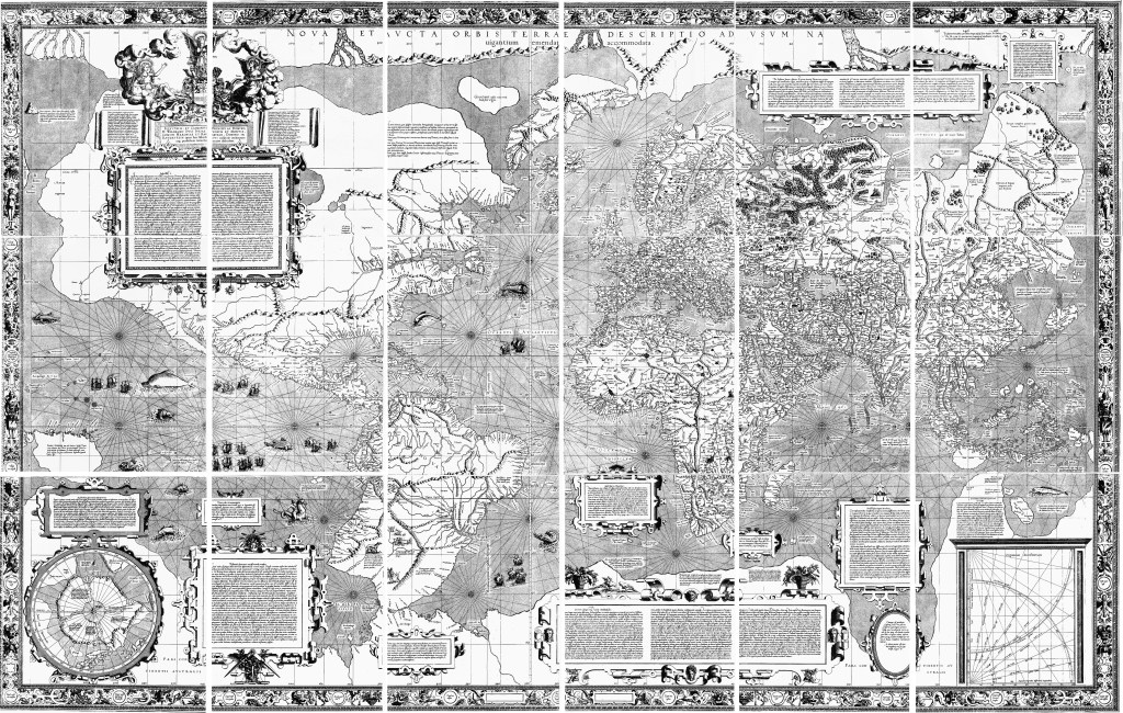
…and that looks a lot like the Catalan Atlas with the exception there are no ley-lines on land, only on water. The ley-lines were starting to disappear from Earth’s maps.
And, oh by the way, Mercator was a globe-maker as well.
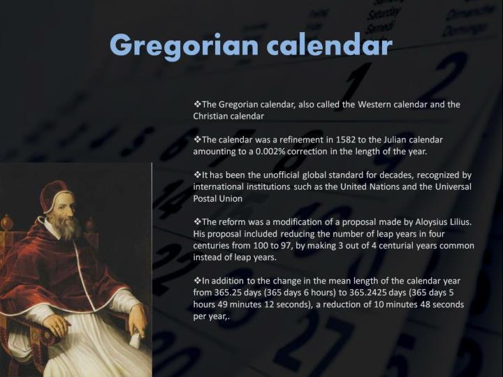
Within the same century, in October of 1582, the Gregorian Calendar was introduced by Pope Gregory XIII for the given reason of correcting the Julian calendar on stopping the drift of the calendar with respect to the equinoxes, and included the addition of leap years. It took 300 years to implement the calendar in the west, and nowadays used in non-western countries for civil purposes.
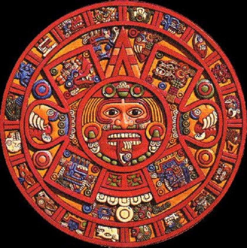
Indigenous calendrical systems like the Mayan calendar were involved with the harmonization and synchronization of human beings with natural cycles of time, and not linear time.
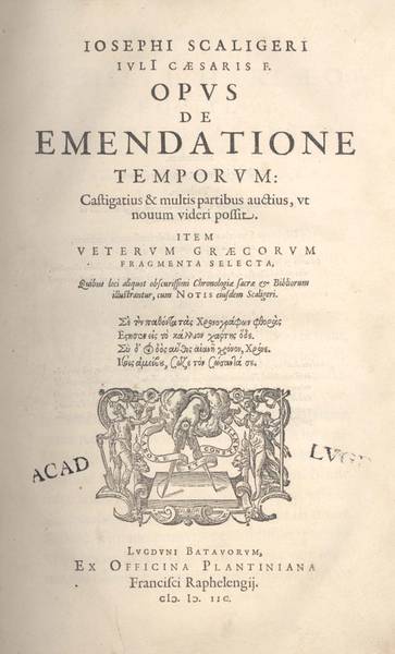
In the year of 1583, only one-year after the introduction of the Gregorian calendrical system, Joseph Justus Scaliger, called the “Father of Modern Chronology…”
…published the “Opus de Emendatione Tempore” or “Study on the Improvement of Time,” a study of previous calendars.
In it, he was said to compare the computations of time made by the various civilizations of antiquity, and in the process of doing so, correcting their errors, and placing chronology for the first time on a solidly scientific basis.
Do all of these things – globe-makers and a new calendrical-system – represent deliberate manipulations for control of our perception of space and time? And does a new chronology exist to provide the rationale for explaining the discrepancies between the systems?
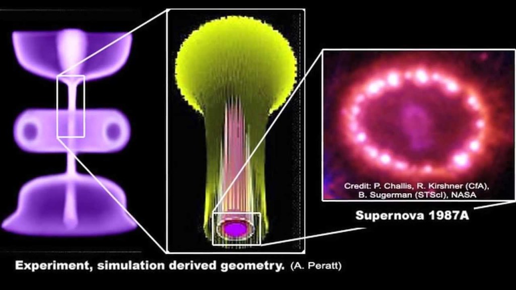
I came across David LaPoint’s work on Primer Fields on Youtube several years ago, and his theory, which has been extensively tested by physicists in laboratory vacuum chambers, is that every component of matter has a double-toroidal-shaped magnetic field that radiates from its core…
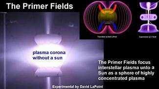
…including the structure of our Universe…
…and the Earth.
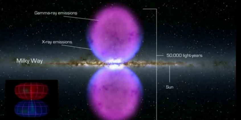
Then there is the Electric Universe Theory, which generally states that electricity is the engine behind a long list of natural and astrophysical spectacles, and supports the idea that electricity powers the sun and the stars…
…and that cosmic occurrences are electrical in nature.
This is a good segue for me into the Dogon, who live in the country of Mali in northern Africa.
The Dogon have a very sophisticated spiritual, astronomical and calendrical system, as well as extensive anatomical and physiological knowledge. They also have a systematic pharmacopeia, which means directions for compound medications.
Perhaps they are best known for the accurate knowledge they possess about the Sirius star system.
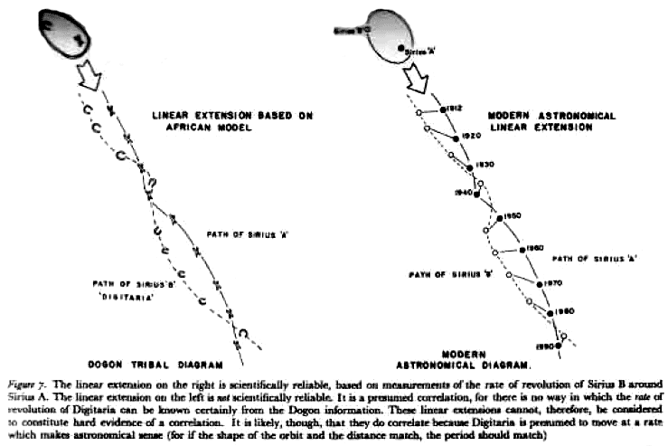
Yet it is mainly an agricultural society.
They say they were visited in the distant past by amphibious beings from Sirius called the Nommo, who were their teachers.

Who is to say they weren’t?
The Dogon have such incredibly advanced and sophisticated knowledge that the only explanation for it is that they are telling the truth!
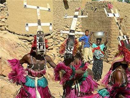
The Dogon perform elaborate ceremonies with masks, headdresses, and dance.
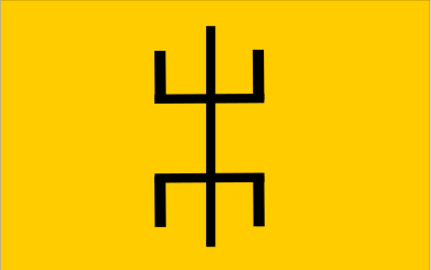
Compare the Dogon headdresses in this ceremony…
…with the flag of the Tuareg people, who also live in this part of West Africa…
…and with this image on the left, the well-documented laboratory electric discharge form of plasma next to a form called the “stickman” that is found in rock art worldwide.
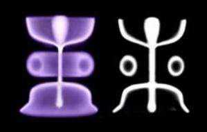
Think the ancient peoples of the earth might know something we don’t?
One more thing before leaving Dogon Country.
I have made the comparison of the similarity between Bandiagara Escarpment and Mesa Verde in Colorado in past posts.
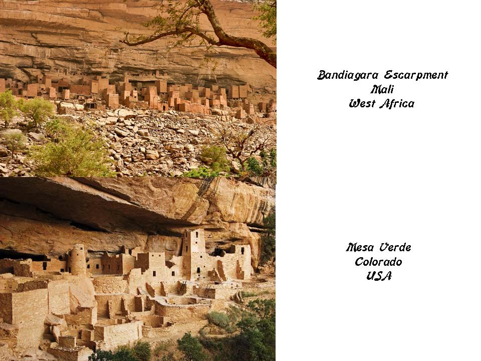
Not only because of this similarity between these two places on different continents, but in the many other places I have encountered as well, I wonder if there were much closer physical connections between continents.
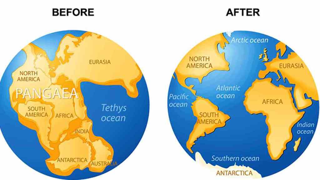
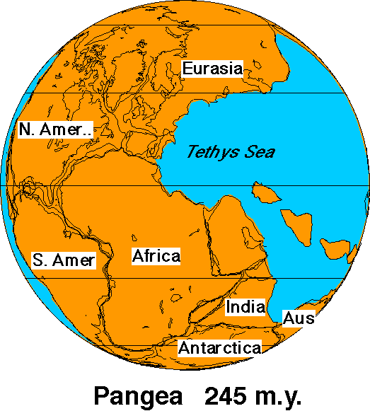
For one thing, this is what the world looked like when it was called Pangea on the let, before whatever caused continental drift, depicted on the right.
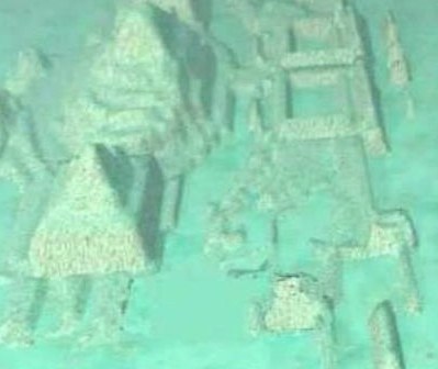
There are certainly submerged ruins found around the world, like Dwarka in the Gulf of Cambay off the West Coast of India, north of present-day Mumbai…
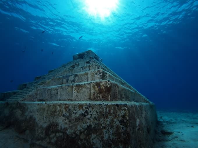
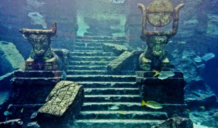
…Yonaguni, off the coast of Okinawa in the western most part of Japan…
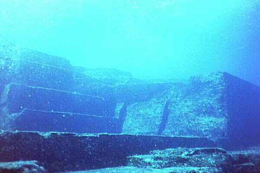
…and underwater ruins off the western coast of Cuba, to name a few.
This next thought is purely speculative on my part.
Could the land-mass known as Pangaea have been intact until much more recently than over 200 million years ago, as an explanation for the occurrence of the same, and interconnected, infrastructure world-wide, from ancient to modern, than what we can imagine now with vast oceans between continents? Just a thought. This I definitely do not know.
Regardless of anything, there are huge chunks of information missing from the historical record that we no longer have access to by conventional means. We just have mind-boggling mysteries that we can’t explain by conventional means.
In the next post, I will be picking up the alignment in Lahore, Pakistan.

I like to see if you may be interested in doing a interview with Mel Fàbregas on Veritas Radio. I’m sure he would love to feature you on his show. Thank you for all your work and for each time that I visit I shall contribute to your donation box.
God bless,
Yolanda Bertaud
LikeLike
Thank you so much, Yolanda ~ I appreciate your support!
I would love to do an interview with Mel Fabregas.
My email address is michelle.gibson565@gmail.com if he would be interested in doing an interview with me.
LikeLike