
So far on the Circle Alignment beginning on Algeria’s Mediterranean Sea coast at its capital of Algiers, this journey has taken us through Algeria; Mali; Guinea; across the Atlantic Ocean at the Equatorial Counter Current to Brazil; Colombia; Panama; Nicaragua; Honduras; Belize; Mexico; across the Gulf of Mexico into Louisiana; Arkansas; Missouri; Iowa; and Wisconsin.
Leaving the Apostle Islands in northern Wisconsin, on the southwest shore of Lake Superior, where the last post ended….
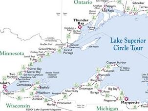
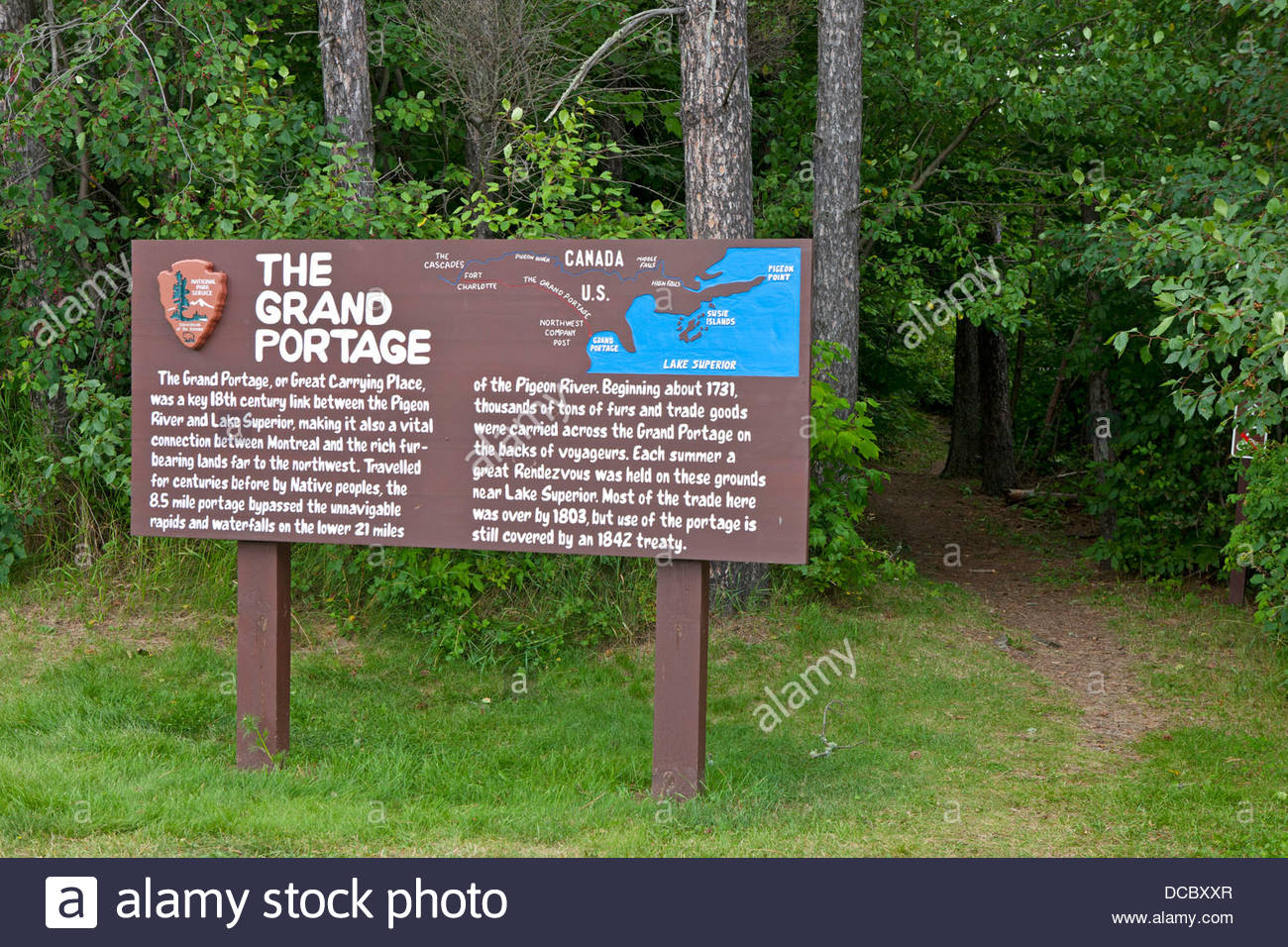
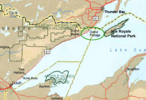
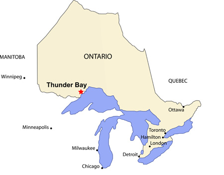
…the next place on the Circle Alignment beginning, and ending, in Algiers is Grand Portage, an unorganized territory Cook County, Minnesota on the northwest shore of Lake Superior.
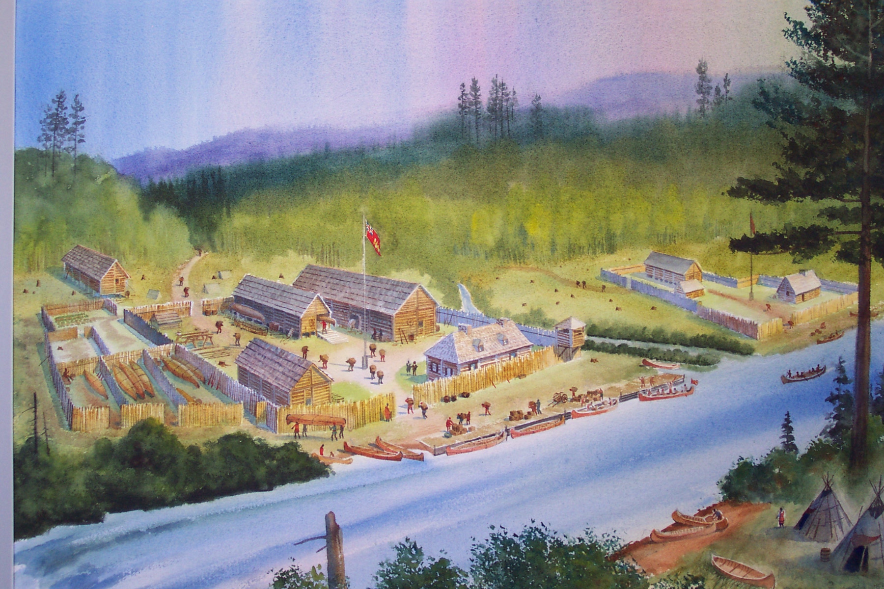
The British Northwest Company, a fur-trading business based out of Montreal in Quebec from 1779 to 1821, was really interested in this location, as they built its inland headquarters at Grand Portage in 1785, and was active there until 1802.
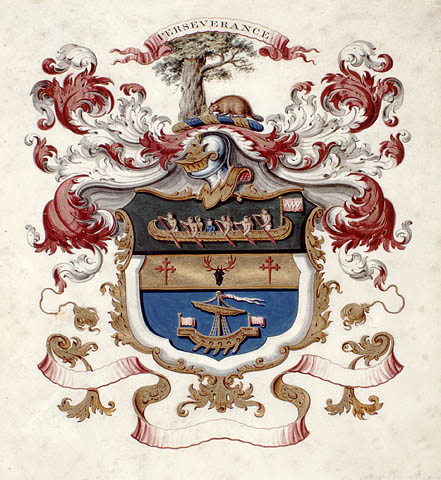
Grand Portage, along with Fort Niagara, Fort Detroit, and Michilimackinac in the Straits of Mackinac in Michigan, were the four main fur-trading centers of the British Empire in North America.
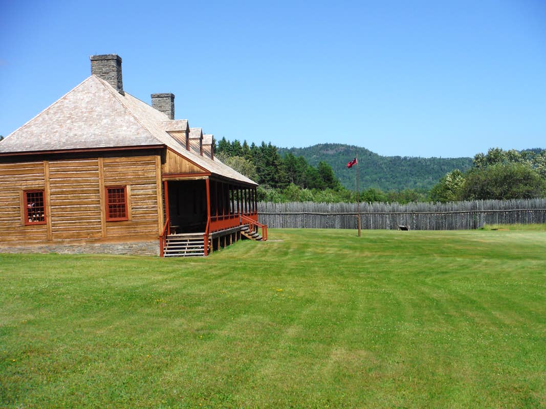
This is the reconstructed Great Hall of the British Northwest Company on the grounds of the Grand Portage National Monument.
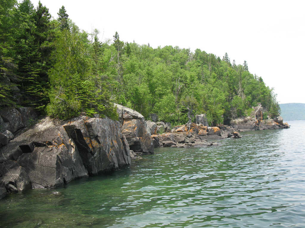
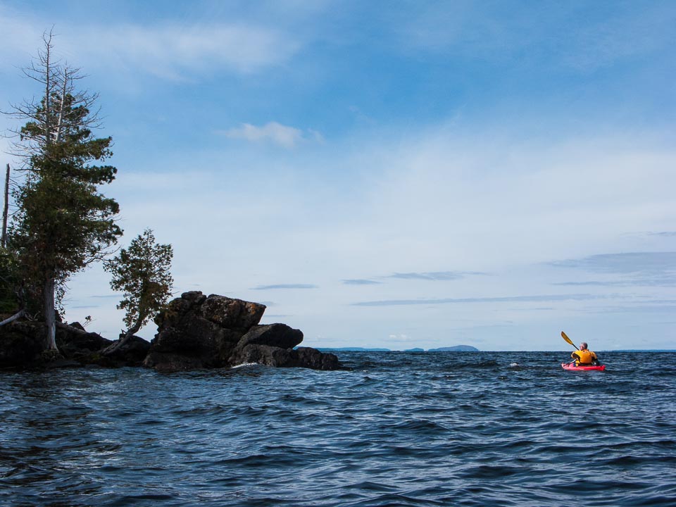
Grand Portage Island is just a short distance off-shore from Grand Portage. This is what its shoreline looks like…
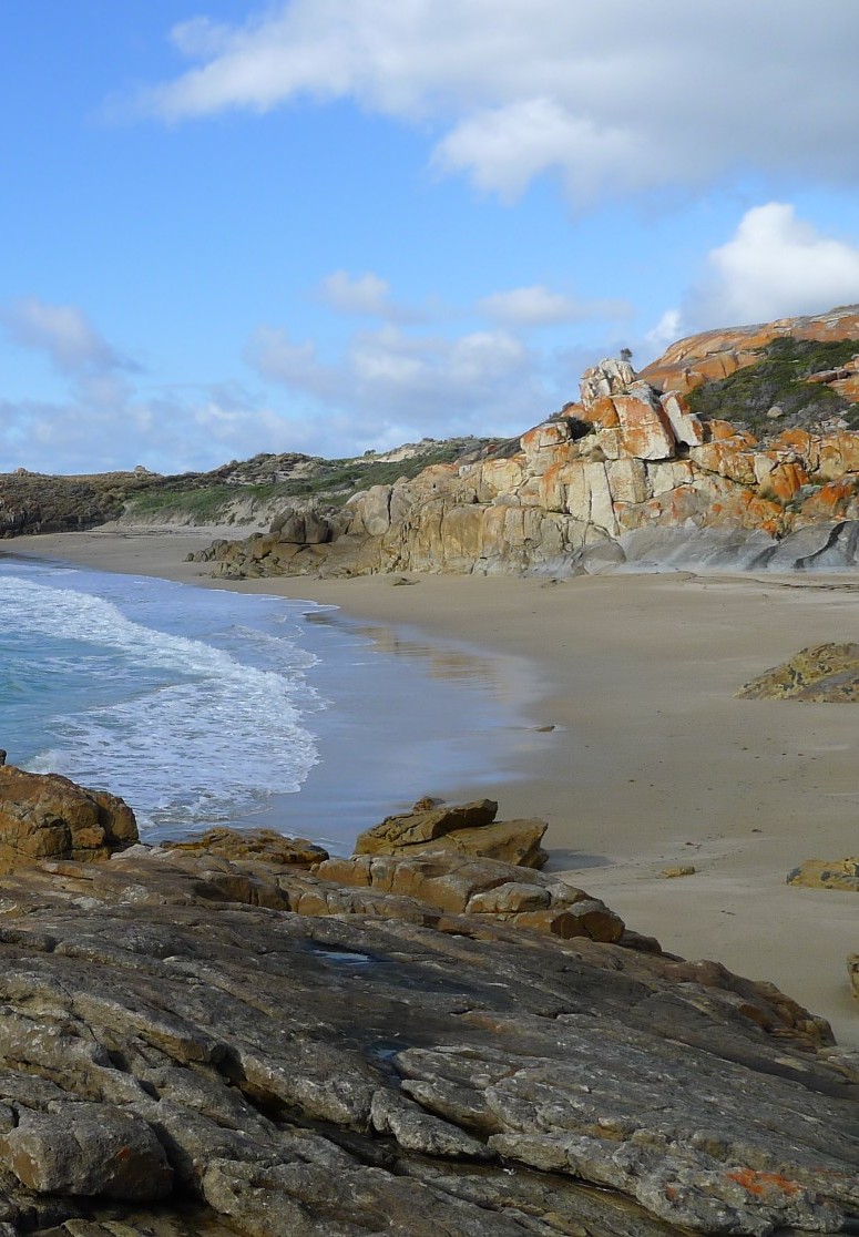
…compared with the shoreline of Flinders Island, the largest island in the Furneaux Group, located in the Bass Strait of the Tasman Sea which separates Tasmania and Australia.
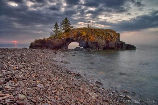
This is a picture of Hollow Rock Beach on Grand Portage Island in Lake Superior…

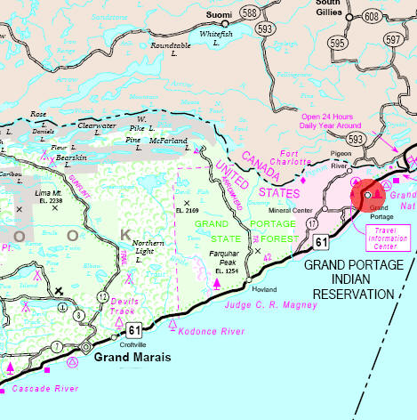
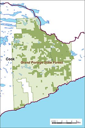
The Grand Portage State Forest is just a short distance southwest of Grand Portage.
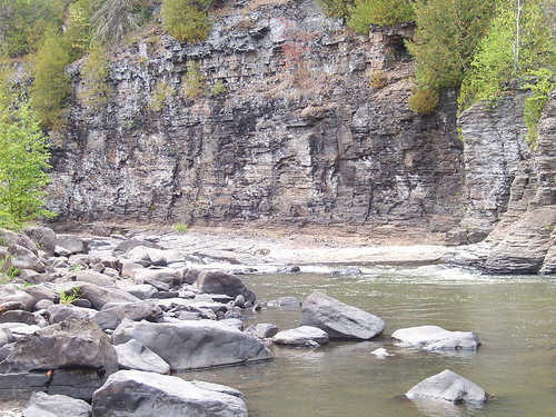
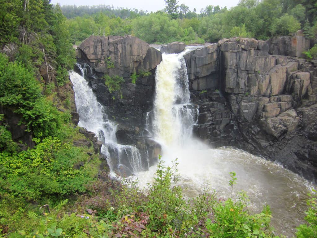
Visitor attractions include the High Falls of the Pigeon River, the highest falls in Minnesota…
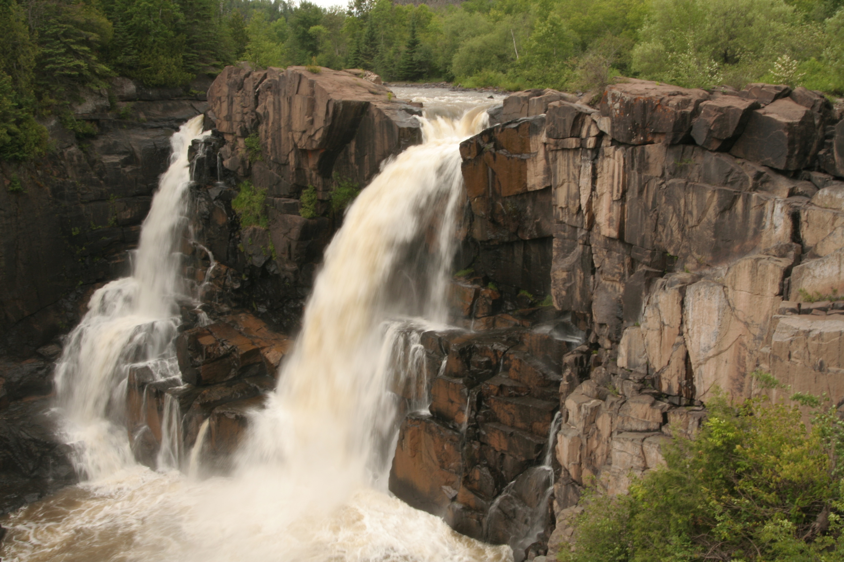
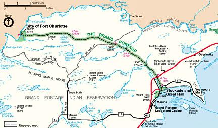
…which are said to be the reason for the Grand Portage, a nine-mile ancient trail to Lake Superior that circumvents this unnavigable stretch of the Pigeon River. i have found the presence of waterfalls all along planetary alignments.
The historical site of Fort Charlotte is on the other end of the Grand Portage, and is also in the Grand Portage State Forest.
It is said to have been established by the British Northwest Company as an outpost of the Grand Portage for the fur trade.
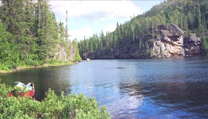
The Pigeon River flows between Minnesota and Ontario.
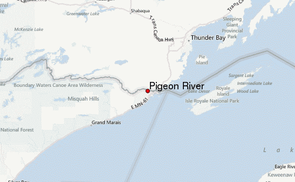
This photo was taken of the Pigeon River in the international border region between the United States and Canada.
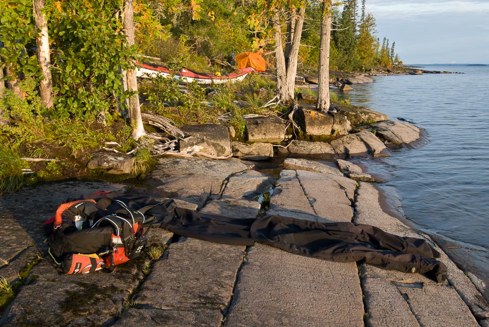
Before moving along the alignment into Ontario, I would be remiss if I did not take you to see Isle Royale.
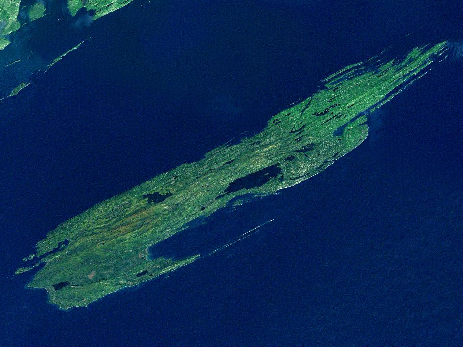
While geographically it is very close to Grand Portage, it is part of the State of Michigan. it is the only national park in Michigan, and the only island national park in the United States.
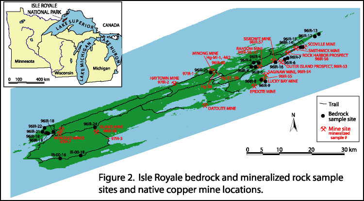
Slide 17: I had read several years ago about the ancient mines found on Isle Royale, and of the high-grade copper that was mined here.
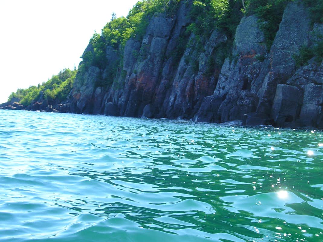
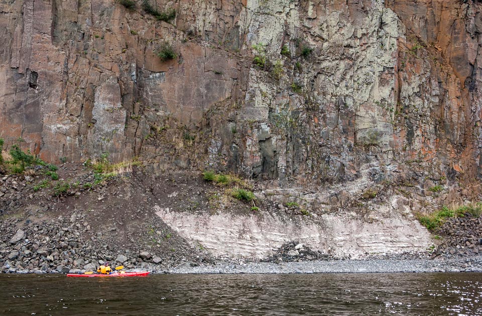
Here is a view along the coast of Isle Royale.
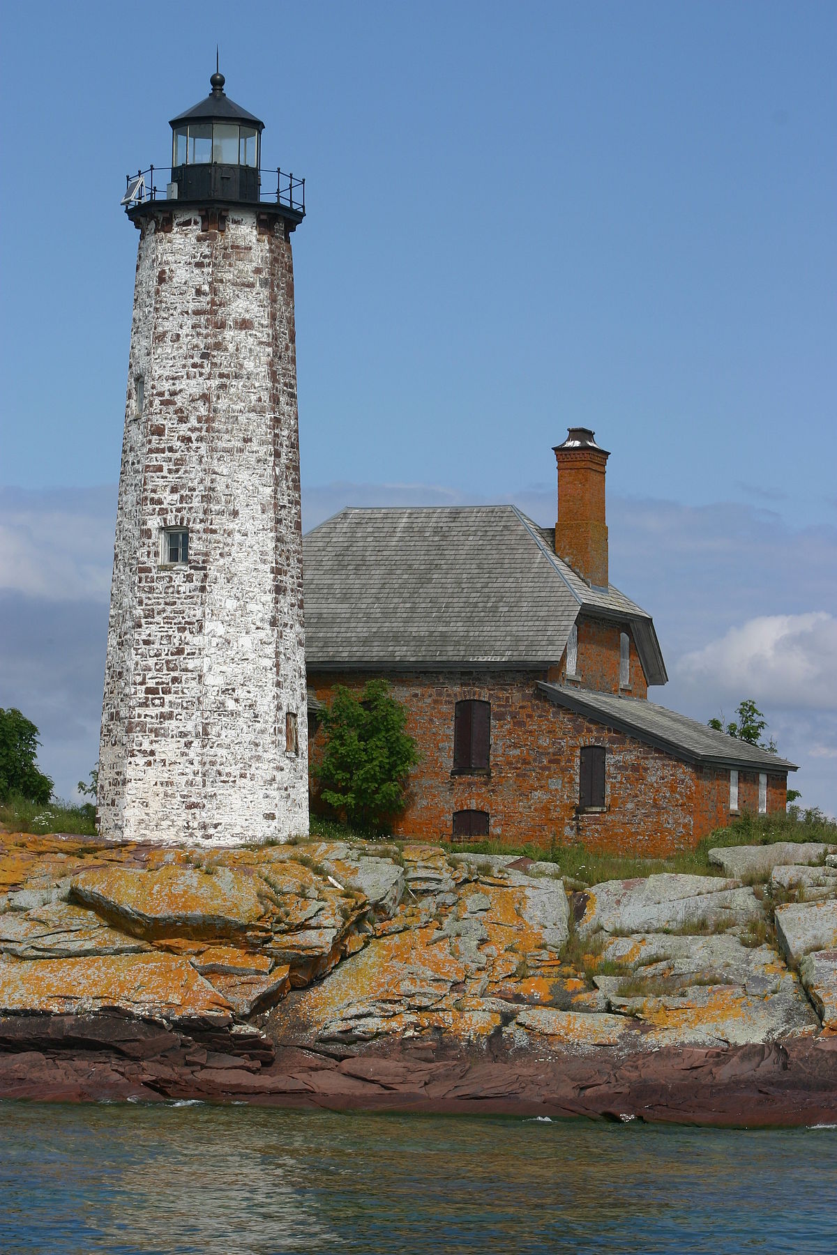
The Isle Royale has a lighthouse on the rocky shore of Menagerie Island, just offshore…
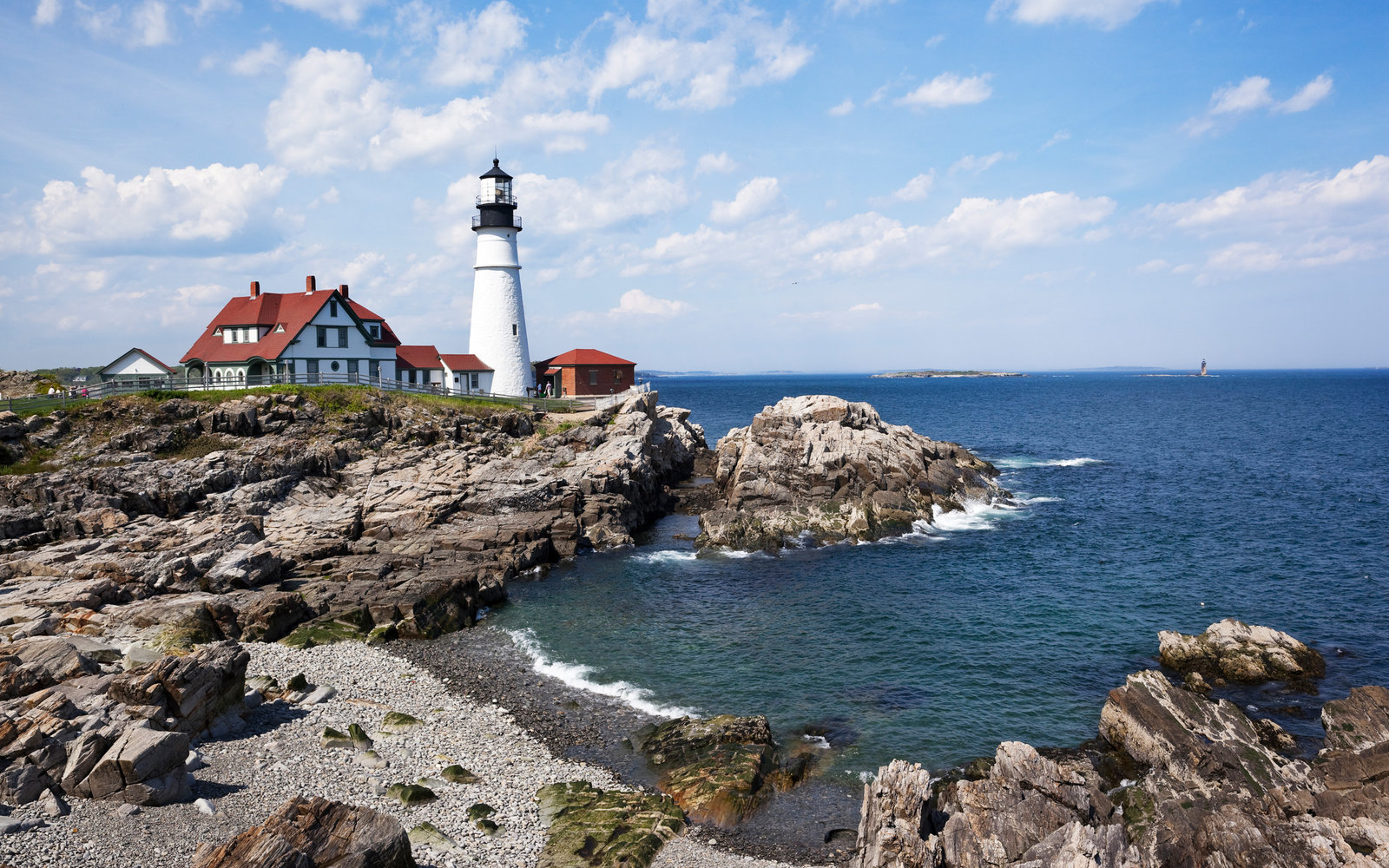
…compared with the lighthouse on the rocky shore of Portland Maine…
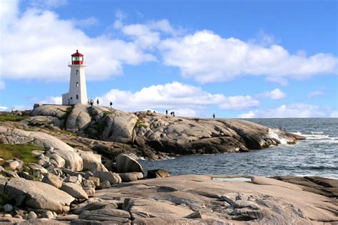
…and the lighthouse on the rocky shore of Peggy’s Cove in Halifax, Nova Scotia.
What I also find of great interest here is that on the North American Star Tetrahedron…
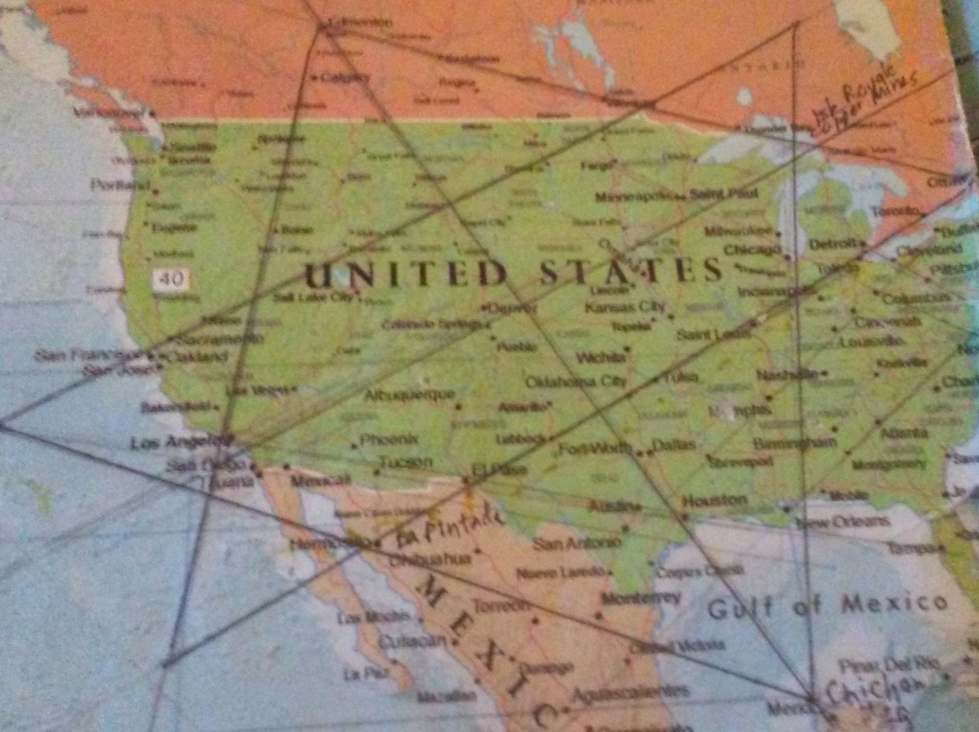
…Isle Royale, and this whole region, features prominently.
The Kakabeka Falls on the Kamanistiquia River, in a Provincial Park located 19 miles west of Thunder Bay, are the second-highest waterfalls in Ontario…
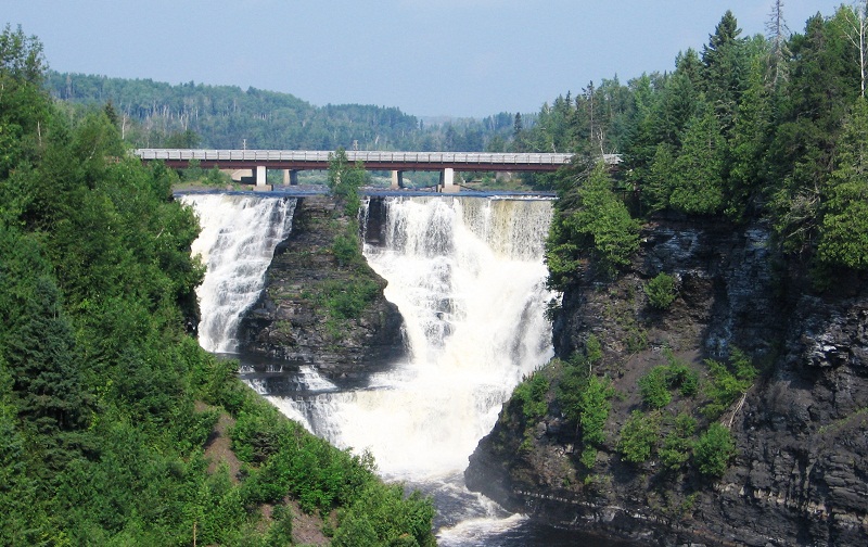
…and look quite similar to the High Falls back on the Pigeon River in the Grand Portage State Forest.
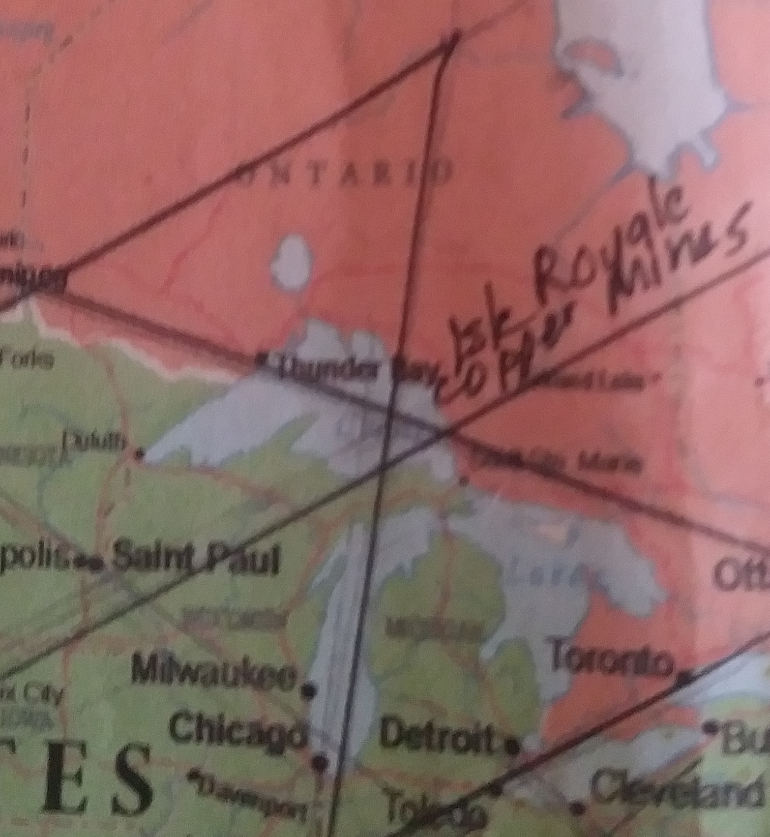
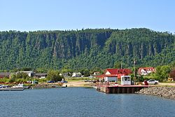
We come now to Thunder Bay, Ontario, on this circle alignment.
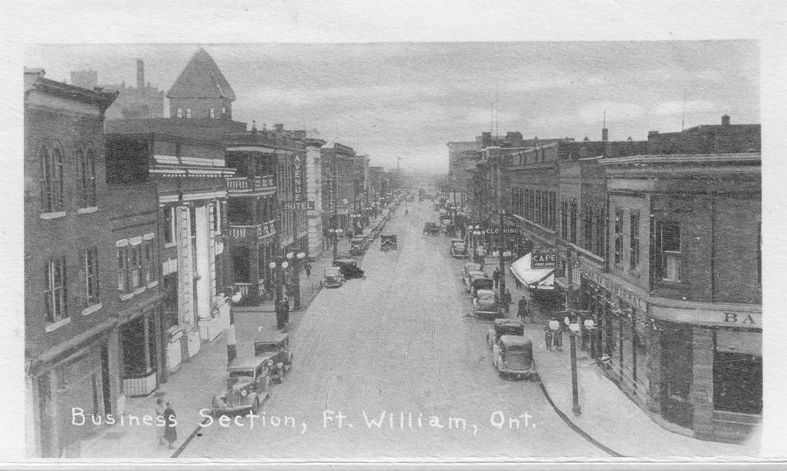
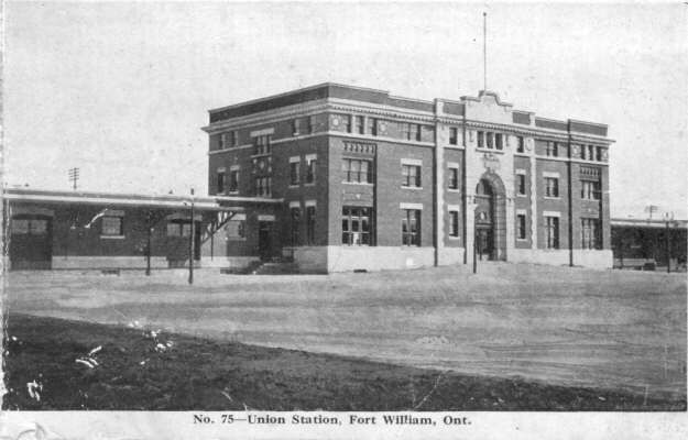
Thunder Bay is the seat of the Thunder Bay District in Ontario and is located at the head of Lake Superior. It was previously known by Fort William and Port Arthur.
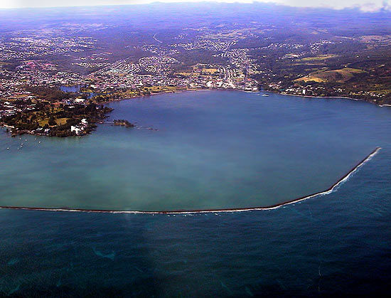
Here is an aerial view of Thunder Bay, with its narrow jetties…
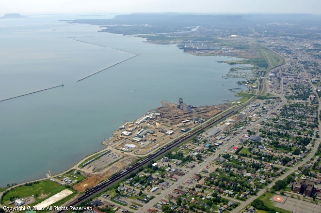
…compared with the long narrow jetties of the harbor of Conakry, Guinea off the West Coast of Africa…
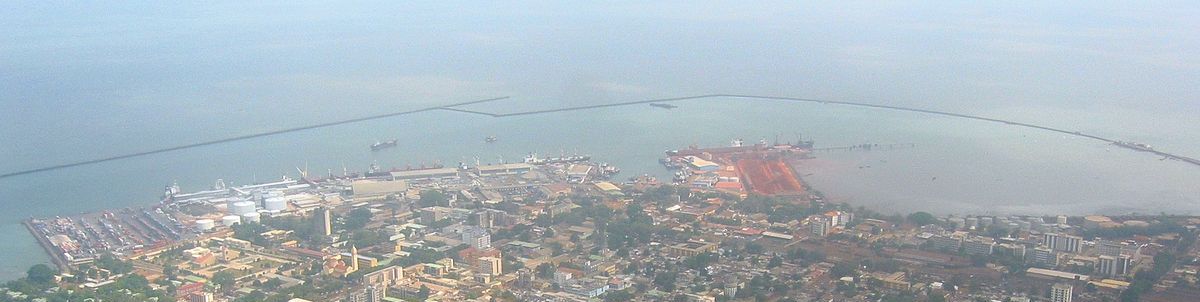
…and the jetty of Hilo Bay on the Big Island of Hawaii.
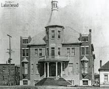
The Hudson Bay Company merged with the original trading post located at Fort William pictured here. So they want us to believe these buildings were the original structures of the area…
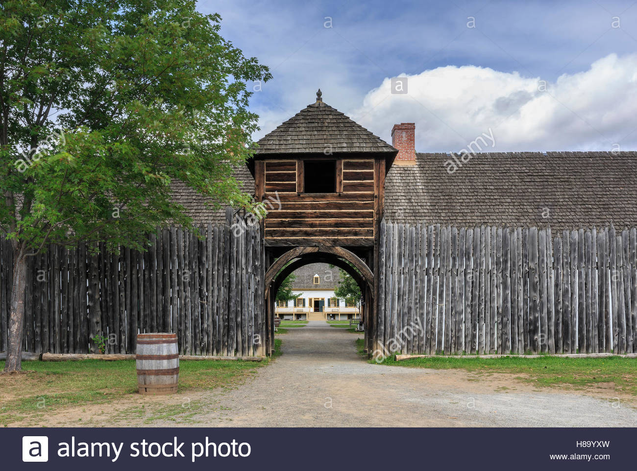
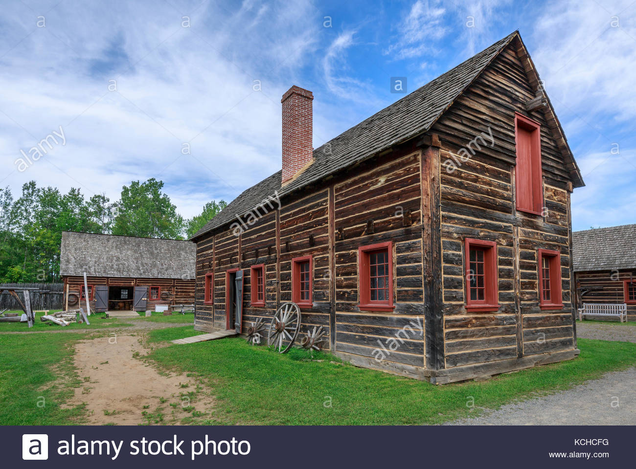
…instead of these buildings.
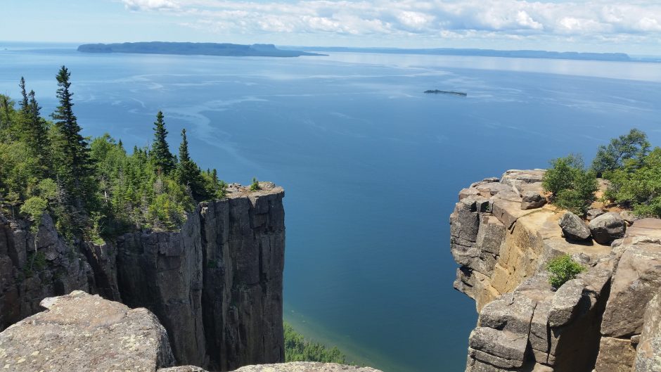
This picture was taken Sleeping Giant Provincial Park near Thunder Bay.
Following the alignment out of the city of Thunder Bay to Lake Nipigon, Ontario, several places of interest in the vicinity of the alignment are on the way.
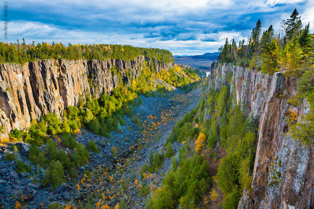
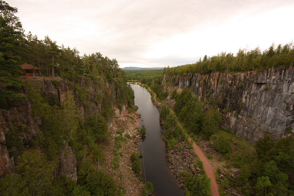
One is Ouimet Canyon is thirty-seven miles, or sixty kilometers, northeast of the city of Thunder Bay.
The other is Red Rock Township…
…located under the cliffs of How Mountain.
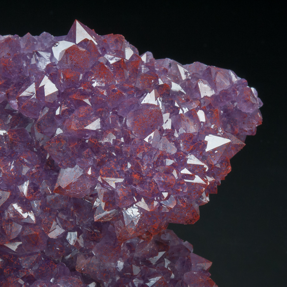
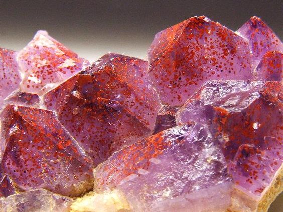
There are also Amethyst Mines close to the alignment as it goes through the Thunder Bay District.
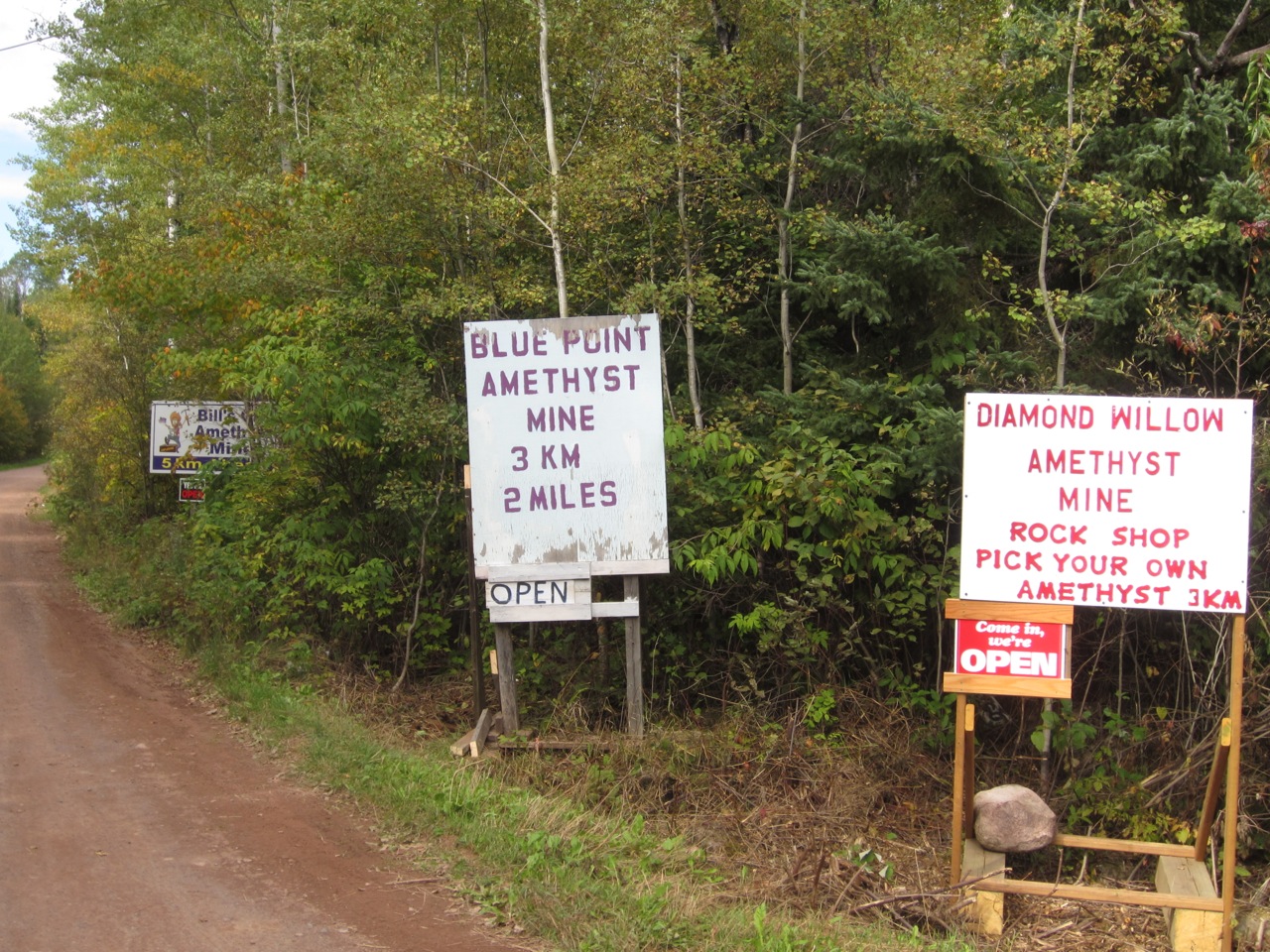
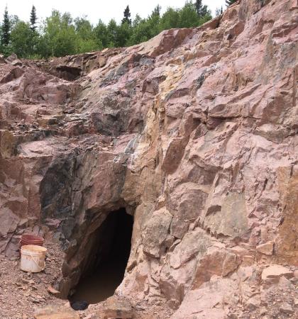
These are Thunder Bay amethysts, with hematite inclusions showing up as the red colorations in the amethyst points.
Next the alignment skirts the western edge of Lake Nipigon, the largest lake inside the Province of Ontario, and part of the drainage basin of the Great Lakes.
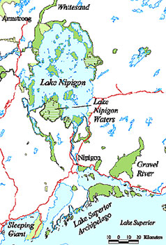
Lake Nipigon has a total area of 1,872 square miles, or 4,848 square kilometers, including numerous islands.
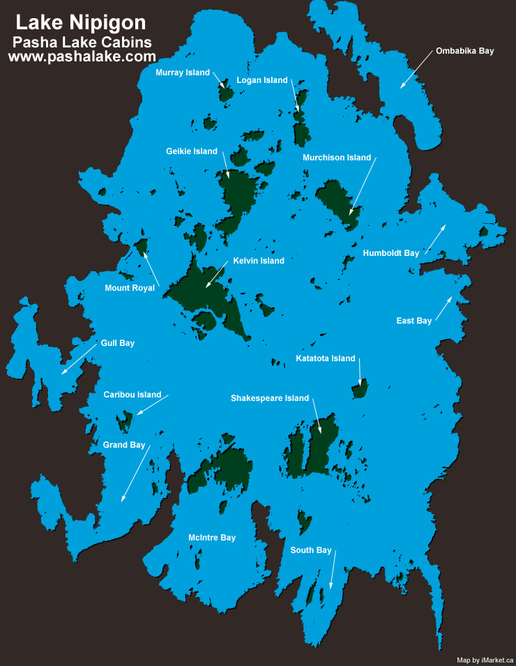
One of the largest islands of Lake Nipigon is called Shakespeare Island, on the left side of this satellite image.

Here are some photos of what Shakespeare Island looks like up close.
Next on the alignment, we come to Fort Hope, on Eabamet Lake, in Northern Ontario.
It is an Ojibway First Nation community, accessible only by airplane, water, or winter ice roads.
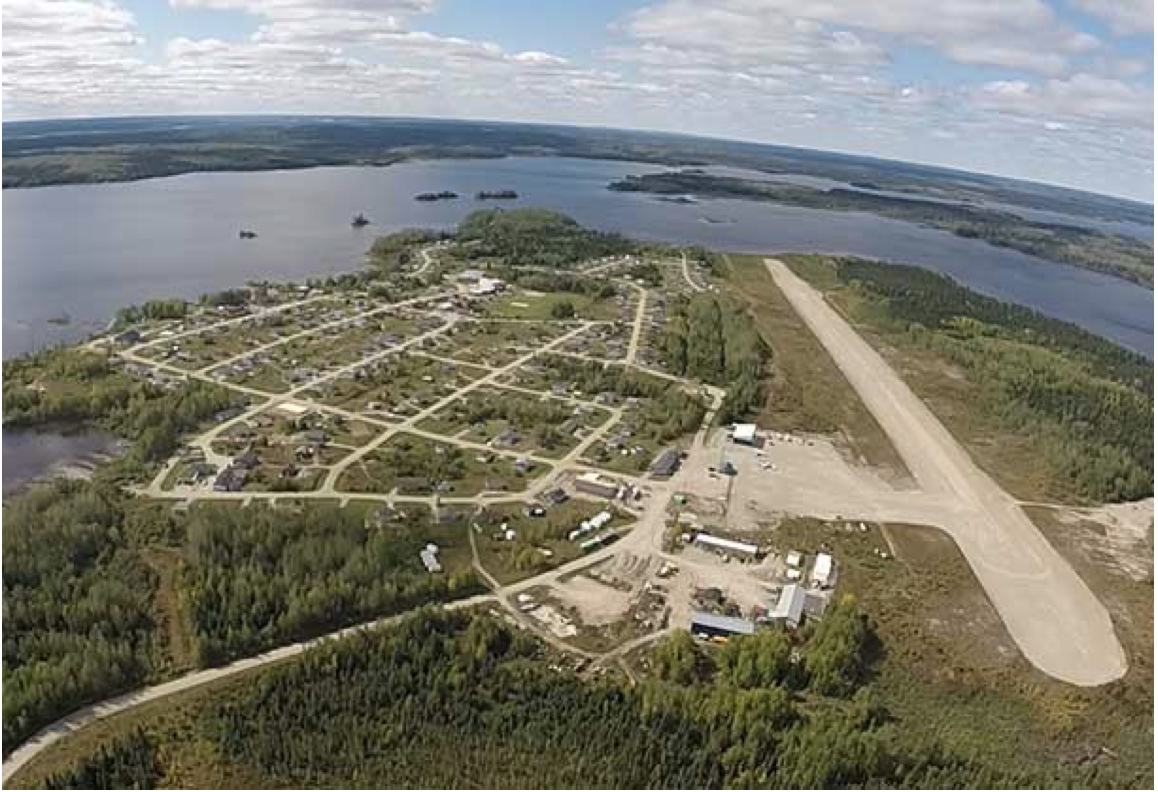
It is the home of the Eabametoong First Nation.

Wabakimi Provincial Park lies perpendicular to Lake Nipigon and Fort Hope in northwestern Ontario.
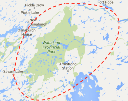
It is in the traditional areas of the Eabametoong, Aroland, and Martens Falls First Nations.
It contains a vast network of interconnected lakes and rivers.
After Fort Hope, Ontario, the alignment crosses into the Hudson Bay, and comes to the Belcher Islands.
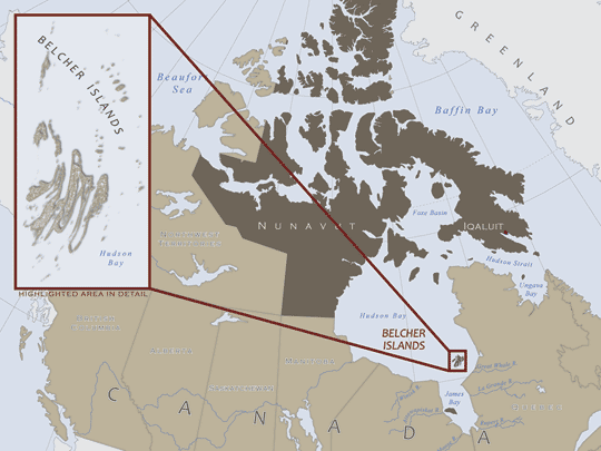
These abstract-art-looking islands, from the air, sit directly on this alignment, as they do on several other alignments…

…including this one, where it appears that the Belcher Islands are in an alignment with other important cities and places on the grid in North America, as it passes very close to Ottawa, Ontario, the Capital of Canada…
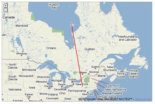
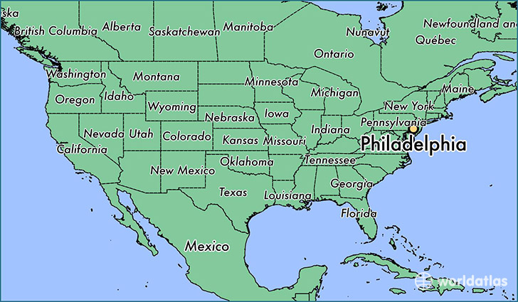
… and, as shown by this map, the Belcher Islands/ Ottawa alignment tracks on through Philadephia, Pennsylvania.
I will end this post here, and pick up the alignment in Inukjuak in Northern Quebec.
