This is the first part of a new on-going series called “All Over the Place Via Your Suggestions” where I will continue to research your suggestions, and follow the many clues you all provide that helps to uncover our hidden history.
In Part 1, I will be focusing on the suggestions of Silvester Gardiner and Gardiner, Maine; photos from the area around Tulsa, Oklahoma; and California’s Channel Islands and Santa Catalina.
I am going to start out by taking a look at MM’s suggestion of Gardiner, Maine, and its namesake Silvester Gardiner, saying that there was something wrong here, as a lot of rich British people come here in the summer to hide at that old mansion on 1,700 acres.
Will get back to the old mansion in a bit.
This suggestion particularly piqued my interest because I mentioned another Gardiner, Lion Gardiner, in my last post about “Recovering Lost HIstory from the Estuaries, Pine Barrens & Elite Enclaves off the Atlantic Northeast Coast of the United States.”
Lion Gardiner was an English engineer and colonist, who in 1639 founded the first English Settlement in New York on Gardiners Island in Gardiners Bay between the North and South Forks of Long Island.
First, a little bit about Silvester Gardiner.
Silvester Gardiner was a wealthy physician, pharmaceutical merchant, and land developer of Maine, who was born in 1708 in South Kingston, in what was known at the time as the “Colony of Rhode Island and Provincetown Plantations.”

In the history of colonialism, plantation was a form of colonization where settlers would establish a permanent or semi-permanent settlement in a new region.
Not only were settlements and settlers being planted in a new region from somewhere else, this plantation system of the colonizers quickly laid the foundation for slavery on large farms owned by “planters” where cash crop goods were produced.
The word plantation first started appearing in the late 1500s to describe the process of colonization, like the Plantations of Ireland in the 16th- and 17th-centuries, during which time we are told the English Crown confiscated land from Irish Catholics and redistributed the land to Protestant settlers from Great Britain.
The British Plantations of Ireland replaced the Irish language, law and customs with those of the British, created sectarian hatred between Protestants and Catholics, and Northern Ireland is still part of Britain to this day.

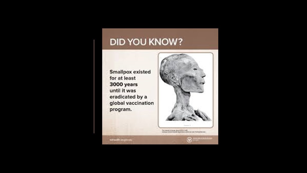
After studying medicine in New York, London, and Paris, Silvester Gardiner opened his medical practice in Boston, where he lectured in anatomy and promoted the inoculation for small pox, for which he proposed and established a hospital in Boston in 1761.

Come to find out, a small pox epidemic had broken out in Boston in the spring of 1721 that lasted until the winter of 1722, in which there were around 6,000 cases of small pox reported in a population of around 11,000, with 850 deaths reported.

The use of inoculation was introduced during the 1721 small pox epidemic, and considered a milestone in the history of vaccination.

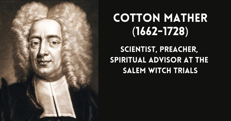
Cotton Mather, the powerful Puritan preacher who was significant in the origin of the Salem Witch Trials of 1692, was credited with introducing inoculation to the colonies, and promoting it as the standard for small pox prevention during the 1721 epidemic.
Inoculation is defined as introducing into the body a dose of biological material, known as inoculum, like an infectious virus in order for the body to generate an immune response to it.

Small pox was a deadly contagious virus transmitted from person-to-person through the respiratory tract, causing flu-like symptoms and disfiguring rashes covering the body.

We are told that the naturally-occurring small pox virus was eradicated by 1980 because of a global vaccination program.
The epidemic of 1721 was the deadliest of a series of small pox epidemics in Boston throughout the 1700s.

The British physician Edward Jenner developed the first vaccine, which was for small pox, given to the first person in May of 1796.
Jenner was a Freemason, becoming a Master Mason in 1802, and the Grand Master of his lodge from 1812 to 1813.

Okay, so there’s the small pox inoculation and apparent freemasonic connection to be found with Silvester Gardiner, as well as his connection to the pharmaceutical business as a merchant.
What else is there to find?
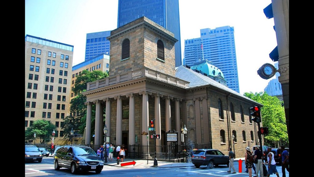
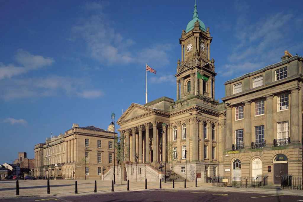
He was said to have been a generous contributer to the construction of King’s Chapel in Boston, said to have been built in 1754, with its uneven, unlevel appearance from front-to-back.
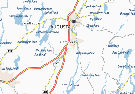
He also purchased over 100,000 acres, or 400-kilometers-squared, on the Kennebec River in Maine for settlement, where he founded the city of Gardiner.
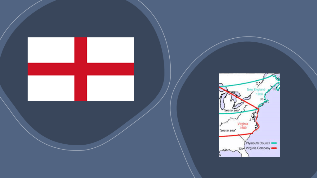
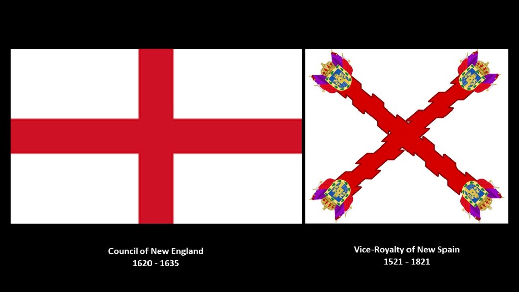
Silvester Gardiner became the principal proprietor of the Kennebec Purchase through the old Plymouth Patent, which had been established by the Council of New England, an English joint-stock company that was granted a Royal Charter to found colonial settlements along the coast of North America that existed between 1620 and 1635.
Largely the creation of Sir Ferdinando Gorges, a military commander and Governor of the Port of Plymouth in England who was called the “Father of English Colonization in North America, it provided for the establishment of the Plymouth Colony, the Province of New Hampshire, the Massachusetts Bay Colony, the New Haven Colony, and the Province of Maine.
The city of Gardiner was founded as the Gardinerstown Plantation in 1754, at the confluence of the Kennebec River and Cobbosseecontee Stream, and the location quickly became utilized for water-powered mills, and Gardinerstown became the regional economic hub.
Gardiner became a city in 1849, and was a major industrial town, complete with industries like shipping, lumber, tanning, and shoe-making.
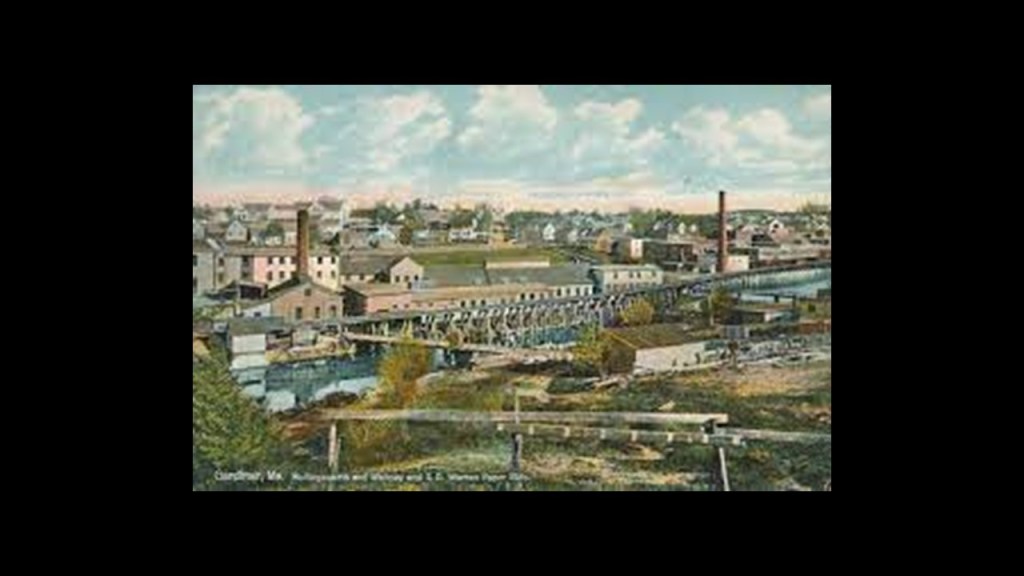
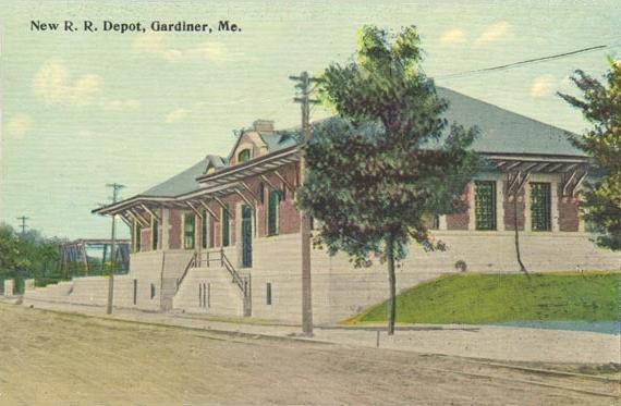
Gardiner was connected by railroad in 1851, and beginning in the 1860s, paper mills flourished, as well as a commercial ice industry between the 1880s and 1920s.
By the 1960s, Gardiner’s economy plummeted with the closure of mills.
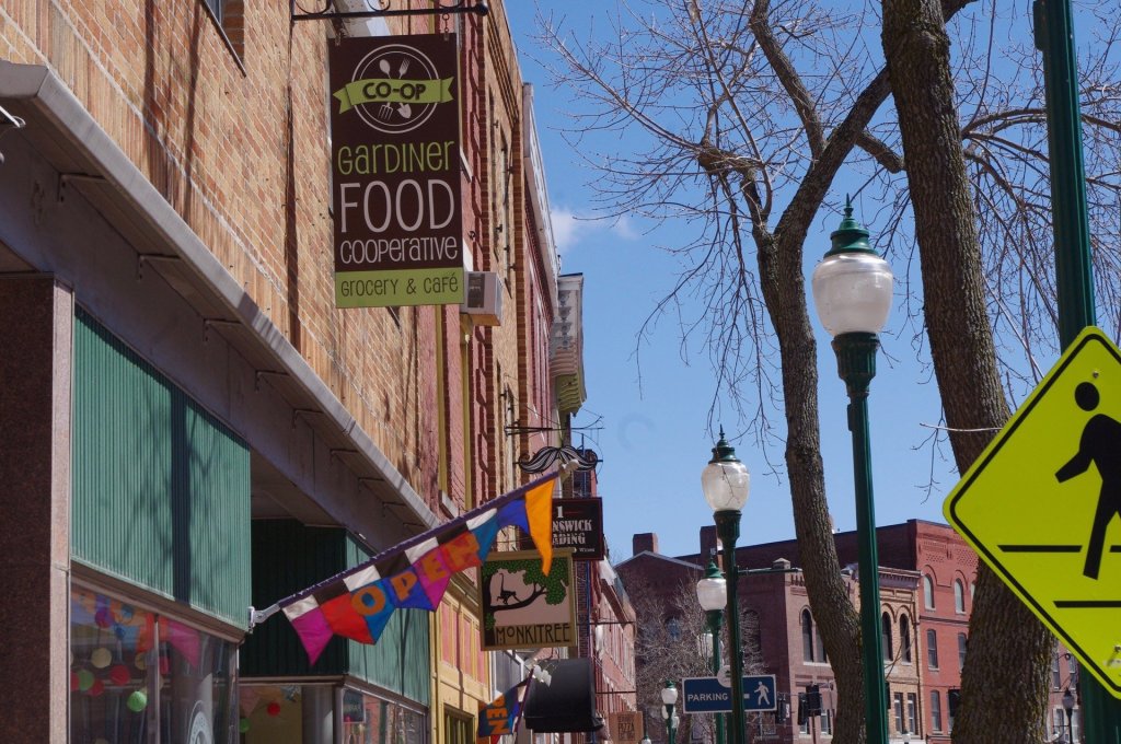
Gardiner subsequently became a bedroom community for the surrounding population centers of Augusta, Bath, and Portland, well-known for its restored antique architecture.
In 1980, the entire downtown became a listing from Kennebec County on the National Register of Historic Places, and it is a nationally-accredited Main Street Community.
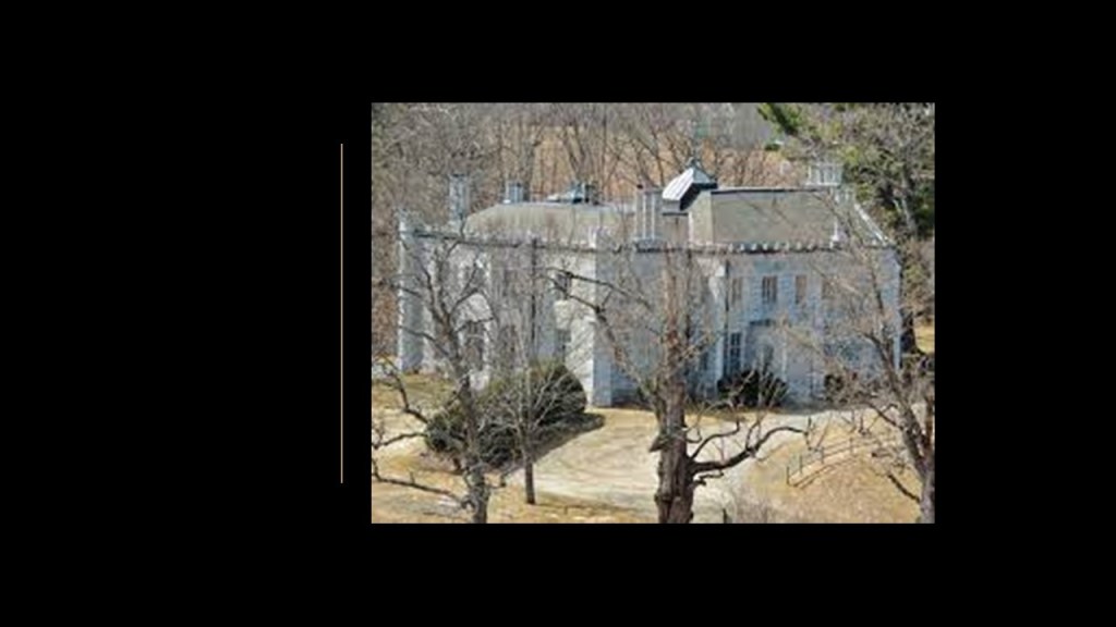
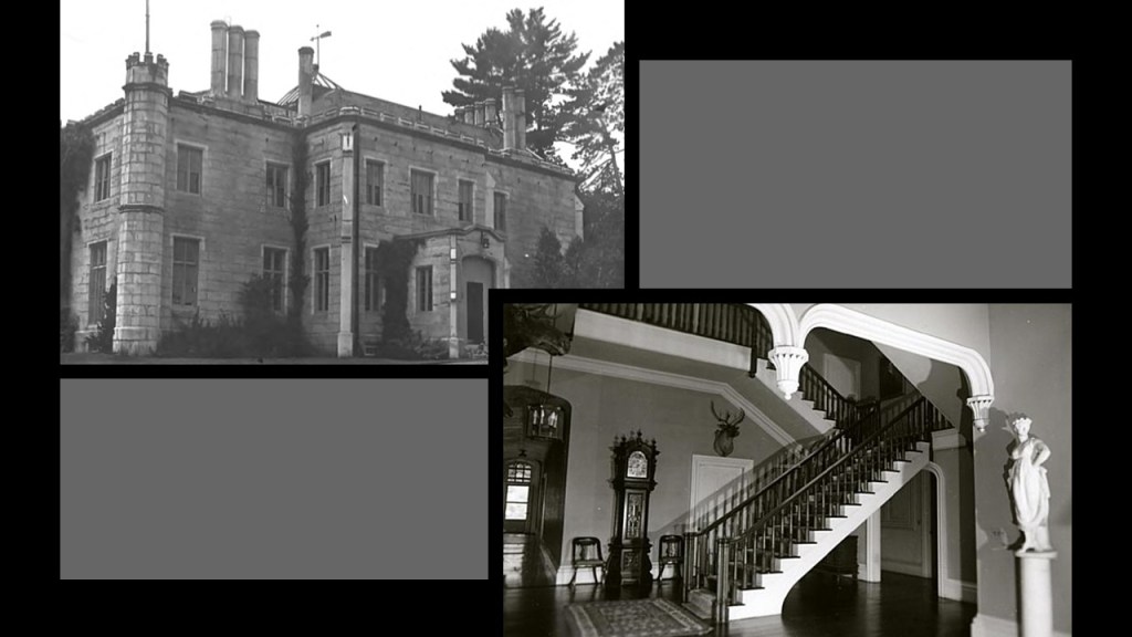
Oaklands Castle in Gardiner, Maine, is on land that was granted to Silvester Gardiner in the 18th-century, and developed by his grandson Robert Hallowell Gardiner, who was also the grandson of Benjamin Hallowell, the founder of Hallowell, Maine.
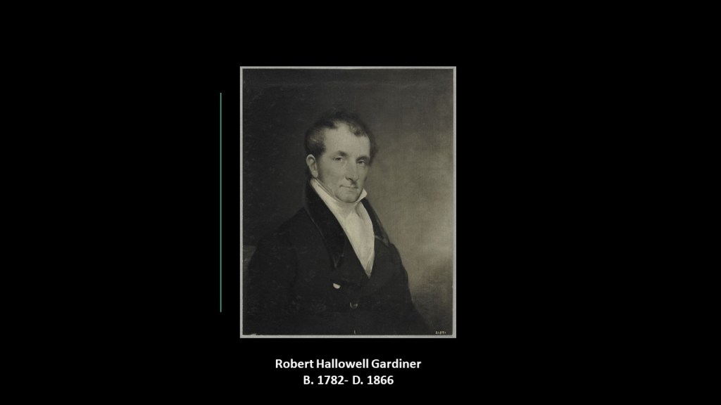
The castle was said to have been built in the Gothic-Revival-style and designed by British-born architect, and first President of the American Institute of Architects, Richard Upjohn between 1835 and 1836 in the early stages of his illustrious architectural career and credited with the promotion of the Gothic-Revival-style.
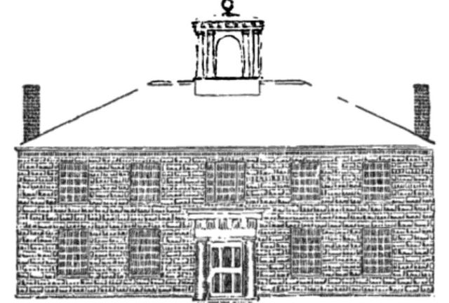
Robert Hallowell Gardiner was also a Trustee for the Gardiner Lyceum School, the first vocational trade school in the United States, and specialized in farming, agriculture and other specialized trades of the 19th-century.
The school was established in 1823, and dissolved less than 10-years later, in 1832, for financial reasons.
It was incorporated in 1822 by an Act of the State of Maine, and its Directors were associated with higher education.
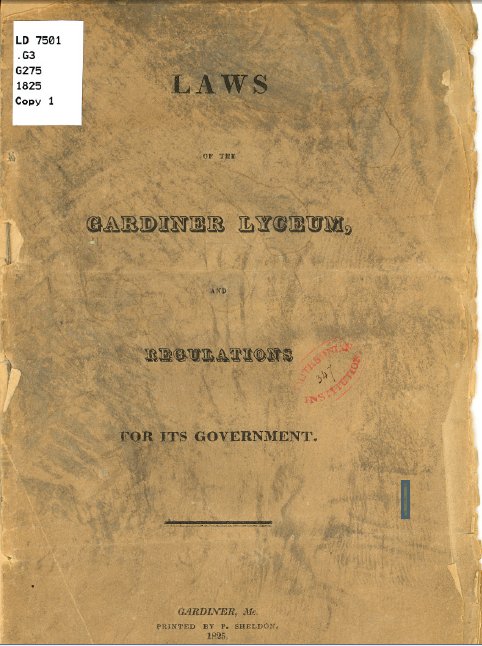
There was a set of laws printed in 1825 on how the school was to be regulated, which an existing copy still held by the Library of Congress.
Just can’t help but wonder if this was a prototype for something.
One more thing before I move on to the next suggested place.
There is an interesting connection coming up between the Gardiner family and the Trinity Church, and I am interested in this from what I have found out about Trinity Church in other locations in past research.
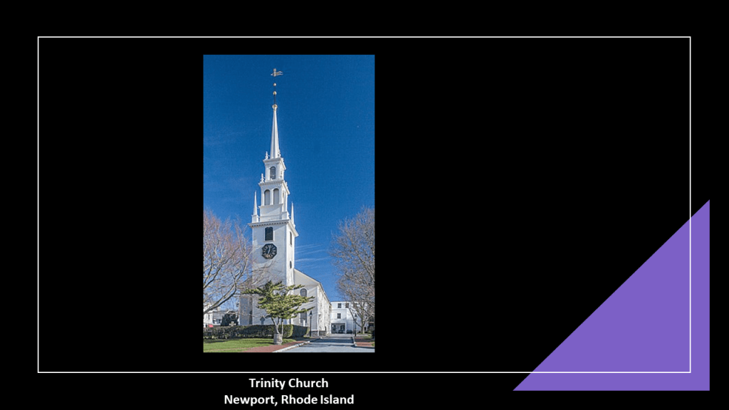
First, Silvester Gardiner was buried under the Trinity Church in Newport, Rhode Island.
The Episcopalian Newport Trinity Church congregation was founded in 1698, and the current church said to have been designed by Richard Munday, based on Sir Christopher Wren’s designs in London, and built between 1725 and 1726.
Notable parishioners of Newport’s Trinity Church included Cornelius Vanderbilt II and John Jacob Astor VI.
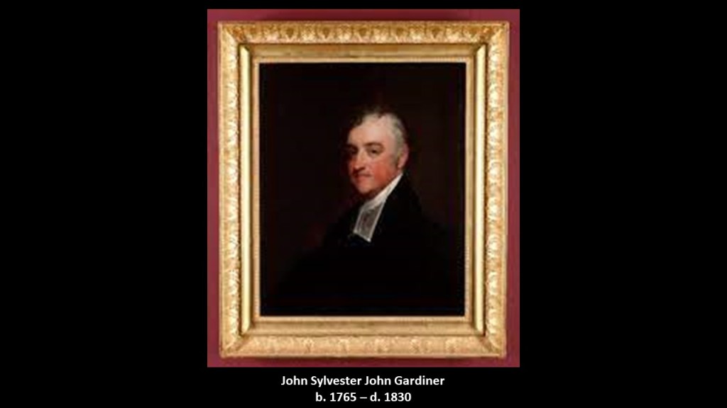
Silvester Gardiner’s grandson, John Sylvester John Gardiner, was a rector of the Trinity Church in Boston from 1805 to 1830, and the “best known and most influential Episcopal clergyman of Boston.
Interesting to note the following about the prominent clergyman’s children.
His son, William Howard Gardiner, was married to the daughter of Thomas Handasyd Perkins, a wealthy merchant, smuggler, and slave-trader from a Boston Brahmin family, members of Boston’s traditional upper-class.
His daughter, Mary Louisa, was married to John Perkins Cushing of Boston, a wealthy American sea merchant and opium smuggler, and nephew of Thomas Handasyd Perkins.
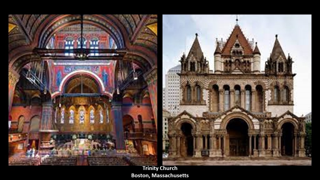
Trinity Church in Boston was founded in 1733, and the current Trinity Church building said to have been built between 1872 and 1877, and designed by architect Henry Hobson Richardson.
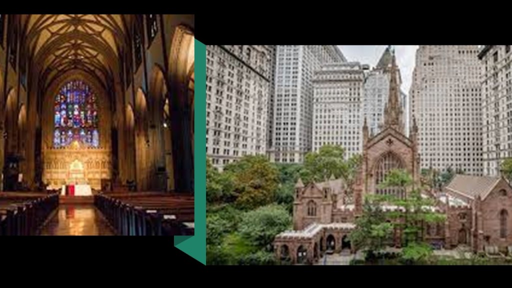
Trinity Church in New York was established in 1697, after King Charles II approved the charter for a new Church of England in Lower Manhattan.
The construction of the current Trinity Church in New York on Wall Street was said to have been constructed between 1839 and 1846, and designed in the Gothic Revival style by Richard Upjohn, the same architect who designed the Oaklands Mansion in Gardiner, Maine, for Robert Hallowell Gardiner.
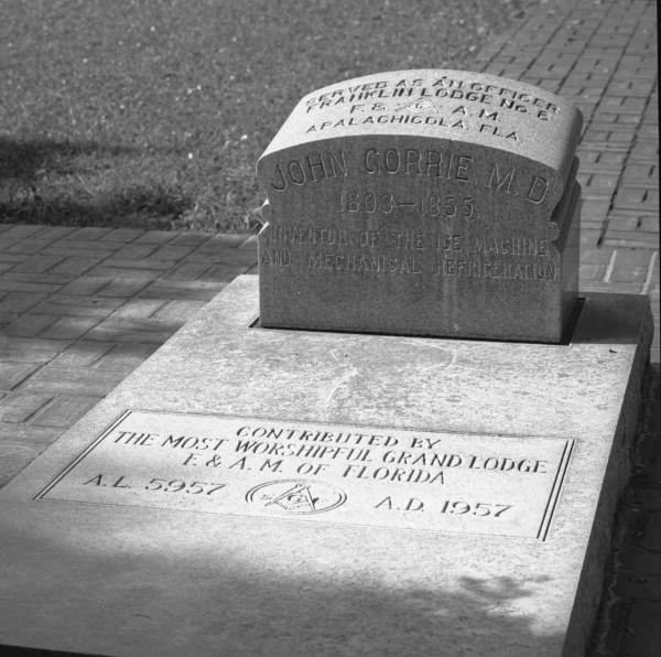
Where I am going with this is that in doing the research for the “Who is in the National Statuary Hall in the U. S. Congress” series, some prominent members of Trinity Church in different cities have come up, like physician and freemason John Gorrie of Florida.
And what came out about Trinity Church from looking at Gorrie’s story was the Corporation of Trinity Church.
The Governor of New York in 1697, Benjamin Fletcher, established the Church of England as New York’s official religion, and leased property in Lower Manhattan that was known as the “King’s Farm” to the newly established Trinity Church, and eight-years later, Queen Anne granted the entire parcel of land to the church outright, and the Episcopal parish was located at corner of Wall Street and Broadway.
With the Queen’s grant, Trinity Church became the second-largest landholder in New York, after the Crown itself, and this set-up Trinity Church to become the wealthiest in the North American colonies.
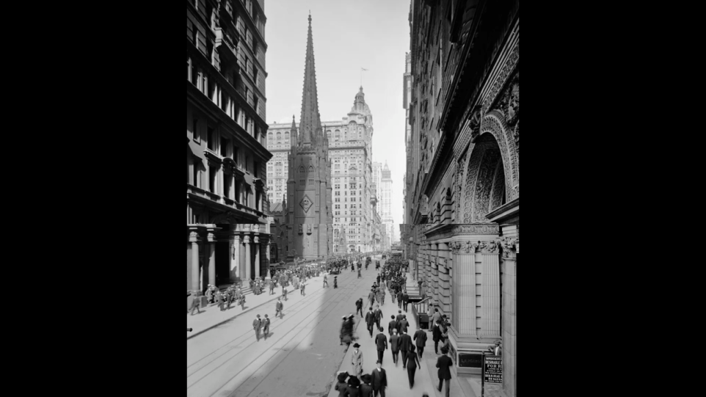
This is a scene of Trinity Church from Broadway in 1915.
Even today, Trinity Church is one of the largest landowners in New York City, now under the name of Trinity Real Estate.

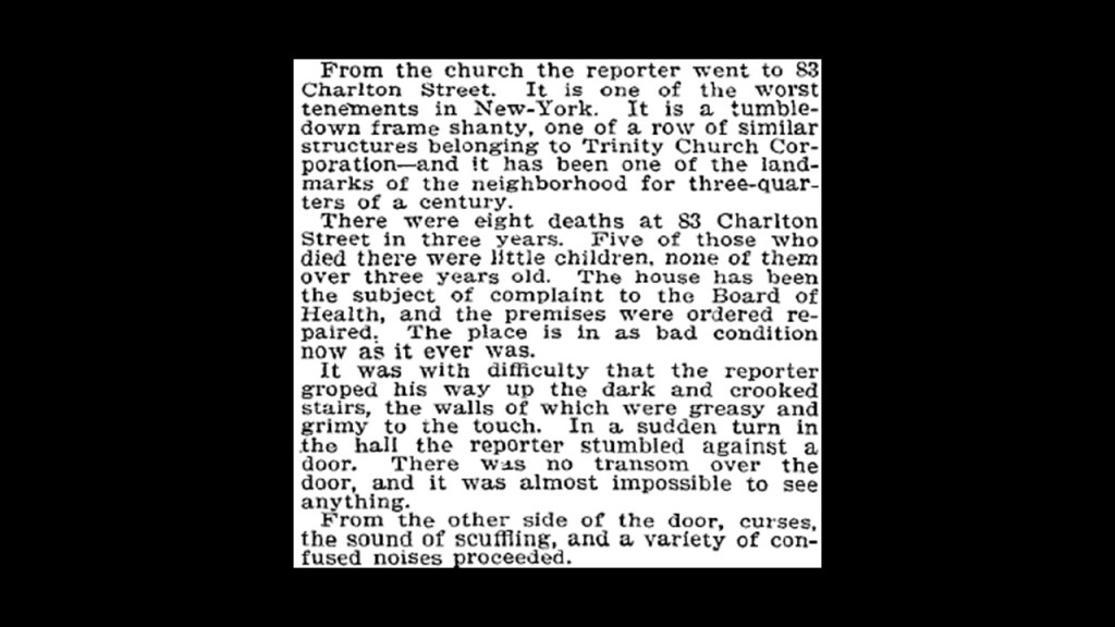
In 1894, the Trinity Corporation was exposed by a New York Times reporter to have substandard living conditions on their Charlton Street properties.
And in doing the research for this right now, I found out that in July of 2018, the Walt Disney Company acquired the rights to develop 4 Hudson Square to become the new site of Disney’s New York operations from Trinity Church Wall Street.

Now, moving along to Oklahoma.
KF of Tulsa sent me a number of photographs she has taken of Tulsa and the surrounding area.
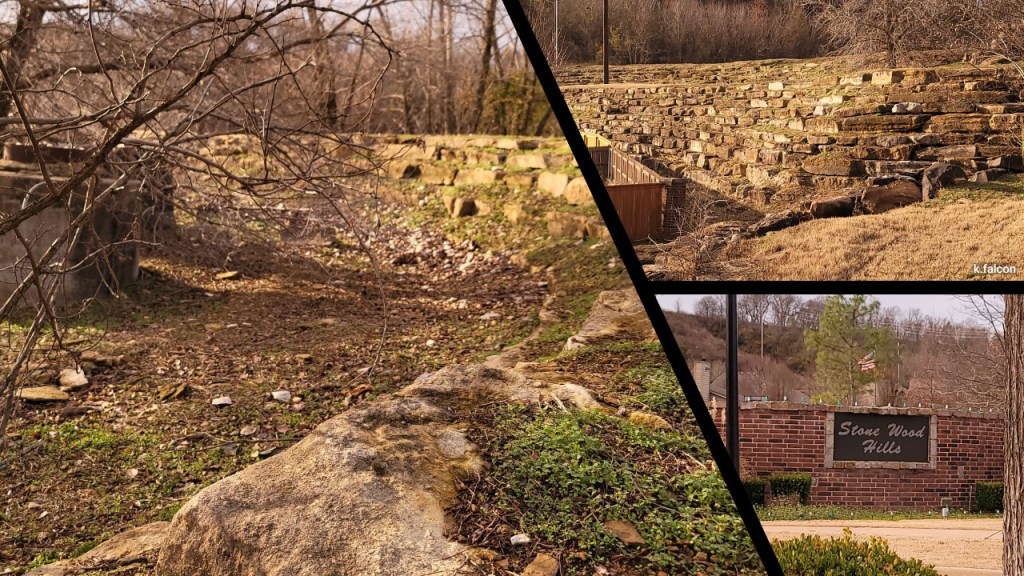
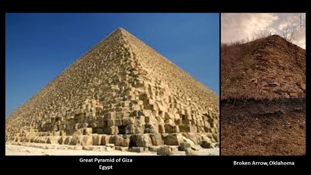
First, photos she took in Broken Arrow, Oklahoma, in a neighborhood in the vicinity of the First Baptist Church of Broken Arrow and the Bass Pro Shops.
She took these photos in the Stone Wood Hills neighborhood of Broken Arrow.
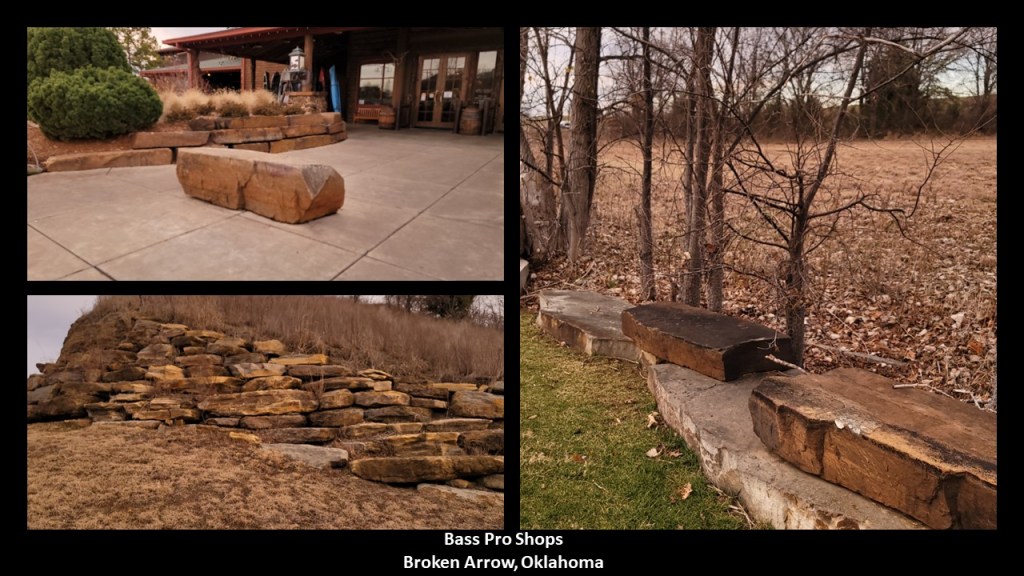
And she took these from around the Bass Pro Shops…
…including this one of a strikingly pyramidal shape on the right, seen even more clearly when compared with a similar view of the Great Pyramid of Giza on the left.
She also checked out the Creek County Landfill in Jenks, Oklahoma, outside of Tulsa…
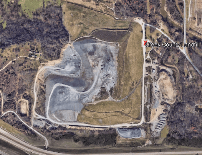
…and sent these photos she took of the view of it from the road.
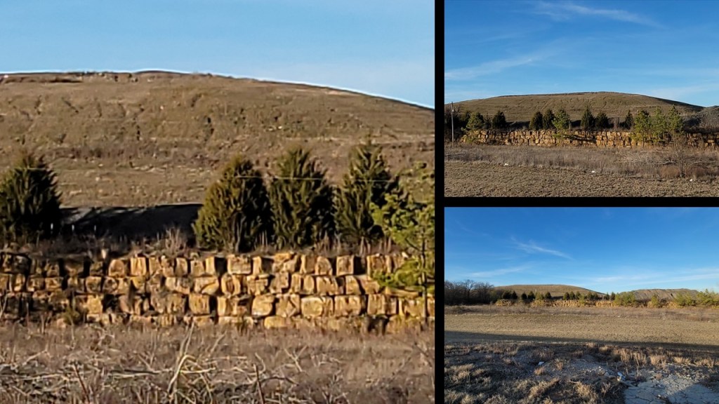
This is a good place to insert my experience with Oklahoma landfills.
I was living in Oklahoma City between 2013 and 2016, and it was here during this time that I started waking up to the ancient civilization in the landscape all around me.
Everything that KF has shared with me hits home because I saw the same things once my perception of the landscape had shifted.
One day, I really noticed a massive, flat-topped shape rising in the landscape on the eastern side of the Oklahoma City, and I decided to drive to it to see what it was.
On my way to that site going east, I passed this sign at 2831 23rd Street NE, advertising Kemet Plaza.
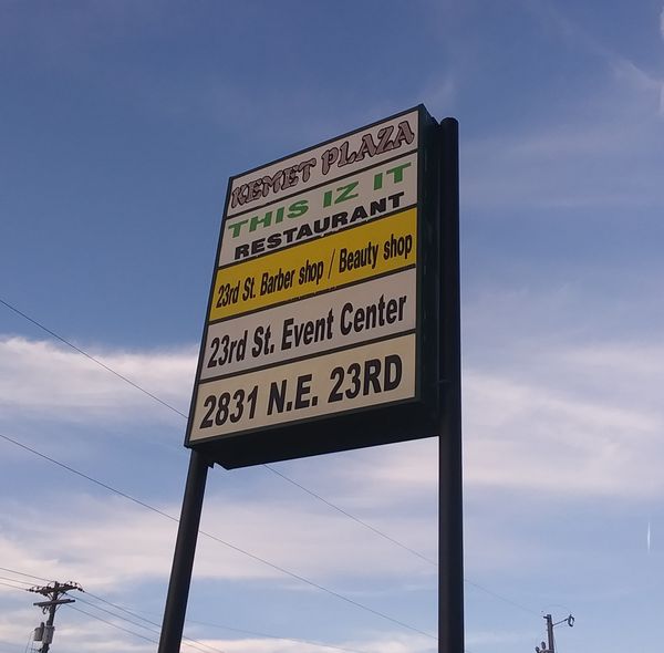
This is the relationship between the location of Kemet Plaza, and the location of where I was going, which as it turned out, was a landfill site.
So it turned out that after I left Kemet Plaza, the site I was looking for was quite close by, at the corner of 23rd Street Northeast and Sooner Road.
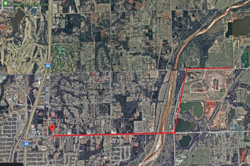
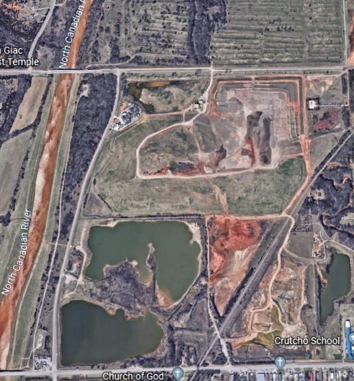
On one side of it, the west side, is an energy site.
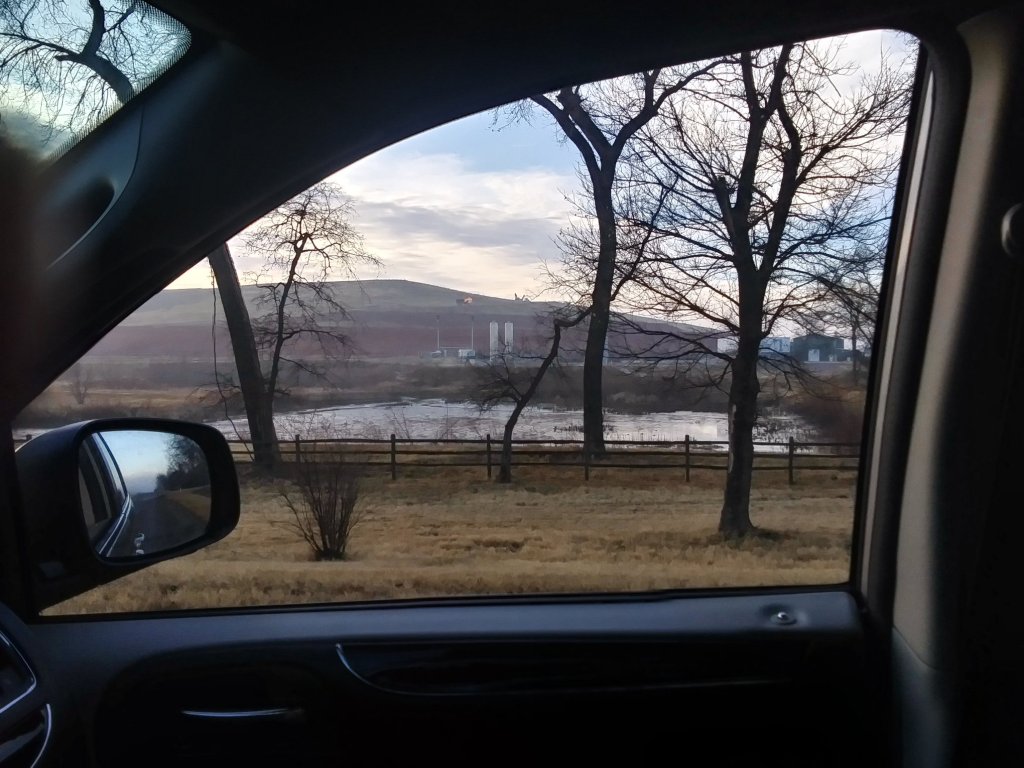
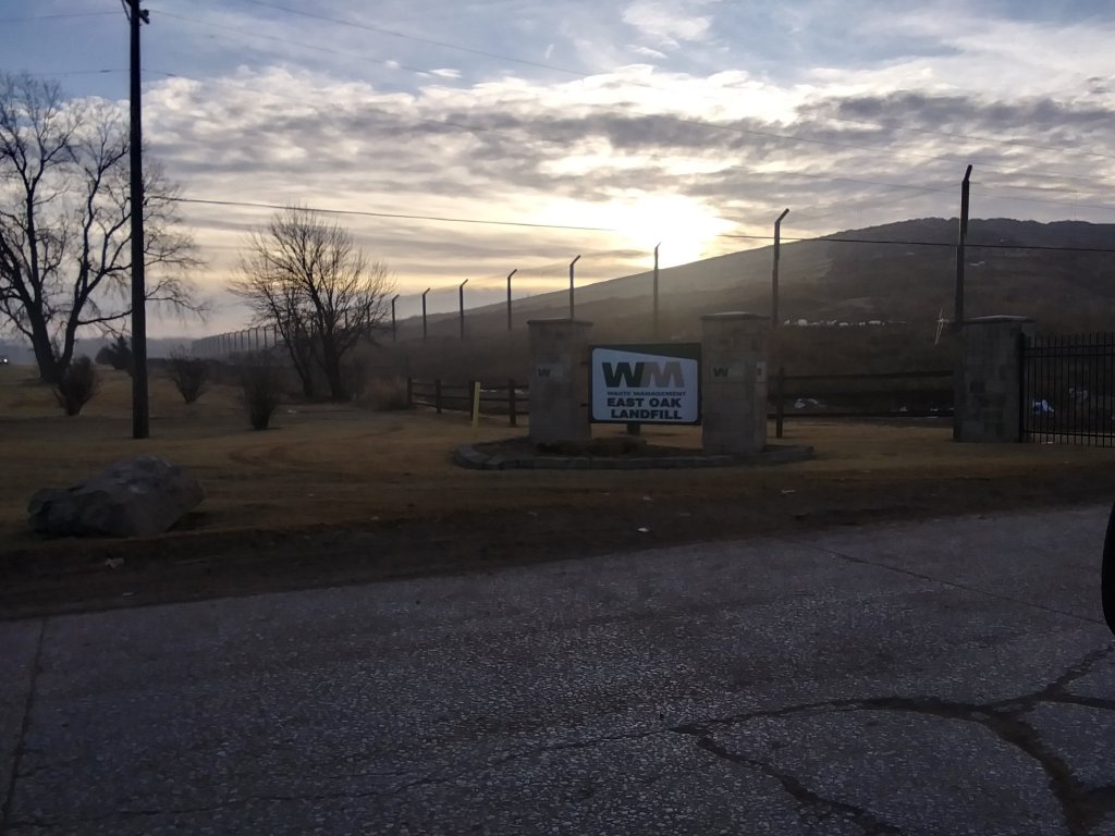
On the east, the southeast side…is a landfill operated by Waste Management.
There are two more just like this in OKC – one is in South OKC off of 240, and the other is in West OKC, in Mustang, Oklahoma. There is another one north of OKC, in Enid. Same idea.
They look like ancient earthworks that are being harvested for energy and also used for dumping trash.
Lastly for this post, MS suggested that I look into Santa Catalina Island, one of California’s Channel Islands.
First I will take a look at the Channel Islands.
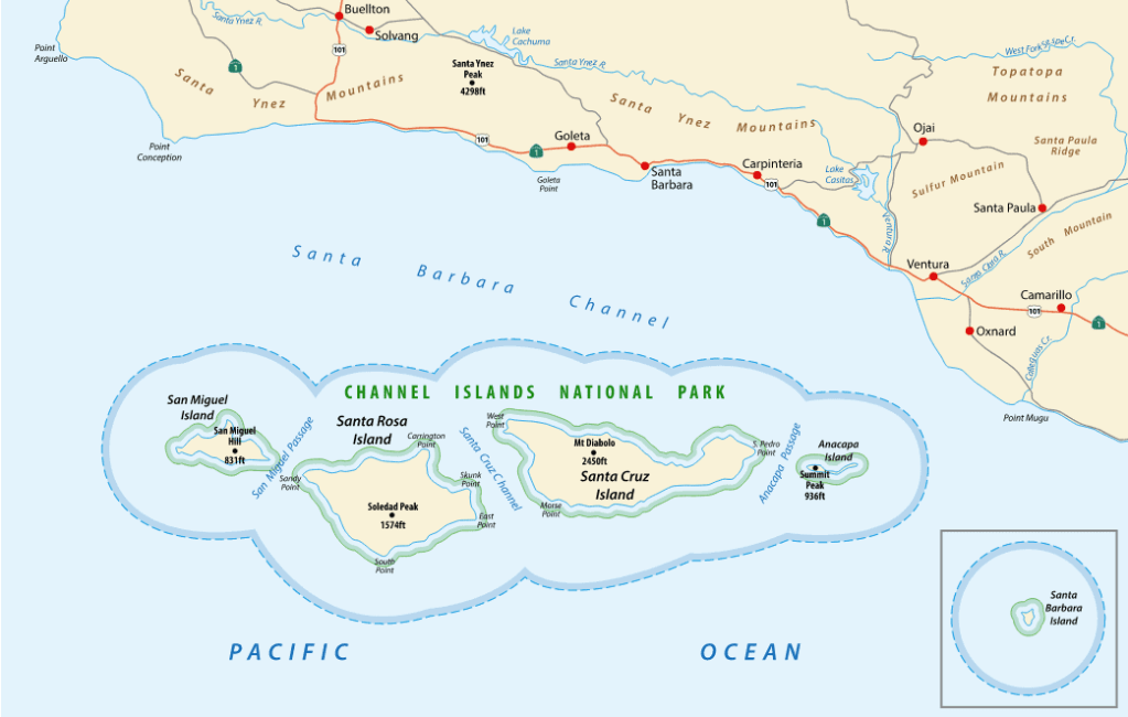
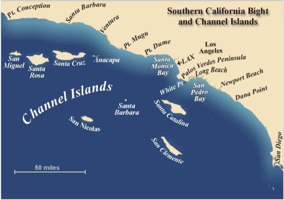
California’s eight Channel Islands are located within the Southern California Bight.
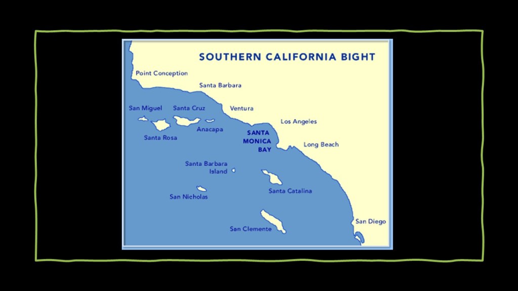
Besides the Channel Islands, the Southern California Bight includes the Coronado Islands and the Isla de Todo Santos of Baja California, coastal southern California and the local portion of the Pacific Ocean.
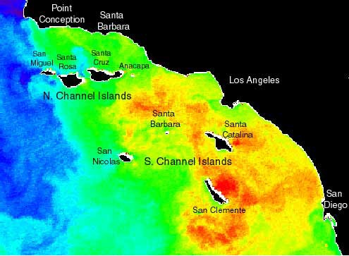
The bight is described as a significant curvature and indentation along the coast between Point Conception to just below San Diego, at Punta Colonet in Baja California, and that the waters offshore have complex current circulation patterns, with cold, southward flowing waters seen displayed in blue in this satellite image of Sea Surface Temperature, and northward flowing warm waters in yellow and orange.
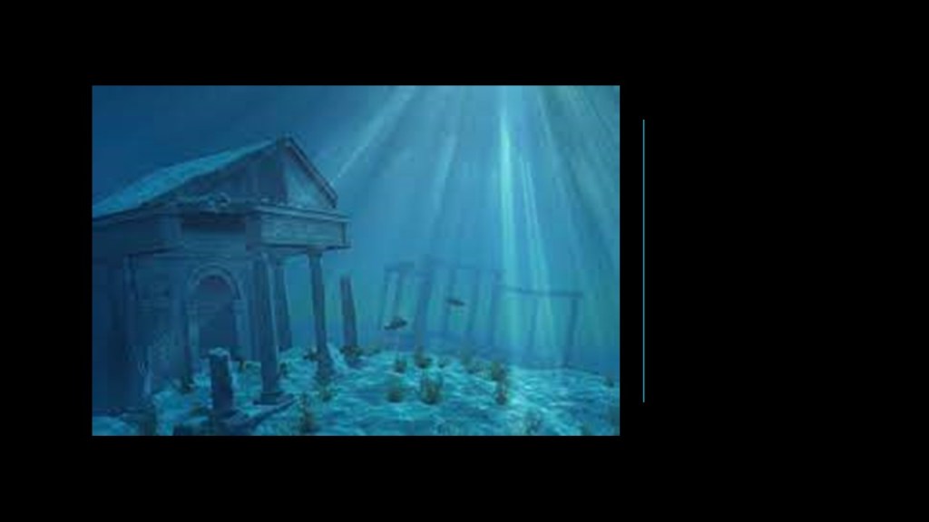
The four North Channel Islands of San Miguel, Santa Rosa, Santa Cruz and Anacapa were said to have been a landmass at one time called Santarosae.
What we are told is that they are the remnants of an ancient landmass off the coast of present-day southern California prior to the end of the last ice age, and that Santarosae lost 70% of its landmass because the sea rose from melting glaciers, leaving a huge submerged landscape that is currently being explored by scientists.
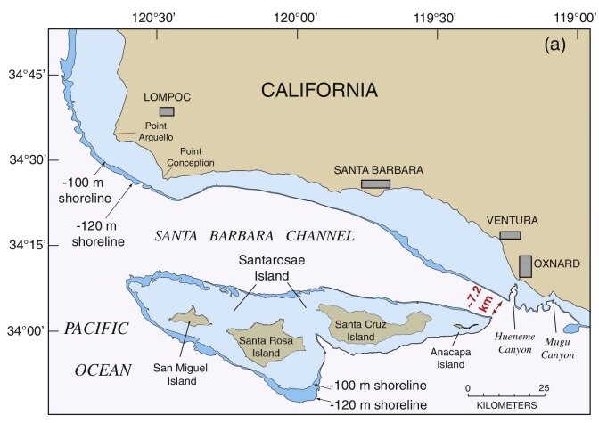
Santarosae is called “California’s Atlantis” by some.
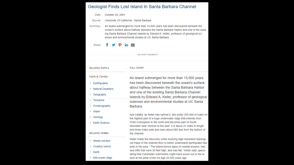
It is interesting to note that around 2001, a geologist discovered a lost island in the Santa Barbara Channel.
Believed to have been submerged for 13,000 years, going underwater towards the end of the last Ice Age, he named it Isla Calafia, and identified it as being located half-way between the Santa Barbara Harbor and one of the existing North Channel Islands.
It was 31-miles-, or 50-kilometers-, long; 3-miles-, or 5-kilometers-, wide, and rises 660-feet-, or 201-meters, from the bottom of the Channel.
So this information about the Isla Calafia ties-in to Queen Calafia, or Califia, the legendary Amazon Queen of the island of California, and for whom California and Baja California was named.
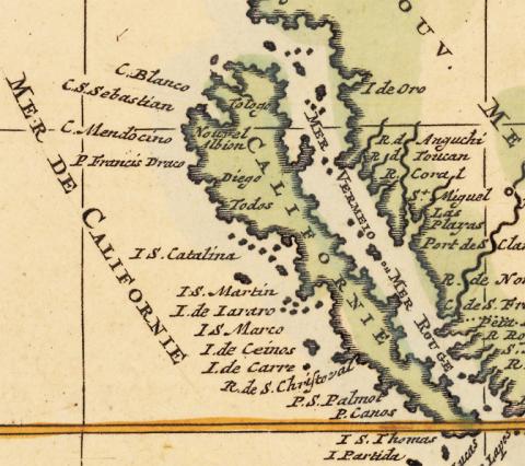
So what we are told about California being an island is that it was one of the most famous map-making errors in history, with the error being reproduced on countless maps during the 17th- and 18th-centuries, despite contradictory evidence from various explorers.
The legend associated with the Island of California was that it was an earthly paradise, like Atlantis or the Garden of Eden.
The first grammar text for Castilian Spanish was published in 1492.
It was the first book dedicated to the Spanish language and its rules, and the first grammar of a modern European language to be published in print.

In our historical narrative, the year of 1492 was also the year of the Fall of Granada in Moorish Spain…
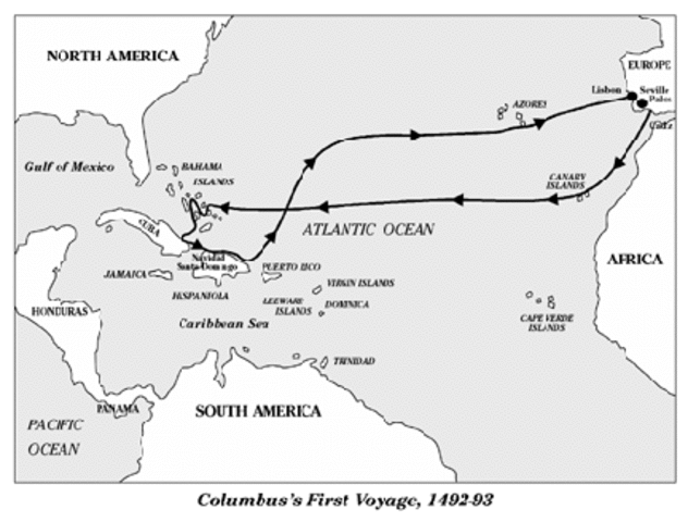
…and the year of Columbus’ first voyage.
Almost 20-years later, in 1510, we are told the first known mention of the Island of California was in the fictional novel “The Adventures of Esplandian,” a novel by Castilian author Garci Rodriguez de Montalvo describing a fictional island named California that was inhabited by only black women, and ruled by Queen Calafia.
Here is a passage from the book:
“Know that on the right-hand of the Indies, there is an island called California very close to the side of the Terrestrial Paradise, and it is peopled by black women, without any man among them, for they live in the manner of Amazons.”
Where did that idea come from?

Calafia’s life and place in history is described as entirely fictional, though she is depicted as the spirit California, and symbolizes an untamed and bountiful land prior to European settlement.
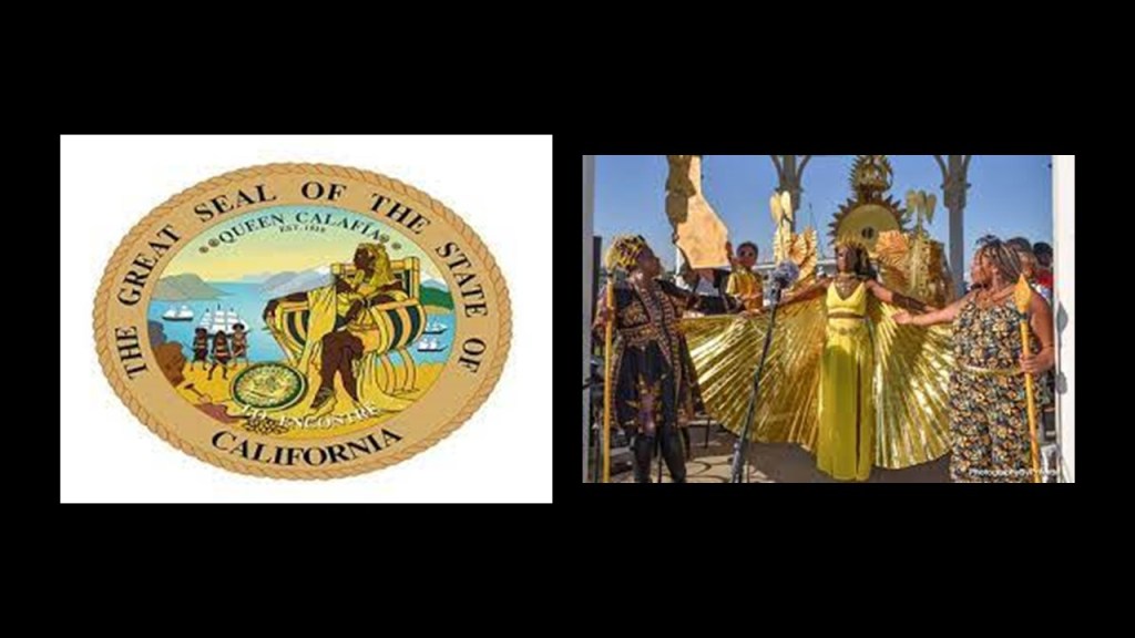
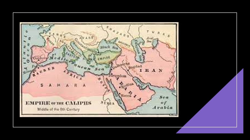
Queen Calafia’s name was said to have been likely formed from the Arabic word “Khalifa,”or “Caliph” in English, for the religious state leader of a “Caliphate,” a Muslim political-religious state.
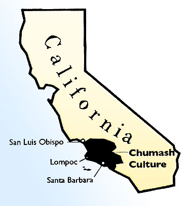
And to throw something else into the mix, the Chumash, the name of the original inhabitants of the North Channel Islands, is also a Hebrew word meaning a Torah in printed or book bound form.

So we have a reference to a Muslim political-religious state, ruled by a woman, is found in the same location as the actual word in Hebrew for the Torah given to the indigenous tribe of Central Southern and Coastal Regions of California, including the North Channel Islands, also known as Santa Barbara Group, of Santa Cruz, Santa Rosa, San Miguel, and Anacapa.
Maybe it’s just a coincidence, but perhaps not.
If it is not a concidence, then what might this signify?
My money is on they were one and the same in the original Moorish civilization, and that those behind the New World Order separated everything out in order to create discord, division, and disharmony, and that all of the Moorish symbolism was taken over, their works and legacy falsely claimed, and/or given a darker meaning by association with certain things that were not the original meaning.

Before I go further into California’s Channel Islands, let me point out some similarities so far to what I found off the Atlantic northeast coast of the United States with what I am seeing here.
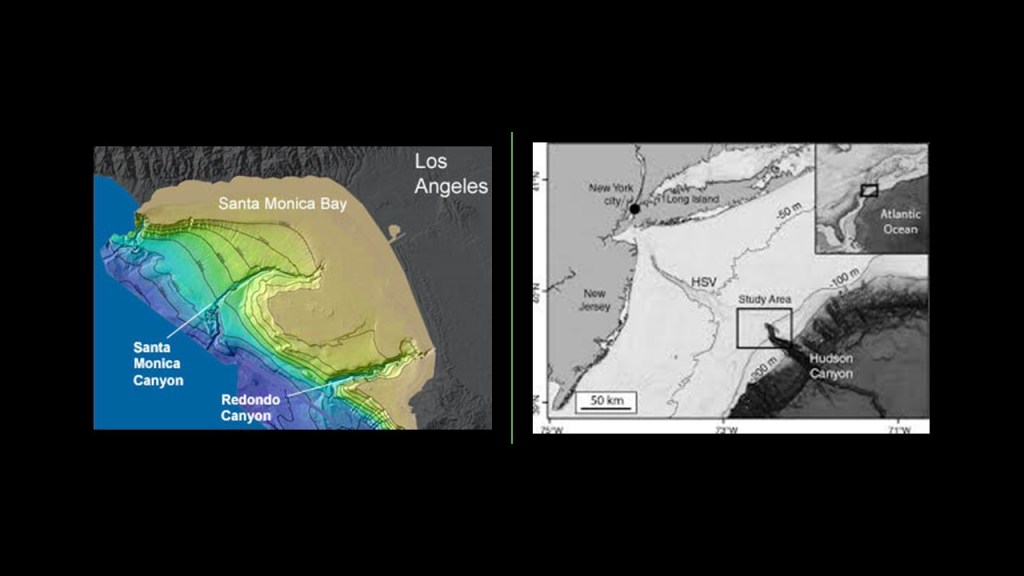
I have found the Southern California Bight on the Pacific Coast and the New York – New Jersey Bight on the northeast Atlantic Coast…
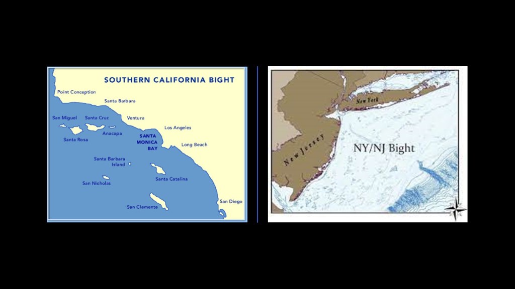
…there are underwater canyons adjacent to the Bights in both places – the Hudson Canyon on the east coast, one of the largest underwater canyons in the world, and numerous canyons off the coast of the Southern California Bight.
My question remains the same: Were this canyons always underwater?
And are they natural or man-made?
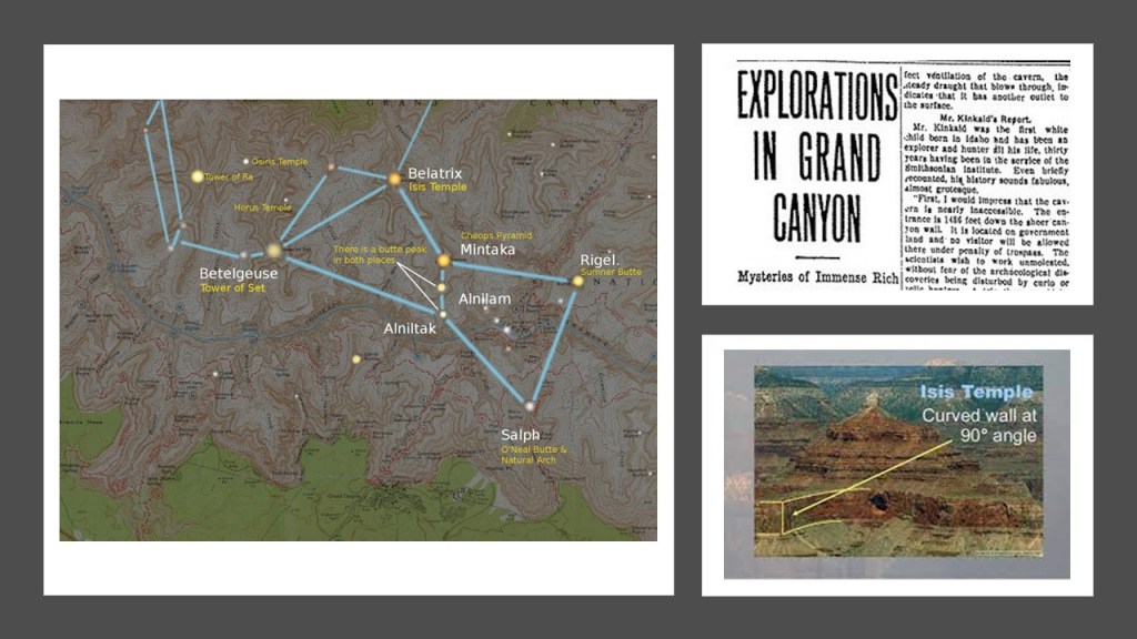
Bear in mind, the Grand Canyon in Arizona has formations with Egyptian names, like the Isis Temple, the Osiris Temple, and the Temple of Set, and that these formations and others correlate with stars in the Orion Constellation.
An article appeared in the Arizona Gazette in 1909 that an explorer in the Grand Canyon had stumbled upon Egyptian artifacts, but news about the discovery disappeared from public view shortly after it was published, and it has been called a hoax ever since.
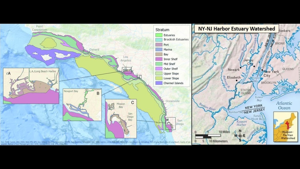
Also, there are estuaries along both the Southern California Bight and the New York – New Jersey Bight.
Estuaries are defined as partially-enclosed, coastal bodies of brackish water, which is water that is salty, dirty & unpleasant, with one or more rivers flowing into it, and a connection to the open sea.
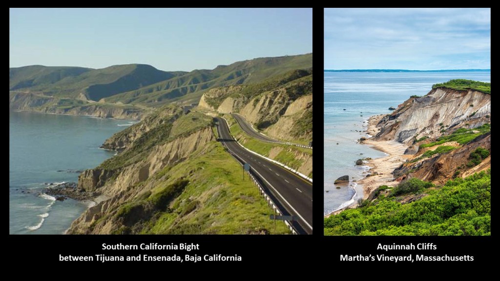
There is sheared-off, unstable-eroded-looking landscape in both places, like as seen on this stretch of coastal road beside the Southern California Bight on the left, and the Aquinnah Cliffs on Martha’s Vineyard, which is also where the headquarters of the Wampanoag Tribe of Martha’s Vineyard is located on their historical land.
And while the Council of New England and the Church of England were busy colonizing and settling New England starting in 1620, the Vice-Royalty of New Spain and the Catholic Church did the same thing after the Spanish Conquest of the Aztec Empire in 1521.
Central Mexico became the base of expeditions of exploration and conquest, in what became a huge area that comprised the Spanish colonization of the Americas, including California among many other places.
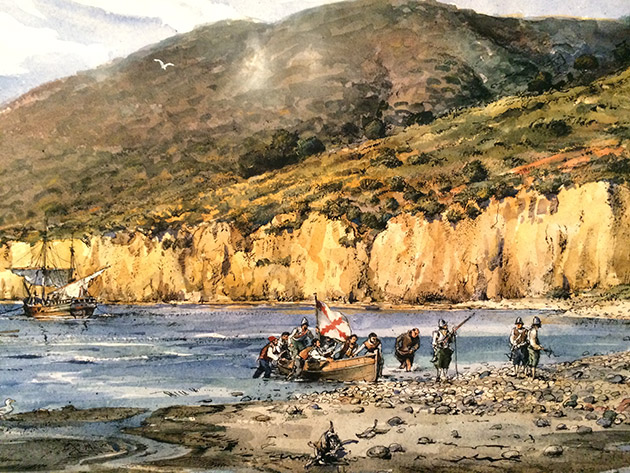
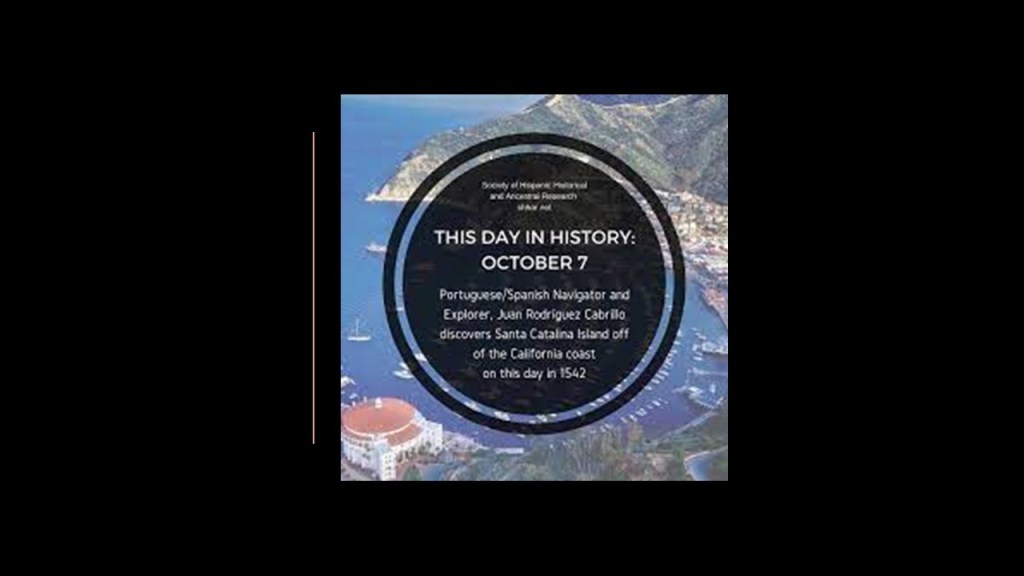
In 1542, explorer Juan Rodriguez Cabrillo landed in San Diego Bay on behalf of the Spanish Empire…
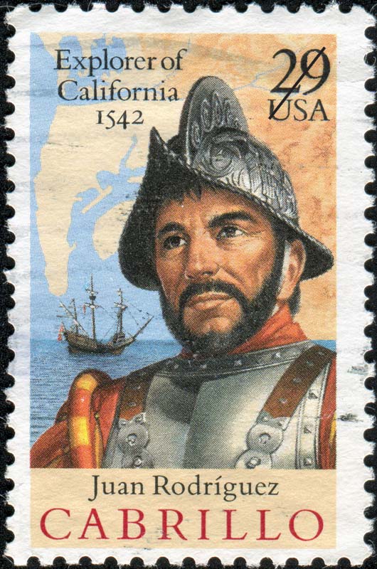
…and we are told became the first European to set foot in California, exploring the California coast starting 1542.
According to the historical narrative, Cabrillo died on Santa Catalina Island in January of 1543 from an injury to his leg that became infected and gangrenous.
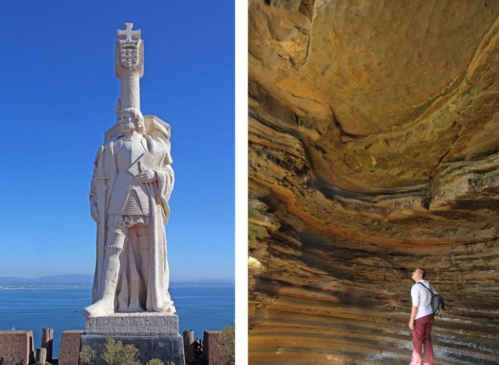
Among other things bearing his name, there is a Cabrillo National Monument in San Diego commemorating his landing in San Diego Bay.
To put Cabrillo’s exploration of California into historical perspective in our timeline, in 1540, two years before Cabrillo explored California, Pope Paul III issued a papal bull forming the Jesuit Order, under the leadership of Ignatius Loyola, a Basque nobleman from the Pyrenees in Northern Spain.
The Jesuit Order included a special vow of obedience to the Pope in matters of mission direction and assignment.

The same year, in 1542, Pope Paul III established the Holy Office, also known as the Inquisition and the Congregation for the Doctrine of the Faith.

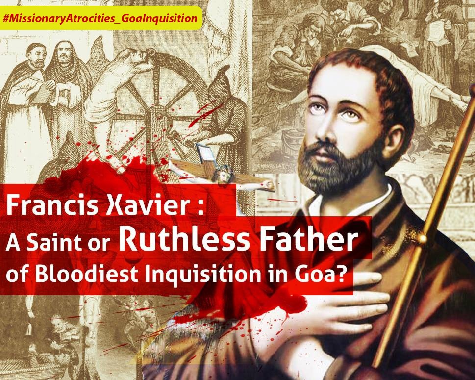
Also in 1542, St. Francis Xavier, a co-founder of the Jesuits, landed in Goa on the Indian subcontinent, where some believe he requested the brutal Goa Inquisition, established, we are told, to enforce Catholic Orthodoxy in colonial-era Portuguese India.
The following year, in May of 1543, Nicolaus Copernicus published “On the Revolutions of the Heavenly Spheres,” offering mathematical arguments for the heliocentric, or sun-centered universe, and denying the geocentric model of the Earth-centered universe of Ptolemy, which the heliocentric model superceded, meaning that while once widely-accepted, current science considered the geocentric model inadequate.
By the end of May of that same year, Copernicus was dead.
So both Juan Rodriguez Cabrillo, first explorer of California, and Nicolaus Copernicus, author of the heliocentric universe, were contemporaries, and died in the same year.

Like India’s St. Francis Xavier, California had its own “Missionary Saint” in the form of St. Junipero Serra, who was credited with establishing the first Franciscan missions in Mexico and California between 1750 and 1782.
Posthumous honors for him include Sainthood in 2015 and he represents the State of California in the National Statuary Hall at the U. S. Congress, along with Ronald Reagan.
Serra was nicknamed the “Apostle of California” for his missionary efforts, but before and after his canonization, his reputation and missionary work was condemned for reasons given like mandatory conversions of the native population to Catholicism and atrocities committed against them.

Now, back to the Channel Islands.
Of the eight Channel Islands, five are part of the Channel Islands National Park and the Channel Islands National Marine Sanctuary – all of the North Channel Islands plus Santa Barbara Island, situated at the center of the Channel Islands.
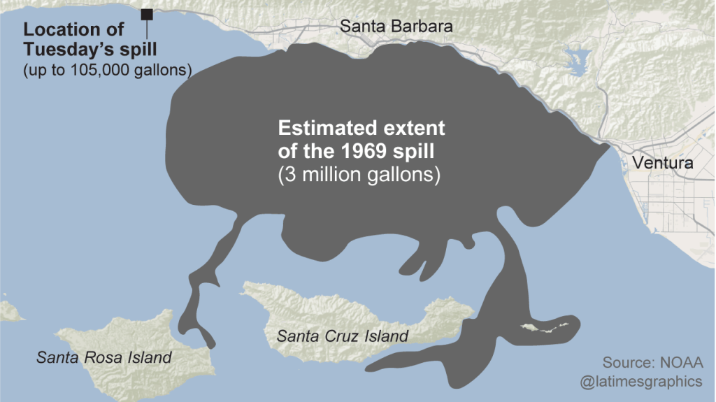
Interesting to note that in 1969, the third-largest oil spil in the history of the United States, known as the Santa Barbara Oil Spill took place in this area, when an oil rig exploded 6-miles, or 10-kilometers, off the California coast inthe Santa Barbara Channel , and tides washed the oil onto all four of the North Channel Islands.
The South Channel Island group is comprised of the islands of Santa Barbara, San Nicolas, San Clemente, and Santa Catalina.
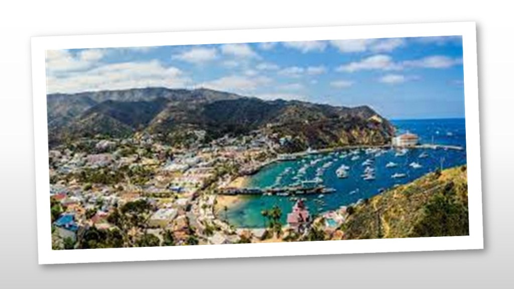
Santa Catalina Island is the only one of the eight Channel Islands with a large, permanent settlement.
Let’s take a look at Santa Catalina Island and see what comes up.
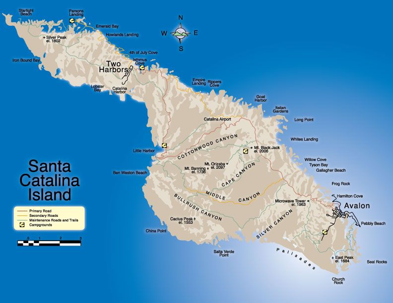
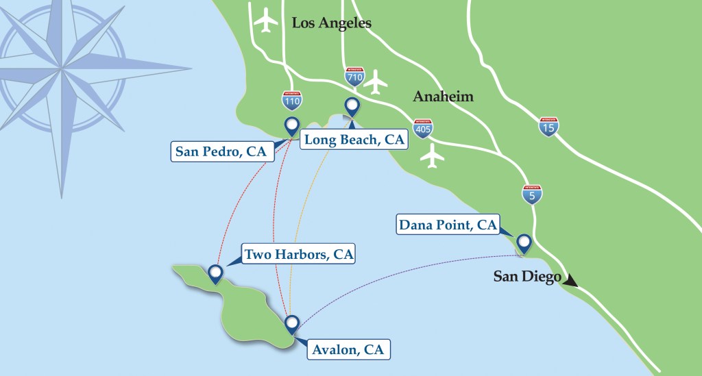
Part of Los Angeles County, Santa Catalina Island is located 29-miles, or 47-kilometers, south-southwest of Long Beach, and west of San Diego.
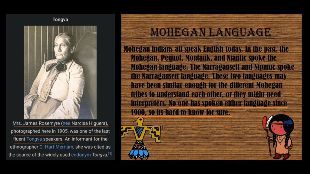
The Tongva people, also known as Kizh, were indigenous to the South Channel Islands and the Los Angeles Basin.
Just like what happened on the northeast coast of the United States with Algonquin languages like Mohegan, the spoken language of the native people of the region died out in the early 1900s.
Santa Catalina’s first European contact was said to have been with Juan Rodriguez Cabrillo on October 7th of 1542…
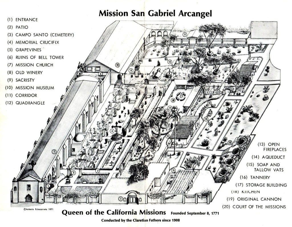
The collapse of the Tongva society and culture of the region was initiated with the founding of the San Gabriel Mission in Los Angeles County in 1771 by the Franciscan missionary Junipero Serra.
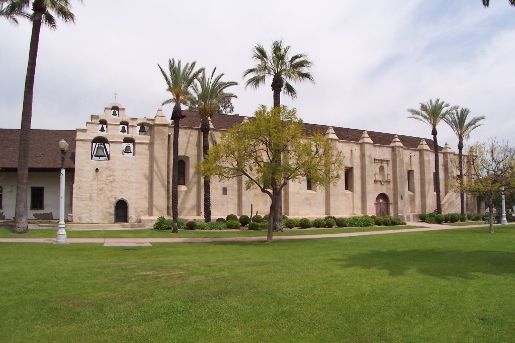
The Spanish initiated forced relocation and enslavement of the native Tongva people under the mission system to secure their labor, and some of the nicknames of the San Gabriel Mission in San Gabriel California is the “Queen of the California Missions,” and “Mother of Agriculture in California.”
The Spanish Mission System of California is sound A LOT like the English plantation system of New England.

Back to Santa Catalina Island.
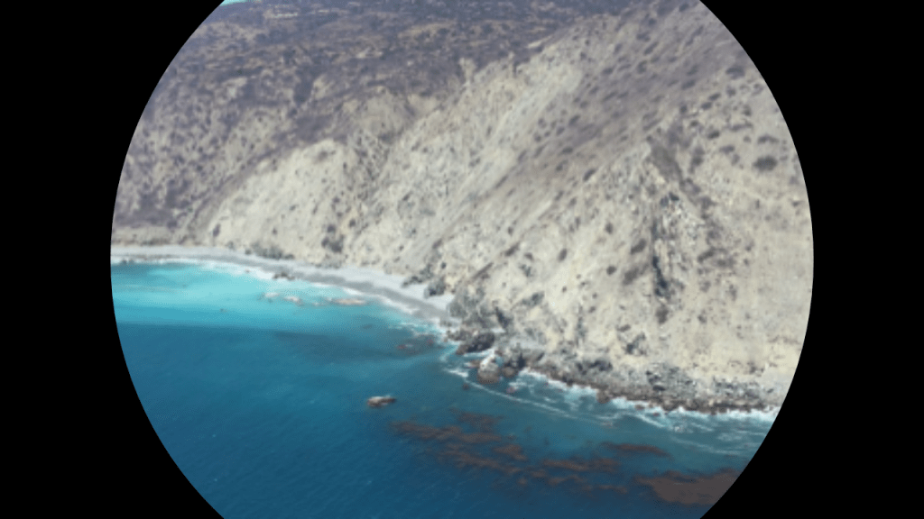
On the south-side of the East End of Catalina Island, we find places with such names as Church Rock, Silver Canyon, China Point, and a ridge seen extending out into the ocean waters, looking like there is more of the island going on underneath it.
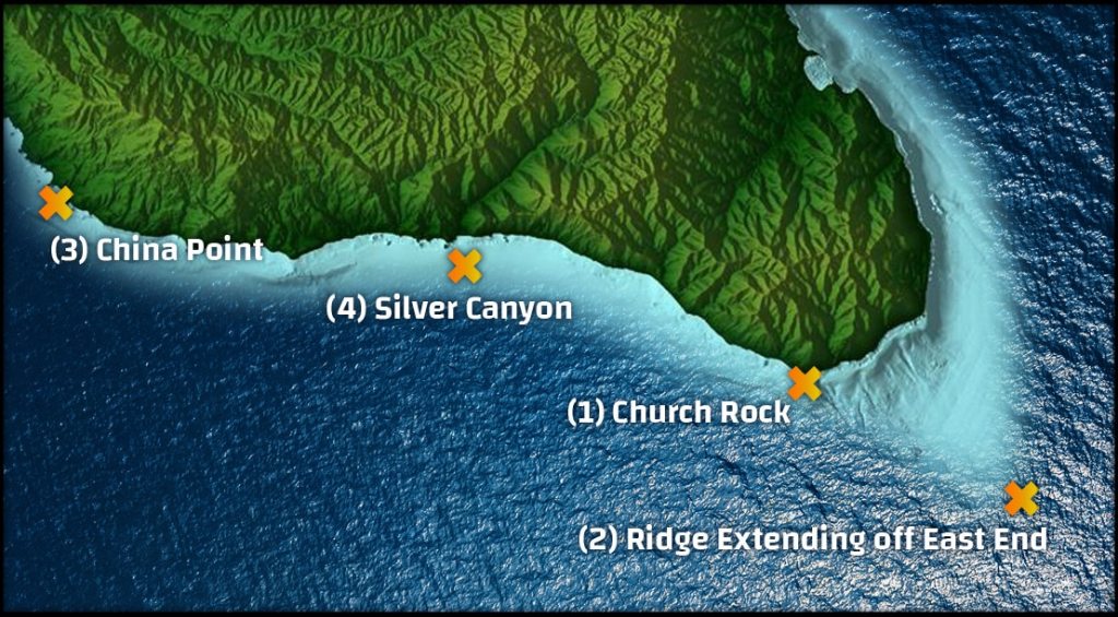
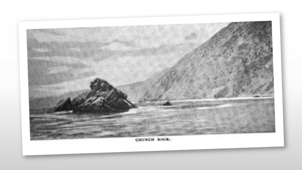
Church Rock is a large rock jutting out of the ocean just off-shore on the East End, and is a popular dive spot.
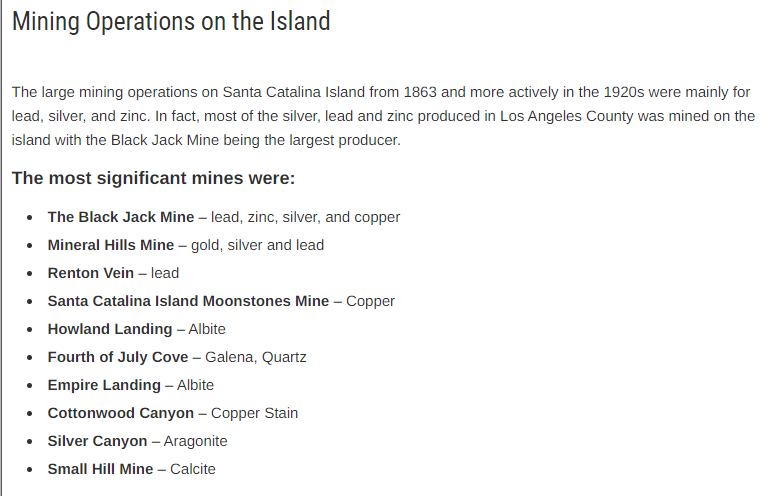
Silver Canyon is one of the largest canyons of several on Catalina Island.
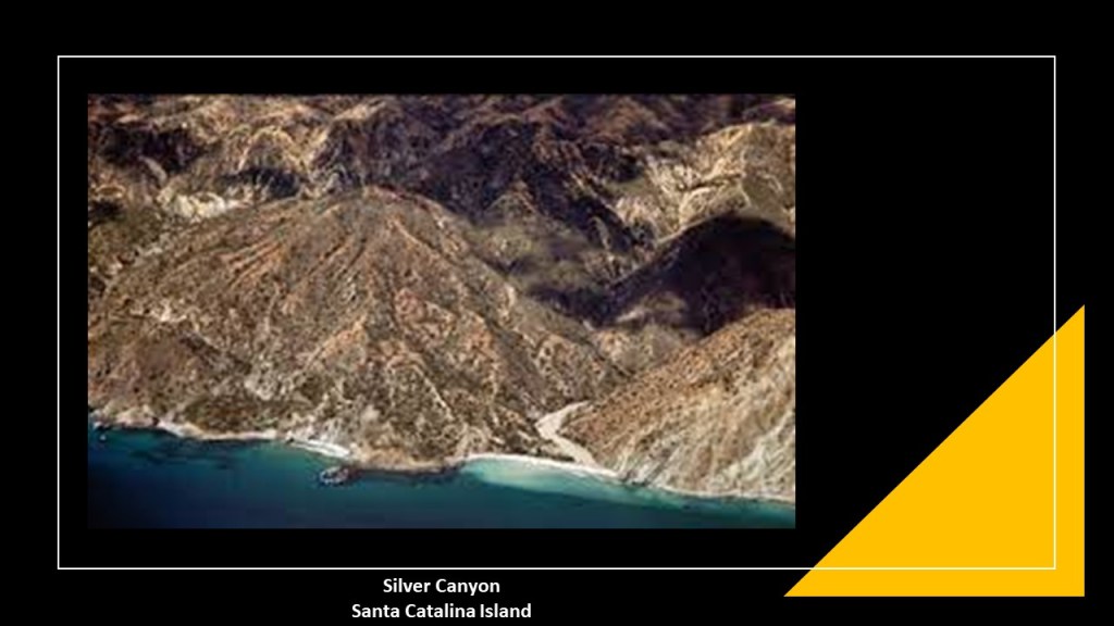
And come to find out, there were large mining operations on Santa Catalina Island, including Silver Canyon, from about 1863 (mid-way through the American Civil War) to the 1920s.
A short-distance up the coast from Silver Canyon is China Point.
Today a dive site, China Point got its name as the location of a camp on the back-side of the island for smuggling Chinese immigrants after the Chinese Exclusion Act was passed by the U. S. Congress in 1882, barring all new immigration from China for 10 years.
This is what we are told about Avalon, the only incorporated city on Catalina Island.
George Shatto, a real estate developer from Grand Rapids, Michigan, was the first owner of the island to try to develop Avalon into a resort destination.
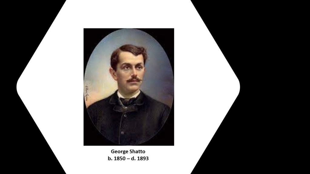
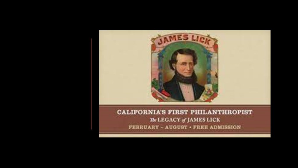
He purchased the island in 1887 for $200,000 from the Lick Estate of James Lick, a real estate investor based in San Francisco who arrived in California in January of 1848.
At the time of Lick’s death in 1876, he was the wealthiest man in California, and his real estate holdings, besides all of Catalina Island, included a considerable part of Santa Clara County, San Francisco, Lake Tahoe, and a large ranch in Los Angeles.
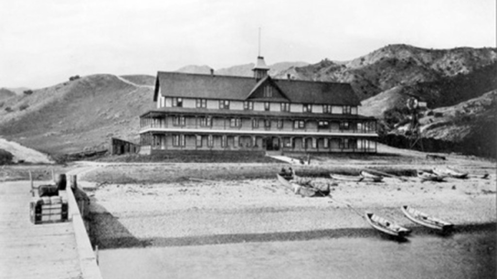
Shatto was credited with creating the settlement that became known as Avalon, and building the first hotel there, the Hotel Metropole, between 1887 and 1888, and that the island first opened for tourists in 1888.
By 1891, Shatto was having financial problems and defaulted on his loan payment for the island, and Santa Catalina Island was returned to the James Lick Trust.
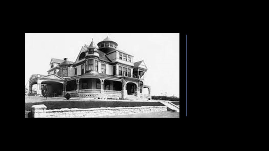
In 1892, Shatto was said to have built the Shatto Mansion in Queen Anne-style architecture in Los Angeles.
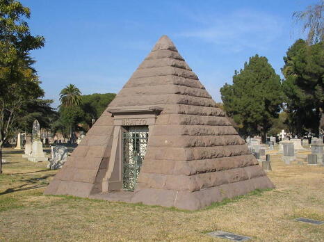
George Shatto was the only person killed in a train crash near Ravenna, California, in 1893…

…and he was interred in a pyramid-shaped mausoleum at the Angelus Rosedale Cemetery in Los Angeles.
In 1891, the Banning Brothers purchased Santa Catalina Island from the James Lick Estate.
They were the sons of Phineas Banning, a wealthy California entrepreneur known as the “Father of the Port of Los Angeles.”
The Banning Brothers were said to have fulfilled the dream of George Shatto of making Avalon a resort community with the construction of numerous tourist facilities.
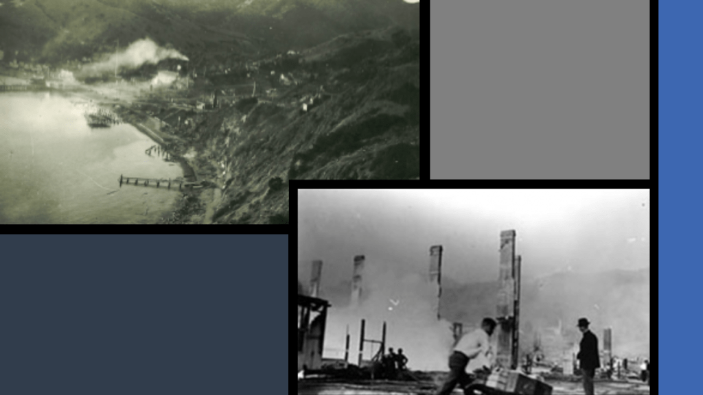
However, in 1915, a fire was said to have burned half of Avalon’s buildings, including six hotels and several clubs.
Subsequently, the Banning Brothers were forced to sell the island in shares starting in 1919.
Chewing gum magnate William Wrigley, Jr, was one of the main investors who purchased Santa Catalina Island’s shares from the Bannings.
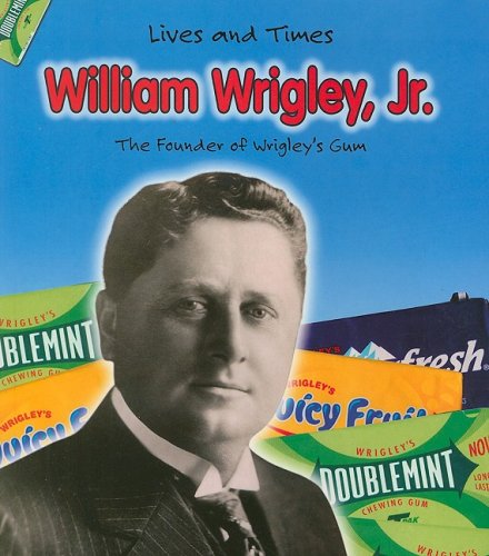
Wrigley bought out most of the other shareholders to become the controlling shareholder in the “Santa Catalina Island Company.”
Wrigley then invested millions into building needed infrastructure for attractions to the island.
This included the Catalina Casino, which was said to have been built starting in 1928, and first opened in 1929.
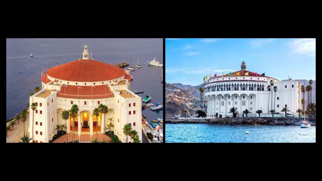
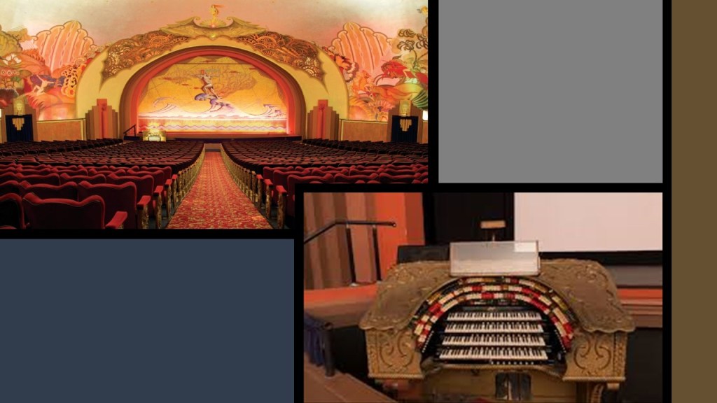
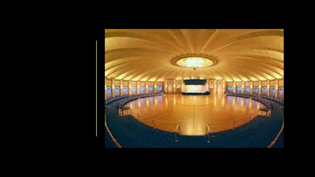
The Catalina Casino houses things like a movie theater and a ballroom.
The movie theater still has its original pipe organ intact.
The acoustics are so good in the Catalina Casino’s movie theater that someone speaking on the stage can be heard without using a microphone and be heard clearly by everyone in the 1,154-seat capacity auditorium.
The Catalina Casino’s ballroom is the world’s largest circular ballroom, with a 180-foot, or 55-meter, dance floor that can accommodate 3,000 dancers.
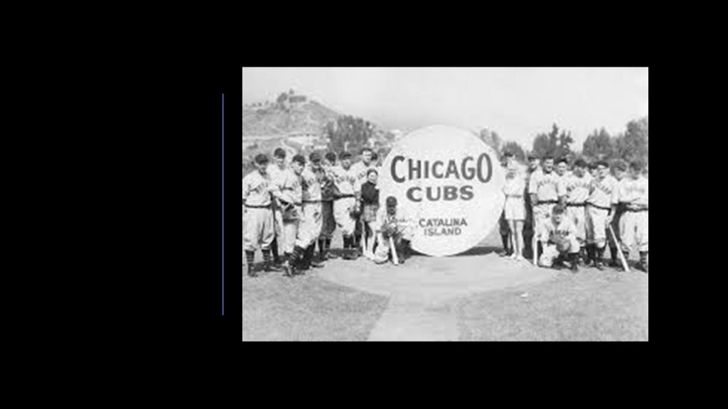
Wrigley even brought the Chicago Cubs to Santa Catalina Island for their spring training starting in 1921, which lasted through 1951.
Santa Catalina Island in California’s Channel Islands is known as a playground for the rich and famous off the Pacific coast of southern California, like the prime and luxury real estate found around the estuaries lining the Atlantic Northeast Coast of the United States, including Martha’s Vineyard and the Hamptons of Long Island.
This fascination and interest the wealthy elites have long had with islands and estuaries on both coasts is noteworthy, leaving me to wonder why they are so obsessed with these places.
Personally, I think the wealthy globalist controllers have been and are lording and gloating over their take over of what was an ancient, beautiful, and advanced worldwide Moorish civilization that existed up until relatively recently, and they covet the very special places to this civilization.
Not only that, I think this whole civilization was what we know as Atlantis, or Atlantean, and not just found in the Atlantic Ocean, with its roots in Ancient LeMuria, or Mu, hence the name “Mu’urs” or “Moors” given to these ancient people.
I think the coastlines of the world got slammed by whatever caused earth’s landmasses to submerge, causing estuaries and wetlands like these worldwide, and that the “Sinking of Atlantis” took place much more recently in time than thousands of years ago, more like hundreds of years ago, and that it was caused by a deliberately created cataclysm or cataclysms by malevolent beings who had a plan to takeover the Earth’s original civilization for their own benefit.
There are countless examples of what I am talking about, but here are a few examples I have encountered in my research:
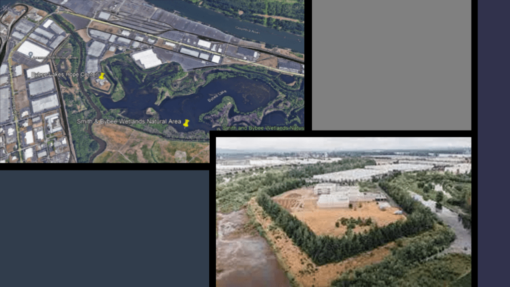
Up the Pacific Coast from California, in Portland, Oregon, there is a visible star fort point at the Smith & Bybee Wetlands Natural Area, which is now the location of the Bybee Lakes Hope Center for the homeless…
The Wirral Peninsula and the River Dee estuary separating northwest England and Wales, and a place where comparatively little water occupies such a large basin.
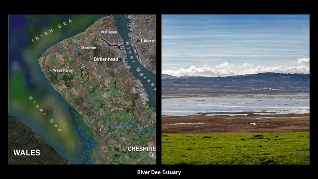
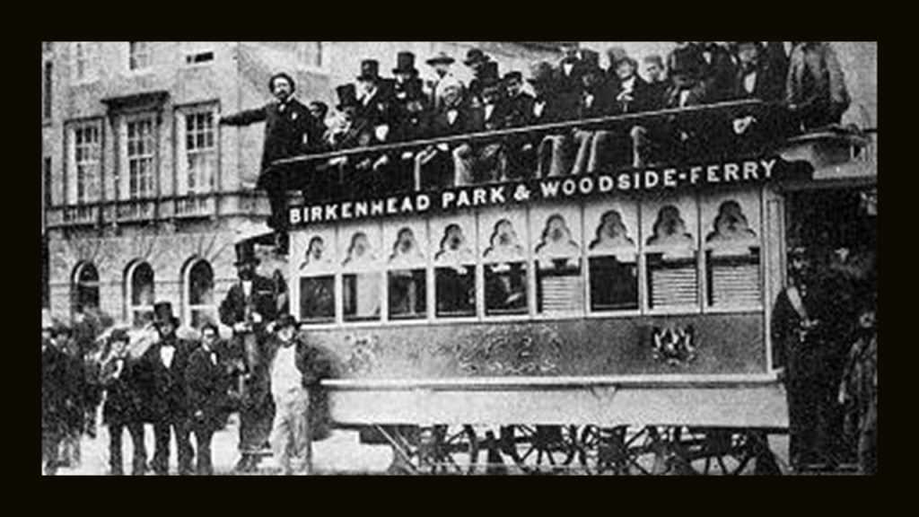
Birkenhead on the Wirral Peninsula was said to have expanded greatly as a result of the Industrial Revolution…
…and was the location of the first street tramway in Great Britain in 1860, and trams ran in Birkenhead until 1937.
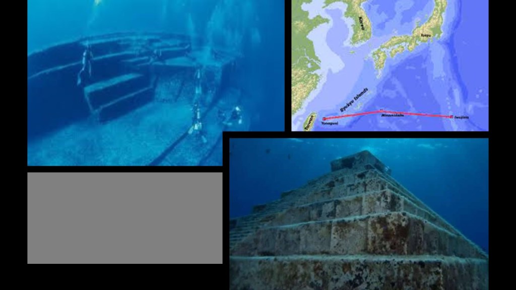
The submarine Yonaguni ruins off the coast of Japan’s Yaeyama Islands.
When I first learned about Yonaguni several years ago, a few years before I started doing my own research, I distinctly remember the argument being made that these were natural formations.
Why the effort cover-up of what are clearly man-made structures?
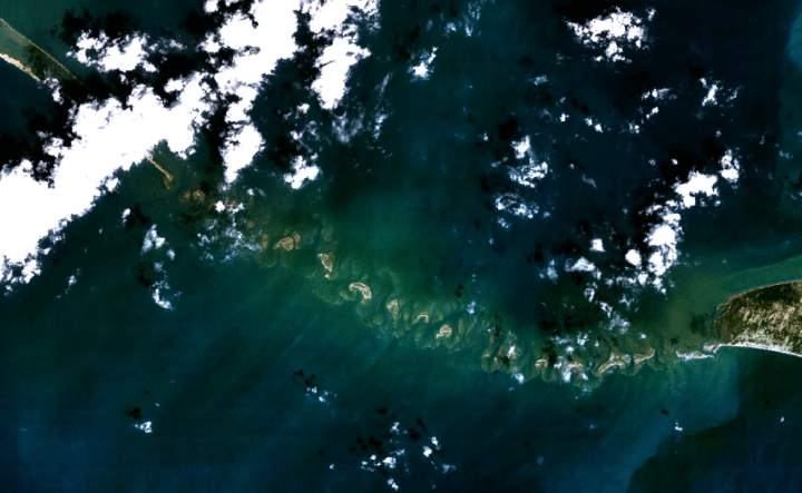
The last example I want to provide is the chain of low islands and reefs called Adam’s Bridge, also known as Rama’s Bridge, or Ramsethu, which separates the Gulf of Mannar from Palk Bay between India and Sri Lanka.
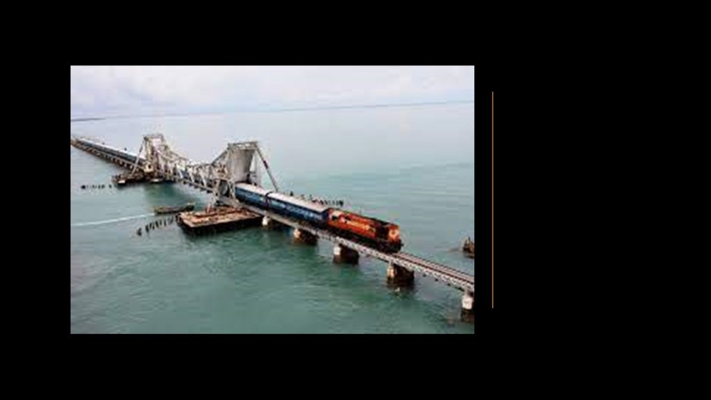
The Pamban Bridge, a railway bridge, connects the town of Mandapam in Tamil Nadu with Pamban Island and Rameswaram to the Indian Railways, ending at the Indian side of Adam’s Bridge.
It was said to have been constructed between 1911 and 1914, which was the year World War I started.
Described as a masterpiece of engineering, it has a movable section midway that is raised to allow ship and barge traffic to pass through.
So, were we actually capable of engineering feats like these based on the technology we are taught existed that at those times?
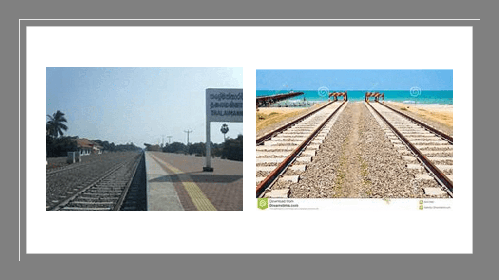
In Palk Bay, you can take a ferry across, in the same general location as the sunken parts of Adam’s Bridge, to Talaimannar, on Sri Lanka’s Mannar Island, and catch the train on to anywhere you want to go in Sri Lanka.
Other examples of advanced railroad technology crossing estuaries is found in New York City’s Jamaica Bay, called a partially man-made and partially natural estuary on the western tip of Long Island, and containing numerous marshy islands.
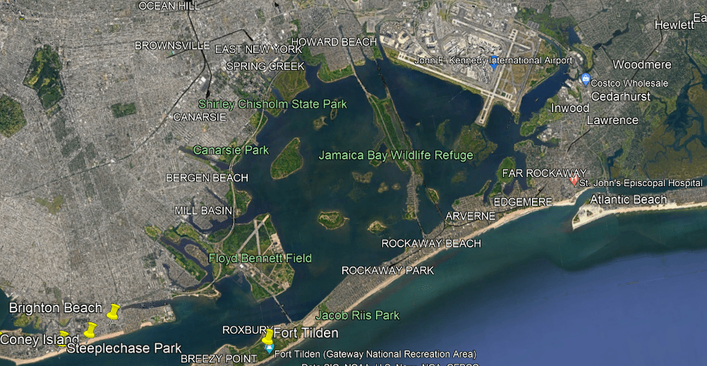
There is a rapid transit line of the New York subway system that operates here, the IND Rockaway Line that runs between the Aqueduct Racetrack Station terminal, close to the airport, and crosses Jamaica Bay to the Rockaway Park-Beach 116th Street Station terminal.

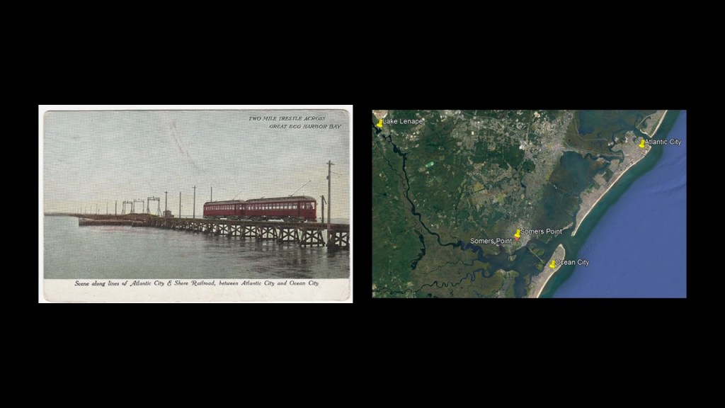
Also, historically at the Great Egg Harbor Estuary in New Jersey, where this old postcard shows the Atlantic City and Shore Railroad crossing a two-mile, or 3-kilometer, -long trestle bridge in the Great Egg Harbor Bay, and was part of an interurban trolley system in New Jersey that served Somers Point and several other cities between Atlantic City and Ocean City in the years between 1907 and 1948.
The reason given for the end of its operation was a hurricane damaging the viaduct in 1948, and fixing it was cost prohibitive because of the decline in trolley use.
There are many more estuaries, wetlands, and undersea ruins around the world, but this should give you some examples about why I believe the “Sinking of Atlantis” was a relatively recent occurrence, and that we have been given a brand new historical narrative superimposed over the original infrastructure and civilization to tell us what happened.
I am going to end this post here, and will continue to investigate your suggestions in the on-going series “All Over the Place via Your Suggestions.”