
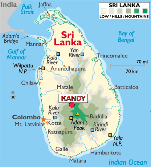
In the last post, I tracked the alignment from the French Southern and Antarctic Lands of the Kerguelen Islands, St. Paul Island, and Amsterdam Island, to Matara, a major city and commercial hub in the Southern Province of Sri Lanka, known historically as Ceylon.
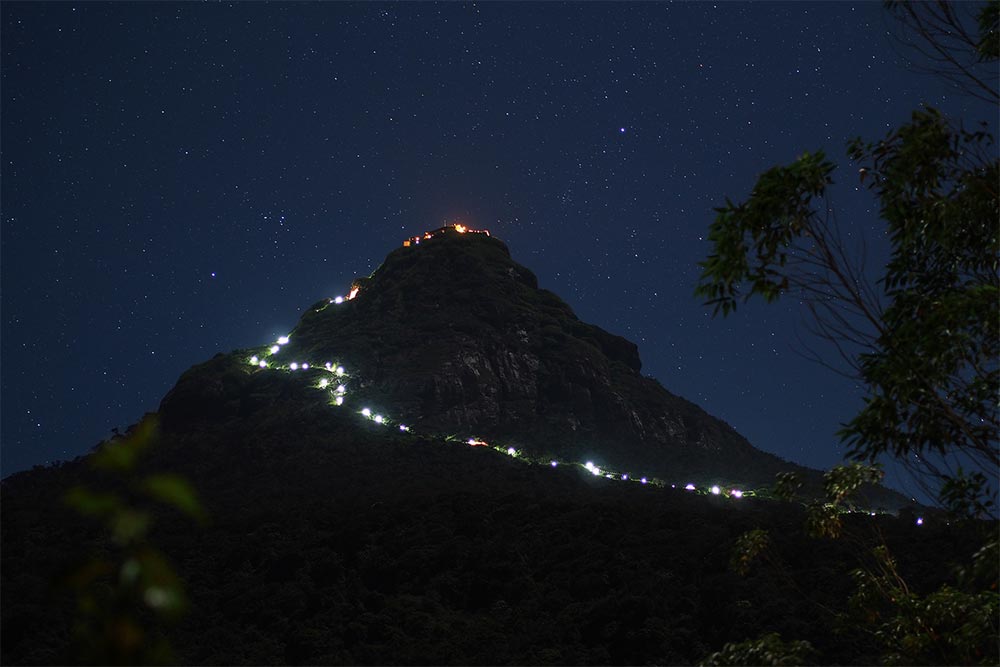
I am picking up the alignment at Adam’s Peak, located in the southern reaches of Sri Lanka’s Central Highlands.
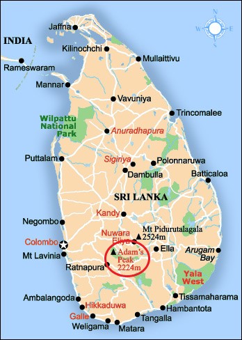
It is described as a tall conical mountain…
…well known for the Sri Pada, or “Sacred Footprint,” near the summit, revered as a holy site in Buddhist tradition to be the footprint of the Buddha, in Hindu tradition the footprint of Shiva or Hanuman, and in some Christian and Islamic traditions, that of Adam…or St. Thomas.
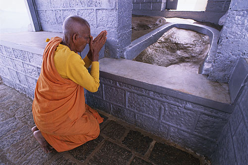
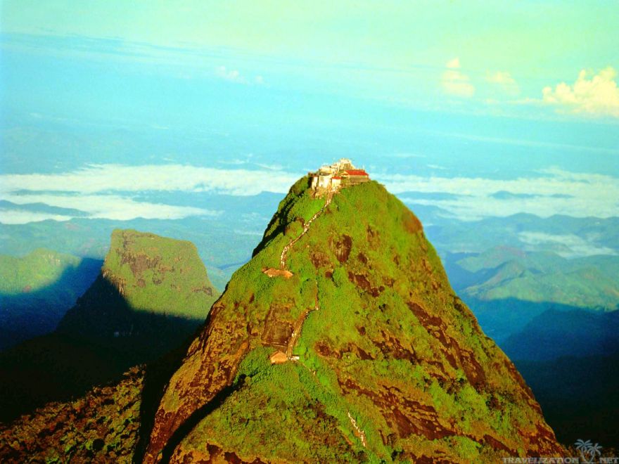
It is an important pilgrimage site.
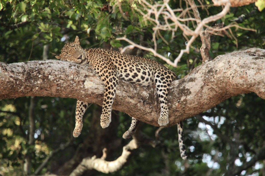
The region along the mountain is a wildlife reserve, home for species like elephants and leopards.
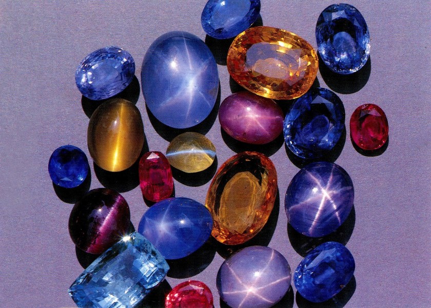
The districts to the south and east of Adam’s Peak yield gemstones, for which the island of Sri Lanka is famous.
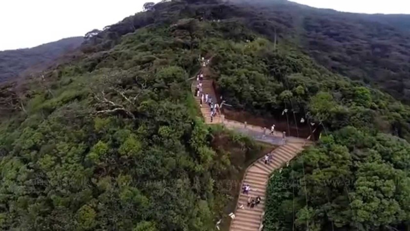
The greater part of the track leading from the base to the summit consists of thousands of steps.
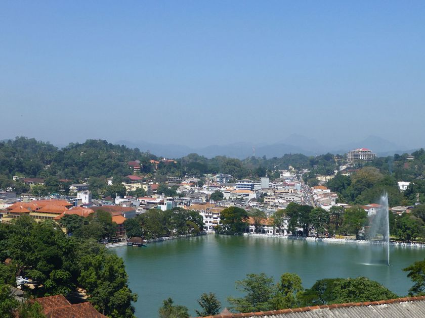
The next place I am going to take a look at on this alignment is Kandy, a major city in Sri Lanka, and the last capital of the ancient Kings’ era of Sri Lanka.
The Kingdom of Kandy was said to have been founded in 1469.
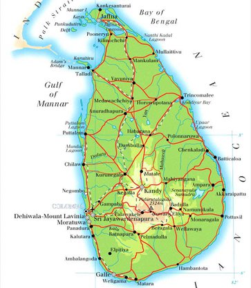
This map is described to be that Sri Lanka in the 1520s, known previously as Ceylon.
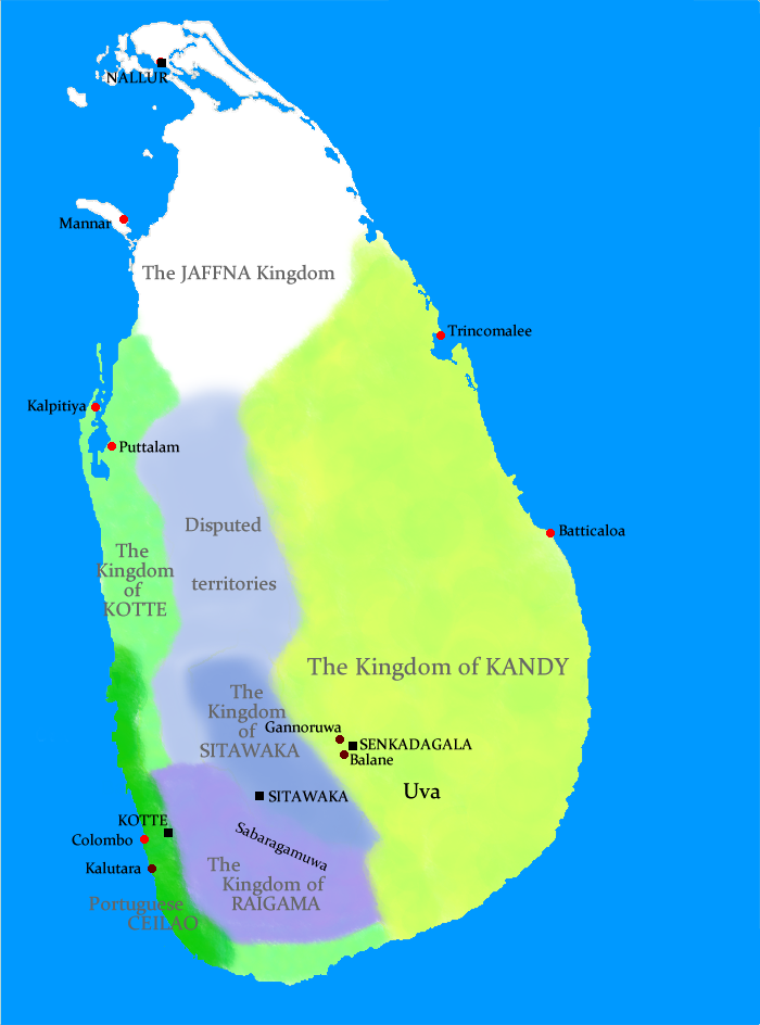
In 1592, Kandy became the capital city of the last remaining independent kingdom in Ceylon after the coast regions had been conquered by the Portuguese.
From that time, the Kingdom of Kandy kept the Portuguese and Dutch East India Company at bay, but succumbed finally to British colonial rule when the kingdom was absorbed into the British Empire as a protectorate via the Kandyan Convention of 1815, an agreement signed between the British and members of the King’s court which ceded the kingdom’s territory to British rule, and the last king was imprisoned.
Ceylon was a British Protectorate until its independence in 1948, and the name of the country was changed to Sri Lanka when it became a republic in 1972.
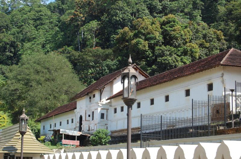
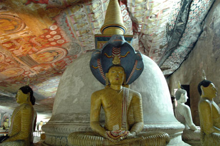
The Kandyan Convention was signed in the Temple of the Sacred Tooth Relic.
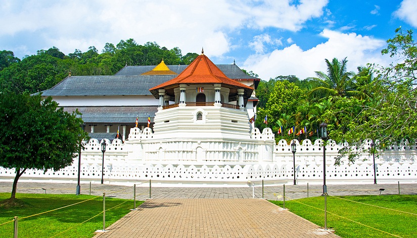
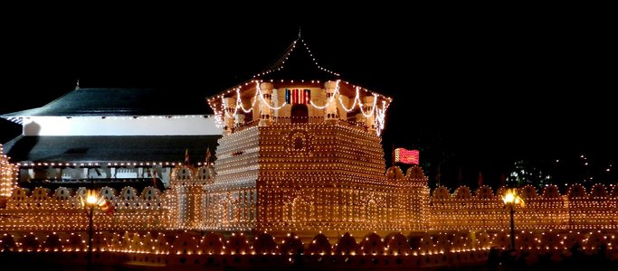
Also known simply as the Temple of the Tooth…
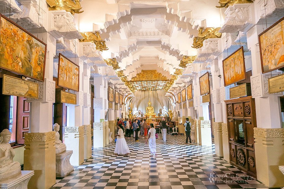
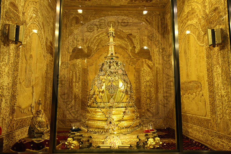
…it houses the tooth of the Buddha, venerated as the Buddha’s only surviving relic.
It is believed that whoever holds the relic, holds the governance of the country.
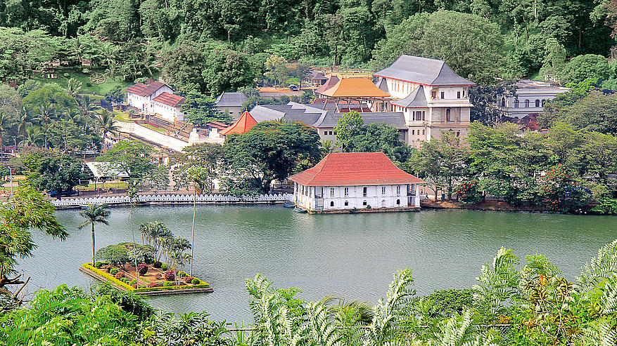
The Temple of the Tooth, or Sri Dalada Maligawa, is part of the Royal Palace Complex of the former Kingdom of Kandy, located on a canal…
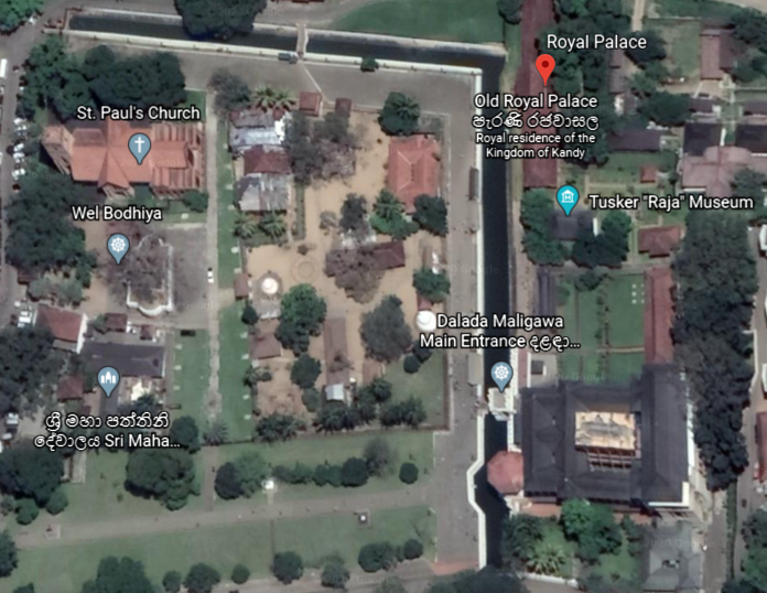
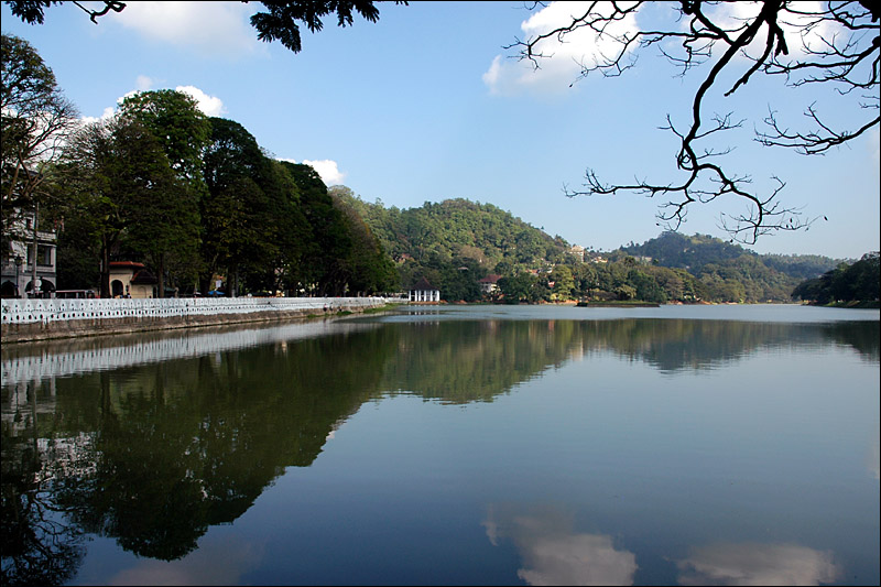
…extending from Kandy Lake, also known as the Kiri Muhuda, or Sea of Milk…
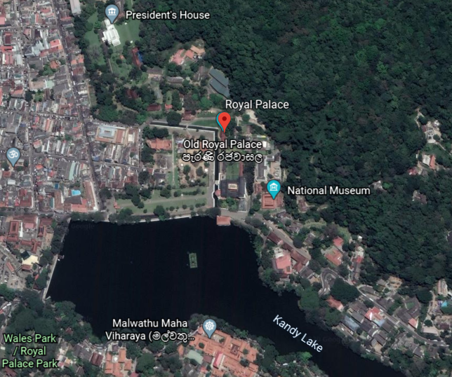
…an artificial lake, and said to have been built next to the Temple of the Tooth by the last King of Kandy in 1807.
After the kingdom’s downfall, the Royal Palace of Kandy became the residence for the primary British agent, and nowadays is a museum of archeology.
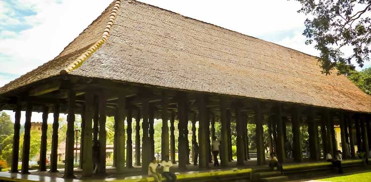
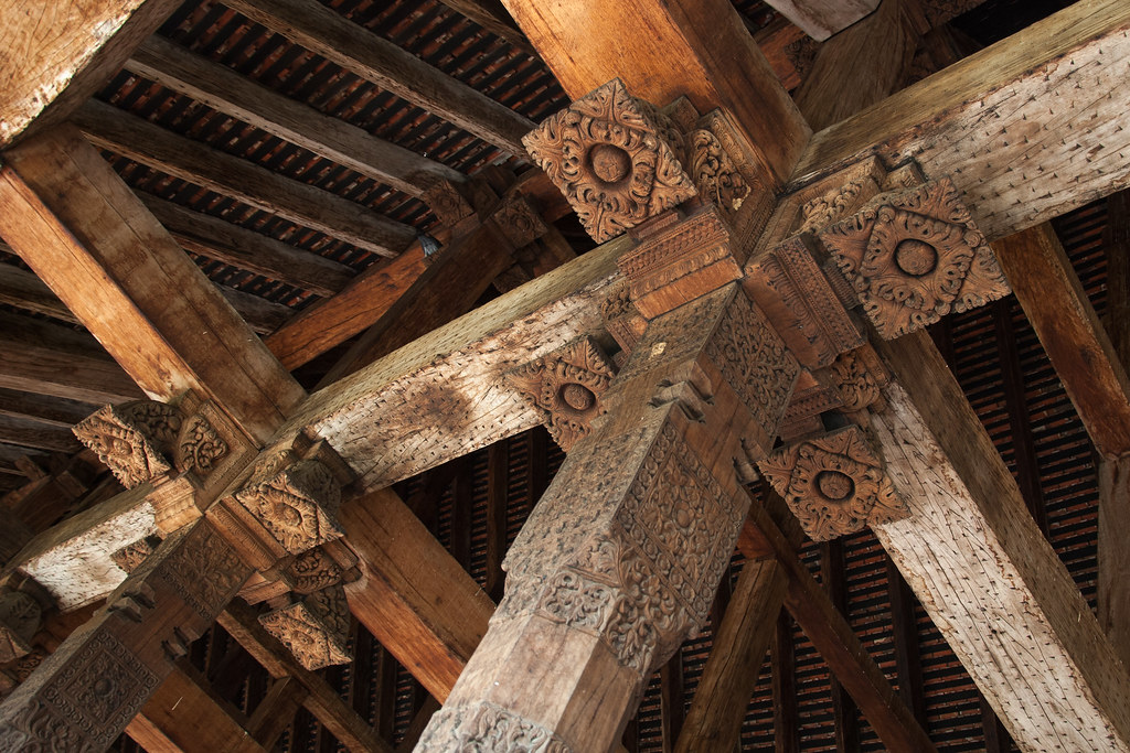
The Royal Audience Hall, or Magul Maduwa, was where the king met his ministers and carried out his daily administrative tasks, as well as being a center of religious and national festivities connected with the Kandyan Court.
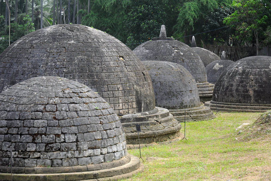
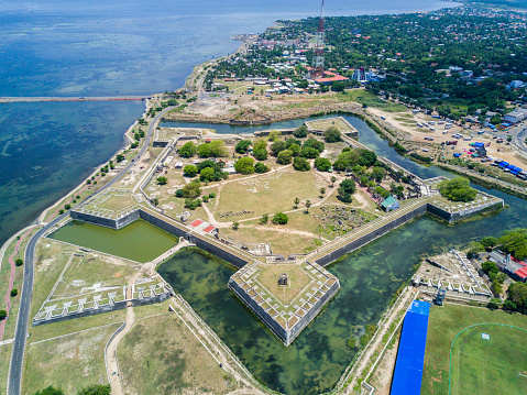
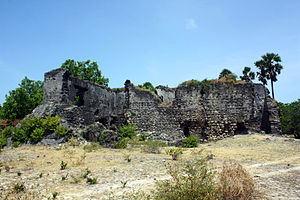
There were at least three star forts in Sri Lanka’s interior region between Kandy and the coast.
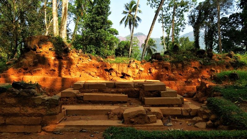
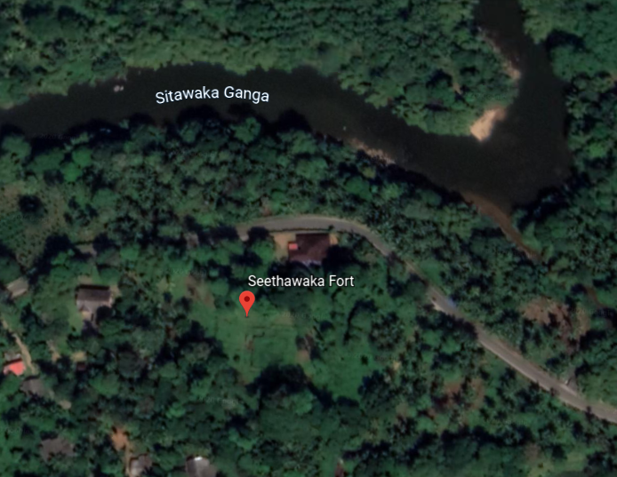
One was called the Sinhalese Sitawaka fort, which was adjoined with the palace of the king of Sitawaka.
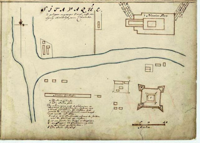
Both the palace and the fort were destroyed by the Portuguese.
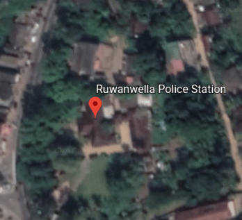
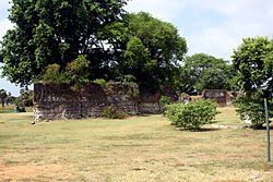
The Ruwenalla fort was said to have been constructed first as a wooden structure by the Dutch around 1665…
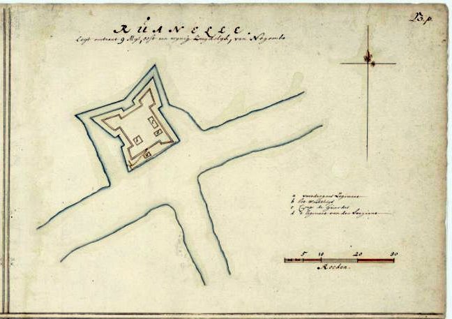
…and then the British were said to have erected a stone fort on the site in 1817.
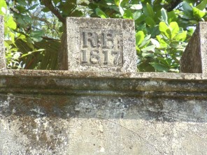
Today it is being used as a police station.
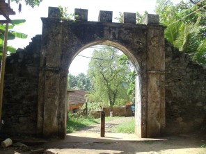
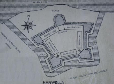
Then there was the Hanwella fort, located at the site of an ancient ferry crossing on the Kelani River.
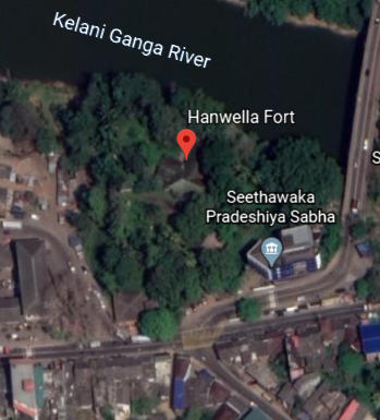
We are told that the fort was thought to have been originally constructed by King Mayadunne of Sitawaka, who ruled between 1521 and 1581.
Then Portuguese occupied the fort in 1597 and re-built it.
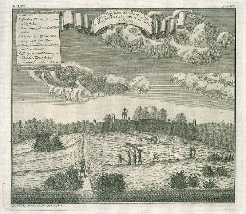
The Dutch were said to have captured it, and constructed a star-shaped fort, completing the work in 1684.
Eventually the fort came under control of the British in 1786, and little evidence of the fort remains with the exception of remnants of the fortifications and the moat.
This is a rest house said to have been built by the Dutch where the fort was…
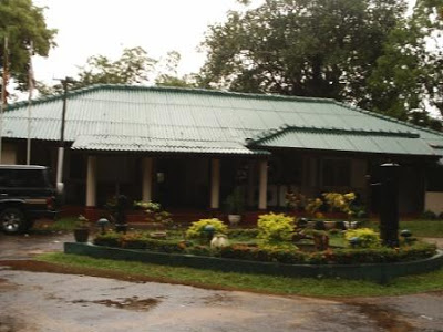
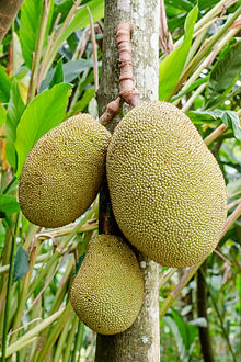
…that was even visited by the Prince of Wales, Albert Edward, in 1875, who, we are told, planted a jackfruit tree on the site to commemorate his visit to Ceylon, and the tree, and two stone seats said to have been constructed for the royal visit, are still on the site.
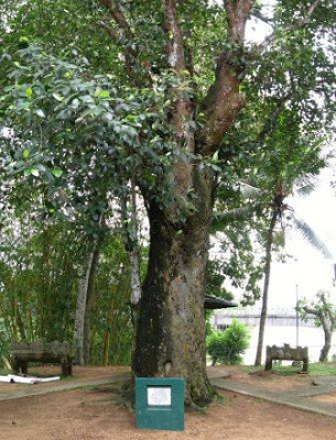
The jackfruit is the national fruit of Sri Lanka, and is native to that part of South Asia.
One more point I would like to make before moving on to the next place on the alignment.
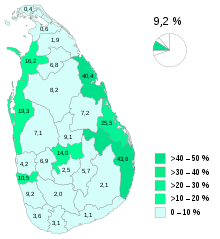
Sri Lanka is one of the few places that I know of to have an acknowledged ethnic minority group called Moors.
They comprise 9.2% of the population, which is approximately a population of 1.9 million Moors in the country, with Kandy being one of their population centers.
They are mainly native speakers of the Tamil language…

…with the influence of Sinhalese…

…and Arabic words.

The Moors of Sri Lanka are predominantly followers of Islam…and are also matrilineal, in which kinship is traced, and great influence is held by, women.
This book is a study about Muslim, Sinhalese, and Tamil households in Sri Lanka.
So…how…did…that…happen according to what we are told in our narrative?!
For one thing, the ancient worldwide Moorish Civilization was matrilineal, and not patriarchal, a civilization which has been left out of the history books.
Yes, the Washitaw, also known as the Ancient Ones, are still very much here with us today..
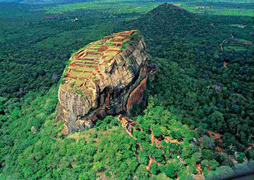
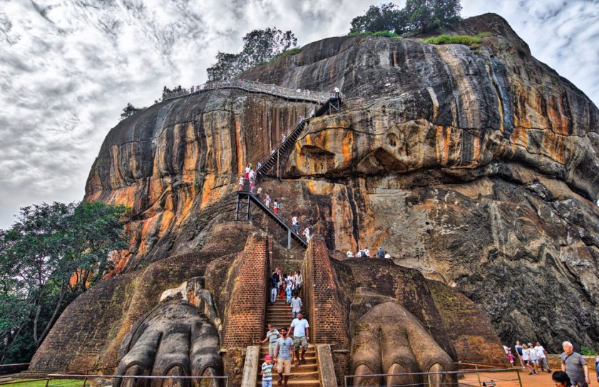
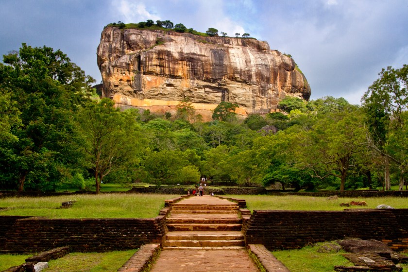
The next place on the alignment that I would like to look at is Sigiriya.
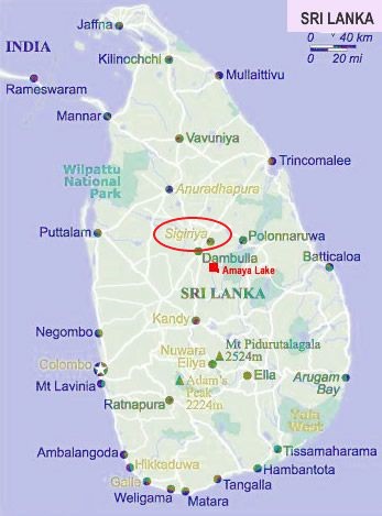
Sigiriya is described as an ancient rock fortress near Dambula in Sri Lanka’s Central Province.
It is dominated by Lion Rock.
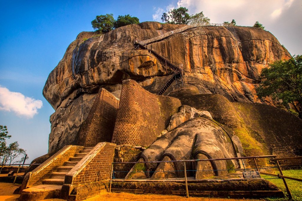
King Kashyapa was said to have built his palace between 477 and 495 AD, on top of Lion Rock, which he had decided to make his new capital.
There are 1,200 steps going to the top of Lion Rock, starting from where he built a gateway in the form of enormous lion paws.
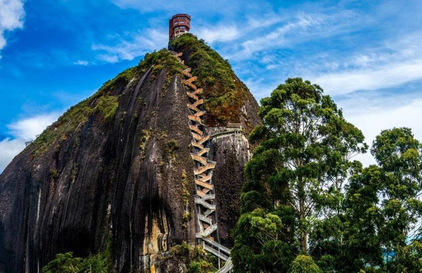
It reminds me visually of the Stone of El Penol, that I found tracking an alignment in Guanape, Colombia.
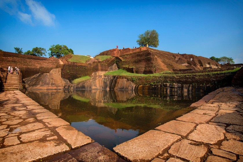
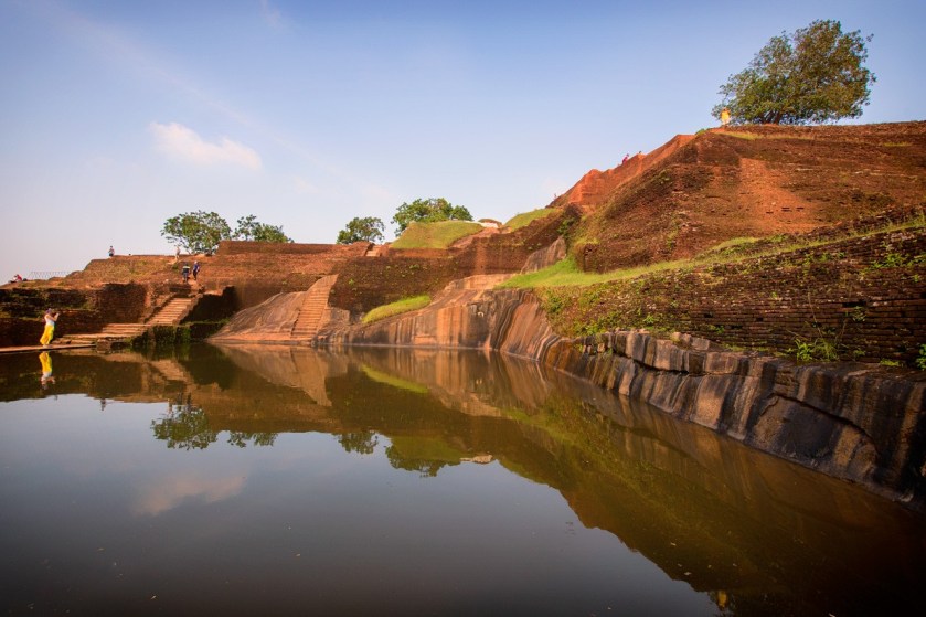
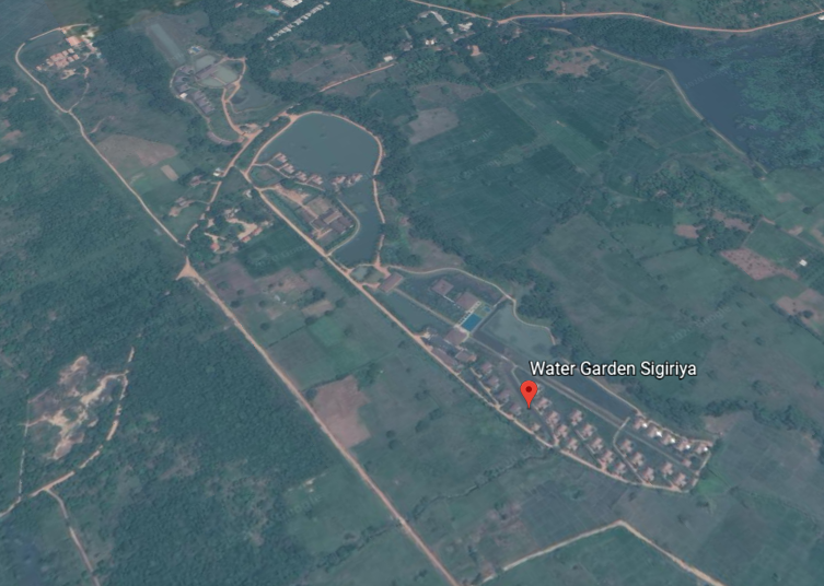
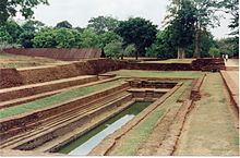
This is a view of the water gardens of Sigiriya from the summit of the rock.
They are built symmetrically on an east-west axis, connected with the outer moat to the west…

….and the large artificial lake to the south of Sigiriya rock.
All the pools are interlinked using an underground conduit network fed by the lake, and connected to the moats.
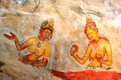
The mirror wall is located in the mid-level terrace where the lions entrance is located, and was said to have been originally so highly polished that the king could see himself while he walked alongside it.
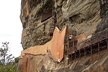
A Spiral staircase at the mirror wall…
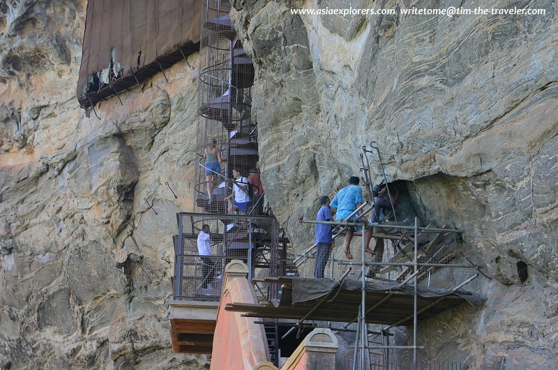
…leads to fresco paintings depicting women that cover most of the western face of the rock, called the largest picture gallery in the world.
After all the work that King Kashyapa put into this place, we are told the capital and royal palace were abandoned after his death, and that it was used as a Buddhist monastery until the 14th-century.
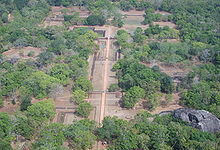
Sigiriya is listed as a UNESCO World Heritage Site, and is considered one of the best-preserved examples of urban planning in the world.
Jaffna is the next place on the alignment, and is the capital city of Sri Lanka’s Northern Province.
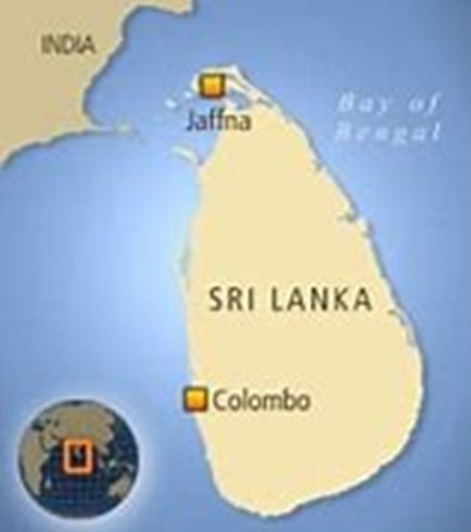
It is the administrative headquarters of the Jaffna District, on the Peninsula of the same name.
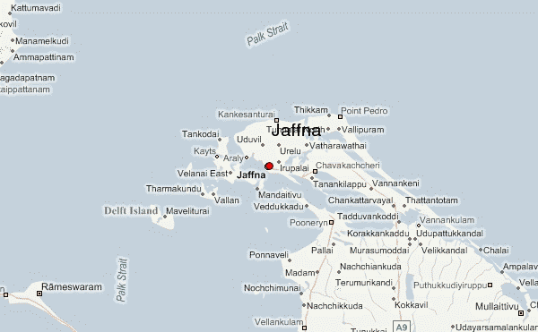
Jaffna is located 6-miles, or 9.7-kilometers, from Kandarodai, a famous emporium city and capital of Tamil kingdoms in northeastern Ceylon from classical antiquity, and the location of the ancient Buddhist monastery known as Kadurugoda Vihara.
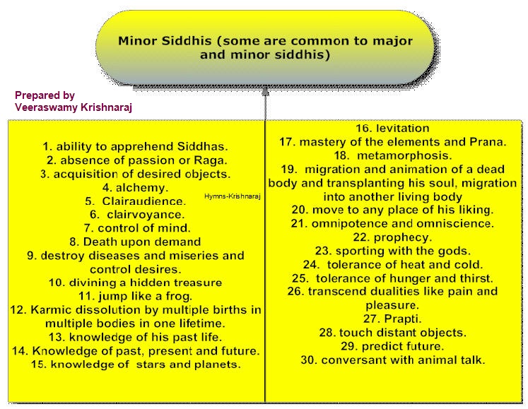
Jaffna and the surrounding region was part Naga Nadu, and inhabited by one of the ancient tribes of Ceylon, the Nagas, generally represented as a class of super humans.
Also called Serpents of Wisdom, nagas were masters of raising serpent-like kundalini energy from the base of the spine to the third-eye. connecting with higher self in physical form…

…and masters of higher human abilities called “Siddhis.”
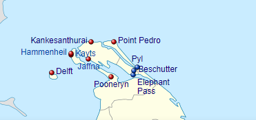
Jaffna was said to have been made into a colonial port town by the Portuguese around 1618, at which time they were said to have built the Jaffna fort…
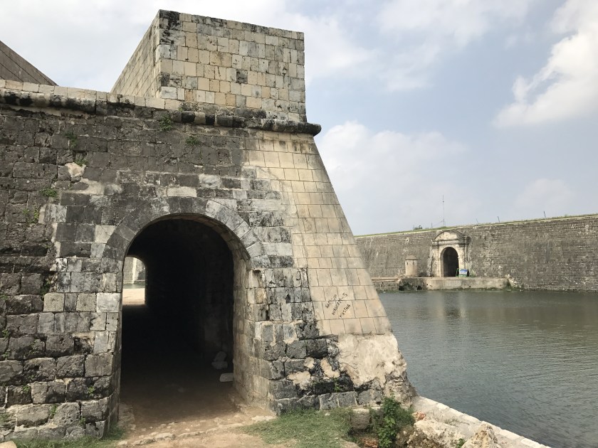
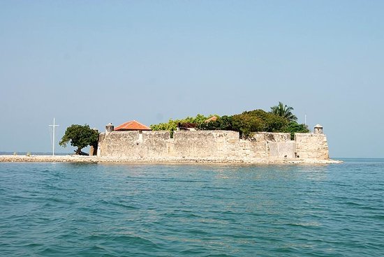
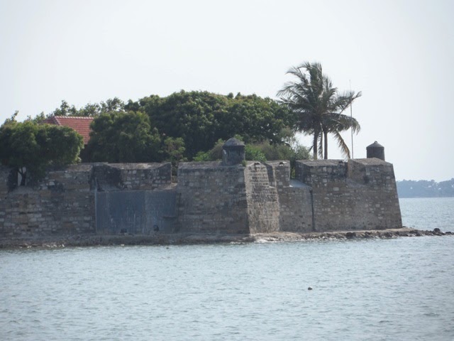
…Fort Hammenheil, built in 1618, around a small island between the islands of Kayts and Karaitivu on the Jaffna Peninsula…
…the Kayts Island fort in 1629…
…the Delft Island fort is attributed to the Portuguese some time during that time period…
…and the Pooneryn Fort, just adjacent to the Jaffna Peninsula..
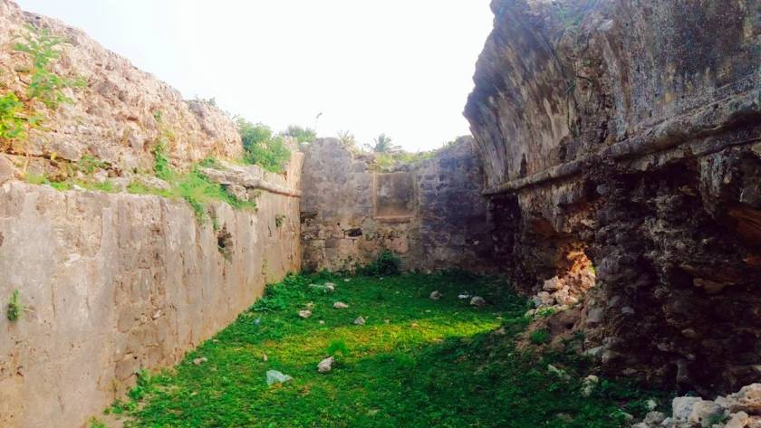
The forts on the Jaffna Peninsula at Kankesanthurai, Point Pedro, Pyl, Beschutter, and Elephant Pass were all completely destroyed at some point in time during colonial times.
Then the Portuguese lost Jaffna to the Dutch East India Company in 1658, the world’s most valuable company of all-time, worth $7.9-trillion.

The Dutch were said to have lost their possessions in Sri Lanka in 1796, when they were taken over by the British, after which time the British were said to have built the major roads and railways connecting Jaffna with Kandy, Colombo, and the rest of the country…
…with the Ceylon Government Railway having been founded in 1858…
…and the rail network introduced by the British Colonial government in 1864.
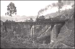
This is said to be a picture circa 1880 of a steam-powered train on the hill-country Colombo – Badulla line.
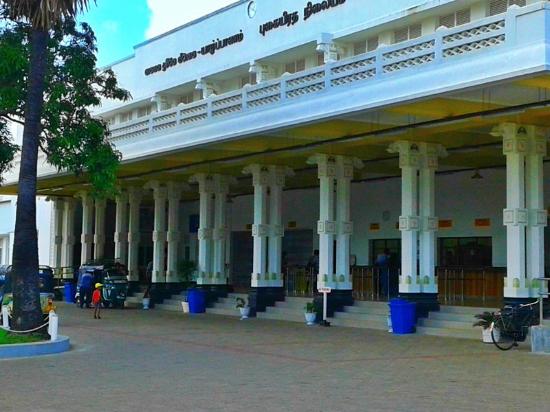
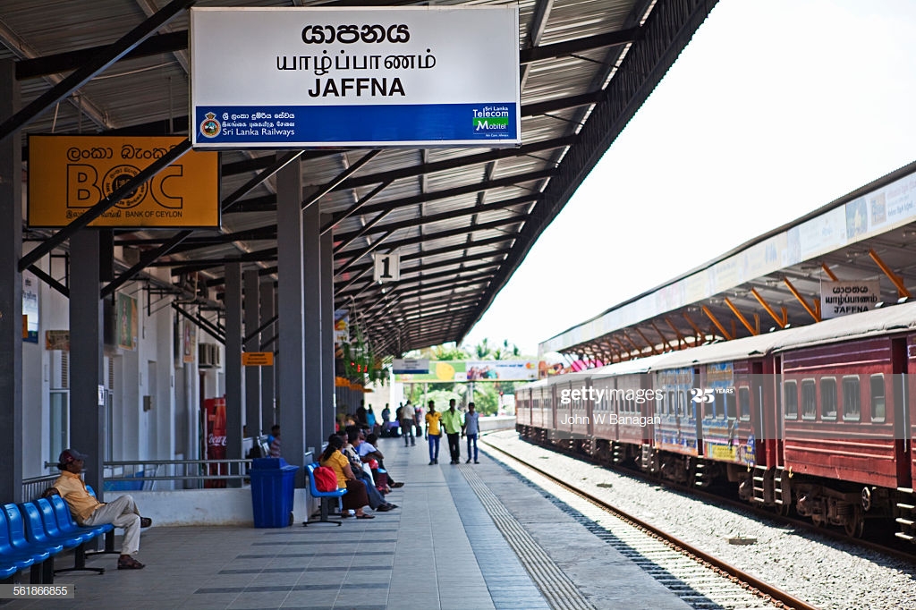
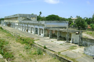
This is the Jaffna Railway Station today, said to have been built originally in 1902, and reconstructed in the time-frame around 2011-2013…
…due to damage it sustained during Sri Lanka’s civil war in the years between 1983 and 1995.
The Jaffna Public Library was said to have originally been built in 1933, and one of the largest libraries in Asia, with over 97,000 books and manuscripts.
Built in what was called an Indo-Saracenic style, we are told it was burned down by an organized mob in 1981.
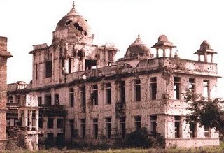
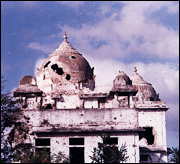
By 2001, the rehabilitation of the original building into a new structure was complete, and new books received, though its old books and manuscripts were not replaced.
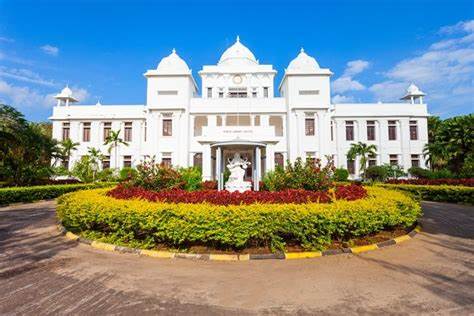
Apparently the books and manuscripts lost in the fire were irreplaceable.
I am going to end this post here, and pick up the alignment in Vellore, located in the south Indian State of Tamil Nadu.

As an addendum to Adam’s Peak. I was there a long time ago. Only two decades later did I realize that I saw something amazing. As the sun rose, a shadow was cast over the jungle canopy below. The shadow was inexplicably triangular (when taking contours of the mountain into account). Out of the top of the shadowed triangle, a white light spew for quite some time. And surrounding this light, a circular rainbow appeared that stopped at the edges of the triangular shadow. The pilgrims went into religious trance. Some of the women saw their gods appear over the canopy below. They pointed these out to me, but I could not see them. I have come to realize over the years that this is a key point on earth and that I witnessed something special.
LikeLike