
In the last post, I tracked the alignment from the Ellora Caves in the Aurangabad District of Maharastra, India, and one of the largest, rock-cut, monastery-cave temple complexes in the world, and Khuldabad in Aurangabad, known as the “Valley of the Saints;” to Indore, the largest and most populated city of Madhya Pradesh State.
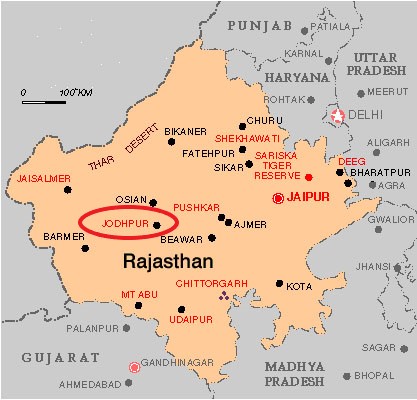
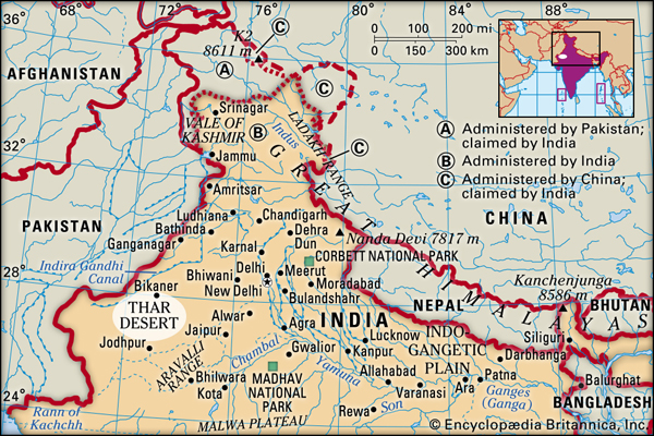
The next place on the alignment is Udaipur, also known as the “City of the Lakes,” in India’s Rajasthan State.
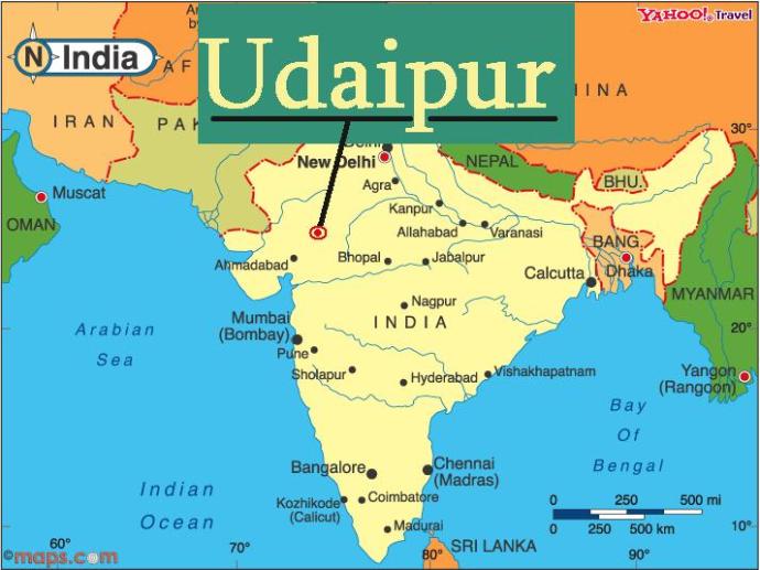
Another nickname of Udaipur is “Venice of the East.”
It was the historic capital of the Mewar Kingdom…
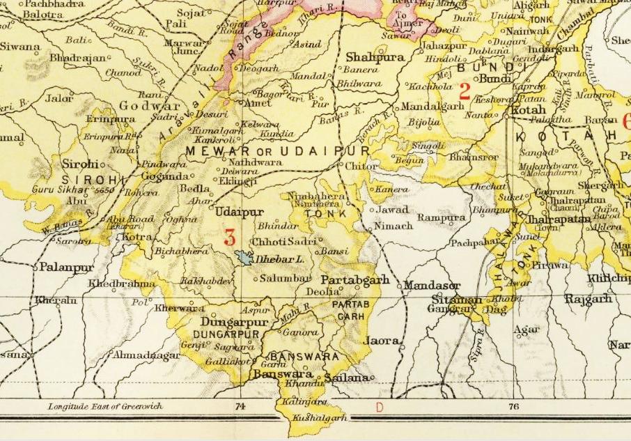
…said to have been founded in 1558 by Udai Singh II of the Sisodia clan of Rajput…
…after he shifted his capital from Chittorgarh…
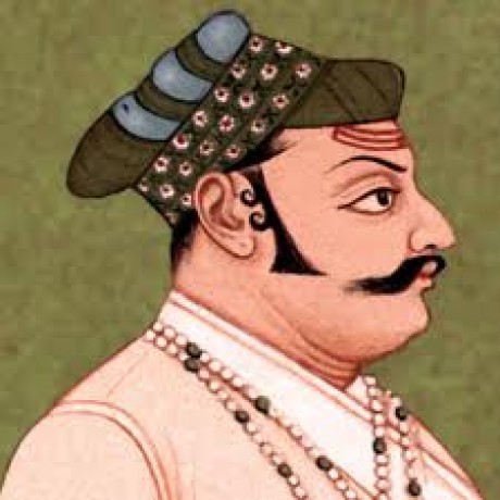
…because it was beseiged by the third Mughal Emperor, Akbar, who reigned from 1556 to 1605.
Yet I find this picture of Akbar looking more like a saint, with the light of spiritual illumination surrounding his head, than a depiction of a general who was said to have extended the influence of the Mughal Empire over almost the entire Indian subcontinent because of military, political, cultural, and economic dominance.

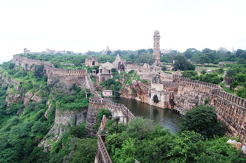
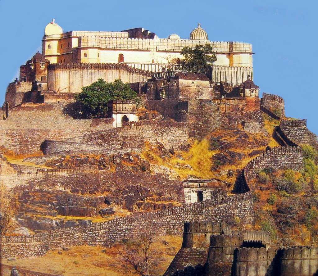
Udai Singh II was said to have been crowned by the nobles of Mewar in 1540 in the Kumbhalghar, a Mewar fortress said to have been built in the Aravalli Hills around Udaipur in the 15th-century the Mewar King Rana Kumbha.
It is a UNESCO World Heritage Site included in the Hill Forts of Rajasthan.
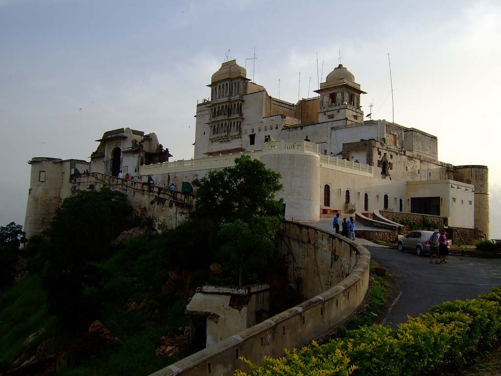
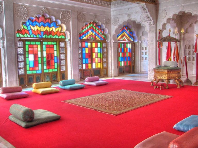
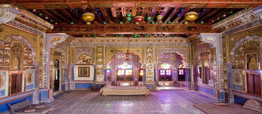
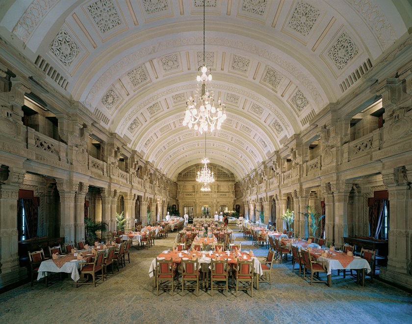
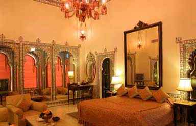
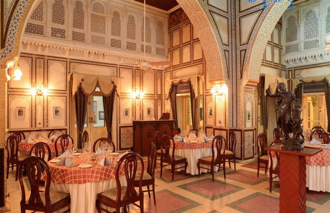
Udai Singh II was said to have built his new palace on a location chosen for him by a hermit he came across while looking for a place to build it, called the “City Palace” today.

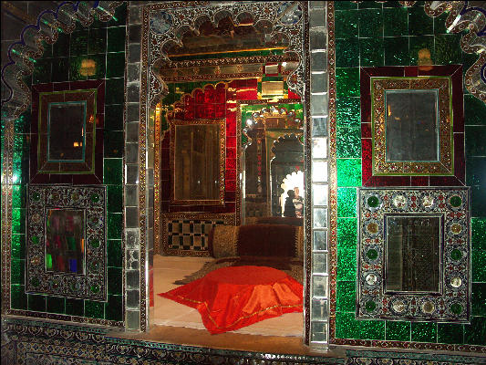
This is the entrance to the Peacock Courtyard at the City Palace, known as the “Mor Chowk.”

This courtyard was used for royal banquets, and has mosaics of peacocks on the walls surrounding the courtyard.

Udai Singh II was also said to have built a 4-mile, or 6-kilometer, long wall, with 7-gates, in order to protect Udaipur from external attacks.
This is one of the wall’s gates…the gate of the City Palace…known as the “Tripolia Pol,” or “Triple Gate.”
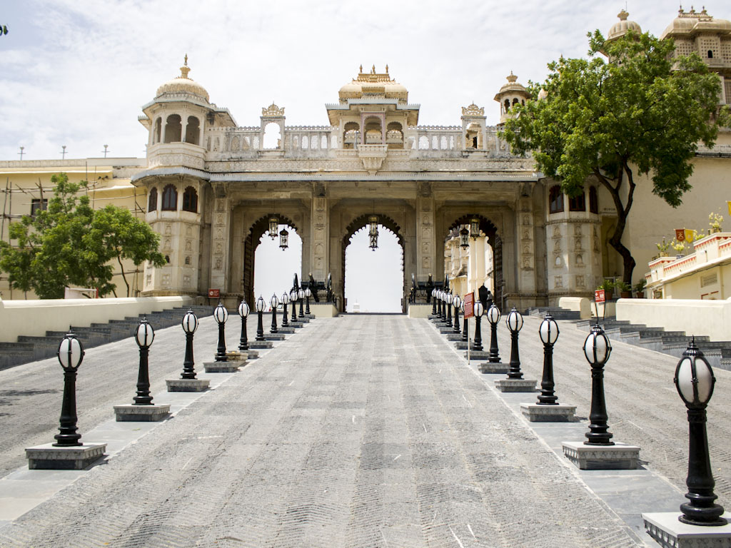
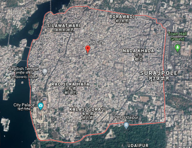
The area within this wall is still known as the “Old City” or “Walled City.”
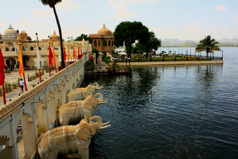
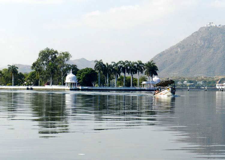
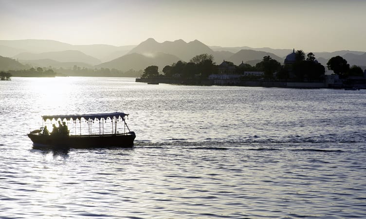
This is a view of the City Palace in the Old City from Lake Pichola.
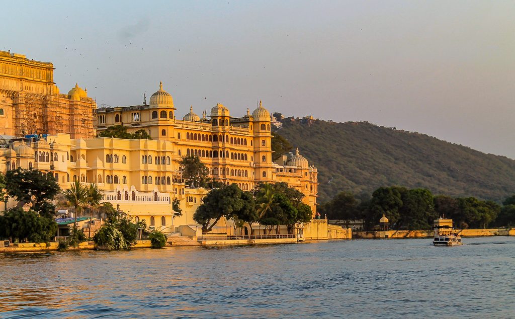
Lake Pichola is described as an artificial freshwater lake that was said to have been created in 1362 by Picchu Banjara, a gypsy tribesman who transported grain during the reign of Maharana Lakha, the third Maharana of the Mewar Kingdom.
It’s not clear here.
Are we being told one man built this artificial lake?
I looked for other references, but the available historical record consistently came back to the lake having been built by this man…in the 1300s…before Udaipur was said to have even been founded.
In addition, Lake Pichola has four artificial islands.
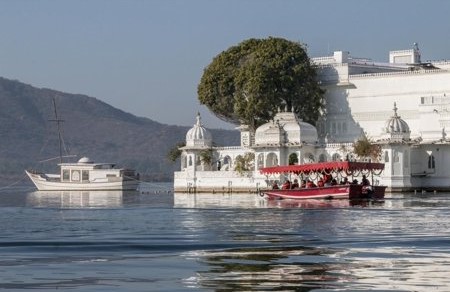
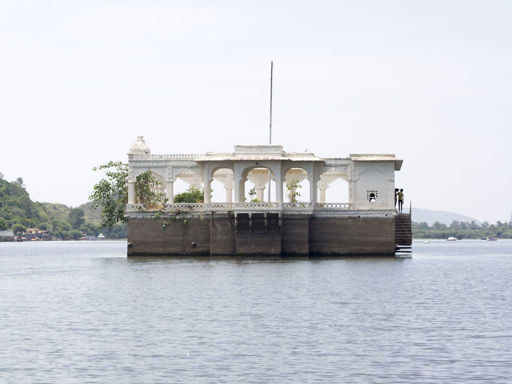
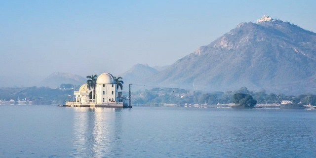
The Jag Niwas, where the Lake Palace is built.
Now a hotel, it was said to have been built between 1743 and 1746, under the direction of Mewar Maharana Janat Singh II.
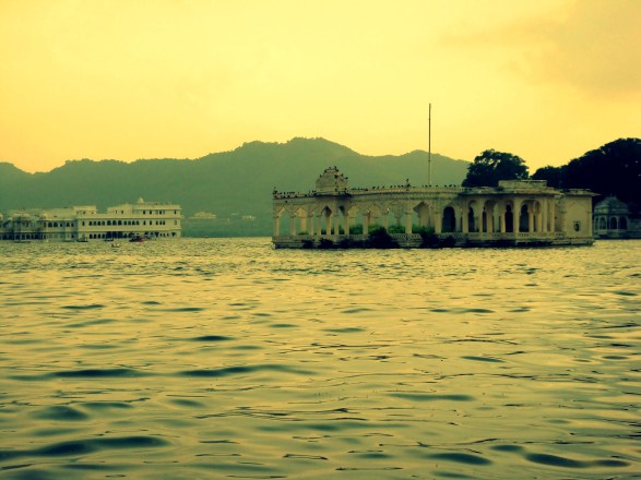
Jag Mandir is an island and palace in Lake Pichola…
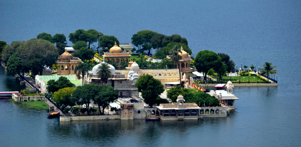
…said to have been constructed by three Maharanas some time between 1551 and 1652…
…as well as the island of Mohan Mandir…
…and Arsi Vilas.
So far, the origin stories of Udaipur, contrasted with the magnificence of the architecture and infrastructure, are just not adding up.
Let’s take a look at some other places in Udaipur and see what we find.
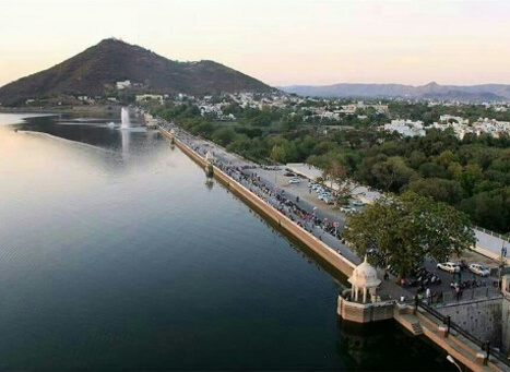
The Sajjan Garh fort is a hilltop palatial residence in Udaipur, with a panoramic view of the city’s lakes, palaces, and surrounding countryside…
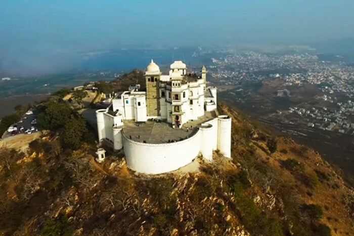
…and named after Maharana Sajjan Singh, who was said to have built it in 1884.
Also known as the Monsoon Palace, it was said to have been built there in order to watch the monsoon clouds.
Here is a beautiful example of the symmetry, proportion and alignment of archways and openings at Sajjan Ghar…

…that I have found around the world, like the Alhambra, in Grenada, Spain, and a classic example of Moorish architecture…

…the Palace of the Kings of Majorca in Perpignan, in southern France…
…and in Indonesia, at the Baiturraman Grand Mosque in Banda Aceh.

The Sajjan Ghar Fort overlooks Fateh Sagar Lake, another of Udaipur’s artificial lakes.
Fateh Sagar Lake was said to have been built in 1680s, with no details on the builders of it.
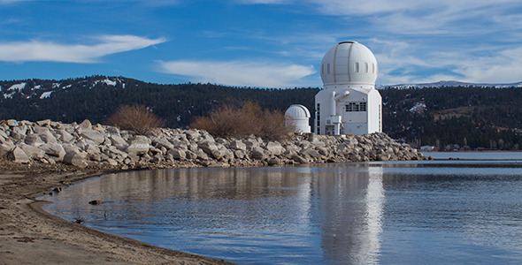
Udaipur Solar Observatory is on one of three artificial islands in the lake.
Said to have been built in 1976, it has one of the most powerful solar telescopes in the world.
It was said to follow the model of the solar observatory at Big Bear Lake in Southern California.
Udai Sagar Lake is another one of the lakes of Udaipur, and said to have been constructed as a reservoir for the city in 1559 by Maharana Udai Singh II, the founder of Udaipur.


Dhebar Lake near Udaipur is India’s second-largest artificial lake.
Dhebar Lake was said to have been created in the 17th-century by Rana Jai Singh when he built a marble dam across the Gomati River, resulting in the largest artificial lake in the world at the time.


The tribe of Bhil Minas inhabits all three islands on Dhebar Lake.
The Bhils, who speak a subgroup of the western zone of the Indo-Aryan languages, are one of the largest indigenous groups in India, as well as among the most economically deprived peoples of India.
This is interesting to note because they are among the oldest communities in India and were inhabitants of the ancient Indus River Valley civilization.
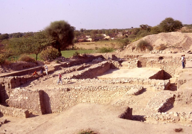
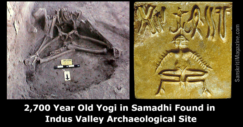
As a matter of fact, the ruins of Balathal in the Udaipur District were from what was connected the Ahar-Banas Culture of the Harappans of Indus River Valley, one of at least 90 Ahar Culture sites in the basins of the Ahar and Banas rivers…
…and where the skeletal remains of a 2,700-year-old yogi were found, sitting in a state of what is called “samadhi,” a meditative consciousness in which human consciousness becomes one with cosmic consciousness.
The Bhil Minas tribe was the ruling tribe before the Kachhawaha clan of Rajputs, otherwise known as the Mewar Kingdom, forced them to hide out in the Aravalli Hills, and they were named a criminal tribe by the British government in 1924 to keep them from regaining power over the Rajputs.
They were subsequently given protection as a Scheduled Tribe after the upliftment in 1949 of the Criminal Tribe Act, which had been enacted on October 12th of 1871.
The Criminal Tribes Act of 1871 criminalized entire communities by designating them as habitual criminals, and restrictions on their movements imposed, including men having to report to the police once per week. Hmmm.
A Scheduled Tribe is recognized by the Indian Constitution, have political representation, and yet they are legally totally or partially excluded from various types of services important for leading a healthy life, and altogether, the Scheduled Tribes of India make-up almost 10% of the population, and are considered India’s poorest people.
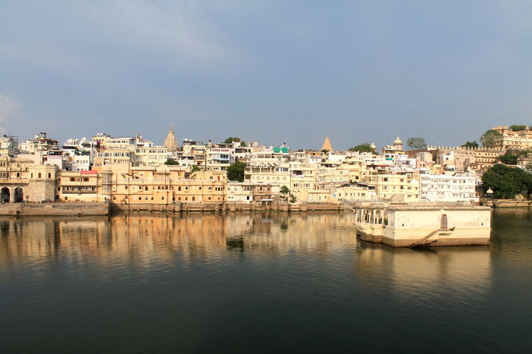
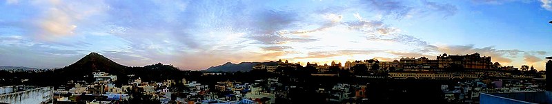
This is a panoramic view of Udaipur’s Old City, which was said to date back to the city’s founding by the Mewar king, Maharana Udai Singh II, in 1558.
Udaipur is a great case study of the marginalization, and even criminalization, of the earth’s ancient indigenous people, and the re-written history to explain the existence of their masterful infrastructure.
The next place on the alignment is Jodhpur, the second-largest city of India’s Rajasthan state, and historically the capital of the Kingdom of Marwar.
Also known as the Blue City, Jodhpur is dominated by Meheranghar Fort.
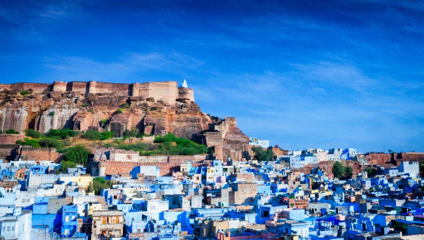
Meheranghar Fort is one of the largest forts in India, situated 410-feet, or 125-meters, above the city, and enclosed by thick walls.
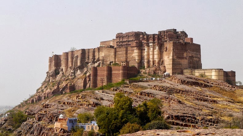
It was said to have been by Rao Jodha, the 15th Rathore ruler, starting in 1459, who we are told was the founder of Jodhpur.

Also called the Citadel of the Sun, inside the walls of Meheranghar Fort there are several palaces known for their intricate carvings and expansive courtyards.

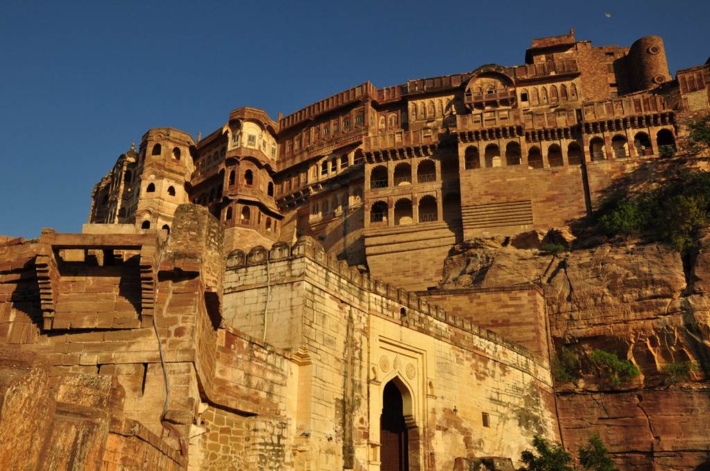
The palaces of Mehrangahr Fort constitute one of the finest museums in Rajasthan.
In 2016, Jodhpur, along with Mumbai, made it on the list of the world’s most inspiring cities.

The Umaid Bhawan Palace in Jodhpur is one of the world’s largest private residences.
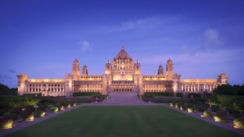
It was said to have been built starting in 1929 by the Majarana Uwaid Singh as the principal residence of the former Jodhpur royal family, and still owned by the family in the present-day.

We are told the Majarana decided to build the palace to help the farmers of Jodhpur, who had just experienced a severe famine, and that he commissioned the British architect, Henry Vaughan Lanchester, for the design of the palace.
We are told it took 2,000 to 3,000 farmers 14-years to complete the construction project, which took place in 1943 (in the middle of World War II).
A part of the palace is managed by Taj Hotels, and it recently received an award as the world’s best hotel.
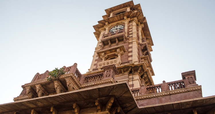
The Clock Tower of Rajasthan in Jodhpur, also known as the Ghanta Ghar…
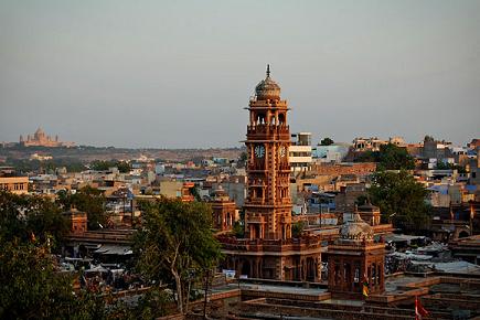
…was said to have been built by Sardar Singh, who was the Maharaja of Jodhpur between 1895 and 1911.
The Jaswant Theda in Jodhpur is a cenotaph, which is defined as an empty tomb or monument erected in honor of a person or group, also said to have been built by Maharaja Sardar Singh, in 1899, in honor of his father, the previous maharaja, Jaswat Singh II.


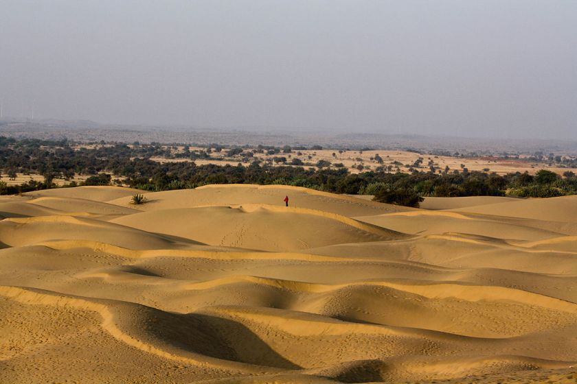
Jodhpur is situated next to the Thar Desert, also known as the Great Indian Desert, covering about 66,000-square-miles, or 170,000-kilometers-squared.
My question is this: Is there enduring infrastructure underneath all those sand dunes?
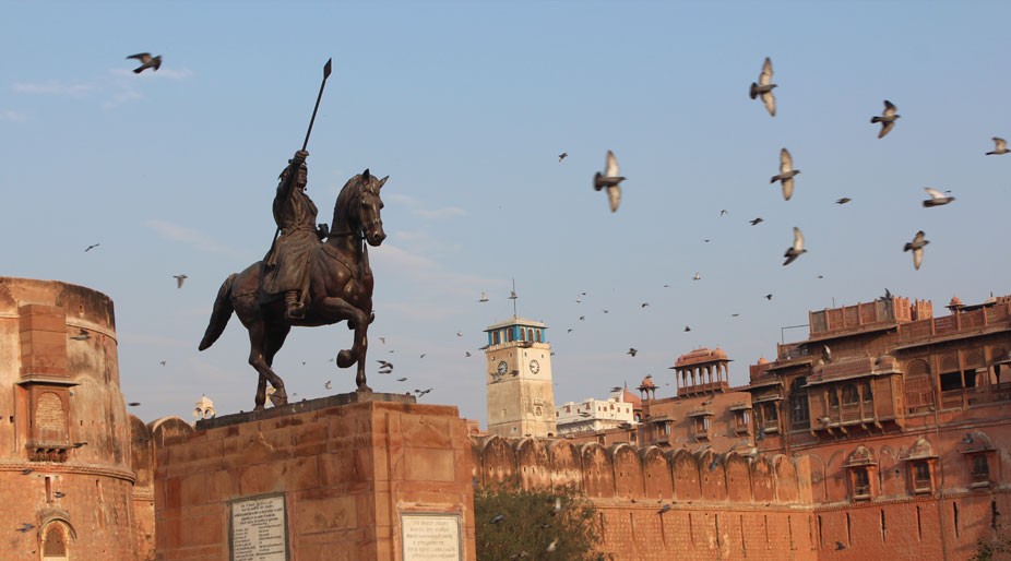
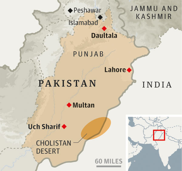
The next place I would like to look at is a city on the other side of the Thar Desert from Jodhpur, and which is Bikaner, also in India’s Rajasthan state.
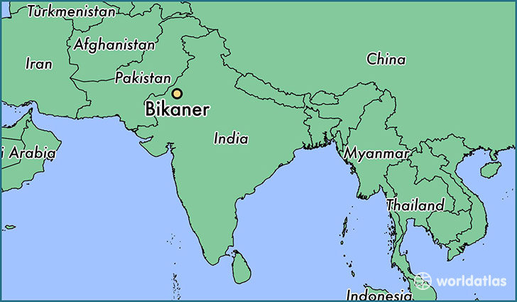
Formerly the capital of the Princely state of Bikaner, it was said to have been founded in 1488 AD by Rao Bika, the son of Rao Jodha, the founder of Jodhpur.
The Gang Canal, also known as Ganga Canal, of Rajasthan was said to have been an irrigation system of canals built between 1925 and 1927 by Maharaja Ganga Singh of Bikaner.

The Indira Gandhi Canal runs near here as well.
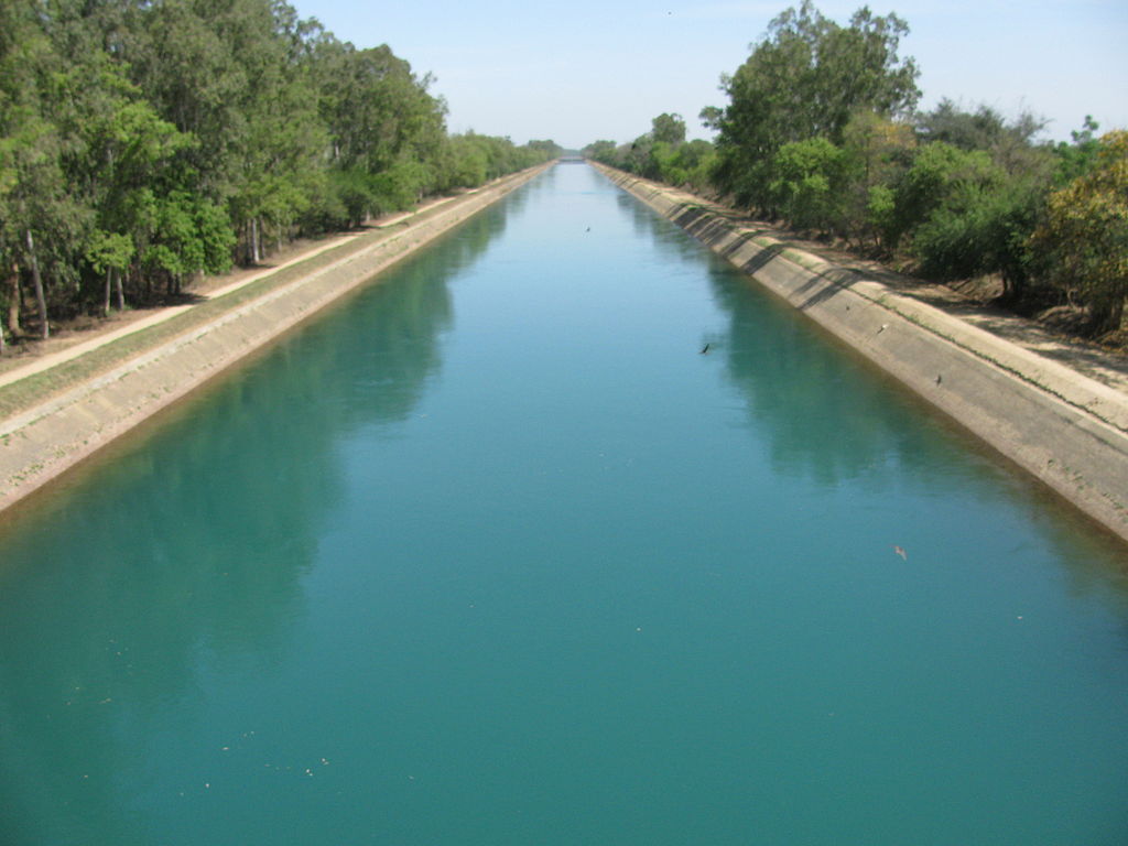
It is the longest canal in India, and was said to have been completed in 1983.
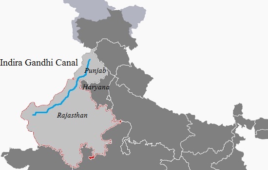
It runs 400-miles, or 650-kilometers, from northern India to irrigation facilities in the Thar Desert.
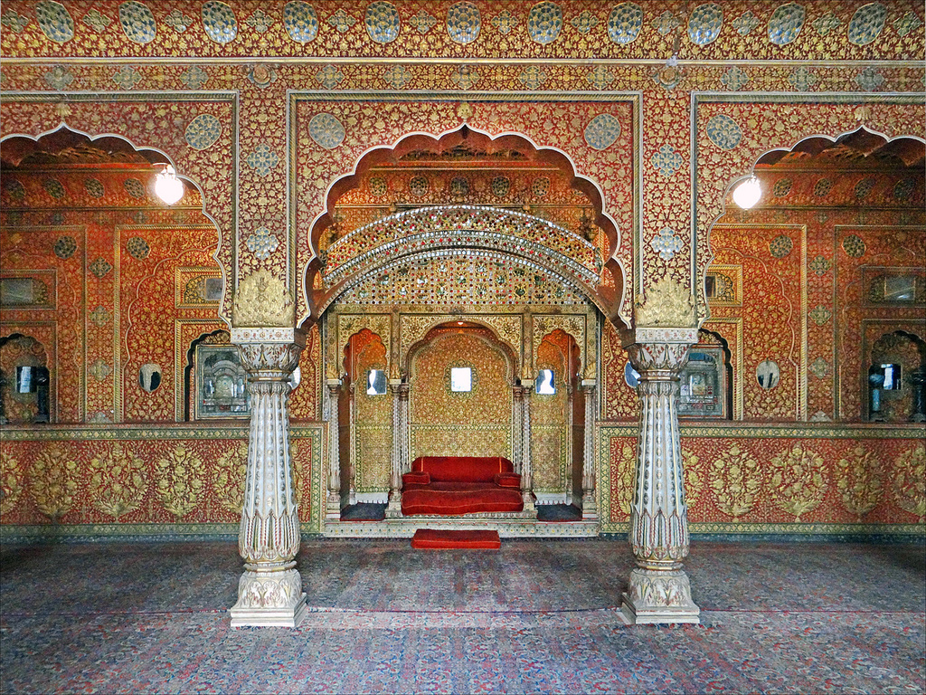
Junaghar Fort in Bikaner was said to have been built between 1589 and 1594.
While it was said in records that in its history, the fort was attacked by enemies in an effort to capture it, the fort complex is also studded with palaces, temples and pavilions.
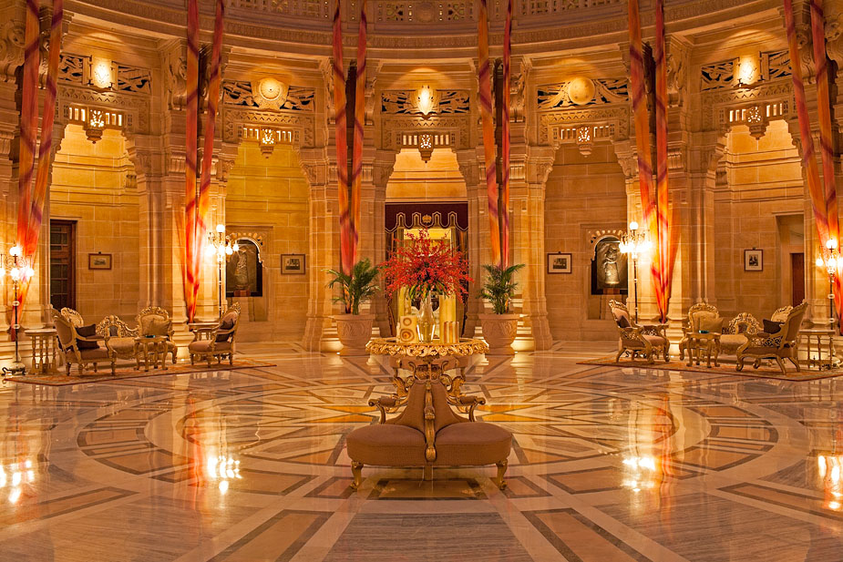
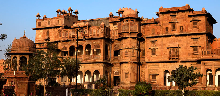
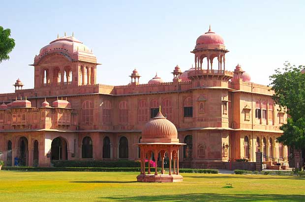
Lalgarh palace is a palace and heritage hotel in Bikaner, located near the Junaghar Fort.
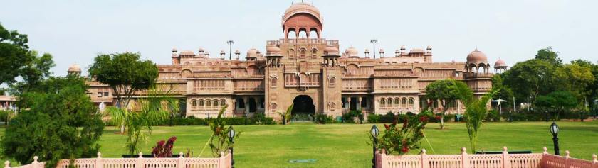
It has a story somewhat similar to the Umaid Bhawan Palace back in Jodhpur.
It was said to have been commissioned by the British-controlled regency for Maharaja Ganga Singh while he was still in his minority because they considered the existing Junaghar Fort Palace as unsuitable for a modern monarch.
Here is a comparison of the two palace complexes in Bikaner so that you can see…
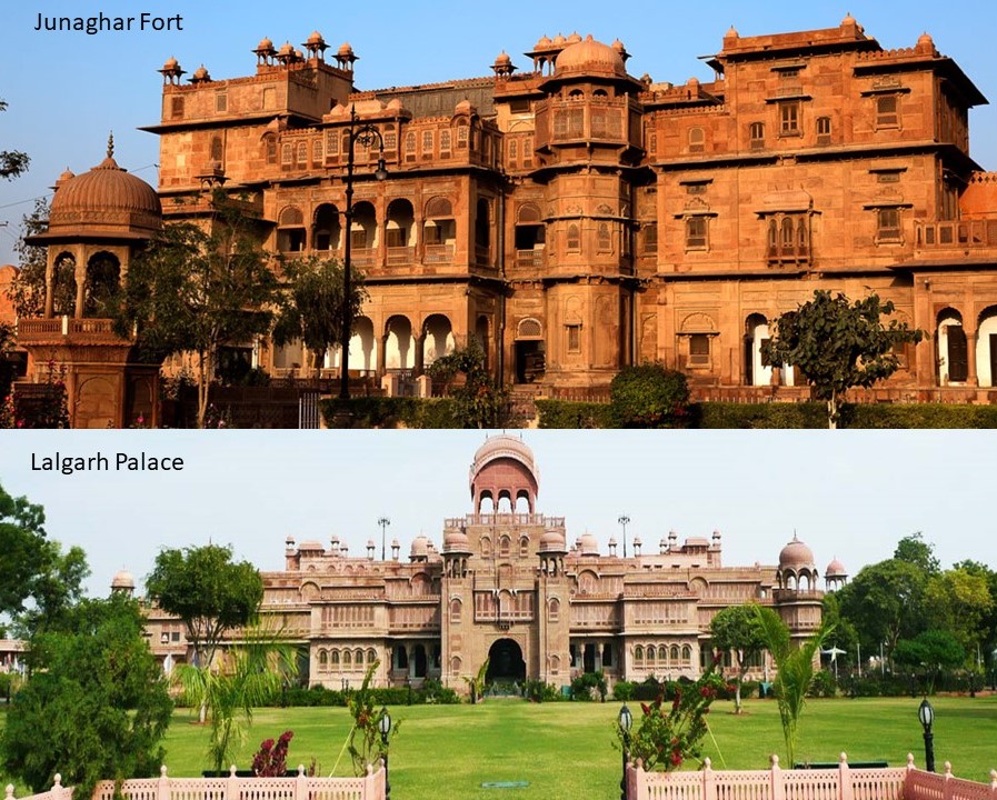
…they are built in a similar style, and Lalgarh Palace doesn’t appear to have been modernized in comparison of the two.
It’s construction was said to have begun in 1902, with the complex having been designed in Indo-Saracenic style by British architect Sir Samuel Jacob Swinton, and completed in 1926.
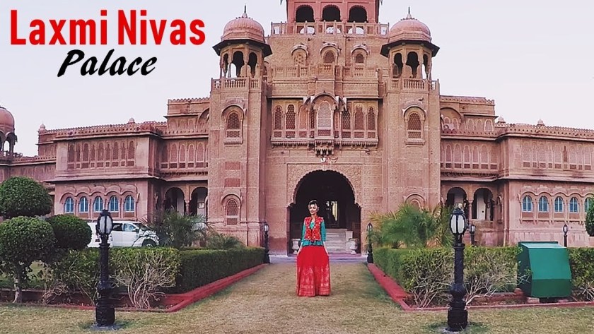
Like Umaid Bhawan Palace in Jodhpur, Laxmi Nivas Palace, part of the Lalbagh Palace complex, is leased as a heritage hotel.
The last place on this alignment is Multan, the major cultural and economic center of the southern Punjab Province of Pakistan.
Multan’s history stretches way back into antiquity.
Multan was the location of the ancient Multan Sun Temple, said to date back 5,000 years…
…which would make it contemporaneous with the neolithic complex of Avebury in southern England…
…and the Watson Brake Mounds, in Richwood, Louisiana, near Monroe and Poverty Point.
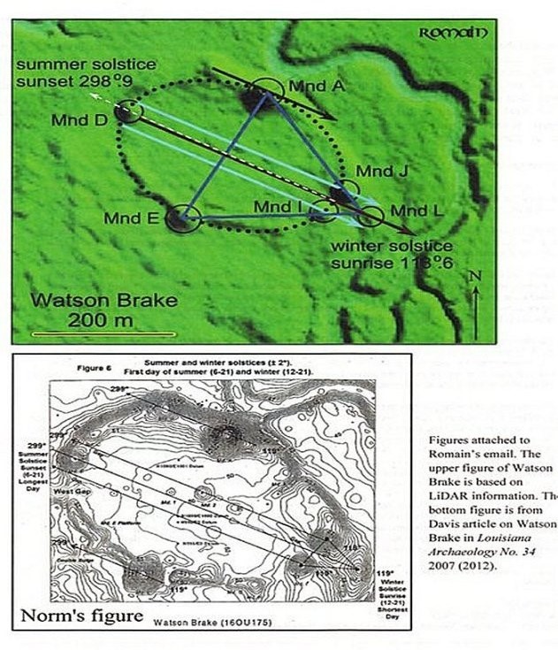
Watson Brake is dated to 5,400 years ago, and is considered the oldest earthwork mound complex in North America. Note the summer and winter solstice alignments depicted here in this diagram of Watson Brake.
This is the entrance to what is called the Multan Fort is on the left, and for comparison on the right is the Soldiers and Sailors Memorial Arch at Bushnell Park in Hartford, Connecticut.

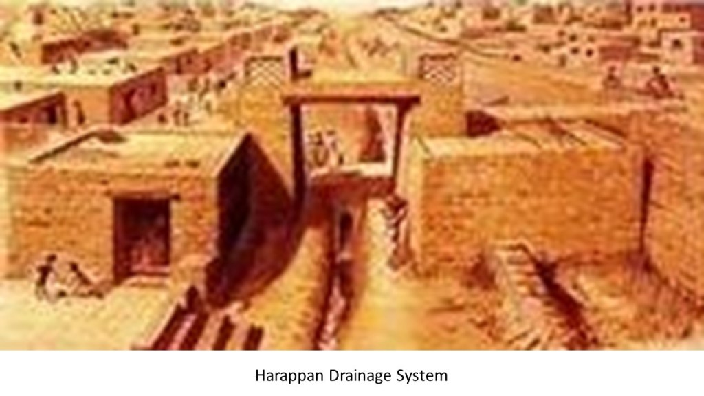
The ancient Harappan Civilization of this region, also known as the Indus River Valley Civilization, was known for their urban-planning, baked-brick houses, elaborate drainage systems, water-supply systems, clusters of large, non-residential buildings, and metallurgy. I even read where they even had street-lights, and extremely accurate systems of weights and measures.
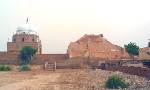
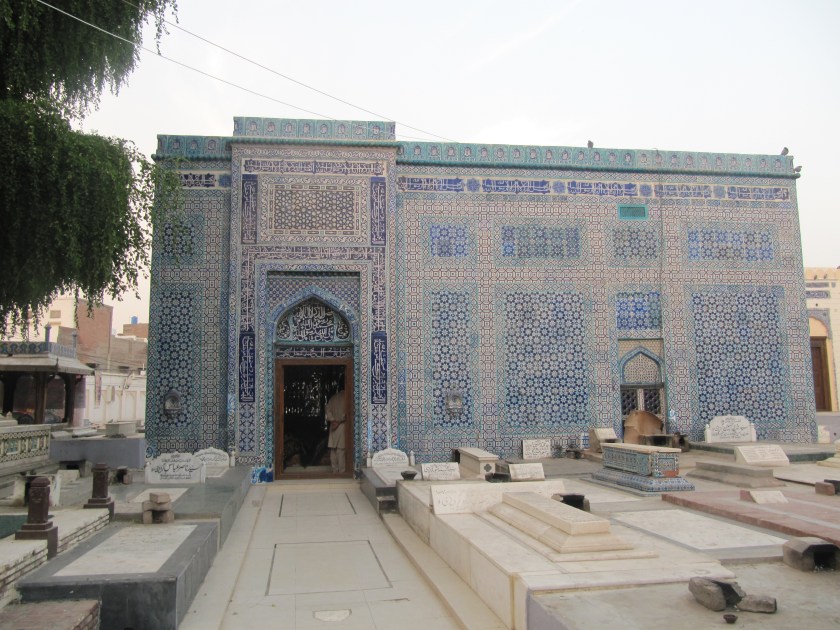
Multan was one of the most important trading centers of medieval Islamic India, and attracted a multitude of Sufi mystics in the 11th- and 12th-centuries, and is known as the “City of the Saints.”

Multan is renowned for its large number of Sufi shrines from that time…
…as well as the Sufi shrines in the nearby city of Uch…
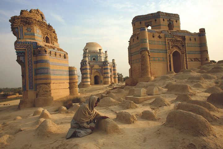
…of which the original shrines seem to be missing large chunks from the original architecture.
Sufis were mystics, and practitioners of the inward dimension of Islam.

Sufism emphasizes personal experience with the Divine, and concentrating one’s energy on spiritual development rather than focusing on the teachings of human religious scholars.
So here we have been passing through this part of the world, known as a highly spiritual place with people actively pursuing a deep, personal connection with the Divine.
It is interesting to note that we find the Shri Jasnath Ashram in the Thar Desert, in the Nagaur District of Rajasthan, between Jodhpur and Bikaner.
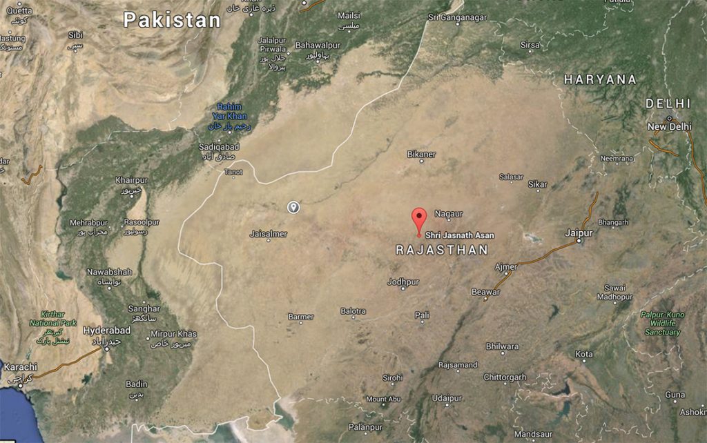
This yogic retreat is in the village of Panchla Siddha, or place of deep meditation, said to have been founded over 500 years ago, and considered a place highly charged with spiritual energy.
In the the Mahabharata, a major Sanskit epic of India, a magical weapon described as an “brahmastra” was said to have been detonated at the end of the 18-day Battle of Kurukshetra.
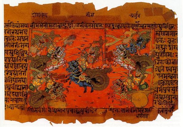
A “brahmastra” was said to have been “a single projectile charged with all the power in the Universe.”

Any target hit by the “brahmastra” would be utterly destroyed; land would become barren and lifeless; rainfall would cease; and humans and animals would become infertile.
The Pandavas were said to have vanquished their enemy, the Kauravas, with the devastating weapon, but the few surviving Pandavas discovered there was nothing left to occupy, and no one left to rule.
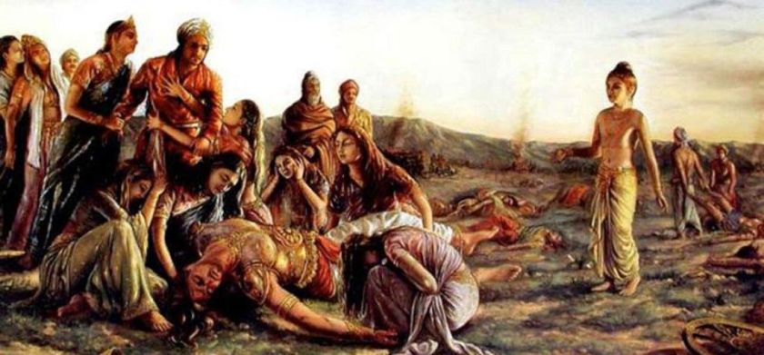
The “brahmastra” had turned the region of present-day Rajasthan to desert.
Well, to support this, evidence exists that exactly this part of the world was devastated by nuclear war at some point in time. Perhaps in ancient times…
…but my research would leave me to believe it could have taken place much more recently in time than what we are told.
More thoughts on what I think is really going on here.
The Pashtun tribal peoples are the primary inhabitants of Pakistan and Afghanistan in a region regarded as Pashtunistan, which became split between the two countries since the formation of the Durand Line border between the two countries in 1893 after the second Anglo-Afghan War.
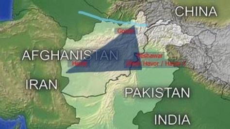
The name sake of the line, Sir Henry Mortimer Durand, was a British Diplomat and Civil Servant of the British Raj. We are told that together with the Afghan Emir, Abdur Rahman Khan, it was established to “fix the limit of their respective spheres of influence and improve diplomatic relations and trade. Well, that certainly sounds good…but what was really going on here?
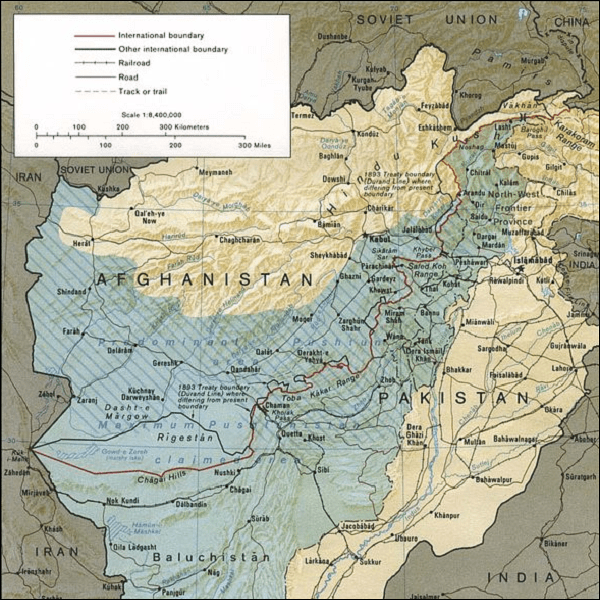
The Durand Line cuts through the Pashtunistan and Balochistan regions, politically dividing ethnic Pashtuns and Baloch, who live on both sides of the border.
But, really, why divide a people in this fashion?
The Pashtun are a tribal nation of millions of Afghani and Pakistani Muslims who also have a strong oral tradition that they are descendants of lost ten Tribes of Israel, and they refer to themselves as Bani Israel.
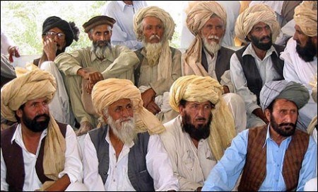


Here is an example of a Pashtun textile piece showing the sacred geometric shape of a star tetrahedron in the center, also known as the Star of David.

So, according to the history we have been taught, how can the Pashtun be Hebrew Israelites and Muslim at the same time?

For many reasons, this is a good opportunity to share why I think there was one original spiritual tradition, and that organized religion came in with the hijack of the original timeline for the purposes of control and serving an agenda not in Humanity’s best interests.

I recently realized that earth’s true history was not about organized religions, which was a stumbling block for me because of what we have been taught.

The controllers didn’t rewrite history from scratch – they rewrote the historical narrative to fit their agenda. And from the new official historical reset year, which I believe was 1850 or 1851, we are immersed in learning their history of what has taken place here from a very young age.
This subjugation allowed for the identity of the True Israelites of the worldwide ancient advanced civilization to be co-opted by the Khazarian Jews and Zionists.

The Rothschilds purchased Jerusalem in 1829, and subsequently acquired considerable land in Palestine in the 1800s and early 1900s.

There is one more stream of information I would like to share before I start tying my thoughts together.
I started to figure this out after recently reading and internalizing the information in Key 2-1-5, Verse 70, of “The Keys of Enoch” transcribed by J. J. Hurtak. This particular key really reached out and grabbed my attention.

The Keys collectively explain how the Divine is extended and manifested through Higher Thought-forms that unfold throughout all realms of life.
One of the places mentioned in this key I am about to share was Lop Nor in China, which I was already familiar with being a nuclear test site because I had found and studied it in my earlier work by connecting the dots, in following the lines I had found, around the world. There are other nuclear tests sites that I know of besides the ones listed below on the earth’s grid system. Novaya Zemlya, a large island in the Arctic Ocean off the northern coast of Russia is one, and another is Reggane, Algeria, where the French did nuclear testing. I am sure there are others as well.
This awareness led me to make the intuitive jump into looking for and compiling the following information from looking up these places on the internet, using among other things the key word “nuclear” or “nuclear test”.
Key 2-1-5, Verse 70:
Accordingly, the twelve energy grid areas for space-time transcription, and areas of proto-communication established by the conversion of each tribe of Israel for the watch and deliverance of the present program from the Treasury of Light, are the areas of:
1) Aral Sea-Kungrad (Uzbekistan)
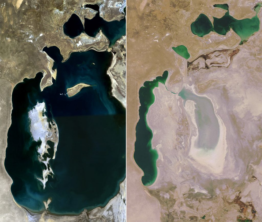
The shrinking of the Aral Sea, diverted by irrigation projects, has been called one of the planet’s worse environmental disasters, and the region is heavily polluted.
2) Takla Maklan – Lop Nur, Sinkiang
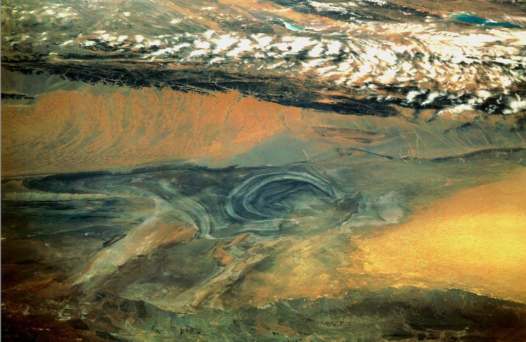
Lop Nur is an ancient salt lake in the Takla Maklan Desert in the Southeastern portion of the Uighur Autonomous Region of Xinjiang in China.
Chinese nuclear weapons test base had four nuclear testing zones from 1959 – with H-bomb detonation in 1967 – until 1996, with 45 nuclear tests conducted.
3) The Philippine Islands

The 1965 Philippine Sea A-4 crash was a “Broken Arrow”* incident in which a USNA-4E Skyhawk attack aircraft carrying a nuclear weapon fell into the sea from the aircraft carrier U.S.S. Ticonderoga. Described as a “Free Fall nuclear weapon on a handling dolly” on 12/5/1965.
A “Broken Arrow” incident is defined as an unexpected event involving nuclear weapons that result in the accidental launching, firing, detonating, theft, or loss of the weapon. To date, six nuclear weapons have been lost and never recovered.
4) The Kwajalein – Marshall Islands
The location of the Pacific Proving Grounds, which was the Name given by the U. S. government to a number of sites in the Marshall islands and a few other sites in the Pacific Ocean between 1946 – 1962. One Hundred five atmospheric and underwater nuclear tests were conducted in the Pacific.
The Marshall Islands composed 80% of tested yields at 210 megatons.
5) The Hawaiian Islands
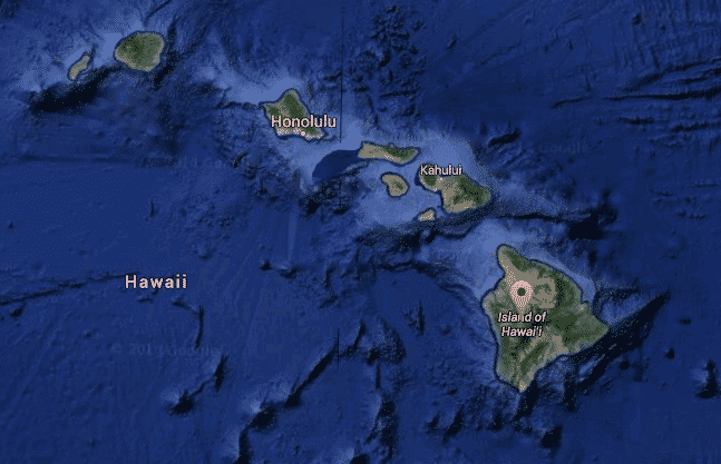
The location of the Pearl Harbor attack in 1942 which brought the United States into World War II.
Johnston Atoll was controlled by the military for 70 years, and used for testing and as a chemical weapon and Agent Orange storage and disposal site.
Kaho’olawe island was used as a bombing range by the Armed Forces during World War II, and was known as the “Target Isle.”
6) Vancouver Island

A Mark IV nuclear device dumped or exploded off the coast was found on 2/13/1950 similar to the atomic bomb that was dropped on Nagasaki. The American B-36 bomber carrying it crashed en route from Alaska to Texas.
7) From Pueblo, CO, to the Mescalero Apache Reservation of New Mexico
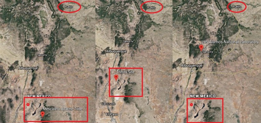
It is important to note that contained within the location described, are both Trinity Site, the first nuclear test detonation site near the Mescalero Apache Indian Reservation; and Los Alamos National Labs, which was established in 1943 as Site Y of the Manhattan Project to design and build the first atomic bomb. Still in use today.
8) From Lexington, Kentucky, to Tennessee

The Oak Ridge National Labs is in Oak Ridge, Tennessee, with a nickname of the Atomic City…it was established in 1943 as part of the Manhattan Project.
It was chosen as a site for a graphite reactor to create plutonium from uranium. Still in use for nuclear research and development.
9) Nova Scotia connecting with the Bermuda Islands
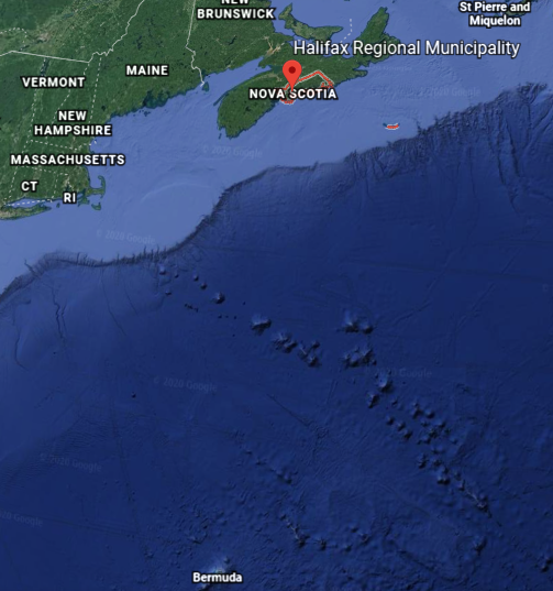
The date of the Halifax Explosion was December 6th of 1917, when a ship collision in the harbor caused a 2.9 kiloton detonation of TNT, killing at least 2,000 people, and injuring 9,000 – the largest manmade explosion prior to the development of nuclear weapons.
10) The Azores
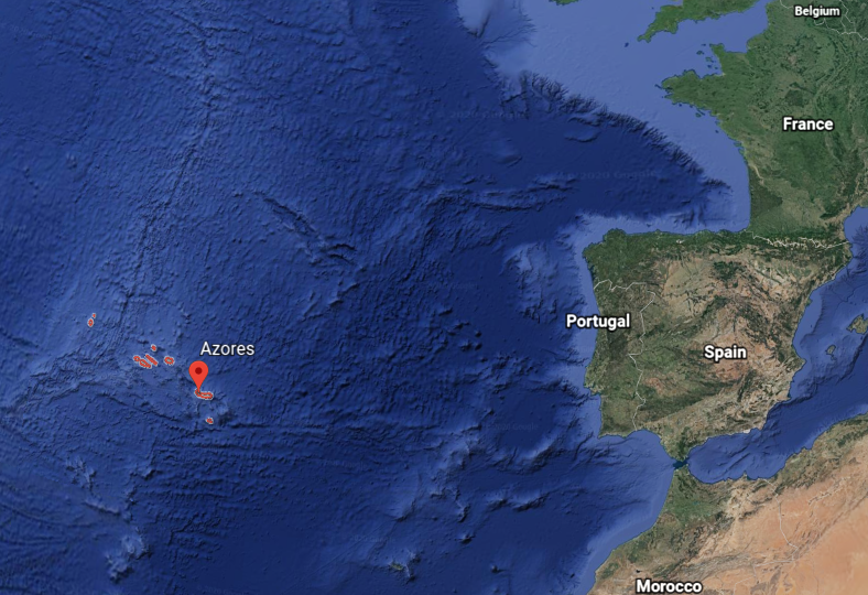
There was a “Broken Arrow” incident on May 22nd of 1968, involving the loss of a nuclear reactor and two W34 nuclear warheads when a U.S. submarine sank from unknown causes, approximately 400 Nautical Miles southwest of the Azores.
11) Lourdes, France
Nothing that I know of.
12) Giza in Egypt
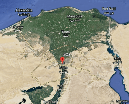
Nothing that I know of.
I find it more than statistically significant that at least ten out of the twelve places listed as being the twelve important energy grid areas for the space-time transcription of each Tribe of Israel had some kind of environmental disaster; nuclear testing facilities and/or test-site locations, nuclear accidents; or some kind of massive explosion.
I see all of this as an extremely hostile takeover of the earth’s grid system and the original advanced ancient human civilization in a war against the Creator and Creation through a Humanity in much lower consciousness than it was before all of this took place.
And what we know today as India went from having fabulous wealth and a high standard-of-living, to the third-world conditions that exist in many places for many people there today.

The same thing can be said about most, if not all, the world’s countries, especially compared with what was actually here before the reset event and new historical timeline.
ISLAM was originally all about: I-Self-Law-Am-Master.
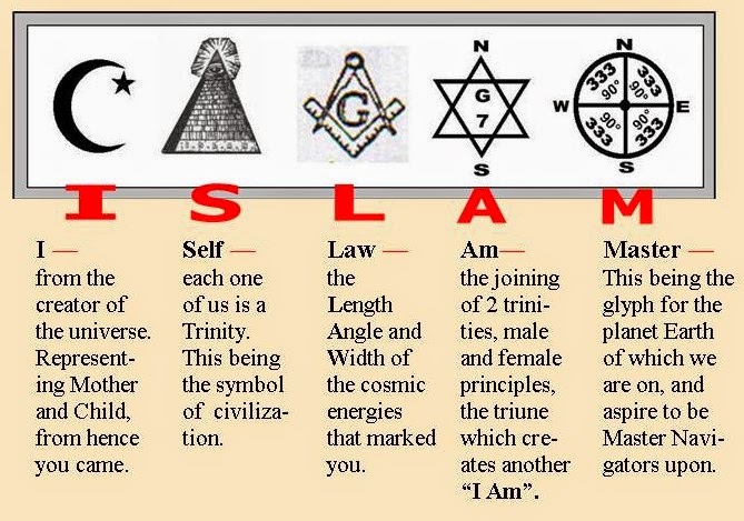
It did not start out as the weaponized belief system we see today that was developed to divide and conquer.

And were the Children of Israel originally called the Children of Asarel?
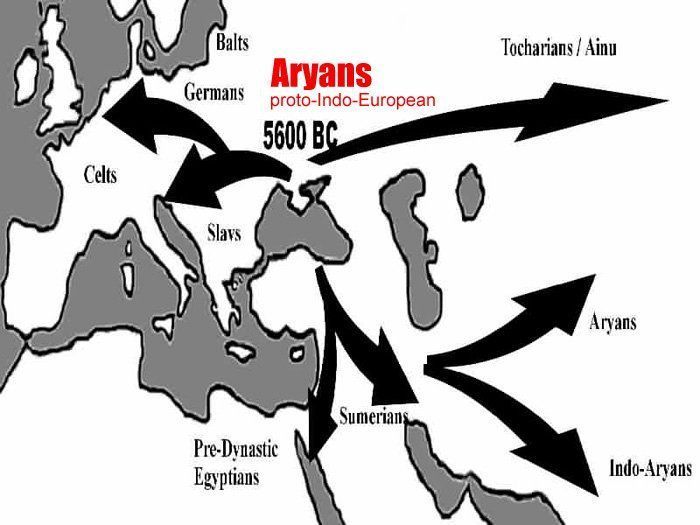
In the last post, I expressed my belief based on my research that the Nazi obsession with creating a master race was based on re-creating the original Aryans, members of a worldwide advanced civilization known as Arrata which is now recognized as the world’s most ancient, known civilization, dating back to 22,000 BCE, developing in the steppes north of the Black Sea, in modern Ukraine and believed to spread out from there to India, Mesopotamia, Egypt, Western China, and across Europe.
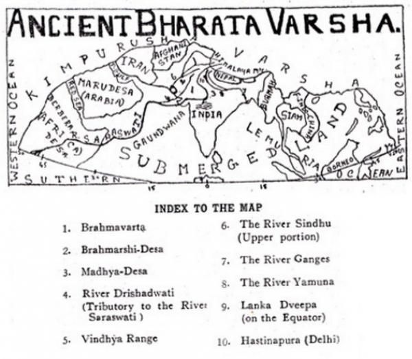
Bharata-Varsha was said to be a name for ancient India, but this illustration depicts much more than the Indian subcontinent.
I tracked the “Ar” sound is contained in many historic place names, like some of the ones I mentioned in the last post – Armenia; Bavaria; Barbaria; Tartaria; Arabia; and Arizona.

These are “ar” sounds I reference in this post alone: Mewar Kingdom; Akbar, the Mughal Emperor; Kumbhalgar Fort; Aravalli Hills; Picchu Banjara; Maharana; Maharaja; Arsi Vilas Lake; Fateh Sagar Lake; Dhebar Lake; Ahar-Banas culture of the Harappan Civilization; Marwar Kingdom; Sardar Singh; Thar Desert; and the Mahabharata.
There are so many “ars” to be found when you start to look.
There is even an “ar” to be found in the spelling of “earth.”
One more thought in closing, not only of this post, but of this particular series.
At first I thought with all of the detailed history of India in the historical narrative we are given that it wasn’t mud-flooded, and had to be taken down by other means. Then in doing research for this part of this series, I found these pictures.
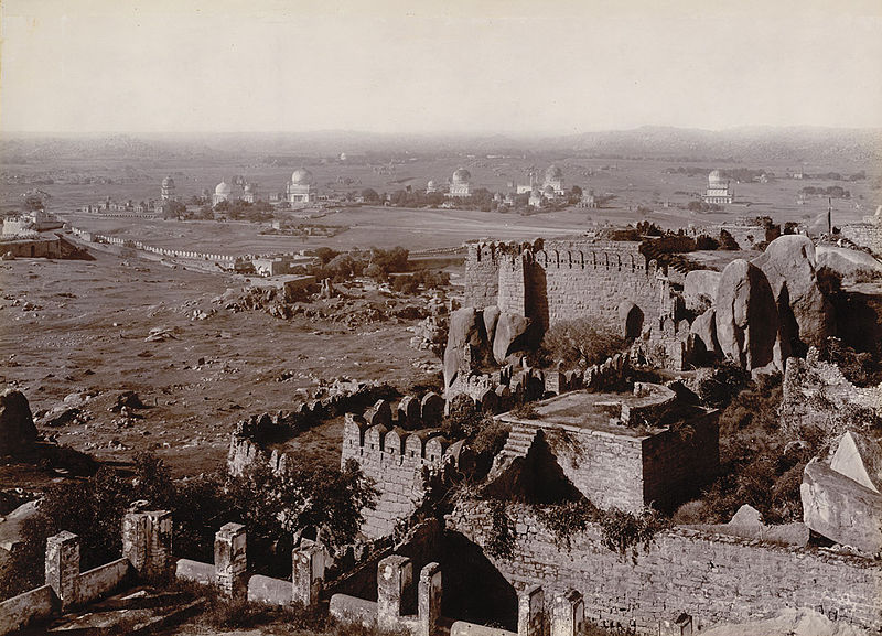
This is a picture of the Qtub Shahi Tombs from the Golconda Fort in Hyderabad, India, circa 1902 or 1903.
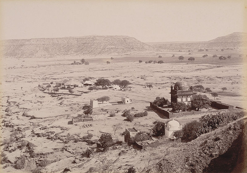
And this photo was said to be of Khuldabad Rest House, near the Ellora Caves, circa 1890.
I have come to believe that a worldwide liquefaction event was deliberately created, and that the original ancient advanced civilization was wiped out, erased from our collective memory, and a new historical narrative was created, based on the underpinnings of the original civilization, but original meanings and intents were twisted and subverted in order to create a system of control for Humanity.
I also believe we are living in times of great change.
We are seeing some of what was planned for us by the controllers playing out right now, but I believe we are on the verge of a great change and shift that will change everything for the better…and soon.

Upcoming projects include tracking an alignment for the occurrence of mines and gemstones; a close look at the Channel Islands in the English Channel; and going back through this series, and pulling together some of the information I have found into one place, like information showing how the new world order was superimposed over the original civilization.
