This is a continuation from parts 1 & 2 of the post involving how I first heard of Novaya Zemlya, by following a major alignment emanating off of the North American Star Tetrahedron. The last part ended at the Qaidam Basin in China.
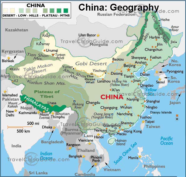
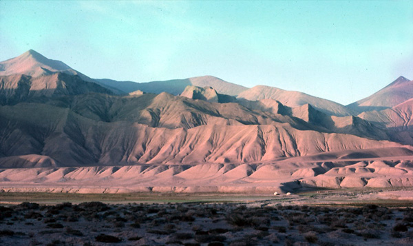
From there, the alignment crosses Kunlun Shan, one of the longest mountain ranges in Asia, and forms the northern edge of the Tibetan Plateau south of the Tarim Basin in China.
Kunlun is the name of a mythical mountain believed to be a mountain paradise, and the Kunlun Mountains are described as the location of the Shangra-La Monastery in the 1933 novel “Lost Horizon” by James Hilton.
Moving along down the alignment, next comes Lhasa, Tibet, currently the capital of the Tibetan Autonomous Region since 1965, it has at least a 1,400 year history (that we are told about) when the capital was moved, originally in 633 AD, by Tsampo Songtsan Gambo from Yalung. In the 1600s, the 5th Dalai Lama is said to have built the Potala Palace. The current Dalai Lama, Tenzin Gyatso, is the 14th reincarnation of the same lifestream – Avalokiteshvara, the Boddhisattva of Compassion.


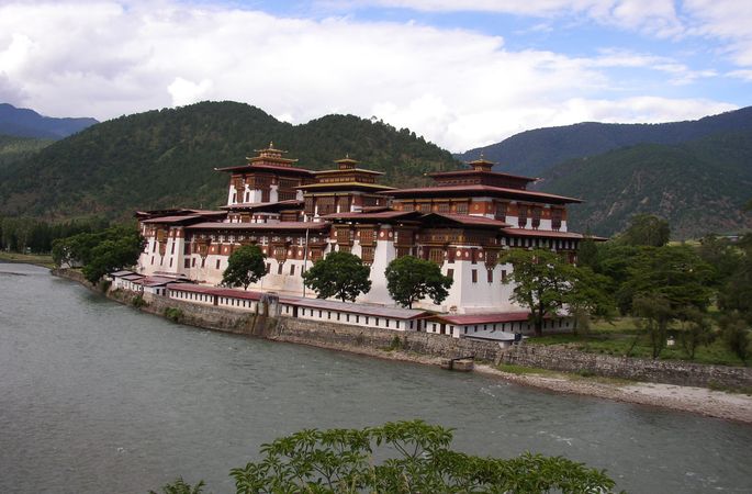
Thimphu is next, the capital and largest city of the Kingdom of Bhutan. It is situated in the constricted, linear valley of the Raidak River, a tributary of the Brahmaputra River. Otherwise, this is a land-locked country in the Himalayas.


Then it connects to the Brahmaputra River, one of the major rivers of Asia. It is a sacred River, considered to be the Son of Brahma, and has a male name, unlike most rivers in India.
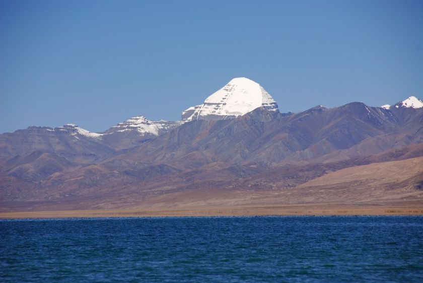
Its origin is Lake Manasarovar (means “Mind Lake”), located in Tibet, the most sacred, and highest, freshwater lake in the world.
Chittagong is a major coastal and financial center in southeastern Bangladesh. It is located on the banks of the Karnaphuli River…
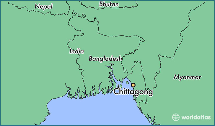
…between the Chittagong Hill Tracts…
…and the Bay of Bengal.
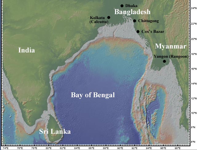
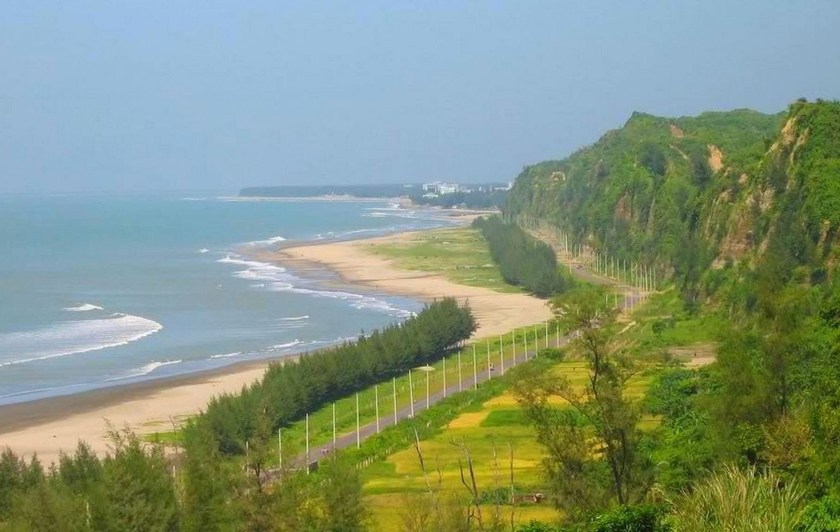
Cox’s Bazar is on the alignment, so let’s see what comes up for that location. The beach at Cox’s Bazar is sandy and has a gentle slope, and is the longest natural sea beach in the world at 75 miles. Previously to that it was known as Panowa, said to mean Yellow Flower. The modern name derived from the last name of a British East India Company officer who died in 1799. A market was established there which was named after him. Now it is one of the most visited tourist destinations in Bangladesh.
Now on to Sittwe (formerly Akyab) in Myanmar (known previously as Burma). Sittwe is the capital of Rakhine State. It is a port city on the Bay of Bengal and is situated on an estuary island at the confluence of the Kaladan, Myur, and Lemyo Rivers.


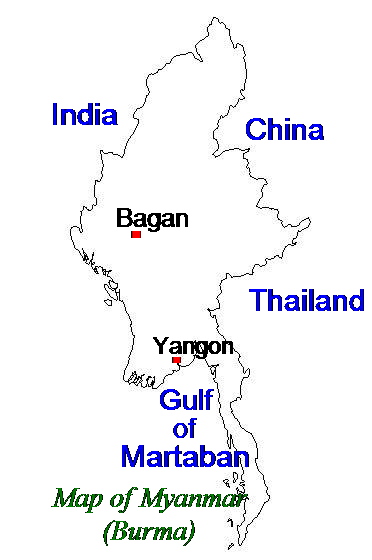
The Gulf of Martaban is an inlet of the Andaman Sea, and a part of the Indian Ocean. It has a tide-dominated coastline, with tides ranging between 4 – 7 meters at the highest tidal range at Elephant Point in the western part of the gulf.
The alignment that comes to Banda Aceh, Indonesia, which suffered extensive damage as a result of the 2004 Boxing Day Tsunami, which is believed to be the deadliest tsunami in history, killing more than 230,000 people in 14 countries.
It is the capital and largest city of the province of Aceh on the Island of Sumatra. It has long been a strategic transportation trading hub in the East Indian Ocean. Its first mention in western accounts were from Marco Polo’s expedition in 1292. He referred to the city as Lambri, from the Lamuri Kingdom which had previously existed there. Hmmmm, sounds a lot like Lemuri(a) doesn’t it?


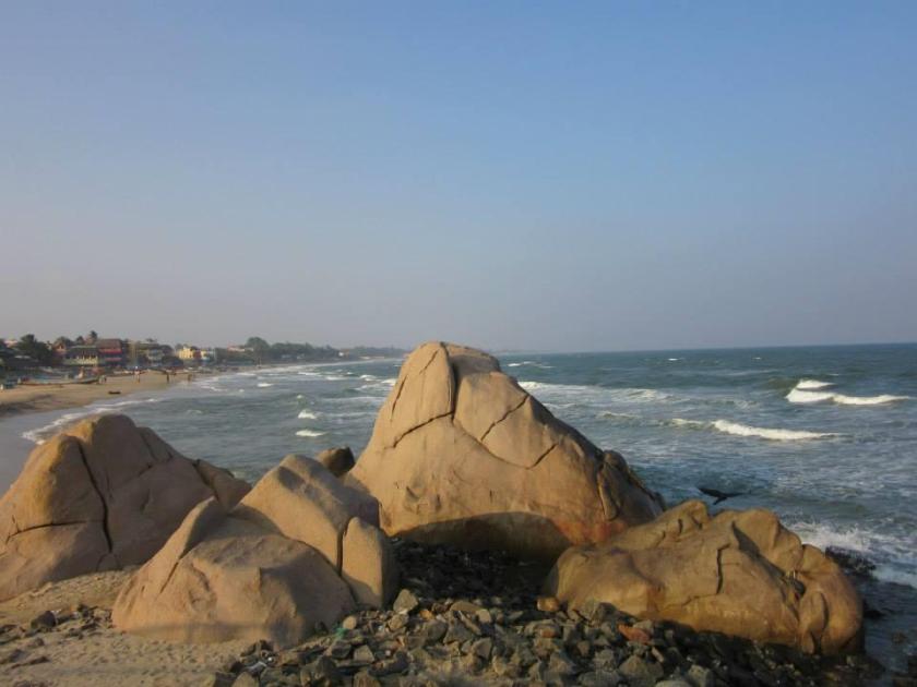
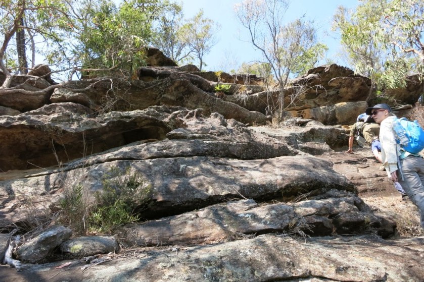
On to the Andaman Sea, which is a marginal sea of the Eastern Indian Ocean, separated from the Bay of Bengal by the Andaman and Nicobar Islands, and touching Myanmar, Thailand, and the Malay Peninsula. I want to reiterate something very important to understand what you are seeing in the photo on the right. We have been taught by historical omission to believe that all stone formations are natural occurrences, formed from geologic processes. The Ancient Ones were Master Builders, and I think there is another explanation for the massive stonework that you see in all the photos I am sharing that we have not been told about, and that this actually represents Humanity’s highest potential as Spirit in Biological Form.


Next is Siberut, the largest of the Mentawai Islands.


These Islands lie 150 kms west of the island of Sumatra. Siberut is the most important home for the Mentawai people. Also known for biodiversity of plant and animal species, as the Mentawai Islands have been separated from the Sunda Mainland since the mid Pleistocene Era. While the islands were impacted by the 2004 Boxing Day earthquake and tsunami, there was no known loss of human life.
Next is the Sunda Strait, which is located between the islands of Java and Sumatra, and connects the Java Sea to the Indian Ocean.


There are a couple of noteworthy tidbits about this location. One is that the island of Krakatoa is located here. Krakatoa is a volcanic island that exploded in a major eruption in 1883 with global effects. It was one of the deadliest and most destructive volcanic events in recorded history. It destroyed most of the island, affected the region with pyroclastic flows and volcanic ash. Global after-effects included tsunamis and climactic changes involving a cooling of temperatures over the next few years.
The other is that there was a World War II naval battle that took place here in 1942. This was not the only battle that took place on a grid-line during the second World War. There were actually gobs of them that did, not only in that particular war, but many others. I will be doing future blog posts on how modern history reads like a book on the planetary grid lines.
Next, we come to Christmas Island which is an Australian External Territory. It currently has a small population. It was named as the result of a first sighting by a captain of the British East India Company on Christmas Day in 1643.
There are many caves on the island. It is also well known for its biological diversity as a result of its isolated location.


Note: There is another Christmas Island in the Line Islands of Kiribati, on another alignment, upon which H-bomb tests were conducted by the British in 1957 & 1958.
Back to the alignment at hand, the next place is Coral Bay, Australia. It is a small town on the coast of Western Australia, north of Perth. The coral starts right at the water’s edge. Its main industries are tourism and fishing.


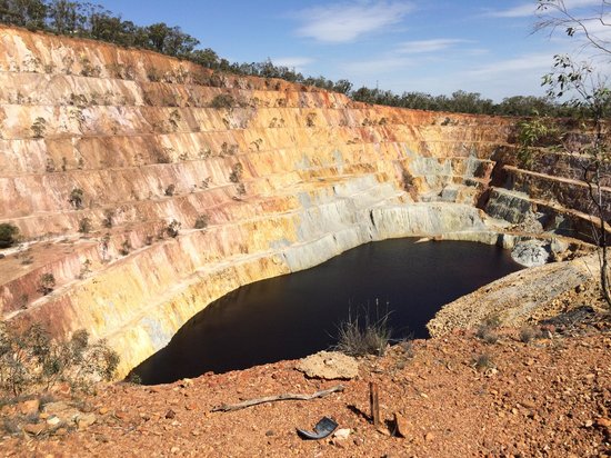
The next location is Peak Hill in the Gibson Desert. This particular place comes up on more than one alignment. It is the site of a large gold field.
Next is stop is the Victoria Desert, where we find the Pinnacles…
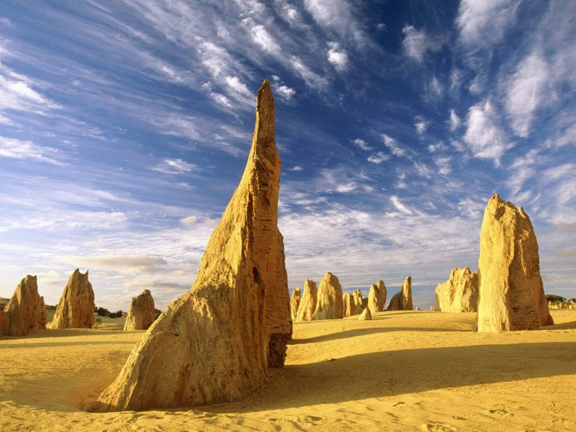
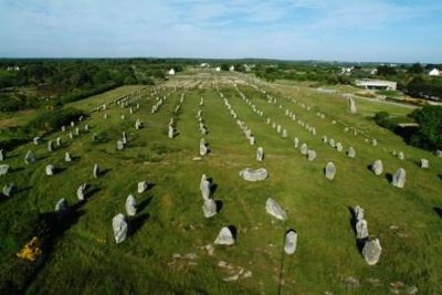
…which reminds me of the Carnac standing stones in Brittany, France.
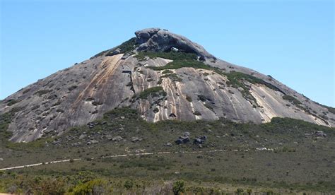
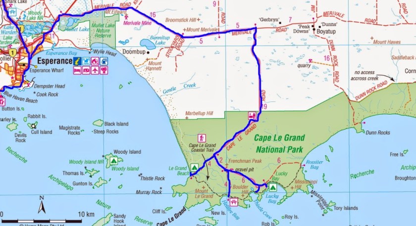
The last place I am going to show you on this long-distance alignment, and the end of this post, is Cape LaGrand National Park in the Goldfields-Esperance Region of Western Australia.


Our highly advanced Human Ancestors were capable of engineering feats we can’t even imagine. The megalithic structures they left us around the planet continue to amaze us, with huge, multi-ton blocks of stone perfectly fitted together, and clearly demonstrate their capabilities. However, by historical omission, the only thing we can conceive of in regards to big blocks of stone found all over the world, many times in interesting configurations, is that nature was capable of doing some pretty amazing stuff.
I am saying that Humanity in the fullest expression of its highest potential was the Ancient Ones of the Advanced Ancient Civilization, and they did amazing and incredible work, for which they receive absolutely no credit. The knowledge about this advanced civilization had to be removed in order to put a system in place to control Humanity.
For an overview of this whole alignment, please check out parts 1 & 2 on this blog of “How I First Heard of Novaya Zemlya, and Other Places I had Never Heard of Before.”
I will leave you with this photo of Frenchman’s Peak at Cape LaGrand. If we had been taught the True History, there would be no mysteries in history.