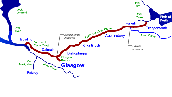
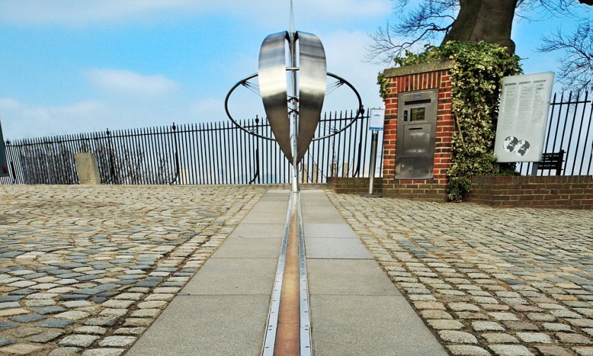
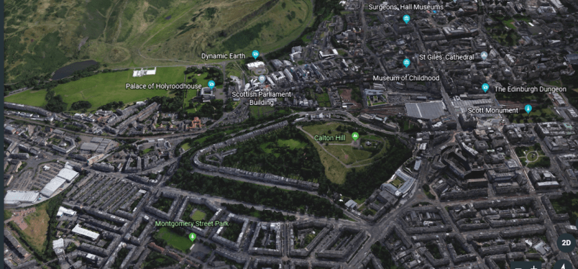
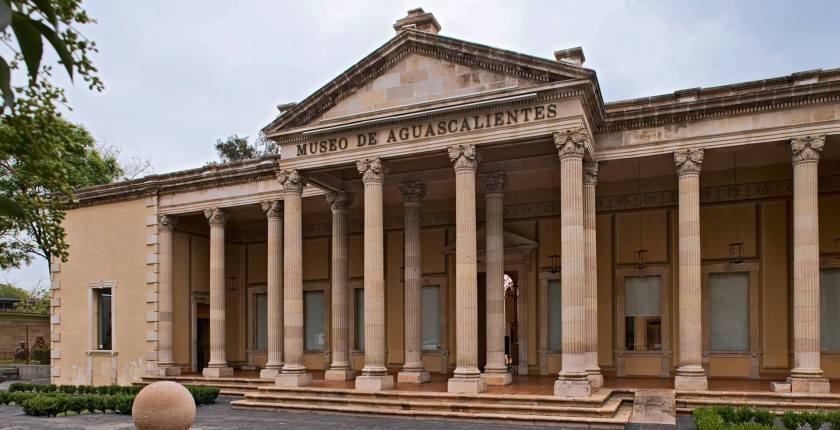
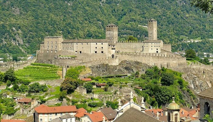
I am going to focus on bringing together the star forts, and other similar infrastructure with names like fortresses, citadels, and castles & palaces that I have found in the course of doing research for all of the circle alignment series I have done thus far.
While most of this information is contained within different parts of these previous series, I have found more star forts on different alignments while researching for this post.
In my initial research for the circle alignments, I wasn’t necessarily looking for in particular star forts – I just found them along the way.
For this post, I went back to some of the places on the circle alignments looking specifically for them, and found some noteworthy things.
The basis of all of my research comes from a star tetrahedron I found by connecting cities in North America that lined-up in lines.
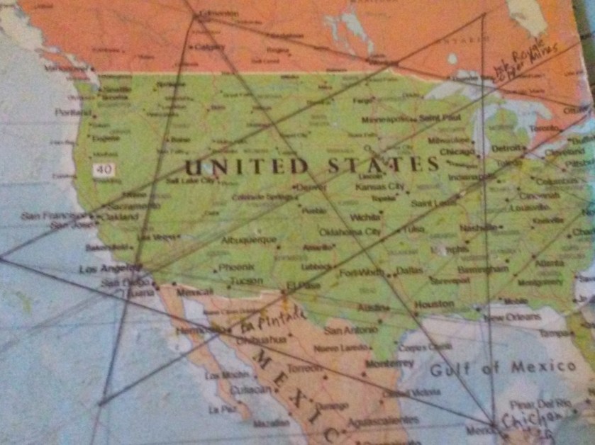
I believe this is the terminus of the planetary grid system, and that everything about the advanced ancient civilization was based on sacred geometry, including how all of the physical infrastructure of the planet was laid out.
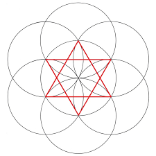
This is the Flower of Life pattern.
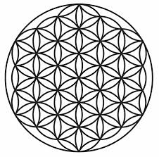
It is the creation pattern of the Universe, and all sacred geometric shapes are contained within it, including, but not limited to, the star tetrahedron.
My intuitive understanding of sacred geometry, which I first learned about starting in 2007, is what has guided me in uncovering the information I am bringing forward, and in finding the circle alignments that I am going to focus on in this post.
There are many kinds of alignments, all connected to each other, so what I am about to share is only a snapshot of what is really an overwhelming amount of information.
This is why I have chosen to review places I found on the circle alignments, and this will be a lot of information in and of itself. There is so much to reveal on this vast topic, so please bear with me on the length of this post! I have much to share.
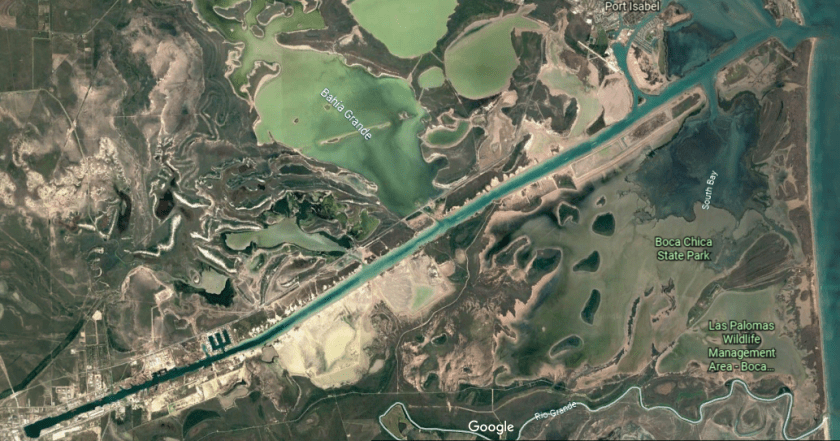
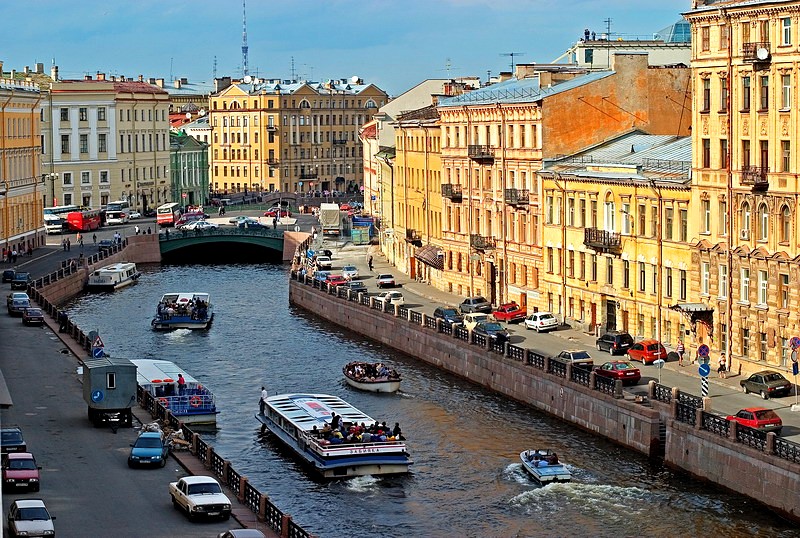
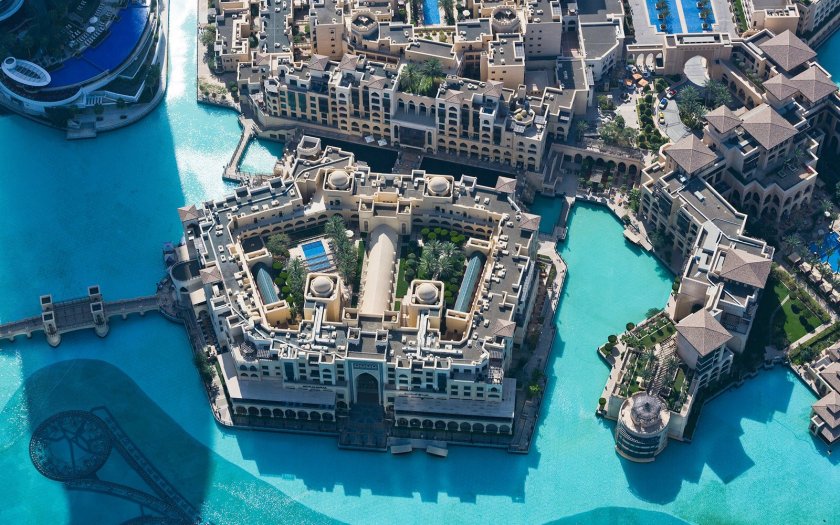
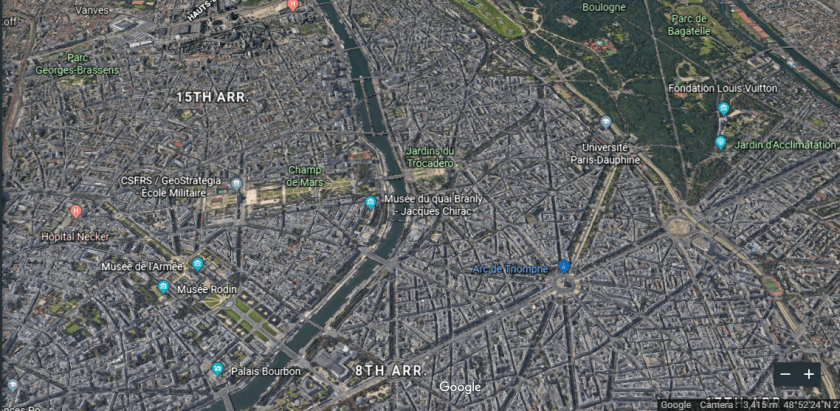
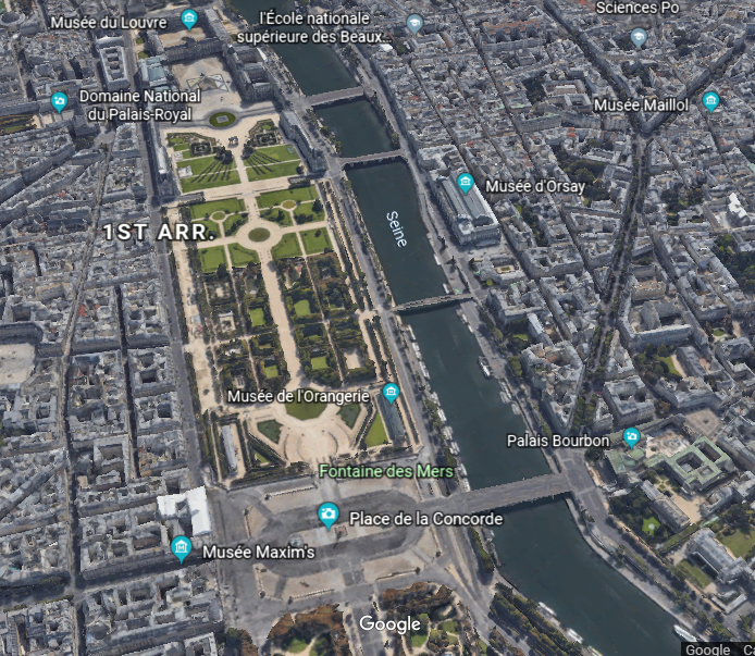
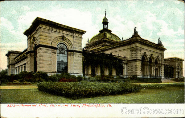
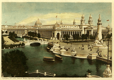
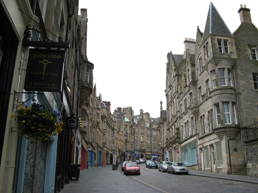
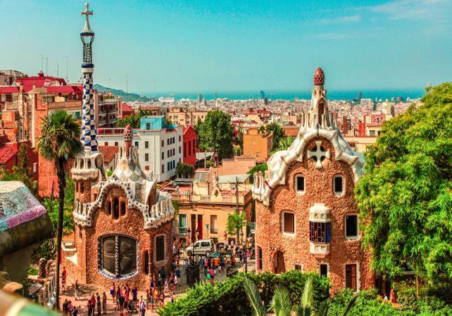
I am going to start with the Circle Alignment beginning, and ending, in Merida, Mexico.
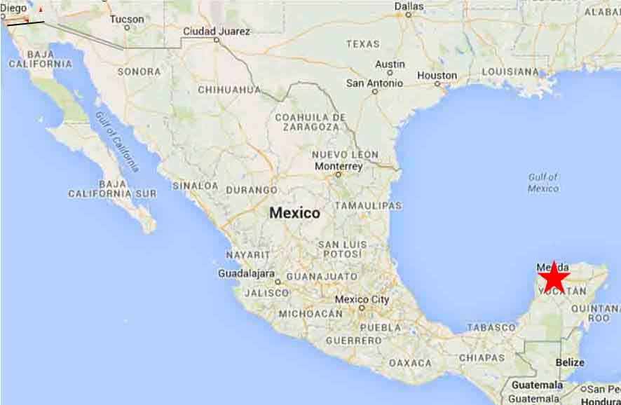
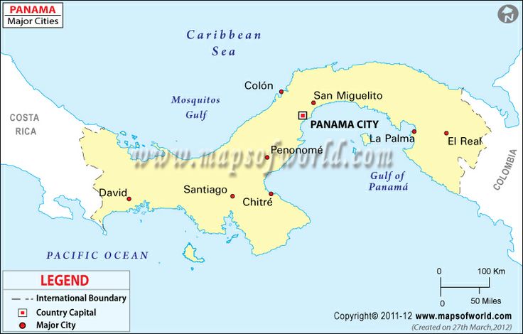
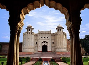
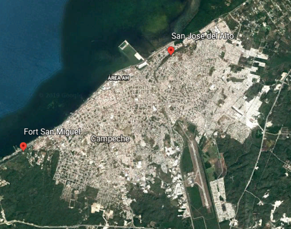
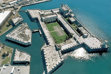
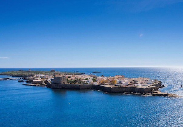
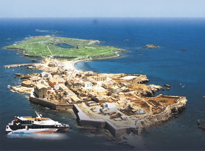
The city of Campeche is located on the coast of the Gulf of Mexico, and a relatively short distance southwest of Merida, Mexico.
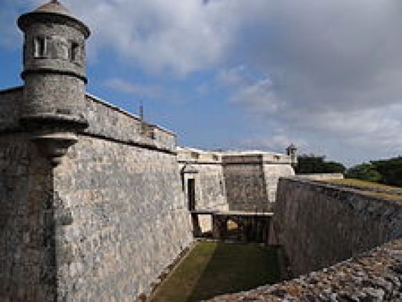
There are at least two star forts there.
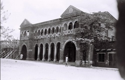
Fort San Miguel is located in Campeche, and was said to have been completed by the Spanish in 1801…
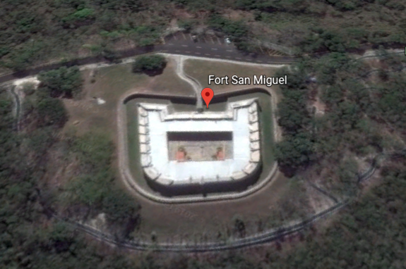
…and is now a Mayan museum.
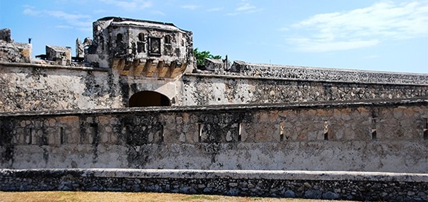
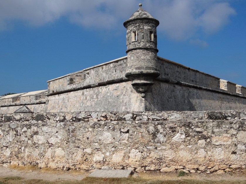
The other is Fort San Jose el Alto on the other side of town on a bluff overlooking the Bay of Campeche…
…and said to have been built in 1762, and also considered a Spanish colonial fort.

It became a UNESCO World Heritage Site in 1999.
It opened as a Museum of Ships and Weaponry in 1995, and in 2017, its primary focus was changed to being a museum of underwater archeology.
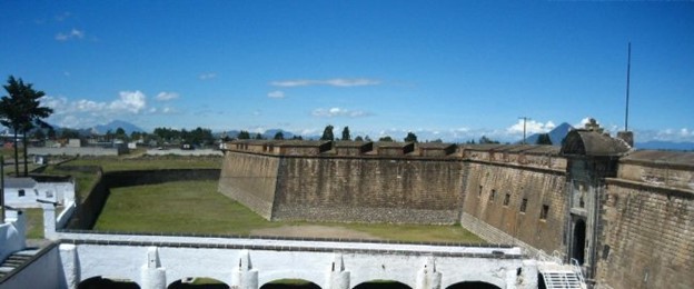
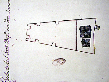
And as I sat here reading about the eight defensive bulwarks that are part of a city wall in the shape of an irregular hexagon, I realized that Campeche was a star city, and searched for an historic map of the city.
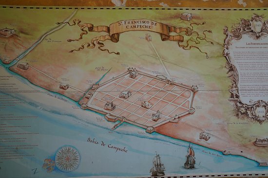
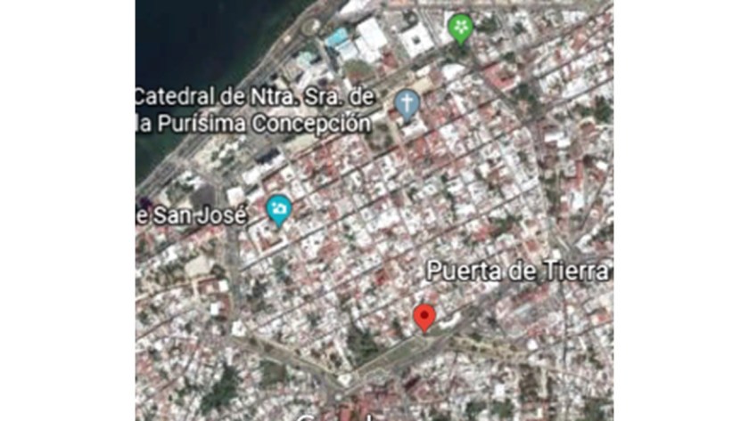
This is called the”Puerta de Tierra” or “Land Gate,” with the seven of the eight bulwarks still standing…
…and many of Campeche’s old gates and walls are still intact and well-preserved. These were said to have been built by starting in 1686.
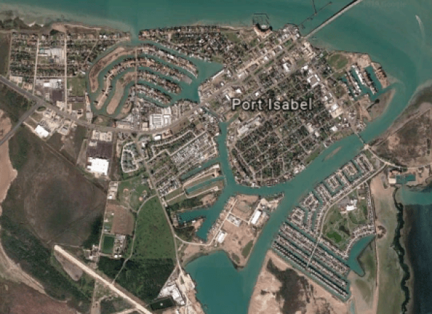
Next on the Merida circle alignment is Key West, Florida, where we find three star forts, including:
East Fort Martello, which was said to have been built in 1862…
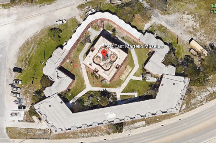
…and called one of the best preserved examples of the Martello-style of military architecture in the country, and is now the Martello Gallery – Key West Art and Historical Museum.
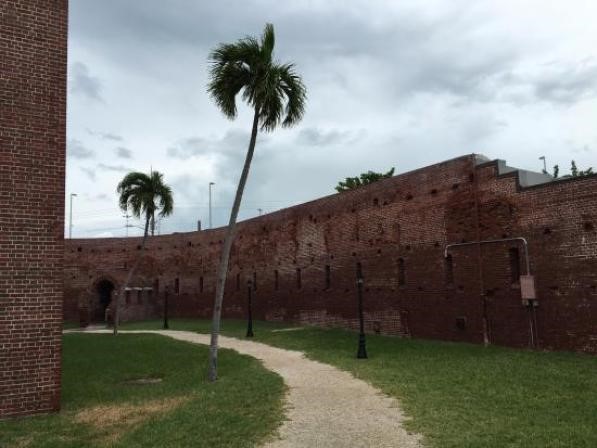
Fort Zachary Taylor is in the city of Key West as well, and was said to have been constructed starting in 1845, and for which Fort East Martello was said to have been a supporting battery.
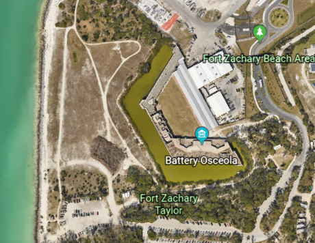
It was said to have been constructed from oolitic limestone and New England granite.
New England granite? In the furthest west part of the Florida Keys? In 1845?
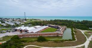
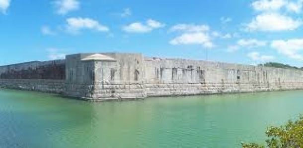
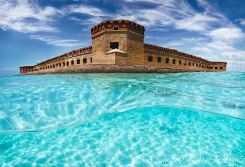
There is a star fort called Ft. Jefferson at Dry Tortugas National Park, on an island which lies 68-miles, 109-kilometers, further west of Key West, and is only accessible by ferry or boat.
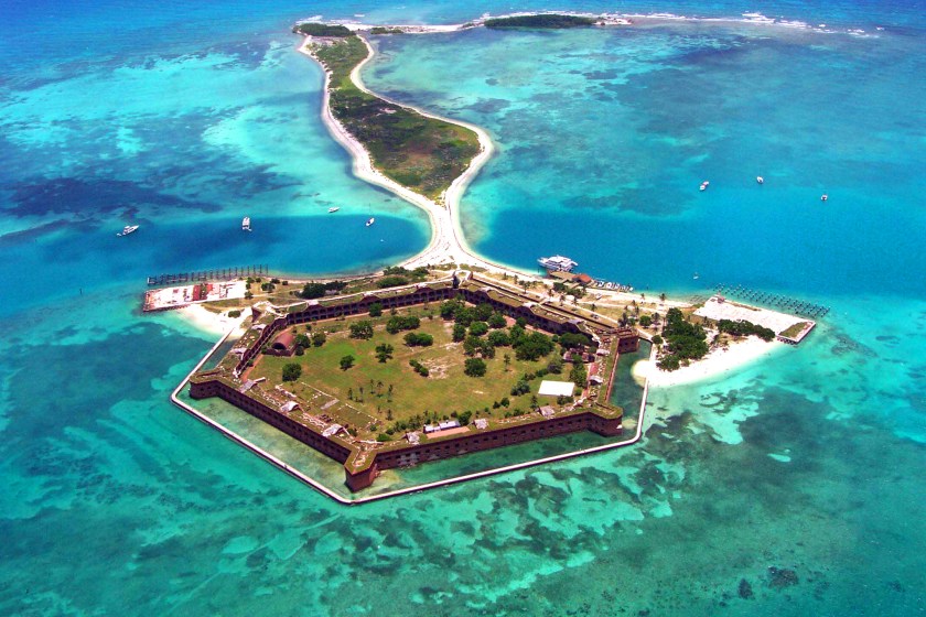
It is called a massive, unfinished coastal structure, and the largest brick masonry structure in the United States, made with over 16 million bricks, and its third-largest fort. It was said to have been built between 1845 and 1861.
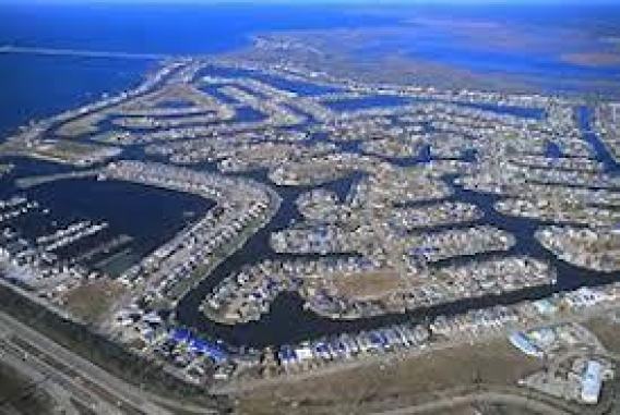
Next, the Merida circle alignment goes through the Bahamas, where in Nassau we find three intact star forts, and one that was located where there is a hotel now.
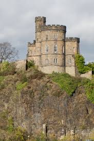
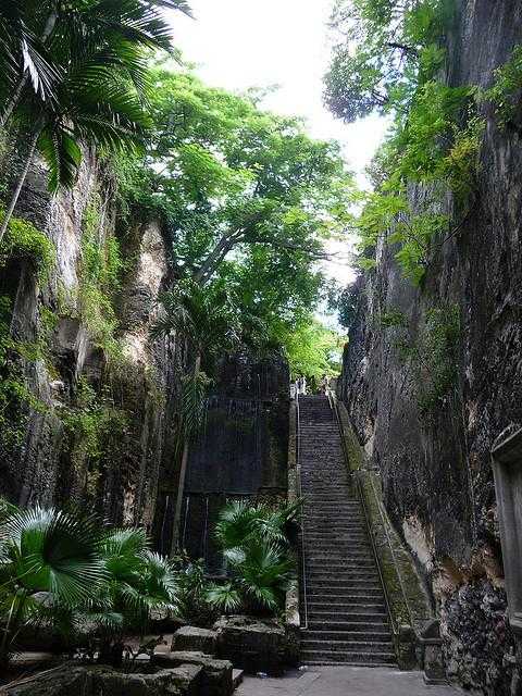
This is Fort Fincastle in Nassau, the capital of the Bahamas, and located on New Providence Island. It was said to have been constructed as a defensive structure from cut limestone 1793 by Lord Dunmore, the royal governor of the Bahamas during this time-frame.
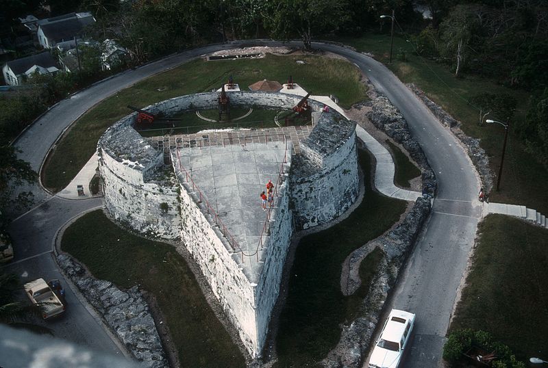
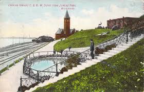
It overlooks the city of Nassau and the Queen’s staircase, 66-steps said to have been carved out of solid limestone rock between 1793 and 1794 around the same time period that Fort Fincastle was built.
Yeah right, I don’t think so!
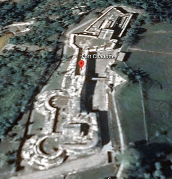
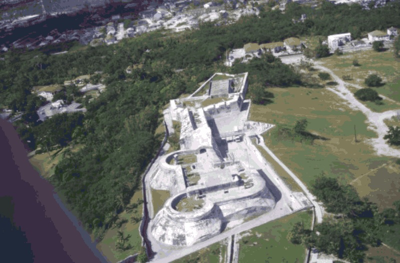
Fort Charlotte is also in Nassau, also said to have been built by Lord Dunmore.
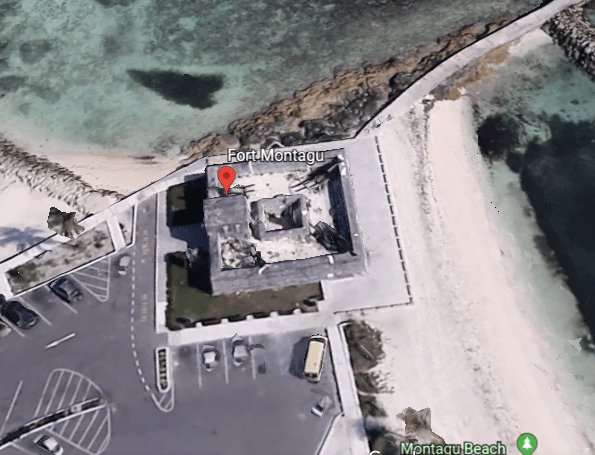
Fort Montagu was said to have been built in 1741, constructed by British military engineer Peter Henry Bruce.
The Bahamas became a British Crown Colony in 1718, we are told when the British were clamping down on piracy. It became an independent Commonwealth Realm of Great Britain in 1973, with its own parliament, and the British monarch as its head of state.
The British Colonial Hilton Hotel is said to be on the grounds of what was the Old Fort of Nassau, described as having been built of stone in the shape of a four-pointed star.
Bermuda is next.
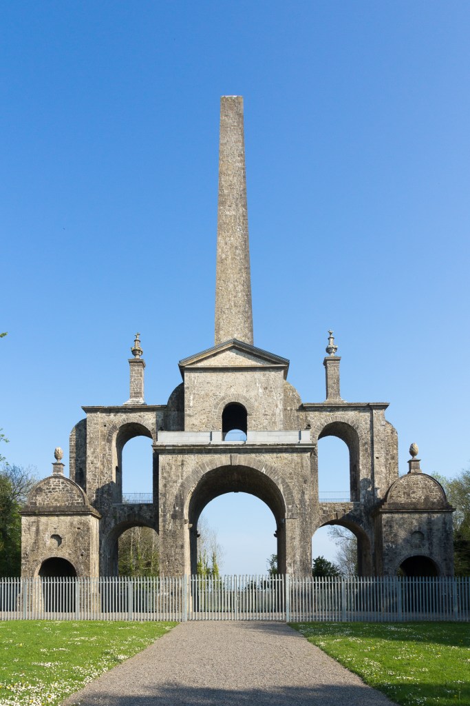
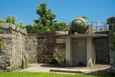
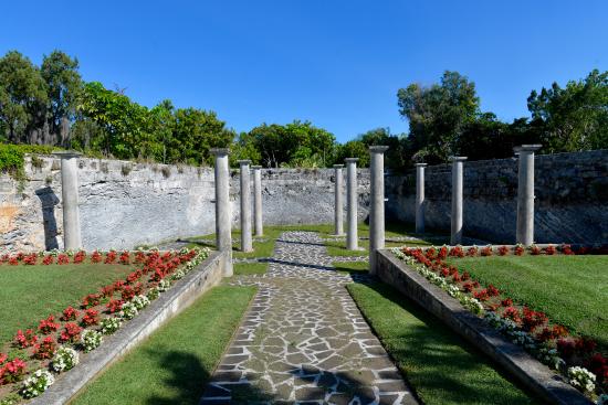
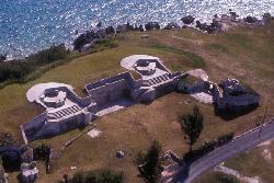
First, let’s take a look at Fort Hamilton in the capital city of Hamilton. It is situated above the city, and is said to have been built in 1870. It is in the shape of a pentagram.
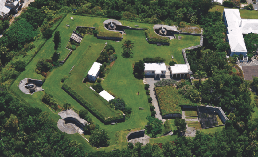
Interestingly they have cannon on platforms at only three of the five main points of the fort’s pentagram shape…
…resting upon what looks to be a more recent concrete platform…
…and nothing in two of the five points.
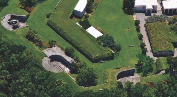
The fort has beautiful colonnades, seemingly holding up air, and a nice wall in the background about the same height. Don’t know if the area used to be enclosed or not, but sure looks like it could have been!
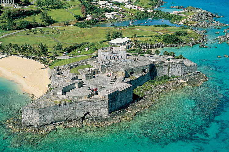
Fort St. Catherine is on the northeast tip of George’s Island in Bermuda. The stone fort here was said to have been built in 1614.
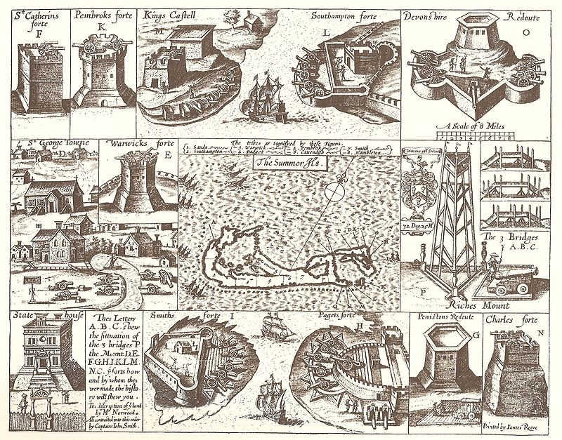
This is a 1624 map of Bermuda, attributed to Captain John Smith of Jamestown, Virginia-fame, with Fort Charlotte depicted on the top left.
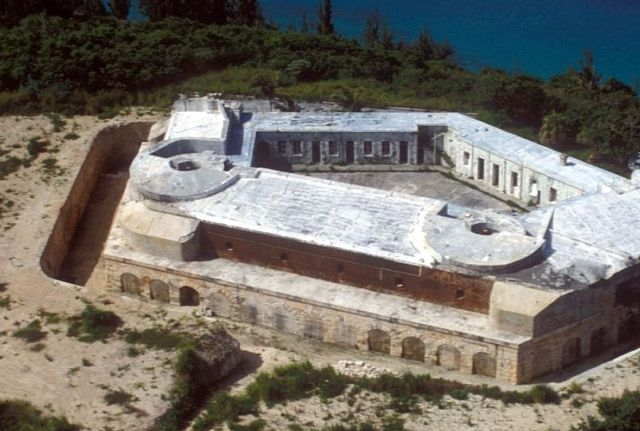
Fort Cunningham is located Paget Island in Bermuda’s St. George’s Harbor…
…and this is Alexandra Battery, located about a mile away from Fort St. Catherine, to name a few.
As a matter of fact, there are dozens of old forts on the island of Bermuda, much like Fernando de Noronha off the coast of Brazil. Both are in the Atlantic Ocean, separated by 3,277-miles, or 5,274-kilometers.
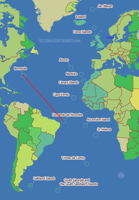
I am thinking these two islands were significant power centers for the energy system of the planetary grid. There were possibly more places like this, but I know of at least two places were for sure! More on Fernando de Noronha later in this post.
The Merida Circle alignment goes through Iceland, Greenland, over the North Pole, into Siberia, then into the Pacific Ocean through the Near Islands at the end of the Aleutian Island chain (Attu, Shemya and Agattu), and down on through the Hawaiian Islands.
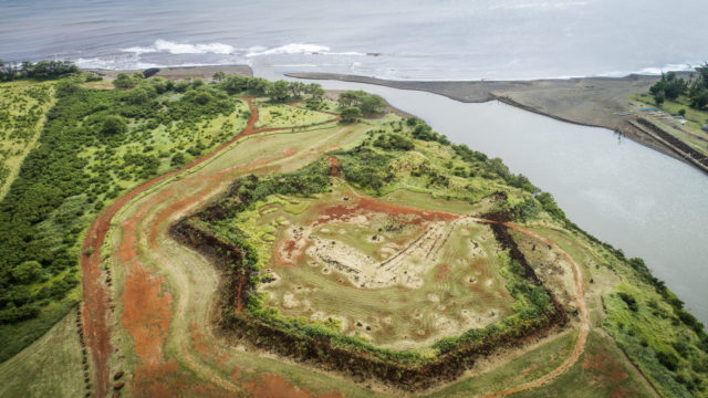
There I found what is called the Old Russian Fort at Fort Elizabeth State Park on the Hawaiian Island of Kauai. It looks like a very ancient star fort to me.
The alignment goes through all of the Hawaiian Islands, the Revillagigedo Islands, in the Pacific Ocean, before entering Mexico at Colima.
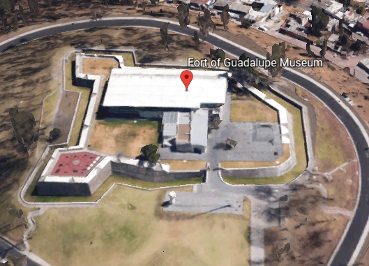
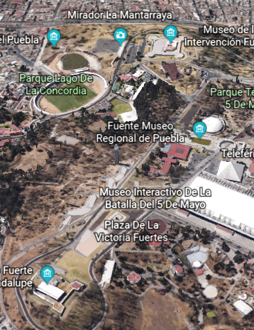
While not directly on the Merida alignment, but very close to it, I found two star forts in Puebla, Mexico, the Fort of Guadalupe…
…and the Fort Loreto…
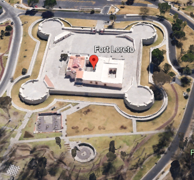
…that are situated relatively close to each other, on a hill not far from the city center of Puebla.
The Battle of Puebla is where the legendary Cinco de Mayo battle took place on May 5, 1862, where poorly-equipped Mexican forces defeated superior French forces.
Also not directly on the alignment, but close, and overlooking the Gulf of Mexico, in Veracruz, we find the Castle of Fort San Juan de Ulua.
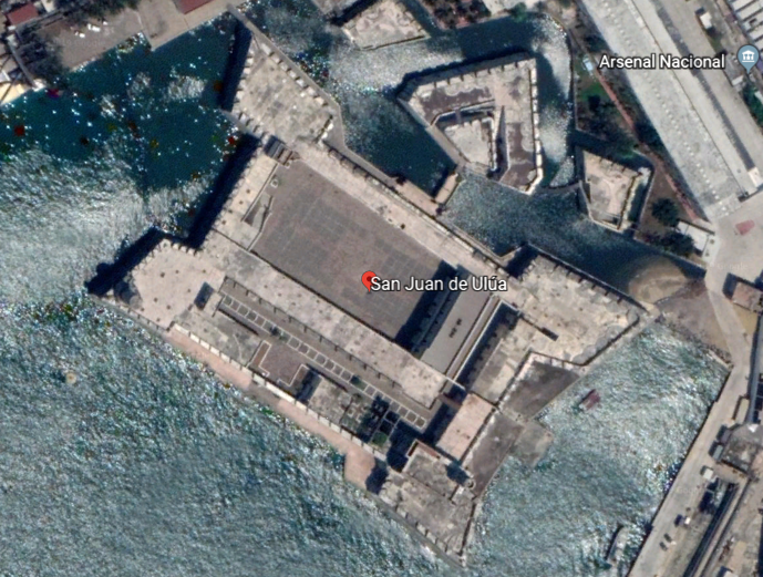
It’s construction was said to have started in 1565, in the Spanish Colonial New Spain era.
The San Carlos Fortress is also in Veracruz.

It was said to have been built between 1770 and 1776 as a guard post and repository for treasure before its shipment to Spain.
Next, I will take a look at some noteworthy locations I found on the Amsterdam Island circle alignments. I will be showing you a variety of citadels, fortresses, and even temples that could very well serve the same function as the star forts around the world even if they don’t fit the classic look. Fort, fortress, or citadel is a code word that covers up ancient infrastructure that had a specific energy function on the planetary grid.
Amsterdam Island is a tiny dot in the South Indian Ocean, one of the French Subantarctic Islands, also known as the French Southern and Antarctic Lands, officially claimed by France in 1892.
There is a research station there that studies biology, meteorology, and geomagnetics.
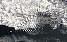
Here is a photograph of Lee Waves taken on Amsterdam Island. Lee Waves are atmospheric stationary waves, and are a form of internal gravity waves. Must be the reason why the geomagnetics of this island are studied.
The Amsterdam Island circle alignment goes through the island of Mauritius in the Indian Ocean, where we find the Citadel Fort Adelaide in Port Louis, the capital of Mauritius.
The alignment goes through Somalia, entering at the capital city of Mogadishu, where we find the Citadel of Gondershe nearby…
…and we find the interesting, almost circuit-looking Taleh Fortress, in Northern Somalia.
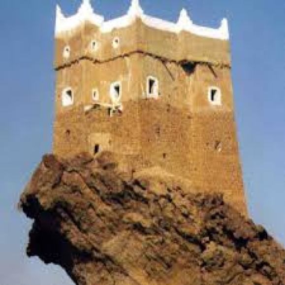
In Mukalla, Yemen, this is the Alguwizi Fortress, called an architectural masterpiece built on the foot of a rock…to protect the city from Bedouin attacks? It sure doesn’t look like it was built to be a defensive structure to me!
Yemen is another one of those places with a missing glorious ancient past.
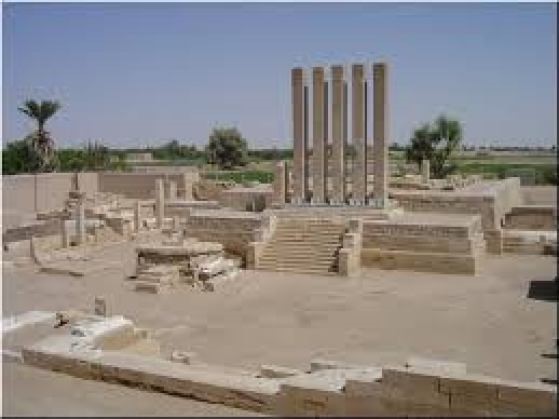
This is the Awwam Temple in Marib, Yemen, also known as the Mahram Bilquis, or the Sanctuary of the Queen of Sheba.

The Sheba Kingdom is one of many ancient kingdoms that reigned in what is now present-day Yemen.
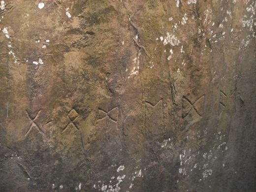
Arash Bilqis, or the Throne of Bilqis, has monolithic stone pillars (meaning single block of stone) more than 26-feet, or 8-meters, high, featuring writing and advanced masonry.
It is interesting to note that the old South Arabian inscriptions seen here…
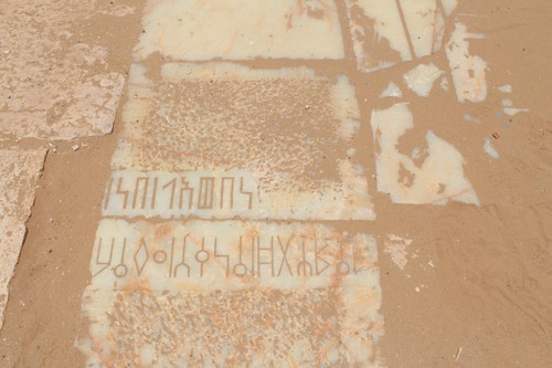
… have a Norse runic look to them.
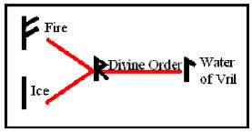
You may ponder what this means. I myself would bet money that it does not mean vikings were in ancient Yemen.
This is exactly what they say about the Heavener Runestone in Heavener, Oklahoma, and the accepted explanation to this day is that there were vikings in Oklahoma.
I would put my money on these being symbols of the original language, Vril, connected to the Ancients and their mastery of how to harness natural energy to create amazing things.
Mahram Bilqis was also dedicated to the moon god of the ancient Yemenis, Al-Muqh, and dates back to the fifth- and seventh-centuries B. C.
Travelling through Yemen and southern Saudi Arabia, on our way to the United Arab Emirates, we pass through the Rub Al Khali, or the Empty Quarter of the southern-third of the Arabian Peninsula. It’s the largest desert in the world.

A recent Saudi Arabian Minister of Petroleum and Mineral Resources reported that the dunes don’t drift – that while sand blows off the surfaces, their essential shape remains intact. Something tells me there is enduring infrastructure underneath all that sand….
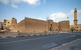
Moving on, this the Al Fahidi Fort, now a museum in Dubai in the United Arab Emirates.
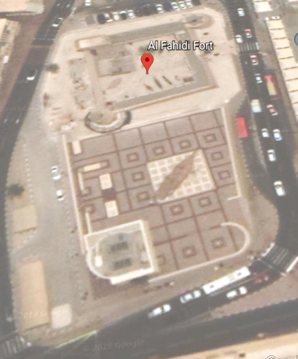
It was said to have been built in 1787, and is said to be the oldest existing building in Dubai.
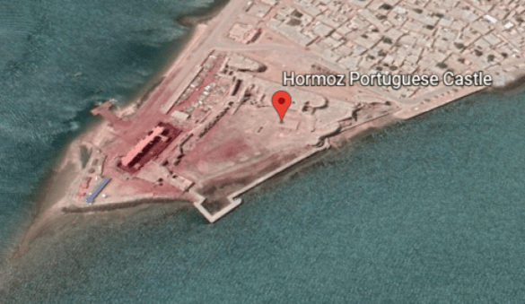
Next on the alignment, we come to the Island of Hormuz in the Strait of Hormuz, part of the Hormozgan Province of southern Iran, where we find the old Portuguese Fort, otherwise known as the Fort of Our Lady of the Conception. It was said to have been built shortly after the Portuguese captured the island in 1507.
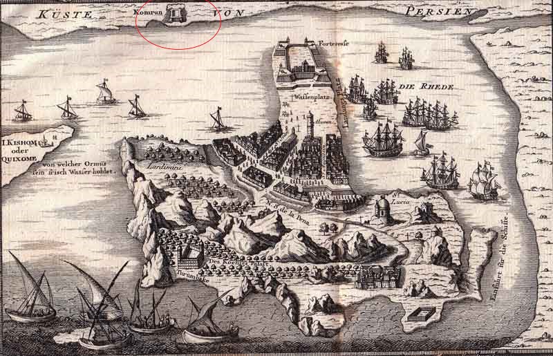
The date given for this old map of Hormuz is 1747, showing lots of activity going on here, and what appears to be another star fort shape across the Strait of Hormuz on the coast of what is now southern Iran.
While on Google Earth there no longer appears to be a similar structure across the water in this location…
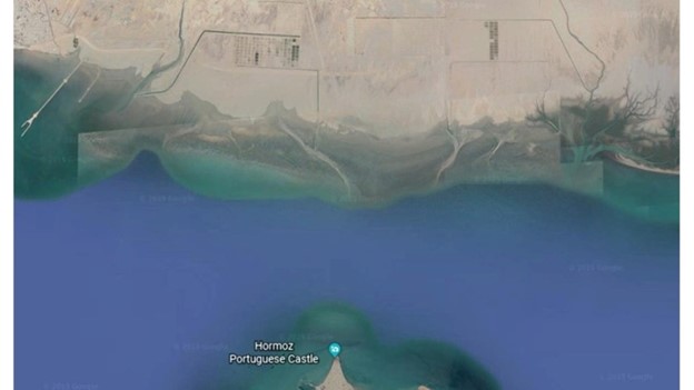
…there does appear to be an intentional configuration of many square shapes in the desert in that location…
…that are reminiscent of circuitry chips on a circuit board.

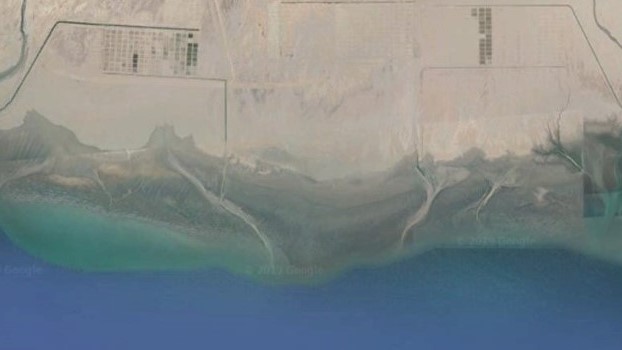
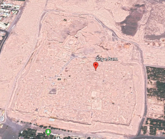
Further up the alignment, the Arg-e-Bam Citadel in Kerman Province in Iran, is considered to be the largest mud brick, or adobe, building in the world.
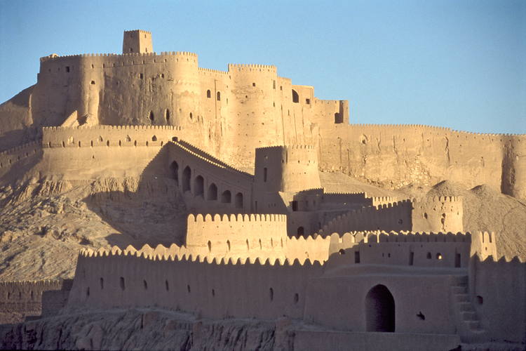
An earthquake in 2003 destroyed much of it, but you can still get a sense of the size and shapes of the complex from this Google Earth screenshot.
This is the Bazaar-e-Sartasari in the city of Kerman, one of the oldest trading centers in Iran…
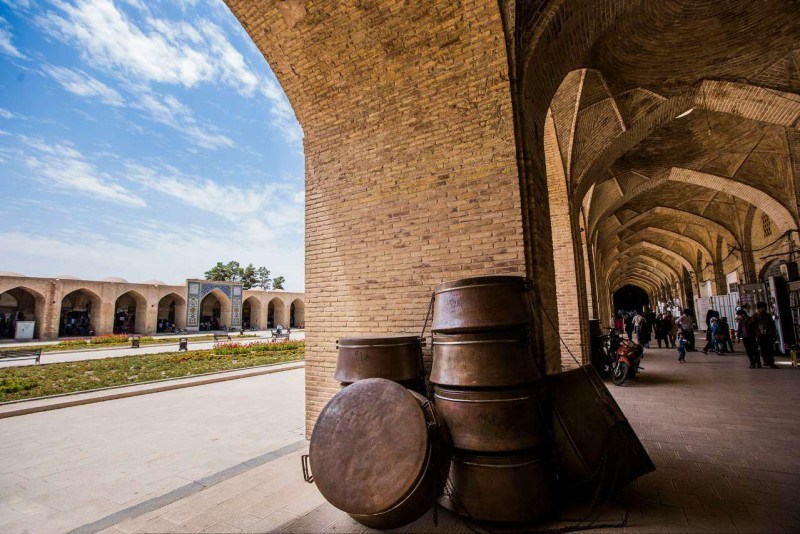
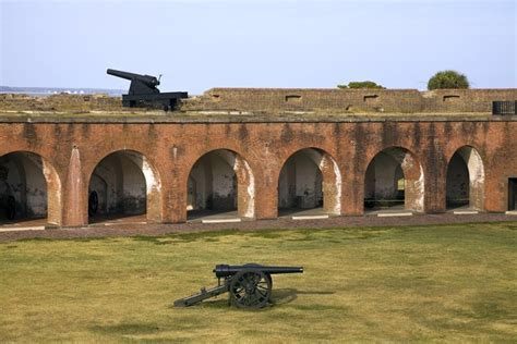
…where you can see shared characteristics, like the vaulted archways, with Fort Pulaski in the U.S. State of Georgia, on Tybee Island near Savannah, Georgia.
…and long buildings with continuous archways.
So, believe me, there is a lot more in this part of the world through Central Asia. I am going to fast-forward through the Amsterdam Circle Alignment to Japan because I have so much more to cover and all of this information belongs together in one post.
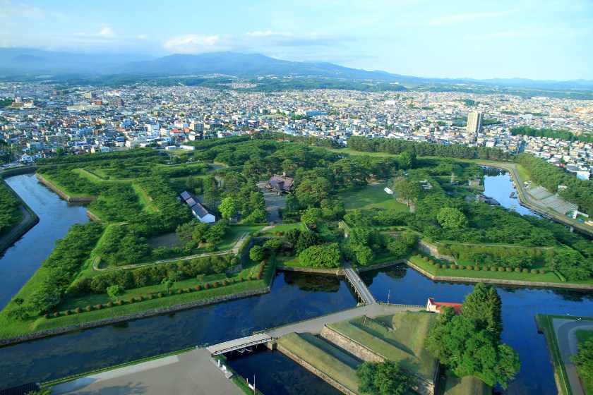
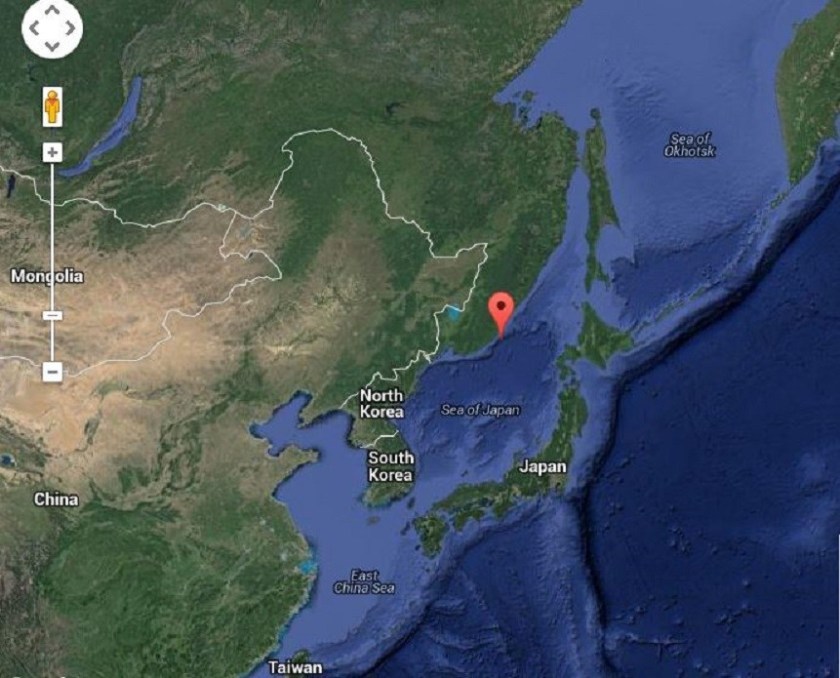
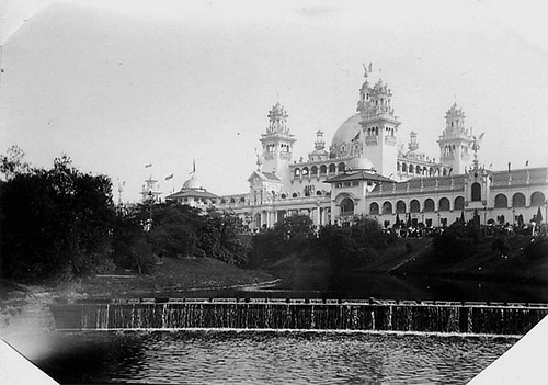
This is the Goryokaku star fort at the port of Hakodate on the southern end of the Japanese Island of Hokkaido.
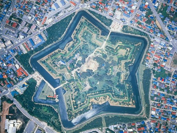
It was one of two Japanese ports that the United States demanded under threat of force to be open to American vessels in 1853 and 1854.
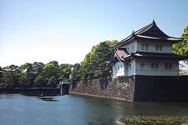
The alignment goes through Tokyo, where we find the Edo Castle, said to have been built in 1457…
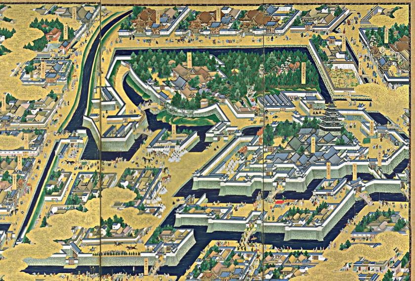
… and today is part of the Tokyo Imperial Palace.
Next, I am going to compile the infrastructure that I uncovered researching the Circle Alignment that begins in Algiers, Algeria. Keep in mind that I am finding that the name citadel and fortress are included in the code words to cover-up highly advanced ancient building technology connected to the energy system of the planetary grid.
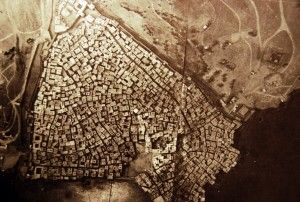
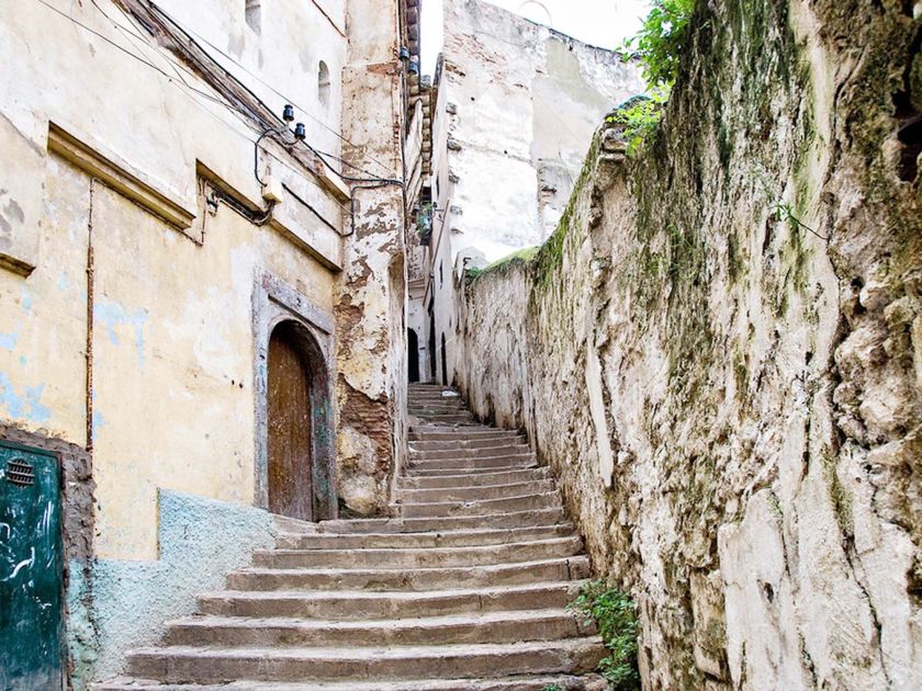
The Casbah in Algiers is also called the Ancient City of the Deys.
The five noble titles of the Moors are: El, Bey, Dey, Al, and Ali.
Ancient means something belonging to the very distant past.
Yet we are told that the title of Dey in Algiers (as well as the Deys of Tunis and Tripoli) was given to these rulers under the Ottomon Empire, starting in 1671.
Yet the Casbah is known as the Ancient City of the Deys???!!!
The meaning of Casbah is “Citadel” and refers to the Citadel of Algiers, and the traditional quarter clustered around it.
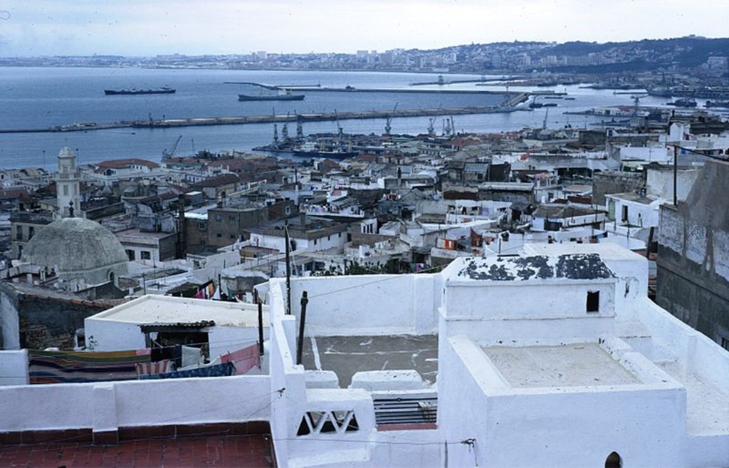
While there are some parts of the Casbah that have not fared well with Civil War and neglect…
…there is still much beauty to be found…
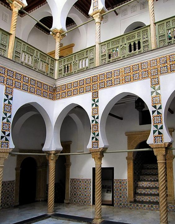
…and heavy stone masonry here.
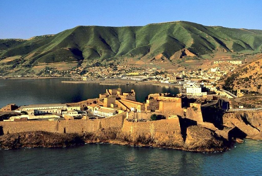
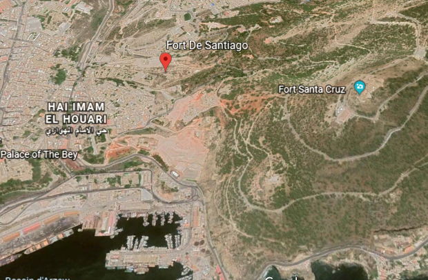
Before moving on from Algeria, I will show you the four star forts that I found in Oran, Algeria, formerly the seat of the Beys, and is west of Algiers on the Mediterranean coast.
The first I found in Oran was Fort Santa Cruz, said to have been built between 1577 and 1604 by the Spanish.
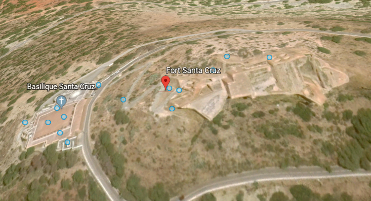
We are told that in 1831, the French occupied Oran and the fort.
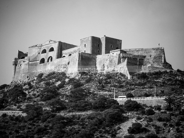
There are subterranean tunnels connecting Fort Santa Cruz with all of the ancient forts of Oran…
…including Fort Lamoune, which is located on the western end of the harbor there…

…and commands the road from Oran to…
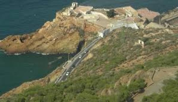
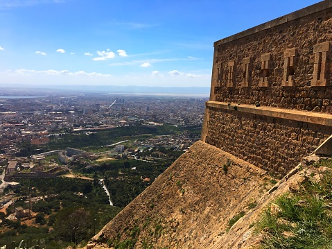
… Mers-el-Kebir, the Great Harbor, and strategic military port of Oran.
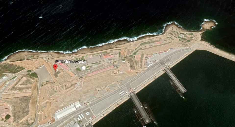
It is said to have an ancient history that goes back to Roman times, and was of great strategic importance.
Taking great note of the year, it was said to have become a center of pirate activity in 1492, the year of the Fall of Grenada, the final act in the campaign to drive the Moors out of Spain.
I believe the year 1492 was a key player and clue as to how and when the original Moorish timeline was deliberately hijacked. In order for negative beings to seize control Humanity, the Advanced Humans of Higher Consciousness had to be taken out, and history re-written and falsified.
Fort de Santiago is also in Oran, and connected to the others.
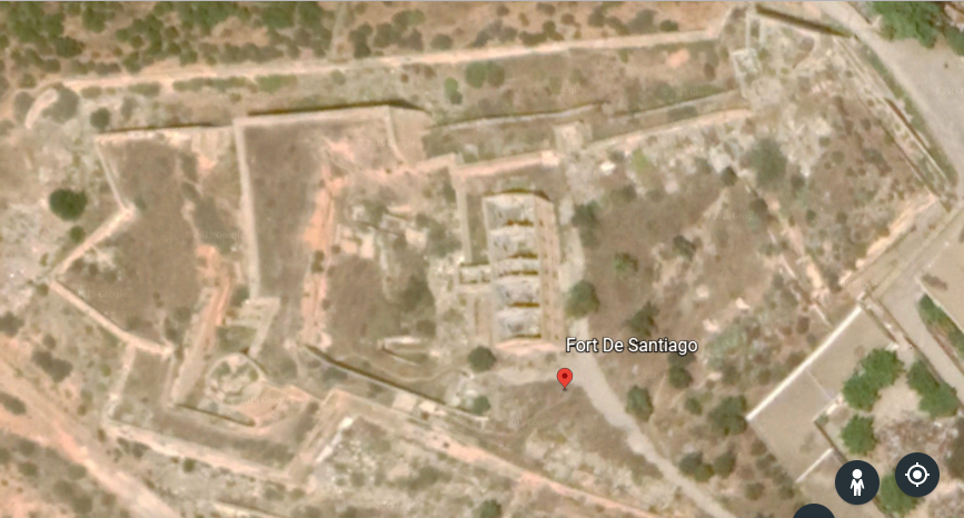
It is a short distance west of the Fort Santa Cruz.
While I am most specifically addressing the alignments I have personally found, I want to emphasize that this civilization was laid out geometrically world-wide, and there are many, many other alignments on which these places are located.
For example, while Guinea-Bissau, formerly French Guinea, is not directly on the Algiers circle alignment, the African country of Guinea to which it is adjacent is, where it goes through Conakry…
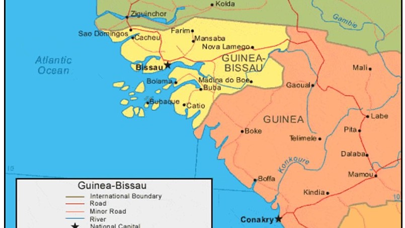
…where we find Fort Cacheu, located on the Cacheu River, near the Atlantic Coast.
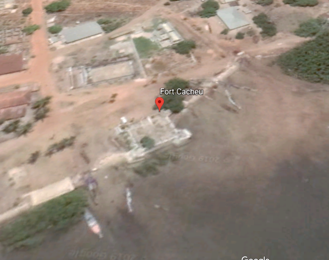
It was said to have been built in the 16th-century by the Portuguese.
The Algiers circle alignment leaves Africa in Guinea, and crosses the Atlantic to enter Brazil on the coast in Sao Luis.
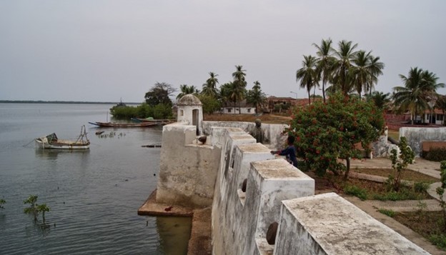
The first star fort I came across in my research in Brazil was the Sao Jose do Rio Negro, at the confluence of the Amazon and Negro Rivers.
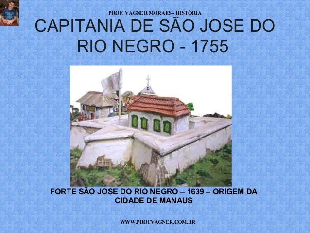
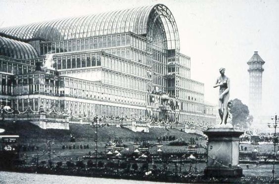
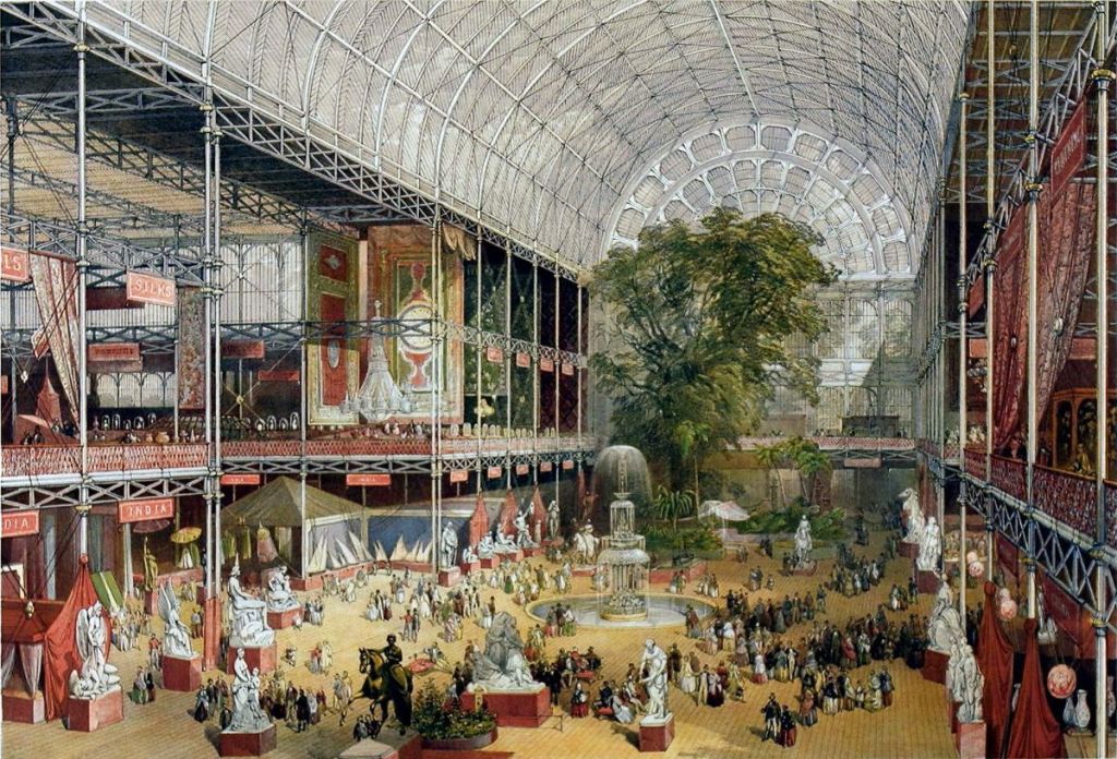
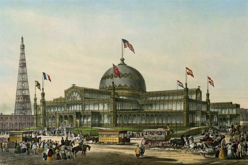
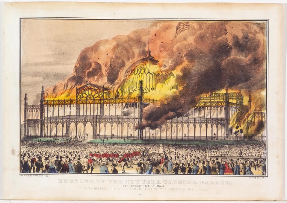
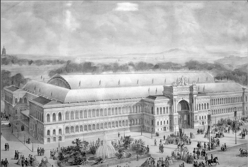
It was renamed Manaus, after the indigenous Manaos people, in 1848 when it was established legally as a city. This was just a few years before the Crystal Palace Exposition in 1851, which I believe was the official start of earth’s new, hijacked timeline.
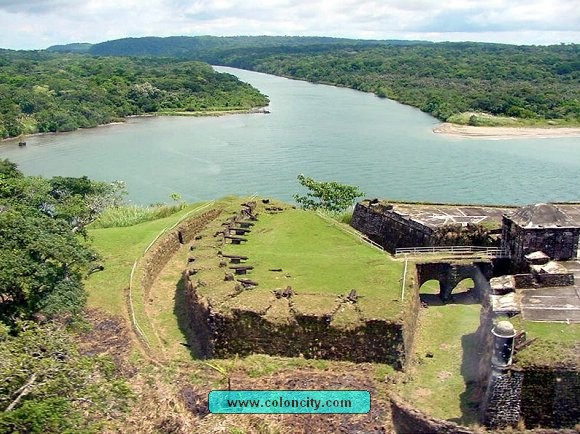
This is an aerial of Fort San Lorenzo, on the Caribbean coast at the village of Chagres, near Colon.

It is a UNESCO World Heritage Site, said to have been built in 1587.
Henry Morgan, a Welsh pirate, was said to have ordered the destruction of Fort San Lorenzo in 1670…
…and then he was said to have invaded Panama City the following year from Fort San Lorenzo, and destroyed what was Old Panama, or Panama Viejo…
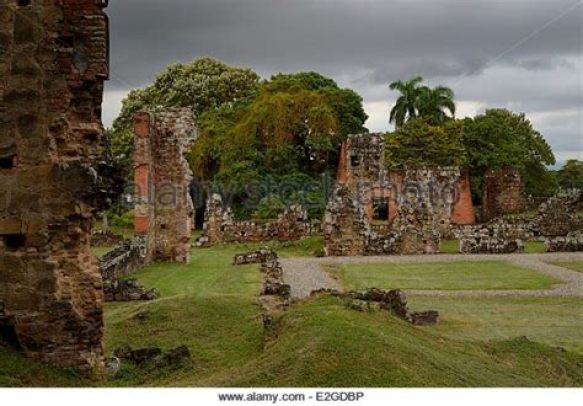
…which had a similar star fort of which only ruins remain. This is a diorama of what Panama Viejo would have looked like before its destruction.
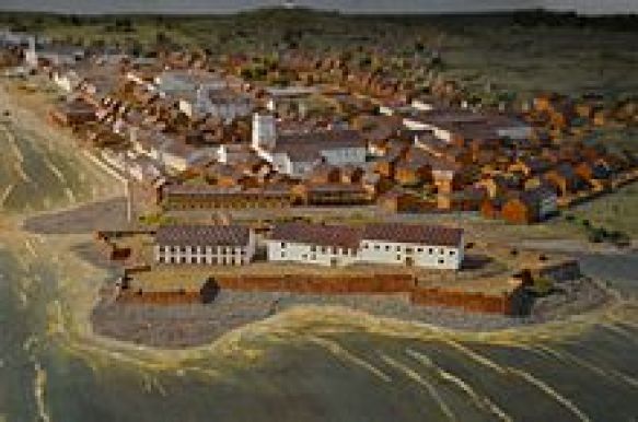
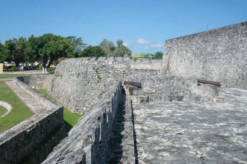
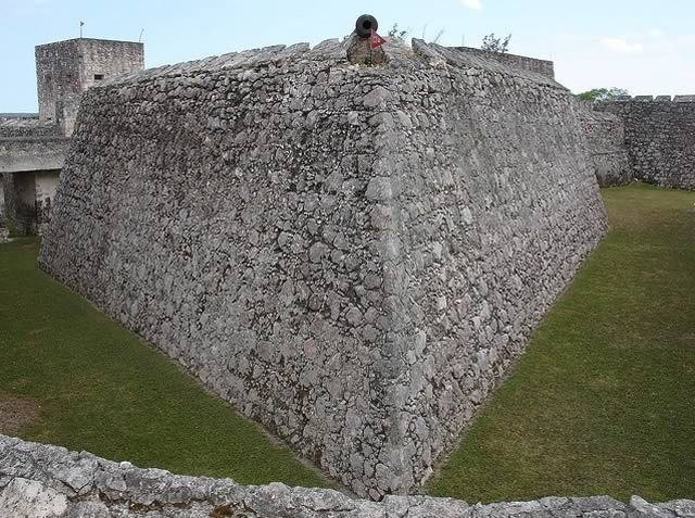
The Algiers Circle alignment goes the Trujillo, Honduras, where we find the Fortaleza de Santa Barbara, said to have been built by the Spanish in around 1550.
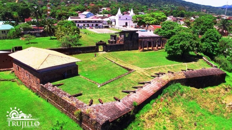
Trujillo is where Christopher Columbus landed in 1502, on his fourth and final journey.
This is the Fortress of San Felipe in Bacalar, Mexico.
It is near Chetumal, in Mexico’s southeastern border with the country of Belize.
The Algiers circle alignment also goes through Merida, where Campeche is 97-miles, or 157-kilometers, southwest of Merida.
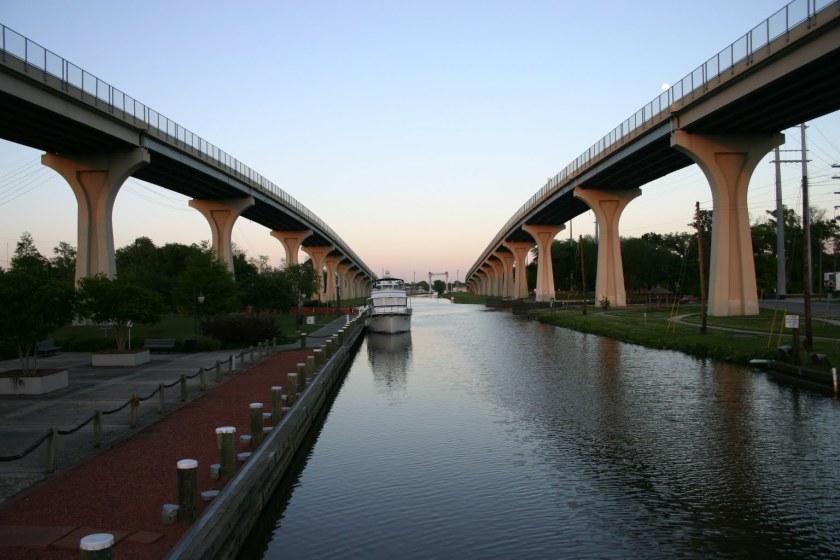
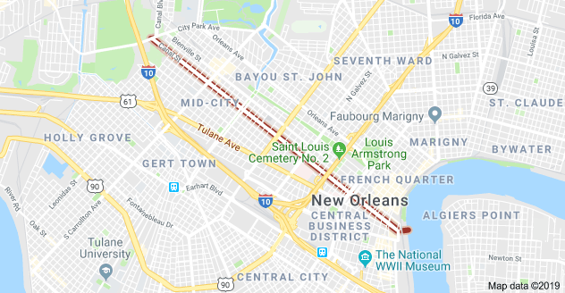
Then, the Algiers Circle Alignment crosses the Gulf of Mexico, and we come to Baton Rouge.
The history of Baton Rouge is going to take me into new research for this post that uncovered numerous star forts, and connections to a little-known history of North America.
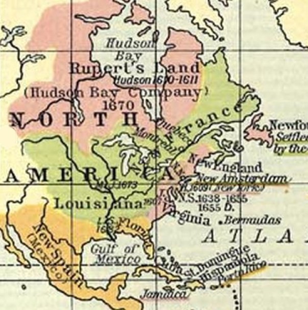
This region was part of French Lower Louisiana, comprising the states of Arkansas, Louisiana, Mississippi, and Alabama, with was established in 1682. More about the former French Louisiana lands later in this post.

In 1762, with the Treaty of Fontainebleau, France secretly ceded Louisiana to Spain.
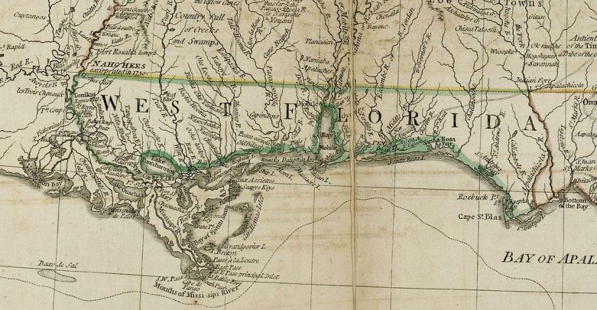
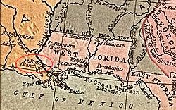
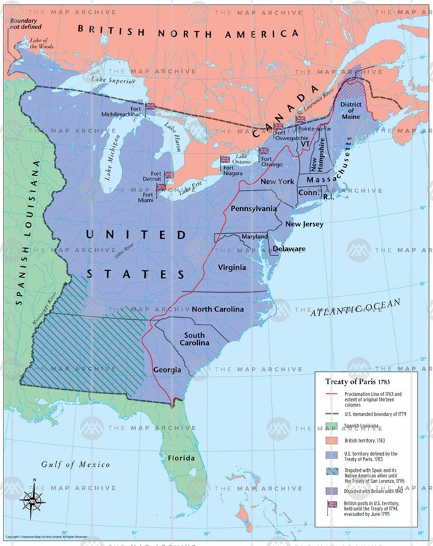
In 1763, Great Britain, who acquired these same lands from France and Spain through the Treaty of Paris at the end of the French and Indian War, established West and East Florida.
Pensacola was the capital of West Florida.
Spain officially entered the American Revolutionary War on May 8th, 1779, with a formal declaration of war by King Charles III, and on July 8th, another declaration followed that authorized colonial subjects to engage in hostilities against the British. That is when the Governor of Spanish Louisiana, Bernardo de Galvez, started to plan operations to take British West Florida in what is known as the Anglo-Spanish War.
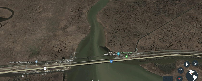
On August 27, 1779, Galvez led an attack force to Fort Bute, a colonial fort that was said to have been built in 1766 by the British to protect the confluence of the Bayou Manchac with the Mississippi River, 115- miles, or 185-kilometers, upriver from New Orleans, on the far western border of British West Florida.
It was described as a decaying relic of the French and Indian War, and was captured after a brief skirmish.
Whatever fort was here in the past at Manchac Bayou, now known as Akers, Louisiana, it is no longer to be found.
The Battle of Baton Rouge was next, a brief siege during the Anglo-Spanish War that was decided on September 21st of 1779, and the second British outpost to fall to the Spanish during Bernardo de Galvez’ march into British West Florida. Baton Rouge was only 15-miles, or 24-kilometers, from Fort Bute.
The British commander, Lt. Colonel Alexander Dickson, was said to have built Fort Richmond in Baton Rouge in July of 1779. He had decided that Fort Bute was indefensible, and placed most of his troops in Baton Rouge.
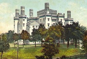
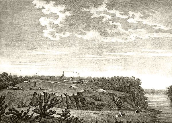
Now, it is unclear as to whether or not Fort Richmond is the same star fort that is depicted in this historic map of Baton Rouge…
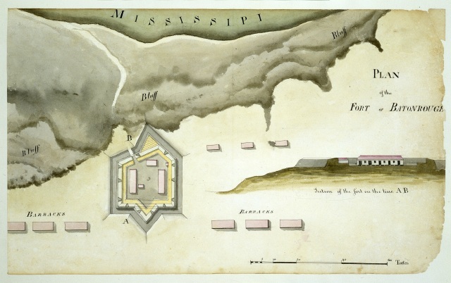
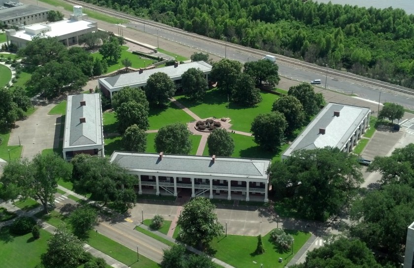
…or whether or not it is a depiction in this map of the Pentagon Barracks, which are still standing as a museum in a prominent part of Baton Rouge. More on this shortly…
…or another star fort entirely. But there it is, at least one star fort depicted on the historic map in Baton Rouge circa 1814.
At any rate, the Spanish shelled the British for three-hours in their Baton Rouge fortication, after which time Lt. Colonel Dickson surrendered to the Spanish Commander Galvez, who also required the capitulation of the British Fort Panmure, also known as Fort Rosalie, in Natchez, Mississippi, as part of the terms of surrender. These terms were accepted.
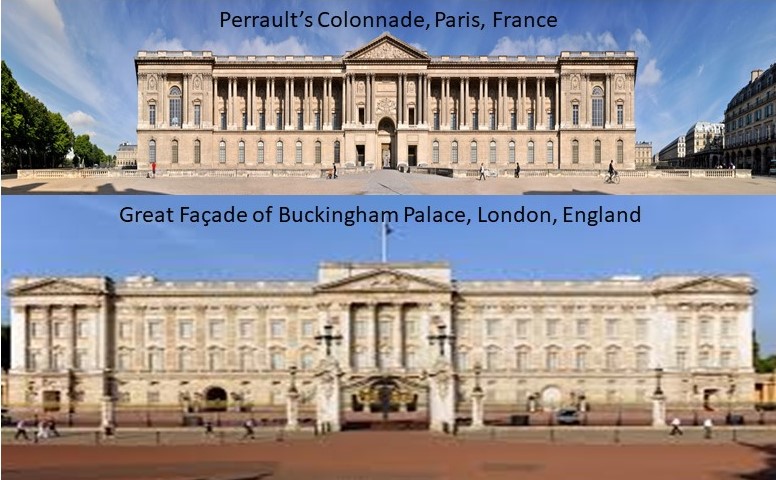
This is a still standing home in Natchez, Mississippi, with a colonnaded onion dome on the top left, compared with the colonnaded onion dome at the Colt Armory in Hartford, Connecticut on the top right, and this one at Sintra, Portugal on the bottom.

Back to the location of the present-day Pentagon Barracks Museum in Baton Rouge, it is located right next to the grounds and heart of the Louisiana State government, shown here.
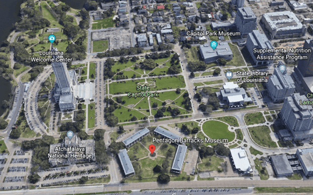
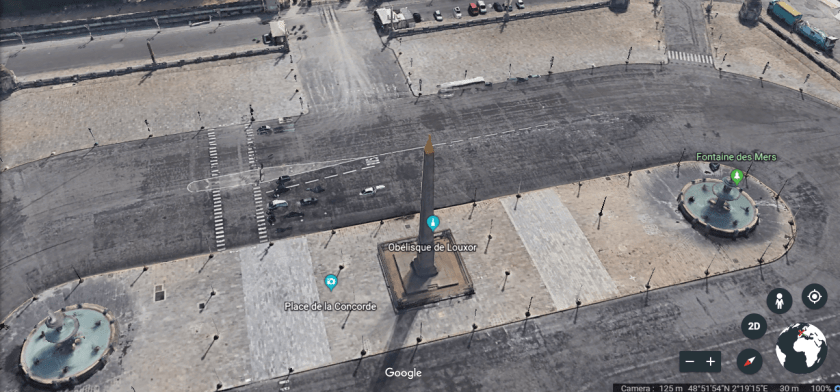
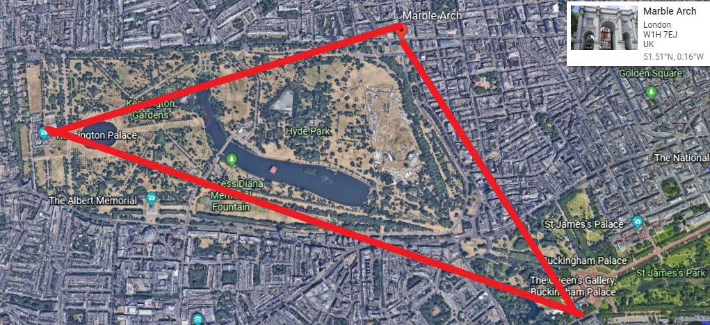
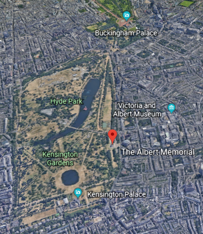
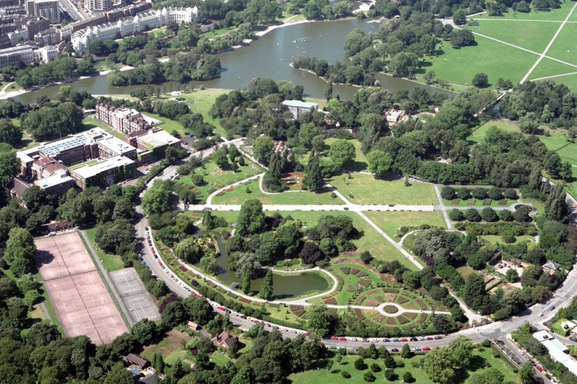
And when you compare the gardens of the Louisiana State Capitol Park here on the top left in Baton Rouge, literally right next to the Pentagon Barracks, you find noteworthy similarities to the geometric lay-out with the Tuileries Gardens in Paris on the top right; the Kensington Gardens and Hyde Park in London on the bottom left, and the Versailles Gardens on the bottom right, located in Versailles and right outside of Paris.

The next battle that Galdez and the Spanish Forces won was the Battle of Fort Charlotte, or Fort Conde, in Mobile, Alabama, after a short less than two-week battle in 1780.
The Siege of Pensacola was fought in 1781, and the culmination of Spain’s conquest of British West Florida during the Gulf Coast campaign.
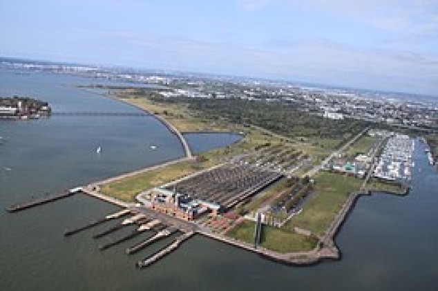
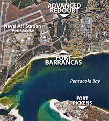
Here is what I found when I looked at Pensacola. These star forts are close together, and intact.
Fort Pickens is on the western end of the Santa Rosa Island…
…where it sits on one side of the channel entering Pensacola Bay from the Gulf of Mexico.
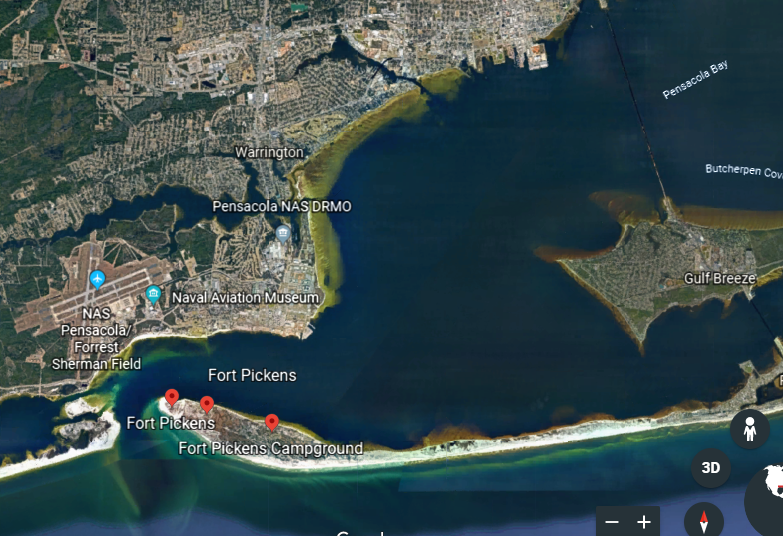
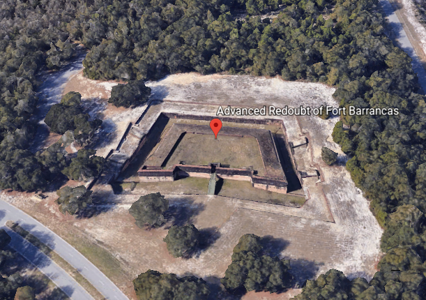
Fort Barrancas is directly across from Fort Pickens on the other side of this channel, and located physically within the Pensacola Naval Air Station…
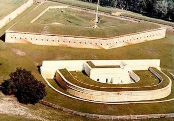
…and what is called the Advanced Redoubt as well.
This is how the relationship between these three star forts looks from above.
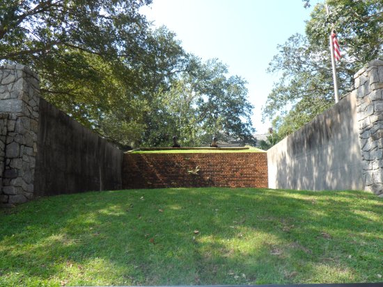
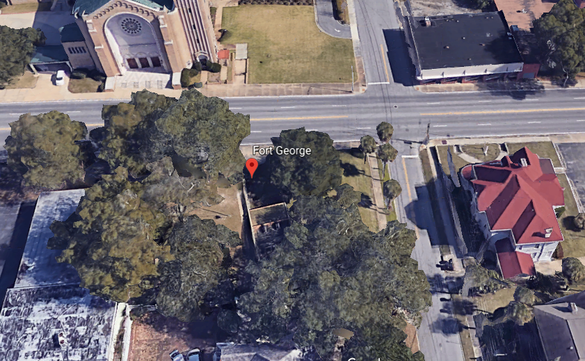
Other star forts in Pensacola included Fort George, of which this is what is left:
There is nothing left of what was the Fort of Pensacola, also known as the Presidio Santa Maria de Galvez.

This was its previous location…
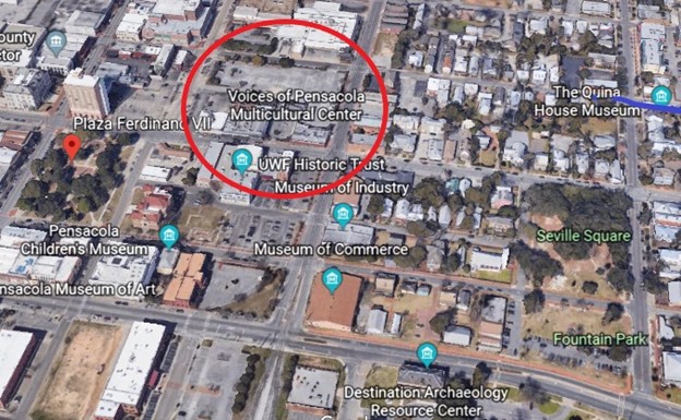
…which I found through the coordinates of the former fort on this map.
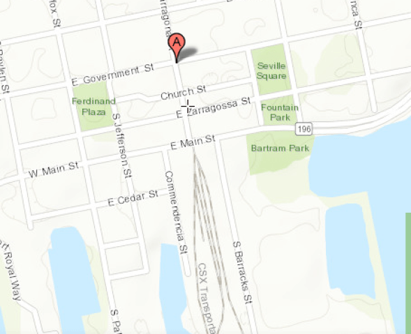
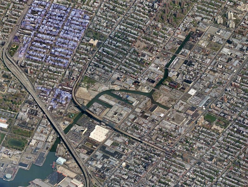
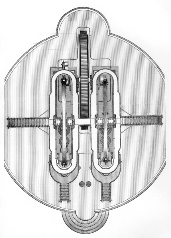
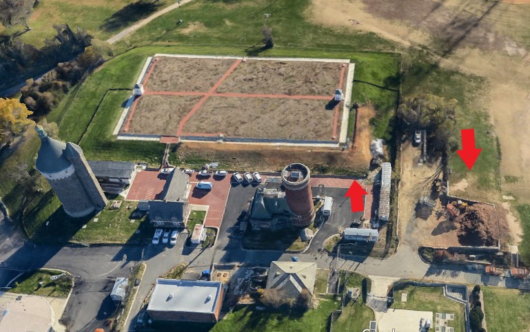
I find it interesting to note the the head of the CSX Railyards was just one-block due south of where the Fort of Pensacola was located, which happens to look like a circuit board diagram.

I will be delving deeply into railroads in a future post.
Great Britain’s effective control of West Florida ended in 1781 when Spain captured Pensacola, and the land was ceded back to Spain by the Treaty of Paris in 1783, which ended the American Revolutionary War.
Was all of this infrastructure already in place at these locations, and the reason for all of the colonial interest and warfare, or were they structures that were built in the years of history we are taught?
All of this land was part of the Ancient Washitaw Empire, and what was already here, and what really took place, is glaringly absent from the historical record.
So there are four more places in Europe on the Algiers Circle Alignment that I would like to share with you before I move on to the last one.
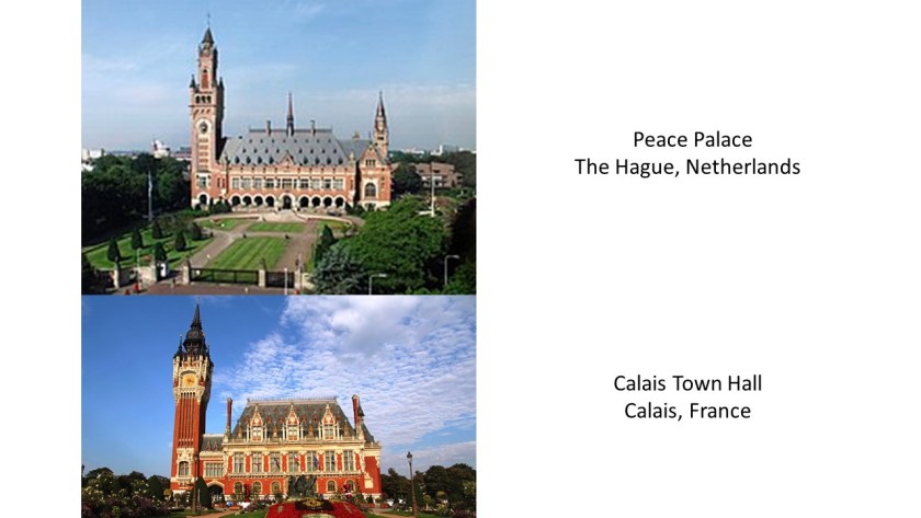
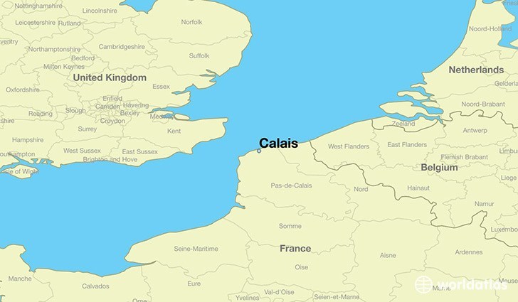
The first is Calais, France, a city and major ferry port in northern France, and situated on the Strait of Dover, the narrowest point in the English Channel across from Dover in England.
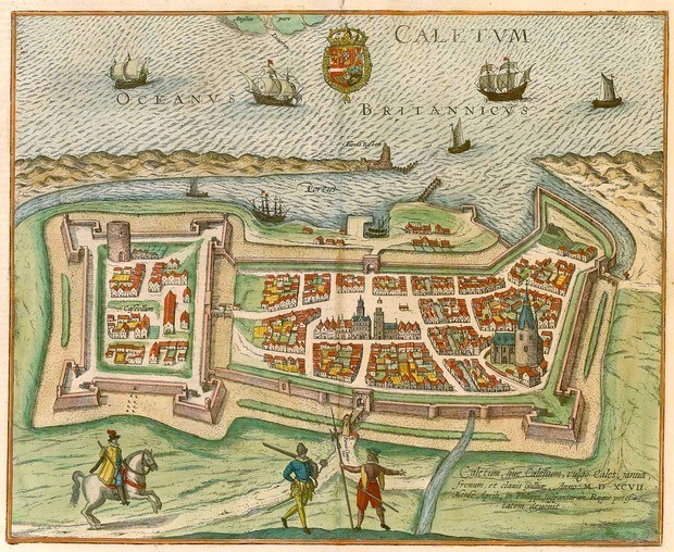
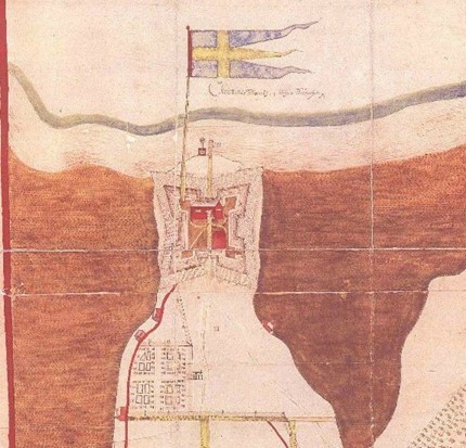
The old part of the town is called Calais-Nord, and is located on what is called an artificial island, on which this antique map shows that either a star city or star fort.
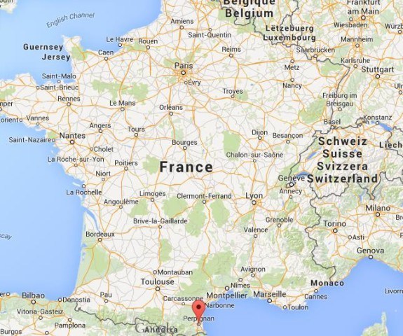
The next place is in Perpignan, the continental capital of the Kingdom of Majorca in the 13th- and 14th-centuries.
Majorca is another kingdom that is glaringly absent from the historical record.
This is the Palace of the Kings of Majorca in Perpignan.
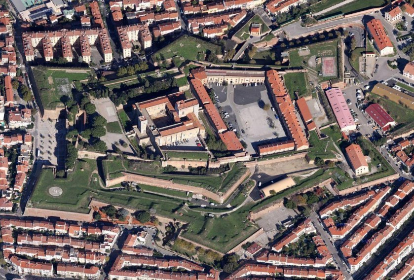
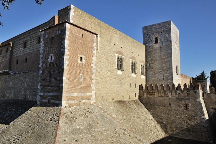
Then on Spain’s Mediterranean coast, between Perpignan and Barcelona, we find Sant Joan’s Castle at Lloret de Mar, on a rocky promontory overlooking the Mediterrean Sea.
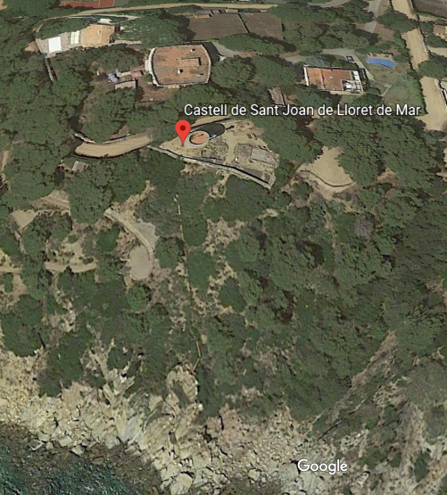
It is said to date back to the 1100s, from the age of Lady Sicardis and her sons, who were the Lords of Lloret. Apparently she ordered the construction of the castle…
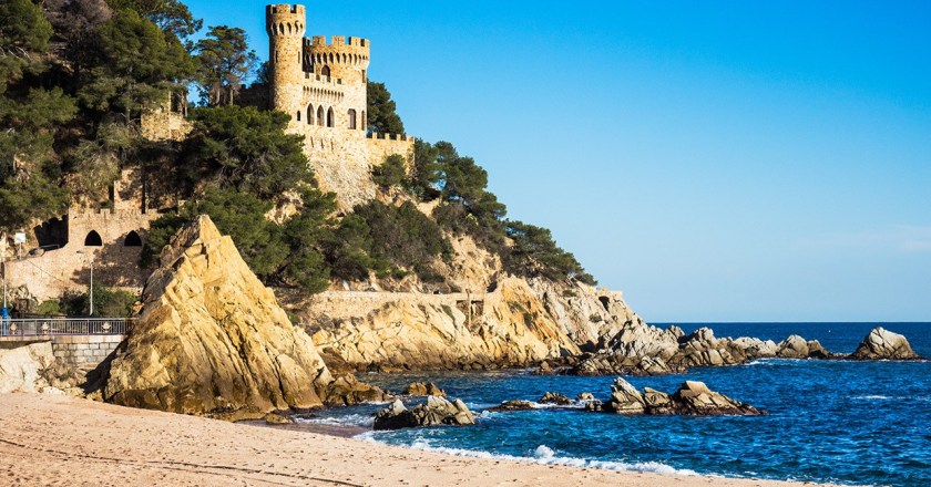
…and the British Navy is said to have bombarded the castle during the Battle of Trafalgar in 1805, and effectively destroyed the fortified site.
The last thing from the Algiers alignment that I want to point out is this view of Barcelona, Spain from the air. The combination of the city’s lay-out and infrastructure looks to me like both Mayan glyphs and/or some kind of binary code.
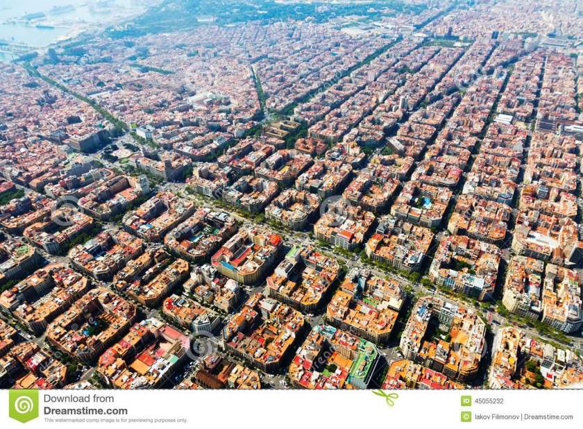
At any rate, that is some kind of city planning there. Not one that happened randomly or haphazardly, that’s for sure!
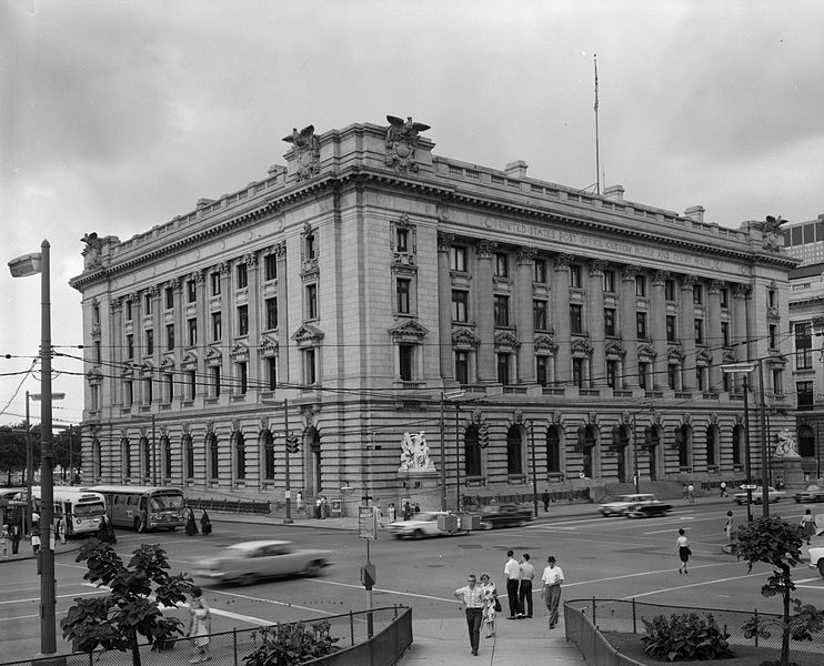
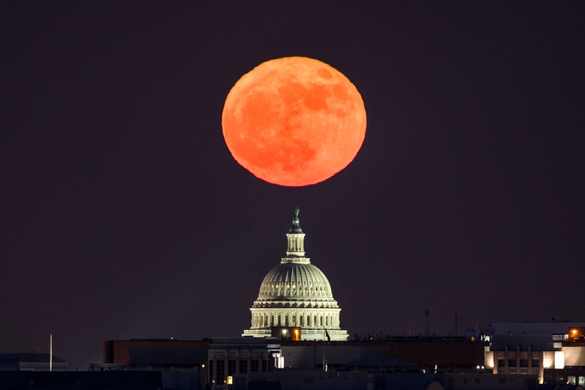
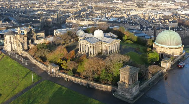
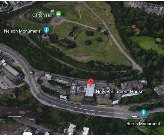
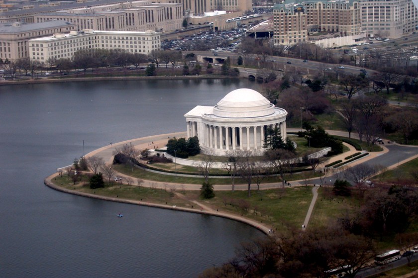
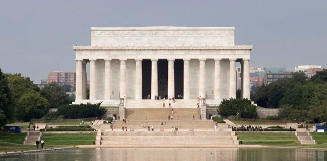
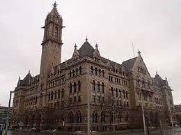
Now on to the final leg of this journey, which is on the circle alignment which beings, and ends, in Washington, DC.
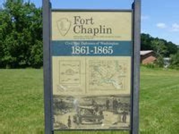
The Washington area had sixty-eight major enclosed forts, so there may have been many star forts in Washington, DC, but we will never know because this is typical of what remains of what was called the Civil War Defenses of Washington, said to have been built between 1861 and 1865.
I would like to bring up the still-standing Fort Reno, where it sits on top of an earthwork. It is located on the highest point in Washington, and said to be the site of the only Civil War battle fought in Washington, during the Battle of Fort Stevens in 1864.
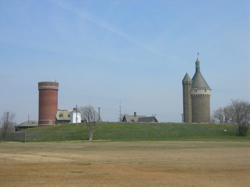
It was said to have been built in the winter of 1861, after the defeat of the Union Army at the Battle of Manassas. Does this look like a temporary structure that was hastily built in the middle of winter?
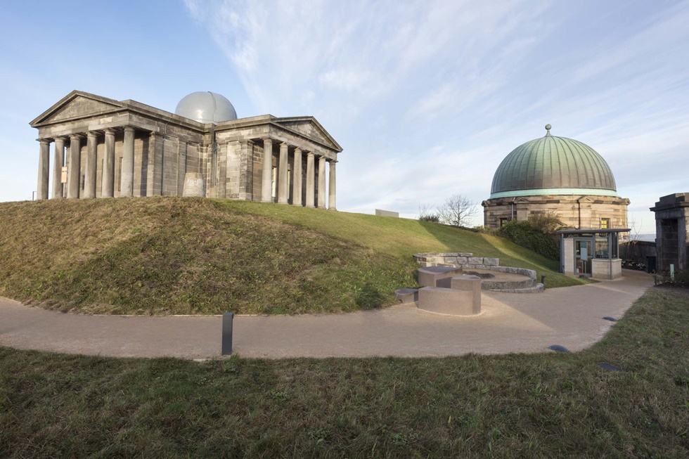
And it is with Fort Reno that I can provide you with an excellent example of the energy harvesting that occurs around these ancient energy sites, with no one the wiser because no one knows about it.
Do you see in this Google Earth snapshot where the top soil is being removed, and dumped nearby?
This is the rule, and not the exception, around the world, and I believe our modern energy industry is utilizing ancient energy technology.
Onward to Baltimore.
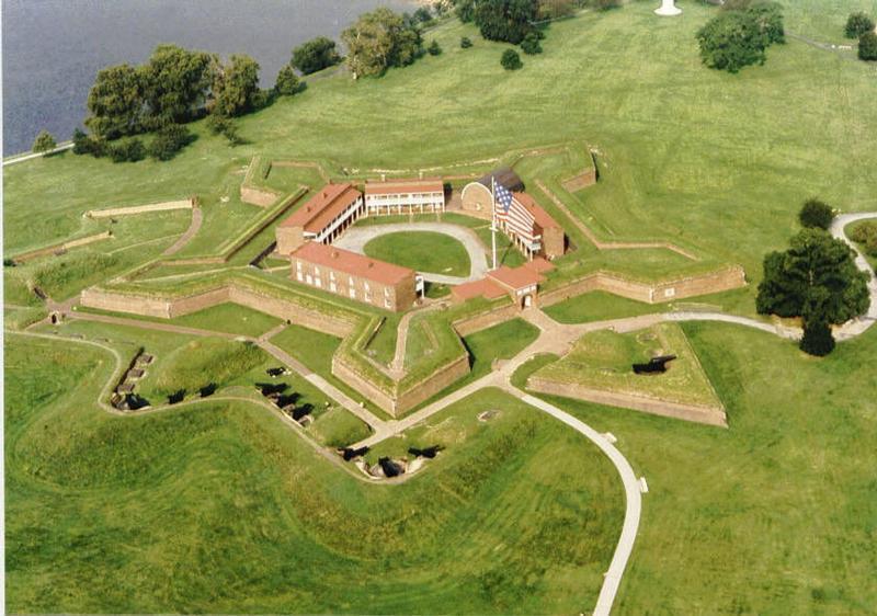
Fort McHenry is the best known star fort in Baltimore. The Star Spangled Banner was said to have been written by Francis Scott Key after he witnessed the bombardment of Fort McHenry during the Battle of Baltimore in 1814, a battle that took place in what is called the War of 1812.
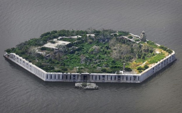
Fort Carroll is in the middle of the Patapsco River, just south of the City of Baltimore, and is described as an artificial island and abandoned hexagonal sea fort.
Wilmington, Delaware was said to have been founded as the Swedish South Company’s Fort Cristina in 1638, the principal settlement of the New Sweden Colony in North America.
Twelve miles south of Wilmington, Fort Delaware is located on Pea Patch Island in the Delaware River. It was said to have been built starting in 1819.
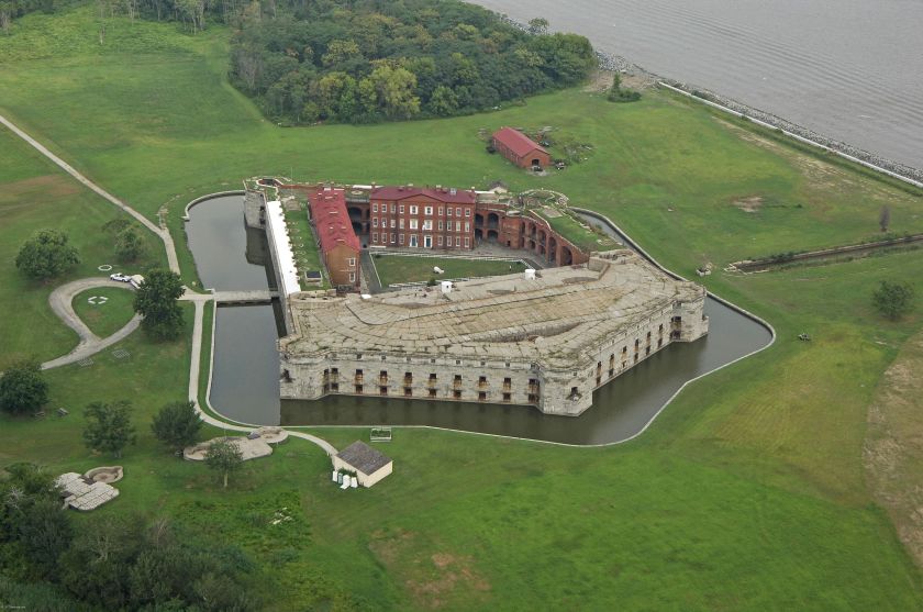
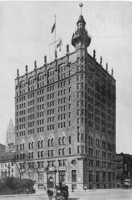
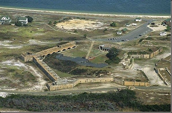
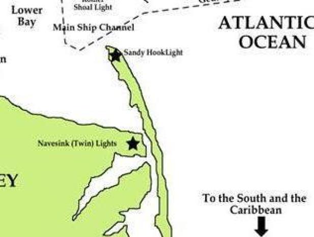
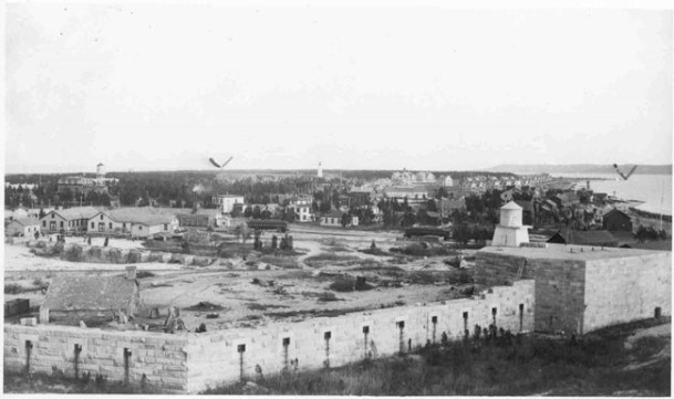
Fort Hancock, and its accompanying Sandy Hook Lighthouse, is located at the northern end of Sandy Hook, a barrier spit in Middletown Township, New Jersey that encloses the southern entrance of the Lower New York Bay.
The construction of the Fort of Sandy Hook was said to have started in 1857 and ended in 1867, without completing the building of the fort under the supervision of then-Captain Robert E. Lee of the Corps of Engineers, and was designed as a five-bastion irregular pentagon built primarily of granite.
Not only was the fort said not to have been completed, it was also said to have had most of its surviving parts taken down by the U. S. Army after World War II.
The batteries of the now designated Fort Hancock were said to have been constructed starting in 1890 as part of the Sandy Hook Proving Ground for the testing of coastal defensive weapons, like Battery Potter.

Battery Potter is described as the prototype for a steam-hydraulic, gun-lift carriages, otherwise known as “disappearing guns.”
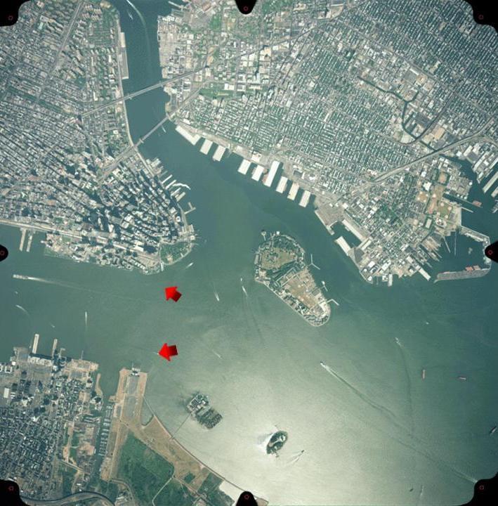
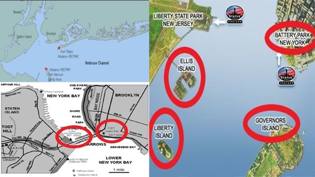
Just north of Sandy Hook is the Ambrose Channel, the main shipping channel in and out of the Port of New York and New Jersey…
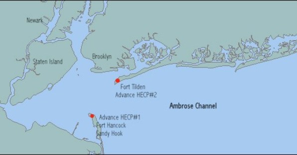
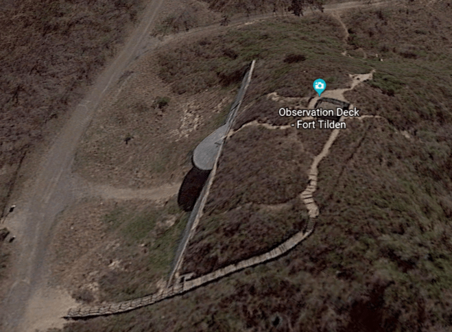
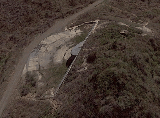
….and Fort Tilden is on the Rockaway Peninsula in the Lower New York Bay, northeast of Fort Hancock and Sandy Hook. It is hard to tell what is here because of the tree cover, but you can make some points out here in this photo.
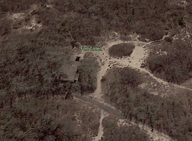
Here is another location on the Fort Tilden site…
…and a similar feature beside it further up the embankment.
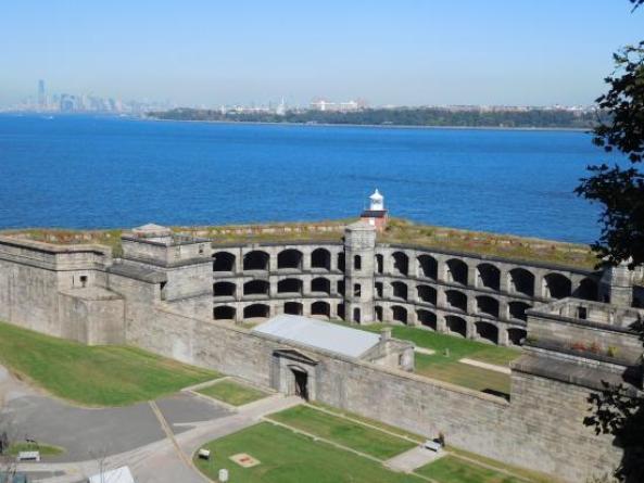
Fort Wadsworth is next to the Staten Island side of the Verrazzano-Narrows Bridge…
…with its four-tiered Battery Weed, is located at what is called The Narrows between the Lower and Upper New York Bays.
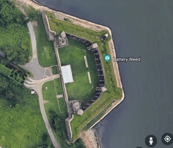
Fort Wadsworth was said to have been established before the War of 1812, as well as between 1845- 1861.
On the southern side of the other end of the Verrazzano-Narrows Bridge from Fort Wadsworth on Staten Island is Fort Hamilton in Brooklyn.
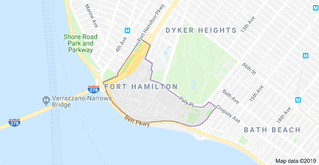
Fort Hamilton is an active United States Army installation.
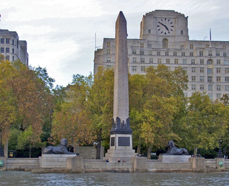
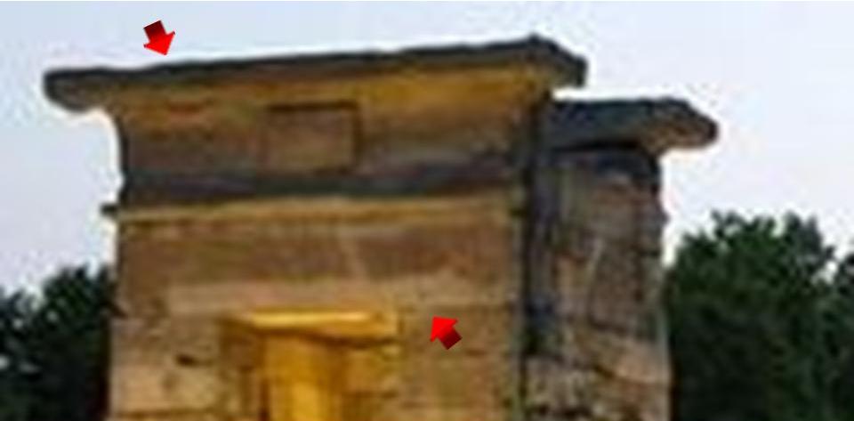
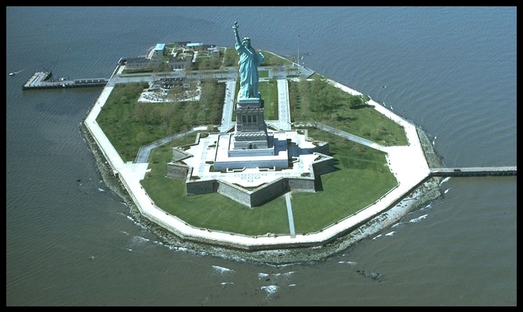
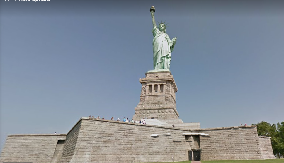
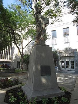
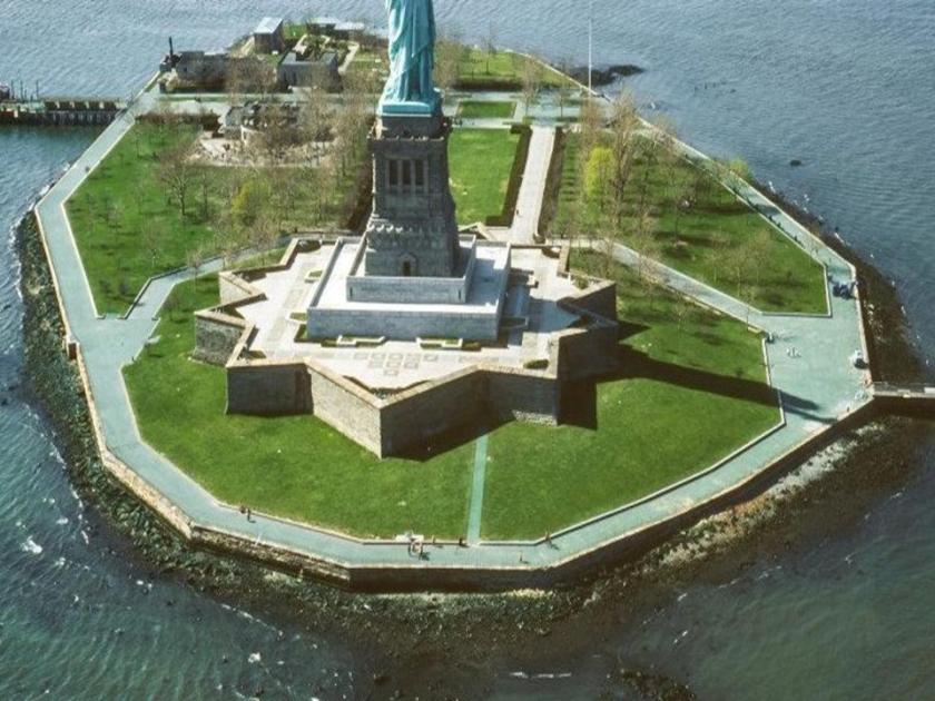
Fort Wood is an eleven-pointed star fort in the Upper New York Bay, located underneath the Statue of Liberty on Liberty Island, and said to have been built between 1806 and 1811…
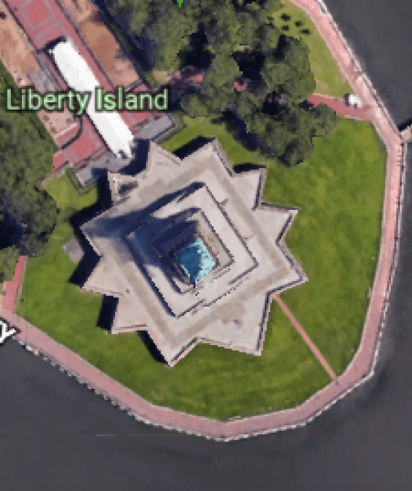
…on what looks to be an artificial island.
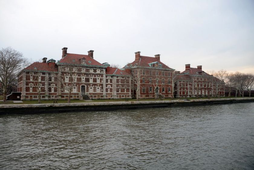
…and it is even more obvious that Ellis Island located right next to it…
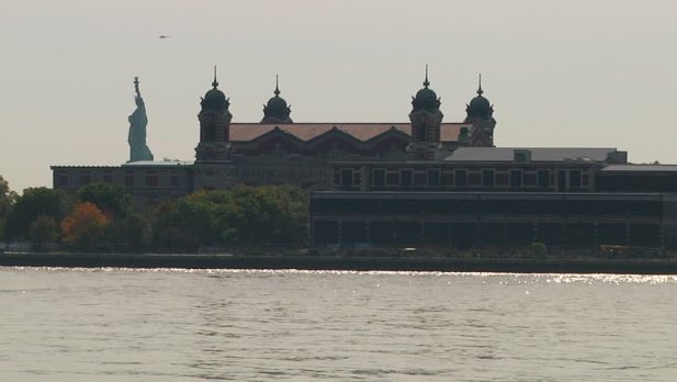
…is an artificial island, with its geometric shapes.
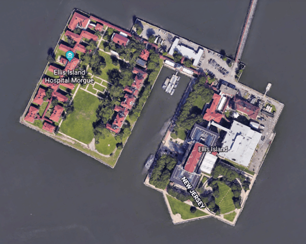
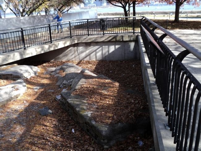
Prior to when the current facilities are said to have been built, Ellis Island was the location of Fort Gibson, one of forty forts said to have been built as part of the the New York Harbor System between 1794 – 1812. This marker commemorates Fort Gibson…
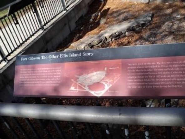
…on what became known as Ellis Island.
Was Fort Gibson a star fort? I think so, but I have a little bit further to go in Upper New York Bay to show you why.
Governors Island is also in the the Upper New York Bay, and situated at the confluence of the East River and the Hudson River.
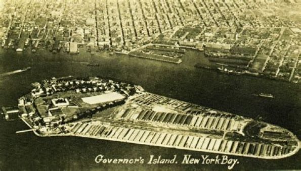
It is 800 yards, or 732 meters, from the southern tip of Manhattan Island, and separated from Brooklyn by the Buttermilk Channel by approximately 400 yards or 366 meters.
Fort Jay is on Governors Island, named after Supreme Court Chief Justice & Founding Father John Jay, and part of the Governors Island National Monument.
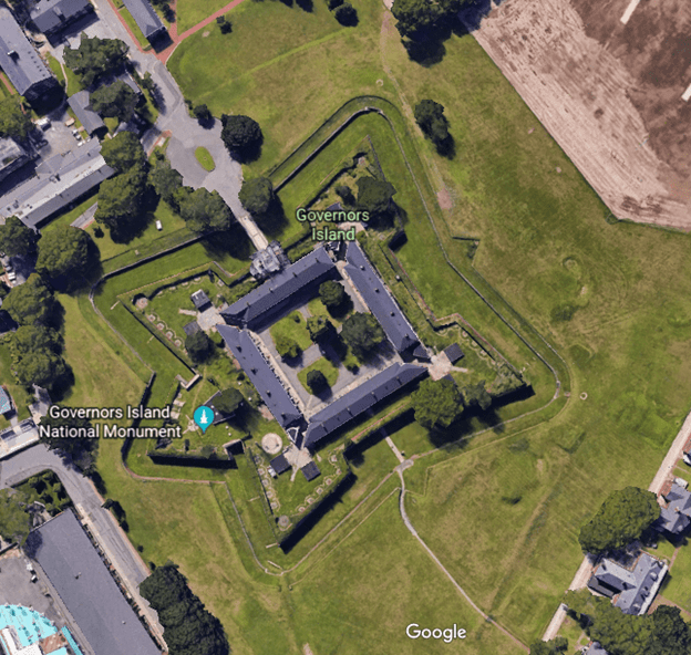
It was said to have been built in 1794 to defend Upper New York Bay, and an active installation until 1997.
Another feature of the Governors Island National Monument is Castle Williams, part of the New York Harbor System defenses. It is called a circular structure of red sandstone, having been built between 1807 and 1811 under the direction of Lt. Colonel Jonathan Williams of the U. S. Army Corps of Engineers.
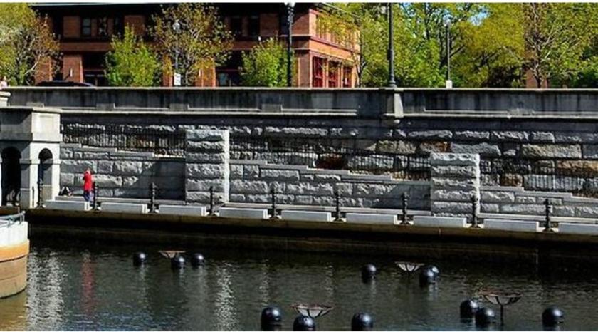
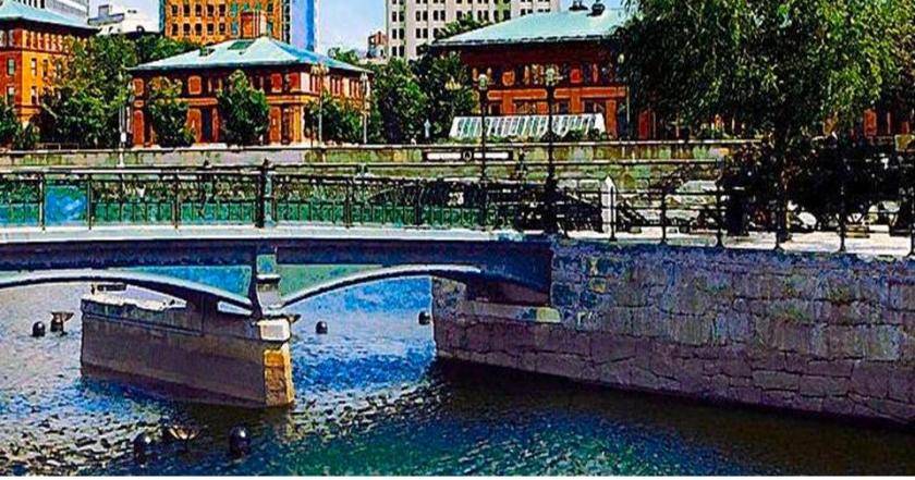
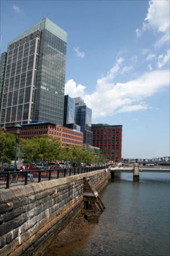
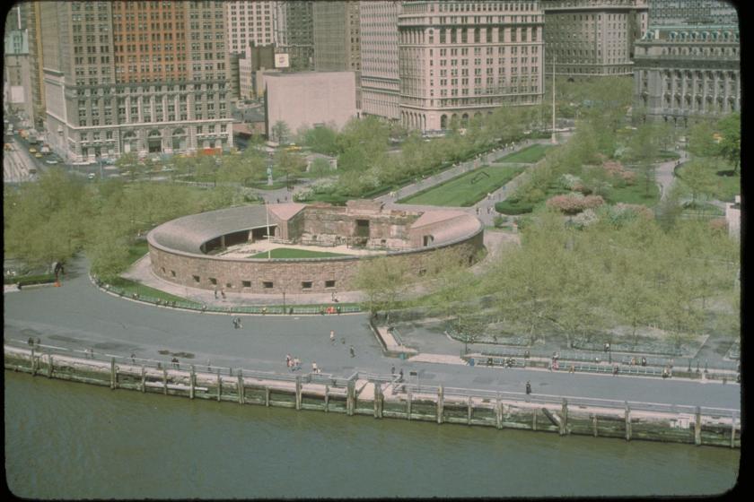
This brings me to Battery Park, at the southern tip of Manhattan, the historical location of another star fort, Fort Amsterdam, said to have been surrendered by the Dutch to the British in 1664.
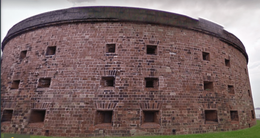
…and Castle Clinton is in Battery Park, a circular fort said to have been built of red sandstone between 1808 and 1811, and the first immigration center of the United States before Ellis Island, between 1855 and 1890.
Castle Clinton was also known as the “West Battery,” a complement to Castle Williams as the “East Battery” on Governors Island. I almost left these two structures out of this post until I realized they were part of the circuitry.
So I can make a case that there were four pairs of star forts, with each pair situated along various points of the Lower and Upper New York Bays, even though the physical structure of what was called Fort Gibson on Ellis Island is long buried and gone.
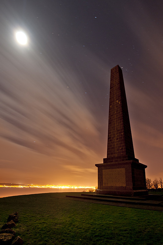
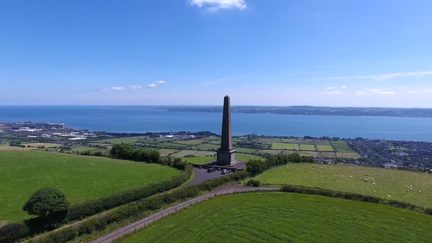
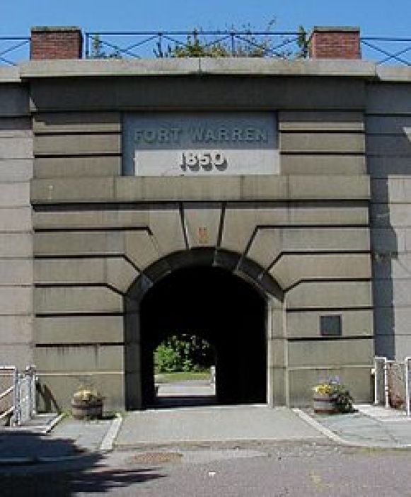
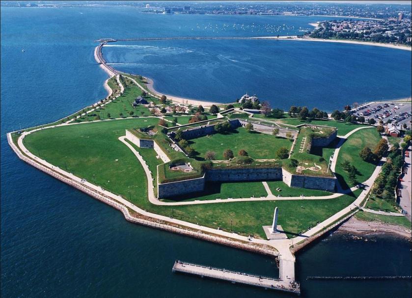
Fort Warren is a star fort on Georges Island in Boston Harbor, named after the Revolutionary War hero Dr. James Warren, said to have been designed by U. S. Army Corps of Engineers Lt. Colonel Sylvanus Thayer, and built between 1834 and 1860.
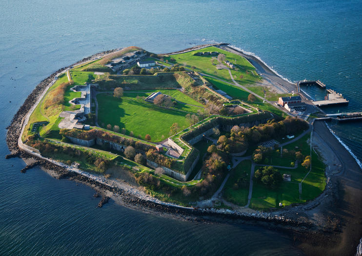
During the Civil War, it served as a prison for Confederate officers and government officials. This is the Sally Port at Fort Warren, which was the secure and controlled entryway to the prison.
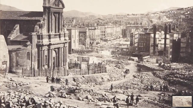
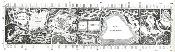
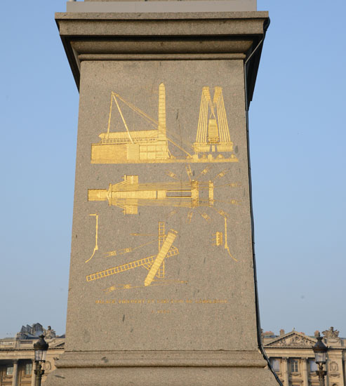
Here is the 1775 map of the Shawmut Peninsula, upon which Boston was built that I showed at the beginning of this post, where there is a star fort depicted on the bottom left.
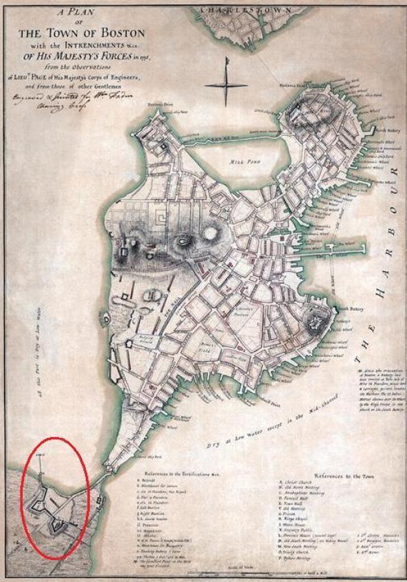
It is long gone, having been removed in 1869, hill and all, to add more room for business facilities.
Another star fort is nearby in Boston Harbor.
Fort Independence is located on Castle Island, a peninsula in South Boston.
Castle Island and Fort Independence was the location where Prince Hall, and fourteen other men of African-American descent, became Freemasons in their initiation into the British Army Lodge 441 of the Irish Registry, after having been declined admittance into the Boston St. John’s Lodge.
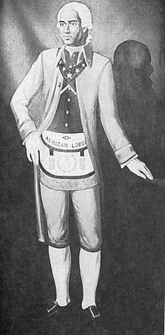
He was the founder of Prince Hall Freemasonry, and the African Grand Lodge of North America.

Until Prince Hall found a way in, Moorish Americans were denied admittance into Freemasonry. There are 360-degrees in Moorish Masonry, compared to the 33-degrees of Freemasonry.
Masonry is based on Moorish Science, which also includes the study of natural and spiritual laws, esoteric symbolism, natal and judicial astrology, and zodiac masonry.
Crossing into Nova Scotia on the alignment, I just want to point out one of the star forts, as there is at least one other, in Halifax, just to put it on the star fort map.
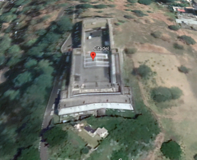
This is the Halifax Citadel, the fortified summit of Citadel Hill.
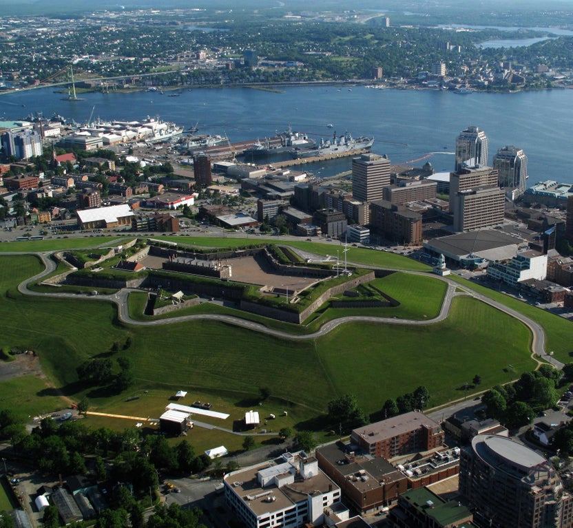
The present citadel was said to have been built between 1828 and 1856.
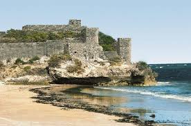
This is Castillo de San Anton, said to have been built as a defensive structure between the 15th- and 16th-centuries.
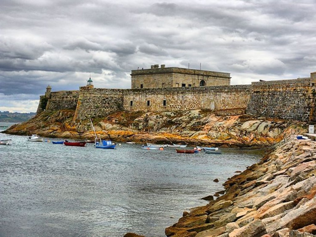
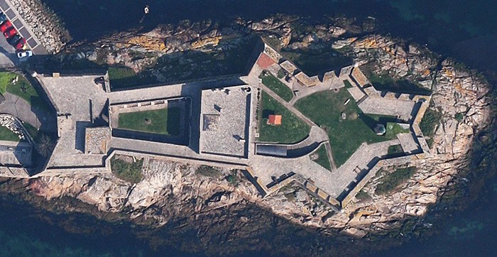
It is in A Coruna, or La Coruna, Spain, on the Atlantic Coast.
This star fort was built on a small island in the Bay of La Coruna.
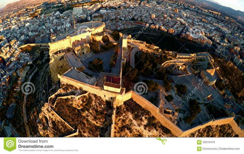
The Castle of Santa Barbara is a major attraction in Alicante, Spain, on the Mediterranean coast. Its origin is said to date back to the 9th-century, at the time of Muslim control of the Iberian Peninsula from 711 to 1296, the year when the castle was said to be captured by the forces of King James II of Aragon.
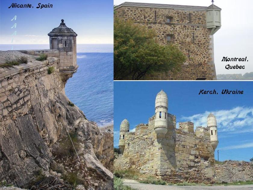
This is a detail of the Castle of Santa Barbara on the left, compared with a detail of Fort Chambly near Montreal on the top right, and the Yenikale Fortress at the city of Kerch on the Crimean Peninsula on the bottom right.
Following the alignment from the Spanish coast from the Alicante area across the Mediterranean Sea towards Algeria, we come to Tabarca Island.
It is the smallest permanently inhabited islet in Spain.
We come back through Algiers, and pass through Niger and Nigeria. I have discussed my findings there in earlier posts, and will just say that much of the glorious civilization of western North Africa is kept from our awareness.
Like in Djanet, Algeria…

…Djado, Niger…
…Bilma, Niger…
…and Abeokuta, Nigeria.
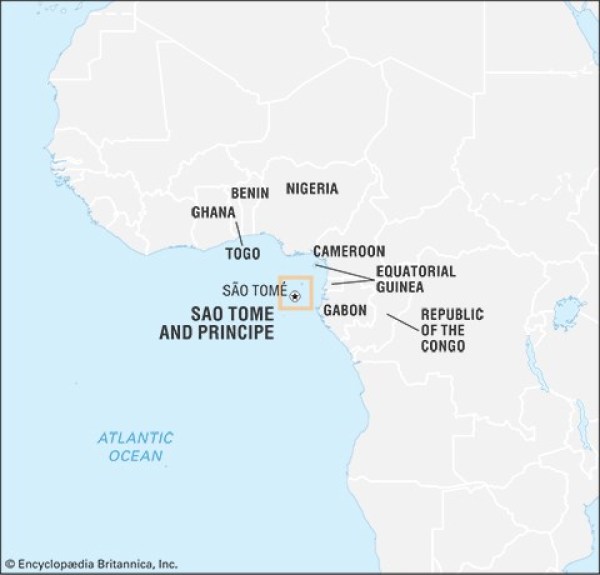
I did find a star fort located on the Sao Tome & Principe, a former Portuguese Colony in the what is now-called Bight of Bonny in the Gulf of Guinea. It used to be called the Bight of Biafra, before Biafra was absorbed into Nigeria in 1970, after the end of the 3-year Nigerian Civil War.
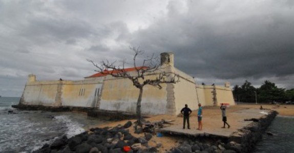
The capital and largest city is Sao Tome, where Sao Sebastiao Fort is located.
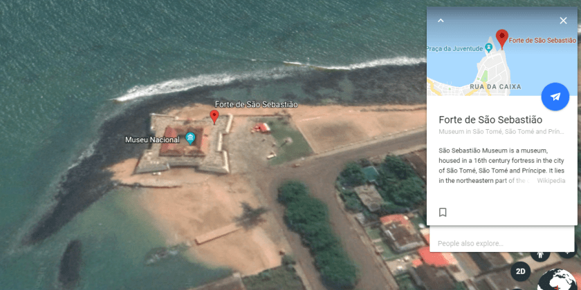
It was said to have been built by the Portuguese in 1566.
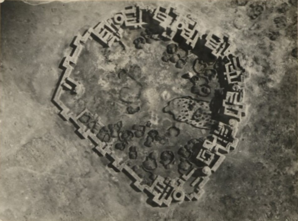
The alignment crosses over Fernando de Noronha, the name of the main island and its archipelago. It is a UNESCO World Heritage Site and on at least one other alignment that I know of. The main island has an area of 7.1 square miles, or 18.4 kilometers-squared, and the archipelago’s total area is 10 square miles, or 26 kilometers-squared.
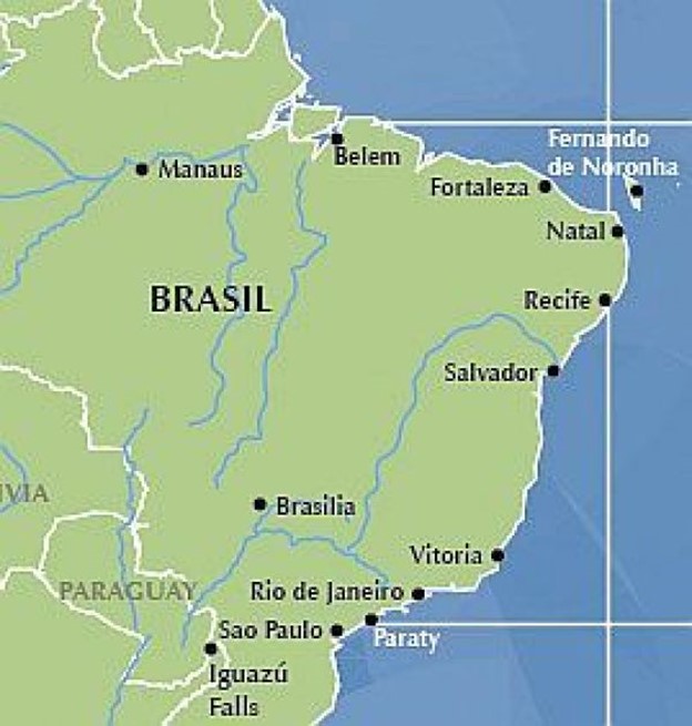
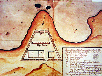
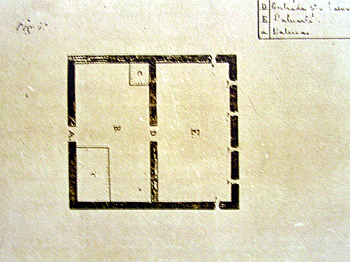
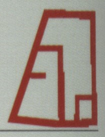
So this is the small island I was talking about in conjunction with Bermuda for it’s small size, there were at least ten star fort-like structures here at one point in time. Some are still standing, and others are in ruins or no longer there. Here are existing diagrams depicting eight of them.

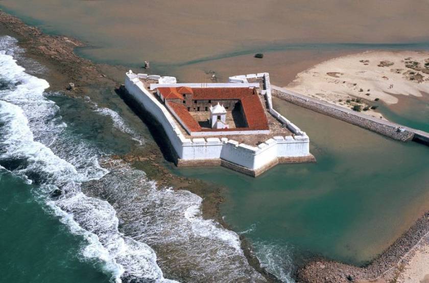
From Fernando de Noronha, the alignment enters Brazil at the city of Natal.
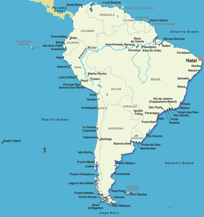
The Portuguese are said to have built the Forte Dos Reis Magos, or the Fort of the Three Wise Men, as the first milestone of the city of Natal.
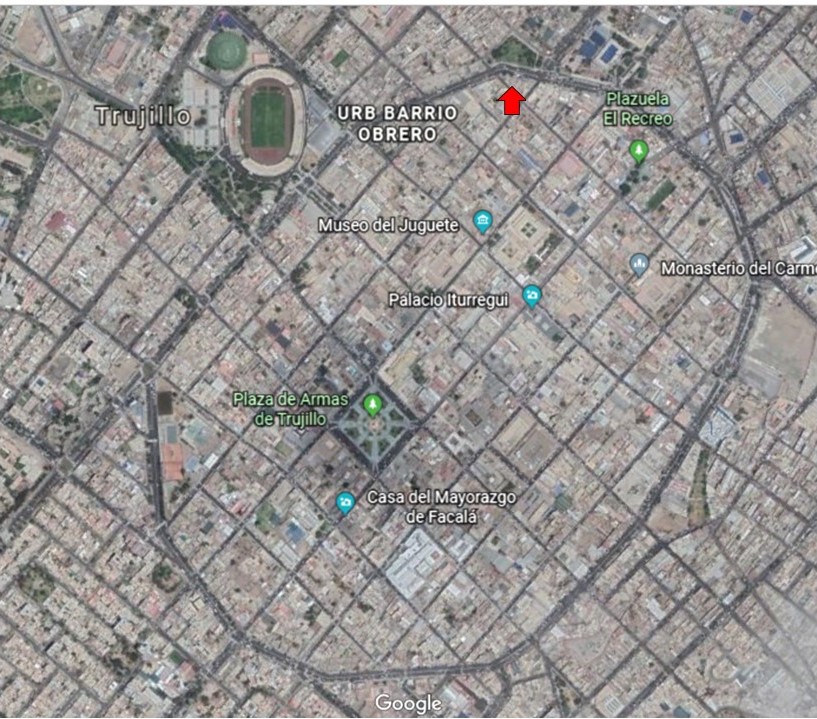
When I tracked the Washington circle alignment through Trujillo, Peru, I encountered an historic map from 1786 that showed Trujillo was at one time a star city.
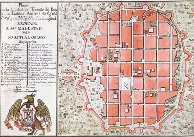
There is one intact point of the original fifteen remaining…
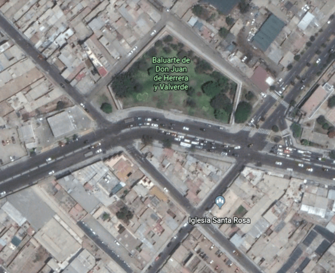
…that I found when I looked at a close up of the oval in the city’s center.
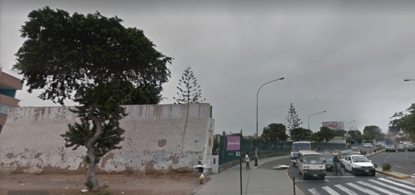
Here is a street view of the wall of the intact point. Note the size of it compared to the people next to it!
Now to come down the home stretch and wrap this up, I will take you back up this alignment to Ship Island, a barrier island off the Gulf Coast of Mississippi near Gulfport and Biloxi, and part of the Gulf Islands National Seashore. It was split into West Ship Island and East Ship Island by Hurricane Camille in 1969.
Fort Massachusetts is on West Ship Island, said to have been built following the War of 1812. Interesting to note that it incorporates both bricks and earthworks.
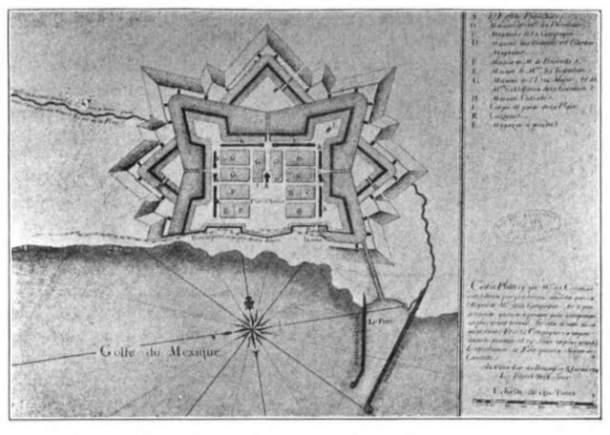
Fort Maurepas, also called Old Biloxi, and was located at present-day Ocean Springs, approximately 2-miles, or 3.2-kilometers, east of Biloxi. It was said to have been developed by the French in 1699, and we are told it burned down around 1722.
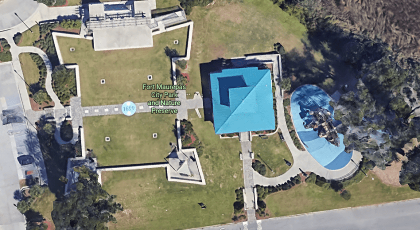
This is Fort Maurepas City Park and Nature Preserve today, which has a pavilion, large green space, playground equipment, and a splash pad.
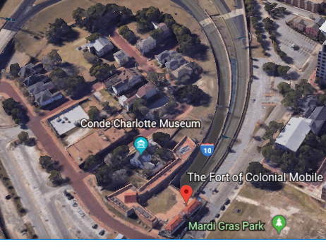
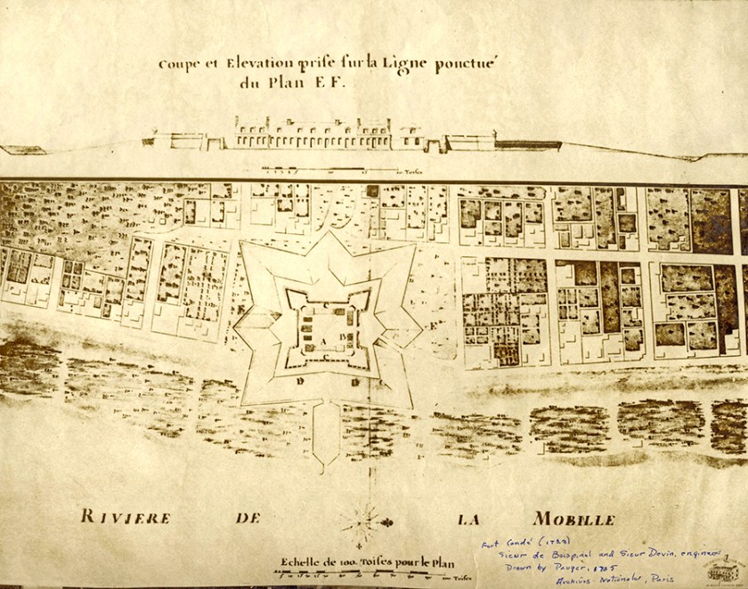
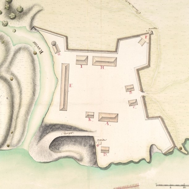
Here is the the Fort of Colonial Mobile, also known as Fort Conde, was said to have been built by the French in 1723. Here is a map depicting it in 1725.
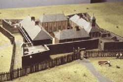
This is what Fort Conde looks like today.

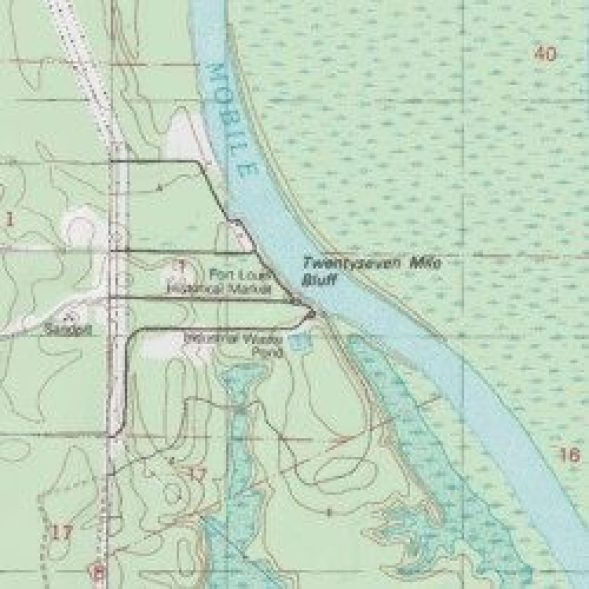
The Old Mobile site was the location of the French settlement La Mobile and the associated Fort Louis de la Louisiane, said to have been built in 1702…
…at a place called Twenty-Seven Mile Bluff on the Mobile River.
Fort Morgan is on Mobile Point at the entrance of Mobile Bay, and said to have been built between 1819 and 1834.
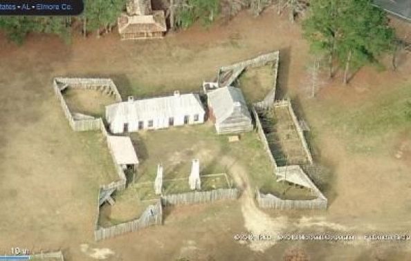
Fort Toulouse is an historic park near Wetumpka, Alabama, and is considered part of the Montgomery Metropolitan area. This is said to be a replica of the original fort.
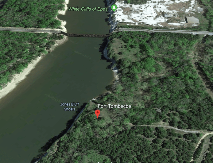
West of Montgomery, at Epes in Sumter County, Alabama, was Fort Tombecbe on the Tombigbee River, said to have been built by the French between 1736 and 1737 as a trading post.
The original structure is pretty much not there anymore.
So this brings me to end of what I found on all these alignments I wanted to share with you in this video.
What is it exactly that I have shown you, and what are we really seeing here?

To find the answer to these questions, I believe it is first necessary to define the word “battery.”
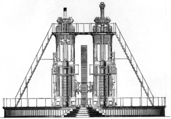
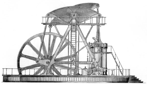
One definition is a device that produces electricity that may have several primary or secondary cells arranged in parallel or series, as well as a battery source of energy which provides a push, or a voltage, of energy to get the current flowing in a circuit.

The second meaning of the word battery is the heavy fire of artillery to saturate an area rather than hit a specific target.
And the third definition is an assault in which the assailant makes physical contact.

The answer to the mystery of star forts lies in what I believe is the first answer – that these star forts, and other infrastructure I have shared with you that don’t feature the classic look of a star fort, functioned as circuitry and batteries for the purpose of producing electricity and/or some form of free energy to power the planetary grid system and the advanced civilization.
And that this is the reason there are so many star forts that are paired together, or even the reason clusters of them are found in the same location.
As we saw, many features on them, or near them, are actually called batteries, even though they were re-purposed in many cases, but not in all, to the second definition applied to them in the new time-line in order for them to appear to have a strictly military function.
Does the third definition apply here?
I think so, in the sense that a major assault has been committed against the Human Race by all that has taken place here without our knowledge and consent, and removing all of this critical information from our awareness about the Moorish Legacy and True History of Humanity, and so, so much more.
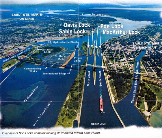
In my next post, I am going to be taking a a bit of a breather, and doing a relatively short piece looking what is found in the area surrounding the Soo Locks, between Sault Saint Marie, Michigan, and Sault Saint Marie, Ontario.