Ancient and Modern Evidence for the Perfect Alignment of Heaven and Earth Worldwide

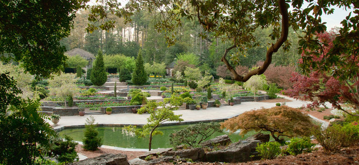
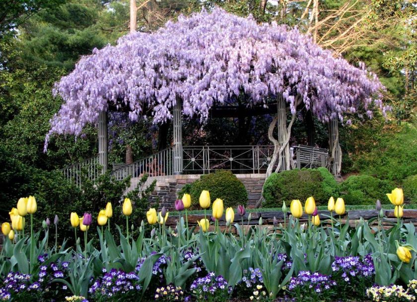
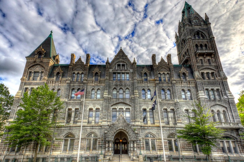
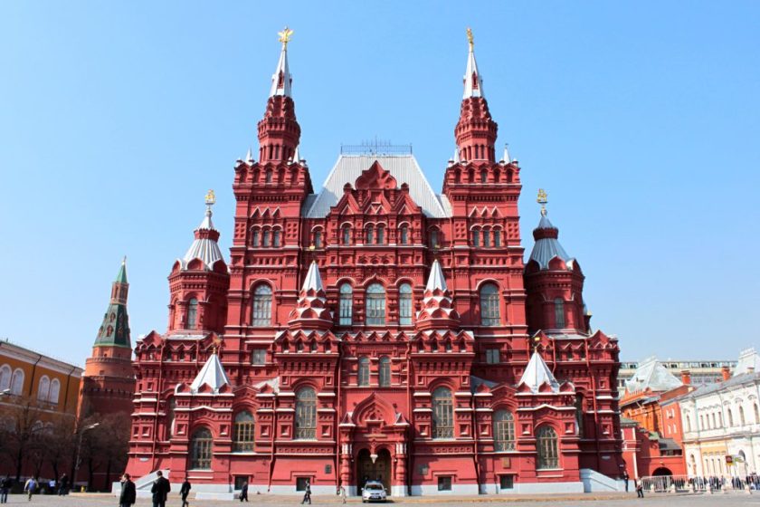
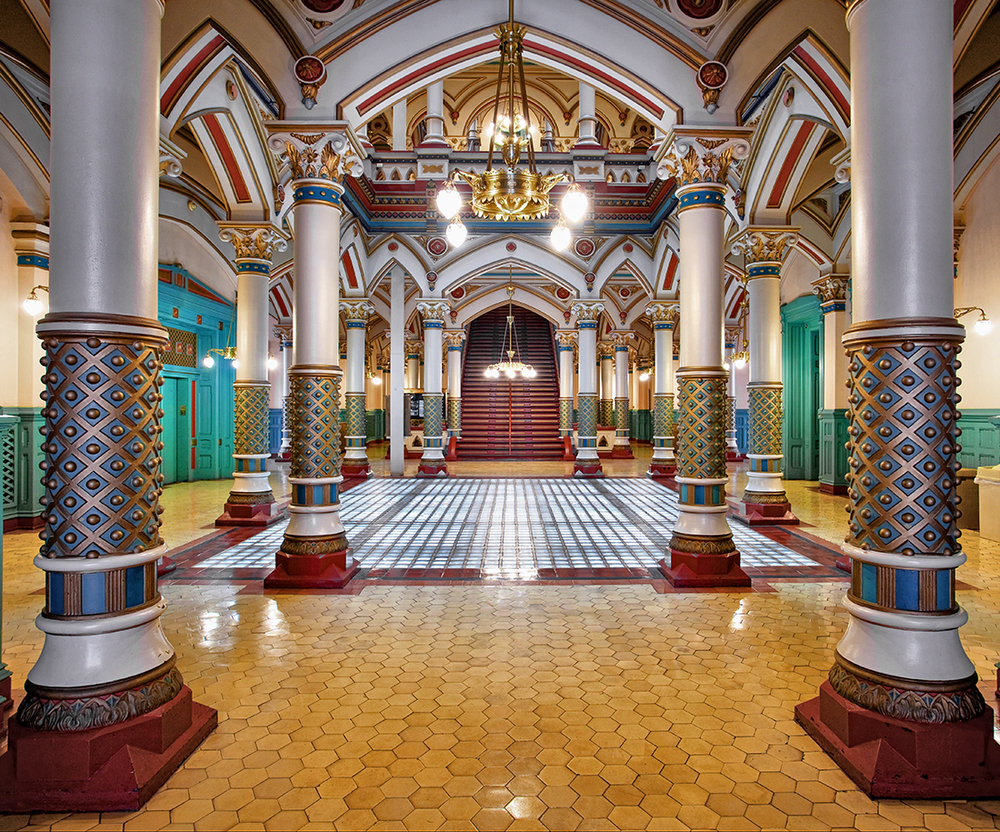
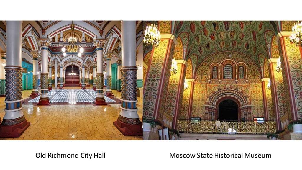
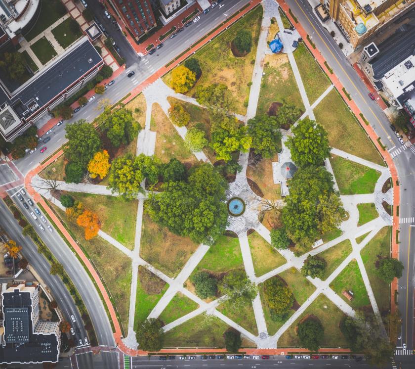
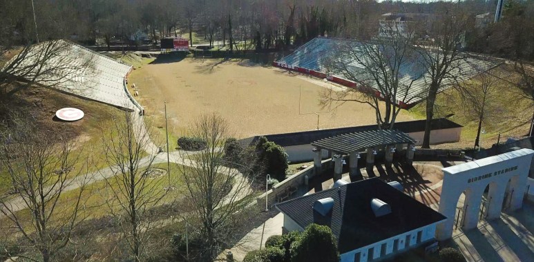
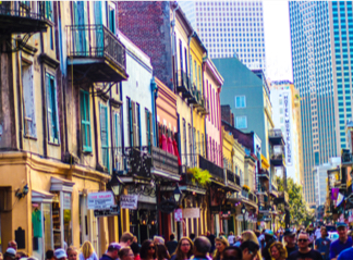
I am dedicating this post to feature the many, many examples I have found of symmetry, proportion and alignment around the world between archways and openings, of not only architecture, but what are called natural features as well.

“Framing” in photography refers to using elements of a scene to create a frame with your frame.

So here is an example of using tree branches to perfectly frame the moon in a photograph.

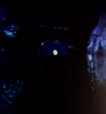
You also see the technique of framing in the capturing of the eagle in between the opening here.

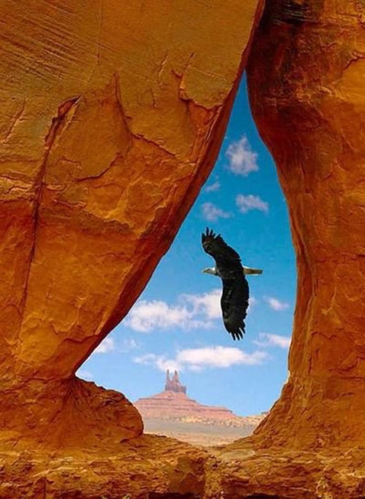
What I am going to be talking about in this post, however, is what else you see here through the opening in this photograph.

I will give you many examples of this framing effect around the world, that would not occur without the existence of a perfect intentional alignment in the first place.

I will be talking about what are called natural features, as well as architecture.

I am going to start where I first learned of amazing man-made alignments in the landscape, in this case the Avebury complex in southern England.

A deep interest in learning more about ancient sacred sites and megaliths is what initially drew me into this whole subject. I was able to visit Avebury on a trip to England in 2010, but didn’t get to spend much time there. I had a travel mate who wasn’t into the same things I was.

I watched many presentations from Megalithomania Conferences, and these provided a lot of background information from other researchers that that helped me get to the level of understanding about the subjects I am sharing with you in my blog posts.

I saw this presentation by Peter Knight for the Glastonbury Megalithomania Conference in 2011…

…several years before I started putting all of this together in 2016. From watching it, I gained an important piece of the puzzle, well before I really understood what it meant.

In Peter Knight’s presentation, his focus was primarily on the West Kennet Long Barrow in the Avebury complex…

…which is a greater sacred landscape that is precise and intricate.

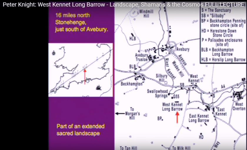
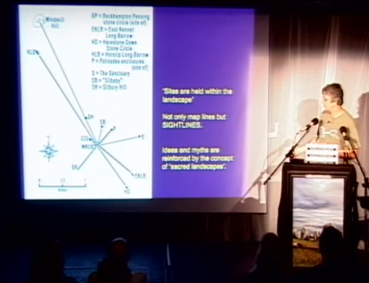
He talks about sight lines in his presentation, which refers to a normally unobstructed line-of-sight between and intended observer and a subject of interest.

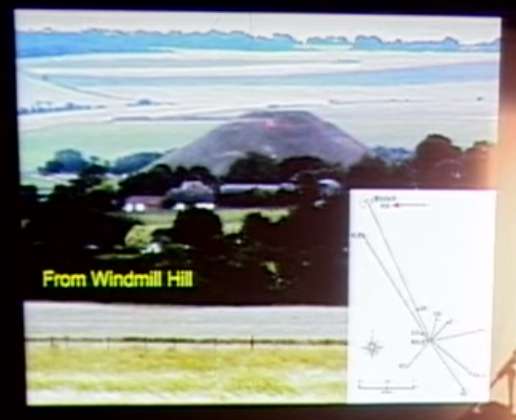
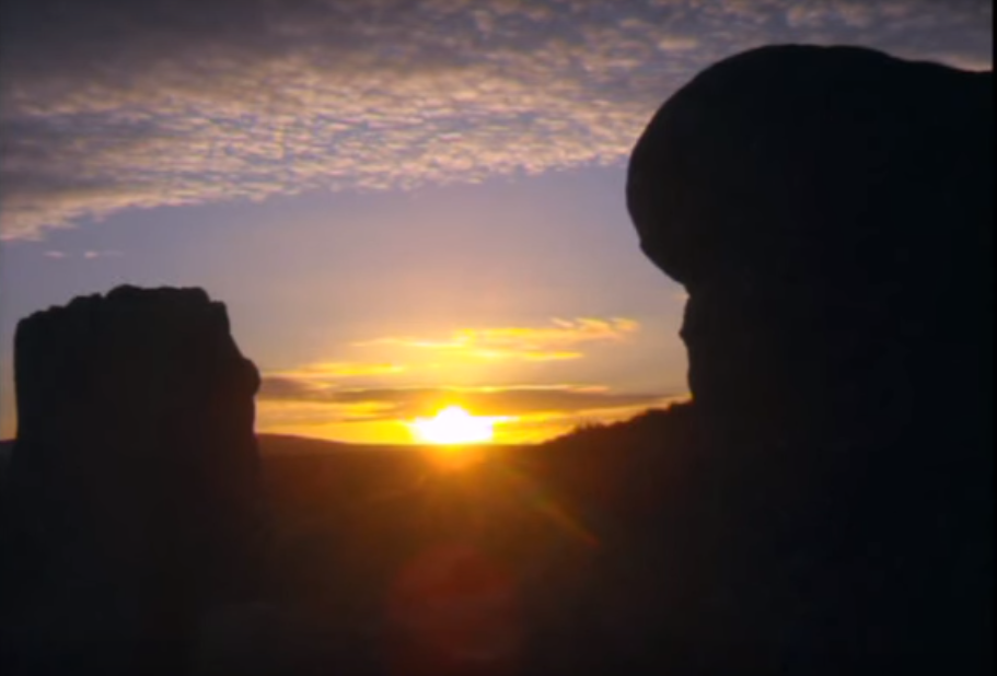
So, for example, in this view from Windmill Hill, there is a visual connection between Windmill Hill, Silbury Hill, and the West Kennet Long Barrow seen here.

All of the sites in the complex are perfectly aligned in some manner with each other.

There are abundant solar and lunar markers in the Avebury landscape.

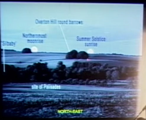
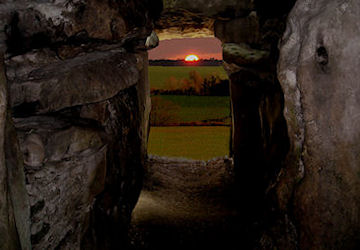
Here is a winter solstice sunset seen in the landscape from the entrance of the West Kennet Long Barrow…

…and is framed in the entrance of the West Kennet Long Barrow as seen from inside the Long Barrow on the solstice, when light streams through to special stones waiting at the end of the chamber.

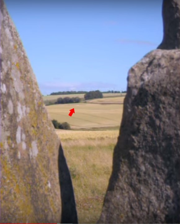
The East Kennet Long Barrow is also framed by the entrance of the West Kennet Long Barrow.

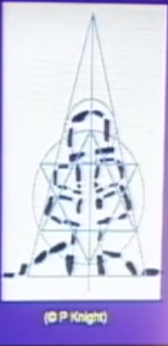
Peter Knight provided this diagram of the sacred geometry he found contained within the long barrow’s chamber configuration.

There are also abundant astronomical markers inside the long barrow, in the chambers within.

From inside the West Kennet Long Barrow, there are places where you can see things at certain times, like the Equinox moonrise…
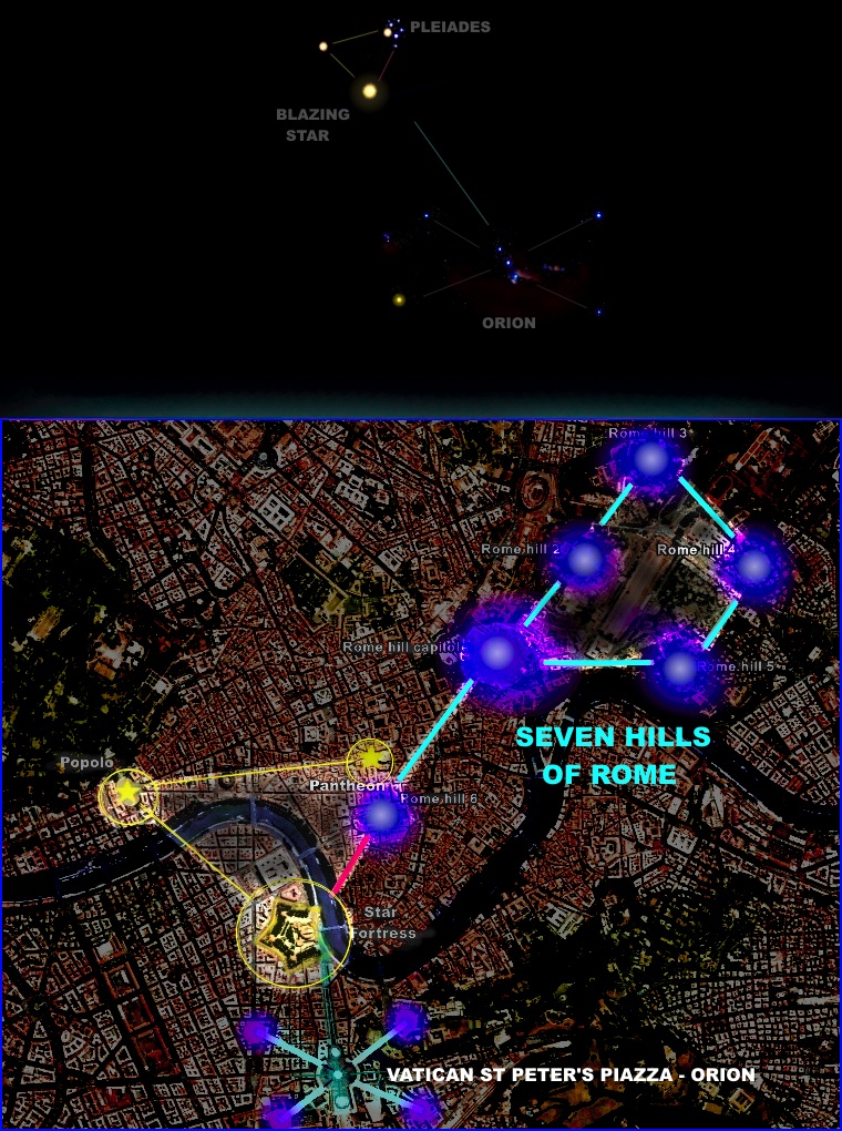
…and the Pleiades.

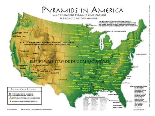
The Avebury complex is believed to be around 5,500-years-old.

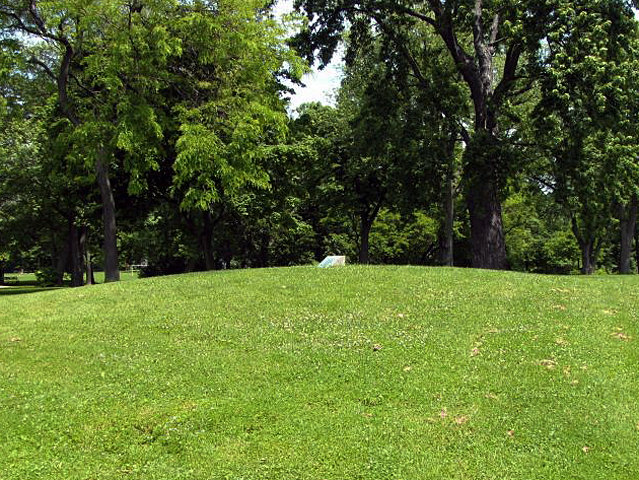
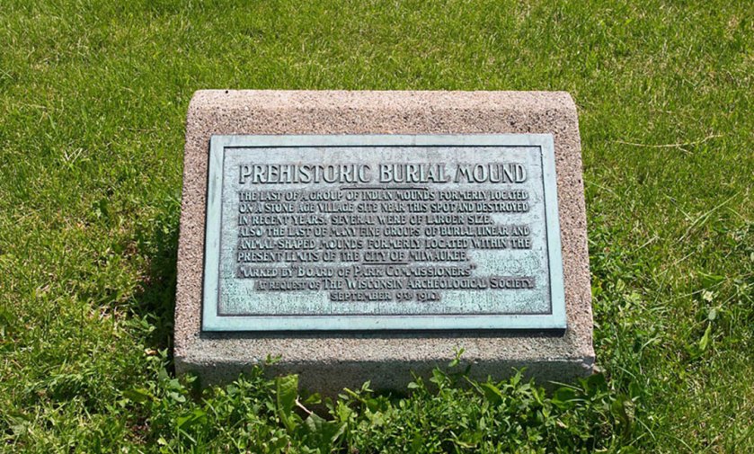
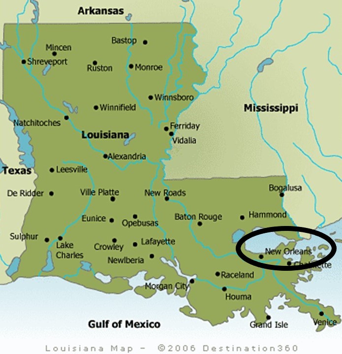
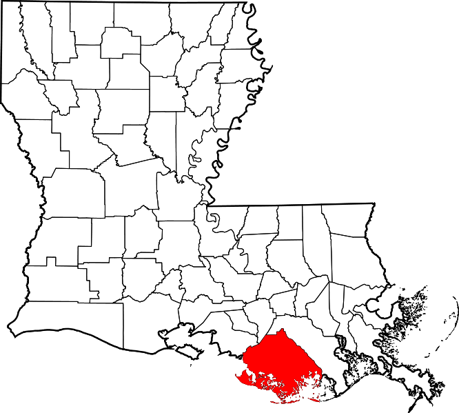
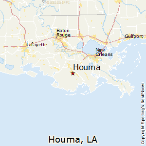
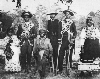
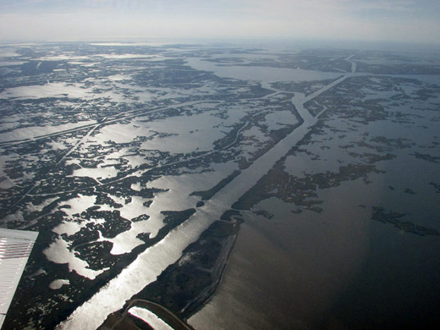
The Watson Brake Lunar Mounds, near Monroe, Louisiana, are contemporaneous with Avebury. They are believed to be 5,400-years-old, and are considered the oldest earthwork mound complex in North America.

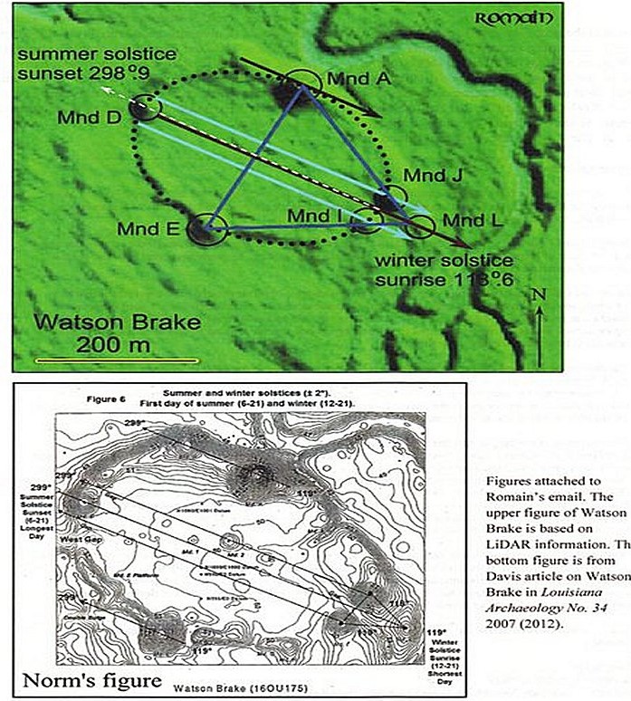
The Watson Brake mounds are located on privately-owned land, and are not available for public viewing.

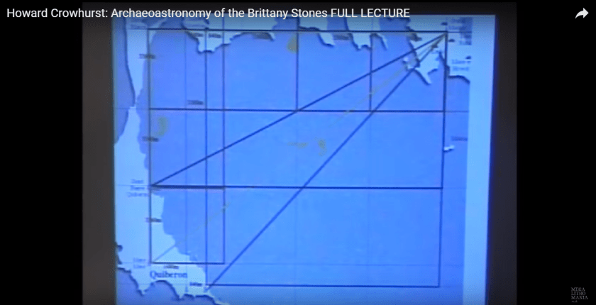
Howard Crowhurst has been studying the megalithic alignments at Carnac in Brittany in France for many years, and he has been able to detail the geometric and archeoastronomical lay-out of the sites around this part of Brittany.

This is a lead-in to say that this practice of precise geometric alignments did not just happen at certain places at certain times.

It occurred worldwide-wide, from ancient times until relatively modern times!

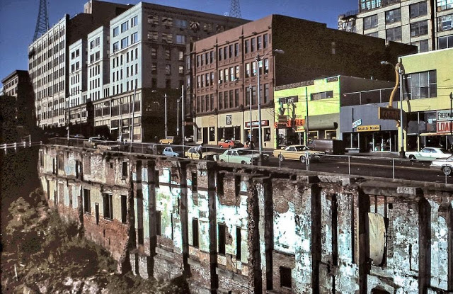
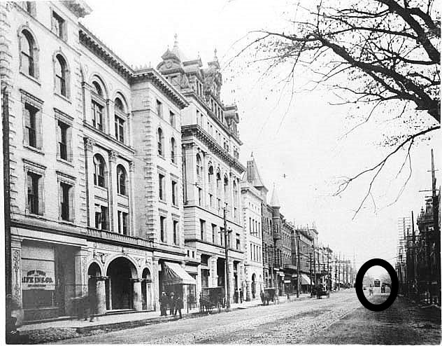
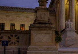
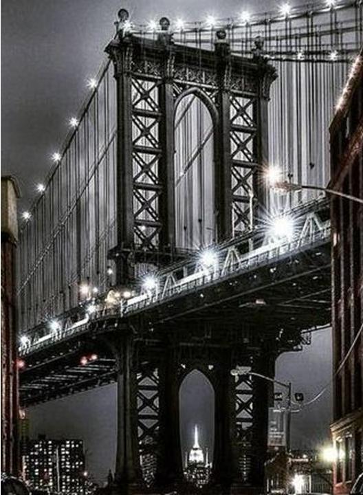
This is the Manhattan Bridge in Brooklyn, New York. The Empire State Building is perfectly framed by the bridge foundation…

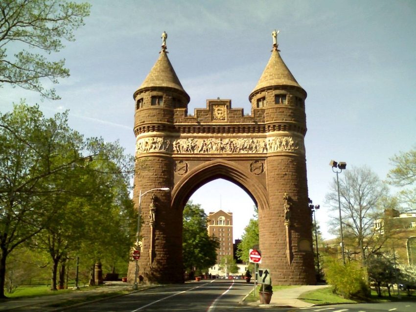
…and the Soldiers and Sailors Memorial Arch in Hartford, Connecticut’s Bushnell Park, framing what is now utilized as an apartment building.

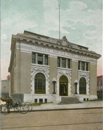
I will provide compelling physical evidence for why I believe Humanity was on a completely different, advanced time-line until relatively recently, and that time-line was hijacked. Everything we believe to be true was grafted onto the original time-line, and infrastructure falsely attributed or named.

First, let’s take a look at the deeper meanings of archways, which play an important role in the alignment process:

Initiation and ceremonies of renewal;

Sloughing off the old and moving into a new phase of life;

Structures with deep resonance;

Structurally crucial elements, capable of spanning great distances while supporting substantial weight;

And they are thought of as a gateway or threshold, a means of passing from one plane (figuratively or literally) to another. 

I am going to begin with so-called natural arches and openings showing some form of solar or lunar alignment going on.

This is Keyhole Rock at Pfeiffer Beach at Big Sur in California.

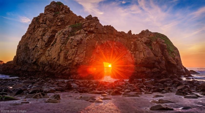
The light comes through the Keyhole arch perfectly during the winter solstice time-of-year in December and January.

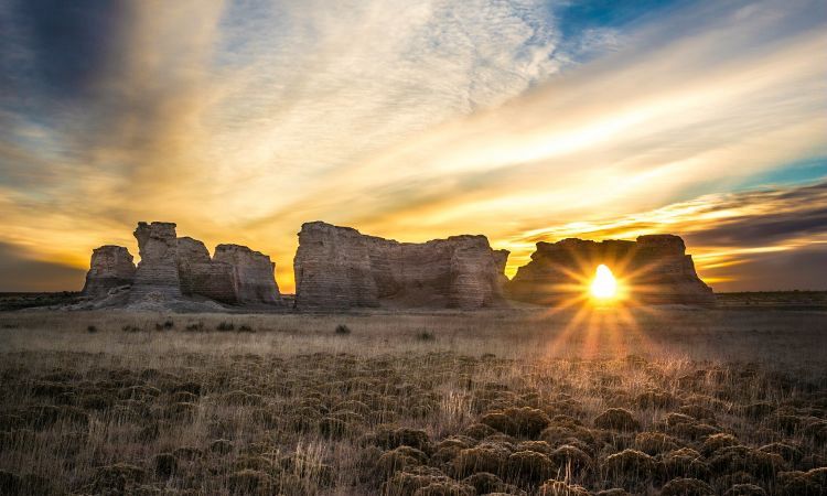
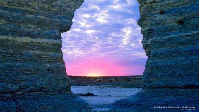
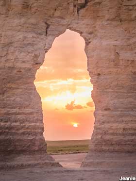
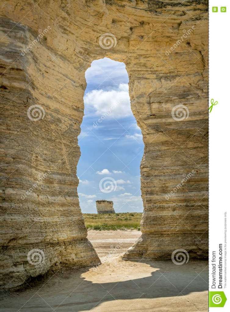
Monument Rocks National Natural Landmark, otherwise known as the Chalk Pyramids, in Gove County, Kansas.

This is Mesa Arch in Canyonlands National Park in Utah…

…and Durdle Door, near Lulworth, England, in Dorset, during the winter solstice period.

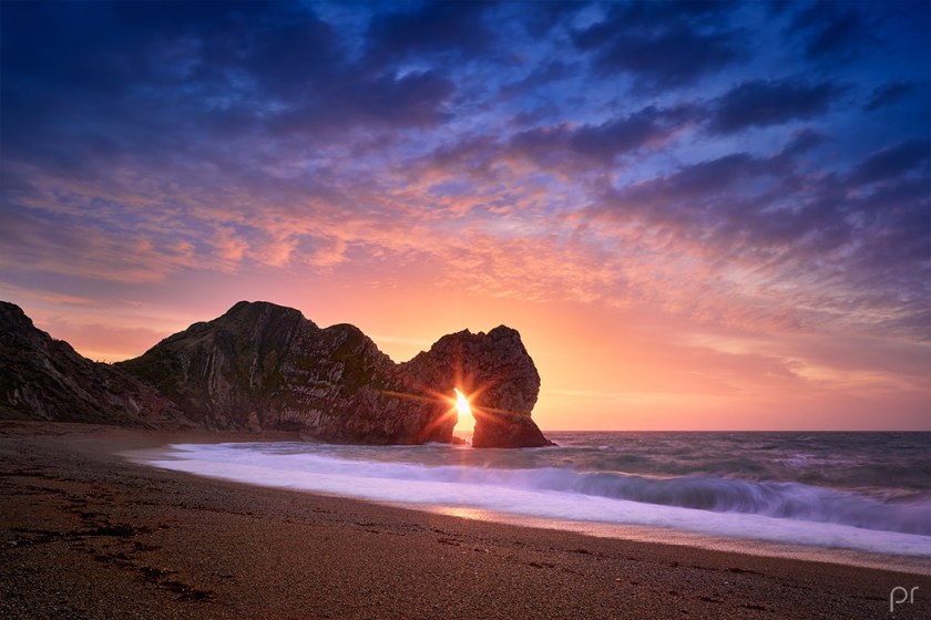
It is on what is called the Jurassic Coast, and called a natural limestone formation.

Next are what are called natural arches or openings that perfectly frame other features.

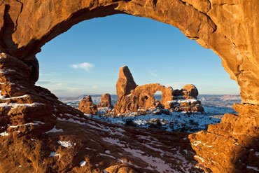
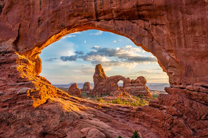
This is at Arches National Park in Utah, where we are told there are over 2,000 natural stone arches…

…what is called the False Kiva in a remote part of Canyonlands National Park in Utah, where there is also a stone circle.

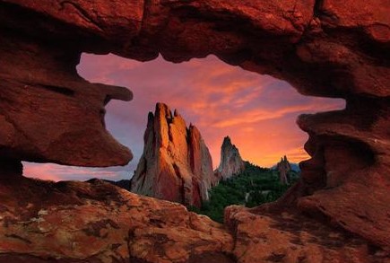
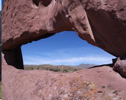
At the Garden of the Gods in Colorado…

…Amaru Muru in Peru…

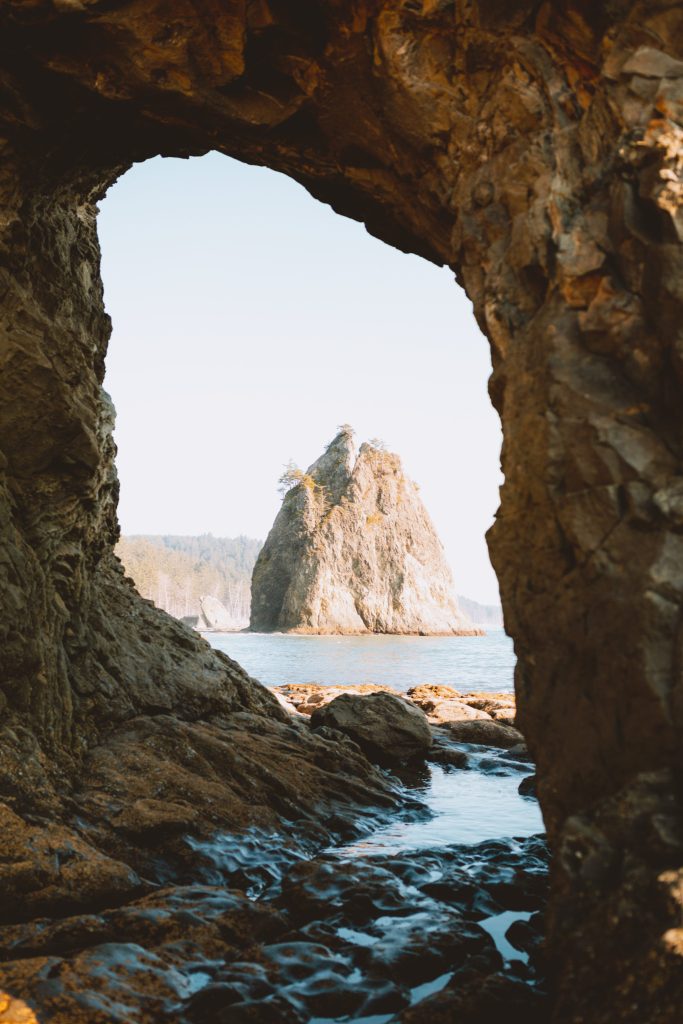
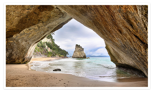
…Hole in the Wall at Rialto Beach on Washington State’s Olympic National Park…

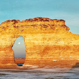
…Monument Rocks in Kansas…

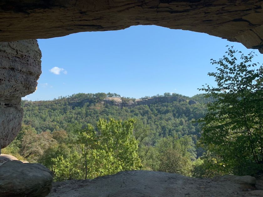
…and Double Arch Trail in Kentucky.

Here are two more places that I am not sure where the photos were taken.

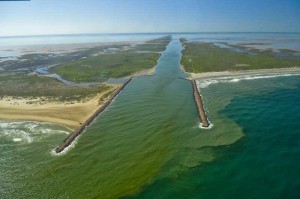
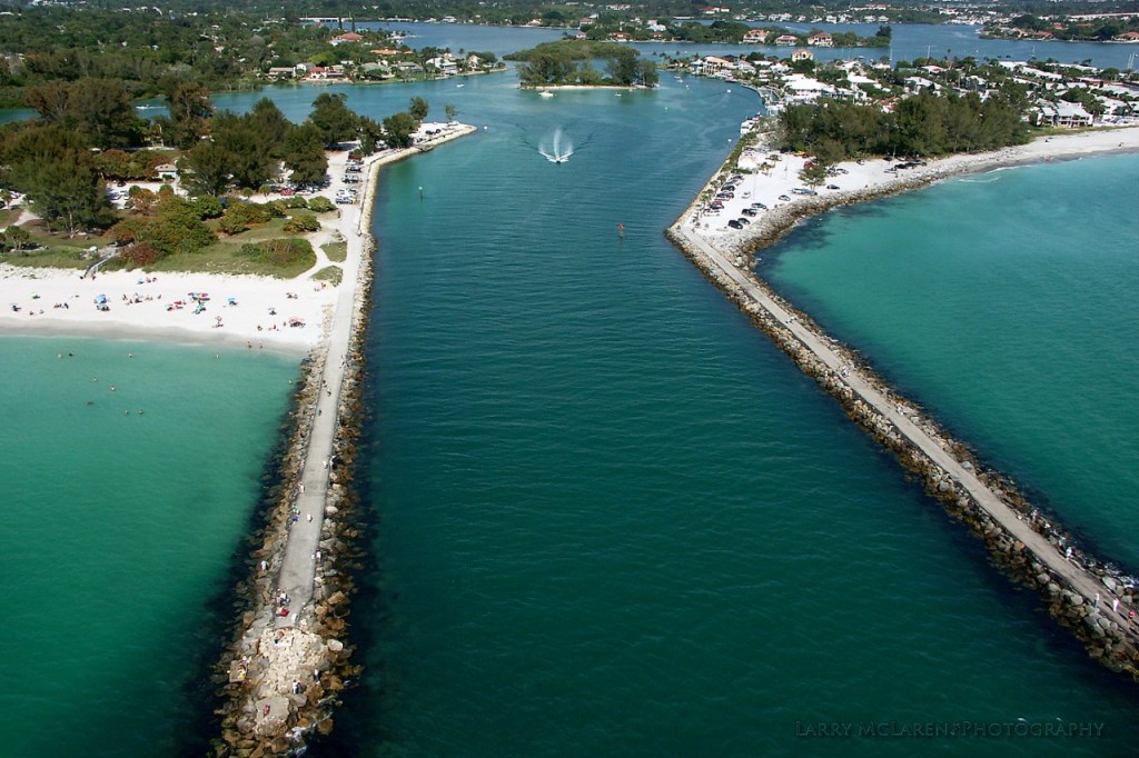
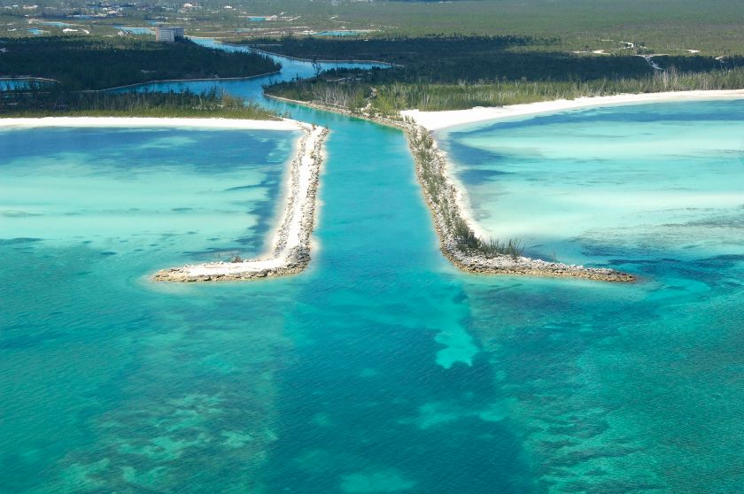
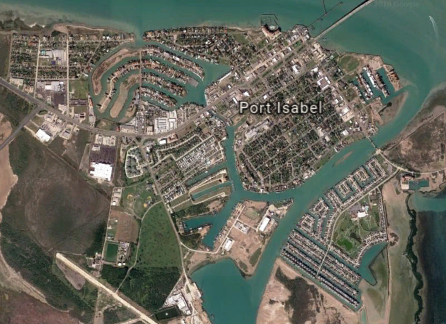
These examples are what I would consider ancient infrastructure, placed precisely a certain way in the landscape for the alignment heaven and earth, and are not the result of natural and random processes as we have been lead to believe.

This represents an intentional terraforming of the earth from ancient times by Master Builders to create harmony, beauty and balance based on geometric principles.

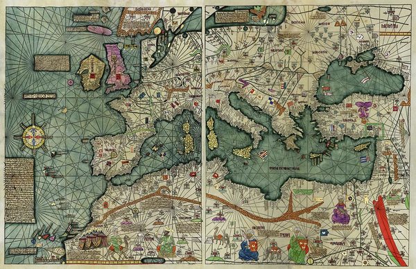
I am going to segue into the symmetry and proportion of the world’s architecture by starting with the Catalan Atlas of the Majorcan Cartographic School for information.

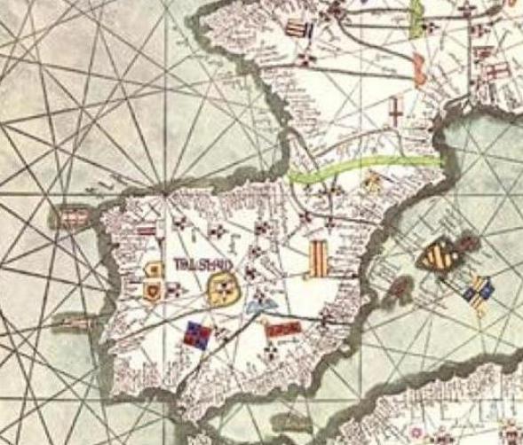
The Catalan Atlas is considered the most important map of the Medieval period in the Catalan language, dated to 1375. It is attributed to Master Mapmaker Cresques Abraham.

The Catalan Atlas all together has six vellum leaves, each being 26 inches, or 65 centimeters, by 20 inches, or 50 centimeters in size.

Each leaf includes the mapping of the geometric lines and shapes that you see depicted here.

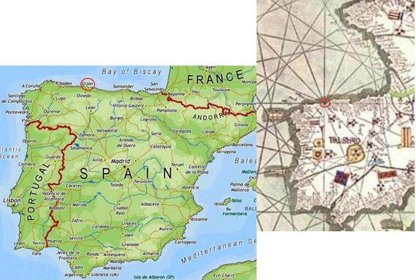
I placed a modern map of Spain on the left when I was doing research for “Circle Alignments on the Planet Washington, DC – Part 13 Madrid, Spain to Albacete, Spain,” with the city of Gijon circled, because the circle with sixteen sections depicted in the Catalan Atlas on the right appears to center on the city of Gijon. It indicates a past importance to Gijon that is no longer recognized. I, for one, had never heard of Gijon before.

The Catalan Atlas is significant for at least two reasons that I can think of off the top of my head.

First, it indicates an awareness of precise planetary alignments and gridlines that has been suppressed, and this knowledge was also lost to modern humanity.

Second, there was an importance to Majorca and this part of the world that has been lost to modern humanity. There was something very special about this part of the world in Spain and France.

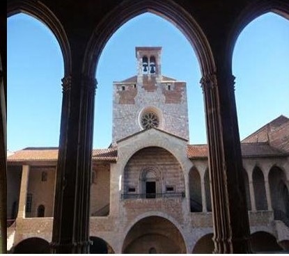
Today, Majorca is one of Spain’s Balearic Islands in the Mediterranean Sea and is what is referenced when you look up information about Majorca.

Yet, this is the Palace of the Kings of Majorca in Perpignan in southern France, so I know there is more to the story of Majorca, like the alignments, missing from the history books.

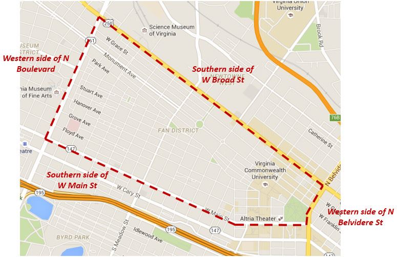
I will organize by country the sample of examples I have found around the world of symmetry, proportion and alignment in architecture.

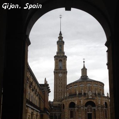
In Spain, the Universidad Laboral de Gijon…
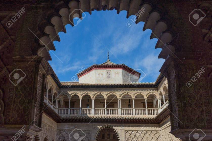
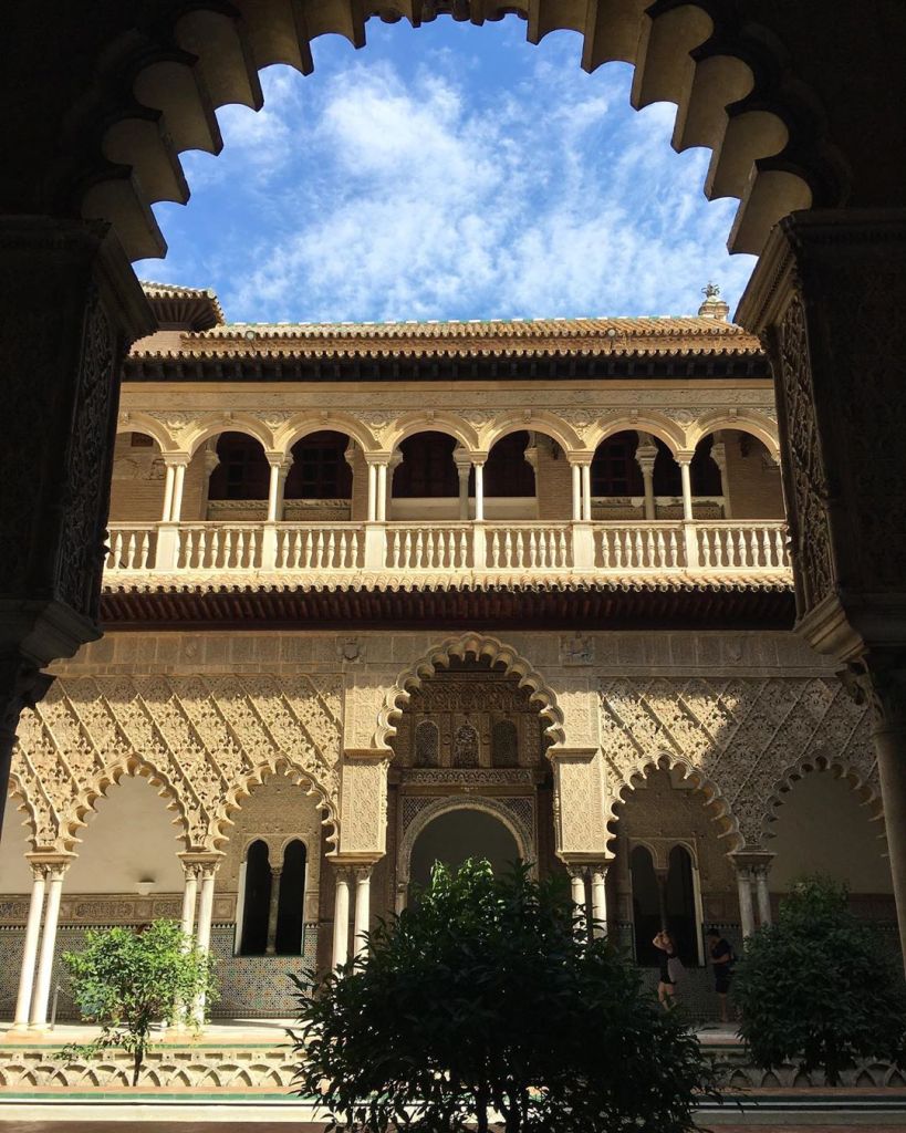
…in Seville…

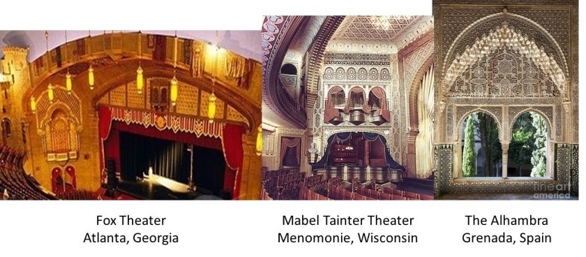
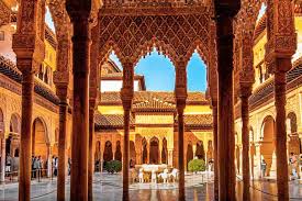
…and the Alhambra in Grenada.

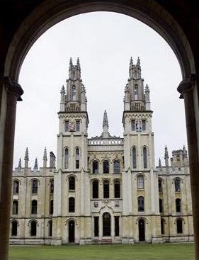
In England, Oxford University…
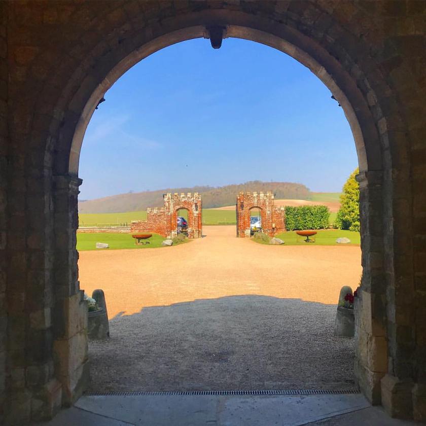
…Eastwell Manor…

…the Tower Bridge in London…

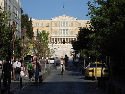
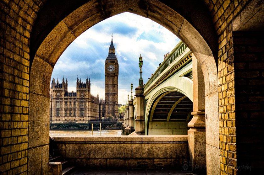
…and the Elizabeth Tower at the Palace of Westminster, the Parliament building in London.

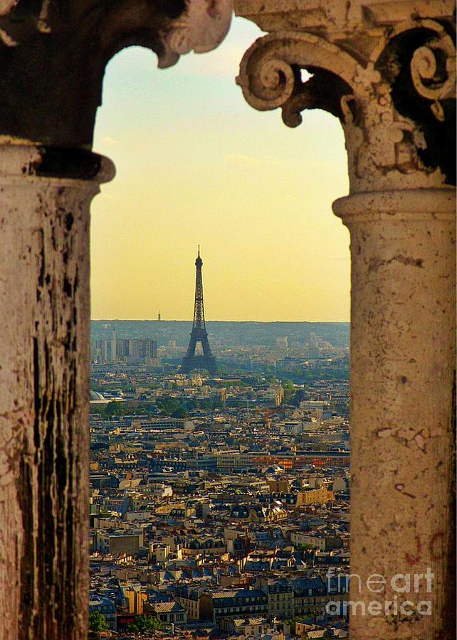
In France, the Eiffel Tower in Paris…

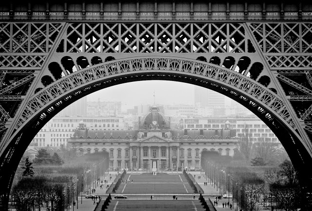
…and through the Eiffel Tower’s archway, the Ecole Militaire.

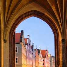
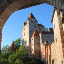
In Germany, Landshut in Bavaria.

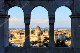
In Hungary, at the Fisherman’s Bastion in Budapest…

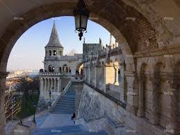
…where you can see the Hungarian Parliament building framed perfectly through the archways…
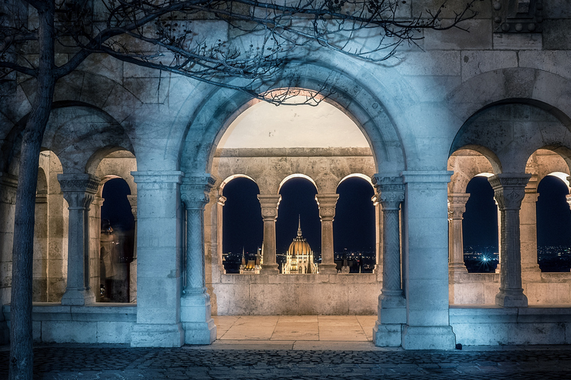
…in various ways.

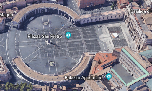
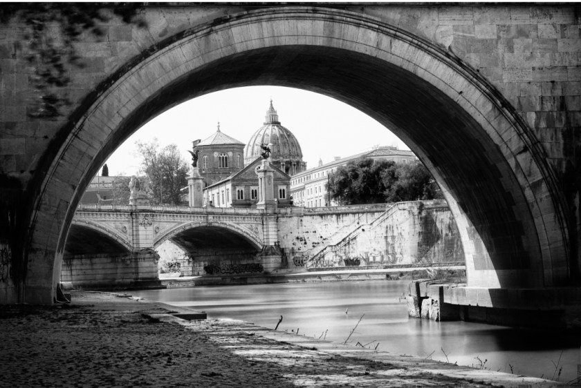
In Italy, you see St. Peter’s Basilica at Vatican City through this archway…

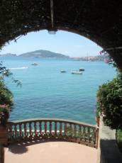
…and this is at the Villa Accetta on the Ulysses Riviera between Rome and Naples.

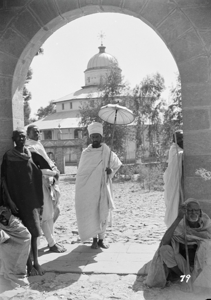
In Ethiopia, at the Debre Libanos Monastery…

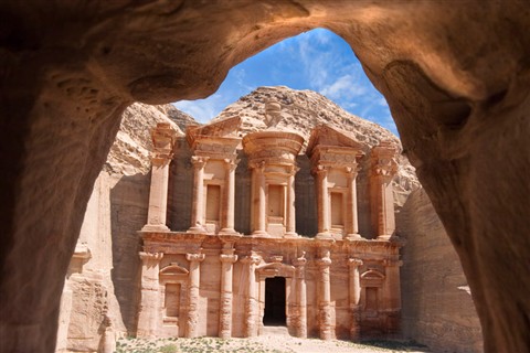
…and in Jordan, at Petra, an ancient city carved right into the rock.

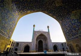
In Iran, at the Blue Mosque in Isfahan.

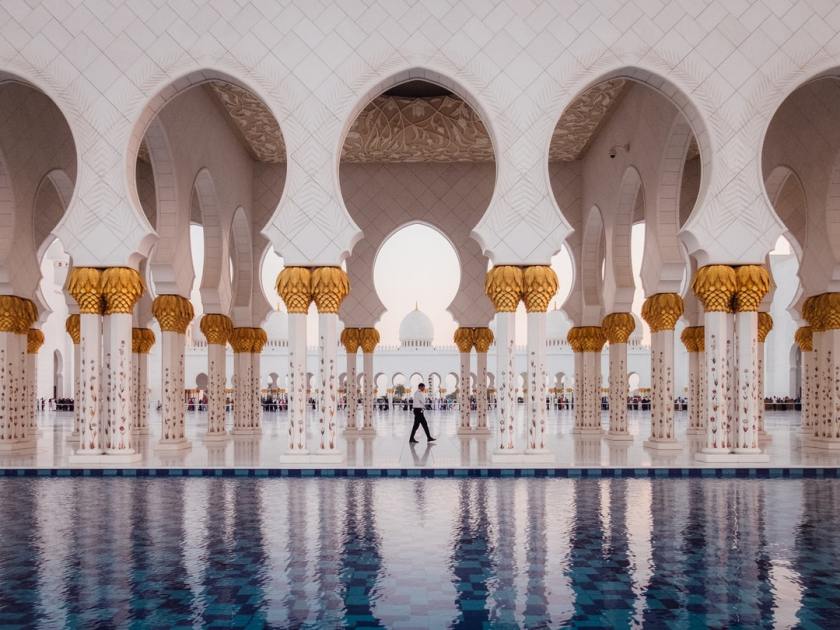
In the United Arab Emirates, at the Sheikh Zayed Grand Mosque in Abu Dhabi.

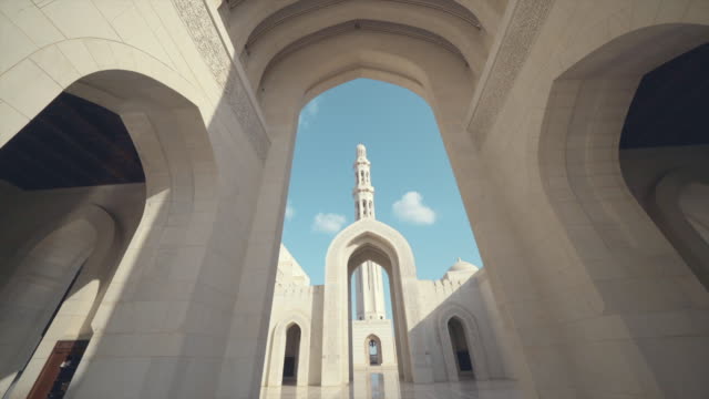
In Oman, at the Sultan Qaboos Grand Mosque in Muscat.

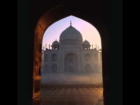
In India, the Taj Mahal in Agra…

…the Sardar Market in Jodhpur…

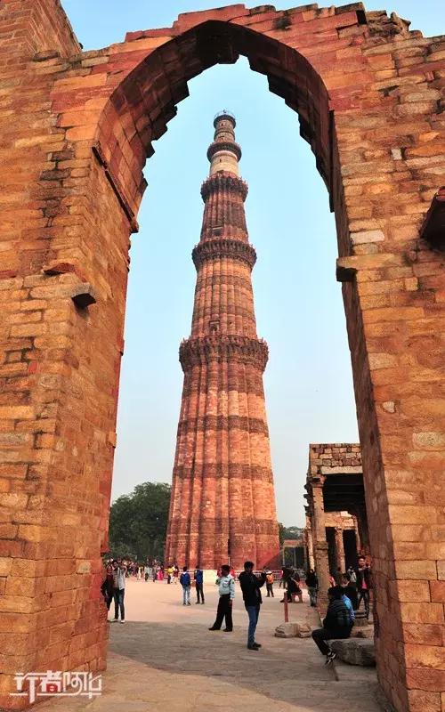
…the Qutb Minar at the Qutb Minar Complex, in Delhi, India…

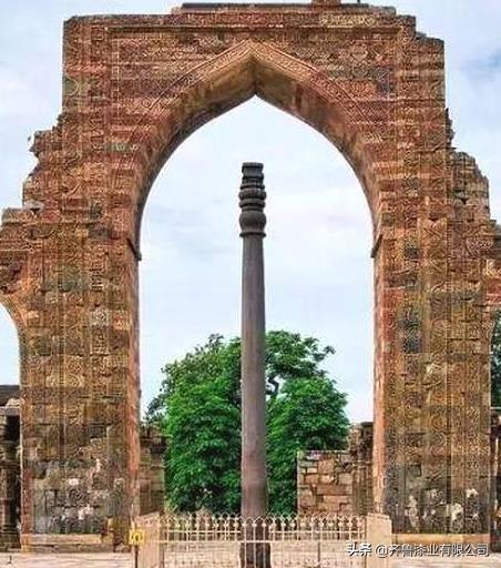
…and the Iron Pillar of Delhi at the same complex.

It is famous for the rust-resistant composition of metals used in its construction. It is said to have been made 1,600 years ago.

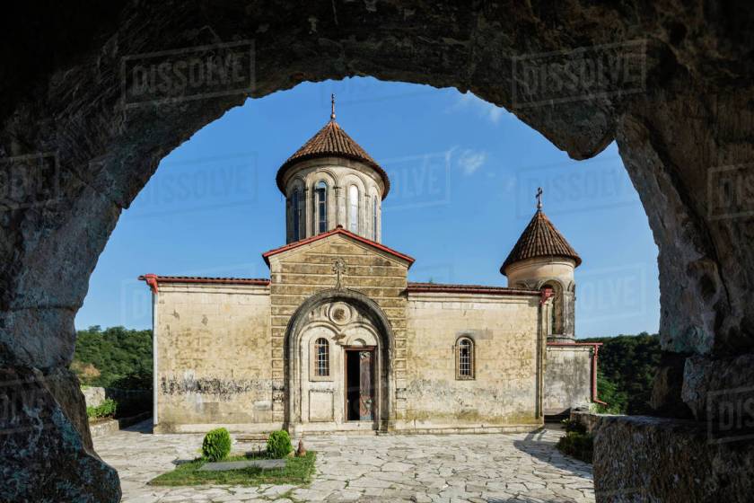
In the country of Georgia, at the Motsameta Monastery near Kutaisi…

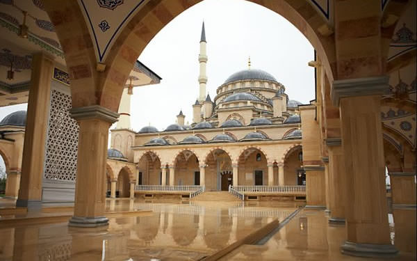
…and in Chechnya, the Akhmad Kadyrov Mosque in the capital city of Grozny.

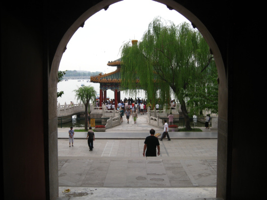
In China, at the Summer Palace in Beijing…

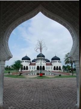
…and in Indonesia, at the Baiturraman Grand Mosque in Banda Aceh.

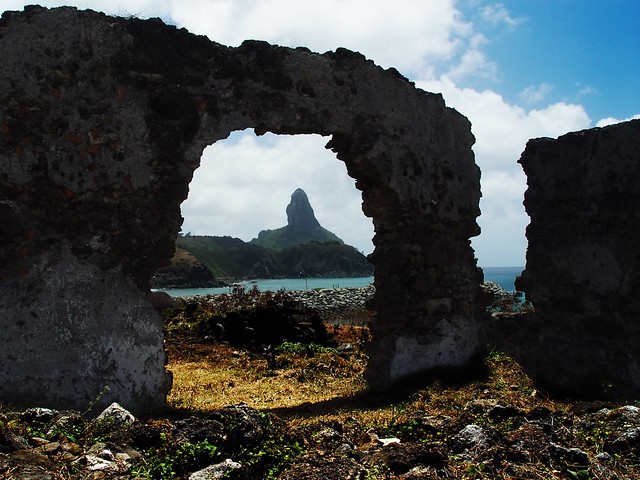
Off the coast of Brazil, the Morro do Pico as seen from the arch at the Fort Santo Antonio on the island of Fernando de Noronha…

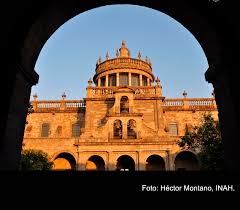
…and in Mexico, at the Hospicio Cabanas in Guadalajara.

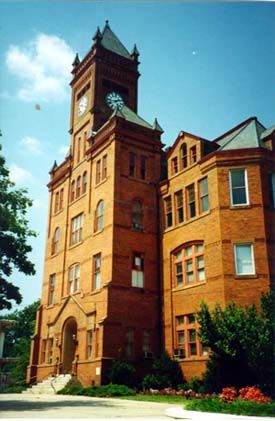
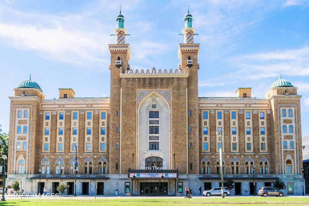
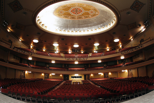
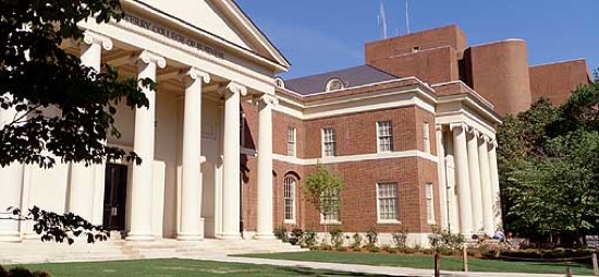
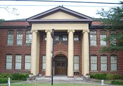
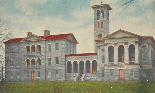
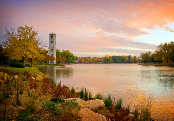
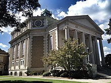
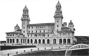
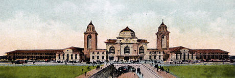
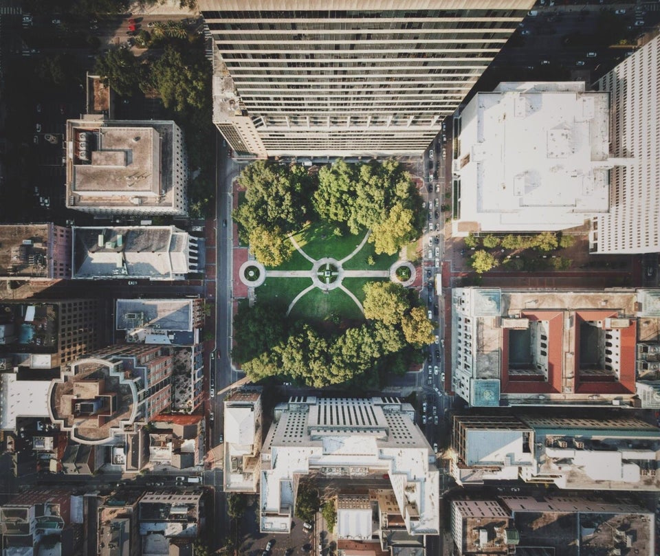
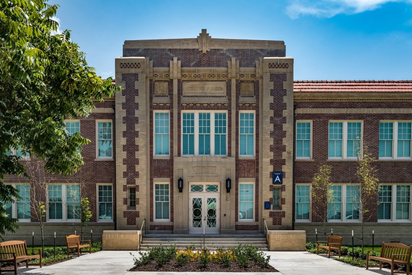
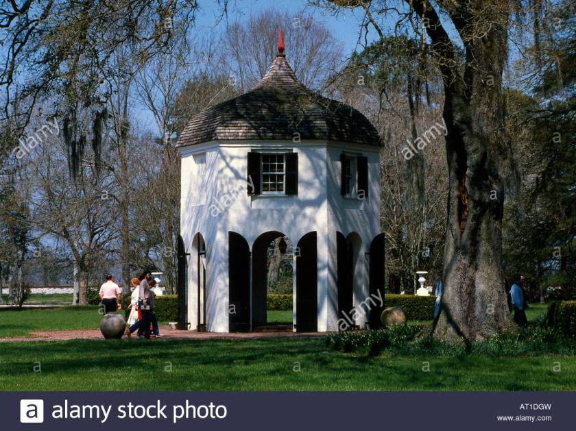
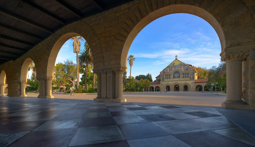
In the United States, the Memorial Church at Stanford University in California…

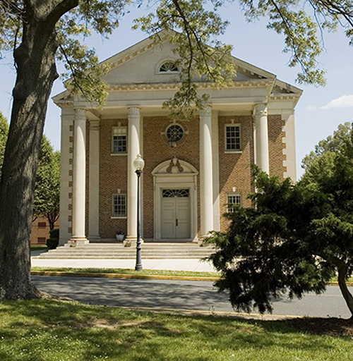
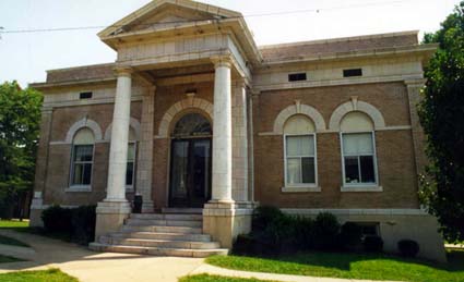
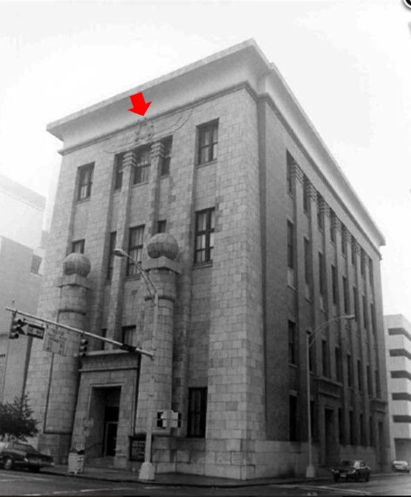
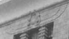
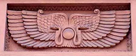
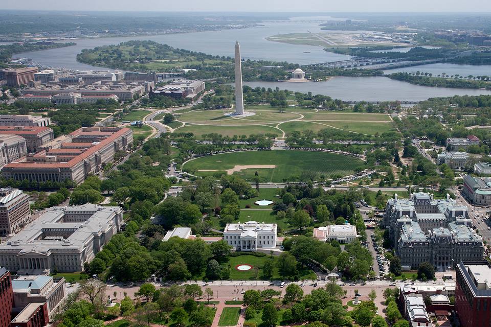
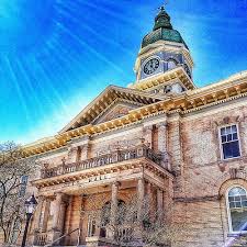
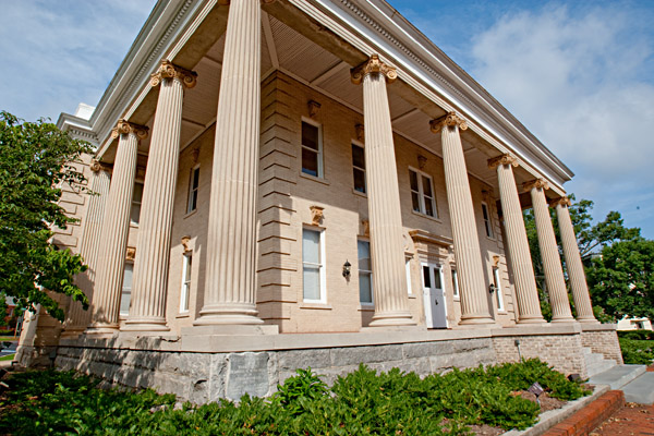
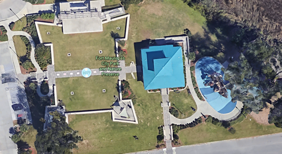
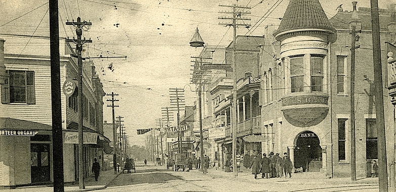
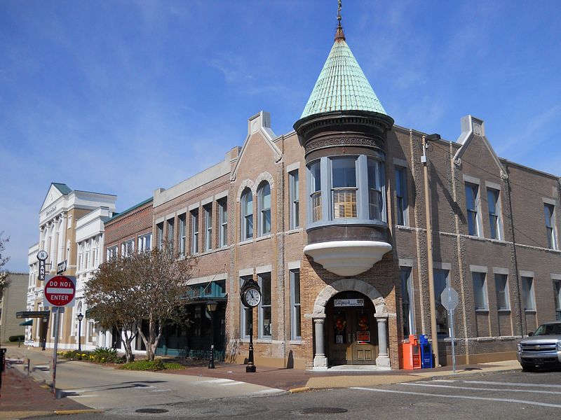
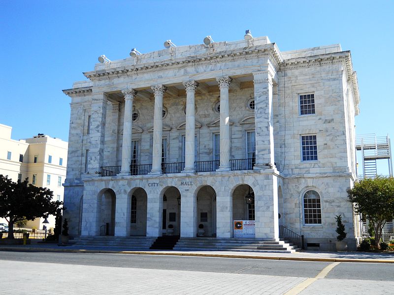
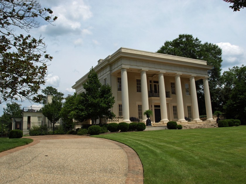
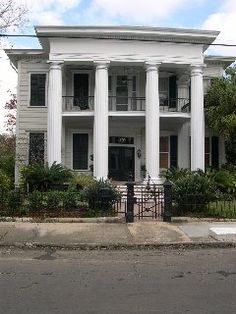
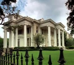
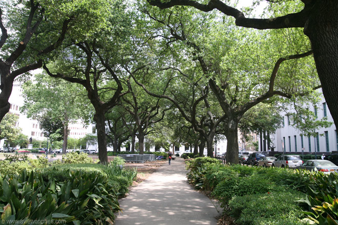
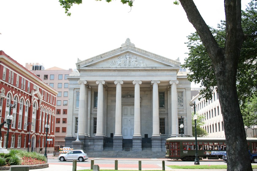
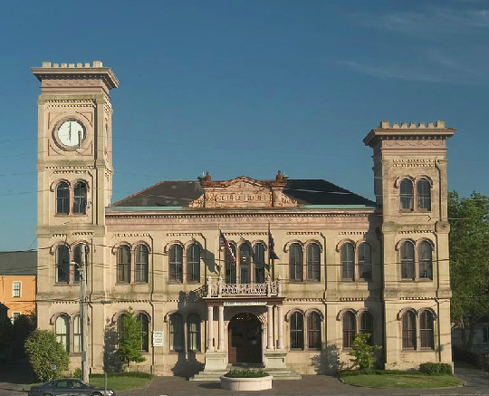
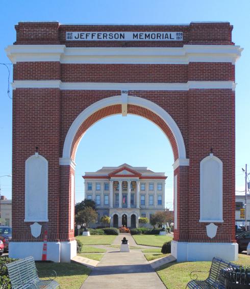
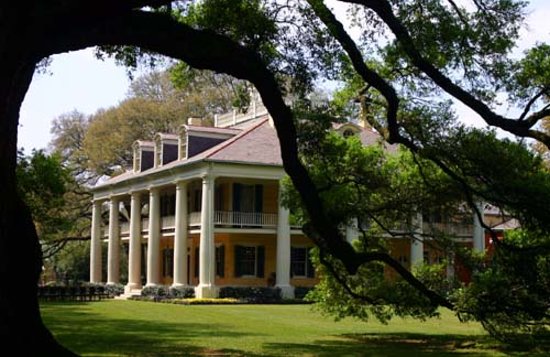
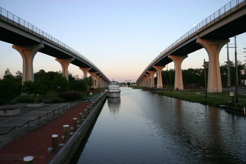
…in Louisiana, the Jefferson Memorial and the Old Jefferson Parish Courthouse in Gretna…

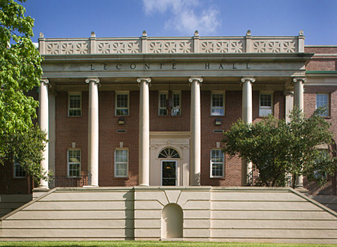
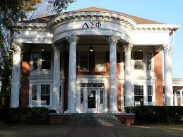
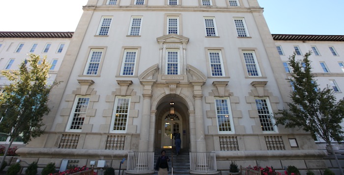
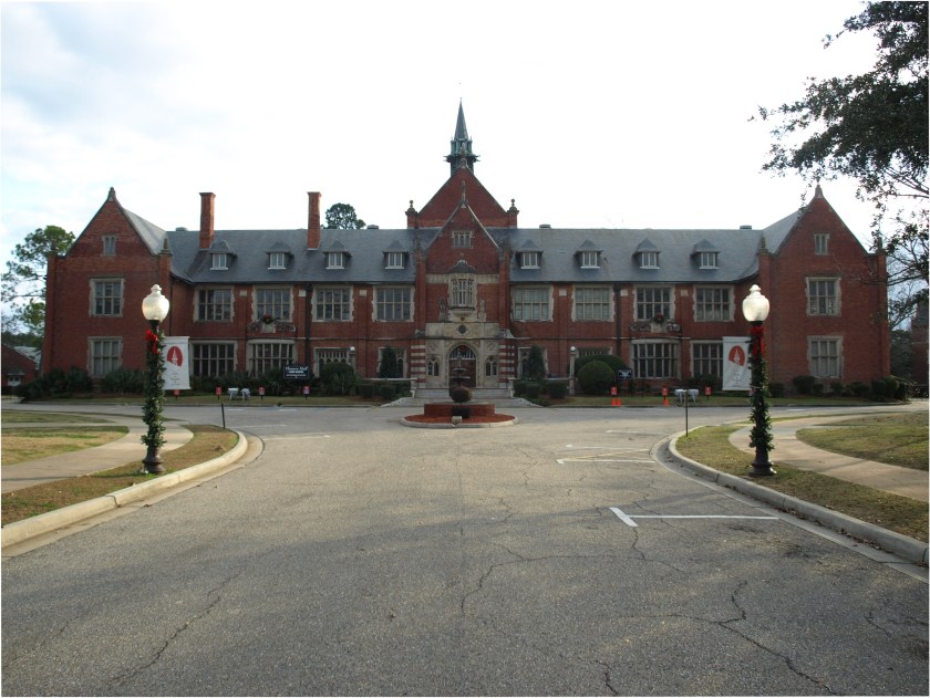
…and in Florida, at Rollins College in Winter Park.

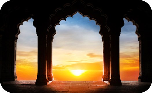
I don’t know where this picture was taken, but there certainly appears to be a solar alignment occurring in the center of these arches.

The Ancient Advanced Moorish Civilization that is missing from our collective awareness was all about Harmony, Balance, Beauty, Sacred Geometry and Unity with each other and the Universe, and connecting with One’s Higher Self, Source, Universal Self, whatever word you choose.

It was a a civilization where each Being knew it was Sovereign, and yet an integral part of the whole collective.  It was all about aligning Heaven and Earth in the fullest expression of Human Potential that there has ever been here on Earth. 

I will leave you with this picture of what happens at the Temple of Angkor Wat on the equinox, the time of year when the sun crosses the plane of the Earth’s equator, and day and night are of equal length.

Circle Alignments on the Planet Washington, DC – Part 27 Charlotte, North Carolina to Washington, DC

In the last post, I tracked the alignment from Athens, Georgia, the home of the flagship campus of the University of Georgia, through Central, a small railroad town in South Carolina; to Greenville, the largest city in Greenville County, South Carolina, and its county seat.

Next on the alignment is Charlotte,the largest city in North Carolina, and the county seat of Mecklenberg County.

One of its nicknames is “The Queen City.”

Charlotte was named for Princess Charlotte of Mecklenberg-Strelitz, a small north German duchy in the Holy Roman Empire, who had become Queen-Consort of Great Britain and Ireland upon her marriage to King George III in 1761. Both of these portraits of Queen Charlotte can be found on the internet…

…as can these of King George III, with a portrait like the one on the right being far more commonplace.

A historical white wash may be difficult to get one’s head around based on what we have been taught, but evidence is there when you start looking.

Holy Roman Emperor Charles V, who ruled from 1500 to 1558, is another example, with the similar of the facial structure between the two portraits, the tilt of the chins, and the similar clothing.

Why would one portrait become the face of the rulers, and the other fade to obscurity?

Here are some examples of German Coats-of-Arms, with the “Moor” sound in the name.

I personally believe there was a deliberately-caused cataclysm within the last couple of hundred years that resulted in a worldwide mud flood that wiped out an advanced global civilization…

…that was subsequently dug out by those involved, and what we have seen playing out in our world are the results of human and social engineering that have been used to divide Humanity by race and religion for the purposes of power and control.

I did not start out from a mud flood perspective, but in the process of what I am researching, I became connected with the mud flood community of researchers on YouTube.

Now back to Charlotte, North Carolina.

Biddleville, the primary historic center of Charlotte’s so-called African-American community, is west of uptown, and starts at the Johnson C. Smith University campus, extending to the airport. Biddleville was said to have been created in the 1870s for the professors at the Johnson C. Smith University.

This is Biddle Hall on the university campus…

…the Jane M. Smith Memorial Church…

…and the James B. Duke Memorial Library.

I say so-called African-Americans because the Moors were and are indigenous to North America. This was their land.

The Ancient Ones don’t refer to a people that existed a long time ago.  It refers to an ancient people that are alive and living in the present day.

The only way that the controllers have had to control our lives is by deceiving Humanity into thinking they have the ability to do that, because they actually do not. Please note that this identification card says: “Natural Born Day” instead of birthday, then it says “Free in Full Life.” This is a significant point of information.

Here are some historic photos of Charlotte.

I don’t know what this building was, or if it is even still standing, but I noticed there was a symbol at the top of the building…

…and here is a close-up of the symbol. I wonder if this is a representation…

…of the ancient symbol of the Winged Sun, an ancient symbol associated with divinity, royalty, and power.

Here’s an historic photo of Charlotte, where you see horse-drawn carriages in the foreground, advanced masonry, and a streetcar way in the background.

Here’s a closer view of a street car in the Charlotte street-car system…

…and here’s another one in a residential neighborhood in Charlotte.

Looks like Charlotte had a well-developed public transportation system from early in its history.

The next city on the alignment is Durham, the county seat of Durham County, North Carolina, and part of the Research Triangle Region, known for its technology companies and scholarly institutions.

The Old Post Office and Federal Building in Durham was said to have been built in 1906. It was demolished in 1936.

Why build a building that looks like it is made to last forever be demolished in thirty years?

This was the Union Station in Durham circa 1910 on the top left; the Furman University Bell Tower in Greenville, South Carolina, in the middle; Sessions House, the Parliament Building in Hamilton, Bermuda, on the top right; a view of the architecture in Santa Cruz de Tenerife on the Island of Tenerife in the Canary Islands, on the bottom left; and the ancient Moroccan city of Ait Benhaddou on the bottom right.

This is the Duke University Chapel in Durham, at the center of the campus.

Here it is from the rear.

This European cathedral looking chapel was said to have been built completed in 1935, only 84 years ago. What do you think?

The Sarah P. Duke Memorial Gardens occupy 55-acres, or 22-hectares, of the grounds of Duke University.

The gardens are named after the wife of Benjamin Duke, one of the University’s benefactors.

The gardens are said to have been developed throughout the 1930s.

Next on the alignment is Richmond, the capital of Virginia. It was incorporated in 1742, and has been an independent city since 1871, meaning it is not a part of any county.

Richmond is on the fall line of the James River, where the are rapids down to its own tidal estuary…

…and is 44-miles, or 71-kilometers, west of Williamsburg, the capital of the Colony and Commonwealth of Virginia from 1699 to 1780…

…66-miles, or 106-kilometers east of Charlottesville, the location of the University of Virginia…

…100-miles, or 160-kilometers, east of Lynchburg, on the banks of the James River, and known as the “City of Seven Hills,” a nickname it shares with Rome in Italy…

…and is 90-miles, or 140-kilometers, south of Washington, DC, where we started this journey, and are about to return.

The planter William Byrd II was said to have commissioned Major William Mayo, a British civil engineer, to lay-out the original town grid. Mayo is said to have named the town after the English town of Richmond, because the view of the James River (this was taken from Libby Hill Park in Richmond)…

…was strikingly similar to the view of the River Thames from Richmond Hill in England.

Richmond became the capital of Virginia in 1780, when it was moved from Williamsburg. This is the Virginia State Capitol Building.

Directly to the north of the Virginia State Capitol building is the Old Richmond City Hall…

…and I am comparing it for similarity with the Moscow State Historical Museum in Russia.

This is inside the Old Richmond City Hall…

…and this is inside the Moscow State Historical Museum.

Jackson Ward, another historically called African-American district in Richmond, is located less than a mile from the Virginia State Capitol building.

The sign references businesses there, such as the St. Luke Penny Savings Bank, which survived the Great Depression when many banks went under, which became Consolidated Bank and Trust, and is still here today.

The sign about Jackson Ward also references the Southern Aid Insurance Company, where it was founded in 1893.

This is the Leigh Street Armory in Jackson Ward, which is now the Black History Museum & Cultural Center of Virginia.

Monroe Park is a 7.5-acre, or 3-hectare, park that is 1-mile, or 1.6-kilometers, northwest of the Virginia State Capitol building. It is pentagonal in shape, and considered to be Richmond’s oldest park.

It is the eastern point of the Fan District, because of the fan shape of the array of the streets that extend west from Belvedere Street on the eastern edge of Monroe Park, westward to the Boulevard.

The Altria Theater is located at the southwest corner of Monroe Park.

We are told that it was built between 1925 and 1927. This is the interior of the Altria Theater.

Formerly known as The Mosque, and the Landmark Theater, it was said to have been built for the Shriners of the Acca Temple Shrine.

Which Shriners, though? These…

…or these?

Because, you see, this is what all of this, every bit of what has taken place, is really all about.

The Moors were and are the custodians of the Ancient Egyptian mysteries, according to George G. M. James in his book “Stolen Legacy.”

As we slide back into Washington, DC, and complete this circle alignment series…

I will leave you with a few more images.

The first is about the Moors, and and their true connection to Masonry.

Next is a photo of the Supreme Court building in Washington, with construction said to have begun in 1932 and completed in 1935. It was built in the middle of the Great Depression? Seriously?

Not only that, there is a detail in this photo of the Supreme Court…

…that matches ones at Leconte Hall at the University of Georgia in Athens, Georgia…

…and the National Library of Greece in Athens.

You see the same cross pattern on the Union Jack flag…

…and in the Piazza San Pietro in front of San Peter’s Basilica at the Vatican.

According to Wayne Herschel, it is representative of the Orion Constellation, as seen in his star map of Rome and the Vatican. The Orion Constellation is connected with Osiris, the primeval god of Egypt.

And here is Wayne’s star map of the Washington, DC area.

The ancient and advanced Moorish Civilization was global. I see a beautiful, harmonious and balanced civilization, geometrically aligned with itself, and in perfect alignment with the stars.

I believe when the Moorish Civilization was taken out, their advanced sacred geometry and planetary gridlines based on the Flower of Life, upon which all infrastructure was precisely located and in alignment, as well as being a free energy generation and distribution system, was reconfigured, and much was destroyed. What remained of the advanced technology of the grid system was then reversed, and used to control Humanity.

Having said this, people are waking up, and I believe we are on the verge of incredible changes which will impact Humanity for the better.

I look forward to sharing my next research project on archways with you, which will involve both man-made and what are called natural.

Circle Alignments on the Planet Washington, DC – Part 26 Athens, Georgia to Greenville, South Carolina

In the last post, I focused on the city of Atlanta, Georgia, and took a close look there at Druid Hills, Midtown Atlanta, Piedmont Park (called the Central Park of the South), the Old Fourth Ward, Cabbagetown, and the Oakland Cemetery.

I am picking up the alignment in Athens, officially Athens-Clarke County, is what is called a consolidated city-county and home to the flagship campus of the University of Georgia. It was said to have been named after Athens in Greece.

This took me to Athens, Greece, to look for comparisons.

The most famous and recognizable symbol of Athens is the Parthenon. It was dedicated to the goddess Athena, whom the people of Athens considered their patron. It was said to have been completed in 432 BC.

By the way, in case you didn’t know, there is a Parthenon in Nashville, Tennessee, said to have been designed by Confederate veteran William Crawford Smith, and built in 1897 for the Tennessee Centennial Exposition that same year. One of Nashville’s nicknames is “Athens of the South.”

Back to Athens in Greece for a few more examples of the architecture there.

Here is the National Library of Greece in Athens, said to have been designed by the Danish architect Baron Theophil Freiherr von Hansen (I am not joking, that was his name) …

…as part of his famous trilogy of what are called neo-classical buildings including the Academy of Athens…

…and the University of Athens. These buildings were said to have been built in the 1800s. It’s interesting to note that even in Athens, Greece, more modern architects are being given the credit designing and building architecture in modern times with exactly the same characteristics as the ancient architecture all around it.

This was photograph of the trilogy at the beginning of the twentieth-century by Odysseas Fokas.

What’s wrong with this picture?

Here is the Temple of Hephaestus with construction starting in 449 BC. It is located in the Agora of Athens, which translates to mean an assembly of people, and by extension means the gathering place.

The modern Greek word Agora means marketplace.

This is the City Hall on Market Street in Athens, Georgia, said to have been designed by Augusta architect L. F. Goodrich, and built by the contractor J. W. Barnett, with construction starting in 1903 and ending in 1904.

We are told it was built to also provide a market place where meat was sold on the ground floor; a jail; a political meeting place; and for theatrical performances. It has an auditorium that accommodates 300 people. Based on its stated multiple public uses, it sounds like a gathering place, just like the Agora of Athens, Georgia.

This is a picture of Syntagma Square, on Hermes Street, in Athens, Greece. The building in the background is the Old Royal Palace, said to have been completed in 1843.

It has been home to the Greek Parliament since 1934.

Just wanted to give you some examples for comparison before taking a look at the University of Georgia, the first state-supported university. Its charter was granted in by the Georgia General Assembly in 1785, and is considered the birthplace of public higher education in America.

The Georgia Arch pictured here is said to have been modeled after the Georgia State Seal, featuring the three pillars of wisdom, justice, and moderation. It was said to have been forged at the Athens Foundry in 1857.

It reminds me somewhat of the Arch of Hadrian in Athens, Greece. Not sure if there is a connection, but you never know. It has been dated to 131 or 132 AD.

This is a picture of the Chapel on the University of Georgia campus, said to have been built in 1832…

…the Terry College of Business in Brooks Hall in 1928…

…the Health Sciences Building on campus, 1900…

…Leconte Hall in 1905…

…and the Delta Sigma Phi Fraternity House. I can’t find a date for the building…

…but check out the banner I found for Delta Sigma Phi!

Is this random? I don’t believe so. The truth is hidden in plain sight.

How were monumental buildings like these built at the time we are told with the historical narrative we have been given? How?

There are also old photographs like this one of Athens, Georgia, showing electric streetcars and horse-drawn carriages in the same image, as well as advanced architecture.

How do we reconcile having the technology to have an electric streetcar system and at the same time be dependent on the horse for propulsion?

Next on the alignment is Central, a town in Pickens County, South Carolina, that was founded by the Atlanta and Richmond Air Line Railway in 1873.

It was called Central because it was mid-way between Atlanta, Georgia, and Charlotte, North Carolina.

This Railway went broke the following year, and was re-organized into the Atlanta and Charlotte Airline Railway…


…and later became part of the Southern Railway.

This was Central High School in Central, South Carolina, and said to have been built in 1908.

The building is currently being used for residential living.

Next on the alignment is Greenville, is the largest city in Greenville County, South Carolina, and its county seat.

It is 145-miles, or 233 kilometers from Atlanta in Georgia, and 100-miles, or 160-kilometers, from Charlotte, and the same distance from Charlotte in a southeast direction to Columbia, the capital of South Carolina.

This is the old campus of Furman University, the oldest private institution of higher learning in South Carolina. It was located in the West End Historic District.

The Bell Tower of Furman University is a symbol of the University. Note the block-shaped rocks in the foreground.

The Bell Tower is on the interestingly-shaped Swan Lake, with all of its straight-edges.

The groundbreaking for the Poinsett Hotel in downtown Greenville was said to have been in 1924, and it opened in 1925.

It was said to have been built to accommodate visitors for the Southern Textile Exposition, which was held in Greenville from 1915 to 2004 due to its status as the “Textile Center of the South.”

This was the Greenville City Hall, Court House, and Post Office, said to have been built in 1889 in the Richardsonian Romanesque style, and to be one of the best pieces of period architecture in the region.

It was demolished for some reason in the early 1970s.

This is Sirrine Stadium in downtown Greenville.

It is definitely situated on a mound.

Here is one heck of a building on South Main Street in the West End Historic District of Greenville, said to have been constructed in 1890 as the American Bank.

I find it interesting that in this picture of Greenville’s Main Street in 1910 was either unpaved or dirt-covered.

Yet they are building monumental architecture like the American Bank in the late 1800s?

I am going to end this post here, and pick up the alignment in Charlotte, North Carolina in the next post.

Circle Alignments on the Planet Washington, DC – Part 25 Atlanta, Georgia

In the last post, I tracked the circle alignment from Biloxi, Mississippi, on the Mississippi Sound; through Mobile, Alabama, a location rich in the history of what we are taught was New France in North America; to Montgomery, the capital city of Alabama.

I am picking up the alignment in Atlanta, the capital of Georgia, and its most populous city. The presently- named City of Atlanta was incorporated on December 29th, 1847.

A town was said to have existed here since 1837 for the purpose of developing a Terminus for the Western and Atlantic Railroad between the port of Savannah in Georgia and the Midwest.

Does Atlanta = Atlantis?

I am seeing and saying that Atlantis was not only a continent that sunk in the Atlantic Ocean from a cataclysmic event at some point in earth’s history, but that the ancient advanced global civilization of Master Builders was the same civilization as that of Atlantis, including all of North America.

I shared what is called the Temple of the Atlantes at Tula in “Circle Alignments on the Planet Washington, DC – Part 20 Colima, Mexico to Aguascalientes, Mexico”…

…and in “A Different Take on Samuel Taylor Coleridge’s ‘Kubla Khan,”’ I showed you the giant foot of one of what are called Atlantes at the…

… New Hermitage in St. Petersburg in Russia.

So let’s see what secrets Atlanta has to reveal….

The ubiquitous Frederick Law Olmsted Sr. was famous as one of the designers, along with Calvert Vaux, of Central Park in New York in 1850s. They were said to have won a competition for the design of Central Park.

Olmsted was said to have been tasked with designing Druid Hills in Atlanta, one of the city’s first planned suburbs, in the early 1890s.

It is interesting to note that Olmsted was said to have been inexperienced before his work on Central Park.

In his biography, it says he created the profession of landscape architecture by working in a dry goods store; taking a year-long voyage in the China trade; and by studying surveying, engineering, chemistry, chemistry, and scientific farming. He was not a college graduate. We are told he was about to enter Yale College in 1837, but weakened eyes from sumac poisoning prevented him the usual course of study. Hmmmm.

He was said to have designed the Olmsted Linear Park in Druid Hills, with his curvilinear style in which small parks are like wings on both sides of a straight line, in this case Ponce de Leon Avenue.

This stony bridge is located in the Olmsted Linear Park.

Interestingly, in addition to having been involved with designing Central Park in New York City and the Olmsted Linear Park in Atlanta, he is also credited with designing Boston’s Emerald Necklace starting in 1878…

…where you find this bridge in Franklin Park…

…as well as what is being called an overlook shelter there.

He is also credited with the designing the Grand Necklace of Parks in Milwaukee, Wisconsin, also known as the Emerald Necklace.

This includes Lake Park, with its…

…so-called Indian Burial Mound…

…North Point lighthouse…

…and Lion Bridge. More on lions to come.

Juneau Park is also one of the Grand Necklace of Parks said to have been designed by Frederick Law Olmsted in Milwaukee starting in 1889. Note the deer statue and the ornate architecture of the railroad depot seen in this old post card.

More on deer to come.

In the vicinity of Druid Hills, there is a golf club. I believe golf courses are a cover-up of mound sites.

This is the massive Druid Hills Baptist Church, also known as the “Church at Ponce and Highland” which looks like an ancient Greco-Roman Temple.

Emory University is in the Druid Hills area. This is the Emory University Hospital on campus.

There are Druid Hills in Baltimore, Maryland; Birmingham, Alabama; and in Fairfield Glade, Tennessee

A druid was a member of a high-ranking professional class in ancient celtic cultures. They were religious leaders, legal authorities, lore-keepers, medical professionals and political advisors.

I think the memory of the people is retained in the name.

The location of today’s Piedmont Park in Midtown Atlanta was the site of two big expositions.

The first was the Piedmont Exposition in 1887, with its main building showing here. The purpose of the exposition was to exhibit the natural resources of the Piedmont Region, which includes Georgia, North Carolina, South Carolina, Tennessee, and Alabama. It was attended by President Grover Cleveland, and was said to have successfully expanded Atlanta’s reputation as a place to visit and conduct business.

The Piedmont Exposition building reminds of this building in Geelong Exhibition Building and Market Square Clocktower in Geelong, which was located in Australia’s Victoria State.

The second was the Cotton States and International Exposition in 1895. It was said to be designed to promote the American South and the World and showcase and promote new technologies.

Landscape architect Joseph Forsyth Johnson is credited with the design of the park, and Bradford Gilbert was the supervising architect of the entire fair.

Olmsted’s sons, John and Frederick Jr, are credited with the completion of today’s Piedmont Park in Midtown Atlanta, called the Central Park of the South.

This is called the Piedmont Park Greystone…

…which serves as an event center for the citizens of Atlanta.

There is an elliptical looking feature adjacent to the Greystone venue, with volleyball courts and what look like may be softball fields.

This reminds me of the Great Lawn in New York City’s Central Park, with its ball fields, which were said to have been added in the 1950s.

It also reminds of the Ellipse in Washington, DC, which is adjacent to the White House.  The exact geographic center of Washington, DC, is said to be 400 meters to the west of, and very slightly south of, the center of the Ellipse Park.

As a matter of fact, there is a precise linear North-South relationship between the White House, the Ellipse, and the Jefferson Memorial, located on the southeast corner of the Tidal Basin, and another between the Lincoln Memorial to the west, through the Washington Monument, and to Capitol building on the East side of the alignment.

This is a view of a stone bridge and gazebo at Lake Clara Meer at Piedmont Park.

The skyline of Midtown Atlanta as seen from Lake Clara Meer…

…reminds me of the skyline of Manhattan as seen from the Jacqueline Kennedy Onassis Reservoir in Central Park.

This is the Fox Theater is in Midtown Atlanta.

This is definitely Moorish architecture. It was said to have been built originally to become a large Shrine Temple, but the 2.75 million dollar project exceeded their budget…

…so the project was said to have been leased to movie mogul William Fox. The Fox Theater opened in 1929, two months after the stock market crash and the beginning of the Great Depression. The Theater closed 125-weeks after it opened. New owners acquired it, Paramount Pictures and Georgia-based Lucas & Jenkins, after the mortgage was foreclosed in 1932.

This is the interior of the Fox Theater

This is a detail of the Fox Theater stage in Atlanta on the left; the Mabel Tainter Memorial Theater stage in Menomonie, Wisconsin in the middle; and a detail on the right at The Alhambra in Grenada, Spain, the only place acknowledged to have had a Moorish civilization.

Everywhere else, the Moors and their ancient, advanced and worldwide civilization have been omitted from the historical record.

The Old Fourth Ward, also known as O4w, is adjacent to Midtown Atlanta, and southwest of Druid Hills.

It is best known as the location of the Martin Luther King Jr Historic Site, which includes his boyhood home…

… and the Ebenezer Baptist Church, where he was baptized, and both he and his father preached.

This is the Ponce City Market in the Old Fourth Ward…

…and a close-up of its tower.

And this is the Hotel Clermont in the Old Fourth Ward…

…with the interesting movie-theater-marquee-looking signage at the hotel’s entrance.

Here is real estate in the Old Fourth Ward…

…and an old masonry water tower there.

Cabbagetown is just to the south of the Old Fourth Ward. The name got my attention because it is unique, so I took a look there.

This is what I found.

We are told that the Atlanta Rolling Mill was destroyed after the Battle of Atlanta (which took place on July 21, 1864).

On its site, the Fulton Bag and Cotton Mill began its operations in 1881. It is on the south side of the Georgia Railroad Line.

Cabbagetown, and the surrounding mill town, was said to be one of the first textile processing mills built in the South.

The mill was closed in 1977, and in 1996 was renovated into the nation’s largest residential loft community – the Fulton Cotton Mill Lofts.

Notice the similarity to the Ponce City Market in the Old Fourth Ward on the left, and the the Fulton Cotton Mill Lofts in Cabbagetown on the right?

The Oakland Cemetery is adjacent to Cabbagetown on its western edge.

I found some interesting things centered around the Oakland Cemetery in Atlanta. Please take a look at these two photos of Oakland Cemetery…

…compared with the Cimetiere du Pere-Lachaise in Paris, France…

…the Vieux Cimetière in Florence, Italy…

…and in New Orleans, the St. Louis Cemetery…

…and the Metairie Cemetery, with what is called the Brunswig Pyramid.

The Lion of Atlanta is in the Oakland Cemetery…

…which immediately brought to mind the Lion of Lucerne in Switzerland, which I saw in 1985 when I was stationed in Augsburg, Germany in the U. S. Army.

The ancient Lion of Kea, or Ioulis, on the Island of Kea in Greece, was believed to have been carved prior to 600 B.C.

And then there is the Sphinx on the Giza Plateau in Egypt, believed to be at least 4,500-years-old, appearing to be the body of a lion, and the head of a human.

What does all of this lion symbolism represent?

I personally believe it is connected with the Lion of Judah.

We are taught that everything is separate, and developed independently, but I don’t believe the ancient, advanced civilization is separate – I believe it is one and the same.

There is a two-letter difference between Kemetic, and what is considered connected to the land of Khem or Egypt; and Semitic, relating to or denoting a family of languages that includes Hebrew, Arabic, and Aramaic and certain ancient languages such as Phoenician and Akkadian, constituting the main subgroup of the Afro-Asiatic family; and relating to the peoples who speak Semitic languages, especially Hebrew and Arabic.

This sphinx is called the first written record of the Semitic alphabet, the proto-Canaanite “Rosetta Stone” Sphinx found by Sir William Matthew Flinders Petrie in Egypt in 1905.

And I found all of these alignments I am sharing with you after I found the North American Star Tetrahedron in 2016 when I noticed cities in North America lining up.

Its about an ancient understanding that connects Us, Humanity, back to All of Creation.

I will end this post here, and pick up the alignment in the next post in northeast Georgia.

Circle Alignments on the Planet Washington, DC – Part 24 Biloxi, Mississippi to Montgomery, Alabama

In the last post, I tracked the circle alignment from New Orleans, on the Mississippi River in the southeastern part of Louisiana; across Lake Pontchartrain to Slidell in St. Tammany Parish; to Gulfport on the Gulf of Mexico coast, and the second-largest city in Mississippi after the state capital, Jackson.

I am picking up the alignment in Biloxi, part of the Biloxi-Gulfport Metropolitan area, and a county seat of Harrison County, along with Gulfport.

Its beachfront lies directly on the Mississippi Sound. A sound is defined as a large sea or ocean inlet.

Fort Maurepas, also called Old Biloxi, and was located at present-day Ocean Springs, approximately 2-miles, or 3.2-kilometers, east of Biloxi. It was said to have been developed by the French in 1699, and we are told it burned down around 1722.

This is Fort Maurepas City Park and Nature Preserve today, which has a pavilion, large green space, playground equipment, and a splash pad.

This is an historic view of Howard Street at Lemeuse Street in Biloxi…

…and Howard Street at Lemeuse today. I find the copper turret, arches, and columns in this photo to be noteworthy.

For comparison, here is a turret from Calpe, Spain on the Mediterranean Costa Blanca. Not identical, but similar in shape.

The City Hall in Biloxi also serves as the Post Office, Courthouse, and Custom House. It was said to have been built by James Knox Taylor as the supervising architect between 1905 and 1908, with its huge columns and arches.

James Knox Taylor was also credited with being the supervising architect of approximately thirty other buildings between 1897 and 1912, like the old post office in Buffalo, New York, in 1901…

…the San Francisco post office and courthouse in 1905. This building is now the United States Court of Appeals for the Ninth Circuit.

…and the Alaska Governor’s Mansion in Juneau in 1912.

We don’t question what we have been taught about who built this architecture because why would we?

Does it make sense to have the technology to build architecture like this built in this time period according to the history we have been taught?

Next on the alignment is Mobile, Alabama, the county seat of Mobile County and the principal municipality of the Mobile Metropolitan area.

The Fort of Colonial Mobile, also known as Fort Conde, was said to have been built by the French in 1723. Here is a map depicting it in 1725.

This is what Fort Conde looks like today.

The Old Mobile site was the location of the French settlement La Mobile and the associated Fort Louis de la Louisiane, said to have been built in 1702…

…at a place called Twenty-Seven Mile Bluff on the Mobile River.

Fort Morgan is on Mobile Point at the entrance of Mobile Bay, and said to have been built between 1819 and 1834.

This is an 1892 photograph of the Pincus Building, also known as the Zadek Building, on the corner of Dauphin Street and Royal Street in the Lower Dauphin Street Historic District.

It was said to have been built in 1891 by local architect Rudolph Benz and first housed the Zadek Jewelry Company. When I searched, no biographical information showed up about him.

This is how the Pincus Building looks today. The original round tower and spire were said to have been removed in the 1940s.

I wonder why that was done…the original building sure looked like it was built to last forever!

This is the Old City Hall and Southern Market in Mobile.

It was said to have been built between 1855 and 1857 as a combination city hall and marketplace for selling vegetables, meat, and fish. The architect was Thomas Simmons James. Like with Rudolph Benz, no biographical information came up when I searched for him.

It is said to be an Italianate style in design. Here is a detail of arcade ironwork at the Old City Hall…

…and an octagonal cupola crowning the central section.

This is the Barton Academy, the first public school in Alabama said to have been built between 1836 to 1839, and to have been designed by James Dakin, Charles Dakin, and the New Orleans architect, James Gallier.

So, how are they building buildings of this size and complexity in the 1830s, according to the history we have been taught? And for a public school?

The Cathedral Basilica of the Immaculate Conception was said to have been designed by Claude Beroujon, a seminarian turned architect, and built between 1835 and 1850.

This is the Passenger Terminal of the Gulf, Mobile and Ohio Railroad. It was said to have been completed in 1907, and designed by P. Thornton Marye.

He is also credited with being the architect for such buildings as the Atlanta Terminal Station, which opened in 1905, and was demolished in 1972…

…and the Birmingham Terminal Station, said to have been completed in 1909, and demolished in 1969.

Next on the alignment is Montgomery, the capital city of Alabama.

Montgomery is named for Richard Montgomery, an Irish soldier first serving in the British army, who later became a Major General in the Continental Army. He was most famous for leading the unsuccessful 1775 invasion of Canada, where he was killed.

It is interesting to note that a major general who was killed during battle in an invasion that was unsuccessful would have so many places named after him. I grew up in Montgomery County, Maryland, which was named after him as well.

This is the Alabama State Capitol Building in Montgomery, said to have been built from 1850 to 1851. They were building massive architecture like this 10 years before the start of the American Civil War? And it only took them a year to build?

The capitol building is located on top of one end of Dexter Avenue, along which also lies the Dexter Avenue Baptist Church, where Martin Luther King Jr. was pastor.

Both of these buildings are recognized as National Historic Landmarks by the U. S. Department of the Interior.

This is a view of the cotton marketing in Montgomery circa 1900. Note the contrast of the rudimentary horse and buggies with the architecture in the square pictured here.

The images we are conveyed historically via literature, movies and television are like these photos from Old Alabama Town in Montgomery.

The architecture from earlier time periods in American history doesn’t match up with the historical narrative.

We have had television shows like “Little House on the Prairie” and “Dr. Quinn, Medicine Woman” informing us about what life was like in the 1800s just like in these pictures from Old Alabama Town. It does not include anything about the monumental architecture that is attributed to the same time period.

Montgomery was said to have had the first city-wide system of electric streetcars in 1886, known as the “Lightning Route.”

For some reason it only operated for 50 years, when in 1936, the streetcars were retired in a big ceremony and replaced by buses. Sounds like a step backwards to me!

The Garden District is a 315-acre, or 127-hectare…

…historic district in Montgomery…

…that has been on the National Register of Historic Places since 1984.

The Cloverdale Historic District of Montgomery includes Huntingdon College, a private Methodist Liberal Arts College, which was established in 1854 first as a women’s college, and this building, Flowers Memorial Hall, was said to have been completed in 1910.

This is an historic photo of the Montgomery Union Station, said to have been built in 1898.

It was stopped being used as a railroad station in 1979, but at least the building is still standing and is utilized as the Visitors Center for Montgomery and commercial space for businesses.

Fort Toulouse is an historic park near Wetumpka, Alabama, and is considered part of the Montgomery Metropolitan area. This is said to be a replica of the original fort.

In Wetumpka, there is a place called the Jasmine Hill Gardens which is said to have full-size replica of the ancient Temple of Hera in Olympia, Greece.

Must be a replica, right? There couldn’t possibly have been anything like this already here based on the history we have been taught!

West of Montgomery, at Epes in Sumter County, Alabama, was Fort Tombecbe on the Tombigbee River, said to have been built by the French between 1736 and 1737 as a trading post.

The original structure is pretty much not there anymore…

…and is located just downriver from the White Cliffs of Epes in rural Alabama.

The infinitely more famous White Cliffs of Dover are a landmark of England.

I will end this post here, and pick up the alignment in the next post in Atlanta, Georgia.

Circle Alignments on the Planet Washington, DC – Part 23 New Orleans, Louisiana to Gulfport, Mississippi

In the last post, I tracked this circle alignment from Port Isabel, on the Gulf Coast of Texas near Brownsville; across South Padre Island; over the Flower Garden Banks Marine Sanctuary in the Gulf of Mexico; into Louisiana at Terrebonne Parish; and ending at Houma, the Parish Seat of Terrebonne Parish.

I am picking up the alignment in New Orleans, a consolidated City-Parish located along the Mississippi River in the southeastern part of Louisiana.

The Central Business District of New Orleans is immediately north and west of…

…the snaky, s-shaped river bends of the Mississippi River winding through New Orleans.

Again, I see this signature feature of the ancient civilization around the world, like the Brisbane River as it goes through Brisbane, Australia…

…the Nile River at Juba in South Sudan…

…and the Red River in Winnipeg, Manitoba.

The Central Business District of called the American Quarter because it was said to have been developed in the heart of the French and Spanish settlements.

It includes Lafayette Square, a 2.5-acre, 1-hectare, park, where concerts and festivals are held.

Called the second-oldest park in New Orleans, after Jackson Square, we are told it was designed in 1788 by Charles Laveau Trudeau AKA Don Carlos Trudeau, Surveyor-General of Louisiana for the Spanish Government at the time, and later acting Mayor of New Orleans in 1812.

The Greco-Roman-looking Gallier Hall, the former City Hall of New Orleans, faces the Lafayette Square on St. Charles Avenue.

This huge and columned structure was said to have been built between 1845 and 1853 under the direction of James Gallier, a bankrupt Irish architect born in 1798, who emigrated to the United States in 1832.

Apparently, he promptly became well-known for his incredible architecture in the United States before his untimely death in 1866 at sea, when the “Evening Star” side-wheel steamship he and his wife were travelling on between New York and New Orleans sank 175-miles east of Savannah, Georgia, in the Atlantic Ocean.

The “Evening Star” sinking was also famous for having had on it six New Orleans Madams who had been in New York selecting new prostitutes for their brothels from “fashionable metropolitan houses.”

So a famous architect and his wife were on a side-wheel steamer that sank in the Atlantic Ocean with a ship full of prostitutes a year after the end of the devastation of the American Civil War?

This is not the first time I have come across information about an architect that was strange.

And Gallier Hall looks like how sunken Atlantean temples are frequently depicted.

Canal Street is a major thorough-fare in New Orleans, forming the upriver boundary between the city’s oldest neighborhood, the French Quarter, and the Central Business District.

The building in the background in this 1960s photograph that was taken on Canal Street, behind the streetcar in the foreground…

…reminds me of this building in Times Square in New York City…

…and this one near the the Calle de Alcala, the main thoroughfare in Madrid, Spain.

This is an historic photo of Canal Street circa 1910…

..compared with this one taken in Leeds, England, in the late 1800s. The architecture in both places looks similar, as well as a similar streetcar system in the middle of the street.

How did such urban similiarities develop independently of each other across countries and continents, according to this history we have been taught?

In 1862, only 48-years earlier from the photo of the highly-urbanized Canal Street in 1910, the Battle of New Orleans was raging in the American Civil War, and New Orleans was said to have looked something like this:

It is interesting to note that while Canal Street was named for a canal that was never built, there are plenty of still-existing canals in New Orleans, as seen in this Google Earth screenshot. No telling how many have been filled-in!

Not surprisingly, south of New Orleans towards Mississippi River Delta is a town called Venice, Louisiana, the last community down the Mississippi accessible by car…

…and which has a lot of channels in the landscape.

Interesting name for this place, since Venice in Italy is the only place in the world that is heavily associated with canals.

I consistently find canal systems in cities all around the world that are not known to the general public, many of which are called rivers instead of the man-made canals they actually are. One of the many ways the ancient advanced civilization has been hidden in plain sight.

This is the River Aire in Leeds, England, for example. It is described as a natural river, but it sure looks like a canal to me!

One end of Canal Street in New Orleans terminates at the Mississippi River, where a ferry has been available since 1827 to connect to the Algiers Neighborhood, one of the oldest sections of New Orleans, on the west bank of the Mississippi River.

I believe that the particular names of places are telling us something, so Algiers in Algeria comes to mind when I see this name here, and think there is a connection between the two places somehow.

Algiers is considered to be the birthplace of Jazz. This is a statue of Louis Armstrong at the Robert E Nims Jazz Walk of Fame there.

This is the Algiers Courthouse, said to have been built on the site of the former Duverje plantation in 1896, and is described as a Moorish-influenced Richardsonian-style building.

So this piece of information provides a good lead-in to Henry Hobson Richardson, one of the architects given credit for incredible building achievements in New England, like James Gallier in New Orleans, that doesn’t match-up to his life-story.

H. H. Richardson was said to be a largely self-taught architect, who died young, and is given credit for the Ames Free Library in the foreground, and the Oakes Ames Memorial Hall in the background, in North Easton, Massachusetts, as well as other examples of monumental architecture.

This style of architecture is called Richardsonian Romanesque in his honor.

I am certain there was a widespread practice of false attribution to certain architects going on to cover-up the actual Moorish Masons who built all of this infrastructure.

Adjacent to the Algiers Neighborhood on the West Bank of the Mississippi River, in the Jefferson Parish, is the city of Gretna.

This is the Jefferson Memorial in Gretna, with the Gretna City Hall seen exactly in the middle of its archway…

…compared to the Soldiers and Sailors Memorial Arch in Bushnell Park in Hartford, Connecticut, with what is now an apartment complex in the middle of the archway…

…St. Peter’s Basilica in the middle of the archway of this bridge in Vatican City…

…the Hungarian Parliament building in the middle of these arches at the Fisherman’s Bastion in Budapest…

…and at the Qutb Minar Complex in New Delhi, India, the Qutb Minar is seen through this archway here…

…and at the same complex we find the Delhi Iron Column perfectly centered in this archway at the Quwwat-ul Mosque.

I am going to be dedicating a future blog post to feature the many examples like this of symmetry, proportion and alignment that I have found around the world between archways, and not only architecture, but what are called natural features as well.

It is called “framing” in photography, but this effect would not occur without the existence of a perfect alignment in the first place which is intentional, and not random.

Back to Canal Street.

Canal Street divides the traditional “downtown” area from the “uptown” area.

Downtown includes the French Quarter, Treme, Faubourg Marigny, and Bywater, and Uptown includes Irish Channel, Broadmoor, and Fontainebleau.

I will highlight a both downtown and uptown neighborhood.

In Downtown, the French Quarter, or Vieux Carre Historic District, the oldest section of New Orleans.

Originally called the Place d’Armes, Jackson Square is the oldest park in New Orleans, and named after Andrew Jackson, the victorious general of the Battle of New Orleans in 1815, where British troops were defeated.

It is where, in 1803, Louisiana was made a United States Territory pursuant to the Louisiana Purchase at the Cabildo, said to have been built between 1795 and 1799.

St. Louis Cathedral is next to the Cabildo on Jackson Square. The most recent cathedral is said to have been expanded from the original structure in 1850. It is the seat of the Roman Catholic Archdiocese of New Orleans.

On the other side of St. Louis Cathedral on Jackson Square is the Presbytere, said to have been designed to match the Cabildo, and completed in 1813. It has been part of the Louisiana State Museum since 1911.

The Pontalba Buildings form two sides of Jackson Square, matching red-brick, one-block-long, four-story buildings said to have been built by the Baroness Micaela Almanester Pontalba.

The Upper Pontalba…

…along with the Lower Pontalba are considered the oldest continuously occupied apartment buildings in the United States.

In Uptown, the Broadmoor is considered a quiet, peaceful neighborhood with about 7,000 residents. I think the spelling of the name of the neighborhood is telling us about the Moors. I don’t think it is happenstance, or without meaning in this regard.

There are a number of beautiful and historic homes, churches, and commercial buildings in Broadmoor.

This is the Hubert Building in Broadmoor…

…compared with this building in Centro Historic District of Merida, Mexico.

I find examples of this same style of street-corner architecture around the world.

Broadmoor includes areas of the lowest-lying ground in New Orleans, and has been hard-hit by flooding, in 1995 with the Louisiana flood, and was hit hard by Hurricane Katrina in 2005.

Next on the alignment is Slidell, on the northeast shore of Lake Pontchartrain in Louisiana’s St. Tammany Parish.

It was said to have been founded in 1882 and 1883 during the construction of the New Orleans and Northeastern Railroad (N.O.N.E.) connecting New Orleans to Meridian, Mississippi.

Slidell is on the southwest corner of the intersection of Interstates 10, 12, 59, and U. S. Highway 11.

The I-10 Twin Span bridge runs six-miles from Slidell over Lake Pontchartrain to New Orleans East.

It was extensively damaged by Hurricane Katrina in 2005…

…and by 2010, both spans were re-built and opened to traffic.

Slidell is also the global headquarters for the automotive manufacturer and military contractor Textron Marine and Land Systems, manufacturing armored vehicles, turrets, advanced marine craft, and other weapons systems.

Between the northeast shore of Lake Pontchartrain, there are two places of interest to me as shown here on Google Earth – Eden Isles and Big Branch Marsh National Wildlife Refuge.

These sure look like artificial islands to me…

…like what was seen at Port Isabel, Texas…

…and Venice, Florida, in the last post.

Next on the alignment is Gulfport, the second-largest city in Mississippi after the state capital, Jackson.

It is home to the U. S. Navy Atlantic Fleet Seabees, the Naval Construction Force.

The City of Gulfport was founded by William H. Hardy, and incorporated in 1898. He was the President of the Gulf & Ship Island Railroad that connected inland lumber mills to the coast.

Ship Island refers to a barrier island off the Gulf Coast of Mississippi, part of the Gulf Islands National Seashore. It was split into West Ship Island and East Ship Island by Hurricane Camille in 1969.

Fort Massachusetts is on West Ship Island, said to have been built following the War of 1812. Interesting to note that it incorporates both bricks and earthworks.

Here is a timeline of when architecture in Gulfport was supposed to have been built, from its incorporation in 1898 to 1916.

This is an historic photo of Gulfport circa 1905…

…which appears to be showing Gulfport’s Old Courthouse as already built.

Next is palatial First United Methodist Church of Gulfport, said to be one of the oldest places of worship on the Gulf Coast.

This is what the stained glass of the dome looks like inside the First United Methodist Church.

Here is a 1912 photograph showing the Gulf & Ship Island Railroad Headquarters on the left, and the Great Southern Hotel on the right.

And last is the Carnegie Library, which is said to have opened in November of 1916. Interesting that they would have been opening a library building that looks like this in the the middle of World War I, which took place between July 28th 1914, and November 11th, 1918.

I am going to end this post here, and pick up the alignment in Biloxi, Mississippi in the next post.

Circle Alignments on the Planet Washington, DC – Part 22 Port Isabel, Texas to Houma, Louisiana

In the last post, I tracked the alignment from San Luis Potosi, a gold and silver mining hub; and followed it through various places in Tamaulipas State, including its capital Victoria, and Matamoros, Mexico, on the United States border; to Brownsville, on the Gulf coast of south Texas.

I am picking up the alignment in Port Isabel, part of the Brownsville-Harlingen-Raymondville and Matamoros-Brownsville metropolitan areas, and has a population of approximately 5,000 people.

It is located beside the Laguna Madre Bay, one of six hypersaline (or saltier than the ocean) lagoons worldwide…

…as is the Laguna Madre y Delta del Rio Bravo of Tamaulipas State in Mexico, mentioned in the previous blog post, which is located on the Gulf of Mexico coast just south of the Laguna Madre in Texas.

The tidal flats and barrier island beaches of the Laguna Madre Bay in Texas represent the largest continuous expanse of suitable habitats in North America for migrating and wintering shore birds…

…and is the most productive Texas bay fishery, and one of the best places to fish for red drum, black drum, and spotted sea trout in North America.

The Laguna Madre Bay is a negative estuary, where seawater flows in rather than out.

The otherwise land-locked Laguna Madre Bay has two channels connecting it to the Gulf of Mexico. One is at Port Isabel, which becomes the 17-mile, or 27-kilometer, Brownsville Ship Channel…

…and the other is at Port Mansfield.

I find the two jetties at the entrance of the channel leading to Port Mansfield to be of interest, because their appearance…

…is reminiscent of these at Venice, Florida…

…and the South Inlet of the Grand Lucayan Waterway at Lucaya, near Freetown, on Grand Bahama Island.

I believe these jetties and channels were part of an ancient worldwide canal system that has been deliberately removed from our awareness, and I will be exploring this subject in more depth in this post.

For instance, this is a view from Google Earth showing artificially-made channels and canals throughout the city of Port Isabel.

Still going to use Venice in Florida shown here on the other side of the Gulf of Mexico for a comparison because these two communities have strikingly similar characteristics, like the residential neighborhoods on artificial islands surrounded by water.

This is a long, straight channel in Venice, Florida, similar to the Brownsville Ship Channel that starts at Port Isabel.

Not only that, they are practically directly across the Gulf of Mexico from each other. If they are not exactly, it is close.

The Port Isabel Lighthouse is a symbol of the city, and said to have been built in 1852. Note that it is sitting on a geometric earthwork that looks like a mound.

Padre Island is next on the alignment, where it crosses over South Padre Island. Padre Island is the world’s longest barrier island.

Barrier islands are coastal landforms, and we are told a type of dune system that is either exceptionally flat, or lumpy areas of sand formed by wave or tidal action.

Not exactly the most solid ground to build on, which makes the wisdom of building resorts like South Padre Island, and by no means is it the only example, on barrier islands rather questionable.

Especially in a part of the world where hurricanes are common. South Padre Island was hit by Hurricane Beulah in 1967; Hurricanes Dolly & Ike in 2008; and Hurricane Alex in 2010.

Nice place to visit, but don’t think I want to live there.

South Padre Island is only connected to the mainland by the Queen Isabella Causeway, named for Queen Isabella of Christopher Columbus fame.

From South Padre Island, the alignment crosses into the Gulf of Mexico, an ocean basin and marginal sea of the Atlantic Ocean.

A marginal sea is a division of an ocean that is partially enclosed by islands or peninsulas.

The Gulf of Mexico is bounded on the northeast, north, and northwest by the United States; the southwest and south by Mexico; and the southeast by Cuba.

As the alignment heads towards Louisiana, it crosses the Flower Garden Banks National Marine Sanctuary, the only sanctuary site located in the Gulf of Mexico.

The Flower Garden Banks are said to have been formed when underlying salt domes forced the seafloor upwards, creating rises and banks.

These were then said to be conducive to reef formation.

So that’s the official explanation.

I’ll just leave a photo here for your consideration of the underwater pyramid city that was discovered in western Cuban waters.

The alignment crosses into Louisiana in Terrebonne Parish. It is the second-largest parish in the state in terms of land area.

The alignment goes through Houma, the largest city and parish seat of Terrebonne Parish.

The city is named after the Houma people, who have state recognition as a tribe, but for some reason they do not have federal recognition.

The Houma people are said to be related to the Choctaw…

…who are related to the Washitaw Mu’urs. This is the recently deceased Empress of the Washitaw, Verdiacee Tiara Washington Turner Goston El Bey.

The Washitaw were recognized as the oldest indigenous civilization on earth by the United Nations in 1993. And yet we have never heard of them?

The Washitaw Mu’urs are also known as the Ancient Ones, and the Mound Builders.

The ancient Imperial seat of the Washitaw, called Washitaw Proper, was in the area around Monroe, in northern Louisiana. The Washitaw Empire was vast. They were somehow completely removed from our collective memory, yet completely relevant to the information I am bringing forward.

This is Houma Elementary School, with its beautiful brick-work. It seems like architectural over-kill for an elementary school to me.

So does El Paso High School for that matter! More like a government building or art museum, but then again, who really built all of the massive architecture that exists everywhere, all around us?

It is hidden in plain sight without us questioning it simply because we haven’t been told anything about it and/or accept what we are told.

The Houmas House Plantation is in Burnside, Louisiana, near New Orleans. It was said to have been established in the 1700s, and its main house completed in 1840. The land it is on was said to have been purchased from the Houmas.

So, who really built this plantation? This is what is called a Garconniere, or bachelor apartment on the Houmas House grounds. It has a distinctly Moorish-look to me.

For comparison to the garconniere in Louisiana is the Moorish architecture and dome that is seen through this archway in Seville, Spain.

Before I take leave of the city of Houma, here is what looks like a canal in downtown Houma…

…as well as another one between Houma’s Twin Bridges.

Southeast of Houma, and on the other side of New Orleans, is the Mississippi River Delta, where you see perfectly straight channels covering the landscape as far as the eyes can see.

The same thing is seen in the Nile Delta in Egypt.

I am going to end this post here, and pick up the alignment in New Orleans in the next post.