I have always found reservoirs and dams/hydroelectric projects to be very interesting in my research, as I have found many in the process of tracking the Earth’s grid-lines.
As a matter of fact, they are go-to places for me when they surface at a place I am looking into on a particular alignment.
In this post, I am going to share with you why I find them such a noteworthy topic for investigation into the ancient advanced civilization that has been removed from our collective awareness.
I am going to start my investigation into this topic with the northern part of the Province of Quebec in Canada.
Lake Manicouagan is described as an annular, or ring, lake, covering an area of 750-square-miles, or 1,942-kilometers-squared, in Central Quebec.

Rene-Lavesseur Island in the center of the lake is classified as the world’s second-largest lake-island.
We are told that Lake Manicouagan is an impact crater formed by a meteor.

The crater is described as a multiple-ringed structure, about 60-miles, or 100-km, across, with the Manicouagan Reservoir at its 40-mile, or 70-kilometer inner ring being its most prominent feature.
We are also told the creation of the Daniel-Johnson Dam, with its construction starting in 1959, created the Manicouagan Reservoir as it presently exists, and part of the Manicouagan, or Manic, series of hydroelectric projects undertaken by Hydro-Quebec, the provincial electrical utility.
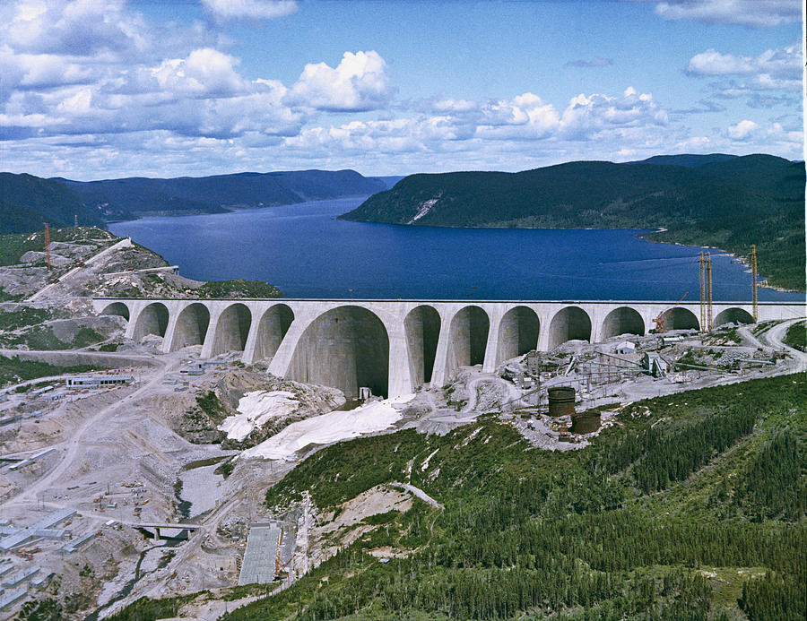
The reservoir, acting as a giant headpond for the Manicouagan River, feeds the Jean-Lesage generating system, which opened in 1967…

…and the Rene Levesque generating station, which opened in 1976…
…and is an underground hydroelectric power plant with six power-generating units.

The Wembo-Nyama Ring Structure in the Democratic Republic of the Congo is similar in appearance to Lake Manicouagan…

…and is also described as a circular meteor impact crater, which the Unia River flows around, with many tributaries, like Lake Manicouagan.

Another so-called impact crater on northern Quebec’s Ungava Peninsula in Pingualuit National Park…

…is the Pingualuit crater.
Another meteor-impact forming a perfect circle in the landscape?

Only this time, we find that Pingualuit is one of the deepest lakes in North America, said to be 876 feet, or 267 meters, deep, and holds some of the purest fresh water in the world.
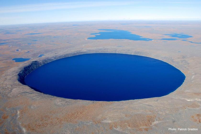
Compare Pingualuit with the Bacalar Cenote Azul, on the Yucatan Peninsula, not far from Chetumal, Mexico, said to be 295-feet, or 90-meters, deep.
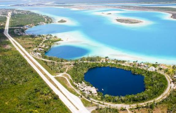
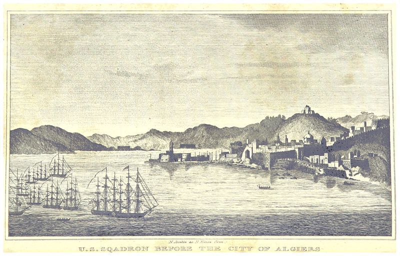
My understanding about the planetary grid system is that it was intentionally created in accordance with sacred geometry, and that everything on it has meaning. When I realized that both of these deep circular wells are on peninsulas, on the same alignment I was tracking off of Algeria, I was guided to connect them with Algiers on the world map.
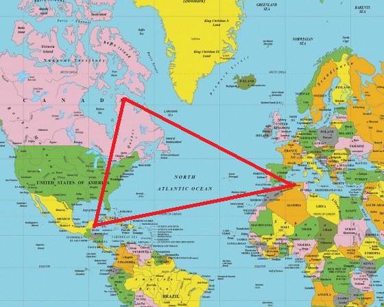
While Algiers may not be the third point of what could be an equilateral triangle relationship in the middle of the Atlantic Ocean, there does appear to be an isosceles triangle relationship, one where two sides are of equal length, between these three points.
One of the largest hydroelectric systems in the world, the James Bay Project is a series of hydroelectric power stations on the LeGrande River in northwestern Quebec.
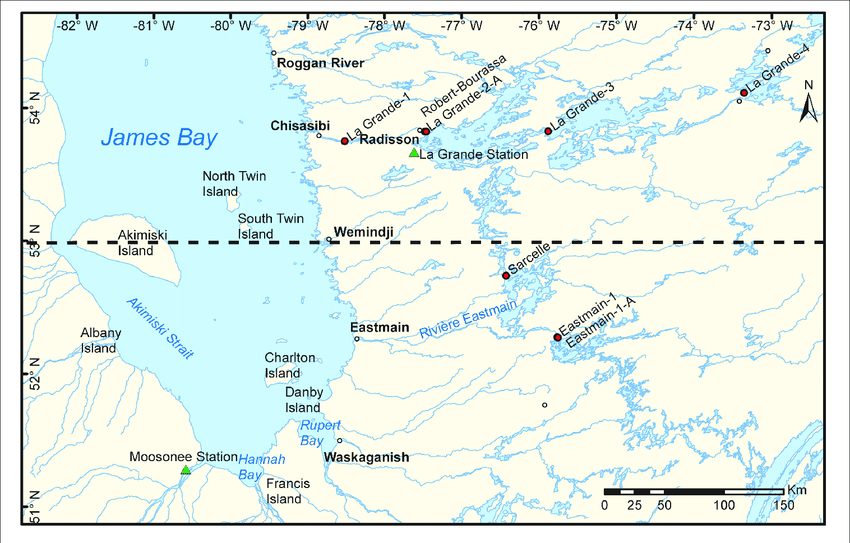
The red-dots on the map show where the James Bay Project’s power-generating stations are located.
Not without controversy, particularly regarding First Nations’ land claims in the region, we are told that by 1986, the largest power-stations and reservoirs were mostly completed, including the Robert Bourassa Generating Station, said to have been built between 1974 and 1981…
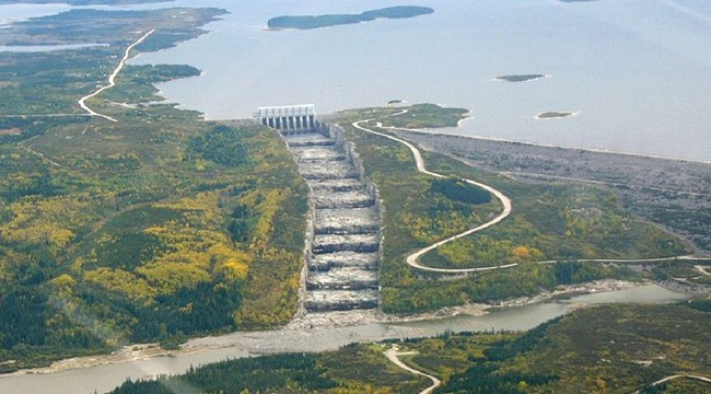
…named for the Premier of Quebec who gave the vital political impetus to the James Bay Project.
Some interesting things to note about the Robert Bourassa Generating Station.
It uses the reservoir and dam system of the Robert Bourassa Reservoir to generate electricity…
…It is Canada’s largest hydroelectric power station, and is the world’s largest underground power station…

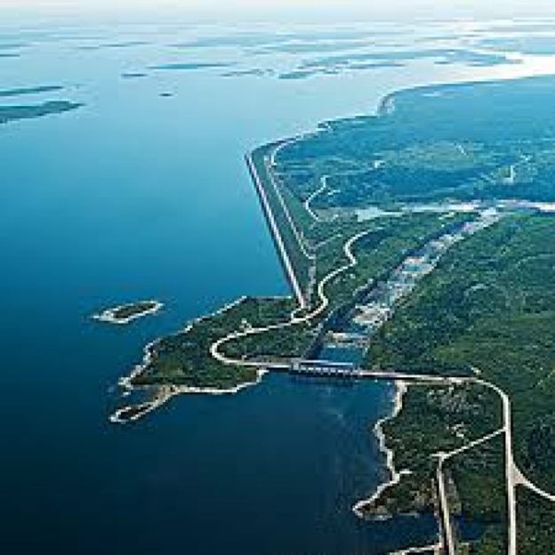
…and the spillway is near the north-end of the main dam, and part of Dyke D-4, which is part of a section of dykes known as the “Staircase of the Giants,” .and notable for the spillway flowing down a 4,900-foot, or 1,500-meter, rock-cut channel, with ten steps ranging from 30- to 40-feet, or 9.1 – to 12.2-meters, in height, and 417- to 656-feet, or 127- to 200-meters in length.

This is said to be a circa 1907 photograph of the Shawinigan Water & Power Company, which played a major role in the history of hydroelectricity in Canada.

At the end of the 19th-century, American engineers considered the Shawinigan Falls to be among the best hydroelectric sites in North America.
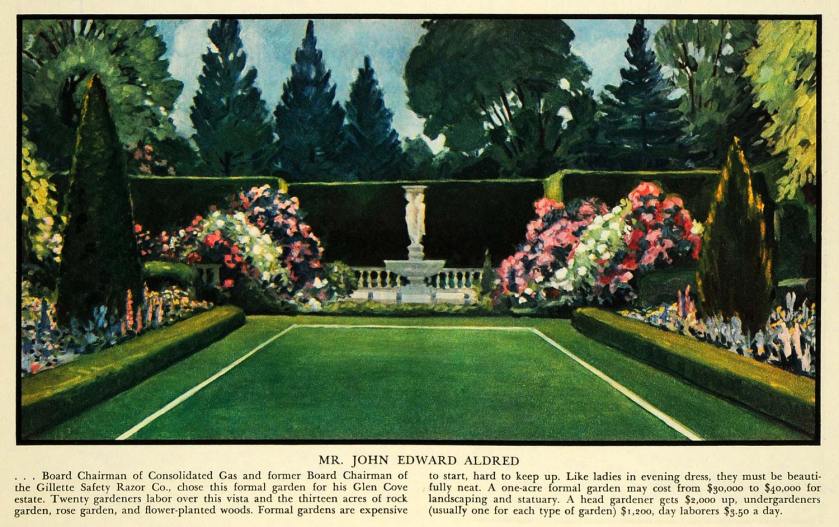
One of its founders in 1898 was the American businessman John Edward Aldred, who was born in 1864…
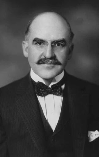
…and a Director of the United Railways and Electric Company…


…a President of Baltimore’s Consolidated Gas, Electric Light & Power…

…the Pennsylvania Water & Power Company…

…and a Chairman of the Gillette Safety Razor Company.

Another founder of the Shawinigan Water & Power Company was Andrew Frederick Gault, an Irish-born Canadian merchant, industrialist, and philanthropist born in 1833, and known to history as the Cotton King of Canada.

Andrew Gault was born in 1833, and emigrated with his family to Montreal in 1842. His father was said to have died of cholera 9-months later, and his mother returned to Ireland.
He and his brothers stayed in Montreal, and starting in 1853, Andrew Gault entered into a partnership in wholesale textiles with a man named Stephenson, and ultimately went into partnership with his brother, Robert, forming “Gault Brothers & Company.”
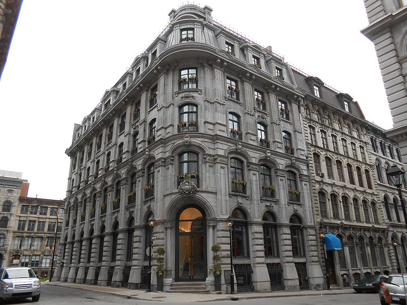
Now the “Hotel Gault,” this building was said to have been the location of the “Gault Brothers & Company Store” and warehouse building, built, we are told, in 1871.
Then in the early 1870’s, he went into business with his brother, Matthew, investing in cotton textiles, and they invested in a cotton mill in Cornwall, Ontario, known as the Stormont Manufacturing Works.

Gault also had investments in beet root sugar manufacturing; silk manufacturing; woollen mill companies; the Citizens’ Gas company in Montreal; manufacturing companies; and electric light and tramway company’s.
This was Gault’s home called Rokeby on Sherbrooke Street in Montreal, circa 1885.

I am bringing up these two founders of the Shawinigan Water & Power Company to show you how wealth, power, and control of utilities and amenities was consolidated into the hands of a few individuals early on in the new historical narrative we were given, of which the official start I have come to believe was the 1851 Exhibition of the Works of All Nations, held in the Crystal Palace in London.

All of this was part of the process of re-starting the existing infrastructure of the original ancient civilization in order to create the world we are living in today, where power and control were consolidated in the hands of a few, and upon whom, like in this example, we are required to pay for things like razor blades and cotton fabric for clothing, as well as electricity and water.

The people with the money had their hands in all of the action!
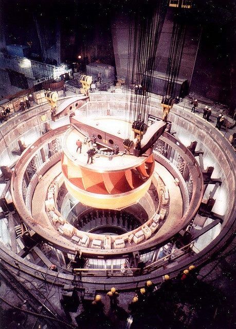
The Churchill Falls Generating Station is in the Province of Labrador, and is an underground hydroelectric power station.
It is the 10th-largest in the world, and the second-largest in Canada, after the Robert-Bourassa Generating Station in Quebec.

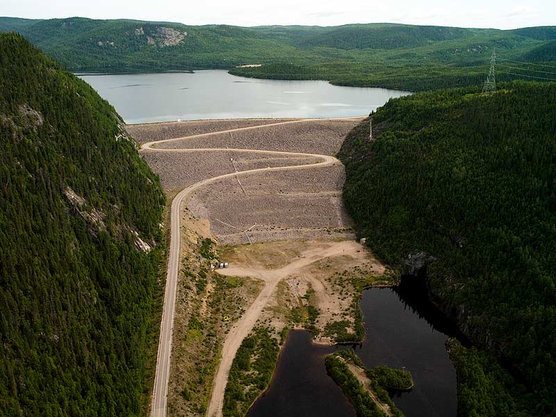
Rather than a single large dam, the plant’s Smallwood Reservoir is contained by 88-dykes, totaling 40-miles, or 64-kilometers, in length.

The Smallwood Reservoir has a catchment area that is larger than the Republic of Ireland, at 27,000-square-miles, or 72,000-kilometers-squared, that drops over 1,000-feet, or 305-meters, to the location of the plant’s 11 turbines.

The plant’s powerhouse was hewn from solid granite, 984-feet, or 300-meters, underground.


We are told construction began in 1967, and was completed in 1974, costing almost a billion Canadian dollars to build.
We are also told that the region opened up for this kind of development because of the completion of the Quebec North Shore and Labrador Railway, said to have been built between 1951 and 1954, and owned by the Iron Ore Company of Canada (IOC).

In 1958, the IOC opened the Wabash Ore Body near Labrador City, and that one and other iron ore reserve locations were developed through the region.

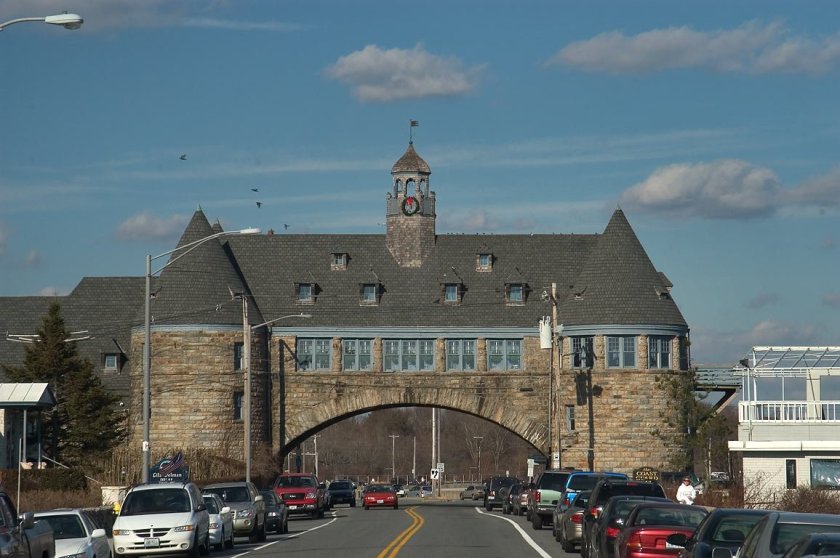
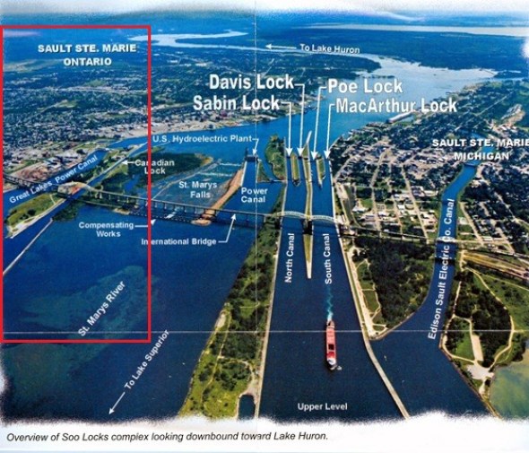
A good bridge between Canada and the United States on this subject is literally and figuratively Sault Ste. Marie, also referred to as “The Soo.”

Sault Ste. Marie was one city until the border between the United States and Canada was established at the St. Mary’s River in a treaty after the War of 1812, creating Sault Ste. Marie in Michigan, and Sault Ste. Marie in Ontario, on both sides of the St. Mary’s River.

In Sault Ste. Marie, Michigan, the Edison Sault Electric Company Canal, also known as the Edison Sault Power Canal, supplies the St. Mary’s Falls Hydropower Plant, an 18-MW, with capacity up to 30-MW, hydroelectric generating plant.
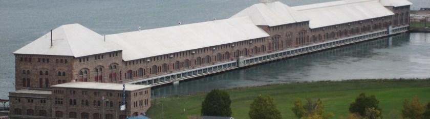
Made from sandstone masonry, it was said to have been built under the supervision of the U. S. Army Corps of Engineers, starting in 1898, with operation starting in 1902, and is one of the oldest, continuously-operating power plants in North America. Just want to point out the doors in the middle of the building, above ground level. Seems to be an odd location for a full-size set of doors.

The water velocity of the power canal varies at times but can be up to 7-mph, or 11-kph, with the entrance being controlled by four steel headgates.

The first locks were said to have been built here in 1855, and operated by the State of Michigan until transferred to the U. S. Army Corps of Engineers in 1881, who owns and maintains and operates the St. Mary’s Falls Canal, within which the locks are located.
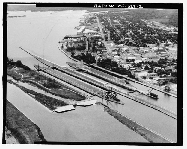
There are two hydroelectric powerhouses next to the Soo Locks, together generating 18.4-MW for the Soo Locks complex.

The Sault Ste. Marie International Bridge runs between the United States and Canada, which permits vehicular traffic to pass over the locks.

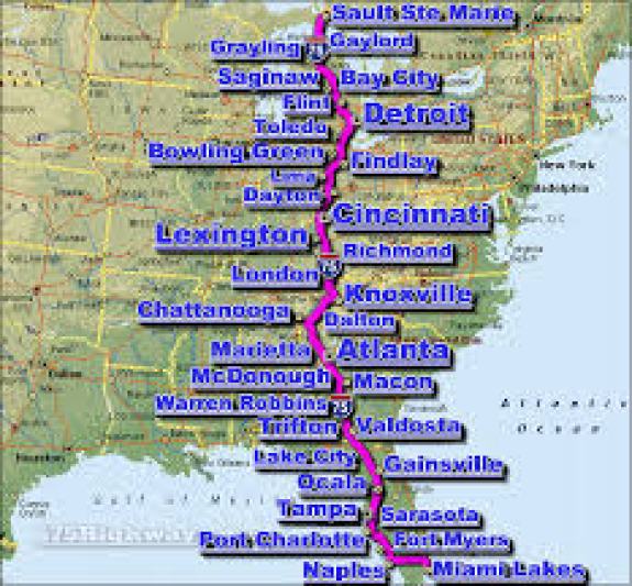
It is the northern terminus of I-75, which goes all the way to Miami, Florida.
The Sault Ste. Marie International Railroad bridge runs adjacent to the International Bridge, and was said to have been built in 1887. It has a vertical lift bridge and swing bridge features as well.

Really sophisticated engineering feats for the times!
Next are the St. Mary’s Falls, of which the International boundary goes through the middle.

In the right foreground of this photo, in front of the International Bridges, are what are known as the Compensating Works.
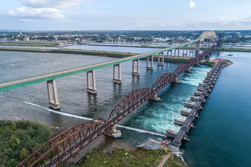
They consist of 17 piers and concrete aprons bearing on sandstone bedrock. Piers 1 – 9 are in Canada, and Piers 10 – 17 are in the United States. These were said to have been constructed between 1913 and 1919 (with World War I occurring between 1914 and 1918), and has an extremely sophisticated sluice gate and gate machinery system.
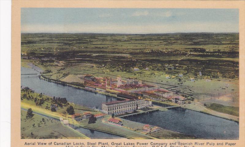
On the Ontario side of Sault Ste. Marie, is the Great Lakes Power Canal.
Great Lakes Power was established in the early 1900s by Francis H. Clergue.
He was another one of those early businessmen in on all of the action.
Francis H. Clergue was the leading industrialist of Sault Ste. Marie, Ontario, in the late 1800s and early 1900s.

In addition to Great Lakes Power, he established the Sault Ste. Marie Pulp and Paper Company in 1895…


…the Algoma Steel Factory, which is said to have opened in 1902, at which time the factory was said to have produced its first rail-tracks, and where it specialized in rails for Canadian Railways as its primary product for the next twenty-years, we are told.

Clergue was also credited with the development of the Algoma Central Railway, connecting it to the Transcontinental artery of Canada.
He was said to have initially owned it, and needed a way to transport logs from the Algoma District in northeastern Ontario for his pulp mill, and iron ore for the steel factory, and that it was chartered on August 11th, 1899. It was said to have been completed to Hearst, Ontario, in 1914.

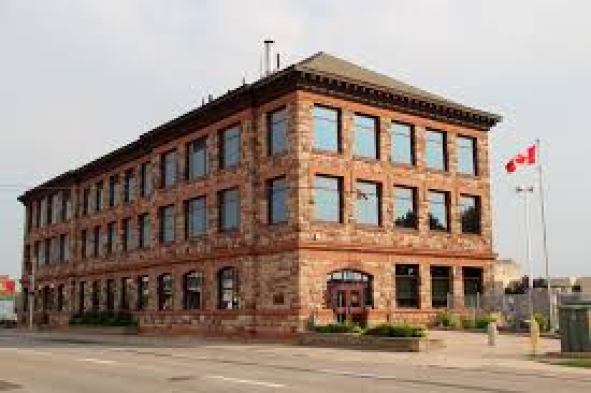
This is the Algoma Central & Hudson Bay Railway Terminal Station in Sault Ste. Marie, Ontario, said to have been built in 1912.
Entering into the United States, I will start with several places on the West Coast.
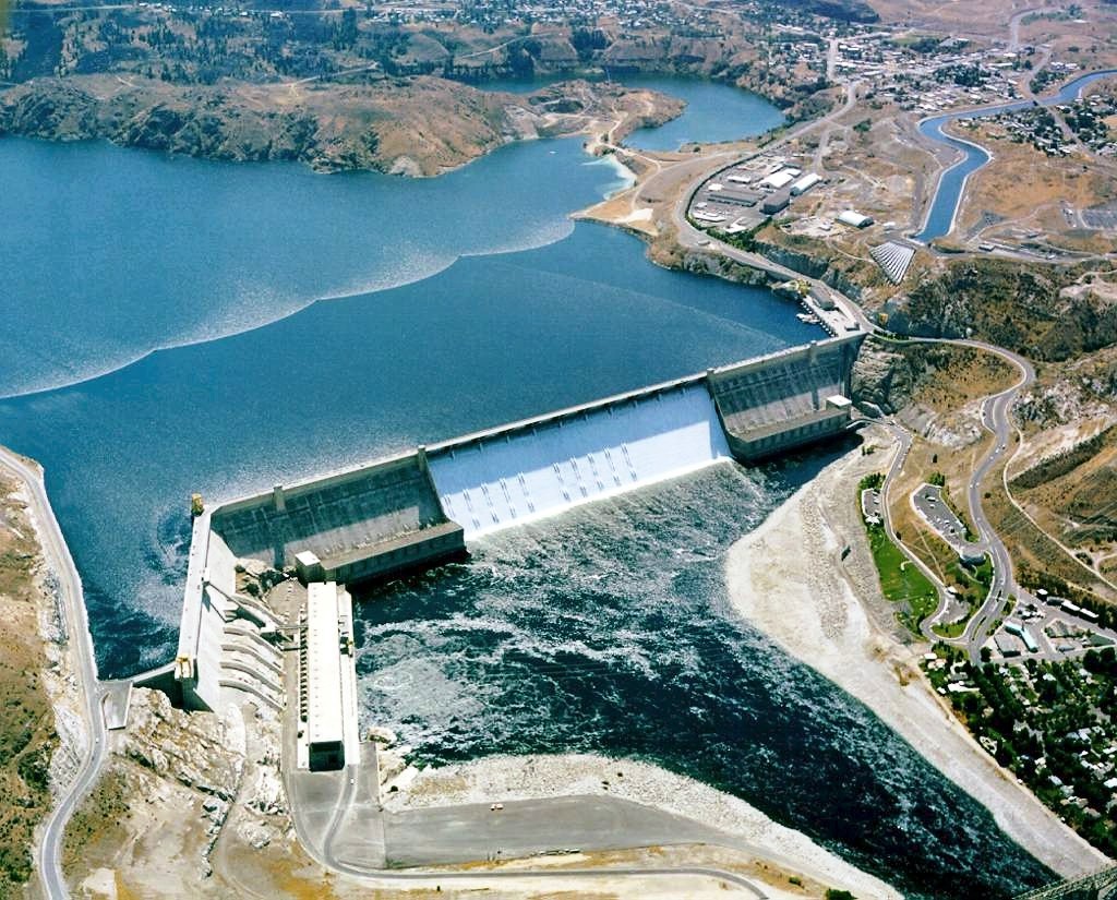
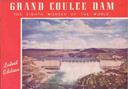
In Washington State in the United States, the Grand Coulee High Dam was said to have been built between 1935 and 1942, during the administration of President Franklin D. Roosevelt.
Keep in mind, this would have been during the middle of the Great Depression and half-way through World War II.
By its maximum capacity, it is the largest power station in the United States.
It is a concrete gravity dam on the Columbia River…

…and the centerpiece of the Columbia Basin Project, the irrigation network that the Grand Coulee Dam makes possible.
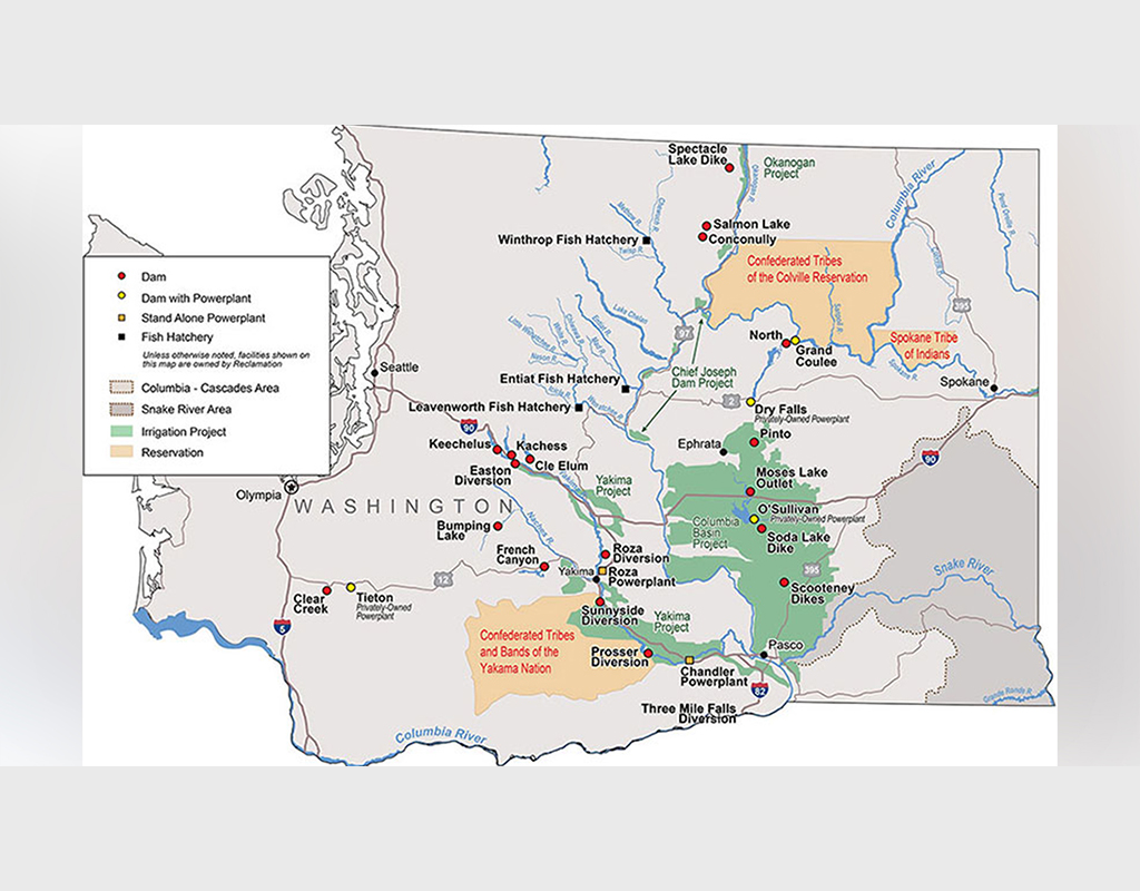
The Columbia Basin Project is the largest water reclamation project in the United States, supplying water to over 670,000 acres, or 2,700-kilometers-squared, of the 1.1 million acres, or 4,500-kilometers-squared, large project area, all of which was originally intended to be supplied.
We are told the proposal to build the dam was the focus of a bitter debate during the 1920s between two groups.
One group wanted to irrigate the ancient Grand Coulee with a gravity canal, while the other pursued a high-dam and pumping scheme.
The dam supporters were said to have won, and in August of 1934, FDR endorsed the “high dam” design.
The Grand Coulee is described as an ancient river bed.
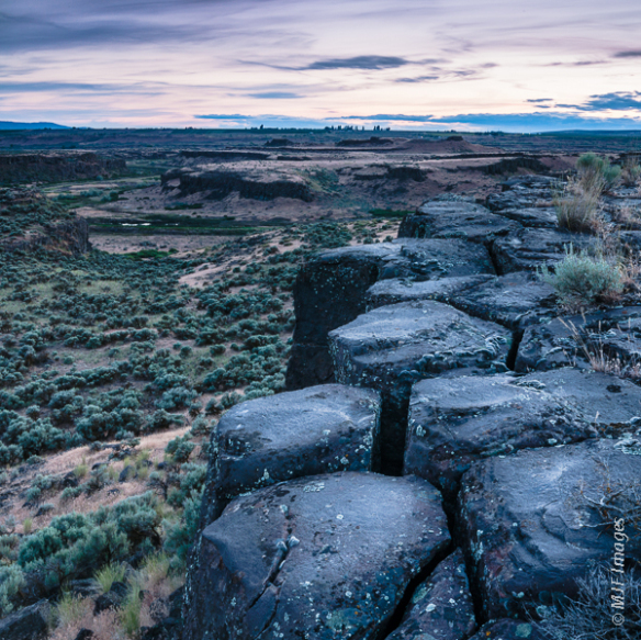
A coulee, in the northwestern United States, is defined as a large, steep-walled, trench-like trough, which commonly are spillways and flood channels incised into the basalt plateau.
This was said to be an 1853 lithograph of the ancient Ground Coulee.

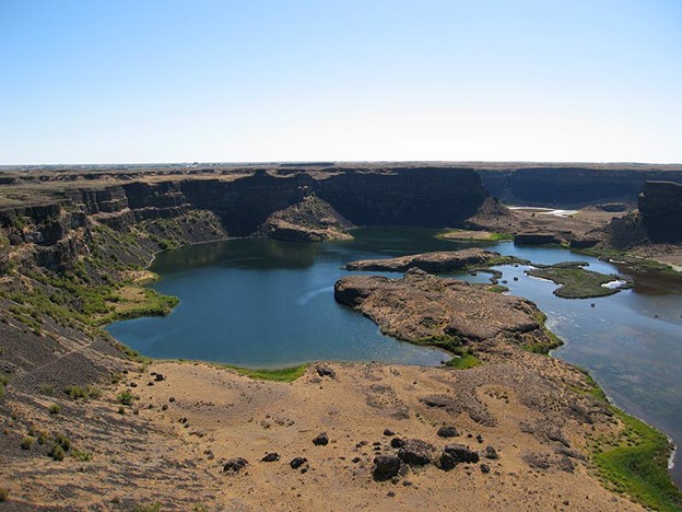
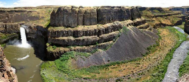
It stretches for about 60-miles, or 100-kilometers southwest from the Grand Coulee Dam to Soap Lake, being bisected by Dry Falls in to the Upper and Lower Grand Coulee, and part of the “Channeled Scablands” region of Washington State.

Dry Falls, a scalloped precipice with four major alcoves on the opposite side of the Upper Grand Coulee from the Columbia River, is described as one of the largest waterfalls ever known.
Estimates are that the falls were five times the width of Niagara Falls, with ten-times the flow of all the current rivers in the world combined…
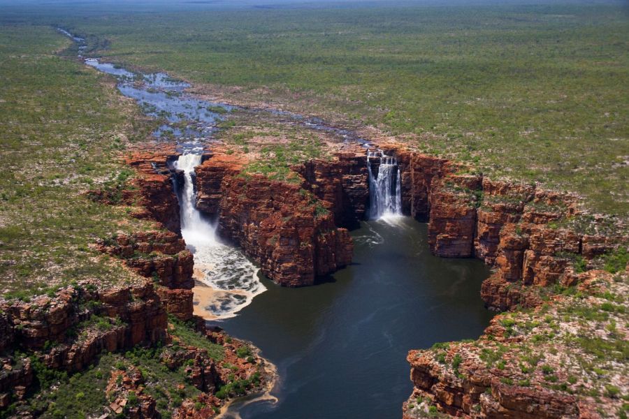
…and which brings to my mind in appearance the King George Falls in the Kimberley region in Australia.
One of the theories about the formation of the “Channeled Scablands” from the 1920’s was that they were created by immense, but short, floods…for which the theorist, J. Harlan Bretz, had no explanation.
I can’t help but wonder what story we are not being told about this region.

The Chief Joseph Dam is further west along the Columbia River at Bridgeport, Washington, from where the Grand Coulee Dam is located…

…and is a concrete gravity dam, with construction said to have begun in 1950 and completed in 1961.
Operated by the U. S. Army Corps of Engineers for the Bonneville Power Administration, it is the third-largest hydroelectric power producer in the United States.
As a run-of-the-river dam, which is not able to store large amounts of water, water flowing to the Chief Joseph Dam from the Grand Coulee Dam must be passed onto Wells Dam.
Wells Dam is a hydroelectric dam on the Columbia River, downstream from the confluence of the Okanagon, Methow, and Columbia Rivers.

It has been open and producing electricity since August of 1967.
Lake Pateros is the reservoir for the Wells Dam.
The aerial picture seen here is of Chelan, Washington, which is located on Lake Pateros.
Of particular note is the shaped shoreline seen here.

While the lake is not deep, a high-volume of water moves through it.
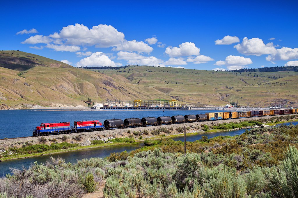
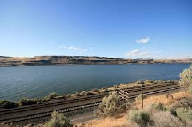
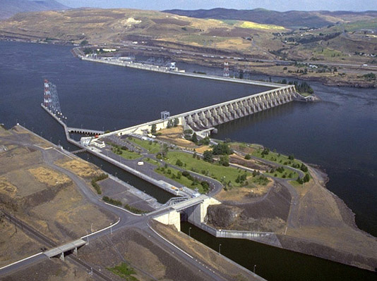
The John Day Dam spans the Columbia River where it forms the border between the states of Washington and Oregon.

It was said to have been built between 1968 and 1971.
It is a concrete run-of-the river dam, featuring a navigation lock and fish-ladders on both sides.

The John Day navigational lock has the highest lift, at 110-feet or 34-meters, of any lock in the United States.
Lake Umatilla was said to have been created in 1971 with the construction of the John Day Dam, and is its reservoir.
The John Day Dam is located 28-miles, or 45-kilometers, east of the city of The Dalles in Oregon, where another dam is located.

The Dalles Dam is also a concrete, run-of-the-river dam spanning the Columbia River, said to have been built by the U. S. Army Corps of Engineers between 1952 and 1957.
The city of the Dalles was said to be a major Native American trading center for at least 10,000 years, and that the general area is one of North America’s most significant archeological regions.
The rising water filling The Dalles Dam submerged the Celilo Falls, and the village of Celilo, in 1957…
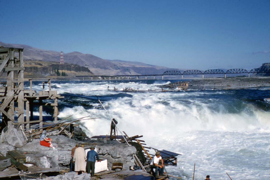
…the economic and cultural hub of Native Americans in the region, and said to be the oldest continuously inhabited settlement in North America.

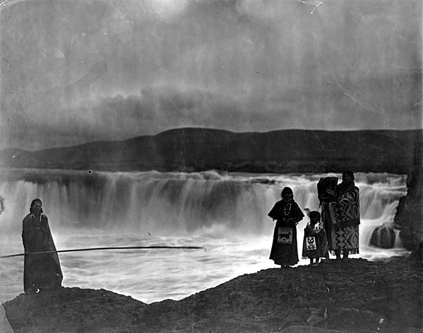
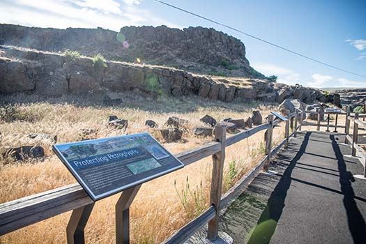
We are told that 40 petroglyph panels were removed with jackhammers before the land was inundated with water, and placed in storage before being installed in the nearby Columbia Hills State Park in the 2000s.

I have long-suspected that the fate of Celilo was the fate of many ancient sites, and was among the first a-ha’s of this particular journey for me, when I was living in Oklahoma between 2012 and 2016.
The very first place I went to in-person to test my idea that man-made lakes covered up ancient infrastructure was Lake Thunderbird outside of Norman. I knew what to look for, and was not surprised when I found it.
What my research is leading me to conclude now is that the hydrological-engineering technology was pre-existing too, and the “construction” was just re-started for present-day use, in the creation of a water supply, and the cover-up of ancient infrastructure.
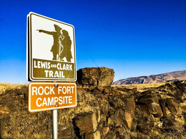
At any rate, Lewis and Clark of westward expedition fame were said to have camped for three nights near Celilo, at the Rock Fort Campsite, described as a natural fortification, in late October of 1805.
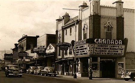
As a matter-of-fact, the historic Granada Theater in downtown The Dalles…
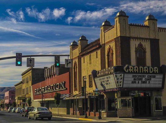
…is on the Lewis and Clark Trail, and still in use as a theater today.
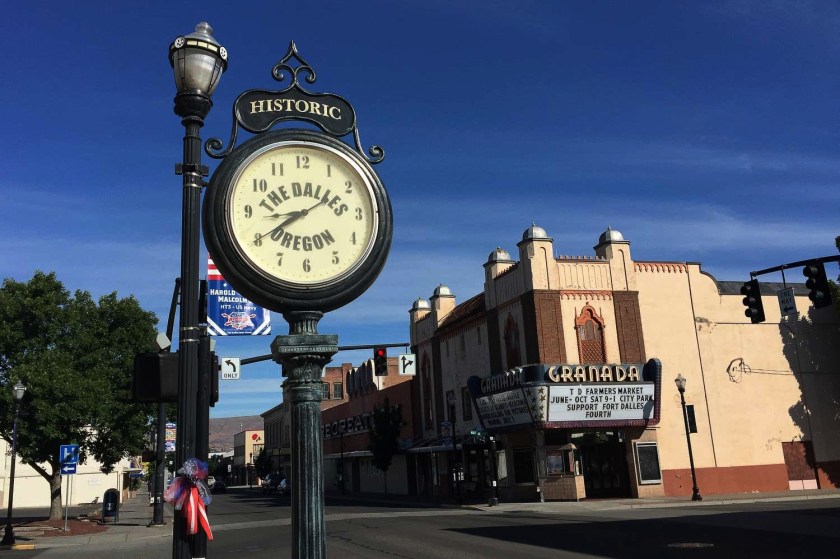
It was said to have been built in the Moorish Revival style, between 1929 and its opening in 1930, and is famous for having been the first theater west of the Mississippi to show a “talkie.”
Various fur trading companies were said to have become active in the region around present-day The Dalles starting around 1810, and this continued on with growth of trading networks, like that of the Hudson Bay Company, starting in the 1820s through the 1840s
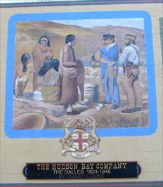
This is the full Hudson Bay Company mural in The Dalles.

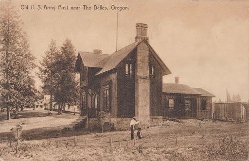
We are told that in 1850, the United States Army founded a small post at the site of an old mission that was here…
…and a post office established within the city’s current boundaries in 1851.
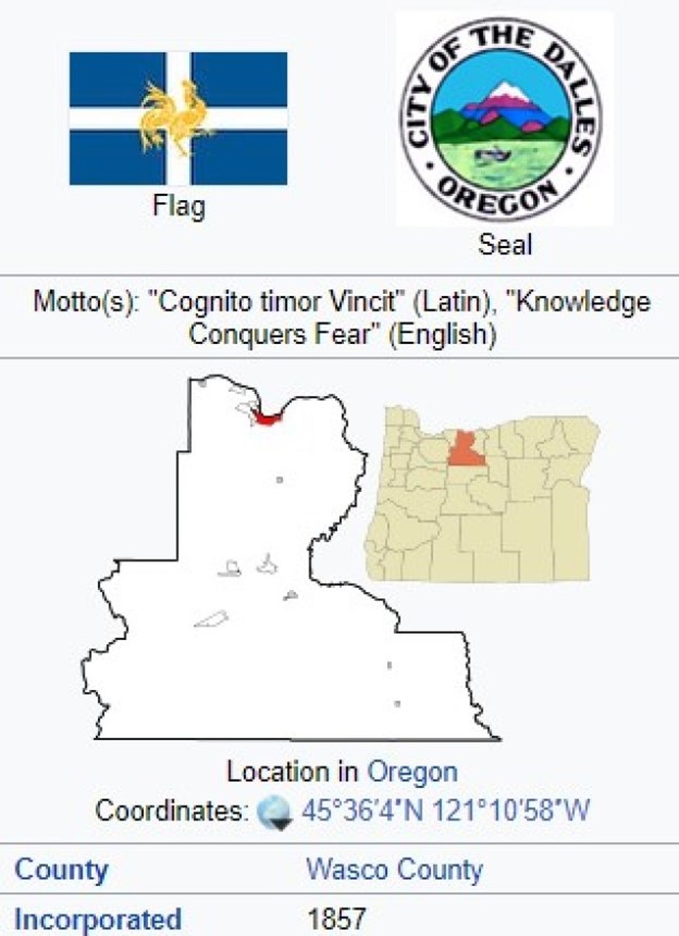
The Dalles was incorporated as a city in 1857.
A neighborhood in southeast Portland is named Mount Tabor, which is also the name given to an extinct volcanic vent, and park, located there.

Portland is said to be one of six cities in the United States to have an extinct volcano within its boundaries.
It was said to have been named after Mount Tabor in Israel, the biblical site of the Transfiguration of Jesus.

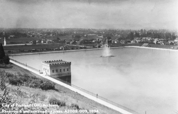
We are told that the land making up the Mount Tabor volcanic butte were identified as an ideal site for reservoirs in the 1880s due to its ideal location as a water distribution system.
The Mount Tabor reservoirs were said to have been built between 1894 and 1911.


We are told the reservoirs and their gatehouses were artistically constructed, incorporated using extensive reinforced concrete that was designed to “look like” stonework, two early patented techniques by engineer Ernest Ransome.
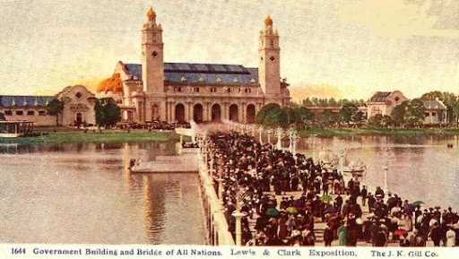
We are told that John Charles Olmsted, stepson and nephew of famed landscape architect Frederick Law Olmsted, was in Portland in 1903 to help design the 1905 Lewis and Clark World Exposition, said to have been held to celebrate the centennial of the Lewis and Clark Expedition…
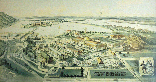
…for which all the buildings were said to have been designed for the exposition, after its site was selected in September of 1902 at Willamette Heights, which was described as a “grove of trees, of pasture, and waist-high stagnant water at the site’s center.”

…and during the time John Charles Olmsted was in Portland, he was asked to create a grand plan of parks in Portland, which would come to include in time Mt. Tabor Park.

Before I head over to the East Coast of the United States to look at noteworthy reservoirs and dams, I would be remiss if I did not stop at the Hoover Dam to take a look.
Hoover Dam is a concrete, arch-gravity dam…

…said to have been constructed between 1931 and 1935 during the Great Depression, and which caused the deaths of over a hundred workers.
We are told many of the workers on the dam had been unemployed due to the Depression, as a great number of unemployed men and their families were said to have converged on southern Nevada, creating squatters’ camps there during the time of its construction.

It is located in the Black Canyon of the Colorado River on the border between the states of Nevada and Arizona.

The Hoover Dam’s Reservoir is Lake Mead, the largest reservoir in the United States by volume when it is full.

There are two details I would like to point out about the Hoover Dam.
The first is that the timeline for Ames Shovels includes helping to build the Hoover Dam.

I am curious as to exactly where all those shovels came into play building the Hoover Dam, with all of the hard rock, water, and massive infrastructure seen here.
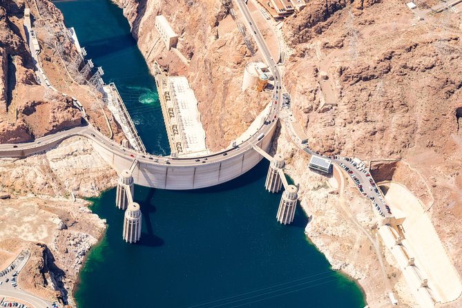
What were they digging?
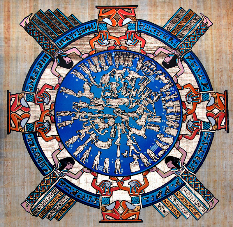
The other thing I would like to point out is the star map at the Hoover Dam Memorial on the Nevada side of the complex…

…said to have been created by Oskar J. W. Hansen, a Norwegian-born, naturalized American citizen.

In-laid into a terrazzo floor, which consists of chips of marble, quartz, granite, glass poured together with a binder, is a star chart, said to preserve for future generations the date on which FDR dedicated Hoover Dam on September 30th of 1935.

In this celestial map, the bodies of the solar system are said to be placed so exactly that those versed in astronomy could calculate the precession of the pole star for approximately the next 14,000 years.
There is even an inlaid marking showing that Thuban was the pole star for the ancient Egyptians at the time of the Great Pyramids.

I just find all of this about the star map being inlaid into the Hoover Dam complex to memorialize the building of it for future generations to be able to tell when it was built in precessional time, which measures an approximately 26,000-year cycle of time, to be very…maybe the words I am looking for are “out-of-place.”
It just seems very strange to me to be coming from people in our relative day and age who aren’t oriented to astronomy and measuring the cycles of time…which the Ancients very much were into doing.
This is the ancient Mayan observatory at Chichen Itza.

The Ancient Ones faithfully tracked the stars over incredibly long cycles of time.
Here are some notable places I have identified from my research on the East Coast.
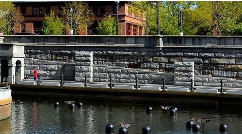
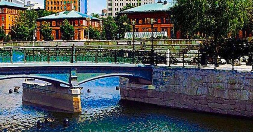
The first I would like to bring up is the Scituate Reservoir in Rhode Island.
The Scituate watershed and reservoir system has six tributary reservoirs, which provide the drinking water for 60% of the state’s population.

This massive public works construction project was said to have gotten underway in about 1915, and completed by 1925.
Interesting to see the low-tech-looking equipment for the project pictured here in 1921, according to the date at the bottom right…
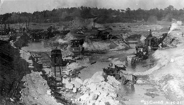
…that we are told was being used to build this…

…this…

…and this. On top of that, World War I was happening at the beginning of that time period.

The next place I am going to take a look at is the Jacqueline Kennedy Onassis Reservoir in Manhattan’s Central Park, a decommissioned reservoir that was said to have been built between 1852 and 1862 (with the Civil War taking place between 1861 – 1865)…

…to receive water from the Old Croton Aqueduct.

The Old Croton Aqueduct, said to have been built between 1837 and 1842, originates in Croton in Westchester County, and is 41-miles, or 227- kilometers, long.

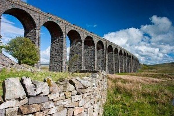
This is the High Bridge of the Croton Aqueduct, which crosses over the Harlem River, on its way to Central Park…
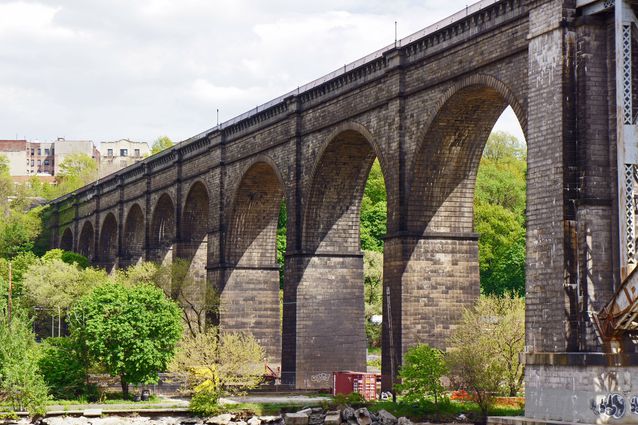
…which reminded me of the Ribblehead Viaduct in the Yorkshire Dales National Park in northern England, said to have been built for the railroad between 1869 and 1874.
How could they have accomplished these kind of engineering feats in a time period we are taught was low technology?
The Upper Roxborough Reservoir is an abandoned watershed project in northwest Philadelphia. These stately structures are described as filters of the reservoir.
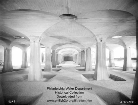
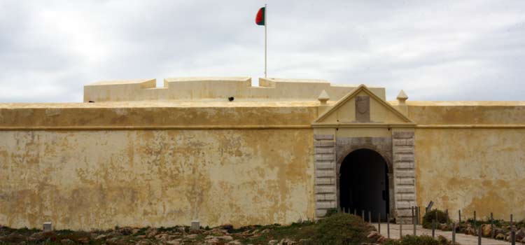
It brought to mind the fort the Portuguese are said to have built on Hormuz Island after they captured the island between today’s United Arab Emirates and Iran in 1507 – the interestingly named Fort of Our Lady of the Conception (for a military fort?)…

…compared with a pedestrian underground associated with the long-gone Crystal Palace in London.

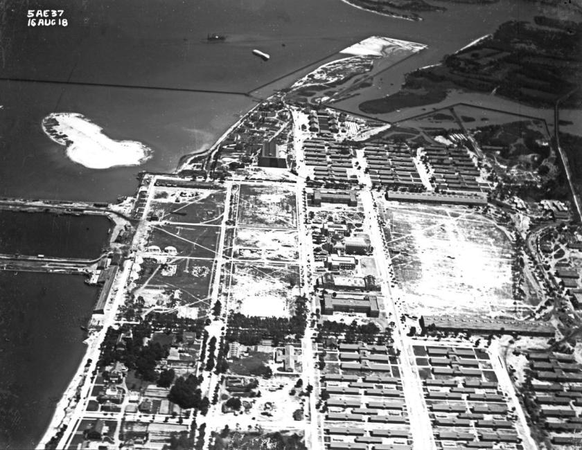
Jones Falls is described as an 18-mile, or 29 kilometer, major North-South stream that runs from the North through Baltimore City before it empties into the Inner Harbor.
This is the Lake Roland Dam and Reservoir in Baltimore County, north of Baltimore City, and said to have been built between 1854 and 1861.
The Jones Falls flow into, and out from, Lake Roland.

Lake Roland is described as having been a defunct reservoir since 1915.
They sure put an enormous amount of effort into building something that wasn’t used for very long, like not even 60 years?

I have many more examples I could bring forward in North America, but the examples I have given are more than enough to make my point about the similar, and advanced, nature of the engineering and architecture of reservoirs and hydroelectric projects in North America, as well as the anomalies and inconsistencies in the explanation we are given about them, that do not make sense within the context of our historical narrative.
In the second part of this two-part series, I am going to be looking at reservoirs and hydroelectric projects in Europe, Africa, and Asia.