
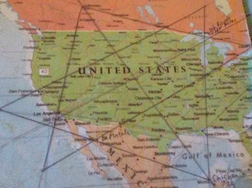
I started following this long-distance global alignment at Montreal, Quebec, Canada, in “How I Found the Silk Road, Part 1,” and will be ending the series in Montreal in the next post. This leg of the journey will take us into North Korea, South Korea, and Japan, all the way to Guadelupe Island, which is located off the west coast of Baja California.
I found the alignment after I discovered a Star Tetrahedron in North America by connecting major cities that I noticed were lining up in straight lines. I believe it is the terminus of the planetary grid system. When I extended the lines out on a globe, I found that cities lined up around the world in circles and lines.
I ended the last post in the journey along this alignment at Dalian, China, where I found Europe in China, before it crosses the Yellow Sea into North Korea.
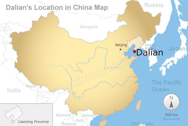
From Dalian, the alignment crosses the Yellow Sea which separates China from North Korea.


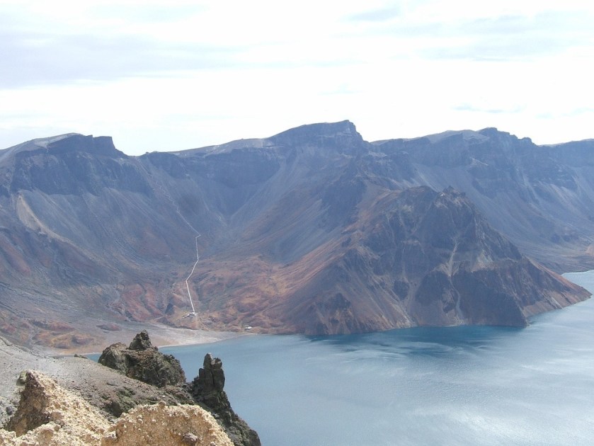
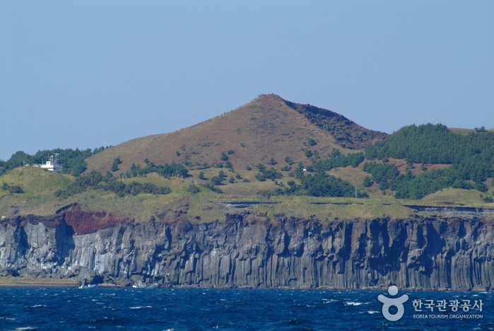
This is a view of the shoreline of North Korea where it meets the Yellow Sea.
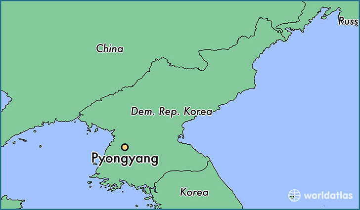
The alignment crosses through Pyongyang, the capital of North Korea. This is an ancient alignment on a planetary grid system, and as such I will be showing you photos of historical Pyongyang and North Korea, other than to say Pyongyang is the capital and largest city in North Korea.
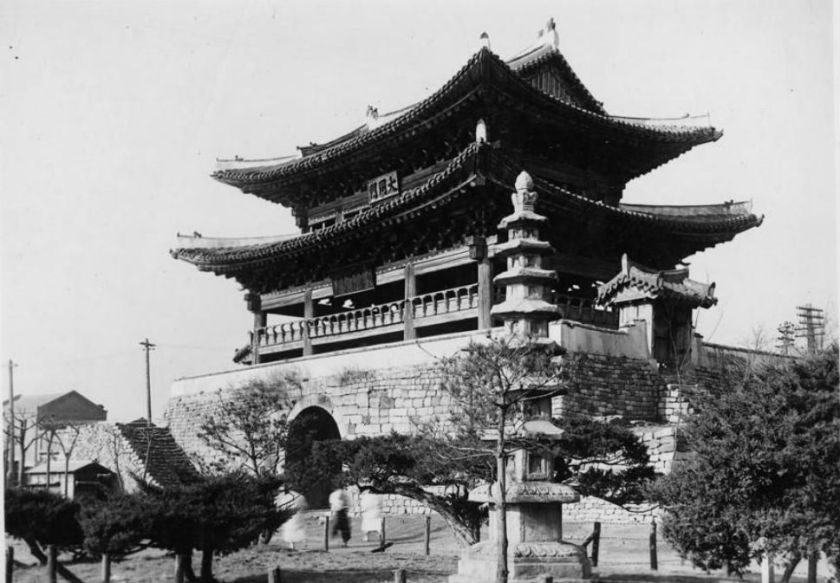
This is Taedong Gate, the eastern gate of the original walled city of Pyongyang. It is considered one of the national treasures of North Korea.
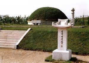
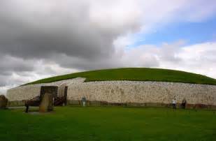
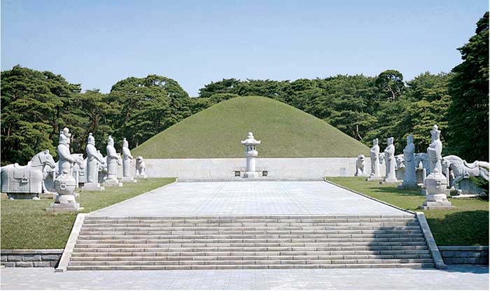
Here is a comparison of what is called the burial mound of Pak Chi Won in North Korea, with Newgrange in Ireland. I am seeing and saying that there was a unified global advanced civilization originating from ancient times that has been removed from our collective memory. The structural design is virtually identical in these very different parts of the world.
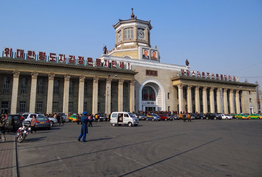
This is the railway station in Pyongyang. Again, as we have seen all along this alignment, very heavy and incredibly huge masonry.
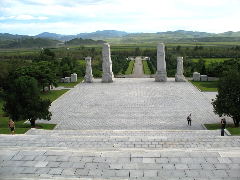
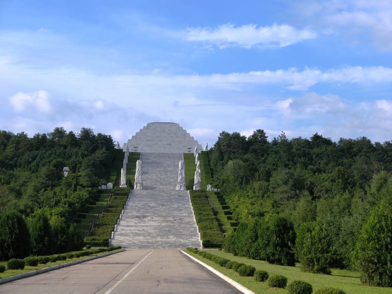
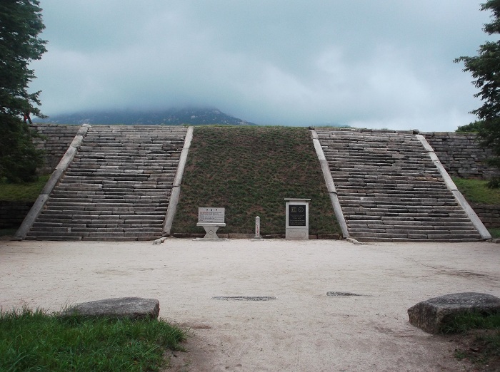
And here are different views of historical remains in North Korea, featuring incredibly sophisticated stone works and earthworks, a stepped pyramid, and a mound with what looks like a rounded pyramidal shape.
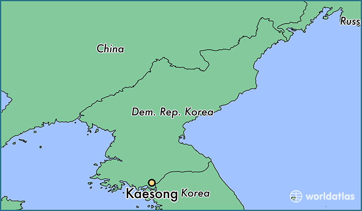
Next we come to Kaesong, North Korea. At one time in the Korean peninsula’s history, it was the capital of Korea.
In 2014, North Korea and South Korea joined together to excavate the remains of Manwoldae Palace, which is now a UNESCO World Heritage Site. It was the main palace of the Goryeo Kings from the 900s to the 1300s.
It is just across the DMZ in southern North Korea, in what is called the Songaksan Mountain range.
Next on the alignment we come to Seoul, South Korea, the capital and largest metropolis of South Korea.
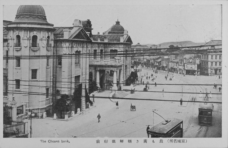
Here is a historic photo of Seoul, taken in 1919. Notice in addition to the huge, heavy masonry pictured throughout Seoul, in the center of the photo you see onion domes here as well.
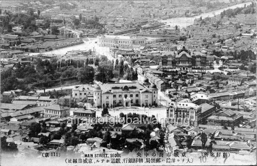
Here is a close-up of that center building. It is the Bank of Korea, circa 1920. Check out how huge that building is, relative to the size of the people in the street!
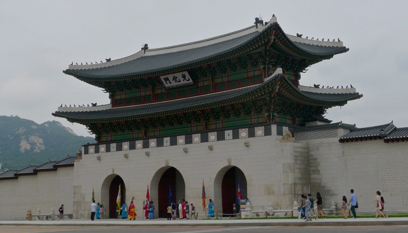
This is Gyeongbukgong Palace in Seoul. It was the main royal palace of the Joseon Dynasty, said to have been built in 1395.
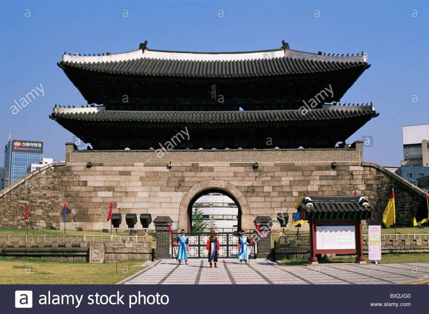
This is the Sungnyemun South Gate of Seoul. It is one of the eight gates of the fortress wall of Seoul. which surrounded the city in the Joseon Dynasty. Once again we find heavy masonry and arches, which are consistent features throughout this alignment, notwithstanding the oriental nature of the roof structures.
-One more thing I want to bring forward is from the Bukchon Hanok Historic District of Seoul. Besides the prevalence of the stone work and masonry you see pictured here, I also want to point out the regular, but somewhat steep slope in both pictures. This is common in cities around the world. It is not irregular as one might expect to find if natural. It looks geometric in nature.


As is the case with every where, there is much more to uncover, but I mostly want to hit highlights for the purposes of this blog post.
I am now going to take leave of the Korean Peninsula, and cross the Sea of Japan (also known as the East Sea) head on to Japan.


So we roll into Nagano, Japan on the alignment.
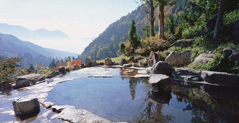
Nagano is the capital of Nagano Prefecture, near the confluence of the Chikuma and Sai Rivers. Here is some of what you see around Nagano and Nagano Prefecture.
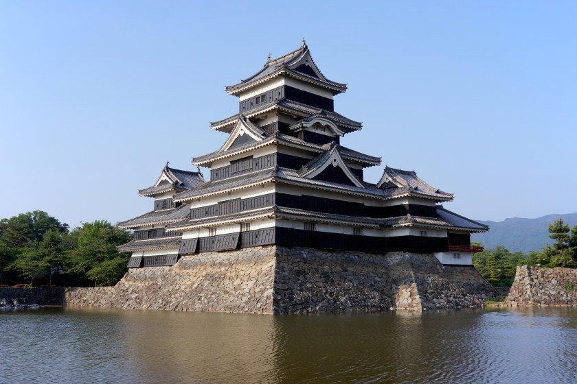
You see more of the stonework so prevalent in all of these cultures with what looks like a fortification at the base of Matsumoto Castle in Nagano Prefecture. This is said to be the oldest existing castle in Japan, and is recognized as a national treasure.
Here is yet another example of the ubiquitous block-shaped rocks that cover the surface of the planet. Nice-looking straight-edges there, as well as the stone work around the edges of what looks to be a pond, or some kind of water work.
Other examples of sophisticated knowledge about hydrology and engineering are shown here, with the photo on the left being in Nagano Prefecture, and on the right in a Miao Village in China. The Miao live primarily in the mountains of Southern China.


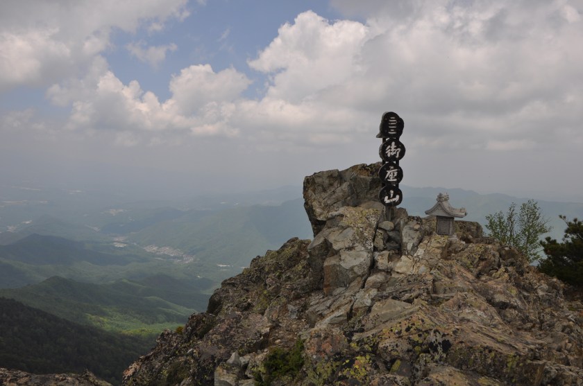
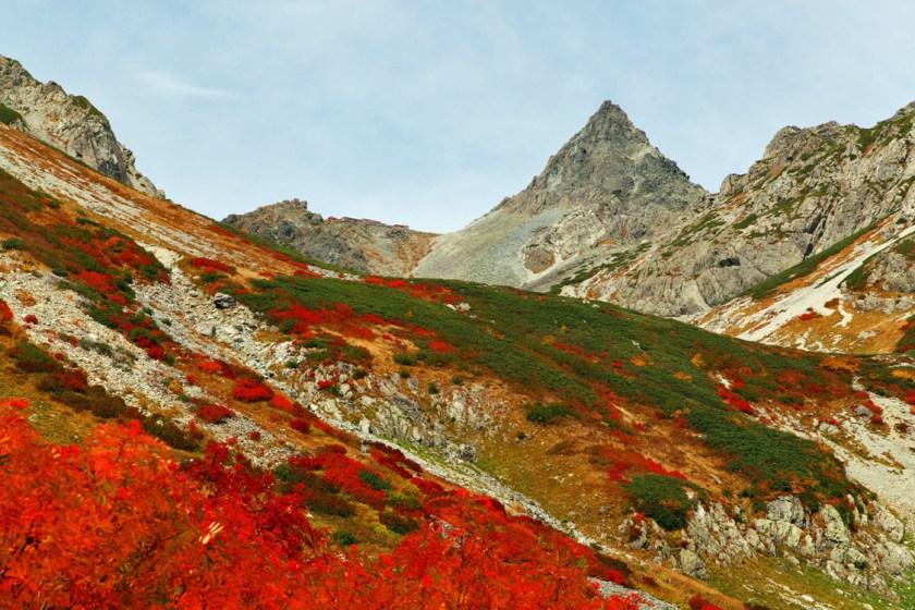
Next, this is the summit of Mount Ogura, with its rocky, pointed top.
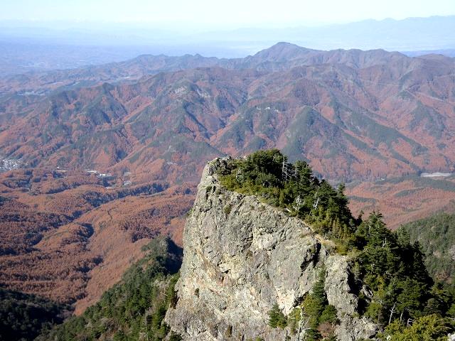
And this could be another view of the same mountain, or perhaps a different peak in the same area, but it is also in the mountains of Nagano Prefecture.
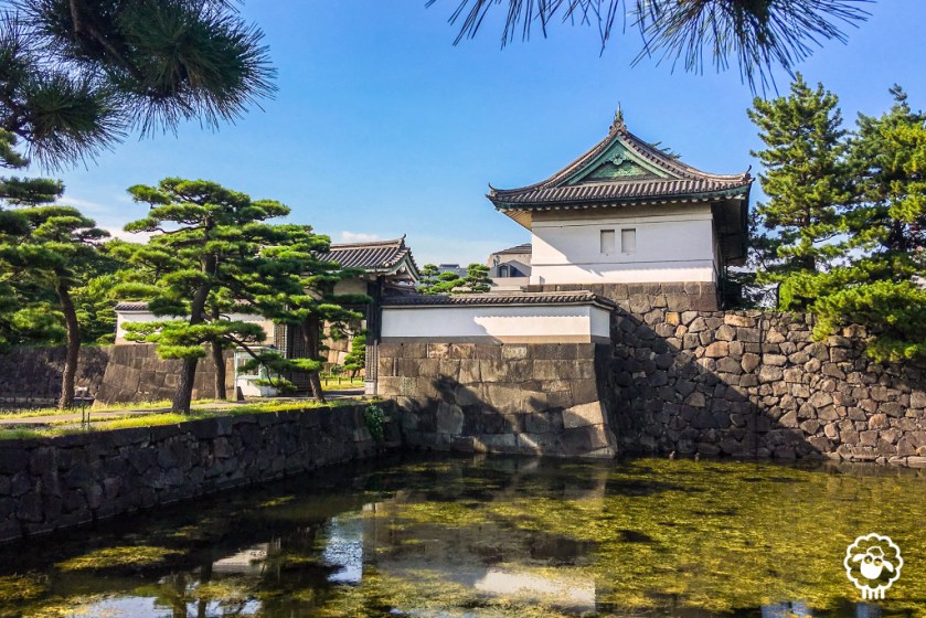
The alignment goes through Tokyo, the capital of Japan since 1869. It is the seat of the Emperor of Japan and the Japanese Government, and is the most populous metropolitan area in the world.
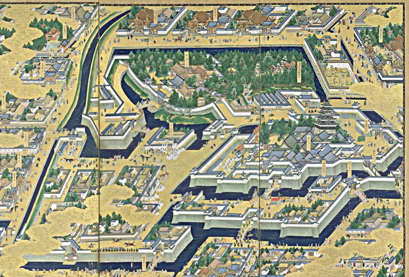
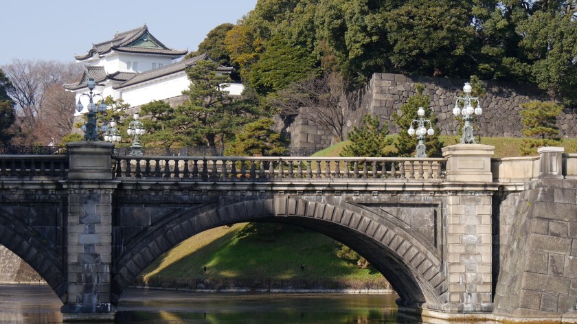
Let’s take a look at Edo Castle in Tokyo, the Imperial Castle of Japan. Said to have been built in 1457, here is an historic depiction of it. Looks like a pretty sophisticated enterprise with all of those heavy wall fortifications, and canals surrounding it.
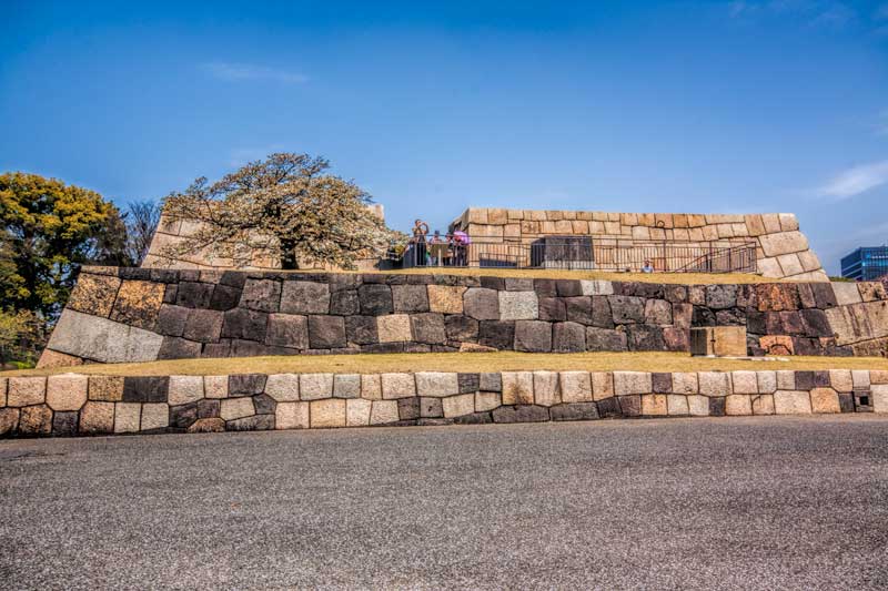
Let’s see what is still intact from the original buildings on the castle grounds.
Here we have a beautiful example of a megalithic polygonal wall that is still intact.
Here’s a comparison with a megalithic polygonal structure at Tambo Machay, near Cusco in Peru.
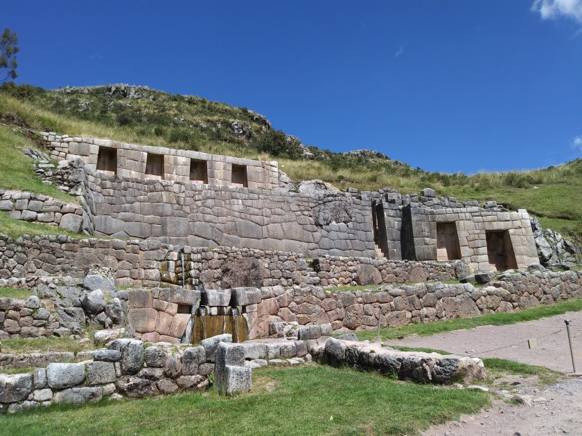
This shows a comparison with the earlier polygonal stonewalls side by side with a later stone wall construction, which has comparatively smaller stones.
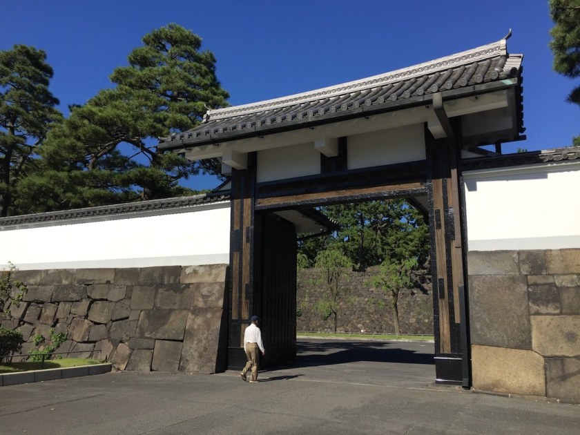
The Sakuradamon Gate of Edo Castle has huge polygonal megalithic masonry.
And this street view on the grounds of the Edo Castle/Imperial Palace shows really sophisticated masonry and construction.
So, according to what’s in these photos, Japan had a megalithic culture at one time, exactly like the acknowledged ones of Peru, other countries in Central and South America, Egypt, Turkey, and so on. In fact there are megaliths all over the world, including North America. We are just not told about them.
We will now leave the island of Honshu in Japan, and head out across the Pacific Ocean, where we cross over Midway Island.
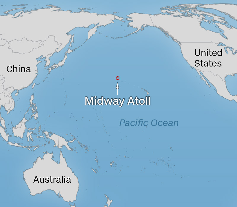
Here is a photo of Midway Island, site of a major World War II Battle:
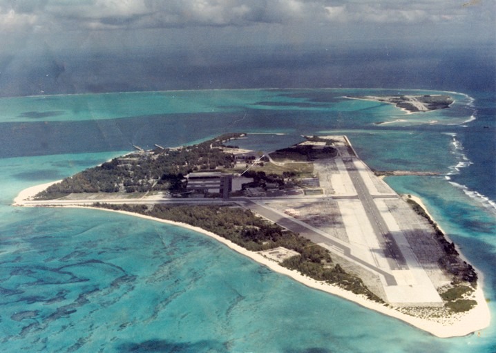
That’s Midway, Folks!
And the U. S. Government still has a claim there as well. Midway is an unorganized, unincorporated Territory of the United States, and continues to be the only island in the Hawaiian Island chain that is not part of the state of Hawaii.
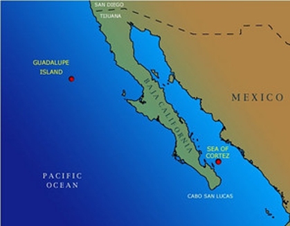
So the last stop for Part 5 of this video series is Guadalupe Island, which is located off the west coast of Mexico’s Baja California.
Guadalupe Island is listed within a biosphere reserve, so visitors have to obtain a permit. There are small communities of fishing camps on the island, a weather station, and a small airport. It is also a destination for cage-diving to view great white sharks.
It otherwise has a rugged landscape, as captured in these photos:


And at Guadalupe Island there is an unusual-looking rock formation on the left reminiscent of the one at the Galapagos Islands in the center photo, and the one near Yalta in the Crimea on the right.


This is where I am ending this part of the series on “How I Found the Silk Road”, and in the next post will end the tour of this alignment at Montreal, where it began.

Hello, I am a newcomer to your blog and I am fascinated by your research. The mound tombs are indeed fascinating, as they were made with high knowledge of decomposition and nature of the earth. Koreans are highly superstitious people and are still sensitive to numerology. People back as far as Goryeo and Sinla used numerology to their advantage, that I know for sure. Since most of the historical records have been destroyed, not many historians know why and when they did this. I always found something fascinating about Korea, because I’ve always felt there was great power/secret that made Korea a valuable country, despite its small size and humble society, unlike rich China or Egypt. I know something is in Korea energetically or in the earth, which is why it was colonized and divided forcefully (North and South), and still overlooked by countries like Japan and the US. I’d love to hear more about your opinions and research about Korea fitting into the narrative that you are researching, as I am Korean myself.
LikeLike
I have been on the road last week and this week, getting home on this coming Thursday. I agree with you. There is something special about North Korea.
LikeLike