This is a new on-going series called “All Over the Place Via Your Suggestions” where I will continue to research your suggestions, and follow the many clues you all provide that helps to uncover our hidden history.
In Part 2 of this series, I will be researching places which viewers have suggested or provided photos from, including, but not limited, to Santa Ana, California; St. Louis, Missouri; Saint Paul, Minnesota; and Florida’s Tampa Bay area in St. Petersburg and Tampa.
Viewer KM sent me some photographs from around Santa Ana that I am going to share.
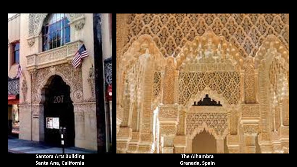
First, she sent me photos of the Santora Arts building there.
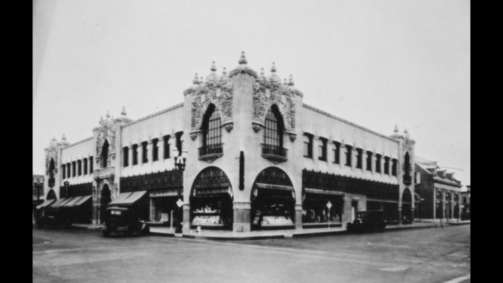
This is an historic photo of the Santora Arts Building in Santa Ana.
It was said to have been designed by the premier regional architect Frank Landsdowne in the “California Churrigueresque” Style of “Spanish Colonial Revival” architecture, with construction starting in July of 1928.
Churrigueresque refers to a Spanish Baroque-style of lavishly elaborate sculptural ornament, said to have emerged in Spain in the late 17th-century, and used up to about 1750, and credited to Jose Benito de Churriguera, who trained as a joiner of altar-pieces.
He was said to have an excessively elaborate style of filling the entire surface with detail, leading to the adjective “Churrigueresque.”
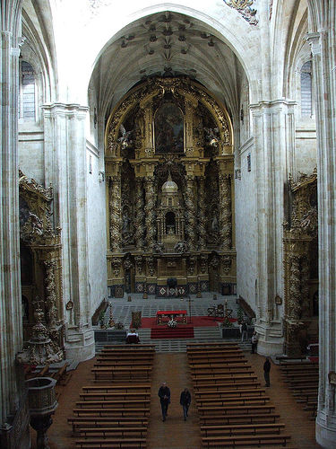
Among other churches and palaces Churriguera received the credit for, he was credited with the design of the altar in the Church for the Convent of Saint Steven in Salamanca, Spain.
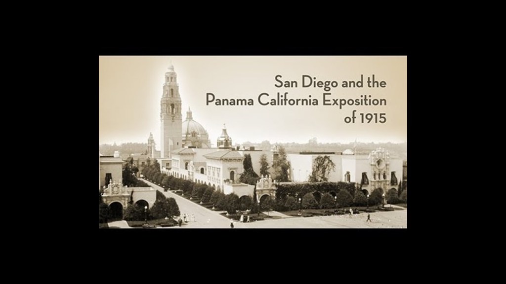
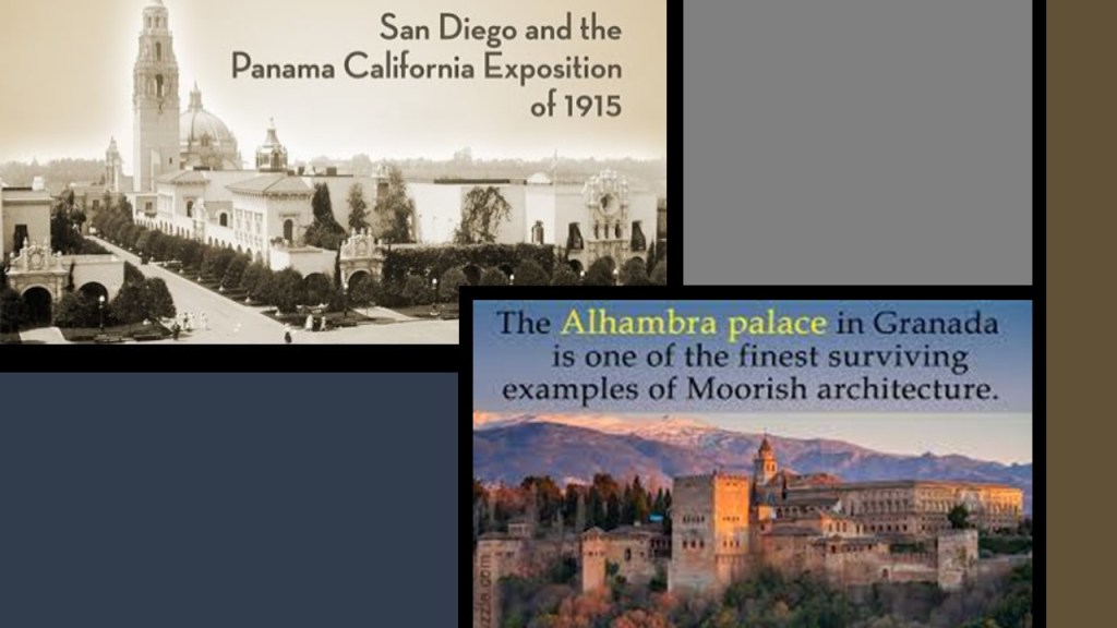
The California Churrigueresque-style was said to be a revival-style native to California that originated in the early 20th-century by architects Bertram Goodhue and Carleton Winslow Sr. for the 1915 – 1917 Panama-California Exposition in San Diego, which was said to have been held to celebrate the opening of the Panama Canal and touting San Diego as the first Port of Call for ships travelling north after passing westward through the canal.
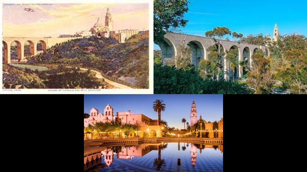
The Exposition’s buildings and infrastructure, including the Cabrillo Bridge, some said to be meant to be permanent and others temporary, were said to have been constructed specifically for the Exposition in San Diego’s Balboa Park between 1911 and its opening in 1915.
But wait – doesn’t that look like the same kind of architecture in San Diego that you find in Moorish Spain?
Speaking of the Alhambra, there are details on the outside of the Santora Arts Building, still standing today housing art galleries, retail stores and restaurants in Santa Ana that look like details you find at the Alhambra in Granada, Spain.
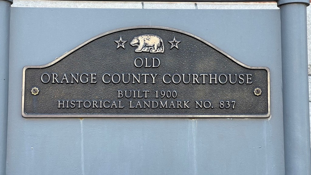
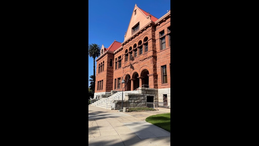
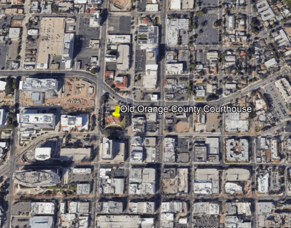
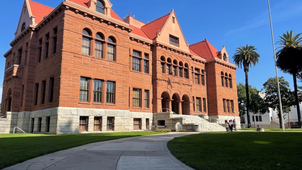
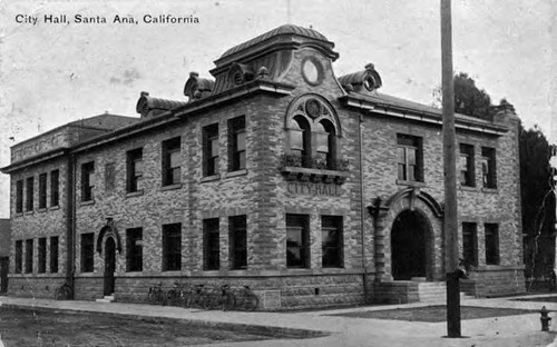
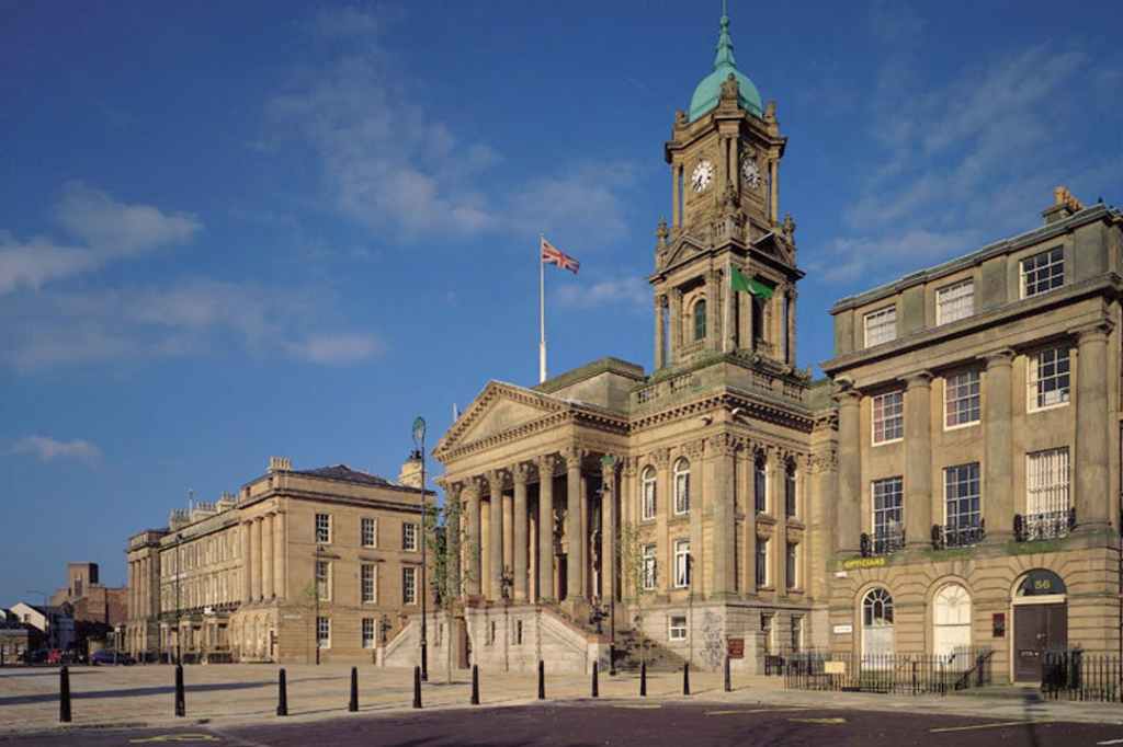
KM sent photos she took at the Old Orange County Courthouse, said to have been built in 1900, and opened in 1901.
A museum today, the Old Orange County Courthouse was said to have been designed in the Romanesque-Revival-style first that opened in 1901.
It is located on Civic and Broadway Streets in Santa Ana’s Historic Downtown District.
We are told that in 1869, William Spurgeon established the City of Santa Ana on land he purchased from an old Spanish land grant from 1810 called the Rancho Santiago de Santa Ana, which stretched for 22-miles, or 35-kilometers, between the Santa Ana River to the Santa Ana Mountains.
Santa Ana was said to have been chosen as the county seat of Orange County because it was growing faster than the surrounding towns.
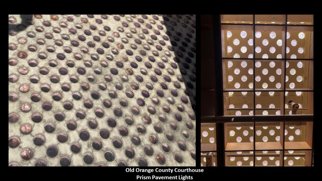
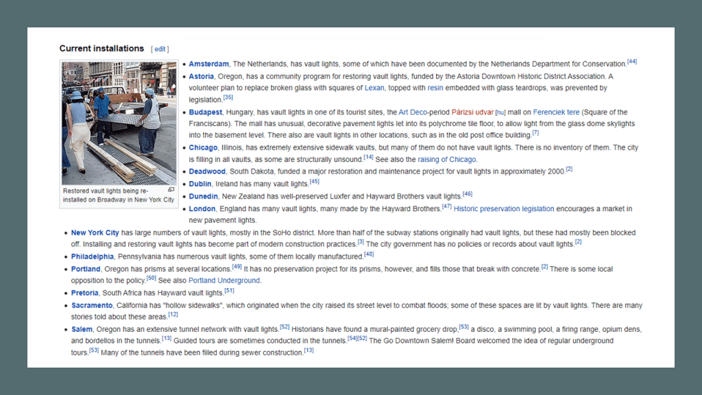
There are pavement prism lights at the Old County Courthouse, which can be seen from above outside, and below inside.
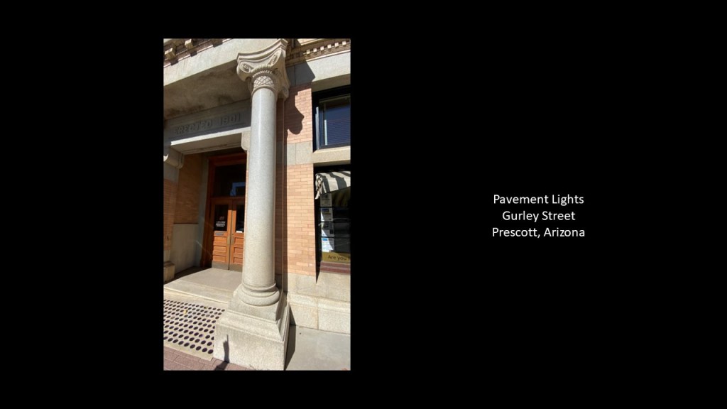
Prism pavement lights are even to be found in smaller towns, like this one remaining strip of pavement lights on Gurley Street I came across last year in Prescott, Arizona.
Prism Pavement or Vault lights were once found around the world, and while you can still see them in some places, they have largely been removed.
What we are told about these pavement lights is this:
Prism lighting was commonly found on flat-topped, walk-on skylights, known as pavement lights in the United Kingdom; Vault Lights in the United States…or floor lights and sidewalk prisms that were set-in sidewalks or floors to let sunlight into the space below, and that it was the use of lighting to improve the distribution of light, usually daylight, within a space.
We are told prism lighting was only popular starting from its introduction in the 1890s…until cheap electric lights became commonplace in the 1930s, at which time prism lighting became unfashionable.
Shout out and thank you to Jon (AKA Beags) of the Stuffed Beagle YouTube channel for first bringing them to my attention and inviting me to collaborate with him on his three-part series about prism pavement lights in March of 2020.
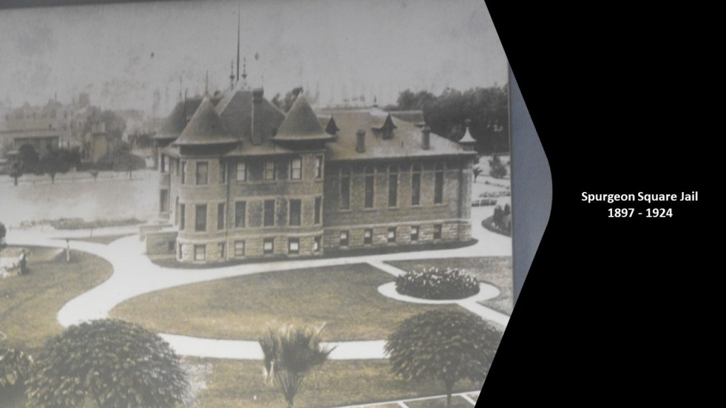
The Spurgeon Square Jail, historically located next to the Old Orange County Courthouse and the county’s third jail, was said to have been built in 1897 as a turreted and stone structure for a cost of $31,000, and had gas and electricity, and it was considered fire-proof.
It was demolished in 1924, would would have been after only 27-years of existence.
The Spurgeon Square Jail became known as “Lacy’s Hotel,” after Theophilus Lacy, a farmer, stable operator, and Santa Ana City Treasurer turned Sheriff.
Sheriff Lacy and his family resided in and oversaw the lock-up.
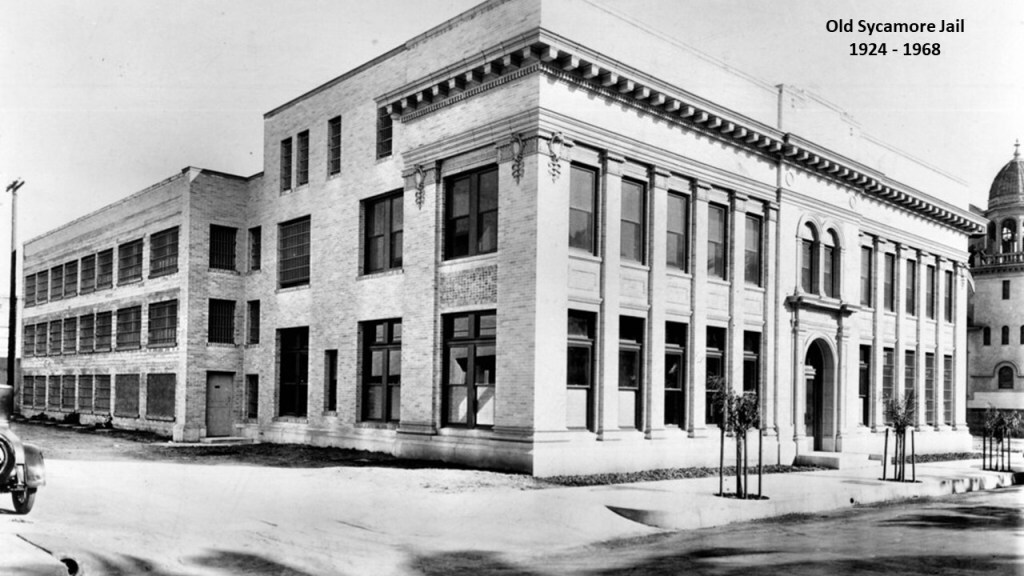
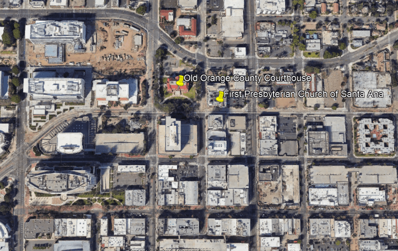
The “Old Sycamore Jail,” in Santa Ana was across from the Old Orange County Courthouse, and located next to the First Presbyterian Church on Sycamore Street.
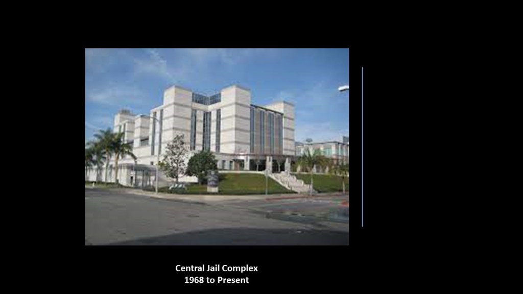
It was in use from 1924 until 1968, when it was closed after the completion of the $10.4-million Central Jails Complex in Santa Ana.
The “Old Sycamore” jail was located next to the First Presbyterian Church of Santa Ana, which is still standing today, and located directly across the street from the Old Orange County Courthouse.
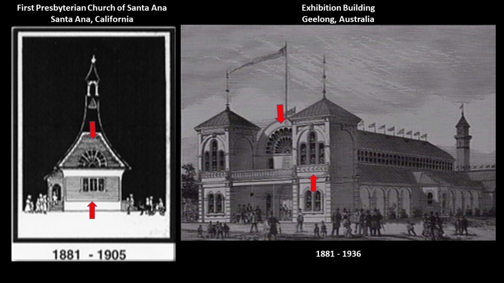
The First Presbyterian Church of Santa Ana was first established in the early 1880s.
The semi-circular and triple windows of the first church building on the left brought to mind the Geelong Exhibition Building I had seen tracking an alignment through Australia
Both were said to have been built in the same year.
The Geelong Exhibition Building was closed in 1936 and turned into a motor garage; in 1961 it was turned into a concrete car park; and it was finally demolished in 1984 to make room for a new shopping center.
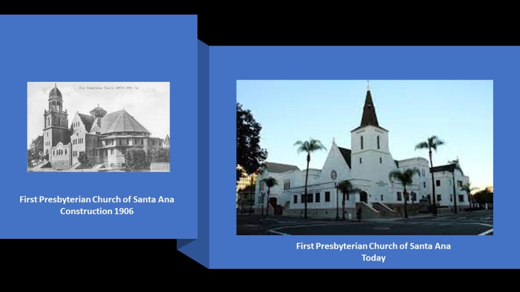
The building on the left was said to have been built in 1906 to house the growing First Presbyterian Church, andthe building on the right is how the church looks today.
The 1933 Long Beach Earthquake resulted in building damage, including the destruction of the cupolas, and some of the original building’s ornate trim.
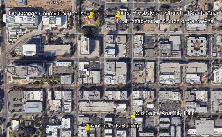
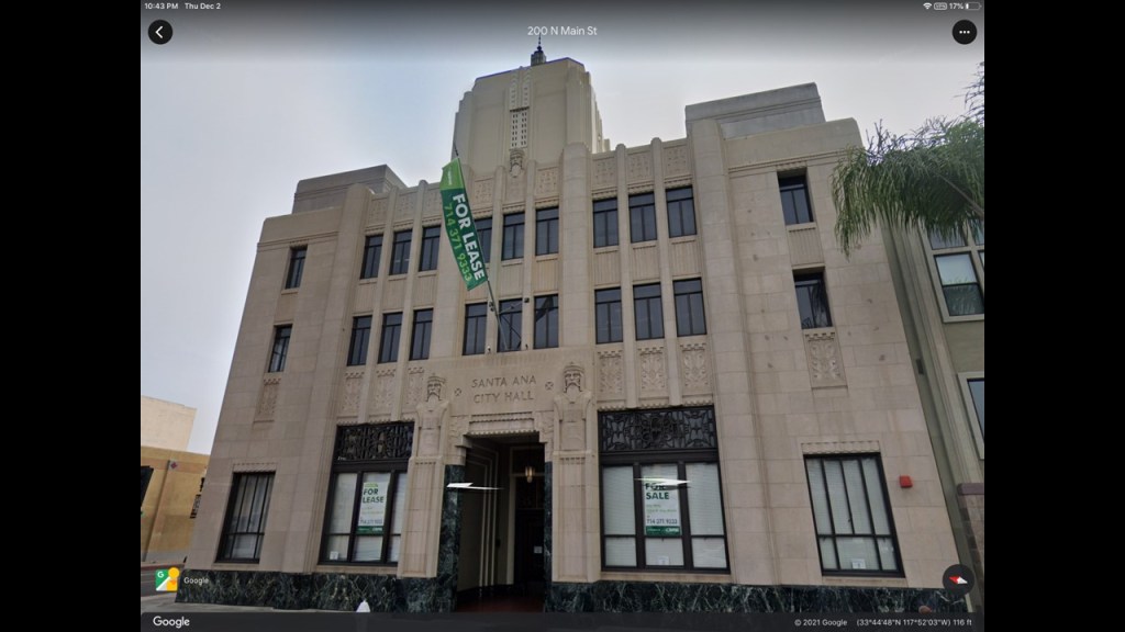
The Old Santa Ana City Hall #2 building is several blocks south of the First Presbyterian Church & Old County Courthouse, and a couple of blocks east of the Santora Arts Building.
The Old Santa Ana City Hall #2 building today is utilized as commercial office space.
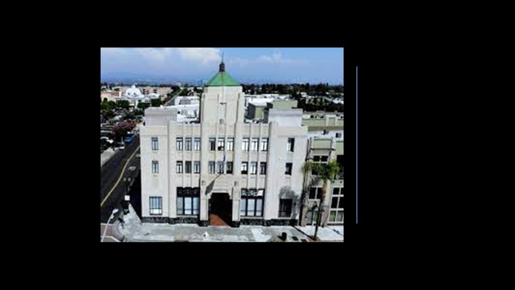
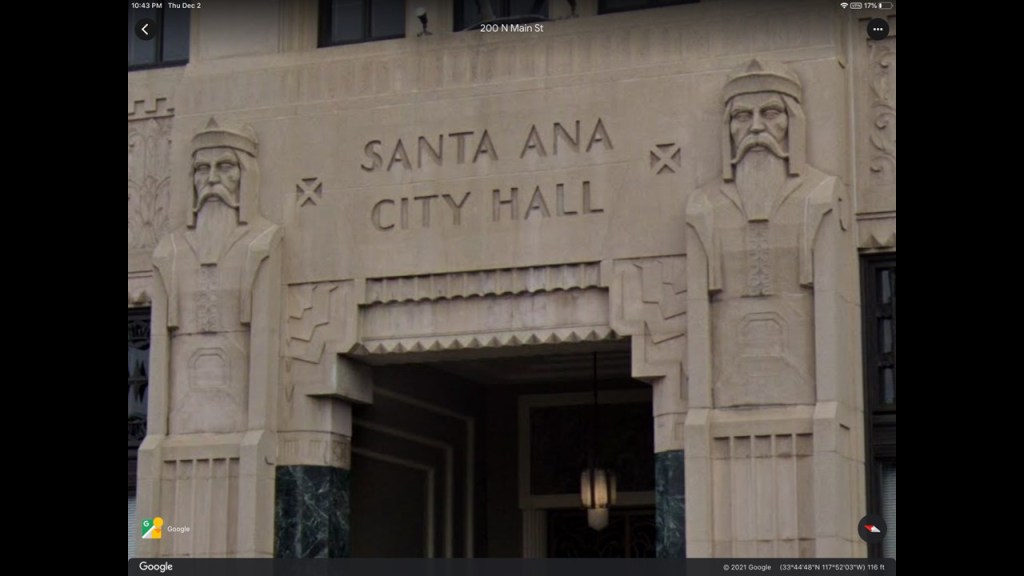
This courthouse was said to have been built in the Art Deco Architectural-style between 1934 and 1935 as a Works Progress Administration (WPA) project during the Great Depression, in which we are told the City of Santa Ana could have access to skilled labor at low prices.
The exterior of the building has a dark marble base and durable stonework…
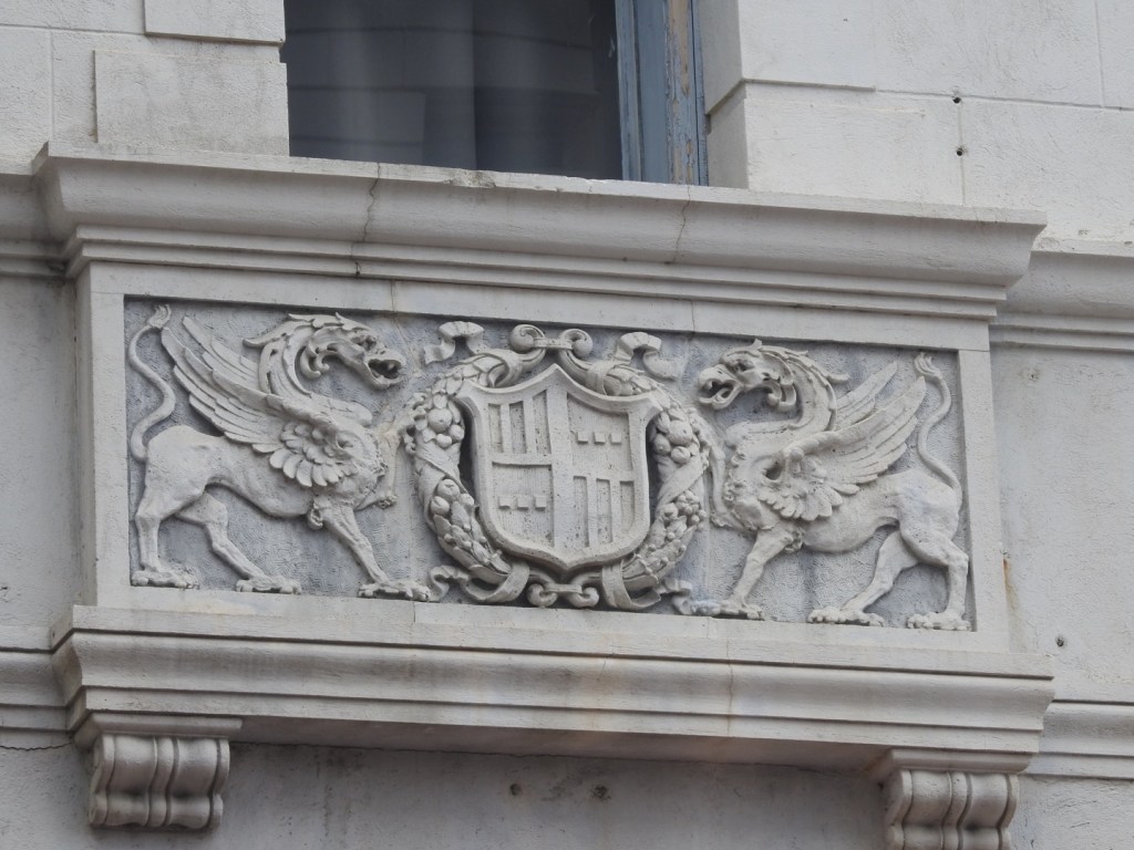
…carved friezes…
…and two bearded giant statues flanking the front entrance…
…and the Old Santa Ana City Hall #1 was said to be reminiscent of a construction from ancient Mesopotamia.
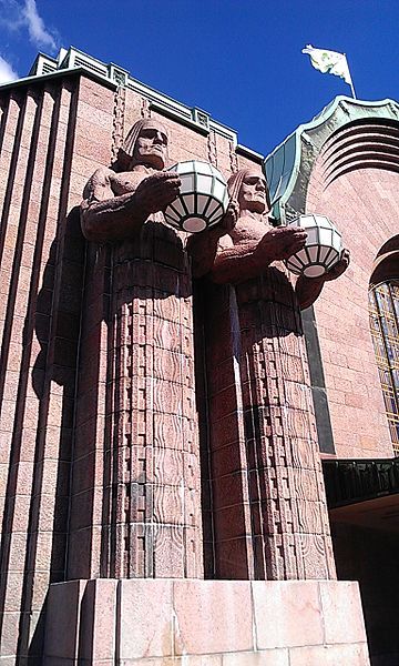
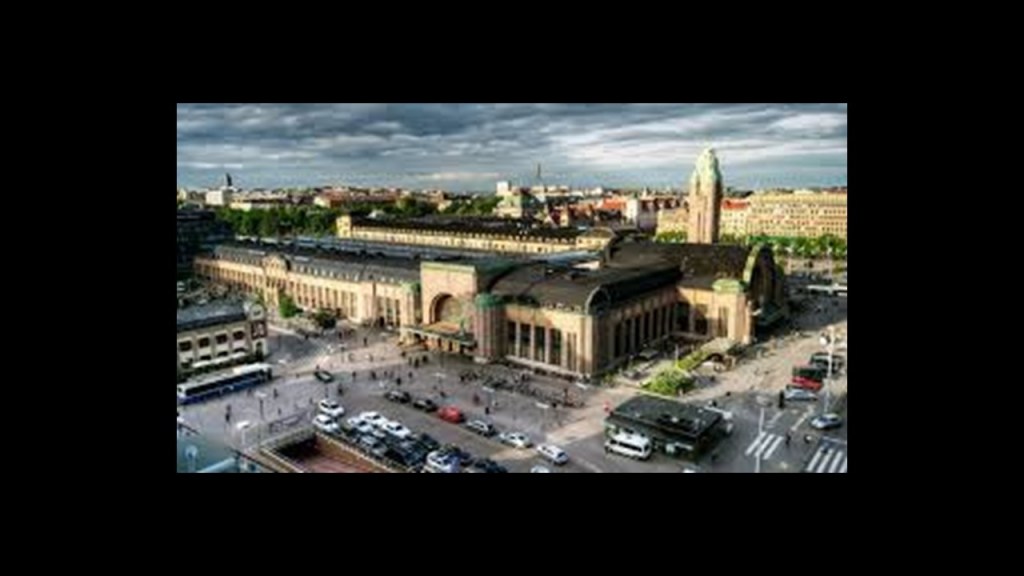
The giant bearded statues at the Old Santa Ana City Hall brought to mind the two giant statues at the entrance of the Central Railway Station in Helsinki, Finland.
The Helsinki Central Railway Station was said to have come into existence as the result of a design contest in 1904.
The winner of the design contest was Eliel Saarinen, and we are told the new station he designed opened in 1919.
The first Santa Ana City Hall was said to have been erected in 1904 on the spot where the second was erected starting in 1934.
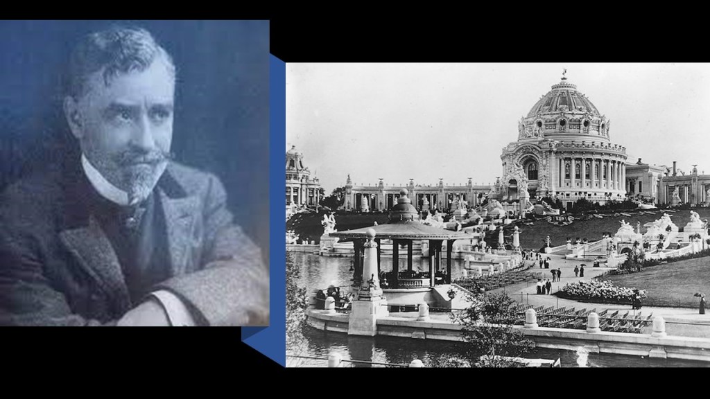
Next, I am going to take a look at noteworthy architecture in St. Louis, Missouri, via viewer GS.
GS sent me photos of several places in St. Louis, including:
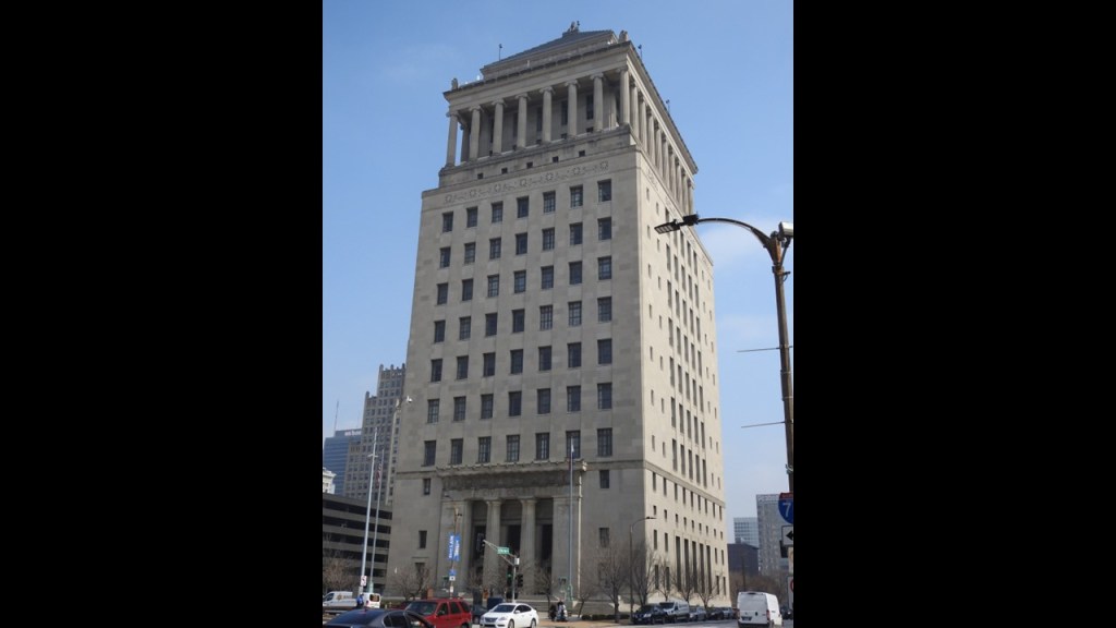
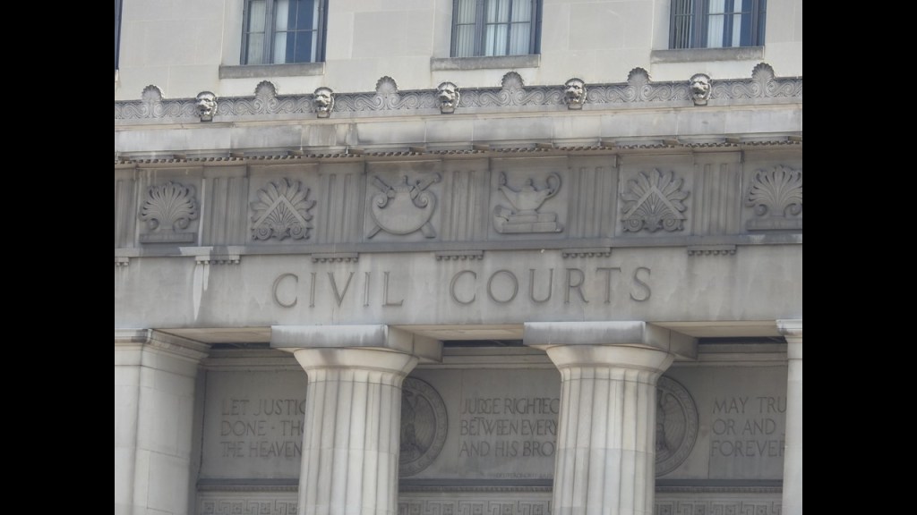
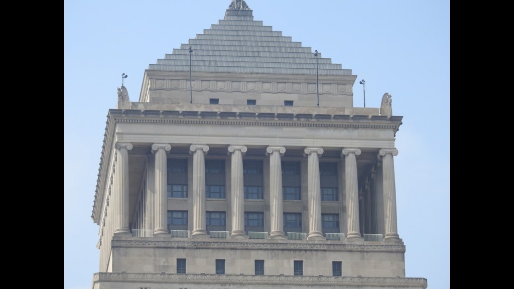
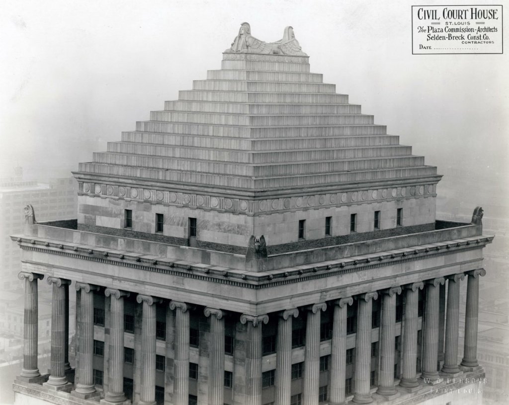
The Civil Courts Building.
The Civil Courts Building was said to have been part of an $87-million bond ratified by voters in 1923 to build monumental buildings along the Memorial Plaza, and that its construction was said to have been completed in 1930, during the Great Depression.
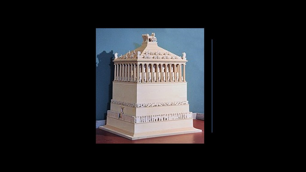
We are told the pyramid-roof of the Civil Courts building was designed to resemble the Mausoleum of Halicarnassus in Turkey, considered one of the Seven Wonders of the Ancient World, and said to have been destroyed by a succession of earthquakes centuries-ago.
The Civil Courts Pyramid has thirty-two ionic columns, and are 42-feet, or 13-meters-, high, and 5 1/2-feet, or almost 2-meters, wide.
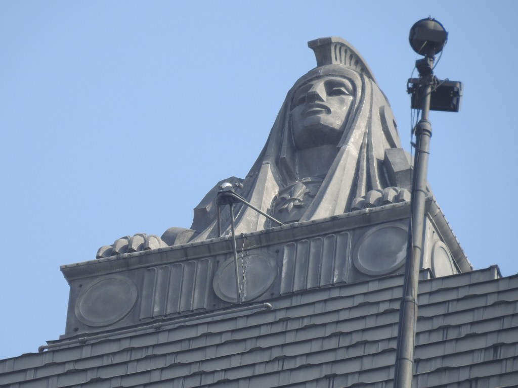
On top of the pyramid, there are two sphinxes, facing in opposite directions.
Each sphinx is 12-feet, or 3.7-meters, high…
…and said to have been sculpted by Cleveland sculptor Steven Rebeck in 1930.
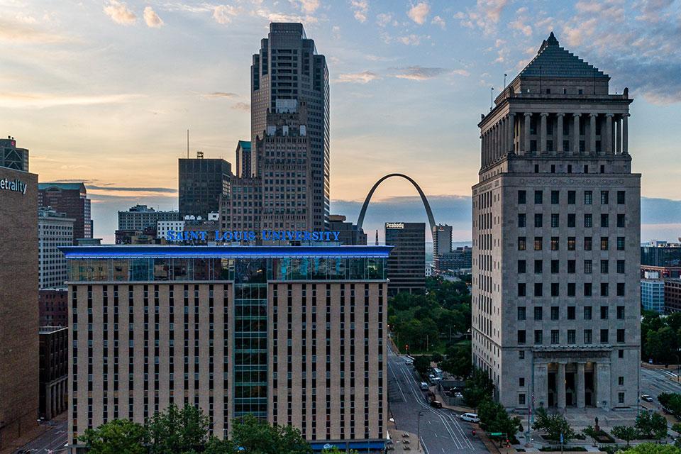
The Civil Courts Building is in alignment with the famous Gateway Arch of St. Louis.
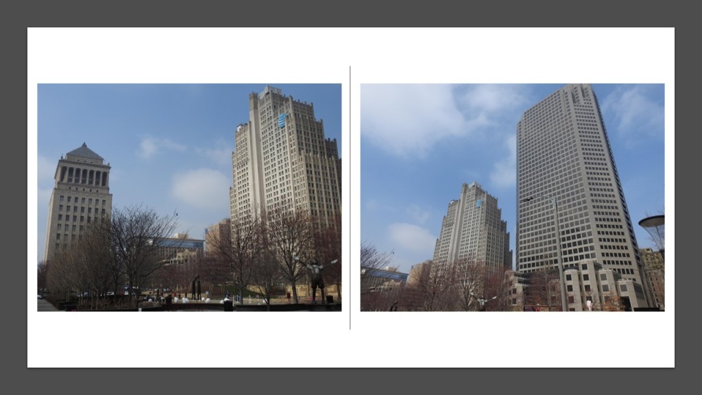
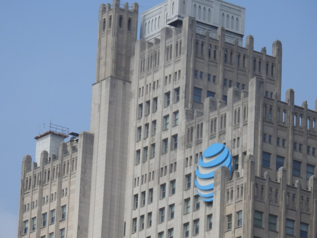
The Old and New ATT buildings are right next to the Civil Courts building.
From what I can gather from internet searches, both AT & T buildings, the two tallest office towers in St. Louis, are currently vacant.
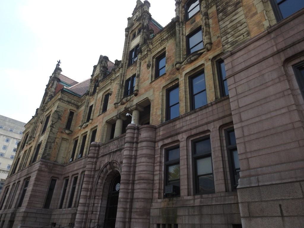
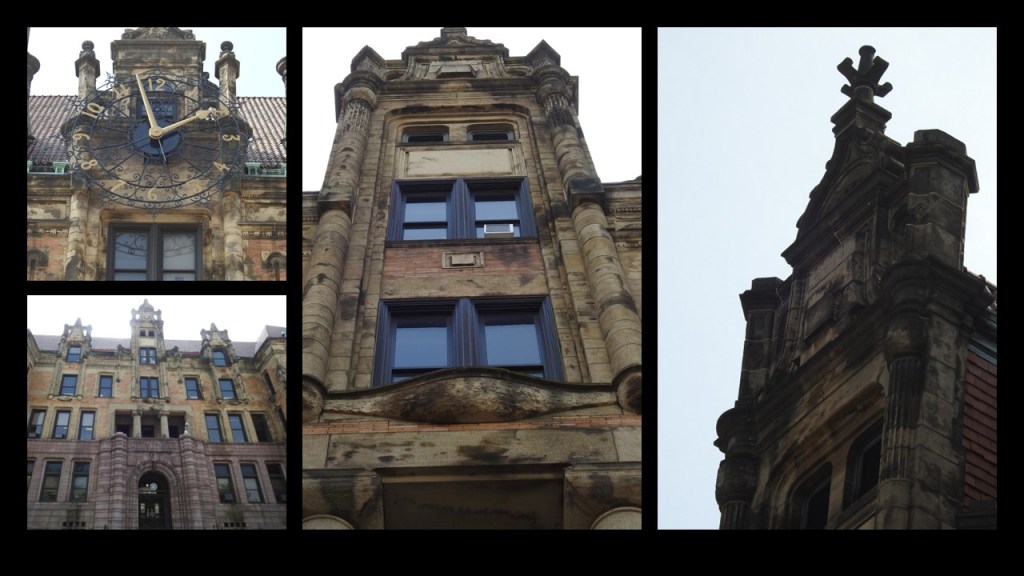
GS also shared photos with me of the St. Louis City Hall.
The St. Louis City Hall was was said to have been designed by architects Eckel and Mann, the winners of a national design competition.
Construction was said to have started in 1890, and completed in 1904.
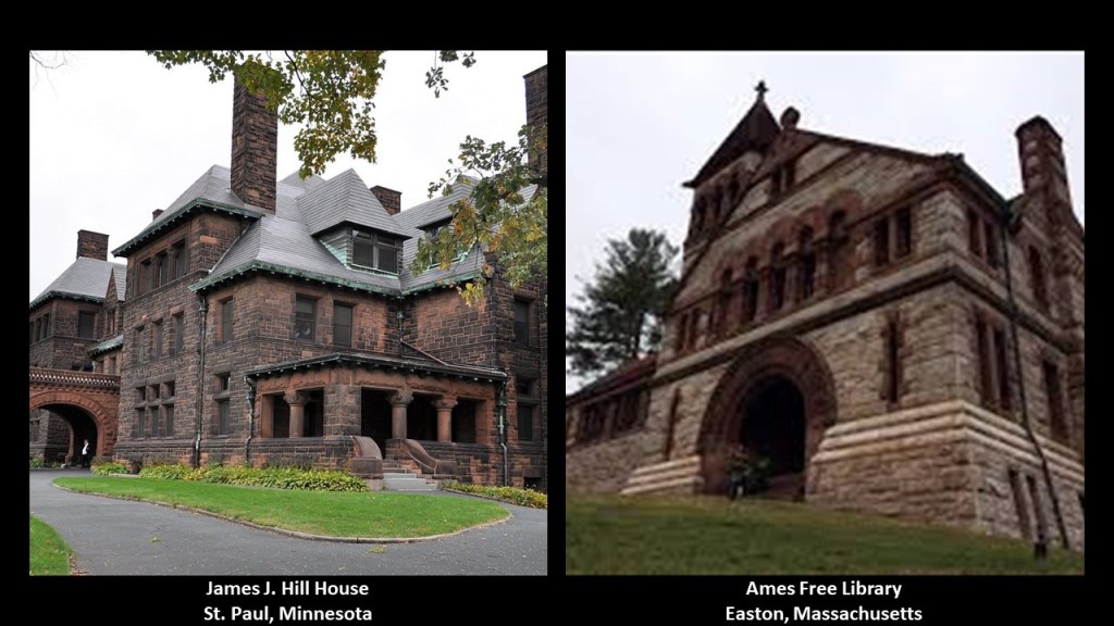
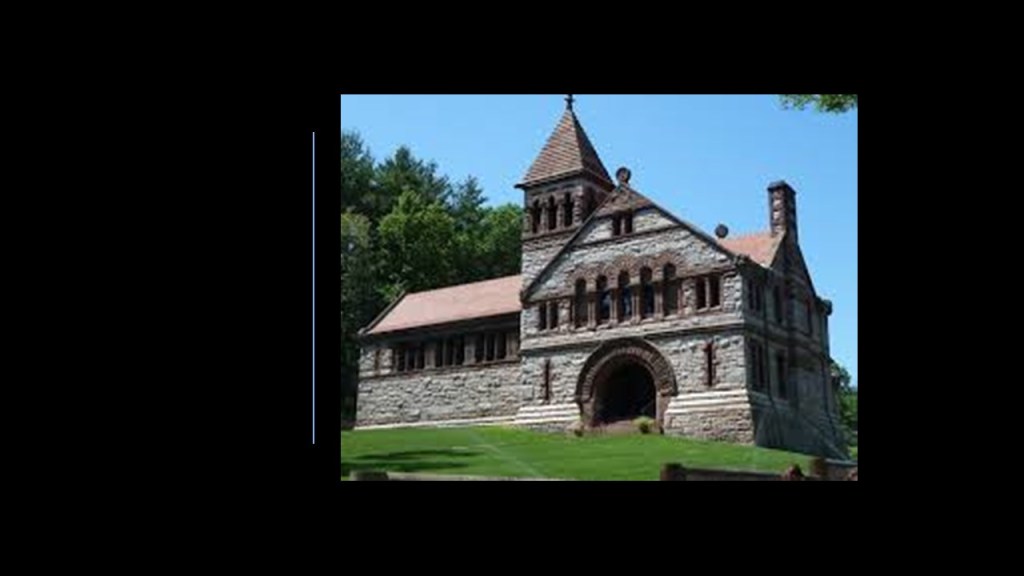
Next, LAD directed my attention to the James J. Hill House in St. Paul, Minnesota, saying that it looks like the Ames Free Library in Easton, Massachusetts.
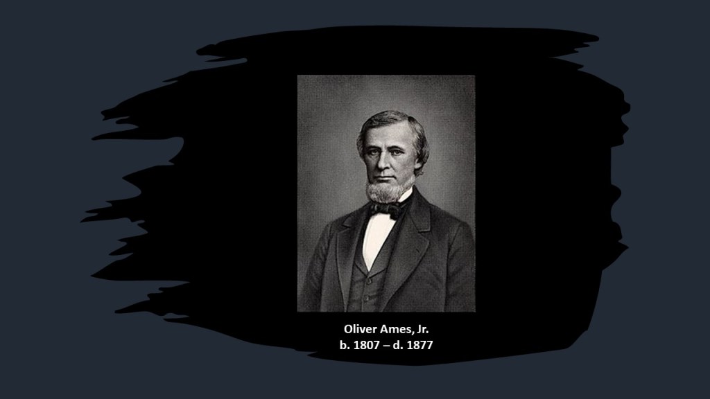
The Ames Free Library in Easton, Massachusetts, was said to have been commissioned by the children of Oliver Ames, Jr, after he left money in his will for the construction of a library.
The building of it we are told took place between 1877 and 1879.
The architectural-style of the building called Richardsonian Romanesque, named after 19th-century architect, Henry Hobson Richardson who was said to have actually designed the Ames Free Library.
Interestingly, Mr. Richardson is said to have never finished his architecture studies in Paris due to the Civil War.
He also was said to have died at the age of 47, after having a prolific career in the design of mind-blowingly sophisticated and ornate buildings of heavy masonry.
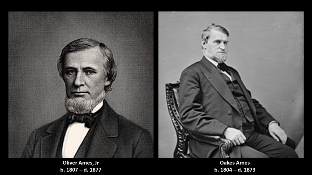
Oliver Ames, Jr, was a co-owner of the Ames Shovel Shop, along with his brother Oakes Ames.
Oliver was also the President of the Union Pacific Railroad from when it met the Central Pacific Railroad in Utah for the completion of the first Transcontinental Railroad in North America.
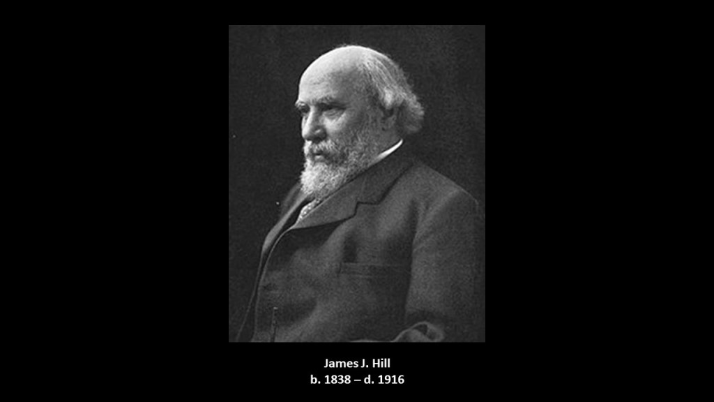
James J. Hill was a Canadian-American railroad magnate, and CEO of the family of lines headed by the Great Northern Railway.
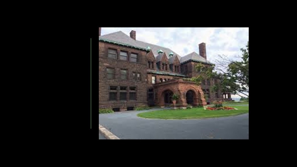
The James J. Hill House is the largest house in St. Paul, the construction of which was said to have been completed in 1891, after Hill purchased three lots on Summit Avenue in 1882, at a time when wealthy citizens wanted to build fashionable homes there.
The James J. Hill House was said to be an example of Richardsonian Romanesque architecture desgined by the East Coast architectural firm of Peabody, Stearns and Furber, and that Hill himself supervised the design and construction closely.
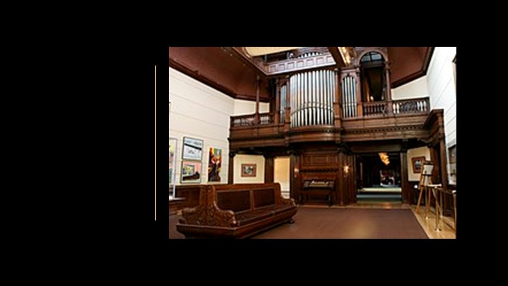
There was even a pipe organ in the home because apparently that was also a fashionable trend back in Hill’s day.
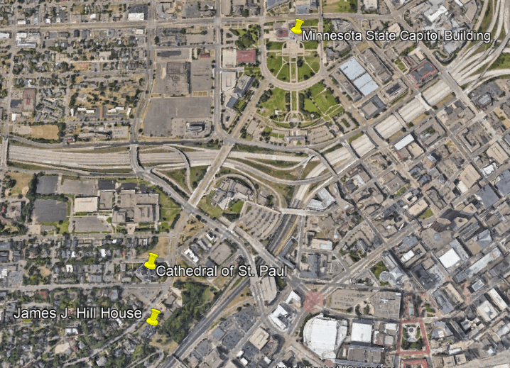
The James J. Hill House is located near the Cathedral of St. Paul on Summit Avenue, and both are relatively close to the Minnesota State Capitol building.
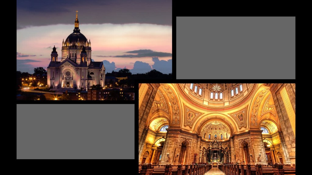
The Cathedral of St. Paul was said to have been built between 1906 and 1915.
It is considered to be one of the most distinctive cathedrals in the United States.
The Cathedral of St. Paul was said to have been designed by French Beaux-Arts architect Emmanuel Louis Masqueray, who was also credited with being the Chief Architect of the 1904 St. Louis World’s Fair.
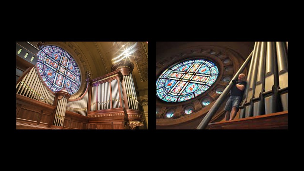
There are two pipe organs in the Cathedral of St. Paul.
We are told one is a 1927 Skinner Sanctuary Organ…
…and the other is a 1963 Aeolian-Skinner Organ, recently restored.
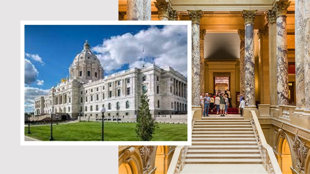
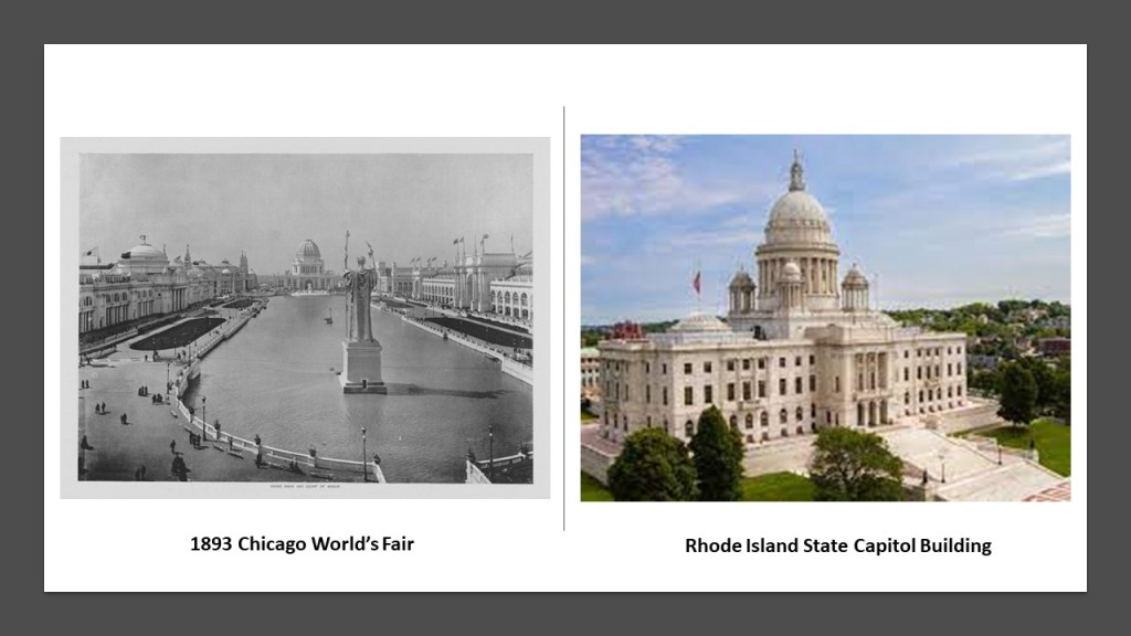
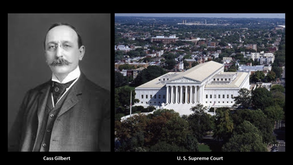
The Minnesota State Capitol building was said to have been designed by architect Cass Gilbert, and completed in 1905.
Gilbert’s Beaux-Arts/American Renaissance Design was said to have been influenced by by 1893 Chicago World’s Fair, and by the Rhode Island State Capitol Building, said to have been designed by the architectural firm of…McKim, Mead & White.
Architect Cass Gilbert was als0 credited with the design of the Supreme Court building in Washington, DC, which was said to have been built between 1932 and 1935…which also would have been during the Great Depression.
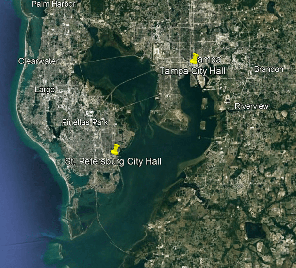
Next, I am going to head over to the Tampa Bay area in Central Florida, and take a look at the City Halls and some other architecture in the neighboring cities of Tampa and St. Petersburg.
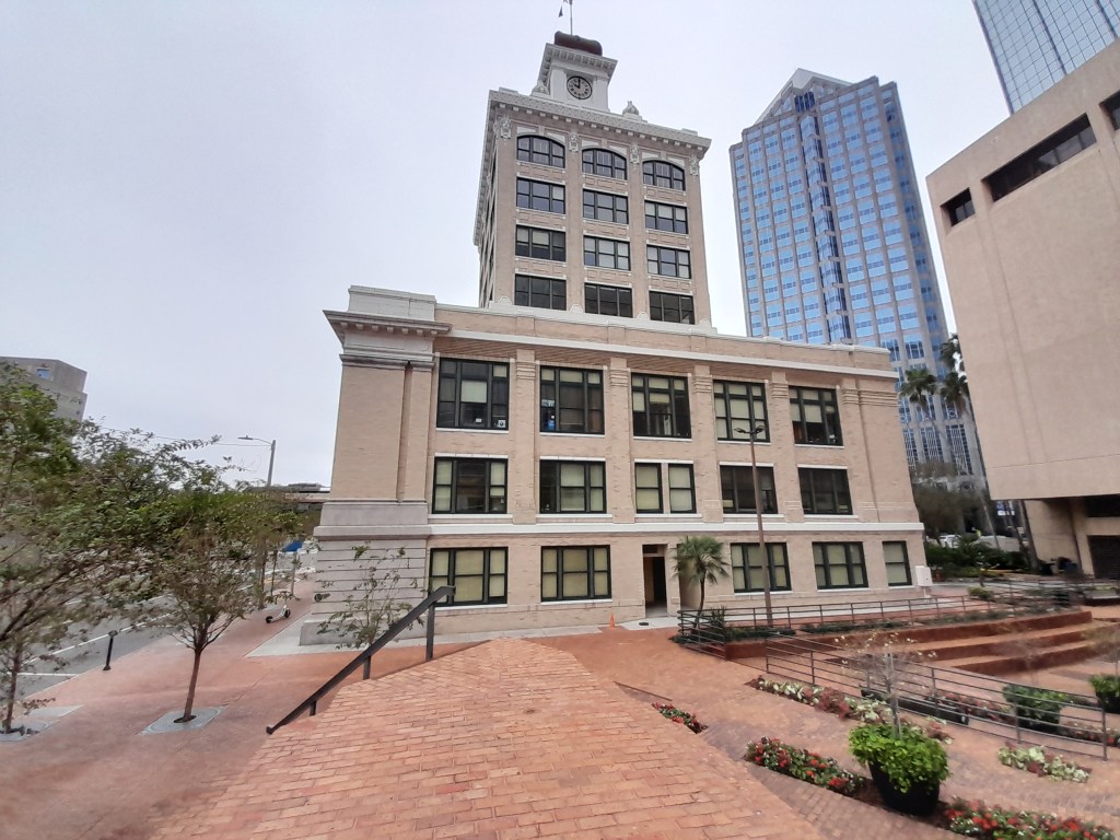
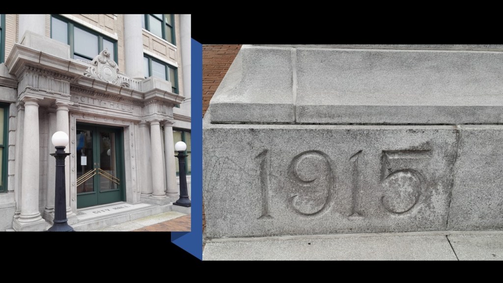
First, JR sent me photographs of the Old Tampa City Hall.
The Old Tampa City Hall was said to have been designed by local architects M. Leo Elliott and Bayard Clayton Bonfoey.
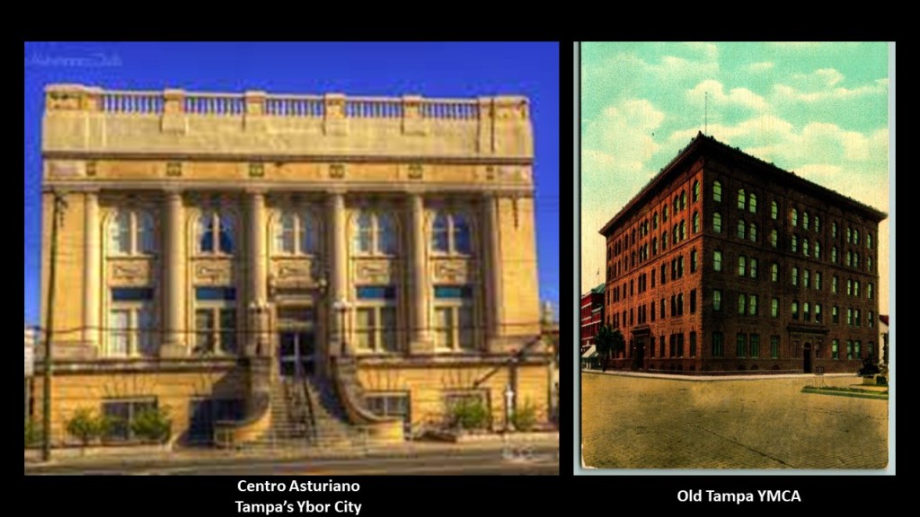
Widely regarded as one of Tampa’s finest architects, Elliott was said to have come to the area from New York, and that he won first place in design competitions for the Centro Asturiano Club in Tampa’s Ybor City and the Tampa YMCA.
In September of 1907, he formed the architectural firm of Bonfoey and Elliott.
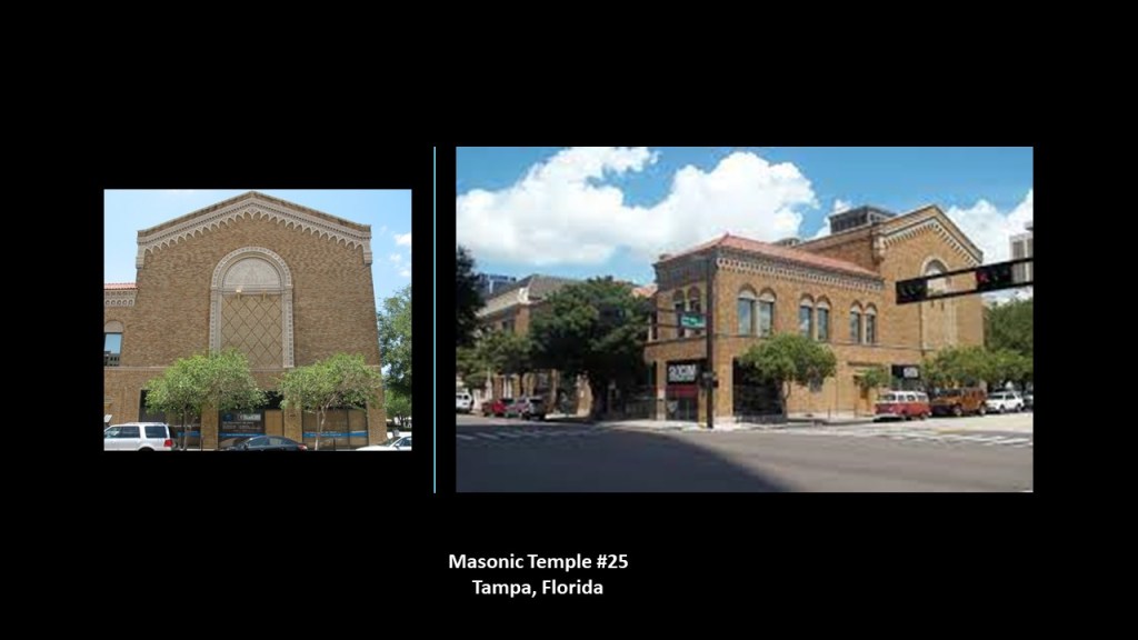
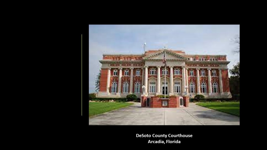
M. Leo Elliott is also credited with the following buildings in the Tampa area:
Masonic Temple #25…
…the DeSoto County Courthouse in Arcadia, Florida…
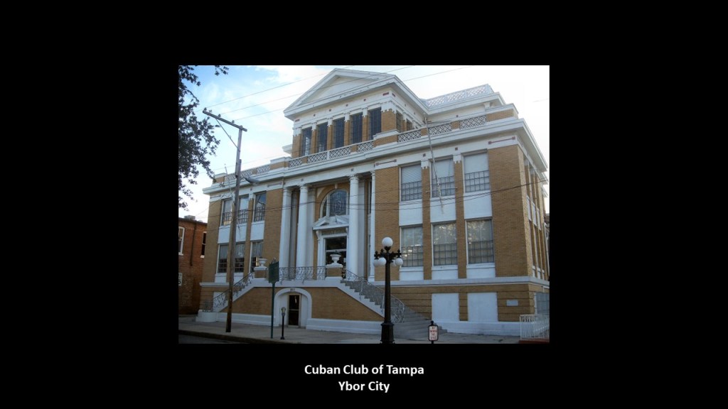
…the Cuban Club of Tampa in Ybor City…
…and the Leiman-Wilson House in Tampa…
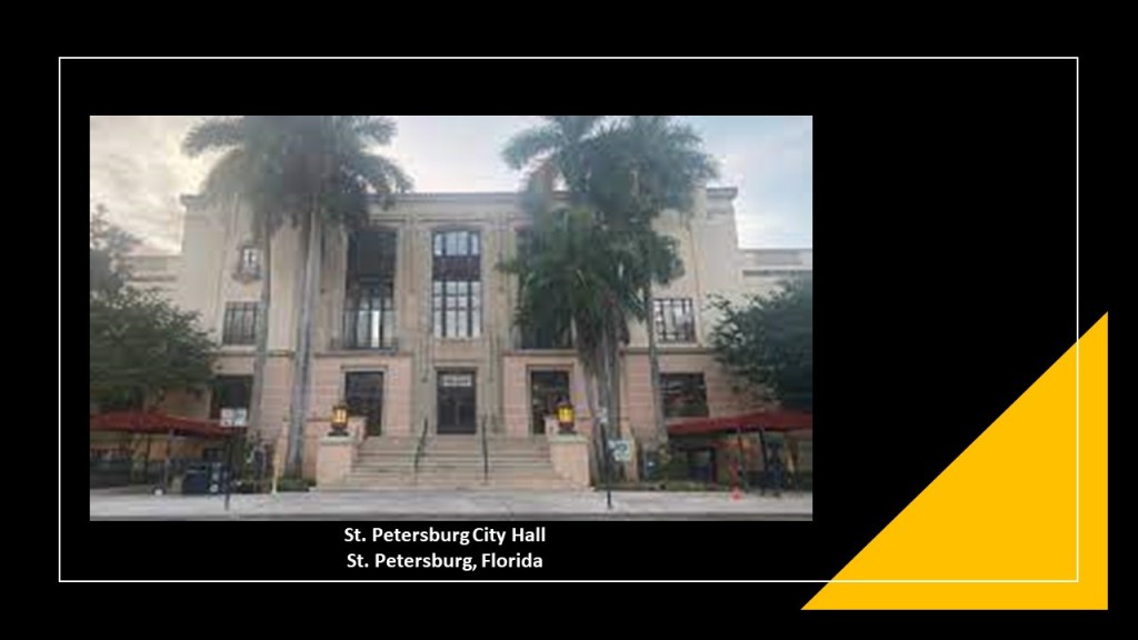
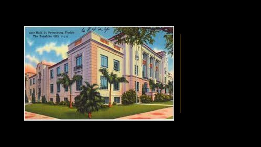
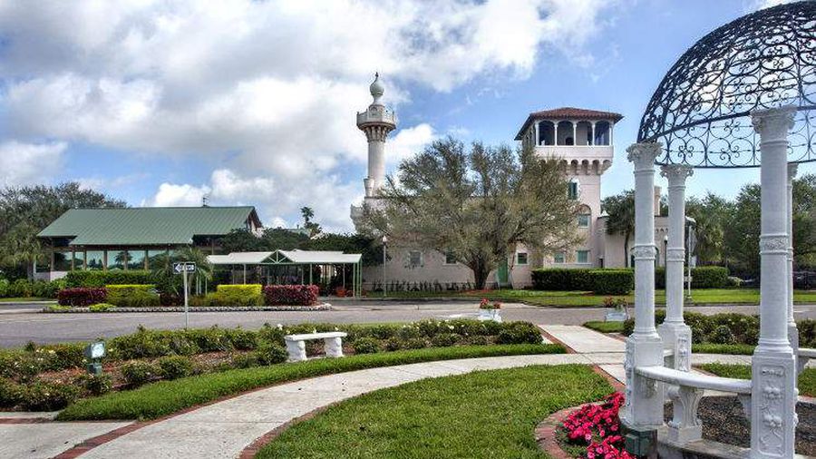
Lastly, I am going to hop across Tampa Bay to St. Petersburg, also known as “St. Pete,” and take a look at the St. Petersburg City Hall.
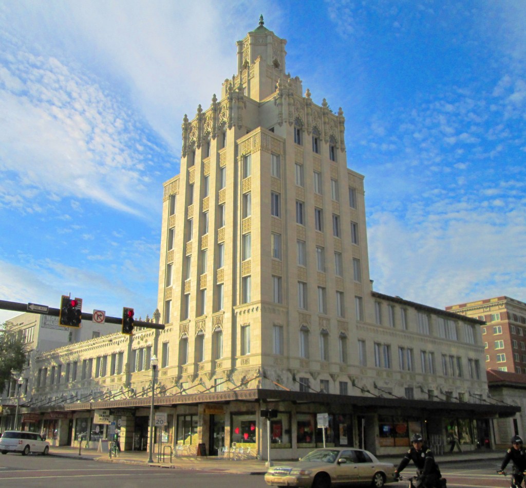
Still in use today, St. Petersburg City Hall was said to have been built in 1939 with federal funds.
As a matter of fact, it was said to be one of the few buildings in St. Pete constructed under a Public Works Administration, or PWA, grant made possible through President Franklin D. Roosevelt’s New Deal.
Its design credited to nationally-known architect, A. Lowther Forrest, it is said to be an example of the Mediterranean Revival-style of architecture.
Interestingly, I can’t find out anything about an A. Lowther Forrest architect in an internet search.
The historic downtown of St. Pete included the Snell Arcade, also known as the Rutland Building, also said to have been built in the Mediterranean Revival-style said to have been built starting in 1926, and developed by wealthy landowner Perry C. Snell.
…which remains standing today as a result of preservation efforts.
Other historic St. Pete buildings that remain standing today include:
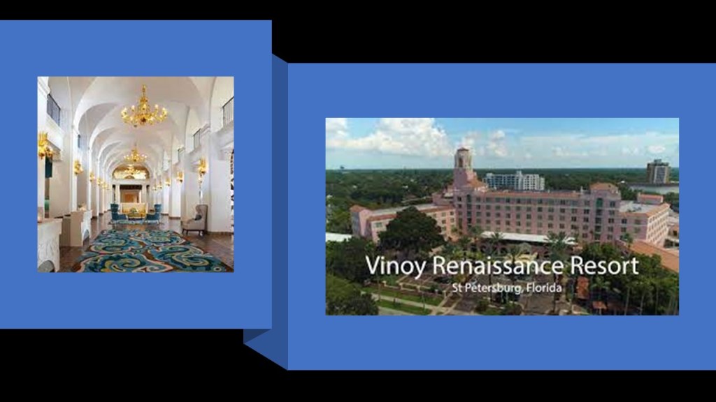
The Vinoy Renaissance Hotel, said to date from 1925, closed in 1974 – 1975, and re-opened in 1992…
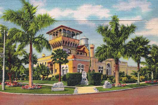
…the Sunset Golf and Country Club on Snell Island, said to have been constructed in 1926 in the Romantic Revival-style, with an onion dome, tile-detailing and minaret…
…and today it is the Vinoy Renaissance Golf Club.
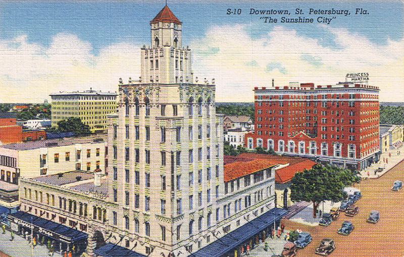
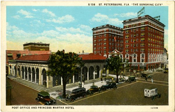
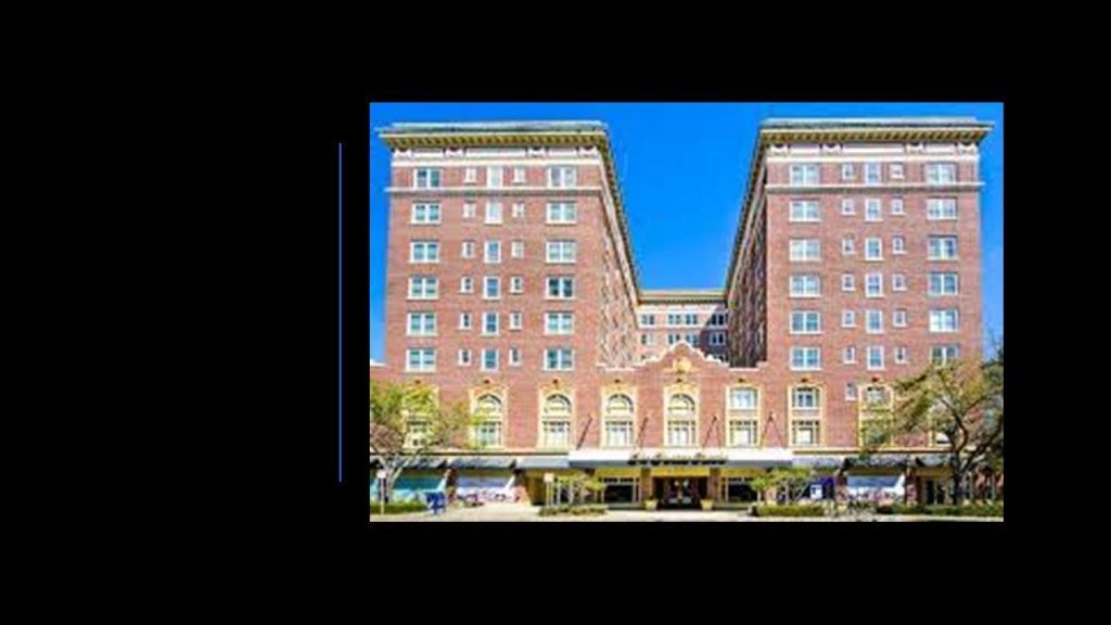
…and the Princess Martha Hotel, said to have first opened in 1924.
We are told it was originally called “The Mason” after New York steel magnate Franklin Mason and the hotel’s first owner.
The Princess Martha Hotel is a Senior Living Community today.
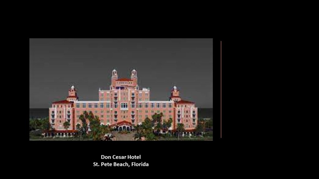
The Don Cesar Hotel on St. Pete Beach, also known as the “Pink Palace,” was said to have been designed by Indianapolis architect Henry H. Dupont for developer Thomas Rowe in a Moorish and Mediterranean style, and first opened in 1928 as a Gulf of Mexico playground for the pampered rich of America at the height of the Jazz Age during the 1930s, which would have been during the same time-frame of the Great Depression.
One of the really neat things that has been happening when I do the research of places that people have suggested, invariably unplanned themes emerge, like ones seen in this post, including architecture explained by world fairs and expositions; the Depression-era New Deal; winning designs in contests; and so forth.
I am going to end this post in St. Pete, and will continue to investigate your suggestions in the on-going series “All Over the Place via Your Suggestions.”
This is the first part of a new on-going series called “All Over the Place Via Your Suggestions” where I will continue to research your suggestions, and follow the many clues you all provide that helps to uncover our hidden history.
In Part 1, I will be focusing on the suggestions of Silvester Gardiner and Gardiner, Maine; photos from the area around Tulsa, Oklahoma; and California’s Channel Islands and Santa Catalina.
I am going to start out by taking a look at MM’s suggestion of Gardiner, Maine, and its namesake Silvester Gardiner, saying that there was something wrong here, as a lot of rich British people come here in the summer to hide at that old mansion on 1,700 acres.
Will get back to the old mansion in a bit.
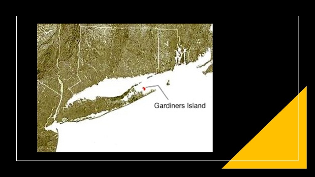
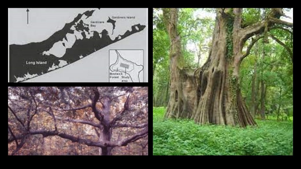
This suggestion particularly piqued my interest because I mentioned another Gardiner, Lion Gardiner, in my last post about “Recovering Lost HIstory from the Estuaries, Pine Barrens & Elite Enclaves off the Atlantic Northeast Coast of the United States.”
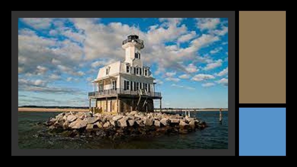
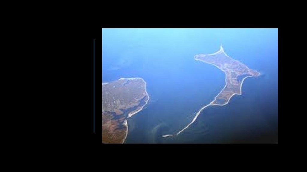
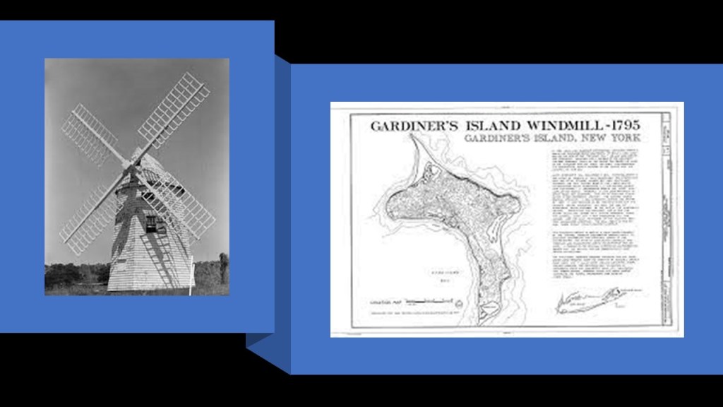
Lion Gardiner was an English engineer and colonist, who in 1639 founded the first English Settlement in New York on Gardiners Island in Gardiners Bay between the North and South Forks of Long Island.
First, a little bit about Silvester Gardiner.
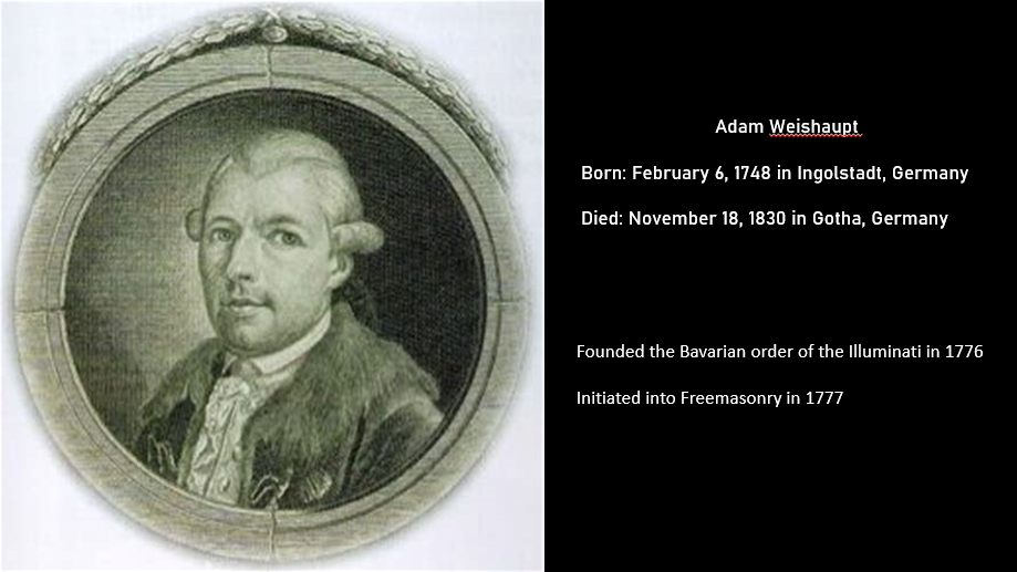
Silvester Gardiner was a wealthy physician, pharmaceutical merchant, and land developer of Maine, who was born in 1708 in South Kingston, in what was known at the time as the “Colony of Rhode Island and Provincetown Plantations.”
In the history of colonialism, plantation was a form of colonization where settlers would establish a permanent or semi-permanent settlement in a new region.
Not only were settlements and settlers being planted in a new region from somewhere else, this plantation system of the colonizers quickly laid the foundation for slavery on large farms owned by “planters” where cash crop goods were produced.
The word plantation first started appearing in the late 1500s to describe the process of colonization, like the Plantations of Ireland in the 16th- and 17th-centuries, during which time we are told the English Crown confiscated land from Irish Catholics and redistributed the land to Protestant settlers from Great Britain.
The British Plantations of Ireland replaced the Irish language, law and customs with those of the British, created sectarian hatred between Protestants and Catholics, and Northern Ireland is still part of Britain to this day.
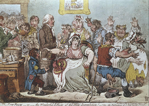
After studying medicine in New York, London, and Paris, Silvester Gardiner opened his medical practice in Boston, where he lectured in anatomy and promoted the inoculation for small pox, for which he proposed and established a hospital in Boston in 1761.
Come to find out, a small pox epidemic had broken out in Boston in the spring of 1721 that lasted until the winter of 1722, in which there were around 6,000 cases of small pox reported in a population of around 11,000, with 850 deaths reported.
The use of inoculation was introduced during the 1721 small pox epidemic, and considered a milestone in the history of vaccination.
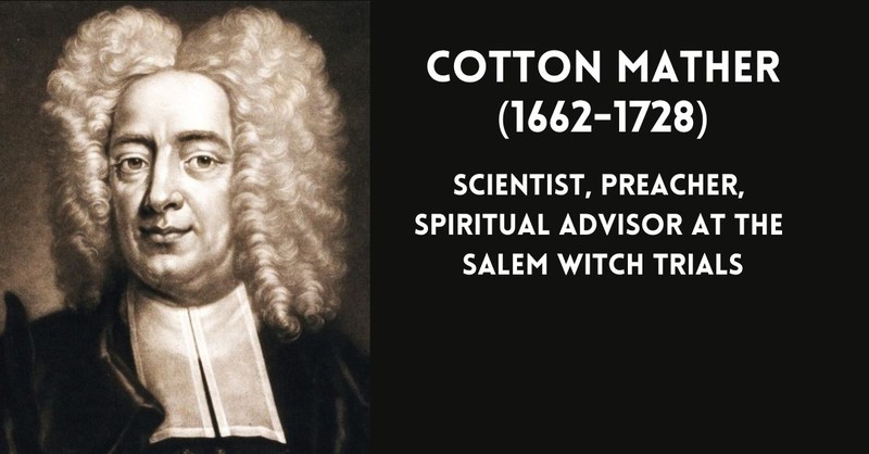
Cotton Mather, the powerful Puritan preacher who was significant in the origin of the Salem Witch Trials of 1692, was credited with introducing inoculation to the colonies, and promoting it as the standard for small pox prevention during the 1721 epidemic.
Inoculation is defined as introducing into the body a dose of biological material, known as inoculum, like an infectious virus in order for the body to generate an immune response to it.
Small pox was a deadly contagious virus transmitted from person-to-person through the respiratory tract, causing flu-like symptoms and disfiguring rashes covering the body.
We are told that the naturally-occurring small pox virus was eradicated by 1980 because of a global vaccination program.
The epidemic of 1721 was the deadliest of a series of small pox epidemics in Boston throughout the 1700s.
The British physician Edward Jenner developed the first vaccine, which was for small pox, given to the first person in May of 1796.
Jenner was a Freemason, becoming a Master Mason in 1802, and the Grand Master of his lodge from 1812 to 1813.
Okay, so there’s the small pox inoculation and apparent freemasonic connection to be found with Silvester Gardiner, as well as his connection to the pharmaceutical business as a merchant.
What else is there to find?
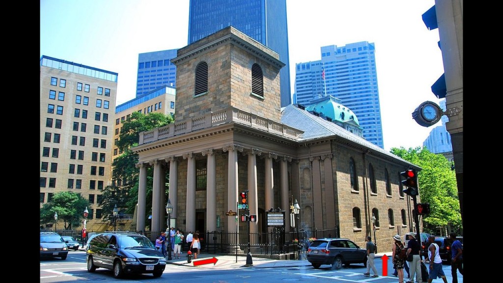
He was said to have been a generous contributer to the construction of King’s Chapel in Boston, said to have been built in 1754, with its uneven, unlevel appearance from front-to-back.
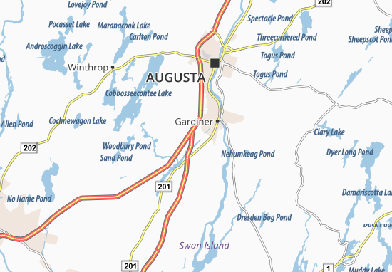
He also purchased over 100,000 acres, or 400-kilometers-squared, on the Kennebec River in Maine for settlement, where he founded the city of Gardiner.
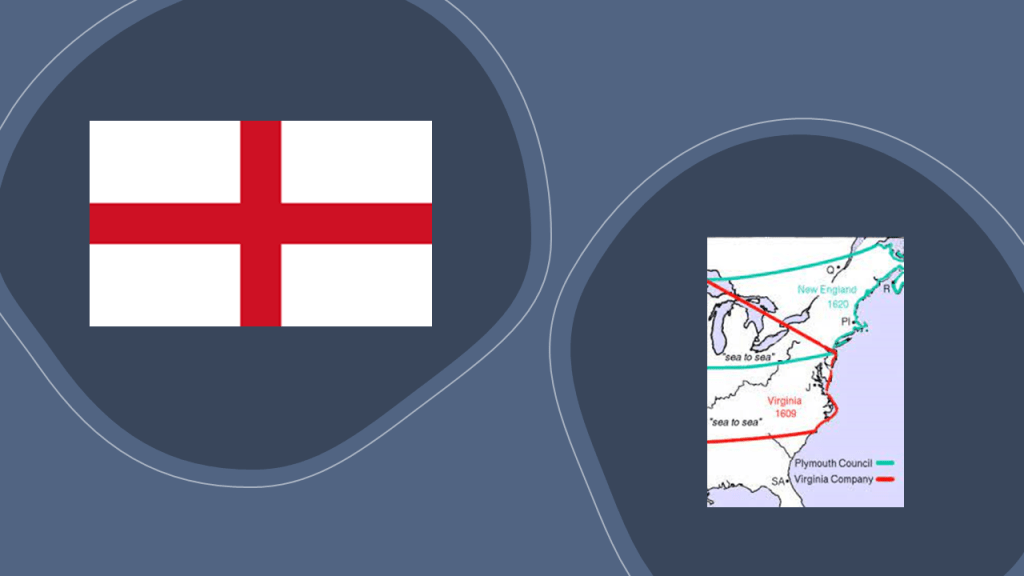
Silvester Gardiner became the principal proprietor of the Kennebec Purchase through the old Plymouth Patent, which had been established by the Council of New England, an English joint-stock company that was granted a Royal Charter to found colonial settlements along the coast of North America that existed between 1620 and 1635.
Largely the creation of Sir Ferdinando Gorges, a military commander and Governor of the Port of Plymouth in England who was called the “Father of English Colonization in North America, it provided for the establishment of the Plymouth Colony, the Province of New Hampshire, the Massachusetts Bay Colony, the New Haven Colony, and the Province of Maine.
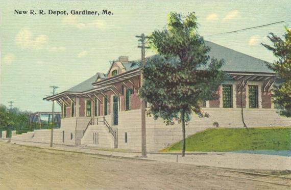
The city of Gardiner was founded as the Gardinerstown Plantation in 1754, at the confluence of the Kennebec River and Cobbosseecontee Stream, and the location quickly became utilized for water-powered mills, and Gardinerstown became the regional economic hub.
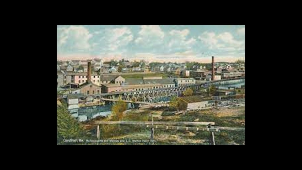
Gardiner became a city in 1849, and was a major industrial town, complete with industries like shipping, lumber, tanning, and shoe-making.
Gardiner was connected by railroad in 1851, and beginning in the 1860s, paper mills flourished, as well as a commercial ice industry between the 1880s and 1920s.
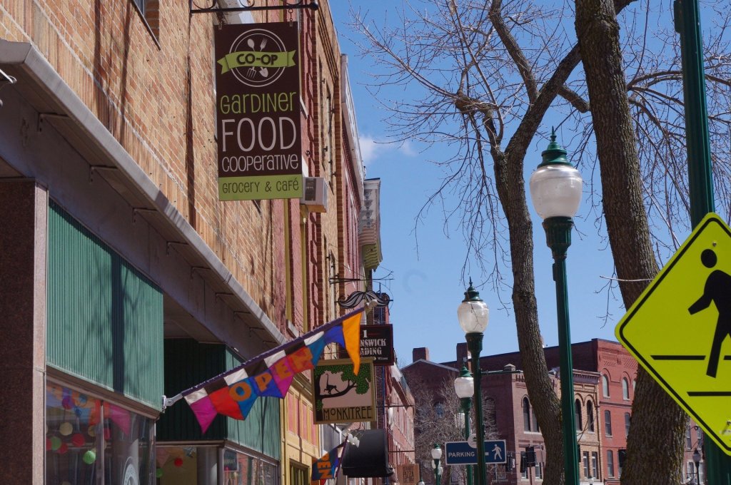
By the 1960s, Gardiner’s economy plummeted with the closure of mills.
Gardiner subsequently became a bedroom community for the surrounding population centers of Augusta, Bath, and Portland, well-known for its restored antique architecture.
In 1980, the entire downtown became a listing from Kennebec County on the National Register of Historic Places, and it is a nationally-accredited Main Street Community.
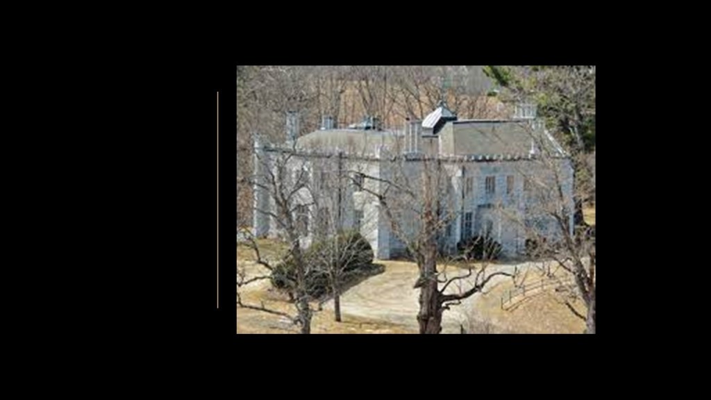
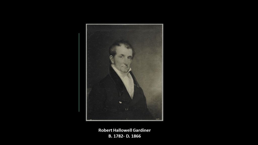
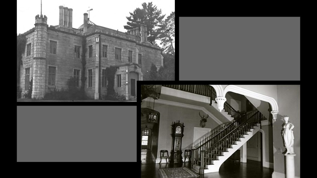
Oaklands Castle in Gardiner, Maine, is on land that was granted to Silvester Gardiner in the 18th-century, and developed by his grandson Robert Hallowell Gardiner, who was also the grandson of Benjamin Hallowell, the founder of Hallowell, Maine.
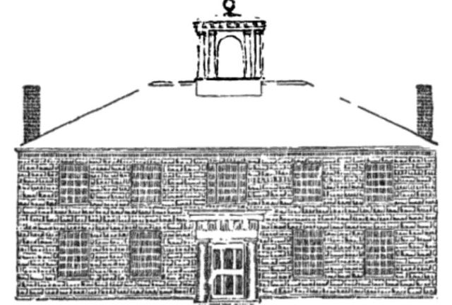
The castle was said to have been built in the Gothic-Revival-style and designed by British-born architect, and first President of the American Institute of Architects, Richard Upjohn between 1835 and 1836 in the early stages of his illustrious architectural career and credited with the promotion of the Gothic-Revival-style.
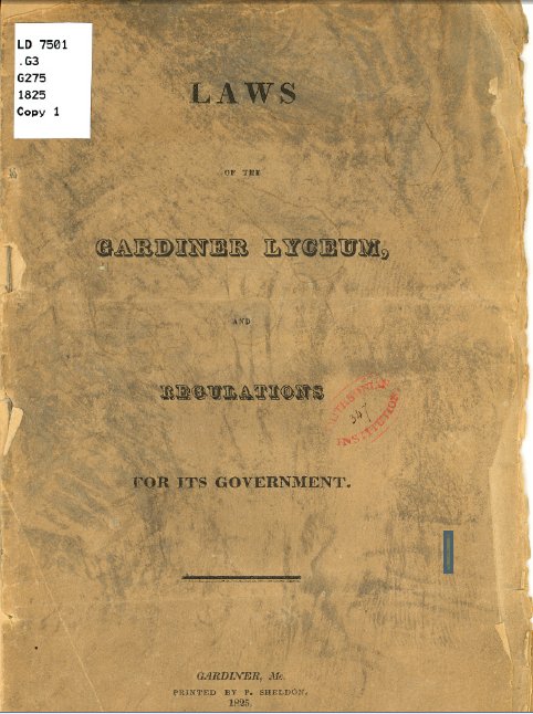
Robert Hallowell Gardiner was also a Trustee for the Gardiner Lyceum School, the first vocational trade school in the United States, and specialized in farming, agriculture and other specialized trades of the 19th-century.
The school was established in 1823, and dissolved less than 10-years later, in 1832, for financial reasons.
It was incorporated in 1822 by an Act of the State of Maine, and its Directors were associated with higher education.
There was a set of laws printed in 1825 on how the school was to be regulated, which an existing copy still held by the Library of Congress.
Just can’t help but wonder if this was a prototype for something.
One more thing before I move on to the next suggested place.
There is an interesting connection coming up between the Gardiner family and the Trinity Church, and I am interested in this from what I have found out about Trinity Church in other locations in past research.
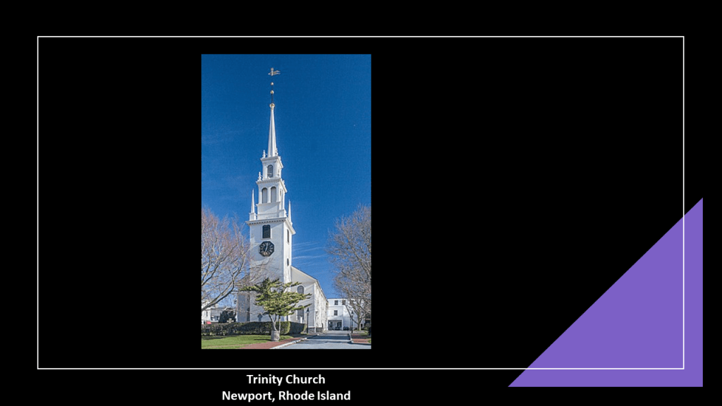
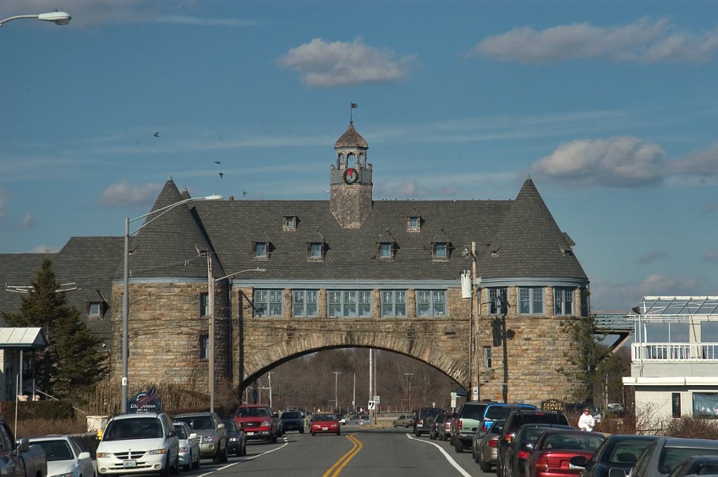
First, Silvester Gardiner was buried under the Trinity Church in Newport, Rhode Island.
The Episcopalian Newport Trinity Church congregation was founded in 1698, and the current church said to have been designed by Richard Munday, based on Sir Christopher Wren’s designs in London, and built between 1725 and 1726.
Notable parishioners of Newport’s Trinity Church included Cornelius Vanderbilt II and John Jacob Astor VI.
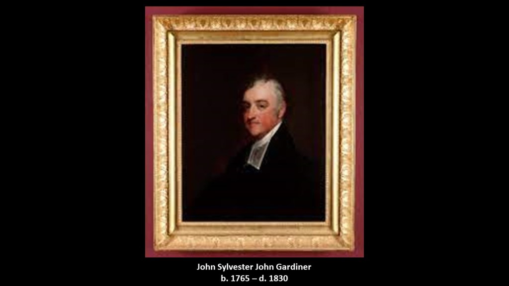
Silvester Gardiner’s grandson, John Sylvester John Gardiner, was a rector of the Trinity Church in Boston from 1805 to 1830, and the “best known and most influential Episcopal clergyman of Boston.
Interesting to note the following about the prominent clergyman’s children.
His son, William Howard Gardiner, was married to the daughter of Thomas Handasyd Perkins, a wealthy merchant, smuggler, and slave-trader from a Boston Brahmin family, members of Boston’s traditional upper-class.
His daughter, Mary Louisa, was married to John Perkins Cushing of Boston, a wealthy American sea merchant and opium smuggler, and nephew of Thomas Handasyd Perkins.
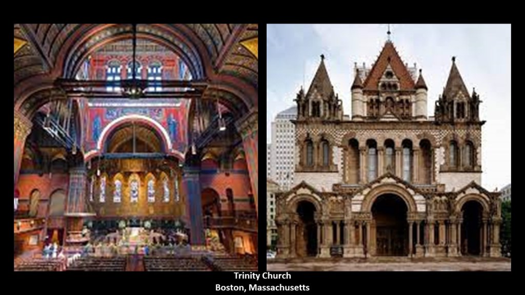
Trinity Church in Boston was founded in 1733, and the current Trinity Church building said to have been built between 1872 and 1877, and designed by architect Henry Hobson Richardson.
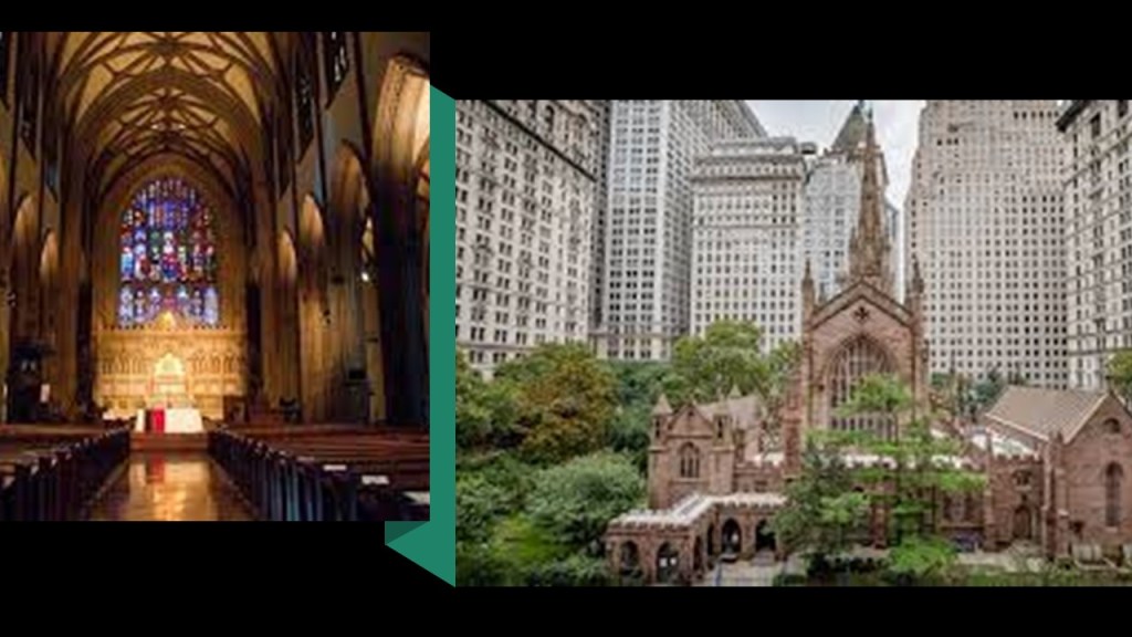
Trinity Church in New York was established in 1697, after King Charles II approved the charter for a new Church of England in Lower Manhattan.
The construction of the current Trinity Church in New York on Wall Street was said to have been constructed between 1839 and 1846, and designed in the Gothic Revival style by Richard Upjohn, the same architect who designed the Oaklands Mansion in Gardiner, Maine, for Robert Hallowell Gardiner.
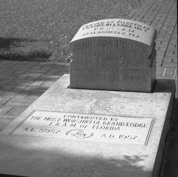
Where I am going with this is that in doing the research for the “Who is in the National Statuary Hall in the U. S. Congress” series, some prominent members of Trinity Church in different cities have come up, like physician and freemason John Gorrie of Florida.
And what came out about Trinity Church from looking at Gorrie’s story was the Corporation of Trinity Church.
The Governor of New York in 1697, Benjamin Fletcher, established the Church of England as New York’s official religion, and leased property in Lower Manhattan that was known as the “King’s Farm” to the newly established Trinity Church, and eight-years later, Queen Anne granted the entire parcel of land to the church outright, and the Episcopal parish was located at corner of Wall Street and Broadway.
With the Queen’s grant, Trinity Church became the second-largest landholder in New York, after the Crown itself, and this set-up Trinity Church to become the wealthiest in the North American colonies.
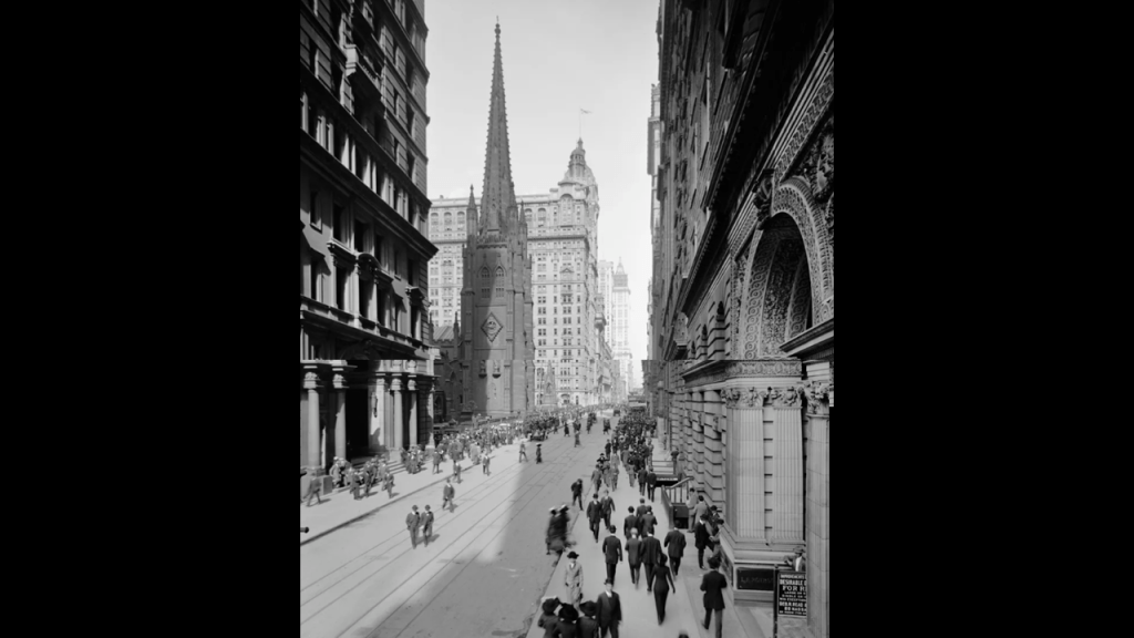
This is a scene of Trinity Church from Broadway in 1915.
Even today, Trinity Church is one of the largest landowners in New York City, now under the name of Trinity Real Estate.
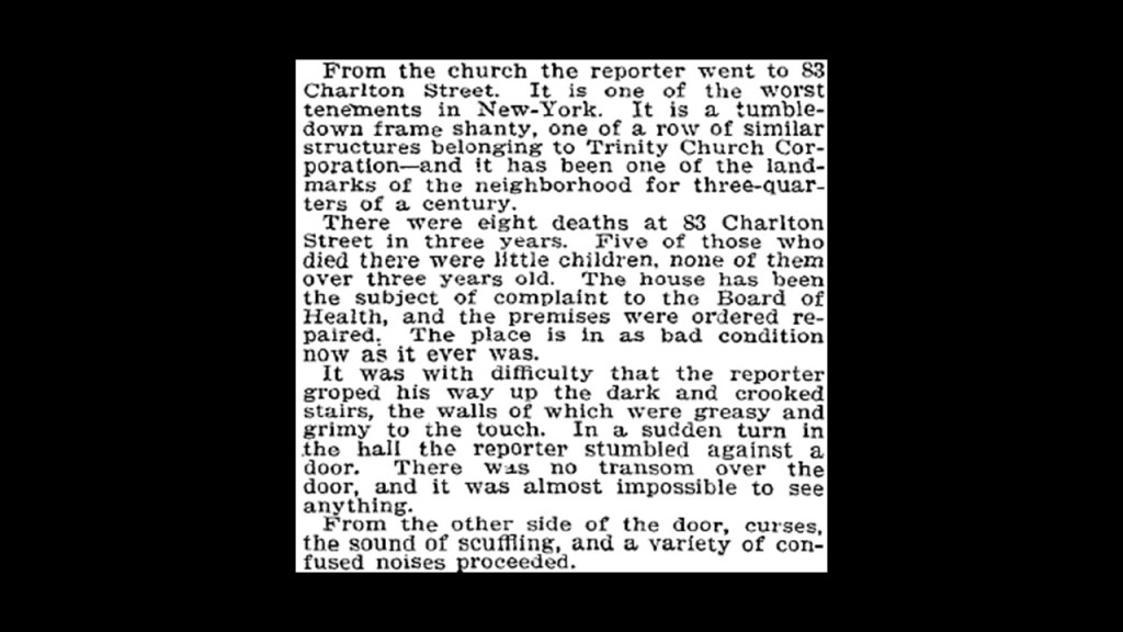
In 1894, the Trinity Corporation was exposed by a New York Times reporter to have substandard living conditions on their Charlton Street properties.
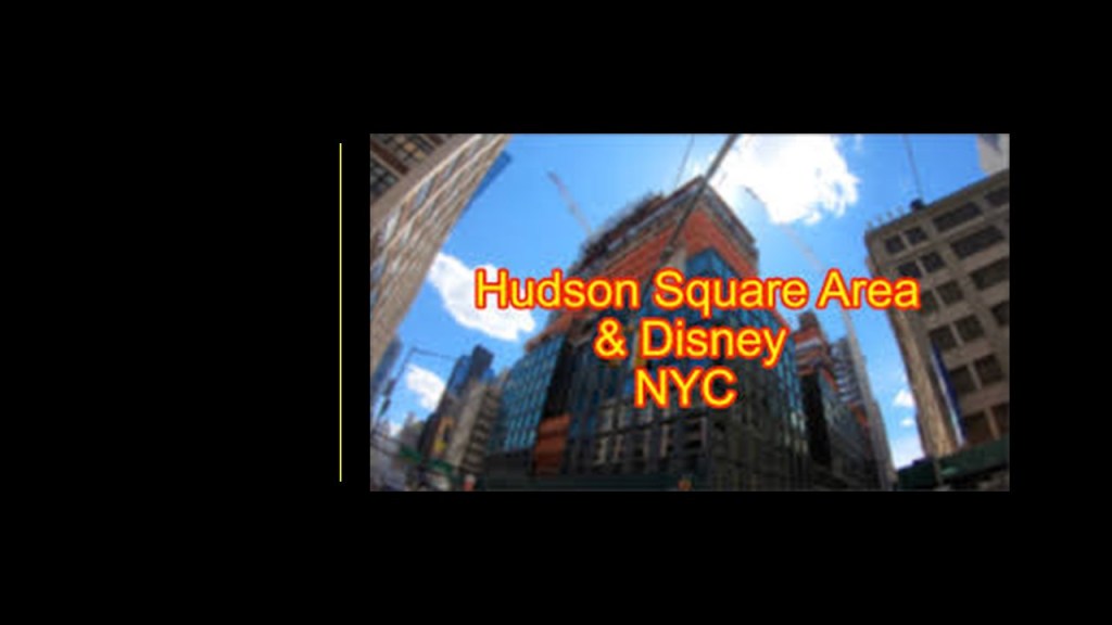
And in doing the research for this right now, I found out that in July of 2018, the Walt Disney Company acquired the rights to develop 4 Hudson Square to become the new site of Disney’s New York operations from Trinity Church Wall Street.
Now, moving along to Oklahoma.
KF of Tulsa sent me a number of photographs she has taken of Tulsa and the surrounding area.
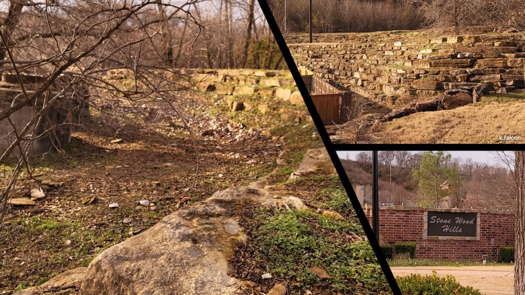
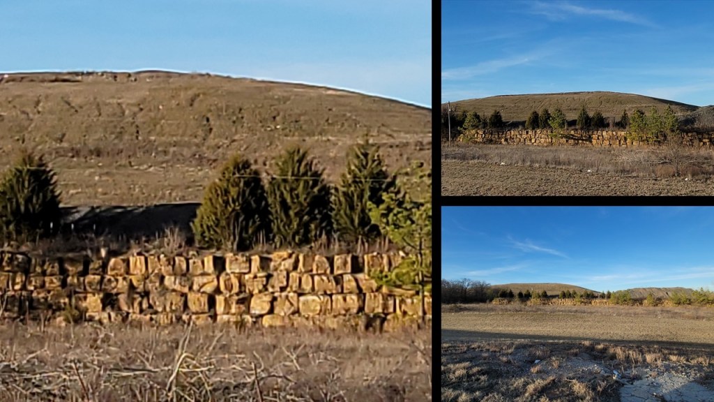
First, photos she took in Broken Arrow, Oklahoma, in a neighborhood in the vicinity of the First Baptist Church of Broken Arrow and the Bass Pro Shops.
She took these photos in the Stone Wood Hills neighborhood of Broken Arrow.
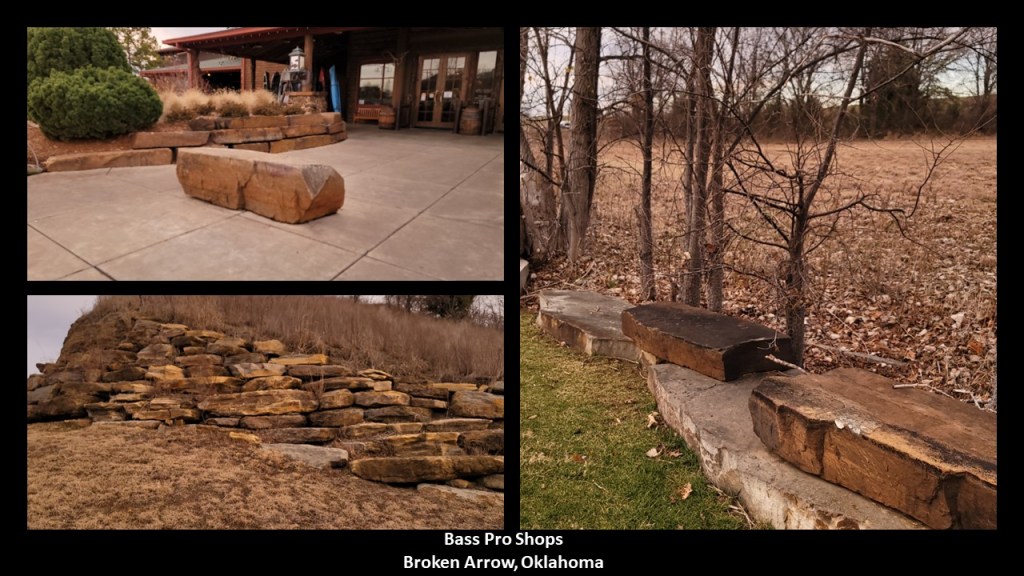
And she took these from around the Bass Pro Shops…
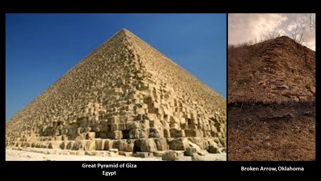
…including this one of a strikingly pyramidal shape on the right, seen even more clearly when compared with a similar view of the Great Pyramid of Giza on the left.
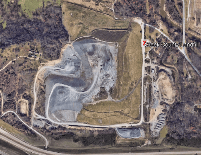
She also checked out the Creek County Landfill in Jenks, Oklahoma, outside of Tulsa…
…and sent these photos she took of the view of it from the road.
This is a good place to insert my experience with Oklahoma landfills.
I was living in Oklahoma City between 2013 and 2016, and it was here during this time that I started waking up to the ancient civilization in the landscape all around me.
Everything that KF has shared with me hits home because I saw the same things once my perception of the landscape had shifted.
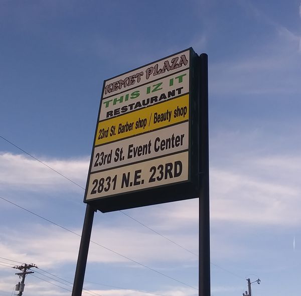
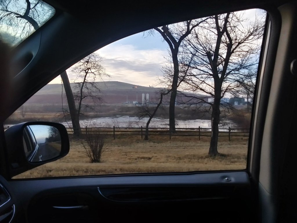
One day, I really noticed a massive, flat-topped shape rising in the landscape on the eastern side of the Oklahoma City, and I decided to drive to it to see what it was.
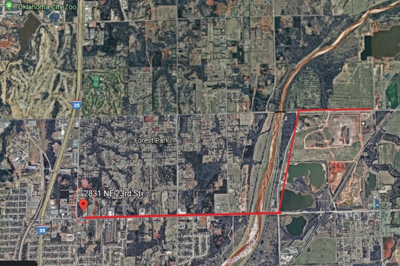
On my way to that site going east, I passed this sign at 2831 23rd Street NE, advertising Kemet Plaza.
This is the relationship between the location of Kemet Plaza, and the location of where I was going, which as it turned out, was a landfill site.
So it turned out that after I left Kemet Plaza, the site I was looking for was quite close by, at the corner of 23rd Street Northeast and Sooner Road.
On one side of it, the west side, is an energy site.
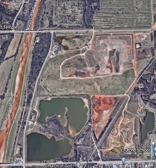
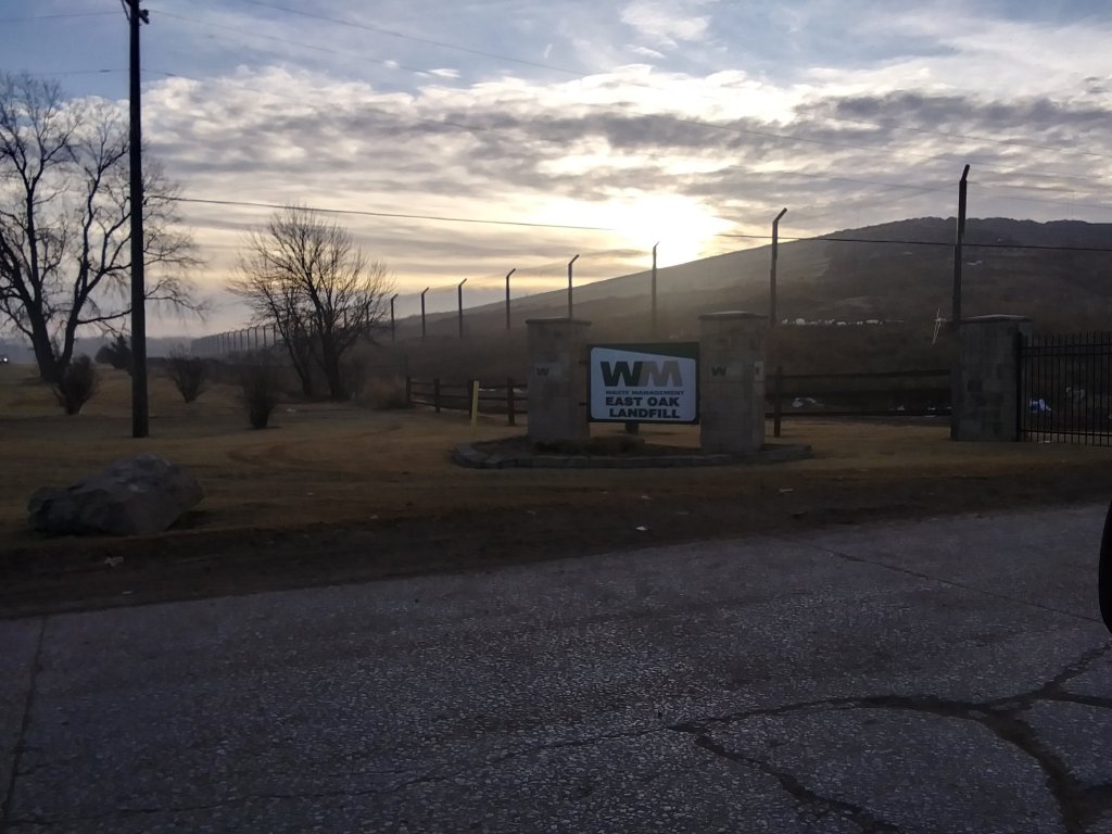
On the east, the southeast side…is a landfill operated by Waste Management.
There are two more just like this in OKC – one is in South OKC off of 240, and the other is in West OKC, in Mustang, Oklahoma. There is another one north of OKC, in Enid. Same idea.
They look like ancient earthworks that are being harvested for energy and also used for dumping trash.
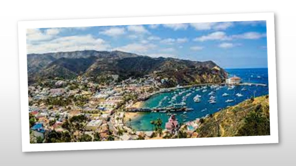
Lastly for this post, MS suggested that I look into Santa Catalina Island, one of California’s Channel Islands.
First I will take a look at the Channel Islands.
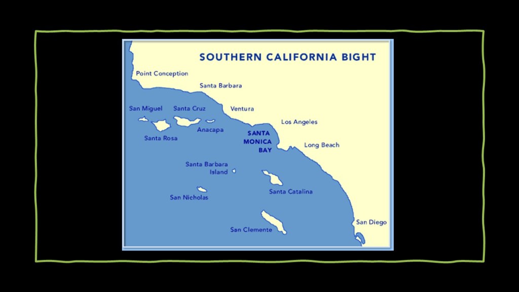
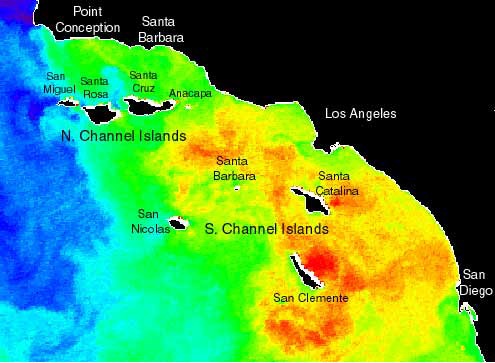
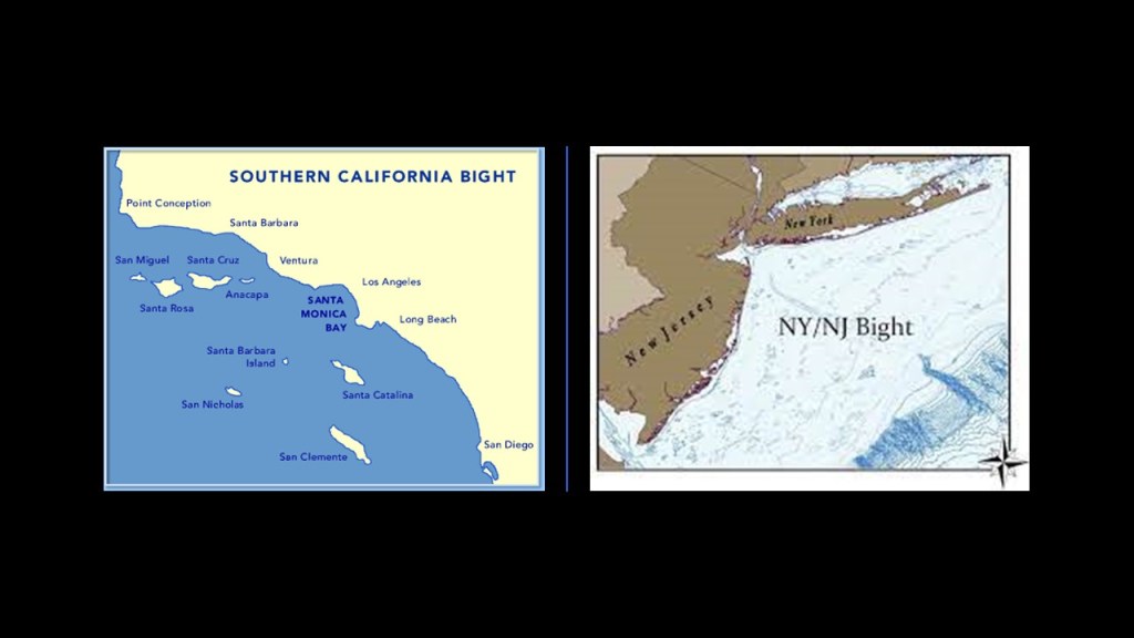
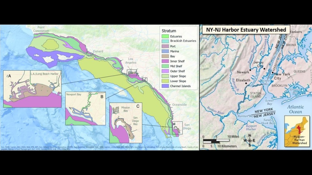
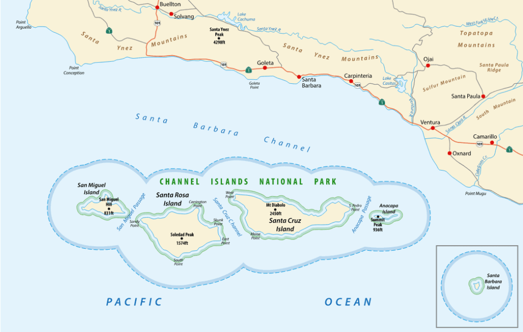
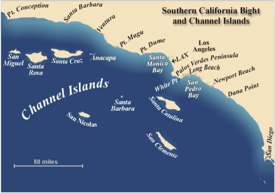
California’s eight Channel Islands are located within the Southern California Bight.
Besides the Channel Islands, the Southern California Bight includes the Coronado Islands and the Isla de Todo Santos of Baja California, coastal southern California and the local portion of the Pacific Ocean.
The bight is described as a significant curvature and indentation along the coast between Point Conception to just below San Diego, at Punta Colonet in Baja California, and that the waters offshore have complex current circulation patterns, with cold, southward flowing waters seen displayed in blue in this satellite image of Sea Surface Temperature, and northward flowing warm waters in yellow and orange.
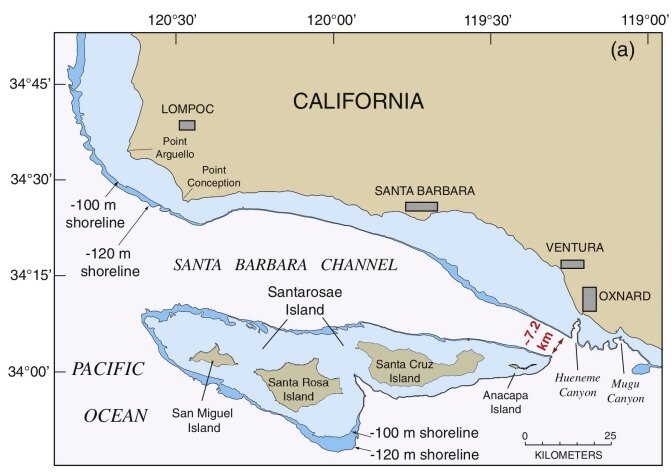
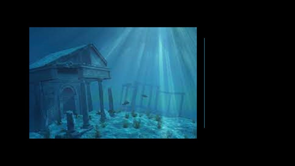
The four North Channel Islands of San Miguel, Santa Rosa, Santa Cruz and Anacapa were said to have been a landmass at one time called Santarosae.
What we are told is that they are the remnants of an ancient landmass off the coast of present-day southern California prior to the end of the last ice age, and that Santarosae lost 70% of its landmass because the sea rose from melting glaciers, leaving a huge submerged landscape that is currently being explored by scientists.
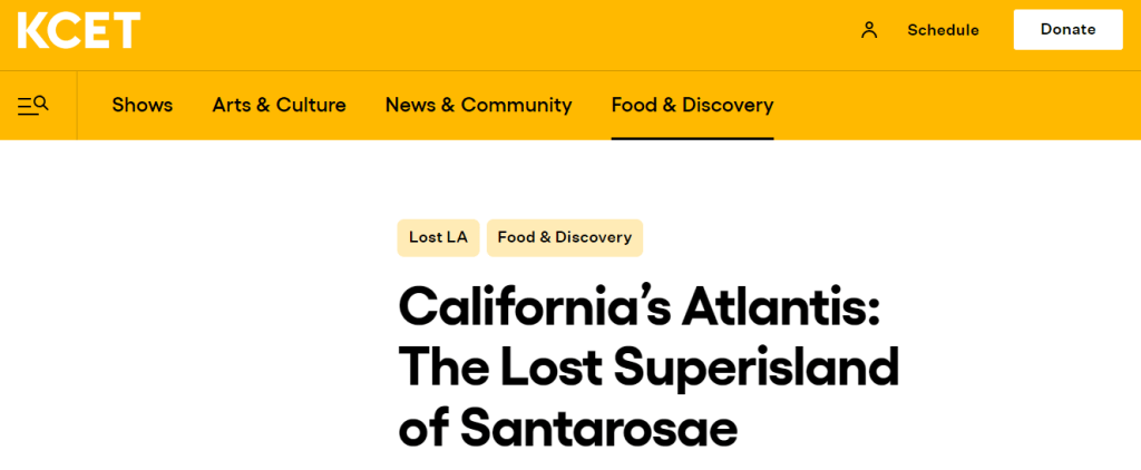
Santarosae is called “California’s Atlantis” by some.
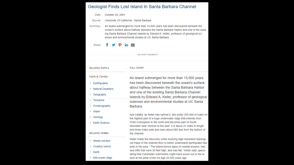
It is interesting to note that around 2001, a geologist discovered a lost island in the Santa Barbara Channel.
Believed to have been submerged for 13,000 years, going underwater towards the end of the last Ice Age, he named it Isla Calafia, and identified it as being located half-way between the Santa Barbara Harbor and one of the existing North Channel Islands.
It was 31-miles-, or 50-kilometers-, long; 3-miles-, or 5-kilometers-, wide, and rises 660-feet-, or 201-meters, from the bottom of the Channel.
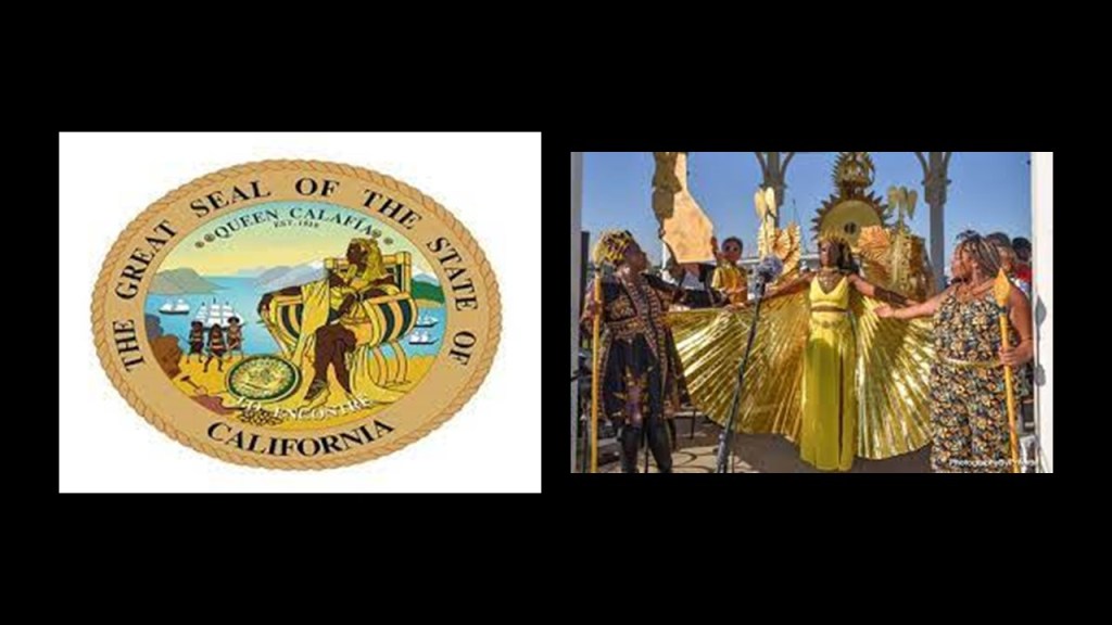
So this information about the Isla Calafia ties-in to Queen Calafia, or Califia, the legendary Amazon Queen of the island of California, and for whom California and Baja California was named.
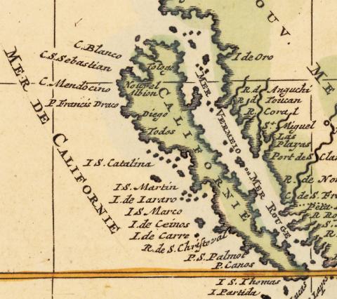
So what we are told about California being an island is that it was one of the most famous map-making errors in history, with the error being reproduced on countless maps during the 17th- and 18th-centuries, despite contradictory evidence from various explorers.
The legend associated with the Island of California was that it was an earthly paradise, like Atlantis or the Garden of Eden.
The first grammar text for Castilian Spanish was published in 1492.
It was the first book dedicated to the Spanish language and its rules, and the first grammar of a modern European language to be published in print.
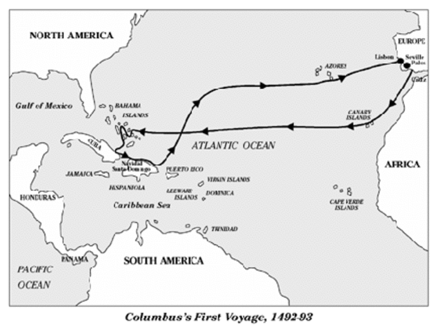
In our historical narrative, the year of 1492 was also the year of the Fall of Granada in Moorish Spain…
…and the year of Columbus’ first voyage.
Almost 20-years later, in 1510, we are told the first known mention of the Island of California was in the fictional novel “The Adventures of Esplandian,” a novel by Castilian author Garci Rodriguez de Montalvo describing a fictional island named California that was inhabited by only black women, and ruled by Queen Calafia.
Here is a passage from the book:
“Know that on the right-hand of the Indies, there is an island called California very close to the side of the Terrestrial Paradise, and it is peopled by black women, without any man among them, for they live in the manner of Amazons.”
Where did that idea come from?
Calafia’s life and place in history is described as entirely fictional, though she is depicted as the spirit California, and symbolizes an untamed and bountiful land prior to European settlement.
Queen Calafia’s name was said to have been likely formed from the Arabic word “Khalifa,”or “Caliph” in English, for the religious state leader of a “Caliphate,” a Muslim political-religious state.
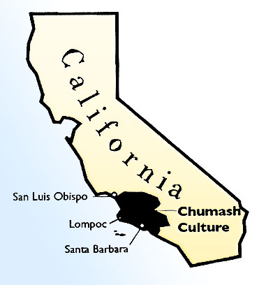
And to throw something else into the mix, the Chumash, the name of the original inhabitants of the North Channel Islands, is also a Hebrew word meaning a Torah in printed or book bound form.
So we have a reference to a Muslim political-religious state, ruled by a woman, is found in the same location as the actual word in Hebrew for the Torah given to the indigenous tribe of Central Southern and Coastal Regions of California, including the North Channel Islands, also known as Santa Barbara Group, of Santa Cruz, Santa Rosa, San Miguel, and Anacapa.
Maybe it’s just a coincidence, but perhaps not.
If it is not a concidence, then what might this signify?
My money is on they were one and the same in the original Moorish civilization, and that those behind the New World Order separated everything out in order to create discord, division, and disharmony, and that all of the Moorish symbolism was taken over, their works and legacy falsely claimed, and/or given a darker meaning by association with certain things that were not the original meaning.
Before I go further into California’s Channel Islands, let me point out some similarities so far to what I found off the Atlantic northeast coast of the United States with what I am seeing here.
I have found the Southern California Bight on the Pacific Coast and the New York – New Jersey Bight on the northeast Atlantic Coast…
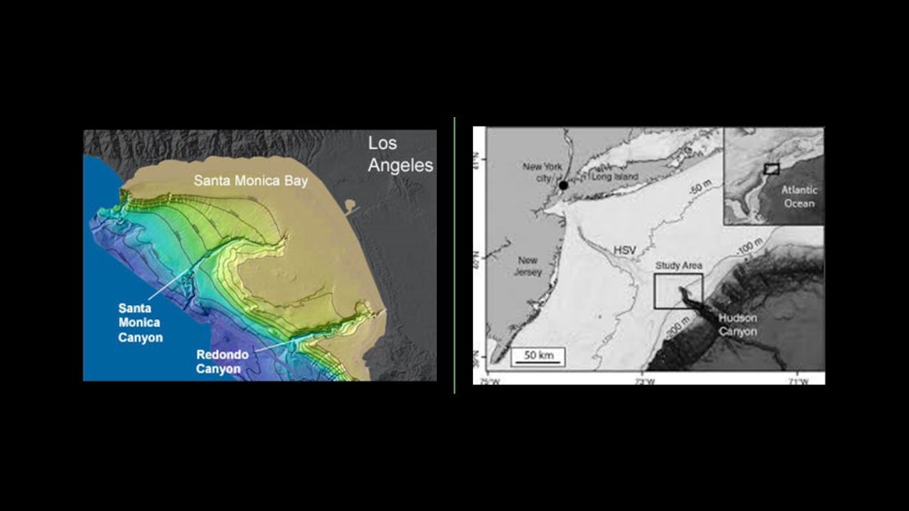
…there are underwater canyons adjacent to the Bights in both places – the Hudson Canyon on the east coast, one of the largest underwater canyons in the world, and numerous canyons off the coast of the Southern California Bight.
My question remains the same: Were this canyons always underwater?
And are they natural or man-made?
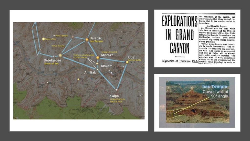
Bear in mind, the Grand Canyon in Arizona has formations with Egyptian names, like the Isis Temple, the Osiris Temple, and the Temple of Set, and that these formations and others correlate with stars in the Orion Constellation.
An article appeared in the Arizona Gazette in 1909 that an explorer in the Grand Canyon had stumbled upon Egyptian artifacts, but news about the discovery disappeared from public view shortly after it was published, and it has been called a hoax ever since.
Also, there are estuaries along both the Southern California Bight and the New York – New Jersey Bight.
Estuaries are defined as partially-enclosed, coastal bodies of brackish water, which is water that is salty, dirty & unpleasant, with one or more rivers flowing into it, and a connection to the open sea.
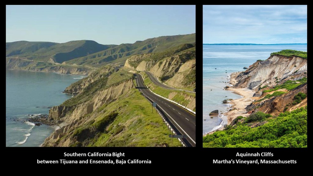
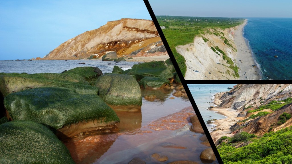
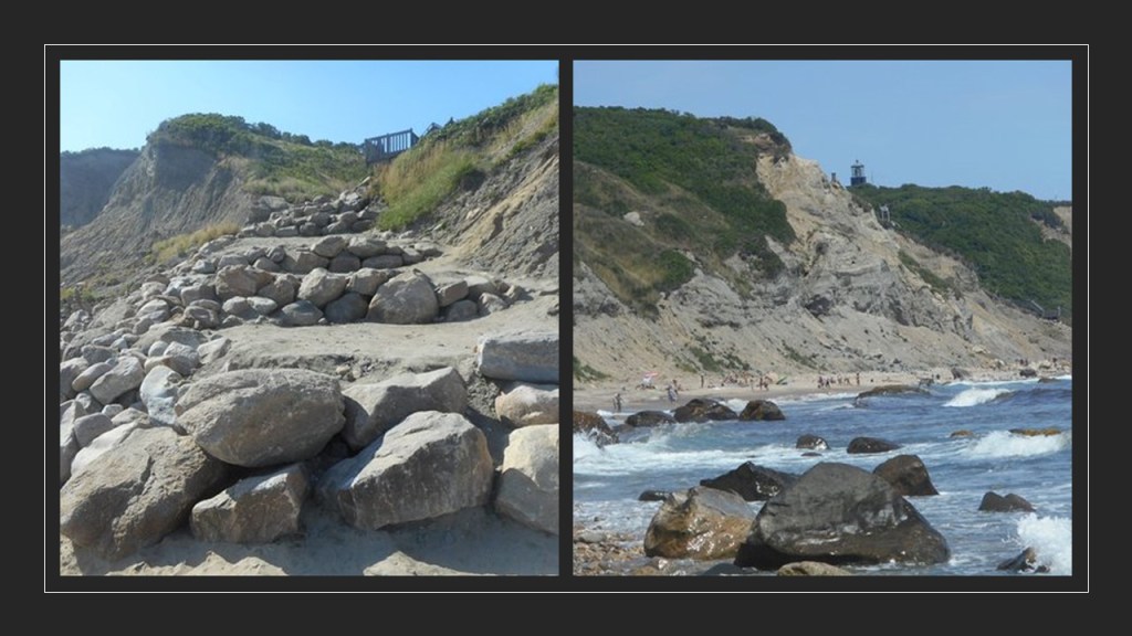
There is sheared-off, unstable-eroded-looking landscape in both places, like as seen on this stretch of coastal road beside the Southern California Bight on the left, and the Aquinnah Cliffs on Martha’s Vineyard, which is also where the headquarters of the Wampanoag Tribe of Martha’s Vineyard is located on their historical land.
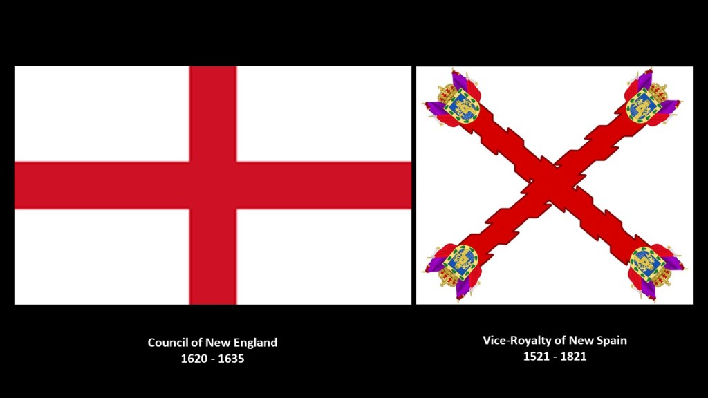
And while the Council of New England and the Church of England were busy colonizing and settling New England starting in 1620, the Vice-Royalty of New Spain and the Catholic Church did the same thing after the Spanish Conquest of the Aztec Empire in 1521.
Central Mexico became the base of expeditions of exploration and conquest, in what became a huge area that comprised the Spanish colonization of the Americas, including California among many other places.
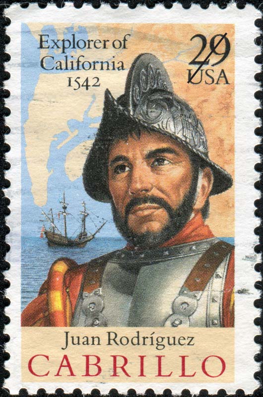
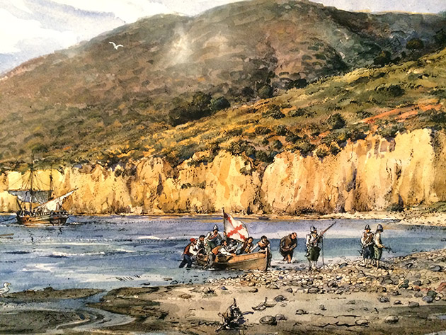
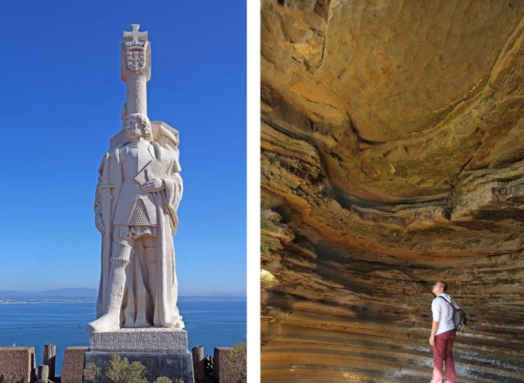
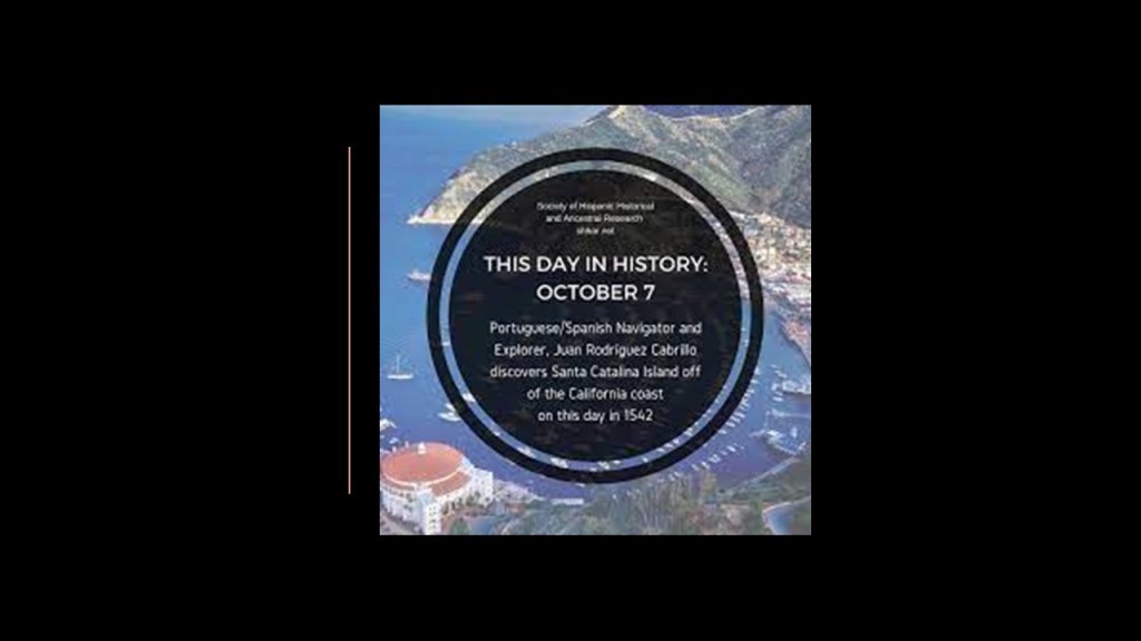
In 1542, explorer Juan Rodriguez Cabrillo landed in San Diego Bay on behalf of the Spanish Empire…
…and we are told became the first European to set foot in California, exploring the California coast starting 1542.
According to the historical narrative, Cabrillo died on Santa Catalina Island in January of 1543 from an injury to his leg that became infected and gangrenous.
Among other things bearing his name, there is a Cabrillo National Monument in San Diego commemorating his landing in San Diego Bay.
To put Cabrillo’s exploration of California into historical perspective in our timeline, in 1540, two years before Cabrillo explored California, Pope Paul III issued a papal bull forming the Jesuit Order, under the leadership of Ignatius Loyola, a Basque nobleman from the Pyrenees in Northern Spain.
The Jesuit Order included a special vow of obedience to the Pope in matters of mission direction and assignment.
The same year, in 1542, Pope Paul III established the Holy Office, also known as the Inquisition and the Congregation for the Doctrine of the Faith.
Also in 1542, St. Francis Xavier, a co-founder of the Jesuits, landed in Goa on the Indian subcontinent, where some believe he requested the brutal Goa Inquisition, established, we are told, to enforce Catholic Orthodoxy in colonial-era Portuguese India.
The following year, in May of 1543, Nicolaus Copernicus published “On the Revolutions of the Heavenly Spheres,” offering mathematical arguments for the heliocentric, or sun-centered universe, and denying the geocentric model of the Earth-centered universe of Ptolemy, which the heliocentric model superceded, meaning that while once widely-accepted, current science considered the geocentric model inadequate.
By the end of May of that same year, Copernicus was dead.
So both Juan Rodriguez Cabrillo, first explorer of California, and Nicolaus Copernicus, author of the heliocentric universe, were contemporaries, and died in the same year.
Like India’s St. Francis Xavier, California had its own “Missionary Saint” in the form of St. Junipero Serra, who was credited with establishing the first Franciscan missions in Mexico and California between 1750 and 1782.
Posthumous honors for him include Sainthood in 2015 and he represents the State of California in the National Statuary Hall at the U. S. Congress, along with Ronald Reagan.
Serra was nicknamed the “Apostle of California” for his missionary efforts, but before and after his canonization, his reputation and missionary work was condemned for reasons given like mandatory conversions of the native population to Catholicism and atrocities committed against them.
Now, back to the Channel Islands.
Of the eight Channel Islands, five are part of the Channel Islands National Park and the Channel Islands National Marine Sanctuary – all of the North Channel Islands plus Santa Barbara Island, situated at the center of the Channel Islands.
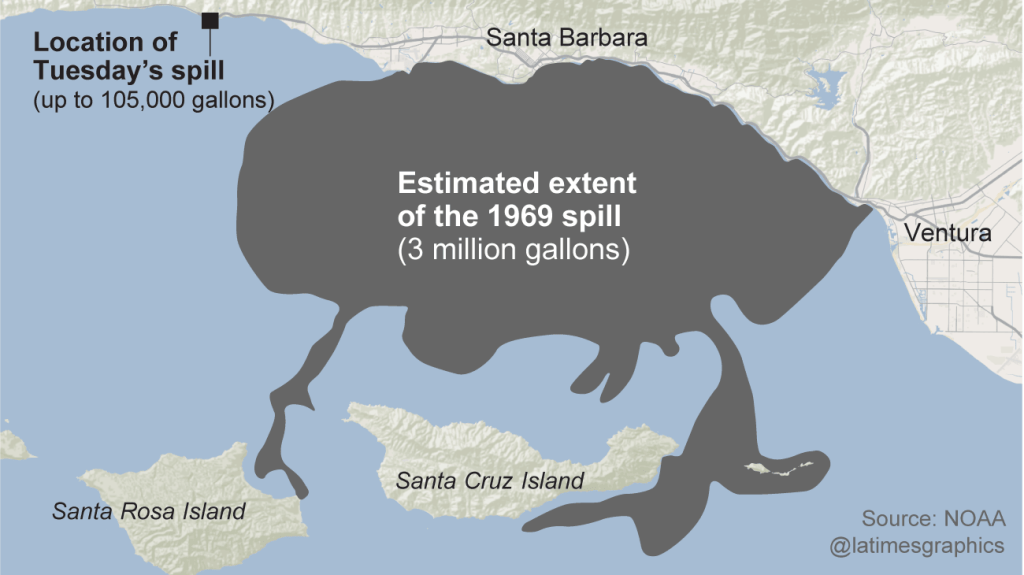
Interesting to note that in 1969, the third-largest oil spil in the history of the United States, known as the Santa Barbara Oil Spill took place in this area, when an oil rig exploded 6-miles, or 10-kilometers, off the California coast inthe Santa Barbara Channel , and tides washed the oil onto all four of the North Channel Islands.
The South Channel Island group is comprised of the islands of Santa Barbara, San Nicolas, San Clemente, and Santa Catalina.
Santa Catalina Island is the only one of the eight Channel Islands with a large, permanent settlement.
Let’s take a look at Santa Catalina Island and see what comes up.
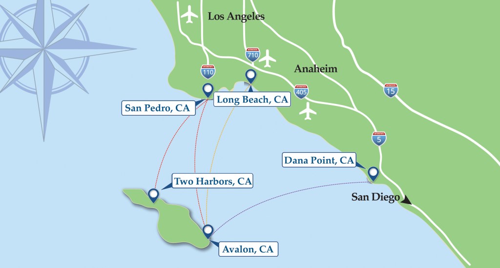
Part of Los Angeles County, Santa Catalina Island is located 29-miles, or 47-kilometers, south-southwest of Long Beach, and west of San Diego.
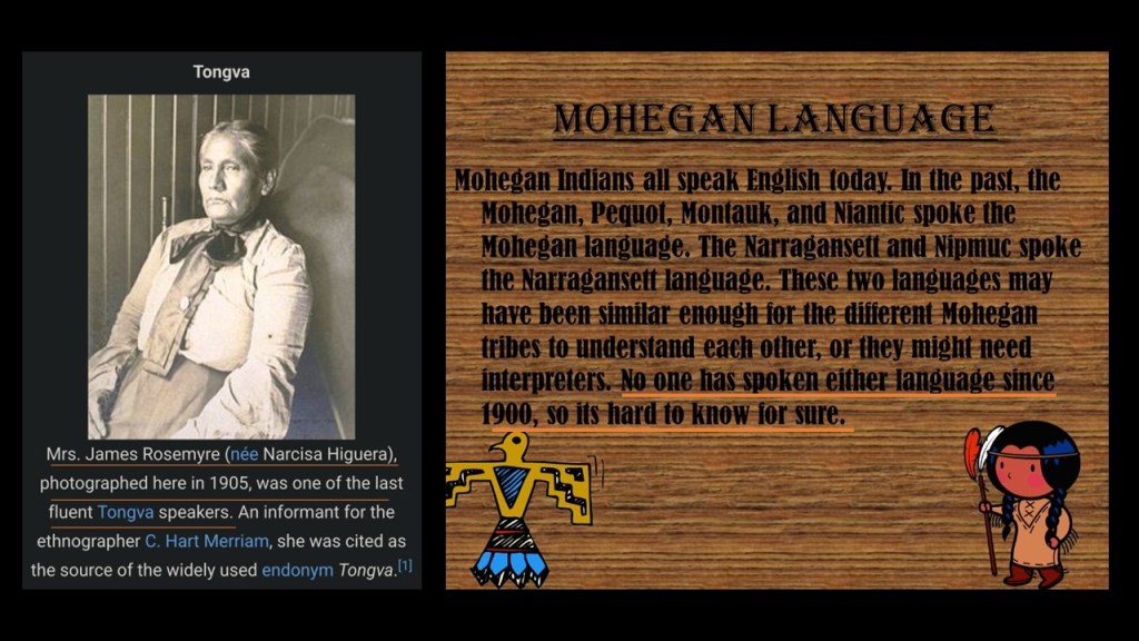
The Tongva people, also known as Kizh, were indigenous to the South Channel Islands and the Los Angeles Basin.
Just like what happened on the northeast coast of the United States with Algonquin languages like Mohegan, the spoken language of the native people of the region died out in the early 1900s.
Santa Catalina’s first European contact was said to have been with Juan Rodriguez Cabrillo on October 7th of 1542…
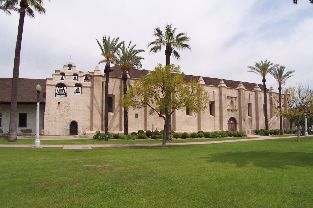
The collapse of the Tongva society and culture of the region was initiated with the founding of the San Gabriel Mission in Los Angeles County in 1771 by the Franciscan missionary Junipero Serra.
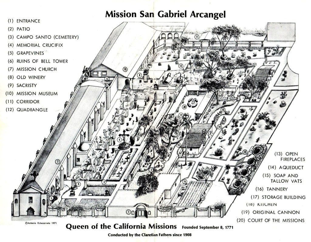
The Spanish initiated forced relocation and enslavement of the native Tongva people under the mission system to secure their labor, and some of the nicknames of the San Gabriel Mission in San Gabriel California is the “Queen of the California Missions,” and “Mother of Agriculture in California.”
The Spanish Mission System of California is sound A LOT like the English plantation system of New England.
Back to Santa Catalina Island.
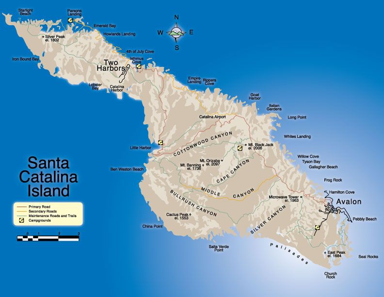
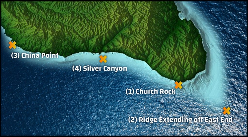
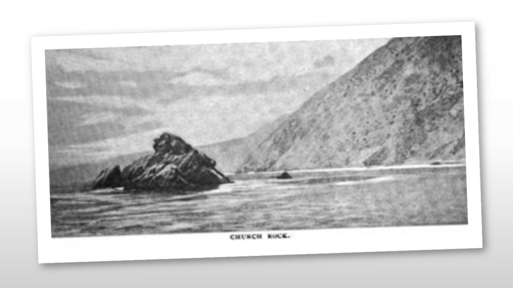
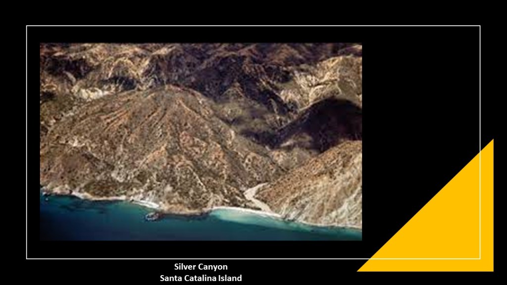
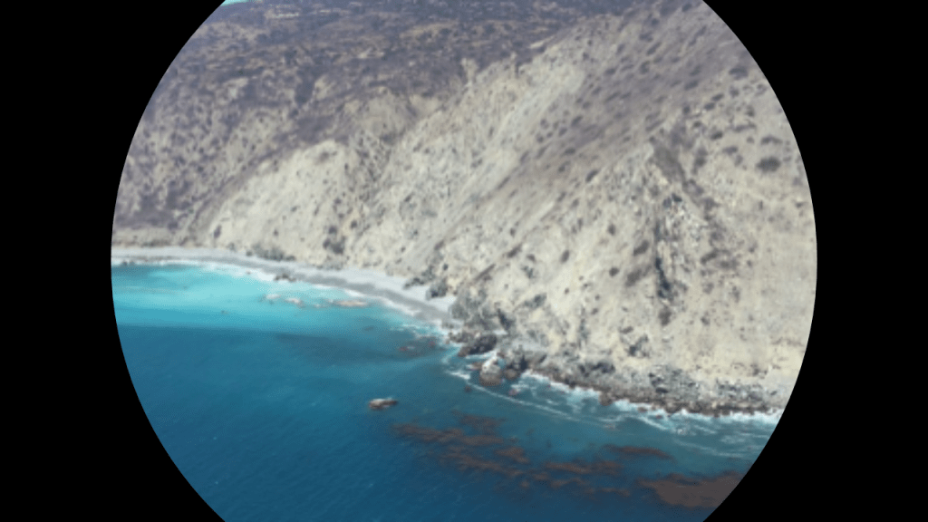
On the south-side of the East End of Catalina Island, we find places with such names as Church Rock, Silver Canyon, China Point, and a ridge seen extending out into the ocean waters, looking like there is more of the island going on underneath it.
Church Rock is a large rock jutting out of the ocean just off-shore on the East End, and is a popular dive spot.
Silver Canyon is one of the largest canyons of several on Catalina Island.
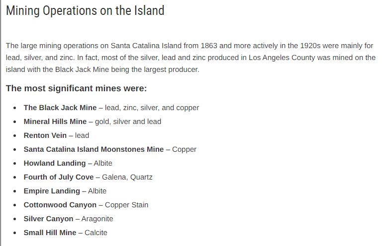
And come to find out, there were large mining operations on Santa Catalina Island, including Silver Canyon, from about 1863 (mid-way through the American Civil War) to the 1920s.
A short-distance up the coast from Silver Canyon is China Point.
Today a dive site, China Point got its name as the location of a camp on the back-side of the island for smuggling Chinese immigrants after the Chinese Exclusion Act was passed by the U. S. Congress in 1882, barring all new immigration from China for 10 years.
This is what we are told about Avalon, the only incorporated city on Catalina Island.
George Shatto, a real estate developer from Grand Rapids, Michigan, was the first owner of the island to try to develop Avalon into a resort destination.
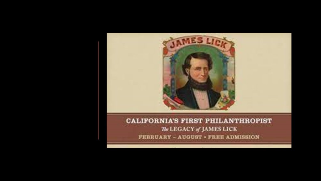
He purchased the island in 1887 for $200,000 from the Lick Estate of James Lick, a real estate investor based in San Francisco who arrived in California in January of 1848.
At the time of Lick’s death in 1876, he was the wealthiest man in California, and his real estate holdings, besides all of Catalina Island, included a considerable part of Santa Clara County, San Francisco, Lake Tahoe, and a large ranch in Los Angeles.
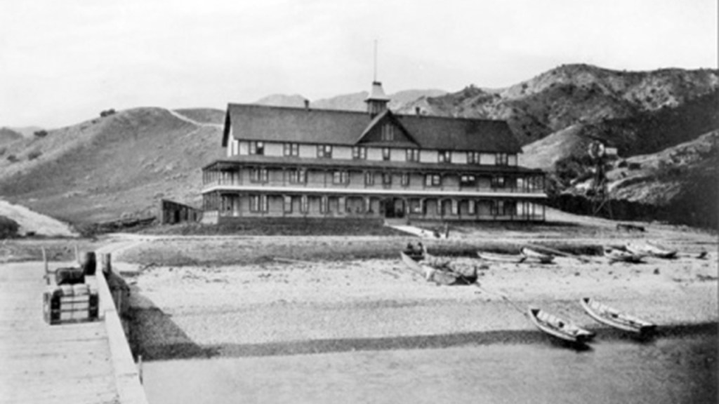
Shatto was credited with creating the settlement that became known as Avalon, and building the first hotel there, the Hotel Metropole, between 1887 and 1888, and that the island first opened for tourists in 1888.
By 1891, Shatto was having financial problems and defaulted on his loan payment for the island, and Santa Catalina Island was returned to the James Lick Trust.
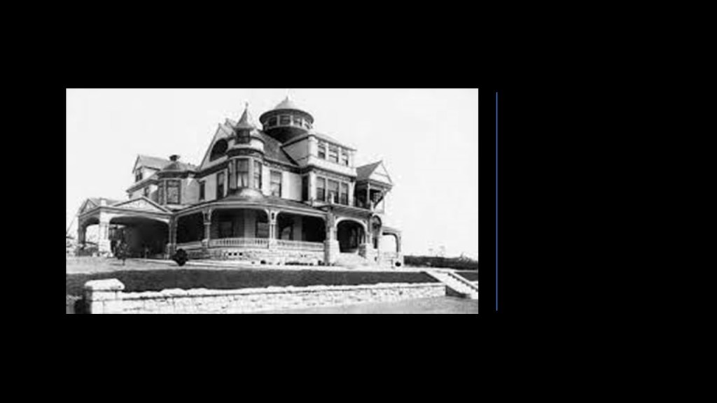
In 1892, Shatto was said to have built the Shatto Mansion in Queen Anne-style architecture in Los Angeles.
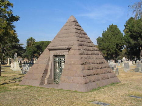
George Shatto was the only person killed in a train crash near Ravenna, California, in 1893…
…and he was interred in a pyramid-shaped mausoleum at the Angelus Rosedale Cemetery in Los Angeles.
In 1891, the Banning Brothers purchased Santa Catalina Island from the James Lick Estate.
They were the sons of Phineas Banning, a wealthy California entrepreneur known as the “Father of the Port of Los Angeles.”
The Banning Brothers were said to have fulfilled the dream of George Shatto of making Avalon a resort community with the construction of numerous tourist facilities.
However, in 1915, a fire was said to have burned half of Avalon’s buildings, including six hotels and several clubs.
Subsequently, the Banning Brothers were forced to sell the island in shares starting in 1919.
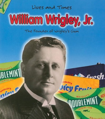
Chewing gum magnate William Wrigley, Jr, was one of the main investors who purchased Santa Catalina Island’s shares from the Bannings.
Wrigley bought out most of the other shareholders to become the controlling shareholder in the “Santa Catalina Island Company.”
Wrigley then invested millions into building needed infrastructure for attractions to the island.
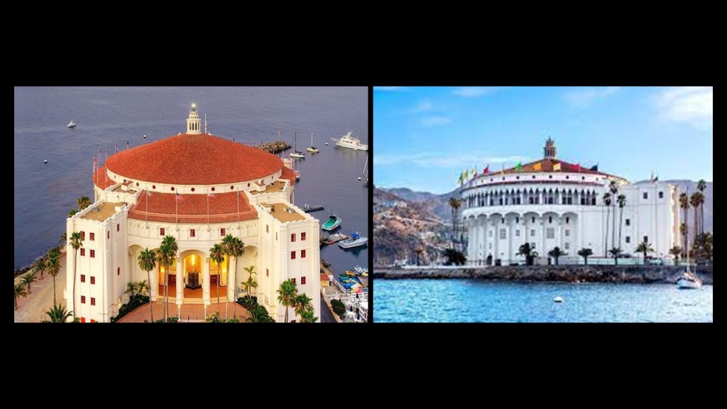
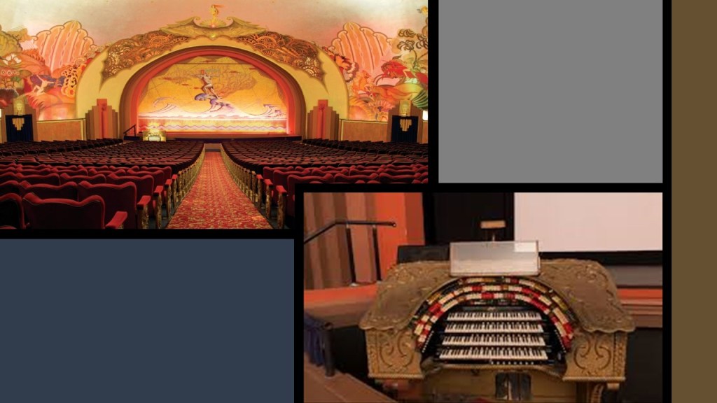
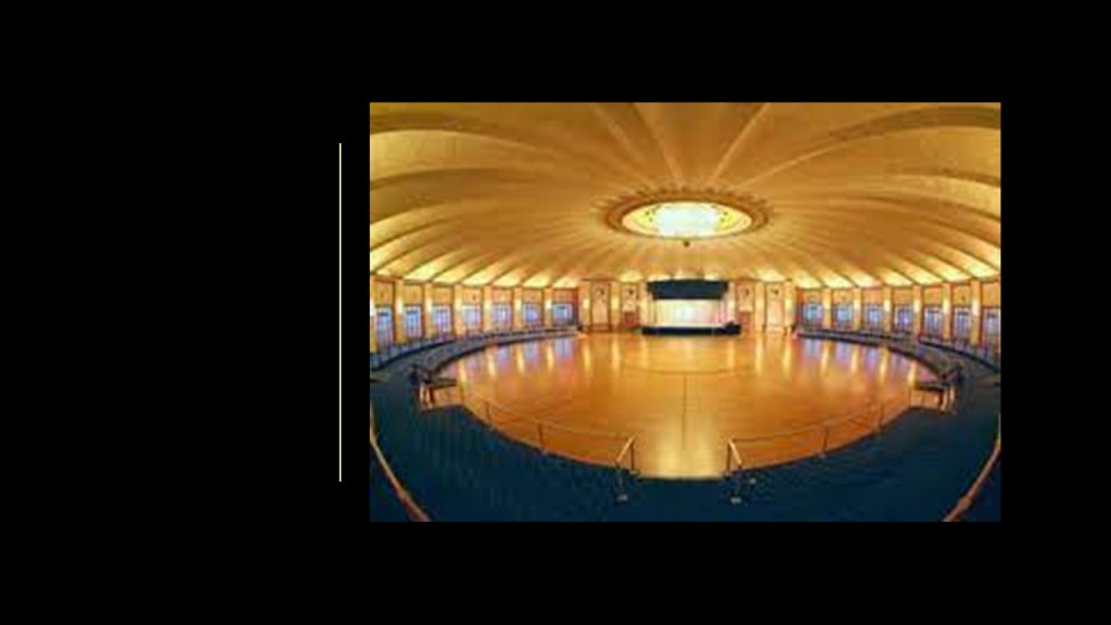
This included the Catalina Casino, which was said to have been built starting in 1928, and first opened in 1929.
The Catalina Casino houses things like a movie theater and a ballroom.
The movie theater still has its original pipe organ intact.
The acoustics are so good in the Catalina Casino’s movie theater that someone speaking on the stage can be heard without using a microphone and be heard clearly by everyone in the 1,154-seat capacity auditorium.
The Catalina Casino’s ballroom is the world’s largest circular ballroom, with a 180-foot, or 55-meter, dance floor that can accommodate 3,000 dancers.
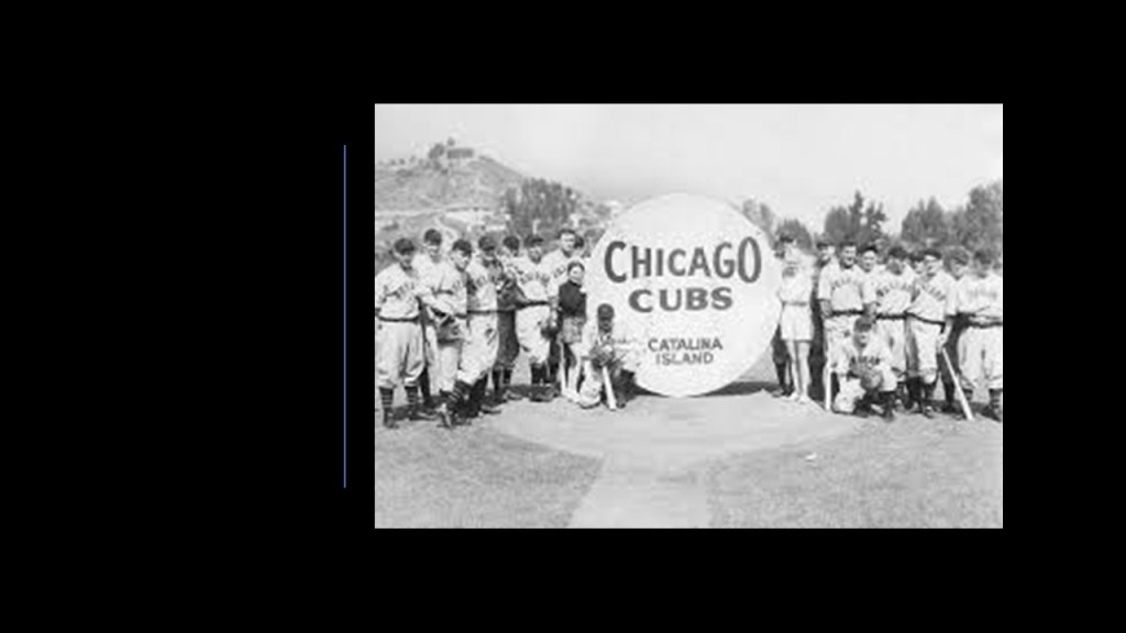
Wrigley even brought the Chicago Cubs to Santa Catalina Island for their spring training starting in 1921, which lasted through 1951.
Santa Catalina Island in California’s Channel Islands is known as a playground for the rich and famous off the Pacific coast of southern California, like the prime and luxury real estate found around the estuaries lining the Atlantic Northeast Coast of the United States, including Martha’s Vineyard and the Hamptons of Long Island.
This fascination and interest the wealthy elites have long had with islands and estuaries on both coasts is noteworthy, leaving me to wonder why they are so obsessed with these places.
Personally, I think the wealthy globalist controllers have been and are lording and gloating over their take over of what was an ancient, beautiful, and advanced worldwide Moorish civilization that existed up until relatively recently, and they covet the very special places to this civilization.
Not only that, I think this whole civilization was what we know as Atlantis, or Atlantean, and not just found in the Atlantic Ocean, with its roots in Ancient LeMuria, or Mu, hence the name “Mu’urs” or “Moors” given to these ancient people.
I think the coastlines of the world got slammed by whatever caused earth’s landmasses to submerge, causing estuaries and wetlands like these worldwide, and that the “Sinking of Atlantis” took place much more recently in time than thousands of years ago, more like hundreds of years ago, and that it was caused by a deliberately created cataclysm or cataclysms by malevolent beings who had a plan to takeover the Earth’s original civilization for their own benefit.
There are countless examples of what I am talking about, but here are a few examples I have encountered in my research:
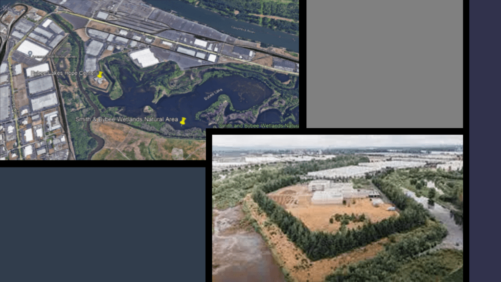
Up the Pacific Coast from California, in Portland, Oregon, there is a visible star fort point at the Smith & Bybee Wetlands Natural Area, which is now the location of the Bybee Lakes Hope Center for the homeless…
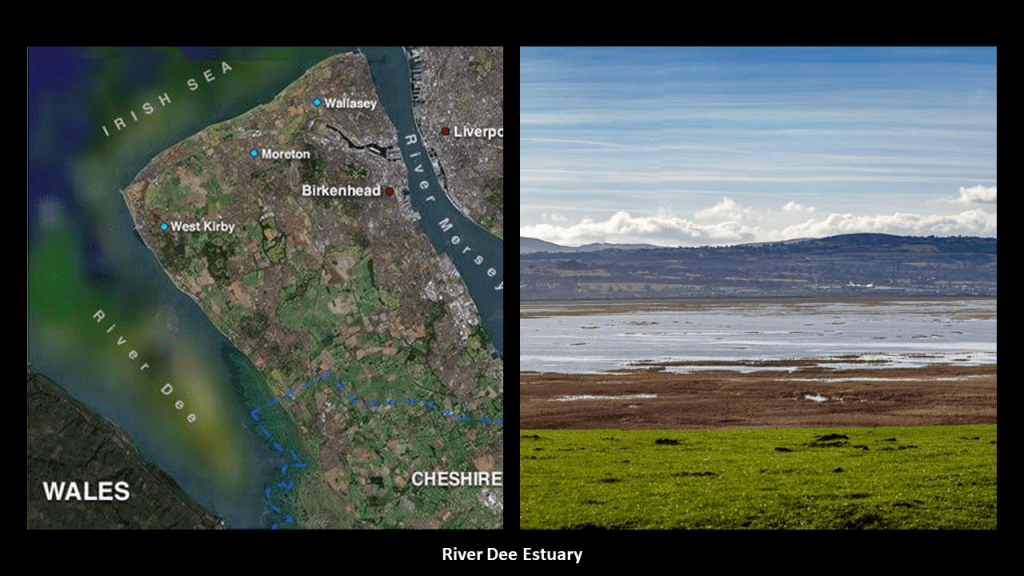
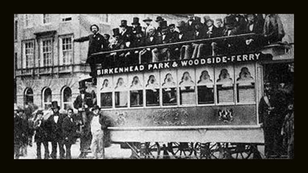
The Wirral Peninsula and the River Dee estuary separating northwest England and Wales, and a place where comparatively little water occupies such a large basin.
Birkenhead on the Wirral Peninsula was said to have expanded greatly as a result of the Industrial Revolution…
…and was the location of the first street tramway in Great Britain in 1860, and trams ran in Birkenhead until 1937.
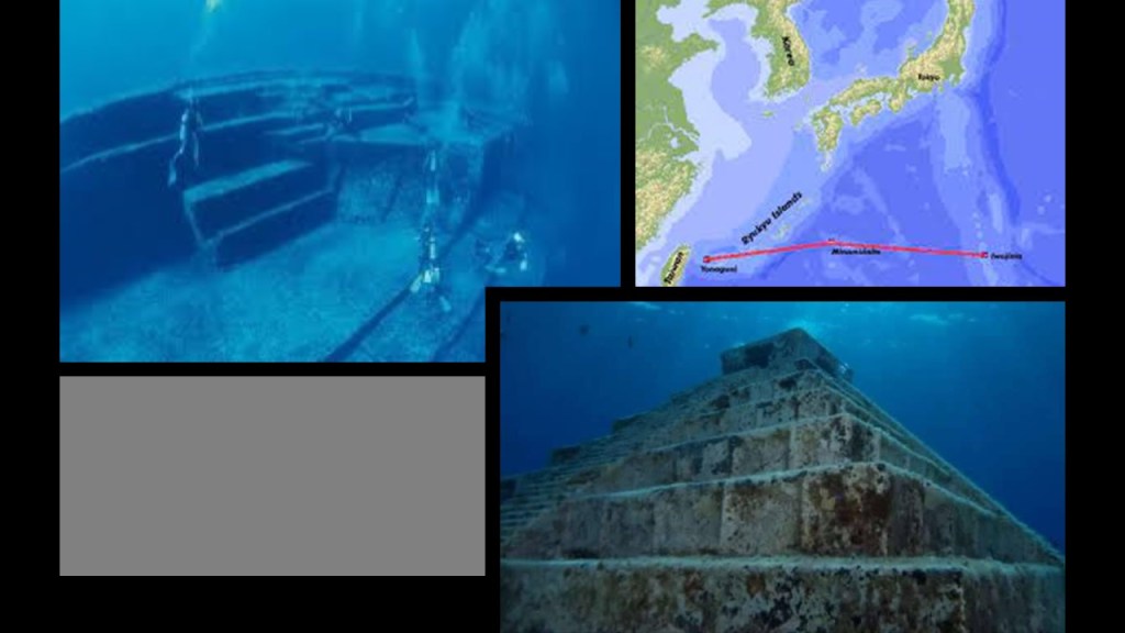
The submarine Yonaguni ruins off the coast of Japan’s Yaeyama Islands.
When I first learned about Yonaguni several years ago, a few years before I started doing my own research, I distinctly remember the argument being made that these were natural formations.
Why the effort cover-up of what are clearly man-made structures?
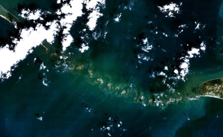
The last example I want to provide is the chain of low islands and reefs called Adam’s Bridge, also known as Rama’s Bridge, or Ramsethu, which separates the Gulf of Mannar from Palk Bay between India and Sri Lanka.
The Pamban Bridge, a railway bridge, connects the town of Mandapam in Tamil Nadu with Pamban Island and Rameswaram to the Indian Railways, ending at the Indian side of Adam’s Bridge.
It was said to have been constructed between 1911 and 1914, which was the year World War I started.
Described as a masterpiece of engineering, it has a movable section midway that is raised to allow ship and barge traffic to pass through.
So, were we actually capable of engineering feats like these based on the technology we are taught existed that at those times?
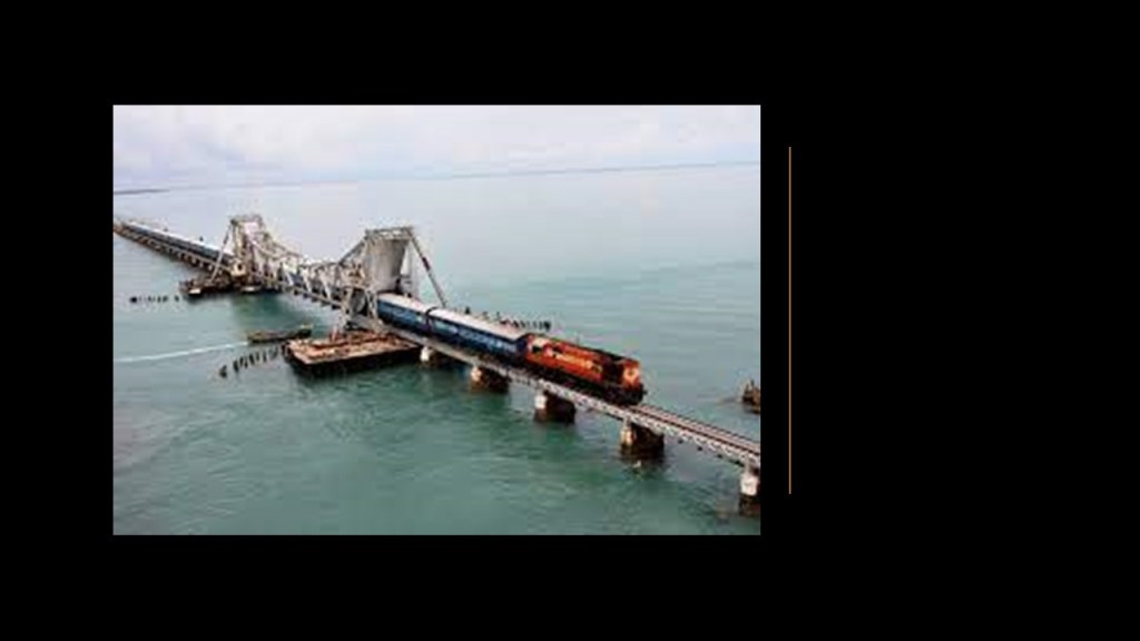
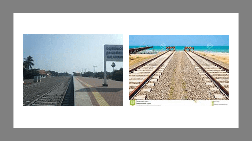
In Palk Bay, you can take a ferry across, in the same general location as the sunken parts of Adam’s Bridge, to Talaimannar, on Sri Lanka’s Mannar Island, and catch the train on to anywhere you want to go in Sri Lanka.
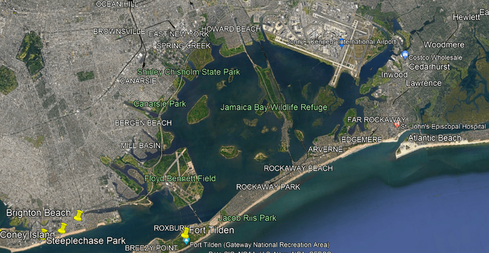
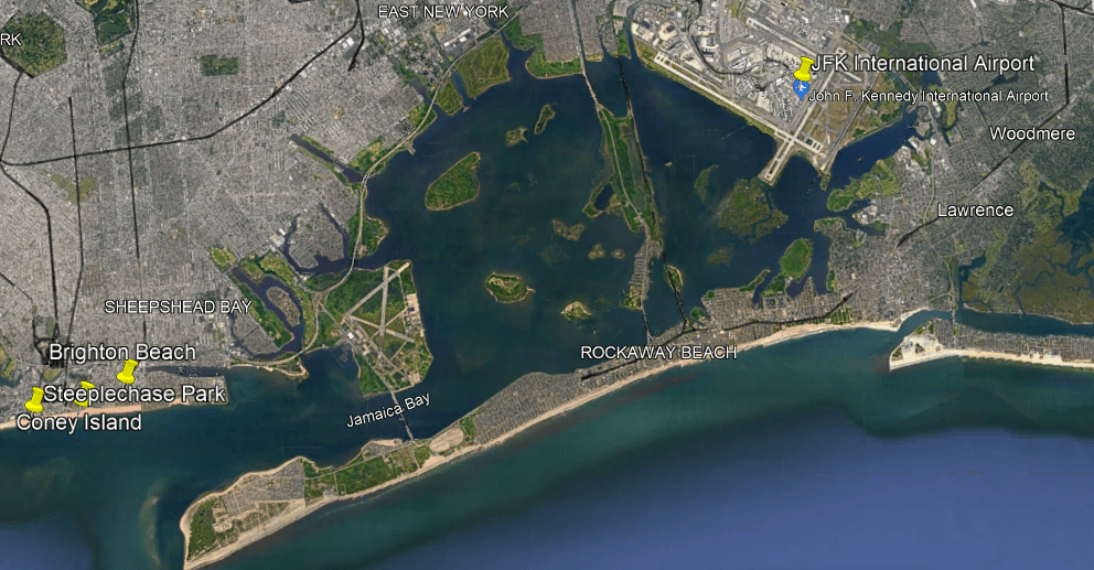
Other examples of advanced railroad technology crossing estuaries is found in New York City’s Jamaica Bay, called a partially man-made and partially natural estuary on the western tip of Long Island, and containing numerous marshy islands.
There is a rapid transit line of the New York subway system that operates here, the IND Rockaway Line that runs between the Aqueduct Racetrack Station terminal, close to the airport, and crosses Jamaica Bay to the Rockaway Park-Beach 116th Street Station terminal.
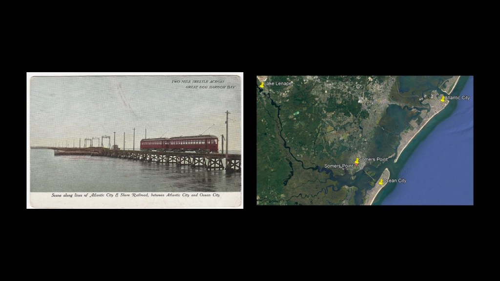
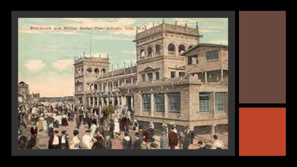
Also, historically at the Great Egg Harbor Estuary in New Jersey, where this old postcard shows the Atlantic City and Shore Railroad crossing a two-mile, or 3-kilometer, -long trestle bridge in the Great Egg Harbor Bay, and was part of an interurban trolley system in New Jersey that served Somers Point and several other cities between Atlantic City and Ocean City in the years between 1907 and 1948.
The reason given for the end of its operation was a hurricane damaging the viaduct in 1948, and fixing it was cost prohibitive because of the decline in trolley use.
There are many more estuaries, wetlands, and undersea ruins around the world, but this should give you some examples about why I believe the “Sinking of Atlantis” was a relatively recent occurrence, and that we have been given a brand new historical narrative superimposed over the original infrastructure and civilization to tell us what happened.
I am going to end this post here, and will continue to investigate your suggestions in the on-going series “All Over the Place via Your Suggestions.”
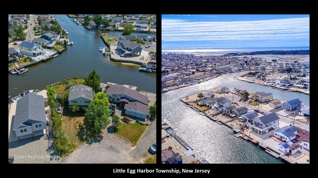
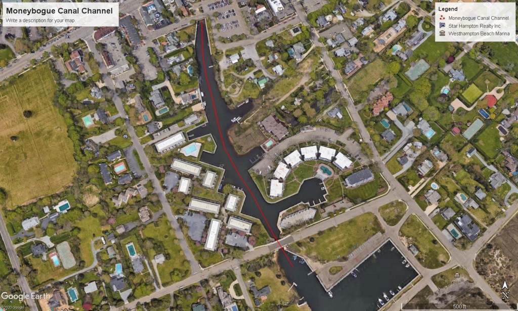
I was taken to the area around the Great Egg Harbor in New Jersey by a viewer who suggested I look into a specific place on the Great Egg Harbor River.
Now, swamps and bogs are not the first thing that come to mind when I think of New Jersey, but those are the first things that jumped out at me when I looked up the place the viewer suggested.
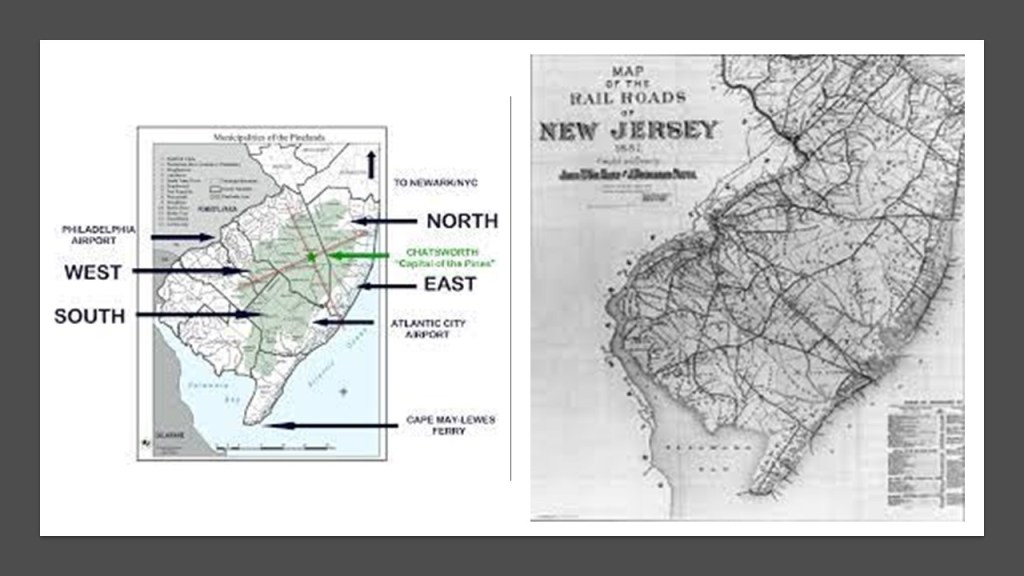
This area is part of both the New Jersey Pine Barrens and the New York-New Jersey Estuary System.
I am finding a lot of noteworthy things here, and I have found that when looking at the subject of estuaries and pine barrens, there is way more to this subject than what meets the eye on a superficial glance as you will see, and I am going to make the case that these are ruined lands that were once part and parcel of a thriving and sophisticated worldwide Moorish civilization that we have not been told about, and there is an accompanying fascination and interest the wealthy elites of American society have long had with this region.
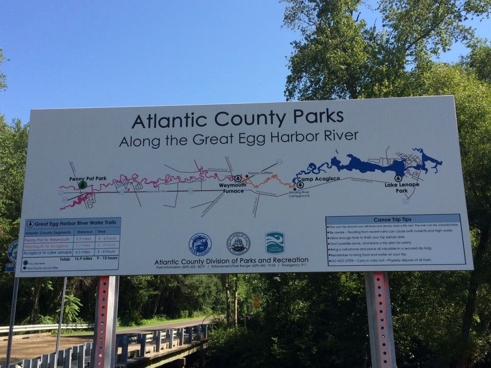
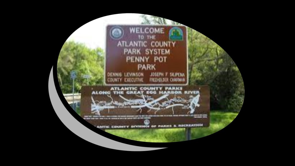
Viewer FG suggested that I look in to the Weymouth Furnace in Atlantic County, New Jersey, on the Great Egg Harbor River.
FG said that the area where it is located is now a county park.
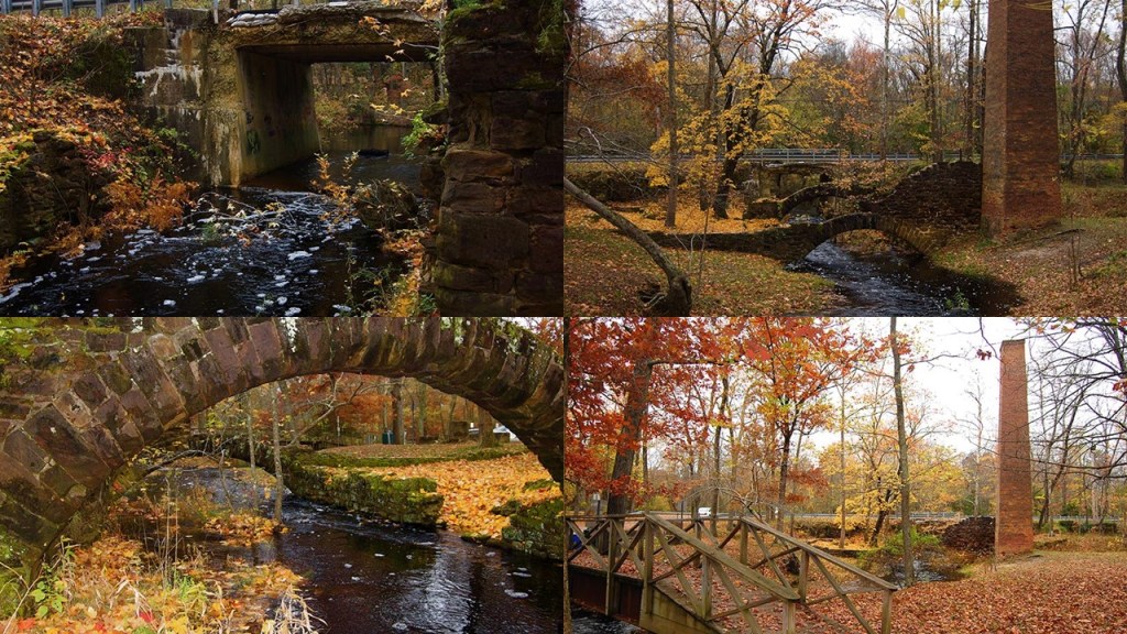
Seeing the map of the Atlantic County Parks along the Great Egg Harbor River, I am going to expand my focus, and take a look at what is between Lake Lenape and Penny Pot Park, with the Weymouth Furnace in-between.
I will start at the Weymouth Furnace.
This is what we are told.
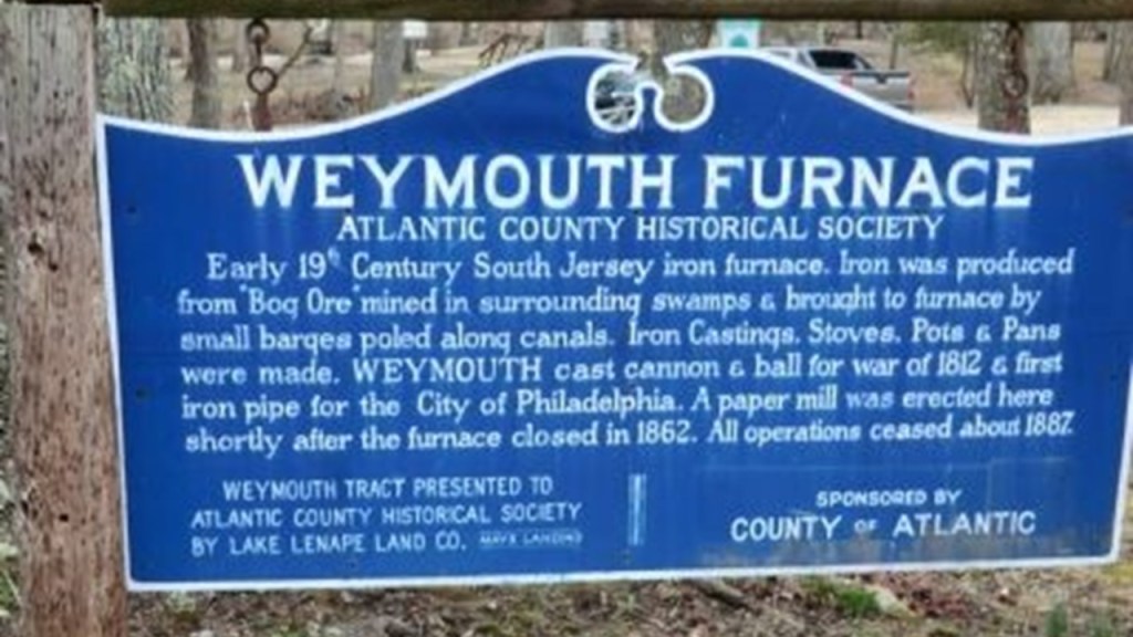
The Weymouth Furnace was said to have been an iron furnace built in the early 19th-Century.
The iron was produced at the furnace from “Bog Ore” mined in the surrounding swamps.
The mined “bog ore” was then transported on pole-propelled barges along canals.
Iron castings, stoves, pots, pans, pipes, cannon & cannon balls were made at the Weymouth Furnace.
The iron foundry was closed in 1862 (during the American Civil War) and replaced by a paper mill until all operations ceased around 1887.
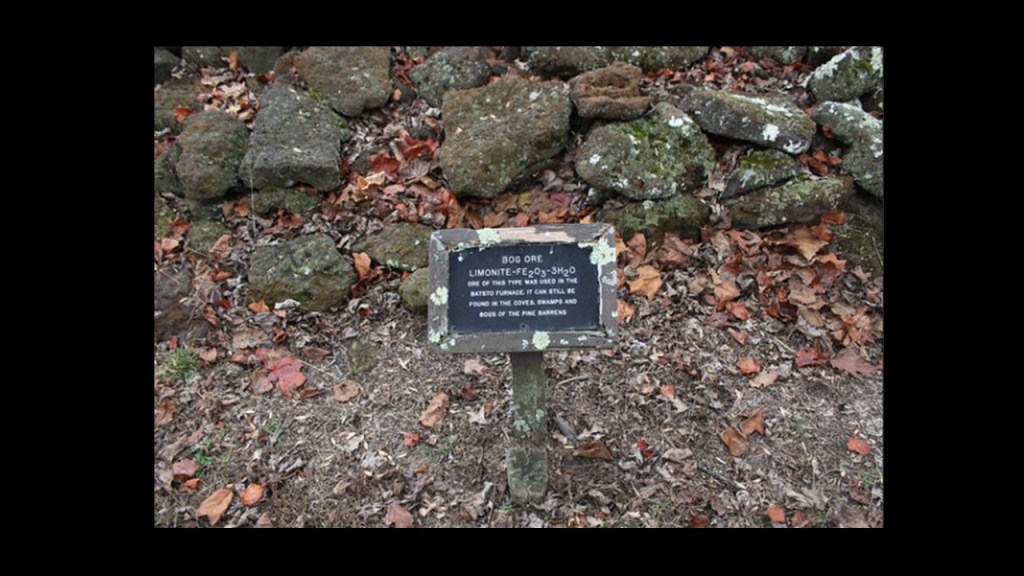
So, for starters, the iron came from “Bog Ore” that was mined in the surrounded swamps.
Sounds suspicious to me!
What’s “bog ore?”
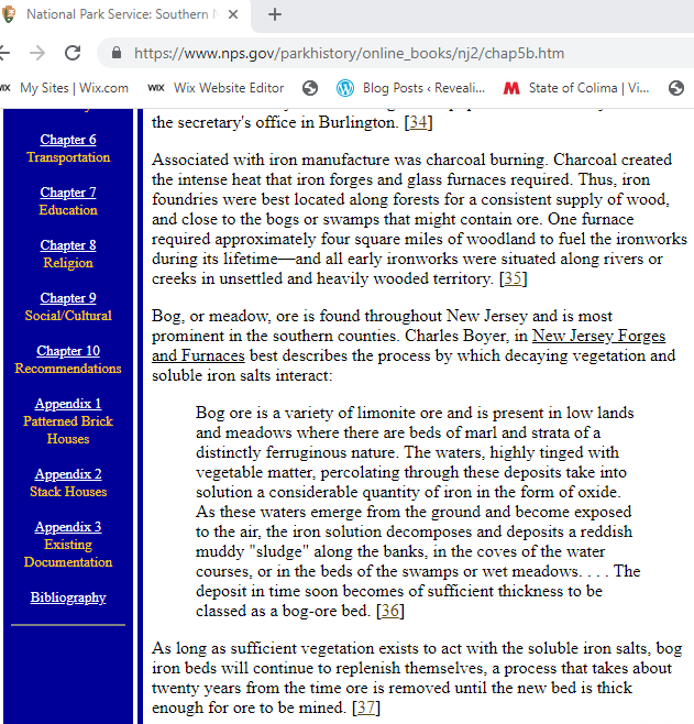
This article on the federal government’s National Park Service website regarding “Southern New Jersey and the Delaware Bay” says the following about iron works and bog ore:
Iron foundries were best located along rivers and creeks in unsettled and heavily-wooded land for the wood and charcoal needed to generate the intense heat required for iron furnaces;
Bog, also called meadow, ore is found throughout New Jersey, especially in the southern counties, and that it is produced from the interaction of decaying vegetation and soluble iron salts, creating bog-ore-beds that replenish themselves over time.
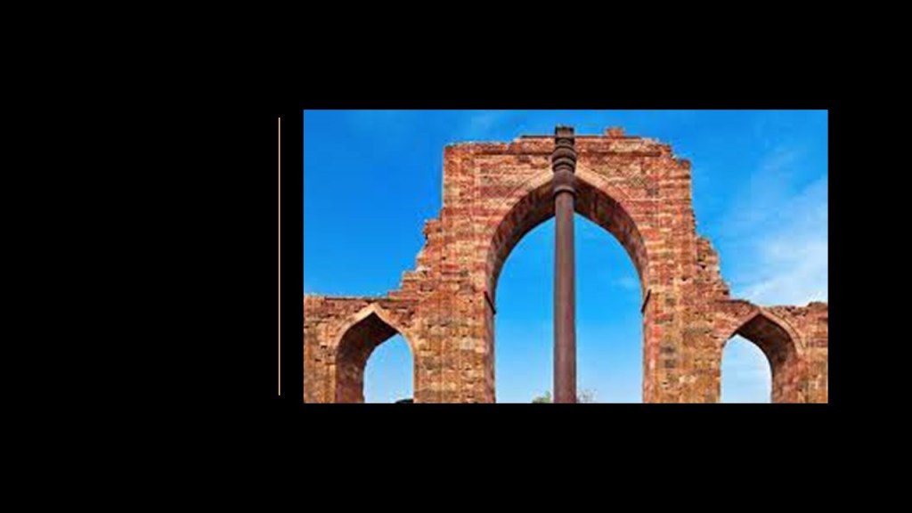
Just as a point of information, in case one would think that the existence of naturally-occurring iron beds is the only explanation for “bog ore,” the Iron Pillar of Delhi in India is famous for the rust-resistant composition of metals used in its construction, and said to have been made 1,600 years ago, an example of advanced knowledge of iron-work having been around for quite a long time.
What about transporting the “bog iron” on barges in canals?
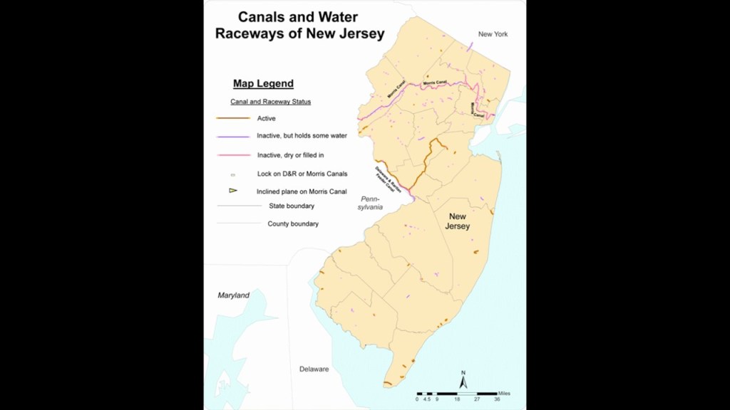
Well, there are definitely canals in the Great Egg Harbor area…
…and New Jersey in general.
New Jersey’s Morris Canal, for example, was a wonder to behold.
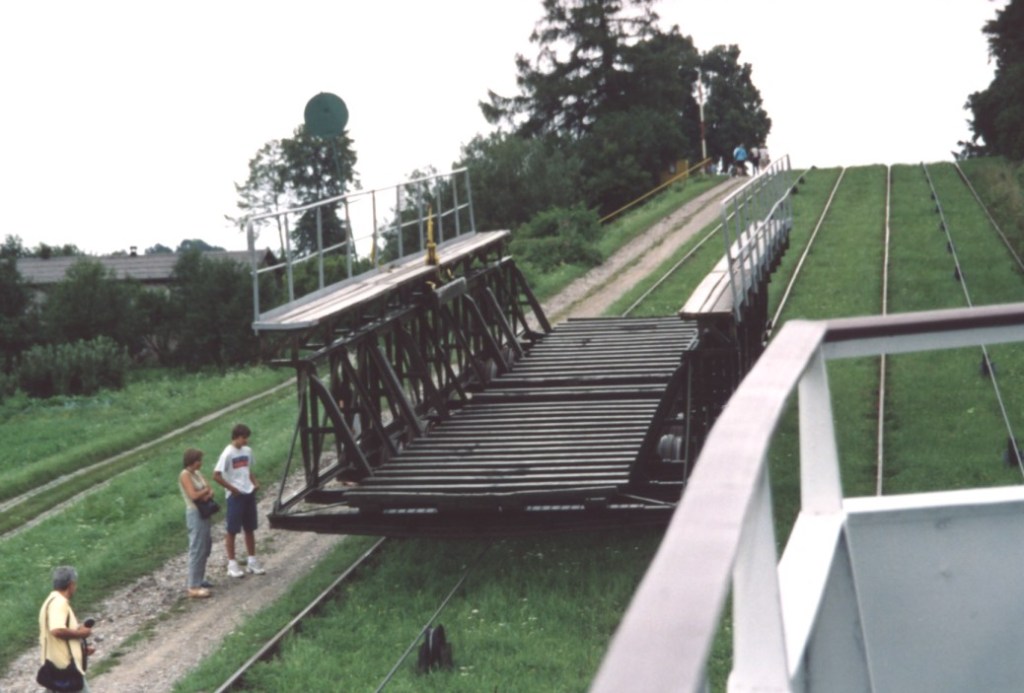
It was hailed as an ingenious, technological marvel for its use of water-driven, inclined planes.
It was said to have been completed in 1832 to carry coal across northern New Jersey between the Delaware River and the Hudson River. It was closed in 1924.
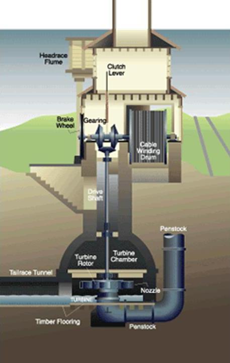
The builders of the Morris Canal also used a sophisticated power house technology, pictured here, to power the water turbine that was set in motion to raise or lower cradled boats on the inclined planes by means of a cable.
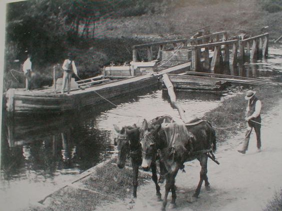
Even with the advanced technology of the Morris Canal, mules were needed to be used to pull the canal boats in places on the Morris Canal in the historical narrative we have been given.
I need to reel myself in for a moment and focus on the Weymouth Furnace that brought me here to look because there are so many different directions I want to go off into regarding things that I am seeing here.
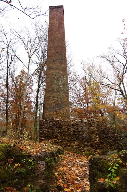
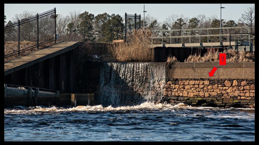
FG commented that the Weymouth Furnace is a 70-ft, or 21- meter, square brick chimney coming out of stream beds with no openings.
The furnace is buried below, with stone arches and span spillways that housed two water wheels.
It is a sophisticated construction, with iron pipes , bolts and combined heavy large block foundations with many brick walls.
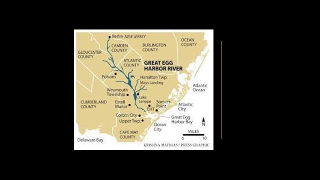
Now to look at the Great Egg Harbor River.
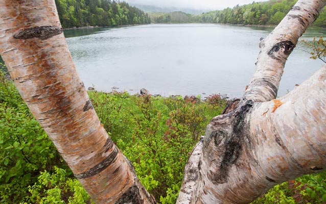
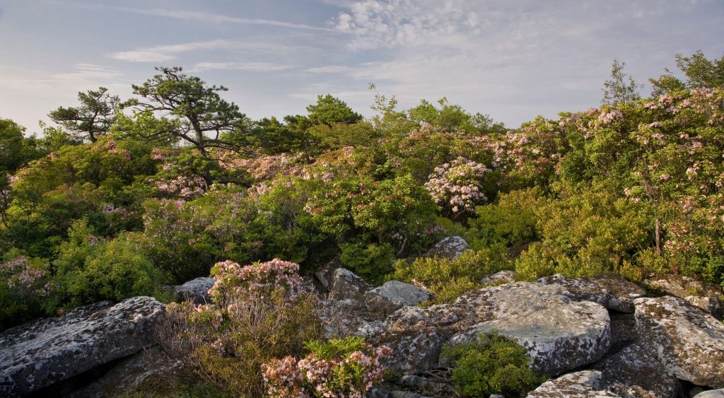
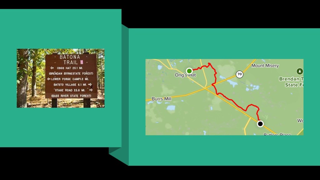
The Great Egg Harbor River is a described as a major river that crosses the largely undisturbed Pinelands, also known as the New Jersey Pine Barrens, so-called because of the nutrient-poor, sandy and acidic soil that supports pine trees, orchids and carniverous plants.
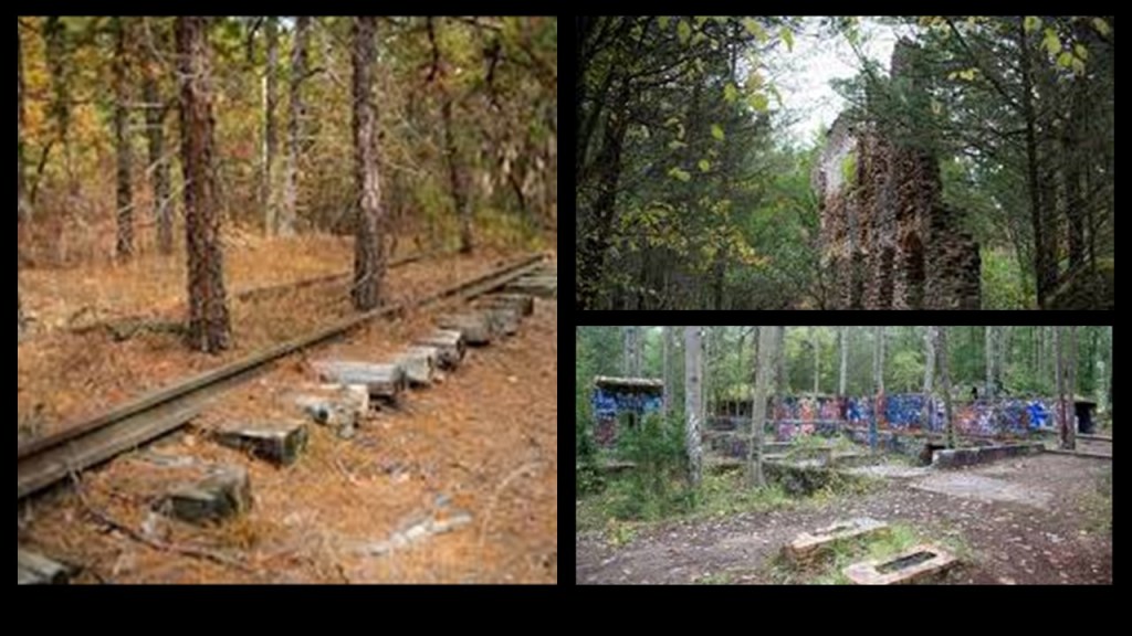
It is interesting to note that the New Jersey Pine Barrens contain ruins…
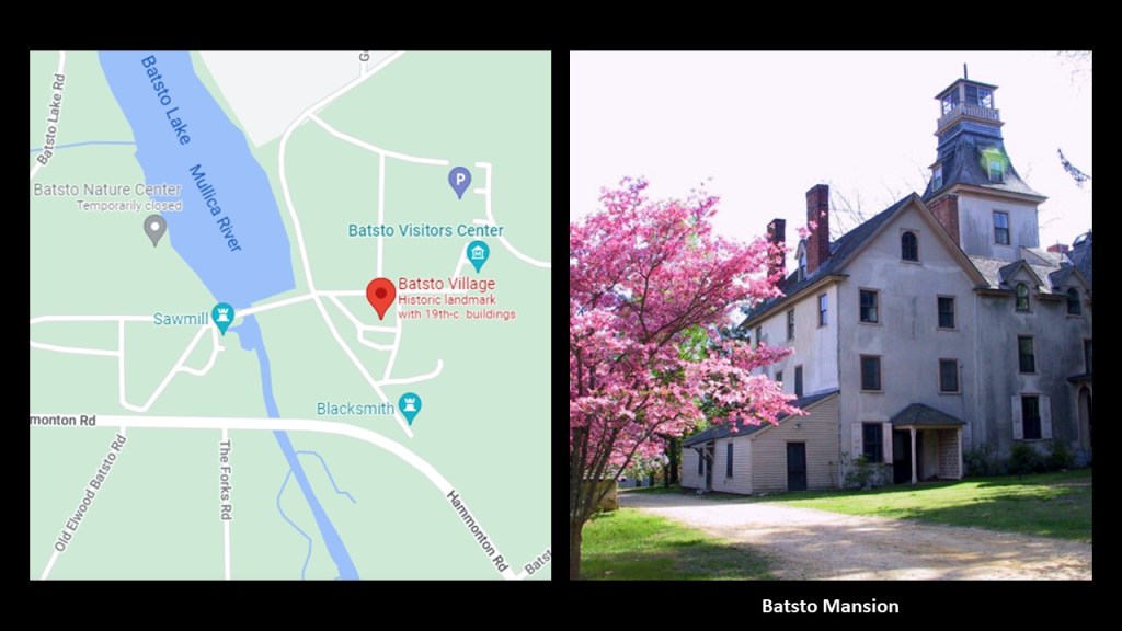
… and ghost towns, like Batsto Village, which we are told was the site of a bog iron and glass-making center from 1766 to 1867, consisting of 33 buildings and structures, including a mansion, gristmill, sawmill, and workers’ homes.
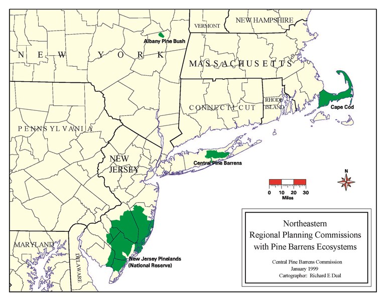
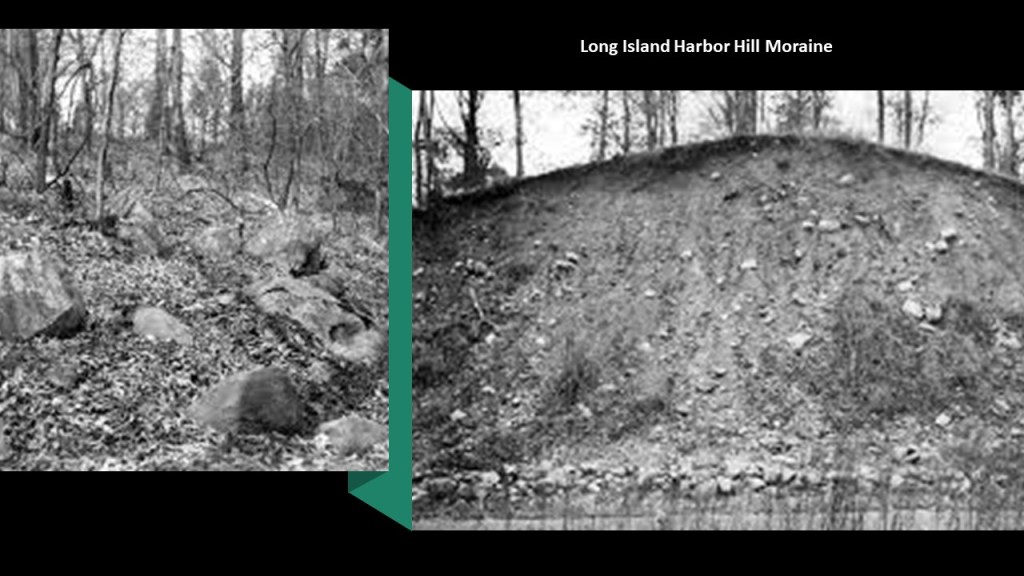
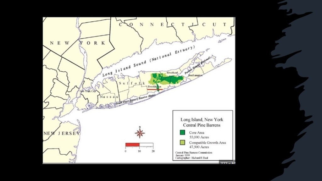
Two other places in the northeastern United States have Pine Barrens – Long Island Central and Massachusetts Coastal.
More thoughts on these particular locations shortly.
Back to the Great Egg Harbor River and Lake Lenape.
This is what we are told about Lake Lenape.
The lake was formed after the construction of a dam in May’s Landing around 1847, with the land having previously been an apple orchard.
Interesting to note the megalithic stones used in the construction of the dam.
Then that in 1854, the first railroad was built in the area between Camden and Atlantic City.
Then in regards to the Lake Lenape Park, it was said to have first opened in the early 1900s.
Named for the indigenous people who lived here, Lake Lenape Park features Lakeside Manor, a popular wedding and special event venue…
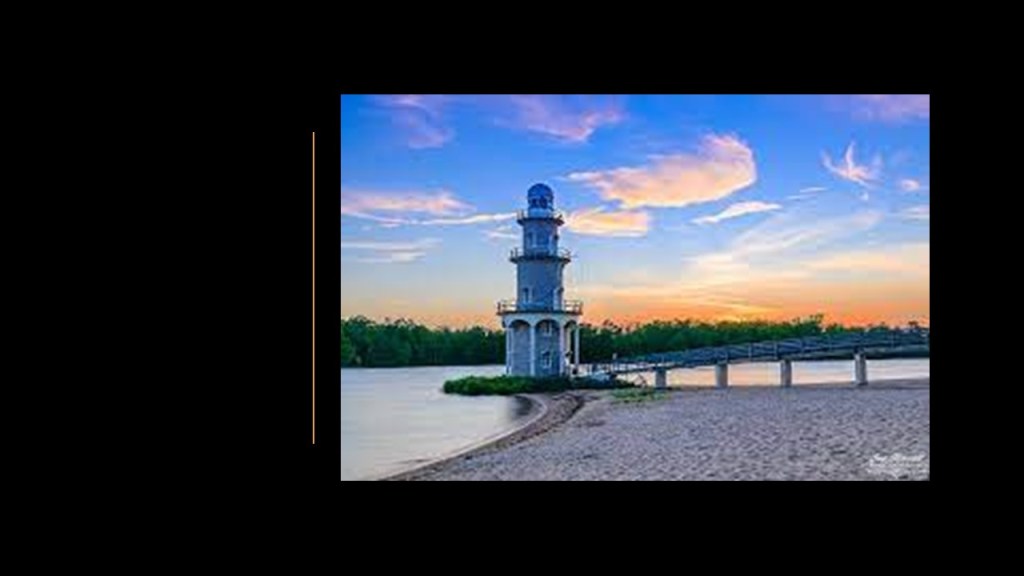
…and an historic lighthouse next to Lakeside Manor.
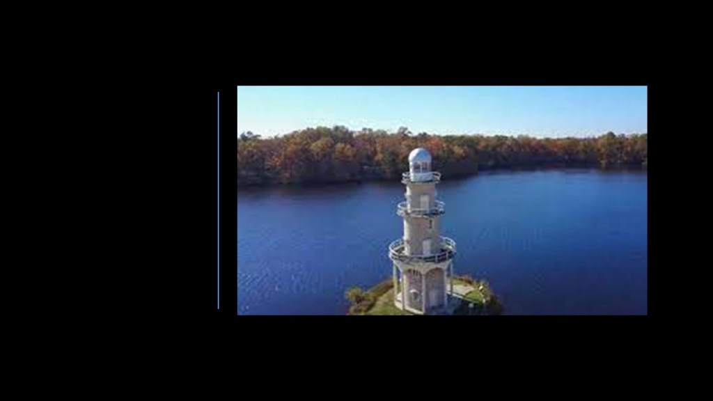
We are told the Lake Lenape Lighthouse at May’s Landing never actually served the function of a real lighthouse, and that it was built in 1939 with hand-tools and the help of some neighborhood children.
Made of wood, is 65-feet, or 20-meters, – tall, and it was also known as the “Singing Tower.”
It may be torn-down in the near future but I could not find confirmation that this is definitely going to happen.
So that’s Lake Lenape Park on one side and Atlantic County’s Penny Pot Park and Preserve is west of the Weymouth Furnace Park on the Great Egg Harbor River.
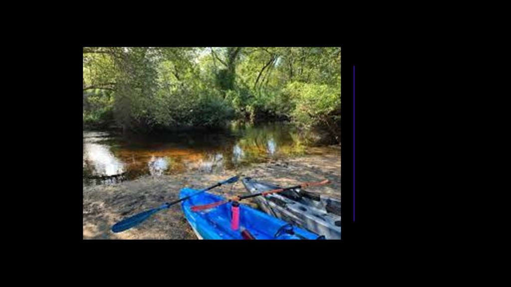
Part of the New Jersey Natural Lands Trust, the land Penny Pot Park is on was once slated for the development of a large, corporately-owned industrial plant.
Located along the Atlantic Expressway and having access to freight train service, twenty-five acres of the were cleared and wetlands altered by ditches.
Business plans changed, and the land in the Pine Barrens that was donated in 1997 has been reclaimed by nature, turned into habitat for wildlife and plants, and a starting place for kayaking and canoeing on the Great Egg Harbor River.
The Great Egg Harbor River flows southeast from near Camden, entering the Great Egg Harbor about 5-miles, or 8-kilometers, southwest of Atlantic City.
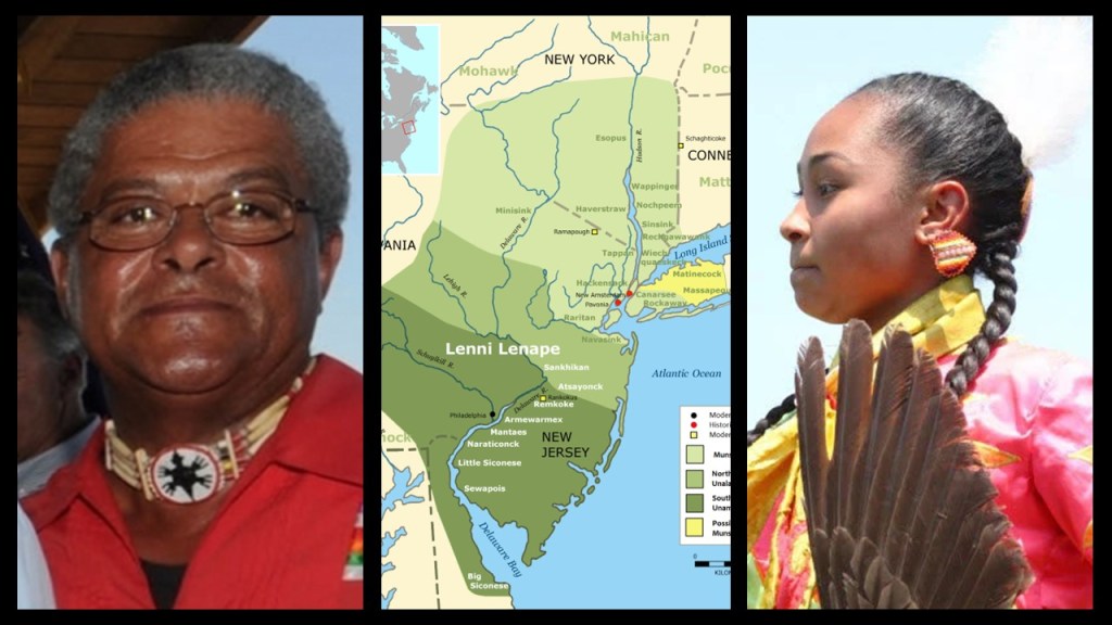
The traditional land of the Lenape people, also called the Lenni Lenape and the Delaware Indians, was said to have included: present-day New Jersey; eastern Pennsylvania along the Delaware River watershed; New York City; western Long Island; and the Lower Hudson Valley.
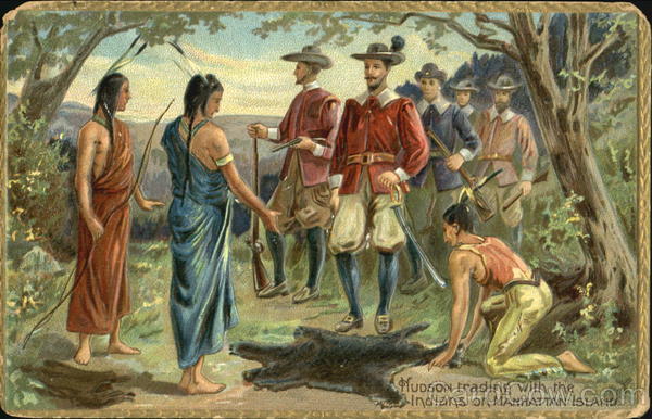
According the history we have been taught, everything changed for the Lenni Lenape who lived here after Henry Hudson sailed up what is now called the Delaware River in 1609, and this painting depicts what we are taught to believe about all the original people of this land – they were hunter-gatherers living off the land, and framing the European colonizers as the builders of infrastructure and civilization in the so-called New World.
I am going to continue to give you examples from here of why that narrative doesn’t hold up under scrutiny, and also about the fascination and interest the wealthy elites of American society have long had with this region.
So let’s take a look at what they tell us about Atlantic City.
Prior to the arrival of European settlers, the location was the summer home of the Lenape.
Then in 1783, Jeremiah Leeds built the first home here.
But it was not until 1850 that the idea of this becoming a resort location was conceived, and the first hotel here was said to have been built in 1853.
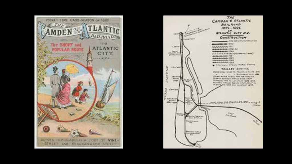
What became known as “Atlantic City” was incorporated in 1854, the same year that train service began on the Camden and Atlantic Railroad mentioned previously, and providing a direct link to Philadelphia in Pennsylvania.
The first Atlantic City Boardwalk was said to have been built in 1870.
By 1874, an estimated 500,000 were coming to Atlantic City each year by the railroad, and we are told that there were so many people coming to Atlantic City by 1878 that the decision was made to build the Philadelphia and Atlantic City Railroad was constructed to accommodate the increased ridership.
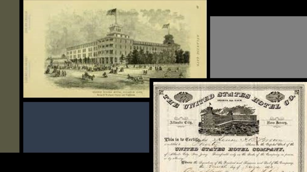
Then, in order to accommodate the increasing number of tourists coming to Atlantic City, massive hotels like the United States Hotel sprang up.
And all of the new railroad lines that were popping up betwixt and between these large population centers and the South Jersey shore were going right through the desolate, swampy and forbidding pine barrens.
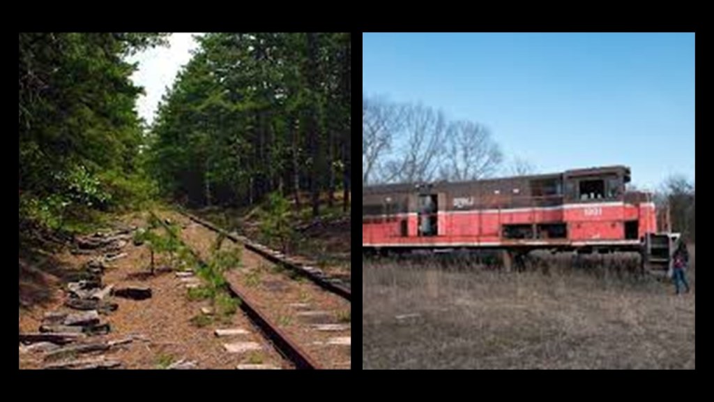
Today there are abandoned trains and railroad lines found throughout the New Jersey Pine Barrens.
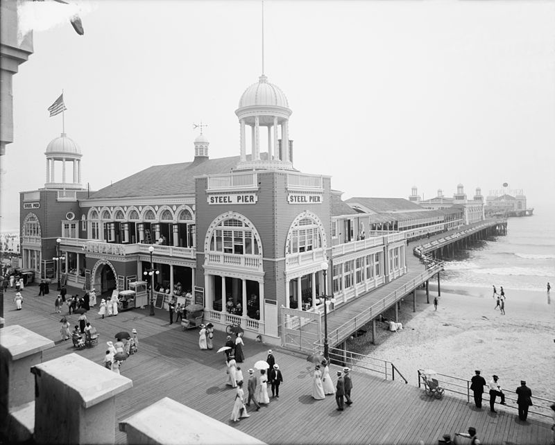
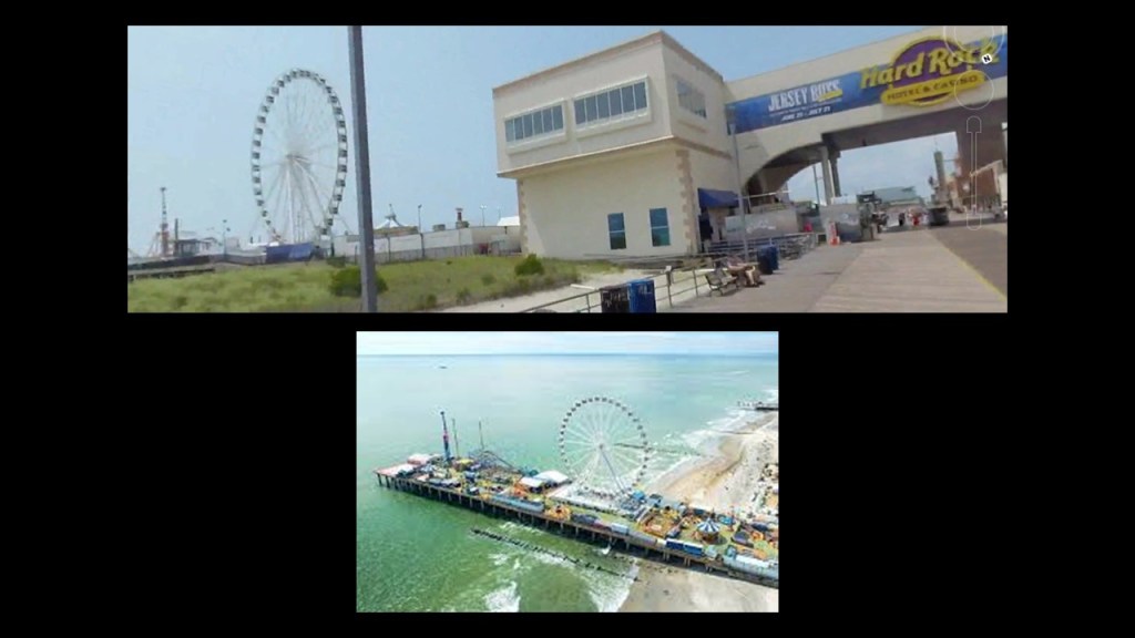
Atlantic City’s Steel Pier was said to have been built by the Steel Pier Company that first opened in June of 1898 as an amusement park built on a pier.
Called the “Showplace of the Nation,” it was one of the most popular entertainments in the United States for 70 years.
The Steel Pier continues to operate as an amusement park to this day.
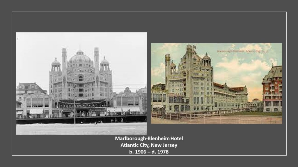
Other examples of the original Moorish-style architecture in Atlantic City included the Marlborough-Blenheim Hotel, which was said to have been built between 1902 and 1906, and demolished in October of 1978…
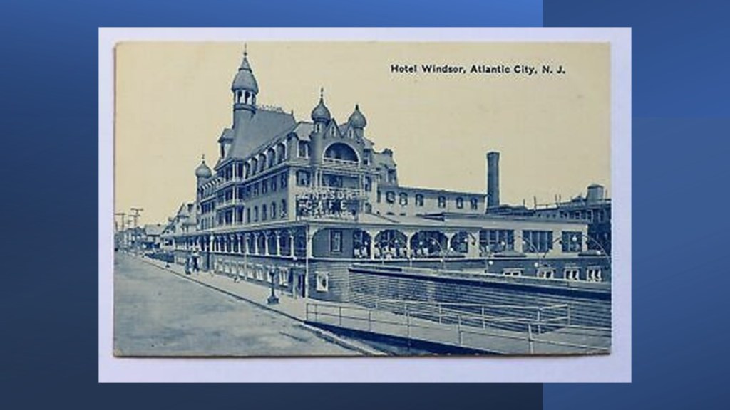
…and the Hotel Windsor, about which I can’t find any information to speak of, but presumably long gone.
This is an old postcard showing the Atlantic City and Shore Railroad crossing a two-mile, or 3-kilometer, -long trestle bridge in the Great Egg Harbor Bay, and was part of an interurban trolley system in New Jersey that served Somers Point and several other cities between Atlantic City and Ocean City in the years between 1907 and 1948.
The reason given for the end of its operation was a hurricane damaging the viaduct in 1948, and fixing it was cost prohibitive because of the decline in trolley use.
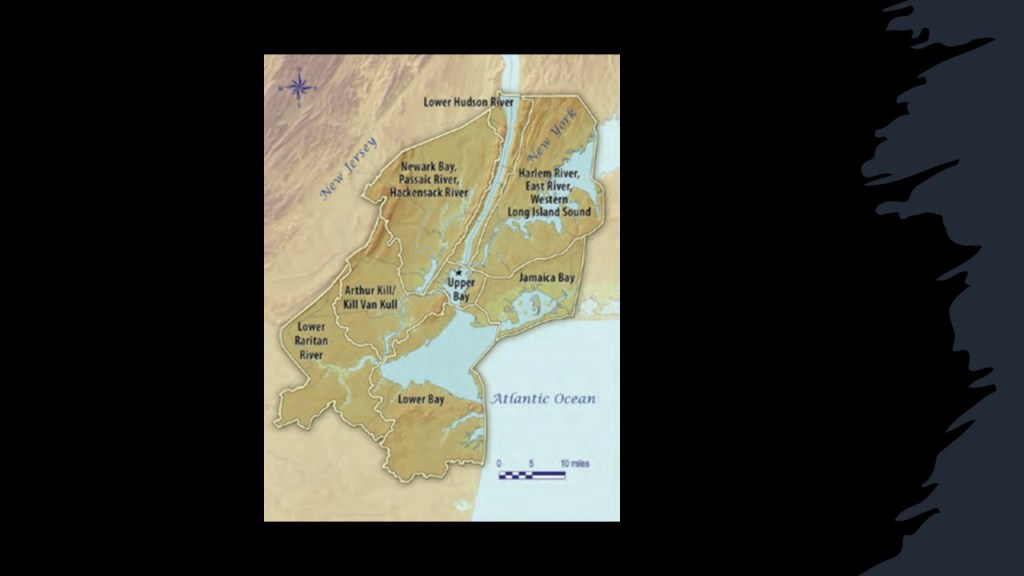
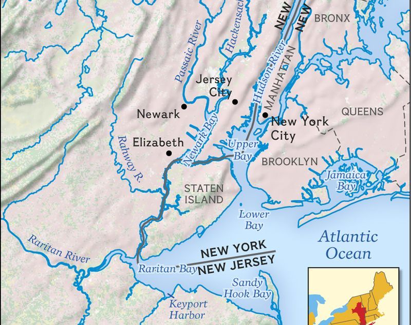
This whole area is part of the New York – New Jersey Harbor Estuary System, which forms one of the most intricate natural harbors in the world, as well as being the busiest port in the world as the Ports of New York and New Jersey are contained within it.
An “estuary” is defined as a partially-enclosed, coastal body of brackish water, which is water that is salty, dirty & unpleasant, with one or more rivers flowing into it, and a connection to the open sea.
Also known as the Hudson-Raritan Estuary, it is described as a harbor system of bays and tidal rivers where the Hudson, Hackensack, Rahway, Passaic and Raritan Rivers meet the Atlantic Ocean.
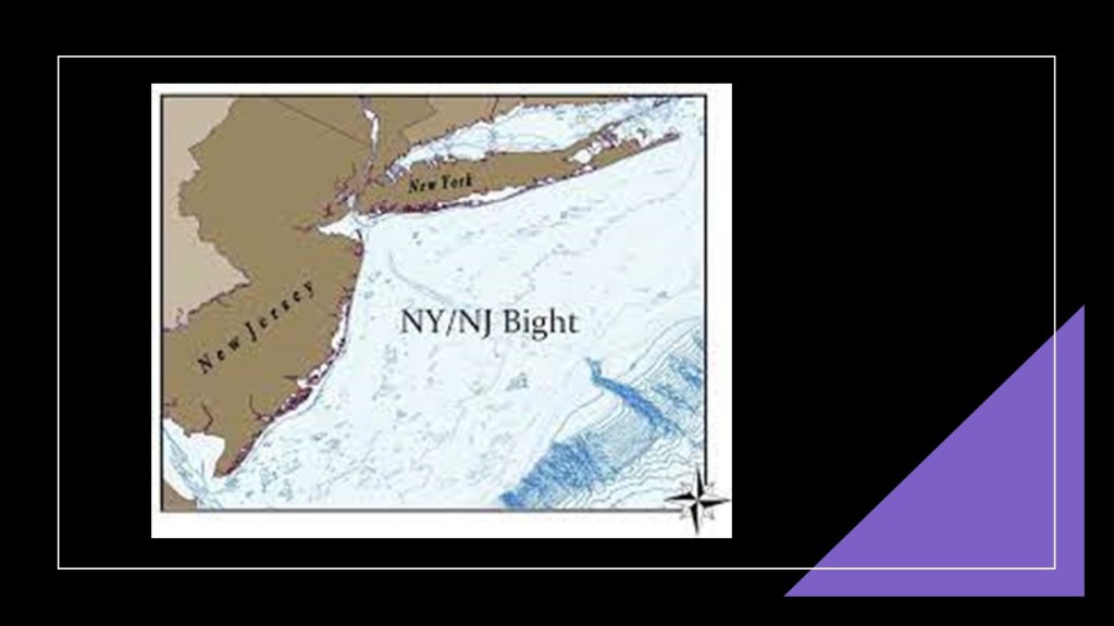
To the southeast, the Lower New York Bay that is part of the harbor system opens into the New York Bight in the Atlantic Ocean.
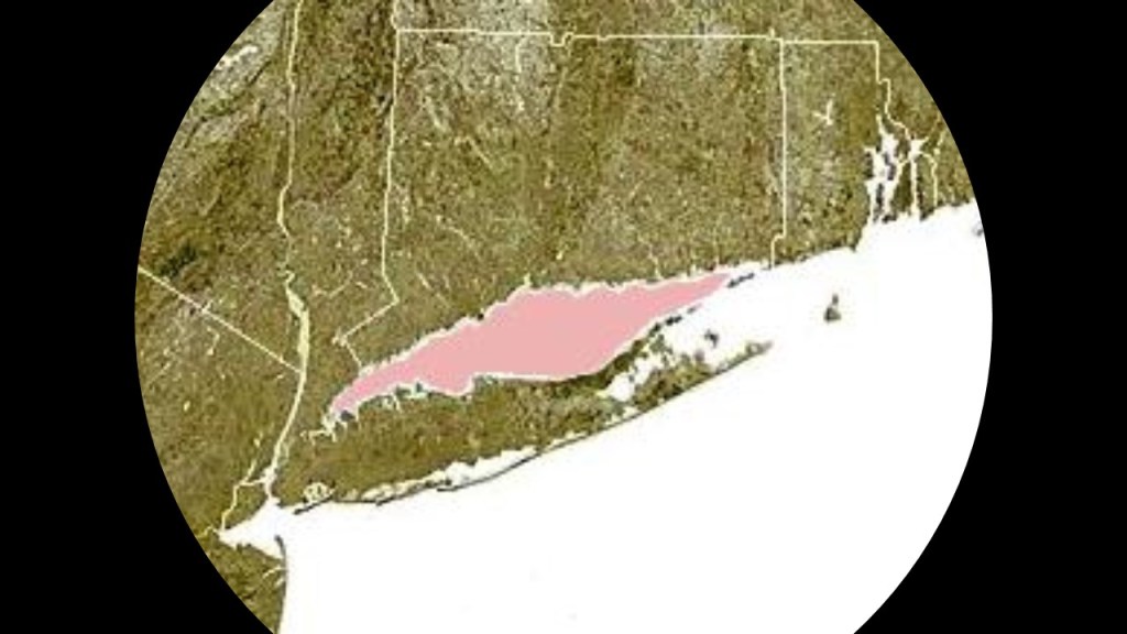
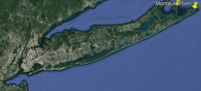
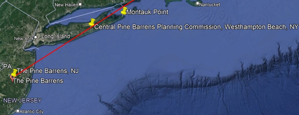
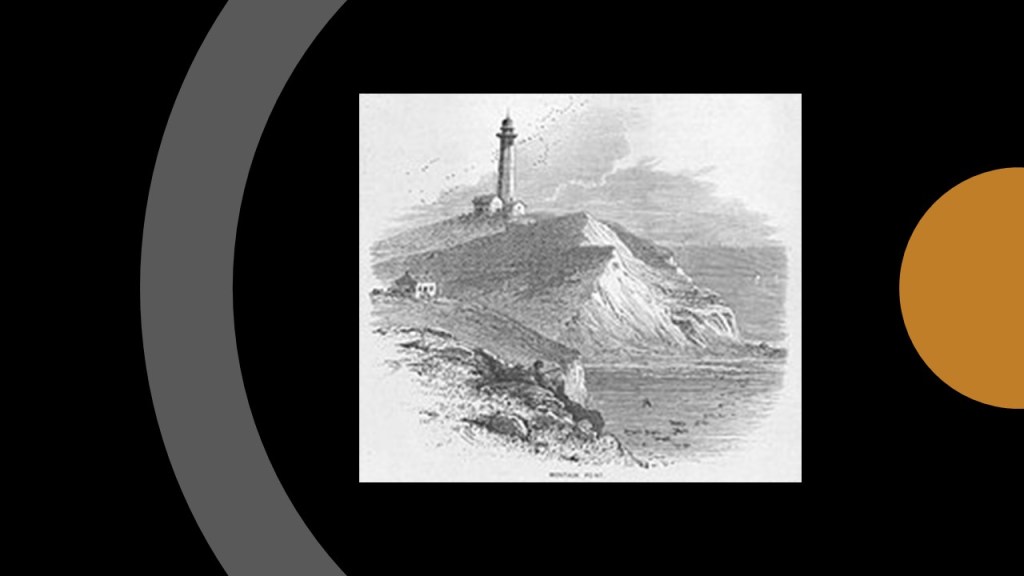
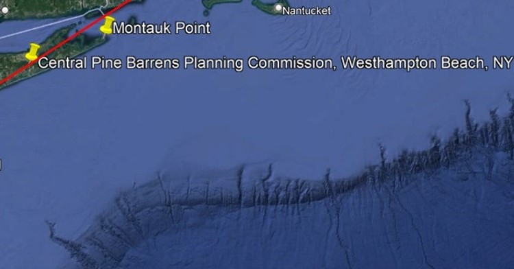
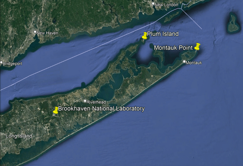
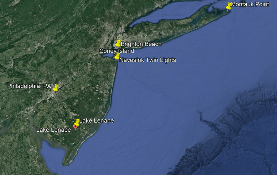
The New York Bight is described as a roughly triangular indentation along the Atlantic Coast of the northeastern United States from Cape May, New Jersey, to Montauk Point on the Eastern tip of Long Island.
“Bight” is the term given to a concave bend or curvature in a coastline.
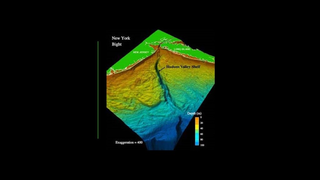
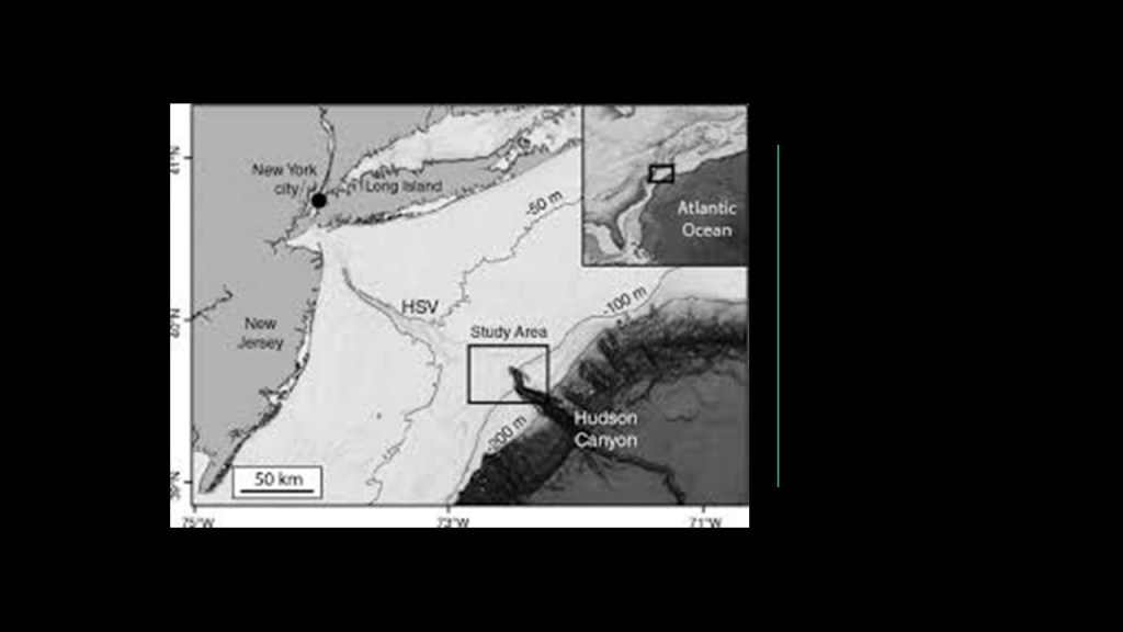
The Hudson Valley Shelf, also known as the Hudson Canyon, is an underwater canyon that begins at the shallow outlet of the estuary at the mouth of the Hudson River, said to begin as a natural channel.
The size of the Hudson Canyon is comparable to the Grand Canyon, the largest known canyon off the East Coast, and one of the largest underwater canyons in the world.
My question is: Was this canyon always underwater?
And is it a natural or man-made landform?
With regards to the possibility that the Hudson Canyon was man-made, and since the Grand Canyon was mentioned in comparison to the Hudson Canyon, it is important to mention that the Grand Canyon has a few notable points of information to bring up here.
One is that the Grand Canyon has formations with Egyptian names, like the Isis Temple, the Osiris Temple, and the Temple of Set, and that these formations and others correlate with stars in the Orion Constellation.
Another is that an article appeared in the Arizona Gazette in 1909 that an explorer in the Grand Canyon had stumbled upon Egyptian artifacts, but news about the discovery disappeared from public view shortly after it was published, and it has been called a hoax ever since.
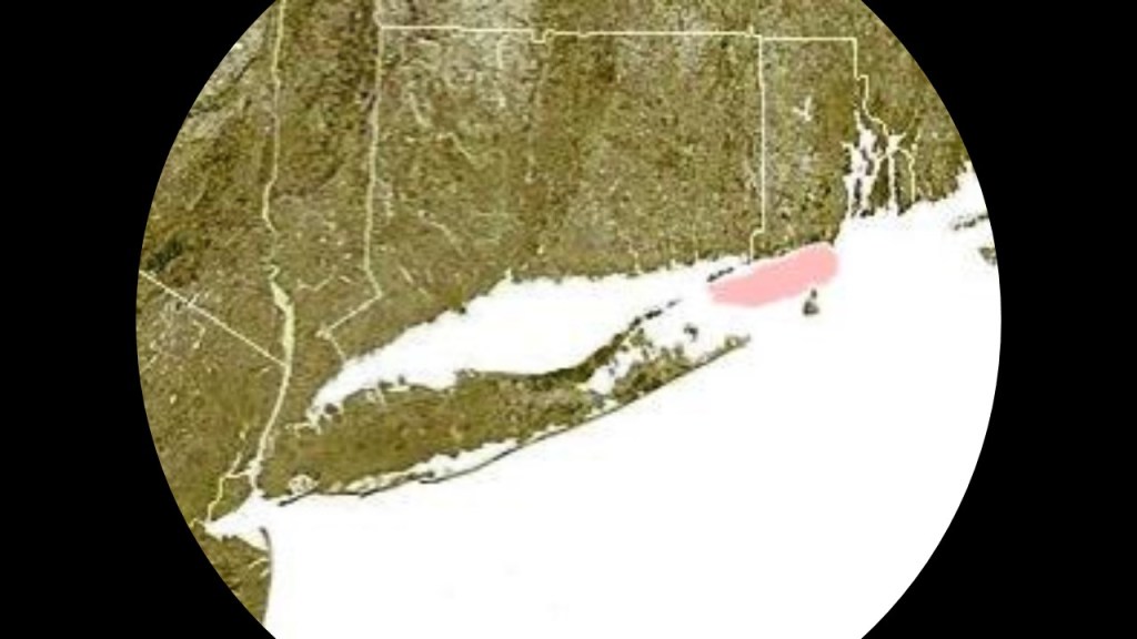
The New York – New Jersey Harbor estuary system opens to Long Island Sound to the northeast.
Long Island Sound is a tidal estuary and marine sound of the Atlantic ocean.
A sound is the term given to a smaller body of water connected to a larger sea or ocean.
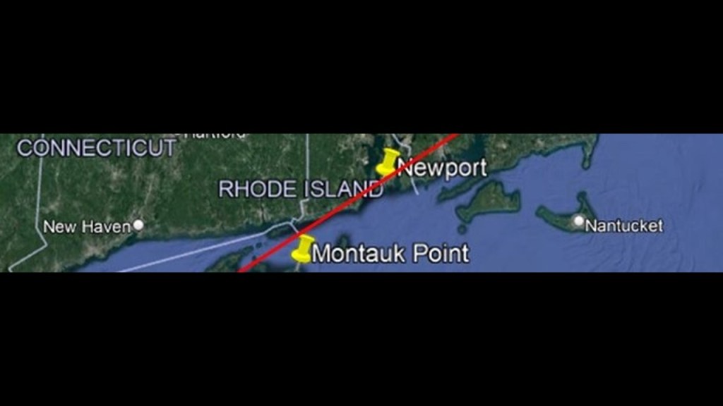
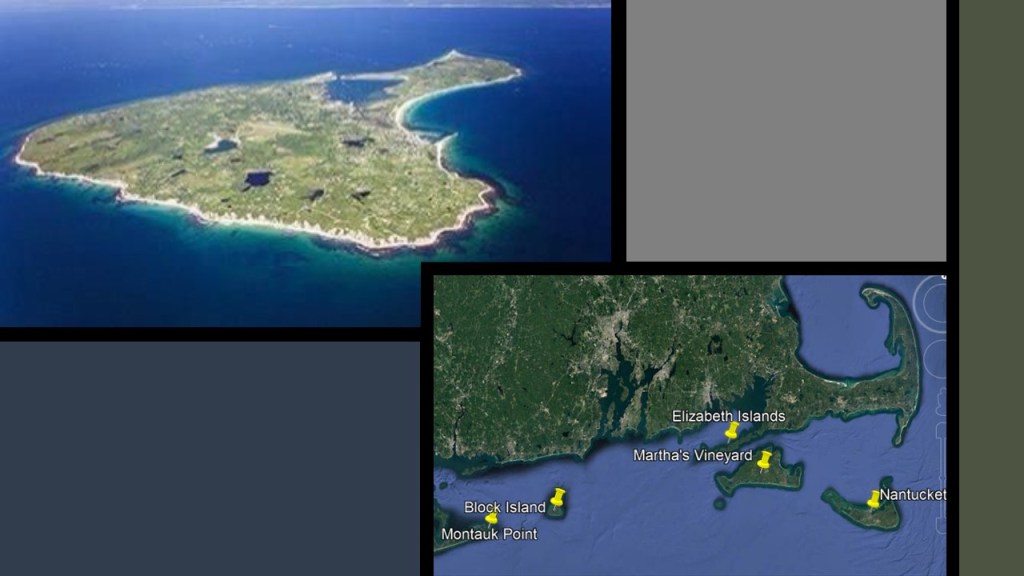
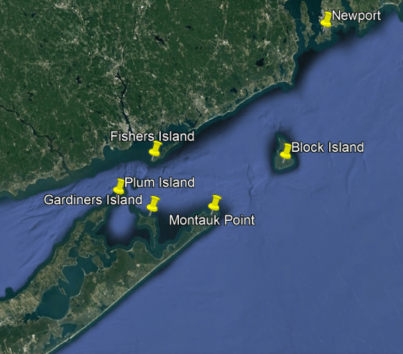
From west to east, Long Island Sound is 110-miles, or 180-kilometers, -long, and runs between the East River in New York City, along the North Shore of Long Island, to Block Island Sound.
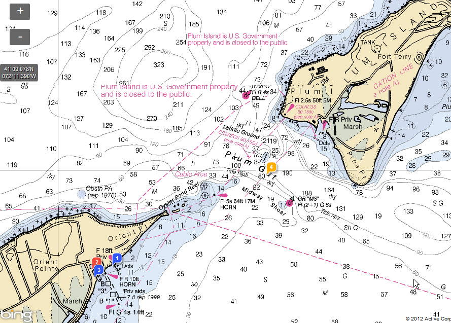
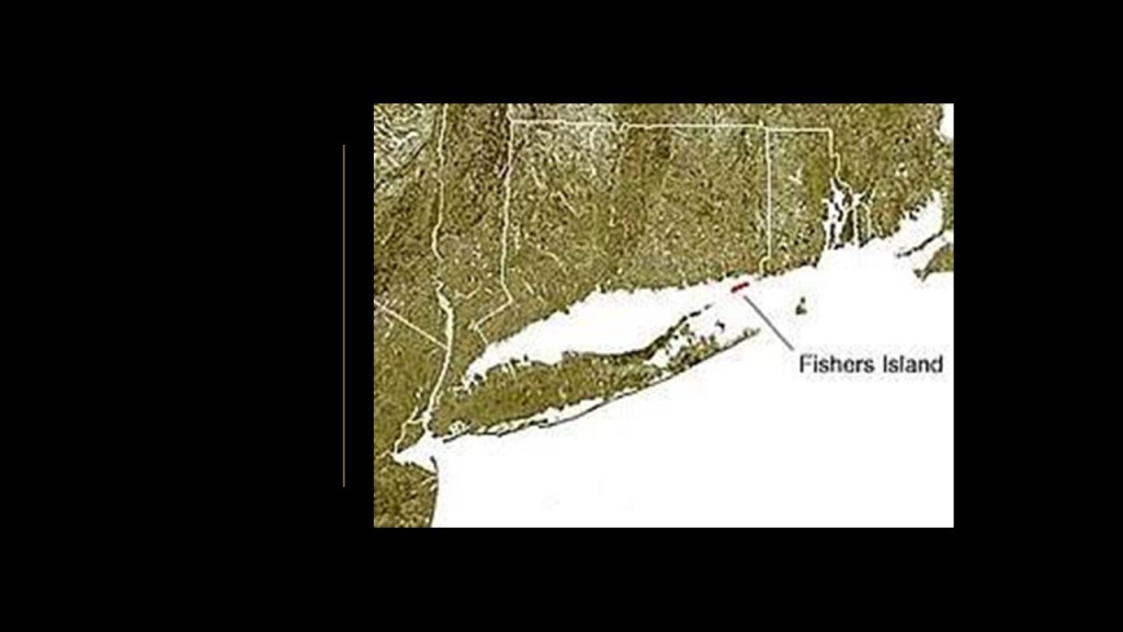
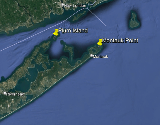
Block Island Sound is a 10-mile, or 16-kilometer,-wide strait that separates Block Island from the coast of mainland Rhode Island to the east, and to the west, it extends to Montauk Point on the eastern tip of Long Island, as well as Plum Island, Gardiners Island, and Fishers Island, all in New York State.
More on these places in a moment.
So those are the basics of what we are told about the make-up of the New York – New Jersey Estuary.
Now I want to connect this information to the bigger picture puzzle pieces that are coming together about this region.
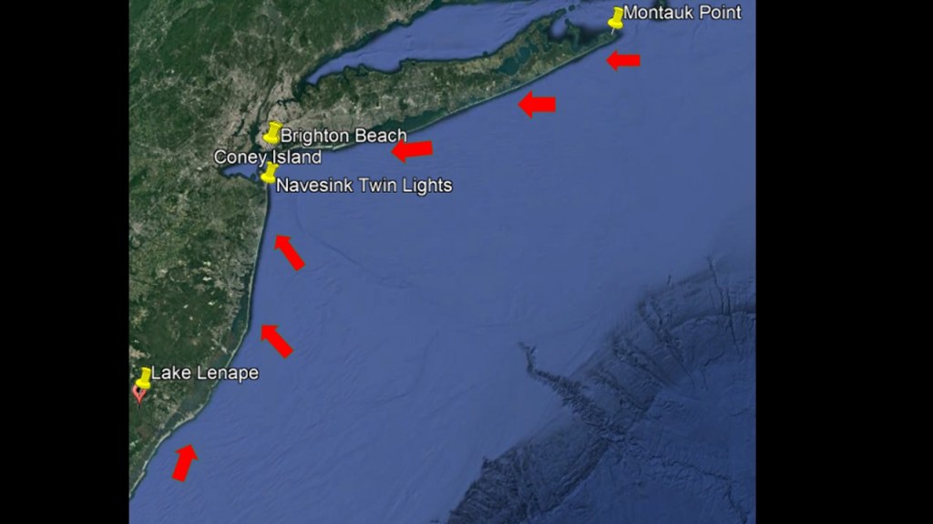
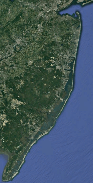
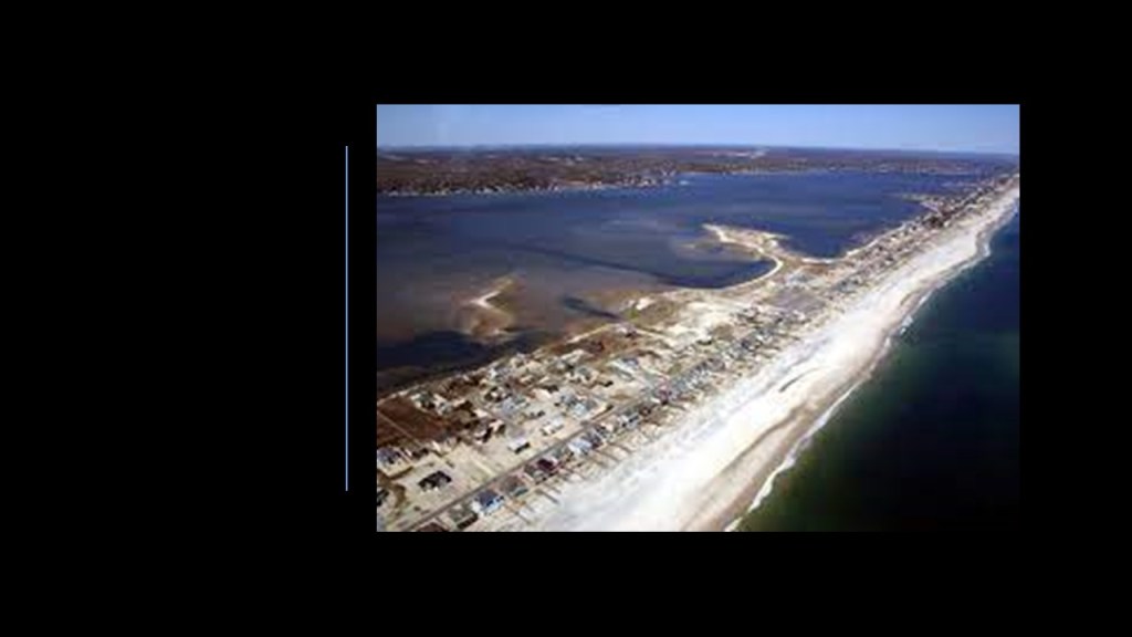
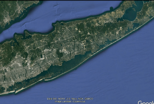
The first thing I want to bring forward is the ruined looking appearance of the shoreline from the South Jersey Shore on up through the Southshore of Long Island, which is the same thing as the New York Bight mentioned previously.
Here’s a closer a look at the South Jersey shoreline up to the New York-New Jersey Estuary System, so you can get a better view of what I am referring to…
…and then what the shoreline looks like going from the New York – New Jersey Estuary System across Long Island to Montauk Point.
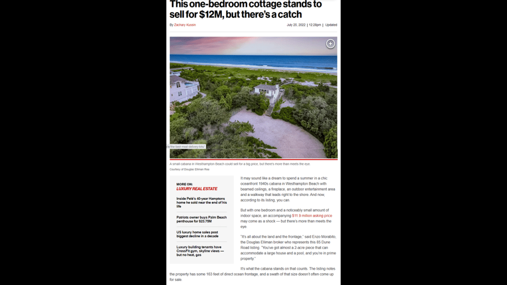
And in spite of the marshy and wetland quality of the landscape hereabouts, this whole area is prime and valuable real estate that is, among other things, coveted by the very wealthy in our society.
This part of the world is highly prized by those of wealth and prestige.
More about this in a moment.
I have one more big-picture puzzle piece to share before I start to break this region down into smaller parts to show you its attraction to the very wealthy, and what appears to be this area’s its role as a significant place on the Earth’s grid system.
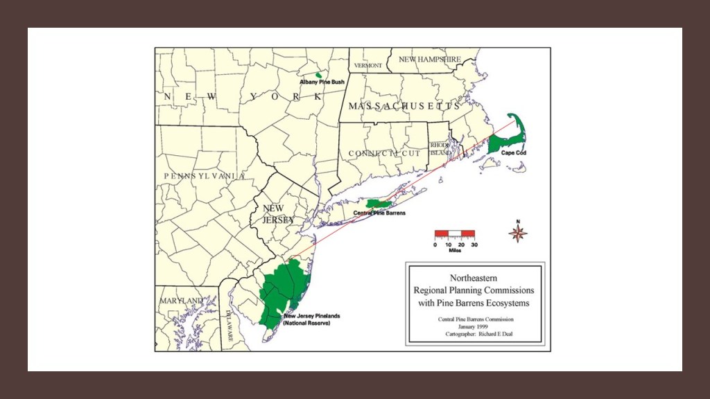
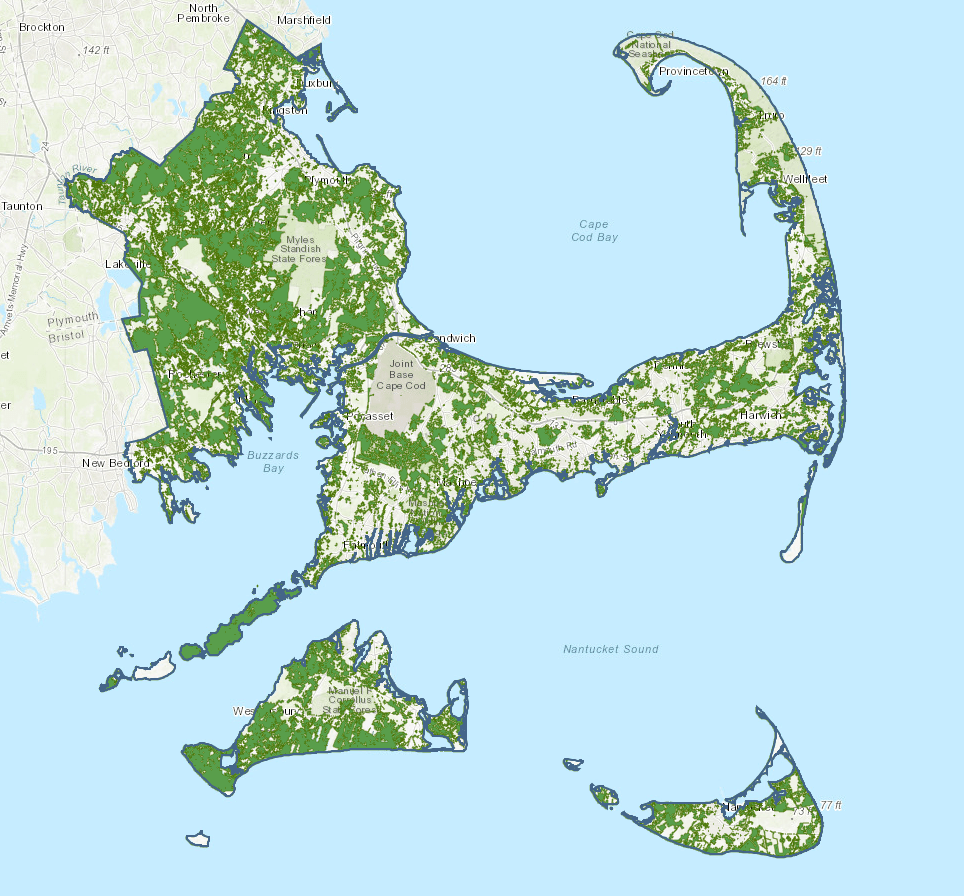
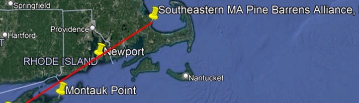
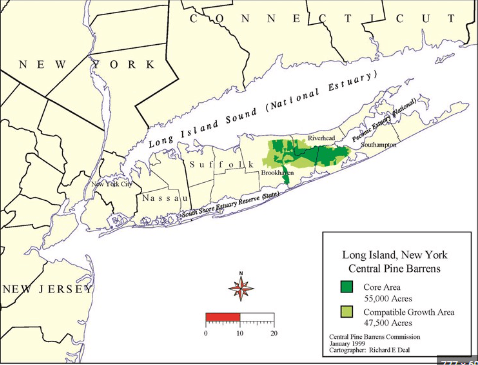
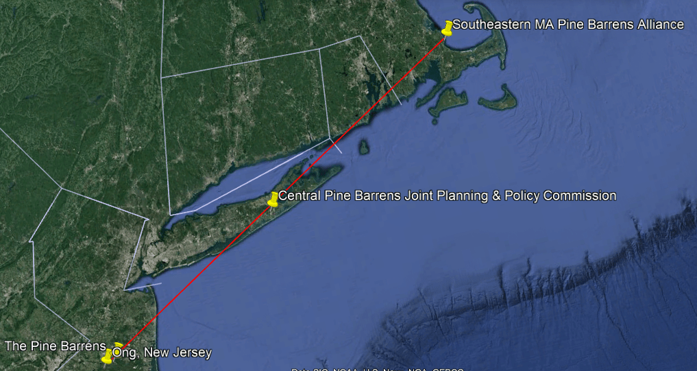
Here is the graphic I presented previously showing the location of the Pine Barrens in New Jersey, Central Long Island, and Coastal Massachusetts.
There seems to be a linear relationship between these three Pine Barren ecosystems.
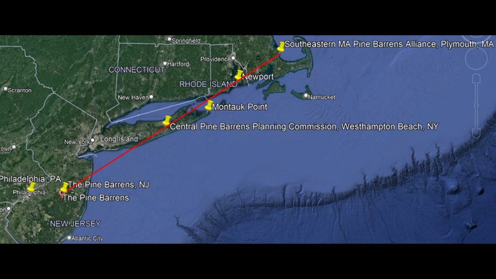
Here is the linear relationship on Google Earth when I searched for the Pine Barrens in New Jersey; the Central Long Island Pine Barrens; and the Coastal Massachusetts Pine Barrens, also known as the Plymouth Pinelands- the pin is placed where that search term for each popped up.
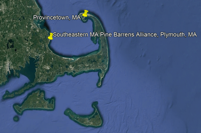
So I am going to start breaking down this region into smaller parts at Plymouth, Massachusetts on Cape Cod, the location of the Southeastern Massachusetts Pine Barrens Alliance.
It so happens that this is the same Plymouth that was the location of the Plymouth Colony, the Pilgrim settlement founded in 1620 by the Pilgrims after they journeyed from England to the New World on the Mayflower, seeking religious freedom, as we are taught and celebrate every year in the United States at Thanksgiving.
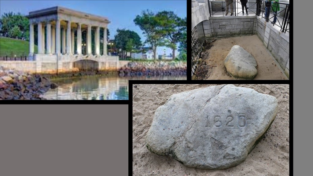
This is the Plymouth Rock Monument in Plymouth.
The current classical monument housing was said to have been designed in 1921 by the architectural firm of McKim, Mead & White.
There’s a whole long back-story to Plymouth Rock itself, including there was no record from the pilgrim fathers themselves about landing on a particular rock; attention was first brought to the rock that became Plymouth Rock in 1741 when plans were being made by the residents to build a wharf that would bury it, and an elderly man came forward and said that was the “one” based on what he had been told by his father who had been there when the Pilgrims landed; that the rock had been moved and split and all kinds of stuff; and that the current Plymouth Rock is estimated to weigh ten tons.
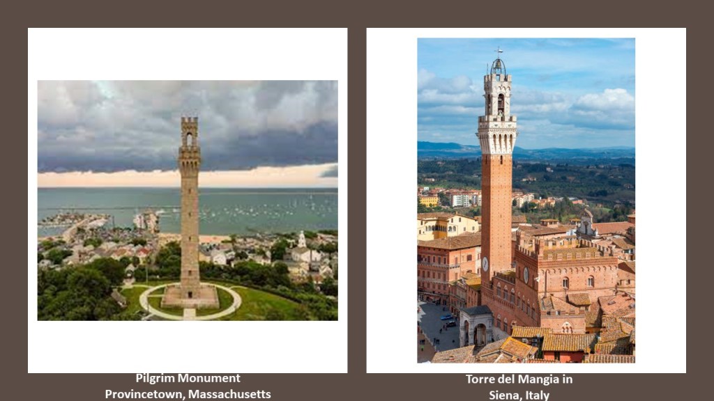
One more thing related to the Pilgrims before I move on is the Pilgrim Monument in Provincetown, Massachusetts, on the northern end of Cape Cod that I was made aware of by a viewer.
It was said to have been built between 1907 and 1910 to commemorate the first landfall of the Pilgrims in 1620 and the signing of the Mayflower Compact in Provincetown Harbor.
It is a bell-tower, and the tallest, all-granite structure in the United States, and said to have been modelled after the Torre del Mangia in Siena, Italy, which is said to have been designed in 1309.
Back to the Southeastern Massachusetts Coastal Pine Barrens, or SEMBP.
The Southeastern Massachusetts Pine Barren Association is headquartered at The Center at Center Hill Preserve in Plymouth.
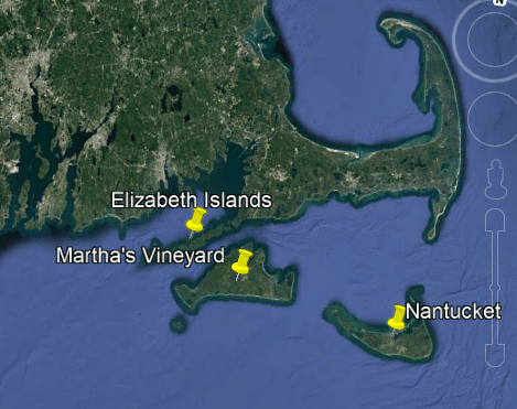
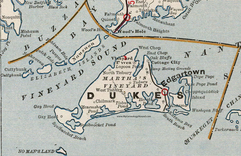
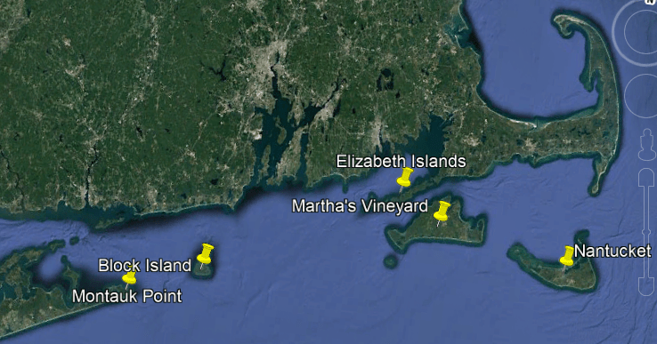
The SEMBP on land extendeds from Duxbury to Provincetown along the Cape Cod Bay shoreline, covering Cape Cod, the Elizabeth Islands, Nantucket Island and Martha’s Vineyard, and inland includes Southeastern Massachusetts, including Plymouth and surrounding communities.
We are told the geologic foundation for the rare Pine Barren ecosystem of Coastal Massachusetts was the result of outwash from the last glacial maximum, which took place somewhere between 26,500 to 19,000 years ago, and left thick glacial deposits of sand and gravel.
This brings us to a series of noteworthy islands off the coast of Massachusetts, Rhode Island, and New York.
First, the Elizabeth Islands, Martha’s Vineyard, and Nantucket Island off the coast of Massachusetts.
The Elizabeth Islands are a small chain of islands off the southern coast of Cape Cod, on the southern edge of Buzzard Bay, and is separated from Martha’s Vineyard by Vineyard Sound.
They were formally laid claim to and settled by colonizers in the name of the British Crown in 1641, and named for Queen Elizabeth I.
That same year, in 1641, Thomas Mayhew the Elder of Watertown, Massachusetts bought the Elizabeth Islands – along with Martha’s Vineyard and Nantucket – from the Earl of Stirling, William Alexander, who was involved in the Scottish colonization of Port Royal in Nova Scotia and Long Island, and Sir Ferdinando Gorges, naval, military commander, and Governor of the Port of Plymouth in England.
Gorges was known as the “Father of English Colonization in North America.
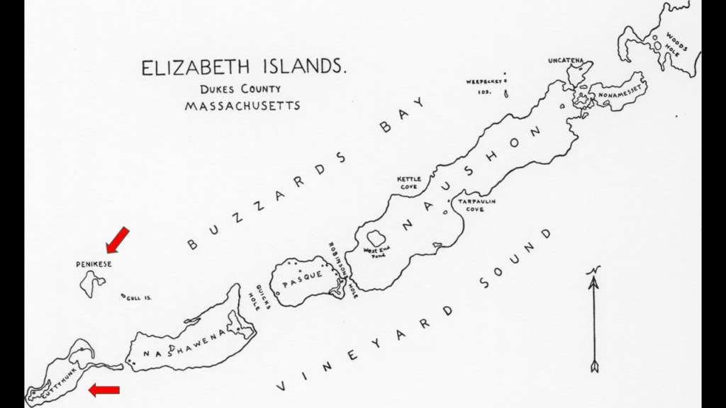
All of the Elizabeth Islands, with the exception of Cuttyhunk and Penikese, are privately-owned by the Forbes family, a wealthy American family of Scottish descent long prominent in Boston.
The family’s original fortune came largely from trading opium and tea between North America and China in the 19th-century.
Forbes family members include businessman John Murray Forbes, among other things a railroad magnate and President of the Michigan Central Railroad, and the Chicago, Burlington, and Quincy Railroad in the 1850s; and John Forbes Kerry, present-day politician, and the Secretary of State in President Obama’s second administration, and currently the U. S. Special Presidential Envoy for climate.
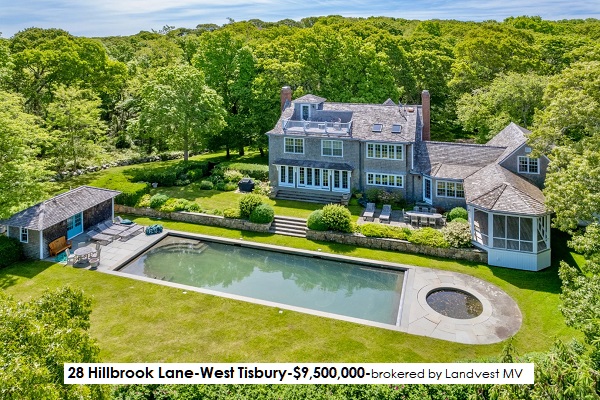
Martha’s Vineyard, an island located south of Cape Cod, is a popular summer colony for the wealthy.
Martha’s Vineyard, along with the adjacent Chappaquiddick Island, another small island off the coast of Martha’s Vineyard called “Noman’s Land,” and the Elizabeth Islands together comprise Massachusetts’ Dukes County.
First, a little bit about Martha’s Vineyard.
Martha’s Vineyard, as of the 2010 Census, had a year-round population of approximately 17,500 people, and in the summer months the population grows to somewhere around 100,000.
In a study by the Martha’s Vineyard Commission, the Cost-of-Living on the island was found to be 60% higher than the national average, and the cost of housing 96% higher.
The origin of the name is unknown, though it is speculated that it was named after a “Martha” relative of the English explorer Bartholomew Gosnold, who led the first recorded European expedition to Cape Cod in 1602.
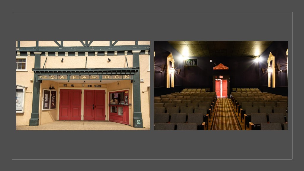
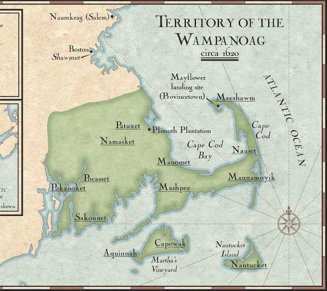
Also known originally as “Noepe,” the island was referred to as “Cappawock” in the 1691 Massachusetts Charter, and which is retained in the name of the “Capawock Theater” in Vineyard Haven.
Vineyard Haven was named the #1 most expensive town in the United States by Lending Tree in 2021.
When the European colonizers arrived, the island was inhabited by the Wampanoag, the Algonquin indigenous people of eastern Rhode Island and southeastern Massachusetts.
There is something interesting to note about the Algonquin language.
It is extremely hard to find this kind of information because of the hunter-gatherer theme going on with indigenous peoples of North America in the narrative, but I found an example in the written language script of the Algonquin Mikmaq people of Nova Scotia, and it is that of an apparent connection to the Egyptian language script.
The Wampanoag Tribe of Gay Head, or Aquinnah, on Martha’s Vineyard is one of only two federally-recognized Wampanoag Tribes, the other one being the Mashpee Wampanoag Tribe, headquartered in Mashpee on Cape Cod.
The Wampanoag on Martha’s Vineyard are headquartered in Aquinnah on the southwest tip of Martha’s Vineyard, part of the lands where they have lived for thousands of years which were dispossessed by English settlers encroaching on their lands.
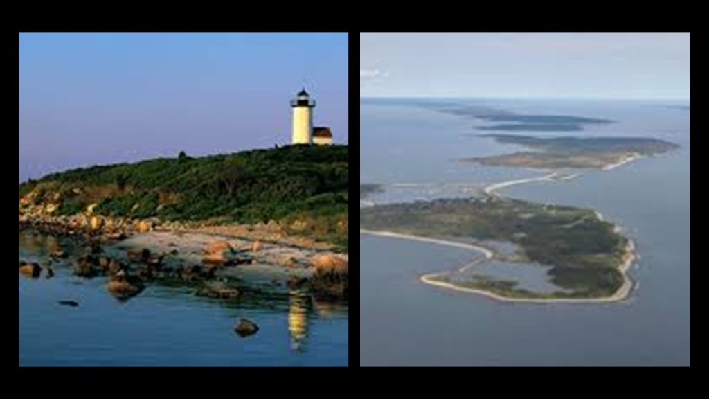
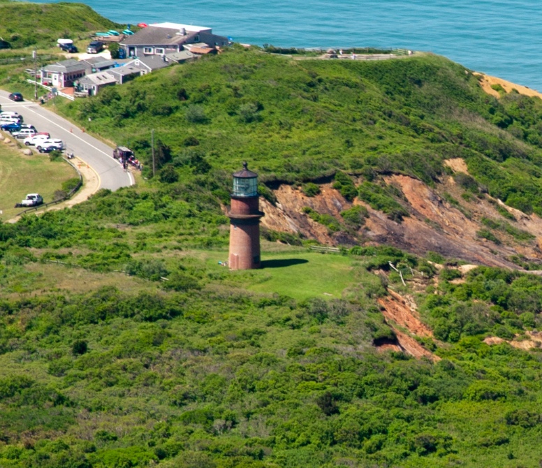
Aquinnah, which was incorporated as a town named Gay Head, between 1870 and 1997, is the location of the Aquinnah Cliffs.
The Aquinnah Cliffs, with streams of red and orange clay mixed with sand, were said to have been formed by glaciers millions of years ago.
Not buying what they are selling.
These cliffs have a sheared-off-looking quality to them, like there is much more to this story.
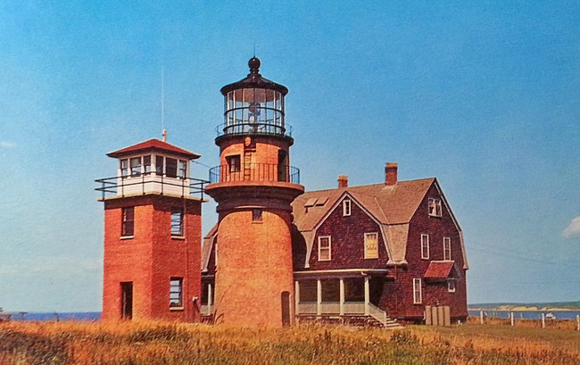
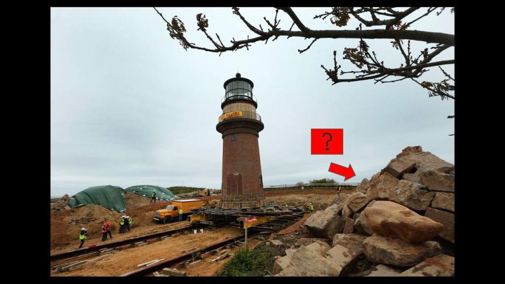
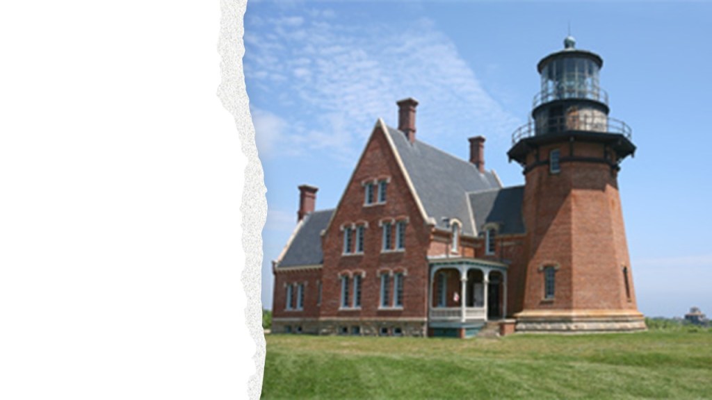
The Gay Head Lighthouse located here was featured in the 1975 movie “Jaws.”
There is an interesting, and lengthy back-story to the Gay Head Lighthouse.
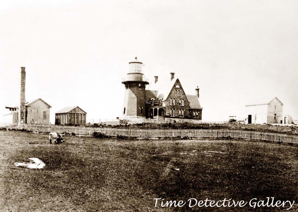
But long story short, at one time there were more buildings here.
Then only one, which looks like there is possibly more to it under the ground.
And that in 2015, the lighthouse structure was moved because it was perilously close to the eroding cliff edge.
Chappaquiddick Island is a small peninsula that occasionally becomes an island, and part of the town of Edgartown, on the eastern end of the Martha’s Vineyard.
Well, if you ever wondered where the Chappaquiddick of the infamous incident involving Ted Kennedy and an overturned vehicle containing the body of a woman back in July of 1969, it was right here.
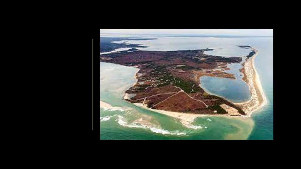
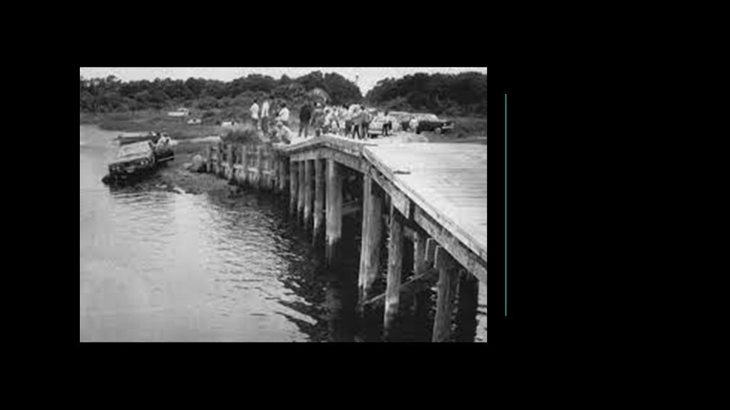
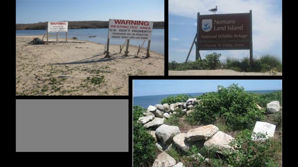
The small island called “Nomans Land” is located three-miles off the southwest coast of Martha’s Vineyard.
It was used as a practice bombing range by the United States Navy between 1943 and 1996.
“Nomans Land” was transferred to the U. S. Fish and Wildlife Service in 1998, at which time it became a wildlife refuge, and closed to all public use.
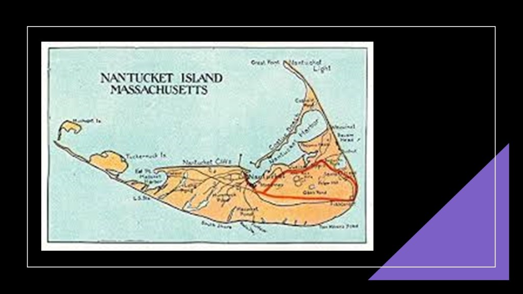
The island of Nantucket is 30-miles, or 50-kilometers, south of Cape Cod, and together with the islands of Tuckernuck and Muskeget, constitutes the Town and County of Nantucket of Massachusetts, and like Martha’s Vineyard, a summer colony for the wealthy.
The name Nantucket was said to have been adapted from a similar-sounding Algonquin name for the island of the indigenous Wampanoag people.
The National Park Service cites Nantucket as being the finest example of a late 18th- and early 19th-century New England Seaport town, and was designated a National Historic Landmark District in 1966.
As mentioned previously, Nantucket was a purchased by Thomas Mayhew the Elder from the Earl of Stirling, William Alexander, and Sir Ferdinando Gorges, as a “proprietary colony,” meaning it was a type of colony owned by the Crown in which charters were granted to companies, groups or indivduals, who then selected the governors and other officials of the colony.
In 1659, Mayhew kept one share for himself, and sold an interest in the island to nine other investors, for the sum of 30 pounds and two beaver hats, and each of the ten original owners was allowed to invite a partner.
The total number of shares in the island increased as they sought to attract skilled tradesmen to come and live on the island for at least three years, and European settlement of Nantucket began in earnest.
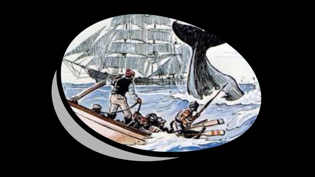
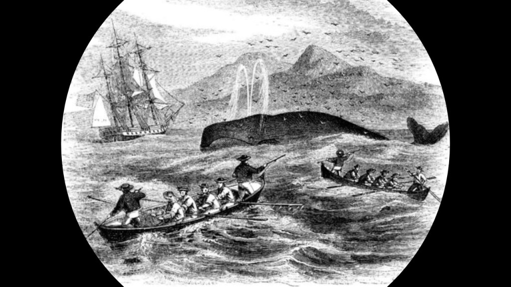
Nantucket Island was perhaps best-known for the historical importance of its whaling industry, particularly during the 18th- up to the mid-19th-centuries.
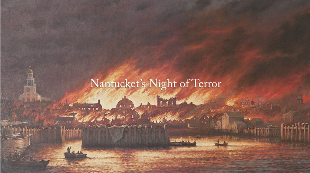
The Great Fire of 1846 devastated the downtown business hub of Nantucket, starting in a hat store and completely destroying more than one-third of the heart of the community and economy, and leaving many homeless, in poverty, and causing them to leave the island.
Great fires (and floods for that matter) destroying the central business districts of cities and towns around the world were quite common in our historical narrative, seemingly as a way to either destroy the original infrastructure, and/or take credit for the building of it afterwards, and as well as to deliberately cause disruption and displacement.
Now moving west along the Pine Barrens line, we come to Rhode Island, where we find Newport…
…and Rhode Island’s Block Island.
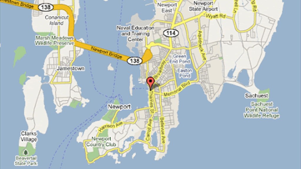
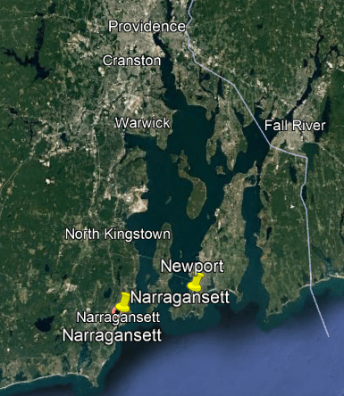
Newport is a seaside city in Rhode Island’s Narragansett Bay, located 33-miles, or 53-kilometers, southeast of Providence.
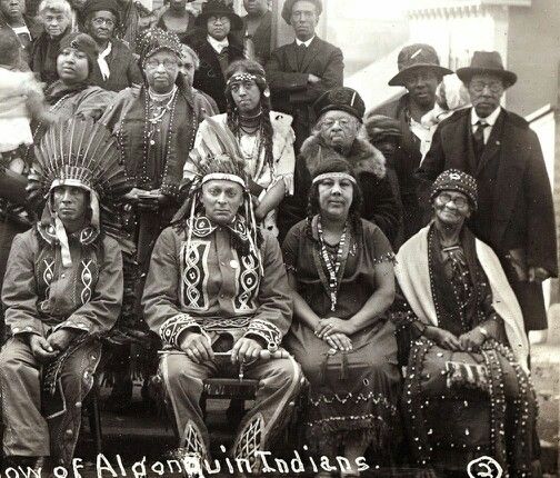
The Narragansett people are an Algonquin tribe of Rhode Island.
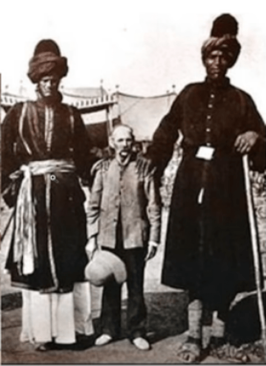
Here is an historic photo of the Narragansett.
Their language died out in the 19th-century, though the tribe has been trying to revive it using written source material.
Across the Narragansett Bay from Newport, in the town of Narragansett, we find a stone masonry building the Towers, said to have been built between 1883 and 1886 by the ubiquitous architectural firm of McKim, Mead and White as part of a Victorian-era casino and social-elite resort facility.
Also known as the “Twin Towers,” it is all that remains after a history of disasters, including fires and hurricanes.
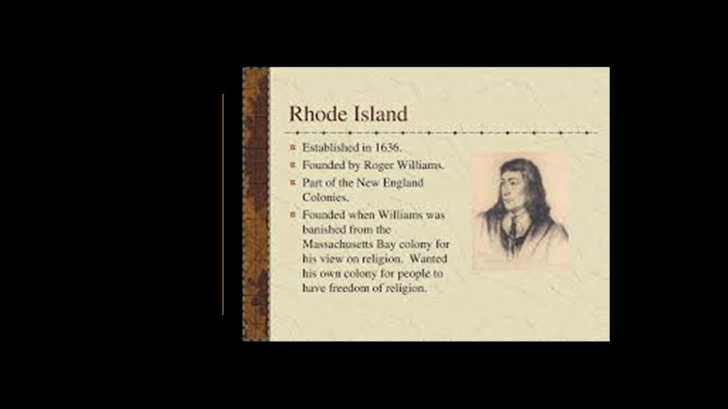
Newport was first incorporated as a town in 1639 by a group of nine founding English colonists, after the Colony of Rhode Island had been established in 1636 by Roger Williams, and only six-years after the Massachusetts Bay Colony was established in 1630.
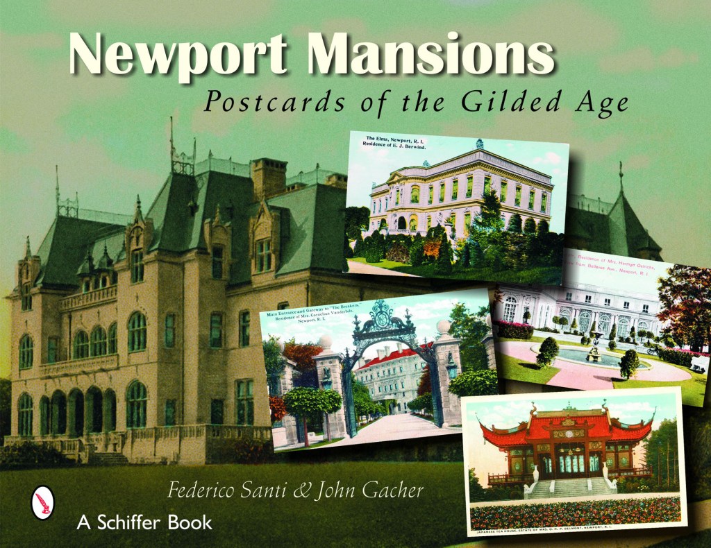
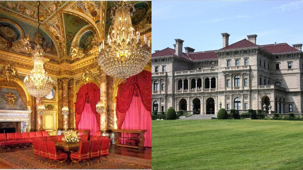
Bellevue Avenue in Newport is known for its “Gilded Age Mansions.”
One definition that I found of “Gilded Age” is that it was a period of gross materialism and blatant political corruption in the United States from the 1870s to 1900.
Another definition is that it was an era of rapid economic growth, especially in the northern and western United States.
Perhaps the most famous of these “Gilded Age” mansions, said to have been built between 1893 and 1895 for Cornelius Vanderbilt II in Newport was known as “The Breakers.”
It was said to have been patterned after a Renaissance Palace, and built with marble imported from Italy and Africa, as well as rare wood and mosaics from countries around the world.
The U. S. Navy has a significant presence here, including Naval Station Newport…
…and during the Eisenhower and Kennedy Administrations, Newport was the location of “Summer White Houses.”
Next, a look at Rhode Island’s Block Island, in the Block Island Sound I mentioned previously that is adjacent to Long Island Sound of the New York – New Jersey Estuary System.
It is 9-miles, or 14-kilometers, south of the Rhode Island mainland, and 14-miles, or 23-kilometers, east of Long Island’s Montauk Point.
Block Island was named for Adrian Block, a Dutch privateer who was employed by the Dutch East India Company who charted the area in 1614.
New Shoreham is the only town on Block Island.
Block Island School is the only school here, teaching students from kindergarten through 12th-grade.
It was said to have been built in 1933 to replace five, one-room schoolhouses, and still use today, with some architectural changes over the years.
Mansion Beach today is a secluded beach on the island’s northeast coast, known for its white sand and big waves.
It was so-named because there was a mansion once here, said to have been designed by Massachusetts architect Edward F. Searles as a dream home for he and his wife, the widow of San Francisco Central Pacific Railroad magnate Mark Hopkins and constructed between 1886 and 1888.
Searle’s wife, Mary Hopkins Searle, was often referred to as the richest woman in America, and shortly after they married, she bequeathed him her entire fortune.
Searles was one of those architects credited with the design of other monumental architecture, including, but not limited to, the interior design for the Kellogg Terrace, known today as Searles Castle, in Great Barrington, Massachusetts, said to be one of America’s great masterpieces of gothic and Neo-Renaissance architecture built in 1883 by Stanford White of the architectural firm of McKim, Mead & White, the same architectural firm credited with the classical design of the Plymouth Rock Monument.
Sure looks to me like Searles Castle sits atop a star fort base, compared with Fort Loreto, a star fort in Puebla, Mexico, on the right.
Searles was credited with the design of the giant nave which still houses one of the largest pipe organs built in a residence in the United States.
At any rate, after having been abandoned for years, the Searle Mansion back on Block Island burned down in the 1960s, and was never rebuilt.
Block Island has thirteen distinct beaches.
This rocky beach is a clothing optional beach below the Mohegna Bluffs, which like the Aquinnah Cliffs back on Martha’s Vineyard, have a sheared-off-looking quality to them.
The huge rocks found here also look megalithic, like they were shaped and cut.
The island’s Southeast Lighthouse is situated atop of the Mohegna Bluffs.
The Southeast Lighthouse was said to have been built in 1874 in the Gothic Revival architectural style.
It is considered one of the most architecturally sophisticated lighthouses built in the United States in the 19th-century, and is the tallest lighthouse in New England.
Things in common with the Gay Head Lighthouse on the Aquinnah Cliffs back on Martha’s Vineyard include:
A top-heavy appearance and ground-level windows, making it look like there is more to this structure hidden underground…
…there used to be more buildings here…
…and this lighthouse was apparently moved away from the edge of the bluff due to erosion as well.
Hmmmm.
“Curioser and Curioser,” as Alice in Wonderland famously once said.
The current Block Island North Lighthouse built of granite and iron was said to have been constructed in 1867, which would have been two years after the end of the American Civil War.
The lighthouse was deactivated in 1973 and acquired by the United States Fish and Wildlife Service.
After being neglected for years, in 1984, the lighthouse and two-acres of land were sold to the town of Shoreham for $1.
It was renovated and first re-lit in 1989, and a museum opened in the first-floor in 1993, and then re-lit again in 2009 after further restoration of the light itself.
Before I move on to Long Island, I want take a look at the other islands located in Block Island Sound, which are Plum Island, Gardiners Island, and Fishers Island, all in New York State.
Plum Island is an island that is part of Southold in Suffolk County, New York, and located in Gardiners Bay, off the eastern end of Long Island’s North Fork peninsula on the eastern end of Long Island.
Plum Island is owned by the United States government, and access to it controlled by the U. S. Department of Homeland Security.
We are told Plum Island was called “Manittuwond” by the historical indigenous Pequot Nation of Connecticut.
This opens up a murky area regarding the people who lived here because their true history has been suppressed in our historical narrative.
The Pequot Nation is indigenous to Connecticut.
The Pequot Nation was classified extinct by colonial authorities after the Pequot Wars that took place between 1636 and 1638, effectively decimating them as a viable tribe, as survivors were either sold into slavery to colonists in the West Indies or Bermuda, otherwise taken captive, or absorbed into other tribes.
Of 5 Pequot tribes in existence today, the Mashantucket Pequot Tribe is the only one that is federally-recognized…
…and, for example, the Eastern Pequot Tribal nation is state-recognized but not federally-recognized.
Mohegan-Pequot was an Algonquin-language spoken by the Mohegan, Pequot, and Niantic people of southern New England, and the Montaukett and Shinnecock of Long Island.
The last living speaker of Mohegan-Pequot died in 1908.
We are told that historically Mohegan-Pequot did not have a writing system, and that the only significant writings came from European colonizers who interacted with speakers of the language.
I am quite sure that James Fenimore Cooper’s “Last of the Mohicans,” first published in 1826, was an early novel introducing and reinforcing the new historical narrative.
Back to Plum Island.
So what we are told is that the Montaukett Grand Sachem Wyandanch of eastern Long Island was said to have sold Plum Island in 1659 to Samuel Wyllys, the son of Connecticut’s governor George Wyllys, for “…a coat, a barrel of biscuits, and 100 fish-hooks.”
Plum Island is only 17-miles, or 27-kilometers, south-southeast of Lyme, Connecticut, the place which gave “Lyme Disease” its name.
The origin story of the disease goes like this:
A mysterious ailment afflicted a group of people in and around Lyme, Connecticut, in the 1970s, and that the cause of Lyme Disease was found to be a form of spiral-shaped bacteria transmitted by the bite of a certain kind of tick.
Lyme Disease causes symptoms like a rash, flu-like symptoms, joint-pain and weakness, among others.
Coincidentally…or not…there is a National Disease Center on Plum Island, which was established in 1954 by the United States Department of Agriculture.
The facility maintains laboratories up to biosafety-level 3, which involves microbes which can cause serious and potentially lethal disease by inhalation.
Fort Terry on Plum Island was said to have been built in 1897 as part of the Harbor Defenses of Long Island Sound, and used intermittently through the end of World War II.
Then in 1952, Fort Terry became a military animal and biological warfare research facility, and in 1954, moved to civilian control as mentioned previously.
The granite lighthouse on the western end of Plum Island, said to have been built and in-service in 1869, looks a lot like the North Lighthouse on Block Island, but unlike the North Lighthouse, it is not open to the public, and access to the Plum Island lighthouse is controlled by the Department of Homeland Security for community stakeholders on a case-by-case basis.
The Plum Island Lighthouse is on one side of “the “Plum Gut,” the mile-wide entrance to Long Island Sound, known for having extremely strong tidal currents.
There is another Lighthouse on the other side of the “Plum Gut,” called the “Orient Long Beach Bar Light,” at the easternmost end of the Long Island’s North Fork.
It was said to have been destroyed by fire in 1963; rebuilt in 1990; and reactivated for navigation in 1993.
Next, I am going to check out Gardiners Island in the Block Island Sound.
Gardiners Island is a small island located in Gardiners Bay between the North and South Forks of Long Island.
The island has been owned by the Gardiner family since 1659, when Lion Gardiner, an English engineer and colonist who founded the first English Settlement in New York here, and said to have purchased it from the Montaukett Grand Sachem Wyandanch, this time for “…a large black dog, some powder and shot, and a few Dutch blankets.”
Wyandanch died that same year, and after his death, the title of “Grand Sachem” went into decline and was eliminated by the colonists after they conquered the region of what was known as “New Netherlands” at the time.
What I am able to find in a search is that the title “Sachem” was the title given to a Native American Chief, in particular the chief of a confederation of Algonquin tribes.
“Sagamore” was the title given to a chief or leader of the Algonquins.
This selection from William Wood’s book was of a map showing the plantations along Massachusetts Bay, and the word or name Sagamore is showing in several places.
William Wood’s book from 1639 was entitled: “New Englands Prospect” and called “A true, lively and experimentall description of that part of America commonly called New England; discovering the state of that Countrie, both as it stands to our new-come English Planters; and to the old native inhabitants. Laying down which that which might enrich the knowledge of the mind-travelling reader, or benefit the future voyager.”
While not under the jurisdiction of the Colonies of Connecticut or Rhode Island, Gardiners Island did fall under the jurisdiction of William Alexander, the 1st Earl of Stirling, who had been given Long Island by the King Charles I of England in 1636, and who required that Gardiner gain approval of his land grant, which he did in 1639 with a royal patent giving him the right to possess the land forever, and given the title of “Lord of the Manor.”
Gardiners Island is a little over 5-square-miles, or 13.4-kilometers-squared, and has more than 1,000 acres of old growth forest, considered by some to be the largest old-growth forest on the northeast coast of the United States.
Passed down through the Gardiner family for over 380-years, the Gardiner mansion on the island is considered to be the oldest family estate in America.
The windmill on Gardiners Island was said to have been built in 1795, and added to the National Register of Historic Places in 1978.
Next, Fishers Island is a part of Southold, New York, at the end of Long Island Sound, located in close proximity to Connecticut and Rhode Island as well.
Named Munnawtawkit by the Pequot, it was said to have been named “Vischer’s Island” by the Adrian Block in 1614 after one of his companions.
John Winthrop the Younger, son of the Massachusetts Bay Colony – which was established in 1630 – founder and Governor John Winthrop, received a grant of Fisher’s Island in 1640.
Winthrop the Younger, who first became Governor of Connecticut in 1657, was said to have used the island to raise sheep and wool, and make bricks, and that after his death, his son leased the island to a farmer from England who established the system of cultivation on the island that was used for the next 200 years.
The island was privately held by the Winthrop family until 1863, then owned privately by others until 1879, when a joint-commission for Connecticut and New York reiterated the New York had legal title to Fisher’s Island, even though it has closer ties to Connecticut because of its proximity.
Between 1783 and 1909, brick-making was the only industry on the island because of the clay-pits there, and at its peak in the 1880s, the brickyard was believed to be the largest in the country, with a production capacity of 18-million bricks per year.
Horse-drawn railroad cars were used to transport clay produced by hundreds of miners wielding shovels to the brick presses.
Okay, so that’s what they tell us, anyway!
Since the 1920s, Fishers Island has been a playground for the social register set that includes the Rockefellers, duPonts, Whitneys, and Roosevelts, and two-thirds of the island is off-limits to everyone except residents and their guests.
The social centers of Fishers Island are two private, exclusive clubs that rarely allow outsiders in – the Fishers Island Club and the Hay Harbor Club.
The Fishers Island Club is located near the eastern end of Fishers Island, and has an 18-hole golf course, said to have been designed by Seth Raynor and opened in 1926, that was ranked in 2009 as ninth in “Golf Digest” of the top 100 golf courses in the world.
The Hay Harbor Club was established in 1909, and is on the western end of Fishers Island.
Among other things, it has a 9-hole golf course said to have been designed by George Strath and opened in 1898.
There is a good view of the Race Rock Lighthouse from the Hay Harbor Club.
The Race Rock Lighthouse is on Race Rock Reef, a dangerous set of rocks on Long Island Sound, and the site of many shipwrecks.
The light has been automated since 1878.
It was said to have been designed by American author, artist and engineer Francis Hopkinson Smith, and built between 1871 and 1878.
Smith, along with being a prolific wrter and painter, was also credited with building the foundation for the Statue of Liberty.
Fishers Island is surrounded by nine smaller islands, like the privately-owned North Dumpling Island, where the North Dumpling Island Lighthouse is located.
The North Dumpling Lighthouse was said to have been built in 1849, then rebuilt in 1871, and deactivated in 1959.
The navigational aid replacing the lighthouse is the metal tower near the lighthouse.
How about all those megalithic stones!
And are those columns I see?
There is a lot more to find here on Fishers Island, but I am going to move on to Long Island where there is a lot to find as well.
Suffolk County on Long Island’s East End is comprised of six main townships – East Hampton; Southampton, which includes Westhampton; Shelter Island; Southold; Riverhead; and Brookhaven, and includes the Long Island Central Pine Barrens.
I am only going to highlight a noteworthy thing or two found in these places as there is so much to find in eastern Long Island.
The towns of East Hampton and Southampton together are what are known as “The Hamptons,” another one of the historical summer colonies of the wealthy elite in our society.
The township of East Hampton is on the eastern end of Long Island’s South Shore.
East Hampton includes the following hamlets: Montauk, Springs, Wainscott, Amagansett, part of Sag Harbor, and jurisdiction over the privately-owned Gardiners Island.
The hamlet of Montauk is on the eastern end of Long Island’s South Fork.
The Montauk Point Light is on Turtle Hill at the easternmost tip of Long Island, and not only was it said to be the first built within the State of New York, it was said to be the first public works project in the new United States having been authorized by Congress because the port of New York City was the first in the nation in volume in foreign shipping, and shippers were said to have needed a lighthouse at the end of Long Island to guide them along the south side into New York Harbor.
It is said to be the fourth-oldest active lighthouse in the United States, and also a privately-run museum.
We are told that construction of the lighthouse was authorized by the Second United States Congress in April of 1792 under President George Washington, and that Ezra L’Hommedieu, a prominent lawyer and politician local to the area, chose the location and designed the lighthouse, and that the lighthouse was built between July and November of 1796.
The U. S. Army took over the lighthouse during World War II, and opened Camp Hero, or Montauk Air Force Station, in 1942, adjacent to the lighthouse.
The remnants of Camp Hero are said to be four gun-battery casements, emplacements and concrete fire control towers at the nearby Camp Hero State Park today.
Now, here’s something interesting.
Camp Hero on Montauk Point is alleged to be the location of the Montauk Project, a series of U. S. Government projects with the purpose of developing things like psychological warfare techniques, like MK Ultra, and time-travel research, among others.
We are entering a place on Earth where so-called “Conspiracy Theories” abound, and the Montauk Project is the first of several examples.
The Conspiracy-Theory Montauk Project was the inspiration for the Netflix show “Stranger Things…”
…which was originally billed as “Montauk.”
So far on the East End of Long Island, there was a known Biological Warfare Laboratory on tightly-controlled Plum Island just off-shore in Long Island Sound, and an alleged Psychological Warfare and Time Travel Research Laboratory at Montauk Point’s Camp Hero.
What else could there possibly be here on Long Island’s East End?
Let’s see what comes up.
Southampton, which includes Westhampton, is partially located on the South Fork, and stretches west along the coastline.
Southampton was founded in 1640 by a group of ten settlers from Lynn, Massachusetts, who obtained land from the Shinnecock Nation by signing a lease, and the town grew quickly and over the next few years, established an early whaling industry here.
The Algonquin Shinnecock Nation’s reservation is in Southampton, and we are told, among thirteen indian tribes on Long Island, largely based on kinship.
In 2005, the Shinnecock filed a lawsuit against the State of New York seeking return of 3,500 acres, or 14 km-squared, in Southampton, and billions of dollars for damages, challenging the State Legislature’s approval of an 1859 sale of 3,500 acres of tribal land.
The disputed land included the Shinnecock Hills Golf Course.
In 2006, the court ruled against the Shinnecock Nation, however, finding the lawsuit was barred by laches, or a lack of diligence or activity for making a legal claim or moving forward with legal enforcement of a right.
They did finally receive federal recognition in 2010, after a 30-year effort that included suing the Department of the Interior.
Their historic neighbors to the East on Long Island, the Montauks, or Montauketts, once resided in large numbers on the eastern end of Long Island.
In 1910, a Judge ruled that the Montauks no longer existed as a tribe and were disenfranchised from their ancestral lands.
Today the Montauk are actively working towards the reversal of this decision, as well as the revitalization of their language and culture.
Interesting to note there is a “Pharoah” surname amongst the Montauks.
This a painting of David Pharaoh of the royal family of the Montauk tribe.
He lived between 1835 and died on July 18th of 1878. He was buried in the Indian Field Cemetery on the old reservation lands on East Lake Drive in Montauk.
Princess Pocahontas Pharaoh was born on February 15th of 1878, the last Montauk born on the Montauk Reservation at Indian Field on Montauk Point, a year before the reservation was sold.
She was the youngest daughter of King David Pharaoh and Queen Maria Fowler Pharaoh of the Montauk Tribe.
The King of the tribe always came from the Pharaoh family.
Pocahontas Pharaoh was born in the middle of efforts by Arthur Benson and the Long Island Railroad to force the Montauks off their Land.
Benson purchased Montauk in October of 1879 for $151,000 and allowed the railroad to expand its rail service through it.
In 1897, King Wyandanch Pharaoh, Pocahontas’ brother went to court to try to get the Montauk land back and fought until 1910, at which time a New York court held that the Montauk Tribe was extinct and stripped the nation of its tribal lands.
Interesting side-note that at least in the Romance languages, the word for lighthouse includes the root sound of “Far”:
In Italian, the word for lighthouse is “Faro…”
In Spanish, it is the same word “Faro…”
In French, the word for lighthouse is “Phare…”
In Portuguese, it is “Farol…”
And in Romanian, “Far.”
They are spelled and sound like they are related to the word “Pharaoh,” which we are told was the common title for monarchs of ancient Egypt from the First Dynasty, starting in 3,150 BC, up to the annexation of Egypt by the Roman Empire in 30 BC.
Throwing this information in for consideration since both a lighthouse and pharaohs are found on Montauk Point.
Southampton is on the eastern side of the Long Island Central Pine Barrens, and the Central Pine Barrens Planning Commission is in Westhampton Beach, on the western side of Southampton.
…where you find the Westhampton dunes…
…considered prime land and luxury real estate for those that can afford it…
…and canals, like the Moneybogue Canal, which requires dredging to get rid of the sediment at the bottom of the waterway.
The Long Island Central Pine Barrens is called Long Island’s largest natural area and last remaining wilderness.
The Pine Barrens recharge a federally-designated sole source aquifer for Long Island’s fresh drinking water, which comes from groundwater wells.
Almost all of Long Island’s Peconic and Carmans Rivers, and their watersheds, two of the four major rivers here, are in the Pine Barrens.
The Peconic River drains an area between the Harbor Hill Moraine, flowing into Flanders Bay, and connecting to Peconic Bay, the bay between Long Island’s North and South Forks, east of Riverhead.
It originates in bogs and wetlands in Central Long Island, and is freshwater until it becomes an estuary in Riverhead, a town and township on the northern edge of the Pine Barrens.
The Harbor Hill Moraine that skirts the North Shore of Long Island was said to have resulted from advancing glaciers 18,000 years ago…
…and named for Harbor Hill in Roslyn, New York, the highest point in Nassau County, where the Harbor Hill Mansion was said to have been built between 1899 – 1902 for the telecommunications magnate Clarence Hungerford Mackay, and designed by Stanford White of the architectural firm of McKim, Mead and White.
Next, I am going to take a look at what is found near the town of Brookhaven, which borders the Long Island Central Pine Barrens to the southwest.
The town of Brookhaven on Long Island is the namesake of the Brookhaven National Laboratory in nearby Upton, a U. S. Department of Energy Laboratory.
The Brookhaven National Laboratory is located on the site of the former Camp Upton, a U. S. Army facility first established in 1917 during World War I to house troops awaiting deployment overseas, and during World War II, it was used as an internment camp for Japanese, German, and Italian citizens living in New York or serving on merchant vessels, since the U. S. was at war with these three countries.
The Department of Energy National Laboratory was established in 1947, with a stated desire to “explore peaceful applications for atomic energy” after World War II.
The Laboratory has developed a broader mission over time, including: nuclear and high-energy physics; physics and chemistry of materials; nanoscience; energy and environmental research; national security and nonproliferation; neuroscience; structural biology; and computational sciences.
The research facilities of Brookhaven National Laboratory include the Relativistic Heavy Ion Collider (RHIC), the first and one of two operating heavy-ion colliders, and only spin-polarized proton collider ever built.
It is also said to be the only operating particle collider in the United States, as physicists study the primordial form of matter that existed in the Universe after what we are told was the “Big Bang,” a physical theory about an event that describes how the Universe expanded from an initial state of high density and temperature.
The worlds’ other operating heavy-ion collider is the Large Hadron Collider, also known as CERN, near Geneva, Switzerland.
In addition to the RHIC, the Brookhaven hosts the National Synchrotron Light Source II, designed to produce x-rays 10,000-times brighter than the original National Synchrotron Light Source at Brookhaven National Laboratory.
We are told it supports basic and advanced energy technologies in a wide-variety of applications, from nano-catalyst-based fuel cells to economical use of solar energy in high-temperature superconductors in a high-capacity and high-reliability electric grid.
So, along with biological warfare research at Plum Island and psychological warfare and time travel research with the Montauk Project at Camp Hero, we have the Brookhaven National Laboratories on Long Island’s East End studying things likeatomic and high-energy physics.
Going in a southwesterly direction on Long Island, we come to the long and narrow Great South Bay.
The Great South Bay is described as a lagoon that is 45-miles, or 72-kilometers-, long, and has an average depth of a little over 4-feet, or 1.2-meters, and is 20-feet, or 6-meters, at its deepest.
I am sure there is a lot more to find here if I dig around, but I will share this book cover and say that during the so-called Gilded Age, the Vanderbilts, Roosevelts, Whitneys, Morgans, and Woolworths were said to have built summer mansions on the South Shore.
Southwest of the Great South Bay, we come to Jamaica Bay, called a partially man-made and partially natural estuary on the western tip of Long Island, and containing numerous marshy islands.
John F. Kennedy International Airport is on the northeast side of Jamaica Bay.
Interestingly, there is a rapid transit line of the New York subway system that operates here, the IND Rockaway Line that runs between the Aqueduct Racetrack Station terminal, also close to the airport in a short-distance, straight-line alignment, and the Rockaway Park-Beach 116th Street Station terminal.
West of Jamaica Bay, we come to Brighton Beach, where we find megalithic rocks strewn about on the beach…
…and the explanation we are given for faces amongst the rocks was that there was a mystery artist in the 1970s who carved them.
There were three major historic amusement parks with Moorish-looking infrastructure/architecture on Brooklyn’s Coney Island Peninsula west of Brighton Beach – Dreamland, Luna Park, and Steeplechase Park.
Dreamland was the third and last of the three original parks said to have been built on Coney Island in the early 19th-century, and founded by successful Brooklyn real estate developer and former State Senator William H. Reynolds as a refined and elegant competitor to the chaotic noise of Luna Park, opening in May of 1904.
The location of Dreamland was near the West Eighth Street subway station opposite Culver Depot.
Everything at Dreamland was touted to be bigger than Luna Park, including the larger Electric Tower, and four times as many incandescent lights than Luna Park.
Dreamland’s life on Coney Island was ended only 7-years after opening.
On May 27th of 1911, a fire started at the Hell Gate attraction the night before the season’s opening day, and spread quickly, completely destroying the park by morning.
Coney Island’s Luna Park was said to have opened in 1903, and operated until 1944.
We are told the park’s architectural style was an oriental theme, with over 1,000 red and white painted spires, minarets, and domes on buildings constructed on a grand scale.
All the domes, spires, and towers were lit-up at night with several 100,000 incandescent lights.
In the middle of the lake at the center of the park was a 200-foot, or 61-meter, tall Electric Tower that was decorated with 20,000 incandescent lamps, said to be a smaller version of the Electric Tower featured in the 1901 Pan American Exposition in Buffalo.
Luna Park was accessible from Culver Depot, the terminals of the West End and Sea Beach Streetcar and Railroad lines.
Over the years, Luna Park would continue under different management, with constant changes.
The end of Luna Park came with two fires in 1944, one in August and one in October, which destroyed the park, and in 1946, the whole park was demolished.
There has been a Luna Park operating near the original location since 2010 that has no connection to the 1903 park.
Steeplechase Park on Coney Island was said to have been created by entrepreneur George Tilyou in 1897.
The entrance to Steeplechase Park had a grand archway, the top of which was decorated with four horses.
The park included over 50 attractions on its midway alone.
In Steeplechase Park’s history between its opening in 1897 and closing in 1964, there were things like fires, rebuilding, rides added, and so on.
The only remaining structure from Steeplechase Park is the defunct Parachute Jump, next to Maimonades Park, the location of a minor league baseball stadium.
When I was doing research for my recent blog post “Star Forts, Gone-Bye Trolley Parks and Lighthouses of New York’s Hudson River Valley & New York Bays…”
…I found that between the entrance to the lower New York Bay at the Atlantic Ocean to the locations around the George Washington Bridge across the Hudson River alone, there were eleven historical star forts that are in pairs and/or clusters; five major historic trolley amusement parks; and eleven lighthouses.
I found a lot more up the Hudson River from here.
I even found the John D. Rockefeller Estate known as Kykuit near Tarrytown.
Situated on the highest point in Pocantino Hills, the Rockefeller Estate was said to have been built in 1913.
Continuing to track the coastline heading south down the Jersey Shore from Coney Island, we come to the Navesink Twin Lights on the headlands of the Navesink Highlands, overlooking Sandy Hook Bay, at the entrance to the New York Harbor and the Atlantic Ocean.
Navesink was also the name of the Lenape people who inhabited the Raritan Bayshore near Sandy Hook in the scenic highlands in eastern New Jersey.
Much like the other stories we have been told about these places I have looked at along the way, the story goes that the Navesink lands were sold by Navesink elders to a group of Dutch businessmen for wampum and goods in March of 1664, the first and largest land sale deal along the Jersey Shore between Native Americans and Europeans, and that the Navesink received in return for their land things like 5 coats; one gun; 12-pounds of tobacco; and 10 gallons of liquor.
The Navesink Twin Lights were said to have been built in 1862.
The American Civil War is said to have taken place between 1861 to 1865, so we are expected to believe this solid masonry structure was built during war-time.
To the west of the Navesink Twin Lights on the Highlands overlooking Sandy Hook is a town called Sayreville, located at the mouth of the Raritan River where it enters Raritan Bay in the New York – New Jersey Estuary System.
Sayreville received its final naming from James Sayre, Jr, of Newark, one of the two co-founders of the Sayre and Fisher Brick Company in 1850.
Like Fishers Island, there are extensive clay deposits in the area, and the Sayre and Fisher Company quickly became one of the largest brick-making companies in the world.
Big companies including, but not limited to, DuPont established plants in Sayreville for gunpowder production initially in 1898, and later for paint and photo products.
The Raritan River Railroad operated freight and passenger service through here between 1888 and 1980, after which time Conrail took over rail operations.
This the logo for the Raritan River Railroad…
…and this is the logo for Rolls Royce.
The similarity between these two logos tells me these two companies were likely connected in some way. Besides the fact the logos look virtually identical, it brings to mind what I found in Derby, England.
I found Derby near the Algiers’ Circle Alignment as I was tracking it through England.
Derby is the geographic center of England, and the Derwent River Valley in Derbyshire is considered the Birthplace of the Industrial Revolution.
Rolls-Royce is a global aerospace, defense, energy, and marine company focused on world-class power and propulsion systems, and its civil aerospace and nuclear divisions are in Derby…
…as well as the Railway Technical Center, the technical headquarters of British Rail, and considered the largest railway research complex in the world.
There are certainly interconnecting pieces of the puzzle to be found lying around these tidbits of seemingly disconnected information.
Were they all working together to bring already existing railroad infrastructure back on-line?
Interesting to note that I found the Ames Shovel Shop in Easton, Massachusetts, several years ago when I was tracking a long-distance alignment starting and ending in Washington, DC.
In 1803, the Ames Shovel Works was established in Easton.
It became nationally known for providing the shovels for the Union Pacific Railroad, which opened the west. It was said to have been the world’s largest supplier of shovels in the 19th-century.
Brothers Oliver Ames, Jr, and Oakes Ames (b. 1807 – d. 1877) were co-owners of the Ames Shovel Shop.
Oliver was also the President of the Union Pacific Railroad from when it met the Central Pacific Railroad in Utah for the completion of the first Transcontinental Railroad in North America.
Oakes was a member of the U. S. Congress House of Representatives from Massachusetts 2nd District from 1863-1873. He is credited by many as being the most important influence in building the Union Pacific portion of the first Transcontinental Railroad.
He was also known for his involvement in the Credit-Mobilier Scandal of 1867, regarding the improper sale of stock of the railroad’s construction company.
He was formally censured by Congress in 1873 for this involvement, and he died in the same year.
He was exonerated by the Massachusetts State Legislature on May 10th, 1883, the 10th-Anniversary of the completion of the Transcontinental Railroad.
As we return to the New Jersey Pine Barrens following this linear alignment of Atlantic Coastal Pine Barrens, there are a couple of more things in this area that I would like to bring to your attention.
Ong is a ghost town that falls on the Atlantic Coastal Pine Barren alignment, keeping in mind that the places pinned are where each term came up on the Google Earth search.
Ong, or Ong’s Hat, is a ghost town in the Brandon T. Byrne State Forest, and the northern terminus of the Batona Trail, a 53.5-mile, or 86.1-kilometer, hiking trail through the Pine Barrens.
Ong’s Hat was also considered one of the earliest, internet-based, conspiracy theories.
Ong’s Hat is also listed as the first Alternate Reality Game (ARG) on many lists of ARGs.
We are told that “Ong’s Hat” was a work of alternate-reality collaborative fiction, beginning back in the 1980s and embedded in various media to establish a backstory – like bulletin boards, xerox mail art networks, and zines – and that author Joseph Matheny concluded the project.
The Ong’s Hat tale is told about a group of physics and science professors from Princeton who ran chaos theory and quantum physics experiments from an ashram there to travel interdimensionally through a device called “The Egg,” and they were camped out in another world.
“The Egg” was said to have been developed by these physicists and scientists as a sensory deprivation chamber, and used by them to determine when a wave becomes a particle.
One day “The Egg” disappeared, and the young man within explained that in the seven-minutes he was gone, he had travelled to an alternate dimension of the Earth.
According to the story about “Ong’s Hat,” these experiments continued over the years, until the military threatened their research, at which time they moved entirely in to the alternate dimension, only coming back for supplies.
“The Egg?” Great Egg Harbor? I don’t know if there is a connection. Just curious….
What we are told is that Great Egg Harbor was named “Eyren Haven” in Dutch by the Dutch Explorer Cornelius May, for whom Cape May was named sometime around 1614 for all the birds laying eggs he observed here.
Philadelphia is located in close proximity to Ong and the New Jersey Pine Barrens, so let’s take a look at the Philadelphia Experiment and see what we are told about that.
World War II started on September 1st in 1939, and ended on September 2nd in 1945 – exactly six years later. It is considered the deadliest conflict in human history.
Almost halfway through World War II, on July 22nd, 1942, the strange Philadelphia experiment was alleged to have taken place at the Philadelphia Navy Yard.
Did the USS Eldridge just become invisible?
Or did it go somewhere else?
And if it went somewhere else, where might it have gone?
What was the real purpose of the Philadelphia Experiment?
What if the USS Eldridge went back in time, and created a rip in the fabric of space-time?
Personally I think it was a deliberate manipulation of the original civilization’s energy grid system in order to create a rip in the fabric of space-time, and that a new artificial timeline was somehow inserted.
At the very least, I believe this rip allowed great evil in the form of parasitic non-human souls to incarnate in human form on the Earth, and subsequently created the conditions for the world we are living in today. More on this in a moment.
I have postulated for several years that the years 1492 and 1942 are the boundary years of a new timeline called Rome, with 1717 as the midpoint year, and a new history was grafted on to the existing infrastructure on the Earth, and falsely attributed in the new historical narrative.
For some reason, the conspiracy theories I have mentioned of have come back into form to be consumed by the public as shows like the previously “Stranger Things” based on the Montauk Project, or movies like “The Final Countdown,” a 1980 movie where a time-travelling naval vessel in the form of the USS Nimitz goes back in time to the day before the attack on Pearl Harbor on December 7th of 1941.
I think this is because the negative beings have to tell us what they are doing to gain our consent for their actions, but they don’t tell us they are telling us, and instead relying on such methods as predictive programming like this in order to gain our tacit consent (since we don’t know they are telling us something) rather than informed consent.
Predictive programming is defined as: Storylines, or even subtle images, that in retrospect seem to hint at events that actually end up happening in the real world.
As part of my journey going deep into this research, I was guided through a psychic friend in 2019 to look at Ireland in 1742 in my research.
As we were visiting, she received an image of Ireland that was white, cold and frozen on one side of 1742, and bright and sunny on the other.
So I searched for what happened in the year 1742 on the internet, and only two things came up.
The first was that Dublin, Ireland, was the location for the premier of George Frederick Handel’s Messiah on April 13th, 1742.
And the only other thing that came up was an extraordinary cold weather event in Ireland between 1740 – 1741, during which time, the Irish population endured 21-months of bizarre weather without known precedent that defied conventional explanation. The cause was not known.
And Handel’s Messiah premieres in Dublin right after the extremely cold, lethal weather event???!!!
So, who shows up within a few years after the Great Frost of Ireland?
Well, in 1744 Mayer Amschel Rothschild was born in Frankfurt, Germany. He established his banking business there in the 1760s, which became the start of an international banking family.
Starting out as a dealer in rare coins, his business grew to include a number of princely patrons, and continued to expand into an international banker and profiteer from the Napoleonic Wars.
Then on February 6th, 1748, Bavarian Illuminati-founder Adam Weishaupt was born in Ingolstadt, Bavaria, Germany. He went to a Jesuit school at the age of 7, and was initiated into Freemasonry in 1777.
Weishaupt’s radical views on Illuminism got him in trouble with the ruler in Bavaria when writings of his were intercepted and deemed seditious, and he fled to the Duchy of Saxe-Gotha-Altenburg under the protection of Duke Ernest II starting in 1784.
Francis, Duke of Saxe-Coburg-Saalfeld, was born on July 15th of 1750, and was the progenitor of the House of Saxe-Coburg and Gotha line, which seeded the lineage of the new royals, primarily through first cousins Queen Victoria and Prince Albert, but also through direct marriage of this obscure ducal line marrying directly into other European Royal families.
King George V of Great Britain changed the name of the royal house from Saxe-Coburg & Gotha to Windsor on July 17th of 1917, supposedly due to anti-German sentiment generated by World War I.
In 1839, John D. Rockefeller, Sr. was born in the United States, the progenitor of the wealthy Rockefeller family and considered to be the wealthiest American of all time. He founded the Standard Oil Company in 1870.
Shortly after I learned about the cold-weather event in Ireland, I was connected by someone to the mud flood community.
I learned about the fantastic research that is being done by people looking at their own communities and other places, around the world, at strong evidence that there was a cataclysmic event involving a massive flood of mud, as recently as 200 – 300 years ago.
It is being called a reset event, and that photographic evidence exists that buildings, canals, rail-lines, tunnels, among other things, were purposefully dug out after the event to the point where they could be used.
The explanation of a mud flood makes a lot of sense to me based on what I am finding and seeing.
A sudden cataclysmic liquefaction event creating a flood of mud accounts for how a highly advanced worldwide civilization of giants…
…could be wiped from the face of the Earth and erased from our collective memory.
I truly believe there was at least one worldwide cataclysm, but perhaps several, that was deliberately-caused by blood-line connected families.
They were shovel-ready to dig out enough of the infrastructure of the original civilization, with a free-energy-generating grid system that was perfectly aligned with the Heavens, to restart enough of that civilization so they could take control of the new civilization, its people and its resources, and then created the conditions to destroy the whole thing, which seems to be what is playing out right now in front of our eyes.
This was Paris on December 10th of 2022, after France beat England in the World Cup match in Qatar.
This journey looking at the estuaries, pine barrens & elite enclaves of the northeast coast of the United States has provided for me what appears to be tangible evidence for what I believe has taken place here, that this powerful area for the original advanced Moorish civilization got blasted through a leyline with tremendous energy artificially running through it, and this caused the land here to be ruined and sunk.
This makes me wonder if what we are told about the sinking of Atlantis took place much more recently than we have been led to believe in our historical narrative.
And it is very interesting to note how the wealthy elite are obsessed with this region and willing to live or vacation here for an exorbitant cost-of-living, even though it is in a ruined state from what it once was.
If all this sounds crazy, remember the old saying “Truth is Stranger than Fiction.”
We have been taught and told egregious lies from cradle to grave to get us to the world we live in today.
The parasitic and multi-dimensionally aware beings behind all of this want us to believe that suffering, sickness, misery, destruction, division, and death was and is our normal state of being, and not question what we have been taught about who we are.
They are the only ones who benefit because they energetically feed on Humanity’s negative emotional states, at the same time they have sucked up all the wealth of the Earth for themselves.