
This is the first-part of a new four-part series on cities that I found in linear alignment in the United States.
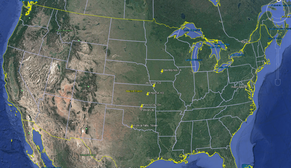
Each part of this series is the complete linear alignment that I am showcasing. I am sure there are more cities…and alignments…. that could be added, but these are based on short alignments I identifed while looking at a map on the internet of the region where I was living in Oklahoma City several years ago.
I found these alignments not long after I found the North American Star Tetrahedron in 2016, when I noticed major cities lining up in lines, and all of my research is based on this original finding.
I believe this is the terminus, or key, of the Earth’s grid system.

Once I found the star tetrahedron, I extended the lines out. I used a magnifying glass and wrote down the cities that lined up in linear and circular fashion.
And I got an amazing tour of the world of places I had never heard of with remarkable similarities across countries.
I have found so much informationjust by literally connecting dots on maps.
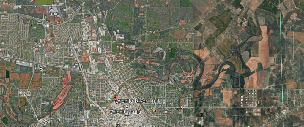
The starting point of this part of the series is Wichita Falls, the largest city and county seat of Wichita County in Texas.
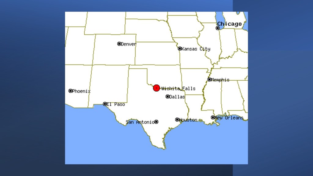
It is situated on the Wichita River.
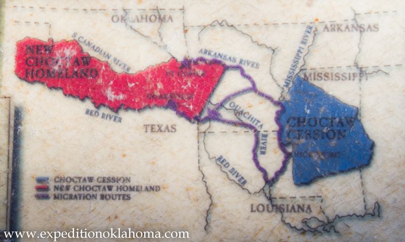
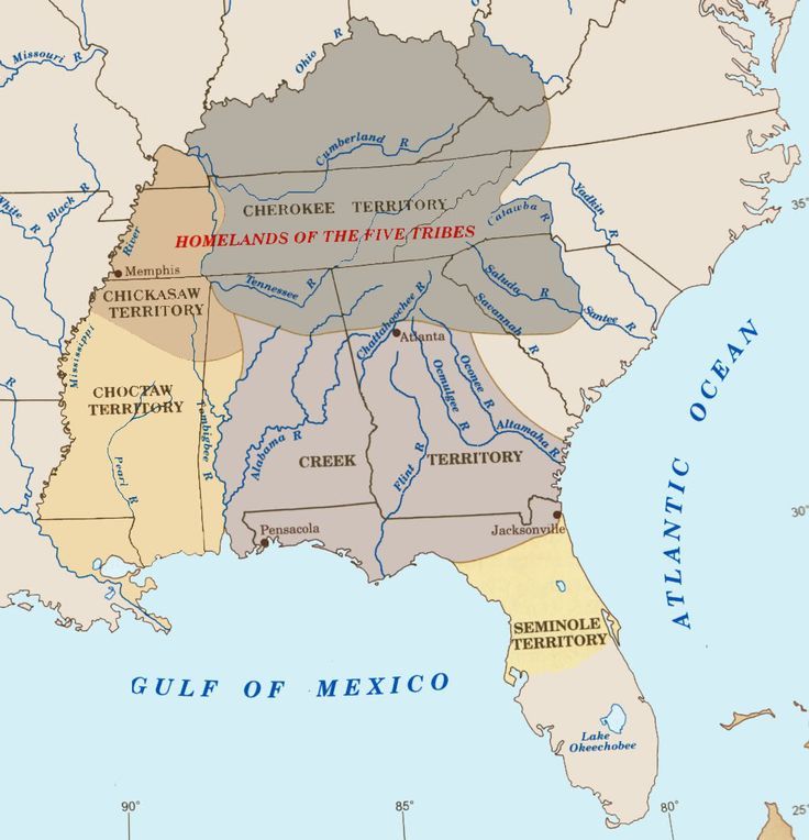
As a matter of fact, we are told is that the Wichita Falls area was settled by Choctaw Native Americans in the 1830s after they were relocated to Indian Territory from their lands in Mississippi as a result of the Treaty of Dancing Rabbit Creek.
This was the first removal treaty carried out after the Indian Removal Act, which was signed into law by President Andrew Jackson on May 28th of 1830, after it was passed by both Houses of Congress, just prior to that.
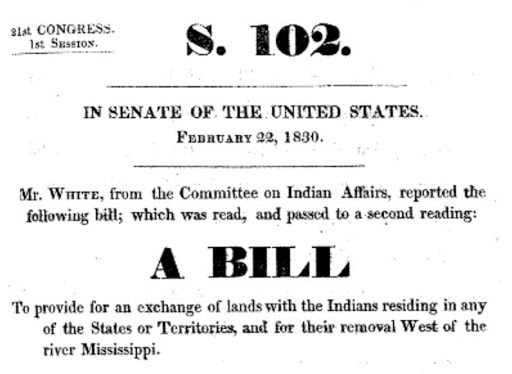
The new law authorized the President to negotiate with the southern Native American tribes for their removal to federal territory west of the Mississippi River in exchange for settlement of their ancestral lands.
This is a fancy way of saying that the Indian Removal Act was put in place to give to the southern states the land that belonged to the Native Americans.
The Indian Removal Act was passed only seven years after the United States Supreme Court ruled in 1823, based largely on the Doctrine of Discovery, and under which title to lands lay with the government whose subjects travelled to and occupied a territory whose inhabitants were not subjects of a European Christian monarch.
In other words, the Supreme Court ruled that Native Americans didn’t own their land.
The Treaty of Dancing Rabbit Creek, signed in September of 1830 and effective at the end of February of 1831, was one of the largest land transfers ever signed between the United States Government and Native Americans in time of peace.

According to what we are told, the Choctaw ceded their remaining traditional homeland to the United States.

Article 14 of the treaty allowed for some Choctaw to remain in the State of Mississippi, if they wanted to become citizens.
The treaty ceded about 11 million acres (45,000 km2) of the Choctaw Nation in what is now Mississippi in exchange for about 15 million acres (61,000 km2) in the Indian Territory, now primarily the state of Oklahoma.
The Choctaw were the first of what were called the “Five Civilized Tribes” to be removed from the southeastern United States, as the federal and state governments desired Native American lands to accommodate a growing agrarian American society.
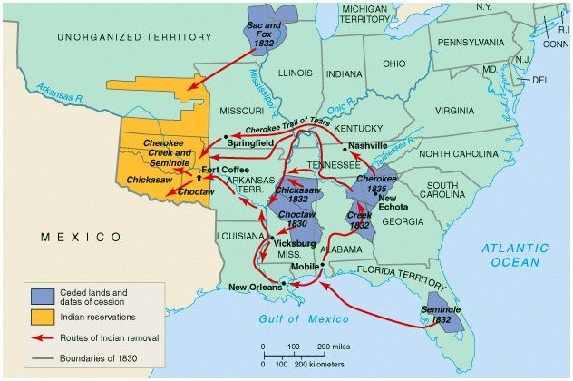
In 1831, tens of thousands of Choctaw walked the 500-mile, or 800-kilometer, journey to Indian Territory and many died. Like the Creek, Cherokee, Chickasaw, and Seminole who followed them, the Choctaw attempted to resurrect their traditional lifestyle and government in their new homeland.
Then, starting in the 1850s, settlers arrived in the area to form cattle ranches, like the Waggoner Ranch, started by Dan Waggoner sometime around 1852 with 15,000 acres for longhorn cattle, and which today is the United States’ largest cattle ranch behind a single fence.
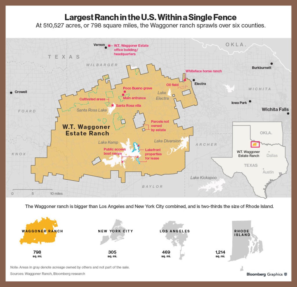
It stretches from west of Wichita Falls in Wichita County, also covering parts of Archer, Baylor, Foard, Knox, and Wilbarger counties.
The official naming of the city as Wichita Falls occurred on September 27th of 1876, and on the same day, we are told, a sale of town lots occurred at what is now the corner of Seventh and Ohio Streets, a location that is considered the birthplace of the city.
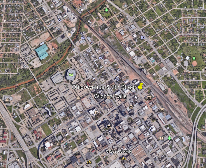
Then six-years later, in 1882, the Fort Worth and Denver City Railway arrived.
The railway’s train depot was located on the northwest corner of Seventh Street.
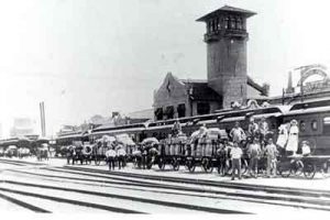
Said to have been built in 1909, the Kemp and Kell Depot Route Building was called an example of the Renaissance Revival style of architecture.
Industrialists Joseph Kemp and Frank Kell came to prominence as a result of their railroad involvement, and the depot route building housed offices for their expanding interests as well as serving as both a passenger and freight depot.

In the short time period of eight-years from the arrival of the railroad, this is a map showing how much Wichita Falls had grown by 1890.
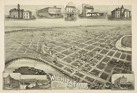
The Depot Square Historic District from where the city started is designated as a Texas Historic Landmark.
Buildings in the Depot Square Historic District include the following:
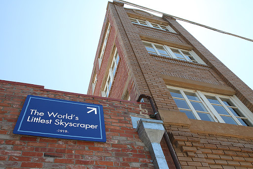
The Newby-McMahon Building…
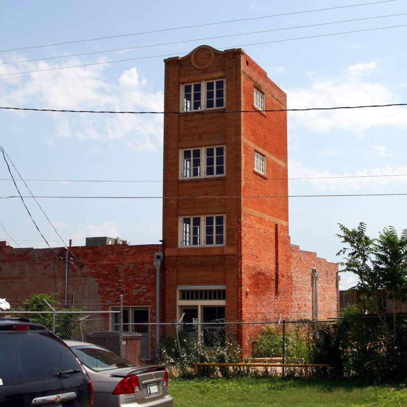
…said to have been completed in 1919 as the result of a fraudulent investment scheme by a con man, became a source of embarrassment to the city, and was featured in “Ripley’s Believe it or Not” in the 1920s as the “World’s Littlest Skyscraper,” and the name stuck.
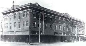
The City National Bank Building was located at Ohio Avenue and Seventh Street, which is where I noted earlier that a sale of town lots was held on the day the city was named in 1876, and which was notoriously robbed in 1896.

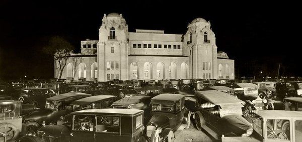
The Union Passenger Station on the northwest corner of Eighth and Ohio Streets in the Depot Square Historic District was said to have been built in 1910…
…and abandoned and demolished shortly after the last passenger train came through Wichita Falls in 1967.
The former location of the Union Passenger Station is the current Farmers Market.

At the peak of the railroad passenger era during the Burkburnett oil boom of 1918, more than thirty trains boarded and de-boarded daily.
We are told that a flood in 1886 destroyed the original Wichita Falls for which the city was named, and that 100-years later, the city built a 54-foot, or 16-meter, high multi-cascade artificial waterfall to replace the original 5-foot, or 1.5-meter, high waterfall at a bend in the Wichita River where Lucy Park is today.

The falls are visible from I-44.
Lake Wichita is described as a manmade reservoir that was said to have been completed through the efforts of Joseph Kemp, who when unable to finance the construction of it as a bond issue, we are told, found a business partner in Galveston to privately finance the construction of the dam and reservoir with the establishment of the Lake Wichita Irrigation and Water company.

It was completed in 1901 at a cost of $175,000, and nicknamed “The Gem of North Texas.
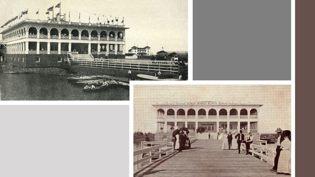
Lake Wichita had a recreational area that included a three-story colonnaded pavilion, and we are told that by 1909, Lake Wichita was connected by an electric trolley line to the city of Wichita Falls.

The Lakeside Hotel at Lake Wichita was said to have burned down in 1918…

…and the colonnaded pavilion was razed to the ground in 1955, we are told, after visitors were said to have lost interest over time in Lake Wichita as a resort.
The Memorial Auditorium in Wichita Falls, located on 7th Street, just west of Wichita Falls downtown district, was said to have been built in 1927 in the hopes of attracting conventions and major entertainers.

We are told that it was modelled after the Fair Park Music Hall in Dallas, which was said to have opened in 1925 with Spanish Baroque and Moorish architectural influences.
Midwestern State University has its original campus in Wichita Falls.
It was founded in 1922 as Wichita Falls Junior College, and renamed Hardin Junior College in 1937 in honor of Mr. and Mrs. John G. Hardin, local business people who had donated $400,000 to the college.

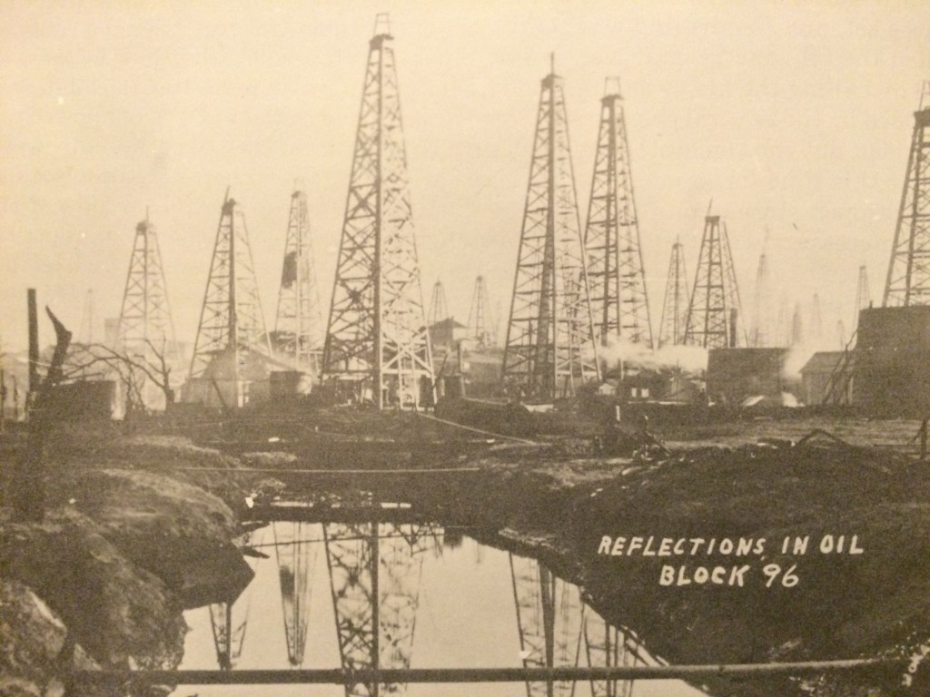
They got wealthy after oil was discovered on their land in nearby Burkburnett, Texas, which had an oil boom starting in 1918.
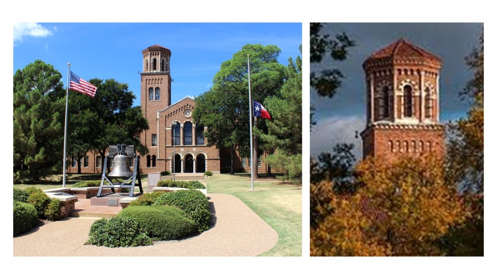
This is the Hardin Administrative Building on campus, said to have been completed around 1937, with a bell-tower shown on the right.
Here is a comparison of the front of the Hardin Administrative Building in Wichita Falls, Texas, on the left with the front of the Natural History Museum in Milan Italy on the right.

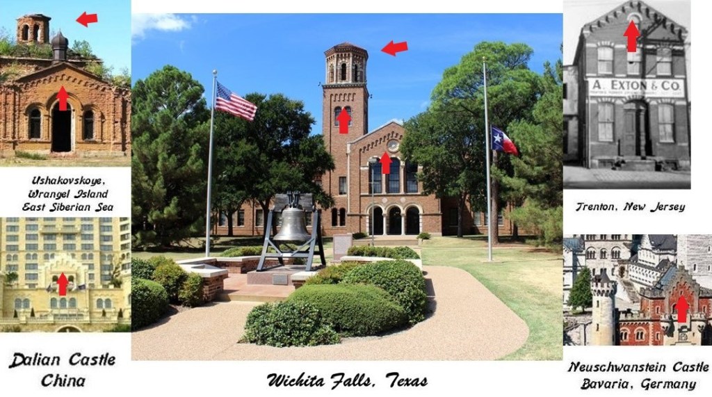
The Hardin Administration Building pictured here in the middle also shares design features with buildings in diverse places, like on Wrangel Island in the East Siberian Sea on the top left; Trenton, New Jersey on the top right; the Dalian Castle in Dalian, China, on the bottom left; and Neuschwanstein Castle in Bavaria Germany on the bottom right.
One last thing I would like to mention before I move on from Wichita Falls.
I think it is interesting to note it is the home of the United States Air Force’s largest technical training wing and the Euro-NATO Joint-Force Jet Pilot Training Program at Sheppard Air Force Base, and the world’s only multinationally staffed and managed flying training program chartered to produce combat pilots for both USAF and NATO.

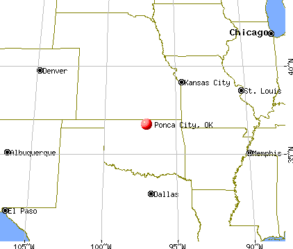
The next place I am going to be taking a look at in this particular linear alignment is Ponca City, the largest city in Kay County in north-central Oklahoma close to the state’s border with Kansas.
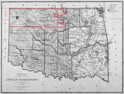
Ponca City was established in 1893 after the Cherokee Outlet was opened for European-American settlement during the Cherokee Strip land run, which was the largest land run in United States history.
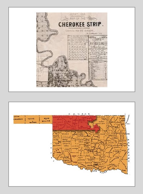
The Cherokee Outlet was part of the lands the Cherokee Nation had acquired after resettlement to lands in present-day Oklahoma…

… as part of the 1835 Treaty of New Echota.
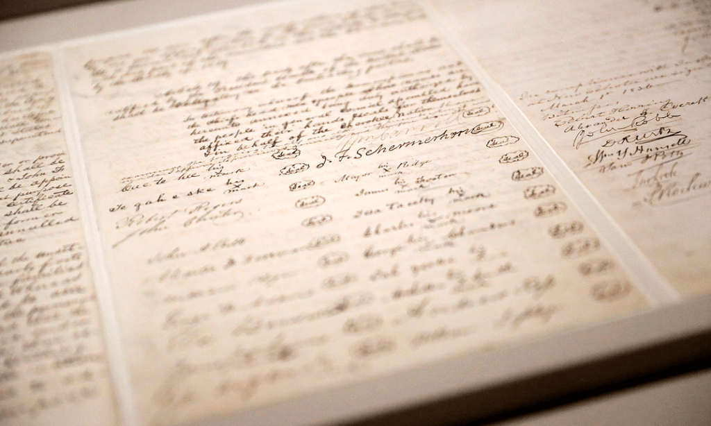
The Treaty of New Echota was signed on December 29th of 1835 by officials of the United States government, and a minority Cherokee political faction known as the Treaty Party.
Although the Treaty of New Echota was not approved by the Cherokee National Council, or signed by the Principal Chief, John Ross, it established the terms under which the entire Cherokee Nation ceded its territory in the southeast…
…and agreed to move west to the Indian Territory.
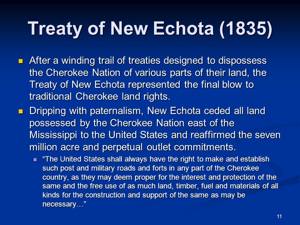
The Treaty of New Echota became the legal basis for the forcible removal of the Cherokees, which became known as the “Trail of Tears.”

The Cherokees ended up selling their land of the Cherokee Outlet at a price ranging from $1.40 to $2.50 per acre to the United States government following a Proclamation by President Benjamin Harris which forbade all grazing leases in the Cherokee Outlet after October 2nd of 1890, thereby effectively eliminating tribal profits from cattle leases.
There was an agreement included in this land sale that individual Cherokees could still establish claims in the Cherokee Outlet.
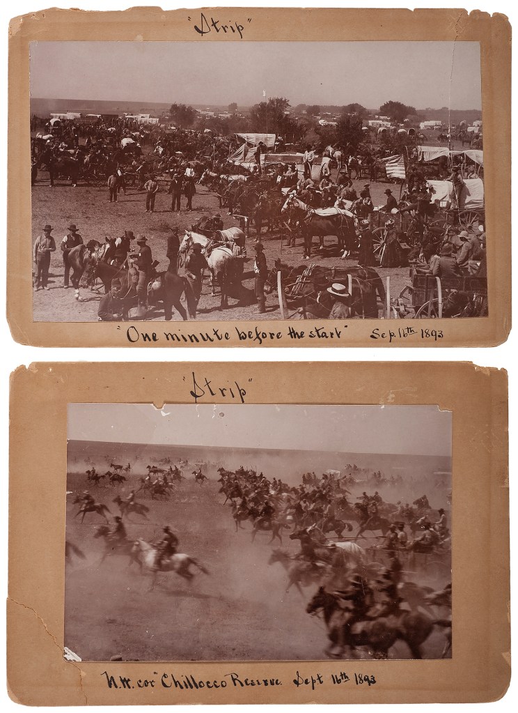
The Cherokee Strip land run began at noon on September 16th of 1893, with approximately 100,000 people hoping to stake claim in the free 6-million acres of land and 40,000 homesteads that had been opened up.
The counties of Kay, Grant, Woods, Woodward, Garfield, Noble, and Pawnee were established following the run. These seven counties were initially designated by the letters K thru Q respectively, and Kay County is the only one of the seven to have kept its original “name” as Oklahoma moved from a territory to a state.
This is the present Kay County Courthouse in Newkirk, Oklahoma, said to have been built in 1926 to replace the original 1894 wooden courthouse which was said to have burned down.

Here is an historic 1910 photo of a building in Newkirk on Main Street which housed the National Bank…as well as a drug store.

Back to Ponca City, the largest city in Kay County and named after the Ponca tribe.
The city was created as “New Ponca” in 1893 after the Cherokee Strip land run, said to have been selected for its location near the Arkansas River, a nearby freshwater spring, and access to the railroad.
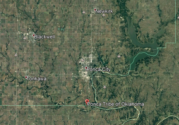
Ponca City was named after the Ponca Tribe of Oklahoma.
Approximately 700 members of the Ponca Tribe of Nebraska had been made to forcibly relocate to a reservation in this part of northern Oklahoma from their traditional lands in Nebraska between 1877 and 1880, and of that number, 158 died in Oklahoma within a two-year-period.
The credit for the founding of the city goes to Burton S. Barnes, a furniture-manufacturer who sold his plant in Michigan to seek his fortune in the land being opened in the Cherokee Strip.
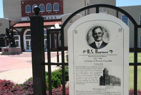
We are told that he organized the Ponca Townsite Company, through which he sold town-lots that he had surveyed for $2 each, then the new owners of the lots was determined by a drawing, after which Burton Barnes was elected the first mayor of Ponca City.
This signage of him and the city’s history is located in front of the City Hall and Civic Center of Ponca City.
Called one of the most beautiful city halls in the United States, it was said to have been designed by Solomon Andrew Layton and built as an auditorium in 1916 (which would have been during World War I), and then the east and west wings added in 1922.

Solomon Andrew Layton, we are told, was one of the main architects of the Oklahoma State Capitol Building, with construction dates given between 1914 and 1917 (which also would have been during World War I).

Ponca City’s economy and history has been predominantly influenced by the petroleum industry.
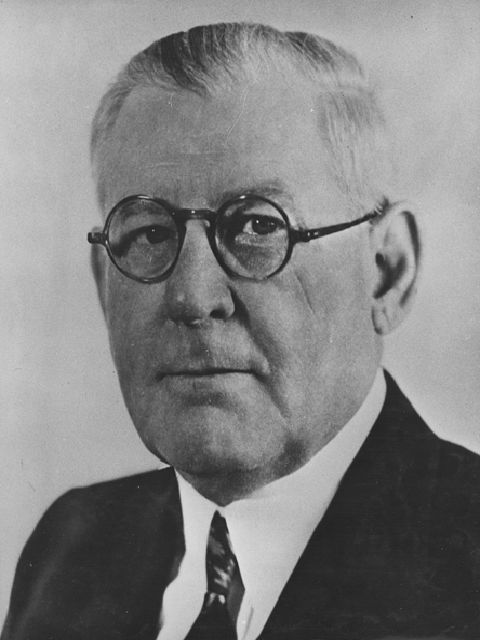
E. W. Marland was a lawyer and oil-man who moved to Ponca City in 1908 from Pennsylvania…
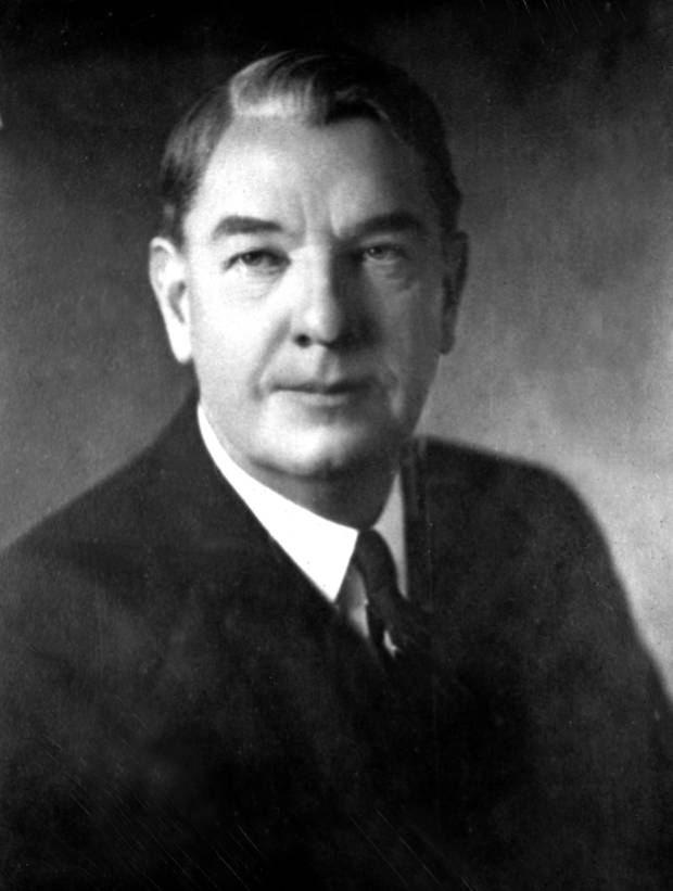
…at which time he founded the “101 Ranch Oil Company” when he entered into a leasing arrangement with the Miller Brothers 101 Ranch in Ponca City.
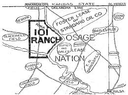
The Miller Brothers 101 Ranch was a 100,000 acre, or 45,000 hectare, cattle ranch founded in 1893 by Colonel George Washington Miller, a Confederate Army veteran.

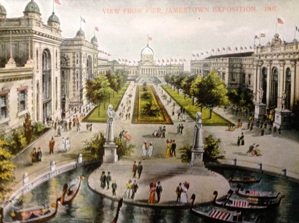
In addition to being a focal point of the oil rush in northeastern Oklahoma, it was the birthplace of the Miller Brothers 101 Ranch Wild West Show…

…which went national in 1907 at the Ter-Centennial Jamestown Exposition at Hampton Roads in Norfolk, Virginia, which commemorated the 300th-anniversary of the founding of the Jamestown Colony, the first permanent English settlement in what became the United States.
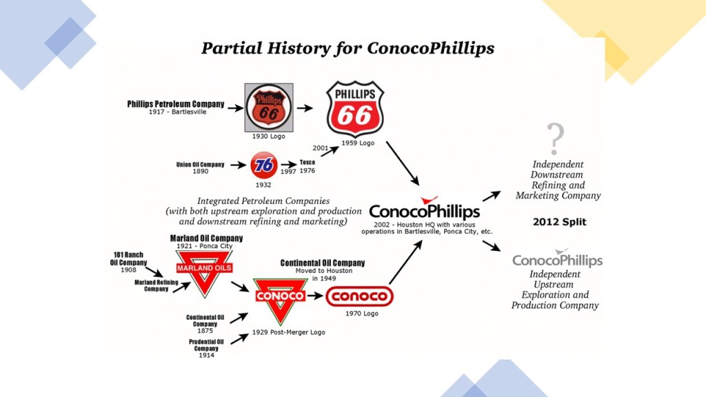
Then in 1917, E. W. Marland founded the Marland Oil Company, which by 1920 controlled 10% of the world’s oil reserves.

The Ponca Nation played a major part in the development of the Marland Oil Company, leasing resource-containing portions of the tribe’s allotted land to the Miller Brothers 101 Ranch and E.W. Marland for oil exploration and development.
Marland Oil Company merged with Continental Oil, also known as Conoco, in 1929, after a successful take-over bid by J. P. Morgan, Jr.
The company maintained its headquarters in Ponca City until 1949, when it moved to Houston, Texas.
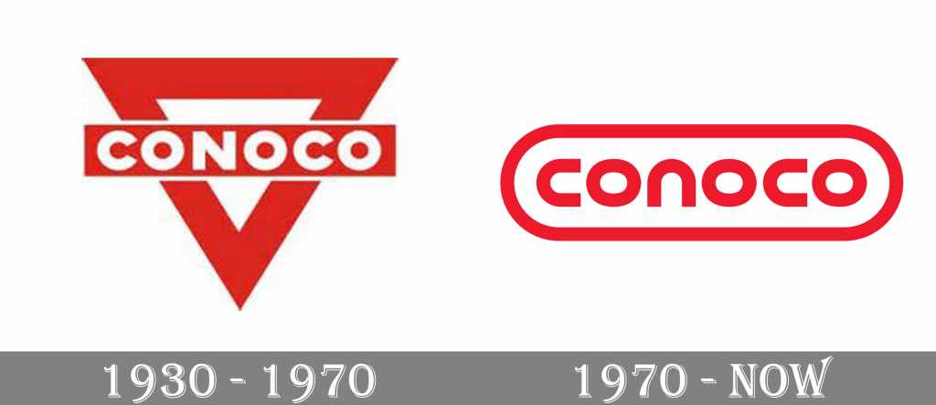
Conoco was owned by the DuPont Corporation between 1981 and 1998, and in 2002, Conoco merged with Phillips Petroleum, which had its roots in Bartlesville, Oklahoma, near Ponca City in northern Oklahoma, to become ConocoPhillips.
The wealth of the company of E. W. Marland, who went on to serve Oklahoma as a United States Congressman, and Governor, was said to have built Ponca City from the ground-up, which has a high concentration of buildings described as Spanish Colonial Revival architecture, like the Poncan Theater, said to have been designed by the Boller Brothers of Kansas City, and opened on September 20th of 1927…

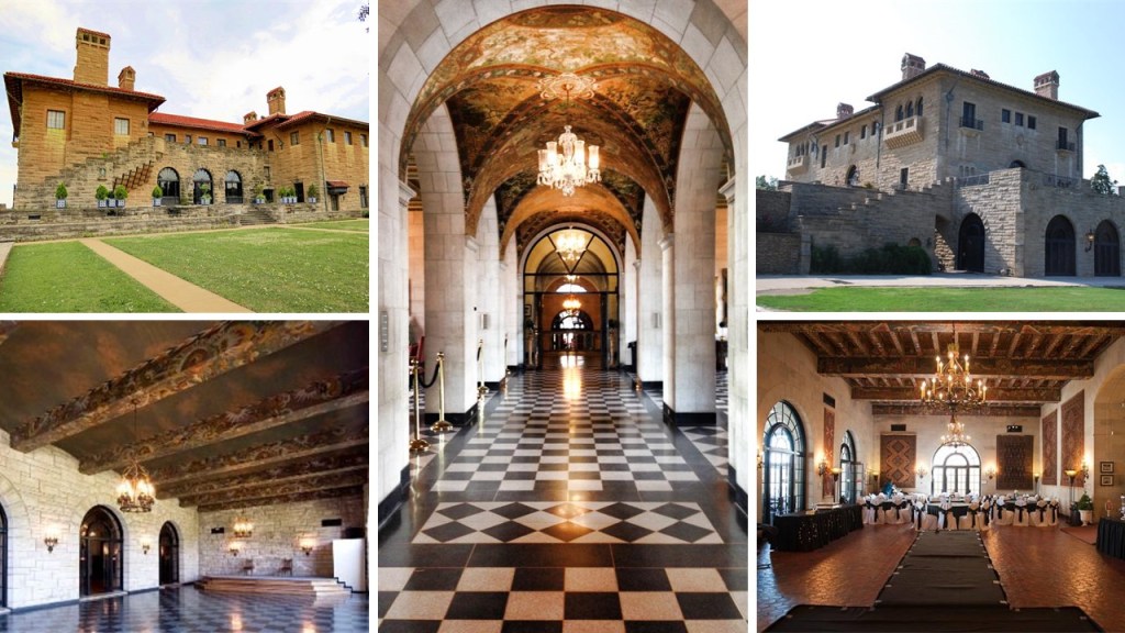
…and the Marland Mansion, also known as the “Palace on the Prairie,” said to have been designed by Tulsa architect John Duncan Forsyth in the Mediterranean Revival style and built between 1925 and 1928.
Another noteworthy place is the Wentz Camp and Pool, which was donated to Ponca City by oil-man Lew Wentz, who was one of the ten wealthiest men in the United States when he died in 1949.
He was said to have spent hundreds of thousands of dollars constructing the camp, cabins and pool in Romanesque Revival style for the use of the people of Ponca City.

The next place I am going to look at in this linear alignment is Emporia, KS.
Emporia is the county seat of Lyon County…

…and is located roughly half-way between Topeka and Wichita in the Flint Hills of Kansas.

The Flint Hills are described as a region in eastern Kansas and northcentral Oklahoma named for the abundant residual flint eroded from bedrock that lies near or at the surface…

…and it also has the densest coverage of intact tallgrass prairie in North America.

What I find interesting about the landscape of the Flint Hills is the striking similarity to what is found in the landscape of Neolithic Britain, the beginning of which is dated back to 4,000 BC.

And not only is the landscape between the Flint Hills and Neolithic Britain similar.
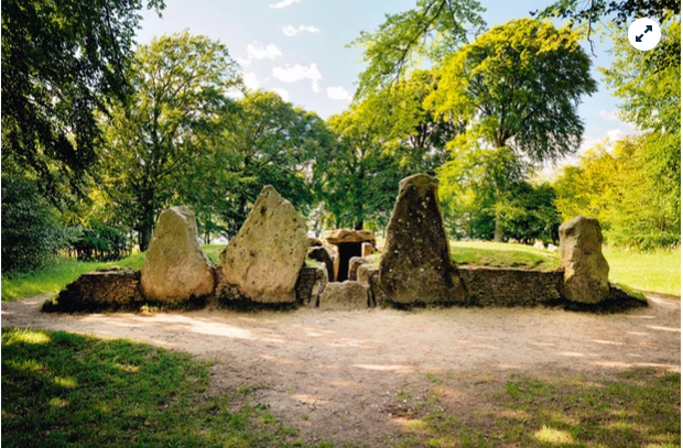
On the left is Teter Rock, said to be a monument erected for James Teter the landowner located near the former Teterville and Teter Oil Fields in southeast Kansas, and on the right are four examples of the more than 270 such structures that have been located and documented here, mostly on private property, and of which the Flint Hills region is considered to have the largest concentration of this type of construction in the world.

For comparison is this standing stone and the underground passageway to Maes Howe in the Orkney Islands off the northern coast of Scotland.
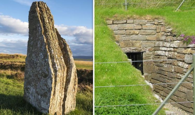
The entrance is aligned to the setting sun of the winter solstice, the darkest point of winter.
This is Grime’s Graves in Norfolk in England, a neolithic site that is the only flint mine that is open to the public, where visitors over ten years of age can enter the mine to see the jet-black flint.
We are told it was a large neolithic mining complex dating back to 2,600 BC.
Are the Flint Hills in Kansas an important, yet unacknowledged, neolithic landscape?

Back to Emporia.
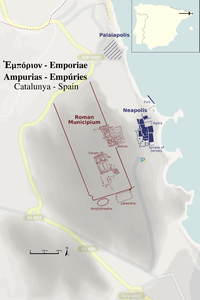
Emporia was founded in 1857, and, we are told, took its name from ancient Carthage.

An “emporia” was a place where the traders of one nation had reserved to their business interests within the territory of another nation, and in ancient Greek, it referred to the Phoenician city-states and trade outposts of North Africa, including Carthage and Lepcis Magna, as well as others in Spain, Britain, and Arabia.
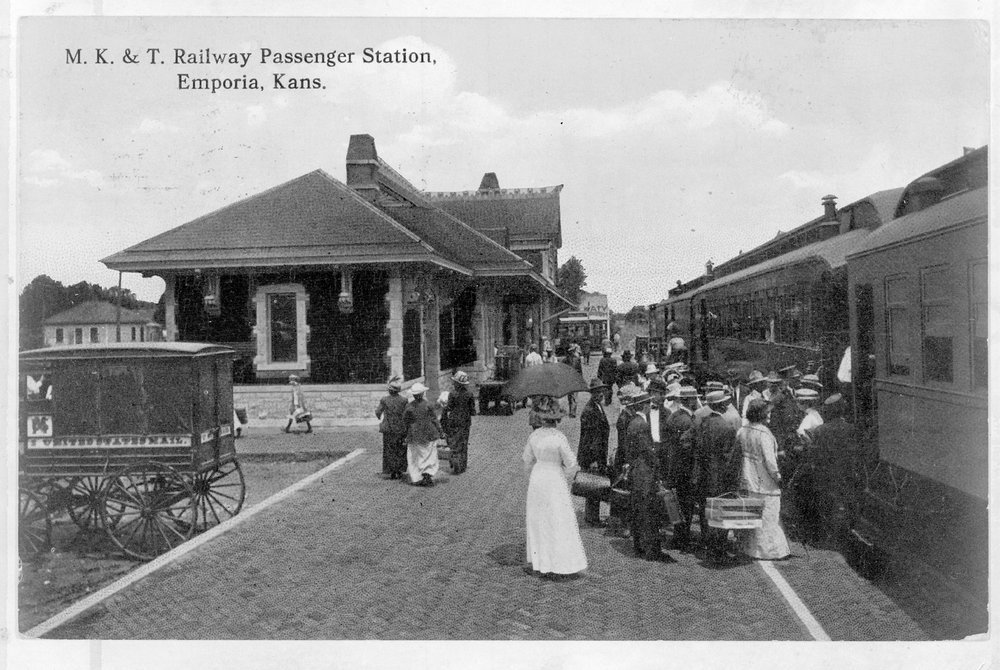
By December of 1860, the Missouri-Kansas-Texas Railroad had reached Emporia, setting the stage for it to become a major railroad hub.
Emporia State University was established here in 1863, two years after Kansas became a state in 1861 (and both of these years were during the American Civil War, which took place between 1861 and 1865).

Emporia was chosen as the county seat of Lyon County in 1860, and this courthouse was said to have been built between 1901 and 1903…for a community at that time which was said to have a population of approximately 8,200 people.
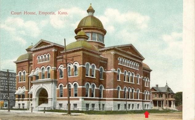
Ground-level windows are noted here as possible mud flood evidence.
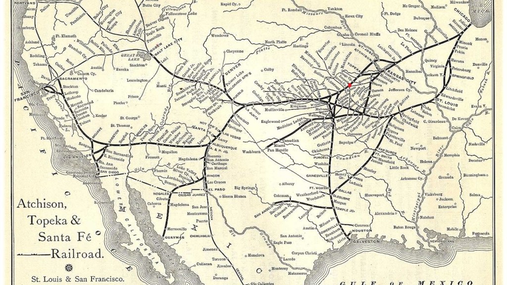
By the early years of the 20th-century, Emporia had become an important railroad center, as not only the junction of the Missouri-Kansas-Texas Railroad, but also as the main-line of the Atchison, Topeka & Santa Fe Railroad.
By 1910, Emporia was said to have the following:
Waterworks; electricity for lighting and power; police and fire departments; well-paved streets; a public library; woolen and flour mills; foundries; machine shops; carriage and wagon works; an ice plant; broom factories; a planing mill; a creamery; brick-and-tile works; a corrugated culvert factory; and marble works. All, we are told, with a population of approximately 9,058.
The Emporia Public Library has been in operation since 1869, and is the oldest in the State of Kansas to remain in operation.

This photograph of Commercial Street is said to date between 1910 and 1919.

The historic Granada Theater in Emporia is located on Commercial Street, and like the Poncan Theater in Ponca City, was said to have been designed in the Spanish Colonial Revival Style by the Boller Brothers of Kansas City.

It opened in 1929.
It was closed in 1982 due to damage and neglect, but local preservationists saved it from demolition in 1994, and it was reopened for public use.
I am going to look at Atchison next on the alignment, the county seat of Atchison County in Kansas.

The year of its founding was 1854, and named after the United States Senator from Missouri, David Rice Atchison, who had interested some of his friends in forming a city when Kansas was opened for settlement.

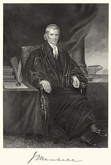
This portrait of Senator Atchison was credited to the Civil-War-era photographer Matthew Brady in 1849.
Atchison was the original eastern terminus of the Atchison, Topeka and Santa Fe Railway.

The railroad was chartered in February of 1859 to serve the cities of Atchison and Topeka in Kansas, and Santa Fe, New Mexico.
Despite being chartered to serve the city, the railroad was said to have chosen to bypass Santa Fe, because of the engineering challenges of the mountainous terrain, and eventually a branch line from Lamy, New Mexico brought the Santa Fe railroad to its namesake city.
The railroad was the subject of a popular song written by Harry Warren and Johnny Mercer for the 1946 film “The Harvey Girls.”

The Soldiers’ Orphans Home was said to have been founded in Atchison in sometime around 1887 for the nurture, education and maintenance of indigent children of soldiers and sailors who served in the Union during the Civil War, and eventually changed to the State Orphans Home, which was in operation until 1962.

The construction of the current Atchison Post Office was said to have been authorized by the United State Congress in 1890, with construction of the Romanesque-style limestone building starting in 1892.

The Atchison County Courthouse was said to have been built between 1896 and 1897 to replace the first courthouse which had been built in 1859.

Then there is St. Benedict’s Abbey in Atchison, which was established in 1857 in order to provide education for the sons of German settlers in the Kansas Territory.

The German Benedictines were quite active in establishing institutions in America during the 1840s and 1850s, said to have been pursuing their religious calling in peace, as well as providing guidance to the German immigrants to America during that period.
When I saw the view of Atchison, Kansas in the top left photo, I was immediately reminded of the view of the city of Santa Cruz de Tenerife on the island of Tenerife in the Canary islands, which are located off the coast of Morocco, on the bottom left. Then on the right is a picture of the ancient city of Ouarzazate, Morocco, which I had encountered in my research, and its appearance reminded me of Santa Cruz de Tenerife and Atchison, especially with regards to the orientation of the buildings, and the placement of the windows.

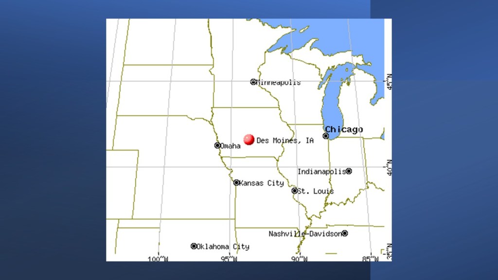
The last place I am going to take a look at on this linear alignment is Des Moines, the state capital and largest city of Iowa.
It was incorporated in 1851 as Fort Des Moines, with the Army said to have built the fort in 1843.

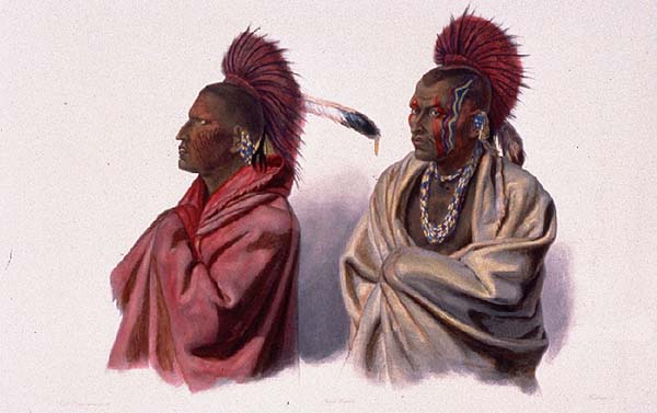
The stated reason for having a fort in Des Moines was to control the Sauk, an Algonquin language-speaking people of the Green Bay, Wisconsin area and the Meskwaki. closely related to the Sauk, known as the Fox, and also Algonquin language speakers. Their homelands were in the Great Lakes region. Both the Sauk and Meskwaki had been relocated from their homelands to eastern Iowa.
The Fort was located where the Raccoon River and Des Moines River meet…
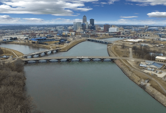
…which has the same appearance as where the Mississippi River and Missouri river meet near St. Louis in Missouri…

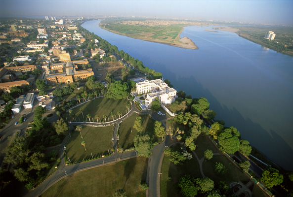
…and where the Blue Nile and White Nile meet at Khartoum in the Sudan.
Even though there was a flood here in May of 1851, destroying crops, houses, and fences when the Des Moines and Racoon Rivers rose to an unprecedented height…
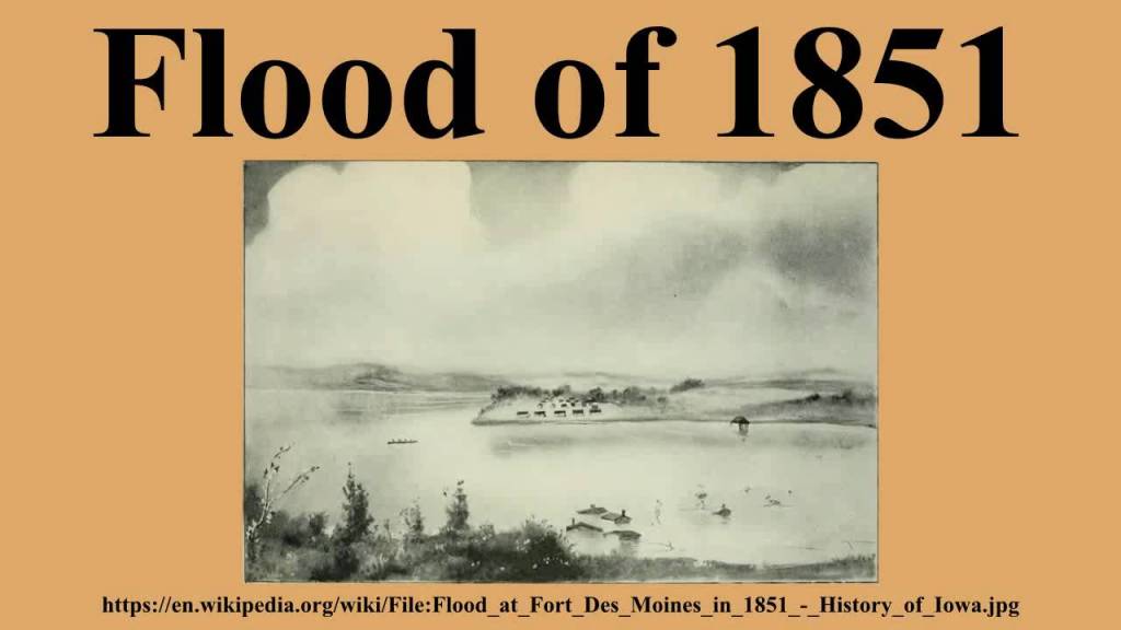
…it was incorporated on September 22nd of 1851 as Fort des Moines, and the name was shortened to Des Moines in 1857.
This is an 1875 map showing a well-developed city of Des Moines in less than 25-years.
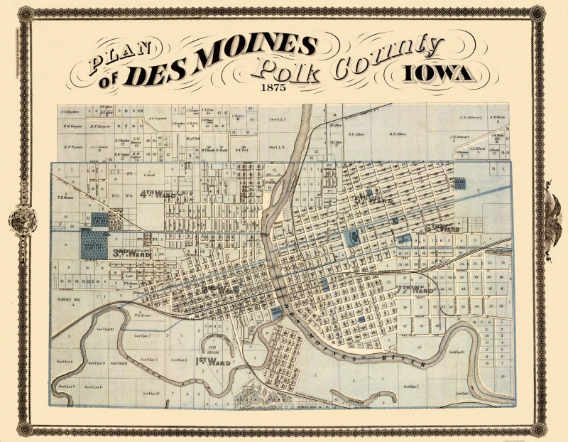
| This “Land Ownership” map indicated the original land owner plot number and many times their names. |
So, for example, this is an historic photo of the Des Moines Post Office, circa 1850…
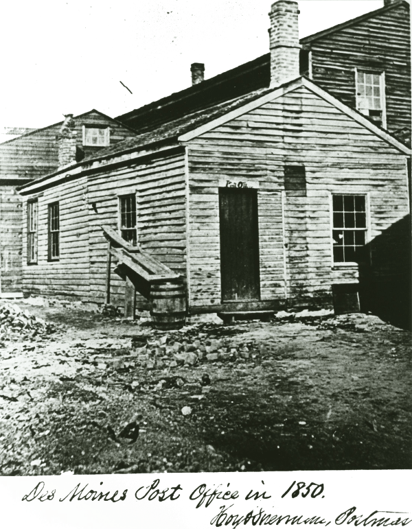
…then this building was constructed in 1871 to house the court house and post office, and it was demolished in 1968…
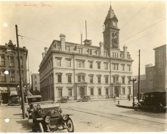
…and then the U. S. Central Post Office in Des Moines was said to have been built between 1909 and 1910, which was the first structure the federal government provided as part of the “City Beautiful Project”…

…a turn-of-the-20th century project the city of Des Moines undertook to construct large Beaux Arts public buildings and fountains along the Des Moines River.
Other architecture attributed to this time included:
The old Des Moines Public Library Building, said to have been constructed in 1903, was listed on the National Register of Historic Places in 1977.
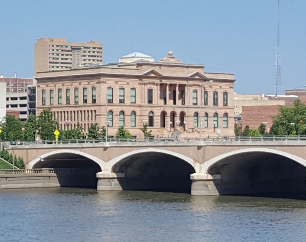
Since 1973, it has been the Norman E. Borlaug/World Food Prize Hall of Laureates for the World Food Prize, an international award recognizing the achievements of individuals who have advanced human development by improving the quality, quantity, or availability of food in the world.
Like the Central Post Office, the Des Moines City Hall was also said to have been built between 1909 and 1910.
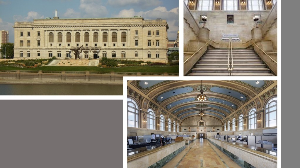
These three buildings are part of the Civic Center Historic District that is located at the confluence of the Des Moines and Raccoon Rivers.
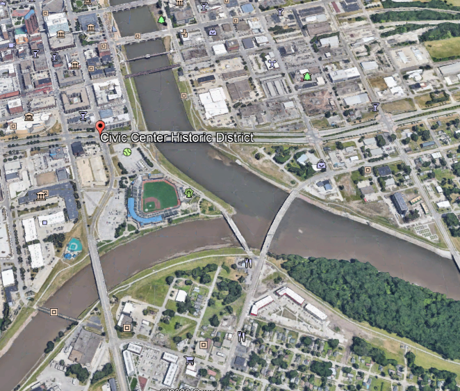
The Iowa State Capitol Building is located near the Civic Center Historic District in Des Moines…
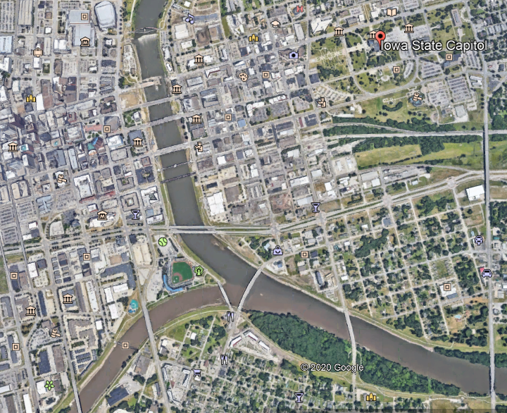
…and was said to have been completed in 1886, and only one of two state capitol buildings in the country with five domes…
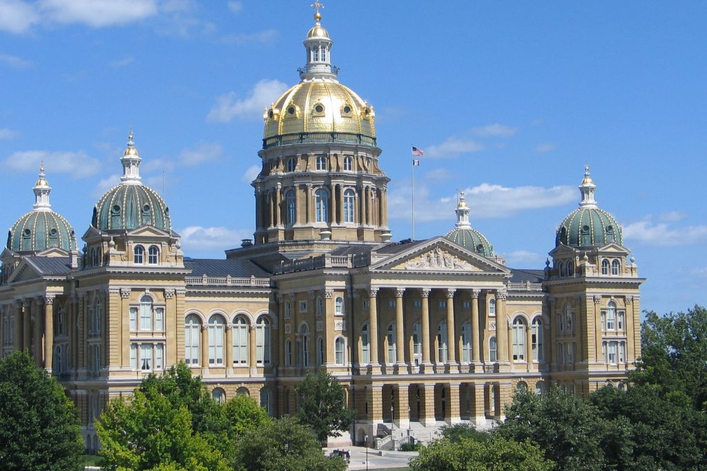
…the other one being in Providence, Rhode Island.

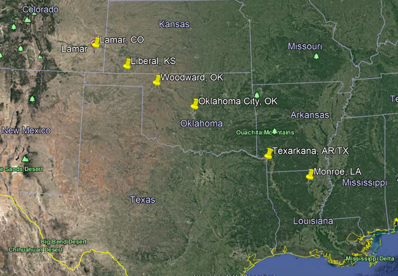
I am going to go ahead and end this post here, and in the next part of the series, I will be looking at a linear alignment of cities between Monroe, Louisiana, and Lamar, Colorado.

I really don’t know how to respond to this information Michelle except to gasp “Wow!” and “Thank you!”. I’m going to have to read it all again because it’s a lot to take in.
LikeLike
It’s interesting because I never know what I am going to find before I start researching data points, but I am never disappointed. I wrote these places down four-years ago, and didn’t look at them until now. I am surprised, and yet at the same time, not surprised, by what I found because I absolutely believe our true history has been suppressed and so much have been covered up.
LikeLike
So many things built during big wars, I wonder if something is going on with this. Is it harder to check out, so easier to lie about it.
LikeLike