
In the last post, I tracked the alignment from Madrid, the capital of Spain and its largest city, through the historic region of New Castile, to the city of Albacete, the capital of the Province of Albacete.
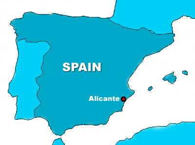
Next on the alignment is Alicante, an historic Mediterranean port city and the capital of the province of Alicante, on Spain’s Costa Blanca.
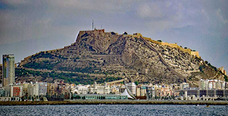
The Castle of Santa Barbara is a major attraction in Alicante. Its origin is said to date back to the 9th-century, at the time of Muslim control of the Iberian Peninsula from 711 to 1296, the year when the castle was said to be captured by the forces of King James II of Aragon.
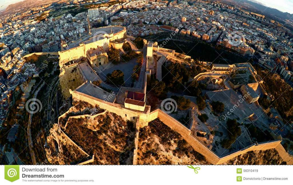
Looks like it could possibly be a type of star fort.
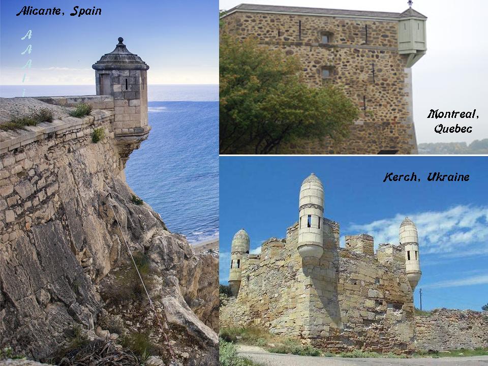
This is a detail of the Castle of Santa Barbara on the left, compared with a detail of Fort Chambly near Montreal on the top right, and the Yenikale Fortress at the city of Kerch on the Crimean Peninsula on the bottom right.
The Castle of Santa Barbara is at the top of Mount Benacantil, said to be derived from the name of Banu-IQatil, given to it by the Arab Medieval geographer, Al-Idrisi, who lived from 1100 to 1165 AD.
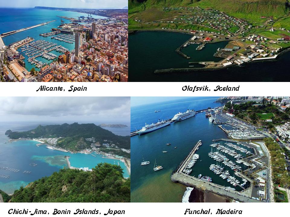
This is the port of Alicante on the top left, compared for similarity in appearance with the port of Olafsvik, Iceland on the top right; the port at Chichi-Jima in the Bonin Islands of Japan on the bottom left; and the port at Funchal on the island of Madeira on the bottom right.
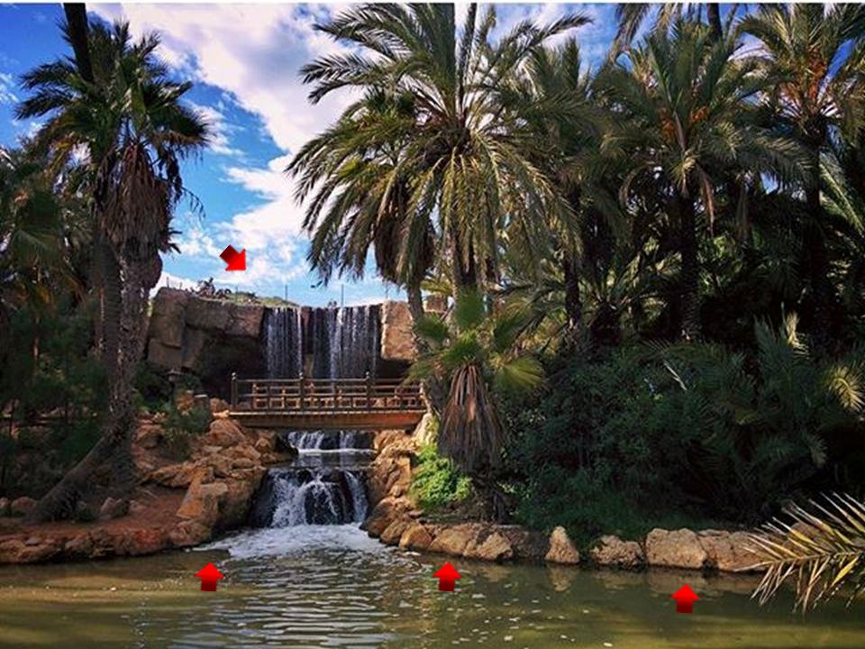
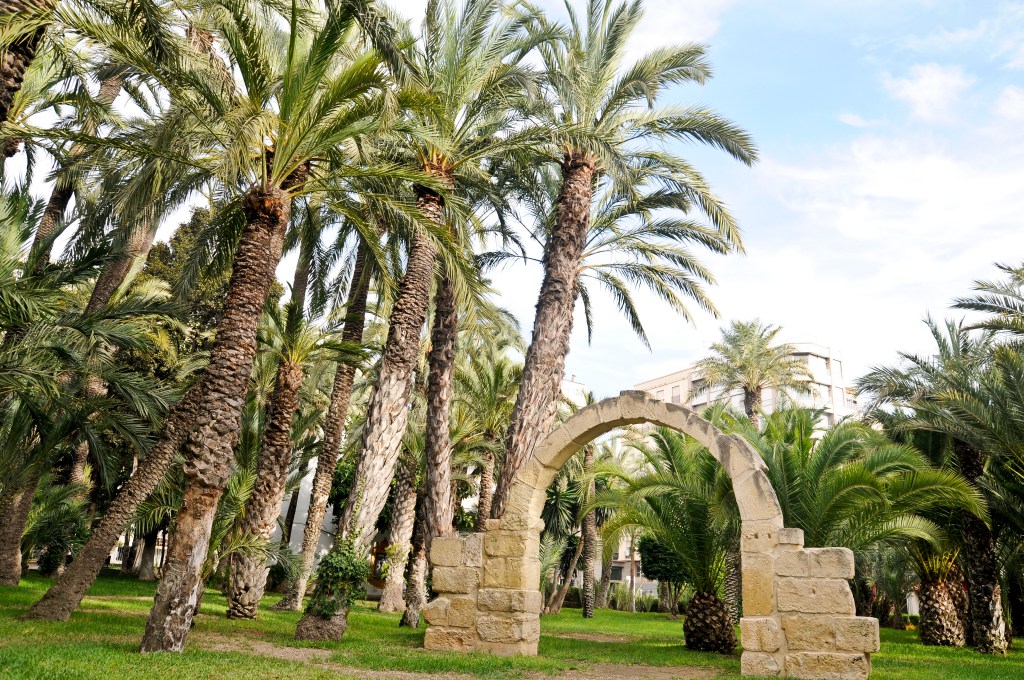
I always look at parks because the ancient civilization is preserved intact in parks of all kinds around the world. Otherwise, in unprotected places, the ancient civilization is destroyed, neglected, or incorporated into existing infrastructure.
This is El Palmeral Park in Alicante, with arrows pointing to ancient stone masonry. Stones with edges and angles that looked carved and shaped in appearance.
For another example, these stones are in Martin Nature Park in Oklahoma City, Oklahoma.
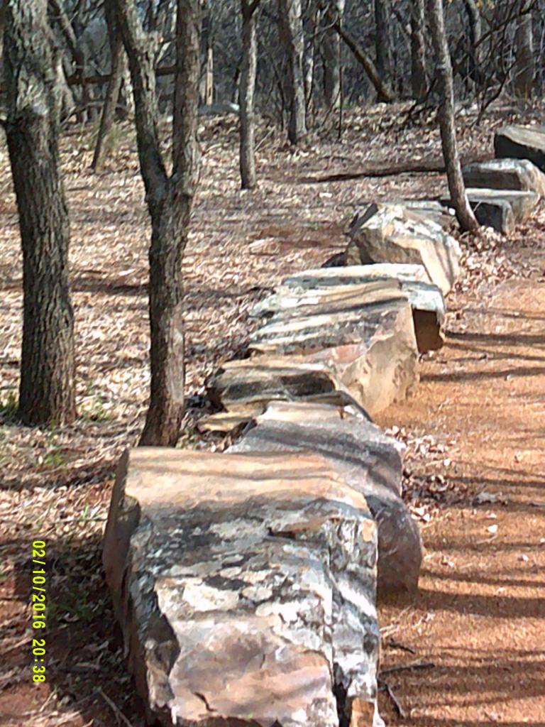
These are not isolated examples by any stretch of the imagination.
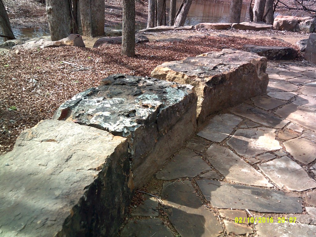
Once you tune into seeing them in your environment, you will notice them everywhere. It doesn’t matter where on the planet you live. We don’t see them because they aren’t supposed to be there based on what we have been taught about our history. This picture was taken in Greenland.
The Metropolitan area of Alicante includes Elche, a town located in the comarca of Baie Vinalopo.
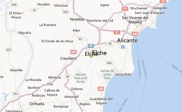
The River Vinalopo, said to be more accurately called a creek or stream, divides Elche into two parts. It looks like a canal to me, and not like a natural land feature.
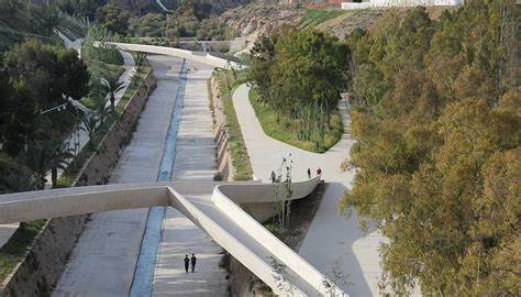
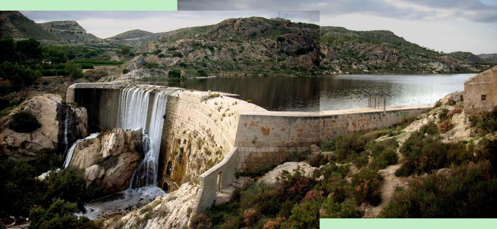
This is the Pantano de Elche, which is 3 miles, or 5 kilometers, north of Elche. The area is described as a wonderful nature reserve and swampland.
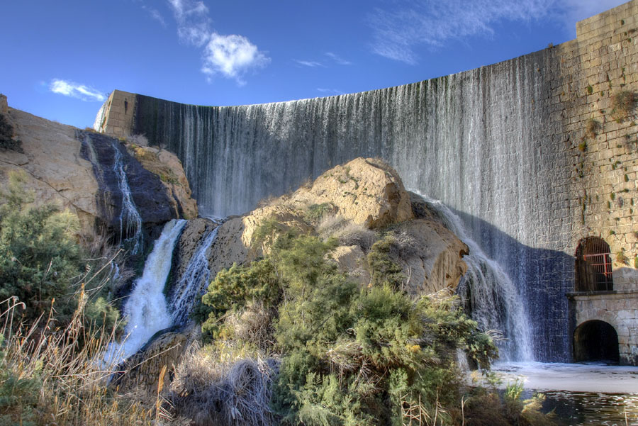
The wall was said to have been built in the 17th-century, and was the first arch-type dam wall to be built in Europe since Roman times.
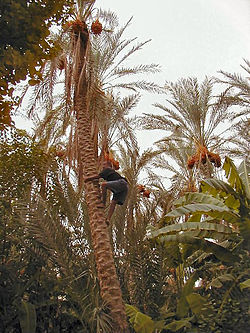
The Palmeral of Elche is a UNESCO World Heritage site.
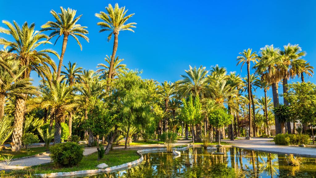
The Palmeral, or Palm Grove of Elche, is a generic name to designate a system of date palm orchards here.
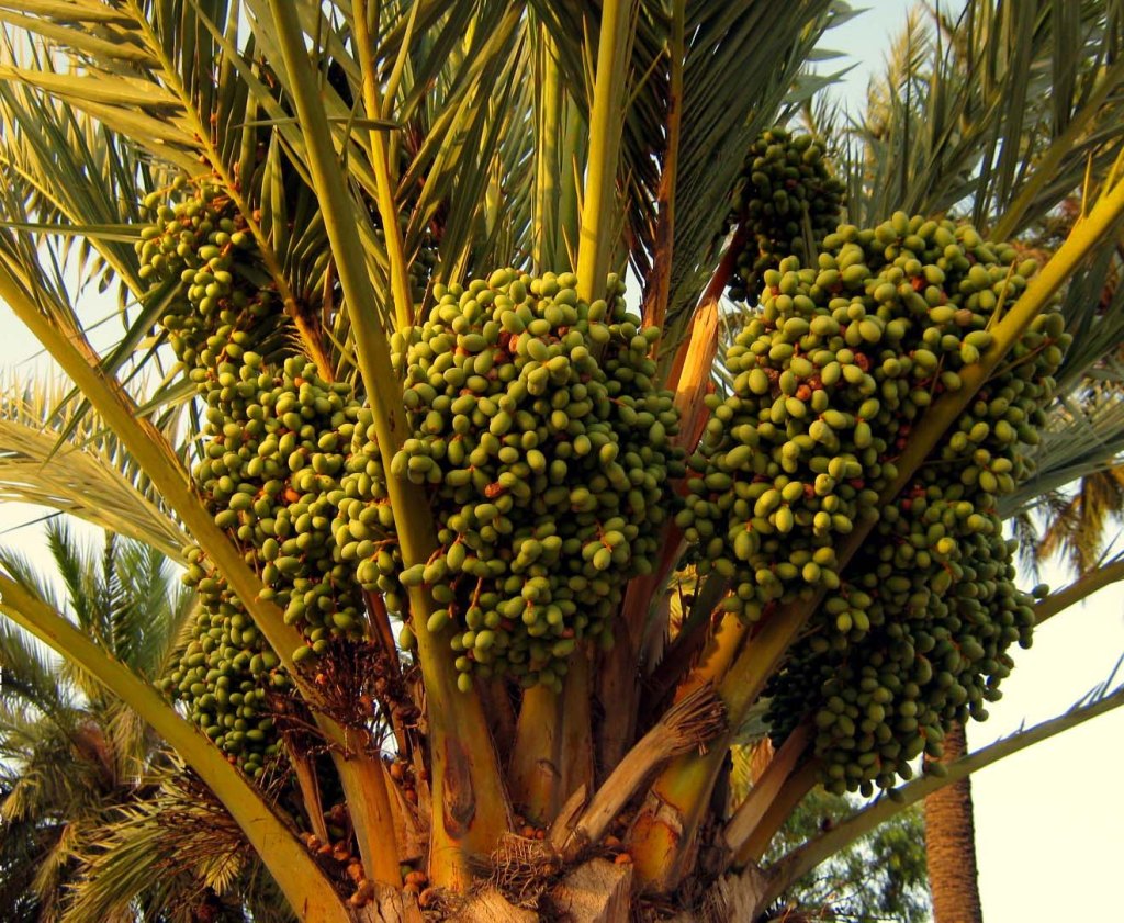
Said to have originally been planted by the Carthaginians, this sprawling palm grove is one of the largest in the world.
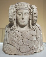
Elche is perhaps best known outside of Spain for the Lady of Elche, a limestone bust that was discovered in 1897 at L’Alcudia, just a short distance outside of Elche.
A shout-out here to Baltimore Fats for his discovery of a similar-looking bust on the B & O Railroad Building in Baltimore, Maryland. Baltimore is also found on this same alignment.
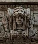
Baltimore Fats is researching these connections on his YouTube Channel of the same name. Interesting stuff!
In modern popular culture, why does Princess Leia from the Star Wars series, sport the same unusual hairdo as Major Iceborg from the movie “The Fifth Element?”

Where did the idea for this hairstyle come from?
It also resembles a traditional hairstyle for Hopi women.

I don’t know the answers. Just asking questions.
There are mysteries here that do not add up for me when it comes to understanding exactly what has taken place on earth. I believe Humanity was experiencing a timeline of higher consciousness timeline that somehow was removed from the collective awareness, and replaced with a degraded and lower timeline of Human misery and suffering. The world was very different from what we see playing out today.


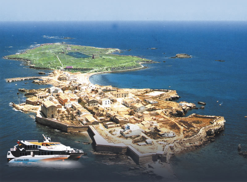
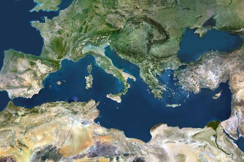
Following the alignment from the Spanish coast from the Alicante area across the Mediterranean Sea towards Algeria, we come to Tabarca Island.
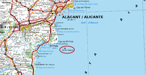
It is the smallest permanently inhabited islet in Spain.
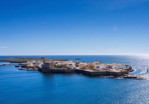
It certainly looks like an artificial island, and maybe even a star fort as well.
The alignment tracks across the Mediterranean Sea from Alicante in Spain, to Algiers in Algeria.

The Mediterranean Sea is connected to the Atlantic Ocean, surrounded by the Mediterranean Basin, and almost completely enclosed by land.
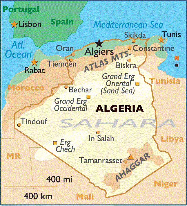
Algiers is the capital, and largest city of the Northern African country of Algeria, and is situated on the west side of a bay of the Mediterranean Sea.
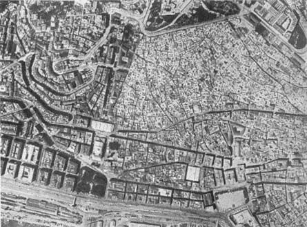
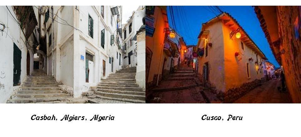
The old part of Algiers is located on a steep hill, topped by a citadel called the Casbah, and is known as the Ancient City of the Deys.
The 5 noble titles of the Moors are: El, Bey, Dey, Al, and Ali. Ancient means something belonging to the very distant past.
Yet we are told that the title of Dey in Algiers (as well as the Deys of Tunis and Tripoli) was given to these rules under the Ottoman Empire, Starting in 1671.
Yet the Casbah is known as the Ancient City of the Deys?
Here is a street lay-out found in the Casbah of Algiers on the left compared with the same construct in Cusco, Peru, on the right.
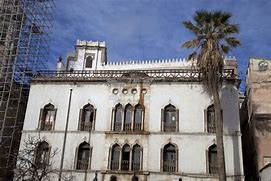
This photo was taken of a building at the Casbah in Algeria.
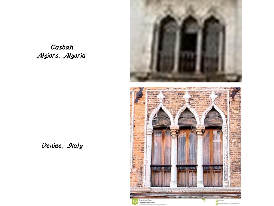
Here is a closer look at the windows of this building in the Casbah of Algiers compared with a detail of windows in Venice, Italy.
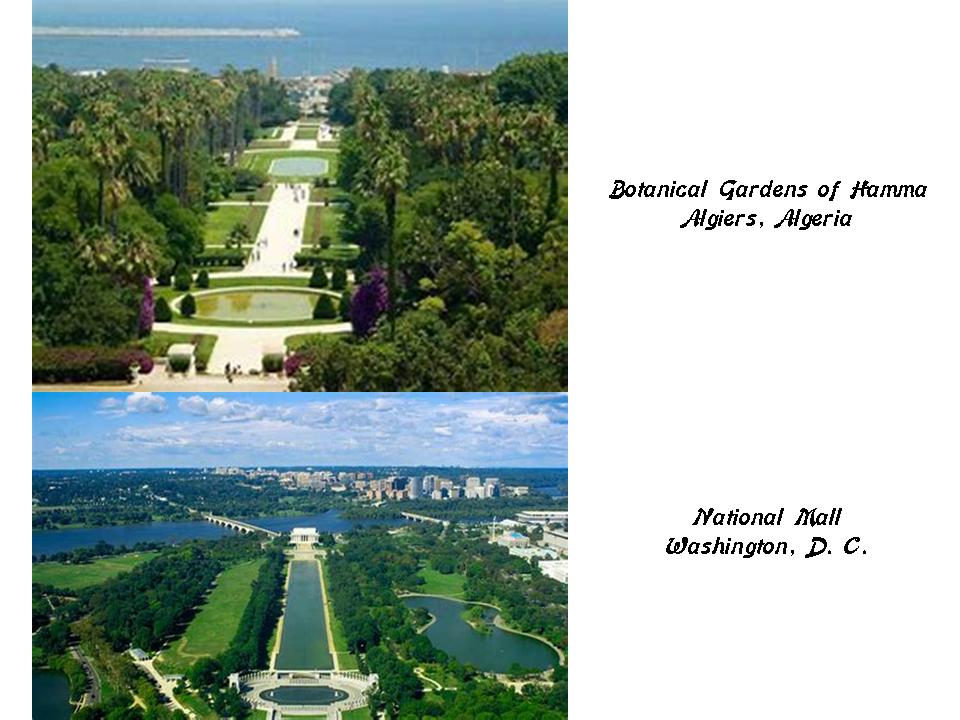
This photo of the grounds of the Botanical Gardens of Hamma in Algiers on the top reminded me of the National Mall in Washington, D. C. on the bottom.
From Algiers, the alignment crosses over the Tell Atlas, the coastal ranges of the Atlas Mountains running for 1,000 miles, or 1,600 kilometers, from eastern Morocco, through Algeria, to Tunisia.
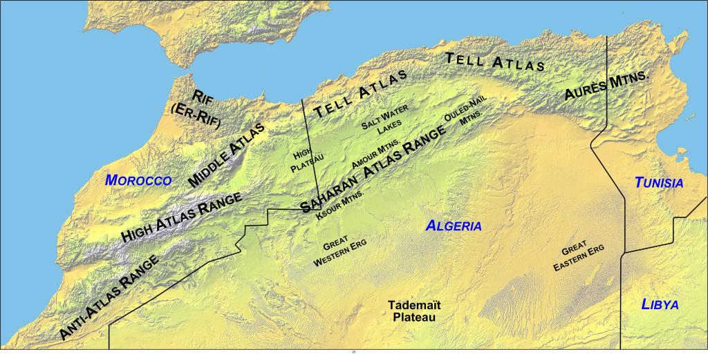
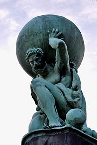
The Atlas Mountains is the location on earth where, according to Greek mythology, the Titan Atlas was condemned to support the heavens. This was his special punishment for his participation in a 10-year Battle of the Titans, in which there was a series of battles involving the younger generation of Titans against the older Gods of Mount Olympus, and the younger Titans lost. The other Titans were put in a place called Tartarus, described by Homer as a deep and sunless place.
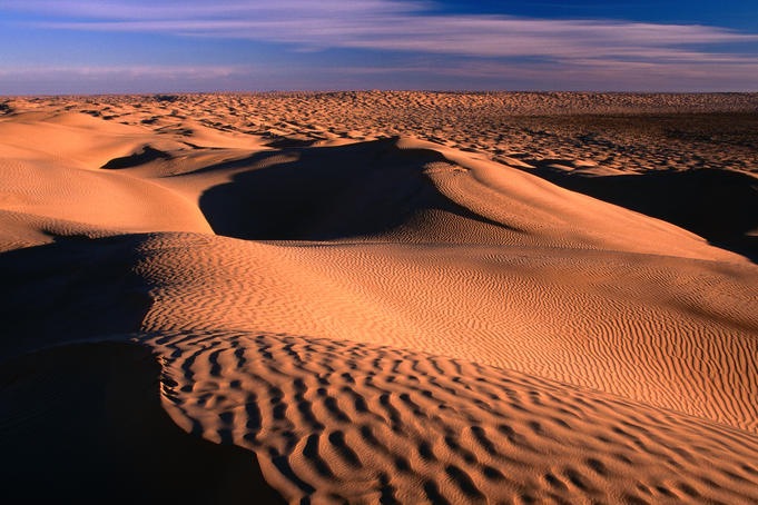
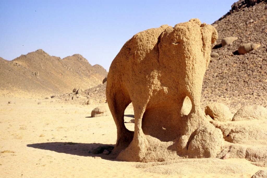
The alignment crosses over the Great Eastern Erg, or the Great Eastern Sand Sea, a field of sand dunes stretching from northeast Algeria to the western part of Tunisia.
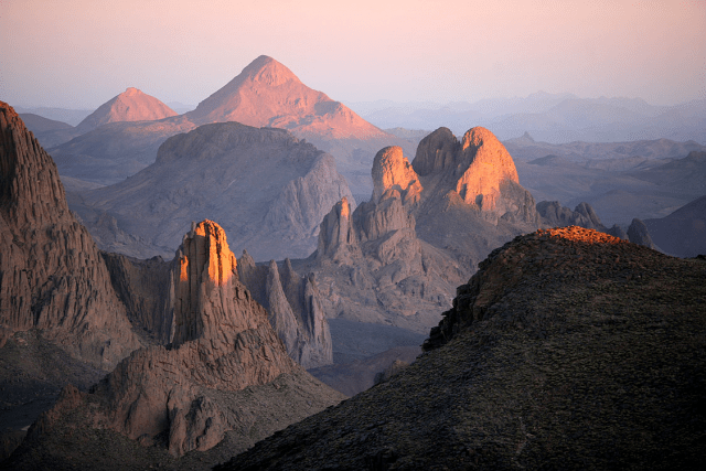
The Great Eastern Erg used to be associated with the Wadi Igharghar, mostly dry and buried river, with a sizeable network of tributaries, which would flow north into the Erg from the Ahaggar Mountains pictured here if the river-beds were filled with water.
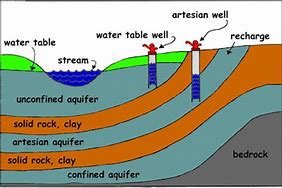
To the north of the Erg, the Aures Mountains provide abundant water run-off, feeding the artesian aquifer of the Jerid of southwestern Tunisia, which of Tunisia’s most important date producing regions.
An artesian aquifer is a confined aquifer containing groundwater under positive pressure. It is trapped water that is surrounded by impermeable layers of rock and clay.
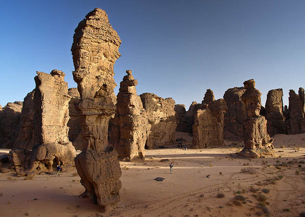
The alignment goes through Illizi, a town in southeastern Algeria, and one of the gateways to Tassili n’Ajjer National Park, which is known for its ancient rock art…
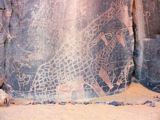
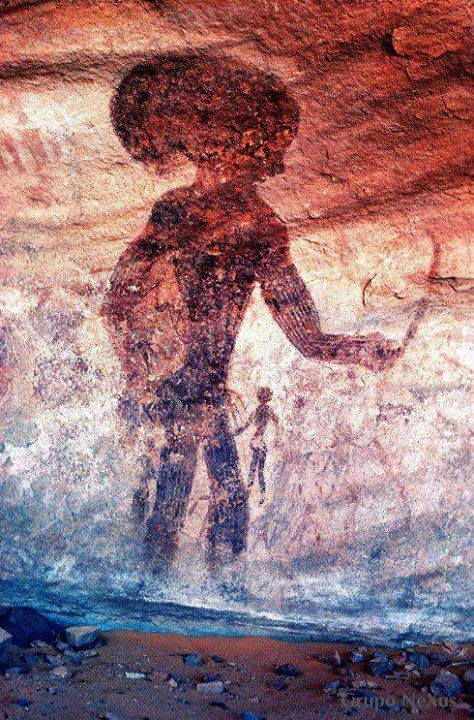
…and unusual rock-formations.
Next on the alignment is Djanet, capital of the Djanet District of the Illizi Province.
The Gorges of Essendilene are 60-miles, or 97-kilometers, north of Djanet.
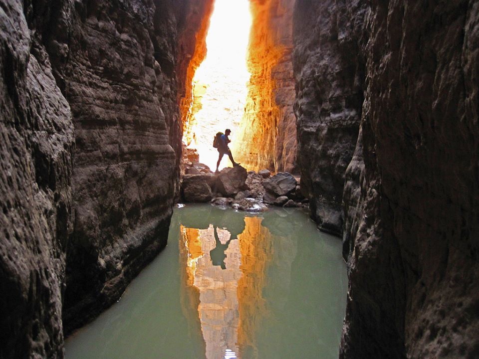
This area is famed for its clear water and plant life.
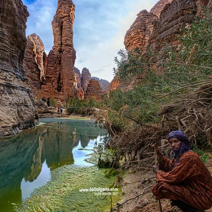
Djanet is inhabited by the Kel Ajjer Tuareg people of eastern Algeria and western Libya.
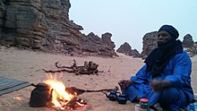
The Tuaregs are an ancient people of North Africa.
I will end this post here, and pick up the alignment in Djado, Niger, in the next post.
