Interesting comments I have Received Redux – Part 2B of All Over the Map

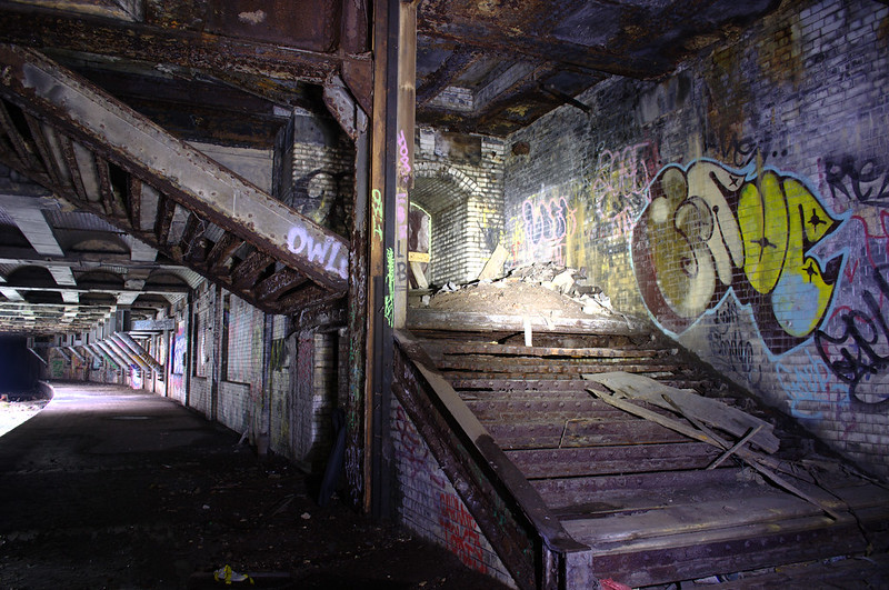
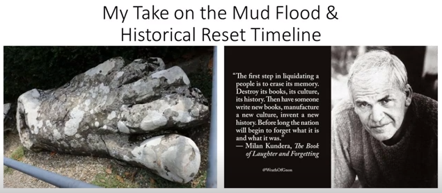
In the third part of this series, I am still drawing from the long list of places that viewers have brought to my attention in comments and/or sent me pictures and information.

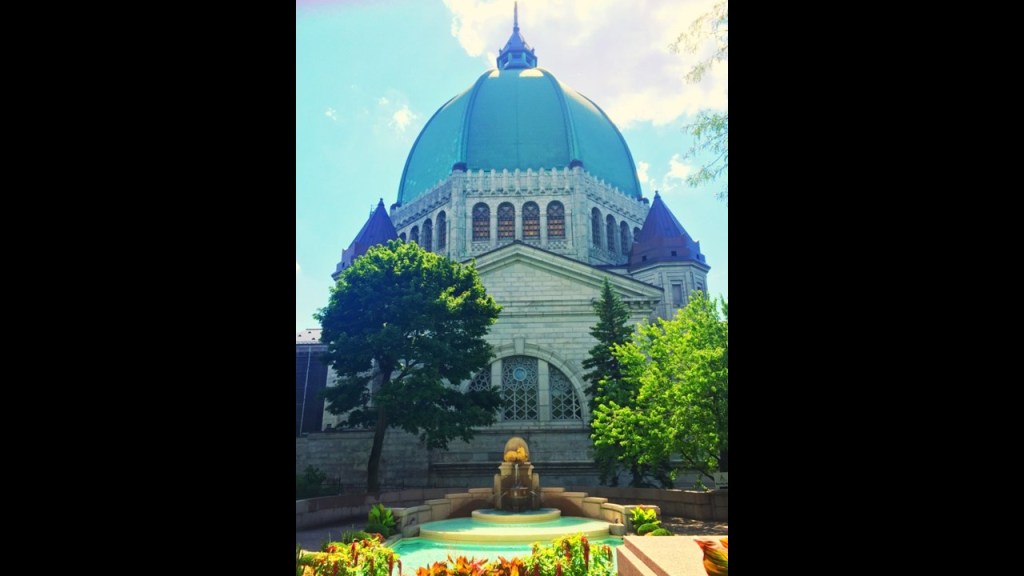
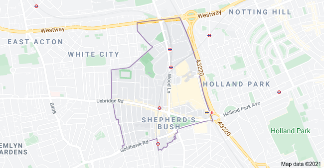
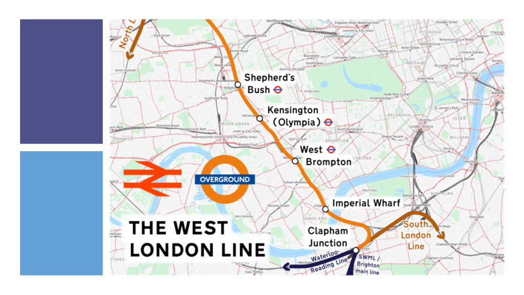
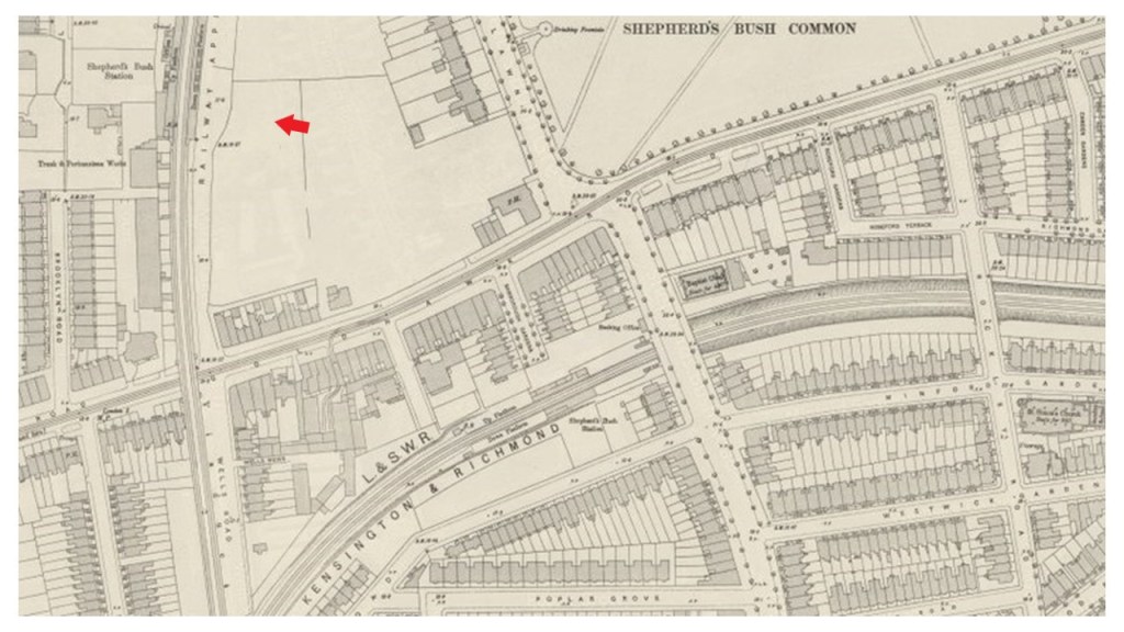
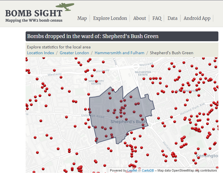
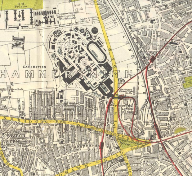
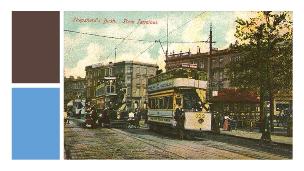
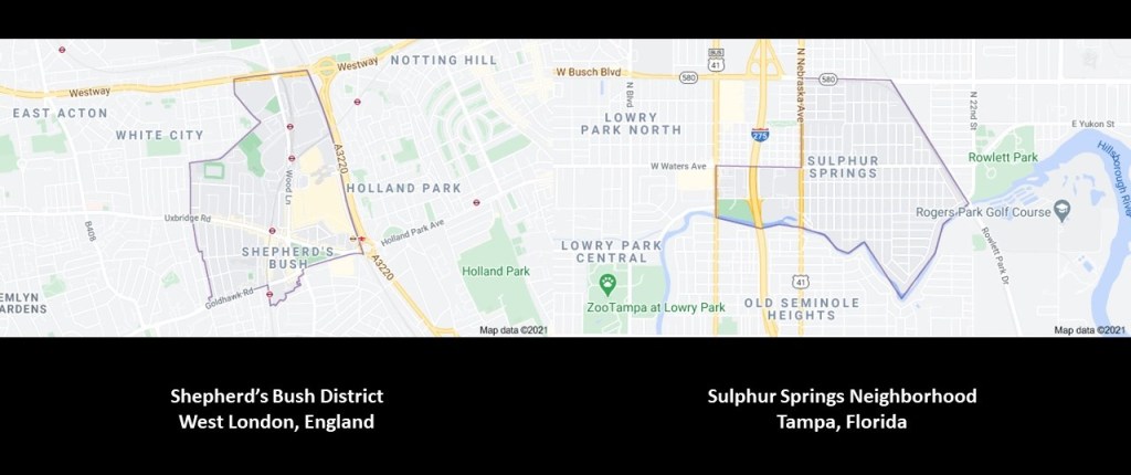
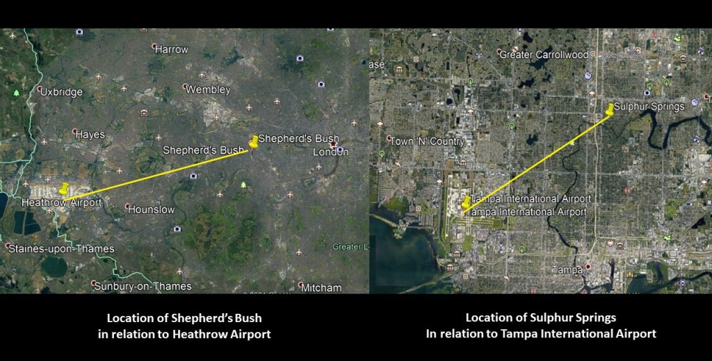
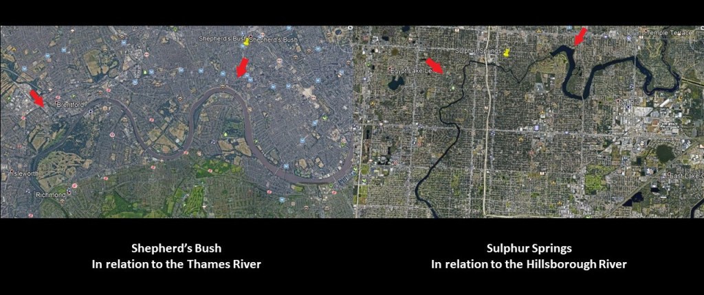
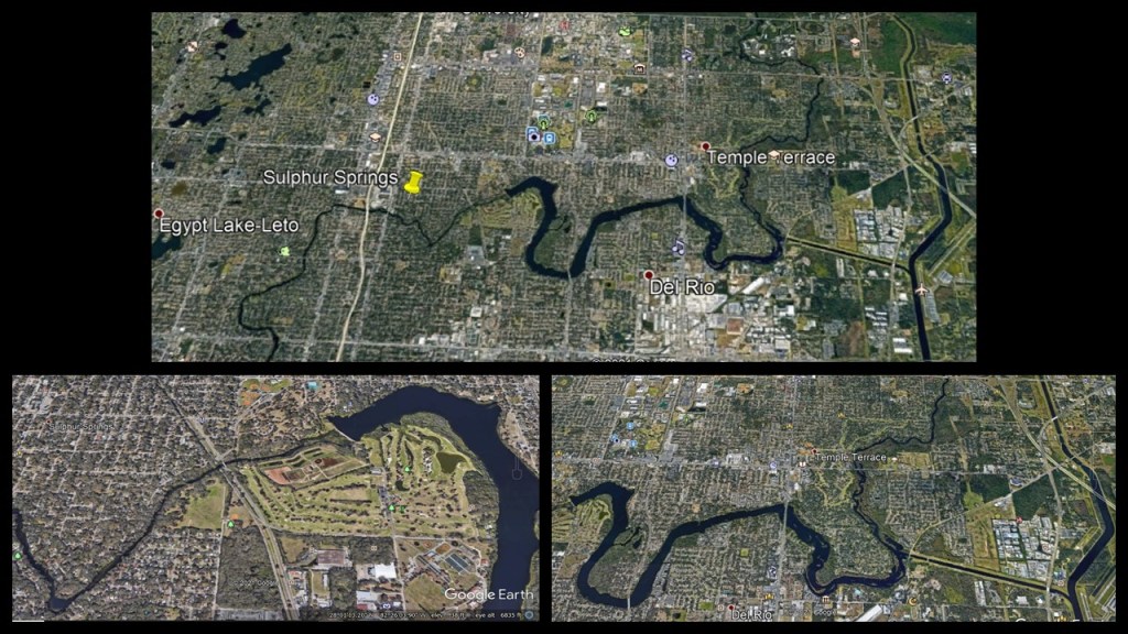
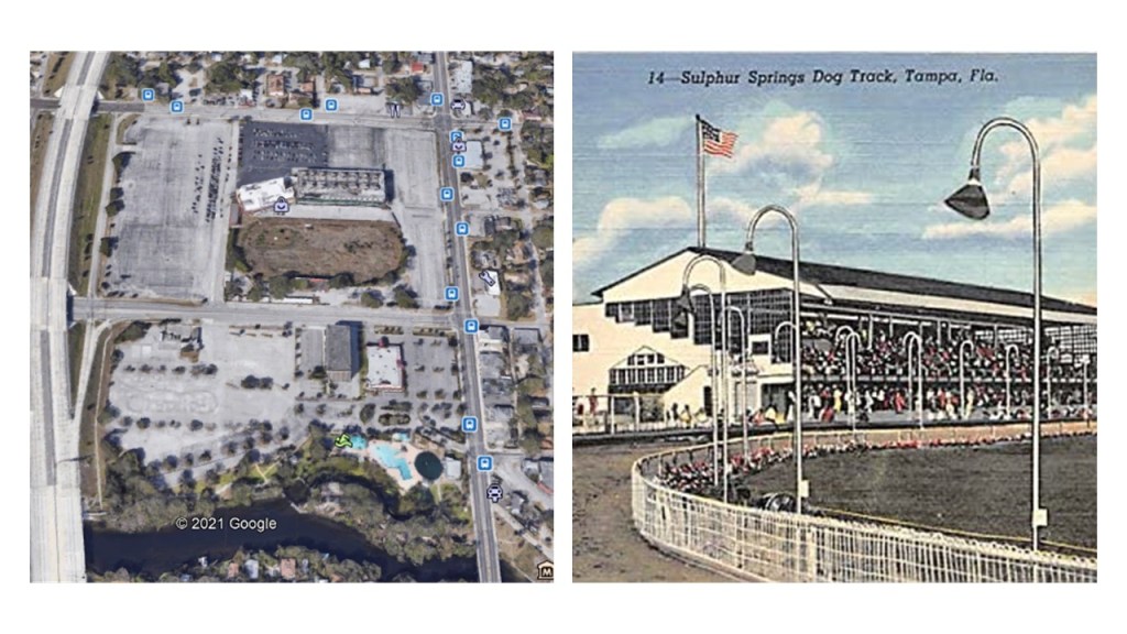
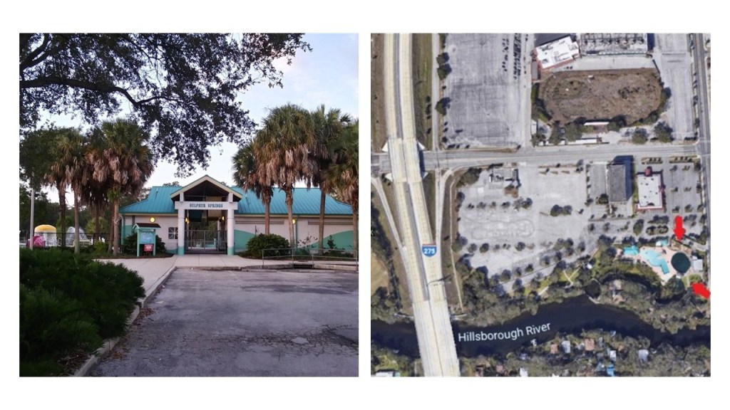
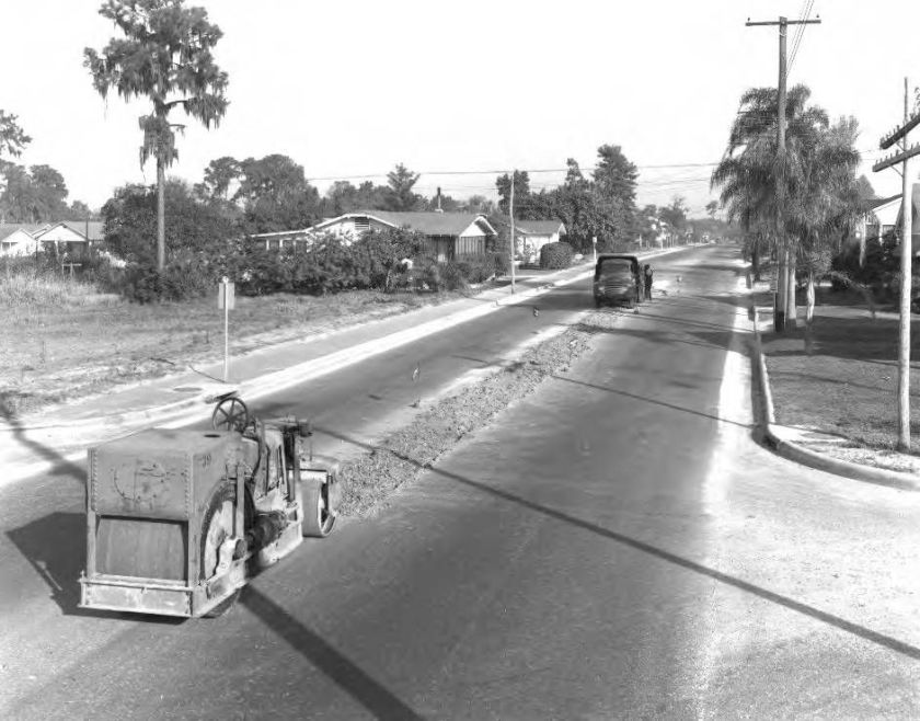
My starting point again will be places people have suggested on the subject of airports and racing tracks in cities with the same characteristics and relationship to each other that I have already seen in the first two parts of this series – in Shepherd’s Bush District of West London; the Sulphur Springs neighborhood in Tampa, Florida; in Montreal, Quebec, Canada; and in Philadelphia, Pennsylvania.

Several commenters pointed me in the direction of Toronto, and there are several places I am going to take a look at here.

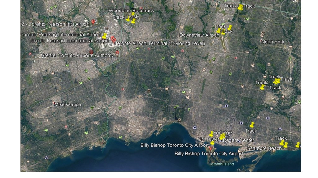
First, the Woodbine Racetrack is a short-distance northeast of the Toronto Pearson International Airport, in a straight-line distance of 3-miles, or 4.5-kilometers.

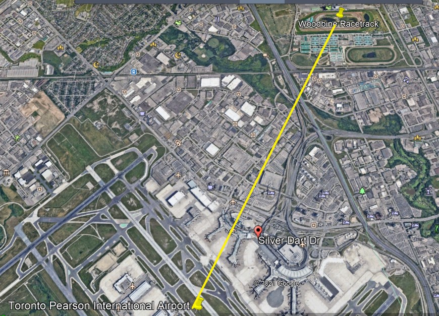
The Woodbine Racetrack has been a Thoroughbred horse-racing venue and there is a casino at this location.

The Downsview Airport further east of the Toronto Pearson International Airport has a number of tracks close by.

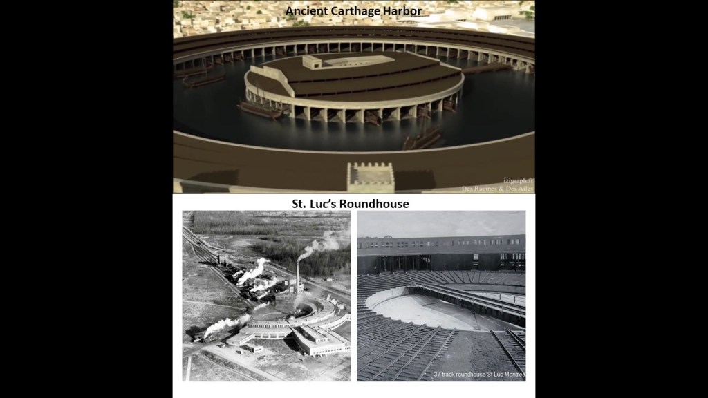
And the Billy Bishop Toronto City Airport on Toronto Island has a track located northeast of it in a line that crosses through the real estate containing the CN Tower, Rogers Center, and Roundhouse Park and downtown Toronto.

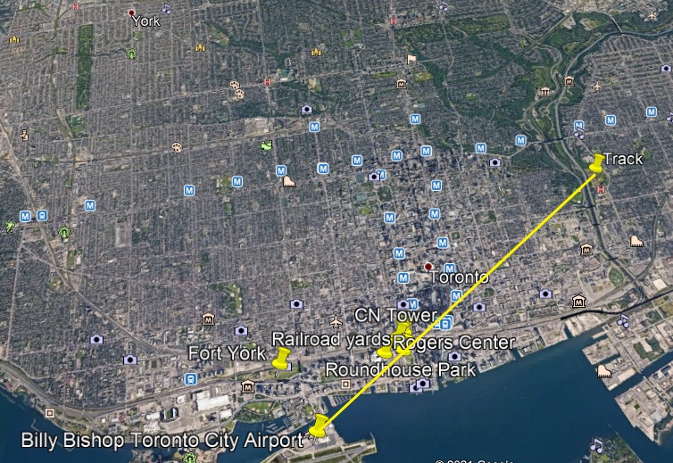
The CN, or Canadian National, Tower is 1,815-feet, or 553-meters, high, a communications and observation tower located on what is known as Railway Lands, a large railway switching yard on the Toronto Waterfront, and said to have been completed in 1976.

Roundhouse Park next to the CN Tower was the location of the John Street Roundhouse, said to have been built in 1929 to maintain Canadian Pacific Railway trains during the Golden Age of Railways, where maintenance teams worked on as many as 32 trains at a time.

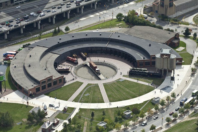
The Roundhouse is the last such building in Toronto, and survived the demolition of other railway facilities nearby that took place to make room for the new stadium, the Rogers Center, which opened in June of 1989.

The Rogers Center is the home of Major League Baseball’s Toronto Blue Jays, as well as a large-event venue.

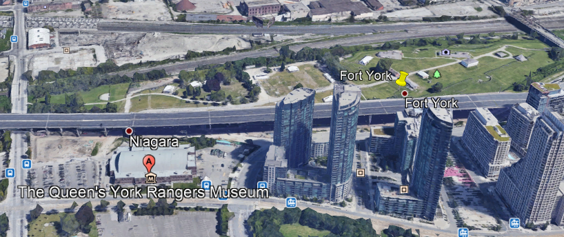
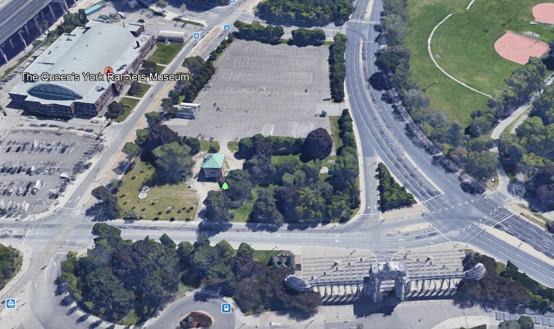
Fort York is located Just a short distance west of this busy spot on Toronto’s water-front, and a short-distance north of the Billy Bishop Toronto City Airport.

What we see at Fort York was said to have been built between 1813 and 1815 to house soldiers of the British Army and Canadian Militia and to defend the entrance of Toronto Harbor…

…and made of stone-lined earthwork walls, and eight buildings within the walls.

CANADA – ONTARIO – TORONTO – FORTS – FORT YORK – UP TO 1979

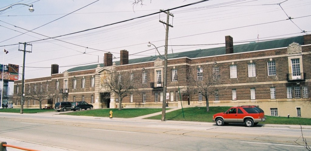
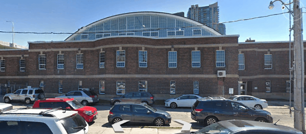
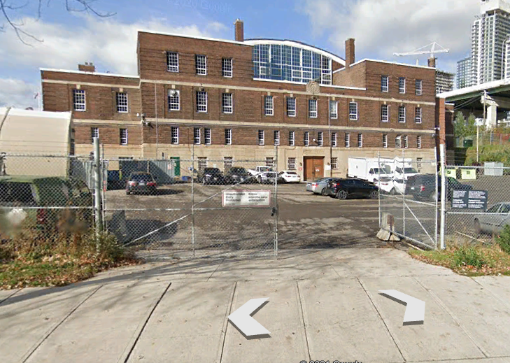
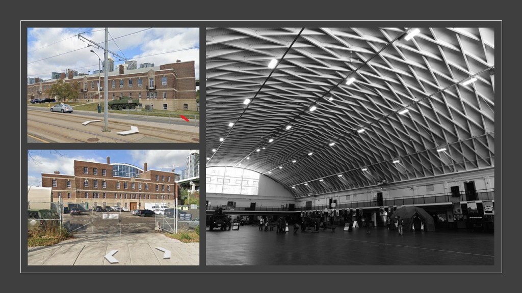
The Fort York Armory is interesting, and also houses the Queen’s York Rangers Museum.

It is cut-off from the Old Fort by the Expressway…

…but you can get to the Old Fort from here, between the pair of old stonemasonry arches at this entrance.

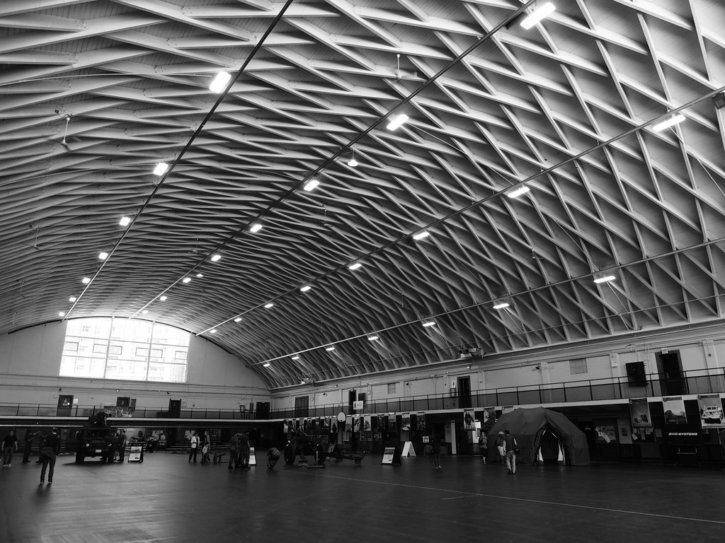
We are told the Armory was built with private funds in 1933, and has the largest lattice wood arched roof in Canada.

There is some interesting window action going on here at the Armory.

At the east-end of the building, there is uneven ground and windows at ground-level.

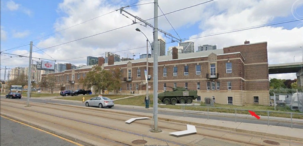
Most of the the front of the Armory…

…and the west-side of the building appears the same.

…but the east-side of the building appears to show a whole floor underneath.

We could call that a basement, right?

Well, but it was planned this way, it was sure sloppily done, like what is seen here in the front corner with regard to the ground-level windows, especially for the building with the stunning perfection shown in the largest lattice wood-arched roof in Canada.

And, literally right around the corner from the Fort York Armory…

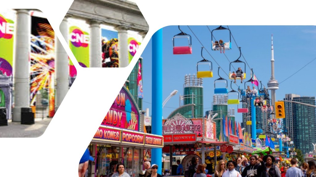
…is a triumphal arch and monumental gateway known as the Prince’s Gate at Exhibition Place.

The Prince’s Gate was said to have been constructed out of cement and stone between April and August of 1927…

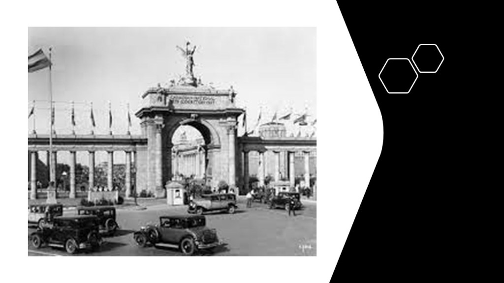
…and serves as the eastern gateway of the Canadian National Exhibition, an annual agricultural and provincial fair.

Now I am going to head in the direction of a Toronto neighborhood known as The Beach, or The Beaches.

It is considered part of the old city of Toronto.

There is a long series of what are called groynes, which are jetties on the shoreline around both sides of the RC Harris Water Treatment plant that create and maintain beach, and reduce erosion.

The groynes on either side of the RC Harris Water Treatment Plant remind me in appearance of the ones in front of Fort Clinch, a star fort on Amelia Island on North Florida’s Atlantic Coast near the state border with Georgia.

There were historically several amusement parks here, the only pictorially documented one being the Scarboro Beach Park, in operation from 1907 until 1925, when apparently the owner of the park, the Toronto Railway Company, locked the gates to the property.

Eventually the Scarboro Beach Park property was sold to a company which removed the rides and buildings, and replaced the land with housing.

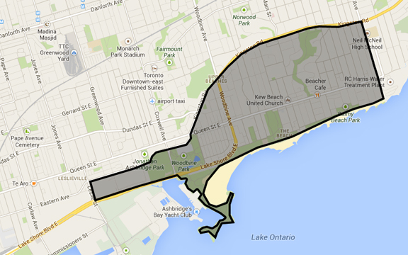
The Victoria Park Amusement Park, said to have been in operation from 1878 to 1906, would have been right about where the “x” is, at the intersection of Queen Street and Victoria Park Avenue.

A special thanks to Lisa H. from Toronto for sending me not only this map to share with me where the location of the Victoria Park would have been, but she also went exploring and sent me quite a few pictures of the RC Harris Water Treatment Plant Complex to follow.

Based on the photos she sent, and past research on star forts, I am going to postulate that the original purpose of the complex was a star fort.

Here’s why I think that.

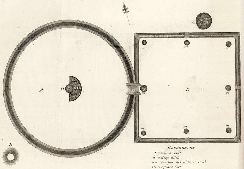
First, star forts had many different shapes.

Most have pointed bastions, but some have round bastions, or a different shape altogether, and where I find one, there is at least one more in the vicinity to be found.

Here is the example in Puebla, Mexico, of Fort Guadalupe with pointed bastions, and Fort Loreto with round bastions.

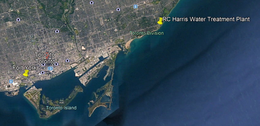
Here is the geographic relationship of the locations of Fort York and the RC Harris Water Treatment Plant.

This is a photo of one of the round bastions at the RC Harris Water Treatment Plant, and cut-and-shaped stone blocks with straight edges in the foreground.

We are not given any other explanation in our historical narrative, so we typically don’t ask questions about how they got this way.

Like the buildings of Fort York, the RC Harris Water Treatment Plant is built on top of earthworks…

…and the brick-masonry here is massive, sophisticated and intricate.

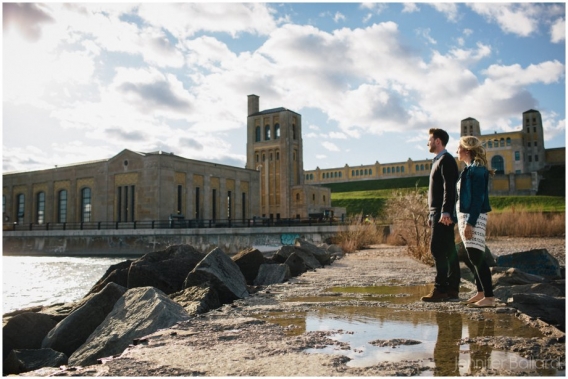
It’s even a popular spot in Toronto for engagement picture photo shoots!

It is definitely quite impressive on the inside as well!

This megalithic stone wall runs parallel to Queen Street at the front-boundary of the complex…

…with the Neville Street Loop for the Queen Street streetcar line the eastern terminus of Toronto’s longest streetcar route, just off the northwest corner of the RC Harris complex.

Here is what we are told about the RC Harris Water Treatment Plant.

Its construction started in 1932, and the building became operational on November 1st of 1941 (during World War II, and a little over a month before the bombing of Pearl Harbor).

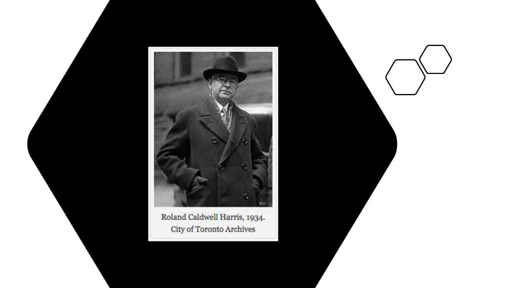
It was named after the long-time Commissioner of Toronto’s Public Works, RC Harris, overseer of the construction project.

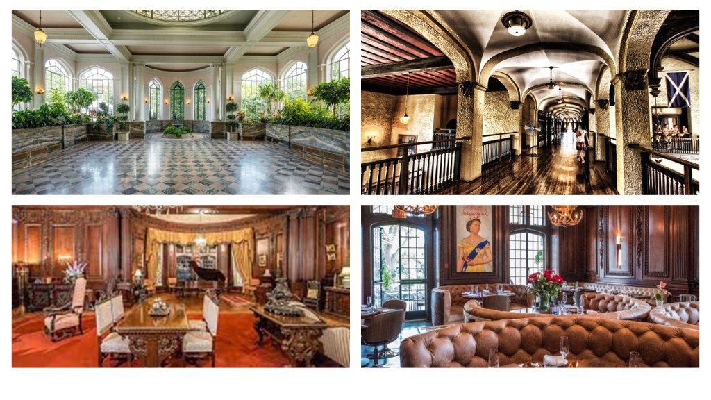
The last place I want to look at in Toronto before I move was the suggestion someone made to look at the Casa Loma, described as a Gothic Revival Style mansion constructed between 1911 and 1914 as a residence for financier Sir Henry Pellatt, and called the biggest private residence ever constructed in Canada.

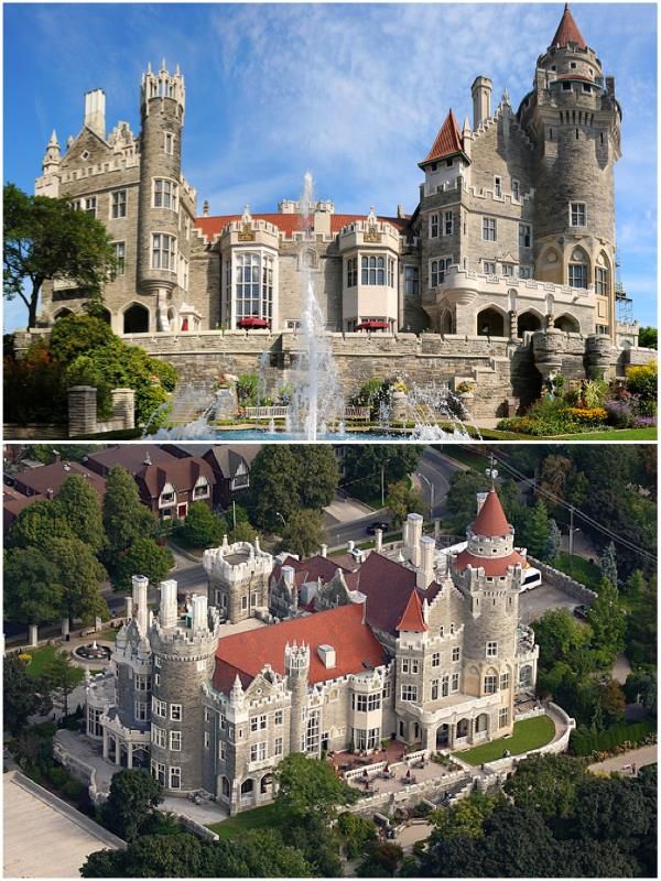
It is a popular filming location for movies and television, as well as a wedding venue.

Another commenter directed my attention to the former horse-racing track next to Los Angeles International Airport, where there used to be a thoroughbred racehorse track.

It was located at Hollywood Park…

…but the racetrack was destroyed and replaced with the new SoFi stadium for the LA Rams and LA Chargers, that first opened in September of 2020.

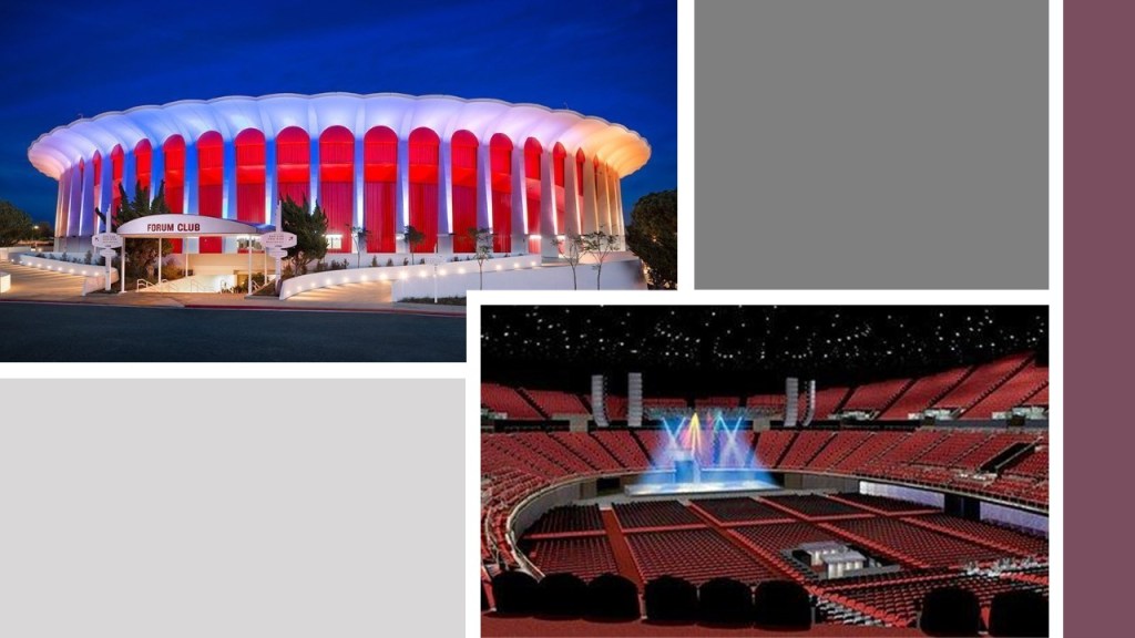
It is 3-miles, or 4.5-kilometers from the Los Angeles International Airport, and just southeast of The Forum, a multi-purpose indoor arena that has been the home of the Major League Basketball and Hockey teams of LA.

Said to have been built in 1966, The Forum has no major support pillars on the inside.

Another person suggested I take a look at Baltimore.

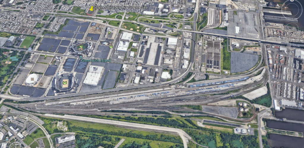
Starting with the airport, I found school tracks at a similar angular relationship to Baltimore-Washington International Airport that I have found in other cities.

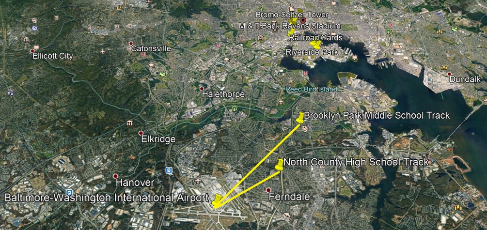
Also, like what I have found in other major cities, the Baltimore professional sports complexes are relatively close to the airport, in South Baltimore.

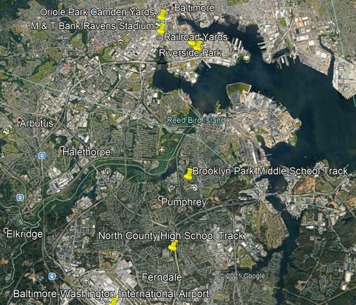
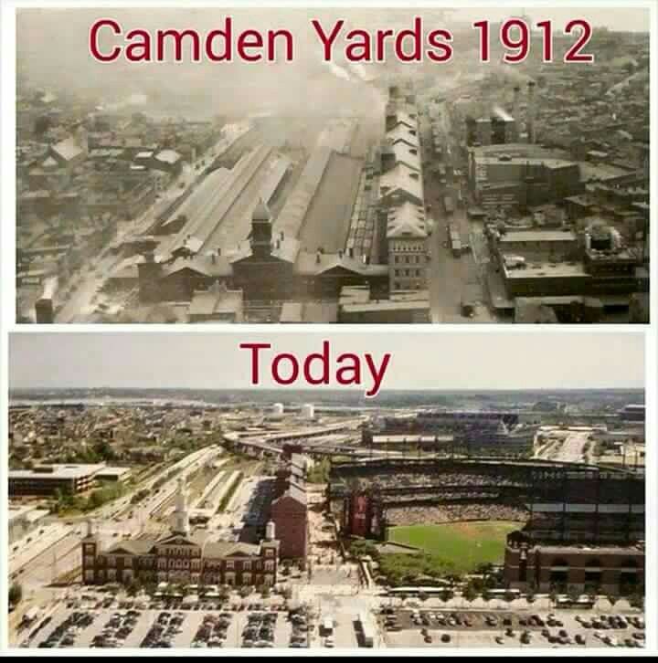
Camden Yards was previously a yard for the Baltimore & Ohio Railroad, and was converted into today’s Oriole Park for the Baltimore Major League Baseball Team, first opening in April of 1992…

…and the M & T Bank Stadium, the home of the National Football League’s Baltimore Ravens, is located next to Oriole Park at Camden Yards, and first opened in September of 1998.

There are still railyards fairly close to this location today.

The next three places are located in downtown Baltimore, suggested by the viewer, that are located close to Oriole Park at Camden Yards.

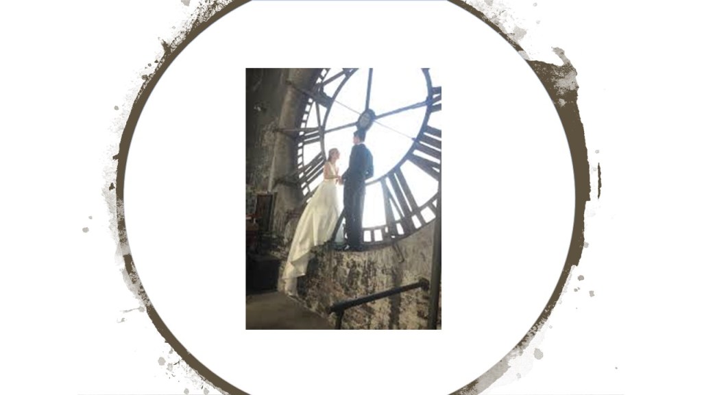
Baltimore’s famous landmark, the Bromo Seltzer tower, was said to have been designed by local architect Joseph Evans Sperry, and erected between 1907 and 1911…

…for Bromo-Seltzer inventor Isaac Edward Emerson.

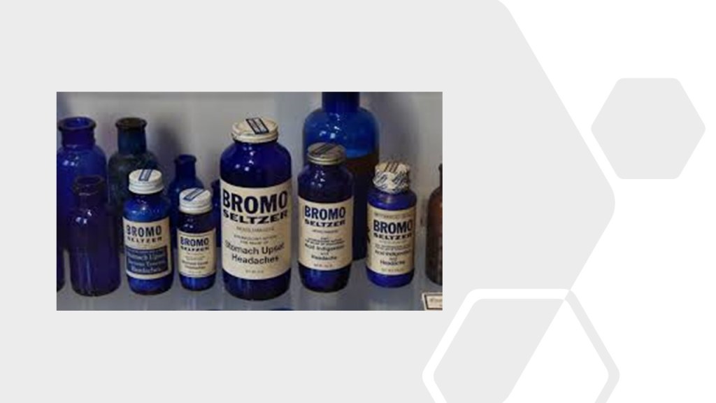
The Bromo-Seltzer Tower is also popular for photo shoots.

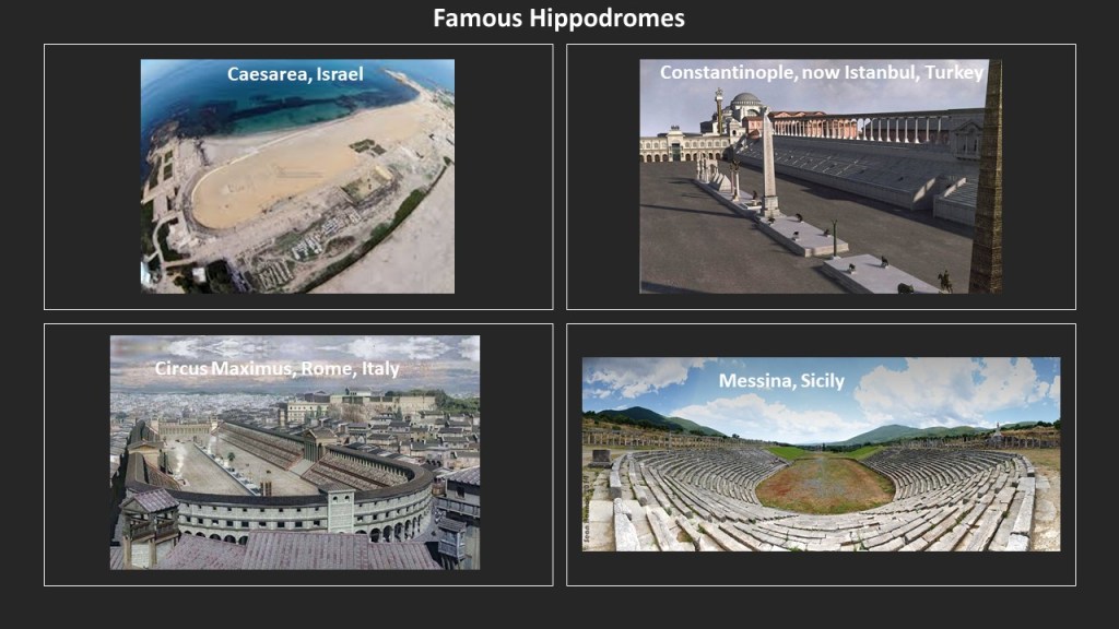
Interestingly, Baltimore had a Hippodrome Theater near the Bromo-Seltzer Tower, which was said to have been built in 1914, and was the foremost vaudeville house in Baltimore as well as a movie theater.

It was renovated in 2004, and is now part of the France-Merrick Performing Arts Center.

The Basilica of the Assumption is a number of blocks northeast of the Hippodrome in downtown Baltimore, and said to be the first Roman Catholic Cathedral, built in the United States between 1806 and 1821.

The architect of the Baltimore Basilica was said to be Benjamin Henry Latrobe, the “Father of American Architecture,” and best-known for having been given the credit for designing the U. S. Capitol Building.

Another commenter mentioned the Sydney International Airport and the Royal Randwick racecourse.

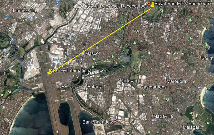
The Royal Randwick Racecourse is a horse-racing track on Crown Land, a territorial area belonging to the British monarch, that is leased to the Australian Turf Club.

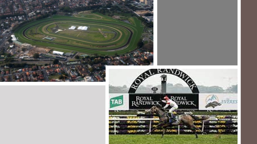
The first race at Randwick was held in 1833, and in the present-day is the host of racing championships with millions of dollars in prize-money.

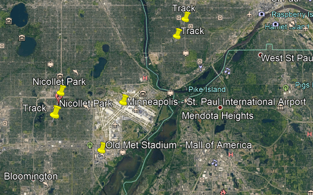
Another viewer mentioned Minneapolis, and the Old Met Stadium, which is now the Mall of America southwest of the airport, and I also found two running tracks just northeast of the airport, another running track just west of the airport, as well as the historical location of Nicollet Park, the home of the minor-league baseball team the Minneapolis Millers between 1896 and 1955.

The Old Met Stadium was said to have been constructed between 1955 and 1956, in use mostly by the minor league Millers when they moved from Nicollet Park, and the major league baseball Twins and football Vikings, until 1981, and the stadium was demolished by 1985.

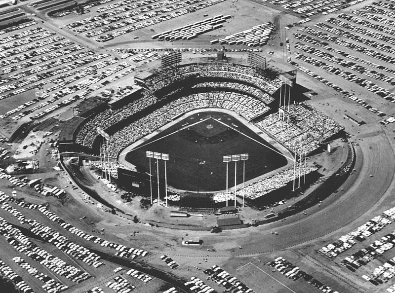
Then the Mall of America was built where the stadium used to be, and when it opened in 1992, it was the largest shopping mall in total area and total number of store vendors.

It is currently the seventh-largest shopping mall in the world.

Here is a comparison ofthe relationship between some of the International Airports and racing tracks that I have looked at in this series.

What are the odds of this similar relationship happening randomly is in diverse places across the world over long periods of time?

Like long before international city-planners could have gotten together and compared notes about where they were going to site airports relative to racetracks in their respective communities.

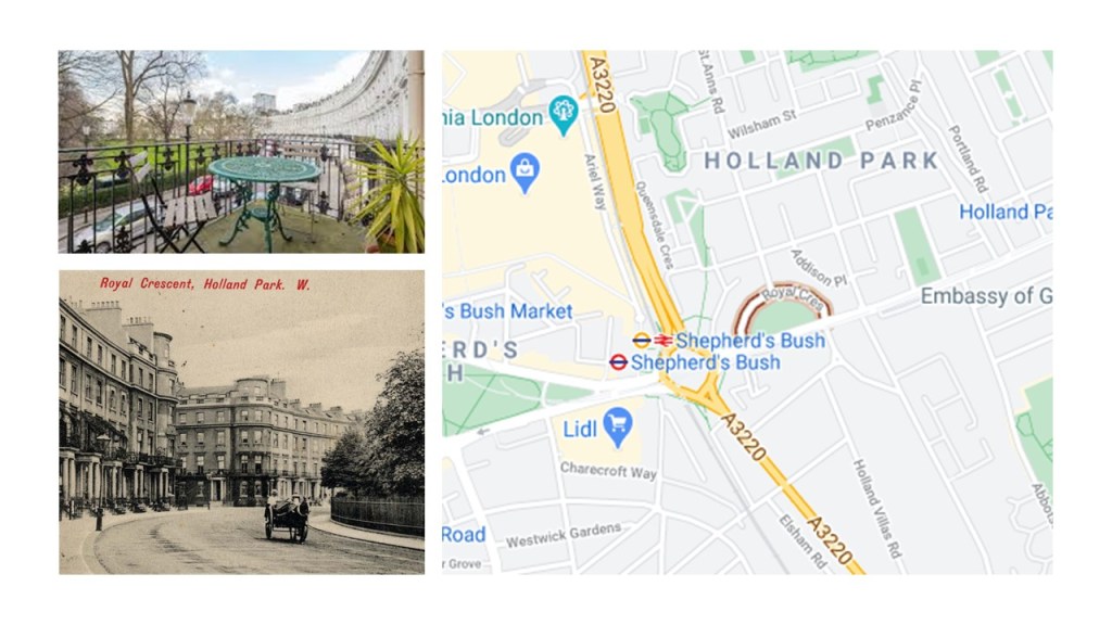
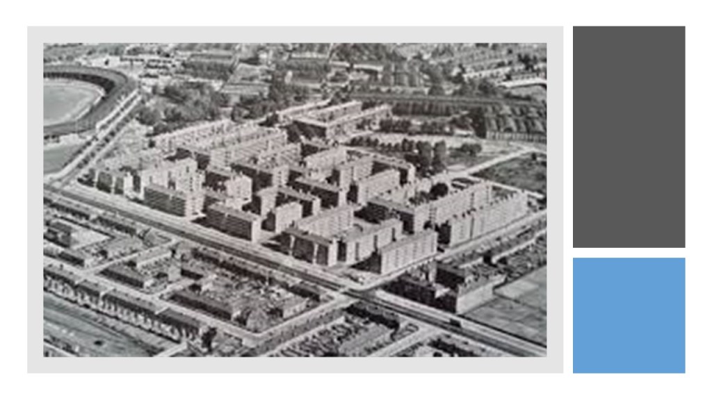
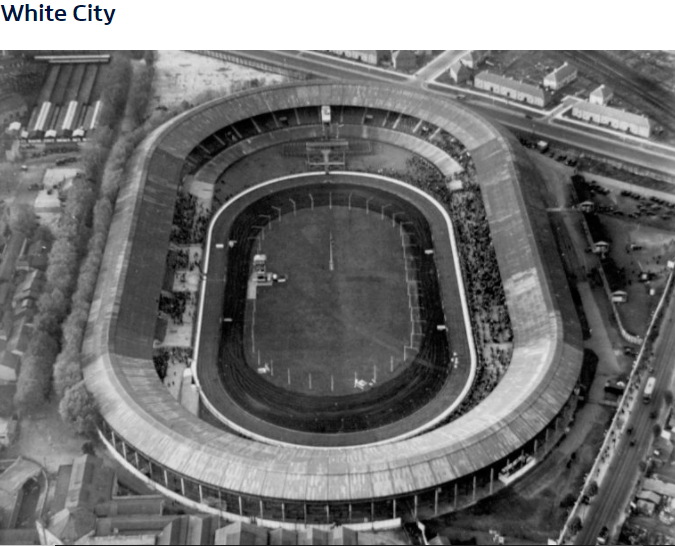
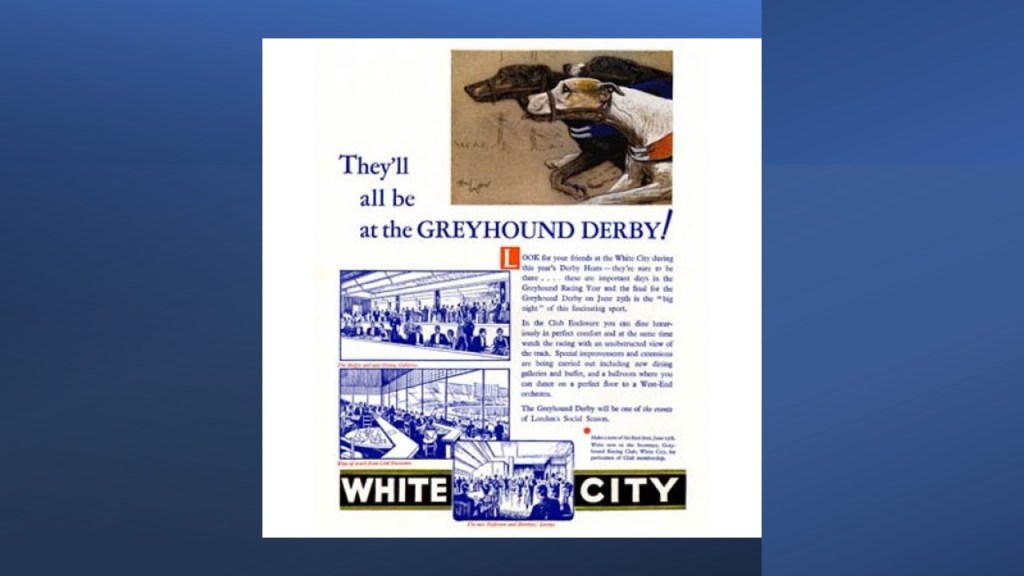
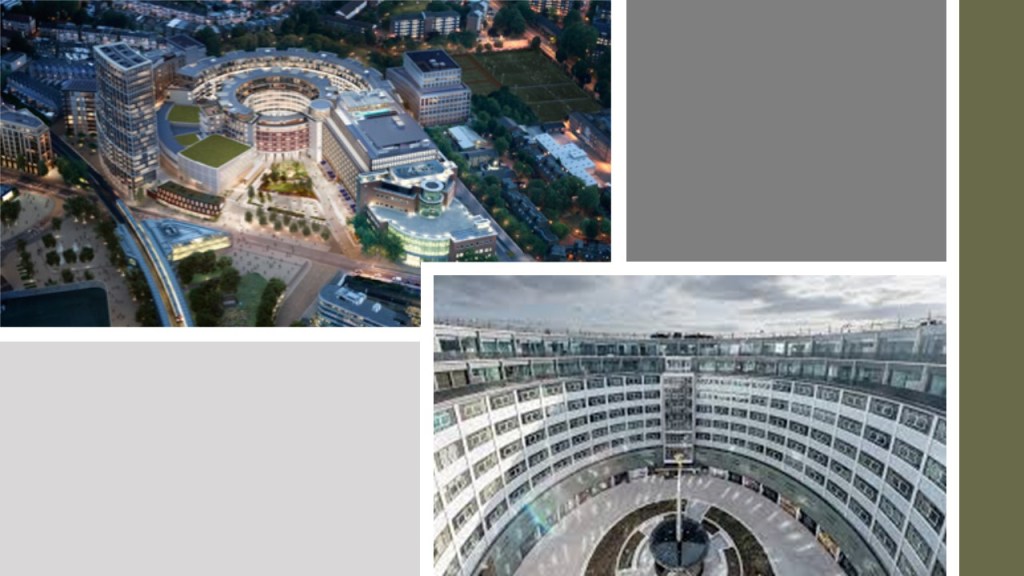
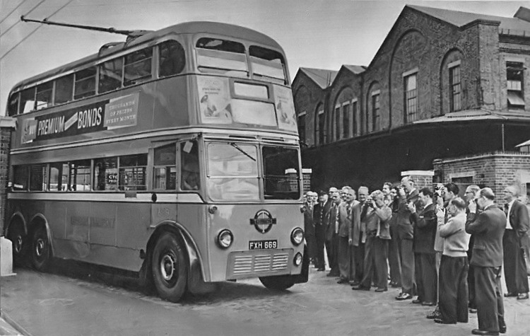
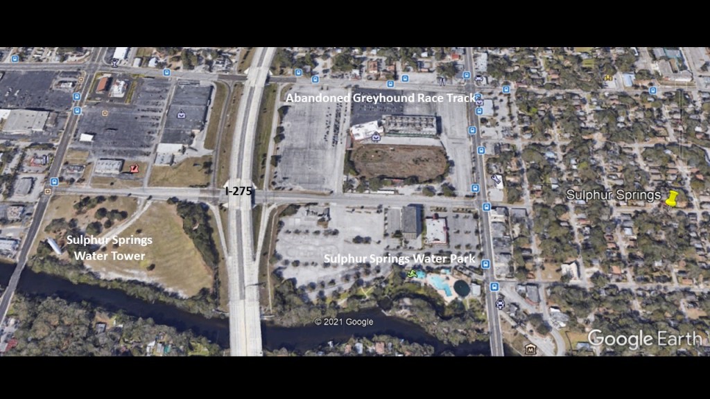
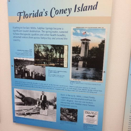
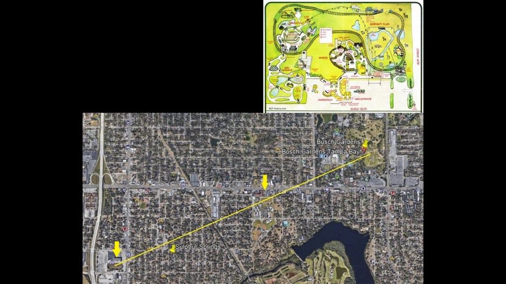
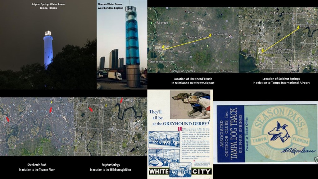
All of this came to my attention after I noticed a similar relationship in the first part of this series between the location of the former White City Stadium, now the BBC White City complex, in the Shepherd’s Bush District in West London and Heathrow International Airport in London, and the former Greyhound Track in the Sulphur Springs neighborhood of Tampa that I researched last summer and the Tampa International Airport.

Then all of a sudden airports and racetracks, and other infrastructure like railyards, and major sports’ stadiums are turning up in similar relationships in different cities all over the world!

I am not an electronics person.

This is an intuitive process for me, driven by the understanding through my research that the original advanced Moorish civilization had infrastructure placed precisely all over the world as part of an electromagnetic grid system that provided free energy.

When I investigated elliptical electric circuitry for this blog post, I came across elliptical PADS in Printed Circuit Boards (PCBs).

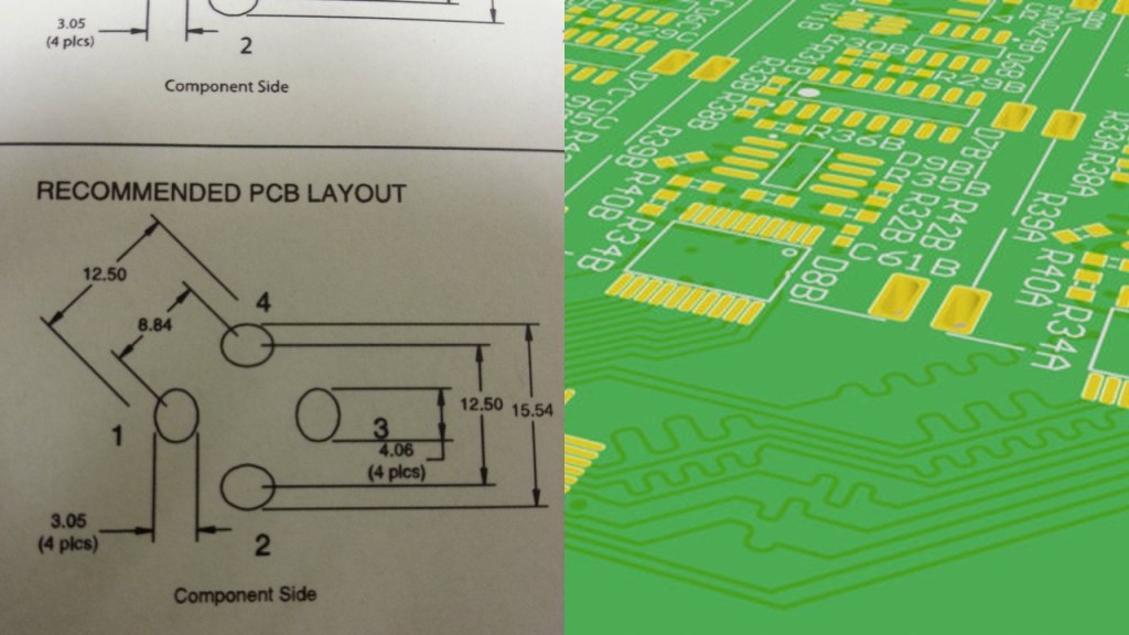
PADS are an electrical connection point for components, and most carry current for either signal transfer or heat.

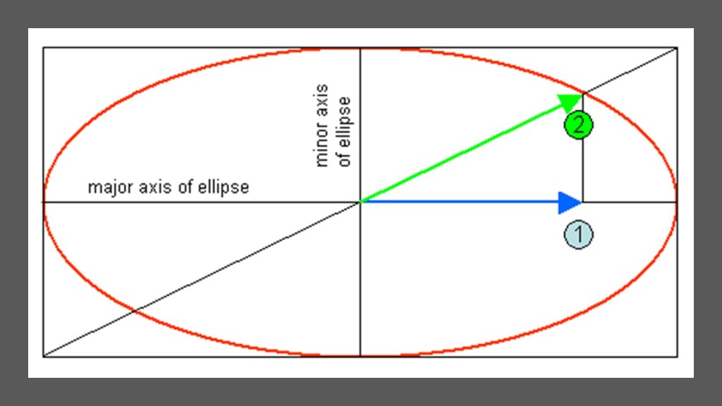
I also found the term “Elliptical Polarization,” which occurs when there is more than one source of a magnetic field at the same frequency, the magnetic field traces out an ellipse in space.

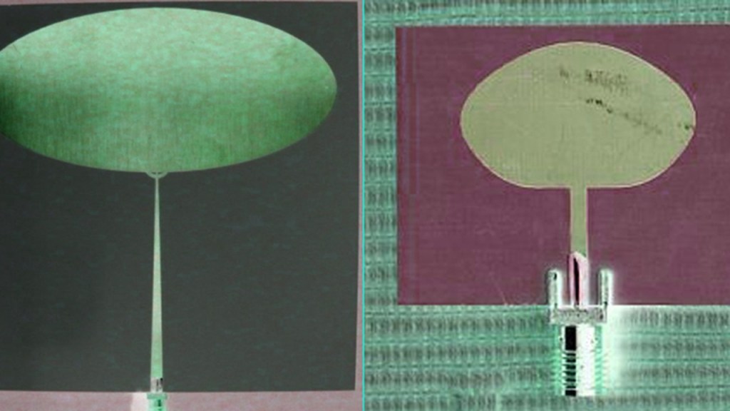
Then there are elliptical antenna for things like satellite dishes…

…and Ultra wide-band communications.

Then, when I was reading an article about “Elliptical Polarization,” I encountered the diagram on the left showing the efficiency in decibels of the axial ratio of two antenna, and the shapes formed in the graph immediately brought this common shape of windows in cathedrals on the right.

This brings me to a different subject, which is that of what I believe the true function of cathedrals was – resonating chambers and communal places for people to gather for synchronization and harmonization through healing solfeggio frequencies.

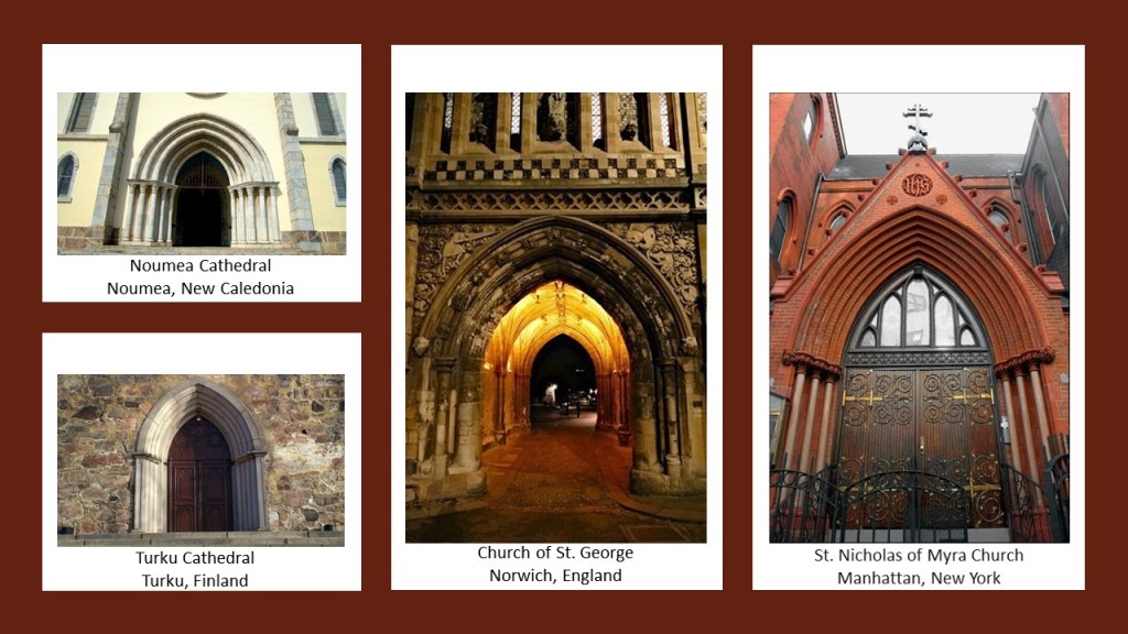
Someone sent me this graphic of what looks like a relationship between cathedral doors and octaves, the intervals between one musical pitch and another with double its frequency.

This image has an empty alt attribute; its file name is Octave-Chart-Church-Door.png

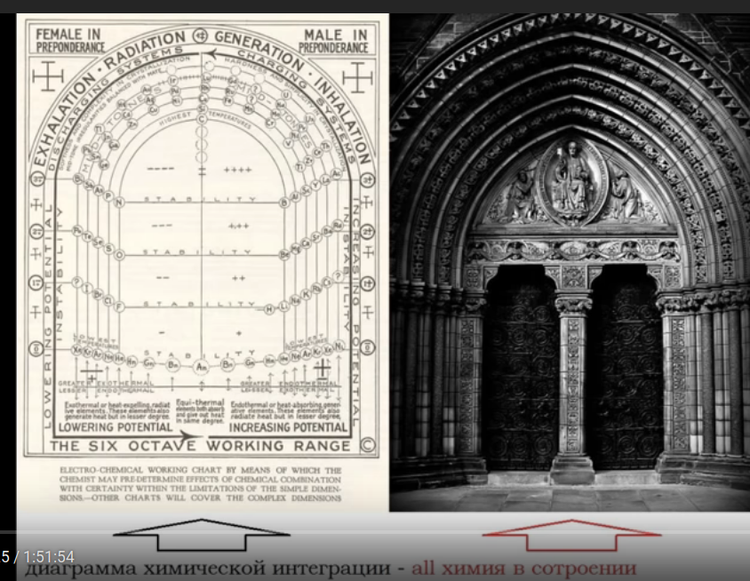
This shape of doors is found at cathedrals and churches all over the world built in different centuries, with the Noumea Cathedral in New Caledonia said to have been built between 1887 and 1897; the  St. Nicholas of Myra Russian Orthodox Church in Manhattan, New York, said to have been built in 1883; the Church of St. George in Norwich, England, said to have been built in the 1100s; and the Turku Cathedral in Turku, Finland, said to have been consecrated in 1300.

Not only that, Cathedral Rose windows look like the cymatic patterns of musical notes.

Solfeggio frequencies make-up the ancient six-tone scale used in sacred music, like, for example, Gregorian chants and Tibetan singing bowls.

Each solfeggio tone is a frequency that can be used to balance one’s energy and keep one’s body, mind, and spirit in harmony.

The modern suppression of solfeggio frequencies is an issue for Humanity.

The current musical scale is not tuned into the solfeggio frequencies, and the results of this are believed to negatively affect our thinking skills and emotional states.

More on in this subject as I go along.

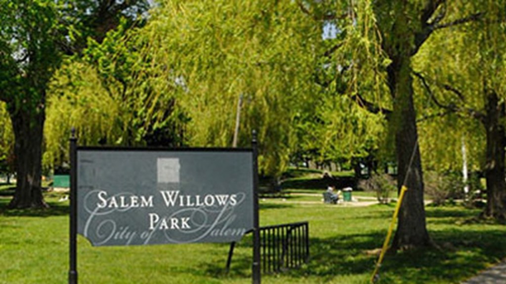
Someone suggested that I look at what was a historical trolley amusement park called “The Salem Willows” in Salem, Massachusetts.

The area became a public park in 1858, and opened as an amusement park in 1880, becoming a popular summer destination for residents of Boston’s North Shore.

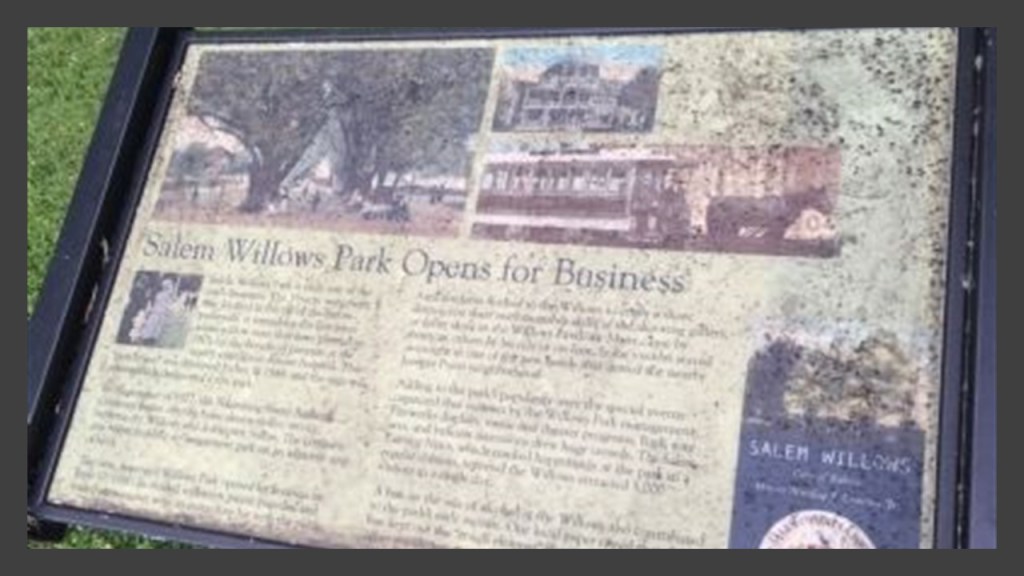
Today, the Salem Willows Park still has many recreational activity venues and a children’s amusement park.

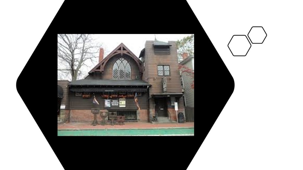
This brings me to Salem, Massachusetts – the historical location of the Salem Witch Trials and a great example of the points I made about the relationship between architecture, frequencies, and the subversion of frequencies.

This is the Salem Witch Museum, with its castle-like appearance and beautiful cathedral windows.

The museum was founded in 1972 with exhibits and tours exploring the famous 1692 Salem Witch Trials.

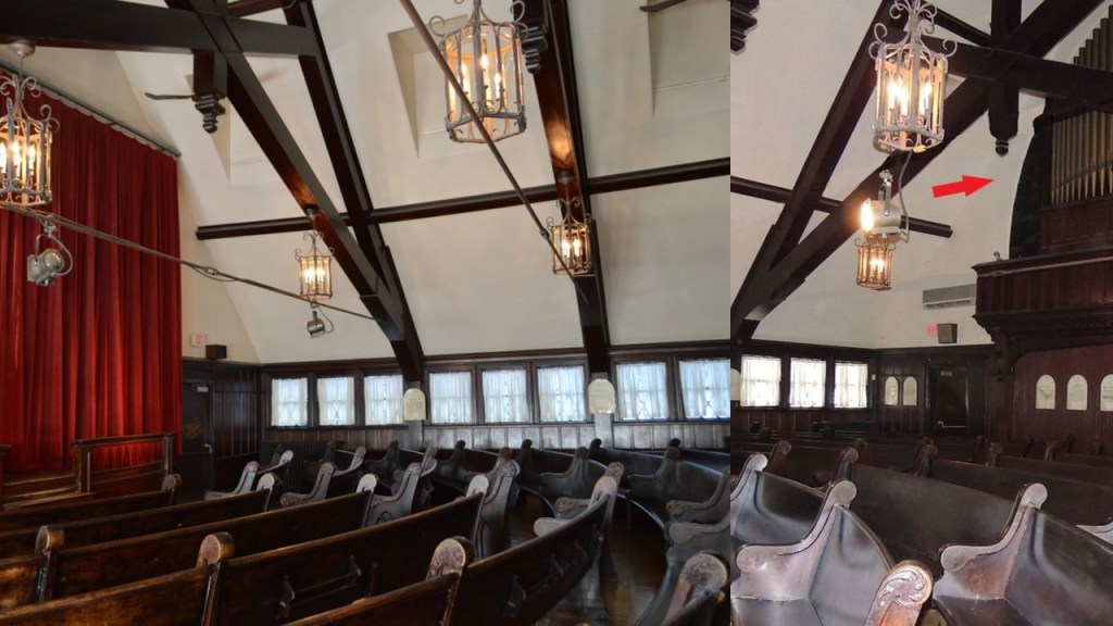
There is also what is called the “Witch Dungeon Museum” in Salem, also with a nice cathedral window…

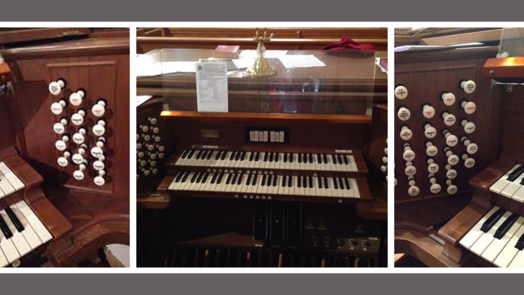
…where there is a play about the witch trials in a beautiful theater with a huge pipe organ in the back…

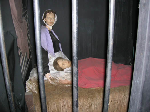
…and exhibits of jailed people…

…and people hanging from a tree.

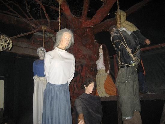
Look at the kinds of lower-vibrational imagery being deliberately imprinted on our brains and consciousness, instead of providing uplifting and healing experiences.

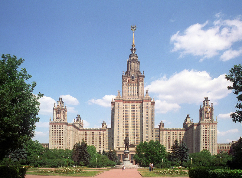
Someone else brought the Cathedral of Learning in Pittsburgh to my attention, the tallest educational building in the western hemisphere, said to have been constructed between 1926 and 1934 in the late Gothic Revival style, and the second-tallest educational building in the world…

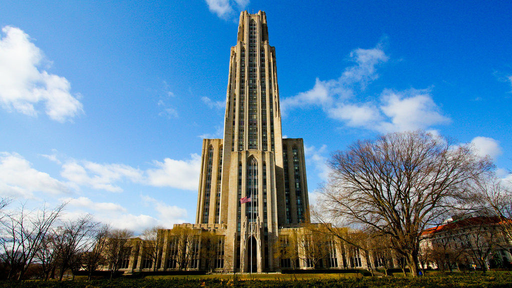
…after the main building of the Moscow State University in Russia, said to have been constructed between 1947 and 1953 in the Stalinist architectural-style.

Both reminded me of the “new” Louisiana State Capitol building in Baton Rouge, said to have been built between December 16th of 1930 and May 16th of 1932 in the Art Deco architectural-style…

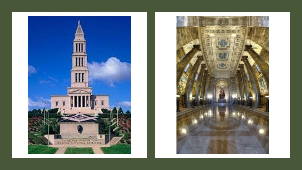
…and the George Washington Masonic National Memorial in Alexandria, Virginia, with construction beginning in 1922 and completed in 1932, in a neoclassical architectural design patterned after the ancient lighthouse of Alexandria in Egypt.

Then, someone brought the Duke Chapel at Duke University in Durham, North Carolina to my attention, said to have first opened in 1932.

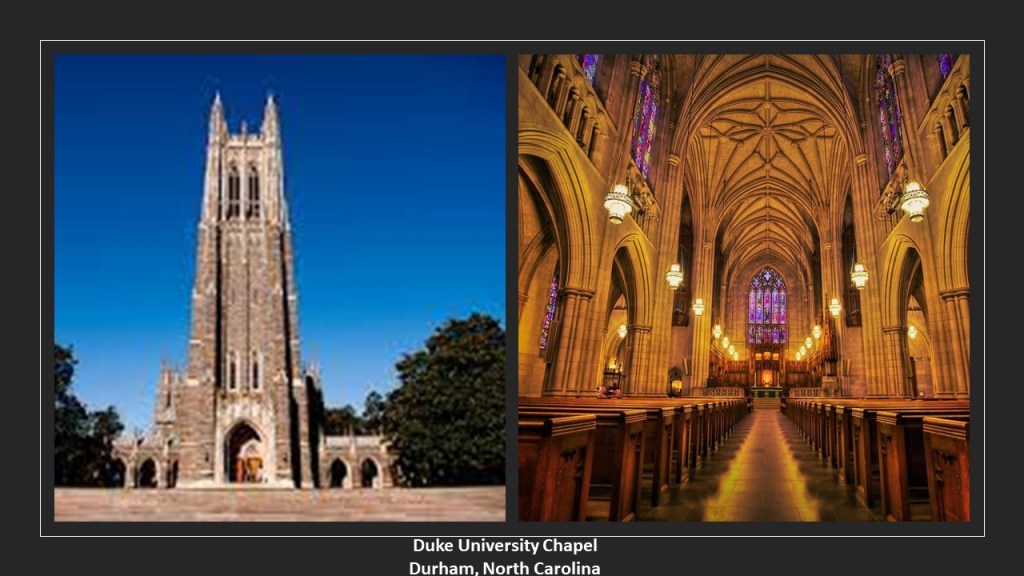
This beautful structure really caught my attention because in addition to its architectural size and features, Duke Chapel has four organs, each constructed in a different style…

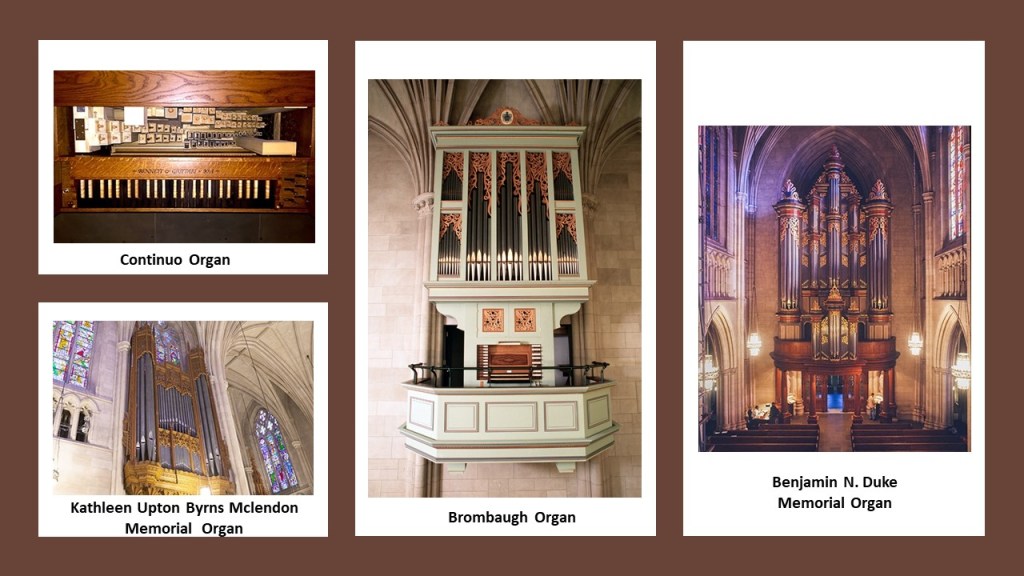
…and a 50-bell carillon.

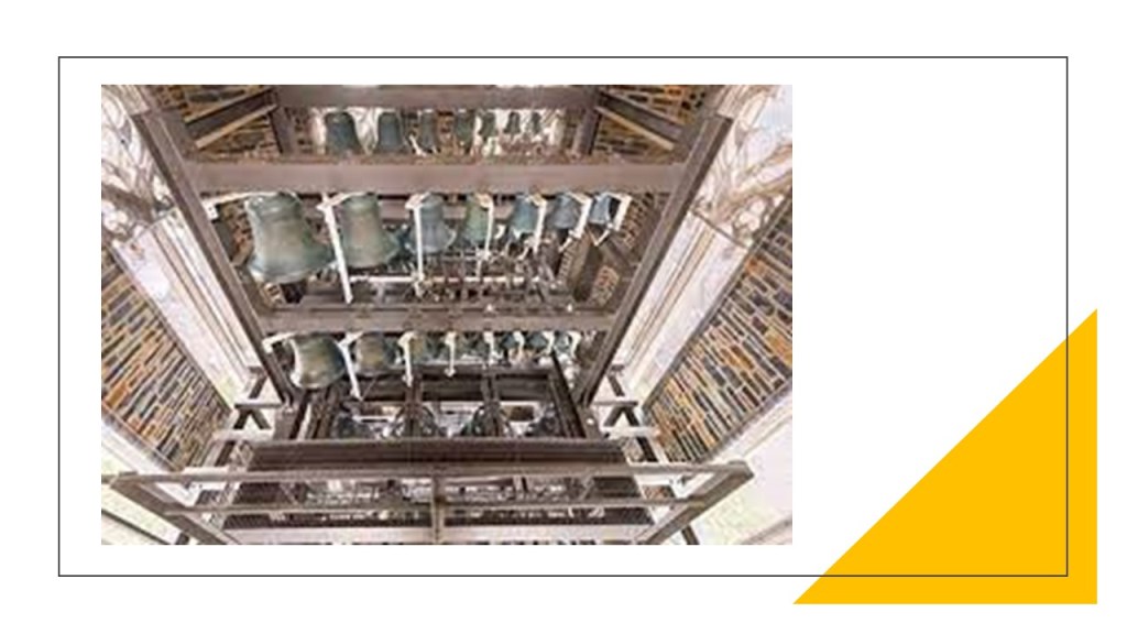
So, it is a fully-equipped and functioning frequency-generator, used for concerts, and the carillon-bells are rung every weekday at 5 pm.

Somebody else brought Circleville in Ohio to my attention.

The city of Circleville received its name from its original lay-out of a circle when it was established in 1810.

I found this depiction of Circleville circa 1820…

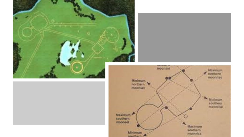
…looking something like the Octagon and Great Circle Earthworks in Newark, Ohio, which became part of the Moundbuilders Country Club.

Circleville was incorporated as a town in 1814, and became a city in 1853.

In 1838, the “Circleville Squaring Company” was formed to convert the town into a squared grid because residents were not satisfied with the town’s original lay-out.

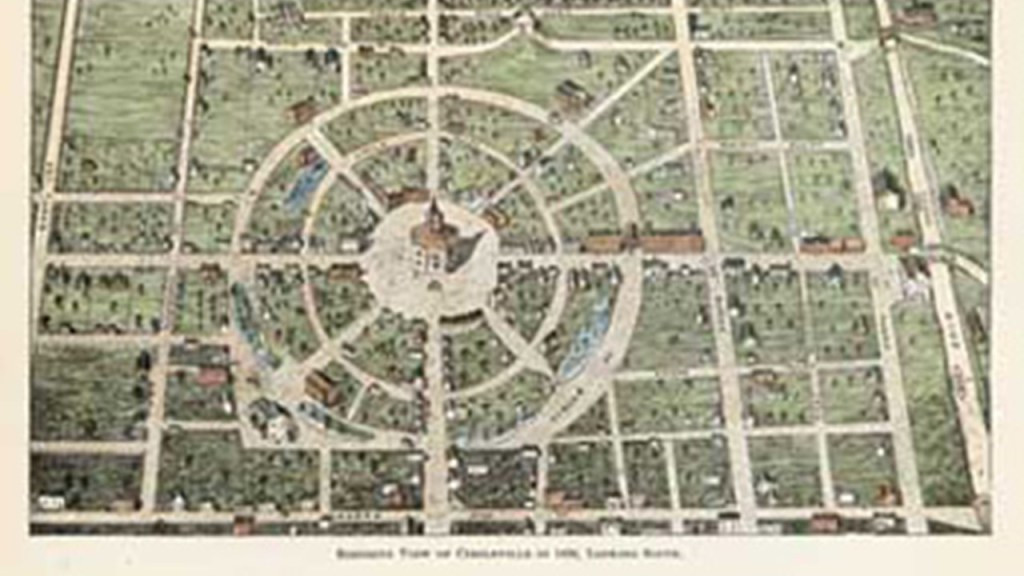
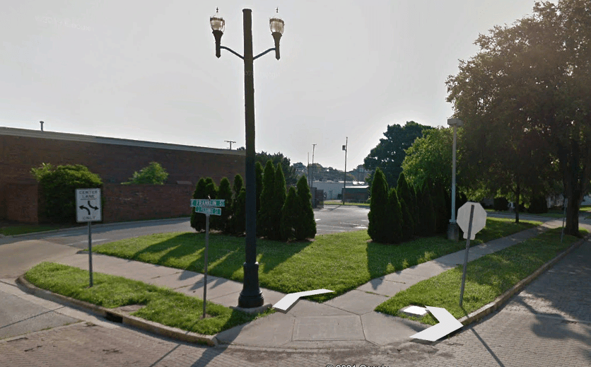
By 1856, no traces of the original earthworks remained, except for a section of slightly elevated ground at the corner of Picaway and Franklin Streets.

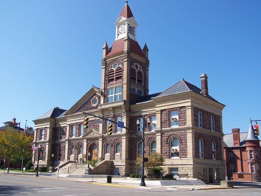
As the county seat of Picaway County, this courthouse in Circleville was said to have been built in 1890.

Joseph S. sent me a number of photographs from where he lives in Defiance, Ohio.

This is St. Paul’s United Methodist Church in Defiance.

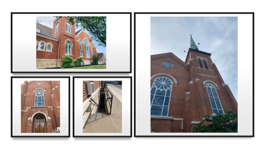
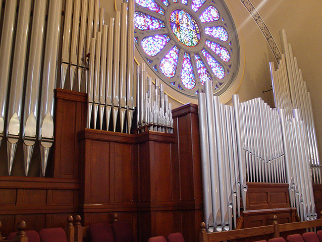
St. Paul’s has a pipe organ, but I can’t find a picture on-line showing where it is located inside the church.

I did find this photograph of the pipes of an organ right underneath the cathedral rose window at St. Michael’s Catholic Church in Kalida, Ohio, looking like there is a direct relationship between the frequency of the shape of the window and the music of the organ.

In biology, the definition of organ, from the Latin word meaning instrument or tool, is a collection of tissues that structurally form for a specialized functional unit to perform a particular function.

Are we talking about the same kind of thing with the organ as a musical instrument and the window is a frequency being broadcast for its particular function in the collective system?

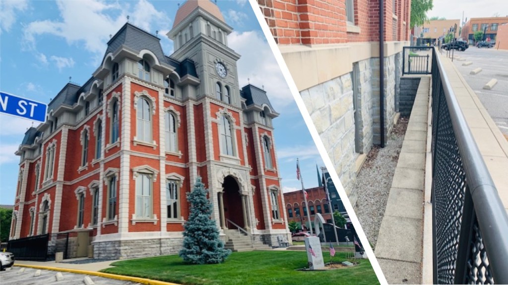
This old courthouse in Defiance was said to have been built in 1873, and designed in the Italianate and Second Empire styles of architecture.

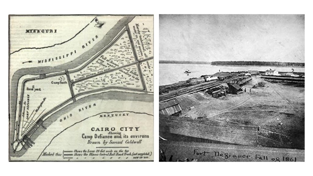
The city of Defiance is located at the confluence of the Auglaize and Maumee Rivers, and the point where the rivers merged was the location of Old Fort Defiance…

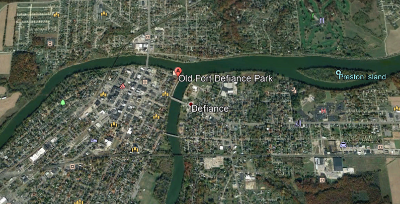
…just like the old Fort Defiance at the abandoned town of Cairo, Illinois, which was located at the confluence of the Mississippi and Ohio Rivers…

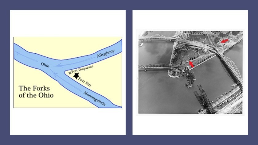
…and the two star forts at the Forks of the Ohio located where the Ohio, Allegheny and Monongahela Rivers meet in Pittsburgh, Pennsylvania.

Fort Defiance was said to have been built in second week of August in 1794 by General “Mad” Anthony Wayne as part of the line of defenses in the campaign leading to the Northwest Indian War’s Battle of Foreign Timbers, and that Fort Winchester was built in the same area in 1812 by General William Henry Harrison, who later became the 9th President of the United States with the shortest term, as he died a month after he took office.

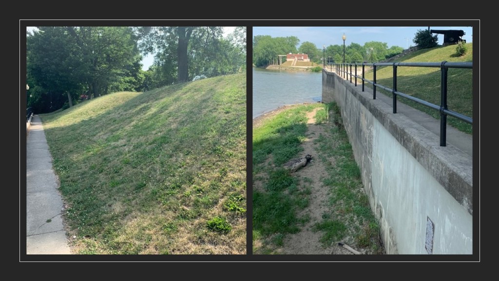
All that remains of the forts at the park are the earthworks seen in these photos Joseph S. sent me, like the earthworks at Fort York and the RC Harris Treatment plant that we saw back in Toronto.

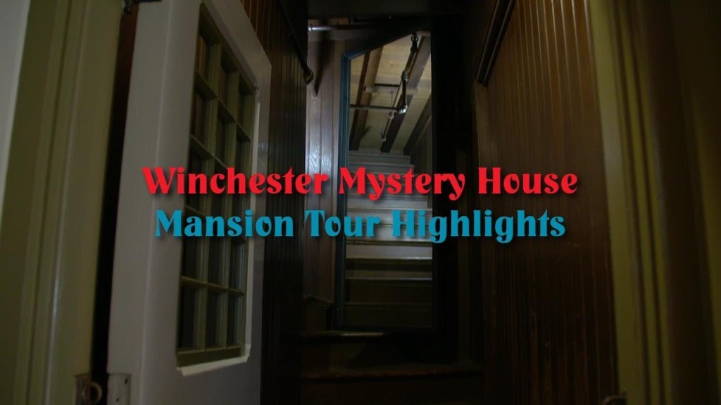
The last place I am going to take a look at from a commenter’s suggestion is the old Winchester Mystery house in San Jose, California.

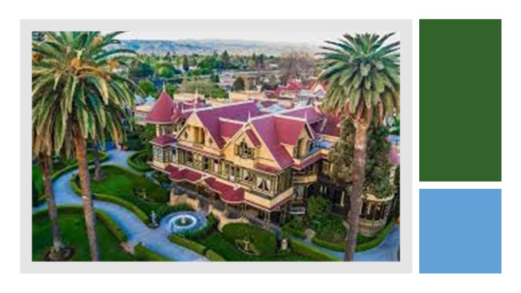
The story goes that Sarah Winchester, the wealthy widow of firearm magnate William Wirt Winchester who died of Tuberculosis in 1881, was told by a medium to leave New Haven, Connecticut, and travel west to a location where she would continuously build a home for herself and the ghosts of the victims who died as a result of Winchester rifles.

She left for California, and purchased an unfinished farmhouse in Santa Clara County, apparently believing her family and fortune was haunted by ghosts, and she could only appease them by building them a house.

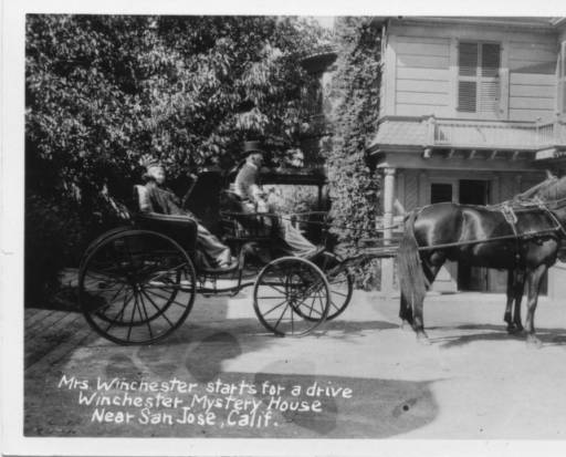
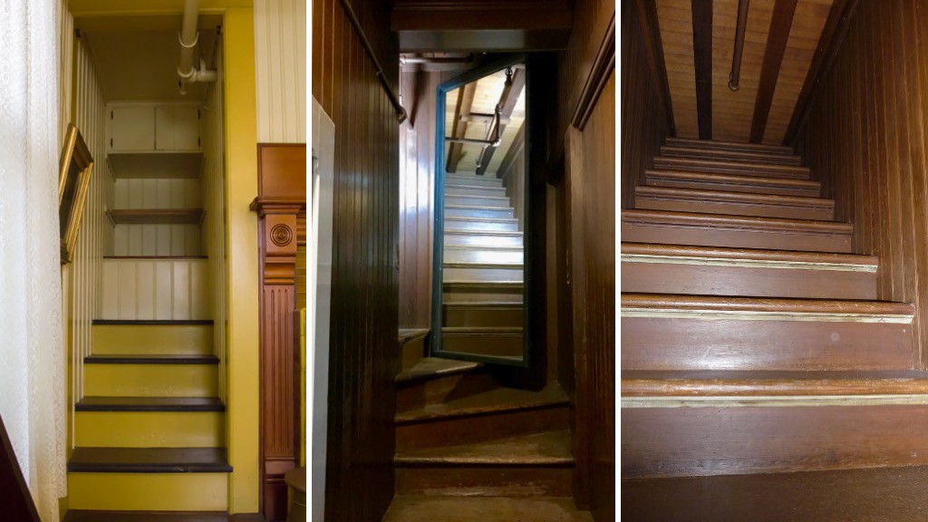
She did not hire an architect, but instead added on to the building in a haphazard fashion by hiring carpenters to do the work, and ended up with a seven-story mansion.

The house contains numerous strange features such as doors and stairs that don’t go anywhere; windows overlooking other rooms; and odd-sized stairs.

After the 1906 San Francisco Earthquake, the Winchester House was said to go from seven-stories to four-stories because of damage caused by the quake.

Sarah Winchester died in 1922, and her will made no mention of the mansion.

Shortly thereafter, it was purchased by investors and leased to John and Mayme Brown.

The Winchester Mystery House was opened to the public in February of 1923, with Mayme Brown becoming the first tour guide.

In the nearly hundred years since the Winchester Mystery House was opened to the public for tours, millions of people have visited it, and has been listed in many places as a top destination around the world, especially in the “haunted” destination category.

I still have a lot of places left to visit that commenters have suggested to me, so I will be continuing with this subject in the next part of this series.

Interesting comments I have Received Redux – Part 2A of All Over the Map

In the second part of this series, I will continue to research places from the long list I have that viewers brought to my attention in comments and/or sent me pictures and information.

I am going to start with comments that were made in response to part 1 of this series because they expose more of the same types of patterns that I saw in part one.

After I talked about hippodromes, racing tracks, and proximity to international airports in part one, a viewer brought to my attention in a comment about part 1 of this series that the Montreal Hippodrome is located next to rails; is 15-minutes to the Montreal Pierre Trudeau International Airport; and the St. Lawrence River is just south of it.

The Montreal Hippodrome was located 8-miles, or 13-kilometers from Montreal-Pierre Trudeau-International Airport, or a driving distance of 11-miles, or 18-kilometers, from there.

The location of the historical Montreal Hippodrome appears to be situated at a similar angle to major international airports as seen in Shepherd’s Bush in West London and Sulphur Springs in Tampa shown and dicussed in the first part of this series, where both places had had elliptical-shaped race-tracks in their vicinities.

Also known as the Blue Bonnets Raceway, a thoroughbred horseracing track and casino, the Montreal Hippodrome was permanently closed in October of 2009 after 137 years of operation, and the abandoned site was demolished starting 2018.

The Hippodrome was located right next to the Canadian Pacific St. Luc Railyards, and its interesting to note this array of elliptical shapes on the race track grounds between the main ellipse and the railyards.

It is also interesting to note that the roundhouse at the St. Luc Railyards was said to have been completed in 1950…

…and by 2003, it was reduced to 4 or 5 stalls.

Why was a beautiful structure like this deconstructed after only a half-century of use?

The appearance of the historical St. Luc Roundhouse reminded me of depictions I have seen of the ancient harbor of Carthage in Tunisia, called a cothon, meaning an artificial, protected harbor.

This is a 2017 photo of the former grand 37-stall roundhouse , considered a shining example of the Canadian Pacific Railway when it was built.

Studies and planning have been done to re-develop the hippodrome site into social housing units.

The hippodrome was located in the western part of Montreal’s Cote-des-Neiges neighborhood, which is the geographic center of the Island of Montreal, said to have been founded in 1862…

…and is also the location of the Notre-Dame-des-Neiges Cemetery…

…as well as the nearby Saint Joseph’s Oratory, the construction of which was said to have started in 1914, and completed in 1967.

Saint Joseph’s Oratory is: the highest building in Montreal; a National Shrine; a Roman Catholic minor basilica; the largest church in Canada; and has one of largest domes in the world.

Like Shepherd’s Bush in West London, the Cotes-des-Neiges neighborhood is an underground transportation hub, with five Orange Line metro stops, and four on the Blue Line.

Another place I would like to bring your attention to before I move on is in Philadelphia.

I decided to take a peek at Philadelphia, another place I have studied on a map previously, and I knew the Philadelphia International Airport was in the southwestern part of the city.

So I looked at it on a map, and proceeded to look for an elliptical shape nearby to see if I could find one.

I came across this track on Google Earth, which I was able to identify by looking-up tracks in South Philadelphia.

The South Philadelphia Super Site is located 4-miles, or 7-kilometers in a straight-line, from the Philadelphia International Airport, and is a driving distance of 6-miles, or 10-kilometers.

Here is a comparison of the appearance of all four of these locations I have looked at with an elliptical race-track and relatively short-distance to a major international airport.

The South Philadelphia Sports Complex is adjacent to the Super Site…

…and which consists of Citizens Bank Park, the home of baseball’s Philadelphia Phillies; the Lincoln Financial Field, the home of football’s Philadelphia Eagles; and the Wells Fargo Center, the home of basketball’s Philadelphia 76’ers and hockey’s Philadelphia Flyers, and the sport of lacrosse’s Philadelphia Wings.

The South Philadelphia Super Site track and the three professional sports venues are both located very close to the CSX railyards…

…below which I noticed there was an abandoned elliptical shape surrounded by trees.

When I looked on a map, the railroad and sports complexes in South Philadelphia are adjacent to the Philadelphia Naval Yard, the location of the Philadelphia Experiment.

A couple of thoughts before I move on from here.

First, I have long-wondered about a connection between athletic fields to the Earth’s grid system since finding ball-fields sandwiched between a star fort in called Fort Negley and the railroad yards in Nashville.

I am definitely beginning to think ellipses served a function similar to star forts as circuitry on the Earth’s electro-magnetic grid system.

Secondly, for a variety of reasons, I have come to believe that the Philadelphia Experiment was part of how the Earth’s original positive timeline was hijacked, which I have talked in-depth about in other blog posts.

And if that belief sounds out-there, there actually is a time-travelling naval vessel in the field of information in the form of the 1980 movie “The Final Countdown.”

I am wondering if Philadelphia was a very powerful node even amongst the network of electrical power node points around world, or if its location was the key for something like this to take place…or both.

One last thing before moving on from this particular topic for now.

A viewer sent me this graphic awhile back saying:

“If you haven’t yet researched the Indianapolis Motor Speedway, I think it’s worth a glance.

Balloon racing and monorail aeroplanes being used there before they were racing cars.

Check this out: Vatican City, the Wimbledon Campus, the Roman Colosseum, the Rose Bowl, Yankee Stadium, and the Kentucky Derby all fit inside the automobile racing CIRCUIT.”

The Indianapolis Motor Speedway is the largest sports’ venue in the world, and said to have been constructed in 1909.

It was the second-purpose built, banked oval racing circuit after Brooklands in Surrey, England, which opened in 1907 and closed in 1939.

It certainly looks like the Controllers’ utilized the existing performance-enhancing features of the physical infrastructure of the Earth’s grid system for the sporting venues of the new historical timeline.

Someone mentioned the Battersea Power Station on the south bank of the River Thames in Battersea in the London Borough of Wandsworth.

The one building comprises two power stations, with Power Station A said to have been constructed between 1929 and 1935, and Power Station B between 1937 and 1941.

One of the largest brick buildings in the world, and known for its Art Deco.

Then, after all that work to design and construct it, both power stations of the Battersea Power Station were decommissioned by 1983…only 42-years later?

After 30-years of abandonment, interest in the redevelopment of the site picked up, and it is currently being turned into luxury apartments, office space, and commercial business space.

Someone mentioned the Efteling Amusement Park, located in the North Brabant Province of the Netherlands, with largest nearby city being called Hertogenbosch, also known as Den Bosch.

Sounds like Bush, and Busch, as noted London and Tampa in the first part of the series.

The Efteling Theme Park was opened in 1952 on the grounds of what was a former sports and recreational park under the guidance of the three visionary men who developed the park.

Amusements at the park include the King’s Castle of the Symbolica ride, a trackless dark family ride…

…with a grand ballroom at the end of the ride…

…the Villa Volta…

…an unusual type of ride in which the visitors get the illusion while inside that either the building, or the visitors, or both, are turned-upside down.

…and the Fata Morgana, also known as the Forbidden City and the 1001 Arabian Nights, an attraction that opened in 1986.

I have to wonder if the infrastructure for the park was already there….

Another theme place with a theme park that someone brought to my attention was in Chippewa Lake, a town in Ohio at the end of a trolley-line that came from Cleveland.

It operated for 100-years, from 1878 to 1978, after which time it was abandoned, with many of the original rides left to deteriorate in situ.

The Chippewa Park Dance Hall burned-down in June of 2002.

A viewer from Belgium commented about the Antwerp Zoo, one of the oldest in the world as it was established on July 21st of 1842…

…and is located right next to the Antwerpen-Centraal Railway Station, which first opened in 1905.

The following are some of the architectural features of the Antwerp Zoo:

The Egyptian Temple, said to date from 1856, which houses the giraffes…

…the Moor Temple, said to date from 1885, which houses okapis, known as forest giraffes and the world’s first zoo with okapis starting in 1918…

…the Reptile Building, said to date from 1901…

…and the Winter Garden, a tropical garden dated to 1897.

The Belgian viewer also mentioned the Albert Canal, connecting Antwerp and Liege, which was said to have been built first by a German engineering company between 1930 and 1934, and then completed by Belgian companies by 1939…

…just in time for the German forces to cross the Albert Canal on May 11th of 1940, the destruction of Fort Eben-Emael, and the beginning of the German Occupation of Belgium.

Fort Eben-Emael was a star fort that was called part of the National Redoubt of Belgium, said to be a network of fortifcations that functioned as the infrastructural cornerstone of the Belgian defensive network and built between 1890 and 1914.

Along with Fort Eben-Emael, near the border with the Netherlands, the National Redoubt included:

The Fortified position of Liege, at the other end of the Albert Canal from Antwerp.

The Belgian government was said to have upgraded and extended the already existing infrastructure of the Fortified Position of Liege after World War I to block Germany’s invasion corridor through Belgium to France.

This was done after World War I because the Belgians were able to hold up the German forces invading France for a week at Liege, which in-turn affected the German timetable for invading France.

Interestingly, the Belgian King Leopold III declared Belgium’s neutrality in 1936 to try to prevent another conflict, which was said to prevent France from making active use for its defense of the Belgian defenses and territory, and as seen with Fort Eben-Emael, the Belgian fortifications did not hold the Germans, who occupied Belgium and France for at least four years during World War II.

Liege is one of the most important railway hubs in Belgium, with its first station opening in 1842…

…and in 1843, becoming the location of the first international railway connection linking Liege to Aachen and Cologne in Germany.

There was even a World’s Fair held in Liege in 1905.

This is the Liege-Guillemins Railway Station, which opened in 2009, one of four Belgian stations on the high-speed rail network.

The Fortified Position of Namur of the Belgian National Redoubt was said to have been established for the same reason as the Fortified Position of Liege – to fortify the traditional invasion corridor of Germany through Belgium to France.

The old forts here were said to have been built between 1888 and 1892.

The Siege of Namur took place in World War I, between August 20th and August 25th of 1914, when the German Army bombarded and destroyed the forts with heavy artillery.

I think quite likely star forts were targeted for destruction in both World Wars, and other wars as well, and not because they were military fortifications.

During the Siege, the German Army captured the Namur Citadel…

…and Namur was occupied by the German Army for the rest of World War I.

Namur is situated at the confluence of the Meuse and Sambre Rivers, which reminded me in appearance of Pittsburgh in Pennsylvania at the Forks of the Ohio, where the Ohio and Monongahela Rivers meet.

I am really quite sure that what we are told are natural river systems are in fact man-made canal systems.

Interestingly Namur was also the name of the Montreal Underground stop next to the former Montreal Hippodrome.

The most important part of the Belgian National Redoubt, we are told, was the double-ring of defensive fortifications around the port city of Antwerp.

During World War I, the Germans also laid siege to Antwerp, against Belgian, French, and British forces.

The Germans were again victorious after bombarding the so-called Belgian fortifications with heavy and super-heavy artillery.

During World War II, on September 4th of 1944, the British Armored 11th-Division captured the port city of Antwerp intact except for the bridges across the Albert Canal.

Apparently, the retreating Germans blew up these bridges on their way out of town.

Then on October 12th of 1944, Hitler and the German High Command exclusively focused their V-weapon missile attacks on the cities of Antwerp and London, and for a period of 175-days-and-nights, German missile-launching crews fired more than 4,000 V-1s and more than 1,000 V-2s at Greater Antwerp, and Antwerp had become known as the “City of Sudden Death.

The Antwerp Underground is known as the “Ruien” and here there are vaulted ceilings, narrow canals, bridges, sewers and sluices.

It is interesting to note that Antwerp is not located too far from the Efteling Amusement Park, being only 51-miles, or 82-kilometers, apart from each other.

Other places on my list of places suggested by commenters include:

Silloth Harbour and Beach in Cumbria, a northwest County in England near the country’s border with Scotland.

Silloth Beach is located on England’s Solway Coast, which is designated as an Area of Outstanding Natural Beauty in Cumbria.

Silloth Harbor and Beach was said to have been inspired by Carlisle business men in the 1850s as a deepwater port, seaside resort and railway hub.

Carlisle, the administrative center of Cumbria, at one time had seven railway companies operating out of the Carlisle Railway Station, which was said to have first opened in 1847.

Silloth Port, one of the busiest ports in Cumbria, is clearly man-made, with old-looking walls, with its main cargoes being wheat, molasses, fertilizer, and general cargo.

Carrs Flour Mill is located right next to the port, called a Victorian-era mill that was said to have been built in 1887, and still provides flour to leading food manufacturers.

Silloth was called a planned community, and we are told that the railway company even had grey granite shipped here in its own vessels from northern Ireland for the Christ Church, a prominent landmark in Silloth, occupying a complete rectangle of the planned town, and its construction completed, we are told, in 1870.

The Silloth Green is considered to be one of the largest and longest greens in England, going back to the 1860s…

…and is fronted by the Silloth Promenade along the shoreline heading up the Solway Coast towards Skinburness.

Skinburness is considered a residential area for Silloth…

…and its most prominent building, the Skinburness Hotel, said to have opened in the 1880s and demolished in 2017, after having been abandoned for about ten years.

Another commenter pointed out the similarity between the architecture of Shipstone’s Brewery in Nottingham, England, founded in 1852, on the left, and the Anheuser-Busch Brewery in St. Louis, Missouri, on the right, first established as the Bavarian Brewery in 1852.

Both Shipstone’s Brewery and Anheuser-Busch Brewery are famous for their Clydesdales, a Scottish breed of draughthorse.

Someone else drew my attention to a place called Yednize in Dresden, Germany.

Come to find out Yenidze was formerly a tobacco and cigarette factory, which was said to have been built between 1907 and 1909, and designed by architect Marvin Hammitzsch in Moorish Revival style.

Often confused for a mosque by tourists, we are told that no, it’s not a mosque, it was just the clever way that the architect designed the mosque as an art-deco, mosque-inspired structure, because according to Dresden law at the time, we are told, it was prohibited to build factory buildings that might spoil the city’s baroque sky-line.

Jewish entrepreneur Hugo Zietz started the tobacco company which imported tobacco from Ottoman Yenidze in Thrace, which is now Genisea, Greece.

The bombing of Dresden took place between February 13th and 15th of 1945, more than 1,200 bombers of the British and American Air Forces dropped more than 3,900 tons of high-explosive bombs and incendiary devices on the capital of the German State of Saxony.

These attacks destroyed more than 1,600-acres, or 6.5-kilometers-squared, of the city-center, and as many as 25,000 people were believed to have been killed.

I am going to continue this series in “Interesting comments I have Received Redux – Part 2B of All Over the Map.”

Interesting comments I have Received Redux – Part 1 The Shepherd’s Bush District of West London

In this new series, I am planning to once again research places from a long list I have of places that viewers have brought to my attention in comments and/or sent me pictures and information.

James C. relayed to me that there are many hidden secrets in the Shepherd’s Bush District and its wards of White City and Wormholt in West London.

In taking a cursory look there and seeing many interesting things, I am going to make this location the primary focus for this blog post.

Shepherd’s Bush is a District of West London in the Borough of Hammersmith and Fulham.

One of the explanations for the District’s name is that it was said to have been named Shepherd’s Bush because it was originally a pasture for shepherds as they made their way with their sheep…

…to the Smithfield Market in the City of London, the current building for which was said to have been designed by Victorian architect Sir Horace Jones and built in the second-half of the 19th-century.

Both the Shepherd’s Bush District and its White City Ward are located on the Central Line of the London Underground System, and along with the Metropolitan Line, one of only two lines to cross the Greater London boundary.

The Central Line first opened in 1900 as the third deep-level Tube line to be built after electric trains were said to have made them possible.

It is interesting to note that the Shepherd’s Bush Train Station was only in use for 42-years, by the London and South Western Railway, between January of 1874 and May of 1916, at which time it was closed, along with other nearby train stations, never to be used again.

The Shepherd’s Bush Green is an approximately 8-acre, or 3.2-hectare, triangular space of open grass that is surrounded by busy roads on all three sides.

Four main roads radiate from the western side of the green, and three approach from the eastern side, meeting at the Holland Park Roundabout.

The Thames Water Tower is located in the Holland Park Roundabout.

The Thames Water Tower was said to have been designed and built in 1994 on top of an underground shaft that brings drinking water up from the London Ring Main, an extensive underground tunnel of flowing water 30 meters, or 98-feet, underground.

The steel core of the glass-covered tower functions as one of the world’s largest barometers, said to forecast the weather by responding to changes in air pressure, characterized by filling-up with colored water, and turning the tower blue.

Neighboring Shepherd’s Bush, Holland Park is an affluent section of Kensington, known for its Royal Crescent, said to have been designed in 1839 by Robert Cantwell, and considered one of the most architecturally interesting 19th-century developments in Holland Park.

The Shepherd’s Park Green is an important node of the Bus Line, with eighteen bus routes arriving here, as well as being near five underground stations.

In addition to the two mentioned previously at Shepherd’s Bush and White City, the following underground stations are nearby:

The Shepherd’s Bush Market…

…the Goldhawk Road Tube Station…

…and the new Wood Lane Station on the Circle and Hammersmith & City Lines, that opened in 2008.

The original Wood Lane Station on the London Underground’s Central Line was said to have been built to serve the Franco-British Exhibition and the Olympic Games in London, which took place in 1908.

The Wood Lane Tube Station was said to have been closed when the White City Tube Station was opened a short distance north on the Central Line, and while the Wood Lane platforms were abandoned, the depot here became known lines as the White City Depot, one of three traction maintenance depots on the Central Line.

The depot at this location became operational in 1900.

Until 1928, it had the main power station for the Central London Railway (CLR) to generate electricity for the railway’s trains…

…after which time the Lots Road Power Station supplied the London Underground’s electricity until it was decommissioned in 2002.

Uxbridge Road is on the north side of the Shepherd’s Bush Green, a major road through West London that also provides transportation connections for buses and the London Underground.

The Shepherd’s Bush Green is bounded to the East by the West London Overland Line…

…and at one time bounded to the west by the rail-line which serviced the Shepherd’s Bush Station, again which was closed in 1916, and the tracks have been built over.

It is important to note that during the Second World War, Shepherd’s Bush and its environs were targeted heavily by German V-1 flying bomb attacks, which would strike with little notice.

Now I am going to take a look at the Franco-British Exhibition and the Olympic Games in London, both of which took place in 1908 in this complex in the White City Ward of Shepherd’s Bush.

What we are told is that the area now called White City was farmland until it was used as the building site of the Franco-British Exhibition, so-named as a celebration of the 1904 Entente Cordial between the two countries, said to mark the end of hundreds of years of intermittent conflict between the two states and their predecessors…among other things, and one of six Exhibitions held there between 1908 and 1914.

The 1908 Olympic Summer Games were held in London alongside the Franco-British Exhibition, as they were not able to be held in Rome as originally scheduled because of a violent eruption of Mt. Vesuvius in 1906 that put the breaks on that plan.

First on the Exhibitions.

We are told the chief architect of the White City Buildings for the 1908 Franco-British Exhibition…

…was John Belcher, President of the Royal Institute of Architects from 1904 – 1906.

In addition to the twenty palaces and eight exhibition halls that were said to have been built expressly for the 1908 Exhibition, there were a number of amusement attractions featured, including:

The Flip-Flap in the Elite Gardens…

…the Mountain Scenic Railway…

…the Spiral Railway…

…and the Canadian Toboggan.

There were also two Human exhibits, otherwise known as Human zoos, at the 1908 Franco-British Exhibition.

One was called “Ballymacclinton,” and said to have been the largest and most successful Irish Village ever staged…

…and the other was the “Senegalese Village.”

The White City was also the location of five more Exhibitions:

The Imperial International Exhibition in 1909, called an opportunity to reflect upon the achievements of the three members of the 1907 Triple Entente, an accord between Russia, France, and Great Britain…

…and which also featured two Human exhibits, one from France with people from Dahomey, now Benin, in Africa…

…and the other from Russia of Kalmyk people, Buddhist Mongols from Russia and Kyrgyzstan, otherwise known as Tartars.

The Japan-British Exhibition was held in 1910 to celebrate and reinforce the Anglo-Japanese Alliance signed between the two countries in 1902, and driven by the Empire of Japan’s desire to develop a more favorable image to Britain and Europe.

Most of the content of the Exhibition was Japanese and not British, like the Japanese Gardens…

…that included a Human exhibit of Ainu, the indigenous people of Japan, from the island of Hokkaido…

…and from some of the Japanese colonies, like Taiwan, known as Formosa at that time, with the given reason of showing that Japan was following in Great Britain’s footsteps as an Imperial Power striving to “improve” the lives of its “colonial natives.”

The Coronation Exhibition was held in the White City starting in May of 1911, to showcase highlights of the British Empire and to celebrate the coronation of King George V and Queen Mary in Westminster Cathedral in June of 2011.

In March of the same year, King George V and his wife Queen Mary were elevated to Emperor and Empress of India, a title used by British Monarchs from 1876 to 1948…

…during the Delhi Durbar of 1911, an Indian imperial-style mass-assembly organized by the British at Coronation Park in Delhi, India .

The Human exhibits at this Exhibition were from Somalia…

…Ireland…

…Canada…

…and India.

The Latin-British Exhibition in 1912 focused on the Latin countries in Europe of France, Spain, Italy, and Portugal, and South America.

…and while I am seeing references to Human exhibits from the colonies at this one, I am not finding any photographs or depictions of these other than on this program cover.

In 1914, the White City of London held its last Exhibition, the Anglo-American Exposition.

Among other things, the Anglo-American Exposition featured the “American Picanninny Band,” comprised of a group of young people recruited from the Jenkins orphanage in Charleston, South Carolina…

…and the Miller Brothers’ 101 Ranch Wild West Show from Ponca City in Oklahoma.

It is interesting to note that the 101 Ranch was also the physical location of the 101 Ranch Oil Company.

The 101 Ranch Oil Company was founded by in 1908 by E. W. Marland, a lawyer and oil-man who moved to Ponca City from Pennsylvania and entered into a leasing arrangement with the Miller Brothers 101 Ranch.

The 101 Ranch was a focal point of the oil rush in northeastern Oklahoma.

In 1917, E. W. Marland founded the Marland Oil Company, which by 1920 controlled 10% of the world’s oil reserves.

Marland Oil Company merged with Continental Oil, also known as Conoco, in 1929, after a successful take-over bid by J. P. Morgan, Jr.

The company maintained its headquarters in Ponca City until 1949, when it moved to Houston, Texas.

Conoco was owned by the DuPont Corporation between 1981 and 1998, and in 2002, Conoco merged with Phillips Petroleum, which also had its roots near Ponca City in northern Oklahoma, to become today’s ConocoPhillips.

A thought with regards to these international exhibitions and expositions.

There are two definitions of the word exposition.

One is a device used to give background information to the audience about the setting and characters of the story.

Exposition is used in television programs, movies, literature, plays and even music.

What better way to tell your audience the story you want them to believe than the other definition of exposition, a large exhibition of art or trade goods.

Following the 1914 Anglo-American Exposition, the White City site fell into disuse and disrepair.

In 1937, a large portion of the White City was cleared to make way for a housing estate

The White City Stadium was the main venue for the 1908 Summer Olympics held concurrently with the Franco-British Exhibition on the White City grounds..

This stadium with a seating capacity for 68,000 was said to have been designed by engineer J. J. Webster, and built in 10-months by the George Wimpey construction firm starting in 2007, on part of the site of the Franco-British Exhibition.

The 1908 London Olympic Games were opened by King Edward VII at the White City stadium on April 27th.

One of the notable outcomes of these particular Olympic Games was that the distance for the marathon was fixed for future games and sporting events, and calculated by the distance from Windsor Castle to a point in front of the royal box.

After the 1908 Olympic Games, only the running track at the White Stadium was used until 1914, and there were attempts to sell it.

Other than that, the White Stadium track was used as by some athletes in training for the 1924 Olympic Games in Paris.

Then the Greyhound Racing Association took-over the White City Stadium in 1926.

The stadium became the host to the English Greyhound Derby between 1927 until the time of its closure in 1984.

Today, the BBC White City occupies the site of the White City Stadium, which was demolished in 1985.

The former White City Exhibition Site now hosts the Westfield Shopping Center, one of the largest in London.

We are told this 1841 map shows a largely rural and undeveloped Shepherd’s Bush, with a lot of open farmland compared to fast-developing Hammersmith.

I have an arrow pointing to the green feature marked “Hippodrome” which jumped out at me because of the White City Stadium and what a “Hippodrome” actually is – a Greek word used from ancient times to mean a racetrack.

Famous Hippodromes from antiquity include one in Caesarea in Israel on the top left; Constantinople on the top right; the Circus Maximus in Rome on the bottom left; and one in Messina in Sicily.

Long before I started doing my own research, I lapped up the available research on megalithic sites like Stonehenge in southern England.

In the neolithic landscape surrounding the dominating Stonehenge, much is found, including two features, one which is known as the Greater Cursus, and the other as the Lesser Cursus.

Besides having the meaning of being a neolithic earthwork enclosure comprising parallel banks, cursus is another historical term with the meaning of racetrack.

When I was doing research into underground railway systems, I found an elliptical-, or cursus-, shaped subway in Glasgow, Scotland, said to have first opened in 1896.

The fifteen stations of the subway are distributed over a 10-kilometer, or 6-mile, circuit of the West End and City Center of Glasgow, with eight stations to the north of the River Clyde, and seven to the south. There are two lines: an outer circle running clockwise, and an inner circle running counter-clockwise.

Circuit is a word in the English language that means: 1) a roughly circular line, route, or movement that starts and finishes at the same place; and 2) a path in which electrons from a voltage or current source flow. The point where those electrons enter an electrical circuit is called the source of the electrons.

This came up when I searched for “particle accelerator diagram,” showing counter-rotating beams in a circular accelerator, contrasted with the Glasgow subway’s outer and inner circle running in opposite directions from each other.

Like with what I found in Shepherd’s Bush previously in this post, there are also abandoned rail-line stations in Glasgow, like the Botanic Gardens Station, said to have been built in 1896, and closed to passenger transport in 1939…

…and there is an abandoned tunnel at the Botanic Gardens as well.

When I look at the configuration of the blueprint for the lay-out of the Franco-British Exhibition and the White City Stadium, R2D2, the beeping ‘droid from Star Wars comes to mind as a similar match.

This is a detail of a map from 1912 called “Bacon’s Up-to-Date Map of London” showing the White City configuration, along with London Underground lines marked in red, and Tram lines marked in yellow.

To me, the whole White City configuration reminds me of sophisticated circuitry that appears to plug into the Central London Depot, which I mentioned previously, was the main power station for the Central London Railway (CLR) until 1928.

This is an old postcard depicted Shepherd’s Bush Tram Terminus, where electric trams operated from 1901, until replaced by trolley-buses in 1936.

Trolley-buses operated here until they were replaced by diesel buses in 1960.

Now, there is a place I want to revisit in Tampa, Florida, which I researched last summer, that reminds me in very many ways of Shepherd’s Bush.

There is a similar relationship in the location of both of these places being close to a major international airport, with Shepherd’s Bush being 10-miles, or 16-kilometers in a straight-line, from London’s Heathrow Airport on the left; and on the right, the Sulphur Springs neighborhood of Tampa in a straight-line is 6-miles, or 10-kilometers, from Tampa International Airport.

Both places are located in a similar relationship to snaky, s-shaped rivers bends that have the same curvature…

…where the similarity would be even more pronounced had the water of the Hillsborough River not been dammed up and subject to water resource management.

Sulphur Springs is located six-miles north of downtown Tampa.

Its southern boundary is the Hillsborough River; the northern boundary is Busch Boulevard; Florida Avenue, Nebraska Avenue, and the CSX Railroad line forms boundaries on the west and the east.

Going from left to right on this map of Google Earth, there is a water tower here…

…like finding one in the Holland Park Roundabout right next to the Shepherd’s Bush Green…

…the construction of which was said to have been finished in 1927, to include a full automatic elevator for some reason, commissioned by local developer Josiah Richardson for the purpose of ensuring an adequate water pressure to supply the building which housed his Sulphur Springs Hotel & Apartments, and the first shopping mall in Florida, Mave’s Arcade.

Also, like the White City Stadium in Shepherd’s Bush, there was a stadium and track here that became a popular Greyhound Racing Track…

…and Sulphur Springs at one time in its history was a trolley park, known as the “Coney Island of Florida.”

It featured the Toboggan Water Slide…

…and a circular pool and beach…

…which looks like it still has a presence on the grounds of the Sulphur Springs pool in the present-day, according to Google Earth.

Trolley parks were said to have started in the United States in the 19th-century as picnic and recreation areas at the ends of street car lines, and were precursors to amusement parks.

By 1919, there were estimated to be between 1,500 and 2,000 such parks. For example, Luna Park at Coney Island in Brooklyn was a trolley park.

I was not at all surprised when I found out that Sulphur Springs was the terminus of a trolley line at one time…and Shepherd’s Bush was a trolley line terminus as well, as previously mentioned.

Tampa was said to have a steam-powered trolley system by 1885 carrying passengers between Tampa and Ybor City, and that in 1893, the Tampa Street Railway and Power Company converted its trolley system to electric-power from steam.

Sulphur Springs became the northernmost terminus of what was known as the Tampa Streetcar line, which TECO (Tampa Electric Company) took control of in 1899.

By the late 1930s, trolleys were in use in many cities, and by the end of World War II in 1945, Tampa and St. Petersburg were the only Florida cities with trolleys.

Then on August 4th of 1946, the last Tampa electric trolley was retired. The overhead wires were eventually taken down, and the rails paved over.

Today, TECO operates a 2.7-mile trolley line in downtown Tampa between the city’s Channel District and Ybor City…

…the only remnant of what was once an extensive trolley system here.

This brings me to the Busch Gardens in Tampa, located just slightly to the northeast of Sulphur Springs.

The “Busch Gardens” name was first used in reference to gardens developed near Pasadena between by Adolphus Busch, the co-founder of Anheuser-Busch with his father-in-law Eberhard Anheuser…

…where we find interesting-looking earthworks.

They were said to have been open to the public between 1906 and 1937.

The Busch Gardens amusement parks were developed initially as marketing vehicles for Anheuser-Busch, and Busch Gardens in Tampa opened on March 31st of 1959 as a hospitality-facility for an Anheuser-Busch brewery which provided visitors with the opportunity to taste beer.

It is known for the African theme of the park.

There was no charge for admission at that time.

We are told there initially was a bird-garden and an escalator called “Stairway to the Stars,” which took visitors to the roof of the brewery where the tour began.

Rides and attractions were added, developing into a full-theme park while still promoting Anheuser-Busch beer.

I tracked a straight-line relationship between the old greyhound racing track in Sulphur Springs, another elliptical shape in the landscape near Busch Boulevard, and a point in the African Safari park of the Busch Gardens complex.

It is hard to tell from Google Earth exactly what is there at the thumb-tack, but this is what I got when I tried to find out.

I would love to know if there is an esoteric connection between the “Bush” of Shepherd’s Bush, and the “Busch” of Busch Gardens in relationship to the similarities found both of these places.

If anyone knows what it might be, please let me know.

From the similarities in configurations and features found between the Shepherd’s Bush District and the Sulphur Springs neighborhood in Tampa, Florida, I surmise they were both significant power nodal points in the Earth’s original grid-system of the ancient advanced Moorish civilization, which I believe existed up until relatively recently, until a deliberately-caused cataclysm wiped out the original civilization, and Earth’s positive timeline was hijacked by negative Beings for their own benefit, not ours.

Among other significant power nodal points, I would include places like Las Vegas in Nevada on that list, as well as other amusement parks still in existence, like Busch Gardens in Tampa, as well as others from ancient times to modern.

I cover the topic of the cataclysm and historical reset timeline extensively in other blog posts, like “My Take on the Mud Flood & Historical Reset Timeline.”

I will be continuing on the subect of “Interesting comments I have Received Redux” in this new series.