
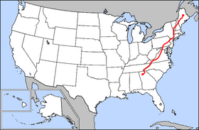
I am going to share a fascinating global alignment with you in a series of posts. It’s a really long alignment, and I have many interesting things to share with you as I result of what I found along the way.
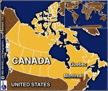
The particular alignment that the Silk Road is on emanates off of one side of the North American Star Tetrahedron – the line of cities between Santa Rosalia, Baja California and Montreal, Quebec, Canada – and as I remember, it is the first one I tracked around the world.
One of my travel buddies gave me a flat map of the world in early 2015 – she thought I needed it. So, it just sat there on my dining room table where I studied it for quite some time while eating before I started noticing major cities lining up in lines in North America, and then in 2016 I found a familiar figure of sacred geometry when I literally started connecting them. I believe it is the terminus/key of a worldwide grid.
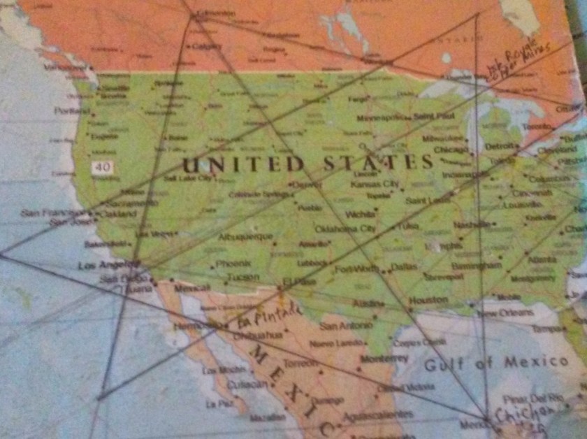
Once I found the star tetrahedron, I extended the lines out, and eventually switched to a globe. I used a magnifying glass and wrote down the cities that lined up primarily in a circular fashion. And I got an amazing tour of the world of places I had never heard of with remarkable similarities across countries.
I am going to start at the top of the side of this tetrahedron, at Montreal for this post because it is where I started my journey of connecting the cities I found that lined up along the way. And indeed this process brought me around the world to the bottom of the alignment at Santa Rosalia in Baja California.
If you are familiar with my work, you will know that as I followed the planetary alignments that emanate off of the North American Star Tetrahedron, I saw the same signature, same hand of design, all over the planet. I believe this was the hand of a global and unified Moorish Empire, and that we have been given a false historical narrative that was grafted onto what they built. I will be showing you what I am seeing.
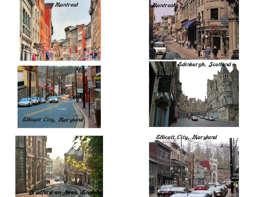
You will see the same architectural styling as you see here in Historic Montreal that you see in other places, like the ones shown below in Ellicott City, Maryland; Edinburgh, Scotland; and Bradford-on-Avon, England – the same stone workmanship, steep, and curvy, streets. I know I can find many other examples. How could there be such striking similarities across centuries, continents and countries?
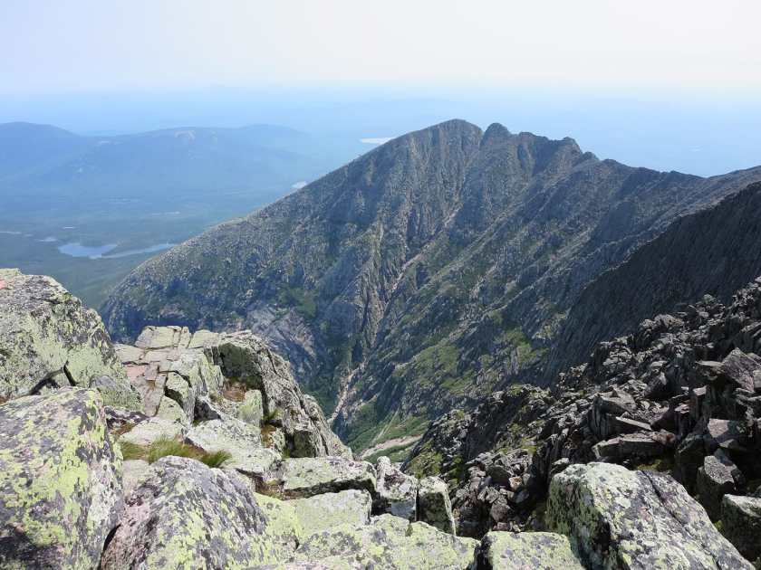
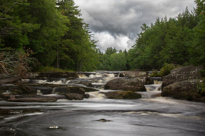
So this next place I just found in the course of researching information for this post. On my original spreadsheet I skipped over anything in Maine because it crossed through northern Maine where there weren’t any cities. So I didn’t write anything down. However, it does cross over something noteworthy: Mt. Katahdin in Maine’s Baxter State Park. Ever heard of it? Me neither. Mt. Katahdin.
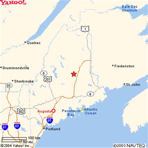
It is the highest mountain in Maine, and is the northern terminus of the Appalachian Trail, which goes down through the Appalachian Mountains to Springer Mountain in Georgia.
Note the rectangular-looking rock with straight edges in the foreground….
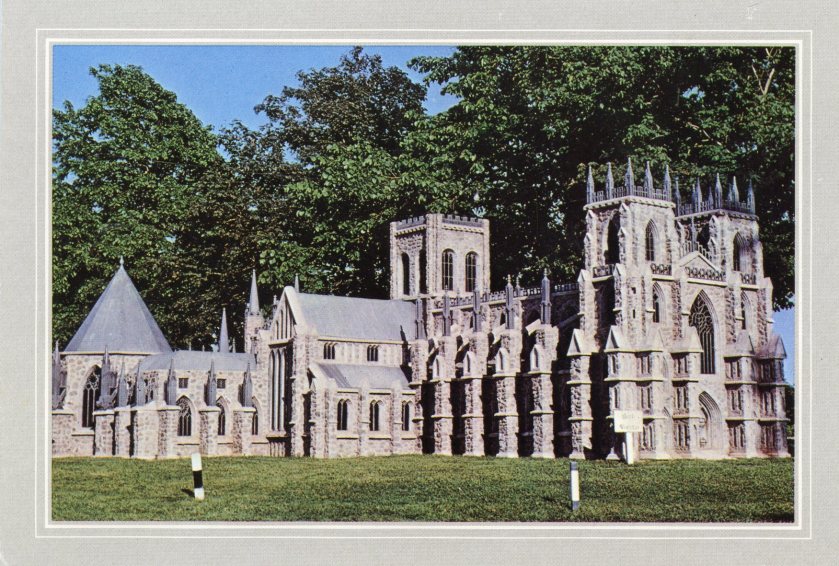
The alignment then goes on to Fredericton, New Brunswick.
Fredericton is the capital of New Brunswick, and the third largest city in the province.


It is situated on the Saint John River, which flows through it west to east.
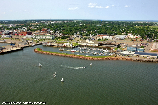
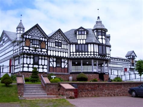
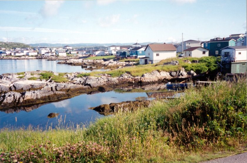
Next we come to Prince Edward Island, Canada’s smallest province, where it goes through Summerside and Kensington. Summerside is the second largest city on Prince Edward island.
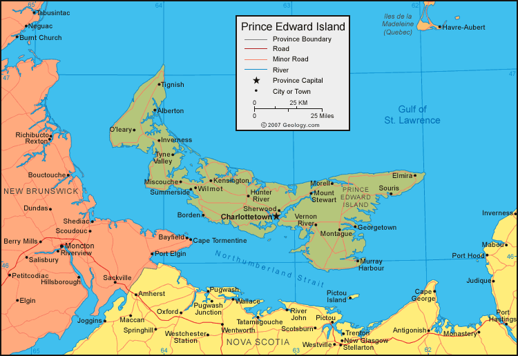
Summerside, Prince Edward Island
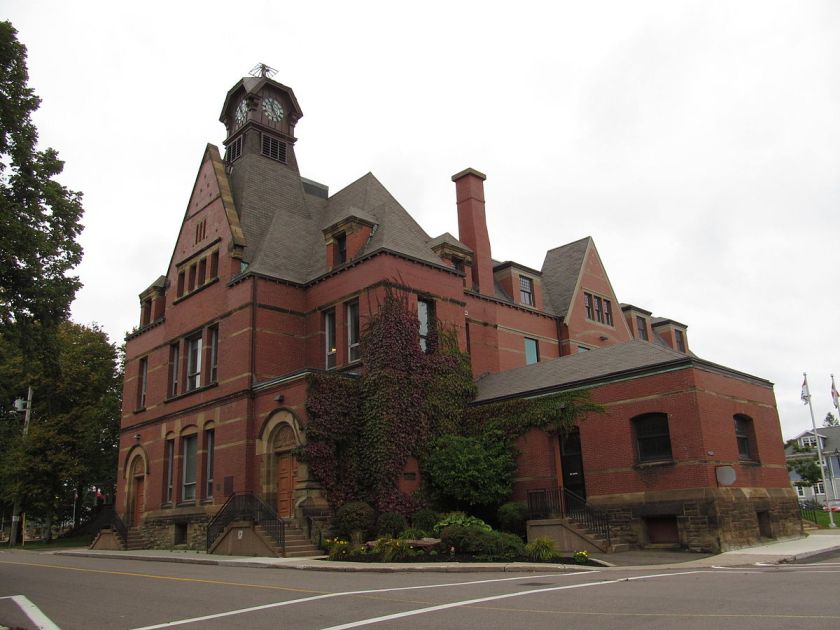
Further on up the alignment on Prince Edward Island, here are examples of Kensington Architecture:
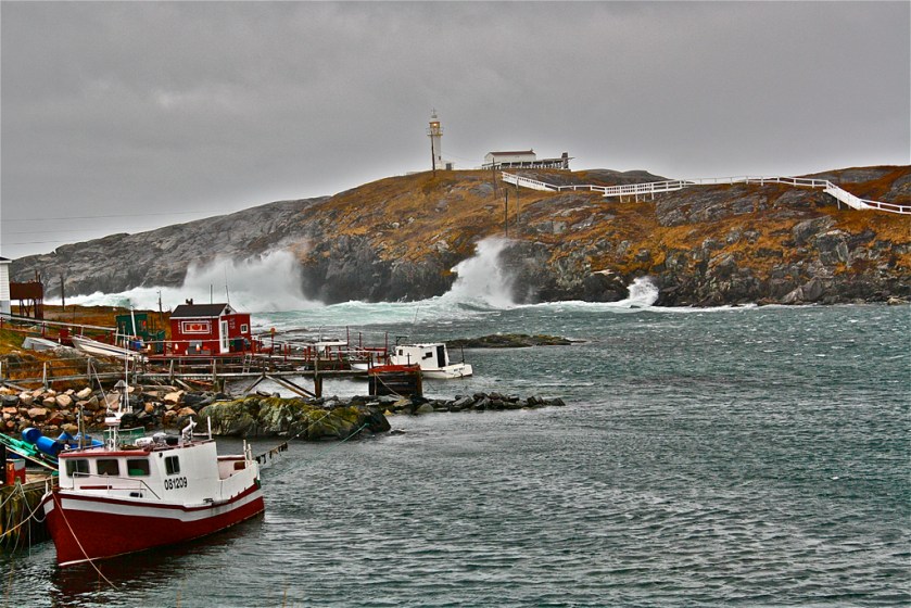
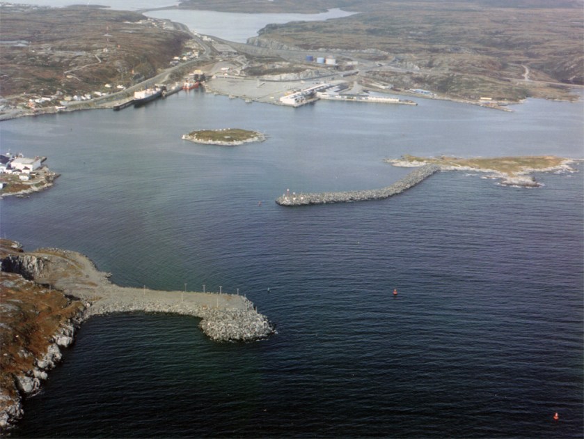
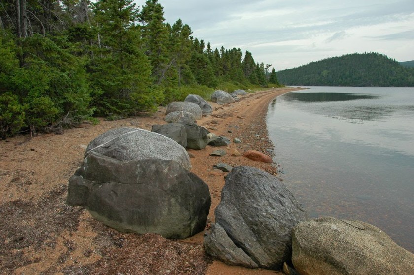
From Prince Edward Island, the alignment goes through Newfoundland, entering at Channel-Port aux Basques.
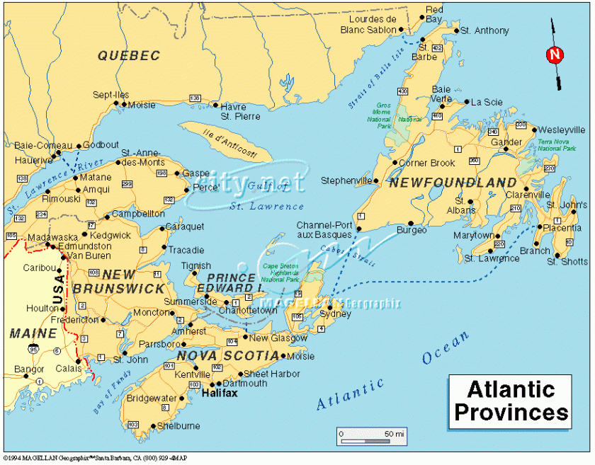
Channel-Port aux Basques is on the extreme southwestern tip of Newfoundland, and has a Marine Ferry Terminal and is the primary entry point into Newfoundland. It is also the western terminus of the Trans-Canada Highway in the province.
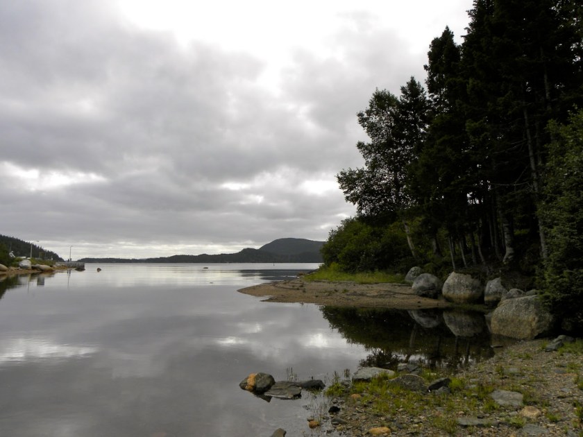
The alignment exits Newfoundland at Terra Nova National Park, which is Canada’s most easterly national park.
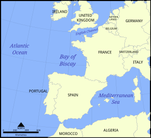
After the alignment leaves Newfoundland, it traverses the Atlantic Ocean – Between Iceland and the Azores – and enters Europe, crossing the Bay of Biscay into Bordeaux, France.
The Bay of Biscay is a gulf in the Northeast Atlantic that lies along the coast of Western France and the northern coast of Spain. Just for point of information, Basque districts lie along the Bay (referencing Port aux Basques in Newfoundland), including Bilbao, the capital of the Basque Country in Spain, and Biscay was the name for Basque up until the early 19th century. Also the Gulf Stream enters the Bay following the continental shelf’s border counterclockwise, keeping the temperature moderate.
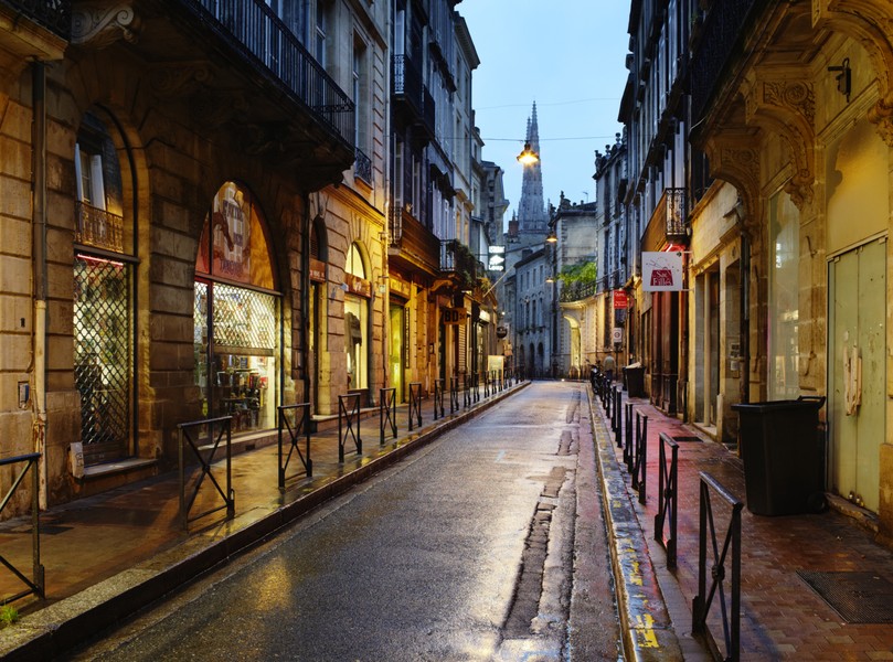
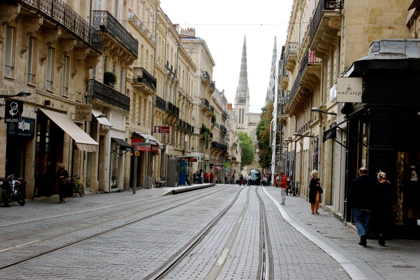
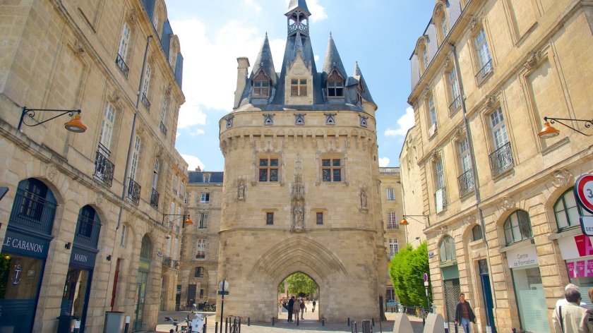
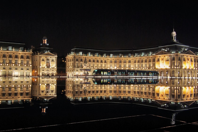
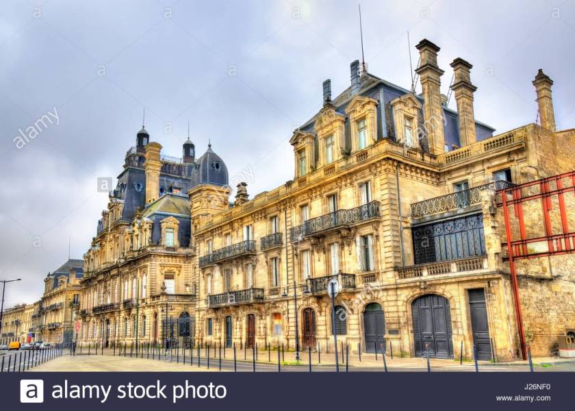
Bordeaux is the capital of the Nouvelle-Aquitaine region of France, and a port city, known as the Port of the Moon.
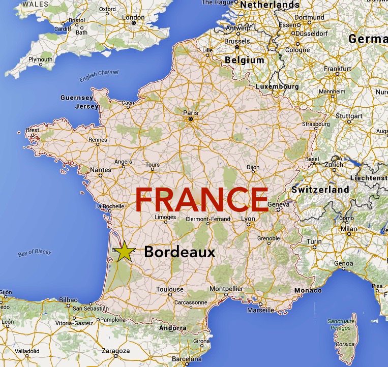
Bordeaux is the world’s major wine industry capital. Also, the historic part of the city is on the UNESCO World Heritage list for what is called “an outstanding urban and architectural ensemble of the 18th century.” After Paris, Bordeaux has the highest number of preserved historical buildings in France.
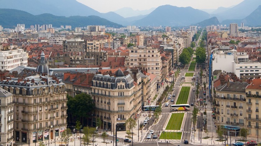
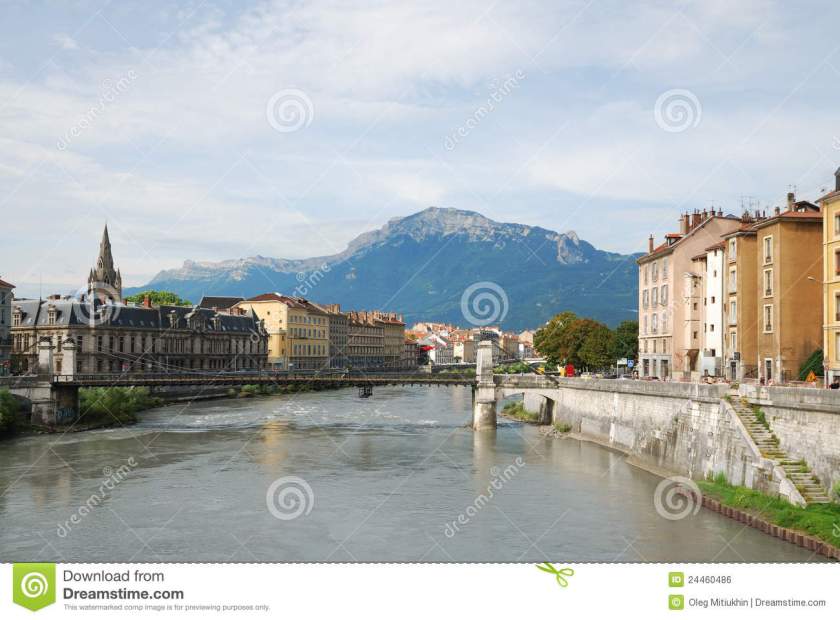
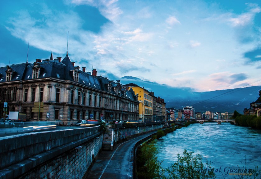
From Bordeaux, the next major city on this alignment is Grenoble, France, which is at the foot of the French Alps, where the River Drac joins the River Isere.
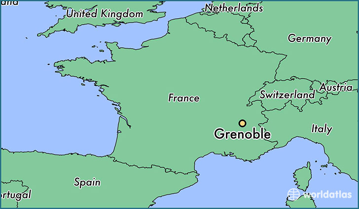
Grenoble is said to have over a 2,000 year history, starting out as a small Gallic village. It was the host of the Winter Olympic games in 1968. Now it is one one Europe’s most important research, technology and innovation centers:
Some comparisons of what I am seeing so far. So first is this comparison of Montreal and Grenoble. I know it is not an exact match with regards to architecture, but has a similar lay-out and fountain design, and when I saw the photo of Grenoble on the right, it reminded me immediately of this one on the left in historic Montreal: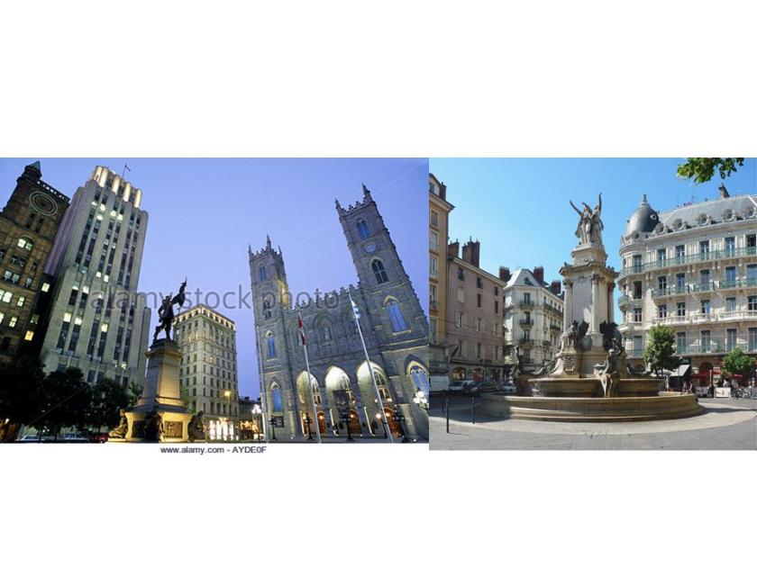
And here is a direct comparison between photos, the one on top taken in Bordeaux, France and on the bottom, Grenoble, France. In addition to the lay-out and architectural style of the buildings, please note the similarity of what is going on with the domed shapes (and rods?) in both pictures.
Okay, well maybe, but any thoughts on the similarities between the street corner in Madrid on the left, and the street corner in New York City on the right?


One more thing I want to show you before I leave Grenoble, France.
These are photos of the Fort de la Bastille in Grenoble:
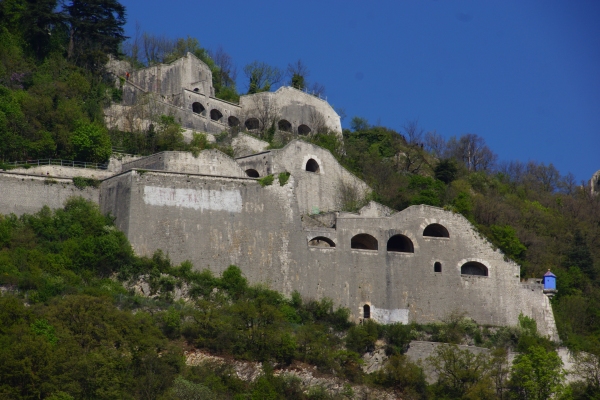
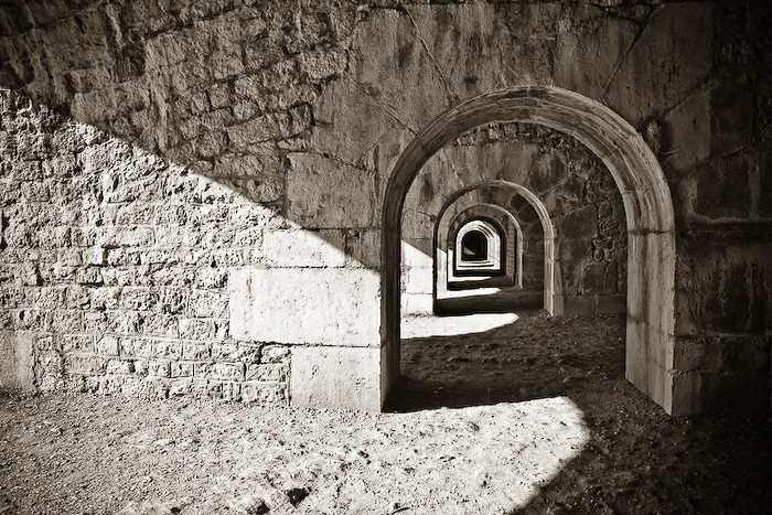
With its massive stone work from top to bottom of this photograph…
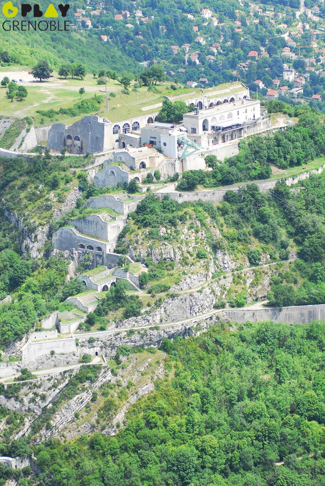
…and sitting on what looks like a massive sheer outcrop of stone.
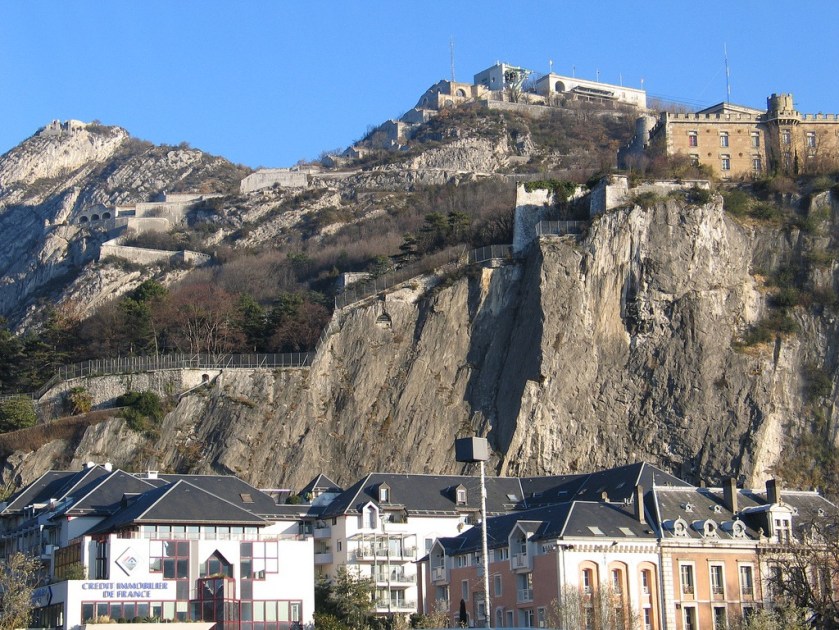
It was said to have been completed in 1592 after a Huguenot leader had taken control of Grenoble.
This leads to two issues. One is this: Based on the history we have been taught, what building technology existed in the late 1500s that was capable of building a sophisticated fortification like this?
The second issue is about the Huguenots. On my dad’s side of the family, the only oral history that passed down about our ancestors is that they were Huguenots. No details.
So I started looking up information about the Huguenots in encyclopedias when I was young. Up until the Internet Age, the only information available on them is that they were perscecuted and massacred reformed Calvinists that were run out of France.
Of particular note were the French Wars of Religion starting with the Massacre of Vassay in March of 1562 to April of 1598, ultimately taking an estimated 3 million lives. Over a couple of centuries, most of them ended up leaving France.
With the advent of the Internet Age, there is more explanation available to find about who the Huguenots actually were. I find it very credible to discover that the Huguenots were Cathars and Moors, especially in light of all of the genocide that took place against these people, not only here but around the world. This makes more sense to me than the French King and Catholic Church being hell-bent to annihilate Reformed Calvinists.
I will end this post here, and continue on to Milan, Italy on the alignment in Part 2.
