This is volume 4 of what will be a lengthy new series.
I am highlighting places, concepts, and historical events that people have suggested that I research in a new multi-volume series that is a compilation of work I have previously done.
There were a few more man-made lakes that commenters mentioned that I want to include before I move onto new material.
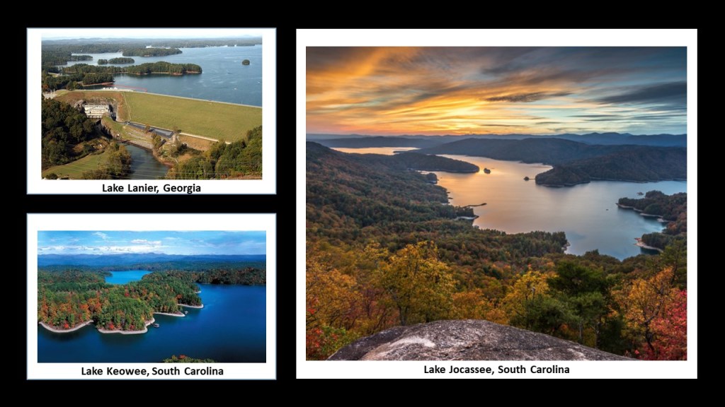
In “Places & Topics Suggested by Viewers – Volume 3,’ I featured Lake Lanier in north Georgia, and Lakes Keowee and Jocassee in the northwestern corner of South Carolina, near the state’s border with North Carolina and Georgia, an area known as the gateway to the Blue Ridge Mountains.
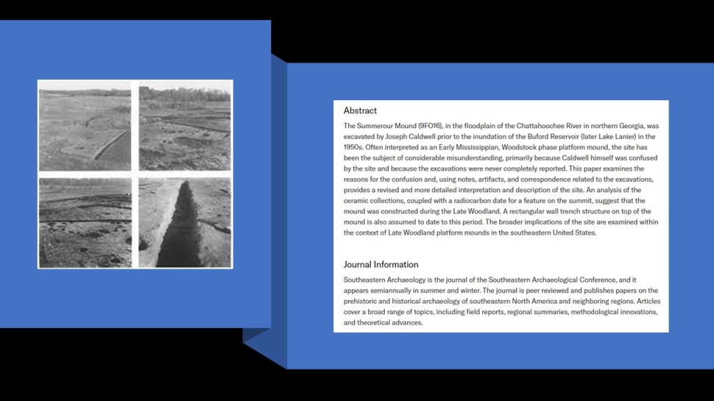
Viewer TM lives in Cumming, Georgia, right at Sawnee Mountain (that I featured in the video in conjunction with its proximity to Lake Lanier), and commented “I can tell you what is under the dam at Lake Lanier. An ancient Native American mound. It is called Summerour Mound. There is also one in Dawsonville, Georgia, right next to Cumming, Georgia. They were destroyed with the creation of Lake Lanier.”
Summerour was a mound site that was excavated between 1951 and 1954 by archeologist Joseph Caldwell, before it was flooded by the waters of the Buford Dam.
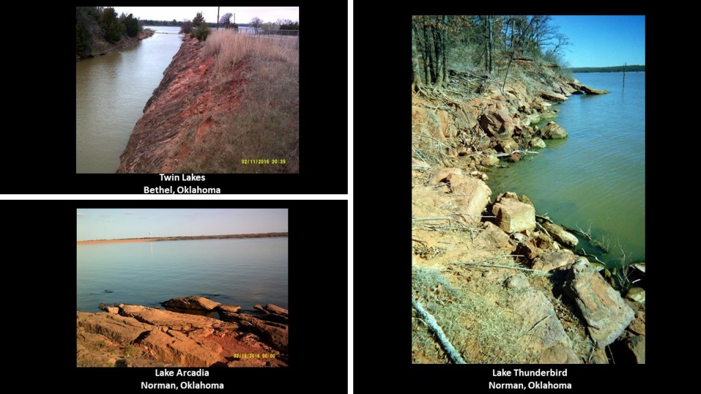
This goes along with my field observations at local lakes where I was living in Oklahoma City at the time between 2012 and 2016, I came to the conclusion that man-made lakes serve at least two purposes, 1) creating a water reservoir and/or hydroelectric power supply; and 2) covering up ancient infrastructure.
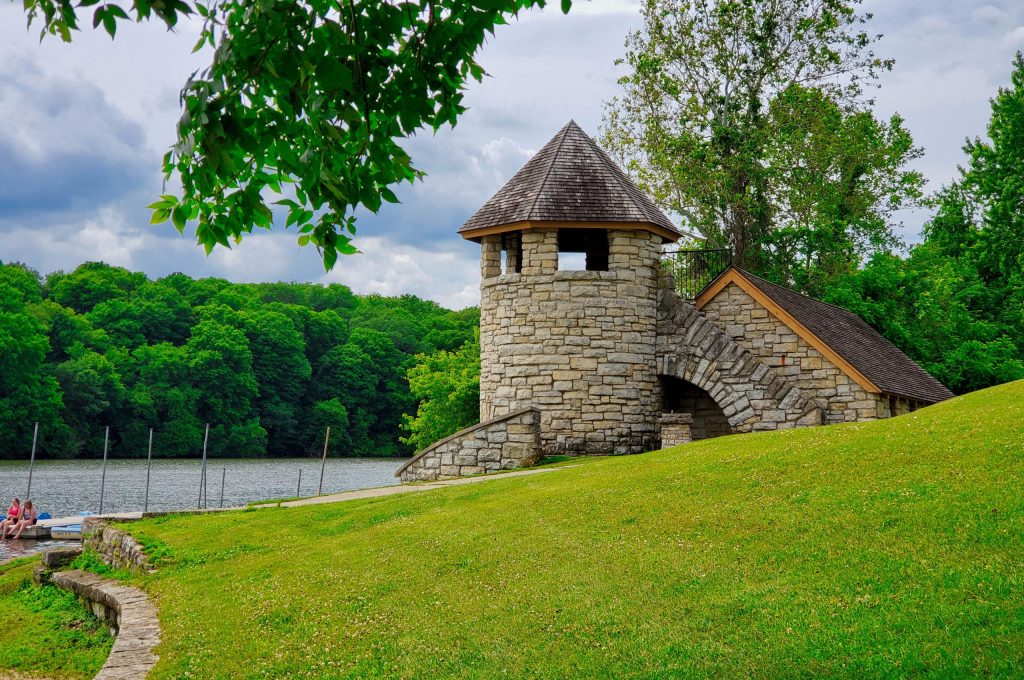
These are pictures I took at Twin Lakes at Bethel, Oklahoma, on the top left; Lake Arcadia in Edmond, Oklahoma, on the bottom left; and Lake Thunderbird in Norman, Oklahoma, pictured on the right.
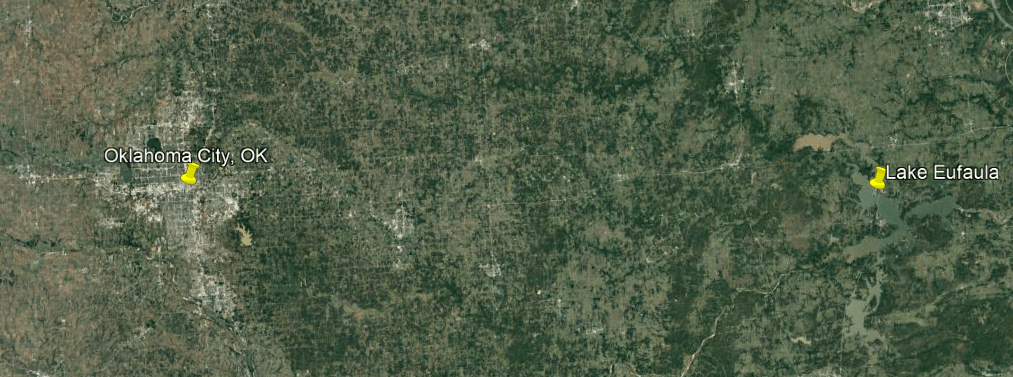
XTX left a comment about Lake Eufaula, a man-made reservoir in Oklahoma, east of Oklahoma City, off Interstate 40.
XTX grew up here and was told of people who had drowned in the lake due to wells and open holes beneath the water, and said nothing was torn down or filled in when it was made, and that it took in a lot of land…
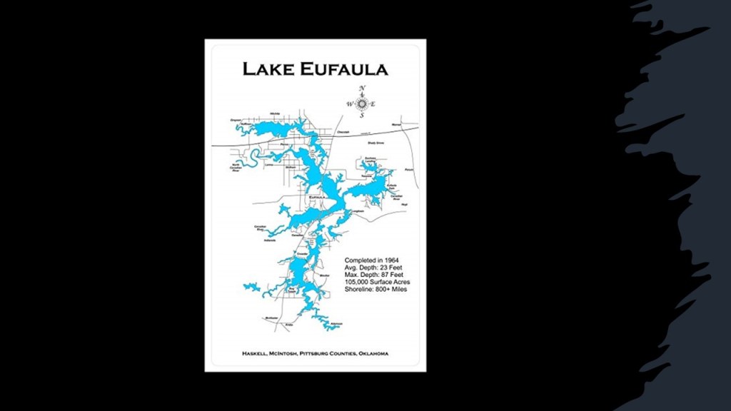
…and a town called North Fork Town that was founded by the Creek Nation in Indian territory back in the 1800s.
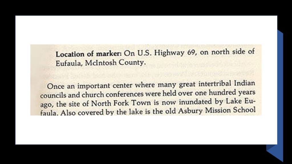
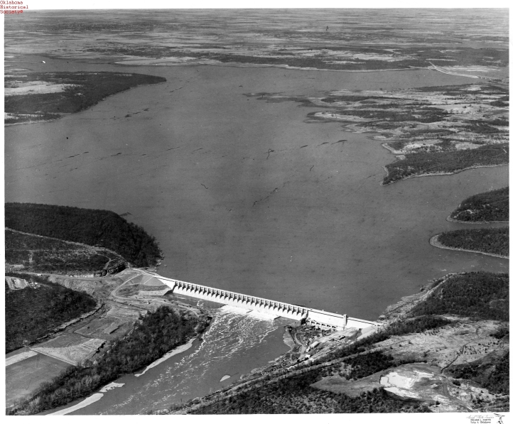
We are told after its approval by Congress in 1946 to “provide flood control, hydroelectric power, water supply, navigation, and recreation,” the Eufaula Dam was built by the U. S. Army Corps of Engineers between 1956 and 1964.
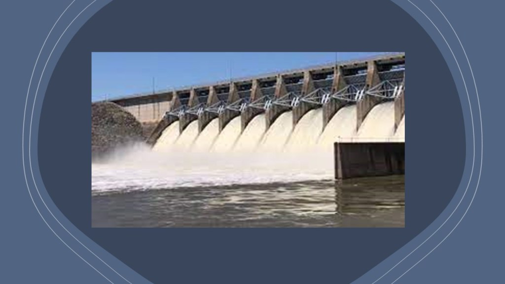
The resulting Lake Eufaula, on the Canadian River, upstream from its confluence with the Arkansas River, is the largest capacity lake in Oklahoma, by volume, surface-area, and shoreline.
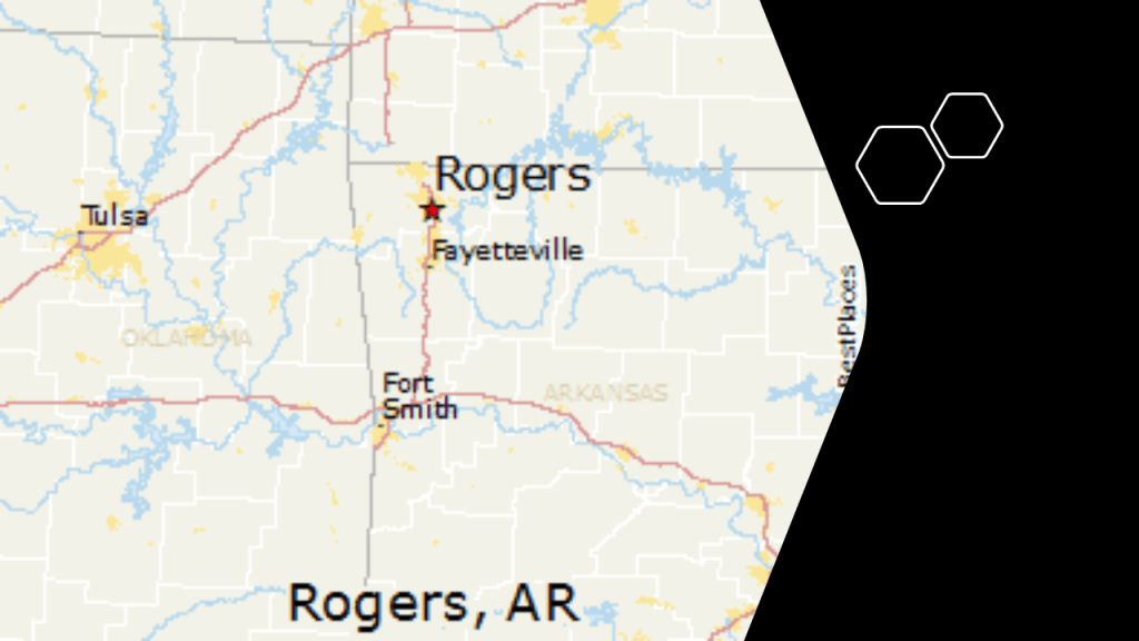
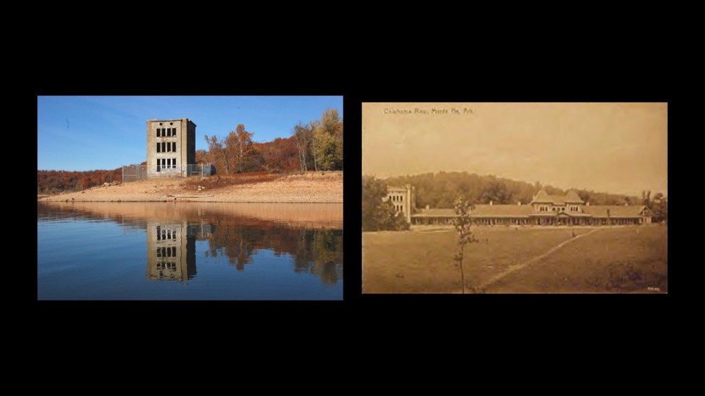
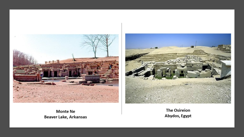
MFJ commented that Beaver lake in Arkansas has a city underneath with a pyramid, and it was called the Arkansas Atlantis.
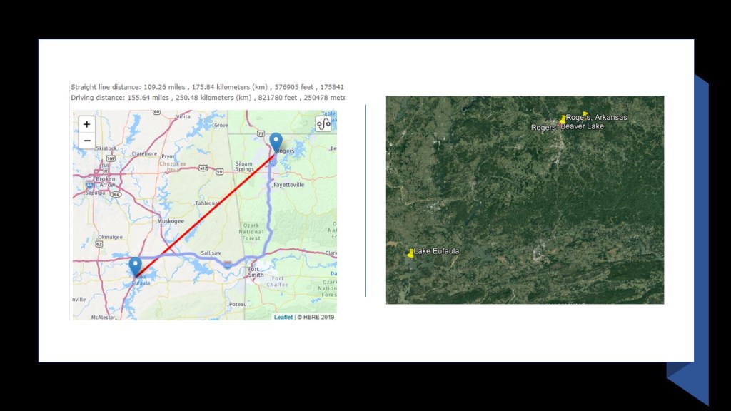
Beaver Lake is near Rogers, Arkansas, in the Ozark Mountains of northwestern Arkansas…
…and Rogers, Arkansas, is a straight-line distance of only 109-miles, or 176-kilometers, from the city of Eufaula at Lake Eufaula.
MFJ said the name of the city is Monte Ne, and when the lake gets low you can see a magnificent city under the water, but said there is a crazy backstory behind it.
The story behind it goes something like this.
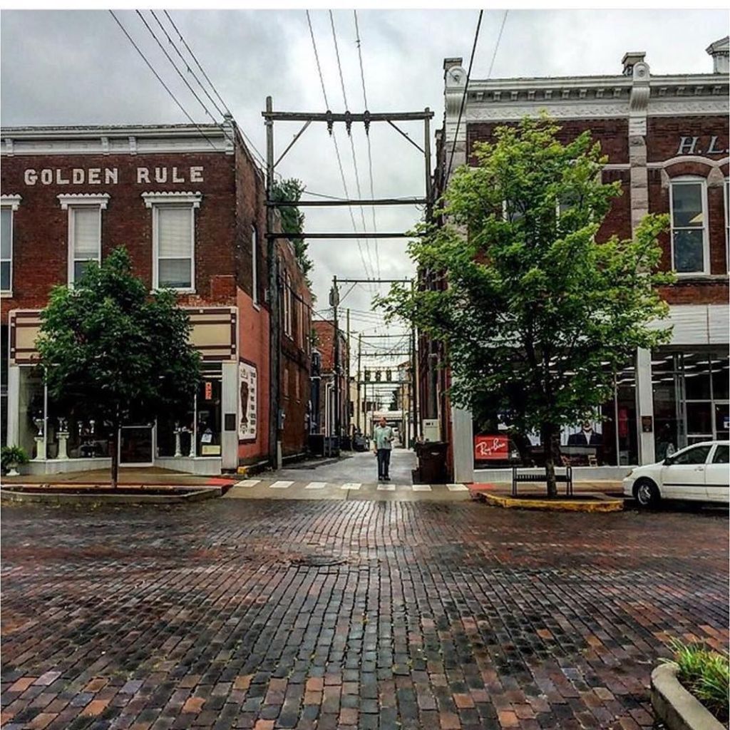
William Hope Harvey, also known as “Coin” Harvey, arrived in Rogers in 1900…

…and opened his office in what is called the “Golden Rule” Building.
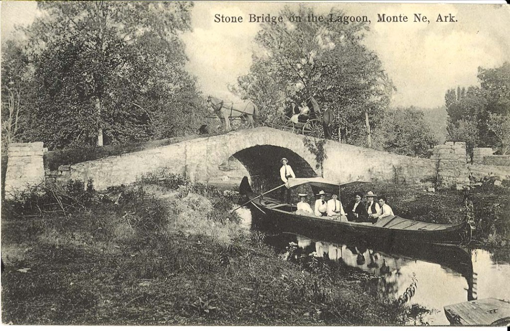
He bought 320-acres, or 129-hectares, of land in a lush valley southeast of Rogers, and dammed the creek on his property to create a small lake for his resort, around which he was said to have built between 1900 and 1920 three large hotels, a bank, stores, post office, and the first heated swimming pool in Arkansas.
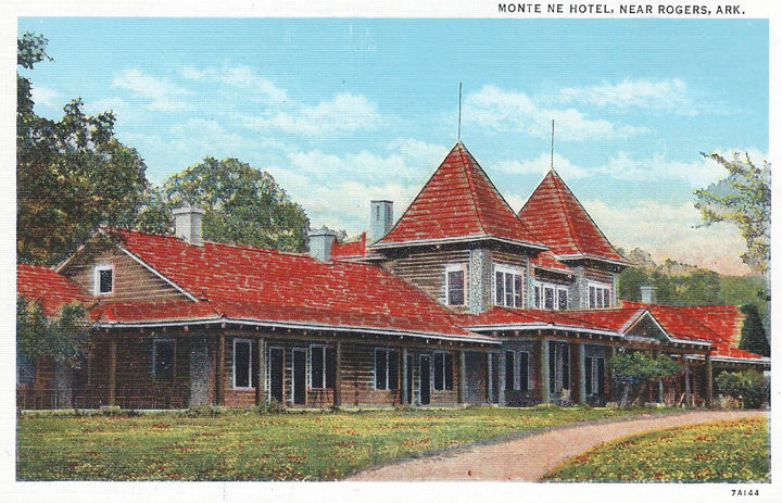
Two of his hotels, “Missouri Row” and “Oklahoma Row,” were said to be the largest log-buildings in the world.
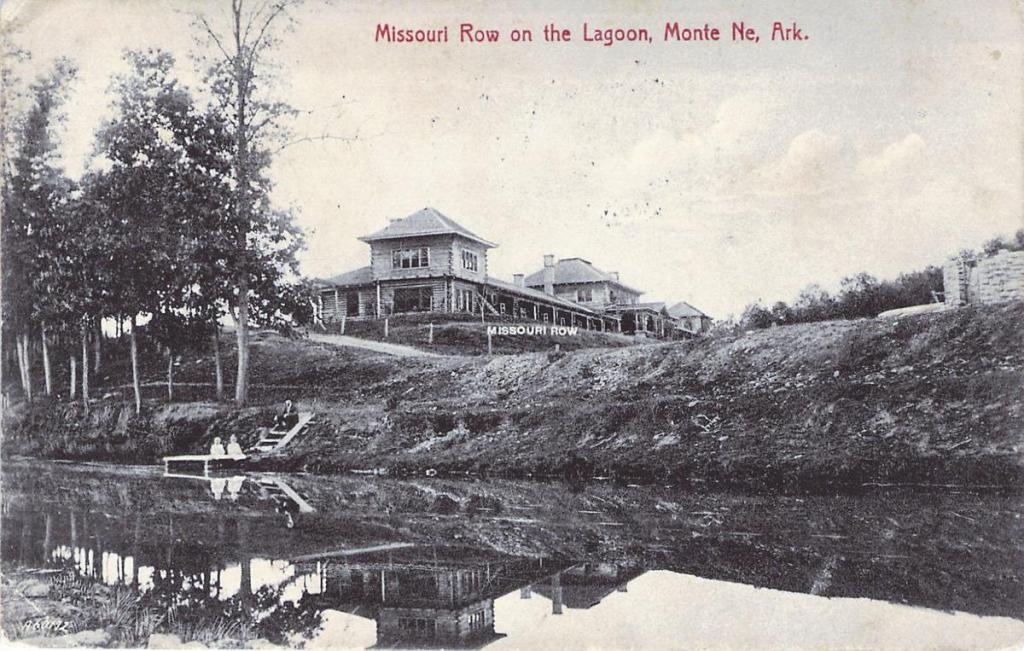
There was a railroad spur leading to the resort, and a 50-foot gondola Harvey was said to have imported from Venice to convey passengers visiting the resort.
But, Harvey was a poor money manager, when it came to running the resort, so his ventures were never completed or went bankrupt, and after his death in 1936, the property was sold off in lots.
The remainder of the town and resort was submerged when Beaver Lake was created in 1964, and all that remains today are foundations and one severely vandalized structure.
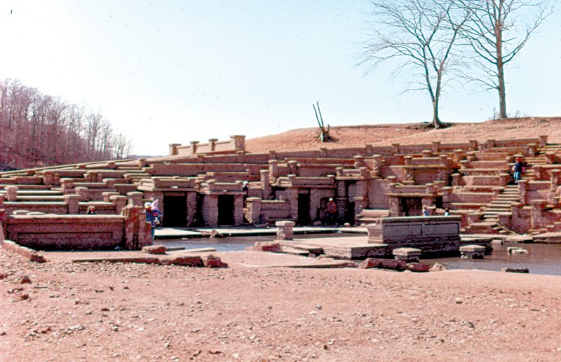
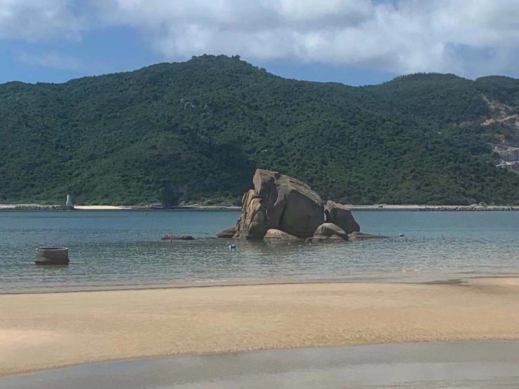
The unsubmerged ruins of Monte Ne reminded me of the Osireion, an ancient temple in Abydos, Egypt, on the right.
Just a few of the other man-made lakes mentioned by viewers:
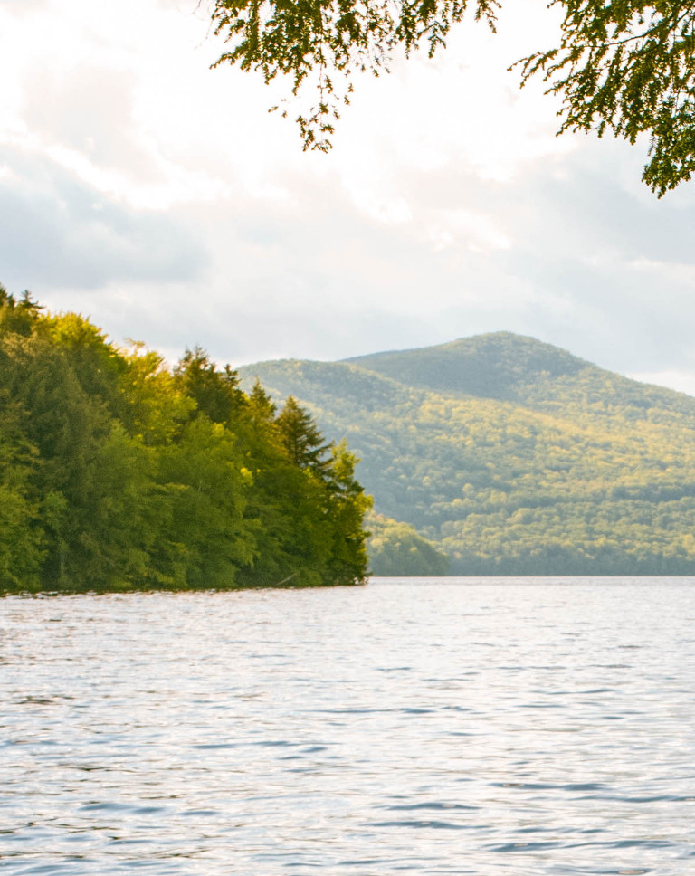
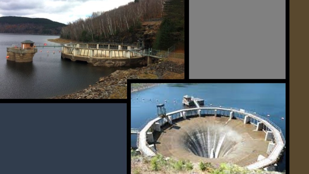
IP suggested checking out the Harriman Reservoir and Lake Whitingham, Vermont’s largest landlocked body of water…
…which was made when they flooded the very large, for the time town, of Mountain Mills…
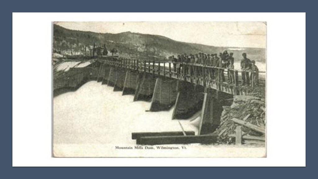
….and the rare glory-hole-style dam there.
Several viewers mentioned Lake Murray in South Carolina…
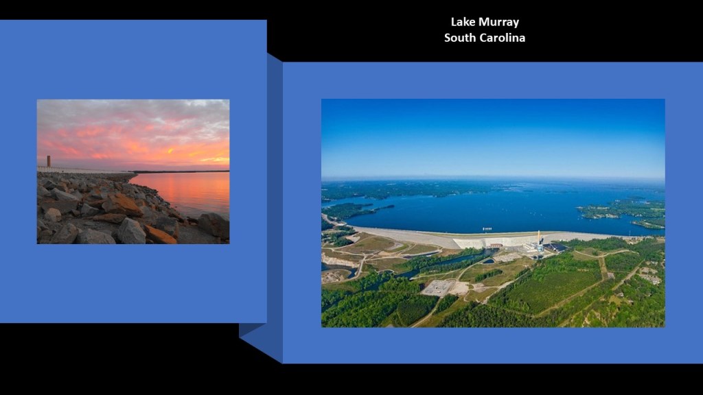
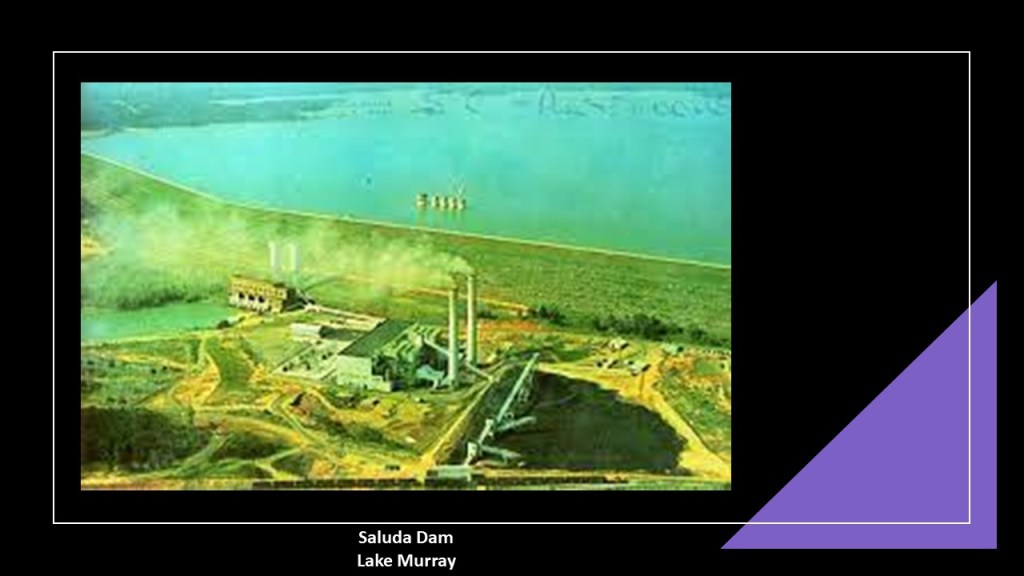
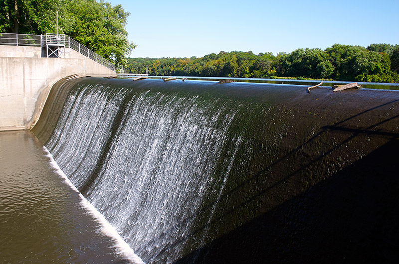
…called the jewel of South Carolina is just west of Columbia, was created in 1930 as a result of the construction of the Saluda Dam, which was at one time the largest earthen dam in the world, and at the time it was finished flooding the region, Lake Murray was the largest man-made lake in the world.
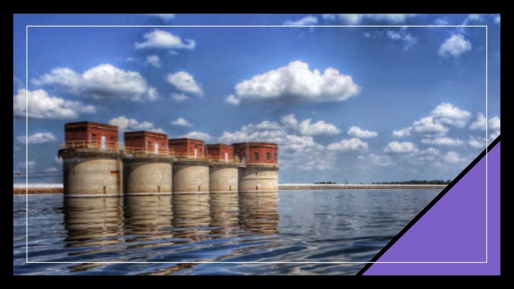
These are the dam’s 5 massive hydroelectric intake towers in the lake.
Other suggestions included Lake Norman outside of Charlotte in North Carolina…
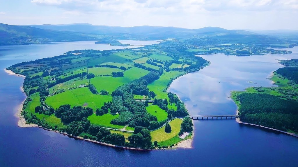
…and Blessington Lakes in the foothills of Ireland’s Wicklow Mountains.
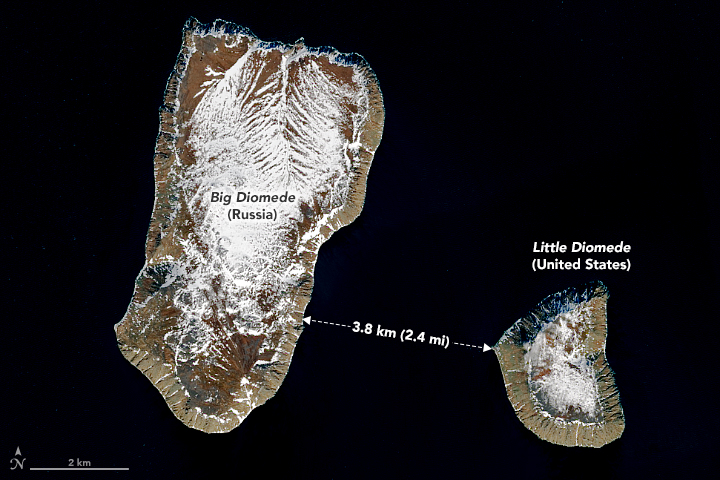
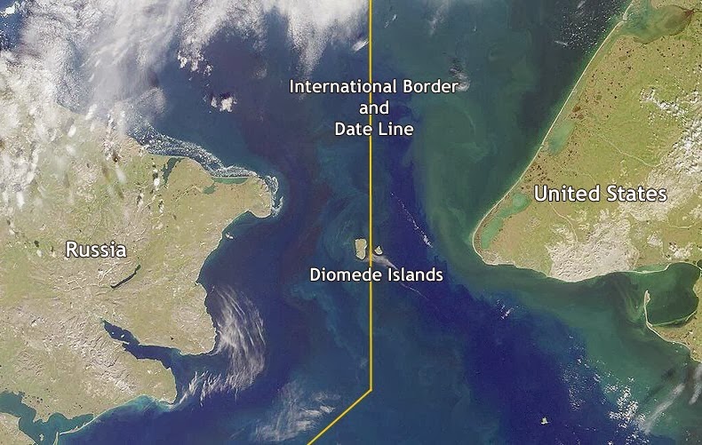
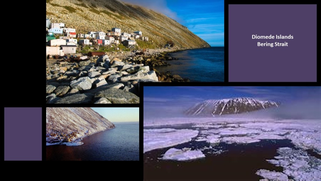
Next, HH suggested looking at the time anomaly between Big Diomede and Little Diomede Islands, which are a pair of rocky islands located in the middle of the Bering Strait between Siberia and mainland Alaska…
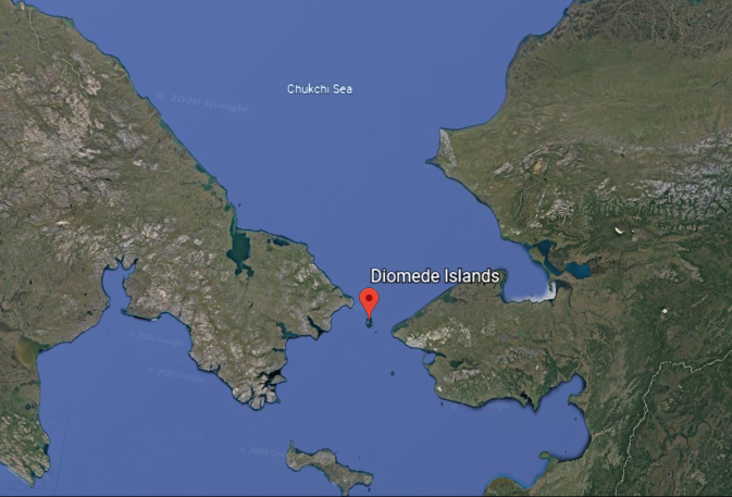
…and are only 2.4-miles, or 3.8-kilometers, apart from each other.
The international date line travels through that distance between them.
In spite of their proximity to each other, they are separated by the International Date Line, and Big Diomede is almost a day ahead of Little Diomede.
Also, these two islands are described as rocky, mesa-like islands, and have sheer, steep slopes, and block-shaped rocks on the shoreline.
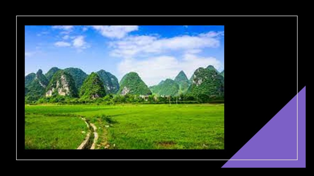
JZ who lives in China requested that I look up Guilin City and Yangshuo County in the Guangxi Province, and he emailed me numerous pictures of the region.
He said the earthworks here are everything I talk about, and the mountains look like pyramids.
Notice how they rise from an otherwise perfectly flat landscape!
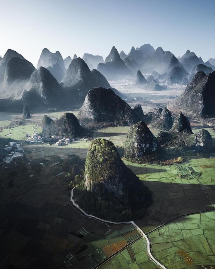
They are called the Karst Mountains in Guangxi Province, and are said to have been naturally formed by receding water from hundreds of millions of years ago.
With what are described as sheer limestone surfaces, the what are called mountains of this region are China’s top spot for climbing.
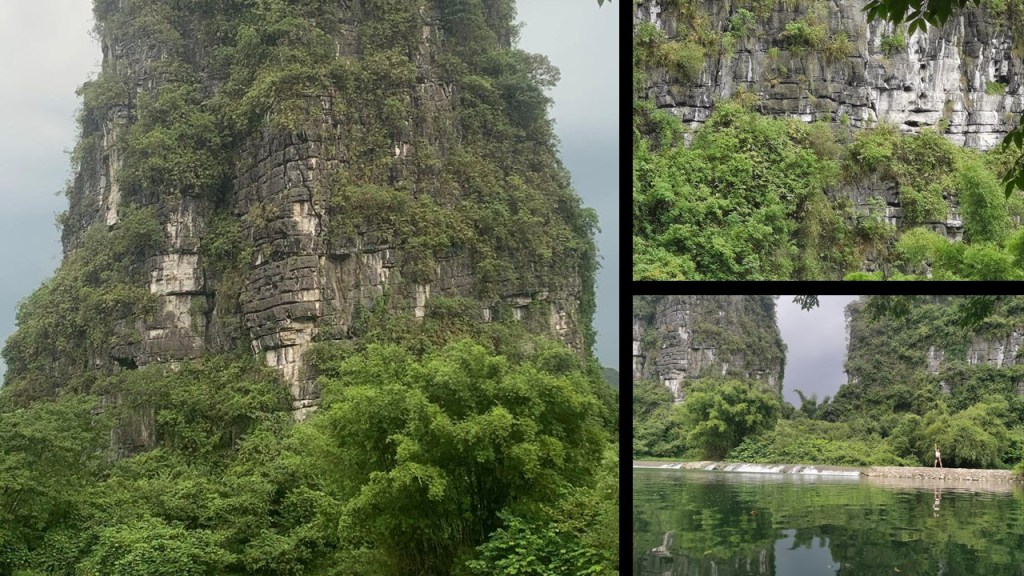
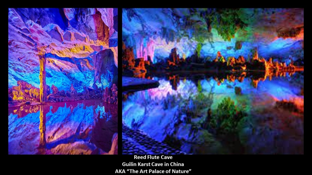
This same region in South China is also known for its karst caves, like the “Flute-Reed Cave,” also known as the “Art Palace of Nature.”
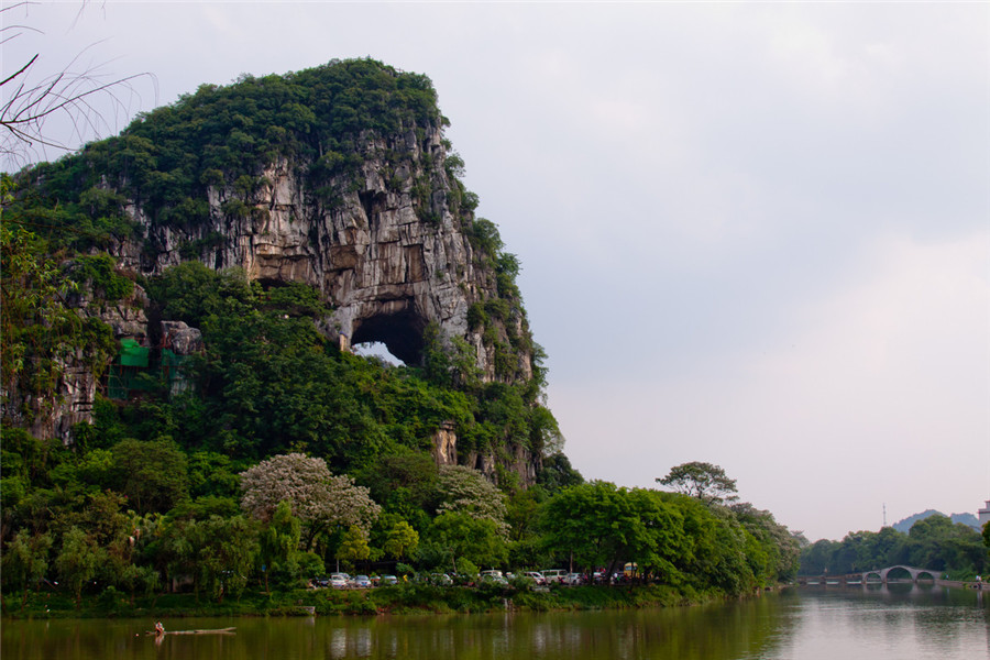
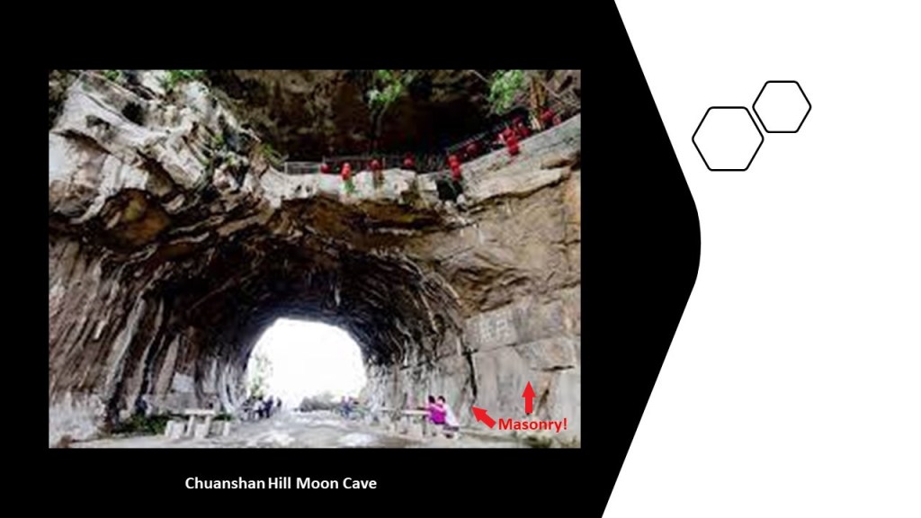
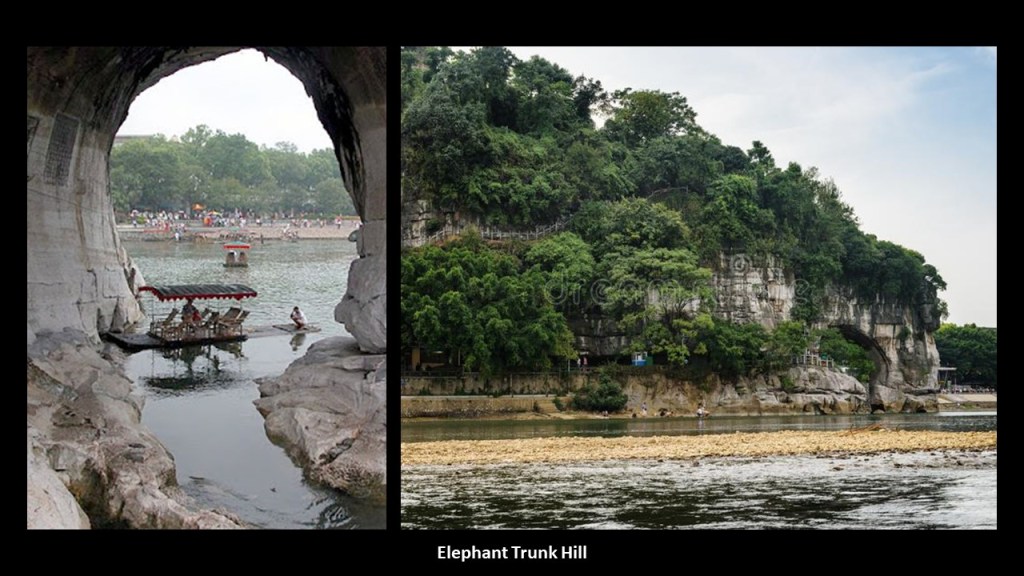
This is Chuanshan Hill in Chuanshan Park in the southern part of Guilin City, with what is called the hill’s “Moon Cave” showing prominently.
This is a close-up photo of the “Moon Cave” in Chuanshan Hill in the park, also known as “Tunnel Hill.”
Here is a view of Pagoda Hill next to Chuanshan Hill, with the Li River, with its masonry bank, in the foreground…
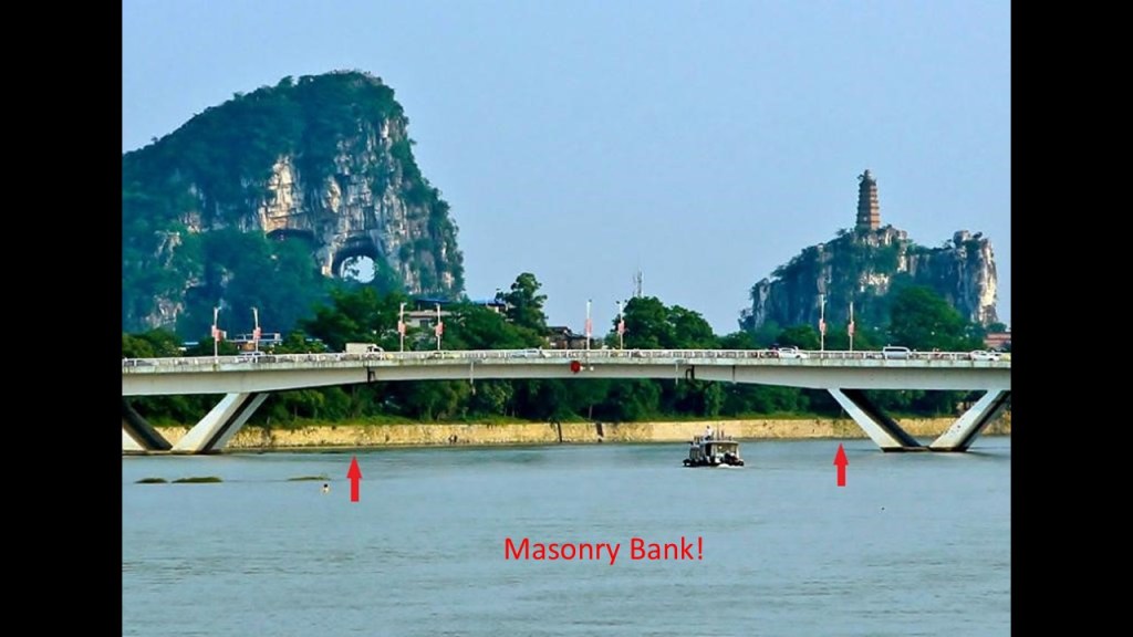
…and Chuanshan Hill is right across the Li River from the archway at what is called the “Elephant Trunk” Hill.
It’s important to note that other archways like these can be found in places as diverse as on the Mexican Revillagigedo Islands, located between the Hawaiian Islands and Mexico, like the arch at Cabo Pearce…
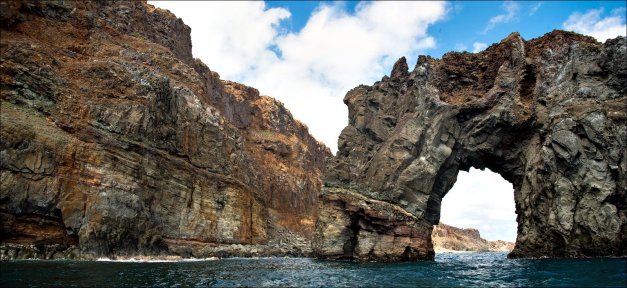
…and the Grand Arch on the Isla Socorro…
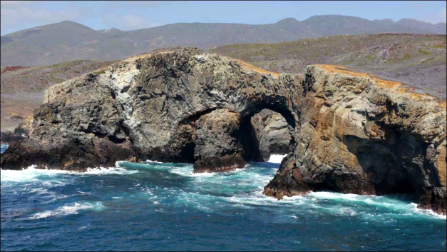
…on the Hollow Rock Beach on Minnesota’s Grand Portage Island…

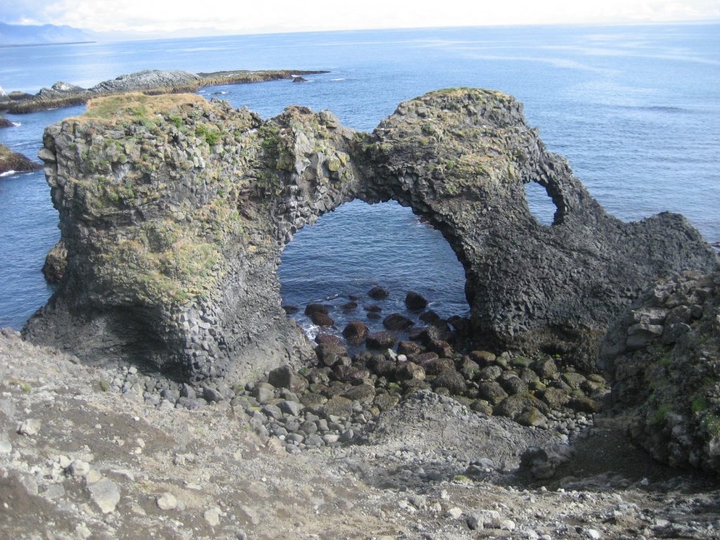
…and Arch Rock at Arnarstapi in Iceland.
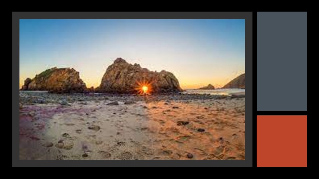
And some of these so-called natural arches are well-known to have things like winter solstice alignments, like Keyhole Rock at Pfeiffer Beach in California…
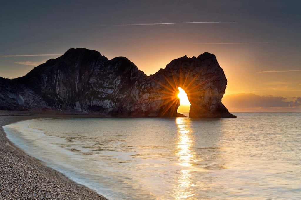
…and the Durdle Door in Lulworth, England.
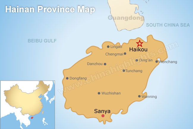
JZ also sent me pictures from Sanya City, which is located on Hainan Island in South China.
Sanya is the southernmost city on the island of Hainan.
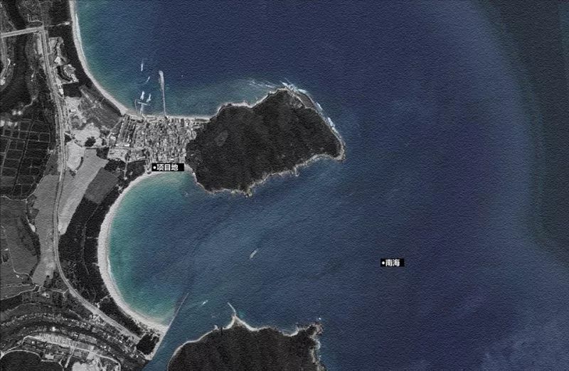
JZ said this double-bay is called Haitangwan.
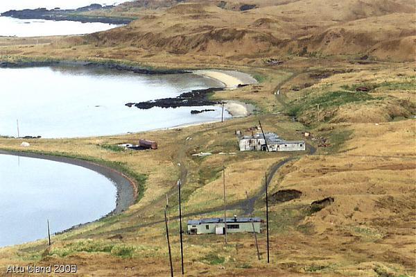
What I find is interesting is that I have found examples of double-bays like that in many places, like Casco Cove on Attu Island, the former site of a U. S. Coast Guard Station at the end of the Aleutian Island chain, so far west, it is in the eastern hemisphere, and the westernmost point of land relative to Alaska…
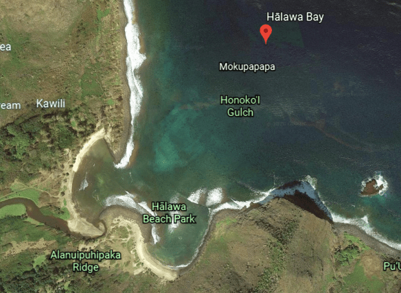
…Halawa Bay on the Hawaiian Island of Molokai…
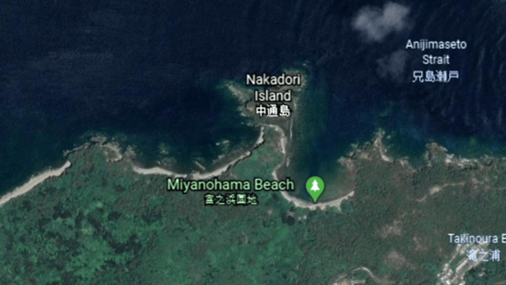
…and the double-bay at Miyanohama Beach on the Japanese Bonin (also known as Ogasawara) Island of Chichijimi.
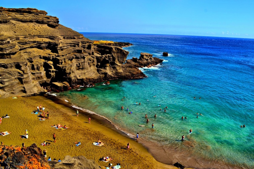
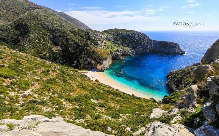
Not only that, I have found single-beaches that have the same appearance all over the world, like Green Sand Beach, on the big island of Hawaii…
…Vaja Beach in Korcula, Croatia…
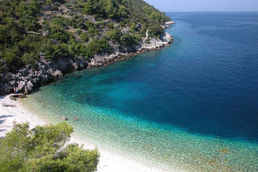
…Myrtos Beach in Kefalonia, Greece…
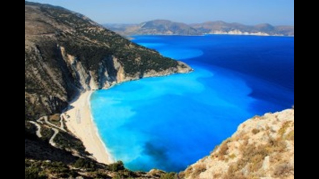
…and Grama Bay in Albania.
JZ said this is a picture of a mine on the left at another bay in the Sanya City called Huanghouwan.
He asked several locals and they all said that it is a natural structure, but he said to just look at it, and it is compared with the Boddington Gold Mine in Western Australia on the right.
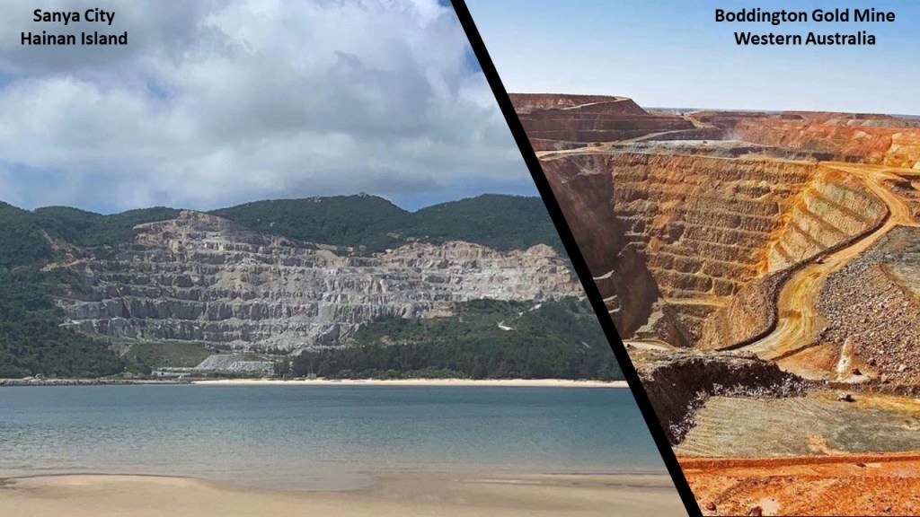
He also said there are huge rocks everywhere at Huanghouwan.
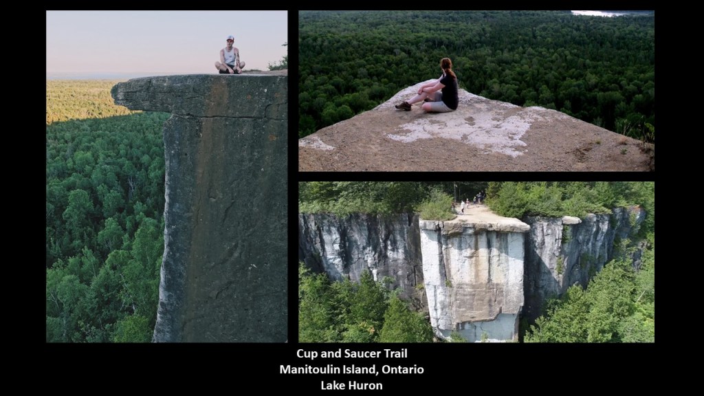
Another viewer, RK, mentioned Manitoulin Island, which is part of the Niagara Escarpment.
The Niagara Escarpment runs predominantly east-to-west, from New York, through Ontario, Michigan, Illinois, and Wisconsin, with a nice, half-circle shape, attached to a straight-line, when drawn on a map.
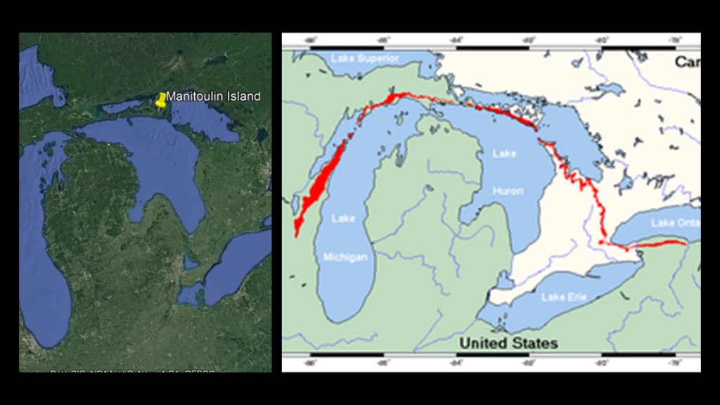
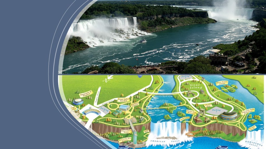
It gets its name and its fame from being the cliff where the Niagara River takes its plunge at the Niagara Falls in New York and Ontario.
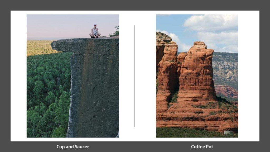
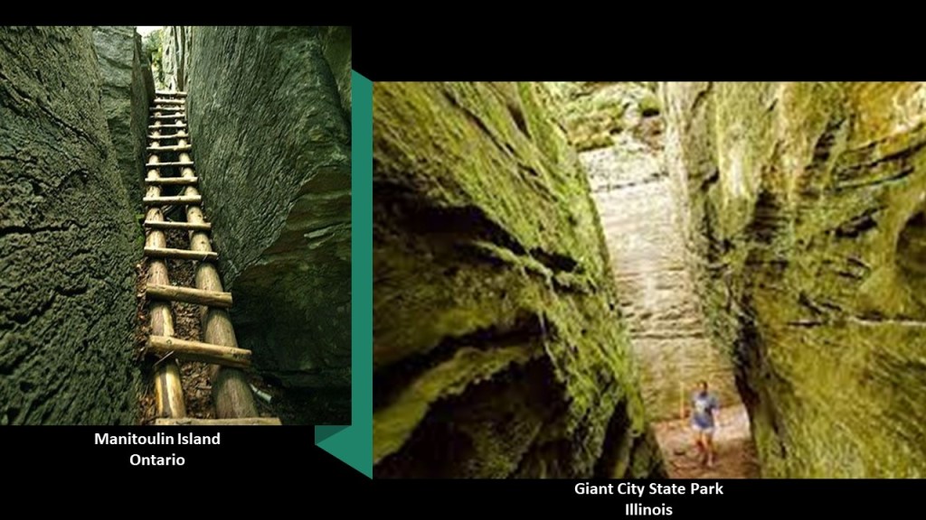
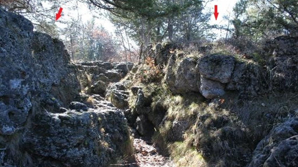
RK specifically mentioned the highest-point on the island, which is called the “Cup and Saucer,” and accessed by the trail of the same name.
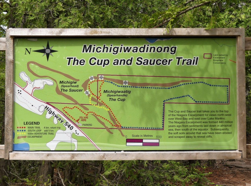
Here are some views of the flat surfaces, straight-edges, and right-angles of what we are told are natural rock formations.
It reminded me of what is called Coffee Pot Rock in Sedona on the right, a great view of which I had out my bedroom window for two-years (I have recently moved).
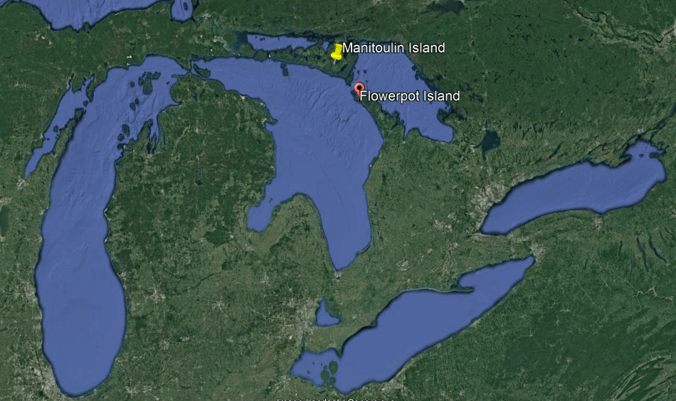
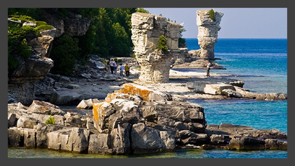
Come to think of it, a place known as “Flower Pot Island” in Ontario’s Five Fathom National Park in Lake Huron’s Georgian Bay, happens to be located right next to Manitoulin Island on the Niagara Escarpment.
It is so-named because of the two rock-pillars on its eastern shore, described as a type of “sea stack,” formed over many years of “wind, rain, waves, and ice hammering away at the cliff that was once at the water’s edge.”
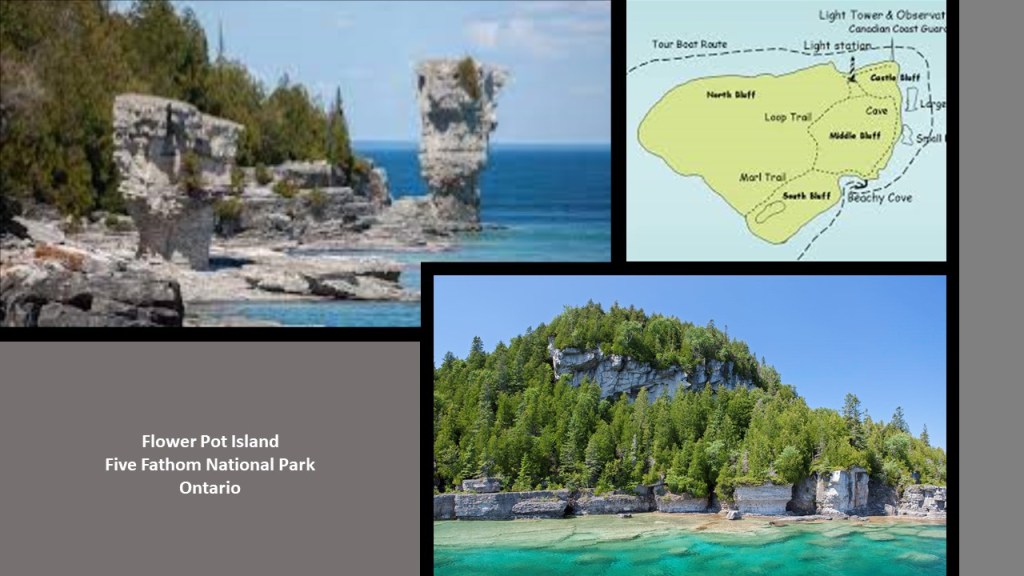
A third flower pot was said to have been here until 1903, at which time it tumbled.
Here is a photo of the trail to Manitoulin Island’s Cup and Saucer formations on the left, at a place which looks like Giant City State Park in Makanda, also known as the “Star of Egypt,” in Southern Illinois, on the right.
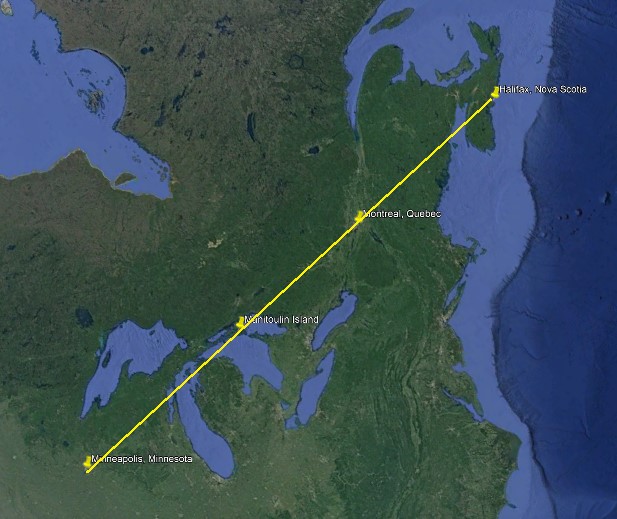
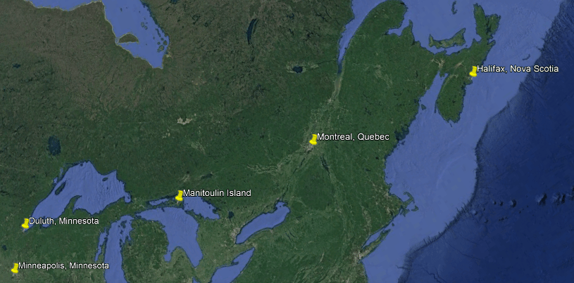
RK also mentioned that a leyline goes right through Manitoulin Island to Montreal.
Let’s see we can find in that department on Google Earth.
On a quick search, these four places appear to line-up with each other – Minneapolis, Minnesota; Manitoulin Island, Ontario; Montreal, Quebec; and Halifax, Nova Scotia.
Viewer JT suggested that I look into Duluth, Minnesota on Lake Superior, and this is a good place to begin.
He suggested starting at the history of the Merritt Brothers and the railroad, so I will.
The Merritt family came to the Minnesota Territory in 1855 and 1856 from Pennsylvania after the 1854 Treaty of LaPointe was signed in Wisconsin between the U. S. Government and representatives of the Ojibwe of Lake Superior and the Mississippi.
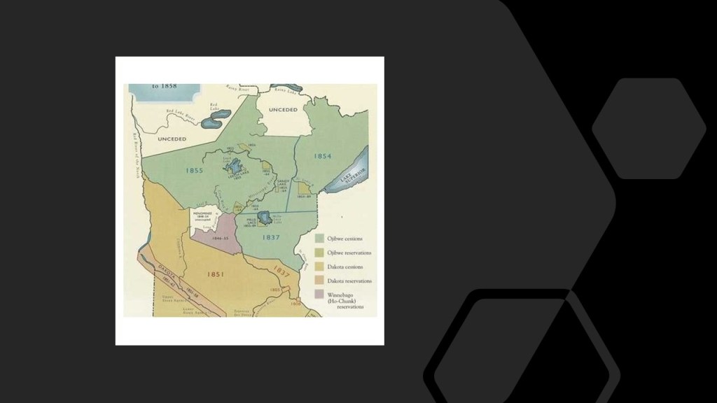
As a result of this treaty, the Ojibwe ceded all of the Lake Superior Ojibwe lands in the Arrowhead Region of Northeastern Minnesota to the United States in exchange for reservations for the Lake Superior Ojibwe in Wisconsin, Michigan, and Minnesota.
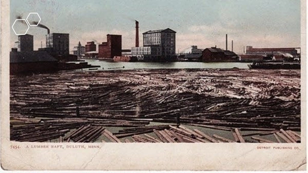
The Merritt family settled in Oneota, which is now West Duluth, where they ran a hotel, and the father, Lewis, worked as a lumberman and millwright.
Lewis also prospected for gold in what was called the Vermilion Lake Gold Rush of 1865 to 1866 in the Mesabi Mountain Ranges because gold specks were found in quartz stone there in 1865.
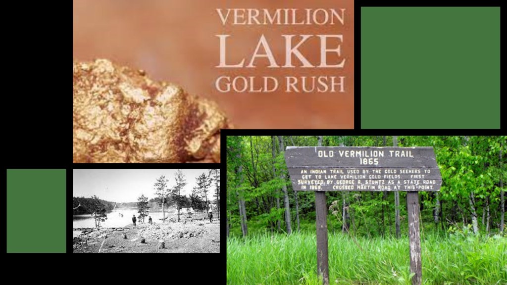
Like the other prospectors, he couldn’t find any gold, but someone gave him a piece of iron ore that caused him to speculate there was more of the that to be found in northern Minnesota.

There are four iron ranges around Lake Superior in Minnesota and Ontario: the Vermilion; the Mesabi; the Gunflint; and the Cuyuna.
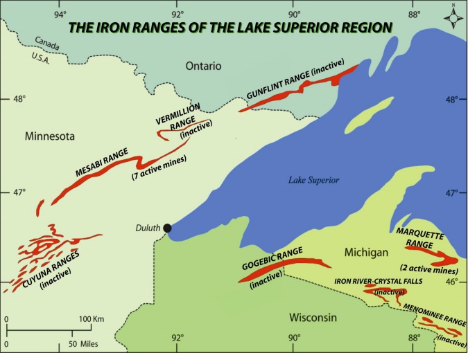
They are classified as not mountains, but outcrops of sedimentary formations containing high-percentages of iron from the Precambrian-geologic era, which was four-to-six-billion-years ago to 541-million-years ago.

Lewis Merritt and his wife Hepziabeth had eight sons.
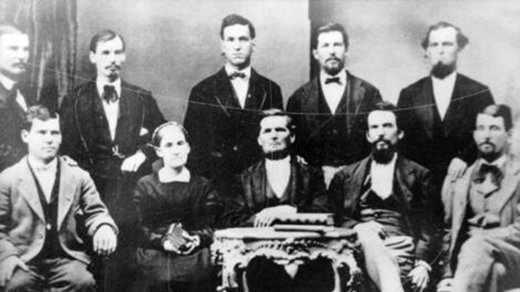
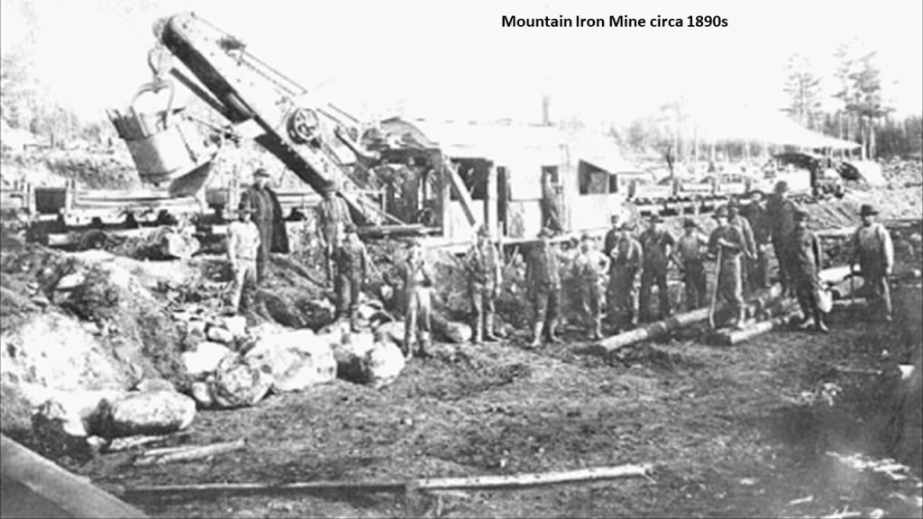
One of their sons, Leonidas, purchased land in the Mesabi Range in northern Minnesota after he surveyed and mapped the surrounding area for iron ore, and opened the Mountain Iron Mine in the early 1890s, which became the largest iron ore deposit ever discovered.
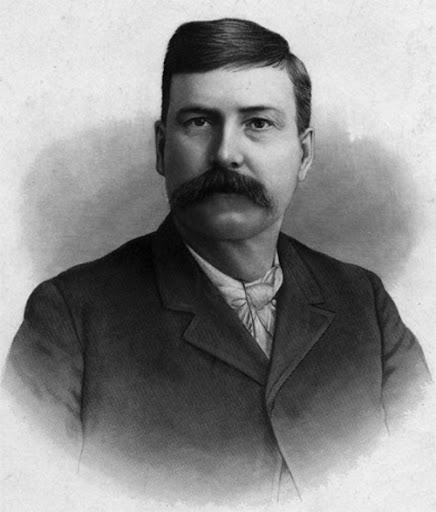
He was joined by 6 of his brothers, and what became known as the “Seven Iron Brothers” owned the largest iron mine in the world in the 1890s.
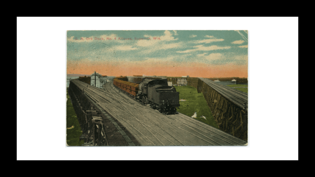
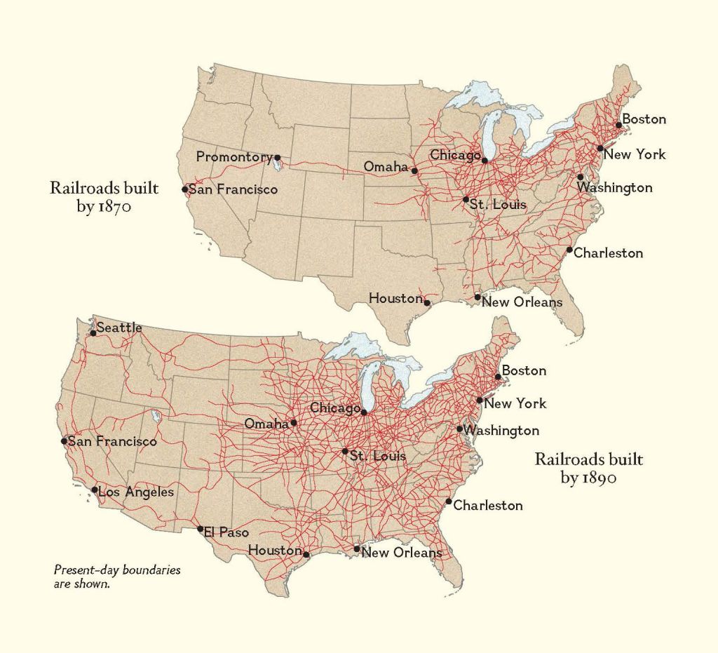
In 1891, the Merritt family incorporated the Duluth, Missabe, and Northern Railway Company to build a 70-mile, or 113-kilometer-long, railroad from the mine to the port at Superior, Wisconsin, which was south of Duluth, raising the money needed in exchange for bonds from the railroad company.
Their success attracted the attention of John D. Rockefeller, who wanted to expand into the iron ore business, and the Merritts put their company stock up as collateral to borrow money from Rockefeller in order to fund the railroad.
Long story short, the Merritts ended up being financially ruined, and Rockefeller came to own both the mine and the railroad.
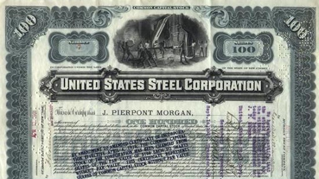
After Rockefeller assumed ownership in 1894, he leased his iron ore properties and the railroad to the Carnegie Steel Company in 1896.

John D. Rockefeller sold the railway to United States Steel in 1901, after it had been formed by the merger of the merger of Andrew Carnegie’s Carnegie Steel Company, Elbert Gary’s Federal Steel Company, and William Henry Moore’s National Steel Company in 1901, which was financed by J. P. Morgan.
Other places that JT suggested looking at in Duluth are the Enger Tower, which is a 80-foot, or 24-meter stone observation tower that has 5-stories, and was built on Enger Hill.
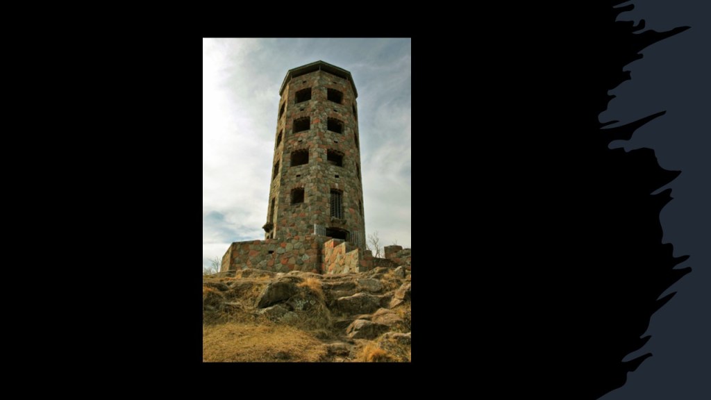
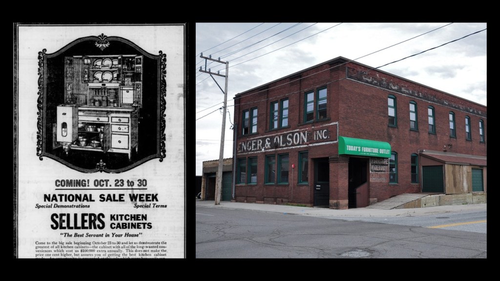
The tower was said to have been constructed as a tribute to businessman and philanthropist Bert Enger, a Norwegian-immigrant who came to Duluth in 1903 and set-up a furniture store with his business partner Emil Olson, which turned into a prosperous business over the years.
Enger donated a sizeable amount of his estate to the city of Duluth, which included Enger Hill, Enger Park, and Enger Golf Course.
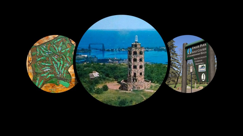
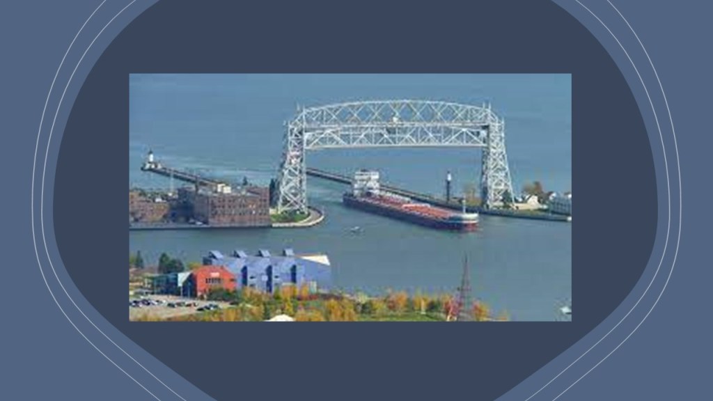
There is a panoramic view from Enger Tower and Enger Hill of the Twin Ports of Duluth and Lake Superior, including great view of the Duluth Aerial Lift Bridge.
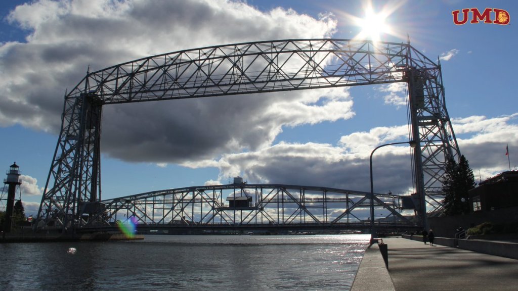
A movable, lift-bridge, it spans the Duluth Ship Canal and Minnesota Point, and said to have been constructed between 1901 and 1905, and modified in 1929.
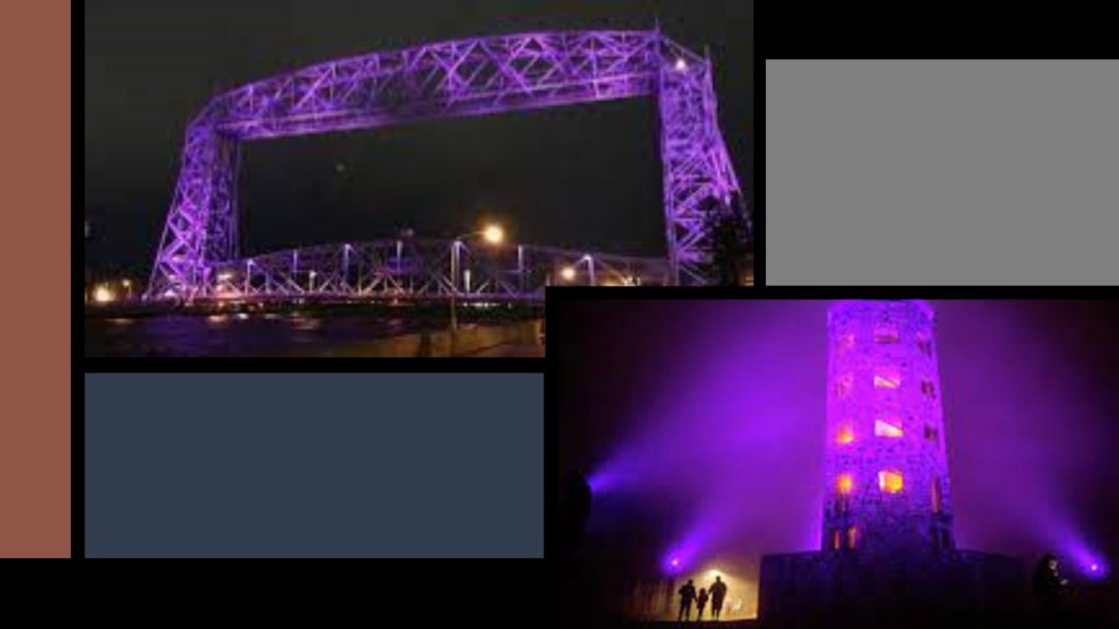
Both the Aerial Lift Bridge and Enger Tower are lit up at night, with different colors for different occasions and causes.
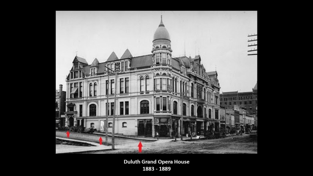
JT also mentioned the Kitchee Gammi Club.
It is the oldest incorporated club in Minnesota, having been founded in 1883, and originally met at Duluth’s Grand Opera House, which was said to have only stood for six years, from 1883 to 1889 – at which time a mysterious fire that began at Grasser’s Grocery store, got out of control and by the time it was put out, the Grand Opera House was in ruins.
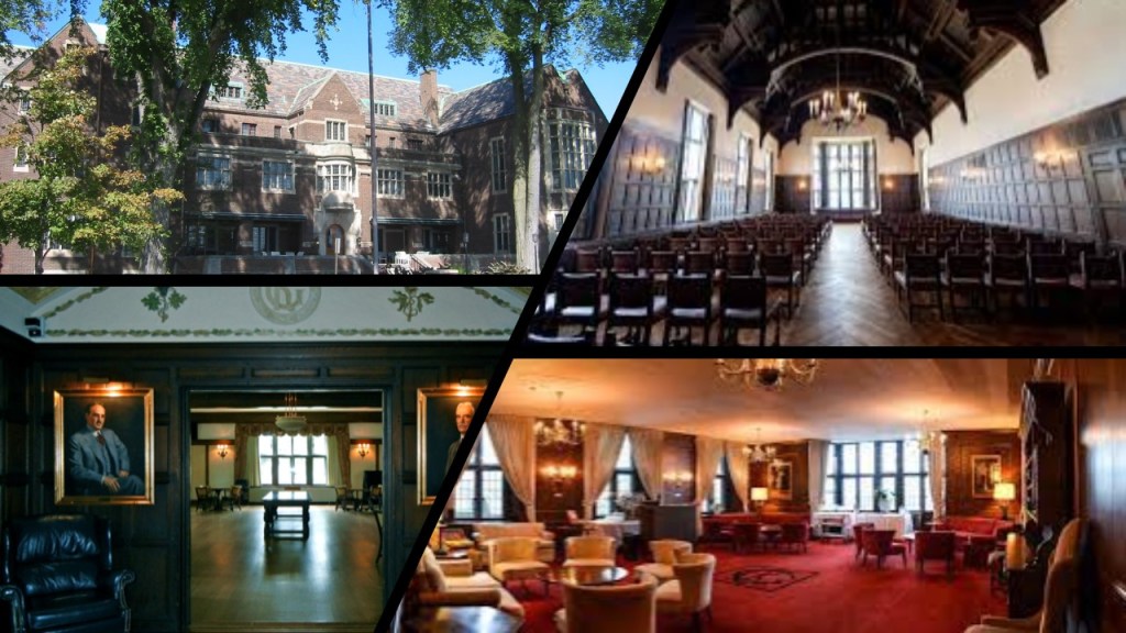
The current Kitchee Gammi Club building was said to have been designed by prominent New Yorkarchitect Bertram Goodhue, and built between 1911 and 1913, with a 1914 opening.
The architecture is said to be “Jacobean Revival Style,” for features like bay windows, rectangular windows, triangular gables, and high ceilings, with Jacobean architecture being named after King James I of England and James VI of Scotland whose reign it is associated with.
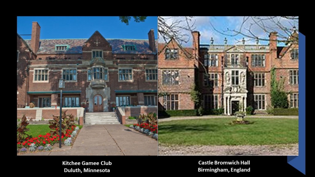
As a matter of fact, here is a comparison between the Kitchee Gammi Club in Duluth on the left, and the Castle Bromwich Hall in Birmingham, England, on the right, said to have been built between 1557 and 1585.
There are two possibilities here – the Kitchee Gammi Club House truly represents a revival of Jacobean Architecture, and was built when it was by who was said to have built it…or its not, and was already built.
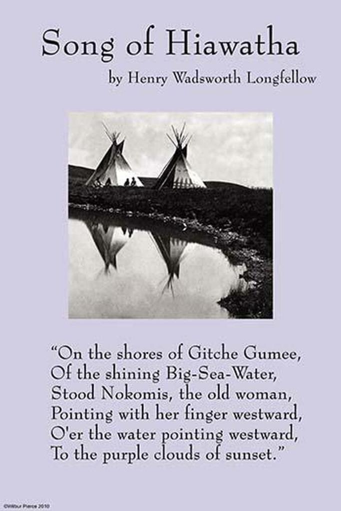
The name of the Kitchee Gammi Club is based on “Gitche Gumee,” the Ojibwe name for Lake Superior, and best known to the general public for being mentioned in the opening verse of in Henry Wadsworth Longfellow’s poem, “The Song of Hiawatha…”
…and it was mentioned in the opening verse of Gordon Lightfoot’s song “The Wreck of the Edmund Fitzgerald.”

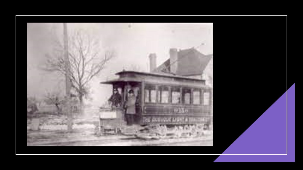
I found this map, circa 1911, of the Duluth Street Railway Company.
I have circled the place where the Aerial Lift Bridge is marked on the map.
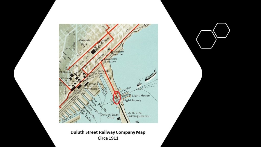
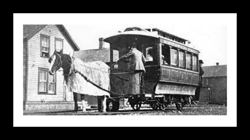
The Duluth Street Railway Company was said to have been incorporated in 1881, and that the first mule-pulled trolley cars were available for service in 1883…
…and that by 1892, the entire line was electrified.
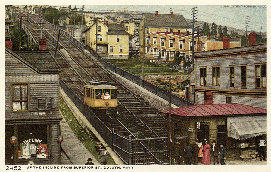
The Highland Park Tramway Line served Duluth Heights via an Incline-Railway from 1892 to 1939, which was the last piece of the electric streetcar system to be dismantled, as the rest started going away in the early 1930s.
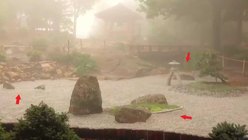
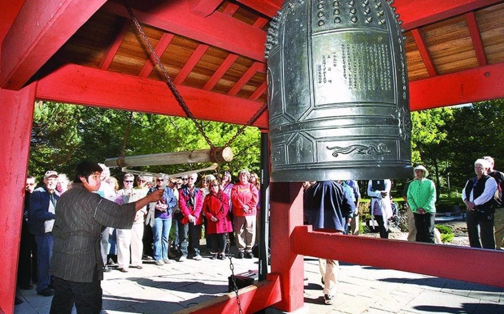
MB, who also lives in Duluth, made a comment about the bell that is found in Duluth’s Enger Park.

Called the Peace Bell, it is located in a Japanese Zen Garden in the park, and is a replica of a temple bell in Duluth’s Sister City of Ohara, Japan.
The story is that the city of Ohara donated the temple bell, which is now the oldest remaining bell in Ohara, to a wartime scrap drive during World War II, but the bell was never destroyed.
After the war, sailors on the USS Duluth found it, and gave it to the city of Duluth, where it was displayed in the City Hall.
A visiting academic from Ohara learned of the bell’s existence, and met with the Mayor of Duluth to ask for the bell’s return, which it was in 1954, and re-named the “Japan-U.S. Friendship Peace Bell.”
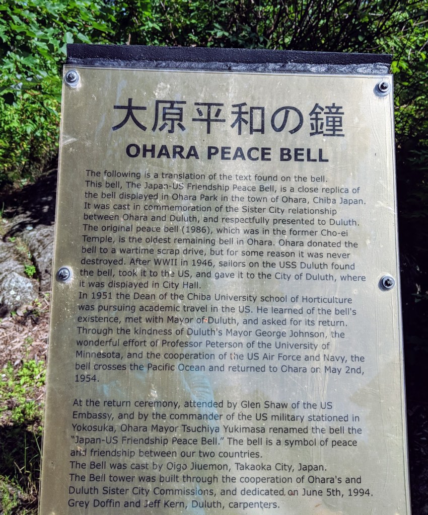
The current bell was dedicated in Duluth’s Enger Park in 1994, in the Japanese Peace Bell Garden.
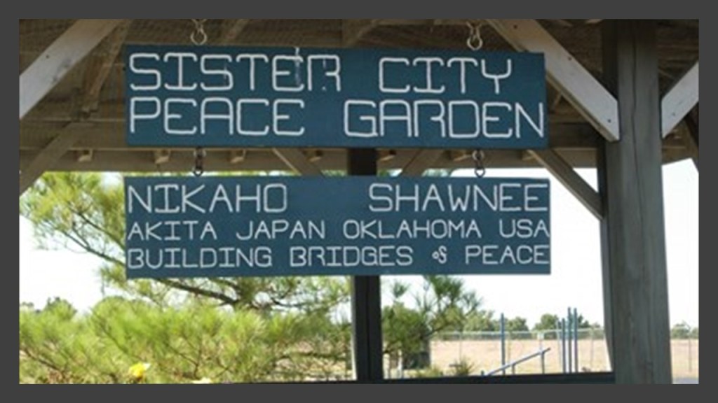
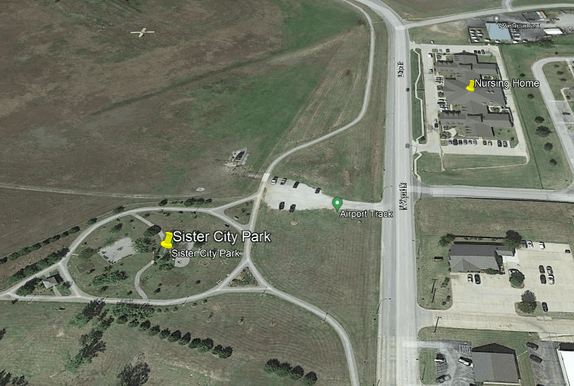
Now, I find the subject of Japanese Peace and Friendship Sister City Gardens very interesting, because when I was first waking up to all of this several years ago in Oklahoma City, my brother, his family, and my mother were living in Shawnee, Oklahoma, which happens to have a Sister City relationship with Akita, Japan, and a Peace Garden as well.
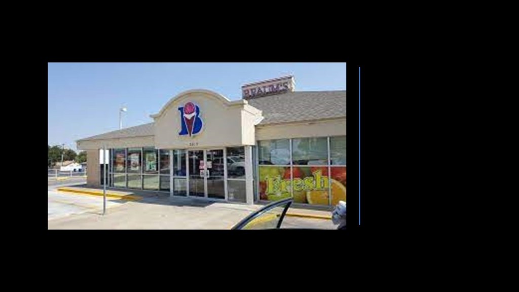
My mom’s significant other was living in the nursing home facility across the street, and I had taken her on this occasion to see him for a visit, and had some time to kill, so I went by a nearby Braum’s to grab a cheeseburger, fries, and chocolate milkshake, and if you have ever lived in Oklahoma, you’ll know what that’s about…
…and went to the Peace Garden to sit and eat my Braum’s lunch while I was waiting for mom.
While I was sitting there eating, I started noticing that there were big stone blocks in the Peace Garden.
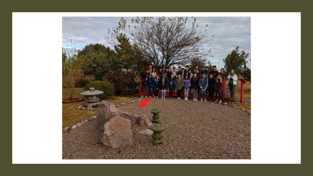
Either before I finished eating, or right after, I don’t remember which, I got up from where I was sitting and starting walking around the garden grounds.
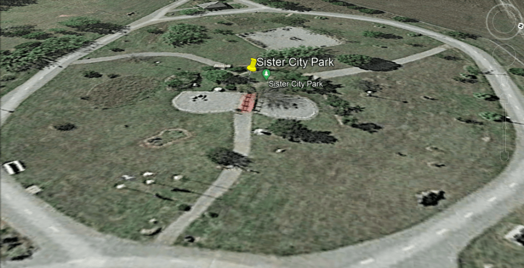
And you can’t really tell clearly from this Google Earth Screen shot, but there are big stones situated at different places within the circle formed by the road going around it, and there are also large stones hidden away in the trees with no attention whatsoever drawn to them. You only see them if you happen to be looking there.
I am quite sure that the Sister City Peace Garden in Shawnee provides the cover for what was a stone circle.
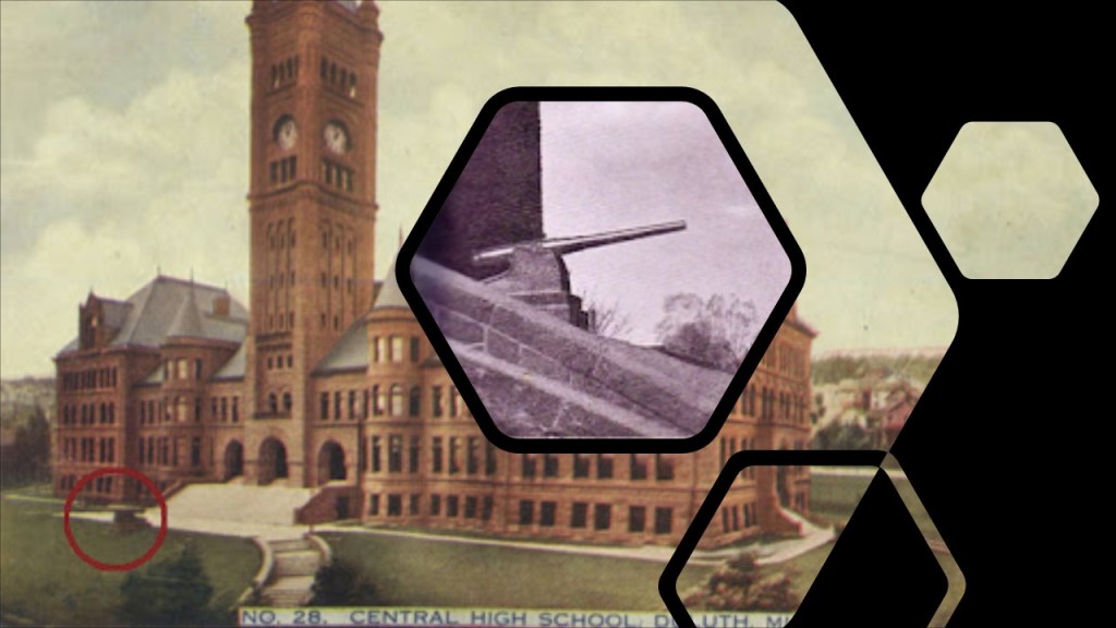
Back in Duluth, SG shared that the Old Duluth Central High School was super shady, saying that no way was that built for high schoolers!
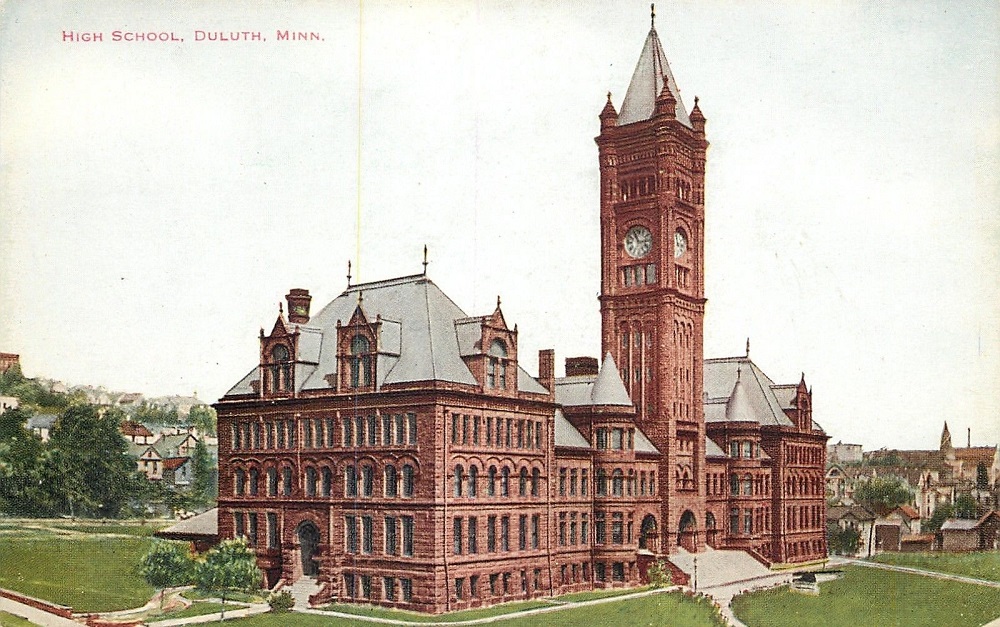
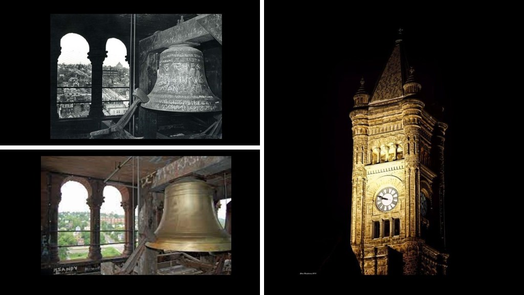
Said to have been built starting in 1891 and opening for classes in 1892, the Old Central High School, nowadays used as school district office space, occupies a city block…
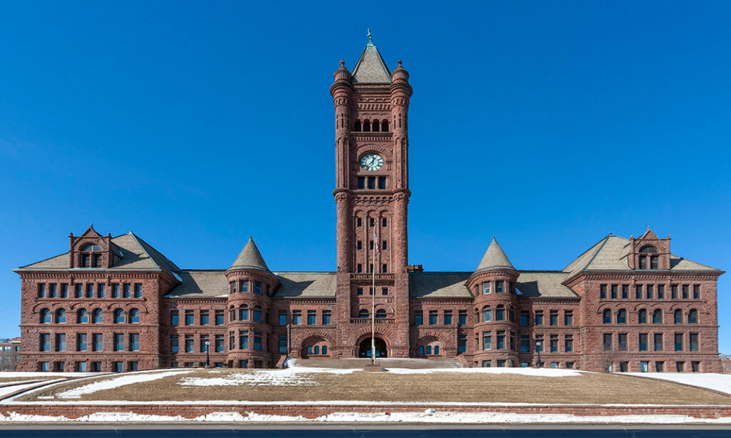
…and has a clock tower that is 210-feet, or 64-meters, high, that had five-bells added to the clock in 1895.
There was even a 17-foot, 6-ton cannon on the steps of the Old Central High School from 1898 to 1942, said to have been captured from a Spanish warship during the Spanish-American War, and requested by the Duluth City Council for Duluth, who had to pay for the transportation costs to get it to Duluth.
We are told the cannon was either sold or donated as scrap-iron, and was melted down and used during World War II.
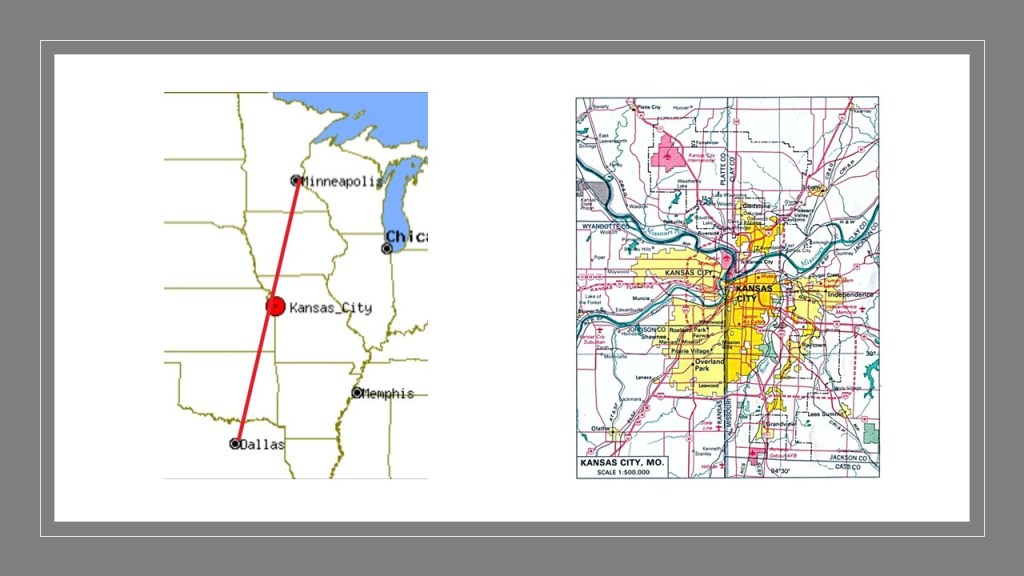
I had two viewers comment on places to look at in Kansas City, Missouri, which is located almost exactly mid-way between Minneapolis, Minnesota, which is 412-miles, or 662-kilometers northeast of Kansas City, and Dallas, Texas, which is 454-miles, or 731-kilometers, southwest of Kansas City, keeping in mind that Kansas City is split between the states of Kansas and Missouri.
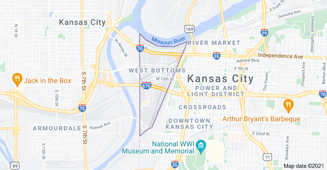
HW said that Kansas City in Missouri has an area called West Bottoms, that is always hit harder when it floods in Kansas City than other parts of the city.
And no wonder, considering that West Bottoms is located on land that is situated between the confluence of the Missouri and Kansas Rivers, and was also the original Central Industrial District of Kansas City, and is one of the oldest areas of the city.
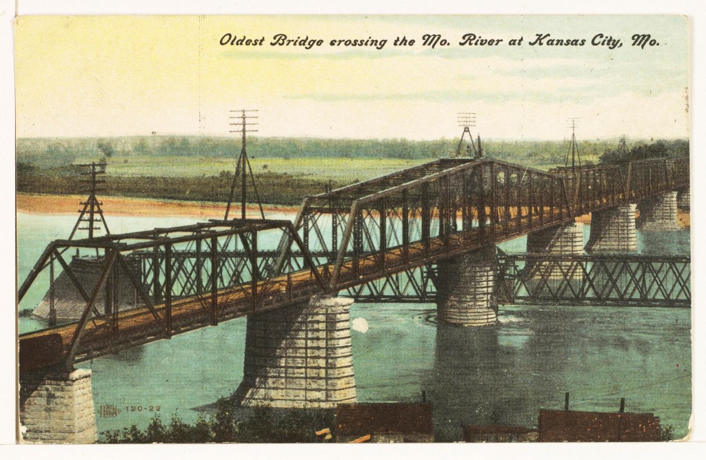
The first Hannibal Bridge, the oldest bridge crossing the Missouri River, was said to have been completed in 1869, after its construction started in 1867, two-years after the end of the American Civil War, and was the first permanent rail crossing of the Missouri River.
It established Kansas City as a major city and rail center.
After the completion of the Hannibal Bridge, we are told the need for the Kansas City Union Depot arose.
After all, soon after the Hannibal Bridge opened, it carried eight railroads shipping freight to major trade centers in the east, like St. Louis, Chicago, and New York.
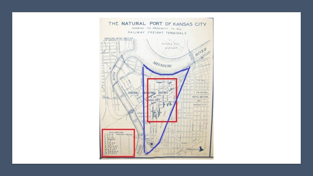
This is a historical map of what was called the “Natural Port of Kansas City,” with the West Bottoms District highlighted in blue, and the freight houses of 12 different railroads are listed by number in the red square on the left-hand-side, and the locations by number of each freight house in the red square that is contained completely within the West Bottoms District.
The first Kansas City Union Depot opened in 1878, andsaid to be the largest building west of New York of the time, and located near the stockyards.
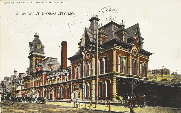
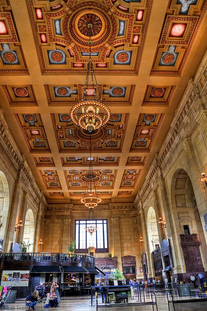
The first Union Depot train station was razed to the ground in 1915, after only 32-years of use, after the Kansas City’s second main train station, Union Station opened in 1914, the same year that World War I began.
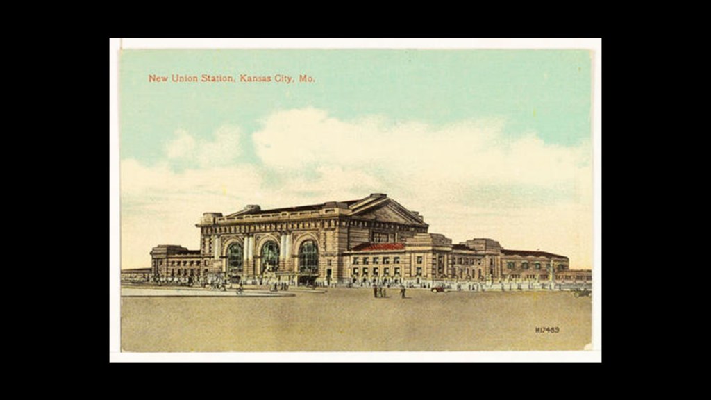
The New Union Station is still in use by Amtrak as a train station today, in addition to housing museums, theaters, and restaurants and shops.
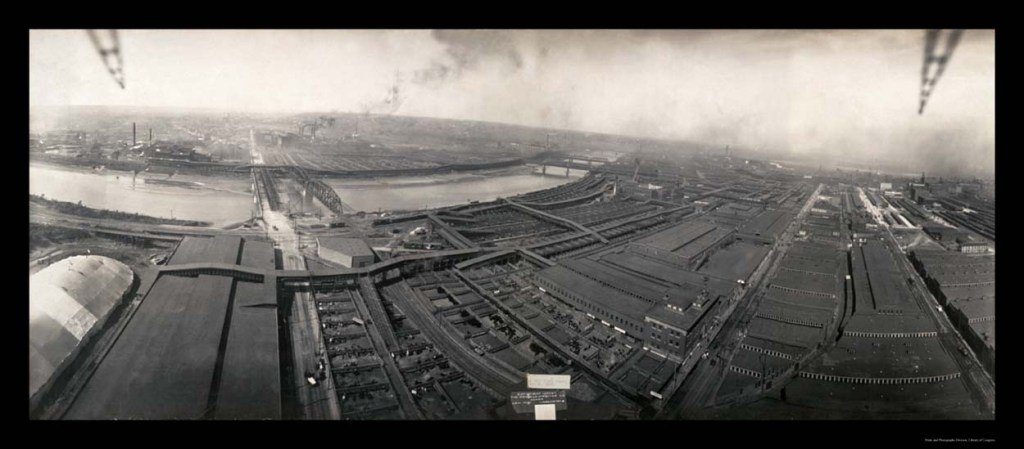
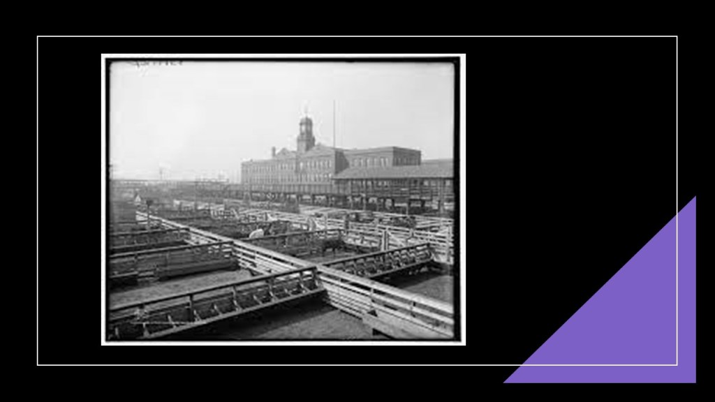
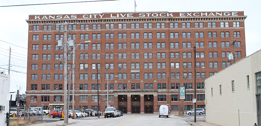
The Kansas City Livestock Exchange and Stockyards in West Bottoms were established in 1871, and at its peak, only the stockyards in Chicago were larger, of which this is a photo circa 1909.
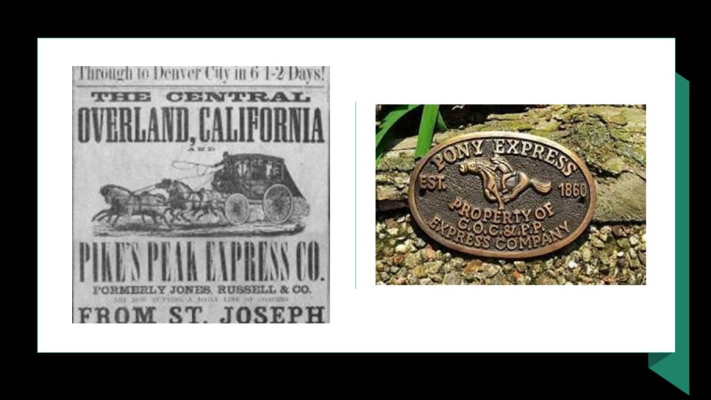
We are told the Kansas City Livestock Exchange and Stockyards was built around the facilities of the Central Overland California and Pike’s Peak Express Company.
The Central Overland California and Pike’s Peak Express Company was a subsidiary of a freighting company that operated as a stagecoach line starting in 1859, and was the parent company of the Pony Express that ran from April of 1860 to October of 1861.
The stagecoach line went out of business in 1862.
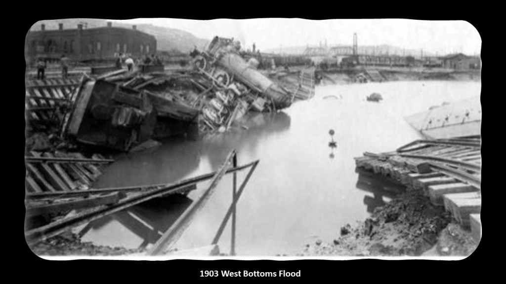
The Kansas City Livestock Exchange and Stockyards, along with the whole of West Bottoms, has had major floods over the years as HW shared, in 1903…
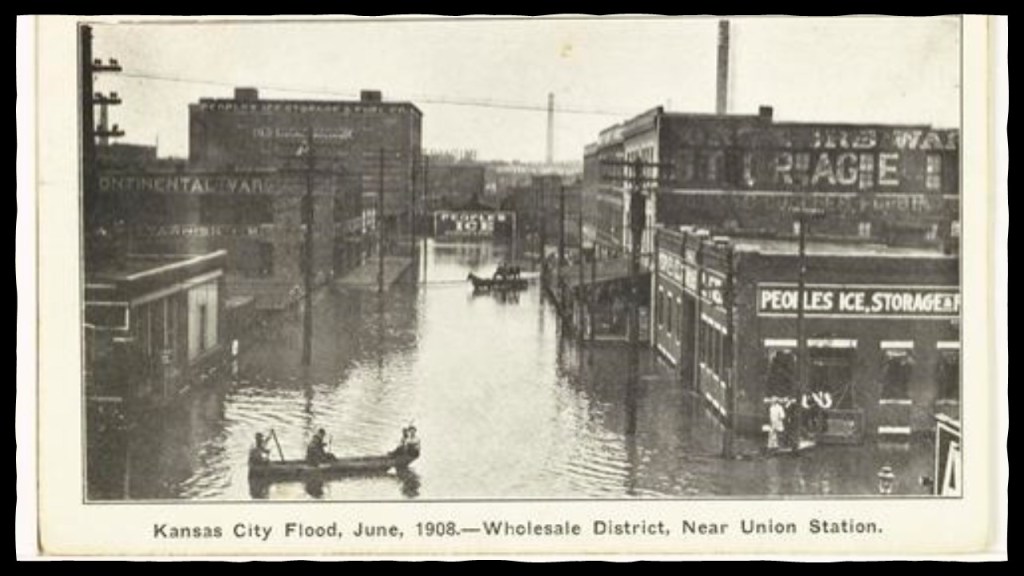
…in 1908…
…and after the 1951 flood, the Kansas City Livestock Exchange and Stockyards and associated businesses were devastated, and it closed its doors for good in 1991.
The Livestock Exchange building, said to have been completed in 1911, was renovated and today is commercial business space…
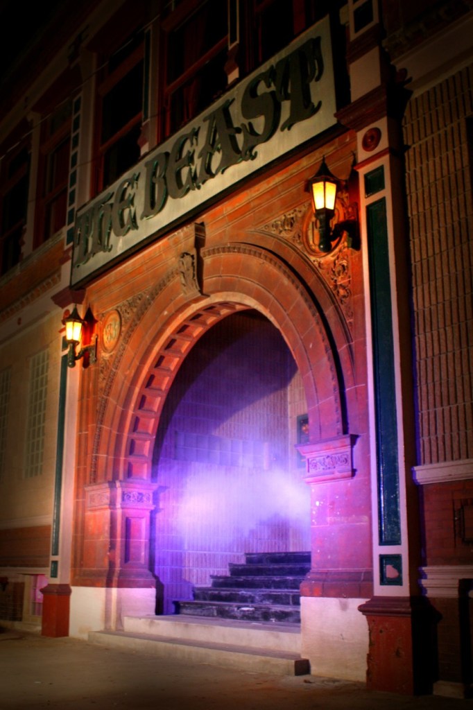
…as are many of the old buildings in West Bottoms, known for its art galleries, restaurants, antique stores…
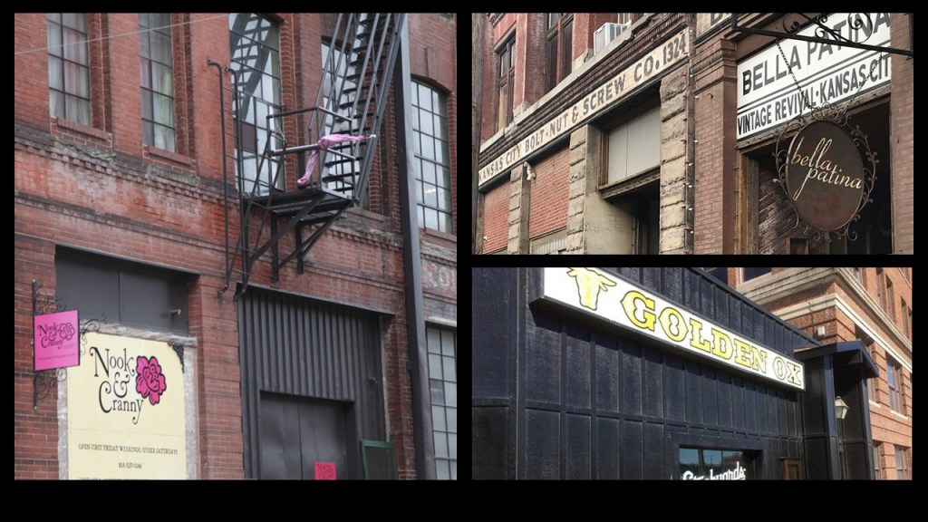
…and haunted houses.
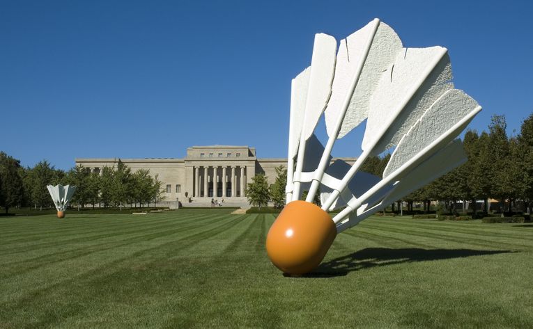
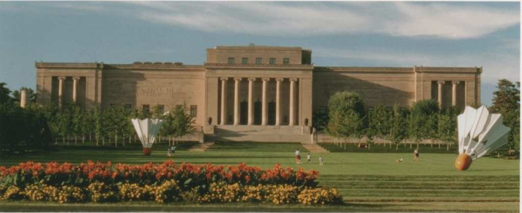
Another viewer, MA, suggested looking into the Nelson-Atkin Museum of Art in Kansas City.
She said it is a massive building, and was said to have been completed in 1933…which would have been in the middle of the Great Depression.
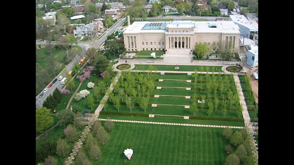
The building was said to have been designed by prominent Kansas City architects, Wight and Wight, with groundbreaking in 1930 on the grounds of Oak Hill, home of Kansas City Star publisher William Rockhill Nelson who left a fortune in his will for purchasing art for public enjoyment, in conjunction with $300,000 bequeathed in the will of Mary McAfee Atkins, the widow of a Kansas City real estate developer, establish an art museum.
The humongous badminton shuttlecocks were added to the grounds in 1994 as contemporary art.
Inside this magnificent building built during the Great Depression, there are marble floors, staircases, columns, and ornate marble alcoves and hallways.
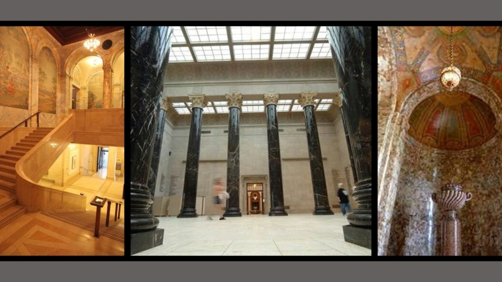
She said the front entrance has six, 3-story-tall, Ionic Columns.

…and Ionic columns are found on either end of the building.
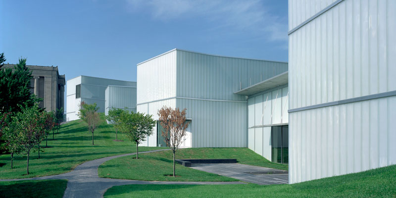
She said the windows on that lower level were half buried at the back of the building, and this is a photo I found behind the Bloch Building, an addition to the main museum which opened in 2005.
When I was looking around for information on the early history of Kansas City, Missouri, the following information and photos stand out.
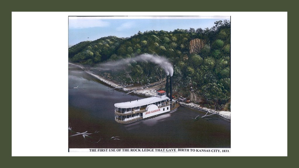
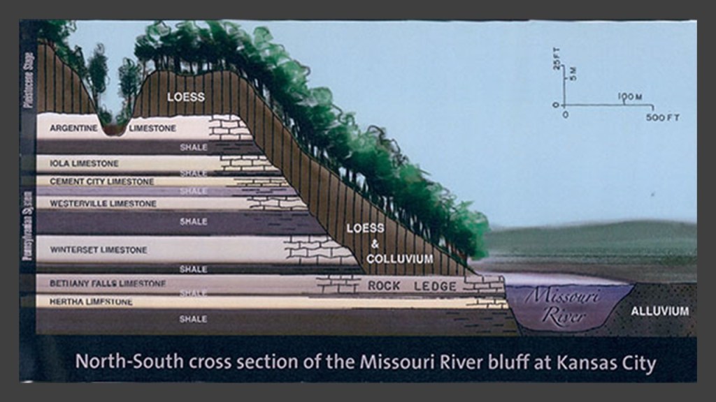
A Rock Ledge became the landing place for riverboats and wagon trains starting in 1833, on the southside of the Missouri River at what became Kansas City, Missouri.
And all of these strata of limestone are underneath the surface where the rock ledge is located.
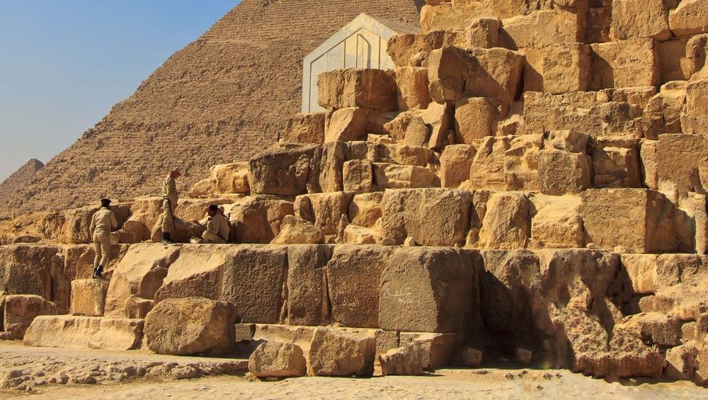
I just want to point out that limestone was a common building material in the ancient world, and used in constructions like the Pyramids of Giza…
…and the Western Wall, also known as the “Wailing Wall,” an ancient limestone wall in the old city of Jerusalem.

…and places that are officially identified as canals have rock ledges.
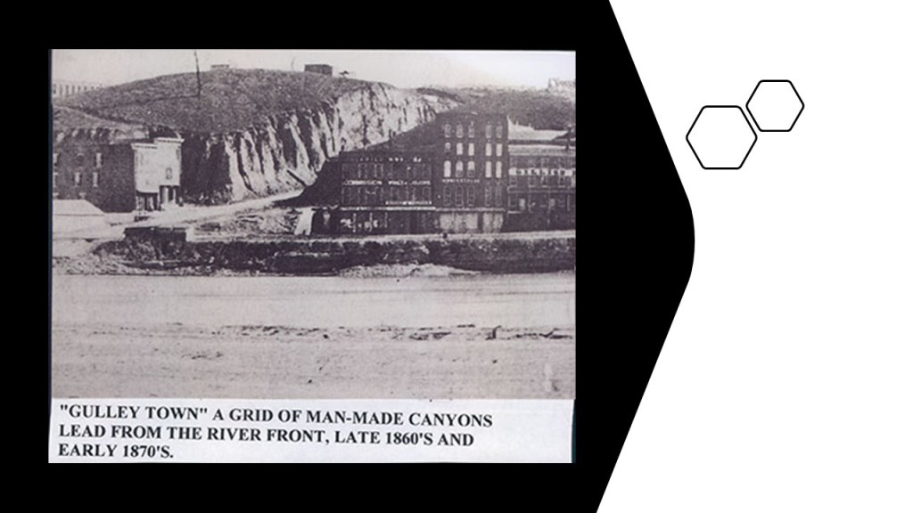
Other historic pictures that I would like to include of Kansas City, Missouri, include this one of when it was called “Gulley Town” in the 1860s and 1870s…
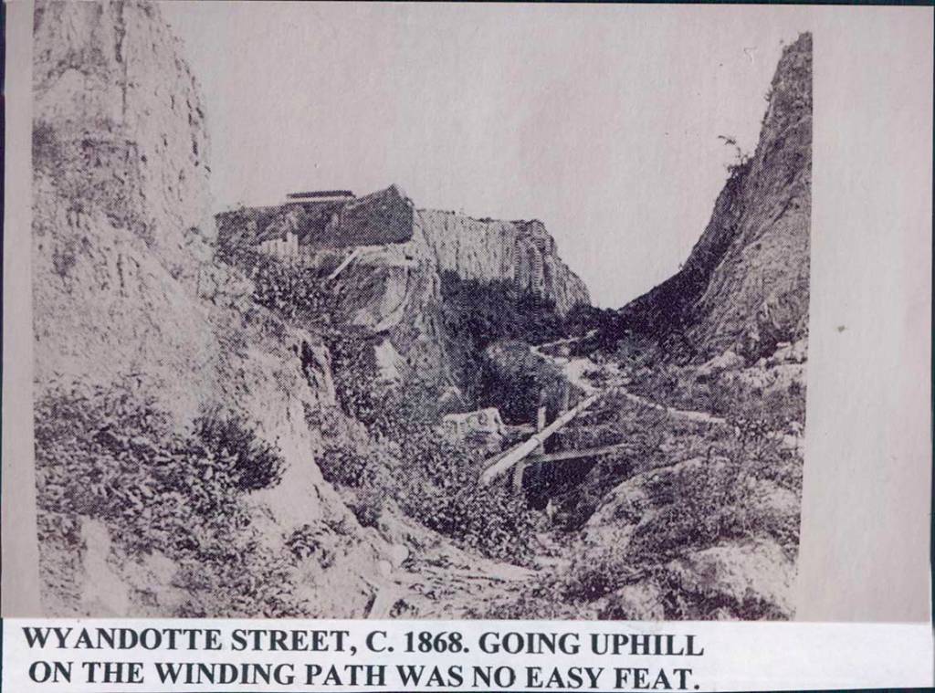
…and I found these views of Wyandotte Street as it looked in 1868…
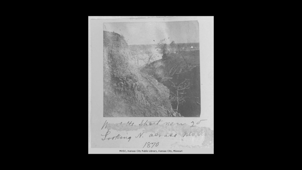
…in 1870…
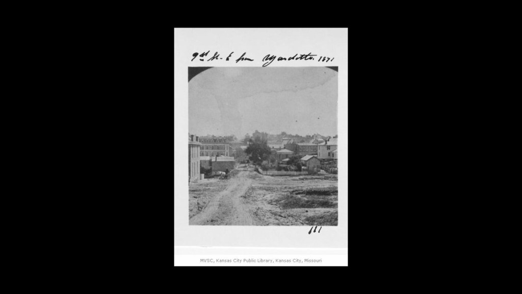
…in 1871…
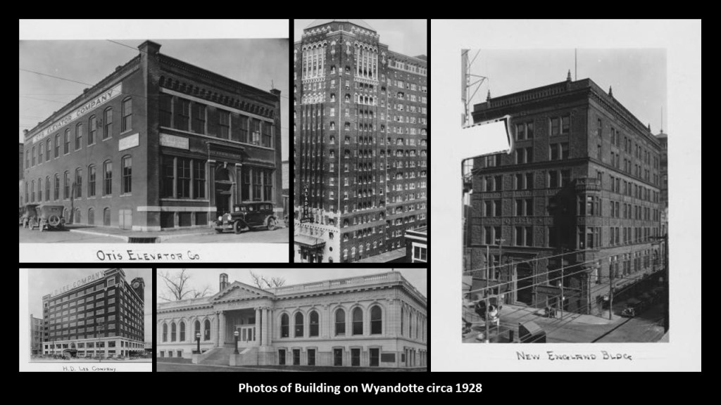
…and here are historic photos of some of the buildings on Wyandotte Street circa 1928.
Also, there were two viewers from the other side of Lake Superior in Keweenaw County in Michigan’s Upper Peninsula on Lake Superior who commented after I touched base on the history of Duluth, located in northeastern Minnesota on Lake Superior.
While the Minnesota/Ontario side of Lake Superior is known for the high-quality iron ore from its Iron Ranges, the Upper Peninsula of Michigan is known for its high-quality copper.
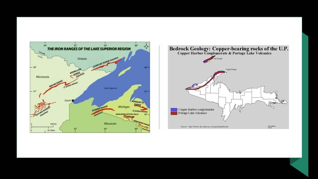
Keweenaw is the northernmost county of the State of Michigan, and it shares the Keweenaw Peninsula with Houghton County.
The Keweenaw Peninsula is formed by the largest freshwaters on Earth…
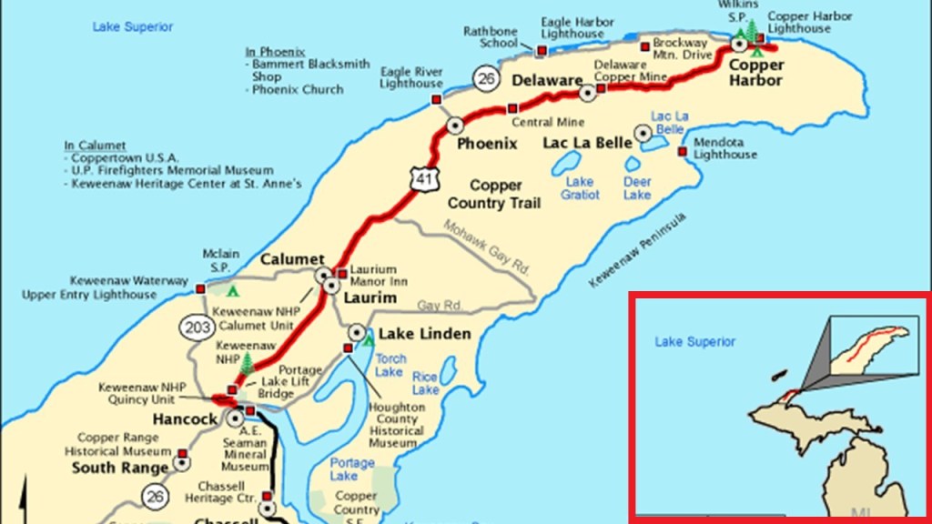
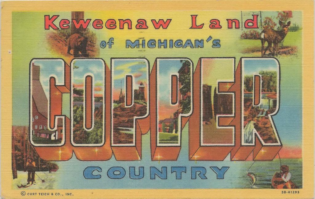
…and, along with several other adjacent counties in the Upper Peninsula, is collectively called “Copper Country,” and in its hey-day, in the late 19th- and early-20th-century, it was the world’s greatest producer of copper.
The copper here is predominately in what is known as native, or pure, copper form without the compound elements, like oxides and sulfides, that are found in other copper deposits.
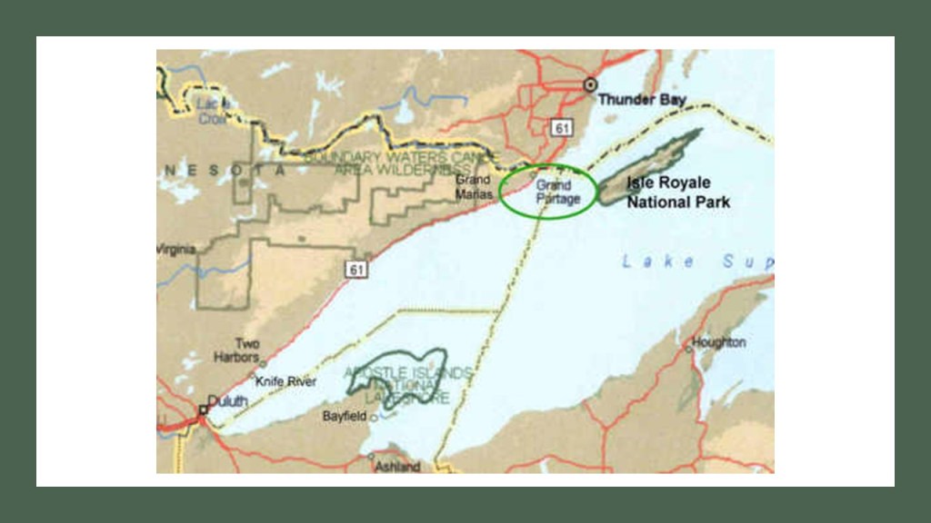
Isle Royale is the largest island in Lake Superior, and the second-largest island in the Great Lakes after Manitoulin Island in Lake Huron.
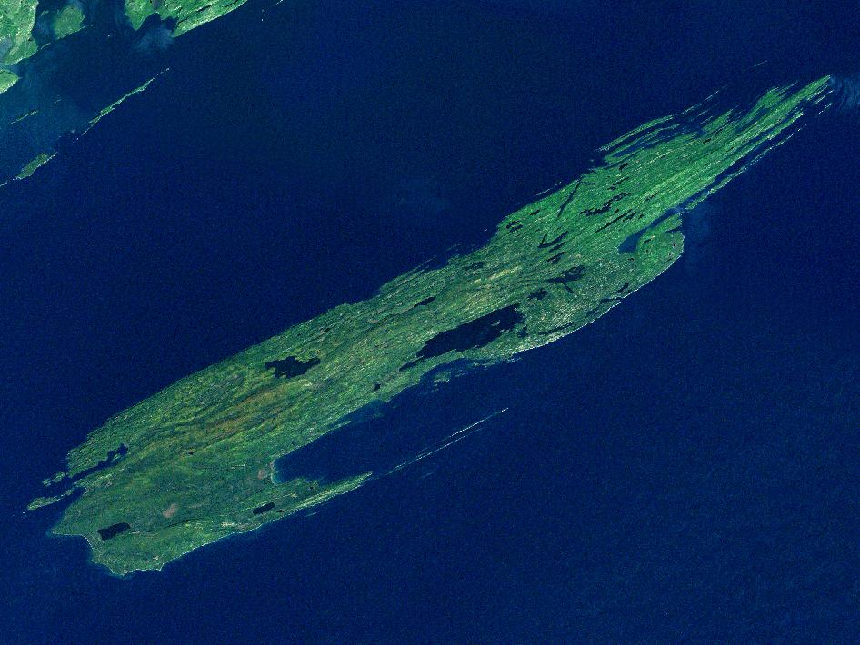
It is part of the State of Michigan, though geographically closer to the northernmost part of Minnesota and Ontario.
It is the only national park in Michigan, and the only island national park in the United States.
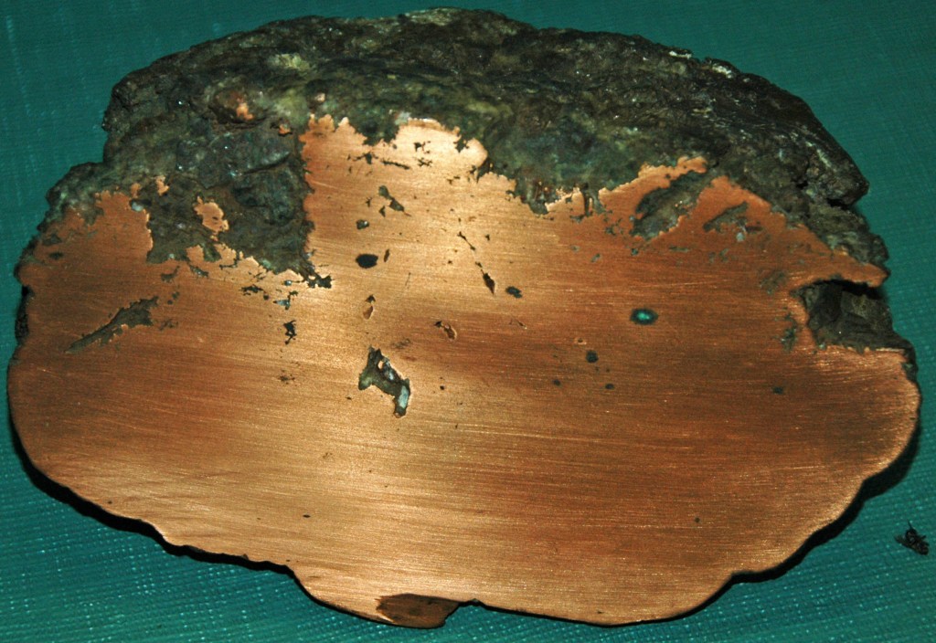
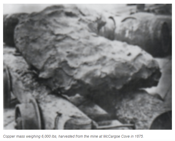
I had read several years ago about the copper mines found on Isle Royale, and of the high-grade copper that was mined here in ancient times…
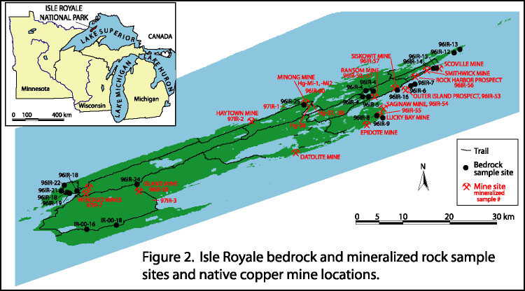
…as well as in the mid-to-late 1800s, like this 6,000 lb, or 2,722-kilogram, chunk of copper that was mined from the McCargoe Cove mine in 1875.
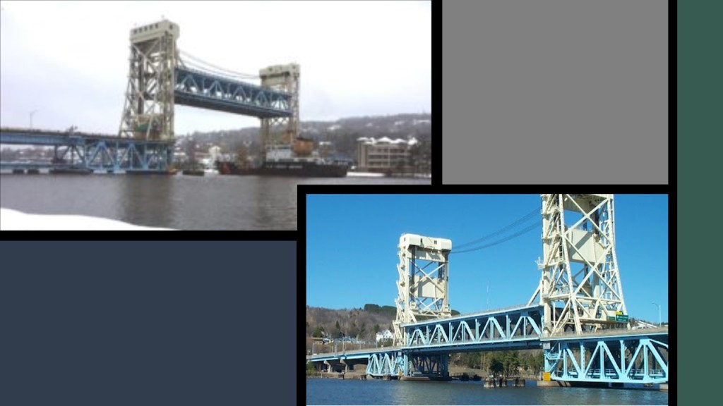
LH lives on the Keweenaw Peninsula in Keweenaw County, and said, among other things, that there is a lift bridge in Houghton County, as I had mentioned the one in Duluth in the last post.
Known as the “Portage Canal Lift Bridge,” it connects the cities of Houghton and Hancock across Portage Lake, which is part of the waterway which cuts across the Keweenaw Peninsula with a canal linking the five-miles to Lake Superior to the northwest.
The steel swing, or vertical, bridge was said to have first been built in 1895 to replace a damaged wooden swing bridge that was built in that location in 1875, and that the current steel bridge replaced the previous steel bridge in 1959.
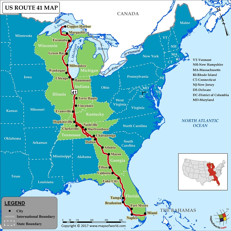
The Portage Canal Lift Bridge is on the only land-route across the waterway, which is U. S. Highway 41, that originates in Miami, Florida.
The Keweenaw Waterway is described as “part artificial and part natural,” and separates Copper Island from the mainland, in this case referring to Keweenaw County.
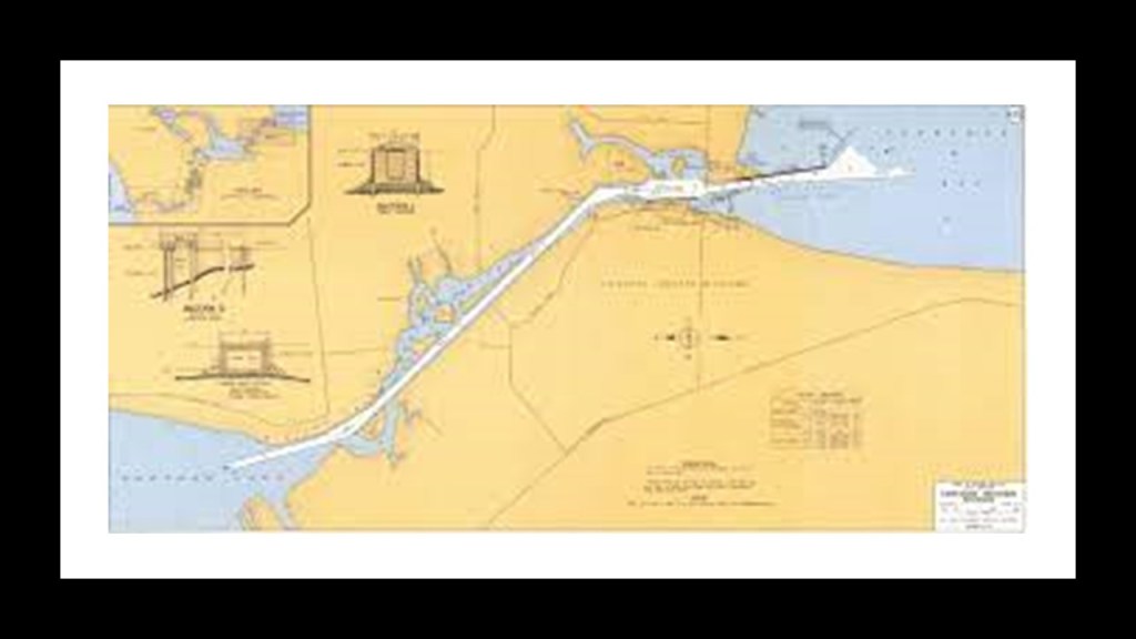
The building of the canal was said to have started in 1868, after the legislation authorizing the building of it passed in 1861, and completed in 1874…and widened in 1935.
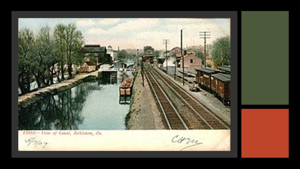
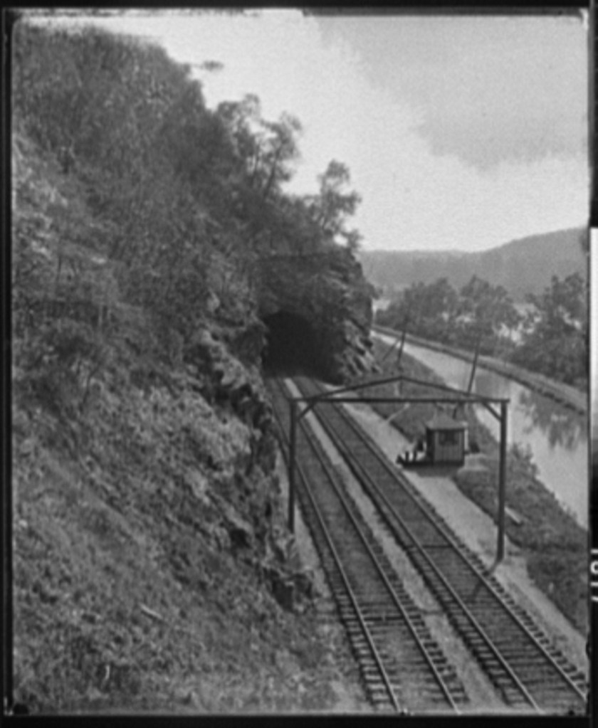
Interesting to note the straight railroad track and canal running parallel to each other…
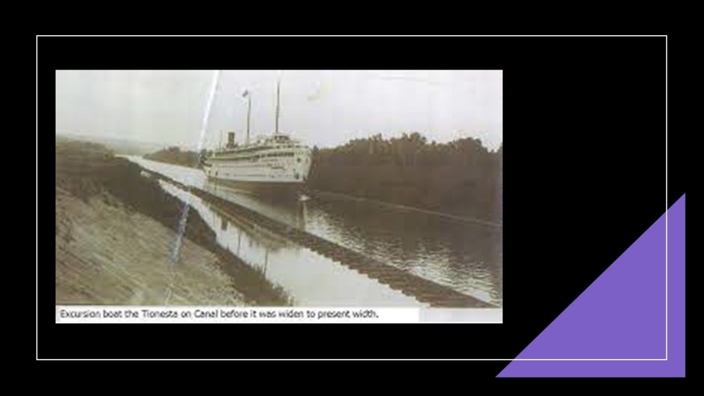
…which is a configuration I have seen in the past, at places like the Lehigh Canal and railroad tracks in Bethlehem, Pennsylvania…
…and at Point-of-Rocks in Maryland, near Harper’s Ferry, West Virginia.
LH also mentioned some other places on the Keweenaw Peninsula, like the Houghton County Courthouse, with the cornerstone said to have been laid on July 24th of 1886, and the new courthouse dedicated a little over a year to the day later, on July 28th of 1887.
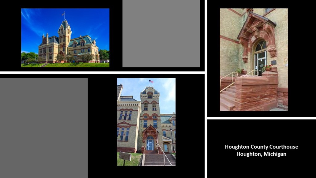
So…built in a year…in Northern Michigan no less…
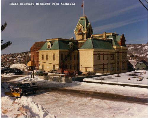
…a place where winters are cold, and spring and fall still tend to be on the cold and moist side.
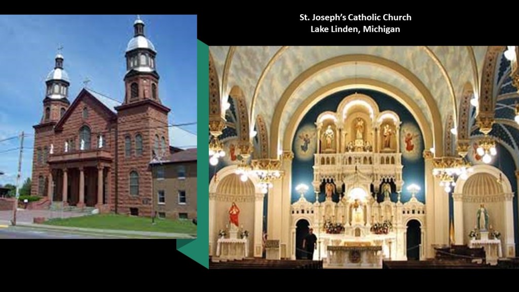
LH also mentioned the Catholic Church in Lake Linden, said to have been built between 1901 and 1912…
…and said there used to be a trolley line from Calumet and Houghton…
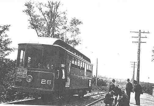
…as well as many trains, but all the tracks have been pulled up.
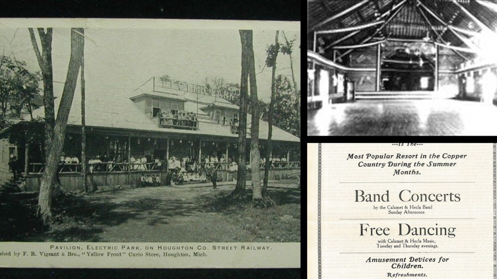
According to this map of the Houghton County Traction Company that operated the trolley line, there even was an “Electric Park” way up here!
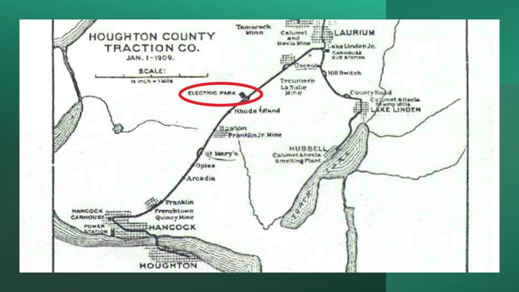
It was a popular recreation destination, also known as a trolley park, between 1902 and 1932, which was when all operations of the Houghton County Traction Company ended, and the park disappeared completely from the scene by World War II, we are told, because of the cost of maintenance upkeep, etc, with the main pavilion sold, scrapped and reassembled as a potato barn.
Memories from Mr. Rogers’ Neighborhood just popped into my head.
Though I am more from the Captain Kangaroo generation of young children’s television programming in the 1960s…

…I would watch Mr. Rogers on occasion with my younger brothers.
I wonder if there were hidden meanings, beyond a clever way to tell a story to young children, behind Trolley and the Neighborhood of Make-Believe in the long-running children’s show Mr. Rogers’ Neighborhood.

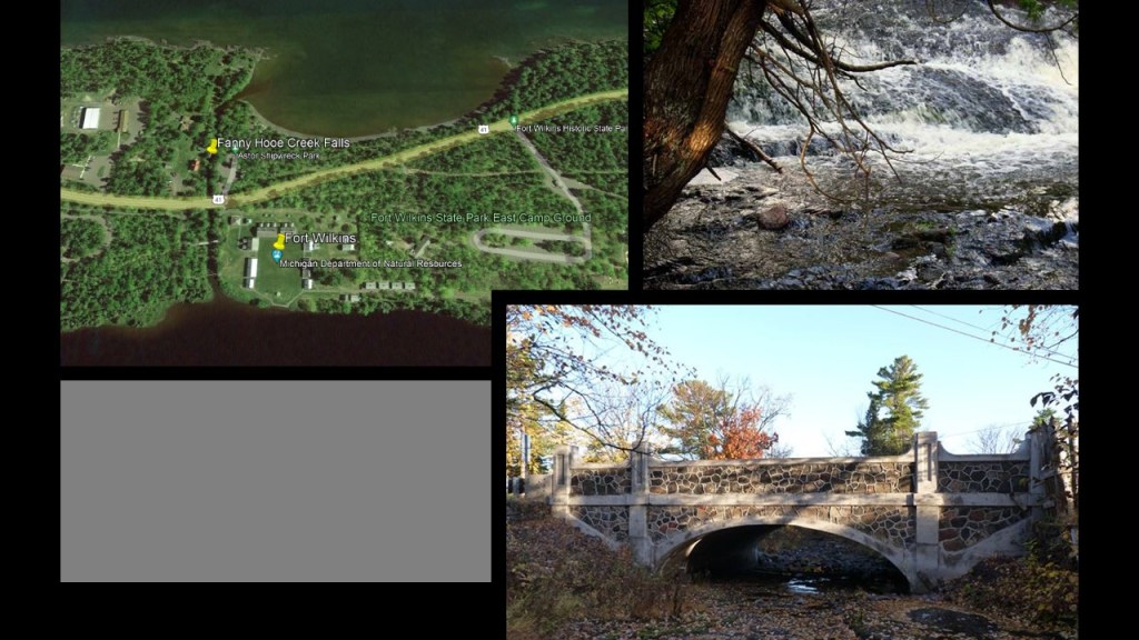
There is a lot more to find here, including the historical Fort Wilkins at the tip of the Keweenaw Peninsula, said to have been established in 1844…
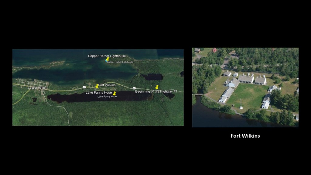
…sandwiched from east-to west between the beginning of Highway 41 marker…
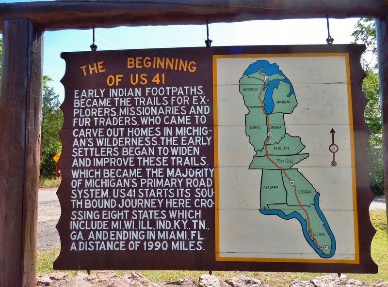
…and Copper Harbor, also established in 1844…
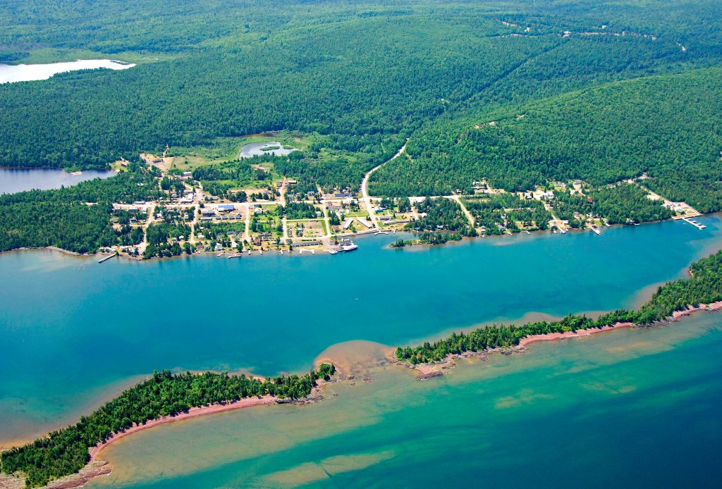
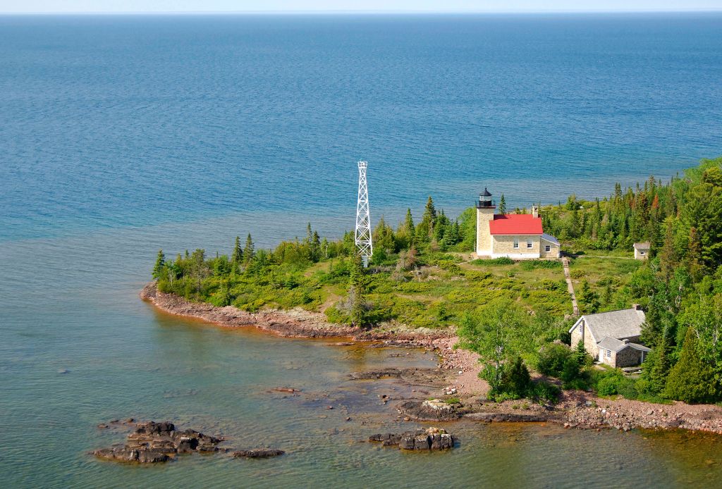
…and from north-to-south between Copper Harbor Light House, said to have first been built in 1849, and then dismantled, and using the same stones as the first lighthouse, re-built and lit in 1866…
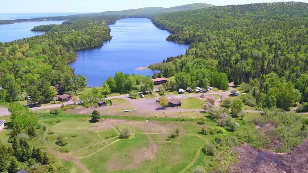
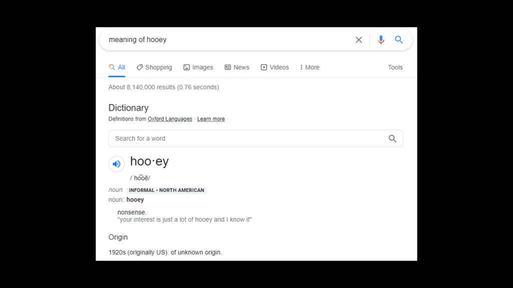
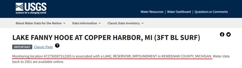
…and the long, skinny Lake Fanny Hooe.
There are a number of different women coming up as the subject in the tales of how the lake was named.
The slang meaning of “hooe-y” in English, having the same pronunciation with a silent “y” added at the end in the spelled form, is “nonsense.”
It is interesting to note that the only indication I could find that this might be a man-made lake in a search is this from the USGS website.
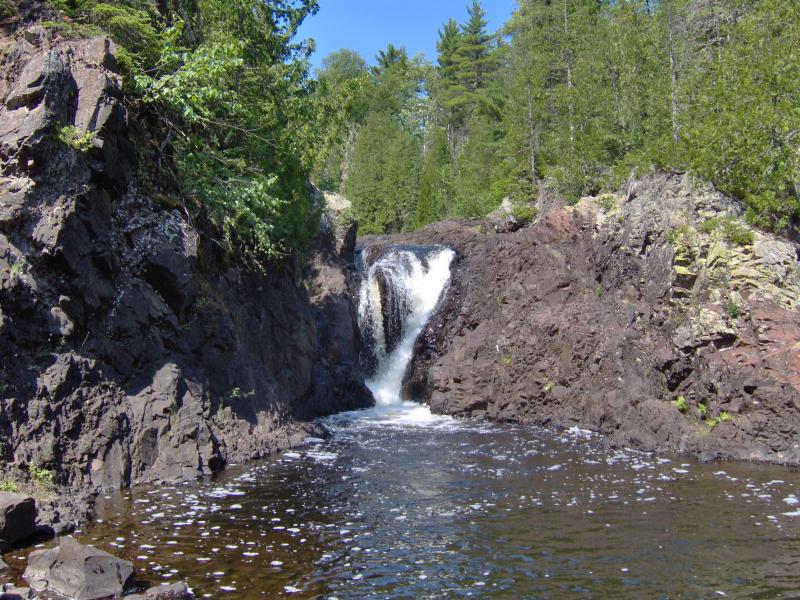
In the short distance between Lake Fanny Hooe and Lake Superior, I found the Fanny Hooe Creek Falls and the bridge on Highway 41 crossing the creek, said to have been built in the 1920s.
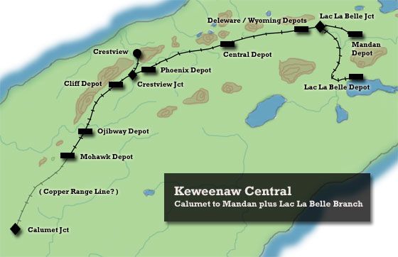
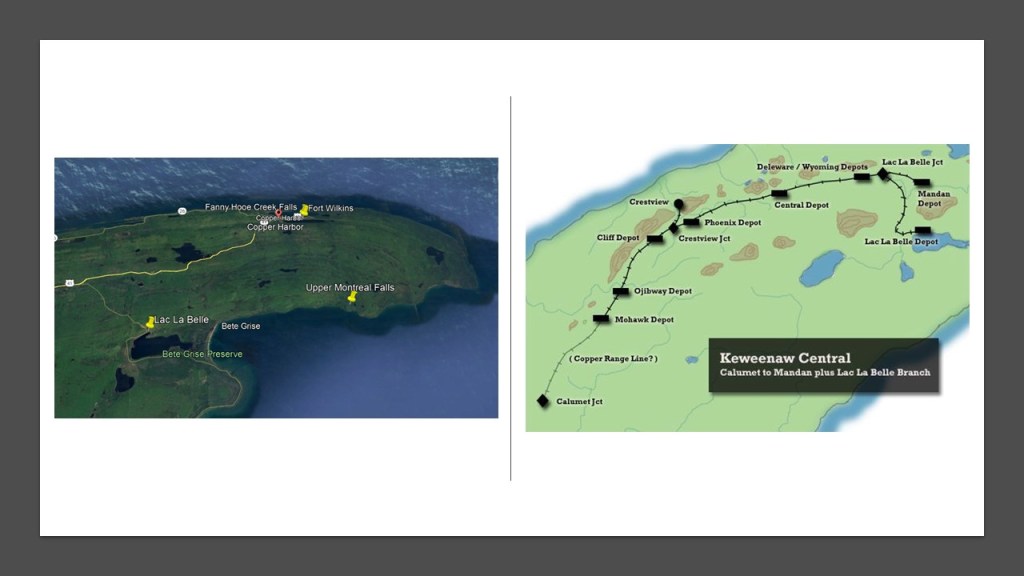
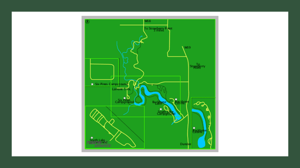
There are other falls hereabouts, but there is one other I want to highlight, the Upper Montreal Falls on the Keweenaw Peninsula’s Montreal River.
These particular falls are not located far from Lac La Belle, which at one time…
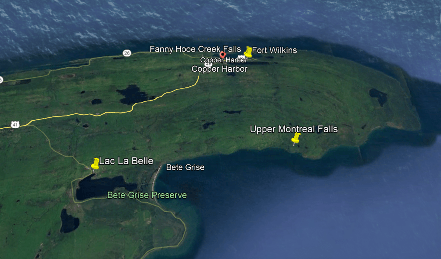
…was a railroad depot, as shown in the map on the right.
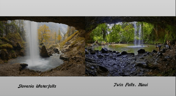
Two things I have consistently found in my research are waterfalls of the same make and model in different places all over the world…
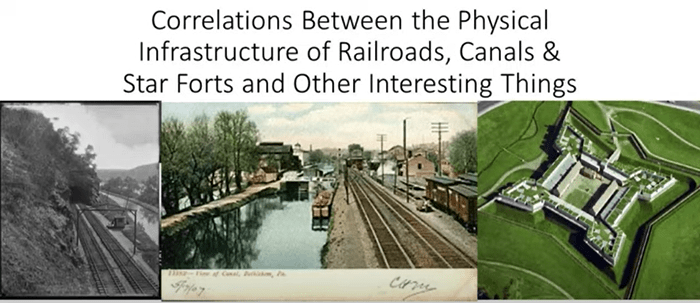
…and correlations in location between railroads and canals, like I showed previously in this post with the Portage Canal of the Keweenaw Waterway, as well as the additional correlation of star forts located nearby, which I have studied extensively in past research.
So, now I am going to add the possibility of correlations of waterfalls to this configuration, with the idea that these were all connected to the original energy-generating grid system of the Earth.
To study this possibility more in-depth, I am going to turn my attention to information that viewer JG in Iowa has sent me.
We had connected about two years ago and one of the possibilities we explored in our correspondence were the possible correlations between railroads and waterfalls, and she had emailed me the information she had uncovered when she researched her home-state of Iowa regarding this subject.
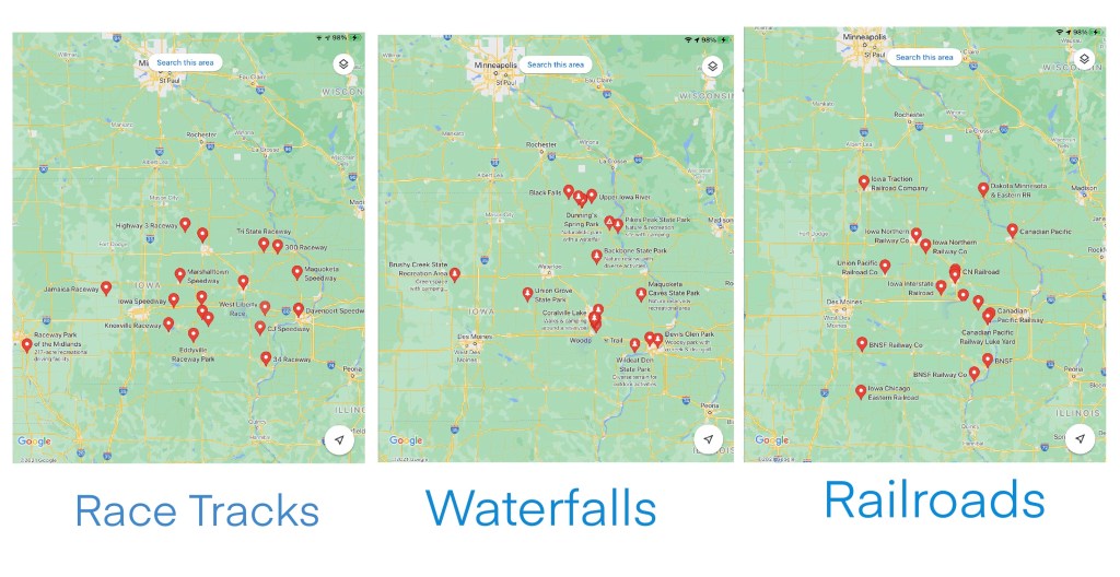
I recently asked her to re-send her findings because I couldn’t find the original email with the information she sent, and so she sent google maps showing the locations of railroads and state parks with waterfalls, and racetracks, as well as another set of maps with more key things like the locations of powerplants, mines and sports stadiums.
I am going to focus in this post on the correlations between railroads, waterfalls, and racetracks that she sent me as a grouping.
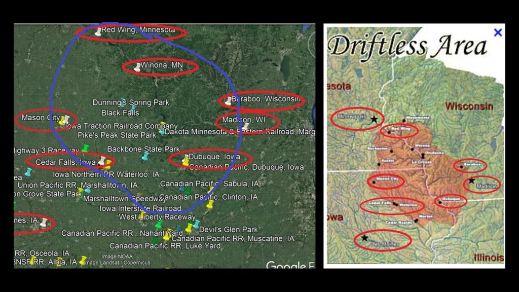
Much of the part of Iowa being looked at here is where Iowa, Minnesota, Wisconsin and Illinois meet, and is in part of what is called the “Driftless Area.”
This is part of North America is called the “Driftless Area” because it was said to have been by-passed by the last glacier on the continent and lacks glacial drift.
JG sent me this overlay that she put together of the racetracks, waterfalls, and railroads in Iowa…
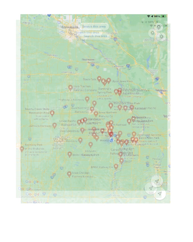
…and I ended up needing to enlarge each map she sent separately as well so I could see and read the place names…
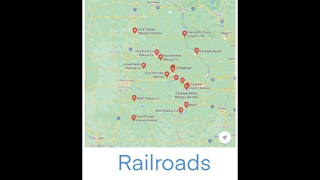
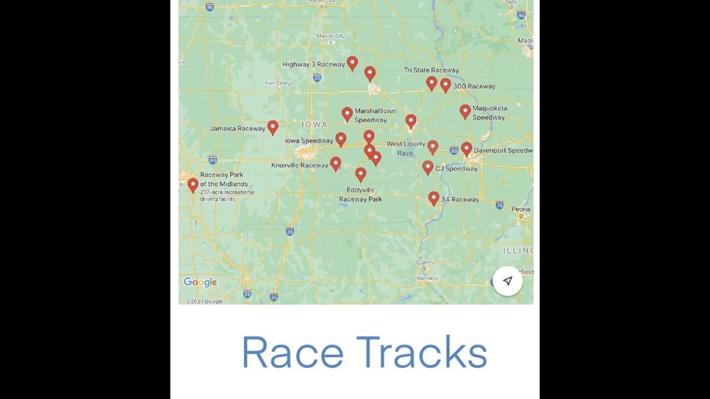
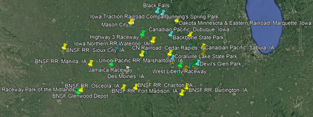
…and then I transferred the same information to Google Earth to see where these places were in relationship to each other.
I am specifically looking for correlations between the state parks with waterfalls and railroads here, and it will be interesting to see where the racetracks fit into the picture as well.
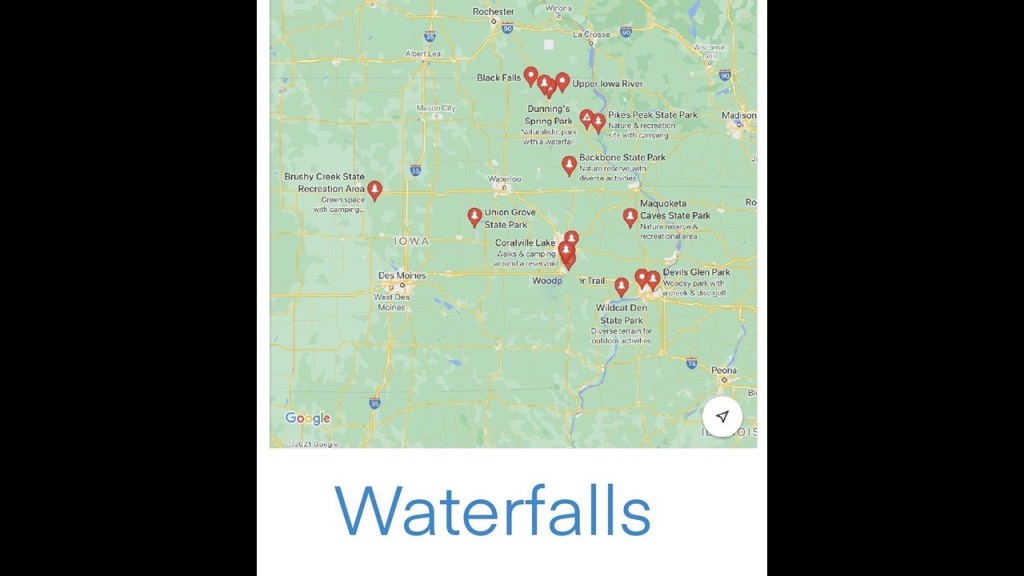
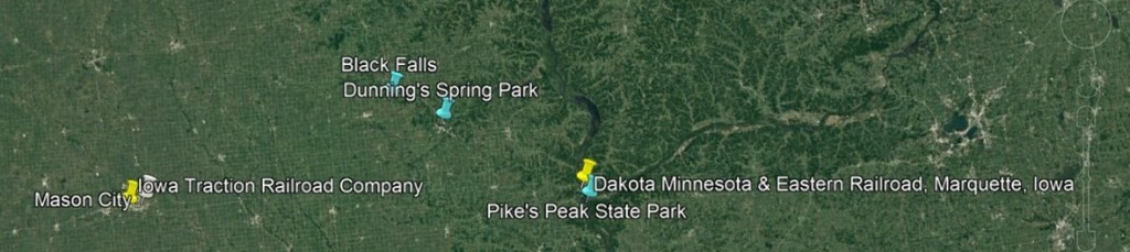
I am going to look specifically for this post at the upper section of the previous Google Earth screenshot.
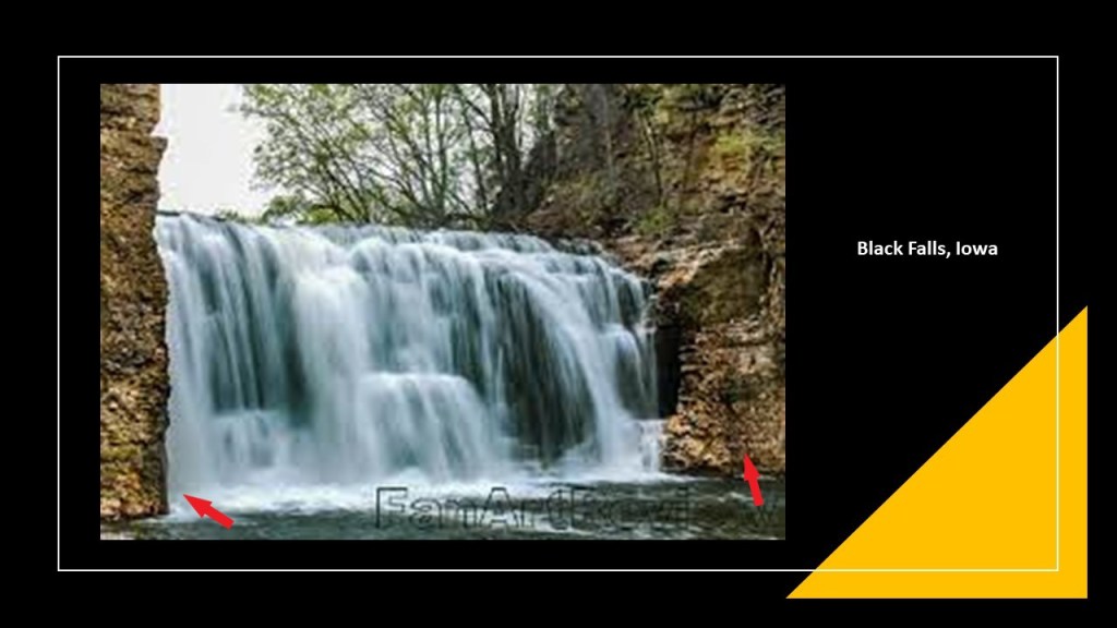
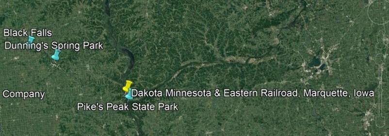
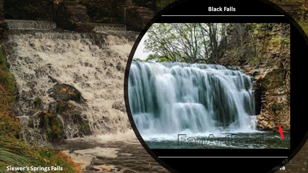
In the top middle, is Black Falls and Dunning’s Spring Park.
Black Falls is near Kendallville, Iowa.
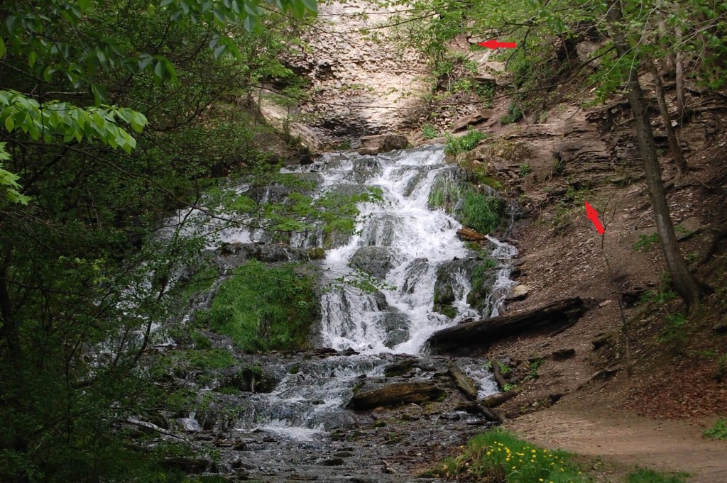
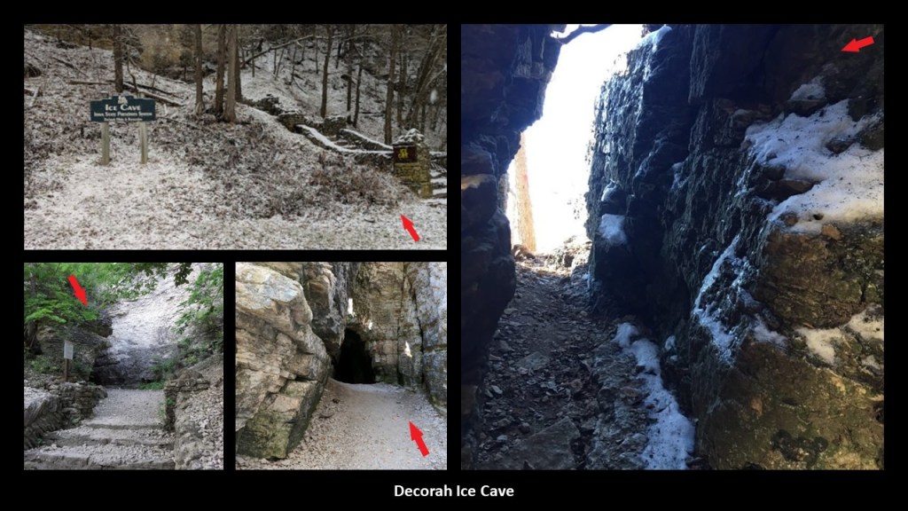
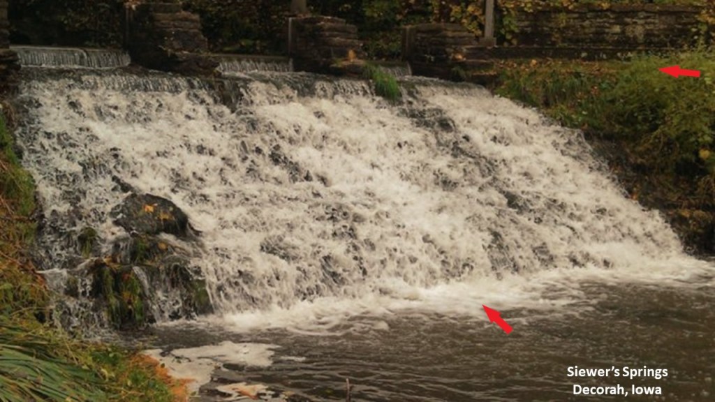
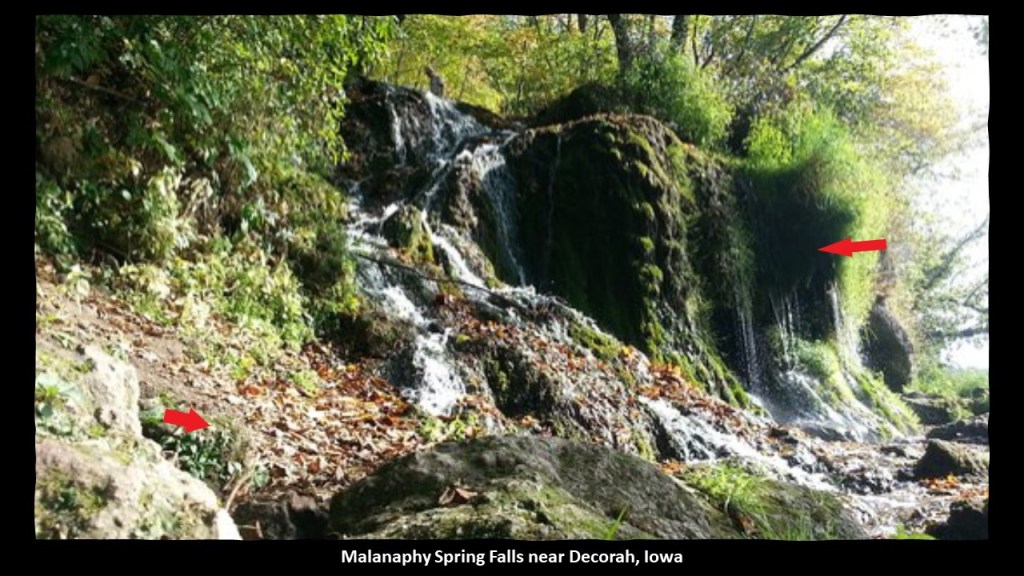
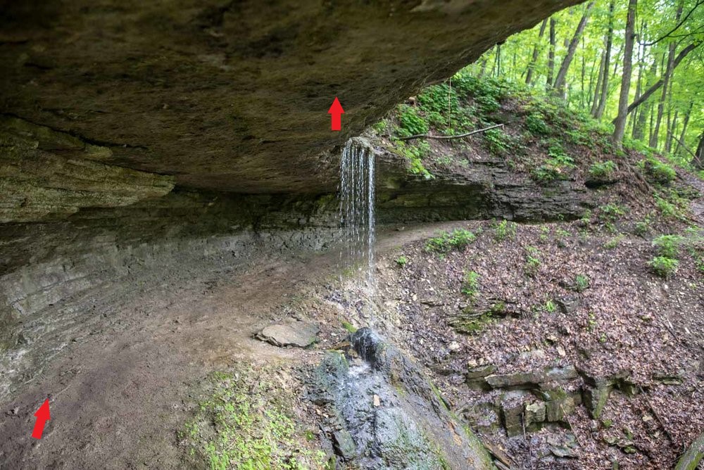
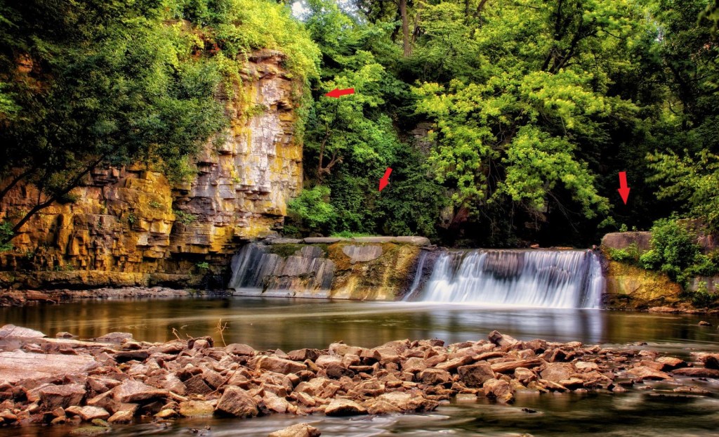
For all of the following waterfalls, I am going to point out with red arrows what looks like an old wall, or old masonry, to me.
There are three waterfalls at Dunning’s Spring just southeast of Black Falls, near Decorah, Iowa…
…one of which is located near the Decorah Ice Cave, a limestone and dolomite cave that has ice on the inside even during the summer…
…as well as the falls at Siewer’s Springs near Decorah, described as “technically a spillway, but a gorgeous staircase formation….”
…and the Malanaphy Spring Falls, northwest of Decorah.
I looked for rail-related infrastructure near Decorah, which now only has Railroad Street and Railroad Avenue, with the Mediacom Communications facility sandwiched between the two…
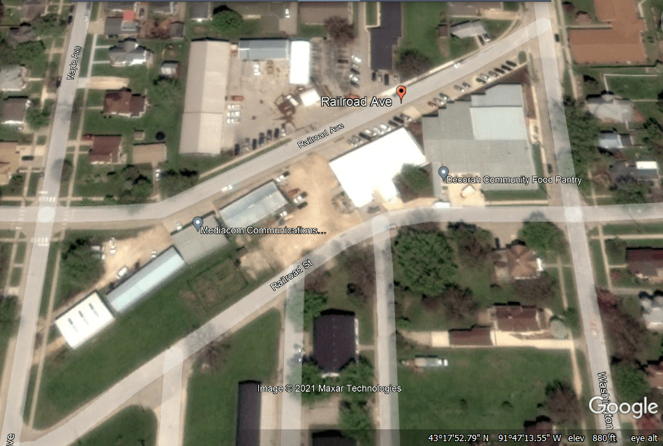
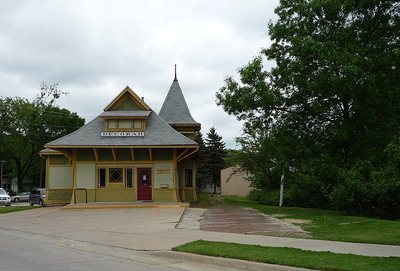
…and what was the Milwaukee and St. Paul Railway Combination Depot in Decorah is now commercial space, and all the railroad tracks through here were removed in 1971.
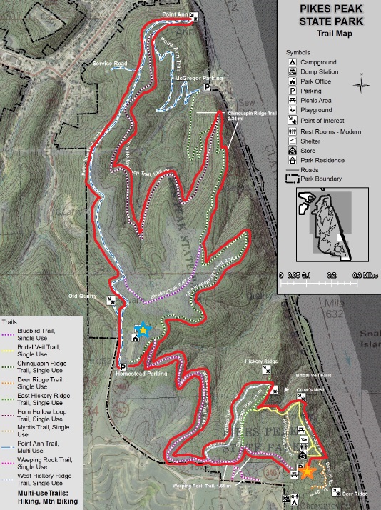
From where Black Falls and Dunning’s Spring are at the top of the Google Earth screenshot, next I am going to go southeast of there to “Pike’s Peak State Park.
Pike’s Peak State Park in McGregor, Iowa, is situated on a 500-foot, or 150-meter, bluff overlooking the confluence of the Mississippi and Wisconsin Rivers.
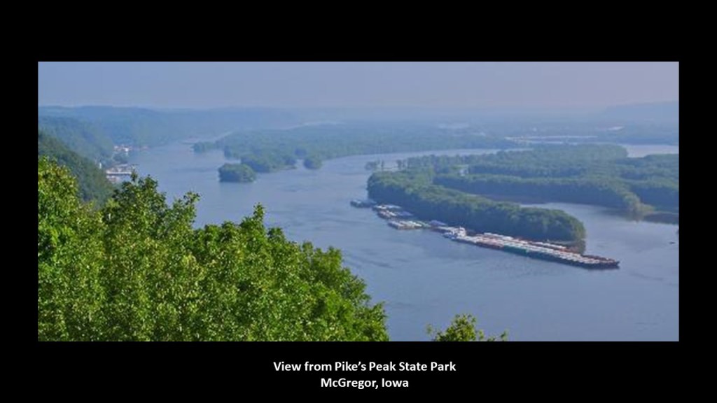
It is a recreational area that is considered one of Iowa’s premier nature destinations…
…where one of the places you can hike to is called Bridal Veil Falls.
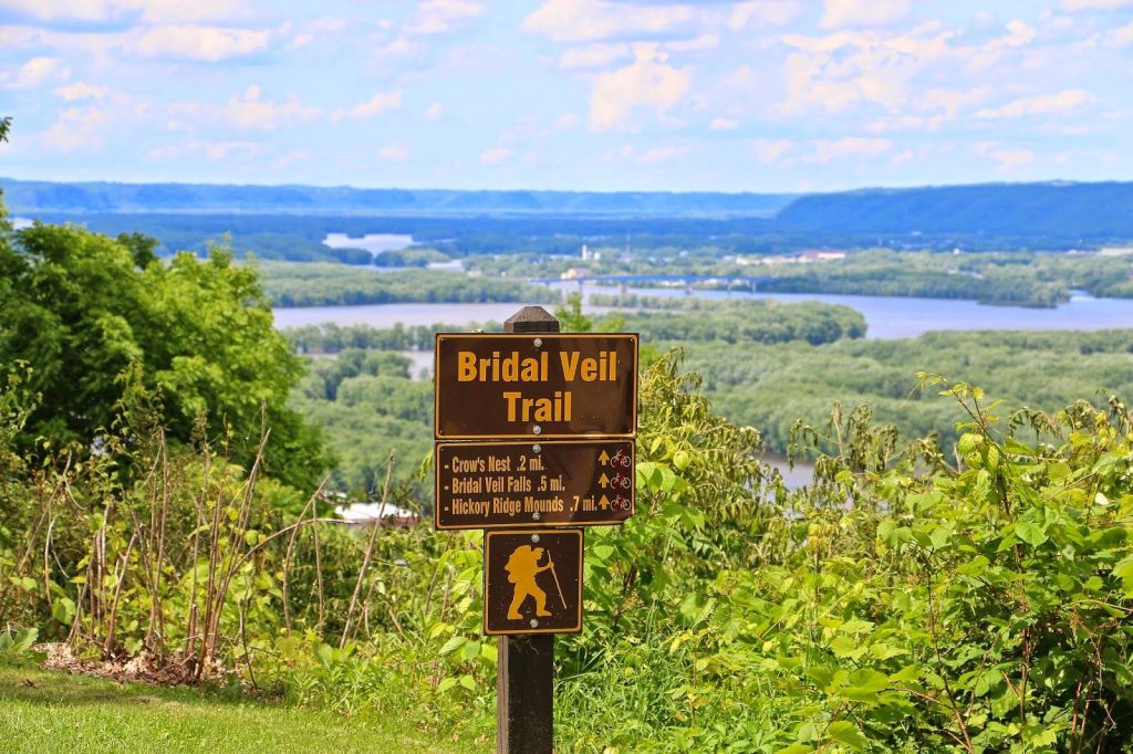
Bridal Veil Falls is described as “a small natural waterfall that flows gracefully out of a horizontal limestone outcropping.”
Pike’s Peak State Park and McGregor, Iowa, are right next to Marquette, Iowa, on the Mississippi River, right across from Prairie de Chien, Wisconsin.
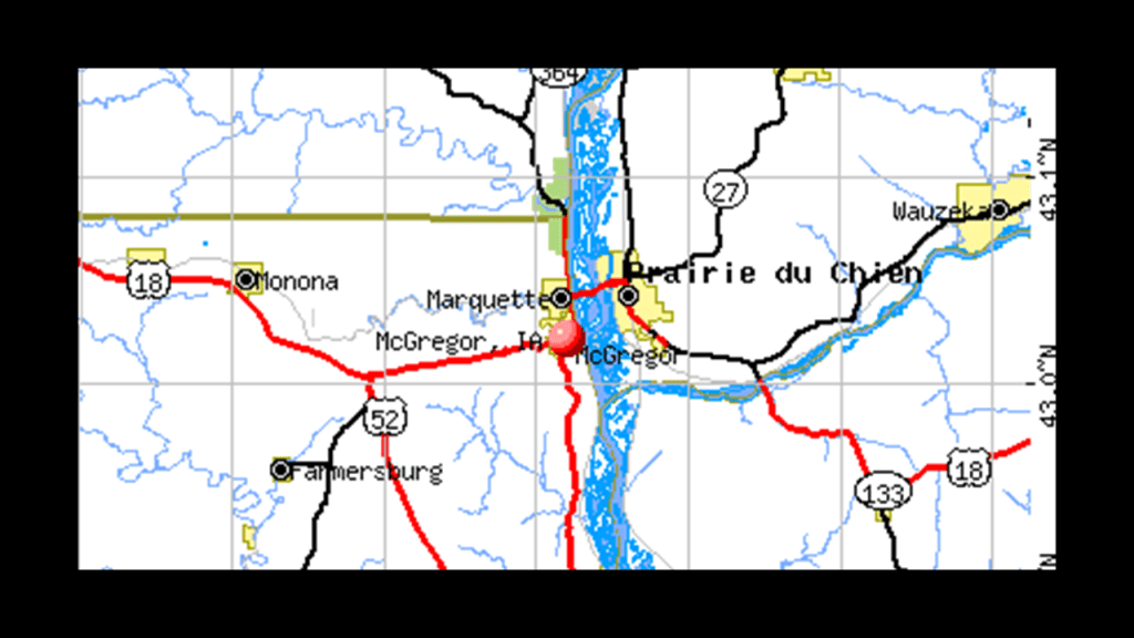
Marquette earlier in history was known as North McGregor, and served as a railroad terminus, becoming a major railroad hub for the region in its hey-day.
Passenger service ended in 1960, and the Marquette Depot Museum and Information Service in Marquette celebrates the town’s railroad history with exhibits of historic railroad artifacts…
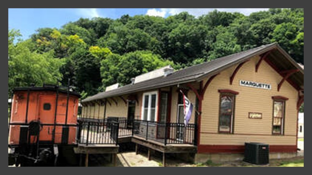
…though the Dakota, Minnesota and Eastern Railroad, a subsidiary of Canadian Pacific Railway, still runs freight on the rail-lines through here.
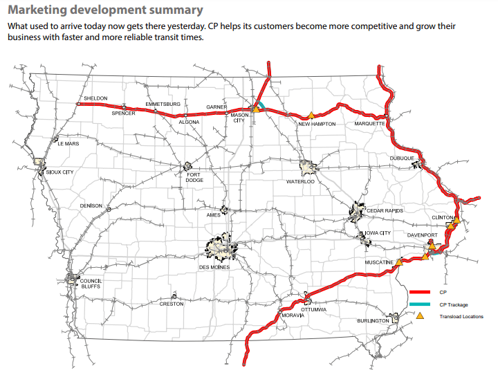
Next, I am going to go due west from Marquette and McGregor over to Mason City, which is connected by the same Canadian Pacific Rail-line to Marquette.
Mason City is located on the Winnebago River, and was original of the settlement that was established here in 1853 was “Shibboleth.”
It was also known as Mason Grove and Masonville, until, we are told, Mason City was adopted in 1855, in honor of a founder’s son, Mason Long.
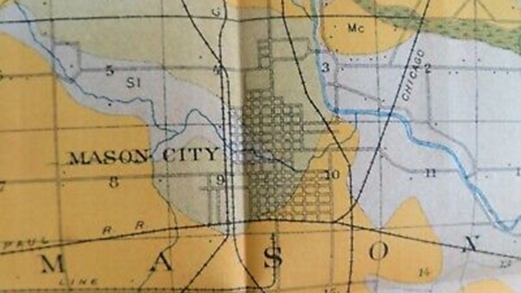
Interesting to note that the original name for the settlement, Shibboleth, is also a Freemasonic password.

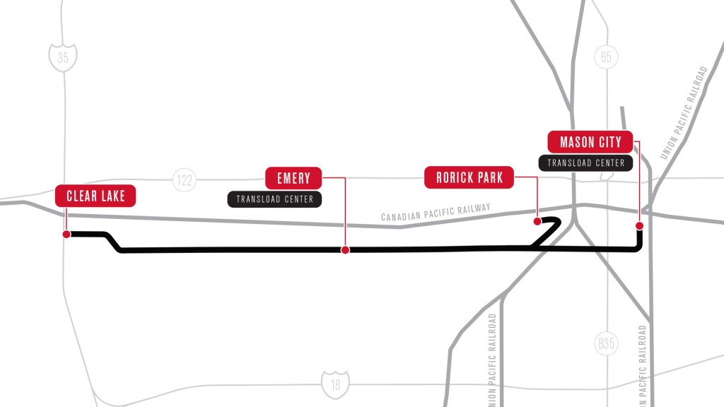
The “Iowa Traction Railroad Company,” headquartered in Emery, west of Mason City, operates a short-line rail-line, that is around 10-miles, or 17-kilometers, -long freight railroad between Mason City and Clear Lake, Iowa, that interchanges in Mason City with the Canadian Pacific Railway and Union Pacific Railway.
It is electrified, which means that an electrification system supplies electric power to the railway, as opposed to an on-board power source or local fuel supply…
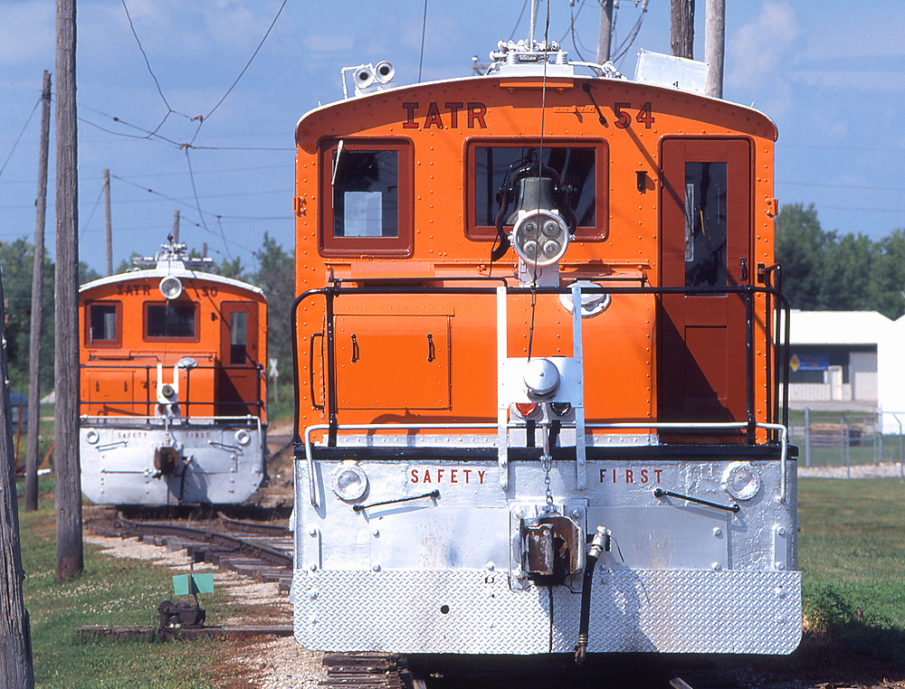
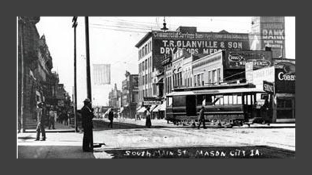
…and at one time was part of the electric trolley and interurban system of the region, with the charter for the trolley system expiring in August of 1936, and replaced by passenger bus service the following January.
I did find a waterfall in Mason City, though it is on private property and not in a state park.
Called the “Willow Creek Waterfall,” it can be viewed from the State Street Bridge between 1st Street NE and S. Carolina Avenue in Mason City.
The next places I am going to take a look at are the Highway 3 Raceway southeast of Mason City, and Backbone State Park southwest of Pike’s Peak State Park at McGregor.

The Highway 3 Raceway is a half-mile, semi-banked clay oval in Allison, Iowa at the Butler County Fairgrounds.
Seeing a Railroad Avneue here too.
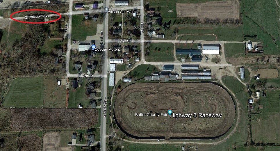
Not a whole lot of information available except that it hosts stock-car races and the like.

I think racetracks like this are re-purposed elliptical circuitry on the Earth’s grid system.

Backbone State Park, 45-miles, or 72-kilometers, west of Dubuque, Iowa, is the state’s oldest park, having been dedicated in 1919…
…and named after the limestone ridges found in the park.
A Civilian Conservation Corps (CCC) work-site for otherwise unemployed young men during the Great Depression, were given the credit for building the park’s recreational infrastructure in the 1930s…
…and the spillway dam at the park’s lake.
Backbone State Park is near Dubuque, Iowa, which has a connection to the railroad.
The Illinois Central Railroad ran through Iowa between Sioux City and Dubuque, one of four railroads were authorized by Congress via the “Act of 1856…”
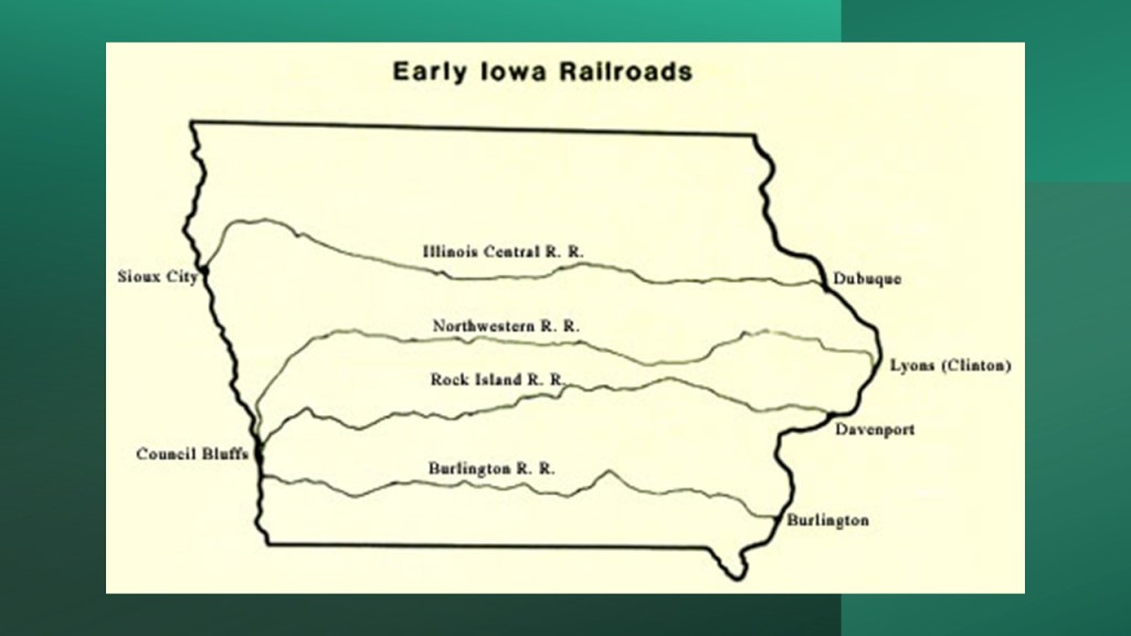
…connecting that part of Iowa by rail to Chicago sometime around 1870.
Like Mason City, at one time Dubuque had an electric streetcar system, and which was retired in 1932.
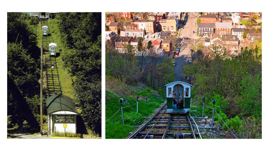
Dubuque has one of the few incline railways still in operation, much less still in existence, in today’s world.
The Fenelon Place Cable Car is found in Dubuque’s Cathedral Historic District, and is described as the world’s steepest, shortest scenic railway, said to have been built in 1882 for the private-use of J. K. Graves, a local banker and State Senator.
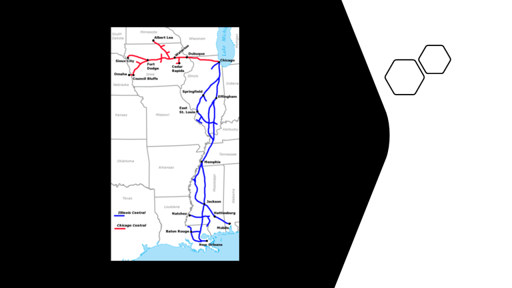
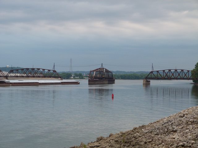
The Dubuque Railroad Bridge is currently operated by the Canadian National Railway, who purchased the Illinois Central Railroad in 1999.
It is a single-track railroad bridge that crosses the Mississippi River between Dubuque Iowa, and East Dubuque, Illinois, that has a swing-span.
The original swing bridge was said to have been built in 1868, and that it was rebuilt in 1898.
There’s more in the information that JG sent about Iowa, but I am going to stop here, as I can go on and on.
The examples here show in particular that there are at least correlations in location between places with waterfalls and the locations of rail infrastructure.
What that means exactly is certainly open to interpretation, some conventional and some unconventional. I suggested earlier that waterfalls were possibly somehow connected to the earth’s original energy grid system, but it could also mean that waterfalls were very much apart of the original civilization’s infrastructure serving multiple hydrological purposes…
…and that the rail infrastructure was also an intrinsic and pre-existing part of the Earth’s energy grid system as well, and not originally built during the years we are told.
I am going to end “Places & Topics Suggested by Viewers – Volume 4” here.
Lots more to come!