
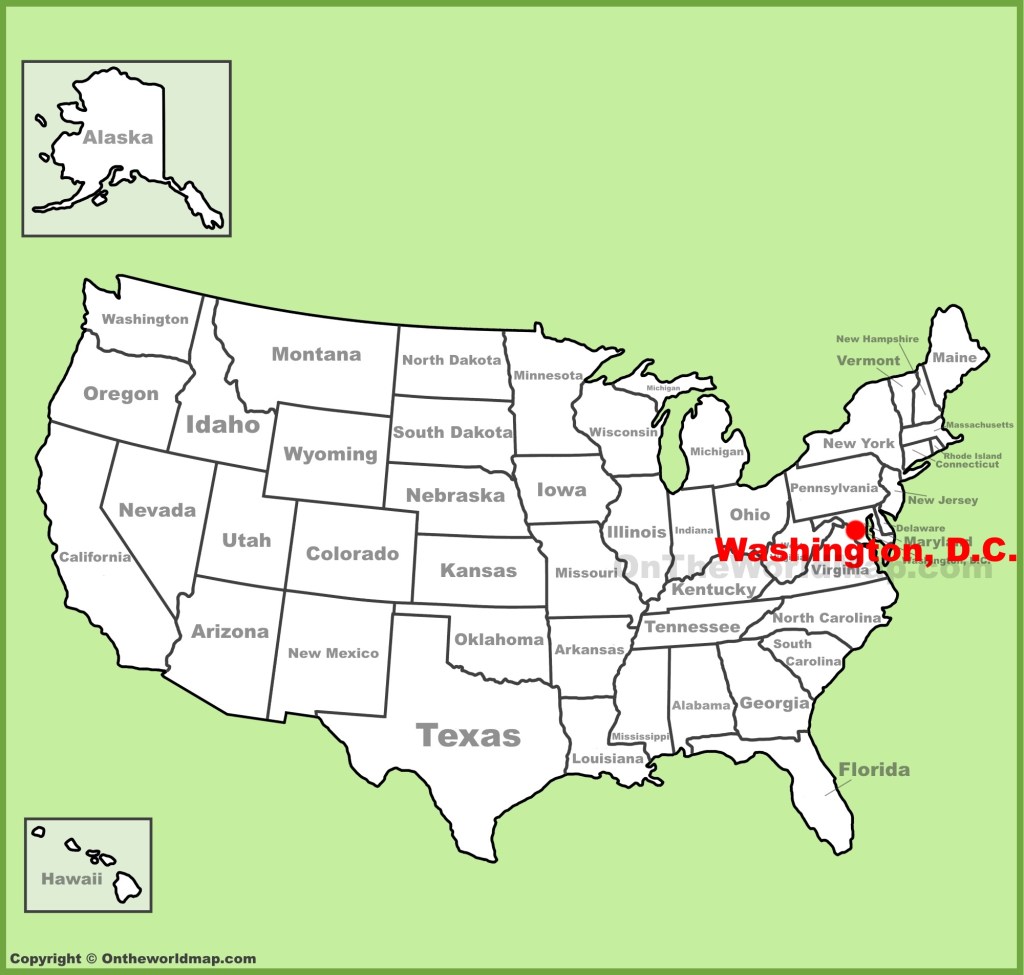
This is the start of a brand new circle alignment, and I will start the tracking of it from Washington, DC.
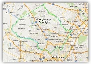
I grew up in suburban Maryland, in Montgomery County, Maryland, first in Gaithersburg, then Rockville. I have seen the sights around Washington, DC, many, many times. Field trips, out-of-town family visits, you name it.
I started to notice unusual, or out-of-place, features living here starting from a very young age.
The preparation that I had that helped me find all of these alignments was a passionate interest in megaliths, in long-distance alignments discovered by other researchers, and earth mysteries, and knowledge about sacred geometry.
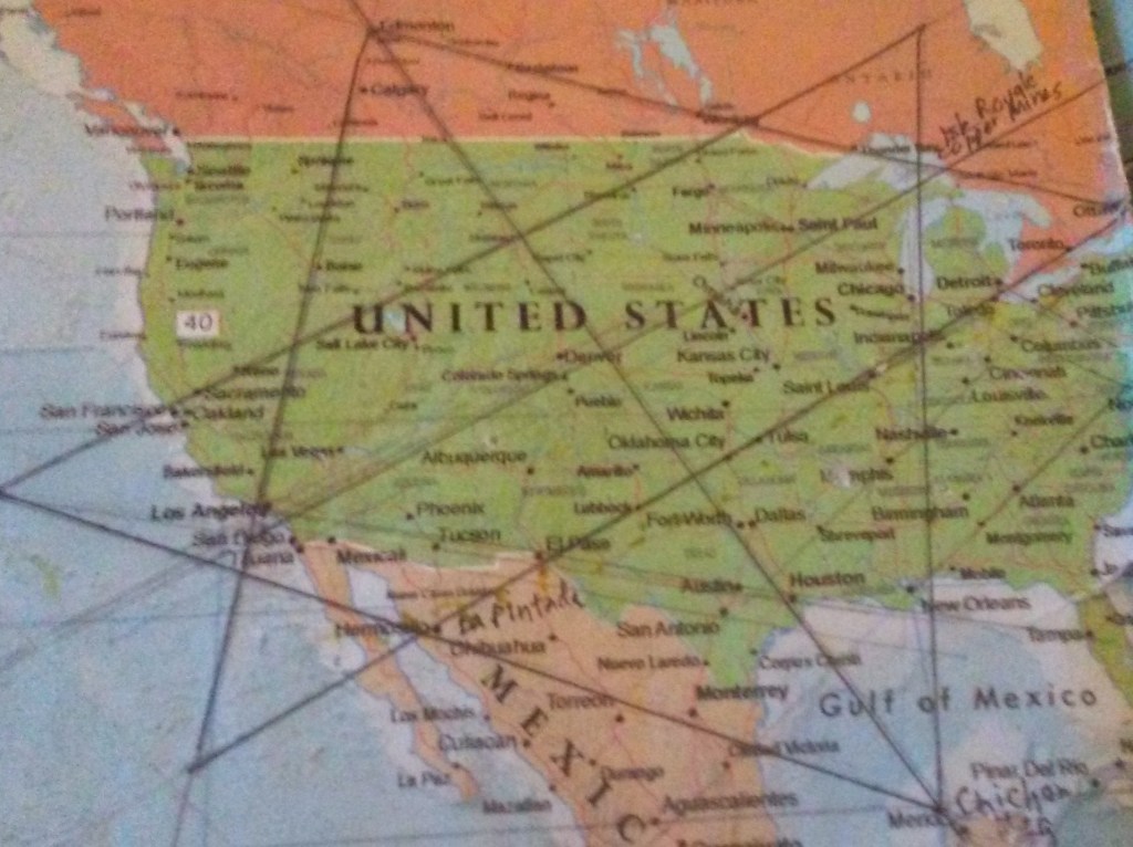
This map was given to me by one of my travel buddies in Oklahoma in 2014 or 2015 – she thought I needed it. So, it just sat there on my table where I studied it for quite some time while eating before I started noticing major cities lining up in lines in North America.
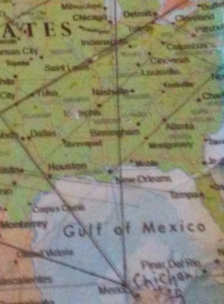
Early in 2016, I found this familiar figure of sacred geometry when I literally started connecting North American cities. All of the research and work that I am doing in this blog is based on my discovery of what appears to be the terminus/key of a worldwide grid, and on what I found after I tracked many, many alignments that I found emanating off of the star tetrahedron.
Around the same time in 2016, I figured out that there was a code of key words used to cover up ancient infrastructure, by calling them natural features, and by seeing architectural similarity worldwide by following these lines. It has been, and still is, a remarkable journey
Washington, DC, formally the District of Columbia, is the capital of the United States. It was created as a capital district in 1790, a federal district with its own municipal government, and not under the jurisdiction of any state.
I am drawn first to look at the area around the Tidal Basin. I am amazed at all that is happening here at this location in this one glance, from the amazing geometries, to the monumental importance to the identity of the United States.
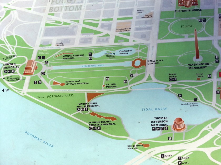
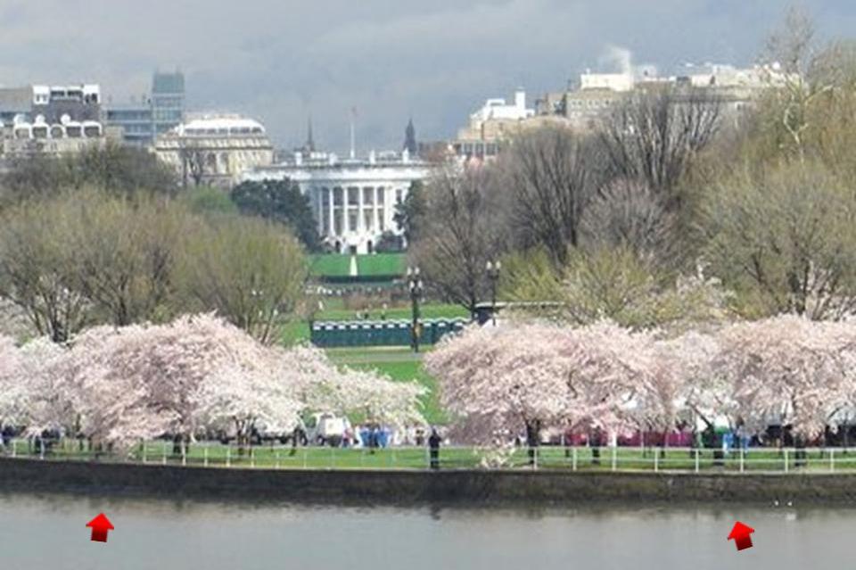
This is photo from Google Earth of the same relative area as the above map shows the exact linear North-South relationships between the White House and the Jefferson Memorial, located on the southeast corner of the Tidal Basin, and the exact line between the Lincoln Memorial to the west, through the Washington Monument, and to Capitol building on the East side of the alignment.
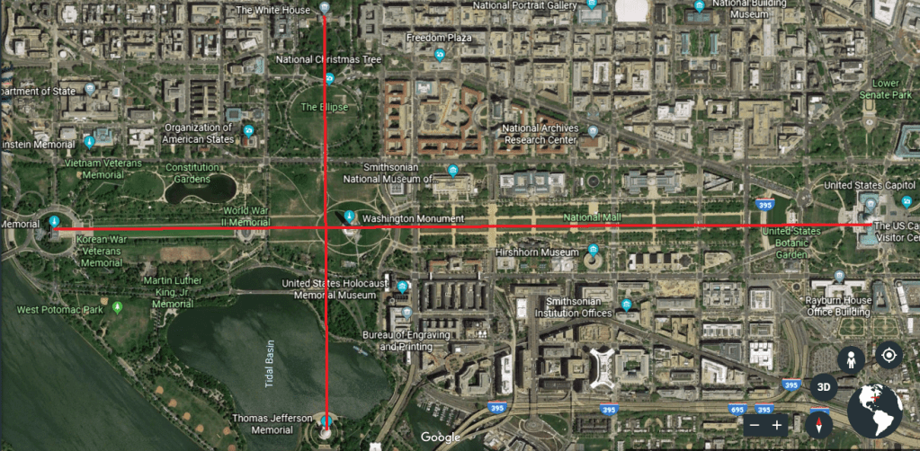
I find it interesting that the alignment between the White House and the Jefferson Memorial goes right through the center of the feature known as the Ellipse, just south of the White House.
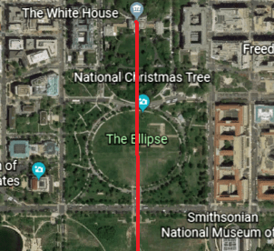
The Ellipse is also known as President’s Park South, and is the home of the National Christmas Tree, and where the annual Easter Egg Roll is held. It is also interesting to note that the exact geographic center of Washington, DC, is said to be 400 meters to the west of, and very slightly south of, the center of the Ellipse Park.
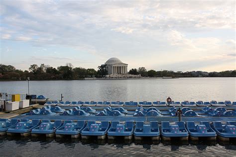
You can rent a paddle boat at the Tidal Basin…
…where you can get a close-up view of its masonry walls, like this view with the cherry blossom tree on top…
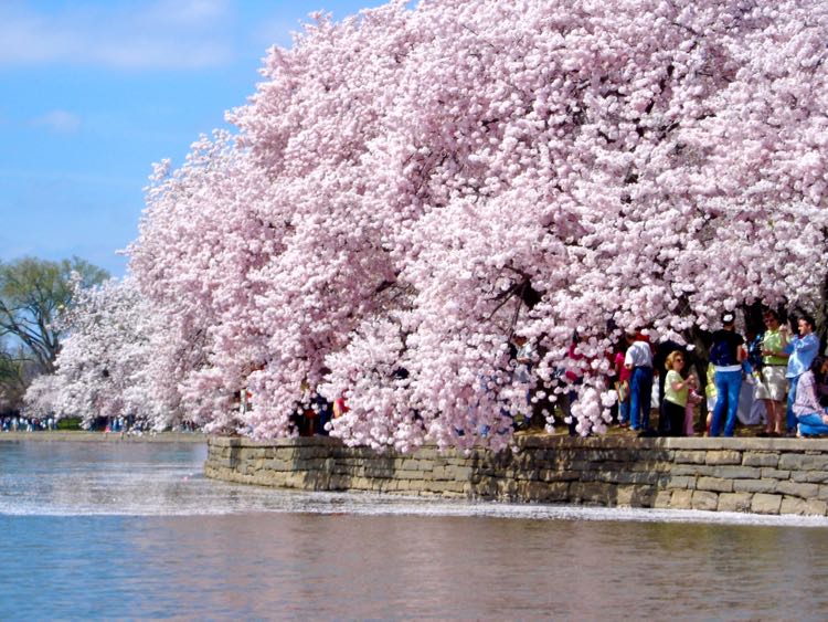
…and the masonry walls in this great view of the cherry blossom trees and the White House from the Tidal Basin.
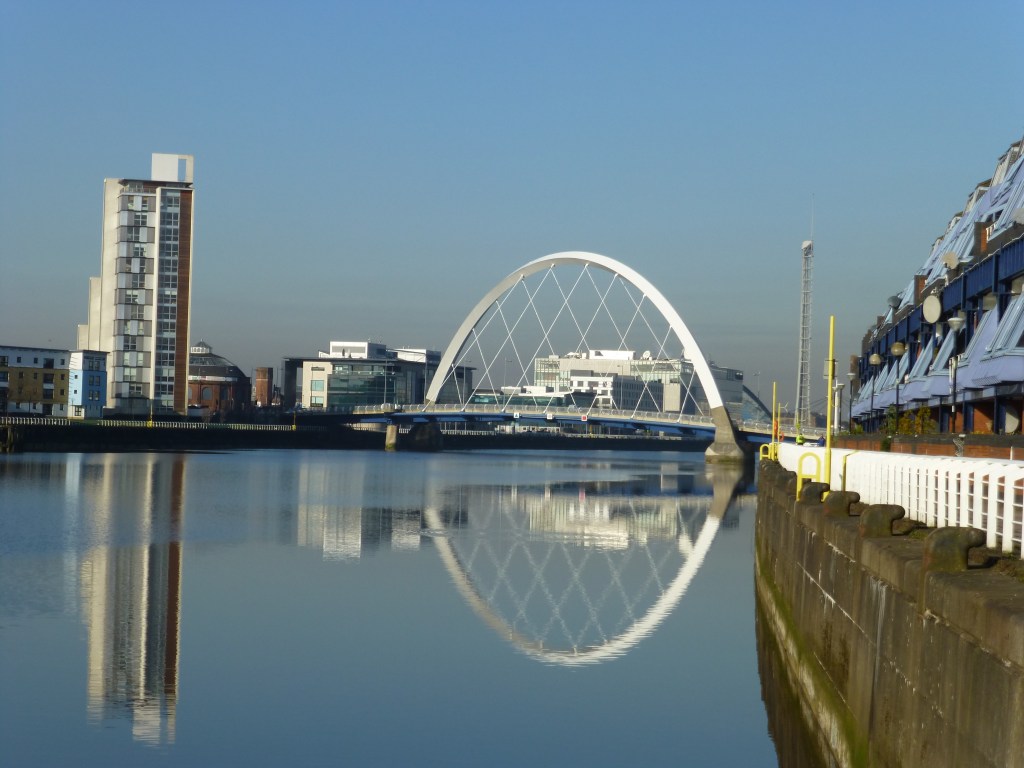
In the Algiers Circle Alignment series I just finished, I found masonry associated with water features occurring throughout Scotland, like the River Clyde going through Glasgow shown here…
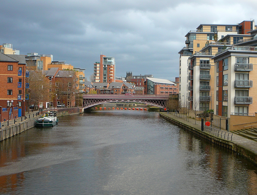
… throughout England like the River Aire in Leeds…
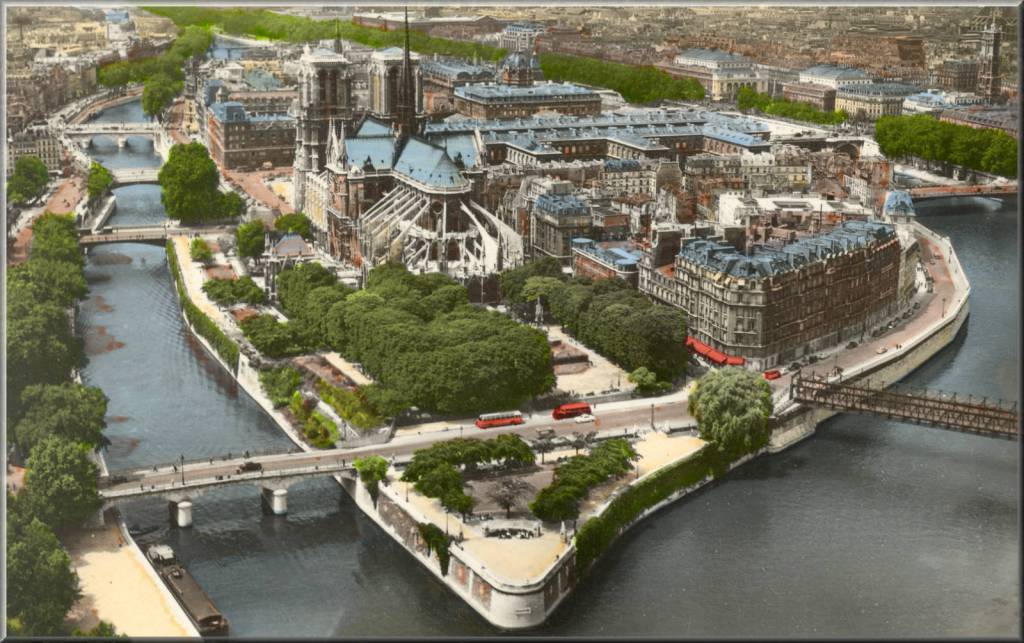
…throughout France, like the Ile de la Cite, the center and oldest part of Paris, and which also happens to be the location of the famous Cathedral of Notre Dame Cathedral…
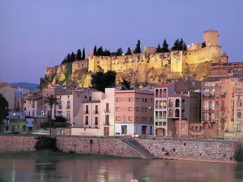
…and throughout Spain, like this view of the River Ebro at Tortosa.
Coincidental…or intentional?
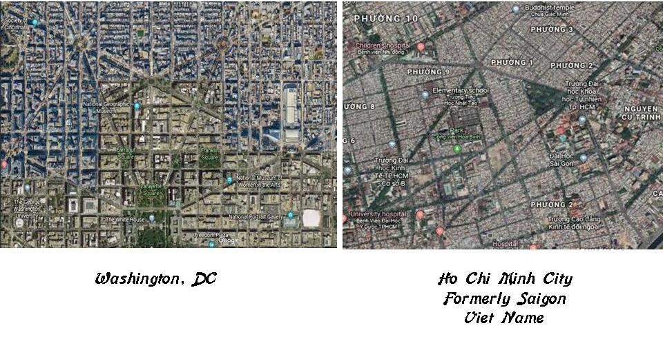
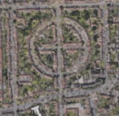
Comparing Google Earth photos, the one on the left is taken in the section of Washington, DC, that is just north of the White house, and on the right is Ho Chi Minh City, formerly known as Saigon, the largest city in Viet Nam by population. Of particular note are the similar geometries seen in the city lay-outs in two very different parts of the world.
This is London from Google Earth, with interesting geometries happening in the street lay-out as there well.
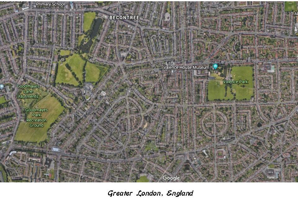
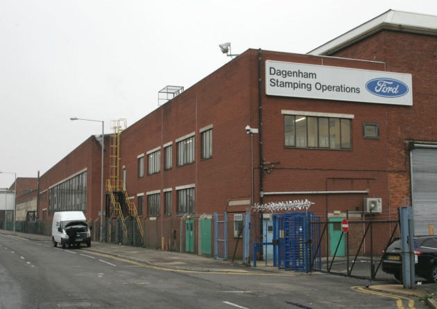
So I picked out this section from the above picture at which to take a closer look, and it turns out to be the city of Dagenham, voted in 2015 as the worst place to live in the United Kingdom.
Yet the Ford Motor Company chose Dagenham, of all places, to be the location of a major automotive factory here. What is up with that?
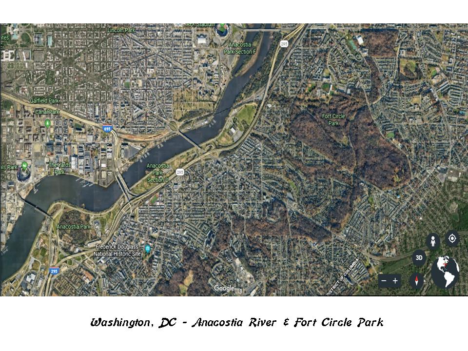
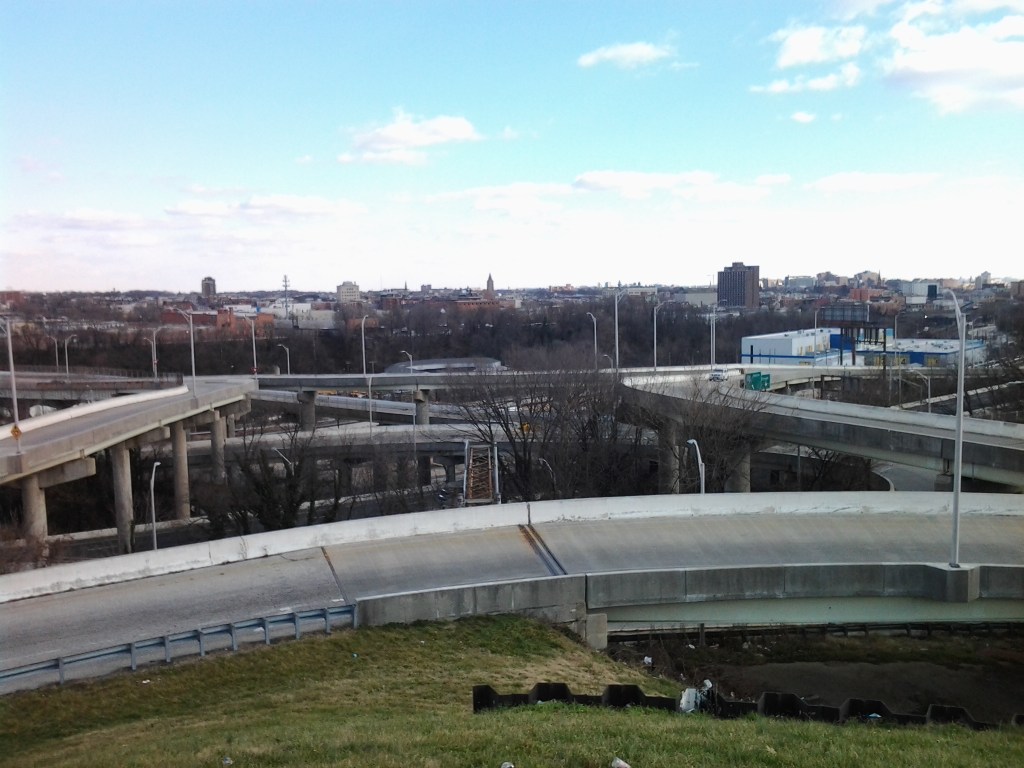
This brings me to Anacostia, historically considered one of the poorest areas of Washington, DC. Currently the waterfront area of Anacostia is undergoing a massive redevelopment project. I believe this area is of great significance with respect to the Advanced Ancient Civilization.
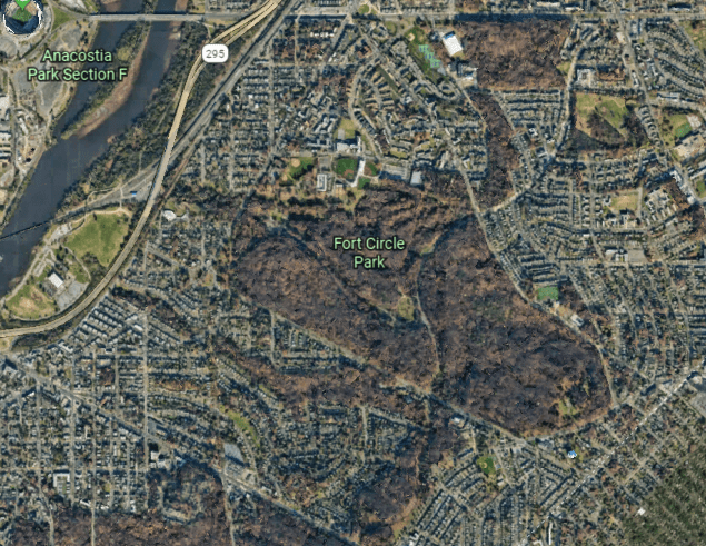
This is a Google Earth image of the Anacostia River, and the Fort Circle Park just to the right of the river. I am going to be looking at both.
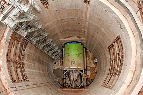
Here is a map showing the locations of shafts for the tunnel system of the Anacostia River Tunnel System…
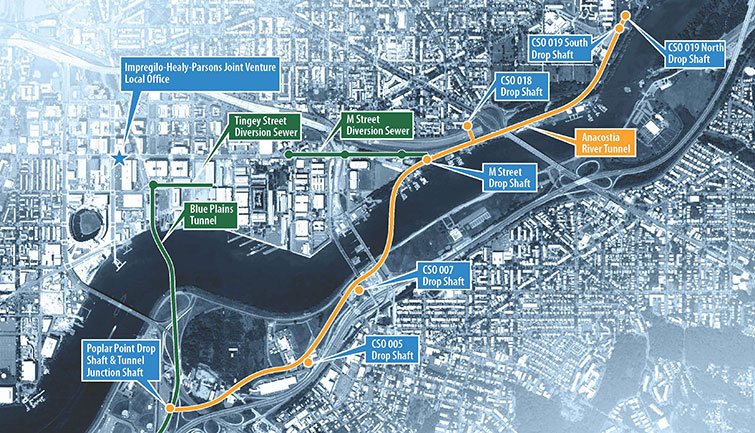
…owned by the DC Water and Sewer System.
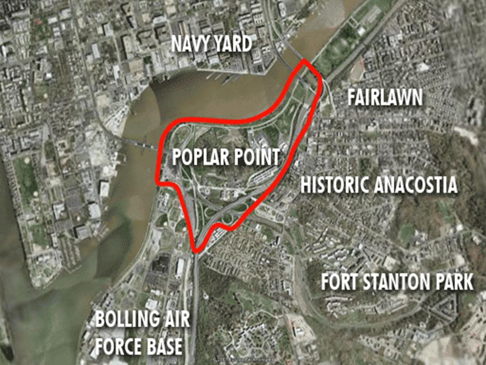
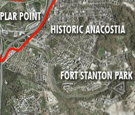
And just in picking one place on the Tunnel System map, at Poplar Point where there is a Deep Shaft and Tunnel Junction Shaft, all of this shows up in close vicinity – Bolling Air Force Base, the Navy Yard, and Fort Stanton Park.
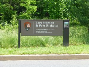
This presents a good lead in to the Fort Circle Park, where there is a 7-mile hiker-biker trail around the remains of what are called Civil War-era forts…
…with end-points at Fort Stanton, which was described at one time as a massive earthwork…
…to which Fort Ricketts was near…
…and the other end-point of the Fort Circle Trail is where Fort Mahan was located.
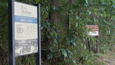
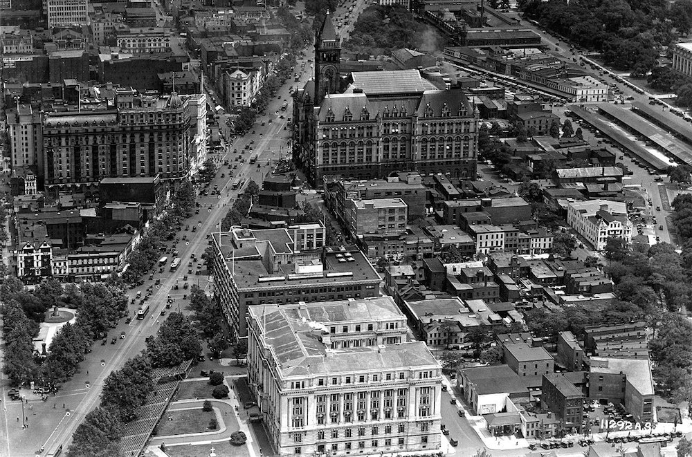
This is an historic photo of Benning, the residential neighborhood where Fort Mahan Park is located. Note the massive size and style of the architecture.
There were four other historic forts on the Fort Circle Park Trail, and with only one exception, there is only signage to mark the one-time existence of these structures.
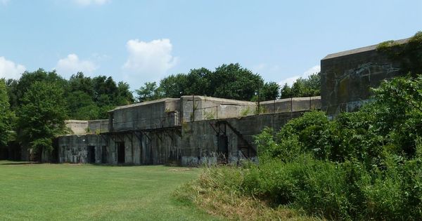
The exception is Fort Dupont…
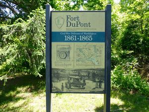
…which has the only intact structure that I can find from looking at images.
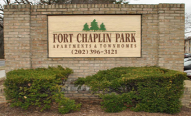
The other forts in the area of the Fort Circle Park were Fort Chaplin…
…where you now find the Fort Chaplin Park Townhomes, one of many such examples.
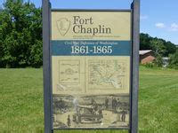
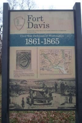
The location of Fort Davis is also located in the Fort Circle Parks Trail.
And these are just a few of what were called the Civil War Defenses of Washington, described as a complex system of Fortifications, said to have been built in 1861. There were 68 major enclosed forts said to have been built, and 93 batteries for field guns. I read where they were considered temporary structures at the time they were built.
This is Fort Reno, where it sits on top of an earthwork, AKA mound. It is located on the highest point in Washington, and said to be the site of the only Civil War battle fought in Washington, during the Battle of Fort Stevens in 1864.
It was said to have been built in the winter of 1861, after the defeat of the Union Army at the Battle of Manassas. Does this look like a hastily built, temporary structure, in the middle of winter?
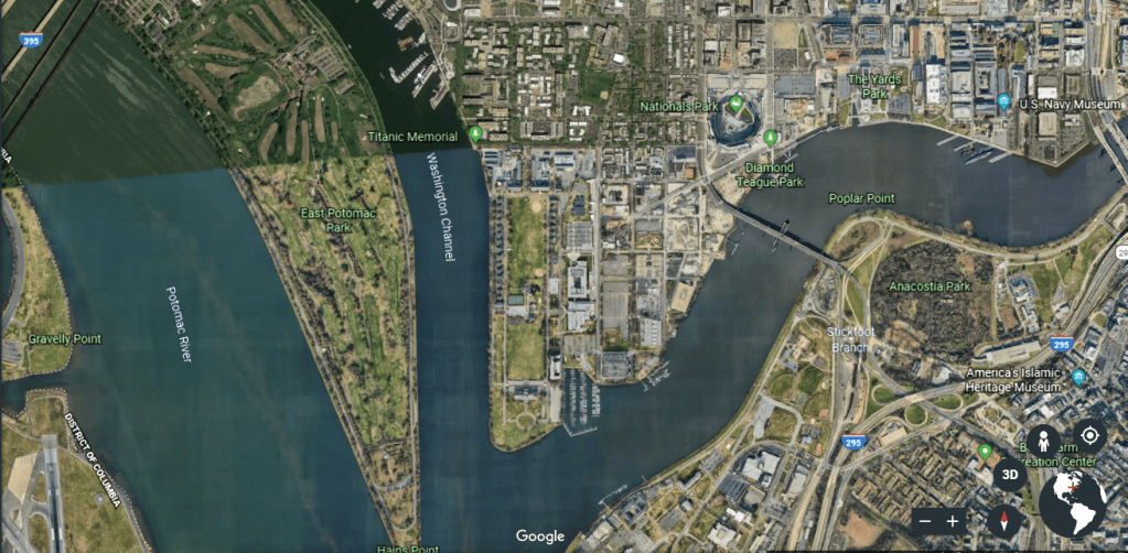
I was also drawn to look at the Georgetown Channel of the Potomac River, where it connects to the Anacostia River…
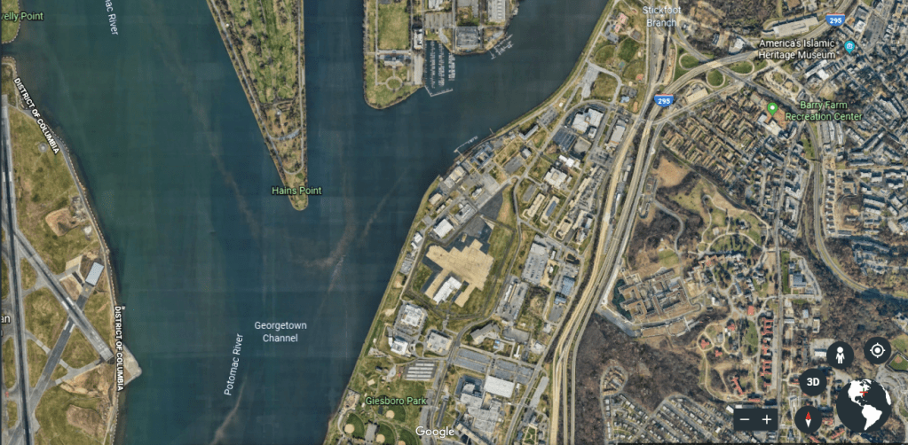
…and the Washington Channel.
There are two features that I would like to highlight in this location.
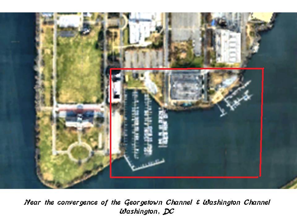
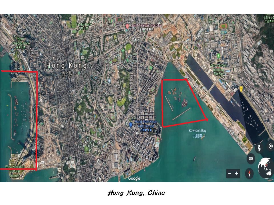
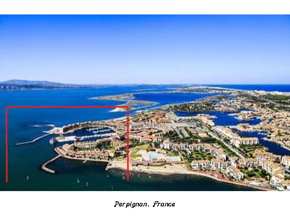
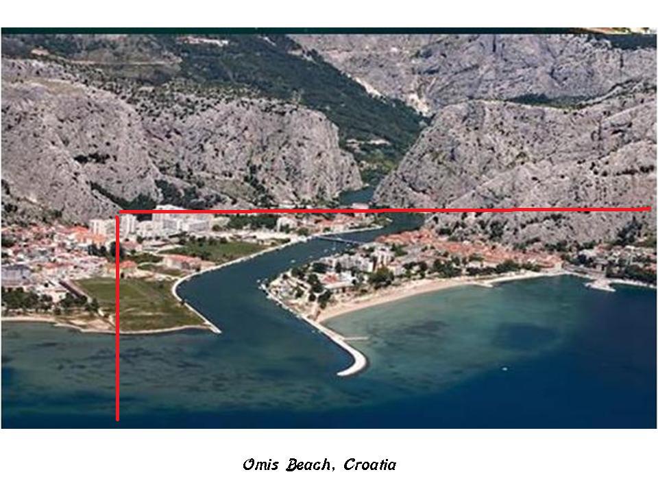
The first is comparing this location at the mouth of the Anacostia River near the Washington and Georgetown Channels…
…with what you see in Hong Kong…
…in Perpignan, France, near the Mediterranean Sea…
…and Omis Beach in Croatia.
The other feature is found on Hains Point, the spit of land between the Washington Channel, the Georgetown Channel, and the Potomac River.
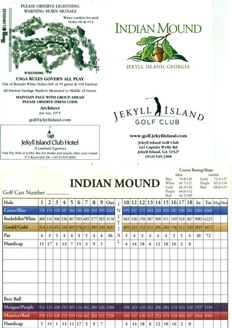
This is the East Potomac Park Golf Course on the top left; a golf course visible from Google Earth in Nairobi, Kenya; and the Indian Mounds Golf Course on Jekyll Island off the coast of Georgia.
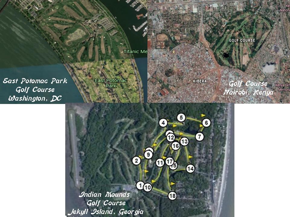
The Indian Mounds Golf Course gave me my first clue several years ago that golf courses cover-up mound sites.
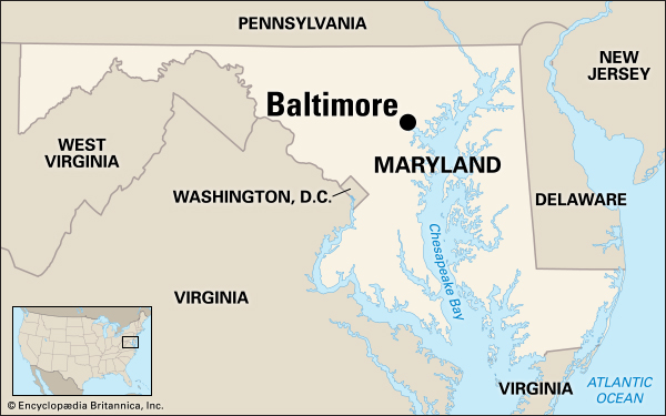
The next place on the alignment is Baltimore, the largest city in Maryland. It is an Independent city, which means that it is not considered part of any county.
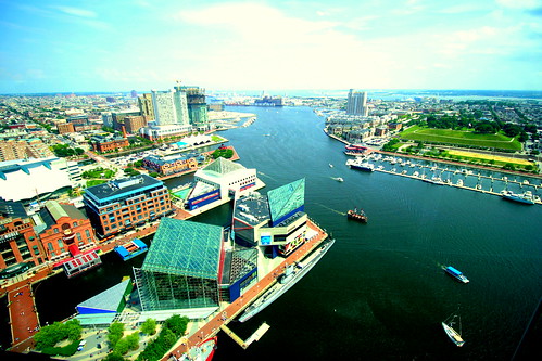
The tidal portion of the Patapsco River forms the Baltimore Harbor…
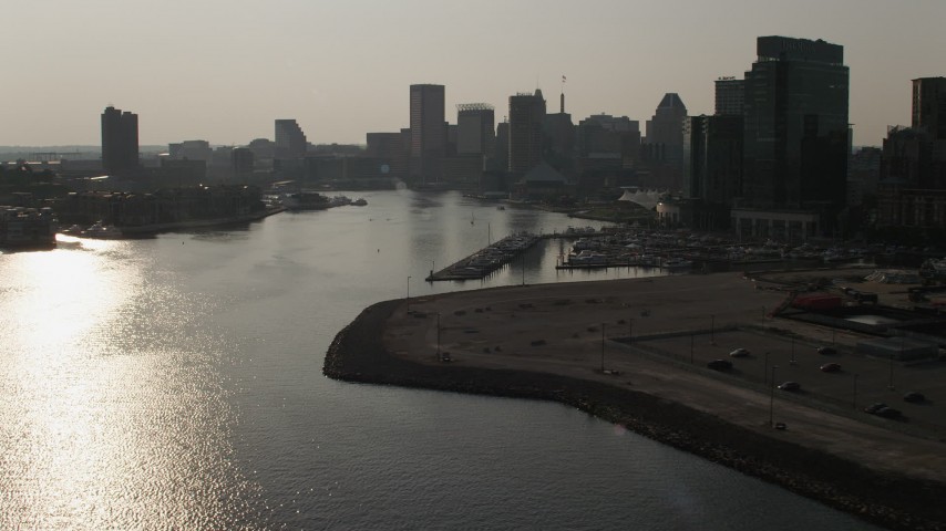
…including the Inner Harbor, which is located at the mouth of the Jones Falls, creating the wide and short northwest branch of the Patapsco River.
Jones Falls is described as an 18-mile, or 29 kilometer, major North-South stream that runs from the North through Baltimore City before it empties into the Inner Harbor.
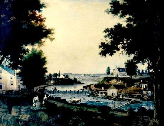
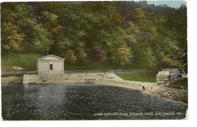
This is the Lake Roland Dam in Baltimore County, north of Baltimore City, described as a defunct reservoir since 1915, and said to have been built between 1854 and 1861. Jones Falls flows in to, and out from, Lake Roland.
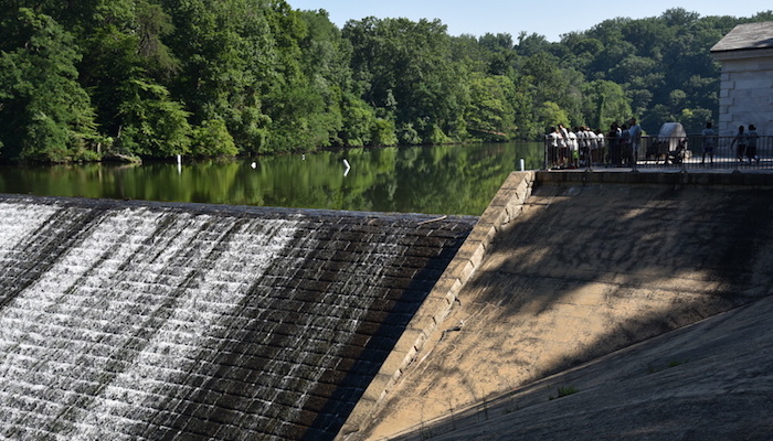
They sure put an enormous amount of effort into building something that wasn’t used for very long….
Jones Falls skirts the eastern edge of Druid Hills Park…
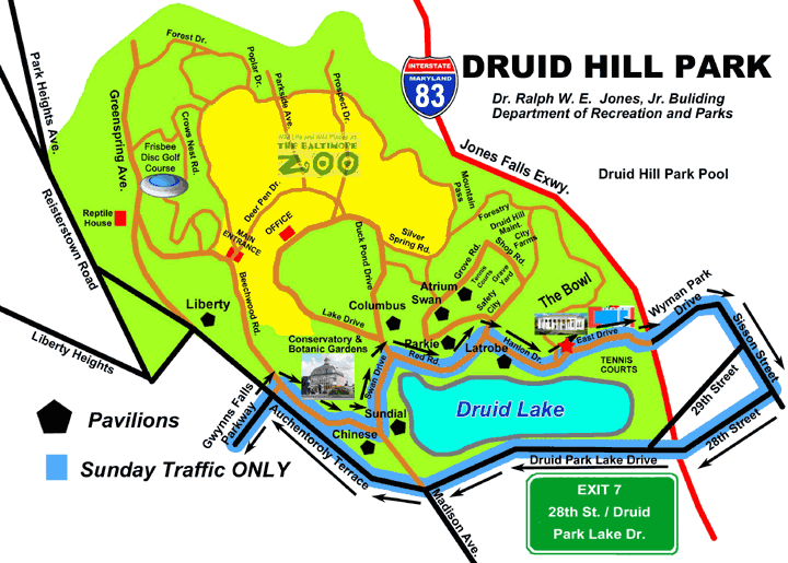
…over which I-83 was built over top of and is known as the Jones Falls Expressway. I attended the University of Maryland Baltimore County (UMBC) from 1986 – 1989, and I was shocked when I lived there to find out that the Jones Falls Expressway was literally built over Jones Falls, and this didn’t sit well with me even then.
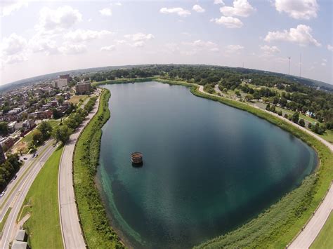
This is Druid Lake, said to have been constructed in 1863 (in the middle of the Civil War?), and is called one of the country’s largest earthen dammed lakes. It served at one time as a reservoir for the Baltimore metropolitan area public water system.
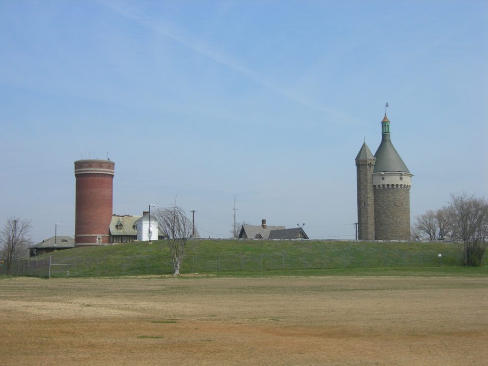
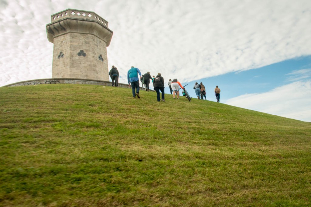
This structure is located at the southeast corner of Druid Lake, and is actually called the Moorish Tower, but said to have been designed and built by George Frederick in 1870…
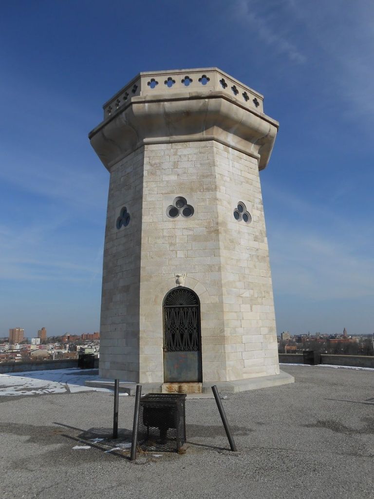
…and also sits atop an earthwork. The tower itself is 30-feet high, and is said to have 18-inch wide marble walls. The entrance was sealed at some point in the 1900s, so entry is no longer possible. It has also been referred to as the Baltimore Tower.
The Maryland Zoo, formerly the Baltimore Zoo, is in Druid Hill Park as well. It is said to be the third oldest zoo in the country, with construction starting in 1876.
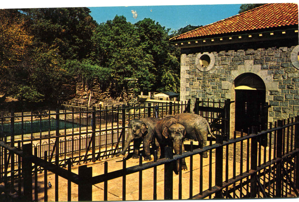
This is the old elephant house, with its heavy masonry and port-hole windows.
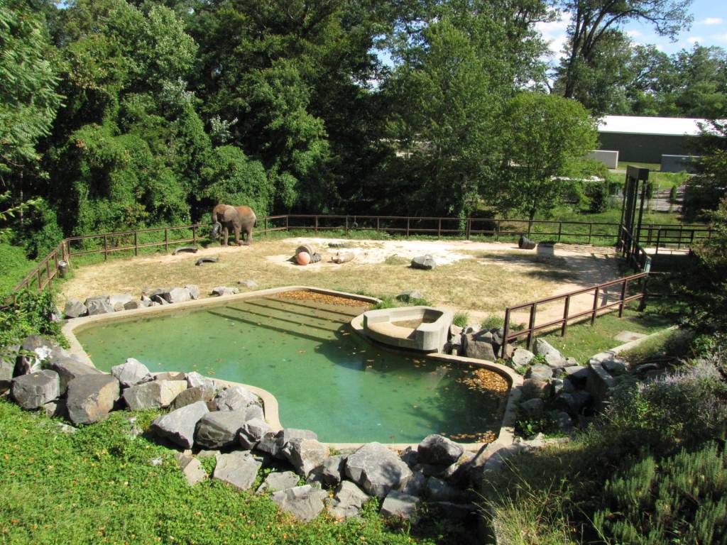
This location is part of the elephant exhibit, with its big block-y rocks with flat faces and straight edges in the foreground…
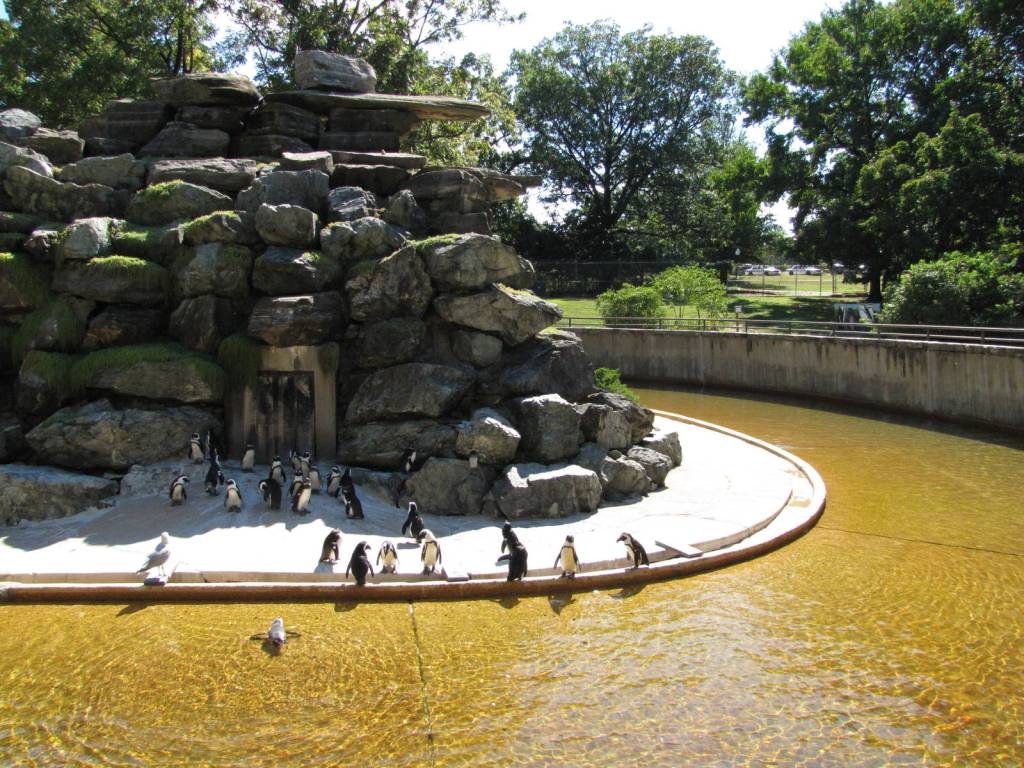
…and same block-y rocks at the penguin venue.
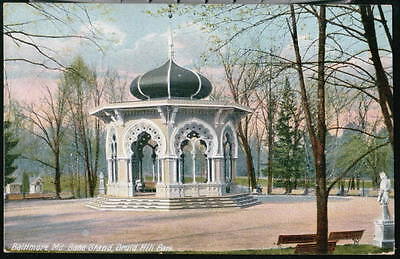
This is a postcard circa 1910 showing the Moorish-looking band stand at Druid Hill Park, with its unique arches and columns, which was demolished for some reason in the 1950s…
…and this is the Latrobe Pavillion in Druid Hill Park, with its interesting arches and double-columns.
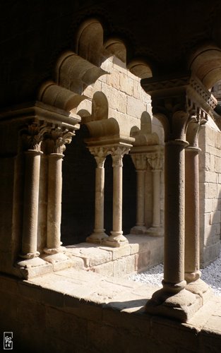
This is the 12th-century Sant Pau del Camp Cloister in Barcelona, Spain, where the arches are described as reminiscent of the Moorish style, where on some arches there are 3-lobes, and on others, 5-lobes…and double-columns, too.
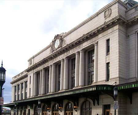
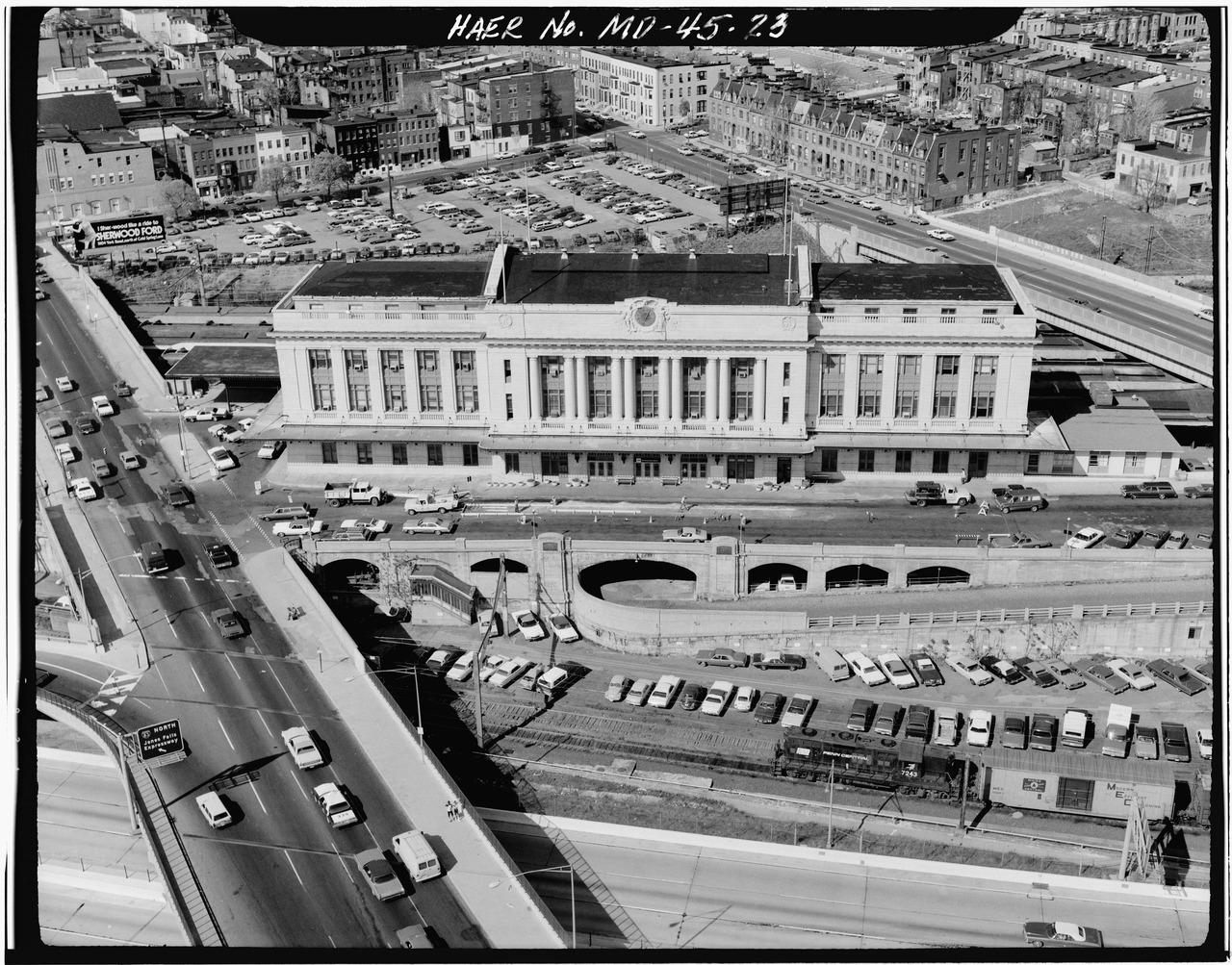
Jones Falls also passes close to Baltimore’s Pennsylvania Station (originally known as Union Station), called the main transportation hub in Baltimore.
It is described as sitting on an island between two open trenches, one for the Jones Falls Expressway…
…which would have originally looked like this with Jones Falls in the foreground before it was covered over…
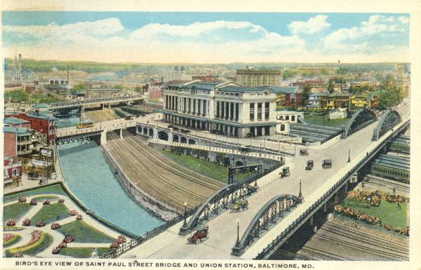
…and on the other side, the tracks of the Northeast Corridor (NEC) as its westernmost stop.

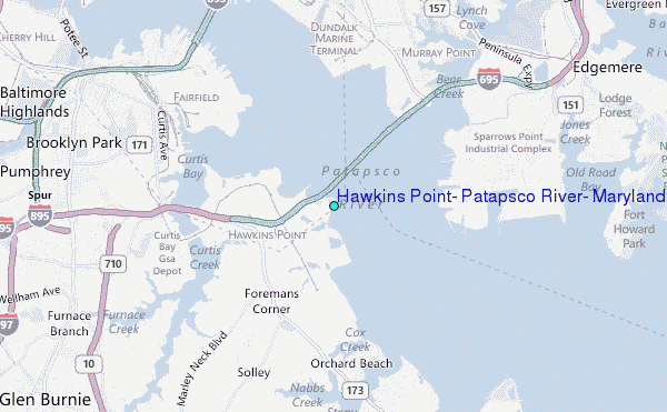
Hawkins Point is the location of the tide station for the Patapsco River.
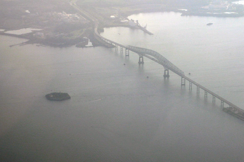
This is an aerial view of Hawkins Point before the Key Bridge construction was started in 1972…
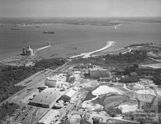
…and after.
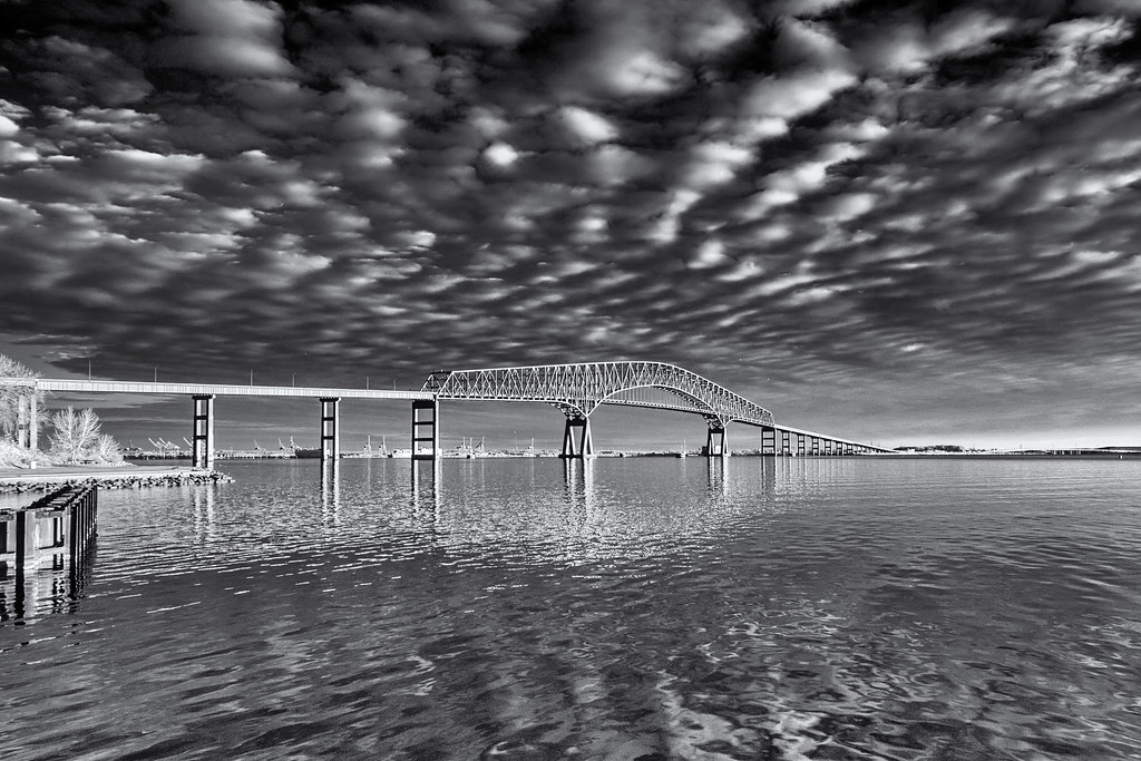
Fort Carroll is a short distance on the other side of the Key Bridge from Hawkins Point. It is described as an artificial island and abandoned hexagonal sea fort, in the middle of the Patapsco River, just south of Baltimore, and said to be named for Charles Carroll of Carrollton, a signer of the Declaration of Independence.
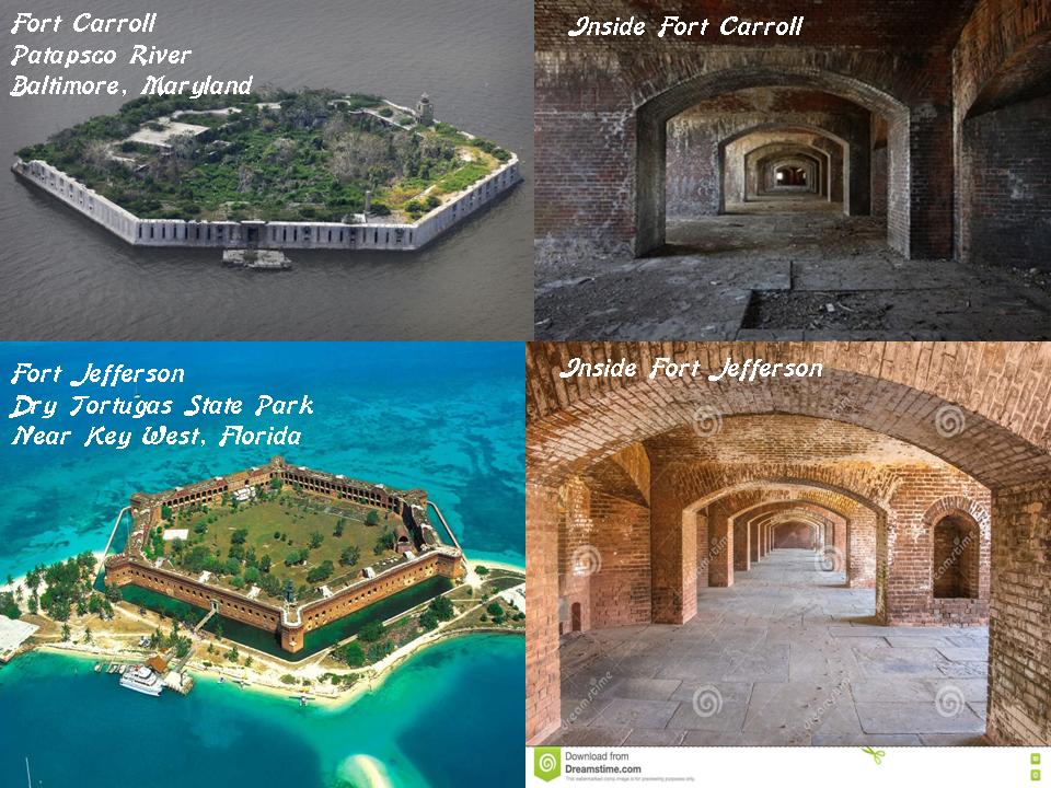
Here I have compared Fort Carroll on the top left and right, with Fort Jefferson, located west of Key West, Florida, now Dry Tortugas State Park, on the bottom left and right
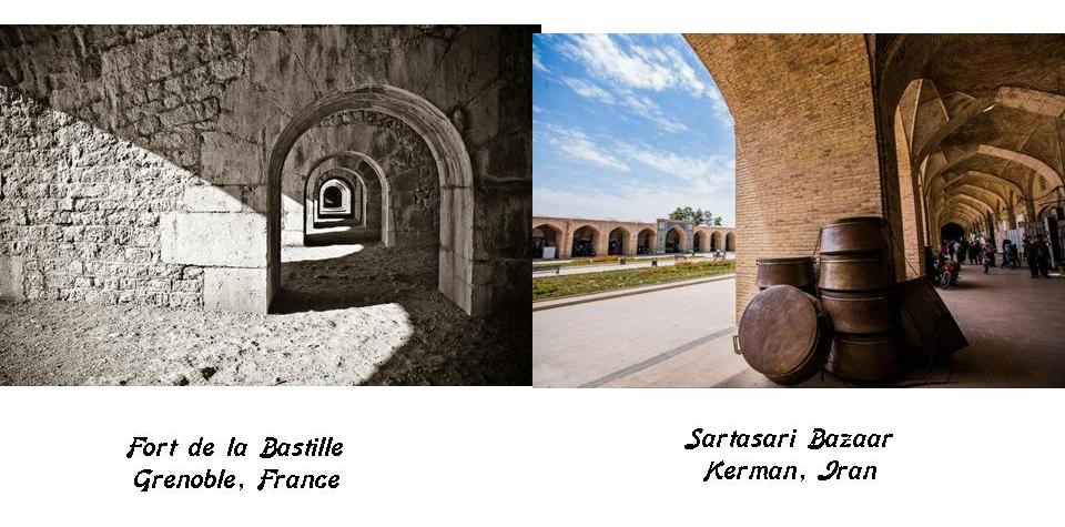
Compare the insides of these forts for similarity with the Fort de la Bastille in Grenoble, France, and the Bazaar-e-Sartasari in Kerman, Iran.
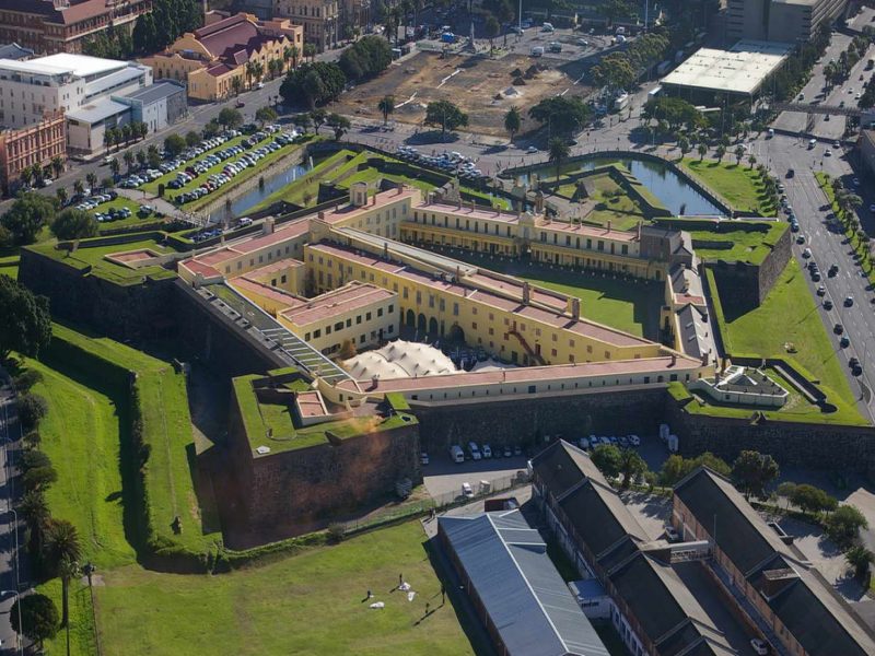
Fort McHenry is the best known fort in Baltimore. The Star Spangled Banner was said to have been written by Francis Scott Key after he witnessed the bombardment of Fort McHenry during the Battle of Baltimore in 1814, a battle that took place in what is called the War of 1812. It is a star fort, like Fort Jefferson, and likely Fort Carroll.
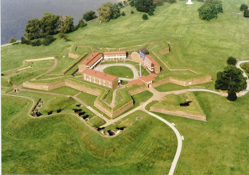
Compare the appearance of Fort McHenry with Kastellet, a star fort in Copenhagen, Denmark…
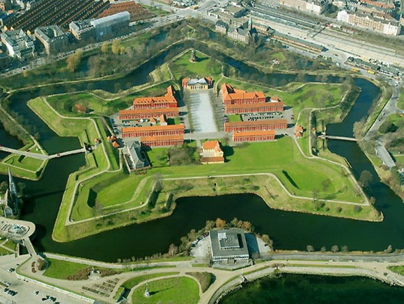
…and the star fort called the Castle of Good Hope in Cape Town, South Africa. Star forts with this type of configuration exist all over the world.
I am going to end this post here, and pick up the alignment in Philadelphia, Pennsylvania.

I find this fascinating. Would you happen to have a youtube channel explaining all this? Thanks.
LikeLike
https://www.youtube.com/channel/UCadBL43irIsBzL6-tIunFtA
LikeLike
Wonderful research, Michelle! Abundant thanks and gratitude.
In 2015, I moved to the Arcadia-Beverly Hills Historic District of Baltimore (https://chap.baltimorecity.gov/historic-districts/maps/arcadia-beverly-hills).
A decade of tremendous activity in and around our little neighborhood has recently been completed (see >> https://transportation.baltimorecity.gov/harfordroadbridgeproject).
When I purchased my home on Arabia Avenue, I had no idea I was putting down roots only blocks away from the Baltimore Columbus Obelisk.
SOURCE: https://en.wikipedia.org/wiki/Columbus_Obelisk
The Columbus Obelisk is one of three monuments to Christopher Columbus in Baltimore, Maryland. Erected on 12 October 1792, the obelisk is the oldest monument to Christopher Columbus in the United States.
On the monument, the inscription read “Sacred to the Memory of Chris. Columbus / Octob. XII MDCCVIIIC.” until the plaque with this message was destroyed in 2017.
History
The Columbus Obelisk was donated by the French Consul to the City of Baltimore, Charles François Adrian de Paulmier, Chevalier d’Anmour, in 1792 to commemorate the tricentennial anniversary of Columbus’s discovery of America.[5] The monument was originally located on d’Anmour’s estate on North Avenue and Harford Road. On October 12, 1964, it was rededicated and moved to its present location in Herring Run Park at Harford Road, Walther Avenue, and Parkside Drive.
LikeLike
Thank you for sharing this Ann! Memorializing famous historical characters like Columbus and Lewis and Clark was one of the ways that true history has been covered up. “We built it or erected it or held it in honor of ________” The 1893 World’s Columbian Exposition in Chicago is another example of a Columbus arrival celebration.
LikeLike