
I started noticing an important pattern in big cities when I was doing the research for the “Circle Alignments on the Planet Washington, DC” series, which is that the oldest and most historic neighborhoods of major cities of this country are what would be described as today’s inner cities.
For the sake of keeping this post shorter rather than longer, I am only going to focus on four places – Anacostia in Washington, DC; Harlem in Upper Manhattan in New York City; the Jackson Ward in Richmond, Virginia; and the oldest parts of Atlanta, Georgia.
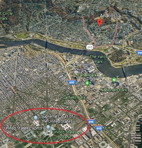
Anacostia is an historic neighborhood in Washington, DC. This is where Anacostia is situated relative to the United States Capitol and Supreme Court Buildings.
And, from another angle, the U. S. Capitol Building is on the east-end of horizontal line that connects it geometrically to the Lincoln Memorial and the Washington Monument to the west.
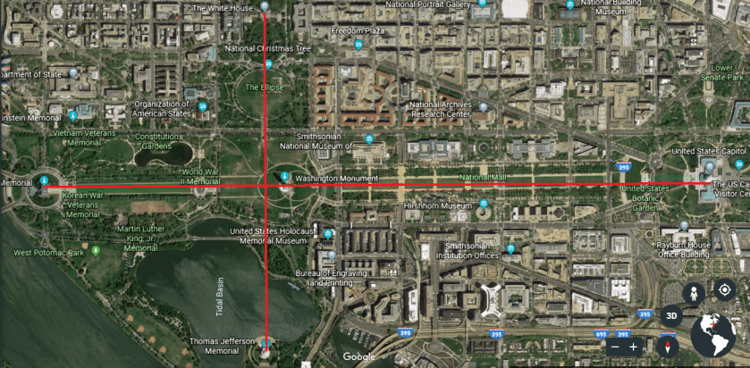
The North-South line depicted here runs from the White House, through the Ellipse, to the Jefferson Memorial.
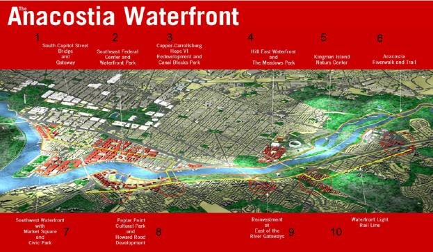
Currently the waterfront area of Anacostia is undergoing a massive redevelopment project…
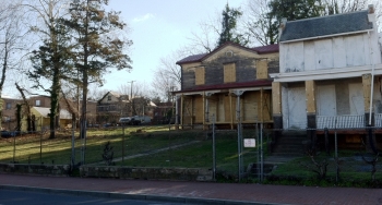
…and there are a large number of abandoned and seriously deteriorating historic real estate properties in Anascostia that are in state of limbo because of disagreement regarding whether or not to restore them in a community sorely in need of affordable housing…
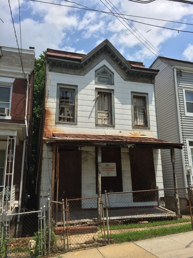
…or to sell the properties for redevelopment purposes.
The name anglicized name Anacostia is said to come from a settlement of Nacochtank, an extinct Algonquin people living around what became Washington, DC.
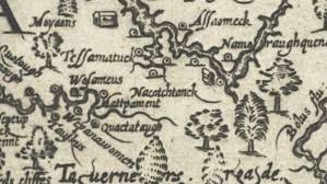
They were said to be associated with the larger Algonquin-speaking Piscataway people of southern Maryland and the Chesapeake Bay.
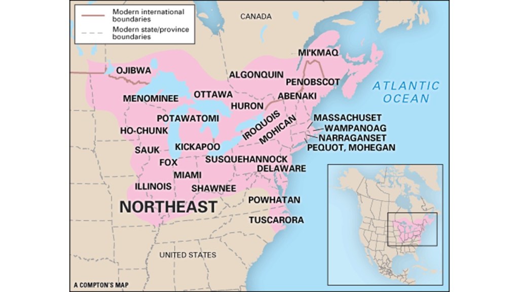
Look at all of these Algonquin-language tribes with lands spread out everywhere in northeastern North America.
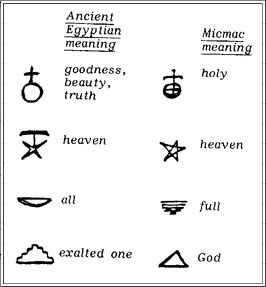
What if I told you the Algonquin language is related to Metu Neter, the the language of the Egyptian hieroglyphs?
This is totally hidden information, so the best I can do right now in support of this assertion is to show you a comparison of the similar meanings of some Egyptian Hieroglyphs compared with that of the Micmac, or Mi’kmaq, an Algonquin-speaking nation of what is now eastern Canada and the State of Maine.
Those behind all of this suppression don’t want us to know about the Stolen Legacy of the Moors in North America and around the world…
…who were the Keepers of the Egyptian Mysteries.
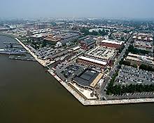
This is a Google Earth image of the Anacostia River.
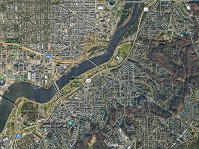
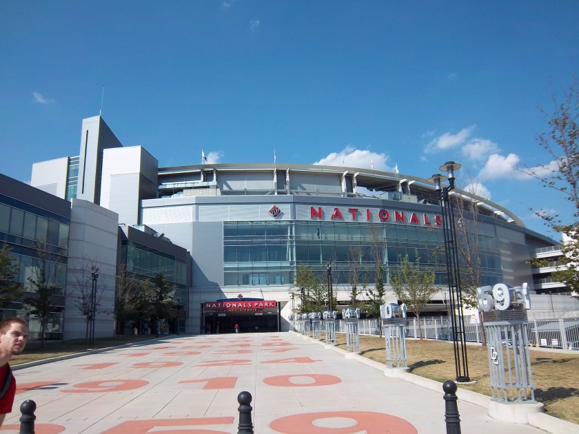
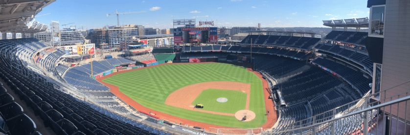
I am amazed at all the things in close vicinity of Historic Anacostia – Nationals Park, the stadium for the Washington Nationals baseball team…
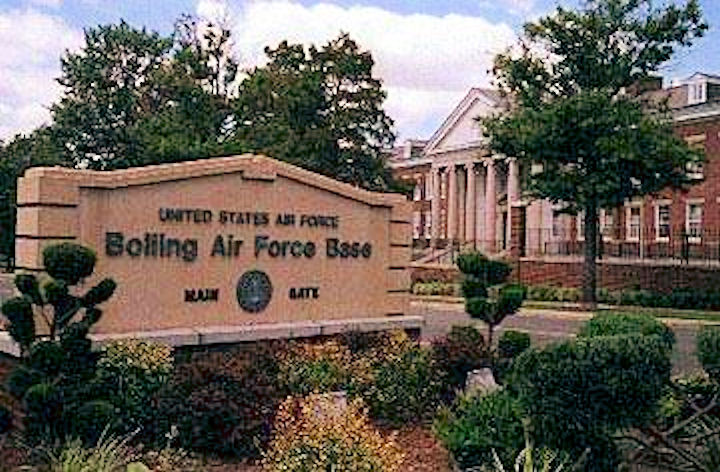
…as well as what is known as Bolling Air Force Base, or Joint Base Anacostia-Bolling, which merged with Naval Support Facility Anacostia…
…the Washington Navy Yard…
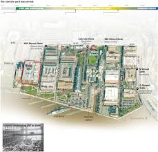
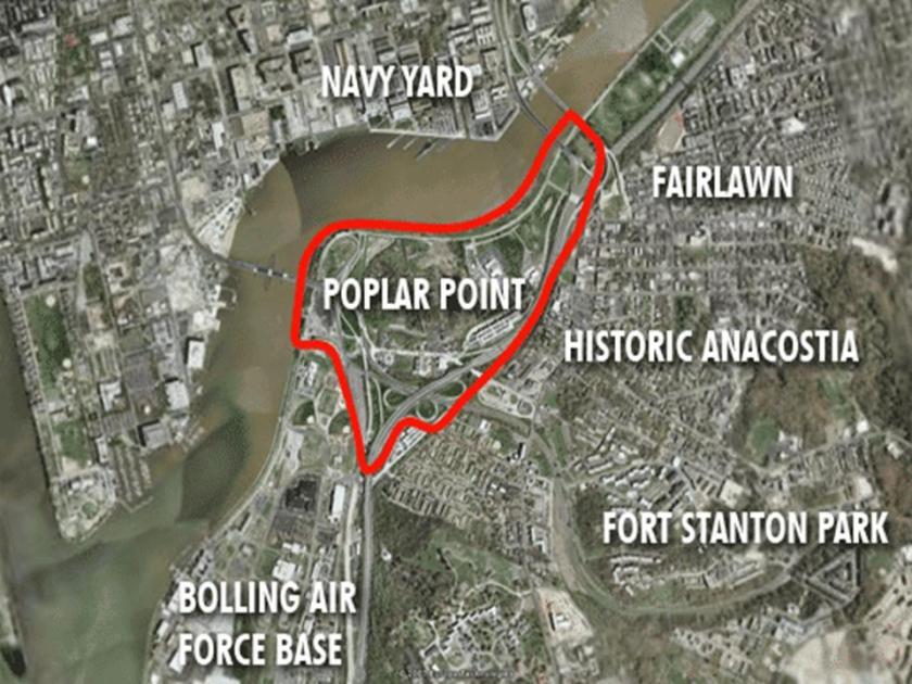
…and where Poplar Point is circled on this aerial map…
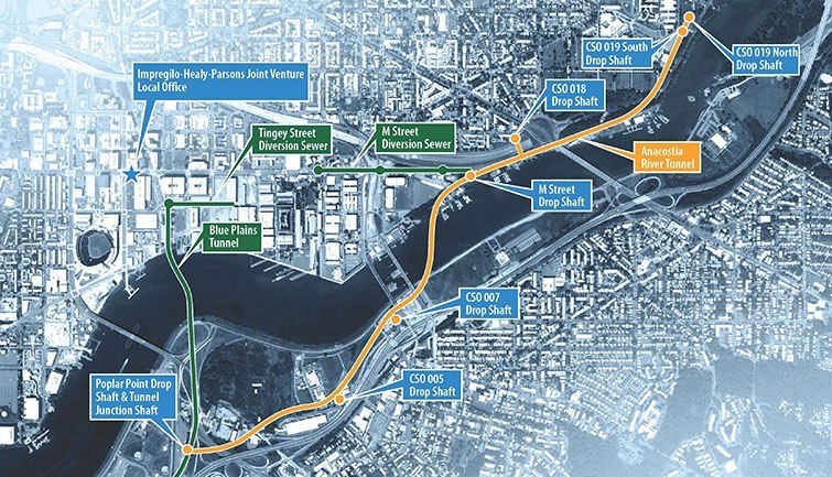
…there is a Deep Shaft and Tunnel Junction Shaft owned by the DC Water and Sewer System. …
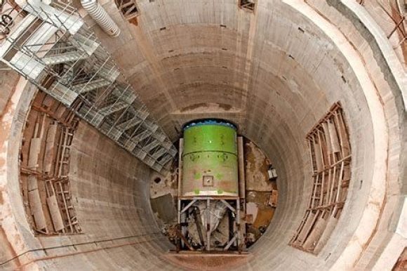
…that is on the map showing the locations of shafts for the tunnel system of the Anacostia River Tunnel System.
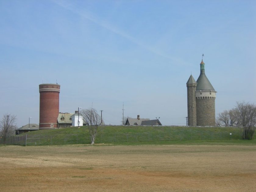
Fort Circle Park, where there is a 7-mile hiker-biker trail around the remains of what are called Civil War-era forts, has an end-point at Fort Stanton Park next to Anacostia, which was described at one time as a massive earthwork.

There were six other so-called civil war era forts in what is now the Fort Circle Park, part of sixty-eight major forts of what was called the Civil War Defenses of Washington said to have been built in 1861. There is hardly anything left to show for this infrastructure here adjacent to Anacostia.
While not in Anacostia in DC, I can show you a place said to have been built during this same time frame that is still standing.
This is Fort Reno, situated on top of an earthwork. It is located on the highest point in Washington, and said to be the site of the only Civil War battle fought in Washington, during the Battle of Fort Stevens in 1864.
It was said to have been built in the winter of 1861, after the defeat of the Union Army at the Battle of Manassas. Does this look like a temporary structure, hastily built in the middle of winter?
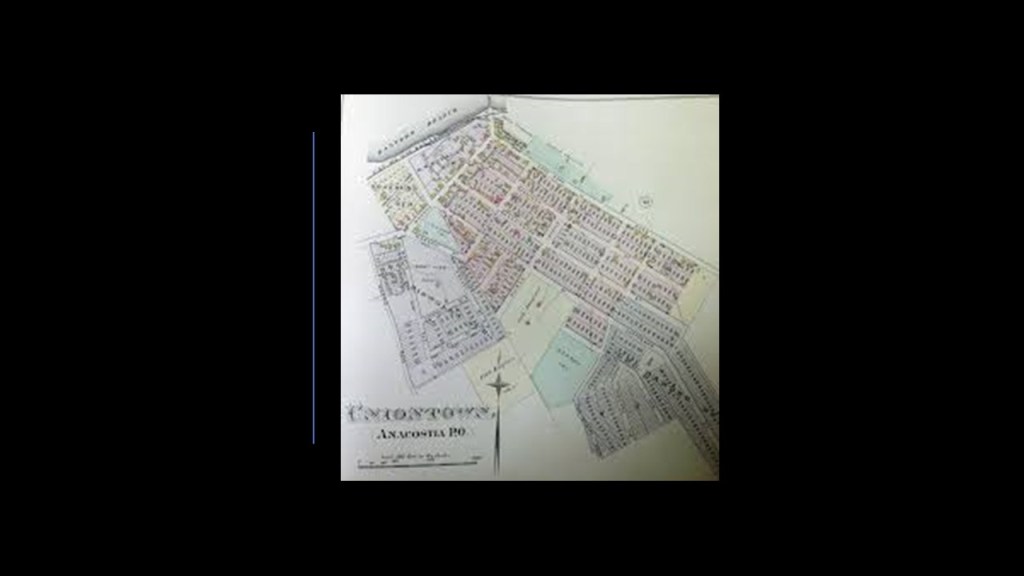
The core of what is now the Anacostia Historic District was incorporated in 1854 as Uniontown. It was said to have been designed to be affordable for Washington’s working class.
Morris Road SE is one of the boundaries of historic Anacostia…
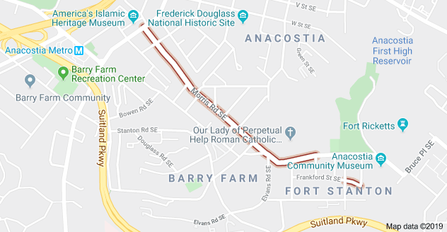
…which is known for its extensive collection of late 18th-century and early 19th-century small-scale, frame-and-brick, working class housing, like shown here on Morris Street.

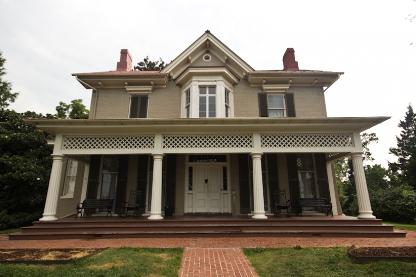
Frederick Douglass, also known as “The Sage of Anacostia,” purchased an estate known as Cedar Hill in 1877, and lived there until his death in 1895.
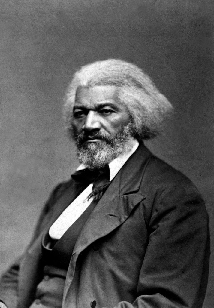
It is still maintained as the “Frederick Douglass National Historic Site.”
I will leave Anacostia with this photo here of the landmark giant chair that is found at the corner of Martin Luther King Jr. Avenue and V Street SE. Wait a minute ~ a giant chair? We are told it was built by the Bassett Furniture Company, and installed there by the Curtis Brothers Furniture Company in 1957. But what a strange landmark!

Are they telling us something without telling us they are telling us?
Could it have been an actual giant’s chair, and not a furniture company gimmick?

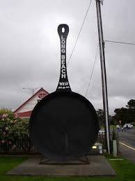
Along the same lines as attractions like the World’s Largest Frying Pan in Long Beach, Washington, said to be a replica of one in which a woman skated on bacon in the town’s Clam Festival in 1941…
…and there is this giant frying pan that was unearthed in Indonesia on the island of Java in 2016.

Just saying not everything…actually quite a lot… is what we are told it is.
Harlem is a neighborhood in the northern section of Manhattan in New York City.
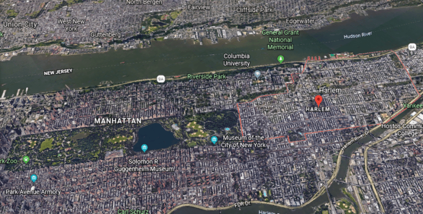
First, let’s see what the neighborhood of Harlem is close to, but not within its boundaries.
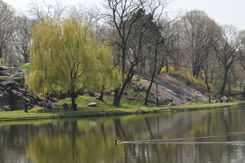
It is bounded by Central Park, where it is right next to the Harlem Meer, or Harlem Lake, section of the Park.
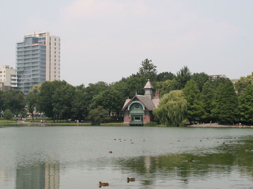
I don’t see much difference etymologically (having to do with the origin of words and how their meanings change) between the word Moor, which pertains to people who were Masters of the Sea, and the one-letter difference between the word meer which means lake in Dutch, and sea in German. In French, the word mer means sea.
This rocky formation at Harlem Meer is called a bluff, which is one of the code-words used to cover up ancient infrastructure.
The Museum of the City of New York is close to Harlem, said to have been built in 1929 and 1930 by Joseph H. Freedlander…
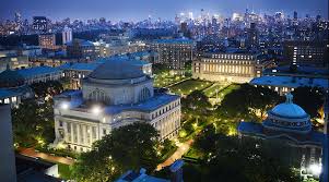
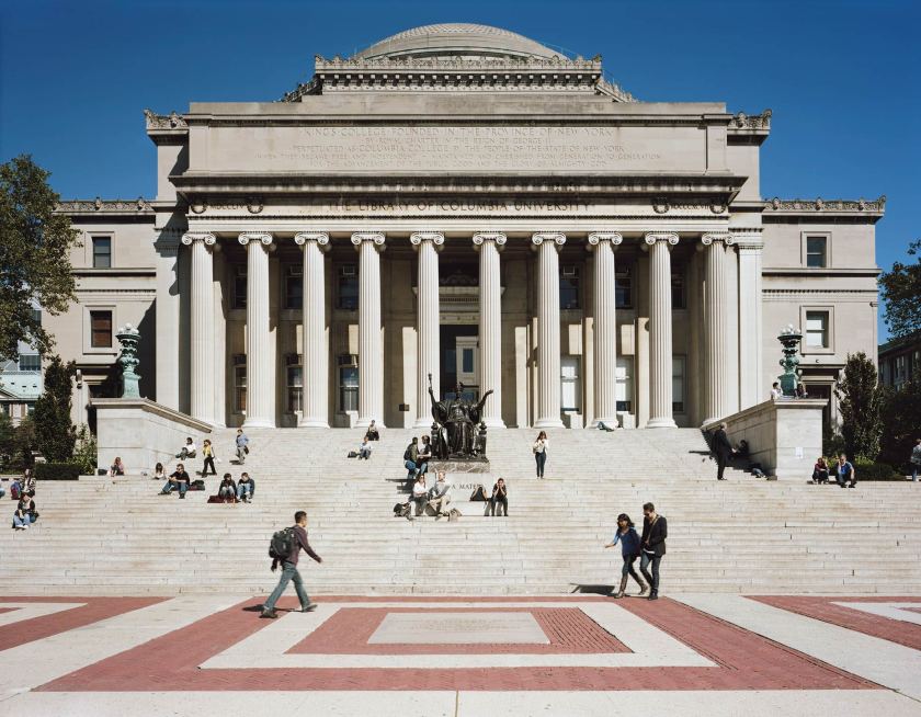
…and Columbia University is close to Harlem…
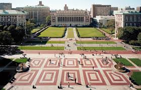
…said to have been established in 1754, and the oldest institution of higher education in New York.
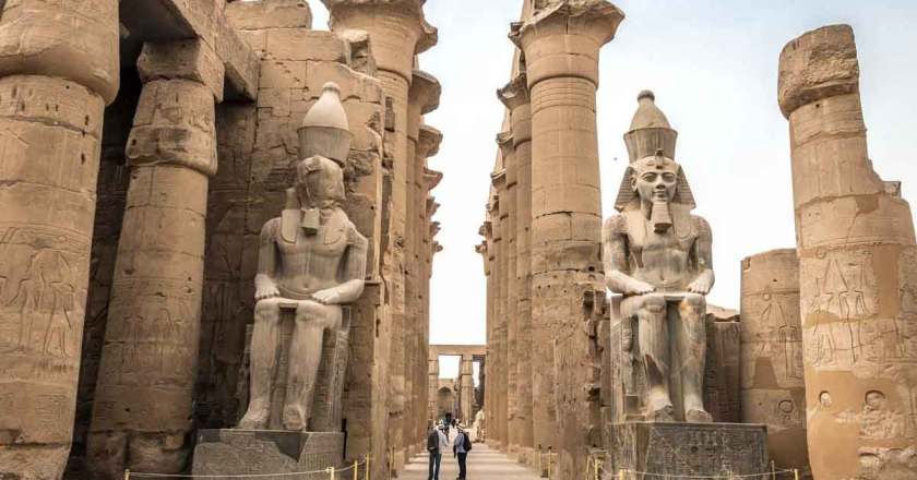
Does this look like architecture built by short people for short people?
For comparison of size and scale to people in the present-day, here is the ancient Temple of Luxor of Egypt.
The General Grant National Memorial, also known as Grant’s Tomb, is located near Harlem, said to have been built in 1897…

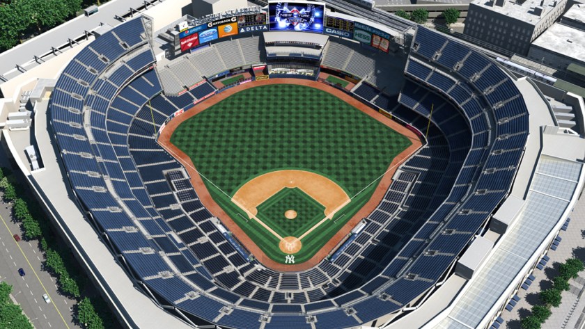
…and Yankee Stadium, just across the Harlem River from Harlem, in the Bronx, said to have originally been built in 1923.

Up the Harlem River a short distance from Harlem proper is the High Bridge, built we are told for the Croton Aqueduct on its way to the reservoir at Central Park, the called the oldest bridge in New York City, with construction having started in 1839…
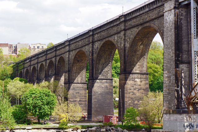
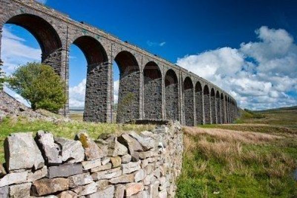
…which reminded me of the Ribblehead Viaduct in the Yorkshire Dales National Park in northern England, said to have been built for the railroad between 1869 and 1874.
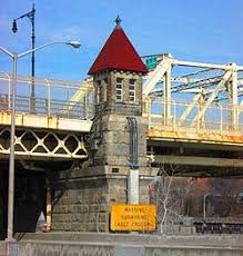
Let’s take a look at what is found in Harlem itself, starting at the Macombs Dam bridge, which crosses the Harlem River between Yankee Stadium in the Bronx and Harlem, said to have opened in 1895, and the third-oldest bridge in New York City.
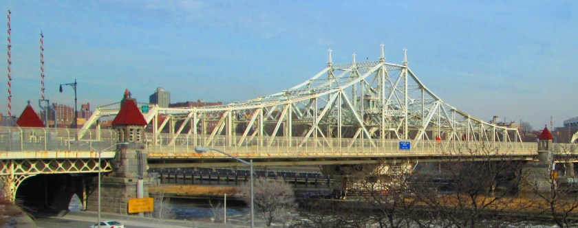
Look at the beautiful, old, and distinctive masonry found on the each of the four stone end piers!
Jackie Robinson Park in Harlem was said to have originally been part of the Samuel Bradhurst estate in the late 18th to early 19th-centuries.
This estate was said to have brick buildings on it, which are now part of the impressive-looking Jackie Robinson Recreational Park facilities…
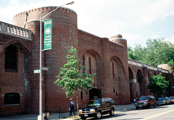
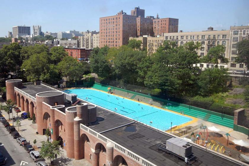
…including these beautiful vaulted ceilings inside the park’s recreational facilities…
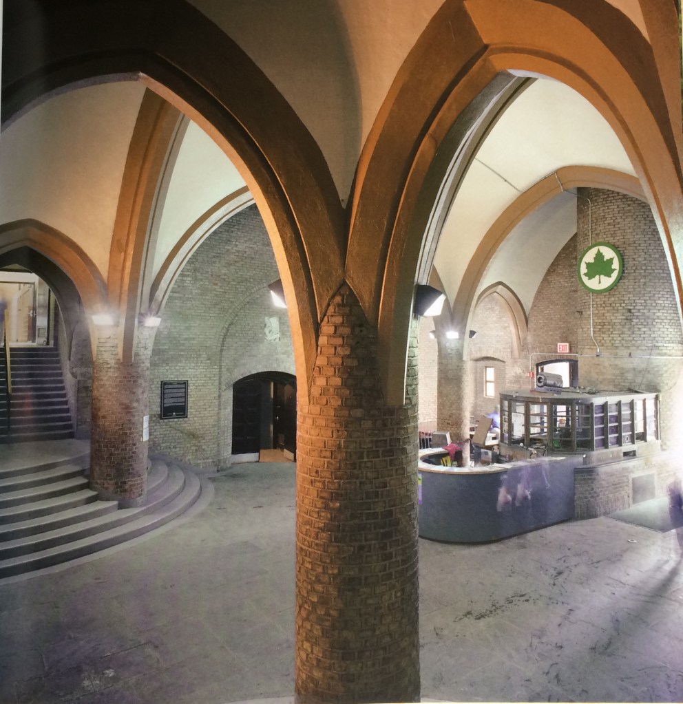
…which is the same kind of vaulted ceiling that we find in cathedrals. Hmmmm.
Convent Garden, with its beautiful gazebo and landscaping, is called an oasis in Harlem…
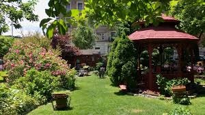
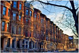
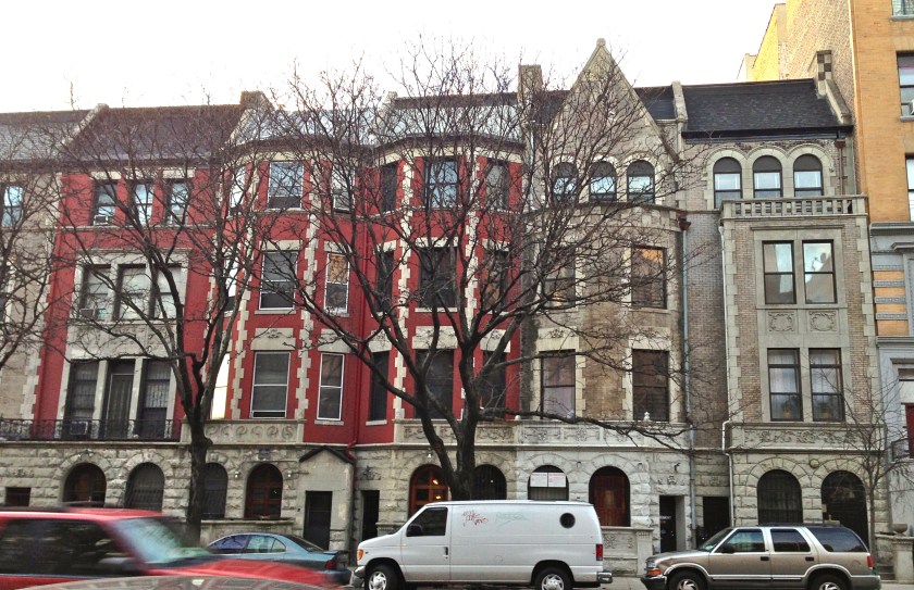
…and is a 13-acre haven amidst the Sugar Hill brownstones, called a once-glamorous enclave of Harlem.
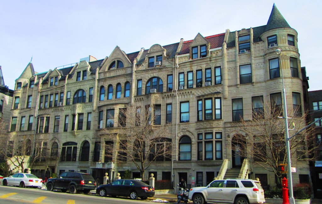
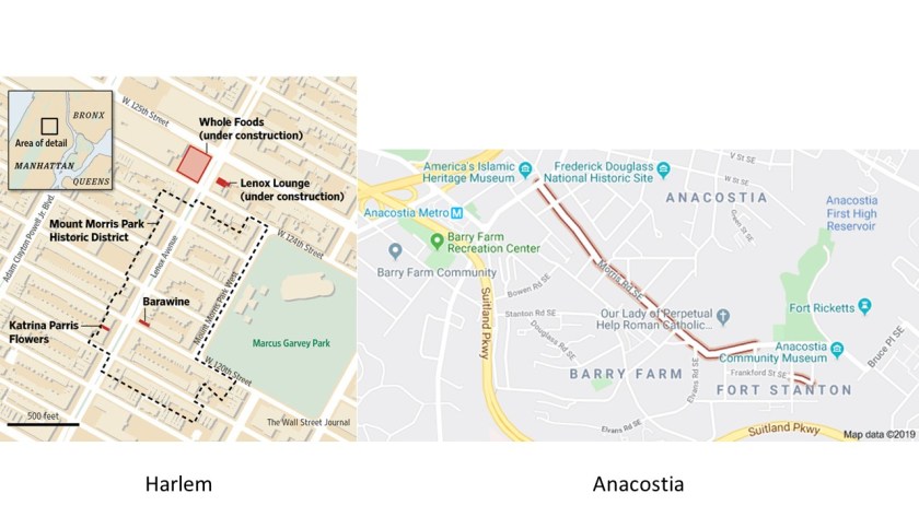
The Mount Morris Park Historic District is in west-central Harlem.
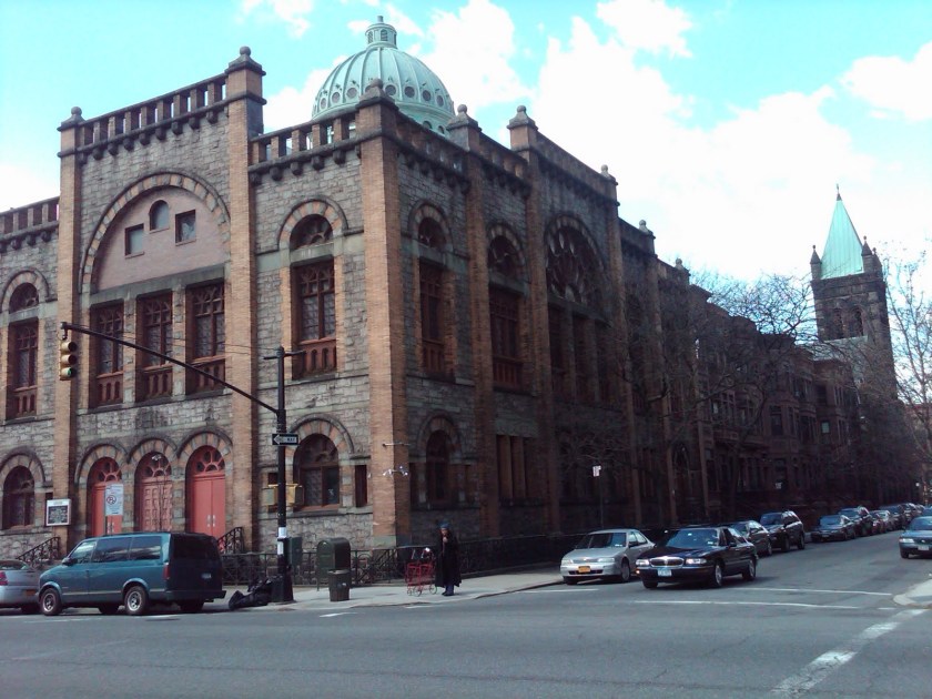
This is the Ascension Presbyterian Church in the Mount Morris Park Historic District in East Harlem, with its impressive masonry architecture and dome…
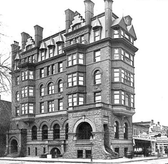
…and a historic photo of the Mount Morris Bank Building, said to have been built in 1883.
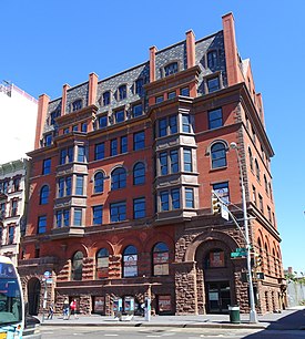
This is the Mount Morris Bank building as it looks today, after having been renovated and re-opened in 2015, after the building withstood decades of neglect, deterioration, and a fire.
Mount Morris Square, the core of the district, is now called Marcus Garvey Park, and is centered on a massive and steep outcropping of stone, and surrounded by flat lawns and playing fields.
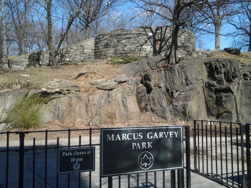
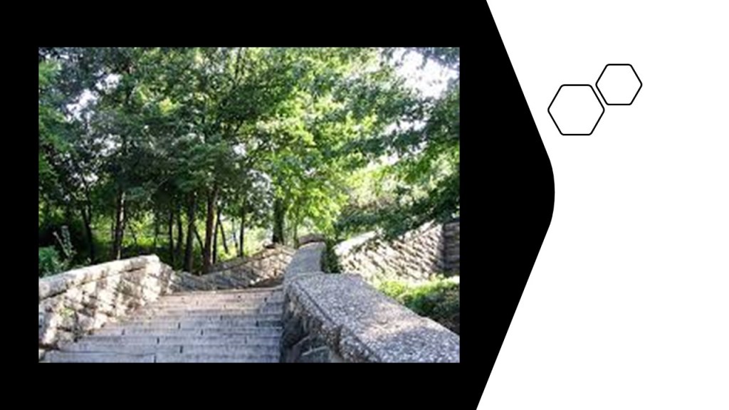
These beautiful stone steps lead up the acropolis in the park…
…where what was called the cast-iron Harlem Fire Watchtower once-stood, said to have been installed there in 1857 …
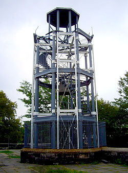
… until it was dismantled in 2015, the reason given being to restore the structure for stability and soundness before it is reconstructed.
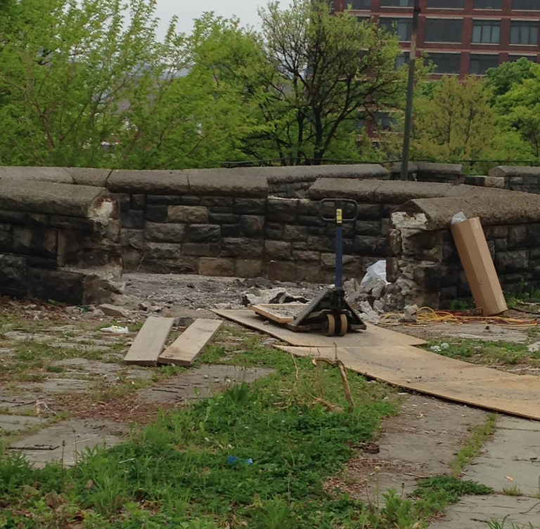
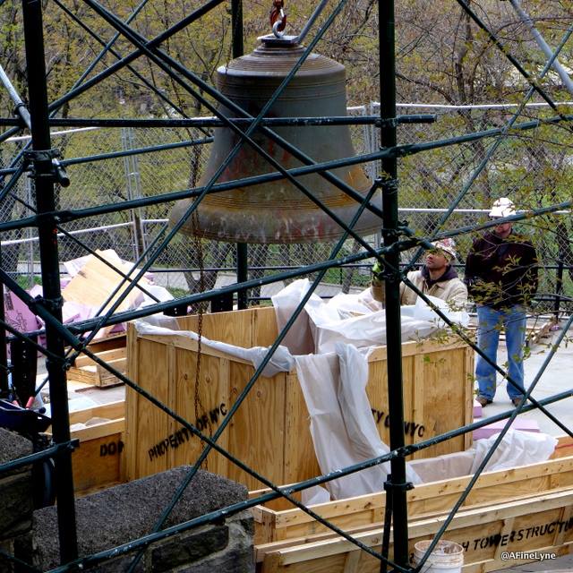
This is the 10,000-lb, or 4,536-kilogram, bell of the watchtower before it was crated. It was said to have been used to ring the time twice a day long after the watchtower was no longer being used as part of the city-wide fire warning system.
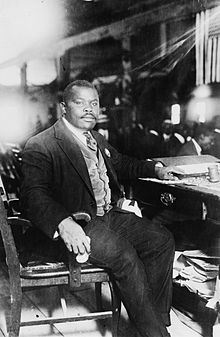
Marcus Garvey (b. 1877 – d. 1940) was a Jamaican-born political activist, publisher, journalist, entrepreneur and orator. This picture of him was taken in 1924.
So far, Harlem has a Mt. Morris district, and Anacostia has a Morris Street. What is it with the name of Morris in these places?
Could it have something to do with telling us who was really here?
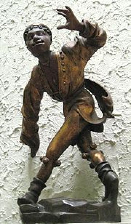
These are Morris Dancers in England, who practice a group dance form of choreographed steps, with bells on the knees, and wielding sticks, swords, or handkerchiefs.
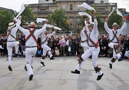
It is said the name of Morris Dance is first recorded in the 15th-century as Moorish Dance. Here is a 1480 statue of a Moorish Dancer at the Old Townhall in Munich…
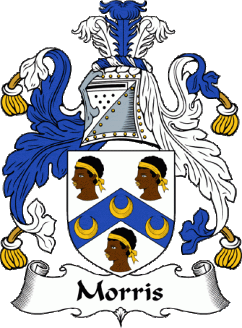
…and this is one of the depictions of the Morris Coat-of-Arms and Morris Family Crest.
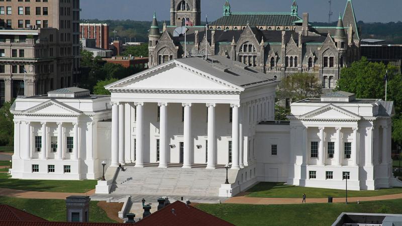
In Virginia, Richmond became the capital of Virginia in 1780, when it was moved from Williamsburg. This is the Virginia State Capitol Building.
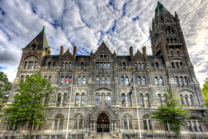
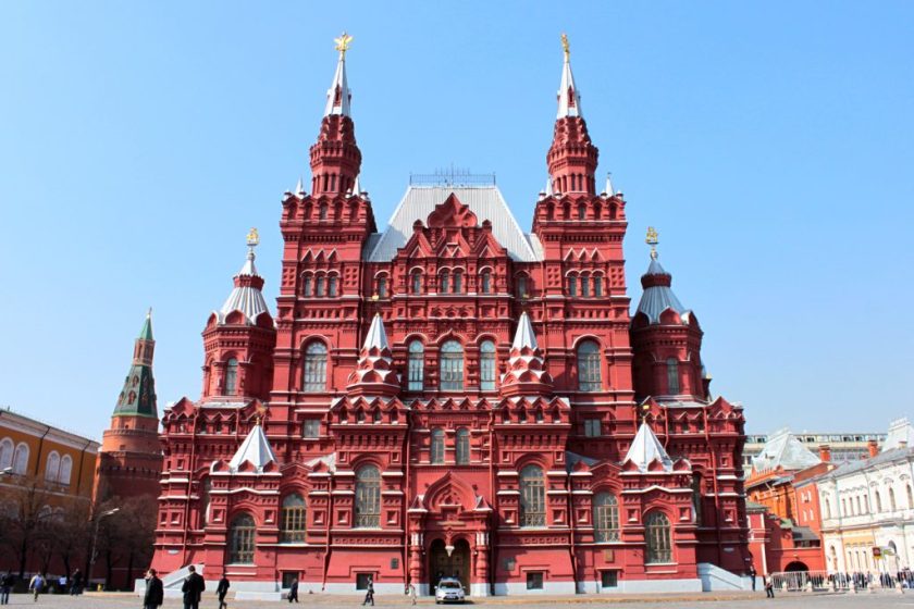
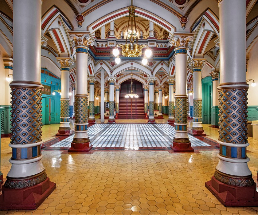
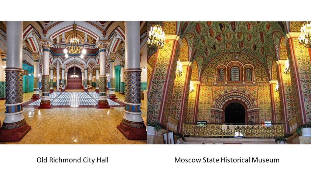
Directly to the north of the Virginia State Capitol building is the Old Richmond City Hall…
…and I am comparing it for similarity with the Moscow State Historical Museum in Russia.
This is inside the Old Richmond City Hall…
…and this is inside the Moscow State Historical Museum.
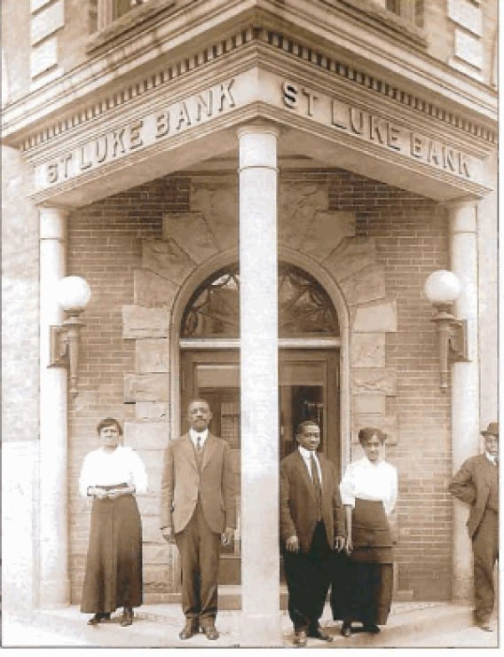
The old and historic Jackson Ward neighborhood is located less than a mile from the Virginia State Capitol building.
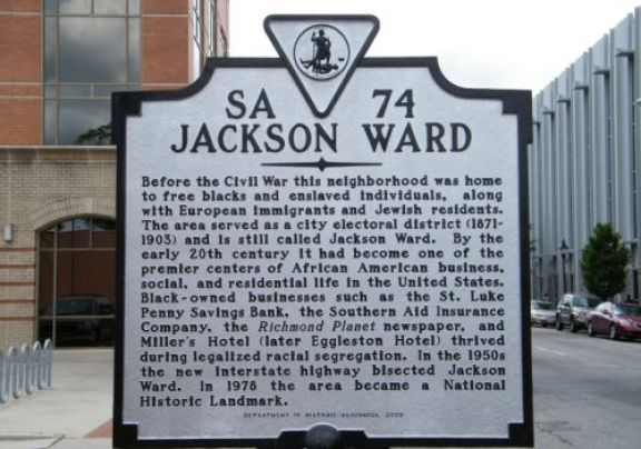
The sign references businesses there, such as the St. Luke Penny Savings Bank, which survived the Great Depression when many banks went under, which became Consolidated Bank and Trust, and is still here today.
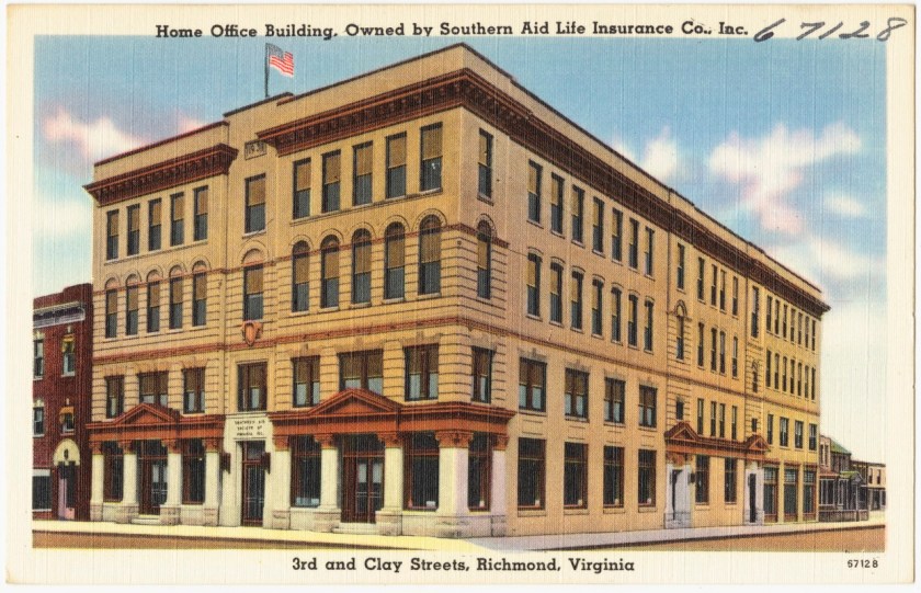
The sign about Jackson Ward also references the Southern Aid Insurance Company, where it was founded in 1893.

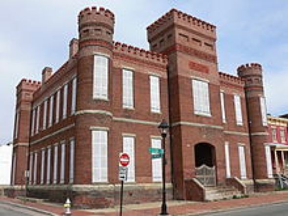
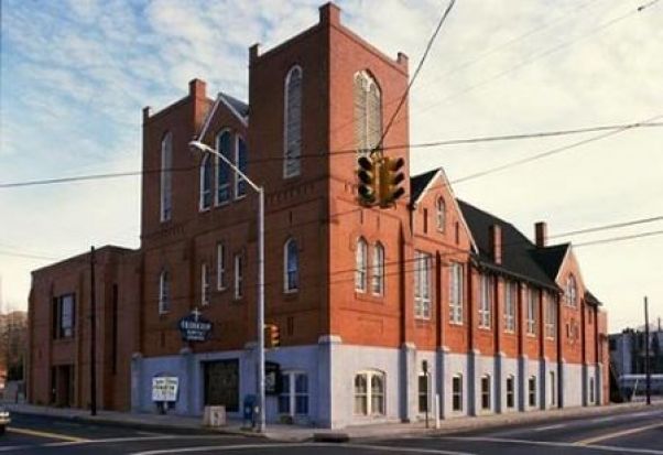
This is the Leigh Street Armory in Jackson Ward, which is now the Black History Museum & Cultural Center of Virginia.
Monroe Park is a 7.5-acre, or 3-hectare, park that is 1-mile, or 1.6-kilometers, northwest of the Virginia State Capitol building. It is pentagonal in shape, and considered to be Richmond’s oldest park.
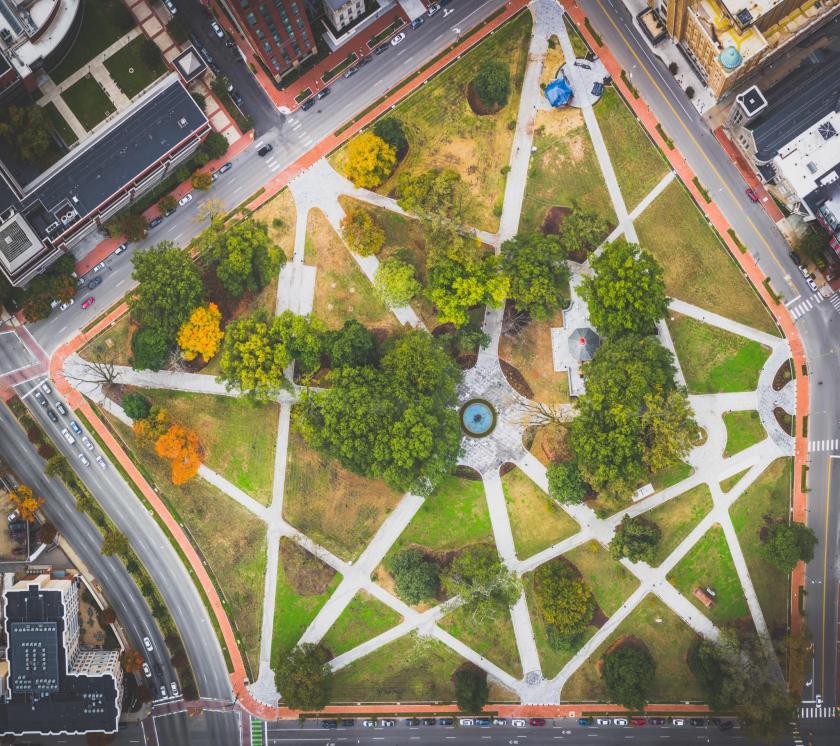
It is the eastern point of the Fan District, because of the fan shape of the array of the streets that extend west from Belvedere Street on the eastern edge of Monroe Park, westward to the Boulevard.

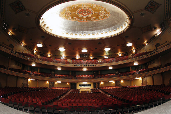
The Altria Theater is located at the southwest corner of Monroe Park.
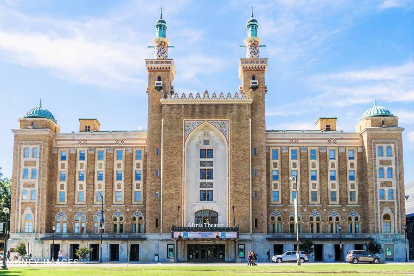
We are told that it was built between 1925 and 1927. This is the interior of the Altria Theater.
Formerly known as The Mosque, and the Landmark Theater, it was said to have been built for the Shriners of the Acca Temple Shrine. More about this later in this post.
Now onwards to Atlanta, Georgia.
We are told that indigenous Creek people and their ancestors inhabited the area, one of the Five Civilized Tribes, along with the Cherokee, Chickasaw, Choctaw, and Seminole.
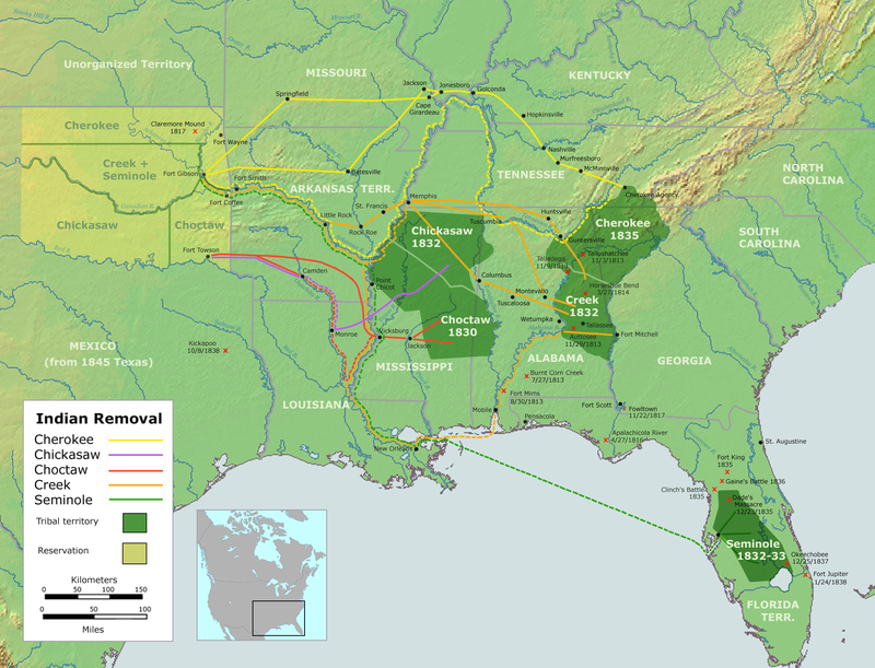
Through the early 19th-century, so-called European Americans systematically encroached on the Creek of North Georgia, and forcing their relocation in 1820s and 1830s under “Indian Removal” to lands west of the Mississippi River. We know of this today as the “Trail of Tears.”
The ancient Etowah Mounds are in North Georgia, near Cartersville in northwest Georgia.
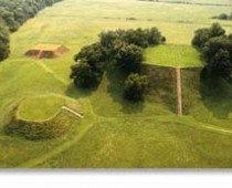
Etowah is said to be a Creek word meaning town/people/tribe, and is a place name found in many states in the U. S.
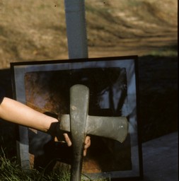
This is a monolithic (made from one stone) axe found in the Etowah, Georgia area…
…and at one time there was what was called a flour mill in Etowah, at the base of three pyramidal-looking mountains.
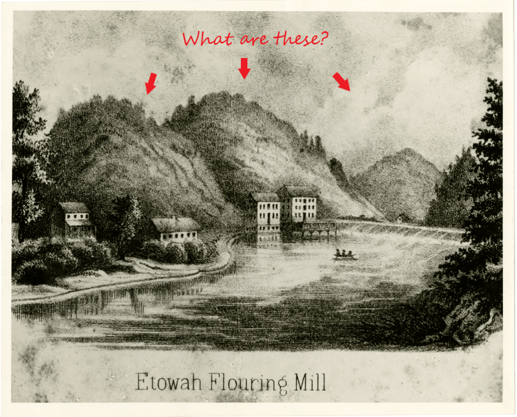
At any rate, this is important, because turning infrastructure built by the indigenous people of this land into some kind of mill, or calling ruins mills, is how this information has been kept hidden from us.
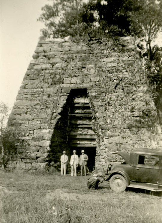
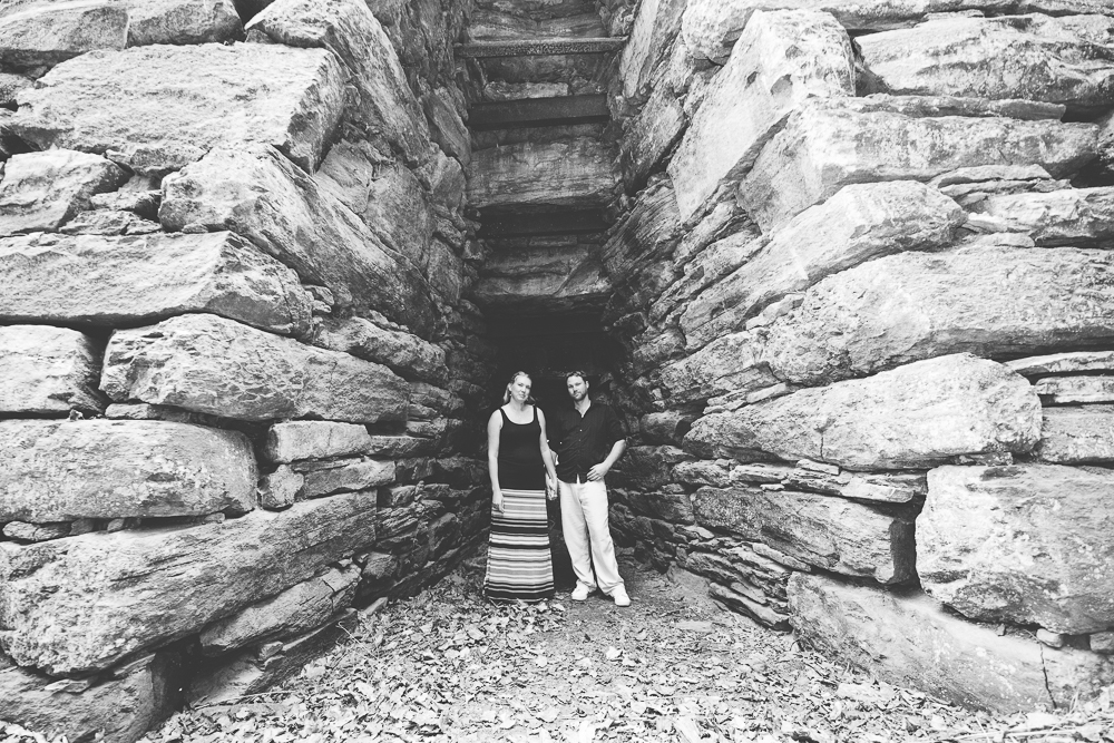
Look at the size of what is called Cooper’s Furnace in Cartersville, Georgia, called the only remains of the bustling industrial town of Etowah…
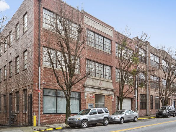
The area in the city limits of Atlanta known as Castleberry Hill is adjacent to, and southwest, of Downtown Atlanta, with Daniel Castleberry becoming an established businessman here when he was said to have won the land in a Georgia land lottery in 1921.
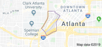
It has become a booming urban renaissance area since the early 1980s, with loft conversions of what are called former industrial areas beginning around that time, and turning them into residences.
Like this brick residential block in Castleberry Hill…
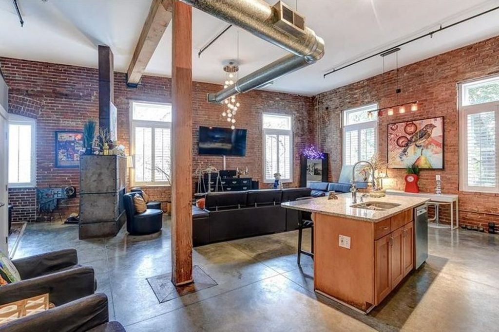
…in another in Castleberry Hill, the renovation inside.
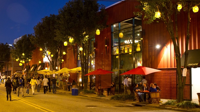
Things like this, and the Castleberry Hill Art Stroll, turning Castleberry Hill into a trendy part of town.
Grant Park refers to the oldest city park in Atlanta, as well as what is called the Victorian neighborhood surrounding it.
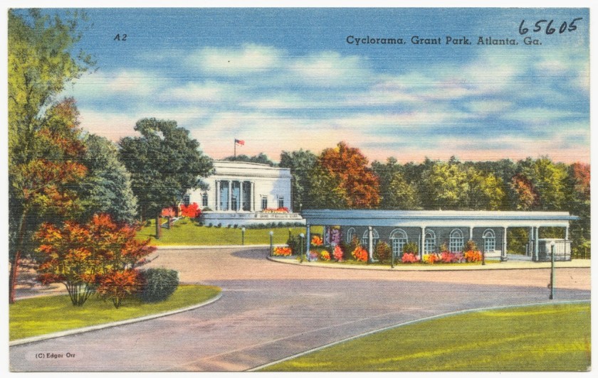
It is a 131-acre green-space and recreational area.
Inman Park in Atlanta has been around, we are told, since the 1880s, and was Atlanta’s first planned suburb, complete with its own electric streetcar shuttling commuters to Downtown Atlanta a few miles to the west.
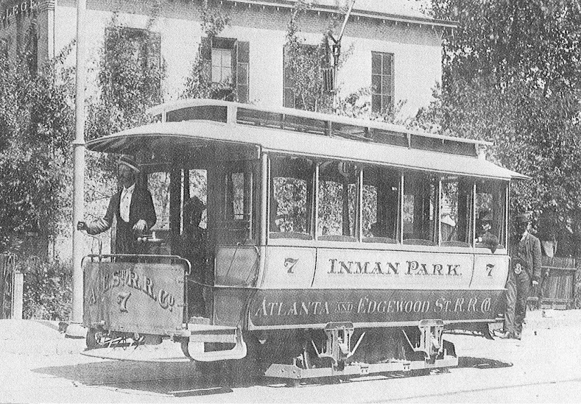
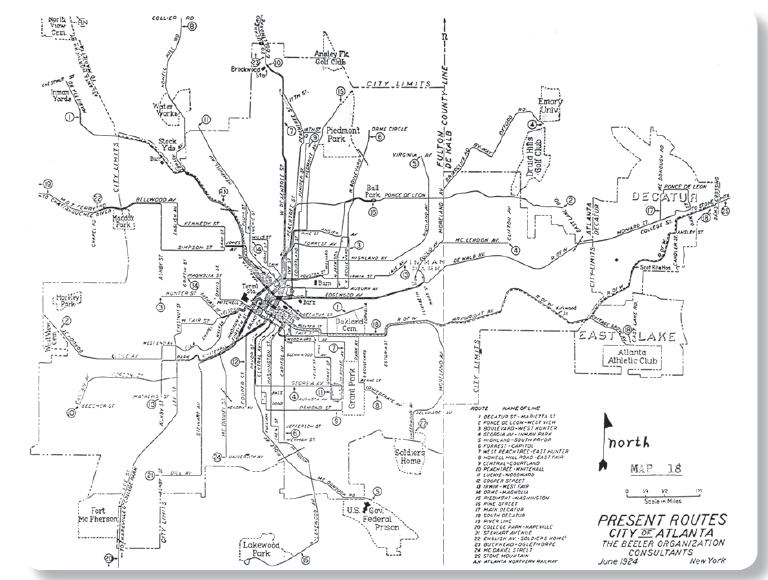
This is a map showing Atlanta’s streetcar system in 1924, and the last streetcar from the original system went out of service in 1949.
The reason given for the decline of streetcars is the popularity of the automobile, but why completely scuttle an efficient and affordable mass transportation system, and replace it with a polluting and expensive one?
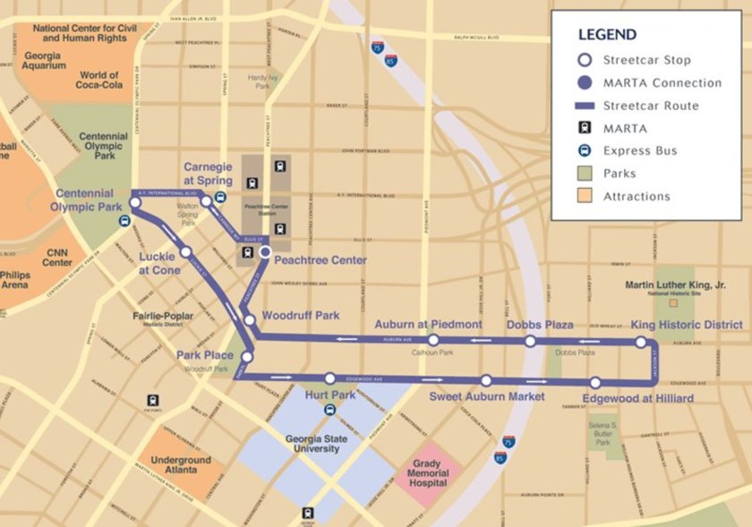
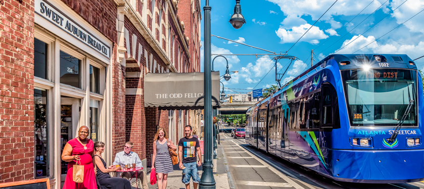
As a matter of fact, one of the streetcar lines has returned to Atlanta. A 2.7-mile, or 4.3-kilometer, streetcar line opened in Atlanta in December of 2014 between Centennial Park, going east along Edgewood Avenue to the Martin Luther King, Jr. National Historic Site, and west along Auburn Avenue.
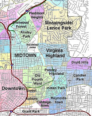
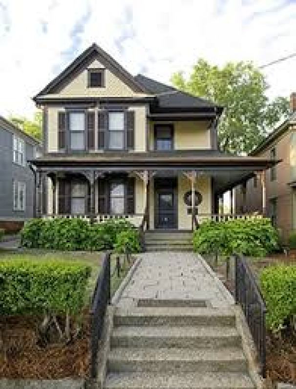
The Martin Luther King Jr Historic Site in the Sweet Auburn residential district adjacent to the Old Fourth Ward…
…which includes his boyhood home…
…and the Ebenezer Baptist Church, where he was baptized, and both he and his father preached.
Sweet Auburn is described as a historic African-American neighborhood with one of the largest concentrations of African-American businesses in the United States, and where there were more financial institutions, professionals, educators, entertainers and politicians on this one-mile of street than any other African-American street in the South.
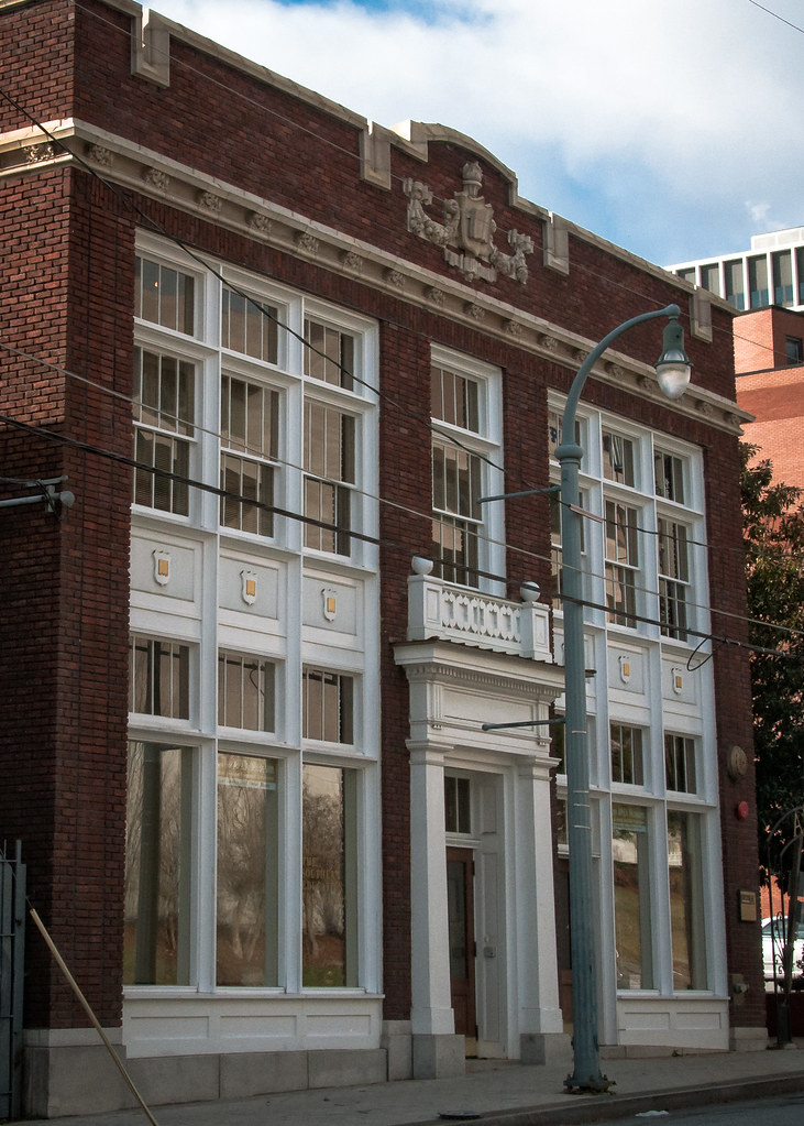
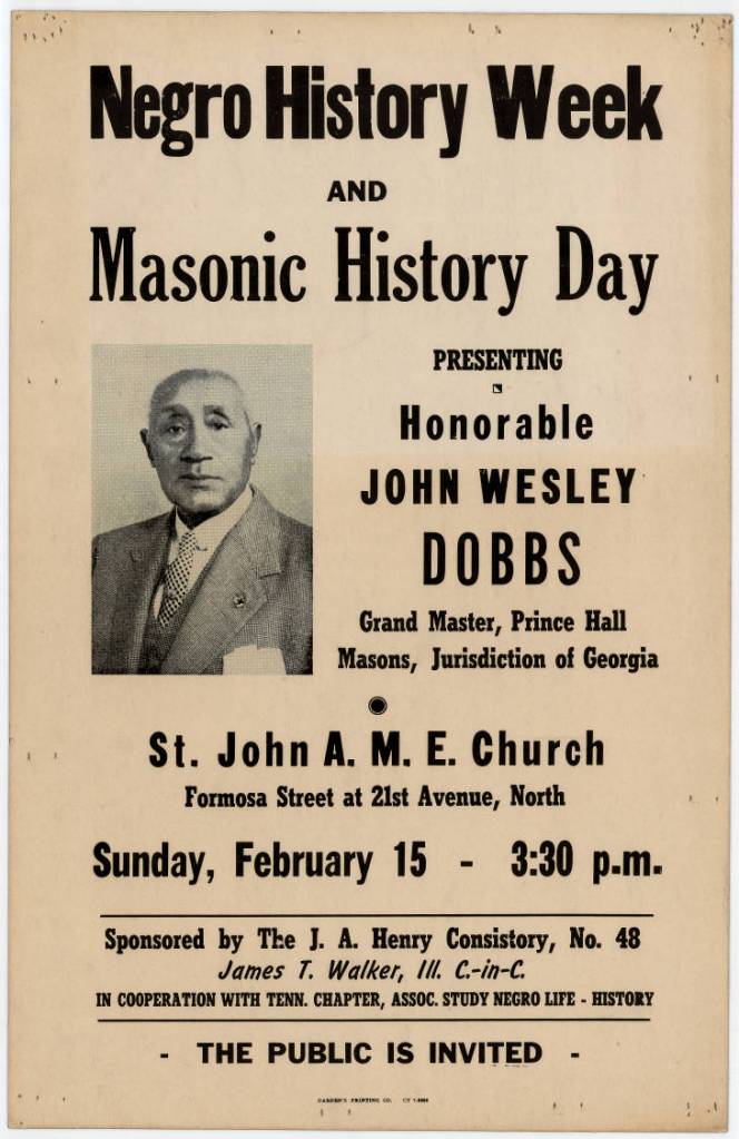
This is the John Wesley Dobbs building, said to have been built in 1910 as the Atlanta School Book Depository, and is now the African-American Panoramic Experience, or APEX, Museum.
John Wesley Dobbs was a civil and political leader in Atlanta. He became a member of the Prince Hall Masons in 1911, and in 1932, he was elected Grand Master of the Prince Hall Masons of the Jurisdiction of Georgia, a post he held for the rest of his life.
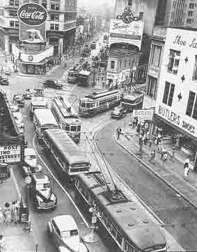
This is a 1940 historic photo of streetcars on Auburn Avenue and Peachtree Street…
…and the streetcar line running again in Sweet Auburn today.
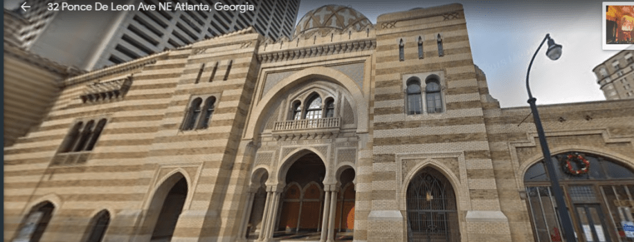
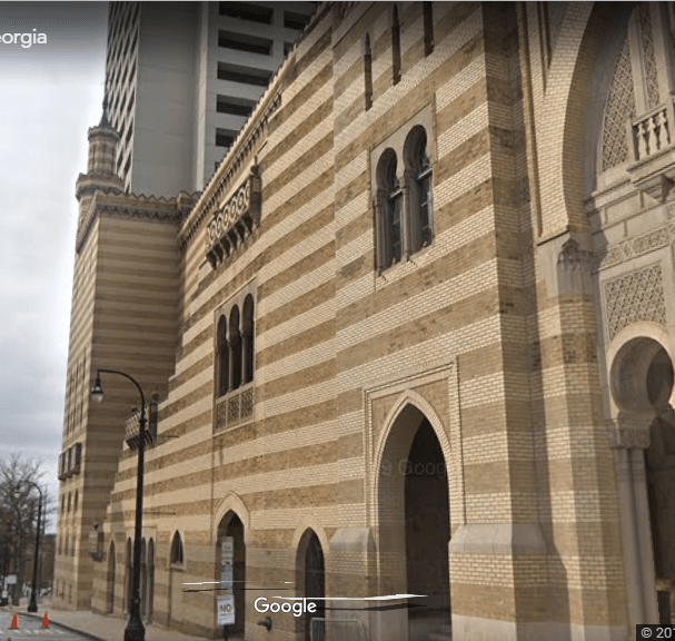
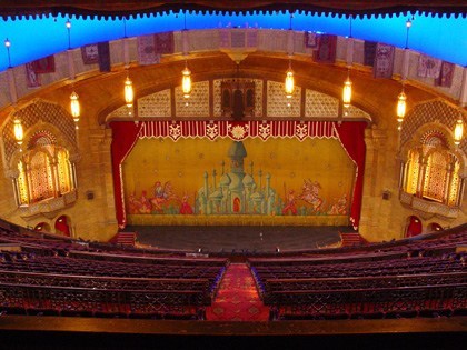
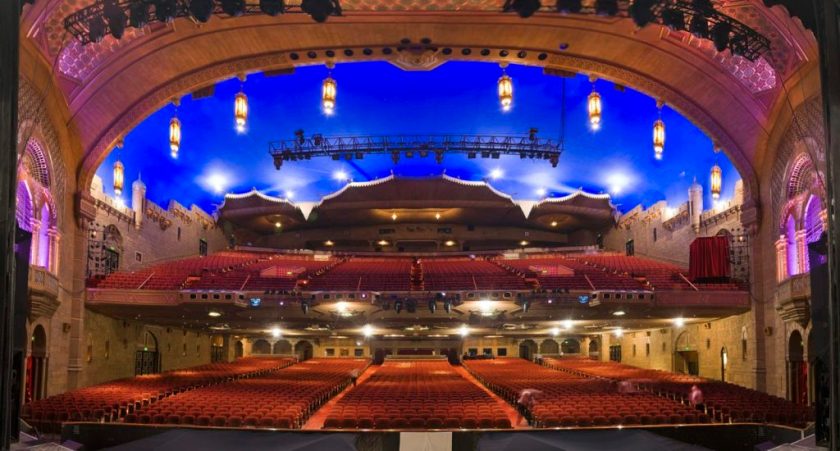
There is one more place in Atlanta I would like to look at before ending this post. This is the Fox Theater is in Midtown Atlanta.
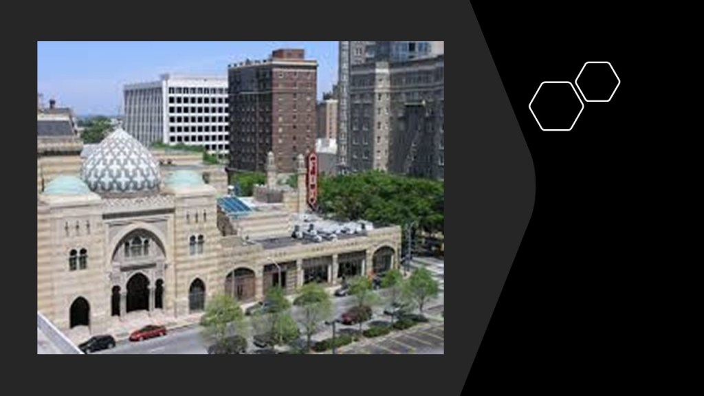
It was said to have been built originally to become a large Shrine Temple, but the 2.75 million dollar project exceeded their budget…
…so the project was said to have been leased to movie mogul William Fox. The Fox Theater opened in 1929, two months after the stock market crash and the beginning of the Great Depression. The Theater closed 125-weeks after it opened. New owners acquired it, Paramount Pictures and Georgia-based Lucas & Jenkins, after the mortgage was foreclosed in 1932.
This is the interior of the Fox Theater …
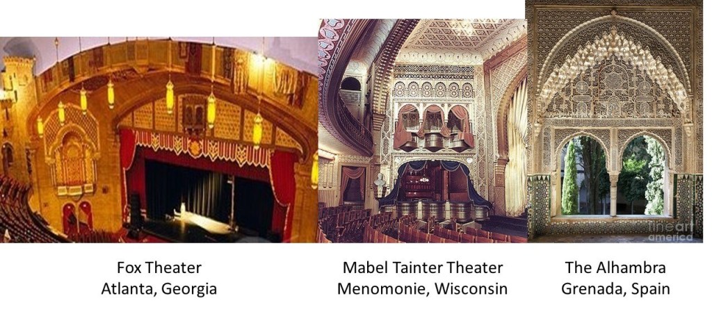
This is a detail of the Fox Theater stage in Atlanta on the left; the Mabel Tainter Memorial Theater stage in Menomonie, Wisconsin in the middle; and a detail on the right at The Alhambra in Grenada, Spain, the only place acknowledged to have had a Moorish civilization.
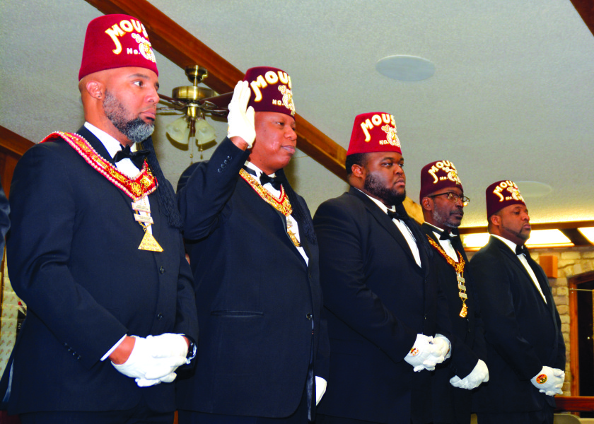
So, like the Altria Theater in Richmond, the Fox Theater in Atlanta was said to have been built for the Shriners.
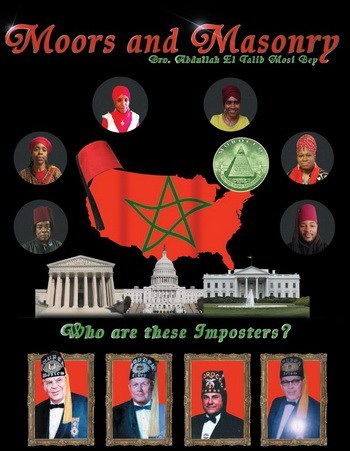
Which Shriners, though? These…

…or these?
Because, you see, this is what all of this, every bit of what has taken place in Earth’s modern history, is really all about. A stolen legacy that everything we are taught today has been grafted on top of, and has been hidden away from the general public.
In my next post, I am going to be looking at famous castles and mansions in the United States.
