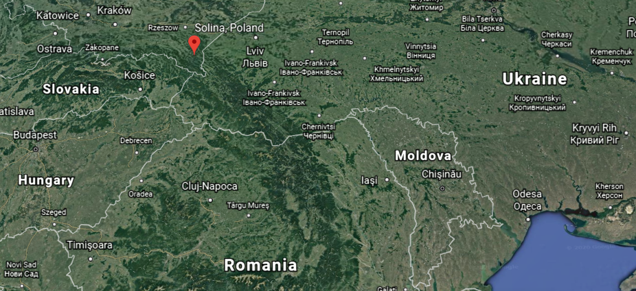
In my post “An Explanation for What Happened to the Positive Timeline of Humanity and Associated Historical Events & Anomalies,” and “My Take on the Mud Flood & Historical Reset Timeline,” I shared things like an extremely cold weather event in the historical record in Ireland between 1740 – 1741, as well as my thoughts about how an artificial time-loop could have been created between 1492 – 1942, with 1717 as the mid-point year between the two.
I decided to pull together in this video what I have found that was taking place during the 1800s in the course of my research, starting at the tail-end of the 1700s and through to the early 1900s, as there are overlapping events happening on either side of the 19th-century.
I am providing the following recap for those who may be new to my work – this information will be familiar to those who have been following my work.
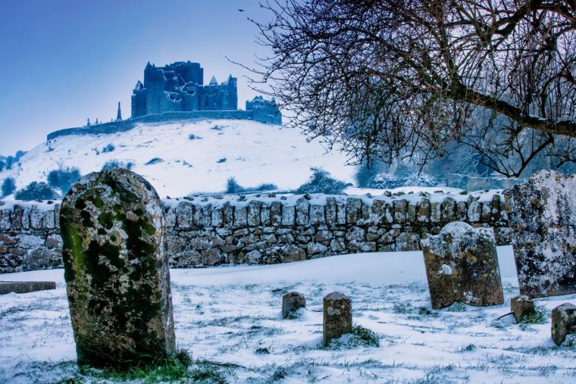
First, on the extreme cold weather in Ireland, Irish Historian David Dickson talks about this little-known event in his book “Arctic Ireland.”
I have explored the idea that this event was related to the hijack of the original timeline.

The Irish population endured 21-months of bizarre weather without known precedent that defied conventional explanation. The cause is not known.
Shortly after I learned about the cold-weather event in Ireland, I was connected by someone to the mud flood community.
I learned about the fantastic research that is being done by people looking at their own communities and other places, around the world, at strong evidence that there was a cataclysmic event involving a massive flood of mud, within the last couple of hundred years.

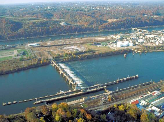
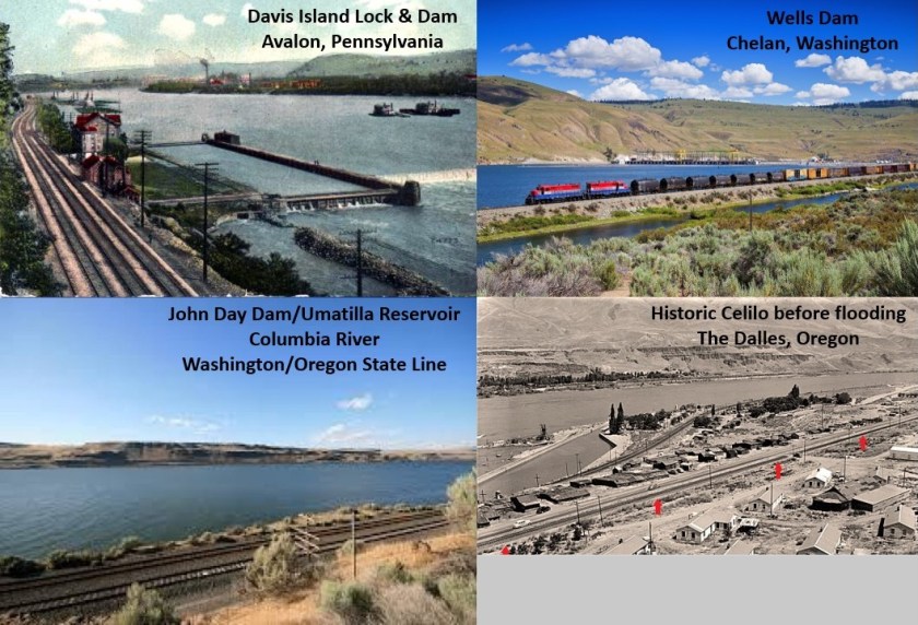
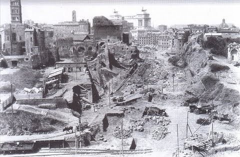
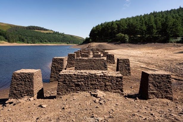
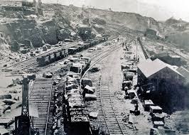
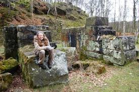
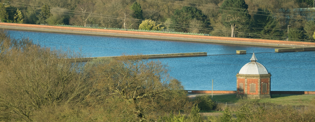
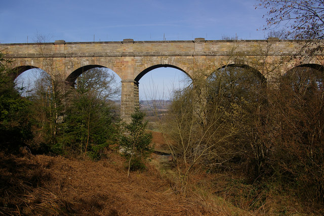
It is being called a reset event, and photographic evidence exists that buildings, canals, rail-lines, tunnels, among other things, were purposefully dug out after the event to the point where they could be used.

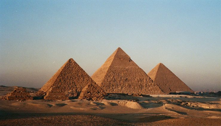
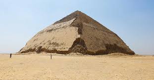
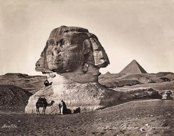
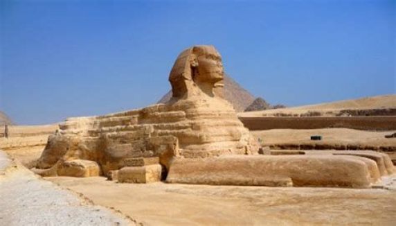
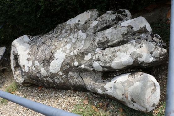
Over the years, I have filled my head with information about megaliths. Long before I became aware of the information I am sharing, I learned about such places as the Sphinx in Egypt having been dug out…
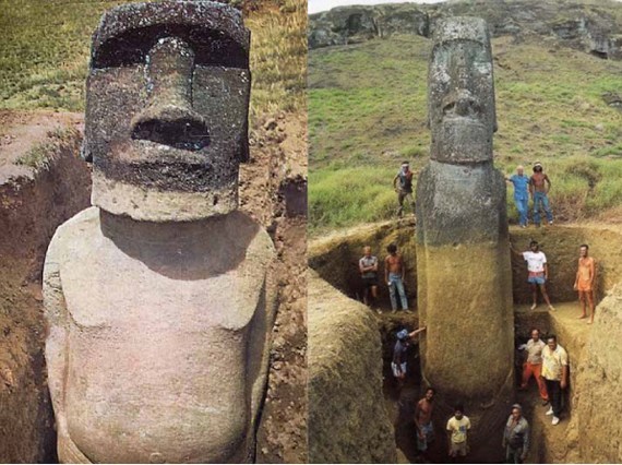
…as well as the famous heads of Easter Island…

…that were found to have bodies too!
The explanation of a mud flood makes a lot of sense to me based on what I am finding and seeing.
A sudden cataclysmic liquefaction event creating a flood of mud accounts for how a highly advanced worldwide civilization of giants…
…could have been wiped from the face of the Earth and erased from our collective memory.
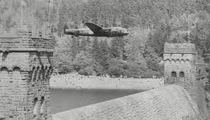
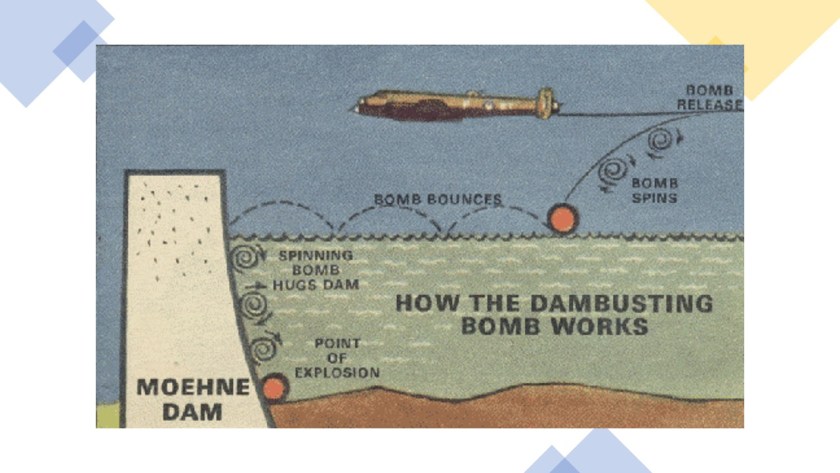
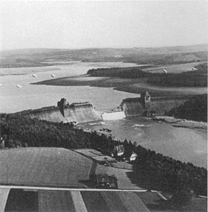
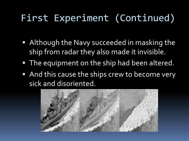
I have speculated that the Philadelphia Experiment, which took place halfway through World War II, on July 22nd of 1942, actually transported the USS Eldridge back to the time of the Great Frost of Ireland in 1740 and 1741 , creating a rip in the fabric of space-time and was a causal factor for the liquefaction event creating the mud flood.
These slides give an overview of the Philadelphia Experiment.


If this was actually the case, it would have taken the beings involved in the cataclysm a little over 100-years to dig enough of the original infrastructure out of the mud flow to re-start civilization and create the new, false historical narrative superimposed onto this infrastructure.
There is plenty of underground infrastructure around the world where people could have lived until the Earth’s surface became habitable once-again.
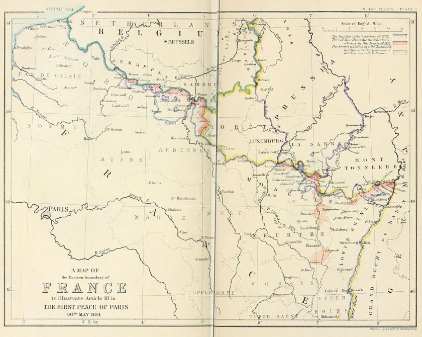
There are 450 years in between 1492 and 1942, and the midpoint, at 225-years, is 1717.
Next, I will provide the findings of my research of the historical record around the year of 1717.
Based on what I found when I started looking at historical events from around 1717 to 1942, I believe the extremely cold weather event in Ireland was deliberately caused, and is connected to the Mud Flood and the historical reset.
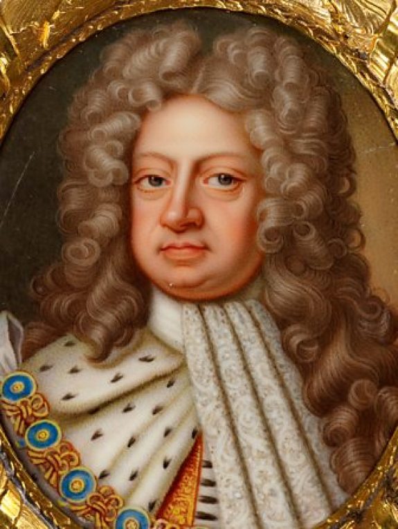
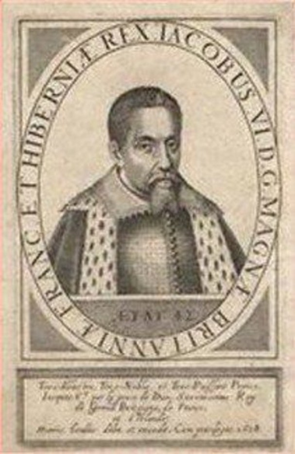
King George I of the German House of Hanover became King of Great Britain and Ireland in 1714.
This marked the end of the rule of the House of Stuart, which originated in Scotland.
On January 4th, 1717, Great Britain, France, and the Dutch Republic signed the Triple Alliance in an attempt to maintain the Treaty of Utrecht, which was signed in April of 1713, in which in order to become King of Spain, Philip had to renounce his concurrent claim to the French throne.
This prevented the thrones of Spain and France from merging together, and ultimately paved the way for the maritime, commercial, and financial supremacy of Great Britain.
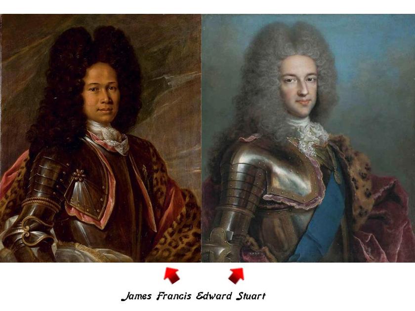
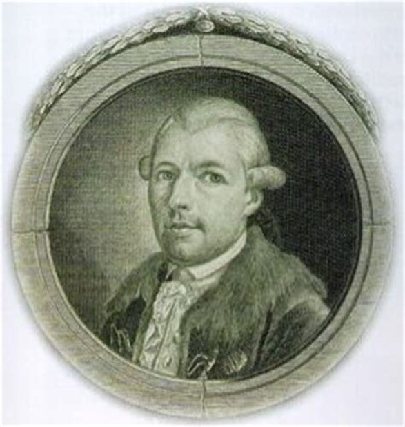
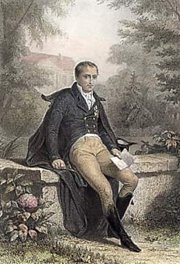
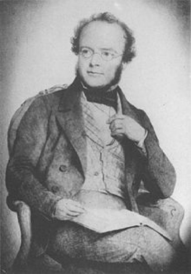
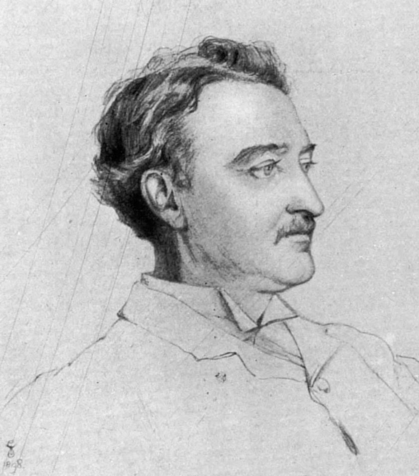
In February of 1717, James Francis Edward Stuart of the House of Stuart, called the Pretender, who at one time was claimant to the throne, left where he was living in France, after the Triple Alliance was signed in January, to seek exile with Pope Clement XI in Rome. He died in Rome in 1766.
This is believed to be a portrait of James Francis Edward Stuart that was painted when he lived in France on the left, and the typical portrait of him on the right.
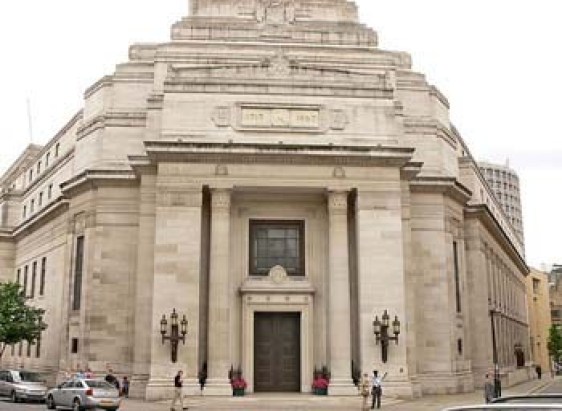
On June 24th, 1717, the Premier Grand Lodge of England – the first Free-Mason Grand Lodge – was founded in London.
I find it highly significant that this event shows up at the exact mid-point year between 1492 and 1942.
And then on 7/17/1717, an interesting date from a numerological perspective, the premiere of George Frideric Handel’s “Water Music” took place for King George I on a barge on the Thames.
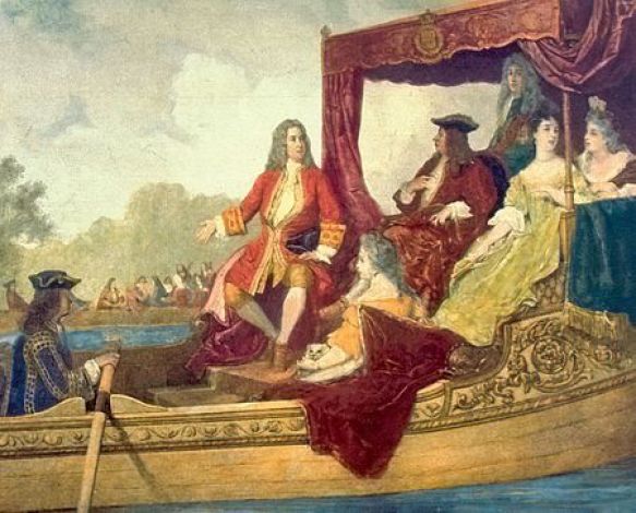
In 1727, George Frideric Handel became a British citizen.
Then I was guided through a psychic friend who came to visit me to look at Ireland in 1742 in my research.
She had received an image from my guides to communicate to me of Ireland before 1742 as cold and frozen, and 1742 and after as green and sunny.
So I plugged the year “1742” for an internet search, and only two things came up.
The first was that Dublin, Ireland, was the location for the premiere of George Frideric Handel’s Messiah on April 13th, 1742.
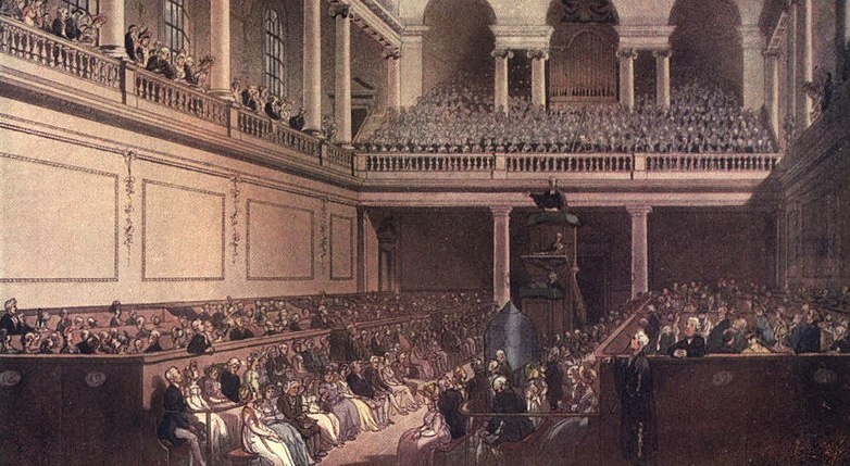
And the other thing that came up was the extraordinary cold weather event in Ireland between 1740 – 1741.
Handel’s Messiah premieres in Dublin right after the extremely cold, lethal weather event???!!!
So, who else shows up during this same time period?
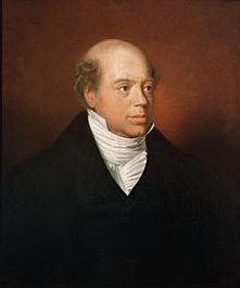
Mayer Amschel Rothschild was born in Frankfurt, Germany, in 1744. He established his banking business there in the 1760s, which became the start of an international banking family.
His third-born son, Nathan Mayer Rothschild, was sent to England from Frankfurt in 1798, and after becoming a citizen, established a bank in the City of London in 1804.
Then on February 6th, 1748, Bavarian Illuminati-founder Adam Weishaupt was born in Ingolstadt, Bavaria, Germany. He went to a Jesuit school at the age of 7, and was initiated into Freemasonry in 1777.
The parasitic and multi-dimensionally aware beings behind all of this want us to believe that suffering, sickness, misery, destruction, death was and is our normal state of being, and not question what we have been taught about who we are.
They are the only ones who benefit because they energetically feed on Humanity’s negative emotional states, at the same time they have sucked up all the wealth of the Earth for themselves.

Additionally, they have manipulated Human beings to become the perpetrators of negativity and depravity against fellow Human beings.
What I am going to share in this video is the information that I have found in the course of my research which supports this notion of a historical reset occurring in the mid-1800s, and that all of the history we have been taught has been grafted onto the original infrastructure and falsely attributed.
I have come to believe that the Great Exhibition of the Works of All Nations of 1851 in London, also known as the Crystal Palace Exhibition in reference to where it was held, was the official kick-off for the New World Order timeline…
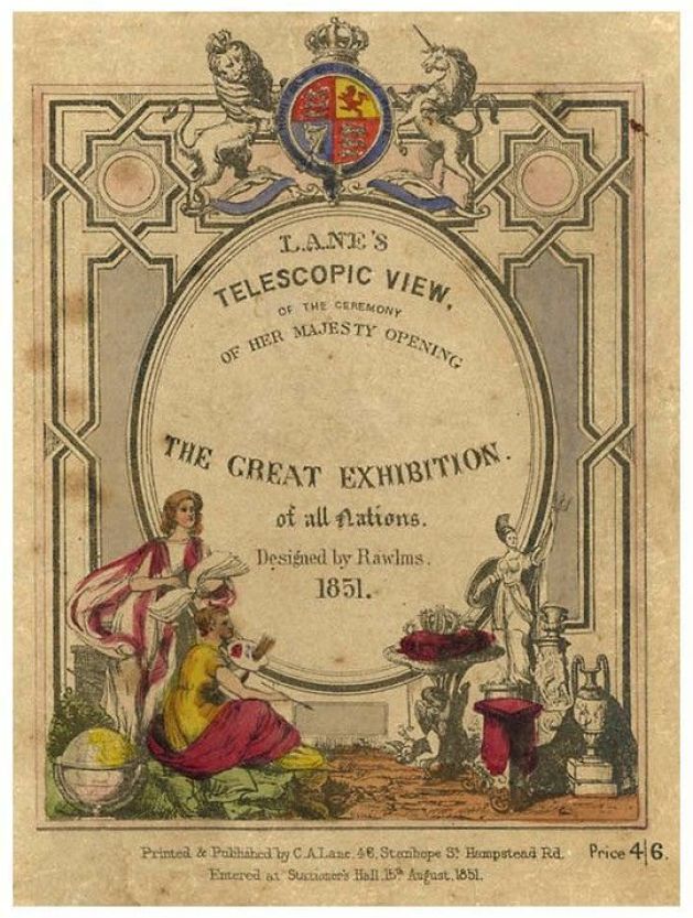
…and that, in the hundred or so years following, Exhibitions, Expositions, and World Fairs were showcasing the technology and architectural wonders of the original civilization before being hidden away or forever destroyed.
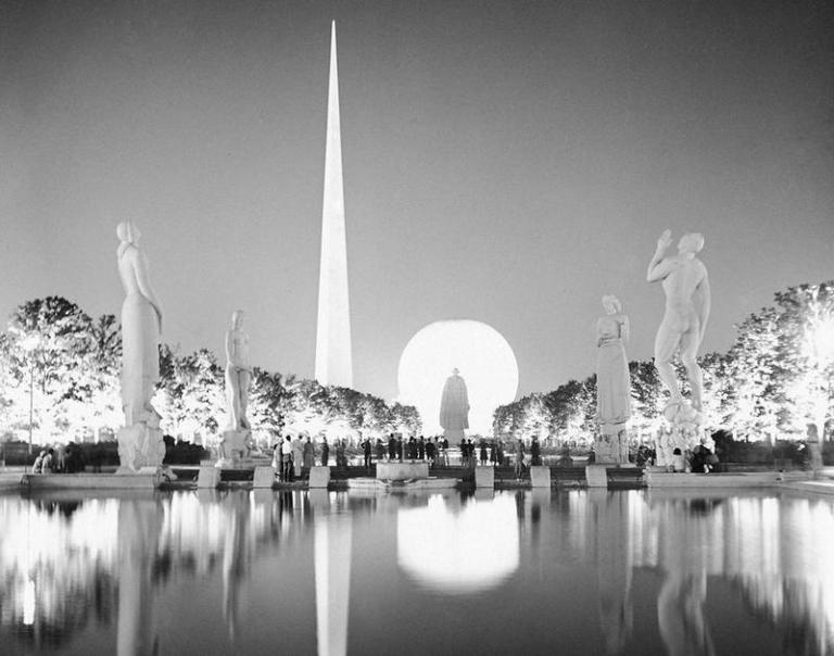
This was a scene at the New York World Fair of 1939 to 1940, almost 100 years later, where we still see incredibly big, what appear to be luminescent structures in the background, and in the foreground, statues much bigger than the size of the people standing near them.
While I will be mentioning several European countries in the historical narrative I reference in this post, please note in particular the German and British thread running through what I am about to share because it believe it to be of significance in terms of the physical origins of what has taken place here, keeping in mind all that we have seen thus for with the accession of the German House of Hanover to the British throne in 1714, and the births of Mayer Amschel Rothschild and Adam Weishaupt in the 1740s, shortly after the occurrence of the Great Frost of Ireland.
I am going to start with the historical happenings I found during the years 1797 to 1820.
The Ionian Islands, also known as the Heptanese, is a group of seven main islands in the Ionian Sea off the western coast of Greece.
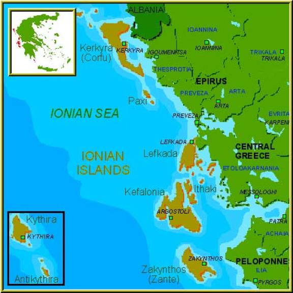
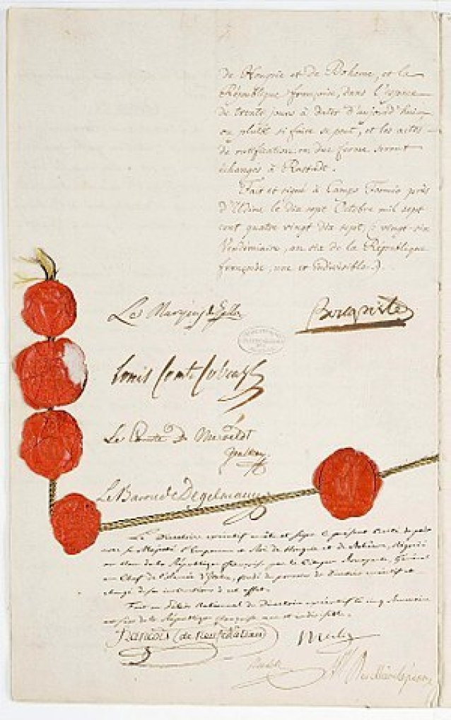
The Treaty of Campoformio was signed by Napoleon Bonaparte and Count Philipp von Cobenzi, as representatives of the French Republic and the Austrian Monarchy respectively, in 1797…
…disbanding and partitioning the Most Serene Republic of Venice, La Serenissima, by the French and the Austrians, of which the Ionian Islands were said to have been a part of since 1500 AD…

…and the Ionian Islands were awarded to France.
At that time, the Ionian Islands became the short-lived French Department of Ithaque, as it fell to the Russians in 1798, and was officially ended in 1802.

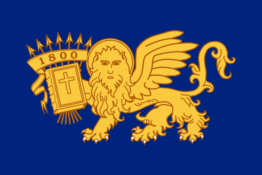
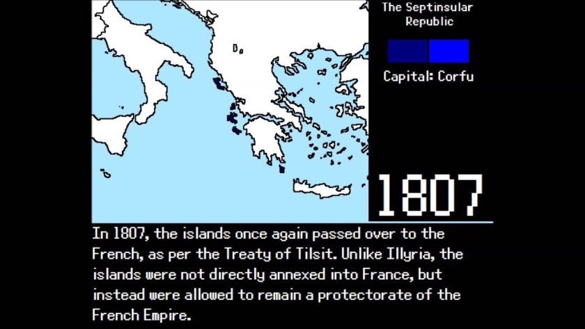
Between the years of 1800 and 1807, the Ionian Islands were known as the Septinsular Republic under Russian and Ottoman rule after the Russian/Ottoman fleet defeated Napoleon Bonaparte.
Then in 1807, Napoleon signed two agreements in the town of Tilsit in what was Prussia in East Germany, one between Emperor Alexander I of Russia, and the second treaty was signed with Prussia, and the Ionian Islands were returned to France, becoming a French Protectorate.
Then, in 1809, the British blockaded the Ionian Islands as part of the war against Napoleon, and, in September of that year, hoisted the British flag on the island of Zakynthos, with Kefalonia and Ithaca soon surrendering. The British installed provisional governments here.
The Treaty of Paris of 1815 recognized the United States of the Ionian Islands, and established them as a British Protectorate.
Then, Napoleon led the French invasion of Malta in 1798, which was part of the Mediterranean Campaign in the War of the Second Coalition of the French Revolutionary Wars.
The Order of the Knights Hospitallers, the rulers of Malta since 1530, surrendered to Napoleon when the French landed there.
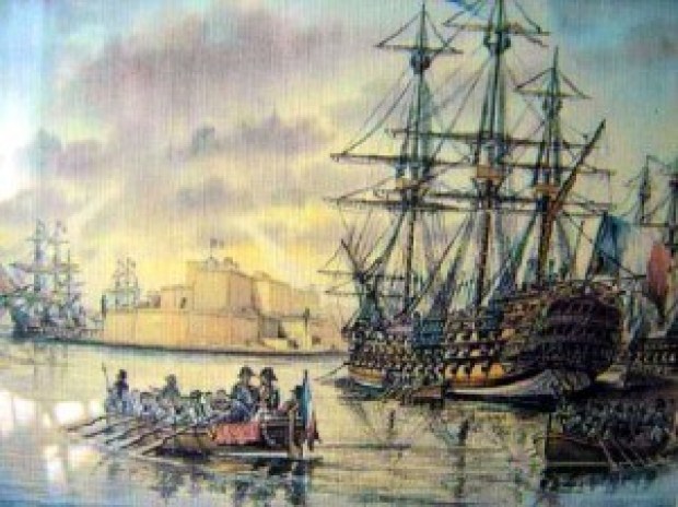
We are told that during the short time Napoleon was in Valletta, the capital city of Malta, between June 12th and 18th of 1798, he did such things as reforming, among other things, national administration with the creation of a Government Commission and twelve municipalities; creating a public finance administration, and the organization of public education, and providing for primary and secondary education, all before sailing for Egypt, and leaving a substantial garrison in Malta.
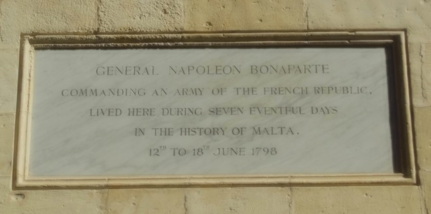
What?
All this in a week? Why?
After the British Royal Navy destroyed the French Mediterranean fleet at the Battle of the Nile in Egypt on August 1st, 1798, the British were able to initiate a blockade of Malta, assisted by an uprising of the native Maltese against French rule. The blockade effectively ended the French Occupation of Malta in 1800, and replaced it with British Protectorate, returning control of the central Mediterranean to Great Britain.
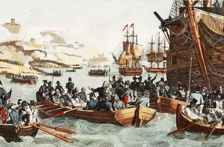
In the 1814 Treaty of Paris, Malta officially became part of the British Empire and was used as a shipping way-station and fleet headquarters.
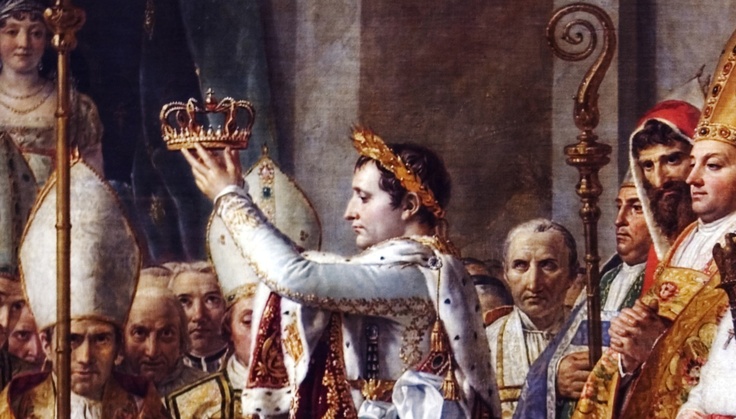
Napoleon was still very much in the picture, proclaiming himself Emperor of France in 1804.
Apparently he was very interested in the part of Calabria, the region in the toe of the boot of Italy, that is across from Messina in Sicily in the Strait of Messina…
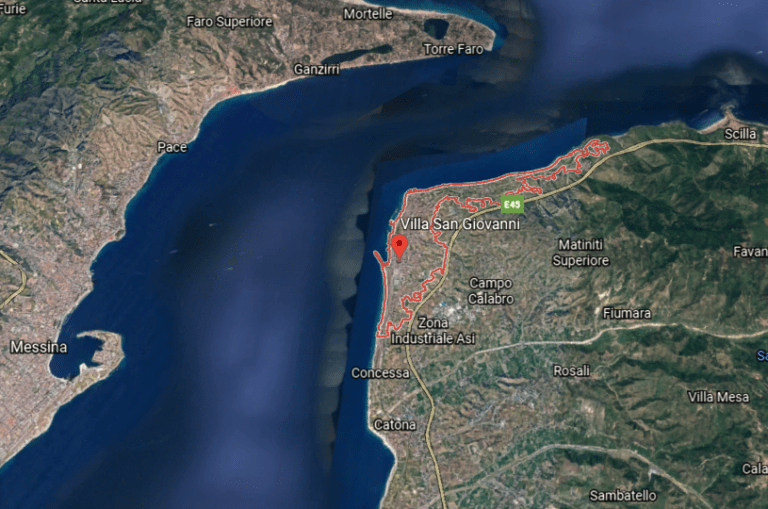
…as he made his older brother, Joseph-Napoleon, the King of Naples and Sicily between 1806 and 1808, who we are told, implemented administrative reforms in 1806 that abolished the ruling system that was in place there, and the Lordship of Fiumara disappeared.
Then further north, we are told the Union of the Kingdom of Denmark-Norway, also known as the Oldenburg Monarchy, existed as a dual monarchy between 1537 and 1814, with Copenhagen as its capital.
The Oldenburg Monarchy had long-remained neutral in the Napoleonic Wars.
Britain was said to have feared that Napoleon would attempt to conquer the Danish-Norwegian naval fleet, and used that as a pretext to attack Copenhagen in what became known as the Siege of Copenhagen in August of 1807, and Britain seized the naval fleet in September of 1807.
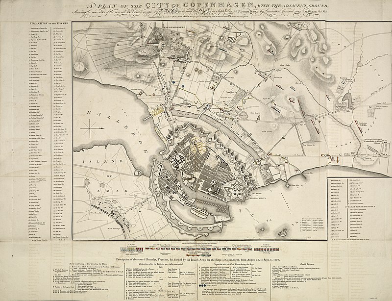
This also assured the use of the sea lanes in the North Sea and Baltic Sea for the British merchant fleet.
The “fleet robbery” drew Denmark-Norway into the war on the side of Napoleon.
Then in 1814, during the Napoleonic Wars, the Treaty of Kiel, between the United Kingdom and Sweden on the anti-French-side, and Norway and Denmark on the French-side, dissolved the Oldenburg Monarchy by transferring Norway to the King of Sweden.
The King of Denmark retained the Faroe Islands, Greenland, and Iceland.
Alexander von Humboldt was a German from the historically prominent state of Prussia.
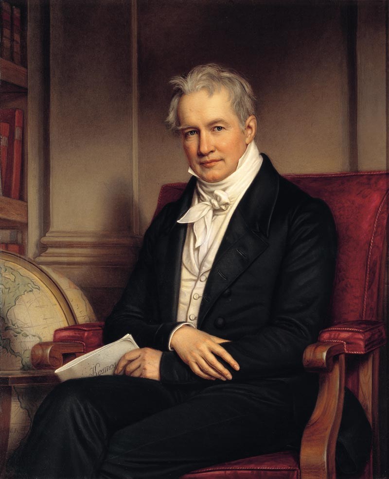
A geographer, naturalist and explorer, he travelled extensively in the Americas between 1799 and 1804, said to have explored them from a modern, scientific point-of-view, including the Canary Islands, Venezuela, Cuba, the Andes Mountains, Mexico, and the United States.
He is known for a multi-volume work entitled “Kosmos,” in which he was said to have sought to unify diverse branches of scientific knowledge and culture.
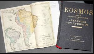
It was published in five volumes between 1845 and 1862.
The German geologist and paleontologist Leopold von Buch visited the Canary Islands in 1815, where he primarily studied the production and activities of volcanoes.
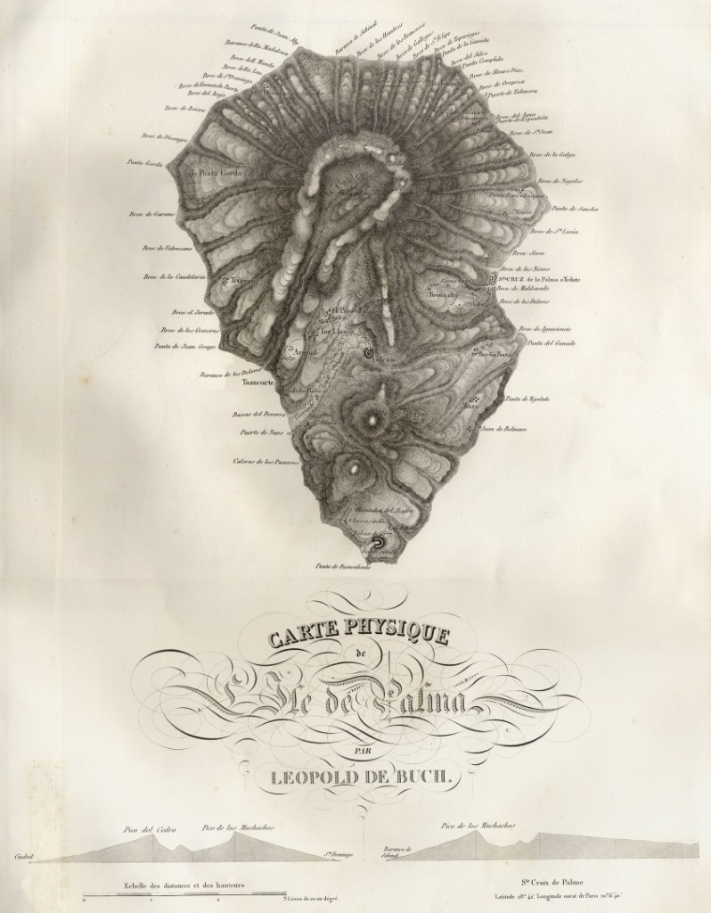
He studied with Alexander von Humboldt at the Freiburg School of Mining, and is considered a founder of modern geology.
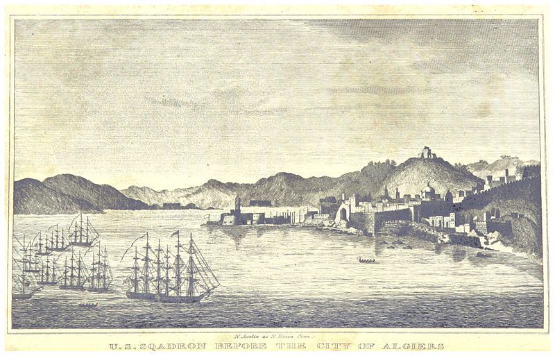
The Barbary Wars were a series of conflicts culminating in two main wars fought between the United States, Sweden, and the Barbary States of the Ottoman Empire in the late 18th- and early 19th-century.
We are told that Barbary pirates demanded tribute from American vessels in the Mediterranean Sea, and in 1801, President Thomas Jefferson refused to pay, sending a U. S. Naval fleet to the Mediterranean in May of that year, and the First Barbary War lasted until 1805.
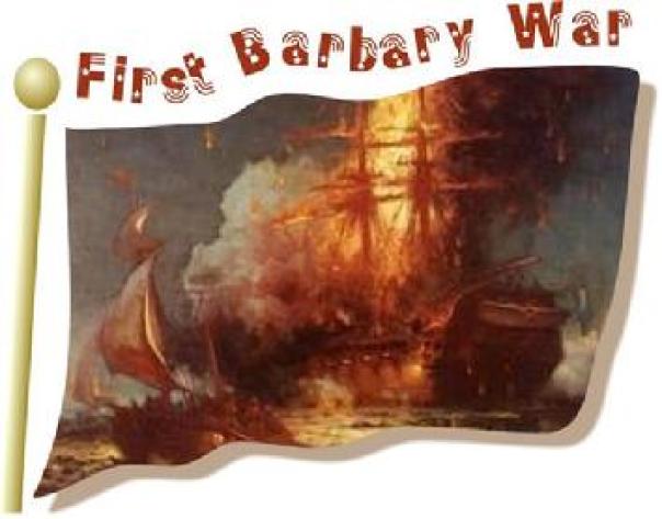
We are told the naval fleet commenced bombarding various fortified “pirate” cities in present-day Libya, Tunisia, and Algeria, over the next three years until concessions of fair passage were extracted from their rulers, which were most likely the Deys of Tripoli, Tunis, and Algiers, in the First Barbary War.
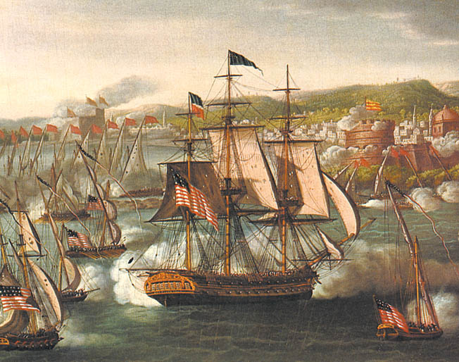
The second Barbary War took place in 1815 between the United States and the Barbary States, and we are told, brought to an end the American practice of paying tribute to the “pirate” states and marked the beginning of the end of piracy in that region.
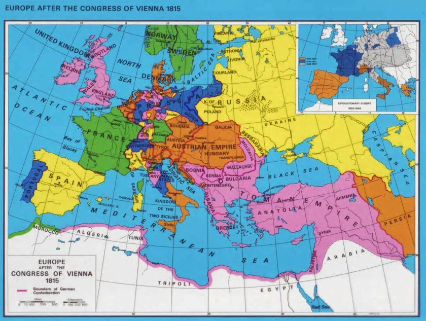
The Congress of Vienna was said to be one of the most important international conferences in European history.
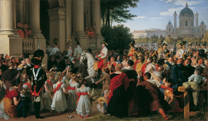
It was a meeting of ambassadors of European states held in Vienna in Austria between 1814 and 1815 in order to remake Europe after the downfall of Napoleon.
The stated goal was to re-size the main powers so they could balance each other and in this way remain at peace, and not simply to restore old boundaries.
As a result of the Congress of Vienna, France lost all of its recent conquests, while Prussia, Austria, and Russia made major territorial gains.
Most of the discussions took place in informal, face-to-face sessions among the ambassadors of Austria, Britain, France, Russia, and sometimes Prussia, with limited or no participation by other delegates.
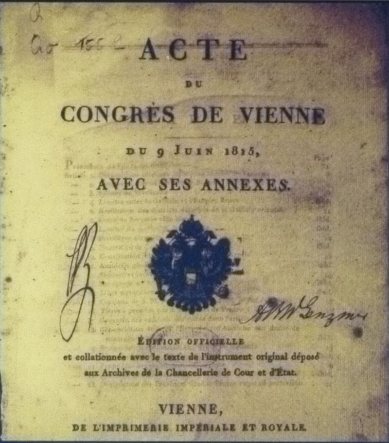
As such, the so-called Congress of Vienna never met in plenary session, which means a session in which all members of all parties are able to attend.
In 1815, the Kingdom of Kandy, the last remaining independent kingdom in Ceylon, known today as Sri Lanka, succumbed to British colonial rule when the kingdom was absorbed into the British Empire as a protectorate via the Kandyan Convention of 1815, an agreement signed between the British and members of the King’s court which ceded the kingdom’s territory to British rule, and its last king was imprisoned.
Ceylon was a British Protectorate until its independence in 1948.
Next are some of the happenings in our current historical narrative that I found from 1821 to 1850.
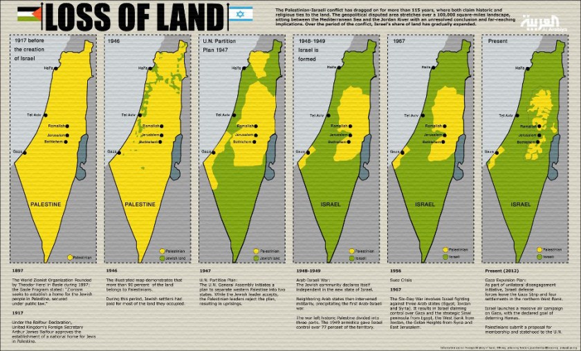
The Rothschilds purchased Jerusalem in 1829, and subsequently acquired considerable land in Palestine in the 1800s and early 1900s.
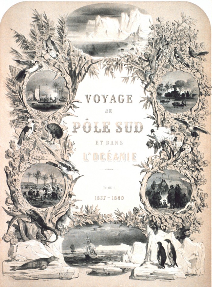
Between 1822 and 1843, several countries were involved in major expeditions to the southern oceans to collect scientific and strategic information, like Jules Dumont d’Urville for France…
…who claimed land on January 21st of 1840 on Antarctica for France, considered his most significant achievement.

He was promoted to Rear Admiral upon his return, and he wrote a report of the expedition entitled “Voyage au Pole Sud et dans L’Oceanie sur les Corvettes Astrolabe et la Zelee 1837 – 1840,” which was published between 1841 and 1854 in 24 volumes.
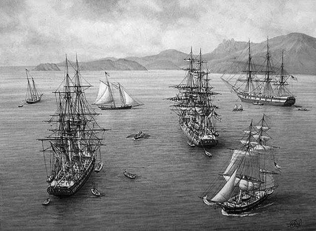
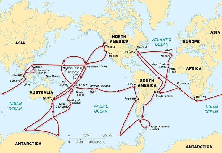
The U. S. Exploring Expedition was another exploring and surveying expedition of the Pacific Ocean and the surrounding lands, conducted by the United States between 1838 and 1842.
The expedition was described as of major importance to the growth of science in the United States, and that during the events of its occurrence, armed conflict between Pacific Islanders and the expedition was common, and dozens of natives were killed, as well as a few Americans.
It involved a squadron of four ships, with specialists on each including naturalists, botanists, a mineralogist, a taxidermist, and a philologist, which is someone who studies written and oral histories.
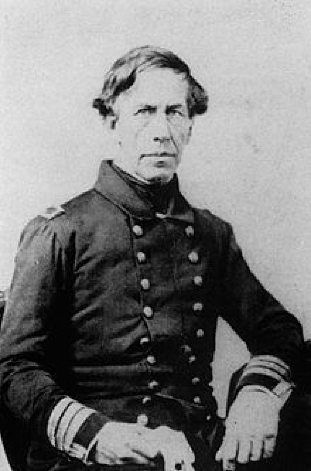
It is sometimes referred to as the “U. S. Ex. Ex.” or “Wilkes Expedition,” after the commanding officer, Navy Lt. Charles Wilkes.
The routes of the Wilkes Expedition went something like this – all over the place.
…and which, just five days prior to Dumont d’Urville of France, “discovered” Antarctica on January 16th of 1840.
Then there were the three voyages of the HMS Beagle starting in 1826 with the surveying of the southern tip of South America…

…to the second voyage of the HMS Beagle, between 1831 and 1832, which was joined by naturalist Charles Darwin, on another trip to South America, and then around the world.
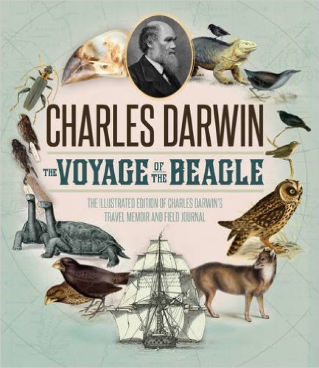
Charles Darwin kept a diary of his experiences, and rewrote this as a book titled “Journal and Remarks,” becoming published in 1839 as “The Voyage of the Beagle.”
It was in “The Voyage of the Beagle” that Darwin developed his theories of evolution through common descent and natural selection.
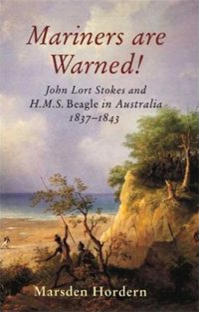
The third voyage of the HMS Beagle took place between 1837 and 1843, and was a surveying voyage to Australia.
In 1845, the HMS Beagle was refitted as a Coast Guard watch vessel in Essex, in the navigable waters beyond the Thames Estuary, until it was removed in 1851.
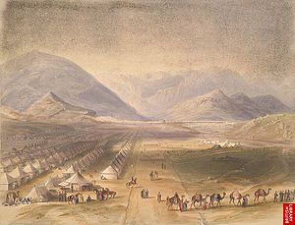
The First Anglo-Afghan War was fought for three years between the British East India Company and the Emirate of Afghanistan starting in 1839, after the British had successfully captured Kabul, and they capitalized on a succession dispute between a current and former Emir there, at which time the British exiled the Emir at the time, Dost Mohammed, and installed the former Emir, Shah Shujah.
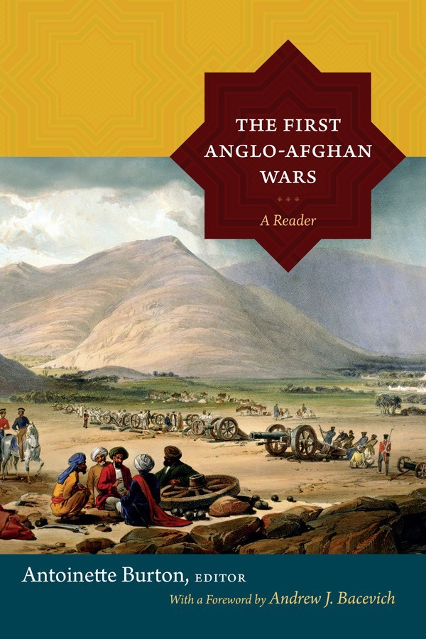
When the main British forces occupying Kabul retreated in January of 1842, they were almost completely annihilated by Afghani tribesmen. In retaliation, the British sent what was called an “Army of Retribution” to Kabul to avenge their defeat, and demolished parts of the city, recovered prisoners, and left Afghanistan, with the exiled Emir Dost Mohammed returning from India to Kabul.
Destruction that was done in retaliation for people who were defending their own land from invading foreigners who wanted to take it.
The First Anglo-Afghan War is called one of the first major conflicts of what was called “The Great Game,” the 19th-century competition for power and influence in central Asia between Britain and Russia.
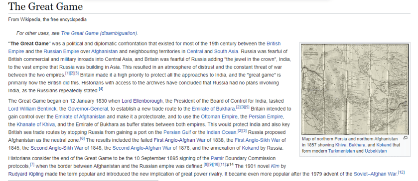
The Treaty of Nanking, or Nanjing, between the British Empire and China, was signed after China’s defeat after the First Opium War in 1842.
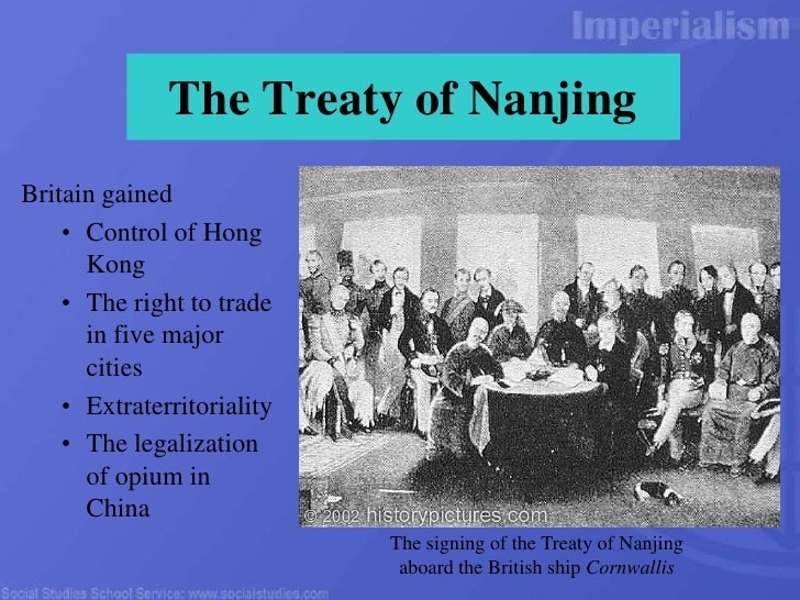
The First Opium War was fought between Qing Dynasty of China and Britain between 1839 and 1842, a military engagement that started when the Chinese seized opium stocks at Canton in order to stop the opium trade, which was banned.
The British government insisted upon free trade and equality among nations and backed the merchants’ demands.
From 1757 to 1842, the Canton System served as a means for China to control trade with the west by focusing all trade in the southern port of Canton.
To counter this, the British East India Company began to grow opium in Bengal, in present-day Bangladesh, and allowed private British merchants to sell opium to Chinese smugglers for illegal sale in China.
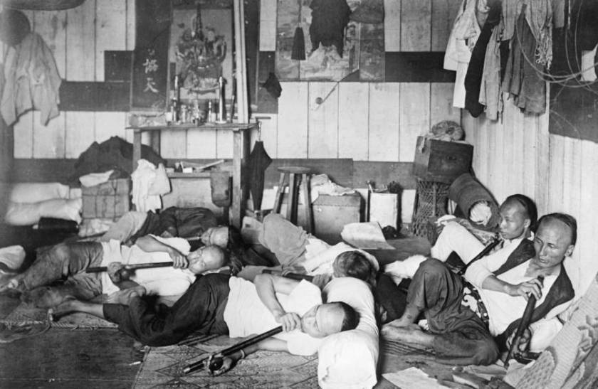
As a result of these events in history, opium dens, establishments where opium was sold and smoked, became prevalent in many parts of the world throughout the 19th-century.
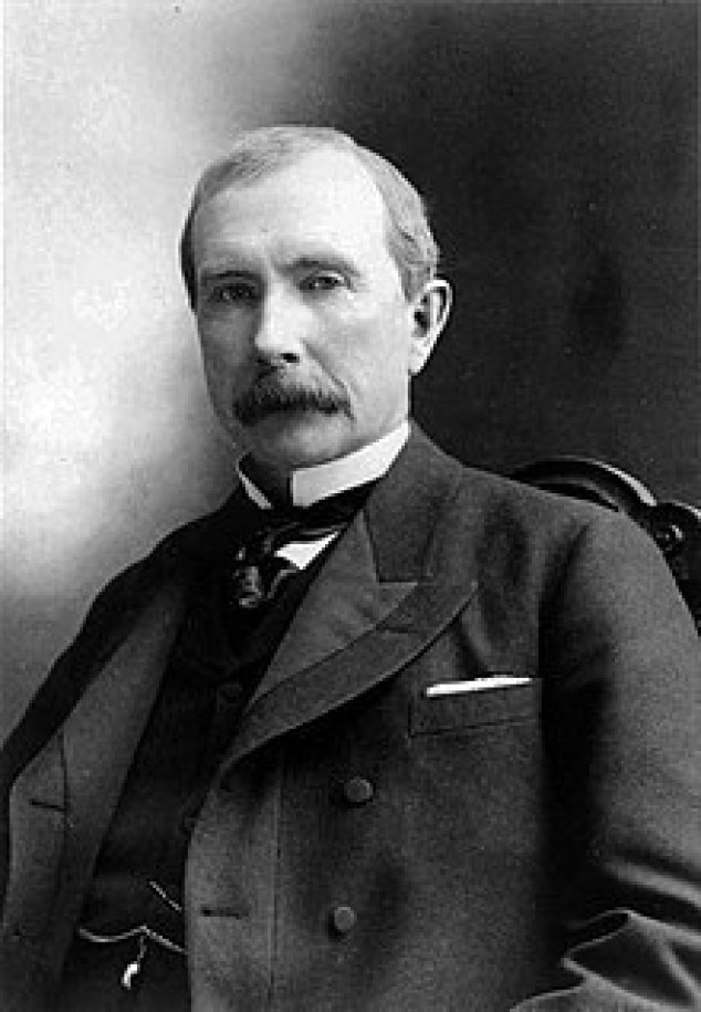
In 1839, John D. Rockefeller, Sr. was born in the United States, the progenitor of the wealthy Rockefeller family and considered to be the wealthiest American of all time.
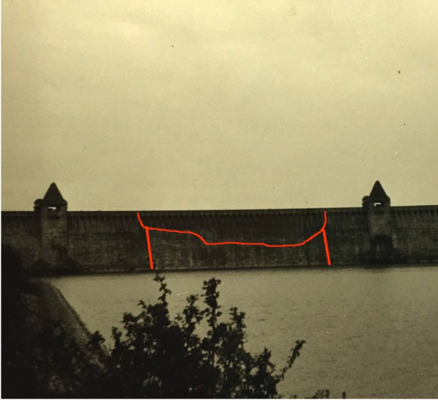
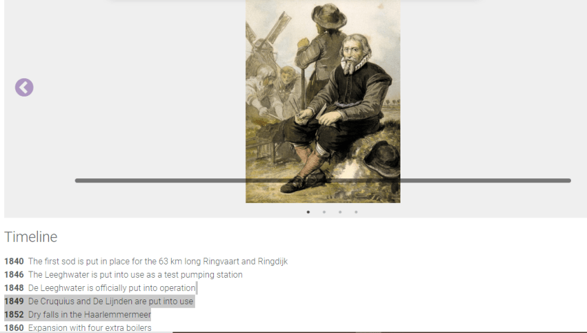
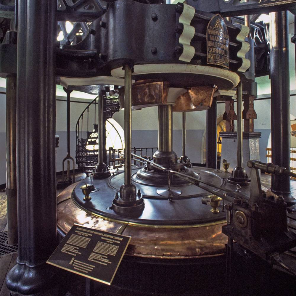
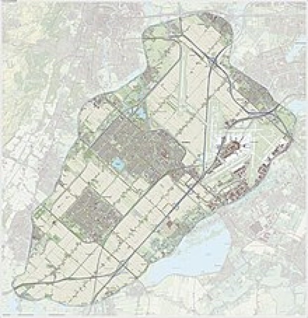
The Cruquius, now a museum, was an old steam-pumping station in The Netherlands, named after one of its promoters, Nicolaus Samuel Cruquius.
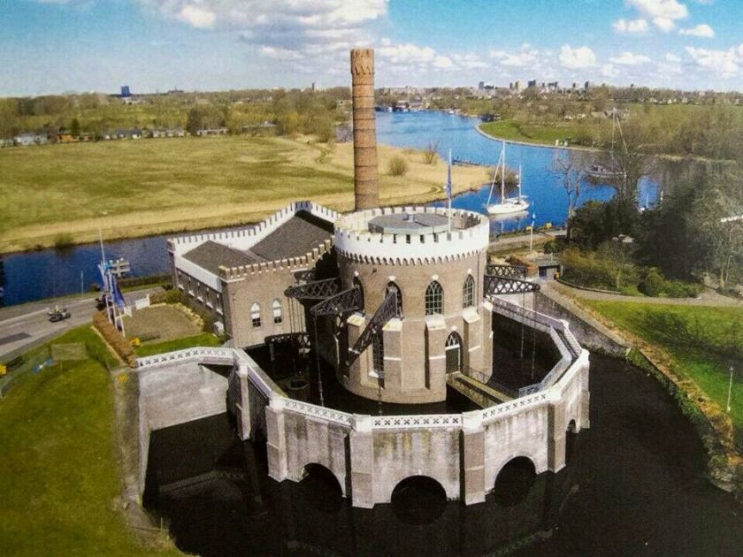
It was one of three steam-driven pump stations built around the Harlemermeer, described as a “polder,” or low-lying piece of land reclaimed from water, located near Amsterdam.
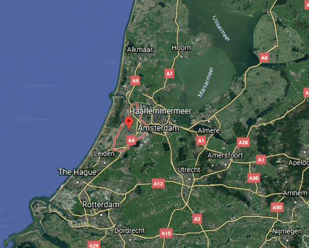
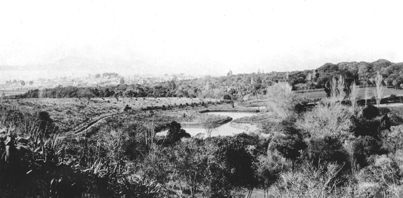
This is said to be a map of the Haarlemmermeer before reclamation.
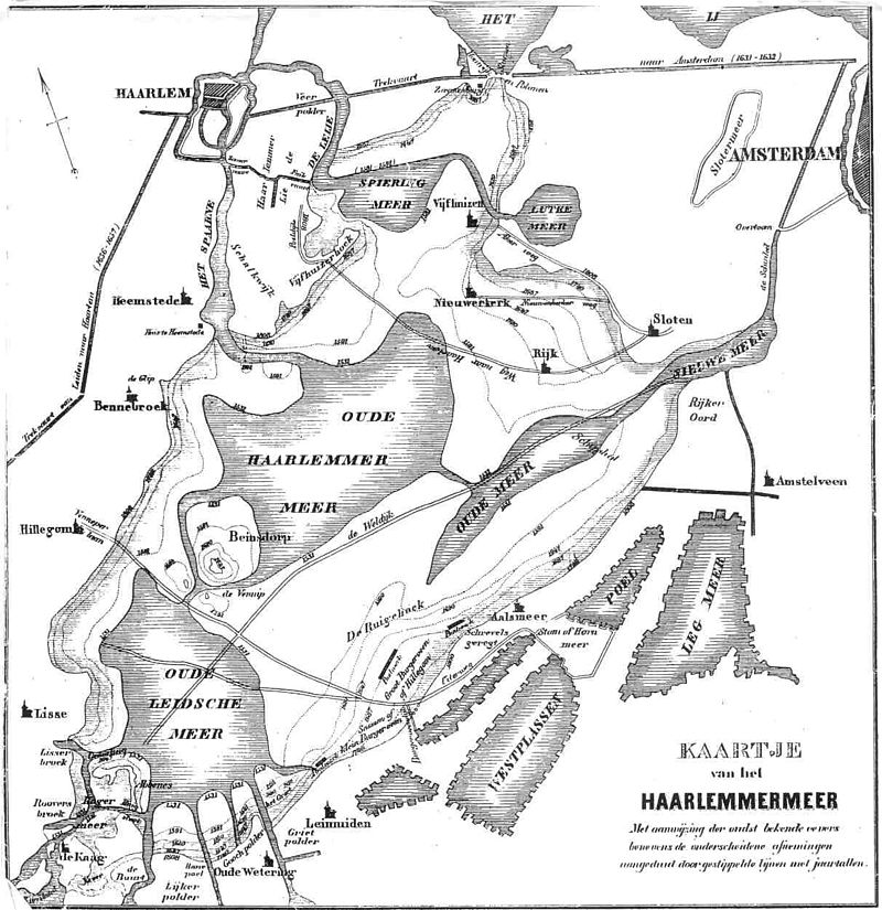
The lakes of the Haarlemmermeer were said to have been formed into one by successive floods, in which villages disappeared in the process, and said to have become a threat to Amsterdam.
Long story short, King William I of the Netherlands appointed a commission of inquiry, and the commission’s plan to build the three steam-driven pump stations around the Haarlemmermeer were approved, with construction commencing in 1840.
This is the first 20-years of the timeline we are given for the construction of the steam-driven-pumping system of the Haarlemmermeer, and the dates line-up around this mid-century historical narrative reset.

The Cruquius is described as the largest Watt-design reciprocal stroke steam-engine ever built.
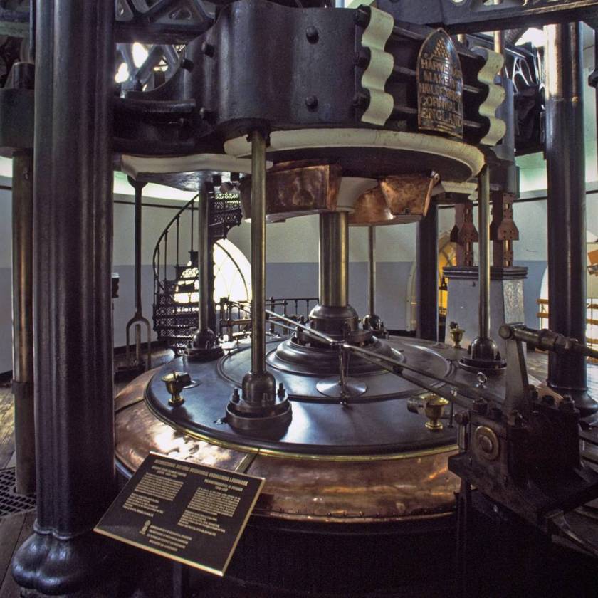
We are told pumping began in 1848 and the lake was dry by July 1st of 1852.
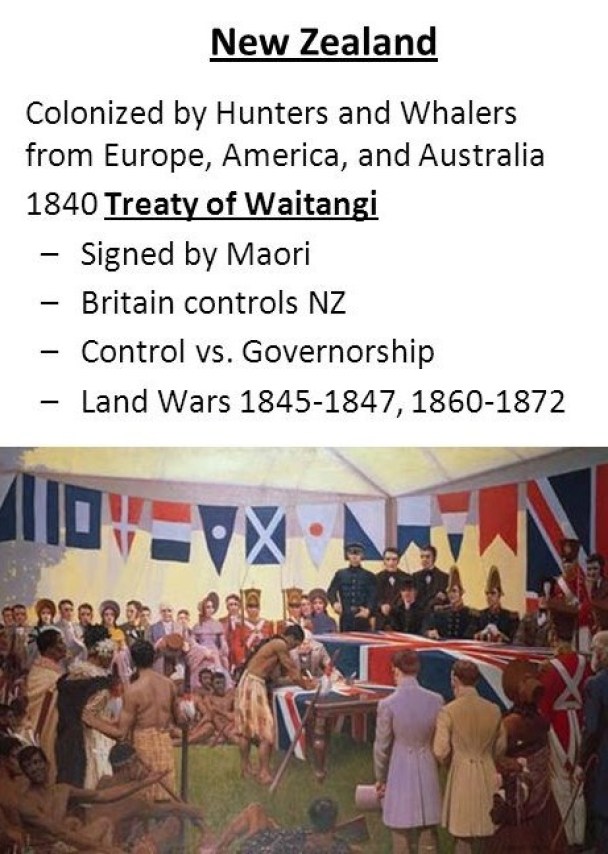
In the historical narrative we are given, Auckland was first settled by Europeans in the form of the British in 1840.
With the signing of the Treaty of Waitangi in 1840 between representatives of the British Crown and 500 Maori Chieftains, we are told, Britain gained sovereignty over what became known as New Zealand.
We are also told that starting in 1848, and for the next fifteen years, there was a chronic water shortage, with Auckland’s wells affected by severe pollution.
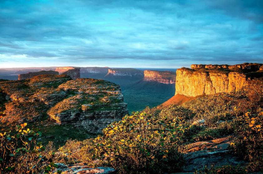
The Chapada Diamantina National Park is located in the center of Brazil’s Bahia State, and considered one of the ten best national parks in the world.
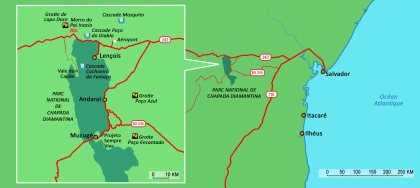
We are told this region was deserted until the discovery of gold and diamonds here in 1844, which then was said to have triggered a rush of gold and diamond seekers wanting to make their fortunes.
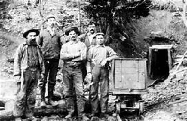
California’s mother-lode country, an historic region in northern part California, is on the western slope of the Sierra Nevadas.
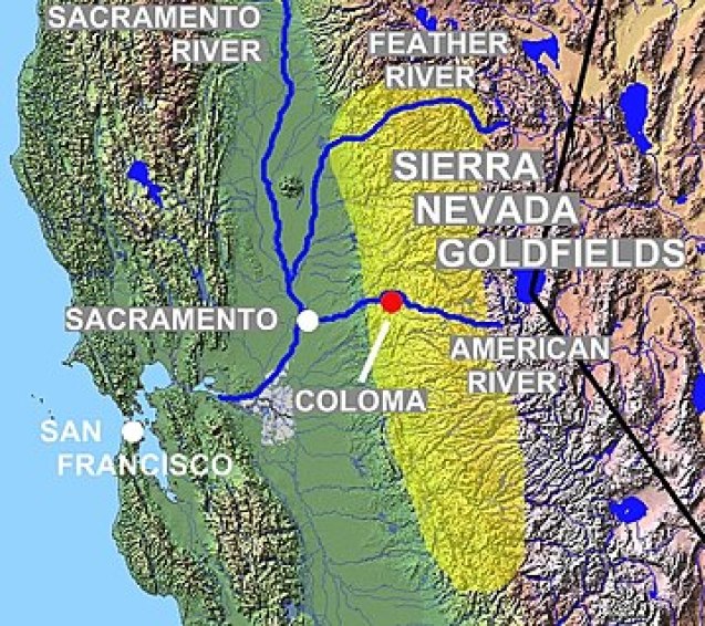
It was famed for mineral deposits and gold mines said to have attracted waves of immigrants starting in 1849, known to history as 49ers.
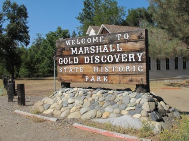
We are told that California’s gold rush was sparked by James Marshall’s discovery in 1848 of placer gold at Sutter’s Mill near Coloma.
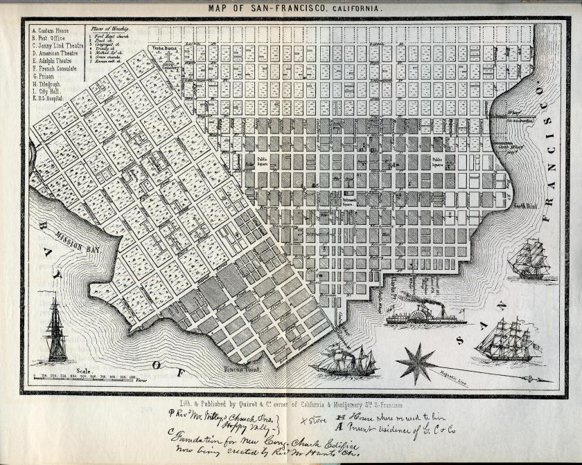
We are also told San Francisco grew from a small settlement of about 200 residents to a boom town of about 36,000 by 1852, the year this map was said to have been made.
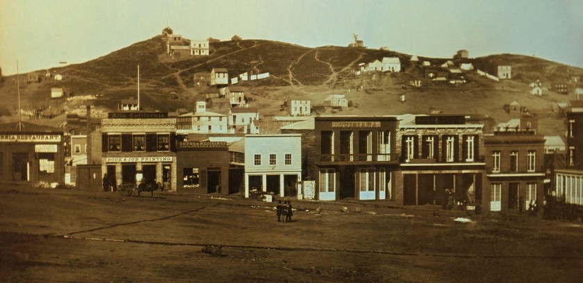
This was said to be an early daguerrotype, an early form of photography, of Portsmouth Square in San Francisco from 1851, some time before June of 1851.
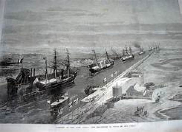
The city of Colon in Panama is a sea port on the Caribbean Sea…
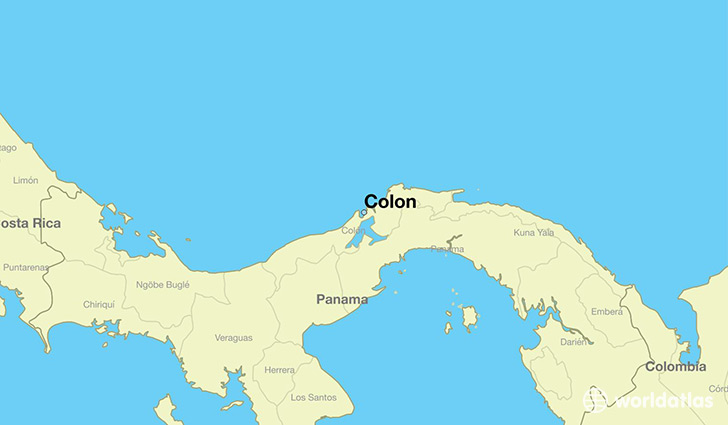
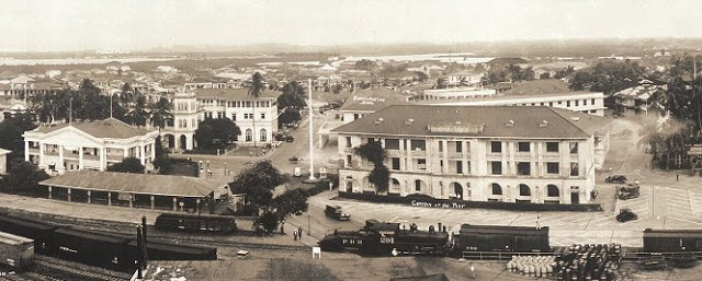
…and was said to have been founded in 1850 as the Atlantic Terminal of the Panama Railroad, which was said to have been under rush construction to meet the demand for a fast way to get to California for the Gold Rush.
This is a historical photo of the massive and ornate office buildings of the Panama Railroad Atlantic Terminal.
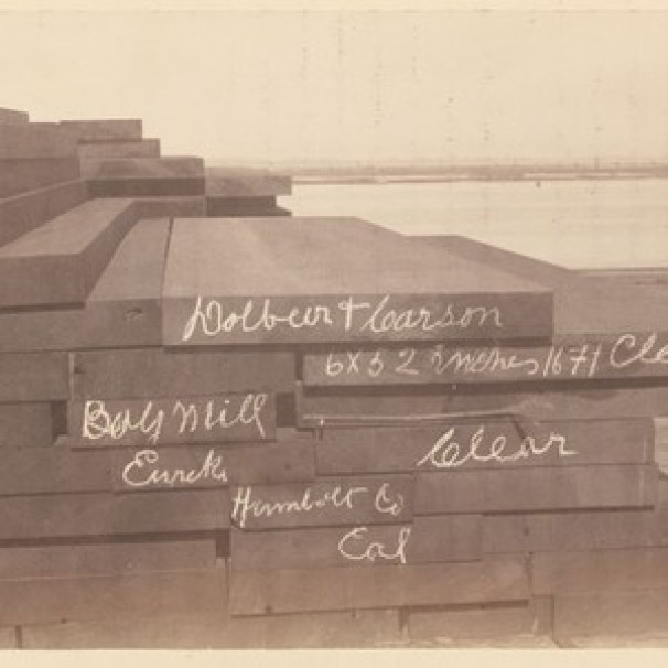
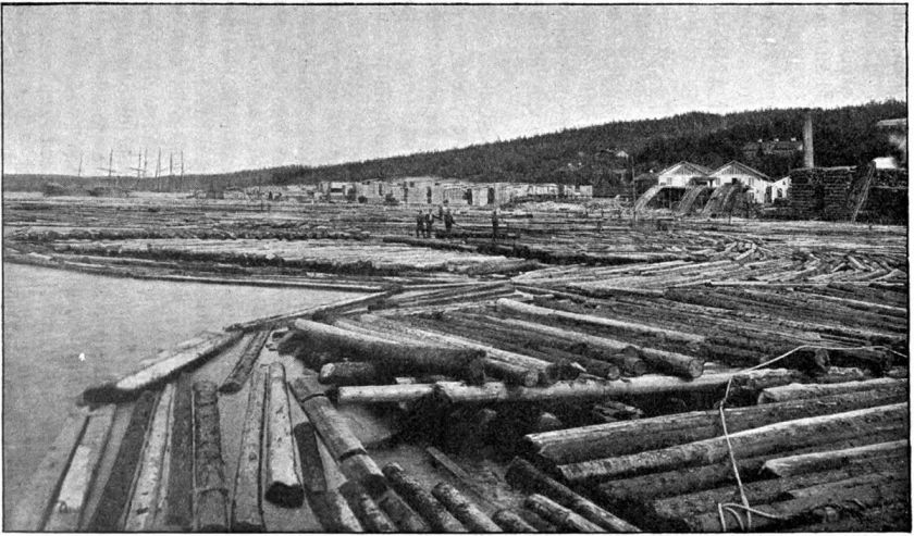
Lumber Baron William Carson was said to have arrived in San Francisco in 1849, from New Brunswick in Canada, with a group of other woodsmen.
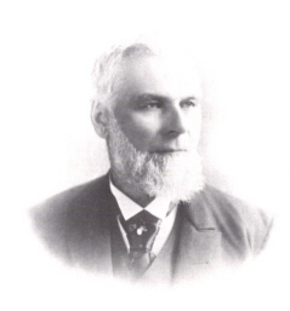
In 1850, he and Jerry Whitmore were said to have felled a tree, the first for commercial purposes on Humboldt Bay in present-day Eureka, California, and was soon in the business of shipping Redwood timber to San Francisco.
We are told that Swedish industrialism started in 1849 in Sundsvall in Sweden when the Tunadal Sawmill brought in a steam-engine-driven saw.
Sundsvall is still a center of the Swedish forestry industry.
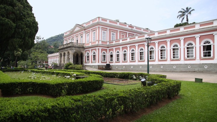
In the 1840s, Brazil’s Emperor Pedro II was said to have issued an imperial decree ordering the construction of a settlement to be formed at Petropolis with the arrival of German immigrants…
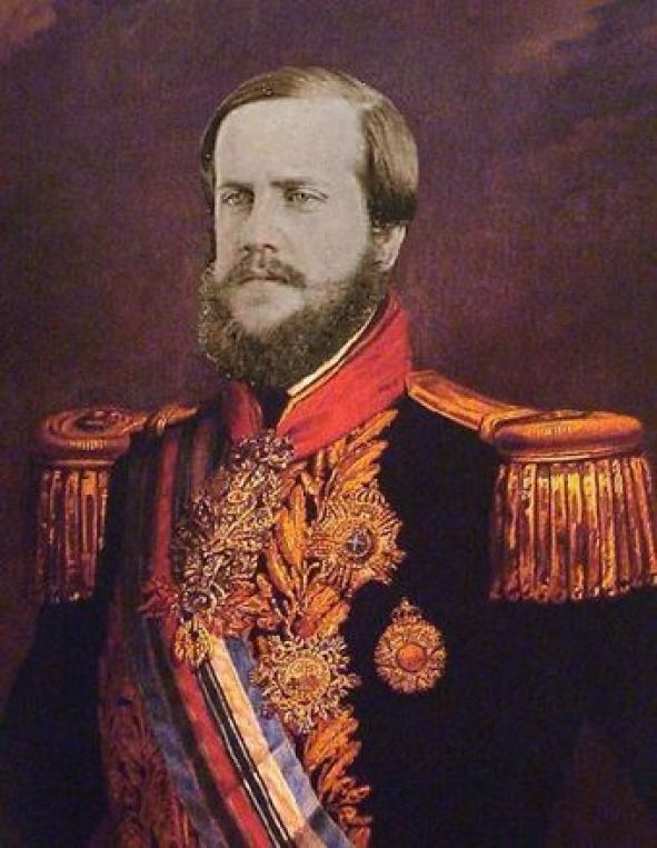
…as well as for the construction of his summer palace there, with the cornerstone said to have been laid in 1845, and that it was built by 1847.
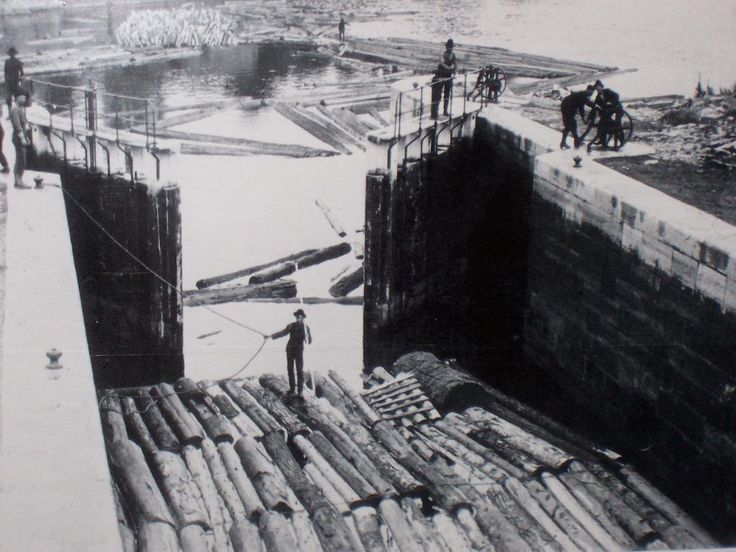
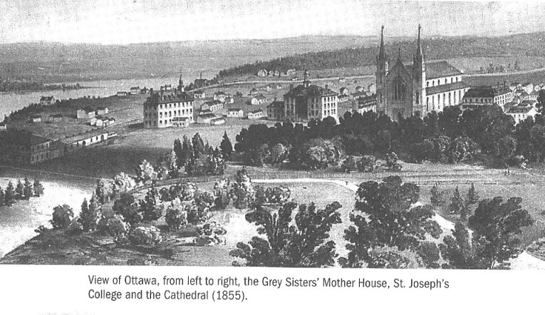
Ottawa, the capital city of Canada, is on the south bank of the Ottawa River on Ontario’s border with Quebec, with Gatineau on the other side of the river in Quebec.

We are told that it was founded as Bytown in 1826, which was marked by a sod-turning, and a letter from Governor-General Dalhousie which authorized Lt. Col. John By to divide up the town into lots.
We are told Bytown came about as a direct result of the construction of the Rideau Canal, which was said to have been built by Lt. Col. By, and opened in 1832…
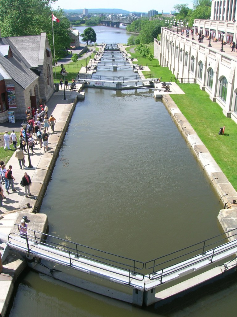
…and Bytown was said to have grown because of the Ottawa River timber trade.
Bytown was incorporated as a town on January 1st of 1850, and this was superseded by the incorporation of the city of Ottawa on January 1st of 1855.
This is a depiction of Lower Town in Ottawa in 1855, said to be the oldest part of the city.
In the Sudbury region of Ontario, we are told a large tract of land, including what is now Sudbury, was signed over to the British Crown in 1850, by the local chiefs, as part of the Robinson-Huron Treaty.
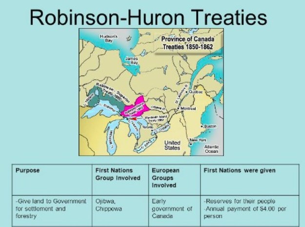
In return, the Crown pledged to pay an annuity to these First Nations people, originally set at $1.60 per treaty member, and it was last increased to $4 in 1874, where it is fixed to this day.
Reservations were also established as result of this Treaty.
Here is a example of the ancient, indigenous inhabitants having their land taken from them, and getting very little in return, in what is clearly a rigged exchange!
Next are things that took place in our historical narrative between 1851 to 1870.
The Girgam is the royal history of the the line of kings of the the Kanem-Bornu Empire in what is now Chad and Nigeria.
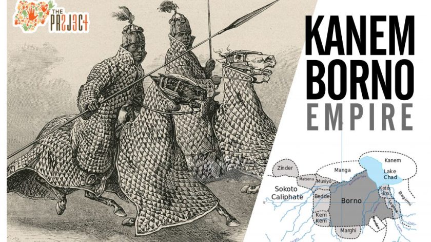
In 1851, a copy of the Girgam was given by a local associated with the Seyfawa Dynasty of the Kanem-Bornu Empire to Heinrich Barth, an Arabic-speaking German explorer of Africa, and he published a translation of it in 1852.
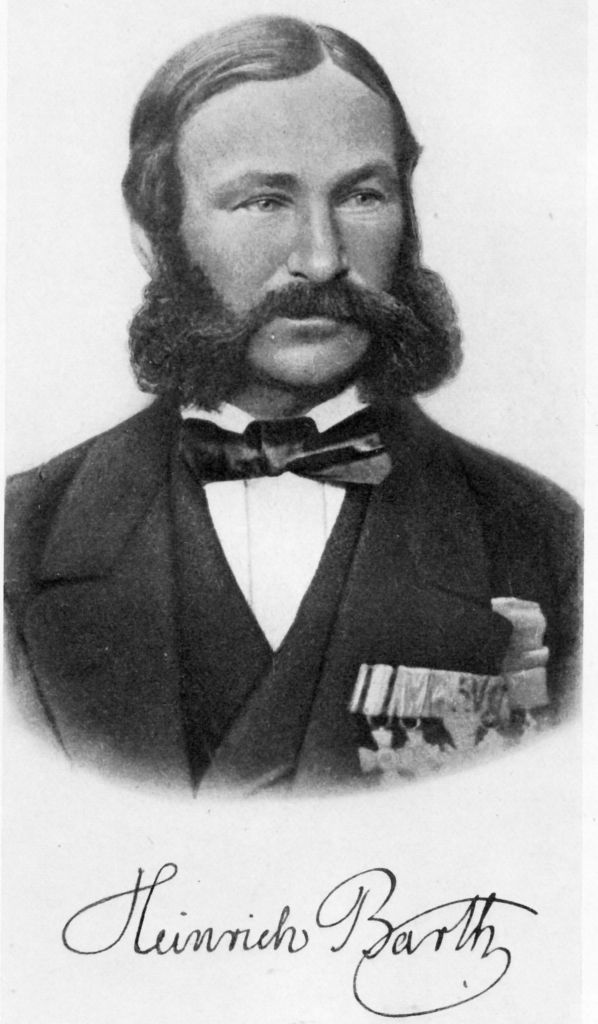
He travelled extensively throughout Africa between 1850 and 1855, establishing friendships with rulers and scholars, and carefully documenting the details of the cultures he visited.
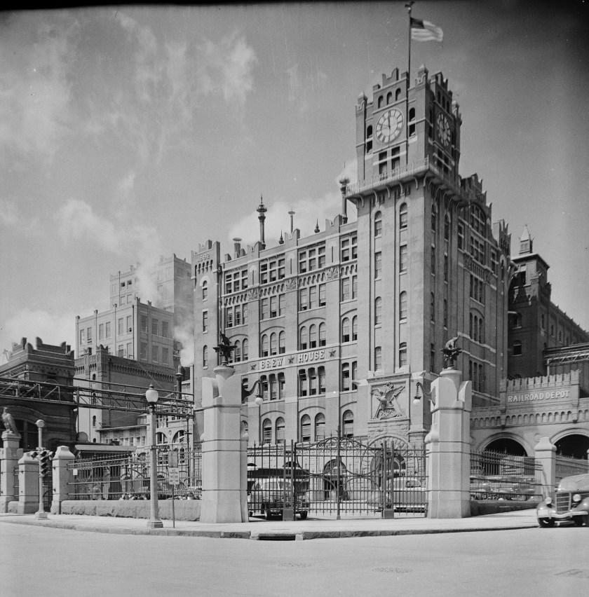
In 1852, George Schneider founded the Bavarian Brewery in St. Louis, but financial problems forced him to sell the brewery to various owners during the late 1850s, one of which Eberhard Anheuser, a prosperous German-American soap and candle-maker, and the brewery’s name became E. Anheuser & Company in 1860.
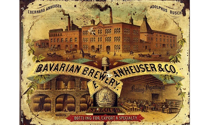
A wholesaler who had immigrated from Germany to St. Louis in 1857, Adolphus Busch, became Eberhard Anheuser’s son-in-law in 1861 and later president of the company.
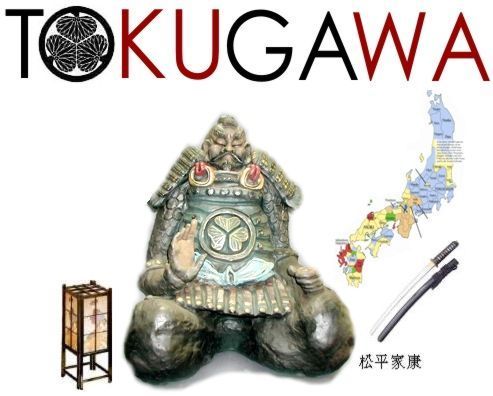
Commodore Matthew Perry played a leading role in the Opening of Japan, starting on July 8th, 1853, when he led four U. S. Navy ships ordered by President Millard Fillmore to Tokyo Bay with the mission of forcing the opening of Japanese ports to American trade by any means necessary.
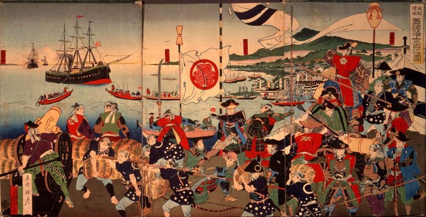
After threatening to burn Tokyo to the ground, he was allowed to land and deliver a letter with United States demands to the Tokugawa Shogun, Ieyoshi.
The Shogun Ieyoshi died a short time after Perry’s departure in July of 1853, leaving effective administration in the hands of the Council of Elders, though nominally to his sickly son, Iesada, who was the Tokugawa Shogun from 1853 to 1858.
The Tokugawa Shogunate was called the last feudal Japanese Military Government.
Perry returned again with eight naval vessels in February of 1854, and on March 31st of 1854, the Japanese Emperor Komei signed the “Japan and United States Treaty of Peace and Amity” at the Convention of Kanagawa under threat of force…

… if the Japanese government did not open the ports of Shimoda…
…and Hakodate to American vessels.
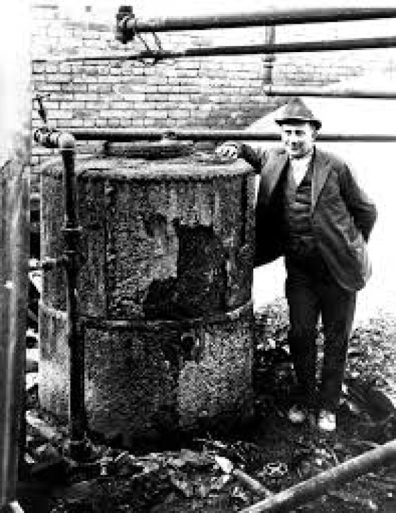
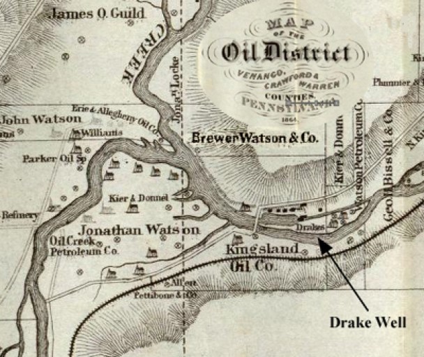
Samuel Kier established America’s first oil refinery for making lamp oil in Pittsburgh in 1854.

The petroleum industry in the United States began in earnest in 1859 when Edwin Drake found oil on a piece of leased-land near Titusville, Pennsylvania, in what is now called Oil Creek State Park.
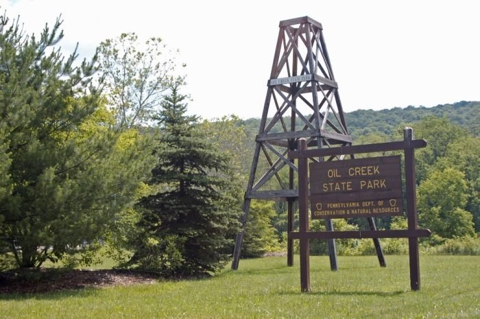
For this reason, Titusville is called the Birthplace of the Oil Industry, and for a number of years this part of Pennsylvania was the leading oil-producing region in the world.
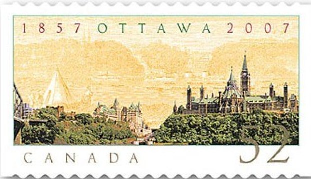
Our history tells us that on New Year’s Eve of 1857, Queen Victoria was presented with the responsibility of choosing the location for the permanent capital of Canada, with Ottawa being described as a small, frontier town.

The Parliament buildings were said to have been constructed between 1859 and 1866, in an architectural style called Gothic Revival.
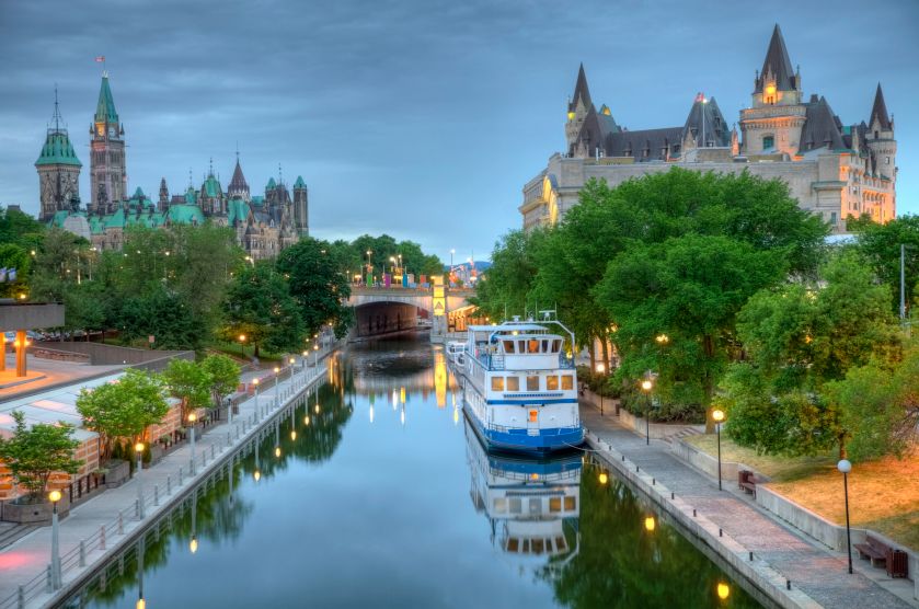
This a view of Parliament Hill from the Rideau Canal.
In the same year that Queen Victoria chose the location of Ottawa as Canada’s capital, Persia was compelled by the Treaty of Paris of 1857 not to challenge the British for Herat and other parts of what is today Afghanistan.
Britain supported the Afghans to protect their East India Company.
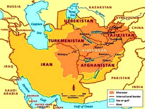
Herat in Afghanistan was separated from Persia by British in the Anglo-Persian War of 1856 – 1857, and the Persians were unable to defeat the British to take back Herat.
Also in that same time period, between 1857 and 1859, a major uprising took place in northern India against the rule of the British East India Company, which functioned as a sovereign power on behalf of the British Crown.
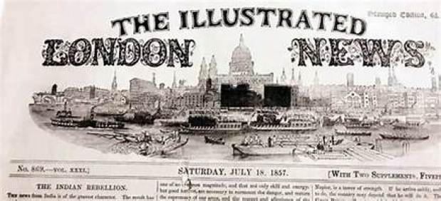
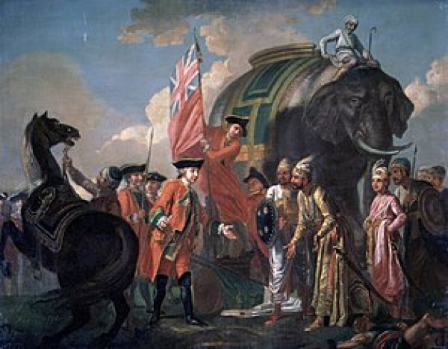
The British East India Company had ruled over parts of the Indian Subcontinent between 1757 and 1858, commencing after the 1757 Battle of Plassey, called a decisive victory over the Nawab of Bengal, Mir Jafar, after which time the Nawab started ceding revenues to the what was called the “Company.”
One of the earliest railways said to have been constructed in India was the Solani Aqueduct Railway in 1851, which we are told was built for…
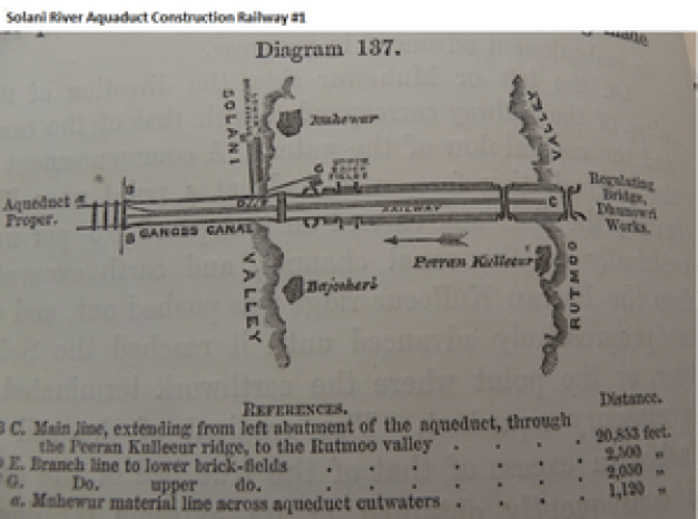
…the purposes of tranporting construction materials for the Solani River Aqueduct.
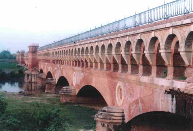
Proby Cautley, an English engineer and paleontologist, and an officer in the British East India Company, was given the historical credit not only for the building of the Solani Aqueduct…
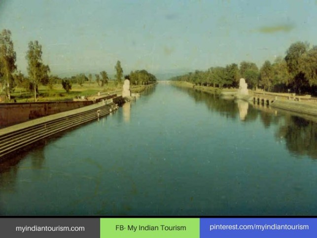
…as well as the 350-mile, or 563-kilometer Ganges Canal between 1843 and 1854,which the aqueduct crosses, said to have had the greatest discharge of any irrigation canal in the world at the time of its construction, and described as an engineering marvel.
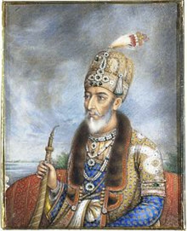
The last Mughal Emperor in India, Bahadur Shah Zafar, was deposed by the British East India Company in 1858, and exiled.
Through the Government of India Act of 1858, the British Crown assumed direct control of the British East India Company-held territories in India in the form of the new British Raj.

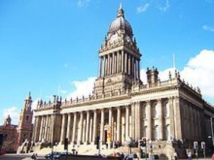
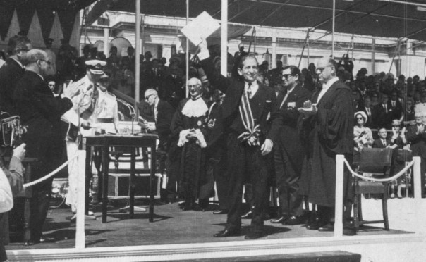
I have also found that winners of architecture contests, like Cuthbert Broderick for one of many examples, a 29-year-old architect who was said to have won a design contest in 1852 for the…
…Leeds Town Hall, said to have been opened by Queen Victoria in 1858.
The Bey of Tunis from 1855 to 1859, Muhammad, was forced by the British and French to sign the 1857 Fundamental Pact, which increased freedoms for non-Tunisians.
Then, we are told, in 1861, Tunisia enacted the first constitution in what was called the Arab world, but a move toward a modernizing republic was said to have been hampered by a poor economy and political unrest.
Regardless of the new Constitution, when the Tunisian government couldn’t manage the loans made by foreigners to the government, it declared bankruptcy in 1869.
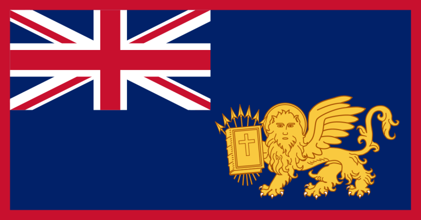
When the Suez Canal opened in 1869, Malta was considered an important stop on the way to India, a central trade route for the British, because it was half-way between the Strait of Gibraltar and Egypt.
Malta didn’t gain its independence from Britain until 1964.
John D. Rockefeller, along with Henry Flagler, an American Industrialist and major developer in the state of Florida, founded the Standard Oil Company in 1870…

…becoming an American oil producing, transporting, refining, marketing company…and monopoly, which exists when a specific person or enterprise is the only supplier of a particular commodity.
This is what I found happening between the years of 1871 to 1890.
This statement of Albert Pike, a prominent American Freemason of the 19th-century, was attributed to him in 1871.
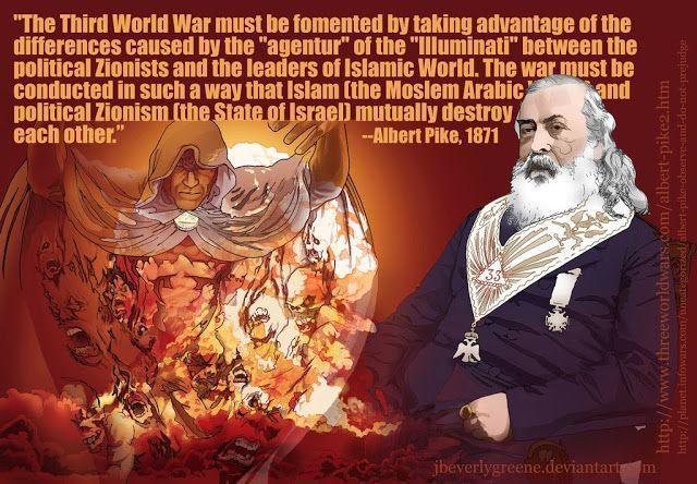
And, by the way, how did he know about a first and second World War?
Britain and France cooperated between 1871 and 1878 to prevent Italy from acquiring Tunisia as a colony having investment, and subsequently Britain supported the French interest in Tunisia in exchange for dominion over Cyprus.
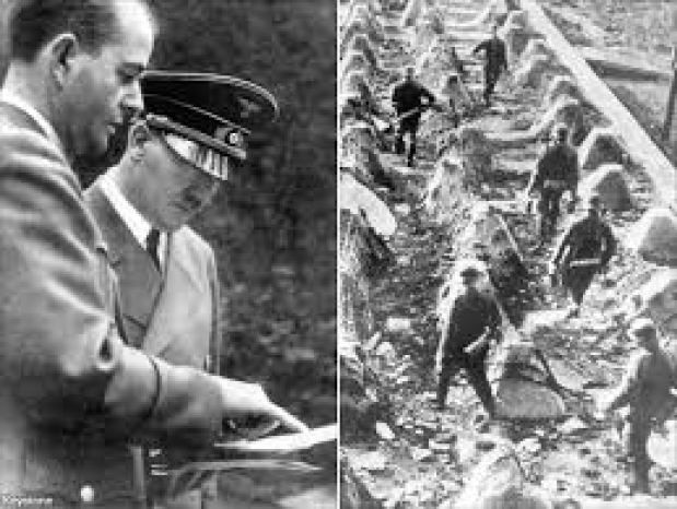
Otto von Bismarck was the mastermind behind the unification of Germany in 1871, and served as its first chancellor until 1890.
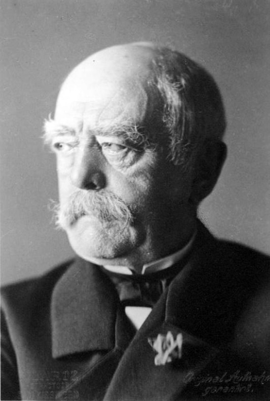
While on one hand, Bismarck was said to have skillfully used balance-of-power diplomacy to maintain Germany’s position for 20-years in a peaceful Europe, at the same time the way he unified Germany was by provoking three short, decisive wars with Denmark, Austria, and France, and by abolishing the supra-national German Confederation, an association of 39 German-speaking states in Central Europe that was created by the Congress of Vienna to replace the former Holy Roman Empire, and formed the German Empire, which excluded Austria, which was a major beef of the Austrian Adolf Hitler.
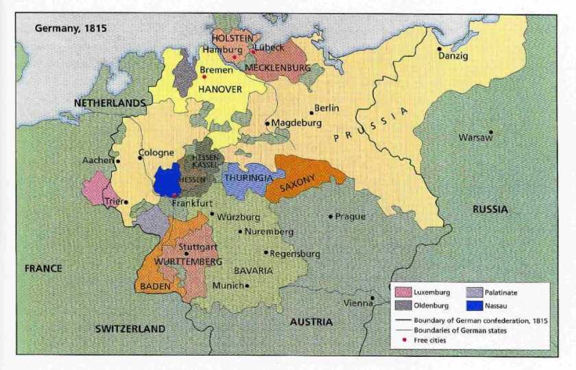
Bismarck also annexed Alsace-Lorraine on the border with Germany, which was part of France, as a result of the Franco-Prussian War of 1870 – 1871.
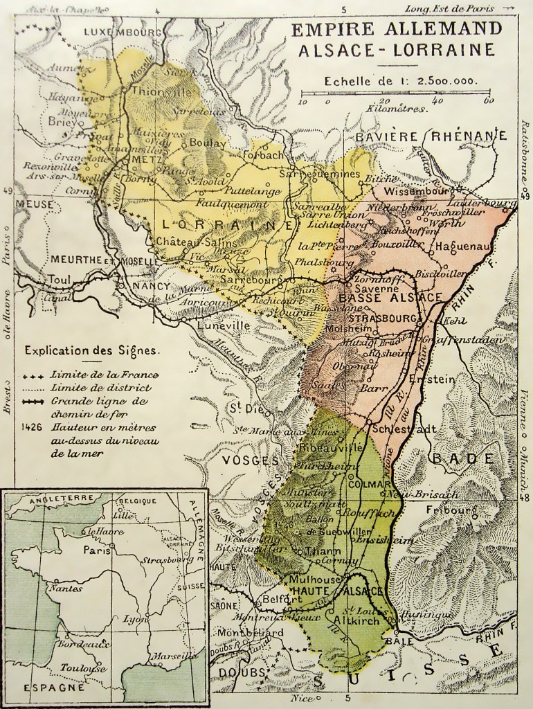
We are told that France’s determination to regain Alsace-Lorraine, and fear of another Franco-German war, as well as British apprehension about the balance-of-power, became factors in the causes of World War I.
So by not including the Austria in the German Confederation, and annexing France’s Alsace-Lorraine, Otto von Bismarck set the stage for World War I and World War II.
The Criminal Tribes Act was enacted by the British in India on October 12th of 1871, and wasn’t ended until 1949.
The Criminal Tribes Act of 1871 criminalized entire communities by designating them as habitual criminals, and restrictions on their movements were imposed, including men having to report to the police once per week.
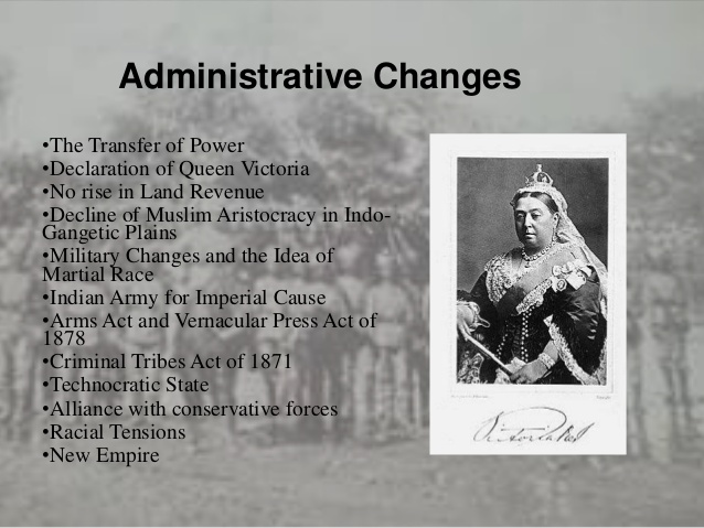
In 1876, Queen Victoria assumed the title of Empress of India.
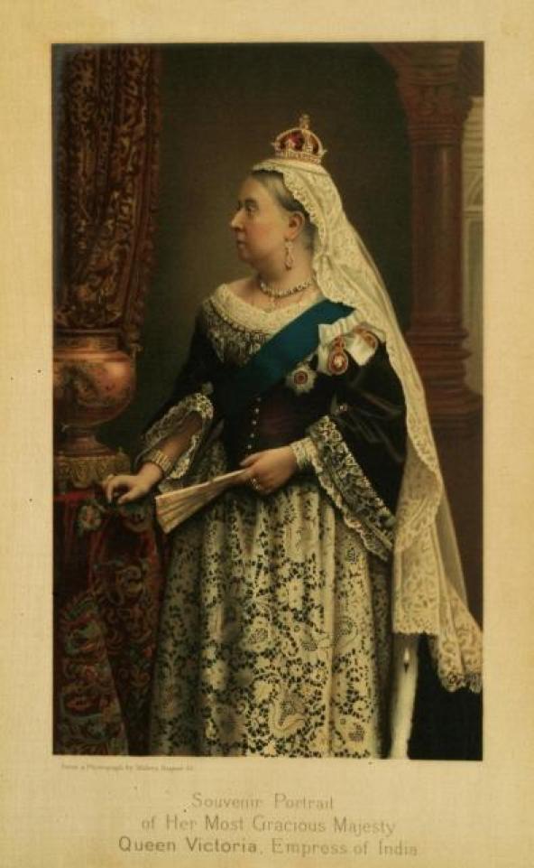
King-Emperor and Queen-Empress were the titles used by the British monarchs in India between 1876 and 1948.
During the 1870s, Adolphus Busch was said to have toured Europe to study changes in brewing methods at the time.
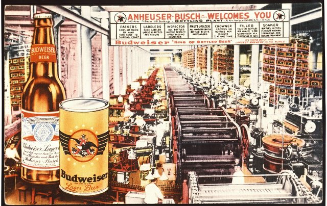
In particular he was interested in the pilsner beer of the town of Budweis, located in what is now the Czech Republic, and in 1876, he introduced Budweiser…
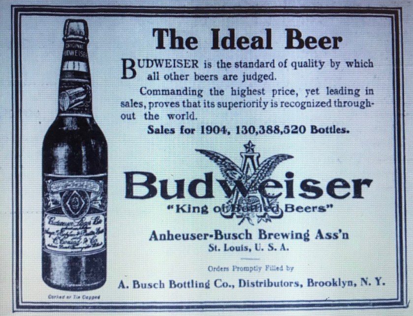
…and 1876 was the same year he introduced refrigerated railroad cars to transport beer.

By 1877, the company owned a fleet of 40 refrigerated railroad cars.
Expanding the company’s distribution range led to increased demand for their products, and the company expanded its facilities in St. Louis during the 1870s.
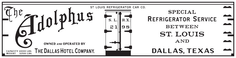
Busch implemented pasteurization in 1878 as a way to keep beer fresh for a longer period of time.
He established the St. Louis Refrigerator Car Company in 1878, and by 1888, the company owned 850 cars.
In addition to refrigeration and pasteurization, Busch adopted vertical integration as a business practice, in which he bought all the components of his business, from bottling factories to ice-manufacturing plants to buying the rights from Rudolf Diesel to manufacture all diesel engines in America.
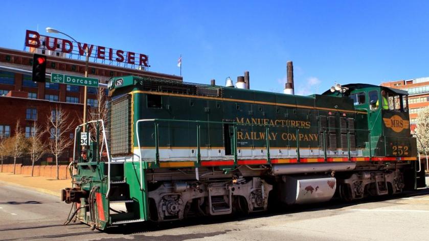
He also founded the Manufacturers Railway Company in 1887.
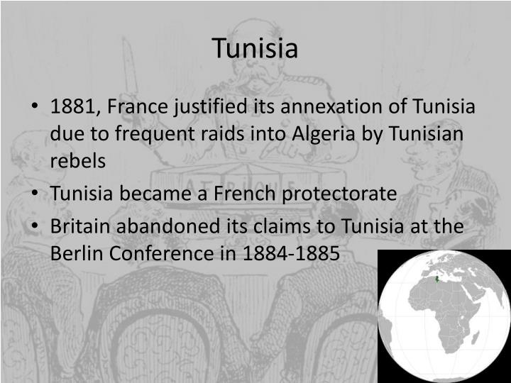
In 1881, using the pretext of a Tunisian invasion into Algeria, the French invaded Tunisia with an army of 36,000, which quickly advanced to, and occupied, its capital Tunis, which was also the historic location of ancient Carthage.

Then, the French forced the new Bey of Tunis, Muhammad III as-Sadiq, to make terms in the form of the 1881 Treaty of Bardo, which gave France control of Tunisian governance and making it a de facto French Protectorate.
The French progressively assumed more of the important administrative positions, and by 1884 they supervised all Tunisian government bureaus dealing with finance, post, education, telegraph, public works, and agriculture.
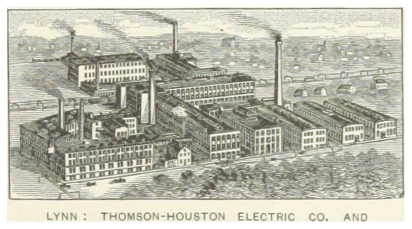
Thomson-Houston Electric was formed in 1882, when Charles Coffin led a group of Lynn, Massachusetts investors bought out Elihu Thomson’s and Edwin Houston’s American Electric Company from their New Britain, Connecticut investors in 1882.
The Thomson-Houston Electric Company moved their operations to a building on Western Street in Lynn, Massachusetts.
We are told that in 1888, Thomson-Houston Electric implemented the electrification of streetcars in Lynn…
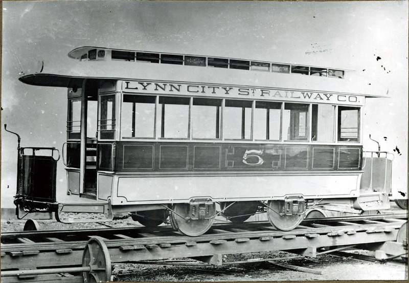
…which was part of the Lynn and Boston Street Railway, in service since 1854, when it had been powered by mules.
In 1882, Billings, Montana was founded as a railroad town.
It was nicknamed the “Magic City” for its rapid growth in a short period of time.
We are told the city of Billings went from three buildings to over 2,000 within months of its founding!
Billings was named after the Northern Pacific Railway president Frederick H. Billings, and we are told the railroad formed the city as a western railhead for its further westward expansion.
In October of 1884, the United States hosted the International Meridian Conference, attended by twenty-five countries, in order to determine the Prime Meridian for international use.
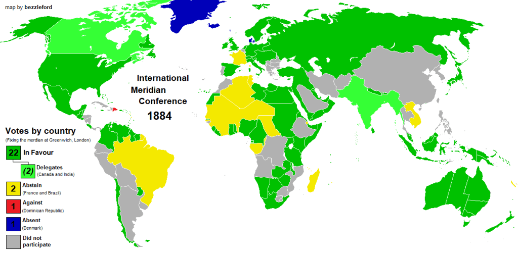
Twenty-two of the twenty-five countries in attendance voted to adopt the longitude of the Royal Observatory in Greenwich as the zero-reference line.
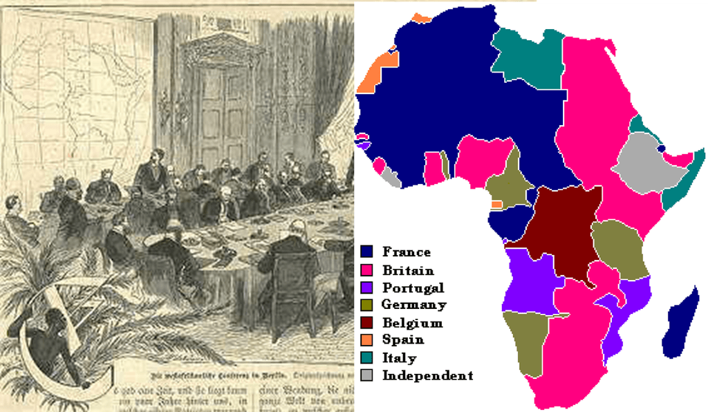
The International Meridian Conference was held right before the Otto von Bismarck-organized Berlin Conference, which was convened in November of 1884 and lasted until February of 1885…
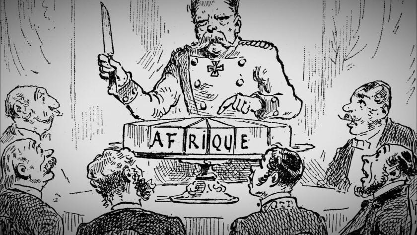
…during which time the entire continent of Africa was carved up between the European powers.
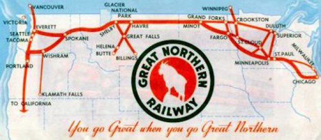
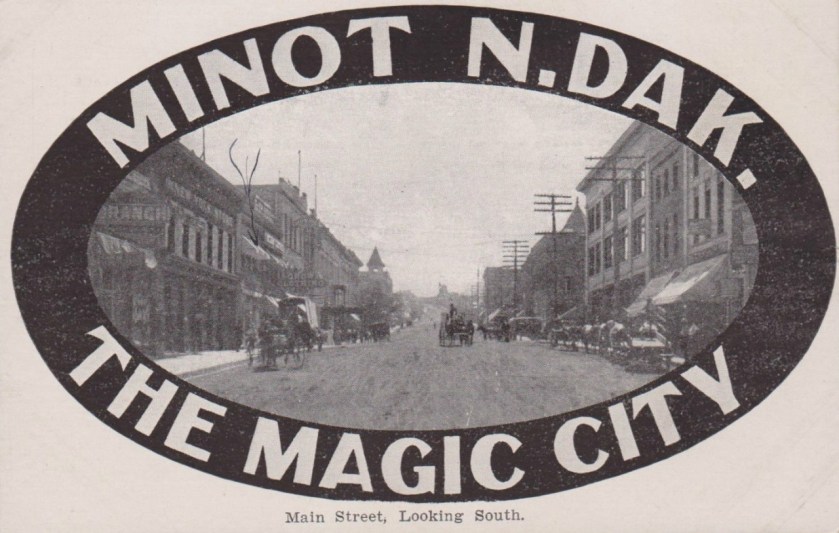
In 1886, Minot was founded in North Dakota during the construction of James J. Hill’s Great Northern Railway.
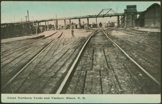
James J. Hill was said to be a Canadian-American railroad executive who came from an impoverished childhood…
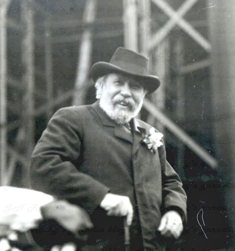
…to eventually become the founder and driving force of the Great Northern Railway Company.
Like Billings, Minot was also known as the “Magic City” for what was called its remarkable growth over a short period of time.
The DeBeers Group, an international corporation that specializes in all aspects of the diamond industry, was founded in 1888 by British businessman, Cecil Rhodes, who received funding from the Rothschilds for his diamond business expansion in South Africa.
Things I found in my research between 1891 and 1917 included:
The Lumiere Brothers premiered ten short films in Paris on December 28th, 1895, considered the breakthrough of projected cinematography, meaning pertaining to the art or technique of motion picture photography.
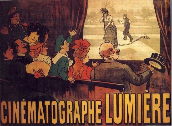
Shortly thereafter, film production companies and studios were established all over the world.
After Spain’s defeat in the Spanish-American War in 1898, the islands of Palau were sold to Imperial Germany in 1899 under the terms of the German-Spanish Treaty.
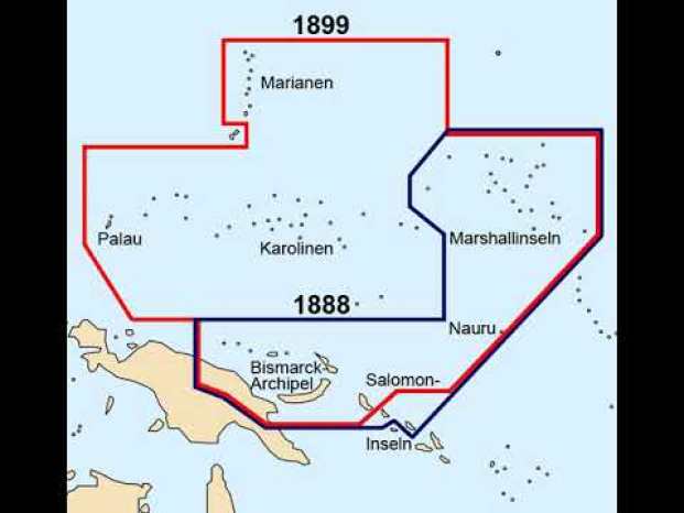
The other islands purchased by Germany as a result of this treaty were the Caroline Islands and the Mariana Islands.
They were all part of German New Guinea, which was part of the German Colonial empire that existed from 1884 to 1919.

German New Guinea ceased to exist after World War I and the Treaty of Versailles.
Gold rushes were still happening during this time period as well.
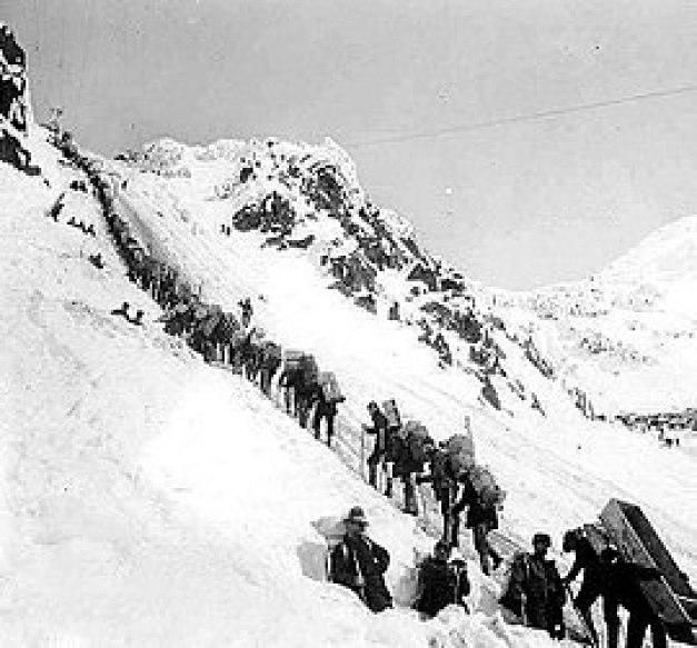
The Klondike Gold Rush, a migration by an estimated 100,000 prospectors to the Klondike region of northern Yukon between 1896 and 1899.
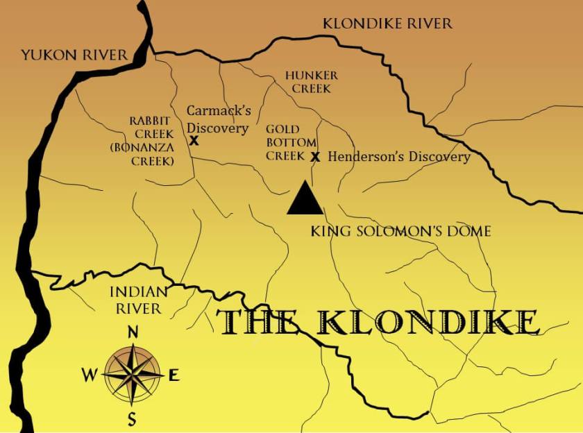
As soon as word about the discovery of gold in the Klondike reached Seattle and San Francisco, it triggered a stampede of prospectors, immortalized in photos like this of the long-line waiting to cross the Chilkoot Pass, a high-mountain pass between the Boundary Ranges of the Coast Mountains between Alaska and British Columbia.
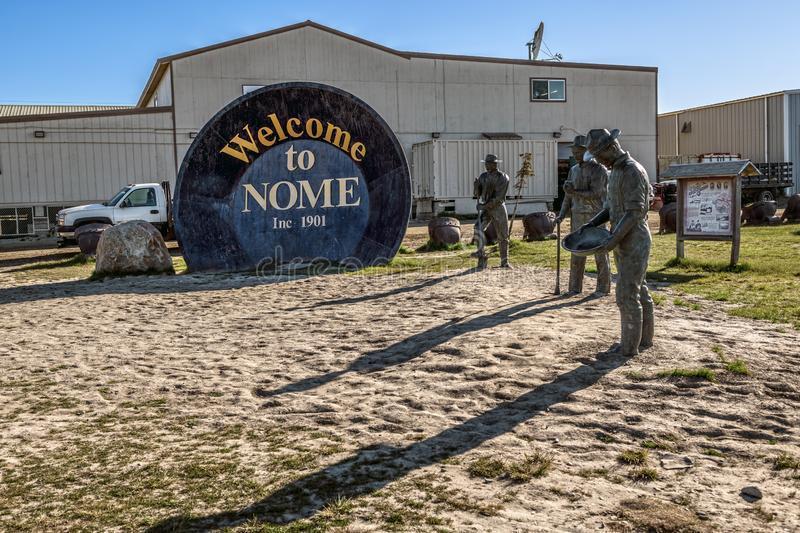
Then, there was the gold found in Nome, Alaska.
The most populous city in Alaska at one time, Nome was incorporated in April of 1901…
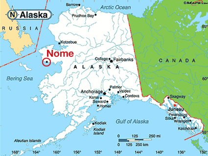
…shortly after gold was discovered on Anvil Creek there in 1898 by “three lucky Swedes.”
News of the discovery was said to have reached the outside world that winter, and that by 1899, had a population of 10,000 people.
The area was first organized as the “Nome Mining District.”
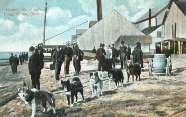
Also in 1899, gold was found in the beach sands for dozens of miles along the coast at Nome, spurring the stampede to new heights.
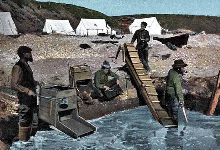
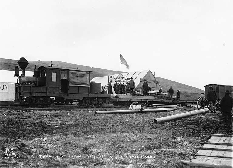
In 1899, Charles D. Lane founded the Wild Goose Mining and Trading Company…
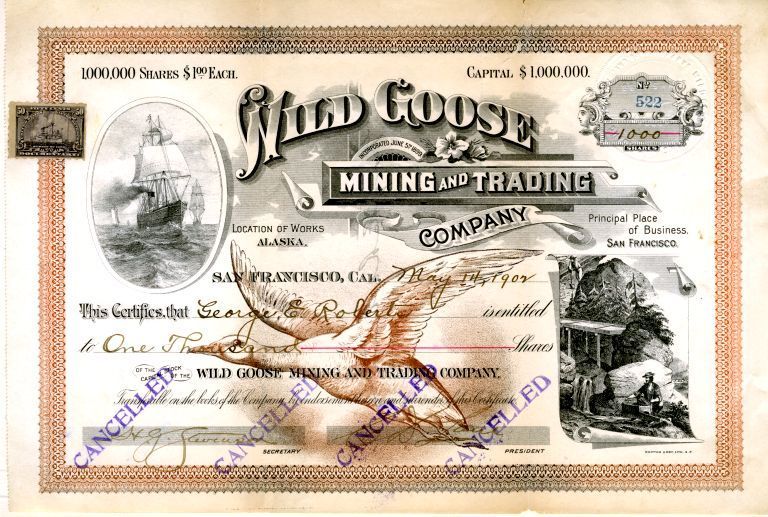
…for which he was said to have built the Wild Goose Railroad, which ran from Nome to Dexter Discovery, and by 1908 to the village of Shelton.
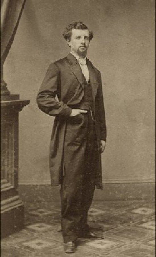
Charles D. Lane, a millionaire mine owner, was recognized as a founder of Nome.
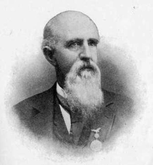
He was born in Palmyra, Missouri, in 1840, and moved to California with his father in 1852.
He had gotten involved in the mining industry, developing successful mines in Idaho, California, and Arizona, before hearing of the first gold strike in Nome in 1898.
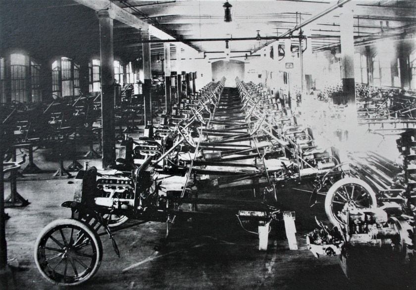
In the area of mass transportation during the early 1900s, Henry Ford and the the Ford Motor Company would lead the world in the expansion and refinement of the assembly line concept between 1904 and 1914, leading to the mass production of automobiles…
..and, during the same time-period, in 1911, the United States Supreme Court ruled that Standard Oil was an illegal monopoly, ending its history as one of the world’s first and largest multinational corporations.
Rockefeller’s wealth had soared as kerosene and gasoline grew in importance.
At his peak, Rockefeller controlled 90% of all oil.
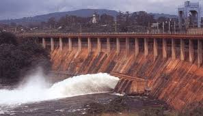
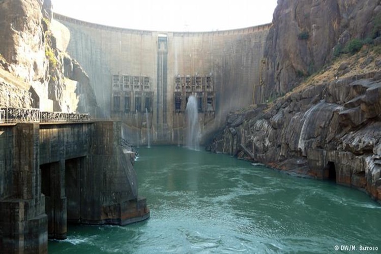
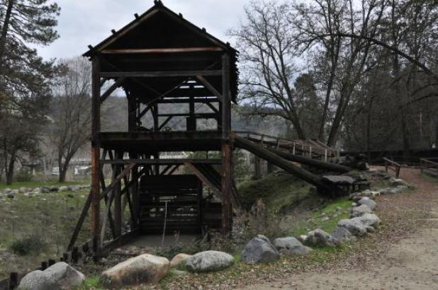
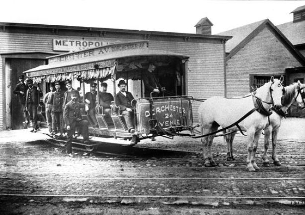
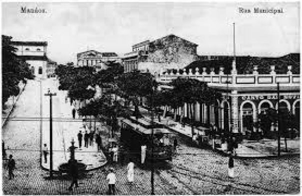
There is mounting evidence that there had already been a worldwide free energy system in existence from the original civilization, including electric streetcar systems all over the Earth, like this one in the middle of the Amazon Rainforest in Manaus, Brazil, once upon a time…
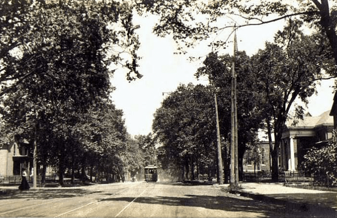
…systems which even included residential routes, as seen in this historic photograph in a Charlotte, North Carolina neighborhood…
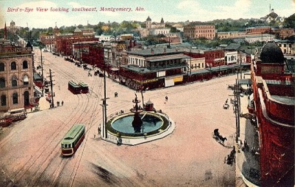
…and that whole electric streetcar systems were retired as soon as they could be replaced by cars and buses, like, for example, the “Lightning Route” in Montgomery, Alabama, said to have been in operation for only 50-years, between 1886 and 1936.
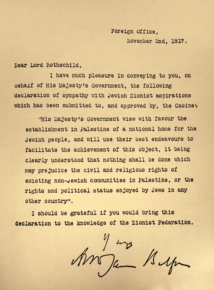
In 1917, the Balfour Declaration was issued by the British government, during the first World War, announcing the support for the establishment of a national home for the Jewish people, written by the Foreign Secretary Arthur Balfour to Lord Rothschild, a leader of the British Jewish community.
The powers that were didn’t rewrite history from scratch – they rewrote the historical narrative to fit their agenda.

And starting from the new official historical reset year of 1851, we have been required to learn their version of history via compulsory education from a very young age.
This information is from Foster Gamble’s “Thrive” website.


We don’t see the copious evidence for the original ancient, advanced civilization in the environment around us because it is not supposed to be there.

While there is always more to add about what was going on in the 1800s, I have put together this timeline from research that I pulled together from other blog posts that I have done in order to share with you what I have found all together in one place.
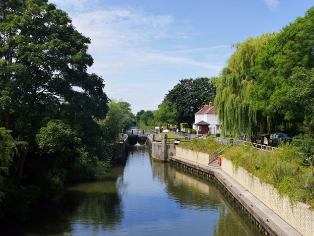
In my next post, I will be looking at the islands of the English Channel.