
In Part 1 of this two-part series, I looked at reservoirs and hydroelectric projects in Canada and the United States, among other things, to bring forward their characteristics of advanced engineering which does not fit our historical narrative, like those projects of Hydro-Quebec in northern Quebec; the Churchill Falls Generating Station in the Province of Labrador; in Sault-Ste-Marie, also known as “The Soo,” divided between Ontario and Michigan; the Columbia Basin Project in Washington State; hydroelectric dam systems along the Columbia River between Washington and Oregon; reservoirs in Portland; the Hoover Dam between Nevada and Arizona; the Scituate Reservoir in Rhode Island; the Jacqueline Kennedy Onassis Reservoir in Central Park, which is connected to the Old Croton Aqueduct; the Upper Roxborough Aqueduct outside of Philadelpha; and the Lake Roland Dam and Reservoir in Baltimore County, north of Baltimore City.
I have one more place to share in the United States before I jump over, as promised, to the reservoir and dam systems in Europe, where I will start in Great Britain.
Someone left a comment about Ohio dams.
So I looked in Ohio and this is just a little of what I found:
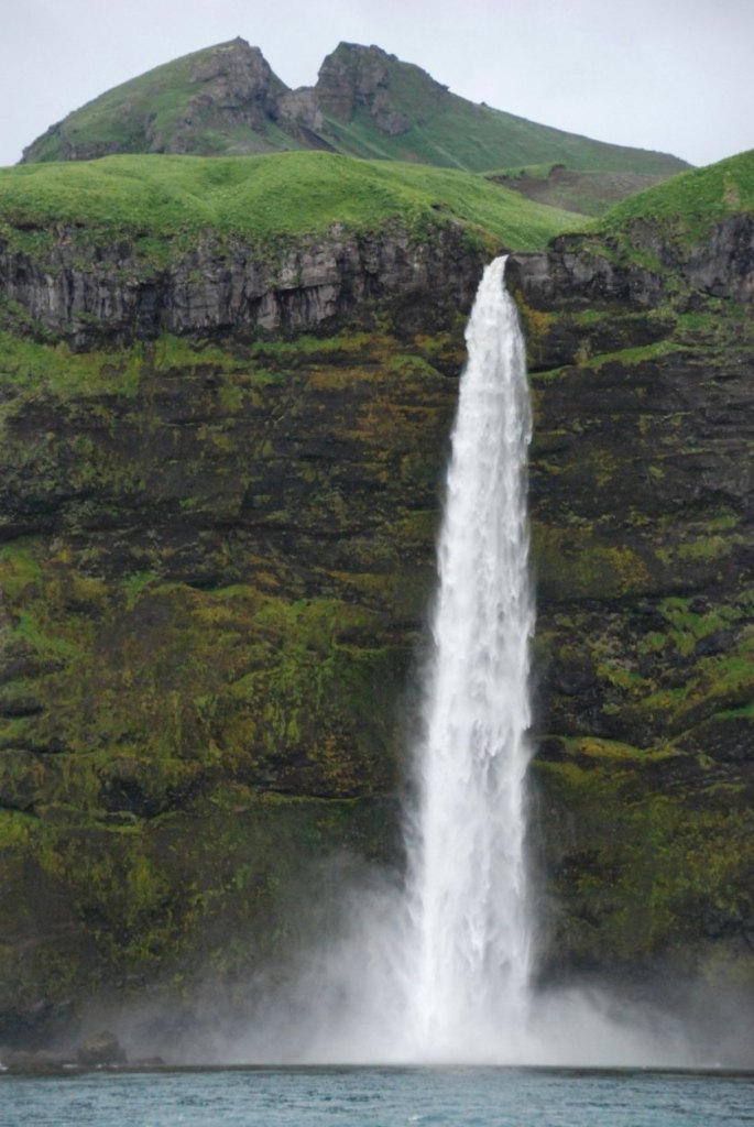
One example is the Hoover Dam in Westerville, Ohio, near Columbus.
The construction dates we are given are between 1953 and 1955, and that it was named for two brothers, Charles P. Hoover and Clarence P. Hoover, to honor their careers with the City of Columbus Waterworks.
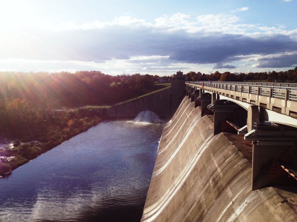
Then I stumbled across the Ohio River Mainstem Navigation System, a system of locks and dams which begins at the confluence of the Allegheny and Monongahela Rivers at The Point in Pittsburgh, Pennsylvania, and ends at the conflucence of the Ohio and Mississippi River near Cairo, Illinois.
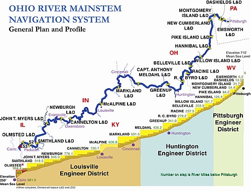
The entire Ohio River Navigation System is operated by the U. S. Army Corps of Engineers.
What we are told was that in the early days of steamboat navigation on the Ohio River, the major physical hurdle that delayed travel were the Falls of the Ohio near Louisville, Ohio…
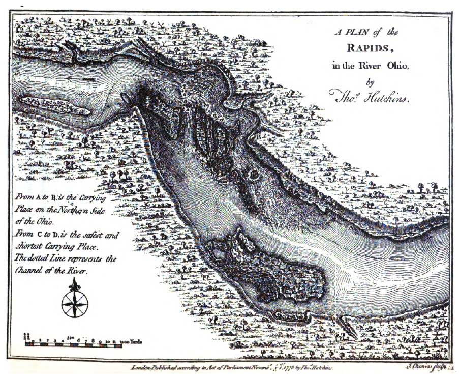
…and that this made steamboat travel very challenging when the water was low.
Thus, it was determined that a canal and lock system was needed to circumvent the Falls of the Ohio.
The construction of the first one, the Louisville & Portland Canal, was said to have started in 1825 and completed in 1830.
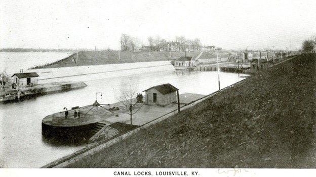
We are seriously told the privately-financed canal was constructed by hand-tools, with the help of animal-drawn scrappers and carts.
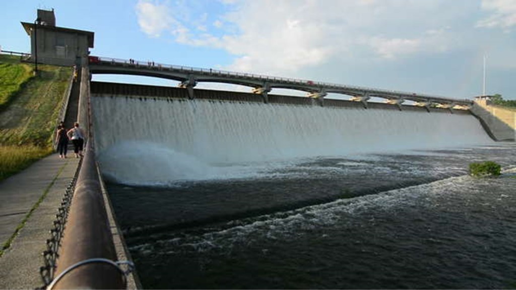
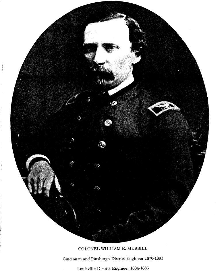
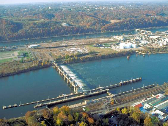
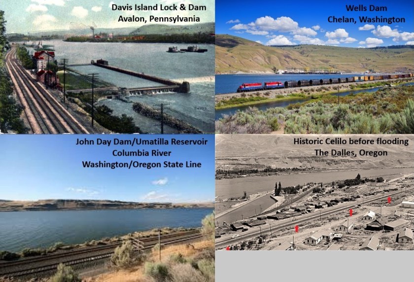
Next came the Davis Island Lock and Dam site in Avalon, Pennsylvania, said to have been designed by William Emery Merrill, an American soldier and military engineer who graduated first in his class at West Point in 1859, as well as the US Army Corp of Engineers.
Said to have been the first dam constructed on the Ohio River, it officially opened on October 7th of 1885…and was dismantled in 1922…
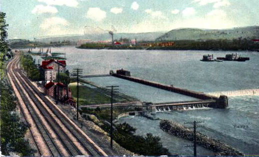
…when it was said to have been replaced by the Emsworth Locks less than a mile downstream from the original site.
I am very curious about finding the presence of railroad tracks at these hydroelectric and reservoir sites I have been looking at.
I really believe they were built by the original advanced Moorish Civilization that has been removed from our awareness, and that “building” the railroad, and the other infrastructure here that I am researching, actually involved digging them out from the mud flood, making them viable once again and figuring out how to re-start their use.
Let’s see what we find elsewhere. On to Great Britain!
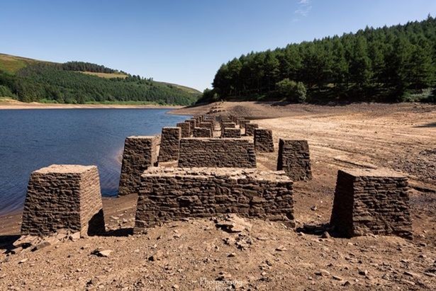
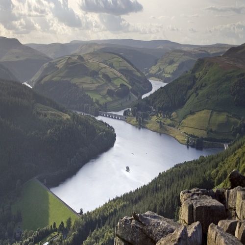
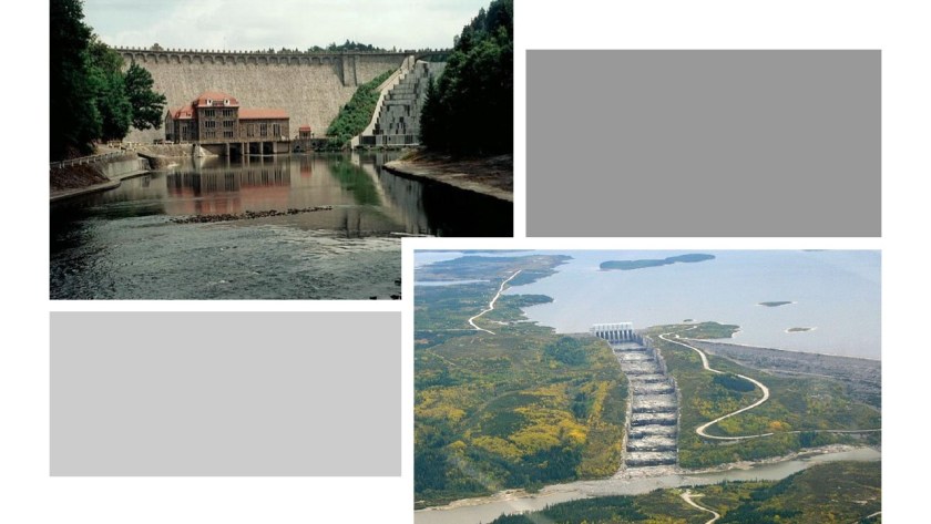
I am going to start with the three Derwent River Dams and Reservoirs, located in the Peak District National Park in the north of England between Sheffield and Manchester…
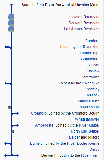
…with the source of the River Derwent being “Howden Moor.”
As in the case of many places in different parts of the world, the memory of the people is retained in the name, and is a subtle way of hiding the Truth in plain sight.
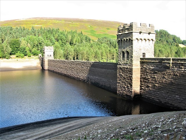
The Howden Reservoir and Dam is the first of three that are consecutively located on the River Derwent…
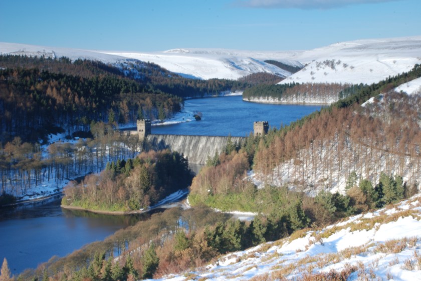
…below which the water from the Howden Dam flows…
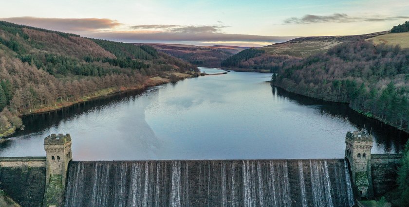
…immediately into the Derwent Reservoir.
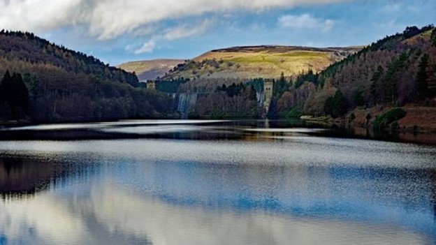
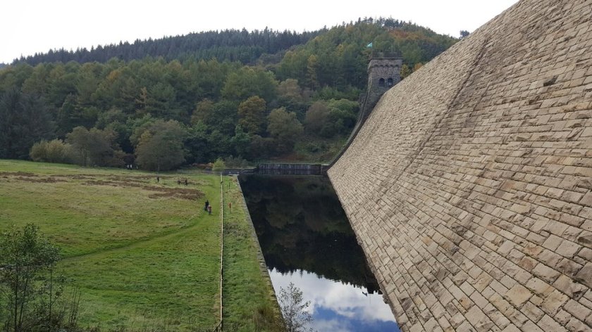
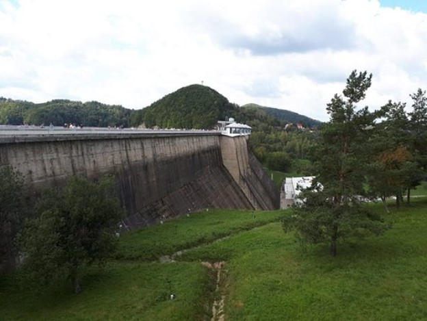
The Derwent Dam and Reservoir is the middle of the three reservoirs in the Upper Derwent Valley in this part of England’s northeast Derbyshire.
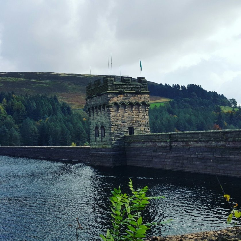
This another perspective of the size and masonry of the dam from its base.
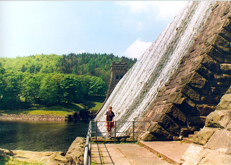
Both the Derwent and Howden Dams and Reservoirs were said to have been built between 1902 and 1914, and filled with water between 1914 – 1916.
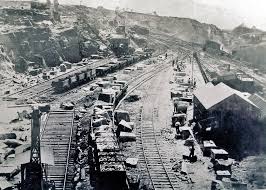
We are told the Bamford and Howden Railway was constructed between 1901 and 1903, from the village of Bamford to the south of the reservoir to Howden, to carry the many tons of stone required for the construction of the two dams.
We are told these are the remains of the old railway at Derwent Reservoir…
…and that the Bole Hill Quarry in Grindleford supplied well over a million tons of stone needed for the construction of the two dams, and was closed in September of 1914, with the end of the railway following soon afterwards.

Both the Howden and Derwent Reservoirs were used by the pilots of the RAF 617 Squadron for practicing low-level flights needed for Operation Chastise (commonly known as the “Dam-Busters” raids) during World War II.
We are told they were used for flight practice due to their similarity to German Dams.
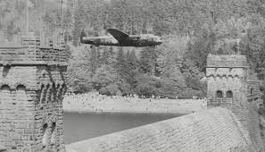
The narrow twists and turns of the upper Derwent were said to have been like those of the Ruhr River, a tributary of the Rhine, and that even the dams were very similar in their design and shape to those of the Mohne, Eder and Sorpe.
So for one example of the German dams, this is the dam and reservoir today of Mohne, near Dortmund, Germany…
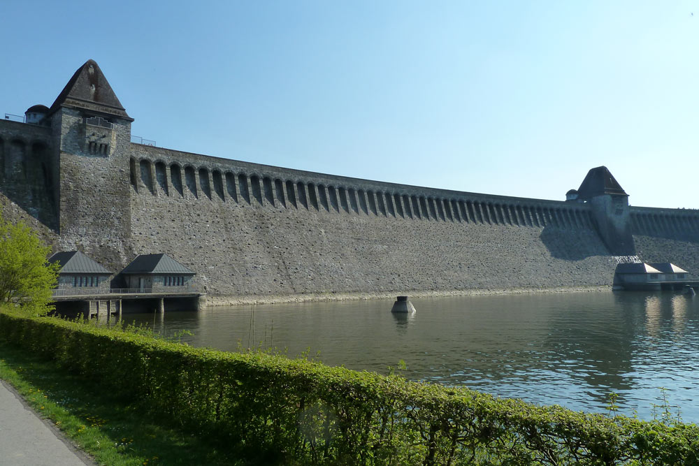
…said to have been built between 1908 and 1913, it was breached by a “bouncing bomb”…
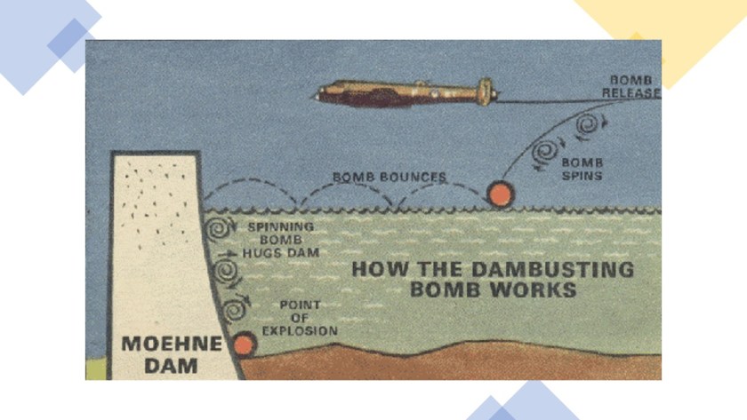
…in a bombing raid on the night of May 16th and 17th in 1943…
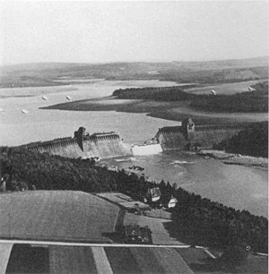
…and repaired quickly, we are told, via the Organization Todt…

…a civil and military engineering organization in Nazi Germany between 1933 and 1945, that administered the forced labor supply from concentration camps for construction projects, like the repair patch of the Mohne Dam said to be pictured here.
Is what we are seeing of the breach, and subsequent repair, of the Mohne Dam historically true?
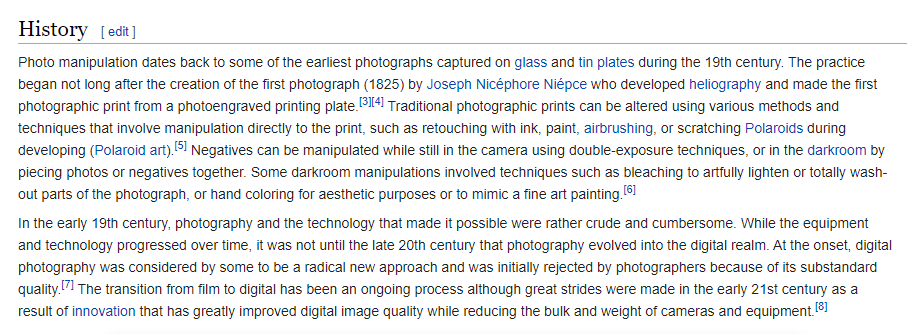
I certainly can’t say for sure one way or the other, but the history of photo manipulation goes back to the beginning of photography in the historical narrative we have been given.
I am just saying that manipulated photos during World War II, in this example, is not outside the realm of possibility. At this point in my research, absolutely nothing would surprise me!
In its role of rebuilding the Mohne Dam, Organization Todt was said to have utilized the labor of 7,000 men taken from the construction of the Atlantic Wall…

…one of the largest building works of the 20th-century, fortifications built between 1942 and 1944, envisioned to make an Allied invasion of the Western European mainland from the Sea impossible.
“Todt” means “dead” in German.

Back to England.
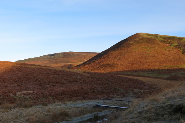
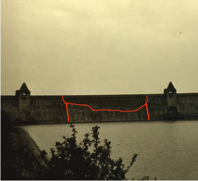
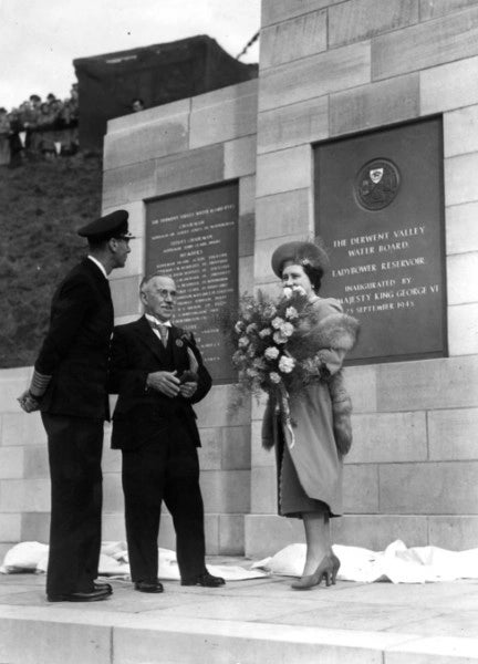
Ladybower is the lowest of the three consecutive dams and reservoirs in the Upper Derwent Valley.
It was said to have been built between 1935 and 1943 by the Derwent Water Board as a supplement to the other two reservoirs in supplying the needs of the East Midlands.
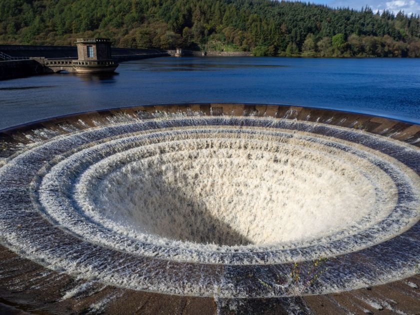
Said to be made out of clay-cored earth embankment, and not solid masonry like the other two I have mentioned in the Upper Derwent Valley, notable features include two totally enclosed bellmouth overflows, locally named the “plug-holes,” which are made of stone.
The Reservoir was said to have been formally opened on September 25th of 1945 by King George VI and his wife, Queen Elizabeth.
The Hodron Edge Stone Circle is located above the east arm of the Ladybower Reservoir.

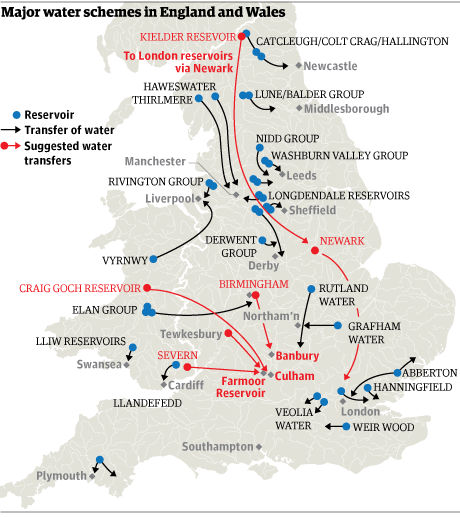
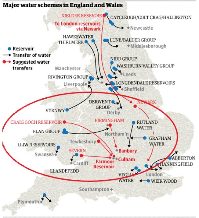
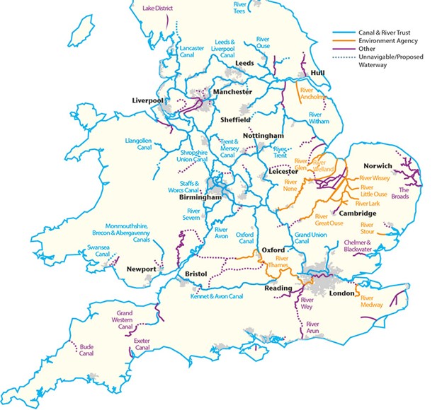
For the next place in England to check out, I was drawn first to what appears to be an interconnected cluster of reservoirs and suggested water transfer locations, some of them from Wales to England.
I want to see what the mechanism for that would be.
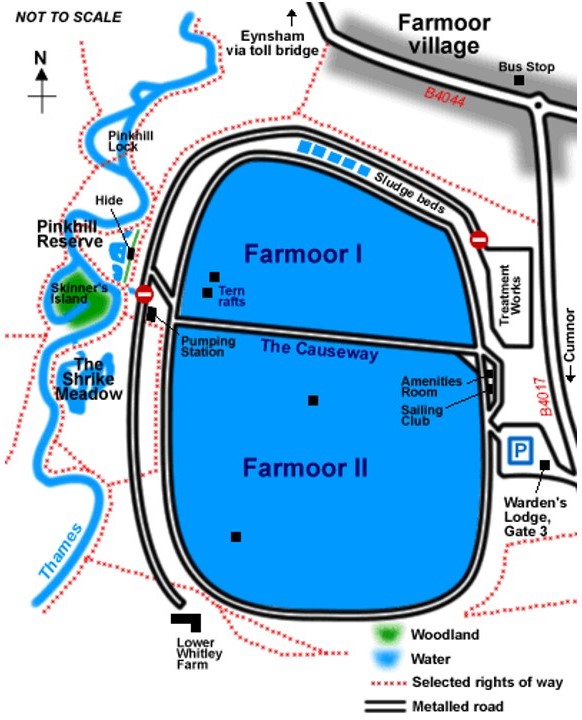
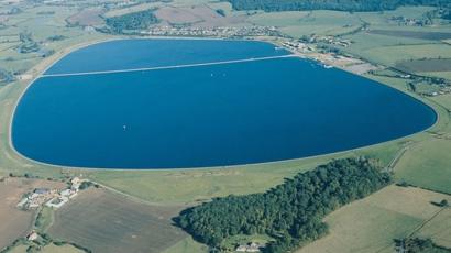
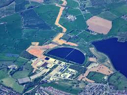
I am starting with the Farmoor Reservoir in Oxfordshire, primarily because of the “moor” sound in the name.
It was said to have been built in two stages, with the first stage having been completed in 1967, and the second in 1976.
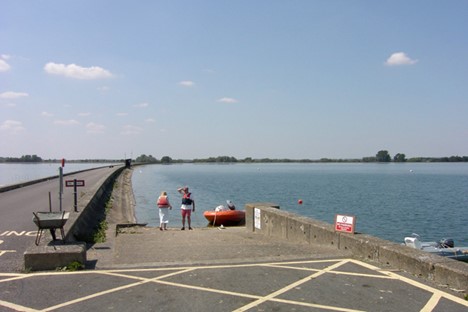
It is near the city of Oxford on the left bank of the River Thames, and is used for fishing, dinghy sailing, and windsurfing, as well as bird-watching and walking.
This is called an an old Control Building of Farmoor Reservoir, in the northern third of it, where fishing is not allowed.
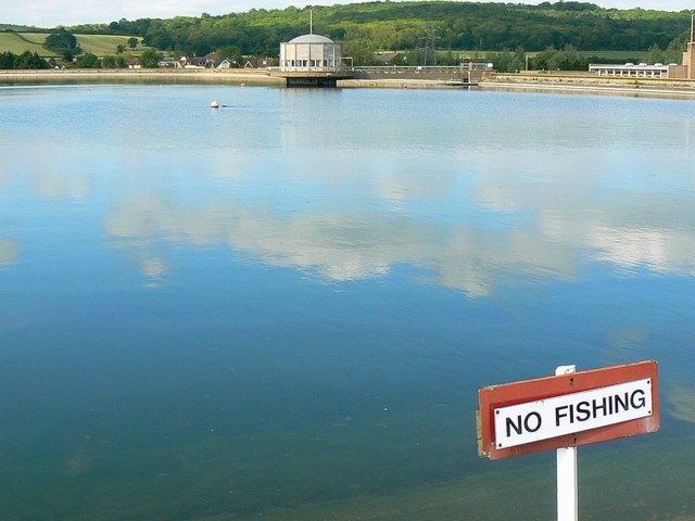
A wall divides the reservoir into the northern third, and southern two-thirds.
The Craig Goch Dam is located in the Elan Valley in Wales.
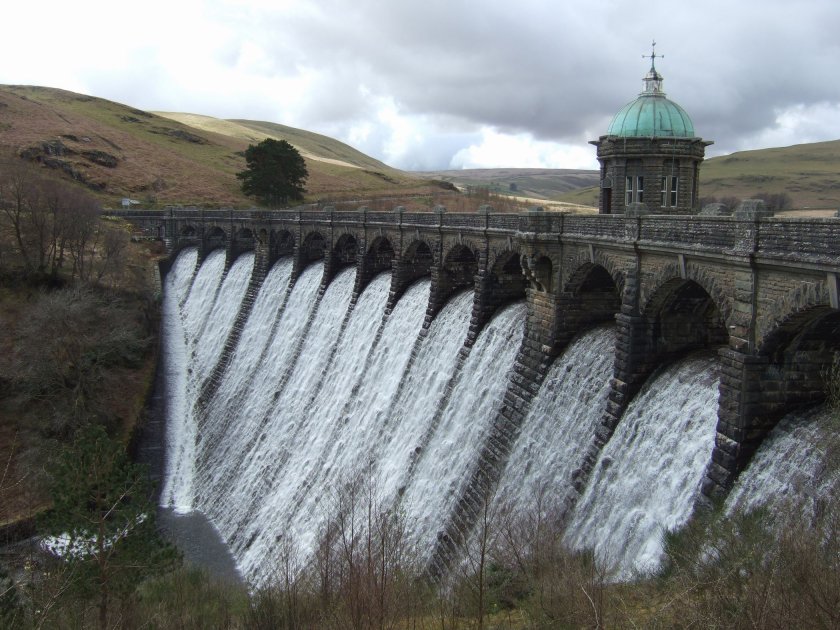
Also called the Top Dam, it is a masonry dam said to have been built between 1897 and 1904…
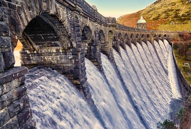
…and is the upper-most of the Elan Valley Reservoirs in Wales.
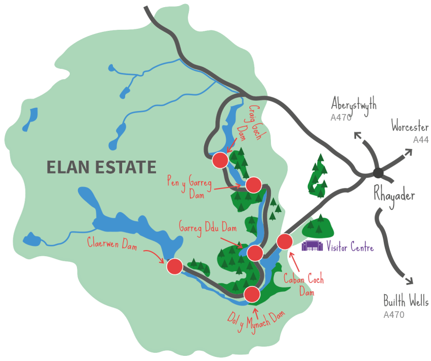
These reservoirs were said to have been built by the Birmingham Corporation Water Department to provide clean water for Birmingham in England’s West Midlands.
Water from the reservoirs is carried by gravity to the Frankley Reservoir in Birmingham…
…construction of which was said to have been authorized by the Birmingham Corporation Water Act of 1892, and built in 1904…
…via the Elan Aqueduct…
…construction of which was said to have started in 1896 by the Birmingham Corporation Water Department, and first opened in 1906.
From what I am seeing, there have been proposals floated to transfer water from the Craig Goch Reservoir to the River Thames amidst concerns of potential water shortages.
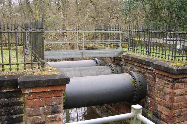
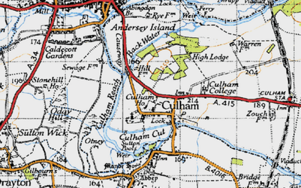
One of the places suggested as a water-transfer point is Culham, which is adjacent to the Farmoor Reservoir in Oxfordshire, and the location of a lock on the River Thames, cut to the north of the mainstream.
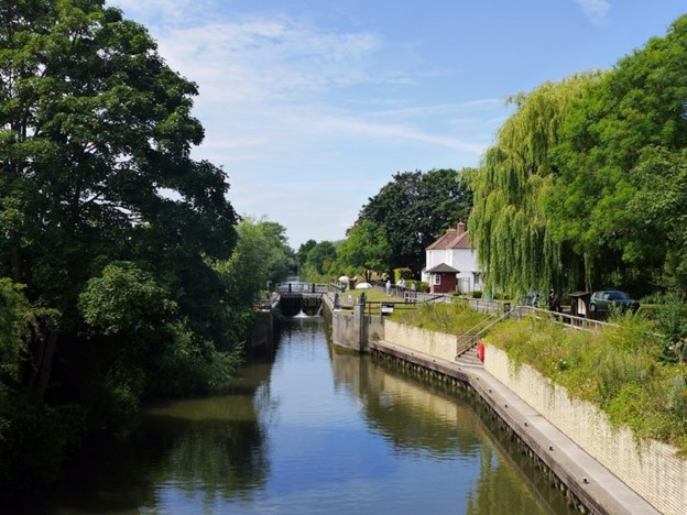
It was said to have been built by the Thames River Commission in 1809.
Something tells me there is a lot more to find in Culham, but I better not dig any more, or I will never leave and get seriously-off topic.
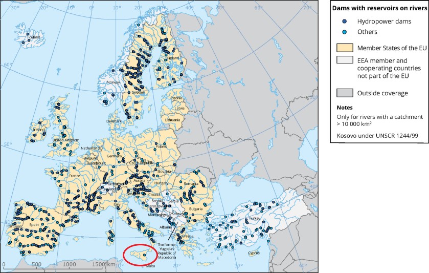
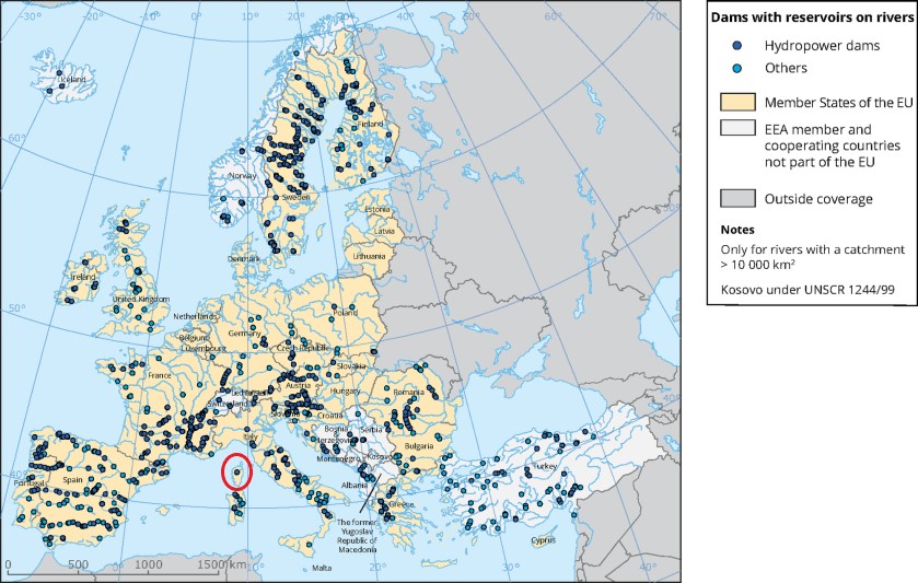
This a map of dams with reservoirs on rivers in Europe.
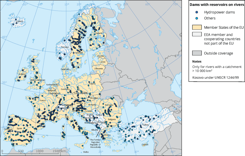
There are so many to choose from that to keep this as simple as possible, I am going to look at the three places on the map with the fewest number of dots – Poland, Sicily, and Corsica.
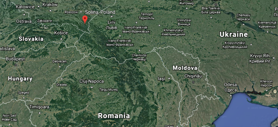
The largest dam in Poland is the Solina Dam, in southeastern Poland…
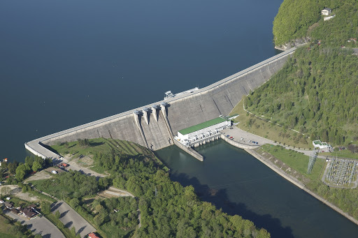
…near the country’s borders with Slovakia to the southeast, and Ukraine to the southwest.
We are told the first plans for a dam in the region came in 1921, but that plans were put on hold with the start of World War II.
After the war, work on a smaller dam in the region began in 1953, and the Solina Dam was said to have been constructed between 1960 and 1969, and its construction was said to have created the artificial lake, which became the reservoir.
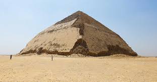
I find the large, slightly-rounded, pyramidal shape next to the Solina Dam to be noteworthy.
In case you are wondering about that, an example of a type of pyramid with a modified, somewhat rounded-shape from the typical description of a pyramid of four triangles which meet at the top…

…is the Pyramid of Sneferu, also known as the Bent Pyramid, in the Al Giza desert, located approximately 25-miles, or 40-kilometers, south of Giza.
Well, come to find out the four or five points on Poland on the map of Europe I showed previously of places with reservoirs and dams is misleading…
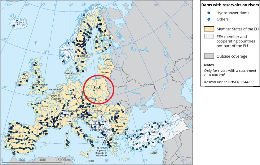
… because this is the list of reservoirs and dams that comes up for Poland:


So, just a quick peak at another dam and reservoir in Poland.
This the Pilchowice Dam and Reservoir on Poland’s Bobr River.
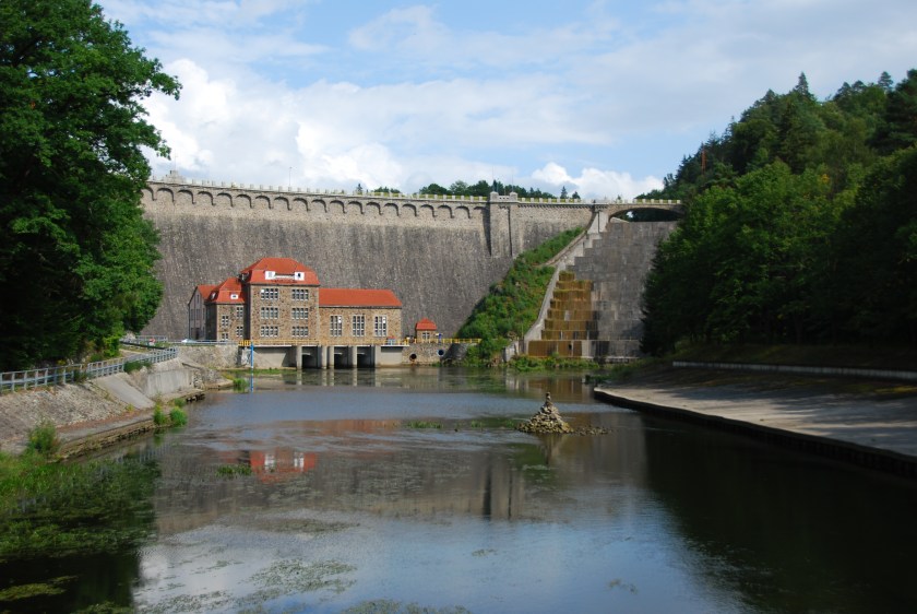
I could find surprisingly little information about the construction of the Pilchowice Dam in an internet search, but I did find these dates attributed to when it was said to have been constructed, between 1904 and 1912…

…and its spillway on the top left looks similar to the spillway of the Robert Bourassa Dam in Quebec on the bottom right.
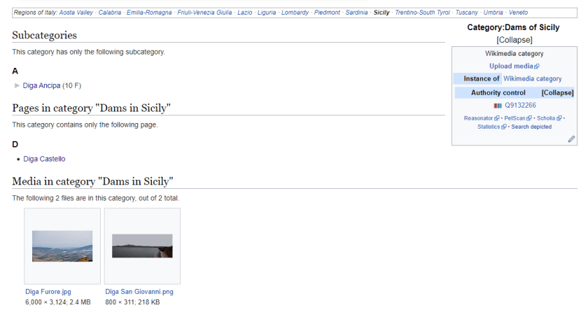
I am finding the same situation in Sicily that I found in Poland with regards to the number of dots showing dams and reservoirs there, in this case one dot, as I am finding more than that.
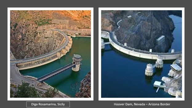
Examples include the Diga Rosamarina, a dam across the San Leonardo River, near Palermo, said to have been built in 1993.
It is located in Caccamo, a town and commune located on the Tyrrhenian Sea coast of Sicily in the metropolitan city of Palermo.
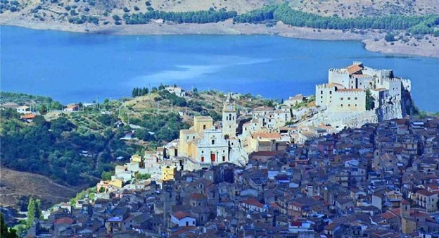
Apparently a medieval stone bridge which linked Caccamo with Palermo was submerged by Lake Rosamarina.
Here is a comparison photo between the Diga Rosamarina in Sicily on the left, and the Hoover Dam in the United States on the right, said to have been built during the Great Depression, between 1931 and 1935.
This is the Diga Ancipa, also in Sicily.
It is located near Mount Etna in the Messina Province.
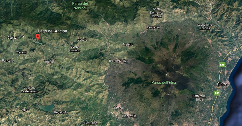
This is all Wikipedia has to say about Lago dell’Ancipa, the lake that forms the Diga Ancipa’s reservoir.
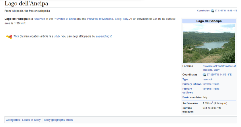
…and the only reason I found the dam in the first place was because I found a reference to it in Wikimedia.
Let’s see what Corsica has to offer, an island in the Mediterranean Sea and one of France’s 18 regions.
Well, there are a lot more dams in Corsica as well than one dot would indicate.
Here is a list of dams in South Corsica…
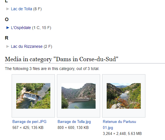
…and the list of dams in North Corsica.
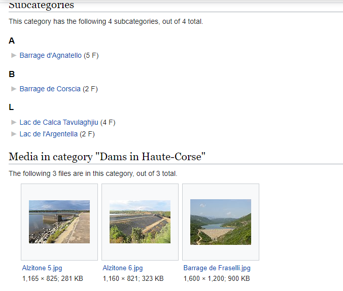
Here are some examples of what we find in South Corsica:
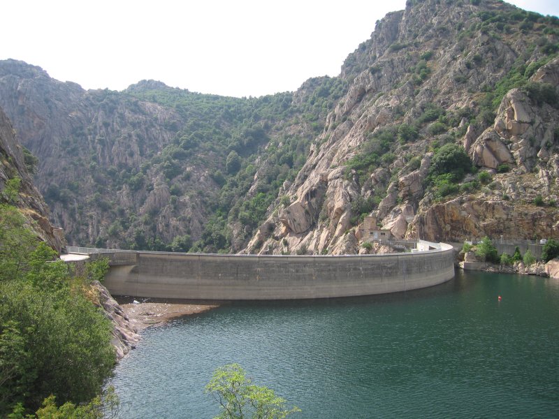
The Tolla Dam in the Prunelli Gorge was said to have been built between 1958 and 1960.
It is a concrete, curved gravity, and hydroelectric dam.
It impounds the Prunelli River.
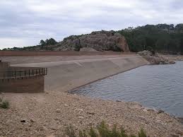
There is also the L’Ospedale Dam, which supplies drinking water to the very southern part of Corsica.
Here is L’Ospedale Lake, with its submerged tree stumps…
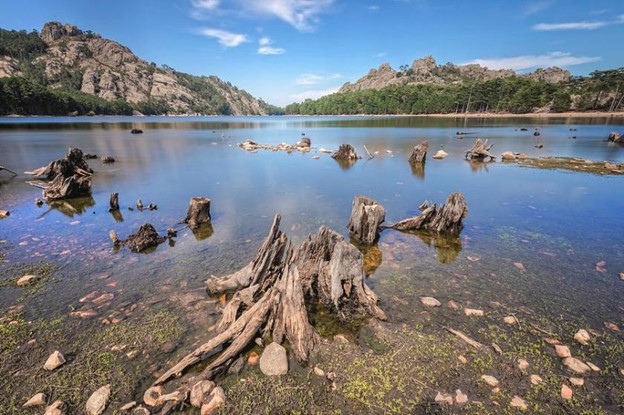
…all part of L’Ospedale Massif…
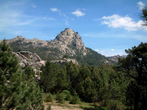
…where we find waterfalls…
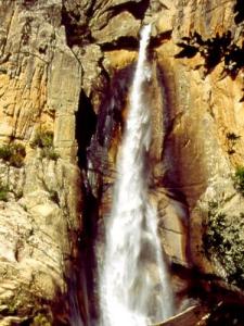
…that looks like what we see on the Hawaiian Island of Molokai…
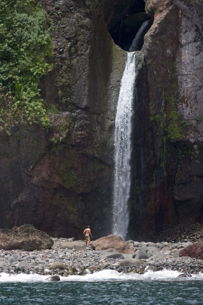
…the island of Agattu, one of the westernmost islands in the Aleutians…
…and the Mandhab Kunda waterfall, one of the highest in Bangladesh.
There is also at least one balanced rock found at the L’Ospedale Massif, examples of which are found all over the Earth.

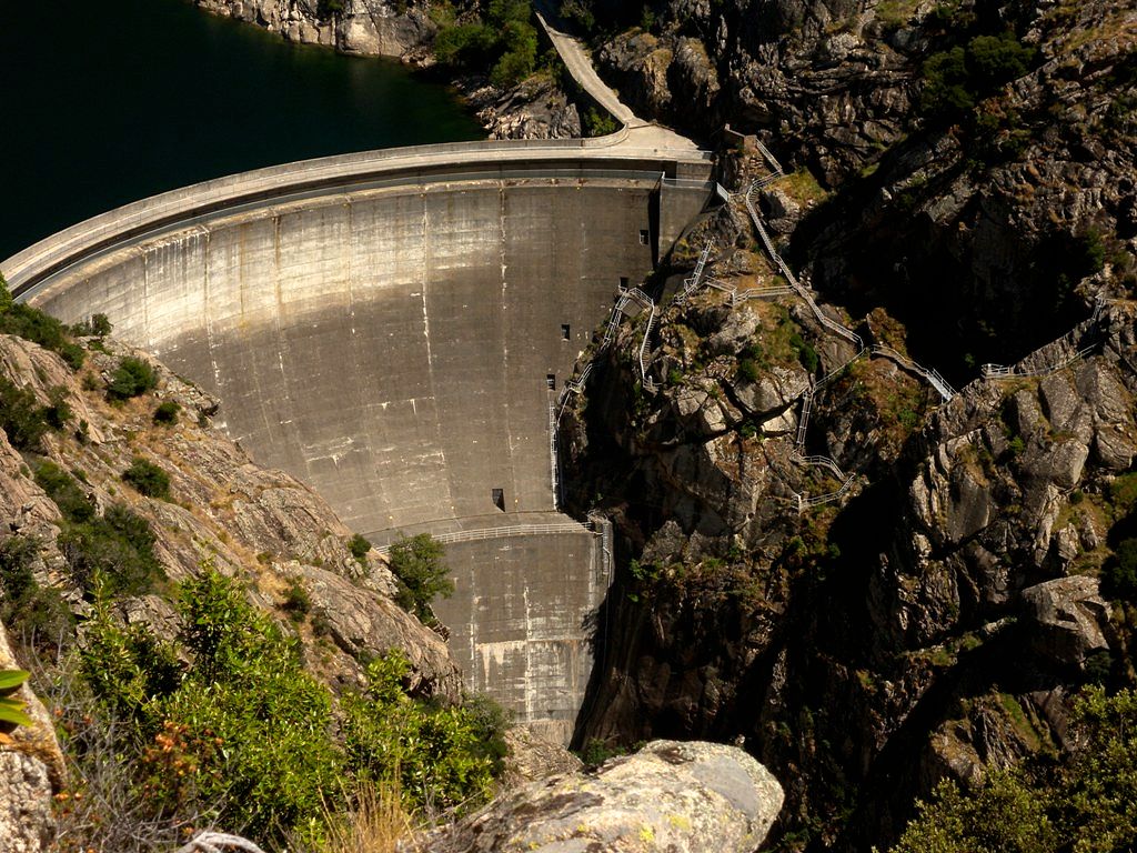
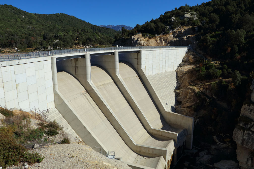
One more dam in southern Corsica to share is the Barrage du Rizzanese…
This is the flag of Corsica, portraying a Moor’s head.

Why exactly a Moor’s head?
Same idea with the flag of Sardinia, a region of Italy located directly south of Corsica in the Mediterranean Sea, only it has not one, but four Moors on it.

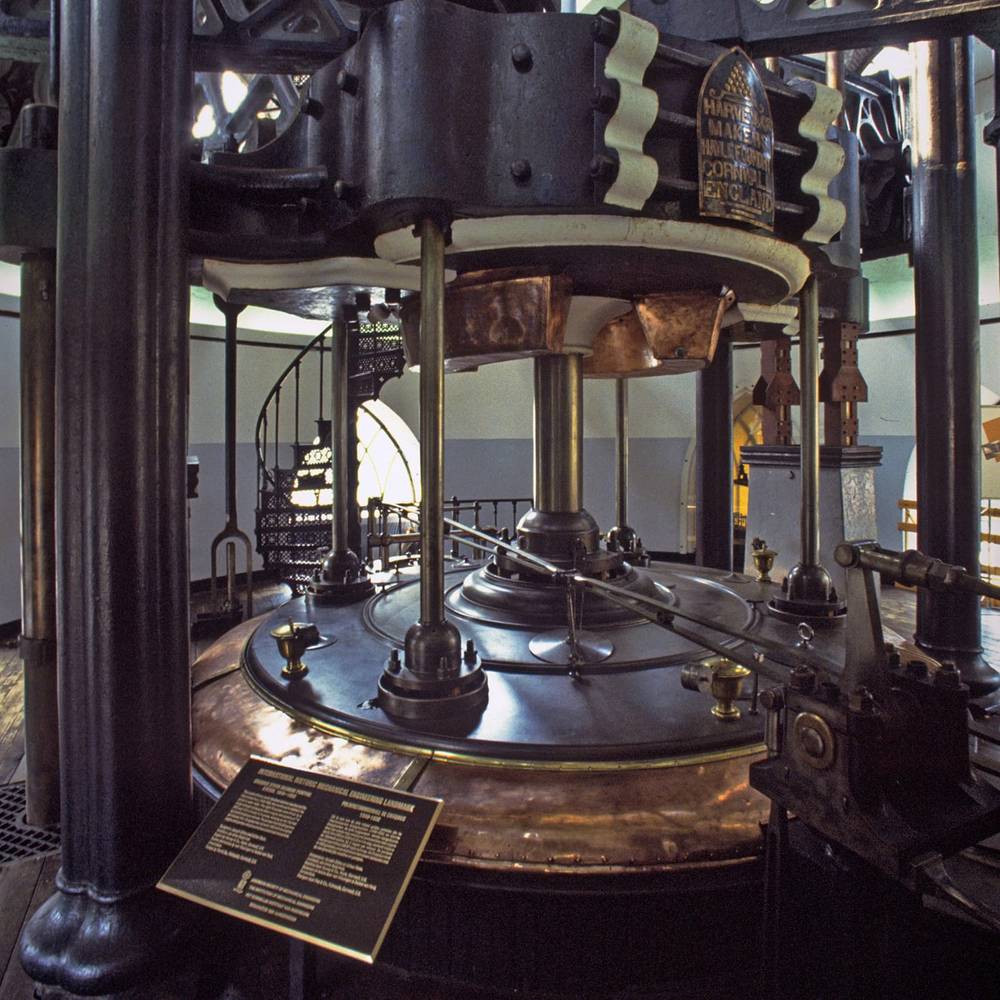
One more place I would like to take a look at before leaving Europe is the Cruquius, which someone left me a comment about regarding my last post.
The comment read “It pumped out water for the Dutch ‘Drymaking.’ I tell my Dutch fiance that it is the mudflood museum.”
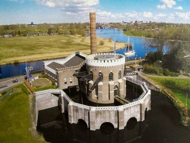
That was enough for me to want to take a look into it :).
The Cruquius, which is now a museum, was an old steam-pumping station in The Netherlands, named after one of its promoters, Nicolaus Samuel Cruquius, said to have been born in 1678, who was a Dutch land surveyor, hydraulic engineer, cartographer, and astronomer, and considered one of the founders of meteorology. He died in 1754.
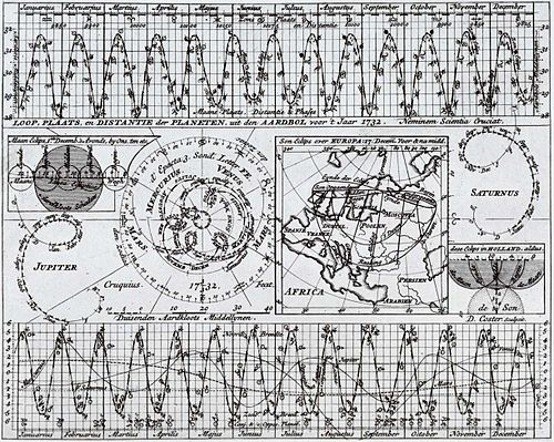
One of the things Nicolaus Cruquius is known for is this diagram attributed to him showing the distance of the planets to the Earth in 1732, also showing a complete lunar eclipse and a partial solar eclipse in that year.
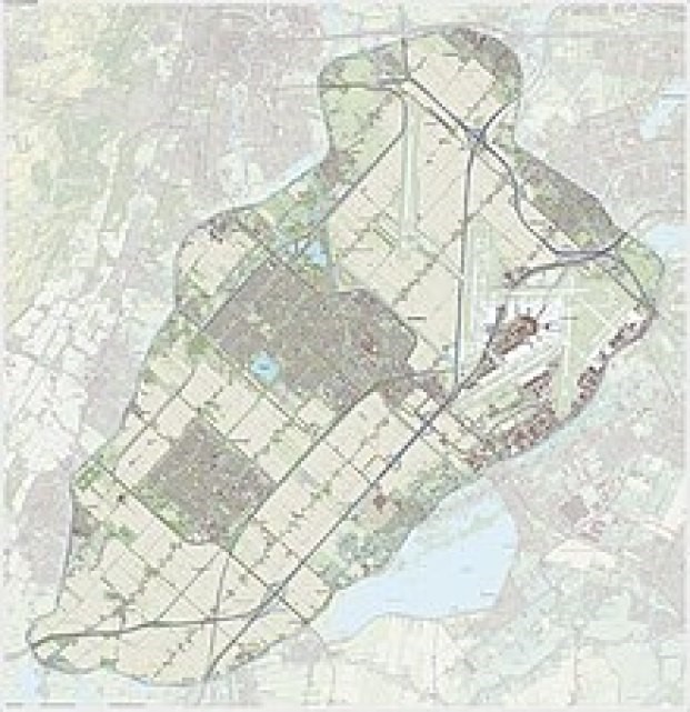
Almost 100-years after the death of Cruquius, there were three steam-driven pump stations, one of which was named after him, built around the Harlemermeer, described as a “polder,” or low-lying piece of land reclaimed from water, located near Amsterdam.
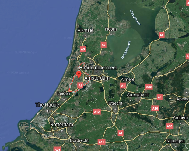
This is said to be a map of the Haarlemmermeer before reclamation.
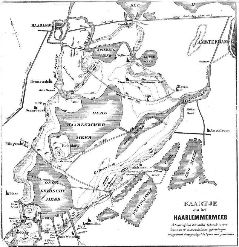
The lakes of the Haarlemmermeer were said to have been formed into one by successive floods, in which villages disappeared in the process, and said to have become a threat to Amsterdam.
Long story short, King William I of the Netherlands appointed a commission of inquiry, and the commission’s plan to build the three steam-driven pump stations around the Haarlemmermeer were approved, with construction commencing in 1840.
This is the first 20-years of the timeline we are given for the construction of the steam-driven-pumping system of the Haarlemmermeer, and the dates line-up around the date of 1851, the year of the Crystal Palace Exhibition, which I believe was the kick-off of a new historical timeline following digging out enough infrastructure from a deliberately-caused mud liquefaction cataclysm to re-start civilization.

The Cruquius is described as the largest Watt-design reciprocal stroke steam-engine ever built.
We are told pumping began in 1848 and the lake was dry by July 1st of 1852.
This is a topographical map of the reclaimed land of the Haarlemmermeer in 2015.
Next, on to dams and reservoirs on the continent of Africa.
The Aswan High Dam is built across the Nile River in Egypt, and is considered the world’s largest embankment dam, built between 1960 and 1970.

The building of it was seen as pivotal to Egypt’s planned industrialization after the Egyptian Revolution of 1952, also known as the Coup d’Etat, at which time King Farouk I of Egypt and Sudan…

…was overthrown by the Free Officers Movement, led by Gamal Abdel Nasser and Mohamed Naguib.

King Farouk was forced to abdicate in 1952 in favor of his infant son, Fuad II, and his son was deposed in 1953, at which time Mohamed Naguib became the first president of Egypt…

…who was only president for a year because he was forced from power by Gamal Abdel Nasser, who became the second president of Egypt in 1954.

The British were credited in history with building the Aswan Low Dam across the Nile between 1898 and 1902.
Then after the 1952 Egyptian Revolution, we are told, the priority became storing the Nile waters in Egypt for political reasons, and after a lot of diplomatic backs-and-forths between interested nations, the construction of the Aswan High Dam was said to have begun in 1960 and on July 21st of 1970 it was completed.
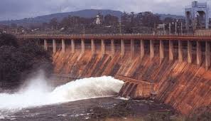
In 1976, the reservoir was said to have reached capacity.
Many archeological sites were submerged, while others were relocated.
One of the more interesting relocations from the Aswan High Dam flood zone that I have encountered is in Madrid in Spain.
What is described as is an ancient Egyptian temple, the Temple of Debod was dismantled at Abu Simbel due to the construction of the Aswan High Dam, and donated to Spain as a gift for helping to save it. It was consequently said to be rebuilt in the Parque del Oeste in Madrid, Spain between 1970 and 1972.
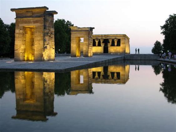
I am just wondering how a megalithic temple complex like this could have been transported. Those stones would be heavy. Arrows are pointing to what appears to be single-block stones.
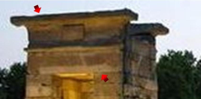
I also find it noteworthy that this said re-building of an Egyptian megalithic structure would have taken place at the tail-end of Franco’s rule in Spain, which ended in 1975.
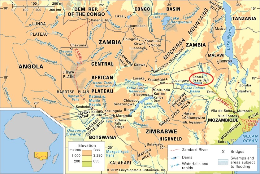
The Cahora Bassa Dam in Mozambique…
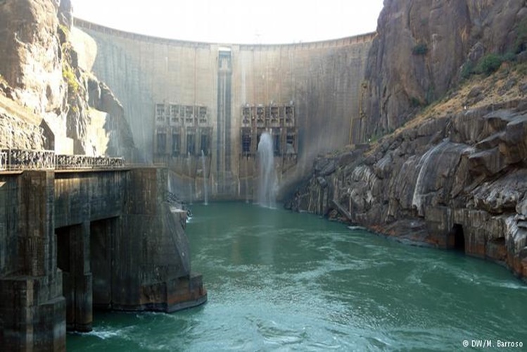
…is one of the three major dams on the Zambezi River system.
The Cahora Bassa Dam was said to have been built between 1969 and 1974, and is the largest hydroelectric power plant in Southern Africa, and the most efficient power-generating station in Mozambique.
It is jointly owned by Mozambique and Portugal, and from 1975 to 2007, 82% of the dam and lake was owned by the Portuguese, and then in 2007, Portugal sold its share down to 15%.
Mozambique was a Portuguese colony, we are told, between 1498 and 1975.
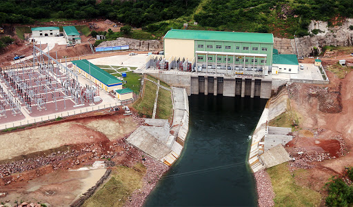
The other two major dams on the Zambezi River are the Kariba Dam, a double-curvature, concrete arch dam…
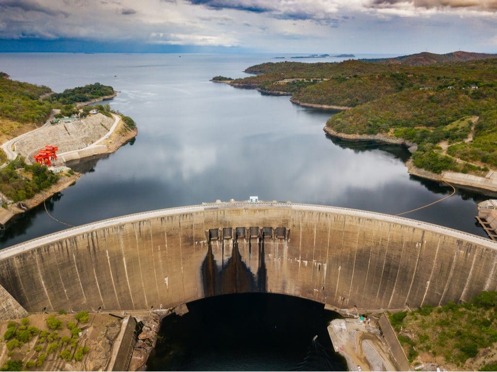
…in the Kariba Gorge of the Zambezi River basin between Zambia and Zimbabwe…
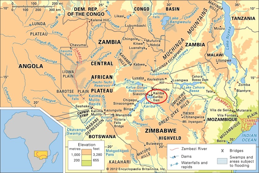
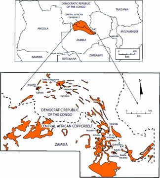
…said to have been built between 1955 and 1959, and which supplies electricity to parts of Zimbabwe, and the part of northern Zambia known as the “Copper Belt”…
…and the third major dam in the Zambezi River system is the Itezhi-Tezhi Dam and Reservoir, said to have been built between 1974 and 1977…
…on the Kafue River in west-central Zambia at the Itezhi-Tezhi Gap.
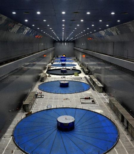
In Asia, I am just going to look at the Three Gorges Dam is over the Yangtze River at Sandouping in China’s Hubei Province.
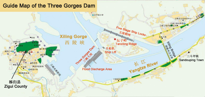
Said to have been built between 1994 and 2003, it is considered to be the world’s largest power station in terms of installed capacity since 2012.
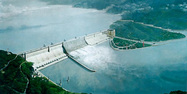
The total electric-generating capacity of the dam is 22,500 MW.
As I near the end of this post, I just want to close by taking a peak at some of the dams in Australia and New Zealand in the South Pacific.
There are countless dams in Australia.
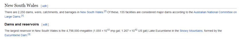
Just in the Australian State of New South Wales alone, there are 2,250 dams, weirs, catchments, and barrages, and of those 135 are considered major dams.
So I am going to show you a few of the dams and reservoirs in the Snowy Mountains…
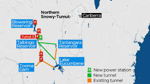
…like the Lake Eucumbene Dam…
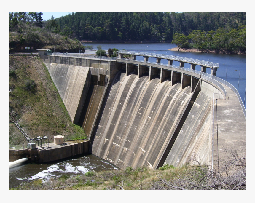
…described as a major, gated, earthfill embankment dam, with an overflow ski-jump and bucket spillway, with two vertical-lift-gates.
Its construction was said to have started in May of 1956 and completed in May of 1958, two-years to the month later.
Its main purpose was for the generation of hydro-power, and one of the 16 major dams that comprise the Snowy Mountains Scheme, constructed between 1949 and 1974 and run by Snowy Hydro, we are told.

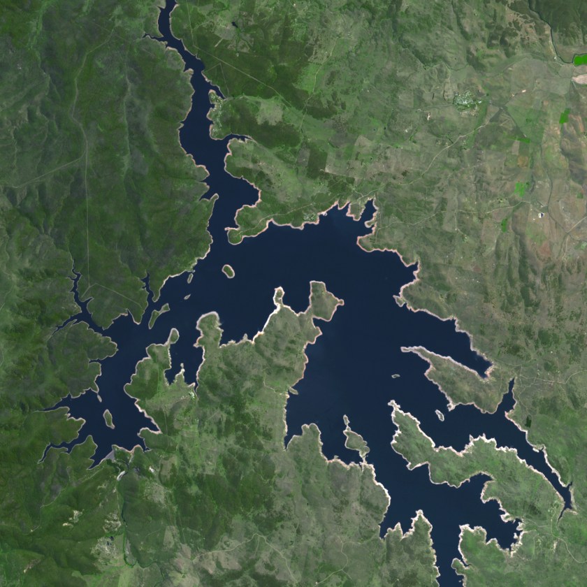
The largest reservoir and storage lake in the Snowy Mountains Scheme is Lake Eucumbene.
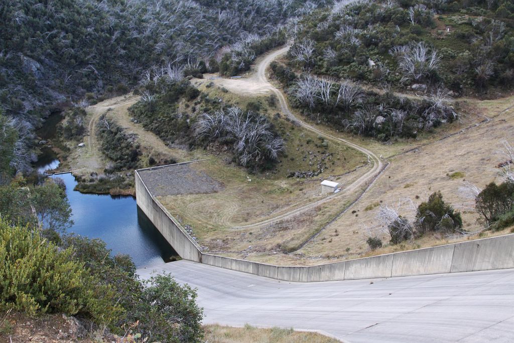
The Tooma Dam is to the west of Lake Eucumbene, and it is described as a major ungated concrete embankment dam, opened in 1961, with the main purpose of power generation, across the Tooma River, and also in the Snowy Mountains in New South Wales.
This is the spillway of the Tooma Dam.
The Tantangara Dam and Reservoir is directly to the North of Lake Eucumbene.
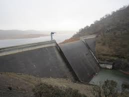
It is a major ungated, concrete gravity dam with a concrete chute spillway, and also part of the Snowy Mountains Scheme.
Much of the impounded headwaters of the Tantangara Reservoir are diverted to Lake Eucumbene.
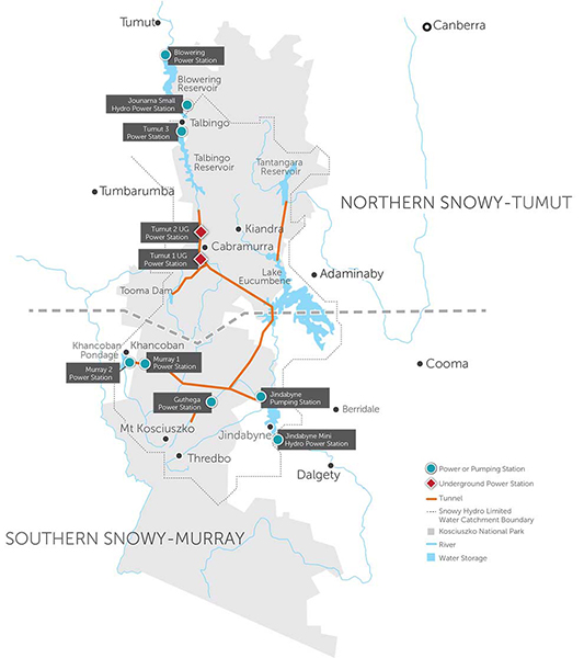
There is more to share here, but this is more than enough to give you an idea of what Australia’s hydro-electric prowess looks like.
One more stop. New Zealand.
New Zealand is an island country in the southwestern Pacific Ocean, consisting of two main, large islands – North Island and South Island – and around 600 smaller islands, covering an area of 103,483-square-miles, or 268,021 kilometers-square.
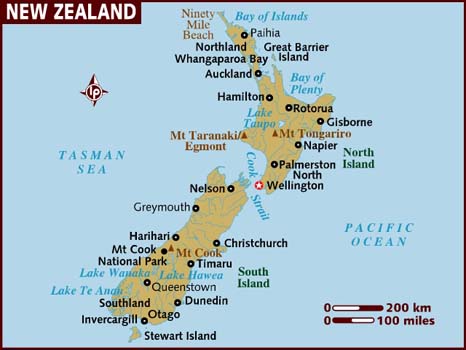
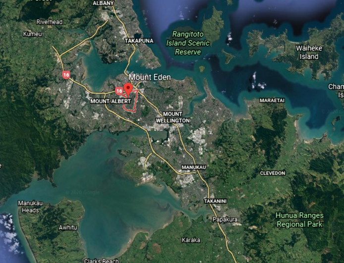
I am going to be looking at dam systems around Auckland on the North Island, New Zealand’s largest city.
But first, I am going to look a little bit into the history of the Auckland region because of 1) the dates in question; and 2) the conditions that were described as being here in the historical narrative we are given, because both speak to the historical reset and the possibility of a mud flood.
In the historical narrative we are given, Auckland was first settled by Europeans in the form of the British in 1840.
With the signing of the Treaty of Waitangi in 1840 between representatives of the British Crown and 500 Maori Chieftains, we are told, Britain gained sovereignty over what became known as New Zealand.
We are also told that between the years 1848 to 1863, there was a chronic water shortage, with Auckland’s wells affected by severe pollution, to which the city council responded by digging more wells.
Then, in 1865, we are told, water was piped in from springs and ponds on the Auckland Domain Volcano, which is Auckland’s oldest park in the central suburb of Grafton.
In 1871, Auckland was promoted from Borough to city, and Seecombe’s Well provided the new city with a steady supply of water from an aquifer below Mount Eden.
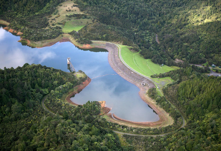
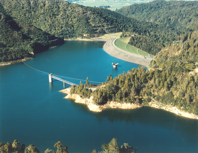
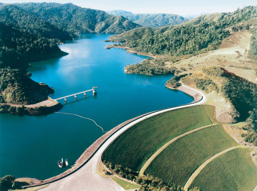
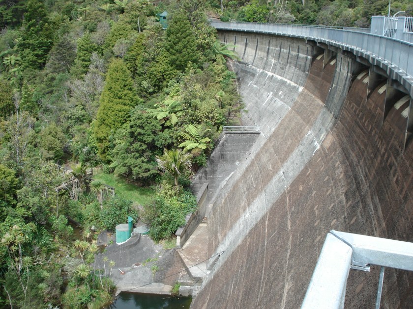
Fast forward to 1946, when we are told the work commenced on the first of the Hunua Reservoirs, Cossey’s Dam and Reservoir, said to have been completed in 1955.
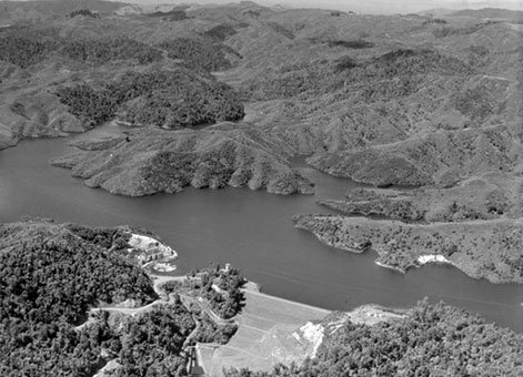
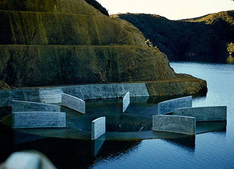
This is the bellmouth spillway of Cossey’s Dam, leading to a spillway tunnel discharging to a lined channel downstream of the dam.
The Cossey Dam and Reservoir was said to have provided Auckland, for the first time in years, and adequate water supply.
But, Auckland was continuing to grow!
It was decided to maximize the capacity of the Cossey Reservoir by expanding the water supply options, so in 1956 the Wairoa Tunnel from the Hunua to the Otau Valley was completed, and the Wairoa Dam was completed in 1975.
The Mangatani Dam in the Hunuas was said to have been commissioned in 1965, and is the largest of Auckland’s upland catchments.
It was said to have been constructed between 1972 and 1977.
There’s a lot more to see in New Zealand’s Auckland region, but I am going to go ahead and stop here.
Do I think all of these dams, reservoirs, and hydrological projects were actually constructed when we are told they were?
No.
Do I think they could have been brought back into functional use when are told they were?
Yes.
This is a photo I came across labelled: “City Councillors visit the Waitekere Dam in 1907.”
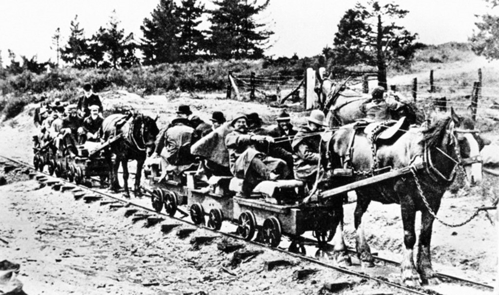
Was the technology that could only provide tiny, mule-drawn rail cars for the city councillors in 1907 capable of constructing the Waitakere Dam west of Auckland by 1910?
As with the rest of the world’s massive engineering projects, including canals, rail-systems of all kinds, etc, I believe these major hydrological projects were an integrated part of the infrastructure of the original ancient advanced Moorish civilization, and were used in harmony and balance with the environment for the needs of the civilization.
In my next post, I am going to be pulling all of my research together to show what we are told was happening in the world throughout the 1800s, with an emphasis on all the things that were happening in the mid-1800s.

I get the Illuminati has a secret sound technology, that makes heavy blocks weightless & soft for a short time till they can be moved & put into place and no cement is needed, since the block slightly alters its shape & fits tightly.
LikeLike
This will answer a lot of questions about how heavy blocks were moved, to include how the pyramids were built. In short, the pyramids were built using multiple techniques, not just one.
LikeLike
Hi nnice reading your blog
LikeLike