The Ancient Ones don’t refer to a people that existed a long time ago. It refers to an ancient people that are alive and living in the present day, who were the Moorish Master Builders of the planet.
This is a video montage, with music but no narrative, acknowledging them and their remarkable legacy, put together with pictures in previous blog posts.
Music: At the Shores of Remembering Artist: Angel Sananda
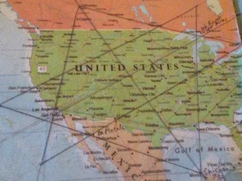
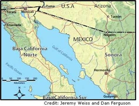
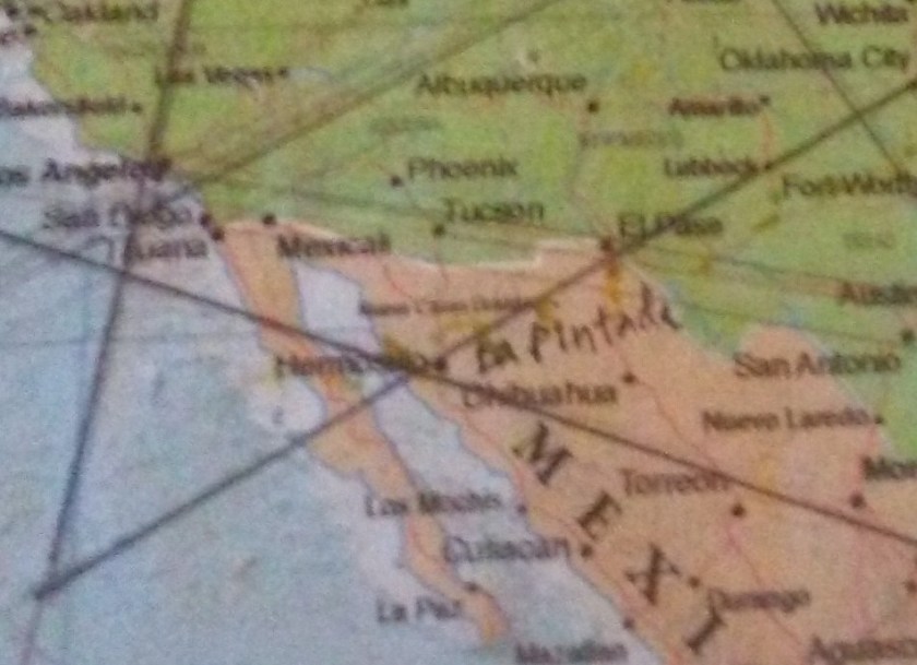
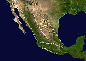
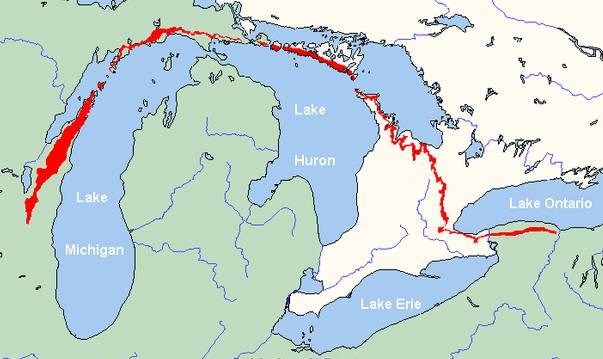
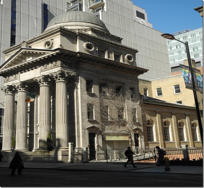
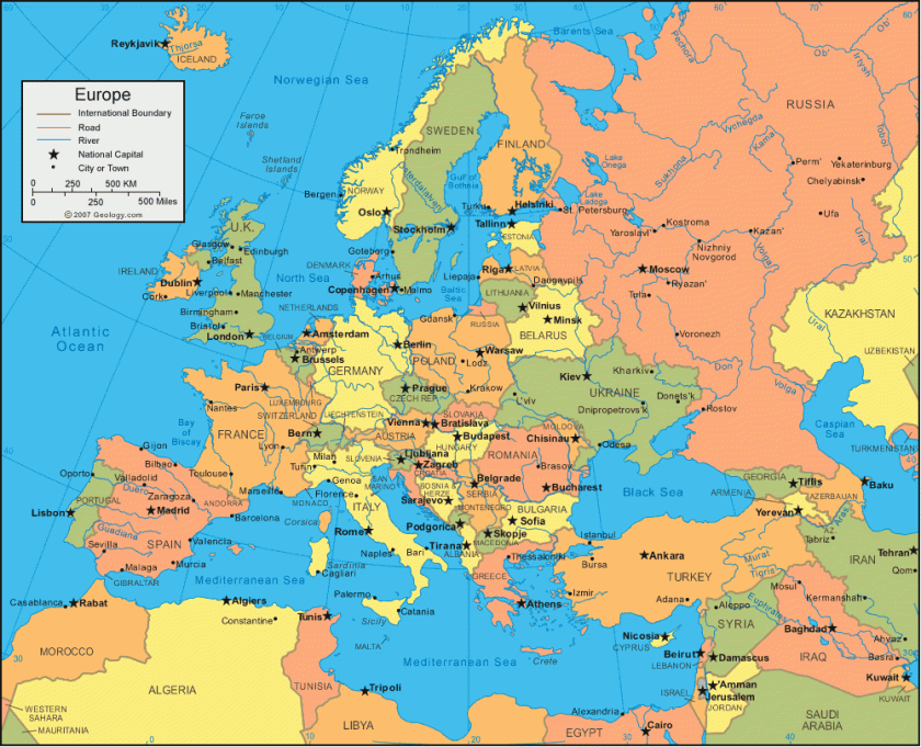
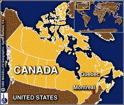
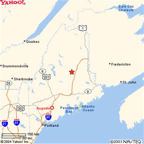
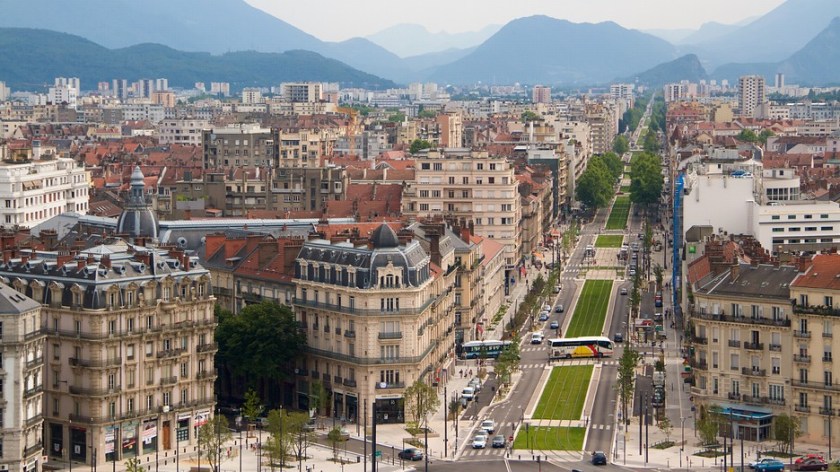
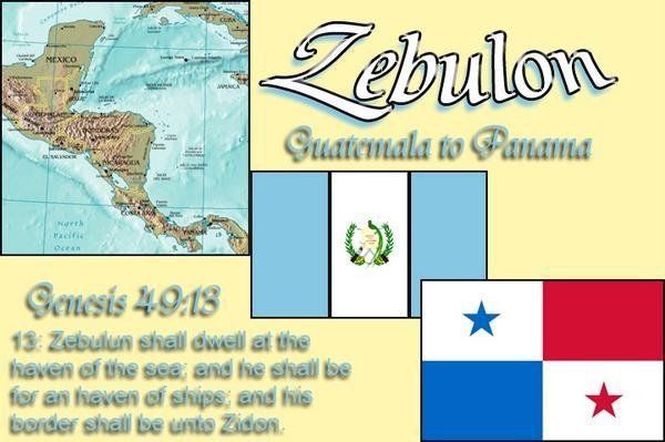
The last leg of this journey following a major planetary alignment will take us from Santa Rosalia in Baja California, across major cities and capitals in Mexico, the United States and Canada and will be ending at Montreal, where I started this series about “How I Found the Silk Road.”
I did not know where the Silk Road was before I went through the process, after I found the star tetrahedron, of extending the lines out on a globe, and writing down the cities that lined up around the world.
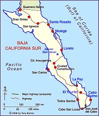
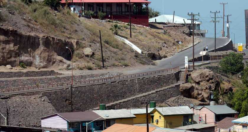
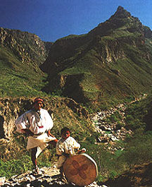
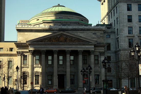
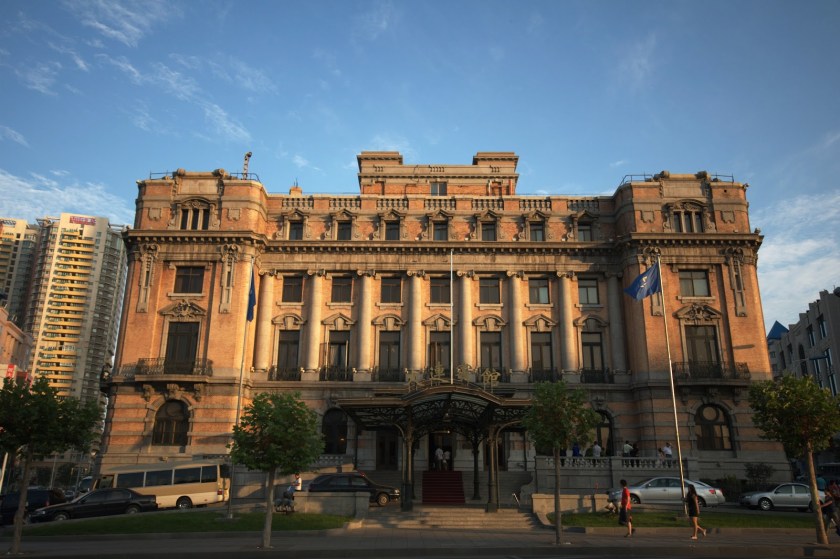
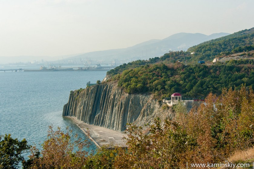
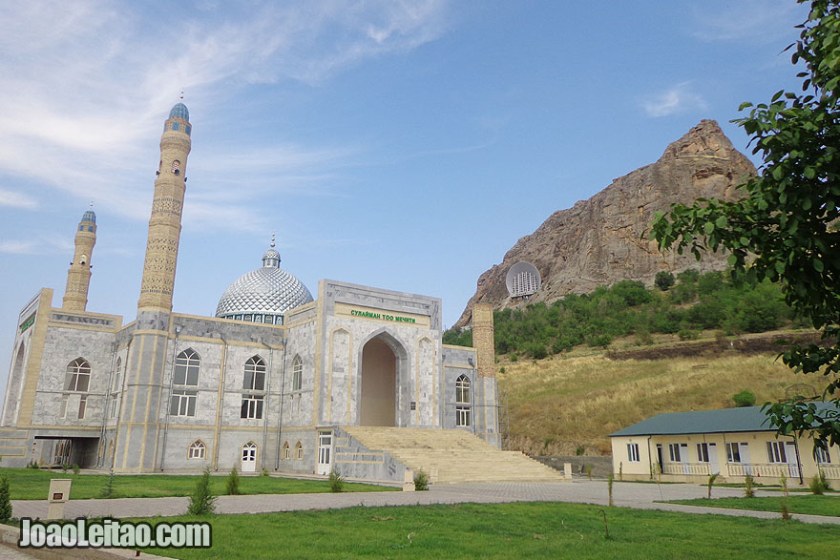
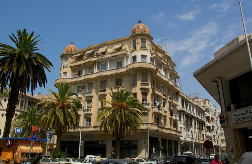
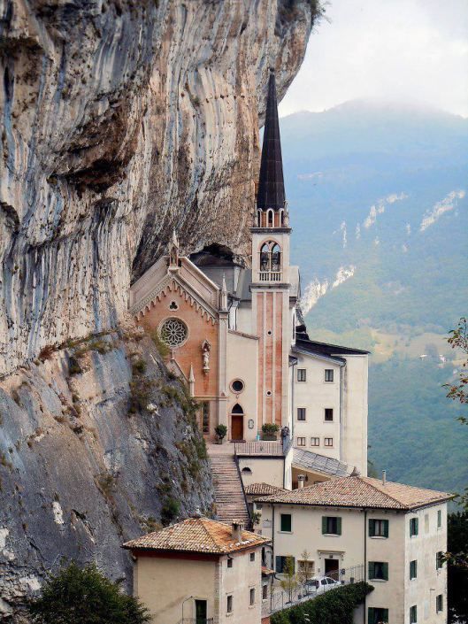
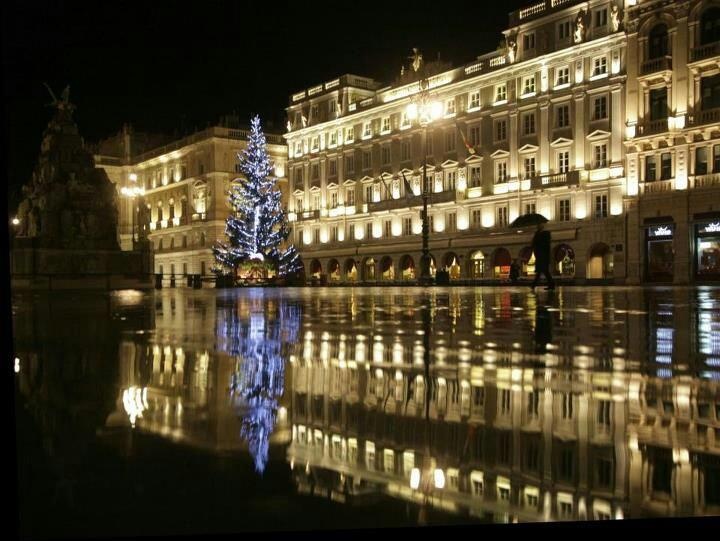
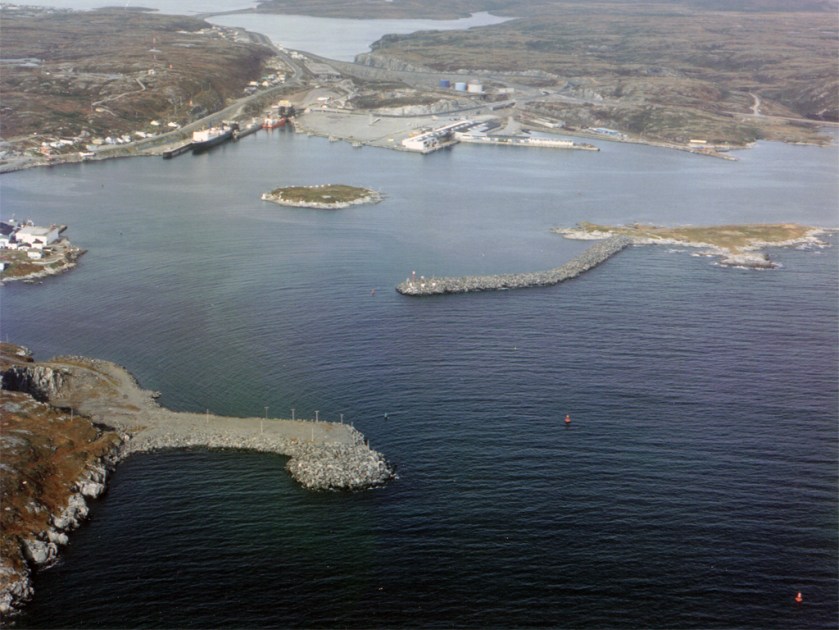
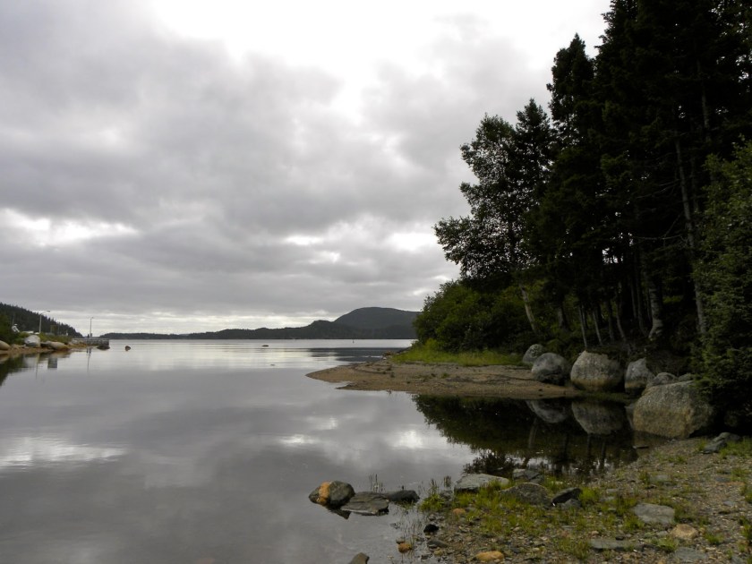
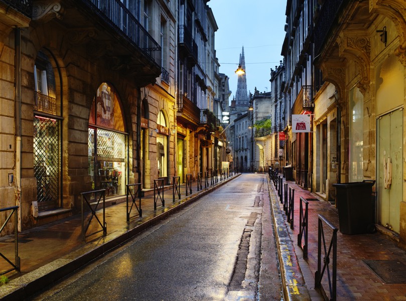
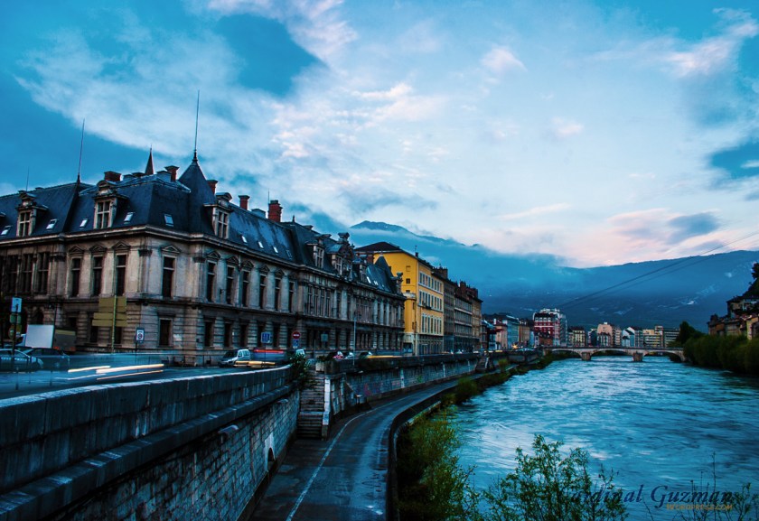
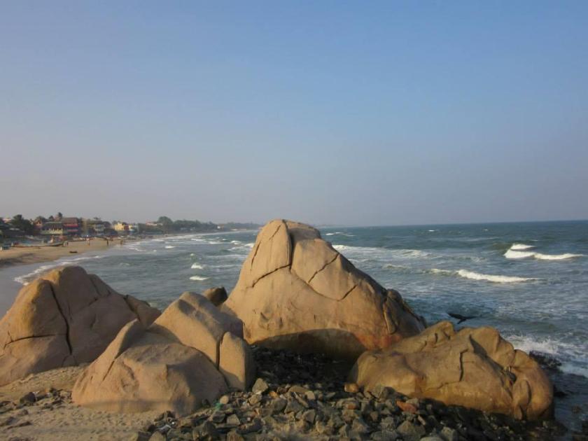
I am picking up the alignment in Santa Rosalia, Baja California, which is a port city and ferry terminal. It is said to actually boast French influence in architecture, and a French company mined copper there from 1885 – 1954.
Santa Rosalia, Baja California
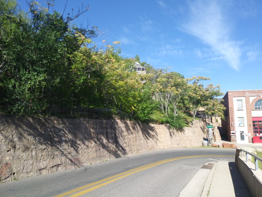
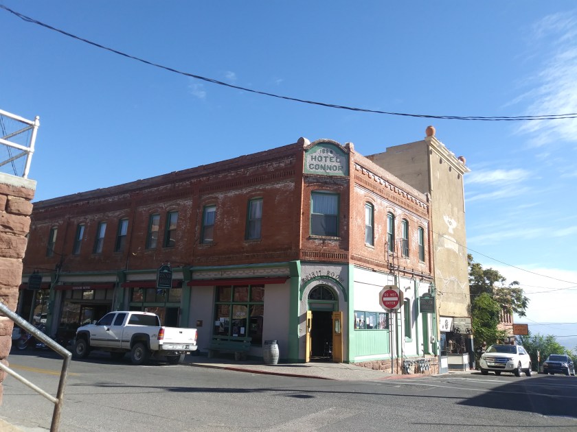
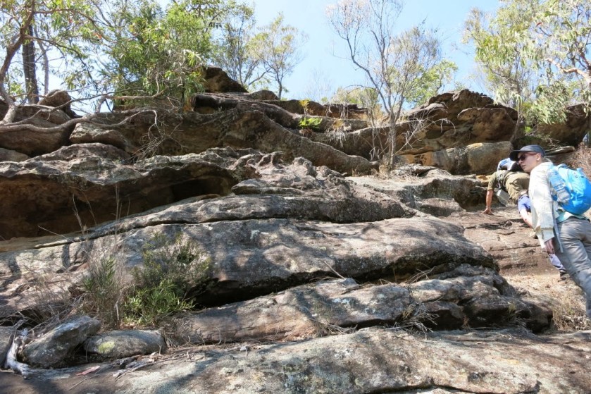
Jerome, Arizona is not on this particular alignment, but I am including a picture there to show a similar stone wall. Not exactly the same, but whoever built these walls is really comfortable with stone work.
Jerome, Arizona
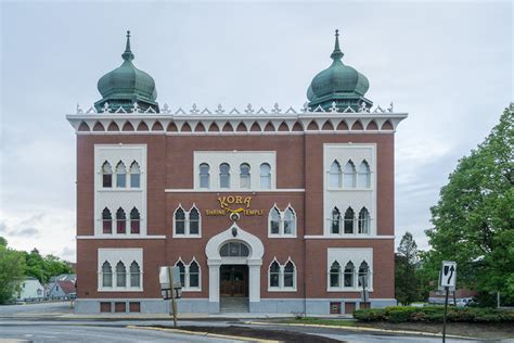
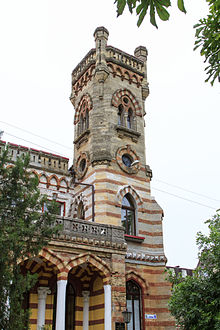
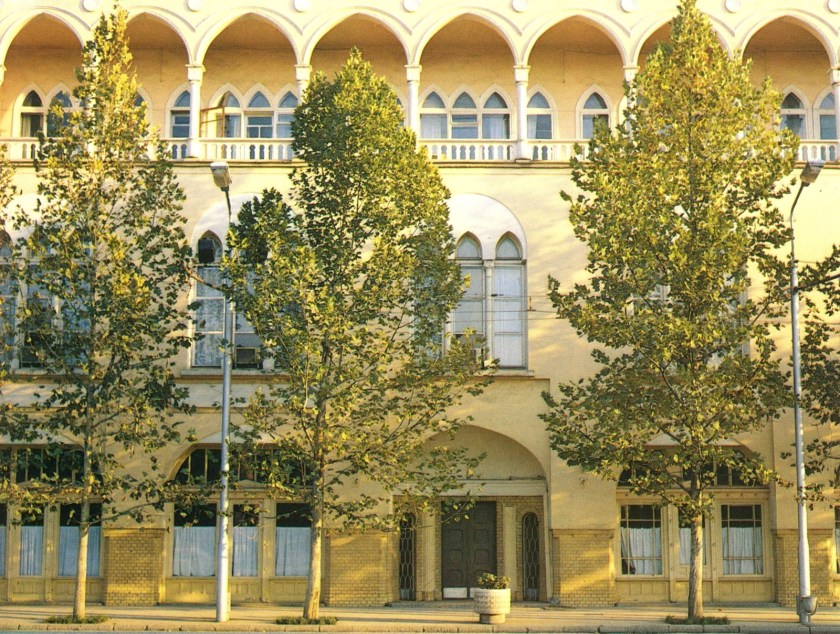
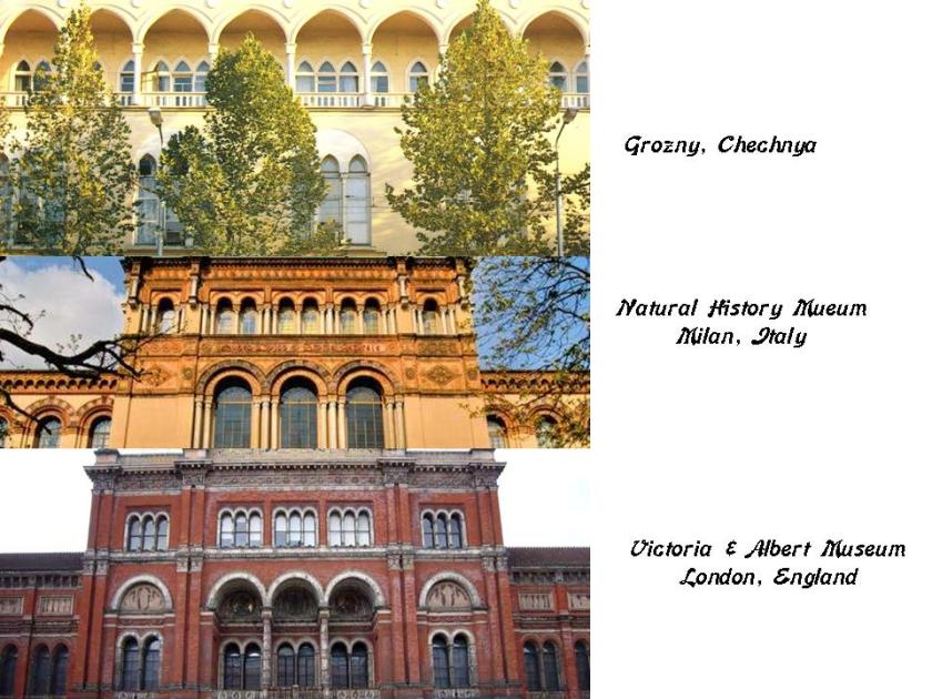
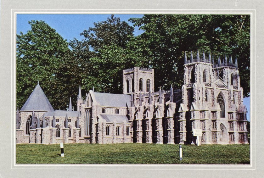
The prefabricated metal Church in Santa Rosalia is said to have been designed in 1884 by Gustave Eiffel, of Eiffel Tower fame. It is pictured on the left, with a building in Grozny, Chechnya in the middle; and the Natural History Museum of Milan, Italy on the right, and the Lewiston Shriners’ Temple to show the shared window design features.
Lewiston, Maine – Kora Shriners’ Temple
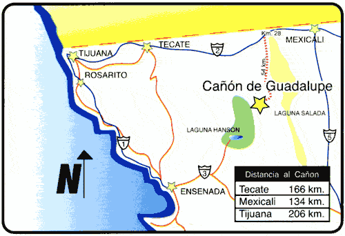
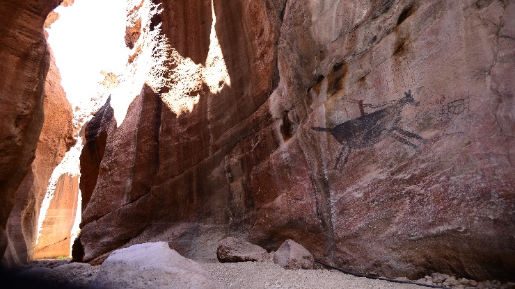
There are places in Guadelupe Canyon in Northern Baja California in the general area of the alignment.
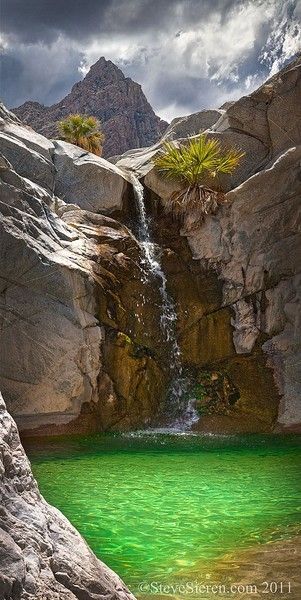
Here is the Emerald Pool and Waterfall in Guadalupe Canyon, with the pyramidal shape in the background.
Emerald Pool & Waterfall, Baja California
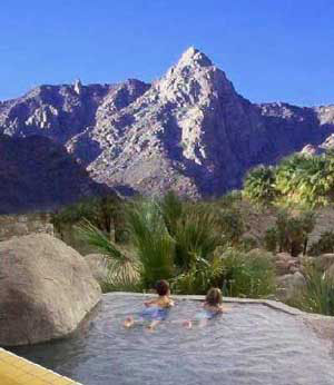
And a view from El Mirador, also in Guadalupe Canyon, with a nicely-engineered stone pool in the fairground and pyramidal shape in the background.
El Mirador in Guadelupe Canyon
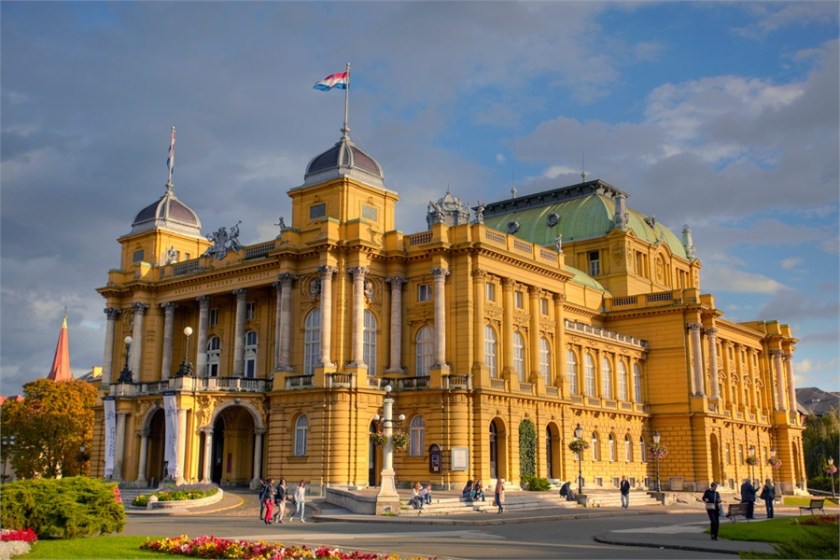
Next on the alignment is Hermosillo, Mexico.
It is actually located at the intersection of two major ley-lines of the North American Star Tetrahedron.
It is located centrally in the northwestern state of Sonora. It was ranked as one of the 5 best cities to live in Mexico in 2013.
This is the Government Palace in Hermosillo on the left, and for comparison with a similar appearance is the University of Otago in New Zealand on the right.
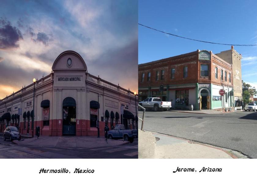
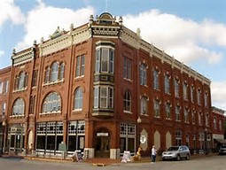
On the left is the Municipal Market in Hermosillo, and on the right, is the Hotel Connor in Jerome, Arizona.
La Pintada is a site located 60 kilometers south of Hermosillo, within La Pintada Canyon.
La Pintada is an important ancient archeological zone.
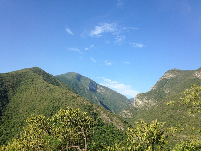
From here, the alignment crosses over the Sierra Madre Occidental Mountains.
This is a major mountain range of the North American Cordillera, which is the mountain chain that runs along the western side of the Americas, including the Rocky Mountains.
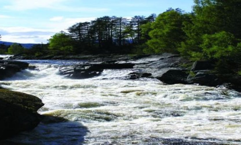
The Rio Grande de Santiago winds through the Sierra Madre Occidental, and forms part of the border between Nayarit and Jalisco States.
The Basaseachic Falls on the left are on the Basaseachic River in the high Sierra Madre Occidental; on the top right you see Angel Falls in Venezuala, and bottom right the Staubbach Falls in Switzerland – both of which have a similar appearance to Basaseachic Falls.
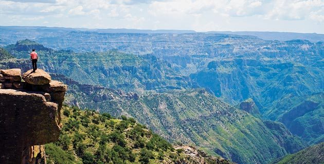
Copper Canyon is also in this area, and is the home of the Tarahumara. The Tarahumara are known for their exceptional abilities in long-distance running. Most still practice a traditional lifestyle.
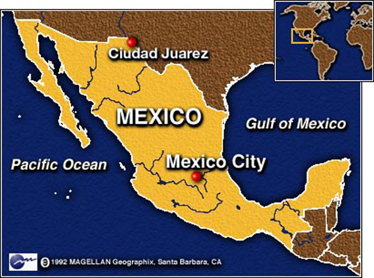
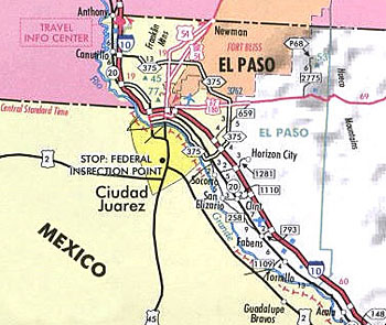
Next we come to Juarez, Mexico,the seat of government and most populated city in the State of Chihuahua. It sits on the U.S. border, right across the Rio Grande from El Paso, Texas.
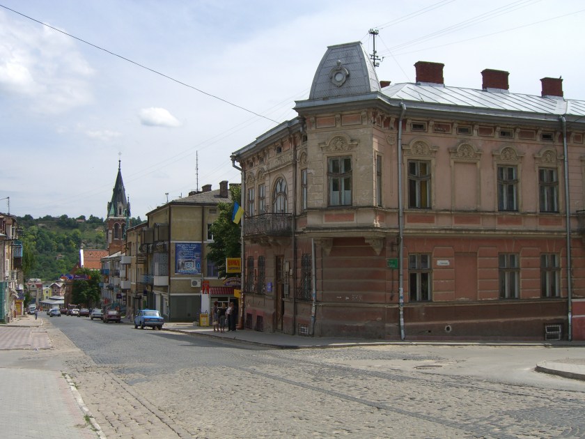
Here is a comparison of a building in Juarez on the top, and on the bottom row on the left is in Kresy, Siberia; in the middle is Guthrie, Oklahoma; and on the right is Kherson, Ukraine.
Also the this old postcard showing the roof features of the Custom House in Juarez on the top left, compared with similar features in Bordeaux, France on the top right; Yalta in the Crimea on the bottom left; and in Belgrade, Serbia on the bottom right.
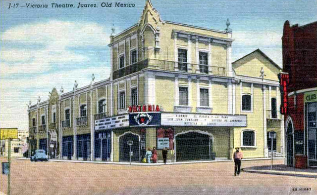
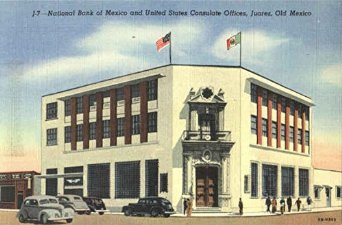
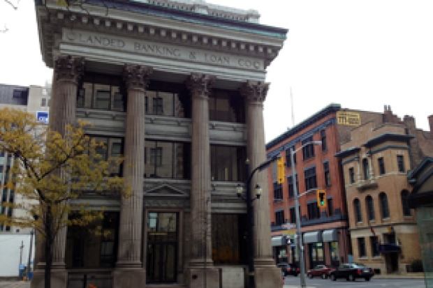
In the next set of photos in Juarez, I am highlighting a school, theater, and bank.
Juarez Academy
Victoria Theater – Juarez,MexicoNational Bank of Mexico & U. S. Consulate Offices in Juarez
As I move forward on the alignment into El Paso, Texas in the United States…
…I will be highlighting these three types of institutions in most of the cities for a variety of reasons:
1) Monumental architecture, and I am using this term in its meaning of large human-made structures of stone or earth which are used as public buildings or communal spaces;
2) They are related to control structures, as in thought and finance;
3) There are so many examples to choose from that focusing primarily on these three, with some exceptions as you will soon see, narrows my search and helps organize the material.
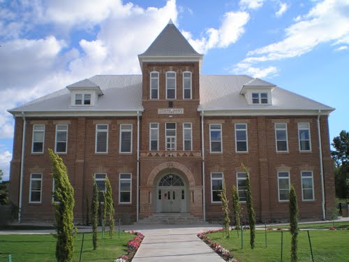
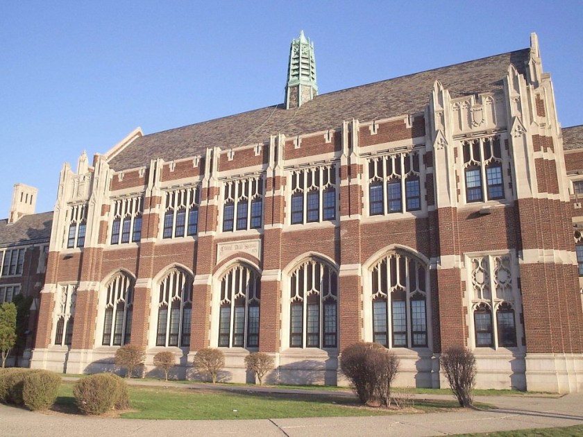
For example, this is El Paso High School. You know, I didn’t go to a high school that looked like this or similarly monumental, but I think a lot of people did. And didn’t think twice about it. It doesn’t fit the historical narrative that we have been taught. It’s not supposed to be there, so we don’t see it, and we don’t even think it. We are being educated in schools that look like this and don’t even ask questions about it.
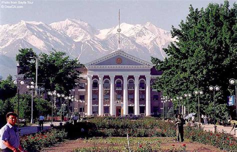
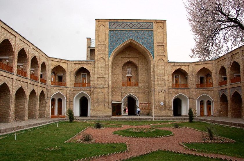
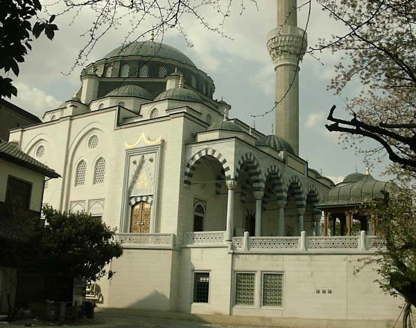
For comparison, this building is in Bishkek, Kyrgyzstan…..
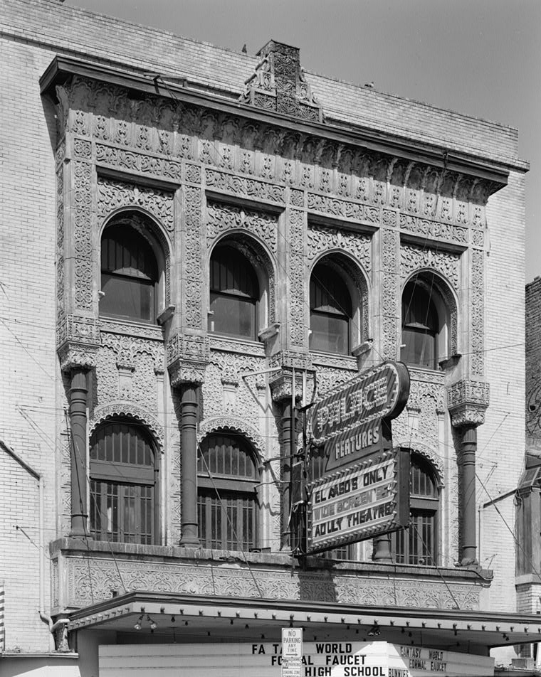
This is the Alhambra Theater in El Paso, with its ornate and intricately-designed facade.
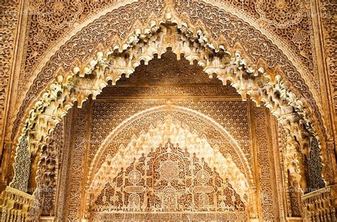
And this ornate and intricately designed space is one of the many found at the Alhambra in Grenada, Spain.
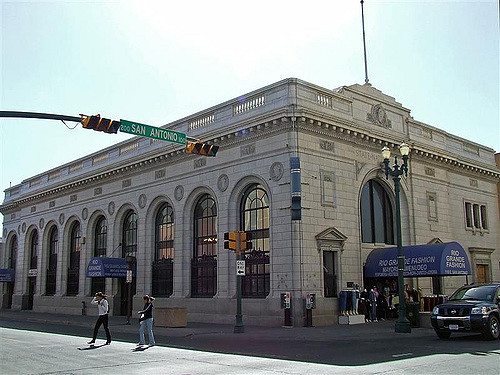
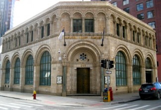
Here is the El Paso State National Bank building with its heavy and huge masonry.
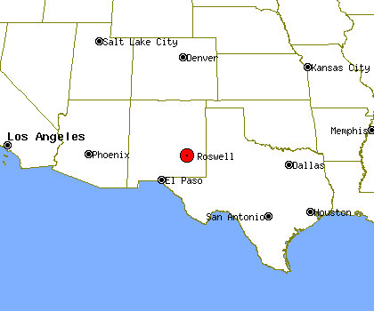
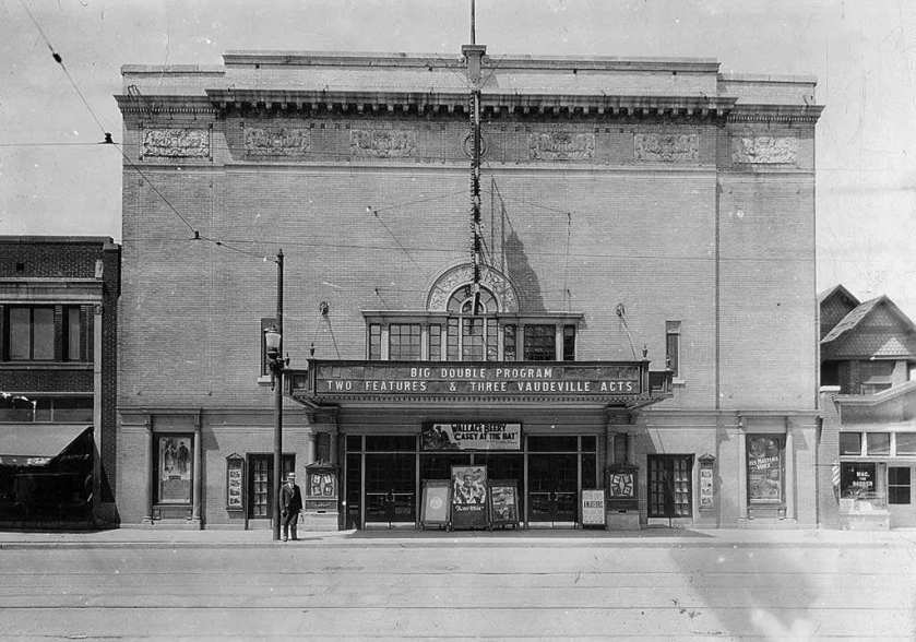
Next we come to Roswell, New Mexico, most famous as the site of a UFO crash in 1947, to which I don’t think the government has ever publicly admitted, but which has a lot of circumstantial supporting evidence :).
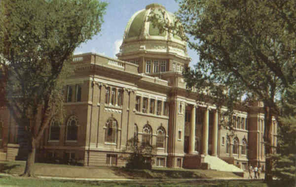
Roswell is the County Seat of Chaves County. As we go further along the alignment, I encourage you to be open to thinking differently about who actually built these monumental buildings. Perhaps county seats and capitals were chosen because of buildings that were already there….
Chaves County Courthouse
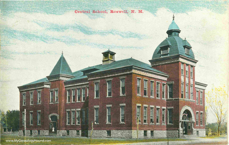
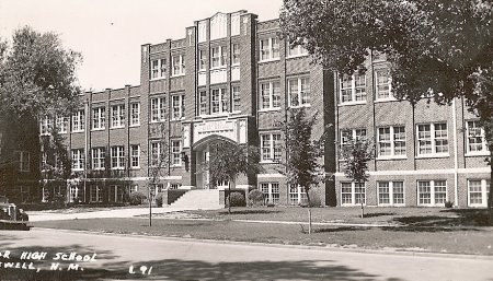
Next are two old depictions of schools in Roswell – Central High School…
…and North Junior High School.
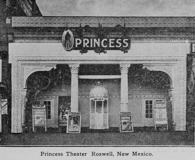
Here is an old picture of the Princess Theater in Roswell with its intricate design features.
And the Plaza Hotel, which takes us back to the same style I keep showing you that is found in so many different places (and more to come along the way).
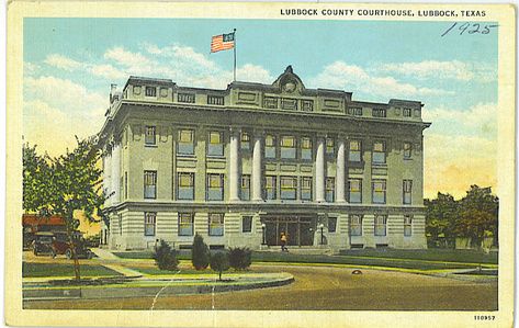
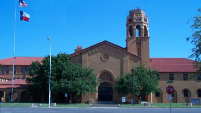
Lubbock, Texas is next on the alignment.
It is the County Seat of Lubbock County on the southern end of the high plains, also known as the Llano Estacado. It is considered a regional hub city.
This is Lubbock High School.
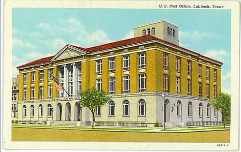
And its monumental post office and federal building.
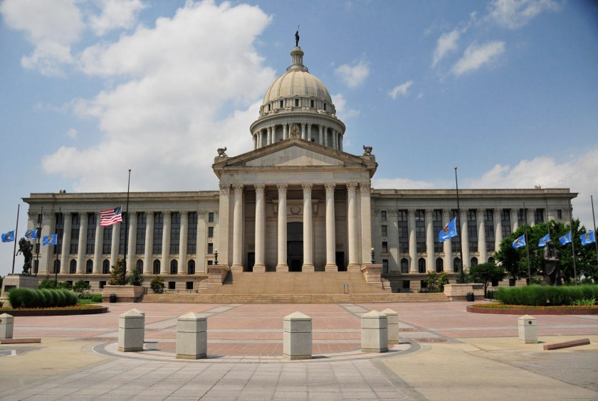
Next is Oklahoma City, Oklahoma, the state capital and county seat of Oklahoma County. It is definitely a major economic and transportation hub with its central location in the country, and on the nation’s interstate highways, sitting at the convergence of I-35 and I-40 and I-44. This is also where I was living when I started to put together what I am sharing with you, where I started to see what was really in the environment around me, and where I first learned about the advanced Ancient Civilization that has been removed from our awareness.
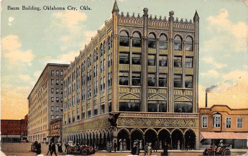
Here is an old postcard depicting The Baum Building in Oklahoma City. It was razed in 1973, supposedly as part of an Urban Renewal project.
In its day, the Baum Building was compared to the Doge’s Palace in Venice, shown here.
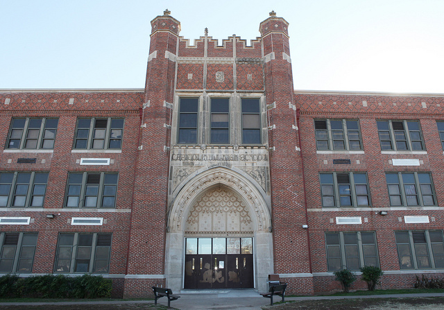
This is Capitol Hill High School in South Oklahoma City.
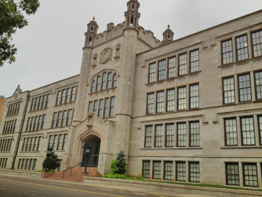
This is Central High School in Oklahoma City. It is listed on the National Register of Historic Places in the United States. Pretty fancy places, huh?
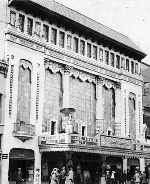
This is the old Criterion Theater in Oklahoma City, with its ornate styling…
Criterion Theatre, Oklahoma City, OK.
…and this is the Oklahoma City Federal Reserve Bank.
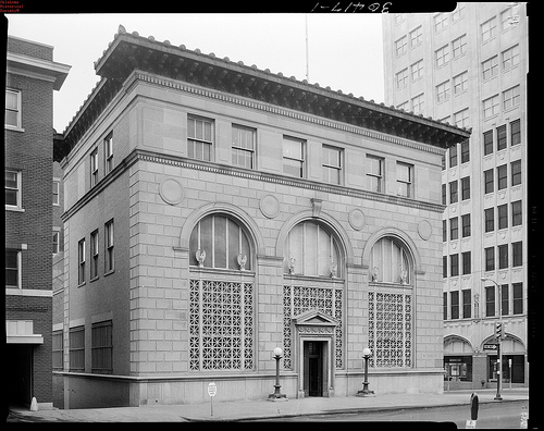
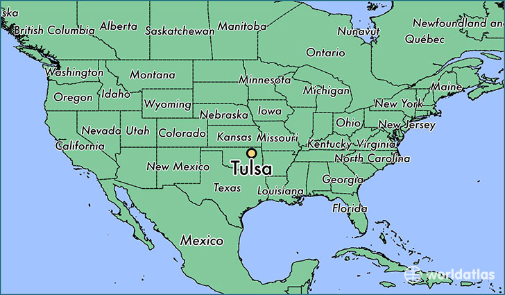
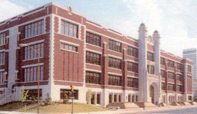
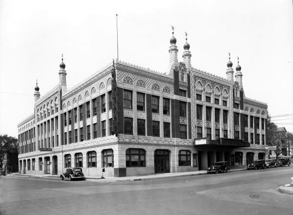
Next on the alignment is Tulsa, Oklahoma. Tulsa is the second largest city in Oklahoma, and is the County seat of Tulsa County.
Here is Central High school in Tulsa.
This is the Mincks-Adams Building – first called an exchange bank in the 1930s, and apparently is now a hotel. Similar in appearance to the Baum Building that was in Oklahoma City.
And here is the old Akdar Movie Theater in Tulsa. It has also been demolished.
Next on the alignment is St. Louis, Missouri, an independent city and major port built on the western bank of the Mississippi River on the border with Illinois. As an independent city, it is not in the territory of any county.
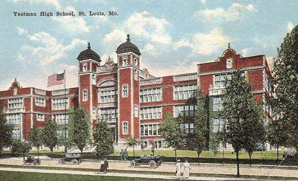
This is the old Yeatman High School. The building is no longer in use.
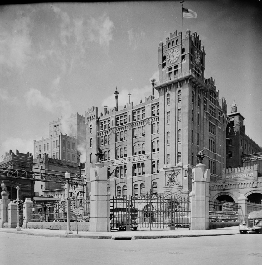
Here is the Anheuser-Busch Brewery in St. Louis. Pretty fancy heavy masonry here too.
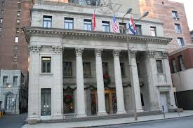
The Old Mutual Bank Building in St. Louis…
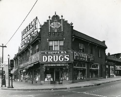
…and a historic Drug Store in St. Louis, Missouri.
Next is Springfield, Illinois…
…the capital of Illinois, and county seat of Sangamon County.
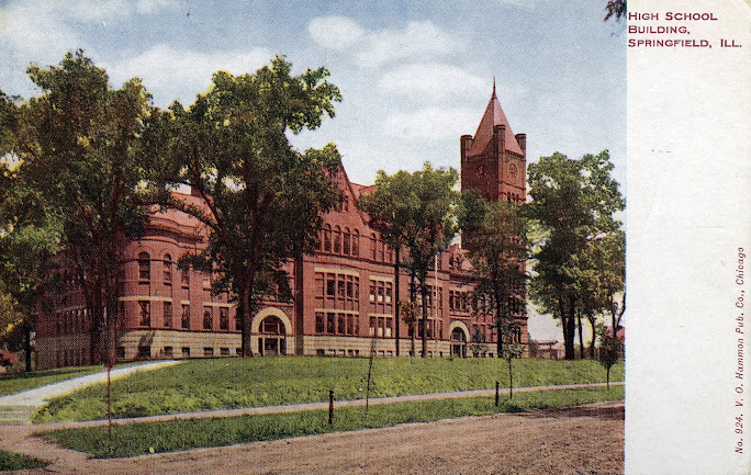
Here’s an old high school in Springfield.
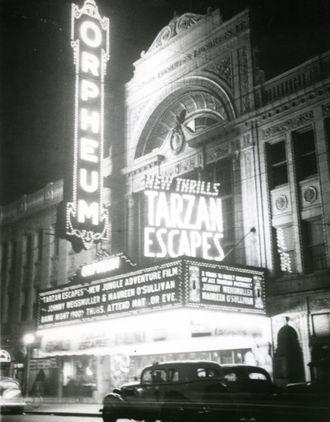
The old Orpheum theater in Springfield. Orpheum was the name of many theaters at one time, and the roots of this word goes back to Greek mythology. Orpheus had the ability to charm all living things through his music. Hmmm. That means casting spells…..
And here is the Chapin National Bank Building in Springfield.
Toledo, Ohio is next on the alignment, and is located at the western end of Lake Erie.
Toledo is the County Seat of Lucas County.
Here is Waite High School in Toledo.
And the old State Theater in Toledo, Ohio
And Toledo Ohio Savings Bank and Trust on left, compared with the historic drug store in St. Louis on the top right, and the building in Juarez, Mexico both shown earlier in this post.
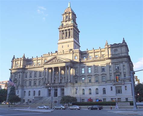
Now we come to Detroit, Michigan. It is located on the United States – Canada border, and on the Detroit River, which connects the Great Lakes System with the St. Lawrence Seaway.
Detroit is the seat of Wayne County. This is the old Wayne County Courthouse.
Here is the Central Academy and High School in Detroit;
The Bankers Trust building in Detroit;
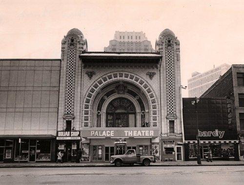
And the historic Palace Theater, Detroit, Michigan.
Onto Windsor, Ontario, which is directly across from Detroit, Michigan and also on the Detroit River.
The Windsor, Ontario School District building…
…Here an old theater building in Walkerville, a historic neighborhood of Windsor…
…and a bank building, also in Walkerville.
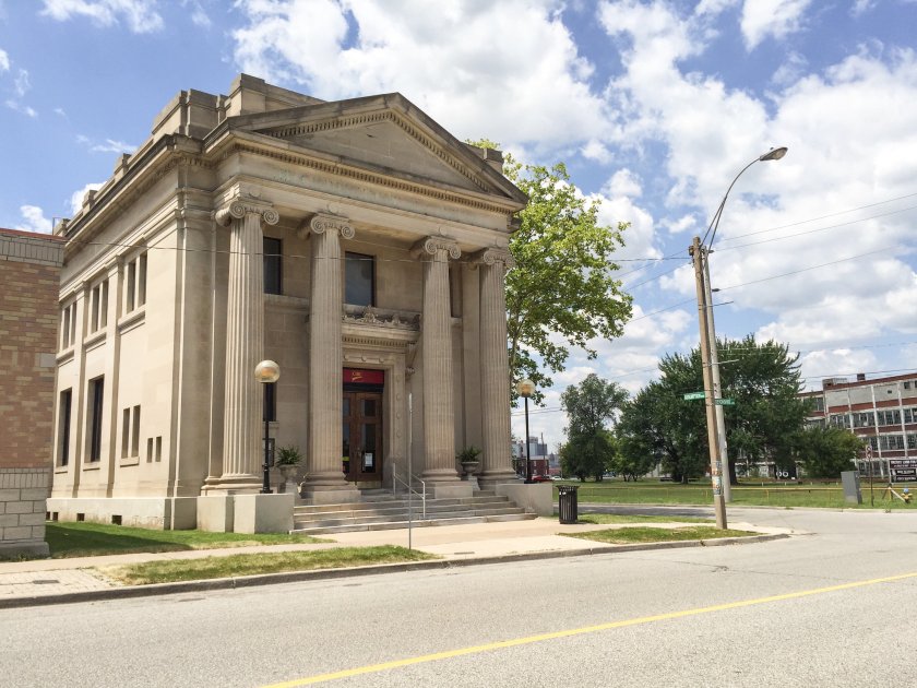
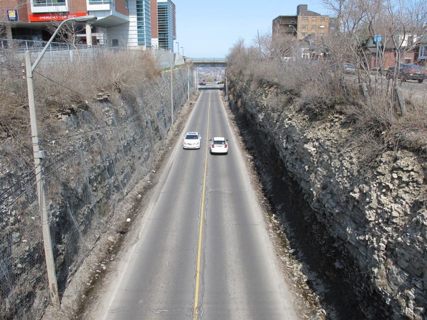
Next we come to Hamilton, Ontario, a port city on the western end of Lake Ontario. It is roughly the midway point between Toronto and Buffalo, New York.
The Niagara Escarpment runs through the middle of the city.
And I have my own opinion about what the Niagara Escarpment actually is. Check out my “Expanding on Waterfalls” if you are interested in finding out more about what that might be….
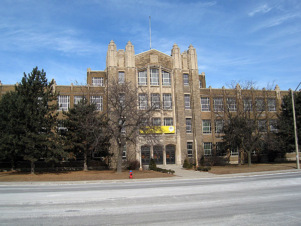
Here is a high school in Hamilton.
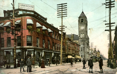
And an old view of James Street in Hamilton.
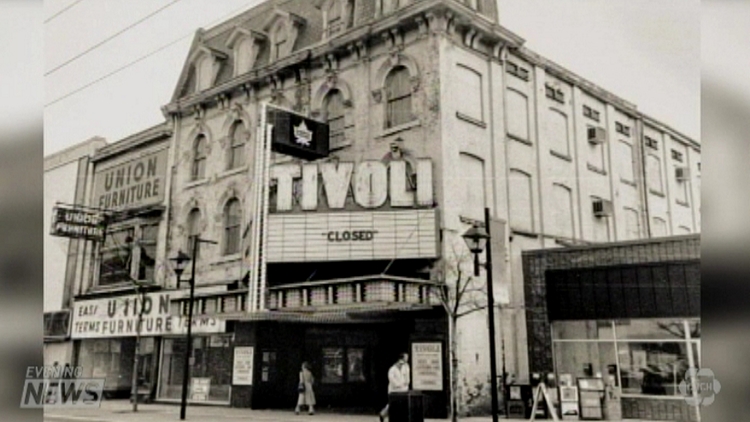
The historic Tivoli Theater…
…and a Historic Bank in Hamilton.
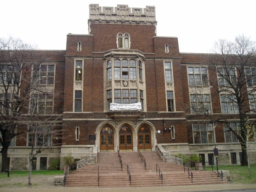
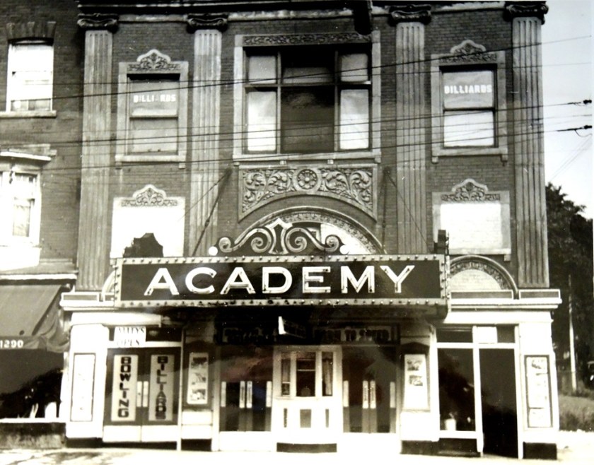
Next is Toronto, Ontario, the capital of Ontario and largest city in Canada, and on the northwestern shore of Lake Ontario.
This is the Jarvis Collegiate Institute in Toronto…
…the old Academy Theater…
…and the old Bank of Toronto.
So finally arrive at the end of the line, or the beginning as it were – Montreal, Quebec.
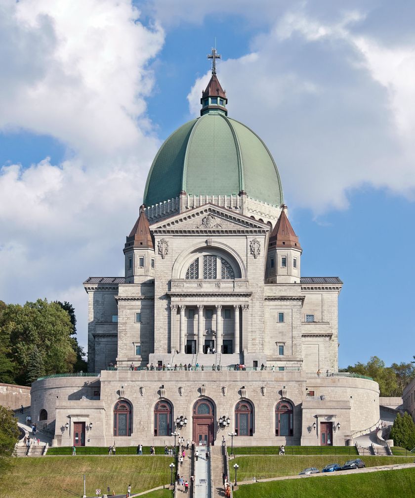
Montreal is named after Mount Royal – the triple-peaked hill in the center of the city, where we find another one of these – Saint Joseph’s Oratory on Mount Royal.
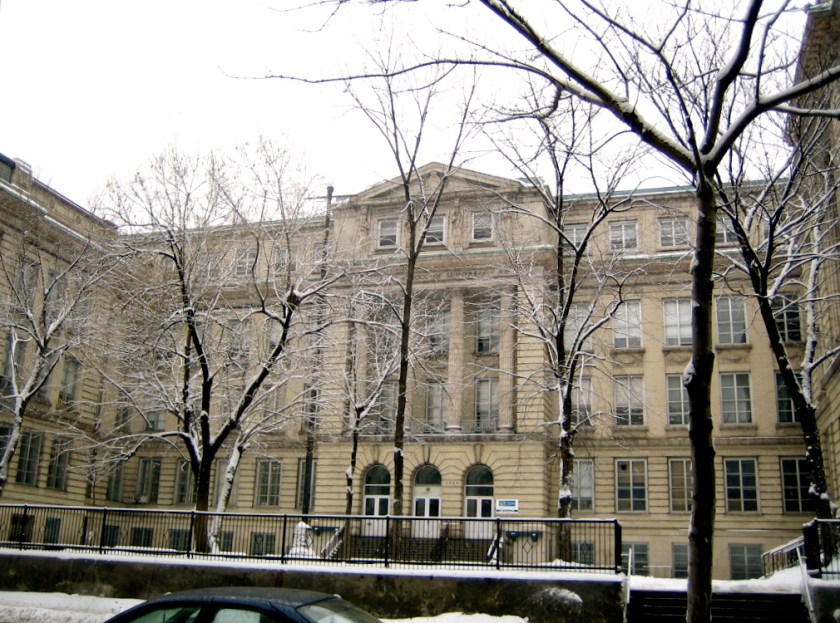
This is the Fine Arts Core Education School in Montreal.
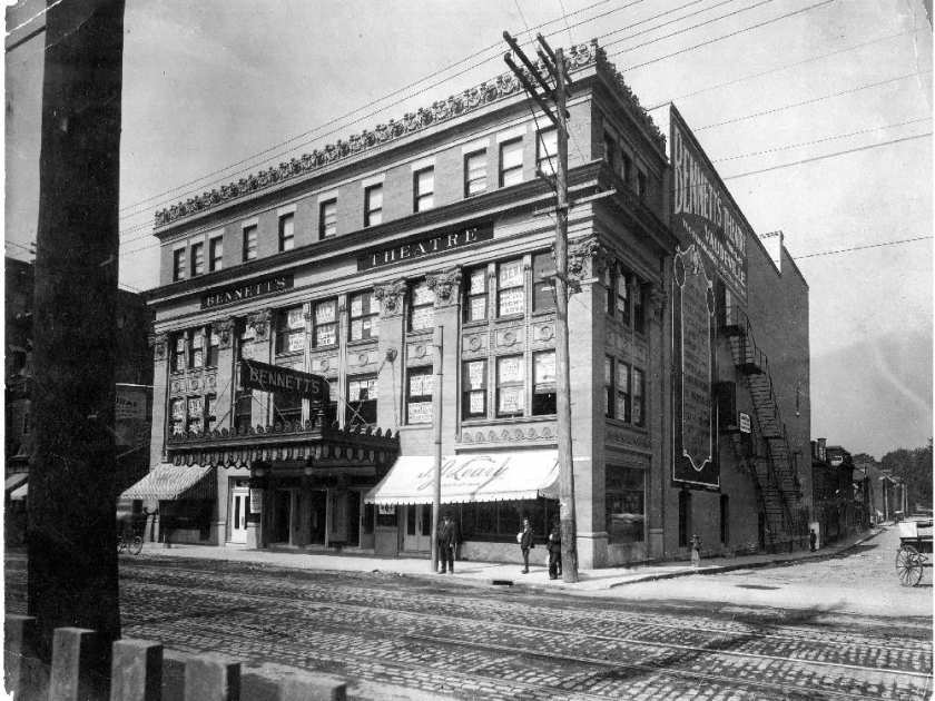
…A historic theater in Montreal…
…and the old Bank of Montreal.
In conclusion, the same signature and hand of design is seen around the world and found in very different places in which one would not expect to find. There are astonishing similarities as we have seen traveling on this alignment through Canada, France, Italy, Serbia, Romania, the Crimea, Ukraine, Russia Chechnya, Kazakhstan, Turkmenistan, Uzbekhistan, Kyrgyzstan, China, North Korea, South Korea, Japan, Mexico, and the United States.
There was a unified, global civilization with Monumental Architecture up until relatively recent times. The buildings of this civilization of Human Genius that were not turned into government buildings were turned into schools, banks, theaters, art museums, churches, and so forth, which then became tools to control Humanity.
I believe that the hand of design of the Monumental Architecture were the Master Masons of a global and unified Moorish Empire, and that we have been taught a false historical narrative that was grafted onto what they built, and that we were somehow knocked off a positive timeline in order to control Humanity.
I also believe that the Moors;
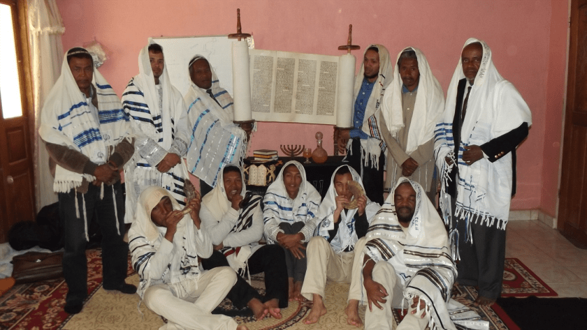
The Washitaw Muurs, also known as the Ancient Ones, who are still very much with us, and who the United Nations has formally recognized as being the oldest indigenous civilization on earth in this Charter (but for some reason the general population – cough, cough – has never heard of them);
and the 12 Tribes of Israel…
…are somehow interrelated, but I can’t say exactly how because the True History has been deliberately removed from our collective memory, but I know they are related..
I can only piece this together from the very compelling evidence of their incredible and monumental legacies worldwide, of which I have only scratched the surface of what I have found here in this post.
They have hidden it in plain sight by controlling our perception.
But now we are waking up to what they have been doing…and this is a very good thing because it is necessary to know this as we are evolving in consciousness, together as a collective.
I started following this long-distance global alignment at Montreal, Quebec, Canada, in “How I Found the Silk Road, Part 1,” and will be ending the series in Montreal in the next post. This leg of the journey will take us into North Korea, South Korea, and Japan, all the way to Guadelupe Island, which is located off the west coast of Baja California.
I found the alignment after I discovered a Star Tetrahedron in North America by connecting major cities that I noticed were lining up in straight lines. I believe it is the terminus of the planetary grid system. When I extended the lines out on a globe, I found that cities lined up around the world in circles and lines.
I ended the last post in the journey along this alignment at Dalian, China, where I found Europe in China, before it crosses the Yellow Sea into North Korea.
From Dalian, the alignment crosses the Yellow Sea which separates China from North Korea.
This is a view of the shoreline of North Korea where it meets the Yellow Sea.
The alignment crosses through Pyongyang, the capital of North Korea. This is an ancient alignment on a planetary grid system, and as such I will be showing you photos of historical Pyongyang and North Korea, other than to say Pyongyang is the capital and largest city in North Korea.
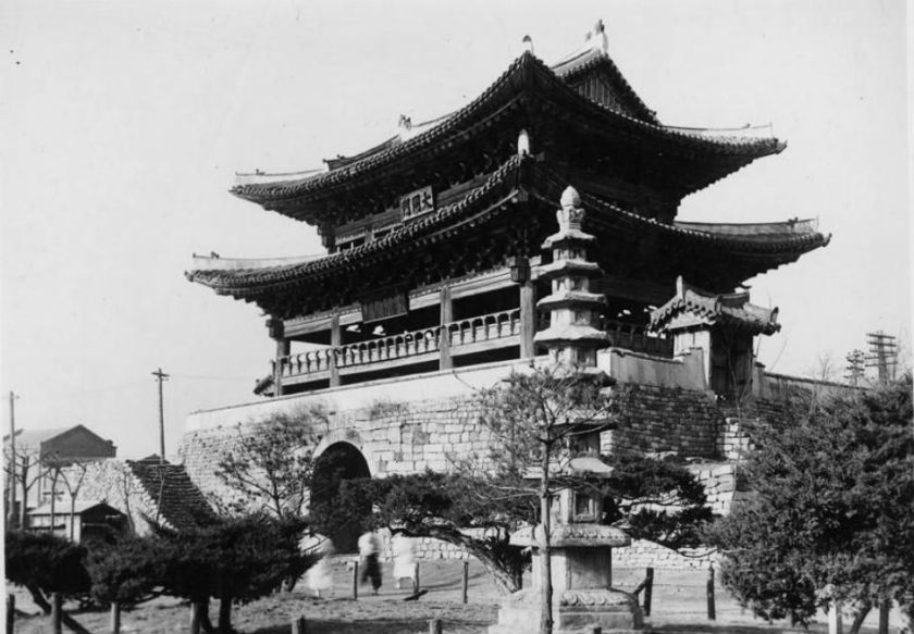
This is Taedong Gate, the eastern gate of the original walled city of Pyongyang. It is considered one of the national treasures of North Korea.
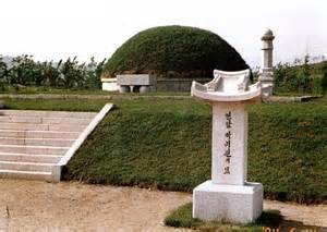
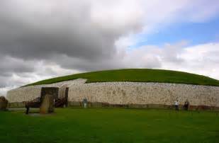
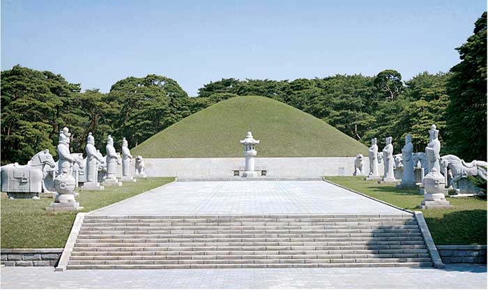
Here is a comparison of what is called the burial mound of Pak Chi Won in North Korea, with Newgrange in Ireland. I am seeing and saying that there was a unified global advanced civilization originating from ancient times that has been removed from our collective memory. The structural design is virtually identical in these very different parts of the world.
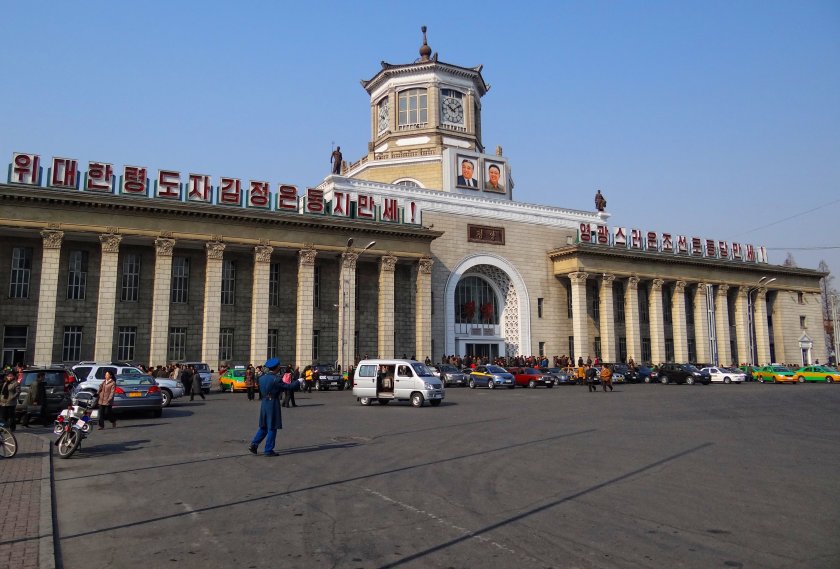
This is the railway station in Pyongyang. Again, as we have seen all along this alignment, very heavy and incredibly huge masonry.
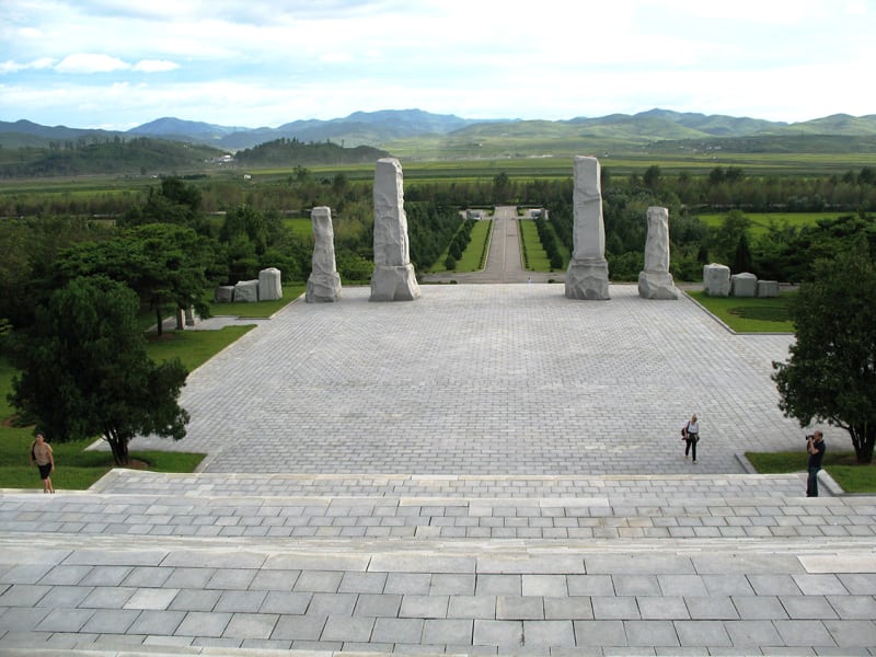
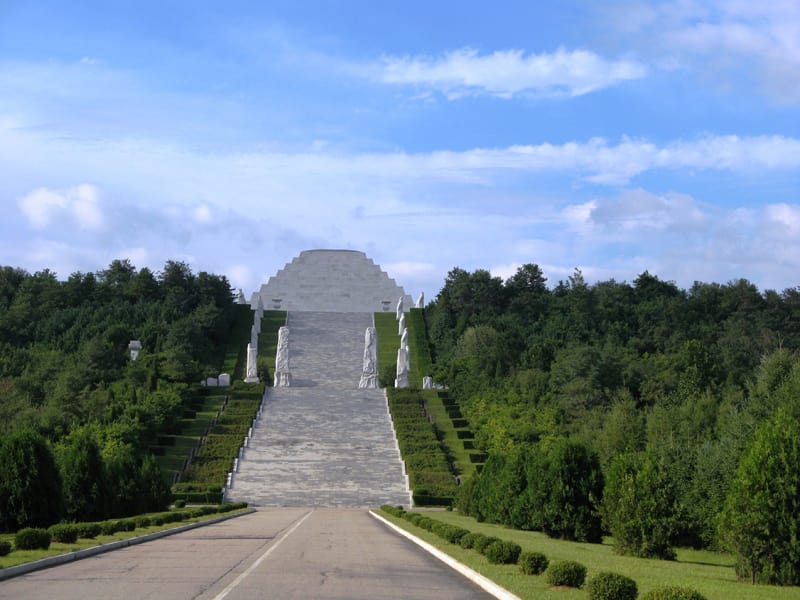
And here are different views of historical remains in North Korea, featuring incredibly sophisticated stone works and earthworks, a stepped pyramid, and a mound with what looks like a rounded pyramidal shape.
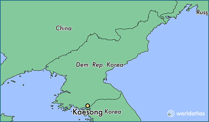
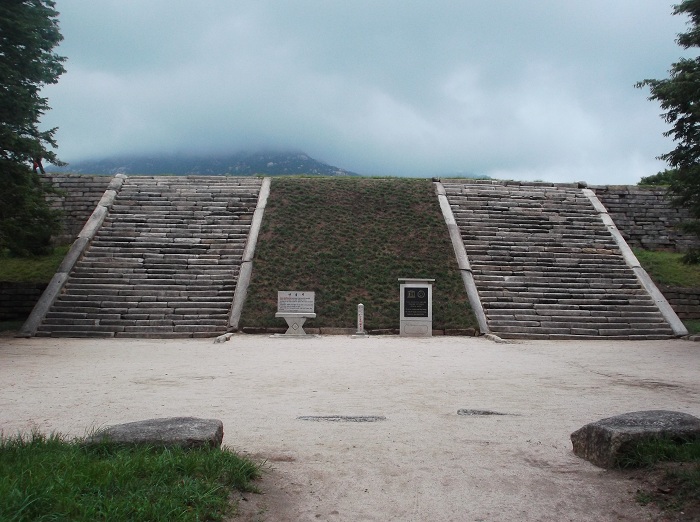
Next we come to Kaesong, North Korea. At one time in the Korean peninsula’s history, it was the capital of Korea.
In 2014, North Korea and South Korea joined together to excavate the remains of Manwoldae Palace, which is now a UNESCO World Heritage Site. It was the main palace of the Goryeo Kings from the 900s to the 1300s.
It is just across the DMZ in southern North Korea, in what is called the Songaksan Mountain range.
Songaksan Mountain
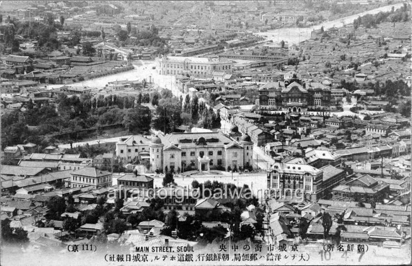
Next on the alignment we come to Seoul, South Korea, the capital and largest metropolis of South Korea.
Here is a historic photo of Seoul, taken in 1919. Notice in addition to the huge, heavy masonry pictured throughout Seoul, in the center of the photo you see onion domes here as well.
Here is a close-up of that center building. It is the Bank of Korea, circa 1920. Check out how huge that building is, relative to the size of the people in the street!
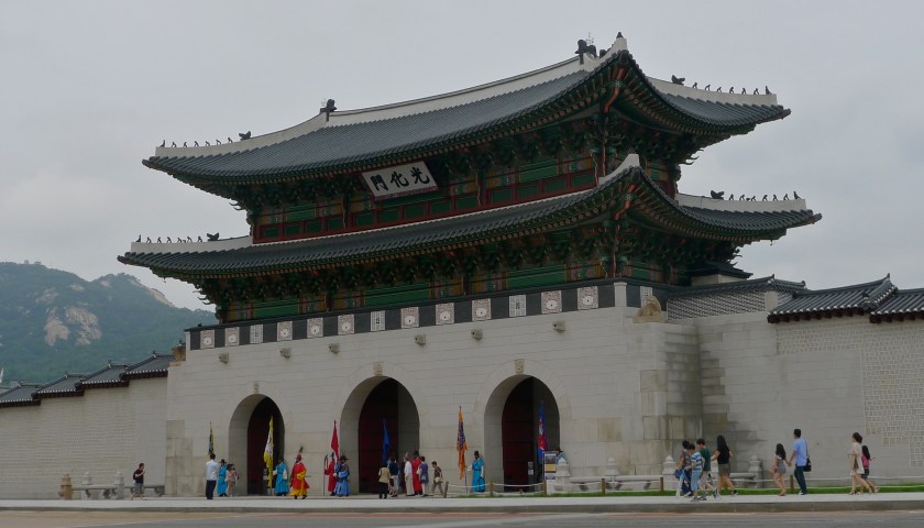
This is Gyeongbukgong Palace in Seoul. It was the main royal palace of the Joseon Dynasty, said to have been built in 1395.
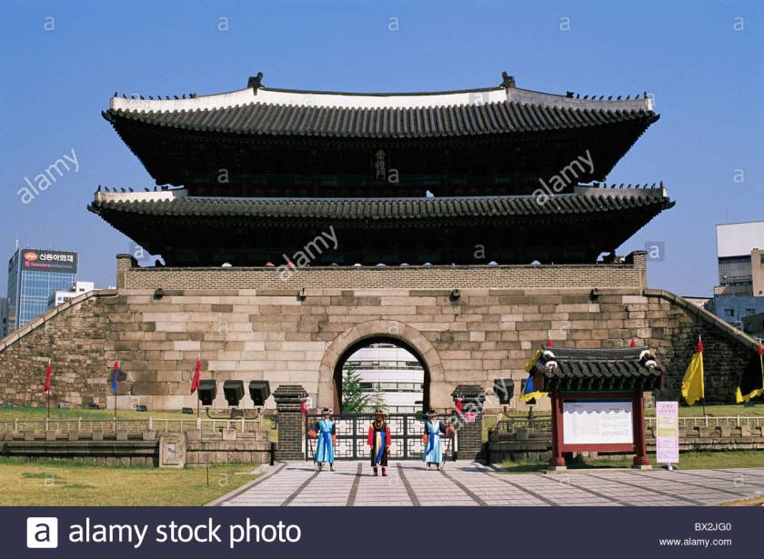
This is the Sungnyemun South Gate of Seoul. It is one of the eight gates of the fortress wall of Seoul. which surrounded the city in the Joseon Dynasty. Once again we find heavy masonry and arches, which are consistent features throughout this alignment, notwithstanding the oriental nature of the roof structures.
-One more thing I want to bring forward is from the Bukchon Hanok Historic District of Seoul. Besides the prevalence of the stone work and masonry you see pictured here, I also want to point out the regular, but somewhat steep slope in both pictures. This is common in cities around the world. It is not irregular as one might expect to find if natural. It looks geometric in nature.
Bukchon Hanok historic district in Seoul, South Korea.
As is the case with every where, there is much more to uncover, but I mostly want to hit highlights for the purposes of this blog post.
I am now going to take leave of the Korean Peninsula, and cross the Sea of Japan (also known as the East Sea) head on to Japan.
The Sea of Japan
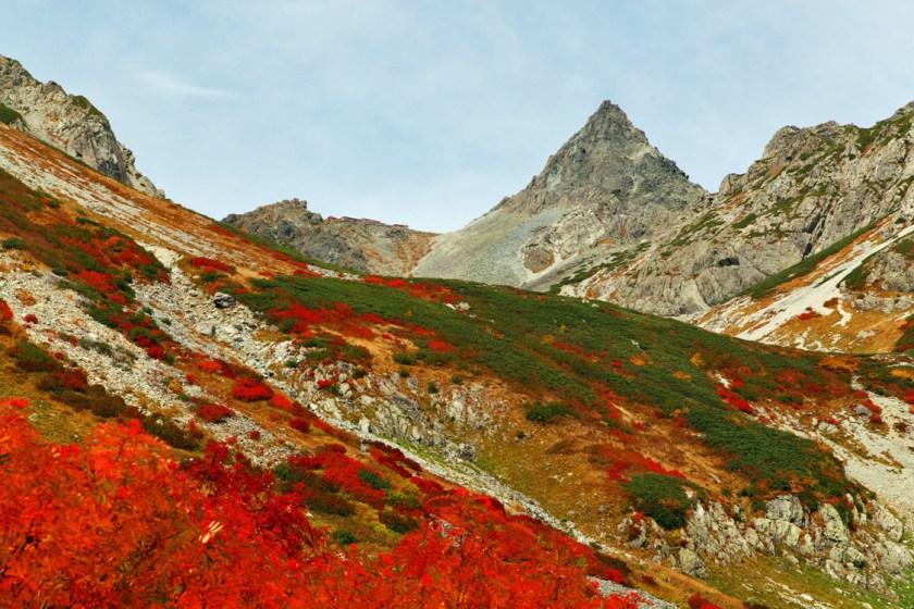
So we roll into Nagano, Japan on the alignment.
Nagano is the capital of Nagano Prefecture, near the confluence of the Chikuma and Sai Rivers. Here is some of what you see around Nagano and Nagano Prefecture.
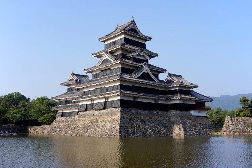
You see more of the stonework so prevalent in all of these cultures with what looks like a fortification at the base of Matsumoto Castle in Nagano Prefecture. This is said to be the oldest existing castle in Japan, and is recognized as a national treasure.
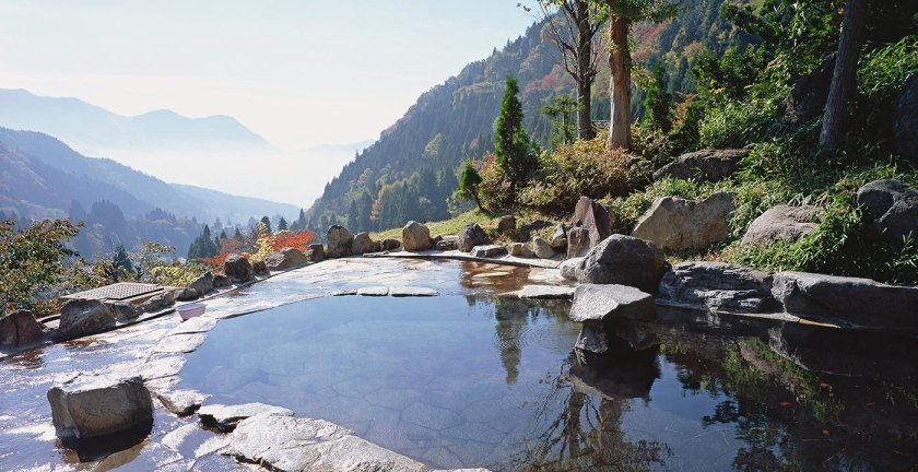
Here is yet another example of the ubiquitous block-shaped rocks that cover the surface of the planet. Nice-looking straight-edges there, as well as the stone work around the edges of what looks to be a pond, or some kind of water work.
Other examples of sophisticated knowledge about hydrology and engineering are shown here, with the photo on the left being in Nagano Prefecture, and on the right in a Miao Village in China. The Miao live primarily in the mountains of Southern China.
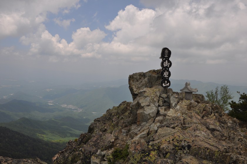
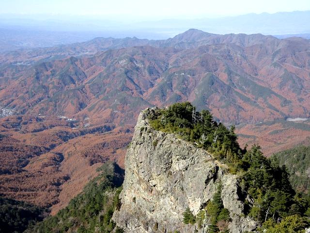
Next, this is the summit of Mount Ogura, with its rocky, pointed top.
And this could be another view of the same mountain, or perhaps a different peak in the same area, but it is also in the mountains of Nagano Prefecture.
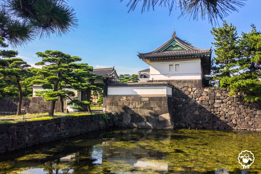
The alignment goes through Tokyo, the capital of Japan since 1869. It is the seat of the Emperor of Japan and the Japanese Government, and is the most populous metropolitan area in the world.
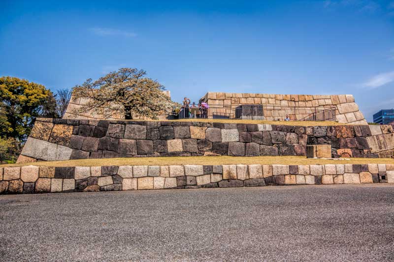
Let’s take a look at Edo Castle in Tokyo, the Imperial Castle of Japan. Said to have been built in 1457, here is an historic depiction of it. Looks like a pretty sophisticated enterprise with all of those heavy wall fortifications, and canals surrounding it.
Let’s see what is still intact from the original buildings on the castle grounds.
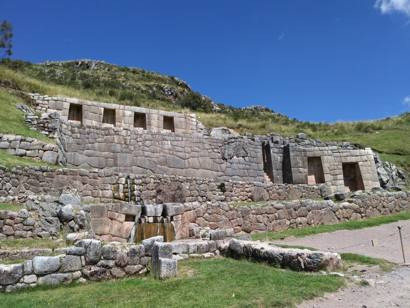
Here we have a beautiful example of a megalithic polygonal wall that is still intact.
Here’s a comparison with a megalithic polygonal structure at Tambo Machay, near Cusco in Peru.
This shows a comparison with the earlier polygonal stonewalls side by side with a later stone wall construction, which has comparatively smaller stones.
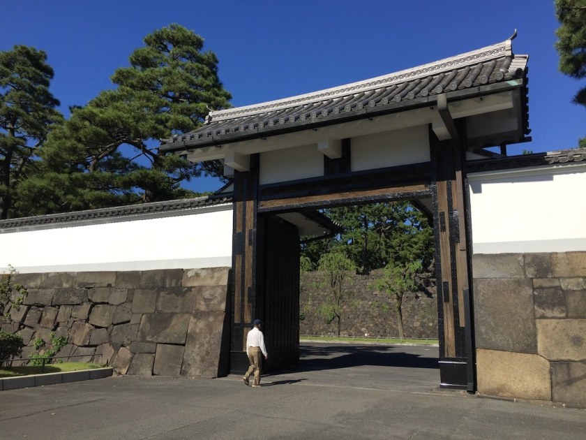
The Sakuradamon Gate of Edo Castle has huge polygonal megalithic masonry.
And this street view on the grounds of the Edo Castle/Imperial Palace shows really sophisticated masonry and construction.
So, according to what’s in these photos, Japan had a megalithic culture at one time, exactly like the acknowledged ones of Peru, other countries in Central and South America, Egypt, Turkey, and so on. In fact there are megaliths all over the world, including North America. We are just not told about them.
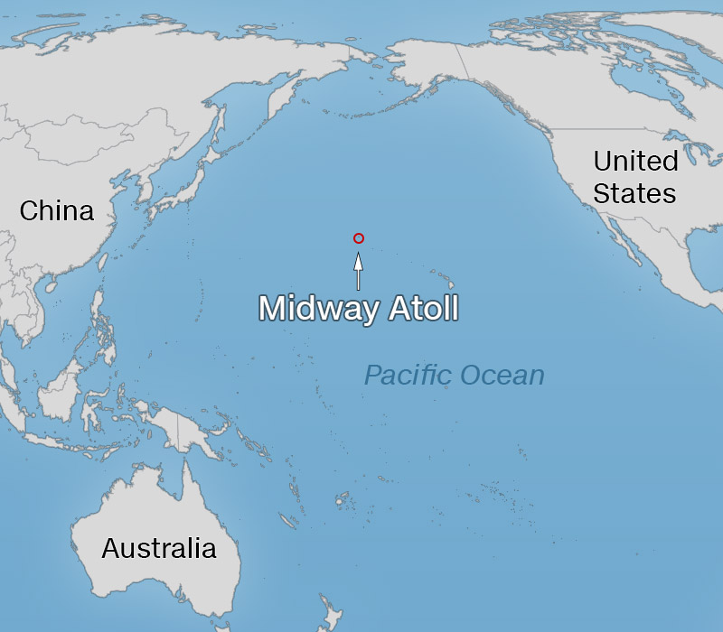
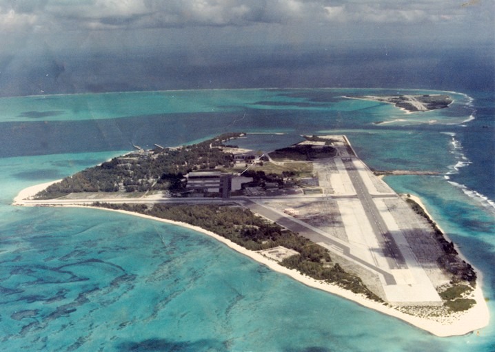
We will now leave the island of Honshu in Japan, and head out across the Pacific Ocean, where we cross over Midway Island.
Here is a photo of Midway Island, site of a major World War II Battle:
That’s Midway, Folks!
And the U. S. Government still has a claim there as well. Midway is an unorganized, unincorporated Territory of the United States, and continues to be the only island in the Hawaiian Island chain that is not part of the state of Hawaii.
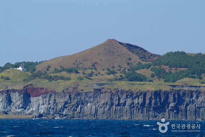
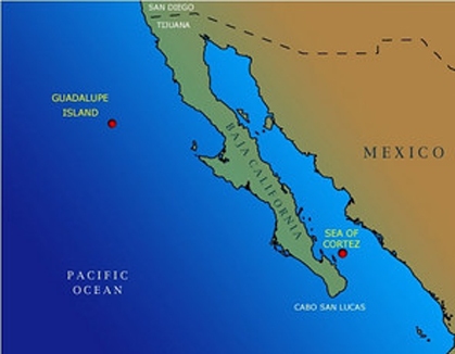
So the last stop for Part 5 of this video series is Guadalupe Island, which is located off the west coast of Mexico’s Baja California.
Guadalupe Island is listed within a biosphere reserve, so visitors have to obtain a permit. There are small communities of fishing camps on the island, a weather station, and a small airport. It is also a destination for cage-diving to view great white sharks.
It otherwise has a rugged landscape, as captured in these photos:
And at Guadalupe Island there is an unusual-looking rock formation on the left reminiscent of the one at the Galapagos Islands in the center photo, and the one near Yalta in the Crimea on the right.
This is where I am ending this part of the series on “How I Found the Silk Road”, and in the next post will end the tour of this alignment at Montreal, where it began.
I ended “How I Found the Silk Road, Part 3,” at Pik Pobedy in the Tian Shan Mountains on the Kyrgyzstan – China border.
I started the journey along this particular planetary alignment in North America in Montreal, Quebec, Canada in Part 1 – which gives you the background details of exactly how I came into this awareness of this particular planetary grid-line, as well as many others, and who I believe was responsible for building everything.
I will be ending this journey in Montreal as well, at the end of the video series. This is a long-distance alignment that encircles the earth.
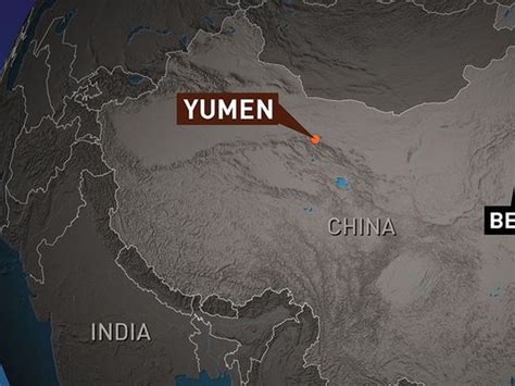
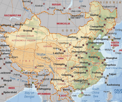
Picking up the journey in China, we are now in Yumen City in Gansu Province. It is located on the Silk Road, and is best known now for its oil production.
Starting in the 1930s, a modern highway was built over the old caravan route from Yumen to Urumqi, and continuing on to Kazakhstan. Then a railway line was built connecting Lanzhou (the Capital of Gansu Province) with Yumen and Urumqi. Then oil was discovered near Yumen City in 1939, which has since then developed a sizeable energy industry.
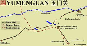
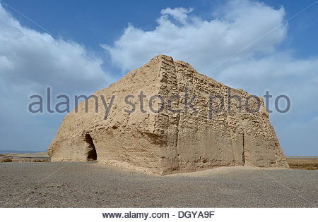
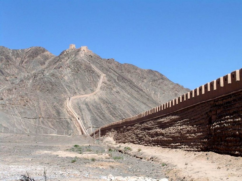
Located 250 miles to the west of Yumen City is Yumen Guan, or Jade Gate, on the Great Wall of China. It was the frontier pass in ancient times, the entrance to the old Silk Roads, and the one road connecting Central Asia and China.
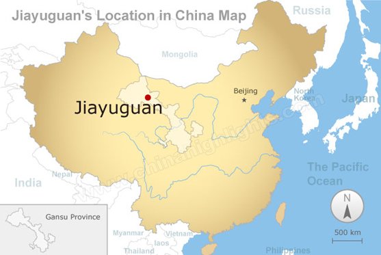
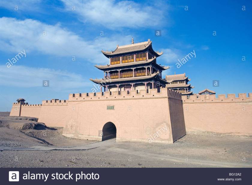
Next on the alignment is Jiayuquan, China. Jiayuquan, also in Gansu Province, is called the “Mouth of China” since it is located at the end of the Great Wall of China, and guarded the western boundary of China’s Ming Dynasty (1368 – 1644).
Jaiyu Pass is nearby, the largest and most intact pass…
of the Great Wall of China.
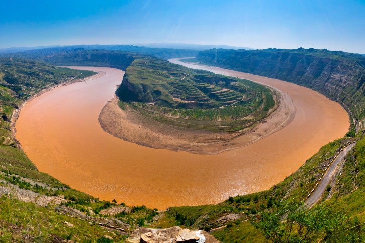
Next we come to Yinchuan, China, the capital of the Ningxia-Hui Autonomous Region.
It is located on the Yellow River (or Huang He River), the Mother River of China. It is the second longest River in Asia, and the sixth longest river system in the world.
For comparison, here is Big Bend, Texas, on the left, and Horseshoe Bend, Arizona, on the right. I don’t believe the creation of these quite similar-looking river bends are a random act of nature, and these are not the only examples. Snaky, S-shaped rivers are a signature of the advanced Ancient Civilization, and will be its own subject in a future post.
Yinchuan is a center of the Muslin Hui minority people. Here is the Hui Mosque on the left, one of the approximately 500 mosques in Yinchuan, with a comparison picture on the right of the Taj Mahal in Agra, India, so you can see the similarity in architectural styles between the two, which are separated by a distance of 1,807 air miles (or 2,909 kms).
Next on the alignment is Taiyuen, China. It is the capital and largest city of the Shanxi Province. It is a main manufacturing base in China, and a transportation hub.
The meaning of Taiyuen is Great Plain, with its location where the Fen River leaves the mountains and enters a flat plain, going through the Shanxi Province, eventually connecting with the Yellow River (Huang He).
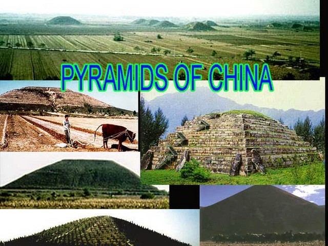
For information, southwest of Tiayuen and Shanxi Province, near Xi’an, the capital of Shaanxi Province, there are sixteen pyramids on the Guangzhong Plain, northwest of Xi’an.
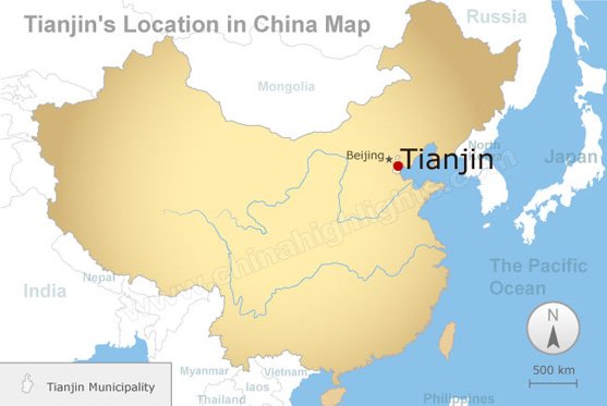
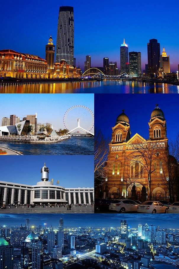
From Taiyuen, next we come to Tianjin, China, on the alignment. It is a coastal city with a population of over 15 million, and is one of four national central cities in the People’s Republic of China.
What really gets my attention in this photo of sights around Tianjin is the photo of the older building with two towers, center right. It looks like architecture I have seen in many other places around the world.
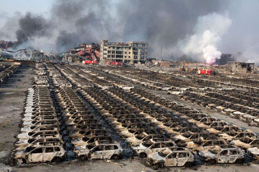
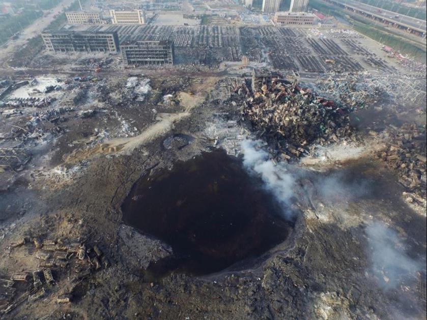
The other thing that really caught my attention about Tianjin is that there was a massive explosion there in 2015 – which I had heard about before I found it on the alignment. When I say massive, I mean it was apocalyptic, like a nuclear blast.
We are told the explosion took place at a warehouse at the port that contain hazardous and flammable materials chemicals, and the cause of the blast was unknown. Whatever caused the explosion, it left behind a gigantic crater….
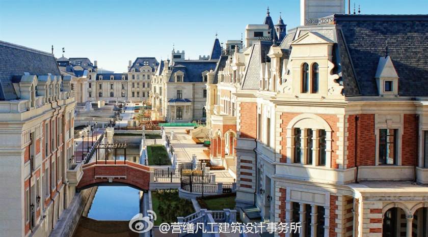
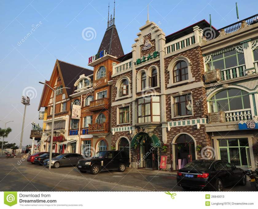
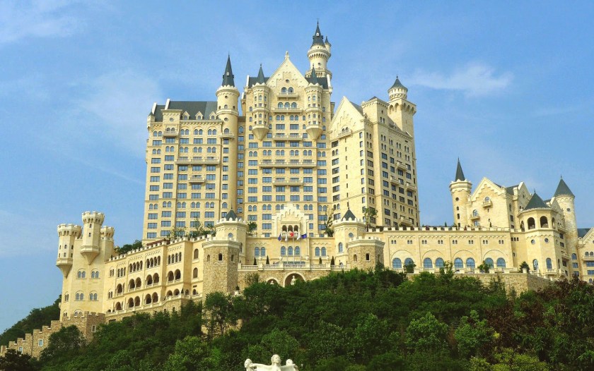
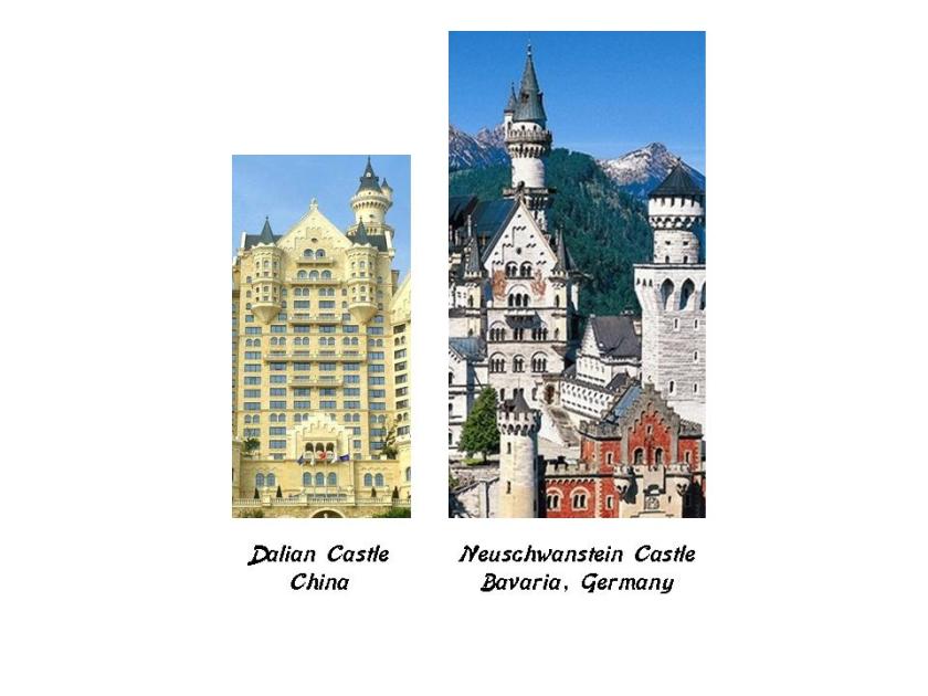
Next is Dalian, China, a major city and seaport in Liaoning Province. It is a financial, shipping and logistics center for Northeast Asia.
Okay guys, if you have been following me in this series, do the next photos look like what we would expect to see in China…or does it look like what we have seen in Europe and Central Asia along this alignment? If you are new to my work, and have any questions about why I am asking, please check out “How I Found the Silk Road – Parts 1 – 3.” This is Dalian, China, right before you leave the continent and head across the Yellow Sea to North Korea.
This is the Dalian Castle Hotel on the left, and Neuschwanstein Castle in Bavaria, Germany on the right. Now the Dalian Castle Hotel bills itself as “Bavarian-Styled,” but not specifically Neuschwanstein. I have highlighted specific design features that are identical in this comparison, between the northern east end of China, and just outside of Munich in Bavaria. Neuschwanstein was said to have been completed under Mad King Ludwig II in 1869. The information I can find on the Dalian Castle Hotel is that it is said to have opened in 2014. I am not convinced this is when it was built.
I will pick up the alignment in the next post at Pyongyang, North Korea.
I ended “How I Found the Silk Road, Part 2,” in Bucharest, Romania.
I started the journey along this particular planetary alignment in North America in Montreal, Quebec, Canada. Part 1 gives you the background details of exactly how I came into this awareness of this particular planetary grid-line, as well as many others, and who I believe was responsible for building everything.
We are entering into the actual Silk Road part of this alignment as we leave Bucharest in Eastern Europe, and move directly east along the alignment over the Black Sea, crossing over the tip of the Crimean Peninsula at Sevastopol.
The Crimea is a peninsula on the northern coast of the Black Sea that is almost completely surrounded by the Black Sea and the small Sea of Azov to the northeast. and since 2014 is controlled and governed as part of the Russian Confederation though internationally recognized as part of Ukraine. The Crimea has historically been the boundary between the so-called Classical world and what is called the Pontic-Caspian Steppe.
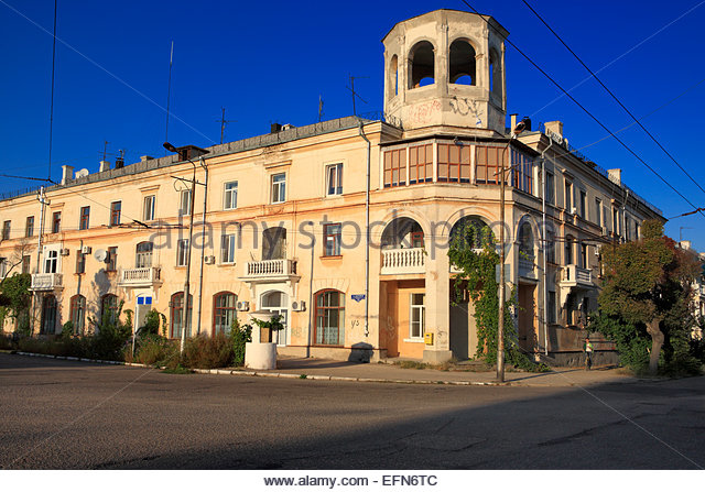
The alignment crosses Sevastopol, a major Black Sea Port and the largest city on the peninsula, which has historically been a strategically important port and naval base. It is also a popular seaside resort and tourist destination.
In the next series, the photo on the top is in Sevastopol in the Crimea; next is Guthrie, Oklahoma; below that is Kresy, Siberia; and the bottom photo is the Hotel Connor in Jerome, Arizona. Granted not identical, but I see similar structural design elements, in buildings in very different places.
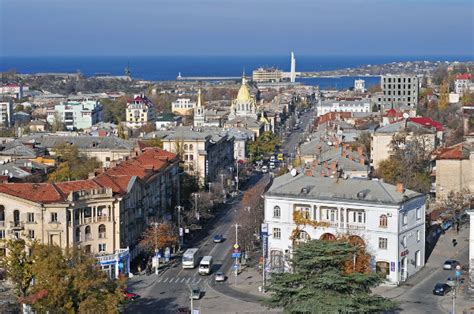
The alignment also crosses near Yalta, also on the Crimean Peninsula. Probably best known as the place where the Treaty of Yalta was signed, formally ending World War II.
Yalta is a resort city on the Black Sea. It is said to be on the site of an ancient Greek colony.
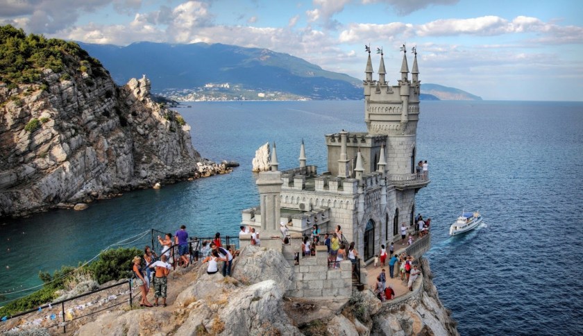
This is a photo of Swallow’s Nest in Yalta. Swallow’s Nest is said to have been built between 1911 and 1912.
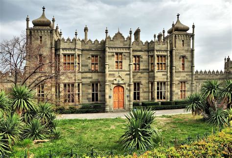
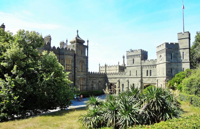
We are told the Scots Baronial and Moorish Revival styles had been introduced to the Crimea in the 1820s by British architect Edward Blore with the Vorontsov Palace in Alupka, Crimea. Hmmmm. Really? Blore was also said to not have any formal training in architecture – his training was in “Antiquarian Draftsmanship.” So this guy is supposed to be responsible for the palace in the following pictures? A bit hard to swallow….
Vorontsov PalaceVorontsov Palace
Here is a side-by-side comparison of architecture at Vorontsov Palace on the left, and the Jama Masyid Mosque in Delhi, India:
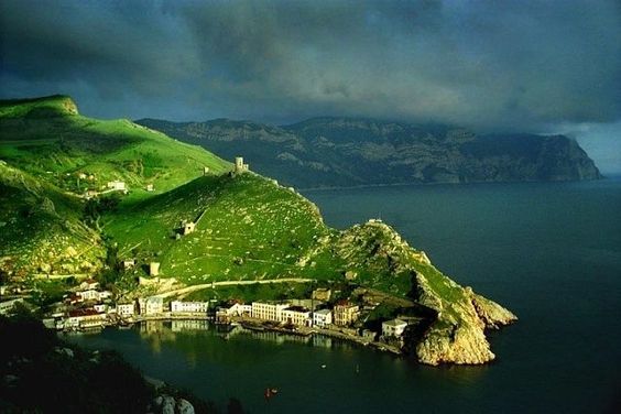
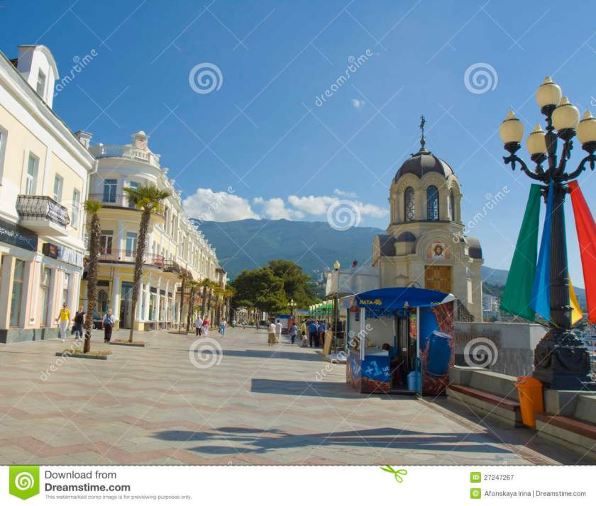
More Yalta scenes….
And this place on the coast in Yalta on the left reminds me of this place in the Galapagos Islands on the right:
The alignment leaves the Crimean Peninsula at Yalta, and then when back on the mainland goes first near Kherson, Ukraine. Kherson is an important port on the Black Sea and the Dnieper River, and is a major ship-building industry.
More of the same configuration here in Kherson that we saw in other places far from here as I showed in a comparison above:
On the left is the town hall building in Kherson, Ukraine on the left, and the town hall building in Augsburg, Germany on the right.
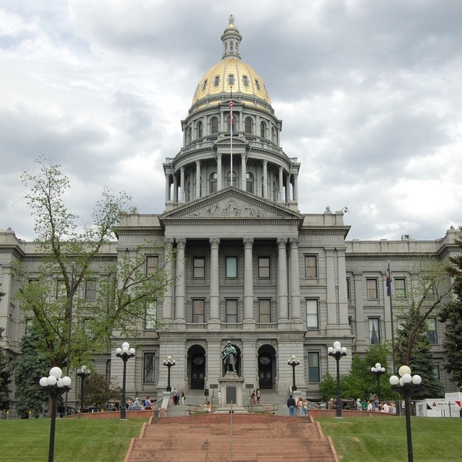
And here is a comparison of a government building in Kherson, Ukraine on the left and the Colorado State Capital building on the right.
and this building, the Kherson Musical School, definitely has Moorish architectural features:
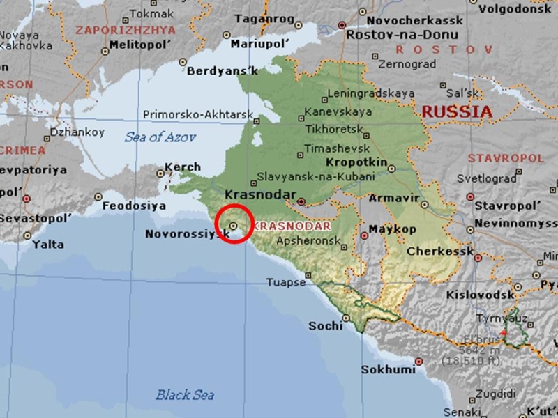
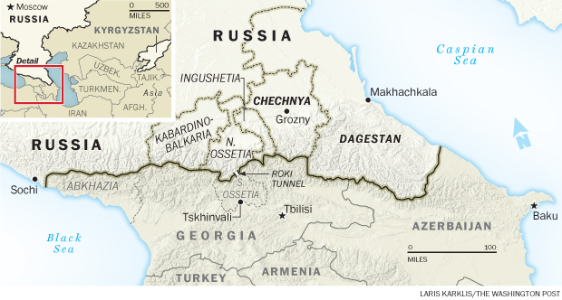
Krasnodar Krai, Russia is next, very close to the alignment. It is a federal subject of Russia, located in the Northern Caucasus Region of Southern Russia.
Some architecture in Krasnodar Krai:
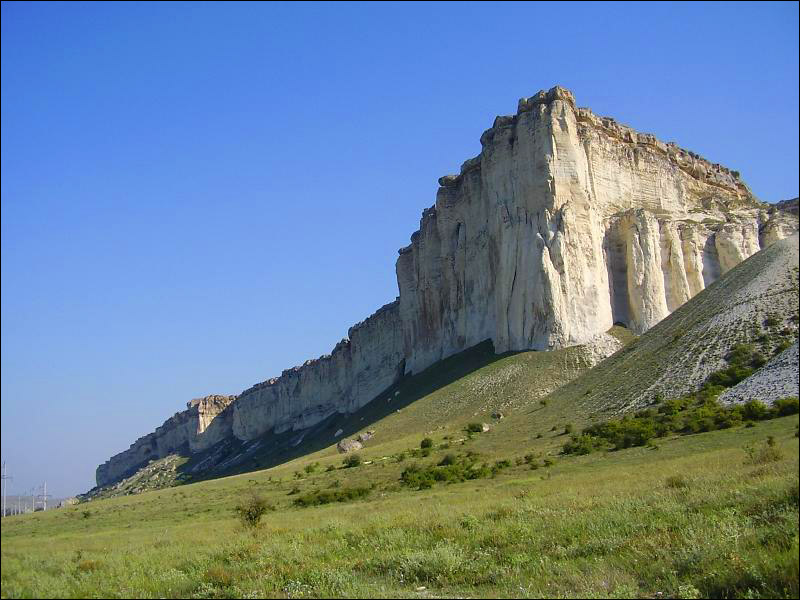
And here are some “natural” features of the area:
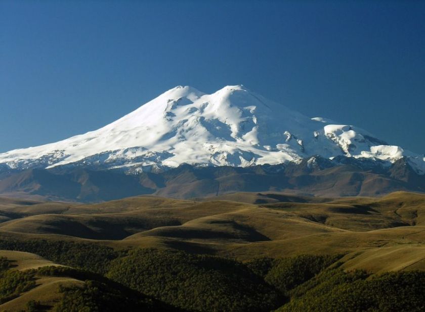
Moving along, the alignment crosses Mt. Elbrus in southern Russia in the Caucasus Mountains, near the border with Georgia. It is the highest mountain in Europe, and the tenth most prominent peak in the world. Here also we are leaving Europe and entering Central Asia. Mt. Elbrus is also the mountain the Titan Prometheus was chained to by Zeus in Greek Mythology as a punishment for stealing fire from the gods and giving it to mankind.
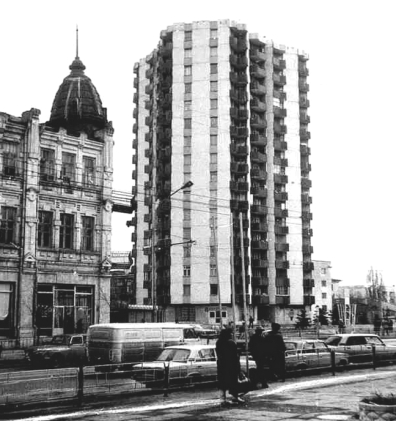
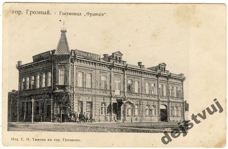
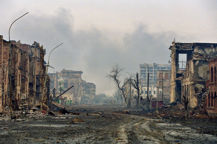
Next the alignment goes through Grozny, the capital city of the Chechen Republic, also known as Chechnya. It has been rebuilt since the destruction of the First and Second Chechnen wars with Russia, starting in 1994 and ending in 2000. A Separatist government had formed after the collapse of the Soviet Union 1991.
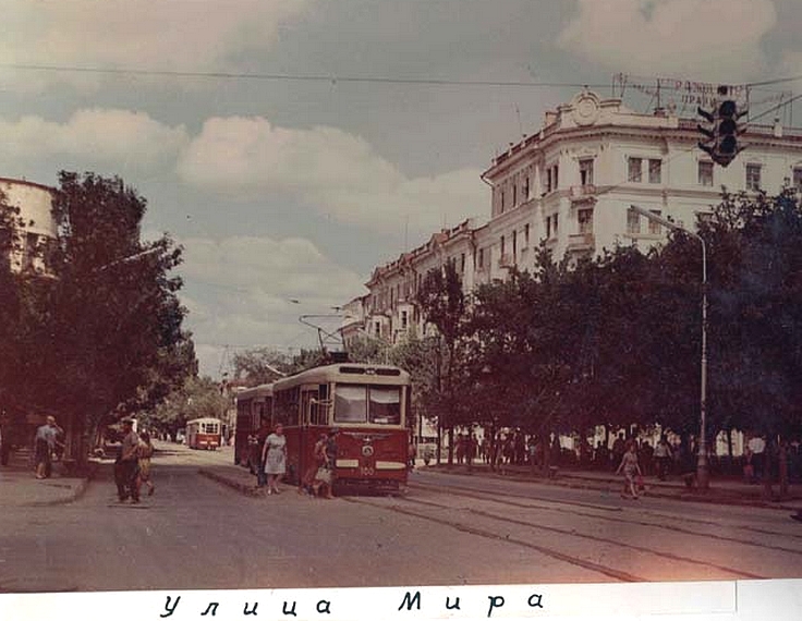
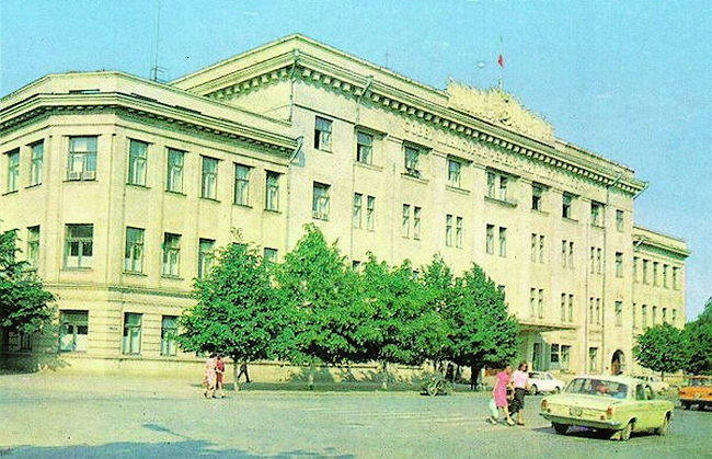
Here are photos taken in Grozny before the Chechen wars:
All of the above photos in Grozny have the same heavy masonry and design features that I have been seeing and sharing all along the alignment thus far.
And what happened to Grozny as a result of the Chechen Wars?
Why? Really, why this destruction? Grozny has since been rebuilt, but just because a proud and independent people wanted their own government, during a time when other former Soviet republics were becoming self-governing? Does this make sense?
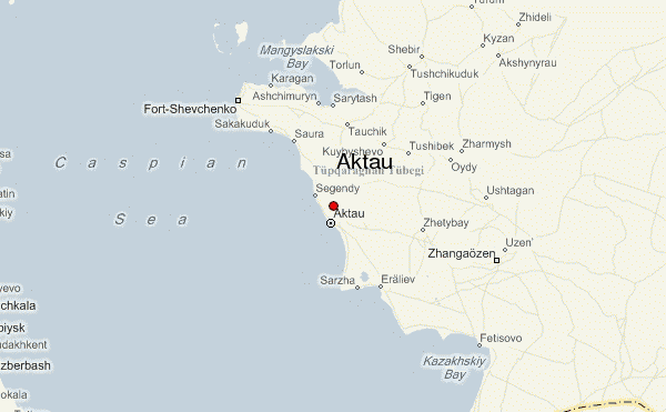
Next the alignment crosses over the Caspian Sea, and enters Kazakhstan at the port city of Aktau. There are developed uranium deposits in Aktau, as well as oil industry. As a matter of fact, the region is one of the biggest producers in the country and a major industry of the city is hydrocarbon production.
We are told that this area at one times was inhabited by ancient tribes of Scythians, and that this region of Western Khazakstan known as Mangistau hosted a spur route of the northern Silk Road.
The alignment crosses the Kyzyl-Kum desert in Central Asia, which occupies Kazakhstan, Turkmenistan and Uzbekhistan. It covers 115,000 square miles (298,000 km2).
Much of the desert is covered with sand dunes, and there are deposits of gold, uranium, copper, silver, natural gas and oil.
The Great Silk Road is considered to be one of the greatest achievements of in world civilization’s history, connecting Europe and Asia from the Mediterranean to China. The longest and most strategic part passed through this part of Central Asia.
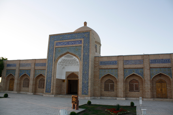
Bukhara Mausoleum
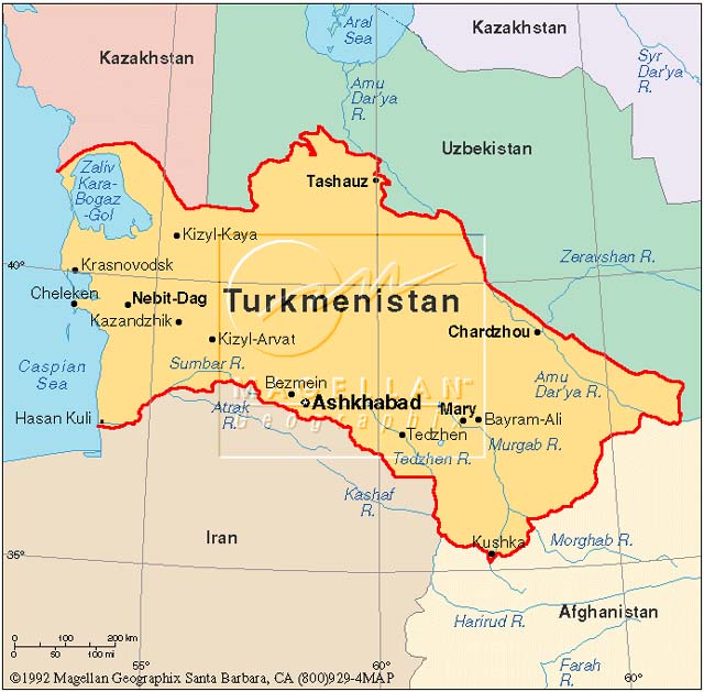
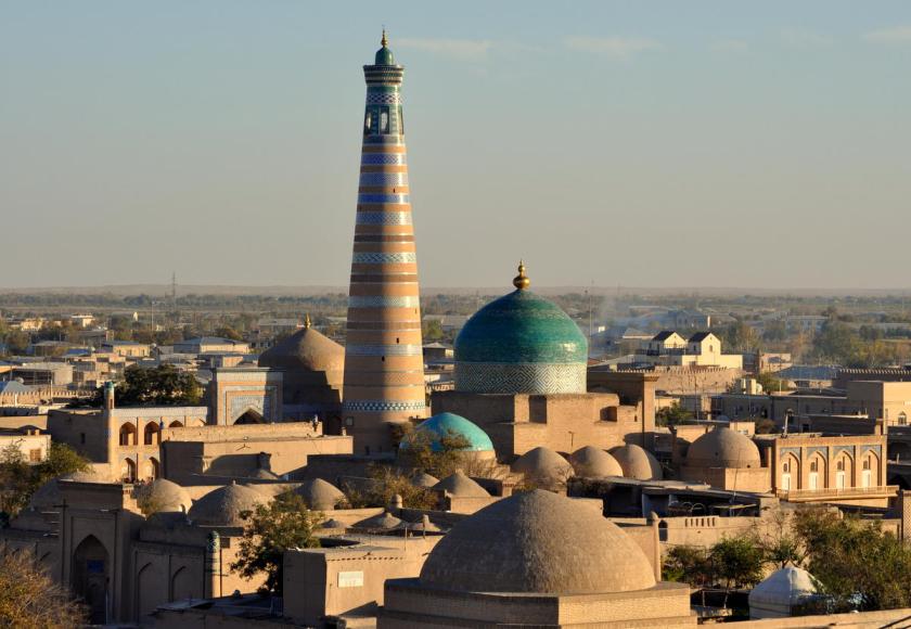
Next on the alignment is Tashauz (now known as Dasoguz), Turkmenistan, close to Usbekistan.
Tashauz was a popular stop on the Silk Road because of a spring located there.
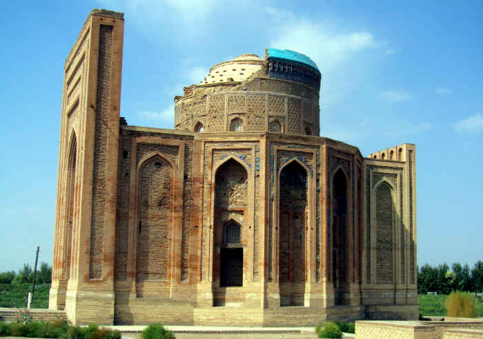
Nearby is Konye-Urgench , and is the site of an ancient town – Urgench – which contains the ruins of Khwarezm, which lies between the Kyzyl-Kum desert to the north, and the Karakum desert to the south. The Khwarezm region was a wealthy and beautiful civilization of the Persian Empire, and in our historical narrative is said to have been destroyed by Genghis Khan and his Mongol hordes.
Konye-Urgench (Khwarezm), TurkmenistanKonye-Urgench (Khwarezm), Turkmenistan
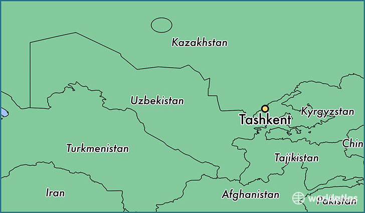
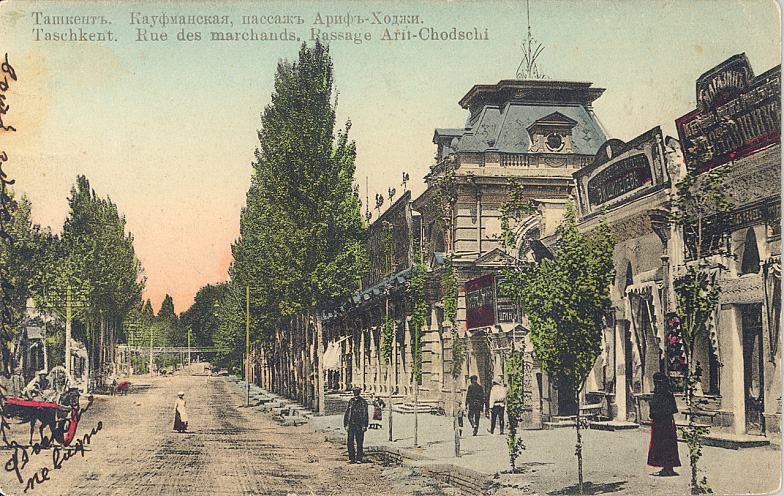
Next we come to Tashkent, Uzbekistan. Tashkent is the capital and largest city of Uzbekistan. It was also destroyed by Genghis Khan in the 1200s, but rebuilt and profited from the Silk Road. It has over 2,200 years of written history.
This area is in the foothills of the West Tian Shan Mountains. This region was called Chach in earlier times. By the 600s, the principality of Chach was said to have more than 30 towns and over 50 canals….
One of the top attractions of Tashkent is the Ankhor Canal:
And here is an older photo of Tashkent showing the same style of architecture that we keep seeing along this alignment…
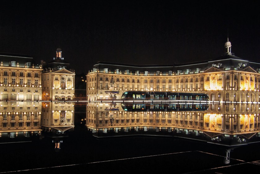
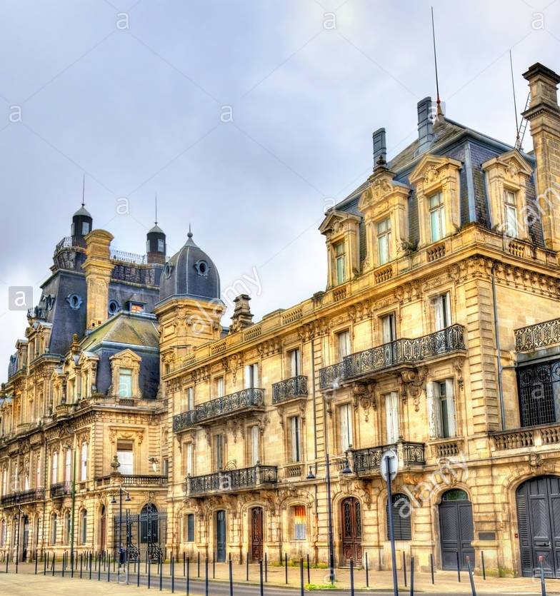
So far we are almost into China on this alignment, and you are seeing the same style of architecture in Tashkent, Uzbekistan that you saw where the alignment entered Europe in Bordeaux, France, and the distance separating these two cities on the map is 3,425 miles (5513 kms):
Bordeaux, France
There are also these familiar styles in Tashkent, like this one with a tower similar to one I showed you in Krasnodar Krai, Russia…
…and this massive building in Tashkent with heavy masonry, arches, columns and towers…
…and you also find this style of architecture is in Tashkent, which is more typical of what one would expect to find through this region:
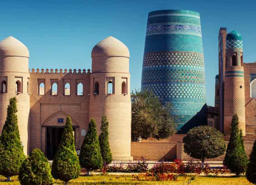
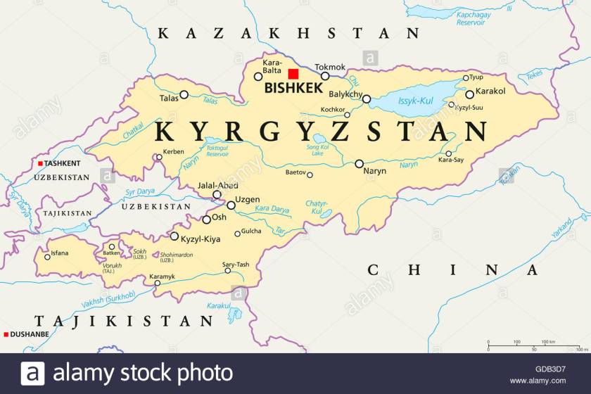
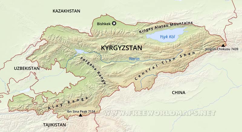
Okay, moving along the alignment to Bishkek, Kyrgyzstan. Bishkek is the capital and largest city of Kyrgyzstan.
It is described as originally a caravan rest stop on one of the branches of the Silk Road through the Tian Shan Range. The city itself is relatively young, since Bishkek was first established around 1825.
Here are some of the local sights around Bishkek:
The alignment continues along to Lake Issyk-kul in Kyrgyzstan. This lake is in the Northern Tian Shan mountains, and is the 10th largest lake in the world by volume. It is the second largest saline lake after the Caspian Sea. It is considered to be a sacred place by the Kyrgyz people.
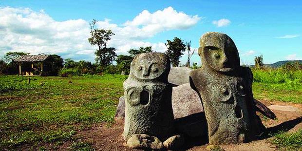
NearLake Issyk-Kul at a place called Cholpon Ata, you find numerous stone statues like this one…
…which are reminiscent of the ones on Sulawesi in Indonesia at the Lore Lindu National Park that I found on another alignment….
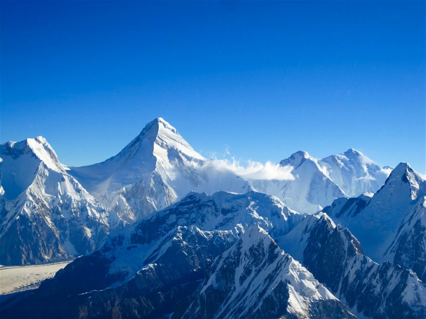
So I will end this post at Pik-Pobedy (also known as Jengish Chokusu) in Kyrgyztan, on the Chinese border in the and the highest mountain in the Tian Shan Mountains.
On the Chinese side, it goes into Wensu County of the Aksu Prefecture of the Xinjiang Uighur Autonomous Region – once part of the Ancient Uighur Empire.
Pik Pobedy = Jengish Chokusu
I will pick up this global alignment in Yumen City, China, in part 4 of this series.
I ended “How I Found the Silk Road, Part 1,” in Grenoble, France.
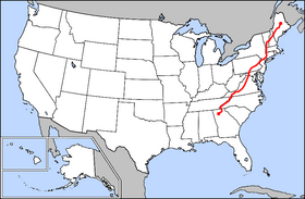
I started the journey along this particular planetary alignment in Montreal, Quebec, Canada, from where it goes through Maine, New Brunswick, Prince Edward Island, Newfoundland, and entering Europe at Bordeaux in France. It is a long alignment, and I will take you through the entire alignment in a series of posts. Part 1 gives you the background details of exactly how I came into this awareness of this particular planetary grid-line, as well as many others, and who I believe was responsible for building everything.
I will pick up this alignment in Milan, Italy. Milan is the second largest city population-wise in Italy after Rome, and the capital of the region of Lombardy in Northern Italy. The metropolitan area of Milan is the largest in Italy. According to our historical narrative, it was the capital of the Western Roman Empire from 286 to 402 AD.
Throughout my posts, I am going to be comparing architectural styles between different places, because I see the same signature, the same hand of design, all over the world. It forms the basis of what I believe, and is why I am putting a lot of energy into getting this information back out into the collective awareness through blog posts and videos of the posts. Our historical narrative does not hold up under scrutiny. It really doesn’t. I believe there was a global, unified, harmonious Ancient Moorish Empire – with roots before and after the fall of Atlantis – that existed well into modern times.
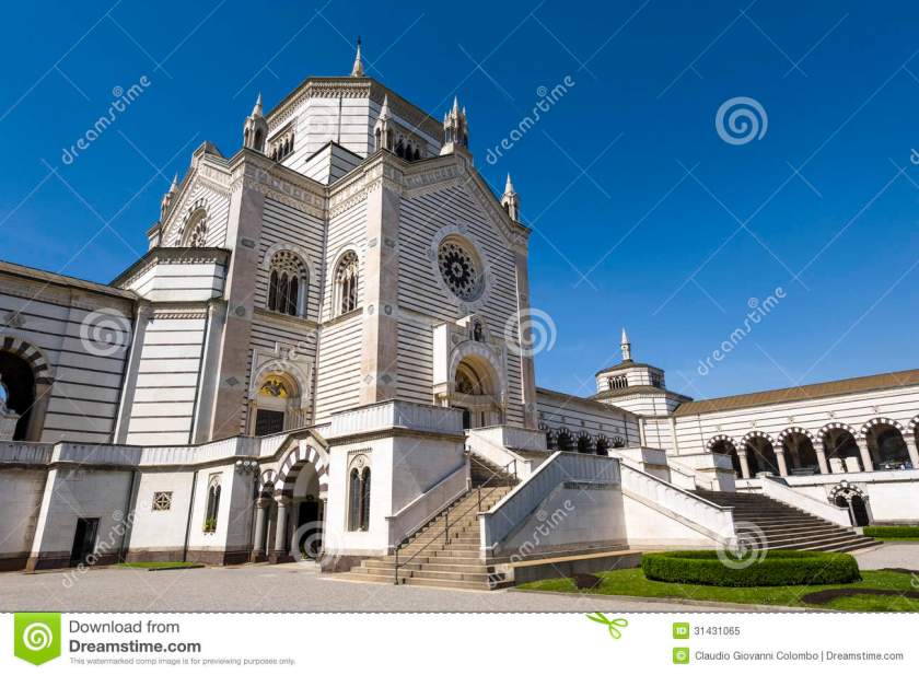
For example, the top photo is architecture at one of the two largest cemeteries in Milan, which is said to have been established in 1866. The bottom photo is of the Tokyo Camii Mosque in Tokyo, Japan, said to have been built in the 1930s. In particular, notice the design of the arches in both photos.
The Cimitero in Milan, ItalyTokyo Camii Mosque in Japan
Here’s another example of similar architecture, the top photo being taken in Milan, Italy, and the middle in Grenoble, France, and the bottom, Casablanca, Morocco.
Milan, ItalyGrenoble, FranceCasablanca, Morocco
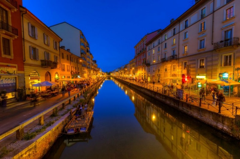
Here is a comparison of a canal in the Navigli of Milan on the top, with Venice, Italy on the bottom. You knew about the canals in Milan, right? Well, these two places are only 157 air miles (253 km) apart. There must be a logical reason in our history as to the likeness.
Canal of Milan, ItalyCanal of Venice, Italy
Oh, by the way, check this out – here is a canal in St. Petersburg (Leningrad), Russia:
St. Petersburg (Leningrad), Russia
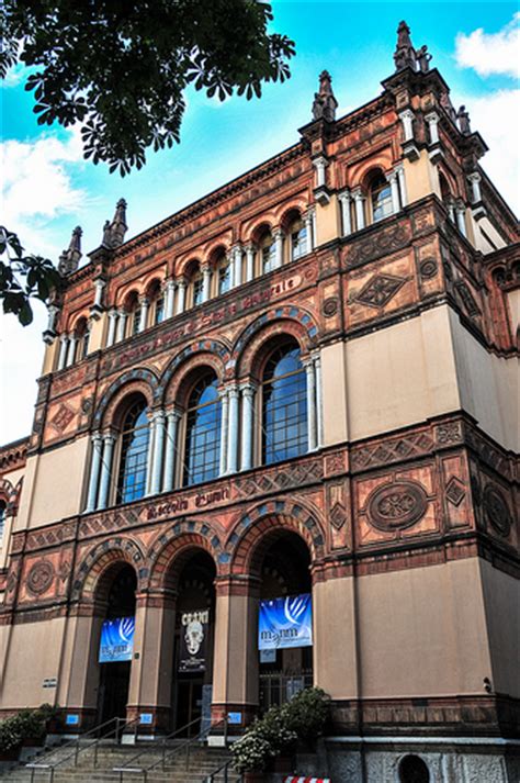
How about this comparison of the architectural design of the Natural History Museum in Milan, Italy on the top and on the bottom, the Victoria & Albert Museum in London, England?
Natural History Museum, Milan, ItalyVictoria & Albert Museum, London, England
Okay, I will move on now. Next stop on the alignment is Verona, Italy in the Veneto region. Verona is one of the top tourist destinations in northern Italy. Two of Shakespeare’s plays are set in Verona – one is “Romeo and Juliet,” and the other is “The Two Gentleman of Verona.” It has also been designated a UNESCO World Heritage Site.
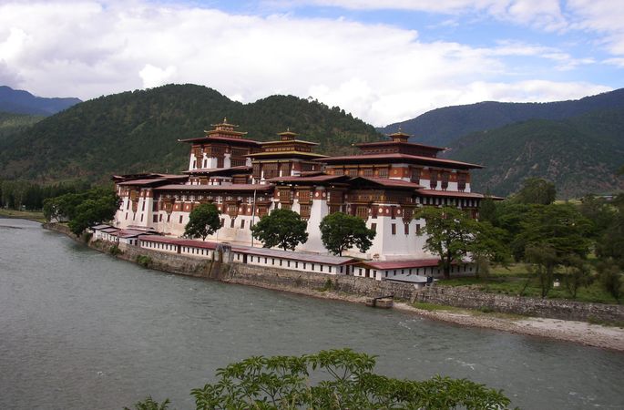
So the top picture of the Madonna della Corona Church near Verona, Italy immediately brought to mind the Tiger’s Nest Monastery in Bhutan pictured on the bottom.
Madonna della Corona Church near VeronaTiger’s Nest Monastery, Bhutan
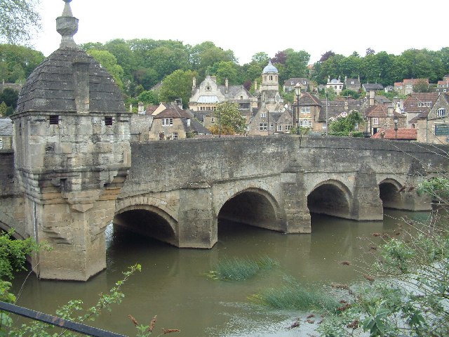
And this picture on top of the bridge crossing the Adige River in Verona reminded me of the bottom picture of the bridge crossing the River Avon in Bradford-on-Avon, England:
Bridge crossing the Adige River in Verona, ItalyBridge Crossing the River Avon in Bradford-on-Avon, England
Moving on to Venice on the alignment.
Venice is in northeastern Italy, and is the capital of the region of Veneto. It is situated across a group of 118 islands, separated by canals, and linked by 400 bridges. The islands are located in the shallow Venetian Lagoon in a bay that lies between the Po and Piave Rivers. Venice is also listed as a UNESCO World Heritage Site.
The architectural style of Venice is called Venetian Gothic, which is described as a combination of the use of the Gothic Lancet Arch with Byzantine and Moorish influences.
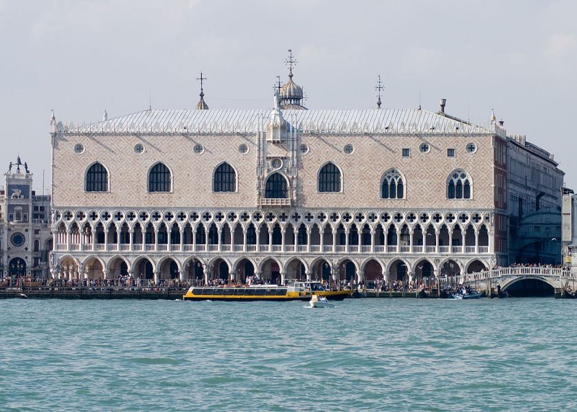
Compare the Doge’s Palace in Venice, Italy…
Doge’s Palace
…to this building in Casablanca, Morocco.
There is a lot that could be said about Venice in our historical narrative. I am going to skip it because I believe we are talking about a Moorish history that is not even acknowledged. The only European History Moors are given credit for is 700 years in Spain. The truth is the Moors were all over, and ruled, Europe, and knowledge of that was deliberately removed from our awareness. I am not saying that without foundation. This blog is dedicated to providing compelling evidence to support that statement. I go into more depth on this issue in previous posts, including one called “The Whitewash of Europe”.
Venice Moors
I will say that Marco Polo was a Venetian merchant and explorer, is said to have been born in 1254, and he dictated a book while he was in prison in 1299 detailing a 15,000 mile, 24-year trip to Asia. I believe he travelled east on this alignment. He did travel on the Silk Road, and I found myself there as well as I followed this alignment. History has been so white-washed, who knows what he really looked like, but here is one historical image of him.
Marco Polo
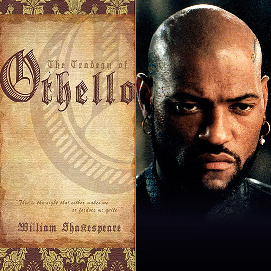
The other thing I would like to bring up is Shakespeare’s play “Othello.” Now there is a lot about who really wrote Shakespeare’s plays to delve into, but that is not the scope of this blog. But for the purposes of what I am trying to say, whoever Shakespeare was, he wrote an entire play about a Moorish general in the Venetian Army. The play is believed to have been written in 1603, and based on a book published in 1565 by an Italian named Cinthio.
According to our historical narrative, the Moors were expelled from Spain after the Fall of Grenada in 1492. What historical significance could there be to Shakespeare writing a play over one hundred years later about a Moorish general in Venice? I don’t have an answer to that question. I just found a major planetary grid-line that goes right through there in an alignment that goes around the world.
Next on the alignment is Trieste, Italy, which is a seaport in northeastern Italy located on a narrow strip of Italian Territory lying between the Adriatic Sea and near the border with Slovenia. It is also located near Croatia, which is 19 miles south.
I just found out in looking through photos that it is also a city of canals:
And this photo taken next to the Grand Canal in Trieste …
…reminded me of this one in my last post taken in Bordeaux, France – 872 miles (1,403 kms) due west across Italy and France to the far west coast of France on the border with Spain:
The Place de la Bourse, Bordeaux, and the Water Mirror
This is the Place de la Bourse, and is part of the Port of the Moon in Bordeaux, France, and the building you see is said to be over 300 years old. The Water Mirror in front is said to be only 10 years old.
Keep in mind that the Moors were always about uniting heaven and earth in all they did. Even if the Water Mirror is actually only 10 years old, it would not surprise me to find out that the technology for creating it pre-existed and was already in place from previous centuries.
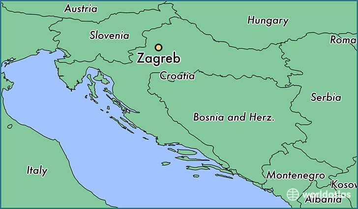
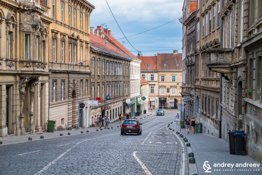
Moving on to Zagreb, Croatia from Trieste. Zagreb is the capital and largest city of Croatia.
It is situated on the Sava River on the south slopes of Medvednica Mountain (also known as Sljeme).
Medvednica Mountain (Sljeme)
The next series of photos is to show you a direct comparison of the similarities of a street view in Zagreb on the top, with one in Bradford-on-Avon, England in the middle: and Edinburg, Scotland on the bottom.
Zagreb, CroatiaBradford-on-Avon, EnglandEdinburgh, Scotland
The next is a comparison of the architectural similarities of Prigorje Museum in Zagreb, Croatia, with a museum in Prague in the Czech Republic.
Zagreb, CroatiaPrague, the Czech Republic
Next, on to Belgrade in Serbia. Belgrade is the capital of Serbia, and became the capital of Yugoslavia when it was created in 1918. It is located at the confluence of the Sava and Danube Rivers, and is considered to be one of the oldest cities in Europe.
This is the capital building in Belgrade.
Capitol Building in Belgrade, Serbia
It certainly has similar design features the capital buildings in the United States, like the one shown here in Colorado. I will do a future post on domed-buildings around the world and make direct comparisons of them from one end of the earth to the other.
Colorado State Capital Building
Please note the similarities between architectural styles shown here in these two photos, with Belgrade, Serbia on the top, and Bordeaux, France on the bottom.
Belgrade, SerbiaBordeaux, France
Remember on a map, the relative positions of Bordeaux and Belgrade in Europe, with the top map showing the location of Bordeaux in France, and the bottom map is of Europe, with Belgrade 1,252 miles (2,015 kms) due east of Bordeaux, close to the middle of the map.
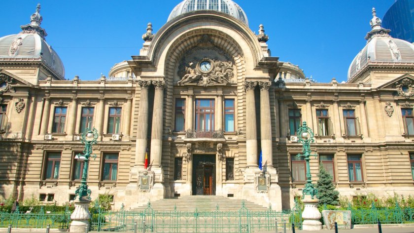
On to Bucharest Romania, which was called the “Little Paris of the East” at one time, is situated at a crossroads between central, eastern, and southeastern Europe.
Well, I think there is quite a bit of interest in Romania from an Ancient technology standpoint.
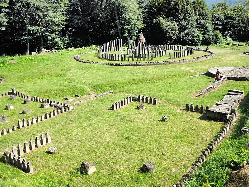
First, there is Sarmizegetusa Regia, former capital of the Dacian Kingdom…
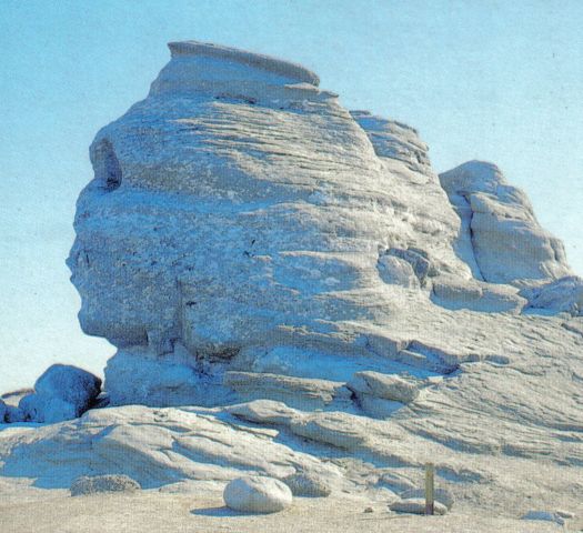
…and a lot of ancient high tech stuff associated with the Romanian Sphinx in the Bucegi Mountains. I recommend reading the book “Transylvanian Sunrise” by Radu Cinamar if you are interested in learning more about this.
But getting back to the main theme of this post, the architecture you see in Bucharest, well into eastern Europe, is pretty much the same as what you see everywhere else in Europe – elaborate domes, ornate decoration, heavy masonry, and similar street lay-out.
I will end this post here in Bucharest, and in Part 3 will pick up the alignment at Yalta/Sevastopol, Crimea, where, on a historical note, the Treaty ending World War II was signed.
I am going to share a fascinating global alignment with you in a series of posts. It’s a really long alignment, and I have many interesting things to share with you as I result of what I found along the way.
The particular alignment that the Silk Road is on emanates off of one side of the North American Star Tetrahedron – the line of cities between Santa Rosalia, Baja California and Montreal, Quebec, Canada – and as I remember, it is the first one I tracked around the world.
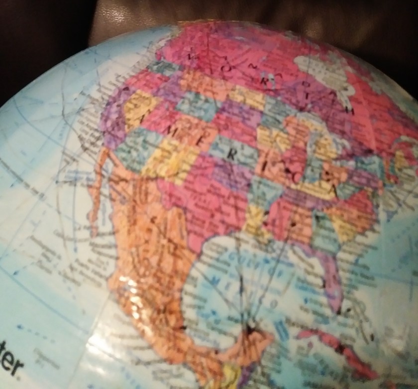
One of my travel buddies gave me a flat map of the world in early 2015 – she thought I needed it. So, it just sat there on my dining room table where I studied it for quite some time while eating before I started noticing major cities lining up in lines in North America, and then in 2016 I found a familiar figure of sacred geometry when I literally started connecting them. I believe it is the terminus/key of a worldwide grid.
Once I found the star tetrahedron, I extended the lines out, and eventually switched to a globe. I used a magnifying glass and wrote down the cities that lined up primarily in a circular fashion. And I got an amazing tour of the world of places I had never heard of with remarkable similarities across countries.
I am going to start at the top of the side of this tetrahedron, at Montreal for this post because it is where I started my journey of connecting the cities I found that lined up along the way. And indeed this process brought me around the world to the bottom of the alignment at Santa Rosalia in Baja California.
If you are familiar with my work, you will know that as I followed the planetary alignments that emanate off of the North American Star Tetrahedron, I saw the same signature, same hand of design, all over the planet. I believe this was the hand of a global and unified Moorish Empire, and that we have been given a false historical narrative that was grafted onto what they built. I will be showing you what I am seeing.
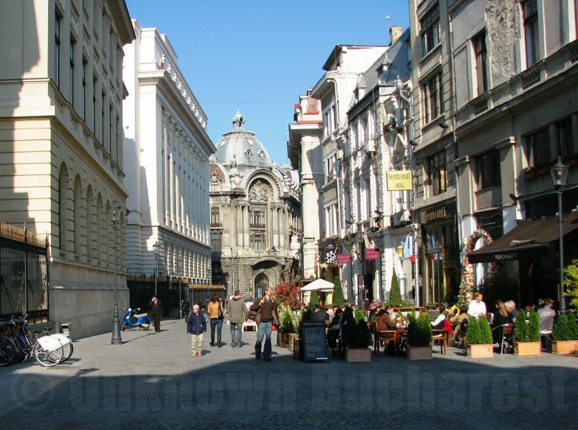
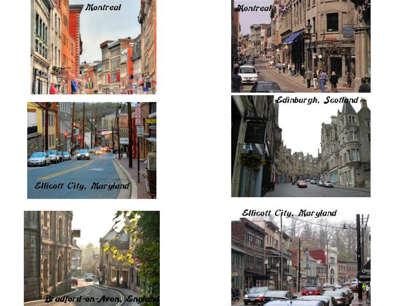
You will see the same architectural styling as you see here in Historic Montreal that you see in other places, like the ones shown below in Ellicott City, Maryland; Edinburgh, Scotland; and Bradford-on-Avon, England – the same stone workmanship, steep, and curvy, streets. I know I can find many other examples. How could there be such striking similarities across centuries, continents and countries?
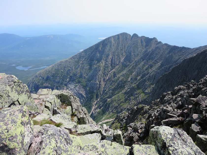
So this next place I just found in the course of researching information for this post. On my original spreadsheet I skipped over anything in Maine because it crossed through northern Maine where there weren’t any cities. So I didn’t write anything down. However, it does cross over something noteworthy: Mt. Katahdin in Maine’s Baxter State Park. Ever heard of it? Me neither. Mt. Katahdin.
It is the highest mountain in Maine, and is the northern terminus of the Appalachian Trail, which goes down through the Appalachian Mountains to Springer Mountain in Georgia.
Note the rectangular-looking rock with straight edges in the foreground….
Mount Katahdin, Baxter State Park, Maine
The alignment then goes on to Fredericton, New Brunswick.
Fredericton is the capital of New Brunswick, and the third largest city in the province.
It is situated on the Saint John River, which flows through it west to east.
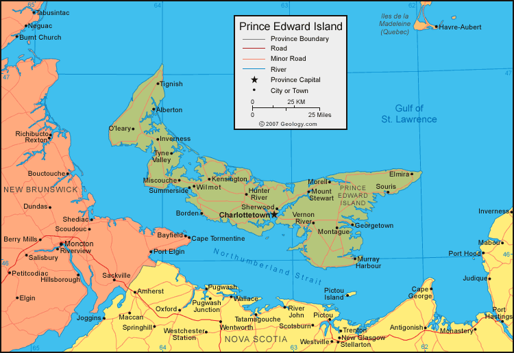
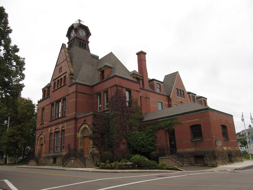
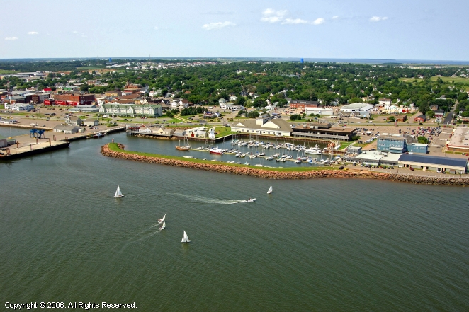
Next we come to Prince Edward Island, Canada’s smallest province, where it goes through Summerside and Kensington. Summerside is the second largest city on Prince Edward island.
Summerside, Prince Edward Island
Further on up the alignment on Prince Edward Island, here are examples of Kensington Architecture:
From Prince Edward Island, the alignment goes through Newfoundland, entering at Channel-Port aux Basques.
Channel-Port aux Basques is on the extreme southwestern tip of Newfoundland, and has a Marine Ferry Terminal and is the primary entry point into Newfoundland. It is also the western terminus of the Trans-Canada Highway in the province.
The alignment exits Newfoundland at Terra Nova National Park, which is Canada’s most easterly national park.
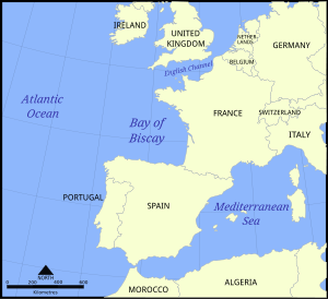
After the alignment leaves Newfoundland, it traverses the Atlantic Ocean – Between Iceland and the Azores – and enters Europe, crossing the Bay of Biscay into Bordeaux, France.
The Bay of Biscay is a gulf in the Northeast Atlantic that lies along the coast of Western France and the northern coast of Spain. Just for point of information, Basque districts lie along the Bay (referencing Port aux Basques in Newfoundland), including Bilbao, the capital of the Basque Country in Spain, and Biscay was the name for Basque up until the early 19th century. Also the Gulf Stream enters the Bay following the continental shelf’s border counterclockwise, keeping the temperature moderate.
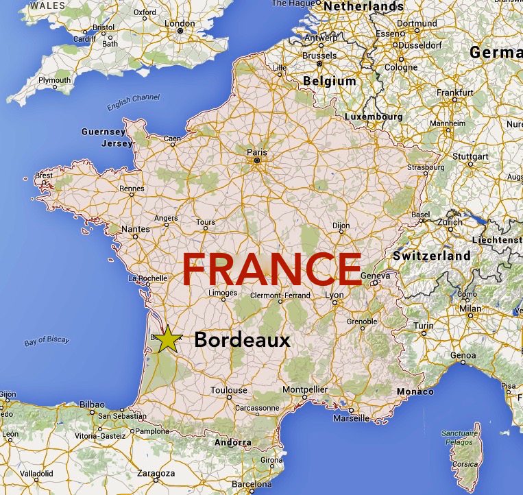
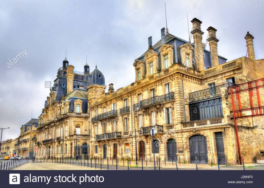
Bordeaux is the capital of the Nouvelle-Aquitaine region of France, and a port city, known as the Port of the Moon.
Bordeaux is the world’s major wine industry capital. Also, the historic part of the city is on the UNESCO World Heritage list for what is called “an outstanding urban and architectural ensemble of the 18th century.” After Paris, Bordeaux has the highest number of preserved historical buildings in France.
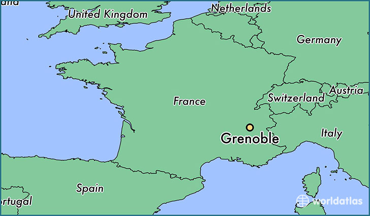
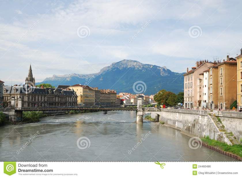
From Bordeaux, the next major city on this alignment is Grenoble, France, which is at the foot of the French Alps, where the River Drac joins the River Isere.
Grenoble is said to have over a 2,000 year history, starting out as a small Gallic village. It was the host of the Winter Olympic games in 1968. Now it is one one Europe’s most important research, technology and innovation centers:
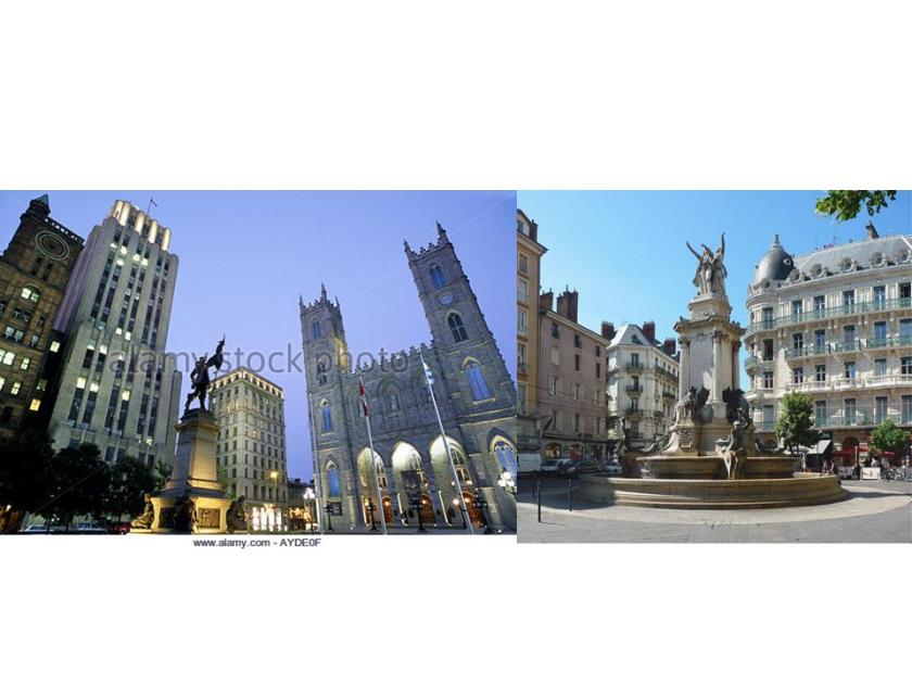
Some comparisons of what I am seeing so far. So first is this comparison of Montreal and Grenoble. I know it is not an exact match with regards to architecture, but has a similar lay-out and fountain design, and when I saw the photo of Grenoble on the right, it reminded me immediately of this one on the left in historic Montreal:
And here is a direct comparison between photos, the one on top taken in Bordeaux, France and on the bottom, Grenoble, France. In addition to the lay-out and architectural style of the buildings, please note the similarity of what is going on with the domed shapes (and rods?) in both pictures.
Okay, well maybe, but any thoughts on the similarities between the street corner in Madrid on the left, and the street corner in New York City on the right?
One more thing I want to show you before I leave Grenoble, France.
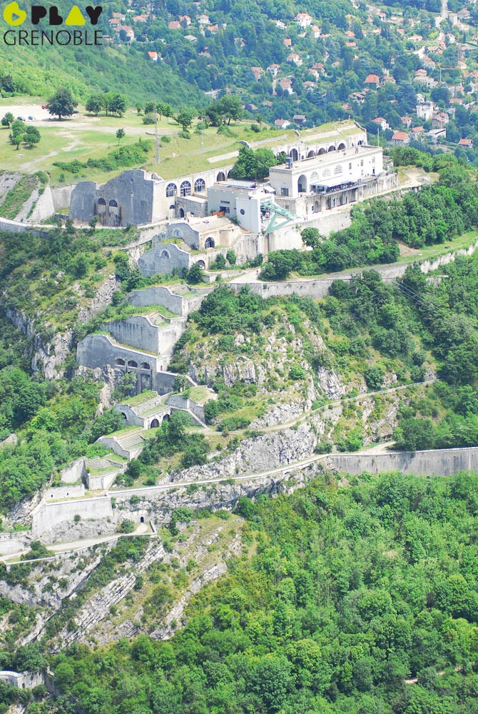
These are photos of the Fort de la Bastille in Grenoble:
With its massive stone work from top to bottom of this photograph…
…and sitting on what looks like a massive sheer outcrop of stone.
It was said to have been completed in 1592 after a Huguenot leader had taken control of Grenoble.
This leads to two issues. One is this: Based on the history we have been taught, what building technology existed in the late 1500s that was capable of building a sophisticated fortification like this?
The second issue is about the Huguenots. On my dad’s side of the family, the only oral history that passed down about our ancestors is that they were Huguenots. No details.
So I started looking up information about the Huguenots in encyclopedias when I was young. Up until the Internet Age, the only information available on them is that they were perscecuted and massacred reformed Calvinists that were run out of France.
Of particular note were the French Wars of Religion starting with the Massacre of Vassay in March of 1562 to April of 1598, ultimately taking an estimated 3 million lives. Over a couple of centuries, most of them ended up leaving France.
With the advent of the Internet Age, there is more explanation available to find about who the Huguenots actually were. I find it very credible to discover that the Huguenots were Cathars and Moors, especially in light of all of the genocide that took place against these people, not only here but around the world. This makes more sense to me than the French King and Catholic Church being hell-bent to annihilate Reformed Calvinists.
I will end this post here, and continue on to Milan, Italy on the alignment in Part 2.
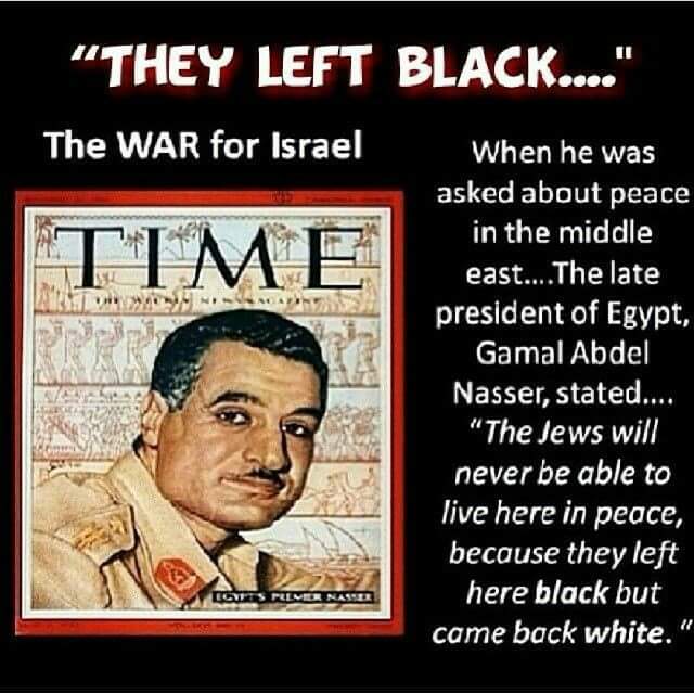
Gamel Abdel Nasser, late president of Egypt, famously made the comment that the Jews left the middle east black, and came back white. Why would he say that?
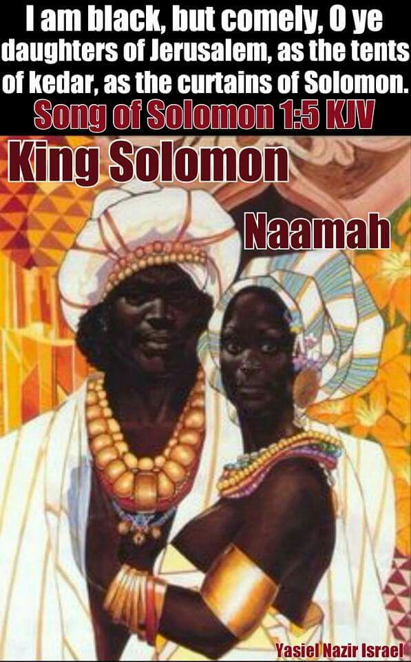
There are references to the actual skin color of the Israelites in the Bible that contradict what we have been taught by historical whitewash. Here are some examples.
And as for Moses, in Exodus 4: 6-7, God is showing Moses miracles so he can prove to the children of Israel who sent him. He is told to put this hand into his bosom. When he takes his hand out, it is leprous (white) as snow. If Moses was already white-skinned, what would have been the miracle in turning the skin of his hand white?
The Tribes of Israel weren’t lost in the manner we have been taught. I have recently come to realize that the suppressed story of the civilization of the Moors/Washitaw Muurs/Hebrew Israelites is the template the globalist elite have hijacked for their plans to control Humanity and destroy western civilization in the present day and replace it with their version of a New World Order. I am also going to say that while unfortunately the globalists are far along in the implementation of their plans because they have been working at it for a very long time, I believe that conditions are very much in place for a new positive timeline for humanity. The globalist plans have been interrupted.
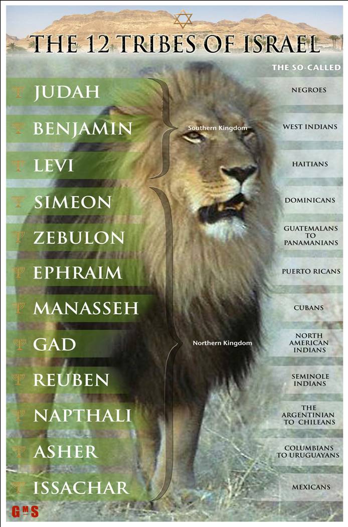
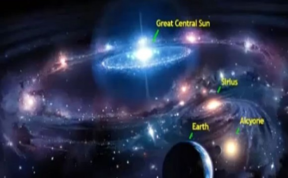
The identities of the True Israelites, the 12 tribes of the Great Central Sun, the Children of Is-ra-el – Mother – Father God – were replaced with a false identity and hidden away, and many were relegated to an existence of slavery, degradation and marginalization, if they weren’t killed.
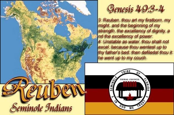
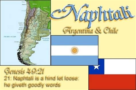
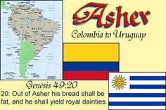
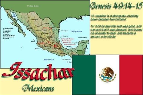
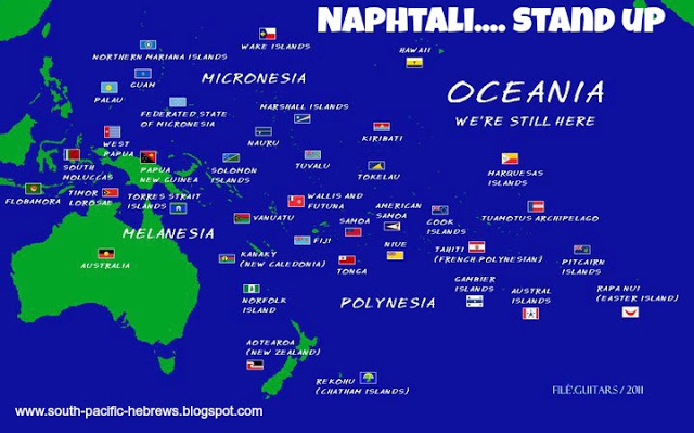
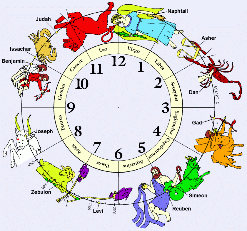
Here are peoples/countries identified as the 12 Tribes of Israel in the Americas:
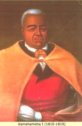
At first I was puzzled by seeing references to the twelve tribes in different places besides the ones shown above. The Tribe of Naphtali in the South Pacific:
Hawaiian King Kamehameha I:
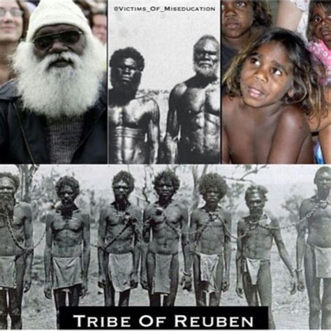
The Tribe of Reuben in Australia:
The Tribe of Zebulon as the Pathans in Pakistan/Afghanistan:
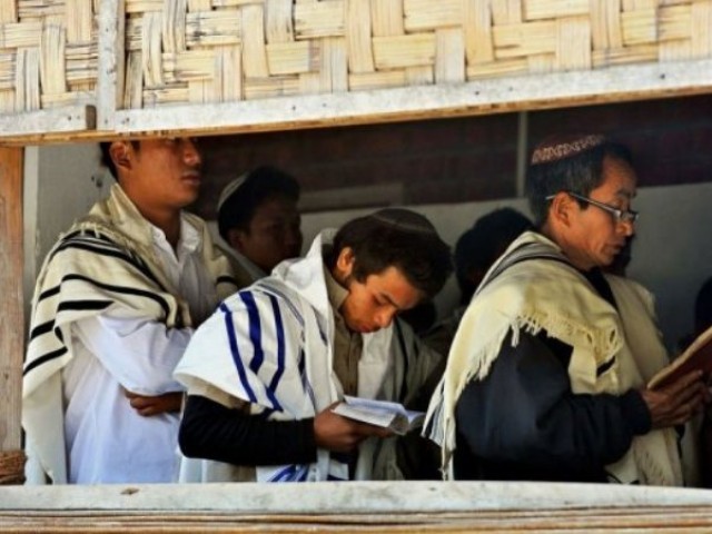
The Kuki of India say they are the Tribe of Manasseh:
And on Madagascar, there is a resurgence of what they say the original religious faith of the island:
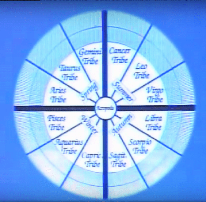
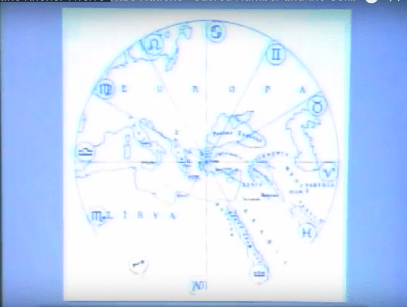
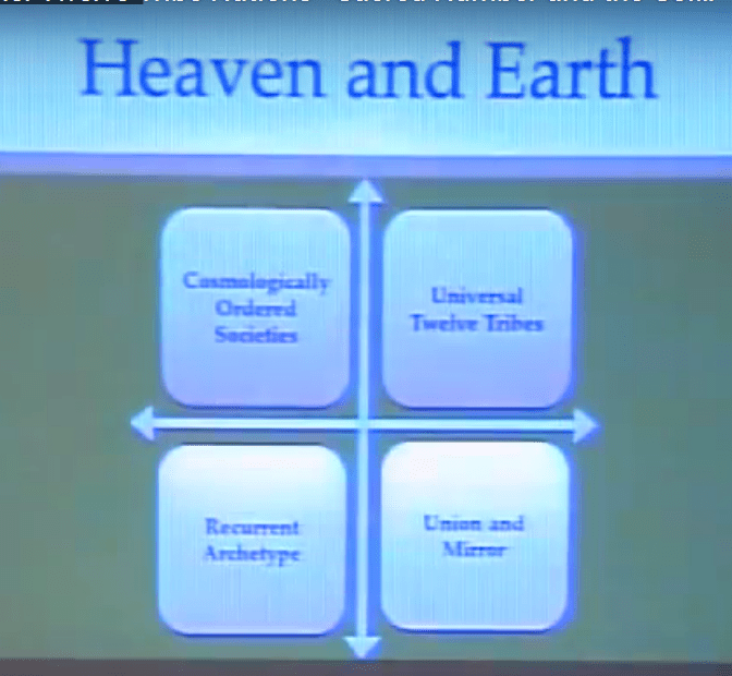
I think a good explanation of this finding of the same tribal name in different parts of the world is contained in a Megalithomania presentation by Christine Rhone on “Twelve Tribe Nations – Sacred Number and the Golden Age.”
She co-authored a book with John Michel called: “Twelve Tribe Nations – Sacred Number and the Golden Age.” Among other things, they followed the Apollo – St. Michael alignment across countries and continents all the way to Jerusalem in Israel. They discuss records and traditions of whole nations being divided into twelve tribes and twelve regions, each corresponding to one of the twelve signs of the zodiac and to one of the twelve months of the year. All formed around a sacred center.
It stands to reason that these people would apply to the same concepts of Harmony, Balance, Beauty, Sacred Geometry, and aligning heaven and earth, to building their communities and themselves that they applied to building all of the infrastructure of the planet.
So what if we are talking about an arrangement like what you see pictured below occurring in a flower of life pattern, from macro to micro, covering the surface of the Earth?
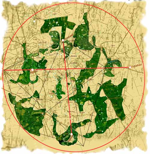
Researchers have looked into zodiacs that have been revealed in features in the landscape, like the Glastonbury Zodiac in England:
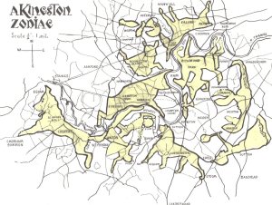
and the Kingston landscape Zodiac in Surrey, England:
I recently realized that earth’s true history was never, ever about organized religions, which was a stumbling block for me because of what we have been taught. Organized religions came with the hijack of the timeline as a control mechanism for Humanity.
I believe the Twelve Tribes of Is-Ra-El on Earth are directly connected to the Twelve Tribes of the Great Central Sun. They are the Children of Is-Ra-El, Mother/Father God, God/Goddess, and not the organized religion we have come to associate with them today. It is not a formal religion, as we have come to know Judaism. Hebrew is a language of Light – sounds of Light – along with Egyptian, Tibetan, Sanskrit, and Chinese. All of which are part of the same advanced Ancient Global Civilization, which was of Light and High Vibration.
Last thoughts on this subject before I am complete with this post.
The name Tabor is ascribed to one mountain and three towns in the Bible. Tabor the mountain is situated on the border of Naphtali, Zebulun, and Issachar, southwest of the sea of Galilee. Towns and places with Tabor in the name are:
Mt. Tabor, Israel
Mt. Tabor, Oregon
Tabor, Siberia
Tabor, Czech Republic
Tabor City, North Carolina
Tabor, Minnesota
Mt. Tabor, Arkansas
So, for another example, Arkansas has many place-names of Biblical significance. Nearly every county there has several settlements with Biblical names. Most of the Tribes were mentioned e.g. Naphtali, Zebulon, Issachar, Gad, Judah, Asher, Dan, Ephraim, Manasseh, and Benjamin.
Ah, you may say, just places named after the places in the Bible, along the lines we have been taught about our history, or just random coincidence.
I am saying that there more than likely is another explanation, where the memory of the people and the significance of the place remains in the name.
So obviously I can’t definitively prove what I am saying. The True History is gone from the historical record and not available to access in a conventional way. I can only provide circumstantial evidence that I have put together that is out there if you start looking for it.
This is a continuation from parts 1 & 2 of the post involving how I first heard of Novaya Zemlya, by following a major alignment emanating off of the North American Star Tetrahedron. The last part ended at the Qaidam Basin in China.
From there, the alignment crosses Kunlun Shan, one of the longest mountain ranges in Asia, and forms the northern edge of the Tibetan Plateau south of the Tarim Basin in China.
Kunlun is the name of a mythical mountain believed to be a mountain paradise, and the Kunlun Mountains are described as the location of the Shangra-La Monastery in the 1933 novel “Lost Horizon” by James Hilton.
Moving along down the alignment, next comes Lhasa, Tibet, currently the capital of the Tibetan Autonomous Region since 1965, it has at least a 1,400 year history (that we are told about) when the capital was moved, originally in 633 AD, by Tsampo Songtsan Gambo from Yalung. In the 1600s, the 5th Dalai Lama is said to have built the Potala Palace. The current Dalai Lama, Tenzin Gyatso, is the 14th reincarnation of the same lifestream – Avalokiteshvara, the Boddhisattva of Compassion.
Thimphu is next, the capital and largest city of the Kingdom of Bhutan. It is situated in the constricted, linear valley of the Raidak River, a tributary of the Brahmaputra River. Otherwise, this is a land-locked country in the Himalayas.
Then it connects to the Brahmaputra River, one of the major rivers of Asia. It is a sacred River, considered to be the Son of Brahma, and has a male name, unlike most rivers in India.
Brahmaputra River in Bhutan
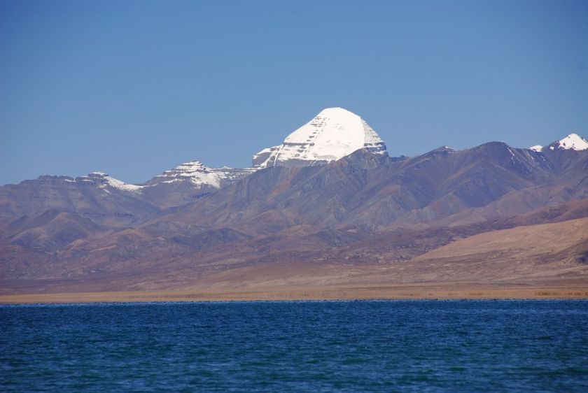
Its origin is Lake Manasarovar (means “Mind Lake”), located in Tibet, the most sacred, and highest, freshwater lake in the world.
Lake Manasarovar in Tibet
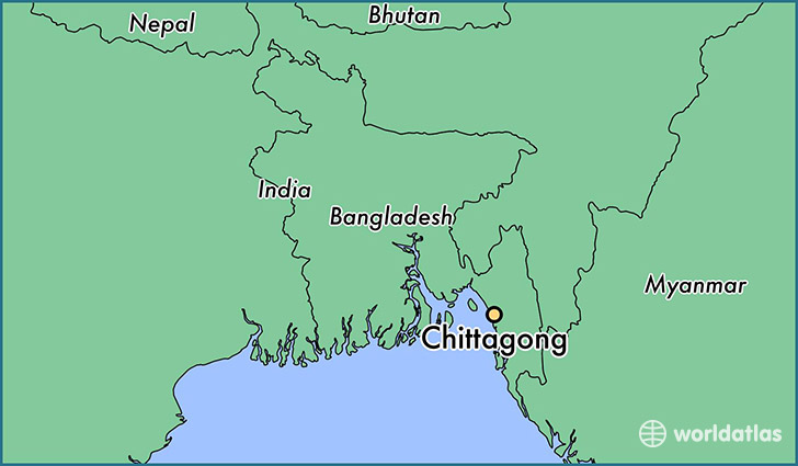
Chittagong is a major coastal and financial center in southeastern Bangladesh. It is located on the banks of the Karnaphuli River…
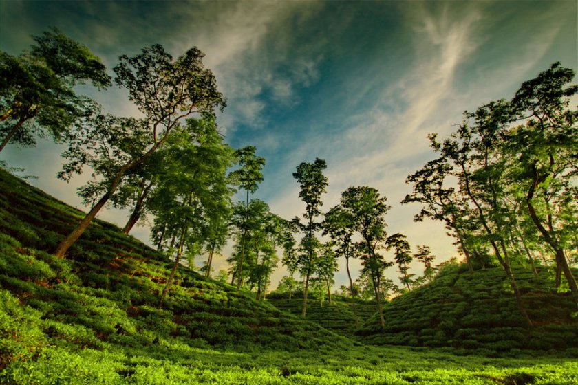
…between the Chittagong Hill Tracts…
Chittagong Hill Tracts
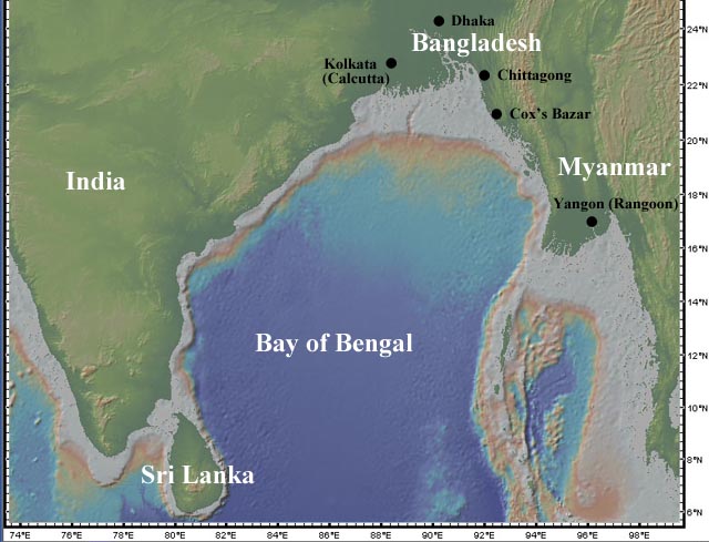
…and the Bay of Bengal.
Bay of Bengal
Cox’s Bazar is on the alignment, so let’s see what comes up for that location. The beach at Cox’s Bazar is sandy and has a gentle slope, and is the longest natural sea beach in the world at 75 miles. Previously to that it was known as Panowa, said to mean Yellow Flower. The modern name derived from the last name of a British East India Company officer who died in 1799. A market was established there which was named after him. Now it is one of the most visited tourist destinations in Bangladesh.
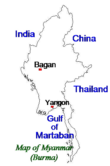
Now on to Sittwe (formerly Akyab) in Myanmar (known previously as Burma). Sittwe is the capital of Rakhine State. It is a port city on the Bay of Bengal and is situated on an estuary island at the confluence of the Kaladan, Myur, and Lemyo Rivers.
The Gulf of Martaban is an inlet of the Andaman Sea, and a part of the Indian Ocean. It has a tide-dominated coastline, with tides ranging between 4 – 7 meters at the highest tidal range at Elephant Point in the western part of the gulf.
The alignment that comes to Banda Aceh, Indonesia, which suffered extensive damage as a result of the 2004 Boxing Day Tsunami, which is believed to be the deadliest tsunami in history, killing more than 230,000 people in 14 countries.
It is the capital and largest city of the province of Aceh on the Island of Sumatra. It has long been a strategic transportation trading hub in the East Indian Ocean. Its first mention in western accounts were from Marco Polo’s expedition in 1292. He referred to the city as Lambri, from the Lamuri Kingdom which had previously existed there. Hmmmm, sounds a lot like Lemuri(a) doesn’t it?
On to the Andaman Sea, which is a marginal sea of the Eastern Indian Ocean, separated from the Bay of Bengal by the Andaman and Nicobar Islands, and touching Myanmar, Thailand, and the Malay Peninsula. I want to reiterate something very important to understand what you are seeing in the photo on the right. We have been taught by historical omission to believe that all stone formations are natural occurrences, formed from geologic processes. The Ancient Ones were Master Builders, and I think there is another explanation for the massive stonework that you see in all the photos I am sharing that we have not been told about, and that this actually represents Humanity’s highest potential as Spirit in Biological Form.
Next is Siberut, the largest of the Mentawai Islands.
These Islands lie 150 kms west of the island of Sumatra. Siberut is the most important home for the Mentawai people. Also known for biodiversity of plant and animal species, as the Mentawai Islands have been separated from the Sunda Mainland since the mid Pleistocene Era. While the islands were impacted by the 2004 Boxing Day earthquake and tsunami, there was no known loss of human life.
Next is the Sunda Strait, which is located between the islands of Java and Sumatra, and connects the Java Sea to the Indian Ocean.
????????????????????????????????????
There are a couple of noteworthy tidbits about this location. One is that the island of Krakatoa is located here. Krakatoa is a volcanic island that exploded in a major eruption in 1883 with global effects. It was one of the deadliest and most destructive volcanic events in recorded history. It destroyed most of the island, affected the region with pyroclastic flows and volcanic ash. Global after-effects included tsunamis and climactic changes involving a cooling of temperatures over the next few years.
The other is that there was a World War II naval battle that took place here in 1942. This was not the only battle that took place on a grid-line during the second World War. There were actually gobs of them that did, not only in that particular war, but many others. I will be doing future blog posts on how modern history reads like a book on the planetary grid lines.
Next, we come to Christmas Island which is an Australian External Territory. It currently has a small population. It was named as the result of a first sighting by a captain of the British East India Company on Christmas Day in 1643.
There are many caves on the island. It is also well known for its biological diversity as a result of its isolated location.
Note: There is another Christmas Island in the Line Islands of Kiribati, on another alignment, upon which H-bomb tests were conducted by the British in 1957 & 1958.
Back to the alignment at hand, the next place is Coral Bay, Australia. It is a small town on the coast of Western Australia, north of Perth. The coral starts right at the water’s edge. Its main industries are tourism and fishing.
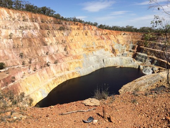
The next location is Peak Hill in the Gibson Desert. This particular place comes up on more than one alignment. It is the site of a large gold field.
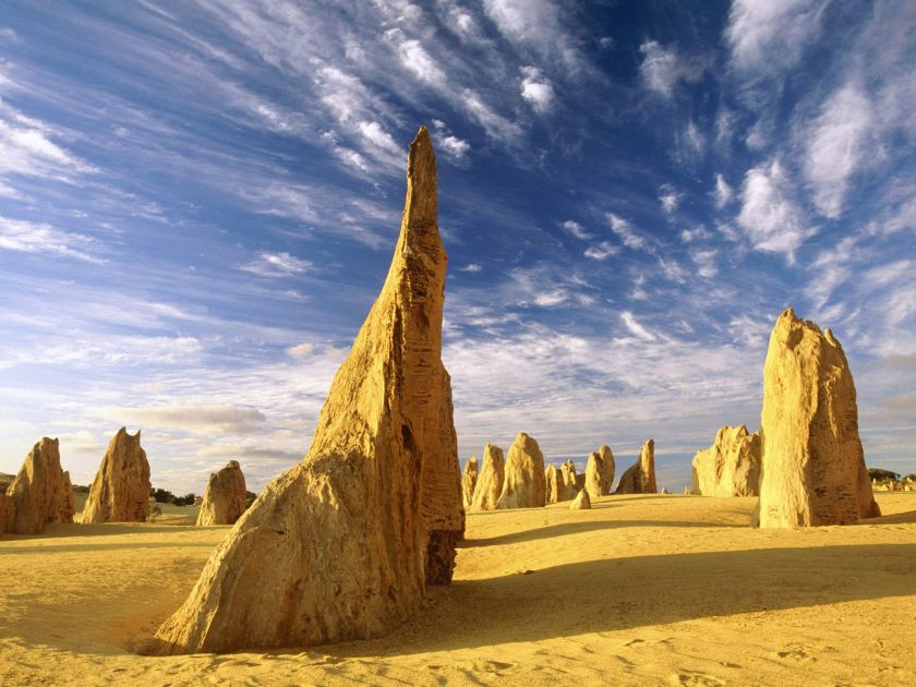
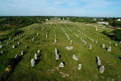
Next is stop is the Victoria Desert, where we find the Pinnacles…
…which reminds me of the Carnac standing stones in Brittany, France.
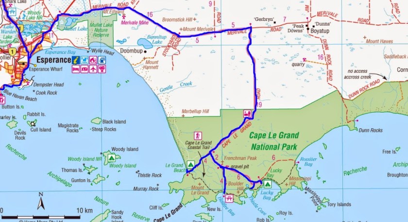
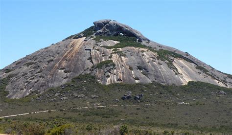
The last place I am going to show you on this long-distance alignment, and the end of this post, is Cape LaGrand National Park in the Goldfields-Esperance Region of Western Australia.
Our highly advanced Human Ancestors were capable of engineering feats we can’t even imagine. The megalithic structures they left us around the planet continue to amaze us, with huge, multi-ton blocks of stone perfectly fitted together, and clearly demonstrate their capabilities. However, by historical omission, the only thing we can conceive of in regards to big blocks of stone found all over the world, many times in interesting configurations, is that nature was capable of doing some pretty amazing stuff.
I am saying that Humanity in the fullest expression of its highest potential was the Ancient Ones of the Advanced Ancient Civilization, and they did amazing and incredible work, for which they receive absolutely no credit. The knowledge about this advanced civilization had to be removed in order to put a system in place to control Humanity.
For an overview of this whole alignment, please check out parts 1 & 2 on this blog of “How I First Heard of Novaya Zemlya, and Other Places I had Never Heard of Before.”
I will leave you with this photo of Frenchman’s Peak at Cape LaGrand. If we had been taught the True History, there would be no mysteries in history.
This is a continuation from my last post, where I ended following a major alignment emanating off the North American Star Tetrahedron to Novaya Zemlya, a boomerang shaped island off of the northern coast of Russia. In addition to current military bases, there is a history here of nuclear testing by the Russians, including over 224 nuclear detonations at Novaya Zemlya between 1955 and 1990. The most powerful nuclear weapon ever, Tsar Bomba, was detonated at Novaya Zemlya in 1961.
As we continue following this alignment over the next couple of posts, you will see a pattern emerging of nuclear testing sites along this particular planetary gridline.
After leaving Novaya Zemlya, the first place the alignment enters is the Yamal Peninsula, and in the language of the Nenet people, traditional large-scale nomadic reindeer herders who are the indigenous inhabitants of the area, Yamal means “End of the Land.”
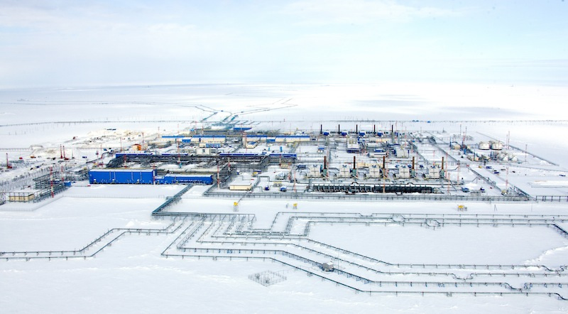
The Yamal Peninsula holds Russia’s biggest gas reserves. Russia’s largest natural gas project in history puts the future of traditional nomadic reindeer herding at risk.
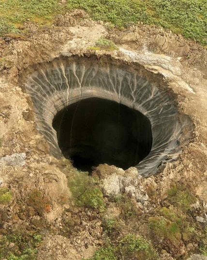
It has been in the news in recent years because of the appearance of huge sinkholes, starting with one that appeared in 2014. By 2015, five more had developed.
As a side note here, I observed as I went through my research process that the planetary gridlines approximate tectonic plates. This could account for the occurrence of the sinkholes here.
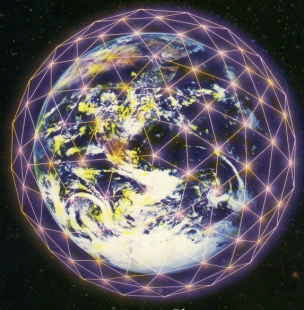
Geomancy is an ancient science in which the Ancients used stones, rocks, crystals and physical things to change the energy flow of the earth. Structures were built on very specific sites to change the internal flow inside the earth, and the external flow above the earth – energies created by volcanoes, tectonic plate pressures, geopath lines, different kinds of internal structures.
The Ancient Ones, Masters of Sacred Geometry, built the physical planetary grid to create the corresponding the crystalline consciousness structure around the planet.
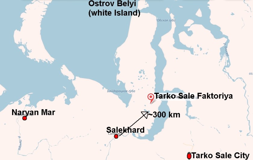
Next, we come to Tarko-Sale, Russia. Tarko-Sale is an urban-type settlement that is the administrative center of the Yamalo-Nenets Administrative Okrug. It is also the headquarters of Russia’s largest independent gas producer, Novatek.
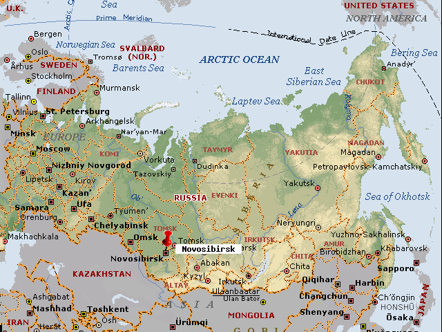
The next stop is Novosibirsk, Russia. It is the third most populous city in Russia.
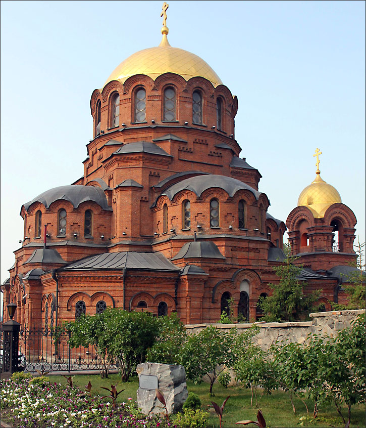
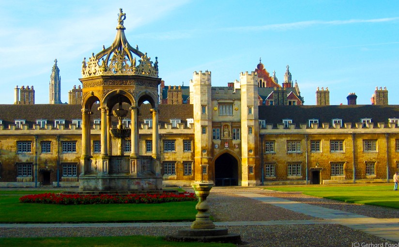
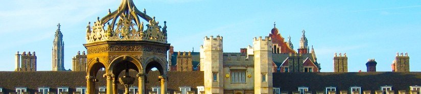
By the way, see the comparison below the similar building features and facade ornamentation towards the top of the above photo in Novosibirsk, to that showing behind Trinity College in the top of the photo at Cambridge University:
Novosibirsk, RussiaTrinity College, Cambridge, England
Novosibirsk is located in southwestern Siberia on the Ob River, which is the world’s seventh longest river.
Barnaul, Russia, is next on the alignment, and is a city and administrative center of the Altai Krai in the west Siberian plain, located at the confluence of the Barnaulka and Ob Rivers.
I see a definite architectural similarity between the building pictured on the left below, which is in Barnaul, Russia, and the one on the right, which is in Invercargill, New Zealand, located at the very southern tip of New Zealand. How can this be explained by the historical narrative we are given? I do not believe it is adequately explained given that only in the 20th century as we are taught in school did the technology exist for rapid transcontinental travel and communication, facilitating the sharing of ideas and knowledge. I believe the actual explanation for the similarity, a unified global culture, has been removed from our collective awareness deliberately.
In another example of similar architectural styles, you seeon the left a street corner in a Siberian city, and on the right, a street corner in Guthrie, Oklahoma.
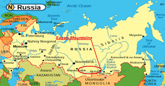
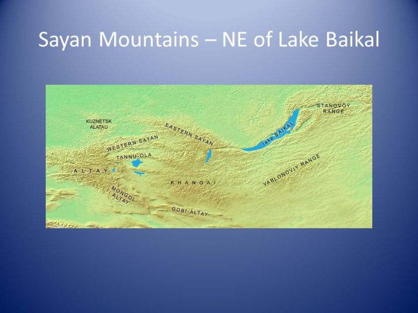
Next, the alignment crosses the Sayan Mountains, a mountain range located in southern Siberia; Russia; and northern Mongolia.
The appearance of the Sayan Mountains is quite interesting. Here are some examples:
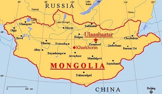
Ulaangom is next, the capital of the Uvs Province in Mongolia, near Lake Uvs Nuur, and 70 miles south of the border with Russia. Just now in looking at this map, I am going to speculate there is a special relationship between Lake Uvs Nuur, Lake Hovsgol, and Lake Baikal on the planetary grid. I have previously heard of Lake Hovsgol, and also Lake Baikal – which is the location of one of the twelve golden sun disks associated with the planetary grid.
Other photos of Ulaangom:
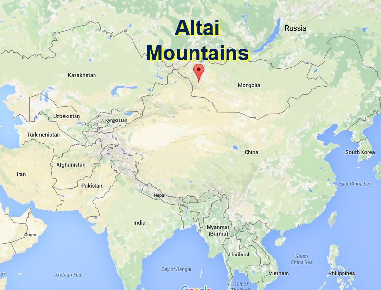
From here, the alignment crosses over the Altai Mountains in Mongolia:
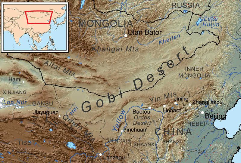
This whole region is part of the western Gobi Desert:
It is also strongly affiliated with the legendary Shamballa/Shangra-La. In this context, it is associated with Sanat Kumara, the Planetary Logos, who has an etheric retreat above the Gobi Desert. Please see link for more information about this connection: Shamballa.
And we find then ourselves in Urumqi, China, once part of the ancient Uighur Empire during Lemurian times, and now part of the Uighur Autonomous Region of Xinjiang in China.
Lop Nur, an ancient salt lake, is next on the alignment. It is in the Takla Maklan Desert in the Southeastern portion of the Uighur Autonomous Region of Xinjiang in China.
It is also significant to note that the Chinese Nuclear Weapons Test Base had four nuclear testing zones at Lop Nur, starting in 1959 – with H-Bomb detonation in 1967 – until 1996, with 45 nuclear tests conducted.
The whole region is associated with the Uighur Empire. According to James Churchward in his books about Mu, this ancient empire was very powerful and huge during Lemurian times. See link for more information: Uighur Empire.
As I was following the alignment, I next found the Qaidam Basin, which is located in the Haixi Mongol and the Tibetan Autonomous Region, in the Qinghai Province, in Western China. At current count, there are 27 salt lakes here, and approximately 1/3rd of the Basin is desert.
Vegetation barriers to stabilize migration of longitudinal (seif) sand dunes in the Qaidam Basin, a high altitude desert, in Qinghai Province, China.
I have more ground to cover in this long-distance alignment centered around Novaya Zemlya, but I will end part 2 here for now. More to come, so stay tuned….