
The more I look into all of this, the more direct interconnections I find between all of the subjects I am delving into this new series about the Ancient Advanced Moorish Civilization, a civilization which existed up until relatively recent times, and about the manner in which it has been covered up. Moor, or Mu’ur, pertains to the people of this ancient civilization that originated during the time of Mu, also known as Lemuria.
I have found the subjects under scrutiny in my research for the various planetary and circle alignments I found emanating from the North American Star Tetrahedron, and which I have written about previously in my blog.
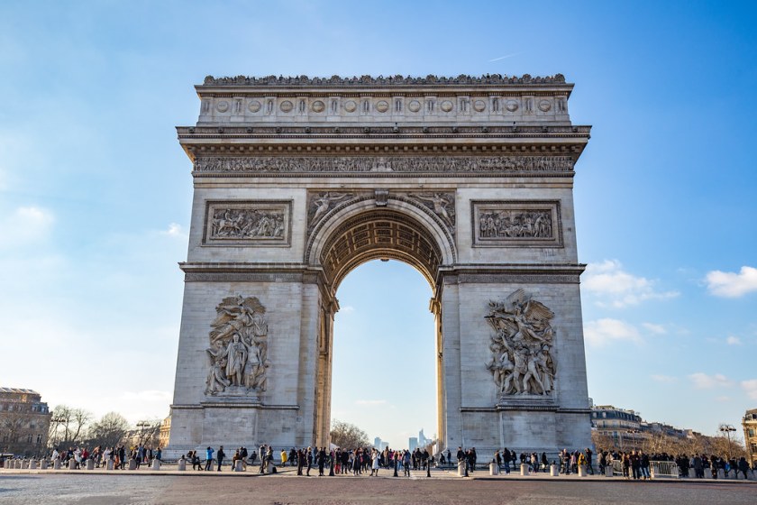
The Arc de Triomphe de l’Etoile, the literal meaning of which is the Triumphal Arch of the Star, stands at the western end of the Champs-Elysees at the center of the Place Charles de Gaulle. Construction was said to have begun in 1806 to honor those who fought and died for France during the French Revolution and the Napoleonic Wars.
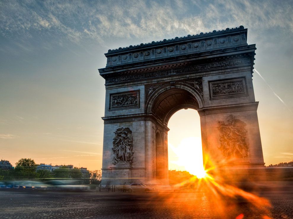
There appears to be a solar alignment happening in this photograph through the archway of the Triumphal Arch of the Star.
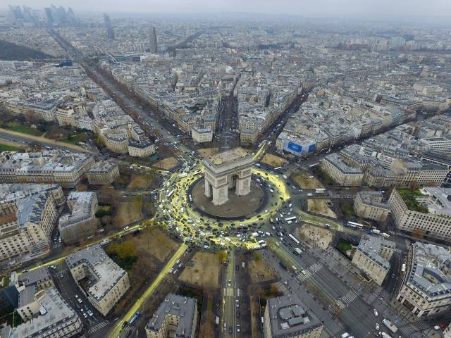
It is situated in formerly named the “Place de l’Etoile” or “Place of the Star” said to be named for the juncture of twelve avenues radiating out from the place where the Triumphal Arch of the Star is located in the center.
Obviously there was a very high-level of city planning going on in Paris, one that was holistic and planned, and not a haphazard or random development process over the different eras of history as expressed by the education we received in our history classes in school.
Let’s see where else evidence of sophisticated and intentional planning shows up as we go along throughout this post.
The Arc de Triomphe du Carrousel was said to have been built in the Corinthian-style of architecture between 1806 and 1808 to commemorate Napolean’s military victories the previous year.
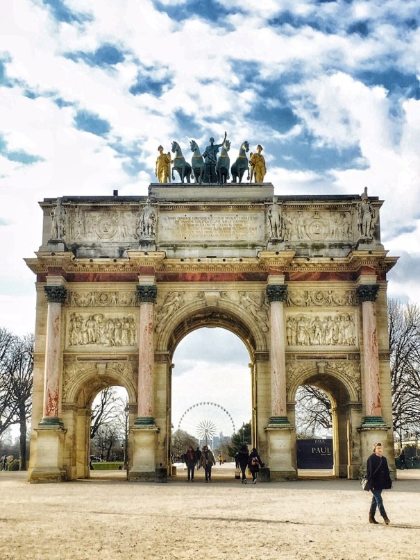
The Arc de Triomphe du Carrousel we are told was built as a gateway to the Tuileries Palace. When the Palace was destroyed in 1871 during Paris Commune, a radical socialist and revolutionary government that ruled Paris from March 18th, 1871 to May 28th, 1871 (sound familiar?), it allowed an unobstructed view west towards the Arc de Triomphe de l’Etoile.
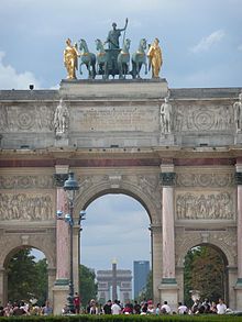
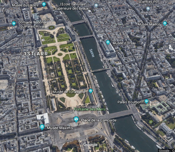
This part of Paris, at which I am going to take a closer look , is part of what is called the Axe Historique, or Historic Axis, of a line of buildings, monuments and thoroughfares that extends from the center of Paris to the West.
The Arc de Triomphe du Carrousel appears to be a central component of this Historic Axis, which follows a straight line through various locations in the thoroughfare. So locations in front of the arch seen in this view from Google Earth pictured here include…

…the Tuileries Garden, a public garden that represents what’s left of the Tuileries Palace grounds…
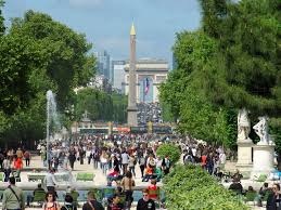
…to the Place de la Concorde, most famous as location of the Parisian Cleopatra’s Needle, said to be an over 3,000-year-old obelisk from the Temple of Luxor in Egypt.
I will have more to say about this obelisk in the next post on the subject of “Gifts and Contests” for the explanation that we are given as to how they managed to get an ancient, multi-ton obelisk from Egypt to the center of Paris.

Among other things, by the end of this post, I am going to show you there are obelisks literally all over the place – just called, and attributed to, something else.
However, in our present-day collective awareness, obelisks are associated primarily with ancient Egypt.
The obelisk called Cleopatra’s Needle is flanked on either side by the much less well-known…
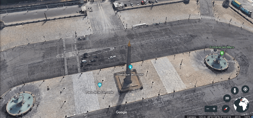
… Fontaines de la Concorde. One is called the Maritime Fountain, or “Fontaine des Mers,” and is on the side of the Place de la Concorde, closer to the Seine River, and said to represent the Maritime Spirit of France.
The other is similar in appearance to the Maritime Fountain, and is called the “Fountain of the Rivers,” or “Fontaines des Fleuves,” said to represent the Rhone River and the Rhine River.
These fountains are attributed to Jacques Ignace Hirtorff, a German-born French architect who was said to have completed them in 1840, in the reign of King Louis-Phillipe.
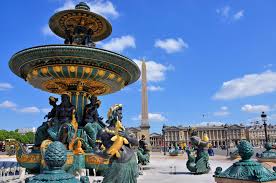
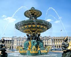
In my mind it is quite easy to see these Fountains as having been created by the Moors, with its maritime symbology, pineal glands representing the Human third-eye (and not pine cones as we are led to believe)…

…and what looks strikingly like Tibetan symbols, which are shown here in comparison to the design of the fountain.

There is no mystery to me here because I believe, based on what I am seeing and finding, that all over the world the Ancient Moorish Civilization was one and the same, based on sacred geometry and twelve tribes.
Everything was configured in perfect geometric and harmonious relationship to everything else around the world and in the heavens.
For example, each Tribe of Israel had its own designated precious stones. One of the stones for the Tribe of Dan was turquoise.

There are many points in common between the Tibetan culture, and that of the Native Americans of the Southwest, including the wearing of turquoise. And they recognize each other as being connected to the other.
They also have tradition of often-times masked dancers at certain times of the year to harmonize and balance positive and negative energies, in both Tibetan culture of Asia…

…and in the cultures of the American Southwest, like these Hopi Dancers.

I firmly believe there would be no mysteries in history if we had been taught the True History.
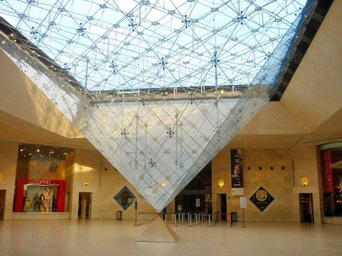
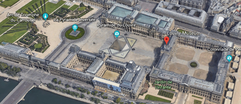
Going in a straight line in the other direction from the Arc de Triomphe du Carrousel, we come to the Inverted Pyramid, which is said to be a skylight designed by the Chinese-American architect I. M. Pei, and completed in 1993 for the…
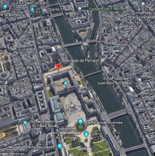
…Carrousel de Louvre, an underground shopping mall in front of the Louvre Museum.
What if there was already underground city infrastructure, world-wide, already built-out by the Ancient Advanced Civilization?
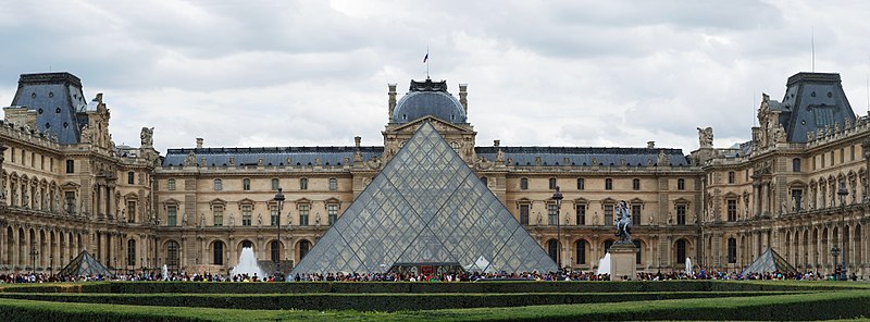
Next we come to another pyramid, serving as entrance to the main building of the Louvre museum, also attributed to I. M .Pei, with completion in 1989.
Verifiable, you say? Well, maybe so, but as we know, desirable information can easily be added, or removed, from the data base. Who is actually going to question it, and check on it, anyway?
And, if it actually was completed in 1989 as we are told, it was most likely built on top of a known power-spot.
The Louvre Museum, the world’s largest art museum, was said to have been originally built as a fortress in the 12th- and 13th -century under King Phillip II, called the Louvre Castle. The Louvre museum was said to have opened in 1793, right after the end of the French Revolution. There is a nice Templar cross in the courtyard of the main building, seen here.
I do seriously question what we are told about who the original Templars were, also known as the Order of the Temple of Solomon. We are told it was Catholic military order recognized in 1139 AD by Pope Innocent II’s papal bull Omne Datum Optimum.

I personally think there is a lot of information missing from the historical record about who the Templars really were, and about what their actual historical association with the Temple of Solomon was, like maybe being Moorish Master Masons instead of Catholic knights. Whatever the Truth was about the Templars, information is not available in the written historical record to make a connection directly to the Moors.
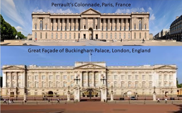
The back-side of the Louvre is known as the Colonnade de Perrault. I will also be talking more about Monsieur Perrault in the next post on “Gifts and Contests.”
For this post, I just want to show you a comparison of the Colonnade he is famous for having designed on the top, said to have been completed between 1667 and 1670, with the Great Facade of Buckingham Palace, with the design attributed to British Antiquarian draftsman Edward Blore in 1847, and completed in 1850, on the bottom.
The last site I am going to show you on this axis with the Arch de Triomphe du Caroussal is the Tour Saint-Jacques…
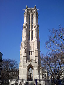
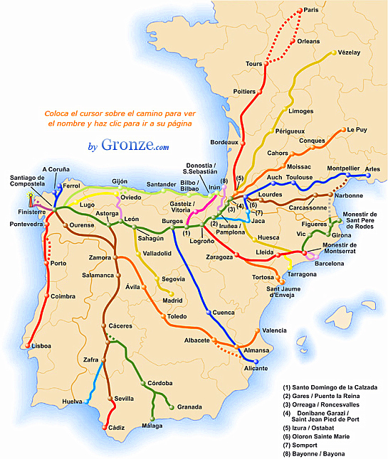
…said to be have been built between 1509 and 1523 as the meeting point on the Tours Route of the pilgrimage to Santiago de Compostela in Spain, also known as the Way of Saint James.
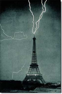
One more place to include here is the most famous symbol of the city of Paris, the Eiffel Tower, located on the Champs de Mars in the precise and geometric city plan of Paris.

It is a wrought-iron lattice tower said to have been designed and built by the Gustav Eiffel’s engineering company between 1887 and 1889 as the entrance to the 1889 Paris World’s Fair, a celebration of the centennial of the French Revolution.
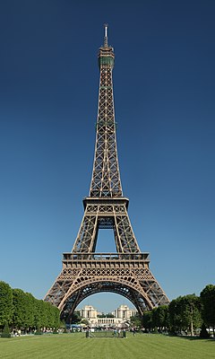
Gustave Eiffel famously compared the tower his company was said to be building to the Egyptian pyramids, in response to criticism from the Parisian artistic community during the time it was being erected.
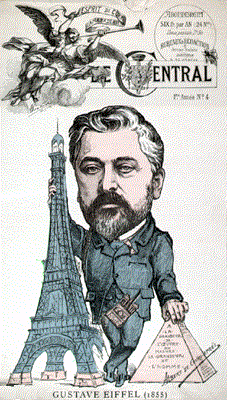
Was this massive and beautiful wrought-iron structure actually built in only two years for the 1889 Paris World’s Fair?
Or was it already there?
Perhaps it was an important antenna for a free energy system…
…and/or wireless transmission technology of the Advanced Ancient Civilization, and falsely attributed to someone for the annals of our history.

Incidently, the Eiffel Tower is used for making radio and television transmissions, beginning in the early 1900s.
Next, on to the British Isles.
First stop, London.
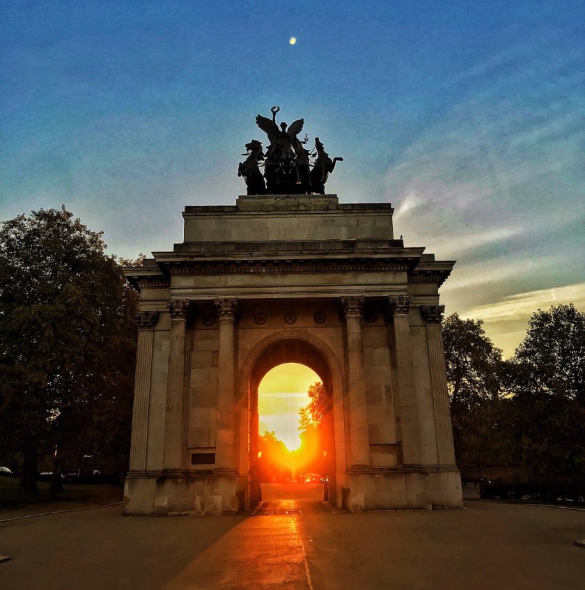
The Marble Arch in London pictured here with both a solar and lunar alignment on 9/26/18, within the summer solstice time period.
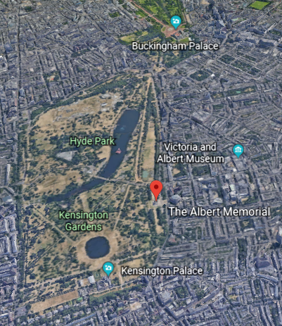
And, as seem from Google Earth, there does appear to be a triangular and/or triangulated relationship between the Marble Arch…
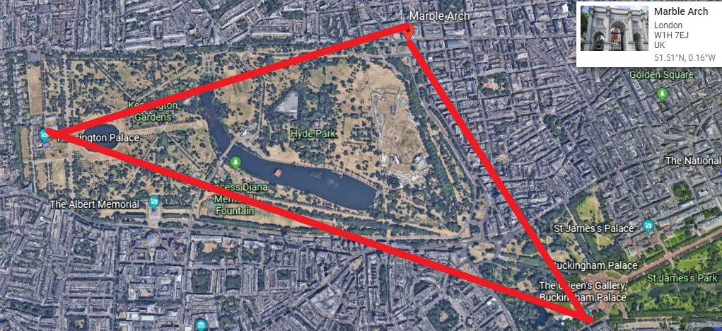
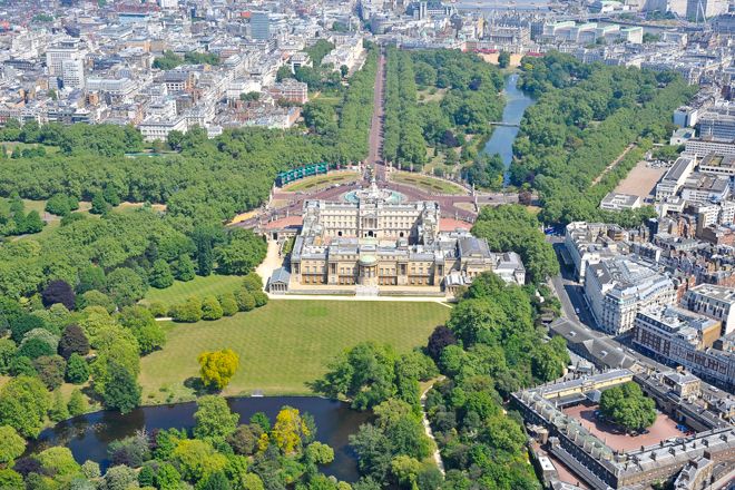
…Buckingham Palace, the London residence and administrative headquarters of the monarch of the United Kingdom…
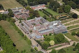
…and Kensington Palace, a royal residence in the Kensington Gardens, where the younger royal families live.
Speke’s Monument is located in the Kensington Gardens, a red granite obelisk dedicated to John Hanning Speke, the explorer who “discovered” Lake Victoria and led expeditions to the source of the Nile.
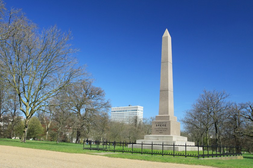
We are told it was designed by Philip Hardwick, and installed in Kensington Gardens in 1866.
Hardwick was also given credit for the design of the original Euston Station, which was said to have opened in 1837. The station was demolished and rebuilt in in the 1960s.

The original stone was used in 1962 as fill to improve the the Prescott Channel, part of a flood relief scheme for the River Lee Navigation in London’s East End, and where efforts have been made to recover some of the original stone.

The Albert Memorial, also in the Kensington Gardens, was said to have been commissioned by Queen Victoria after Prince Albert’s death in 1861.

Designed in the Gothic Revival style by Sir George Gilbert Scott, taking 10-years to complete, and paid for by public subscription, the Albert Memorial was said to have opened by Queen Victoria in 1872, with the statue of Prince Albert seated in the memorial at the time of the opening.
The Albert Memorial is located close to Hyde Park, which is adjacent to the Kensington Gardens.
Hyde Park is the largest of four royal parks that form a chain from the entrance of Kensington Palace, through Kensington Gardens and Hyde Park, via Hyde Park corner and Green Park past the main entrance to Buckingham Palace.
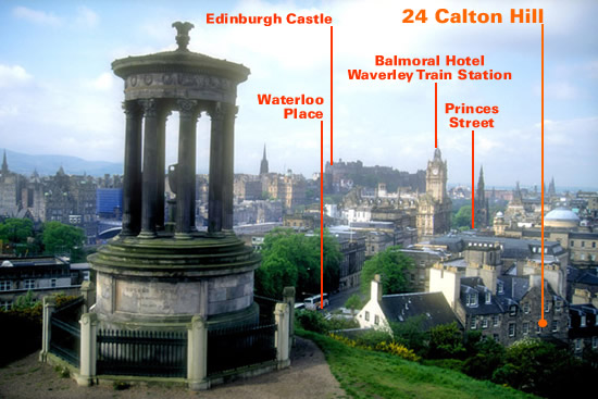
Next stop, Edinburgh, Scotland.
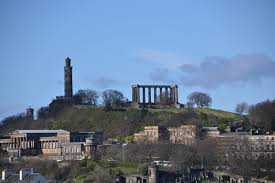
I quickly found Calton Hill in my research on monuments in Edinburgh, and it is quite noteworthy.
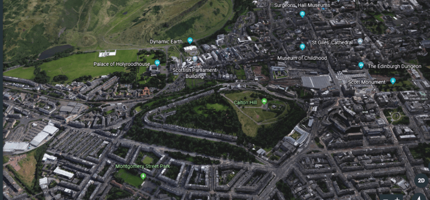
The following places are all located on Calton Hill in Central Edinburgh:
The National Monument of Scotland, a national memorial to the Scottish soldiers and sailors who died fighting in the Napoleonic Wars, which took place between 1803 and 1815.
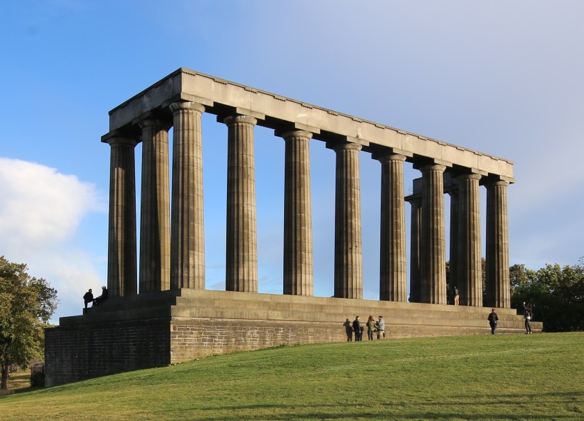
With a design by Charles Robert Cockerell and William Henry Playfair based on the Parthenon in Athens, construction was said to have started in 1826, and that it was left unfinished in 1829 due to lack of funds.
A foundation stone weighing 6-tons, or 5.5-metric tons, was said to have been laid in 1822 during a visit of King George IV to Scotland.
How did they move a heavy stone weighing 6 tons in 1822 according to the history we have been taught?
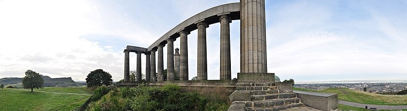
In this view of Calton Hill, you see the Nelson Monument perfectly-framed through the center of the front colonnade of the National Monument.
The Nelson Monument was said to have been built on the highest point on Calton Hill between 1807 to 1816 to commemorate the British Vice-Admiral Horatio Nelson’s victory over the French and Spanish fleets at the Battle of Trafalgar in 1805.

It has an pentagonal castellated base…
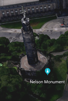
…and a time-ball at the top, a large ball lowered and raised historically to mark the time for ships anchored in the Firth of Forth to set their chronometers.
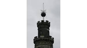
It is still raised just before 1 pm, and dropped precisely at 1 pm, every day.
Other famous time-balls include:
The time-ball at the Royal Observatory at Greenwich, the location of the world’s Prime Meridian since 1851, was said to have been first used in 1833.
Every day, the ball rises half-way up the mast at 12:55 pm Greenwich Mean Time, up to the top at 12:58 pm…
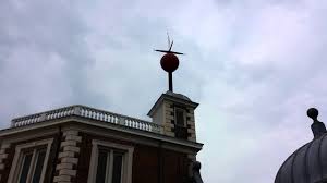
…and drops exactly at 1 pm.
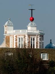
Also, there is a time-ball at Sydney Observatory in Sydney Australia, still in operation around 1 pm since 1858…
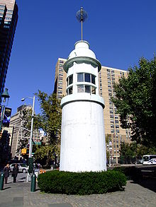
…the Titanic Memorial Lighthouse and Time-Ball seen in this photo on the roof of the old Seaman’s Church Institute of New York and New Jersey circa 1913…
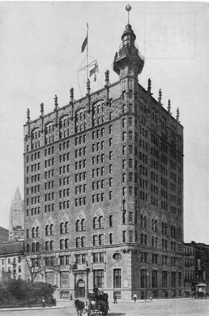
…to the Titanic Memorial Lighthouse and Time-ball’s present-day location at Fulton and Pearl Streets in Manhattan…
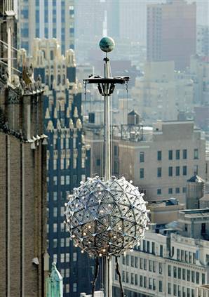
…and the Times Square Time-Ball drop starting at 11:59 pm on December 31st every year to mark the arrival of the New Year.
Were time-balls developed as part of a Modern-day time-keeping system, or the remnants from the traditions from a far older civilization, perhaps involving time-keeping, perhaps not?
So what else is atop of Calton Hill?

The so-called Portuguese Cannon seems out-of-place in the midst of grandeur, which is what makes it interesting. Why is it even here?
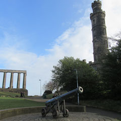
Bearing the Coat-of-Arms of the Spanish ruling royal family of Portugal in the 17th-century, it was said to have been captured by the rulers of Burma and taken to Mandalay in 1785. It fell into the hands of British forces in Burma in 1885.
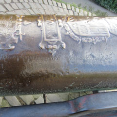
The cannon was taken to Calton Hill after it was exhibited at the 1886 Edinburgh Fair. Hmmm, I wonder what the true significance of this cannon is!
The Dugald Stewart Monument is situated on Calton Hill where it overlooks Edinburgh, and said to have been built as a memorial to the Scottish philosopher Dugald Stewart, and completed in 1831.
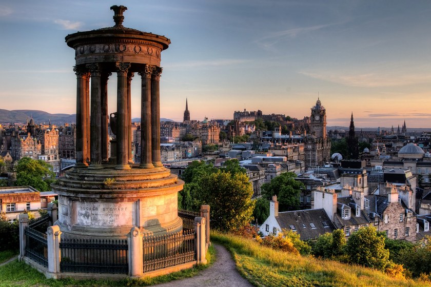
Check out some of the alignments noted from the Dugald Stewart Monument.
The City Observatory of Edinburgh, also known as the Calton Hill Observatory, is located on the other side of a green space, which contains the Portuguese cannon, that is across from, and in-between, the Nelson Monument and the Dugald Steward Monument.
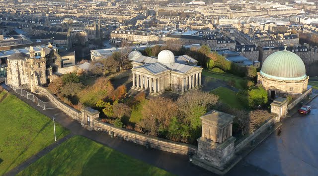
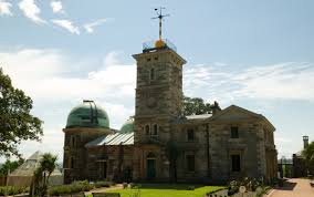
Said to have been designed with the appearance of a Greek Temple by William Henry Playfair in 1818…
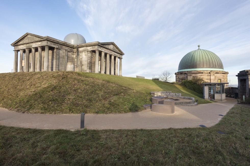
…and its instrumentation was said to have been completed in 1831 with the delivery of a newest transit telescope of the day.
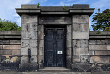
This is a door on the grounds of Edinburgh’s Observatory on Calton Hill.
In a future dedicated post as part of this series. I will be giving attention to the subject of observatories, going back into time to look at observatories like the Mayan El Caracol at Chichen Itza in Mexico…
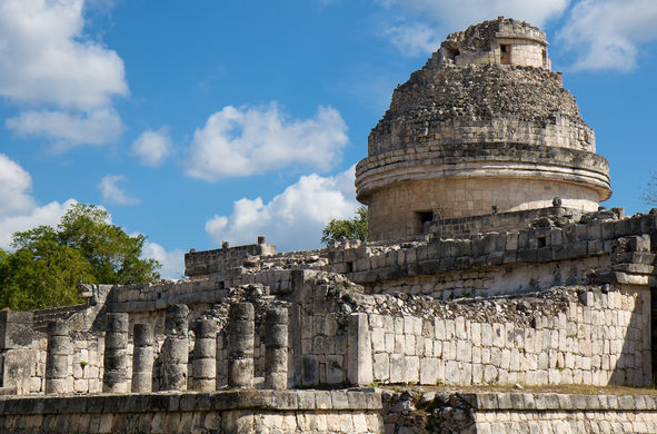
…and look for similarities to present-observatories, like with the City Observatory in Edinburgh.

Leaving the top of Calton Hill, and taking the road that goes down the hill, you come to…
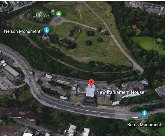
…what is now known as the New Parliament, but used to be called the Old Royal High School…

…said to have been constructed between 1826 and 1829 for use as the city’s Royal High School…

…and the Robert Burns Monument right across the street from it, said to have been constructed in 1830 as a Greek-style memorial to Scotland’s national poet, Robert Burns.
On the way down Calton Hill, next we come to St. Andrew’s House, the Headquarters of the Scottish Government.
The next area we come to on Calton Hill contains two places of interest.

One is what is called the Political Martyrs Monument, located in the Old Calton Burial Ground, and said to commemorate five political reformists from the late 18th-, and early 19th-, centuries.
Right next to the so-called Political Martyrs Monument is the old Governor’s House, said to be all that remains of the Calton Jail, once the largest prison in Scotland, that was built between 1815 and 1817.

This view of the Old Governor’s House on Calton Hill reminded me…
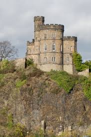
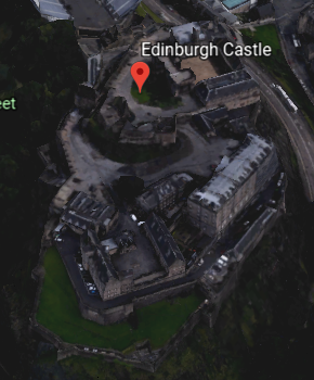
…of this view of Edinburgh Castle…
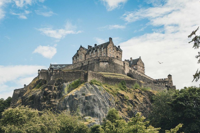
… which prompted me to look at Edinburgh Castle from Google Earth, revealing what looks to be a star fort.
I will make one last stop in the British Isles to look at a few monuments and memorials in Ireland before I head across the Atlantic Ocean.
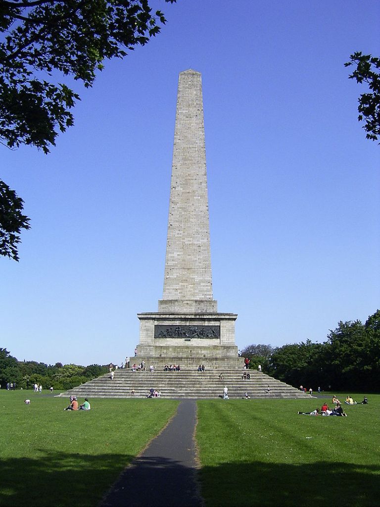
In Dublin, we find the Wellington Monument, also known as the Wellington Testimonial, in the Phoenix Park, to commemorate the victories of the British general at the time, Arthur Wellesley, 1st Duke of Wellington, over Napoleon in the Battle of Waterloo, which took place in 1815. Construction was said to have started in 1817, and for a variety of reasons given, wasn’t completed until 1861.
Near Maynooth in County Kildare, Conolly’s Folly is an obelisk structure and national monument said to have been built in 1740 to provide employment for the poor of Celbridge during the famine of 1740 to 1741.
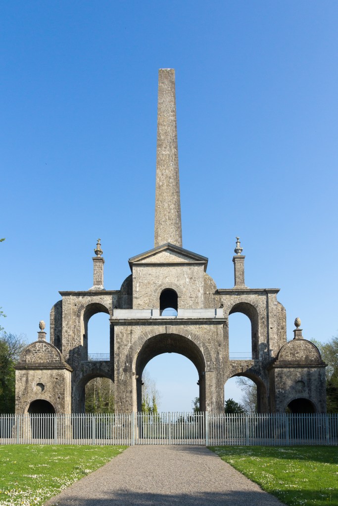
Here’s the thing, besides the fact that this is an extremely sophisticated engineering accomplishment, the famine of 1740 to 1741 in Ireland was caused by an almost two-year period of extremely cold, enduring weather in Ireland between 1740 and 1741. It just doesn’t make any sense that something like this could have been built by cold, starving poor people in the middle of a period of extended extreme weather like this.

Hundreds of thousand of people in Ireland perished in the cold snap. To this day, it is the longest period of extreme cold in modern European history.
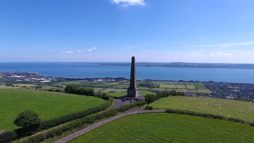
Near Belfast, the Knockagh Monument is designated as a World War I memorial in County Antrim.
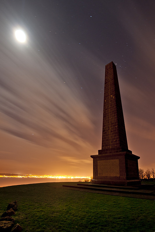
It is the largest war memorial in Northern Ireland, and this obelisk said to have been built in 1922 and 1936 as a smaller replica of the Wellington Monument in Dublin.
I am going to finish up this post with a look at the monuments and geometries of Washington, D. C.
Like we have seen in the other great cities of Paris, London, and Edinburgh, there is a lot happening here at this location in just this one glance, from the monumental importance to the identity of the United States, to the amazing geometries as we will see.
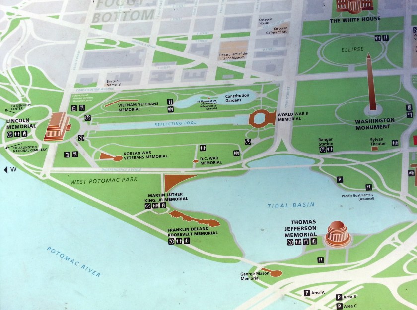
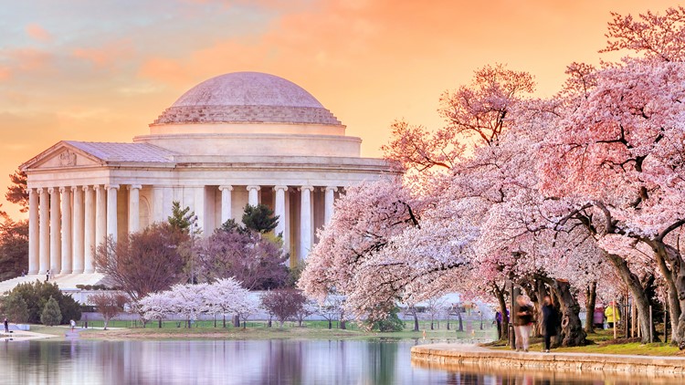
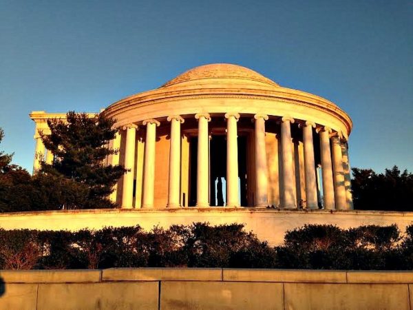
Starting at the Tidal Basin with the Jefferson Memoria in West Potomac Park, the years of 1939 to 1943 are given to us for its construction, which was during the administration of Franklin Delano Roosevelt Administration, and World War II.
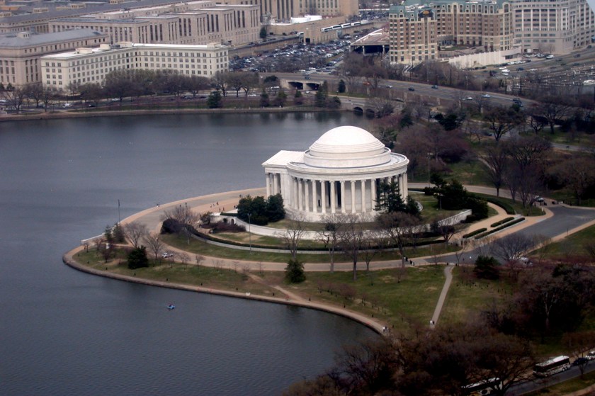
The shores of the Tidal Basin look man-made as well!
The Lincoln Memorial was said to have been constructed between 1914 and 1922 in the Greek-Revival-style, and yet another monumental construction taking place during war-time. This time it is during World War I, which started in 1914, and ended in 1918.
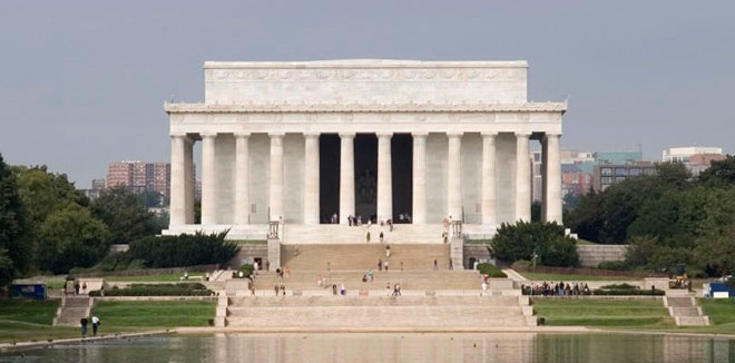
It’s a massive building!
The Lincoln Memorial’s interior is divided into three-chambers by two rows of four ionic columns, each 50-ft, or 15-meters, tall, and 5.5 feet, or 1.7-meters, across at their base.

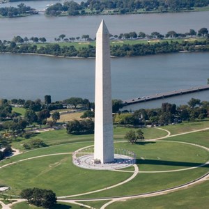
The Washington Monument is a marble, granite, and bluestone gneiss obelisk, with its construction said to have started in 1848, and completed in 1884. It’s completion was delayed, we are told, by lack of funding, and the occurrence of the American Civil War.
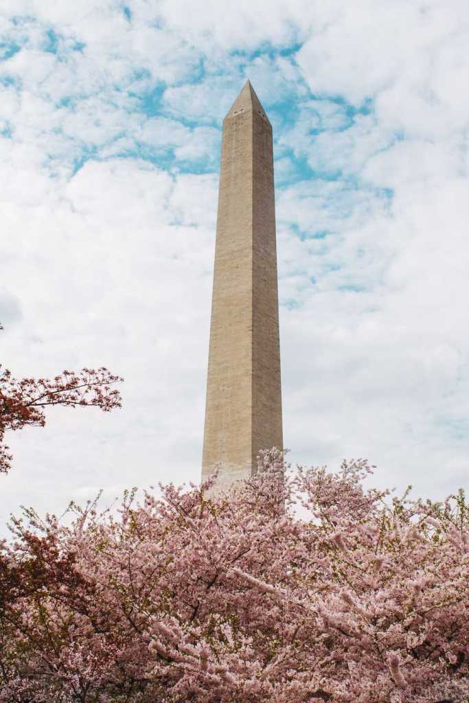
It is the world’s tallest obelisk , and tallest predominantly stone structure.
The Washington Monument is situated in the middle of a Vesica Pisces, a mathematical shape formed by the intersection of two disks with the same radius, intersecting in such a way that each disk lies in the perimeter of the other.
The Vesica Pisces is part of the Flower of Life, the creational pattern of sacred geometry, that I believe is the foundation of the Ancient Advanced Civilization and its physical lay-out on the Earth.

This is what you see in this part of Washington, DC from Google Earth – a perfect North-South alignment between the White House, the Ellipse and the Jefferson Memorial, and a perfect East-West alignment between the Lincoln Memorial, World War II Memorial, Washington Monument, and the United States Capitol Building.


This post went in a different direction from what I originally had in mind. So, I will do another post at a later time on the other material I gathered for it on the subject of “Cenotaphs, Obelisks, and War Monuments.”
The next post will be “Regarding the Subject of Gifts and Contests.”
