
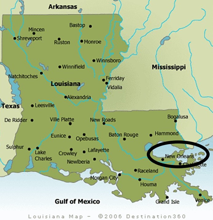
In the last post, I tracked this circle alignment from Port Isabel, on the Gulf Coast of Texas near Brownsville; across South Padre Island; over the Flower Garden Banks Marine Sanctuary in the Gulf of Mexico; into Louisiana at Terrebonne Parish; and ending at Houma, the Parish Seat of Terrebonne Parish.
I am picking up the alignment in New Orleans, a consolidated City-Parish located along the Mississippi River in the southeastern part of Louisiana.
The Central Business District of New Orleans is immediately north and west of…
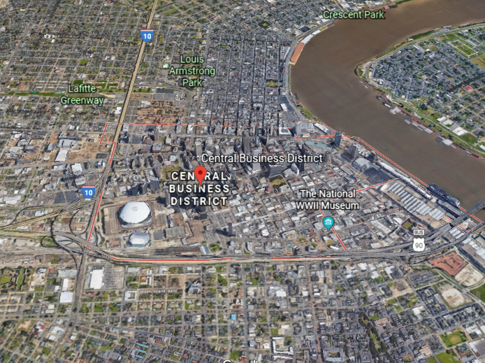
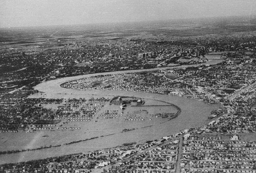
…the snaky, s-shaped river bends of the Mississippi River winding through New Orleans.
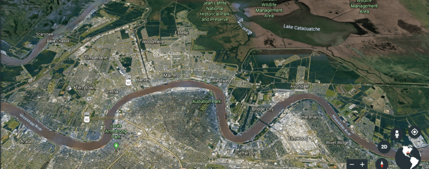
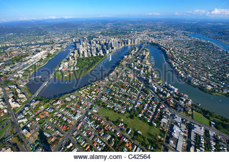
Again, I see this signature feature of the ancient civilization around the world, like the Brisbane River as it goes through Brisbane, Australia…
…the Nile River at Juba in South Sudan…

…and the Red River in Winnipeg, Manitoba.
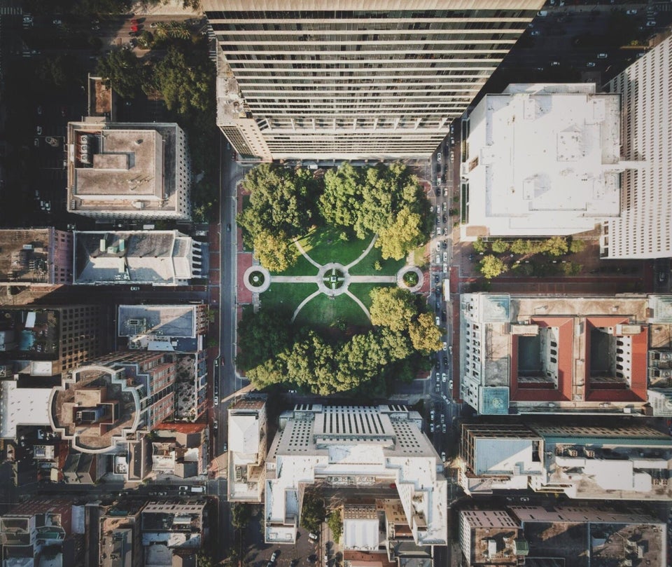
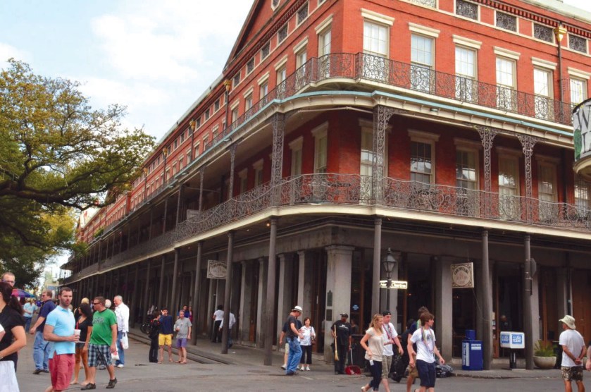
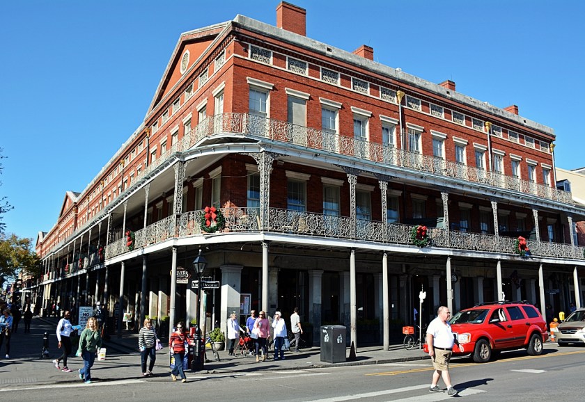
The Central Business District of called the American Quarter because it was said to have been developed in the heart of the French and Spanish settlements.

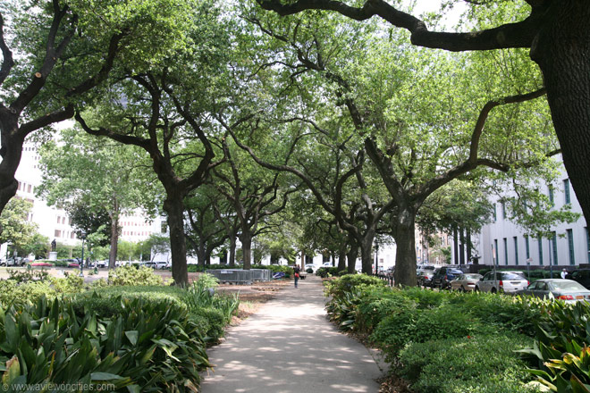
It includes Lafayette Square, a 2.5-acre, 1-hectare, park, where concerts and festivals are held.
Called the second-oldest park in New Orleans, after Jackson Square, we are told it was designed in 1788 by Charles Laveau Trudeau AKA Don Carlos Trudeau, Surveyor-General of Louisiana for the Spanish Government at the time, and later acting Mayor of New Orleans in 1812.
The Greco-Roman-looking Gallier Hall, the former City Hall of New Orleans, faces the Lafayette Square on St. Charles Avenue.
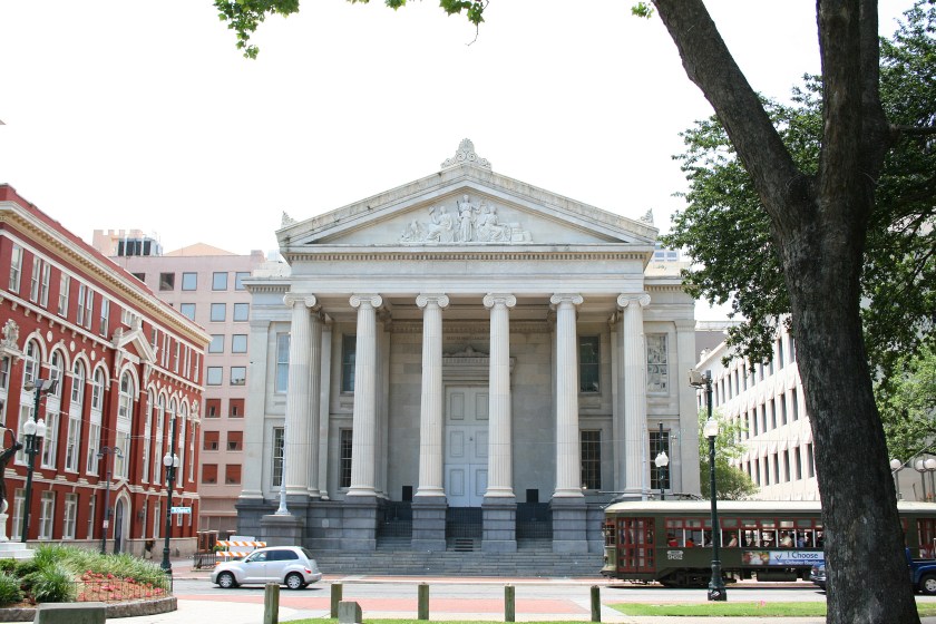
This huge and columned structure was said to have been built between 1845 and 1853 under the direction of James Gallier, a bankrupt Irish architect born in 1798, who emigrated to the United States in 1832.

Apparently, he promptly became well-known for his incredible architecture in the United States before his untimely death in 1866 at sea, when the “Evening Star” side-wheel steamship he and his wife were travelling on between New York and New Orleans sank 175-miles east of Savannah, Georgia, in the Atlantic Ocean.
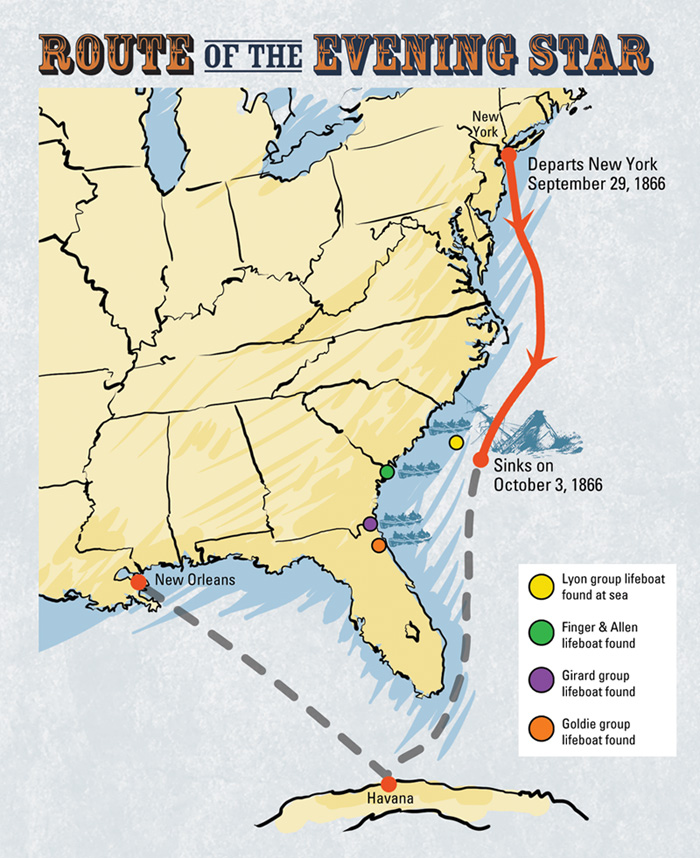
The “Evening Star” sinking was also famous for having had on it six New Orleans Madams who had been in New York selecting new prostitutes for their brothels from “fashionable metropolitan houses.”

So a famous architect and his wife were on a side-wheel steamer that sank in the Atlantic Ocean with a ship full of prostitutes a year after the end of the devastation of the American Civil War?
This is not the first time I have come across information about an architect that was strange.
And Gallier Hall looks like how sunken Atlantean temples are frequently depicted.

Canal Street is a major thorough-fare in New Orleans, forming the upriver boundary between the city’s oldest neighborhood, the French Quarter, and the Central Business District.
The building in the background in this 1960s photograph that was taken on Canal Street, behind the streetcar in the foreground…
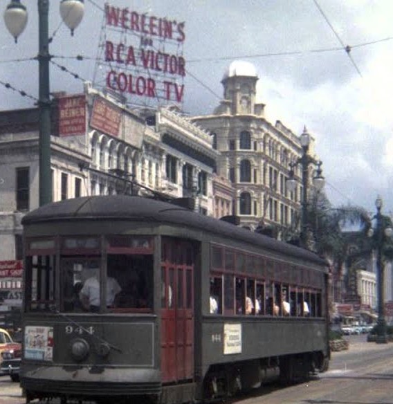
…reminds me of this building in Times Square in New York City…
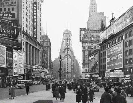
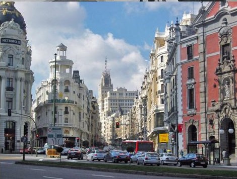
…and this one near the the Calle de Alcala, the main thoroughfare in Madrid, Spain.
This is an historic photo of Canal Street circa 1910…
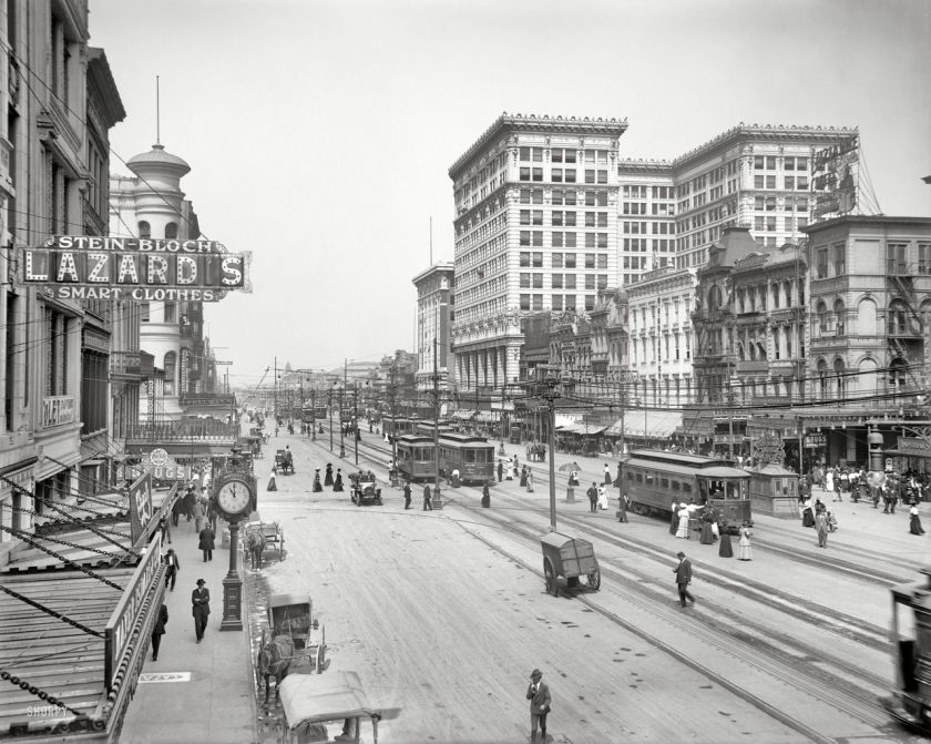
..compared with this one taken in Leeds, England, in the late 1800s. The architecture in both places looks similar, as well as a similar streetcar system in the middle of the street.
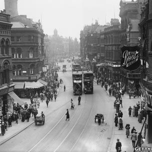
How did such urban similiarities develop independently of each other across countries and continents, according to this history we have been taught?
In 1862, only 48-years earlier from the photo of the highly-urbanized Canal Street in 1910, the Battle of New Orleans was raging in the American Civil War, and New Orleans was said to have looked something like this:

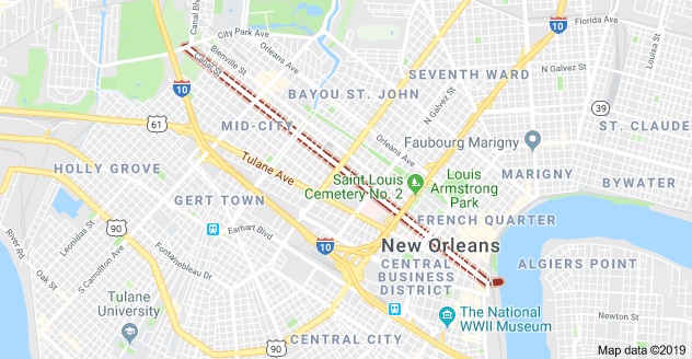
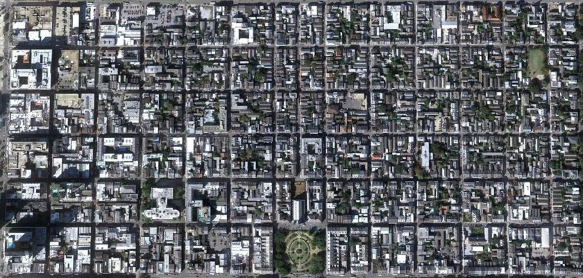
It is interesting to note that while Canal Street was named for a canal that was never built, there are plenty of still-existing canals in New Orleans, as seen in this Google Earth screenshot. No telling how many have been filled-in!

Not surprisingly, south of New Orleans towards Mississippi River Delta is a town called Venice, Louisiana, the last community down the Mississippi accessible by car…
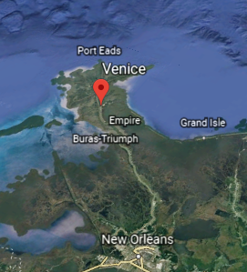
…and which has a lot of channels in the landscape.
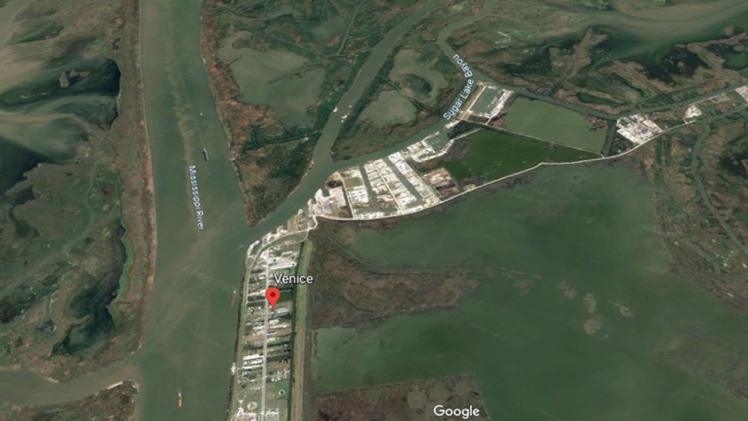
Interesting name for this place, since Venice in Italy is the only place in the world that is heavily associated with canals.
I consistently find canal systems in cities all around the world that are not known to the general public, many of which are called rivers instead of the man-made canals they actually are. One of the many ways the ancient advanced civilization has been hidden in plain sight.
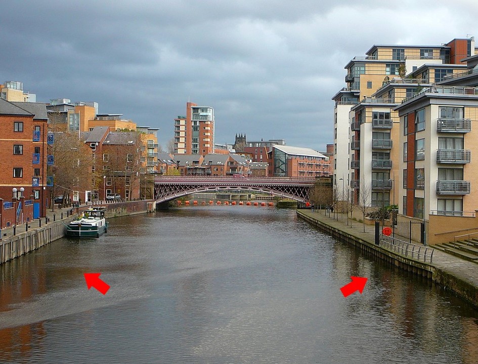
This is the River Aire in Leeds, England, for example. It is described as a natural river, but it sure looks like a canal to me!
One end of Canal Street in New Orleans terminates at the Mississippi River, where a ferry has been available since 1827 to connect to the Algiers Neighborhood, one of the oldest sections of New Orleans, on the west bank of the Mississippi River.
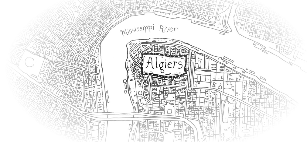
I believe that the particular names of places are telling us something, so Algiers in Algeria comes to mind when I see this name here, and think there is a connection between the two places somehow.
Algiers is considered to be the birthplace of Jazz. This is a statue of Louis Armstrong at the Robert E Nims Jazz Walk of Fame there.

This is the Algiers Courthouse, said to have been built on the site of the former Duverje plantation in 1896, and is described as a Moorish-influenced Richardsonian-style building.
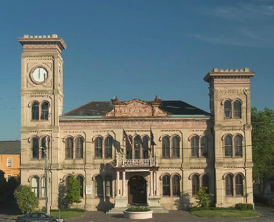
So this piece of information provides a good lead-in to Henry Hobson Richardson, one of the architects given credit for incredible building achievements in New England, like James Gallier in New Orleans, that doesn’t match-up to his life-story.
H. H. Richardson was said to be a largely self-taught architect, who died young, and is given credit for the Ames Free Library in the foreground, and the Oakes Ames Memorial Hall in the background, in North Easton, Massachusetts, as well as other examples of monumental architecture.
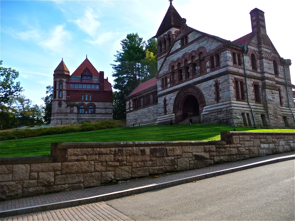
This style of architecture is called Richardsonian Romanesque in his honor.
I am certain there was a widespread practice of false attribution to certain architects going on to cover-up the actual Moorish Masons who built all of this infrastructure.
Adjacent to the Algiers Neighborhood on the West Bank of the Mississippi River, in the Jefferson Parish, is the city of Gretna.
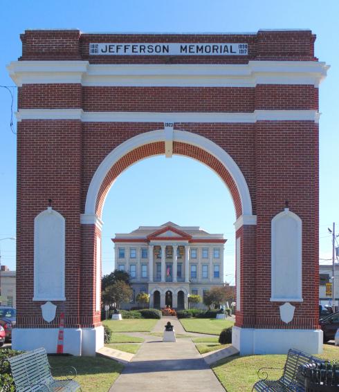
This is the Jefferson Memorial in Gretna, with the Gretna City Hall seen exactly in the middle of its archway…
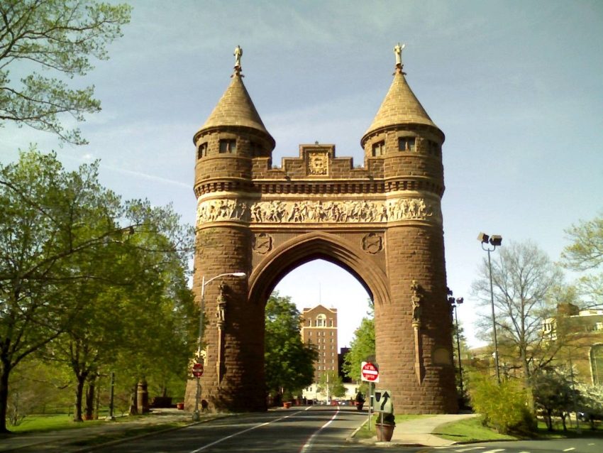
…compared to the Soldiers and Sailors Memorial Arch in Bushnell Park in Hartford, Connecticut, with what is now an apartment complex in the middle of the archway…
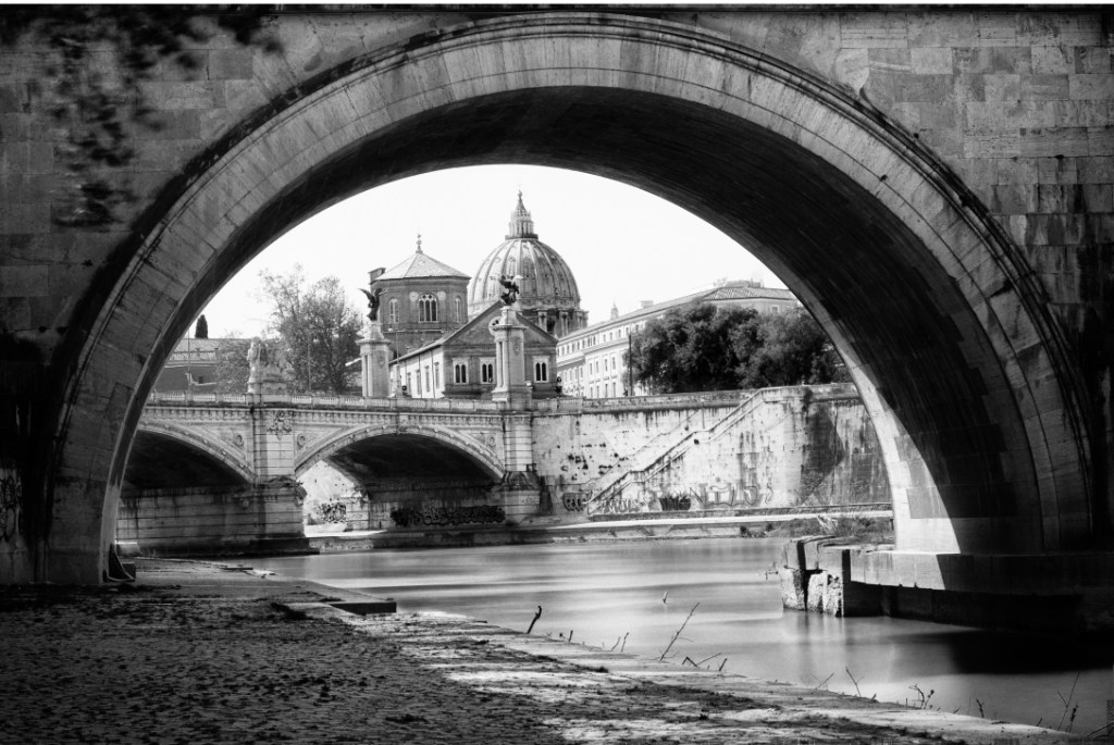
…St. Peter’s Basilica in the middle of the archway of this bridge in Vatican City…
…the Hungarian Parliament building in the middle of these arches at the Fisherman’s Bastion in Budapest…

…and at the Qutb Minar Complex in New Delhi, India, the Qutb Minar is seen through this archway here…

…and at the same complex we find the Delhi Iron Column perfectly centered in this archway at the Quwwat-ul Mosque.
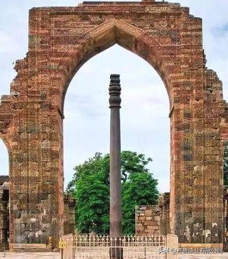
I am going to be dedicating a future blog post to feature the many examples like this of symmetry, proportion and alignment that I have found around the world between archways, and not only architecture, but what are called natural features as well.
It is called “framing” in photography, but this effect would not occur without the existence of a perfect alignment in the first place which is intentional, and not random.
Back to Canal Street.

Canal Street divides the traditional “downtown” area from the “uptown” area.
Downtown includes the French Quarter, Treme, Faubourg Marigny, and Bywater, and Uptown includes Irish Channel, Broadmoor, and Fontainebleau.
I will highlight a both downtown and uptown neighborhood.
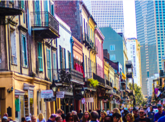
In Downtown, the French Quarter, or Vieux Carre Historic District, the oldest section of New Orleans.
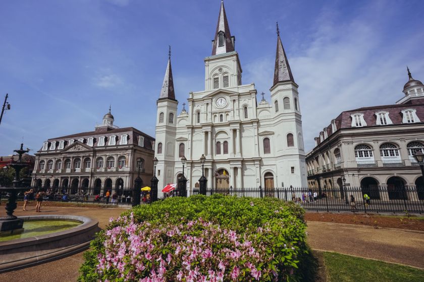
Originally called the Place d’Armes, Jackson Square is the oldest park in New Orleans, and named after Andrew Jackson, the victorious general of the Battle of New Orleans in 1815, where British troops were defeated.

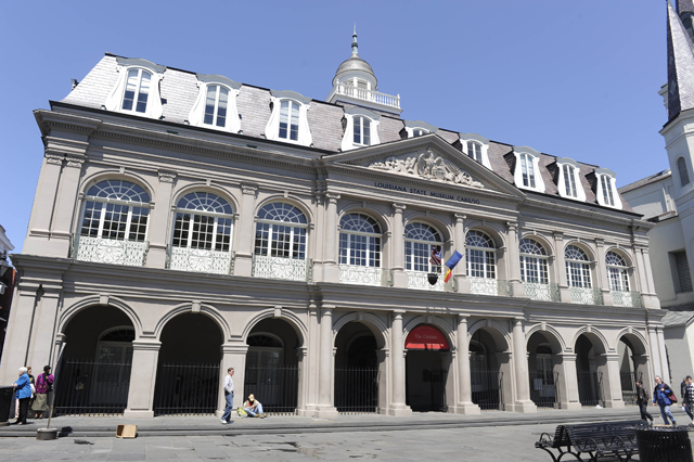
It is where, in 1803, Louisiana was made a United States Territory pursuant to the Louisiana Purchase at the Cabildo, said to have been built between 1795 and 1799.
St. Louis Cathedral is next to the Cabildo on Jackson Square. The most recent cathedral is said to have been expanded from the original structure in 1850. It is the seat of the Roman Catholic Archdiocese of New Orleans.
On the other side of St. Louis Cathedral on Jackson Square is the Presbytere, said to have been designed to match the Cabildo, and completed in 1813. It has been part of the Louisiana State Museum since 1911.

The Pontalba Buildings form two sides of Jackson Square, matching red-brick, one-block-long, four-story buildings said to have been built by the Baroness Micaela Almanester Pontalba.
The Upper Pontalba…
…along with the Lower Pontalba are considered the oldest continuously occupied apartment buildings in the United States.
In Uptown, the Broadmoor is considered a quiet, peaceful neighborhood with about 7,000 residents. I think the spelling of the name of the neighborhood is telling us about the Moors. I don’t think it is happenstance, or without meaning in this regard.
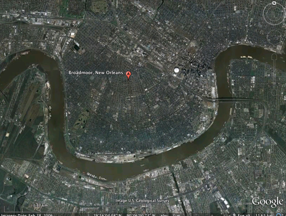
There are a number of beautiful and historic homes, churches, and commercial buildings in Broadmoor.
This is the Hubert Building in Broadmoor…
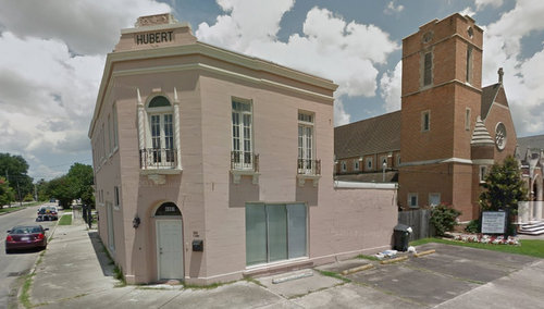
…compared with this building in Centro Historic District of Merida, Mexico.

I find examples of this same style of street-corner architecture around the world.
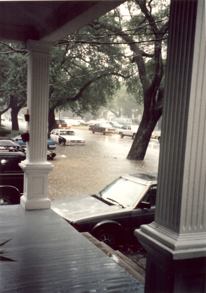
Broadmoor includes areas of the lowest-lying ground in New Orleans, and has been hard-hit by flooding, in 1995 with the Louisiana flood, and was hit hard by Hurricane Katrina in 2005.
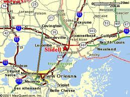
Next on the alignment is Slidell, on the northeast shore of Lake Pontchartrain in Louisiana’s St. Tammany Parish.
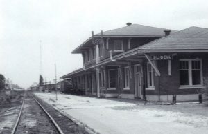
It was said to have been founded in 1882 and 1883 during the construction of the New Orleans and Northeastern Railroad (N.O.N.E.) connecting New Orleans to Meridian, Mississippi.
Slidell is on the southwest corner of the intersection of Interstates 10, 12, 59, and U. S. Highway 11.
The I-10 Twin Span bridge runs six-miles from Slidell over Lake Pontchartrain to New Orleans East.
It was extensively damaged by Hurricane Katrina in 2005…
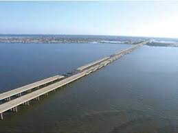
…and by 2010, both spans were re-built and opened to traffic.

Slidell is also the global headquarters for the automotive manufacturer and military contractor Textron Marine and Land Systems, manufacturing armored vehicles, turrets, advanced marine craft, and other weapons systems.

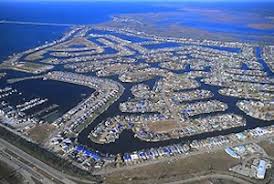
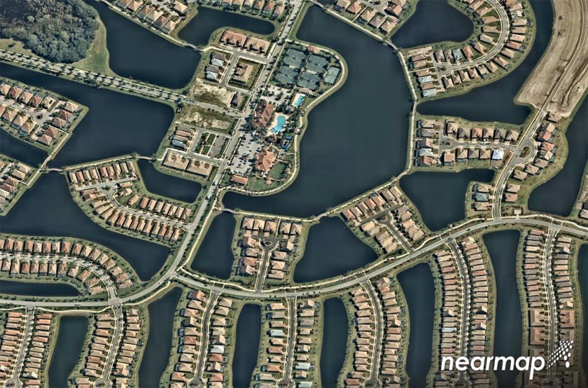
Between the northeast shore of Lake Pontchartrain, there are two places of interest to me as shown here on Google Earth – Eden Isles and Big Branch Marsh National Wildlife Refuge.
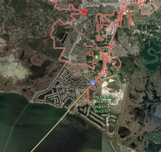
These sure look like artificial islands to me…
…like what was seen at Port Isabel, Texas…

…and Venice, Florida, in the last post.
Next on the alignment is Gulfport, the second-largest city in Mississippi after the state capital, Jackson.
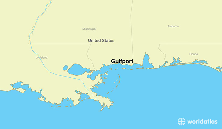
It is home to the U. S. Navy Atlantic Fleet Seabees, the Naval Construction Force.

The City of Gulfport was founded by William H. Hardy, and incorporated in 1898. He was the President of the Gulf & Ship Island Railroad that connected inland lumber mills to the coast.

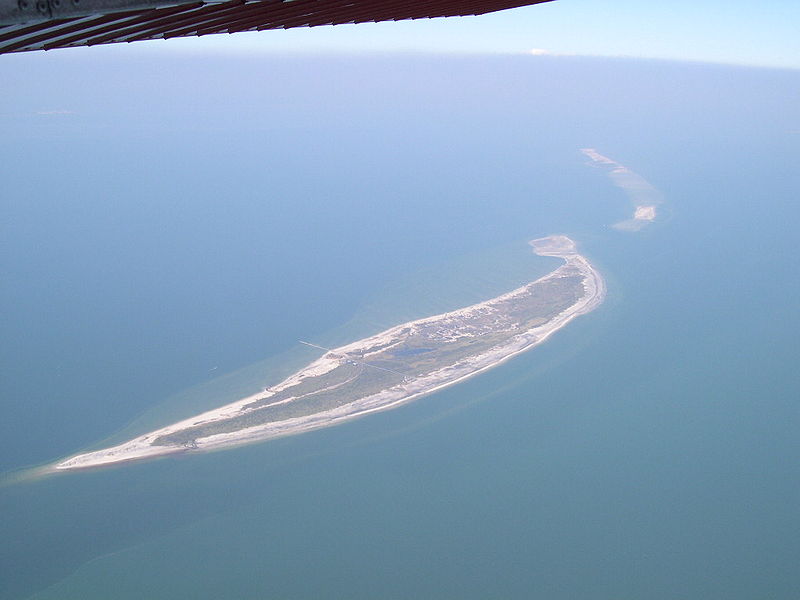
Ship Island refers to a barrier island off the Gulf Coast of Mississippi, part of the Gulf Islands National Seashore. It was split into West Ship Island and East Ship Island by Hurricane Camille in 1969.
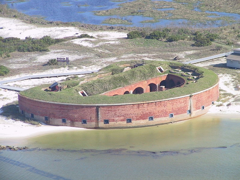
Fort Massachusetts is on West Ship Island, said to have been built following the War of 1812. Interesting to note that it incorporates both bricks and earthworks.
Here is a timeline of when architecture in Gulfport was supposed to have been built, from its incorporation in 1898 to 1916.
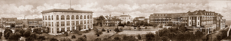
This is an historic photo of Gulfport circa 1905…

…which appears to be showing Gulfport’s Old Courthouse as already built.

Next is palatial First United Methodist Church of Gulfport, said to be one of the oldest places of worship on the Gulf Coast.

This is what the stained glass of the dome looks like inside the First United Methodist Church.

Here is a 1912 photograph showing the Gulf & Ship Island Railroad Headquarters on the left, and the Great Southern Hotel on the right.
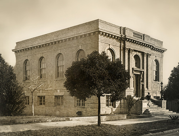
And last is the Carnegie Library, which is said to have opened in November of 1916. Interesting that they would have been opening a library building that looks like this in the the middle of World War I, which took place between July 28th 1914, and November 11th, 1918.
I am going to end this post here, and pick up the alignment in Biloxi, Mississippi in the next post.
