Sacred Geometry, Ley-Lines & Places in Alignment – Part 22 The Ellora Caves to Indore, India

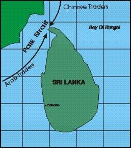
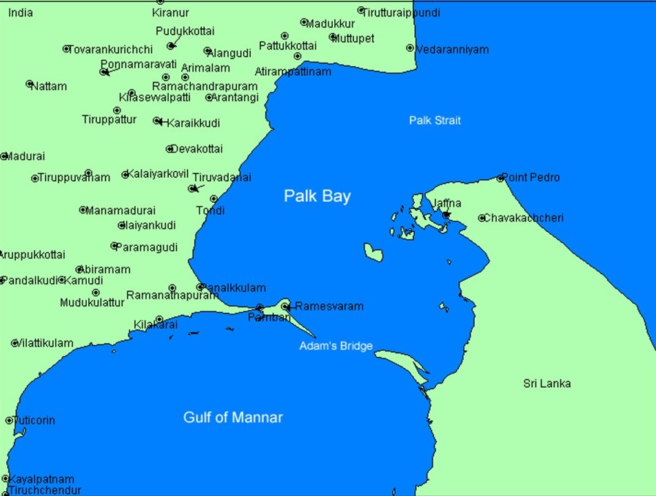
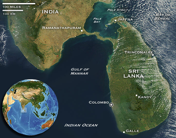
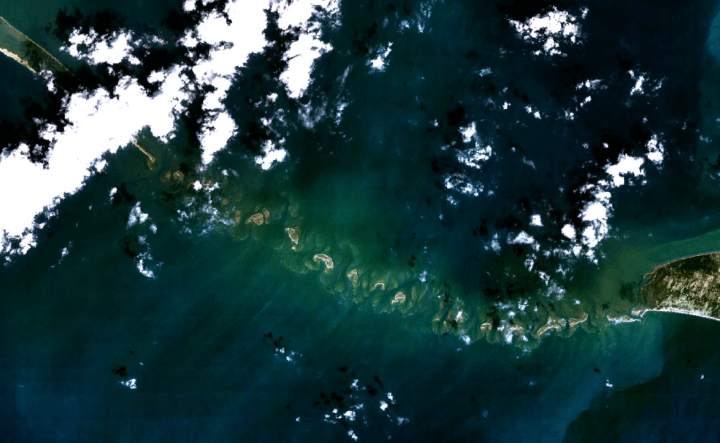
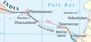
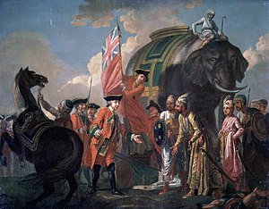
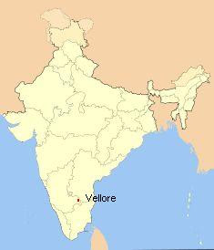
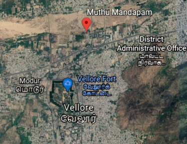
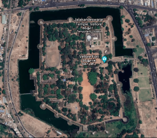
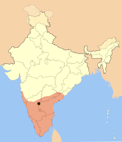
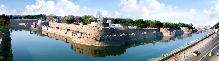
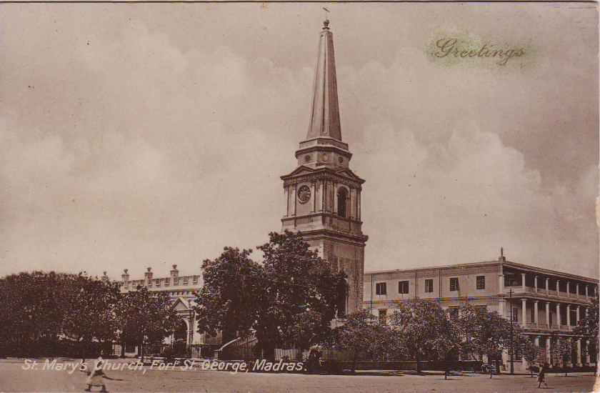
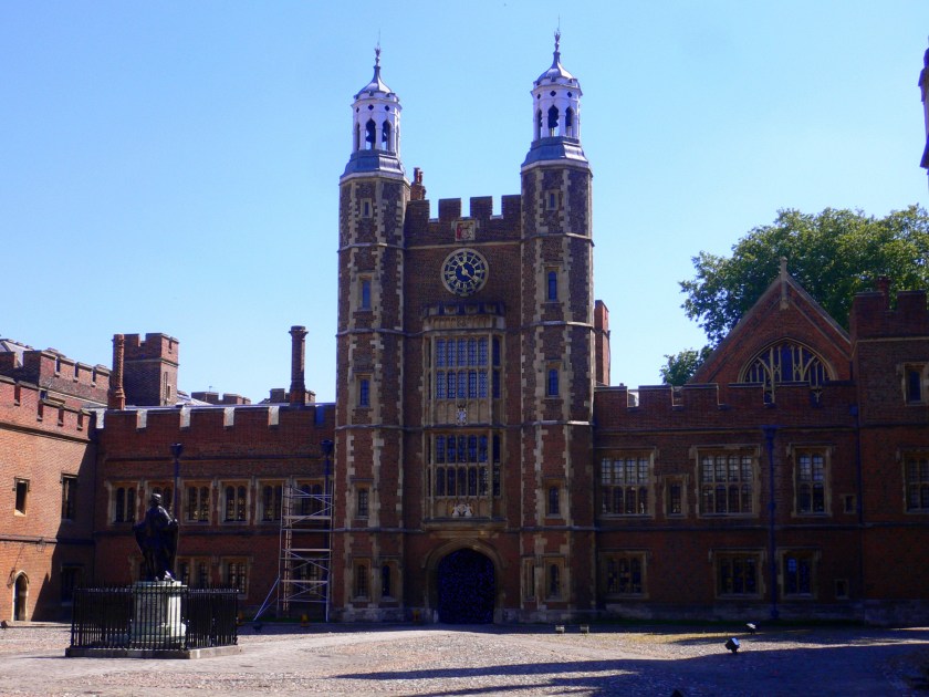
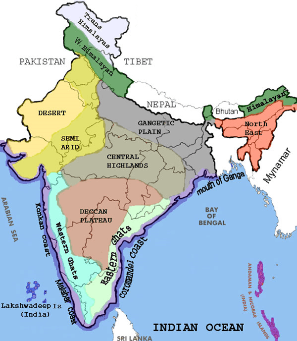
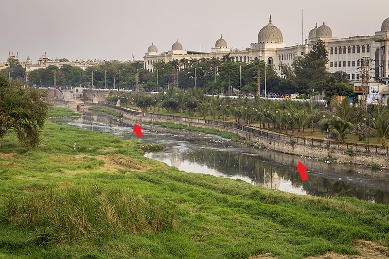
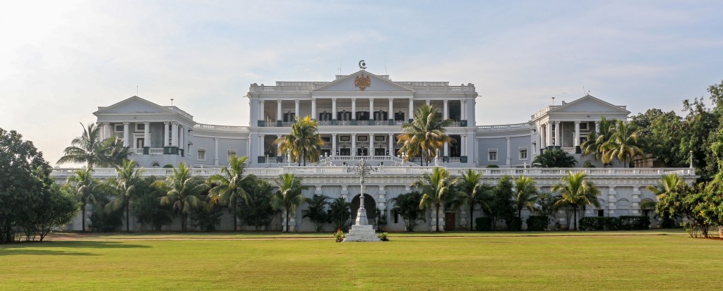
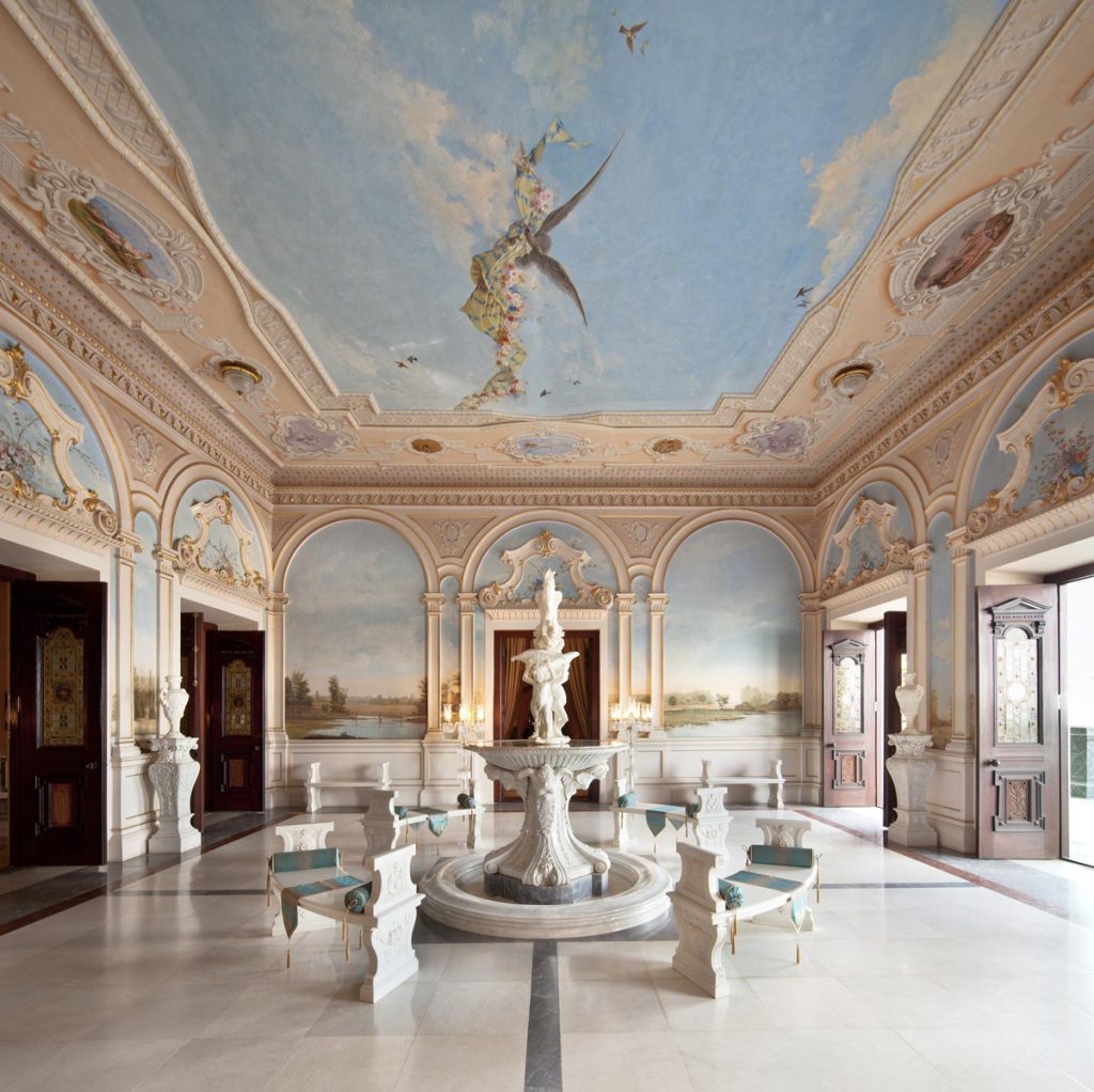
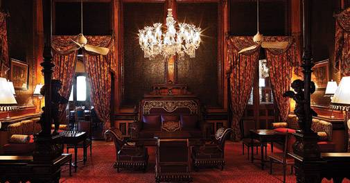
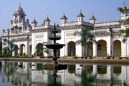
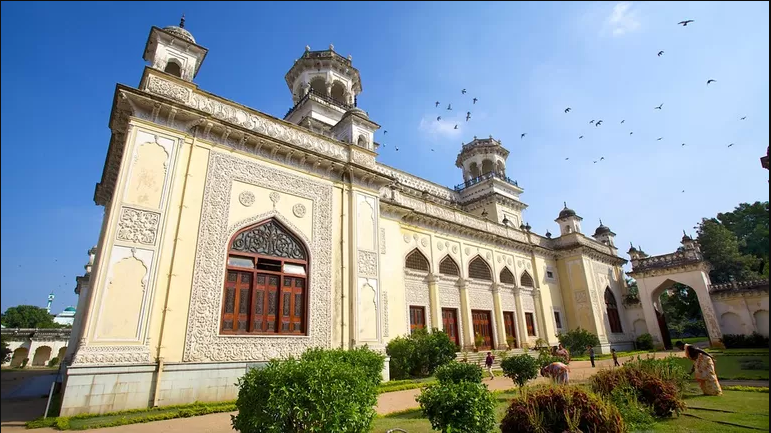
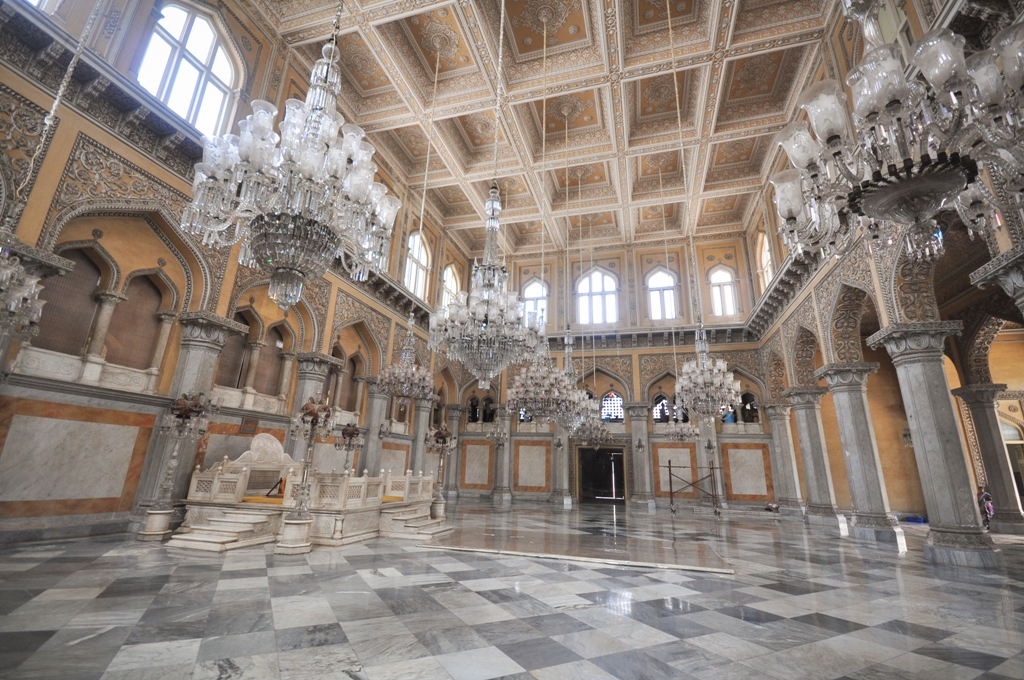
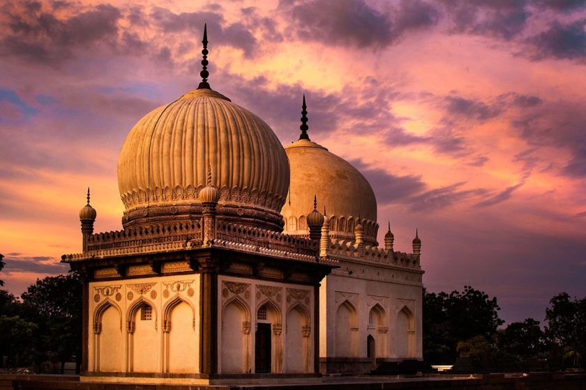
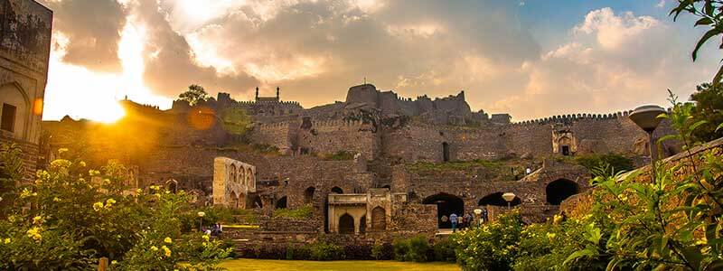
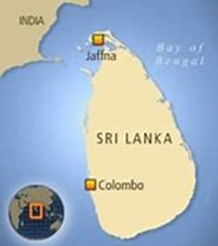
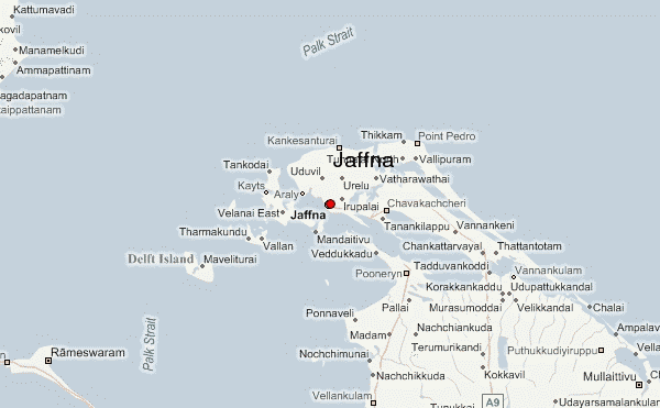
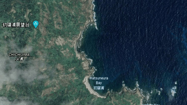
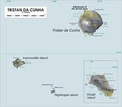
In the last post, I tracked the alignment from the Palk Strait, located between Sri Lanka and India; to Vellore, in the northeastern part of the Indian State of Tamil Nadu; and ended up at Hyderabad, the capital and largest city of Telengana State on the Deccan Plateau.

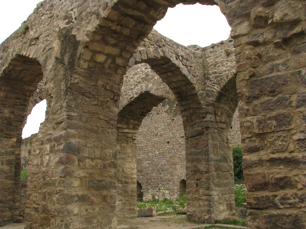
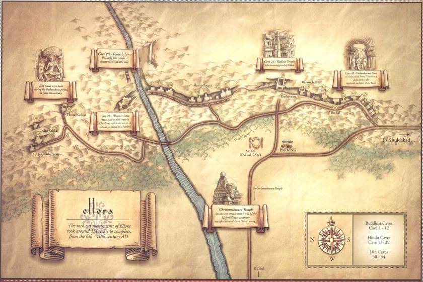
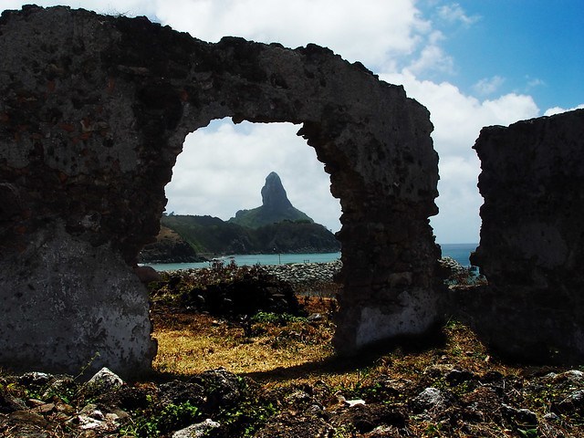
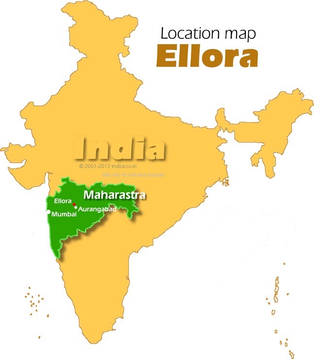
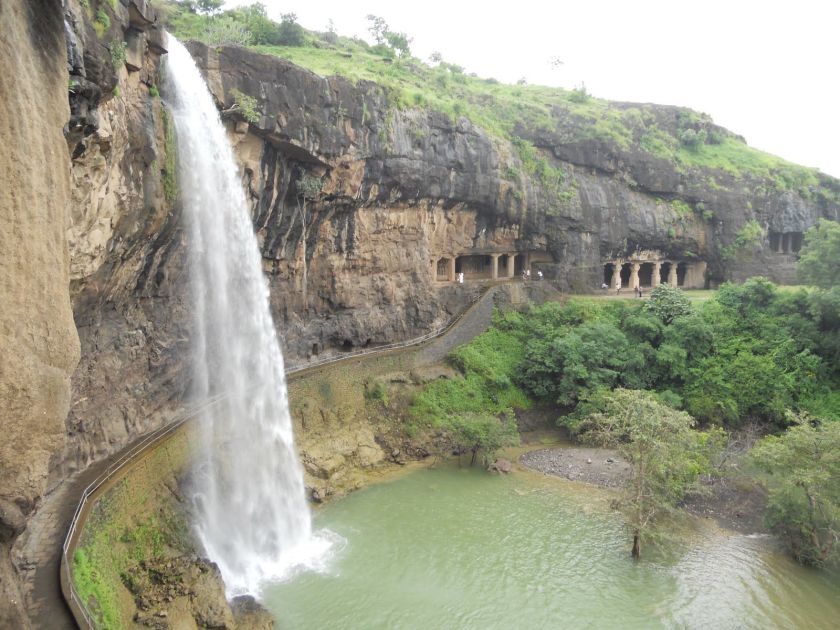
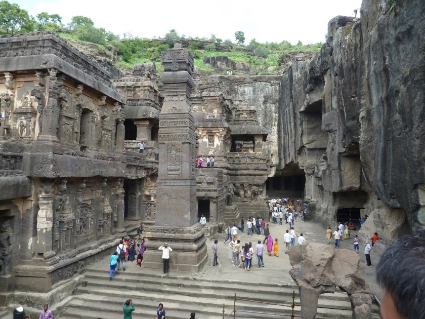
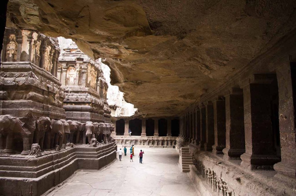
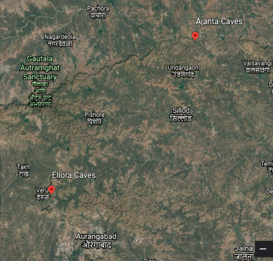
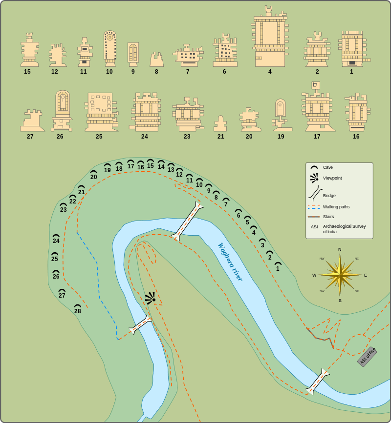
Next on the alignment we come to the Ellora Caves, located in the Aurangabad District of Maharastra, India.

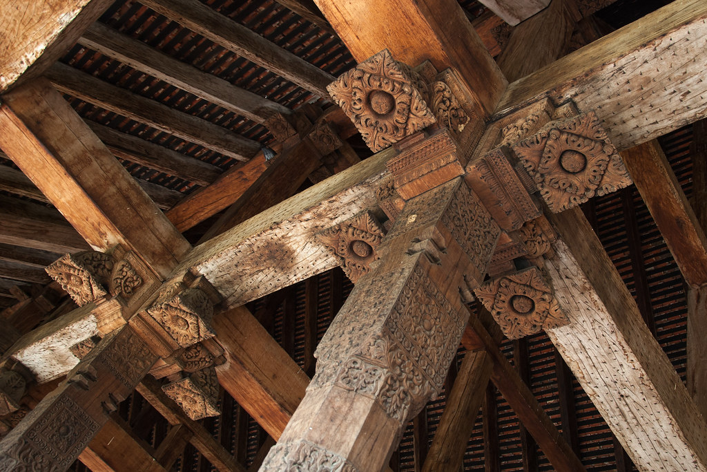
A UNESCO World Heritage Site, it is one of the largest rock-cut, monastery-temple cave complexes in the world, featuring Hindu, Buddhist, and Jain monuments and artwork, and we are told dating to the time-period of 600 – 1000 AD.

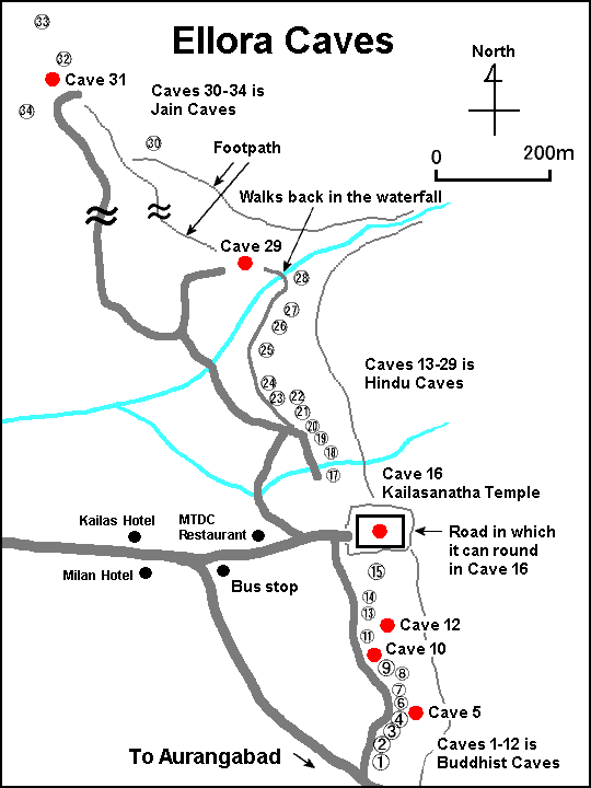
Of the 100-or-so caves at the site, excavated from the basalt cliffs in the Charanandri Hills, thirty-four are open to the public.


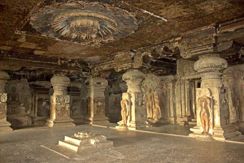
The Kailasa is the largest of the rock-cut temples at the Ellora Caves.

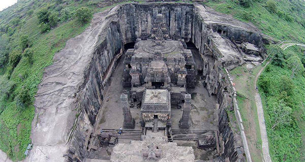
Carved from a rock-cliff face, it is considered one of the most remarkable cave temples in the world because of its size, architecture, and sculptural treatments.

Let me be clear: It is the world’s largest monolithic structure, meaning carved-out from the rock.

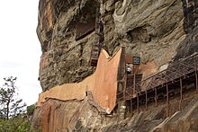
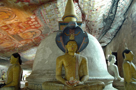
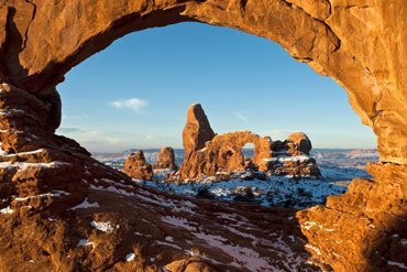
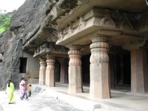
The Ajanta Caves are also in the Auranabad District of Maharashra state…

…almost thirty rock-cut Buddhist cave monuments, said to date from the 2nd-century BC to about 480 AD.

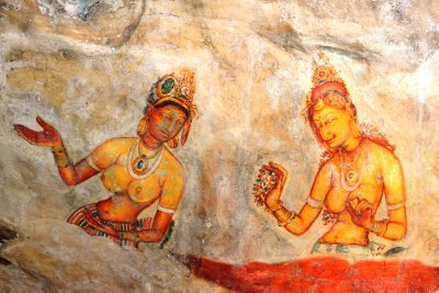
…and believed to be among the finest surviving examples of ancient Indian art, and masterpieces of Buddhist religious art.

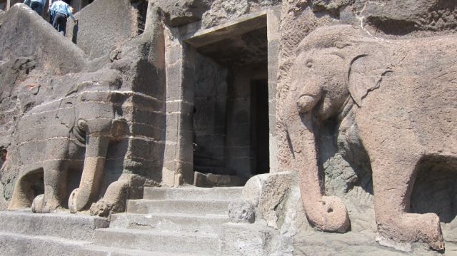
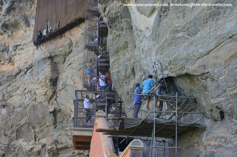
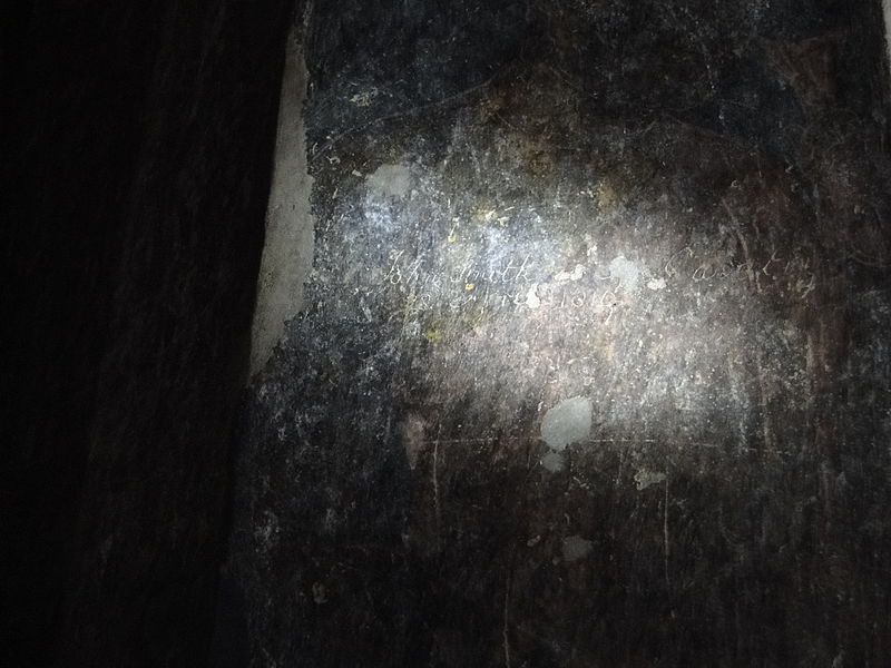
The Ajanta Caves were said to have been re-discovered in 1819 by a British officer named John Smith.

While hunting tigers, he was said to have discovered the door to cave #10 when a local shepherd boy guided him to the location and the door.

John Smith went to a nearby village to get help gaining entrance to the temple, after which time he vandalized the wall by scratching his name and the date over a painting on the wall.

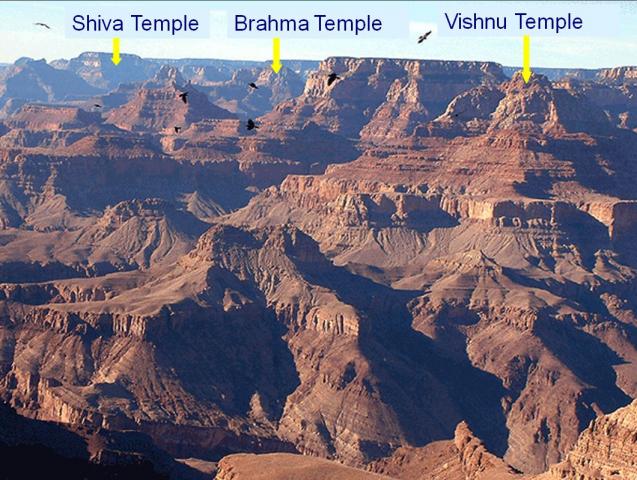
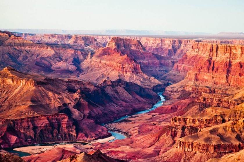
It is interesting to note that the Grand Canyon has Hindu names for some of its rock features, like the “Three Hindu Gods at the Grand Canyon…”

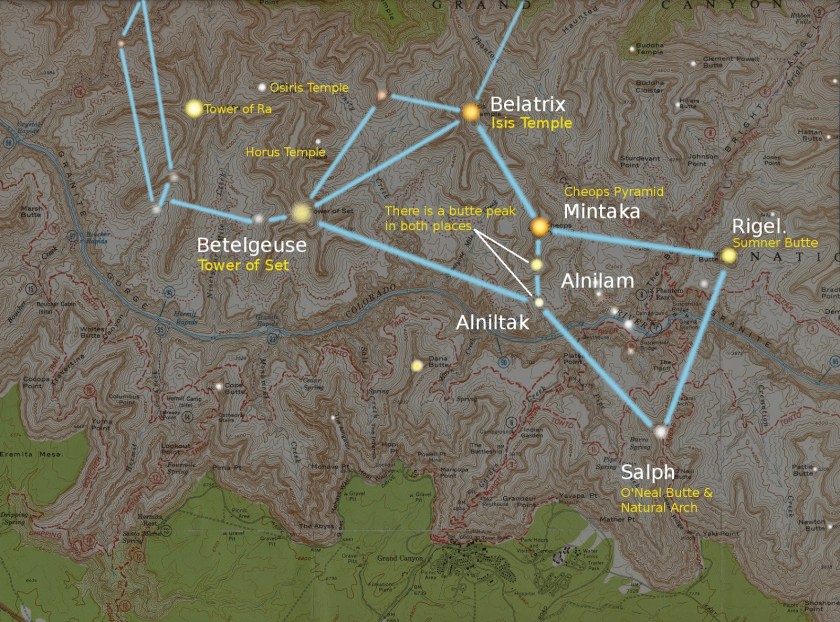
…as well as ones with Egyptian names, which are a part of the formation of a star map of the constellation Orion.

And there are stories from early explorers of the Grand Canyon, like the one of G. E. Kinkaid, who claimed to have found an entrance to a mysterious underground citadel…

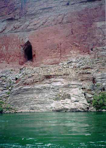
…which led to the finding of a massive chamber from which scores of passages radiated…

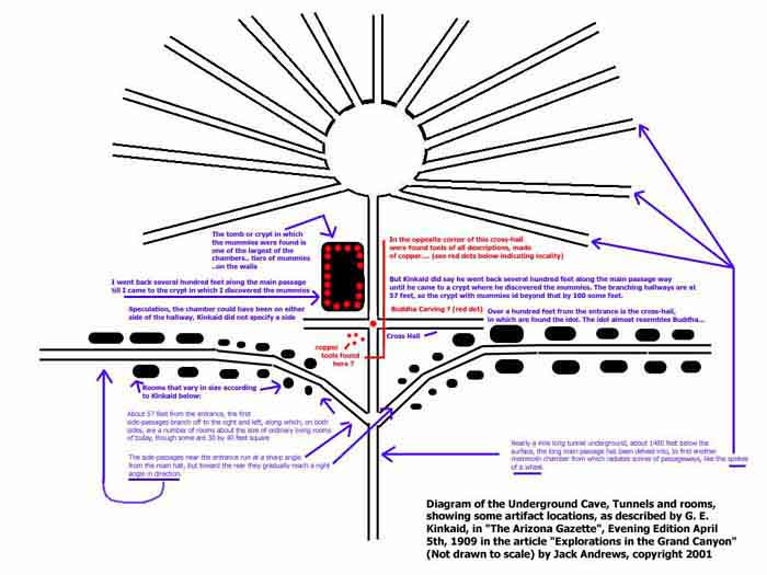
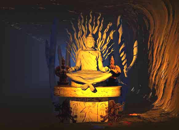
…and finding, among many other similar things, an idol sitting cross-legged, with a lotus flower in each hand.

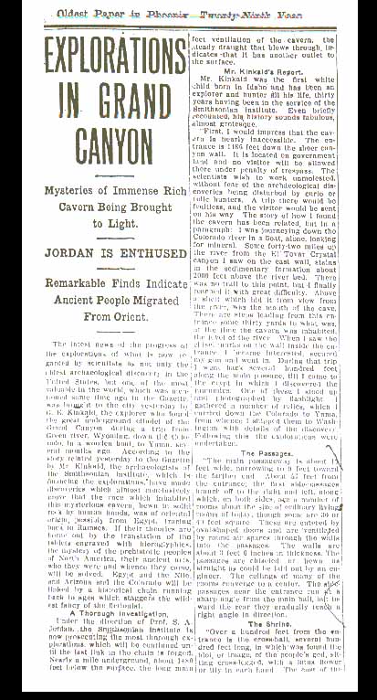
An expedition to a rock-cut vault in the Grand Canyon in 1909 by a Professor S. A. Jordan of the Smithsonian received front-page coverage in the Phoenix Gazette…

…about which the Smithsonian in short order was said to have claimed to not have knowledge of the discovery or the discoveries.

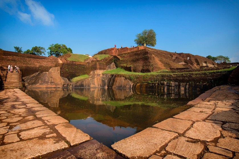
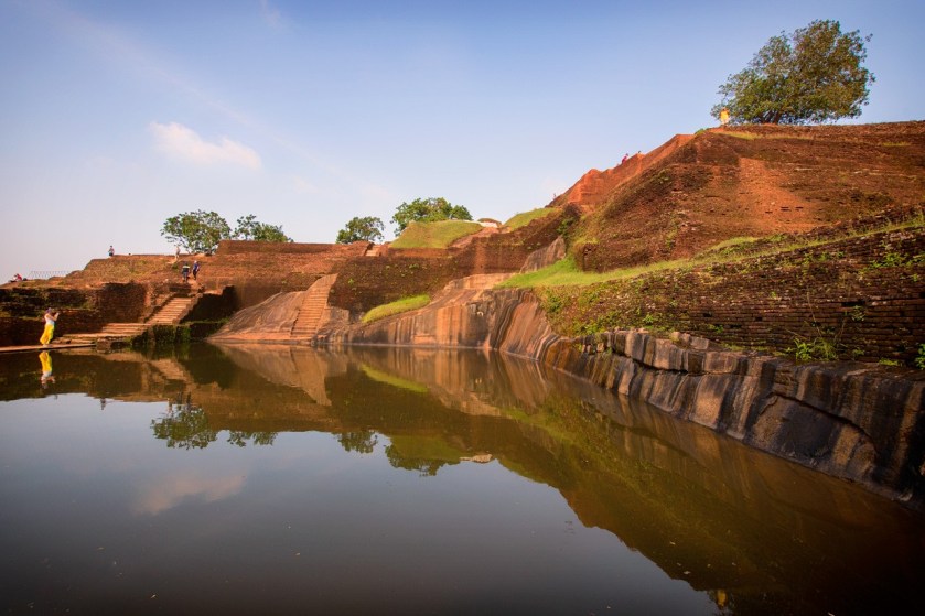
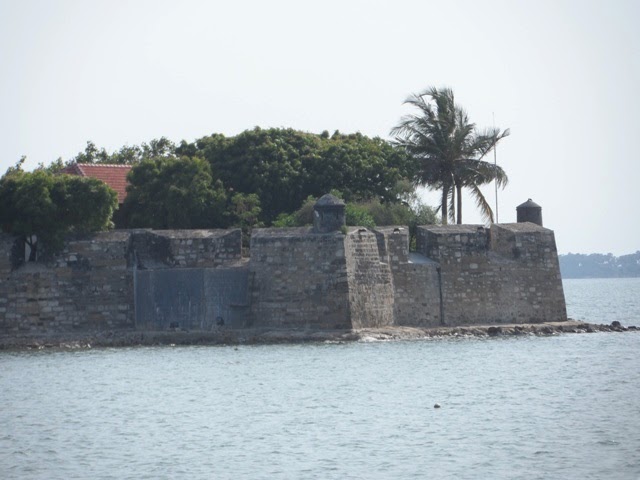
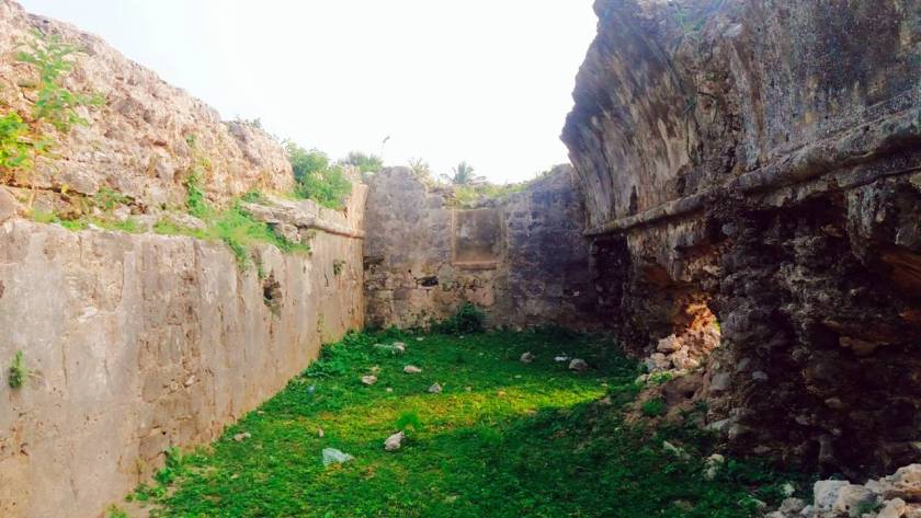
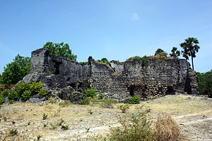
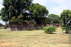
The “Grand Canyon of India…”

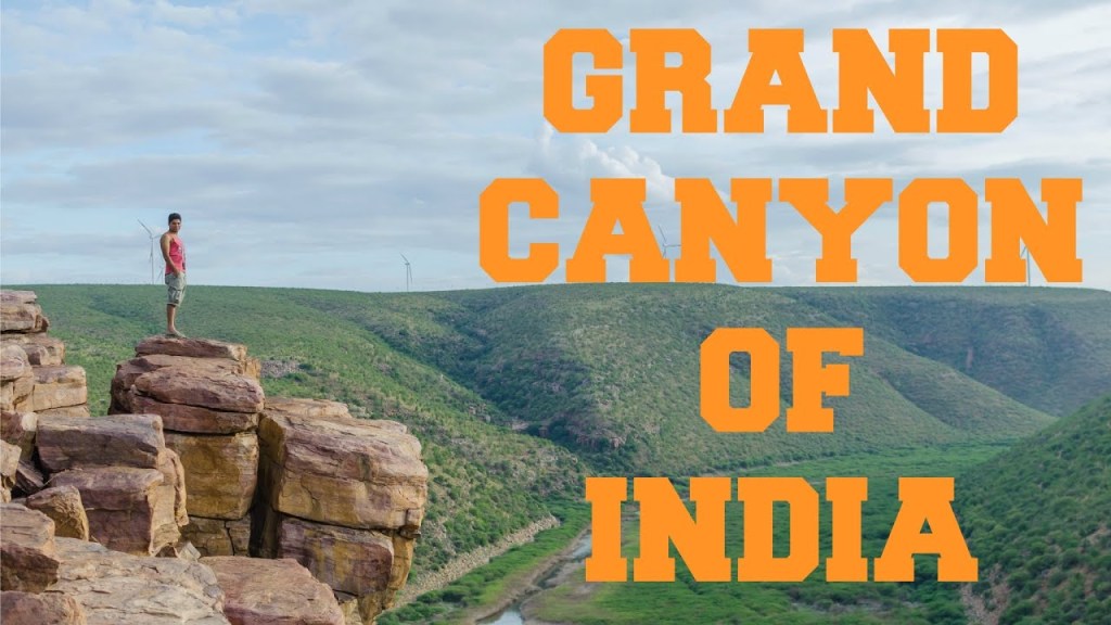
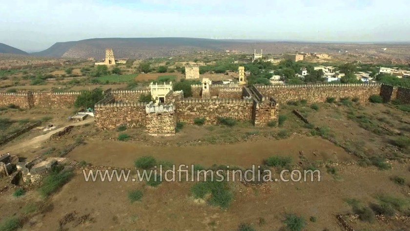
…is in a place called Gandikota, in the Andhra Pradesh State, along the Pennar River.

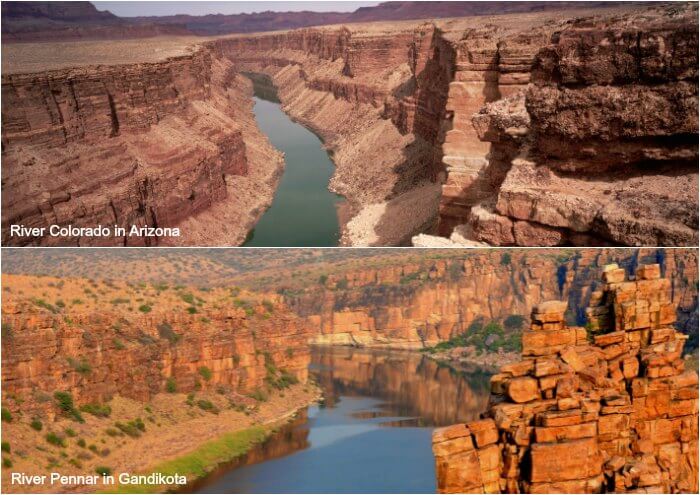
Gandikota, the center of power for various dynasties, including the Golconda Sultanate mentioned in the last post, also has a massive fort at Gandikota, built of granite, with a 20-foot, or 6-meter, high entry gate in a fort wall running around a 5-mile, or 8-kilometer, perimeter.

It has 101 bastions, each about 40-feet, or 12-meters, high.

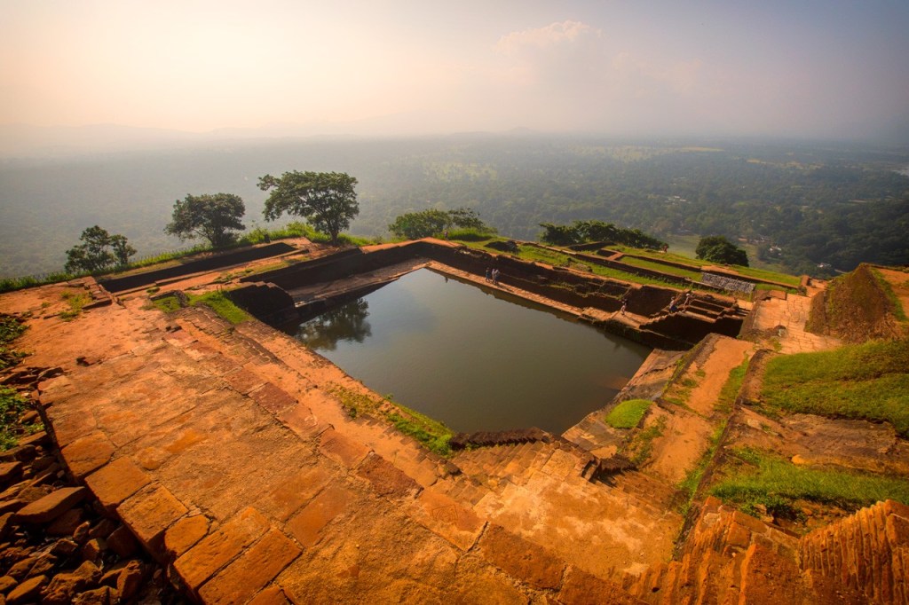
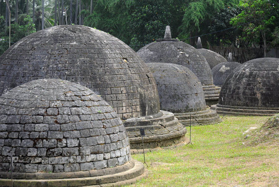
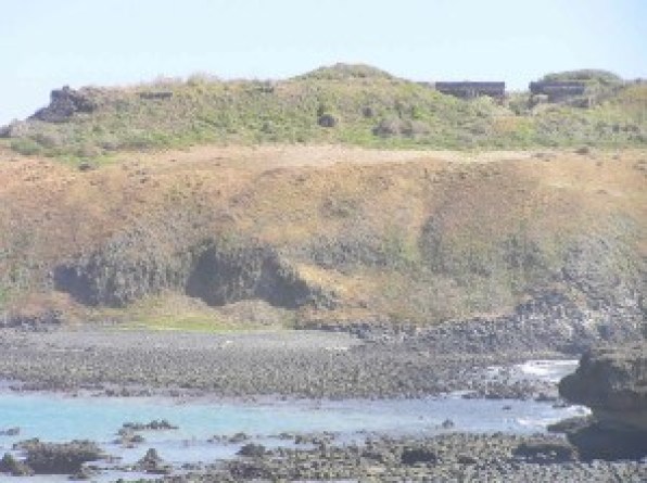
The Belum Caves, approximately two-hours from Gandikota in Andhra Pradesh…

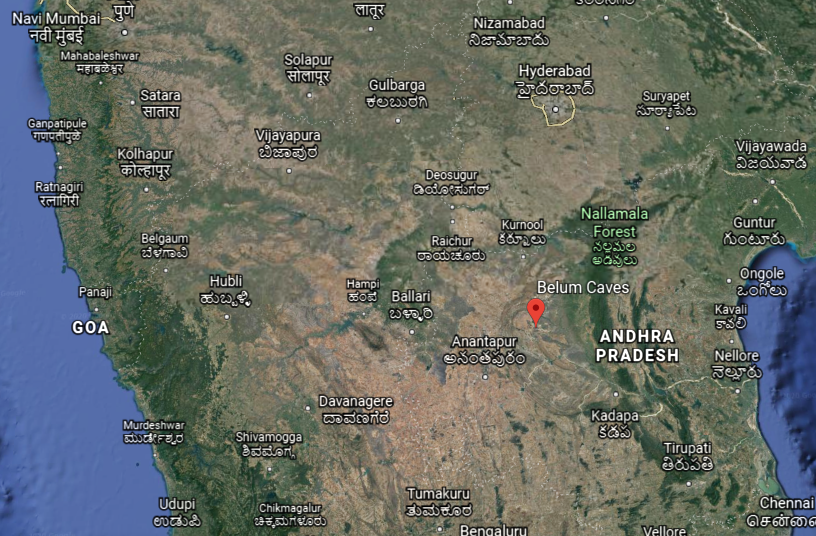
…are the largest and longest cave system open to the public on the Indian Subcontinent.

The Bezeklik Thousand Buddha Caves are found in Turpan, in the Uighur Autonomous Region of China, a complex of 77 rock-cut cave grottoes said to date from between the 5th and 14th centuries…

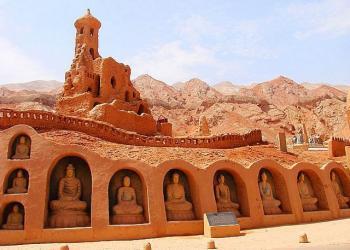
…that are located in what is called the Flaming Gorge…

…compared to the appearance of Arizona’s Grand Canyon.

What in the world is going on here?

I believe there is something very important that we have not been told about the universality of the spiritual beliefs, practices, and building technology of the ancient worldwide advanced civilization.

Examples of places in other countries with massive architecture cut directly out of rock include the eleven monolithc churches of Lalibela in Ethiopia.

Here are three of them…

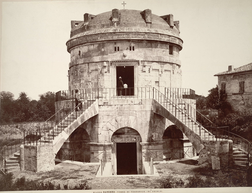
…the roof of the mausoleum of Theodoric outside of Ravenna in Italy is described as a single, 230-ton, or 209-metric-tonne type of limestone…

…which for some reason no longer has its beautiful double-stone-staircase, and other features it used to have that look like they have been filled in…

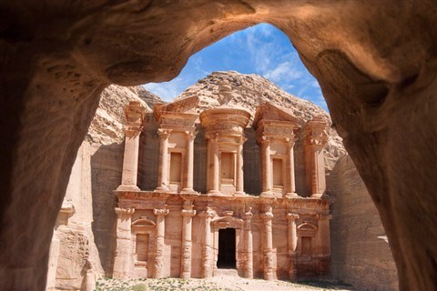
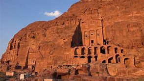
…the ancient site of Petra in Jordan…

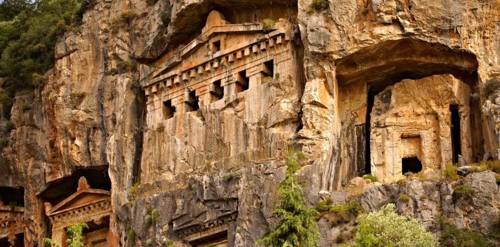
…and the Lycian rock-cut Dalyan temples in the province of Antalya in southern Turkey.

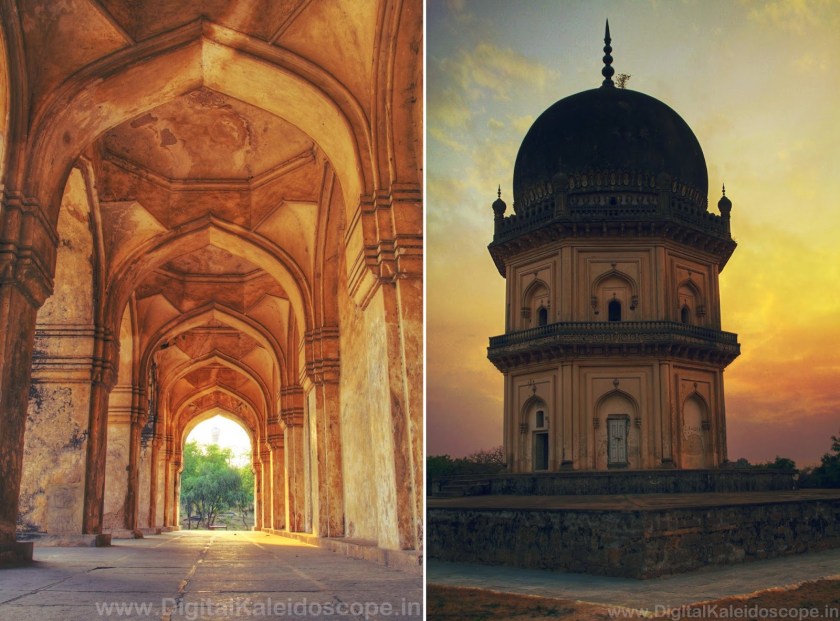
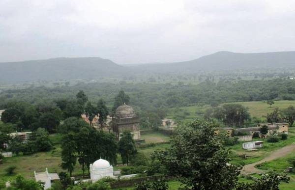
Just a short distance from the Ellora Cave-Temple Complex in Khuldabad…

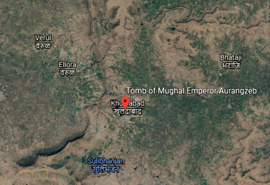
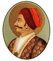
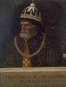
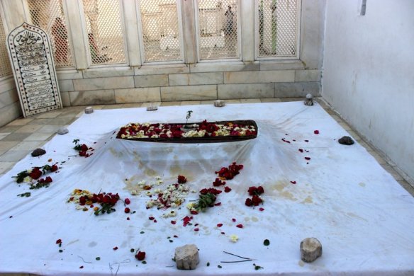
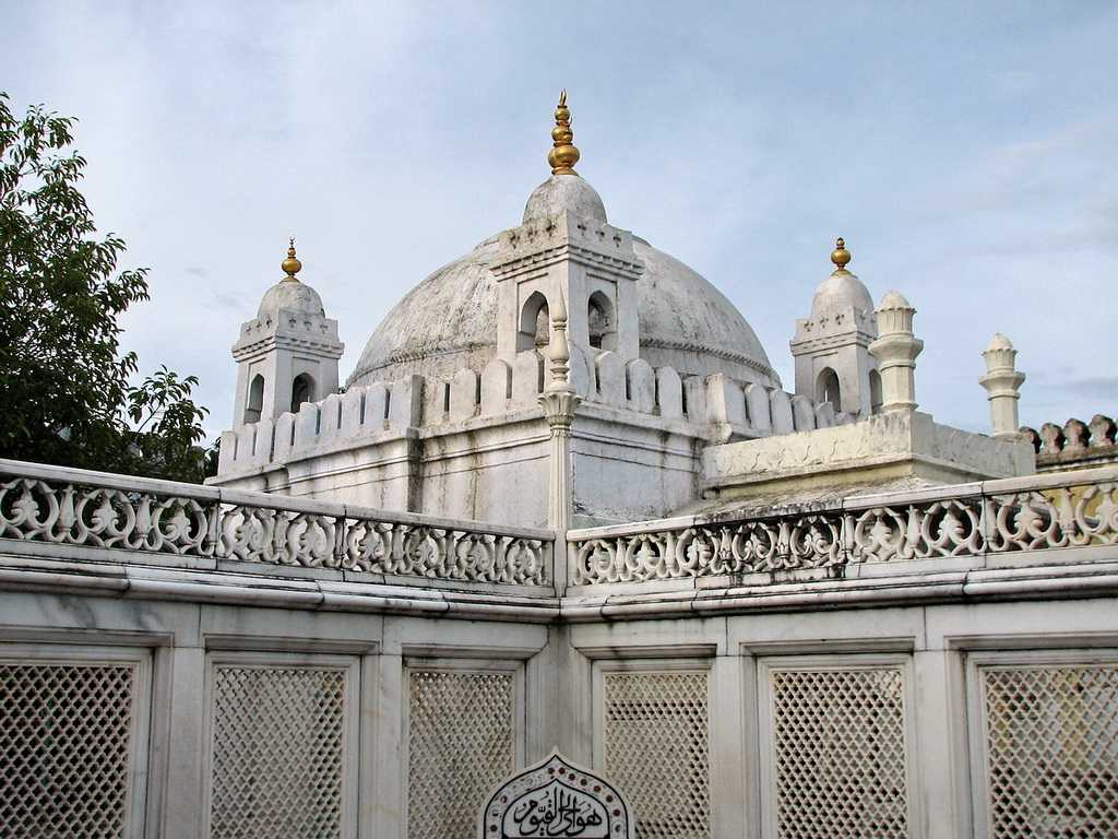
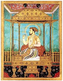
…is the Tomb of Aurangzeb, considered the last of the strong Mughal Emperors, and who died in 1707. Aurangzeb means “Ornament of the Throne” in Persian.

A Persian name for the ruler of the Mughal Empire of the Indian subcontinent?

His burial site is located on at the complex of the dargah, or shrine, of Sheikh Zainuddin, a Sufi saint of the Dahkan, also known as Deccan, of India, and the spiritual and religious teacher of Aurangzeb.

As a matter of fact, Khuldabad is popular as the “Valley of Saints” because several Sufi saints resided there in the 14th-century.

Who were the Sufis?

They were mystics, and practitioners of the inward dimension of Islam.

Sufism emphasizes personal experience with the Divine, and concentrating one’s energy on spiritual development rather than focusing on the teachings of human religious scholars.

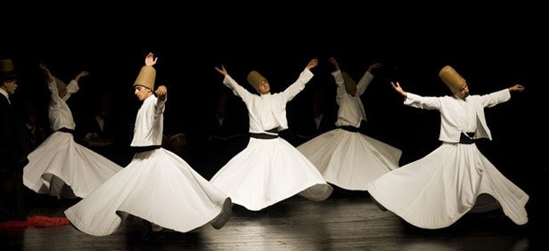
For example, followers of the Persian Sufi Mystic Rumi, from the Greater Khorasan…

…established the Mevlevi Order in Konya, Turkey, otherwise known as Whirling Dervishes,  who practice a spinning dance used to connect with the Divine.

Okay, this information about the Mughal Emperor Aurangzeb having a Persian name and being a Sufi Muslim…

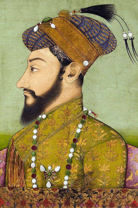
…and Rumi being a Persian from the Greater Khorasan is really nudging at my consciousness to bring in another stream of information.

Some of what I am about to share is based on things I have learned in tracking this alignment, and some of it is based on things I remember learning at some point in my life.

I am going to surf the synchronicities here because that is all I am able to do.

The validity of this information is gone from the official historical narrative about whether or not I am correct going in this direction.

I can’t definitively prove what I am going to say, but I can bring forward something that wants to come out in a meaningful way.

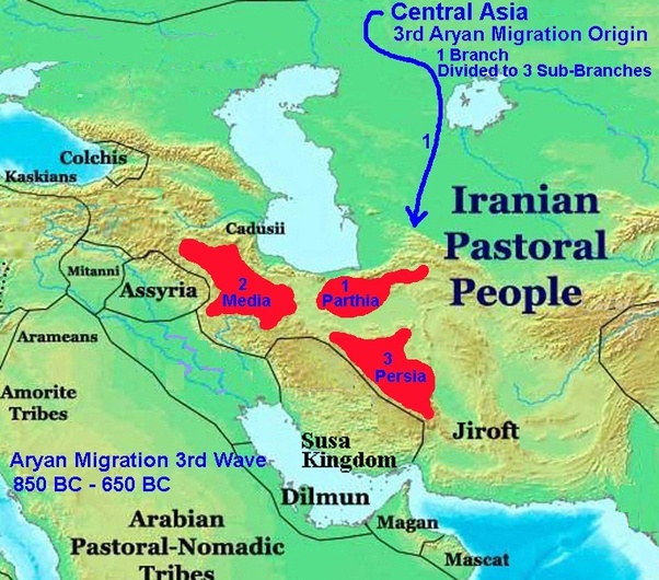
Earlier in this series, I tracked this alignment through Pakistan, Afghanistan, Iran, and Turkey.

I found the alignment running through a region historically called “the Greater Khorasan,” forming the northeast province of what is called Iran today, Persia historically, and comprising the present territories of northeastern Iran, parts of Afghanistan, and much of Central Asia.

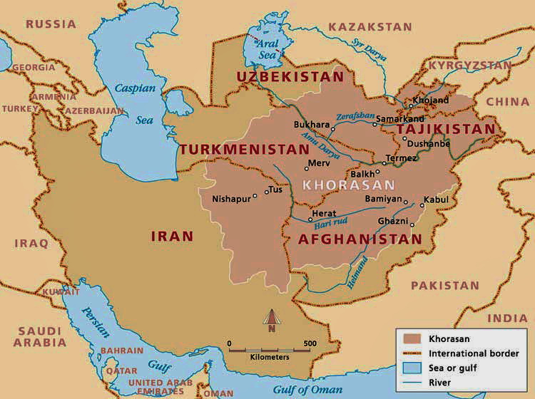
Khorasan is said to mean something along the lines of “Land of the Sun,” or “Where the Sun Arrives from” in Persian.

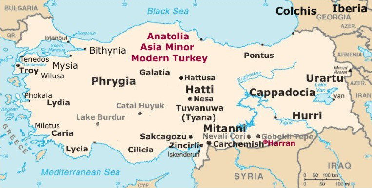
Then, when I arrived in Turkey, known historically as Anatolia, I found out that Anatolia also means something along the lines of “Rising Sun” in ancient Greek.

Also, the “Land of the Rising Sun” is a popular nickname for the country of Japan.

So what this tells me is that the whole concept of the sun always rising on the empires of the ancient advanced civilization was embedded in language and collective awareness.

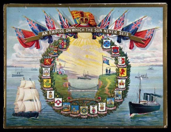
In similar fashion, we learned that the “Sun never set on the British Empire.”

We are told that between the 18th- and 20th-centuries, Britain acquired more and more territories, making it the largest empire in history.

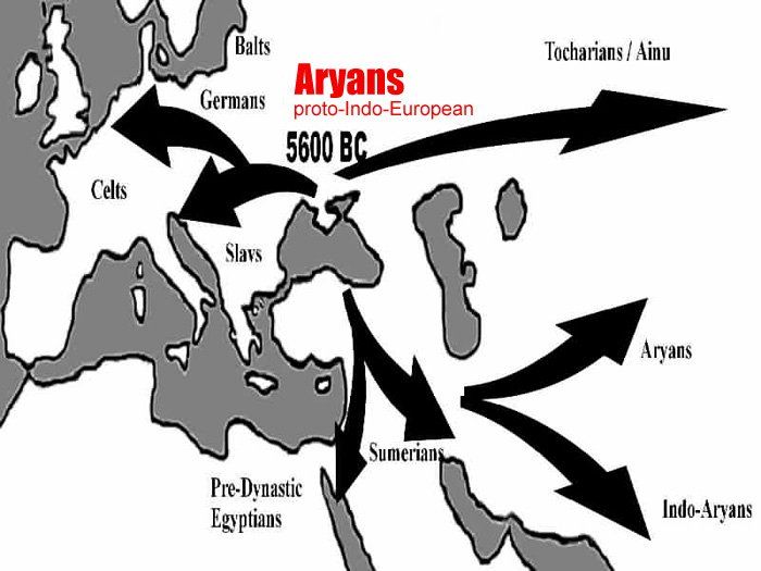
When I saw the Persian name of the Mughal Emperor Aurangzeb, I vaguely recollected something about the Aryans. It rang the bell of a distant memory.

In looking up definitions of Aryan, here is what I am finding:

The Aryans brought Hindu religious thought to India;

The term was used by the Indo-Aryan people of the Vedic period in Ancient India as a religious label for themselves;

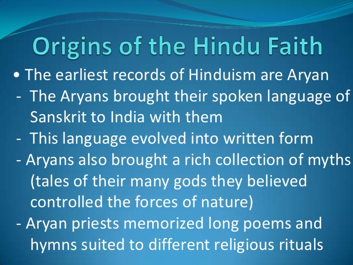
The Iranian people used the term as an ethnic label for themselves in the Avesta scriptures, the religious texts of Zoroastrianism, and the word “Aryan” forms the source of the country name Iran;

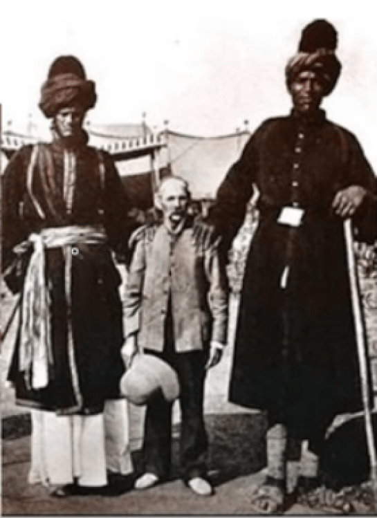
The definition of an Aryan, described by the Nazi Germans as a member of the Master Race, was not Jewish and had nordic features.

What exactly was the Nazi obsession with creating a Master Race all about?

Was this actually a desire to re-create the original Master Race?

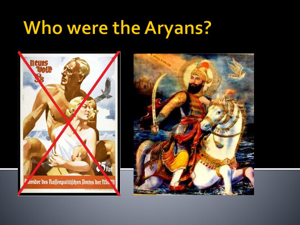
Giant human beings who, among many other things, were capable of carving massive infrastructure right out of rock like it was no big deal?

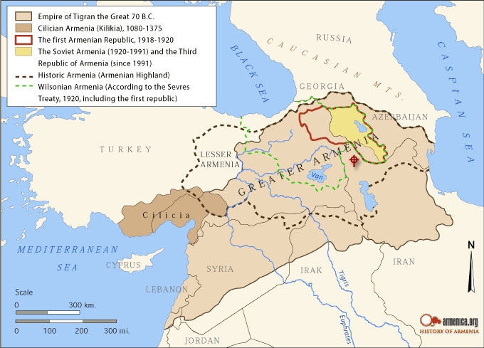
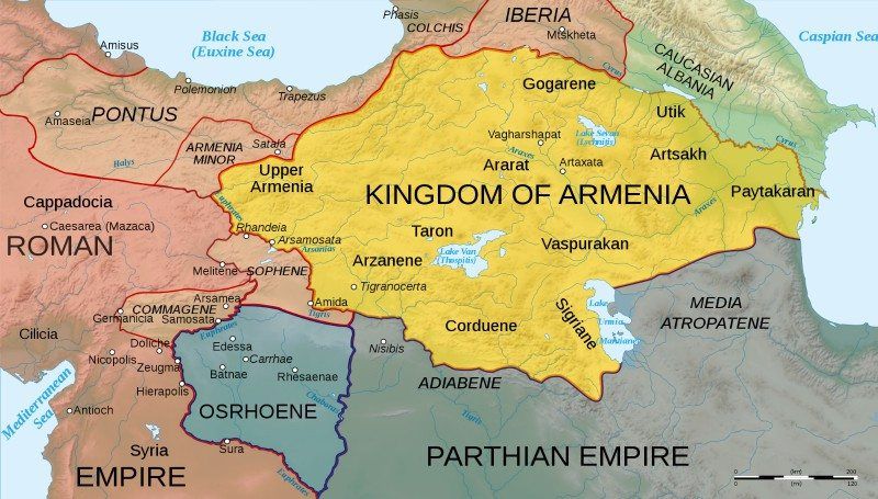
When I was tracking this alignment through the modern country of Turkey, in the ancient region of Lake Van, I learned about the Kingdom of Urartu…

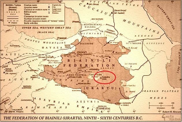
…which was historically part of Armenia.

Which brings me to the question: Who were the People of Ar?

Mt. Ararat, the legendary landing place of Noah’s Ark, was located in the historical Armenia, though now is within the boundaries of modern Turkey.

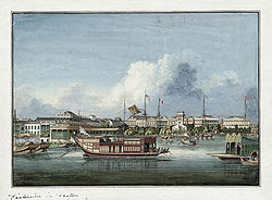
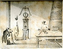
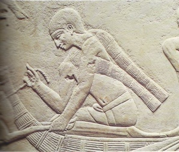
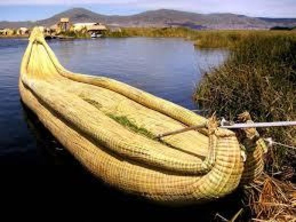
The Sumerians called Ararat “Arrata,” and they tell of this land of their ancestors in the Armenian Highlands in their epic poem of Gilgamesh.

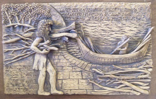
Compare the boat pictured here with the Sumerian Gilgamesh with an ancient Egyptian boat…

…a boat on Lake Chad in Africa…

…and a boat on Lake Titicaca in Peru.

As a matter of fact, Arrata is said to be now recognized as the world’s most ancient, known civilization, dating back to 22,000 BCE, developing in the steppes north of the Black Sea, in modern Ukraine and believed to spread out from there to India, Mesopotamia, Egypt, Western China, and across Europe.

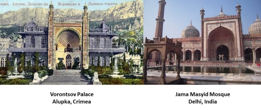
This is the Vorontsov Palace in Alupka, on the Black Sea’s Crimean Peninsula, which was historically part of the Ukraine, on the left, in comparison with the Jama Masyid Mosque in Delhi, India, on the right.

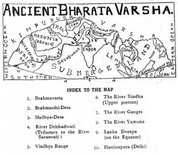
I found out that ancient India was known as Bharata Varsha at one time…or does the term Bharata Varsha refer to the entire earth?

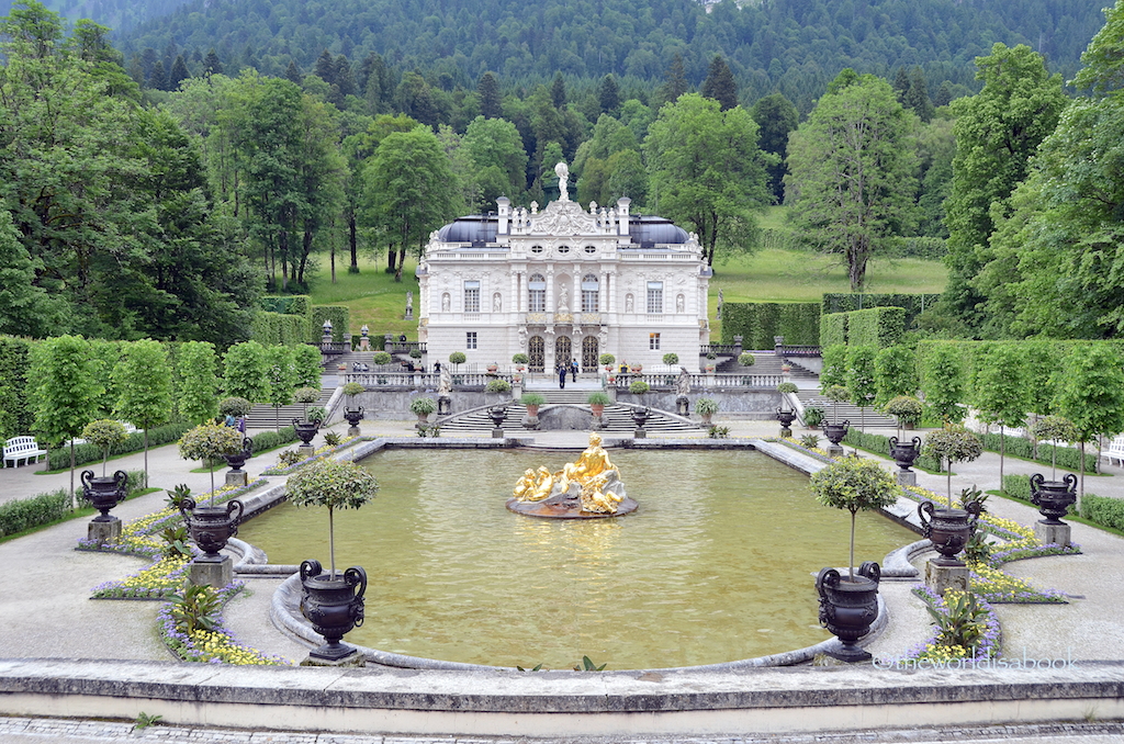
Let’s take a look at Bavaria, a state in Germany, at the Linderhof Castle, the smallest of three castles said to have been built by mad King Ludwig II, constructed between 1863 and 1886.

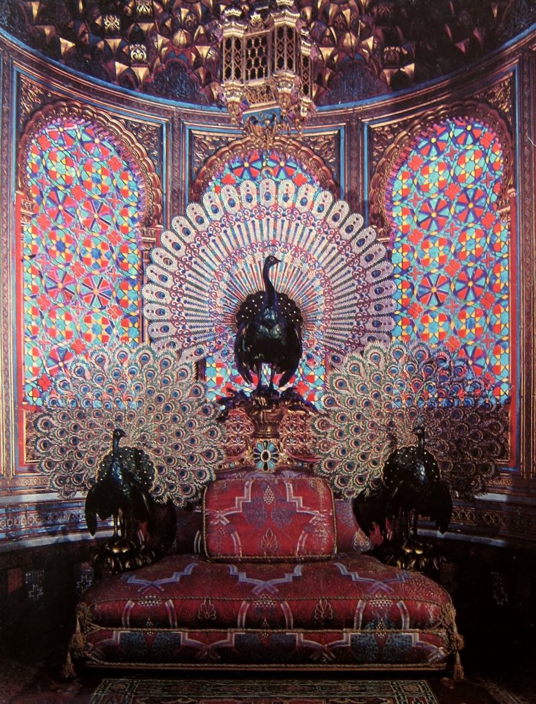
This is the Peacock Throne found inside the Linderhof Palace.

…and Moorish architecture is found in this amazing room inside the main Linderhof Palace…

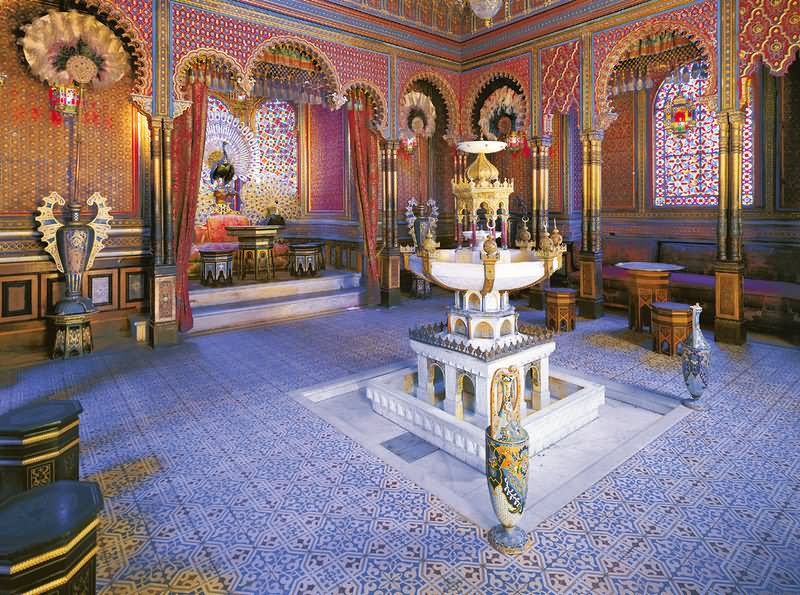
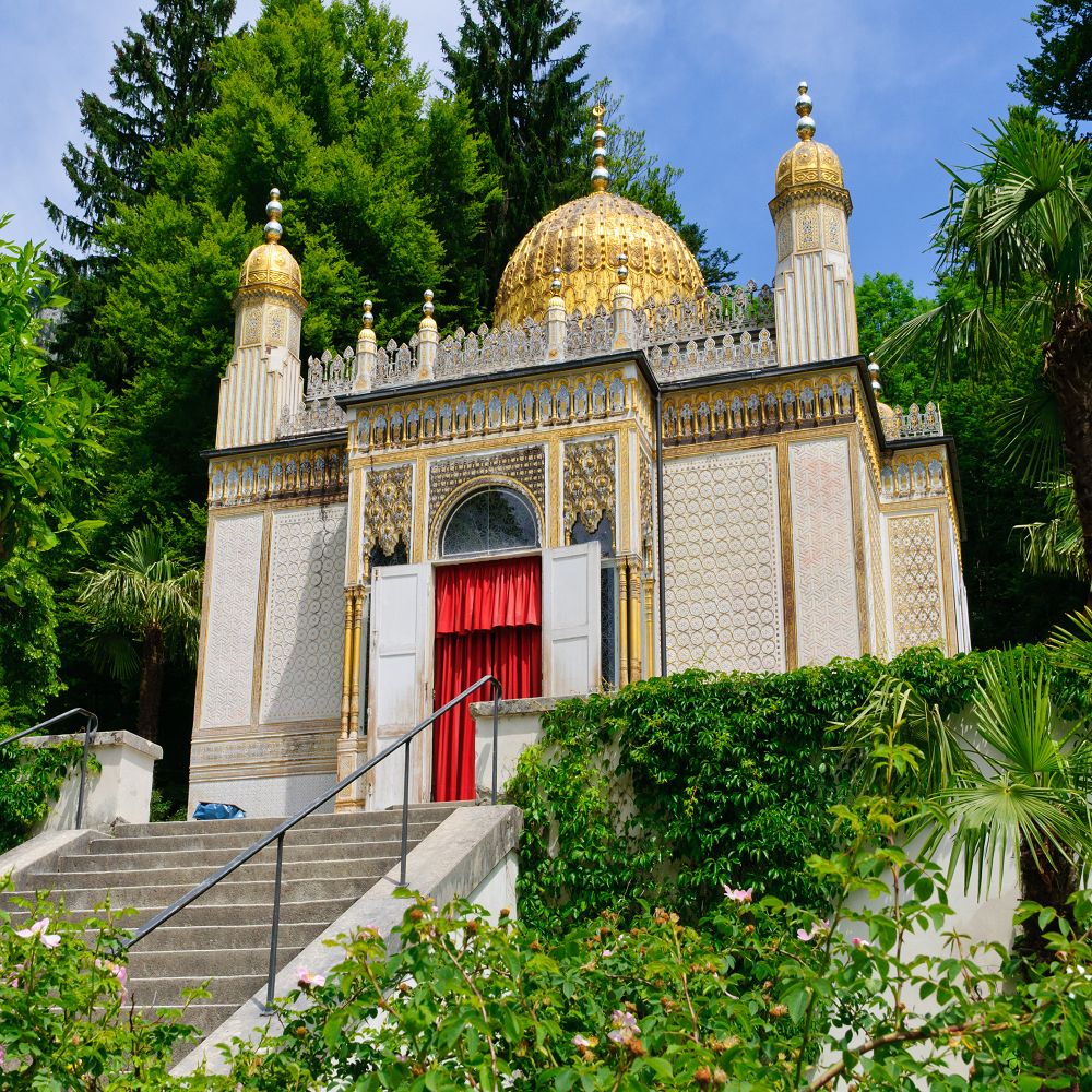
…and this building located on the grounds of the Linderhof Palace complex.

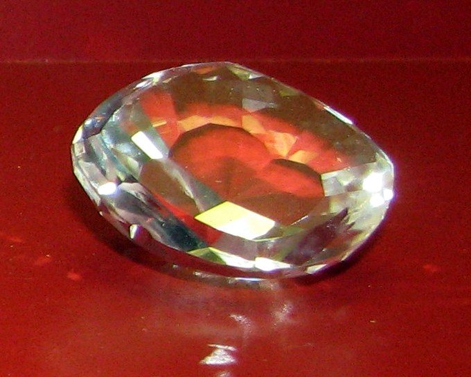
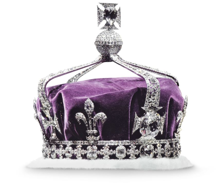
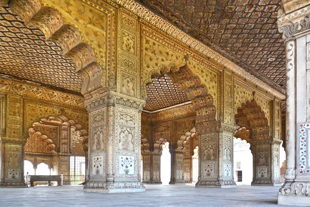
The Peacock Throne of the Mughal Emperor was a famous jewelled throne…

…located in the Hall of Private Audiences…

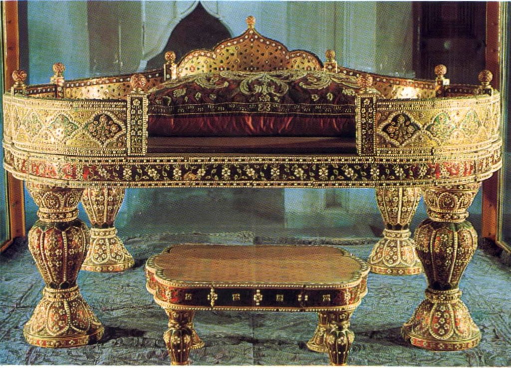
…at the Red Fort, in Delhi, India, the main residence of the Mughal Emperors.

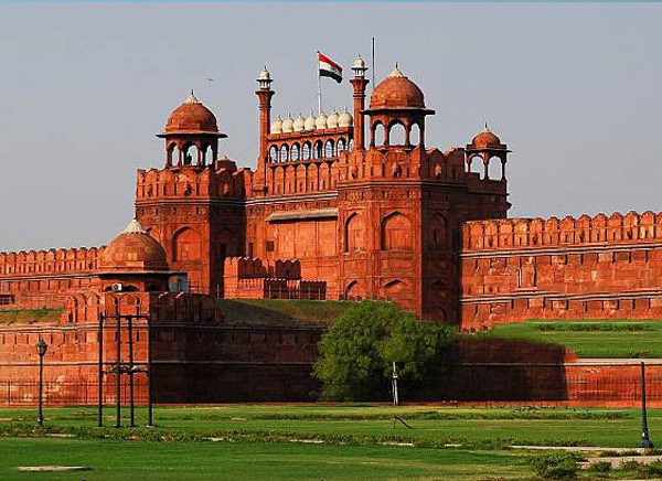
…and now the Mughal Peacock Throne is on display at the Topkapi Palace in Istanbul, Turkey, not in India.

Where else can I find “ars?”

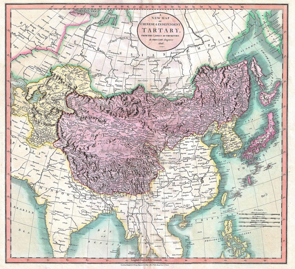
Tartary, or Tartaria, a historical region in northern and Central Asia…

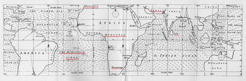
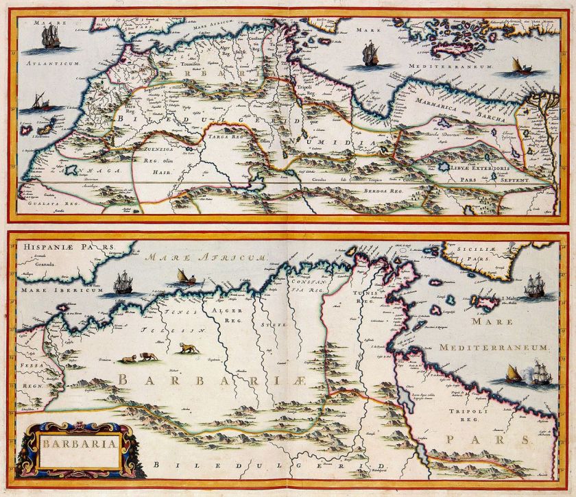
…the Barbary Coast, or Barbaria, the name given to a vast region stretching from the Nile River Delta, across Northern Africa, to the Canary Islands…

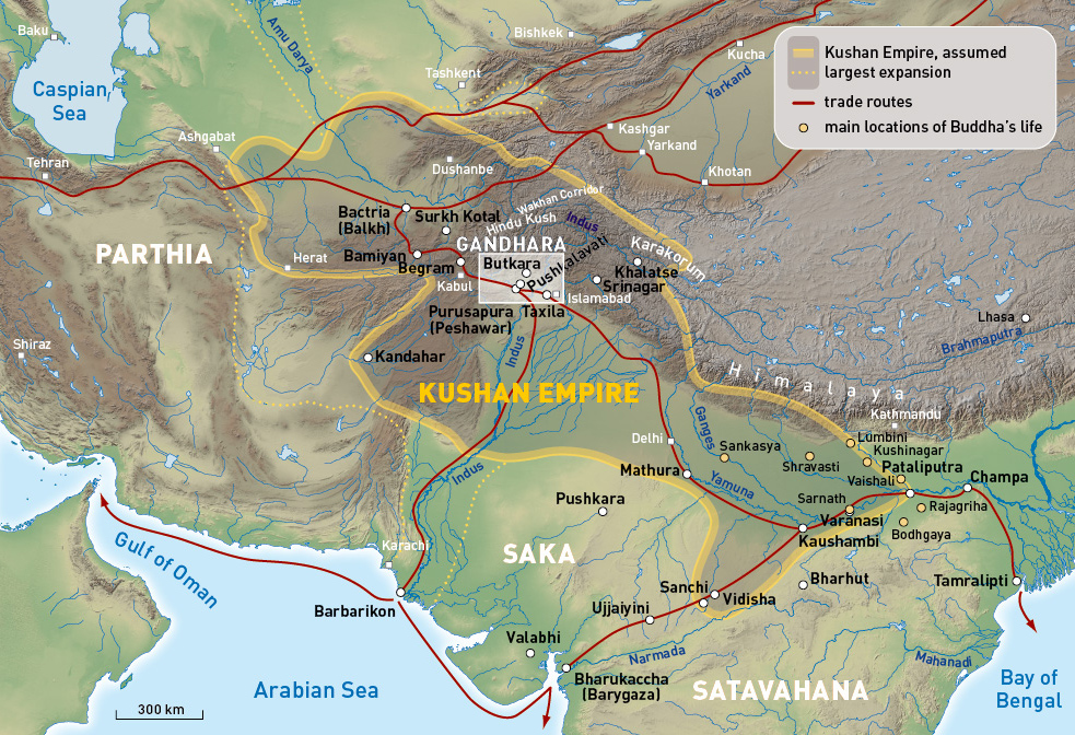
…Gandhara, an ancient Buddhist Kingdom primarily in what is now Pakistan, and part of the Kushan Empire…
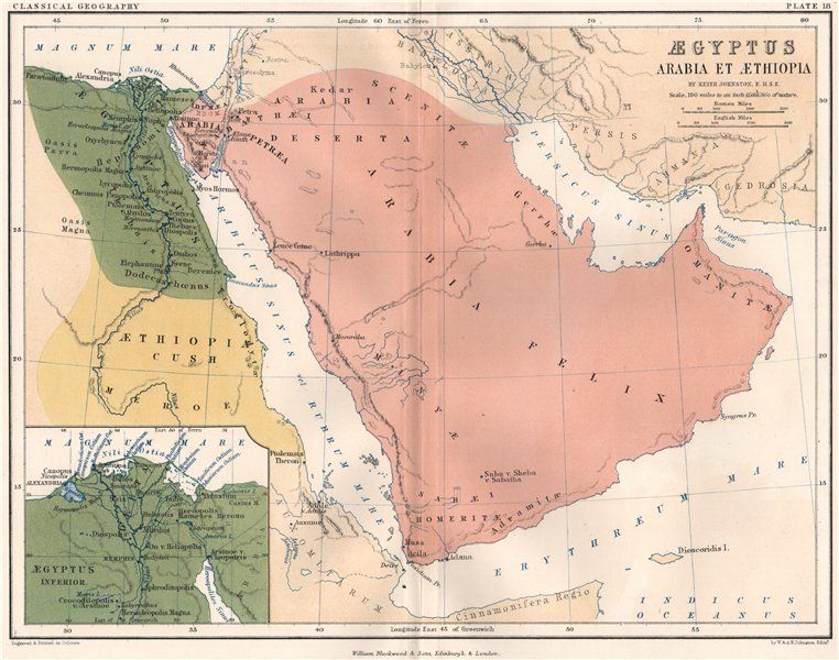
…Arabia…

…Arizona in the United States, with its flag on the top, compared with the flag of Tibet on the bottom, both looking very much like a sunrays in the background…

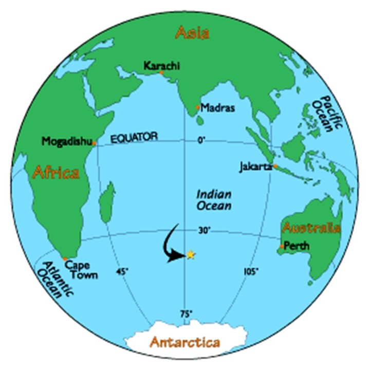
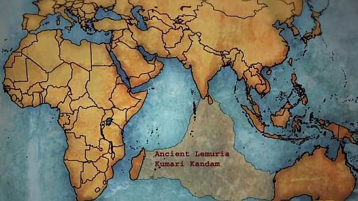
…and Kumari Kandam, a lost continent in the Indian Ocean that had an ancient Tamil civilization, to name just a few.

Who were the People of Ar?

Originally, Humanity as a collective was taught the knowledge of who we really are as spiritual beings and living holograms of the Universe; how to reconnect with Higher Self by raising kundalini energy from the base of the spine up to the third-eye and crown chakras…and lived at a much, much higher level of consciousness and full potential in human form…

…before the Earth’s people and grid system was deliberately hijacked by dark beings with a negative agenda, who definitely don’t want us to wake up to our true history and who we really are.

Here’s the thing. By Universal Law, we have to give our consent for what they have done here, and the only way they can accomplish this consent is by outright lies, deception and duplicity because if people knew the true agenda of these controllers, the majority of Humanity would never, ever, ever accept anything that has taken place here.

They wanted to rule over it all, take all wealth for themselves, and control the destiny of Humanity for their own benefit, not ours. And more and more people are waking up to this every day ~ we do not consent…and we never consented!

Back to India.

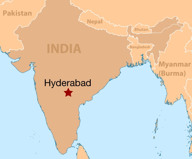
The next place I want to take a look at on the alignment is Indore, the largest and most populated city in the Indian state of Madhya Pradesh.

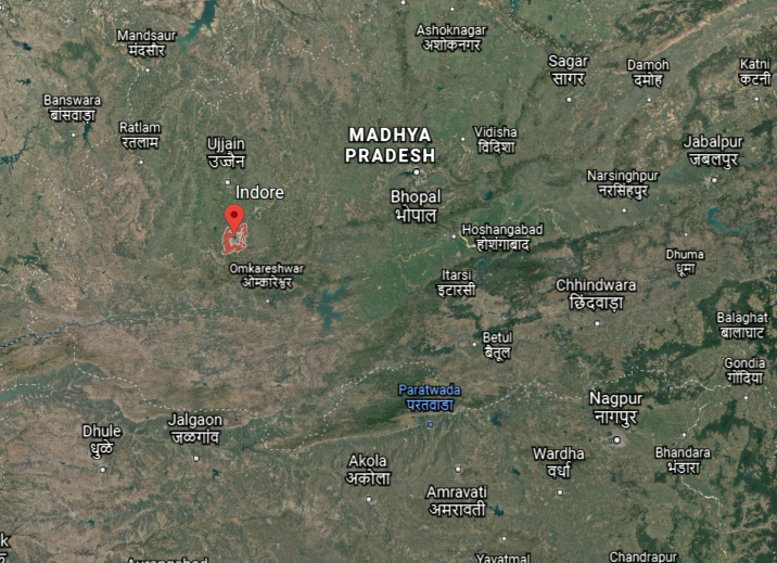
We are told Indore was founded in the 16th-century as a trading hub between Delhi and the Deccan region of India.

It was ruled as a princely state by the Holkar Dynasty until they acceded to the Union of Indian in 1947.

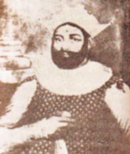
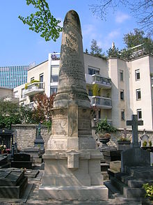
The first Holkar of the Dynasty was Malhar Rao Holkar, who ruled from 1731 to 1766.

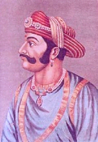
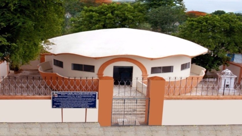
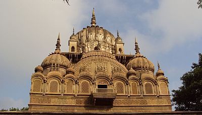
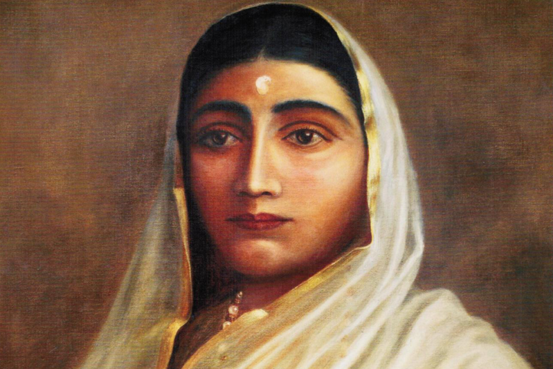
This is the Chhatri, the definition of which is funerary monument, for him that was said to have been built by his daughter-in-law, Ahilyabai Holkar…

…who became Queen in the Holkar Dynasty after the death of her husband, Malhar Rao Holkar’s son, Khanderao Holkar.

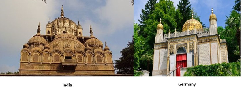
Now compare the similarities between Malhar Rao Holkar’s Chhatri on the left with the building we saw previously on the grounds of the Linderhof Palace in Bavaria, Germany, on the right.

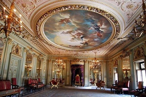
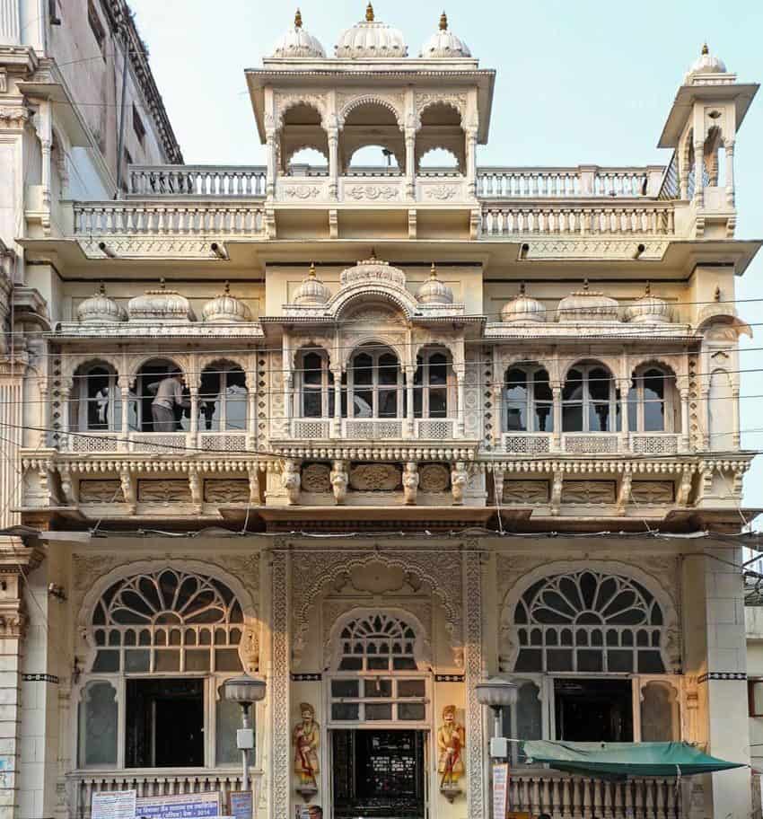
The Rajwada Palace in Indore was a royal residence of the Holkars…

…as was the Lal Bagh Palace.

The Lal Bagh brought to mind the Schaezlerpalais in the city of Augsburg, in Bavaria, Germany, which I remember visiting when I was stationed there in the Army in the mid- 1980s.

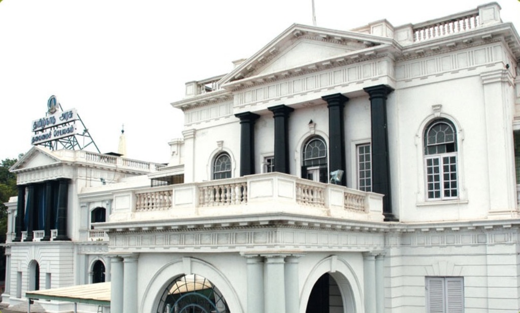
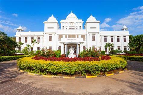
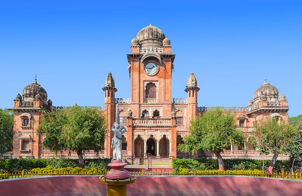
The Mahatma Gandhi Town Hall in Indore was said to have been built in 1904, named King Edward Hall, and renamed to honor Gandhi in 1948.

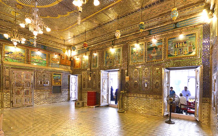
The Kanch Mandir in Indore is a Jain temple, said to have been built starting in 1903.

Meaning “Temple of Glass,” the inside is entirely covered by glass panels and mosaics, including the floor, columns, walls, and ceilings.

One side-note before ending this post.

The capital of the Indian state of Madhya Pradesh is Bhopal, which is 107-miles, or 172-kilometers, from Indore.

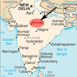
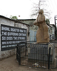
Bhopal was the location of the world’s worst industrial disaster in December of 1984, when the Union Carbide pesticide plant there leaked highly toxic methyl isocyanate gas, which made its way into the surrounding areas.

The official death toll at the time was 2,259, and this major gas leak caused over half-a-million injuries, with on-going effects over time.

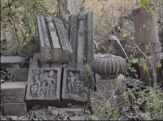
One last point of information about Bhopal.

About ten years ago, archaeologists found the remains of twenty-one temples near Bhopal, in the village of Ashapuri, believed to date back 1,300-years .

These people were remarkably prolific builders.

In the next post, I am picking up the alignment in Jodhpur, India.

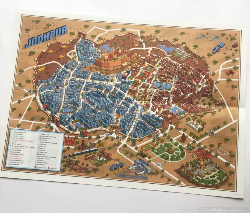
It will be the last post of this particular series on “Sacred Geometry, Ley-Lines & Places in Alignment.”

Sacred Geometry, Ley-Lines & Places in Alignment – Part 21 the Palk Strait to Hyderabad, India

In the last post, I tracked the alignment from Adam’s Peak, a conical mountain in Sri Lanka that is revered by Buddhism, Hinduism, Islam, and Christianity for the “Sri Pada,” or “Sacred Footprint”, a major pilgrimage site, and one of the twelve primary nodal points on the earth’s grid system; through Kandy, the last capital of the ancient kings’ era of Sri Lanka; to Sigirya, an ancient rock fortress in Sri Lanka’s Central Province that is a UNESCO World Heritage Site, and considered one of the best-preserved examples of urban planning in the world; to Jaffna, the capital city of the Northern Province of Sri Lanka, and part of a region historically called Naga Nadu.

The alignment from Jaffna crosses the Palk Strait, located between the Jaffna District of the Northern Province of Sri Lanka and the Tamil Nadu state of India.

It connects the Bay of Bengal…

…the largest bay in the world, at 839,000-square-miles, or 2, 172,000-square-kilometers…

…with Palk Bay, to the southwest.

The chain of low islands and reefs called Adam’s Bridge, also known as Rama’s Bridge, or Ramsethu, which separates the Gulf of Mannar, known for having one of the most productive Pearl fisheries in the world, from Palk Bay.

This is a depiction I found of what this place might have looked like when it connected India and Sri Lanka location circa 1480…

…at which time supposedly a cyclone deepened the channels between the two places.

At any rate, the Pamban Bridge, a railway bridge, connects the town of Mandapam in Tamil Nadu with Pamban Island and Rameswaram to the Indian Railways, ending at the Indian side of Adam’s Bridge.

It was said to have been constructed between 1911 and 1914, which was the year World War I started.

It is over a mile-long, at 6,776-feet, or 2,065-meters.

Described as a masterpiece of engineering, it has a movable section midway that is raised to allow ship and barge traffic to pass through.

There are similar movable sections on the Sault Ste. Marie International Railroad Bridge, with a swing bridge…and a vertical lift bridge. It was said to have been built in 1887.

For perspective in the historical narrative we have been taught, the Model T Ford first came into production in 1908…

…and the Wright Brothers had their first flight at Kitty Hawk in North Carolina’s Outer Banks in 1903.

So, were we actually capable of engineering feats like these based on the technology we are taught existed that at those times?.

And what in the world was going on in 1887, the year the Sault Ste. Marie International Railroad Bridge was said to have been built?

Well, for one, Buffalo Bill took his Wild West Show…

…to Great Britain for the celebration of the Jubilee Year of Queen Victoria in 1887.

Back to Palk Bay, you can take a ferry across, in the same general location as the sunken parts of Adam’s Bridge, to Talaimannar, on Sri Lanka’s Mannar Island, and catch the train on to anywhere you want to go in Sri Lanka.

The Palk Bay and Palk Strait were named for Sir Robert Palk, an officer in the British India Company that served as the Governor of Madras between 1755 and 1763…

…during the period called Company Raj period, or Company rule in India, when the British East India Company ruled over parts of the Indian Subcontinent between 1757 and 1858…

…commencing after the 1757 Battle of Plassey, called a decisive victory over the Nawab of Bengal, Mir Jafar, after which time the Nawab ceded revenues to the what was called the “Company.”

Mir Jafar was considered the first dependent Nawab of Bengal of the British East India Company, and this was considered to be the start of British Imperialism in India, and a key step in the eventual British domination of vast areas there.

The next place I come to tracking the alignment from Jaffna, is Vellore, a city and administrative headquarters of the Vellore District in the northeastern part of the Indian state of Tamil Nadu.

It is located on the banks of the dry-looking Palar River today…

…which historically flowed from the Nandi Hills, also known as Nandidurg, an ancient hilltop fortress in Karnataka State that was at one time believed to have been impregnable…

…but was successfully stormed by the Army of Charles Cornwallis in 1791, the 1st Marquess of Cornwallis in the Third Anglo-Mysore War, a conflict in South India between the British East India Company and the Kingdom of Mysore…

…and the same General Cornwallis famous for being defeated at the Battle of Yorktown in 1781, and being forced to surrender, basically ending the American Revolutionary War.

In spite of his loss and surrender to the Americans in the Revolutionary War, Cornwallis was knighted in 1786, and in the same year became the Governor-General and Commander-in-Chief of the British Colony in India.

Nandi Hills later became a resort for British Raj officials during the hot season.

The Muthu Mandapam, or Pearl Hall, located on the banks of the Palar River…

…is the resting place of the last King of Kandy in Sri Lanka, Sri Wickrama Rajasinghe, and a place where Sri Lankans journey to in order to pay their respects to him.

He had been arrested by the British in 1815, and ended up in exile in India.

In January of 1816, he and his families were sent to Madras on the HMS Cornwallis…

…which was the same ship on which the Treaty of Nanking, or Nanjing, between the British Empire and China would be signed after China’s defeat, after the First Opium War in 1842.

The First Opium War was fought between Qing Dynasty of China and Britain between 1839 and 1842, a military engagement that started when the Chinese seized opium stocks at Canton in order to stop the opium trade, which was banned.

The British government insisted upon free trade and equality among nations and backed the merchants’ demands.

From 1757 to 1842, the Canton System served as a means for China to control trade with the west by focusing all trade in the southern port of Canton.

To counter this, the British East India Company began to grow opium in Bengal, in present-day Bangladesh, and allowed private British merchants to sell opium to Chinese smugglers for illegal sale in China.

As a result from these events in history, opium dens, establishments where opium was sold and smoked, became prevalent in many parts of the world throughout the 19th-century.

Sounds like these events were the origins of the same drug trade that plagues the world today, a means by which to keep Humanity asleep and unconscious as much as possible, and make a ton of money in the process.

The Vellore Fort is situated in the heart of Vellore…

…said to have been built by the Vijayanagara, also called the Karnata Empire, that was based in the Deccan Plateau Region of South India.

The Vellore Fort is known for its grand ramparts, wide moat, and robust masonry.


The fort’s ownership was said to have passed from the Karnata Empire to the Bijapur Sultans, to the Marathas, to the Carnatic Nawabs, and finally to the British…

…who held the fort until India gained independence in 1947, at which time the heart-wrenching Partition of India displaced 10- to 12-million people along religious lines, and created an overwhelming refugee crisis in the newly constituted independent dominions of India and Pakistan, as well as large-scale violence and death.

The first significant rebellion against British rule erupted at Vellore Fort in 1806, known as the Vellore Mutiny, or Vellore Sepoy Mutiny.

While it only lasted one day, it was the first instance of a large-scale and violent mutiny by Indian Sepoys against the British East India Company.

The Sepoys seized the Vellore Fort, and killed or wounded 200 British soldiers, but the mutiny was subdued by the end of the day by cavalry and artillery from another nearby British unit.

This pillar at Hazrath Makkaan Junction in Vellore commemorates the 1806 Vellore Mutiny.

The Jalakandeswarar Temple is a temple dedicated to Shiva in the Vellore Fort, and its construction was said to have been completed by a Karnata chieftain in 1550.

The temple has exquisite statues on its gopuram, or tower…

….richly carved stone pillars…

…and a stone-carved ceiling.

The Vainu Bappu Observatory in Kavalur in the Vellore District…

…is in what are called the Javadi Hills of the Eastern Ghats.

It is the biggest observatory in Asia, with observations said to have started here in 1968.

Its location 12-degrees north of the equator allows for the coverage of the northern and southern hemispheres, and it is the only major astronomical facility between Australia and South Africa for observing the southern objects.

On-going programs include the observations of stars, star clusters, novae, super novae, blazars, galaxies, solar system objects, and many others.

William Petrie was an officer in the British East India Company in Madras in the 1780s. An amateur astronomer, he was given the credit for making the first modern astronomical observations outside of Europe in Madras in 1786.

We are told his home observatory and instruments contributed to the first modern observatory outside of Europe, the Madras Observatory, shown here, said to have been built around 1792, with the first observations on the meridian being in 1793, said to have been designed by Michael Topping, the Chief Marine Surveyor of Fort St. George in Madras.

The Madras Observatory was described as having a single room that was 40-feet, or 12-meters, long and 20-feet, or 6-meters, wide, with a 15-foot, or 5-meter, high ceiling, as well as a granite pillar weighing 10-tons, or 9-metric tonnes, in the center of the room.

Seriously, a 10-ton granite Pillar?

Well, the granite pillar still exists in the present-day, with an engraving by those said to have erected it.

Could some kind of sand-blasting technology been used on an already existing pillar?

This massive granite pillar is found on the grounds of the present-day Regional Meteorological Centre in Chennai, what Madras is called today, and the original building of the Madras Observatory no longer exists…

…and where I read other stone slabs and broken pillars are found in a fenced-off section on its grounds.

Another observatory in South India is the Kodaikanal Solar Observatory…

…located in the Palani Hills, southwest of Vellore in Tamil Nadu State.

Founded in April of 1899, legend has it that the observatory’s 6-inch telescope was said to have been brought on foot by four men who climbed steep valleys and braved the attack of wild animals, carrying the telescope on their shoulders for almost three-months.

It is interesting to note that there are abandoned observatories dotting the landscape of the hills behind Kodaikanal.

In northern India, we are told that between 1724 and 1730, Jai Singh II, the Raja of Jaipur, oversaw the construction of five monumental stone observatories, called Jantar Mantars, across his domains.

The primary purpose of these observatories was for the study of space and time.

There is one in Delhi, an ancient city and the seat of the Mughal Empire.

It is interesting to note that the Jantar Mantar in what is now called New Delhi is surrounded by the government buildings of India, in a rather geometric-looking configuration…

…which the British were said to have built New Delhi between 1911 and 1931, after the laying of the foundation stone laid by Emperor George V of India, a title used by British Monarchs from 1876 to 1948…

…during the Delhi Durbar of 1911, an Indian imperial-style mass-assembly organized by the British at Coronation Park to mark his accession as Emperor of India.

Other Jantar Mantars are in Jaipur, a collection of nineteen architectural instruments forming the largest stone observatory in the world…

…including the world’s largest stone sundial…

…in Varanasi, India, a major religious center in India, and considered the holiest city of Hinduism and Jainism…

…in the holy city of Ujjain, with thirteen architectural astronomy instruments…

…and the Jantar Mantar of Mathura, an ancient city believed to be the homeland and birthplace of Krishna.

Vedic astronomy has ancient roots in India…

…going back thousands of years.

Yet they want us to believe the British East India Company brought the science of astronomy to India?

One more place I would like to take a look at before leaving Tamil Nadu State is its capital in modern-times, Chennai, known historically as Madras.

The British East India Company arrived in what came to be known as Madras in 1600, making it their principal settlement, and we are told, constructed Fort St. George in 1644.

…which serves today as the Secretariat and Legislative Assembly of the Tamil Nadu Government.

The British India Company was said to have come here in order to have a port close to the Malaccan Straits, the main shipping channel between the Indian Ocean and Pacific Ocean, and to secure its trade lines and commercial interests in the spice trade.

It is one of the most important shipping lanes in the world.

They must have succeeded in their securing their goals, because the British East India Company officer I mentioned previously, who was said to have made the first astronomical observations outside of Europe, William Petrie, was also the Governor of Prince of Wales Island in the Malaccan Strait between 1812 to 1816.

Prince of Wales Island is known as Penang Island, the main constituent island of the Malaysian state of Penang.

Apparently the British East India Company was able to take Penang from the Kedah Sultanate, and keep it.

St. Mary’s Church at Fort St. George is said to the oldest Anglican church in India, built between 1678 and 1680…

…and Elihu Yale, a British merchant, trader, and a President of the British East India Company settlement at Fort St. George, was married at St. Mary’s Church.

Elihu Yale later became a benefactor of the Collegiate School in the Colony of Connecticut, which in 1718 was renamed Yale College in his honor.

I have found the same style of architecture at universities and colleges around the world, including, but not limited to, Korea University in Seoul, Korea…

…the University of Sydney, in Australia…

…and Eton College, in Windsor, England.

The Madras Presidency, or the Presidency of Fort St. George, was an administrative subdivision of British India, and established in 1652, and of which Elihu Yale became president in 1684.

At its greatest extent, the Madras Presidency included most of southern India, including the whole of the states of Tamil Nadu and Andhra Pradesh; parts of Odisha, Kerala, and Karnataka; and the union territory of Lakshadweep, a group of islands off India’s southwestern coast.

The Madras Presidency ended with the advent of Indian independence on August 15th of 1947.

We come to Hyderabad next on the alignment, the capital and largest city of India’s Telengana State on the Deccan Plateau.

The Deccan Plateau bounded by the Eastern Ghats and the Western Ghats…

…and it is important to the note that ghats in India are also a series of steps leading down to water, like the Harishchandra Ghat in Varanasi.

This is a screenshot from a YouTube video I watched several years ago entitled “The Eastern Ghats in Journey through India”…

…showing this part of the subcontinent of India looking like Monument Valley, in Arizona near the border with Utah in the American Southwest. 

Hyderabad occupies 241-square-miles, or 625-square-kilometers along the Musi River.

This is a view of the Salar Jung Museum in Hyderabad showing masonry banks on the Musi River.

The Salar Jung Museum is described as having the largest collection of antiques belonging to a single person, said to have been sourced from Nawab Mir Yusuf Ali Khan Salar Jung III, former prime minister of the 7th Nizam, the title of the ruler of what was then the princely state of Hyderabad.

One of the most popular attractions at the museum is what is described as a 19th-century musical clock.

It has a bearded man that comes out from the enclosure exactly three minutes before every hour.

On completion of each hour, the bearded man on the left side strikes the bell as per the number of the hour, and a bearded man on the right side who strikes every second.

The Palace owned by the Nizam of Hyderabad, the Falaknuma Palace, was said to have been built in 1893, and converted into a 5-star hotel in 2010.

There are 60-rooms and 22-halls inside the Falaknuma Palace…

…as well as a large collection of the Nizam of Hyderabad’s treasures, including furniture, paintings, statues, books and manuscripts.

The official residence of the Nizams of Hyderabad was the Chowmahalla Palace, said to have been built starting in 1750.

We are told that Hyderabad is located on hilly terrain around artificial lakes, including the heart-shaped Hussain Sagar lake, located north of the city center.

The lake was said to have been built by Ibrahim Quli Qtub Shah in 1563, and the large monolithic (meaning cut from one block of stone) statue of Gautama Buddha was said to have been erected in 1992 on top of what is called Gibraltar Rock in the middle of the lake.

The Qtub Shahi tombs are located in the Ibrahim Bagh, or Garden District, near the Golconda Fort.

We are told they are the tombs and mosques were built by the various kings of the Qtub Shahi, which ruled the Golconda Sultanate of South India between 1518 and 1687.

There are seven tombs all together, built of grey granite.

I found this picture of a view of the Qtub Shahi tombs from the Golconda Fort said to date to around 1902 that brings mud flood immediately to mind.

I am sharing what I am finding in the written historical record, and I know many things happened to take down the original ancient advanced Moorish civilization and erase it from our collective memory.

Just leaving this here for consideration as to one of the ways this might have happened.

The Golconda Fort is described as a 12th-century citadel with four forts, eighty-seven bastions and numerous buildings.

It is described as an early capital of the Qtub Shahi kings.

Golconda flourished as a trade center of large diamonds, known as Golconda Diamonds.

It has produced some of the world’s most famous diamonds, including the Koh-i-Noor, one of the largest cut diamonds in the world. This is a glass replica of it…

…because it is part of the British Crown Jewels…

…and the Hope Diamond, a famous, blue-diamond that is on exhibit at the Smithsonian in Washington, DC.

After India gained independence in 1947, the Nizam of Hyderabad, Mir Osman Ali Khan, the world’s richest man of his time, declared his intention to remain independent rather than become part of the Indian Union.

The Hyderabad State Congress began to agitate against him, with the support of the Indian National Congress and Communist Party of India, and in 1948, the Indian Army invaded Hyderabad, and he ended up surrendering to the Indian Union, signing a instrument of Accession which made him a Princely Governor of Hyderabad until October 31st of 1956.

Then on November 1st of 1956, Hyderabad was split into three parts, and merged into neighboring states. Eventually, the Telengana State, of which Hyderabad is the capital, was formed on June 2nd of 2014.

One more thought before ending this post. India was called the “Jewel in the Crown” of the British Empire. and its largest, and most important, overseas possession.

Much of the British Empire was built around India, in order to provide routes to, or protection for, India.

India was prosperous and rich, in spices, silk, indigo, gold, cotton, and other products and resources.

Trade with, and eventual political dominance of large parts of India, was what provided Britain with large parts of its wealth in the 1700s through 1900s.

There were other players in the mix in India – the Jesuits, the Portuguese, the French East India Company, the Dutch East India Company – but for whatever reason, the British came out on top there…for a long time.

I think the truth of the matter is that all these players were actually working towards the same goal of taking down the Old World Order, taking its wealth, faking the historical narrative to exclude the original civilization, and establishing the conditions for what we have seen happening in the world today.

I am going to be picking up the alignment in the next post at the Ellora Caves, one of the largest, rock-cut, monastery- temple cave complexes in the world.

Sacred Geometry, Ley-Lines & Places in Alignment – Part 20 Adam’s Peak, Sri Lanka to Jaffna, Sri Lanka

In the last post, I tracked the alignment from the French Southern and Antarctic Lands of the Kerguelen Islands, St. Paul Island, and Amsterdam Island, to Matara, a major city and commercial hub in the Southern Province of Sri Lanka, known historically as Ceylon.

I am picking up the alignment at Adam’s Peak, located in the southern reaches of Sri Lanka’s Central Highlands.

It is described as a tall conical mountain…

…well known for the Sri Pada, or “Sacred Footprint,” near the summit, revered as a holy site in Buddhist tradition to be the footprint of the Buddha, in Hindu tradition the footprint of Shiva or Hanuman, and in some Christian and Islamic traditions, that of Adam…or St. Thomas.

It is an important pilgrimage site.

The region along the mountain is a wildlife reserve, home for species like elephants and leopards.

The districts to the south and east of Adam’s Peak yield gemstones, for which the island of Sri Lanka is famous.

The greater part of the track leading from the base to the summit consists of thousands of steps.

Adam’s Peak first came into my awareness somewhere around 2013 as Sri Pada, one of the twelve primary nodal points of the earth’s grid system, via the work of James Tyberonn that I encountered around that time.

It is important to note that I found many of these places on alignments I have tracked.

According to Tyberonn, the other nodal points are:

Axum, Ethiopia…

…Borobudur, on the island of Java in Indonesia…

…Delphi on Mount Parnassus in Greece…

…Gobekli Tepe near Sanliurfa in Turkey…

…the Gobi Desert in Mongolia…

…Lumbini, Nepal, the birthplace of Gautama Buddha…

…in Minas Gerais, Brazil, also known for its gemstone mines…

…Mount Hakusan, one of Japan’s three holy mountains, along with Mount Fuji, and Mount Tate…

…Rapa Nui, perhaps better known as Easter Island…

…Sedona, Arizona…

…and Uluru in Australia.

Uluru is also known as Ayers Rock.

The next place I am going to take a look at on this alignment is Kandy, a major city in Sri Lanka, and the last capital of the ancient Kings’ era of Sri Lanka.

The Kingdom of Kandy was said to have been founded in 1469.

This map is described to be that Sri Lanka in the 1520s, known previously as Ceylon.

In 1592, Kandy became the capital city of the last remaining independent kingdom in Ceylon after the coast regions had been conquered by the Portuguese.

From that time, the Kingdom of Kandy kept the Portuguese and Dutch East India Company at bay, but succumbed finally to British colonial rule when the kingdom was absorbed into the British Empire as a protectorate via the Kandyan Convention of 1815, an agreement signed between the British and members of the King’s court which ceded the kingdom’s territory to British rule, and the last king was imprisoned.

Ceylon was a British Protectorate until its independence in 1948, and the name of the country was changed to Sri Lanka when it became a republic in 1972.

The Kandyan Convention was signed in the Temple of the Sacred Tooth Relic.

Also known simply as the Temple of the Tooth…

…it houses the tooth of the Buddha, venerated as the Buddha’s only surviving relic.

It is believed that whoever holds the relic, holds the governance of the country.

The Temple of the Tooth, or Sri Dalada Maligawa, is part of the Royal Palace Complex of the former Kingdom of Kandy, located on a canal…

…extending from Kandy Lake, also known as the Kiri Muhuda, or Sea of Milk…

…an artificial lake, and said to have been built next to the Temple of the Tooth by the last King of Kandy in 1807.

After the kingdom’s downfall, the Royal Palace of Kandy became the residence for the primary British agent, and nowadays is a museum of archeology.

The Royal Audience Hall, or Magul Maduwa, was where the king met his ministers and carried out his daily administrative tasks, as well as being a center of religious and national festivities connected with the Kandyan Court.

There were at least three star forts in Sri Lanka’s interior region between Kandy and the coast.

One was called the Sinhalese Sitawaka fort, which was adjoined with the palace of the king of Sitawaka.

Both the palace and the fort were destroyed by the Portuguese.


The Ruwenalla fort was said to have been constructed first as a wooden structure by the Dutch around 1665…

…and then the British were said to have erected a stone fort on the site in 1817.

Today it is being used as a police station.

Then there was the Hanwella fort, located at the site of an ancient ferry crossing on the Kelani River.

We are told that the fort was thought to have been originally constructed by King Mayadunne of Sitawaka, who ruled between 1521 and 1581.

Then Portuguese occupied the fort in 1597 and re-built it.

The Dutch were said to have captured it, and constructed a star-shaped fort, completing the work in 1684.

Eventually the fort came under control of the British in 1786, and little evidence of the fort remains with the exception of remnants of the fortifications and the moat.

This is a rest house said to have been built by the Dutch where the fort was…

…that was even visited by the Prince of Wales, Albert Edward, in 1875, who, we are told, planted a jackfruit tree on the site to commemorate his visit to Ceylon, and the tree, and two stone seats said to have been constructed for the royal visit, are still on the site.


The jackfruit is the national fruit of Sri Lanka, and is native to that part of South Asia.

One more point I would like to make before moving on to the next place on the alignment.

Sri Lanka is one of the few places that I know of to have an acknowledged ethnic minority group called Moors.

They comprise 9.2% of the population, which is approximately a population of 1.9 million Moors in the country, with Kandy being one of their population centers.

They are mainly native speakers of the Tamil language…

…with the influence of Sinhalese…

…and Arabic words.

The Moors of Sri Lanka are predominantly followers of Islam…and are also matrilineal, in which kinship is traced, and great influence is held by, women.

This book is a study about Muslim, Sinhalese, and Tamil households in Sri Lanka.

So…how…did…that…happen?

To the best of my understanding, Islam was originally about how to connect with One’s Higher Self…

…and the ancient Moorish Civilization was matrilineal, and not patriarchal.

The next place on the alignment that I would like to look at is Sigiriya.

Sigiriya is described as an ancient rock fortress near Dambula in Sri Lanka’s Central Province.

It is dominated by Lion Rock.

King Kashyapa was said to have built his palace between 477 and 495 AD, on top of Lion Rock, which he had decided to make his new capital.

There are 1,200 steps going to the top of Lion Rock, starting from where he built a gateway in the form of enormous lion paws.

It reminds me visually of the Stone of El Penol, that I found tracking an alignment in Guanape, Colombia.

This is a view of the water gardens of Sigiriya from the summit of the rock.

They are built symmetrically on an east-west axis, connected with the outer moat to the west…

….and the large artificial lake to the south of Sigiriya rock.

All the pools are interlinked using an underground conduit network fed by the lake, and connected to the moats.


The mirror wall is located in the mid-level terrace where the lions entrance is located, and was said to have been originally so highly polished that the king could see himself while he walked alongside it.

A Spiral staircase at the mirror wall…

…leads to fresco paintings depicting women that cover most of the western face of the rock, called the largest picture gallery in the world.

After all the work that King Kashyapa put into this place, we are told the capital and royal palace were abandoned after his death, and that it was used as a Buddhist monastery until the 14th-century.

Sigiriya is listed as a UNESCO World Heritage Site, and is considered one of the best-preserved examples of urban planning in the world.

Jaffna is the next place on the alignment, and is the capital city of Sri Lanka’s Northern Province.

It is the administrative headquarters of the Jaffna District, on the Peninsula of the same name.

Jaffna is located 6-miles, or 9.7-kilometers, from Kandarodai, a famous emporium city and capital of Tamil kingdoms in northeastern Ceylon from classical antiquity, and the location of the ancient Buddhist monastery known as Kadurugoda Vihara.

Jaffna and the surrounding region was part Naga Nadu, and inhabited by one of the ancient tribes of Ceylon, the Nagas, generally represented as a class of super humans.

Also called Serpents of Wisdom, nagas were masters of raising serpent-like kundalini energy from the base of the spine to the third-eye. connecting with higher self in physical form…

…and masters of higher human abilities called “Siddhis.”

Jaffna was said to have been made into a colonial port town by the Portuguese around 1618, at which time they were said to have built the Jaffna fort…

…Fort Hammenheil, built in 1618, around a small island between the islands of Kayts and Karaitivu on the Jaffna Peninsula…

…the Kayts Island fort in 1629…


…the Delft Island fort is attributed to the Portuguese some time during that time period…

…and the Pooneryn Fort, just adjacent to the Jaffna Peninsula..

The forts on the Jaffna Peninsula at Kankesanthurai, Point Pedro, Pyl, Beschutter, and Elephant Pass were all completely destroyed at some point in time during colonial times.

Then the Portuguese lost Jaffna to the Dutch East India Company in 1658, the world’s most valuable company of all-time, worth $7.9-trillion.

The Dutch were said to have lost their possessions in Sri Lanka in 1796, when they were taken over by the British, after which time the British were said to have built the major roads and railways connecting Jaffna with Kandy, Colombo, and the rest of the country…

…with the Ceylon Government Railway having been founded in 1858…

…and the rail network introduced by the British Colonial government in 1864.

This is said to be a picture circa 1880 of a steam-powered train on the hill-country Colombo – Badulla line.

This is the Jaffna Railway Station today, said to have been built originally in 1902, and reconstructed in the time-frame around 2011-2013…

…due to damage it sustained during Sri Lanka’s civil war in the years between 1983 and 1995.

The Jaffna Public Library was said to have originally been built in 1933, and one of the largest libraries in Asia, with over 97,000 books and manuscripts.

Built in what was called an Indo-Saracenic style, we are told it was burned down by an organized mob in 1981.

By 2001, the rehabilitation of the original building into a new structure was complete, and new books received, though its old books and manuscripts were not replaced.

Apparently the books and manuscripts lost in the fire were irreplaceable.

I am going to end this post here, and pick up the alignment in Vellore, located in the south Indian State of Tamil Nadu.

Sacred Geometry, Ley-Lines & Places in Alignment – Part 19 Kerguelen Islands to Matara, Sri Lanka

In the last post, I tracked the alignment from the Fernando de Noronha islands of Brazil, just off the coast near Natal, and the location of what were at least ten star forts at one time; to the islands of Trindade and Martin Vaz, also part of Brazil but located 680-miles, or 1,100-kilometers, from the coast; to the islands of Tristan da Cunha, a British Overseas Territory, and the location of the world’s most isolated settlement, with ship or boat being the only way to travel in-or-out.

Next on the alignment we come to the Kerguelen Islands, also known as the Desolation Islands, and administered as part of the French Southern and Antarctic Lands, otherwise known as France’s Scattered Islands in the Indian Ocean.

The French Southern and Antarctic Lands have been an overseas territory of France since 1955.

They consist of:

–The Kerguelen Islands, volcanic islands in the southern Indian Ocean, southeast of Africa, approximately equidistant between Africa, Antarctica and Australia;

–St. Paul and Amsterdam Islands, a group to the north of Kerguelen, and we’ll be looking at both in tracking this alignment;

–the Crozet Islands, a group in the southern Indian Ocean, south of Madagascar;

–Adelie Land, the French claim on the continent of Antarctica. Adelie land, and the Adelie penguin for that matter, were named after Adele, the wife of the French explorer and naval officer Jules Dumont d’Urville who explored Antarctica, among other places in the south and west Pacific;

–The Scattered Islands, a group of dispersed islands around the coast of Madagascar, of which the principal station for these islands is on Tromelin Island.

The French Austral Lands and Seas were inscribed as a UNESCO World Heritage Site on July 5th, 2019.

The French Southern and Antarctic Lands are administered by a prefect with headquarters in Saint-Pierre on Reunion Island.

I am going to spend some time looking into the life and voyages of Jules Dumont d’Urville because I believe his story is important to understanding the historical narrative we have been taught.

Early in his naval exploration career, as a result of being in the right place at the right time on a naval hydrological survey of the Greek islands in the Aegean Sea, Dumont d’Urville was given the credit, and a knighthood in the Legion of Honor, for ultimately enabling the famous Venus de Milo marble statue to come from the Greek island of Milos to the Louvre in Paris instead of going to Constantinople.

After the Aegean Sea expedition, he planned an expedition, with another naval officer, of the Pacific Ocean, an area France had been forced out of as a result of the Napoleonic Wars.

They set out on their expedition to collect scientific and strategic information in August of 1822, on a ship named originally La Coquille, and sailed to the Falkland Islands; the coasts of Peru and Chile in South America; New Guinea; New Zealand and Australia.

The expedition carried out research in the fields of botany and insects, bringing back thousands of specimens to the Natural History Museum in Paris.

Then Dumont d’Urville departed on La Coquille, now called L’Astrolabe, or the Astrolabe, named for a navigational device, and sailed in 1826 for three-year voyage to New Zealand; Fiji; the Loyalty Islands; New Guinea; the Solomon Islands, Caroline Islands, and the Moluccas in eastern Indonesia.

In 1837, Dumont d’Urville set out yet again on the Astrolabe for the South Orkney Islands in the Southern Ocean; the Marquesas Islands; Tasmania; along the coast of Antarctica, at which time he claimed land on January 21st of 1840 for France, considered it his most significant achievement. He named it Adelie Land after his wife Adele.

He also named the Adelie penguin for his wife.

He then sailed onto New Zealand; the Torres Strait; Reunion Island; and St. Helena island, and returning to France later in 1840.

He was promoted to Rear Admiral upon his return, and he wrote a report of the expedition entitled “Voyage au Pole Sud et dans L’Oceanie sur les Corvettes Astrolabe et la Zelee 1837 – 1840,” which was published between 1841 and 1854 in 24 volumes.

An interesting side-note about Dumont d’Urville’s life was his death – he and his entire family were killed in the first ever rail disaster in France in May of 1842, called the Versailles Rail Accident, in which the train’s locomotive derailed, the wagons rolled, and the coal tender ended up at the front of the train and caught fire. This was said to be a painting of the incident.

Remains said to have been identified as his by a doctor who had been on-board the Astrolabe with him, and were interred here at the Montparnasse Cemetery in Paris.

Could this be a case of “Dead men tell no tales” as it were?

Like, perhaps, explorer Meriwether Lewis, who died of gunshot wounds in 1809?

Meriwether Lewis had returned from the Lewis & Clark Expedition in 1807; was made Governor of Louisiana Territory by Thomas Jefferson; and had made arrangements to publish his Corps of Discovery Journals.

For a point of information, he was initiated into freemasonry between 1796 and 1797, from where he was born and raised in Ablemarle County, Virginia Colony, shortly after he joined the United States Army in 1795.

Being Governor of the Louisiana Territory didn’t work too well for him for a variety of reasons, and he set out for Washington, DC, to address financial issues that had arisen as a result of denied payments of drafts he had drawn against the War Department when he was governor…and he carried with him his journals for delivery to his publisher.

He decided to go overland to Washington instead of via ship by way of New Orleans, and stayed for the night at a place called Grinder’s Stand, southwest of Nashville, Tennessee.

Gunshots were heard in the early morning hours, and he was found with multiple gunshot wounds to the head and gut.

We are told that Thomas Jefferson and some historians generally accepted Lewis’ death as a suicide. His family never accepted that it was suicide, and the matter is still debated. No one was ever charged with his murder.

Just sharing some strange deaths of famous explorers that are out there, and easy to find, in the historical narrative we have been given.

And I am quite certain there was a correlation between the ancient advanced Washitaw Empire of North America and the Louisiana Purchase.

Also, it is interesting to note there were similar naval expeditions by other countries around the same time of those of Dumont d’Urville for France.

The U. S. Exploring Expedition was an exploring and surveying expedition of the Pacific Ocean and the surrounding lands conducted by the United States between 1838 and 1842.

The expedition was described as of major importance to the growth of science in the United States, and that during the events of its occurrence, armed conflict between Pacific Islanders and the expedition was common, and dozens of natives were killed, as well as a few Americans.

It involved a squadron of four ships, with specialists on each including naturalists, botanists, a mineralogist, a taxidermist, and a philologist, which is someone who studies written and oral histories.

It is sometimes referred to as the “U. S. Ex. Ex.” or “Wilkes Expedition,” after the commanding officer, Navy Lt. Charles Wilkes.

The ships of the Wilkes Expedition departed from Hampton Roads in Virginia for the first stop the Madeira Islands off the coast of Africa on August 18th, 1838.

The routes of the expedition went something like this – all over the place.

The squadron of ships pretty much sailed together, at different rates of speed, from their first stop at Madeira, to Rio de Janeiro in Brazil; Tierra del Fuego at the southern tip of South America; Valparaiso in Chile; Callao in Peru; the islands of Tahiti, and Samoa, in the South Pacific; Sydney in Australia; Antarctica, which they arrived at and “discovered” on January 16th of 1840, just mere days before the completely different expedition (?) of Dumont d’Urville’s claimed land on Antarctica on January 21st of 1840; and then, by way of Fiji, to the Sandwich Islands (otherwise known as the Hawaiian Islands), before returning to the United States. The ships did break-off into pairs on occasion to explore different places in the same general location.

Then there were the voyages of the HMS Beagle, originally a Cherokee class 10-gun boat of the British Royal Navy, said to have set off from the Royal Dockland of Woolwich at the River Thames on May 11th of 1820.

The HMS Beagle’s first voyage was between 1826 and 1830, accompanying the larger ship, HMS Adventure, on a hydrologic survey of Patagonia and Tierra del Fuego, under the overall command of the Australian Navy Captain, Phillip Parker King.

The second voyage of the HMS Beagle, between 1831 and 1832, was joined by naturalist Charles Darwin, on a second trip to South America, and then around the world.

Charles Darwin kept a diary of his experiences, and rewrote this as a book titled “Journal and Remarks,” becoming published in 1839 as “The Voyage of the Beagle.”

The third voyage of the HMS Beagle took place between 1837 and 1843, and was a third surveying voyage to Australia, stopping on the way at Tenerife in the Canary Islands; Salvador on the coast of Brazil in Bahia State; and Cape Town in South Africa. I have found all three of these places on planetary grid alignments.

In Australia, the crew surveyed Western Australia, starting in what is now Perth, to the Fitzroy River; then both shores of the Bass Strait in Australia’s southeast corner; then north to the shores of the Arafura Sea, across from Timor. Again, all of these places figure prominently on grid alignments.

In 1845, the HMS Beagle was refitted as a Coast Guard watch vessel in Essex, in the navigable waters beyond the Thames Estuary, moored in the middle of the River Roach, until oyster companies and traders petitioned to have it removed in 1851, citing the vessel was obstructing the river and its oyster beds.

The Navy List shows that on May 25th of 1851, the Beagle was renamed “Southend ‘W.V. No. 7′” at Paglesham, and sold in 1870 to be broken-up.

Just for point of reference, the Crystal Palace Exhibition took place in London’s Hyde Park between May 1st of 1851 to October 15th of 1851.

I believe the Crystal Palace Exhibition of 1851 was the official kick-off to the reset timeline of the New World Order.

I believe the history of Earth has been replaced with the history of those that took over and claimed the legacy of the original builders of civilization, and I believe all of these voyages of exploration were part of how they did it.

The earth, and all that was in it, was surveyed after the mud flood event, and before the official start of the new reset timeline in 1851, from which our new history was based on.

Back to the Kerguelen Islands, which started the side-track off into 19th-century exploration history.

The Kerguelen Islands themselves are considered an exposed part of the Kerguelen Plateau, which is considered a large igneous province, or an extremely large accumulation of igneous rocks, mostly submerged by the southern Indian Ocean.

The main island, known as Grande Terre, is 2,577 square-miles, or 6,675 kilometers-squared.

The islands were officially discovered by the French navigator Yves-Joseph de Kerguelen-Tremarec on February 12th of 1772.

Then, apparently the very next day, a member of the expedition named Charles de Boisguehenneuc, landed on the island, and claimed it for the French Crown.

The island was visited regularly by whalers and sealers after its discovery, and between the 18th- and 20th-century, the regions whales and seals were hunted to the point of near extinction.

The islands were not completely surveyed until 1840 during the Ross Expedition, a voyage of scientific exploration of the Antarctic between 1839 and 1843.

This is said to be an engraving from the Ross Expedition of Christmas Harbor at Kerguelen Island, from an elevation 600-feet, or 183-meters.

The main base, or so-called capital of the Kerguelen Islands, is at Port-aux-Francais, on the eastern shore of Grande Terre.

This is the best known feature of the Kerguelen Islands, known as the Arch of Kerguelen at Port Christmas, where there was formerly a geomagnetic station.

Apparently the Arch of Kerguelen actually looked like an arch at one time.

Also, what looks to be a version of the same land feature in the Kerguelen islands, called St. Anne’s Finger on the Gallieni Peninsula in the Baie Larose, on the top left, is found in the Revillagigedo Islands, in the Pacific Ocean near the west coast of Mexico, and part of its Colima Province, on the top right; and on the bottom left, a feature found in the Galapagos Islands, off the coast of Ecuador on the northwestern side of South America; and on the bottom right, one is also found near Yalta on the Crimean Peninsula in the Black Sea.

Mount Ross is the highest point of Kerguelen Island, at 6,069-feet, or 1,850- meters, also on the Gallieni Peninsula.

Other land features of Kerguelen Island include Mounts Simoun and Diane.

George Biddell Airy, of Great Britain’s Royal Observatory, organized and equipped five expeditions to different parts of the world, of which three were sent to the Kerguelen Islands, to observe the 1874 Transit of Venus.

Between 1874 and 1875, altogether British, German, and United States expeditions visited Kerguelen to observe the Transit of Venus.

The 1874 Transit of Venus took place on December 9th of that year, and was the first of the pair of Venus Transits which took place in the 19th-century, the second one being in 1882.

A transit of Venus takes place across the sun when the planet Venus passes directly between the sun and a superior planet, becoming visible against the solar disk.

Interestingly, this is a diagram of the orbit of Venus as seen from Earth.

There is a geomagnetic station at Cap Ratmanoff in the present-day, the easternmost point of the Kerguelen Islands.

So, even today, the principal activities on the islands focus on scientific research, mostly earth sciences and biology, as well as a French satellite- and rocket-tracking lodging and station near Port-aux-Francais…

…and a small fleet of fishing vessels that are owned out of Reunion Island and licensed to fish in this exclusive economic zone.

Next on the alignment, we come to Ile St-Paul, or St. Paul Island…

…part of the French Southern and Antarctic Lands mentioned previously.

We are told in 1780, the thin stretch of rock that used to close off the crater active volcano it sits on top of collapsed, admitting water through a 330-foot, or 100-meter, channel. The entrance is shallow, allowing only small ships and boats to enter.

For comparison in appearance, on the left is the entrance to what is called the “Bassin du Cratere” or “Lac Cratere,” or in English “Crater Lake” on Ile Saint-Paul in the South Indian Ocean, compared with what is found on the Hawaiian Island of Molokai, in the middle of the Pacific Ocean.


While the Portuguese were first credited with discovering the island in 1559, and the Dutch with sighting it in 1618, the French laid claim to it in 1842, apparently when a group of fisherman from Reunion Island that were interested in setting-up a fishery on Saint-Paul, pressed the Governor of Reunion to take possession of Saint-Paul, as well as Amsterdam Island, which we will be coming to next on the alignment.

Apparently, he did so, by official decree, on June 8th of 1843.

All fishery activities were abandoned in 1853, however, when the French government renounced its possession of the two islands.

The HMS Megaera, a British troop transport, was wrecked on the Ile Saint-Paul in 1871, and it took approximately 3-months to rescue all 400 persons that were on board.

This is said to be a print of the Ile Saint-Paul from that time period in 1871.

Then, in 1892, the crew of the French ship Bourdonnais again took possession for the French government of Saint-Paul and Amsterdam Islands.

These days, the main human activity on Ile Saint-Paul is a scientific research cabin used for scientific or ecological short campaigns only, and no permanent human population.

Other activity involves its importance as a seabird breeding site.

The next place we come to on the alignment I am tracking is the Ile Amsterdam, or Amsterdam Island, another one of the French Southern and Antarctic Lands claimed by France in 1892.

Amsterdam Island is roughly equidistant from the land masses of Madagascar, Australia, and Antarctica.

While a Spanish explorer by the name of Juan Sebastian de Elcano was said to have sighted the island in 1522, when he was completing the first circumnavigation of the world after Magellan’s death in the Phillippines in 1522…

…Amsterdam Island was said to have gotten its name over one-hundred years later…

…in 1633, from a Dutch sea captain, Anthony van Diemen who named it after his ship, Nieuw Amsterdam, which was named after the Dutch settlement of Nieuw Amsterdam (which later became New York City).

Amsterdam Island was a stop for the Macartney Mission in 1793, the first British diplomatic mission to China.

The goals of the Macartney Mission were to: 1) Open new ports for British trade in China; 2) the establishment of a permanent embassy in what was then called Peking, now Beijing; 3) the cession of a small island off the coast of China for Britain’s use; and 4) the relaxation of trade restrictions on British merchants in Canton in southern China.

While it was said to have failed to achieve its initial objectives, the Macartney Mission was noted for having brought back extensive cultural, political, and geographical observations that its participants recorded.

After having been claimed for France in 1892, the islands were part of the French Colony of Madagascar from 1924 until August 6th of 1955, when the French Southern and Antarctic Lands were formed.

The only settlement on Amsterdam Island is a seasonal research station, which studies biology, meteorology, and geomagnetics. 

Phylica Arbora trees grow on Amsterdam Island.

It was called the “Great Forest,” covering the lowlands of the island, until most of the trees were cleared by fires set by sealers around 1825.

Here is a photograph of Lee Waves taken on Amsterdam Island.  Lee Waves are atmospheric stationary waves, and are a form of internal gravity waves.  

I have an 11-part Circle Alignment Series that tracks a long-distance alignment that begins and ends at Amsterdam Island.

It definitely seems as though the location of the islands I have been tracking in the Atlantic and South Indian Oceans are in a favorable location with regards to: 1) Trade Winds, or the permanent east-to-west prevailing winds that flow in the earth’s equatorial region between 30-degrees north and 30-degrees south, and which allowed trade routes to become established across the Atlantic and Pacific Oceans, making various places on earth easy or difficult to access…

…and 2) on the Earth’s ocean currents, which are like giant conveyor belts flowing through the ocean and moving huge amounts of water all of the time, and which look very similar to the depiction of the direction of the trade winds.


Edmond Halley was not only an astronomer, he was a geophysicist, mathematician, meteorologist and physicist.

This is a map he made in 1686 of the earth’s trade winds.

Note the place-names of his time.

The next stop on the alignment I am tracking is Matara, a major commercial hub and city in Sri Lanka’s Southern Province.

Matara historically is part of an area that was known as the Kingdom, or Principality, of Rohana, or Ruhunu, one of the three kingdoms of what is known in the present-day as Sri Lanka, and known in the past as Ceylon.

The Buddhist temple in the middle of town was built by the ancient kings, and is on the site of a fig tree sacred to, and protected by, the Buddhists who live here.

In the 16th- through 18th-centuries, Matara was ruled by the Portuguese, and Dutch, respectively.

The Portuguese rule of Matara was said to have been ruthless, during which time they were said to have plundered and ransacked buildings, store-houses and shrines.

The Dutch were said to have captured Matara from the Portuguese in 1640.

There is a section of Matara called “Fort,” between the ocean and the Nilwala River.

The Matara fort was said to have been built by the Portuguese in 1560, and largely rebuilt by the Dutch in 1640, an illustration of which is pictured on the left, and on the right, is all that remains of the Matara fort today, though it is the location of the administrative center of the entire Matara District.

Directly across the Nilwala River from the remains of the Matara Fort is what is actually called “Star Fort Matara.”


The Dutch were said to have built the Star Fort Matara between 1761 and 1765 to protect the main fort from attacks originating from the river.

At the top of the entrance to the star fort, the “VOC” symbol of the Dutch East India Company is prominently and permanently engraved.

It is far easier to add engravings than build a structure of this nature and size.

I typically find star forts in pairs and clusters on alignments all over the Earth, and believe they were not military in nature as we have been taught. I think they functioned as part of the electrical circuitry of the earth’s worldwide grid system.

One of the definitions of the word battery is “a device that produces electricity that may have several primary or secondary cells arranged in parallel or series, as well as a battery source of energy which provides a push, or a voltage, of energy to get the current flowing in a circuit.”

The Matara Clock Tower is situated on the rampart of the Matara Fort in the Fort section of Matara…

…and was said to have been built by the Dutch in 1765.

This is one of the massive gates of the Matara Fort.

What is called the “Old Nupe Market” or “Old Dutch Market” in Matara was said to have been built by the Dutch in 1784.

Today it is part of the Ruhunu Cultural Center.

I am interested in what looks like a water tower made of stone pictured behind the front of the market. I am having a hard time finding information about it.

I will just leave this picture here of it from the Google Earth street-view.

I am drawn to look into in an area right next to Matara, now called Dondra, but was historically called Devinuwara or Dewundara, an historic temple-port town. It is said to mean “Gods City” or “Gods port” in the Sinhalese language

And indeed, one of the most celebrated religious sites of the island, with a thousand Hindu and Buddhist statues at one time, and the ruins of Hindu shrines and a Buddhist temple.

Sri Lanka’s tallest lighthouse is located here.

It is 161-feet, or 49-meters, tall, and said to have been designed and built by two English engineers starting in 1887; first lit in 1889; and opened in 1890.

This picture was said to have been taken circa 1890.

Now, let’s just take a picture of ourselves beside the lighthouse, and no one will know the difference.

Not only that, we are told the granite used in its construction was said to have come from Scotland and Cornwall in England; and the bricks and steel from England.

I am going to end this post here, and pick up the alignment at Adam’s Peak in Sri Lanka in the next post.

Sacred Geometry, Ley-Lines, Places in Alignment – Part 18 The Fernando de Noronha Islands to the Tristan da Cunha Islands

In the last post, I tracked this alignment through Mauretania, including its capital city of Nouakchott and surrounding areas; toured around northcentral Mauretania, taking a look at what is likely the longest train in the world that runs between the iron ore mines of Zouerat in the Sahara Desert and Nouadhibou in northern Mauretania on the coast; uncovering information about the noteworthy ancient cities of Atar, Cinguetti, and Ouaduane, all located in close proximity to the Eye of the Sahara in Central Mauretania; took a quick look at the Banc d’Arguin National Park on the coast; and ended up by checking out some things on the island of Santiago, the largest of the Cape Verde Islands.

The alignment crosses over Fernando de Noronha, the name of the main island and its archipelago, off the coast of Brazil near the city of Natal.

It is a UNESCO World Heritage Site…and on at least two other alignments that I know of.

The main island has an area of 7.1 square miles, or 18.4 kilometers-squared, and the archipelago’s total area is 10 square miles, or 26 kilometers-squared.

So what I just found out that is really interesting about this place is that in its relatively small area, there were at least ten star forts here at one time.

The largest and best-preserved is the Forteleza Nossa Senhora dos Remedios.

The Forte de Sao Jose do Morro was the only fort built on a secondary island.  It still has imposing ruins.

Interesting to note that while the Portuguese word “morro” translates to “hill or mound,” there is definitely a “moor” sound contained within it.

Forte de Santo Antonio construction was an irregular, four-sided, polygon.

You can see the Morro do Pico framed through this archway at the Forte de Santo Antonio…

…like what you see of the Winter Turret through this arch at Arches National Park in Utah…

…at the Garden of the Gods in Colorado…

…at the Hole-in-the-Wall on Rialto Beach on Washington State’s Olympic Peninsula…

…and at Petra in Jordan.

I believe these alignments were intentional and not coincidental.

There will be more examples of what appears to be intentional kinds of things throughout this post, and not the result of natural forces.

The Forte de Sant’ana was situated over the old harbor in the Vila dos Remedios.

Ruins of the Forte de Nossa Senhora da Conceicao are visible in the vegetation.

The Forte de Santa Cruz do Pico was described as a small redoubt, defined as a temporary or supplemental fortification, typically square or polygonal.

This is an old map of the Forte de Sao Pedro do Boldro.

People come to the Fort Boldro look-out for sunsets. 

There is a good view from the Lookout Fort Boldro of the Two Brothers Rock, which appears to be in alignment with the sun…

…like Keyhole Rock at Pfeiffer Beach at Big Sur in California, where the light comes through the Keyhole arch perfectly during the winter solstice time-of-year in December and January…

…a solar alignment at Monument Rocks National Natural Landmark, otherwise known as the Chalk Pyramids, in Gove County, Kansas…

…at Mesa Arch in Canyonlands National Park in Utah…

…and at Durdle Door, near Lulworth, England, in Dorset, during the winter solstice period.

Back on Fernando de Noronha, there was also the Forte de Sao Bautista dos dois Irmaios…

…the Forte de San Juaquim do Sueste…

…and lastly the Forte do Bom Jesus do Leao.


We are told the islands were named after a wealthy Portuguese merchant Fernao de Loronha, who was granted the first captaincy of the islands of Sao Joao da Quaresma.

He was the financier and organizer of a private commercial expedition to exploit Brazil wood from new lands to the Crown, and the flagship of the expedition he organized to do this hit a reef near the island in 1503 and had to be salvaged.

There was an island named Quaresma in the cartographic record, showing up in a map called the Cantino Planisphere, said to have been completed by an anonymous Portuguese cartographer before 1502.

A planisphere is defined as a map formed by the projection of a sphere or part of a sphere on a plane.

There are a couple of things I would like to point out the Cantino Planisphere.

The first is that the earth’s gridlines appear on it…

…which also appear on the Catalan Atlas of the Majorcan Cartographic School. The Catalan Atlas is considered the most important map of the Medieval period in the Catalan language, dated to 1375.

This is a depiction of the Iberian Peninsula, with Madrid in its center, in the Catalan Atlas.

The Catalan Atlas all together has six vellum leaves, each being 26 inches, or 65 centimeters, by 20 inches, or 50 centimeters in size. Each leaf includes the mapping of the geometric lines and shapes that you see depicted here.

It would seem that the Earth’s grid-lines started to disappear from maps in the 1500s, as Gerardus Mercator, a Flemish geographer, cartographer and cosmographer…

…published a world map in 1569 that is considered to be the first where sailing courses on the sphere were mapped to the plane map, allowing for a “correction of the chart to be more useful for sailors.”

Here is a close-up section of the 1569 map showing the depiction of straight ley-lines in the seas…

…but not on land and sea as were present on the flat projections of the Cantino Planisphere and the Catalan Atlas.

Not only that, Mercator was also a globe-maker, like this one from 1541.

So Mercator was said to have made a revolutionary flat projection map that corrected the chart for sailors…and the earth as a globe as well?

I have to ask the question – is this information telling us something about what was actually going on here?

While the focus of my research is not about proving or disproving flat earth versus planet, nor am I directed by it, I do find this information about older maps on flat planes with ley-lines to be extremely interesting and noteworthy.

This is where my research has taken me, and I am sharing my findings.

Here’s a close-up of the region on the Cantino Planisphere depicting Quaresma off the coast of Brazil, shown by the lower arrow…and the upper arrow points to the Cape Verde Islands at the center of a circle with multiple radial lines and sectors emanating from it.

This would indicate to me that the Cape Verde Islands were an important location on the earth’s geometric grid system.

I found a similar geometric place of importance centered in the city of Gijon, the largest city of Asturias in northern Spain, and port on the Bay of Biscay.

I have placed a modern map of Spain on the left, with the city of Gijon circled, because the circle with sixteen sectors depicted in the Catalan Atlas on the right appears to center on the city of Gijon. It indicates a past importance to Gijon that is no longer recognized.

The next location on the alignment I am tracking is the Trinidade and Martin Vaz Archipelago, located in the southern Atlantic Ocean, 680-miles, or 1,100-kilometers, east of the coast of Espirito Santo, Brazil, which it is part of.

This group of islands has a total area of 4-miles, or 10.4-kilometers, and a population of 32 Brazilian Navy personnel.

They were said to have been discovered by the Portuguese in 1502, and, along with Brazil, became part of the Portuguese Empire until 1822, the year Brazil became independent from Portugal.

Trindade, also known as Trinidad, is the largest island.

Many military and scientific expeditions from Europe and North America visited the islands.

For example, the famous English astronomer, Edmund Halley, for whom Halley’s comet was named, was said to have taken possession of the islands on behalf of the British monarchy in 1700.

At least one visitor to these islands was a fortune-seeker.

In 1893, James Harden-Hickey, a French-American newspaper editor, author and adventurer born in San Francisco in 1854, proclaimed himself James I, Prince of Trinidad in the South Atlantic Ocean, known as Trindade Island today.

He started selling Principality of Trinidad government bonds, opened an office in New York City, started making secretarial appointments and he designed postage stamps for it.

Prince James I of Trinidad’s new principality didn’t last long, however, as the British seized Trinidad as a telegraph cable relay station, and he was forced to surrender it to them.

The British occupied what they called South Trinidad in 1895 and 1896 until an agreement was reached with Brazil.

Since there is relatively little in the written historical record about this place, I am going to point out some thing’s about the islands topography that draw my attention.

The first are the pyramidal peaks on display in this photo near the island’s shore.

The tall pointed peak in the foreground reminds me of Ship Rock in Sedona, Arizona, which I see every day.

The second are the shapes of the shoreline and coves on the island of Trindade…

…which are quite similar in appearance to the coastline of an island in the Caribbean – the northern 60% of which is governed as a Collectivity of France called St. Martin…

…and the southern 40% is governed by the Netherlands and called St. Maarten.

…as well as the that of Casco Cove on the Near Island of Attu, the furthest west of Alaska’s Aleutian Islands in the Bering Sea, and where there was an operational U. S. Naval Station, then Coast Guard Station at Casco Cove on Attu from June of 1943 until August of 2010…

…and the same single and double beach-head configuration can be found at Halawa Bay on the Hawaiian Island of Molokai…

…and there are many on the island of Chichi-jima, one of the Japan’s subtropical Bonin Islands, and part of Tokyo’s Metropolitan administrative area, like Washington Beach…

…Miyanohama Beach…

…and Hatsuneura Bay.

We are also told that until 1850, 85% of this island was covered by a forest of Colubrina Grandulosa trees…

…after which time, the indiscriminate cutting of trees, and the introduction of non-native animals, led to an extinction of the trees that were once there, and causing a heavy erosion throughout the island.

The other islands of this archipelago, the islands of Martin Vaz, consist of four islands ~ North Island; Crack Island; Needle Rock; and South Island.

Have you ever heard of these places?

I sure hadn’t before I started tracking these alignments, and these island groups I am covering in this post typically show up on more than one alignment.

The next island group on this alignment I am tracking is the British Overseas Territory of Tristan da Cunha (UK), which is also a volcanic island named for Portuguese explorer Tristan da Cunha who was credited for its discovery in 1506…

…and home to British citizens living in the world’s most isolated settlement.

There is no airstrip on the main island, so the only way of travelling in-and-out is by boat, a 6-day trip from South Africa.

The first undisputed landing was the Dutch East India Company ship, Heemstede, on February 7th of 1643, and the Dutch made four more stops there in the next 25-years, making the first rough charts of the islands in 1656.

Tristan da Cunha was favorably located on the world’s historic shipping lanes between the West and the East.

The Dutch East India Company was a megacorporation founded by a government-directed amalgamation of several Dutch rival trading companies established on March 20th, 1602. It was the world’s first formally listed public company, and was influential in the rise of corporate-led globalism in the early modern period.

Also known as the VOC, or Veerenigde Oostindische Compagnie, it was chartered as a company to trade primarily with Mughal Subah, or Mughal Bengal, which includes modern Bangladesh, and the West Bengal state of Modern India.

Mughal Bengal was described as a “Paradise of Nations,” and its inhabitants living standards were among the highest in the world at one time…

…and for comparison, a typical photo of the poverty found in Bangladesh today.

Tristan da Cunha in the present-day is considered a constituent part of the British Overseas Territory of the South Atlantic…

…which also includes the islands of St. Helena, where Napoleon lived in exile from 1815 until his death in 1821…

…and Ascension Island, which besides being a British colonial outpost, has a U.S. military airbase, satellite and submarine tracking stations, a BBC transmitter, and a listening post run by GCHQ’s Composite Signals Organization. 

Ascension Island’s residents have been squeezed out for over 100 years.

Also, I first found the location of Ascension Island on a major alignment emanating off of the North American Star Tetrahedron…

…where one of the lines extending from Merida, Mexico, crosses right over Ascension Island, a tiny speck of land in this part of the South Atlantic.

I can also make a circumstantial case that islands I have talked about thus far in this post have an octagonal geometric relationship between each other. I found the map showing the relationship in red of an equilateral triangle between the Trindade & Martin Vaz Islands; Tristan da Cunha; and St. Helena.

I added Fernando de Noronha in blue to Trindade and Martin Vaz, and St. Helena, to form an octagon…with Ascension Island off the right side of the upper triangle.

The main settlement of the main island of Tristan da Cunha is Edinburgh of the Seven Seas, and located on the only inhabited island…

…named in 1867 in honor of the visit of Prince Albert, the Duke of Edinburgh, the second son of Queen Victoria. It has approximately 250 permanent inhabitants in the present-day.

The islands of Tristan da Cunha were annexed by the United Kingdom in 1816, making them a dependency of the Cape Colony in South Africa, for the stated reasons of preventing the islands’ use as a base for any attempt to free Napoleon Bonaparte from his prison on St. Helena, and for preventing the United States from using the islands as a base for naval cruisers.

While possession was abandoned by the United Kingdom in 1817, a garrison of British marines stayed and formed the nucleus of a permanent population, which gradually grew, and was once a stopping point for lengthy sea voyages until the time of the opening of the Suez Canal in 1869.

It eventually became a dependency of the British Crown in October of 1875.

In January of 1938, Britain declared Tristan Da Cunha a dependency of St. Helena, and at that time created the British Crown Colony of St. Helena and Dependencies.

Then shortly afterwards, Tristan da Cunha was commissioned as a stone frigate, meaning a naval establishment on land, and used as a secret signals’ intelligence station to monitor Nazi U-boats and shipping movements in the South Atlantic Ocean.

The Dunnottar Castle was an ocean liner said to have has its keel laid down in 1936 for Cape Town Service, launched in 1936, and retired in 2002, operating for 66-years.

In 1942, the Dunnottar Castle was seconded for a special assignment, and was used to sail on the top-secret mission of erecting the meteorological and wireless radio station on Tristan da Cunha used for this secret intelligence collection.

There are several other islands of the Tristan da Cunha archipelago.

Inaccessible Island, described as an extinct volcano with sheer sea cliffs and very few landings on boulder beaches, together with…

…Gough Island, an island uninhabited except for a South African weather station, a dependency of Tristan da Cunha that is physically located 250-miles, or 400-kilometers southeast of the island, and also on the alignment I am tracking, that make up the UNESCO World Heritage Site of Gough and Inaccessible islands, important bird areas and Alliance for Zero Extinction sites.

Nightingale Island is also part of the Tristan da Cunha archipelago and is described as an active volcanic island.

I am going to end this post here, and pick up the alignment in the next post at the Kerguelen Islands, part of the French Southern and Antarctic Lands.