This is the second-part of a three-part series on the Channel Islands & other islands of the English Channel. In the first-part, I looked at the Channel Island of Alderney, and in the third-part, I will be looking at the Isles of Portland, Wight, and Chausey, which are also in the English Channel, but not considered part of what is collectively called the Channel Islands.
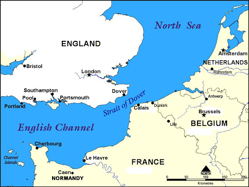
The Channel Islands are a group of islands off the coast of Normandy, a region in France named after Normans, the Norse raiders, also known Vikings, who appeared on the coast at the beginning of the 9th-century, and eventually settled the region…
…and considered remnants of the Duchy of Normandy, with its beginnings in 911 AD…

…and even as recently as the late 1700s, the Channel Islands were dubbed “the French Isles.”
This in spite of the Channel Islands having been governed as de facto possessions, we are told, in one form or another of the Crown of England since 1066, the year when King William II of Normandy was said to have invaded and conquered England, who became known to history as William the Conqueror.
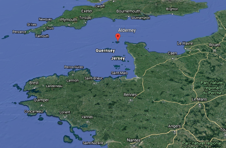
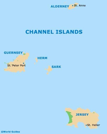
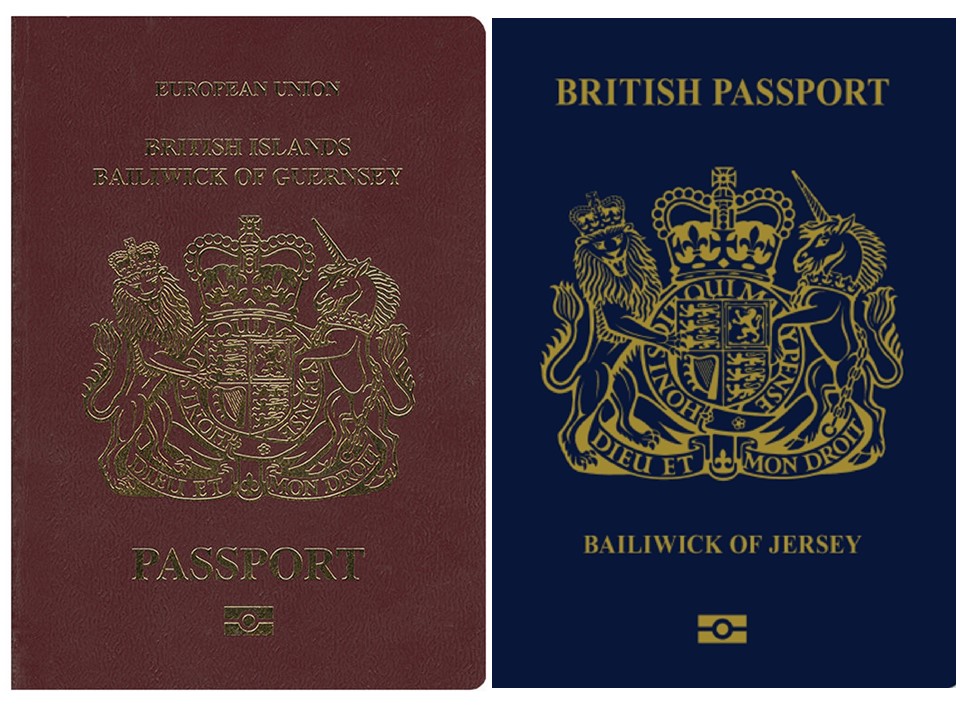
The Channel Islands are considered self-governing possessions of the British Crown, known as Crown dependencies, of which there are three, consisting of the Bailiwick of Guernsey; the Bailiwick of Jersey; and the Isle of Man.

The United Kingdom is responsible for the defense and international relations of the Crown dependencies, even though they are not considered part of the United Kingdom, the Commonwealth of Nations, or the European Union.
The two Bailiwicks of the Channel Islands are administered separately, with each having its own independent laws, elections, and representative bodies…
…and each of the islands of Alderney and Sark within the Bailiwick of Guernsey has their own legislature.
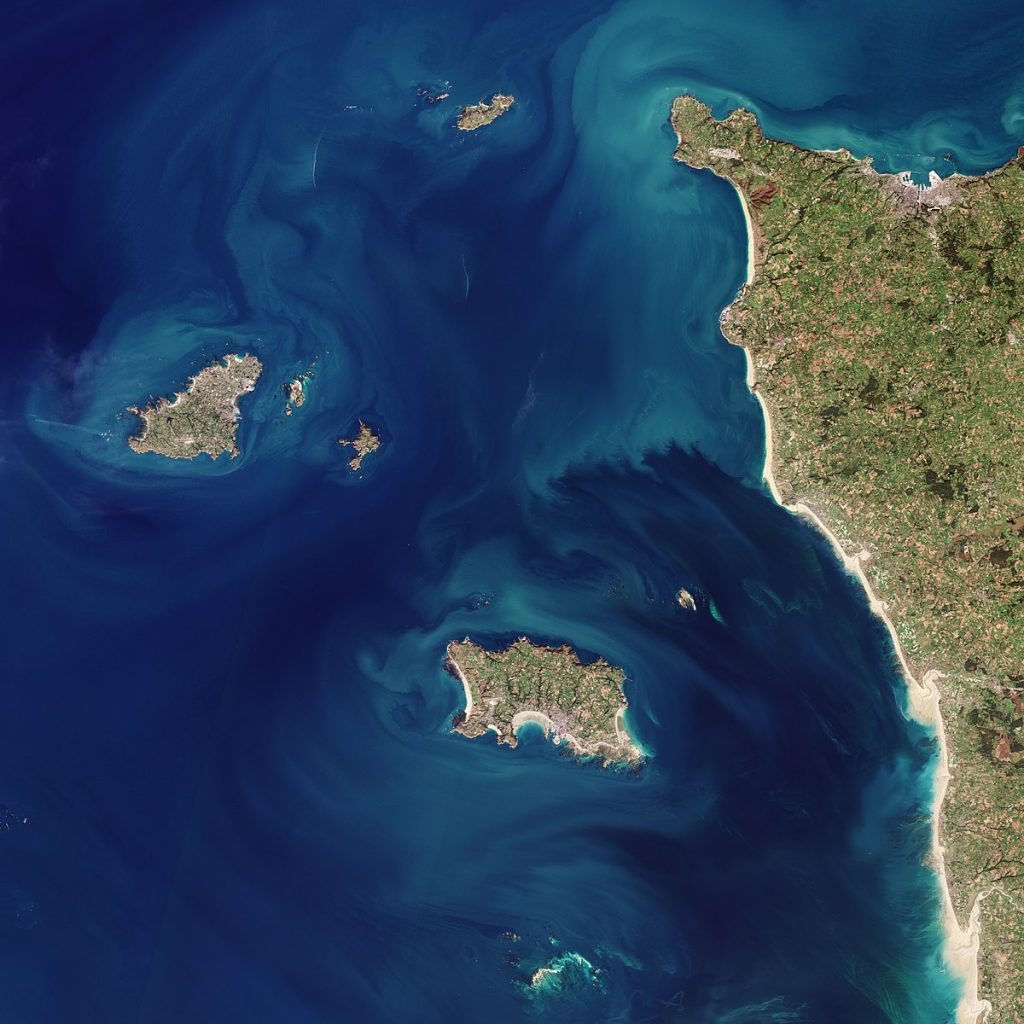
Four main islands clustered together…together yet separate?
This brings to mind the situation with Big Diomede and Little Diomede in the Bering Strait between Russia and Alaska.
The island of Big Diomede belongs to Russia, and Little Diomede to the United States.

In spite of their proximity to each other, they are separated by the International Date Line, and Big Diomede is 21 hours ahead of Little Diomede, almost a day.

We are told the term “Channel Islands” began to be used around 1830, and it was in 1830 that the island of Guernsey began production of copper coins denominated in “doubles,” issued in denominations of 1, 2, 4, and 8 doubles…

…and that, for example, coins of the French livre were legal tender on Guernsey until 1834…
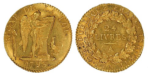
…and French francs were still used up until 1921.
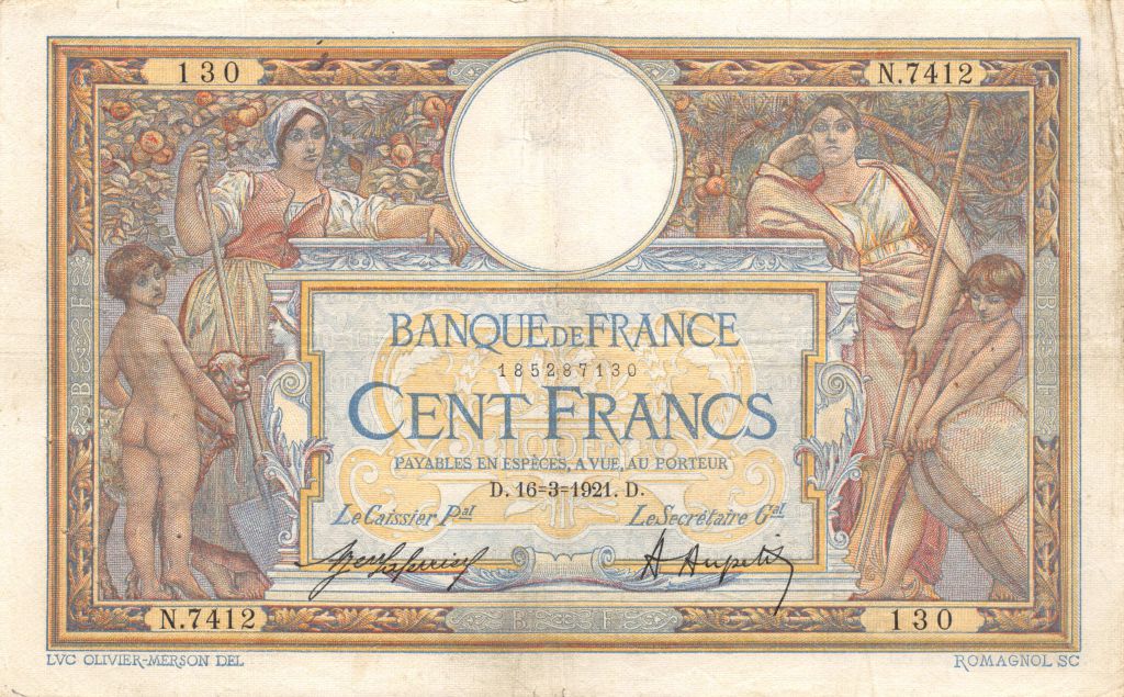
Odd that in spite of the Channel Islands having been governed as possessions of the British Crown for centuries, as we are told, French currency was still being used as legal tender as recently as 1921.
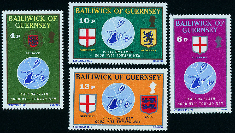
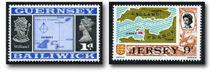
Both Bailiwicks issue their own bank notes and coins, which circulate freely in all the islands…

…and postage stamps which can only be used in their own bailiwicks.
Both Jersey and Guernsey have become major off-shore financial centers since the 1960s, in which they provide financial services to nonresidents on a scale that is out of keeping with the size and financing of their domestic economies.
It is important to note that Queen Victoria’s reign began on June 20th of 1837, around that same time as the production of the Guernsey doubles, and lasted for almost 64-years, until her death on January 22nd of 1901.

Her reign was described as a period of cultural, industrial, political, scientific, and military change within the United Kingdom, and marked by a great expansion of the British Empire.
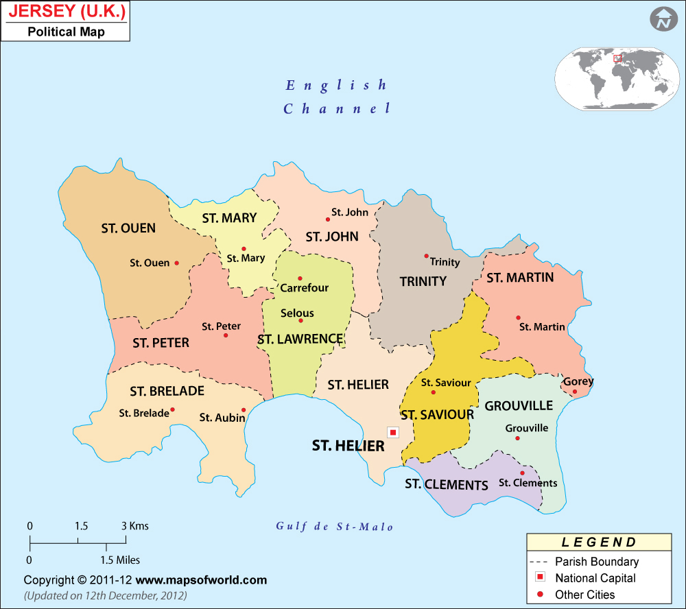
The Bailiwick of Jersey is the largest of the Channel Islands.
English is the main language, though some people still speak and/or understand Jerriais, the local form of the Norman language, and looks very similar to modern French.
It is interesting to note that remnants of what is called the Jersey Script are found scattered around the island, and which looks very similar to…

…a number of known scripts that we are told remain undeciphered, like the Rongo-Rongo script of Easter Island…
…the Indus River Valley Script in Pakistan…

…the Tartaria Tablets, discovered in 1961 at a neolithic site in the village of Tartaria in Romania, near the country’s border with Serbia…
…are dated to the 5th-millenium BC…

…with what are called the Vinca symbols…
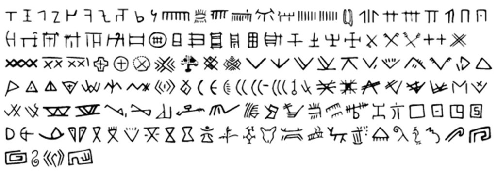
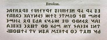
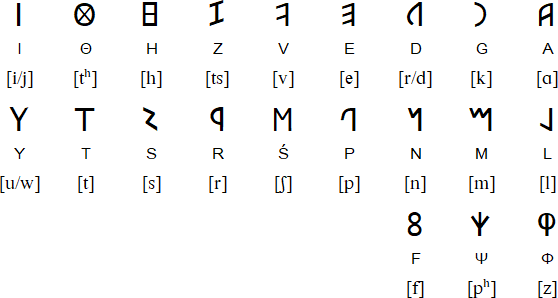
…the Etruscan language script of Etruria, the civilization of ancient Italy…
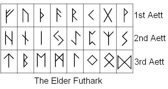
…Norse Runes, and the region of Normandy of which the Channel Islands were a part, was said to have been settled by Norse Vikings…
…the Ogham Script of the Picts in Scotland…


…and the script of the Oracle Bones of ancient China, which were used for divination and prophecy.

All of these mostly undeciphered scripts have characteristics similar to the ancient Ethiopian language of Ge’ez, the oldest African script still in use to this day, and is the liturgical language of the Ethiopian Orthodox Tewahedo Church and the Jewish Community in Ethiopia.
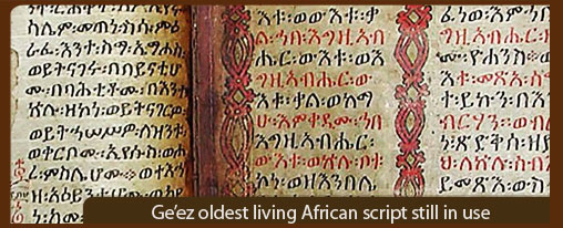
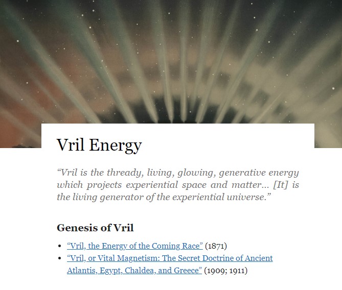
I think there is a connection between Ge’ez, the so-called undecipherable scripts found in different places, and Vril…

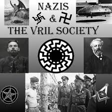
…the original language which was connected to the Ancients and their mastery of how to harness natural energy to create amazing things.
…and a subject the Nazi Germans were most definitely interested in.
The Nazi Germans were also definitely interested in the Channel Islands.
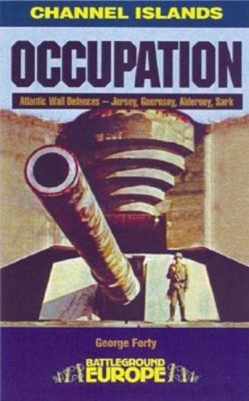
The German Occupation of the Channel Islands lasted for most of the World War II, starting on June 30th of 1940 to May 9th of 1945.
The Channel Islands were the only place in the British Isles occupied by the German Armed forces during the War.
We are told that the German occupation of Jersey started one week after the British government demilitarized the island, for “fearing for the safety of civilians should there be any conflict.”
We are told that on June 28th of 1940, the German Air Force bombed and machine-gunned multiple sites on the island, not knowing about the demilitarization, killing ten people and wounded many more.
The island of Jersey surrendered quickly after this initial attack by the Germans, and several days later, on July 1st, the island was occupied by German forces.
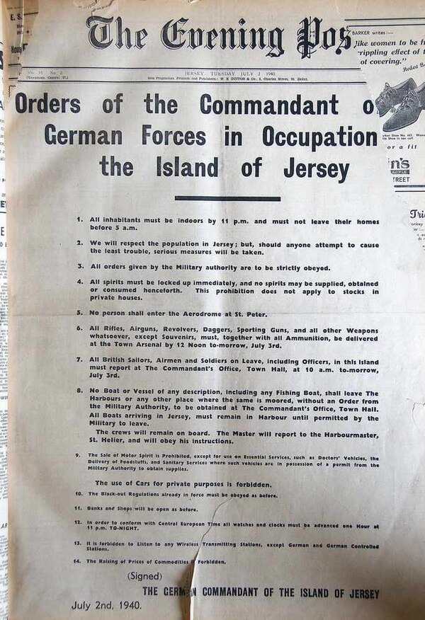
During the years of German occupation, there was no news from the mainland because the Germans outlawed the use of radio sets, and the use of cars for private purposes was forbidden.
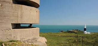
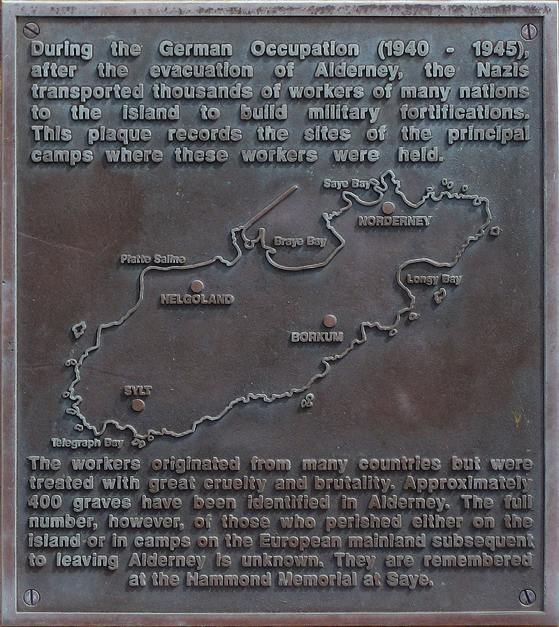
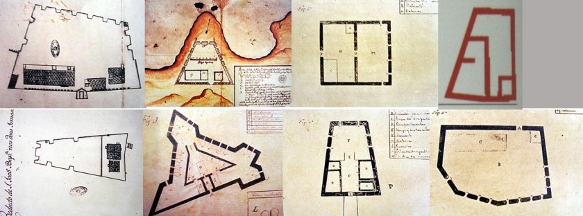
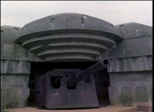
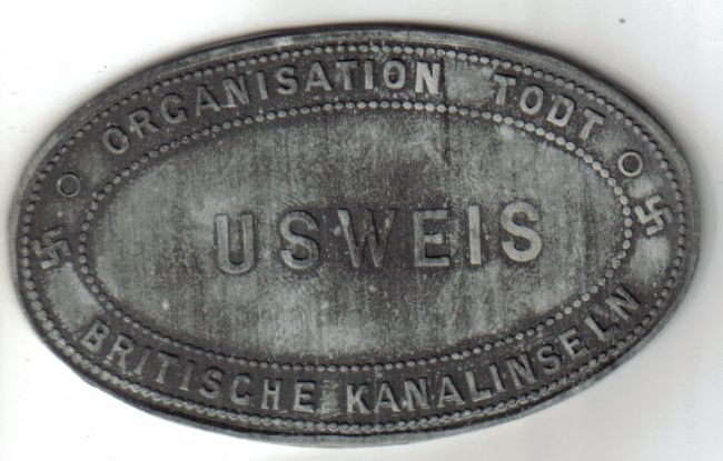
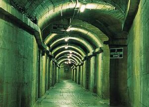
Jersey was said to have been converted into an impregnable fortress during the occupation, with hundreds of bunkers, anti-tank walls, railways systems, and tunnel systems, built by thousands of slave workers from different countries through Organization Todt, a civilian and military engineering organization notorious for using forced labor.
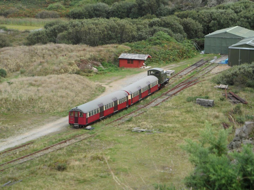
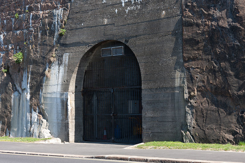
The Jersey War Tunnels were said to have been built during this time by forced labor, and intended as protection from invasion, serving as barracks and storage depots.
Storage tunnels were said to have incorporated a 24-inch, or 600-millimeter, gauge railway in a loop, running through the whole complex.
This is the railway in tunnel Ho2.
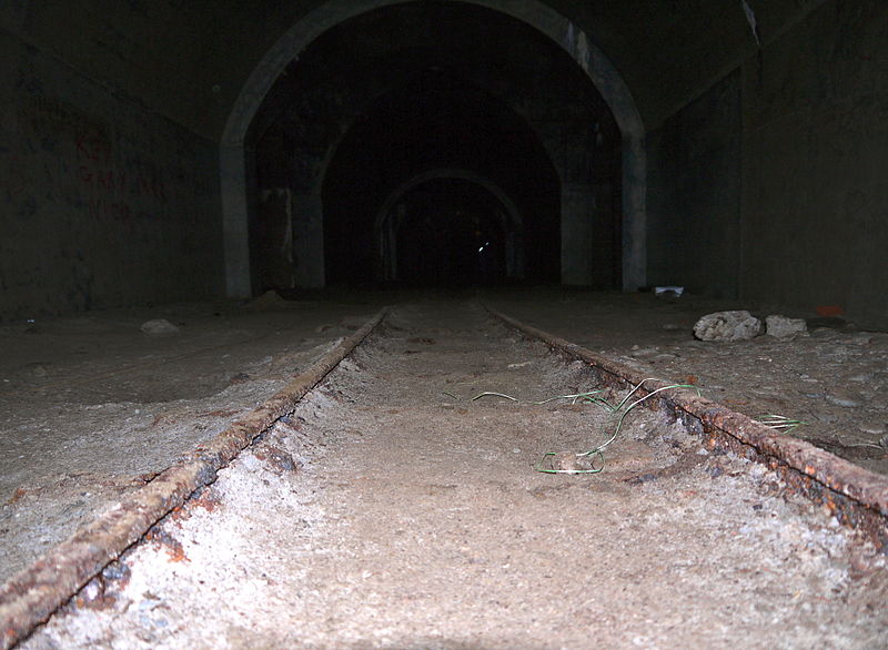
The tunnels were said to have been dug into the sides of hills, into solid rock, as seen with the entrance to Ho19, under Pier Road in Jersey’s capital, St. Helier.
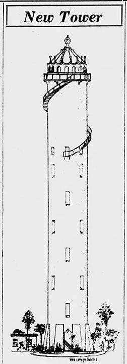
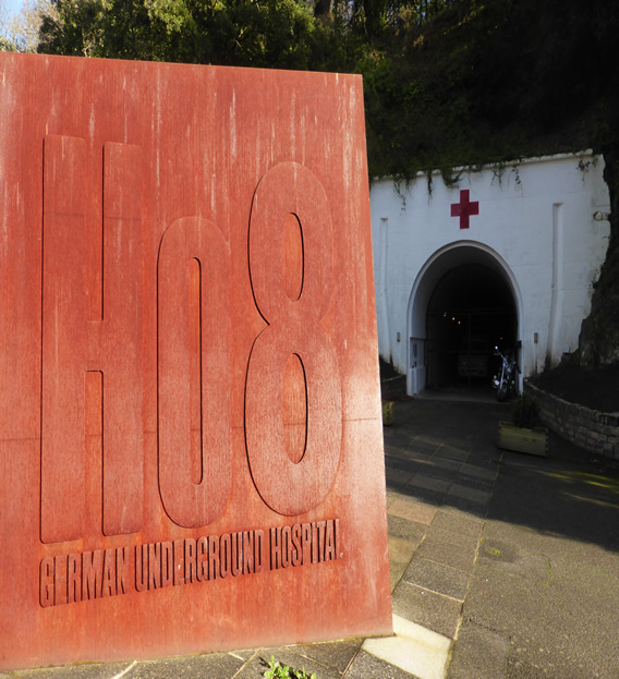
We are told this incredibly sophisticated tunnel system was built between 1941 and 1945, and that as the Germans faced defeat, Tunnel Ho8 was put into use as an emergency hospital because conditions were so bad for them.
More on tunnels later.
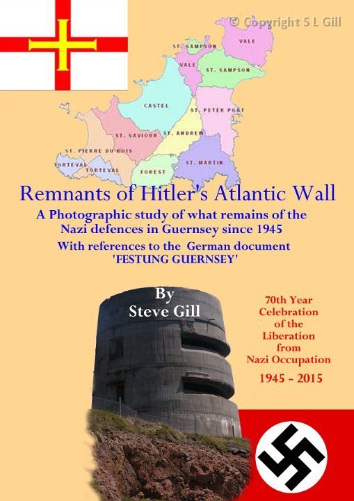
We are told that all of the fortifications built around the island were part of Hitler’s “Atlantic Wall.
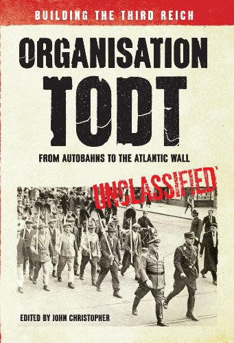
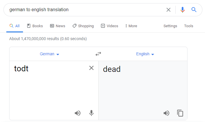
While Organization Todt was said to have been named after its founder Fritz Todt, “todt” is also the German word for “dead.”
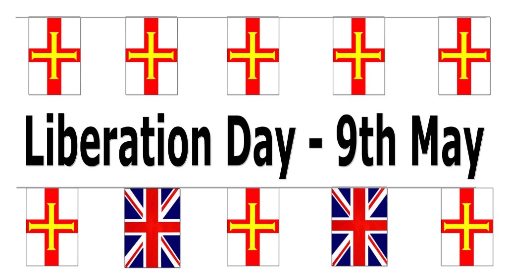
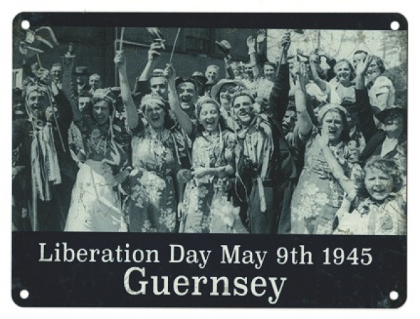
Liberation Day was May 9th of 1945, and is celebrated annually on that day.
Today, we are told, traces of Jersey’s defenses and war-time occupations can be discovered at St. Ouen’s Bay, and other places around the island.
The Military Museum of the Channel Islands is housed in a bunker within Hitler’s Atlantic wall defense system at St. Ouen’s Bay.

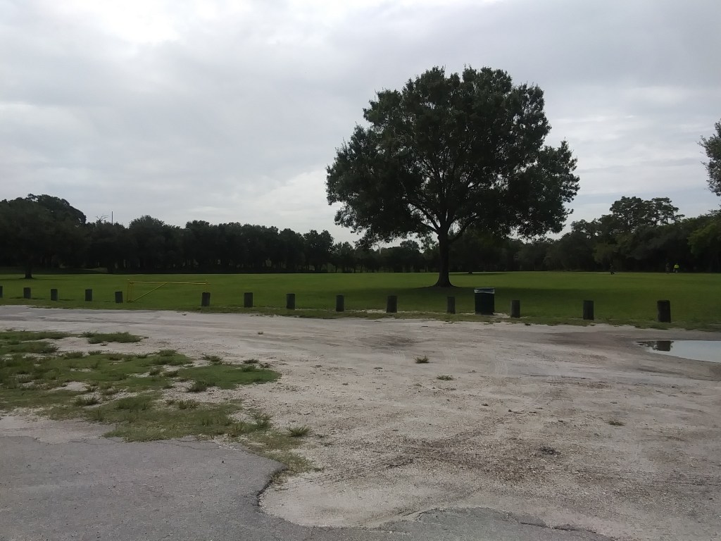
It is interesting to note this pyramidal shape at the northern tip of St. Ouen’s Bay.
The only reason I had any idea that the Channel Islands were occupied during World War II was because of a Masterpiece Theater production called “Island at War,” which was released in the summer of 2004, about the fictionalized island of St. Gregory as a stand-in for events that took place on Jersey and Guernsey.

I don’t remember how much I watched of this series, but I do remember when it was being aired.
Let’s see what we find on Jersey when we take a look around the island today.
The city of St. Helier is the capital of Jersey, and the name of one of the 12 parishes of Jersey.

These are administrative districts that all share access to the sea and share a name with their ancient parish churches.
St. Helier, a 6th-century ascetic hermit and martyred healing saint, is the patron saint of Jersey.

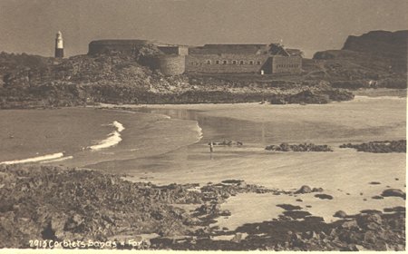
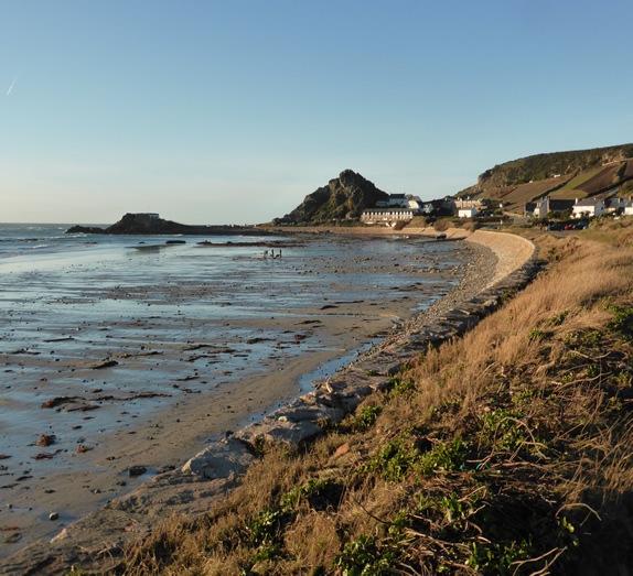
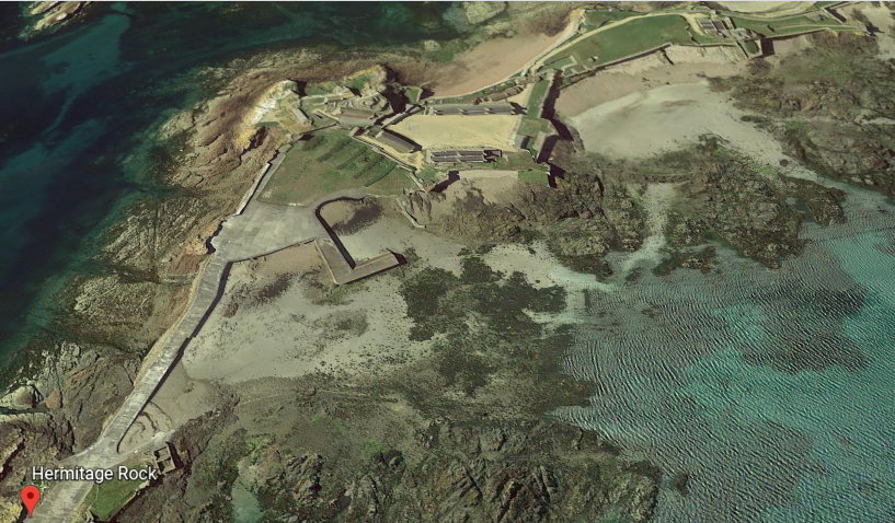
When St. Helier came to Jersey looking for a suitable monastic spot, he settled on a place known as Hermitage Rock on a tidal island known as “The Islet.”

This is said to be an 1872 photo of the Hermitage Rock, showing what appear to be rail-tracks of some kind at this location.
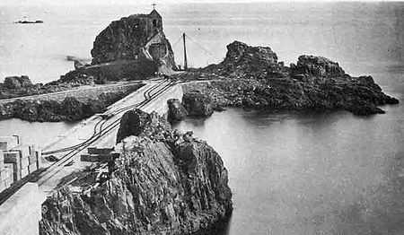
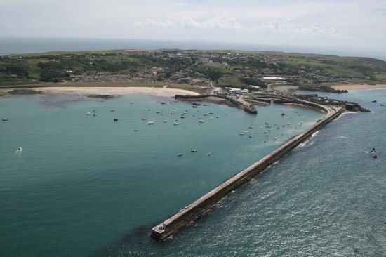
This is the breakwater, said to have been built in 1870, which connects Hermitage Rock…

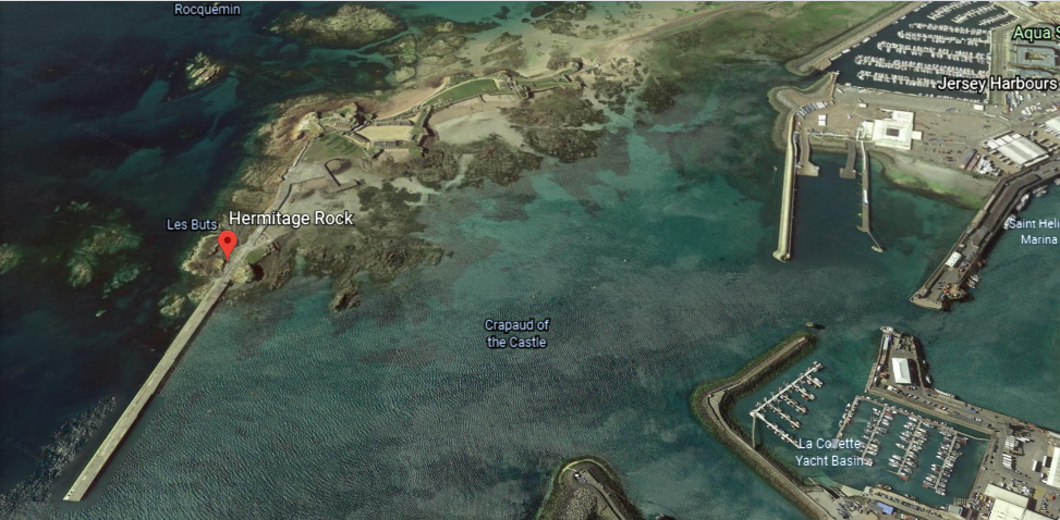
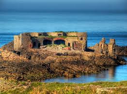
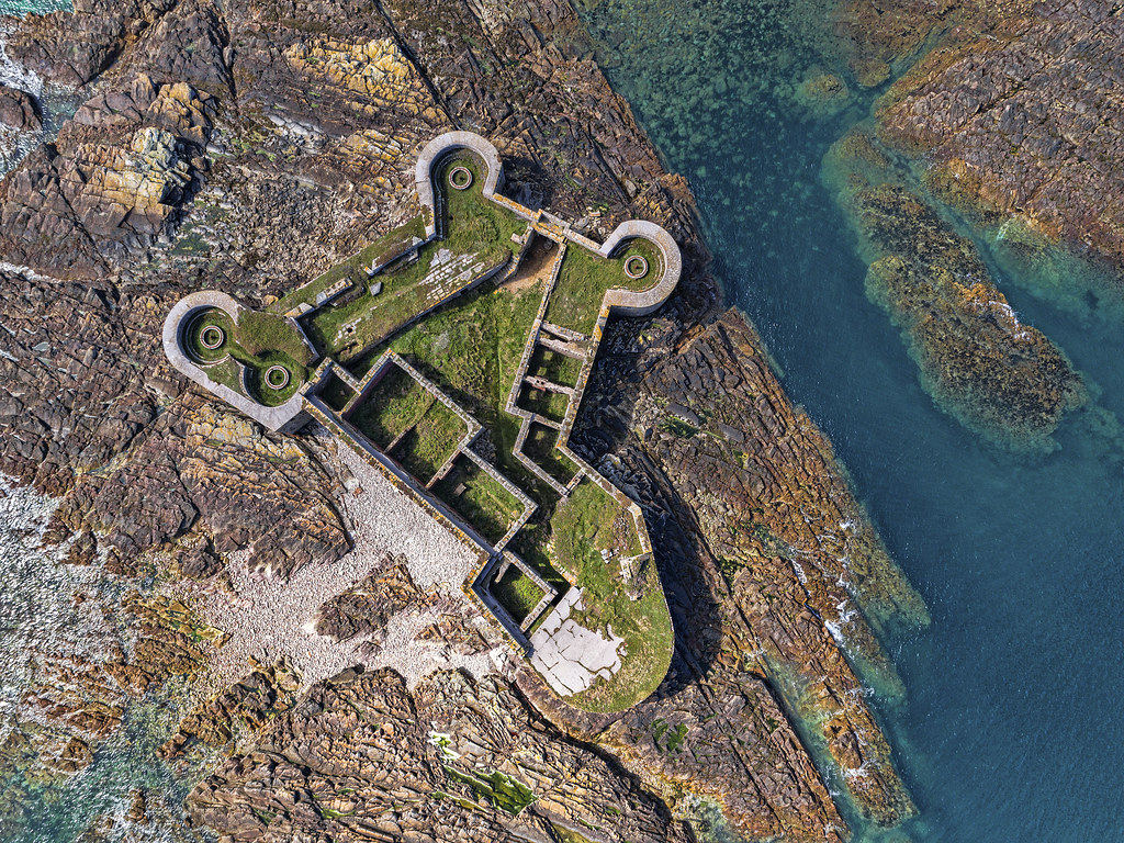
…with Elizabeth Castle, which has the appearance of a classic star fort.
The Elizabeth Castle was said to have been built starting in the 1590s, and that Sir Walter Raleigh, the Governor of Jersey between 1600 and 1603, named the castle after Queen Elizabeth I, the ruling monarch at the time…

…and the official residence of the Governors of Jersey was said to have moved to Elizabeth Castle from Mont Orgueil, which was said to have been built starting in 1204 and completed in 1450.


In looking around Jersey’s capital city of St. Helier, these are some of the places I encountered.
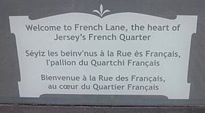
This Hilgrove Street, also known as French Lane, circa 1936.

Hilgrove Street is within the main Central Business District of St. Helier.
The curvature of Hilgrove Street immediately brought to mind the historic Stone Street in the Financial District in Lower Manhattan…
…the Casbah in Old Algiers in Algeria…

…and the Royal Mile in Edinburgh, Scotland.
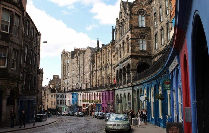
These are just a few of countless examples I have found of this type of curvature in street and building lay-outs demonstrating what appears to be a level of shared city-planning in very diverse places that is inconsistent with what we have been taught.
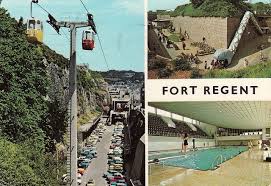
This a 1967 photo of Fort Regent, high above St. Helier on Mont de la Ville, which was said to have been built between 1806 and 1814 fas the island’s main barracks and fortification…

…and 1967 was the year that the decision was made to develop Fort Regent into a leisure complex.

Then there is what is called a 19th-century obelisk at Library Place in St. Helier.
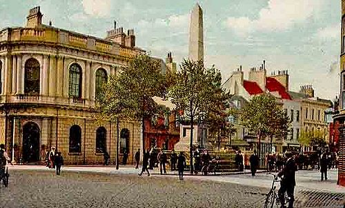
Called the “Le Sueur” Obelisk, it was said to have been erected by an unknown sculptor sometime between 1855 and 1863 to commemorate Peter LeSueur, a respected constable who lived between 1811 and 1853.

There is even a fountain at the base of the obelisk with a lion’s head and water running into a granite basin.

There is one more place on the island of Jersey that I would like to take a look at.
The Royal Bay of Grouville.
We are told that the Royal Bay of Grouville gained the “royal” in its name when it impressed Queen Victoria during her visit her in 1846.

Mont Orgueil Castle, which I mentioned earlier, overlooks the Royal Bay of Grouville.
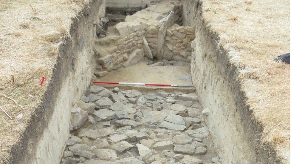
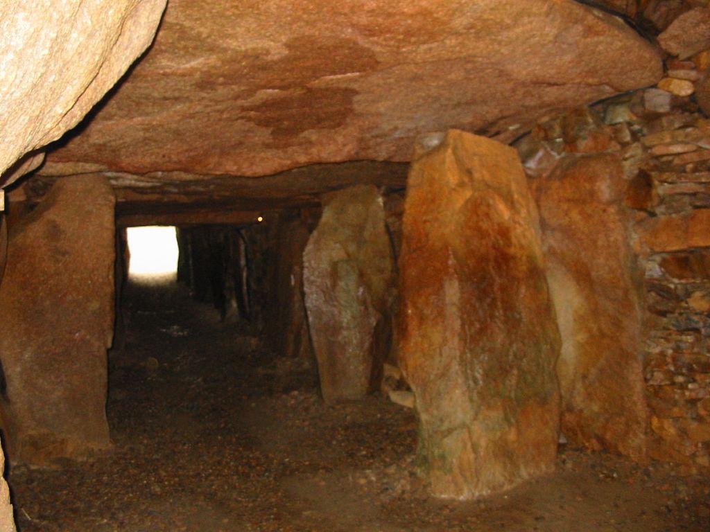
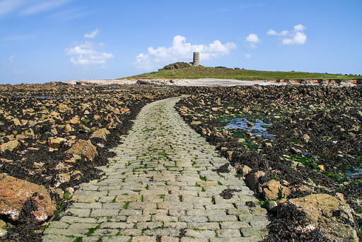
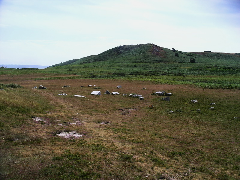
The Parish of Grouville is the location of La Hougue Bie, Jersey’s most noted archeological site.

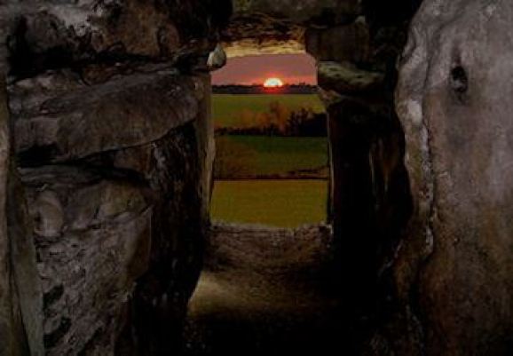
La Hougue Bie is a neolithic chamber site.
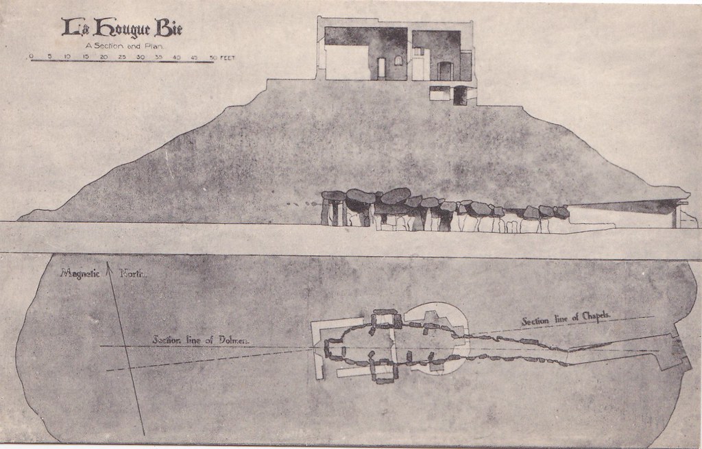
It dates back to about 3,500 BC, and it’s entrance is aligned with the sun on the spring and fall equinox.
This makes La Hougue Bie contemporaneous with the Grey Cairns of Camster in northern Scotland…
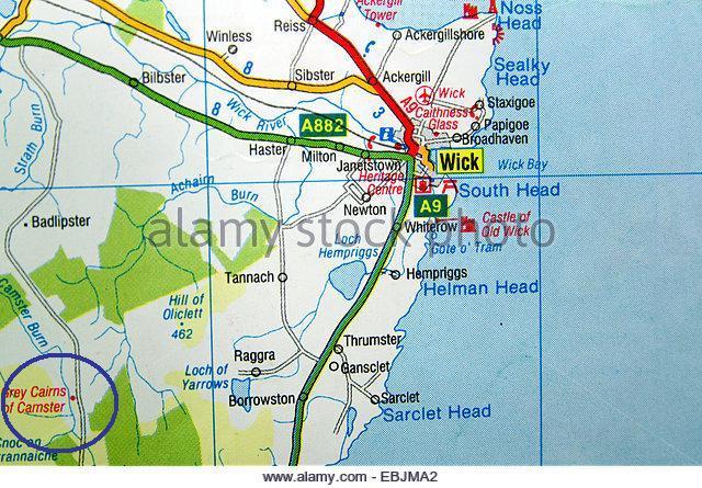
…said to have been discovered in 1850 and excavated in 1865. This cairn is known as Camster Round…
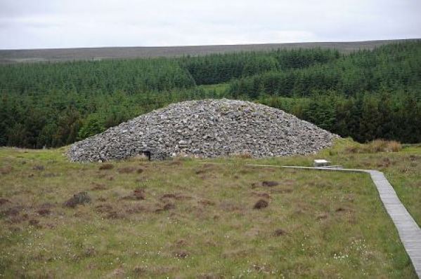
…and this one is Camster Long.


Also dating from this time period of roughly 5,000+ years ago is the West Kennet Long Barrow in southern England’s Avebury complex…
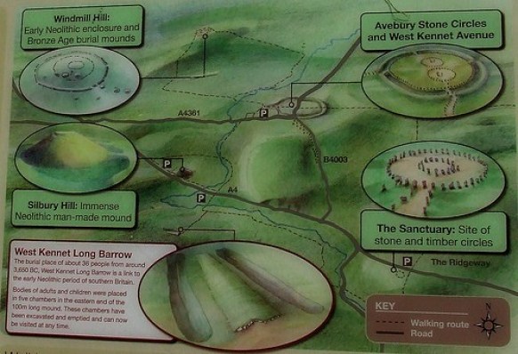
…also known to be a solar marker at the equinoxes…
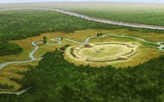
…as well as with the Watson Brake Mounds, in Richwood, Louisiana, near Monroe and Poverty Point.

Watson Brake is dated to 5,400 years ago, and is considered the oldest earthwork mound complex in North America.
Note the summer and winter solstice alignments depicted here in this diagram of Watson Brake.
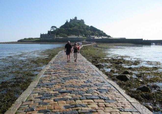
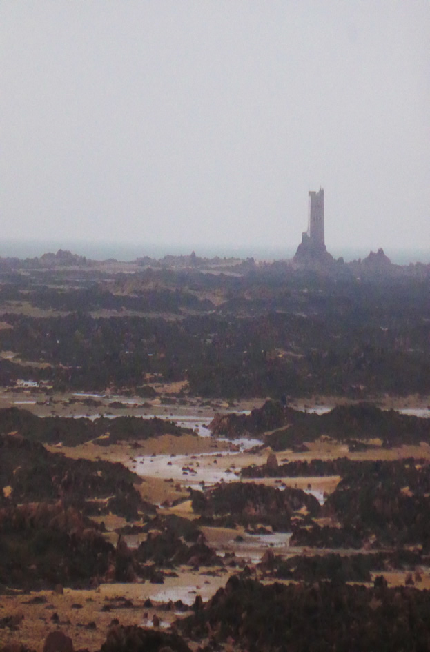
Jersey also has one of the highest ranges between low-tide and high-tide in the world, a massive bulge of water that moves backwards and forwards, twice each day.
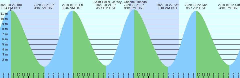
I found this photo in reference to a rocky beach in the Royal Bay of Grouville, saying that it is under water, as well as the Tower, at high tide.
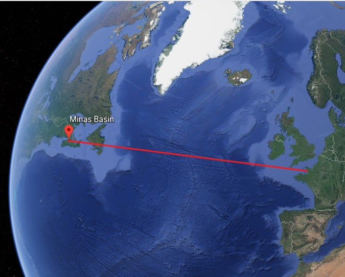
There are two other places I know of from personal experience that have the extreme tidal ranges found in Jersey.
One is the Minas Basin in Nova Scotia, an inlet of the Bay of Fundy, and the home of the most dramatic tidal change in the world, with tides rising and falling as much as 46- to 52-feet, or 14- to 16-meters,


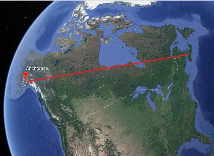
The other is the Cook Inlet, which stretches from the Gulf of Alaska to Anchorage in south-central Alaska.
The Turnagain and Knik Arms of the Cook Inlet boast the second-highest tides in North America, after the Minas Basin and Bay of Fundy.

There are other places in the world which experience this extreme tidal phenomena.
I thought of these two places when I saw the information on Jersey’s extreme tides because I have lived both in Wolfville, located on the Minas Basin in Nova Scotia and saw the dramatic effects of the low-tide versus the high-tide almost on a daily basis, and in Fairbanks, Alaska, and was aware of the tidal phenomena of the Cook Inlet.
So I decided to connect a line between the island of Jersey and the Minas Basin on Google Earth…
…between the Minas Basin and Anchorage, Alaska…
…and then between all three places.
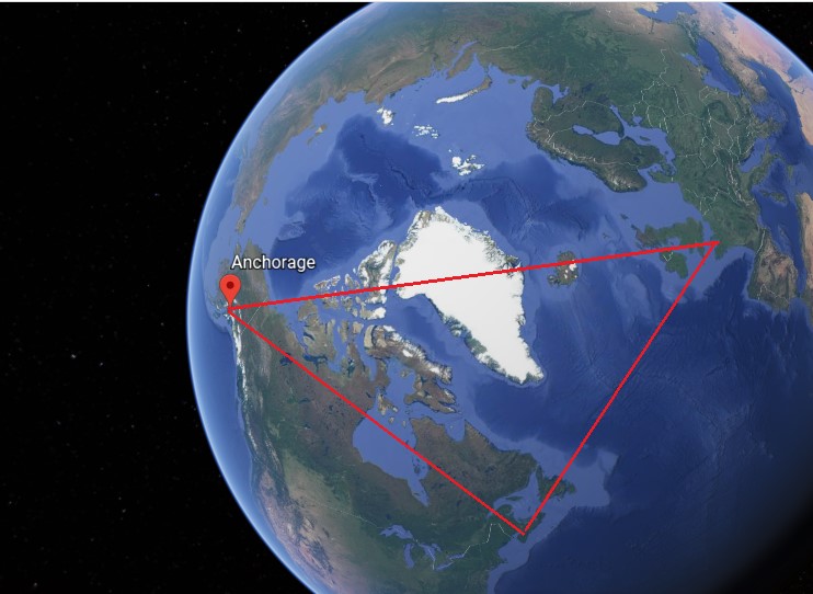
Well, it certainly looks like there could be a geometric connection between these three locations.
Like with so many places I have researched, there is much to find on Jersey, and I could stay here forever looking around and finding many interesting things to share, but I have a lot more ground to cover in the Channel Islands for the purpose of this post.
I am going to leave Jersey here, and move on over to the island of Guernsey.
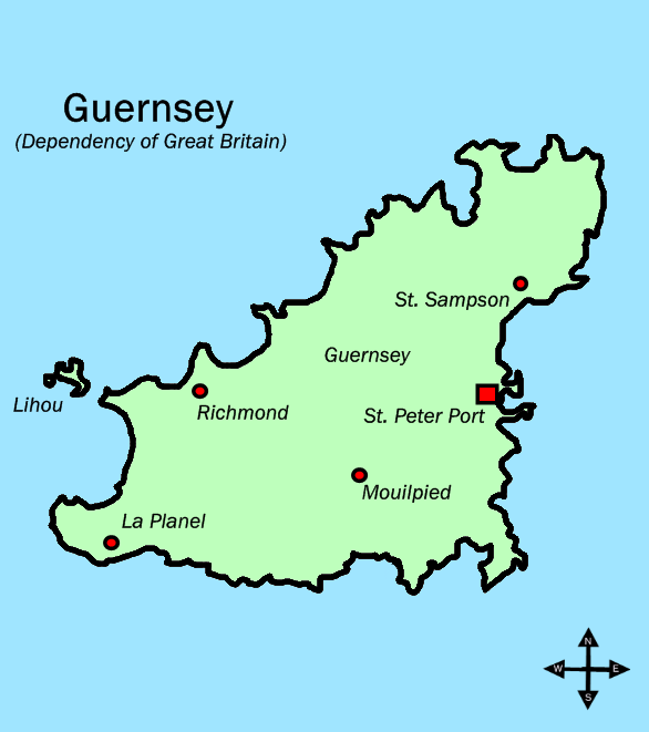
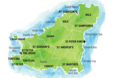
The island of Guernsey has ten parishes, districts that are administered by an elected council of 12 known as a Douzaine and two elected Constables.
The Welsh saint Samson of Dol is the patron saint of Guernsey, one of the seven founder saints of Brittany.
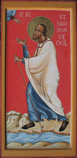
He was believed to have lived between 485 AD and 565 AD.
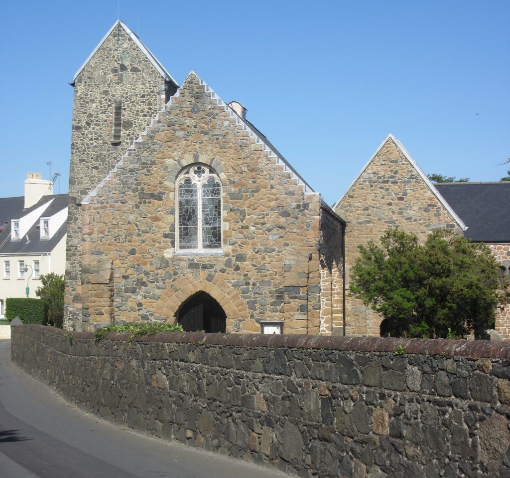
Saint Sampson’s, the oldest parish church in Guernsey, is said to stand near or on the site where St. Samson landed as a Christian missionary around 550 AD.
Guernsey is roughly north of St. Malo, named after another of the seven founder saints of Brittany, and is an historic port on the English Channel coast of the Brittany region of France.
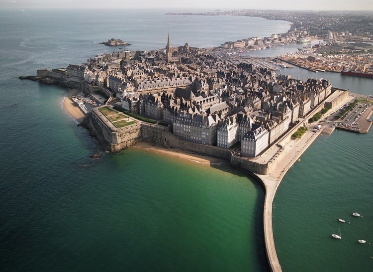
This is an old map of St. Malo showing the presence of several star forts here, as well as St. Malo being a star city.

The Allies heavily bombarded St. Malo, which was garrisoned by German forces, during World War II in 1944.
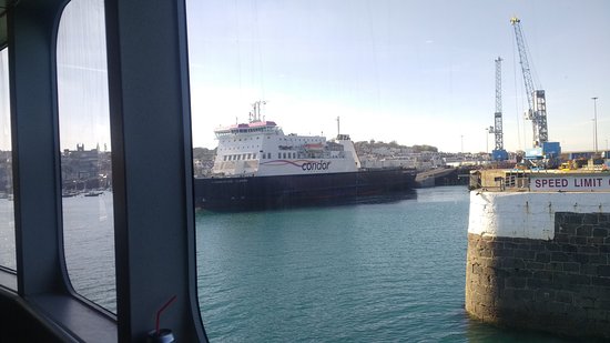
A car ferry system from St. Malo serves St. Peter Port in Guernsey and St. Helier in Jersey, as well as the English cities of Portsmouth and Poole.
St. Peter Port is the capital and main port of Guernsey.
It is described as consisting mostly of steep, narrow streets and steps on the overlooking slopes.

This is High Street in St. Peter Port on the left, looking much like the Hilgrove Street in St. Helier on Jersey on the right that I highlighted earlier in this post for similarity with streets in other cities.

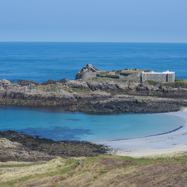
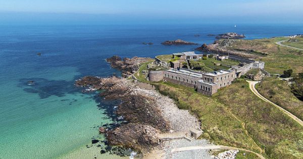
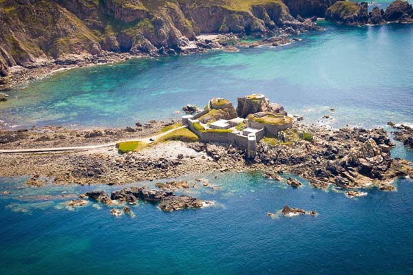
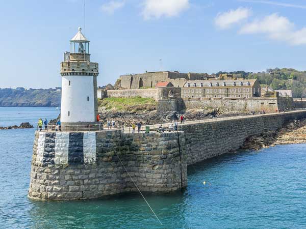
Castle Cornet in St. Peter Port is located on a former tidal island in the Little Russel, a channel running between the isle of Herm and Guernsey.

We are told that it was originally built between 1206 and 1256…
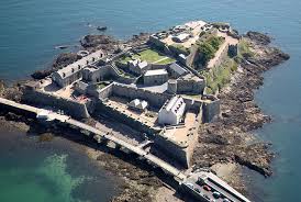
…and that it became one of the breakwaters of St. Peter Port Harbor in 1859.

The tidal island of Lihou, just off the west coast of Guernsey, is the furthest west of the Channel Islands…

…and is connected to Guernseys L’Eree headland by a stone causeway at low tide.

La Braye de Valle was a tidal channel that made La Clos du Valle, the northern extremity of Guernsey, a tidal island…
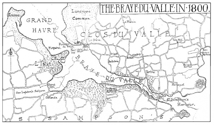
…. but it was said to have been drained and reclaimed by the British in 1806 as a defense measure.
I find the high concentration of tidal islands that are accessible by causeways only at low tide, and all the tidal phenomena I have encountered thus far in the Channel Islands, to be extremely noteworthy, and would love to know what all of this represented to the original advanced civilization.
At the eastern end of the Braye Du Valle on St. Sampson’s Harbor, we find Vale Castle, said to be over 1,000-years-old.

I have a few more points to make about the Vale Parish before going back to St. Peter Port.
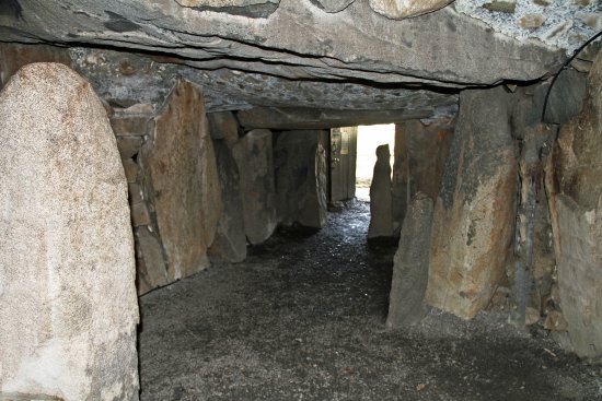
It is the location of a high concentration of ancient megalithic sites, including Le Dolmen de Dehus…

…said to have been first excavated between 1837 and 1848…
…what is called the La Varde Passage grave…
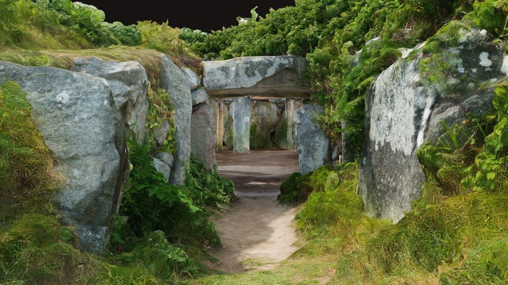
…said to have been discovered in 1811, and dating back to somewhere between 4,000 and 2,500 years ago…

…as well as a number of what are called cist-in-circles, like La Platte Mare.

Cist-in-circles are described as a small megalithic chamber enclosed within a small circular mound.
The L’Ancresse area of Vale Parish also has seven Guernsey Loophole Towers, of the fifteen such towers said to have been built by the British on Guernsey between August of 1778 and March of 1779 to deter the French from attacking after they declared themselves allies of the Americans in the Revolutionary War.

Back to St. Peter Port.
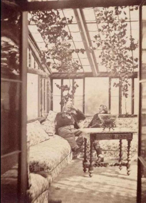
Come to find out, the French author Victor Hugo, best known for his novels “Les Miserables” and “The Hunchback of Notre Dame,” bought a house in St. Peter Port when he was exiled from France between the years of 1850 and 1870, allegedly for declaring the Emperor Napoleon III a traitor for seizing complete power in 1851 and establishing an anti-parliamentary constitution.

This was his home in St. Peter Port.
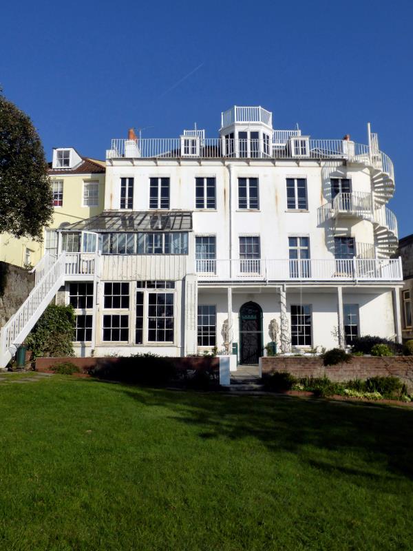
Called the Hautville House, it is utilized to house an honorary consul to the French Embassy in London, as a well as a Victor Hugo museum.
We are told that this house was donated to the city of Paris by Victor Hugo’s heirs in 1927, the centenary year of the literary genre of Romanticism in which Hugo wrote.
It was said to have been built in the year of 1800 by an English privateer, and that Victor Hugo furnished and decorated it himself.
The Candie Gardens are on the outskirts of St. Peter Port, said to have been established in 1894, and a rare surviving example of a Victorian Public Flower Garden.
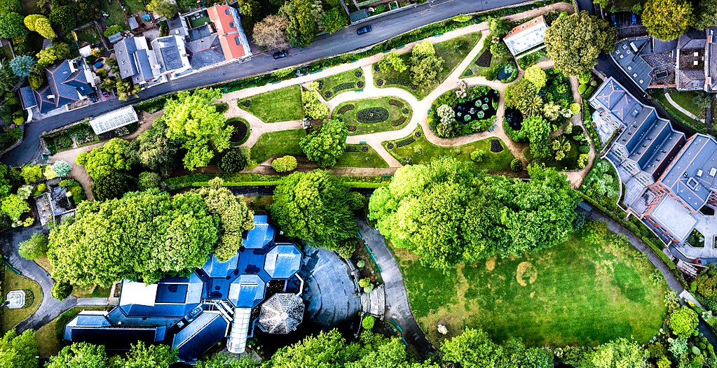
The Gardens are home to the Guernsey Museum…

…as well as a bronze statue of Queen Victoria in imperial regalia with an orb and scepter at the top of the Gardens…

…and a statue of Victor Hugo, that was unveiled in 1914.

It was said to have been presented by the French government to Guernsey in gratitude for the hospitality shown to Victor Hugo during the years he lived there.
I wonder if there is a Victoria/Victor connection on display here in the Candie Gardens, with physical representations of both the feminine and masculine form of the Latin word for victory.
Like the island of Jersey, the island of Guernsey was demilitarized in June of 1940, including the suspension of the militia, and shortly thereafter the Germans occupied Guernsey from June of 1940 until May of 1945.
We are told that a massive building program was instituted by the Germans, which saw the construction of tunnels, anti-tank sea-walls, coastal case-mates, artillery positions, artillery observation towers, and a mass of trenches, mine fields, and barbed wire entanglements.
These were said to have been built using the forced labor of Organization Todt.
Guernsey was liberated from the Germans on the same day as Jersey, on the 9th day of May in 1945, and along with Jersey, celebrates that date every year as Liberation Day.
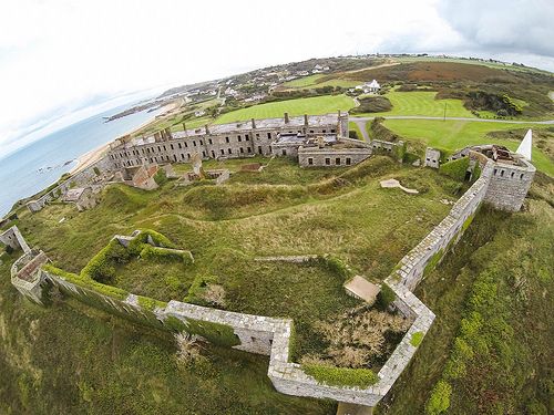
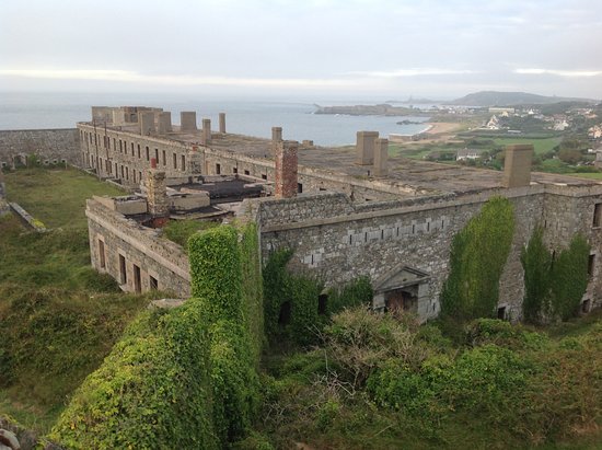
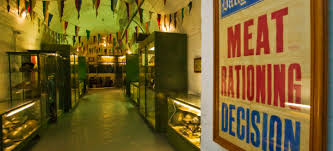
The La Vallette Underground Military Museum is set in a complex of air-conditioned tunnels said to have been built during Guernsey’s occupation as a fuel storage facility for German U-boats.

The museum features exhibitions, displays and information about various military and occupation memorabilia.
So, we have tunnels in both Jersey and Guernsey said to have been built by forced labor during World War II, and Hitler’s Atlantic Wall, one of the largest building works of the 20th-century, envisioned to make an Allied invasion of the Western European mainland from the sea impossible.
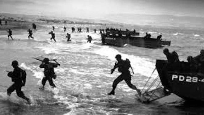
We are also told that when the Allied forces landed on the beaches of Normandy on June 6th of 1944, known to us in history as D-Day, most of the coastal defenses there were stormed within hours.
Something is not adding up here.
All of these massive building projects for making an Allied invasion from the sea impossible amounted to absolutely nothing?
Moving along to the next Channel island, the island of Herm is just east of Guernsey, and part of the Parish of St. Peter Port in the Bailiwick of Guernsey.
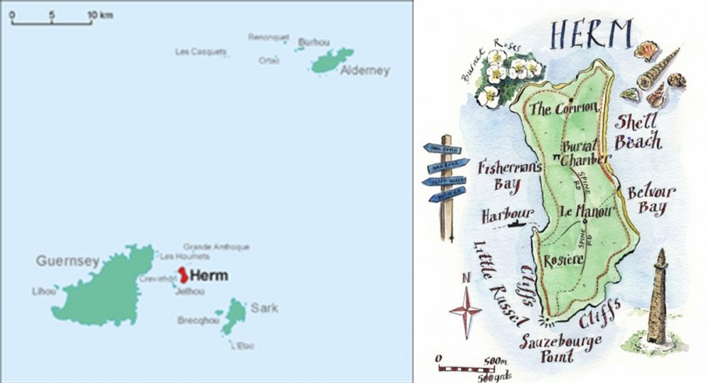
It is administered entirely by Guernsey, with its inhabitants being workers for the tourist industry and their families, and various tenants who rent the island.
For its small size, there are a large number of what are called megalithic sites on Herm, including, but not limited to, the Grand Monceau…
…the Petit Monceau…


…and Robert’s Cross.


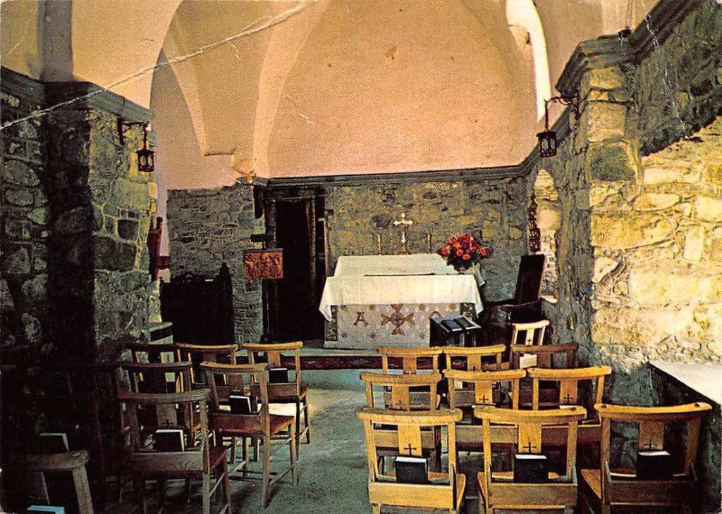
We are told that the first records of inhabitants of Herm are from the 6th-century AD, when followers of St. Tugual, another of the seven founder saints of Brittany, established Herm as a center of monastic activity.

St. Tugual’s Chapel on Herm is said to date from the 11th-century, with the site being of religious significance since the 6th-century.

Herm appears to be a shortened form of the word “Hermit.”
A hermit, or eremite, is defined a person who lives in seclusion, from society, living an ascetic life-style, across religious practices, including Christianity, Buddhism, Hinduism, Sufism, and Taoism.
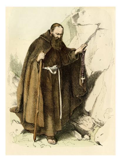
Many famous hermits and ascetics were sainted, and known for special abilities.
For example, St. Teresa of Avila was said to levitate during raptures…
…which is practiced by Hindu…

…and Tibetan yogis.

I mean, was the TV sitcom “The Flying Nun” from 1967 to 1970 telling us something without telling us they were telling us?

The Hermetic tradition represents a lineage of gnosticism attributed to the teachings of Hermes Trimegistus.
These are the Seven Hermetic Laws from the “Corpus Hermetica”

So, were the monks we are told that lived on the island of Herm Hermetic, or eremetic, monks that were learning to access their siddhis, a Sanskrit word for human super powers?

Were all the monks and nuns in the world at one time seeking this knowledge, and we have been taught a different narrative about them to obscure this information of what Human Beings are capable of?
A few other things about Herm.
Quarrying took place throughout the Channel Islands, and the small island of Herm was no exception, with the Herm Granite Company being formed in 1830.

There is an obelisk on the northern end of the island of Herm.
Called the Pierre Aux Rats obelisk, it was said to have been built in the 1800s as a navigational aid for fishermen after quarrymen removed a large tomb previously used by the fishermen for navigation.
The German occupation of the Channel Islands for all intents and purposes by-passed Herm, which had relatively little use by the Germans during that time.
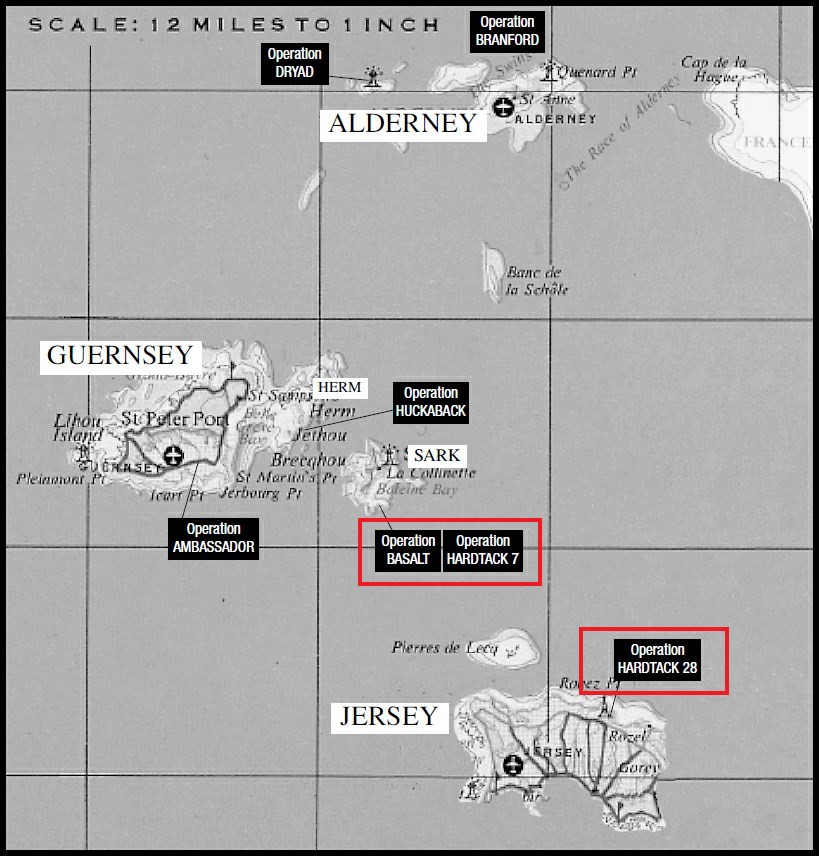
Operation Huckaback was a British commando raid on Herm on the night of February 27th and 28th of 1943, purportedly to take prisoners and gain information about the situation in the occupied Channel Islands.

We are told the commandos didn’t find any signs of German occupation, and left.
Cars and bicycles are banned from Herm, however, ATVs and tractors for transport and luggage.
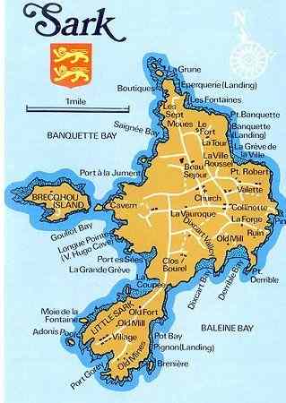
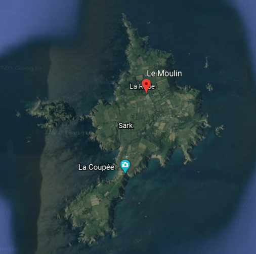
This brings me to the Channel Island of Sark, with a population of somewhere around 500, its own set of laws based on Norman law, and its own Parliament.
It was a hereditary fiefdom, the central element of feudalism, until 2008, at which time it became a fully-elected legislature.
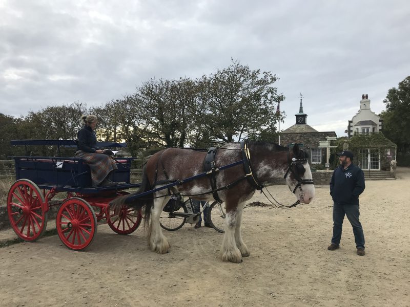
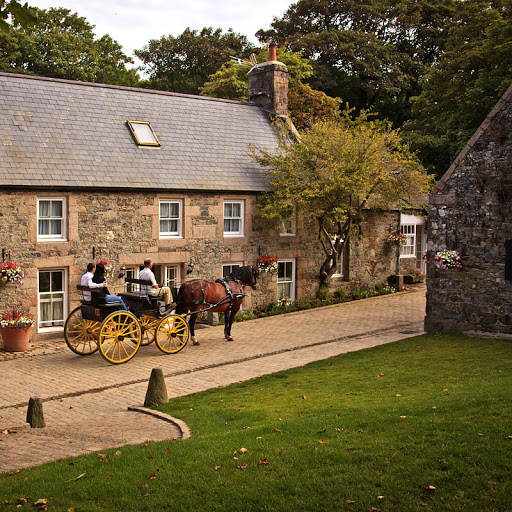
Sark has the same ban on cars as Herm, however, bicycles are allowed, and taxis are horse-drawn carriages.
The patron saint of Sark is St. Magliore of Dol, the nephew of St. Samson of Dol, the patron saint of Guernsey.

He was credited with all kinds of miracles, including healing miracles as well as miraculously saving people, even after death.
Saint Magliore was said to have established a community of monks on Sark at the location what is now a hotel called La Moinerie, which means “monastery”…
…and which is right next to “La Seigneurie,” the traditional residence of the Seigneur or Dame of Sark.

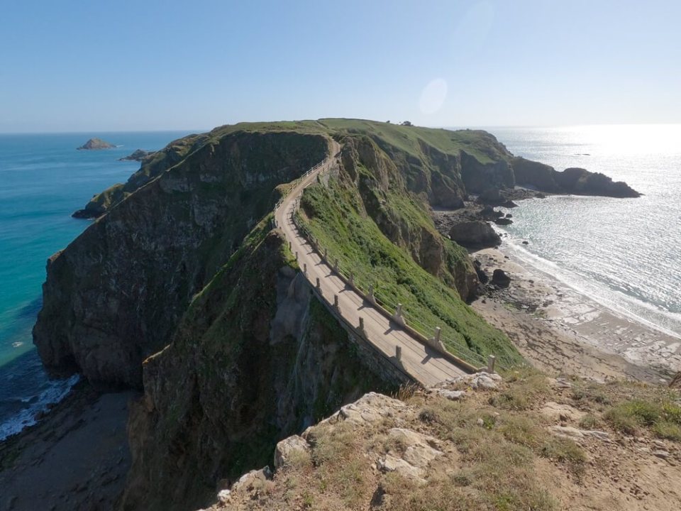
Sark consists of two parts – Greater Sark and Little Sark – and they are connected by a causeway called “La Coupee” that is 328-feet, or 100-meters, long, and 262-feet, or 80-meters, high.
The highest point on Sark, and in the Bailiwick of Guernsey, is called “Le Moulin.”
…after a windmill located there that was said to have been built in 1571…
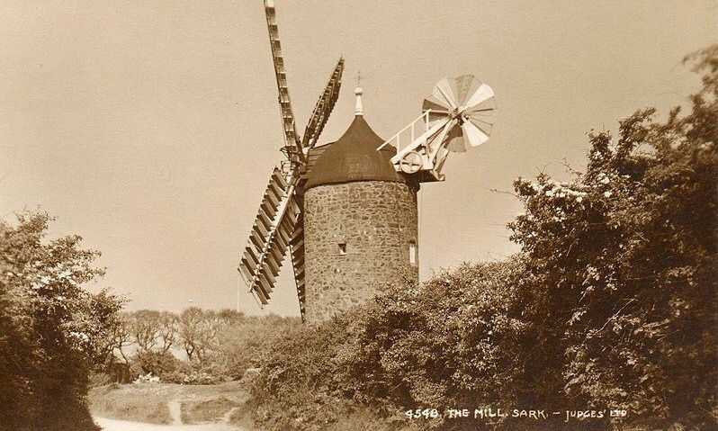
…the sails of which were said to have been removed during World War II.

Sark was occupied by the Germans from July of 1940 to May 10th of 1945, liberated a full-day after Jersey and Guernsey.
We are told that British commandos raided the island several times, including Operation Basalt the night of October 3rd and 4th in 1942, where one German prisoner was captured, and Operation Hardtack, a series of raids in December of 1943 which were ended, we are told, because it caused the Germans to bring in reinforcements.
Sark had a different experience than the other Channel Islands during German occupation because of the influence of Dame Sibyl Hathaway, the hereditary ruler of the royal fief of Sark at the time.
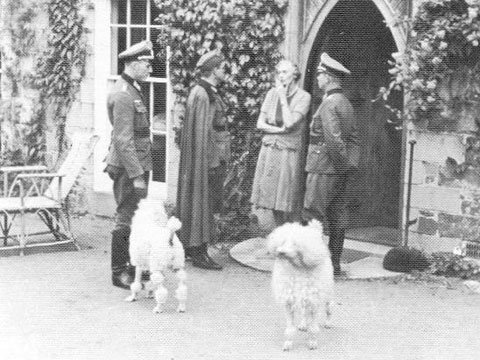
Apparently she had a way of controlling the situation for a better outcome for her people.
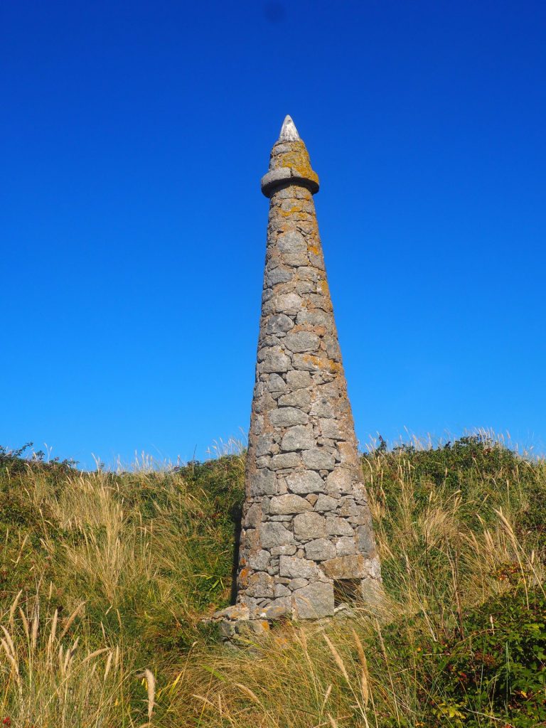
Silver and galena, the natural mineral form of lead ore that is also an important source of silver, were mined historically on Little Sark.
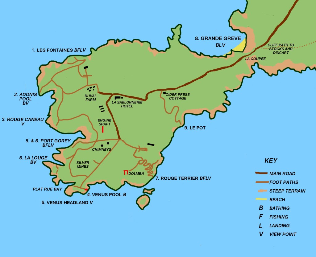
There are what are called chimneys found here, said to have been for the discharge of smoke from the coal-boilers of the silver mines beneath them that were mined roughly between 1836 and 1847.

There is a megalithic dolmen in the vicinity of the silver mines on Little Sark as well.

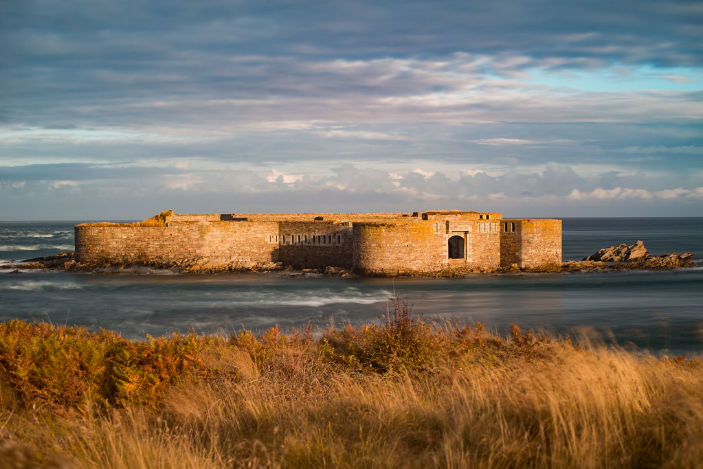
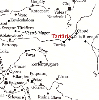
I noticed on the map a place marked “Old Fort,” and when I searched for information about it, I found a reference to it describing it as a star-shaped earthwork fort above the narrow isthmus that joins Little Sark to Greater Sark.
I looked on Google Earth, and there is a star-shape still discernable in the landscape at the location shown on the map marked “Old Fort.”

I end this part with more questions than answers about the Channel Islands.
I have questions about:
Why were the Germans so interested in them?
Why were there so many megaliths concentrated on these small islands?
Why were there so many star forts here?
Why were there so many tidal islands here, and the extreme tidal activity?
Why were there so many saints and monasteries here?
Why do they have separate legislatures, currency, stamps, and passports?
In the last part of this series, I will be taking a look at several other noteworthy islands in the English Channel.