
This is the second part of a series I started recently featuring the cities and places I found around the world in long-distance alignment with each other, starting from San Francisco.
I came into this level of awareness about the physical planetary grid system after I found a star tetrahedron by connecting cities in North America that lined-up in lines.
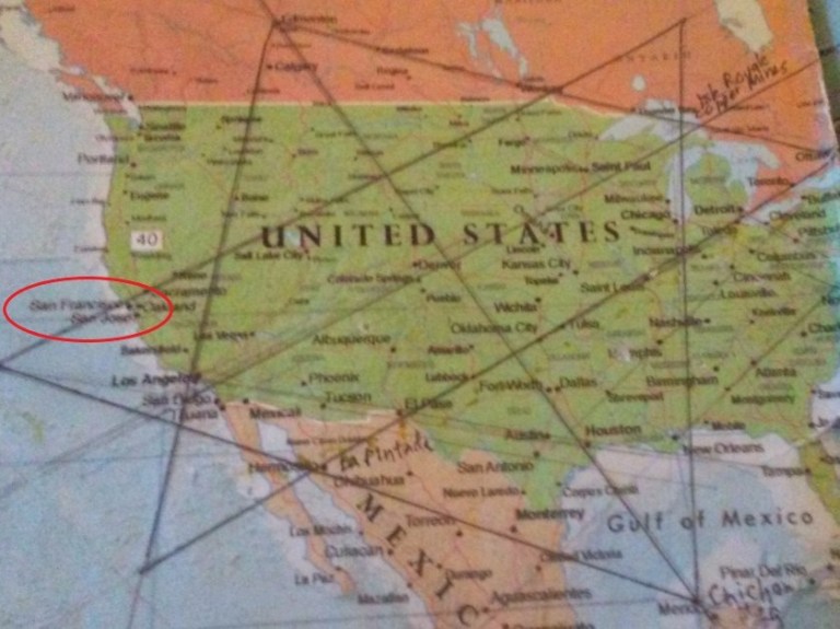
I believe this is the terminus of the planetary grid system, and that all of the physical infrastructure on the earth was laid out by the advanced ancient civilization according to sacred geometry .
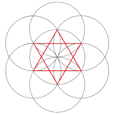
Sacred Geometry is based on the Flower of Life pattern, which is the creation pattern of the Universe.
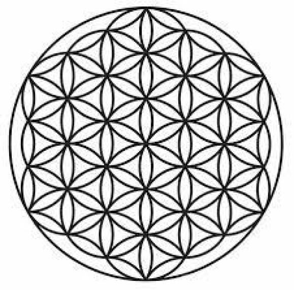
When you connect the centers of each circle, you find all the sacred geometric shapes are contained within it, including, but not limited to, the star tetrahedron.
There are many kinds of alignments and ley-lines, all connected to each other, so what I am going to share is one of the alignments emanating off of San Francisco.
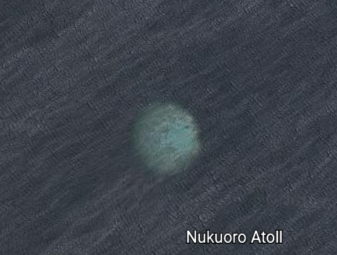
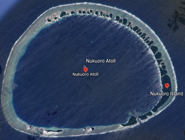
I am picking up this particular alignment emanating from San Francisco where it goes through Nukuoro Atoll.
Nukuoro Atoll in the Caroline Islands is a municipality in the State of Pohnpei in the Federated States of Micronesia.
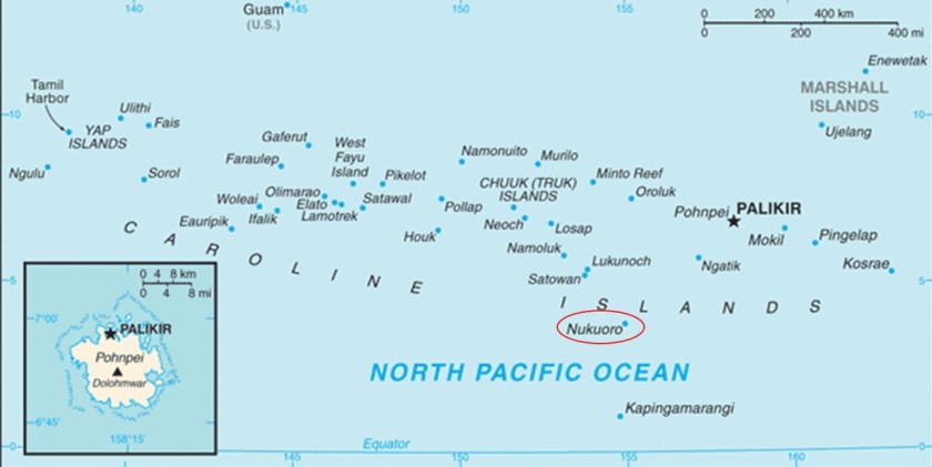
It is the second most southerly atoll in the Federated States of Micronesia.
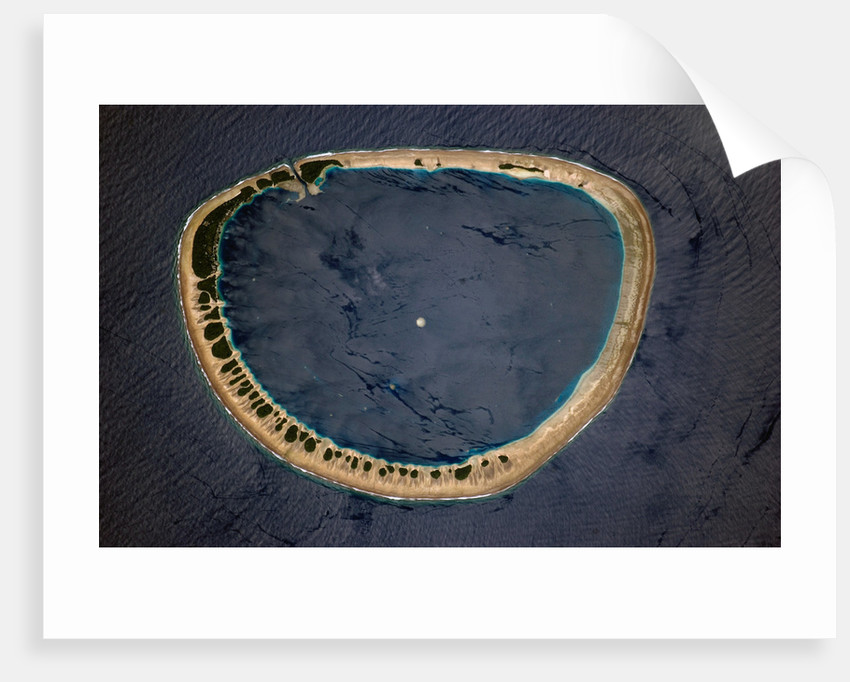
Not sure what that whitish circle in the center of the atoll is, but this is what it looks like on Google Earth. At any rate, an interesting find.
It has a small population of under 500 people, with the capital of the municipality and center of population being Nukuoro Island.
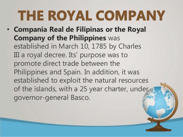
The first sighting of Nukuoro by Europeans was recorded as by Juan Batista Monteverde in 1806. He was a commander of one of the frigates of the Royal Company of the Philippines.
The population is primarily involved in fishing, animal husbandry, farming taro and copra, and black pearl oyster farming.
This the Nukuoro Atoll public elementary school, a four-room schoolhouse for children up to the age of 14.
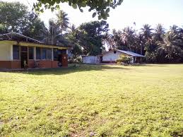
Older children must go to the island of Pohnpei to attend high school.
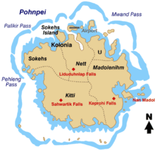
Pohnpei, also called Ponape, is the largest island in the Federated State of Micronesia.
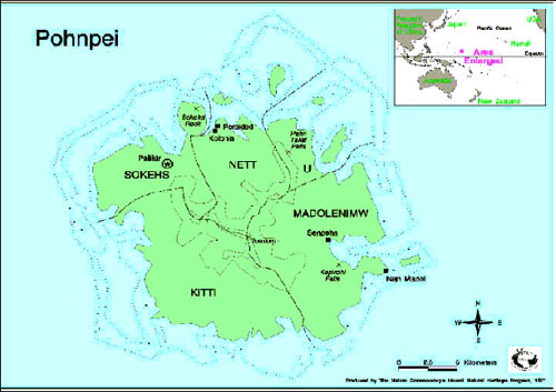
It is described as a high volcanic island with a fringing coral reef.
The capital of Pohnpei State, Kolonia, is here.
I found what is called the Spanish Wall in Kolonia, which we are told was built in 1887 by the Spanish Administrators of Pohnpei, after an uprising by locals drove them onto a ship in the harbor.

Could this wall be all that remains of what once was a star fort?
Most of the Spanish Wall was said to have been taken down by a German administration that took over in the early 20th-century.
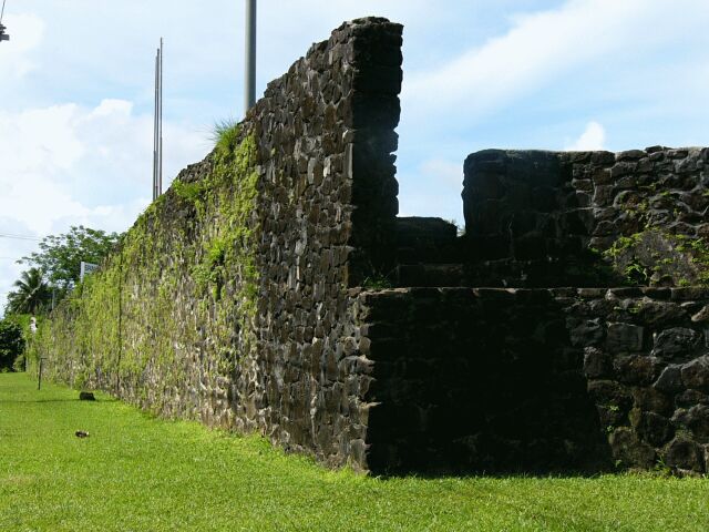
In the right background you see what is called the Catholic Bell-Tower.
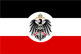
It was said to have been built in 1909 by German Capuchin missionaries, when Pohnpei and the Caroline Islands were administered as part of German New Guinea.
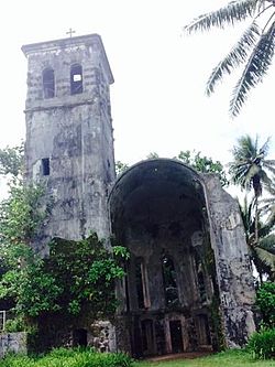
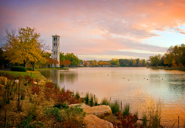
I have seen similarly designed bell-towers in many, many places, including Furman University’s Bell-Tower in Greenville, South Carolina…
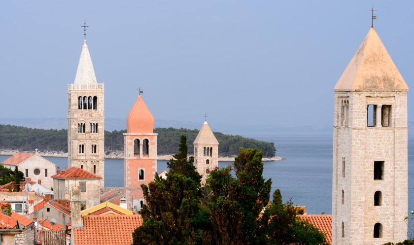
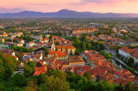
…and the bell-towers on Rab Island in Croatia.
Interestingly, this is a photo from Google Earth, where you have the Spanish Wall, German Bell Tower, Pohnpei Catholic High School, Our Lady of Mercy Catholic High School, what looks like a baseball field right next to the high school, and the Embassy of Australia all pretty much in the same place…
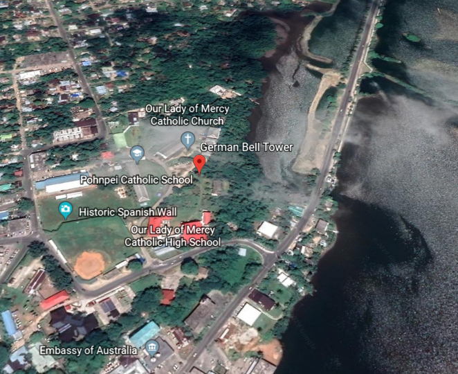
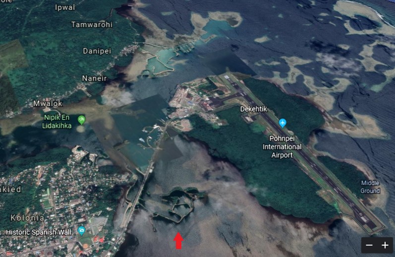
…and what looks like really interesting old infrastructure in the water between this part of Kolonia and the Pohnpei International Airport.
German New Guinea was part of the German Colonial empire, and existed from 1884 to 1919.
The Germans purchased the Marshall Islands from Spain in 1885, and the Caroline Islands, Palau, and the Marianas Islands from the Spanish in 1899.
In 1888, the Germans annexed the island of Nauru to the Marshall Islands protectorate.
Today it is the third smallest country in the world after Vatican City and Monaco.
Interestingly, at one time the island Republic of Nauru had was the second-richest nation in the world by GDP per capita from the mining of its phosphate reserves.
Phosphates are used in the production of phosphate fertilizer; calcium phosphate nutritional supplements for animals; and used to make chemicals for use in industry.
Back to the island of Pohnpei.
Palikir, the capital of the Federated States of Micronesia, is located on the island of Pohnpei.
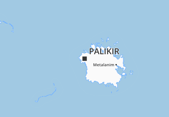
This is what the city of Palakir looks like.
We are told Palakir was a tiny village of little consequence until the Federated States of Micronesia decided to convert it into their capital city which it was said to have officially become in 1989.
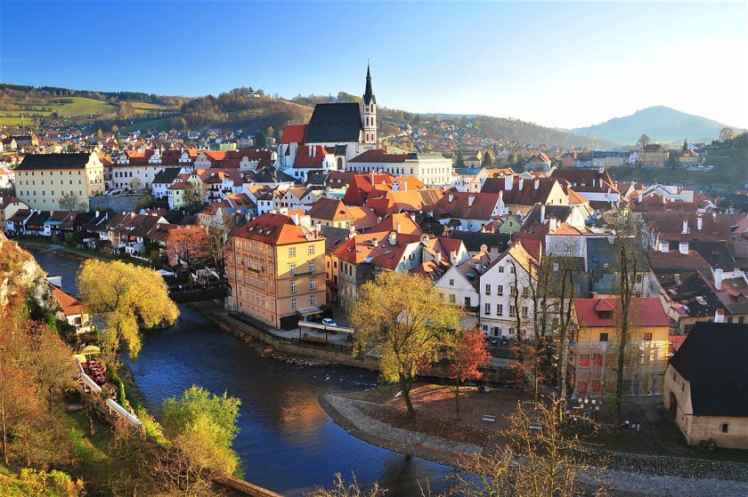
I will leave this picture of Cesky Krumlov in the Czech Republic for comparison with Palikir.
Cesky Krumlov is described as one of the Czech Republic’s finest medieval towns, and is a UNESCO World Heritage site.
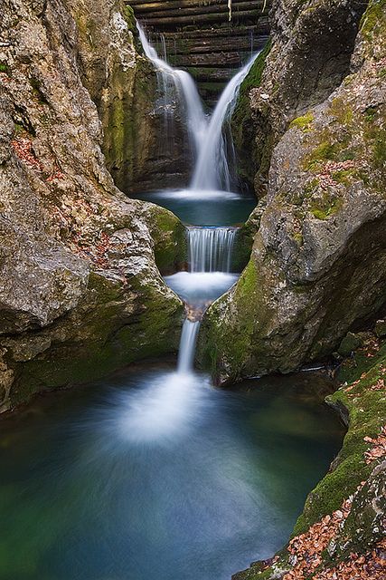
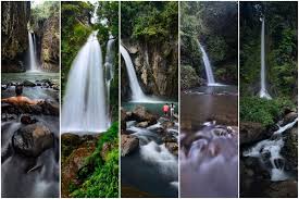
Before I move on to the premier feature of Pohnpei, which is Nan Madol, let’s take a look at the three waterfalls on the island. Waterfalls are a signature feature of the worldwide grid.
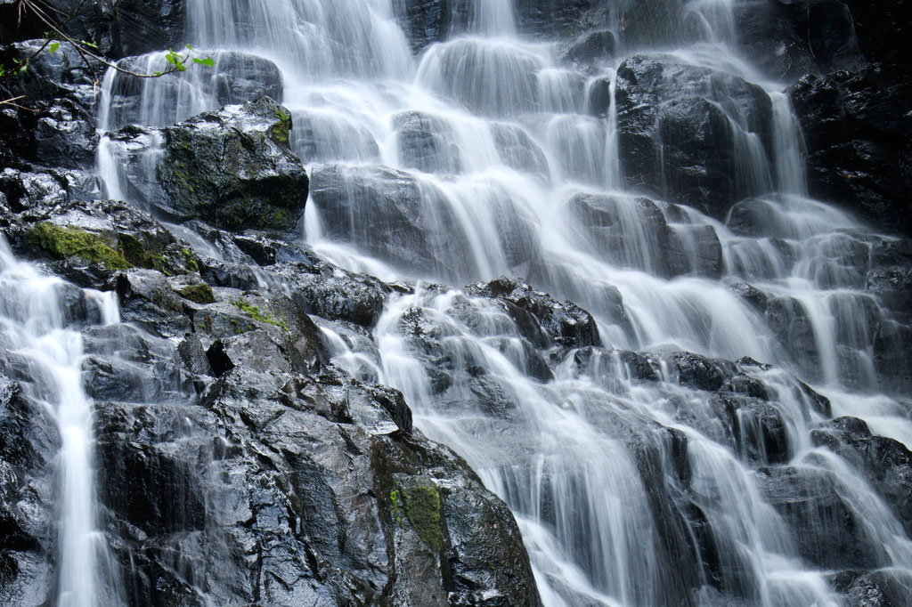
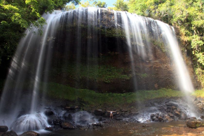
First, here is a photo of the Liduduhnlap Falls, considered a twin falls which is located outside of the city of Kolonia, with what look like cut-and-shaped stones in the foreground…
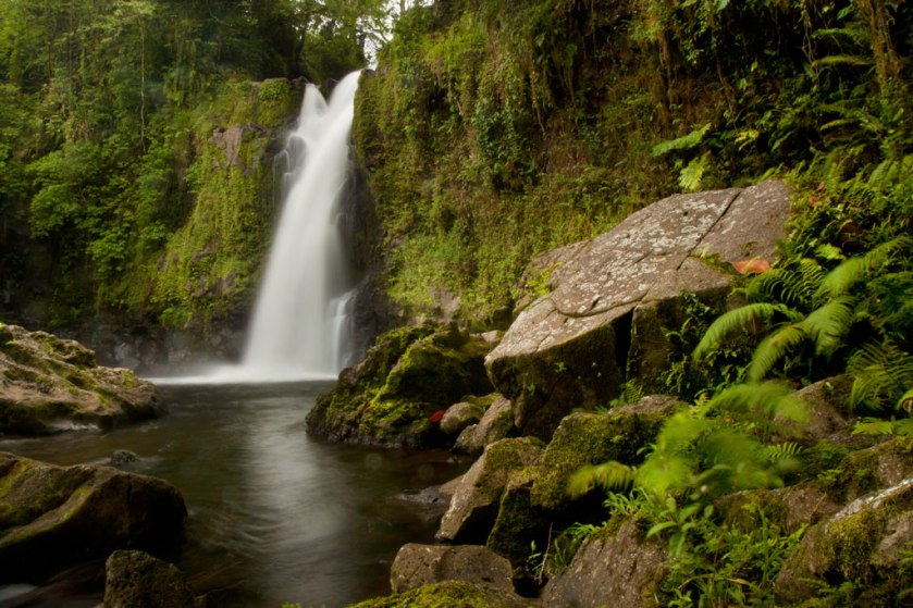
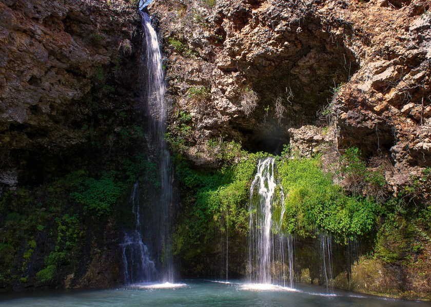
…compared with one of my favorite waterfalls, the Gacnik Waterfalls in the Julian Alps of Slovenia, in particular for its similarity of the upper portion of both waterfalls.
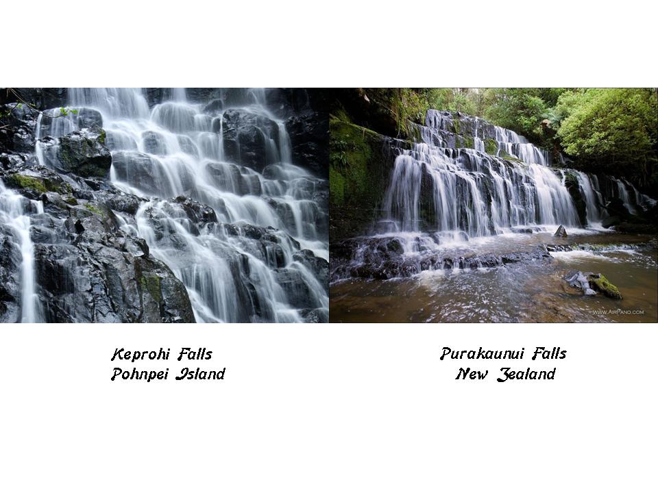
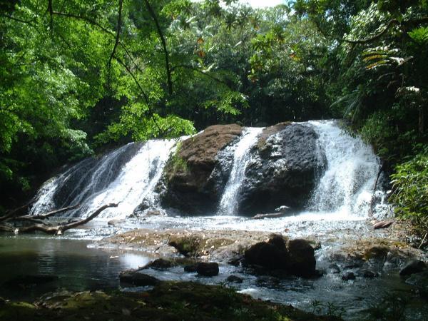
And here is a picture of the Keprohi Falls on Pohnpei…
…compared with the Purakaunui Falls in New Zealand.
I have found a selection of the same models of waterfalls to choose from, from small to large, all over the world.
I believe that rivers and waterfalls signify something like Universal Energy Flows on the Planetary Grid system.
We can’t visit the island of Pohnpei without looking at Nan Madol, which is located adjacent to the eastern shore of Pohnpei.
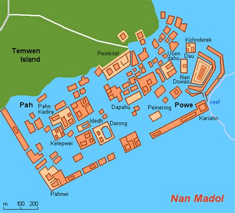
There are massive buildings here, built on small rectangular artificial islands, situated on top of a coral reef and linked by canals.
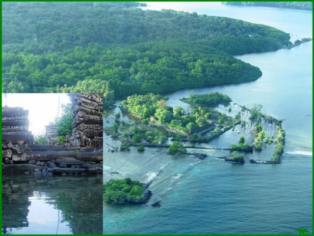
It is estimated that 250 million tons of prismatic magnetized basalt went into the lincoln-log-like construction of Nan Madol, spread over 170 acres.
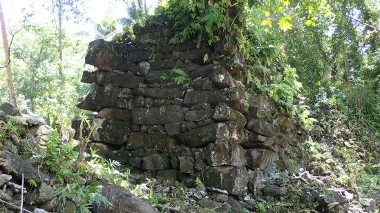
There are similar style basalt column constructions on the neighboring island of Kosrae, to the East of Pohnpei…
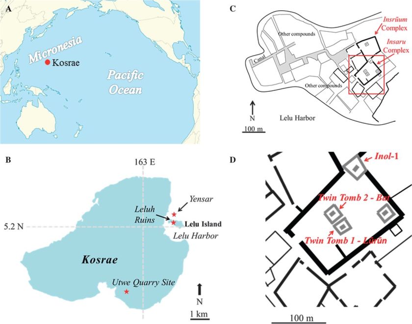
…like these on Lelu Island on Kosrae.
I first read about the island of Pohnpei, Nan Madol, and Kosrae several years ago, in a book by Frank Joseph called The Lost Civilization of Lemuria.
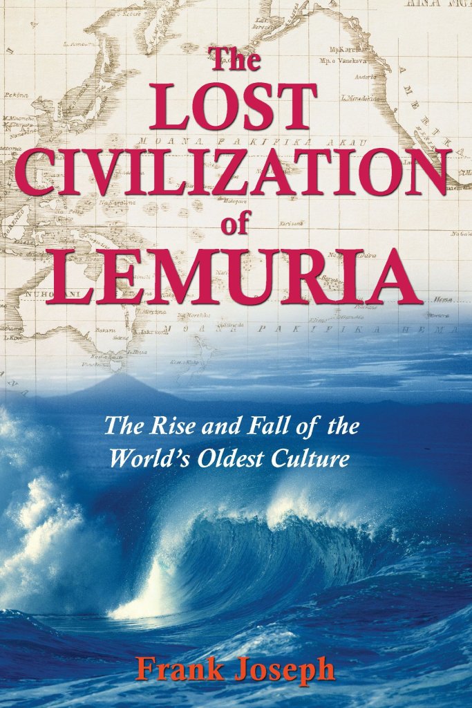
Mr. Joseph speculated that Nan Madol and Kosrae, constructed with prismatic basalt, magnetized in a highly unusual and unnatural manner, were part of ancient high technology.
This book on Lemuria was my first introduction to an ancient civilization in this part of the world, and it was very interesting to me.
It looks to me that when the so-called various colonial powers went exploring, they were going after and claiming very important places on the ancient planetary grid system in terms of technology and the resources there that could be utilized and monetized by the controllers of the new reset civilization.
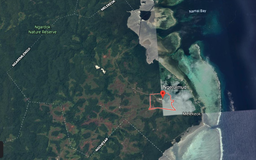
Leaving the Nukuoro Atoll of the Caroline Islands, the alignment goes through Melekeok, a state of the Republic of Palau.
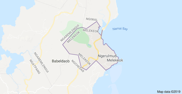
Melekeok is located in the central east coast of Babeldaob Island.
The seat of government of the Republic of Palau is located in Melekeok, and called Ngerulmud.
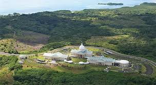
The government was said to have moved here in 2006 from Koror Island, which is the population center of Palau…
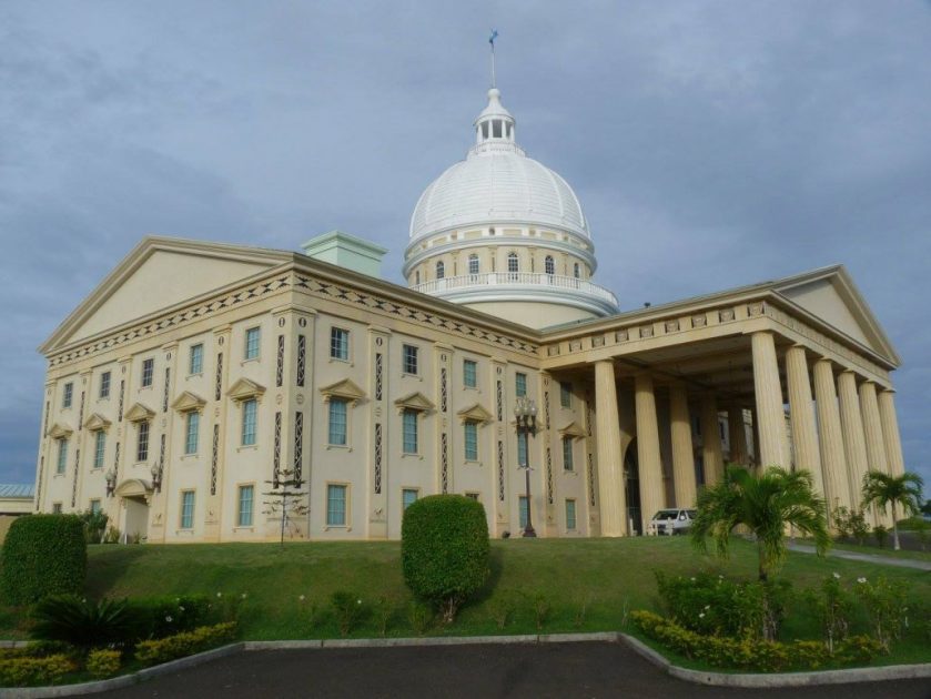
…and the capitol buildings were said to have been built in the middle of nowhere just prior to the time of the move.
The Badrulchau Stone Monoliths are located on the northern part of the island of Babeldaob.
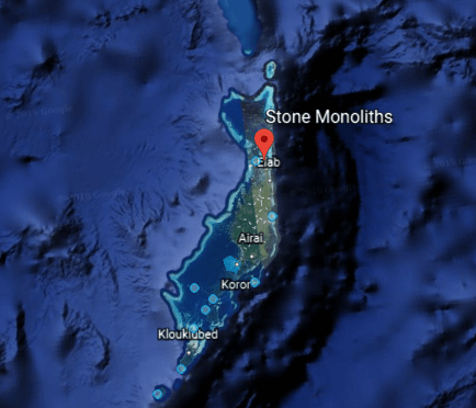
There are 52 here, some of them weighing over 5 tons.
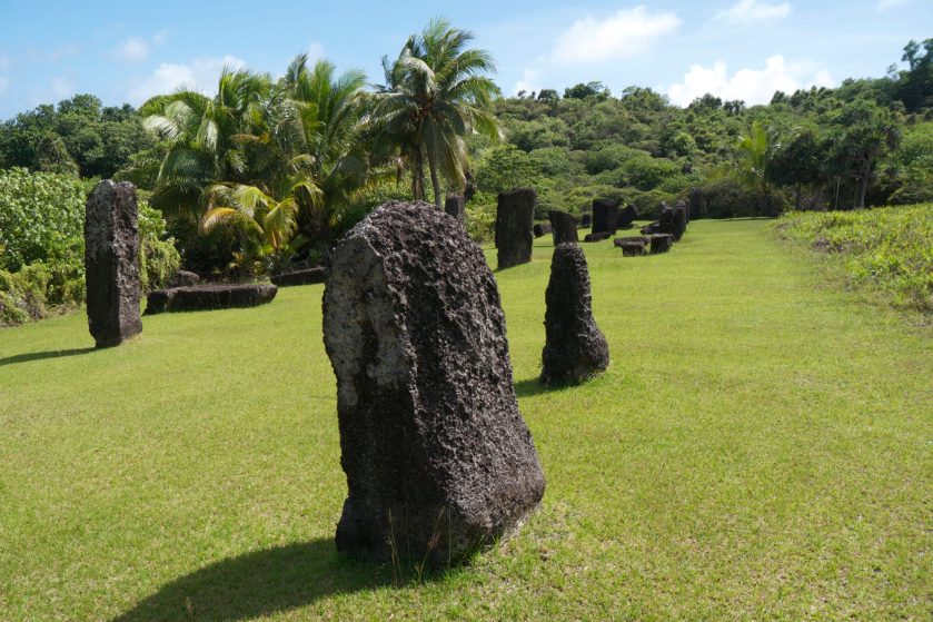
These monoliths are said to be made for a type of stone material not found here.
There are two waterfalls found on Babeldaob Island. One is the Ngardmau waterfall…
…and the other is the Ngatpang waterfall.
Palau was made part of the Spanish East Indies in 1574…
…and after Spain’s defeat in the Spanish-American War in 1898, the islands were sold to Imperial Germany in 1899 under the terms of the German-Spanish Treaty, and became part of German New Guinea until 1919, at which time German New Guinea ceased to exist after World War I and the Treaty of Versailles.
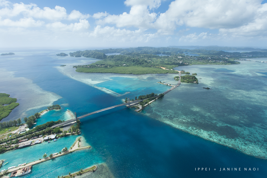
As mentioned before, the island of Koror is the population center of Palau.
There is a bridge connecting Koror with the island of Babeldaob.
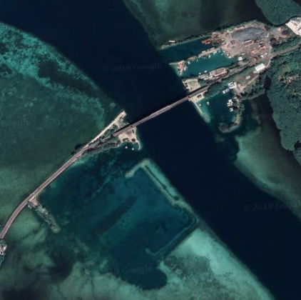
Interesting to note what appears to be man-made channels here.
Here’s a view of the same place from a different angle.
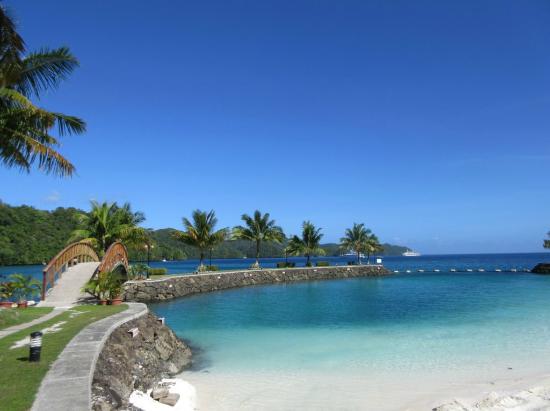
This is the Palau Royal Resort in Koror, sitting on what appears to be an artificial island…
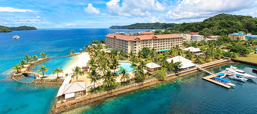
…made from old stone-work.
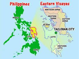
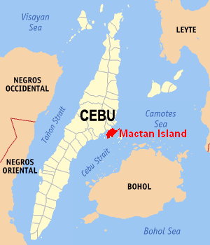
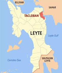
From the Republic of Palau, I tracked this particular alignment to the Eastern Visayas of the Philippines, between the islands of Samar and Leyte.
The earliest European expedition to the Philippines was led by Portuguese explorer Ferdinand Magellan in the service of the King of Spain in 1521. He made landfall there on Homonhon Island in eastern Samar at the mouth of the Leyte Gulf.
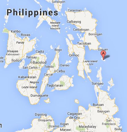
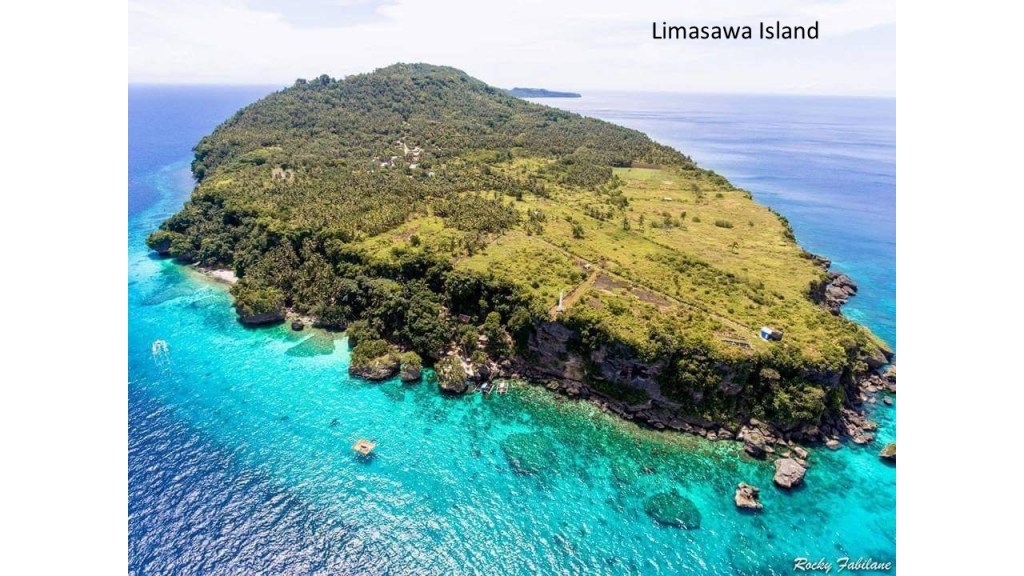
The next day, on March 13th, which was Easter Sunday of the year 1521, Magellan claimed possession of these lands for the King of Spain on what is believed to now be the island of Limasawa in southern Leyte.
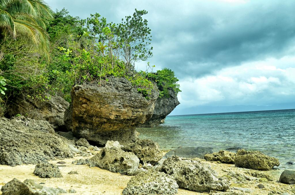
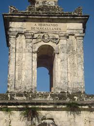
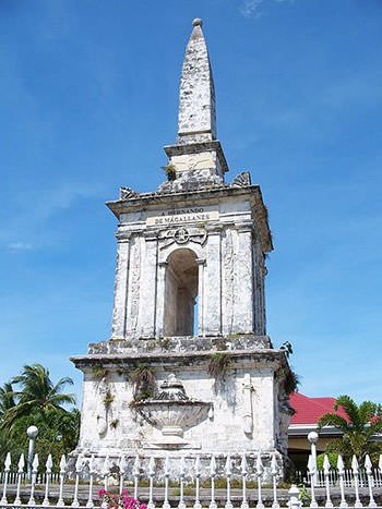
Magellan and fourteen of his men died here shortly thereafter in the Battle of Mactan, which took place on April 27th of 1521 on the Mactan Island of Cebu.
This monument to Magellan was said to have been erected in 1866.
After Magellan’s voyage, five expeditions were sent to the islands.
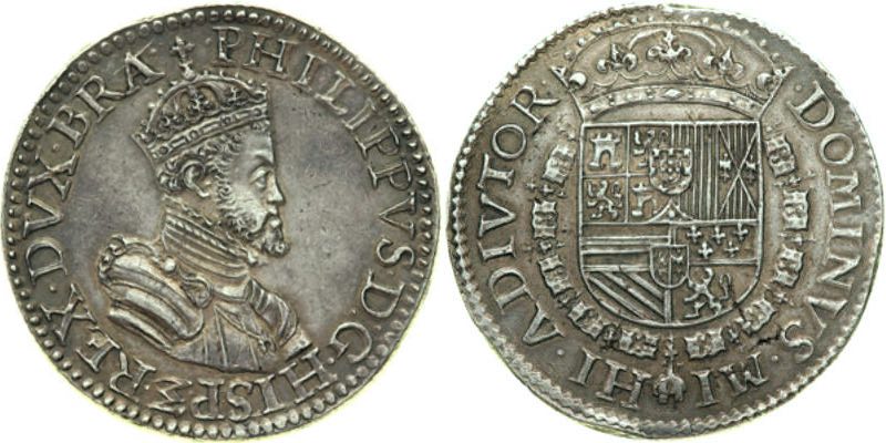
In 1543, Ruy Lopez de Villalobos named the islands of Leyte and Samar “Las Islas Filipinas,” after Phillip of Austria, heir-apparent to the throne of Spain, who became King Phillip II in 1556.
This is a coin bearing an image of King Phillip II…
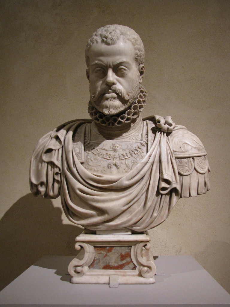
…a bust of King Phillip II by Pompeo Leoni…
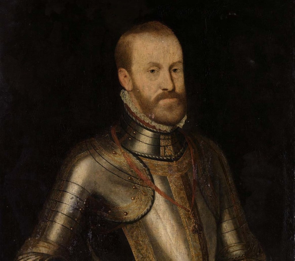
…and a portrait that is typical of King Phillip II.
Is that the same guy? The bust and the coin of King Phillip II showing him having really curly hair and beard look more similar to each other than to the painting.. What’s up with that?
Cebu is the oldest city in the Philippines, as it was the first Spanish settlement and first capital city.
It is important to note that there was a star fort located in Cebu, called the Fort San Pedro.
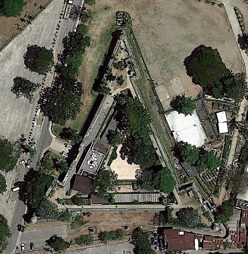
It was said to have been built by the Spanish starting in 1565.
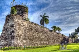
I think they were following the ley-lines, and star forts like Fort San Pedro were important components in the circuitry of the planetary grid system. They were prime targets in the hostile take-over for the control of this grid system.
Tacloban City on Leyte island is the regional center of the eastern Visayas of which Leyte and Samar are a part.
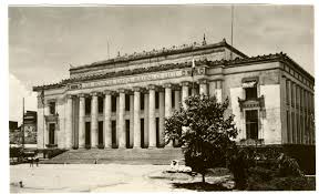
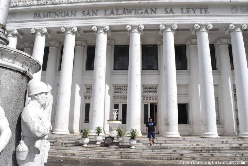
It is the capital of Leyte Province. The construction of the capitol building was said to have started in 1917 and completed in 1924. This is the building circa 1944…
…and today.
Directly adjacent to Leyte Island, Samar is the third largest island in the Philippines.
One-third of Samar is protected as a natural park.
…which reminds me a lot in appearance of Natural Falls State Park in Oklahoma, which I have visited.
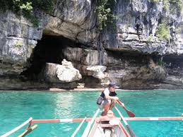
The Maribut Marine Park is on Samar Island.
This is called Tooth Rock…
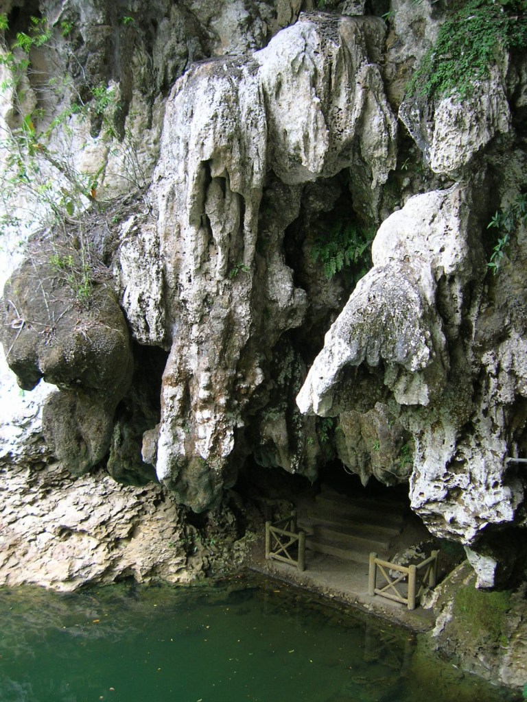
…and this is Madonna’s Cave at the Marine Park.
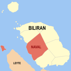
Biliran Island, northwest of Tacloban City, and just off the northern coast of Leyte, is one of the smallest and newest provinces of the Philippines.
A bridge and causeway connects Leyte to Biliran, via Poro Island.
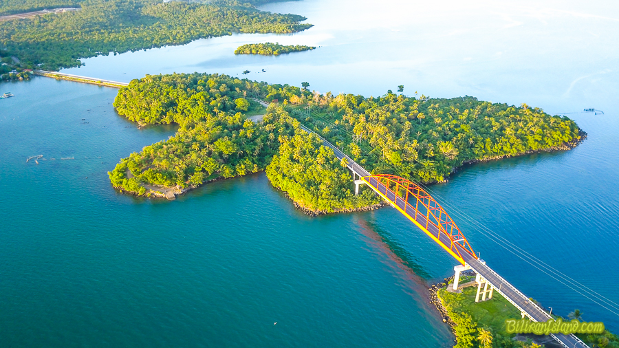
The capital city and population center of Biliran is Naval, on the west coast of the island.
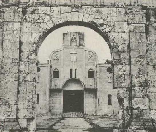
This is the new Catholic Cathedral of Naval – Our Lady of the Most Holy Rosary. It was built in 1963 to replace…
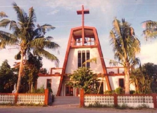
…the old Catholic Cathedral of Naval, which was demolished to give way to the new building.
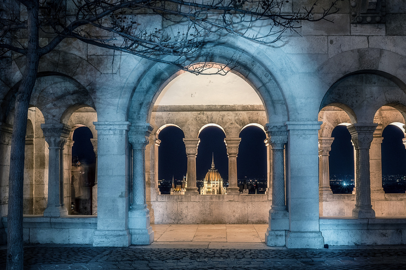
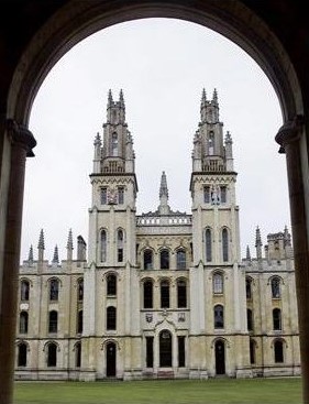
I have seen many, many examples of the same kind of symmetry and proportion between the archway and the perfectly-framed old cathedral in Naval all over the world.
Examples include the Hungarian Parliament as seen from the Fisherman’s Bastion in Budapest, Hungary…
…Oxford University in England…
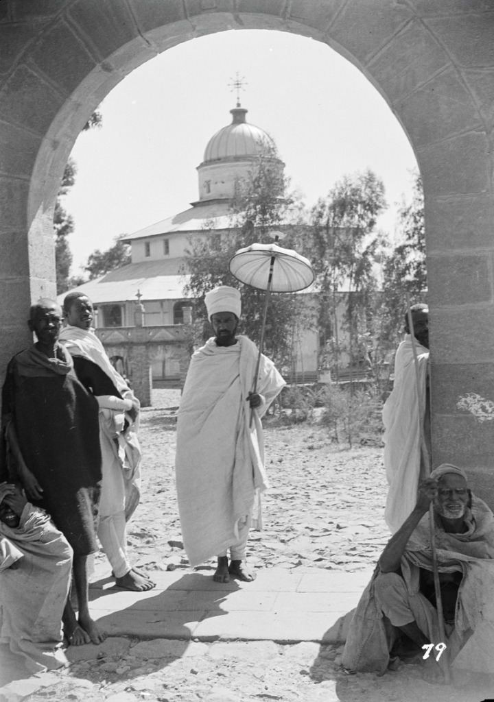
…the Debre Libanos Monastery in Ethiopia…
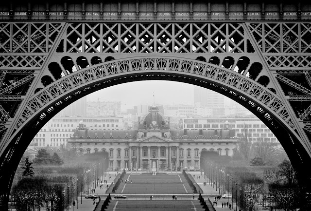
…the Ecole Militaire seen through the arch of the Eiffel Tower in Paris…
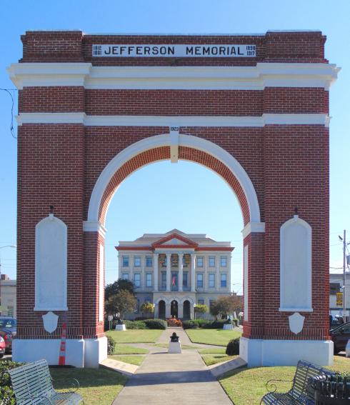
…and the Gretna City Hall seen through the Jefferson Memorial arch near New Orleans, Louisiana, for just a few examples of many I have found.
I don’t believe for a moment that these effects were random occurrences. They were the products of an ancient advanced worldwide civilization that was all about aligning Heaven and Earth in the fullest expression of Human Potential that there has ever been on Earth, and which has been brutally suppressed since the original positive timeline of Humanity was hijacked by negative forces.
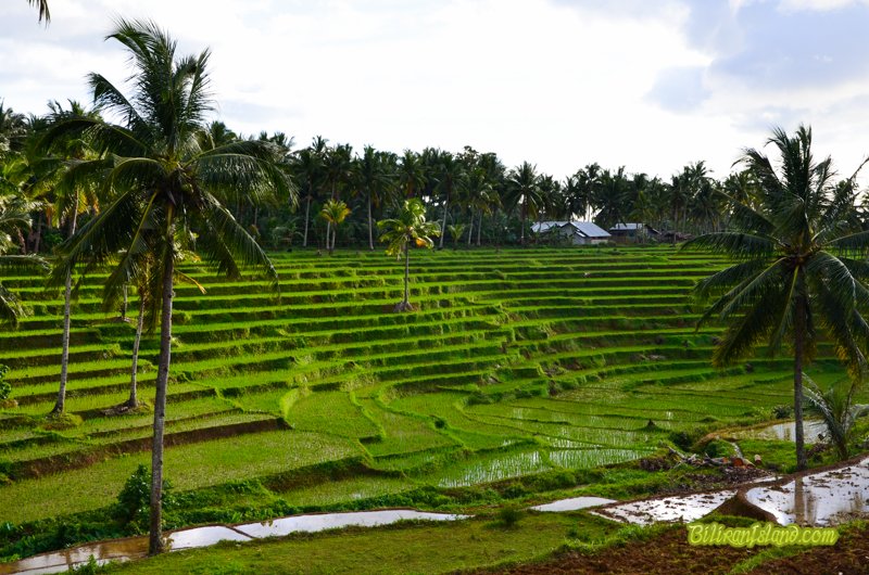
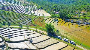
There are many rice terraces on the island of Biliran…
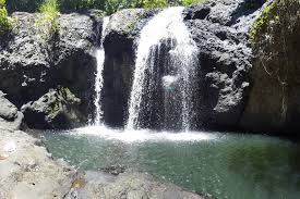
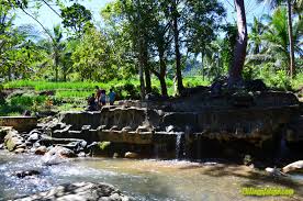
…as well as waterfalls…
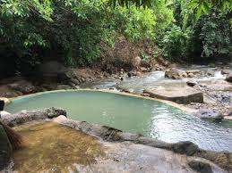
…and Mainit Hot Springs. Like waterfalls, I find hot springs, and springs of all kinds, all over the planetary grid system.
Maripipi Island is just northwest of Biliran, and is considered a municipality that is part of the Biliran Province.
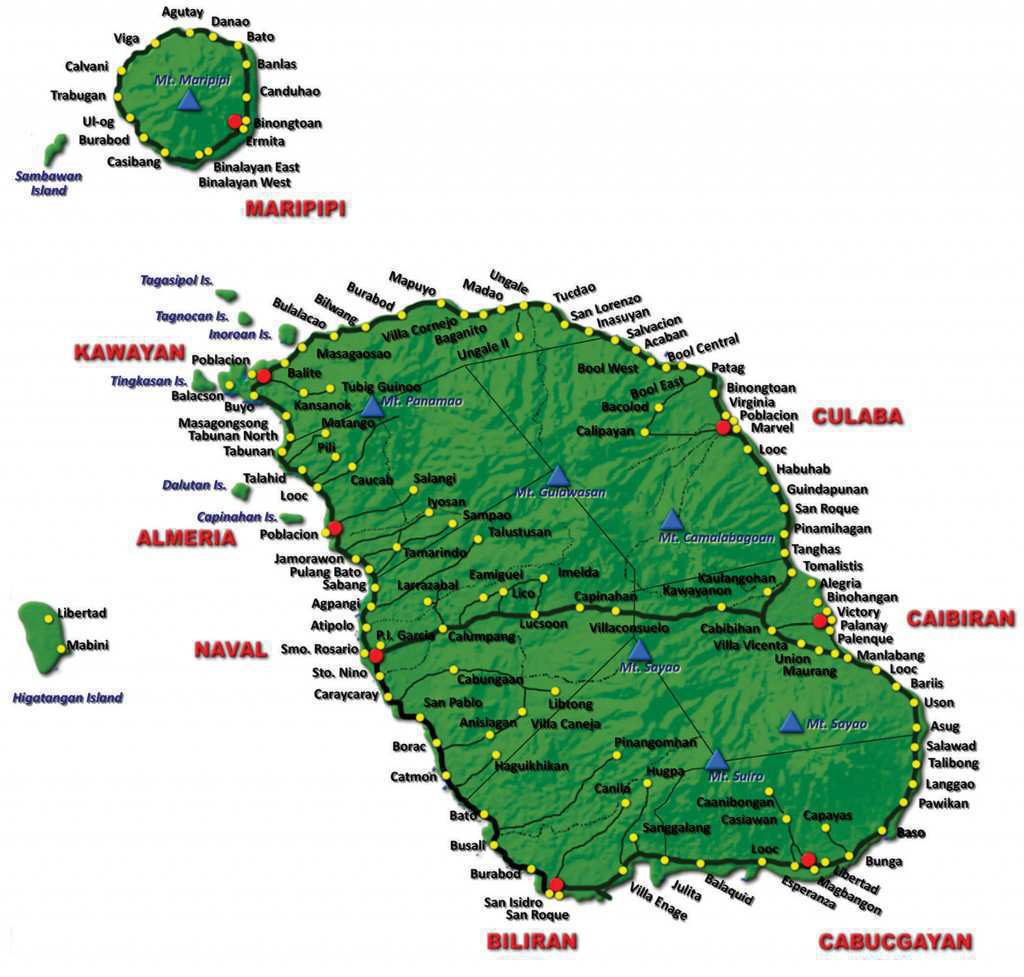
In 2015, its population was approximately 7,200 people.
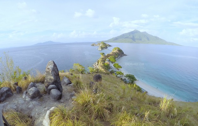
One of its main attractions is Sambawan island, these days a marine sanctuary and popular dive site.
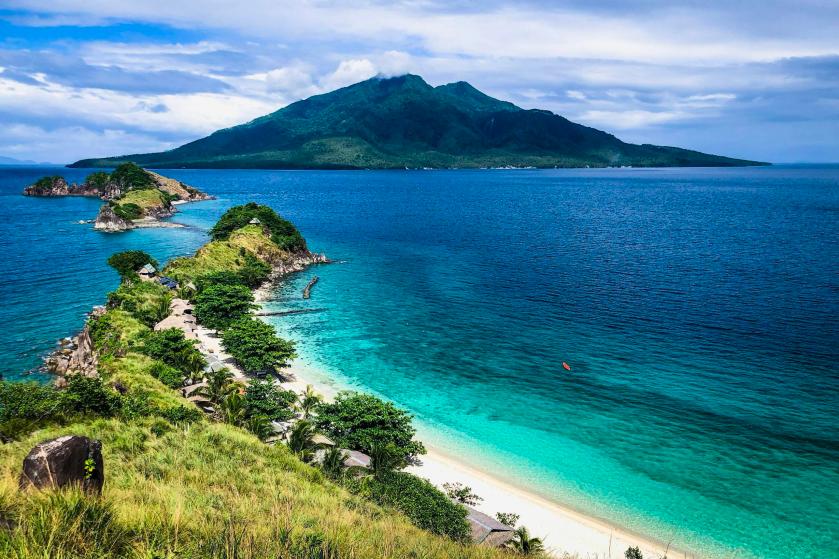
With the megalithic standing stones here, it looks like Sambawan Island served a much different purpose before.
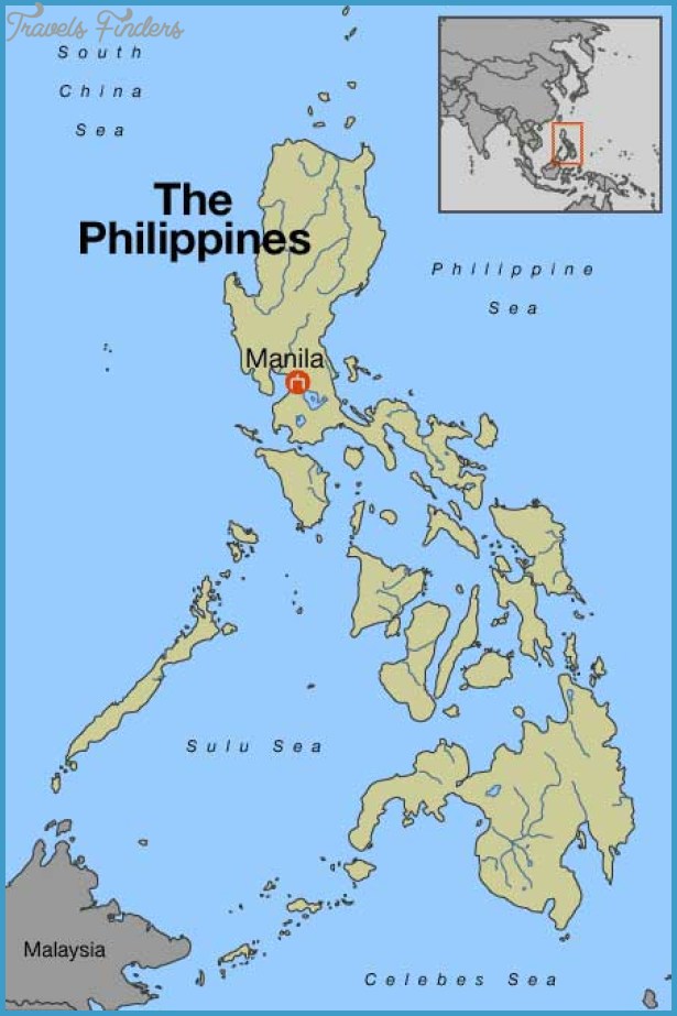
Next we come to Manila, the capital of the Philippines, and the most densely populated city in the world within its boundaries.
Manila, alongside Mexico City and Madrid, are considered the world’s original global cities, due to Manila’s historic commercial networks connecting Asia with the Americas.
We are told the Spanish city of Manila was founded in 1571 by the conquistador Miguel Lopez de Legazpi. He was the first Governor-General of the Spanish East Indies from 1565 to 1572.

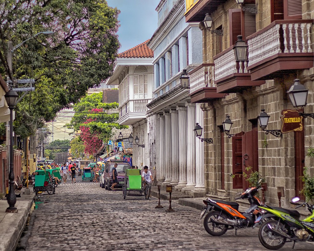
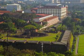
The historic walled city part of Manila is called the Intramuros, said to have been established by the Spaniards in the late 1500s.

Apparently the Intramuros is a star fort.

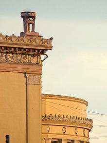
This is a view of a street inside the Intramuros, with cobblestones, colonnades, stone masonry and balconies.
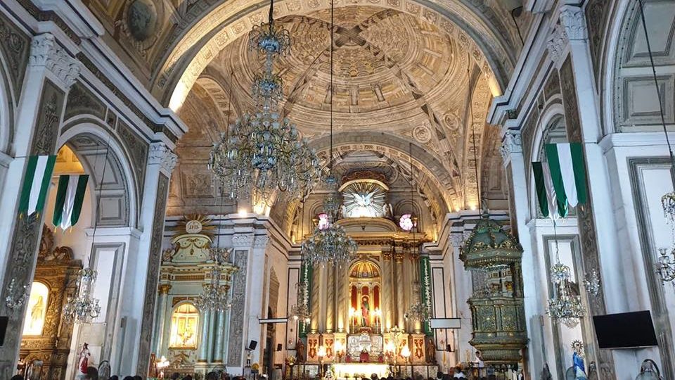
This is the inside of the San Agustin Church in the Intramuros, said to have been completed in 1607.
The first University in Manila, Universidad de San Ignacio, was established in the Intramuros…
…by the Jesuits in 1590. Who were the Jesuits? Who were the Jesuits, really?
The Pasig River flows through Manila, dividing into north and south sections.
Or is the river actually a canal, with its masonry banks?
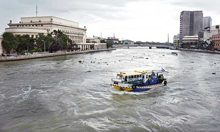
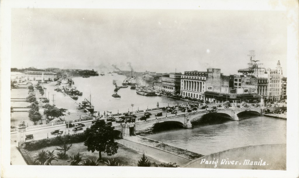
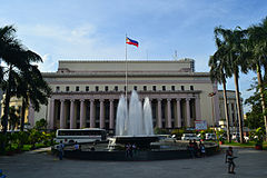
This old post card shows the Jones Bridge and the Manila Central Post Office building.
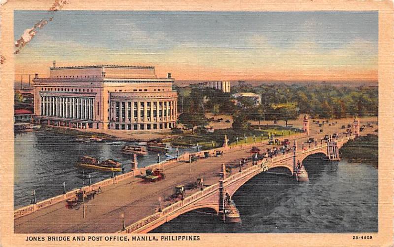
The Central Post Office was said to have been built in 1926.
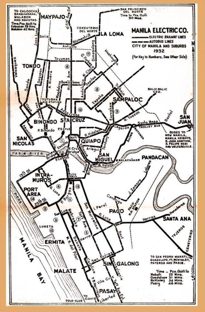
There was a streetcar system in Manila, called the Tranvias, construction of which was said to have been started in 1878, with the first line opening in 1882. This postcard was circa 1900, showing the contrast of the electric streetcar with the horse-drawn carriages.
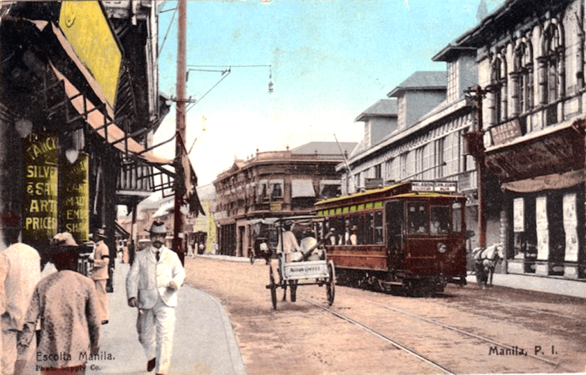
By 1932, the city and suburbs were well-served by a network of 100-kilometers of track.
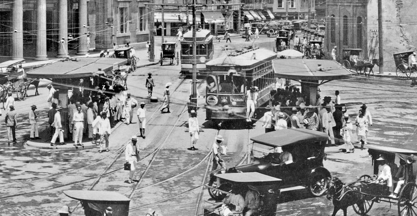
Then, in 1945, in the last months of World War II, the Battle of Manila brought destruction and havoc to the city of Manila and its rail infrastructure.
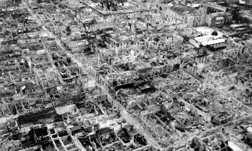
The Manila Tranvias fleet was damaged beyond repair, and abandoned immediately after the war. The rails were pulled up from the city streets, and surviving streetcars were hauled away and scrapped. This was the end of what had previously been considered one of the best street-rail networks in Asia.
I am going to end this post here, and pick up the alignment next in Lingshui on the island of Hainan, China.

Hello there friend, and brilliant soul ~ I have done extensive research on ley lines, sacred geometry, where they meet intertwined with these timelines you speak of. I truly hope the powers that be allow us to converse and exchange valuable information for one another and all others. Godspeed~ Johnnyneon
LikeLike
michelle.gibson565@gmail.com
LikeLike
wow. this is almost like kismet. i grew up in Makati City, Philippines and went to university in University of Santo Tomas Manila. I watched Ewaranon’s documentary about star forts and have been looking for 2 month about the forts in Manila. I didn’t even realized that Intramuros is a star fort – but I know that Manila city hall aerial view is shaped like a coffin. We also have Fort Santiago in Manila. The Manila Cathedral, Quiapo church, UST arc of the century and UST’s main building. I bet they are all connected to the grid and ley-lines. I knew I was living in a historical place growing up but didn’t really know how much history was laying there.
Would very much like to record a conversation with you. Is that possible? I don’t know the proper etiquette to invite someone to a podcast – so please excuse my directness.
LikeLike
Sure – please contact me at michelle.gibson565@gmail.com and we can set something up. Sounds great!
LikeLike