“Interesting Comments & Suggestions I have Received from Viewers – Volume 12” is the last volume in this multi-volume series that wraps up a lengthy compilation of work I have previously done in following the trail of clues pointing to our hidden history provided by suggestions from viewers, and before I start going all over the place once again in a brand-new series from the suggestions you all have provided, taking me to places I would not otherwise be looking or even know about to look.
CP suggested that I look into Vancouver and Long Beach, Washington.
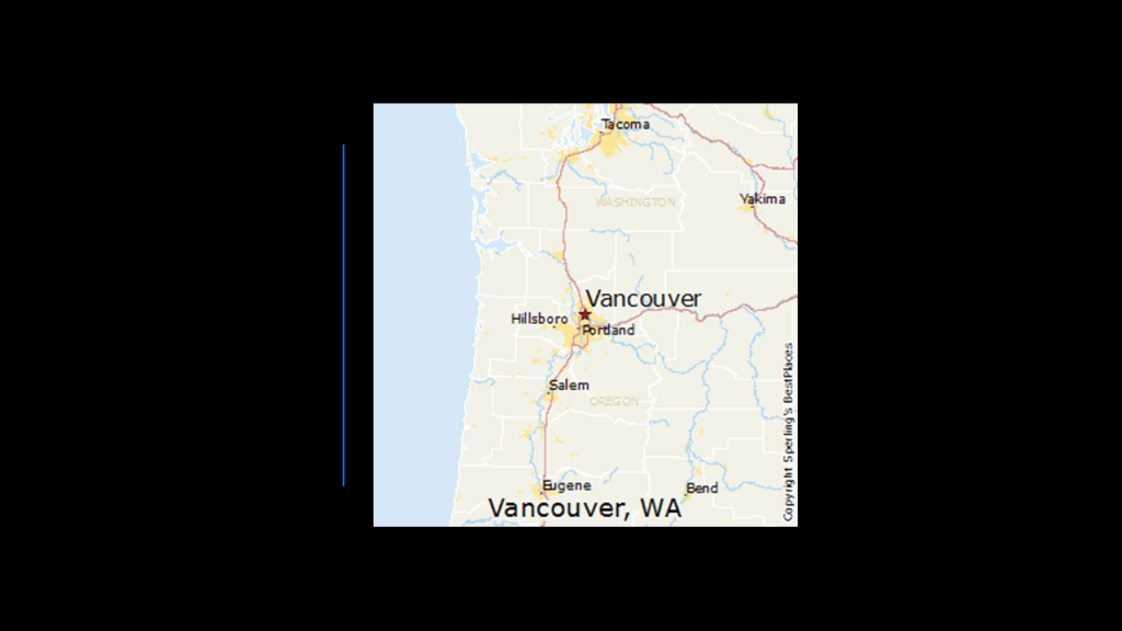
The city of Vancouver in Washington State is located on the north bank of the Columbia River, directly across from Portland, Oregon on the south bank.
In 1806, Lewis & Clark visited the area that became Vancouver, calling it the “only desired situation for settlement west of the Rocky Mountains.”
Fort Vancouver was established as a fur trading outpost and headquarters for the Hudson Bay Company in the Columbia Department of the Pacific Northwest. in 1825.
The fort was a major center for fur-trading in the region, with supplies coming from London via either the Pacific Ocean or overland from the Hudson Bay via the “York Factory Express…”
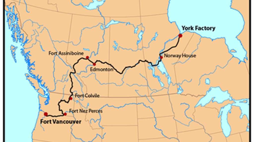
…the main overland connection between Hudson Bay Headquarters at York Factory, established in 1864, as a settlement and was the central base of operations for the Hudson Bay Company’s control of the fur trade and other business dealings with the First Nations’ of what was known as the time as Rupert’s Land…
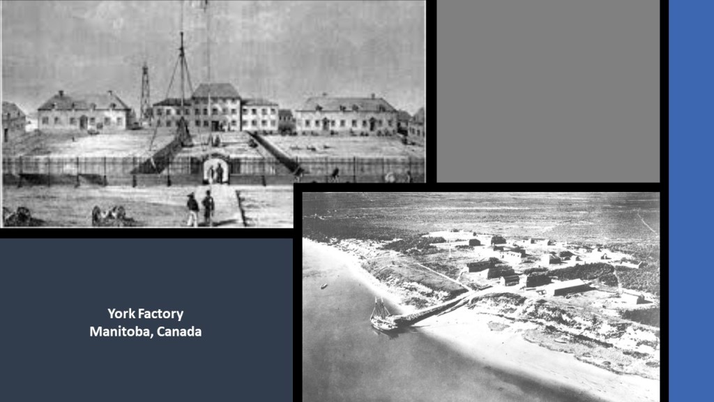
…and the principal depot of the Columbia Department at Fort Vancouver, said to have been built in 1824.
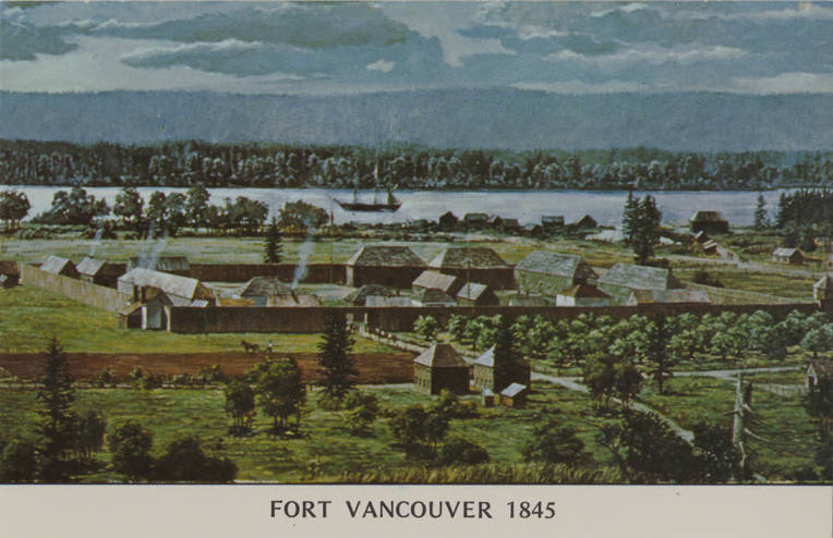
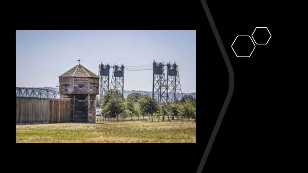
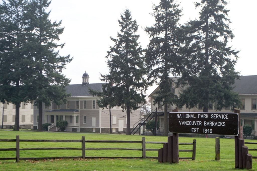
Today, a full-scale replica of the fort is open to the public at the Fort Vancouver National Historic Site.
The Hudson’s Bay Company is the oldest, incorporated, joint-stock merchandising company in the English-speaking world, having been chartered on May 2nd of 1670 by King Charles II on behalf of French traders who wanted to reach the interior of the North American continent via Hudson’s Bay, and British merchants and noblemen who wanted to back the venture.
The Hudson’s Bay Company was granted wide powers, including exclusive trading rights in the lands crossed by rivers flowing into Hudson Bay.
It is still in operation today as a Canadian retail business group operating department stores in several countries.
I am first going to take a look at was in situated around the old Hudson’s Bay Company Fort Vancouver and Fort Vancouver National Historic Site.
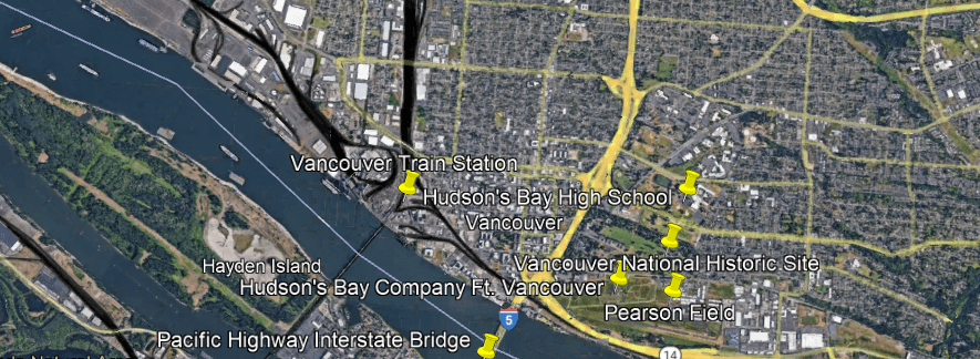
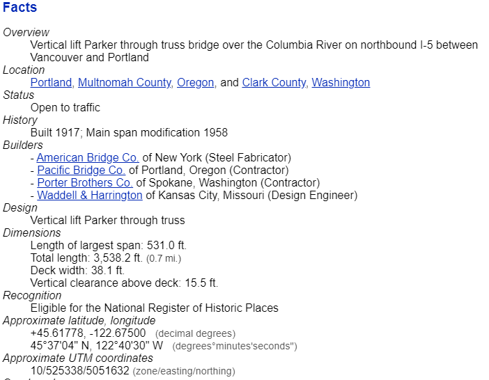
The Hudson’s Bay Company Fort Vancouver is located right next to I-5 and the Pacific Highway Interstate Bridge, a pair of steel, vertical-lift truss bridges that carries the Interstate over the Columbia River between Vancouver and Portland.
The vertical lift spans of the bridge rise vertically while remaining parallel with the deck in order to accommodate shipping lane traffic.
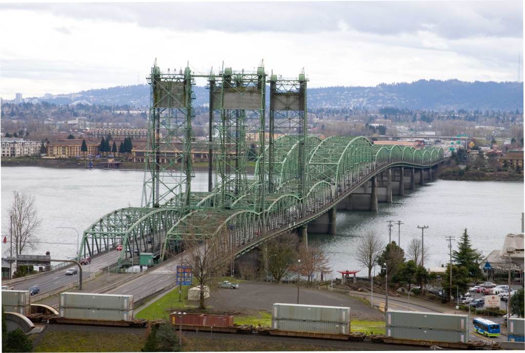
Construction was said to have started in 1915 and opened in 1917 as a single bridge carrying two-way traffic.
I would like to point out that would have been in the middle of World War I, which started in 1914 and ended in 1918.
Plausible?
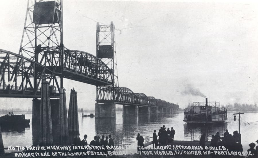
We are told the second bridge opened in 1958.
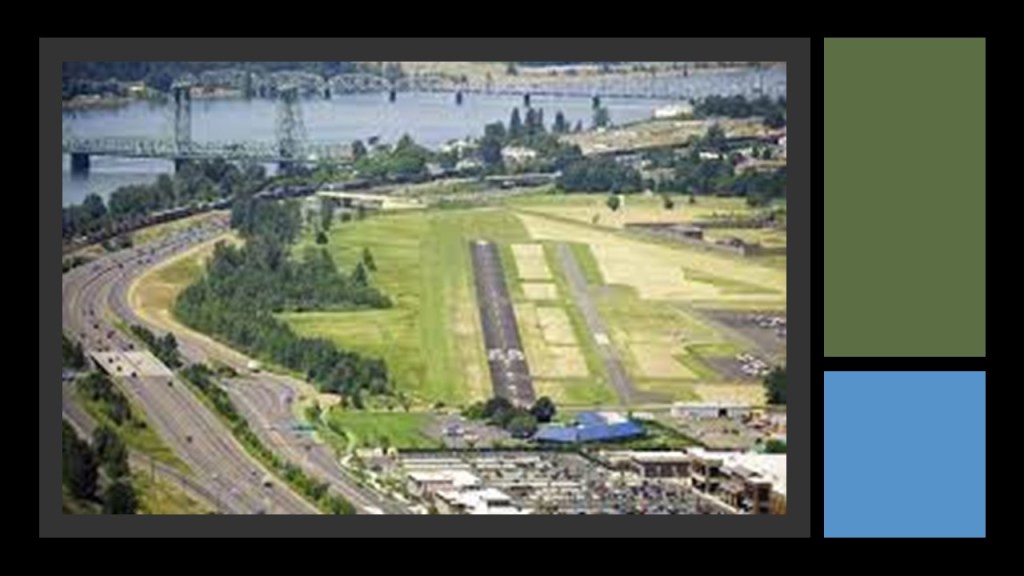
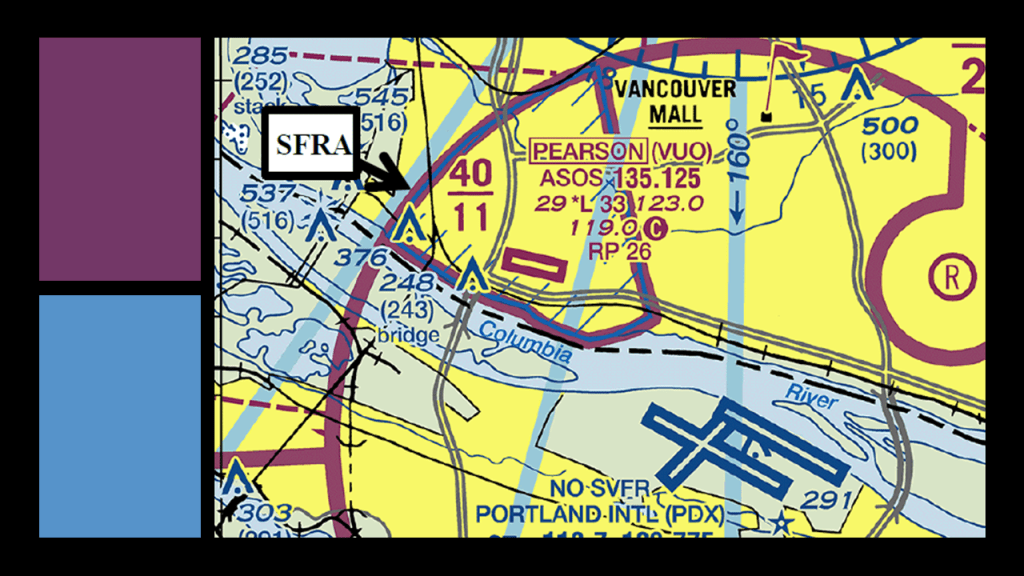
Pearson Field is located on the other side of the old Hudson’s Bay Company Headquarters.
It is the oldest continuously operating airfield in the Pacific Northwest, and one of the two oldest continuously operating airfields in the United States.
It is in the eastern part of the Fort Vancouver National Historic Site, and right next to the reconstructed fort.
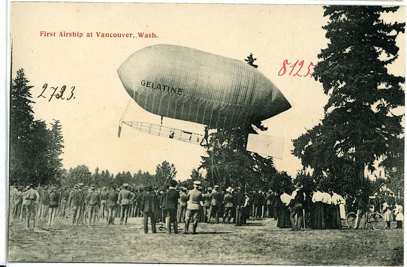
The history of Pearson Field begins with the landing of a Baldwin Airship on the grounds of the U. S. Army’s Vancouver Barracks, the first Army base in the Pacific Northwest, in 1905 as part of a demonstration during the Lewis and Clark Centennial Exposition.
Piloted by Lincoln Beachey, a pioneer American aviator and barnstormer, the airship was launched from the shore of Guild’s Lake in Portland, and travelled a distance of 8-miles, or 13-kilometers, setting an endurance record for flight at the time.
Directly across the Columbia River from Portland International Airport, Pearson Field’s only runway located directly below the final approach to one of the runways at the Portland Airport.
I am extremely interested in the extensive track trackage, the dark ribbons on this Google Earth screenshot, that I am seeing on both sides of the Columbia River at this location.
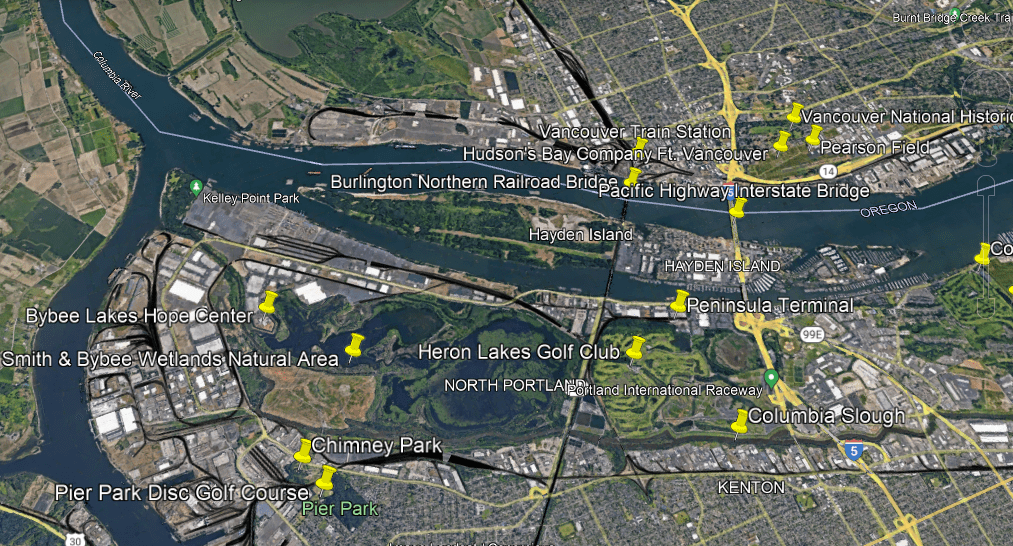
On the Vancouver-side of the Columbia River, there is a lot of rail activity paralleling the I-5 Interstate and the Columbia River.
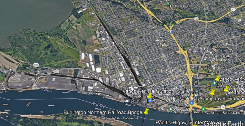
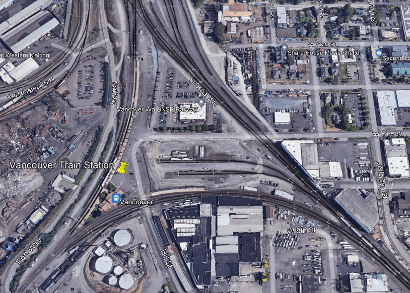
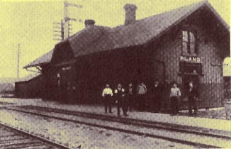
The historic Vancouver Station, said to have been constructed between 1907 and 1908, and is still in use by Amtrak today by three different lines for passenger service.
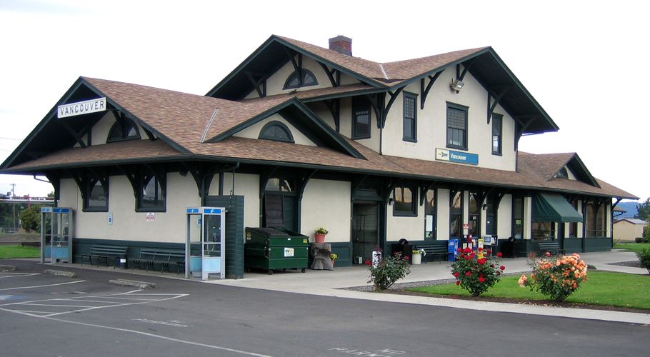
The Vancouver Station is situated in a triangular junction arrangement of the three rail lines with a railroad switch at each corner, along with BNSF Railway offices, which provides freight services and has major railyards in Vancouver.
The Burlington Northern Railroad Bridge 9.6 crosses the Columbia River into Portland just below the triangular junction.
The 2,807-foot, or 856-meter, -long railroad bridge, which was said to have been built between 1906 1908, has a swing-span which pivots on its base to let taller ships pass through.
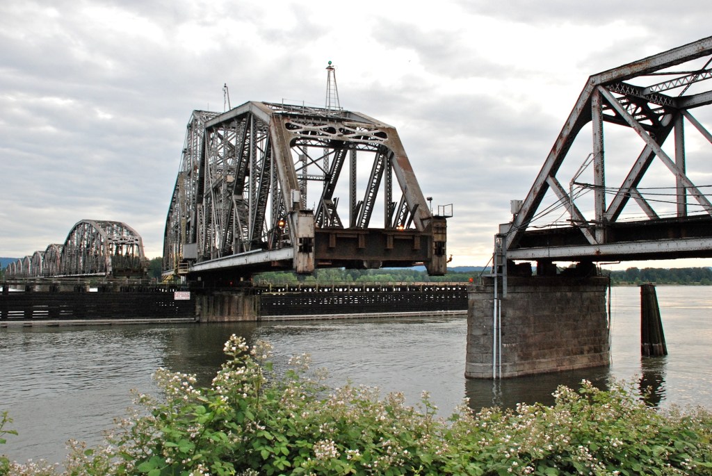
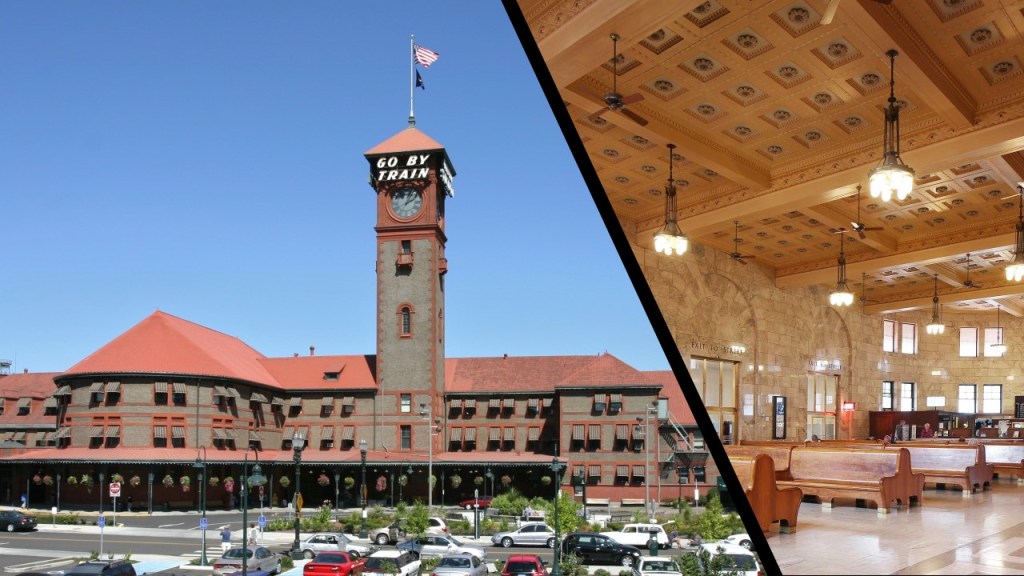
The 9.6 in the bridge’s name refers to the distance between the bridge, and Portland’s Union Station, which was said to have been built between 1890 and 1896 in the Romanesque Revival architectural style.
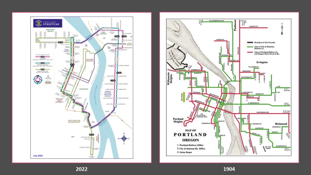
While Portland still has a streetcar system, it is not nearly as extensive as the streetcar system that existed in 1904, the year before Portland hosted the Lewis and Clark Centennial Exposition.
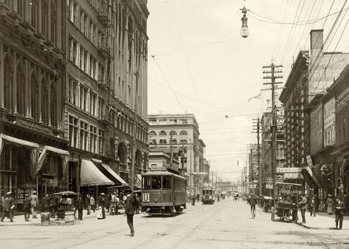
To put this in perspective, this was a view of Portland’s 3rd Avenue in 1904.
Lots of people walking; electric streetcars and electrical lines…and horse-drawn carriages. No cars yet. Mass production of cars didn’t come along until 1908, four-years after this photo was taken.
Oh yes, and the massive and ornate heavy-masonry buildings with columns and archways, and much more.
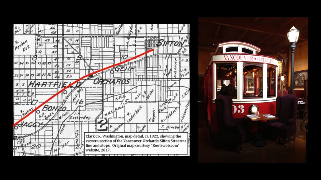
At one time in Vancouver’s history, the neighborhood of Sifton was the terminus of an early electric trolley operated by the North Coast Power Company that also served Orchards from 1910 to 1926, as part of the Orchards-Sifton Route that in part ran along Vancouver’s Main Street.
On the Portland-side of the Columbia River, there is also a lot of railway activity showing-up in the wester part of North Portland, all around the edges of what is called the Smith and Bybee Wetlands Natural Area.
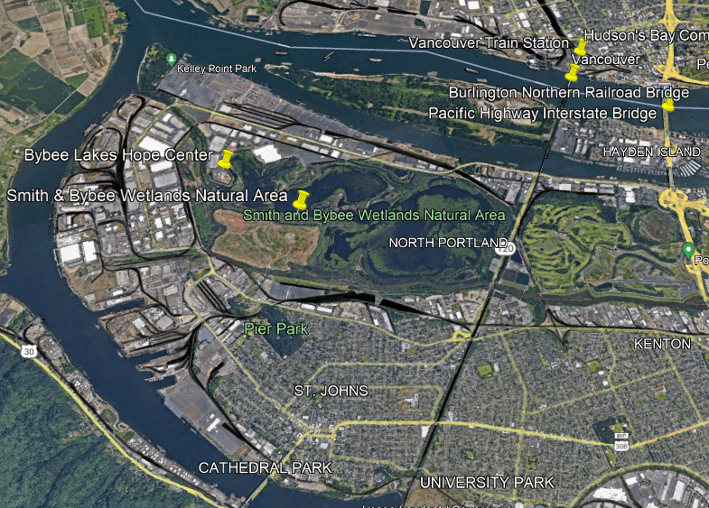
Along with the rail-lines, the Smith and Bybee Wetlands Natural Area is surrounded by warehouses, port terminals, and commercial areas.
It is one the largest urban freshwater wetlands in the United States, and provides habitat for a wide variety of wildlife.
Wetlands, estuaries, marsh-lands, and the like are all on my radar of things to look for when I do research because I have come to believe they are not as advertised as a natural occurrence.
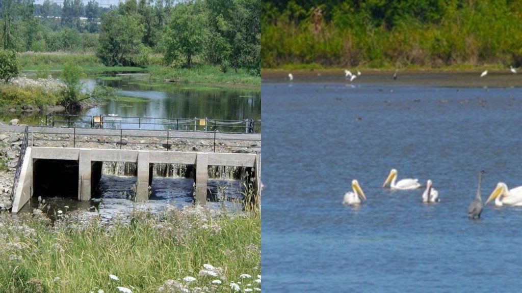
For example, when I took a look around the Smith & Bybee Wetlands Natural Area, I noticed a star fort-point-shape in the landscape.
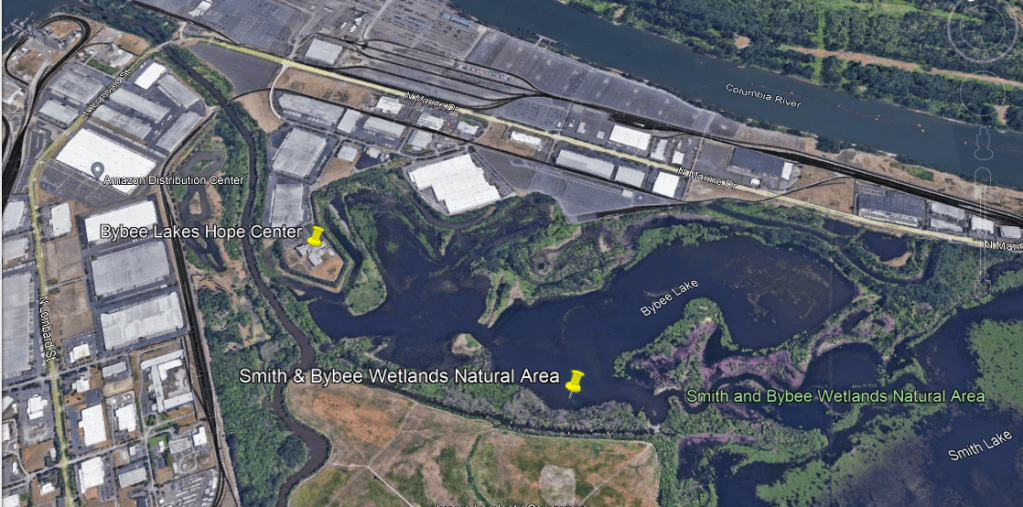
The Bybee Lakes Hope Center is located on top of it, a homeless shelter since October of 2020.
Prior to that, it was the Wapato Jail, said to have cost $58-million to built, but which was never used as a jail because Multonomah County could not afford to operate it as such.
There is one more place I want to look at in Vancouver, Washington, before moving on to Long Beach, Washington.
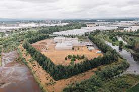
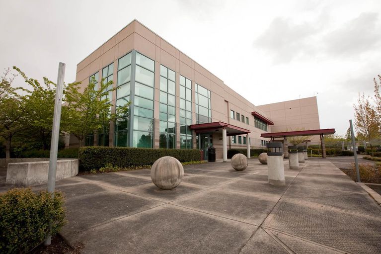
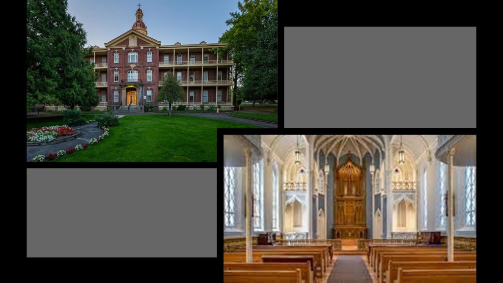
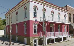
The House of Providence was a former orphanage and school.
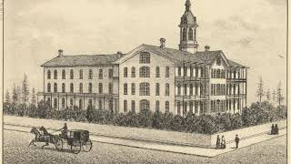
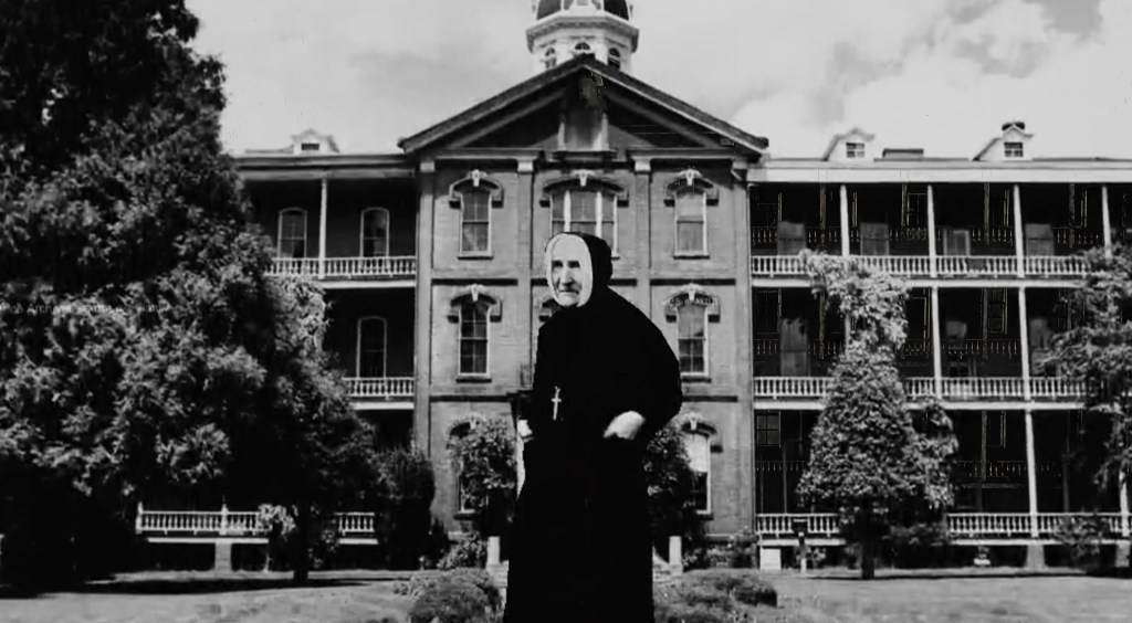
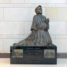
We are told that it was designed by Mother Joseph Pariseau of the Sacred Heart in the Sisters of Providence order of the Montreal, Quebec, Canada, and built in 1873.
As well as the name, not a particularly feminine-looking sister.

Mother Joseph led a group of members of her congregation to the Pacific Northwest, where they established a network of schools and healthcare for American settlers to the region.
In order to raise money for the construction of the House of Providence, Mother Joseph was said to have led begging tours through mining camps.
The House of Providence functioned as a school until 1969, and is an event venue today.
Mother Joseph was credited with the completion of eleven hospitals; seven academies; five schools for native american children; and two orphanages.
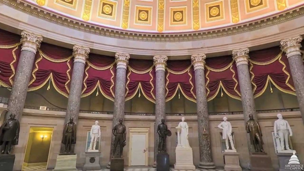
It is interesting to note that Mother Joseph was one of the two individuals chosen to represent Washington State at the National Statuary Hall in the U. S. Capitol building in Washington, DC, for her accomplishments.
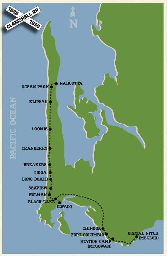
Per CPs suggestion, now I am going to take a look at Long Beach, Washington, which has long been touted as the “World’s Longest Beach.”
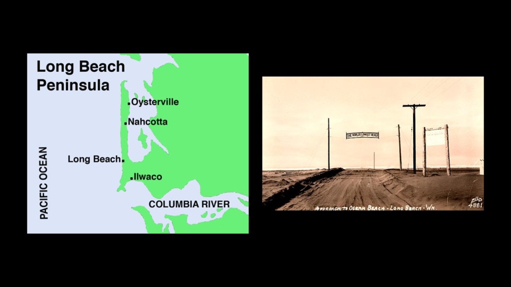
Long Beach is recorded as having been started when Henry Harrison Tinker purchased a land claim in 1880, after which time he platted the town and called it Tinkerville.
Between 1888 and 1930, the Ilwaco Railway and Navigation Company, a narrow-gauge railway, ran-up the whole Long Beach Peninsula.
Between the advent of the automobile and financial difficulties, the railroad was abandoned by its owners on July 12th of 1930.
By the summer of 1931, the railroad’s physical infrastructure and rolling stock had been sold to a scrapping firm in Portland, and the rails and ties ripped up from the road-bed.
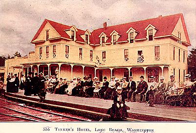
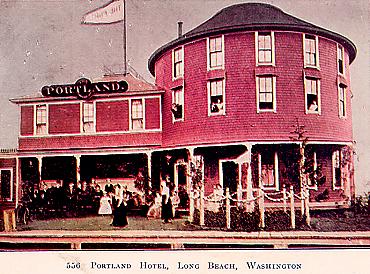
In its hey-day, Long Beach became a resort for the wealthy, where besides the Tinker Hotel, there was the historic Portland Hotel, which burned down in December of 1914 and was never replaced.
There was also the Driftwood Hotel, which no longer exists, but I can’t find a reference about what happened to it…
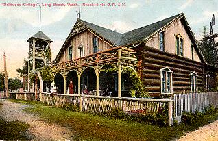
…
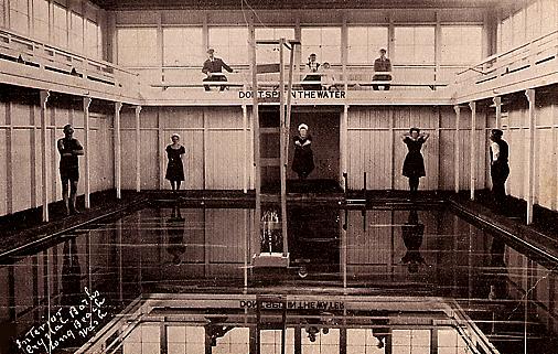
…and the Crystal Waters Natatorium, which featured indoor seawater pools for swimmers.
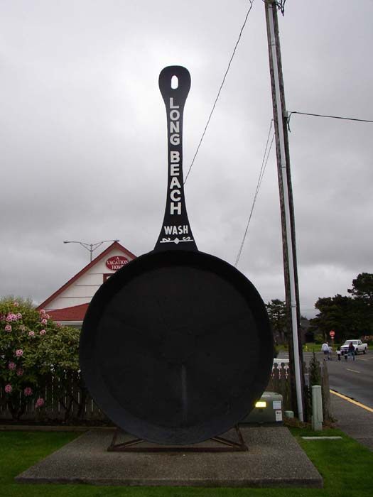
You can still see one of the “World’s largest frying pans” in Long Beach, an attraction there since the early 1940s.
Leadbetter Point State Park is at the tip of Long Beach Peninsula, and is a nature preserve and public recreation area.
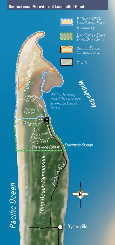
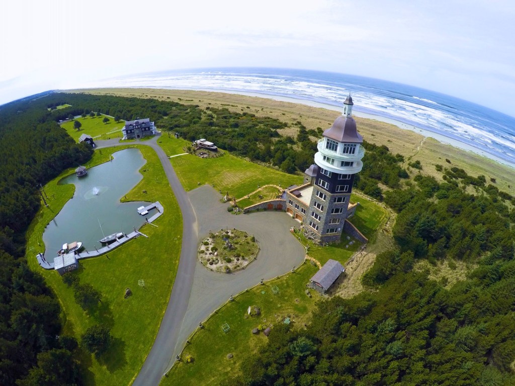
Leadbetter Farms is a private resort, and is located just outside of Leadbetter Point State Park.
The Willapa National Wildlife Refuge borders Leadbetter Point State Park to the south of it, and is described as 11,000 acres, or 45-kilometers-squared of sand dunes, sand beaches, mudflats, grasslands, and saltwater and freshwater marshes.
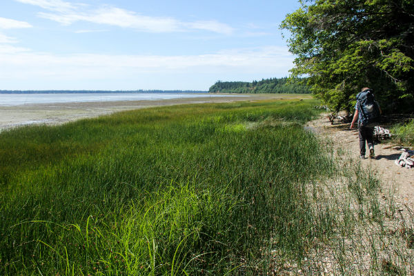
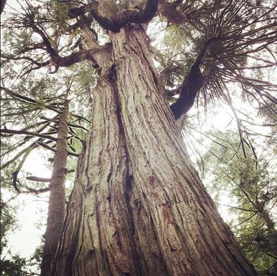
The Willapa National Wildlife Refuge also has old-growth forests, like the ancient cedar grove found on Long Island in Willapa Bay.
At the southern tip of the Long Beach Peninsula, we find Fort Canby at Cape Disappointment State Park.
Fort Cape Disappointment was said to have been built on the northern side of the mouth of the Columbia River between 1863 and 1864 during the American Civil War, and was later known as Fort Canby…
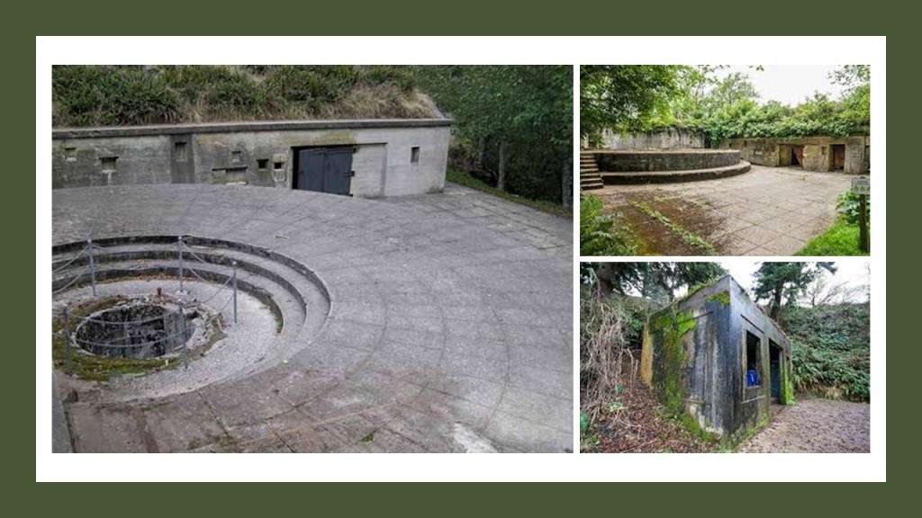
…along with Fort Stevens in the same time frame on the southern side of the mouth of the Columbia River in Oregon, west of Astoria, Oregon…
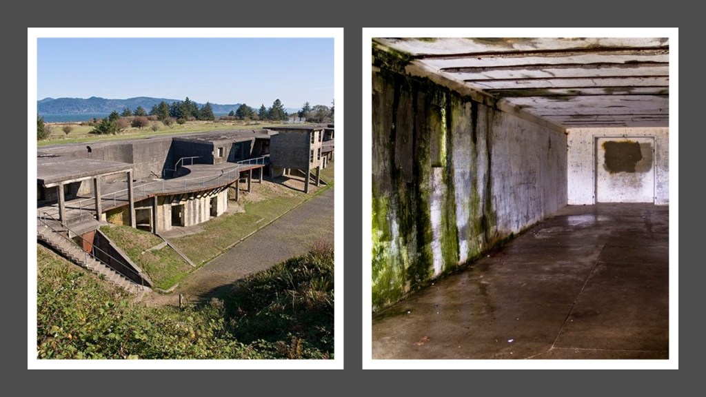
…and Fort Columbia, just east of Fort Canby in Washington State, and said to have been built between 1896 and 1904.
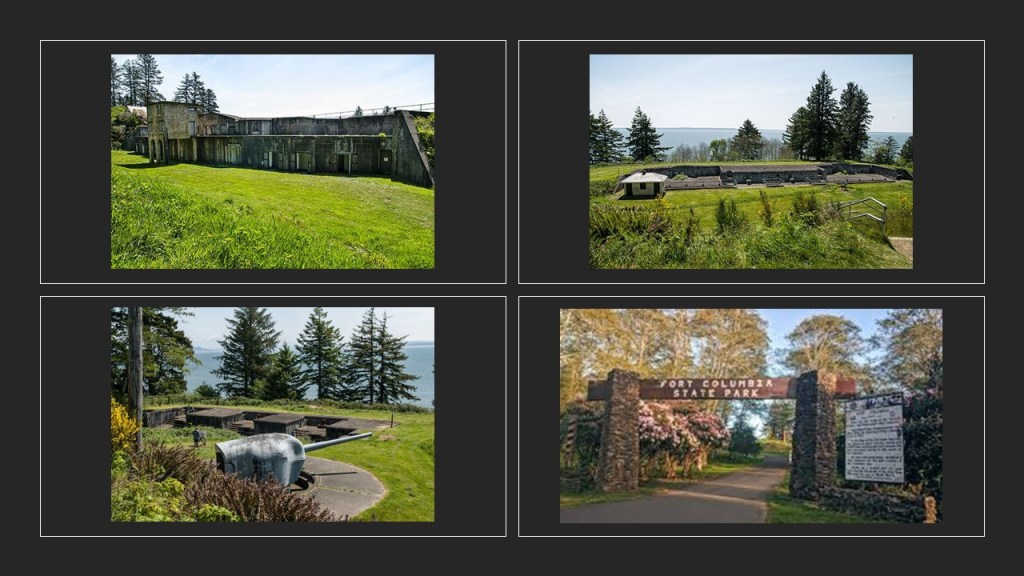
We are told these three forts constituted the “Three Fort Harbor Defense System” at the mouth of the Columbia River.
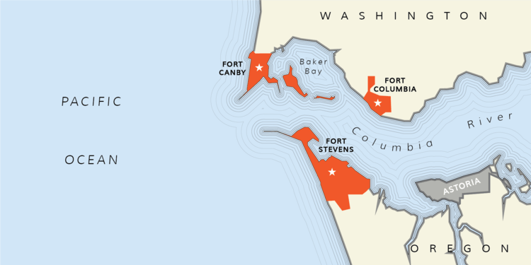
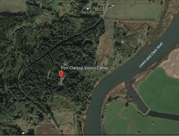
Fort Clatsop is on the Oregon-side of the Columbia River, near Fort Stevens, and was where the members of the Lewis & Clark expedition built Fort Clastrop for shelter and protection, in the winter of 1805, and to officially establish the American presence there, with the American flag flying over the fort.
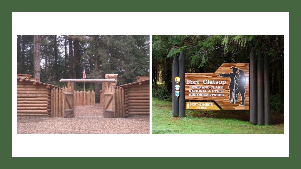
I looked on Google Earth to see if I could detect the remnants of a star fort on the grounds of the Fort Clatsop National Monument, which if one was there, the remnants of it are most likely covered by trees.
Next, I am going to look at Spokane at the request of DA & BM & MH69.
Several places there were suggested.
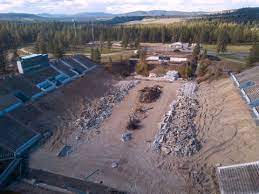
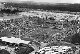
I am going to start at the Joe Albi stadium, a former outdoor athletic stadium that was primarily used for high school football, and is currently in the process of being demolished.
A middle school is planned for the former stadium site.
This is what we are told about it.
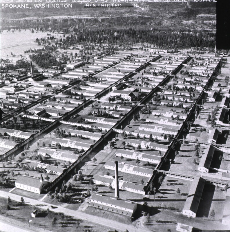
It is located on part of what was the U. S. Army’s Baxter General Hospital, a very large hospital facility which was said to have been built starting in 1942 to accommodate the expected need for military hospital services for all branches of the military, and grew to have 400 buildings and became a self-contained community.
By the end of 1945, the hospital was closed, leaving the city of Spokane with having to do something with the location, and during which time most of the buildings and equipment were sold to outside interests and removed. Part of the location became a Veterans’ Affairs hospital, and part of it was used to construct the new stadium
Taking only four-months to build, the stadium opened as the “Spokane Memorial Stadium” for high school football games.
The stadium was renamed in 1962 for Joe Albi, an attorney and civic leader in Spokane who led the fund-raising effort the construction of the stadium.
It was in use as a sporting and concert venue over the years, with its seating capacity of 28,646, until it was permanently closed in January of 2022.
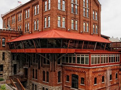
The Old Flour Mill in Spokane was said to have been built in 1895, and one of a series of mills that were built along the Spokane River Falls, and described physical reminder of the importance of water power in Spokane’s history.
It didn’t become operational, apparently, until 1900, because of the property had become the subject of an international lawsuit because of issues arising from the way it had been financed.
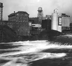
The old flour mill was closed in 1970, renovated, and re-opened in 1973 as the office-retail-restaurant space it is today.
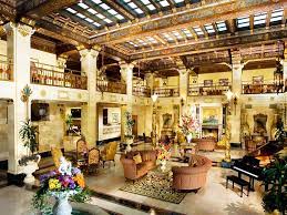
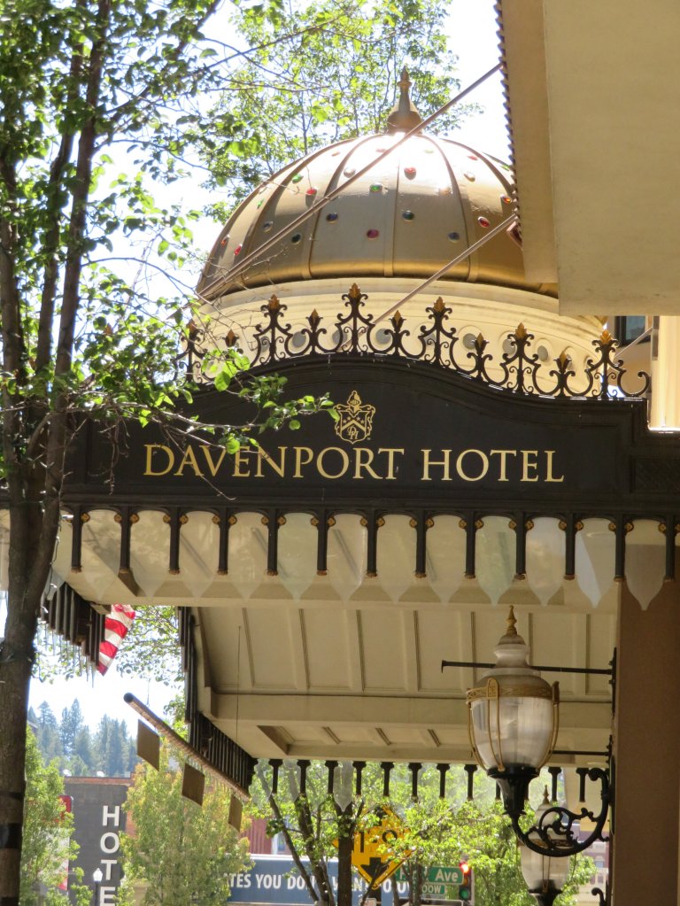
The Historic Davenport Hotel is still the Grandest Hotel in Spokane.
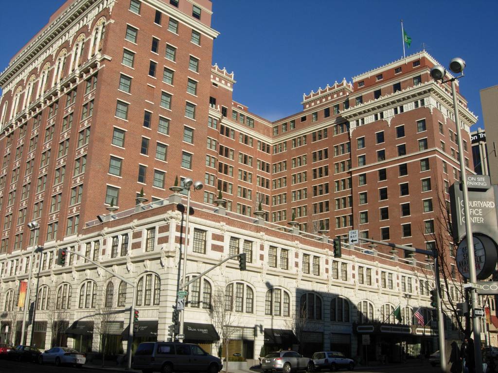
It is a luxury hotel in downtown Spokane.
The Davenport Hotel was said to have been commissioned by a group of Spokane citizens headed by Louis Davenport, the hotel’s first proprietor.
The architect who was given credit for designing the building was Kirtland Kelsey Cutter, and it was said to have been built in 1914.
Notable features included the first hotel air conditioning in the United States; a central vacuum system; and a pipe organ.
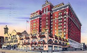
In 1985, the Davenport was closed, and the demolition of the grand building was considered.
However, a local property developer bought the building in 2000, and restored the Davenport to its former grandeur, and it reopened as a hotel in September of 2002.
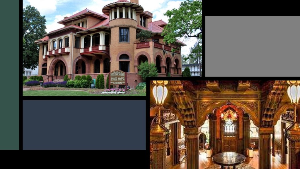
The Patsy Clark Mansion in Spokane was also attributed to the architect Kirtland Kelsey Cutter, circa 1897 – 1898, having been hired by mining millionaire Patsy Clark to replace his mansion that had been burned down in the Great Fire of Spokane in 1889.
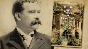
The mansion now houses a law firm and offers private rentals for small events.
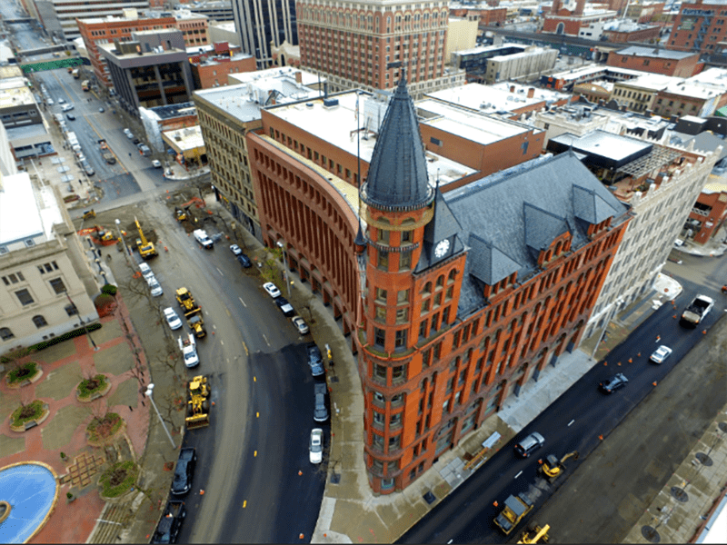
The Spokesman-Review Tower in Spokane was said to have been built starting in March of 1890, and completed the following year, and became the home of the Spokane Falls Review Newspaper.
At one point, the building was home to two newspapers and a hotel, but by the economic downturn of 1893, the main newspaper became the competing “Spokesman-Review,” which continues to occupy the Review building in the present-day.
Manito Park in Spokane was established around 1904, with the Olmsted Brothers credited with the landscaping in 1913 as part of their plan for landscaping Spokane’s parks.
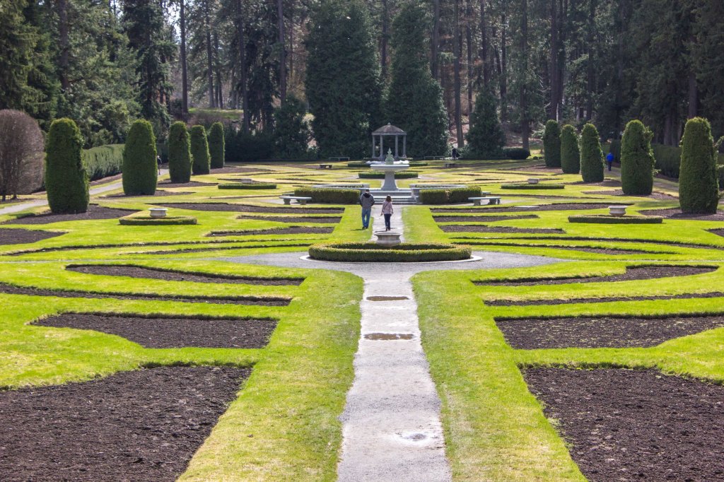
There was a zoo at Manito Park until 1932, when it was closed down due to funding issues created by the Great Depression.
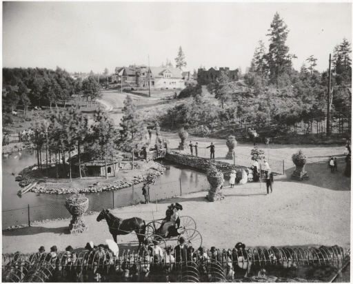
Manito Park contains such attractions as:
Duncan Garden, said to have been designed and built in 1913 as a European-style garden, with a large granite fountain…
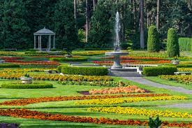
…the Gaiser Conservatory, a greenhouse which has one wing housing desert plants and the other tropical plants…

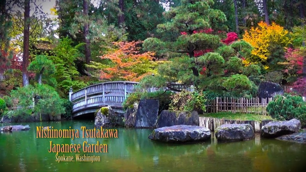
…and Japanese Gardens.
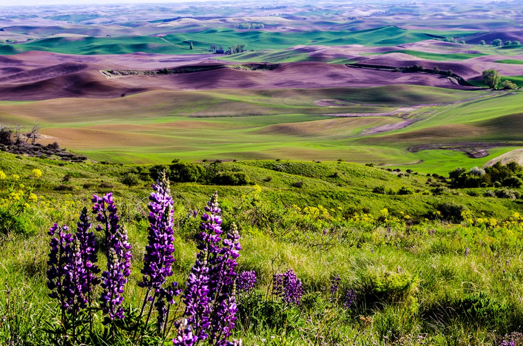
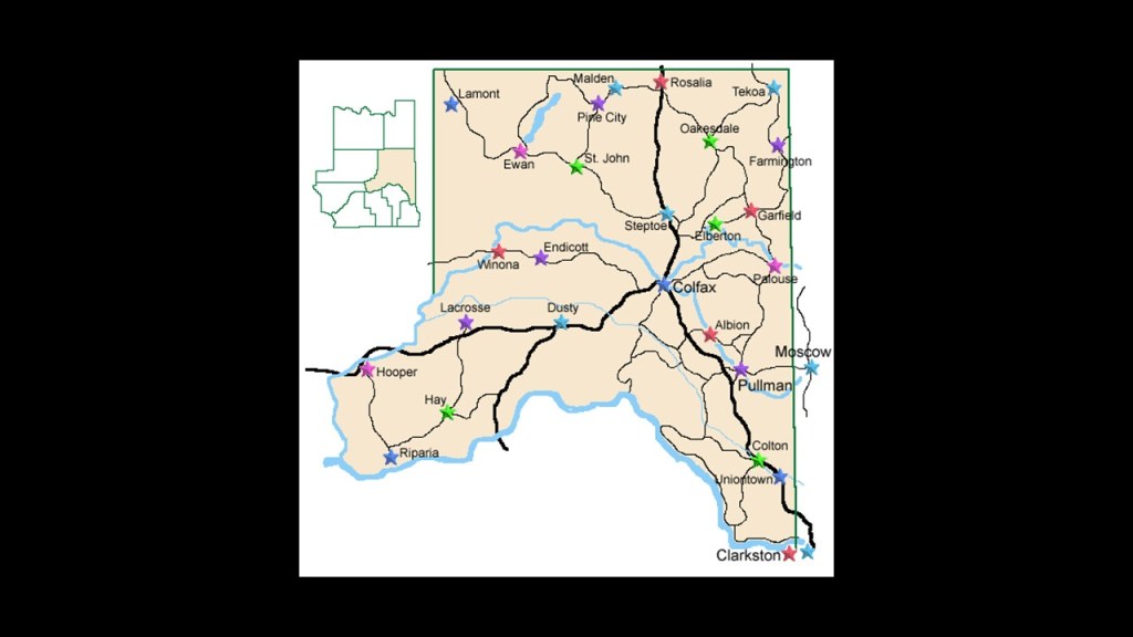
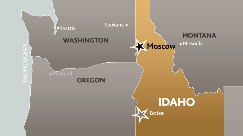
Next, HW suggested that I look at the Palouse geographic region, which is comprised of southeastern Washington, northcentral Idaho, and parts of northeast Oregon.
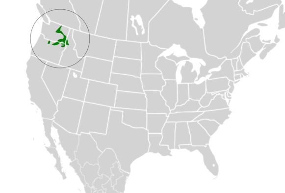
It is a distinct geographic region, and a major agricultural area, especially for wheat and legumes.
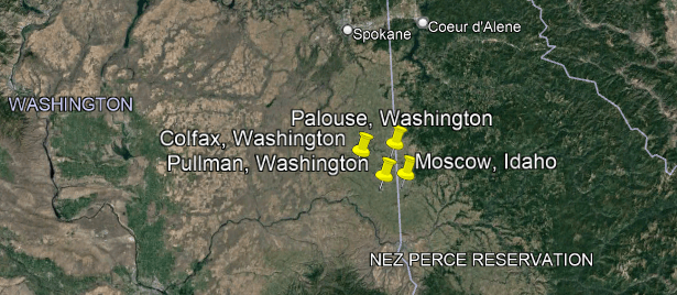
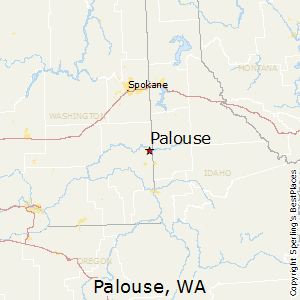
There are four main rural centers in the Palouse that are located geographically close to each other.
Three are in Washington State – Palouse, Pullman, and Colfax – and one in Idaho – Moscow.
Palouse is a small agricultural community today, with a population of 998 in 2010.
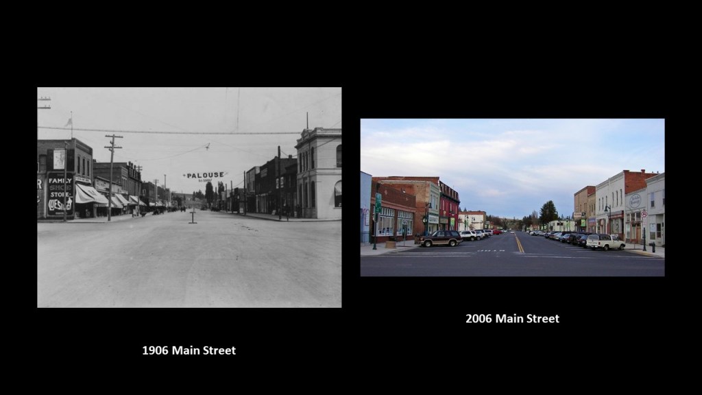
It was founded in 1874, and incorporated in 1888, the same year it was devastated by a massive fire.
Over the next decades, Main Street was rebuilt, becoming a major pioneer-era commercial district for the region.
Here are comparison photos of Main Street circa 1916 and circa 2006.
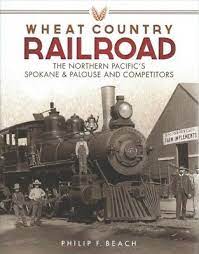
The railroad arrived in Palouse in 1888 with the Spokane and Palouse Railroad, part of the Northern Pacific Railroad.
Then in 1903, the Potlatch Lumber Company, a subsidiary of Weyerhauser bought out several mills and timber stock in the region, including the Palouse River Lumber Company.
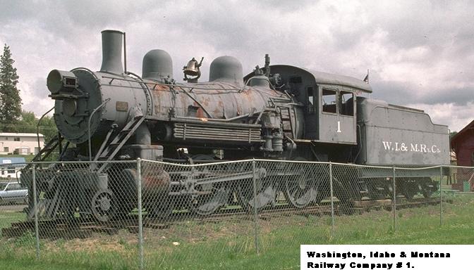
In 1905, they brought in the Washington, Idaho, and Montana Railroad that ran from Palouse to Purdue, Idaho.
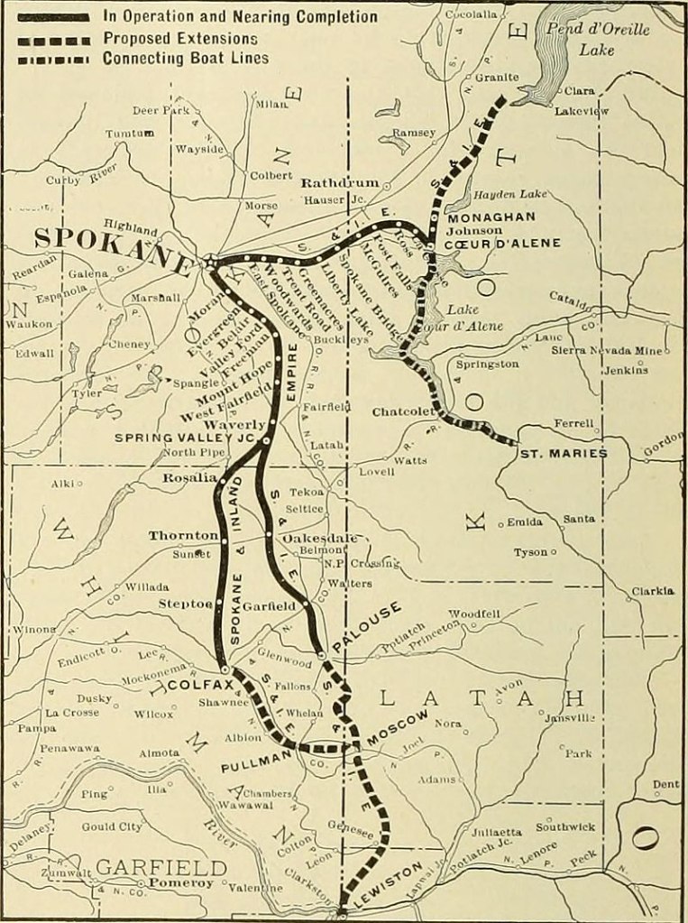
Then in 1906, an Electric Interurban line called the Spokane and Inland Empire Railroad, ran from Spokane, through Palouse, to Moscow, Idaho.
The company slowly converted to bus service, and the last electric rail service to Moscow was in 1939.
Palouse remains a rich farming area today, with main crops of wheat, barley, dry peas, garbanzos, and lentils.

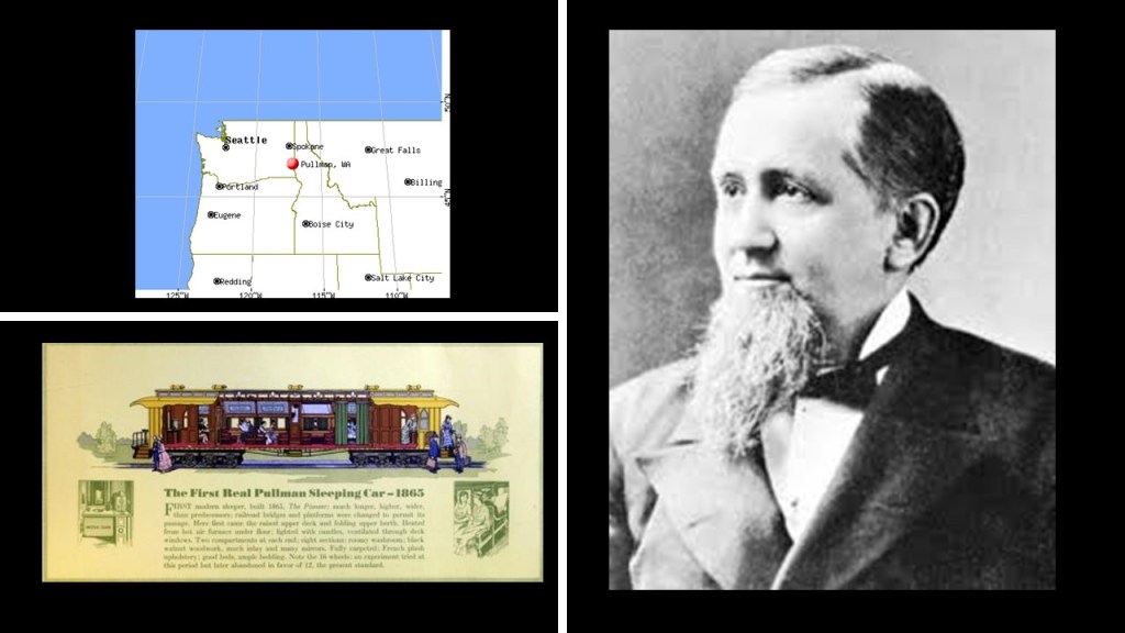
Pullman is the largest city in Whitman County, Washington, and was named after industrialist George Pullman, manufacturer of the Pullman Sleeping Car.
Settlers arrived in the area in 1871, and Pullman was incorporated in 1881.
Like Palouse, Pullman is a fertile agricultural area.
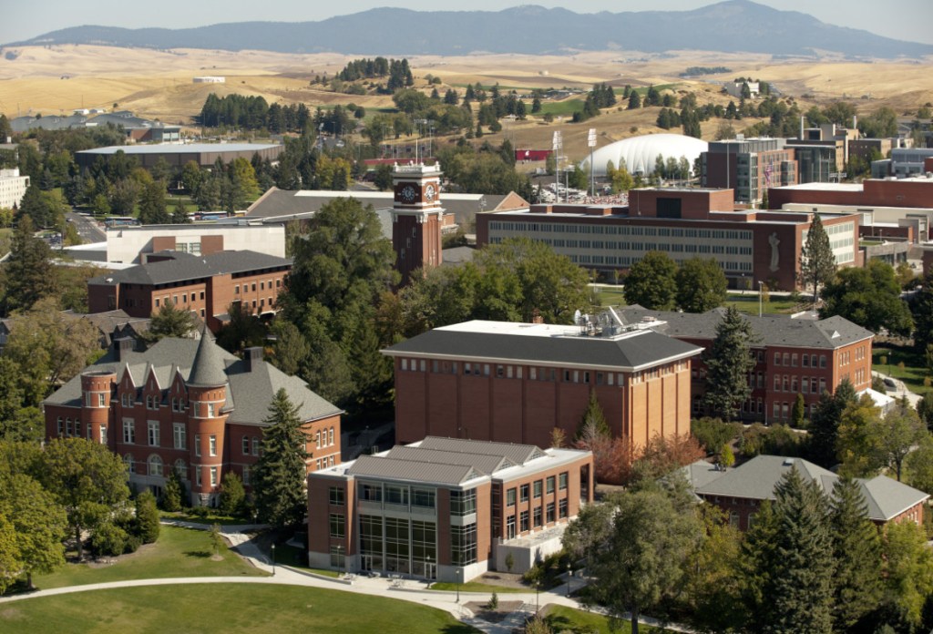
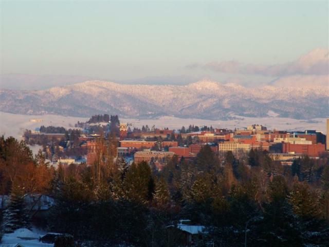
It is also home to the flagship and oldest campus of Washington State University, which was established as an agricultural college in 1890, and is also one of the oldest land-grant Universities in the American West.
Pullman is situated across four major hills which divide the city into nearly equal quarters.
The four hills are:
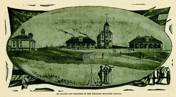
Military Hill, which was named for the Pullman Military College that opened in 1891 and burned down in 1893…
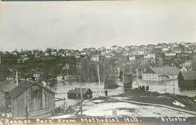
…Methodist Hill, which is now known as Pioneer Hill, with this photo taken from it of Pullman during a flood which devastated the region in 1910…
…College Hill, the location of Washington State University…
…and Sunnyside Hill.
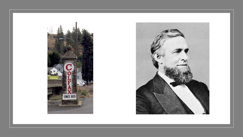
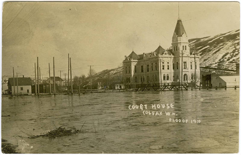
With the first settlers arriving in 1870, Colfax, Washington, was incorporated in 1873, and named for Schuyler Colfax, Vice-President of the United States under President Ulysses S. Grant from 1869 to 1873.
Colfax was situated at the junction of the three railroad lines, as well as the confluence of the north and south forks of the Palouse River.
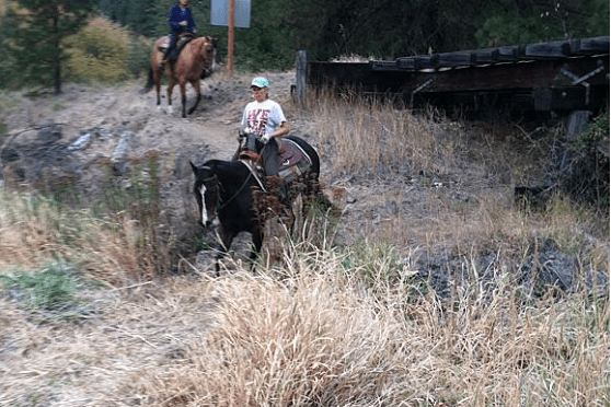
The Colfax Trail is a 3-mile, or 5-kilometer, local trail converted from an old railway line.
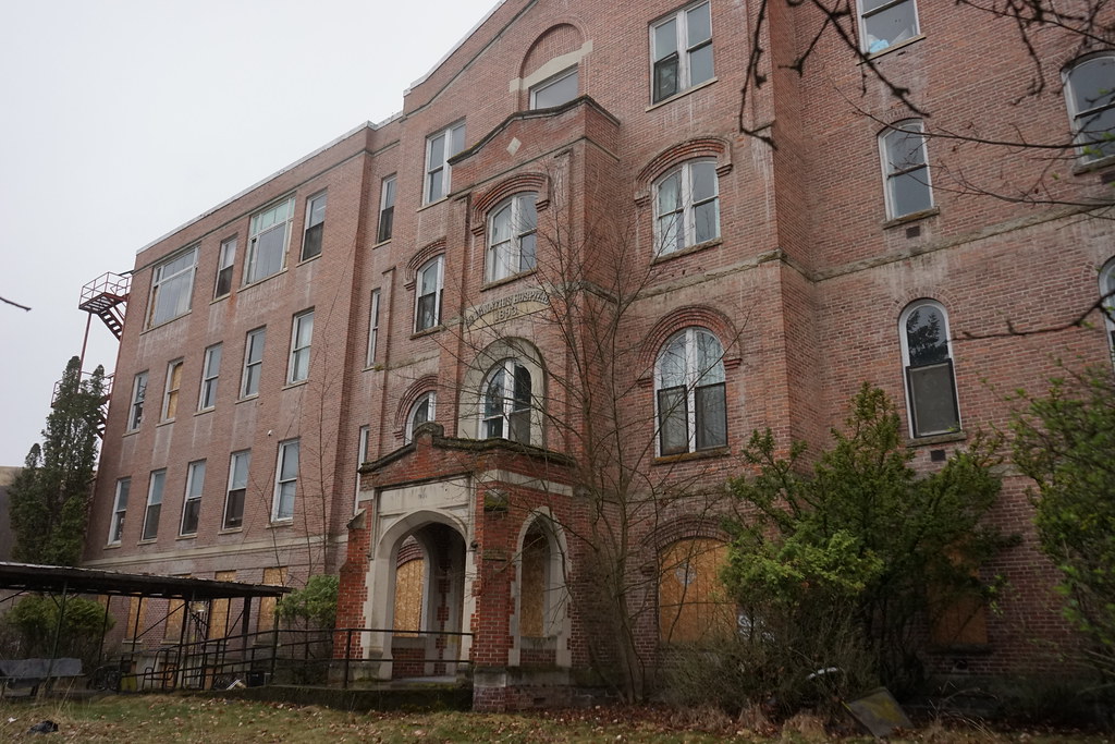
The former St. Ignatius Hospital in Colfax was said to have been constructed in 1892 under the supervision of Mother Joseph, and served as a hospital until 1964, and then as an Assisted Living home until 2000.
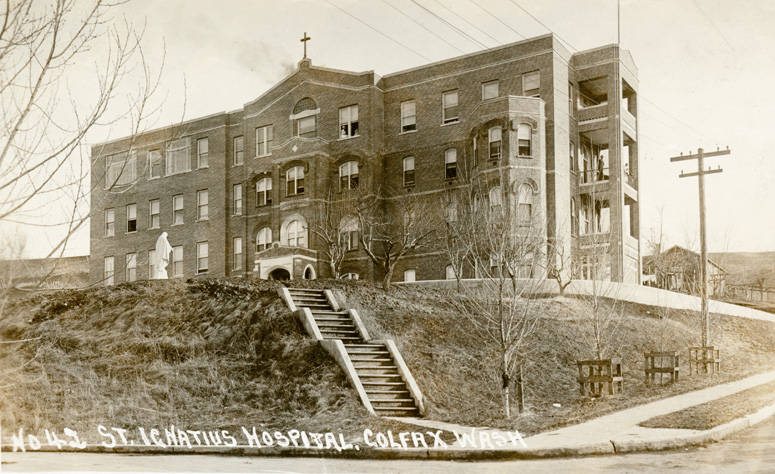
The former St. Ignatius Hospital was abandoned in 2003, though opened-up for ghost tours in 2015, and under new ownership since 2021.
The Palouse River flood of 1910 significantly impacted Colfax, and other cities in the region.
Among other things, the floodwaters left Colfax and Moscow cut-off from the outside world, without train and telegraph service.
The city of Moscow in Idaho is an agricultural and commercial hub for the Palouse region.
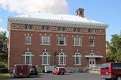
The first permanent settlers came here in 1871, with the first U. S. post office opening here in 1872, and the old post office and federal building pictured here was said to have been built in 1911…
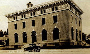
…and today serves as the Moscow City Hall.
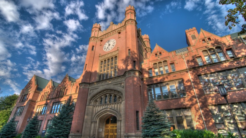
Moscow is the home of the University of Idaho, the state’s only University for 71-years.
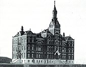
The east-facing Administration building on campus was said to have been built between 1907 and 1909…
…to replace the original Administration building, which was said to have been built in 1899 after having been destroyed by fire in 1906.
There’s much more to find here in the Palouse, but there are two more places I am going to look at in Washington State.
MB brought Snoqualmie Falls and the Ballard Locks to my attention.
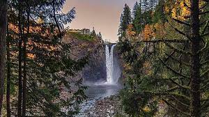
First, Snoqualmie Falls.
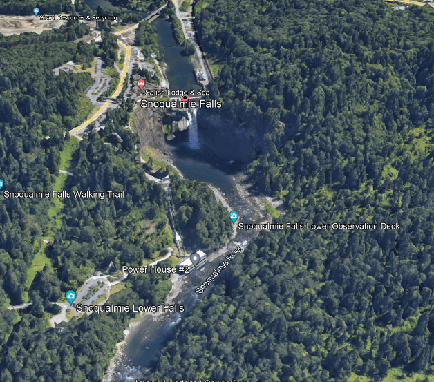
MB said that the Snoqualmie Falls are 100-feet, or 30-meters, higher than Niagara Falls.
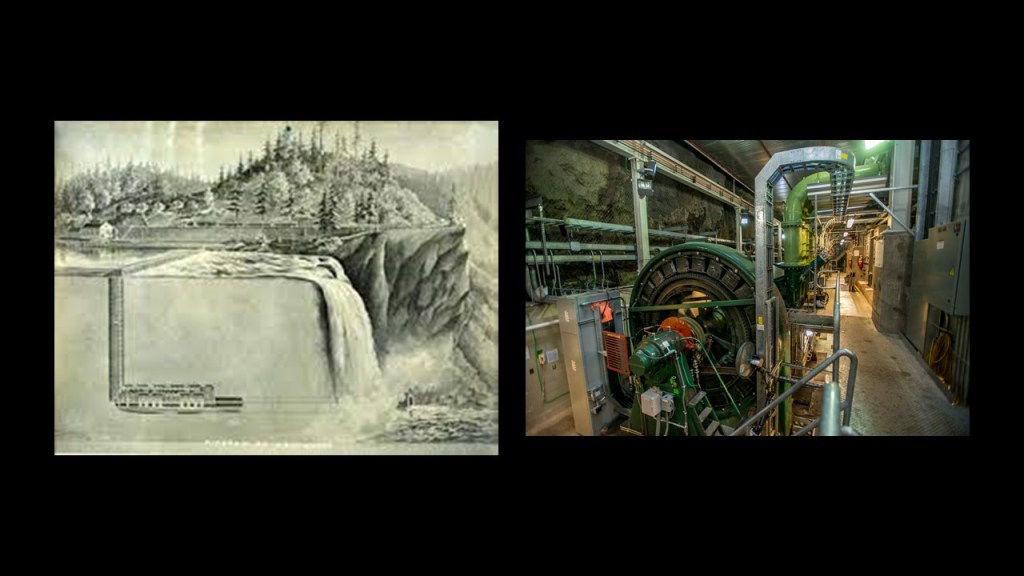
MB said there was an incredible underground, built in-the-bedrock power plant under Snoqualmie Falls.
He said he was inside it back around Y2K, and said it had an ancient feeling, but all the electronics were either updated or being updated.
This is what we are told about it.
The Snoqualmie Falls Hydroelectric Plant 1 was completed in 1899, and was the first completely underground hydroelectric plant ever built in the world.
The story is that Seattle engineer Charles Baker envisioned the hydroelectric plant when he passed by the Snoqualmie Falls on the Seattle, Lake Shore and Eastern Railway routinely during his work.
Baker became unemployed after the Panic of 1893, and sought to build the hydroelectric powerplant.
He received funding from his father, wealthy businessman, William T. Baker, and formed the Snoqualmie Falls Power Company, and bought falls and surrounding land in 1897.
And that’s how we are told the underground Snoqualmie Falls Hydroelectric Plant came to be.
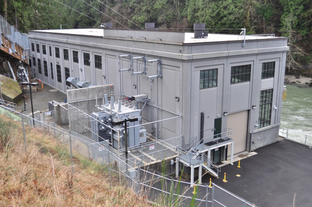
Plant 2 was built in 1910 on the right-bank of the Snoqualmie River.
In Seattle, the Ballard Locks, also known as the Hiram M. Chittenden Locks, is a canal-lock complex in the west-end of Salmon Bay in Seattle’s Lake Washington Ship Canal, and carries more boat traffic than any lock system in the United States.
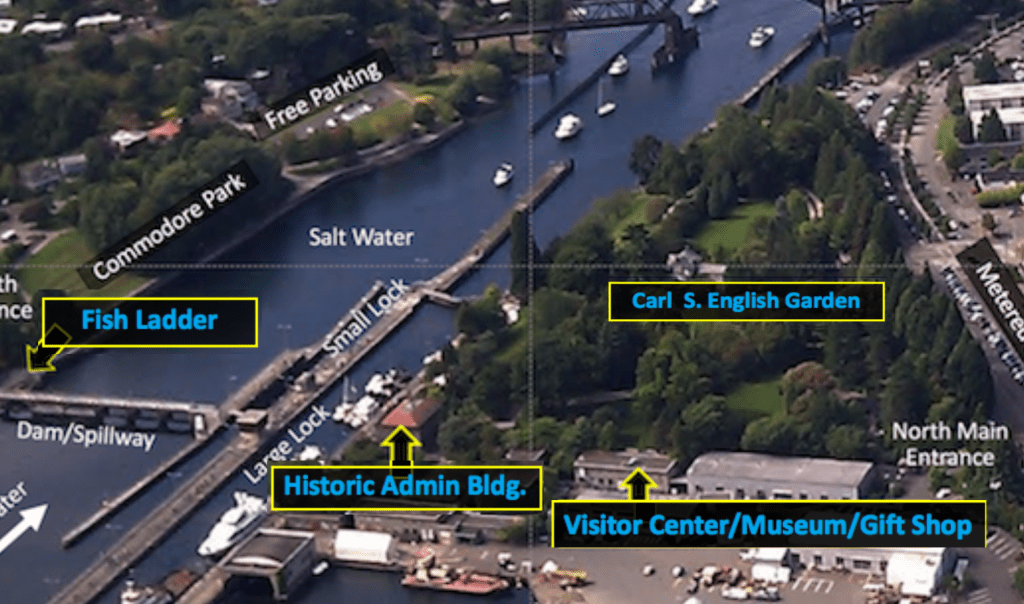
It was said to have been constructed between 1909 and 1917 by the U. S. Army Corps of Engineers under the direction of Hiram M. Chittenden.
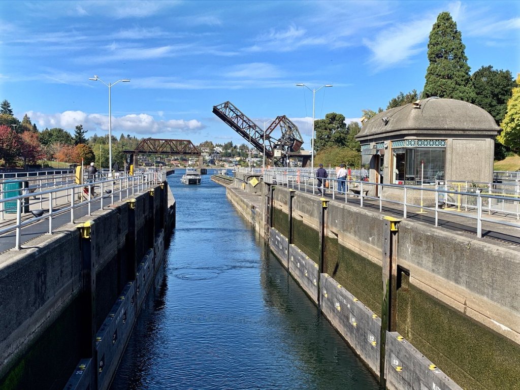
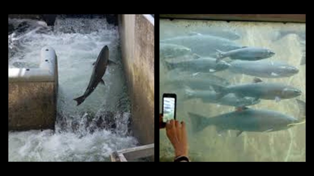
The Fish Ladder was on the southside of the Ballard Locks enables the safe passage of salmon to their upstream spawning grounds from late spring to early fall.
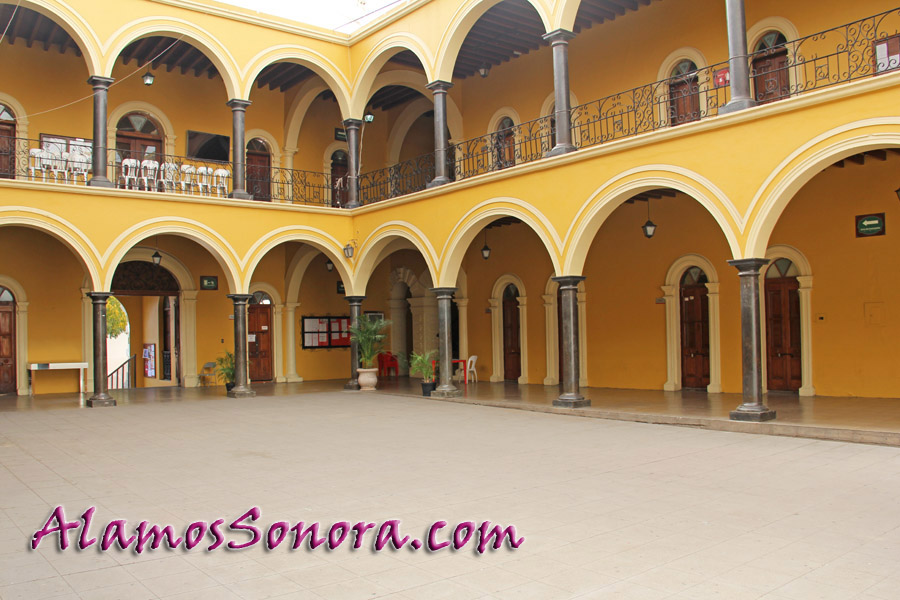
One viewer suggested that I look into the Palacio Municipal Alamos, in Alamos in Mexico’s Sonora State.
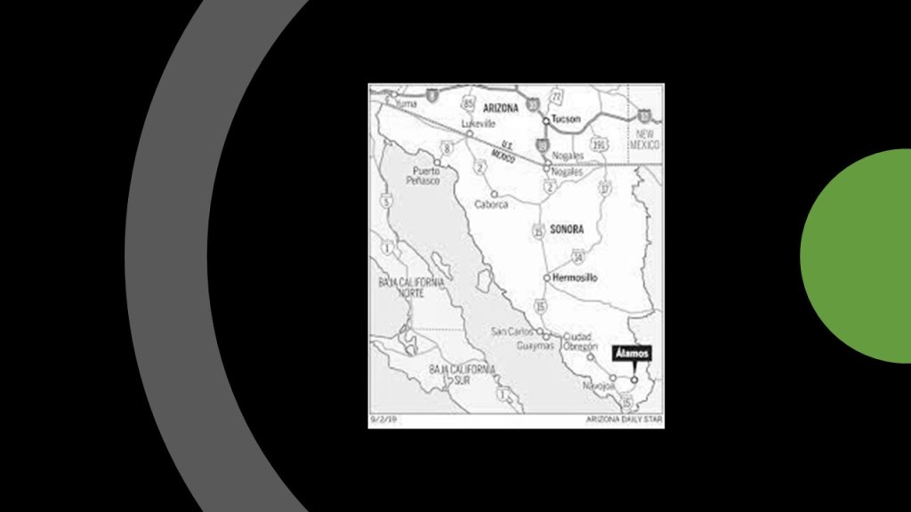
This building is the Government Palace, said to have been built between 1877 and 1899, which houses the offices of the municipal government, as well as state and federal government. The viewer said “the preserved antiquitech tells it all!”
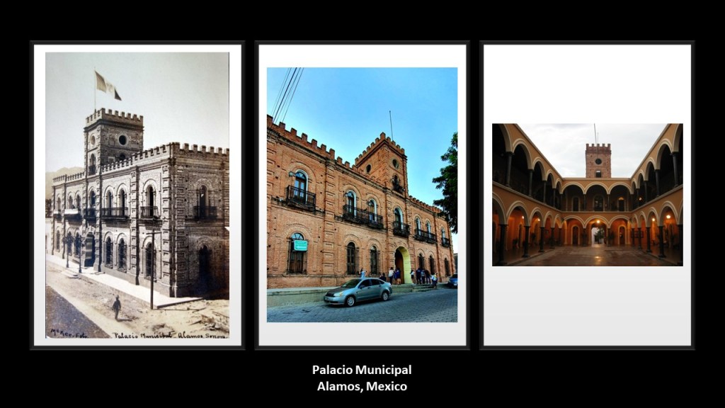
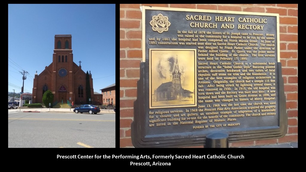
Often used as a flag pole, this type of rod or pole feature was typically found on historic photos of buildings, as well as tall, steeple structures, but in most cases have been removed if the historic building is even still standing, like at the Prescott Center for the Performing Arts, formerly the Sacred Heart Catholic Church in Prescott, Arizona…
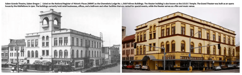
…and the Grand Theater in Salem, Oregon, the building of which in 1900 was credited to the International Order of the Odd Fellows, and served also as their Chemeketa Lodge No. 1.
Today it houses retail businesses, offices, and a ballroom, and other facilities rented for special events.
Inside the entrance of Alamo’s Palacio Municipal, there is a stage, a popular space for concerts, plays, and other gatherings.
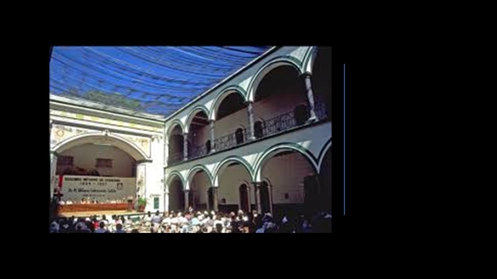
Each office entrance is framed by painted wood Corinthian columns and an archway.
I decided to look around at some of the other places in Alamos.
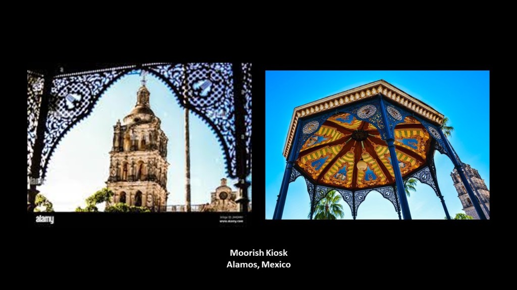
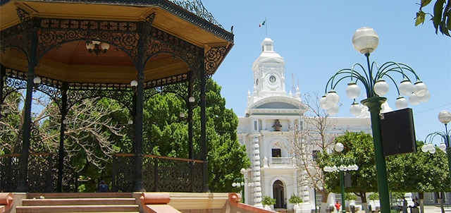
The Iglesia de la Purisima Concepcion is the tallest building in Alamos, and the center of spiritual and cultural life in the silver-mining town of Alamos since its dedication in 1826.
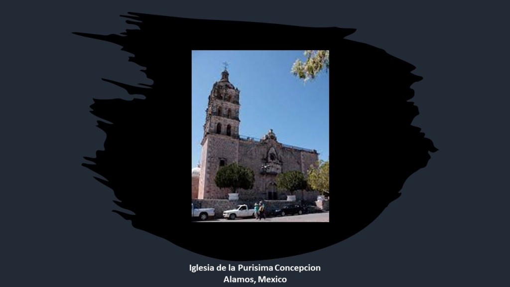
The church and tower is framed by the archway of the Moorish Kiosk in the center of the Main Square of Alamos.
There is also a Moorish Kiosk in Hermosillo, the capital of Mexico’s Sonora State, said to have been brought from Florence, Italy, to the Plaza Zaragoza in the early 1900s, and located is between the Hermosillo Cathedral on one side…
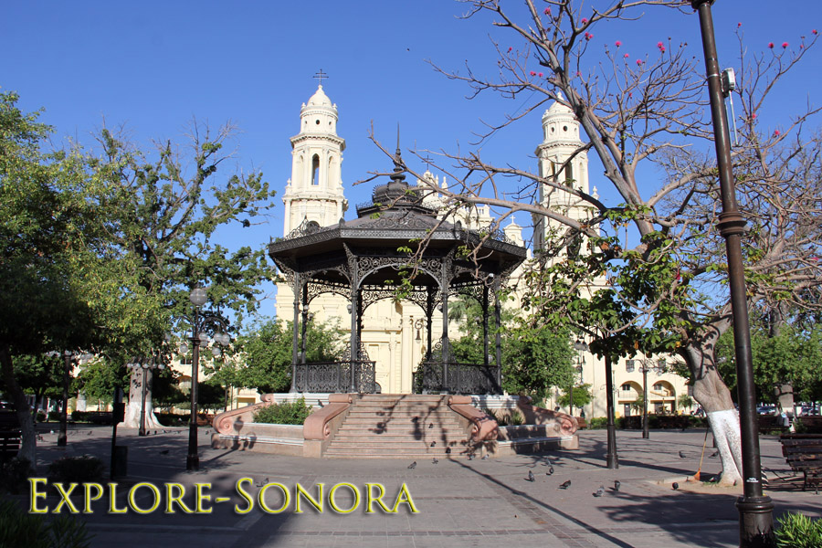
…and the Hermosillo Municipal Building on the other.
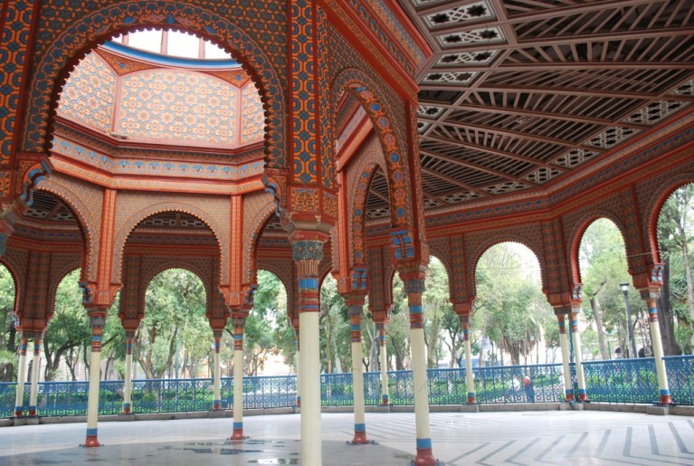
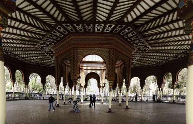
The best-known Moorish Kiosk in Mexico is in the Alameda Park in the center of the Colonia neighborhood in Mexico City.
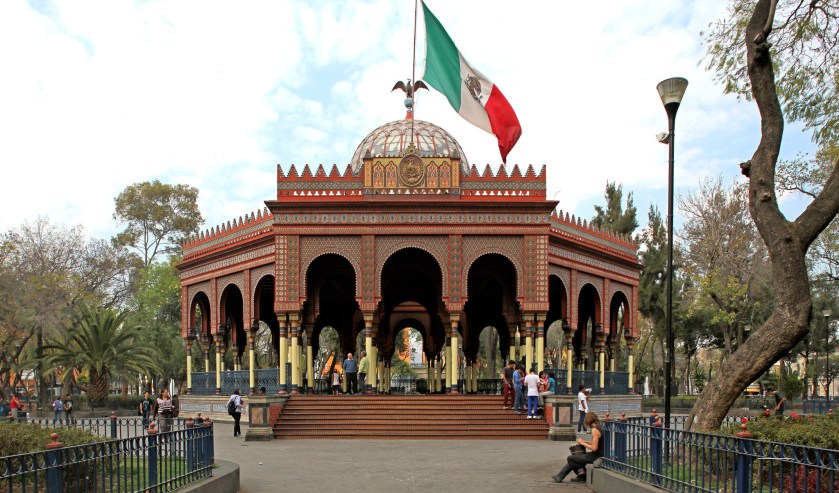
The person who gets the credit for it was a Mexican engineer named Jose Ramon Ibarrola. He is said to have designed it to represent Mexico in the New Orleans International Expo in 1884 -1885. We are told it was transported there, as well as to the St. Louis Missouri Fair in 1904, and then subsequently came back to Mexico.
Just curious ~ by what means could they have transported this huge, highly ornate structure, twice, in the late 1800s and early 1900s?
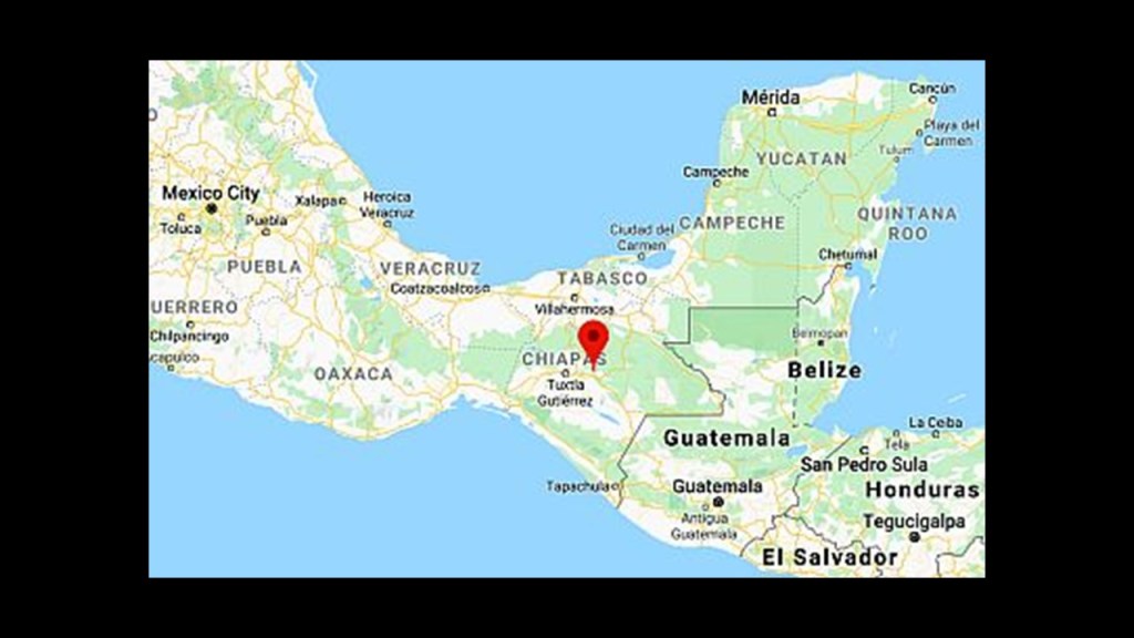
DX suggested that I look at San Cristobal de las Casas in Chiapas, Mexico.
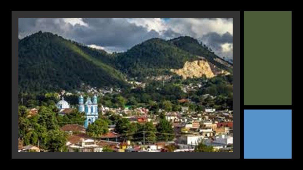
San Cristobal de las Casas is considered the cultural capital of Chiapas in the Central Highlands of the region.
The city’s center is described as maintaining its Spanish Colonial lay-out, with red-tile roofs, cobblestone streets, and wrought-iron balconies.
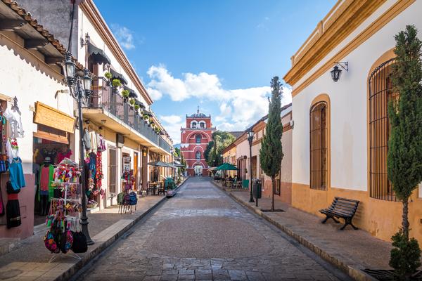
San Cristobal de las Casas was designated as a “Magical Village” in 2003, and was declared the “Most Magical of the Magical Villages” by Mexican President Felipe Calderon in 2010.
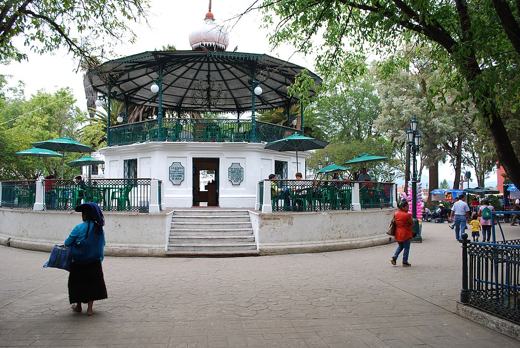
The center of the city is it’s main plaza, the Zocalo, which has this Kiosk in the center of it, which was said to have been added in the early 20th-century.
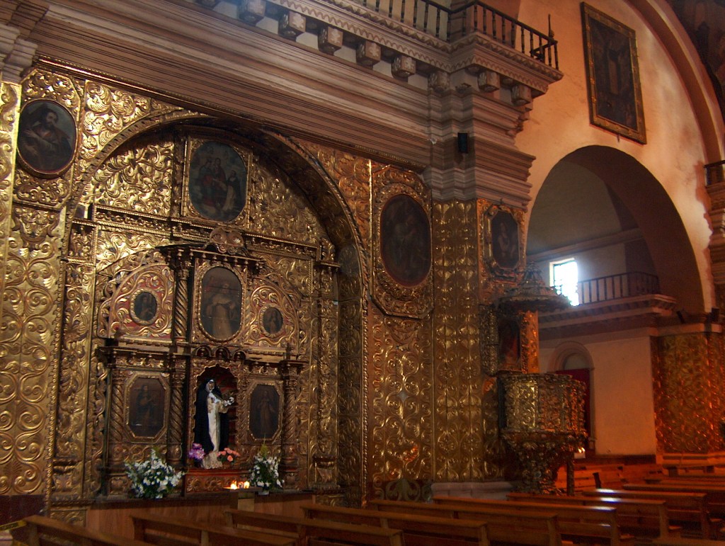
The city’s Cathedral is located north of the main plaza.
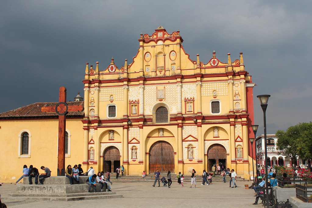
The overall structure is said to contain European, Baroque, Moorish and indigenous influences.
The Neo-Classical Style Palacio Municipal, the City Hall of San Cristobal de las Casas was completed in 1893, and said to have been the result of remodelling a building that was there previously, but had been destroyed by fire in a 1863 that had resulted from riots between imperialists and republicans.
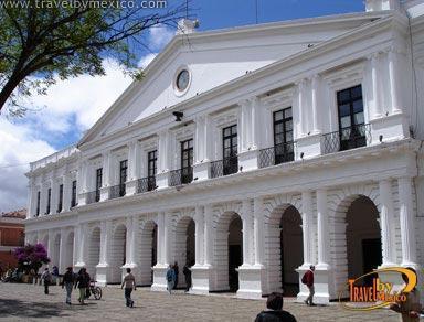
The individual credited with the remodelling of the Palacio Municipal was Carlos Z. Flores, described as a Neoclassical Engineer,who was also said to have been involved with the building of the Santa Lucia Church between 1884 and 1892, among other places.
Now, on over to England.
MF asked me to look at Whitehall Park in Darwen in Lancashire in the United Kingdom.
Whitehall Park first opened as a public park in 1879, and was added to in 1887, 1899, and 1902.
The park occupies 16-acres at the southern end of Darwen.
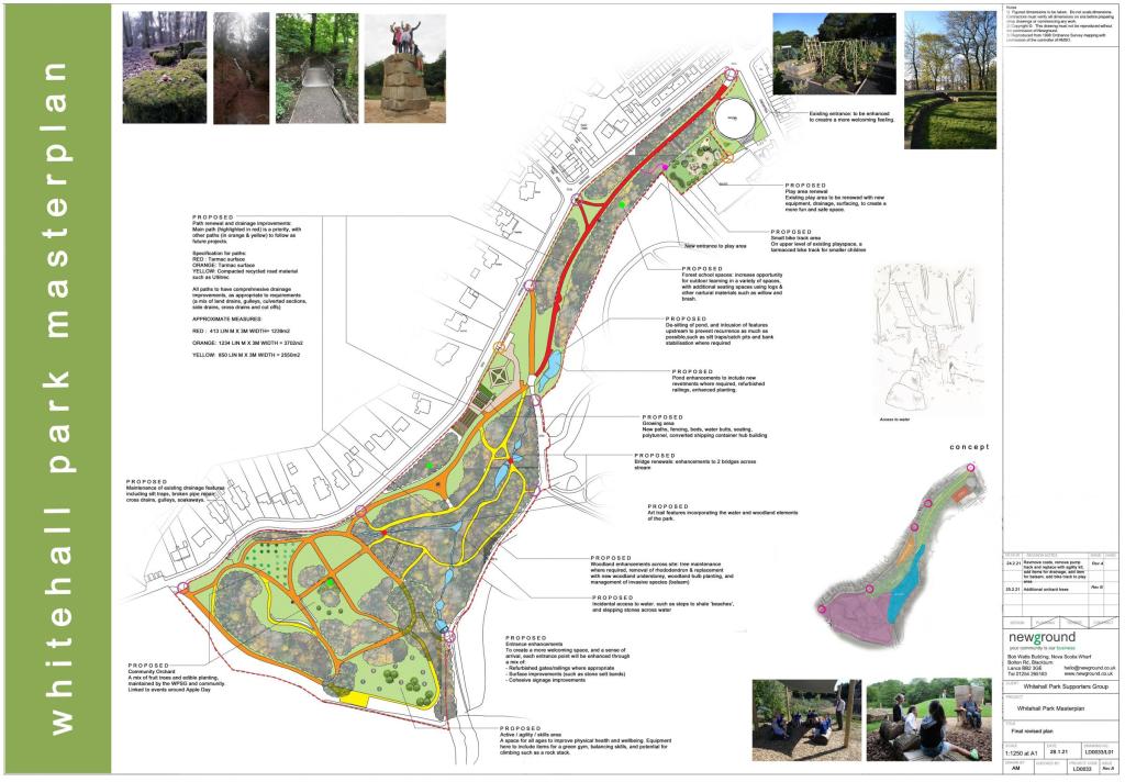
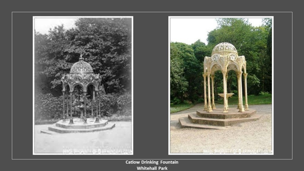
Features at Whitehall Park include:
The Catlow Drinking Fountain, described as a cast-iron drinking fountain donated by John Catlow and Sons to celebrate the coronation of King Edward VII, the oldest son of Queen Victoria and Prince Albert and erected in 1906 over a natural spring.
The Lych Gate on Queen’s Road, also known as the “Wishing Well” entrance, connecting the park with the main road…
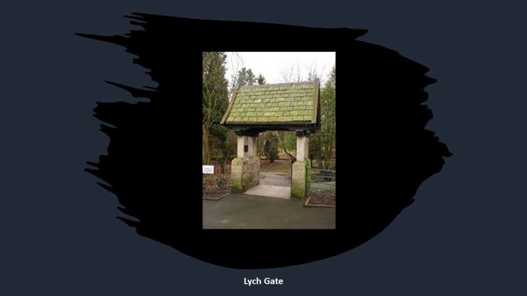
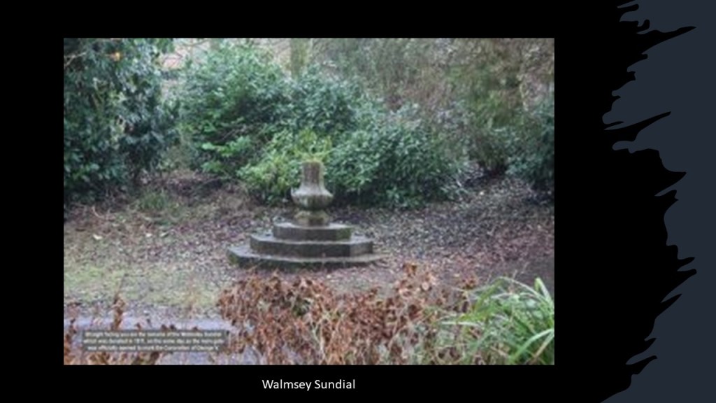
…and the Walmsey Sundial, said to have been donated in 1911, on the same day the Lych Gate was officially opened, to mark the coronation of King George V.
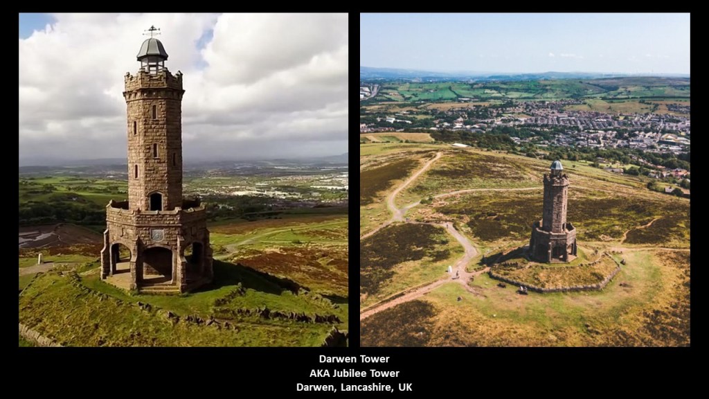
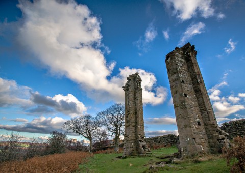
The Darwen, also known as Jubilee, Tower can be accessed via trails on Darwen Moors from Whitehall Park.
The 85-foot, or 26-meter-, high stone tower opened to the public on September 24th of 1898, and was said to have been built to commemorate Queen Victoria’s Diamond Jubilee under the supervision of architect R. W. Smith-Saville.
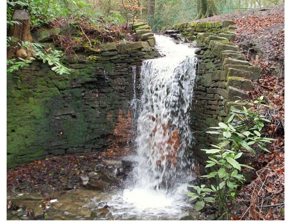
There is even a waterfall at Whitehall Park, surrounded by, and flowing over, a curiously built-looking wall structure.
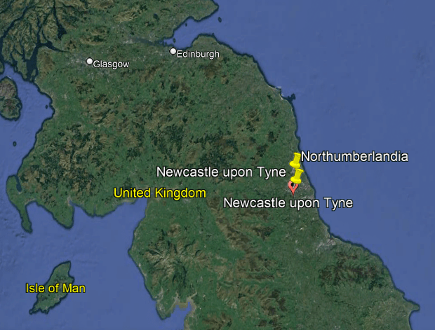
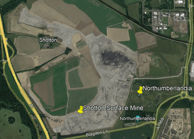
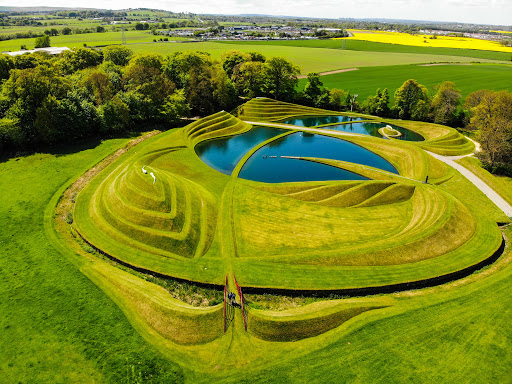
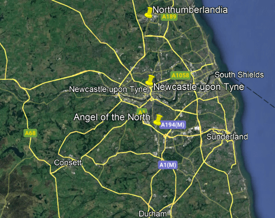
Next, JM brought “Northumberlandia” to my attention, the “Lady of the North.”
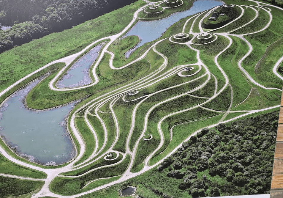
The world’s largest work of Earth Art is 10-miles, or 16-kilometers, north of Newcastle-upon-Tyne in the Northumberland region of England.
The “Lady of the North” was completed in 2012, and made from one-and-a-half-million tons of Earth coming from the development of the neighboring Shotton Surface mine, as it was decided for the project to use the land excavated for the mine as a sculpture instead of returning it to the surface mine at the end of the project.
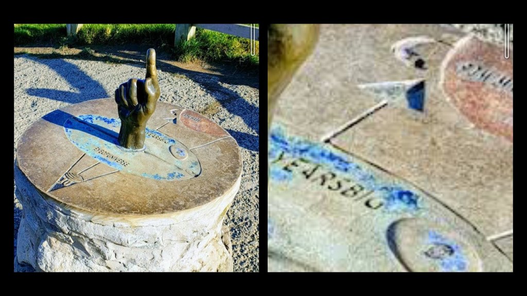
Other things you can find on the grounds of Northumberlandia include this, whatever this means.
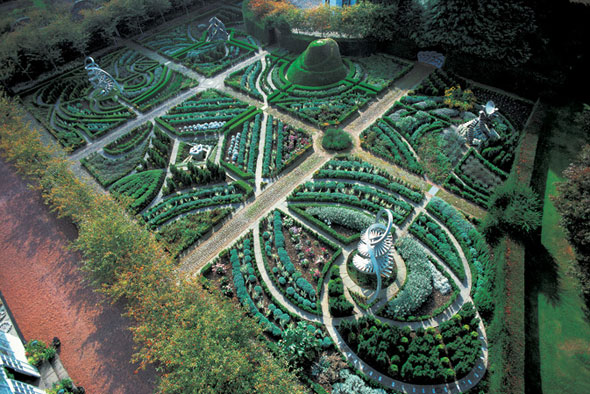
American-born landscape designer Charles Jencks was credited with the design of the “Lady of the North.”
Jencks, who passed away in 2019, had moved to the United Kingdom in 1965.

Other landscape works attributed to him included these in Scotland:
The Garden of Cosmic Speculation in Dumfries…
…Jupiter Artland outside of Edinburgh…
…and the Crawick Multiverse in Sanquhar.
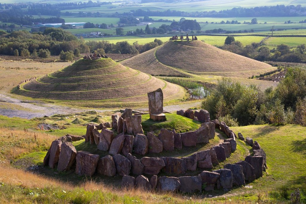
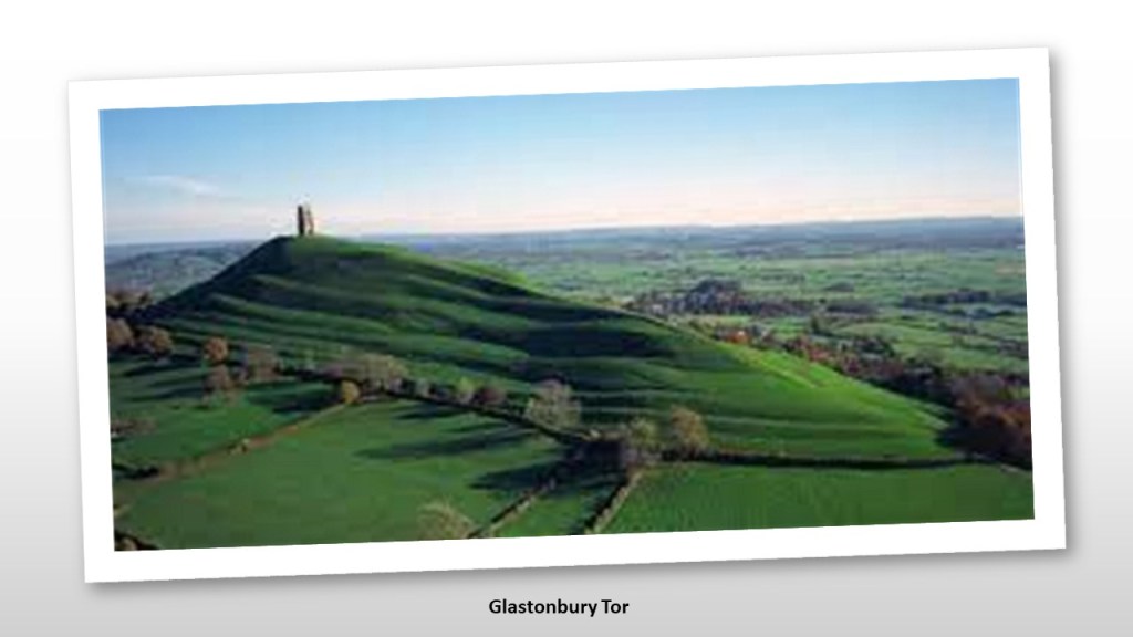
Now, bear in mind that this modern “Earthwork Art” is in a place that is covered with ancient earthworks, megalithic stone circles, and landscape art that looks just like this.
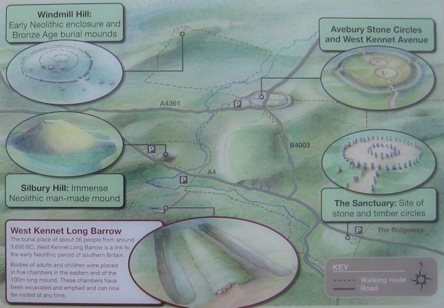
Among many others, you find it at places like Glastonbury Tor in southern England
…and Silbury Hill near the Avebury neolithic complex, called the largest prehaistoric man-made mound in Europe.
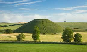
Avebury was one of the principal ceremonial sites of neolithic Britain, dating back to over 5,000-years-ago, as it was believed to have been constructed in the 3,000 BC time-period.
I find it interesting that a modern landscape designer was capable of doing exactly the same thing that ancient Britain’s builders were doing.

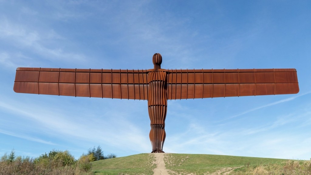
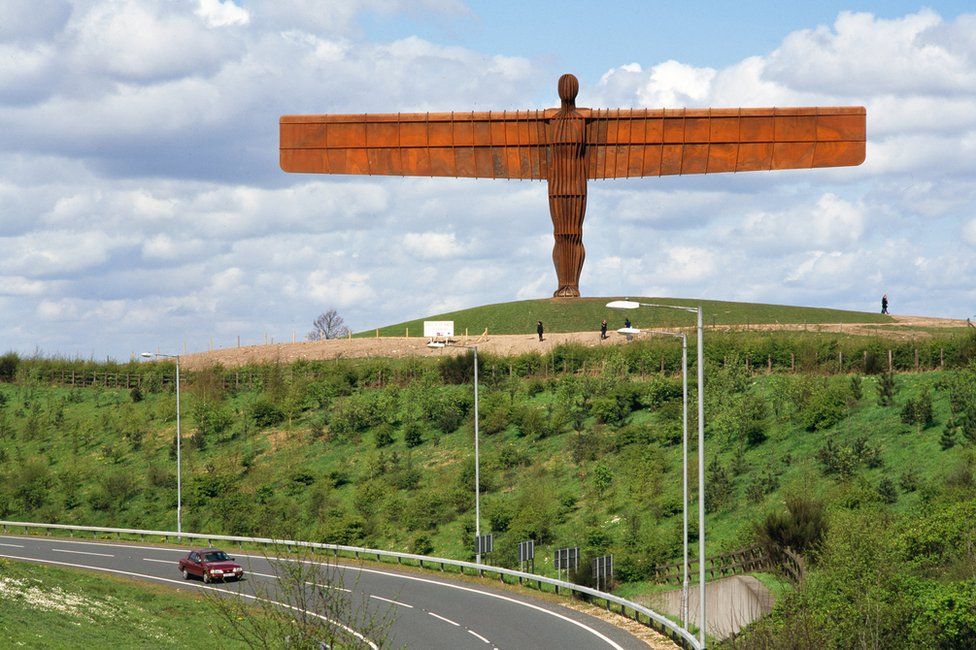
The “Angel of the North” is also located in Northumberland, in Gateshead. It is the largest sculpture of an angel in the world.
The “Angel of the North” is 8-miles, or 13-kilometers, south of Newcastle-upon-Tyne in the opposite direction of the “Lady of the North.”
The “Angel of the North” is a contemporary sculpture that was completed in 1998.
I first learned about this sculpture several years ago, before I started doing my own research.
When I saw it, I thought it was really fugly.
It is located near the A1 & A167 Motorways, and the East Coast Main Line electrified railway, a key transportation artery between London & Edinburgh that runs parallel to the A1.
I am going to go out on a limb and say I don’t believe that all of this is coincidental. The “Lady of the North” on one-side of Newcastle and the “Angel of the North” on the other side of Newcastle, with a short-distance in-between them.
There is a hidden message/configuration going on here, and judging from the fugliness of the “Angel of the North,” I don’t think it is a benevolent one.
One more thing I want to make mention of in Northumberlandthat I thought was interesting before I depart here is that Newcastle-upon-Tyne and the cities around it are completely surrounded by national park land, to include:
Northumberland National Park, a UNESCO World Heritage Site which contains Hadrian’s Wall, as well crumbling castles and forts…

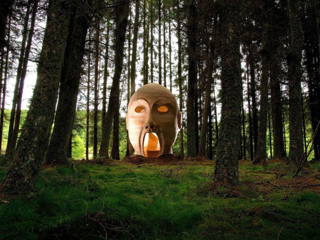
…the Kielder Forest Park is adjacent to the Northumberland National Park, a forestry plantation which started planting trees in the 1920s, and which also has creepy artwork going on there.
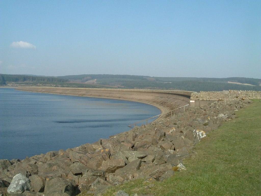
The Kielder Water is also located there, a reservoir containing the biggest man-made lake in northern Europe.
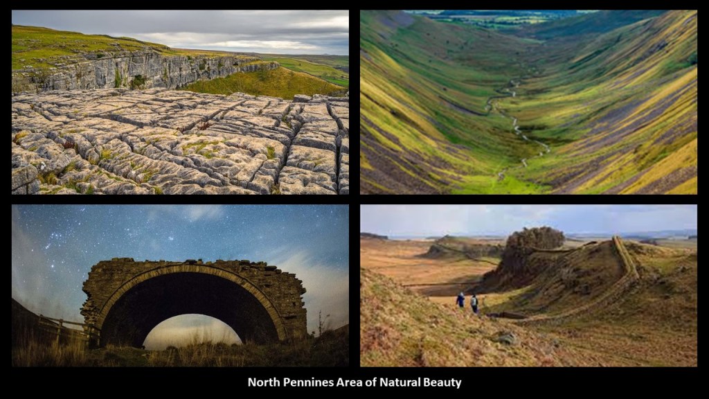
The North Pennines Area of Outstanding Natural Beauty (AONB) is adjacent to the Kielder Forest, and is the northernmost section of the Pennine Range which runs north-south through northern England.
Its landscape is described as open heather Moors between deep dales, upland rivers, and hay meadows.
The Yorkshire Dales National Park is adjacent to the North Pennines Area of Natural Beauty.
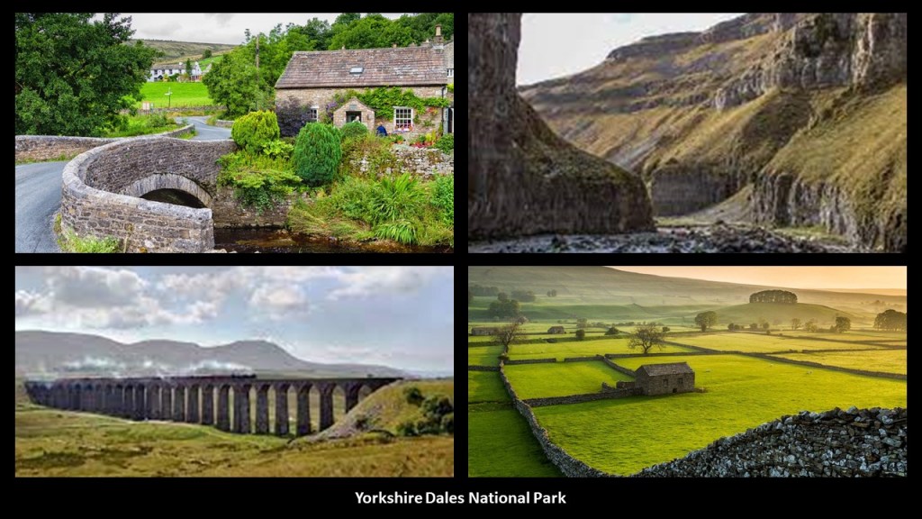
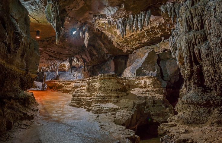
The extensive limestone cave system in the Yorkshire Dales National Park are a major area for caving in the UK.
The Nidderdale AONB is adjacent to the Yorkshire Dales National Park.
The area is said to contain over 6,000-years of human activity, with almost continuous human settlement over this time.
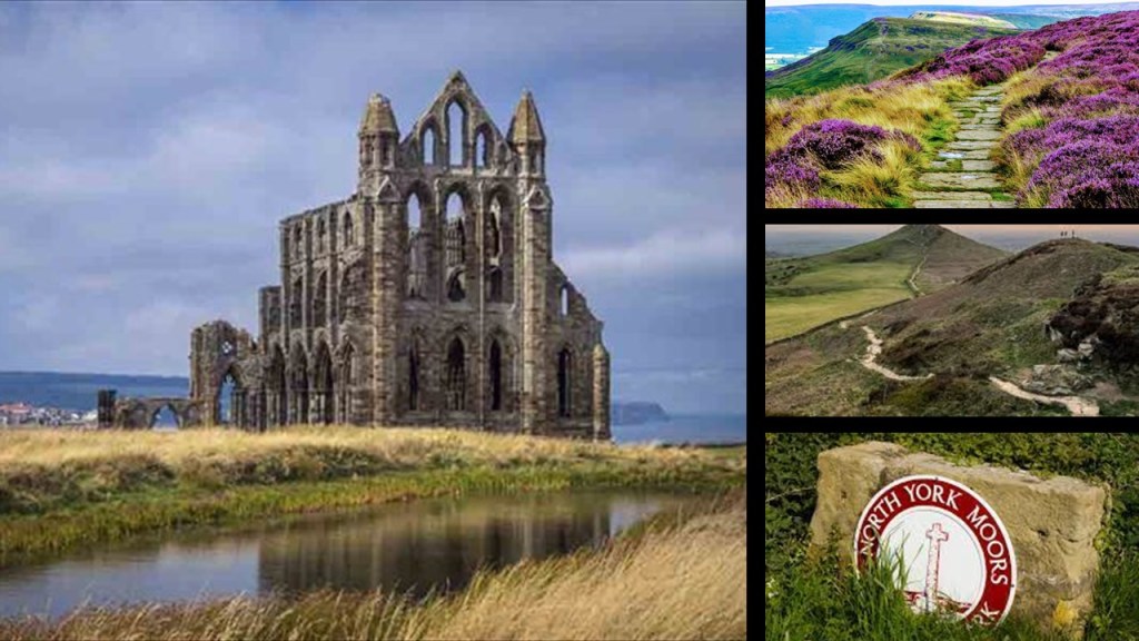
The last National Park surrounding the Newcastle-upon-Tyne area in northeast England is the North York Moors National Park.
It seemed important to bring these parks, and their relationship to the Newcastle-upon-Tyne area to your attention.
Now, over to the States.
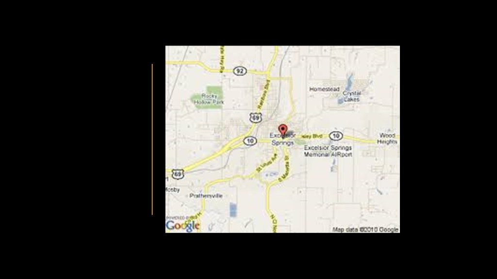
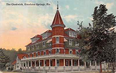
JS suggested that I look into Excelsior Springs in Missouri, located on the East Fork of the Fishing River.
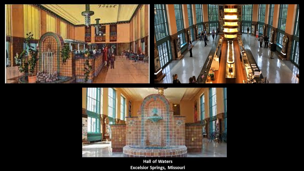
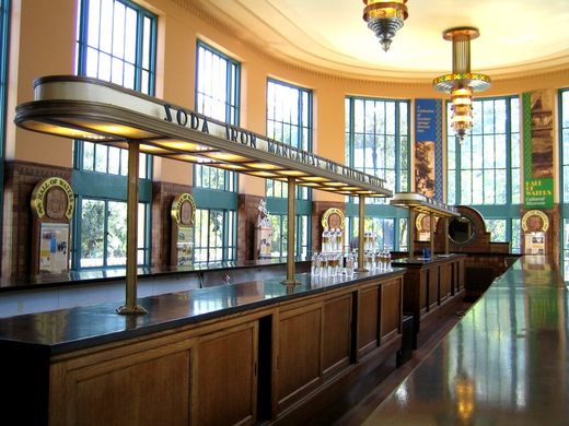
The City Hall of Excelsior Springs today used to be the called the “Hall of Waters.”
This building was said to have been built between 1936 and 1937 by the architectural firm of Keene & Simpson, which would have been in the years between the Great Depression and the beginning of World War II>
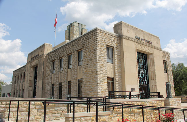
The Hall of Waters was significant as being on the location of one of the only natural supplies of irono-manganese mineral water in the U. S. that was discovered in 1880.
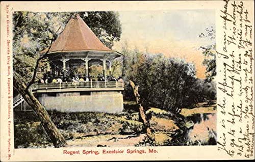
The Regent Spring was said to have been discovered in 1881, a second iron-manganese spring in the area.
Here’s what we are told about the Regent Spring.
The waters of the Regent Spring were one of four Spring waters bottled by the Excelsior Springs Bottling Company, and was considered to be the strongest iron-manganese spring=water in the world.
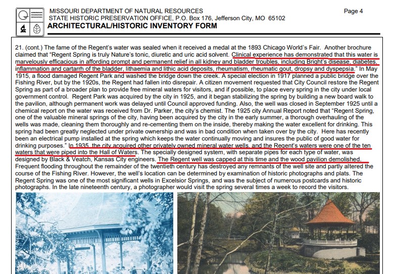
The healing properties of this water were substantial, including prompt and permanent relief of things like all kidney and bladder problems, including Bright’s Disease; Diabetes, inflammation; rheumatism; and dyspepsia.
Long story short, by 1935, the well at the spring had been capped after having been piped, along with that of nine other private wells, into the Hall of Waters, and the wooden pavilion at the Regent Spring was demolished.
Altogether, four different types of mineral water were found in downtown Excelsior Springs, with more varieties than anywhere on Earth.
From the discovery the springs starting in 1881, Excelsior Springs was said to have quickly become the largest health resort in the state, with the town having electricity, a good sewer system and fine hotels.
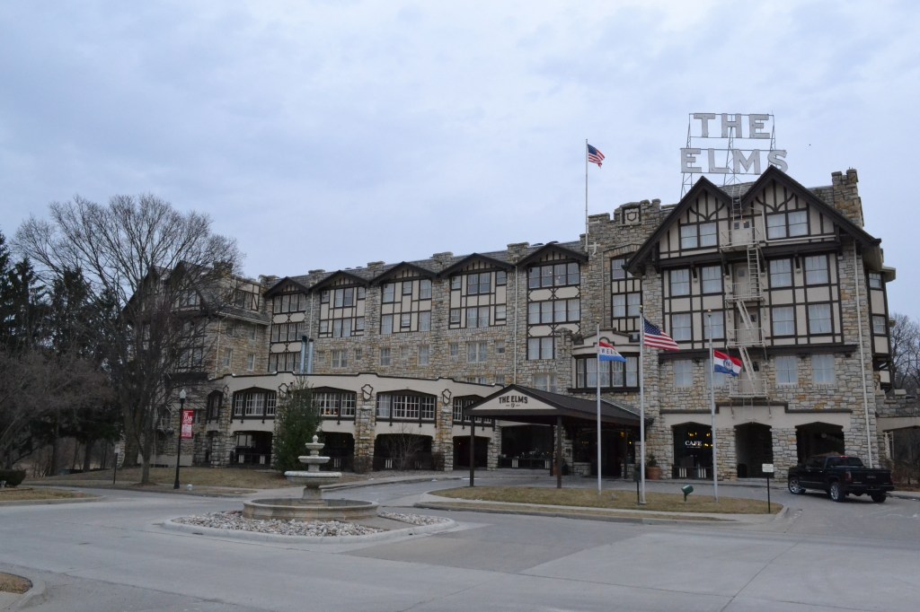
The Elm Hotel illustrated in this post card was said to have opened in 1912…
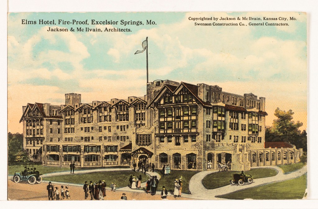
…is still in operation as The Elms Hotel and Spa today.
Other fine lodging places in Excelsior Springs, like the Hotel Castle Rock…
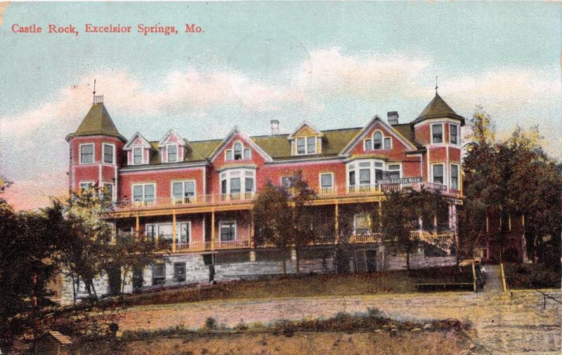
…and the Chadwick Hotel are long gone.
RW suggested that I look at Mount Inge in Texas, saying that it seems a strange hillock in the middle of a flat plain…almost like it doesn’t belong or is concealing something.
Mount Inge is described as a volcanic plug of Uvalde phonolite basalt.
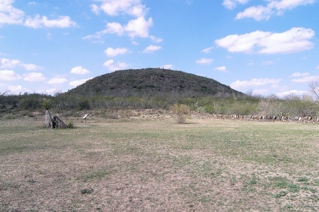
Some very interesting things popped up immediately around Mount Inge.
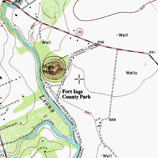
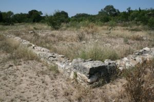
Mount Inge is a land feature found at the Fort Inge Uvalde County Park in Texas.
Fort Inge was said to have been first established as a base for U. S. Army troops in March of 1849 to protect the mail route from Indian Raids on the San Antonio – El Paso Road.
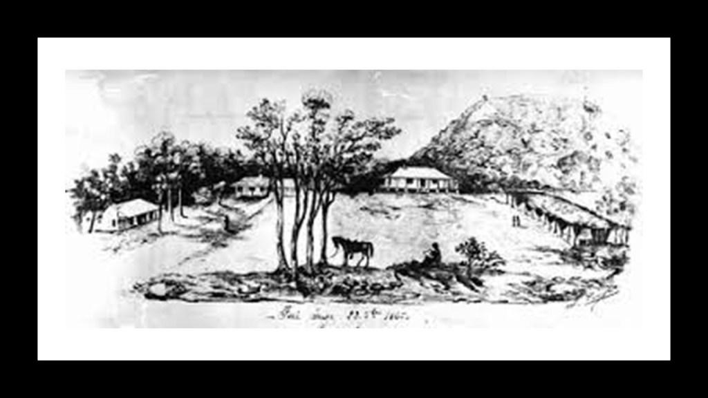
The foundation is all that remains of a limestone building that was said to have been the fort’s hospital.
Fort Inge was closed as a military garrison in March of 1869.
The location opened as a County Park in 1961.
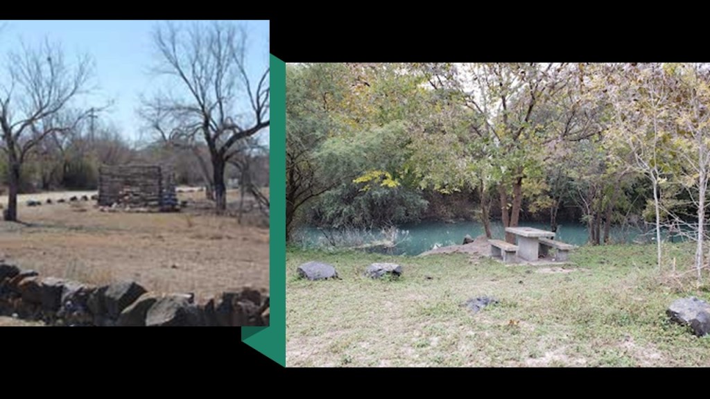
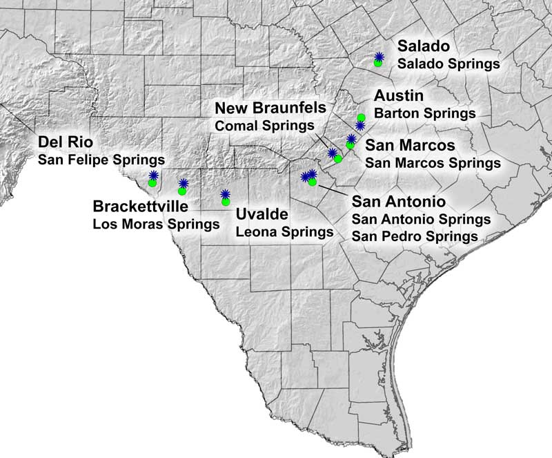
Four groups of springs are found along the Leona River in a 9-mile, or 14.5-kilometer, -long stretch south of the city of Uvalde, known collectively as Leona Springs.
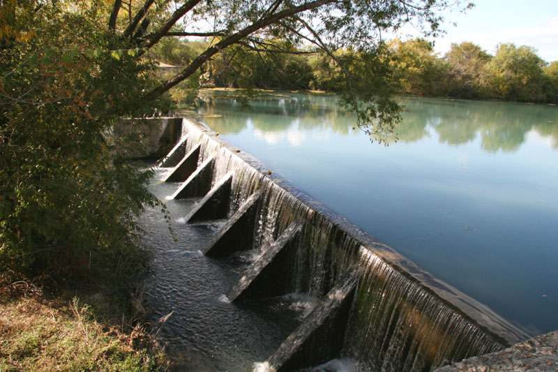
At one time, found at higher elevations, now they are nearly all beneath the surface of the Leona River.
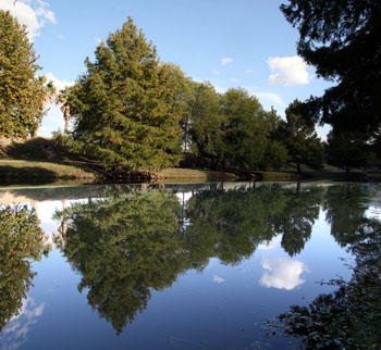
One group of the Leona Springs is located in the Fort Inge Uvalde County Park, where there is what is described as an old irrigation reservoir, a popular spot for fishing and picnicking.
The city of Uvalde is located in the Texas Hill Country, 80-miles, or 130-kilometers, west of downtown San Antonio, and 54-miles, or 87-kilometers, east of the Mexican border.
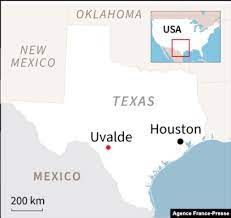
Uvalde is the county seat, and was originally founded in 1853 as the town of Encina, but renamed after the county was organized in 1856 after a former Spanish governor of the region.
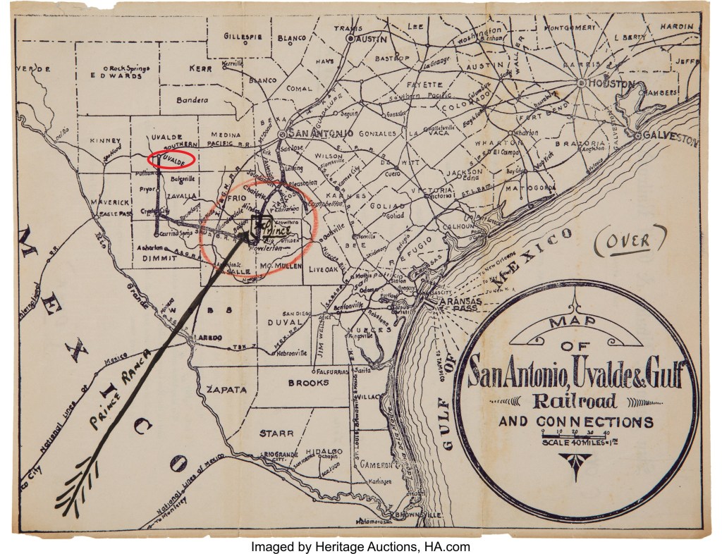
Uvalde was a stop on the San Antonio, Uvalde and Gulf Railroad, which operated from 1909 to 1956, when the railroad merged into the Missouri Pacific Railroad in 1956.
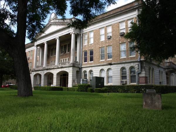
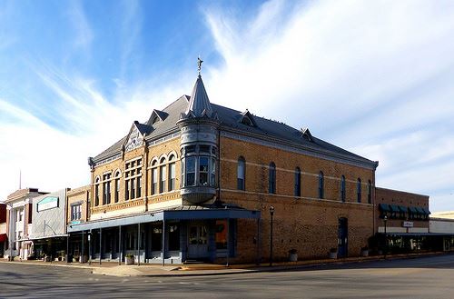
The Grand Opera House in Uvalde, known as the Janey Slaughter Briscoe Grand Opera House.
The oldest functioning theater in the State of Texas, it was said to have been built in 1891, and one of Southwest Texas’ premier locations for plays, musicals, and cultural performances.
Next, SS asked me to look at Williams Lake in British Columbia.
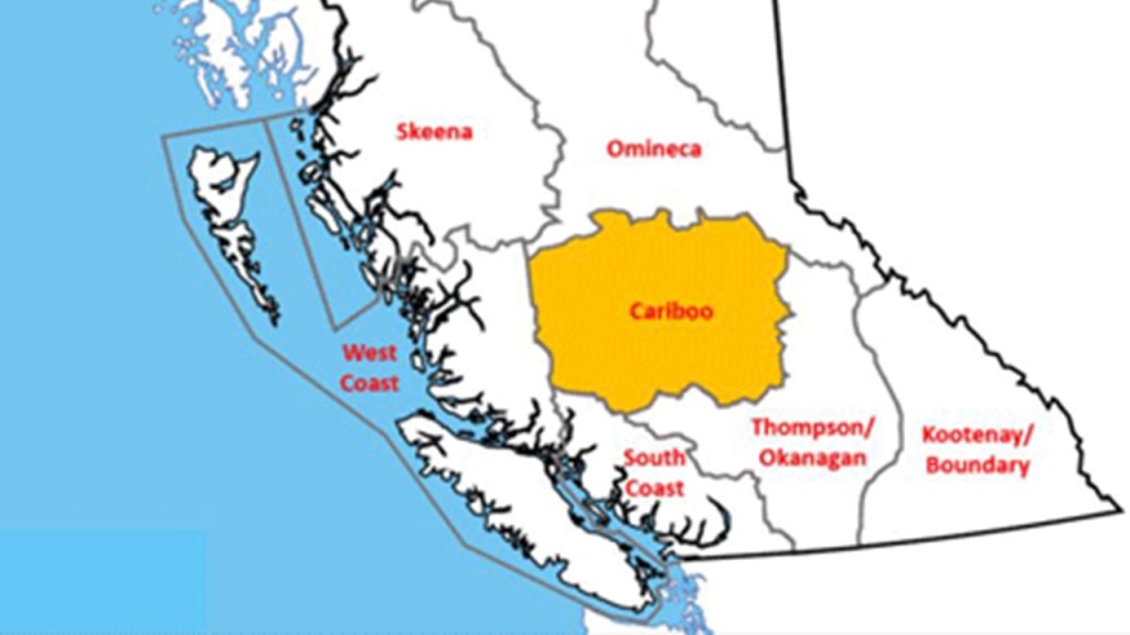
Williams Lake is the second-largest city in what is known as the “Cariboo,” after the city of Quesnel.
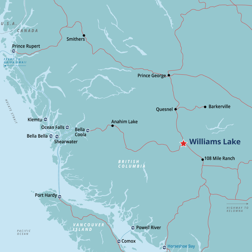
The “Cariboo” region is in the Central Interior of British Columbia, and named after the caribou that were once abundant in the reigon.
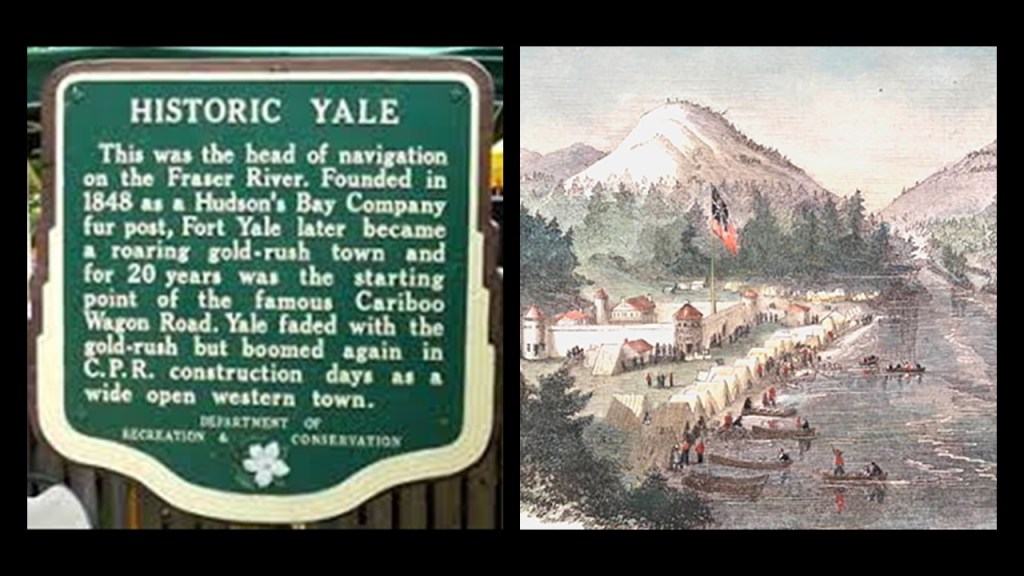
While the story of Williams Lake is said to have begun thousands of years ago by the First Nations people here, the outside settlement of the area started in 1860 with the Cariboo Gold Rush.
The Cariboo Gold Rush started in 1858, when gold was discovered at Hills Bar.
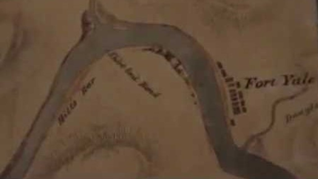
Hills Bar was adjacent to Fort Yale on the Fraser River, founded in 1848 by the Hudson’s Bay Company, and today is the inhabited town of Yale.
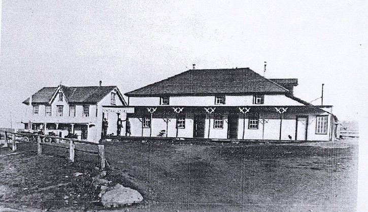
At the time Williams Lake was being settled and organized, there were two pack trails leading to the gold mines that met in Williams Lake, which became the center of local government.
In addition to the courthouse and jail, a road house was established for the huge pack trains and freight wagon convoys that serviced the mining operations.
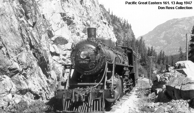
After the Cariboo Gold Rush days, Williams Lake was said to have been re-born in 1919 with the construction of the Pacific Great Eastern Railway.
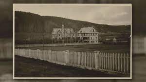
The Roman Catholic Church established the St. Joseph’s Mission half-way between Williams Lake and the Roadhouse in July of 1867, and in 1891 it opened as the St. Joseph’s School, and Indian Residential School.
Over the 90-years it operated, St. Joseph’s became one of the most notorious of the Indian Residential Schools in Canada.
In 2013, Orange Shirt Day was established as a memorial to the victims of the Canadian Residential School system that is observed nationally on September 30th every year.

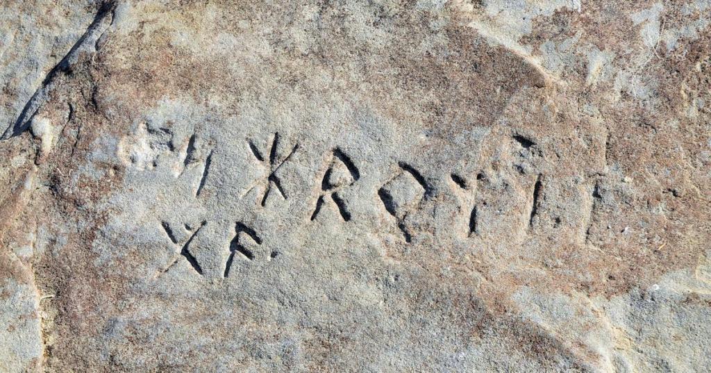
RS suggested that I check out the Wickford stone in Rhode Island.
Originally known as the Narragansett Runestone, it is inscribed with two rows of rune symbols.
Here is what we are told.
The Runestone was originally in Narragansett Bay, but in 2012, the 2 1/2 ton runestone was stolen.
In April of 2013, the State Attorney General announced that the runestone was recovered after someone came forward with information, and it was taken to the University of Rhode Island School of Oceanography for testing, which never took place for fear of damaging the stone.
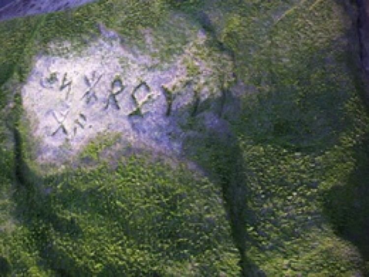
In October of 2015, the runestone was moved to Wickford for long-term public viewing.
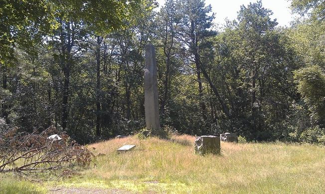
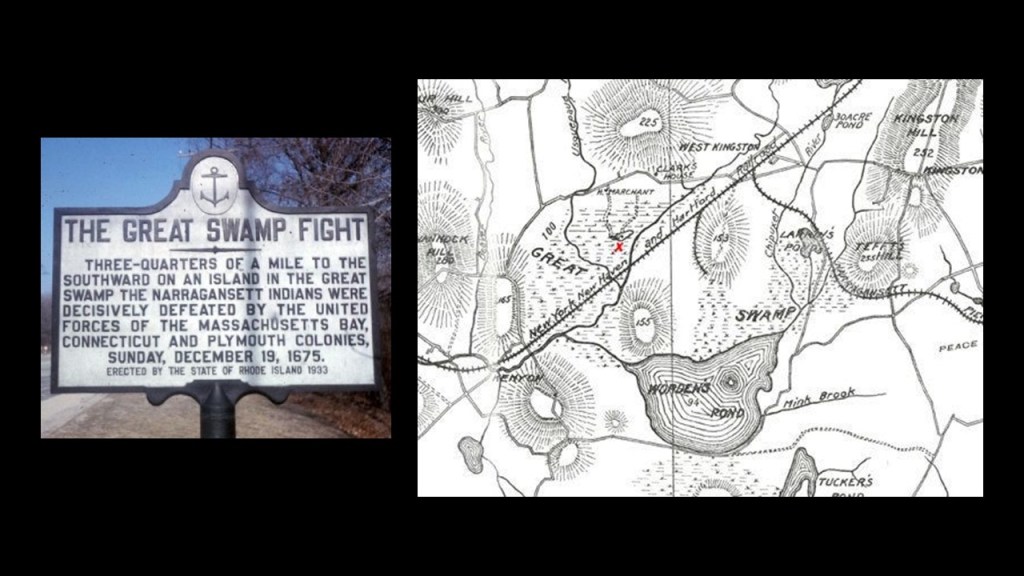
R. S. also mentioned the Great Swamp Obelisk in West Kingston Rhode Island, saying it is a huge granite obelisk in the middle of nowhere in the woods.
Called the Great Swamp Fight Monument, it is said to be a memorial to a battle that took place during King Phillip’s War in the winter of 1675 between early English settlers and the Wampanoag people of the region.
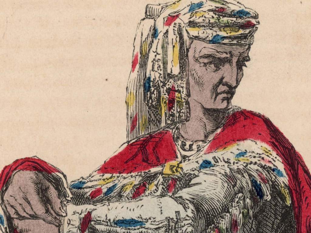
Metacomet, also known as Philip, the sachem, or ruler of the Wampanoag, with growing tensions between the settlers and the people native to the region, was angered with the violation by the English of treaties and agreements, and built a coalition of various native tribes in what became New England.
The Narragansett tribe was seeking to remain neutral, and while the sachem Conanchet pledged to remain neutral on one-hand, did not respond to demands to turn-over any of the Wampanoag people sheltering in the Great Swamp, including non-combatants.
This was used as a justification by the Puritan Forces of the Confederancy of New England to strike a fort of the neutral Narragansett in the middle of the swamp.
Ultimately on December 19th of 1675, colonial forces marched from Smith’s Castle in Kingston…
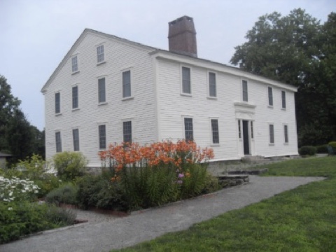
… and attacked the over 1,000 Narragansett at the fort in the Great Swamp, and were crushed in that one-day by the United Forces of the Massachusetts, Connecticut and Plymouth colonies.
ERT asked me to look at Paterson, New Jersey, where she saw what looked to be a city-wide system of castle walls, moats and obelisk structures that look like chimneys.
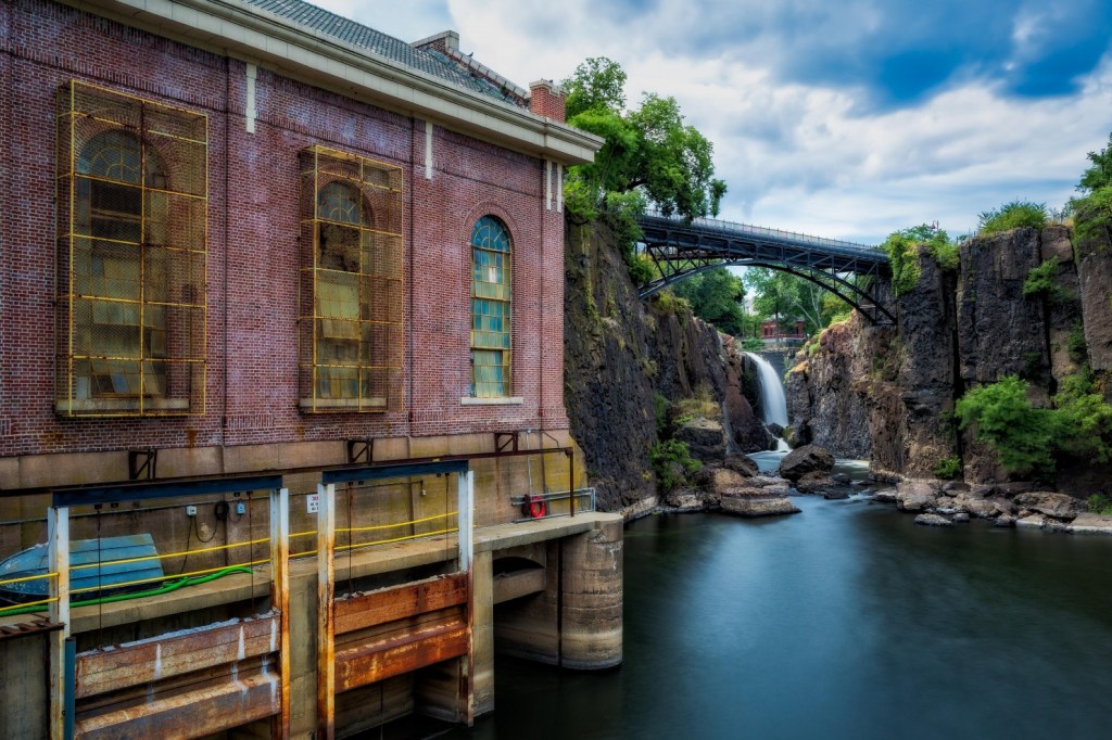
In 1791, the first Secretary of the Treasury, Alexander Hamilton, helped found the “Society for Establishing Useful Manufactures,” which was said to have been established to harness the Great Falls of the Passaic River in order to secure American independence from British Manufacturers.
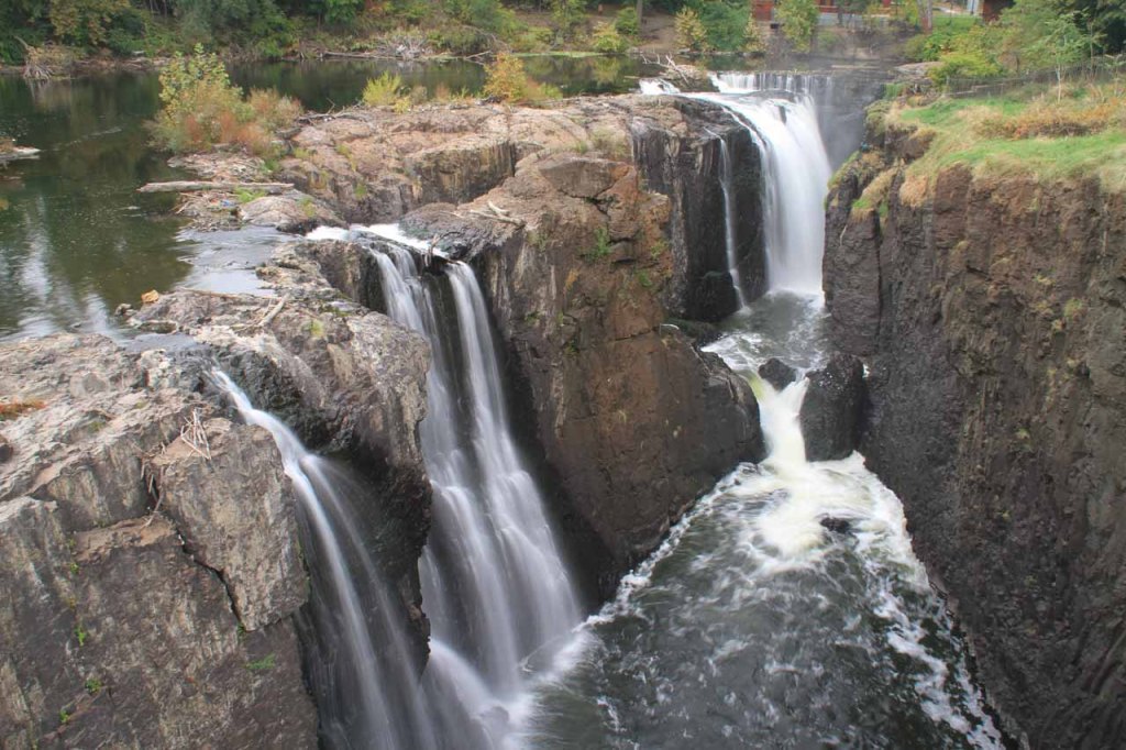
The Society in turn founded Paterson in 1791, the cradle of the Industrial Revolution in America.
The 77-foot, or 24-meter, -high falls and a system of water raceways that harnessed the falls power for the mills in the area until 1914.
There were dozens of mill buildings and other factories associated with textiles, firearms, silk, and the manufacture of railroad locomotives.
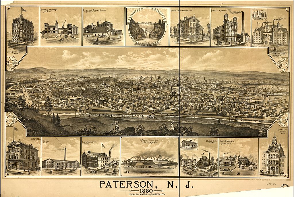
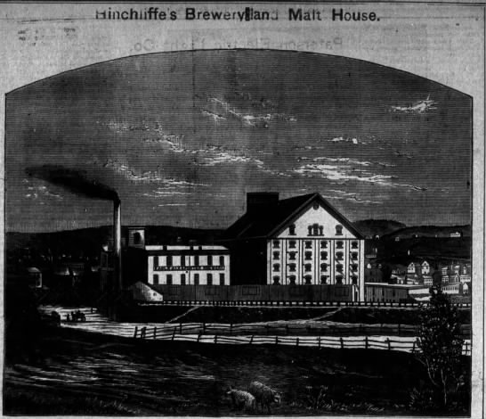
There were numerous breweries in Paterson, including the Hinchliffe Brewing and Malting Company.
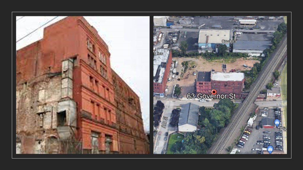
Founded in 1861, this brewery produced 75,000 barrels of beer per year until it was closed in 1920 due to Prohibition.
This is all that remains of the Hinchliffe Brewery, what was once described as a “state-of-the-art” facility at 63 Governor Street, right next to the railroad tracks.
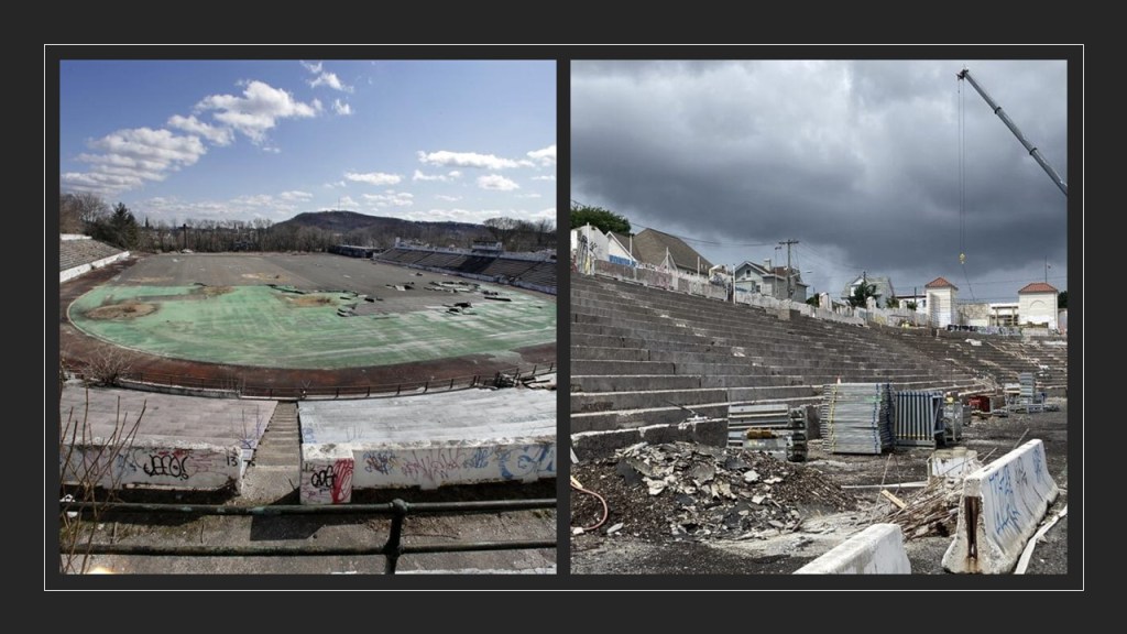
The Hinchliffe Stadium sits above the Great Falls of the Passaic River.
It is a 10,000-seat stadium said to have been built between 1931 and 1932, and used as a sports and auto-racing venue.
Left derelict for many years, the Hinchliffe Stadium has a $94-million restoration project currently underway.
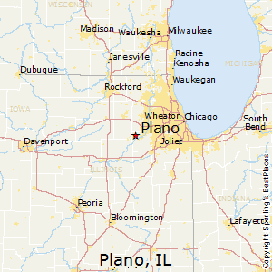
Next, SC requested that I look into his hometown of Plano, lllinois, located in Kendall County, near Chicago.
The foundation of the city’s development was said to start with the production of the “Marsh Harvester” in the early 1860s.
The Marsh Harvester was a reaper and a hand-binder on which two men rode and bound sheaves by hand.
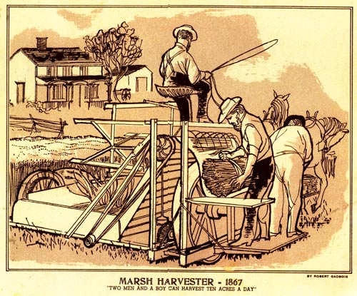
The “Marsh Harvester” led to the establishment of the Plano Manufacturing Company in 1863.
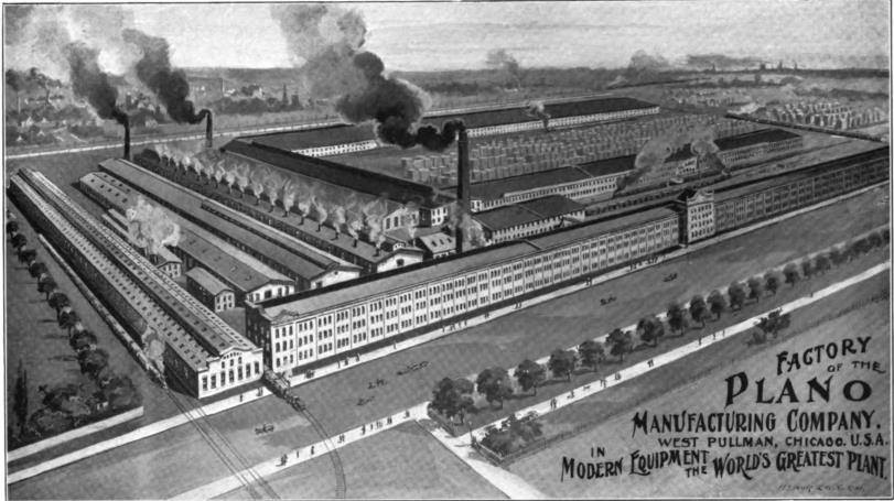
The Plano Manufacturing Company was one of five companies that were combined as part of a merger arranged in 1902 by J. P. Morgan to form the International Harvester Company.
The four other companies were the McCormick Harvesting Machine Company, the Deering Harvesting Company, the Champion Line, and the Milwaukee Harvester Company.

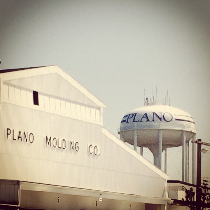
The Plano Molding Company is headquartered in Plano, and manufactures fishing tackle boxes, plastic containers, storage units, and “caboodle” cosmetic cases.
An agricultural city, Plano is situated along a major trade route and rail artery.
The Plano Hotel is one of the oldest buildings in Plano, and was said to have been built in 1868 in the Italianate architectural style in the downtown commercial district at the corner of Main and West Streets.
I found a reference saying the historic building sat vacant for many years and was purchased in 2018 for renovation into either luxury apartments or office space.
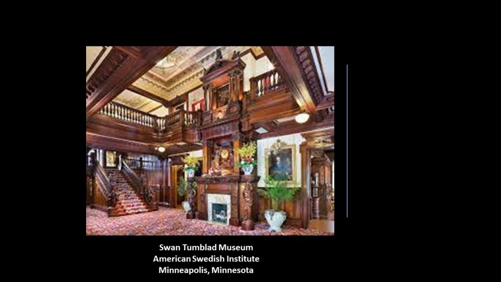
Now I am going to take a look at the American Swedish Institute in Minneapolis, Minnesota, at the request of MJW.
The American Swedish Institute is a museum and cultural center, dedicated to the historic role that Sweden and Swedish-Americans have played in American History.
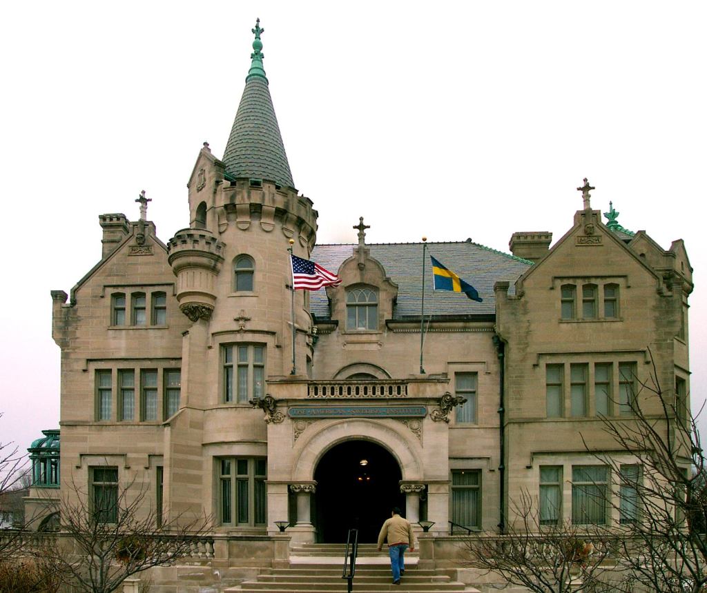
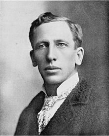
It is housed in what is described as a turn-of-the-century mansion that was built for Swedish immigrants Swan and Christina Tumblad.
Swan Tumblad immigrated with his family to southern Minnesota in 1868, at the age of 8.
His parents were farmers, and in a rags-to-riches story, Swan left the family farm for Minneapolis in 1879, and entered the newspaper business as a type-setter for several Swedish-language newspapers.
He eventually became the publisher and sole owner of one them, and from which he became wealthy.
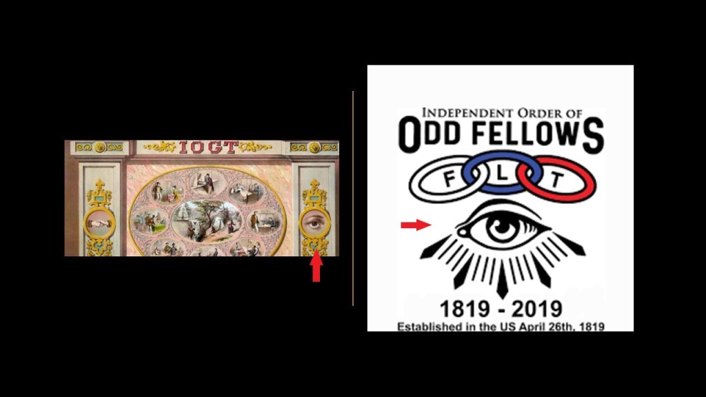
Swan met his wife Christina Nilsson, also an immigrant from Sweden, at an International Organization of Good Templars meeting, a fraternal organization that was part of the Temperance Movement promoting the avoidance from alcohol & drugs.
Notice the shared symbolism that the International Organization of Good Templars has with the Independent Order of Odd Fellows.
We are told that Swan Tumblad commissioned the building of a 33-room mansion for himself and his family in 1903, spending $1.5-million in the process.
Supposedly, the family moved into the mansion in 1908 until 1915, when they spent most of their time living in an apartment across the street.
Then after Swan’s wife died in `1929, he and his daughter moved into the apartment full-time and turned the mansion into a museum.
Hmmm. Nothing strange about that, now is there?!
The last place I am going to look at in this installment is the viewer suggestion of the Stonewall Jackson Training School, saying that it was a house of horrors where A LOT of orphans ended up.
The Stonewall Jackson Training School was in Concord, North Carolina.
Concord is just northeast of Charlotte, and is a place where distant cousins of mine live.

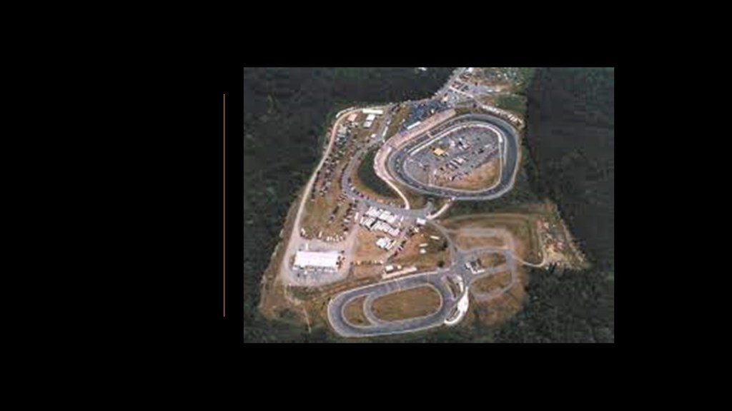
I can remember hearing the very noisy Concord Motor Speedway near my great Aunt Eileen’s house when my parents would visit there when I was growing up.
The Concord Motor Speedway was closed in 2019, and had the world’s fastest half-mile tri-oval.
The Stonewall Jackson Training Center was established in 1907 and opened in 1909 as the state’s first Juvenile Detention Center.
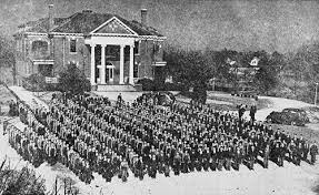
Of the original 800-acre campus, five-buildings on 58-acres are still in use today as a “Youth Development Center” and a “Juvenile Detention Center.”
The Stonewall Jackson Training School Historic District is listed on the National Register of Historic Places, and the designation includes 50-buildings and 71-acres.
Interesting to note that these historic buildings are in a derelict state.
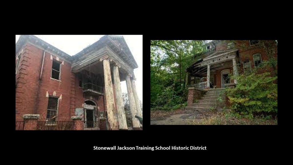
The school was said to have been established to provide a place for troubled white youths separate from the adult prison population, and were generally incarcerated for minor scrapes with the law including school truancy.
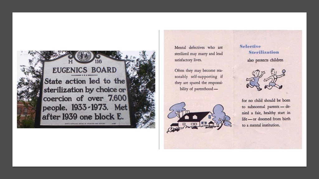
In 1948, the state established a eugenics program at the school, and for the given reason of limiting feeblemindedness and improve the population, it was the site of the sterilization of six teenage boys.
North Carolina was one of the last states to perform sterilizations on people under state care.
I am starting a brand-new series called “All Over the Place Via Your Suggestions,” where I will continue to research your suggestions, and follow all the many clues pointing to our hidden history that are all around us and hidden in plain sight

I am also continuing to work on my “Who is Represented in the National Statuary Hall” series, with my research on part six of the series close to completion.
I was motivated to look into the National Statuary Hall in part because of finding historical characters like Mother Joseph Pariseau, featured in this post in Vancouver, Washington, that struck me as odd that they would even be in there, and I consider it the gift that keeps on giving as far as hidden history is concerned.