This is volume 10 of a compilation of work I have previously done presented in a multi-volume format. in which I am highlighting places, concepts, and historical events that people have suggested to me.
First, I want to revisit some suggested places I talked about in “Interesting Comments & Suggestions I have Received from Viewers – Volume 5” because of a place in Turkey that came up in my feed that looked like two places I compared for similarity in Indiana and Australia.
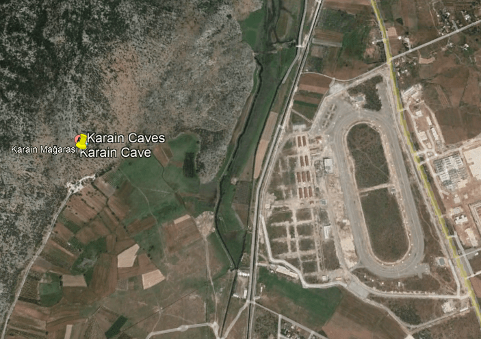
Karain is 19-miles, or 30 kilometers, away from Antalya Province in Turkey.
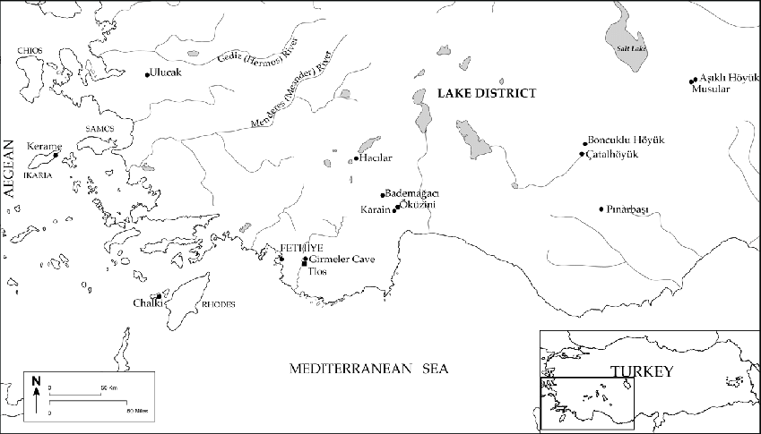
It is described as one of the largest natural caves in Turkey.

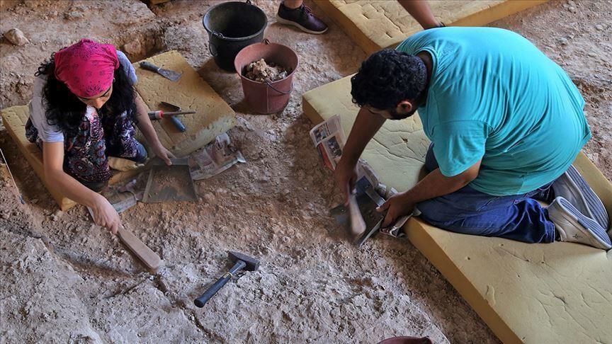
Archeological excavations have been carried out here since 1946.
Karain Cave is said to have been used as a settlement 500,000 years ago.
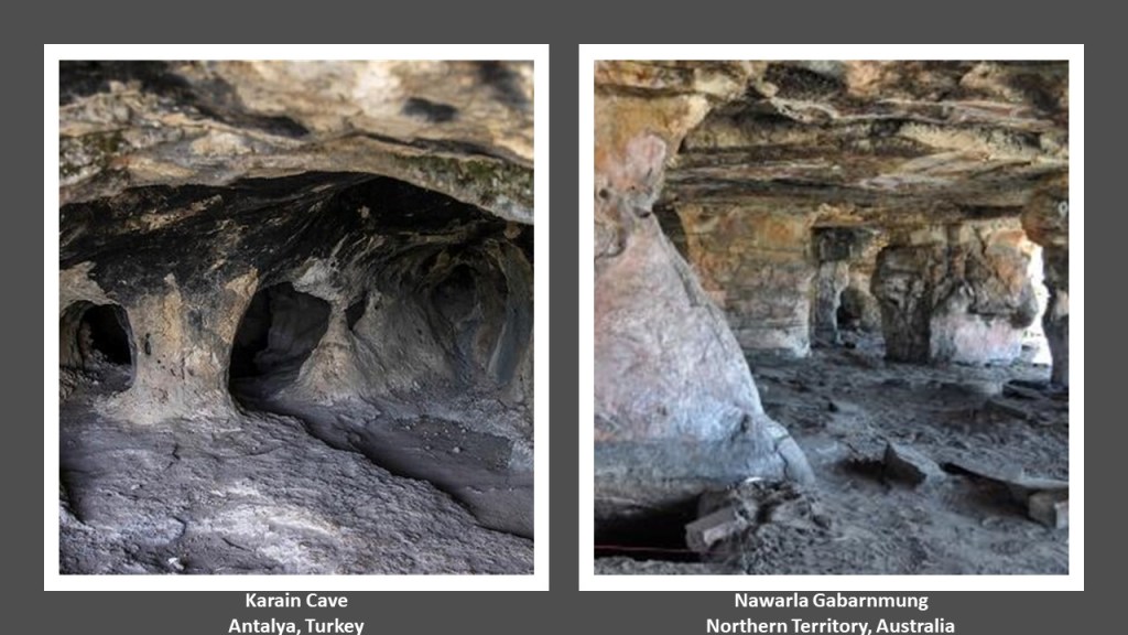
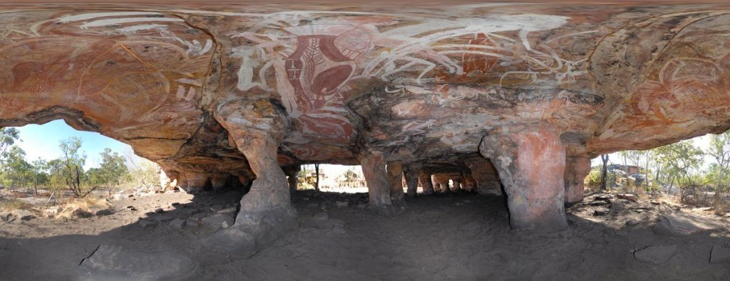
What really got my attention when I saw the information about Karain Cave come up on my feed is the similarity of its appearance inside to Nawarla Gabarnmung in Australia…
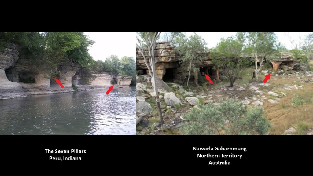
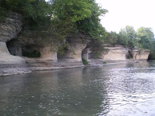
...and I had compared the similarity in appearance between Nawarla Gabarnmung to the Seven Pillars in Peru, Indiana, in Volume 5 of this series.
Nawarla Gabarnmung is believed to go back 44,000 years as far as human habitation goes, making it among the oldest radiocarbon dated sites in Australia.
It is described as a rock shelter made by tunneling into a naturally-eroded cliff face, with thirty-six pillars supporting the roof created by natural erosion of fissure lines in the bed rock.
The Seven Pillars in Peru, Indiana, are held sacred by the Miami Nation of Indiana, which owns land on the south bank of the river directly across from The Seven Pillars, where they hold sacred ceremonies and heritage days.

The Seven Pillars are described as having been created over the centuries as wind and water eroded the limestone, carving the rounded buttresses and alcoves.
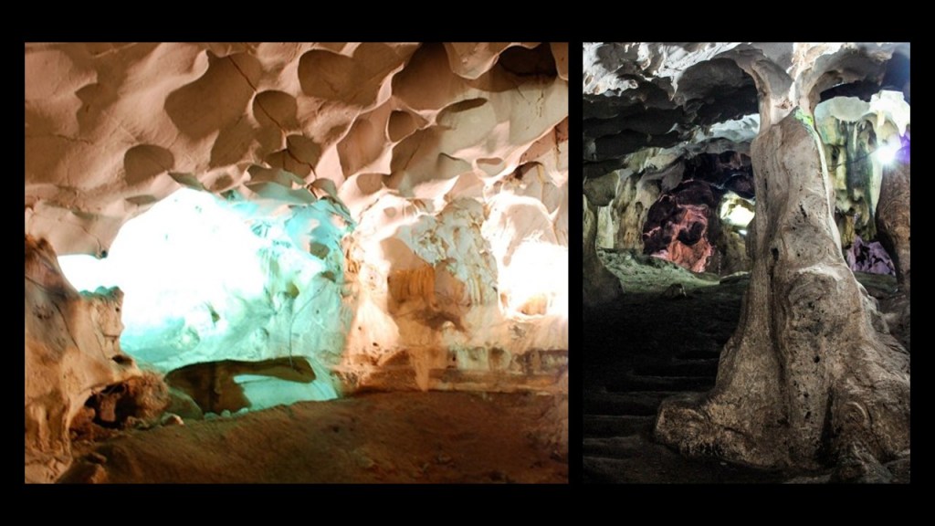
In Turkey, the Karain Cave, also known as the “Black Cave,” is located on the the east slope of Mount Katran in the Western Taurus Mountains.
It is described as a complex of limestone caves consisting of three main chambers, separated by calcite walls and narrow and curving passageways, which includes rock-cut steps.
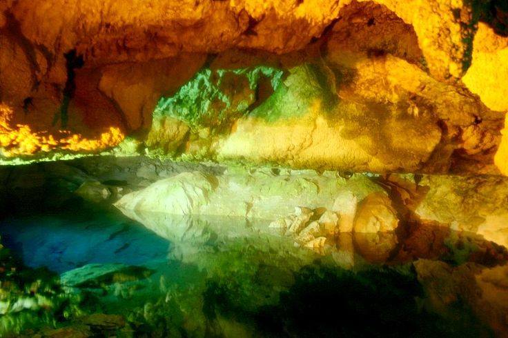
There are also springs at the Karain Cave Complex, described as fine water springs where the travertine plain meets the mountains.
Travertine is type of limestone.
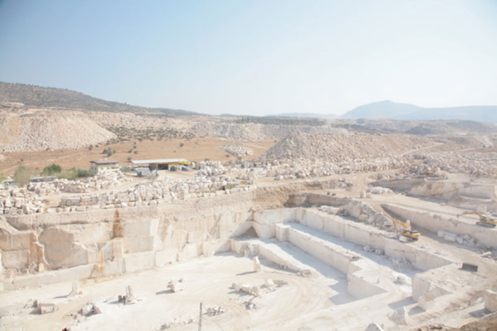
The Travertine terraces in Pamukkale in southwestern Turkey are called one of the most spectacular natural heritage sites in the world, and we are told made from the sedimentary rock deposited by mineral water from the 17 hot springs in the area.

Back at the Karain Cave complex, human habitation is believed to go back 150,000 to 200,000 years, to the Paleolithic Age, from the finding of part of a neanderthal cranium there…

…and a documented continuous human presence for 25,000-years, from the Mesolithic Age dated from 10,000 BC to 8,000 BC, to the Bronze Age, which is considered to have lasted from 3,300 BC to 1,200 BC.
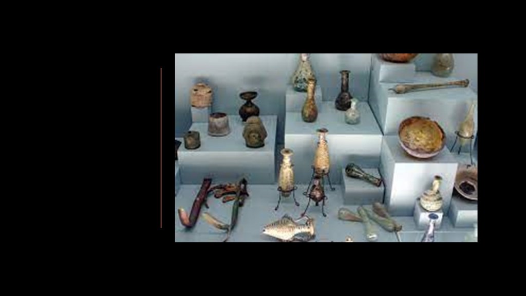
The Greek inscriptions carved at the entrance to the cave complex are attributed to the Greek colonization of Asia Minor during the Iron Age, between 1200 B.C. and 600 B.C.

Other archeological sites found in the neighborhood of the Karain cave complex in Antalya include:
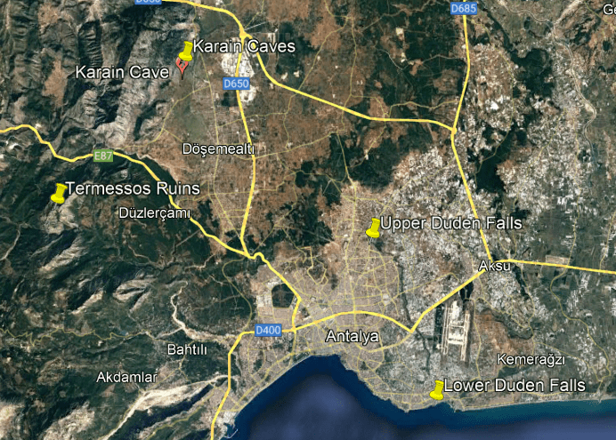
The Upper and Lower Duden Waterfalls.

Interesting to note the Antalya Airport is located between the Upper and Lower Falls…
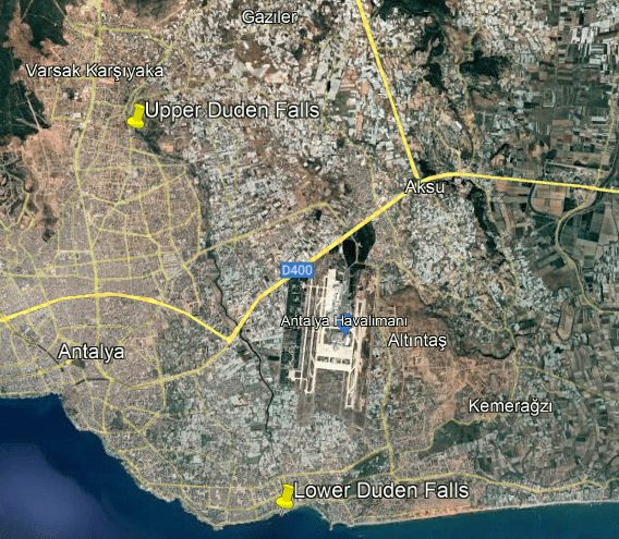
…and that the Karain Cave Complex is right next to an elliptical track.
Personally, I think these were all components of an ancient energy grid, but we have been conditioned to think of them all as either 1) naturally-made, or 2) recently-built infrastructure.
Termessos is also close-by, considered one of the best-preserved of the ancient cities of Turkey, described as a Pisidian city.
Pisidia was a region of Asian Minor that corresponds roughly to the modern-day province of Anatalya in southwest Turkey.

Termessos was said to have been built on a natural platform at a height of 5,463-feet, or 1,665-meters, in the Taurus Mountains, and which includes a megalithic stone amphitheater, what are described as tombs of the western necropolis cut right into the rock face of Mount Solymos…

…and a rock-carved relief of Alcetas, with a missing face, known to history as a general who had served in Alexander the Great’s army, who was recorded as dying in Termessos in 320 BC.
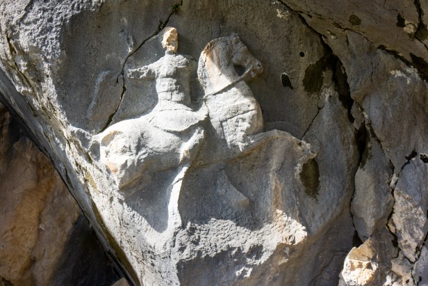
The faceless carving of the general is interesting to me because it brings to mind Petra in Jordan, which was attributed to the Nabateans, an ancient Arabian people.

Like Temessos, Petra is known for it’s rock-carved tombs, and temples, in this case carved right into pink sandstone cliffs.
Was the rock-carving civilization of Jordan actually the same as the rock-carving civilization in Turkey, and not actually separate and arising independently of each other?

…and which also has faceless statues.
They are on the front of what is called “The Treasury” in Petra, which was perhaps best-known as a filming location for the Holy Grail Temple at the end of “Indiana Jones and the Last Crusade.”
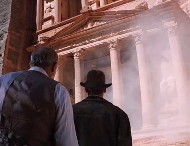
Is this natural wear-and-tear over the centuries…or intentional disfigurement because there was something there we weren’t supposed to know about?
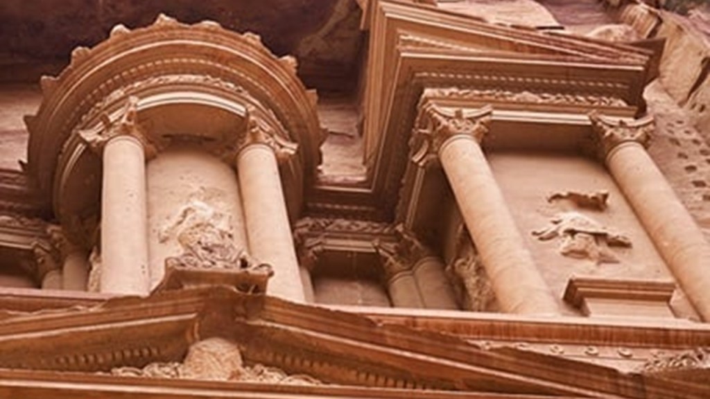
Like, perhaps, the Great Sphinx in Egypt with its missing nose?

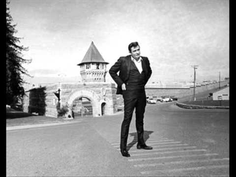
Next, EC in California did a quick map search of the prisons in California, and she found star fort foot-prints everywhere!
Like both prisons in Delano, the North Kern…
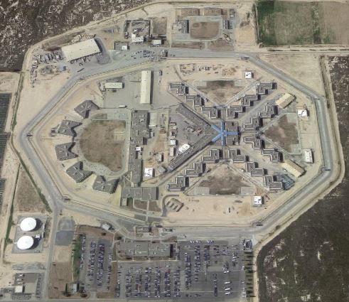
…and Kern Valley State Prisons…
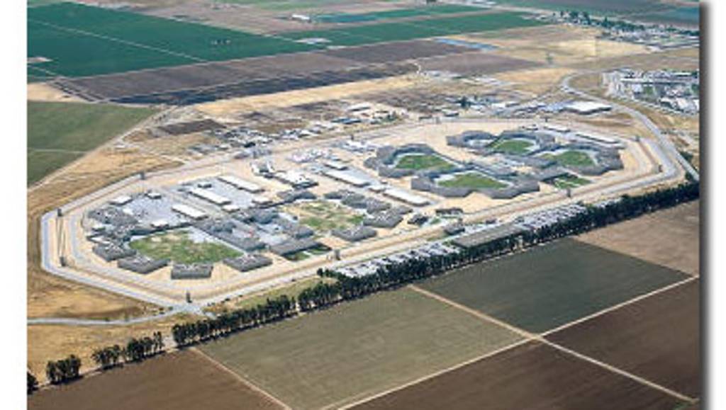
…the Avenal State Prison in Avenal California…
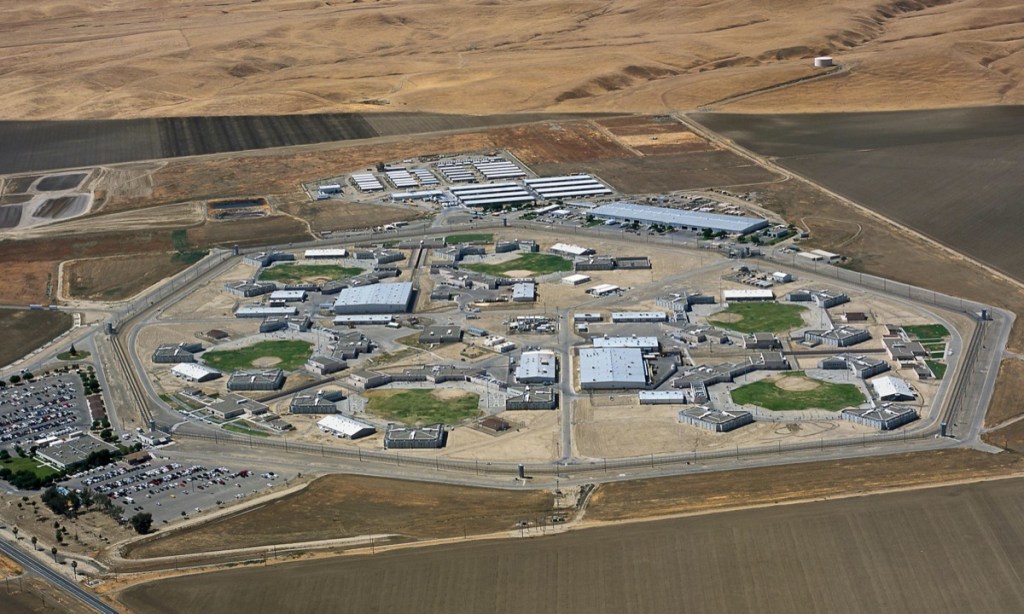
…at San Quentin, the oldest prison in the State, first opening in 1852…
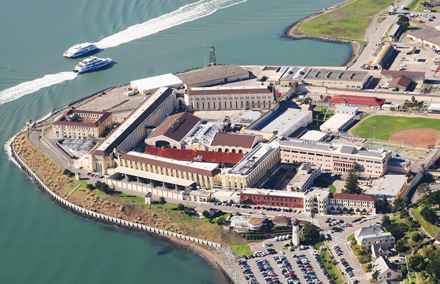
…the Folsom State Prison in Folsom, California, which opened in 1880, and is the second-oldest prison in the state after San Quentin…
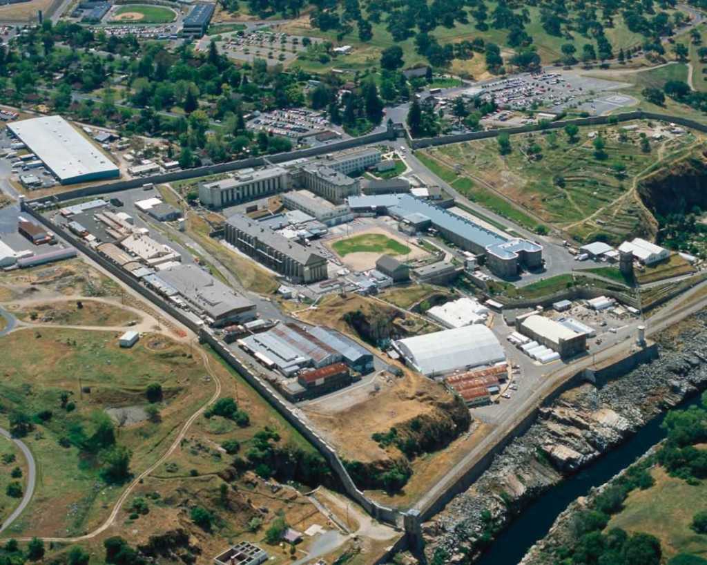
…and the prison Johnny Cash was referring to in his signature “Folsom Prison Blues” song from 1955 and from where he performed live in 1968…
…Pleasant Valley State Prison in Coalinga, California…
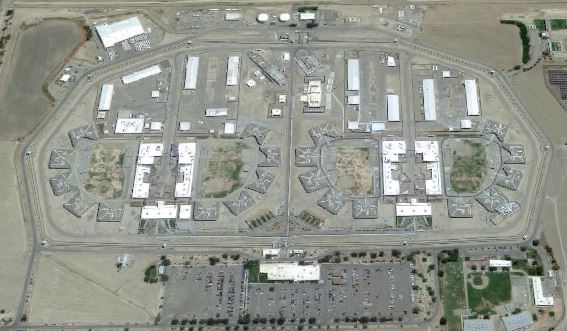
…Lancaster State Prison in Los Angeles County…
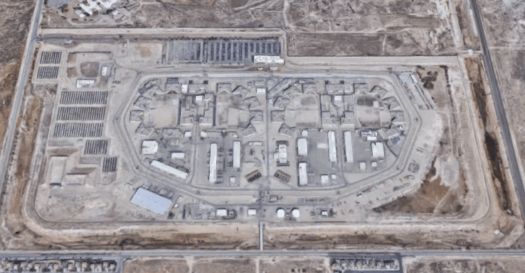
…Wasco State Prison in Wasco, California…
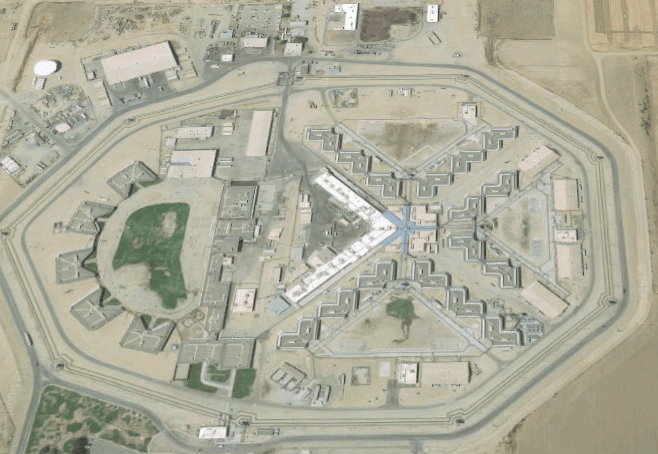
…Corcoran State Prison in Corcoran, California…
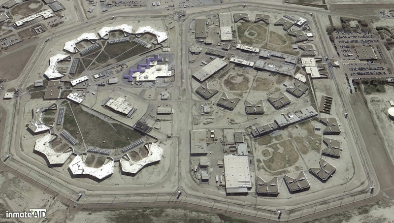
…Pelican Bay State Prison in Crescent City, California, the only supermax prison facility in the State of California, primarily for violent male criminals…
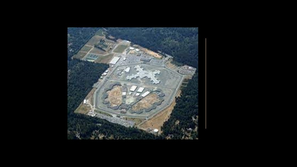
…and Salinas Valley State Prison, in Soledad, California.
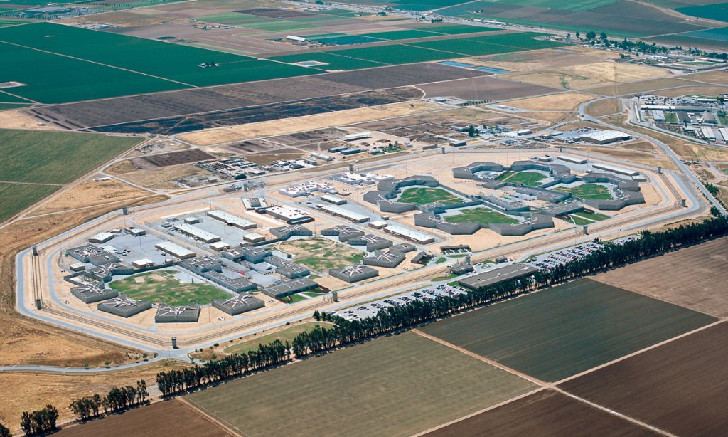
While I am in California, AD asked me to check out Paso Robles.
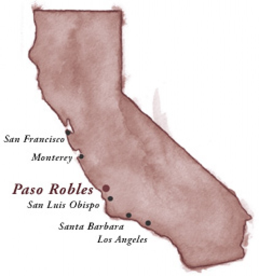
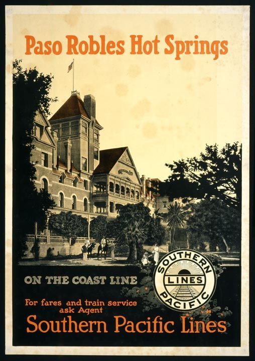
Paso Robles was historically known for its healing hot springs.
AD said there was a a massive bath house downtown where a city parking lot is today.
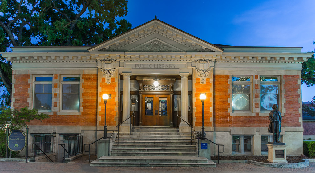
It would have been right next to where the Carnegie Library today, which is right across Spring Street from the Paso Robles Inn today.
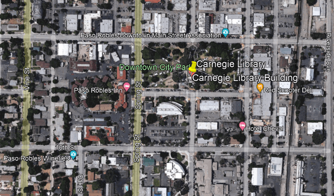
The Carnegie Library in Paso Robles was said to have been built between 1907 and 1908 from a $10,000 grant from the Carnegie Foundation.
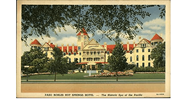
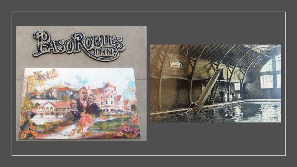
The original Paso Robles Inn featured a 7-acre garden; 9-hole golf course; library; beauty salon; barbershop; several billiard and lounging rooms; along with its famous spa, which attracted the luminaries of the day.
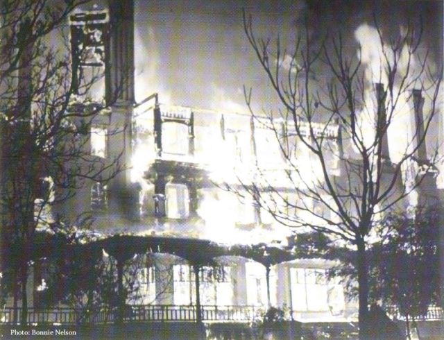
But, alas, tragedy struck this grand hotel in December of 1940.
A spectacular fire completely destroyed the “fire-proof” El Paso de Robles Hotel, though miraculously the guests staying the night escaped unharmed, with the exception of the night clerk, J. H. Emsley, who suffered a fatal heart attack after sounding the alarm!
This has been the Paso Robles Inn since 1942…
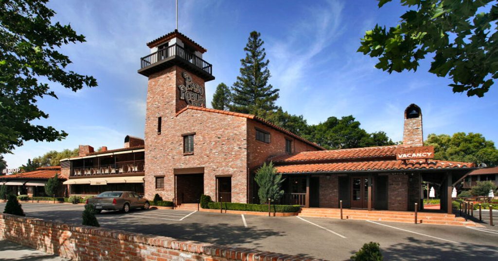
…which is also advertised as a haunted venue.

The Paso Robles Springs and mud baths were known at one time to be among the most healing on earth, from things like psoriasis and arthritis among other ailments.
This is a photo of the municipal mud bath in 1905…
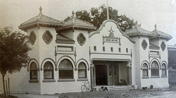
…and the candy store that is at the same location today, with no mud baths to be found!

AD said the San Simeon earthquake cracked open the hot springs underneath the parking lot next to the City Hall and library, and they started flowing again.

Then the cover-up began all over again!

Next, DB suggested I look at Battery Point, a suburb that is immediately south of the Central Business District in Hobart, the capital of Tasmania.
First, let me say that growing up in the United States, the first, and for many years, only, reference to Tasmania in my life was this guy on Looney Tunes cartoons on television – the Tasmanian Devil.

The Tasmanian Devil was a cartoon character based on the real life Tasmanian Devil, the world’s largest carnivorous marsupial and native to Tasmania.
The Tasmanian Devil has been classified as an endangered species since 2008.

Like kangaroos, mom carries her babies in a pouch.

Tasmania is an island state of Australia, located 150-miles, or 240-kilometers, to the south of the Australian mainland, separated from it by the Bass Strait.

This is what we are told about Tasmania.
Tasmania got its present name from the Dutch explorer Abel Tasman, who first sighted the island on November 24th of 1642, when he was exploring in the service of the Dutch East India Company.
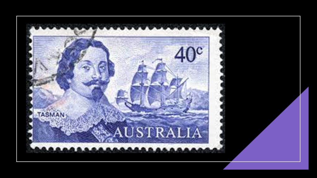
It’s European first name, however, became Van Diemen’s Land, when Tasman honored his patron Anthony van Diemen, the Governor-General of the Dutch East Indies at that time.
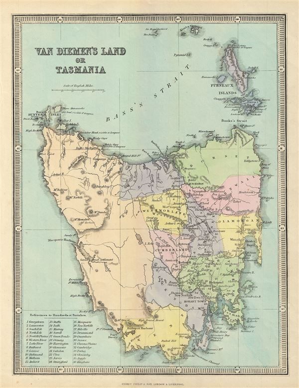
The island was inhabited by aborigines from at least 40,000 years prior to the arrival of Europeans, when they settled the island starting in 1803 as a penal settlement of the British Empire, allegedly to prevent claims to the land by the First French Empire during the Napoleonic Wars.

The aboriginal population of the island was almost completely wiped out within 30-years from the time of European settlement, during a period of conflict between the 1820s and 1832 known as the “Black War,” as well as the spread of infectious diseases.

These are typical of the kinds of paintings of the Australian Aborigines that have come down to us in our historical narrative.

Let’s see what we find in Hobart and Battery Point.
First, I have known for awhile that there was an International Exhibition held in Hobart, which took place in 1894.
It was said to have been built on 11-acres starting in 1893, for a cost not more than 10,000 pounds because that was all the money that was available, for the International Exhibition that was held there between 1894 and 1895, and that the builders of it never meant to last, having been built of hardwood…and plaster and concrete to make it look more elegant, and it is long gone!

The Hobart Cenotaph is located on the Queen’s Domain, a hilly-area northeast of the Central Business District.
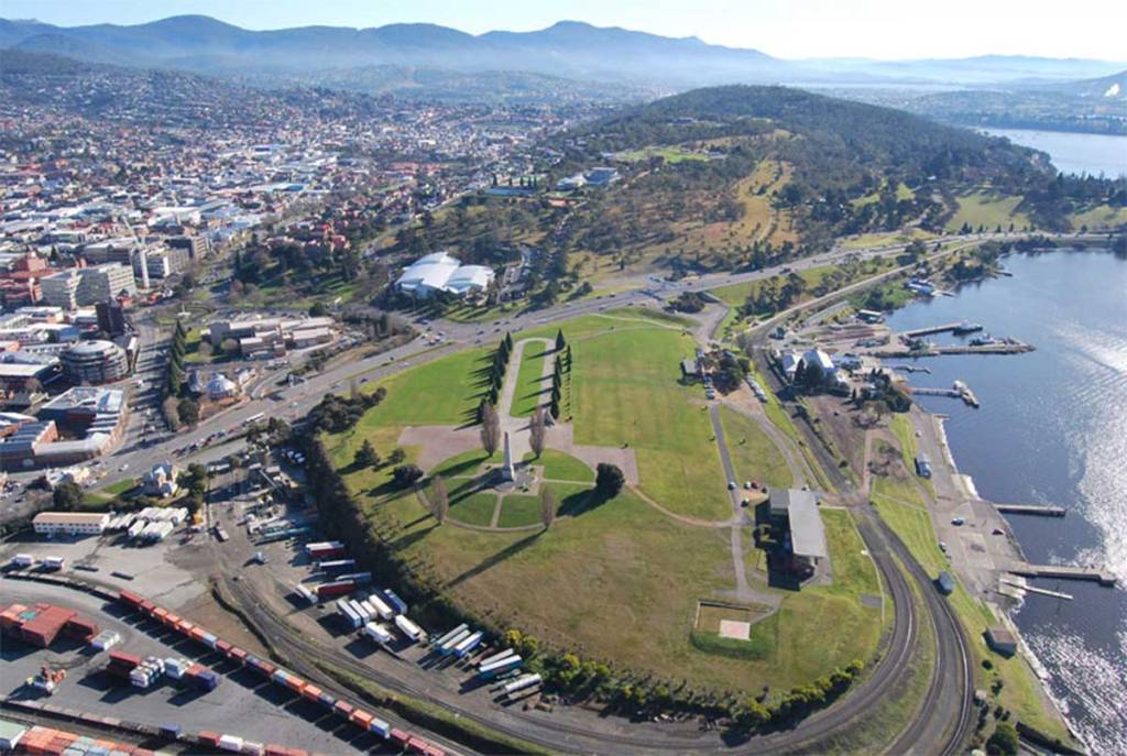
The Cenotaph is on what was at one time called the Queen’s Battery.
More on Hobart’s historical Batteries in just a moment.

The Hobart Cenotaph today is the main commemorative military monument for Tasmania, and is described as an Art Deco reinterpretation of a traditional Egyptian obelisk.
It was said to have been designed by Hobart architects Hutchison and Walker after the firm won a design competition for it in 1923.
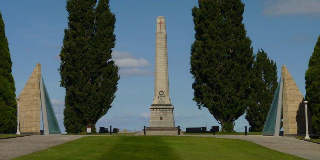
While we are told it was originally designed to memorialize Tasmanians who died during World War I, it was later modified to honor those who died in all military conflicts.

Here is a Google Earth Screenshot showing the location of the Hobart Cenotaph and Queen’s Domain, in relationship to other nearby places.
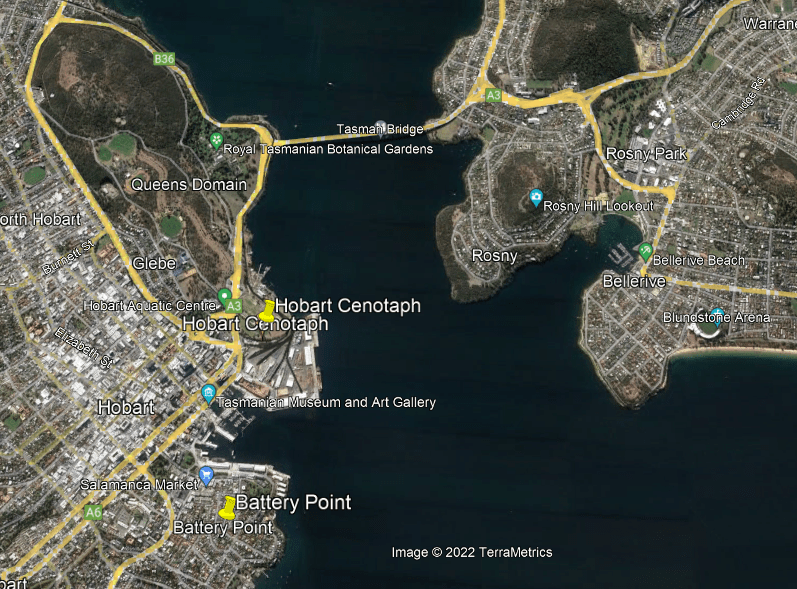
Battery Point is just across a small harbor from where the Hobart Cenotaph is located, and south of the Central Business District.

It was said to have been named after three batteries of guns established there in 1818 as part of the Hobart Coastal defenses.
These guns were subsequently decommissioned, we are told, after an 1878 review of Hobart’s defenses found its location would draw enemy fire on the surrounding residential neighborhood, so the location was turned over to the Hobart City Council for recreation and amusement.

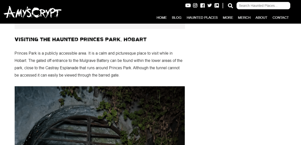
They were located in what is called “Prince’s Park” today, where there are a few above-ground remnants…
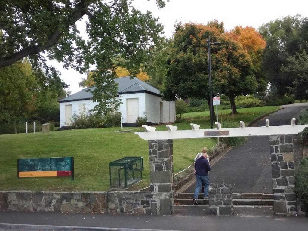
…but mostly underground.
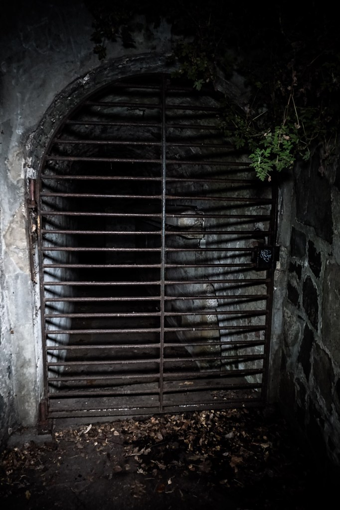
Like the Paso Robles Inn, also reputed to be haunted.
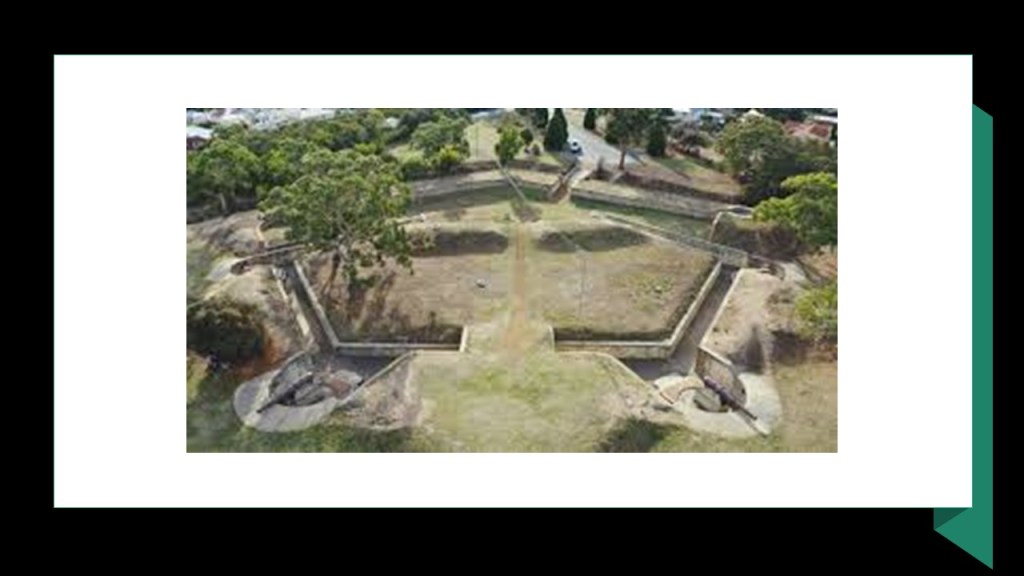
The Alexandra Battery, on a point of land further down from Battery Point and also said to have been built as part of the Hobart Coastal Defenses, still has much of its original structure intact, and is still accessible to visit by the public.

The Kangaroo Bluff Battery was directly across the Derwent River from Battery Point in Hobart.
The first railroad lines on the island were established starting in 1871.
I think these were pre-existing, and the dates we are given was when they became operational after being made serviceable.
Today, there is only freight railroad transport in Tasmania, with the main cargo being cement, and no passenger services in operation.
Why would this be the case?

Today, in much of Tasmania, including Hobart, you can only experience the old rail trails by biking or hiking.

The next place I am going to take a look at was suggested by AP, which is Queen Victoria Building in Sydney, Australia.
The Queen Victoria building is described as a 5-story, late 19th-century building in Sydney’s Central Business District, said to have been designed on the “Scale of a Cathedral” by the architect George McRae, and constructed between 1893 and 1898.

…with its over 20 domes…

…and cathedral-style windows.

During its history, it has had some different uses, but primarily as retail space, which it is today…

…though the Queen Victoria building has been threatened with demolition at various time over the years, starting as early as 1959.
Makes sense, right?
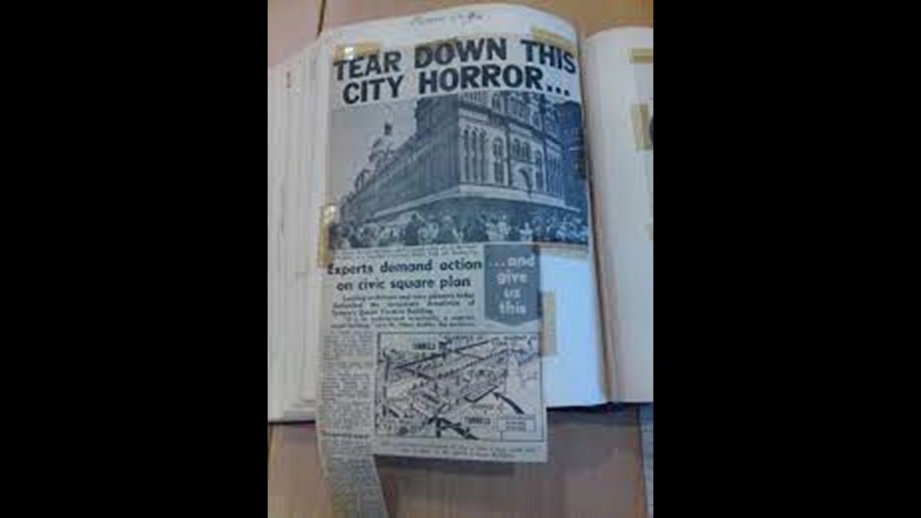
More like make it make sense!

FM suggested that I look at the St. Pancras Renaissance Hotel in London.
It is the front part of the St. Pancras Railway Station, which is a main terminal in London.
The architect credited with the design of the building, first known as the Midland Grand Hotel, was George Gilbert Scott, who won a design competition held for it, we are told, in 1865, and that it’s construction was completed by 1876, with four floors.
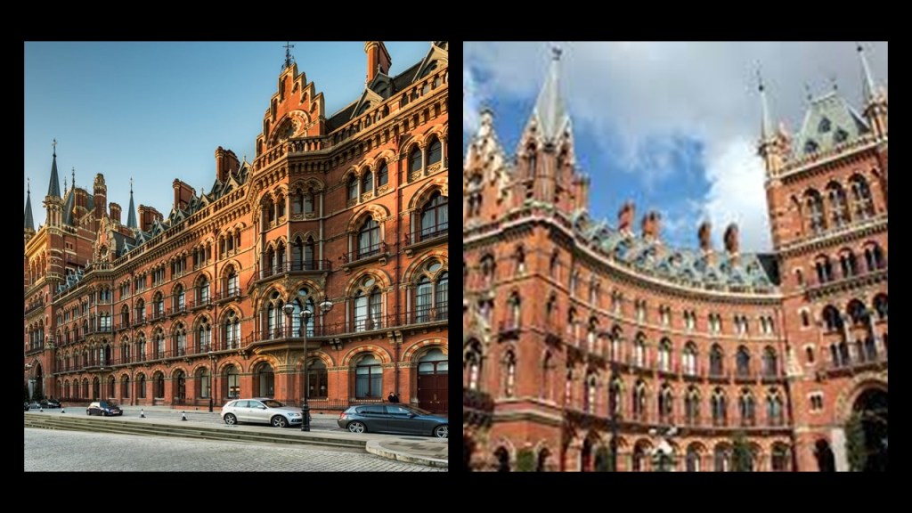
This is an illustration of the hotel showing 5-floors, which we are told it was planned to have, but not built to save on construction costs.

It is interesting to note in this photo of this massive building, you can see the slanted street and unlevel building features from the side-view.

The hotel has a grand grand staircase…
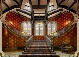
…and stately hallways.

Each room had a fireplace, yet at the same time rooms did not have bathrooms, which we are told was a convention of the times.
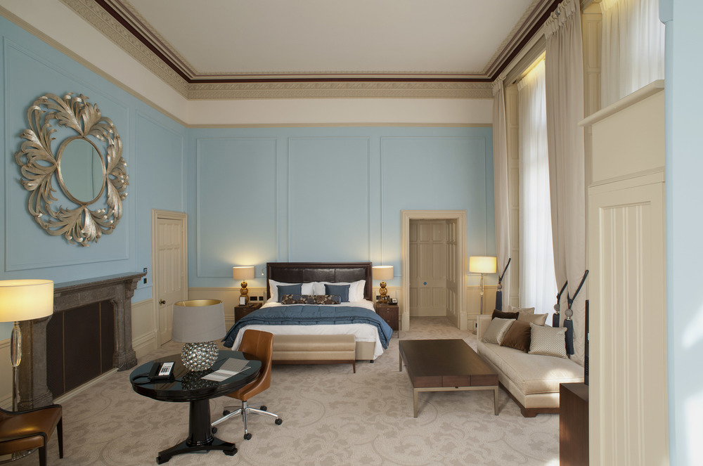
Apparently the original hotel closed in 1935 due to “outdated and costly utilities, and the need for an army of servants needed to carry things like chamber pots and tubs, and instead became office space for British Rail, who had plans to demolish the building until it was saved by a preservation campaign, though it sat abandoned for awhile starting in 1988.
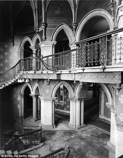
The building was restored, and reopened as a hotel and apartments in 2011.
You too can have an apartment in the St. Pancras clock tower for only 4.6-million pounds.

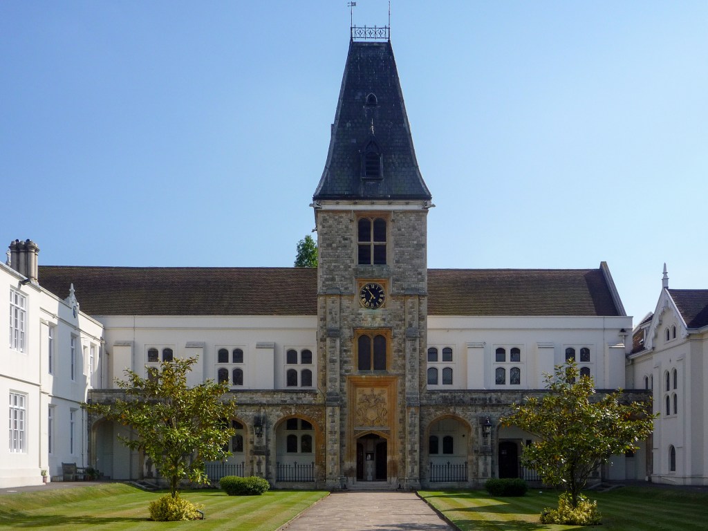
LR suggested that I look into Dulwich College in London.
Dulwich College is a public school for boys, which includes day schools and a myriad of boarding schools.

Dulwich College was founded as a charity in 1619 as the “College of God’s Gift” by Elizabethan actor and businessman Edward Alleyn.
In 1605, Alleyn became the owner of the estate of Dulwich, and somewhere in there decided to establish a hospital for poor people and provide for the education of poor boys.
Between 1613 and 1616, a chapel, schoolhouse, and twelve almshouses were said to have been built.
The Lord Chancellor at the time, Sir Francis Bacon, objected to Alleyn getting the patent of incorporation necessary to be considered a college, and which he ultimately received from King James I, and which allowed the College of God’s Gift to be set-up as an endowment, so it was able to establish and aggregation of assets to support its educational mission forever.
The charity originally was comprised of a Master, a Warden, four fellows, six poor brothers, six poor sisters, and twelve poor scholars that were orphans ages 6 and up.
Known as “Members of the College,” together were legal owners of Alleyn’s endowment of the Dulwich manor and lands.
The business of the charity was conducted on behalf of these thirty members by the Master Warden, and four fellows, consisting of a chaplain, schoolmaster, usher and organist.
The Archbishop of Canterbury became the official Visitor, or overseer of the charitable institution who can intervene in the internal affairs of the institution.
Interesting stipulations made by Alleyn included that the Master and Warden be unmarried and of Alleyn’s surname, and blood if possible.
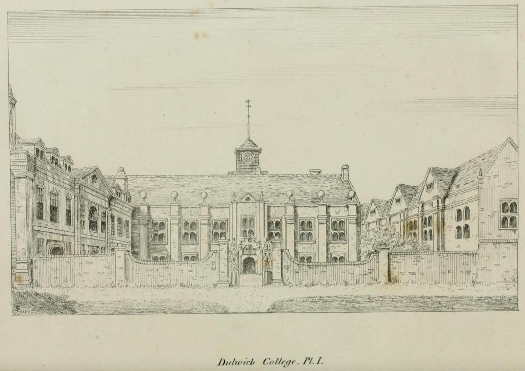
The Dulwich College Act of 1857 dissolved the original corporation.
For one thing, it went from being called the “College of God’s Gift” to “Alleyn’s College of God’s Gift.”
Another, it was divided into an educational part and a charitable part, overseen by a joint Board of Governors.
I am going into the details about this part of Dulwich College’s history because it seems very odd to me, and makes me wonder what was really going on with this charitable institution that we are not being told.

Dulwich College took on its present form when it moved to its present location in 1870.

Next, DC asked me to take a look at the Solent and Portsmouth in the south of England.
The strait between the Isle of Wight and Great Britain is known as “The Solent.”
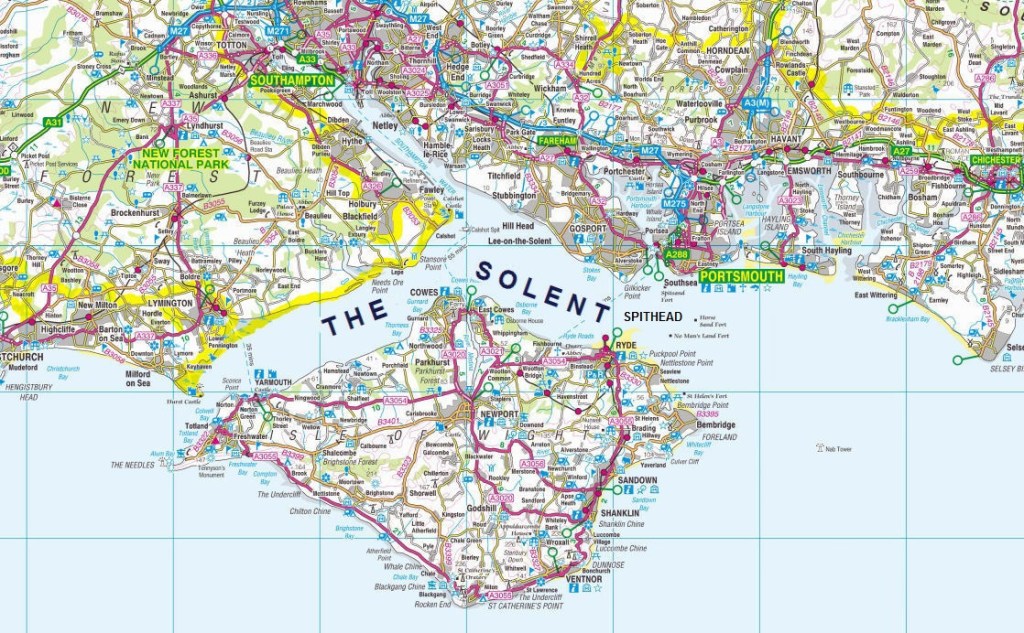
It is a major shipping lane and recreational area for yachts and other water sports.

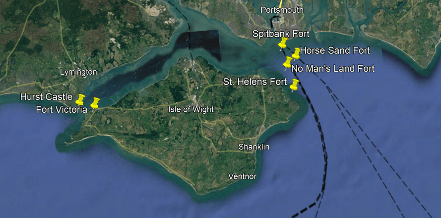
The Hurst Spit projects into the Solent Narrows, and is the location of Hurst Castle.

The Hurst Castle was said to have been built by King Henry VIII in the 16th-century, during the years between 1541 and 1544 as part of part of a coastal protection program against invasion from France, Spain, and the Holy Roman Empire.

Then there are the Palmerston Forts on the Isle of Wight, called a group of forts and associated structures that were built during the Victorian Era in response to a perceived threat of French invasion.

They are called the Palmerston Forts due to their association with Lord Palmerston, the Prime Minister during that time who was said to have promoted the idea.

There were approximately 20 of these Palmerston structures along the west and east coast of the Isle of Wight.
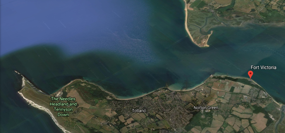
Like Fort Victoria was said to have been built in the 1850s to guard the Solent…

…and is located on the Isle of Wight in a position opposite from Hurst Castle on the mainland’s Hurst Spi
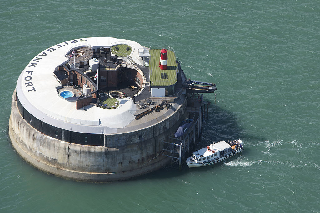
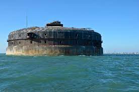
In addition to all the forts and batteries located on the Isle of Wight, other forts associated directly with the Solent include Spitbank Fort, which was turned into a luxury spa hotel with nine rooms from 2012 and until its closure in 2020…
…Horse Sand Fort, said to have been built between 1865 and 1880, and was sold to a private buyer in October of 2021…

…No Man’s Land Fort, said to have been built between 1867 and 1880, and also repurposed into a luxury hotel that opened in 2015 and it is apparently still operating as one today, unlike Spit Bank Fort…

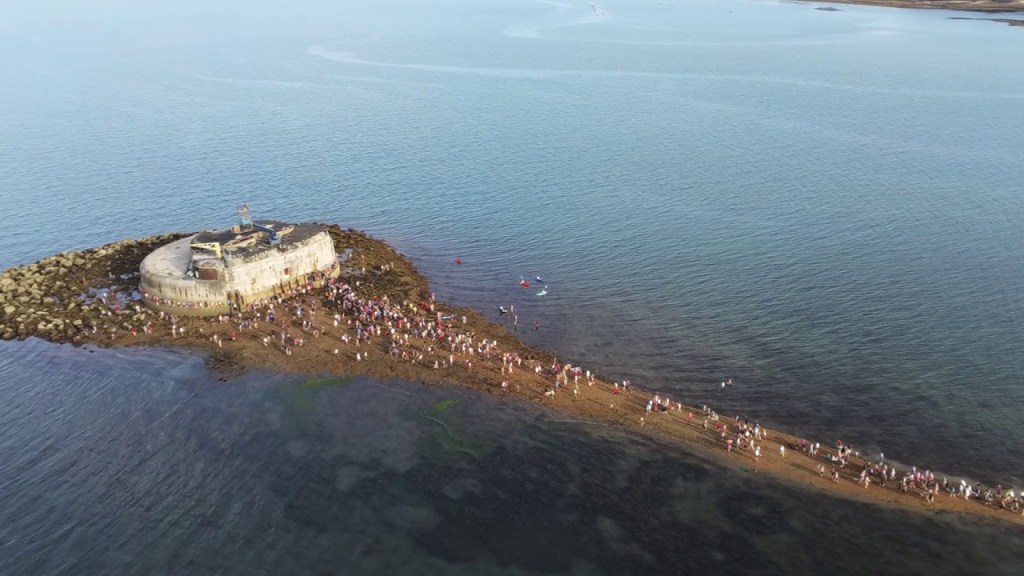
…and St. Helens Fort, said to have been built between 1865 and 1878. It is privately-owned and not open to the public.
It is interesting to note that periodically the tide is low enough to reveal an old causeway, and typically when this happens, there is a mass walk of people out to the fort and back.
All of which were said to have been Palmerston constructions resulting from the 1859 Royal Commission on the Defense of the United Kingdom, a committee formed to inquire into the ability of the United Kingdom to defend itself from an attempted invasion.
The coastal areas of the Solent are estuaries and have status as protected lands, like the New Forest National Park on one-side of the Solent, which interestingly includes the Exbury Gardens & Steam Railway…
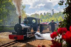
…and the Exbury Gardens are world-famous for the collection of Rhodedendrons and Azaleas of its Rothschild owners.

The Isle of Wight Area of Outstanding Natural Beauty is on the other side of the Solent.

The Solent is known for having a double high-tide, having four tides a day, as opposed to two tides under normal conditions.

It is also at the midpoint in the English Channel, between Dover and Land’s End, and when Dover is at low tide, Land’s End is at high tide, and vice versa.
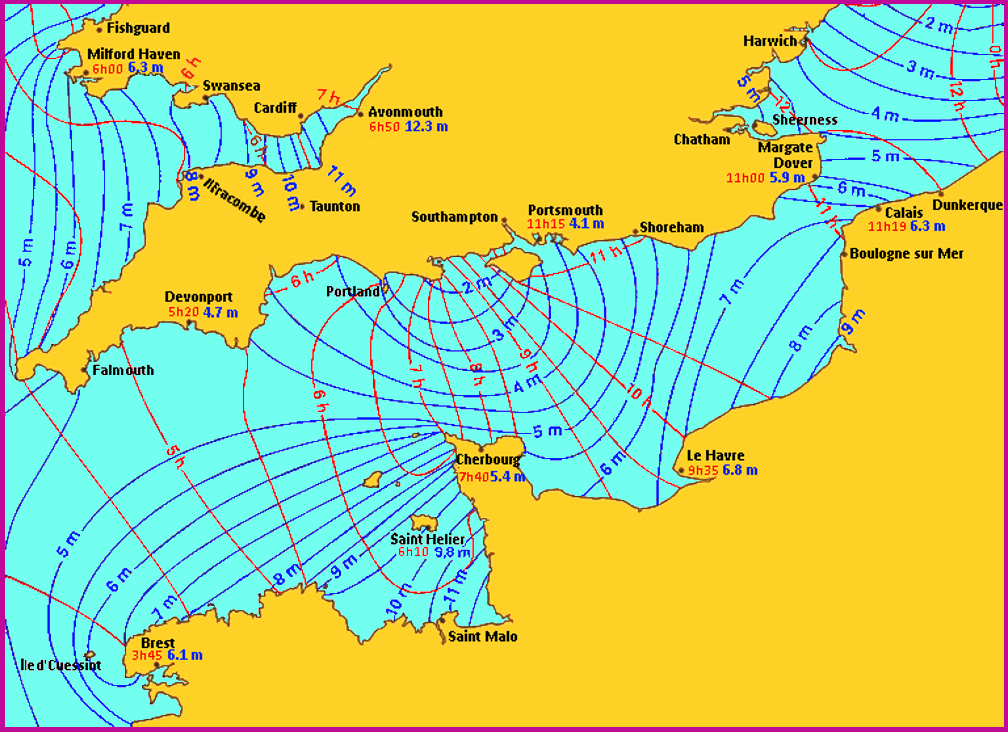
Portsmouth is an island-city located on the northeast corner of the Solent.
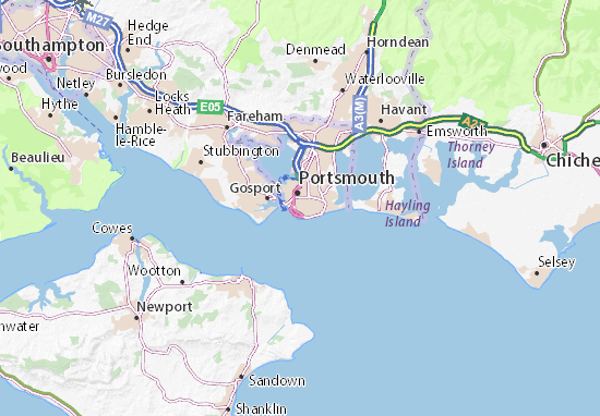
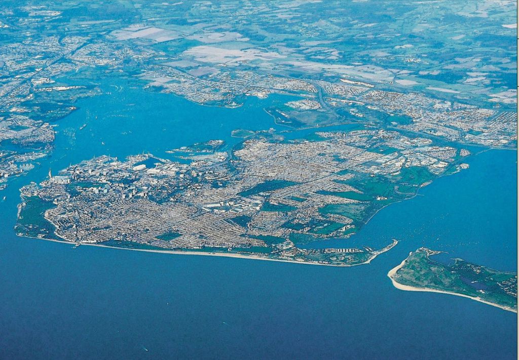
The only island-city in the UK, Portsmouth is located mainly on Portsea Island, a flat, low-lying island that is 9.5-square-miles, or 24.5-square-kilometers, and is the most densely-populated city in the UK.
The oldest part of the city, Old Portsmouth, is located on the southwest part of the island.
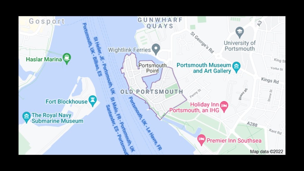
The Anglican Portsmouth Cathedral is located in the center of Old Portsmouth.
This is what we are told about it.
A wealthy Norman merchant gave land around 1180 AD to built a chapel to honor St. Thomas of Canterbury, a Christian martyr who had been assassinated around ten years previously.
Then the chapel became a parish church in the 1400s…and a cathedral in the 1900s.
We are told that in 1932, a sketch plan was submitted by architect Charles Nicholson that would extend the church to a size of a cathedral, and that he chose a “Neo-Byzantine,” and that by 1939, the outer aisles for the choir; the tower; the transepts; and three bays of the nave had been completed.
Then with the Fall of France in 1940, work on the “extension project” stopped, and during the course of World War II, the building sustained minor damage.
Then work began again in 1990 to finish the project, and that between 1990 and 1991, the fourth bay of the nave; western towers; tower room; rose window; gallery; and so forth were completed and the Portsmouth Cathedral was consecrated in the presence of the Queen Mother Elizabeth in November of 1991.

Portsmouth Cathedral has two organs.
The Nicholson Organ was said to have been installed in 1994, the pipes of which had been taken from an organ made in 1861 by John Nicholson originally for the Manchester Cathedral.

Then West Great Organ was added in 2001 to provide music into the separate space of the Nave.

The Portsmouth Cathedral is a short-distance from Gunwharf Quay.
The Old Gunwharf started out as an ordnance yard in 1706 on land that had been reclaimed from the sea.

Then the site was extended by reclaiming further land from the sea, to create the New Gunwharf around 1800.
Reclaimed from what, I wonder?
The definition of reclamation is an act or process of reclaiming, such as reformation, rehabilitation…and restoration to use.
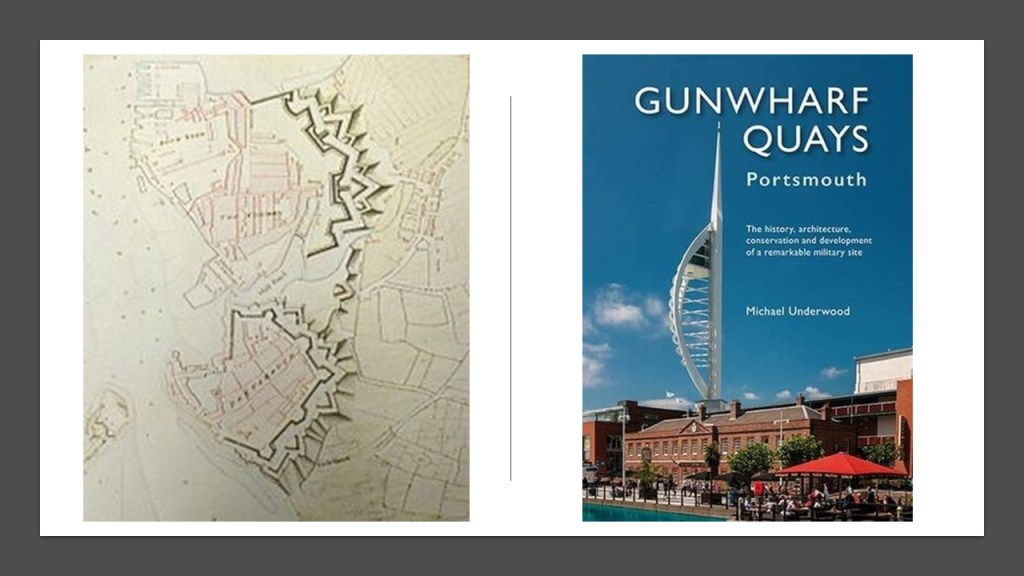
Known now as the Vulcan Building, the Grand Storehouse of the New Gunwharf was completed in 1814, where a wide-range of ordnance weaponry were stored, including gun carriages, cannons, and cannon balls, etc.
Today it is Aspex Portsmouth, the leading contemporary art gallery in Portsmouth.
All of those pyramids on the front lawn are really interesting to me!

Today, “Gunwharf Quays” it is a shopping center.
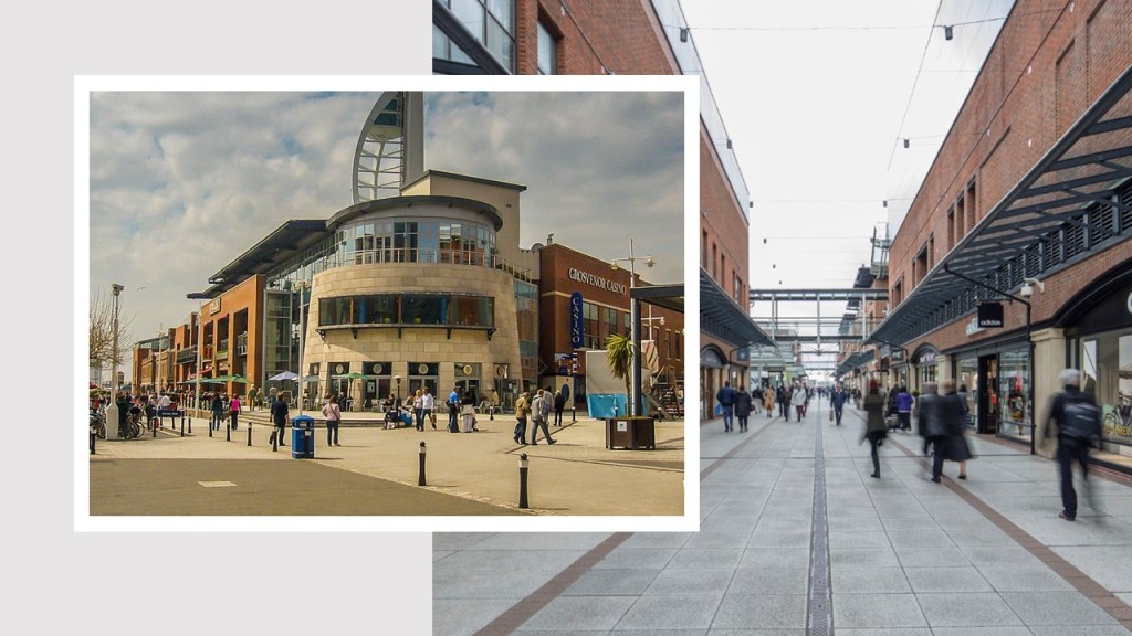
Portsmouth is the location of HMNB Portsmouth, the largest Royal Navy base, home to, among many other naval-related things, two-thirds of the United Kingdom’s surface fleet.
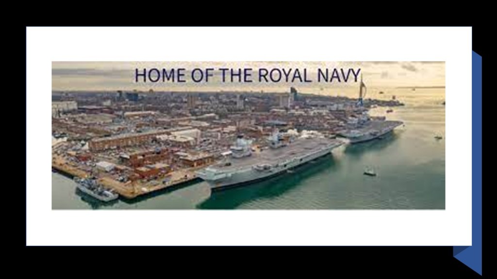
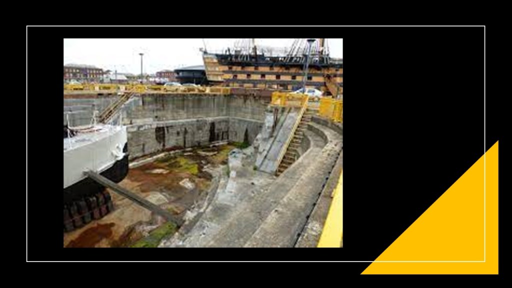
The Royal Dockyard in Portsmouth was said to have been founded in 1495 by King Henry VIII, and are said to have the world’s oldest dry-docks dating from this time-period.
Dry-docks are used for the construction, maintenance, and repair of ships and other water-vessels.
So, the Royal Navy Base and the Gunwharf Quays-turned-shopping center are bringing Hamilton, Bermuda to mind from past research.
This map shows the location of the Royal Navy Dockyard that was located there.

We are told it was built by the British Royal Navy in 1795, and was once home to Britain’s largest naval base outside of the United Kingdom until it closed permanently as a naval base in 1995.
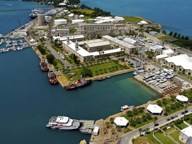
Now it is the home of the Clocktower Mall, hosting a variety of shops, boutiques and restaurants.

I know there is much more to find here in Portsmouth, but now I am going to take a look at a place that was in Amsterdam in the Netherlands that was suggested by another viewer.
This was the “Palace of Industry.”
Described as a large exhibition hall inspired by the Crystal Palace in London, it was said to have been constructed between 1859 and 1864.
To put this into perspective, this would have been in the same time frame as the 1859 Royal Commission on the Defense of the United Kingdom that resulted in the construction of the Palmerston forts in the Solent and on Isle of Wight, and the American Civil War, which began in 1861 and ended in 1865 in our historical narrative.
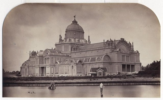
There was even a large organ there that we are told was installed there in 1875 by the famous French constructor of organs, Aristide Covaille-Coll.

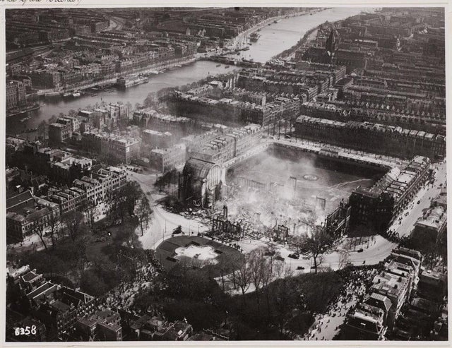
But alas, it was destroyed by fire in April 1929.
While buildings surrounding the Palace of Industry were spared from destruction by the fire, like the gallery, shops, and apartments, the main building was destroyed and never reconstructed.
The next place I am going to look at was suggested by JMG, which was the Fort Washington Avenue Armory in Manhattan.
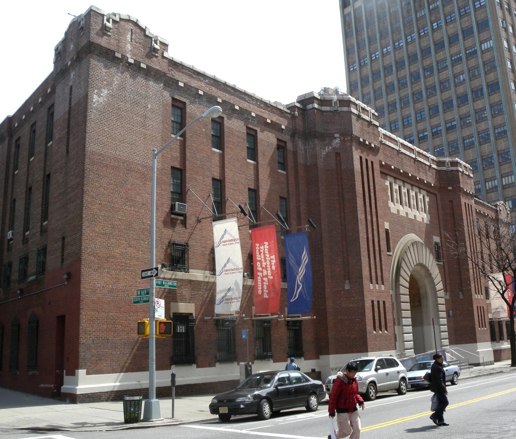
The Armory is considered to be the world’s premiere indoor track and field facility.
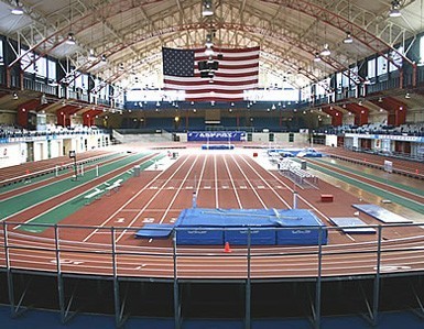
The Armory is known for having the fastest track in the world, with more world records being set here than anywhere else.

It was said to have been constructed in the Neoclassical Style in 1911.
It was home to the 22nd Army Corps of Engineers; used to give licensing exams to architects, engineers, nurses and so on; and even used as a homeless shelter.

The campaign to renovate the building started in 1992, and since then it also houses the National Track and Field Hall of Fame besides the New Balance Track and Field Center, and hosts the largest number of high school and college invitationals in the world.
I wonder what it is about the Armory Building that makes it such a phenomenal track and field venue?!

Viewer JB suggested that I take a look at Beaver Dam, Wisconsin.
Beaver Dam was said to have first been settled in 1841 by two men, and that the population had grew to 100 in two years, and that it received its name from an old beaver dam nearby.

The city was incorporated in March of 1856, the same year we are told the Milwaukee Railroad reached the area.
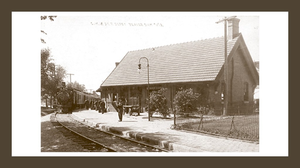
This depiction of Beaver Dam was circa 1867…as seen from the air?
How could that be possible given the technology we have been told existed at the time?

This is the Beaver Dam Community Library.
It first opened as the Williams Free Library.
The story about it goes like this.
In April of 1890, John Williams, a wealthy local businessman, offered to pay $25,000 to construct the library if the city paid for the land.
Done deal, and it first opened in July of 1891.
The library’s design was said to have been inspired by Henry Hobson Richardson.

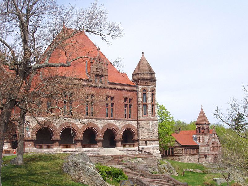
I first encountered the Richardson Romanesque style of architecture in tracking a long-distance alignment through Easton Massachusetts, where I encountered the Ames Free Library.
Henry Hobson Richardson himself wasi said to have designed the Ames Free Library in Easton.
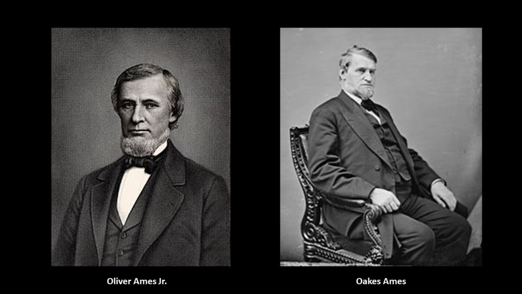
It was said to have been commissioned by the children of Oliver Ames, Jr, after he left money in his will for the construction of a library.
The building we are told took place between 1877 and 1879.
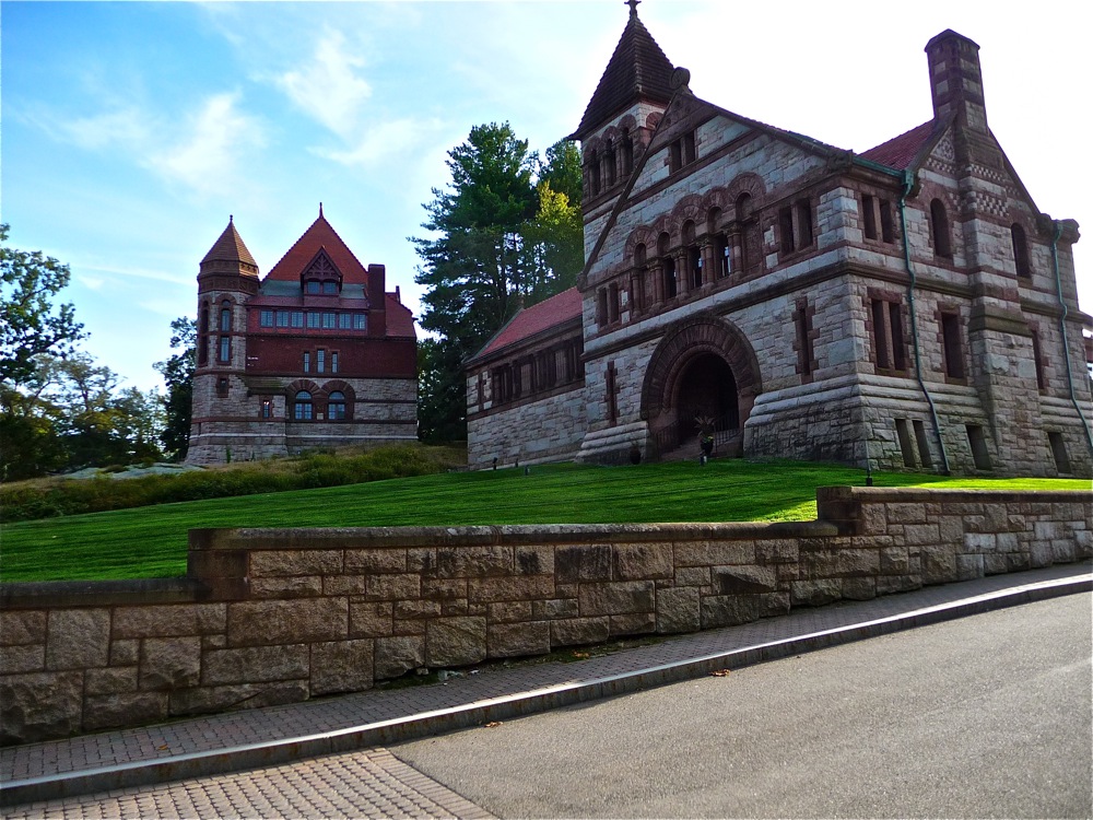
Henry Hobson Richardson was also said to have designed the Oakes Ames Memorial Hall which is right next to the Ames Free Library, said to have been commissioned by the children of Congressman Oakes Ames as a gift to the town of Easton, and built between 1879 and 1881.
The Ames Brothers, Oliver and Oakes, were an interesting pair.
Among many other things, they were co-owners of the Ames Shovel Shop in Easton.
It became nationally known for providing the shovels for the Union Pacific Railroad, which opened the west. It was said to have been the world’s largest supplier of shovels in the 19th-century.
Why would shovels have been so important for constructing the railroad tracks to open the west?
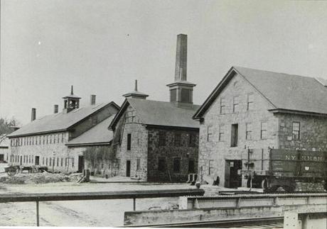
What if…the tracks were already there and just needed to be dug out?

The architect that gave his name to Richardsonian Romanesque, Henry Hobson Richardson, was said to have never finished his architecture studies in Paris due to the Civil War.
He also is said to have died at the age of 47, after having a prolific career in the design of mind-blowingly sophisticated and ornate buildings of heavy masonry.

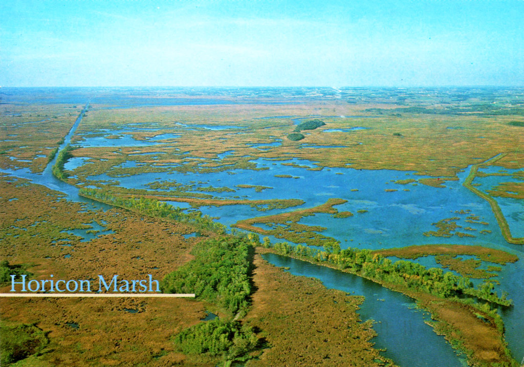
Horicon Marsh is described as a silted-up glacial lake that is a national and state wildlife refuge.

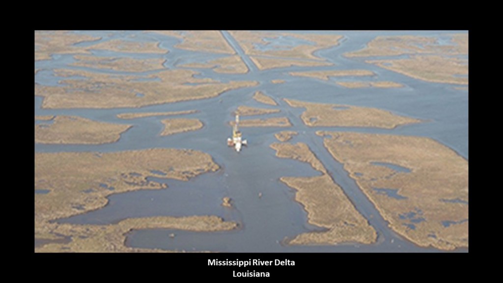
I really think places like marsh-lands and estuaries were mud-flooded places that were ruined for civilized use.
You can see straight channels in this aerial photo of the Horicon Marsh in Wisconsin…
…just like you see straight channels in the Mississippi River Delta south of New Orleans.
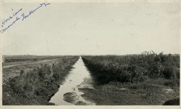
I found this photo of what was called a drainage ditch in the Horicon Marsh circa 1914.
These Drumlins are found south of Horicon Marsh.
Drumlins are the grooves in the landscape, said to be hills formed by a retreating glacier around 12,000-years-ago.

The drumlins in Wisconsin brought to mind Malham Ash, described as a limestone pavement, in the Yorkshire Dales National Park in northern England.
The definition of the word pavement is this: 1) a hard, smooth surface, especially of a public area or thoroughfare, that will bear travel; and 2) the material with which such a surface is made.
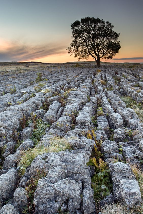
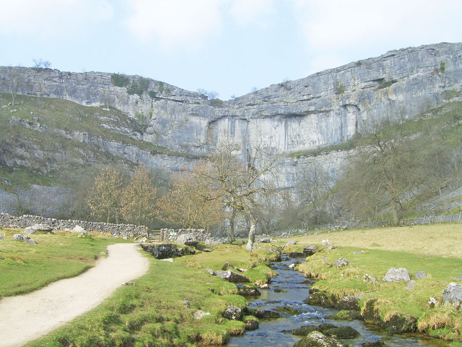
Malham Ash is at Malham Cove.
Malham Cove is described as a huge, curving cliff formation of limestone, with a vertical cliff face of 260 feet, or 79 meters, high, and was said to have been formed by a waterfall carrying glacial melt-water, also over 12,000 years ago like the Wisconsin drumlins.
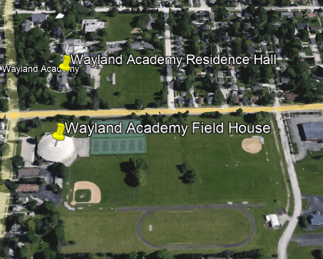
Wayland Academy in Beaver Dam is a private, college prep boarding school, with a student population of 125 in the 2021 – 2022 school year.
It was chartered by the then-Wisconsin Territory Legislature in 1847 as the Beaver Dam Academy.
Originally Baptist school, it was renamed Wayland Academy after Baptist Minister Francis Wayland, who was also an educator and economist.
Wayland Academy Residence Hall looks like it might have had a steeple-like structure at one time, and there are below-ground windows at the front of the building.
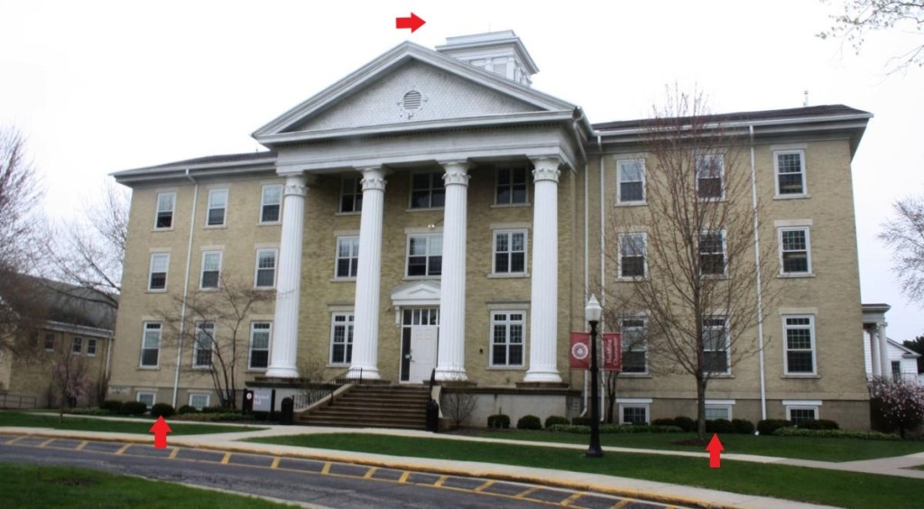
Examples of architectural component removal that I have come across include the Grand Theater in Salem, Oregon, which was said to have been built in as an opera house in 1900 by the Odd Fellows, and owned by them, and today also has retail space, office space, and a ballroom as well as being still used as a theater venue.

…and the Old Lewis Hotel in McGregor, Iowa, only it’s now called the Alexander Hotel, minus the domes it had originally.

The Wayland Academy Field House is located directly across the street from the Residence Hall.

The circular Wayland Academy Field House sports a beautiful domed roof.

When I saw the term Wayland Academy Field House used to describe a sporting venue, it brought Cole Field House at the University of Maryland back to my memory. I grew up in Maryland.
This image of Cole Field House on the left definitely reminds me of an airplane hangar as seen on the right.

Historical photographs of airships in hangars are easily findable in an internet search.
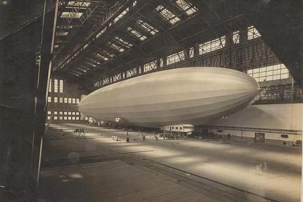
This is what we are told about airships in our historical narrative.
Australian inventor William Bland sent designs for his “Atmotic Airship” to the 1851 Great Exhibition in the Crystal Palace in London where a model was displayed.
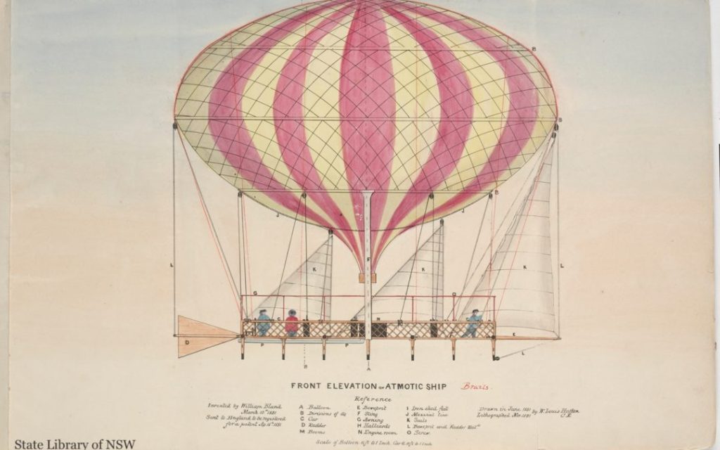
This was an elongated balloon with a steam engine driving twin propellers suspended underneath.
Then, in 1852, Frenchman Henri Giffard was credited as being the first person to make an engine-powered flight when he flew 17-miles, or 27-kilometers, in a steam-powered airship, and airships would develop considerably over the next two decades.

The era of the airships in our historical narrative was somewhere between 1900 and 1940.
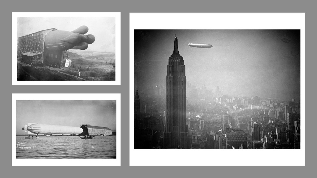
The 1908 military science fiction book of H. G. Wells entitled “The War in the Air” was about entire cities and fleets destroyed by airship attack…

…and airships were used as bombers in military conflicts starting in 1912 and during World War I.
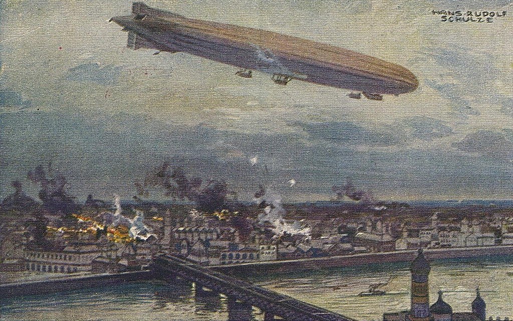
We are told their use decreased as their capabilities were surpassed by those of airplanes.
Sounds like the story we are about the superior capability of trains causing the use of canals for transportation to become obsolete.

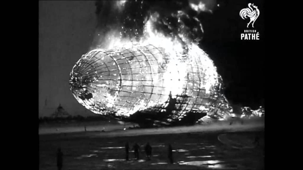
Then, we are told the decline of airships was accelerated by a series of high-profile accidents, including the 1937 dramatic burning of the German Hindenburg passenger airship, which changed the narrative.
Now they were not safe way to travel, so of course they had to get rid of them for public safety!
This is a good lead-in to the viewer suggestions of the so-called Fantasy Arts of Steampunk and Capriccio.
Steampunk Art is described as a vision of the Victorian Age that never was, where airships fill the skies and steampower and clockwork make everything possible, combined with futuristic technological concepts.

Capriccio art is described as architectural fantasy in which buildings, archeological ruins, and other architectural design elements are combined in fictional and fantasical ways.
On the top left is an actual photograph of the view of Budapest and the Hungarian Parliament in the background from the Budapest Castle Funicular iand the top right is the Hungarian Parliament building.
The bottom left is a Capriccio Art depiction of London, with a view of St. Paul’s Cathedral in the background, and the bottom right is St. Paul’s Cathedral.
Interesting side-note that the Hungarian Parliament Building in Budapest and St. Paul’s Cathedral in London are oriented in the same direction.
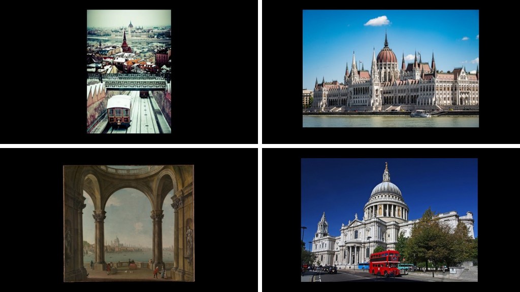
My guess would be they are oriented to the cardinal directions, like the Pyramids of Giza as an example.

You even see this example of a beautiful fantastical-looking city-scape included in this official portrait from the 1950s of Queen Elizabeth II and Prince Philip.
I truly believe the true history of the Earth is being shown to us through these artworks.

Next, RG shared information about the sinking of the Lady Elgin, saying it is so similar to the sinking of the Titanic and that the Lady Elgin passenger manifest was lost, so the exact number on-board was unknown.
The Lady Elgin, a side-wheel steamship, was said to have been built in Buffalo, New York, in 1851.
For almost a decade, the elegant steamship took passengers between Chicago and other cities on Lake Michigan and Lake Superior.

Apparently during the years she was in operation, the steamship was involved in a number of accidents, including, but not limited to, things like striking a rock in 1854 and being damaged by fire in 1857.
Then On September 6th of 1860, the Lady Elgin was rammed below the water-line by the wooden Schooner Augusta, and her sinking has been called the “one of the greatest marine horrors on record.”
The Lady Elgin was on its return trip to Milwaukee, sailing against gale force winds, when she was rammed by the Augusta.
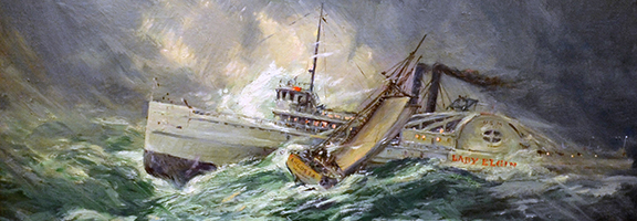
The Lady Elgin’s captain ordered that cattle and cargo be thrown over-board to lighten the load in order to bring the hole above-water.
All of the efforts to try to keep the ship from sinking came nothing, as within twenty-minutes, the ship broke apart and sank quickly.

Of those 300 people, most were from the Irish community of Milwaukee, including nearly all of Milwaukee’s Irish Union Guard.
The Irish Union Guard was an Irish militia based in Milwaukee’s Third Ward, and who were at odds with the Wisconsin governor’s position.
The members of the Irish Union Guard had chartered the Lady Elgin for a quick-trip to Chicago.
It was said that so many Irish-American political operatives died that day that it shifted the balance-of-political-power in Milwaukee from the Irish to the Germans.
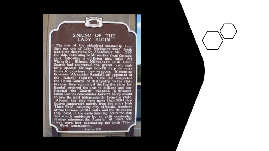
Well, there certainly seems to be some parallels between the sinking of the Lady Elgin in 1860, and the sinking of the Titanic in 1912, that resulted in changing the course of history.
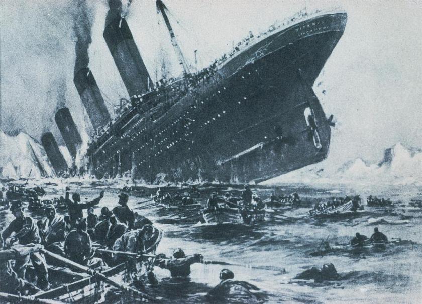
The story goes that the RMS Titanic passenger liner sank on its maiden voyage in the North Atlantic Ocean on April 15th of 1912, after striking an iceberg, and it broke apart and sank 2 hours and 40 minutes later.
More than 1,500 people died of the estimated 2,224 passengers that were on-board, resulting in the deadliest peace-time sinking of a super-liner or cruise ship.
Also, prominent people opposed to the creation of the Federal Reserve were on board, including John Jacob Astor IV, Benjamin Guggenheim, and Isidor Strauss.
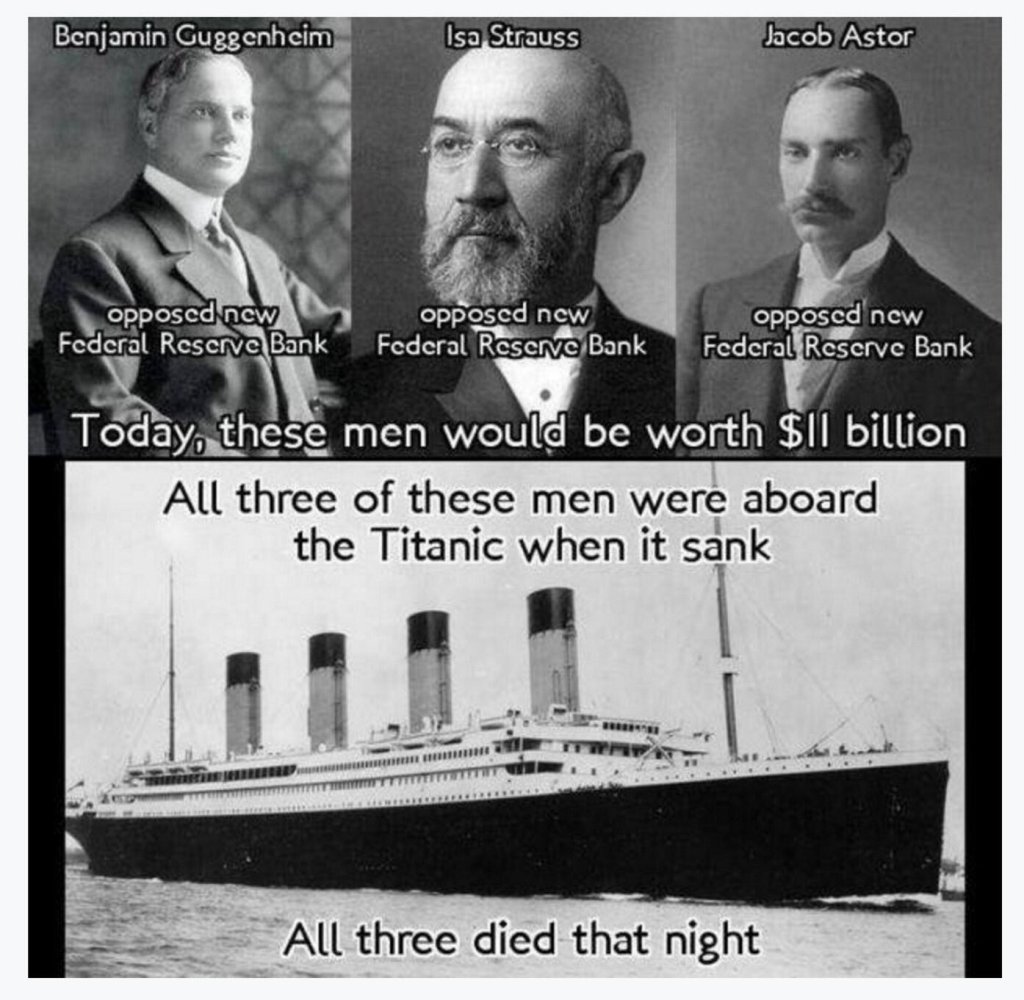
Then on December 23rd, 1913, the Federal Reserve Act Passed Congress, signed into law by Woodrow Wilson.
It created and established the Federal Reserve System, and created the authority to issue Federal Reserve Notes (commonly known as the US dollar) as legal tender.
Food for thought.

ES put together a folder of images and information for me about Ottawa, Illinois.
The city of Ottawa in Illinois was incorporated in 1853, and is located at the confluence of the Illinois and Fox Rivers.
He said this town has some strange and/or important history.

Like, the city’s Washington Square being the location of the first debate between Abraham Lincoln and Stephen Douglas debate on August 21st of 1858.
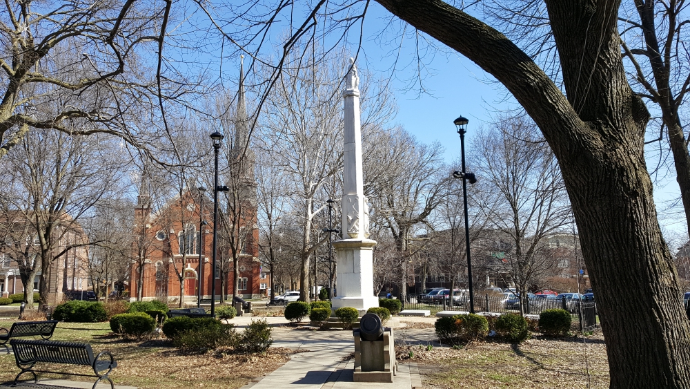
The park was said to have been platted in 1831, and besides having a fountain and reflecting pool with life-size statues of Lincoln and Douglas situated in a plaza surrounded by limestone…
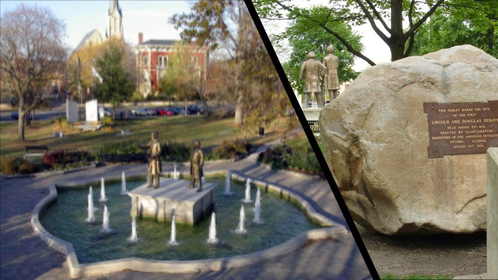
…the LaSalle County Civil War Soldiers Monument is located there, said to have been erected on September 21st of 1873.
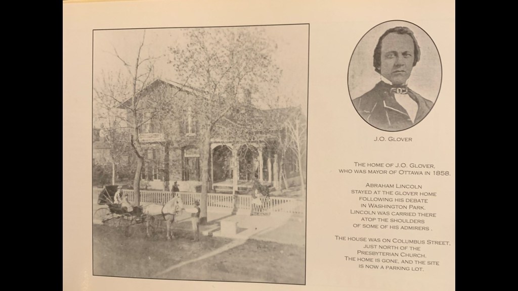
J. O. Glover was the Mayor of Ottawa in 1858 when the first Lincoln-Douglas Debate took place.
This is a picture of his home, where supporters of Abraham Lincoln were said to have carried him on their shoulders after the debate in Washington Square.
Glover’s home on Columbus Street is no longer there, having been replaced by a parking lot.
Here is another photo from the time of the 1858 debate.
It was of what was known as the Eames Home, with Lincoln and Douglas appearing in it, where it was located at the corner of Superior and Paul Streets.

This particular house was said to have been moved from this location to a new location at 118 East Lafayette Street, which is actually right across the street from Washington Square where the debate was held.
At least this is what they tell us!

William Dickson Boyce was said to have built a home in Ottawa in 1913.
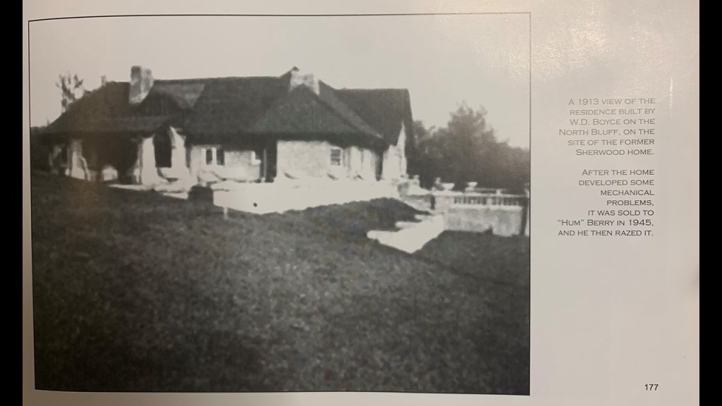
Who was he?
Newspaper & Magazine publisher William D. Boyce was the founder of the Boy Scouts of America, which was established in 1910.
The story goes that he was lost in a fog in London when he was approached by a young English boy scout who led him to his destination, and Boyce was so intrigued that he went on to found the Boy Scouts in America.

ES said there are countless old world buildings and Victorian-era style homes, though it seems much of it was destroyed or heavily modified from its original ornate design.
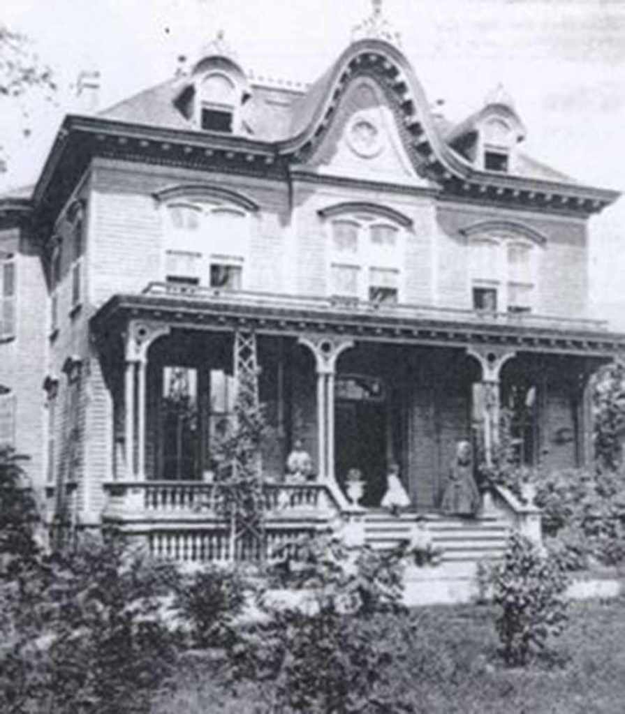
ES said the captions alone given in these images raise some eyebrows with some common themes like fires and war fundraisers, etc.

He included an obituary he found for the man his relatives told him owned the largest home in town (now demolished) and the local department store, Sidney Stiefel.
It seems his Stanley Stiefel’s father started the business in 1899 and before that his grandfather was a clothing manufacturer in Germany.

The fact that he was a Shriner and also an Elk caught ES’s attention, especially since each group has a lodge right in the heart of downtown.

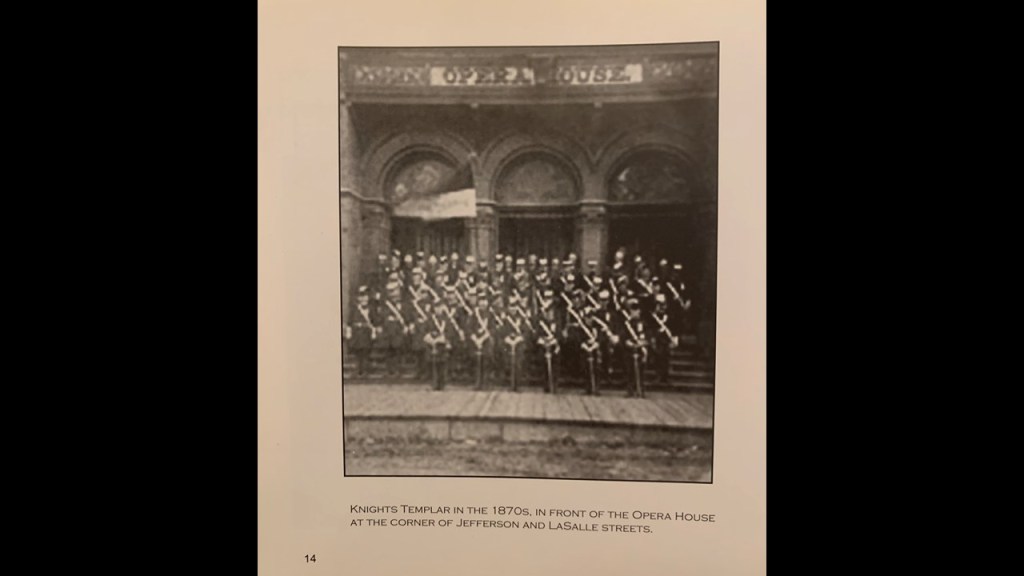
This is a photo of the Ottawa Knights Templar circa the 1870s.
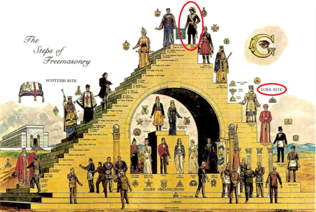
Knight Templar is the highest-degree in the York Rite of Freemasonry.
The photo of the Ottawa Knights Templar was said to have been taken in front of the Opera House.
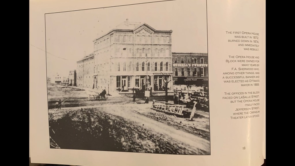
Since a year is not specified for the photo, it is interesting to note that the first Opera House in Ottawa was said to have been built in 1872 and burned down in 1874.
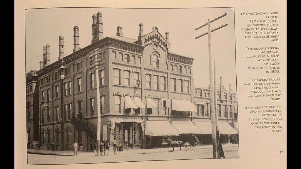
Then the second opera house was said to have been completed in 1875. It was demolished at some point after this photo was taken in 1893 as part of a series of photos showcasing Ottawa.
This was a framed photo ES saw in a local funeral home of the Civil War General George B. McClellan showing the masonic pose of the Hidden Hand.
The Hidden Hand refers to the Freemasonic pose in this illustration, signifying “Master of the Second Veil.”

ES shared several other photos at the funeral home.
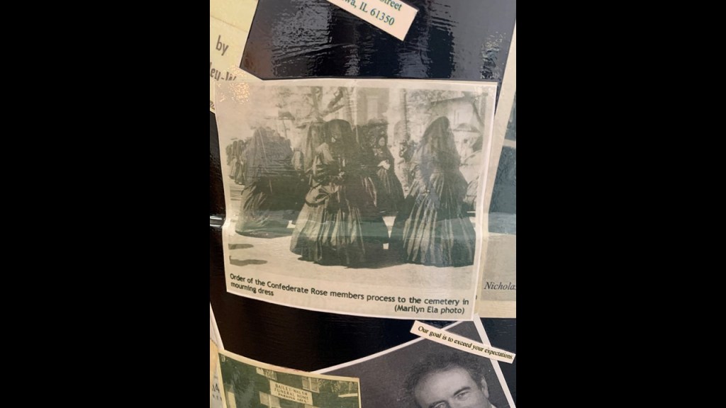
This photo is of an odd Civil War mourning dress ritual of the Order of the Confederate Rose.
The Order of the Confederate Rose is described as an historical organization whose purpose was to support the Sons of Confederate Veterans in their service to the South.
It was named after Rose O’Neal Greenhow, a successful Confederate Spy who lost her life by drowning in 1864.
And another was a group photo of the “Improvement Council.”
If ES had to guess, he said this Improvement Council was a controlled demolition/narrative group that decided who worked on things like getting the trolleys from horse drawn back to electric.

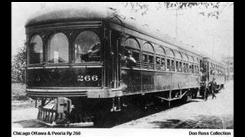
Electric streetcars started operating in Ottawa in 1889 and by 1901, there was an Interurban streetcar system running between towns.
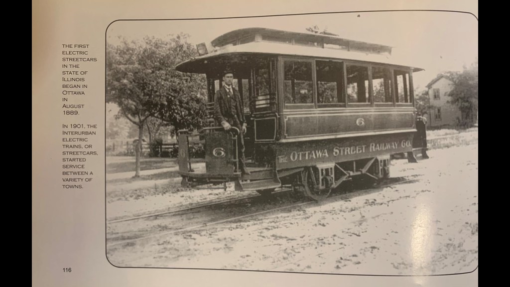
Interesting to see this undated photo of the streetcar in Ottawa on a dirt-covered street.

We are told when the Federal Highway Act was passed in 1916, it marked the beginning of the end of the Interurban systems.
With the construction of paved highways and the mass production of automobiles, we are told that electric rail service decreased in popularity, and that by 1934, all interurbans were halted.
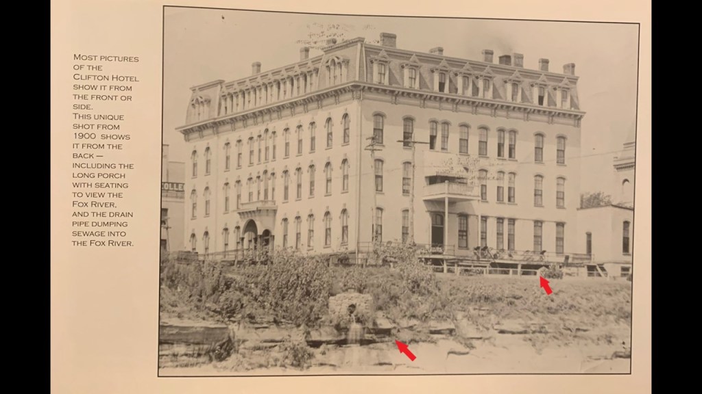
One last historical photo I would like share from ES was that of the Clifton Hotel.
Interesting to note what it says about the long porch with seating to view the Fox River…and the drain-pipe dumping sewage into the Fox River.
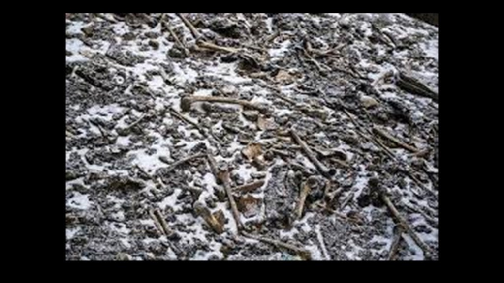
Next, PS suggested that I look at Skeleton Lake in India’s Uttarakhand State of India in the Himalayas.
Also known as Roopkund and Mystery Lake, it is a high-altitude of 16,040-feet, or 5,020-meters.
It is surrounded by glaciers covered by rocks and mountains-topped by snow.

It is called Skeleton Lake because there were hundreds of human skeletons found in 1942 at the edge of the lake.
The remains of approximately 300 people have been identified.
Studies of the remains showed head injuries, caused by round objects from above, so the cause of death has been attributed to which have been attributed by researchers to a sudden hailstorm.
Regardless, who they were or how they died remains an unsolved mystery in the present-day.
Going on to the next place.
SL encountered a Step Pyramid in Death Valley near Rhyolite Ghost Town in Nevada.
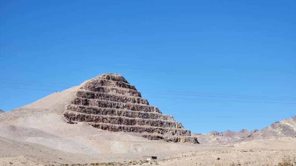
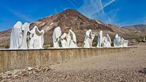
Rhyolite was a boom town that sprung-up after the discovery of high-grade gold ore there in 1905, and its last resident died in 1924.
Today, it is a place where ghostly-looking statues depict things like a Grim Reaper Last Supper.
DA wanted me to check out Spokane in eastern Washington State, eighteen-miles west of the Idaho border near Coeur d’Alene.

It is known as the Birthplace of Father’s Day because the idea was proposed by Spokane resident Sonora Dodd in 1909.

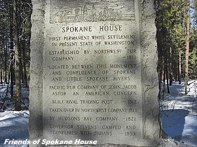
The Northwest Company’s Spokane House was established in 1810, a fur-trading post that was the first long-term settlement in what became Washington State…
…and the Northern Pacific Railway first brought settlers to the Spokane area in 1881.
The Northern Pacific Depot in Spokane pictured here was said to have been built in 1890, after the Great Fire of 1889.

The 1889 Great Fire of Spokane was a major fire in August of that year which affected downtown Spokane, destroying the downtown commercial district of the city.
Some of the things that we are told about it was that due to a technical problem with the pump station, there was no water pressure in the city when the fire began, and that firefighters demolished buildings with dynamite in a desparate bid to starve the fire.

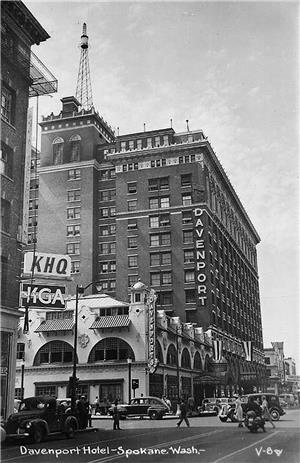
After the fire, architect Kirtland Kelsey Cutter was credited with designing many of the city’s older Romanesque Revival-Style buildings, like the First National Bank…

…the Rookery Building…
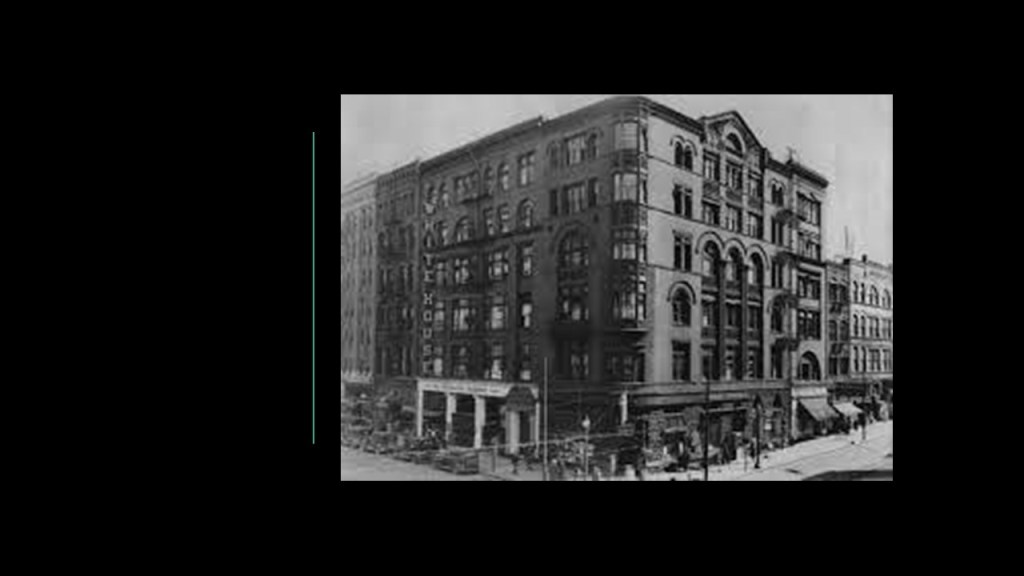
…the Spokane Club…

…and the Davenport Hotel and Restaurant.
Spokane’s Riverfront Park occupies 100-acres, or 40-hectares along the Spokane River, encompassing the Upper Spokane Falls.

Officially opening in 1978, Riverfront Park is said to be located on the site of a former railyard.
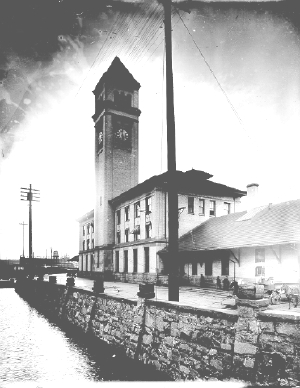
Attractions include the Great Northern Clocktower.

The Clocktower is all that remains of what was the Great Northern Depot, which was levelled to make room for the Expo ’74 that was held in Spokane.
The Great Northern Depot and Clocktower was said to have been built between 1892 and 1902.
The Clocktower was almost levelled too, but was saved by a successful preservation effort.
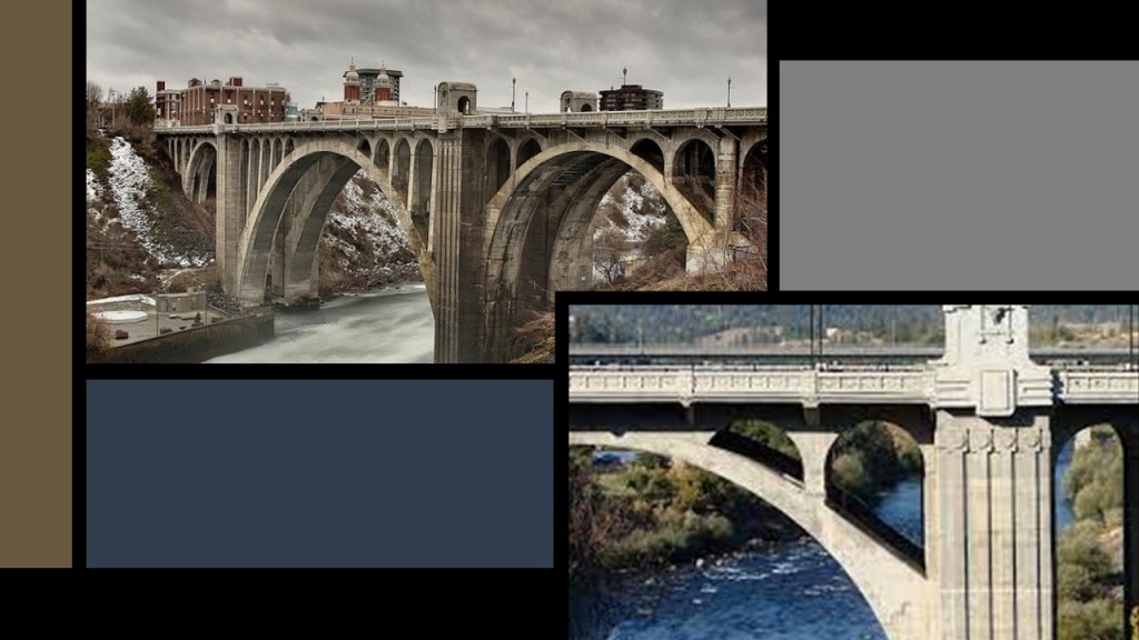
The Monroe Street Bridge is a deck-arch bridge that spans the Spokane River, and was said to have been built in 1911 by the City of Spokane, and designed by city engineer John Chester Ralston.
Just a sample of the many things Spokane has to offer the historical narrative that jumped right out at me.
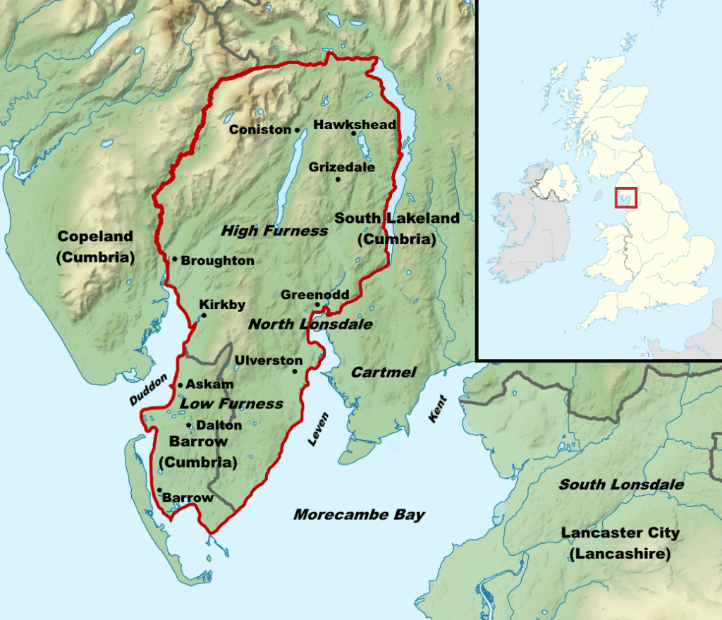
The last place I am going to look at is Barrow-in-Furness in Lancashire, England, a place EK brought to my attention.
It was first incorporated as a municipal borough in 1867.
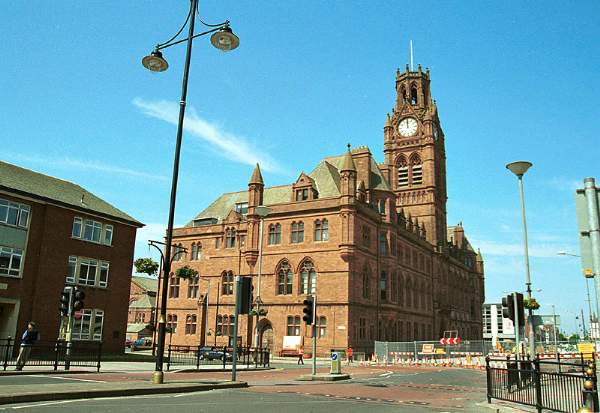
The Barrow-in-Furness Townhall and Clocktower was said to have opened in 1887.
The Furness Railway opened in 1846, and by 1850, extensive hematite deposits were found of sufficient size to open a steel mill.

That led to the creation of the Barrow Hematite Steel Company, a major iron and steel producer based here between 1859 and 1963.
By the beginning of the 20th-century, it was the largest steel mill in the world.

With Barrow’s location and steel supply, the Vickers Shipyard here developed into a significant producer of naval vessels, including submarines.

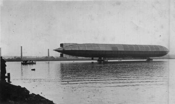
Vickers also was credited with making the first rigid airship known as R1, or “Mayfly,” in 1908.
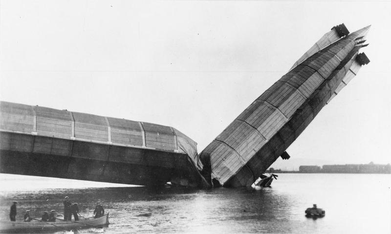
But, unfortunately, it was destroyed by mishandling in the process of being moored.
By 1921, there had been 80 dirigibles constructed here.
In 1930, land for the construction of a second airship facility had been purchased on Walney Island.

It was turned into an airfield in 1940 with onset of World War II, with multiple uses by the Royal Air Force, including those involving airships.
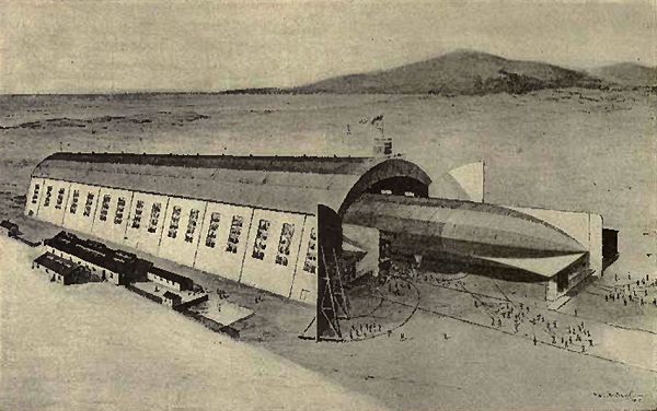
The Walney Airfield was used extensively during World War II, after which time it fell into disuse until it was the 1980s, when it was used for passenger service by different airlines on-and-off again until March of 1992.

I am going to end “Places & Topics Suggested by Viewers – Volume 10” here on Walney Island in Lancashire, and more to come!

