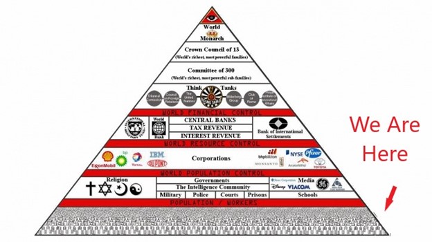
What if something very different has been going on here on Earth from what we have always been taught to believe, and that what has been happening is only for the benefit of a very few, and not for the benefit of all?
I have come to the conclusion after years of research that there is much to question in the official history and science that has come down to us as unquestionable truths, and have decided to approach the subject about what might be really going on here from the perspective of the “Elite Enclaves of the New World,” so I have pulled together many of my research findings over this years about this topic, and new research I have done for this post, and what this might mean in the bigger picture.
“Elite Enclaves” commonly refer to the geography of high-income communities, and in this post, I am going to be specifically looking at places where elite families have lived, as well as vacationed in the summer months, since the early days of the United States; who lived in these place prior to these elite families; and speculate as to the reason why they may have chosen these places above all others.
The original civilization of the Earth was nothing at all like what we have been taught, even though the clues and evidence for the highly-advanced, original ancient advanced civilization surround us all over the Earth.
We don’t recognize the clues and evidence as such because we have no points of reference for them because Earth’s True History is not included the historical narrative we have been given, and instead have been given a fictional explanation for our history and how everything came to be in our world.

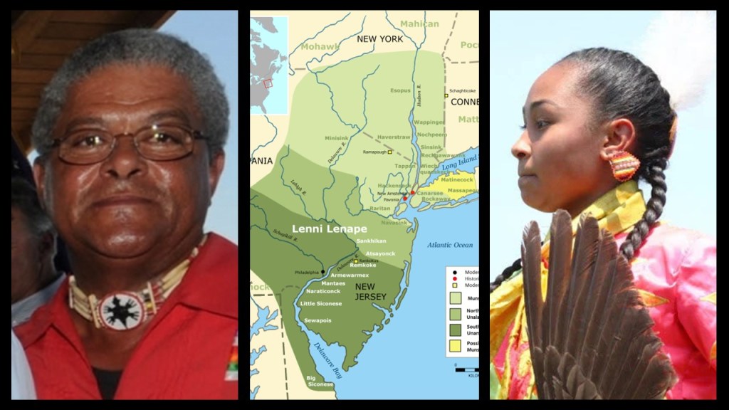
I am going to start by looking at the traditional lands of the Algonquin-speaking Lenape people, also called the Lenni Lenape and the Delaware Indians.
Lenape lands included present-day New Jersey; eastern Pennsylvania along the Delaware River watershed; New York City; western Long Island; and the Lower Hudson Valley.
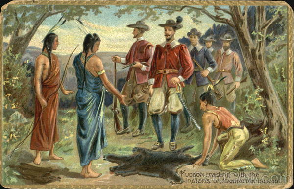
According to the history we have been taught, everything changed for the Lenape who lived here after Henry Hudson sailed up what is now called the Delaware River in 1609, and this painting depicts what we are taught to believe about all the original people of this land – that they were hunter-gatherers living off the land, and framing the European colonizers as the builders of infrastructure and civilization in the so-called New World.
I am going to give you examples from here of why that narrative doesn’t quite hold up under scrutiny, and also about the fascination and interest the wealthy elites of American society have long had with this region.
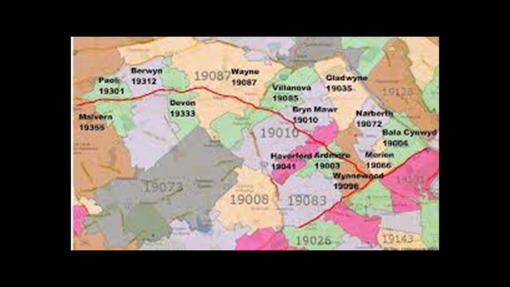
So, for example, the highly-affluent Philadelphia suburbs along the railroad tracks of the Pennsylvania Railroad are collectively called the “Main Line.”
The “Main Line” region was part of the “Lenapehoking,” the homelands of the Lenape people that ranged from western Connecticut to Delaware.
“Main Line” towns had the country estates of the wealthiest families of Philadelphia, including those from “Old Money” and “New Money.”
The “Old Philadelphians” is the name given to the First Families of Philadelphia from the old Colonial-era that are considered part of the historic core of the East Coast Establishment, the dominant social group comprised of a self-selecting, closed circle of elite families.
So in the example of the “Main Line” in Philadelphia, I am going to look at families like the Biddles, Drexels and the Hires.
Firstly, the Biddle family is one of the classic “Old Money” Philadelphia families, and considered part of the city’s historical social aristocracy.
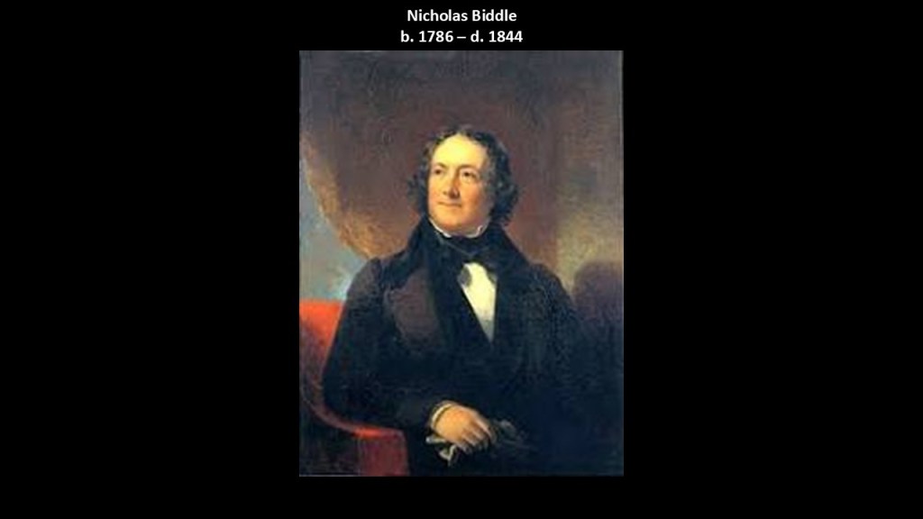
The most famous family member was Nicholas Biddle, one of the most important financiers of the early republic.
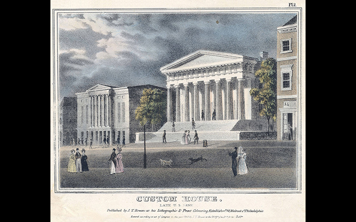
Nicholas Biddle served as President of the Second Bank of the United States, which was headquartered in the Custom House in Philadelphia, which was said to have been built between 1819 and 1824.
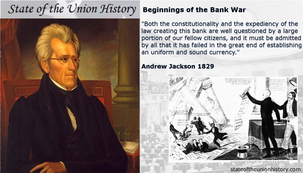
Biddle represented elite centralized finance and he became nationally famous during the “Bank War” with President Andrew Jackson.
The “Bank War” took place between 1832 and 1836, and ultimately resulted in the dissolution of the Second Bank of the United States when President Jackson refused to recharter this Federal Bank, instead removing federal deposits and expanding state banks.
The Biddle family had several “Main Line” estates, but their family estate that really got my attention was not directly on the Main Line, though it is in the Greater Philadelphia area.
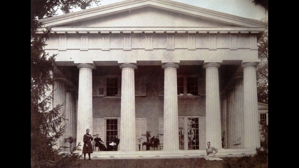
The ancestral home of the Biddle family was “Andalusia,”northeast of Philadelphia on the Delaware River in Bensalem Township, and is open to the public these days for tours.
The family estate is located on 75-acres, or 30-hectares, of land, with a mansion said to have been built as a summer home in 1795 that is considered one of the finest examples of Greek Revival architecture in the United States, and proportionally massive compared to the average height of people in our recent history as seen in this photo.
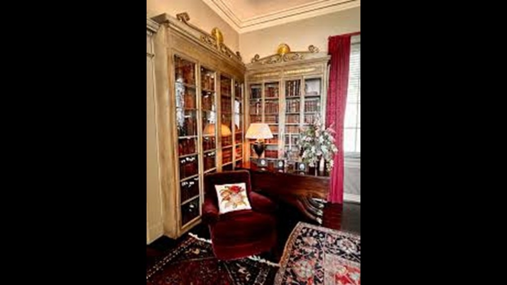
The mansion features original art, sculptures, and rare books & manuscripts that offer a glimpse into the opulent lifestyle of early American high society.
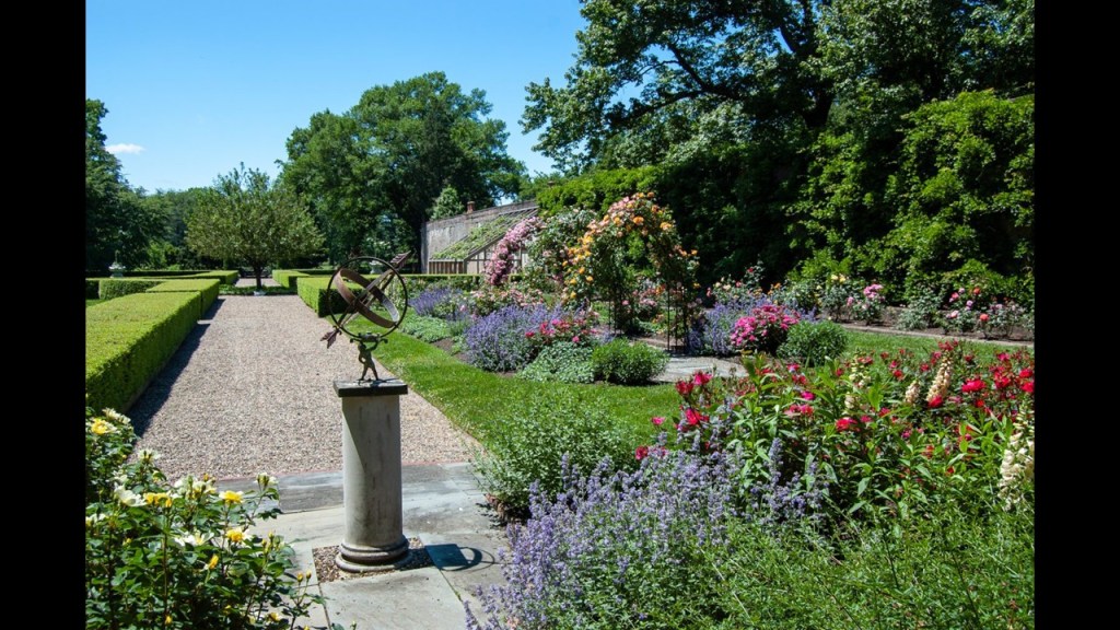
The estate contains formal and informal gardens, and an accredited arboretum with over 250 unique species of plants and trees.
There are several things that I would like to mention here.
The first is Andalusia, the name of the estate.
Andalusia is the southernmost region of Spain.
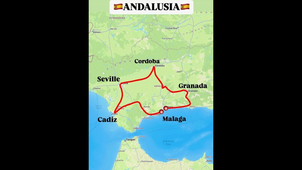
It is noteworthy for its association with Moorish Spain, a nearly 800-year-period between 711 AD and 1492 AD in our historical narrative that the Moors were recognized for their contributions to civilization, and where they were credited with introducing such things as advanced science and magnificent architecture.
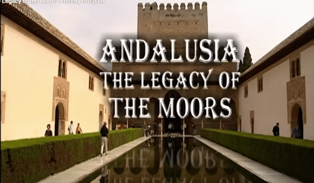
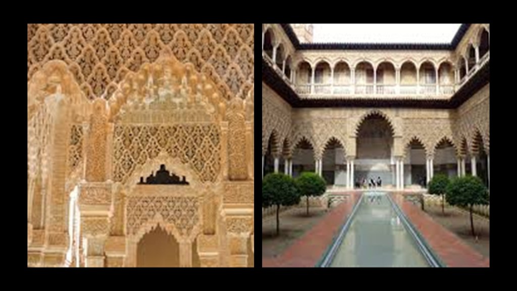
The city of Granada in Andalusia is where the beautiful complex of the Alhambra is located.
The Alhambra is perhaps the most famous example of Moorish architecture and one of the best-preserved palaces of Moorish Spain.
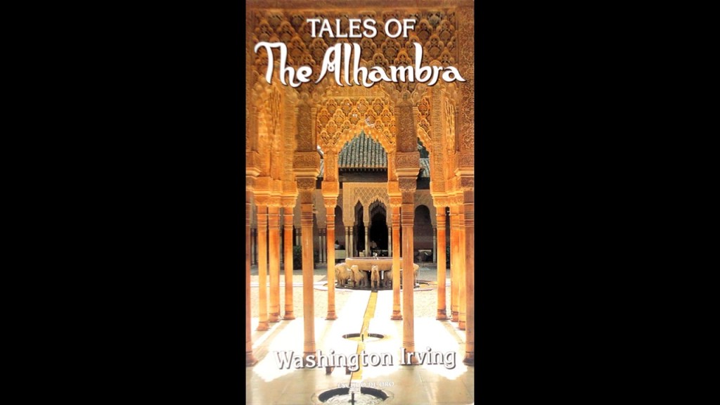
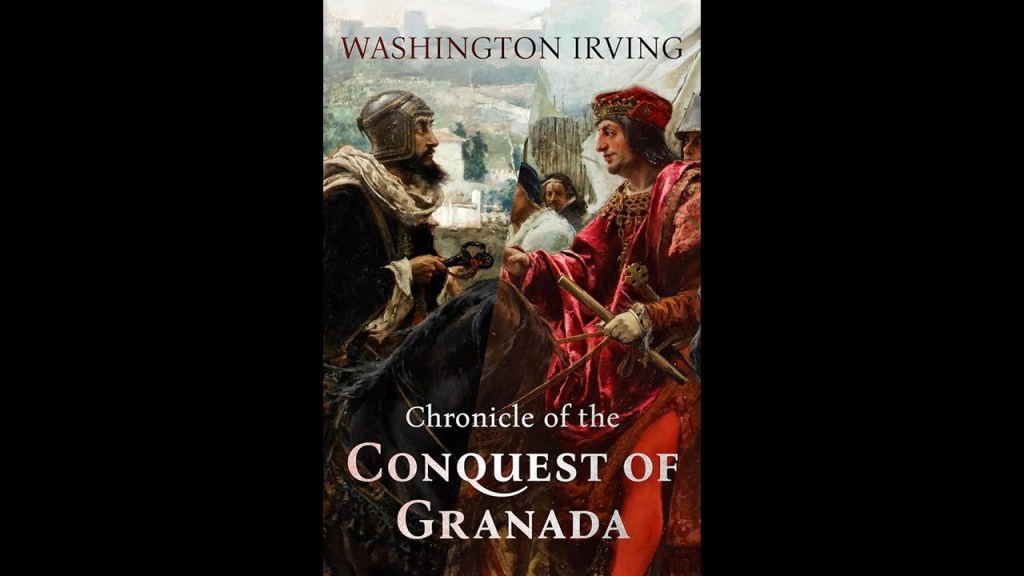
The early American novelist Washington Irving first published his “Tales of the Alhambra: A Series of Tales and Sketches of the Moors and Spaniards” in 1832.
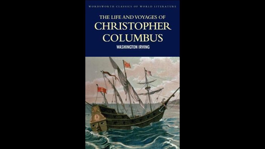
We are told that Washington Irving was in Spain between 1826 and 1829, during which time he published a biography of Christopher Columbus in 1828…
…and he published a book in 1829 after travelling to Granada on “A Chronicle of the Conquest of Granada,” a history of the years 1478 to 1492, and during which time he had also gathered the legends and tales about the Alhambra.
In my post “The Backfill of History and the Shaping of Our New Historical Narrative,” I have expressed my belief among other things that famous authors were being used as programming devices with which to shape our collective minds with a new historical narrative and history that we have been thoroughly educated in, and completely covering up what was once a worldwide ancient Moorish Civilization.
I have identified a 450-year timeline between the Fall of the Moors in Granada in 1492, and 1942, midway through World War II, with 1717 as the mid-point year, that I believe our new false paradigm was based on, and believe that at some point in our narrative, world history has been fabricated and backfilled, and that at some point in our relatively modern history, likely sometime in the 1700s, history became real with the Controllers writing themselves in to the new historical narrative.
More on this to come.
Next, there are two things that I would like to note about Bensalem Township in Pennsylvania.
The first thing is that Bensalem was the name of the mythical utopian island in Sir Francis Bacon’s “New Atlantis” that was first published 1626, after his death in April of that same year.
“New Atlantis” was said to portray a future vision of human discovery and knowledge, and the novel depicts an enlightened utopian land where qualities like generosity, high moral character, and honesty were commonly held by the inhabitants of a mythical island he called “Bensalem.”
There was a state-sponsored scientific institution on Bensalem called “Salomon’s House,” said to envision in the book the modern research university in applied and pure sciences.
I believe Bacon’s “New Atlantis” was actually describing the original advanced and worldwide Moorish civilization, which was the same civilization we know of as Atlantis, that existed in our relatively recent past.
The second thing I would like to mention about Bensalem Township is that it is the current location of the bronze sculpture of a giant disembodied horse’s head called “Horse at Water” at the Parx Casino and Racetrack entrance, a thorough-bred horse-racing venue.
The sculpture was originally installed at the Marble Arch in London in 2011, and sculpted by British artist Nic Fiddian-Green.
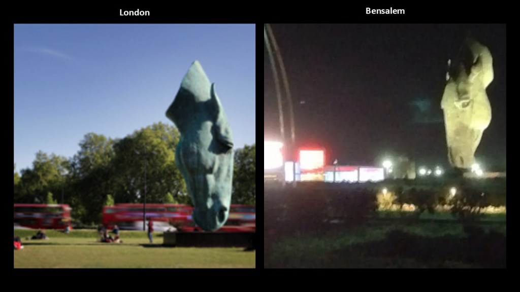
They seem to be trying to make a connection between the disembodied horse’s head as somehow symbolizing horses in general and therefore perfectly natural to have at the entrance of a thoroughbred horse-racing venue, but no matter how you spin it, the disembodied horse’s head is still perceived as creepy in the public eye.

I provided numerous examples from around the world, including this one, of bizarre and shocking art in very public places in my blog post “Really Creepy Public Art,” and framed my belief at the end of it that this creepy public art is some sort of soft disclosure, designed to circumvent the requirement of needing to tell us what they have done and are doing to Humanity, without telling us they are telling us, by putting this artwork in places where people can interact with it and accept it as “Art,” without knowing it is communicating to us something that has been very well-hidden about the world we are living in.
Next, the Drexel family.
The Drexel family was one of the classic Main Line families from the Gilded Age and the early 20th-century.
The family’s wealth originated in Center City Philadelphia banking through Drexel and Company, and we are told the Drexel family was very influential in the development of Philadelphia and the surrounding area.
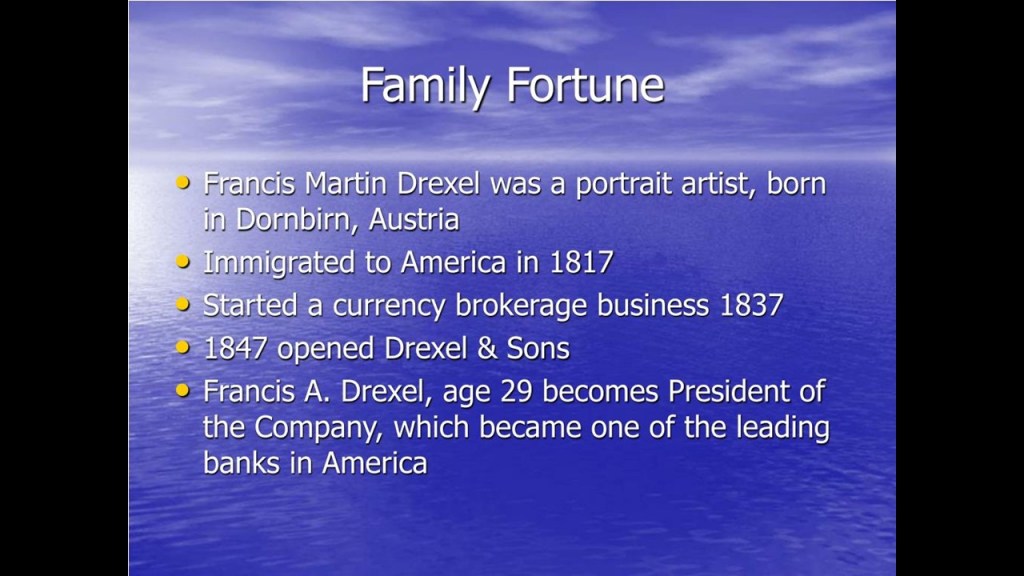
Francis Martin Drexel was an Austrian-American painter and banker who founded the banking house of “Drexel and Company” in Philadelphia in 1837, which became one of the largest banks in the United States.
The firm initially specialized as a currency brokerage firm, specializing in discounting privately-issued bank notes and trading foreign exchange, which laid the foundation for it to become a global financial powerhouse.
Anthony Joseph Drexel, the son of Francis, played a major role in the rise of global finance after the American Civil War.
He founded “Drexel, Morgan and Company” in 1871, with J. P. Morgan as his junior partner.
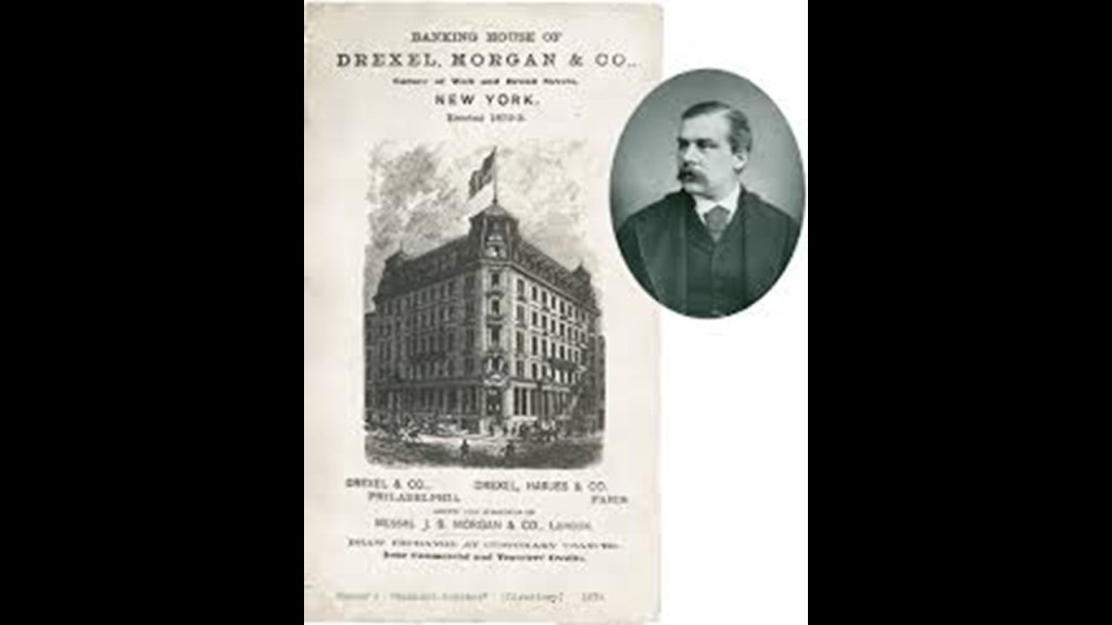
J. P. Morgan was an American financier and banker who dominated corporate finance on Wall Street throughout the period of time called the “Gilded Age,” between the years of 1870 and 1900.
He was a driving force behind the wave of industrial consolidation in the United States in the late 18th- and early 19th-centuries.
Morgan was behind the formation of the U. S. Steel Corporation, General Electric, and International Harvester, among many other mergers.

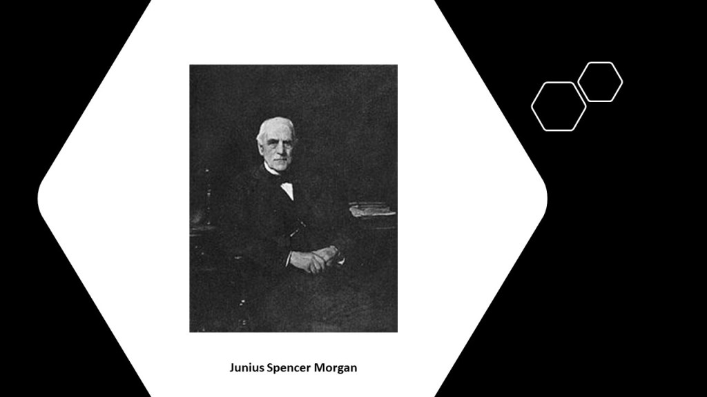
J. P. Morgan’s father was Junius Spencer Morgan.
Junius Spencer Morgan was the founder of the company that would become J. S. Morgan & Company in 1864, that was the successor company to the London-based George Peabody & Company, of which he became the Junior Partner in October of 1854.
In 1854, Morgan was put in charge of the firm’s iron portfolio, which included the marketing of railroad bonds in London and New York.
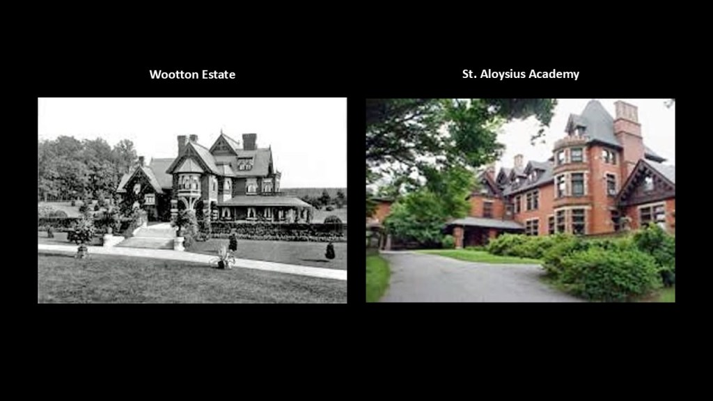
Back in Philadelphia, perhaps the most famous Drexel Estate on the “Main Line” is the Wootton Estate in Radnor.
It is described as a magnificent summer estate developed by publisher George Childs and his partner Anthony Joseph Drexel.
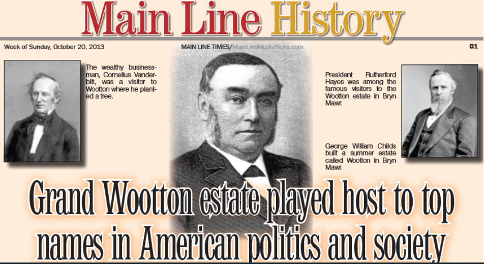
It featured a 50-room mansion that was said to have been built in 1881, and since 1950 has been the home of the St. Aloysius Academy, the only private, Catholic, all-boys school in the Philadelphia-area.
A couple of interesting side-notes here.
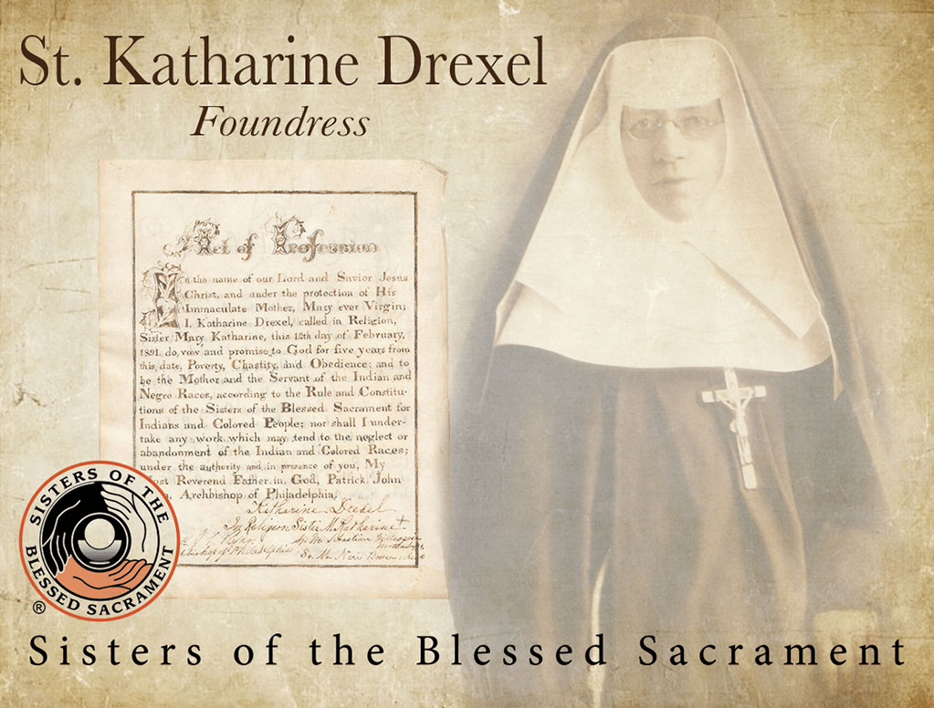
One is that the second-American saint born in the United States, Saint Katherine Drexel, was the daughter of banker Francis Anthony Drexel, the oldest son of Francis Martin Drexel and brother of Anthony Joseph Drexel.
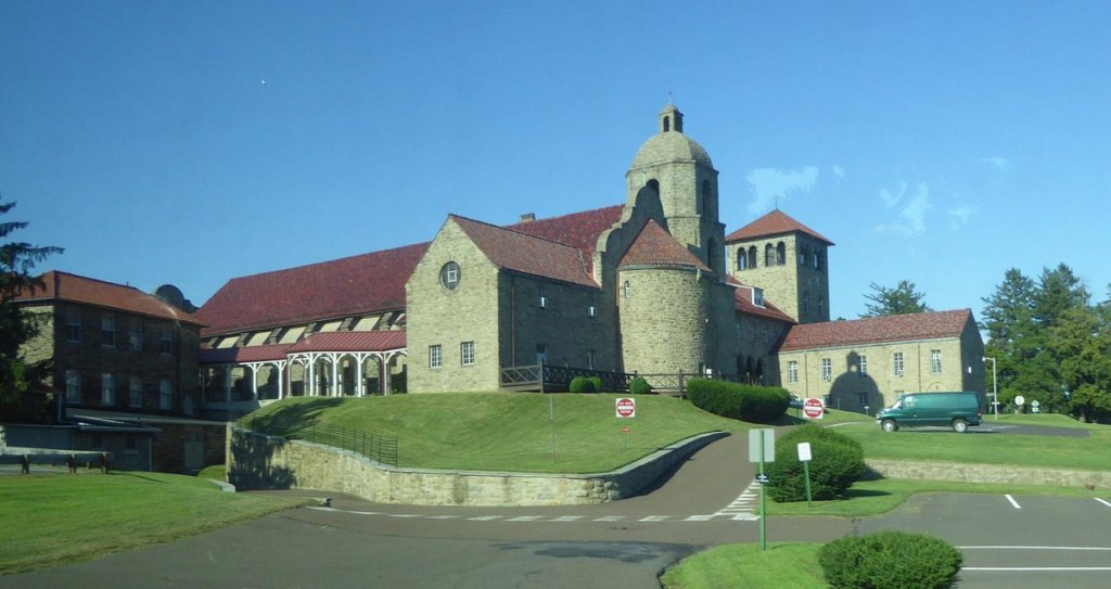
In 1891, she founded what was called the “Congregation of the Sisters of the Blessed Sacrament for Indians and Colored People” in Bensalem, in which she used the vast wealth of $20-million she inherited from her father to finance schools and missions for Native Americans and African-Americans in our historical narrative.
This is the Saint- Katharine Drexel Mission Center and Shrine in Bensalem.
Also interesting to note that Anthony Joseph Drexel was the first president of the Fairmount Park Art Association, the nation’s first private organization dedicated to integrating public art and urban planning that was established in Philadelphia in 1872.
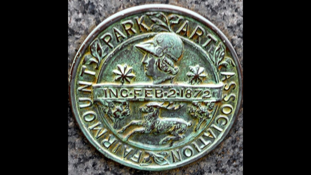
Today, the Association for Public Art works with the city’s Public Art Office, Fairmount Park, and other agencies responsible for placing and caring for outdoor sculptures in Philadelphia.
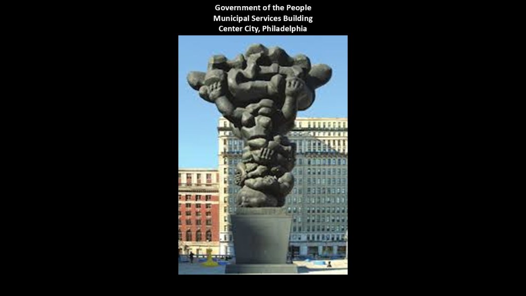
Like the “Government of the People” statue in the plaza of the Municipal Services Building in Center City, Philadlephia.
It is described thus: A tower of intertwined human arms, legs, and torsos that are arranged in a three-tier totem, with a family at the base representing life; a young couple above representing hope; and figures at the top holding a turbulent shape that is meant to symbolize the banner and flag of Philadelphia.
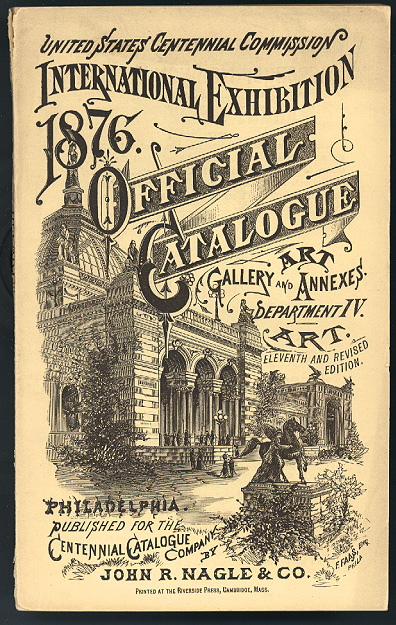
Fairmount Park in Philadelphia was the location of the 1876 Centennial Exhibition, the first official World’s Fair in the United States,
We are told it was held to celebrate the 100th-Anniversary of the signing of the Declaration of Independence.
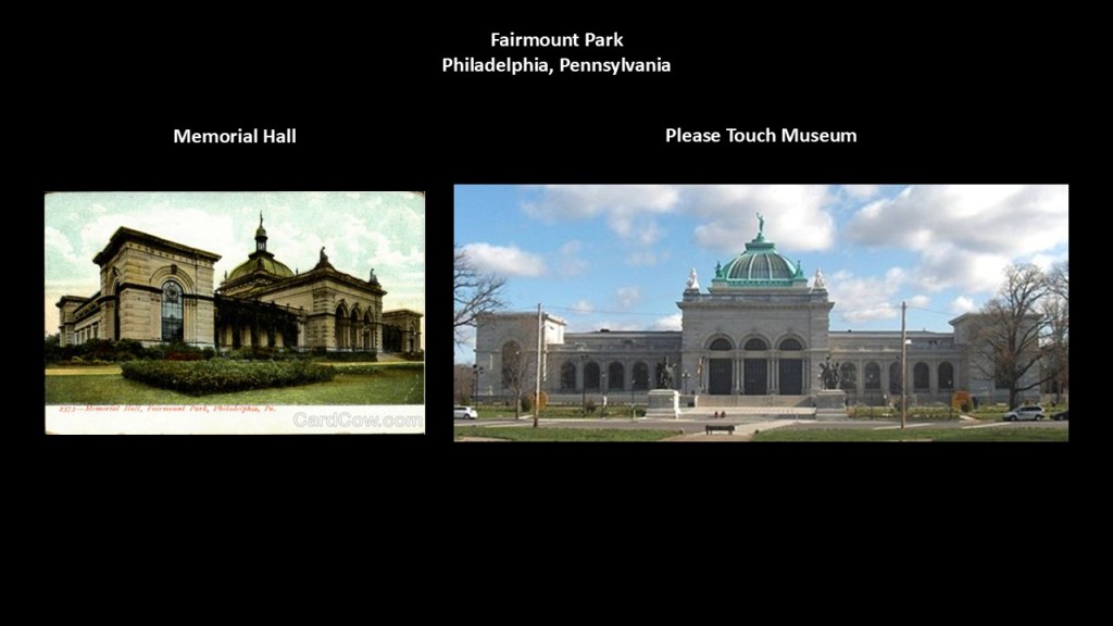
German architect Herman Schwarzmann was given the credit for designing all the buildings for the Centennial Exposition, starting in 1869.

This is the Memorial Hall in Fairmount Park, said to have been built as the Art Gallery for the 1876 Centennial Expo, and the only major structure from that exhibition to survive to the present day.
It is currently called the Please Touch Museum, which focuses on teaching mostly children seven-years-old and younger through interactive exhibits and special events.
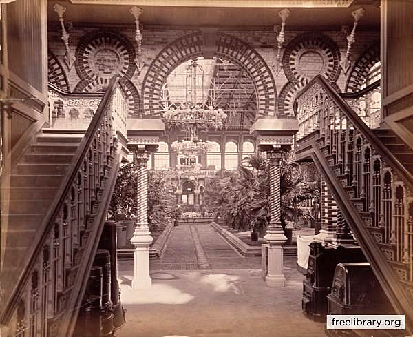
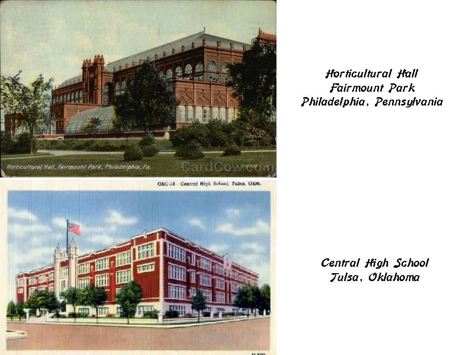
This was inside the original Horticultural Hall, no longer standing, that was said to be designed for the 1876 Exposition in the Moresque style of the twelfth-century…
…and looks a lot on the outside on the top, like some Oklahoma High Schools to me, like this historic photo of the original Central High School in Tulsa, on the bottom.
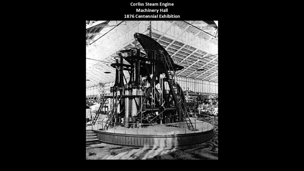
The largest Corliss Steam Engine ever built, with its 1,400-horsepower engine, was on display in, and generated all the energy used in, the Machinery Hall during the 1876 Exhibition.
The Corliss Steam Engine was said to have been invented by George Henry Corliss, and patented in 1849. It is a steam engine fitted with rotary valves and variable valve timing, and generally 30% more fuel efficient than conventional steam engines.
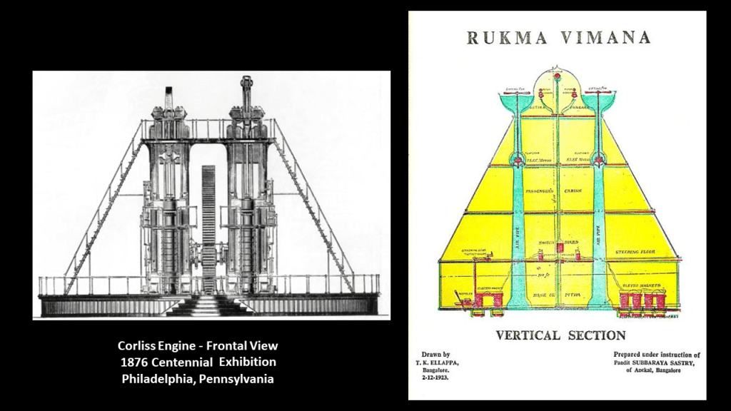
Somebody left me this comment after I uploaded the video four years ago called “Exposing Exihibitions, Expositions, and World Fairs Since 1851” about the Corliss Engine looking like a Rukma Vimana.

I looked it up, and sure enough, it does look like a Rukma Vimana!
This was the frontal view of the Corliss steam engine from the 1876 Centennial Exhibition on the left, and an illustration of the Rukma Vimana on the right.
Vimanas have come down to us as ancient flying vehicles that are described in ancient Indian texts.
Lastly for families on the “Main Line,” on the “Lenapehoking,” the homelands of the Lenape people, I want to look at the Hires family.
Charles E. Hires created “Hires Root Beer,” which gained popularity in the 1870s.
The Hires Family came into prominence in the Gilded Age through manufacturing and consumer products and would be considered more “new money” by Philadelphia standards of the day.
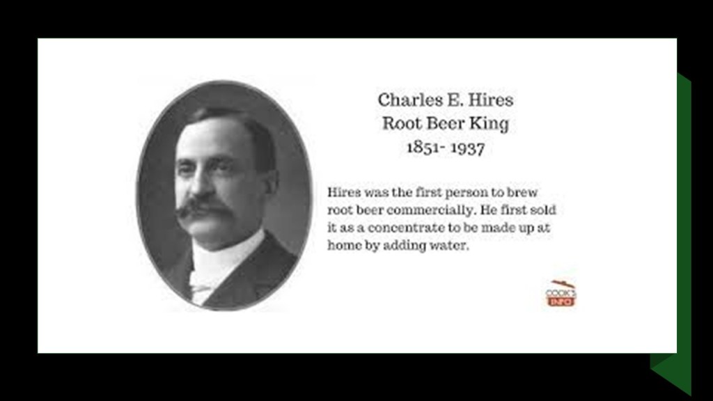
He was described as a pharmacist, who developed health remedies and flavoring extracts as he developed his root beer drink, the first successful commercial root beer soft drink.
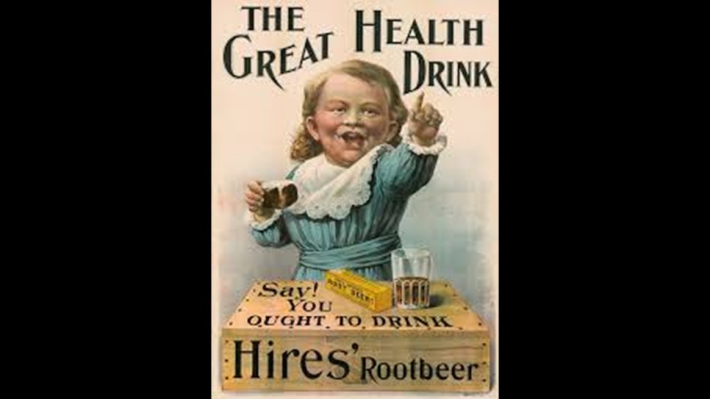
Charles Hires also owned sugar plantations in Cuba and dairies for his condensed milk factories and plants in the Philadelphia-area and across the country.
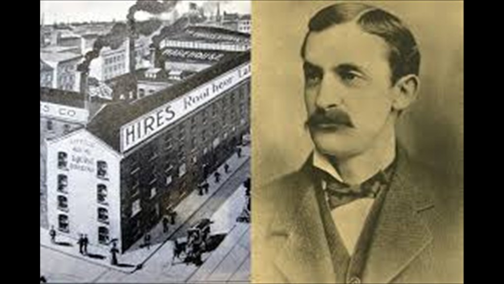
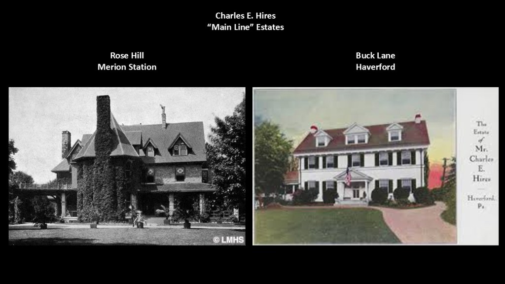
Charles Hires had a 21-acre, or 8 1/2-hectare, estate in Merion Station called Rose Hill, as well as one on Buck Lane in Haverford.
There was also the Wanamaker family, which had the Lindenhurst Estate in Jenkinstown, north of Philadelphia, but not directly part of the “Main Line” suburbs of wealthy families.
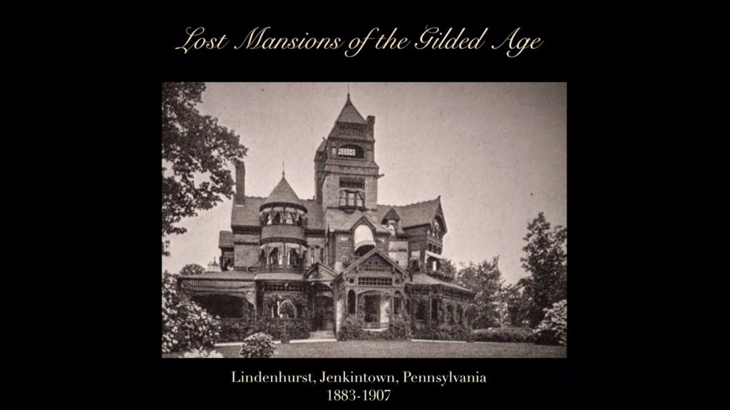
The Wanamaker family, like the Hires family, was also a “New Money” family, from the Gilded Age, rising to prominence through John Wanamaker, the founder of “Wanamaker’s Department Store” and which went on to became one of the most important and influential department stores in American retail history.
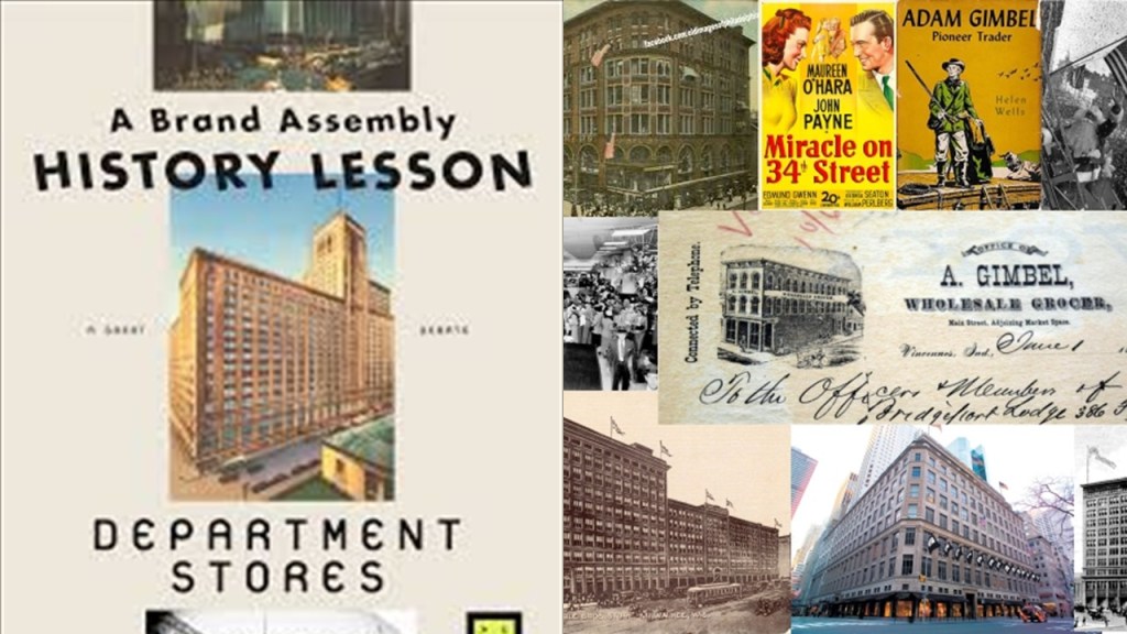
Department stores emerged in the 19th-century as a new way of organizing retail, where one store sold a huge range of goods instead of buying from open-air markets, specialty stores, peddlers and dry-goods stores.
American department stores developed rapidly after the Civil War, which took place in our narrative between 1861 and 1865.
They emerged with industrialization and the mass production of consumer goods; the rise of railroads and steamships facilitating the distribution of goods nationwide; and advertising through newspapers and catalogues.
Interesting to note the Moorish-looking appearance of the 1876 Wanamaker’s Department Store building in Philadelphia shown here.
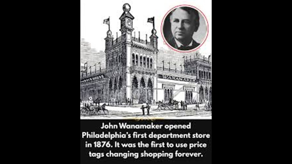
Wanamaker’s was comparable in prestige and scale to Macy’s in New York, and Selfridge’s in London, though it no longer exists as a retail business.
The Wanamaker Grand Court Organ, the largest fully-functioning pipe organ in the world, today is located in the 7-story Grand Court of Macy’s Center City, formerly Wanamaker’s Department Store.
Said to have been built for the 1904 St. Louis World’s Fair, it has 28, 750-pipes and is famous for its orchestra-like sound as it was designed to imitate a full-size orchestra.
After the World’s Fair in St. Louis, it was said to have languished in storage until 1909, at which time it was purchased by John Wanamaker for his department store in Center City, Philadelphia.
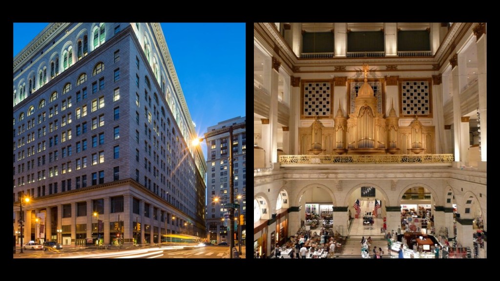
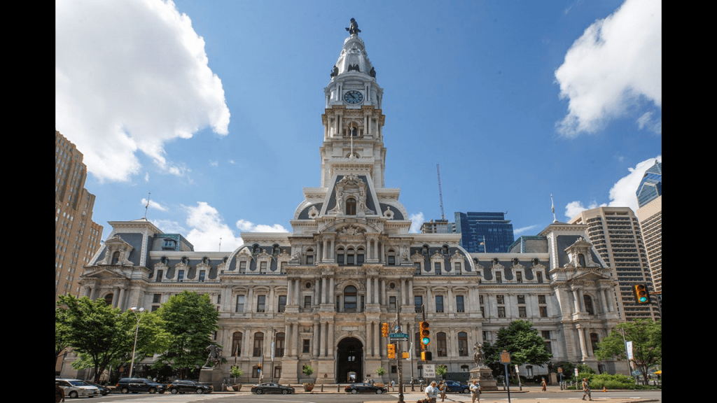
Macy’s Center City is literally just around the corner from the Philadelphia City Hall.
This part of Philadelphia is the historic center of the city.
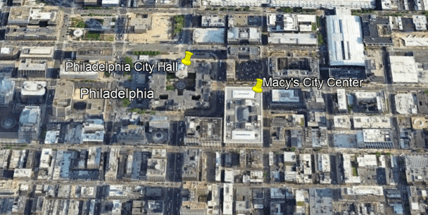
Philadelphia’s City Hall is the world’s tallest, free-standing masonry building, said to have been designed in the ornate Second French Empire-style of Emperor Napoleon III, and constructed from brick, white marble, and limestone between 1871 and 1901.
At the time it was completed, it was said to have the tallest clock-tower in the world.
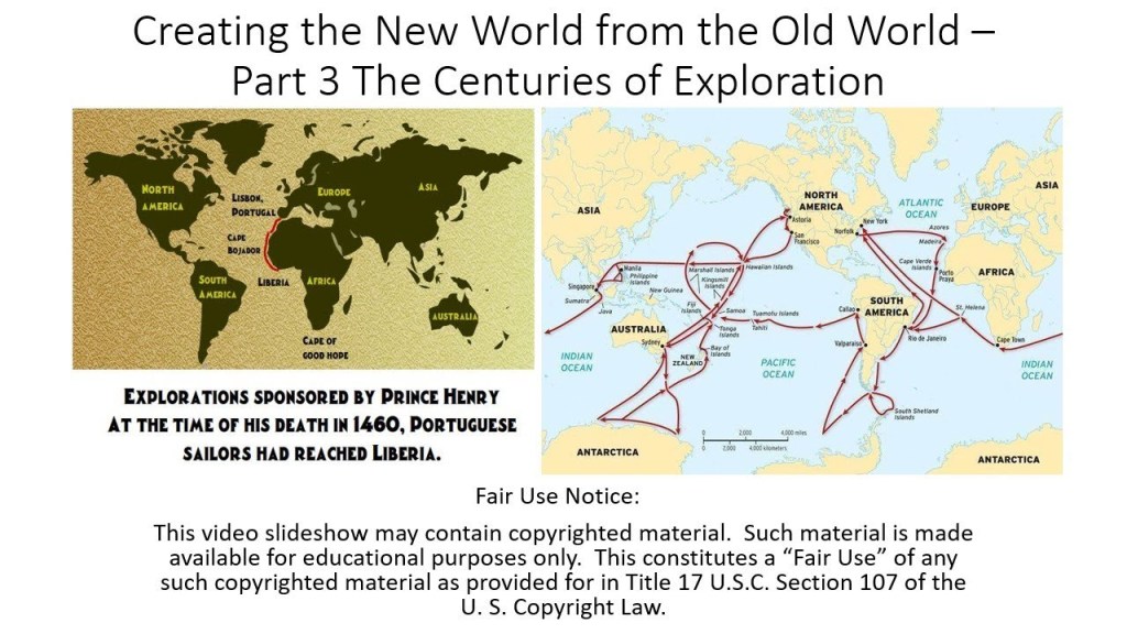
Before I go further, I would like to mention it was when I was researching “Creating the New World from the Old World – Part 3 The Centuries of Exploration” in June of 2020 that I first came to believe that the history about early explorers in school and in our culture is back-filled information and did not really happen as we have been taught, including but not limited to, Henry Hudson who we are told changed everything for the Lenape of this region.
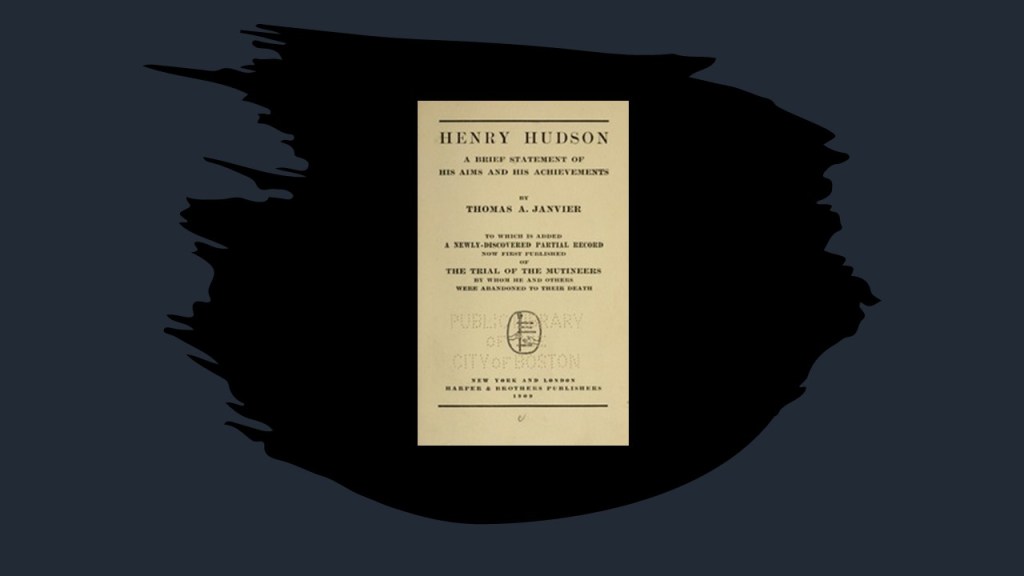
At that time, I found this 1909 publication about Henry Hudson by Thomas Allibone Janvier, described as an American story-writer and historian.
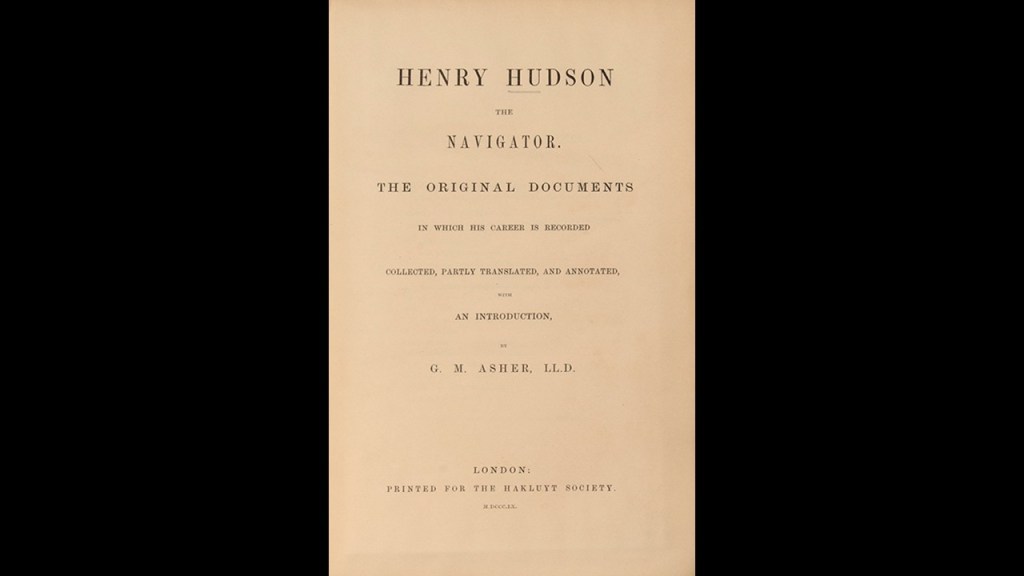
Earlier biographies of Henry Hudson included a book about Henry Hudson that was published by G. M. Asher in 1860 entitled “Henry Hudson the Navigator,” which served as a foundational biographical source for later writers…
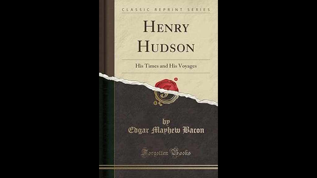
…and one that was published by Edgar M. Bacon in 1907 called “Henry Hudson: His Times and His Voyages.”
When I was researching the Hudson River, I found out that a replica of Henry Hudson’s ship the “Half Moon” was said to have been built in 1912 and moored at the dock of the Bear Mountain State Park on the Hudson River.
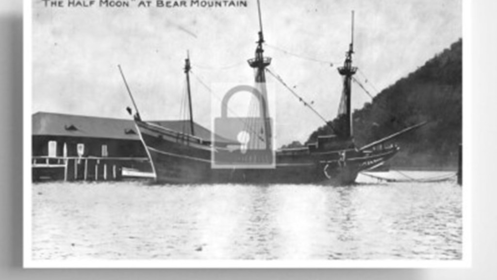
With regards to the history of this park, this is what we are told.
In January of 1909, the State of New York purchased a 740-acre tract of land at Bear Mountain, with plans to build Sing-Sing Prison there, but conservationists stopped the prison from being built.

Later that year, the newly-widowed Mary Averill Harriman, wife of Union Pacific Railroad President and American Financier Edward Henry Harriman who died in September of 1909, offered the state another 10,000 acres – and $1,000,000 – towards the creation of a state park.
American Progressive politician and businessman George W. Perkins, a partner in the J. P. Morgan Company and President of the Palisades Interstate Commission since 1900, with whom Mary Harriman had been working, managed to raise another $1.5-million from a dozen wealthy contributors, including John D. Rockefeller and J. P. Morgan.
The state matched the contributions with a $2.5-million appropriation, and Bear Mountain-Harriman State Park came into being in 1910, and managed by the Palisades Interstate Commission, which was formed in 1900 by New York Governor Theodore Roosevelt and New Jersey Governor Foster Vorhees.

The firm Harriman Brothers & Company grew out of the business empire of W. Averrill Harriman and E. Roland Harriman, the sons of railroad magnate Edward Henry Harriman.
Harriman Brothers & Company merged with the Brown Brothers, originating from Alex. Brown and Sons, the first investment banking firm in the United States in 1800, to become known as the “Brown Brothers Harriman & Company,” one of the oldest and largest private investment banks in the United States.

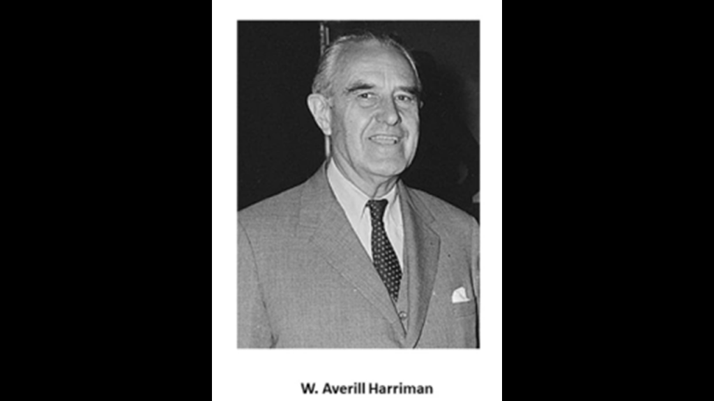
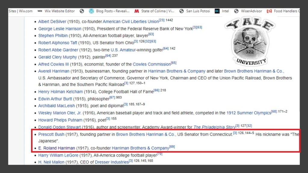
Founding partners of the “Brown Brothers Harriman & Company” included W. Averill Harriman, the son of railroad baron Edward Henry Harriman and Mary Harriman, and Secretary of Commerce under President Harry S. Truman…
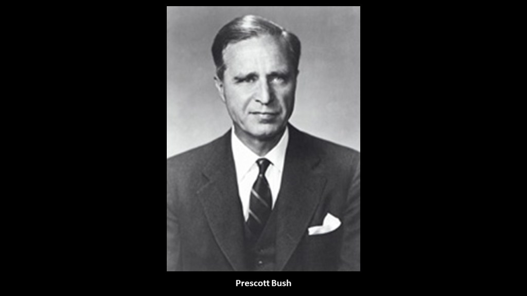
…and Prescott Bush, American banker and politician, and the father of President George H. W. Bush.
Investment banker E. Roland Harriman, AKA “Bunny,” was also the Chairperson of the Board of Governors of the American Red Cross from 1950 to 1973.
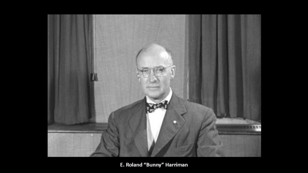
Prescott Bush and E. Roland Harriman attended Yale University at the same time, where they were both members of the “Skull and Bones” Society.
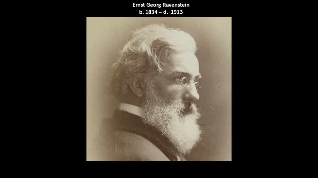
Over the years I have been researching, I have encountered people like Ernst Georg Ravenstein, who was born in Germany in 1834, publishing books in the 19th-century about famous early explorers.
Like Bartolomeu Dias, the Portuguese explorer said to have sailed around the southernmost tip of Africa, the Cape of Good Hope, in 1488, setting up the route from Europe to Asia later on.
Ravenstein was credited with writing the first biography of Dias that was originally published in 1900 and republished in 2010.

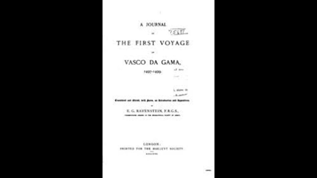
Ravenstein was also said to have translated the only known copy of a journal believed to have been written on-board ship during Portuguese explorer’s Vasco da Gama’s voyage to India, which was published in 1898, who made it to India in a journey between 1497 and 1499 in our historical narrative.
Next I am going to move on into the State of New Jersey from the Philadelphia-area, and look at places like Ong or Ong’s Hat, Lake Lenape, Atlantic City, Sayreville, the Navesink Twin Lights, and Holmdel.
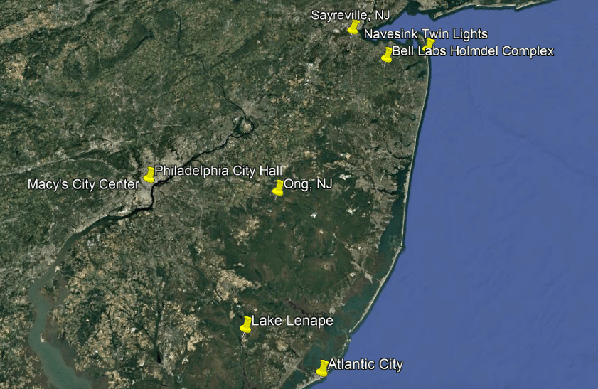
First, Ong.
While it is not an elite enclave, I believe it is part of the story of what has taken place here to bring us to the world we live in today.
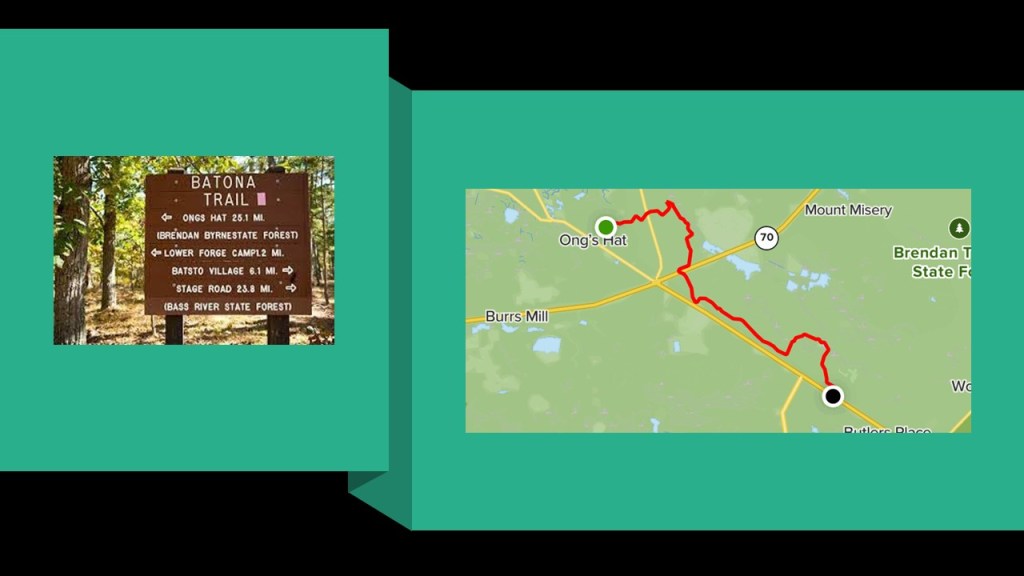
Ong, or Ong’s Hat, is a ghost town in the Brandon T. Byrne State Forest, and the northern terminus of the Batona Trail, a 53.5-mile, or 86.1-kilometer, hiking trail through the New Jersey Pine Barrens.
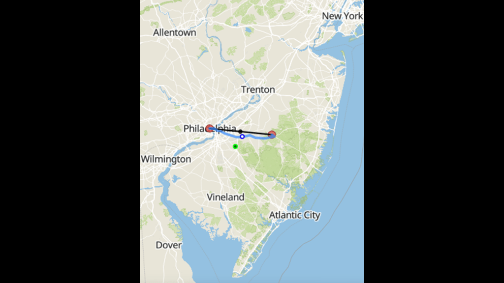
Ong is 29-miles, or 47-kilometers, east of Philadelphia.
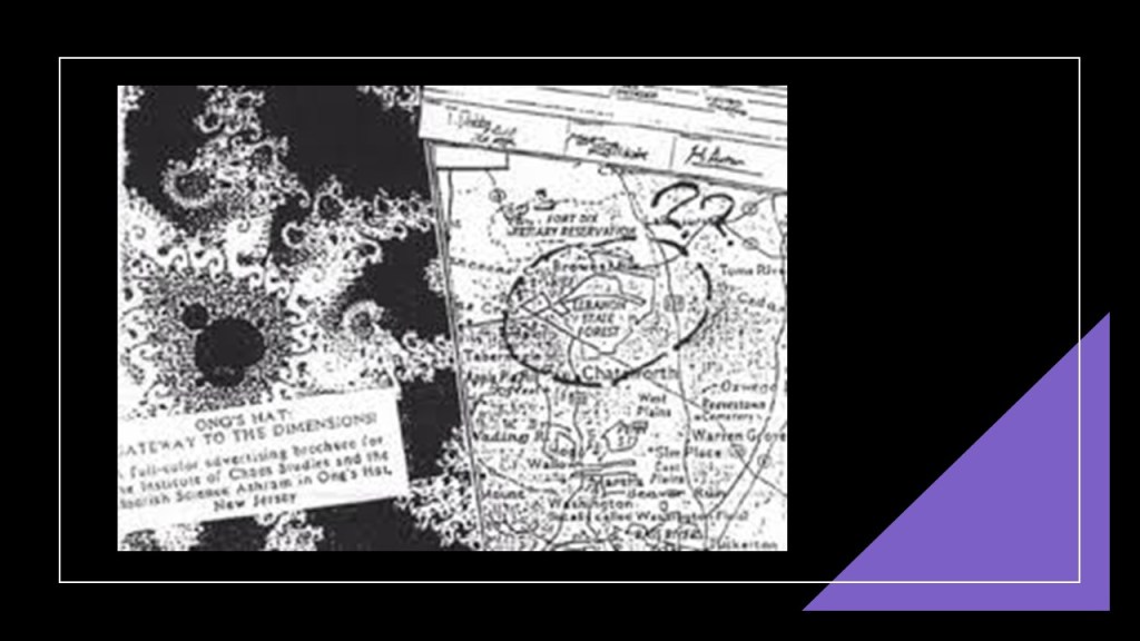
Ong’s Hat was also considered one of the earliest, internet-based, conspiracy theories.
Ong’s Hat is also listed as the first Alternate Reality Game (ARG) on many lists of ARGs.

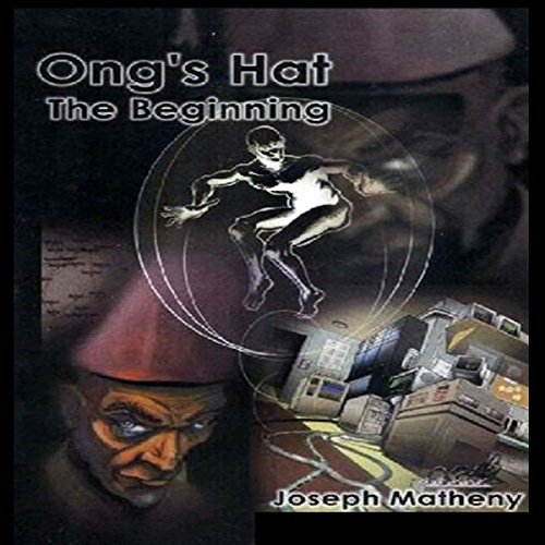
We are told that “Ong’s Hat” was a work of alternate-reality collaborative fiction, beginning back in the 1980s and embedded in various media to establish a backstory, and that author Joseph Matheny concluded the project.
Interesting to note on this cover that there are two Moors depicted on it, as seen on the lower left and upper right.
The Ong’s Hat tale was told about a group of physics and science professors from Princeton who ran chaos theory and quantum physics experiments from an ashram there to travel interdimensionally through a device called “The Egg,” and they were camped out in another world.
“The Egg” was said to have been developed by these physicists and scientists as a sensory deprivation chamber, and used by them to determine when a wave becomes a particle.
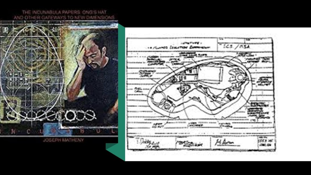
One day “The Egg” disappeared, and the young man within explained that in the seven-minutes he was gone, he had travelled to an alternate dimension of the Earth.
According to the story about “Ong’s Hat,” these experiments continued over the years, until the military threatened their research, at which time they moved entirely in to the alternate dimension, only coming back for supplies.
Interesting to note that Joint Base McGuire-Dix-Lakehurst, the only tri-service base in the U. S. Department of Defense, is right there, at a distance of only 8-miles, or 13-kilometers, north of Ong.
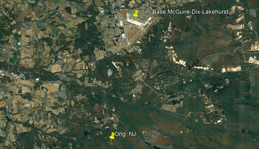
At any rate, Ong is reputed to be an interdimensional gateway.
Next, Lake Lenape Park.
This is what we are told about Lake Lenape Park on the Great Egg Harbor River.
The Great Egg Harbor River flows southeast in New Jersey from near Camden, entering the Great Egg Harbor about 5-miles, or 8-kilometers, southwest of Atlantic City.
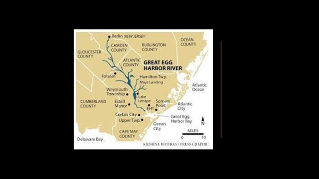
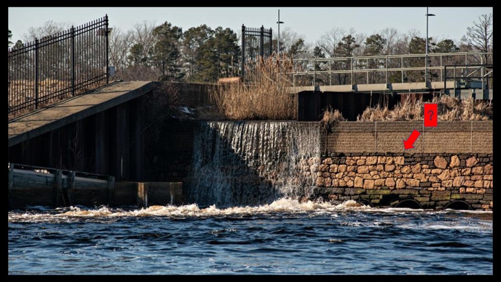
Lake Lenape was formed after the construction of a dam in May’s Landing around 1847, with the land having previously been an apple orchard.
Interesting to note the megalithic stones used in the construction of the dam.
Lake Lenape Park was said to have first opened in the early 1900s.
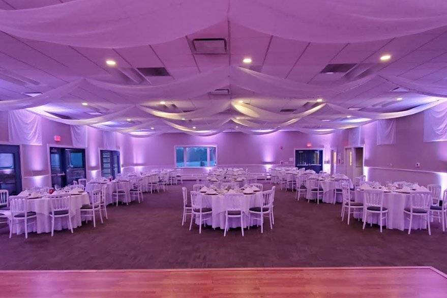
Named for the indigenous people who lived here, Lake Lenape Park features Lakeside Manor, a popular wedding and special event venue.
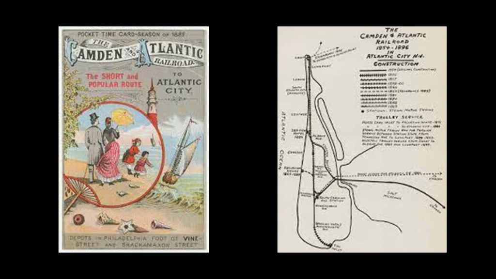
We are told that in 1854, the first railroad was built in the area between Camden and Atlantic City.
So let’s take a look at what they tell us about Atlantic City, which was Lenape land prior to the arrival of European settlers.
We are told in our historical narrative that Jeremiah Leeds was the first permanent European settler in the Atlantic City-area in 1783.
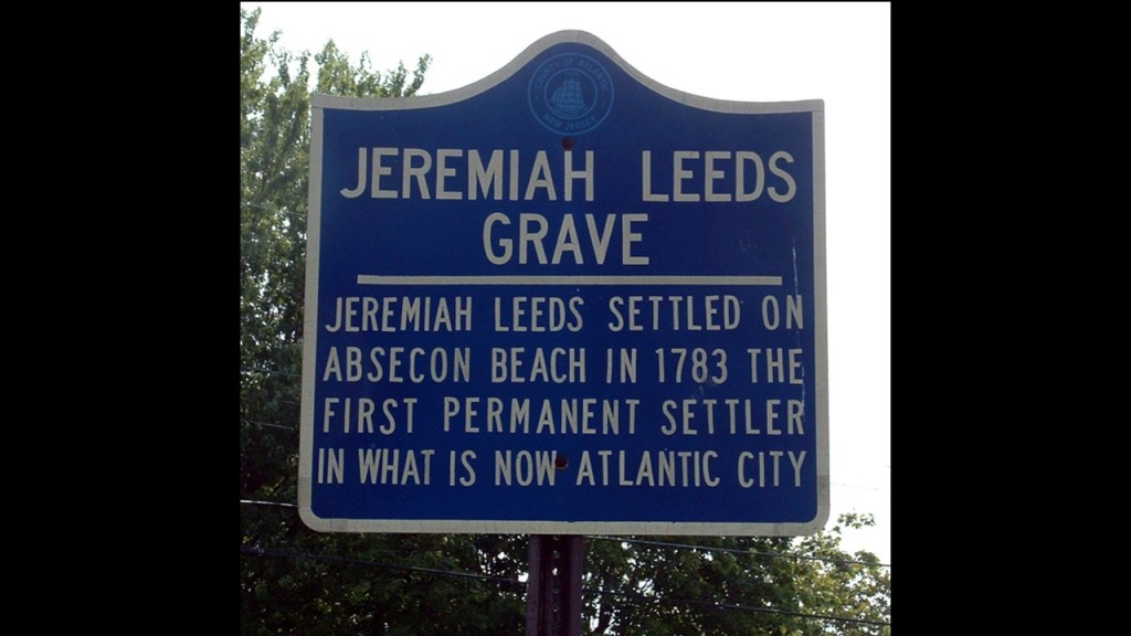
But it was not until 1850 that the idea of this becoming a resort location was conceived, and the first hotel here was said to have been built in 1853.
What became known as “Atlantic City” was incorporated in 1854, the same year that train service began on the Camden and Atlantic Railroad mentioned previously, and providing a direct link to Philadelphia in Pennsylvania.
The first Atlantic City Boardwalk was said to have been built in 1870.
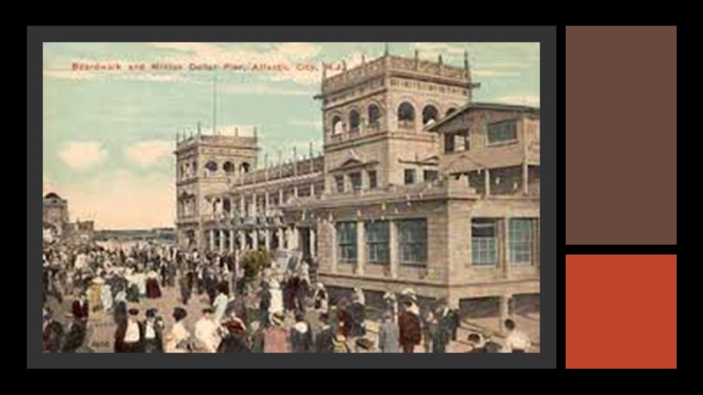
By 1874, an estimated 500,000 were coming to Atlantic City each year by the railroad, and we are told that there were so many people coming to Atlantic City by 1878 that the decision was made to build the Philadelphia and Atlantic City Railroad was constructed to accommodate the increased ridership.
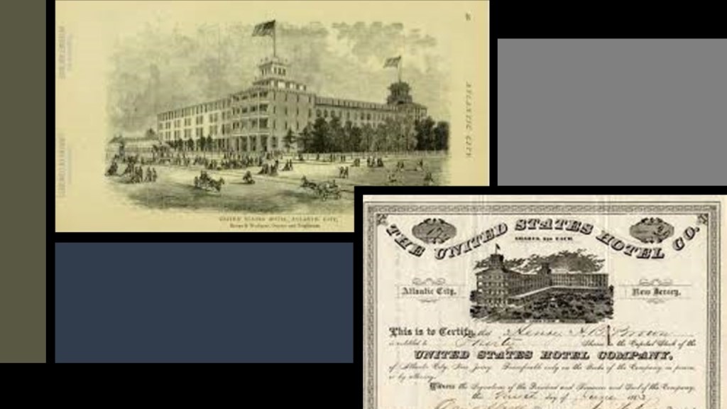
Then, in order to accommodate the increasing number of tourists coming to Atlantic City, massive hotels like the United States Hotel sprang up.
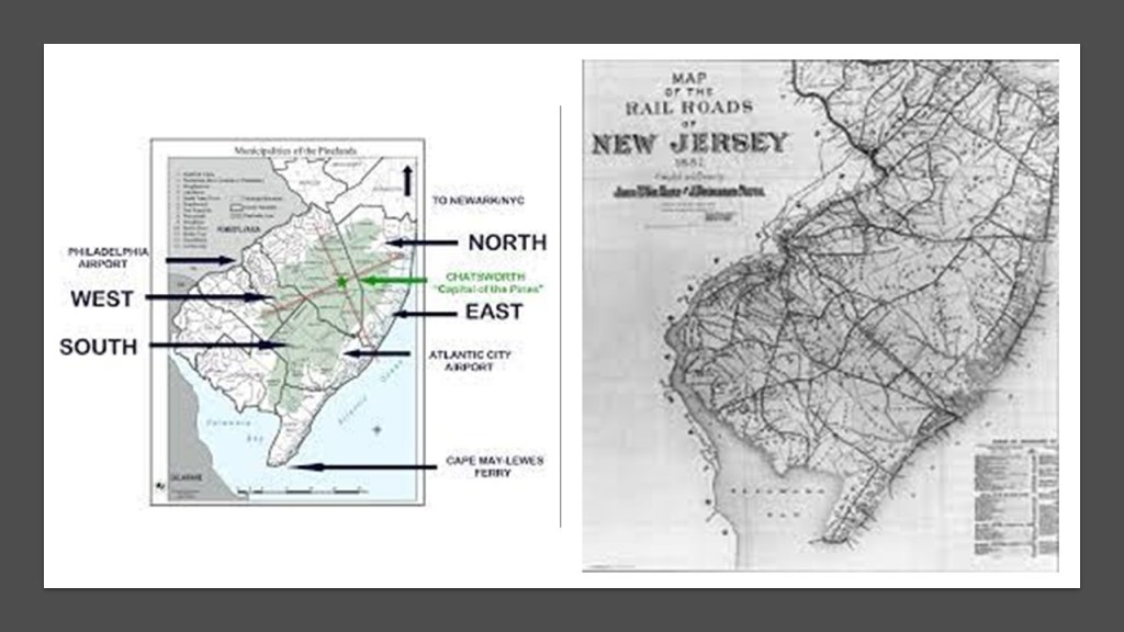
And all of the new railroad lines that were popping up betwixt and between these large population centers and the South Jersey shore were going right through the desolate, swampy and forbidding New Jersey Pine Barrens.
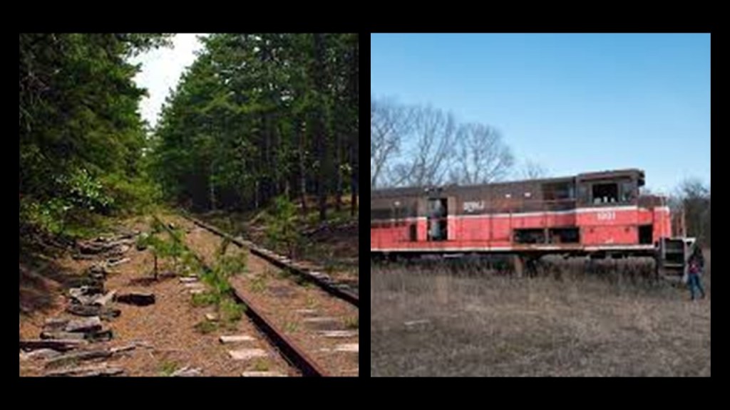
Today there are abandoned trains and railroad lines found throughout the New Jersey Pine Barrens.
Atlantic City’s Steel Pier was said to have been built by the Steel Pier Company that first opened in June of 1898 as an amusement park built on a pier.
Called the “Showplace of the Nation,” it was one of the most popular entertainments in the United States for 70 years.
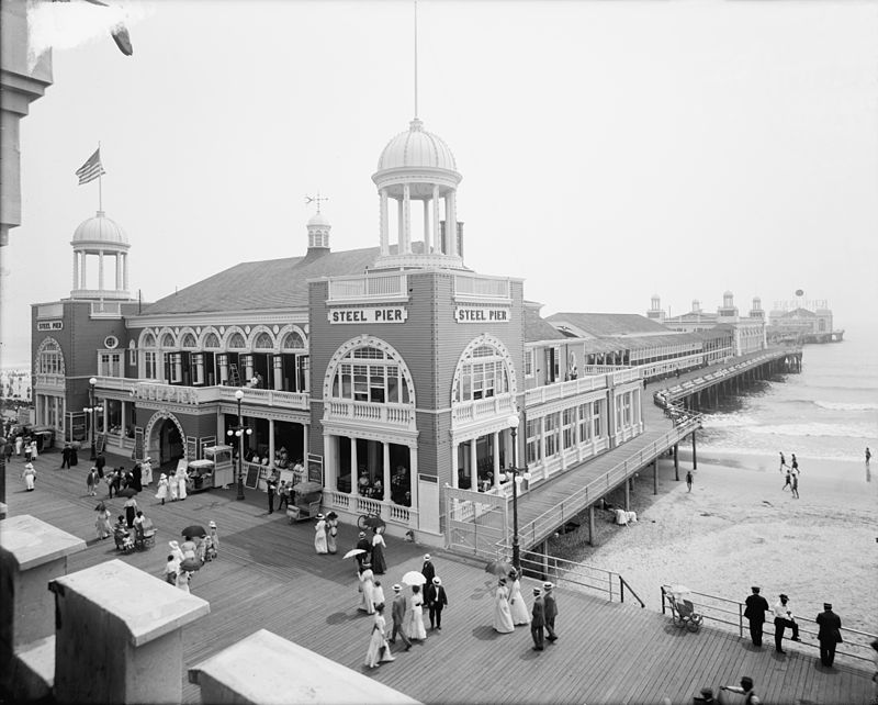
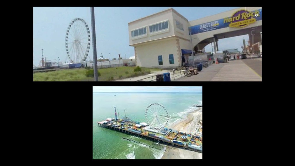
The Steel Pier continues to operate as an amusement park to this day.
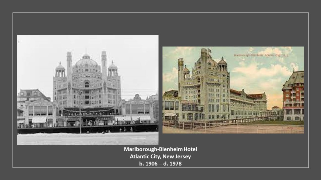
Other examples of the original Moorish-style architecture in Atlantic City included the Marlborough-Blenheim Hotel, which was said to have been built between 1902 and 1906, and demolished in October of 1978…
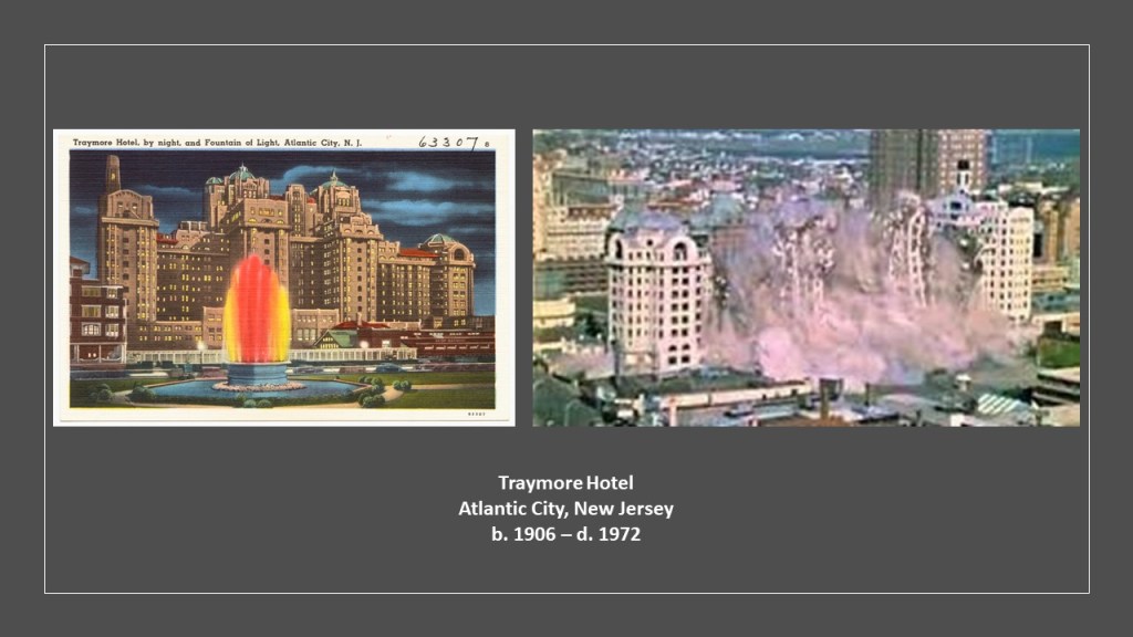
…the Traymore Hotel, said to have opened in its most recent form in 1906 and demolished in 1972…
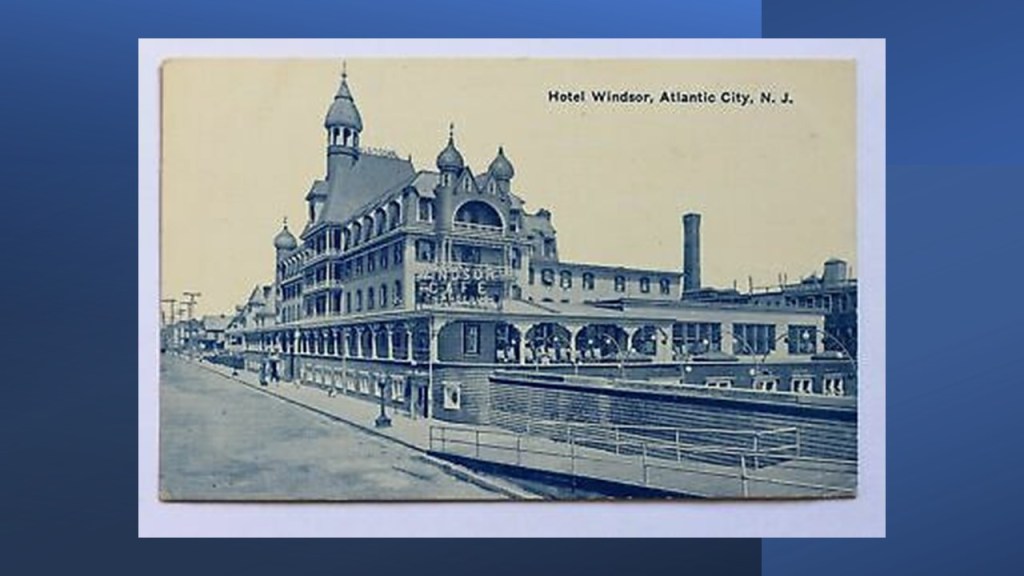
…and the Hotel Windsor, about which I can’t find any information to speak of, but presumably long gone.
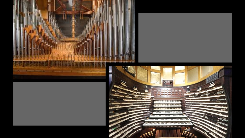
When I was looking around Atlantic City, I also found out that the largest organ in the world by number of pipes, officially with 33,113, is in the Main Auditorium of the Boardwalk Hall, formerly known as the Atlantic City Convention Hall.
What we are told is that it is one of the few surviving buildings from Atlantic City’s hey-day as a seaside resort.
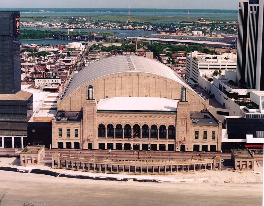
Recognized by the Guiness Book of World Records as the largest and loudest musical instrument ever constructed, it is called the “Boardwalk Hall Auditorium Organ,” also known as the “Poseidon,” and the “Midmer-Losh,” after the defunct pipe-organ building business that was said to have built the instrument between 1929 and 1932.
This organ has not been fully functional since 1944, when it was first damaged in the 1944 Great Atlantic Hurricane, during which time the Boardwalk Hall was flooded with seawater.
Further damage to the organ was said to have taken place in 2001 when it was improperly handled by workmen during a renovation of the Boardwalk Hall.
While we are told that restoration efforts have been on-going, as of yet it’s not fully-operational.
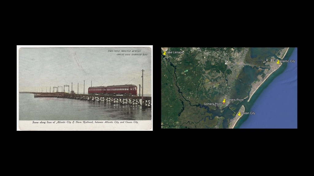
This is an old postcard showing the Atlantic City and Shore Railroad crossing a two-mile, or 3-kilometer, -long trestle bridge in the middle of the Great Egg Harbor Bay, and was part of an interurban trolley system in New Jersey that served Somers Point and several other cities between Atlantic City and Ocean City in the years between 1907 and 1948.
The reason given for the end of its operation was a hurricane damaging the viaduct in 1948, and fixing it was cost prohibitive because of the decline in trolley use.
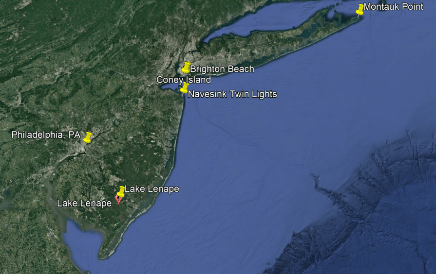
Continuing to track the coastline heading north along the New Jersey shoreline from Lake Lenape and Atlantic City, we come to Sayreville, the Navesink Twin Lights, and Holmdel.
First, Sayreville.
Sayreville is located at the mouth of the Raritan River where it enters Raritan Bay in the New York – New Jersey Estuary System.
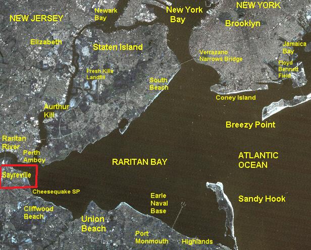
This whole area is part of what is called the New York – New Jersey Harbor Estuary System, forming one of the most intricate natural harbors in the world, as well as being the busiest port in the world as the Ports of New York and New Jersey are contained within it.
An “estuary” is defined as a partially-enclosed, coastal body of brackish water, which is water that is salty, dirty & unpleasant, with one or more rivers flowing into it, and a connection to the open sea.
Estuaries have been on my radar for quite some time as ruined and sunken land and infrastructure.
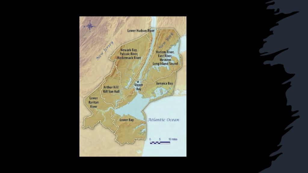
Also known as the Hudson-Raritan Estuary, it is described as a harbor system of bays and tidal rivers where the Hudson, Hackensack, Rahway, Passaic and Raritan Rivers meet the Atlantic Ocean, which I believe were all once part of a gigantic canal system.
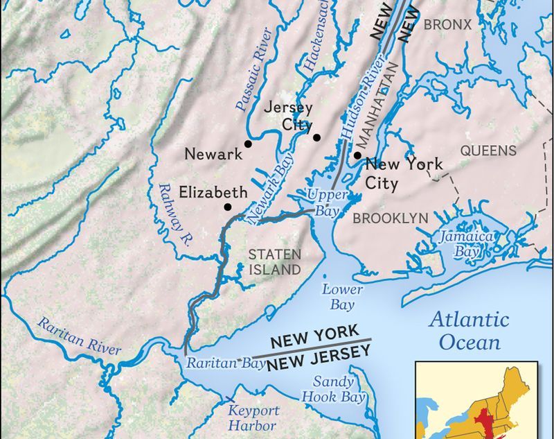
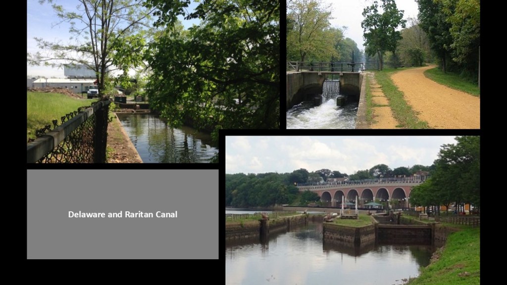
For one example of a canal in the area that is actually called a canal and not a river, the Delaware and Raritan Canal connects the Delaware River at Bordentown, New Jersey, and the Raritan River at New Brunswick, New Jersey.
This a distance of 44 miles, or 71 kilometers.
It goes through Trenton on its way to the New Brunswick Terminus.
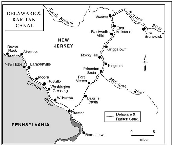
We are told this canal was dug by Irish immigrants using hand-tools between 1830 and 1834, but the sophistication of the engineering of these canals does not match the low technology of the times in which they were said to have been built in our historical narrative.
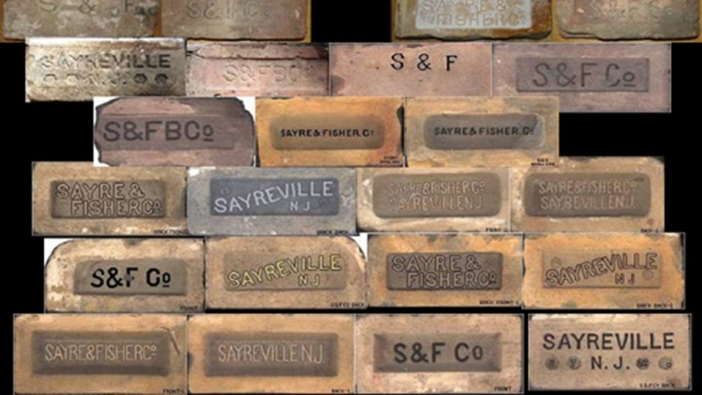
At any rate, Sayreville at the entrance to the Raritan River received its name from James Sayre, Jr, of Newark, one of the two co-founders of the Sayre and Fisher Brick Company in 1850.
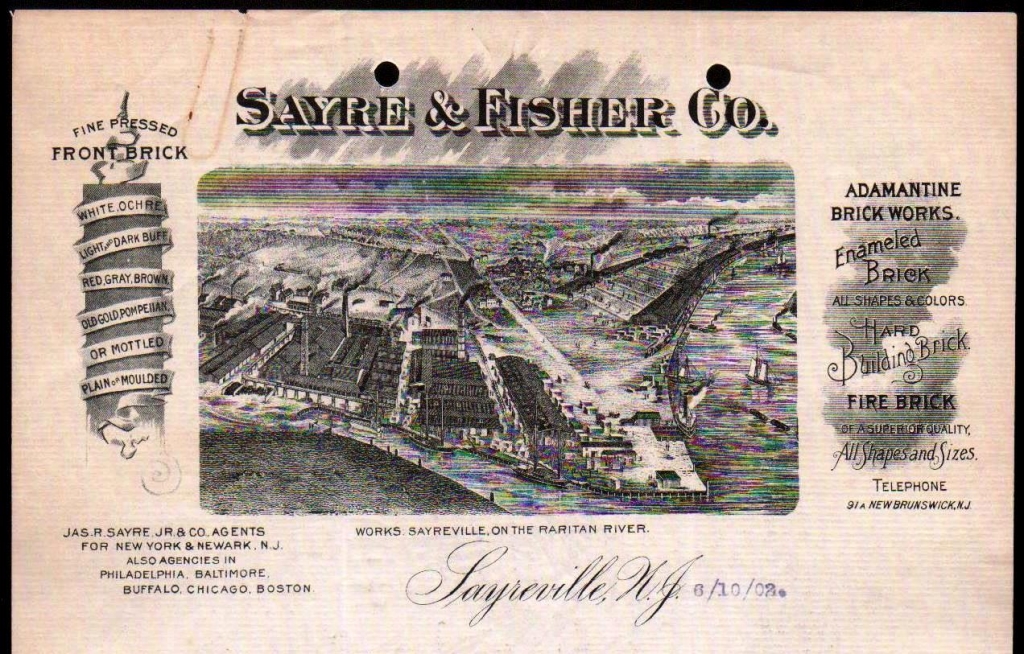
There are extensive clay deposits in the area, and the Sayre and Fisher Company quickly became one of the largest brick-making companies in the world.
Big companies including, but not limited to, DuPont established plants in Sayreville for gunpowder production initially in 1898, and later for paint and photo products.
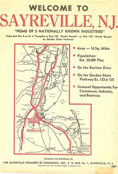
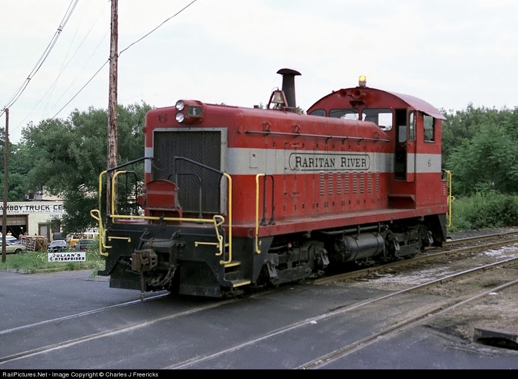
The Raritan River Railroad operated freight and passenger service through here between 1888 and 1980, after which time Conrail took over rail operations.
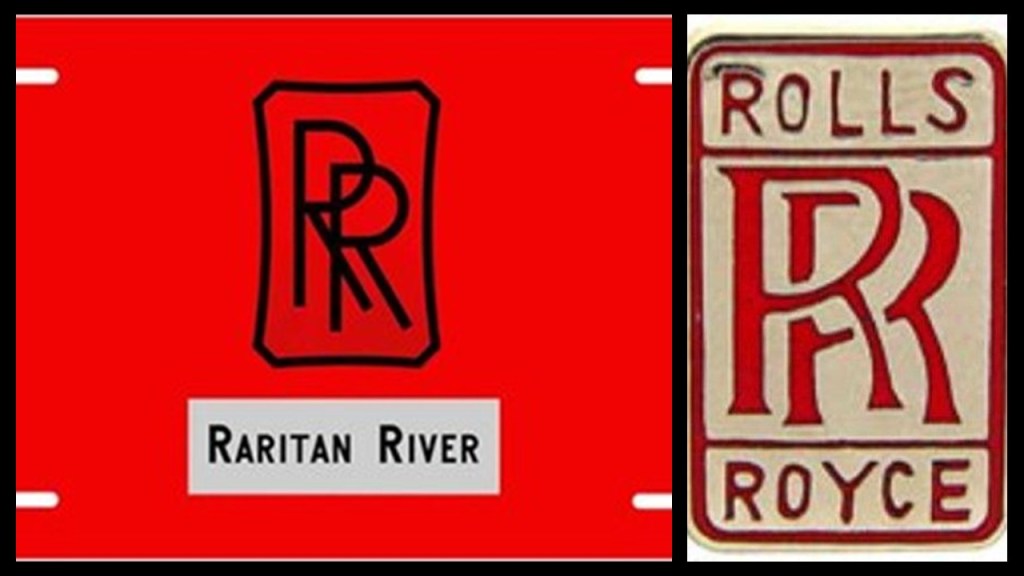
This the logo for the Raritan River Railroad on the left, and this is the logo for Rolls Royce on the right….The similarity between these two logos tells me these two companies were connected in some way. …Besides the fact the logos look virtually identical, it brings to mind what I found on a leyline going through Derby, England.
Derby is the geographic center of England, and the Derwent River Valley in Derbyshire is considered the Birthplace of the Industrial Revolution.
Derby is the headquarters of the Civil Aerospace and Nuclear Division of Rolls-Royce, a global aerospace, defense, energy, and marine company focused on world-class power and propulsion systems.
Derby is also the location of the Railway Technical Center, the technical headquarters of British Rail, and considered the largest railway research complex in the world.
I strongly suspect the apparent connection we see in the similarity of the logos of the Raritan River Railroad and Rolls-Royce has to do with bringing the pre-existing railroad infrastructure back on-line, and that it was being funded by the early bankers and financiers that we have seen thus far.

Next, the Navesink Twin Lights are on the Navesink Highlands overlooking Sandy Hook at the entrance to the Lower New York Bay.
Navesink was also the name of the Lenape people who inhabited the Raritan Bayshore near Sandy Hook in the scenic highlands in eastern New Jersey.
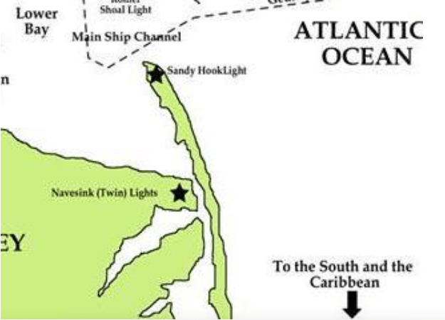
The story goes that the Navesink lands were sold by Navesink elders to a group of Dutch businessmen for wampum and goods in March of 1664, the first and largest land sale deal along the Jersey Shore between Native Americans and Europeans, and that the Navesink received in return for their land such things as 5 coats; one gun; 12-pounds of tobacco; and 10 gallons of liquor.
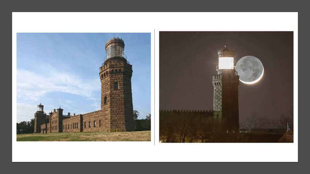
The Navesink Twin Lights were said to have been built in 1862.
The American Civil War is said to have taken place between 1861 to 1865, so we are expected to believe this massive masonry structure was built during war-time.
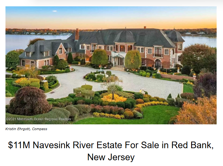
The Navesink Highlands area is one of the most desirable luxury enclaves on New Jersey’s northern shore.
The region is known for its elevated views; large estates overlooking the Navesink River; proximity to Manhattan ferries; and historic coastal architecture.
Real estate prices here typically range from $1-million to $8-million or more.
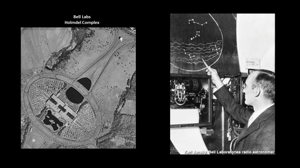
Also, I find it quite interesting that according to historical narrative, this first and largest land sale deal along the Jersey Shore that took place here between Native Americans and Europeans, coincidentally…or not…is the same land that was the location of the first Bell Laboratory at Holmdel.
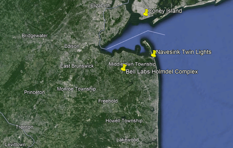
If I were to make an educated guess, I would say that this geographic location on the surface of the Earth was critically important to the original ancient advanced civilization.
What became Bell Labs at Holmdel had a direct connection to the Galactic Center, since this was where, among many other firsts, researchers like Karl Jansky, called the “Father of Radio Astronomy,” was credited with the discovery of radio waves coming from the Galactic Center.
Now I want to connect this information to the bigger picture puzzle pieces about this region.
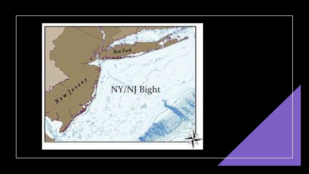
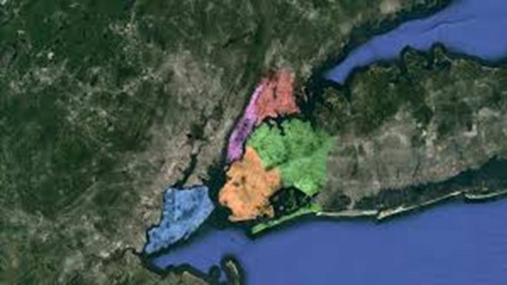
The first thing I want to bring forward is the ruined looking appearance of the shoreline from the South Jersey Shore on up through the South Shore of Long Island, which is the same thing as the New York – New Jersey Bight.
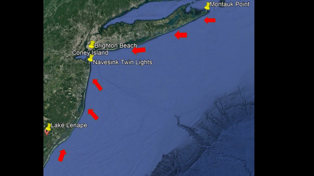
Here’s a closer a look at the South Jersey shoreline up to the New York-New Jersey Estuary System, so you can get a better view of what I am referring to and then what the shoreline looks like going from the New York – New Jersey Estuary System across Long Island to Montauk Point.
And in spite of the marshy and wetland quality of the landscape hereabouts, this whole area is prime and valuable real estate that is, among other things, coveted by the very wealthy in our society as we shall see.
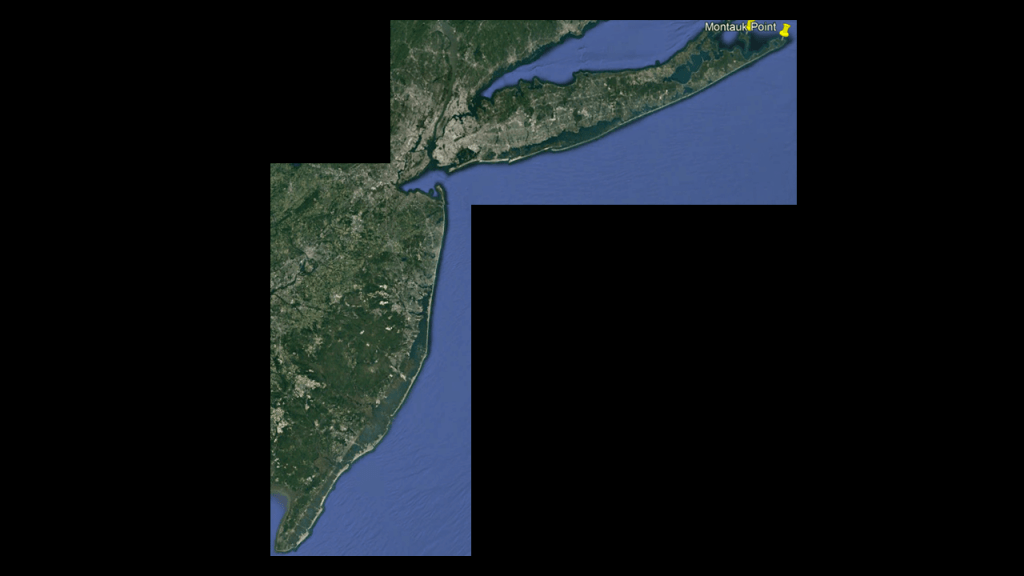
The New York Bight is described as a roughly triangular indentation along the Atlantic Coast of the northeastern United States from Cape May, New Jersey, to Montauk Point on the Eastern tip of Long Island.
“Bight” is the term given to a concave bend or curvature in a coastline.
Next I am going to turn my attention to the New York City-area, and Long Island.
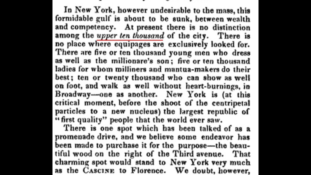
There are two designations for historical elite families of New York City that I would like to mention here – the “Uppertens” and the “Four Hundred.”
First, the “Uppertens” was a 19th-century term referring to the wealthiest 10,000 families of New York City, coined in 1844 by Nathaniel Parker Willis, a writer and publisher who became the highest-paid magazine writer of his day.
It came to refer to the upper circles of other major cities besides New York City.
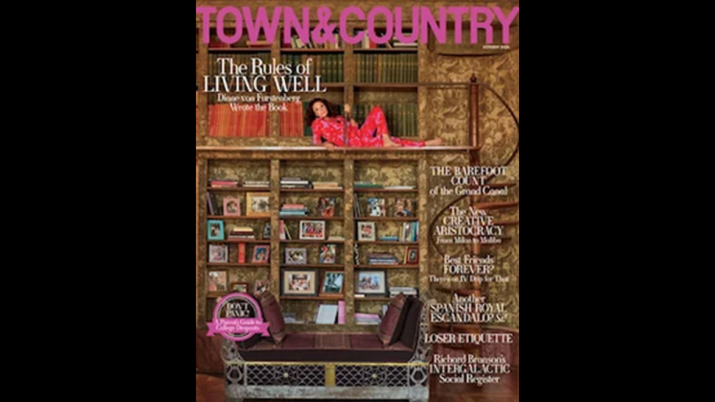
Interesting to note that Nathaniel Parker Willis started a magazine in 1846 with George Pope Morris called “Morris’s National Press – A Home Journal,” which is still with us today as “Town and Country,” the longest-running, continually-published, general-interest magazine in the United States.
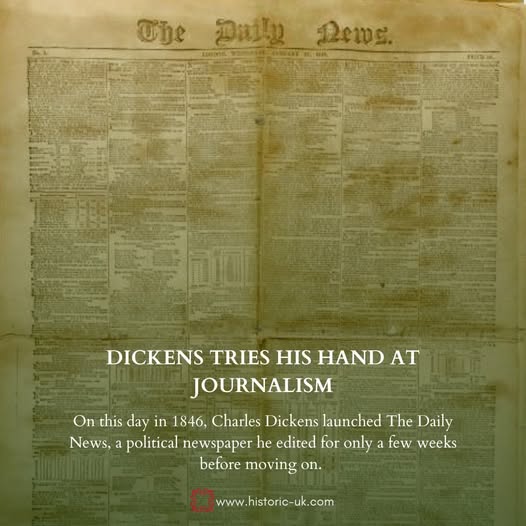
The year of 1846 was the same year that Charles Dickens founded and edited the first edition of the “Daily News” in the United Kingdom, which merged with the “Daily Chronicle” in 1930, and was absorbed into “Daily Mail” in 1960.
So back to the “Uppertens.”
The “Uppertens” were the wealthiest and most socially-powerful families in Manhattan, who controlled fashion, culture, politics, philanthropy, and high society.
As time went on, the phrase “Uppertens” was short-hand for Old-Money Manhattan families and Fifth-Avenue Mansion society.
The most famous families associated with this world were the Astors; Vanderbilts; Whitneys; Livingstons; Roosevelts; Schermerhorns; and Morgans.
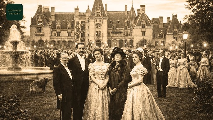
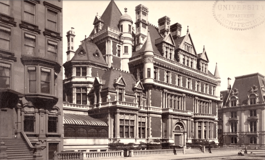
We are told that New York’s Fifth-Avenue came into existence in 1824 where it started in Washington Square, and soon became the premiere residential address where the grandest mansions ever seen were built as lavish displays of the wealth and status of their owners.
Like the Cornelius Vanderbilt II Mansion at 57th Street and 5th Avenue, which was demolished in 1927, and said to have been the largest private home ever built in Manhattan.
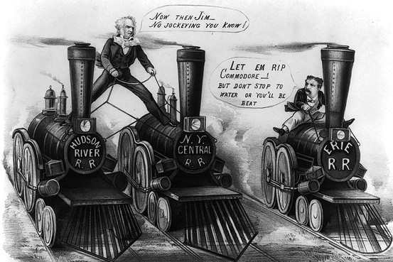
Staten Island-born Cornelius Vanderbilt, the family patriarch, got his start in regional steamboat lines and ocean-going steamships, and from there got into the railroad business.
He bought control of the Hudson River Railroad in 1864; the New York Central Railroad in 1867; the Lake Shore and Michigan Southern Railroad in 1869; and the Canada Southern Railway in 1876.
He consolidated his two key lines into the New York Central and Hudson River Railroad in 1870, becoming one of the first giant corporations in the history of the United States
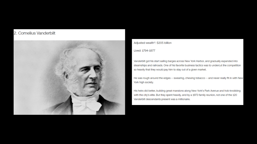
According to CNN Business, Cornelius Vanderbilt was the second-richest American in history, with an adjusted wealth of $205-billion.
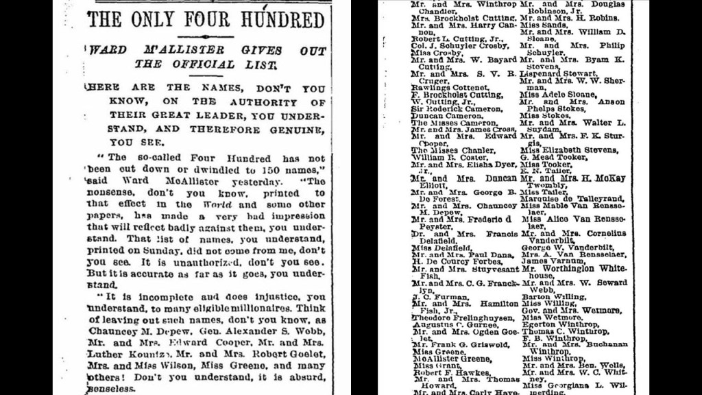
By the 1880s, the social hierarchy became more formalized with the “Four Hundred,” a list of New York Society put together by Caroline Schermerhorn Astor and Ward McAllister, a popular arbiter of social taste in the “Gilded Age of America.”
What was the “Gilded Age?”?”
One definition that I found of “Gilded Age” is that it was a period of gross materialism and blatant political corruption in the United States from the 1870s to 1900.
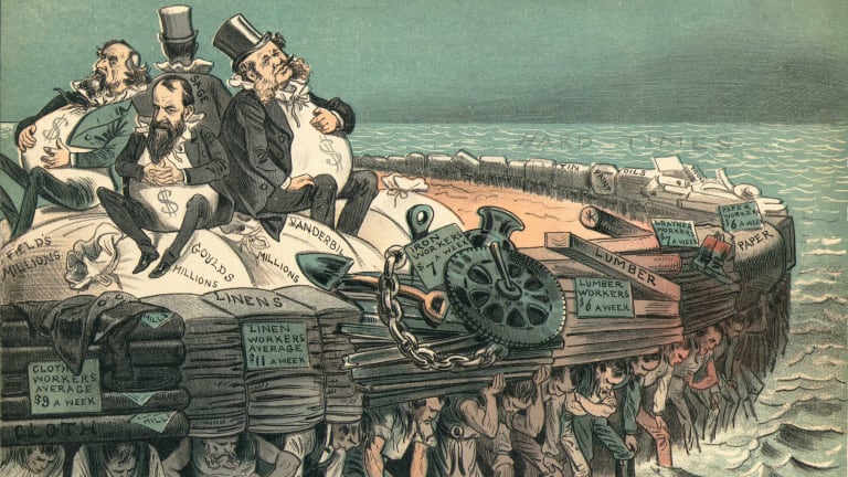
Another definition is that it was an era of rapid economic growth, especially in the northern and western United States.
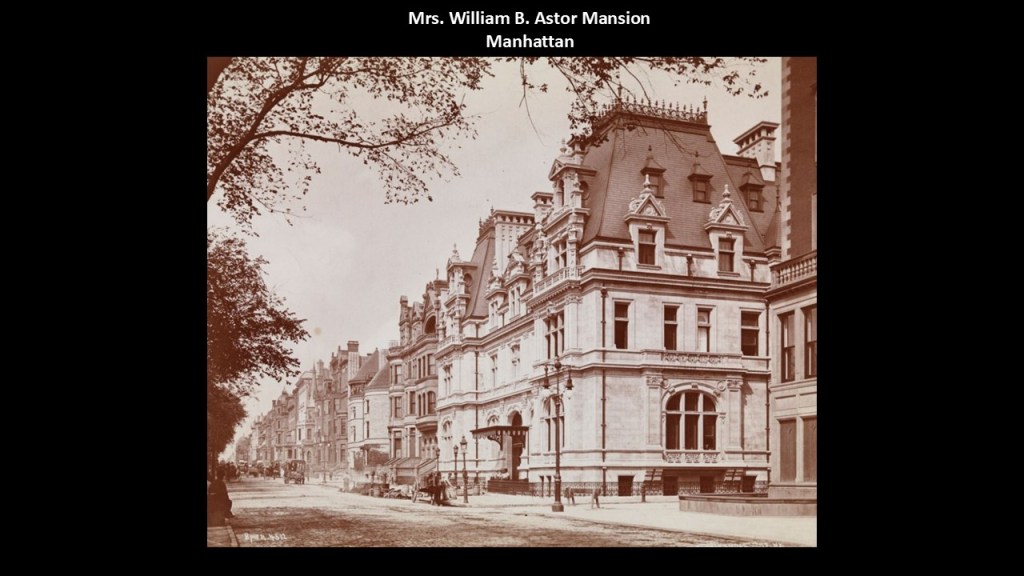
At any rate, what was known as the “Mrs. William B. Astor House” was said to have been completed in 1896 on Fifth Avenue for Caroline Schermerhorn Astor, the widow of real estate heir and racehorse owner/breeder William Backhouse Astor Jr, and for her son John Jacob Astor IV.
It was said to have been designed by Richard Morris Hunt in the architectural-style of the early French Renaissance period of King Louis XII from 1498 to 1515.
Mrs. Astor died in 1908, and her son John J. Astor IV was known in history as being the richest man on-board the Titanic when it sank on April 15th of 1912, and a prominent figureof his day who had been opposed to the creation of the Federal Reserve.
The “Mrs. William B. Astor Mansion” was demolished in 1926.
Mrs. Astor died in 1908, and her son John J. Astor IV was known in history as being the richest man on-board the Titanic when it sank on April 15th of 1912, and a prominent figure of his day who had been opposed to the creation of the Federal Reserve.
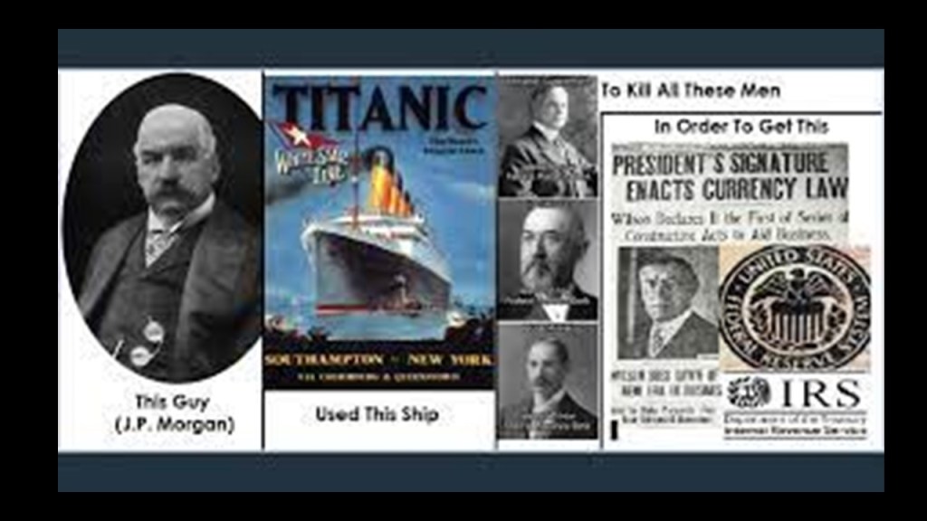
J. P. Morgan has long been suspected of having been behind what has come down to us as the sinking of the Titanic on April 15th of 1912.
We are told the Titanic sank with bankers opposed to the creation of the Federal Reserve on board.
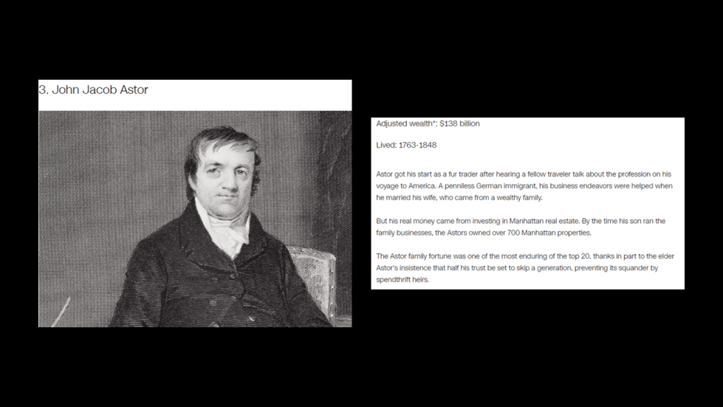
John Jacob Astor IV was the great grandson of John Jacob Astor.
John Jacob Astor who made a fortune in real estate development, the fur trade, and opium smuggling, and was the progenitor of the Astor family in America.
John Jacob Astor was considered to be the world’s first multi-millionaire, and the third-richest American of all time according to CNN Business, with an adjusted wealth of $138-billion.
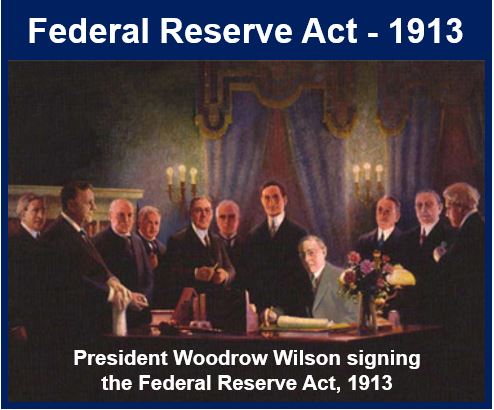
The Federal Reserve Act Passed Congress, and was signed into law by President Woodrow Wilson on December 23rd of 1913, the year following the sinking of the Titanic in our historical narrative.
It created and established the Federal Reserve System, and created the authority to issue Federal Reserve Notes (commonly known as the US dollar) as legal tender.
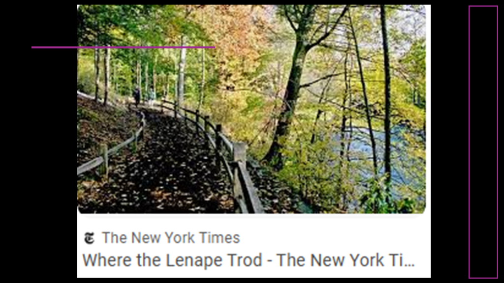
In the Bronx Borough of New York City, the “Thain Family Forest” is a tract of original old-growth forest that has never been logged in the New York Botanical Gardens along the Bronx River, once called the most precious natural possession of New York City.
It consists of several different kinds of trees, like oak, hemlock, beech, and sweet gum.
The New York Times tells us in a 2011 article about it that it was “where the Lenape trod,” the original people here, with the article telling us it was land on which they would hunt.
The New York Botanical Garden is located on 250-acres, or 100-hectares, across from the Bronx Zoo.
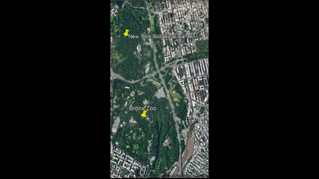
The New York Botanical Garden first opened in 1891, 8-years before the Bronx Zoo, and we are told that the first structures on the grounds opened about a decade-later.
This would include the Enid A. Haupt Conservatory, a greenhouse said to have been designed by Lord & Burnham Company in the Italian Renaissance-style, which first opened in 1902
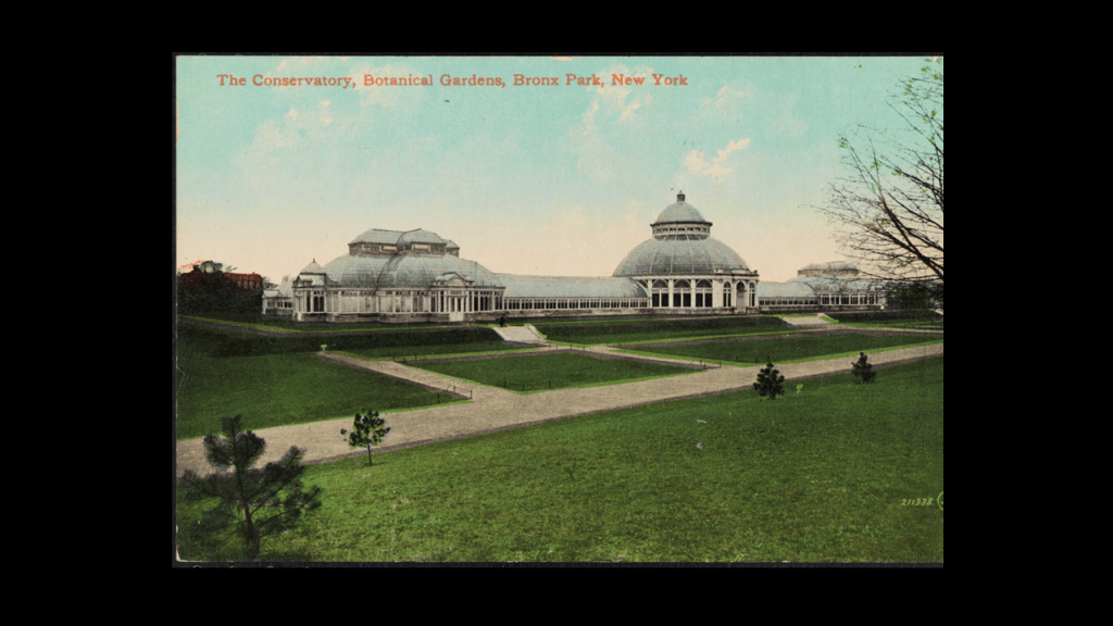
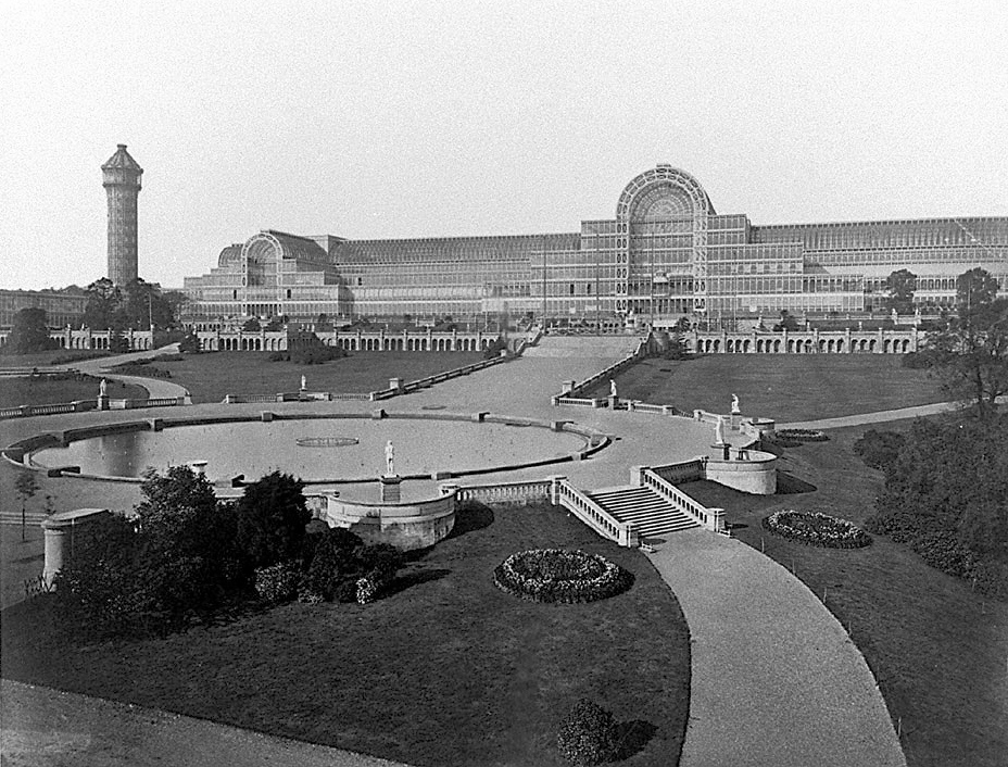
We are told that this conservatory was inspired in part by greenhouse-builder Joseph Paxton’s Crystal Palace, where the 1851 Crystal Palace Exhibition in London was held, the first of a series of major World’s Fairs, Expositions, Exhibitions that took place primarily over the next 100-years, which were described as “large, global exhibitions designed to showcase the achievements of nations.”
So, for example, we are told the purpose of the first Great Exhibition at the Crystal Palace was making clear to the world Britain’s role as industrial leader, while at the same time providing a platform on which other countries from around the world could display their achievements.
I have long seen them as showcasing the technology and architectural wonders of the original civilization before being hidden away or forever destroyed, like what we saw back in Philadelphia at the 1876 Centennial Exhibition.
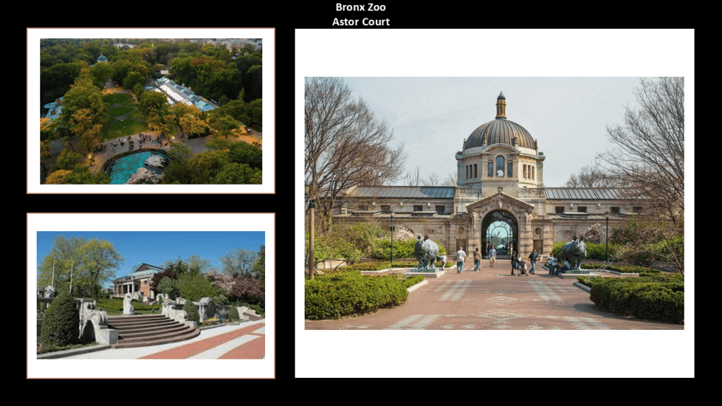
The Bronx Zoo adjacent to the New York Botanical Garden is the largest metropolitan zoo in the United States, and first opened in November of 1899, featuring 843 animals in 22 exhibits.
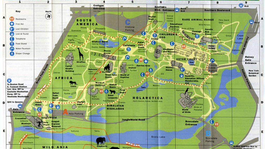
We are told that the zoo’s original buildings, known as “Astor Court,” were designed and built as a series of Beaux-Arts Pavilions between 1899 and 1910.
I would also like to make note of the Century Association in New York City.
It was a private social, arts and dining club, and named after the first 100 people proposed as members.
The Century Association Building at 42 E. 15th Street was in-use by the association starting in 1857.

Members of the Century Association have included artists and writers like: poet and journalist William Cullen Bryant; landscape painter Frederick Edwin Church; landscape painter Winslow Homer; and best-known for stained-glass-work, Louis Comfort Tiffany.
Architect members have included: landscape-architects Calvert Vaux and Frederick Law Olmsted; Beaux-Arts architects Carrere and Hastings, as well as York and Sawyer; and architects McKim, Meade and White, who were said to have defined the ideals of the American Renaissance in end-of-the-century New York.
Other members were said to have included: Eight U. S. Presidents; ten U. S. Supreme Court Justices; forty-three Members of the Presidential Cabinet; twenty-nine Nobel Prize Laureates; members of the Rockefeller, Vanderbilt, Roosevelt, and Astor families; as well as financier J. P. Morgan.

Now I am going to focus on Long Island, starting with Coney Island
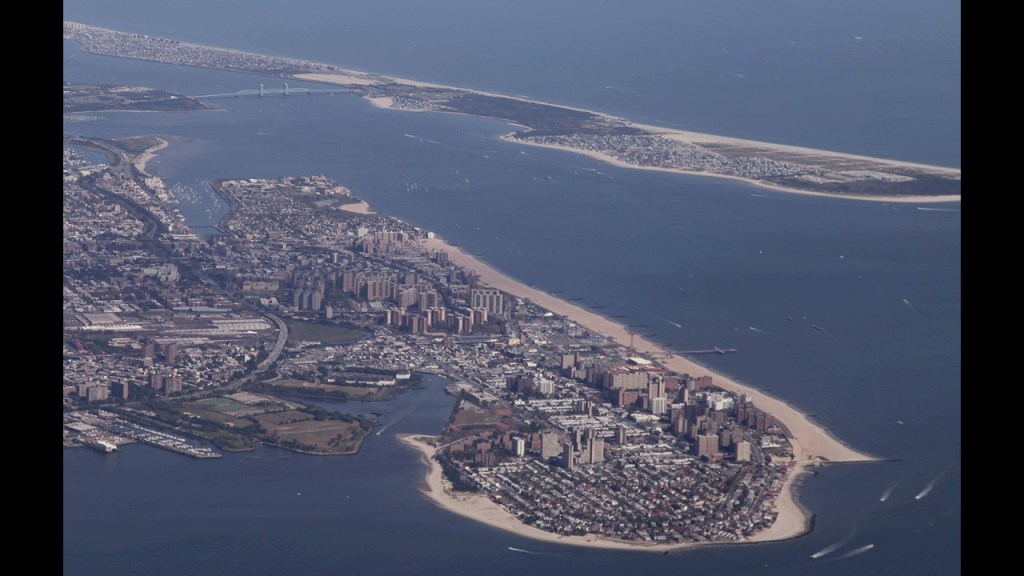
Coney Island is located across the Lower New York Bay from where I was looking in New Jersey.
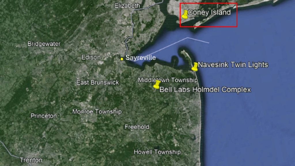
Coney Island is geographically on western Long Island, and is the southwestern tip of New York City’s Borough of Brooklyn.
Coney Island became connected to the rest of the main Long Island landmass through landfill in the early-20th-century.
Historically, there were three major amusement parks with Moorish-looking infrastructure/architecture on Brooklyn’s Coney Island – Steeplechase Park; Luna Park; and Dreamland.
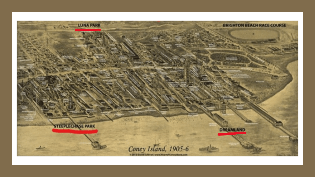
Steeplechase Park on Coney Island was said to have been created by entrepreneur George Tilyou in 1897.
The park included over 50 attractions on its midway alone.
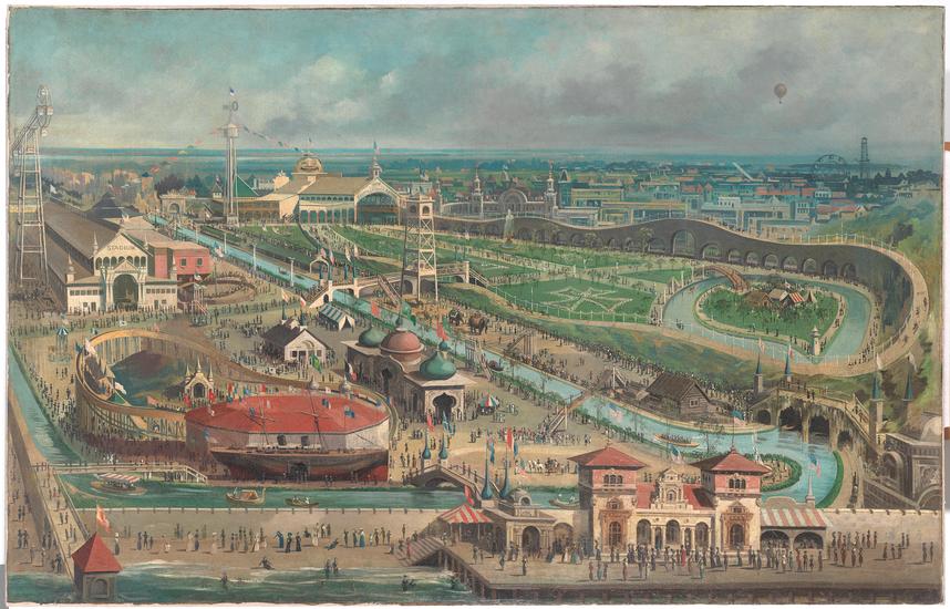
The only remaining structure from Steeplechase Park is the defunct Parachute Jump, next to Maimonades Park, the location of a minor league baseball stadium.

Coney Island’s Luna Park was said to have opened in 1903, and operated until 1944.
We are told the park’s architectural style was an oriental theme, with over 1,000 red and white painted spires, minarets, and domes on buildings constructed on a grand scale.
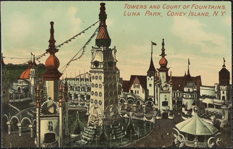
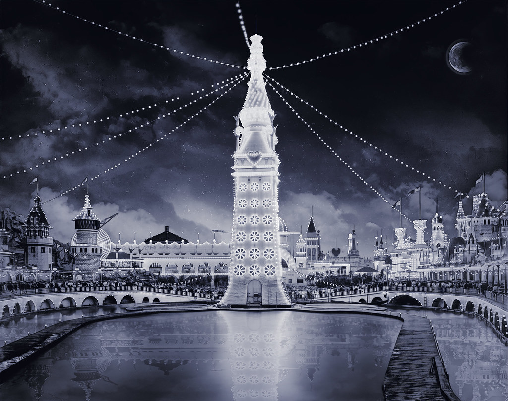
All the domes, spires, and towers were lit-up at night with hunreds of thousands of incandescent lights.

In the middle of the lake at the center of the park was a 200-foot, or 61-meter, tall Electric Tower that was decorated with 20,000 incandescent lamps.
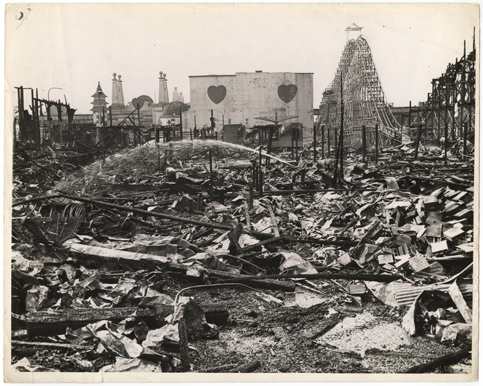
The end of Luna Park came with two fires in 1944, one in August and one in October, which destroyed the park, and in 1946, the whole park was demolished.
There has been a Luna Park operating near the original location since 2010 that has no connection to the 1903 park.

Dreamland was the third and last of the three original parks said to have been built on Coney Island in the early 20th-century, first opening in 1904.
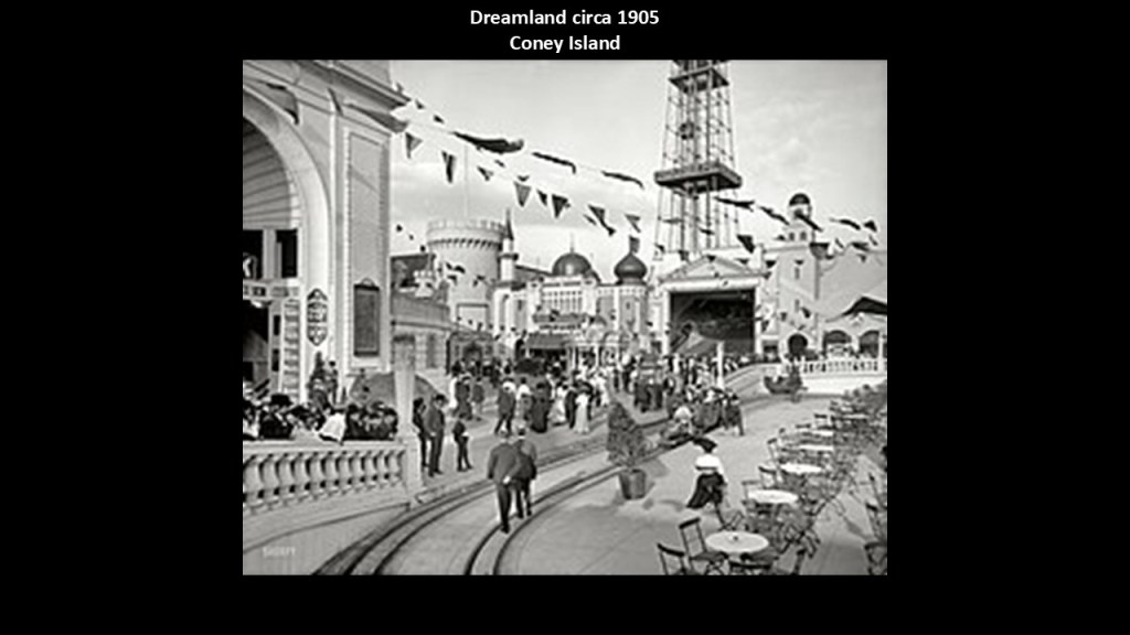
Everything at Dreamland was touted to be bigger than Luna Park, including the larger Electric Tower, and four times as many incandescent lights than Luna Park.

Dreamland’s life on Coney Island was ended only 7-years after opening.
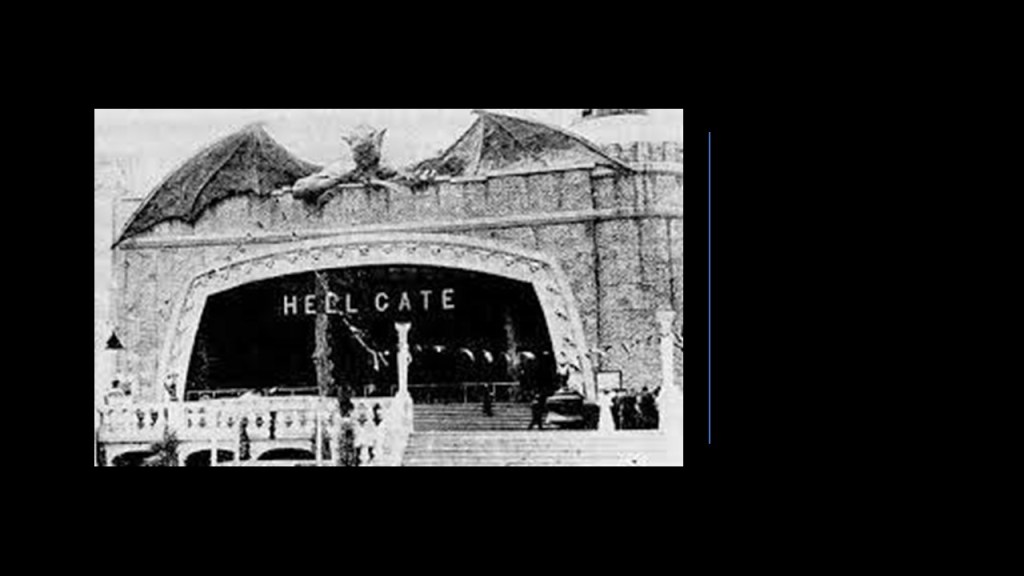
On May 27th of 1911, a fire started at the Hell Gate attraction the night before the season’s opening day, and spread quickly, completely destroying the park by morning.
Next we come to Brighton Beach, Just west of Jamaica Bay, where we find megalithic rocks strewn about on the beach…

…and the explanation we are given for faces amongst the rocks was that there was a mystery artist in the 1970s who carved them.

Jamaica Bay is next, which is called a partially-manmade and partially natural estuary on the western-end of Long Island, and contains numerous marshy islands.
Jamaica Bay spreads across the New York City boroughs of Brooklyn and Queens.
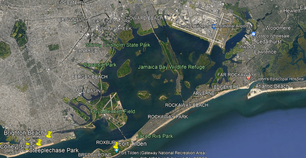
John F. Kennedy International Airport is on the northeast side of Jamaica Bay.
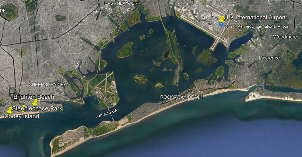
Interestingly, there is a rapid transit line of the New York subway system that operates here, the IND Rockaway Line that runs between the Aqueduct Racetrack Station terminal through the marshy Jamaica Bay to the Rockaway Park-Beach 116th Street Station terminal, like the previously-seen Atlantic City and Shore Railroad that crossed in the middle of the Great Egg Harbor Bay, and was part of an interurban trolley system in New Jersey between 1907 and 1948.

Going in a northeasterly direction on Long Island from Jamaica Bay, we come to the long, narrow, and shallow Great South Bay on Long Island’s South Shore in Suffolk County.
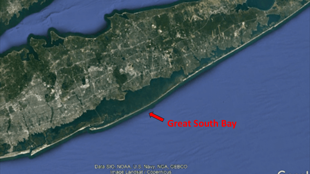
The Great South Bay is described as a shallow lagoon that is 45-miles, or 72-kilometers-, long, and has an average depth of a little over 4-feet, or 1.2-meters, and is 20-feet, or 6-meters, at its deepest.

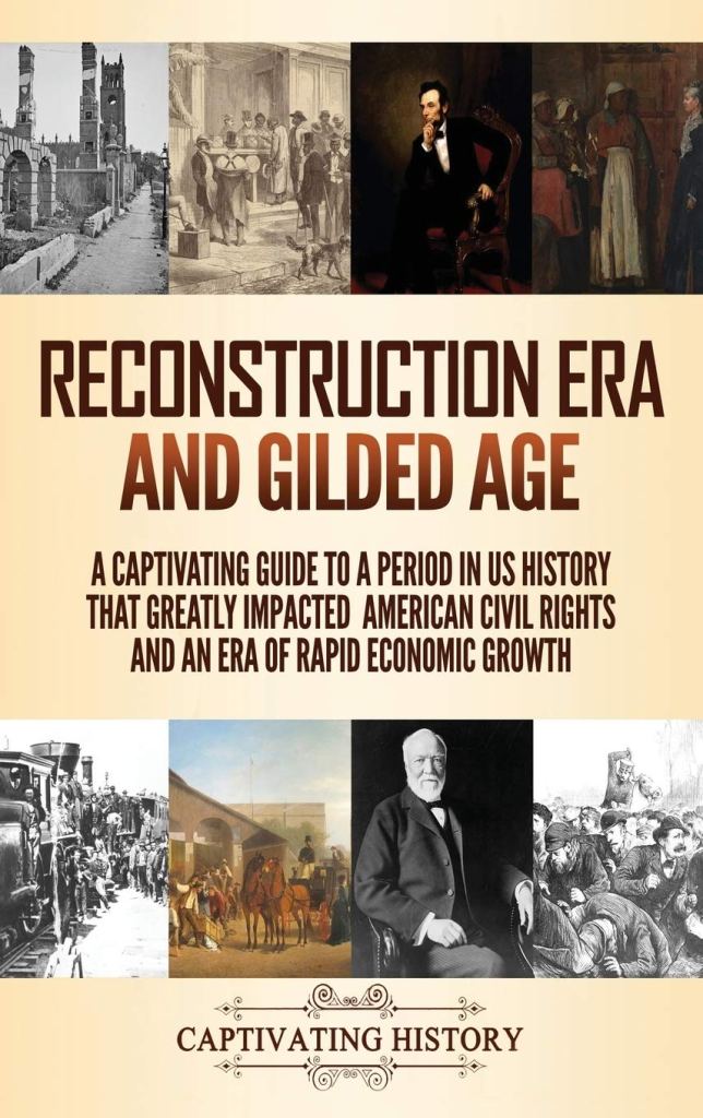
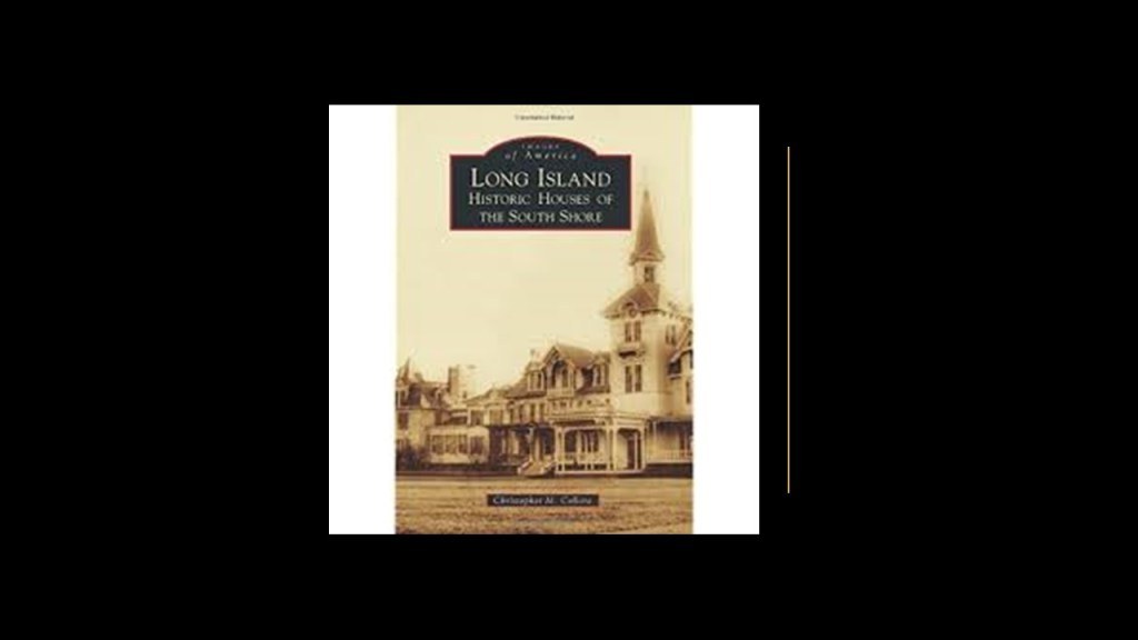
I will share this book cover here and say that during the Gilded Age, the Vanderbilts, Roosevelts, Whitneys, Morgans, and Woolworths were said to have built summer mansions on the South Shore.
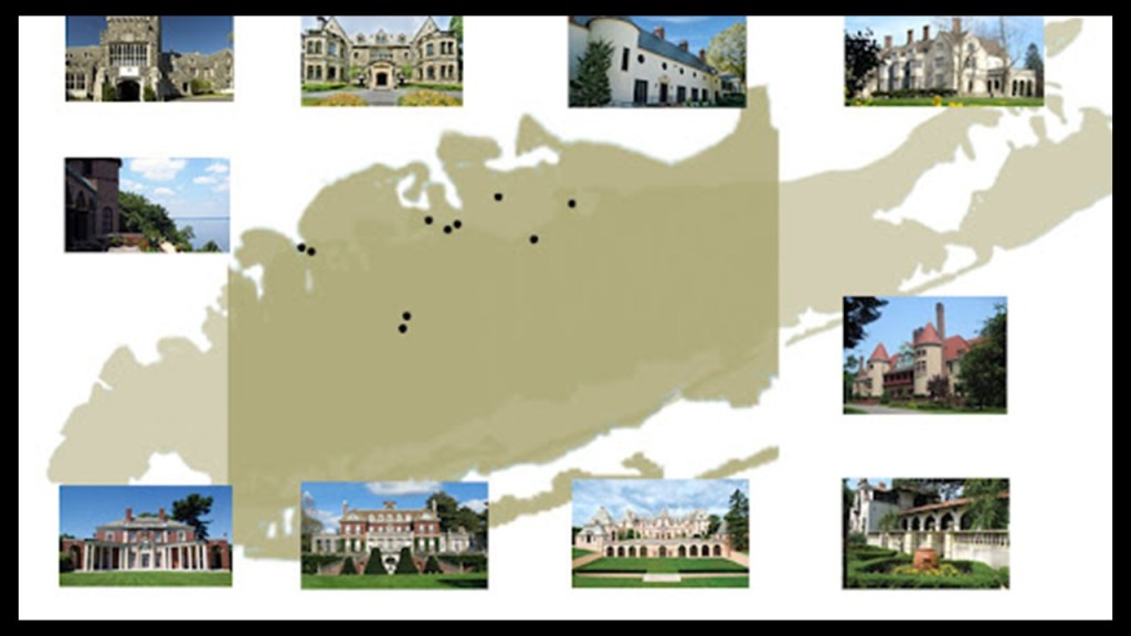
The elite families of the Gilded Age were also found on the North Shore of Long Island, also known as “Long Island’s Gold Coast.”
We are told “Long Island’s Gold Coast” had over 500 lavish mansions and castles built in 70-square-miles, or 180-kilometers-squared, by the very wealthy of the Gilded Age.
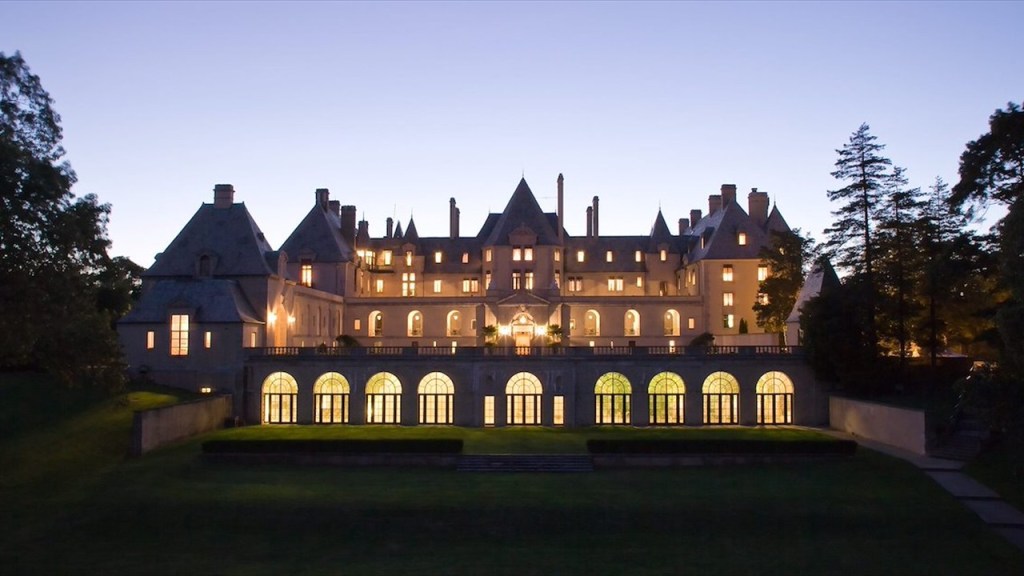
Like the Oheka Castle, which is also known as the Otto Kahn Estate, located on the North Shore of Long Island in the town of Huntington.
It was said to have been built between 1914 and 1919 as a country home for the investment financier Otto Kahn and his family, and was considered to be the second-largest private home in the United States.
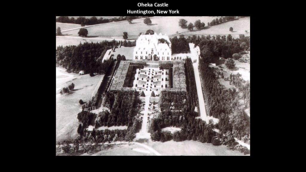
Today, the Oheka Castle is an historic hotel with 32-guest rooms and suites.
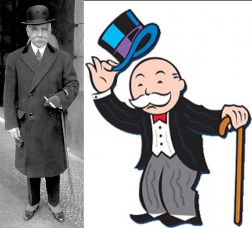
In case you have never heard of him, the fabulously wealthy Otto Kahn was the inspiration for the Mr. Moneybags character of the Monopoly board game.
It is interesting how powerful but otherwise unknown people like this example here get inserted in our collective consciousness in seemingly innocent ways.
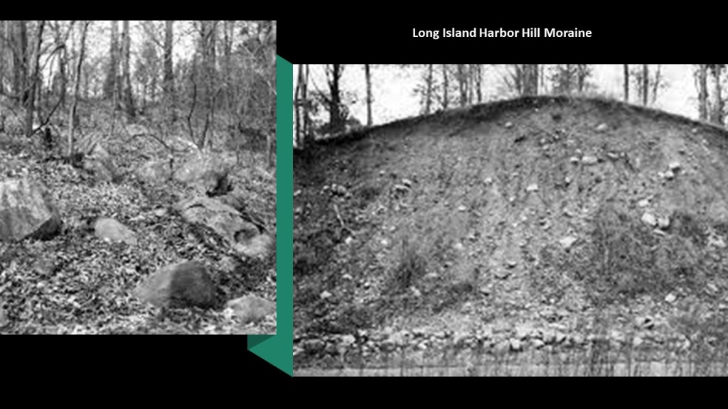
The Harbor Hill Moraine that skirts the North Shore of Long Island was said to have resulted from advancing glaciers 18,000 years ago…
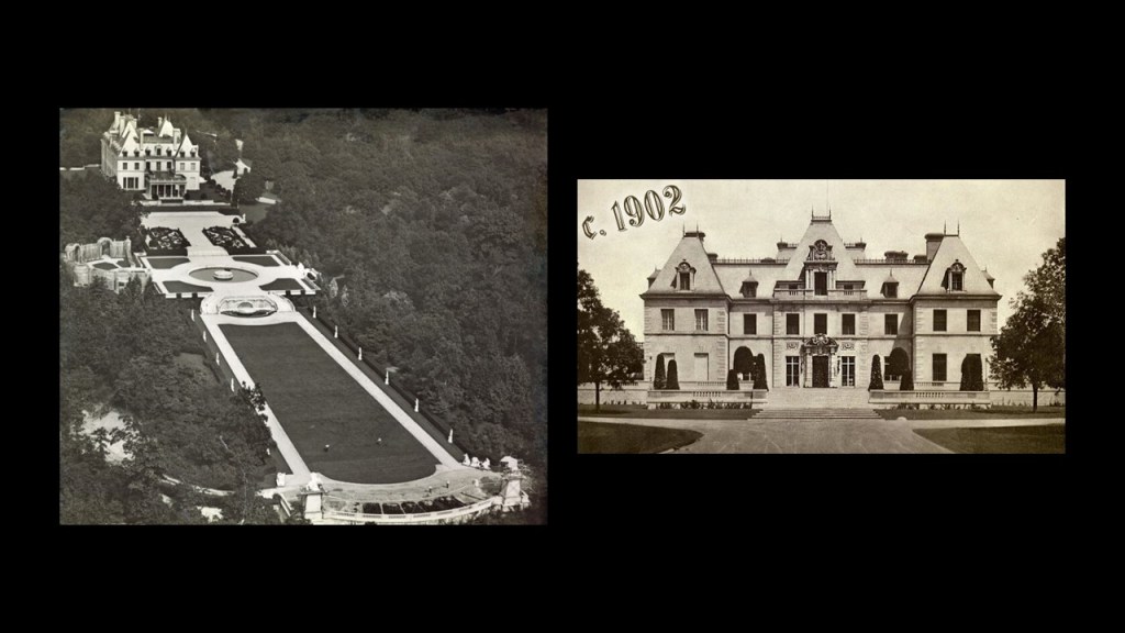
…and named for Harbor Hill in Roslyn, New York, the highest point in Nassau County, where the Harbor Hill Mansion was said to have been built between 1899 – 1902 for the telecommunications magnate Clarence Hungerford Mackay, and designed by Stanford White of the architectural firm of McKim, Mead and White.
Long Island Sound runs from west- to-east between the East River in New York City, along the North Shore of Long Island.
Long Island Sound is a tidal estuary and marine sound of the Atlantic ocean.
A sound is the term given to a smaller body of water connected to a larger sea or ocean.
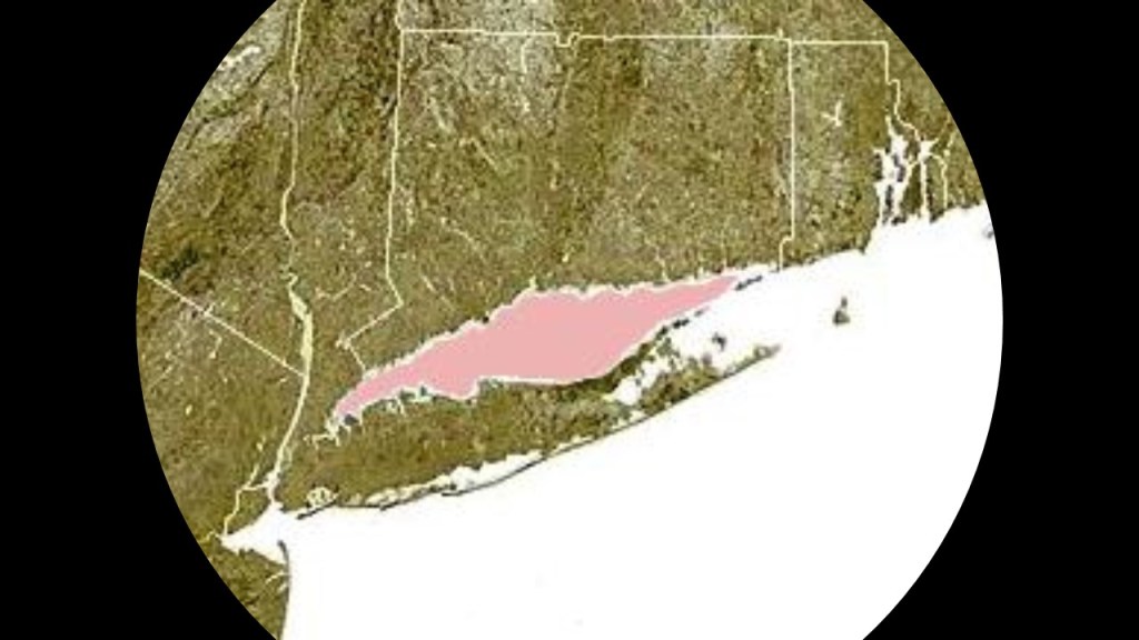
Suffolk County on Long Island’s East End is comprised of the towns of Brookhaven, which includes the Long Island Central Pine Barrens; East Hampton; Southampton, which includes Westhampton; Shelter Island; Southold; and Riverhead.
I am going to highlight several places found here.
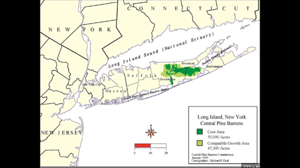
First, Brookhaven.
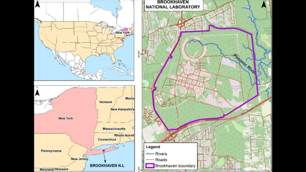
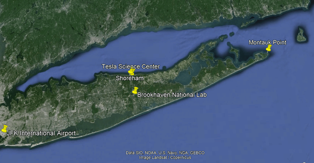
The town of Brookhaven on Long Island is the namesake of the Brookhaven National Laboratory in nearby Upton, a U. S. Department of Energy Laboratory.
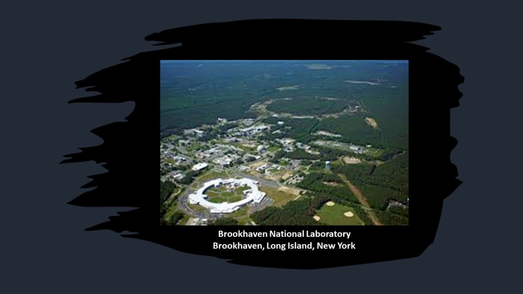
The Department of Energy National Laboratory was established in 1947, with a stated desire to “explore peaceful applications for atomic energy” after World War II.
The Laboratory has developed a broader mission over time, including: nuclear and high-energy physics; physics and chemistry of materials; nanoscience; energy and environmental research; national security and nonproliferation; neuroscience; structural biology; and computational sciences.
The research facilities of Brookhaven National Laboratory include the Relativistic Heavy Ion Collider (RHIC), the first and one of two operating heavy-ion colliders, and only spin-polarized proton collider ever built.
It is also said to be the only operating particle collider in the United States, as physicists study the primordial form of matter that existed in the Universe after what we are told was the “Big Bang,” a physical theory about an event that describes how the Universe expanded from an initial state of high density and temperature.
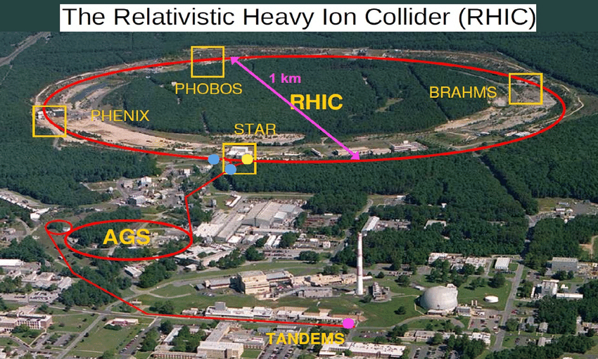
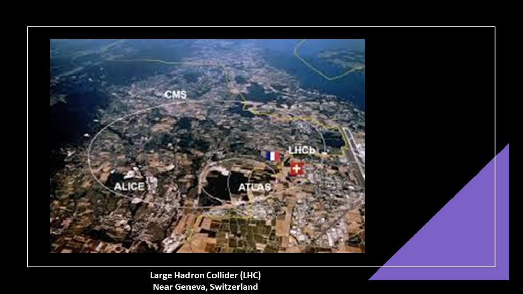
The worlds’ other operating heavy-ion collider is the Large Hadron Collider, or LHC and also known as CERN, near Geneva, Switzerland.
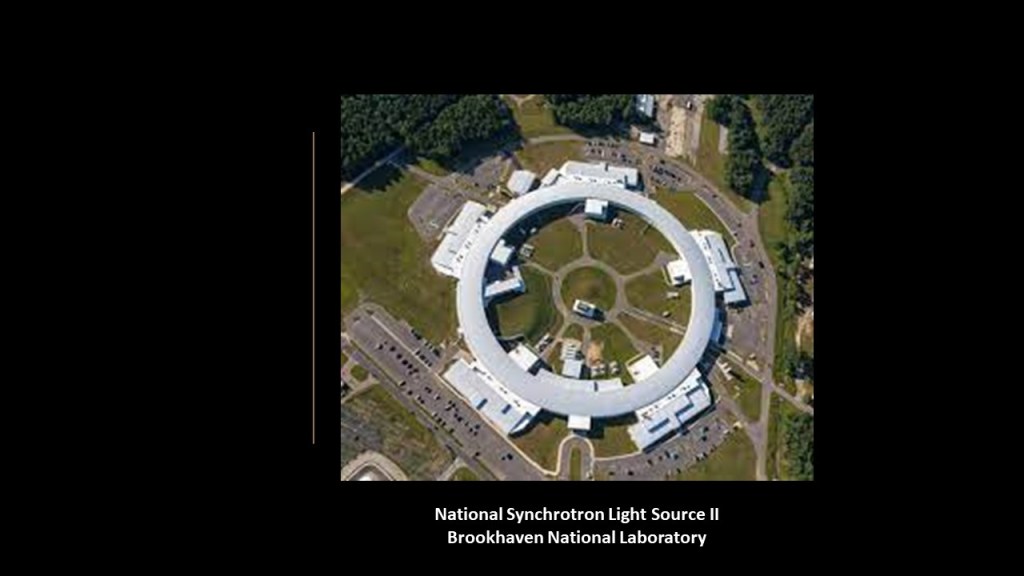
In addition to the RHIC, the Brookhaven hosts the National Synchrotron Light Source II, designed to produce x-rays 10,000-times brighter than the original National Synchrotron Light Source at Brookhaven National Laboratory.
We are told it supports basic and advanced energy technologies in a wide-variety of applications, from nano-catalyst-based fuel cells to economical use of solar energy in high-temperature superconductors in a high-capacity and high-reliability electric grid.
Next, the Long Island Central Pine Barrens is called Long Island’s largest natural area and last remaining wilderness.
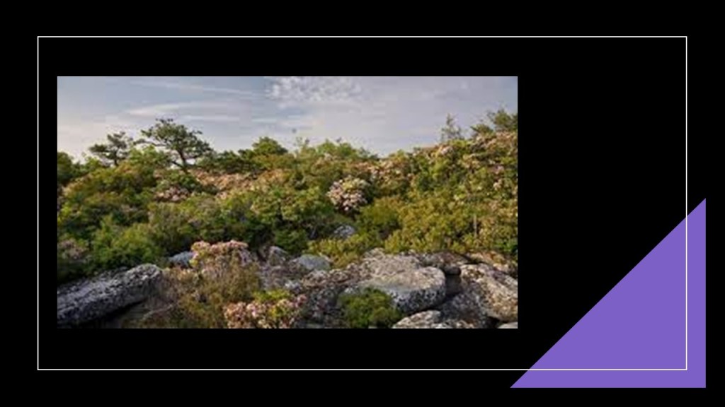
The Brookhaven National Laboratory is located within the Central Long Island Pine Barrens.
The Pine Barrens recharge a federally-designated sole source aquifer for Long Island’s fresh drinking water, which comes from groundwater wells.
Almost all of Long Island’s Peconic and Carmans Rivers, and their watersheds, two of the four major rivers here, are in the Pine Barrens.
Like I said previously with regards to the rivers in the New York – New Jersey Harbor Estuary System, it is my belief that we are looking at what once was a canal system.
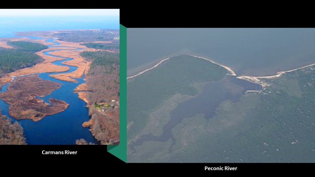
The Peconic River drains an area between the Harbor Hill Moraine, flowing into Flanders Bay, and connecting to Peconic Bay, the bay between Long Island’s North and South Forks, east of Riverhead.
It originates in bogs and wetlands in Central Long Island, and is freshwater until it becomes an estuary in Riverhead, a town and township on the northern edge of the Pine Barrens.
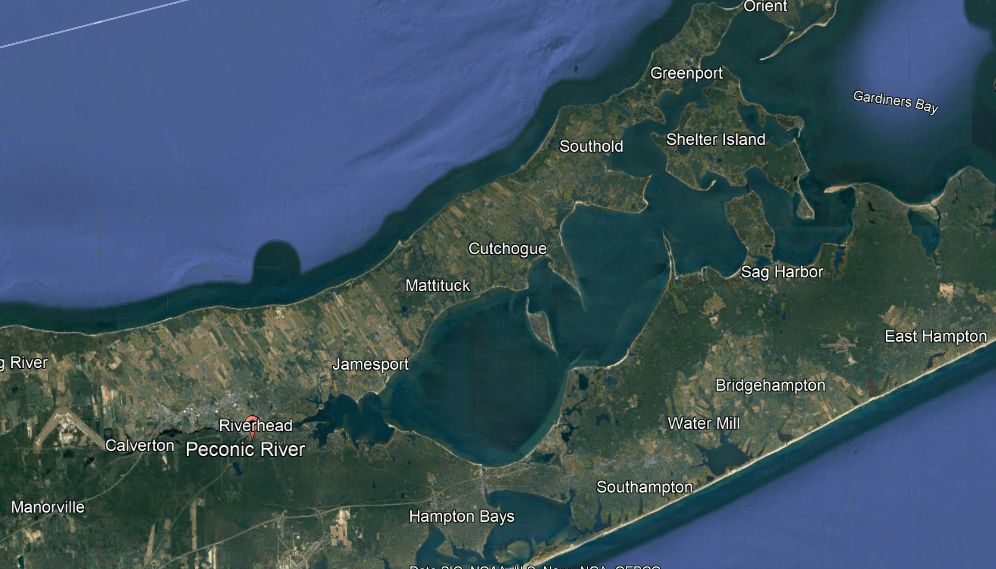
It is interesting to note that the former location of Tesla’s Wardenclyffe Tower was in Shoreham on Long Island, located on the North Shore of Long Island and a short distance north of Brookhaven National Laboratory.
The Wardenclyffe Tower was said to have been built on land next to a railroad line by Tesla between 1901 and 1902 as an early experimental wireless transmission station based on his theories of using the Earth to conduct the signals.
Stanford White, of the architectural firm of McKim, Meade, and White, was said to have designed the original brick building and tower which the Wardenclyffe Tower sat beside.
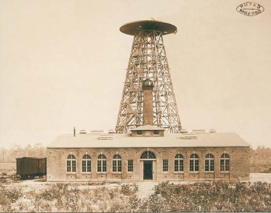
We are told that the primary financial backer of Tesla’s project was J. P. Morgan until he refused Tesla’s request for more funding to increase the size of the facility and implement his ideas of wireless transmission to compete better with Marconi’s radio-based telegraph system.
By 1906, we are told the project was abandoned because there were no further investors and that by 1917, which would have been during World War I, the tower was demolished for scrap.
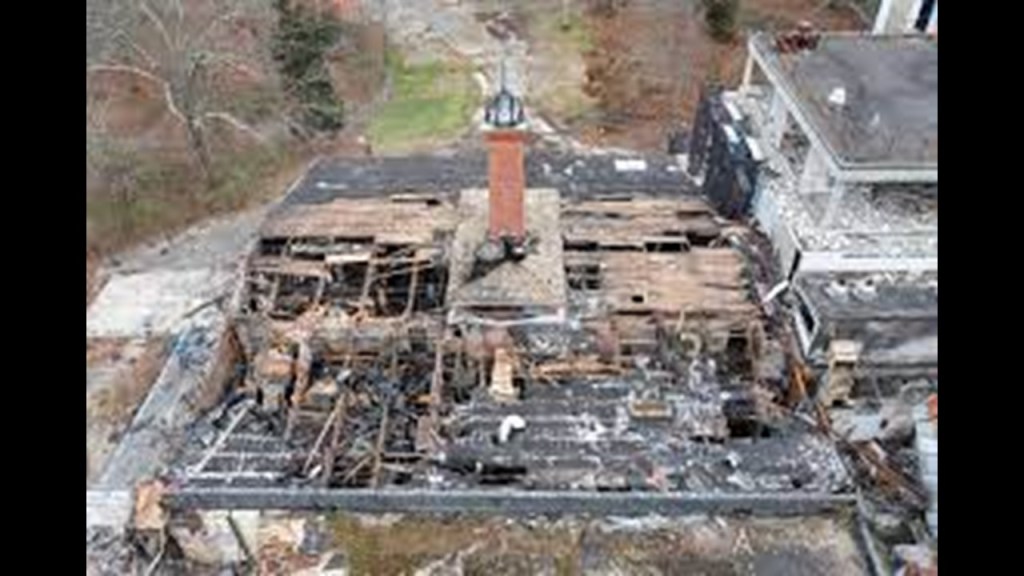
The brick building next to it remained standing up until relatively recently, and part of the Tesla Science Center.

A mysterious fire in November of 2023 severely damaged Tesla’s last remaining laboratory.
This fire happened just before the start of a significant renovation and restoration project that was poised to get started for which millions of dollars had been raised.
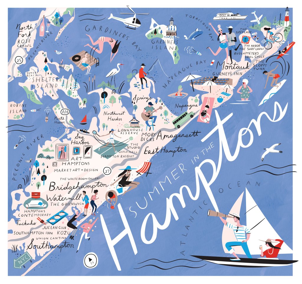
The towns of Southampton and East Hampton together are what are known as “The Hamptons,” another one of the historical summer colonies of the wealthy elite in our society.
Southampton is on the eastern side of the Long Island Central Pine Barrens, and the Central Pine Barrens Planning Commission is in Westhampton Beach, on the western side of Southampton…
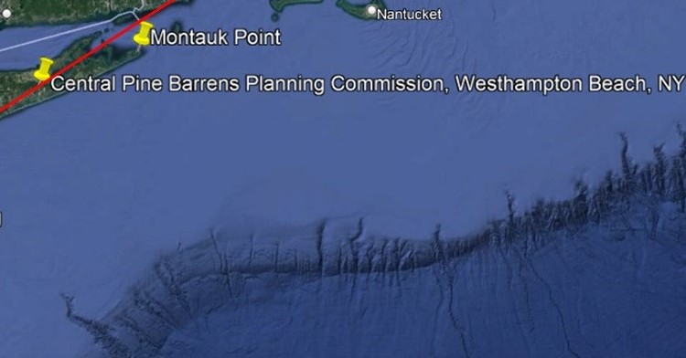
…where you find the Westhampton dunes…
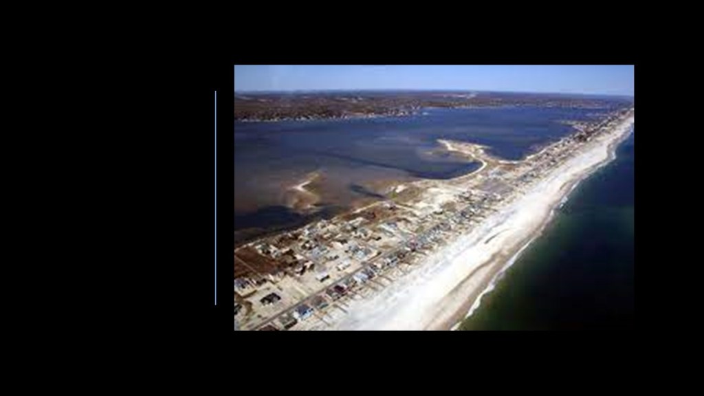
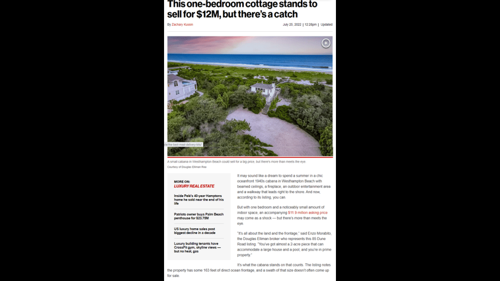
…considered prime land and luxury real estate for those that can afford it…
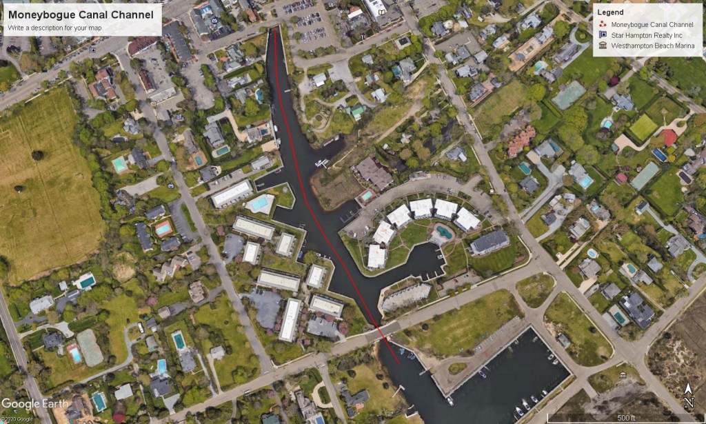
…and canals, like the Moneybogue Canal, which requires dredging to get rid of the sediment at the bottom of the waterway.
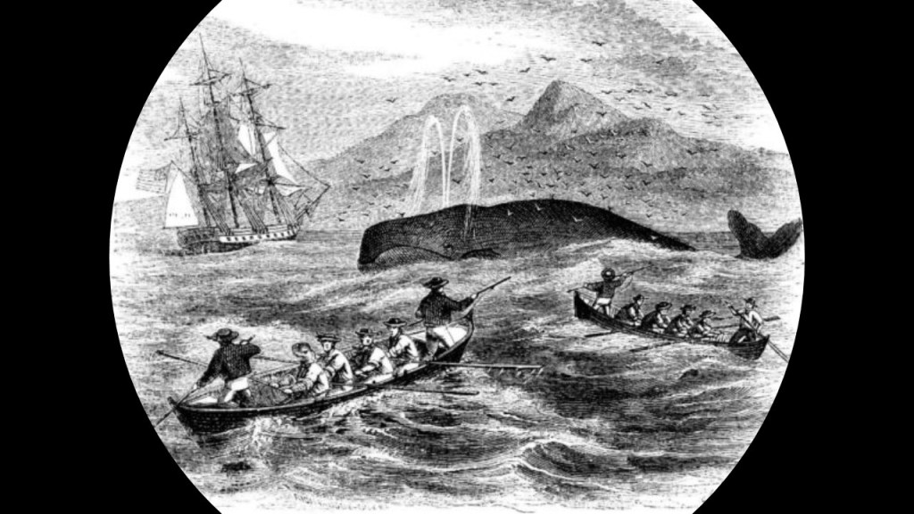
We are told that Southampton was founded in 1640 by a group of ten settlers from Lynn, Massachusetts, who obtained land from the Shinnecock Nation by signing a lease, and the town grew quickly and over the next few years, established an early whaling industry here.
The Algonquin Shinnecock Nation’s reservation is in Southampton, and we are told, among thirteen Indian tribes on Long Island, largely based on kinship.

In 2005, the Shinnecock filed a lawsuit against the State of New York seeking return of 3,500 acres, or 14 km-squared, in Southampton, and billions of dollars for damages, challenging the State Legislature’s approval of an 1859 sale of 3,500 acres of tribal land.
The disputed land included the Shinnecock Hills Golf Course.
In 2006, the court ruled against the Shinnecock Nation, however, finding the lawsuit was barred by laches, or a lack of diligence or activity for making a legal claim or moving forward with legal enforcement of a right.
They did finally receive federal recognition in 2010, after a 30-year effort that included suing the Department of the Interior.

The township of East Hampton is on the eastern end of Long Island’s South Shore.
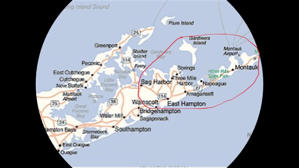
East Hampton includes the following hamlets: Montauk, Springs, Wainscott, Amagansett, part of Sag Harbor, and jurisdiction over the privately-owned Gardiners Island.
The hamlet of Montauk is on the eastern end of Long Island’s South Fork.
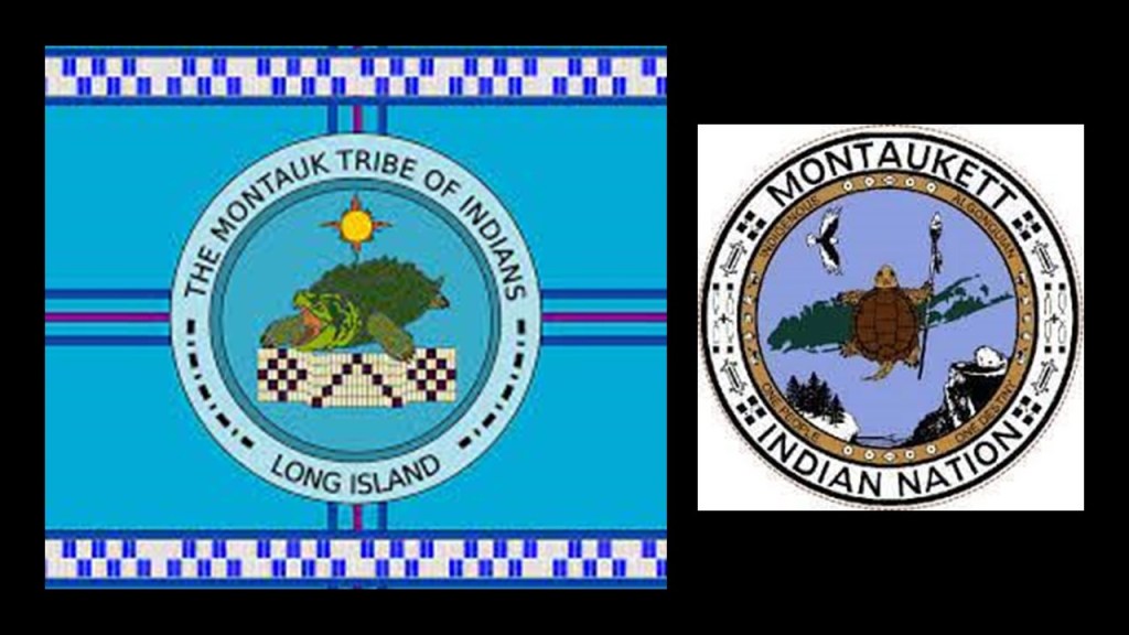
The Montauks, also known as the Montauketts, once resided in large numbers on the eastern end of Long Island.
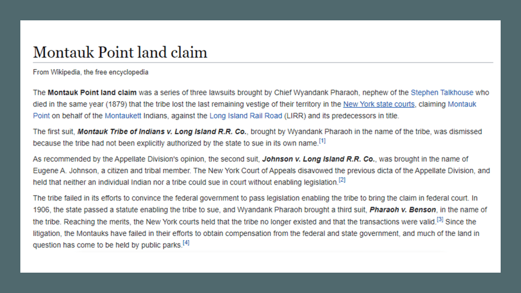
In 1910, a Judge ruled that the Montauks no longer existed as a tribe and were disenfranchised from their ancestral lands.
More on this in a moment.
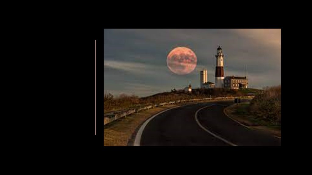
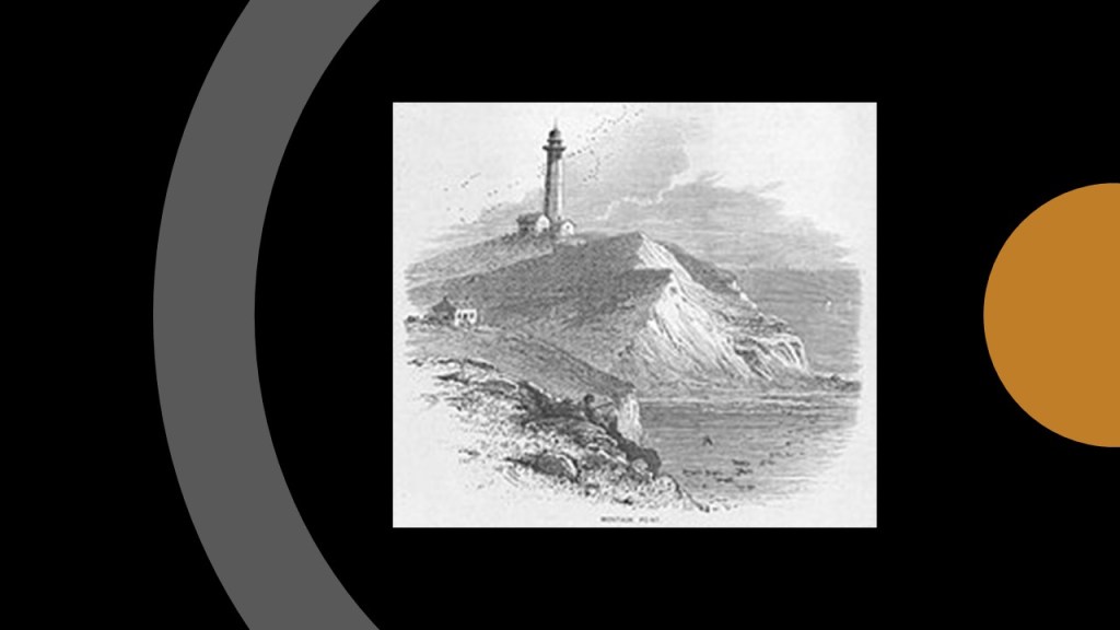
The Montauk Point Lighthouse is on Turtle Hill at the easternmost tip of Long Island, and not only was it said to be the first built within the State of New York, it was said to be the first public works project in the new United States because shippers were said to have needed a lighthouse at the end of Long Island to guide them along the south side into New York Harbor.
It is said to be the fourth-oldest active lighthouse in the United States, and also today a privately-run museum.
We are told that construction of the lighthouse was authorized by the Second United States Congress in April of 1792 and that the lighthouse was built between July and November of 1796.
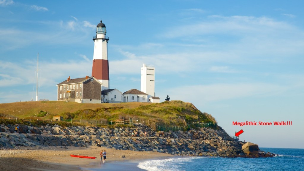
The U. S. Army took over the lighthouse during World War II, and opened Camp Hero, or Montauk Air Force Station, in 1942, adjacent to the lighthouse.
The remnants of Camp Hero are said to be four gun-battery casements, emplacements and concrete fire control towers at the nearby Camp Hero State Park today.
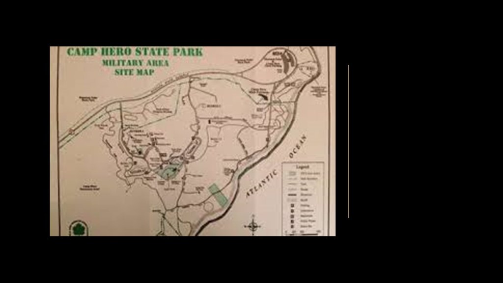
Camp Hero on Montauk Point is alleged to be the location of the Montauk Project, a series of U. S. Government projects with the purpose of developing things like psychological warfare techniques, like MK Ultra, and time-travel research, among others.
We are entering a place on Earth where so-called “Conspiracy Theories” like the Montauk Project abound.

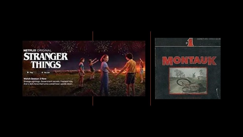
The Conspiracy-Theory Montauk Project was the inspiration for the Netflix show “Stranger Things,” which was originally billed as “Montauk.”
Interesting to note there is a “Pharoah” surname amongst the Montauks.
This is a painting of David Pharaoh of the royal family of the Montauk tribe, depicting sand dunes.
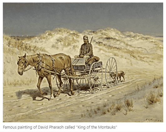
He was born in 1835 and died on July 18th of 1878.
He was buried in the Indian Field Cemetery on the old reservation lands on East Lake Drive in Montauk.
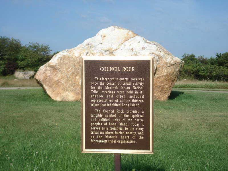
Princess Pocahontas Pharaoh was born on February 15th of 1878, the last Montauk born on the Montauk Reservation at Indian Field on Montauk Point, a year before the reservation was sold.
She was the youngest daughter of King David Pharaoh and Queen Maria Fowler Pharaoh of the Montauk Tribe.
The King of the tribe always came from the Pharaoh family.
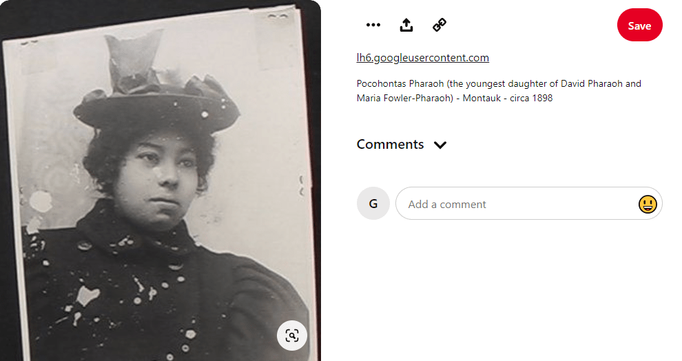
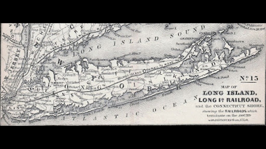
Pocahontas Pharaoh was born in the middle of efforts by Arthur Benson and the Long Island Railroad to force the Montauks off their Land.
Benson purchased Montauk in October of 1879 for $151,000 and allowed for the expansion of the Long Island Railroad through it.
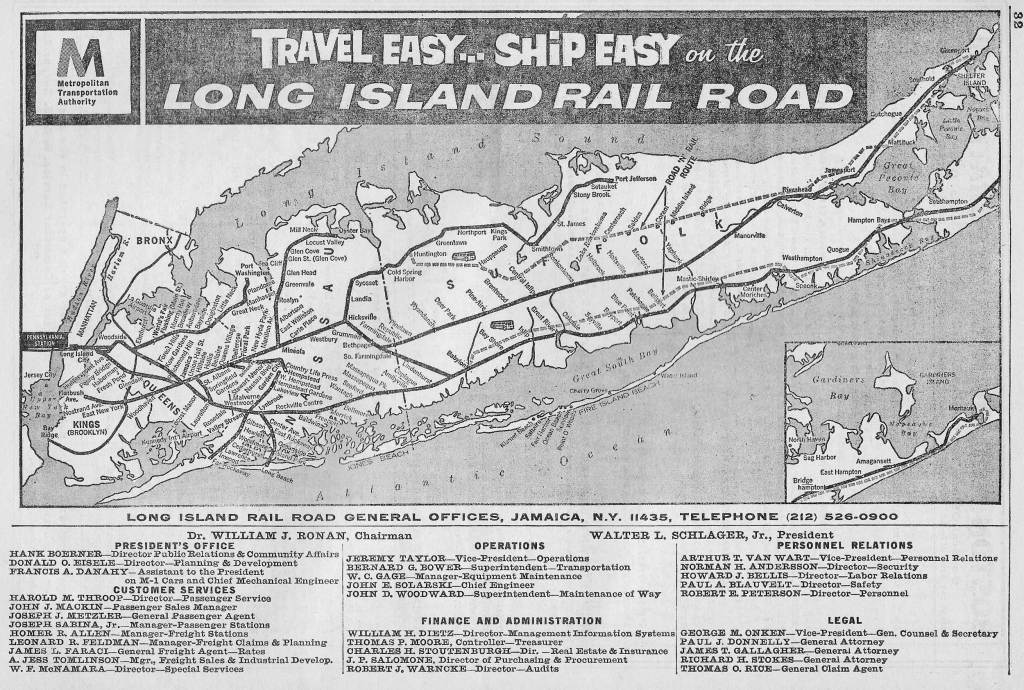
In 1897, King Wyandanch Pharaoh, Pocahontas’ brother, went to court to try to get the Montauk land back and fought until 1910, at which time a New York court held that the Montauk Tribe was extinct and stripped the nation of its tribal lands.
Interesting side-note that at least in the Romance languages, the word for lighthouse includes the root sound of “Far”:
In Italian and Spanish, the word for lighthouse is “Faro;” In French, the word for lighthouse is “Phare;” in Portuguese, it is “Farol;” and in Romanian “Far.”
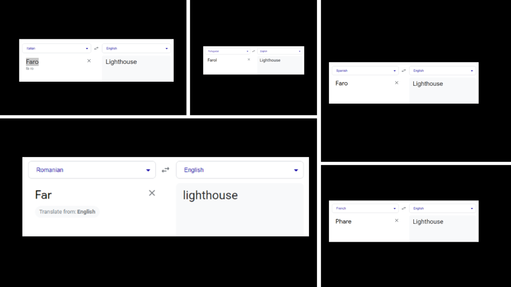
They are spelled and sound like they are related to the word “Pharaoh,” which we are told was the common title for monarchs of ancient Egypt from the First Dynasty, starting in 3,150 BC, up to the annexation of Egypt by the Roman Empire in 30 BC.
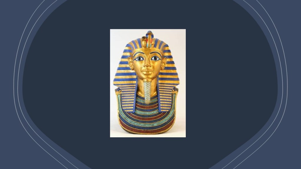
Throwing this information into the mix for consideration since both a lighthouse and pharaohs are found on Montauk Point.
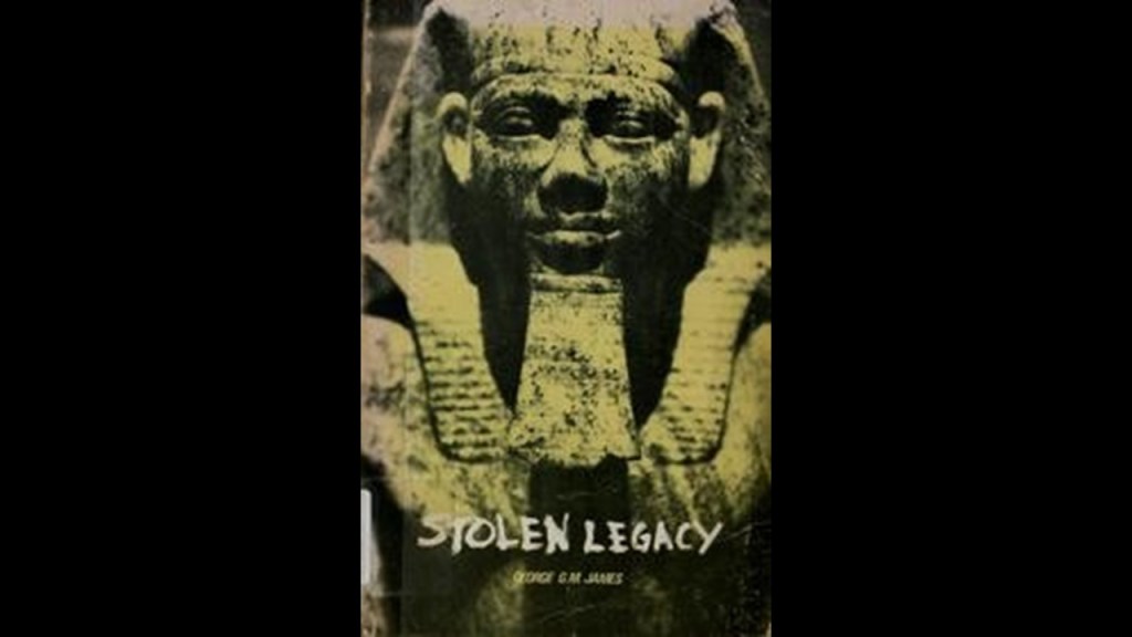
The Moors were the custodians of the Ancient Egyptian mysteries, according to George G. M. James in his book “Stolen Legacy.”
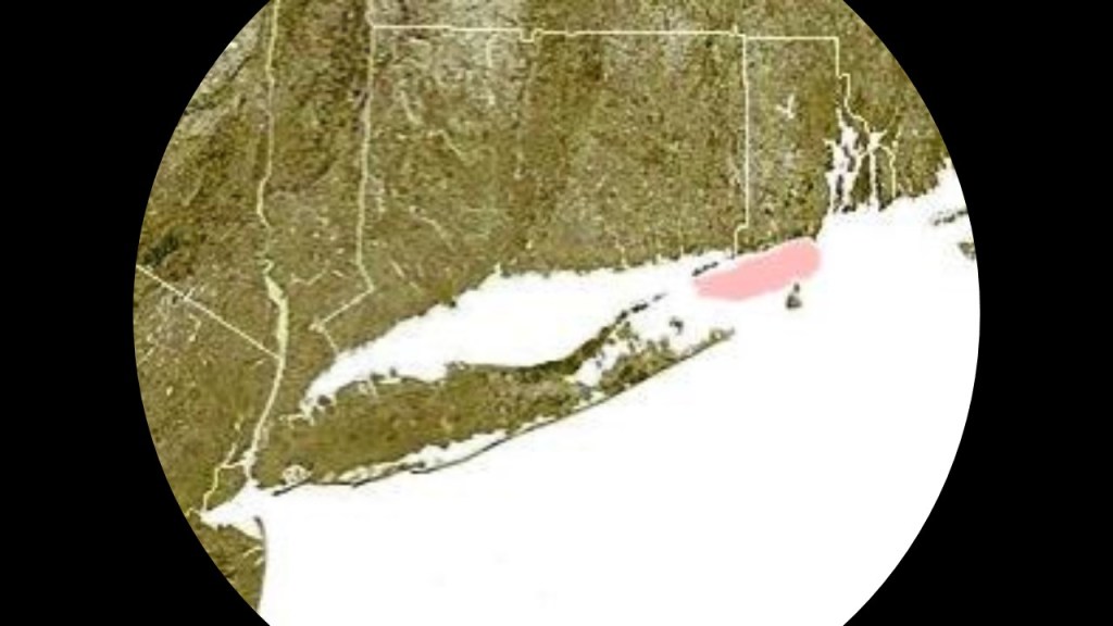
Next, Block Island Sound extends from Montauk Point on the eastern tip of Long Island and separates Block Island from the coast of mainland Rhode Island to the east, and contains places like Gardiners Island, Plum Island, Fishers Island, and Block Island.
First, Gardiners Island.
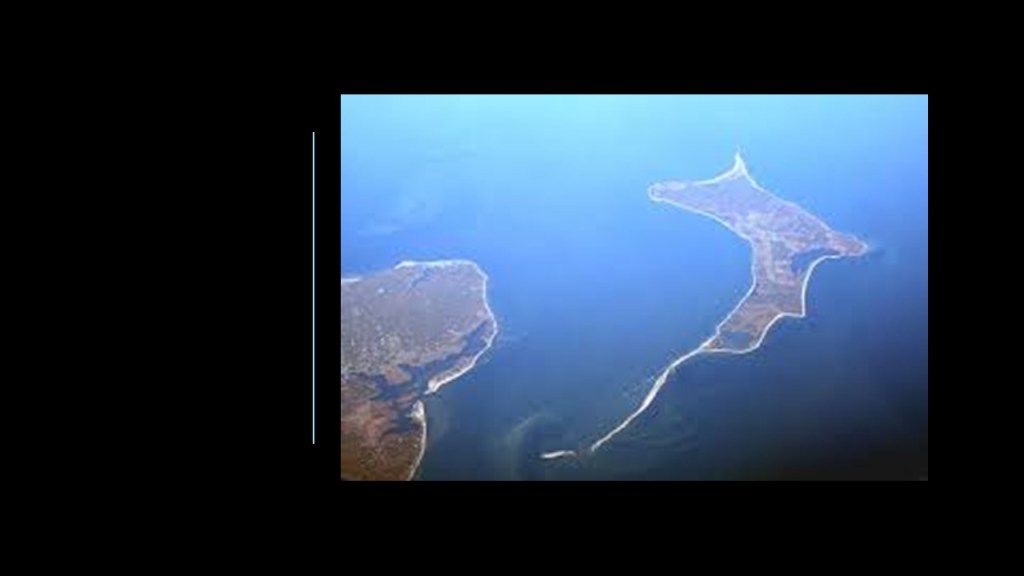
Gardiners Island is a small island located in Gardiners Bay between the North and South Forks of Long Island.
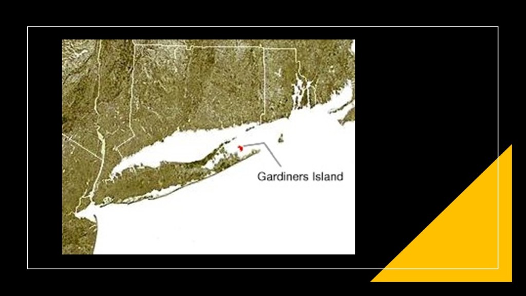
In our historical narrative, the island has been owned by the Gardiner family since 1659, when we are told Lion Gardiner, an English engineer and colonist who founded the first English Settlement in New York here, was said to have purchased it from the Montauk Grand Sachem Wyandanch for “…a large black dog, some powder and shot, and a few Dutch blankets.”
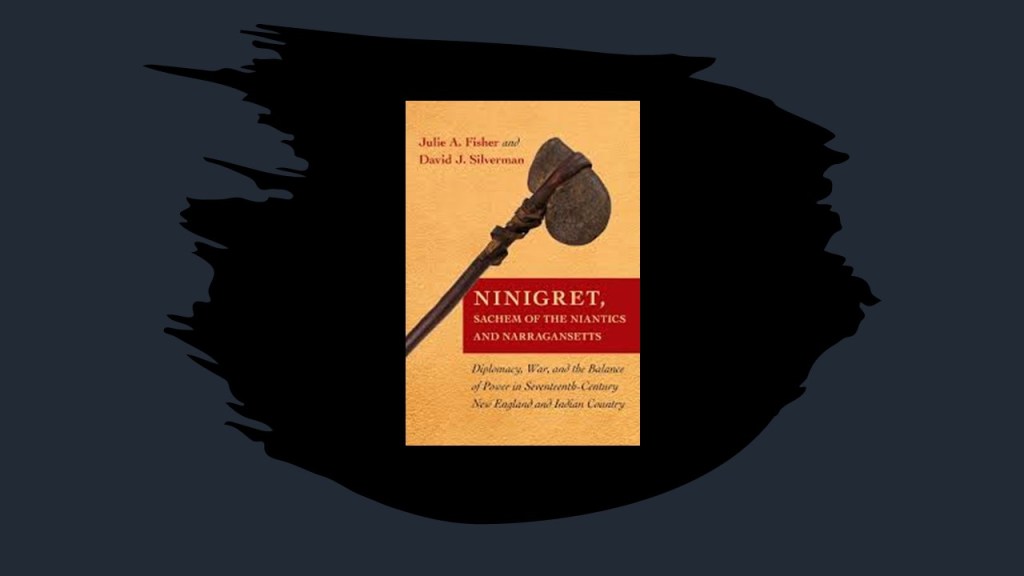
Wyandanch died that same year, and after his death, the title of “Grand Sachem” went into decline and was eliminated by the colonists after they conquered the region of what was known as “New Netherlands” at the time.
What I am able to find in a search is that the title “Sachem” was the title given to a Native American Chief, in particular the chief of a confederation of Algonquin tribes.
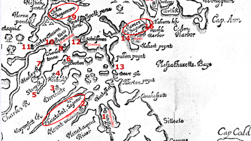
“Sagamore” was the title given to a chief or leader of the Algonquins.
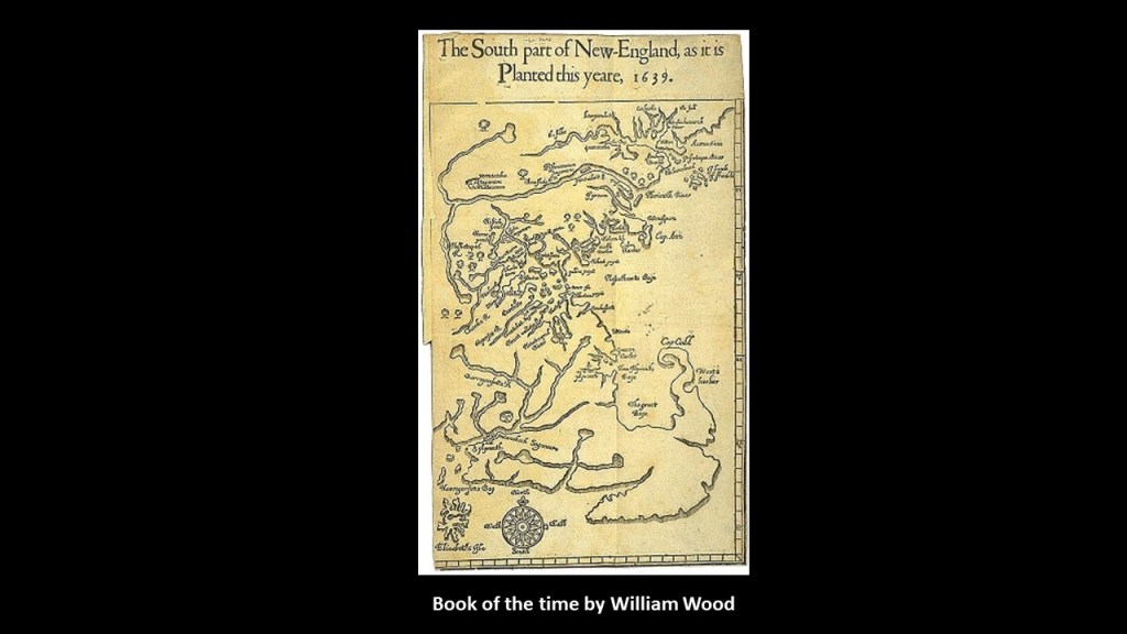
This selection from William Wood’s book was of a map showing the plantations along Massachusetts Bay, and the word or name Sagamore is seen in several places.
William Wood’s book from 1639 was entitled: “New Englands Prospect” and called “A true, lively and experimentall description of that part of America commonly called New England; discovering the state of that Countrie, both as it stands to our new-come English Planters; and to the old native inhabitants. Laying down that which might enrich the knowledge of the mind-travelling reader, or benefit the future voyager.”
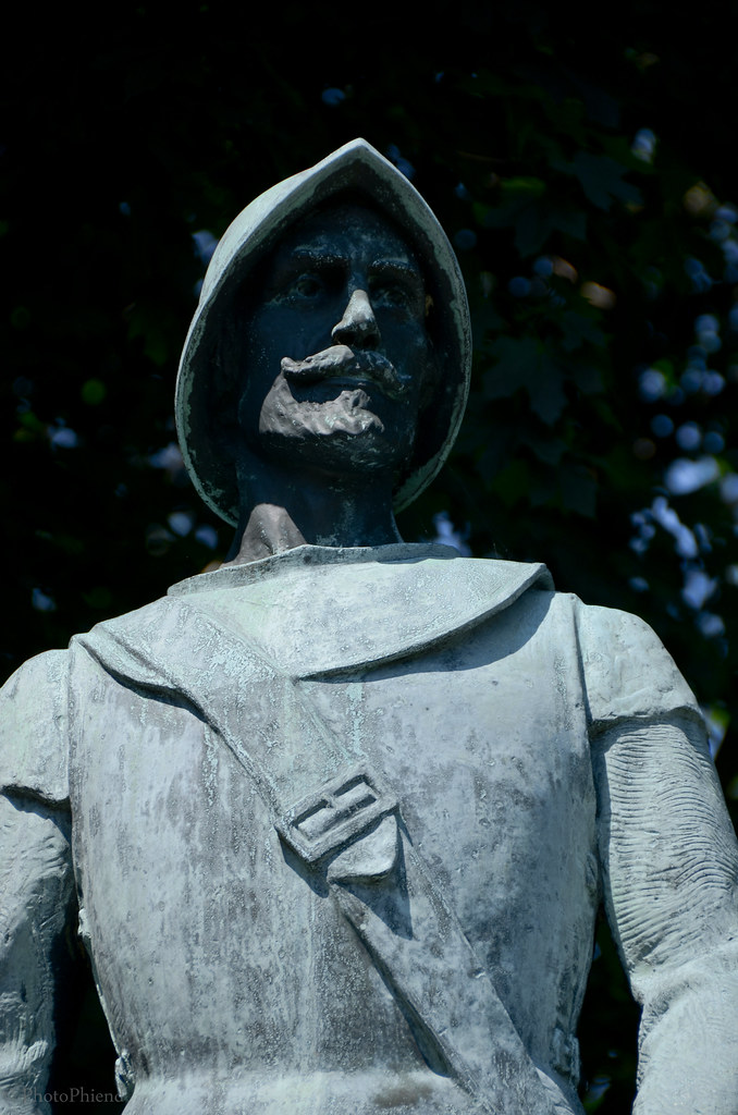
While not under the jurisdiction of the Colonies of Connecticut or Rhode Island, Gardiners Island did fall under the jurisdiction of William Alexander, the 1st Earl of Stirling, who had been given Long Island by the King Charles I of England in 1636, and who required that Gardiner gain approval of his land grant, which he did in 1639 with a royal patent giving him the right to possess the land forever, and given the title of “Lord of the Manor.”
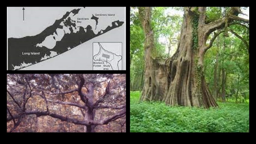
Gardiners Island is a little over 5-square-miles, or 13.4-kilometers-squared, and has more than 1,000 acres of old growth forest, considered by some to be the largest old-growth forest on the northeast coast of the United States.
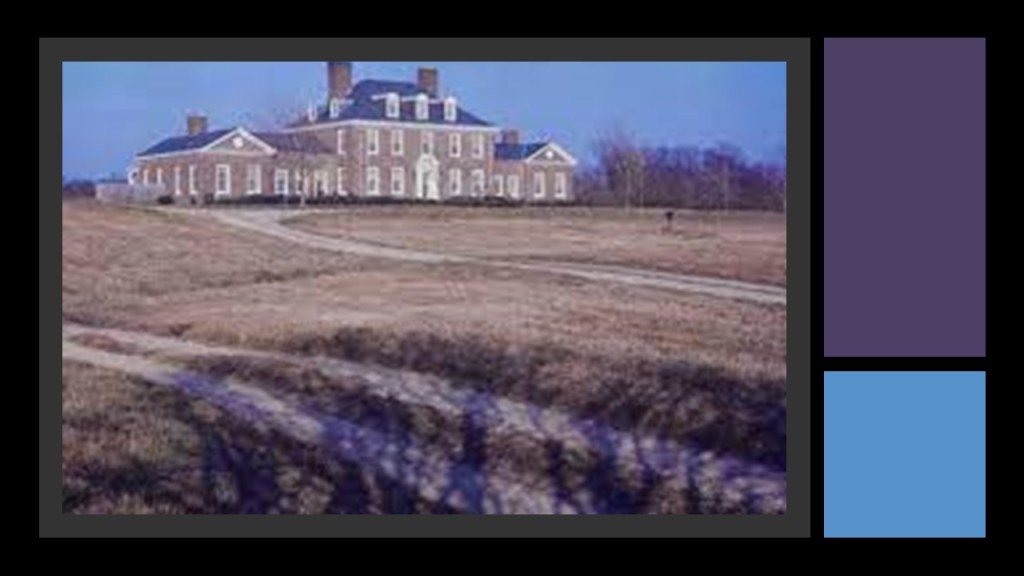
Passed down through the Gardiner family for over 380-years, the Gardiner mansion on the island is considered to be the oldest family estate in America.
Next, Plum Island.
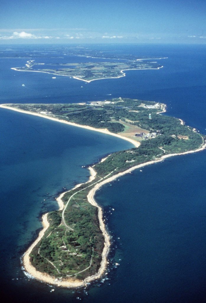
Plum Island is an island that is part of Southold in Suffolk County, New York, and located in Gardiners Bay, off the eastern end of Long Island’s North Fork peninsula on the eastern end of Long Island.
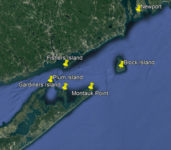
Plum Island is owned by the United States government, and access to it controlled by the U. S. Department of Homeland Security.
Next, Plum Island is only 17-miles, or 27-kilometers, south-southeast of Lyme, Connecticut, the place which gave “Lyme Disease” its name.
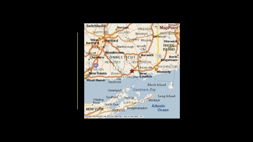
The origin story of the disease goes like this:
A mysterious ailment afflicted a group of people in and around Lyme, Connecticut, in the 1970s, and that the cause of Lyme Disease was found to be a form of spiral-shaped bacteria transmitted by the bite of a certain kind of tick.
Lyme Disease causes symptoms like a rash, flu-like symptoms, joint-pain and weakness, among others.

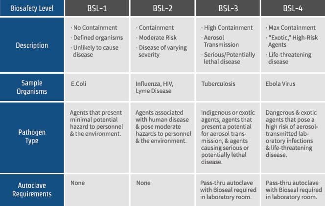
Coincidentally…or not…there is a National Disease Center on Plum Island, which was established in 1954 by the United States Department of Agriculture.
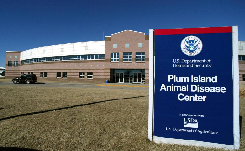
The facility maintains laboratories up to biosafety-level 3, which involves microbes which can cause serious and potentially lethal disease by inhalation.
Next, Fishers Island is also a part of Southold, New York, at the eastern end of Long Island, located in close proximity to Connecticut and Rhode Island as well.
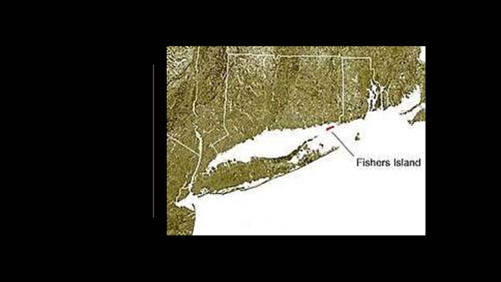
Named Munnawtawkit by the Pequot, it was said to have been named “Vischer’s Island” by the explorer Adrian Block in 1614 after one of his companions.
The Pequot Nation is indigenous to Connecticut.
The Pequot Nation was classified extinct by colonial authorities after the Pequot Wars that took place between 1636 and 1638, effectively decimating them as a viable tribe, as survivors were either sold into slavery to colonists in the West Indies or Bermuda, otherwise taken captive, or absorbed into other tribes.
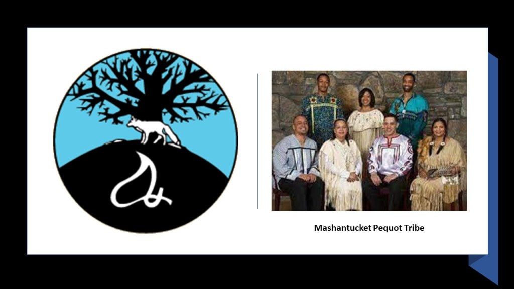
Of 5 Pequot tribes in existence today, the Mashantucket Pequot Tribe is the only one that is federally-recognized…
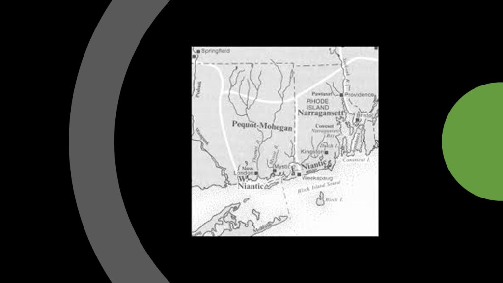
Mohegan-Pequot was an Algonquin-language spoken by the Mohegan, Pequot, and Niantic people of southern New England, and the Montauks and Shinnecock of Long Island.
The last living speaker of Mohegan-Pequot died in 1908.
We are told that historically Mohegan-Pequot did not have a writing system, and that the only significant writings came from European colonizers who interacted with speakers of the language.
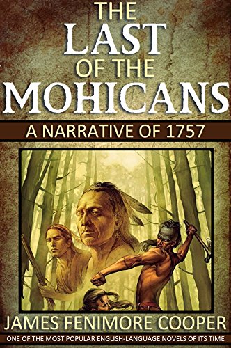
I am quite sure that James Fenimore Cooper’s “Last of the Mohicans,” first published in 1826, was an early novel introducing and reinforcing the new historical narrative.
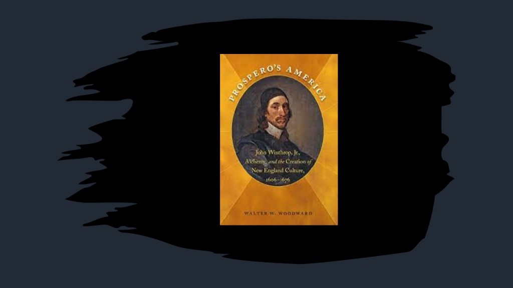
What I found in our narrative about Fisher’s Island is that John Winthrop the Younger, son of the Massachusetts Bay Colony Founder and Governor John Winthrop, which was established in 1630, received a grant of Fisher’s Island in 1640.
The island was privately held by the Winthrop family until 1863, then owned privately by others until 1879, when a joint-commission for Connecticut and New York reiterated that New York had legal title to Fisher’s Island, even though it has closer ties to Connecticut because of its proximity.
Between 1783 and 1909, brick-making was the only industry on the island because of the clay-pits there, and at its peak in the 1880s, the brickyard was believed to be the largest in the country, with a production capacity of 18-million bricks per year.
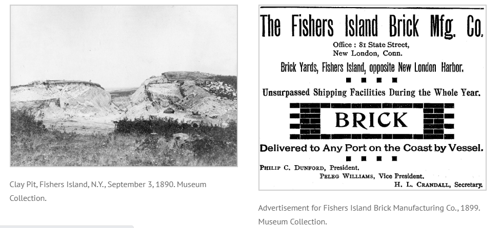
We are told that horse-drawn railroad cars were used to transport clay produced by hundreds of miners wielding shovels to the brick presses.
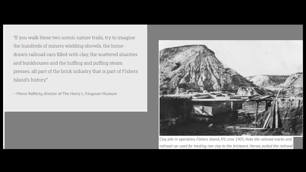
Since the 1920s, Fishers Island has been a playground for the social register set that includes the Rockefellers, DuPonts, Whitneys, and Roosevelts, and two-thirds of the island is off-limits to everyone except residents and their guests.
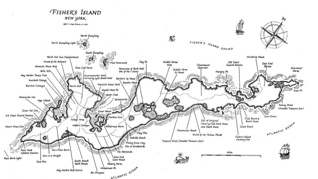
The social centers of Fishers Island are two private, exclusive clubs that rarely allow outsiders in – the Fishers Island Club and the Hay Harbor Club.
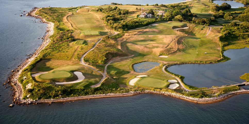
The Fishers Island Club is located near the eastern end of Fishers Island, and has an 18-hole golf course, said to have been designed by Seth Raynor and opened in 1926, that was ranked in 2009 as ninth in “Golf Digest” of the top 100 golf courses in the world.
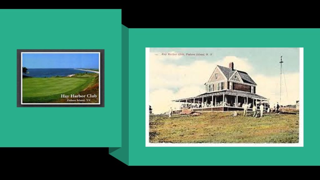
The Hay Harbor Club was established in 1909, and is on the western end of Fishers Island.
Among other things, it has a 9-hole golf course said to have been designed by George Strath and opened in 1898.
Next, a look at Rhode Island’s Block Island.
It is 9-miles, or 14-kilometers, south of the Rhode Island mainland, and 14-miles, or 23-kilometers, east of Long Island’s Montauk Point.
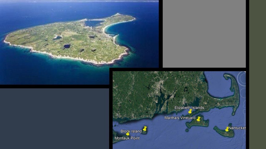
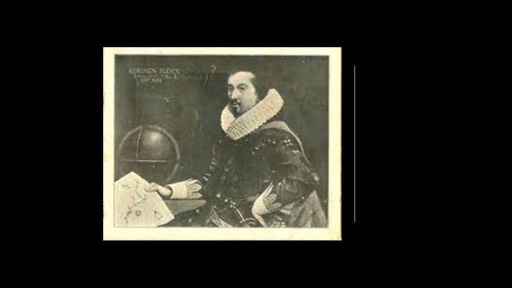
Block Island was named for Adrian Block, a Dutch privateer who was employed by the Dutch East India Company who charted the area in 1614 in our historical narrative.
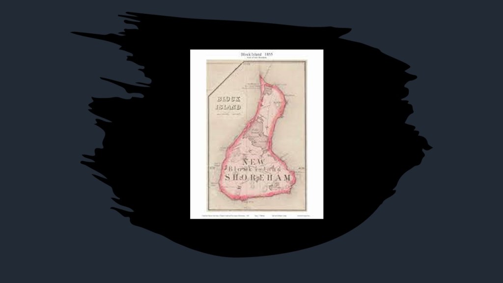
New Shoreham is the only town on Block Island.
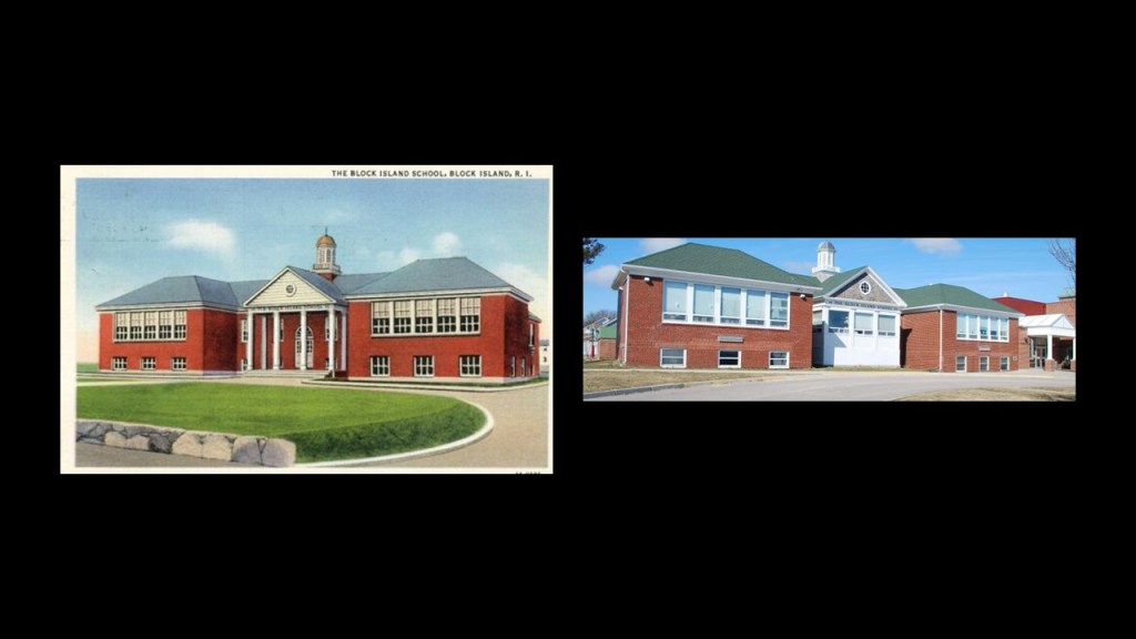
Block Island School is the only school here, teaching students from kindergarten through 12th-grade.
It was said to have been built in 1933 to replace five, one-room schoolhouses, and still use today, with some architectural changes over the years.
Mansion Beach today is a secluded beach on the island’s northeast coast, known for its white sand and big waves.
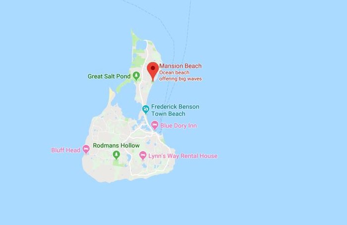
It was so-named because there was a mansion once here, said to have been designed by Massachusetts architect Edward F. Searles as a dream home for he and his wife, the widow of San Francisco Central Pacific Railroad magnate Mark Hopkins and constructed between 1886 and 1888.
Searles’ wife, Mary Hopkins Searles, was often referred to as the richest woman in America, and shortly after they married, she bequeathed him her entire fortune.
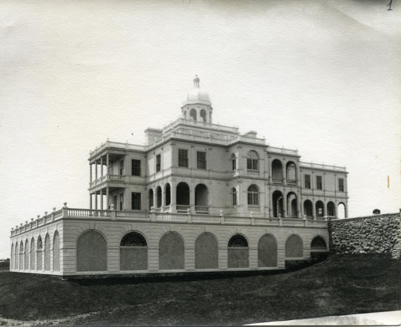
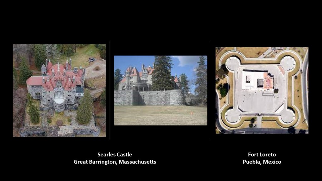
Searles was one of those architects credited with the design of other monumental architecture, including, but not limited to, the interior design for the Kellogg Terrace, known today as Searles Castle, in Great Barrington, Massachusetts, said to be one of America’s great masterpieces of gothic and Neo-Renaissance architecture built in 1883 by Stanford White of the architectural firm of McKim, Mead & White.
It sure looks to me like Searles Castle sits atop a star fort base, compared with Fort Loreto, a star fort in Puebla, Mexico, on the right.
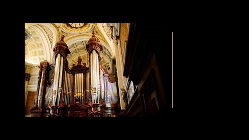
Searles was credited with the design of the giant nave at Searles Castle which still houses one of the largest pipe organs built in a residence in the United States.
At any rate, after having been abandoned for years, the Searles Mansion back on Block Island burned down in the 1960s, and was never rebuilt.
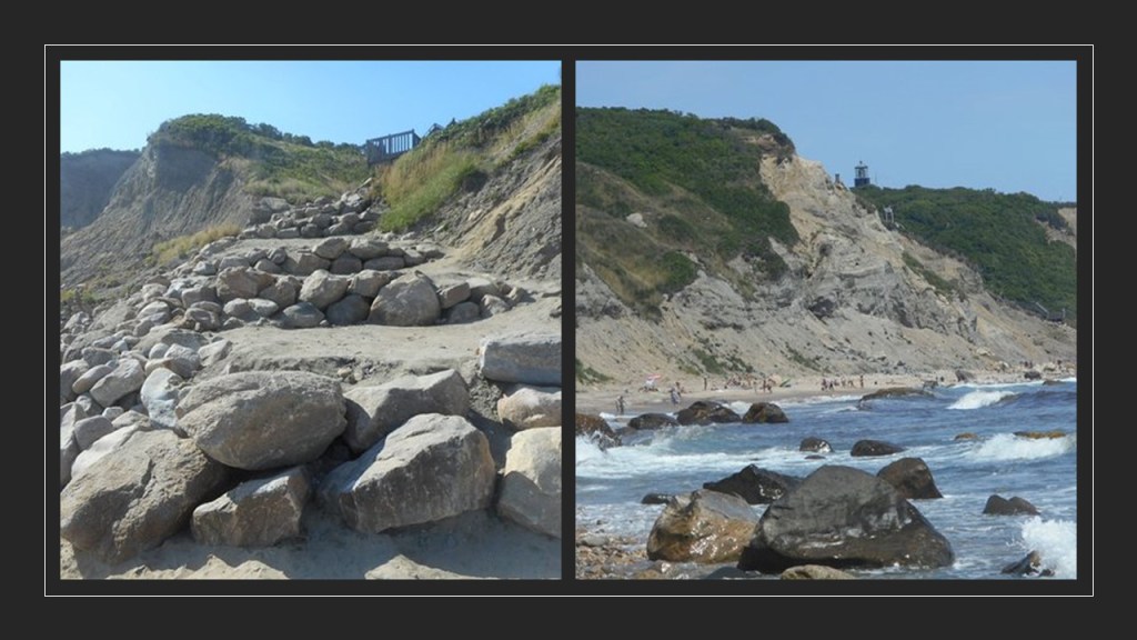
Block Island has thirteen distinct beaches.
This rocky beach is a clothing optional beach below the Mohegna Bluffs, which has a sheared-off-looking quality to it.
The huge rocks found here also look megalithic, like they were shaped and cut.
The next place we come to is Newport, Rhode Island.
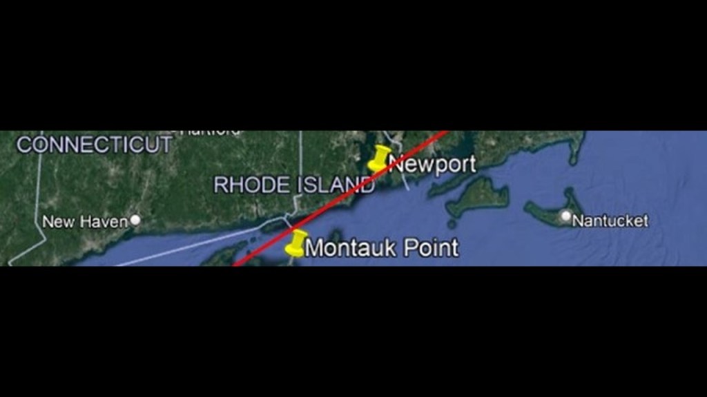
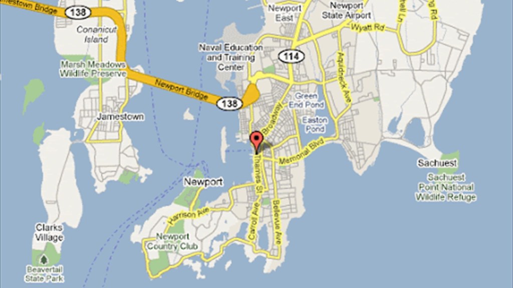
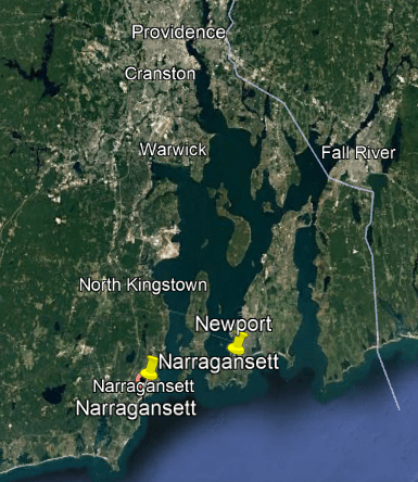
Newport is a seaside city in Rhode Island’s Narragansett Bay, located 33-miles, or 53-kilometers, southeast of Providence.
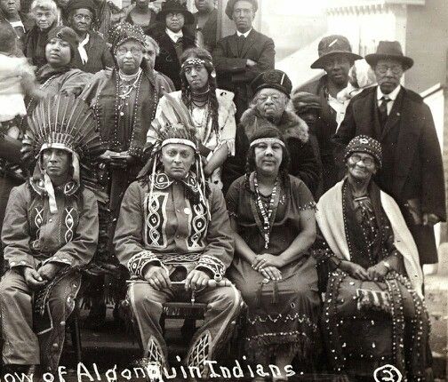
The Narragansetts are an Algonquin-speaking people indigenous to what became the State of Rhode Island.
Here is an historic photo of the Narragansett.
Their language died out in the 19th-century, though the they have been trying to revive it using written source material.
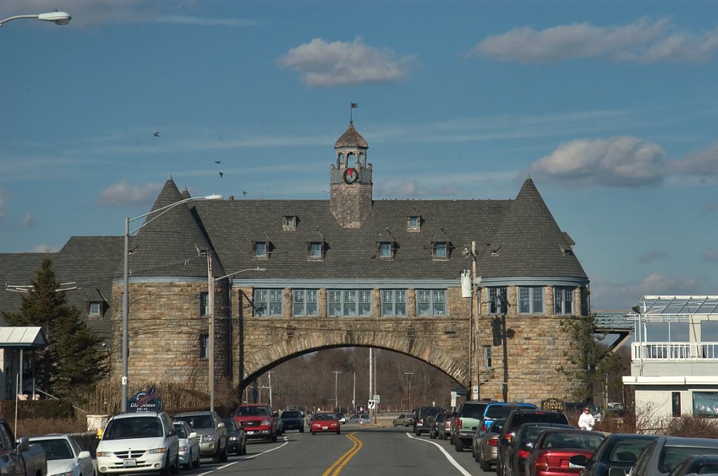
Across the Narragansett Bay from Newport, in the town of Narragansett, we find a stone masonry building called the Towers, said to have been built between 1883 and 1886 by the ubiquitous architectural firm of McKim, Mead and White as part of a Victorian-era casino and social-elite resort facility.
Also known as the “Twin Towers,” it is all that remains after a history of disasters, including fires and hurricanes.
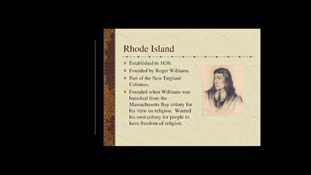
In our historical narrative, Newport was first incorporated as a town in 1639 by a group of nine founding English colonists, after the Colony of Rhode Island had been established in 1636 by Roger Williams, and only six-years after the Massachusetts Bay Colony was established in 1630.
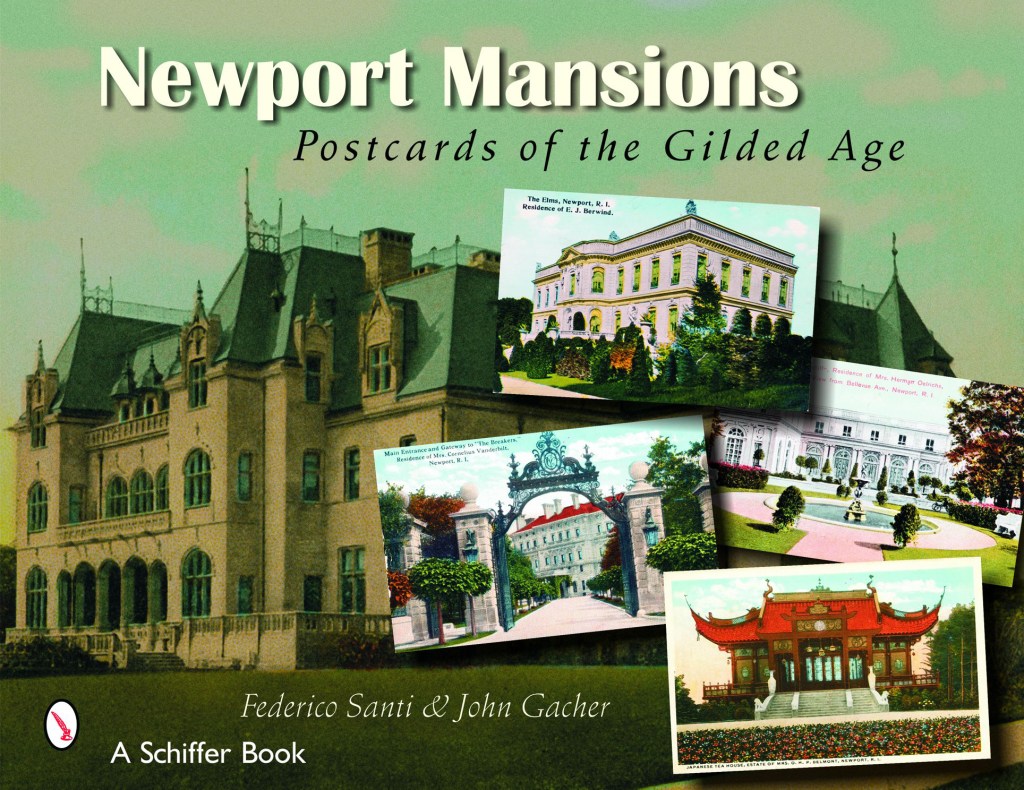
Newport is known for its “Gilded Age Mansions.”
Many members of New York City’s list of “Four Hundred” elite families had massive cottage estates in Newport.
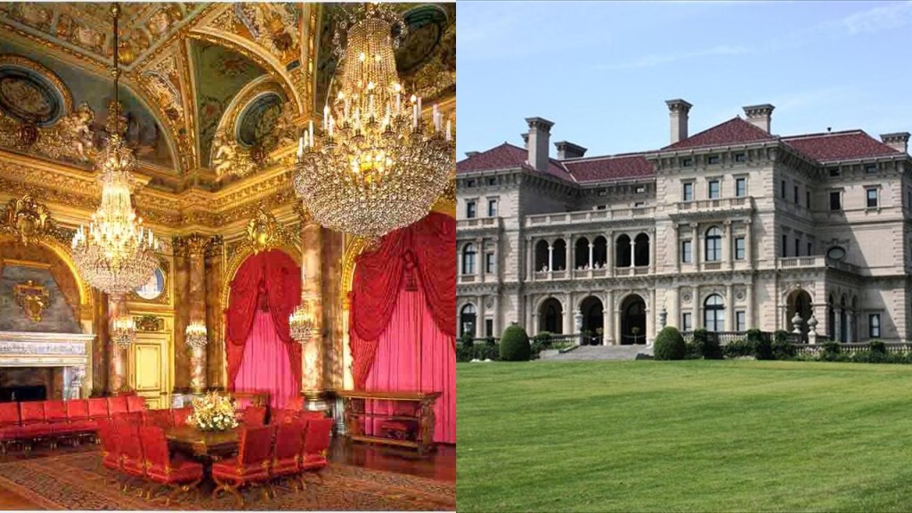
LIke the summer cottage estate known as “The Breakers” that was said to have been built between 1893 and 1895 for Cornelius Vanderbilt II.
It was said to have been patterned after a Renaissance Palace, and built with marble imported from Italy and Africa, as well as rare wood and mosaics from countries around the world.
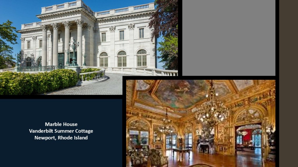
The “Marble House” was another Vanderbilt family summer cottage in Newport.
It was said to have been built between 1888 and 1892 for Alva and William K. Vanderbilt.
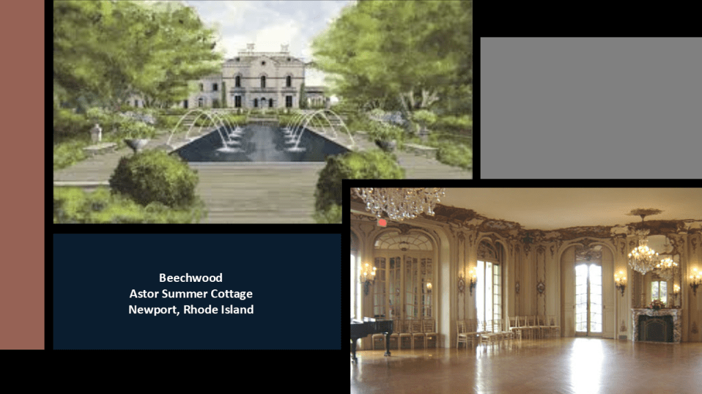
And “Beechwood,” which was said to have been built in 1851, and became the summer cottage estate in 1880 of Caroline Schermerhorn Astor, who had a massive ballroom built in it to accommodate her society events. and it became the epicenter of Newport High Society.
Next, we come to the Elizabeth Islands, Martha’s Vineyard, and Nantucket Island off the coast of Massachusetts.
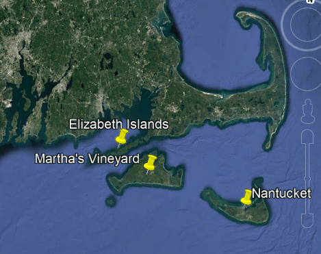
The Elizabeth Islands are a small chain of islands off the southern coast of Cape Cod, on the southern edge of Buzzard Bay, and is separated from Martha’s Vineyard by Vineyard Sound.
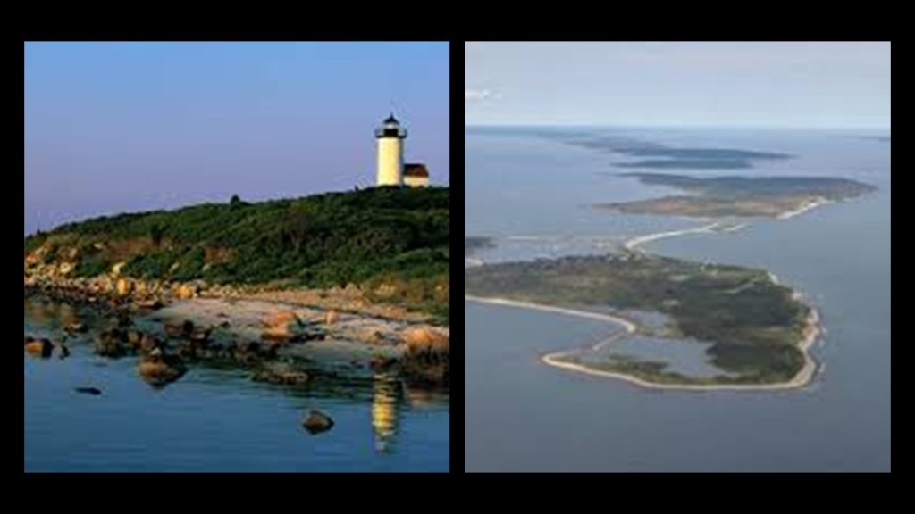
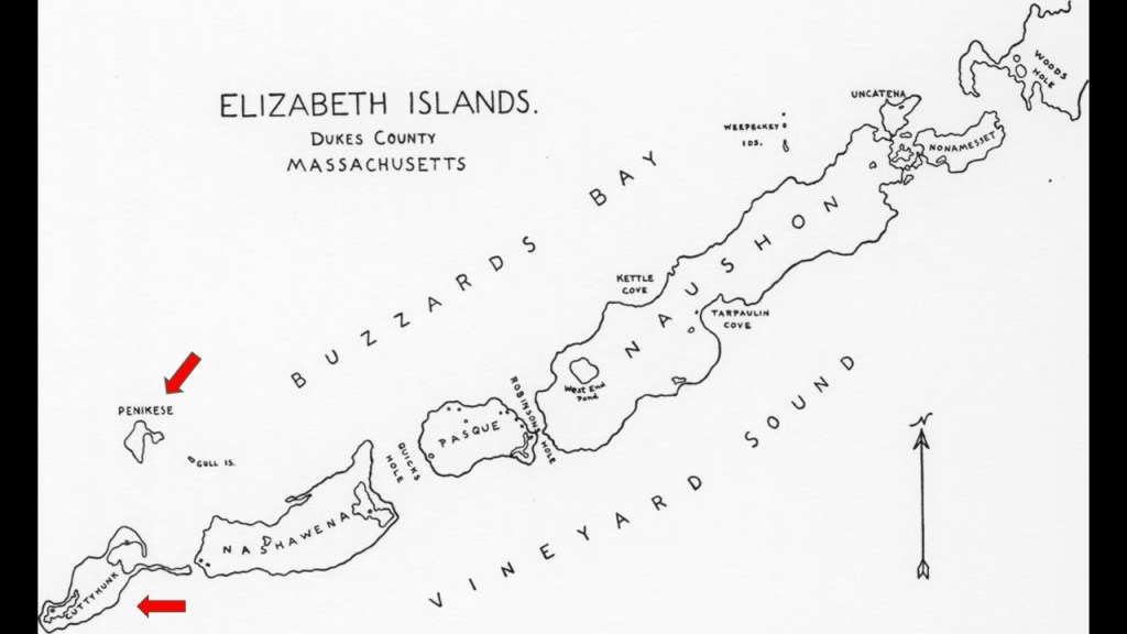
All of the Elizabeth Islands, with the exception of Cuttyhunk and Penikese, are privately-owned by the Forbes family, a wealthy American family of Scottish descent long prominent in Boston.
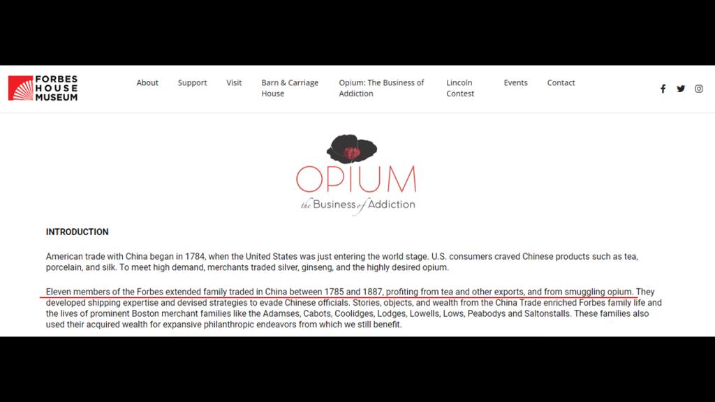
The family’s original fortune came largely from trading opium and tea between North America and China in the 19th-century.
Forbes family members include businessman John Murray Forbes, among other things a railroad magnate and President of the Michigan Central Railroad, and the Chicago, Burlington, and Quincy Railroad in the 1850s; and John Forbes Kerry, present-day politician, and the Secretary of State in President Obama’s second administration.
Like we saw with the Astor family, along with other well-known moneyed families, the Boston Forbes family’s original fortune came in large part from trading opium (and tea) between North America and China in the 19th-century.
This information about opium-trading is on the Forbes’ website, so they do not even try to hide this information from us.
The Forbes family were part of the “Boston Brahmins,” the historic upper elite class of Boston, Massachusetts, widely considered America’s closest equivalent to an aristocracy.
The “Brahmins” dominated New England’s intellectual, cultural and financial institutions from the late-19th- to the mid-20th-centuries, and were instrumental in founding and running major American educational institutions like Harvard University and M.I.T.
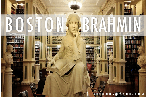
Their recognizable surnames included, besides the Forbes family, the Cabots, Lowells, Lodges, Adamses, and Peabodys.
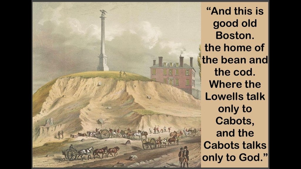
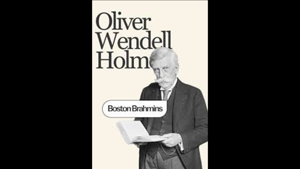
The term “Boston Brahmins” was coined by Oliver Wendall Holmes in an 1860 article in the “Atlantic Monthly,” after he likened Boston’s prestigious, old-money elite to the highest-ranking Brahmin class in Hindu society.
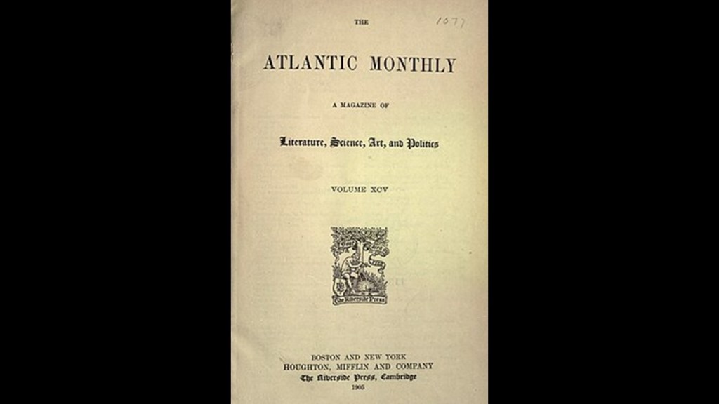
The “Atlantic Monthly” was established in Boston in 1857 as a literary and cultural commentary magazine by a collective of distinguished writers including Ralph Waldo Emerson, Harriet Beecher Stowe, Henry Wadsworth Longfellow, and first editor James Russell Lowell.
Next, Martha’s Vineyard, an island located south of Cape Cod and the Elizabeth Islands, is a popular summer colony for the wealthy.
Martha’s Vineyard, along with the adjacent Chappaquiddick Island, another small island off the coast of Martha’s Vineyard called “Noman’s Land,” and the Elizabeth Islands together comprise Massachusetts’ Dukes County.
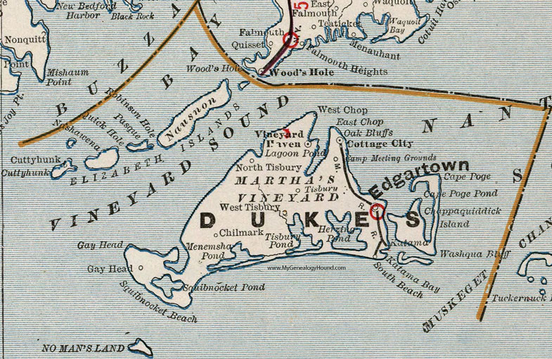
First, a little bit about Martha’s Vineyard.
Martha’s Vineyard, as of the 2010 Census, had a year-round population of approximately 17,500 people, and in the summer months the population grows to somewhere around 100,000.
In a study by the Martha’s Vineyard Commission, the Cost-of-Living on the island was found to be 60% higher than the national average, and the cost of housing 96% higher.
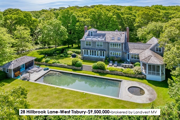
Vineyard Haven was named the #1 most expensive town in the United States by Lending Tree in 2021.

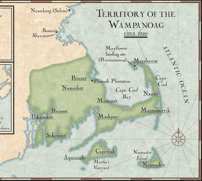
When the European colonizers arrived, the island was inhabited by the Wampanoag, the Algonquin indigenous people of eastern Rhode Island and southeastern Massachusetts.
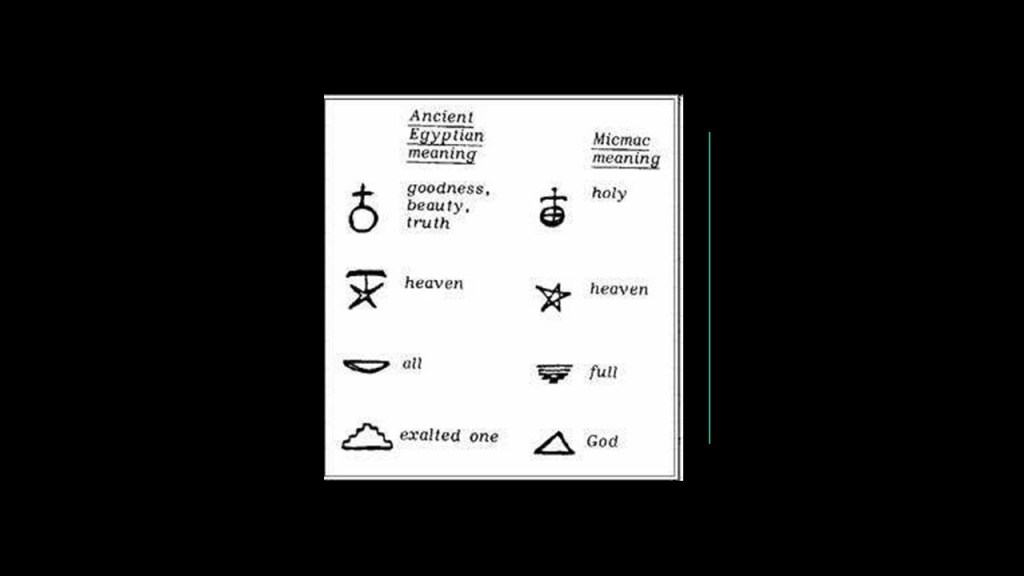
There is something interesting to note about the Algonquin language.
It is extremely hard to find this kind of information because of the hunter-gatherer theme going on with indigenous peoples of North America in the narrative, but I found an example in the written language script of the Algonquin Mikmaq people of Nova Scotia, and it is that of an apparent connection to the Egyptian language script.
The Wampanoag Tribe of Gay Head, or Aquinnah, on Martha’s Vineyard is one of only two federally-recognized Wampanoag Tribes, the other one being the Mashpee Wampanoag Tribe, headquartered in Mashpee on Cape Cod.

The Wampanoag on Martha’s Vineyard are headquartered in Aquinnah on the southwest tip of Martha’s Vineyard, part of the lands where they have lived for thousands of years which were dispossessed by English settlers encroaching on their lands.
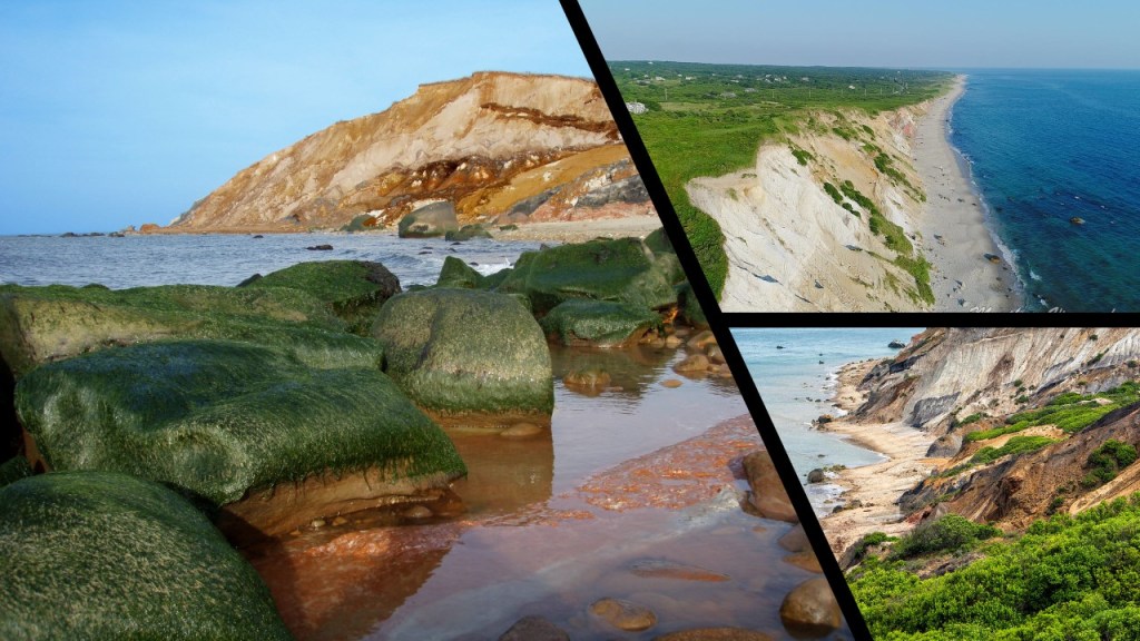
Aquinnah, which was incorporated as a town named Gay Head, between 1870 and 1997, is the location of the Aquinnah Cliffs.
The Aquinnah Cliffs, with streams of red and orange clay mixed with sand, were said to have been formed by glaciers millions of years ago.
These cliffs have that same, sheared-off-looking quality to them like other places we have already seen through here.
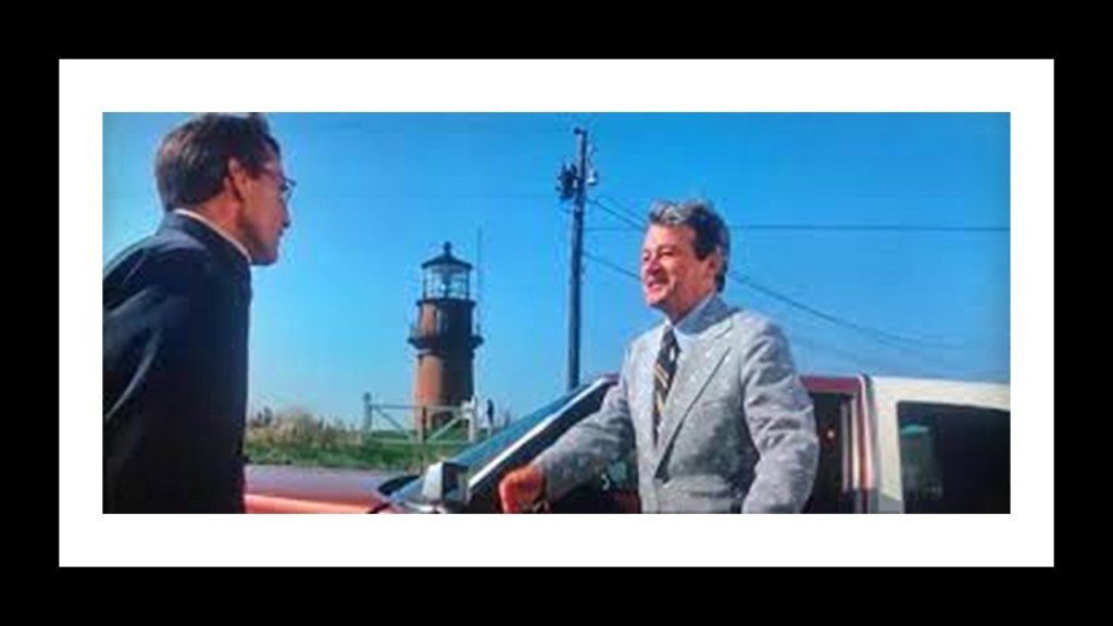
The Gay Head Lighthouse located here was featured in the 1975 movie “Jaws.”
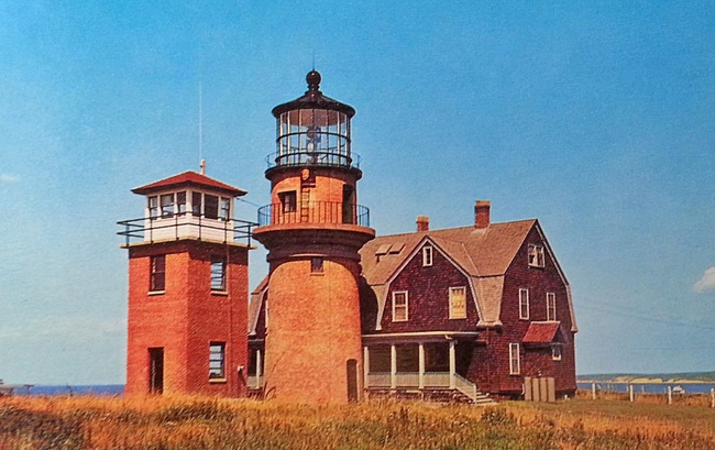
There is an interesting, and lengthy back-story to the Gay Head Lighthouse.
But long story short, at one time there were more buildings here.
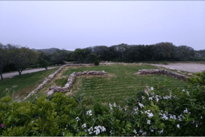
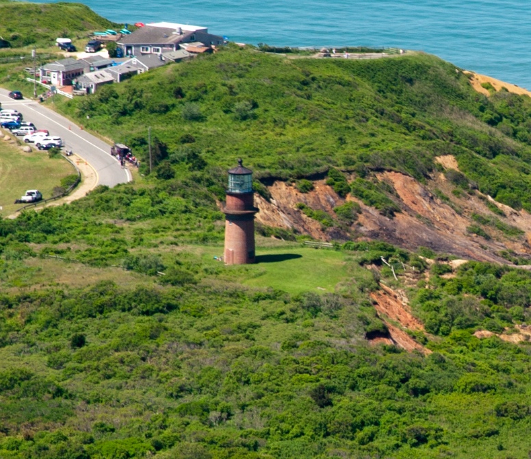
Now there is only one, which looks like there is possibly more to it under the ground.
Also interesting to note that I found this article talking about there being a deaf community on Martha’s Vineyard from its earliest settlement through the 19th-century.
It would appear from the article that the deaf people here attracted a lot of interest and questions.
More thoughts on this to come.
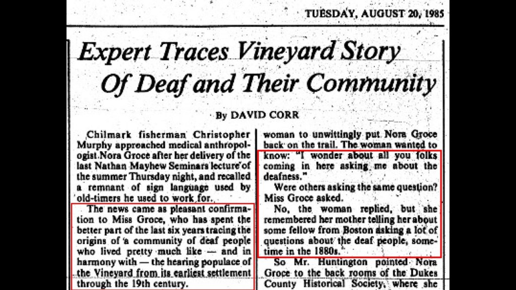
Chappaquiddick Island is a small peninsula that occasionally becomes an island, and part of the town of Edgartown, on the eastern end of Martha’s Vineyard.
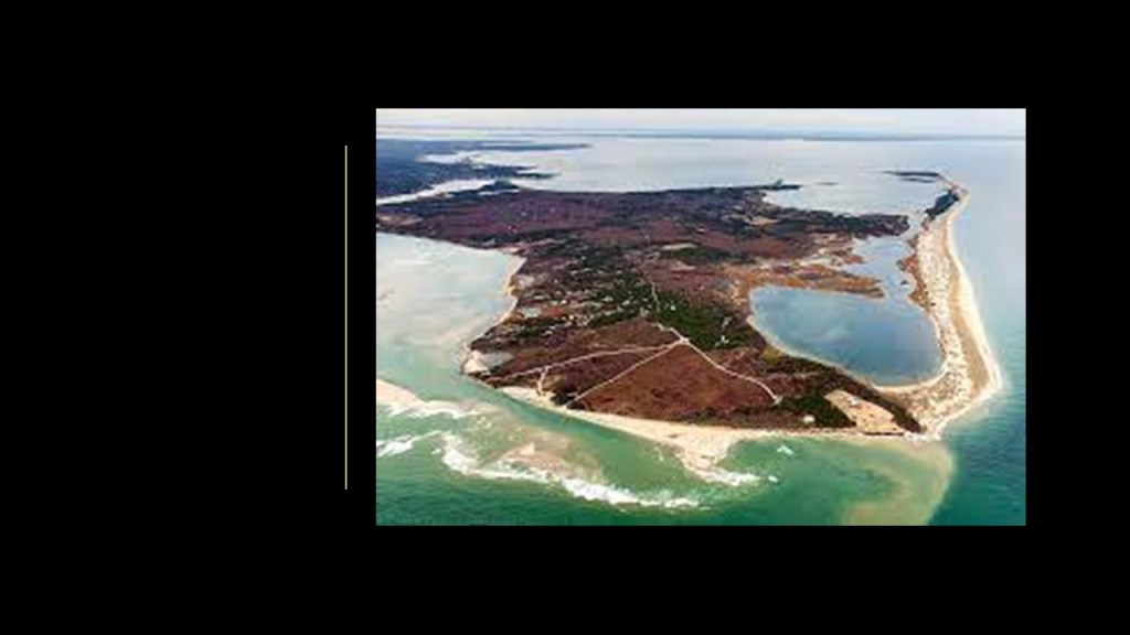
Well, if you ever wondered where the Chappaquiddick of the infamous incident involving Ted Kennedy and an overturned vehicle containing the body of a woman back in July of 1969, it was right here.
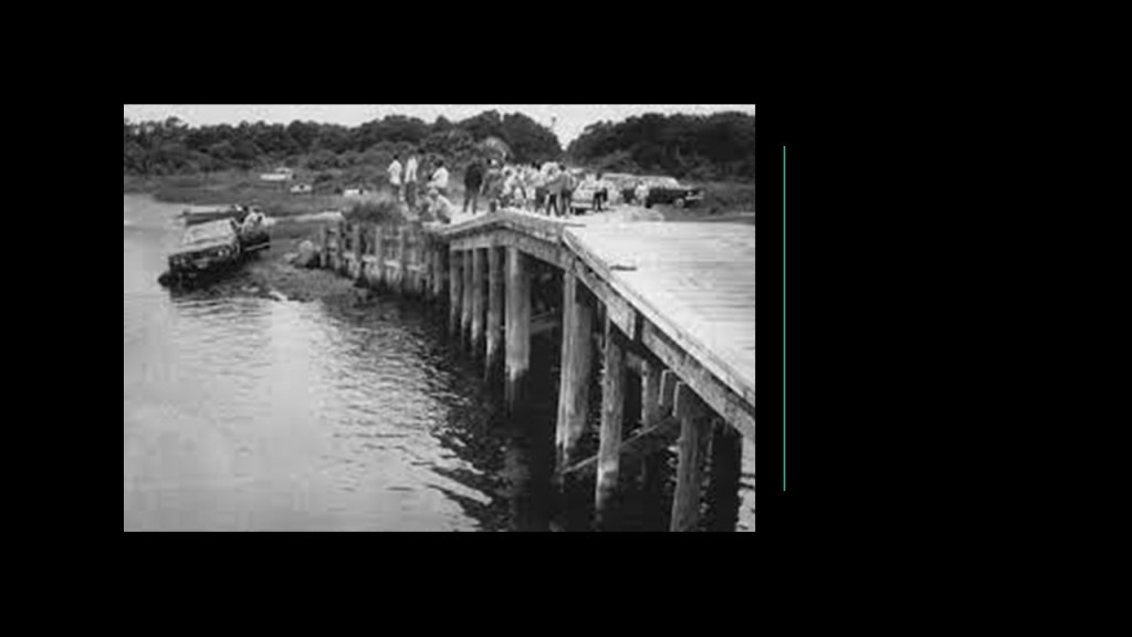
The small island called “Nomans Land” is located three-miles, or 5-kilometers, off the southwest coast of Martha’s Vineyard and was used as a practice bombing range by the United States Navy between 1943 and 1996.

The island of Nantucket is 30-miles, or 50-kilometers, south of Cape Cod, and together with the islands of Tuckernuck and Muskeget, constitutes the Town and County of Nantucket of Massachusetts, and like Martha’s Vineyard, a summer colony for the wealthy.
The name Nantucket was said to have been adapted from a similar-sounding Algonquin name for the island of the indigenous Wampanoag people.
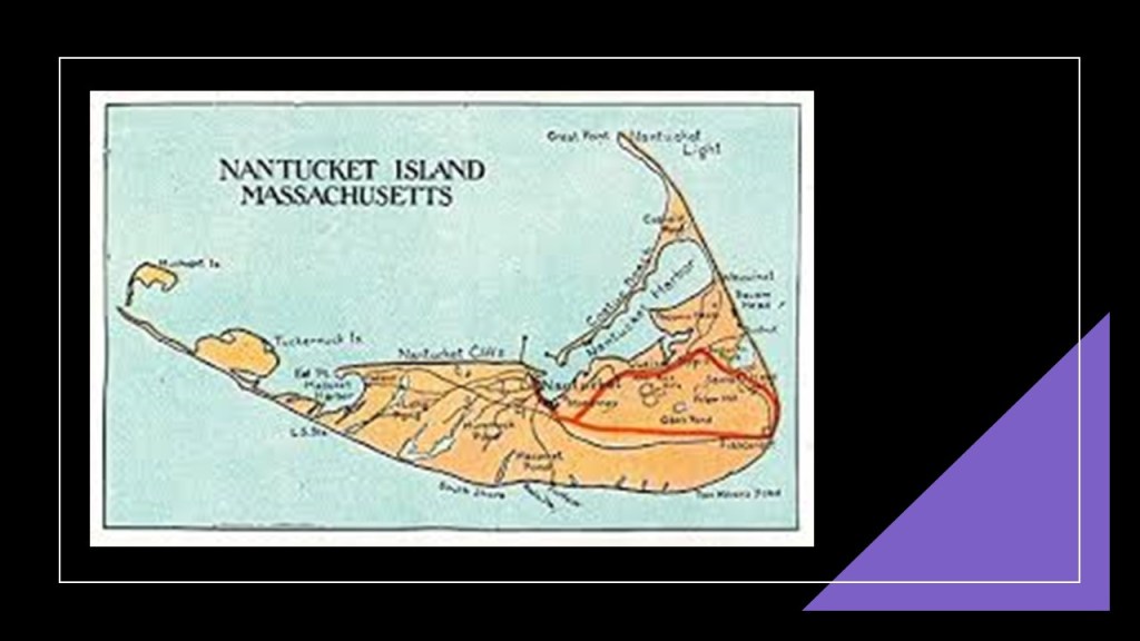
The National Park Service cites Nantucket as being the finest example of a late 18th- and early 19th-century New England Seaport town, and was designated a National Historic Landmark District in 1966.

Nantucket Island was perhaps best-known for the historical importance of its whaling industry, particularly during the 18th- up to the mid-19th-centuries.
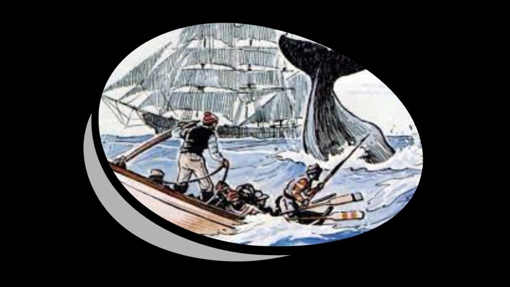
The Great Fire of 1846 devastated the downtown business hub of Nantucket, starting in a hat store and completely destroying more than one-third of the heart of the community and economy, and leaving many homeless, in poverty, and causing them to leave the island.
Great fires (and floods for that matter) destroying the central business districts of cities and towns around the world were quite common in our historical narrative, seemingly as a way to either destroy the original infrastructure, and/or take credit for the building of it afterwards, and as well as to deliberately cause disruption and displacement.
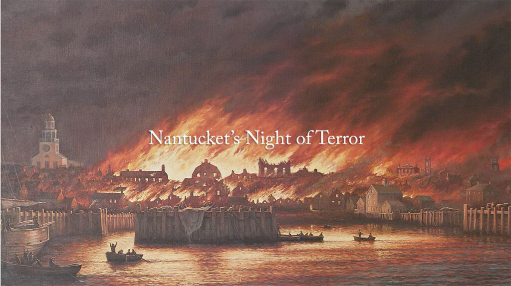
Next, we come to Cape Cod and the Southeastern Massachusetts Pine Barren (SEMBP) Association, which is headquartered at The Center at Center Hill Preserve in Plymouth.
The SEMBP is on land that extends from Duxbury to Provincetown along the Cape Cod Bay shoreline, covering Cape Cod, the Elizabeth Islands, Nantucket Island and Martha’s Vineyard, and inland includes Southeastern Massachusetts, including Plymouth and surrounding communities.
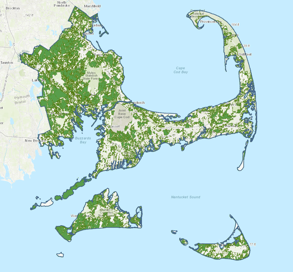
It so happens that this is the same Plymouth that was the location of the Plymouth Colony, the Pilgrim settlement founded in 1620 in our historical narrative by the Pilgrims after they journeyed from England to the New World on the Mayflower, seeking religious freedom, as we are taught and celebrate every year in the United States at Thanksgiving.
This is the Plymouth Rock Monument in Plymouth.
The current classical monument housing it was said again to have been designed in 1921 by the architectural firm of McKim, Mead & White of the elitist Century Association in New York City.
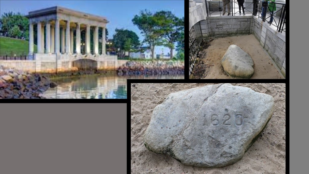
The Pilgrim Monument in Provincetown, Massachusetts, is on the northern end of Cape Cod.
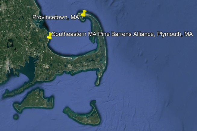
It was said to have been the winning design submitted by Boston architect Willard T. Sears in a contest, and built between 1907 and 1910 to commemorate the first landfall of the Pilgrims in 1620 and the signing of the Mayflower Compact in Provincetown Harbor.
The Pilgrim Monument is a bell-tower, and the tallest, all-granite structure in the United States, and said to have been modelled after the Torre del Mangia in Siena, Italy, which is said to have been designed in 1309.
It is 252-feet, 7.5-inches, or 77-meters, tall.
Granite is described as a “sonorous” rock, meaning that it will make a sound if you strike it, and in the case of granite, it will make a bell-like sound.
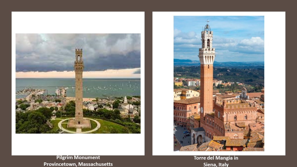
Now I am going to talk about the location of the Pine Barrens in New Jersey, Central Long Island, and Coastal Massachusetts.
There is a linear relationship between these three Pine Barren ecosystems.
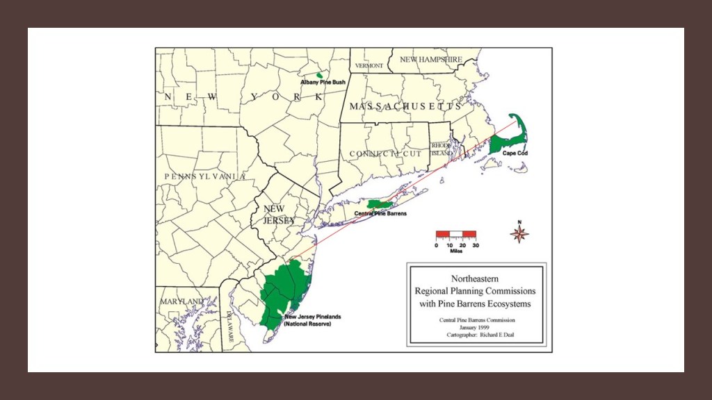
The Pine Barrens have nutrient-poor, sandy and acidic soil, characterized by bogs.
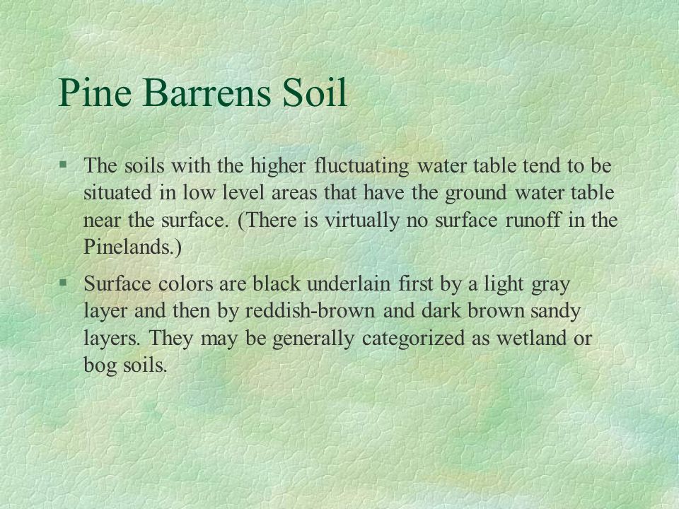
Here is the linear relationship on Google Earth when I searched for the Pine Barrens in New Jersey; the Central Long Island Pine Barrens; and the Coastal Massachusetts Pine Barrens, also known as the Plymouth Pinelands- the pins are placed where that search term for each popped-up, and each place I have mentioned in this post – near Ong in New Jersey; Westhampton Beach on Long Island; and Plymouth in Massachusetts.
I believe this Pine Barren alignment was ground-zero for the cataclysmic event that destroyed the surface of the Earth, and that this event took place relatively recently.
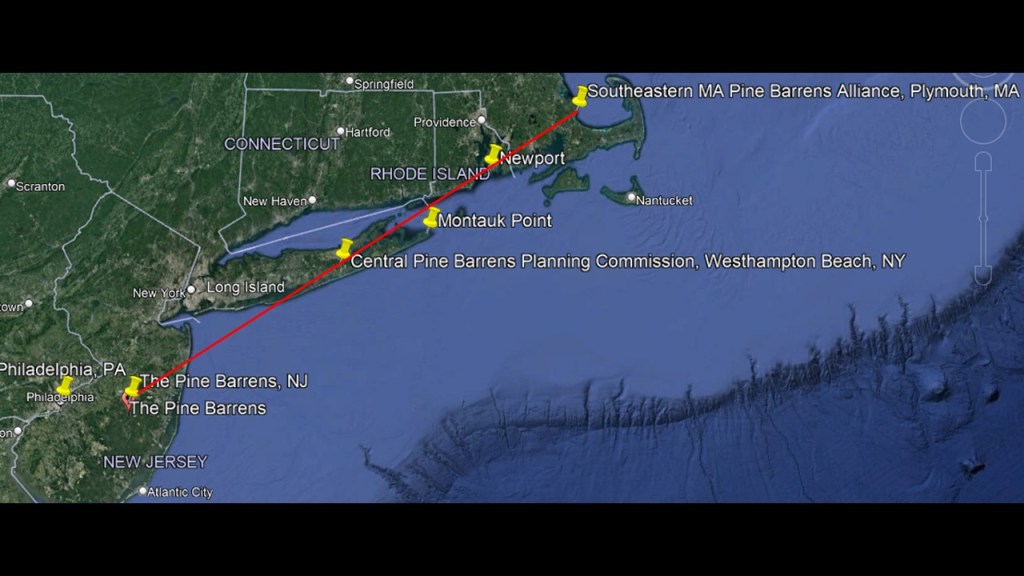
I believe that the landscape we see today here in the northeast United States, and all over the world, was born out of the trauma and changes to the earth’s surface as it buckled and ruptured, and gave way amidst thunderous sound and gigantic force as a result of the deliberate destruction of the original free energy grid that was for the benefit of all life everywhere, and subsequently transformed by those ushering in the “New World Order” into what we know as the Matrix for the benefit of the very few behind the reset of the original earth’s history, which I believe started sometime in the mid-to-late 1700s.
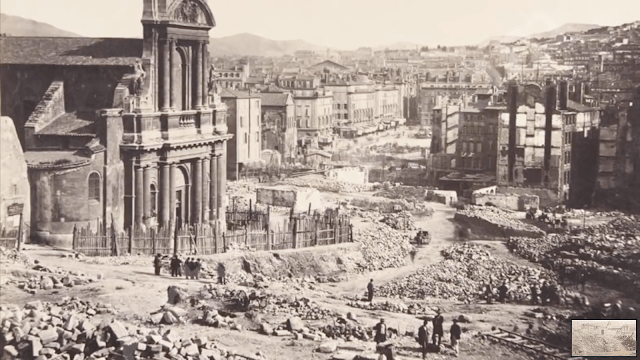
So I am going to present a theory for your consideration as to what might have caused this cataclysm of the Earth’s surface along the Earth’s Grid System in order to bring about the “New World Order.”
Prior to this deliberately-caused cataclysmic event, all of the infrastructure on the Earth was a perfectly-tuned and resonant scientific and musical instrument.
Everything worked together in harmony and balance to produce free-energy and abundance for all life everywhere – all the cathedrals, rail-lines, bridges, star forts, lighthouses, organs, bell-towers, and much, much more.
I believe that the circuit board of the Earth’s original free-energy grid system was deliberately blown-0ut, and because of my findings here in this part of the world, I believe directed frequency could have been used, and I am going to present a scenario for your consideration based on my research over the years as to how this could have happened.
Here’s how what I have learned about the Philadelphia Experiment and what I am calling the “Philadelphia Experiment Ley-line” could have caused the cataclysmic event that destroyed Circuit Board Earth and in the process, brought great change and upheaval to the surface of the Earth.
With regards to the elite enclaves seen throughout this post, I believe the high-society elites prized and coveted most the destroyed places that were of high importance in the original civilization, either because of who lived there or what was there.

I am going to start first with the Philadelphia Experiment.
I have postulated for quite some time that a rip in the fabric of space-time caused by the Philadelphia Experiment allowed great evil in the form of parasitic non-human beings to incarnate in human form on the Earth, and subsequently created the conditions for the world we are living in today.
Humanity has been at the mercy of a parasitic consciousness that has rigged the system to provide the non-stop flow of wealth for them and to keep us stuck in the negative energy of our lowest states of consciousness of fear and suffering that they need to survive.
Now, I’m going to take a look at the Philadelphia Experiment itself and see what we are told about that.
I mentioned previously in this post that Ong in the New Jersey Pine Barrens, geographically close to Philadelphia, is reputed to be an interdimensional gateway.
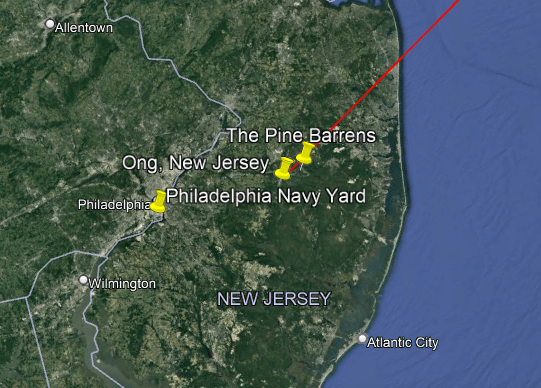
The strange Philadelphia Experiment was alleged to have taken place at the Philadelphia Navy Yard in the middle of World War II, the deadliest conflict in human history which started on September 1st in 1939, and ended on September 2nd in 1945 – exactly six years later.
When I originally looked for information on the Philadelphia Experiment several years ago, the date I first encountered for it was the date of July 22nd of 1942.
The Philadelphia Experiment involved the USS Eldridge, a naval destroyer escort for merchant ships.
The ship’s generators were turned on in view of other merchant ships that were in the Navy Yard.
As the fields created by the generators built-up, a green haze formed around the ship.
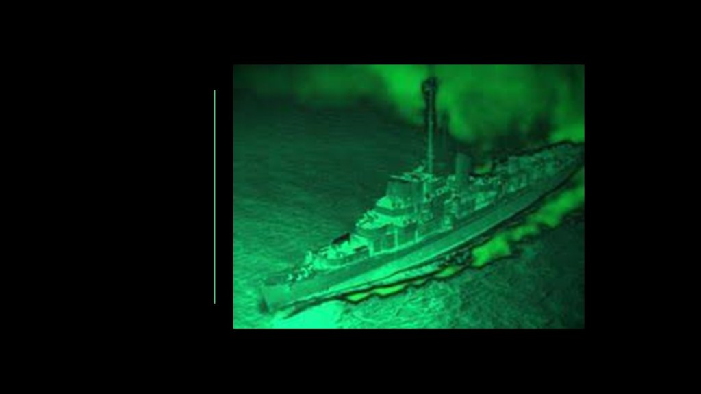
When the green haze disappeared, so did the ship, rendered invisible to both radar and the naked eye.
It returned to view after 15-minutes.
Did the USS Eldridge just become invisible?
Or did it go somewhere else?
And if it went somewhere else, where might it have gone?
What was the real purpose of the Philadelphia Experiment?
What if the USS Eldridge travelled in time?
I first learned of the work of author and publisher, Peter Moon sometime around 2014.
I started reading some of the books he published because I was looking for information about the Moors, and was having a hard time finding it.
Peter has been involved in a lot of work on the Moors, the Philadelphia Experiment, Montauk Project, and time travel research.
Peter also has a lot to say about Aleister Crowley in his books, and the dark, occulted nature of the timeline that we have been living on.
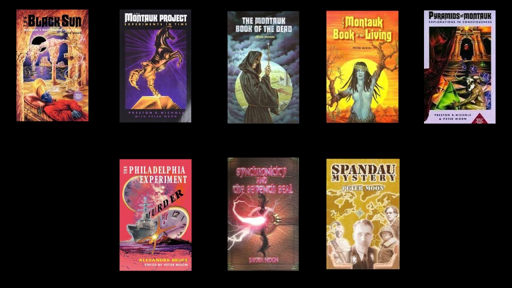
In one of his books,“Synchronicity and the Seventh Seal,” Peter mentioned that he had a correspondence with Crowley’s son Amado, and that Amado related to him that on the day of the Philadelphia Experiment, which he gave as August 12th of 1943, Crowley had passed him as a child through the circular megalith at Men-an-Tol in Morvah, Cornwall, and that when he did this, it caused a line of rough energy to cross the ocean.
This passage in the book also goes onto say further that while Crowley’s organization, known as the Ordo Templi Orientis, or OTO, an occult, fraternal and magical secret society, disputed this, others had no problems with his claim, and reported that during an eclipse ceremony on August 11th in 1998 at Men-an-Tol…
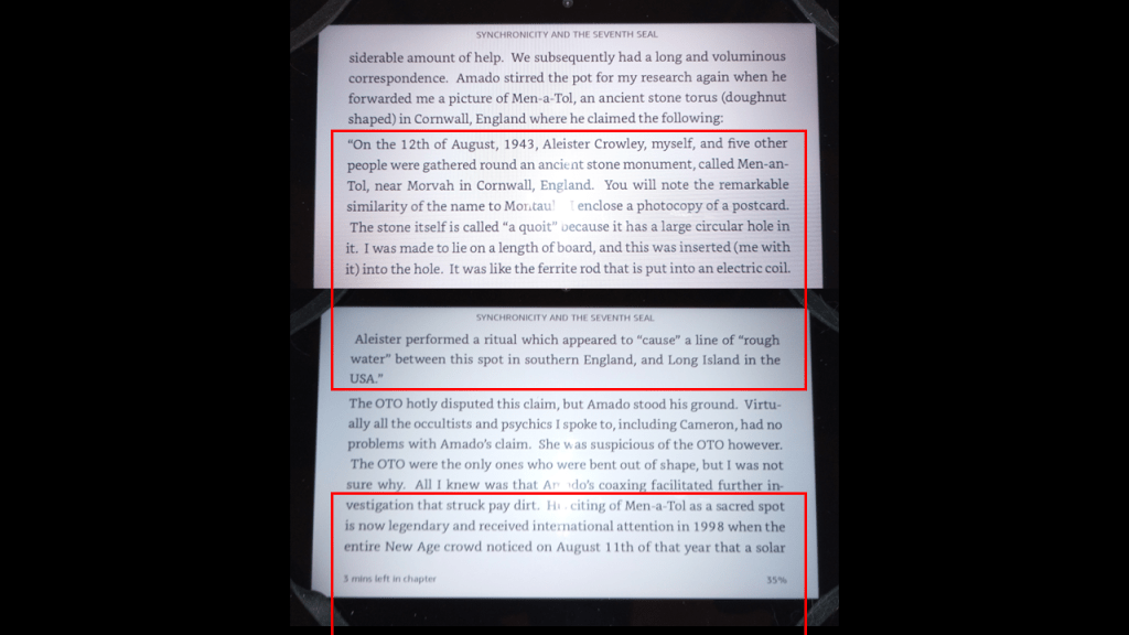
…an eclipse shadow line ran from Cairo, Egypt, to Montauk, Long Island, straight through Men-an-Tol.
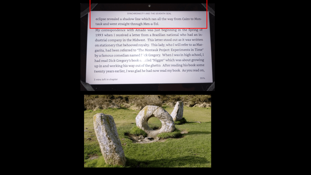
Whatever date it took place on, both July 22nd and August 12th have annual significance in ancient cosmology.
Each year August 12th is the last day of the Lion’s Gate Portal, which begins on July 28th every year, and opens on 8/8…

…and each year, July 22nd coincides with the heliacal rising of Sirius before the sun.
Interesting to note that the Lion’s Gate Portal is symbolized by the Figure 8, which is also the infinity symbol, and it peaks on 8/8 every year.

Like I mentioned earlier in this post, I have postulated for several years that the years 1492 and 1942 are the boundary years of a new timeline called Rome.
There are 450-years between 1492 and 1942 that can be divided evenly into nine, 50-year-periods, and at the beginnings of each these 50-year-periods, much was happening in our historical narrative.
With 225-years on either side, 1717 is the midpoint year.
I believe a new 3D Time loop was created that somehow mirrors or involves the Figure 8, upon which a new history was superimposed on to the existing infrastructure on the Earth, and falsely attributed in the new historical narrative as we have seen in the elite enclaves through this post.
The mid-point year of 1717 was the year that the Premier Grand Lodge of England was founded in London, on June 24th, 1717.
It was the first western Freemason Grand Lodge.
The same lodge adopted the Anno Lucis that same year, in 1717, as the Masonic calendar.
The Anno Lucis Calendar adds 4,000-years to the Gregorian calendar.
It is my understanding that only those initiated into the highest degree of western Freemasonry know directly about the Moors.
And it is no secret within Modern Freemasonry that it is “speculative,” meaning based on conjecture rather than knowledge, as opposed to “operative,” meaning those who actually worked with stone.
The New World’s Controllers stole the identity and legacy of the operative masons, representing Humanity at its highest-level of consciousness, and took us from the “Moorish Divine Movement of the World,” from Antiquity, with the eye on top of the pyramid signifying our pineal gland and our connection to the Creator, to it symbolizing “Big Brother,” and the control of the 13 Bloodline families.
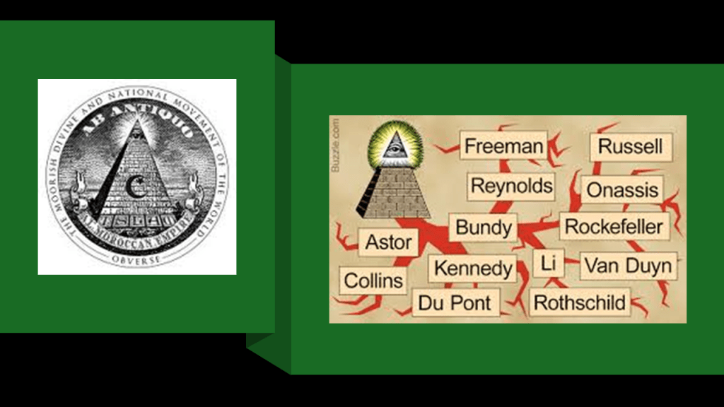
At any rate, with regards to the alleged Aleister Crowley connection with the Philadelphia Experiment, I extended the Pine Barrens alignment that I found connecting the three pine barrens of New Jersey, Central Long Island, and Coastal Massachusetts.
Going in the northeast direction, the alignment connected to Morvah in Cornwall, the location of Men-an-Tol, and going in a southwest direction, I took it as far the bayous in Louisiana.
Along with at least one abandoned train found out in the middle of nowhere in the New Jersey Pine Barrens, there is at least one abandoned train in a bayou in Ascension Parish.
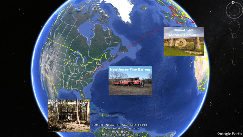
It is my belief that Aleister Crowley, known openly as the “Wickedest Man in the World,” was directly responsible for bringing us to “Crazy Town,” and brought in the parasitic entities that wouldn’t otherwise be here responsible for the world we live in today in the form of the wealthiest families that live in these elite enclaves.
I am sure that some of you will be aware of who this person is, but I would surmise that this name would be unfamiliar to most people.
Crowley was also known as “the Beast.”
He was highly involved in Freemasonry, and in ceremonial magical practices, including sex magic, and he was known to have been bisexual.
He also assumed the title of Baphomet within the OTO, originally founded in the early-20th-Century by German Occultists, and modelled after Freemasonry.
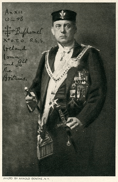
Crowley described the Baphomet as a divine Androgyne, and the “Hieroglyph of Divine Perfection.”
I believe this information is quite relevant to the bizarre gender agendas we see playing out in the world today.
The image on the left popped up when I searched for “they want to turn us into them,” instead of us being in the image of God on the right.

There are several more points I would like to bring up with regards to the Crowley connection and the role of the Philadelphia Experiment in bringing us to the world we live in today being a real possibility, and not science fiction.
I had already collected a lot of puzzle pieces relating to what has taken place here with regards to the original civilization, what happened to it, who was involved in the reset of Earth’s history, and much of the how it was done.
But until I started looking into the sound elements, I did not have a conceptualization about how the time-space altering event of the Philadelphia Experiment could have also caused the destruction of the Earth’s surface, an event which I believe caused the sinking of the advanced civilization of Atlantis only hundreds of years ago at the most, not thousands of years ago as we have been taught.
As I mentioned previously, all three of the Pine Barren ecosystems of Coastal Massachusetts, Central Long Island, and New Jersey are on this alignment, as seen on the top left.
Provincetown at the tip of Cape Cod where the Pilgrim Monument is located, is also on this same alignment and all of Cape Cod, as well as the Elizabeth Islands, Martha’s Vineyard, and Nantucket, is part of the Southeastern Massachusetts Pine Barrens Alliance, on the right.
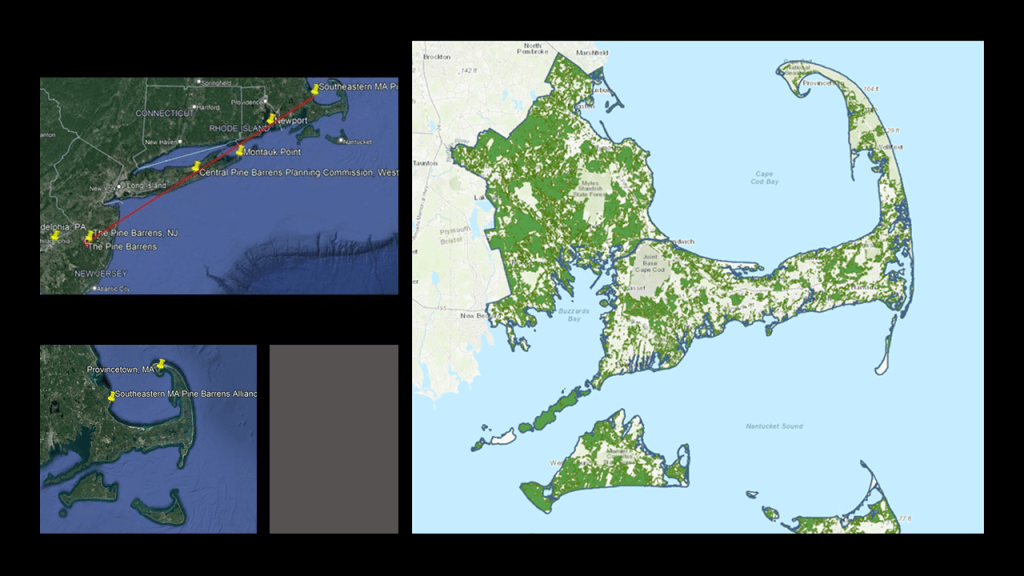
As I mentioned previously, the Pilgrim Monument is a bell-tower that is the tallest granite structure in the United States, and granite rings with a bell-like sound when it is struck.
If Crowley’s ritual ceremony at Men-an-Tol, whenever it took place, did in fact send a line of rough energy to cross the ocean towards Long Island, as claimed by his son Amado to Peter Moon as mentioned previously, it would have crossed through or near the Pilgrim Monument, with the energy thereby striking it, either directly or indirectly.
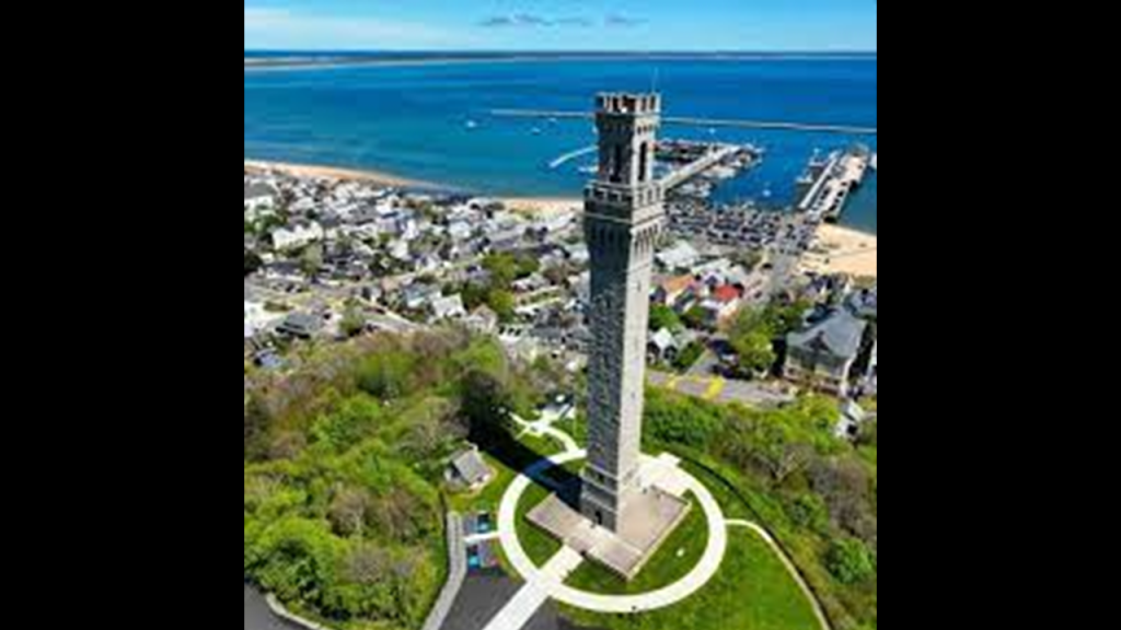
It is also very interesting to note that Provincetown is one of the most LGTBQ-inclusive places in the country, and has been for a long time.
As early as 1900, when an artists’ colony and experimental theater developed there, including drag shows in the 1940s.
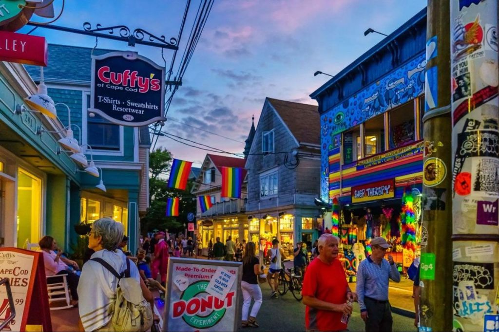
In the process of doing this research, I learned about resonance and forced resonance.
Resonance occurs in oscillating systems when an external force with the same natural frequency causes a rise in amplitude, which results in a net rise of mechanical energy.
Resonance can occur in various systems, whether acoustical, electrical, or mechanical systems, and is desirable in their applications.
Resonance can also be detrimental, however, when it leads to excessive vibrations and structural failure.
Now what I think could have happened is that the rough line of energy caused by Crowley’s ritual ceremony on Cornwall either struck this bell-tower, or another bell-tower along the way that is underwater now, which caused a forced resonant frequency to go throughout the Earth’s entire grid system, either all at the same time, or in waves, like the aftershocks of earthquakes, and caused it to go haywire, leading to the destruction of the entire system and dramatically changing the face of the Earth.
I also consider the possibility that the manipulation of time-and-space involved in the Philadelphia Experiment could have also carried this forced resonant frequency back in time to create the cataclysmic event as opposed to something that happened in real-time.
Let’s use the example of Cape Cod to illustrate the presence of railroad lines and lighthouses, for example, right next to water.
Here is the map showing fourteen lighthouses on Cape Cod alone, as well as other lighthouses of this part of New England, on the left, as well as the historic Old Colony Railroad that traversed the length of Cape Cod.
While we have always been given the explanation that lighthouses were constructed to guide ships through rocky shoals and dangerous waters, and railroads were built around the same time period in the 19th-century, what I am seeing is that these were places that were in perfect resonance and that forced resonance throughout the grid system caused the system to go haywire, and the surrounding land sank, or turned into like swamps, bogs, barrens, or deserts and dunes.
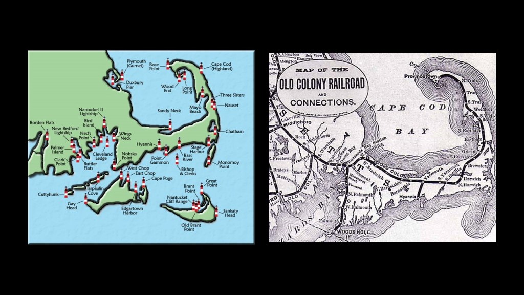
There are several more points I would like to make with regards to the Crowley connection and the role of the Philadelphia Experiment in bringing us to the world we live in today being a real possibility.
One is about the deaf community on Martha’s Vineyard that was being studied in the 19th-century, which would have been very near the bell-tower in Providence.
They want us to believe it was from internal causes, but what if the cause of the deafness was from an external source, like an eardrum-shattering sound resulting from a forced resonant frequency going through a massive, previously-resonant system?
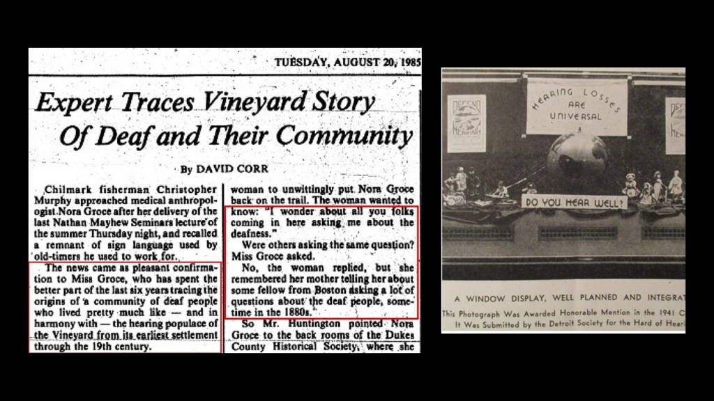
People who were deaf or deaf-mutes was a huge issue in the 19th-century that historical figures like Alexander Graham Bell were famous for working with.
For one example, Bell was known for training instructors of deaf-mute students.
He travelled to Boston in 1871 to teach instructors at the Boston School for Deaf-Mutes his “Visible Speech System.”
The oldest public day school for deaf and hard-of-hearing students, it later became known as the Horace Mann School for the Deaf.
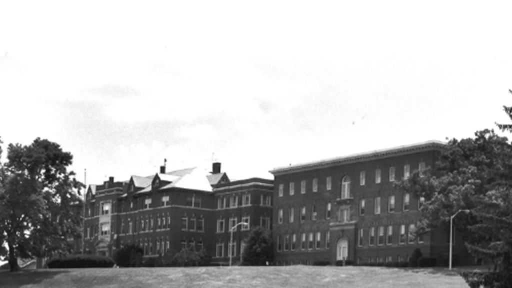
Another point that I would like to make is that because Earth is a Free Will Zone, the Human Beings who live here have to give their consent to choose whether the follow the Light or the Dark, and they have to tell us what they are doing.
They can’t just come in and do whatever they want to, even though it might seem like that is what they have been doing.

One way they gain our consent is through literature, art, music, and things like predictive programming and soft disclosure in movies and television programs, and accomplish this by not telling us they are telling us.
If we don’t get it and object collectively, then they technicially have our tacit consent even if we don’t know we are being told something, and that is what they are counting on.
Predictive programming is defined as storylines, or even subtle images, that in retrospect seem to hint at events that actually end up happening in the real world.

Soft disclosure is defined as a gradual, understated release of controversial or secretive information to the public, like “Stranger Things.”

Does soft disclosure also relate to the 1980 movie “The Final Countdown,” in which a time-travelling naval vessel in the form of the USS Nimitz goes back in time to the day before the attack on Pearl Harbor on December 7th of 1941.
Did the subject matter come solely from someone’s fertile imagination, or are they disclosing something that has been hidden from us?

The other way they get our consent is by outright lies, deception and duplicity because if people knew the true agenda of these controllers, the majority of Humanity would never, ever accept what they are doing to us.

We are inherently sovereign beings.
They have gone to all of this trouble because, by Universal Law, they can’t lay a finger on us.
They have tricked us into accepting their sovereignty over our own.
How was this accomplished?
There were numerous ways, but one is private clubs like the Century Association mentioned previously in New York City, and/or other hand-picked elite groups of people who could meet secretly and make their plans for bringing the New World Order into existence.
Ever hear the George Carlin quote “It’s one big club, and you ain’t in it?” and wonder where that idea might have come from?
The self-appointed elites have continued doing the same thing to this day in their secretive meetings to plan their agendas for what they want the future to look like for Humanity and the World, and what they wanted doesn’t look good for us!

A small number of related, elitist family bloodlines, hidden in different nationalities and religions to carry out their plans for world domination, brought into existence a New World built upon the ruins of the Old World, and have stolen the legacy and identity of the original people and the true builders of all of the original infrastructure of the Earth; claimed their legacy as their own while at the same time, robbing us blind of resources, wealth, and energy without us knowing anything about it because they educated us in a new history with them written in to it, and at the same time removed everything about the Old World from our collective awareness.