
If you are new to my blog, my premise is there was an advanced ancient civilization that was unified around the world up until relatively recent times. This positive timeline was scrubbed from our collective memory and we were given a false timeline, starting from our understanding of history in 1492. This blog is dedicated to providing compelling evidence as to why I believe that.
I started putting puzzle pieces together when I found the North American Star Tetrahedron pictured below by connecting major cities in North America that fell on straight lines. Then I extended the lines out on a globe, wrote down the cities, and followed-up by looking at images and watching drone videos of these places.
This post is about an interesting series of alignments that connects to two-sides of the North American Star Tetrahedron.
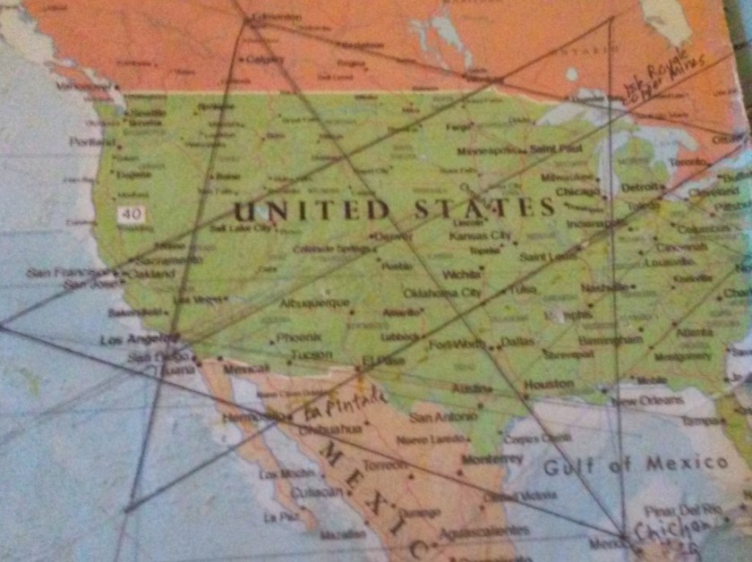
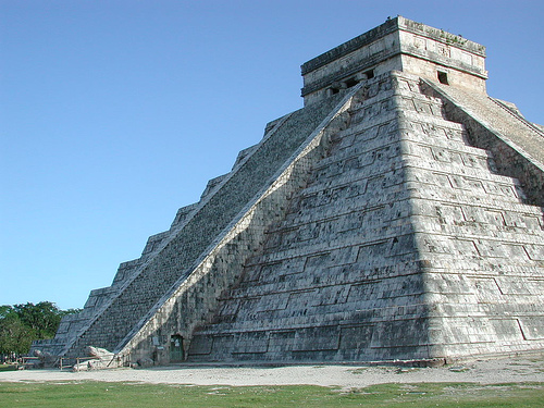
Starting out by heading southwest on the alignment from Merida, Mexico – where the Chichen Itza temple complex is…
…you find these islands:
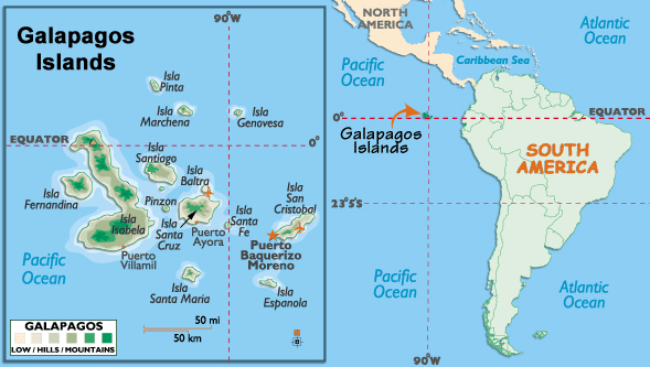
The Galapagos Islands, which are part of Ecuador, and were made famous by the studies of Charles Darwin, who was a naturalist and biologist on-board the HMS Beagle on its famous world surveying tour back in the 1830s. While a small human population lives there, it is a national park.


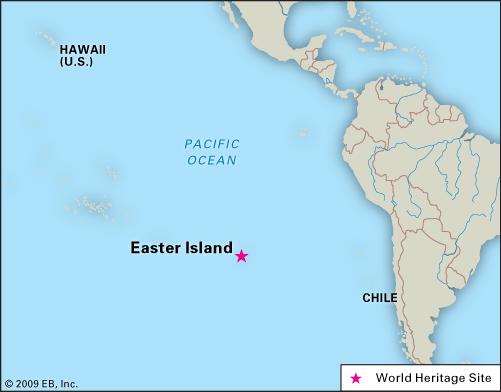
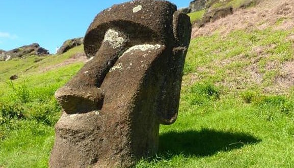
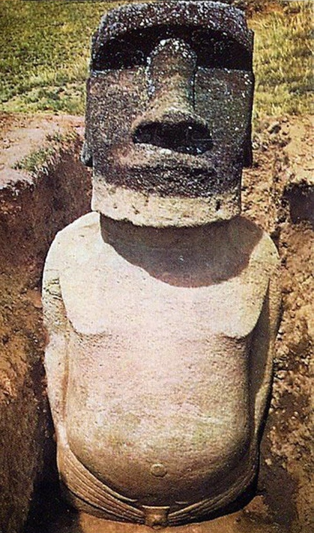
Next, the alignment crosses over Easter Island, which is nodal point on the planetary grid. A nodal point is where numerous leylines and planetary alignments connect. It is considered part of Chile, and its original name is Rapa Nui.
Easter Island is most famous for its Mo’ai, or giant heads.
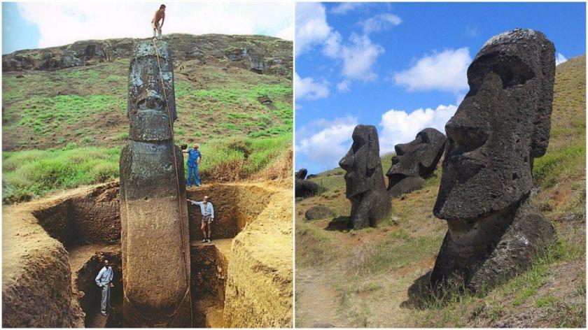
More recent finds show that the famous gigantic heads of Easter Island are substantially much more than heads:
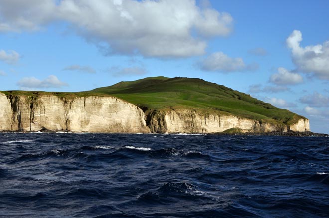
Next, this alignment crosses over the Antipodes Islands, which are considered part, and lie to the south, of New Zealand.
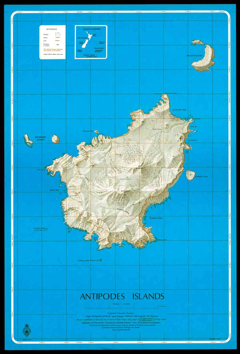
There is no public access to the these islands, and they are on the UNESCO World Heritage List.


Antipodes means “the opposite side of” and was thought for a long time to be the opposite side of London, though it appears to be opposite of a location in France.
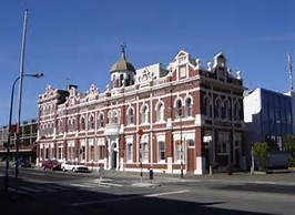
The alignment crosses over the city of Invercargill, New Zealand, a city which sits at the southernmost tip of New Zealand. I see the same building architecture all over the world, with onion domes and they same style of building facade ornamentation:
The Snares Islands/Tini Heke, is a small island group south of New Zealand, which administers it but they are not inhabited. These islands are also designated as a UNESCO World Heritage Site.


Flinders Island is the largest island in the Furneaux Group, and these islands lie northeast, and is a state, of Tasmania:


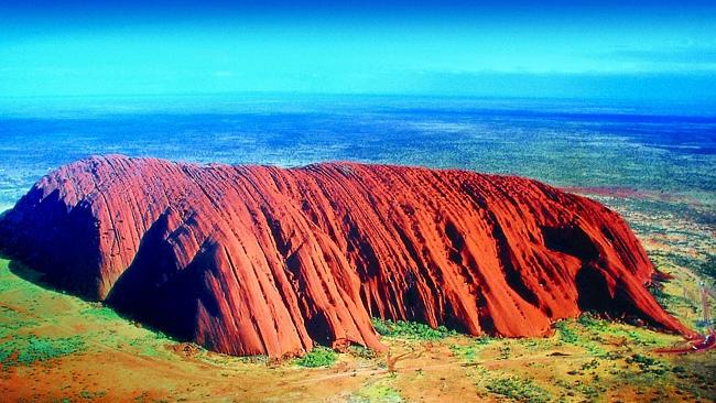
This same alignment continues on up through the middle of the continent of Australia, through Uluru, also known as Ayer’s Rock, which is also a nodal point on the planetary grid, and is the earth’s third chakra.
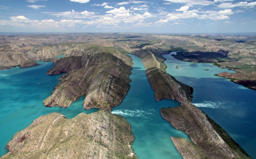
The alignment leaves Australia at Cape Talbot:


which is also known for one of two Horizontal waterfalls in the world:
It then goes through Kupang, West Timor, which is also on at least one other alignment:


Next it passes through Flores Island, Indonesia. It is the tenth largest island of Indonesia. Flores Island is also known for the discovery of dwarf human skeletons in a cave – homo floresiensis. It is also known for the discovery of large skeletons like giant rats, and is also another home for Komodo dragons. The current inhabitants of Flores are primarily Roman Catholic in a predominantly Moslem Indonesia.
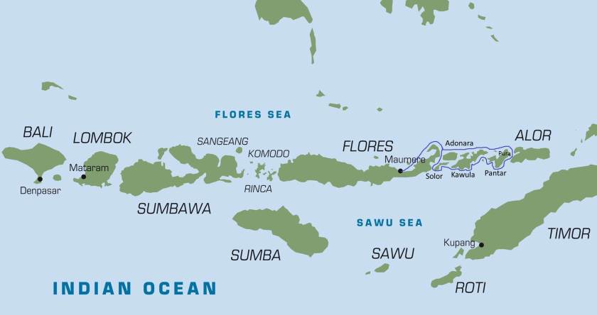


Then the alignment goes on to cross through Posu, and the capital of Central Sulawesi, Palu. Sulawesi is a province of Indonesia.


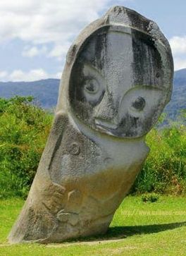
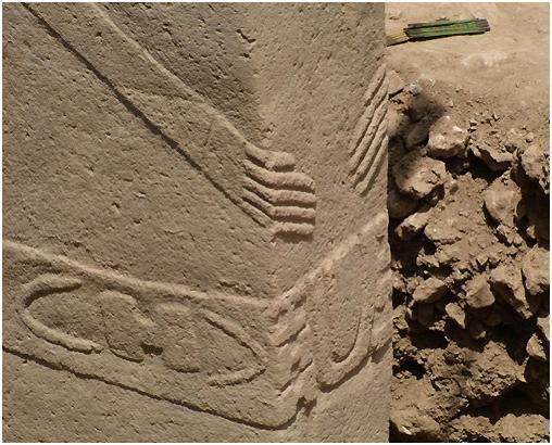
There are over 400 granite megaliths on Sulaweski, in the area of the Lore Lindu National Park, of which around 30 represent human forms.:


While we are here, and I am basing this next section on the top picture below that I found at the Lore Lindu National Park in Sulawesi, as this is a good opportunity to bring in comparison photos of very similar animal relief carvings in other places, in this instance in Peru and Turkey.
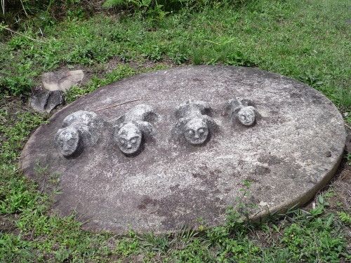
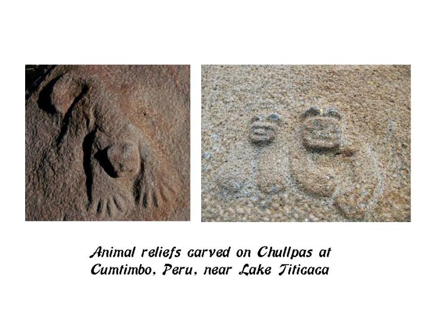
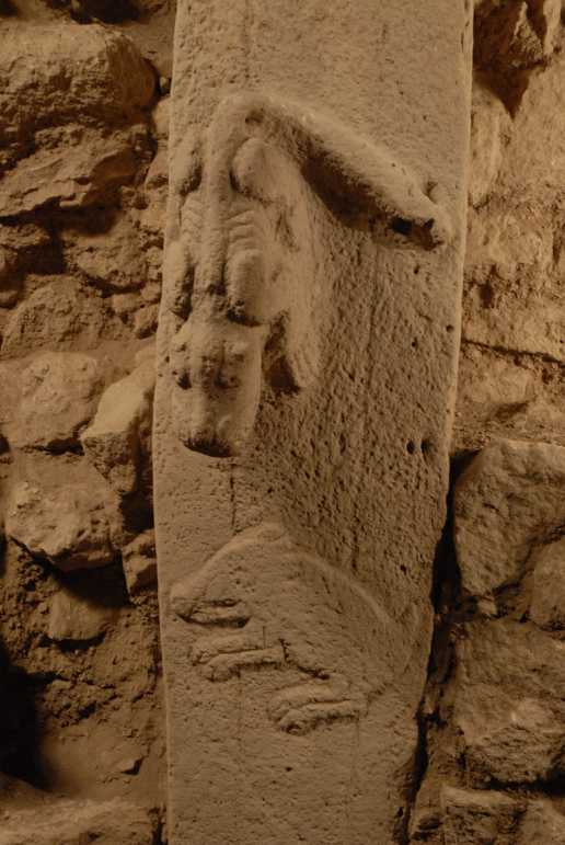
Not only are there similar animal relief carvings in these three places, you find this similarity in humanoid figures in Sulawesi, Indonesia; Easter Island; and Gobekli Tepi in Turkey. In particular, note the identical placement of the hands on the belly on each of the statues.
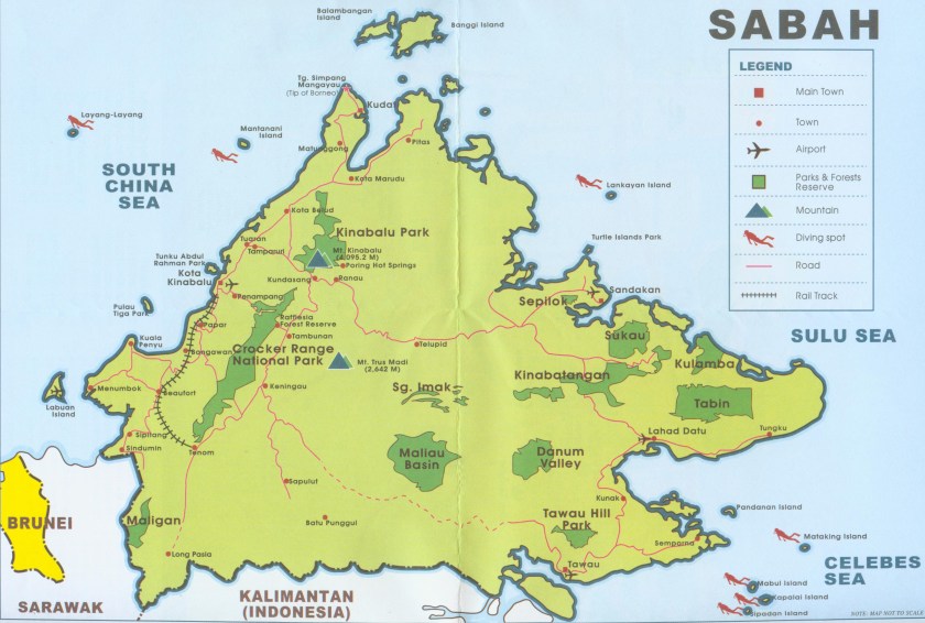
Leaving Sulawesi, the alignment goes into Malaysia, and through Tawau, which is the capital of the Tawau District, in Sabah, Malaysia. In 1898, the British set up a settlement there as part of the British North Borneo Chartered Company. In 1944, Tawau was bombed and razed to the ground. It was rebuilt after the war.


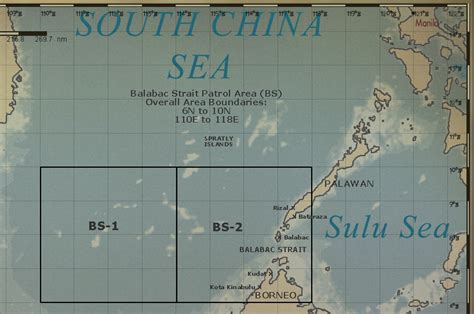
It passes over Balabec Strait, which connects the South China Sea with the Sulu Sea:
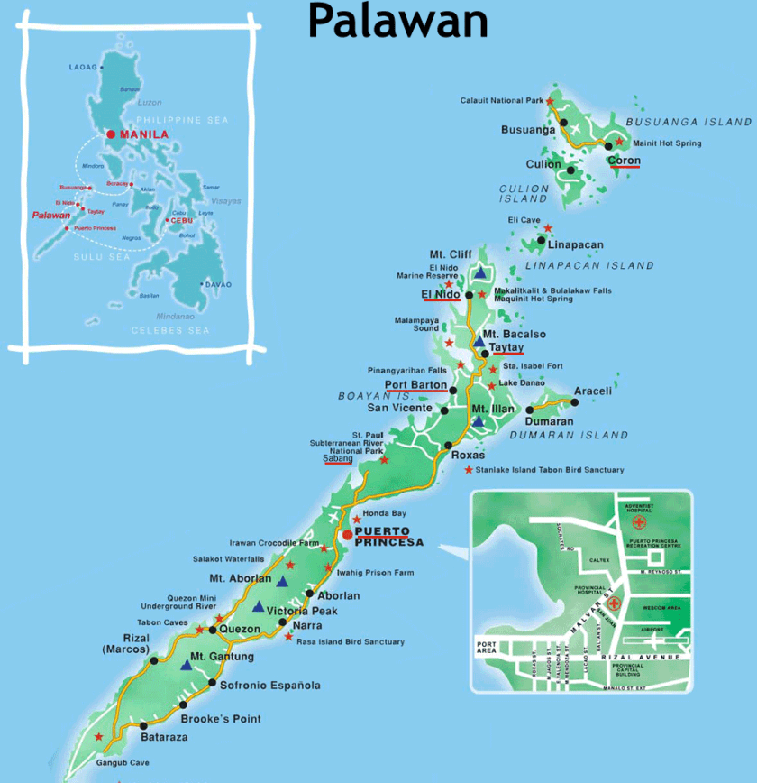
The alignment then passes across Palawan, which is a province of the Phillippines consisting of islands:


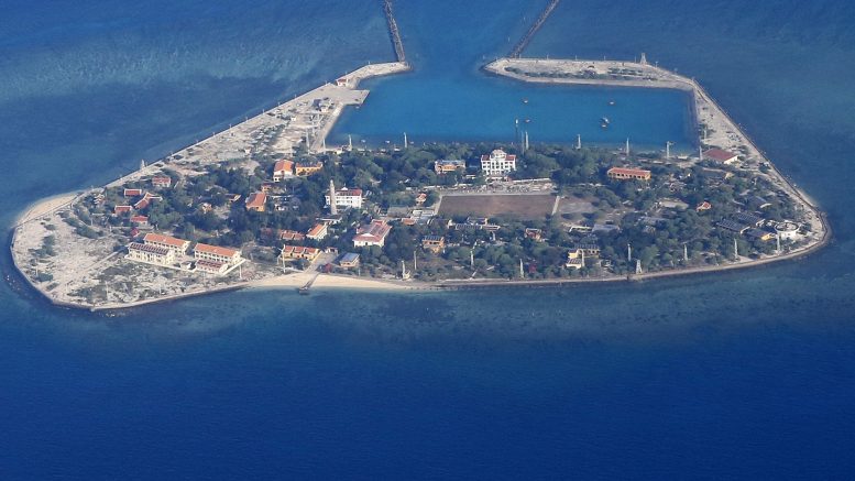
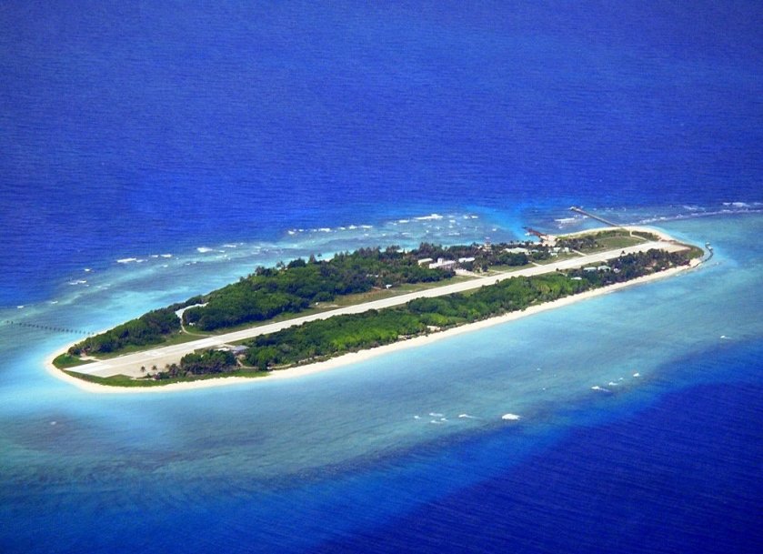
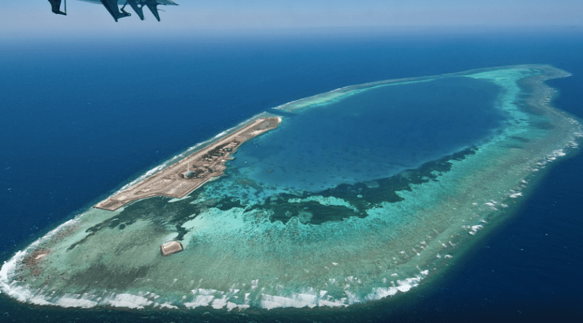
So then I come to the Spratley Islands in the South China Sea, which, like most of the places I am telling you about in this post, I had never heard of before. Come to find out, the Spratley Islands are highly prized for some reason, hotly contested, and claimed by multiple countries including China.
I believe that there is a powerful energy component–whether placement, production, or something else–related to these planetary grid lines, and that since this area falls directly on a major planetary alignment, it falls into this category.
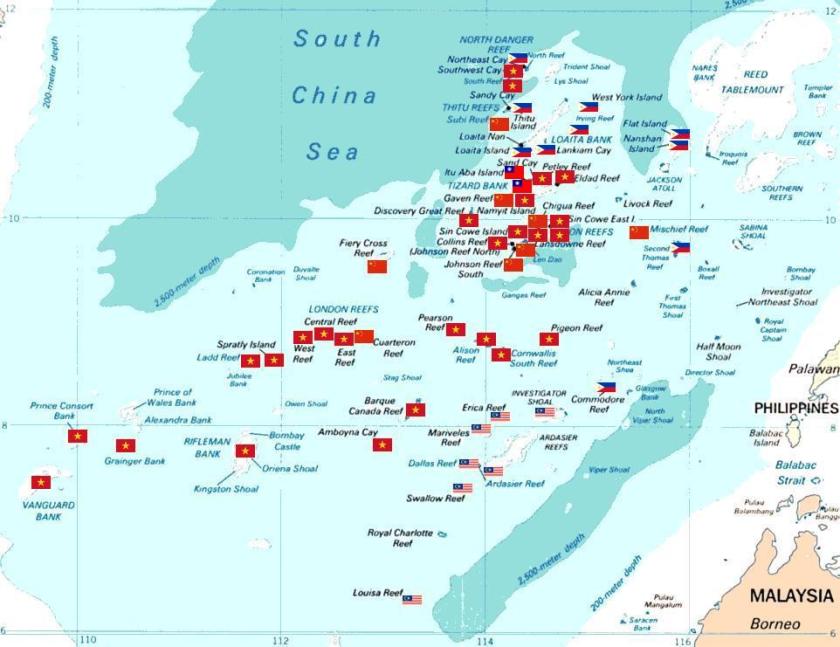
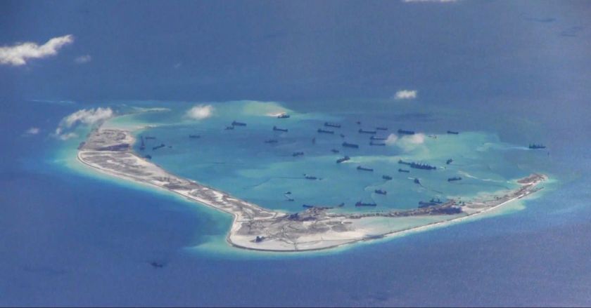
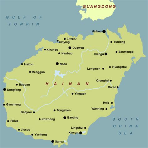
Similarly, the next place the alignment crosses, traversing the length of this province of China, is the island of Hainan, which is being militarized by China along with the Spratleys.


This is Rongtang Village, a historic lava rock village on Hainan, near the city of Haikou. It is said to have been built 900 years ago. It is largely uninhabited. I think it is an interesting place to make note of, given the stone work there.


After leaving the island of Hainan, this alignment goes on into Mainland China, and goes through the Gobi Desert in Mongolia up through Siberia, and leaves Siberia at the Lyakhovsky Islands.


They are the southernmost group of islands in the New Siberian Islands in the Arctic Sea.


Right before you come to this point, lies Tabor Siberia. Tabor is on at least one other alignment as well.
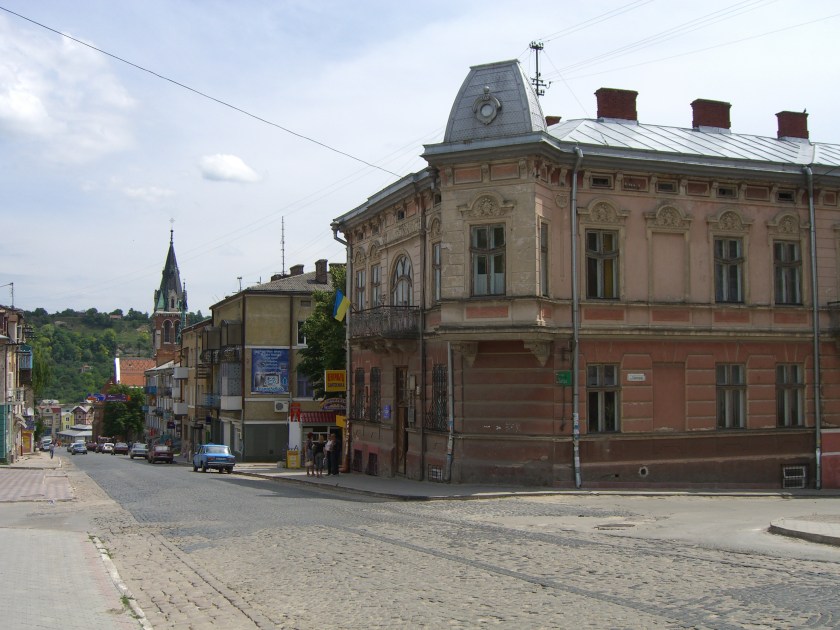
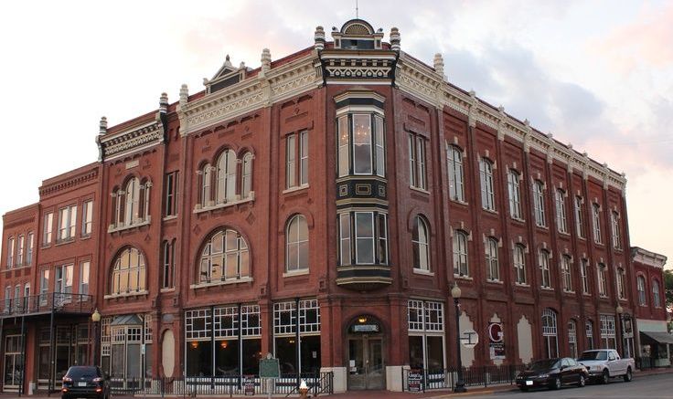
This is a good place to put comparison photos of a Main Street in the United States on top; Kresy, Siberia on the middle, and Guthrie, Oklahoma on the bottom. Why? This picture I found of this Siberian town reminded me both of Main Street USA, and this picture I had seen of Guthrie, Oklahoma:

Next, the alignment enters into North America at Cape Bathurst in the Northwest Territories of Canada (NWT), where I found more waterfalls (see the “Expanding on Waterfalls” post in this blog), and it travels through to Alberta, and then connects with the apex of the Star Tetrahedron at Edmonton, Alberta, and the side the emanates in a Southwest direction once again, only further North.
This side continues on the Alberta, including the Banff/Lake Louise area, down through the Columbia River Gorge area in Washington State, and on down through Nevada, the Sierra Nevada Range, Death Valley, CA (how many of you know that there are waterfalls there as well – called “Darwin Falls”); and then back out into the Pacific after it passes through Los Angeles.
The alignment goes across the following islands:
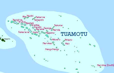
The Tuamotu Archipelago is the largest chain of atolls in world, and is formed of almost 80 islands and atolls:


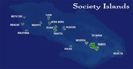
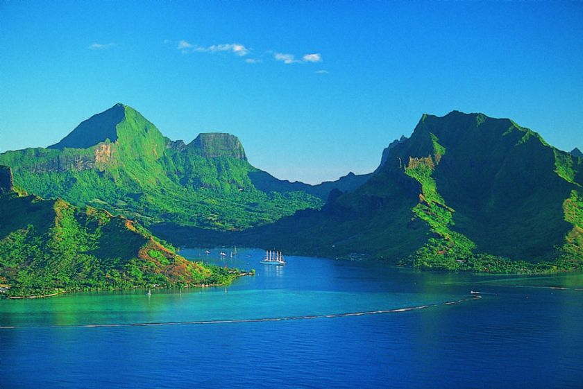
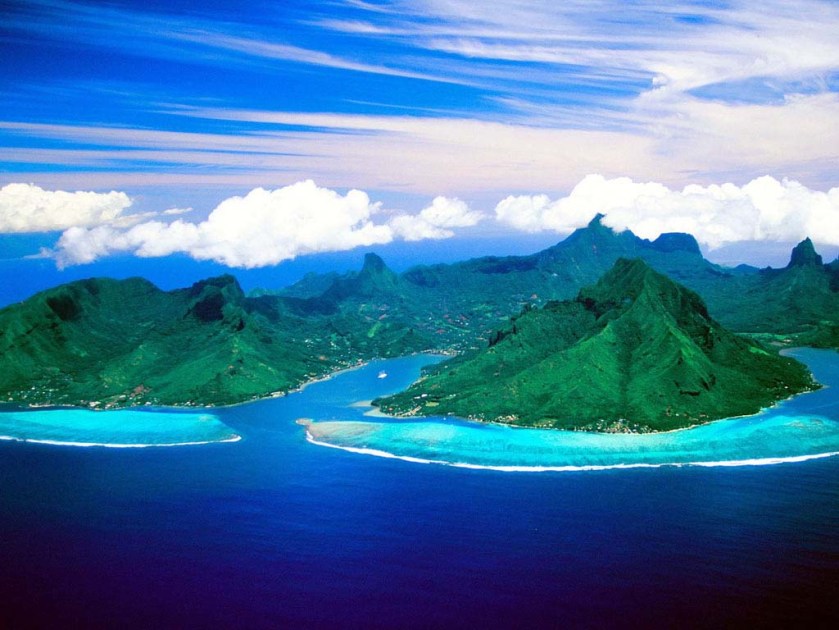
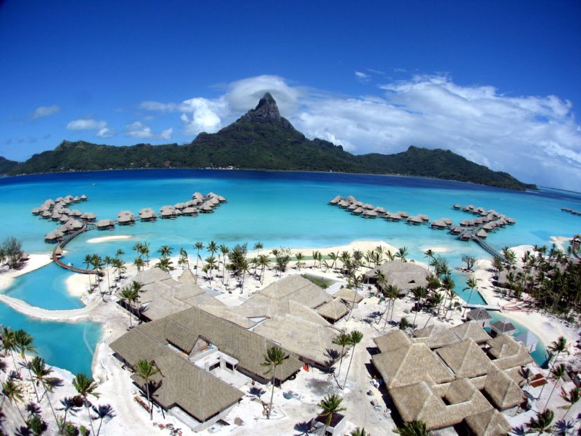
It also crosses the Society Islands, which includes Tahiti, Moorea, and Bora Bora:
And then the alignment crosses the Kermadec Islands, which are uninhabited but administered by New Zealand, and which show up on other alignments:


Next it crosses over Macauley Island, which is considered part of the Kermadec Islands, and is half-way between the North Island of New Zealand, and Tonga.
It crosses over Curtis Island, which is also considered part of the Kermadec Islands.


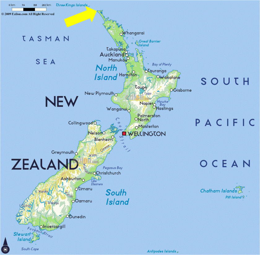
Then it crossed over the northern tip of New Zealand, which is called Three Kings/North Cape, New Zealand. Remember earlier in this post, I showed where the southern alignment of this particular planetary grid configuration crosses right over the southern tip of New Zealand.
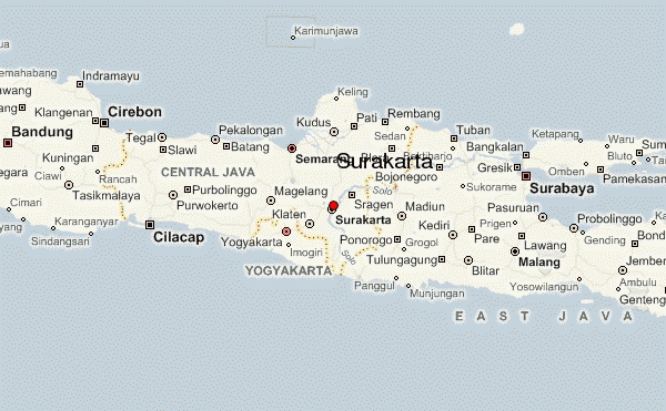
It then enters Australia at Sydney/Wollengong, travels through Australia for a bit before it exits at LaGrange. Then it heads to Surakarta, Indonesia, which is close to Borobudur, one of the nodal points of this grid:
Borobudur


From there, it goes up through the Java Sea, crossing…:
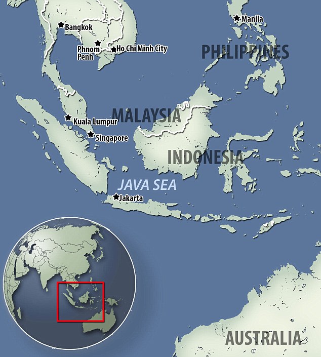
…Belitung. an island on the east coast of Sumatra:


And I will have a post exclusively on lighthouses at some point on this blog because they are relevant to this subject.
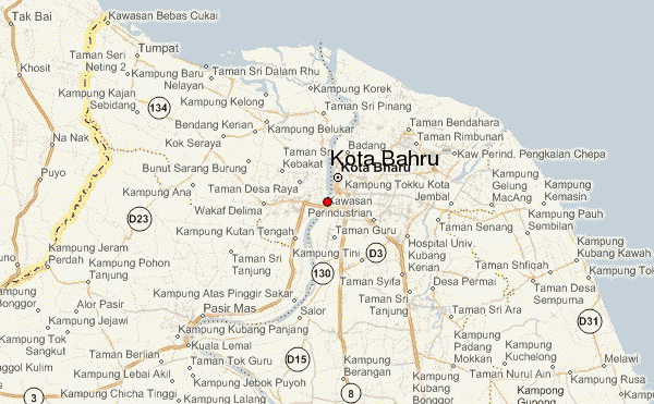
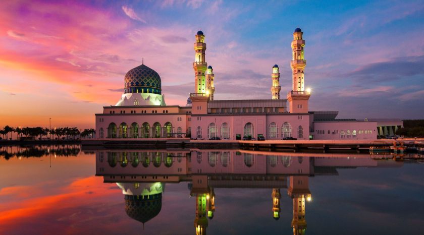
The alignment crosses the city of Kota Bahru, Malaysia:
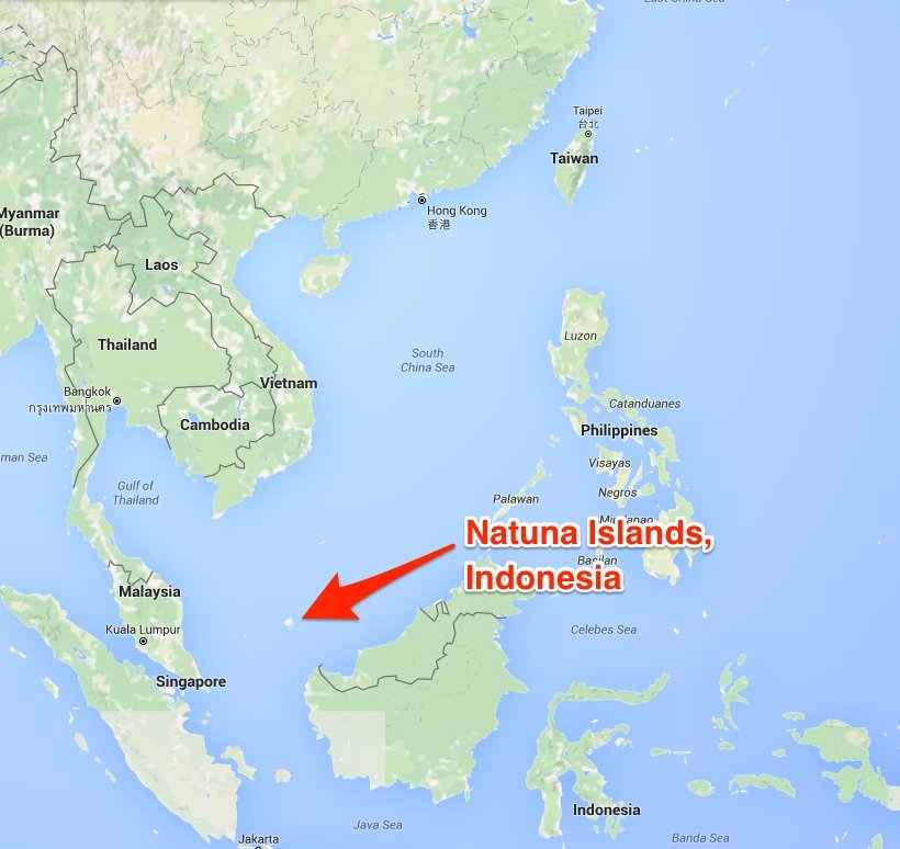
Then it crosses over the Natuna Islands, which are a group of 272 islands located between Malaysia and Borneo.


Then the alignment goes on into Cambodia, through Phnom Penh, Angkor Wat, Eastern Thailand, Central Laos,and on into China. And so on and so forth. Lots of dots connect through here. I am going to stop here, but this is a lengthier post because this information very much belongs together.

wow! exemplary work, your passion is the basis for allowing the humans to continue to exist.
there is nothing more delightful than viewing your intuitive hard work, Thank You , the geologic process and nature intelligence are alive and well and ready to teach.
LikeLike