Sacred Geometry, Ley-Lines & Places in Alignment – Part 13 Delphi, Greece to the Ionian Islands

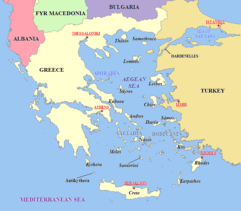
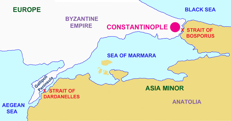
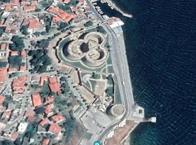
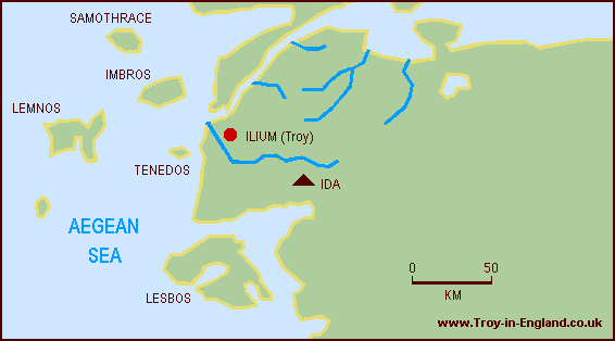
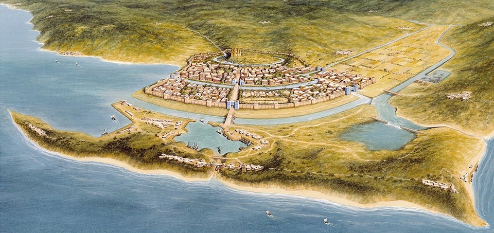
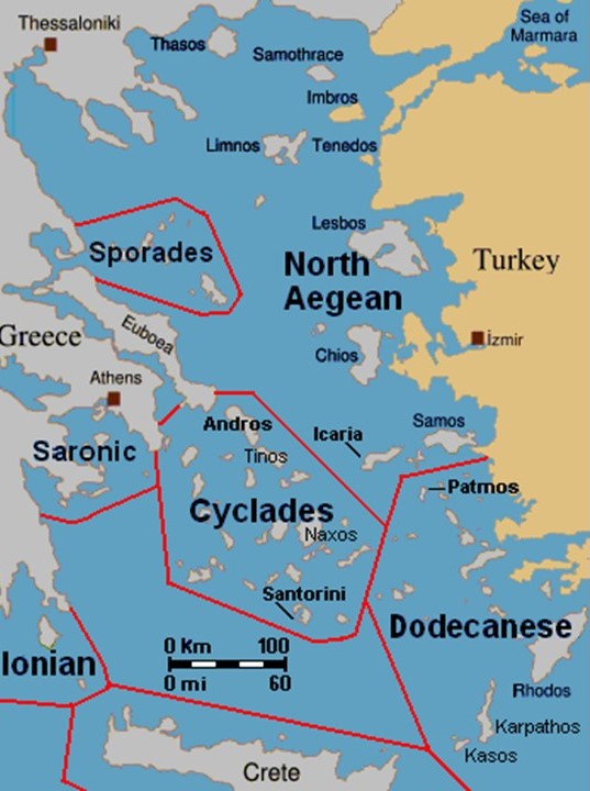
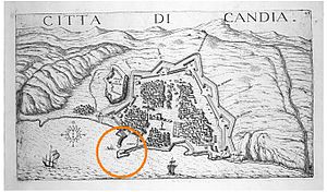
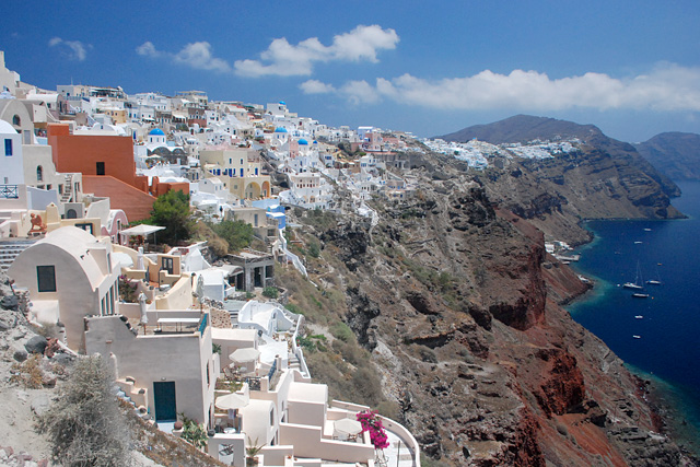
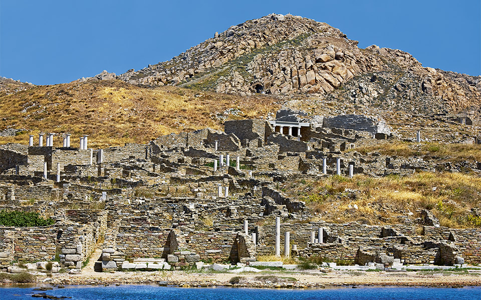
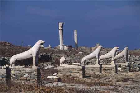
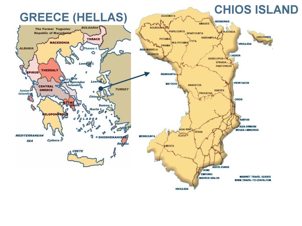
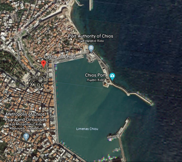
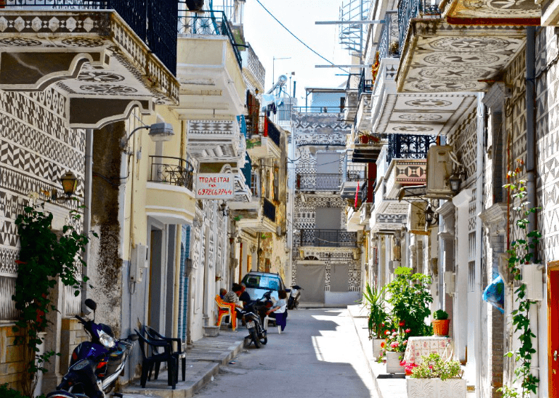
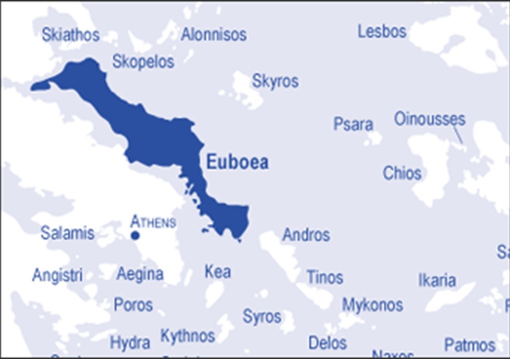
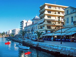
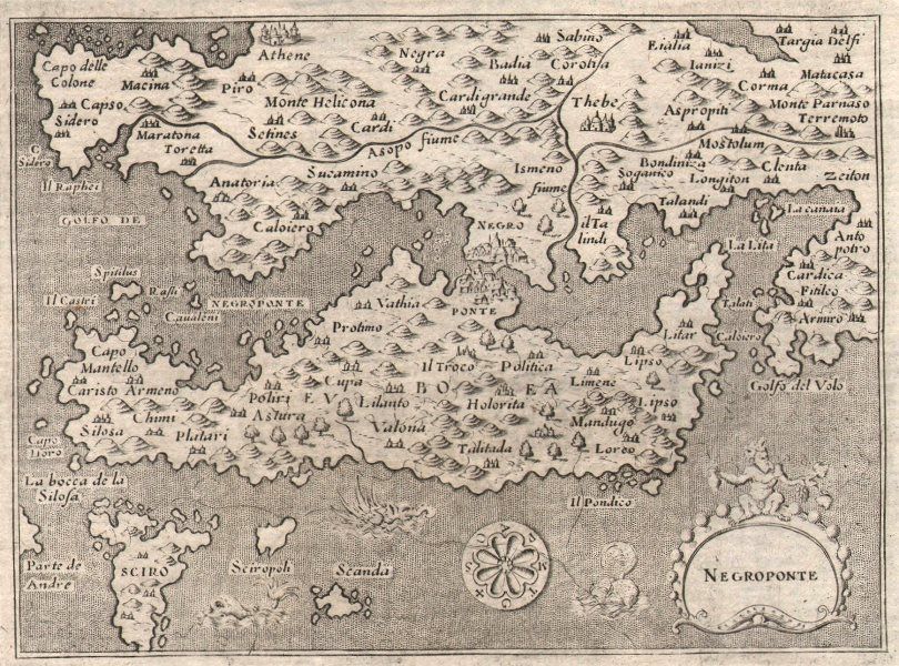
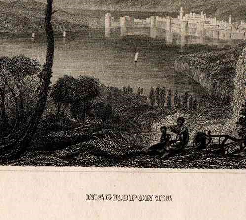
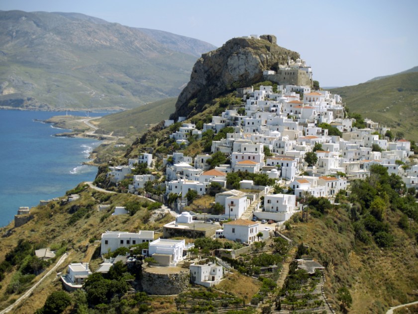
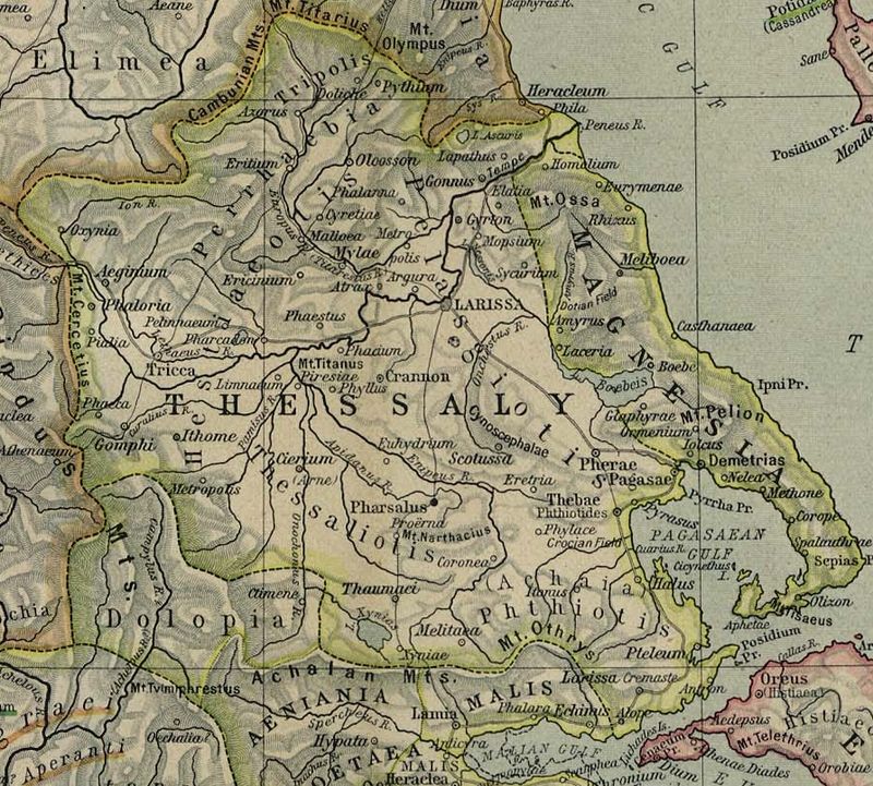
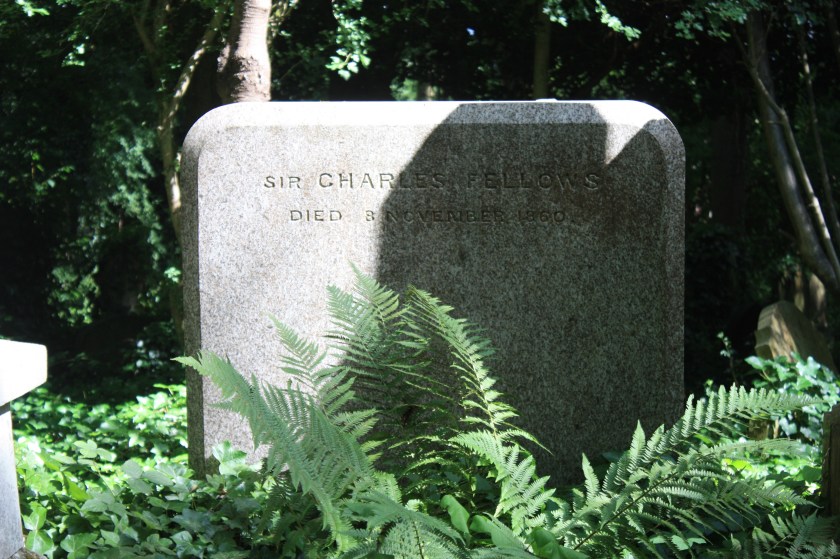
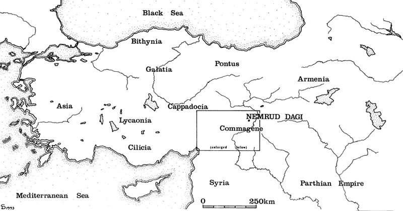
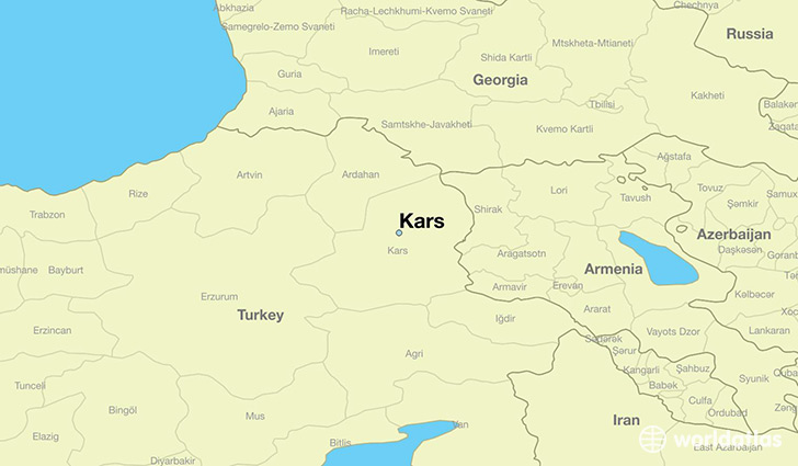
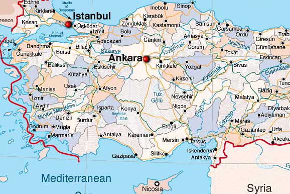
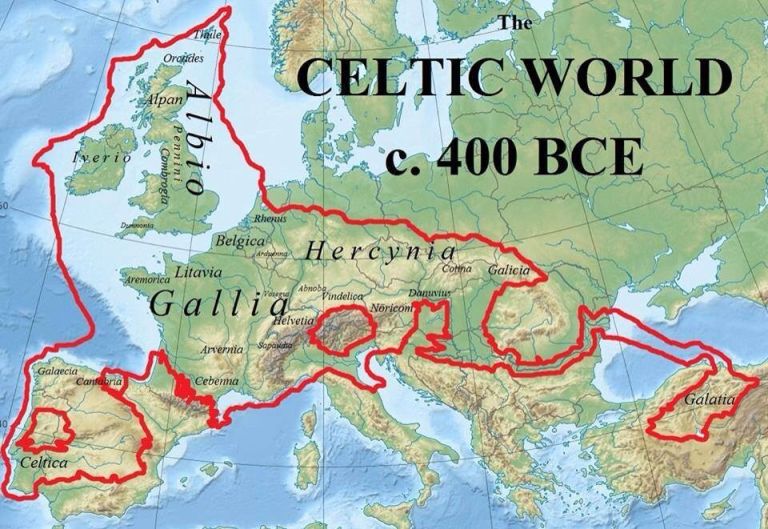
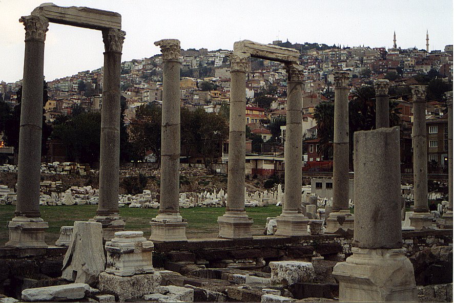
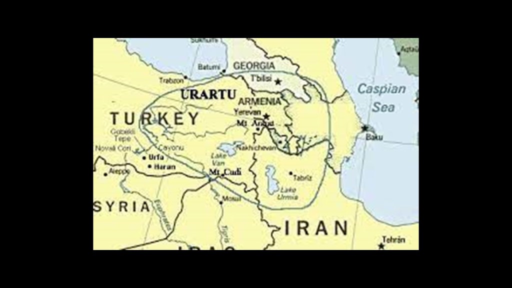
In the last post, I explored the various features of the Aegean Sea, called an elongated bay of the Mediterranean Sea, including the Strait of Dardenelles, which connects the Aegean Sea to the Sea of Marmara, as well as the Black Sea by the Strait of Bosporus; the location of ancient Troy, near the entrance of the Strait of Dardenelles; Crete; the Dodecanese Islands, which includes the islands of Rhodes and Patmos; the Cyclades Islands, which includes Santorini and Delos; the island of Chios; and the island of Euboea and its neighbor Skyros.

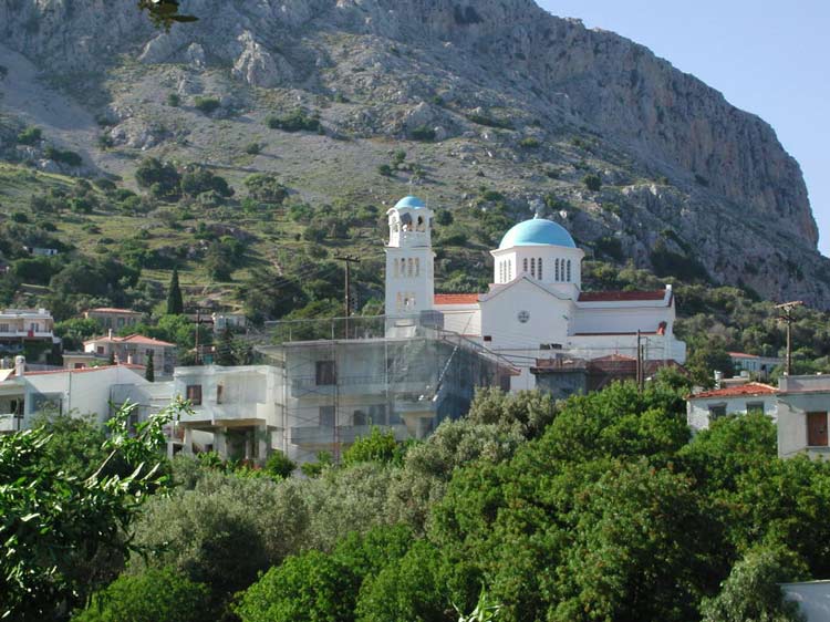
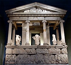
Now I am tracking the alignment to Delphi, an important religious, cultural and social center of Ancient Greece…

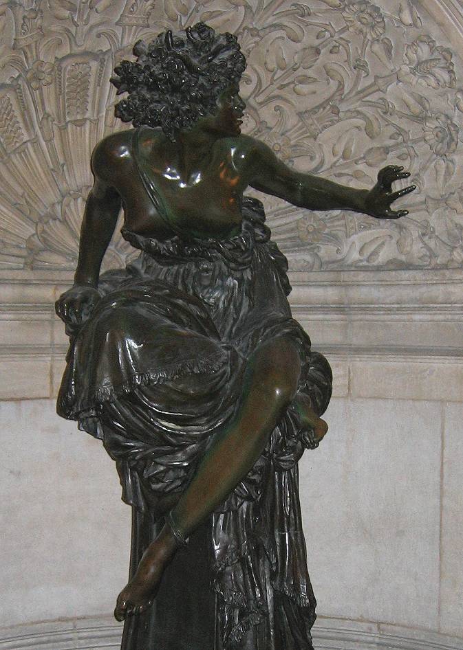
…the seat of Pythia, depicted here in a sculpture at the Paris Opera attributed to the female Swiss sculptor Martello in 1870, and who was the high priestess of the Temple of Apollo in Delphi, as well as the oracle who was consulted about important decisions throughout the ancient classical world…

…and believed to be the center of the World. This is the Omphalos stone, inside the museum at Delphi, a symbol for Delphi’s status as the navel of the Earth…

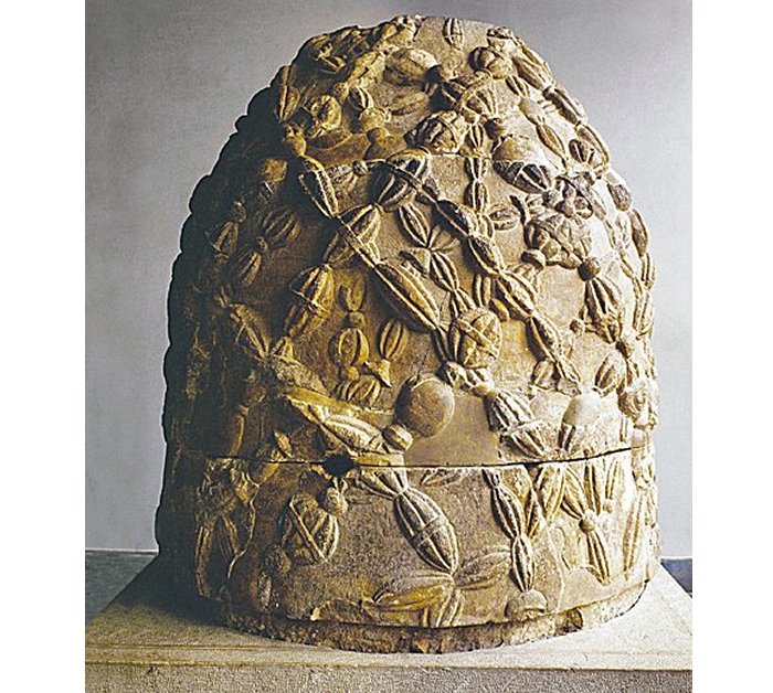
…with markings reminiscent of a dorje, the symbol of Vajra in Tibetan Buddhism, a Sanskrit word which is said to mean “thunderbolt,” in a reference to a follower achieving enlightenment in a single lifetime in a thunderbolt flash of indestructible clarity….

…and the Omphalos stone at the Temple of Apollo in Delphi.

Omphalos also had a meaning as a geodetic point of a master grid of electromagnetic energy around the Earth.

In Greek mythology, the King of the Gods, Zeus, was said to have released two eagles at opposite ends of the world, and commanded them to fly across the Earth, and meet at its center. It was at Delphi where the two eagles finally met.

Zeus was the god of sky and thunder…and wielder of the thunderbolt.

So what’s the message being communicated here, with the connection of the thunderbolts to Delphi, Zeus, and the dorje?

It might have something to do with understanding of the Ancients of the Electric Universe and our direct relationship to it…

…studied in-depth in the present day by the Thunderbolts Project…

…and others who have studied the topic of the Electric Universe and the related topic of free energy.

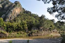
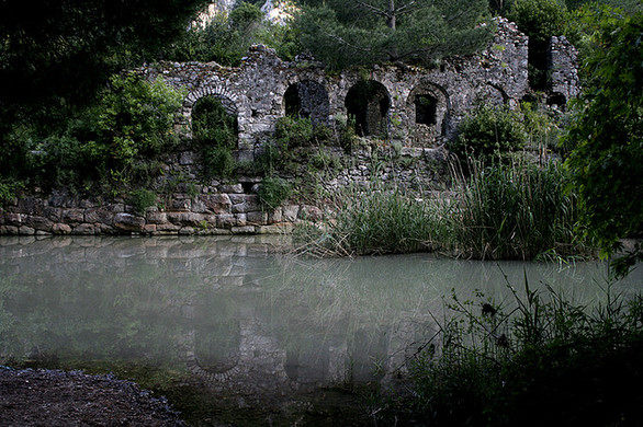
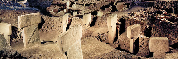
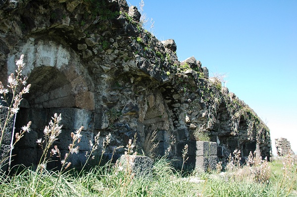
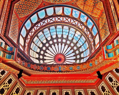
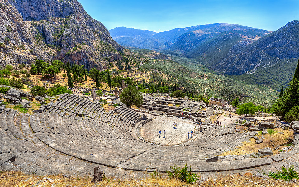
Ancient theaters can be found all over Greece, and Delphi was no exception, where it overlooks the ruins of the Temple of Apollo.

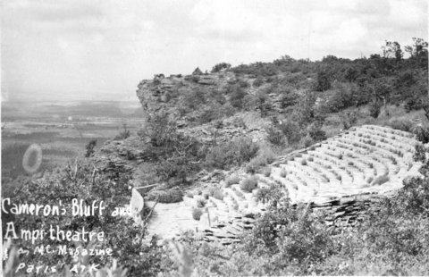
Interestingly, there are similar looking amphitheaters in North America, like the amphitheater on Cameron’s Bluff at Mt. Magazine in Arkansas, which the Works Project Administration of Franklin Roosevelt’s New Deal gets the credit for building in 1939.

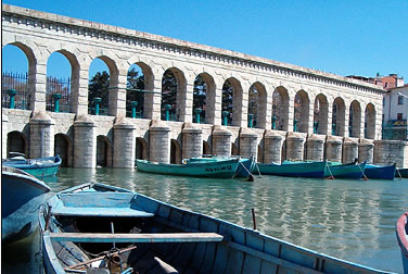
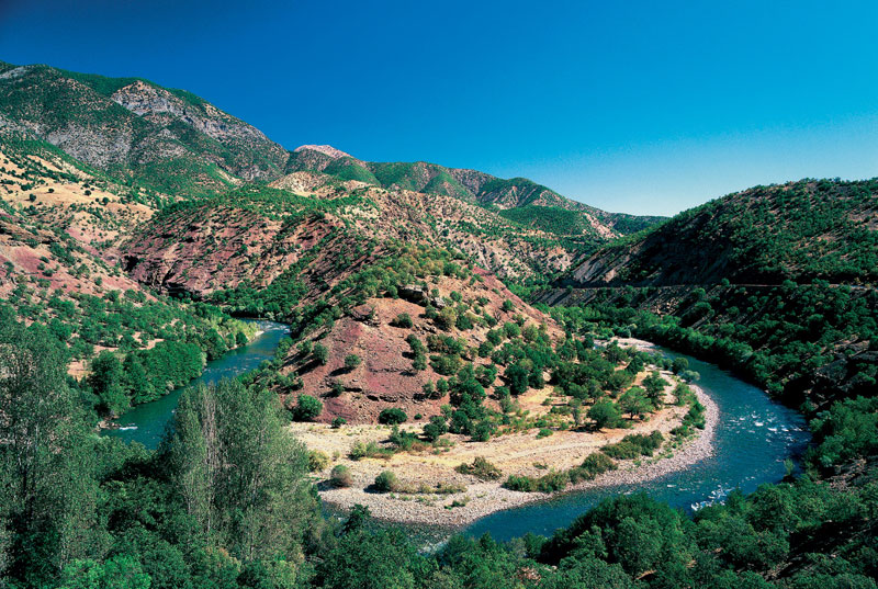
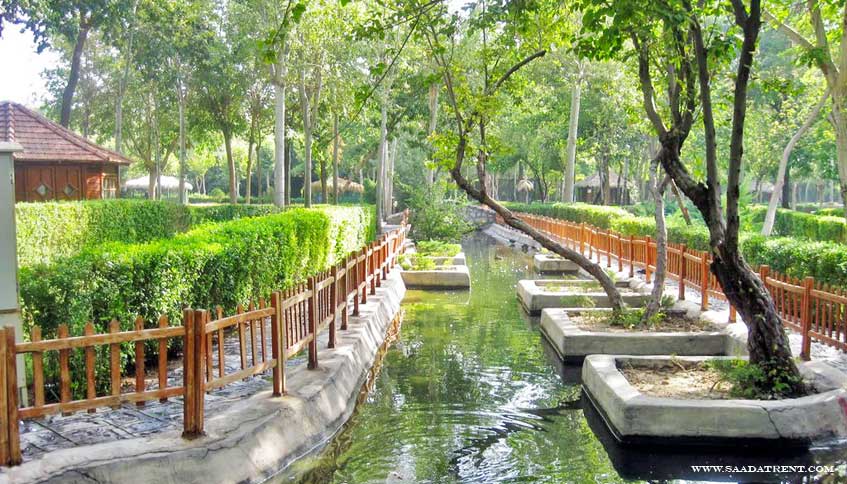
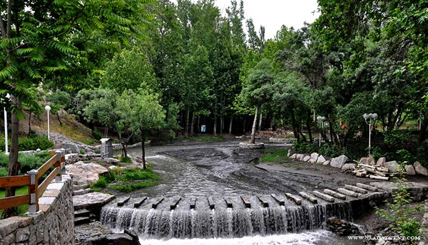
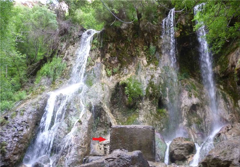
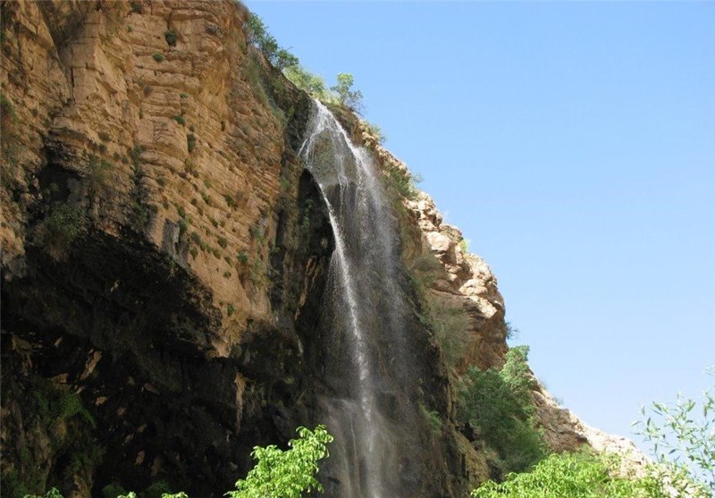
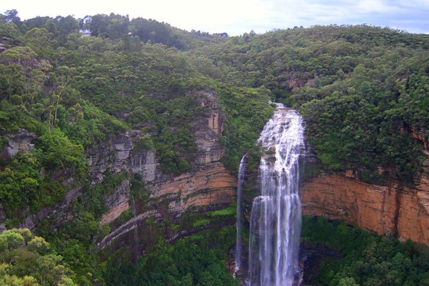
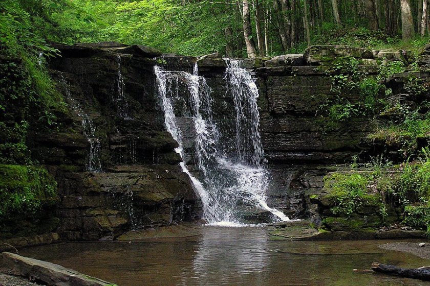
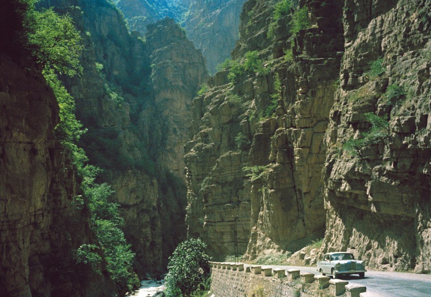
There is also what is described as a gravitational aqueduct in Delphi that carries water to Athens.

This stone bridge is located in a town in the vicinity of Delphi in Greece…

…as are these waterfalls.

Out of curiosity, I looked up Delphi, in the State of Indiana, to see what I would find.

Well, for one thing, it’s the home of the Wabash & Erie Canal…

…which was said to have been in use starting in 1840…

…with at least one beautiful old stone bridge crossing it…

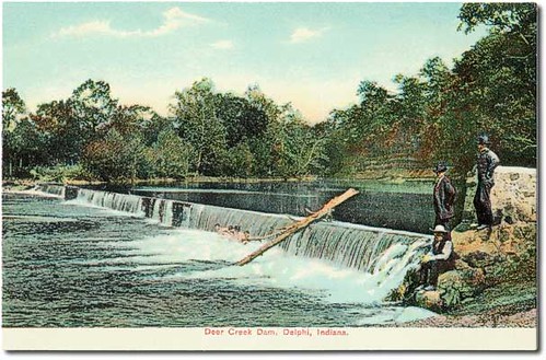
…and this is an old post card of the Deer Creek Dam in Delphi, Indiana.

The Assion-Ruffing City Hall in Delphi, Indiana was said to have opened in 1865 (which was the last year of the American Civil War), and about 20-years later, the third-floor of the building was turned into an opera house.

Then we are told the Opera Hall shut down in 1915, and fell into a state of decay…

…until its renovation, and re-opening 100-years later in 2015.

Back to Delphi in Greece, it was the location of one of the four Panhellenic Games, which included both athletic and non-athletic events, and were called the Pythian games.

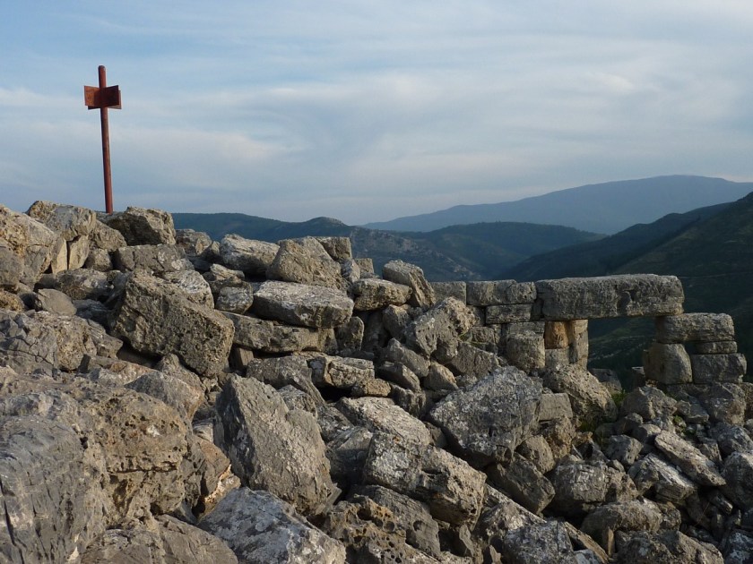
We are told this was the starting line of the stadium of Delphi…

…which was located northwest of the theater, in the highest part of the city, and called one of the best-preserved monuments of its kind.

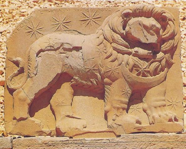
I remember first learning about black-figure Greek art in the 6th-grade (1974 for me) when we studied Ancient Greece, where we are taught that the white Greeks had a style called black-figure in their pottery art, said to be reminiscent of silhouettes.

So here’s what this style looks like.

Could this possibly mean something else quite different from an artistic style?

Like, the Ancient Greeks were actually black, and not white as we have been taught?

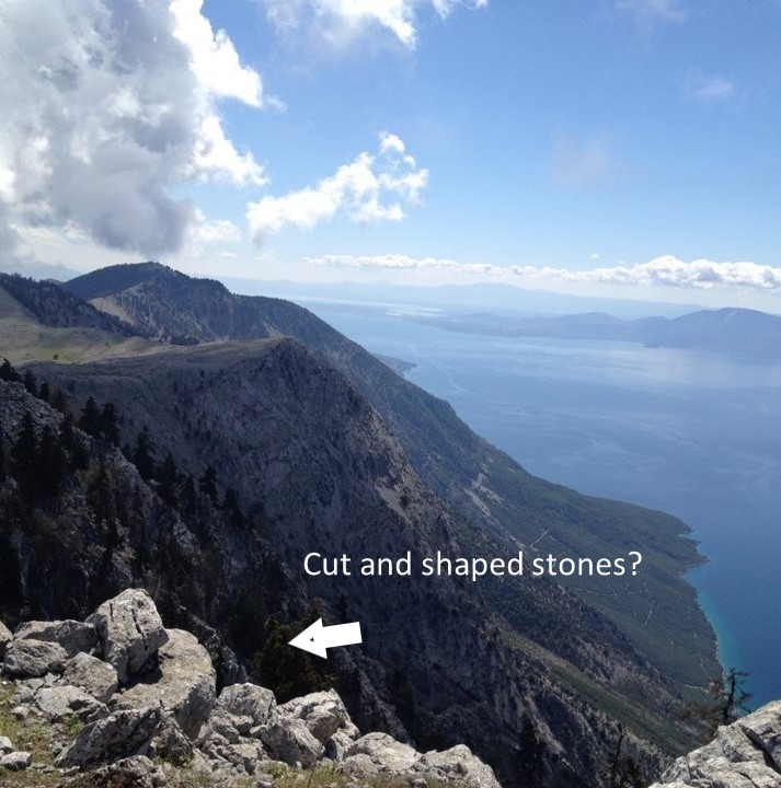
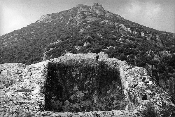
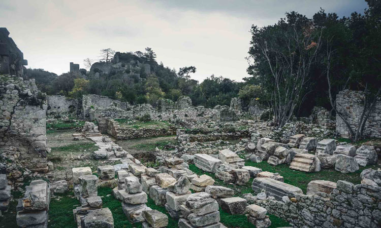
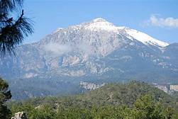
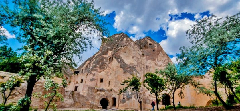
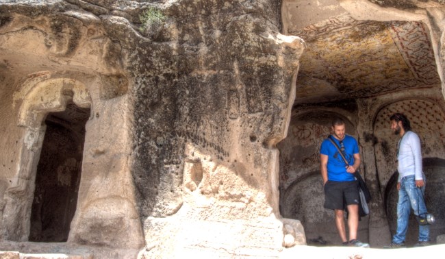
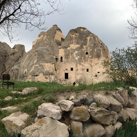
The ancient city of Delphi, and its modern-counterpart is situated on Mount Parnassus, described as a mountain of limestone.

Limestone is classified as a carbonate sedimentary rock composed primarily of calcite and aragonite.

Is this limestone a natural rock formation…or ancient masonry?

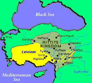
The etymology of the word Parnassus is said to be Luwian, the hieroglyphic language of the Lycians of southwestern Anatolia, derived from a word meaning temple.

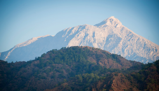
The Phaidriades are the pair of cliffs on the lower southern slopes of Mt. Parnassus which rise above Delphi.

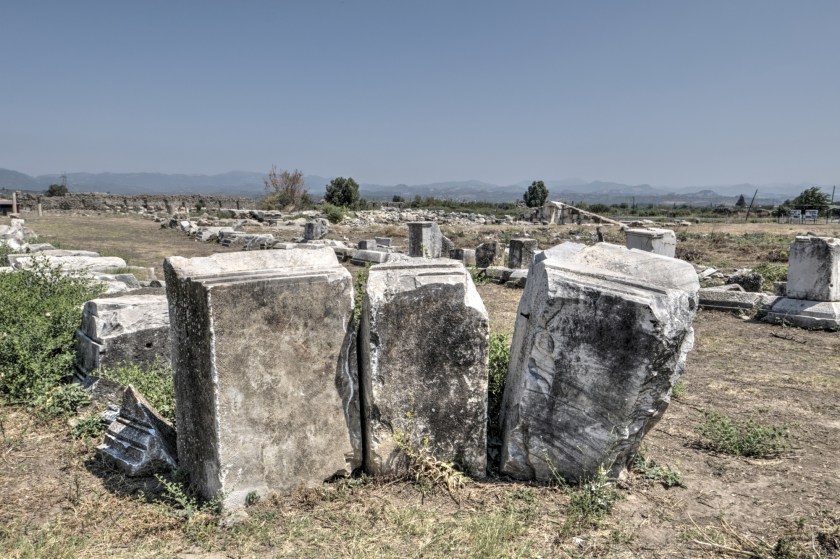
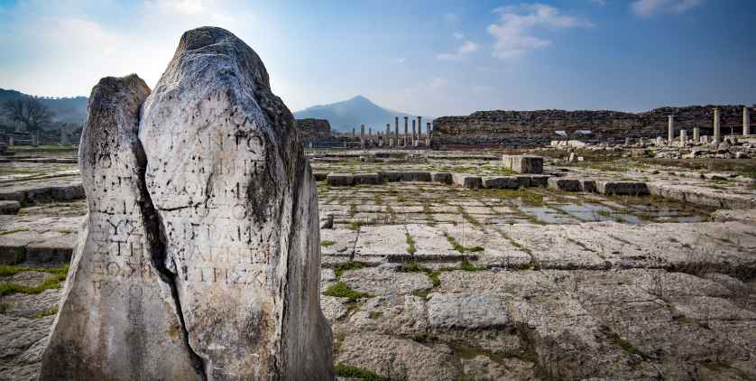
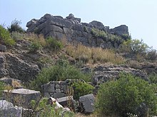
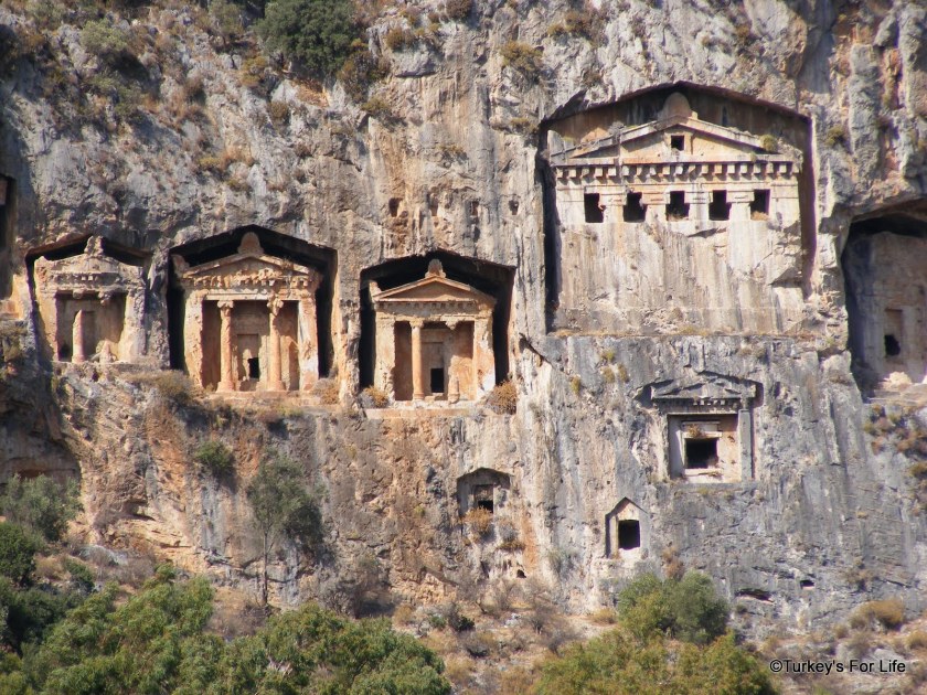
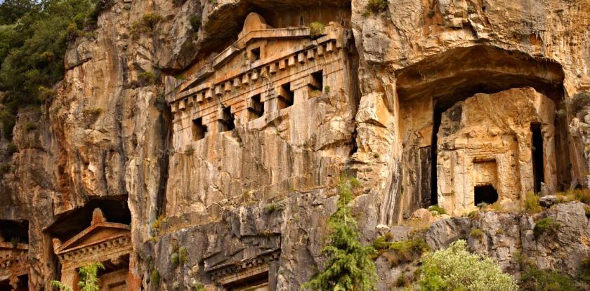
There is polygonal masonry at Delphi…

…like what you find in Cuzco in Peru, another place called the navel of the world, at the Coricancha…

…and Sacsayhuaman, just outside of Cuzco…

…as well as at Edo Castle in Tokyo, Japan.

This is also at Edo Castle. Polygonal masonry is defined as a technique wherein the visible surfaces of the stones are dressed with straight edges or joints, giving the block the appearance of a polygon.

I first learned about Amphictonyes – associations of twelve neighboring states or tribes formed around a religious center – from a presentation given by Christine Rhone titled “Twelve Tribe Nations – Sacred Number and the Golden Age” at the 2009 Megalithomania Conference in Glastonbury, England.

She and John Michel co-authored a book of the same name.  Among other things, they followed the Apollo – St. Michael alignment across countries and continents all the way to Jerusalem in Israel.  They discuss records and traditions of whole nations being divided into twelve tribes and twelve regions, each corresponding to one of the twelve signs of the zodiac and to one of the twelve months of the year.  All formed around a sacred center.

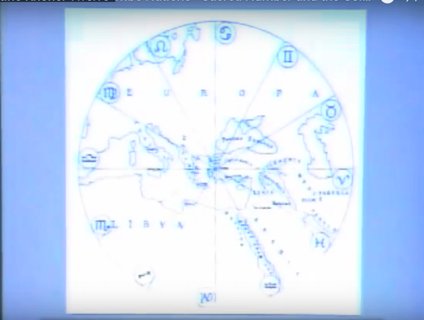
It stands to reason that these people would apply the same concepts of Harmony, Balance, Beauty, Sacred Geometry, and aligning heaven and earth, to building their communities and themselves that they applied to building all of the infrastructure of the earth.

The most important amphictonye, we are told, was the Delphic Amphictonye, or Amphictonyic League, centered around the Temple of Apollo in Delphi.

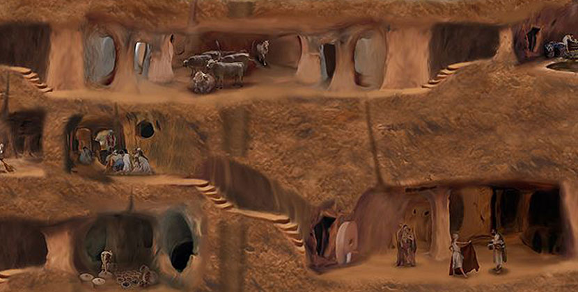
What if we are talking about an arrangement like what you see pictured here of the Twelve Tribes of Israel  occurring in a flower of life pattern, from macro to micro, covering the surface of the Earth?

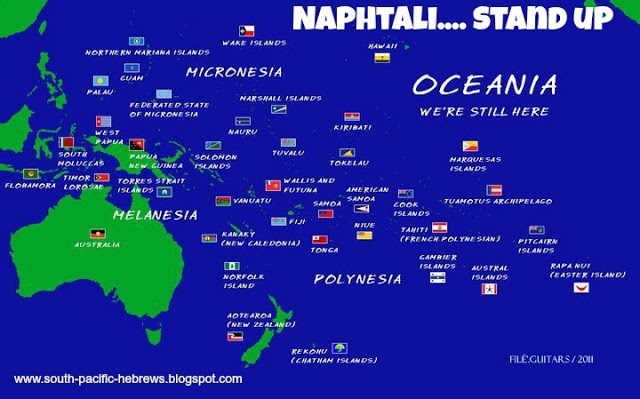
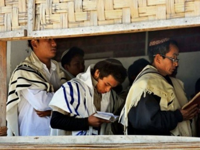
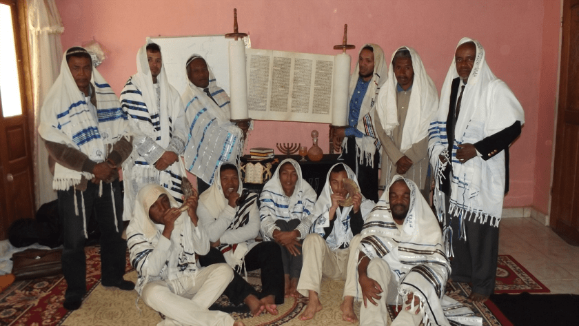
This information about amphictonyes helped to inform my belief that the Twelve Tribes of Israel were the basis for how civilization was laid out all over the Earth, as well as finding information about Lost Tribes of Israel in diverse places, like the South Pacific…

…the Kuki in India…

…the Pashtun of Afghanistan and Pakistan…

…and Madagascar.

There is another place near Delphi I would like to take a look at before I move on.

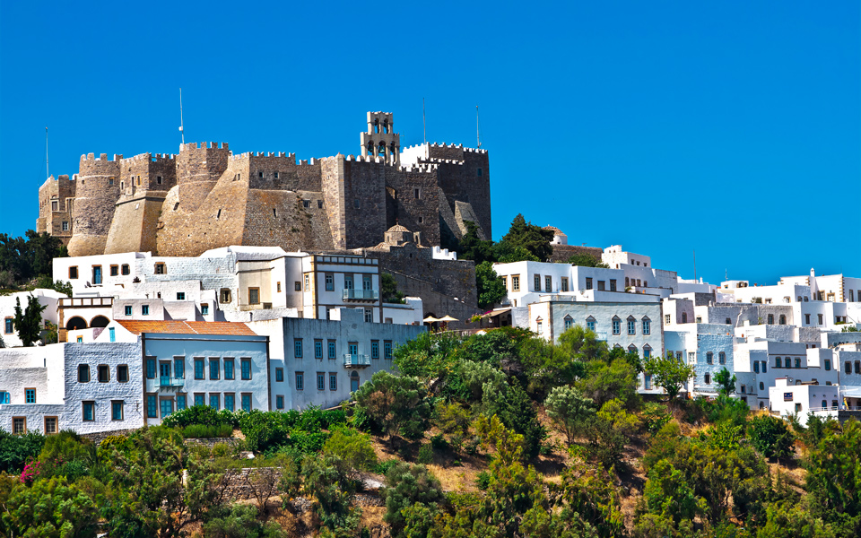
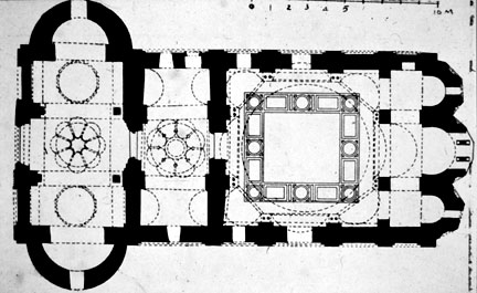
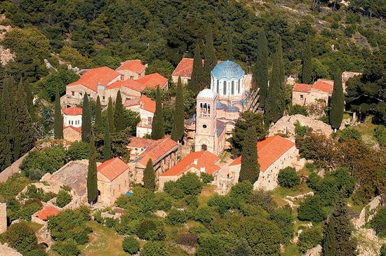
The Hosios Loukas Monastery is southeast of Delphi, and close to, if not on, the alignment I have been tracking.

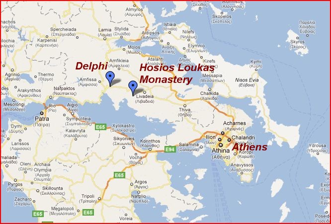
Hosios Loukas Monastery is one of three monasteries in Greece listed as UNESCO World Heritage Sites, along with Nea Moni on the island of Chios, which I looked at in the last post, and Daphnion, northwest of Athens.

It is located on the slopes of Mount Helicon…

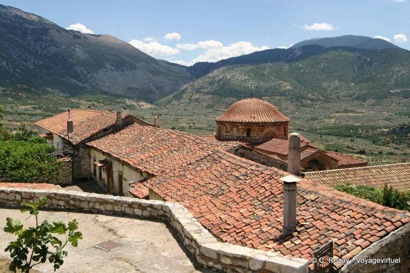
…the home in Greek myth of the nine muses, the inspirational goddesses of literature, sciences, and the arts.

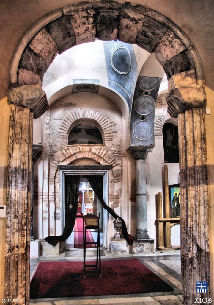
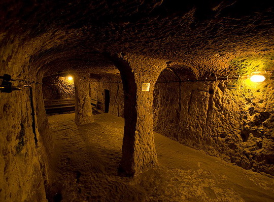
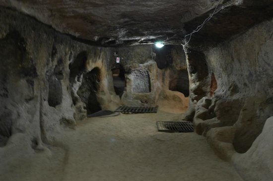
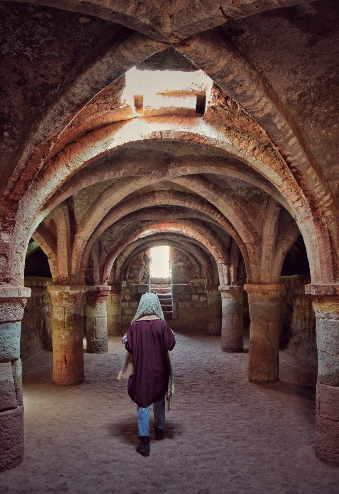
This vaulting is in the interior of the Hosios Loukas Monastery…

…compared with vaulting in the catacombs under the Paris Opera…

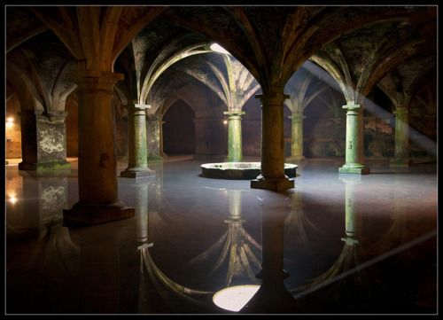
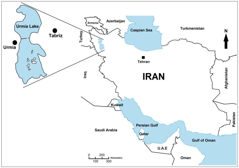
…and the underground vaulting that is found at what is called the old Portuguese fort on Iran’s Hormoz Island in the Strait of Hormoz in the Persian Gulf.

After leaving Delphi, I started to track a circle alignment instead of a linear alignment.

These cities and places in alignment are based upon sacred geometry contained within the Flower of Life pattern as depicted in this overlay…

…and can be found in lines and circles, as all sacred geometric shapes are found within the Flower of Life.

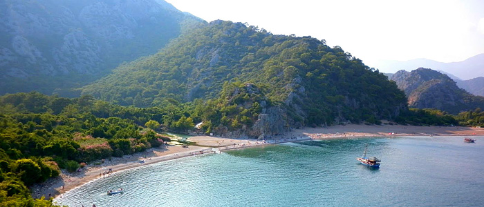
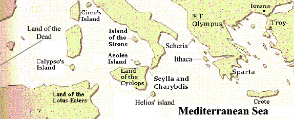
The alignment I am now tracking enters the Ionian Sea and crosses over the islands of Atokos, Ithaca and Kefalonia, which is the largest of…

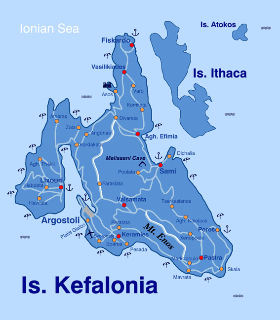
…the Ionian Islands of western Greece.

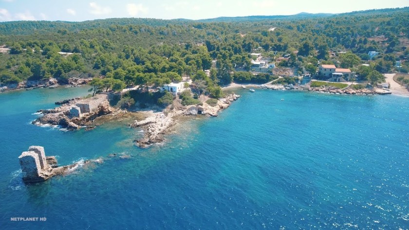
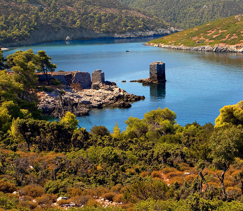
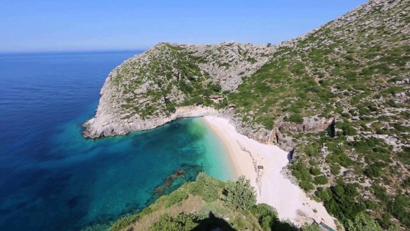
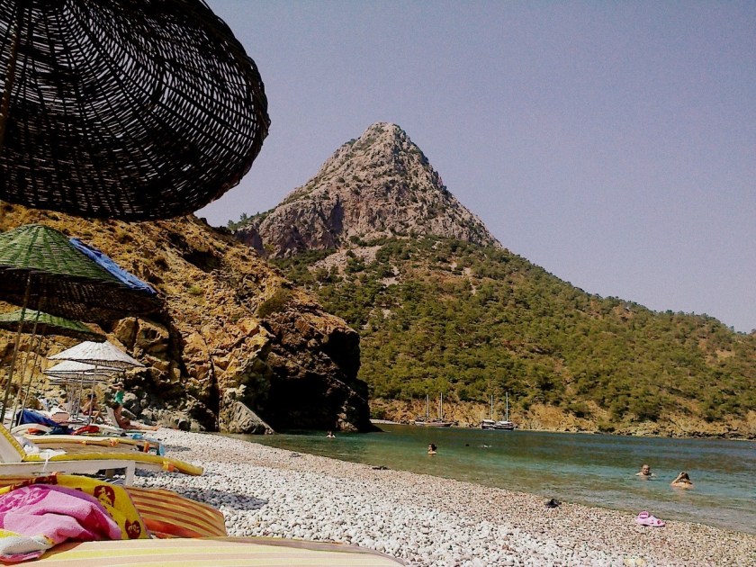
The small island of Atokos is privately owned, but visitors are allowed to come here and it is visited frequently by yachters…

…and is located just off the main shipping channel between Brindisi in Italy and Patras in Greece.

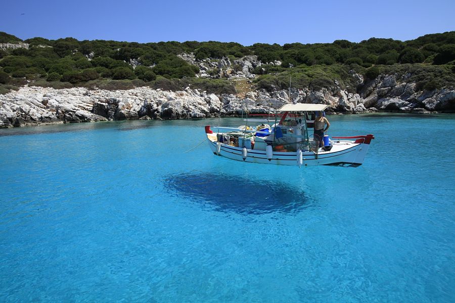
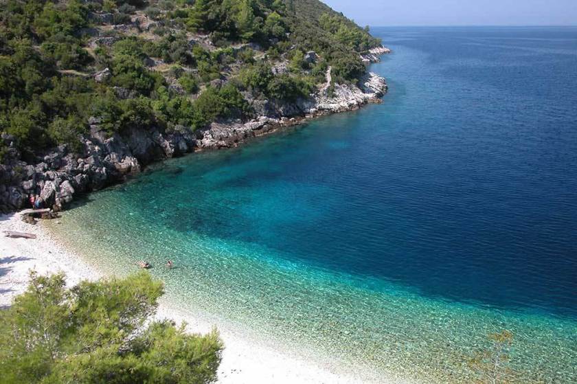
Just like I found on the island of Skyros in the Aegean Sea, the water is so crystal clear on Atokos, it looks like the boats are floating on air.

The island of Ithaca comes next. It is a regional unit of the Ionian Islands region, and its population in 2011 was a little over 3,000 people.

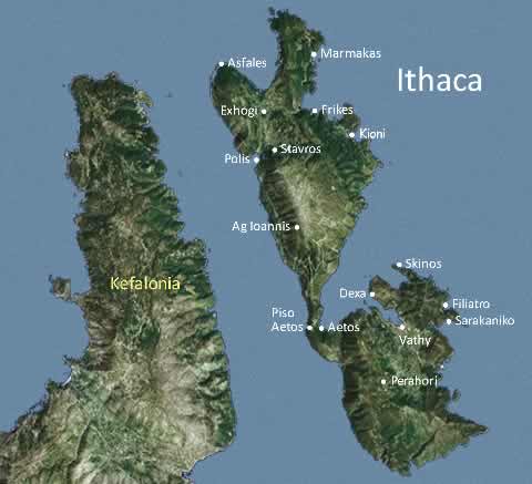
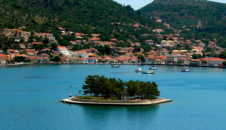
Its capital is Vathy, also the main harbor of the island, and which looks to be artificially made…

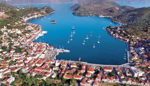
… with its masonry banks…

…and artificial island.

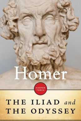
Modern Ithaca is generally identified as the home of Odysseus, whose ten-year-long adventure in returning to Ithaca after the fall of Troy is the subject of Homer’s “Odyssey.”

Kefalonia, just southwest of Ithaca, is the largest of the ionian Islands and also a regional unit of the Ionian Islands region.

The capital of Kefalonia is Argostoli, which it has been since 1757, and called one of the busiest ports in Greece, with its shaped shoreline…

…and masonry banks, like those of Vathy on Ithaca.

The ancient Greek-temple-looking Fanari Lighthouse, or Lighthouse of Saints Theodore, in Argostoli was said to have been built by the British in 1829…

…and the De Bosset Bridge in Argostoli was said to have been inspired in 1813 by the Swiss engineer Charles de Bosset, who became governor of the island in 1810 when the Republic of the Ionian Islands was under British patronage.

The obelisk on an artificial island beside the bridge was said to have been erected to commemorate the British builders and patrons of the bridge.

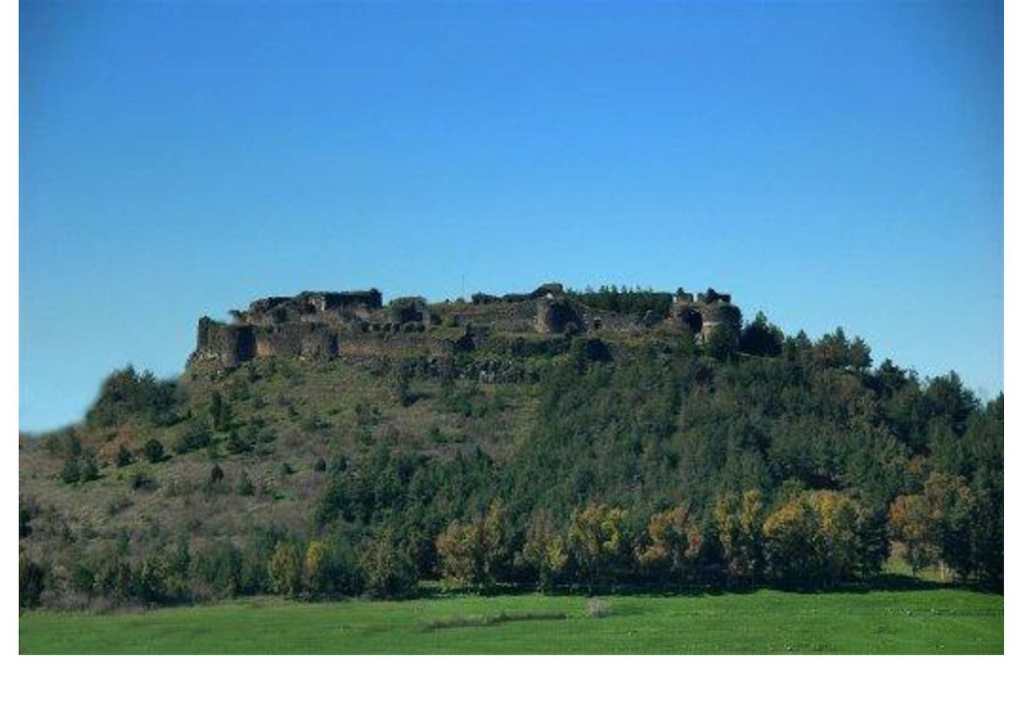
The Castle of Saint George is 4-miles, or 7-kilometers, southeast of Argostoli, above the village of Peretata.

It was said to have been built in the 12th-century A.D. by the Byzantines, and improved by the Venetians. Apparently, Peretata as Agios was the capital of Kefalonia until it was moved to Argostoli in 1757.

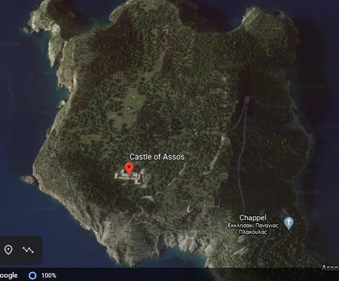
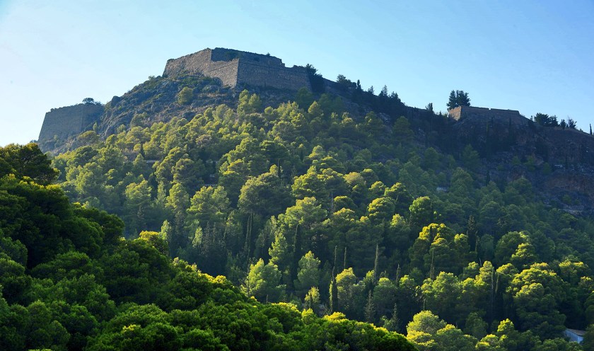
Assos Castle or fortress is on Kefalonia, and was said to have been built on top of the Assos Peninsula by the Venetians in the 16th-century A.D. to protect Assos village from pirates and/or a naval invasion.

Before I close-out this particular post, I would to share what I found about the history of the Ionian Islands, of which there are seven main islands, in the last few hundred years.

I will start when the Ionian Islands were said to have become part of the Venetian Republic in 1500 A.D., also known as La Serenissima, or Most Serene Republic of Venice, described as a sovereign state and maritime republic.

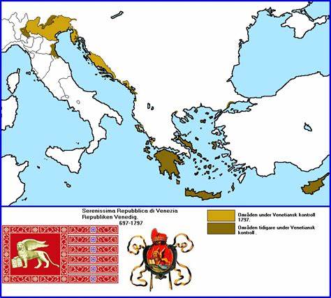
Then in 1797, the Treaty of Campoformio was signed by Napoleon Bonaparte and Count Philipp von Cobenzi, as representatives of the French Republic and the Austrian Monarchy respectively.

This treaty disbanded and partitioned the Venetian Republic by the French and the Austrians, and the Ionian Islands were awarded to France.

At that time, the Ionian Islands became the short-lived French Department of Ithaque, as it fell to the Russians in 1798, and was officially ended in 1802.

Between the years of 1800 and 1807, the Ionian Islands were known as the Septinsular Republic under Russian and Ottoman rule after the Russian/Ottoman fleet defeated Napoleon Bonaparte.

Then in 1807, Napoleon signed two agreements in the town of Tilsit in what was the Prussia in East Germany, one between Emperor Alexander I of Russia, and the second treaty was signed with Prussia, and the Ionian Islands were returned to France, becoming a French Protectorate.

Then, in 1809, the British blockaded the Ionian Islands as part of the war against Napoleon, in September of that year, hoisted the British flag on the island of Zakynthos, with Kefalonia and Ithaca soon surrendering. The British installed provisional governments here.

The Treaty of Paris of 1815 recognized the United States of the Ionian Islands, and established them as a British Protectorate.

Then, in 1864, the Ionian Islands were transferred back to Greece to become a full member of the Greek State when the British-backed Prince William of Denmark became King George the I of the Hellenes in 1863.

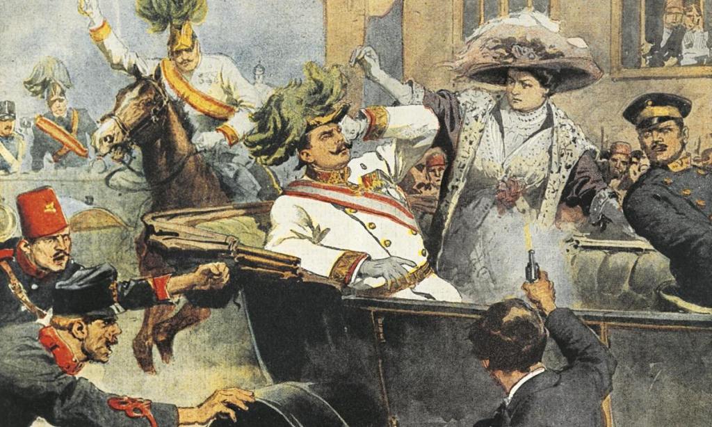
When he was nearing the 50th-year of his reign, he was assassinated in 1913 in Thessaloniki, near the White Tower…

…by a Socialist named Alexandros Schinas, who said, when he was arrested, that he killed the king because the king had refused to give him money.

So, all along the alignment, I have found wars, treaties, partitions, regime changes, and assassinations by individuals of highly questionable mental health, or politically-motivated, in our historical narrative. In a future post, I will be putting all of the information I have found regarding this subject along the way into one post because it illustrates some of the modus operandi by which the old world order was taken down, and replaced with a new one.

In the next post, I am heading for the narrow strait of Messina between the toe of the boot of the Italian Peninsula and the island of Sicily, and the location where Odysseus would have encountered Scylla and Charybdis on his adventurous trip home from Troy.

Sacred Geometry, Ley-Lines & Places in Alignment – Part 12 The Aegean Sea

In the last post, I took the opportunity to venture off the alignment and explore the ancient Anatolian Plateau, from the western Taurus Mountains and the Antalya Province, and the Turkish Riviera; east across the Taurus Mountains to Lake Egirdir, Konya Province, Mount Nemrut, and Sanliurfa Province. Then I looked at the city of Kars, in northeastern Turkey, and situated on the country’s closed border with Armenia; Munzur National Park in north-central Turkey; the capital of modern Turkey since 1923, Ankara; the former imperial capital, Constantinople, known since 1923 as Istanbul; and I ended at the coastal city of Izmir in Western Anatolia, where the alignment leaves Turkey and enters the Aegean Sea.

The Aegean Sea is called an elongated embayment, or bay, of the Mediterranean Sea between the Anatolian and Greek Peninsulas.

In the North, the Aegean is connected to the Sea of Marmara, entirely within the borders of Turkey, and which connects the Black Sea to the Sea of Marmara, and separates Turkey into its European and Asian parts…

…and said to take its name from Marmara Island, from the Greek word for marble, and it is rich in sources of marble…

…between the Straits of Dardenelles and Bosporus.

The Strait of Dardenelles was the location of the Gallipoli Campaign, one of the bloodiest battles of World War I.

The Gallipoli Campaign took place between April 25, 1915, and January 9, 1916. A joint British and French operation was mounted to capture the Ottoman capital of Constantinople (known as Istanbul since 1923) and secure a sea route to Russia.

While the Ottomans were victorious at the end of this campaign, they ultimately lost the war. At the end of World War I, the Ottoman Empire was partitioned and lost its Middle East holdings, which were divided between the Allied Forces.

The first thing I am finding in researching information about the Gallipoli Campaign are the presence of many forts on both sides of the entrance to the Strait of Dardenelles, including, but not limited to the places circled here: Cape Helles and Kilid Bahr on the European side of the Strait; and Kum Kale and Chanak, or Canakkale, on the Asian side.

Fort Sedd-el-Bahr, said to mean “Key of the Sea,” was on Cape Helles at the entrance to the Straits.

This is a view of the Sedd-el-Bahr from the bow of the SS River Clyde, a collier, at the start of the joint-British-and-French amphibious invasion of the Gallipoli Peninsula at Cape Helles on April 25th, 1915.

Its location was designated as “V Beach” of the Gallipoli Campaign.

The Royal Navy bombarded the Sedd-el-Bahr, also known as Fort #3, along with Fort Ertugrul, known as Fort #1 on the other side of “V Beach.”

The Fort at Kum Kale was on the opposite side of entrance to the Strait of Dardenelles from Cape Helles

The Battle of Kum Kale was said to have been fought on April 25th, 1915, between Ottoman defenders and French troops as a diversion from the main landings on the Gallipoli Peninsula.

The fort at Kum Kale was completely destroyed by naval gun fire early in the operations.

Further up, we find the Fort of Kilitbahir and Cimenlik Castle situated across from other on the Strait of Dardenelles.

Kilitbahir, or “Lock of the Sea,” was said to have been built by Sultan Mehmet II in 1463 in the form of a clover…

…and Cimenlik Castle was also said to have been built in the same year as Kalitbahir by Mehmet II to be defenses, we are told, to ensure the protection of the Dardenelles, and to control the maritime traffic to-and-from Constantinople.

I have consistently found star forts paired together, among other things, like here in the Strait of Dardenelles…

…and many other places around the world, like the two star forts in Puebla, Mexico, the Fort of Guadalupe…

…and Fort Loreto…

…that are situated relatively close to each other, on a hill not far from the city center of Puebla.

The Battle of Puebla is where the legendary Cinco de Mayo battle took place on May 5, 1862, where poorly-equipped Mexican forces were said to have defeated superior French forces.

I have also found clusters of star forts in the same location.

As I alluded with the numbering of Fort Sedd-el-Bahr and Fort Ertugrul earlier, there were at least 24 numbered forts in the Strait of Dardenelles…because Fort Anadolu Hamidiye was number 24, said to have been built by the Ottoman Sultan Bayezid I between 1393 and 1394.

I found this map of what are described as the Dardanelles defenses circa 1915, showing the places I have shared with you, and many more, situated in pairs, or clusters in alignment with each other.

Along the same lines, I can make a case that there were four pairs of star forts along the Lower and Upper New York Bay, with each pair situated along various points starting from Fort Hancock on Sandy Hook island in New Jersey and Fort Tilden on the Rockaway Peninsula in New York at the entrance of the Lower New York Bay, up through the pair of Fort Jay on Governors Islands and what was Fort Amsterdam in Battery Park in Lower Manhattan.

The physical structure of what was called Fort Gibson on Ellis Island is long buried and gone, but the Statue of Liberty stands right on top of Fort Wood.

Another shared feature of the Strait of Dardenelles and other places is that there seem to have been certain locations with a high concentration of star forts, like the island nation of Bermuda, which is located in the North Atlantic Ocean, 665-miles, or 1,070-kilometers, east-southeast of Cape Hatteras, North Carolina.

This is a 1624 map depicting numerous star fort looking structures that were found at one time throughout Bermuda, and said to have been made by Captain John Smith of Pocahontas and Virginia fame in our historical narrative.

Another place in the Atlantic Ocean with a high-concentration of star forts is Fernando de Noronha, off the coast of Brazil near the coastal city of Natal. Here are historic drawings of eight of the ten I found out about within an archipelago whose area totals 10-square miles, 26-kilometers squared.

Then I found what appears to have been at least thirteen star forts in the city of Kars at one time, the largest city on Turkey’s closed border with Armenia.

I think places like these were significant power centers for the energy system of the planetary grid, and star forts represented the definition of battery meaning “a device that produces electricity that may have several primary or secondary cells arranged in parallel or series, as well as a battery source of energy which provides a push, or a voltage, of energy to get the current flowing in a circuit…”

…and not the definition of battery meaning “The heavy fire of artillery to saturate an area rather than hit a specific target” that we are led to believe in our current historical narrative.

Before I move on from the Strait of Dardenelles where it meets the Aegean Sea, I would like to point out that ancient Troy, the location of the famous Trojan War between the troops of King Priam of Troy and King Agamemnon of Mycenae, was situated between the mouth of the Strait of Dardenelles…

…and Mount Ida, the location in Homer’s Iliad where the Olympian Gods gathered to watch the progress of the Trojan War.

I found this old stone bridge in the Mount Ida region in Turkey…

…that looks similar to the Rakotz stone bridge in Gablenz, Germany.

And you can’t make this stuff up. One of the first Royal Navy battleships to bombard the Fort Sedd-el-Bahr, and other places in the Strait of Dardenelles, starting in February of 1915, two-months before the official start of the Gallipoli Campaign in April of 1915, was the HMS Agamemnon, the name of the Mycenaean King who victoriously led the attack against Troy as described in Homer’s Iliad…near the actual geographic location of ancient Troy!

It makes me wonder if the reason for World War I was not the assassination of Archduke Franz Ferdinand and a network of interlocking alliances between countries, but another reason entirely: to assist with the destruction and complete takeover of the ancient and advanced Moorish civilization.

There are numerous islands and island groups in the Aegean Sea, including:

…Crete, the largest and most populous of the Aegean Islands, and a place where the Venetians, Genoese, Byzantines, and Turks were all said to have built forts to defend the island from enemies and pirates, with 15 Genoese forts alone, like the one at Rethymnon…

…and Candia was said to have been built by the Venetians, known today as Heraklion, the capital of modern Crete…

…the Dodecanese islands, which includes the Island of Rhodes, which is the place for which the State of Rhode Island was named when Giovanni da Verrazzano likened an island near the mouth of Narragansett Bay to the Island of Rhodes in 1524…

…the island of Patmos, where John the Apostle was given the vision in the Book of Revelations…

…the Cyclades Island group, which includes Santorini, known for having one of the largest volcanic eruptions in history, and by the way, what an interesting lofty, rocky spot to built on top of…

…and Delos, one of the most important mythological, historical and archeological sites in Greece, and once considered a holy sanctuary.

The alignment I have been tracking from San Francisco goes across the island of Chios in the North Aegean Sea. While it is separated only a relatively short distance from Turkey by the Chios Strait, it is part of Greece.

The Nea Moni Monastery on Chios was said to have been constructed during the reign of the Byzantine Emperor Constantine IX Monomachus, starting in 1042 AD, with the main building having been opened in 1049 AD…

…and the complex having been completed in 1055 AD, after Constantine’s death.

Nea Moni was designated as a UNESCO World Heritage Site in 1990, one of 18 in Greece.

Chios is the main population center of the island, and apparently what is called the Chios Castle, called a medieval citadel said to have been built first by the Byzantines, and then finished by the Genoese…

…next to what looks like an artificially made port facility, with its straight lines and angles, and the Chios Citadel contains a portion of the city within its walls…

…and appears to be one of the many shapes a star fort takes.

Not only that, there are Turkish, also known as Ottoman, baths at Chios Castle.

Just north of Chios Town is the town of Vrontados…

…which claims to be the birthplace of Homer, the blind poet of ancient Greece best known for the epic poems of the Iliad, about the Trojan War, and the Odyssey, about Odysseus’ ten-year voyage trying to get back home after the Fall of Troy.

Pyrgi Village is south of Chios, known for the decoration of its houses…

…and as being the traditional seat of the Mastic Villages, where the residents engage in mastic agriculture, farming the resin of the mastic tree, used as a chewing gum, treatment for things like digestive problems, and for making a liqueur and oil.

As of 2018, there were twenty-four Mastic Villages on the island of Chios dedicated to the cultivation and production of mastic.

From the island of Chios, the alignment crosses the Aegean Sea to the island of Euboea, which is administered as part of Central Greece.

Euboea is the second-largest Greek island, after Crete, and separated from Boeotia in mainland Greece by the narrow Euripus Strait.

Euboea’s main city of Chalcis is situated around the narrowest point of the Euripus Strait.

The Karababa Castle is situated on a hilltop right next to this narrow point, and said to have been built by the Ottoman Turks in 1684 to protect the city from Venetians.

And this is the waterfront of Chalcis…with its masonry banks.

…compared with the masonry banks of the Providence River in Providence, Rhode Island.

At one time, the island of Euboea was known by another name…Negroponte…

…and part of what was known as the Kingdom, or Realm, of the Morea.

The island of Euboea is long and narrow, with a mountain range, we are told, traversing the length of it.

The island of Skyros is a regional unit of Euboea, and is the southernmost of the Sporades Islands.

Around 2,000 BC, we are told, Skyros was known as the Island of the Magnetes, identifying their homeland in Thessaly, in a part that is still known as Magnesia.

Well, that information caught my attention because awhile back I remembered reading something about Plato describing Magnesia in “The Republic” as an ideal city and society living in harmony.

There were two prosperous cities in western Anatolia with the name of Magnesia. They were Magnesia-on-the-Maeander…

…and Magnesia ad Sipylum.

Given that I believe the ancient advanced Moorish civilization lived in peace, balance, and harmony, the information that Plato described Magnesia as an ideal society really resonates with me as having existed at one time, and wasn’t just a fictional, idealized society.

I will end this post here, and pick up the alignment in Delphi, Greece.

Sacred Geometry, Ley-Lines & Places in Alignment – Part 11 The Anatolian Plateau

In the last post, I tracked this alignment which originated in San Francisco through Van, the name of a city and province in eastern Turkey, and taking a close look at the history of this region in the Armenian Highlands; to the Valley of the Chimney Fairies in Goreme National Park in the historical region of Cappadocia, as well as taking a look at the region’s underground cities and above-ground rock complexes.

The Anatolian Plateau is called the central upland region of the ancient region of Anatolia, known as Turkey today. The region of Cappadocia and its Valley of the Fairy Chimneys in Goreme National Park from the last post is centrally located on the Anatolian Plateau.

Anatolia is said to mean something along the lines of “Rising Sun” or “the East” in ancient Greek, and has been a bridge between Europe and Asia for thousands of years.

In a similar fashion, Khorasan, the name historically given to the northeastern Persia Empire which came up in previous posts on this alignment, is also said to mean the “Land where the Sun Rises” or the “Eastern Province.”

The Anatolian Plateau is hemmed in by two mountain ranges – the Taurus to the South, and the Pontic Mountains in the northeast & the Kure Mountains in the northwest.

While I am here, I am going to take this opportunity to venture off the alignment and explore this ancient place because I know there is a lot to find.

The Taurus Mountains separate the Mediterranean Coastal Region of Turkey from the Central Anatolian Plateau, extending in a curve from the Province of Antalya in the West…

…to the upper reaches of the Tigris and Euphrates Rivers in the East.

Antalya Province, also known as the Turkish Riveria, is the center of Turkey’s Tourism Industry, and its capital, Antalya, is the fifth-largest city in Turkey.

It is the largest city on Turkey’s Mediterranean coast, with a population of over one-million.

This is Kaputas Beach on the Mediterranean Sea in Antalya…

…compared with Green Sand Beach on the big island of Hawaii…

…Vaja Beach in Korcula, Croatia…

…and Grama Bay in Albania.

These are just a few of many examples I have found that demonstrate similar shapes and angles of beach and rocky coastline in very different places.

The UNESCO World Heritage Site of Xanthos is in Antalya Province, said to be an ancient Lycian city.

This is what remains of the Nereid Monument in Xanthos, with its megalithic base, and believed to be a tomb…

…that was discovered by a British explorer of Turkey, Charles Fellows, who led the archaeological excavation of Xanthos in the early 1840s and shipped an enormous amount of antique monuments to London, where they were reconstructed in the halls of the British Museum, including the Nereid Monument.

Charles Fellows was knighted in 1845 for his services in the removal of Xanthian antiquities to Britain.

This is a surprisingly plain tombstone for him at London’s Highgate cemetery ~ I wonder what that signified!

The Lycian Nereid Monument was said to have inspired the Mausoleum of Halicarnassus, said to have been built between 353 and 350 BC as a tomb for King Mausolus, ruler of Caria, a region of western Anatolia north of Lycia…

…and the Mausoleum of Halicarnassus was said to have been the inspiration for the old Standard Oil Headquarters in Manhattan…said to have been built between 1884 and 1928??

Lycia was a geopolitical region in Southern Anatolia, populated by speakers of the Luwian Language group…

… said to have been a language with a hieroglyphic script in use between 1,300 BC and 600 BC…

…and here are the Lycian rock-cut temple tombs of Dalyan, said to date back to the 4th-century BC.

…which are reminiscent of rock-cut Petra in Jordan, attributed to a people called the Nabateans.

Once considered part of ancient Lycia, the Olympos-Beydaglari National Park is located in the Taurus Mountains in Antalya, along the Mediterranean coast, near the Kemer and Kumluca Districts. It is also called Olympos-Bey National Park.

Hmmm. There is that “Khem” sound again. And Bey is one of the five noble titles of the Moors, along with Dey, El, Al, and Ali. Just a coincidence?

Let’s take a closer look at Olympos-Bey National Park.

The Olympos-Bey National Park contains the ruins of what was called the city of Olympos…

…and the park includes Mount Olympos, the highest mountain in Turkey.

This is not to be confused with Mount Olympus in Greece, on the border between Thessaly and Macedonia.

It is the highest mountain in Greece, and notable in Greek mythology for being the home of the Greek gods.

But wait…in North America, there is a Mount Olympus in Washington State, the highest mountain on the Olympic Peninsula there…

…and there is a Mount Olympus in Utah, near Salt Lake City in the Wasatch Range.

Named after Mount Olympus in Greece? That’s certainly what we are led to believe by historical omission, but what if these two Mount Olympuses in North America, and the ones in Greece and Turkey, are representative in some way of the ancient advanced civilization worldwide that we have not been told about?

Lake Egirdir is located in the Taurus Mountains.

The ancient town of Egirdir on the lake shore looks to have an artificial island, called “Yesil Ada” or “Green Island,” attached to it by a causeway.

There is also a protected harbor here at Egirdir…

…that looks like protected harbors I have seen around the world, like Olafsvik harbor in Iceland…

…Funchal Harbor on the island of Madeira…

…the harbor at Chichi-Jimi in Japan’s Bonin Island group…

…and the ports of Dover, England and…

…and Calais, France in the English Channel, to name a very few.

Heading east across the Taurus Mountains running along the southern part of the Anatolian Plateau, we come to the province and city of Konya.

The Mevlana Museum is in the city of Konya.

The Mevlana Museum is also the mausoleum of the Sufi Mystic Rumi…

…whose followers founded the Mevlevi Order based there, better known as the Whirling Dervishes, who practice a spinning dance used to connect with the Divine.

The Turkish rug on the left from Konya has similar design patterns to the Persian rug from Mashhad, Iran, on the right.

The heavy masonry of the Taskopru, or Stone Bridge, is a combined regular dam and bridge in Konya Province, a flood barrier said to have been built between 1908 and 1912 on what was called a ruined arch bridge…

…and Catalhoyuk is located in Konya Province, a neolithic city that is dated back to origins in 7,100 BC…

…and Lake Tuz, pictured on the top, is in Konya Province, the second-largest lake in Turkey, and one of the largest hypersaline lakes in the world. It is compared with the world’s largest salt flat on the bottom, the Salar de Uyuni in Bolivia.

Both are incredibly reflective!

Lake Tuz is situated on this alignment I have been tracking starting in San Francisco, California.

Further east, we come to more interesting places, like Mount Nemrut…

… in Commagene, a historical kingdom of Armenia located in what is now Turkey.

Mount Nemrut is described as a tomb-sanctuary built by King Antiochus I Theos, ruler of Commagene from 70 BC – 36 BC.

On the eastern side of the complex, there are what appears to be just colossal human and animal heads.

The question is: broken heads, like we are told, or buried heads…

…because, on the western side of the complex, there is a row of intact colossal full statues with similar heads…

…as well as a large relief with a lion superimposed with an arrangement of stars, and said to depict the planets of Jupiter, Mercury, and Mars as a star chart that gives us the date of July 7th in 62 BC, and is surmised to be an indication of when construction on the complex began.

At any rate, this is what the available information has to say about it.

Heading further along towards the eastern end of the Taurus Mountains in the upper reaches of the Tigris and Euphrates Rivers, we are close to the province of Sanliurfa in southeast Turkey near the country’s borders with Syria and Iraq.

The capital of Sanliurfa Province, is Sanliurfa, also known as Urfa. It is also believed to be Ur Kasdim, or Ur of the Chaldeans, the hometown of Abraham, and is approximately 50-miles, or 80-kilometers, east of the Euphrates River.

The location of Abraham’s birthplace, with the entrance pictured here, is generally believed to have been in Harran, less than 20-miles, or 32-kilometers, from the city of Sanliurfa.

The Pool of Abraham, or Balikli Gol, in the city of Sanliurfa is believed to have been where Nimrod threw Abraham into a fire, but God turned the flames into water, and the logs into fish.

The carp in the Pool of Abraham are held sacred, and protected to this day.

Gobekli Tepe is an archaeological site approximately 7-miles, or 12-kilometers, northeast of the city of Sanliurfa.

In 1994, Klaus Schmidt of the German Archaeological Institute reviewed an archaeological survey done in 1963 conducted jointly by Istanbul University and the University of Chicago.

The site was buried, and the following year, in collaboration with the Sanliurfa Museum, Klaus Schmidt unearthed the first of many huge T-shaped pillars.

More than 200 stone pillars in about 20 circles are known through geophysical surveys, with heights up to 20 feet, or 6-meters, and weighing up to 10-tons, and fitted into sockets hewn out of bedrock.

It is dated back to the 10th-century BC, or 12,000 years ago, and is considered the oldest man-made temple complex yet discovered.

Interestingly, there are animal reliefs carved onto the pillars like this one…

…compared with similar-looking carvings found at Cutimbo in Peru, near Lake Titicaca…

…and at the Lore Lindu National Park on the island of Sulawesi in Indonesia.

Moving northeast, close to the Pontic Mountains, is the city of Kars, in eastern Anatolia.

Kars is the largest city along Turkey’s closed border with Armenia, and a settlement that was historically a crossroads of Armenian, Turkish, Georgian, Kurdish, and Russian cultures.

As such, apparently it was of great interest, and the history we are told about it is filled with battles and sieges for control of it.

The Siege of Kars of 1855, for example, was the last major operation to took place during the Crimean War of 1853 to 1856, between the Russian Empire, which ultimately lost the war, and an alliance between the Ottoman Empire, France, Britain, and Sardinia.

Interestingly, in 1854 a British general had been sent to Kars by the supreme commander and chief of British Expeditionary Forces in Crimea to assess the situation.

When I look at this map depicting the siege, I see what appear to be at least thirteen star forts, and which appear to no longer exist in modern times.

Here is an antique map of Kars which also appears to show shapes that could indicate the presence of star forts.

I believe that star forts functioned as part of the circuitry of the original grid system of the earth, and were not military in nature as we have been told. I find them all over the alignments I have found, and they seem to have been prime targets for explorers and European European colonial empires.

The Kars Citadel is still here, though apparently only seven of the original 220 towers remain.

It was said to have been built by the Saltuks in 1152 AD.

There were canals in Kars…

…and these next two photos taken in Kars show classic mud flood evidence of like steep streets with disappearing windows at ground-level, and below-ground level.

Next, I would like to look at Munzur National Park on the Anatolian plateau, situated between the Taurus and Pontic Mountains, and the Armenian Highlands.

It is the largest national park in Turkey, and was established in 1971.

This is a bend of the Munzur River in the national park in Turkey…

…compared with Horseshoe Bend in Page, Arizona…

…this riverbend in the Hulunbuir Grasslands of Inner Mongolia…

…and the Yellow, or Huang He River, the Mother River of China.

The capital of Turkey was moved to the Anatolian Plateau in 1923, when the city of Ankara was chosen as the capital of the new state to remove it from the former imperial capital of Istanbul and to place the capital it in a more central location in the country.

It appears that Ankara is quite the mix of ancient and modern infrastructure!

Within Genclik Park, which is a public park just across the street from Ankara’s main train station…

…we find Ankara’s Luna Park amusement park.

I have believed there to be a connection between amusement parks and rail systems from the time I found this picture of Kansas City, Missouri’s Electric Park, an historic trolley park.

I find it hard to believe that extraordinary trolley parks, like this one in Kansas City, were built at the turn-of-the-century.

Electric Park was said to have been built by the Heim Brothers’ Brewery to increase their beer sales and trolley line ridership. This was the second version of their Electric Park, said to have existed between 1907 and 1925, at which time we are told it was destroyed by fire, the fate of many such trolley and amusement parks, especially in the United States.

Please see my post “Revealing the Significance of Historic Trolley Parks in the United States” for more information about this.

I also found that Mashhad, Iran has a Luna Park as well, in its Mellatt Park.

Mellat Park in Mashhad has amazing hydrological features and beautiful fountains…

…as does Genclik Park in Ankara.

Ankara was one of the main tribal centers of the Galatians, we are told. Galatia in Anatolia was part of the ancient Celtic World.

So interestingly, when I see Ankara Citadel, the foundations of which were said to have been laid by the Galatians in more ancient times (no date was given but prior to Roman times) on a prominent lava outcrop…

…I am once again reminded of Edinburgh Castle in Scotland, which was said to have been built starting around 1100 AD on the plug of an extinct volcano…

…which is what I thought of when I was looking at the rocky outcrop Van Castle is situated on in Van, Turkey, in the last post, said to have been built by the Urartian King Sarduri in 900 BC…

…and the Kars Citadel, circa 1152 AD by the Saltuks, that we just visited looks similar to these other three places.

Yet all built by different civilizations at different times?

When Ankara became the capital of the new Republic of Turkey in 1923, it had been moved from Istanbul, the country’s imperial, historic, economic, and cultural center straddling the continents of Europe and Asia across the Bosporus Strait.

Prior to the capital’s move to Ankara, Istanbul was known as Constantinople, at one time the capital of the Roman Empire, the Byzantine Empire, the Latin Empire, and from 1453 to 1923, the Ottoman Empire.

I am immediately drawn to look into Galata, situated between theBosphorus Straight and what is called the Golden Horn, directly across from the main part of historical Constantinople.

In this history I read about Galata, the name is said to have come from the Greek “Galatai, referring to a Celtic tribe of Gauls who were said to have camped here during Hellenistic times before moving on to the Galatia region in Central Anatolia.

Why would they name a place permanently for temporary inhabitants that were only passing through?

The Galata Tower there absolutely dominates everything in its surroundings!

However, we are told the Genoese get the credit for building it in 1378, when they had a colony here between 1273 and 1453, at the apex of the walls of the citadel, also said to have been built by the Genoese, that no longer exists.

Here are more photos of the outside of the Galata Tower…

…and of the inside of the Galata Tower.

This picture of inside the Galata Tower…

…looks like the Basilica Cistern, the largest of several hundred ancient cisterns that lie beneath Istanbul, and said to have been built during the reign of the Byzantine Emperor Justinian I between 527 to 565.

The Basilica Cistern is located…

…490-feet, or 150-meters, from the Hagia Sophia, also said to have been built during the reign of Emperor Justinian I, between 532 and 537 AD.

I found this diagram showing the geometric lay-out of the Hagia Sophia…which contains an eight-pointed star.

The last place I am going to look at is the city of Izmir, a city on the western edge of the Anatolian Plateau.

The alignment I have been following passes through here on its way towards the Aegean Sea and Greece.

Known in times past as Smyrna, from ancient times to around 1930, at which time it became predominantly known by its Turkish counterpart, Izmir.

Izmir has more than 3,000 years of recorded urban history…

…and up to 8,500 years as a human settlement since the Neolithich area, with Yesilova Hoyuk being continuously inhabited at least between 6,500 BC and to 4,000 BC.

Discovered in 2003, the Yesilova Hoyuk site was at some point in its history…

…covered in silt.

Silt is defined as a fine sand clay, or other material carried by running water and deposited as a sediment.

Izmir’s Metropolitan area extends along the outlying waters of the Gulf of Izmir, where we see what appears to be a shaped, masonry shoreline…

…and inland to the north across the Gediz River Delta, which has a shape similar to the Connecticut River along the Vermont – New Hampshire border in the United States.

The last place I am going to take a look at in Izmir is Konak Square.

This is the clock tower there, said to have been built in the Moorish style in 1901 by the Levantine French architect Raymond Charles Pere.

Levantine refers to the Latin Church of the Catholic Church in the Middle East, in the Levant, which included the country now called Turkey.

This is the Konak Pier on the eastern end of Konak Square.

Gustav Eiffel is credited with its construction in 1890, a French civil engineer and architect most famous for the tower in Paris bearing his name.

Konak Pier is now an upmarket shopping mall in Izmir.

There is so much more to find, but I am going to end this post here. 

It is clear that this geographical region known since 1923 as Turkey, for less than 100-years, and known as Anatolia for far longer, has a very ancient and storied and obscured past, which goes back at least 12,000 years with the dating of the Gobekli Tepe Complex, and with many places showing evidence of having been covered over massively with silt, or mud, or whatever would have caused things like needing to be dug out from the earth.

In the next post, I am going to be picking up the alignment leaving Izmir to where it enters the Aegean Sea.

Sacred Geometry, Ley-Lines & Places in Alignment – Part 10 Van, Turkey to the Valley of the Fairy Chimneys

In the last post, I tracked the alignment from Mashhad, the capital of Iran’s Razavi Khorasan Province, the second-largest city in modern Iran, and at one time a major oasis on the ancient Silk Road; across the Elburz Mountains, and Mount Damavand, the highest peak in Iran; through Sari, capital of Iran’s Mandarazan Province, and situated between the slopes of the Elburz Mountains and the Caspian Sea; to Tabriz, a historical capital of Iran, and capital of the East Azerbaijan Province; and ending at Lake Urmia in Iran, the sixth-largest salt lake on earth.

I am picking up the alignment in Van, the name of a city an province in eastern Turkey, and on the eastern shore of a lake of the same name.

Van has a long history a major city.

It was the capital of the Kingdom of Urartu of ancient Armenia from the 9th-century BC to the 6th-century BC, when it was called Tushpa.

Tushpa was situated on the steep-sided bluff now known as Van Fortress or Castle (Van Kalesi in Turkish)…

…which is similar in appearance and location to the Edinburgh Castle, said to be somewhere around 1,100-years-old in Scotland on top of Castle Rock, which is called the plug of an extinct volcano.

Van Castle was said to have been built in the 9th-century BC by King Sarduri I, the third monarch of Urartu,who was said to have moved the capital of Urartu to Van.

King Sarduri used the title of “King of the Four Corners of the World,” a title of great prestige claimed by powerful monarchs in ancient Mesopotamia.

As a matter of fact, there was a time when Armenia was considered the center of the world, as depicted in this map.

So, in the case of Van Castle, almost 3,000 years ago we were capable of building massive stone fortresses on top of solid rock, not an easily location to built on by any stretch of the imagination…

…and apparently working with huge stone blocks was not a problem!

This is described as a bronze sphinx dated to the 7th-century BC, and said to be from either Tushpa…

…or Toprakkale, southwest of Lake Van.

Some interesting things I found about Toprakkale when I looked it up is that there is a high fortress there as well (and I find the flat landscape surrounding the hill and fortress to be noteworthy)…

…and it is known for being the place where the Toprakkale Shuttle was found, which was taken out of display in Istanbul because some believed it to be a hoax.

Others believed the Toprakkale Shuttle to be over 2,000-years-old.

I think it is important to spend some time looking throughout at the history of this geographical area because it seems to have great importance.

What was this place historically?

Who were the People of Ar?

They identify with that eight-pointed star symbol as well that I keep seeing everywhere…

…including, but far from limited to, the Gumti Monument in Faisalabad, Pakistan…

…and at the Imam Reza Shrine in Mashhad, Iran.

I also found this six-pointed star tetrahedron carved in stone on a church in Armenia’s Independent Republic of Artsakh…

…also known as the Star of David…

…and the Merkaba, the geometric shape of the Human Lightbody.

Some psychically-gifted people are able to see the Human aura, or energy body, but most are unable to see it without the help of Kirlian photography.

This is because the natural psychic abilities of Humanity have been deliberately deactivated by not teaching us about them, and by active efforts to close down our primary psychic organ, the pineal gland, also known as the third-eye, by doing things fluoridating water supplies, which leads to the calcification of the pineal gland.

Back to the Lake Van region, and historical Armenia.

The Armenian alphabet at one time was hieroglyphic…

…and in 405 AD, the introduction of the Armenian alphabet still in use today was credited to Mesrop Mashtots and Isaac of Armenia.

Isaac? A prominent Old Testament name in Armenia?

We are told that the Armenian alphabet was carved in stone in 2005 by Armenian architect Jim Torosyan in Artashavan, Armenia, on the eastern slope of Mt. Aragats, on the northern end of the Ararat Plain, near Mashtot’s final resting place to celebrate the 1,600th-anniversary of its creation.

Mt. Ararat, the legendary landing place of Noah’s Ark, was located in Urartu, and now it is part of modern Turkey.

The Sumerians called Ararat “Arrata,” and they tell of this land of their ancestors in the Armenian Highlands in their epic poems of Gilgamesh and Arrata, which also both describe a great flood which fell…from the highlands of Armenia.

The ancient metallurgical and astronomical center of Metsamor, near Armenia’s modern-day capital of Yerevan, gives its name to the Metsamor Civilization, believed by some to be the world’s first civilization.

This is Carahunge Stone Circle in southern Armenia, an astronomical observatory marking the movement of the sun, moon and stars.

It is believed to be 7,500-years-old.

Great Britain is much better known for its standing stone circles with archeoastronomical correlations, like what is shown on this megalithic map of England…

…and of Scotland.

The two photographs on the left show Armenian stone crosses, and on the right are two stone crosses found along the River Leith in Edinburgh, Scotland. Not identical, but similar stylizations.

Interestingly, I found this map referencing the Kingdom of Iberia in Armenia’s part of the world, the Transcaucasia, a geographical region in the southern Caucasus Mountains that corresponds to modern Georgia, Armenia, and Azerbaijan.

I knew about Spain and Portugal being called Iberia, and occupying what is called the Iberian Peninsula.

I know there is a province of Galicia in Spain…

…and the region of Galatia in Turkey…

…and there was a Kingdom of Galicia & Lodomeria, located historically between what is now Poland and Ukraine, and which was dissolved in 1918.

This research led me to this map of the Celtic World circa 400 BC.

How and why did the history of this part of the world get so obscured? What are we not being told?

And when was what was historically part of Armenia was absorbed into modern Turkey?

What happened?

This is what we are told about Turkey’s history.

Ancient Asia Minor, or Anatolia, consisted of the majority of modern-day Turkey, which is a country in both Asia and Europe.

What is now modern Turkey was once part of the Byzantine Empire…

…until the Seljuk Turks started coming into Anatolia in the 11th-century.

They defeated the Byzantines in battle in 1071, and reign of the Seljuk Turks is said to symbolize the founding of Turkey.

The Seljuk Turks fell to Mongol invasions, which started in 1241.

The Mongols ruled as the “Ilkhanate” in Anatolia between 1243 and 1335.

Then the Ottoman Empire was founded at the end of the 13th-century in northwestern Anatolia…

…and existed as a vast empire and center of interactions between east and west until the end of World War I, when it was defeated as an ally of Germany and occupied by Allied forces.

At this time, the Ottoman Empire was partitioned and lost its Middle East holdings, which were divided between the Allied Forces.

Thus, at the end of World War I, the victorious powers sought to divide up the Ottoman Empire, and the 1920 Treaty of Sevres promised to maintain the existence of the Armenian Republic and to attach the former territories of Ottoman Armenia to it.

Ottoman Armenia was referred to as Wilsonian Armenia because the new borders were to be drawn by U. S. President Woodrow Wilson.

The Treaty of Sevres never came into effect because it was rejected by the Turkish National Movement, which used the occasion to declare itself as the rightful government of Turkey.

Turkish Nationalist Forces invaded Armenia in 1920 from the east, ultimately forcing most of the Armenian military forces to disarm, cede back the former Ottoman lands granted to Armenia by the Treaty, and to give up “Wilsonian Armenia.”

And during the same time frame, the Soviet Eleventh Army invaded Armenia, and ultimately took complete control of it in 1921.

Thus, the Turkish War of Independence initiated under the leadership of Mustafa Kemal Ataturk against the occupying powers resulted in the abolition of the monarchy in 1922, and the establishment of the Republic of Turkey in 1923. Ataturk was the first president of the new republic, moving the country’s seat of power from Istanbul to Ankara.

Obviously this region of historical Armenia was highly prized, and its people were persecuted and many were killed.

There’s a lot more to look at here, but I am going to move on to the next place on the alignment.

The next place I am going to look at is what is called “The Valley of the Fairy Chimneys”…

…. in Cappadocia, a historical region of Central Anatolia known for its unique cultural and historical heritage.

These fairy chimneys are in Goreme National Park, part of the Rock Sites of Cappadocia UNESCO World Heritage Site.

I find it noteworthy that shapes like these are found around the world, including what are called “hoodoos” in Bryce Canyon in southwest Utah…

…in Alberta’s Drumheller Badlands in Canada…

…the Torre Torre in Huancayo, Peru…

…in Renon, Italy…

…in Zaragoza, Spain…

…in Euseigne, Switzerland…

…and in the Puy-de-Dome region of central France.

Here are more in the Pasabag Valley of Goreme National Park in Cappadocia.

So we are told that these phallic shapes were all created by natural geologic forces.

Okay. Well, maybe, but I really don’t think so!

Besides so-called fairy chimneys, the region of Cappadocia has been determined to have 40 underground cities, of which 6 are open to the public:

The underground city of Tatlarin, considered one of the most important of Cappadocia’s underground cities, discovered in 1975…

…Derinkuyu, an ancient, deep multi-level underground city said to be large enough to shelter 20,000 people together with their livestock and food supply, and opened to visitors in 1969…

…the underground city of Ozkonak, discovered in 1972, which had a water well, pipe communication system, winery…

…and moving stone doors…

…and there’s Mazi Underground City, opened to visitors in 1995…

…Kaymakli Underground City, opened to the public in 1964…

…and Kaymakli is the widest underground city…

…and the last one that is open to the public is Gaziemir Underground City, which was discovered in 2006.

So not only is all of this massive stone-work going on underneath the surface of Cappadocia, it was also going on above ground.

Cappadocia is known for its cave-homes and cave-hotels…

…and places like the Keslik Monastery in Cappadocia appear to be carved right out of the solid rock…

…or was it built to look like it was?

The tourism center of Urgup is not far from Keslik Monastery, and here are dwellings found there.

And then there is Uchisar, located on the edge of Goreme National Park, with its 197-foot, or 60-meter, high castle-mountain, criss-crossed by passageways and was said to have 1,000 people living inside it at one time, but apparently not anymore.

I am going to end this post here, and pick up the alignment where it crosses the Anatolian Plateau in the next post.

The Relationship between Sacred Geometry, Ley-Lines, and Places in Alignment – Part 9 Mashhad, Iran to Lake Urmia, Iran

In the last post, I tracked the alignment from Pakistan’s Waziristan region in the Khyber-Pakhtunkwha Province; through Ghazni, an ancient city with a rich heritage in Afghanistan; to Herat, the third-largest city in Afghanistan, and referred to in literature as the “Pearl of the Khorasan.”

Mashhad is the second-most populous city in Iran, and the capital of the Razavi Khorasan Province.

Khorasan was a province in northeastern Iran from 1906 to 2004, but historically referred to a much larger area comprising the east and northeast of the Persian Empire, including, besides northeastern Iran, parts of Afghanistan and much of Central Asia.

While Khorasan is said to mean “The Eastern Province,”it is also said to mean “The Land of the Sun.”

During the Qajar Dynasty and Empire, of what was then called the Sublime State of Persia between 1789 and 1925, Britain supported the Afghans to protect their East India Company.

I have encountered the very active hand of the British East India Company in the take-down of the old empires of this part of the world while tracking this alignment.

So Herat in Afghanistan, which I visited in the last post, was separated from Persia, and the King of Persia, Nasser-al-Din Shah was unable to defeat the British to take back Herat.

Nasser-al-Din Shah was born in 1848 and assassinated in 1896 while in prayer at the Shah Abdol-Azim Shrine in Rey, what is called the oldest existing city in Tehran Province.

Persia was compelled by treaty not to challenge the British for Herat and other parts of what is today Afghanistan. Khorasan was divided into two parts in 1906, with the eastern part coming under British occupation, and the western section remained part of Persia, shown here.

Seems like dividing and partitioning were used as weapons in the dismantling and reorganization of once mighty empires.

Persia historically was part of the vast Persian Empire, which in more ancient times, as we are told, included all of the following present-day countries: Afghanistan, Armenia, Azerbaijan, Bahrain, Egypt, Georgia, Iraq, Israel, Kazakhstan, Kuwait, Lebanon, Oman, Pakistan, Russia, Tajikistan, Turkmenistan, Turkey, and Uzbekistan.

On the Nowruz, or New Year, of 1935, the Shah of Iran, Reza Shah Pahlavi asked foreign delegates to use the term Iran in formal correspondence.

This also changed the usage of the country’s national identity from Persian to Iranian.

Reza Shah Pahlavi was deposed in September of 1941 as a result of the British and Soviet Invasion of Iran during World War II because he was seen as a German ally even though Iran had maintained neutrality in the conflict, which took place purportedly to secure Iran’s oil fields and ensure Allied supply lines along the Persian Corridor.

He was replaced as Shah by his young son at the time, Mohammad Reza Pahlavi…the last Shah, or Emperor of Iran.

Shah Reza Pahlavi was overthrown as Iran’s Head-of-State on February 11, 1979, after which time the country became the Islamic Republic of Iran, with what is called a unitary theocratic-republican authoritarian presidential system subject to a Supreme Leader, or Grand Ayatollah.

So things changed considerably for the people in the Islamic Republic of Iran after 1979. This picture of the citizenry was taken in 2012…

…and these pictures were before the 1979 Islamic Revolution in Iran.

So what has been going on here?

How did Islam in Persia/Iran morph from the Sufi Islam of Rumi, a 13th-century Persian from the Greater Khorasan…

…who was an Islamic jurist, scholar, theologian, mystic and poet…

…into the radical fundamentalist Islam that came into power in Iran?

I think it has something to do with this quote from Albert Pike, described as an American author, poet, orator, jurist, and prominent member of the Freemasons.

And, by the way, how did he know about a first and second World War?

Albert Pike was also a senior officer of the Confederate Army who commanded the District of Indian Territory in the Trans-Mississippi Theater of the American Civil War. Hmmm. I have never heard of this. I will have to look into it.

Regardless of what happened, or how it happened, this is what has been happening on the streets of Iran more recently.

So back to Mashhad. Let’s take a closer look, and see what is found there.

The city of Mashhad in modern Iran was a major oasis along the ancient Silk Road…

…connecting with Merv in present-day Turkmenistan to the East, once a major city in Central Asia, and said to have been one of the largest cities in the world during the 12th- and 13th-centuries.

An ancient city near Mashhad, called Tus, is the location of Ferdowsi’s Tomb, said to have been built in 1934 in time for the millenium of the birth of…

…Abul-Qasem Ferdowsi Tusi, born in 940 AD and died in 1020 AD, and the author of the “Shahnameh,”or “Book of Kings,” the National Epic of Greater Iran and called one of the world’s longest epic poems created by a single poet.

This is a Google Earth screenshot of Mellat Park, the largest park in Mashhad…

…which includes on its grounds what is described as one of the best and most famous amusement parks in Iran, the Mellat Luna Park, and one of several amusement parks in Mashhad.

Interestingly, Luna Park was the name of numerous historical trolley and amusement parks in the United States.

This is a photo of the original Luna Park in Brooklyn, New York, with Moorish-looking buildings.

It was in operation from 1903 to 1944, at which time it was destroyed by fire…

…and had an entrance with a huge face…

…just like the entrance with the huge face and Moorish-looking buildings at Luna Park in Sydney, Australia. Though still in operation today, Sydney’s Luna Park entrance had a face-lift for some reason.

Some other things I would like to point out in the greater park of Mashhad’s Mellat Park is its amazing hydrological features and beautiful fountains…

…and canals, with fountains included.

This canal is in Torqabeh, a short distance east of Mashhad.

I have found canal systems throughout Asia…and elsewhere…including, but far from limited to, Quorgonteppa in Tajikistan…

…and the Kanali Varzob in Dushanbe, the capital of Tajikistan…

…as well as the Ankhor Canal in Tashkent in Uzbekistan.

These places were all once part of the Greater Khorasan of the Persian Empire as well.

There are beautiful hydrological works at Mashhad’s Vakil Abad Park, like this one…

…and this one.

I have seen a similar hydrological design with the water course built into the steps in Xalapa, Mexico.

Mashhad has been called “Iran’s Spiritual Capital,” and is the location of the Imam Reza Shrine, the largest mosque in the world by area.

This is a comparison of the front of the Imam Reza Shrine on the top left, compared with the Jama Masyid Mosque in Delhi, India on the right, and the front of the Vorontsov Palace in Alupka, Crimea.

We are told the Scots Baronial and Moorish Revival styles had been introduced to the Crimea, located on the Black Sea, with the Vorontsov Palace in the 1820s by British architect Edward Blore. Blore was also said to not have any formal training in architecture – his training was in “Antiquarian Draftsmanship.” 

These photos show the exquisitely-crafted interior of the Imam Reza shrine in Mashhad.

Mashhad is a prominent center of the carpet-weaving industry, having been a major producer of Persian rugs for centuries…

…and it is not hard for me to see the shapes made by a kaleidoscope in this particular rug.

Mashhad has a reputation for creating some of the best items on the market.

And immediately I see a cathedral window pattern in this Mashhad Persian rug.

This is a comparison of the star-shapes found in an antique Mashhad Persian rug on the top left, with a window in the facade of the Central Synagogue of New York in the top middle; and a design found on a wooden partition at the entrance of the Coricancha in Cuzco Peru on the top right; and on the bottom left, notice the design patterns on what appears to be a wooden screen in the background of what was a photograph of Prince Andrew and Queen Elizabeth; a star-design found at the Alhambra in Grenada Spain on the bottom middle; and what is called a Turkish Iznic pattern on the bottom right.

These are just some examples of incredibly similar design patterns that I have found worldwide.

Mashhad is connected to three major rail lines: Tehran – Mashhad running west; Mashhad – Bafgh running south; and Mashhad – Sarakhs running east.

The interesting thing is how inter-connected the railways of Asia are with each other.

I mean, doesn’t that take incredible planning and coordination across all of these different countries?

With regards to Iran, we are told that the first Iranian rail lines were established in 1886 and 1887, albeit on a limited basis.

Then the 865-mile, or 1,392-kilometer, Trans-Iranian Railroad was opened during the reign of Reza Shah Pahlavi in 1939, which would have been two years before he was deposed by Allied British and Soviet forces in 1941, and replaced as Shah by his son.

We are told this railway traverses many mountain ranges, and is full of spirals and steep grades, and that much of the terrain was unmapped when the construction took place in unknown geology. Yet, this rail line was supposedly completed ahead of schedule?

We are told the Trans-Iranian rail line was part of the Persian Corridor during World War II after the Anglo-Soviet Invasion of 1941, and used a supply route for war material for the Soviet Union.

Supposedly completed by the Iranians in 1939, just in time for the start of, and use during, World War II by the Allies?

Like the Panama Canal opening on August 15th, 1914…

…just in time for the beginning of World War I, which started on July 28th, 1914.

Just a coincidence? I really wonder about that….

In addition to the above ground rail system in Mashhad…

…there is also an underground system there as well…

…just like underground systems found around the world like in Budapest, Hungary…

…in Hamburg, Germany…

…in St. Petersburg, Russia…

…and Sydney, Australia.

I have found incredible similarities between all rail systems around the world, which are integrated train, streetcar, and subway transportation systems in urban areas, and I find this in places that I would not otherwise expect to find it, like, for instance, subways in Mashhad.

While not identical lay-outs in all these places, there are definite similarities across countries and continents in how rail-lines are laid out, right down to color-coding all of them.

Then when I looked into electric circuitry, I found the same colors, with each having a different function in circuitry. They feature exactly the same colors as the different rail lines of underground systems .

I have speculated that rail systems in general function as electrical circuitry on the planetary grid system. See my post “Going Deep into Underground Railway Systems” for more information on this type of rail system.

I don’t believe for a moment that the people we are told built all of this transportation infrastructure were the actual builders of it. I believe the Master Builders of the original advanced, ancient worldwide Moorish Civilization deserve the credit for all of these massive and integrated transportation engineering projects.

It makes a whole lot more sense to me than miraculous, practically overnight engineering wonders!

Humanity got knocked off the original positive timeline by a cataclysm causing a worldwide flood of mud, I believe deliberately-caused, and someones were shovel-ready to dig out enough infrastructure to restart the “New World” civilization for the “New World Order.”

Heading out of Mashhad towards the Elburz Mountains, the Akhlamad Waterfall is located in the village of Akhlamad, 52-miles, 85-kilometers, from Mashhad in the Razavi Khorasan Province. Nicely cut stone-block there in the foreground.

While we are told the waterfall dates from the late-Jurassic geologic age of roughly 163-million-years ago to 145-million-years ago, this sure looks like an ancient wall to me…

…of which I have seen many waterfalls flowing from what also look like ancient walls, like the Tequendama Falls near Bogota, Columbia…

…the Wentworth Falls in New South Wales, in the Blue Mountains of the Great Dividing Range in Australia…

…and the Twin Falls in Seneca, New York, to name a few of many such examples of what looks like ancient masonry.

These stone walls are found at Akhlamad as well.

Compare the high stone walls at Akhlamad in Iran with these at Virginius Island near Harper’s Ferry, West Virginia…

…and Sungbo’s Eredo, said to be a massive system of defensive walls in Nigeria.

Next, the alignment comes to the Elburz, a mountain range in northern Iran that stretches from its border with Azerbaijan, along the western and entire southern coast of the Caspian Sea, and then runs northeast and merges with the Aladagh mountains in the northern parts of Khorasan.

This picture was taken in the early 1970s of a road-trip across the Elburz Mountains on one of the main road between Tehran and the Caspian Sea.

These are the Elburz Mountains at Salambar Pass on Alamut Road in Northern Iran…

…and this picture was taken at the Kopet Dag in Turkmenistan in the eastern end of the Elburz Mountains.

I see ancient masonry stone blocks in these places, but this is definitely not what we are taught. How could it even be possible? Well, there’s this, and a lot more things we have never been taught about what Humanity was capable of.

Mount Damavand is the highest peak in Iran, located in the Central Elburz Mountains.

We are told it is a stratovolcano, built up of alternate layers of lava and ash, and is the highest volcano in Asia.

It is a popular climbing destination as one of the Seven Volcanic Summits mountaineering challenge, the highest volcanoes on each of the seven continents.

Sari, the capital of Iran’s Mazandaran Province, is on the alignment, between the northern slopes of the Elburz Mountains and the Caspian Sea.

This is what I found looking into Sari.

This is the official logo of the Municipality of Sari City. There is an eight-pointed star contained within this design.

I have found eight-pointed stars in a lot of places, including, but not limited to, the Moorish Kiosk in Mexico City…

…the Mabel Tainter Memorial Theater in Menomonie, Wisconsin…

…and above the chandelier in the abandoned Loew’s Canal Street Theater in Manhattan.

As well, there are eight-pointed stars on the chest of the uniform of King Kalakaua of Hawaii, the last monarch of the Kingdom of Hawaii from February 12th, 1874, until his death on January 20th, 1891, in San Francisco.

Sari’s Clock Tower and Square is one of the notable landmarks of the city…

…and there are clock towers everywhere, like Faisalabad, Pakistan…

…Gisborne, New Zealand…

…and the Apia Clock Tower in Samoa.

Clock towers similar to these are a thing everywhere I look.

They are quite frequently attached to something, and not always in the middle of the street.

For example, the clock tower in Wick, on Scotland’s northeast coast…

…this historic clock tower in Hong Kong…

…and this one in Vyborg, Russia.

Other notable structures in Sari, Iran include the Resket Tower, with a noticeable magnetic energy pattern in the bricks…

…and the Lajeem tower, also with a noticeable magnetic energy pattern.

We are told both of these towers were built as tombs.

Next on the alignment is Tabriz, one of the historical capitals of Iran, and the present-day capital of Iran’s East Azerbaijan Province.

It is the most populated city in northwestern Iran.

It is located on the Quru River.

Is it just me, or does this look like a canal?

This is the Saat Tower in Tabriz, also known as the Tabriz Municipality Palace…

…which not only bears a resemblance to the Victoria Tower at the Houses of Parliament in London…

…the Saat Tower has windows which bear a distinct resemblance to…

…to cathedral windows in the West.

The last place I want to look at on this alignment in this post is Lake Urmia, located between the provinces of East Azerbaijan in Iran and west of the southern portion of the Caspian Sea.

Lake Urmia is described as an endorheic salt lake, or a limited drainage basin with high concentrations of salts and other minerals. It is the sixth-largest saltwater lake on Earth.

There might be a connection with the name of Urmia to the ancient Urartu, also known as the Kingdom of Van, centered around Lake Van in present-day Turkey, but historically part of the Armenian Highlands.

Lake Van in Turkey is where I will be picking up the alignment in the next post.