
In the last post, I tracked the circle alignment from Lugo, Spain, in Galicia in northwestern Spain, looking at places in this region including the Galician Ancares Mountains, and the Picos de Europa National Park in the Cantabrian Mountains; through Vallodolid, in Castile and Leon, and northwestern Spain’s largest city; and ending in Segovia and the nearby mountains of the Sierra de Guadarrama.
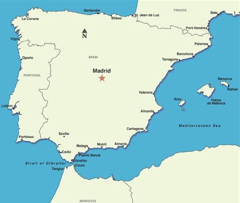
I am picking up the alignment in Madrid, the capital, and largest municipality, of Spain. It is located in the center of Spain, as well as the center of the Autonomous Community of Madrid.
Majrit was the name given to the city in Andalusi Arabic during the Al-Andalusia period. Al Andalus was the name given to most of the Iberian Peninsula between 711 AD and 1492 AD, the only time-period the Moors are given credit for ruling in Spain, and Europe for that matter.
Al Andalus was also known as Muslim Spain, Muslim Iberia, and Islamic Iberia.
I will insert here that I firmly believe the Islam of the Moors was about applied Sacred Geometry, Universal Laws, Beauty, Harmony, and Balance. All of the Moorish Science symbolism was taken over by other groups claiming to be them, falsely claiming their works, or piggy-backing on their legacy. We are not talking about the same thing with the radical Islam we are seeing in the world today. This is a really important distinction to make.

The Moors are Friends of Humanity, with five principles: Love, Truth, Peace, Freedom, and Justice. They are all about teaching to activate the pineal gland and about the human potential to re-connect to our Divine Natures in this lifetime. This is the Great Seal of the Moors.

The True History of Humanity has really been messed with, to put it mildly. My work is about providing compelling evidence for why I believe this.
This is a depiction of Spain, with Madrid in its center, in the Catalan Atlas of the Majorcan Cartographic School. The Catalan Atlas is considered the most important map of the Medieval period in the Catalan language, dated to 1375. It is attributed to Master Mapmaker Cresques Abraham.
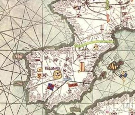
The Catalan Atlas all together has six vellum leaves, each being 26 inches, or 65 centimeters, by 20 inches, or 50 centimeters in size. Each leaf includes the mapping of the geometric lines and shapes that you see depicted here.
It also shows land features that no longer exist, like the two depicted on the left side of this map off the western coast of the Iberian Peninsula.
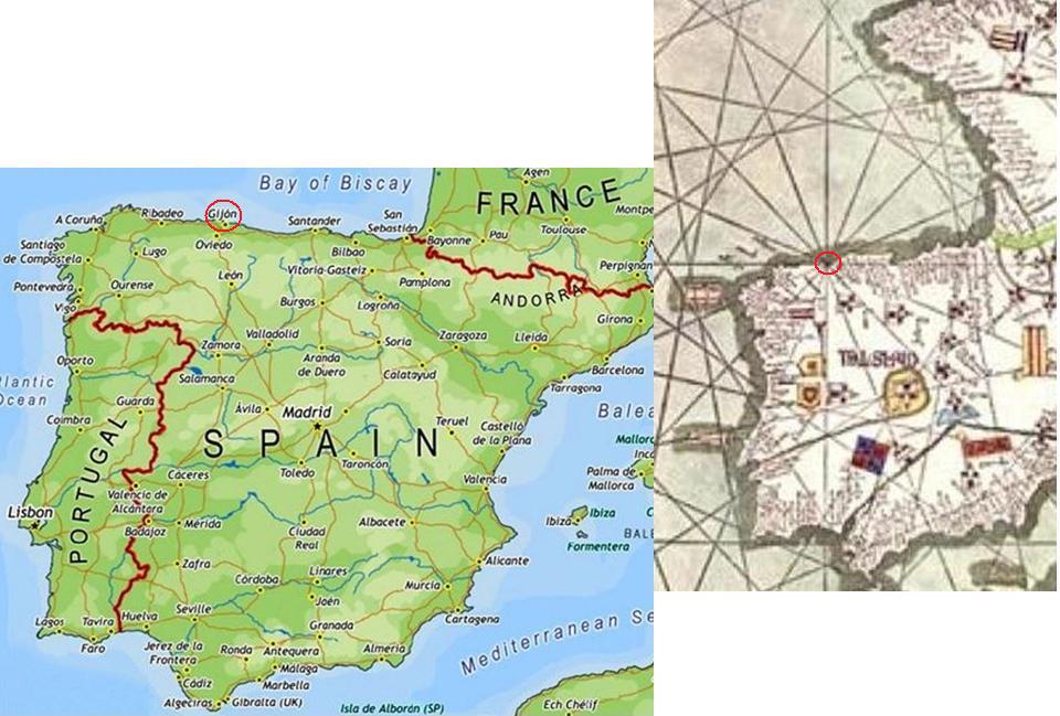
I have placed a modern map of Spain on the left, with the city of Gijon circled, because the circle with sixteen sections depicted in the Catalan Atlas on the right appears to center on the city of Gijon in Asturias. It indicates a past importance to Gijon that is no longer recognized. I, for one, have never heard of Gijon before.
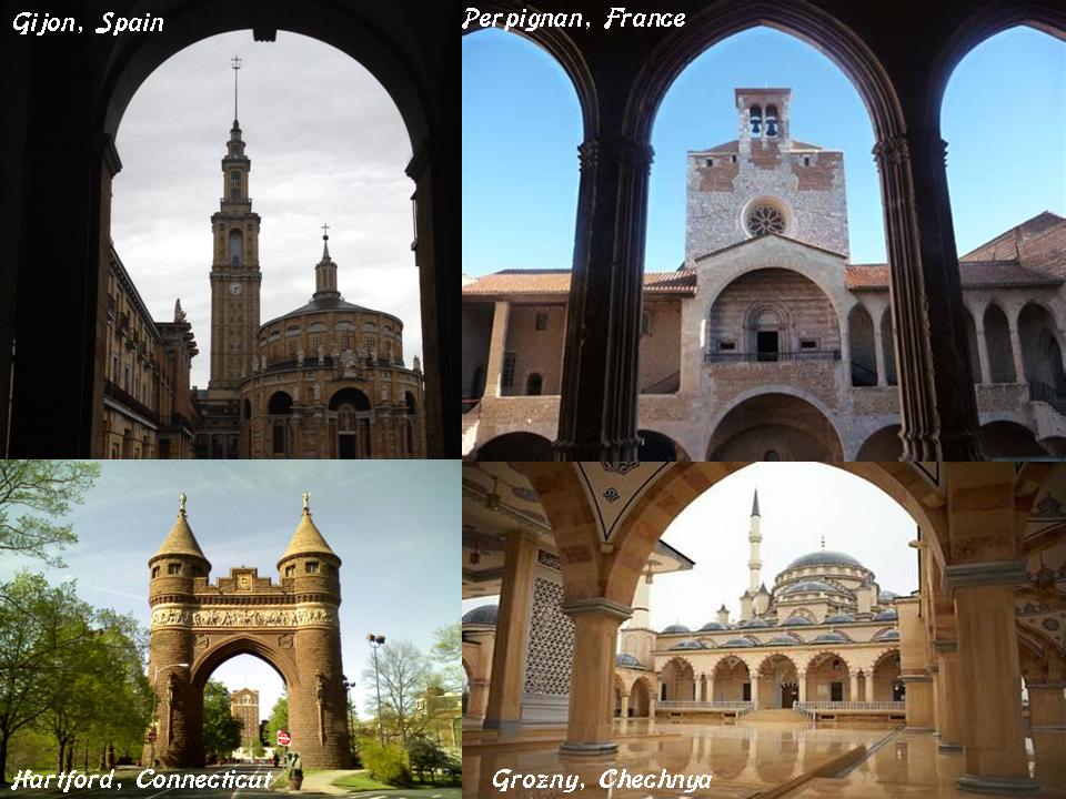
Here are a few examples of the architectural harmony found around the world, where arches perfectly proportionally frame larger buildings: on the top left is the Laboral University of Gijon; the Palace of the Kings of Majorca is on the top right; the Memorial Arch in Hartford, Connecticut on the bottom left; and the mosque in Grozny, Chechnya on the bottom right.
And here is a comparison for the similarity of appearance of the Port of Gijon, Spain, with the Port of Dover in Dover, England.
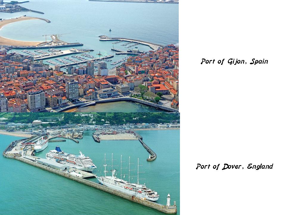
If, as we are taught, the cultures of these two different countries developed independently of each other, why does the design of the respective ports look so similar? Again, these are just two examples of many ports and harbors that share these characteristics found around the world.
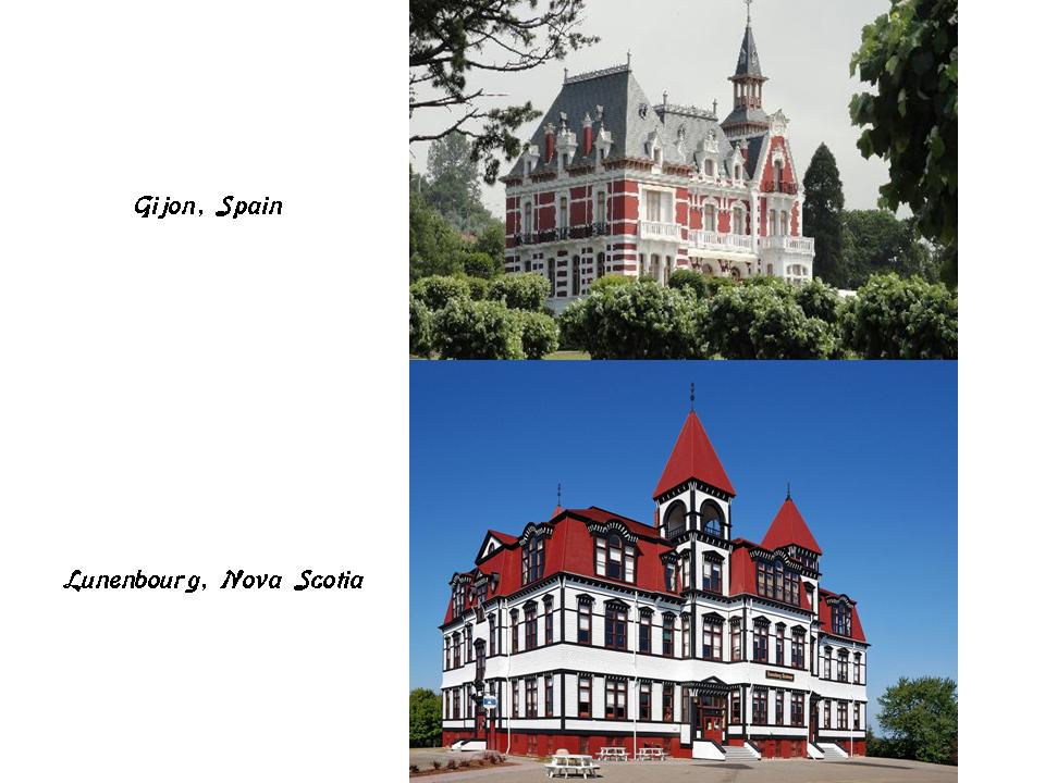
The building on the top is in Gijon, Spain, and on the bottom is in Lunenbourg, Nova Scotia. Not identical, but both buildings have a similar look to them.
Back to Madrid, and the circle alignment emanating from Washington, DC.
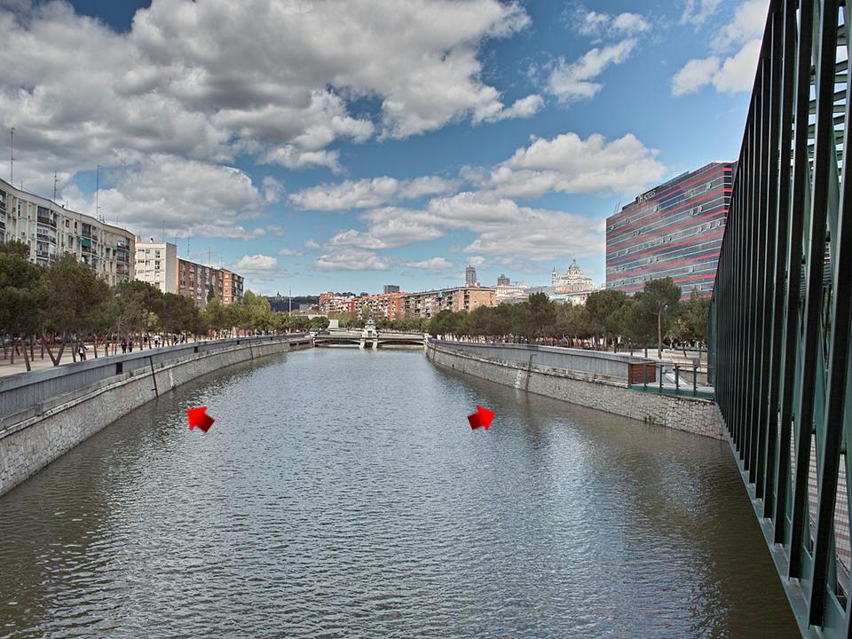
Madrid is situated on the River Manzanares, a river in central Spain which flows from the Sierra de Guadarrama to the Jarama River, a tributary to the Tagus River. Please note the masonry banks of what is being called a natural river, and not a canal.
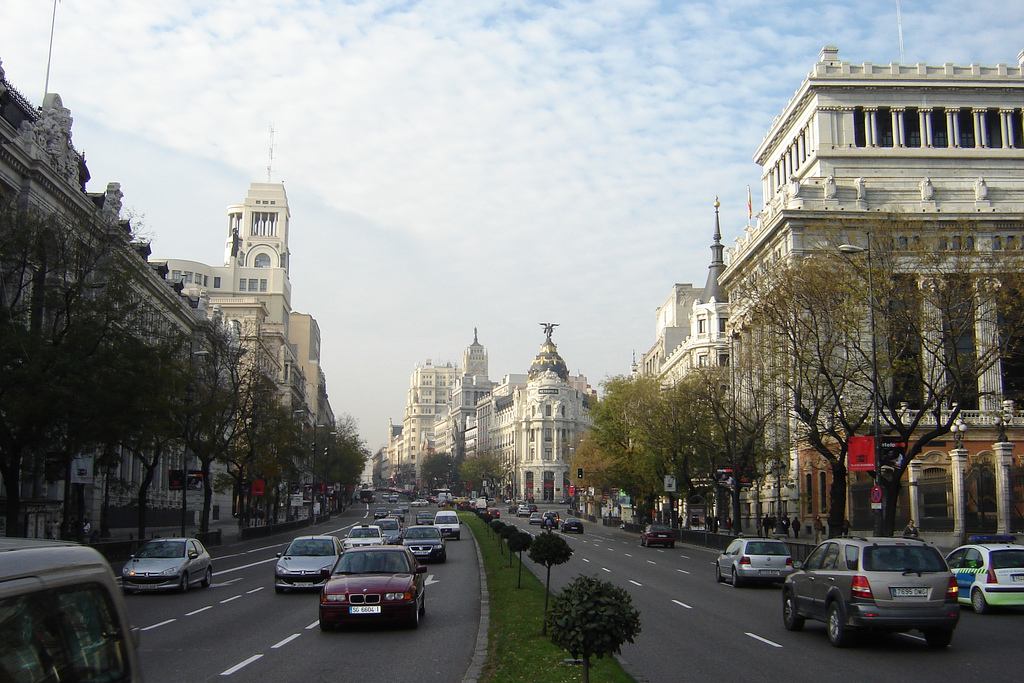
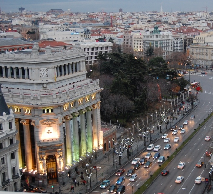
The longest street in Madrid is the Calle de Alcala, which is 7-miles, or 10.5-kilometers, long.
It was the old road which led to Alcala de Henares, 22-miles, or 35-kilometers northeast of Madrid. The historic center of Alcala de Henares is a UNESCO World Heritage Site.
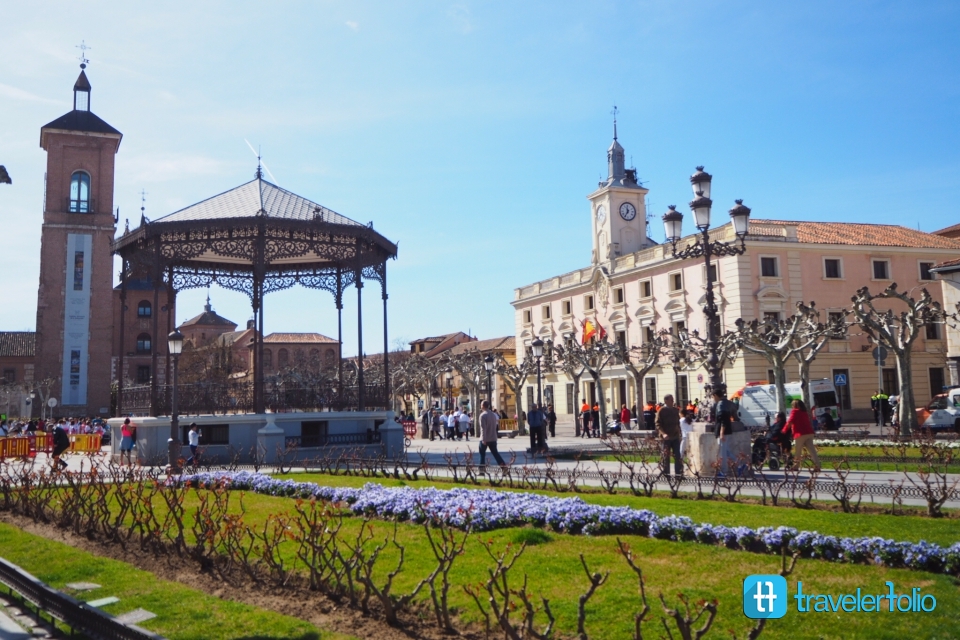
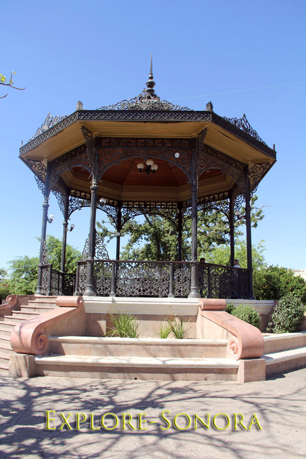
Compare the gazebo in Alcala de Henares above with what is called the Moorish Kiosk in Hermosillo, Mexico.
This is the Puerta de Alcala in Madrid, said to have been built in 1778 as the first modern post-Roman triumphal arch built in Europe, commissioned by King Charles III in 1774. Given the low technology that was said to have existed at that time, pre-industrial revolution, how did they build this?
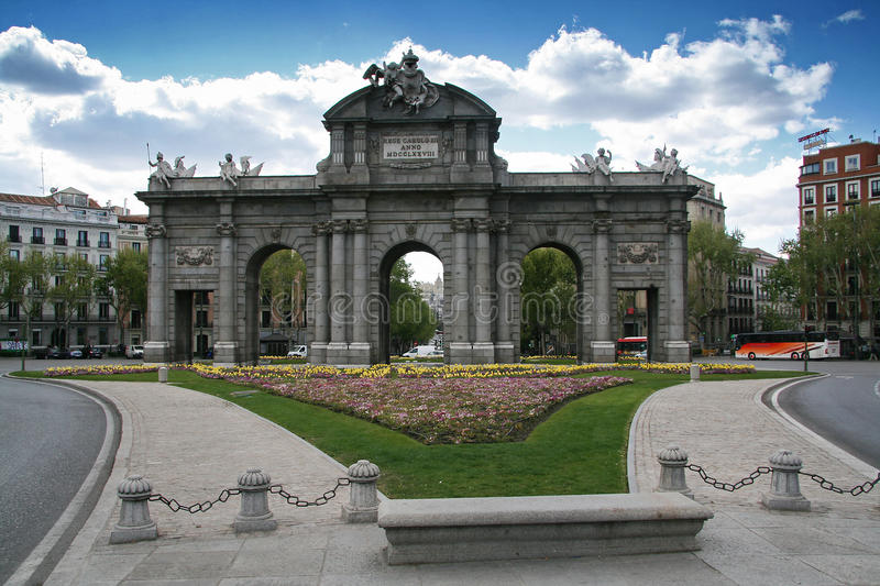
An inscription with a year, or a plaque, is easier to add to architecture, than building monumental architecture of heavy masonry.
This building is also on the Calle de Alcala. I mean, look at the size of it! How are people our size building like this?
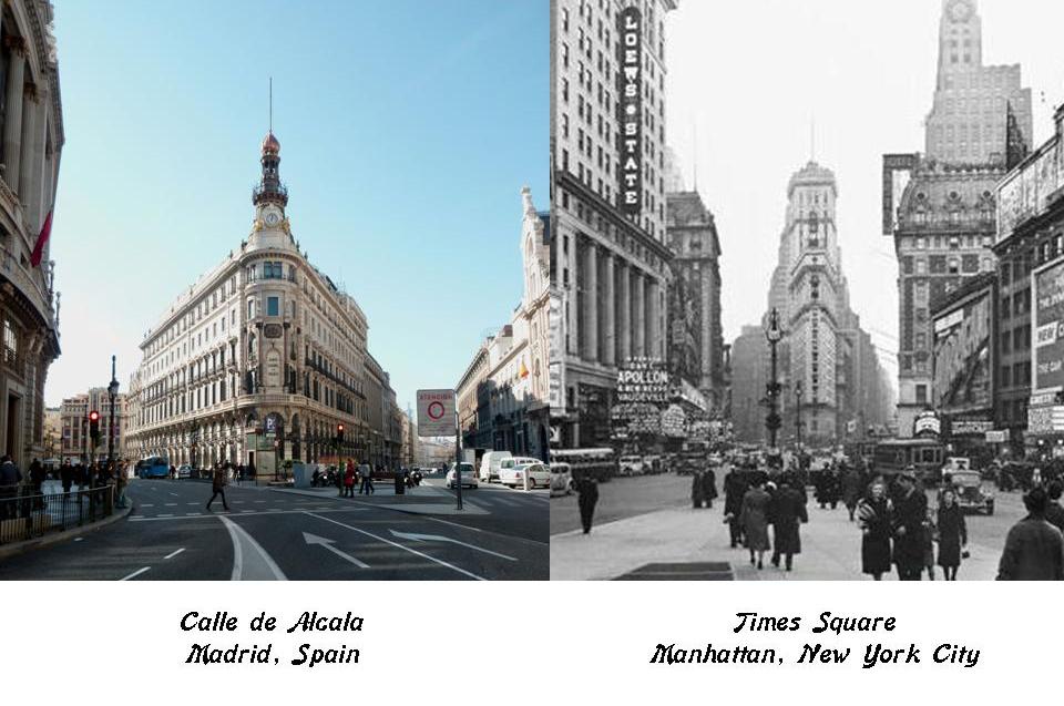
This is another building on the Calle de Alcala, compared with one in Times Square in New York City. How did they get the same street lay-out, and basic building design across continents and cultures?
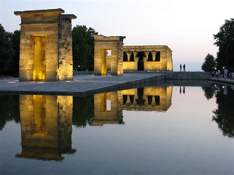
A few words about the Parque de Templo de Debod in Madrid.
What this is described as is an ancient Egyptian Temple of Debod that was dismantled at Abu Simbel due to the construction of the Aswan High Dam, and donated to Spain as a gift for helping to save it. It was consequently said to be rebuilt in the Parque del Oeste in Madrid, Spain between 1970 and 1972.
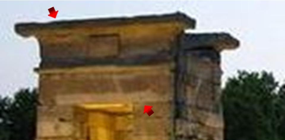
I am just wondering how a megalithic temple complex like this could have been transported. Those stones would be heavy. Arrows are pointing to what appears to be single-block stones. Those especially would be really heavy, like weighing tons!
I also find it noteworthy that this said re-building of an Egyptian megalithic structure would have taken place at the tail-end of Franco’s rule in Spain, which ended in 1975.
This is the Royal Palace of Madrid on the top, with its construction said to have finished in 1764, and on the bottom is Buckingham Palace, home of the Royal family in London, and said to have been constructed in its present form for the accession of Queen Victoria in 1837.
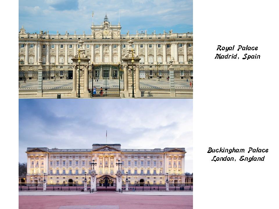
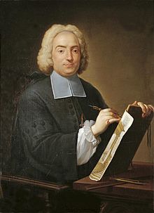
Filippo Juvarra, an Italian architect, was said to be the supervising architect on the design of the Royal Palace of Madrid. His background was said to be originally in stage-set design, primarily in Rome.
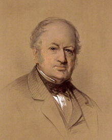
Edward Blore was said to have been one of the designers of Buckingham Palace. It is interesting to note that he was said not to have formal training in architecture, but was instead called an antiquarian draftsman.
He was also given the credit for the design of Vorontsov Place in Alupka, on the Crimean Peninsula, way far away from England on the Black Sea in southern Russia.
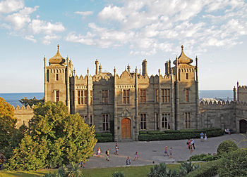
Pretty good for no formal architecture training, huh!
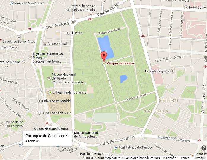
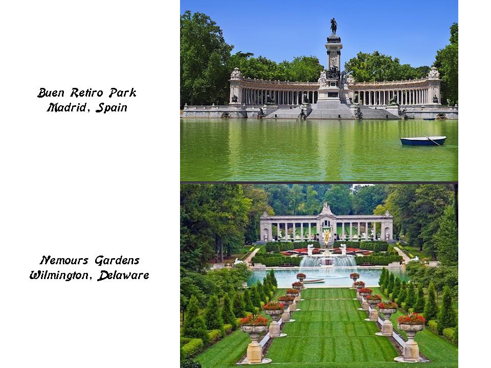
Buen Retiro Park is one of the largest parks in Madrid, having belonged to the Spanish Monarchy until the late 19th-century, at which time it became a public park.
This is the monument for Alfonso XII on the top, the King of Spain from 1874 to 1885. It was said to have opened in 1922. The picture on that bottom is in the Nemours Gardens of the Nemours Estate in Wilmington, Delaware, of the industrialist Alfred I duPont. The Nemours Estate was said to have been created by him in the Louis XVI-Rococo style of French architecture in 1909 – 1910 as a gift for his second wife, Alicia.
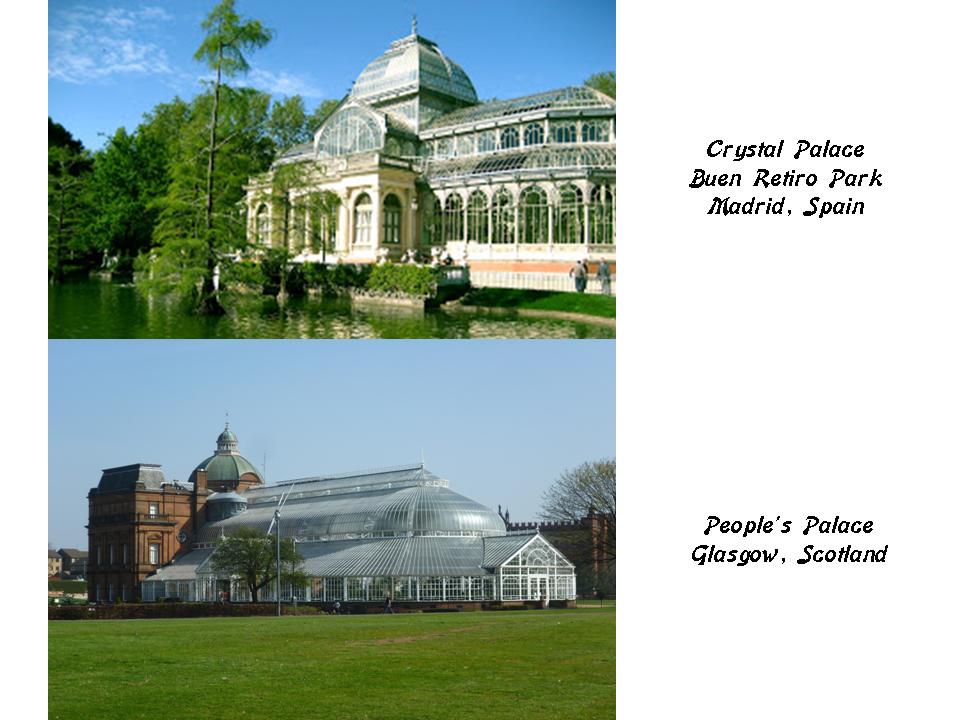
In this next picture on the top is the Crystal Palace of Madrid at the Buen Retiro Park, and on the bottom, the People’s Palace of Glasgow, Scotland, is pictured.
Madrid lies within the historic region of New Castile, which the alignment tracks on its way through Spain. This is a map of New Castile circa 1785.
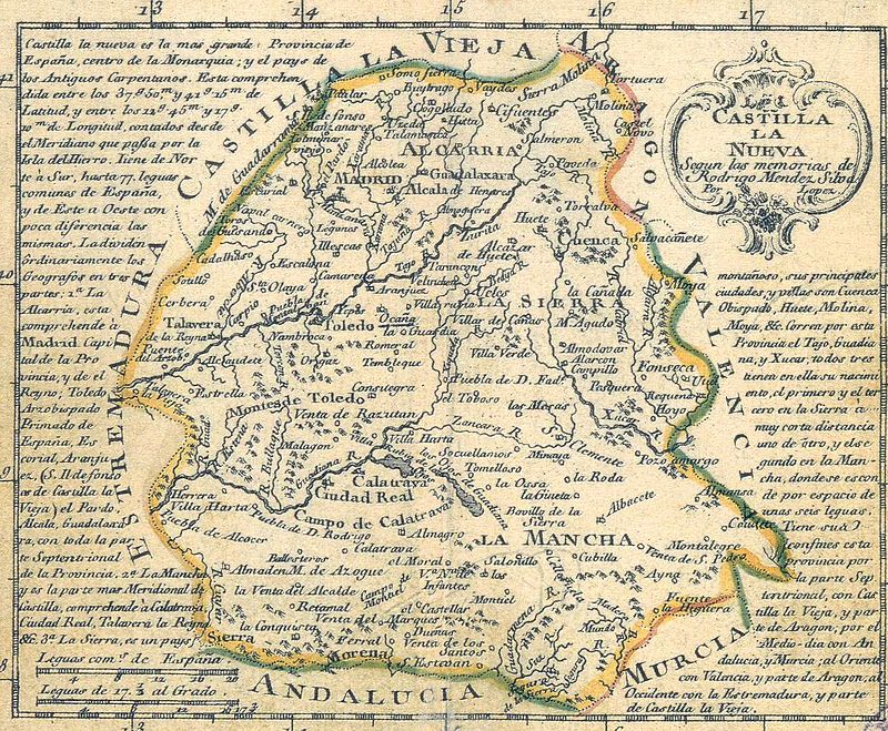
New Castile roughly corresponds to the Moorish Taifa of Toledo, called a Berber Taifa, which was defined as an independent Muslim-ruled principality that was ended by Christians in 1085, and renamed the Kingdom of Toledo after its defeat.
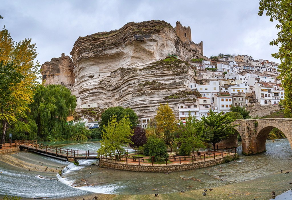
Next on the alignment is Albacete, a city and municipality in the Autonomous Community of Castilla-LaMancha, and capital of the Province of Albacete.
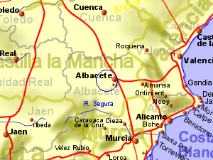
Its Andalusian Arabic name was Al-Basit, translating to “the plain.”
This is said to be a Bronze Age archeological site near Albacete called the Acequion. The Bronze Age in Europe equates in our historical record to 3,200 to 600 BC.
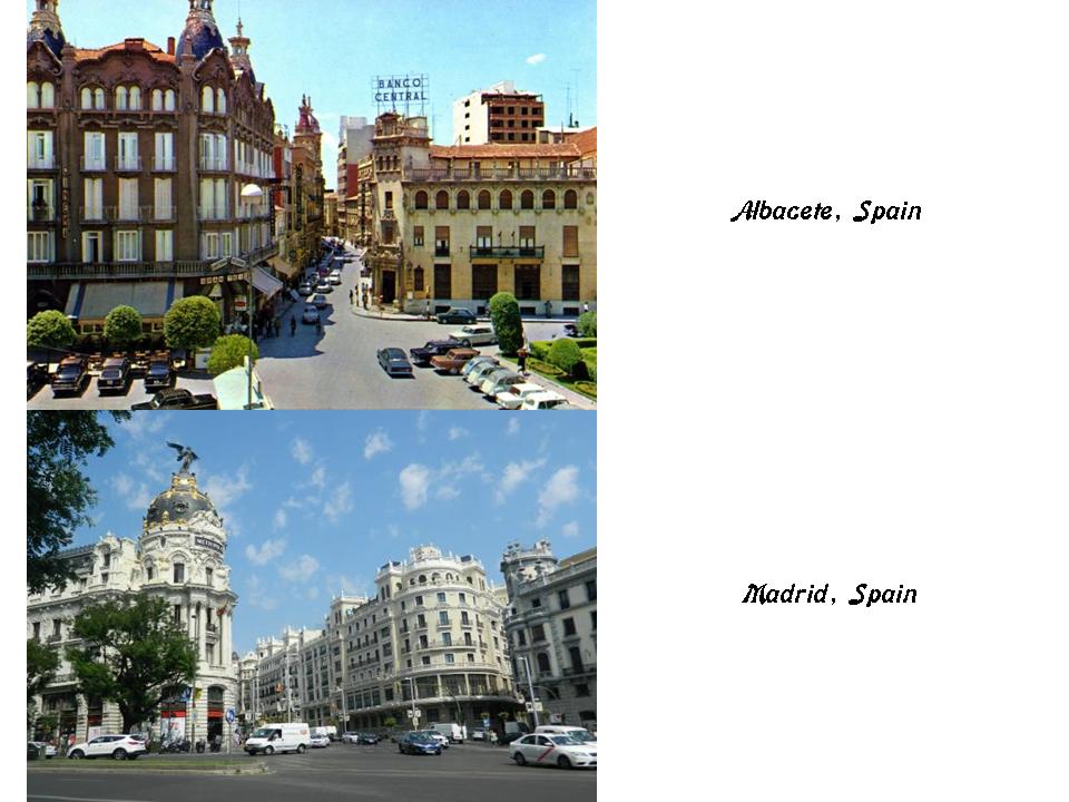
There is lovely and sophisticated architecture in Albacete, pictured on the top, that is similar to what you see in Madrid. on the bottom.
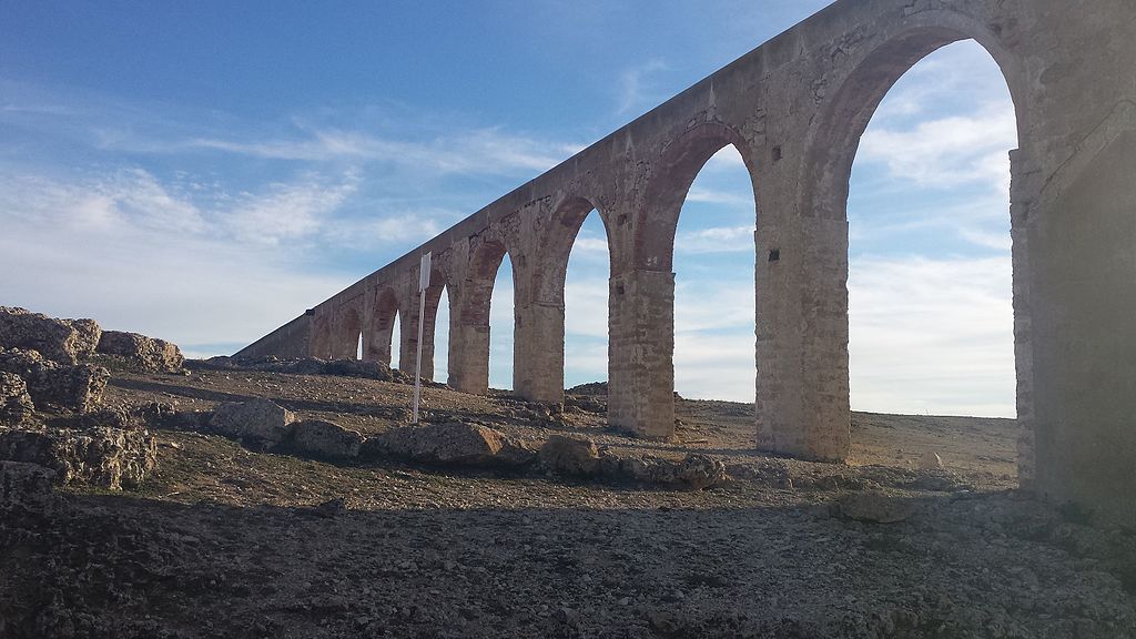
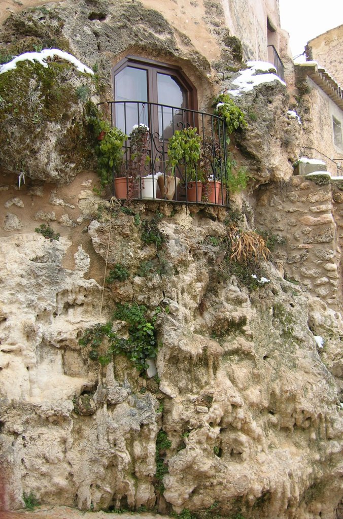
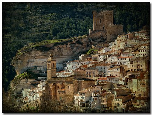
Then there is architecture, and scenery, in Albacete that can only be described as…well…rocky.
I am going to end this post here, and pick up the alignment in the next post in Alicante, Spain.
