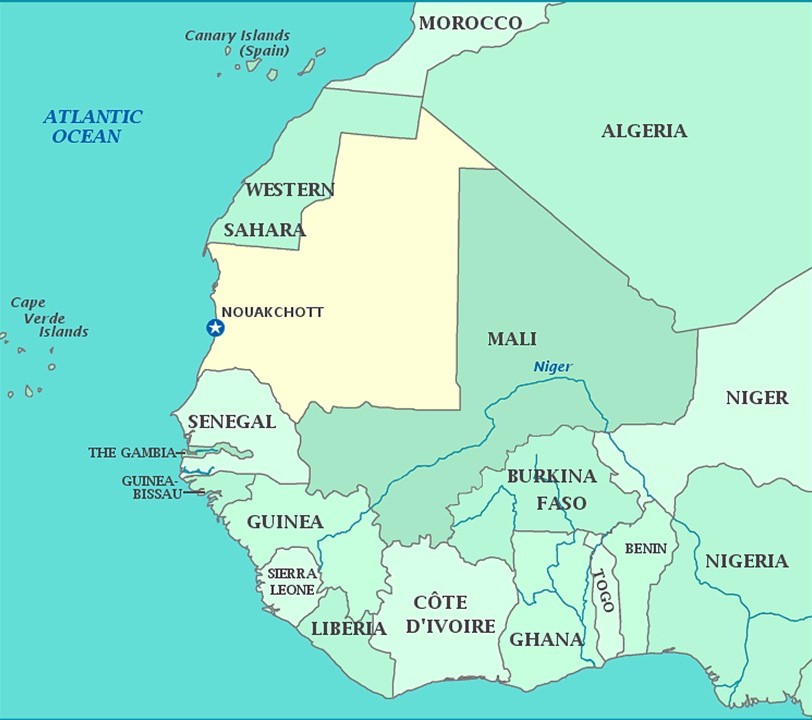
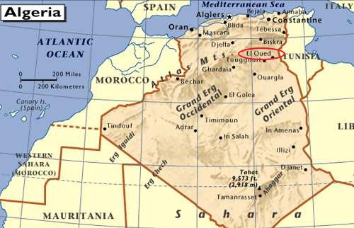
In the last post, I tracked the alignment from Sousse, a port on Tunisia’s Mediterranean Sea coast; through Kairouan, a UNESCO World Heritage Site with the oldest, currently functional University in the world; through Jebel Chambi, which has the highest elevation in Tunisia, above the city of Kasserine, the site of a World War II battle; through El Oued, known as the “City of a Thousand Domes”; Touggourt, a former sultanate until 1854; through Ghardaia, a UNESCO World Heritage site comprised of seven cities in the Mzab River Valley; to the Eye of the Sahara in Central Mauretania, also known as the Blue Eye of the Sahara and the Richat Structure.
I am picking up the alignment in Nouakchott, the capital and largest city of Mauretania.
It is one of the largest cities of the Sahel, the ecoclimatic and biogeographic zone of transition in Africa between the Sahara to the North, and the Sudanian Savannah to the South.
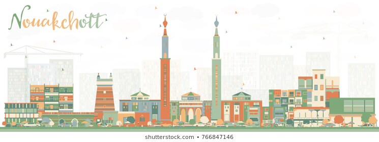
We are told that Nouakchott was a large fortified fishing village in pre-colonial times and under French rule. Why would a fishing village be fortified?
I am unable to find any historic photos of Nouakchott on the internet to see what it might have looked like even around the early 1900s.
I did find this illustration of the skyline of Nouakchott…
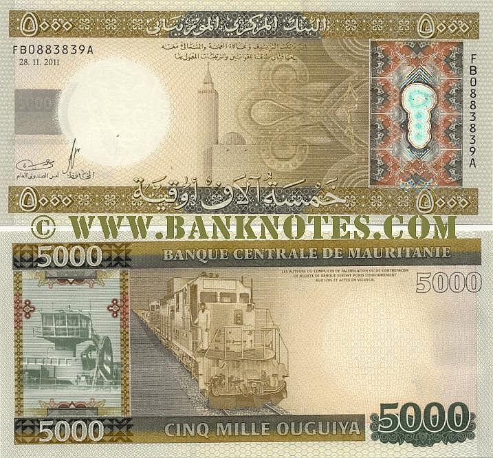
…and this Mauritanian bank note depicting some of the country’s infrastructure.
Then I look at the absolutely devastated-looking desert landscape of the whole country from Google Earth, and it makes me wonder about what we are really looking at here.
So I delved into the history of Mauretania to see what I could find out about what we are told in the historical record we have been given.
We are told that Mauretania was the Latin name for a region in the ancient Maghreb.
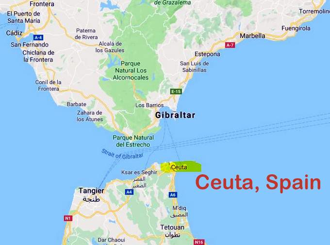
It stretched from central present-day Algeria, westward to the Atlantic, covering northern Morocco, and southward to the Atlas Mountains, and included the cities of Ceuta and Melilla, which are autonomous cities of Spain in North Africa.
Ceuta lies on Strait of Gibraltar, the boundary between the Mediterranean Sea and the Atlantic Ocean…
…and is the location of Jebel Musa, or Mount Moses, considered to be the southern Pillar of Hercules…
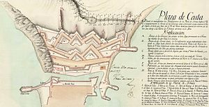
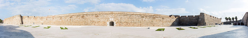
…and the location of the largely intact Royal Walls of Ceuta…
…described as a line of fortifications…
…said to have been built by the Portuguese in the 1540s…
…and Melilla, said to mean the “White One”…
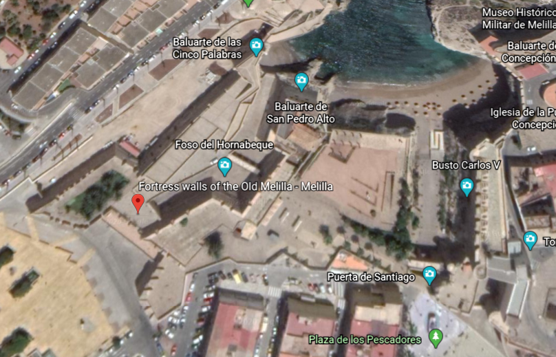
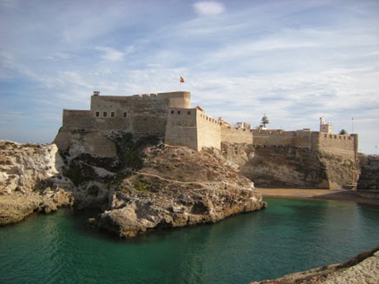
…and which has the fortress walls of Old Melilla, said to have been built in the 16th- and 17th-centuries, after the Spanish conquest of the region in 1496.
Both Ceuta and Melilla are officially claimed by Morocco.
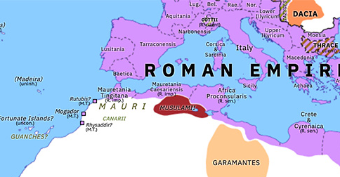
Nevertheless, we are told that the native inhabitants of Mauretania were seminomadic pastoralists of Berber ancestry, and known to the Romans as Mauri…or…Moors.
Berbers are called an ethnic group of several nations, mostly indigenous to Mauritania, Morocco, Tunisia, Algeria, Tunisia, Libya, northern Mali, northern Niger, and a small part of western Egypt.
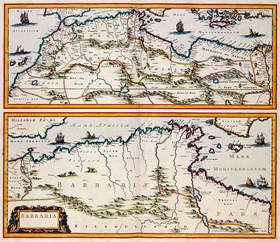
The term Barbary Coast, and Barbaria was said to have been used by Europeans from the 16th-century to the early 19th-century to refer to the regions of North Africa inhabited by the Berber people.
We are taught that the kings of Mauretania became Roman vassals in 27 BC, and that in 44 AD, Mauretania was annexed to Rome as two different provinces – Mauretania Tingitana, or present-day northern Morocco, and Mauretania Caesariensis, or present-day northern Algeria.
Then, during the Crisis of the Third Century, a period of time when the Roman Empire almost collapsed between 235 and 284 AD, we are told, because of invasions and overall instability within the empire…
…parts of Mauretania were reconquered by Berber tribes, and Romano-Moorish Kingdoms were established during the 6th- and 7th-centuries.
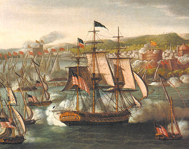
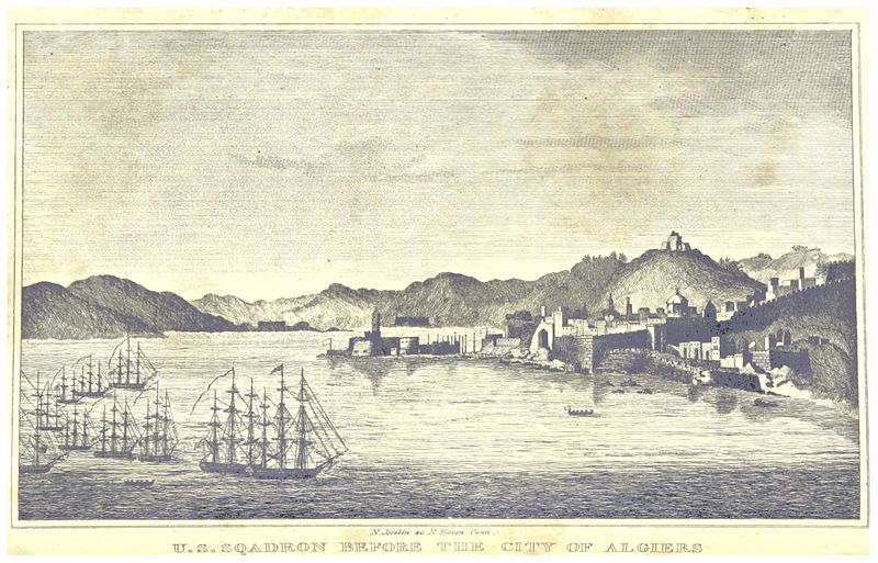
Fast forward through time to the Barbary Wars, a series of conflicts culminating in two main wars fought between the United States, Sweden, and the Barbary States of the Ottoman Empire in the late 18th- and early 19th-century.
We are told that Barbary pirates demanded tribute from American vessels in the Mediterranean Sea, and in 1801, President Thomas Jefferson refused to pay, and sent a U. S. Naval fleet to the Mediterranean in May of that year, and which lasted until 1805.
The naval fleet commenced bombarding various fortified “pirate” cities in present-day Libya, Tunisia, and Algeria, over the next three years until concessions of fair passage were extracted from their rulers, which were most likely the Deys of Tripoli, Tunis, and Algiers, in the First Barbary War.
The second Barbary War took place in 1815 between the United States and the Barbary States, and we are told, brought to an end the American practice of paying tribute to the “pirate” states and marked the beginning of the end of piracy in that region.
I am including what information is available about the Barbary Wars because it is noteworthy.
I would love to know what was really going on here with regards to the Barbary Moors, but that information is nowhere to be found.
Mauretania was administered as a French colony during the first-half of the twentieth-century, achieving independence in 1960, and Nouakchott becoming its capital in 1958, at which time it was described as being a mid-size village of little importance.
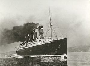
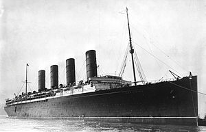
By the way, an interesting side-note is the RMS Mauretania, a passenger ocean liner launched on September 20th of 1906, and said to have been named for the ancient Roman Province of Mauretania, and not the modern country…
…and the sister ship to the RMS Lusitania, named for the Roman province directly to the north of Mauretania, across the Strait of Gibraltar, which is famous in history for having been sunk by a German u-boat in 1915 off the coast of Ireland.
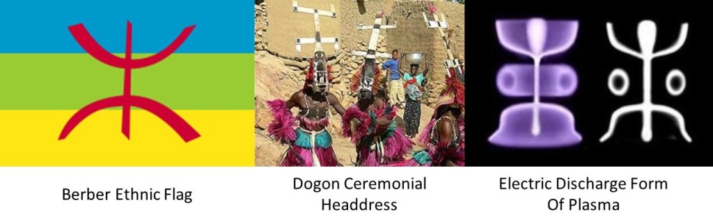
This is a comparison of the Berber ethnic flag on the left, with ceremonial headdresses of the Dogon people, who live on the Bandiagara Escarpment in Mali, and the laboratory electric discharge form of plasma next to a form called the stickman that is found in rock art worldwide.
Think the ancient Peoples of the Earth might know something that we don’t?
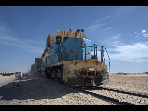
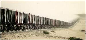
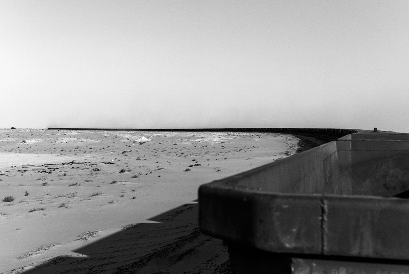
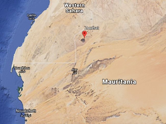
The iron ore trains of Mauretania are some of the longest, if not the longest, in world, at 1.6-miles, or 2.5-kilometers, long…
…hauling iron ore, people and goods, 405-miles, or 652-kilometers between the mining town of Zouerat on the west side of Kediet ej Jill, the highest peak in Mauretania, through the Sahara Desert, to the port city of Nouadhibou on Mauretania’s coast.
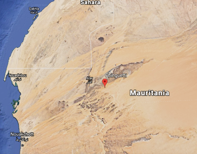
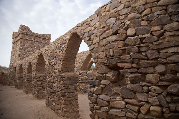
This is a view on the top left in the Amogjar Pass between Atar and Chinguetti in Mauretania, compared with similar-looking ones at Thule, Greenland on the top right; Cutimbo in Peru on the bottom left; and in the Village of Oak Creek, in Sedona, Arizona on the bottom right.
Atar is situated next to the corner of the Eye of the Sahara discussed at the end of the last post…
…and Chinguetti is located on the lower lid of the Eye.
Chinguetti is called the Holy City of the Sahara, and venerated as one of the most holy cities of Islam…
…and has some of the world’s oldest surviving copies of Korans and other documents.
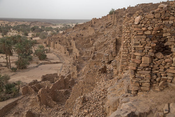
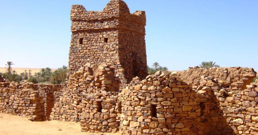
Then there was Ouadane, situated pretty darn close to the eyeball of the Eye of the Sahara.
What was once one of Africa’s key trading posts, and a UNESCO World Heritage site today.
It is largely in ruins, even though there is a settlement of people still living there outside the gates.
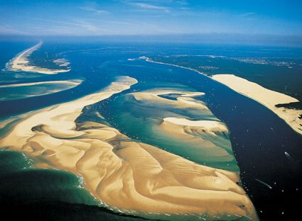
I noticed the Banc d’Arguin National Park on the coast, another UNESCO World Heritage Site located north of Nouakchott, and went there to take a look, as I consistently find that for as much of the ancient civilization as is destroyed, neglected, or incorporated in unprotected places, much is preserved intact in parks.
I must say that to this day, I am never disappointed. I can’t emphasize enough that this Ancient Civilization is everywhere – there is not place in the world that it is not.
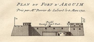
The island of Arguin in the Bay of Arguin was first thing I noticed when I looked at Google Earth.
The interesting thing about Arguin, part of the National Park, is that while there is not much going on there now…
…at one time there was a lot going on there, including a star fort, said to have been built by the Dutch, which doesn’t appear to exist any more.
We are told that starting in 1443, it became a part of the Portuguese Empire; and, at different times over the centuries, it was part of the Dutch Empire; part of the territories and provinces of Prussia; and part of the French overseas empire.
The shallows of the Banc d’Arguin National Park are said to be remnants of a vast river delta from a time when waters flowed from what is now the Sahara Desert…
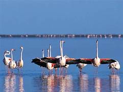
…and the Banc d’Arguin is a major breeding site for migratory birds, and its surrounding waters are some of the richest fishing waters in western Africa, serving as nesting grounds for the region.
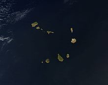
From Nouakchott, the next place we come to on the alignment are the Cape Verde Islands.
The island Republic of Cape Verde is 350-miles, or 570-kilometers, off the coast of western Africa, and consists of 10 islands, divided into two groups.
One group is called the Barlavento, or Windward, islands of Sando Antao; Sao Vicente; Santa Luzia; Sao Nicolau; Sal; and Boavista.
The other group is called the Sotavento, or Leeward, islands of Santiago; Maio; Fogo; and Brava.
They are part of what is called “Macaronesia,” a collection of four archipelagos in the North Atlantic Ocean off the coasts of Africa and Europe, also including the Canary Islands, Madeira, and the Azores.
Santiago is the country’s largest island, and where its capital, Praia, is located.
We are told the islands were uninhabited before the arrival of Portuguese and Genoese navigators in 1456, with Portuguese settlers arriving in 1462 and founding a settlement called Ribeira Grande, now called Cidade Velha, the historic center of which is a UNESCO World Heritage Site.
These are what appear to be the very old stone ruins of what is called Se Catedral in Cidade Velha…
…and a monument called the Pelourinho, said to have been erected in the early 1500s.
Could that have been an antenna at the top of it?
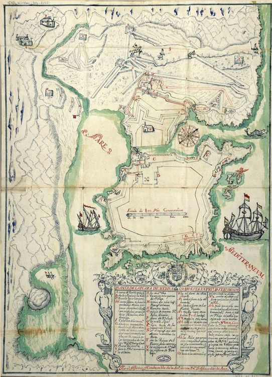
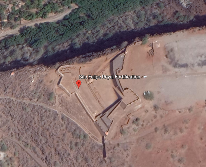
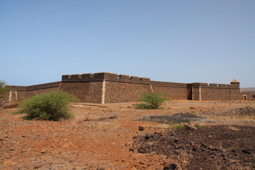
There is also an intact star fort in Cidade Velha, called the Fort Real de Sao Filipe, said to have been built by the Portuguese between 1587 and 1593, and part of a system of defense for the city, which included six smaller forts on the coast and a wall along the port that apparently no longer exists because I can’t find any information about them.
Moving over to look at Praia, the capital city, I see the familiar shape of the harbor there, compared for example, to the harbor back in Sousse, Tunisia, on the other side of Africa.
The red dots mark where lighthouses are located, and I typically find pairs of lighthouses at harbor entrances around the world…
…like at Sousse.
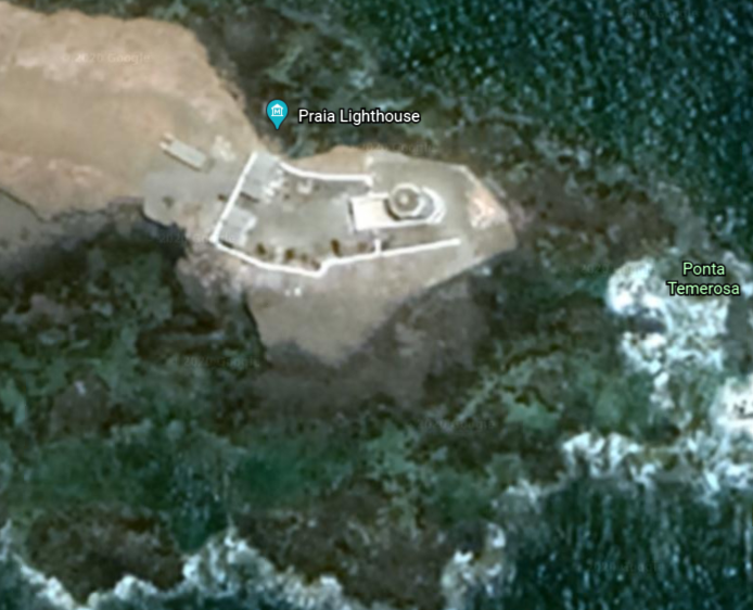
The Farol de Dona Maria Pia is the lighthouse at the southern most point of the island of Santiago at the entrance of Praia Harbor.
Based on what I have found at other locations with a similar harbor configuration, I would expect to find a lighthouse at the head of the opposite jetty.
But there isn’t one.
It looks like something is standing there, but not a lighthouse, and I could find no record of one being there.
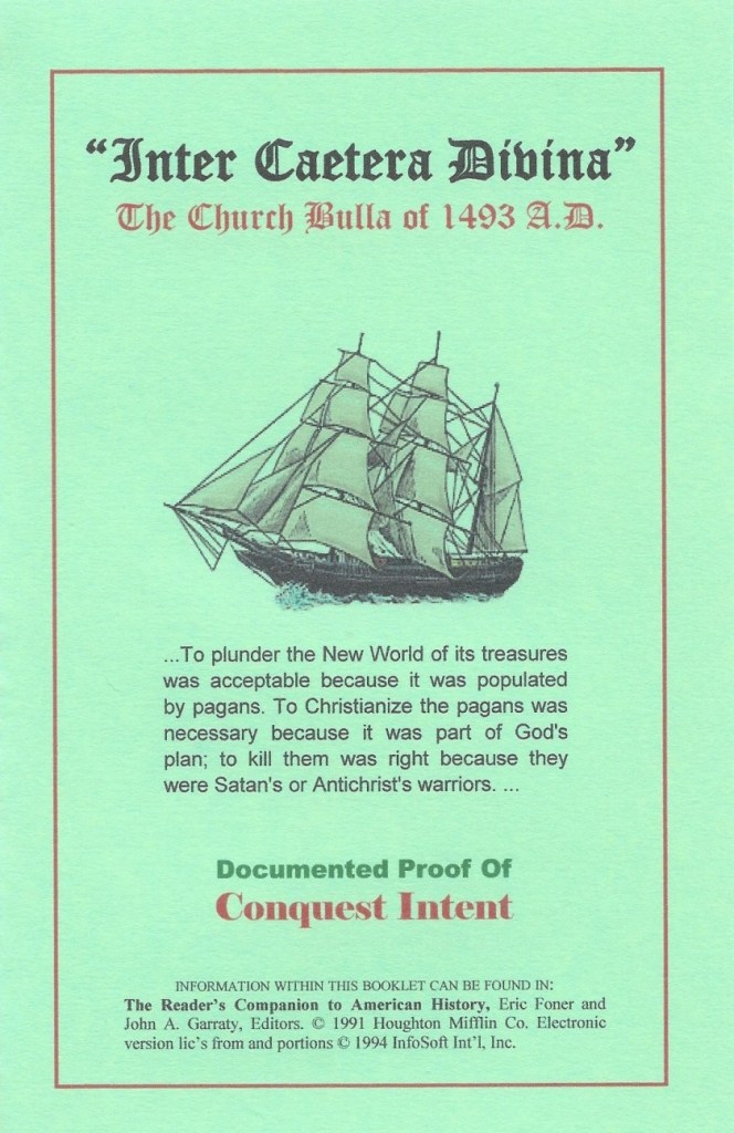
Lastly, it is interesting to note that the Cape Verde Islands are specifically mentioned in the Inter Cetera Bull, issued by Pope Alexander VI on May 4th of 1493.
This papal bull essentially authorized the land grab of the lands of the Moorish civilization in the Americas, and became a major document in the development of subsequent legal doctrines regarding claims of empire in the “New World.”
The bull assigned to Castile “the exclusive right to acquire territory, to trade in, or even approach the lands laying west of the meridian situated one hundred leagues west of the Azores and Cape Verde Islands, except for any lands actually possessed by any other Christian prince beyond this meridian prior to Christmas, 1492.”
In the historical narrative we have been given, this papal bull was issued a year after the Fall of Grenada, on January 2nd, 1492, effectively ending Moorish rule in Spain when Muhammad XII surrendered the Emirate of Grenada to King Ferdinand of Aragon and Queen Isabella of Castile.
I am going to end this post here, and pick up the alignment at Fernando de Noronha, a group of islands off the coast of Brazil near Natal in the next post.
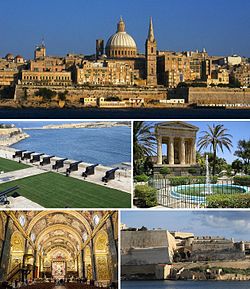
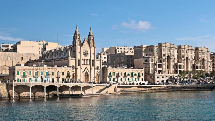
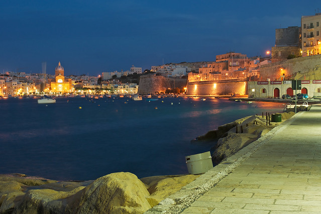
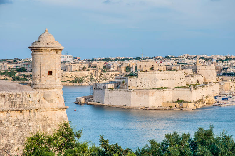
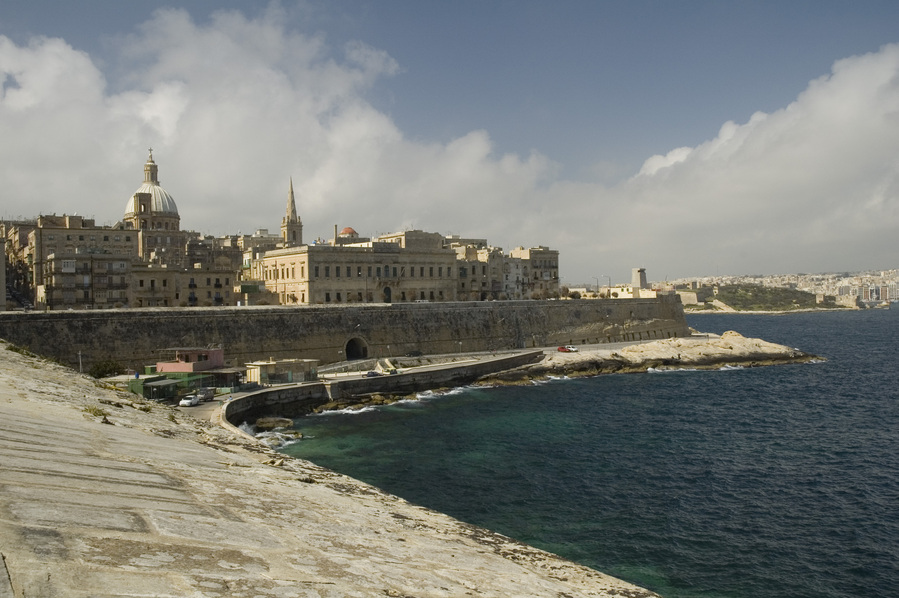
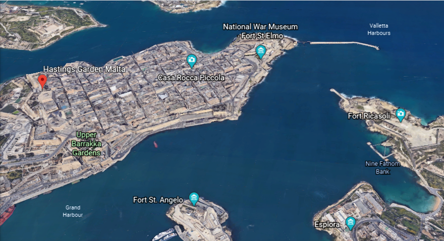
in the last post, I took a tour of the amazing city of Valletta, and capital of the island Republic of Malta. I looked around what is found in the Marsamxett Harbor; around the Grand Harbor; and within the city walls of Valletta.
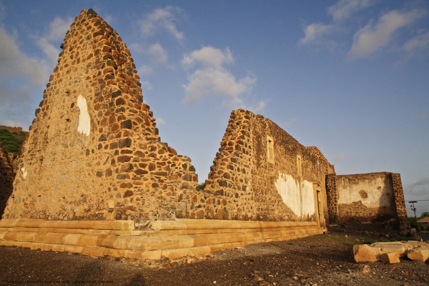
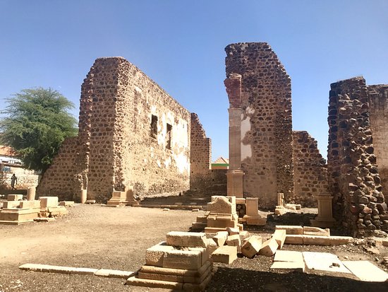
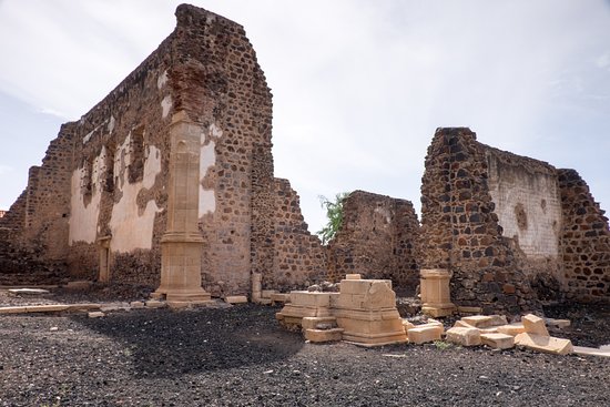
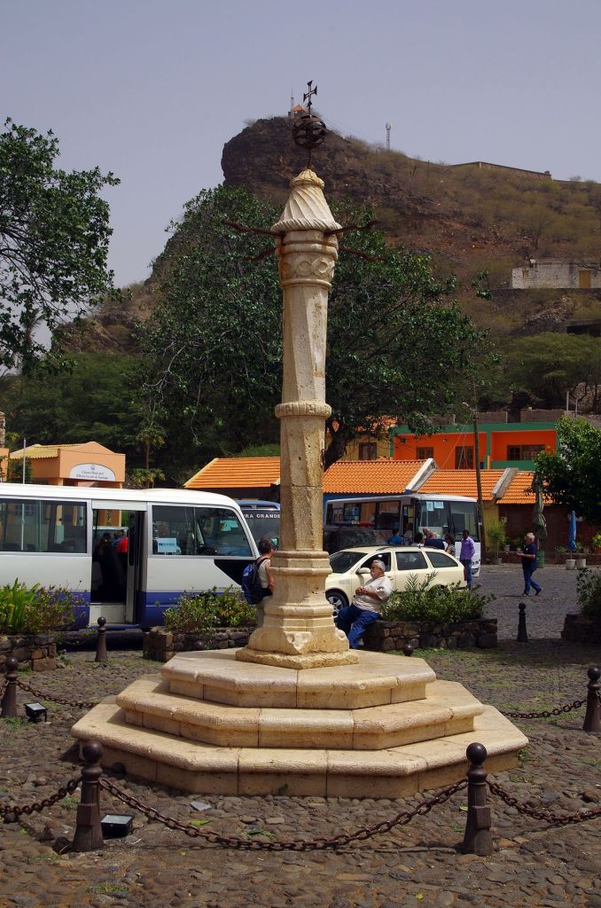
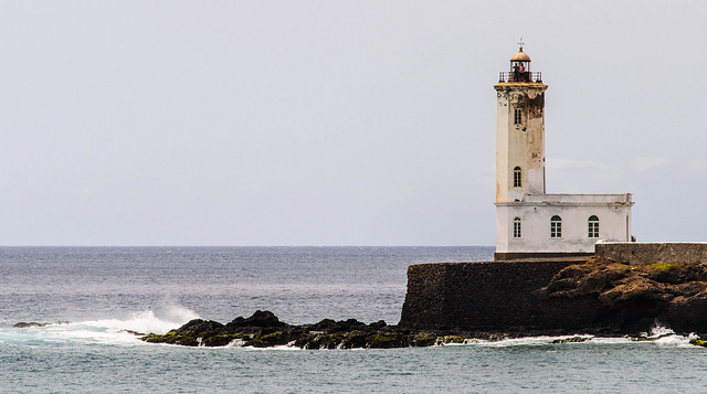
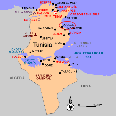
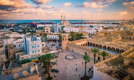
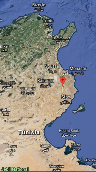
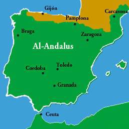
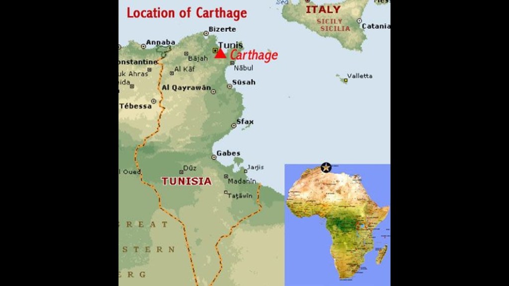
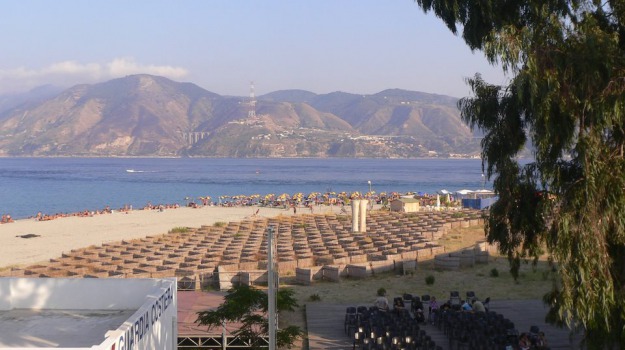
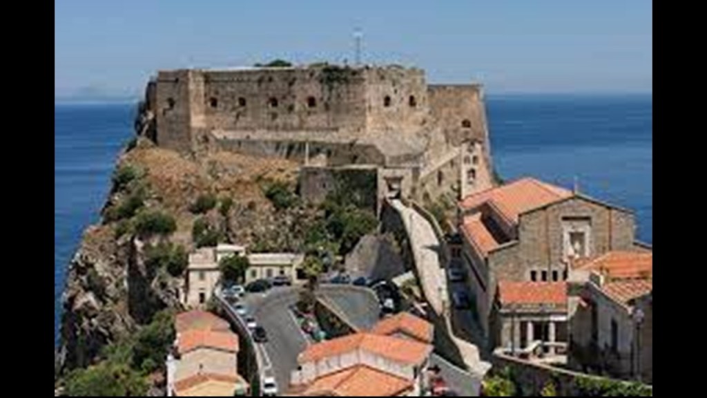
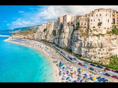
I am picking up the alignment in Sousse, the capital of Tunisia’s Sousse Governorate, one of the 24 governorates of Tunisia, and located 87-miles, or 140-kilometers, south of the nation’s capitol of Tunis.
Sousse is considered one of the most beautiful cities in Tunisia, and is located on the Gulf of Hammamet.
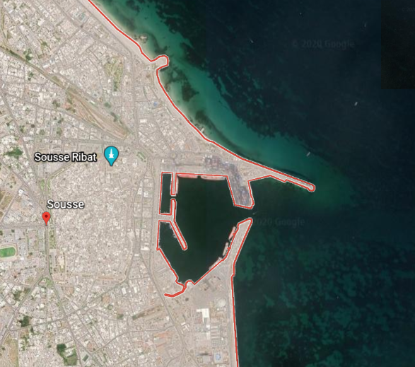
Sousse is a transportation hub. It is a port city…
…where the are two lighthouses at opposite ends of the harbor entrance…
…just like what we saw in Valletta, Malta…
…and even at the Port of Dover, England, in the English Channel.
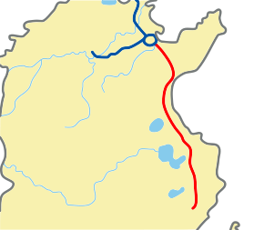
Sousse is linked by the widest road in the country, the A-1 Motorway, a 153-mile, or 247-kilometer, highway that connects Tunis with Sfax, another port city in southern Tunisia, and conceived of as part of an international project called the Trans-Maghreb Highway.
The Maghreb is another name for northwest Africa, a region which we are told was referred to in English and European sources, in the 16th- through 19th-centuries, as the Barbary Coast.
What we are also told about the Maghreb is that during the era of al-Andalus in Moorish Spain between 711 AD and 1492 AD, the Maghreb’s inhabitants, Muslim Berbers or Maghrebi, were known by the European’s as “Moors”…and that’s about as much as they will give up to us directly about this particular subject.
Sousse is also connected by railway to Tunis, and has roads and railways leading further into the country and towards the neighboring country of Libya.
As we are told about so many other places, the construction of the railway was attributed to the French colonizers, and not to the original inhabitants.
So I took a look at the history of Tunisia to see what else I could find.
At the beginning of the 1800s, Tunisia was described as a quasi-autonomous province of the Ottoman Empire.
Its trade increased dramatically with Europe in the 1800s, with the arrival of western merchants wanting to establish business in the country.
Then, the Bey of Tunis from 1855 to 1859, Muhammad, was forced by the British and French to sign the 1857 Fundamental Pact, which increased freedoms for non-Tunisians.
Here’s another clue we are talking about Moors.
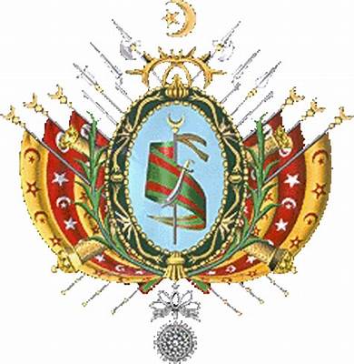
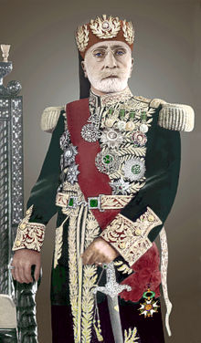
Bey is one of the five noble titles of the Moors, the other four being – Dey, El, Al, and Ali.
We are told that under the Ottoman Empire, Bey was the title of the governor of a province.
Then, we are told, in 1861, Tunisia enacted the first constitution in what was called the Arab world, but a move toward a modernizing republic was said to have been hampered by a poor economy and political unrest.
We are starting to see the use of the world “Arab” replacing that of “Moor.”
Contained within the 1861 Constitution of Tunisia, we find that it was also the first state to establish Islam as its religion.
The world would be in a much better place if we were talking about Moorish Islam, which is about reconnecting with our higher selves and raising our level of consciousness into Higher Consciousness.
I think this marked the beginning of turning formerly Islamic States (i.e. Moorish Islam) into the mechanism for creating a new form of fundamentalist Islam, where it was conceptually altered in order to lead us to what we see now as radical Islam, and its destructive role in today’s world.
Regardless of the new Constitution, when the Tunisian government couldn’t manage the loans made by foreigners to the government, it declared bankruptcy in 1869.
Then Britain and France cooperated between 1871 and 1878 to prevent Italy from acquiring Tunisia as a colony having investment, and subsequently Britain supported the French interest in Tunisia in exchange for dominion over Cyprus.
Using the pretext of a Tunisian invasion into Algeria, the French invaded Tunisia with an army of 36,000, which quickly advanced to Tunis, entering by way of places like Sousse on the coast…
…and subsequently occupying Tunis.
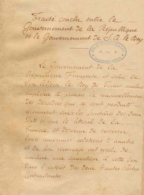
Then, the French forced the new Bey, Muhammad III as-Sadiq, to make terms in the form of the 1881 Treaty of Bardo, which gave France control of Tunisian governance and making it a de facto French Protectorate.
The French progressively assumed more of the important administrative positions, and by 1884 they supervised all Tunisian government bureaus dealing with finance, post, education, telegraph, public works, and agriculture.
French settlements were encouraged, with the number of French settlers said to have grown from 34,000 in 1906, to 144,000 in 1945, and the French administration weakened the local tribes in rural areas.
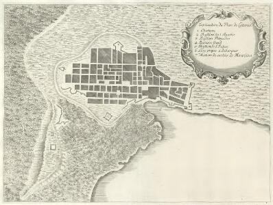
This was said to depict an urban map of Tunis between 1890 and 1914.
Then, on March 20th, 1956, Tunisia achieved its independence from France with the establishment of a Constitutional Monarchy…
…with the last Bey of Tunis, Muhammed VIII al-Amin Bey, as the King of Tunisia.
This State of Affairs didn’t last long, as the Prime Minister, Habib Bourguiba, abolished the monarchy in 1957, and proclaimed the Republic of Tunisia the same year, and served as its President for the next thirty-one years.
At the same time the constitutional monarchy of Tunisia was abolished, the Beylik of Tunis was terminated as well, described as a largely autonomous Beylik of the Ottoman Empire.
This whole series of events seems to be a template for how the Moorish Empire was taken down in different parts of the world, and after I am done with this series, I am going to put together a comprehensive post with all of the examples I have found about this subject.
If this represents true history in the new historical narrative, I think it is possible that places like Tunisia, and others which were not wiped out by a worldwide flood of mud, were taken down by the Controllers by other means, typical of the events seen in Tunisia.
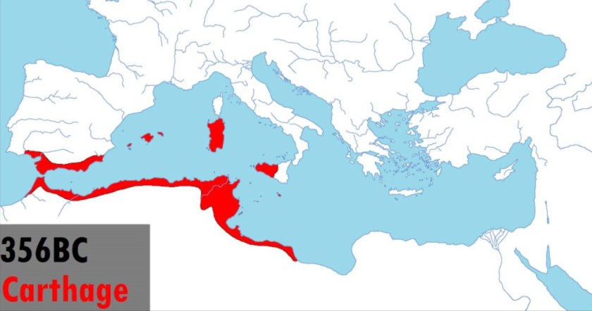
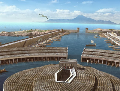
Among other things, it is interesting to note that the Carthaginian Empire was centered in Tunisia…
…and the powerful ancient city of Carthage was located in the vicinity of Tunis.
This reconstruction of how Carthage was said to have looked is typical of depictions of it, and its protected harbor called a cothon, which were said to have been generally found in the Phoenician world.
Carthage was said to have been founded by Phoenician settlers from Tyre and Sidon in the modern-day country of Lebanon, and destroyed by Roman forces in 146 BC at the end of the Third Punic War.
I find it very interesting that there is a narrow strip of the National Forest of Tunisia between A1 Motorway and the coast of Hammamet Bay, between Sousse and the resort town of Hammamet to the North, given the overall desertified nature of the place.
We will see more on the desertification of the region as we move into northern Africa’s Sahara Desert.
There are many olive tree groves south of where the strip of National Forest is located, adjacent to the Gulf of Hammamet Bay, in the vicinity of el Kantaoui Port, north of Sousse Proper.
Olives are Tunisia’s most important natural resource, and Sousse is the center of the production and sale of olive oil in Tunisia.
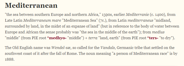
Tunisia, and the coast of North Africa, is the southern boundary of the Mediterranean Sea.
If you break-down the meaning of Mediterranean Sea, you come up with “Middle Earth” Sea.
Interestingly, the Great Pyramid of Giza in Egypt, the northern border of which is on the Mediterranean Sea, has been calculated to be the center of the land mass of the Earth.
Carl Munck in “The Code,” deciphers a shared mathematical code, related to the pyramids of Giza, in the dimensions of the architecture of sacred sites all over the planet, one which encodes longitude & latitude of each that cross-reference other sites.
He shows that this pyramid code is clearly sophisticated and intentional, and perfectly aligned geometrically over long-distances.
The Great Pyramid was the prime meridian of the Earth until the prime meridian was moved to the Royal Observatory in Greenwich, England…in 1851.
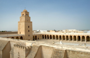
Next on the alignment in Tunisia, we come to Kairouan, the capital of the Kairouan Governate and a UNESCO World Heritage Site.
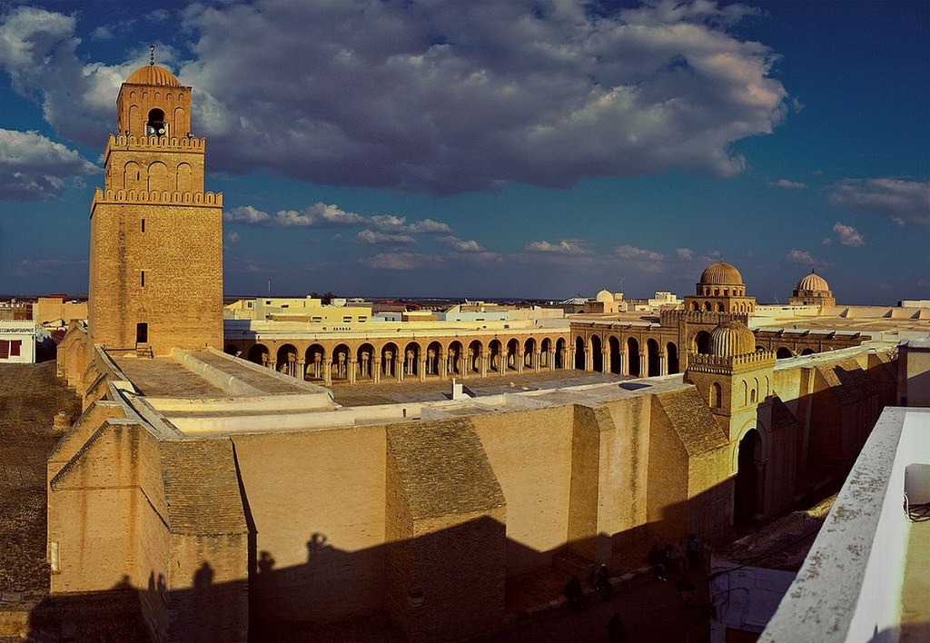
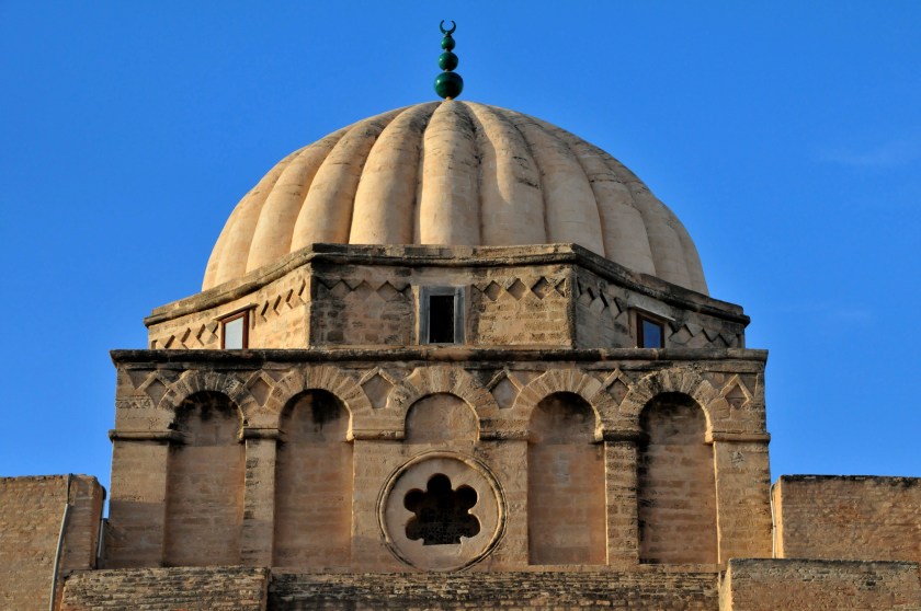
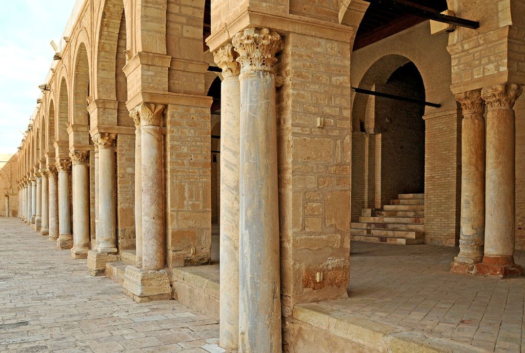
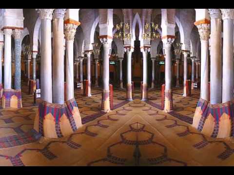
The Great Mosque of Kairouan, also known as the Holy Mosque of Uqba, is considered to be one of the most impressive and largest Islamic monuments in North Africa.
It is one of the oldest places of worship in the Islamic world, said to have been established in 670 AD, and the model for all later mosques in the Maghreb.
We are told during the Aghlabid Dynasty between 800 AD and 909 AD, the ruler of Ifriquiya in today’s North Africa, established a University in Kairouan as part of the Great Mosque complex, and that it became a center of education in both Islamic thought and in the secular sciences.
It is said to be in the Guiness World Book of Records as the oldest, currently functional, university in the world.
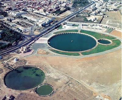
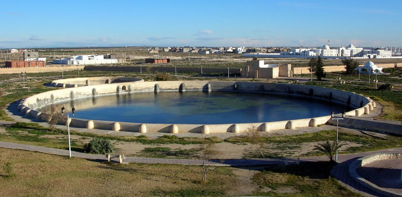
The Aghlabids were said to have built palaces, fortifications, and fine waterworks, of which only the pools remain.
For example, these are called the Aghlabid Basins, said to have been built in the 9th-century as water storage for the Aghlabid Palace, which was on the site of a present-day cemetery in Kairouan.
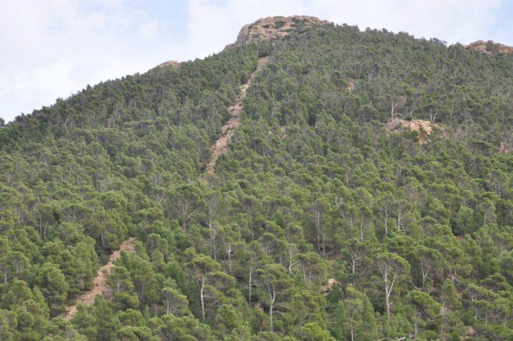
Jebel Chambi is the next place on the alignment, the highest mountain in the country, standing above the city of Kasserine in western central Tunisia.
The summit is covered by a pine forest and is part of Chambi National Park.
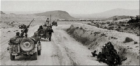
Interestingly, the Battle of Kasserine Pass took place during the Tunisia Campaign of World War II. It was the first major engagement between American and Axis forces in Africa.
With the Axis German and Italian Forces led by Field Marshall Erwin Rommel, it was an early defeat for Allied forces.
Interesting that there are so many military engagements historically that have taken place along these alignments I have been tracking – the Napoleonic Wars, World War I, World War II, among other kinds of wars.
It makes me wonder what they were really all about…like maybe damage to, and in many cases, the complete destruction of, the ancient advanced Moorish Civilization and the earth’s energy grid system.
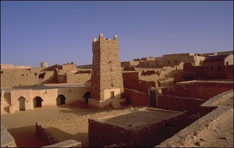
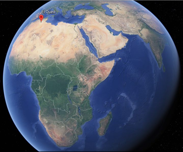
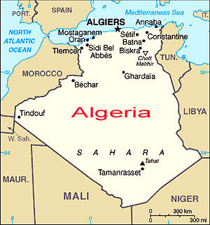
The next place we come to on the alignment is El Oued, the capital of Algeria’s El Oued Province in the Sahara Desert in northeast Algeria.
The oasis town of El Oued is watered by an underground river, which allows for date palm cultivation.
It is also known as the “City of a Thousand Domes” since most rooves are domed.
In El Oued Province itself, we find the Chott Melrhir, an endorheic salt lake (a limited drainage basin with no outflow)…
…and the westernmost of a series of depressions, from the Gulf of Gabes in the Mediterranean Sea into the Sahara.
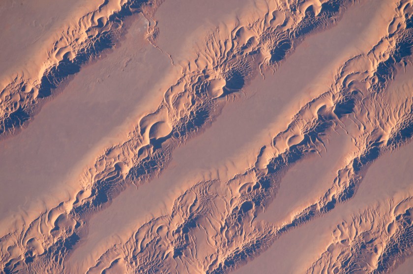
The Grand Erg Oriental, or Great Eastern Sand Sea, is in the southern part of the province, is a field of sand dunes.
Can’t help but wonder if there is enduring infrastructure underneath all that sand!
The Grand Erg Oriental used to be associated with the Wadi Igharghar, described as a dry and mostly buried river with a sizeable number of tributaries (a canal-system?) that flowed north into the Erg from the Ahaggar Mountains to the south of it.
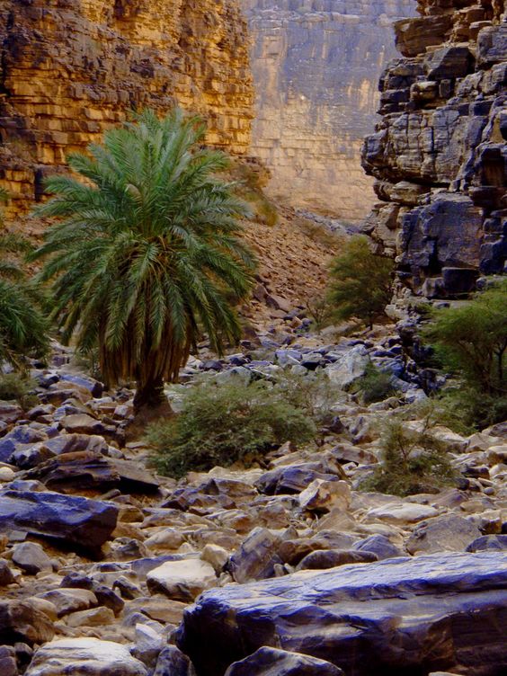
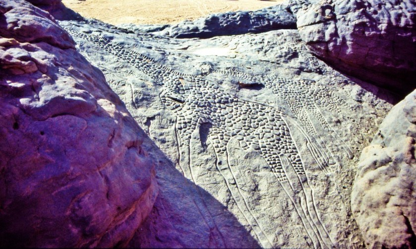
At one time, not only did the Sahara Desert have a fertile, savannah-type ecosystem, supporting a wide-and-varied wildlife population, like these life-sized giraffes carved in rock in the Sahara…
…the region now called the Sahara desert had great forests, including but not limited to, oak, elm, alder, juniper, and pine. As you can see in this picture, we are taught the desertification of this region started happening a long time ago. Maybe. Maybe not. There is so much that we have not been told about.
The silence about the history of this region of the world in the present-day is deafening.
This is a good place to bring up desertification of certain places around the world, like the Sahara Desert.
I mean, is all of the desertification around the world the result of natural processes over time? Or did something happen to cause it all of a sudden?
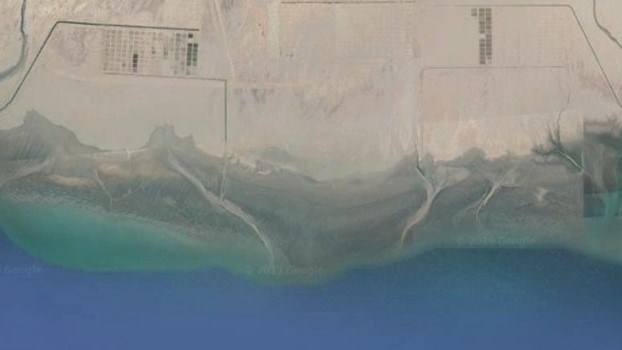
Next on the alignment from El Oued, we come to the city of Touggourt, the capital of Algeria’s Touggourt Province, and a former Sultanate.
The Sultanate was abolished by French colonial authorities in Algeria in 1854, and after about a 50-year period of time, it became an autonomous administrative district in what was called the Southern Territories of Algeria.
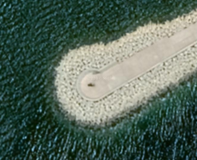
Touggourt is situated next to an extensive system of oases which supports palm plantations and other agriculture in a 31-mile, or 50-kilometer, north to south area. Here is a close-up of place with some kind of agriculture…and where you can see what appears to be what used to be infrastructure in the surrounding desert.
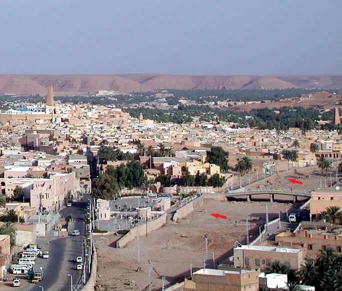
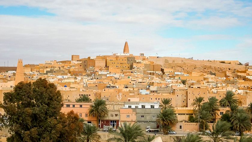
The next place on the alignment is Ghardaia, the capital of Algeria’s Ghardaia Province.
It lies along the west bank of the Wadi Mzab, described as a dry riverbed.
I couldn’t find a picture of the mostly underground Wadi Igharghar back in the Grand Erg Oriental, but it is not hard to find pictures of the Wadi Mzab…showing masonry banks.
The Wadi M’zab Valley in Ghardaia Province has been a UNESCO World Heritage Site since 1982.
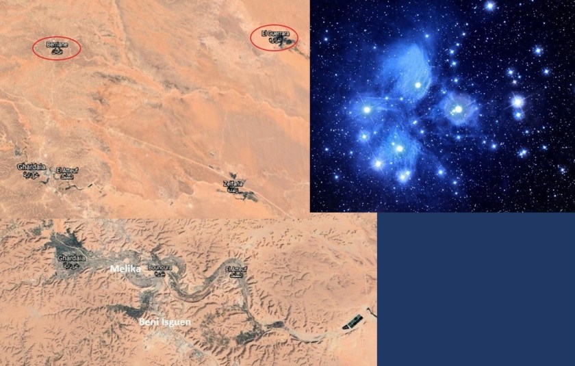
The cities of the Wadi M’zad Valley are seven in number, with five built close together, and two lie further out.
Ghardaia is upstream of the other four cities that form what is called the “pentapole,” and is the commercial capital of the Mzab…
…with its dominating mosque…
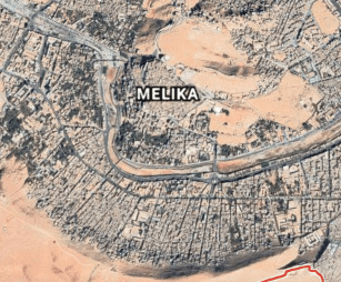
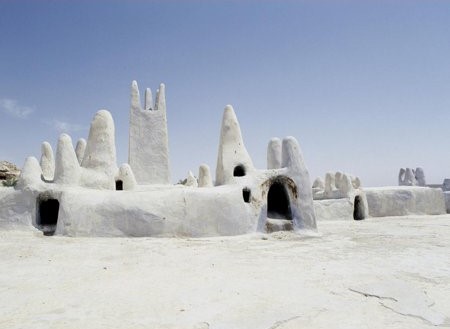
…then next downstream comes Melika…
…with its unique-looking Sheikh Sidi Aissa Cemetery…
…then we come to Beni Isguen…
…the most traditional city of the Mzab Valley, and in which any visitor must be accompanied by an authorized guide or member of the community…
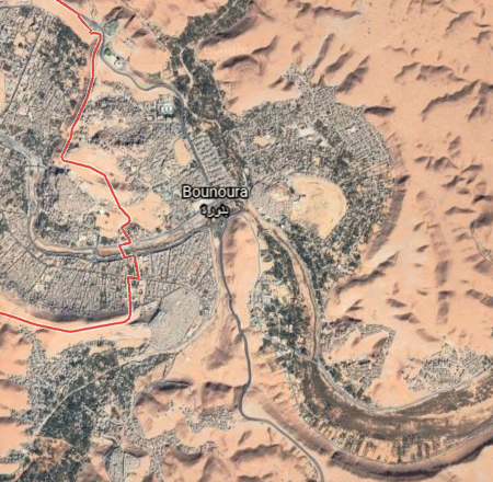
…next we come to Bounoura…
…meaning “the Luminous…”
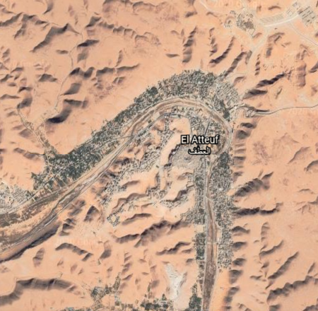
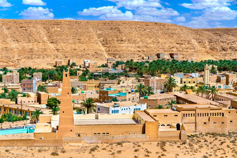
…and El Atteuf…
…which means “The Turn…”
…and all five are close together on the snaky, S-shaped river bends of the Wadi Mzad.
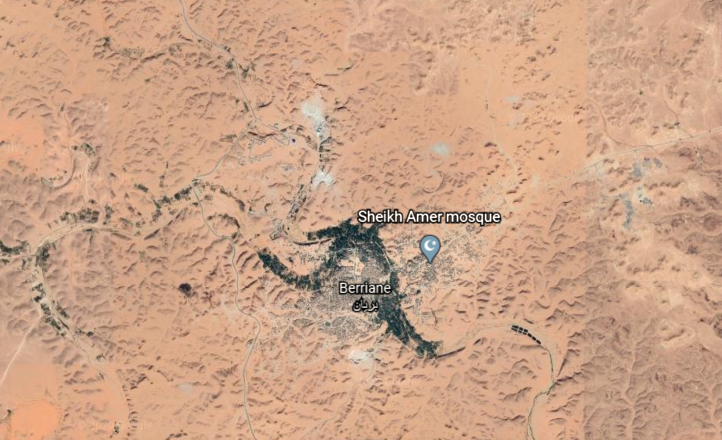
The other two cities of that constitute the seven cities are:
…Berriane, located on National Road 01, one of the country’s important highways…
…and El Guerrara, on the passageway for caravans crossing the Sahara, from east-to-west, and north-to-south…
…and are located further out from the other five.
Taking a look at the Pleiades, I don’t think it is a stretch to say that the seven cities of the UNESCO World Heritage Site of the Wadi M’zad Valley form a star map of the Pleiades, also known as the Seven Sisters.
Before I leave Algeria, and head into Mauretania, there is one more place I would like to bring to your attention.
You can easily find this information if you look for it, as it is not hidden from us like so much else, but most people don’t know about it.
While Reggane is not directly on the alignment I am tracking, it is relatively close to it.
Reggane is the capital of Algeria ‘s Adrar Province.
France began its nuclear testing program in Reggane in 1960 – 1961, before Algeria’s independence.
They conducted four atmospheric nuclear tests, which contaminated the Sahara Desert with plutonium, negatively impacting those who live here to this day – not only Reggane, but far beyond.
Between 1960 and 1966, a total of 17 nuclear tests were conducted in the Reggane District of Algeria. It was called Africa’s Hiroshima.
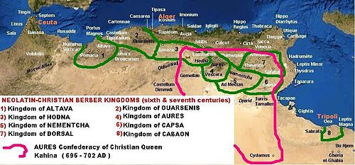
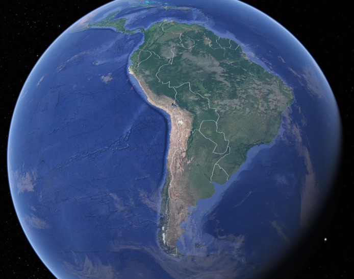
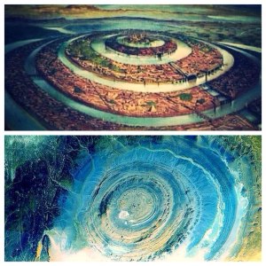
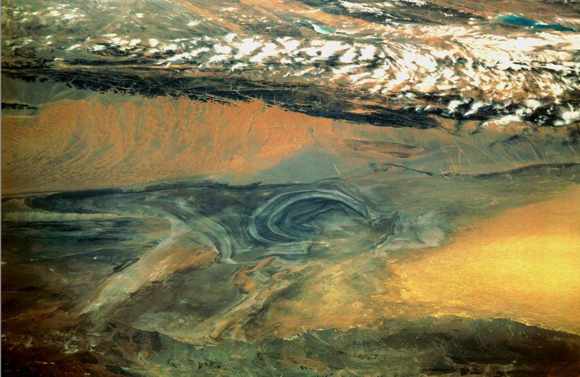
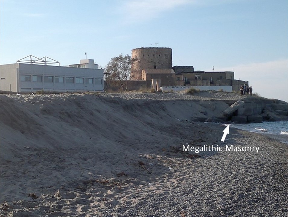
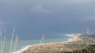
The last place I am going to highlight on the alignment in this post is the Eye of the Sahara, which is near Ouadane in central Mauretania.
It is visible from space, and has been used by NASA astronauts as a visual landmark.
The Blue Eye of the Sahara, also known as the Richat Structure, is described as a geological formation in the Sahara Desert that resembles an enormous bulls-eye.
It is highly symmetrical, and measures 25-miles, or 40-kilometers in diameter.
Three nested rings dip outwards from the center of the structure, and are all equidistant from the center.
Some have speculated that this configuration matches that of Atlantis as described by Plato.
If it is a man-made structure, and not natural as many want us to believe, why does it look melted?
It resembles Lop Nur, an ancient salt lake in the Takla Maklan Desert in the Southeastern portion of the Uighur Autonomous Region of Xinjiang in China…
…and the location where the Chinese Nuclear Weapons Test Base had four nuclear testing zones, starting in 1959 – with H-Bomb detonation in 1967 – until 1996, with 45 nuclear tests conducted.
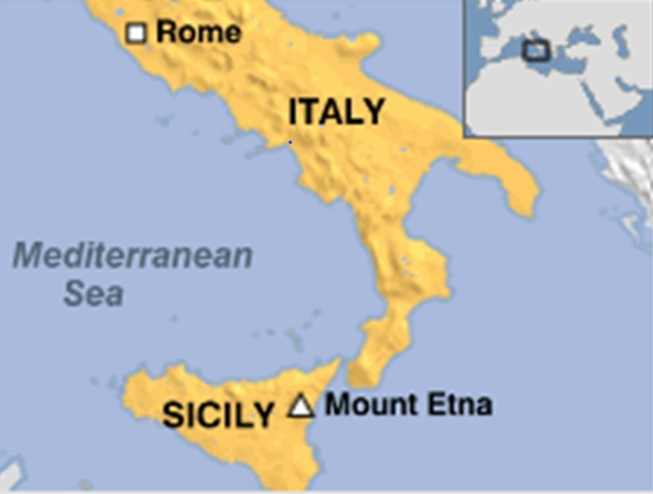
In the last post, I took a close look at the Strait of Messina, particularly the narrowest point between the eastern tip of Sicily, and the western tip of Calabria in Italy; the city of Messina, a major port andthe third-largest city in Sicily; then across to Mount Etna, one of the most active volcanos in the world; and ended at Catania, a city on the Sicilian coast that lies at the foot of Mount Etna.
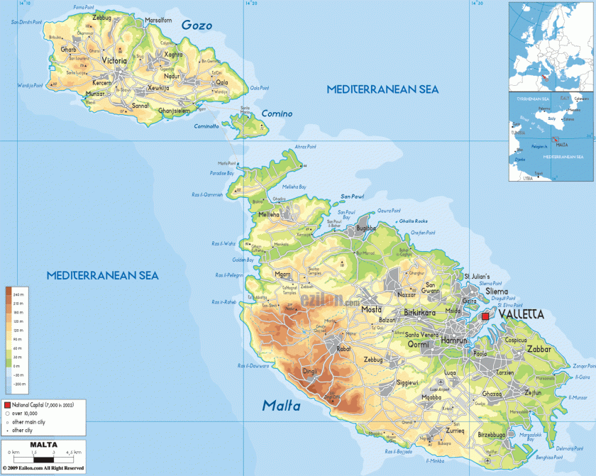
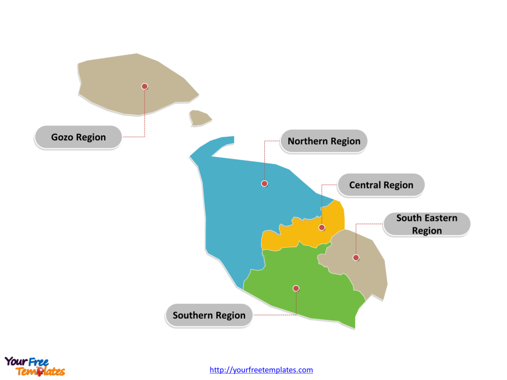
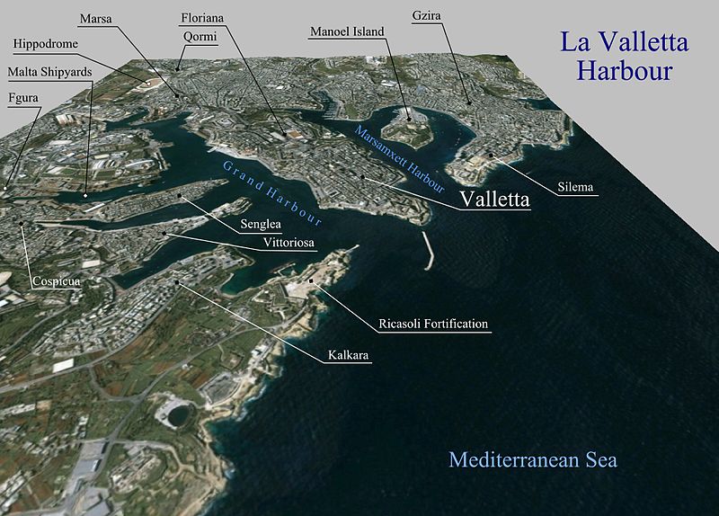
From Sicily, the alignment I am tracking crosses over the island Republic of Malta, in the vicinity of its capital, Valletta…
…and located in the Southeastern Region of the main island…
… one of the five regions of Malta…
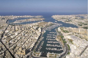
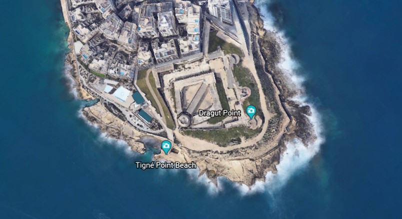
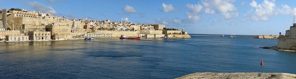
…between the Marsamxett Harbort and the Grand Harbor.
Marsamxett Harbor is described as a natural harbor generally more dedicated to leisure use than the Grand Harbor…
…and is bounded to the north by Dragut Point and Tigne Point…
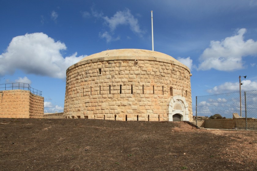
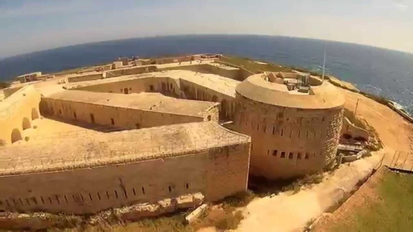
…where we find Fort Tigne…
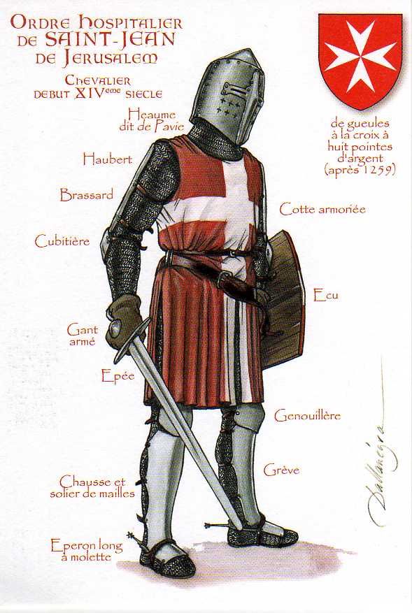
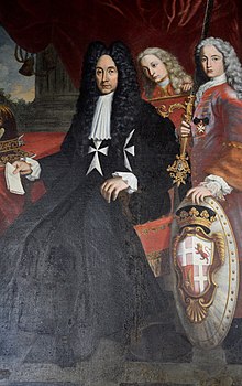
…said to have been built by the Order of the Knights Hospitallers of St. John between 1793 and 1795 and claimed to be one of the oldest polygonal forts in the world.
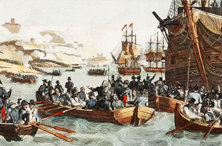
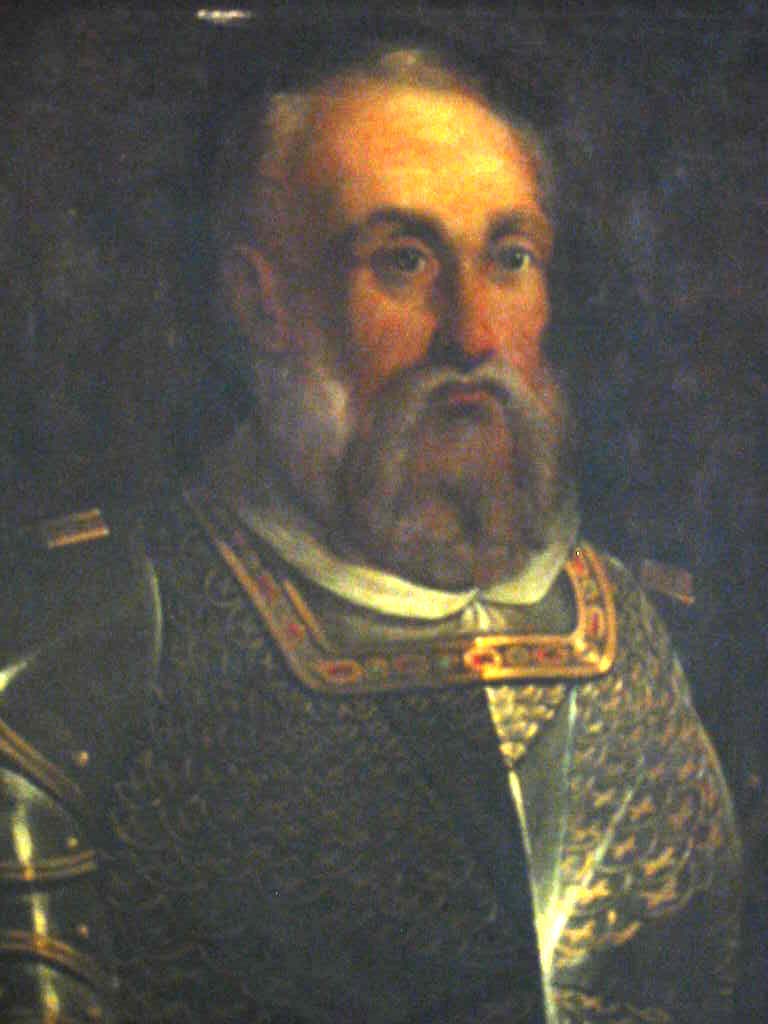
We are told the Order of the Knights Hospitallers of St. John ruled Malta from the time when the Emperor Charles V (who was also King Charles II of Sicily) gave the islands of Malta and Gozo to the Order in 1530, as well as Tripoli in Libya, until the time the Order surrendered to Napoleon when the French landed in Malta in 1798.
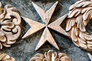
Known usually by the shorter Order of St. John, the Maltese Cross was said to have been officially adopted by the Order in 1126.
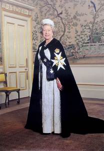
And today’s Order of St. John was chartered by Queen Victoria in 1888 as a British Royal Order of Chivalry.
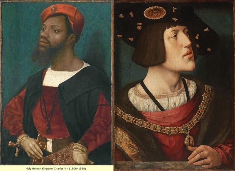
Interesting to note that I have found two different portraits of Charles V, Emperor of the Holy Roman Empire between 1500 and 1558, each having similar facial structure and tilts of the chin, and wearing similar clothing.
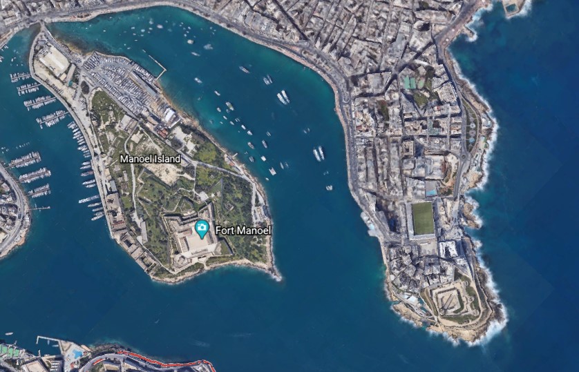
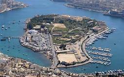
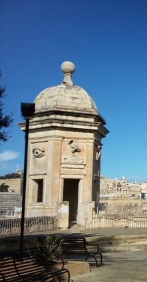
Manoel Island is a small island in Marsamxett Harbor, situated close to Tigne Point…
…and the location of Fort Manoel…
…said to have been built in the 1720s by the Portuguese 66th-Grand Master of the Knights of Malta, Antonio Manoel de Vilhena.
We are told the British military took over the fort in 1800, and renamed it HMS Phoenicia, who used it until 1964…relatively recently.
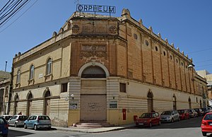
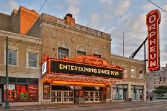
Manoel Island is connected to the town of Gzira, in Malta’s Central Region, by a bridge…
…where we find an Orpheum Theater, said to have been built in 1932.
There are two points I would like to make about this finding.
This is the first point.
Orpheus was a musician and poet in Ancient Greek legend, said to have had the ability to charm all living things, and even stones, with his music.
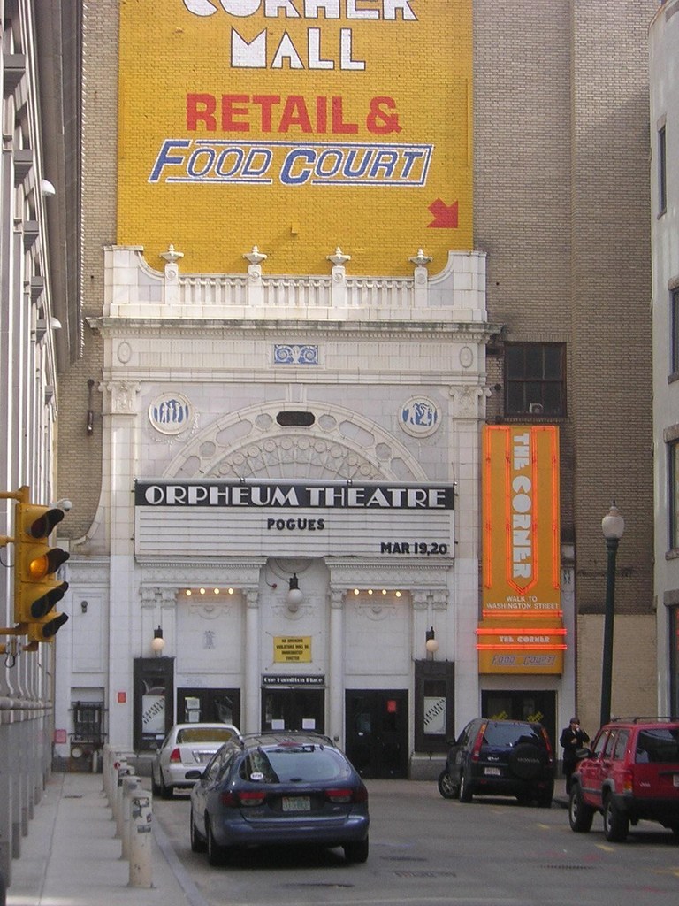
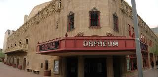
In the course of my research, I found numerous early theaters called “Orpheums,” like the one in Gzira in Malta, including the Orpheum Theater in Los Angeles, California…
…the Orpheum Theater in Boston, Massachusetts…
…in Memphis, Tennessee…
…and in Phoenix, Arizona.
What, exactly, caused us to go to sleep, and forget who we are, and what we were? How has the false information we have been taught in school been reinforced?
Why would this be important to whoever was responsible for removing the ancient advanced civilization from our collective awareness to begin with?
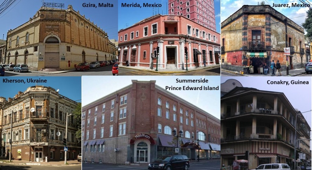
The second point that I would like to make about the Orpheum Theater in Gzira is its street-corner style of architecture…that I have found worldwide, like in Merida, Mexico in the top middle; Juarez, Mexico, on the top right; and on the bottom left, in Kherson, Ukraine; bottom middle, Summerside in Prince Edward Island; and on the bottom right, in Conakry, the capital of the African country of Guinea.
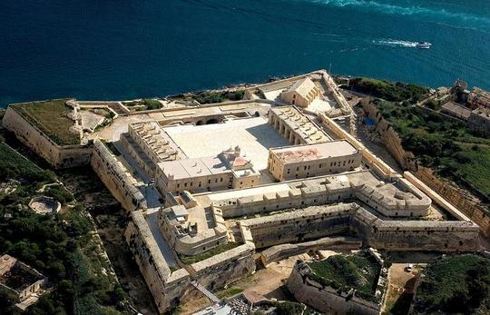
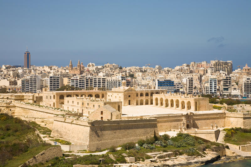
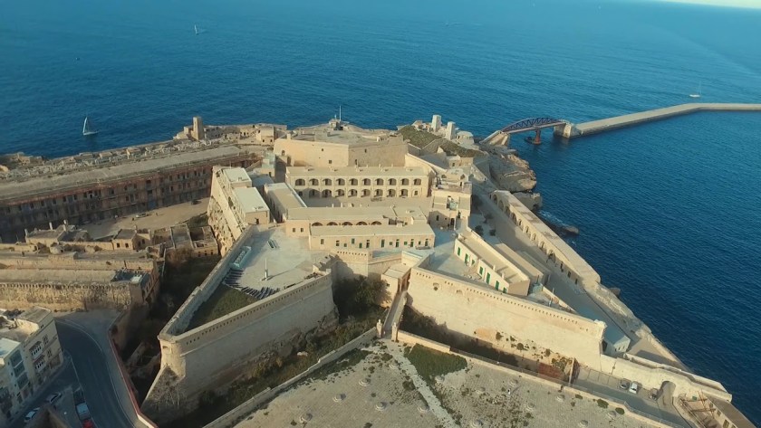
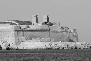
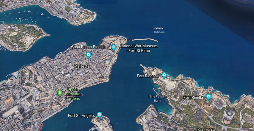
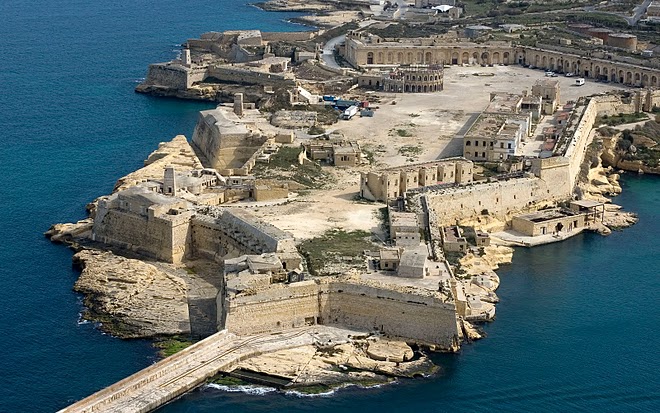
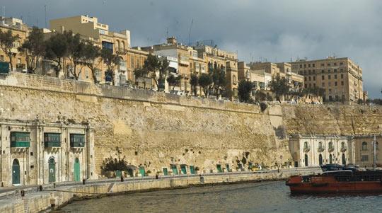
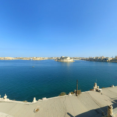
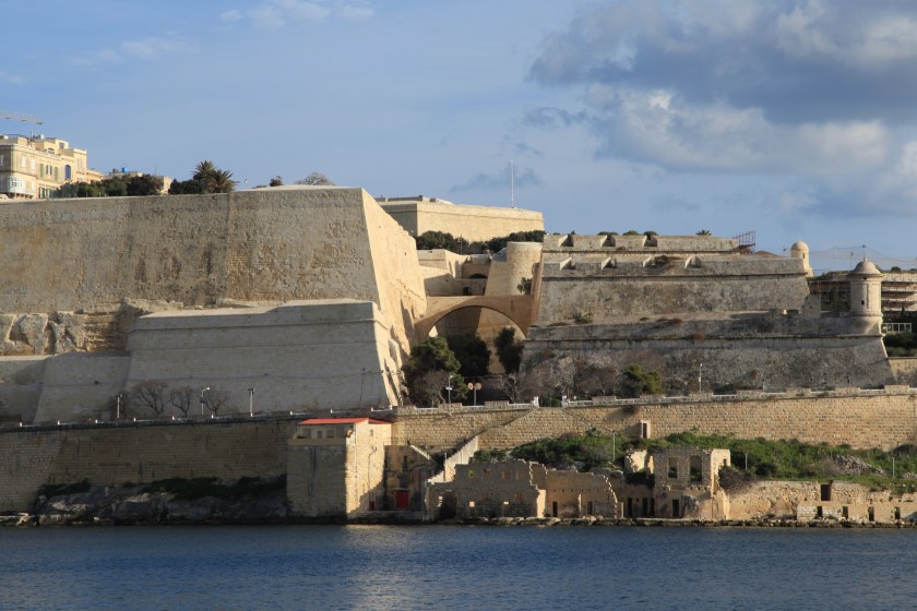
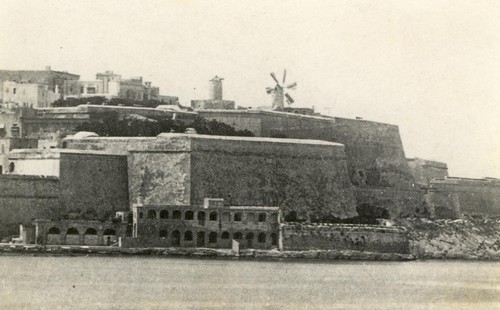
Fort St. Elmo stands on the seaward shore of the peninsula that divides Marsamxett Harbor from the Grand Harbor…
…and said to have been built in its present form as a star fort in the 1550s.
It was the target of aerial bombardment on the first day Malta became involved in the conflict of World War II.
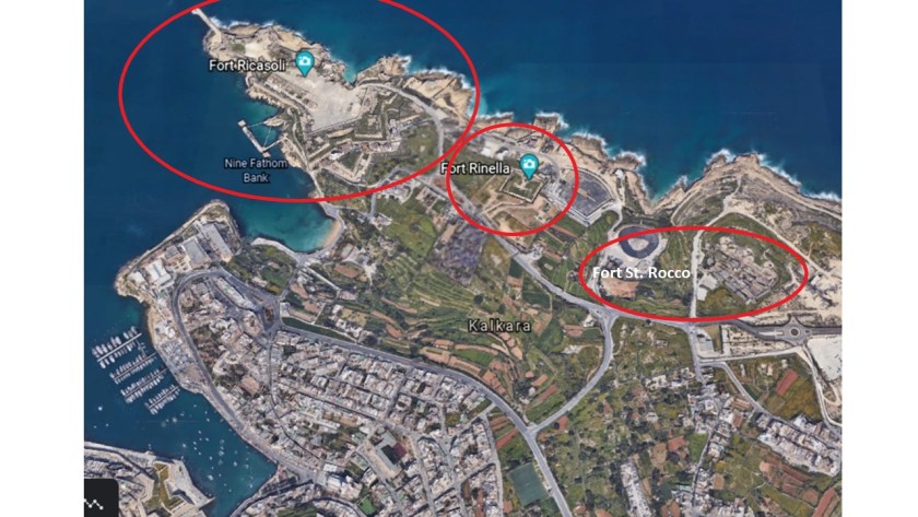
Fort St. Elmo is situated in the middle at the entrance to the two main harbors, between Fort Tigne at the entrance to the Marsamxett Harbor, and Fort Ricasoli at the entrance of the Grand Harbor.
Fort Ricasoli was said to have been built by the Order of St. John between 1670 and 1698.
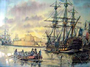
Fort Ricasoli was said to have seen use during the French invasion of Malta, led by Napoleon himself, in 1798, which was part of the Mediterranean Campaign in the War of the Second Coalition of the French Revolutionary Wars.
After the British Royal Navy destroyed the French Mediterranean fleet at the Battle of the Nile on August 1st, 1798, the British were able to initiate a blockade of Malta, assisted by an uprising of the native Maltese against French rule. The blockade effectively ended the French Occupation of Malta in 1800, and replaced it with British Protectorate, returning control of the central Mediterranean to Great Britain.
Malta held the status of British Protectorate for 164-years, until it gained its independence from Britain in 1964.
Though Fort Ricasoli, like Fort St. Elmo, was bombarded during World War II and parts of it destroyed, today the fort remains largely intact.
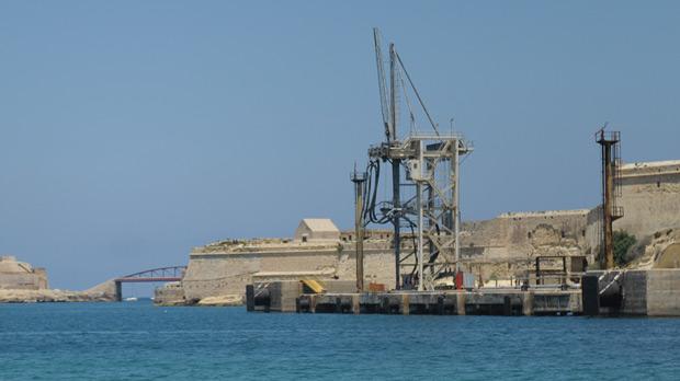
It is used as a filming location…and tank-cleaning facility for the Malta Drydocks, treating liquid waste from ships arriving in the Grand Harbor, removing oil and other chemicals prior to releasing the waste into the sea.
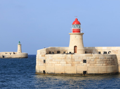
These are the pair of lighthouses, one at Fort St. Elmo and the other at Fort Ricasoli, located on man-made breakwaters at the entrance to the Grand Harbor.
The Maltese language is spoken in the islands, in addition to English and Italian.
Maltese is related to Arabic, but written in the Latin alphabet.
The Maltese word for a lighthouse is “fanal.”
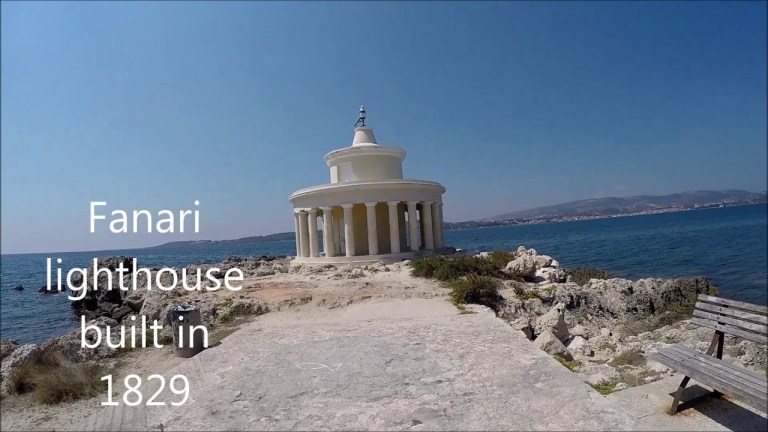
Back on Kefalonia in the Ionian Islands of western Greece, I found a lighthouse at a place called “Fanari Point.”
I looked up the Arabic word for lighthouse, and apparently it is al-Manarah, similar in sound to Fanari, as well as the same word for minaret in Arabic.
There are two more forts along the shore of the Mediterranean Sea next to Fort Ricasoli.
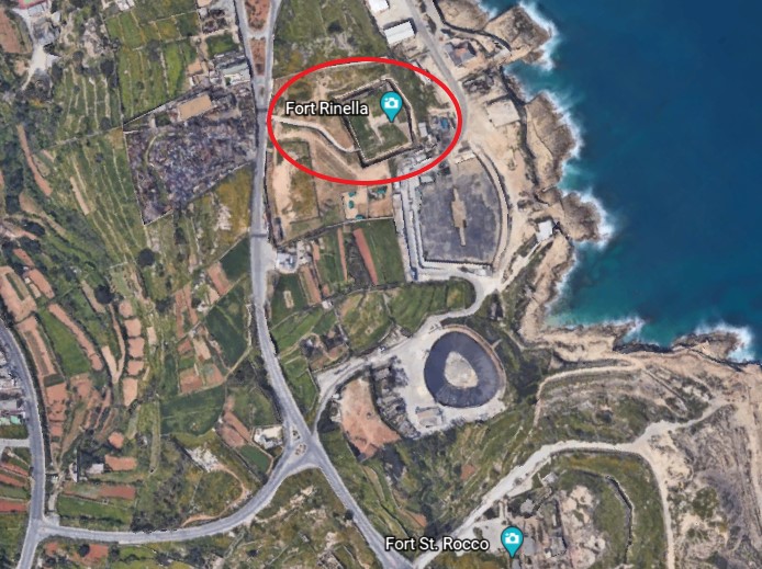
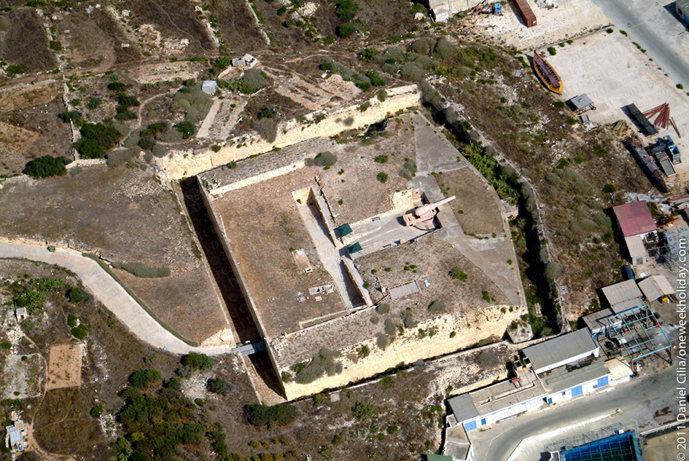
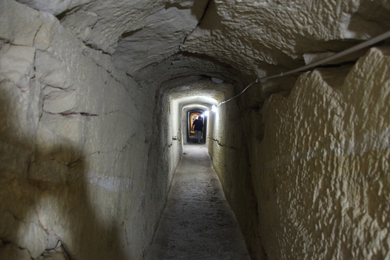
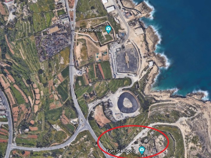
The first is Fort Rinella, described as a Victorian battery.
It was said to have been built by the British between 1878 and 1886.
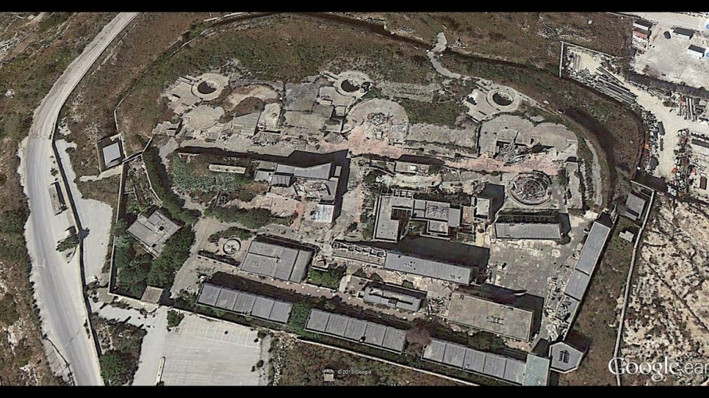
Fort St. Rocco is found just a short distance down the Mediterranean coast from Fort Rinella.
It is described as a polygonal fort, and as part of a complex of shore batteries built by the British to defend the coast east of the mouth of Grand Harbor between the 1870s and 1900.
These three forts are part of Kalkara…
…described as a village on Kalkara Creek, which is shown in this photo…
Here’s another view of Kalkara.
We are told that the name Kalkara derives from the Latin word for lime, “Calce,” and that the village developed as a small fishing community around the sheltered inlet of Kalkara Creek.
Some historians believe, we are told, this was one of the first places in Malta to be inhabited by people who came from the nearby island of Sicily.
I can make, at the very least, a circumstantial case here.
I did not include it in the last post, but I read information saying that Catania in Sicily…
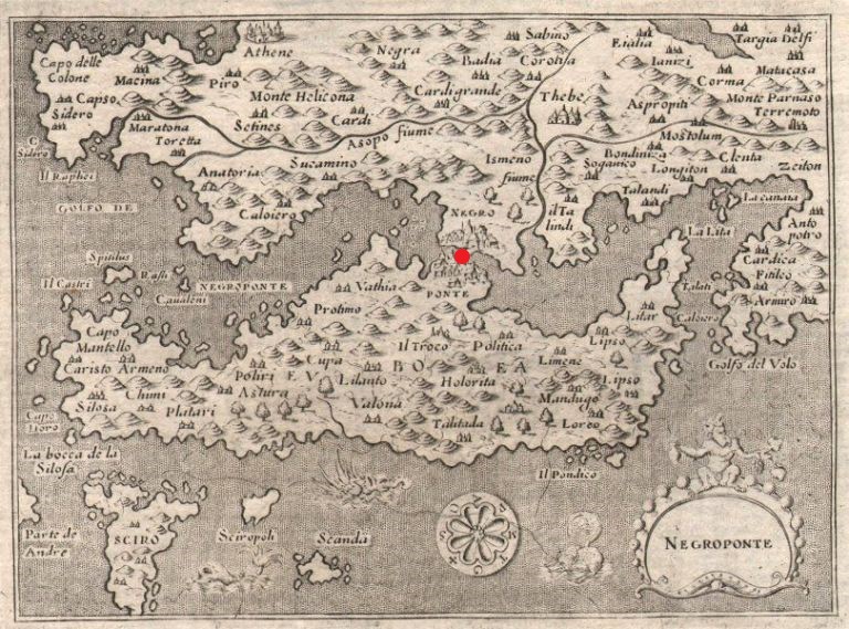
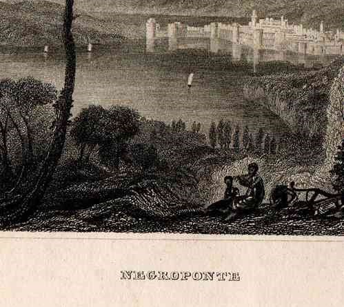
…was a colony of Chalchis, and could also be spelled as Kalkis, an ancient city on the Greek Island of Euboea in the Aegean Sea.
At one time, the island of Euboea was known by another name…Negroponte, and I marked the location of Chalchis on what we are told was a 1620 map.
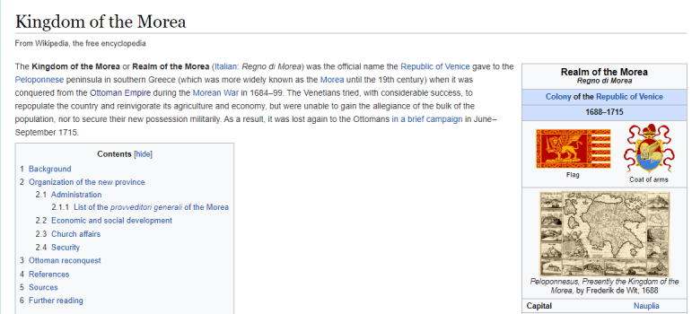
…and part of what was known as the Kingdom, or Realm, of the Morea, which was the official name of the Peloponnese Peninsula of southern Greece…until the 19th-century.
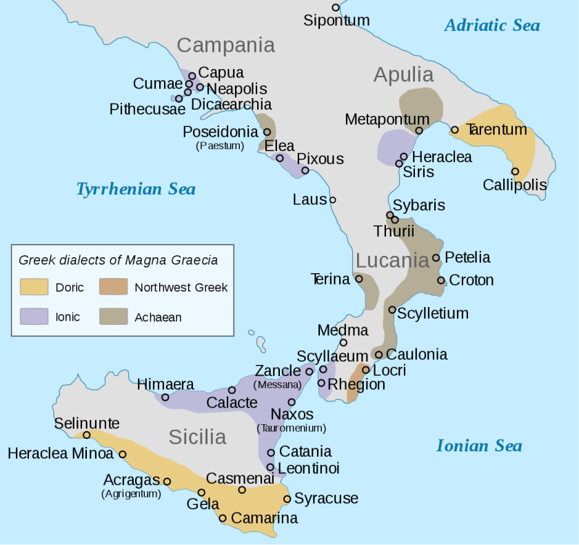
Not only that, we are told the Romans referred to the coastal areas of southern Italy and Sicily as Magna Graecia, or “Great Greece” because these regions were extensively populated by what were called Greek settlers, starting in the 8th-century BC…
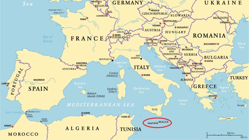
…and Malta lies between Sicily and the country of Tunisia in North Africa.
All of these places are relatively close to each other.
How big of a stretch is to see all of these places connected to the same ancient advanced civilization, other than we haven’t been taught about it?
Places and names have been changed and obscured instead of being taught about it. Why?
Let’s see what other secrets Malta has to reveal!
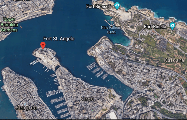
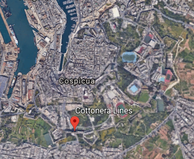
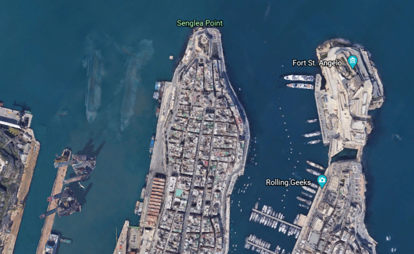
Moving from a short distance west from Kalkara, we come to Birgu, also known as the “Victorious City”…
…and described as the oldest of an area in Malta referred to as “The Three Cities” – three fortified cities in very close proximity to each other, which also includes Senglea and Cospicua.
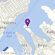
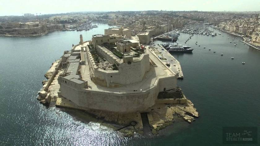
The city occupies a promonory of land in the Grand Harbor, with Fort Saint Angelo at the head…
…and the city of Cospicua at the base.
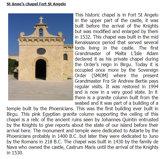
Fort San Angelo served as the base of the Order of St. John, and we are told the de facto capital of Malta between 1530 and 1571…
…and the British garrisoned the fort between 1800 and 1979.
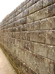
We are told the date of its original construction is unknown, but has large ashlar blocks, the finest stonemasonry unit…
…and an Egyptian pink granite column at the top of the fort inside a chapel.
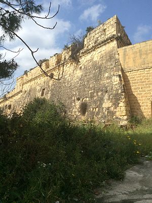
Fort San Salvatore is also in Birgu…
…said to have been built in 1724 on one of the bastions of the Cottonera Lines.
It was said to have been used as a Prisoner-of-War Camp during the Greek War of Independence between 1821 and 1830, as well as during World War I; and during World War II, as a kerosene depot and internment camp, which were used to imprison large groups of people, without charges, or the intent to file charges.
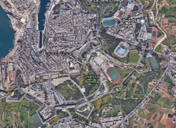
The Cottonera Lines were said to be a line of what are called fortifications in Conspicua and Birgu that were constructed in the 17th- and 18th-centuries to form the outer defenses of the Three Cities…
…and built around an earlier line of fortifications known as the Santa Margherita Lines.
Before leaving Birgu for the neighboring city of Senglea, I would like to point a place that caught my attention on Google Earth.
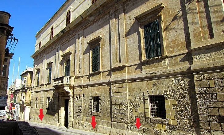
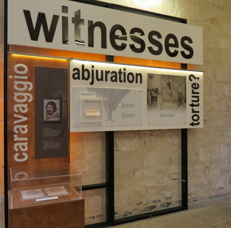
I noticed the Inquisitor’s Palace, and as it turns out, this was the seat of the Inquisition in Malta between 1574 and 1798, which was the first year Napoleon’s forces occupied Malta. It has been the National Museum of Ethnography since 1966, with permanent displays on Malta’s religious traditions as consolidated by the Inquisition.
The arrows are pointing to the building’s windows that are not level with the steep street beside it, which is a classic indicator for mud flood evidence.
The Inquisitor’s Palace was said to have been originally constructed as a courthouse in the 1530s.
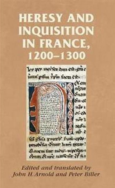
The Inquisition was a group of institutions within the Catholic Church with a stated aim of combating heresy, defined as the formal denial of the orthodox beliefs of the church, which is defined as the adherence to correct or accepted creeds in religion.
It started with the French Inquisition in the 1200s in France, which over a period of about 20-years saw the Cathar Crusade and the genocide of the gnostic Cathars, which had been labelled as an heretical sect.
The Inquisitor’s Palace became the headquarters of the Inquisition in Malta in 1574, serving as tribunal and prison, as well as the palace of the Inquisitor.
So we are taught that all of this is normal and matter of fact in history in school, like there is nothing out of the ordinary or wrong about the Inquisition…which was, by its very nature, violating basic Human Rights and dignity, including torture in the name of Christianity just for having dissenting views?
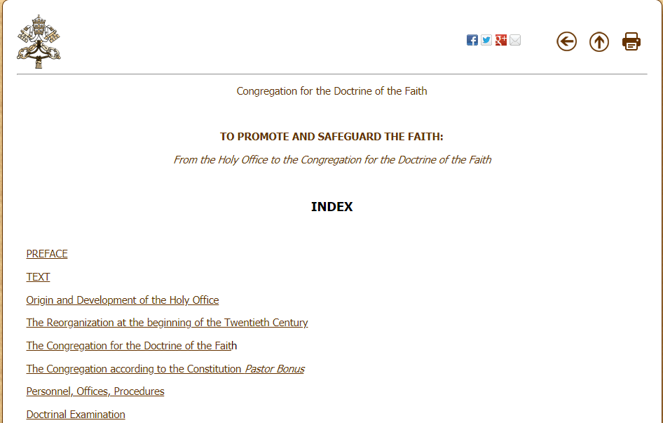
And the Office of the Inquisition it is still in existence to this day?
Only it is now called the “Congregation for the Doctrine of the Faith.”
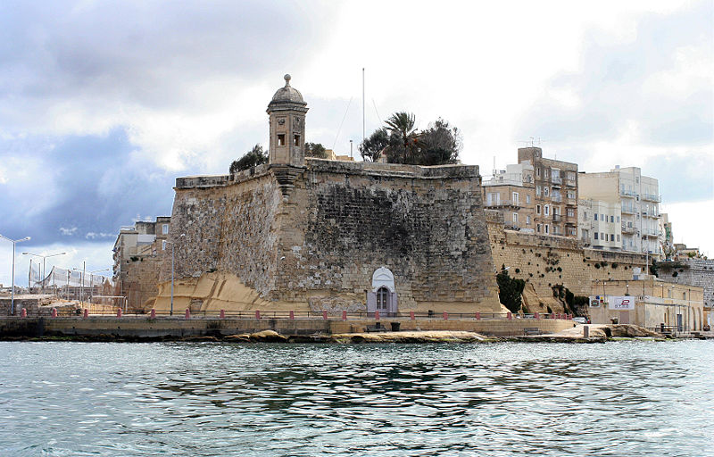
The city of Senglea is a fortified city as well, we are told, and is also known as the “Civitas Invicta” or “Unconquered City.”
We are told there weren’t any buildings here until 1311, at which time St. Julian’s Church, or Chapel, was built, said to have been the first building constructed on what later became Senglea.
Then in 1552, we are told, the foundation stone was laid for Fort St. Michael, and its construction was said to have been completed in 1553.
Then construction of the walled town of what at the time was known as St. Julian’s Island in the decade following the completion of Fort St. Michael, subsequently became known as Senglea…
…in honor of the Grand Master Claude de la Sengle, of the Order of Malta, for giving St. Julian’s Island its city status.
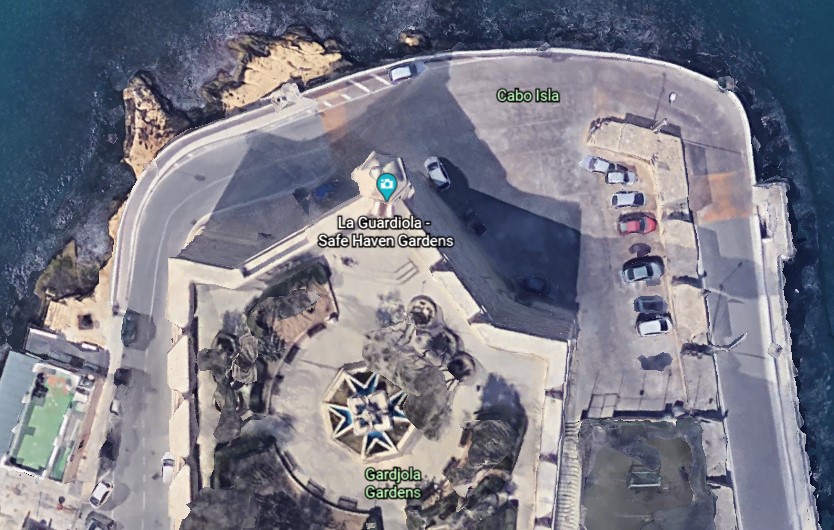
The Gardjola Gardens are located within the bastions of Fort St. Michael, also credited to Claude de la Sengle…
…and named for what is called the “Guard Tower” – “Il-Gardjola” – which has various symbols sculpted on it, such as an eye, ear, and crane bird, said to represent guardianship and observance protecting Maltese shores.
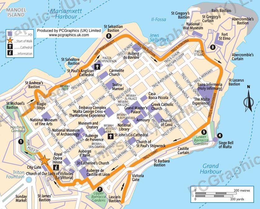
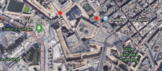
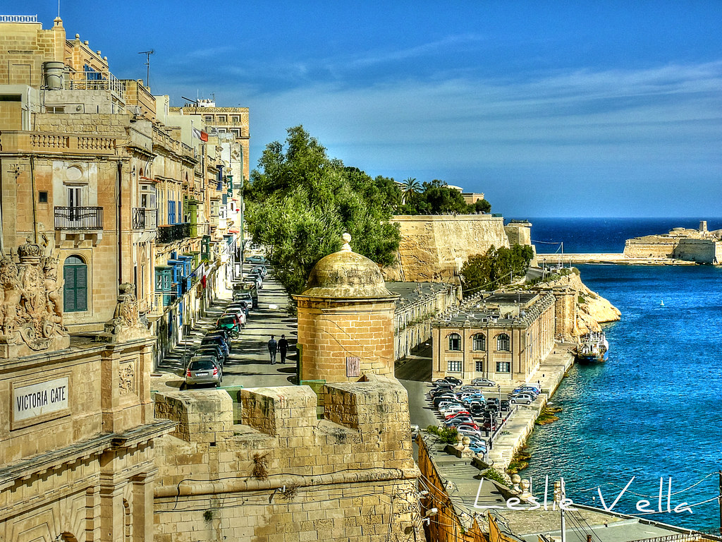
Now I am going to start a walking tour around the walls of Valletta…
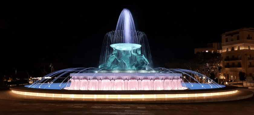
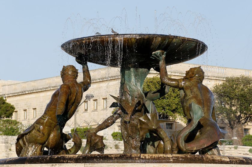
…starting at the Triton Fountain, just outside the main City Gate of Valletta.
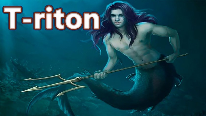
What exactly is a Triton?
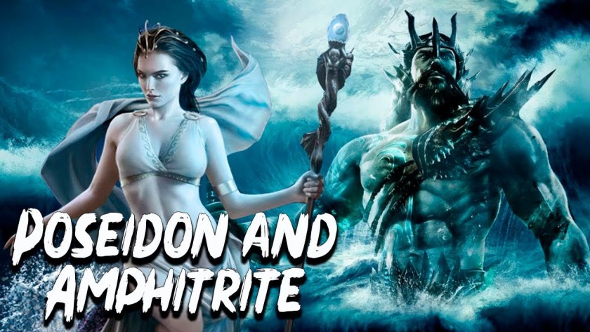
For one, in mythology, Triton was the son of Poseidon, the god of the sea, and Amphitrite, a sea goddess and Queen of the Sea.
Triton’s lower-half was that of a fish, and his top-half was that of a human.
We are told that at some time during the Greek and Roman eras, triton became a generic term for a mer-person in art and literature.
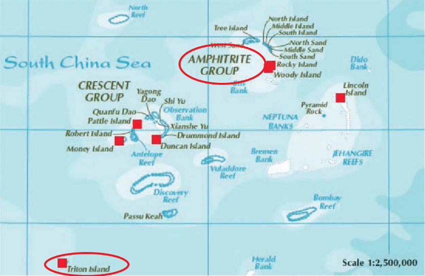
So some connections of interest to me from what I have found in my own research are, first, that in the Paracel Islands in the South China Sea, between the Philippines and south China’s Island of Hainan, we find an Amphitrite Group and a Triton Island…
…and that Poseidon’s Golden Palace was said to have been at Aegae, on the large Greek island of Euboea in the Aegean Sea, mentioned previously in this post in relationship to the city of Kalkala on the other side of the Grand Harbor from Valletta.
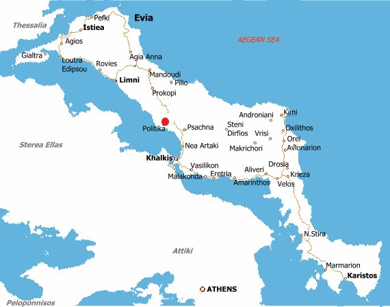
Aegae was said to be located on the west coast of Euboea, north of Chalcis, and said to have been located near the modern town of Politika Kafkala…
…under the sea.
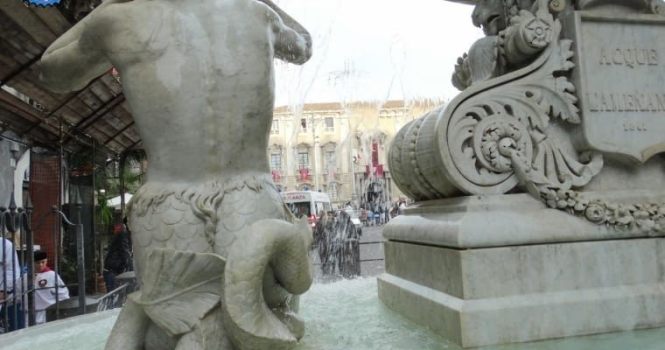
And there were sculptures of tritons, or mer-people, in the Amenano Fountain back in Catania in Sicily from the last post.
What is the meaning of the tritons?
Could they really have existed at one time?
How are they connected to these places?
Perhaps they still exist today as mer-people, who remain mostly hidden away, and were not mythical as we are taught to believe.
The Triton Fountain is located in front of the main city gate of Valletta.
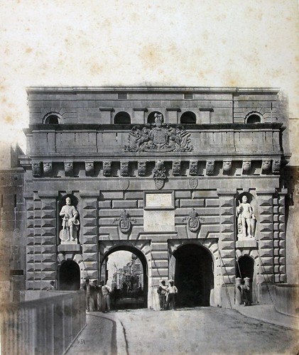
This was the main city gate of Valletta, called the King’s Gate, circa 1871.
It was said to have been designed by Lt. Colonel Francis Ringler Thomson, about whom I can find no biographical information, in 1853…and this gate was demolished in 1964.
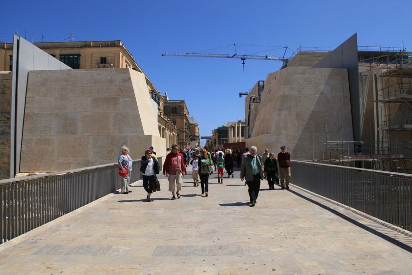
This is what we find at the main city gate today.
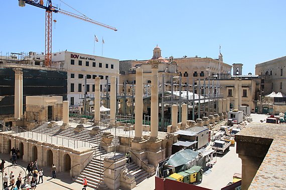
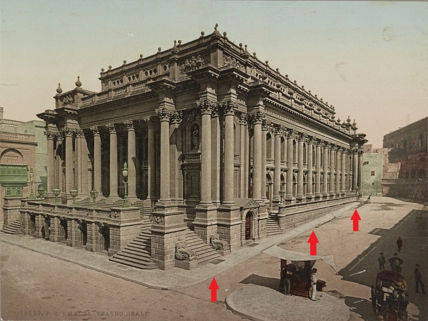
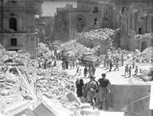
Directly upon entering Valletta, immediately to the right is what remains of the city’s Royal Opera House, though the site was developed into an open air theater which opened in August of 2013.
The Royal Opera Theater was said to have been designed by the English architect Edward Middleton Barry in 1866…
…and with windows and columns that are not level with the sloping street beside it, like what we saw back at the Inquisitor’s Palace.
Then, only 76-years later, it took a direct hit in April of 1942 from German Air Force bombers, and was almost completely destroyed.
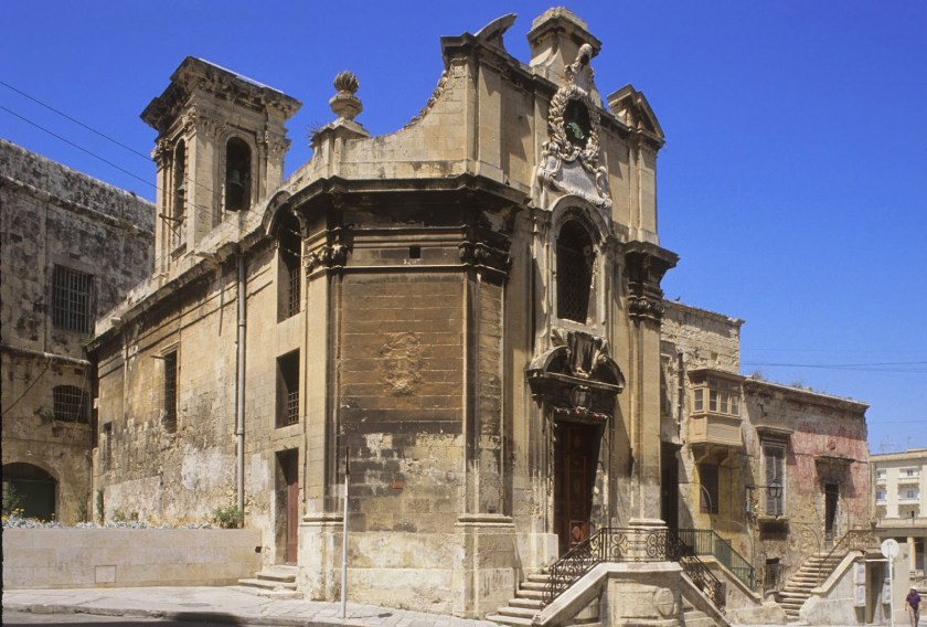
Making a right turn after entering the city through the gate, onto Pope Pius V Street, we come to the Church of Our Lady of Victories, or La Vittoria…
…said to have had its foundation stone laid in 1566, and built to commemorate the Victory of the Knights of the Order of St. John and the Maltese over Ottoman invaders in 1565.
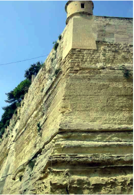
Directly across from La Vittoria Church is the St. James Bastion, where the two places dove-tail with each other in shape.
It was said to be one of the first bulwarks to be completed after the initiation of the construction of the fortified city in 1566.
The St. James Bastion forms one of the four important and massive bulwarks, and was carved largely out of bedrock.
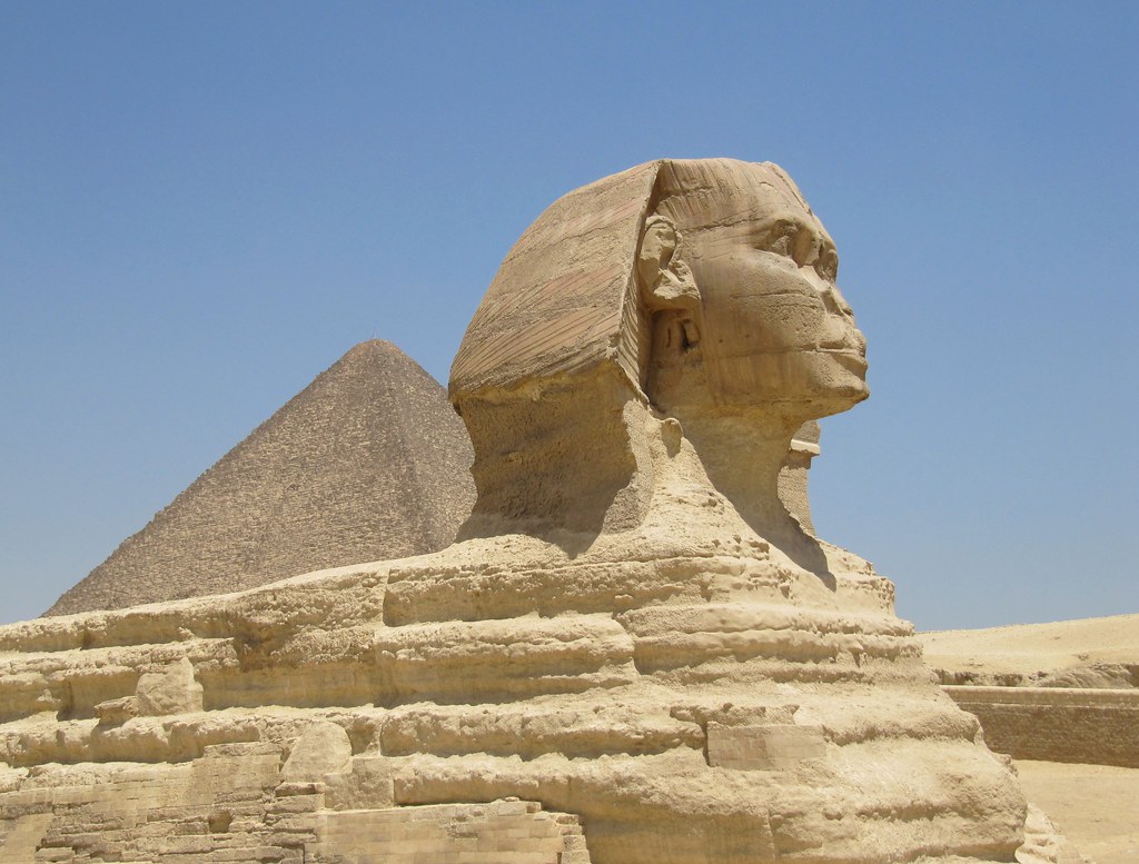
The Sphinx on the Giza Plateau of Egypt was also carved from bedrock.
The bastion is said to contain to low “batteries” in its flanks, each protected by a massive rounded orillion.
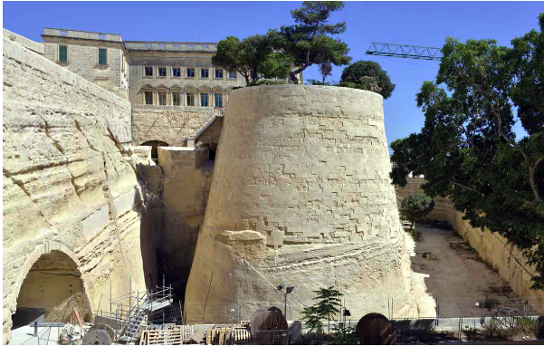
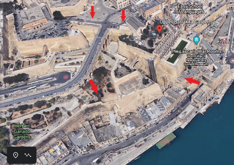
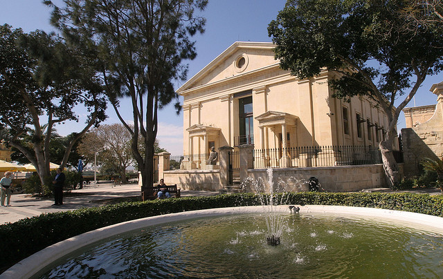
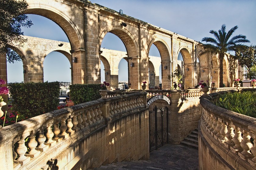
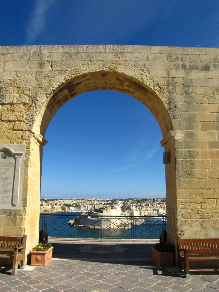
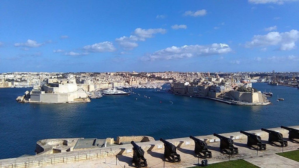
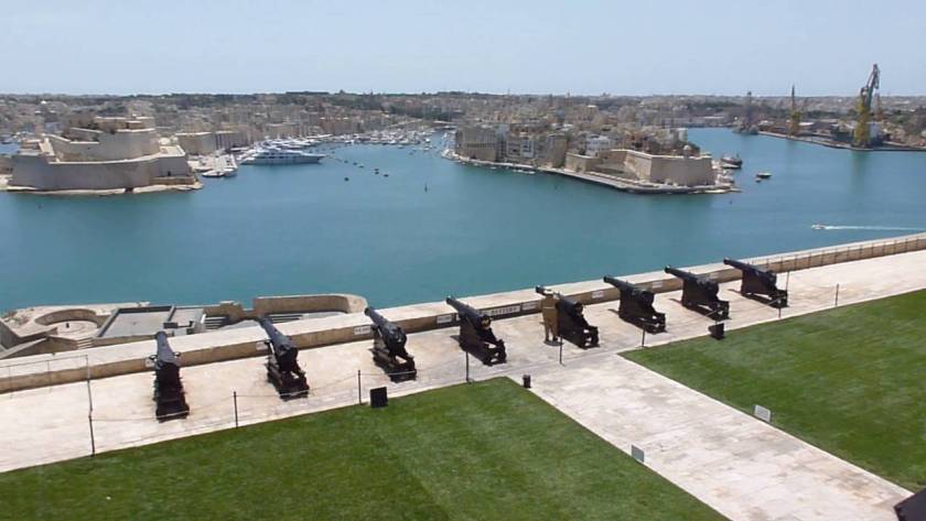
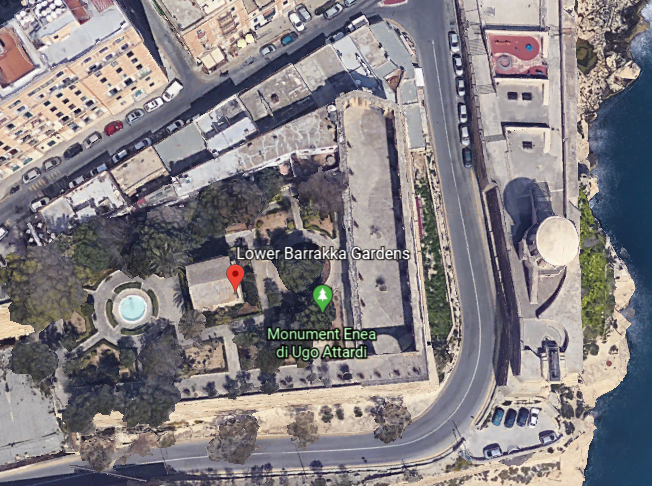
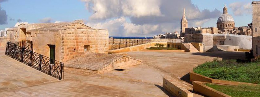
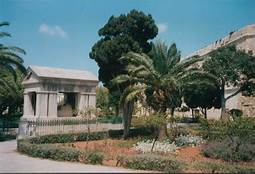
The next place we come to continuing around to the right from the main city gate are the Upper Barrakka Gardens.
Check out the height and depth of the stone work seen here!
The Upper Barrakka Gardens are located on the upper tier of the St. Peter and Paul Bastion, and are a public garden…
…offering a panoramic view of the Grand Harbor.
It is the highest point of the city walls.
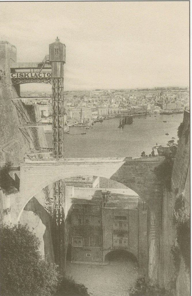
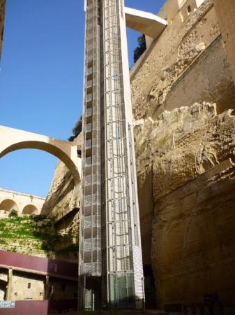
The gardens are linked to the Valletta Ditch and the nearby Lascaris Wharf by the Barrakka Lift, which was said to have first been constructed in 1905, closed in 1973, and dismantled in 1983…
…then a new lift was inaugurated in 2012.
This is the Fort Lacaris Battery, said to have been built by the British in 1854, and connected to the Peter & Paul Bastion that the Upper Barrakka Gardens are located at the top of…
…and this is a view of the Lacaris Bastion Gardjola, or Guard Tower, like what we saw earlier at Fort St. Michael in Senglea.
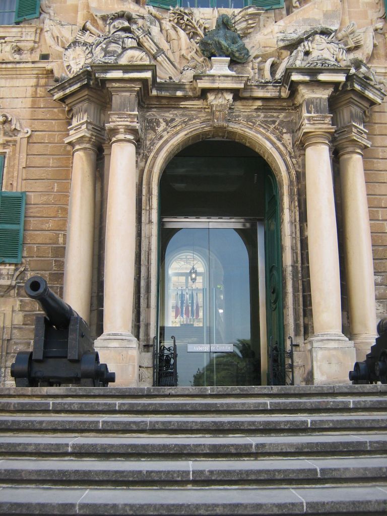
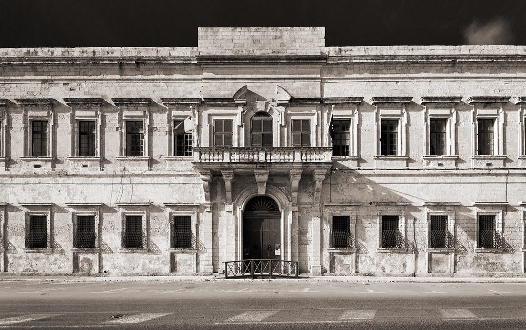
Before I move further along the city’s wall, I would like to show you the Auberge de Castille, which is directly across from the Upper Barrakka Gardens.
It was said to have been built in the 1740s on the highest point in Valletta…
…and has been the Office of the Prime Minister of Malta since 1972.
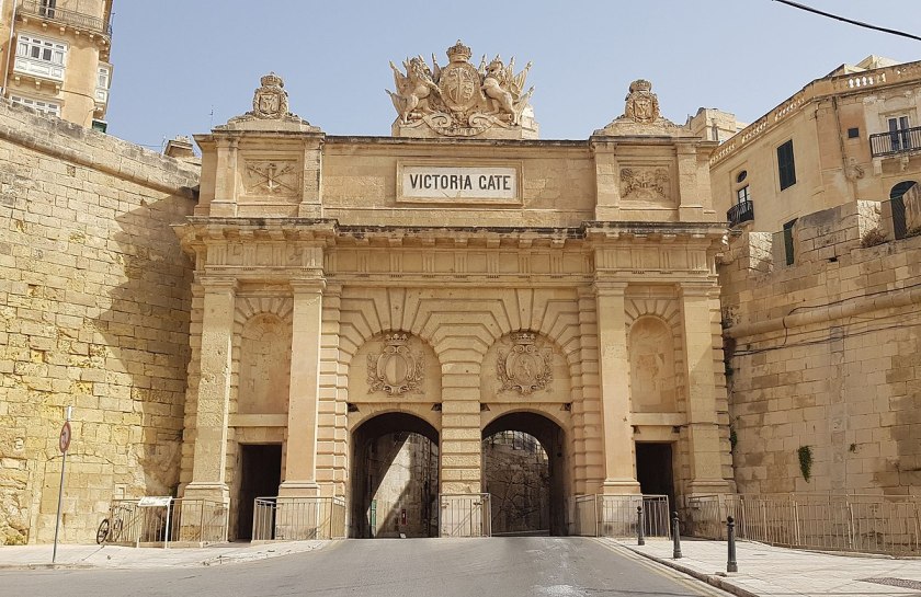
Getting back to the city’s wall, the Victoria Gate, the main entrance to the city from the Grand Harbor area, is situated next to the Lacaris Bastion.
It was said to have been built by the British in 1885, and named after Queen Victoria.
It is the only surviving gate within the fortifications of Malta, as all of the other gates, like the main city gate as I mentioned previously, were demolished between the 18th- and 19th-centuries.
The St. Barbara Bastion comes next, and is situated in the historic center of Valletta…
…and boasts of magnificent views of the Grand Harbor and the Three Cities.
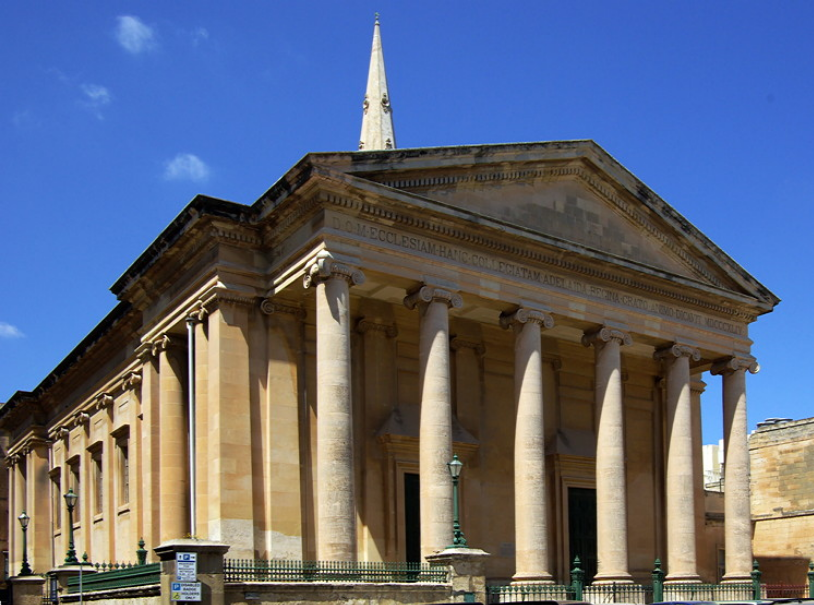
Noteworthy churches near the St. Barbara Bastion are the Church of St. Paul’s Shipwreck, said to have been completed in 1582, is directly across the street from it and said to be one of the oldest churches in Valletta.
St. Paul the Apostle is considered to be the spiritual father of the Maltese, and his shipwreck is described in the New Testament, in the Book of Acts Chapter 28, verse 1, where St. Luke wrote: “Once safely on shore, we found out the island was called Melita (Malta).”
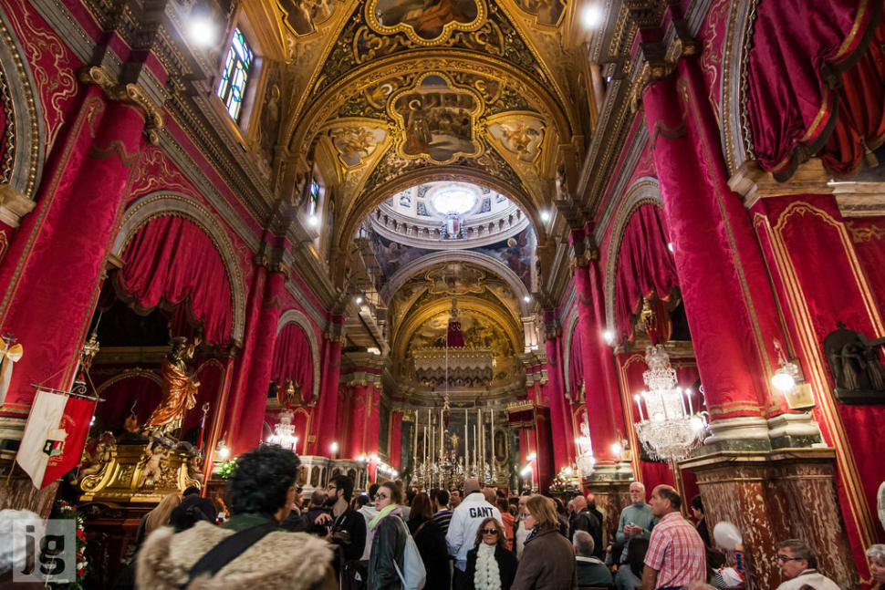
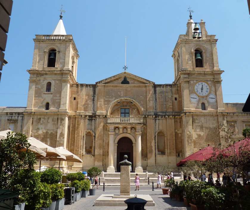
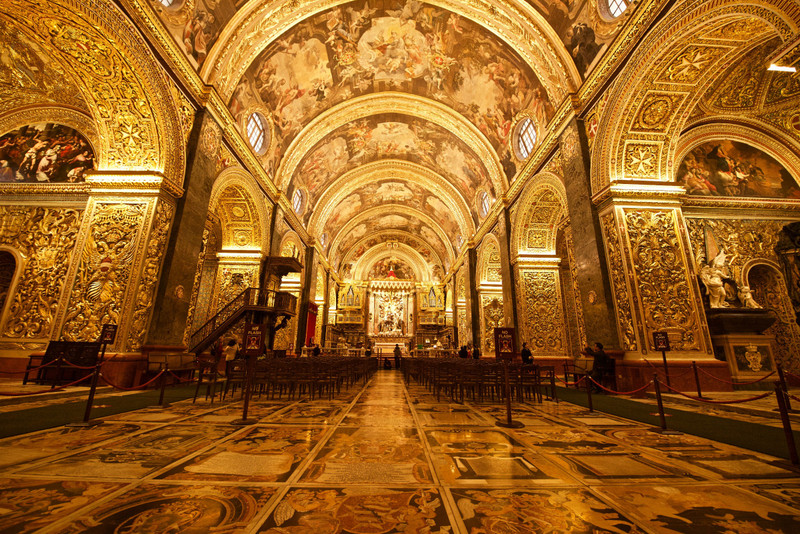
Across the street on the other side of the Church of St. Paul’s Shipwreck, we find St. John’s Co-Cathedral.
It was said to have been commissioned by the then Grand Master of the Order of St. John, Jean de la Cassiere; built by the Order between 1572 and 1577; and dedicated to St. John the Baptist.
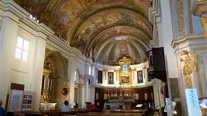
The interior of the church is considered to be one of the finest examples of high Baroque architecture in Europe.
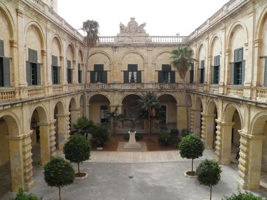
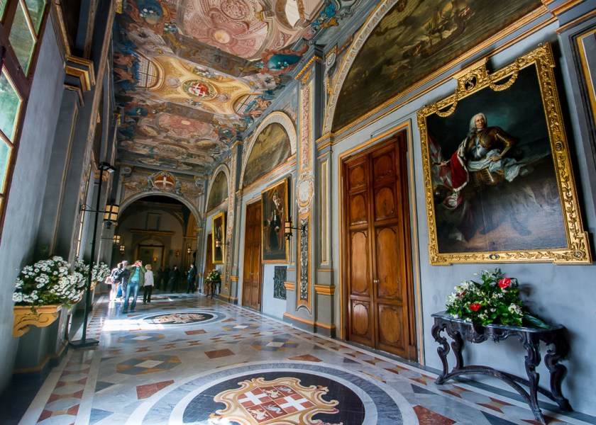
The Grand Master’s Palace in Valletta is located close to the St. John Co-Cathedral…
…and was said to have been built the 16th- and 18th-centuries for the Grand Master of the Order of St. John, who was the ruler of Malta. It currently houses the offices of the President of Malta.
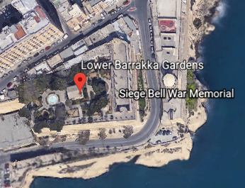
Going back to the city wall, the next place I am going to take a look at are the Lower Barrakka Gardens, which is twinned with the Upper Barrakka Gardens…
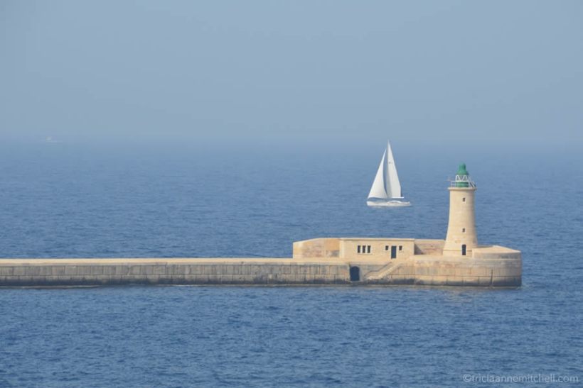
…offering a view of the Grand Harbor and its breakwater.
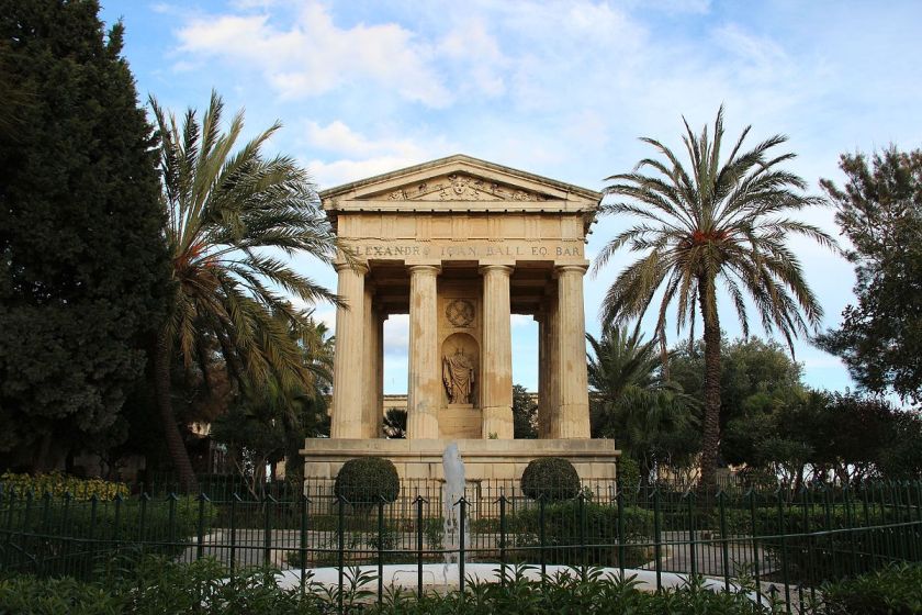
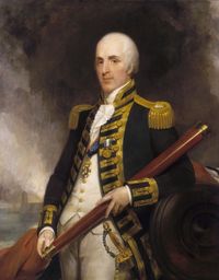
There is what is described as a neoclassical temple in the Lower Barrakka Gardens, said to have been constructed in 1810…
….as a monument to Sir Alexander Ball, a British admiral who was the first Civil Commissioner of Malta.
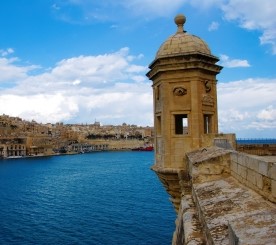
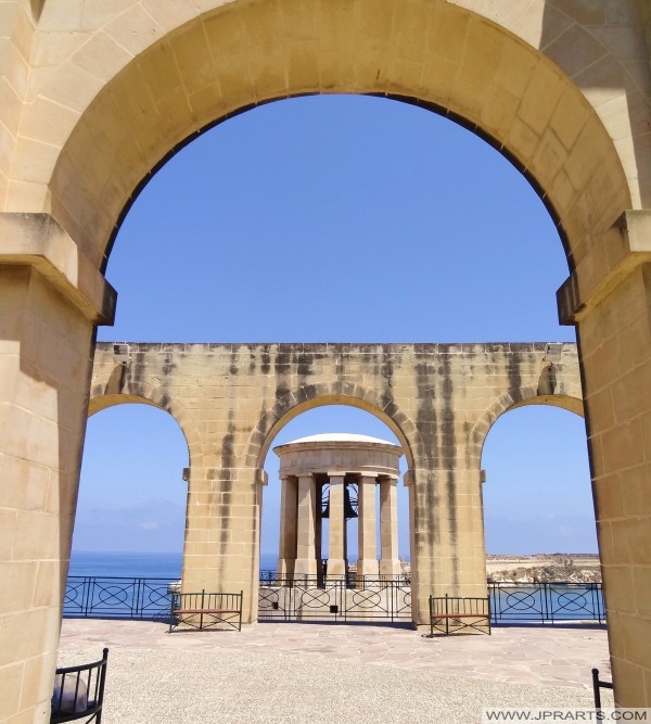
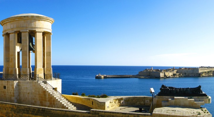
Located adjacent to the Lower Barrakka Gardens is the Siege Bell of Malta on the St. Christopher Bastion.
This is a view of the Siege Bell War Memorial from the Lower Barrakka Gardens.
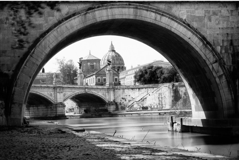
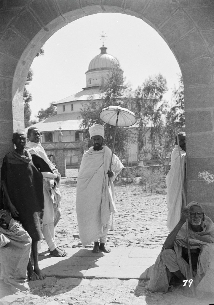
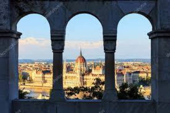
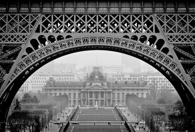
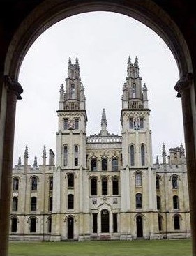
This view catches my attention because I find buildings framed perfectly by arches around the world, like this view of St. Peter’s Basilica at the Vatican…
…of the Debre Libanos Monastery in Ethiopia…
…of the Hungarian Parliament from the Fisherman’s Bastion in Budapest, Hungary…
…of the Ecole Militaire through the arches of the Eiffel Tower in Paris, France…
…and at the University of Oxford in Oxford, England.
The Siege Bell War Memorial was said to have been erected in 1992 to honor the 7,000 people who lost their lives in the World War II Siege of Malta between 1940 and 1943.
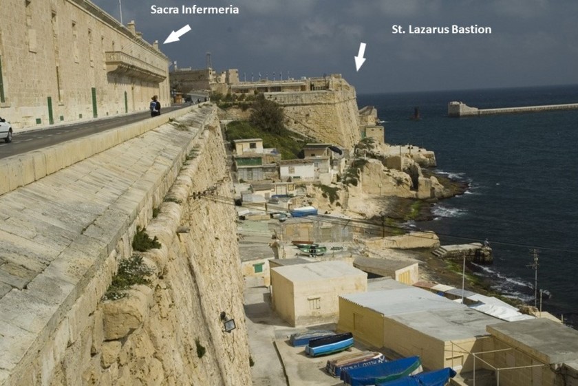
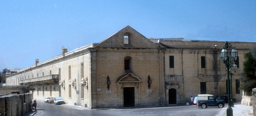
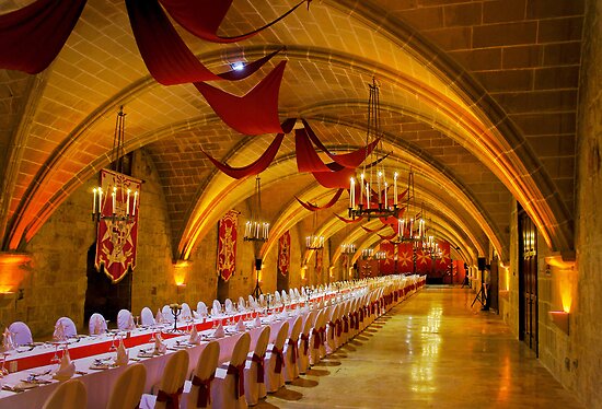
Between the Siege Bell War Memorial on St. Christopher’s Bastion and St. Lazarus Bastion, we find the Sacra Infermeria.
The Sacra Infermeria, or Holy Infirmary, was said to have been built as a hospital by the Order of St. John, and one of the leading hospitals in Europe until the 18th-century.
Today is the Mediterranean Conference Center, and used for banquets, exhibitions, international conventions, and theatrical shows.
Next along the wall, we come to the St. John, also known as Abercrombie’s, Bastion, the entrance to Fort St. Elmo discussed earlier in this post…
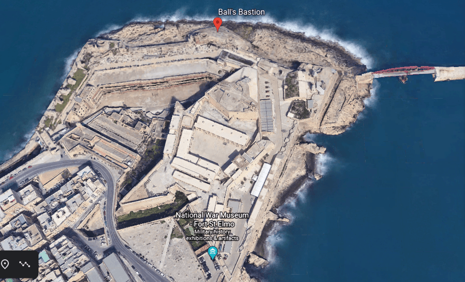
…then we come to Ball’s Bastion in the upper part of Fort St. Elmo…
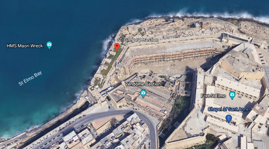
…and it is next to St. Gregory’s Bastion.
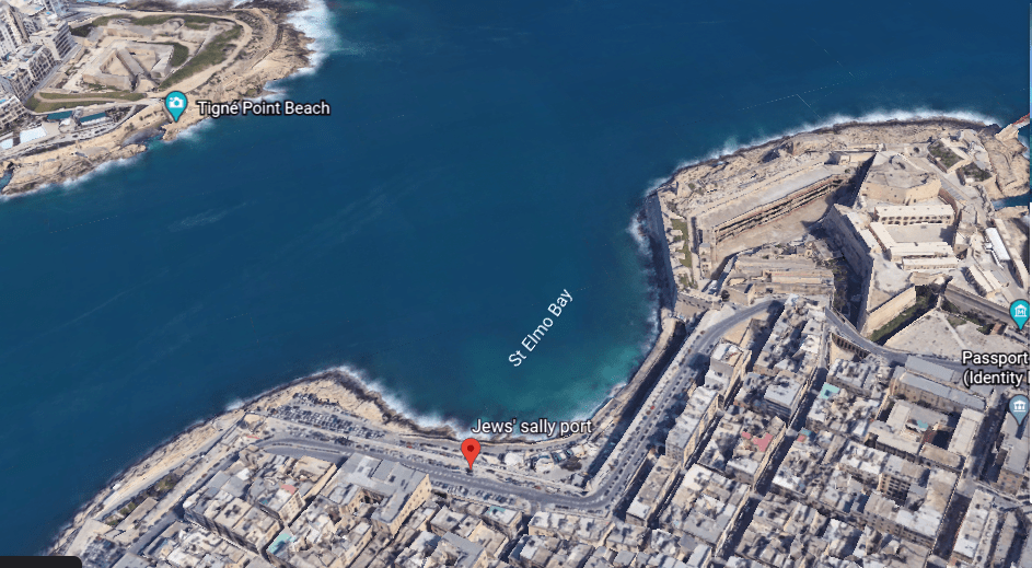
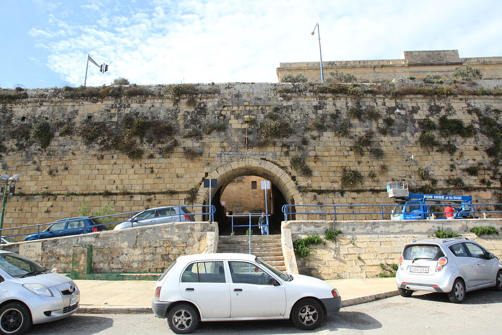
St. Gregory’s Bastion is in close proximity to the Jews’ Sally Port.
We are told the history of the Jews in Malta can be traced back to 62 AD. The Jews’ Sally Port is a gate where free Jews were said to have entered the city.
Next we come to the St. Sebastian Bastion…
…which is in close proximity to the Auberg de Baviere.
The Auberge de Bauviere was said to have been built as the Palazzo Carneiro in 1696, and was the residence of the Grand Master Marc’Antonio Zondadari in the early 18th-century.
Next we come to the St. Salvatore Bastion and the nearby St. Paul’s Anglican Cathedral, also known as St. Paul’s Pro-Cathedral, one of three cathedrals of the Anglican Diocese of Gibraltar in Europe, and said to have been built between 1839 and 1844.
Moving along, we come to St. Andrew’s Bastion…
…a popular wedding venue in today’s day and age.
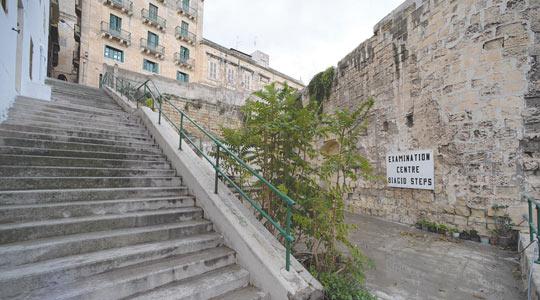
The Biaggio Steps are directly across from St. Andrew’s Bastion, and which are described as run-down.
Next we come to St. Michael’s Bastion…
…where apparently there used to be several windmills overlooking Marsamxett Harbor, but the only reminder of this is a nearby street named “Windmill Street.”
The place I would like to look at around the city walls of Valletta, before returning to the main city gate, are the Hastings Gardens.
The Hasting Gardens are a public garden on top of St. John’s Bastion and St. Michael’s Bastion, located to the immediate west of the west of the city gate.
Three more things to look at before departing the relatively small islands of the Republic of Malta in the the Mediterranean Sea, before heading out from here.
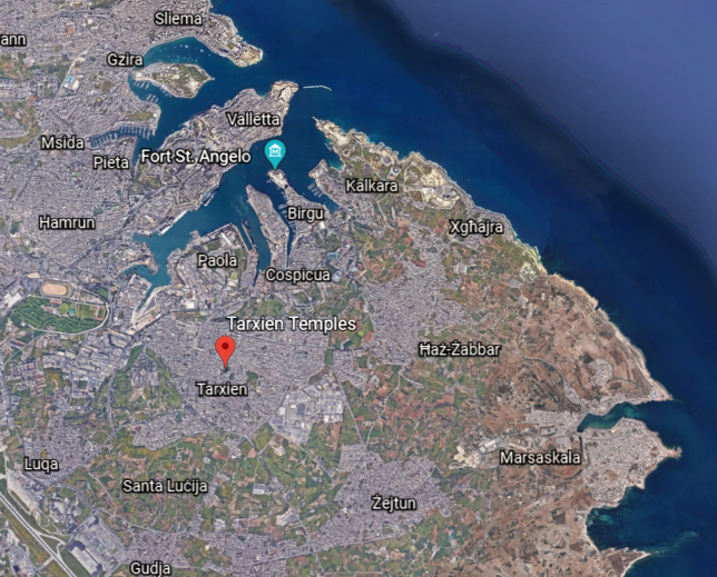
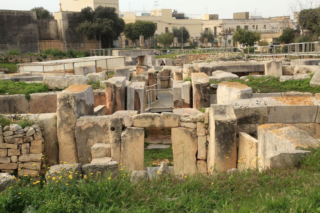
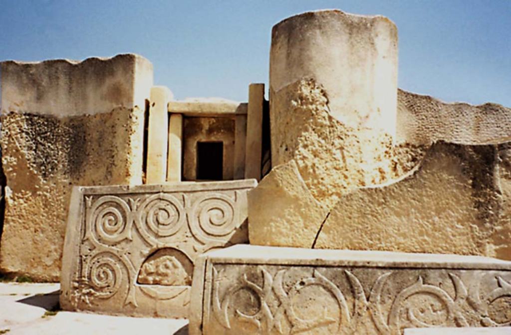
The first is bringing the megalithic Tarxien temples to your attention, located a short distance south of Valletta.
There is a significant megalithic presence in Malta. The Tarxien Temples are just one example of many in Malta.
The temples’ large stone blocks were discovered in 1914 by a farmer ploughing a field, and excavation was begun immediately by the director of the National Museum after the report of the finding was made.
So apparently the temple complex was completely buried underground. We have come to see places being completely buried as a natural occurrence over the passage of time, but was this really the case?
The Tarxien temple complex has rich and intricate stonework decorated with spiral designs and other patterns, and was dated to 3,150 BC.
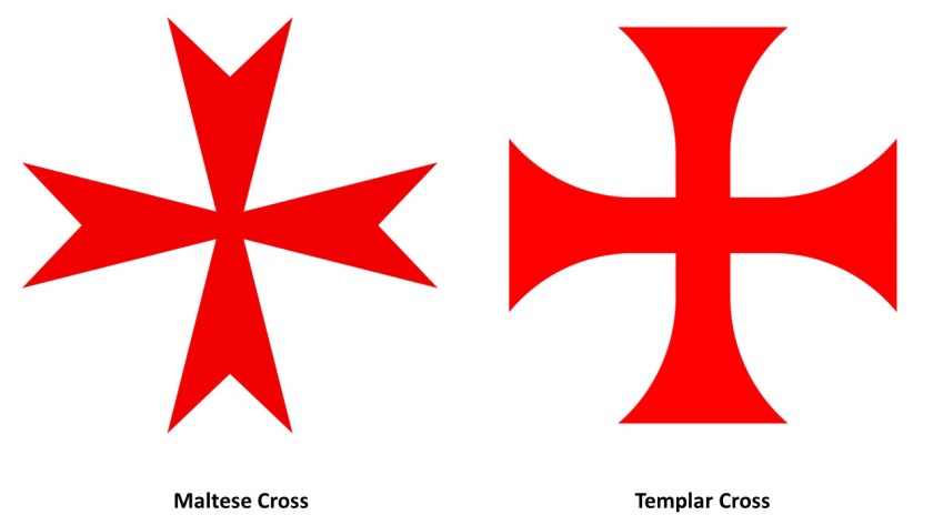
The second is speculation about the Knights’ Templar themselves.
Given that Valletta appears to be a veritable Disney World of stone masonry, and that the Maltese Cross and the Templar Cross are virtually identical, I am thinking that Malta was at the very least a major Templar Center, if not the main headquarters of the Templars.
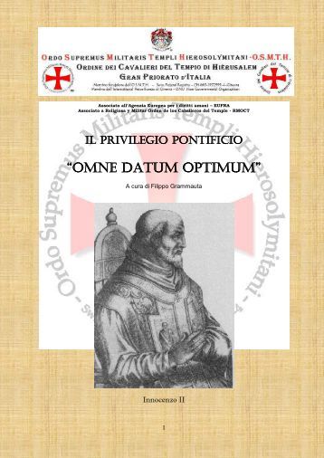
I do seriously question what we are told about who the original Templars were, also known as the Order of the Temple of Solomon.
We are told it was Catholic military order recognized in 1139 AD by Pope Innocent II’s papal bull Omne Datum Optimum.
I personally think there is a lot of information missing from the historical record about who the Templars really were, and about what their actual historical association with the Temple of Solomon was.
Were they actually Moorish Master Masons?
Whatever the Truth was about the original Templars, information is simply not available in the written historical record to make a connection directly to the Moors, and a connection in turn with the Temple of Solomon and the Lost Tribes of Israel.
Lastly, I have stated in previous posts my belief that I think places on the Earth, like Valletta in this example, with numerous star forts concentrated in close proximity, were significant power centers for the energy system of the planetary grid, and that star forts represented the definition of battery meaning “a device that produces electricity that may have several primary or secondary cells arranged in parallel or series, as well as a battery source of energy which provides a push, or a voltage, of energy to get the current flowing in a circuit…”
…and were not originally military in nature as we are led to believe in our current historical narrative, like the Lacaris Battery we saw earlier in this post.
Like the many star forts I found that were bombarded in World War I’s Gallipoli Campaign in the Strait of Dardenelles in Turkey when I was looking at the Aegean Sea, the star-city of Valletta, and its surrounding star forts and star cities, appear to have been deliberately targeted for bombardment during the Siege of Malta between 1940 and 1942 in what was called the “Mediterranean ‘Theater’ of World War II.”
I wonder why the word theater, defined as a building or area used for dramatic performances, also used as a term to describe an area in which important military events are occurring.
In the next post, I am going to be crossing from Valletta in Malta over to Sousse, a city located on Tunisia’s Mediterranean coast in North Africa.
In the last post, I tracked the alignment from Delphi on Mount Parnassus, an important religious, cultural and social center of ancient Greece, to the Ionian Sea, and the islands of Atokos, Ithaca, and Kefalonia, the largest of the Ionian Islands of western Greece.
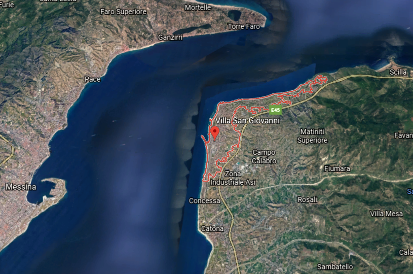
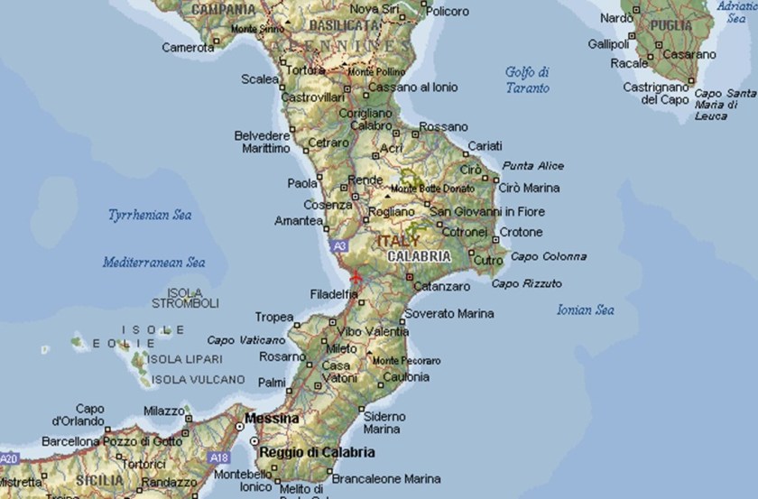
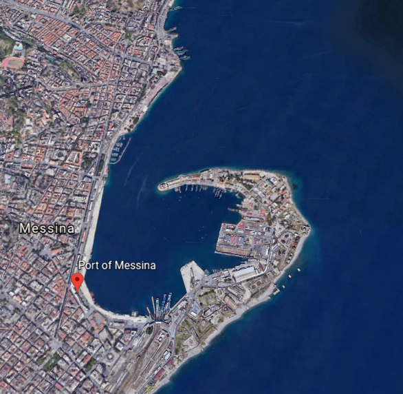
I am picking up the alignment at the Strait of Messina, a narrow strait between the eastern tip of Sicily and the western tip of Calabria in Italy.
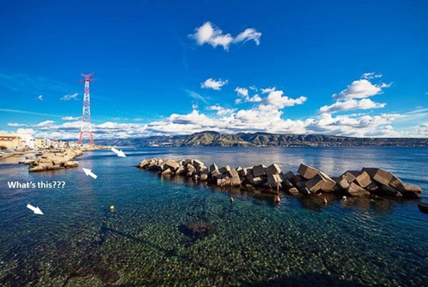
The narrowest point of the Strait of Messina is between the Punta del Faro in Sicily…
…and the Punta Pezzo in Villa San Giovanni in Italy’s Calabria region.
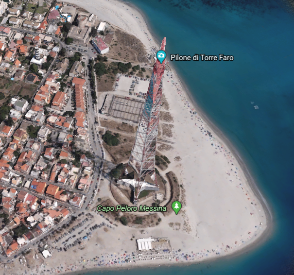
Punta del Faro in Sicily, located northeast of Messina, has a lot going on in a small space.
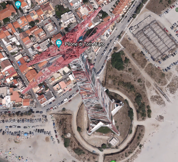
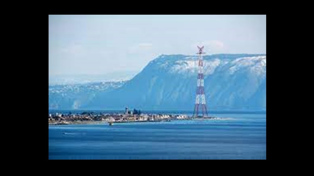
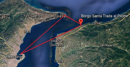
Let’s start with the Torre Faro Pylon.
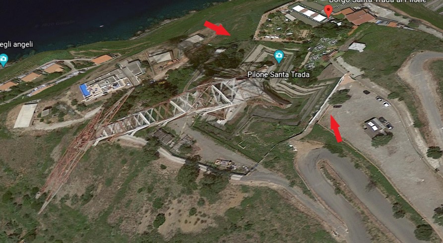
The Torre Faro pylon is one of two free-standing steel towers…
…with the other one, the Santa Trada pylon, being in the Villa San Giovanni across the strait, and standing on top of what looks like one of the more common star fort features.
We are told that they were built in 1955, and used between 1955 and 1994 to carry first 150-kilovolt, and then in 1971, a 220-kilovolt power-line across the Strait of Messina to respective sub-stations on both sides of it. They were decommissioned in 1993, and the conductors were removed a year later.
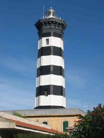
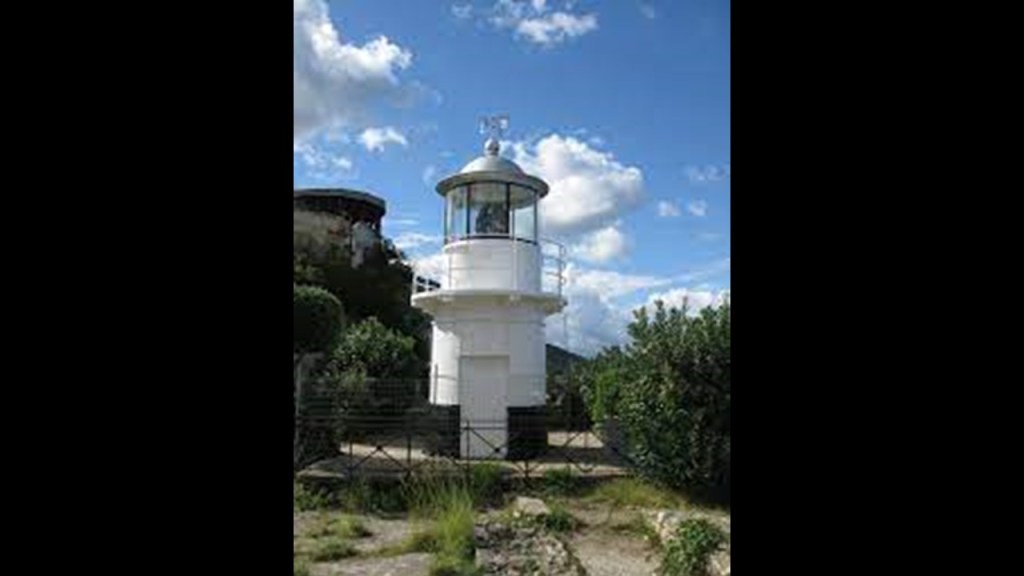
The Faro Point Lighthouse, also known as the Faro di Capo Pelori, is an active lighthouse that is completely automated, powered by mains electricity, or general purpose Alternating Current (AC) electric power supply.
It was said to have been first built in 1853, with periods of disuse in-between. It is operated by the Italian Navy.
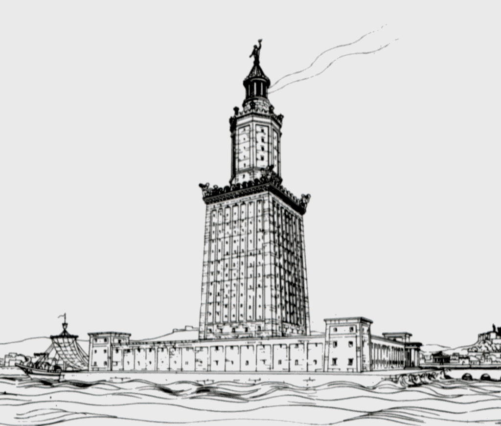
I want to make the point that the Pharos Lighthouse of Alexandria was one of the Seven Wonders of the Ancient World. At one time, at 330-feet, or 100-meters, in overall height, it was one of the tallest manmade structures in the world.
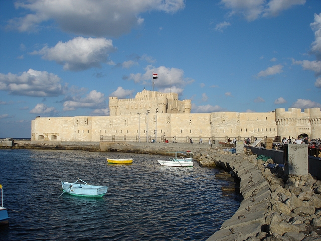
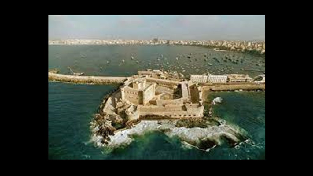
It was said to have been heavily damaged over time by earthquakes, and that in 1477, the Citadel of Qaitbay was established by the Sultan Al-Ashraf Sayf al-Din Qa’it Bay, and we are told the remaining stones of the Pharos Lighthouse were used in the building of it.
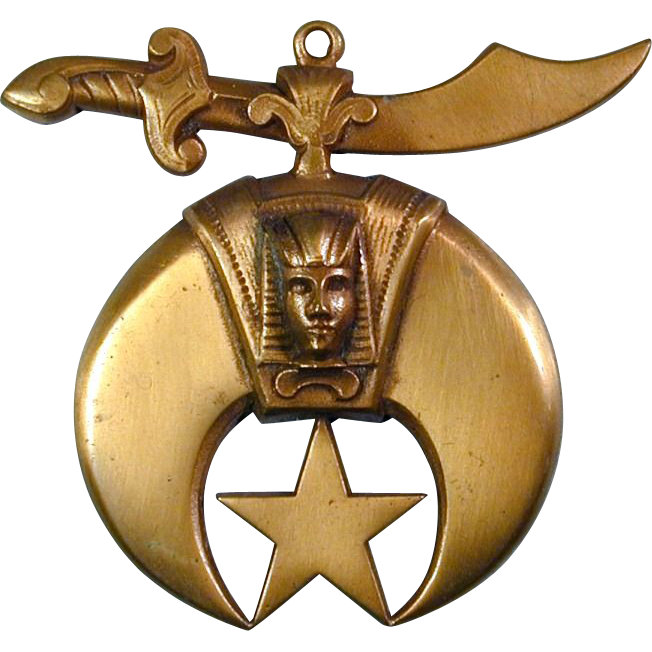
Bey is one of the five noble titles of the Moors. I just wonder if the name Qa’it Bay was changed from Qa’it Bey to obscure who we are really talking about here.
I also want to make note of the fact that, at least in the Romance Languages, the word for lighthouse, like the Pharos Lighthouse of Alexandria, includes the root sound of “Far”:
Italian – Faro
Spanish – Faro
French – Phare
Portuguese – Farol
Romanian – Far
And phonetically sounds like the word Pharaoh, which we are told was the common title for monarchs of ancient Egypt from the First Dynasty, starting in 3,150 BC, up to the annexation of Egypt by the Roman Empire in 30 BC.
Are they telling us something without telling us they are telling us?
I mean, after all, this is the emblem of the Shriners. This organization is comprised of 32nd and 33rd degree Freemasons. With a sword over the head of a pharaoh, this is an image of oppression.
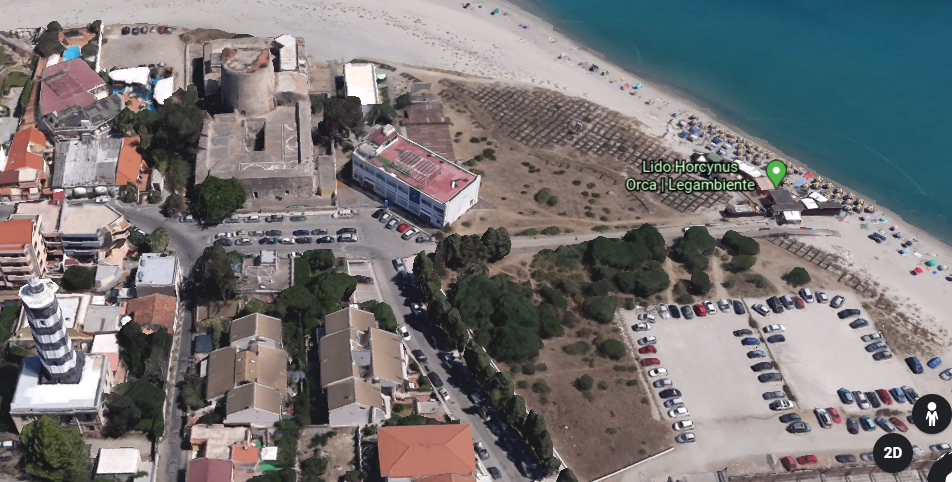
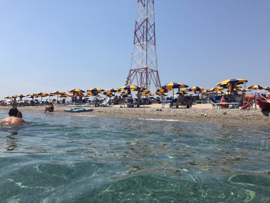
There is what is described as a fortication adjacent to the Punta del Faro lighthouse in Sicily…
…that is now part of the Lido Horcynus Orca Park.
The fortification gets used for things like cinematographic festivals held here.
Lido Horcynus Orca Park is primarily a beach resort.
Does that look like a beach resort you would like to go to?
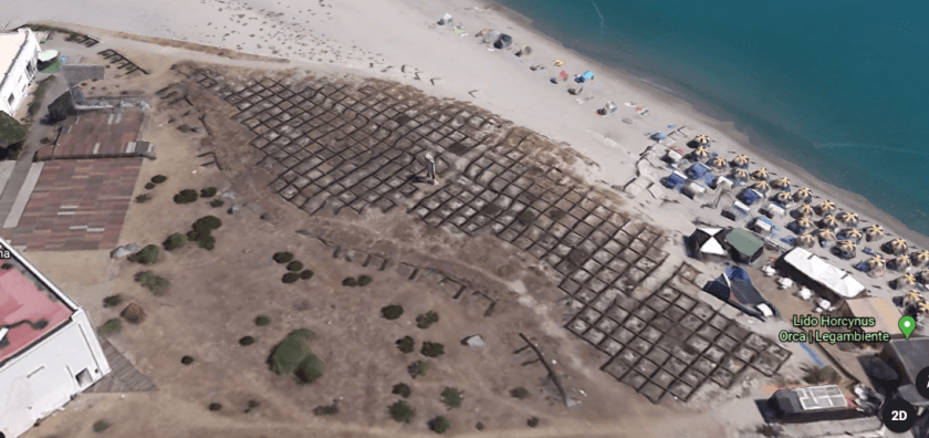
And Lido Horcynus Orca really has some interesting features surrounding the beachfront. Like, what the heck are these squares covering the landscape?
…and what are those two white column-looking things?
It brought to mind the square shapes I saw on Google Earth when I was looking at the coast of Iran across from Hormoz Island in the Strait of Hormuz…
…and both lay-outs in the landscape resemble chips on a circuit board.
As the most northeastern point of Sicily, where the Ionian Sea meets the Tyrrhenian Sea…
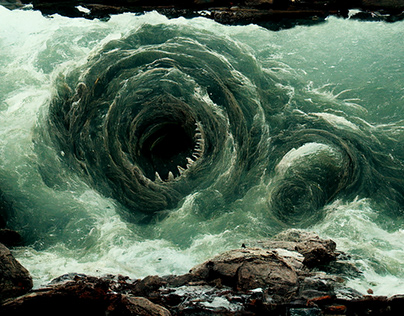
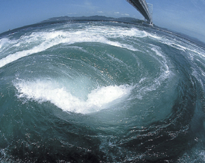
…Capo Peloro or Punta del Faro was supposedly the lair of Charybdis, one of the two beautiful women who had been turned into grotesque monsters by jealous goddesses in Greek mythology.
In one version of the myth, she would partially hide herself beneath a fig tree there, amd would frequently leap out into the sea in order to swallow huge quantities of water, creating a whirlpool that would suck down passing ships, and she would belch the water up afterwards.
Garofalo, otherwise known to the world as Charybdis, is found in the Strait of Messina. While not technically a whirlpool, it occurs when the winds and tides meet at cross-purposes in the strait, producing rough seas that are hazardous for vessels.
One more thing before moving across the Strait of Messina to Calabria.
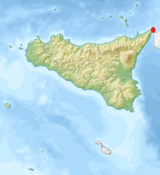
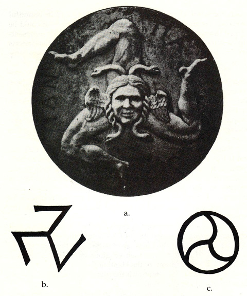
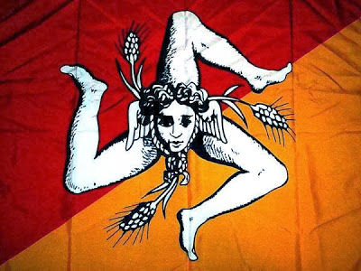
As the ancient Pelorus, Punta del Faro is one of the most celebrated promontories of Sicily, and one of three promontories which were considered to give it the triangular form. Trinacria, the ancient name of Sicily, is said to derive from an ancient Greek word meaning “three legs” and is synonymous with the sun and said to convey motion.
When I looked up the word “Trinacria,”versions of this image popped up all over the place. This particular version includes a human head with serpents and wings…
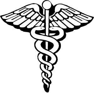
…similar to the winged disk symbol, most commonly associated with Ancient Egyptian and Mesopotamian cultures…
…and the caduceus, the staff of Hermes in Greek mythology, and an emblem of the medical profession in today’s world.
This version of the Trinacria is on the flag of Sicily. The head still has wings, but the serpents aren’t clearly defined as in the first head, kind of looking more like ropes, and the addition of what looks like three ears of wheat.
Why was the image modified?
The Trinacria itself is a symbolic representation of the zenith of the soul in its present state of existence, and the setting of the spiritual essence in its totality. It represents self-realization and ascension.
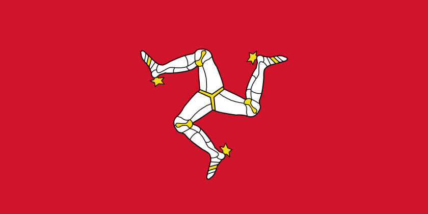
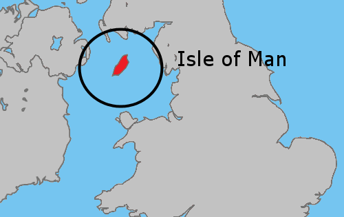
This is the flag of the Isle of Man, with a shape called the Triskelion…
…which is located in the Irish Sea between Ireland and Great Britain.
Interesting that there is information like this about ancient knowledge to be found in flags, as well as information about the true identity of the missing civilization.
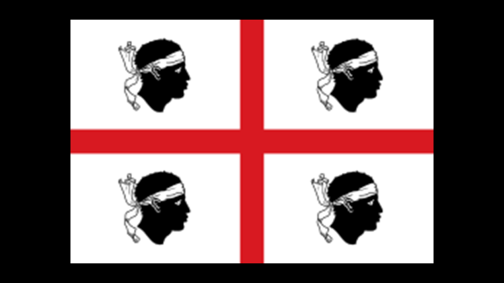
This is the flag of Sardinia, a large island region of Italy in the Mediterranean Sea, northwest of the Strait of Messina. It is also called the flag of the Four Moors…
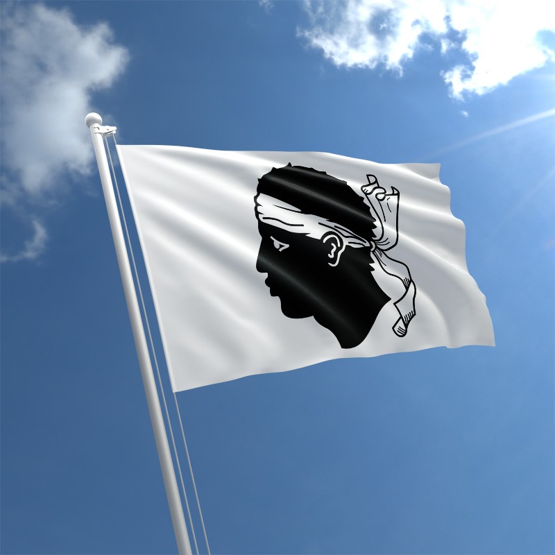
…and this is the flag of Corsica, an island region of France, just north of Sardinia, with one Moor’s head.
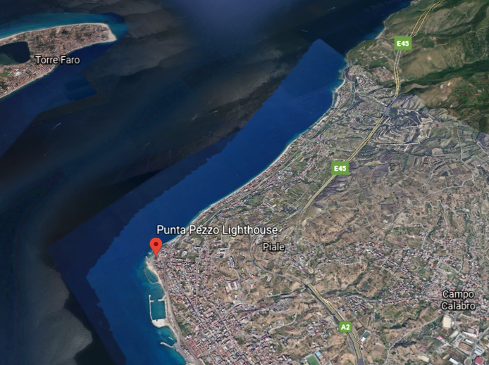
Now changing focus to look at Punta Pezzo, the closest point between Italy’s Calabrian shore in the Villa San Giovanni, and Punta del Faro in Sicily.
The city of Villa San Giovanni faces the city of Messina across the strait.
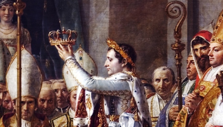
This part of Calabria was a focal point for Napoleon Bonaparte, after he proclaimed himself emperor of France in 1804.
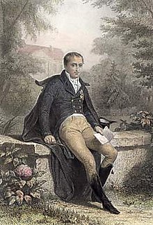
He made his older brother, Joseph-Napoleon, the King of Naples and Sicily between 1806 and 1808, who we are told, implemented administrative reforms in 1806 that abolished the ruling system that was in place here, and the Lordship of Fiumara disappeared.
Then, starting in June of 1810, we are told the new King of Naples, Joachim Murat, and the brother-in-law of Napoleon, ruled the southern Kingdom from the heights of Piale for four months, during which that short period of time he was given the credit for having built the fort of Punta Pezzo, or Piale, with a telegraph tower…
…the Torre Cavallo…
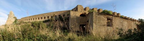
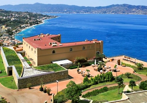
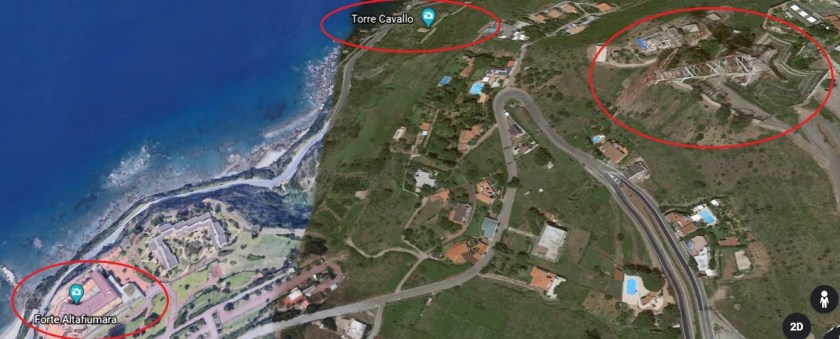
…and the Castello Altafiumara…
…with the Castello Altafiumara and Torre Cavallo both being in close proximity to the Santa Trada Pylon we saw earlier.
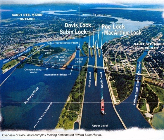
This particular geographic location appears to have been a particularly important place on the planetary grid system, similar in scope of what’s here to what I found in Sault Ste. Marie, Michigan and Sault Ste. Marie, Ontario, situated across from each other with the Saint Mary’s River in-between them.
See my blog post “Sault Ste. Marie – A Microcosm of the Advanced & Global Moorish Civilization” for an in-depth analysis of the region nicknamed “The Soo.”
Just a short distance north of Calabria’s Punta Pezzo , we find the Ruffo Castle of Scilla, described as an ancient fortification, and situated on a promontory in the Strait of Messina in the town of Scilla…
…and which houses the Scilla Lighthouse, also operated by the Italian Navy, like the Faro del Cape Peloro in Sicily.
Scilla is also the traditional site associated with the sea monster Scylla of Greek mythology, with its location right at the entrance to the Strait of Messina.
The linguistic idiom “between Scylla and Charybdis” means having to choose between two similarly dangerous situations, like the more common idiom “between a rock and a hard place.”
Other places of interest in Calabria, known in antiquity as Bruttium, include Tropea, an ancient seaside town built on top of a cliff, with a legend of having been founded by Hercules when returning from his labors at the Pillars of Hercules (in the Strait of Gibraltar)…
…and Reggio di Calabria, known as Rhegium in ancient times, located on the toe of the boot of the Italian peninsula.
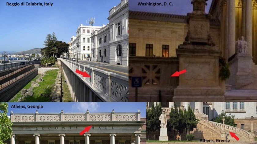
It is interesting to note the presence of the same design pattern in the architecture of Reggio di Calabria that you find at the Supreme Court in Washington, DC; at Leconte Hall at the University of Georgia in Athens, Georgia; and at the National Library of Greece in Athens, Greece.
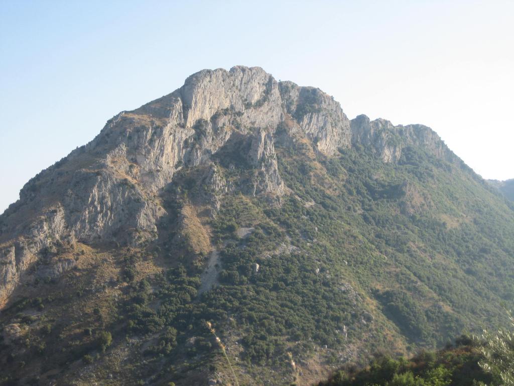
Reggio di Calabria is located on the Aspromonte, a long craggy mountain range that runs up through the center of the region, and described as resembling a giant pyramid.
This is Mount Consolino in the Aspromonte…
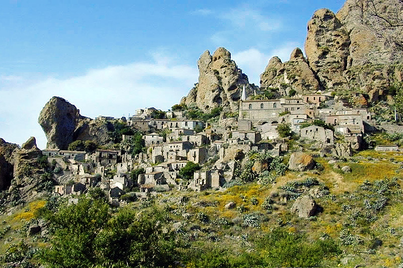
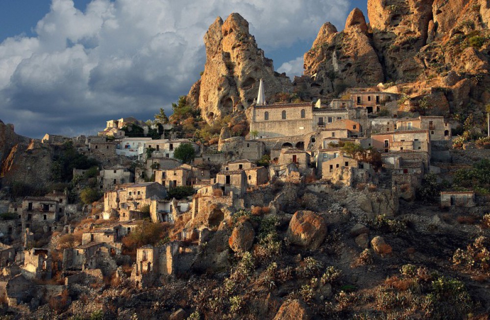
…and within the boundaries of Aspromonte National Park, you find places like the ghost towns of Pentedattilo…
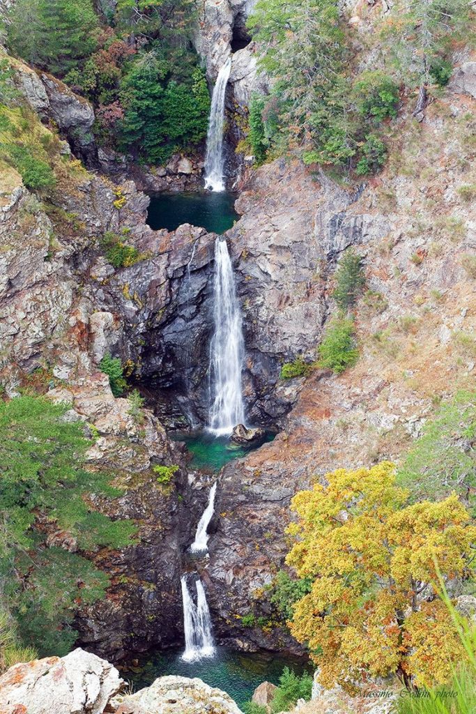
…as well as waterfalls, like the multi-storied Maesano waterfalls.
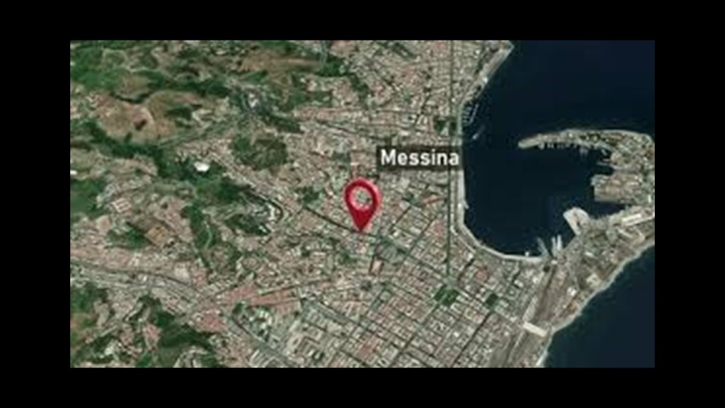
Back across the Strait to take a look at Messina proper, with a population of over 230,000, and the metropolitan area of Messina, which includes Punta del Faro, is around 650,000, making it the third-largest city in Sicily, and the thirteenth largest in Italy.
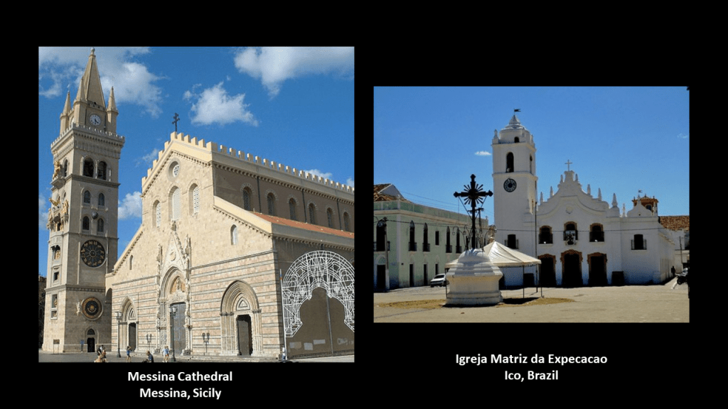
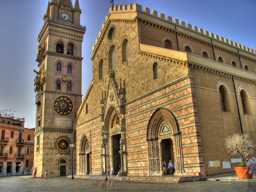
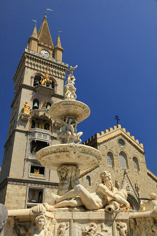
The Messina Cathedral is said to be an example of Norman architecture, built on the orders of the Norman King Ruggero II in 1120 AD.
For comparison in appearance, this is the Igreja Matriz da Expecacao in Ico, Brazil, on the right.
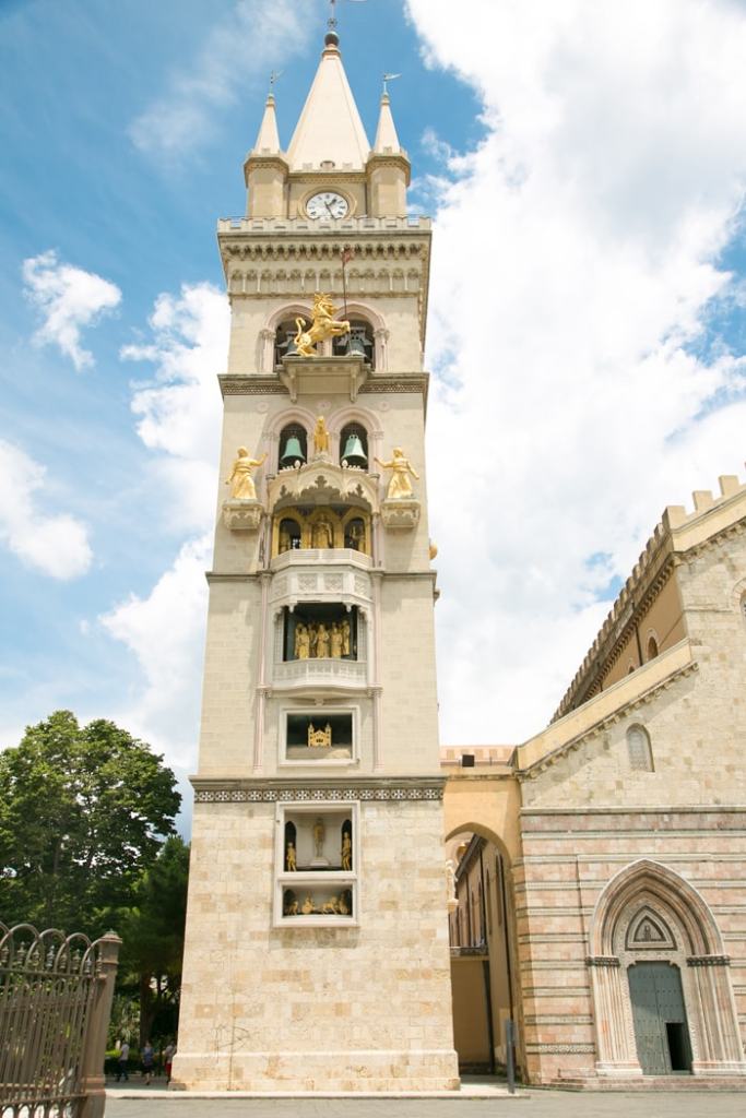
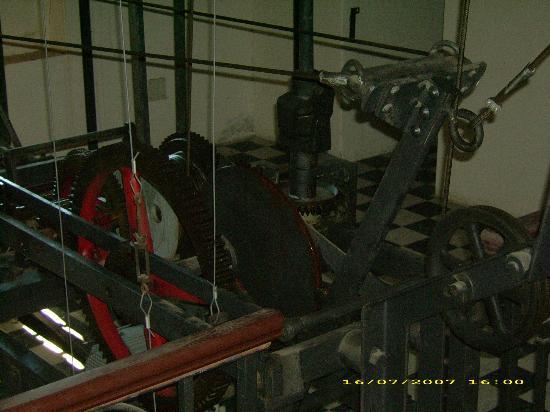
We are told the current Bell-Tower next to the Messina Cathedral was inaugurated in 1933, after having been designed by the firm of Ungerer of Strasbourg, and is famous for having the biggest and most complex astrological clock in the world.
Every day at noon, a complex system of counterweights, leverages, and gears moves gilded bronze statues located in the facade.
The Fountain of Orion is in front of the Messina Cathedral, and said to have been finished in 1553, commemorating both the city’s mythical founder, and the completion of the first aqueduct of Messina in 1547.
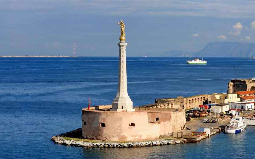
Messina is a major port city.
…and the said-to-be 16th-century Forte del Santissimo Salvatore is located at the port’s entrance.
The Stele of the Madonna Lettera, erected on the fort, was said to have been consecrated and inaugurated in 1934.
I see the Torre Faro pylon in the distance.
It looks like there could be a triangulated relationship between the Stele, the Torre Faro pylon, and the Santa Trada pylon…
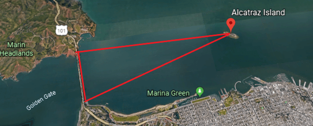
…just like the triangulated relationship I found in the first part of this series between the lighthouse at Alcatraz Island in San Francisco Bay, and the Fort Point Light on the Presidio side of the Golden Gate Bridge, and the Lime Point Light on the other side of the bridge
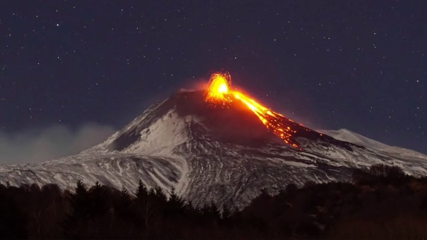
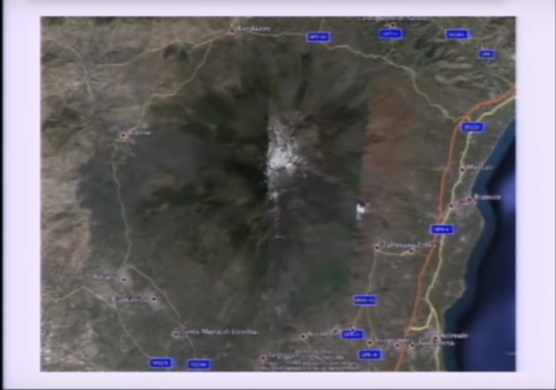
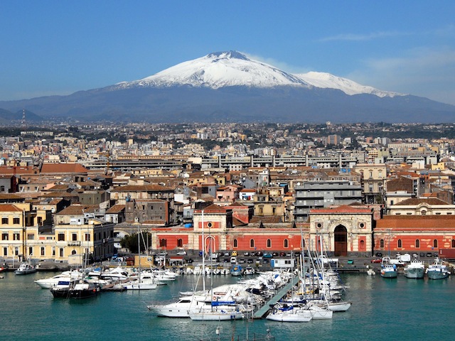
The next place we come to on the alignment is Mount Etna, on the east coast of Sicily, in what is called the Metropolitan City of Catania, formerly the Province of Catania.
It is located between the cities of Messina and Catania.
It is a stratovolcano that is one of the most active in the world, and is in an almost constant state of activity.
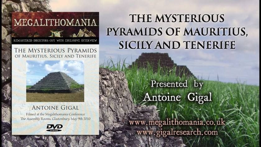
I learned several years ago in a Megalithomania presentation by Antoine Gigal about pyramids around Mount Etna, and I am drawing from her research in the next slides about this obscure subject.
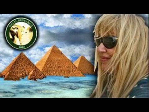
Antoine Gigal is a French writer, researcher and explorer, and the founder of Giza for Humanity who went to Sicily when she heard about 12 pyramids there.
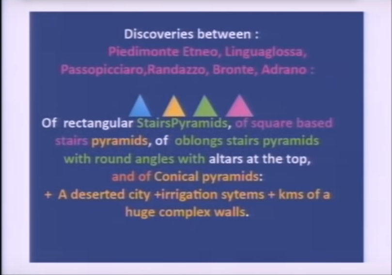
Instead of finding the 12 pyramids she was told about, she found 23 pyramids around Mount Etna, and proceeded to literally do field research, as the pyramids were in the middle of fields.
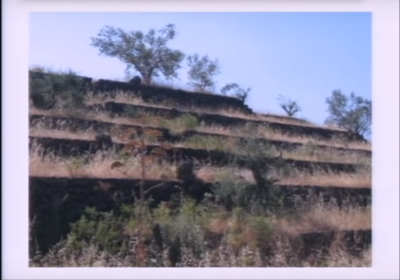
She found pyramids of different shapes and sizes…
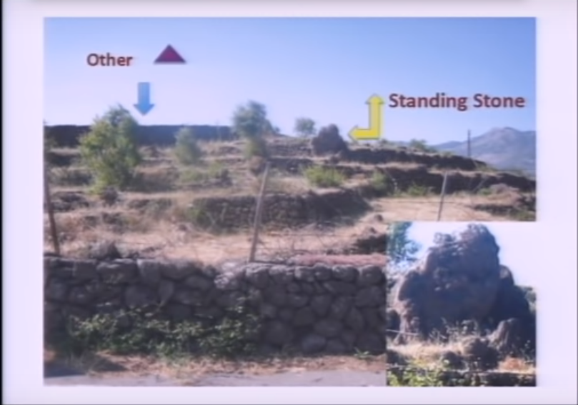
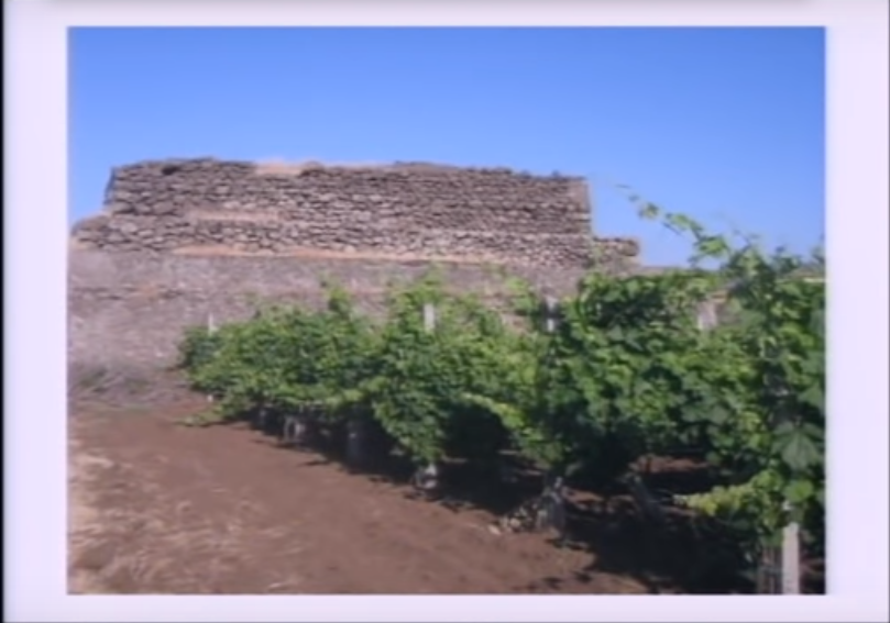
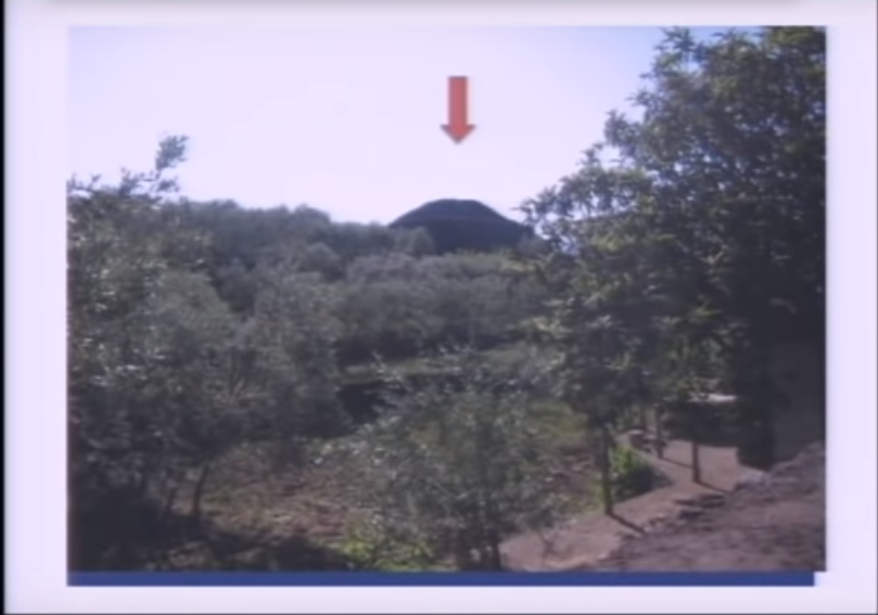
…like an oblong step pyramid between the towns of Passopisciaro and Francavilla…
…which has a standing stone…
…a rectangular pyramid between Linguaglossa and Randazzo…
…and this rectangular pyramid on Mount Etna’s north side.
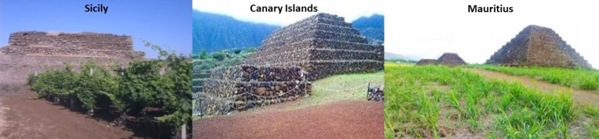
In Antoine Gigal’s presentation, she demonstrates that the construction style of the Sicilian pyramids is like that of the Guimar Pyramids of Tenerife in the Canary Islands in the Atlantic Ocean, and also like that of the pyramids of the island nation of Mauritius in the Indian Ocean.
The last place I am going to be looking at in Sicily is Catania…
…located at the foot of Mount Etna.
This illustration is said to be of a 1679 eruption of Etna that impacted Catania and also shows what looks to be a star fort around the city or a star city.
This prompted me to look for historic maps of Catania, and I found this old map of the city which confirms the finding.
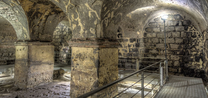
Beneath the surface-level city of Catania, there are said to be several layers of underground cities…
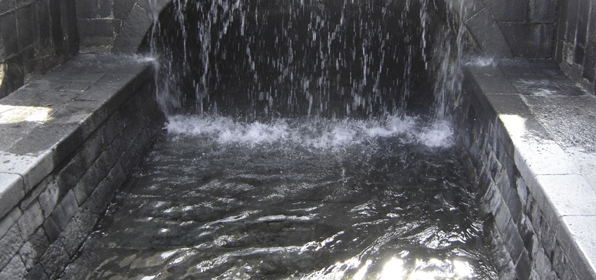
…and an underground river, named Amenano…
…and in the Piazzo del Duomo, the main square of the city, is the Amenano Fountain of the Amenano River, said to have been sculpted in 1867 by Italian sculptor Tito Angelini.
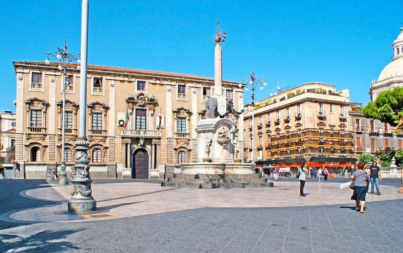
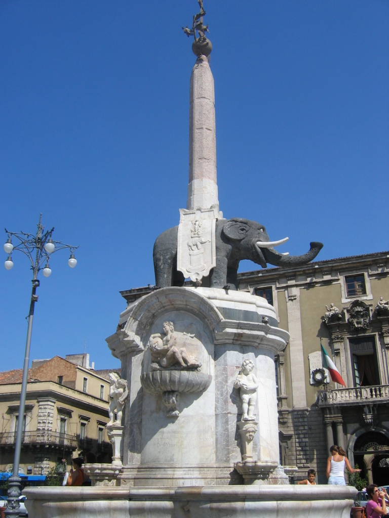
The Catania Town Hall, also known as the “Palace of the Elephants” is also in the Piazzo del Duomo…
…with the U Liotru fountain, the elephant symbol of Catania, said to have been carved from ancient lava stone and topped by an obelisk from Syene (now called Aswan) in Egypt.
As with everywhere else, there is much more to find in Catania, but I am going to end this post here, and pick up the alignment on the island of Malta.