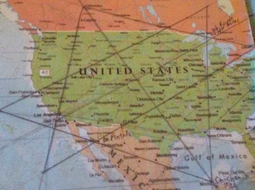
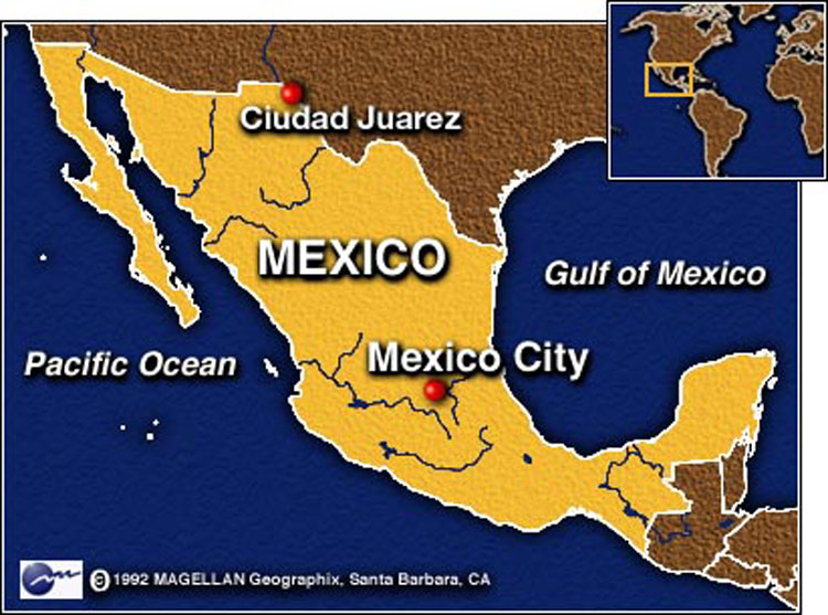
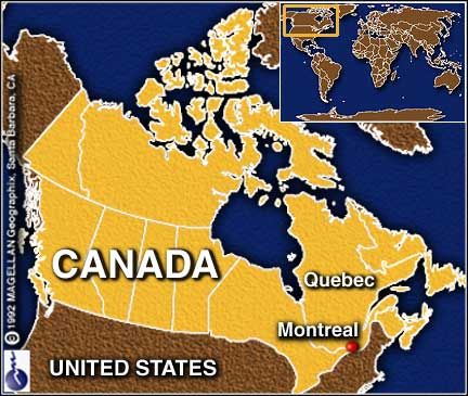
The last leg of this journey following a major planetary alignment will take us from Santa Rosalia in Baja California, across major cities and capitals in Mexico, the United States and Canada and will be ending at Montreal, where I started this series about “How I Found the Silk Road.”
I did not know where the Silk Road was before I went through the process, after I found the star tetrahedron, of extending the lines out on a globe, and writing down the cities that lined up around the world.
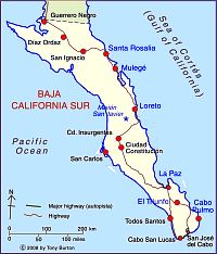
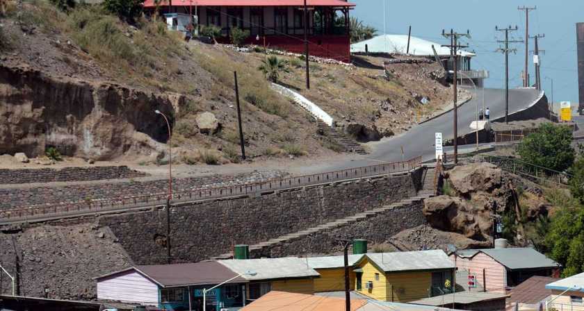
I am picking up the alignment in Santa Rosalia, Baja California, which is a port city and ferry terminal. It is said to actually boast French influence in architecture, and a French company mined copper there from 1885 – 1954.
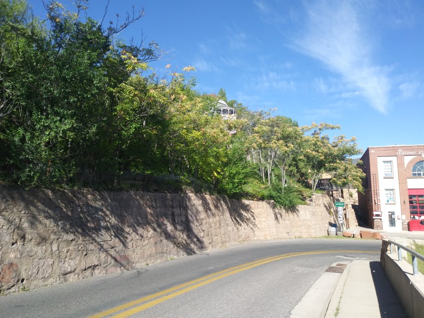
Jerome, Arizona is not on this particular alignment, but I am including a picture there to show a similar stone wall. Not exactly the same, but whoever built these walls is really comfortable with stone work.
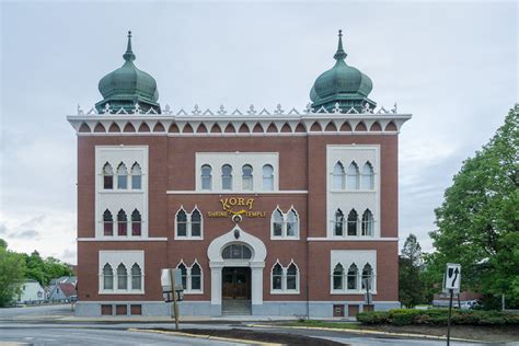
The prefabricated metal Church in Santa Rosalia is said to have been designed in 1884 by Gustave Eiffel, of Eiffel Tower fame. It is pictured on the left, with a building in Grozny, Chechnya in the middle; and the Natural History Museum of Milan, Italy on the right, and the Lewiston Shriners’ Temple to show the shared window design features.


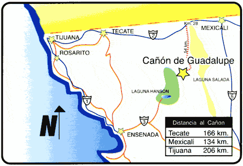
There are places in Guadelupe Canyon in Northern Baja California in the general area of the alignment.
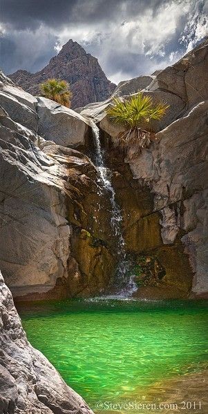
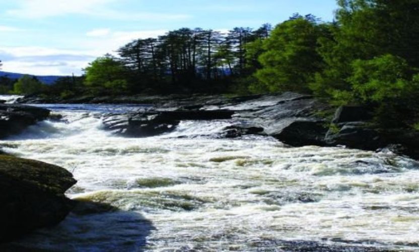
Here is the Emerald Pool and Waterfall in Guadalupe Canyon, with the pyramidal shape in the background.
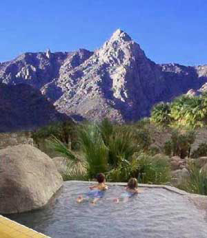
And a view from El Mirador, also in Guadalupe Canyon, with a nicely-engineered stone pool in the fairground and pyramidal shape in the background.
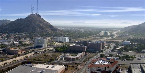
Next on the alignment is Hermosillo, Mexico.
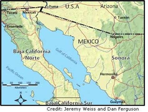
It is actually located at the intersection of two major ley-lines of the North American Star Tetrahedron.
It is located centrally in the northwestern state of Sonora. It was ranked as one of the 5 best cities to live in Mexico in 2013.
This is the Government Palace in Hermosillo on the left, and for comparison with a similar appearance is the University of Otago in New Zealand on the right.


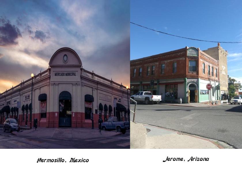
On the left is the Municipal Market in Hermosillo, and on the right, is the Hotel Connor in Jerome, Arizona.
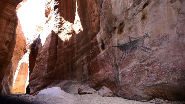
La Pintada is a site located 60 kilometers south of Hermosillo, within La Pintada Canyon.
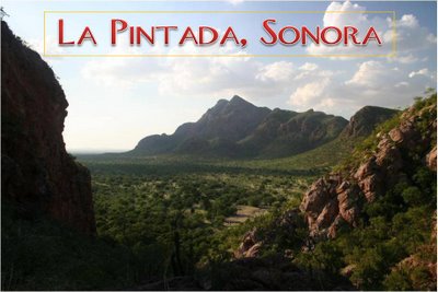
La Pintada is an important ancient archeological zone.
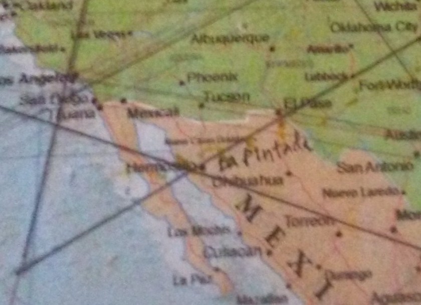
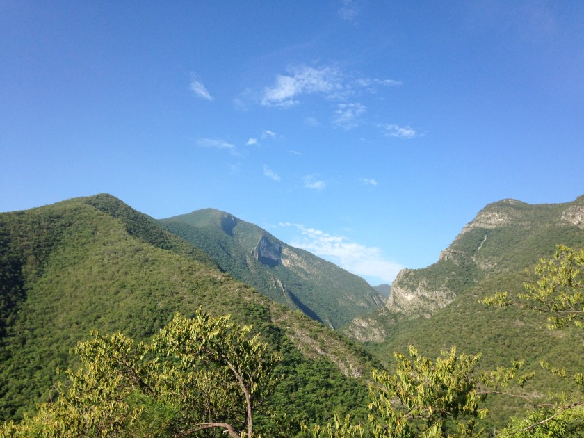
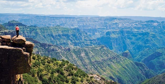
From here, the alignment crosses over the Sierra Madre Occidental Mountains.
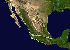
This is a major mountain range of the North American Cordillera, which is the mountain chain that runs along the western side of the Americas, including the Rocky Mountains.
The Rio Grande de Santiago winds through the Sierra Madre Occidental, and forms part of the border between Nayarit and Jalisco States.
The Basaseachic Falls on the left are on the Basaseachic River in the high Sierra Madre Occidental; on the top right you see Angel Falls in Venezuala, and bottom right the Staubbach Falls in Switzerland – both of which have a similar appearance to Basaseachic Falls.


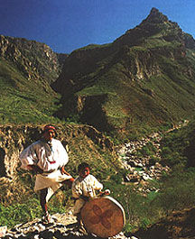
Copper Canyon is also in this area, and is the home of the Tarahumara. The Tarahumara are known for their exceptional abilities in long-distance running. Most still practice a traditional lifestyle.
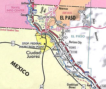
Next we come to Juarez, Mexico,the seat of government and most populated city in the State of Chihuahua. It sits on the U.S. border, right across the Rio Grande from El Paso, Texas.
Here is a comparison of a building in Juarez on the top, and on the bottom row on the left is in Kresy, Siberia; in the middle is Guthrie, Oklahoma; and on the right is Kherson, Ukraine.


Also the this old postcard showing the roof features of the Custom House in Juarez on the top left, compared with similar features in Bordeaux, France on the top right; Yalta in the Crimea on the bottom left; and in Belgrade, Serbia on the bottom right.


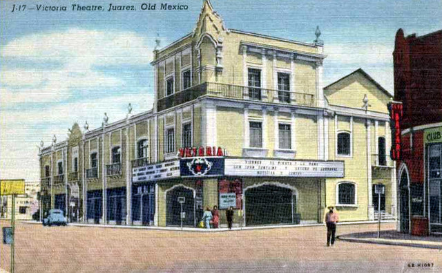
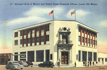
In the next set of photos in Juarez, I am highlighting a school, theater, and bank.
Juarez Academy
As I move forward on the alignment into El Paso, Texas in the United States…
…I will be highlighting these three types of institutions in most of the cities for a variety of reasons:
1) Monumental architecture, and I am using this term in its meaning of large human-made structures of stone or earth which are used as public buildings or communal spaces;
2) They are related to control structures, as in thought and finance;
3) There are so many examples to choose from that focusing primarily on these three, with some exceptions as you will soon see, narrows my search and helps organize the material.
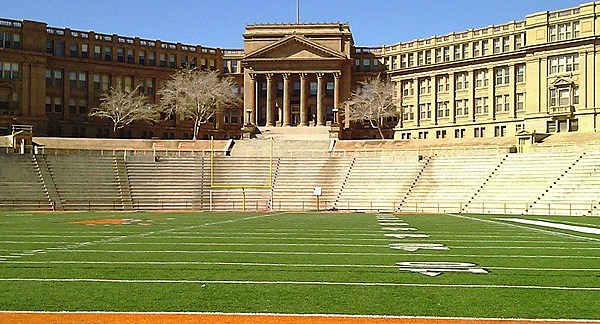
For example, this is El Paso High School. You know, I didn’t go to a high school that looked like this or similarly monumental, but I think a lot of people did. And didn’t think twice about it. It doesn’t fit the historical narrative that we have been taught. It’s not supposed to be there, so we don’t see it, and we don’t even think it. We are being educated in schools that look like this and don’t even ask questions about it.
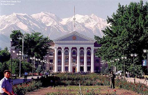
For comparison, this building is in Bishkek, Kyrgyzstan…..
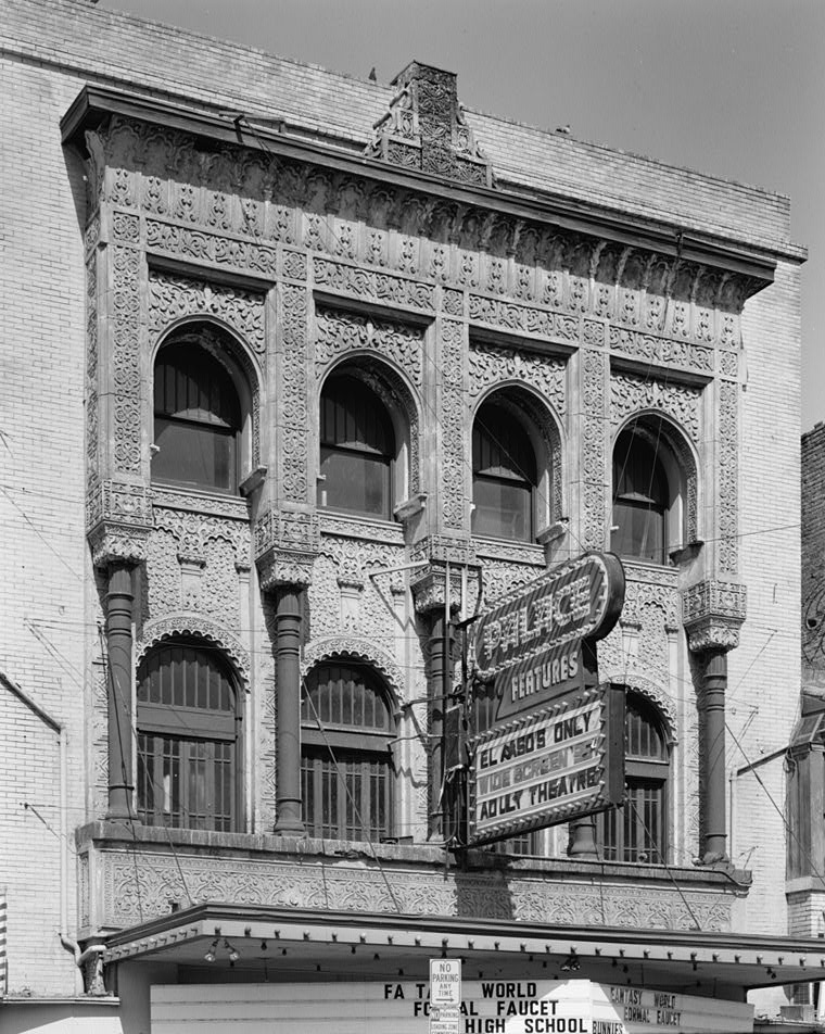
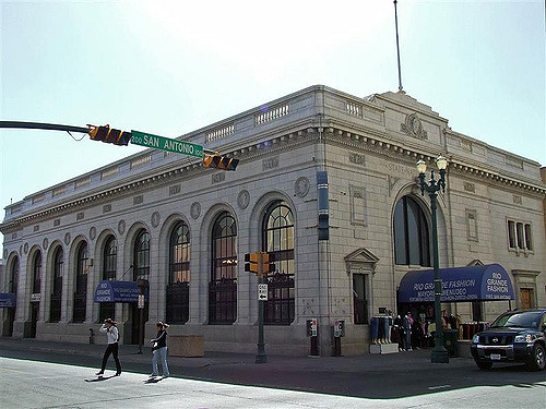
This is the Alhambra Theater in El Paso, with its ornate and intricately-designed facade.
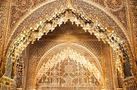
And this ornate and intricately designed space is one of the many found at the Alhambra in Grenada, Spain.
Here is the El Paso State National Bank building with its heavy and huge masonry.
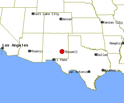
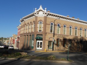
Next we come to Roswell, New Mexico, most famous as the site of a UFO crash in 1947, to which I don’t think the government has ever publicly admitted, but which has a lot of circumstantial supporting evidence :).
Roswell is the County Seat of Chaves County. As we go further along the alignment, I encourage you to be open to thinking differently about who actually built these monumental buildings. Perhaps county seats and capitals were chosen because of buildings that were already there….
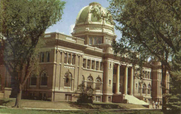
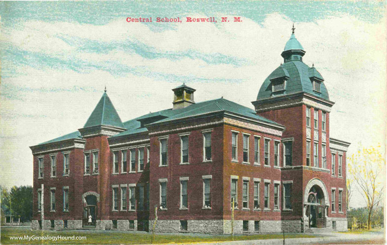
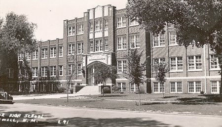
Next are two old depictions of schools in Roswell – Central High School…
…and North Junior High School.
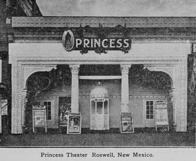
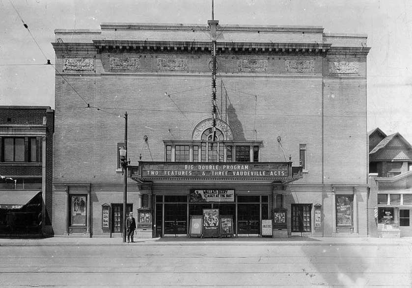
Here is an old picture of the Princess Theater in Roswell with its intricate design features.
And the Plaza Hotel, which takes us back to the same style I keep showing you that is found in so many different places (and more to come along the way).
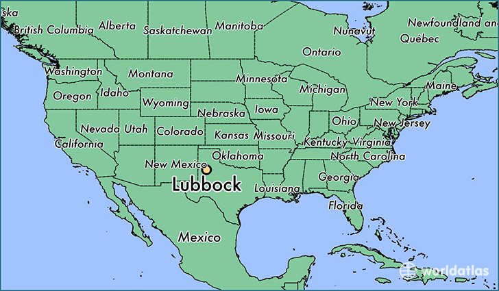
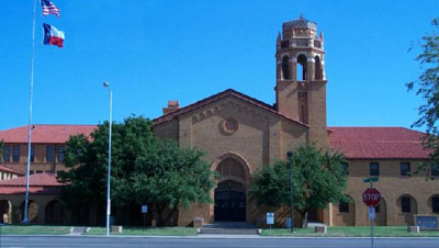
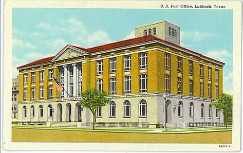
Lubbock, Texas is next on the alignment.
It is the County Seat of Lubbock County on the southern end of the high plains, also known as the Llano Estacado. It is considered a regional hub city.
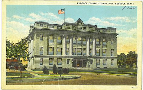
This is Lubbock High School.
And its monumental post office and federal building.
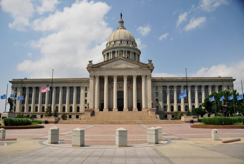
Next is Oklahoma City, Oklahoma, the state capital and county seat of Oklahoma County. It is definitely a major economic and transportation hub with its central location in the country, and on the nation’s interstate highways, sitting at the convergence of I-35 and I-40 and I-44. This is also where I was living when I started to put together what I am sharing with you, where I started to see what was really in the environment around me, and where I first learned about the advanced Ancient Civilization that has been removed from our awareness.
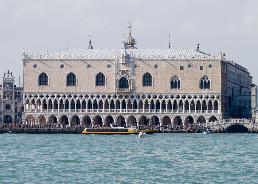
Here is an old postcard depicting The Baum Building in Oklahoma City. It was razed in 1973, supposedly as part of an Urban Renewal project.
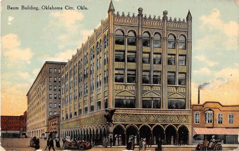
In its day, the Baum Building was compared to the Doge’s Palace in Venice, shown here.
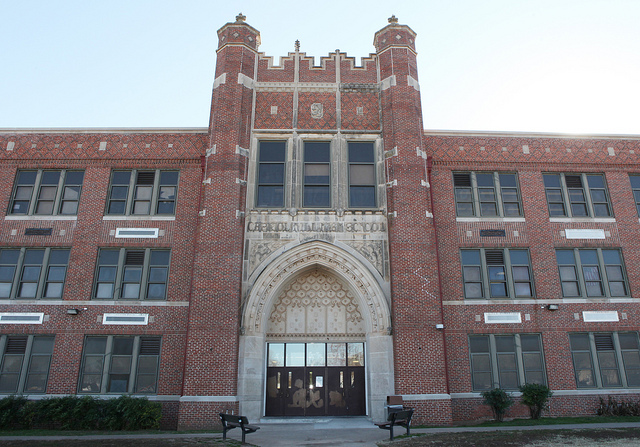
This is Capitol Hill High School in South Oklahoma City.
This is Central High School in Oklahoma City. It is listed on the National Register of Historic Places in the United States. Pretty fancy places, huh?
This is the old Criterion Theater in Oklahoma City, with its ornate styling…
…and this is the Oklahoma City Federal Reserve Bank.
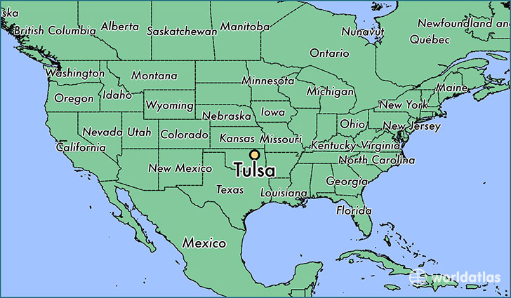
Next on the alignment is Tulsa, Oklahoma. Tulsa is the second largest city in Oklahoma, and is the County seat of Tulsa County.
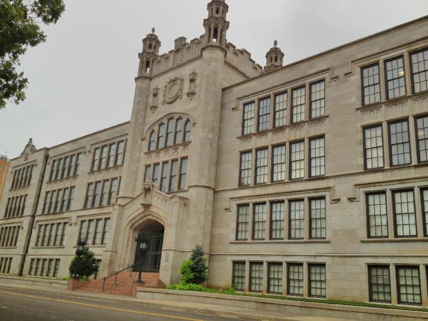
Here is Central High school in Tulsa.
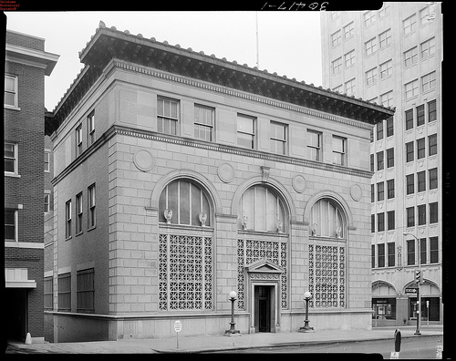
This is the Mincks-Adams Building – first called an exchange bank in the 1930s, and apparently is now a hotel. Similar in appearance to the Baum Building that was in Oklahoma City.


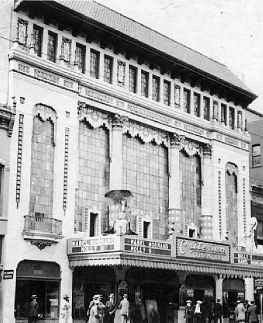
And here is the old Akdar Movie Theater in Tulsa. It has also been demolished.
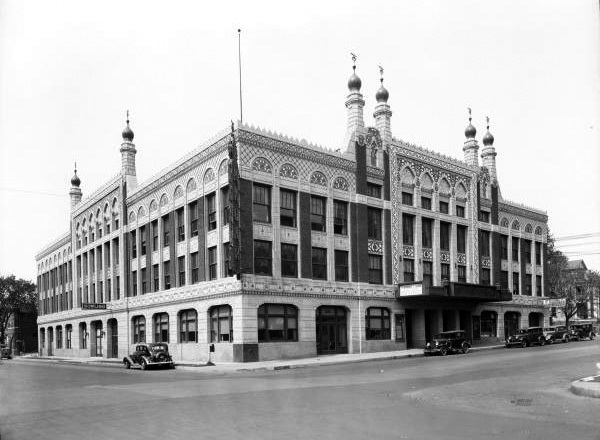
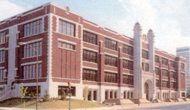
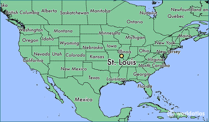
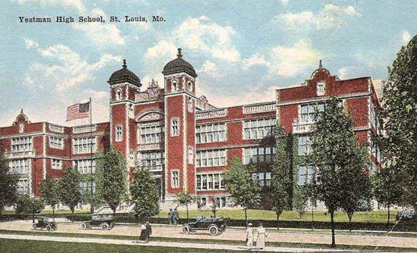
Next on the alignment is St. Louis, Missouri, an independent city and major port built on the western bank of the Mississippi River on the border with Illinois. As an independent city, it is not in the territory of any county.
This is the old Yeatman High School. The building is no longer in use.
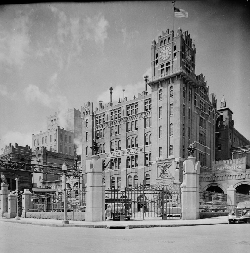
Here is the Anheuser-Busch Brewery in St. Louis. Pretty fancy heavy masonry here too.
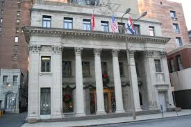
The Old Mutual Bank Building in St. Louis…
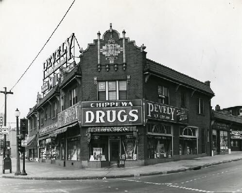
…and a historic Drug Store in St. Louis, Missouri.
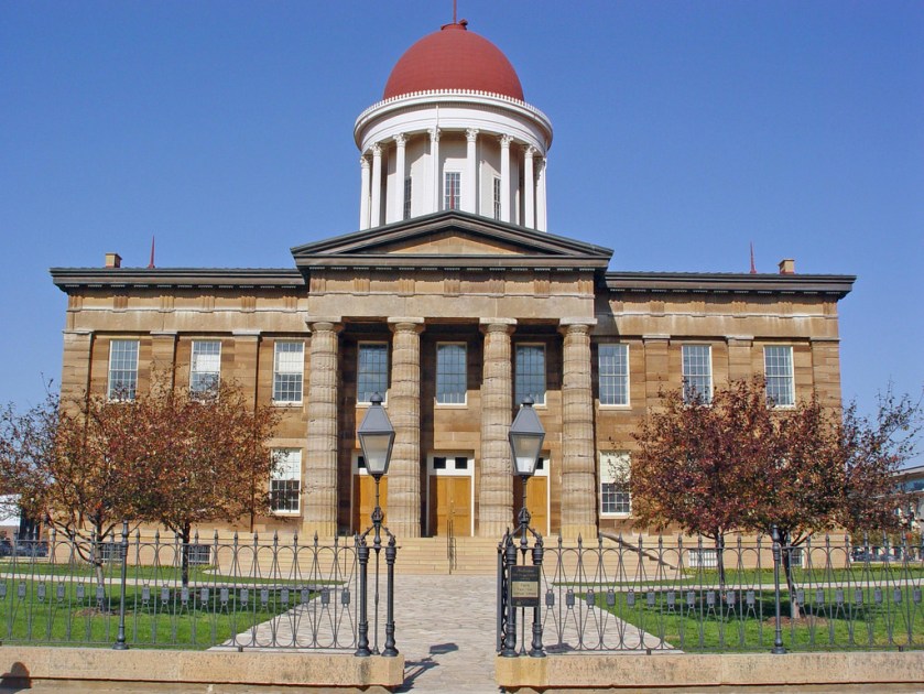
Next is Springfield, Illinois…
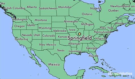
…the capital of Illinois, and county seat of Sangamon County.
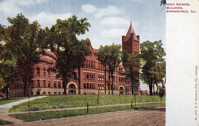
Here’s an old high school in Springfield.
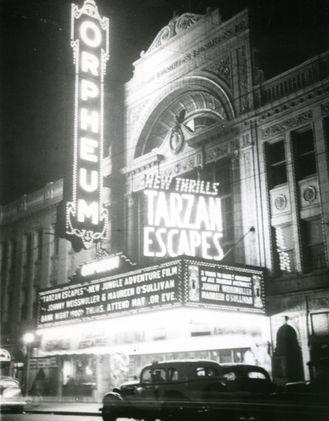
The old Orpheum theater in Springfield. Orpheum was the name of many theaters at one time, and the roots of this word goes back to Greek mythology. Orpheus had the ability to charm all living things through his music. Hmmm. That means casting spells…..
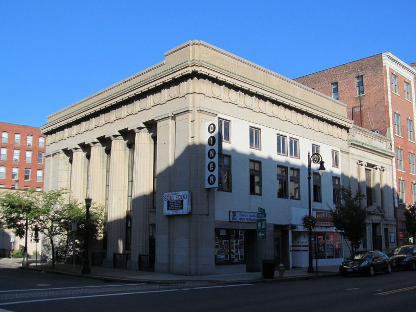
And here is the Chapin National Bank Building in Springfield.
Toledo, Ohio is next on the alignment, and is located at the western end of Lake Erie.
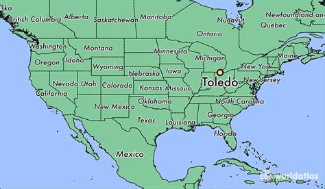
Toledo is the County Seat of Lucas County.
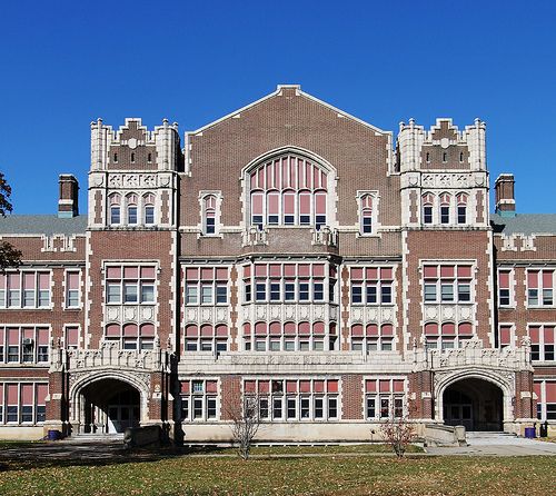
Here is Waite High School in Toledo.
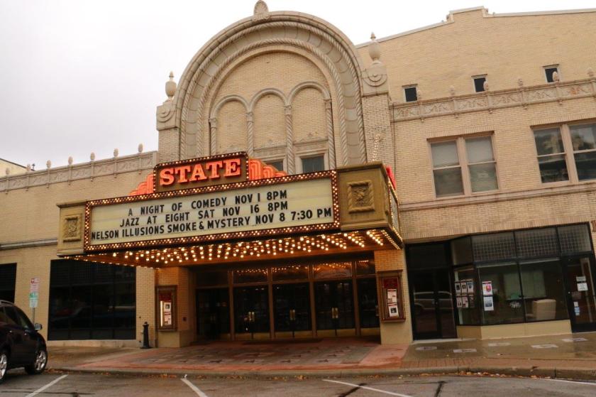
And the old State Theater in Toledo, Ohio
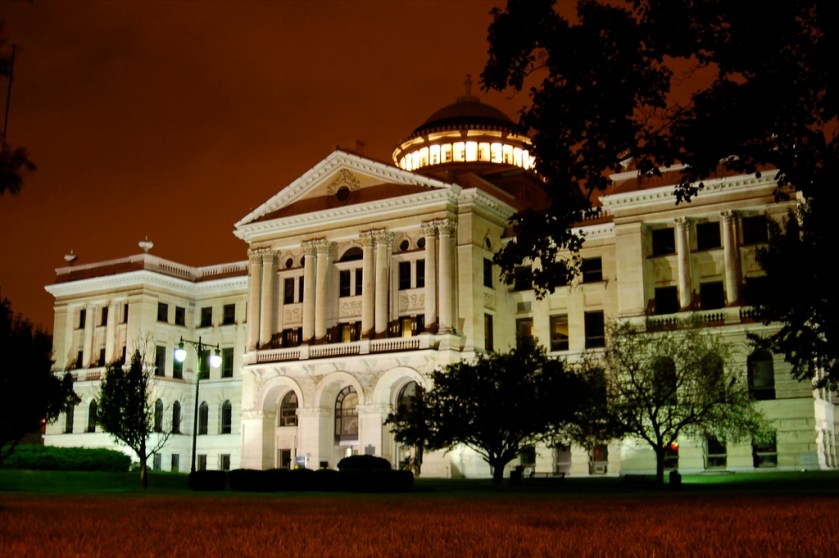
And Toledo Ohio Savings Bank and Trust on left, compared with the historic drug store in St. Louis on the top right, and the building in Juarez, Mexico both shown earlier in this post.


Now we come to Detroit, Michigan. It is located on the United States – Canada border, and on the Detroit River, which connects the Great Lakes System with the St. Lawrence Seaway.
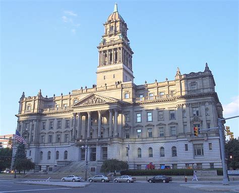
Detroit is the seat of Wayne County. This is the old Wayne County Courthouse.
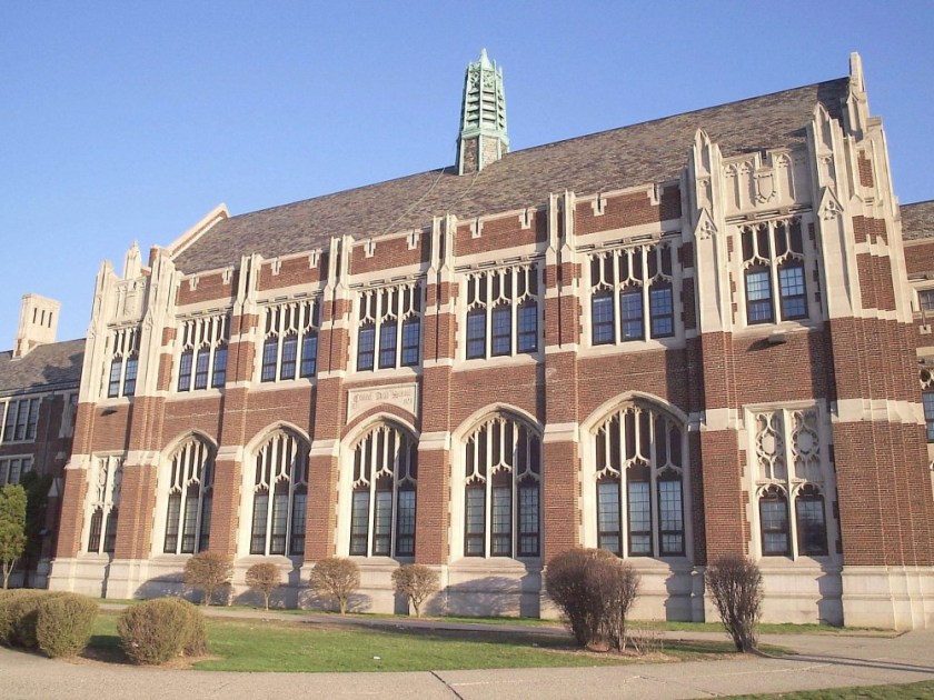
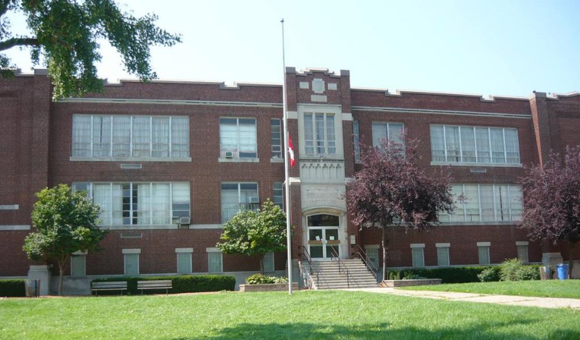
Here is the Central Academy and High School in Detroit;
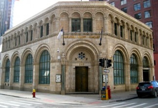
The Bankers Trust building in Detroit;
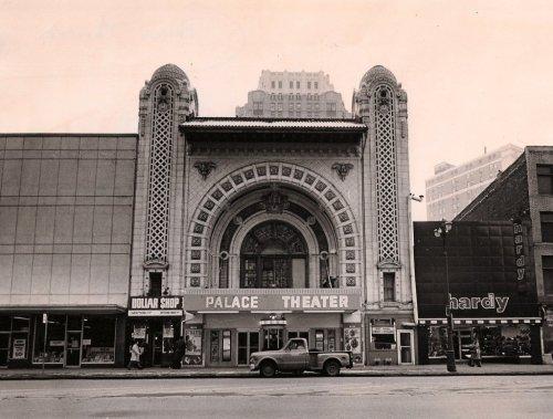
And the historic Palace Theater, Detroit, Michigan.
Onto Windsor, Ontario, which is directly across from Detroit, Michigan and also on the Detroit River.

The Windsor, Ontario School District building…
…Here an old theater building in Walkerville, a historic neighborhood of Windsor…
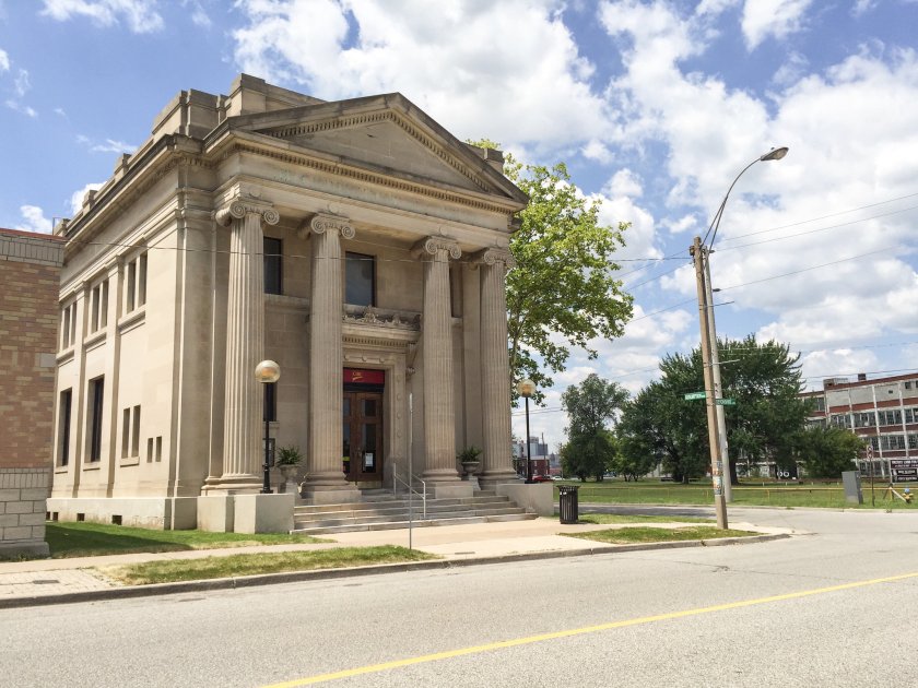
…and a bank building, also in Walkerville.
Next we come to Hamilton, Ontario, a port city on the western end of Lake Ontario. It is roughly the midway point between Toronto and Buffalo, New York.
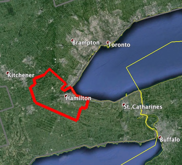
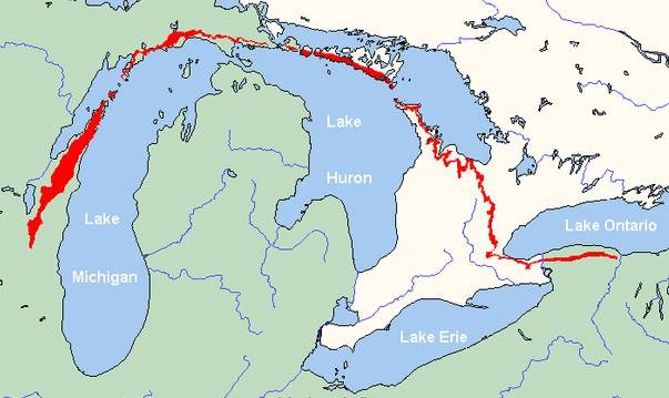
The Niagara Escarpment runs through the middle of the city.
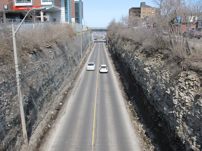
And I have my own opinion about what the Niagara Escarpment actually is. Check out my “Expanding on Waterfalls” if you are interested in finding out more about what that might be….
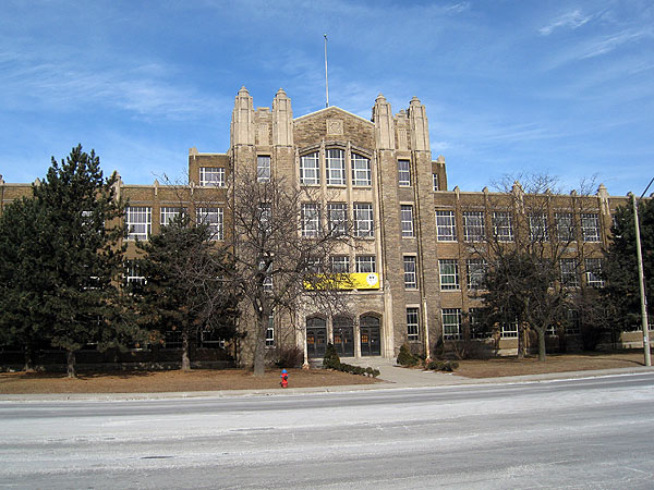
Here is a high school in Hamilton.
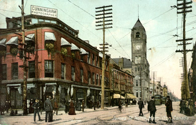
And an old view of James Street in Hamilton.
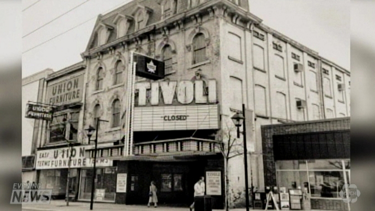
The historic Tivoli Theater…
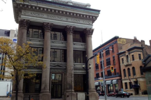
…and a Historic Bank in Hamilton.
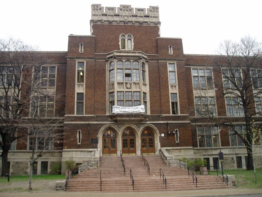
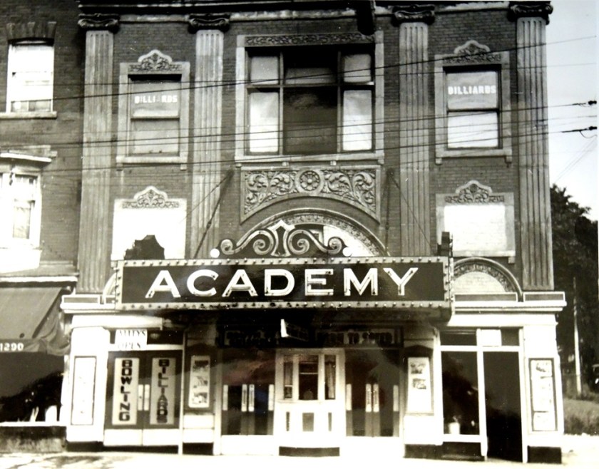
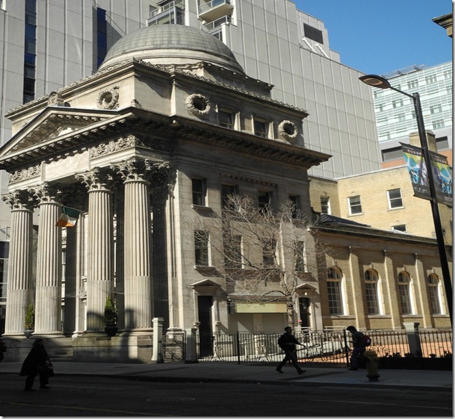
Next is Toronto, Ontario, the capital of Ontario and largest city in Canada, and on the northwestern shore of Lake Ontario.
This is the Jarvis Collegiate Institute in Toronto…
…the old Academy Theater…
…and the old Bank of Toronto.
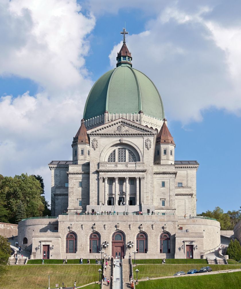
So finally arrive at the end of the line, or the beginning as it were – Montreal, Quebec.
Montreal is named after Mount Royal – the triple-peaked hill in the center of the city, where we find another one of these – Saint Joseph’s Oratory on Mount Royal.
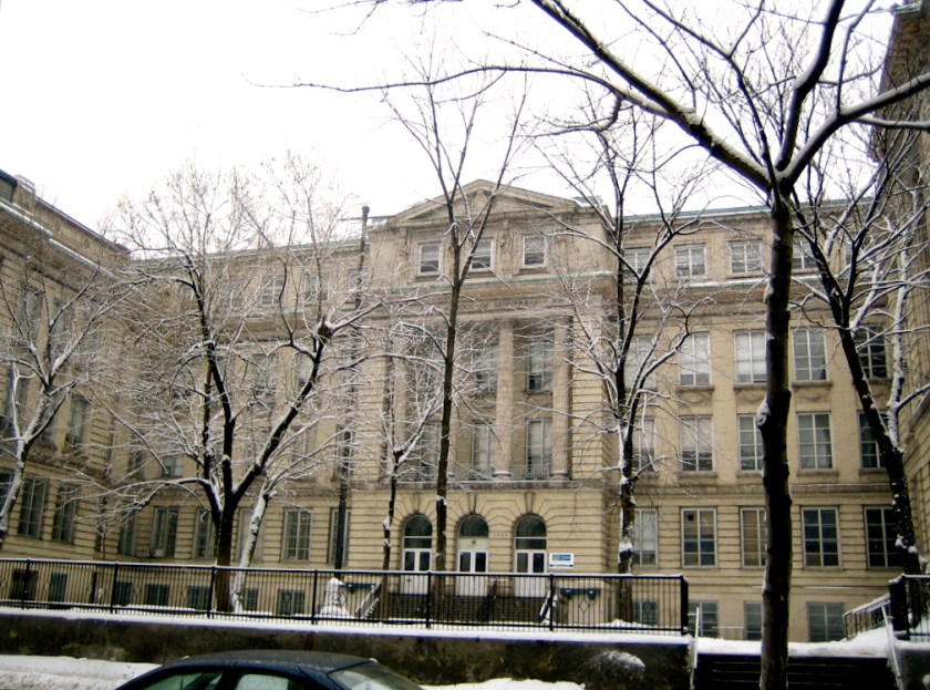
This is the Fine Arts Core Education School in Montreal.
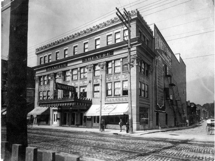
…A historic theater in Montreal…
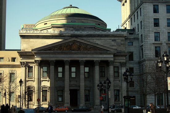
…and the old Bank of Montreal.
In conclusion, the same signature and hand of design is seen around the world and found in very different places in which one would not expect to find. There are astonishing similarities as we have seen traveling on this alignment through Canada, France, Italy, Serbia, Romania, the Crimea, Ukraine, Russia Chechnya, Kazakhstan, Turkmenistan, Uzbekhistan, Kyrgyzstan, China, North Korea, South Korea, Japan, Mexico, and the United States.
There was a unified, global civilization with Monumental Architecture up until relatively recent times. The buildings of this civilization of Human Genius that were not turned into government buildings were turned into schools, banks, theaters, art museums, churches, and so forth, which then became tools to control Humanity.
I believe that the hand of design of the Monumental Architecture were the Master Masons of a global and unified Moorish Empire, and that we have been taught a false historical narrative that was grafted onto what they built, and that we were somehow knocked off a positive timeline in order to control Humanity.
I also believe that the Moors;
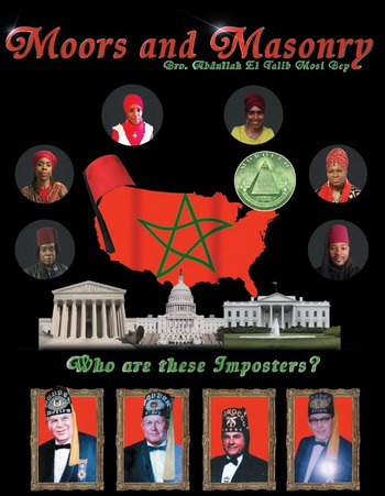
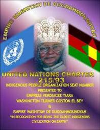
The Washitaw Muurs, also known as the Ancient Ones, who are still very much with us, and who the United Nations has formally recognized as being the oldest indigenous civilization on earth in this Charter (but for some reason the general population – cough, cough – has never heard of them);
and the 12 Tribes of Israel…

…are somehow interrelated, but I can’t say exactly how because the True History has been deliberately removed from our collective memory, but I know they are related..
I can only piece this together from the very compelling evidence of their incredible and monumental legacies worldwide, of which I have only scratched the surface of what I have found here in this post.
They have hidden it in plain sight by controlling our perception.

But now we are waking up to what they have been doing…and this is a very good thing because it is necessary to know this as we are evolving in consciousness, together as a collective.