
In the last post, I tracked the alignment from Delphi on Mount Parnassus, an important religious, cultural and social center of ancient Greece, to the Ionian Sea, and the islands of Atokos, Ithaca, and Kefalonia, the largest of the Ionian Islands of western Greece.
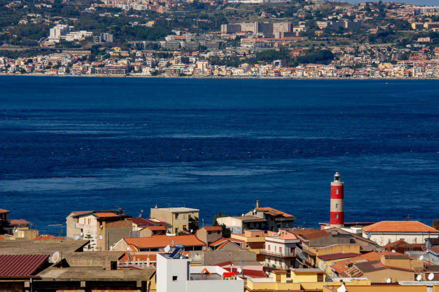
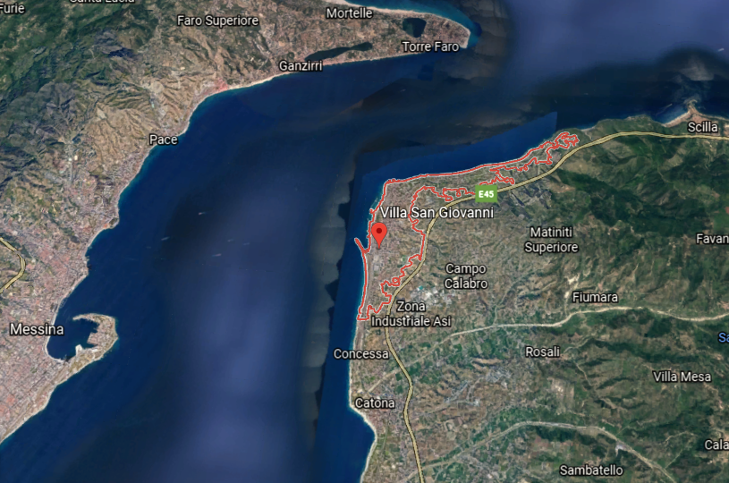
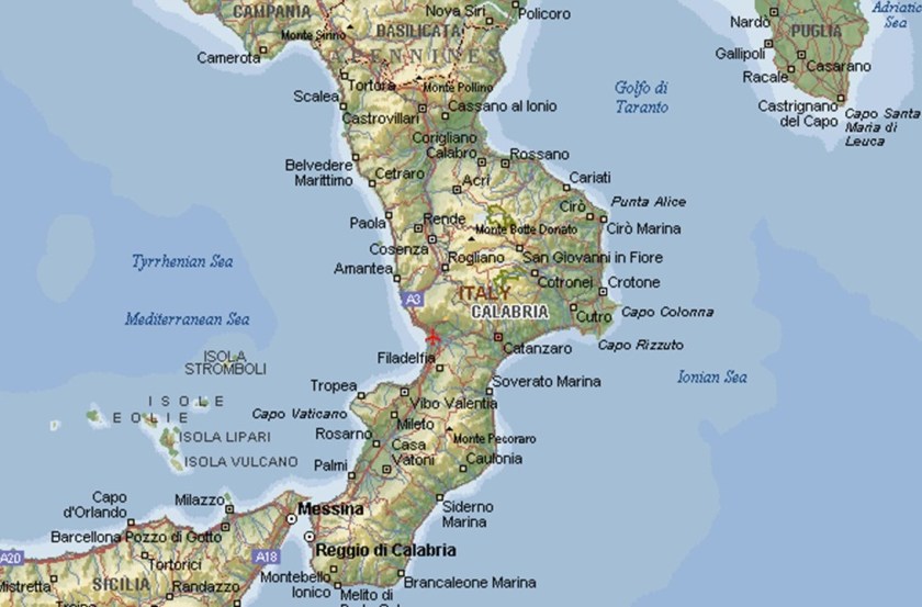
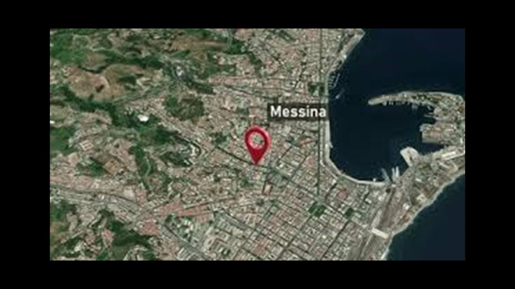
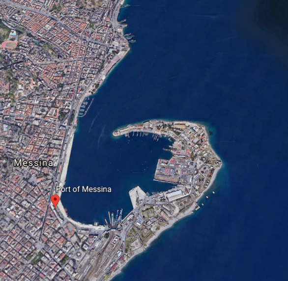
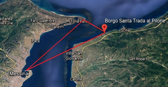
I am picking up the alignment at the Strait of Messina, a narrow strait between the eastern tip of Sicily and the western tip of Calabria in Italy.

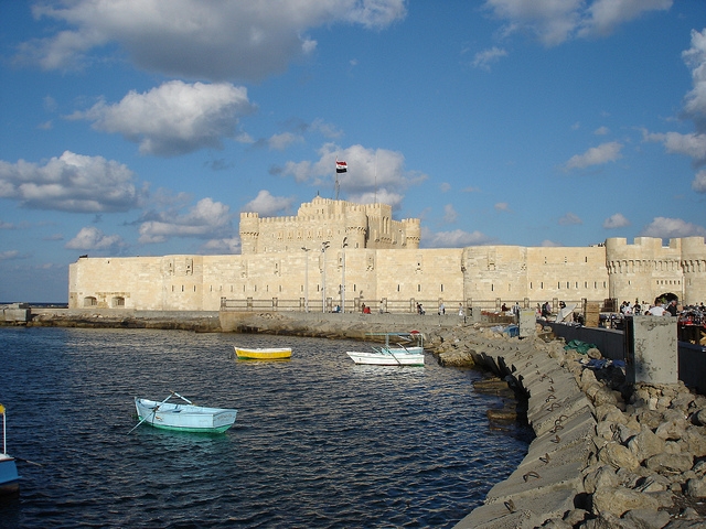
The narrowest point of the Strait of Messina is between the Punta del Faro in Sicily…
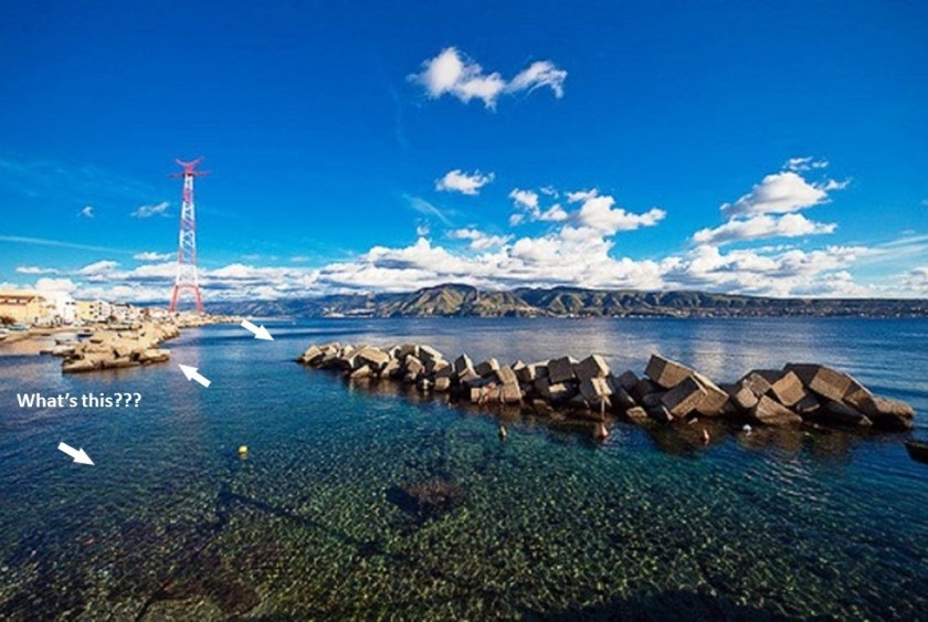
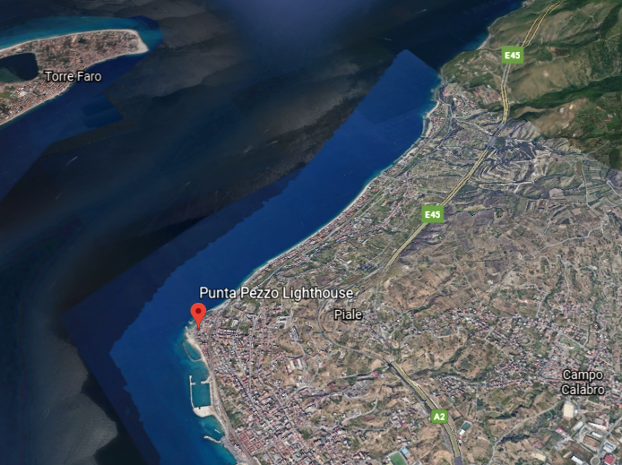
…and the Punta Pezzo in Villa San Giovanni in Italy’s Calabria region.
Punta del Faro in Sicily, located northeast of Messina, has a lot going on in a small space.
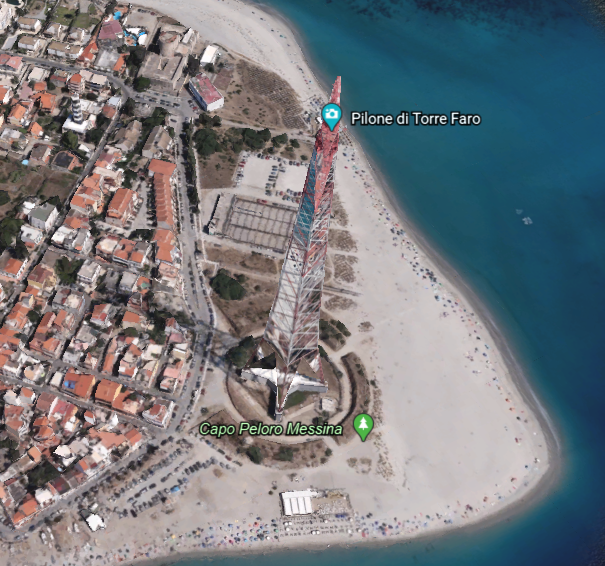
Let’s start with the Torre Faro Pylon.
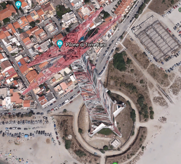
The Torre Faro pylon is one of two free-standing steel towers…
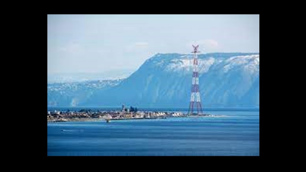
…with the other one, the Santa Trada pylon, being in the Villa San Giovanni across the strait, and standing on top of what looks like one of the more common star fort features.
We are told that they were built in 1955, and used between 1955 and 1994 to carry first 150-kilovolt, and then in 1971, a 220-kilovolt power-line across the Strait of Messina to respective sub-stations on both sides of it. They were decommissioned in 1993, and the conductors were removed a year later.

The Faro Point Lighthouse, also known as the Faro di Capo Pelori, is an active lighthouse that is completely automated, powered by mains electricity, or general purpose Alternating Current (AC) electric power supply.
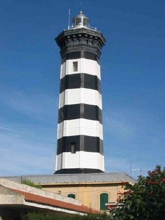
It was said to have been first built in 1853, with periods of disuse in-between. It is operated by the Italian Navy.
I want to make the point that the Pharos Lighthouse of Alexandria was one of the Seven Wonders of the Ancient World. At one time, at 330-feet, or 100-meters, in overall height, it was one of the tallest manmade structures in the world.
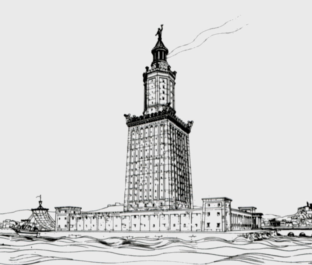
It was said to have been heavily damaged over time by earthquakes, and that in 1477, the Citadel of Qaitbay was established by the Sultan Al-Ashraf Sayf al-Din Qa’it Bay, and we are told the remaining stones of the Pharos Lighthouse were used in the building of it.
Bey is one of the five noble titles of the Moors. I just wonder if the name Qa’it Bay was changed from Qa’it Bey to obscure who we are really talking about here.
I also want to make note of the fact that, at least in the Romance Languages, the word for lighthouse, like the Pharos Lighthouse of Alexandria, includes the root sound of “Far”:
Italian – Faro
Spanish – Faro
French – Phare
Portuguese – Farol
Romanian – Far
And phonetically sounds like the word Pharaoh, which we are told was the common title for monarchs of ancient Egypt from the First Dynasty, starting in 3,150 BC, up to the annexation of Egypt by the Roman Empire in 30 BC.
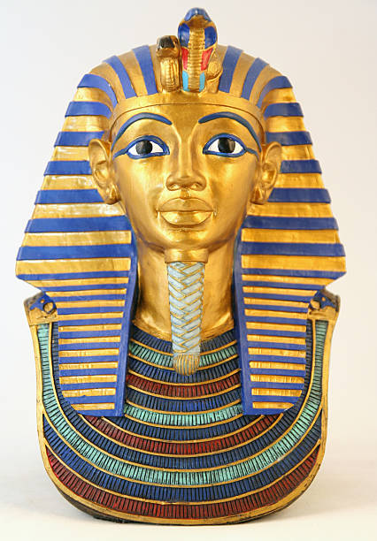
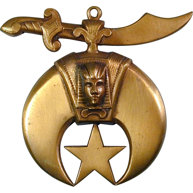
Are they telling us something without telling us they are telling us?
I mean, after all, this is the emblem of the Shriners. This organization is comprised of 32nd and 33rd degree Freemasons. With a sword over the head of a pharaoh, this is an image of oppression.
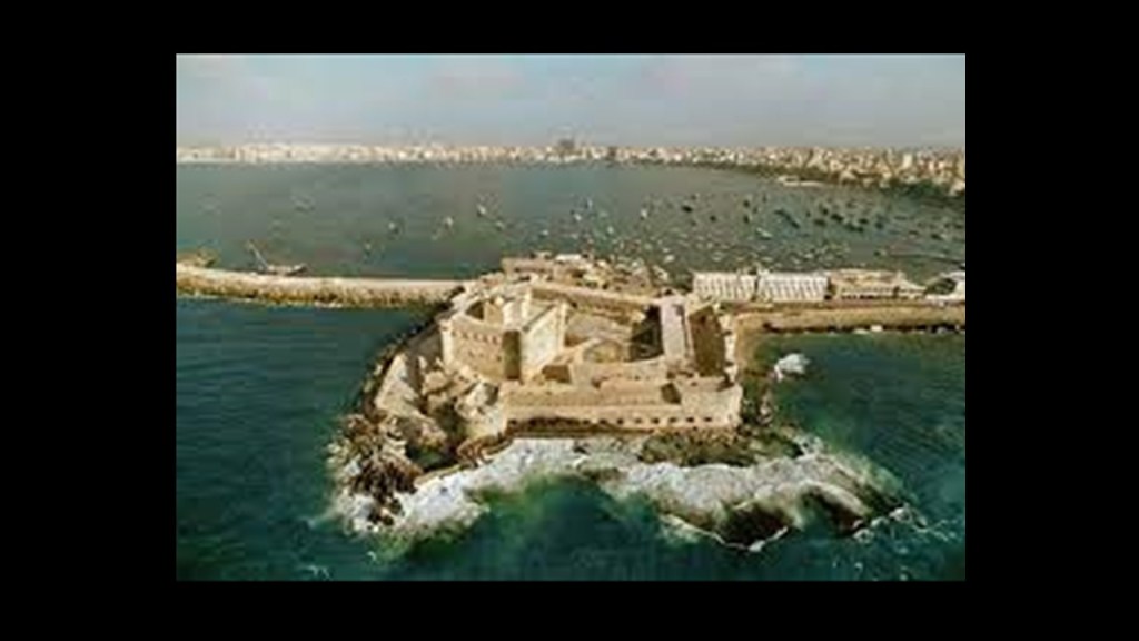
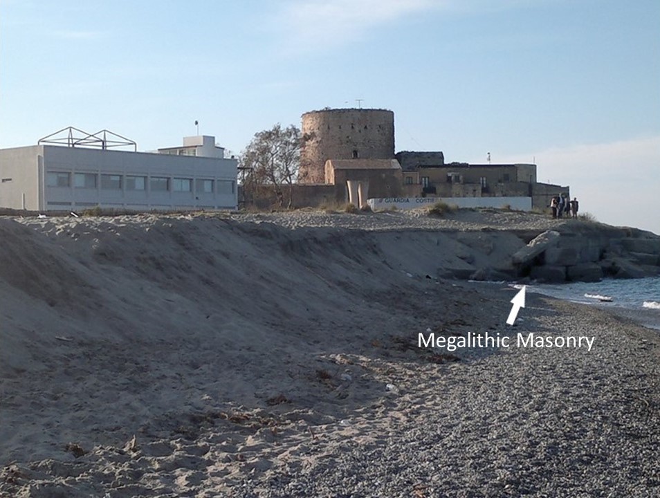
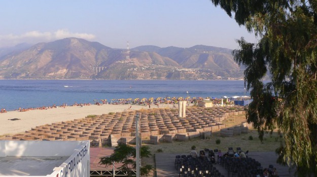
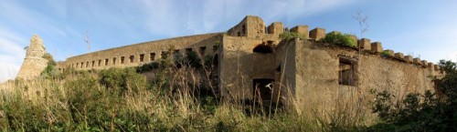
There is what is described as a fortication adjacent to the Punta del Faro lighthouse in Sicily…
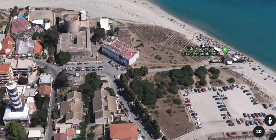
…that is now part of the Lido Horcynus Orca Park.
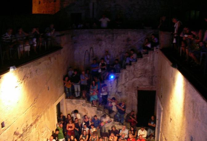
The fortification gets used for things like cinematographic festivals held here.
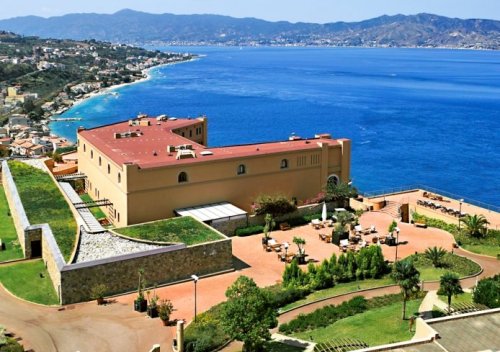
Lido Horcynus Orca Park is primarily a beach resort.
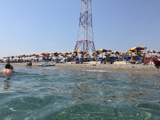
Does that look like a beach resort you would like to go to?
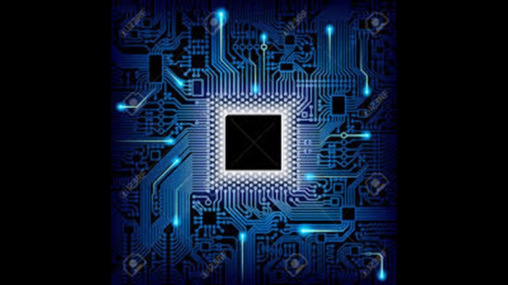
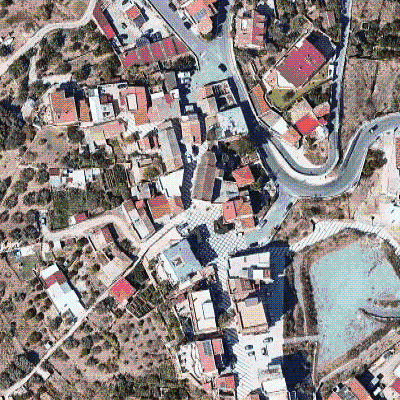
And Lido Horcynus Orca really has some interesting features surrounding the beachfront. Like, what the heck are these squares covering the landscape?
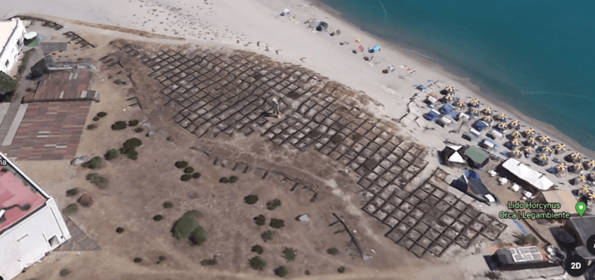
…and what are those two white column-looking things?
It brought to mind the square shapes I saw on Google Earth when I was looking at the coast of Iran across from Hormoz Island in the Strait of Hormuz…
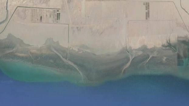
…and both lay-outs in the landscape resemble chips on a circuit board.
As the most northeastern point of Sicily, where the Ionian Sea meets the Tyrrhenian Sea…
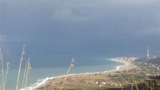
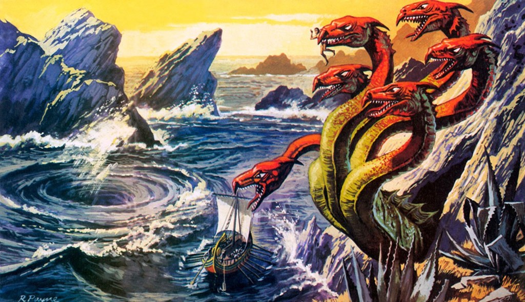
…Capo Peloro or Punta del Faro was supposedly the lair of Charybdis, one of the two beautiful women who had been turned into grotesque monsters by jealous goddesses in Greek mythology.
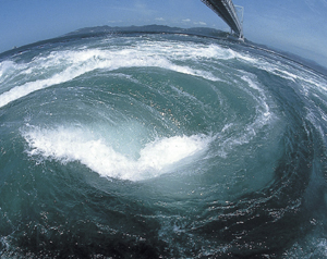
In one version of the myth, she would partially hide herself beneath a fig tree there, amd would frequently leap out into the sea in order to swallow huge quantities of water, creating a whirlpool that would suck down passing ships, and she would belch the water up afterwards.
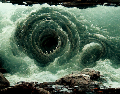
Garofalo, otherwise known to the world as Charybdis, is found in the Strait of Messina. While not technically a whirlpool, it occurs when the winds and tides meet at cross-purposes in the strait, producing rough seas that are hazardous for vessels.
One more thing before moving across the Strait of Messina to Calabria.
As the ancient Pelorus, Punta del Faro is one of the most celebrated promontories of Sicily, and one of three promontories which were considered to give it the triangular form. Trinacria, the ancient name of Sicily, is said to derive from an ancient Greek word meaning “three legs” and is synonymous with the sun and said to convey motion.
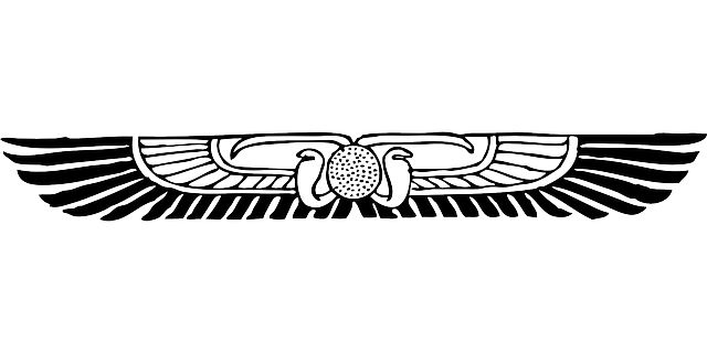
When I looked up the word “Trinacria,”versions of this image popped up all over the place. This particular version includes a human head with serpents and wings…
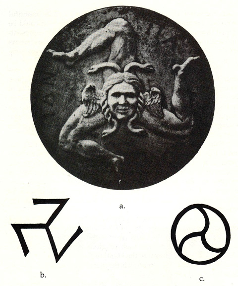
…similar to the winged disk symbol, most commonly associated with Ancient Egyptian and Mesopotamian cultures…
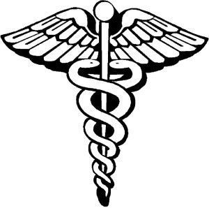
…and the caduceus, the staff of Hermes in Greek mythology, and an emblem of the medical profession in today’s world.
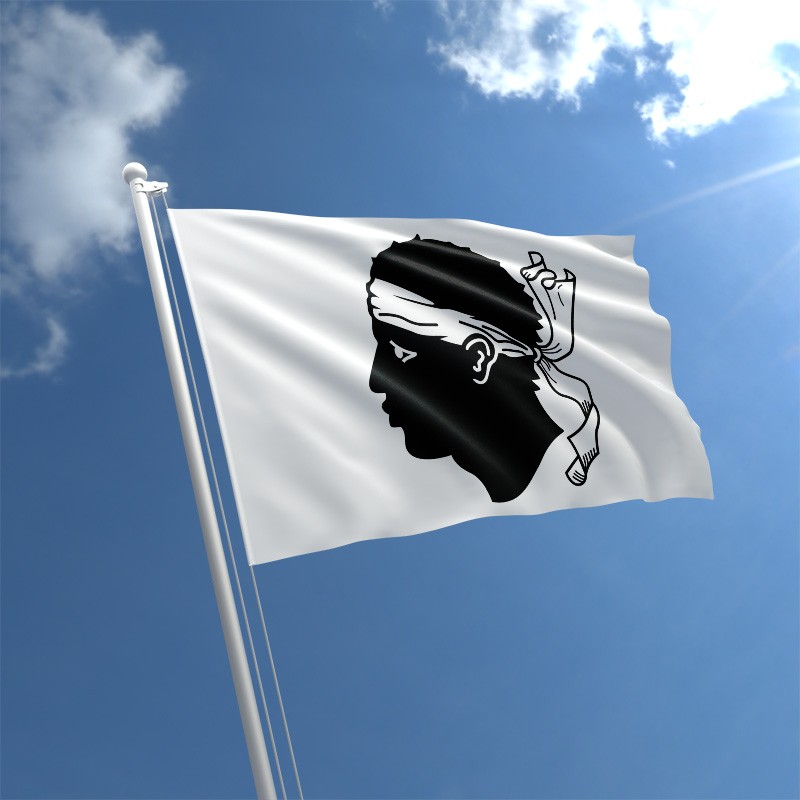
This version of the Trinacria is on the flag of Sicily. The head still has wings, but the serpents aren’t clearly defined as in the first head, kind of looking more like ropes, and the addition of what looks like three ears of wheat.
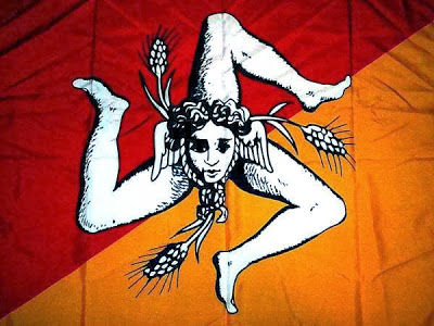
Why was the image modified?
The Trinacria itself is a symbolic representation of the zenith of the soul in its present state of existence, and the setting of the spiritual essence in its totality. It represents self-realization and ascension.
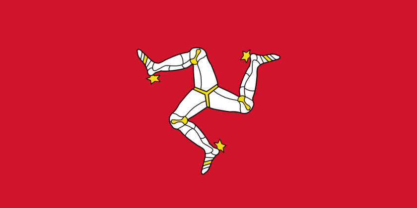
This is the flag of the Isle of Man, with a shape called the Triskelion…
…which is located in the Irish Sea between Ireland and Great Britain.
Interesting that there is information like this about ancient knowledge to be found in flags, as well as information about the true identity of the missing civilization.
This is the flag of Sardinia, a large island region of Italy in the Mediterranean Sea, northwest of the Strait of Messina. It is also called the flag of the Four Moors…
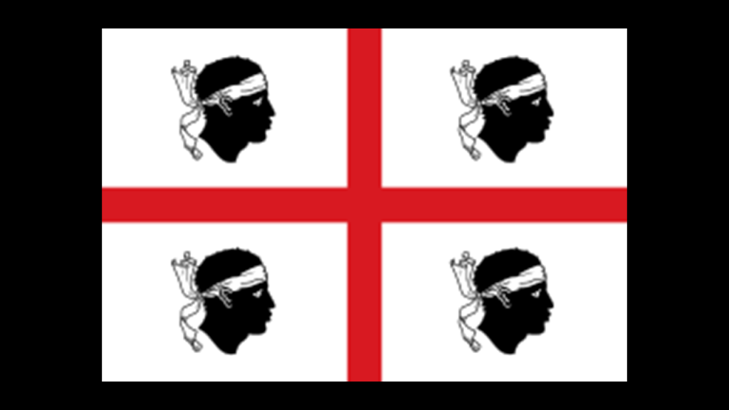
…and this is the flag of Corsica, an island region of France, just north of Sardinia, with one Moor’s head.
Now changing focus to look at Punta Pezzo, the closest point between Italy’s Calabrian shore in the Villa San Giovanni, and Punta del Faro in Sicily.
The city of Villa San Giovanni faces the city of Messina across the strait.
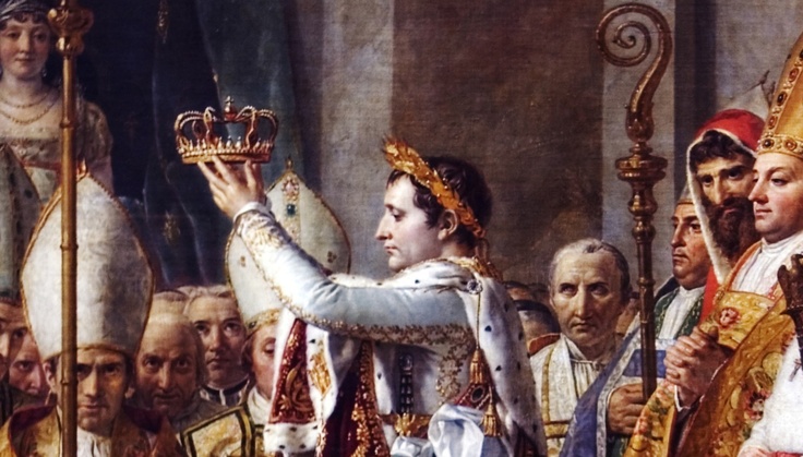
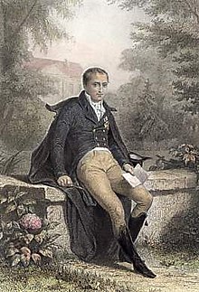
This part of Calabria was a focal point for Napoleon Bonaparte, after he proclaimed himself emperor of France in 1804.
He made his older brother, Joseph-Napoleon, the King of Naples and Sicily between 1806 and 1808, who we are told, implemented administrative reforms in 1806 that abolished the ruling system that was in place here, and the Lordship of Fiumara disappeared.
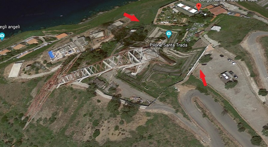
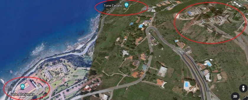
Then, starting in June of 1810, we are told the new King of Naples, Joachim Murat, and the brother-in-law of Napoleon, ruled the southern Kingdom from the heights of Piale for four months, during which that short period of time he was given the credit for having built the fort of Punta Pezzo, or Piale, with a telegraph tower…
…the Torre Cavallo…
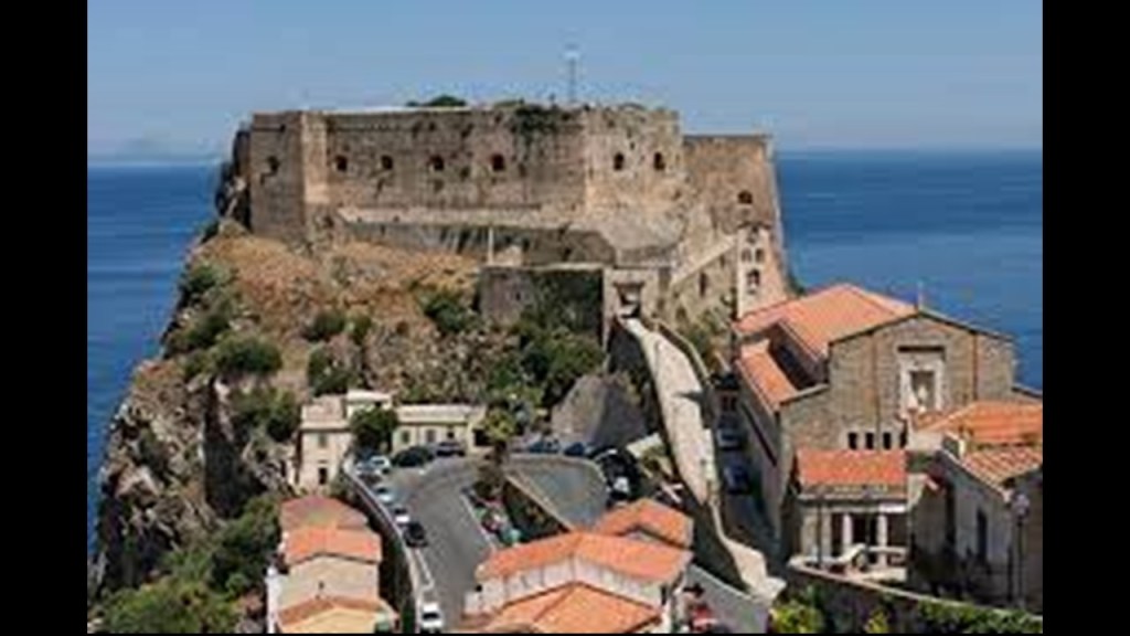
…and the Castello Altafiumara…
…with the Castello Altafiumara and Torre Cavallo both being in close proximity to the Santa Trada Pylon we saw earlier.
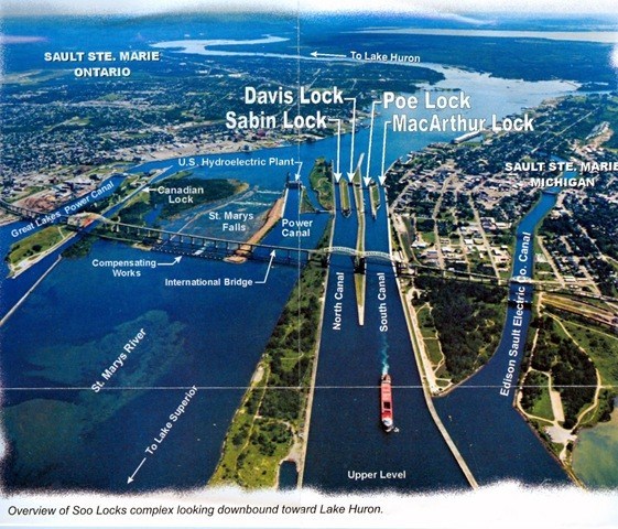
This particular geographic location appears to have been a particularly important place on the planetary grid system, similar in scope of what’s here to what I found in Sault Ste. Marie, Michigan and Sault Ste. Marie, Ontario, situated across from each other with the Saint Mary’s River in-between them.
See my blog post “Sault Ste. Marie – A Microcosm of the Advanced & Global Moorish Civilization” for an in-depth analysis of the region nicknamed “The Soo.”
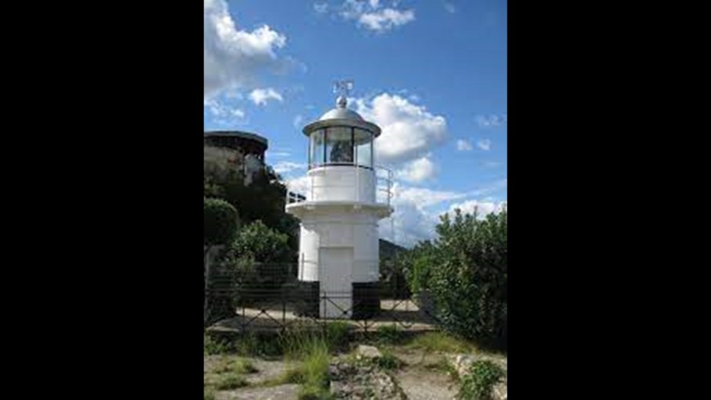
Just a short distance north of Calabria’s Punta Pezzo , we find the Ruffo Castle of Scilla, described as an ancient fortification, and situated on a promontory in the Strait of Messina in the town of Scilla…
…and which houses the Scilla Lighthouse, also operated by the Italian Navy, like the Faro del Cape Peloro in Sicily.
Scilla is also the traditional site associated with the sea monster Scylla of Greek mythology, with its location right at the entrance to the Strait of Messina.
The linguistic idiom “between Scylla and Charybdis” means having to choose between two similarly dangerous situations, like the more common idiom “between a rock and a hard place.”
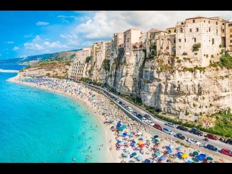
Other places of interest in Calabria, known in antiquity as Bruttium, include Tropea, an ancient seaside town built on top of a cliff, with a legend of having been founded by Hercules when returning from his labors at the Pillars of Hercules (in the Strait of Gibraltar)…
…and Reggio di Calabria, known as Rhegium in ancient times, located on the toe of the boot of the Italian peninsula.
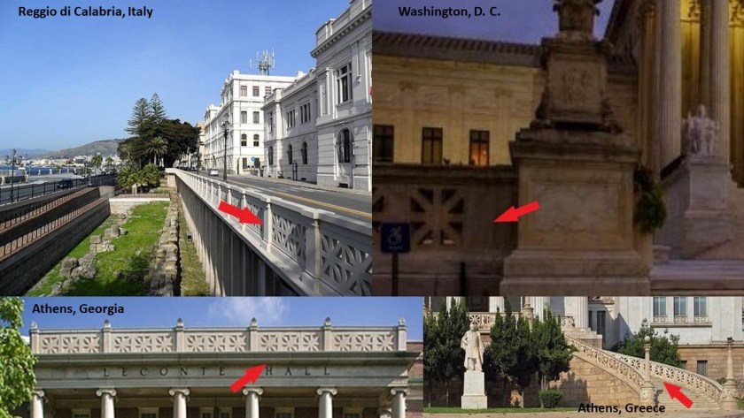
It is interesting to note the presence of the same design pattern in the architecture of Reggio di Calabria that you find at the Supreme Court in Washington, DC; at Leconte Hall at the University of Georgia in Athens, Georgia; and at the National Library of Greece in Athens, Greece.
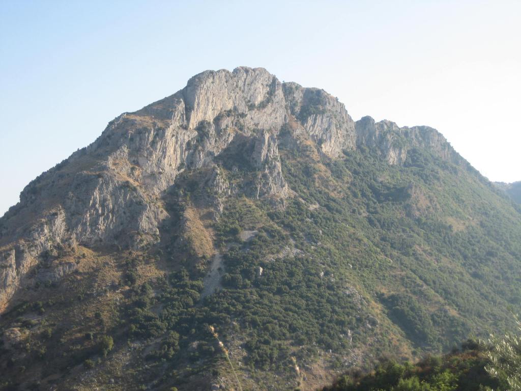
Reggio di Calabria is located on the Aspromonte, a long craggy mountain range that runs up through the center of the region, and described as resembling a giant pyramid.
This is Mount Consolino in the Aspromonte…
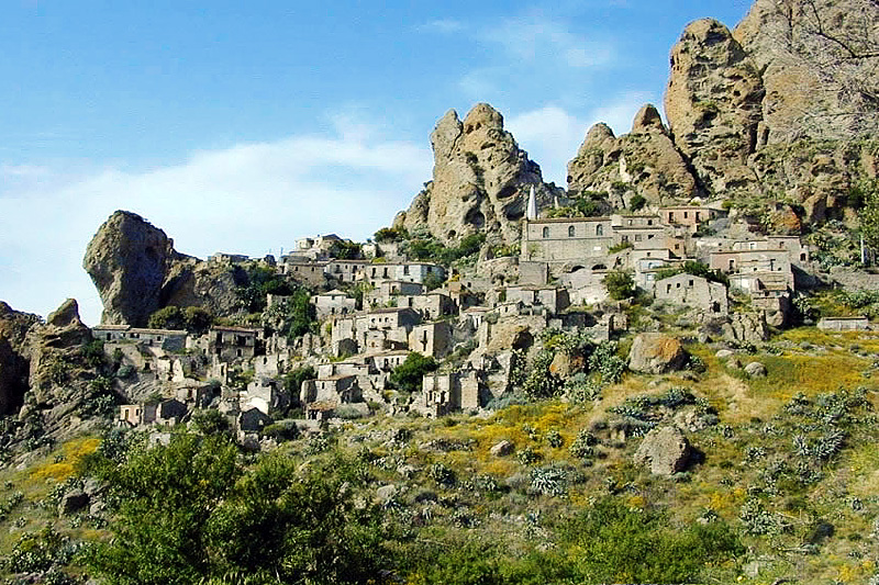
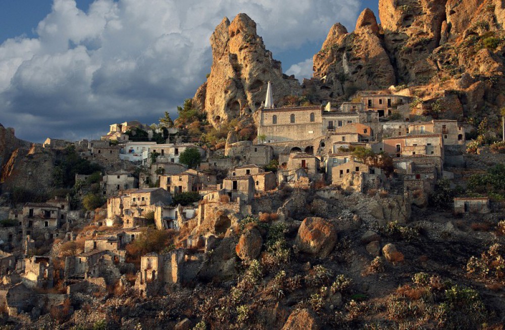
…and within the boundaries of Aspromonte National Park, you find places like the ghost towns of Pentedattilo…
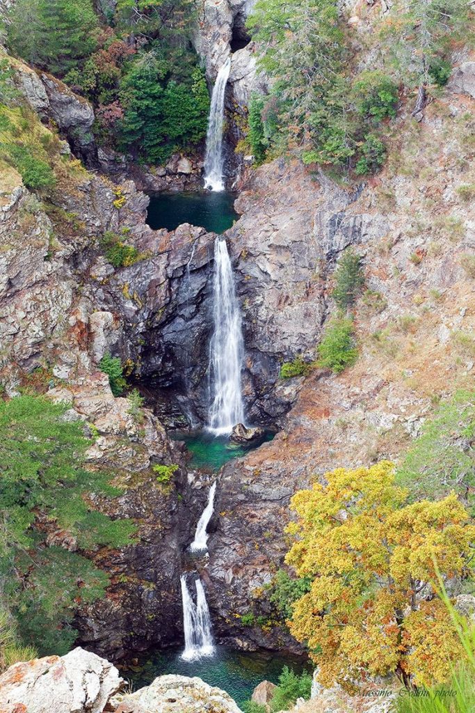
…as well as waterfalls, like the multi-storied Maesano waterfalls.
Back across the Strait to take a look at Messina proper, with a population of over 230,000, and the metropolitan area of Messina, which includes Punta del Faro, is around 650,000, making it the third-largest city in Sicily, and the thirteenth largest in Italy.
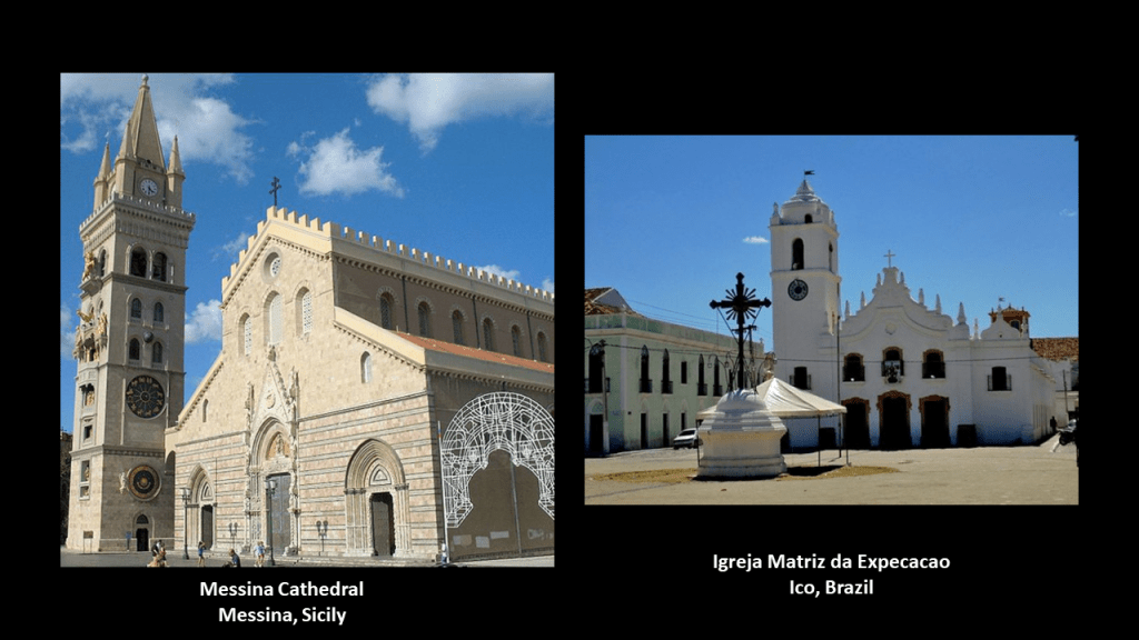
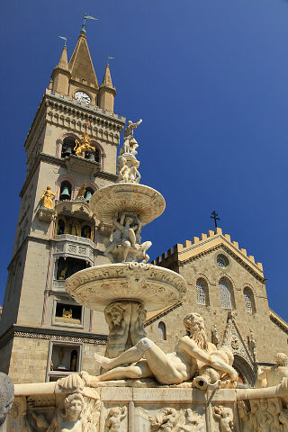
The Messina Cathedral is said to be an example of Norman architecture, built on the orders of the Norman King Ruggero II in 1120 AD.
For comparison in appearance, this is the Igreja Matriz da Expecacao in Ico, Brazil, on the right.
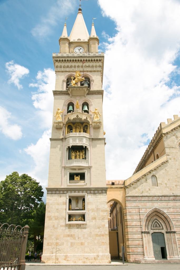
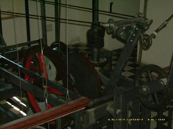
We are told the current Bell-Tower next to the Messina Cathedral was inaugurated in 1933, after having been designed by the firm of Ungerer of Strasbourg, and is famous for having the biggest and most complex astrological clock in the world.
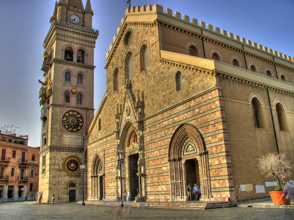
Every day at noon, a complex system of counterweights, leverages, and gears moves gilded bronze statues located in the facade.
The Fountain of Orion is in front of the Messina Cathedral, and said to have been finished in 1553, commemorating both the city’s mythical founder, and the completion of the first aqueduct of Messina in 1547.
Messina is a major port city.
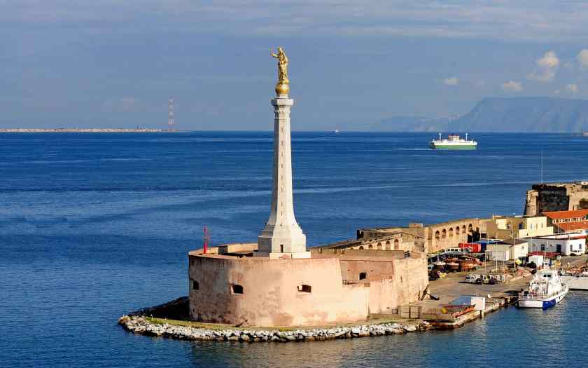
…and the said-to-be 16th-century Forte del Santissimo Salvatore is located at the port’s entrance.
The Stele of the Madonna Lettera, erected on the fort, was said to have been consecrated and inaugurated in 1934.
I see the Torre Faro pylon in the distance.
It looks like there could be a triangulated relationship between the Stele, the Torre Faro pylon, and the Santa Trada pylon…
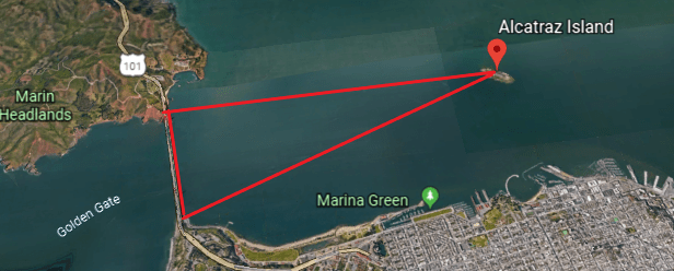
…just like the triangulated relationship I found in the first part of this series between the lighthouse at Alcatraz Island in San Francisco Bay, and the Fort Point Light on the Presidio side of the Golden Gate Bridge, and the Lime Point Light on the other side of the bridge
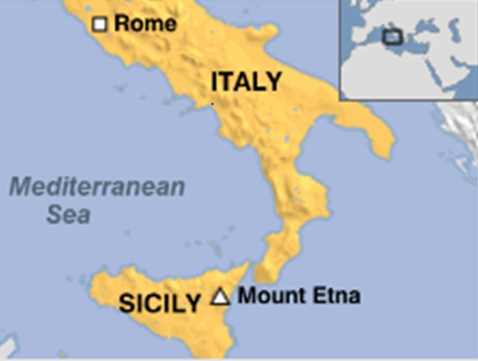
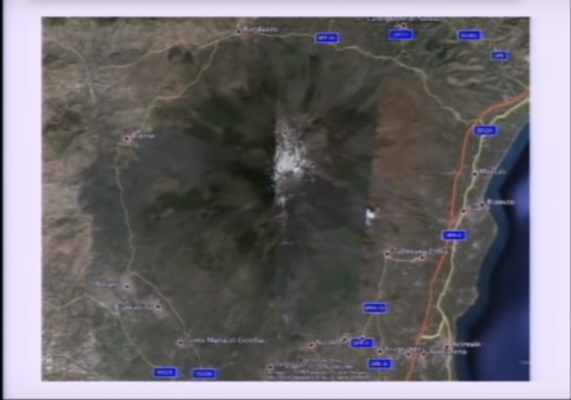
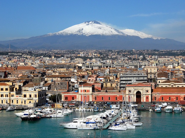
The next place we come to on the alignment is Mount Etna, on the east coast of Sicily, in what is called the Metropolitan City of Catania, formerly the Province of Catania.
It is located between the cities of Messina and Catania.
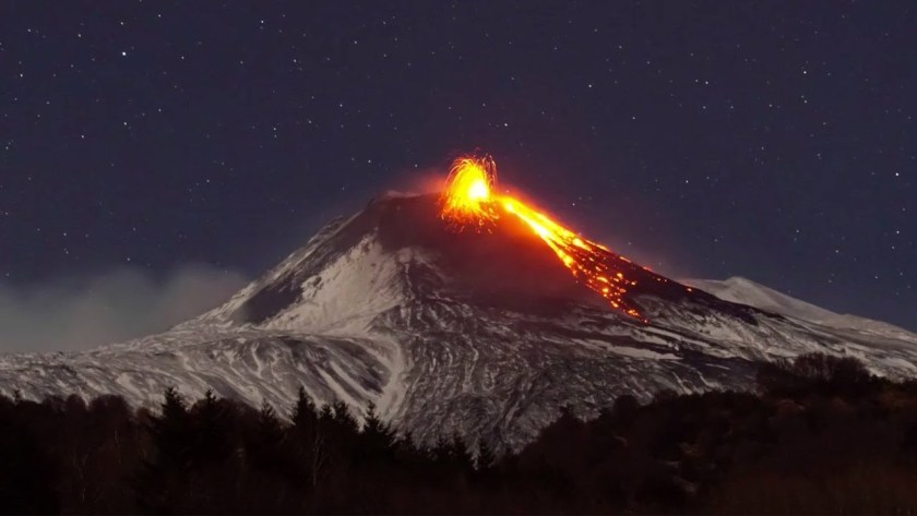
It is a stratovolcano that is one of the most active in the world, and is in an almost constant state of activity.
I learned several years ago in a Megalithomania presentation by Antoine Gigal about pyramids around Mount Etna, and I am drawing from her research in the next slides about this obscure subject.
Antoine Gigal is a French writer, researcher and explorer, and the founder of Giza for Humanity who went to Sicily when she heard about 12 pyramids there.

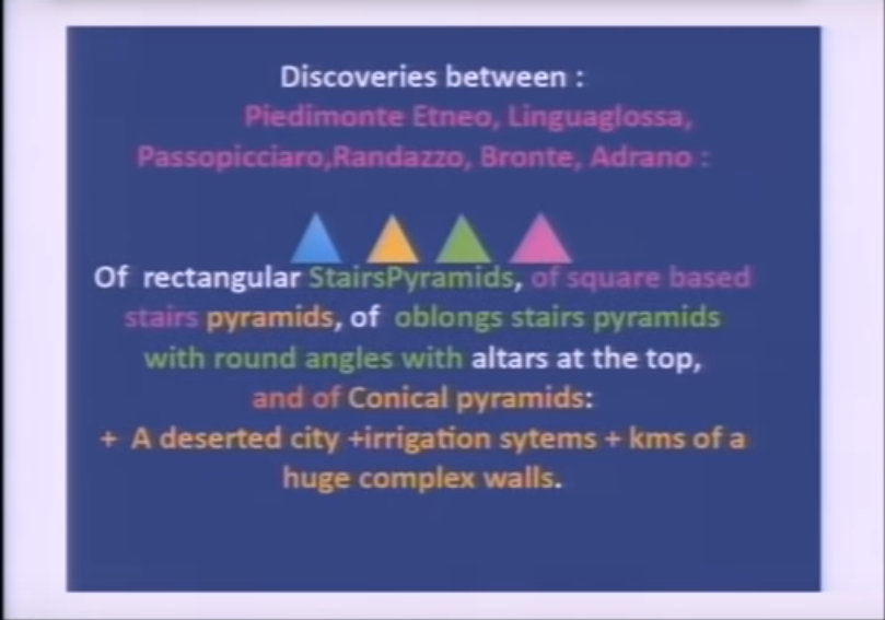
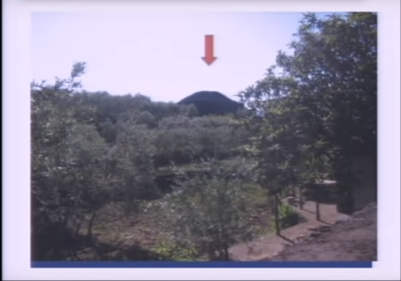
Instead of finding the 12 pyramids she was told about, she found 23 pyramids around Mount Etna, and proceeded to literally do field research, as the pyramids were in the middle of fields.
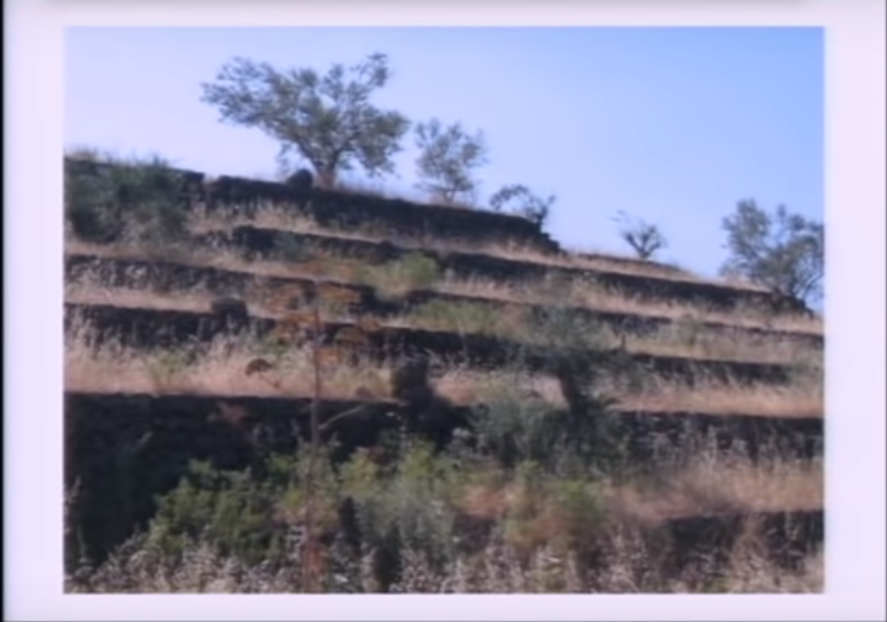
She found pyramids of different shapes and sizes…
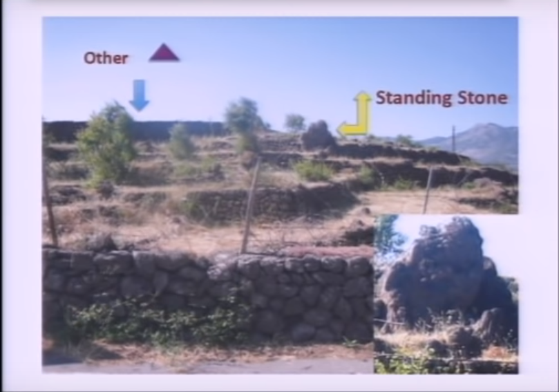
…like an oblong step pyramid between the towns of Passopisciaro and Francavilla…
…which has a standing stone…
…a rectangular pyramid between Linguaglossa and Randazzo…
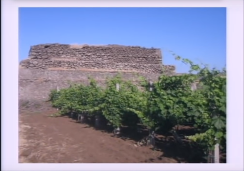
…and this rectangular pyramid on Mount Etna’s north side.
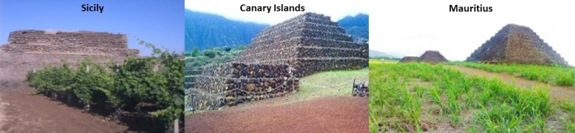
In Antoine Gigal’s presentation, she demonstrates that the construction style of the Sicilian pyramids is like that of the Guimar Pyramids of Tenerife in the Canary Islands in the Atlantic Ocean, and also like that of the pyramids of the island nation of Mauritius in the Indian Ocean.
The last place I am going to be looking at in Sicily is Catania…
…located at the foot of Mount Etna.
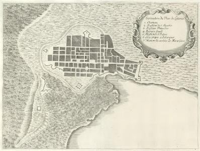
This illustration is said to be of a 1679 eruption of Etna that impacted Catania and also shows what looks to be a star fort around the city or a star city.

This prompted me to look for historic maps of Catania, and I found this old map of the city which confirms the finding.
Beneath the surface-level city of Catania, there are said to be several layers of underground cities…
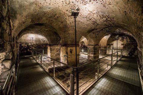
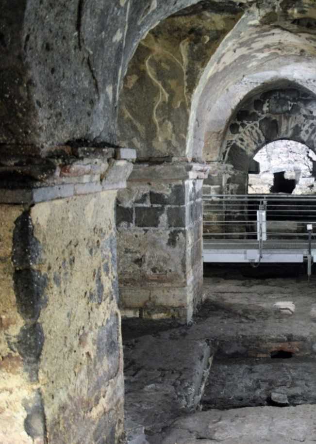
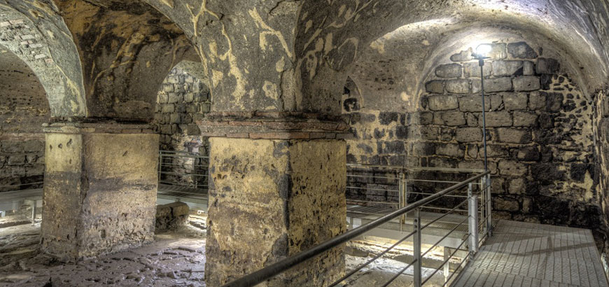
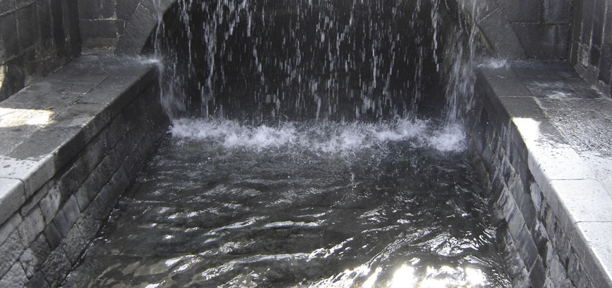
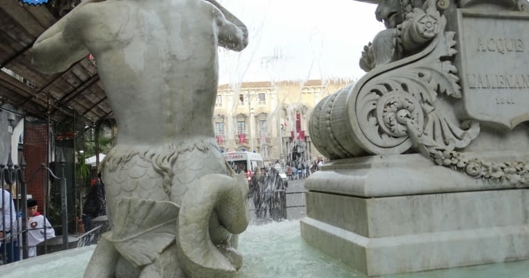
…and an underground river, named Amenano…
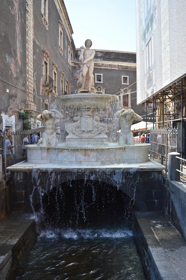
…and in the Piazzo del Duomo, the main square of the city, is the Amenano Fountain of the Amenano River, said to have been sculpted in 1867 by Italian sculptor Tito Angelini.
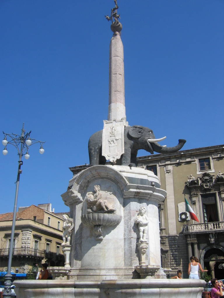
The Catania Town Hall, also known as the “Palace of the Elephants” is also in the Piazzo del Duomo…
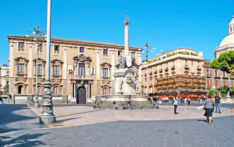
…with the U Liotru fountain, the elephant symbol of Catania, said to have been carved from ancient lava stone and topped by an obelisk from Syene (now called Aswan) in Egypt.
As with everywhere else, there is much more to find in Catania, but I am going to end this post here, and pick up the alignment on the island of Malta.
