This is volume number 7 of a long new series in which I am highlighting places, concepts, and historical events that people have suggested, and is a compilation of work I have previously done, now presented in a multi-volume format.
With regards to the subject of public art in the last video that is/was highly visible, and quite bizarre, if not downright disturbing, here are some follow-up comments from viewers.
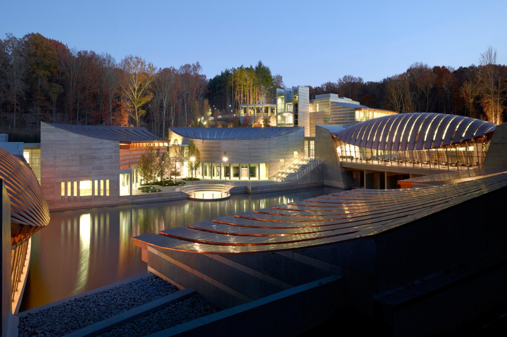
DB was reminded of some of the statues at the Crystal Bridges Museum of American Art in Bentonville, Arkansas, which was founded in by WalMart heiress Alice Walton, and opened to the public in November of 2011…
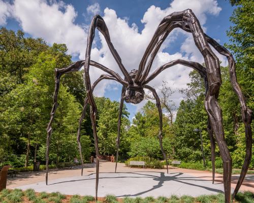
…which has on its grounds one of those massive spiders mentioned in the last post named “Maman,” by French-American artist Louise Bourgeois, as commented on by viewers LR and AI.
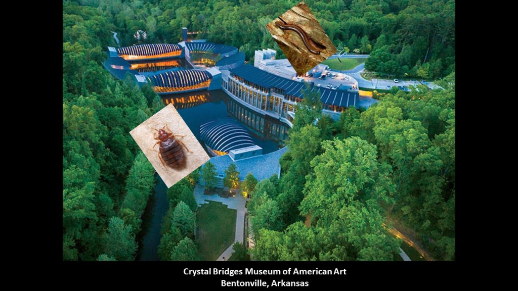
AI also mentioned the bug-like-look of the architecture of the museum.
You know, she might be on to something there ~ it’s not at all hard to find bug images that resemble the architecture of the Crystal Bridges Museum!
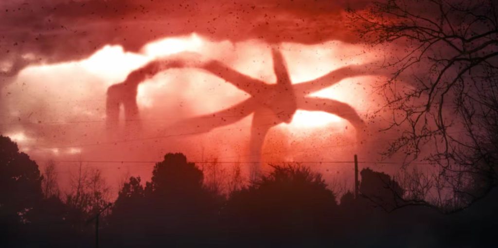
Also, VW commented that all these same spider statues found worldwide reminded her of the mind flayer from the Netflix show Stranger Things.
THE shared that the Parx Casino and Racetrack entrance in Bensalem, Pennsylvania has the same disembodied horse’s head named “Horse at Water” that was displayed at the Marble Arch in London, as it turns out, is exactly the same sculpture done by British Sculptor Nic Fiddian-Green.
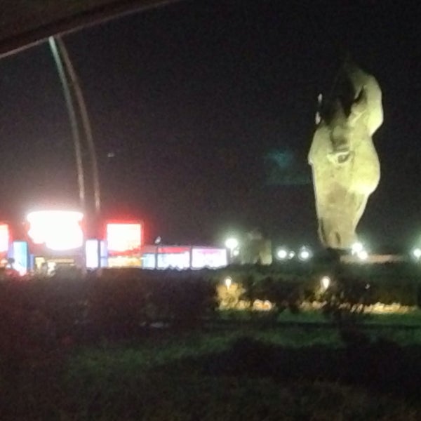
The Parx Casino and Racetrack Complex is the Number One gaming and live thoroughbred racing venue in the region.

Okay ~ I get it!
They seem to be trying to make a connection between the disembodied horse’s head as somehow symbolizing horses in general and therefore perfectly natural to have at the entrance of a thoroughbred horse-racing venue.
No matter how they try to spin it, though, the disembodied horse’s head is still perceived as creepy in the public eye.
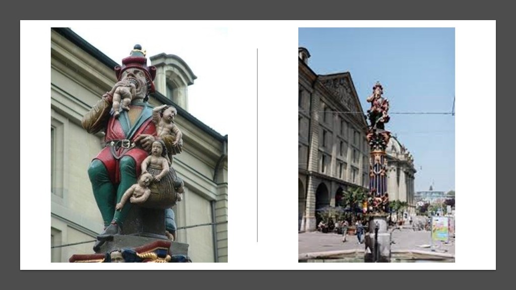
IN commented about a statue called “The Child Eater” in Bern, Switzerland.
There are many stories surrounding it as to the meaning of it.
No one knows for sure where the idea came from, but why is a statue like this even existing in the first place?
It is part of one of the oldest fountains in Bern, with a construction date of 1546, of a giant eating one baby, with more babies depicted on and around the giant.
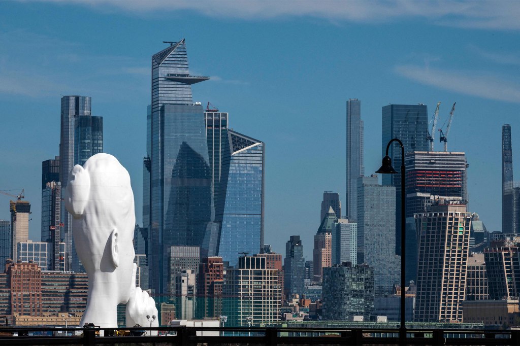
E79 left a comment letting me know about the new”Shhh” statue in New Jersey, which is on the waterfront in Jersey City, facing New York City.
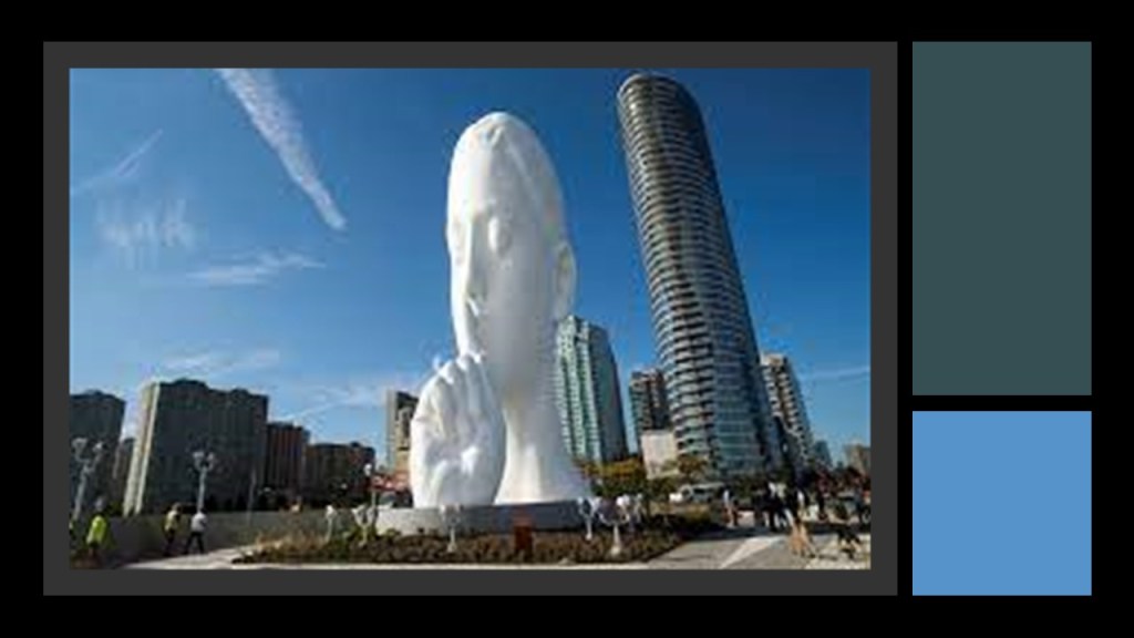
Officially called “Water’s Soul,” it is a brand-new 80-foot, or 24-meter, -high, sculpture on private property.
E79 in New Jersey also brought the Spotted Lanternfly to my attention.

The Spotted Lantern Fly comes from parts of Asia, where it is kept in check by natural predators, and was first recorded in the United States in September of 2014, and is found in eastern seaboard states, besides New Jersey, like Delaware, Maryland, Pennsylvania, New York, Connecticut, Virginia, Indiana, and Ohio.
It flies or jumps into its preferred plant hosts, and causes serious damage including oozing sap; wilting; leaf-curling; and dieback in trees, vines, crops, and other types of plants.

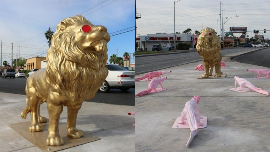
LYT commented that in Las Vegas there is a small statue of a golden lion with red jewel like eyes with seven pink lizards facing it in a circle around it on a median near Sahara and Decatur.
Part of a county art project, it was moved there from its original location at the Decatur and Flamingo intersection because the lion was stolen days after it was installed back in 2016, and the lizards, which are also called alligators or crocodiles, were vandalized.
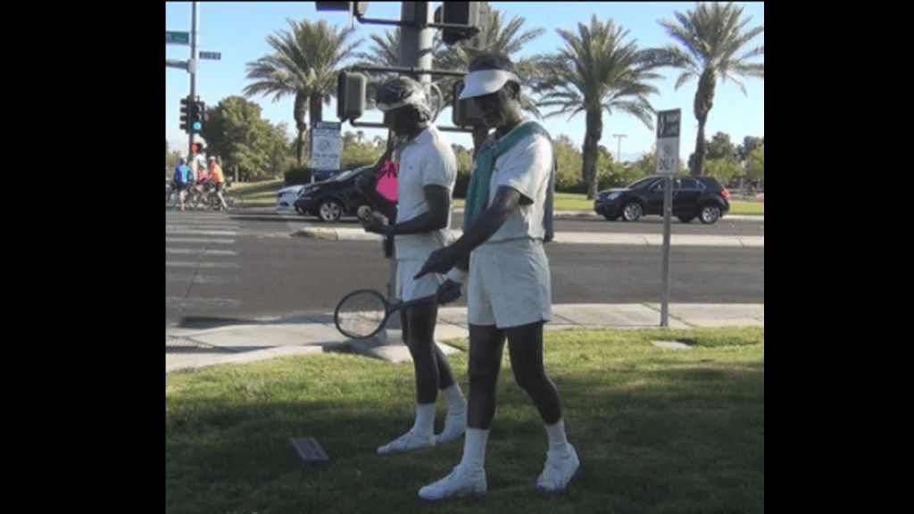
KyB added to the list of unusual public art in Las Vegas that includes several life-size and life-like Seward Johnson sculptures on display , like the ones found at New Jersey’s “Grounds for Sculpture” mentioned in the last post, including one called “Water Power…”

…and another called “Match Point,” among several others.
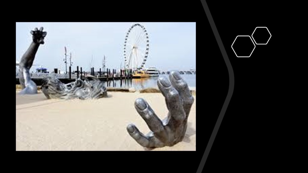
With regards to bringing up the subject of asking what the actual purpose of ferris wheels might be besides fun for the public in the last post, because of seeing one close to one of Seward Johnson’s “Awakening” sculpture of a distressed giant struggling to emerge from the Earth at the National Harbor in Oxon Hill, Maryland…
…I got the following feedback from viewers.
XE commented that if you delve into the science of flywheel energy storage, the scale and mass of a ferris wheel could be explained as a solid-state battery of sorts especially if one considers the idea of mechanical work in the use of gears and gearing ratios…

…and XE said in the case that the oceans used to be higher by around 16-feet, or 5-meters globally, the ferris-wheel with buckets attached to where the benches or gondolas are would be capable of harnessing hydroelectric generation from the force of the incoming tide and persistent waves.

Another viewer, IG, said that ferris wheels are artificial PORTALS, and here’s an article I found addressing that issue.

BB in Australia asked if I was aware of the climate-controlled, indoor Ferris Wheel in Ashgabat, the capital of the Central Asian country of Turkimenistan.
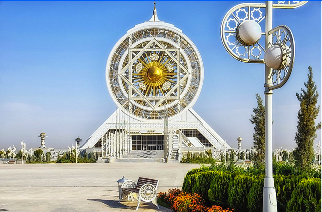
This is a view of the white marble buildings of Ashgabat from the ferris wheel…

…and this is a closer view of what is known as the “White Marble City.”

Considered to perhaps be the world’s strangest city, there definitely seems to be a big story hidden in the country with the smallest population of the Central Asian Republics!

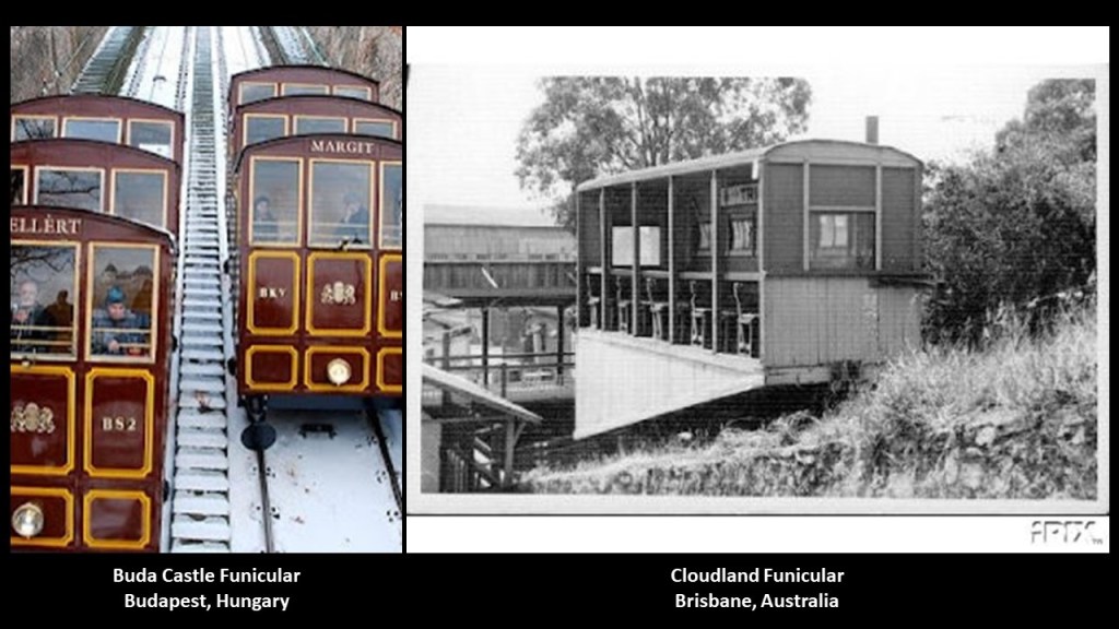
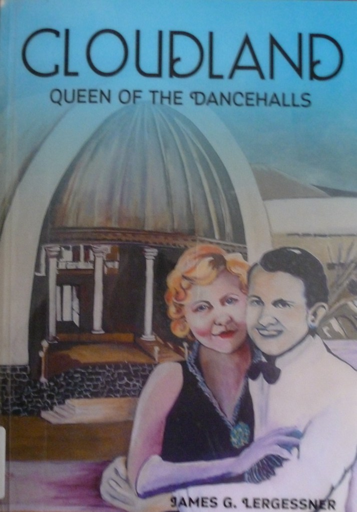
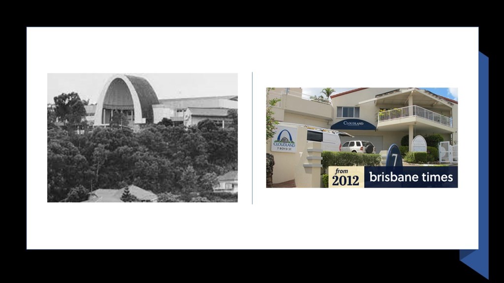
BB also mentioned the funicular that was at Cloudland in Brisbane, Australia, from my mention of Buda Castle’s funicular in Budapest in the last post as well.
Cloudland, also known as Luna Park, along with the Luna Parks in Sydney and Melbourne, and was used as a Ballroom and Dance Hall, and BB said Cloudland was a HUGE thing during the 40’s when the US troops were here, and many local girls married GI’s.

He said the Cloudland dancing floor was naturally-sprung, and when the dancers were pumping, the floor could bounce around nine inches.
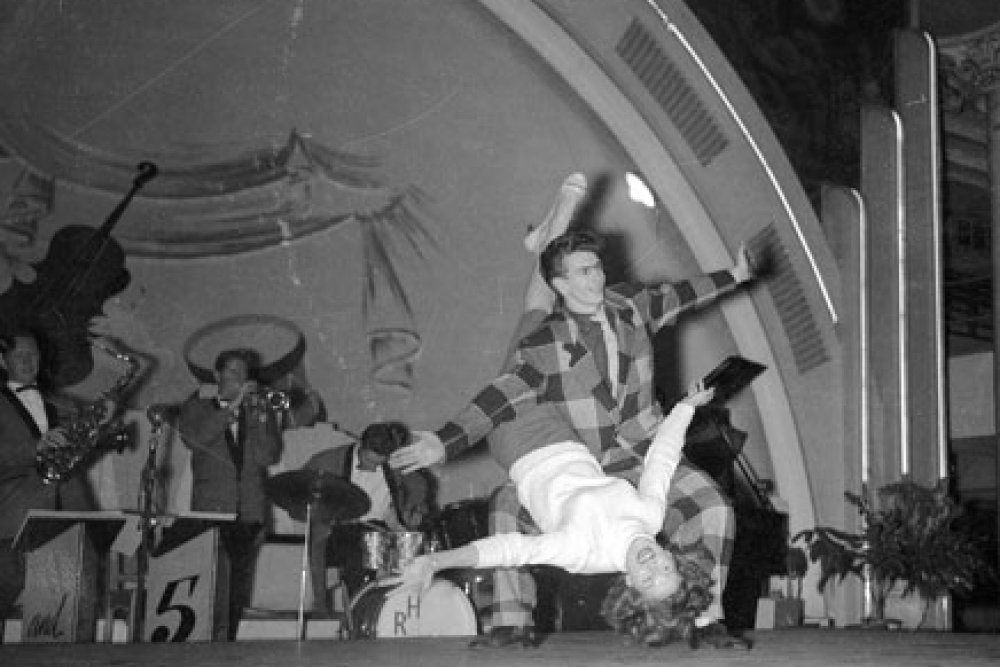
BB said the Ballroom dancing floor was refurbished in 1951, and his father bought some of the original timber and built their house out of it.
He said you cannot buy, for love nor money, that quality of timber anymore.
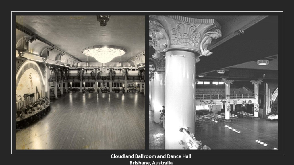
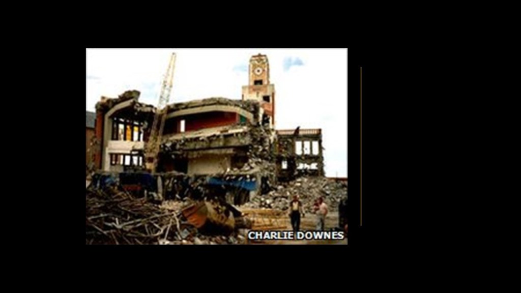
BB said the Cloudland Funicular was demolished in 1967 and was non-functional a few years before that, and that on November 7th of 1982, the famous ballroom and dance hall itself was demolished by a developer, and the Cloudland Apartments occupy the former location of this iconic landmark.
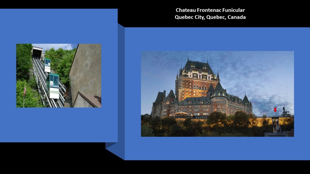
NV brought another funicular that I was not aware of to my attention, and that is the still-operational funicular at the Chateau Frontenac in Québec City.
Now onto some new places and topics.
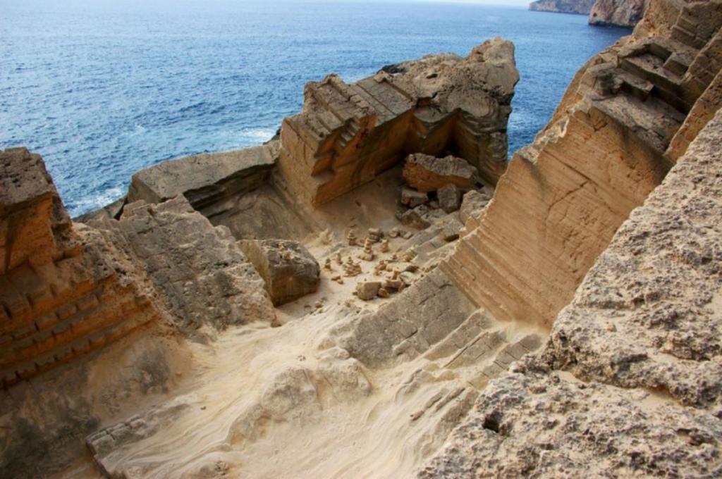
PA suggested that I look at the island of Ibiza, one of Spain’s Balearic Islands near the eastern coast of Spain.
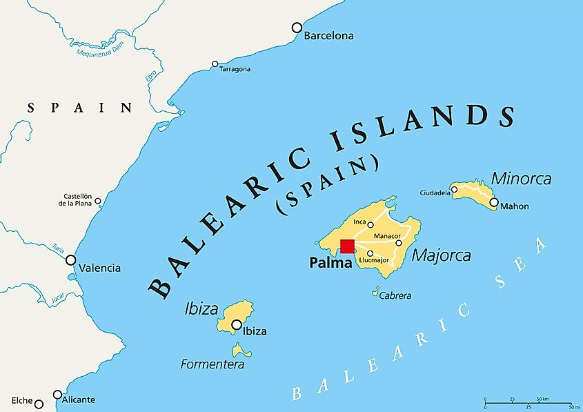
He mentioned the Es Vedra of Ibiza.
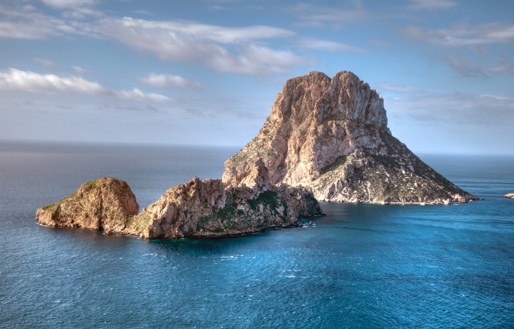
The legends of Es Vedra, described as a limestone outcropping 1,312-feet, or 400-meters, above sea-level, include: it being the tip of the legendary Atlantis…
…it is the third most-magnetic place on Earth after the North Pole and Bermuda Triangle…
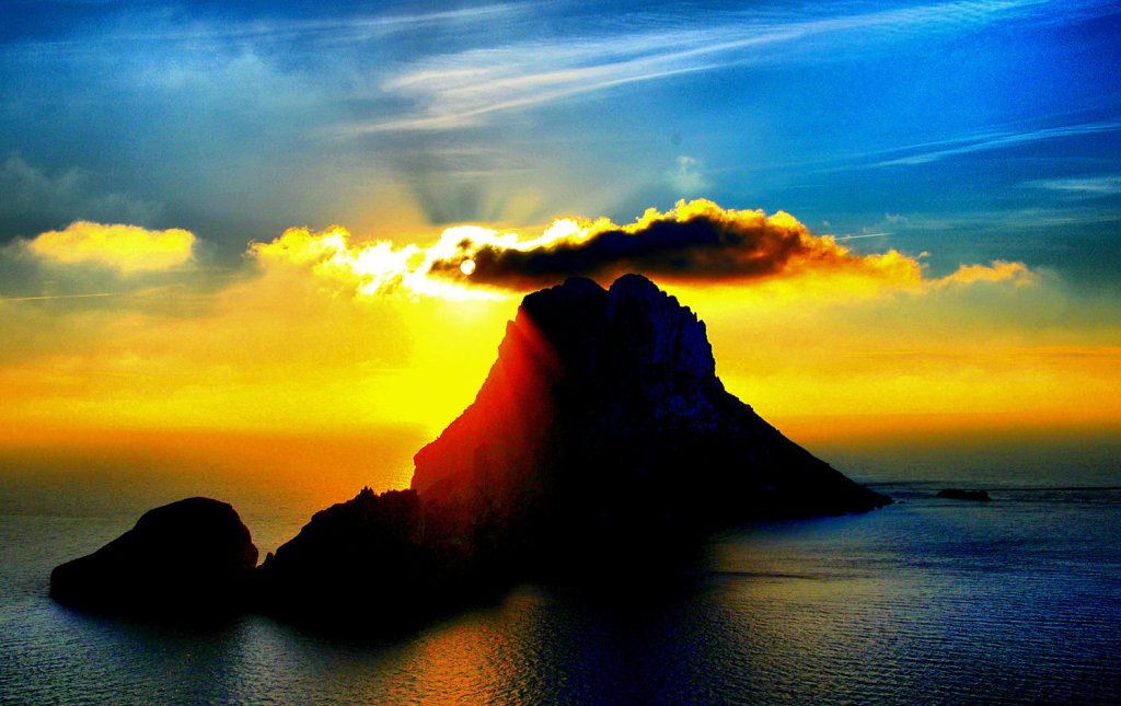
…it is a major energy vortex…

…and it is the location of where the limestone for Egyptian pyramids came from because of the maximum concentration of energy found in it.

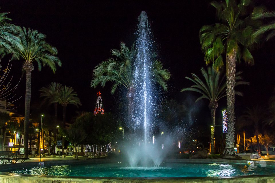
PA also mentioned there there are fountains galore in ibiza, like this one in San Antonio…

…and this one in Ibiza Town.
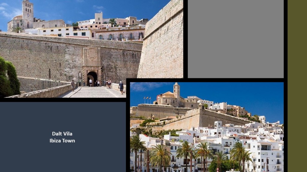
The star-shape of what are called “Renaissance Walls” enclose the oldest part of Ibiza Town.
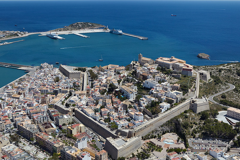
Called the “Dalt Vila,” or “High Town,” said to date from the 16th-century as a stunning example of classic Renaissance Military architecture, it was declared a UNESCO World Heritage Site in 1999.
Modern Ibiza Town is known for its exciting night life, and one of its several internationally-renowned clubs is named “Amnesia.”

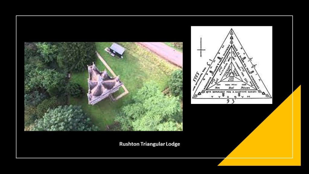
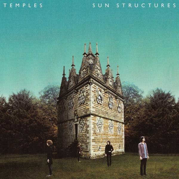
DE in England sent me information about the Rushton Triangular Lodge.
Said to have been designed by Sir Thomas Tresham between 1593 and 1597 near Rushton in England’s Northamptonshire, and is called a “folly.”
The construction stones used were alternating bands of dark and light limestone.
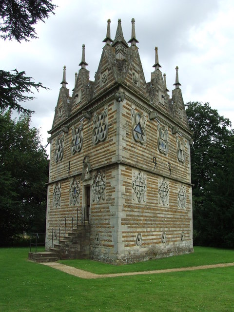
A “folly” is defined as a building constructed primarily for decoration, typically in gardens, but suggesting through its appearance some other purpose, or has such an extravagant appearance that it goes beyond usual garden buildings.

Sir Thomas Tresham was said to have been a Roman Catholic who was imprisoned for 15 years in the late 16th-century for refusing to become a Protestant, and upon his release from prison in 1593, he designed the Triangular Lodge as a profession of his faith, with his belief in the Holy Trinity being represented everywhere in the Lodge by the number 3.
The Rushton Triangular Lodge can be seen on the cover of the 2014 “Sun Structures” album of the English Psychodelic band “Temples.”
NJ asked me what my thoughts were on the possible correlation between the mud flood and trench warfare during WW1, and suggested they could have possibly been fighting over the very ground they were trying to dig out of.
I had never thought about this before, but in retrospect with everything that is coming out about the mud flood now, this idea certainly makes a lot of sense from that perspective.
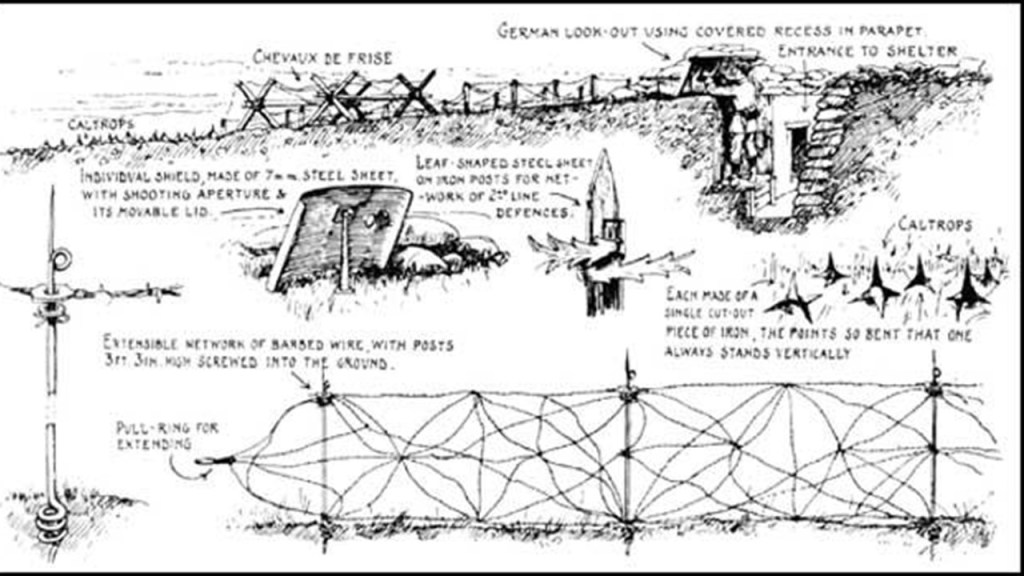
According to our historical narrative, Trench warfare utilized occupied fighting lines of trenches, which were said to have in effect, protected the troops within them from small arms fire, and to a certain extent, artillery fire.
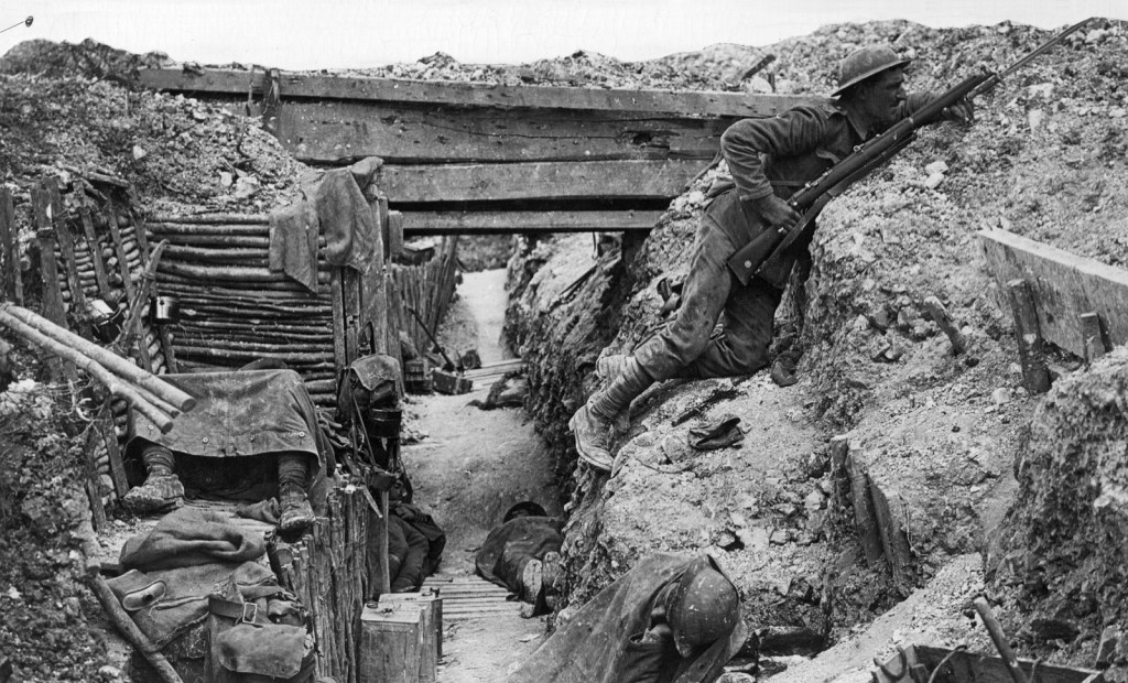
The use of trenches as a military tactic expanded during World War I, when they were used extensively, starting in September of 1914, only a month after the start of the war, on the Western Front, which was the main theater of war during the war.
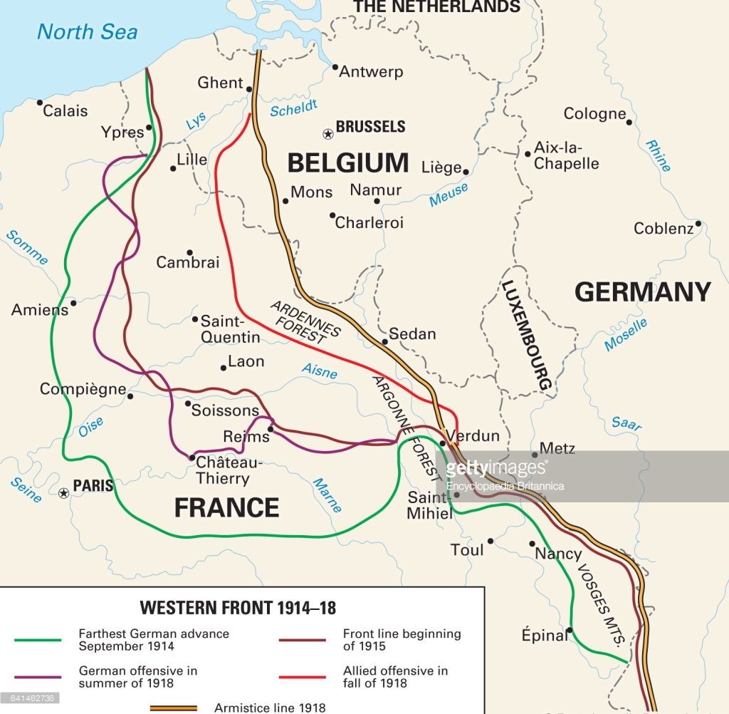
Both sides of the conflict constructed elaborate trench, underground, and dugout systems opposite each other, along a front, and they ran barbed wire between the two sides as a protection against assault.
The attacks that did happen between the two sides often sustained severe casualties, like the Battle of the Somme, one of the largest battles of World War I.
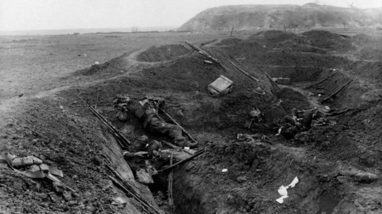
It took place between July 1st and November 18th of 1916, between British and French allied forces on one side, and the German Empire on the other, along an 18-mile, or 29-kilometer stretch of the Somme River in France.
More than 3 million men fought in the battle, and 1 million were killed or wounded, making it among the bloodiest battles in history.
After World War I, the term “trench warfare” became slang for stalement and futility in conflict.

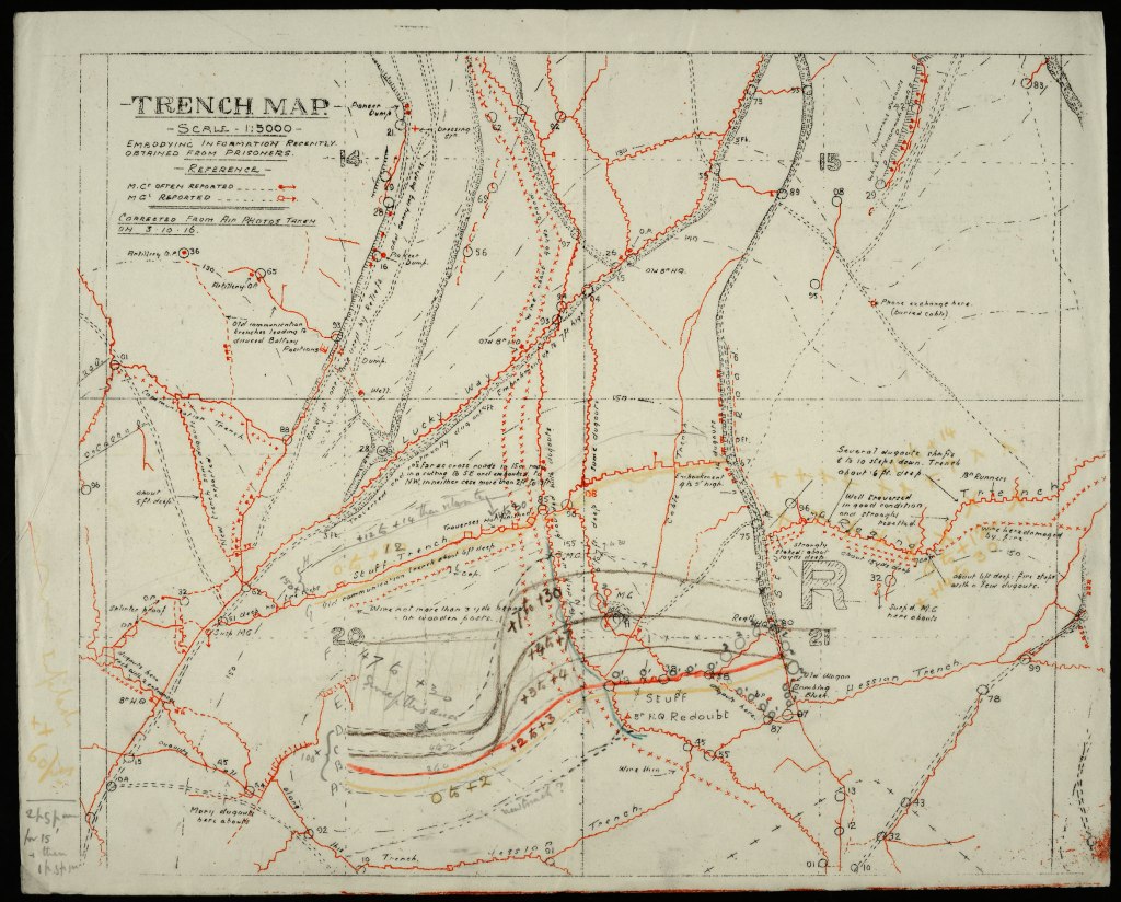
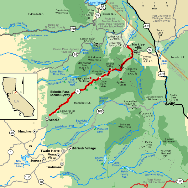
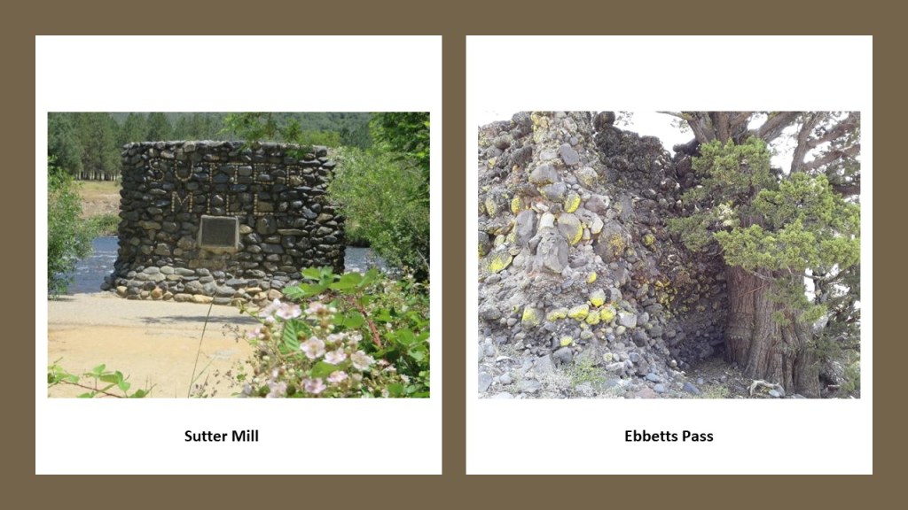
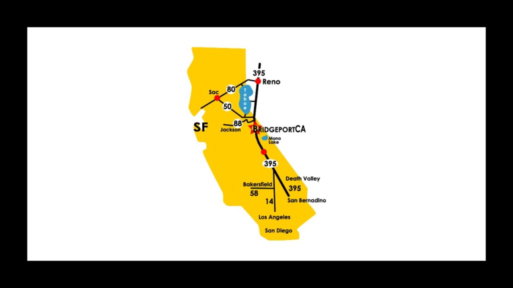
Next, I am going to look at is Ebbetts Pass in California based on viewer JM’s recommendation.
Ebbetts Pass is a high mountain pass through the Sierra Nevada Range in Alpine County, California, and is registered as a California Historical Landmark.
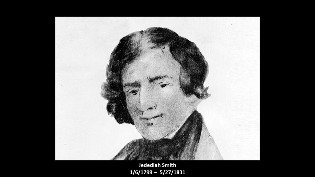
Early explorer Jedediah Smith was reputed to have used this particular mountain pass when crossing the Sierra Nevadas on one of his exploratory journeys in 1827…
…but the pass got its name from John Ebbetts, a fur-trader-turned-guide for California Gold Rush “Forty-Niners,” who claimed to have led a string of pack mules through the high-mountain pass in April of 1851, and was said to believe for a time that the pass he had used would be suitable for transcontinental railroad.
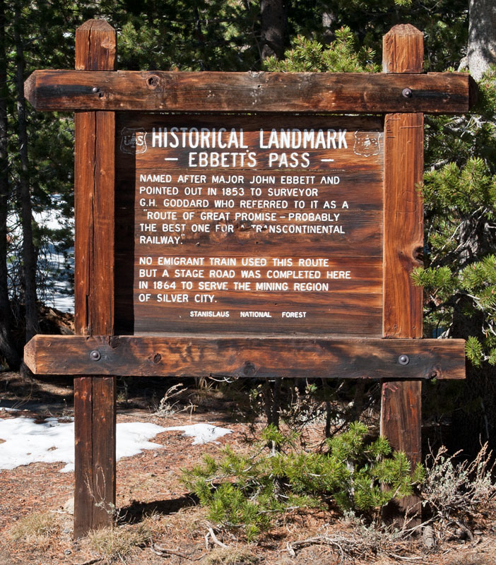
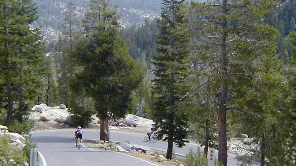
Ebbetts Pass today is one of the least travelled passes in the Sierra Nevadas.
It has very steep sections with hairpin corners and the eastern slope is particular difficult with many blind hairpin corners, and is usually closed during the winter months between November and sometimes as late as May.
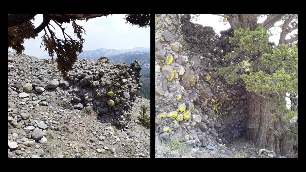
JM sent me these photos that he took on a hiking trip through there.
Like this one showing what appears to be something silty and loose covering of the landscape here…
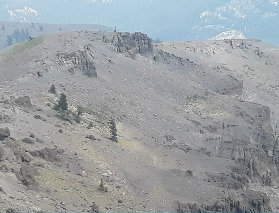
…and in this photo you can see stone outcroppings with straight edges and lines.
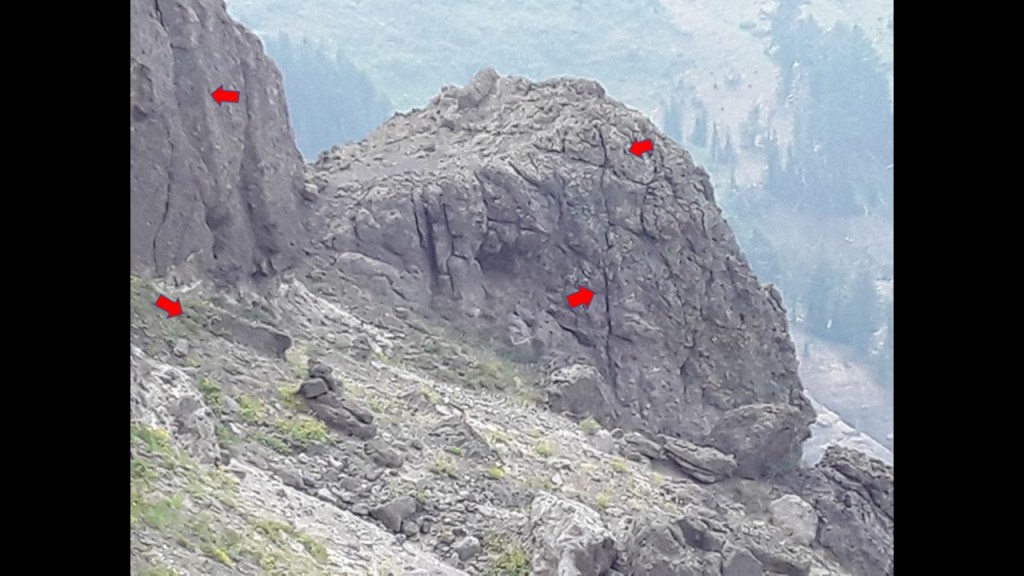
And here are photos JM took of very intriguing-looking piles of rocks that look like they have been formed into that cluster somehow.
KH sent me some information, stemming from her travels around the British Isles, about funicular railways.
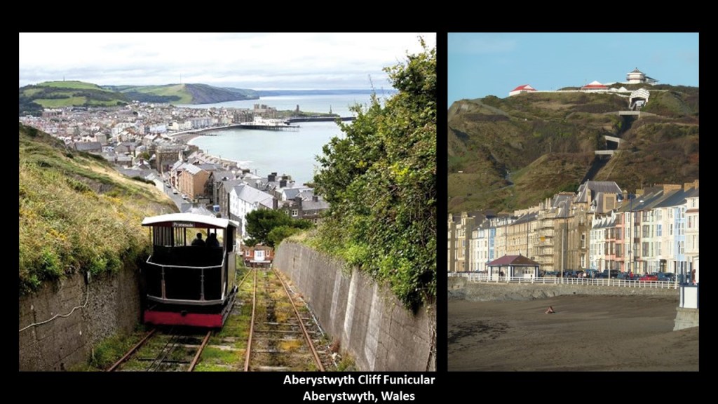
One funicular she visited was the one in Aberystwyth in Wales, which was said to have opened on August 1st of 1896.
It is known at the Aberystwyth Cliff Railway, and is the longest electric funicular in the British Isles, at 778-feet, or 237-meters-long…
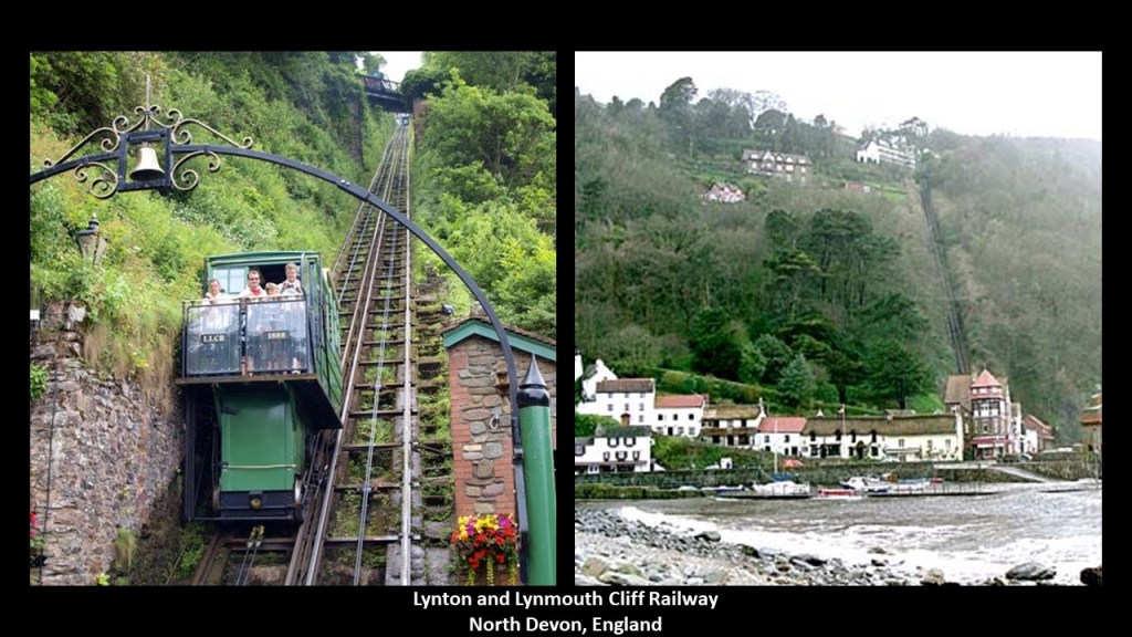
…and the second-longest funicular there after the water-powered Lynton and Lynmouth Cliff Railway in North Devon, which is the highest and steepest water-powered funicular in the world, at 862-feet, or 263-meters, -long, said to have been built between 1887 and its opening in 1890.
KH said Aberystwyth was touted as the Biarritz of Wales in Victorian times, which she said is kind of funny, since it is always raining due to the prevailing winds which come in from across the Irish Sea, dumping their load on Aberystwyth, the first landfall.
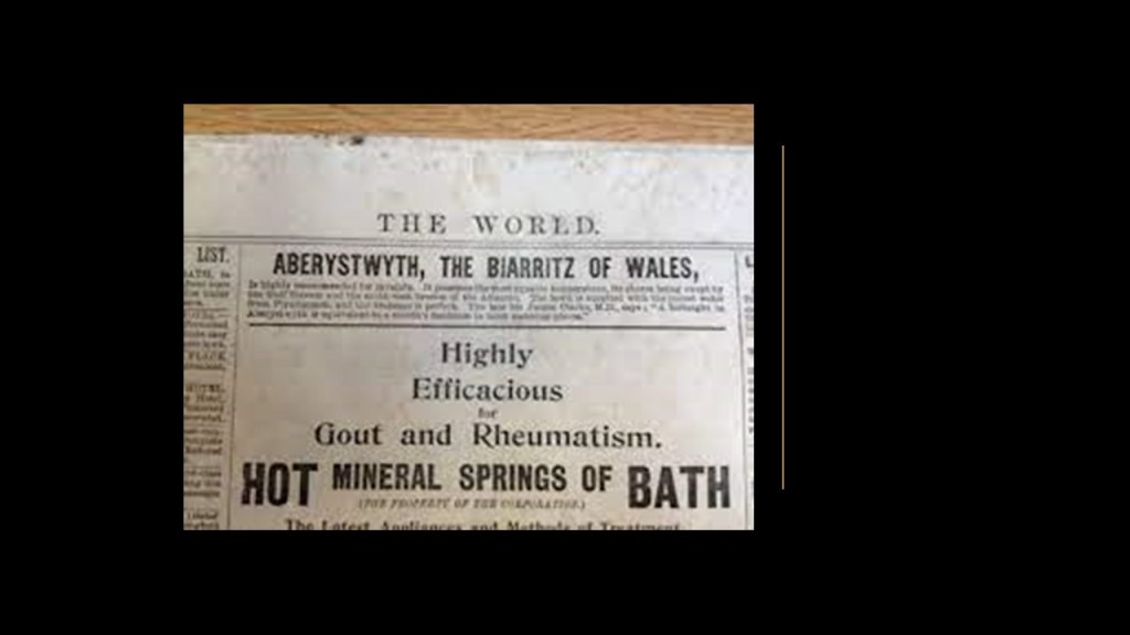
Biarritz on the coast of northwestern France has been a luxurious seaside tourist destination, since Victorian times as well.
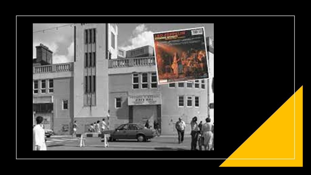
KH said that like the Cloudland Ballroom and Dance Hall in Brisbane, Australia, there was a favored entertainment venue in Aberystwyth, called Kings Hall, for concerts and dances.
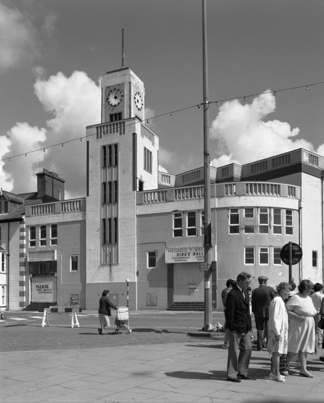
It had a great floor on which to dance, said to have been built in the Art Deco Architecture style in 1934 (which would have been between World War I and World War II).
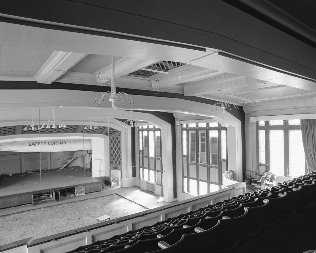
Major band concerts were also held there, like Led Zeppelin in January of 1973 during their Strange Affinity British Tour in 1972 and 1973.
The King’s Hall was demolished in 1989, for the given reason of apparent structural weaknesses and disrepair…
…and it was replaced where it stood on the corner of Marine Terrace and Terrace Road by the King’s Hall residential flats and commercial units.
There were several comments in response to the subject of Ebbetts Pass in California’s Sierra Nevada Mountains.
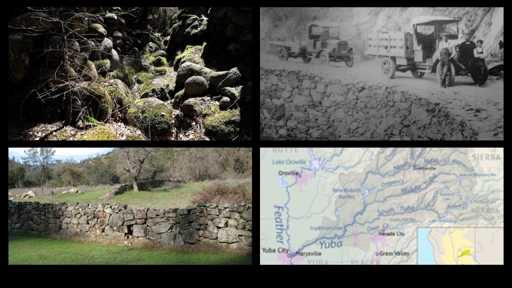
SB lived in the Sierra Nevada’s in the heart of Gold Rush country for years, and said those rock walls are absolutely everywhere in the forest.
I found these examples of stone walls in California’s Yuba River Country, which extends from the High Country of Sierra and Nevada County to the Feather River between Maryville and Yuba City.
California’s historic mother-lode country, or gold rush belt was a region in northern California, on the western slope of the Sierra Nevadas.
Also known as the Golden Chain, it is approximately 150-miles, or 240-kilometers, long, and a few-miles-wide, and traversed by historic Highway 49.
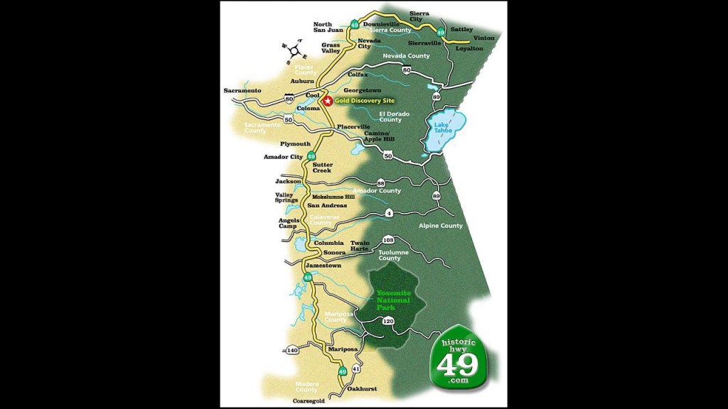
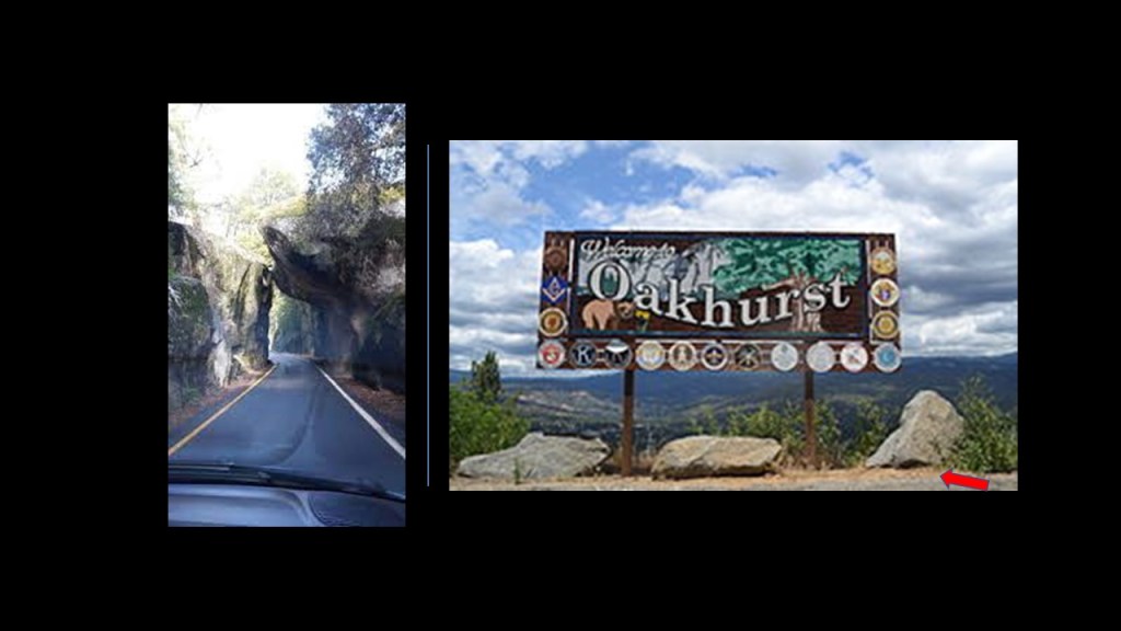
Here are some sites I found in a search along historic Highway 49, like Oakhurst, a community that is 14-miles, or 23-kilometers, south of the entrance to Yosemite National Park…
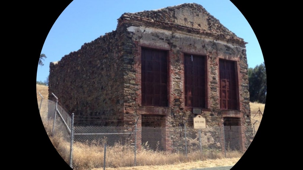
…and the old Butte Store in Amador County, said to have been built in 1857 by an Italian stonemason to serve settlers and miners as a general store and post office, and a reminder of Butte City, a once-vibrant mining community that was settled at the height of the Gold Rush era, and abandoned in the early 1900s as the mines closed and settlers relocated.
It looks suspiciously like a partially-buried structure to me!
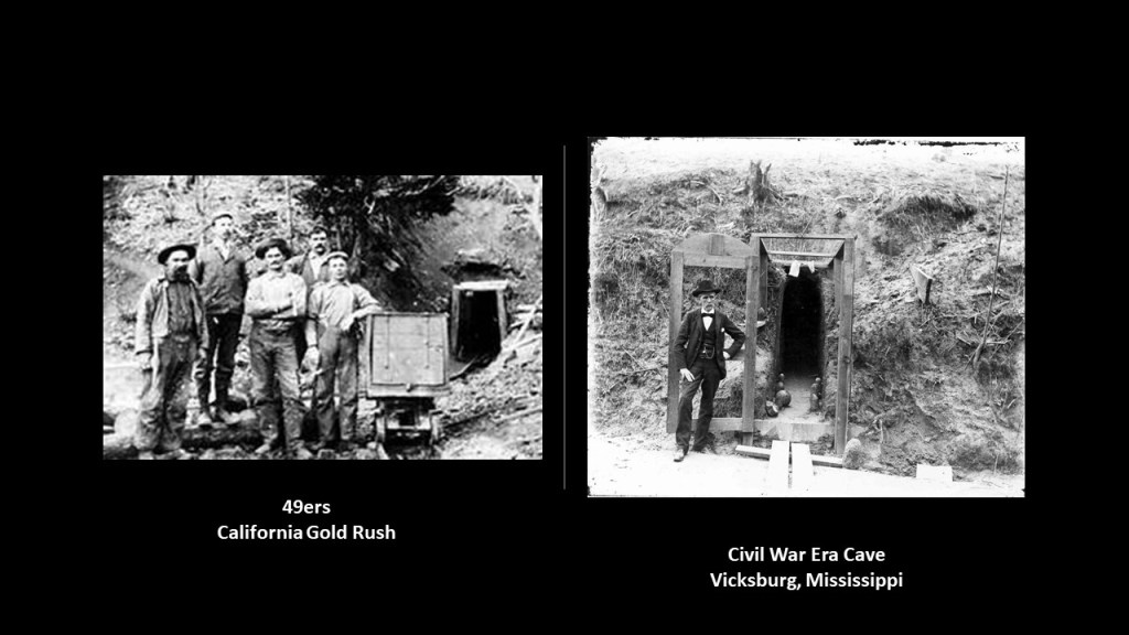
The Gold Rush Country was famed for mineral deposits and gold mines said to have attracted waves of immigrants starting in 1849, known to history as 49ers, pictured on the left.
Interesting to note the similarity between the gold mine entrance in California land the example of a cave that was dug into the side of a hill during the Siege of Vicksburg on the right, where people could get out of harm’s way from the hail of iron that was coming their way from Union forces.
We are told that California’s gold rush was sparked by James Marshall’s discovery in 1848 of placer gold at Sutter’s Mill near Coloma.
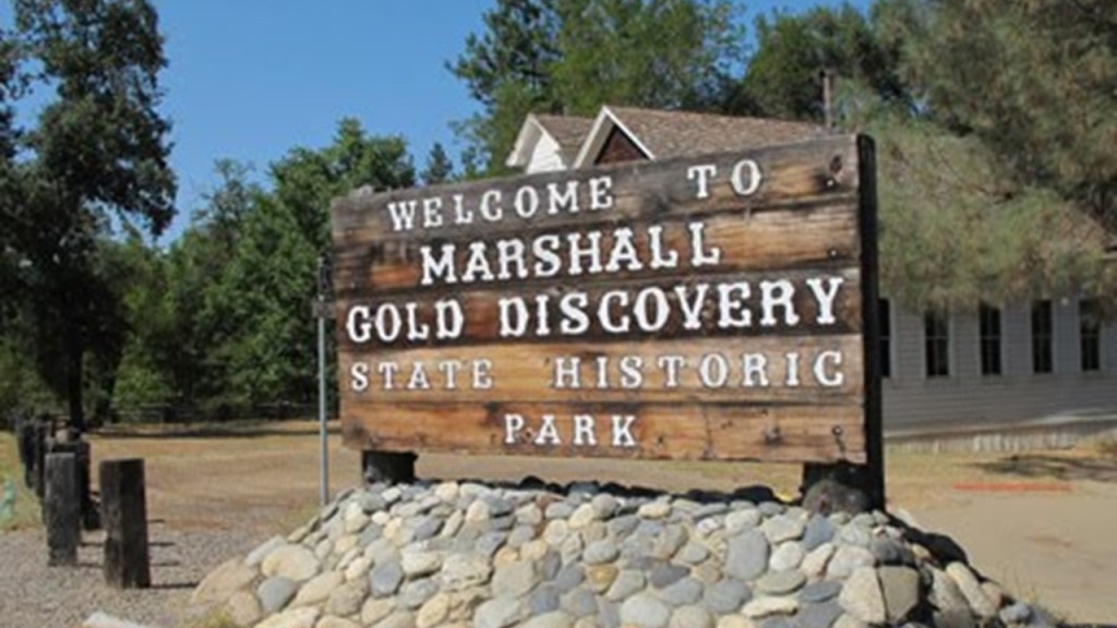
A rock wall sign at Sutter Mill on the left looks very similar to the photo taken by JM, at the end of the last video, of the smaller-sized stones that were pushed up next to some trees in Ebbets Pass on the right.
Also, interesting to note that I found this book about California’s masonic roots the Gold Rush country when I was doing a search of images.

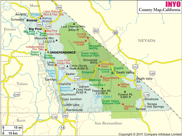
ASV left a comment for me to look into what’s in and around Mono and Inyo Counties, which are right next to each other, and is located east of the Sierra Nevada Range, between Yosemite National Park and Nevada.
First, I will look at Mono County.
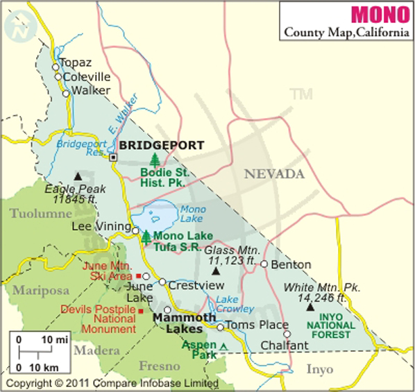
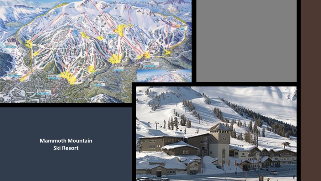
Mono County’s only incorporated town is Mammoth Lakes…
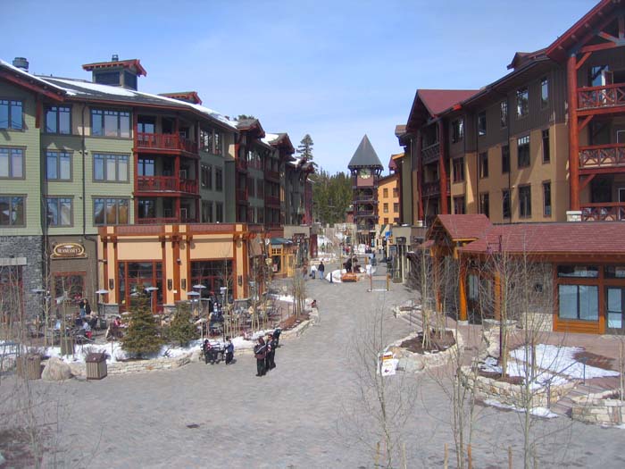
…which is known for its ski resorts, which includes Mammoth Mountain, California’s top skiing destination, and location for official ski and snowboard training as well as competitive events.
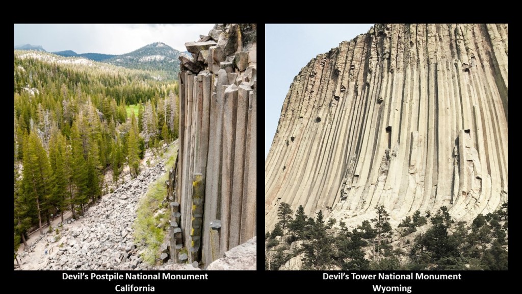
A noteworthy place near Mammoth Mountain and Mammoth Lakes is the Devil’s Postpile National Monument, though it is across the county-line in Madera County.
Devil’s Postpile is described as an unusual rock formation of columnar basalt.
Once part of Yosemite National Park, which was established on October 1st of 1890, it was left on adjacent public land after gold was discovered near Mammoth Lakes in 1905, and saved by influential Californians, including John Muir, from being blasted into the San Joaquin River, which was in a proposal to build a hydroelectric dam.
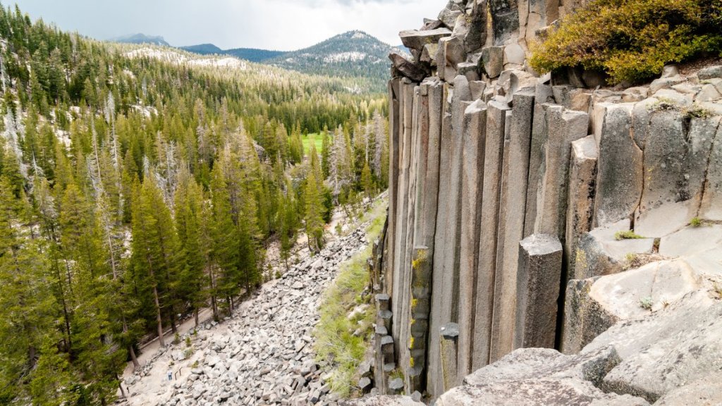
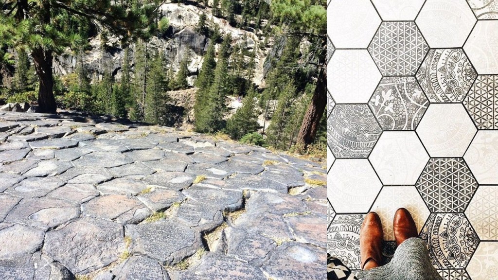
The trail at the top of the Devil’s Postpile is pictured on the left, and on the right is a hexagonal tile floor pattern for comparison of appearance.
There are two other places I would like to bring up here for comparison purposes.
One is the Devil’s Tower National Monument in eastern Wyoming, which is described as a “laccolith,” or igneous intrusion, but which is very similar in appearance to the Devil’s Postpile in California.
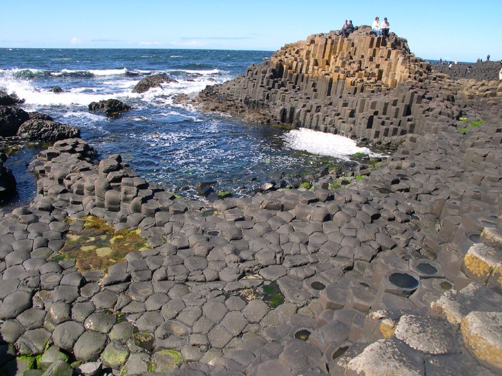
Another similar-looking place is the Giant’s Causeway on the north coast of northern Ireland, described as an area of approximately 40,000 interlocking basalt columns, said to have been the result of an ancient volcanic fissure eruption.
The tops of the basalt columns form stepping stones that lead into the sea.
Back to Mono County.
While Bridgeport is the Mono County seat, in 2010, its population was 575, and has the status of Census-Designated Place, or CDP, meaning it is a place that has a concentration of population defined by the United States Census Bureau for statistical purposes only.
Bridgeport is visited by thousands of tourists every year, in particular those who seek to fish for trout in its surrounding streams and lakes.

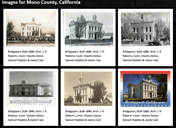
The Mono County Courthouse in Bridgeport is on the National Register of History Places, and was said to have been built in the Italianate-style in 1880…
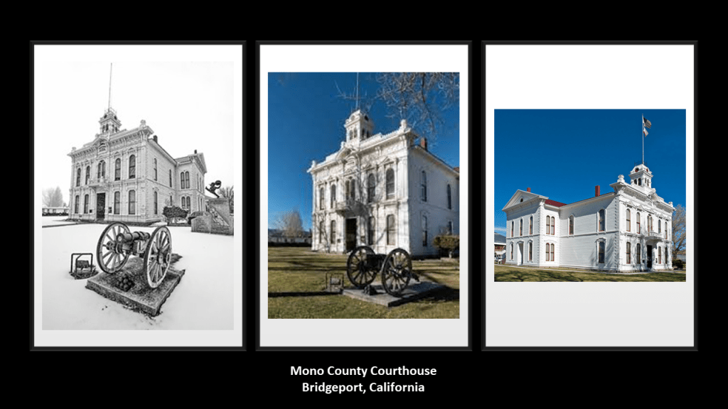
…and designed by architect J. R. Roberts, about whom I can’t seem to find any biographical information in a search, except for his name as the architect of this courthouse.
Mono Lake is located about half-way between Bridgeport and Mammoth Lakes in Mono County.
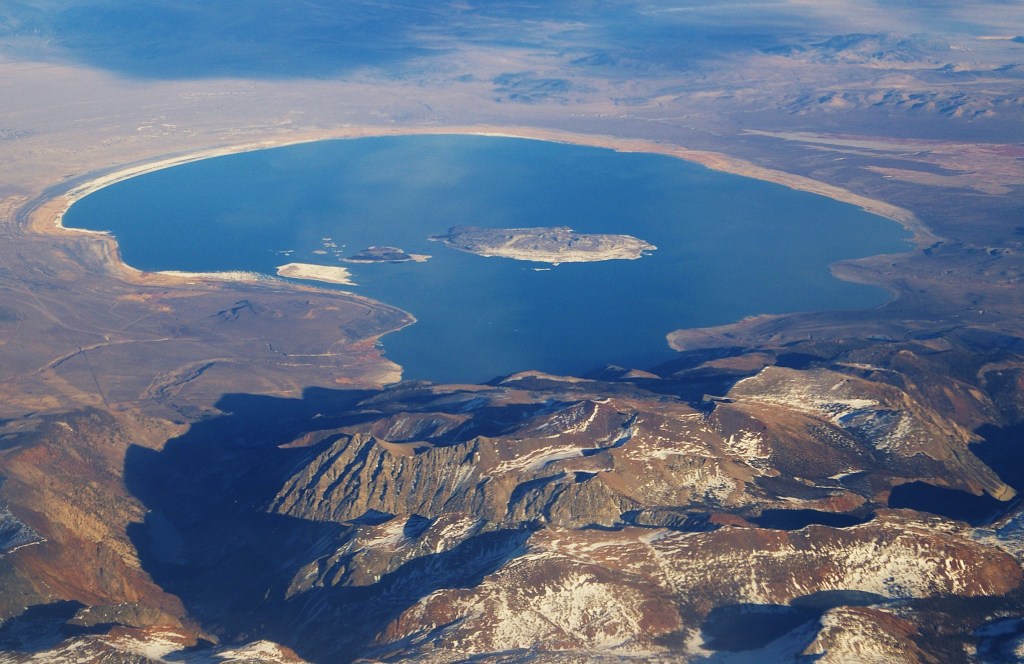
It is a saline soda lake and is in a geologically-active area at the north end of the Mono-Inyo Craters volcanic chain.
Mono Lake has many towers of limestone, called Tufa, which rise above, and around, the surface of Mono Lake.
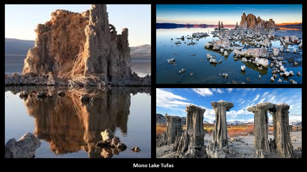
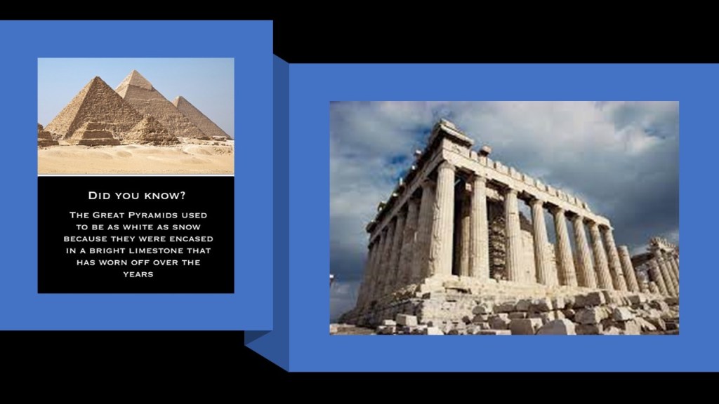
Limestone has been a common building material throughout the ages.
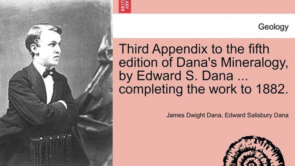
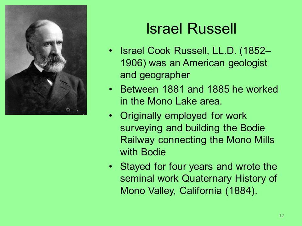
The different types of Mono Lake tufa were categorized in the 1880s by mineralogist Edward S. Dana…
…and geologist Israel C. Russell.
Were they narrative shapers, I wonder?
Inyo County is located right below Mono County.
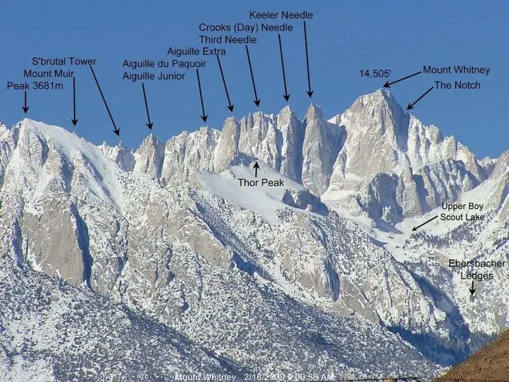
ASV, who suggested I look at the eastern Sierra Nevadas, said “My family and I saw a plane disappear into mountains right next to our car on the freeway to Mt Whitney.”
Mt. Whitney is the highest mountain in the contiguous United States, with an elevation of 14,505-feet or 4,421-meters, and is on the boundary between Inyo and Tulare Counties.
ASV said on the way there were homes with piles of large stones in what could literally be the back yard of the home.
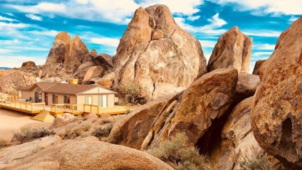
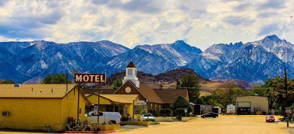
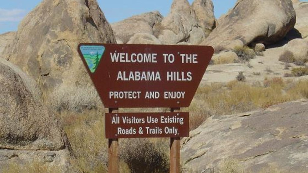
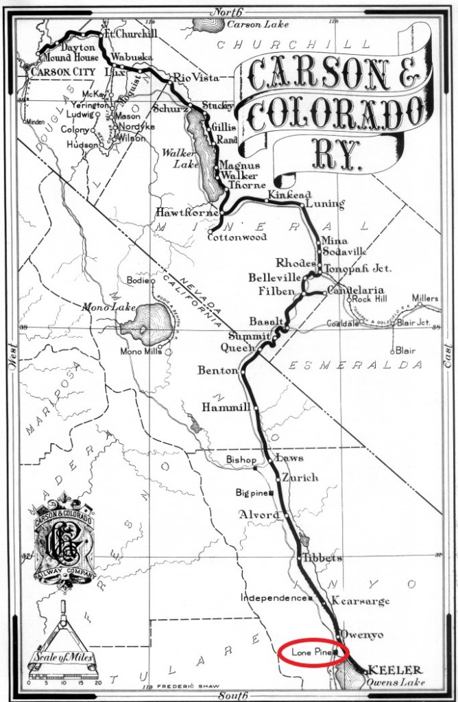
ASV also wondered about some of the towns in Inyo County, like Lone Pine.
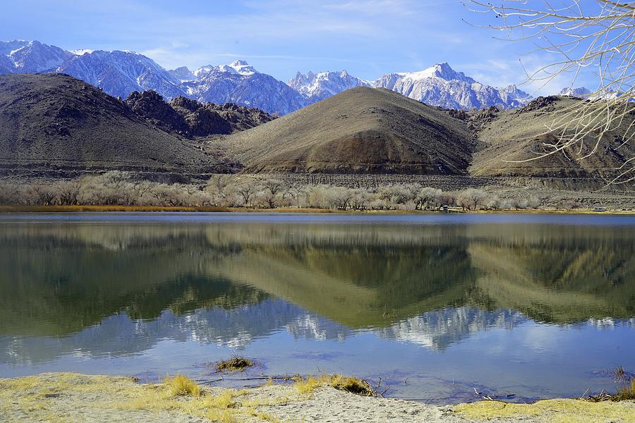
Lone Pine is located in the Owens Valley…
…near the Alabama Hills…
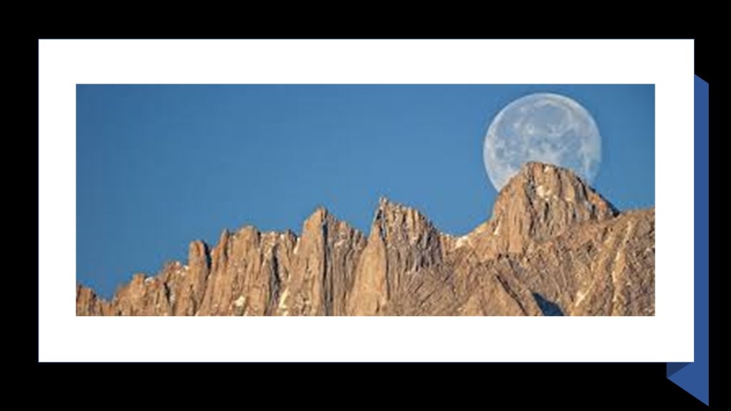
…and Mount Whitney.
Interesting to note Mount Whitney in alignment with the full moon in this photo.
Here are a few tidbits about Lone Pine.
A settlement started after a log cabin was built there during the winter of 1861 and 1862, and a post office opened there in 1870.
In March of 1872, a violent earthquake, said to have been one of the largest ever recorded…
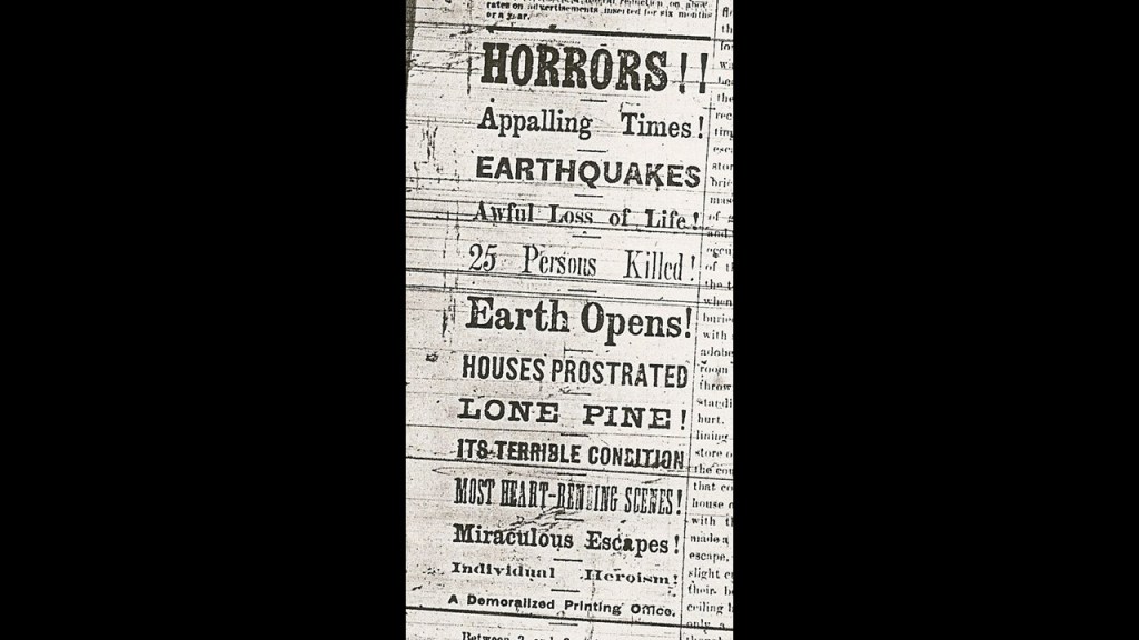
… destroyed most of the town…
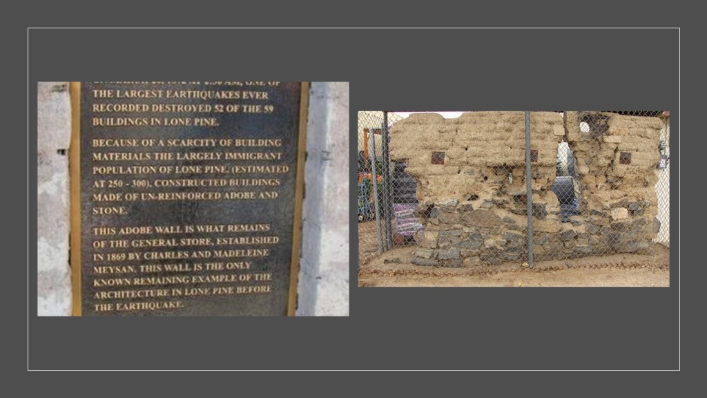
…killed somewhere around 25 – 27 people (the number keeps varying from reference to reference), who were said to have been buried in a mass grave north of town at the location of the site of the main earthquake fault…
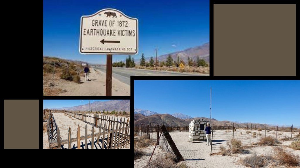
…and formed Diaz Lake.
But one of the worst recorded earthquakes in history didn’t keep the Carson and Colorado railroad from coming through here in 1883…
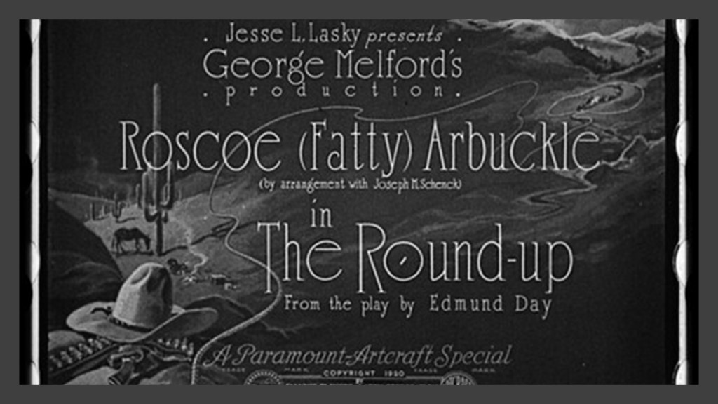
…or from Lone Pine becoming a frequently used setting for the Western movie genre, starting with the making of the silent film “The Round-up” here in 1920, and subsequently becoming the filming location of hundreds of movies, TV shows, and commercials.
One more thing about Lone Pine before I move on.
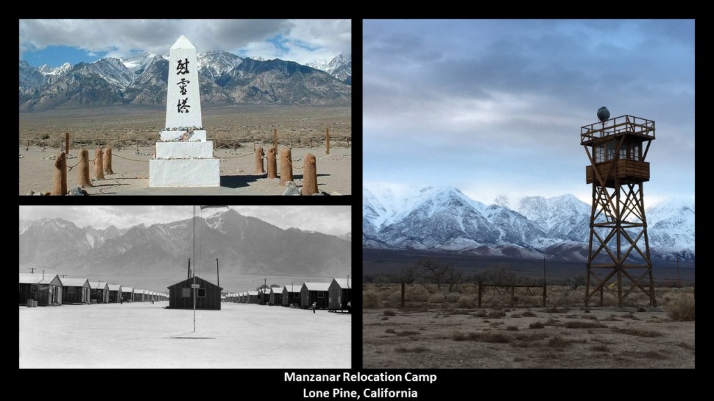
There was one of ten Japanese internment camps during World War II, called Manzanar, located 7-miles, or 11-kilometers, set-up north of Lone Pine, after President Franklin Roosevelt signed an Executive Order requiring people of Japanese ancestry living along the Pacific Coast to be placed in what were called “relocation” camps.
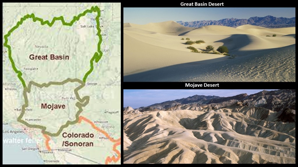
The last thing I want to mention about Inyo County and the eastern Sierra Nevadas is that contains the California-side of Death Valley National Park, which straddles the border of California and Nevada.
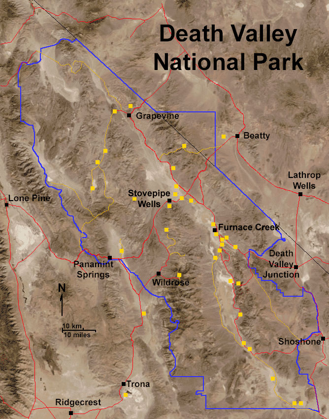
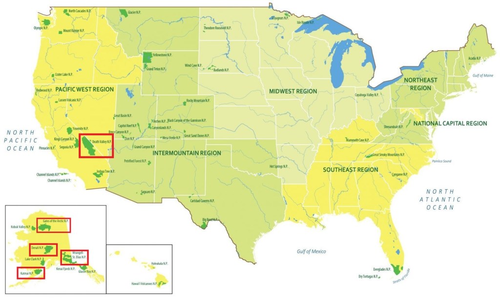
It is the largest national park in the contiguous United States, with four larger national parks being in Alaska.
Death Valley National Park is in the zone between the Great Basin Desert and the Mojave Desert…
…and has both the second-lowest point in the Western Hemisphere at Badwater Basin…
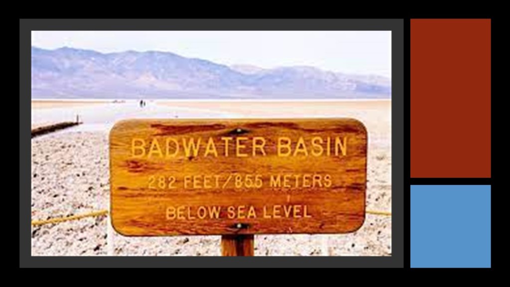
…and is the hottest place on Earth, and the driest place in North America.
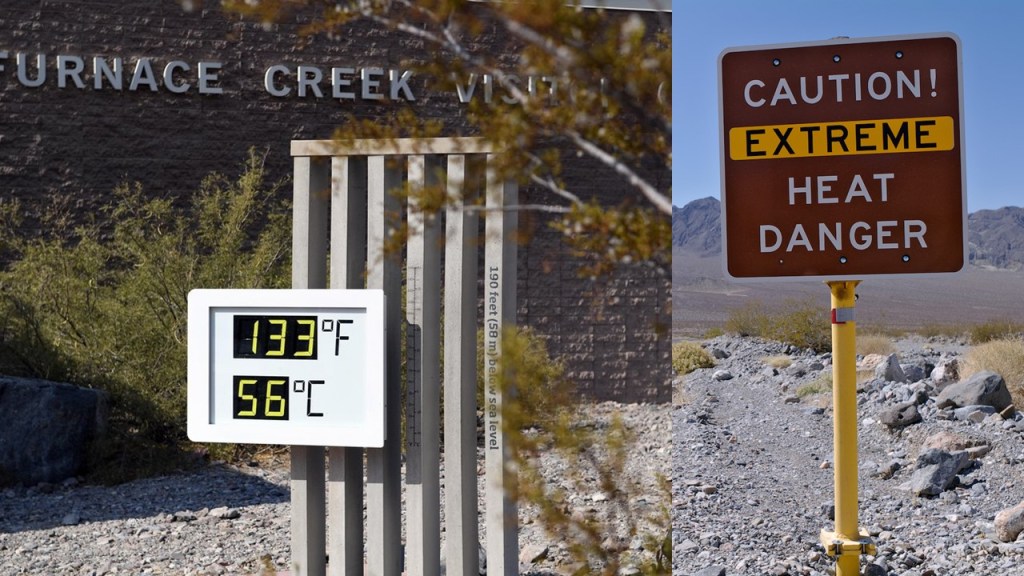
Furnace Creek in Death Valley holds the record of having the highest-recorded air temperature of 134-degrees-Fahrenheit, or 56.7-degrees-Celsius, on July 10th of 1913, and the highest-recorded ground temperature of 201-degrees-Fahrenheit, or 93.9-degrees Celsius on July 15th of 1972.
Furnace Creek is also the location of the headquarters of Death Valley National Park.
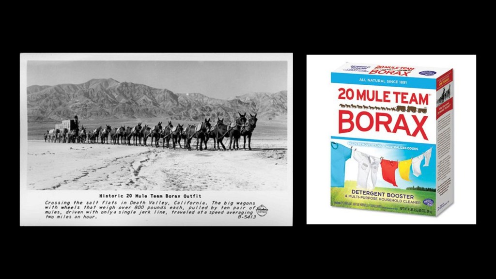
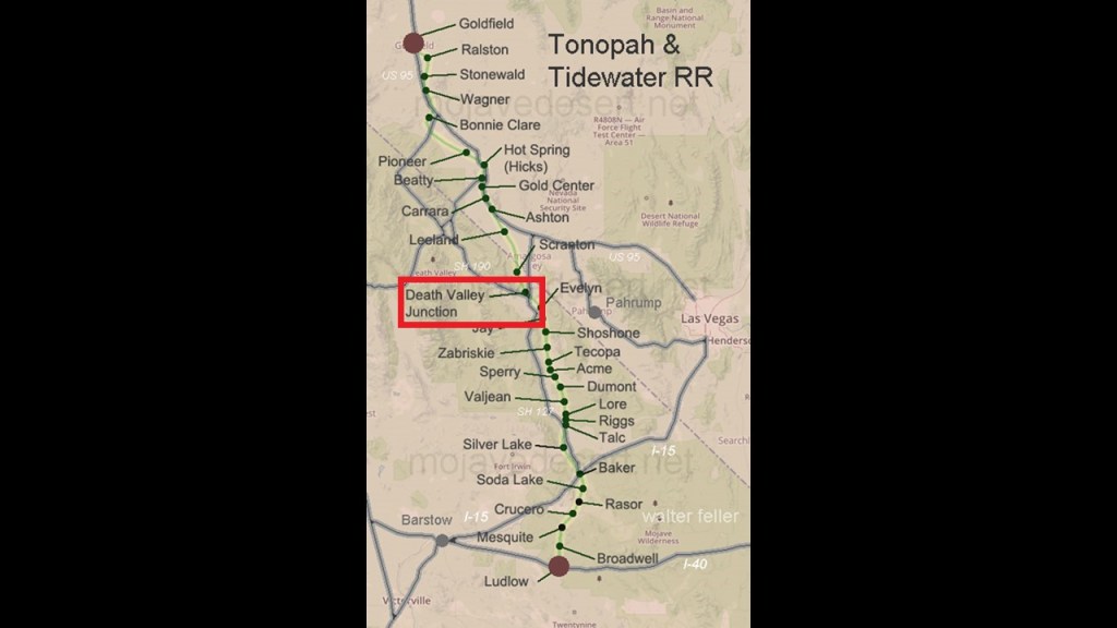
Furnace Creek was also the center of operations starting in 1890 for the Pacific Coast Borax Company and its 20-mule teams hauling wagon trains of borax across the Mojave Desert.

Furnace Creek, the hottest place on Earth, even has a luxury resort.
Today known as The Inn at Death Valley, it was formerly known as The Furnace Creek Inn, and said to have been constructed by the Pacific Coast Borax Company and opened on February 1st of 1927, and operated for decades by the Fred Harvey Company, known for its “Harvey Houses” and other hospitality industry businesses alongside railroads in the western United States.
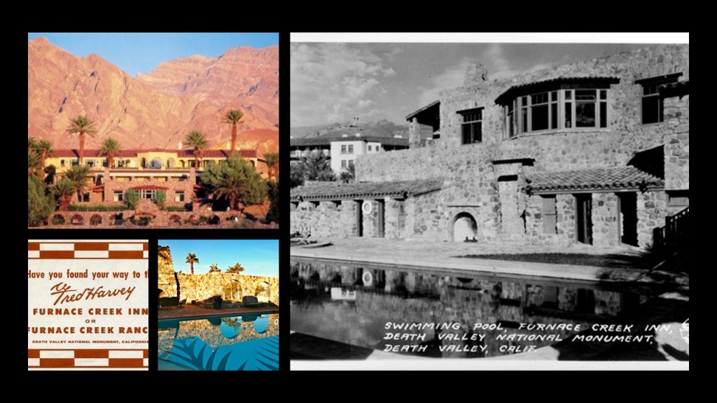
The reason given for this was the President of the Pacific Coast Borax Company, Richard C. Baker, wanted to open Death Valley to tourism, and at the same time, increase the revenue of the Tonopah and Tidewater Railroad that was said to have been built originally by Francis Marion Smith for the purpose of shipping borax.
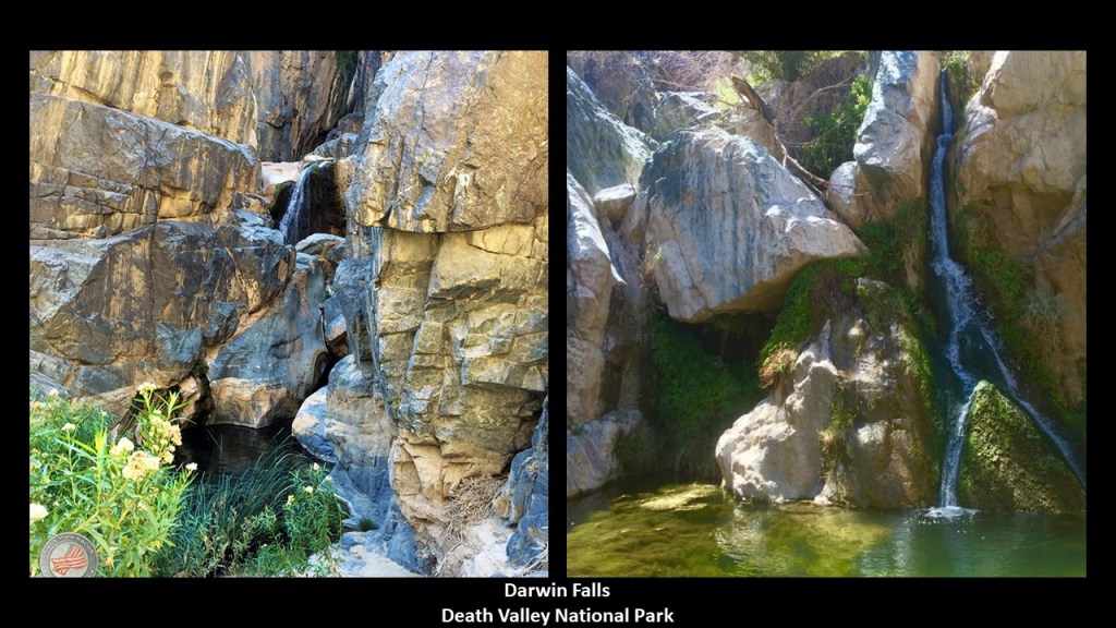
There’s so much more here to look for, but there is one more place here that I would like to take a look at: Darwin Falls.
Apparently even the driest place in the North America has waterfalls, located on the west side of Death Valley National Park near Panamint Springs, where there are upper and lower waterfalls.
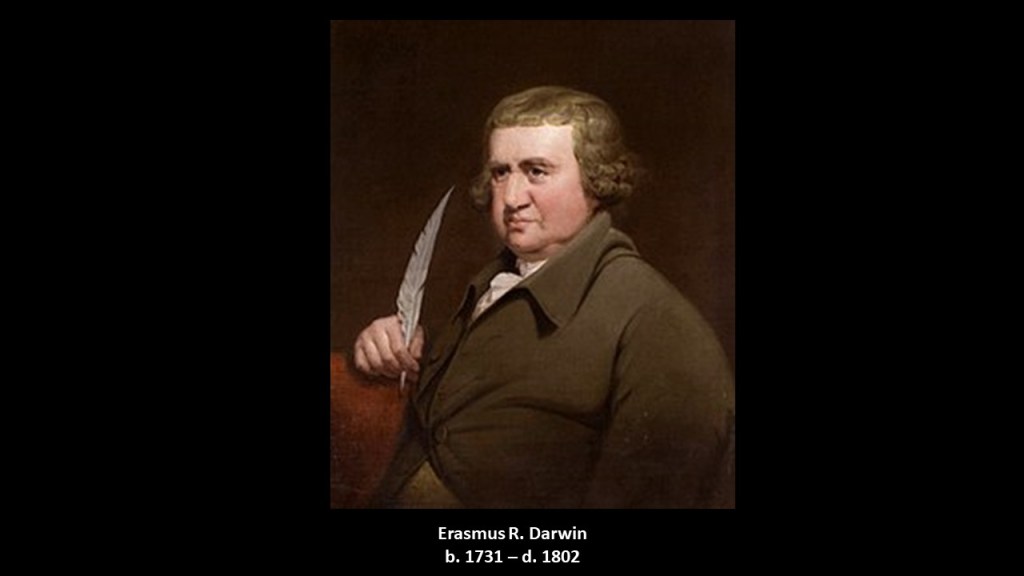
Darwin Falls, and several other Darwins in the area, was named for a physician named Dr. Erasmus Darwin French, who lived between 1822 and 1902, and was called “an American man of adventure” born in New York State, and not named after Charles Darwin, the famed English naturalist.
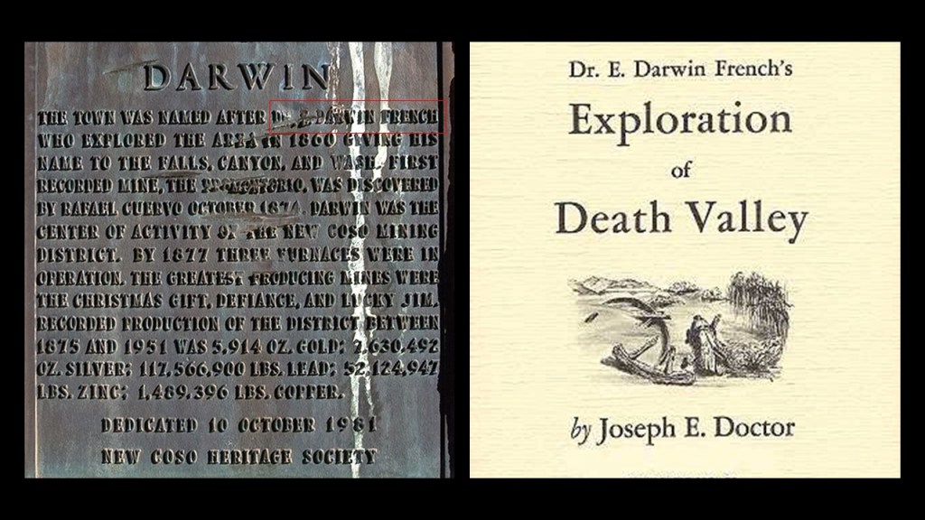
Though it is interesting to note that Charles Darwin’s grandfather was named Erasmus Darwin, who lived between 1731 and 1802.
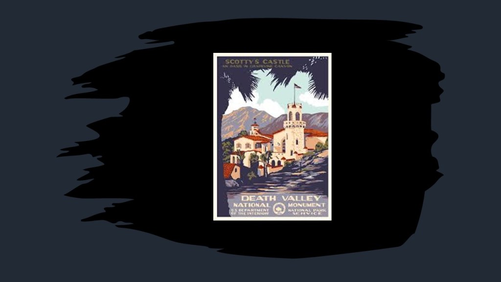
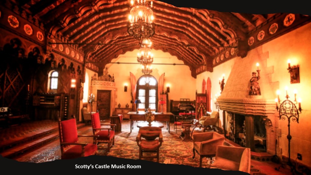
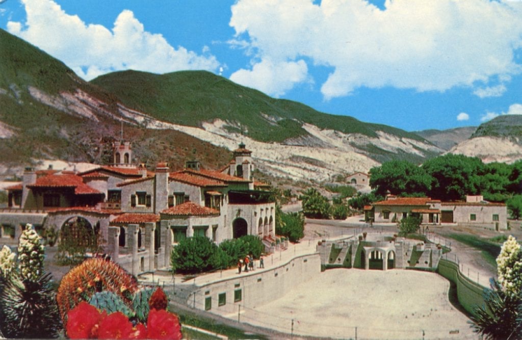
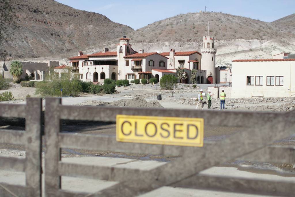
The last place I want to look at in Death Valley is Scotty’s Castle, described as a two-story Mission Revival and Spanish Colonial-style Revival villa in northern Death Valley in the Grapevine Mountains.
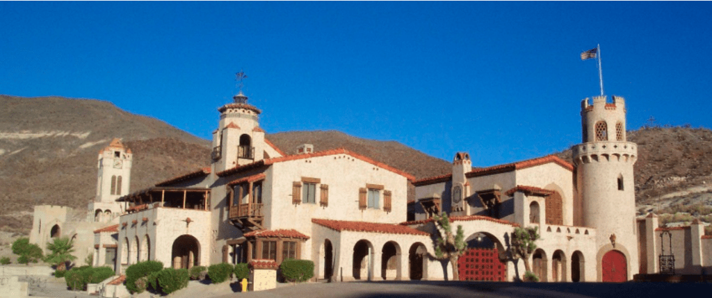
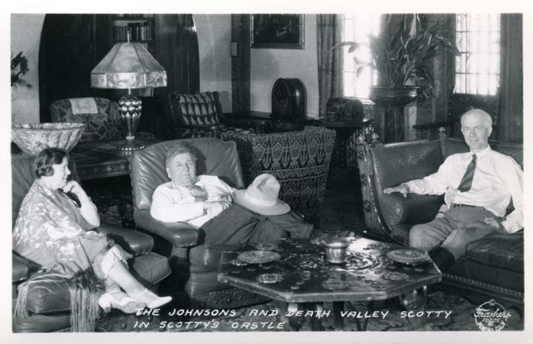
Named for gold prospector Walter E. Scott, the story goes that Scott convinced a Chicago millionaire by the name of Albert Mussey Johnson to invest in Scott’s gold mine in Death Valley.
When the gold mine turned out to be fraudulent, instead of staying angry at Scott, Johnson continued a friendship with him, and Johnson and his wife ended up buying around 1,500-acres in Grapevine Canyon, and proceeded with the construction of a ranch there starting in 1927.
Long story short, for a variety of reasons, including the stock market crash of 1929, the ranch was never completed, and the National Park Service bought the property from Johnson’s Gospel Foundation, and turned it into a tourist attraction.
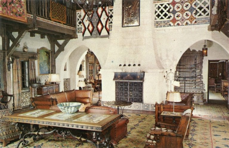
Scotty’s Castle includes such amenities as a 1,121-pipe Welte Theater Organ, which was the type of organ used in movie theaters to accompany the earlier silent films…

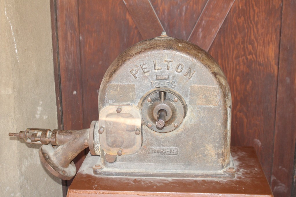
…and one-quarter-mile, or .4-kilometers, of tunnels underneath the building, where there is a Grapevine Canyon springwater-powered Pelton-wheel for electricity-generation…
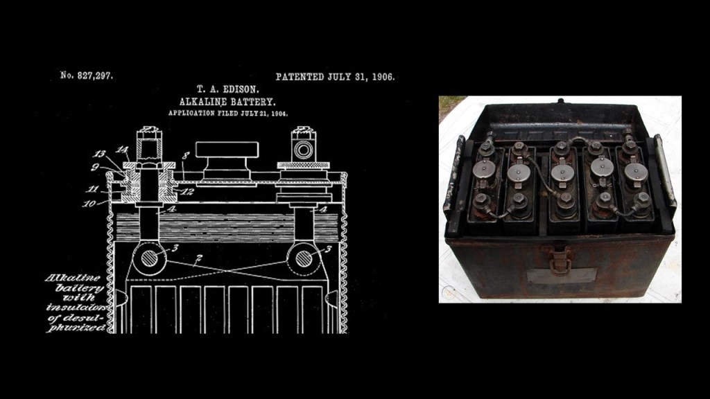
…and an array of Edison’s nickel alkaline batteries for electricity storage…
…and the tunnels were also where the imported Spanish tiles were stored…
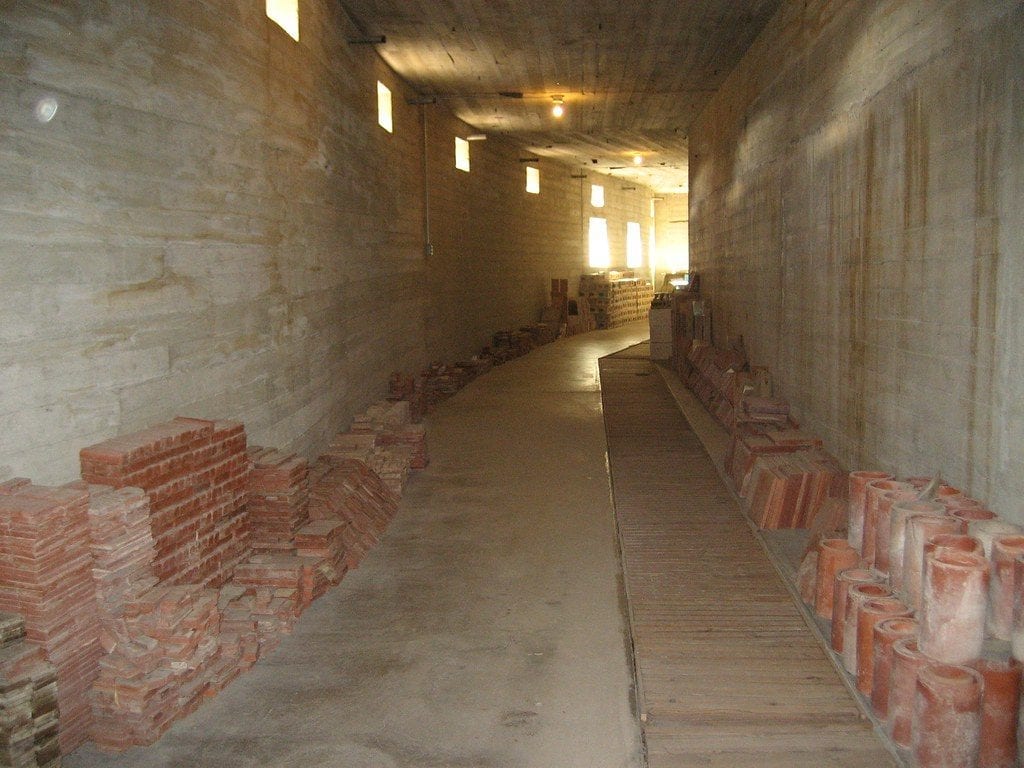
…for the pool that wasn’t finished when we are told the construction of the villa stopped in 1929.
Scotty’s Castle has been closed to the public since 2015 after it sustained severe flood damage.
Since I am already in California, I am going to look at a few of the California locations that were suggested by viewers.
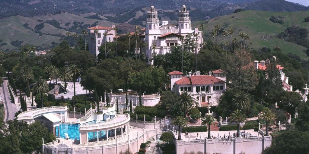
MM suggested looking at Hearst Castle, saying I know there’s a bunch of photographs depicting the construction of the Hearst castle…
…but said the more I think about it the more I feel this was an old building that they added to, and maybe interesting to look into.
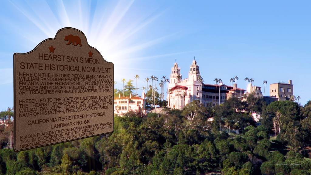
George Hearst purchased the land in San Simeon, California, in 1865.
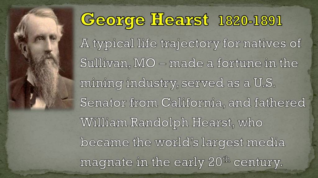
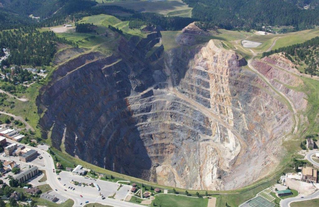
George was an American businessman and politician, who founded and developed mining operations, like the Homestake Mine in the 1870s, in the Black Hills in Lead, South Dakota, which was the largest and deepest gold mine in North America until it closed in 2002.
So, here’s the story we are told behind the Hearst Castle in San Simeon, California.
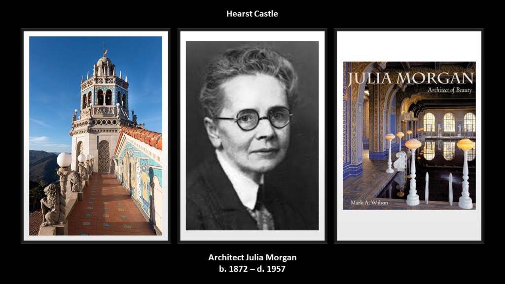
George’s son, William Randolph Hearst the publishing tycoon, and his architect, Julia Morgan, conceived what became the Hearst Castle, which was said to have been built starting in 1919, when William Randolph inherited somewhere around $10-million after the death of his mother, Phoebe.
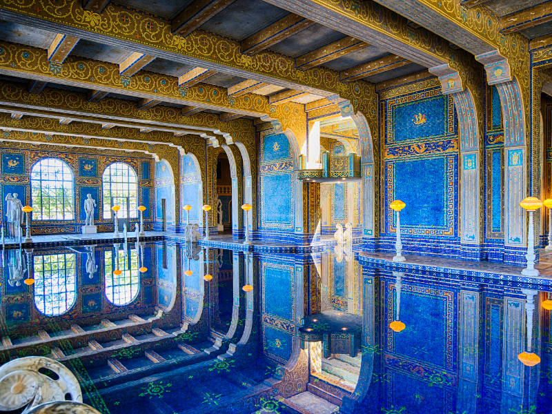
The Hearst Castle was under almost continual construction from 1920 and 1939, and during that time there was apparently enough of it constructed for William Randolph Hearst to lavishly entertain the entertainment and political luminaries of the time with many different forms of entertainment, sports, views, and what was called “the most sumptuous swimming pool on Earth.
The Hearst Castle has both an outdoor swimming pool…
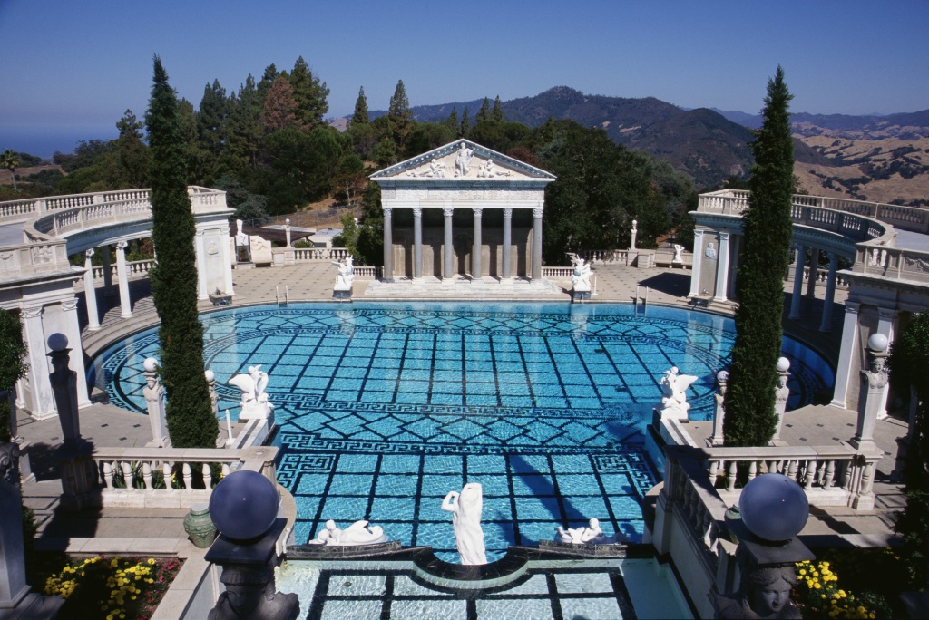
…and an indoor swimming pool.
The construction of it ended for all intents and purposes in 1947.
William Randolph Hearst died in 1951, and Julia Morgan in 1957, and in that year, the Hearst family gave the castle and much of its contents to the State of California, and it has since operated as the Hearst San Simeon State Historical Monument.
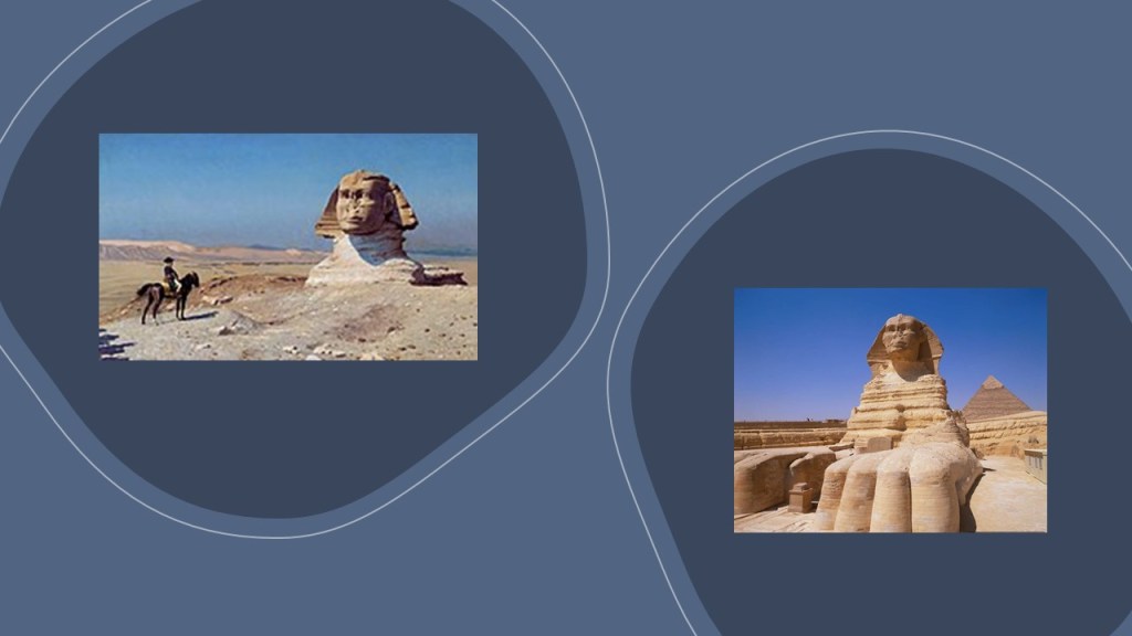
Jean-Leon Gerome’s 1886 painting entitled “Napoleon Before the Sphinx,” hangs in the sitting room of the “Celestial Suite” at the Hearst Castle…
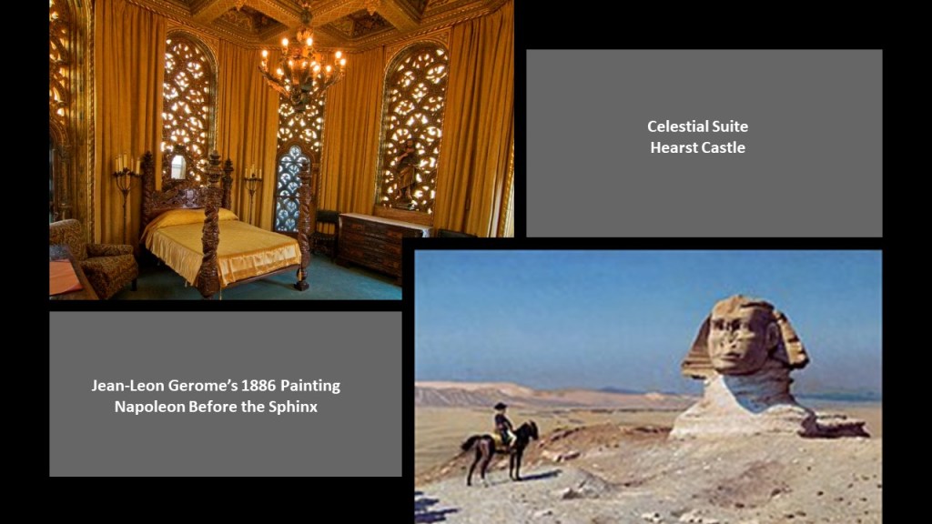
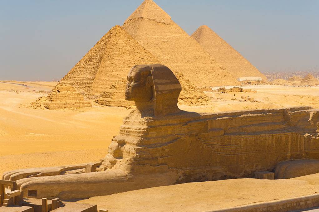
…and here’s how the Sphinx looks today on the right.
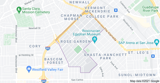
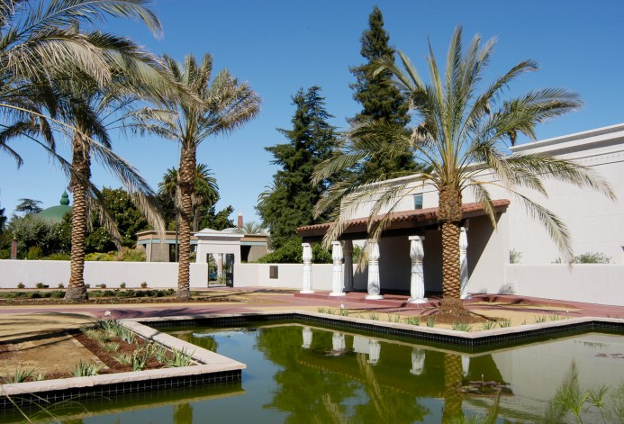
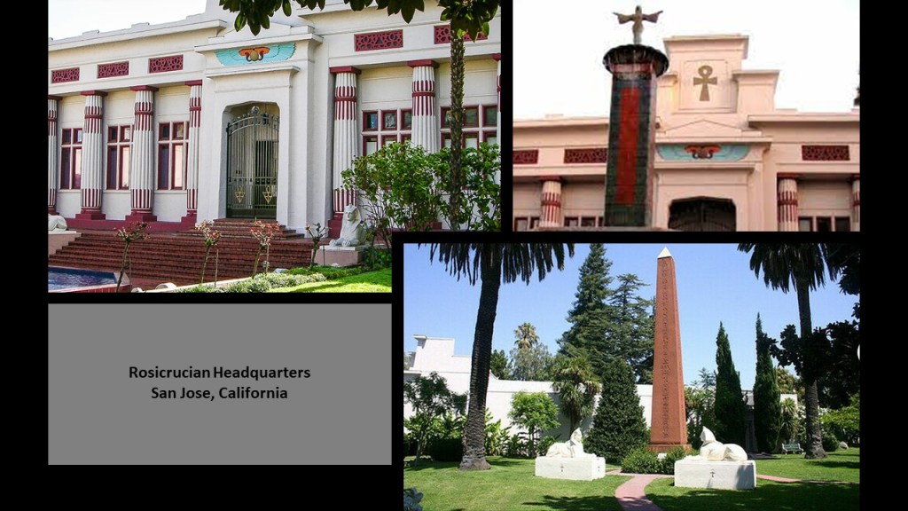
Viewer Jeff suggested that I check-out the Rose Garden Historic District in San Jose, California, which includes the San Jose Municipal Rose Garden; the Rosicrucian Egyptian Museum and Planetarium; and Rosicrucian Headquarters.
We are told the San Jose Municipal Rose Garden was founded in November of 1927, when the San Jose City Council set aside 5 1/2-acres of land for a rose garden. The ground-breaking for it took place on April 7th of 1931, and the Municipal Rose Garden was officially dedicated on April 7th of 1937.
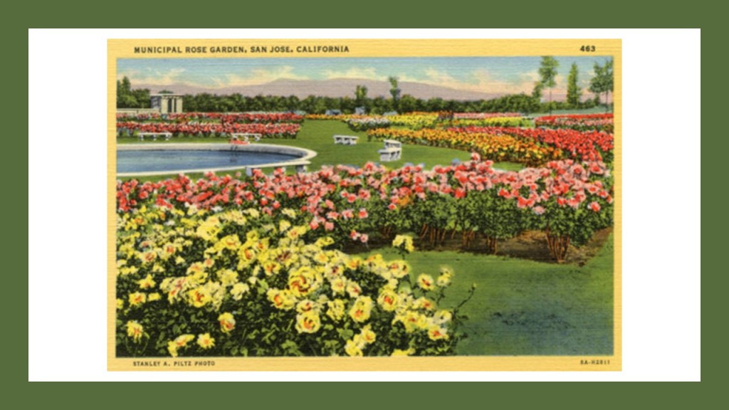
…and is considered by many to be the best rose garden in America today.

The nearby Rosicrucian Park was established in 1927 by Harvey Spencer Lewis, the founder of the Ancient and Mystical Order Rosae Crucis (AMORC) in the United States, and its first Imperator.
Rosicrucian Park hosts several things:
An Egyptian Museum that is devoted to ancient Egypt, and houses the largest collection of Egyptian artifacts and antiquities on exhibit in western North America…
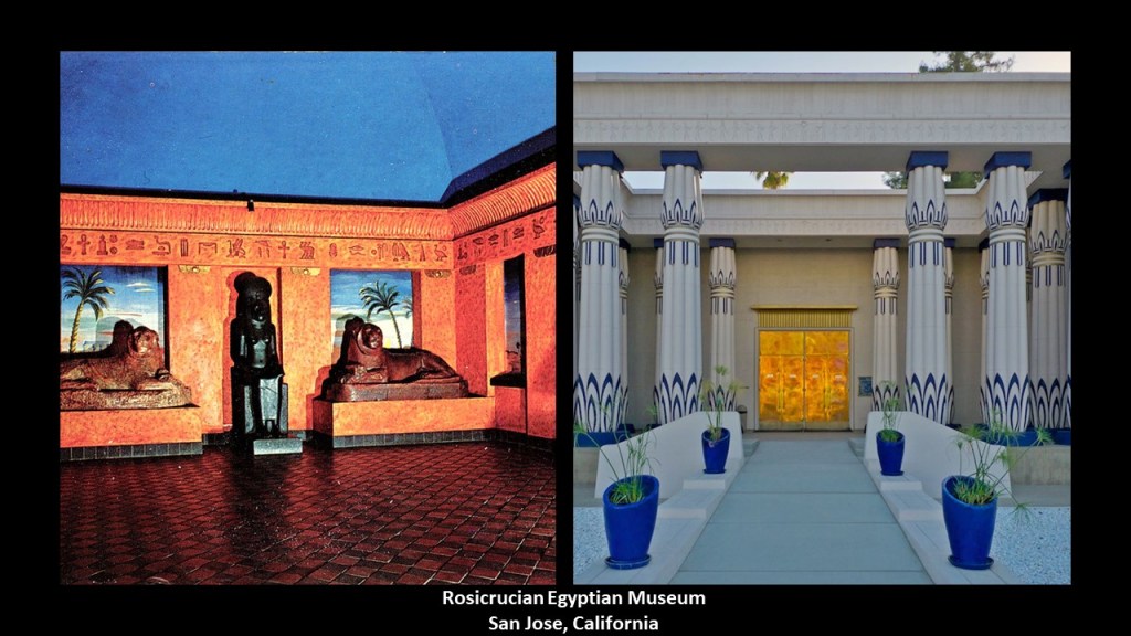
…the Rosicrucian Planetarium, with its Moorish architecture…
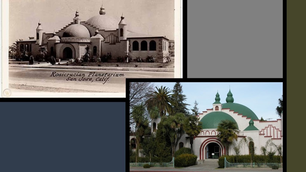
…the Rosicrucian Park Peace Garden, characterized as authentic to the 18th-Dynasty of ancient Egypt, and based on the remains of Akhnaten’s city of Amarna…
…and Rosicrucian Park is the Headquarters of the English Grand Lodge for the Americas of the Ancient Mystical Order Rosae Crucis.
So what do members of the Ancient Mystical Order Rosae Crucis focus on?
From what I can find out about them, they study the ancient mysteries of the Universe, focusing a great deal of attention on the world of the ancient Egyptians.

Next, in San Francisco, EJ mentioned the Old St Mary’s Church, saying it is a huge red brick and granite structure.
It was said to have been built in one year in the Gothic Revival Style, with the cornerstone laid on Sunday, July 17th of 1853, and dedicated at the Christmas midnight mass in 1854.
Note the slant the building is situated on.
It was used as a cathedral until 1891, when it became a parish church.
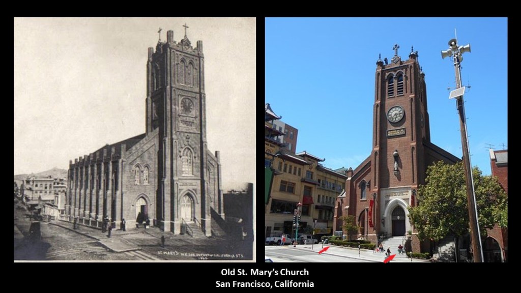
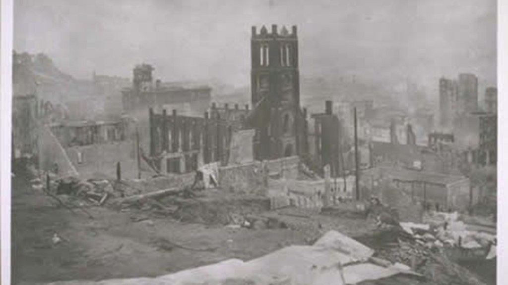
Old St. Mary’s was said to have survived the 1906 Great San Francisco Earthquake, but did not escape the fire that followed the earthquake, during which the fires were so hot, we are told, they melted the church bells and marble altar, leaving only the exterior brick walls and the belltower.
The church was renovated in 1909.
SD suggested I look into the Hammond Castle in Gloucester, Massachusetts.
It was said to have been built between 1926 and 1929 by John Hays Hammond Jr, and his architects from the Boston firm of Allen and Collens, as his dream home of a medieval-style castle.
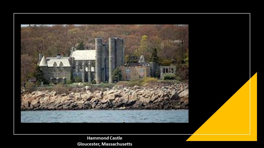
Hammond was a pioneer in the study of remote control, holding over 400 patents.

Hammond Castle operates as a museum today, displaying exhibits about his life and inventions as well as his collection of Roman, medieval, and Renaissance artifacts.
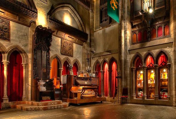
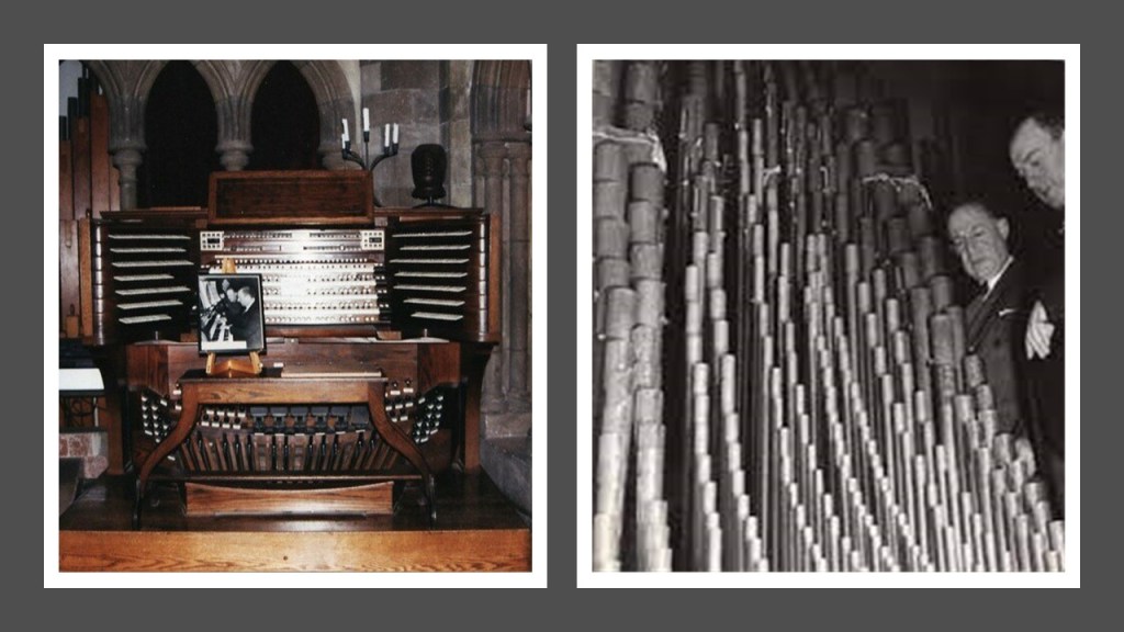
Like Scotty’s Castle back in Death Valley, Hammond’s Castle had a large pipe organ, and it was once the largest organ in the western hemisphere installed in a private residence, consisting of 8,400 pipes.
The organ at Hammond’s Castle, however, has been inoperable since 2004.
Hammond Castle is also a popular local venue for important occasions of all kinds.
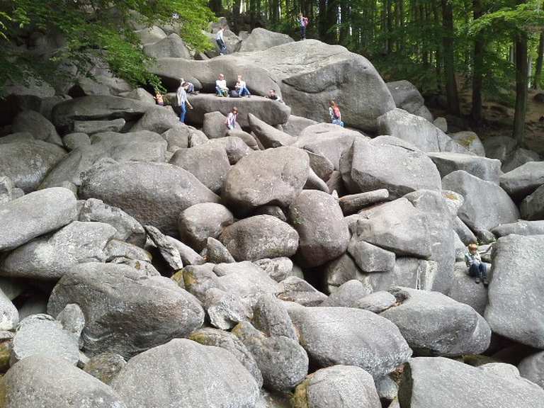
The “Felsenmeer,” or “Rock Sea,” in the Odenwald Region in Germany, was brought to my attention by DD, who sent me photos.
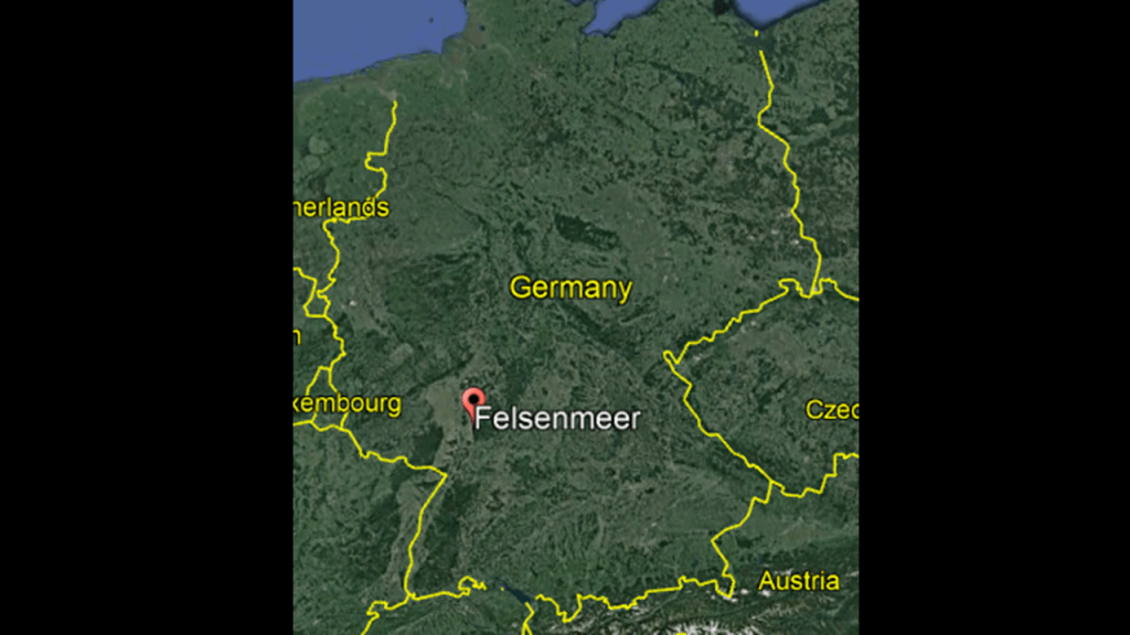
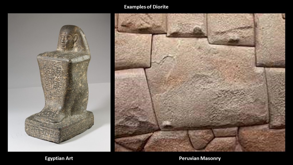
The Felsenmeer is on a mountain called the “Felsberg,” and is a rocky landscape of dark-grey, quartz diorite.
Diorite is a geopolymer, primarily composed of what is called plagioclase feldspar, but it includes other types of minerals as well.
It was used for both art and masonry in numerous ancient civilizations.
Here are some obviously cut-and-shaped megalithic diorite stone blocks in the Felsenmeer that DD sent me photos of…
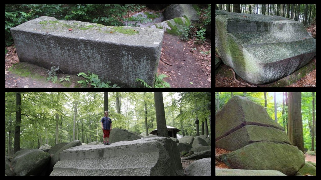
…including megalithic stones with drill-holes.
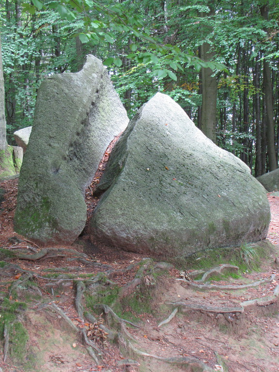
This photo with the beautifully-shaped unfinished megalithic column in the Felsenmeer on the left got my attention, as it reminded me of the famous one I had seen before in Baalbek in Lebanon.
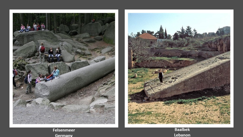
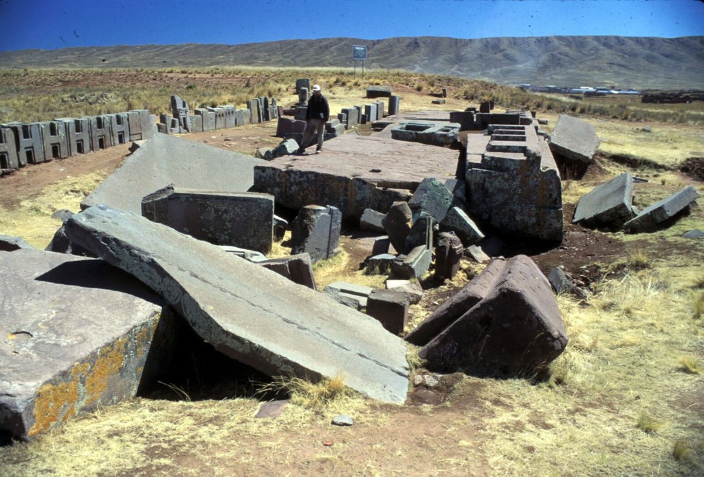
Another famous place that I am aware of that has an unsettled look to it, as if something happened right in the middle of what they were doing so the work remained unfinished and disturbed, is Puma Punka in Bolivia near Tiwanaku.
So did something of a cataclysmic nature happen, and if so, when?
Was it was far back in time as we have always thought, or did the cataclysmic something happen much more recently in time, far more recently than we have ever conceived?
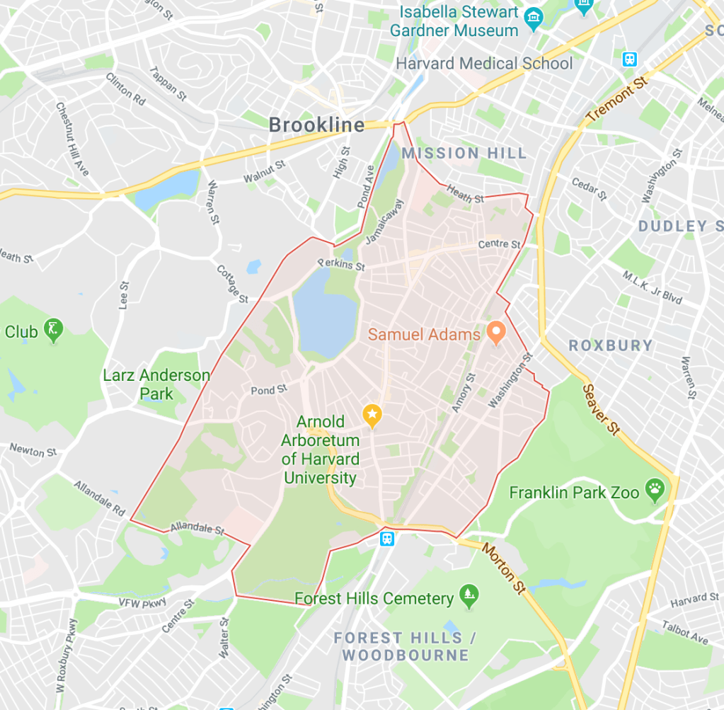
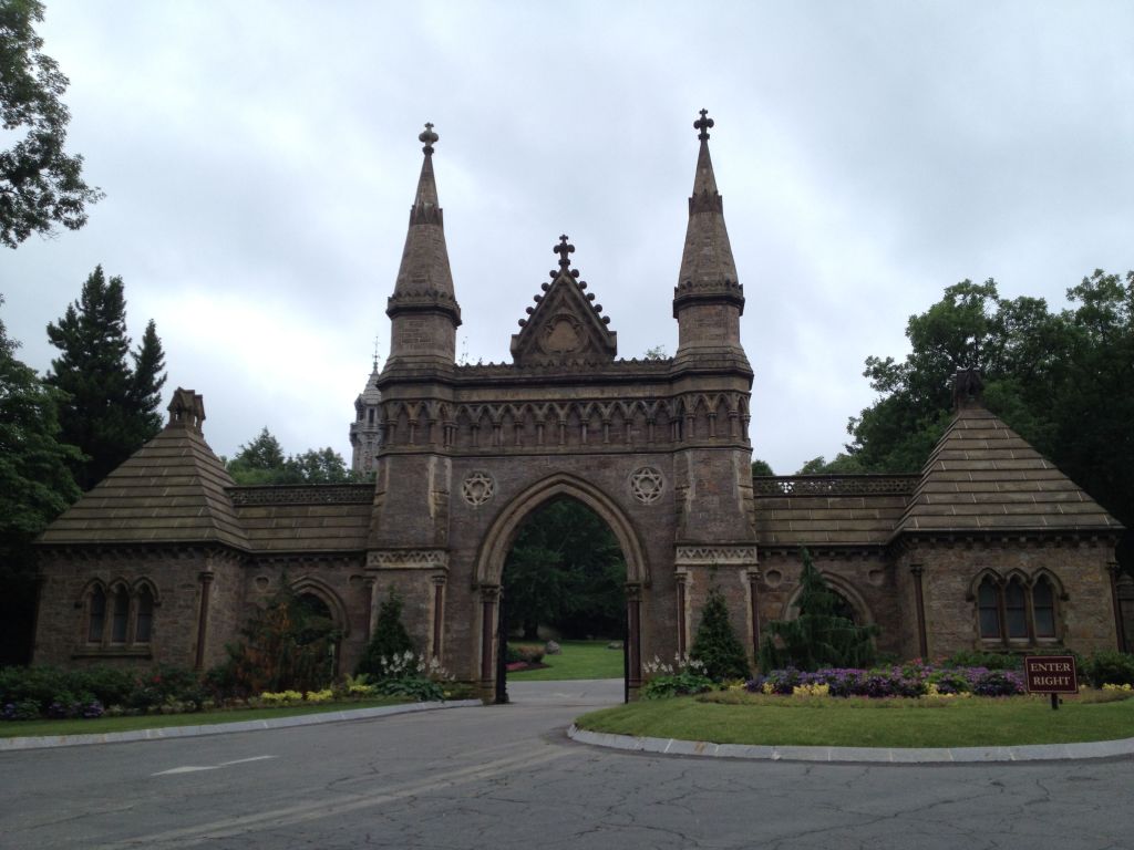
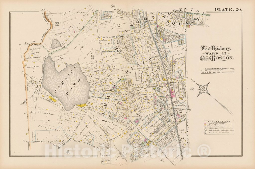
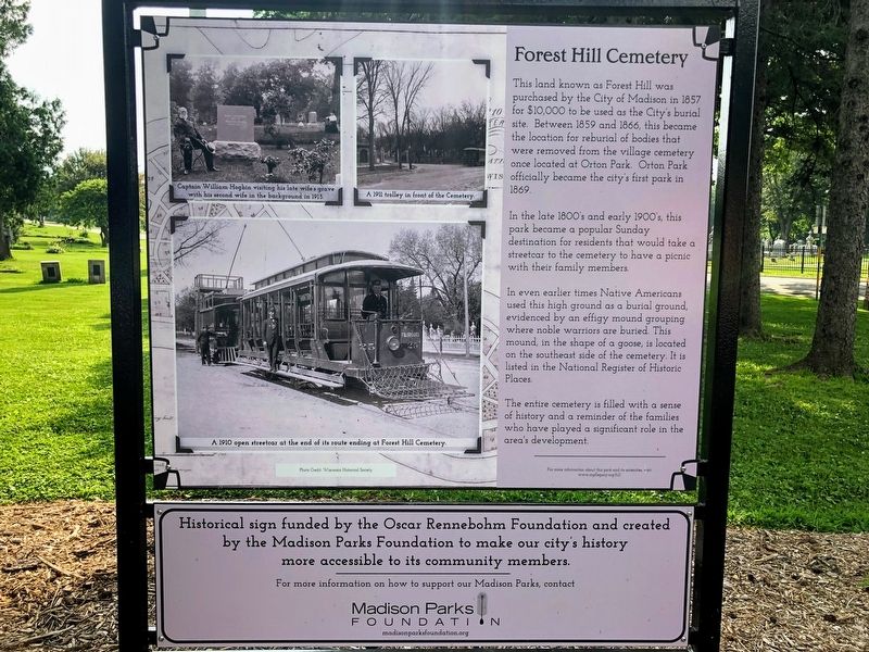
LS recommended that I look into a cemetery called the Forest Hills Cemetery, which is in the Forest Hills section of the Jamaica Plain neighborhood of Boston, Massachusetts.
Already, I see a lot to break-down here.
We are told the cemetery itself was established as a public municipal cemetery in 1848 for the town of Roxbury, until the town was annexed to Boston in 1868 and the cemetery privatized.
Seeing the term “public municipal cemetery” sparked my immediate interest, so I looked into that to see what I could find out.
Here is what we are told.
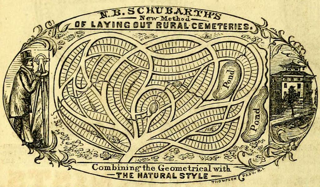
Also known as the “Rural Cemetery Movement,” these were said to have been a style of cemetery that became popular in the mid-19th-century in both the United States and Europe due to the overcrowding and health concerns of urban cemeteries.
They were typically built, we are told, around 5-miles, or 8-kilometers, outside the city in order to both be: 1) separate from the cities; and 2) close enough for visitors.
Not only that, the “Rural Cemeteries” were beautifully landscaped, containing elaborate memorials and mausoleums, and were places that the general public could go for outdoor recreation around art and sculptures, which previously had only been available to the wealthy.
Their popularity decreased, however, towards the end of the 19th-century due to: 1) the high cost of maintenance; 2) the development of true public parks; and 3) the perceived disorderliness of appearance due to independent ownership of family burial plots and different grave markers.
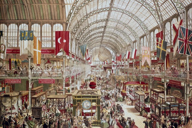
I find the “Rural Cemetery Movement” cropping up in history in the early- mid-19th-century, and ending, for all-intents-and-purposes at the end of the 19th-century to be particularly noteworthy, since the research I have done on what the official narrative tells us points right to this same time-period as being when the New World Order history reset really got underway, starting in earnest in 1830, and officially kicked off at the Crystal Exposition in London in 1851.
Okay, so let’s dig a little deeper into Forest Hills, its Cemetery, the Jamaica Plain neighborhood, and the surrounding area, and see what all comes up.
The Forest Hills Cemetery lies in-between, and to the southwest of Franklin Park, Boston’s biggest park, the design of which was credited to Frederick Law Olmsted in the 19th-century as part of the Emerald Necklace system of parks, and home of the Franklin Park Zoo since 1912…
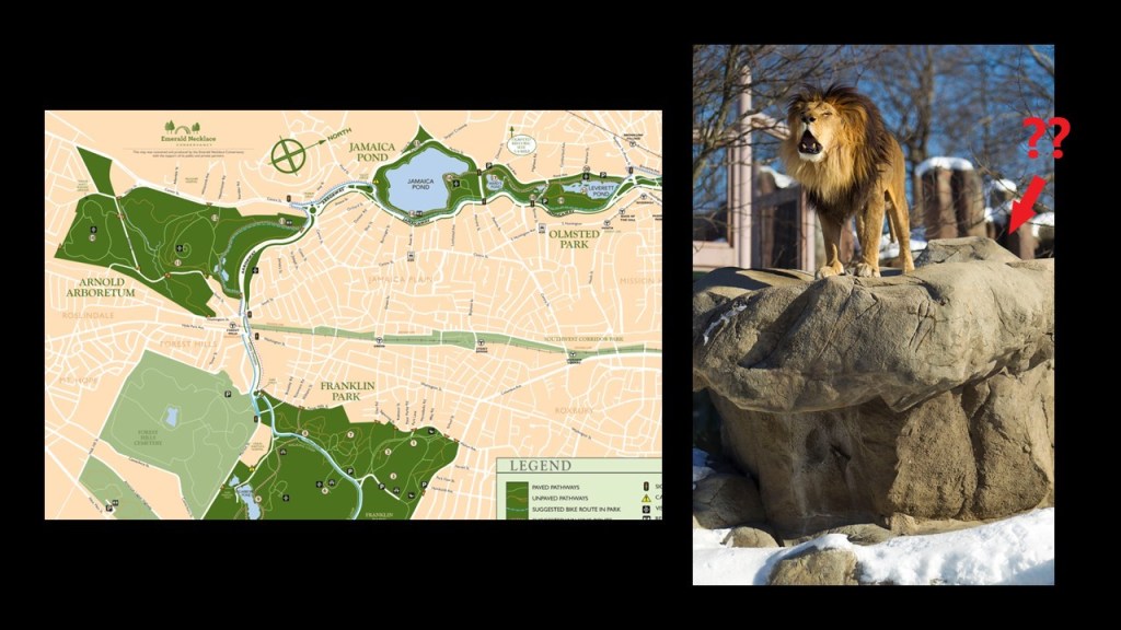
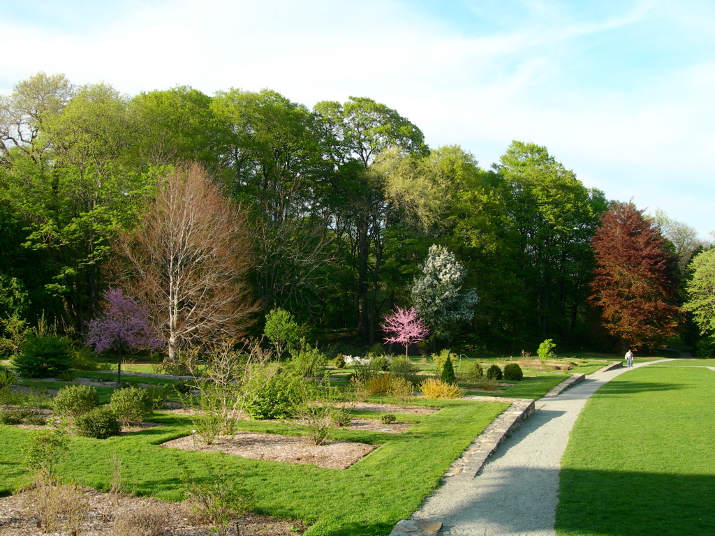
…and southeast of the Arnold Arboretum of Harvard University, the oldest public arboretum in North America, having been established in 1872,when the President and Fellows of Harvard University became the Trustees of part of James Arnold’s estate, a whaling merchant from New Bedford, Massachusetts, who specified in his will that part of his estate be used for “the promotion of agricultural or horticultural improvements.”
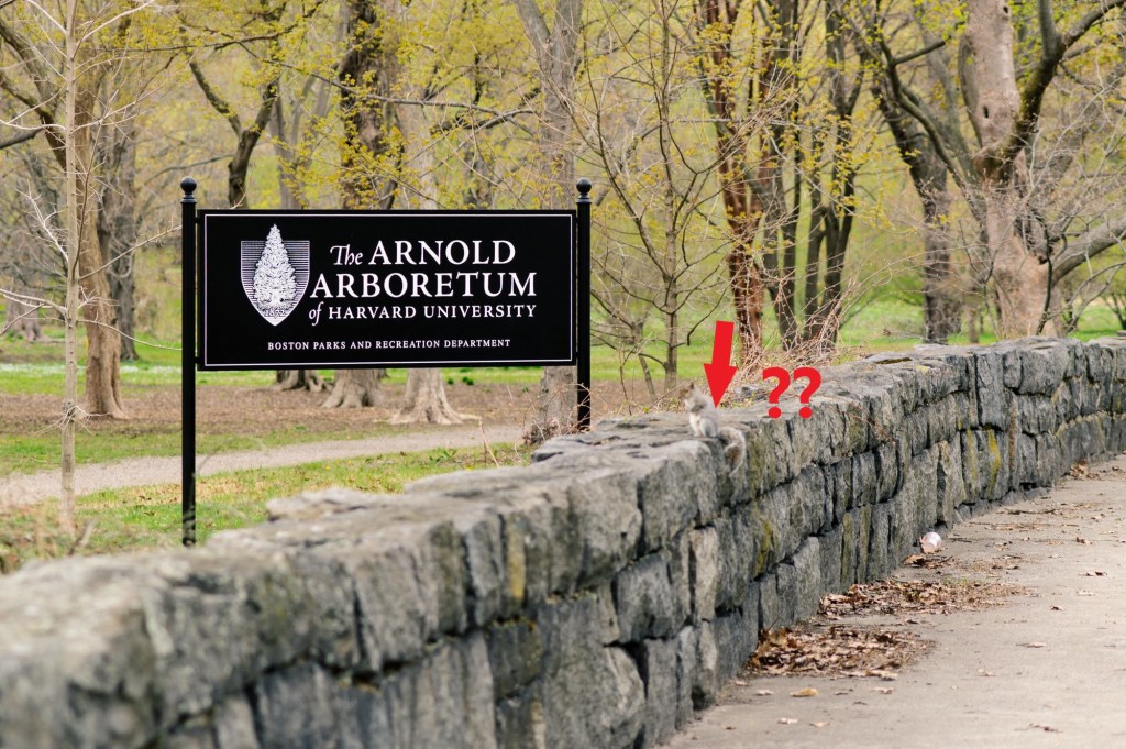
Frederick Law Olmsted got the credit, along with Charles Sprague Sargent, for designing the landscape of the Arnold Arboretum, as well as the Emerald Necklace of Parks.
The Jamaica Plain neighborhood of Boston was said to have been first settled by Boston Puritans in 1630 seeking farmland to the South, and then seceded from Roxbury as West Roxbury…in 1851, and became part of Boston when West Roxbury was annexed in 1874.
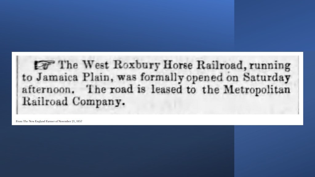
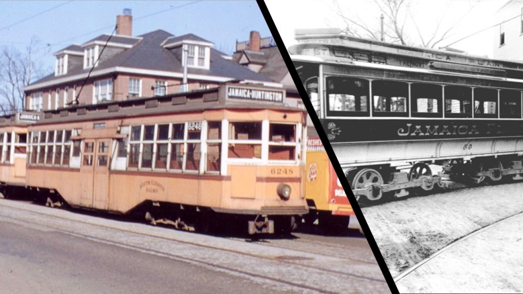
The neighborhood of Jamaica Plain became one of the first “Streetcar Suburbs” in the 19th-century, starting out in 1857 as “The West Roxbury Horse Railroad.”
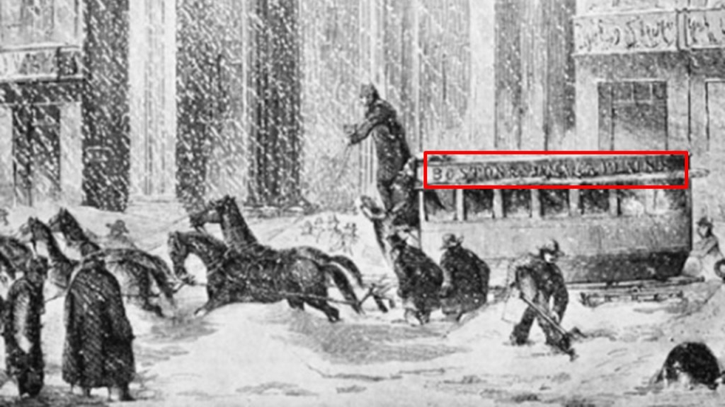
The term “Streetcar Suburbs” referred to residential communities whose growth and development were shaped by streetcar lines as the primary transportation system, when, we are told, the introduction of the electric streetcar allowed the growing middle class to move beyond the inner cities into the suburbs, with a rapid growth of electric streetcar service taking place between 1870 to 1890.
There were three electrified streetcar routes to Boston from the Jamaica Plain neighborhood by the late 1800s – the Forest Hills-to-Boston Route; the Jamaica Plain-to-Boston Route; and the Dudley Street Cross-Over that linked Center and Columbus to the Washington Line.
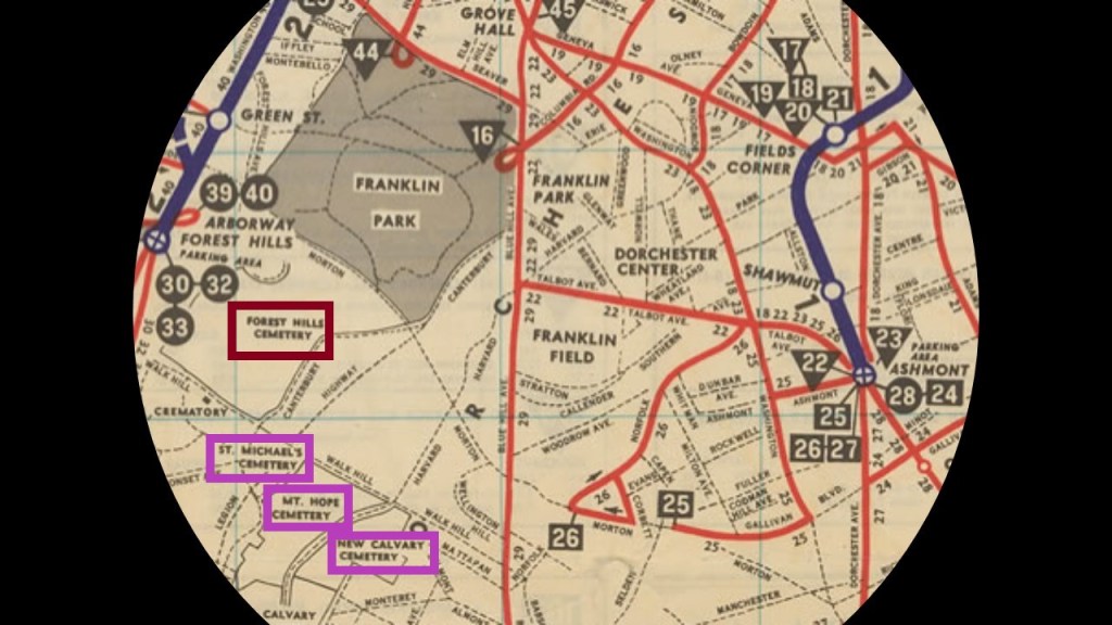
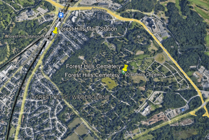
These electrified rail-lines were all around the Forest Hills Cemetery, the maroon box, as well as three other cemeteries, highlighted in the purple boxes.
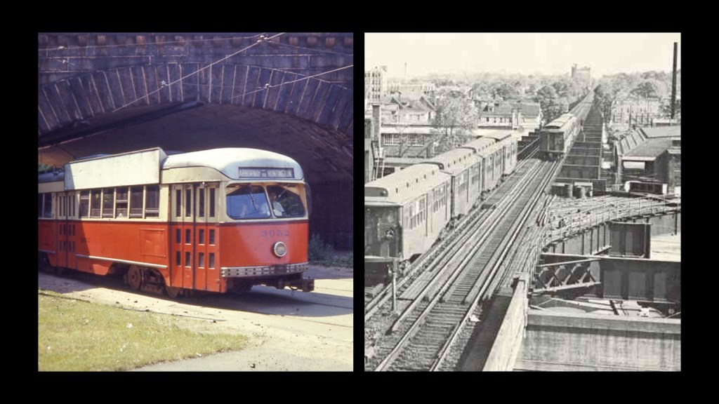
The Arborway Yard in the Forest Hills Station complex, directly adjacent to the Forest Hills Cemetery…
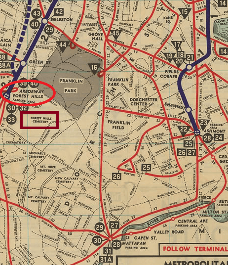
…was in use as part of the Green E Line Branch of Boston’s Light Rail system from 1924 until it was permanently closed in 1985.
The Forest Hills Station itself is still in use today as a main station serving the Forest Hills/Jamaica Plain neighborhood of Boston, including subway, commuter rail and bus lines…
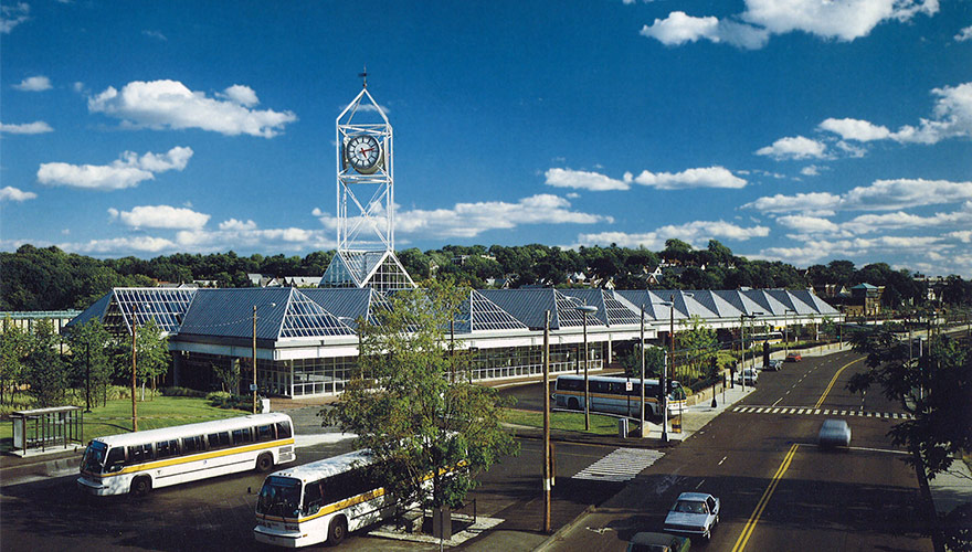
…right next to the Forest Hills Cemetery.
One more place to mention in Jamaica Plain before I take a look at the Forest Hills Cemetery.
Co-located in the same place are the Soldier’s Monument and the First Unitarian Universalist Church in the Jamaica Plain neighborhood.
First, the Soldiers Monument.
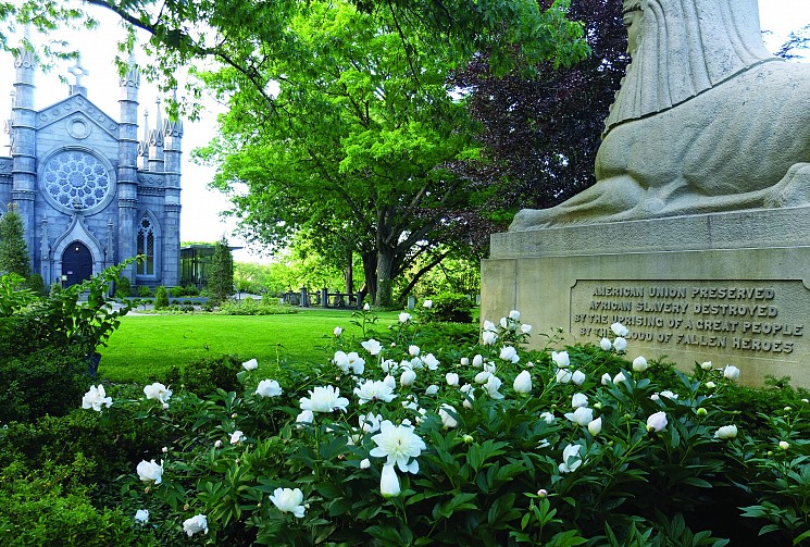
It was said to have been dedicated in 1871 as a memorial for those local citizens who died during American Civil War.
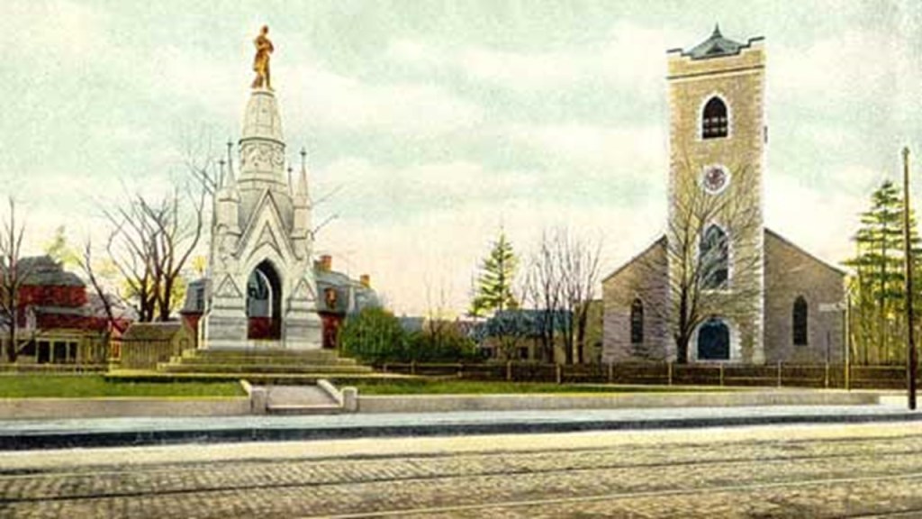
Maybe its just me reading into it, but the Soldiers’ Memorial in Jamaica Plain sure looks like the top of an old building to me!
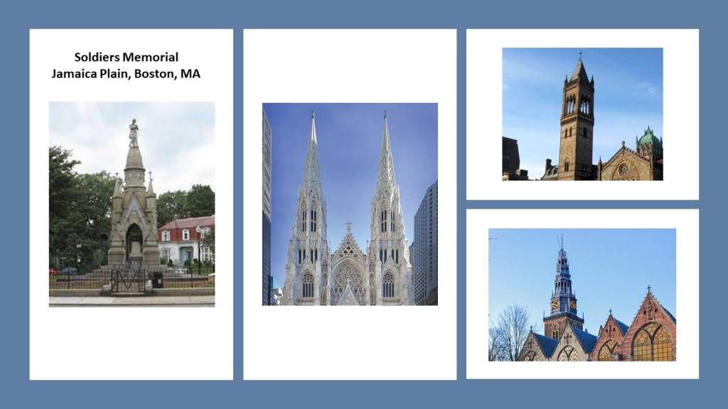
The First Unitarian Universalist Church, also known as the First Church of Jamaica Plain…
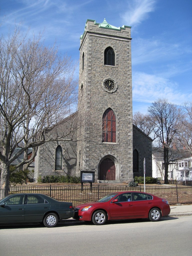
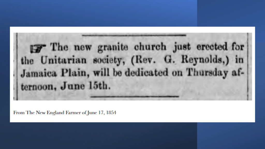
…a stone church that was said to have been built in granite in 1854 in the Gothic Revival-style and designed by the prominent Boston architect Nathanial J. Bradlee.
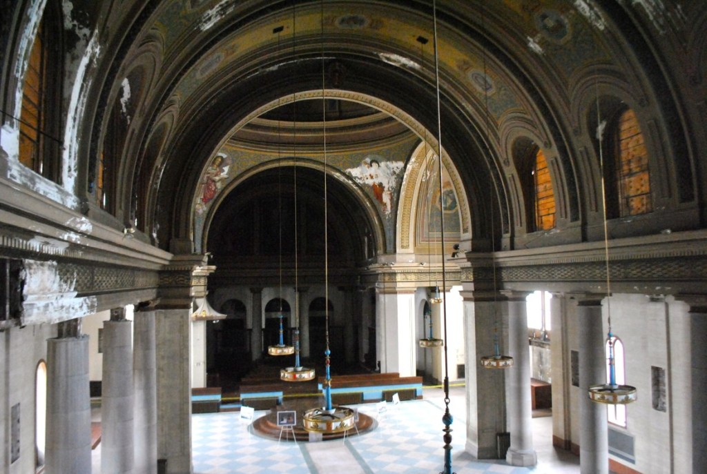
One more church in Jamaica Plain to bring forward that I found when searching for images on the First Church was the Blessed Sacrement Church in Jamaica Plain’s Hyde Square.
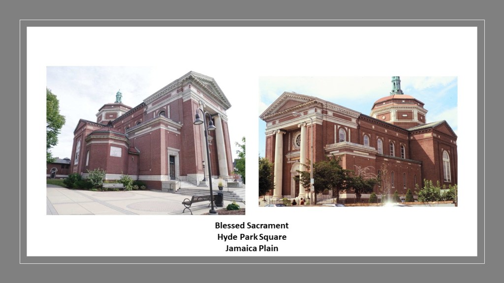
I say was a church because the former Blessed Sacrament building has not been in use as a church in quite some time and currently in the process of being developed into a performance and event space by a local community task force.
Construction of the church was said to have been completed in 1917 and it was closed in 2004.
Now onto to the Forest Hills Cemetery.
What do we find here?
Well, firsts first I guess.
The Forest Hills Cemetery is the location of the first crematorium in not only Massachusetts, but in New England as well, which was added in 1893.
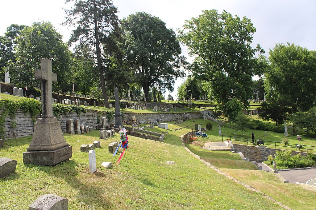
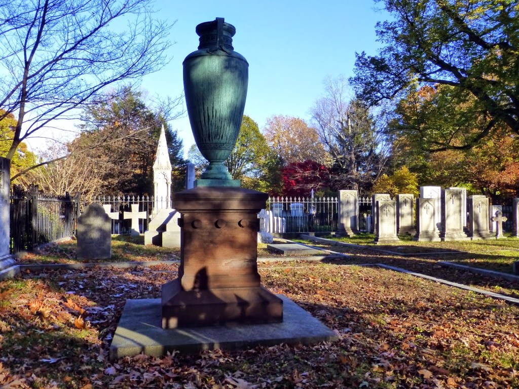
The Forest Hills Cemetery has notable monuments here.
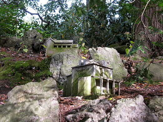
There is a miniature village the cemetery known for, which apparently was added to the grounds in 2004 as part of a larger exhibition in the cemetery, and replicas of the homes of people buried there.
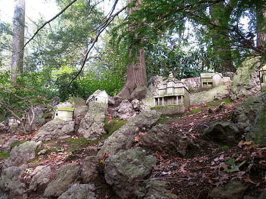
The houses have names carved on them, like “Temperance Leader.”
The subject of “Temperance Leader” brings to mind the “Temperance Movement,” and I am going to talk about the sheer number of historical breweries I have encountered thus far here in this one part of Boston alone, as well as what the “Temperance Movement” was, and the contradictions I see about it all.
Jamaica Plain was the home to most of Boston’s thirty-one breweries prior to the outlawing of alcoholic beverages during the Prohibition Era starting in 1920.
The reasons given for the high number of breweries were: 1) the quality of the water from the aquifer feeding the local Stony Brook; 2) the cheap cost of land in the area after merging with Boston in 1868: 3) and the influx of German and Irish immigrants here with a taste for lager and ale.

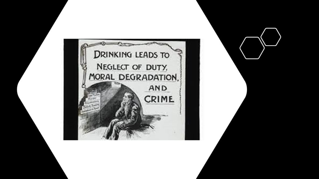
The Temperance Movement was called a social movement against the consumption of alcohol, and typically criticized alcohol consumption and emphasized alcohol’s negative effects on people’s health, personalities, and lives, and demanding the complete prohibition of it.
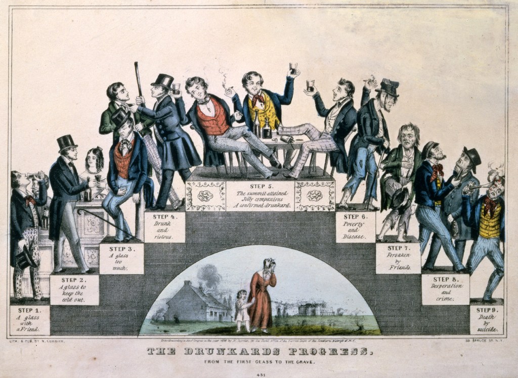
This is really interesting to me because the alcoholic beverage industry was becoming established during this time period between 1830 and 1900, creating the juxtaposition of a culture on one hand that encouraged the profuse consumption of alcohol, and at the same time a counterforce within that same culture that not only criticized alcohol consumption, but that got involved in “charitable institutions” with stated missions of guiding the poor out of the impoverishment and crime coming from the problem of drinking too much alcohol.
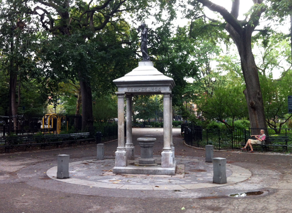
Here what is called the Temperance Fountain in New York City’s Tompkins Square Park.
It also looks like it could possibly be what was once the top of a building…
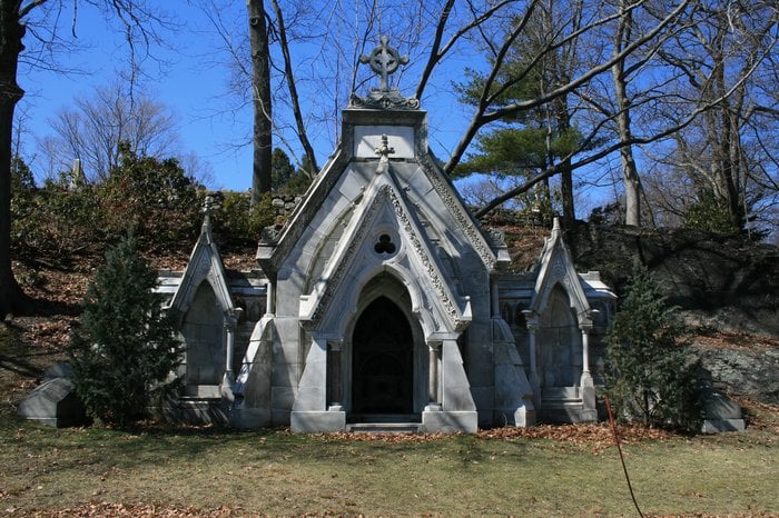
…as do the following monuments in Boston’s Forest Hills Cemetery:
The 1873 Chadwick Mausoleum was said to have been designed by William Gibbons Preston for Joseph Chadwick, a prominent businessman, who was one of the cemetery’s Trustees…
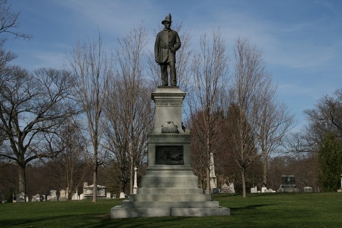
…and the 1909 Firemen’s Memorial.
Also at the Forest Hills Cemetery is the 1889 bronze sculpture of “Death Staying the Hand of the Sculptor,” also known as the Martin Milmore Monument, attributed to Daniel Chester French, in honor of the Martin Milmore, one of two brothers who were Irish immigrants who came to the United States…in 1851.
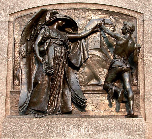
Martin Milmore was a sculptor, and his brother oseph Milmore a stone carver.
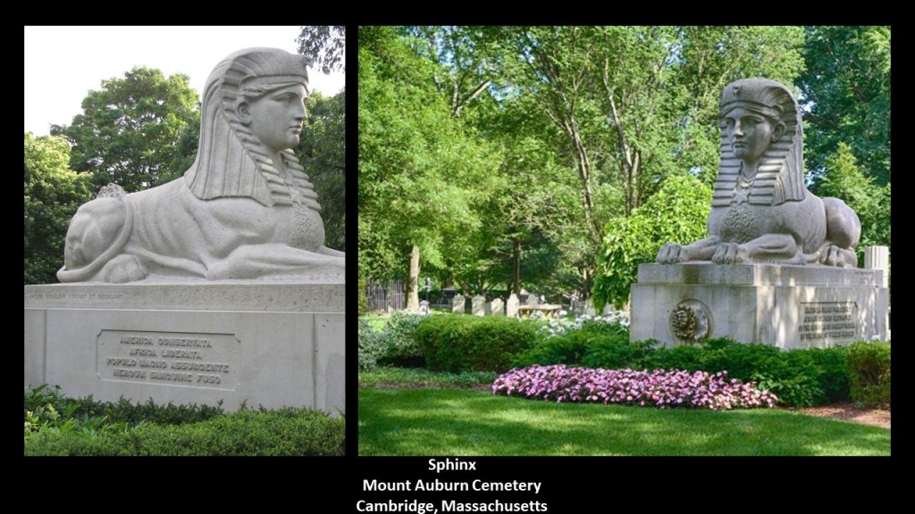
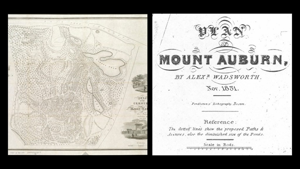
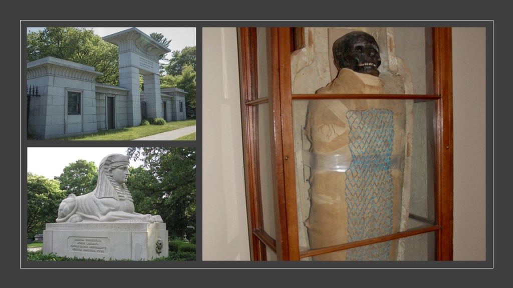
Martin was credited with the creation of the granite Sphinx at the Mount Auburn Cemetery in 1872, said to have been commissioned as a memorial to commemorate Union soldiers who died during the Civil War by the Mount Auburn Cemetery founder and architect Jacob Bigelow.
The Forest Hills Cemetery was said to have been inspired by the Mount Auburn Cemetery.
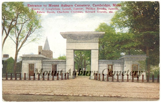
The first rural cemetery in the United States, the Mount Auburn Cemetery, was also in the Boston area, in Cambridge, Massachusetts, established in 1831.
Here is what is described as the “Egyptian Revival Style” front-entrance of the cemetery, said to have been built in 1842 under the direction of architect Dr. Jacob Bigelow to replace an identical original entrance that was built of wood in 1832.
The Bigelow Chapel on the Mount Auburn grounds was said to have been designed in the Gothic Revival style by Dr. Jacob Bigelow, and built in the 1840s for funeral services and public programs.
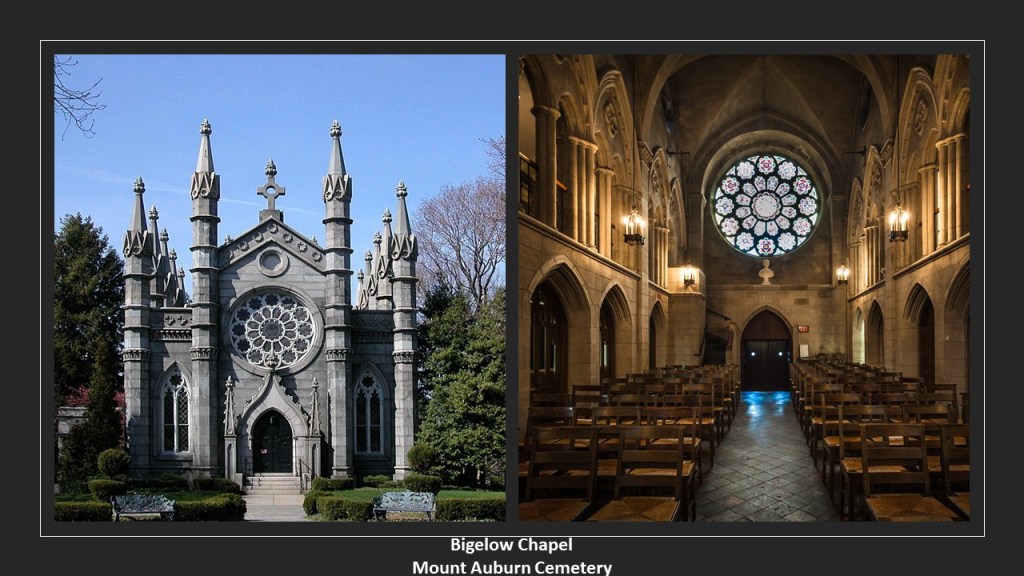
Interesting to note that the “Sphinx” sculpture on the Mount Auburn Cemetery grounds appears to be situated directly in front of, and facing, the Bigelow Chapel.
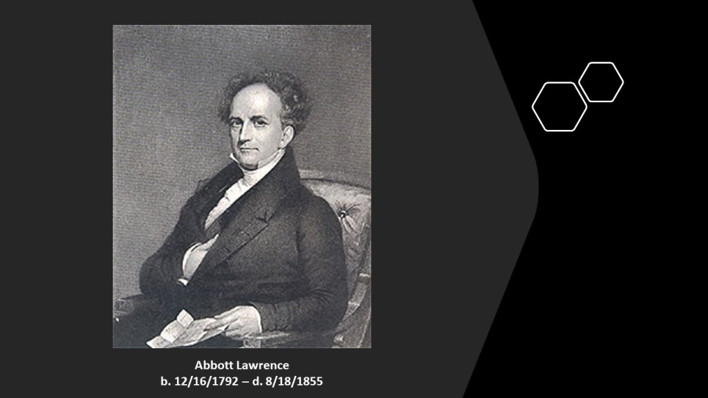
Mount Auburn was dedicated in 1831, and was the burial site of many of the “Boston Brahmins,” the name that was given to the wealthy families Boston of British Protestant origin that became influential in the development of American institutions, and culture, and contains the enclosures of families like the Lawrence family, which included people like Abbott Lawrence, who represented some of the real money in America at the time Mount Auburn was said to have been built in 1831.
Abbott Lawrence was involved in things like establishing the cotton textile mill industry in New England; promoting the railroad for economic development; was one of the partners in A. & A. Lawrence Company, which went on to become the greatest wholesale mercantile house in the United States back in the early days; was a Representative for the Massachusetts 1st District in the U. S. Congress between 1835 and 1837; and he served also as an Ambassador to the United Kingdom between 1849 and 1852 under Queen Victoria.
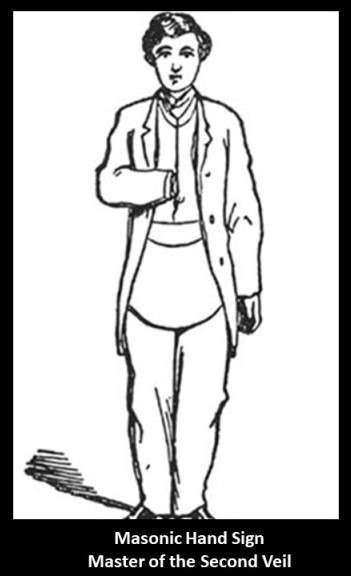
And is he sporting the “hidden hand” in this portrait?
It appears more and more to be the case that the elite class of the world we know got us programmed through many generations via their “hidden hand” in the development of our culture, which is also a masonic a masonic hand-sign signifying “Master of the Second Veil.”
Just for comparison, here are a few more cemeteries around the country named “Forest Hill” that popped up:
The Forest Hill Cemetery in Greencastle, Indiana, established in 1865…
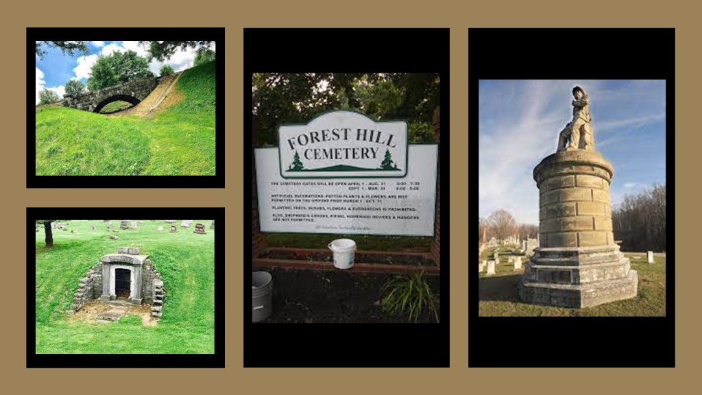
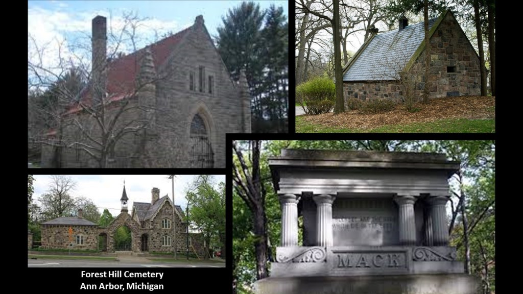
…the Forest Hill Cemetery in Ann Arbor, Michigan, established in 1857 as a “Rural Cemetery…”
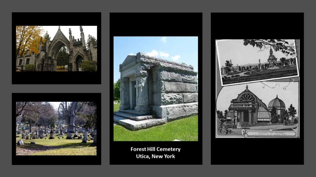
…the Forest Hill Cemetery in Utica, New York, established in 1850…
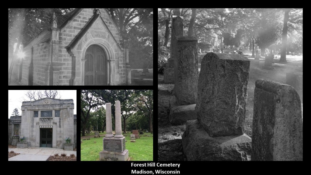
…and the Forest Hill Cemetery in Madison, Wisconsin, established in 1865.
It would appear that there is a LOT more to the old cemetery story than just some place to bury the dead.
If anybody has any ideas as to how these places that became cemeteries in the 19th-century might have tied into the bigger free-energy-grid-system picture, I would love to hear them!
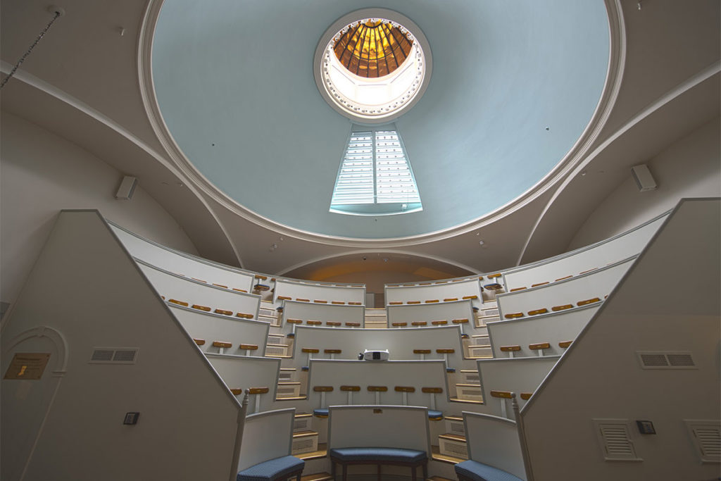
Before I head out of the Boston area, CR left a comment to check out the “Ether Dome” at the Massachusetts General Hospital in Boston.
The dome itself is a copper dome with windows that let in natural light.
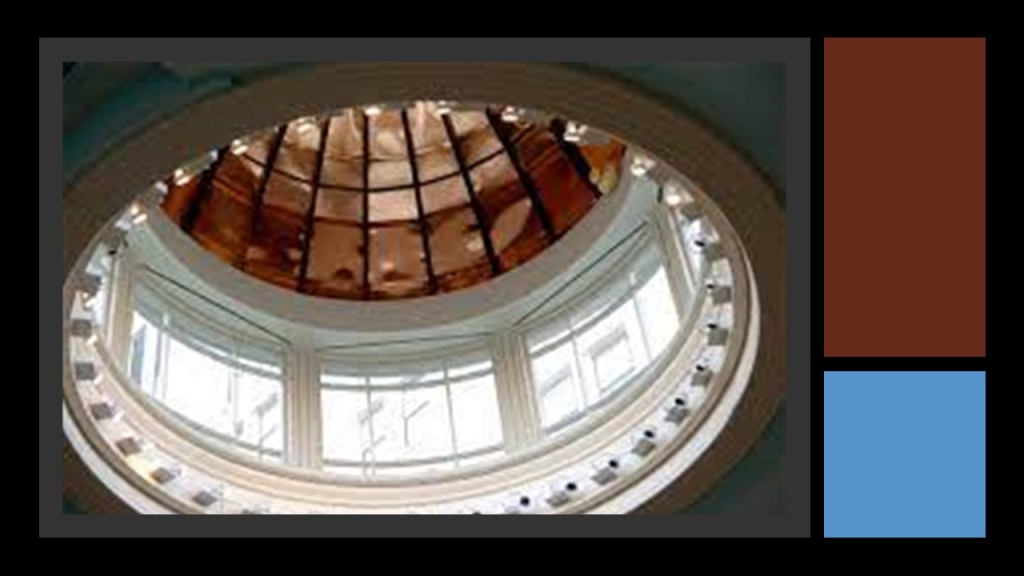
Underneath the Copper Dome on the inside is a surgical operating amphitheater that served as the hospital’s operating room from the time that it opened in 1821 until 1867.
It is famous as the place where the use of inhaled ether as a surgical anesthetic was demonstrated publicly, on October 16th of 1846.
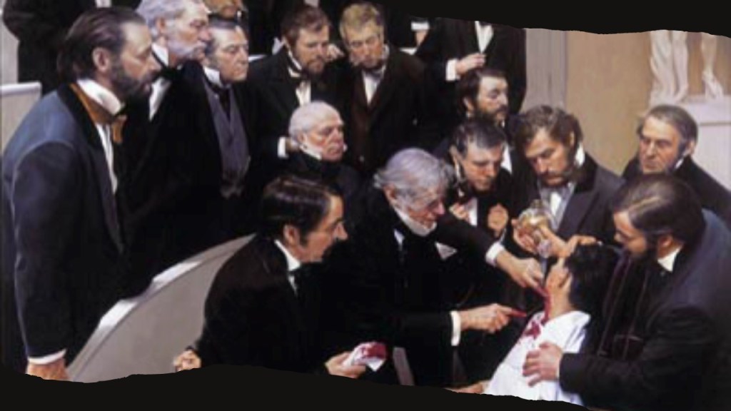
Perhaps so, but the Ether Dome could also have a direct connection with Ether, the 5th element in alchemical chemistry and early physics that has been removed from our awareness, so we only learn about the first four – earth, air, fire, and water.
Ether is the material that fills the Universe.

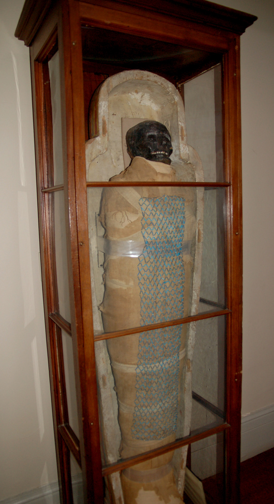
There is an Egyptian mummy that has been in residence at the Ether Dome since May of 1823.
When it arrived by ship from Egypt in Boston, we are told, it was said to be the first complete Egyptian burial ensemble in America.
But did the mummy come from Egypt…or from America?
The resident mummy in the Ether Dome has been kept company since the 19th-century by a resident skeleton.
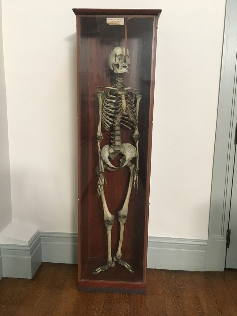
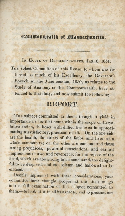
Apparently after the Massachusetts State Legislature passed the Anatomy Act in 1831, medical schools were allowed to obtain the bodies of the poor, the insane, and those who died in prison.
And is it just a coincidence that Boston’s Mount Auburn, the first rural cemetery in the United States, was also established in 1831 ?
So far in Boston, we have an Egyptian Revival-style cemetery gate; Sphinx; and mummy.
Can we find an obelisk and a pyramid?
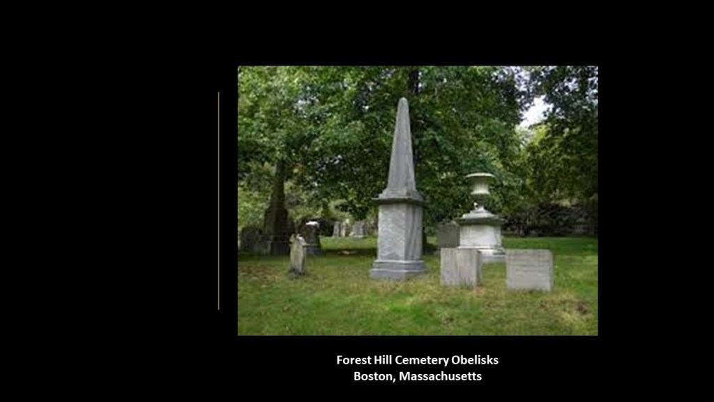
Well, as far as obelisks go, there are a lot in the cemeteries here…
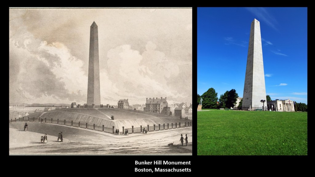
…and there is a big one erected at the site of the Battle of Bunker Hill, which was said to have opened in 1843.
How about pyramids?
Well, if I was there, I could probably find them hidden in plain sight.
But this is what I know from past research into Boston.
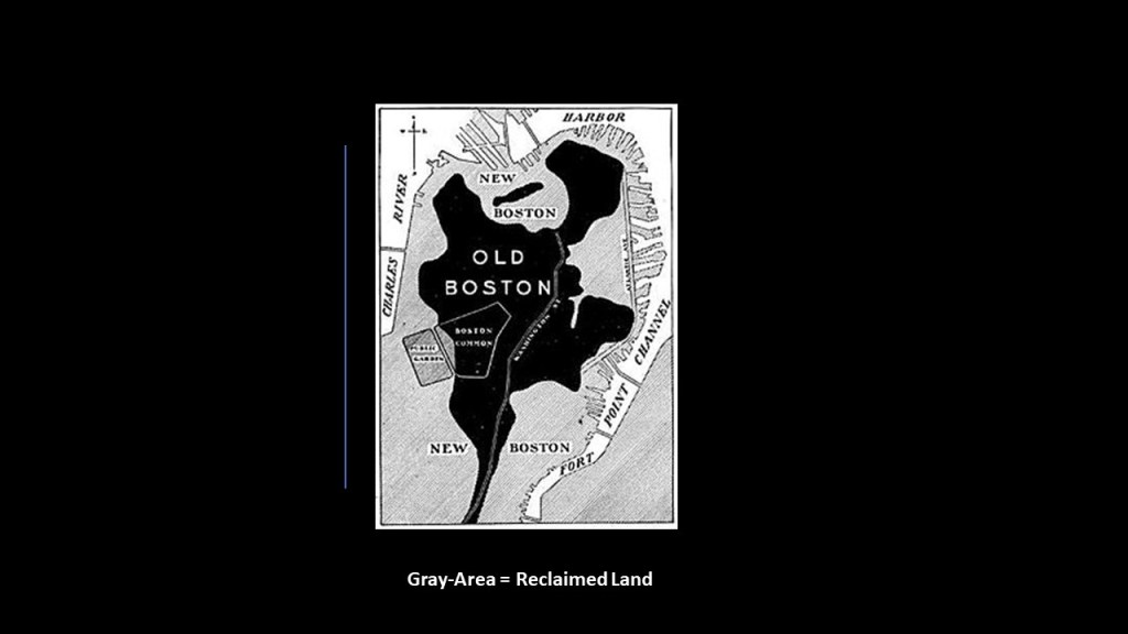
This is a 1775 map of the Shawmut Peninsula, of which Beacon Hill was the center.
This is what we are told:
Boston’s Shawmut Peninsula originally had three hills.
Pemberton Hill and Fort Vernon Hill were near Beacon Hill, and both of these hills were levelled for Beacon Hill development.
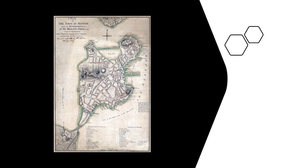
Beacon Hill itself was reduced from 130-feet, or 42-meters, to 80-feet, or 24-meters, between 1807 and 1832.
Were these three hills originally pyramids, or large geometric earthworks of some kind?
Also, interesting to note that land reclamation started here in 1820, in order to create land where there was originally water around the original peninsula, with the gray on this map of Boston showing where land was reclaimed.
All we have ever been taught about Egypt is that it was in one place in North Africa; what Egyptologists tell us that studies this place; and what the Bible tells us about Egypt and Egyptians.
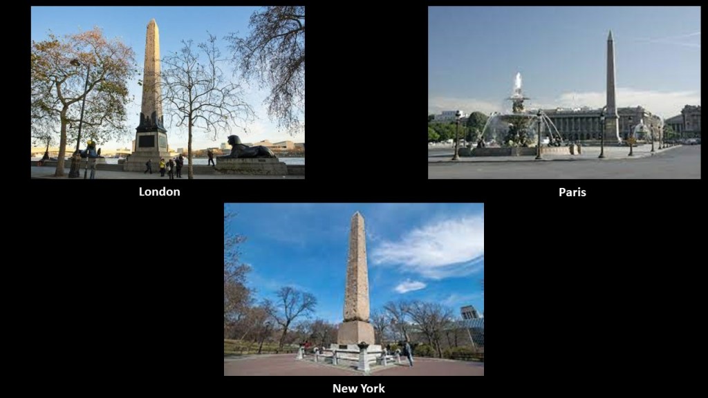
We have never been taught about the Egyptian or Kemetic civilization having been a world-wide civilization, but there is plenty of physical evidence the world over that it was, unless you would prefer to believe the historical narrative about 200-plus-ton obelisks were transported from Egypt to other countries during the 19th-century, as we are told the Cleopatra’s Needles in London, Paris, and New York were.
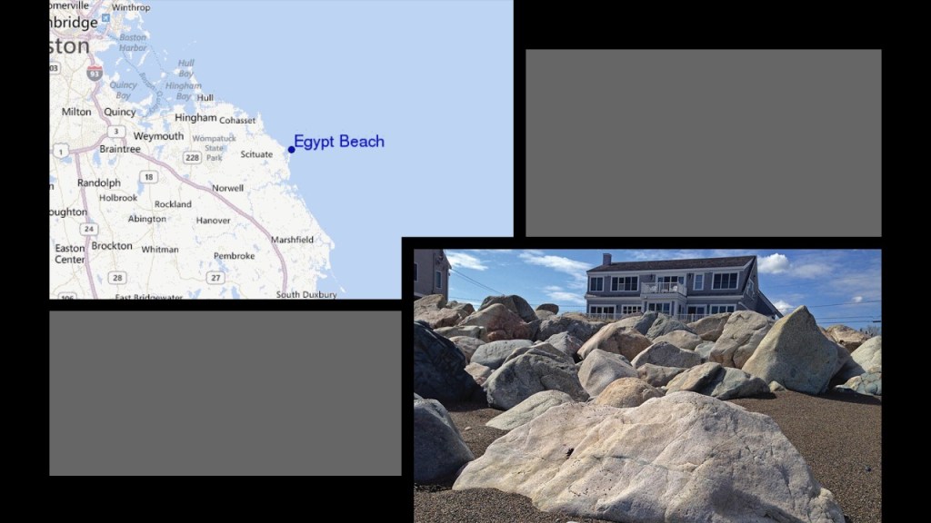
There is even an Egypt Beach in Massachusetts.
I am going to end “Places & Topics Suggested by Viewers – Volume 7” here.
Much more to come!