Circle Alignments on the Planet Washington, DC – Part 12 Lugo, Spain to Segovia, Spain

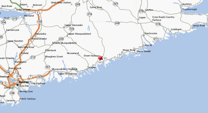
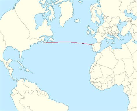
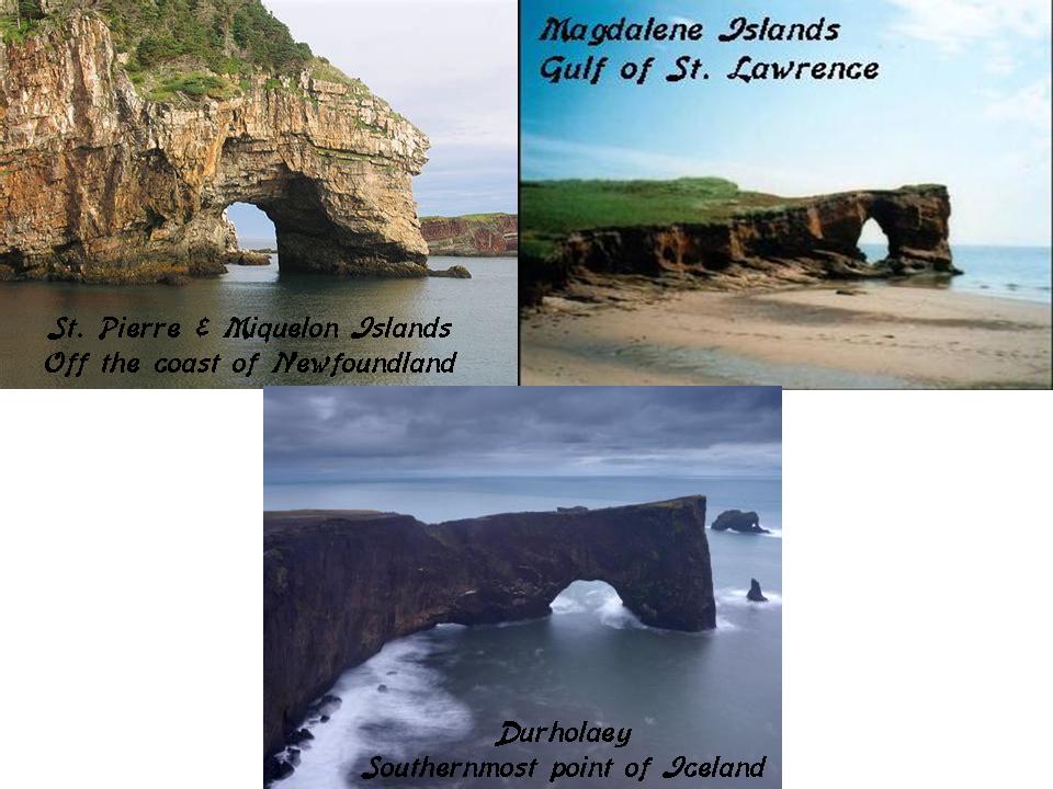
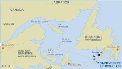
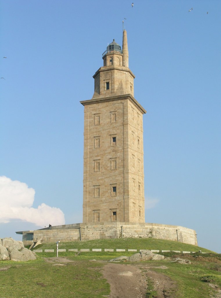
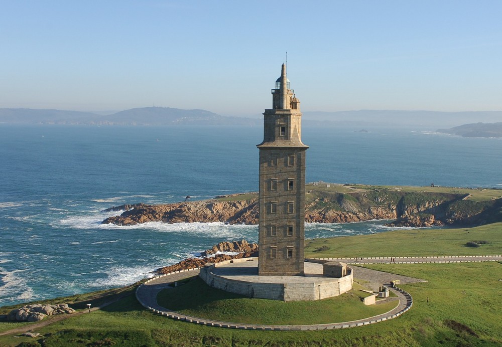
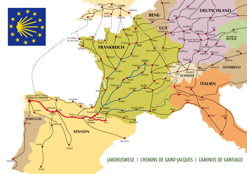
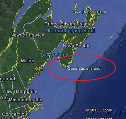
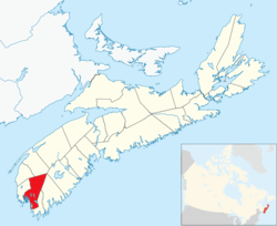
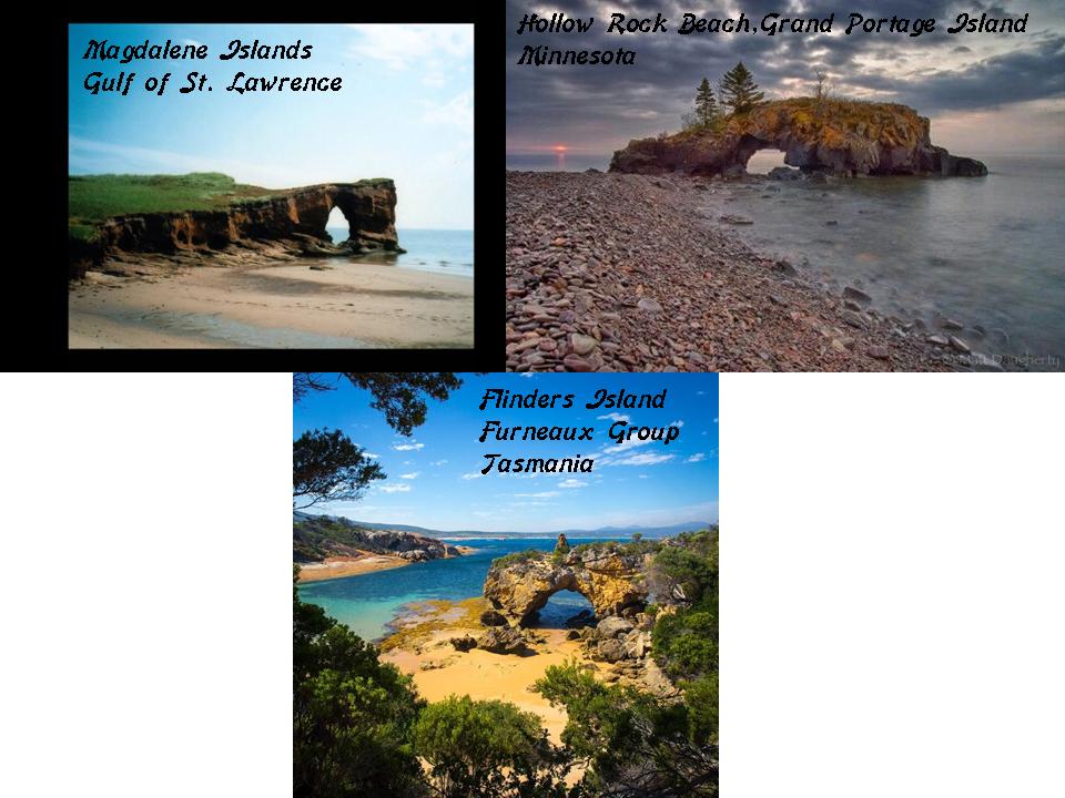
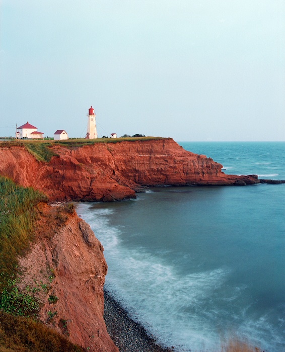
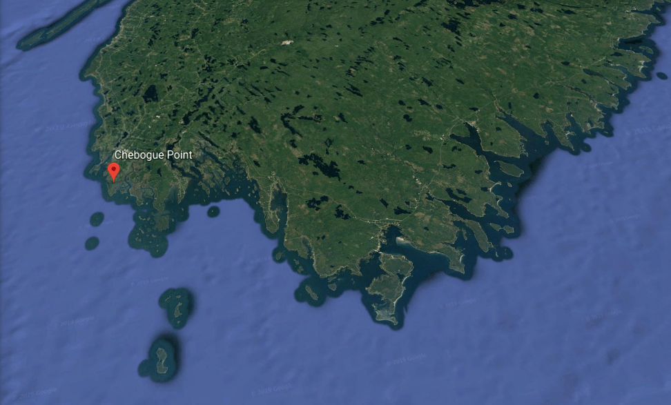
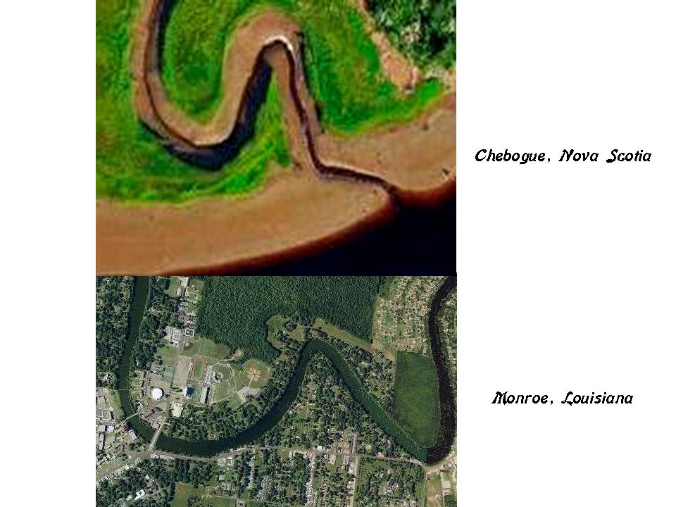
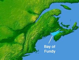
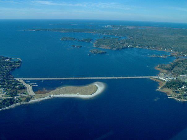
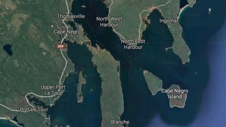
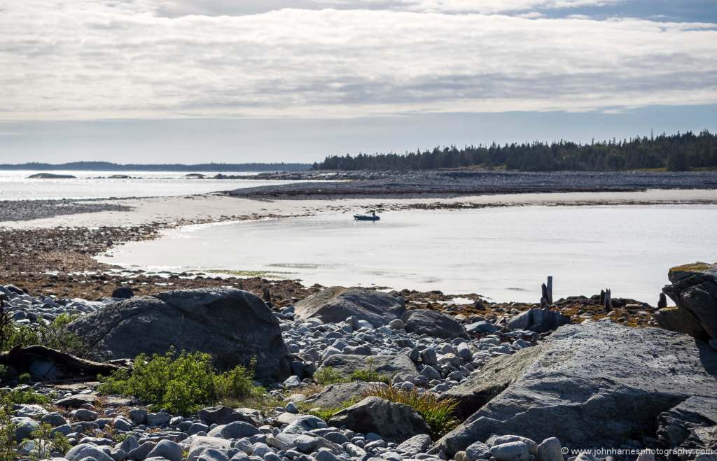
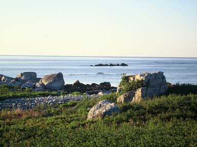
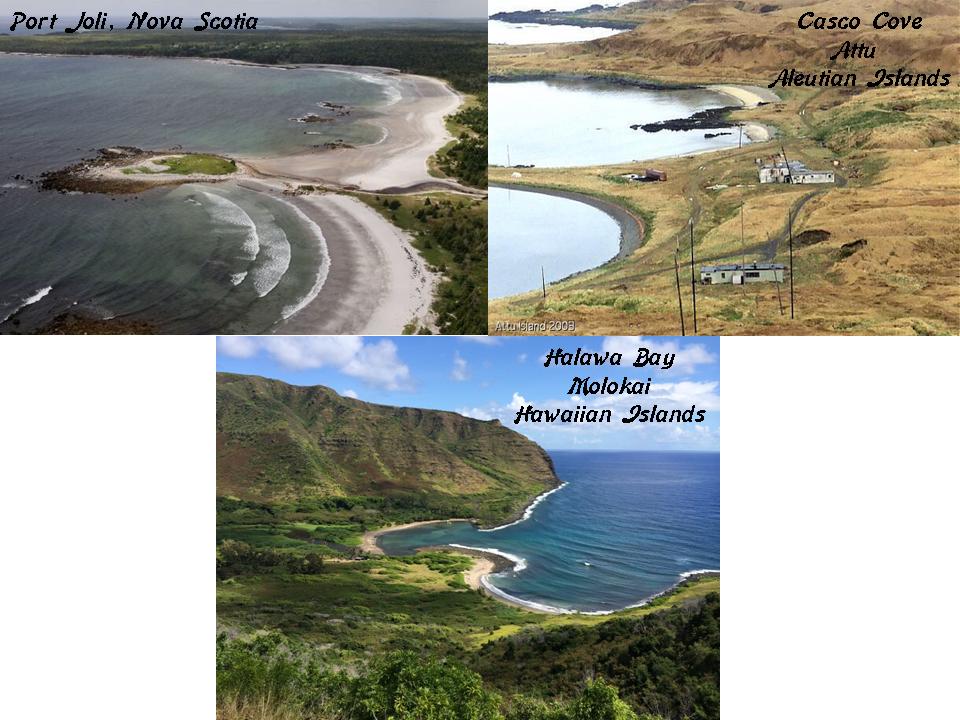
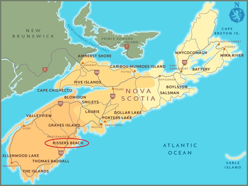
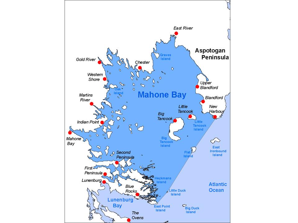
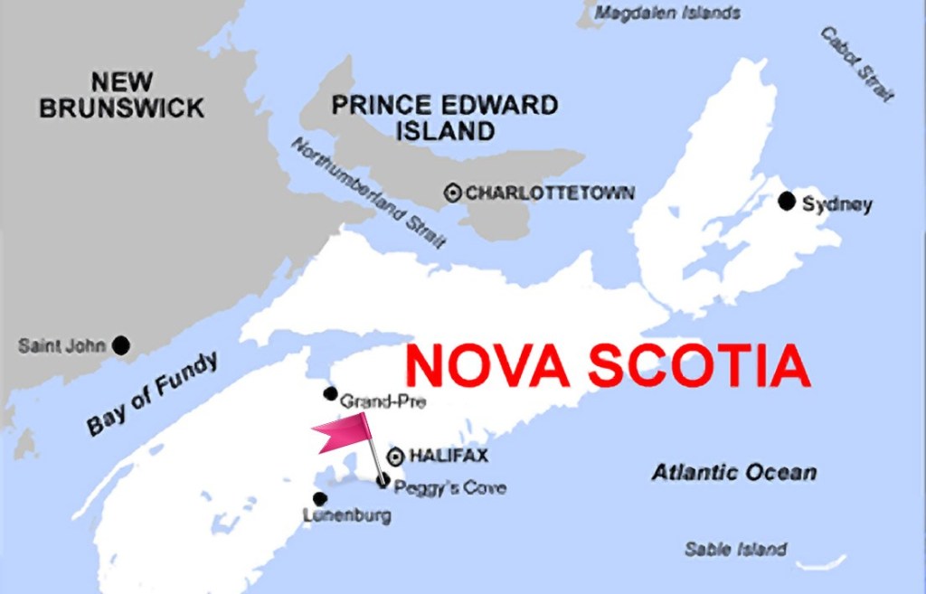
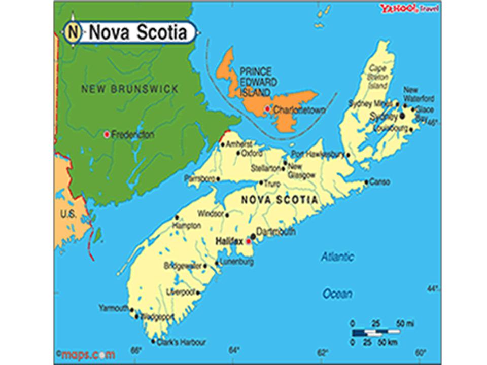
In the last post, I tracked the circle alignment from the coast of Nova Scotia, past the St. Pierre and Miquelon Islands, the last vestige of New France off the coast of the Canadian Province of Newfoundland & Labrador, across the Atlantic to where the alignment entered Spain in Galicia at the city of A Coruna.

I am picking up the alignment at Lugo, a city in northwestern Spain that is still in Galicia, and the capital the of Province of Lugo. It has a population of approximately 100,000 people.

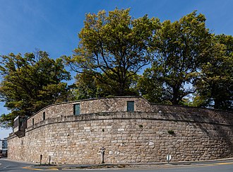
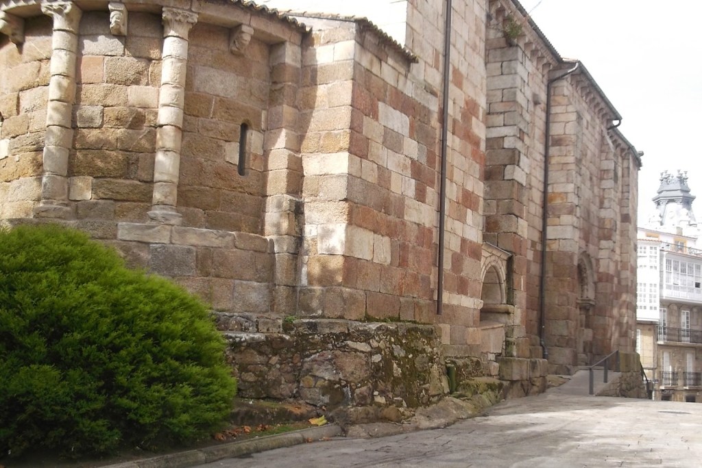
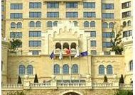
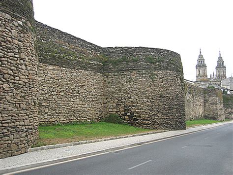
Lugo is the only city in the world that is said to be surrounded by largely intact, 3rd-century Roman walls. They are 33- to 49-feet, or 10- to 15-meters. high.

Just to be clear, I don’t believe the Romans built these walls. They have just been given for the work of another highly advanced and unified global civilization.

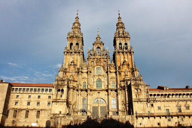
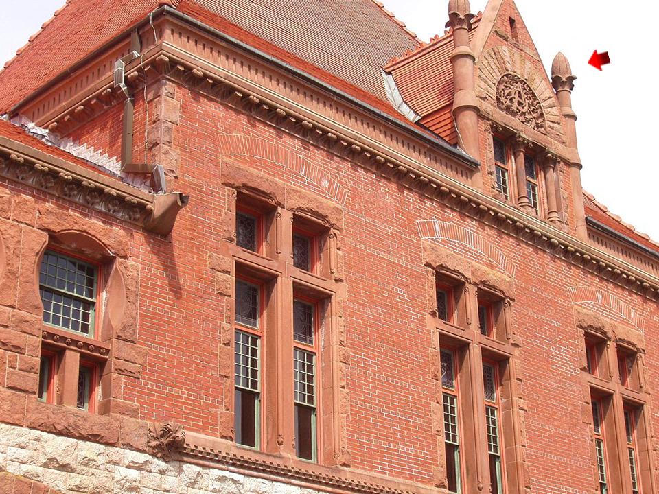
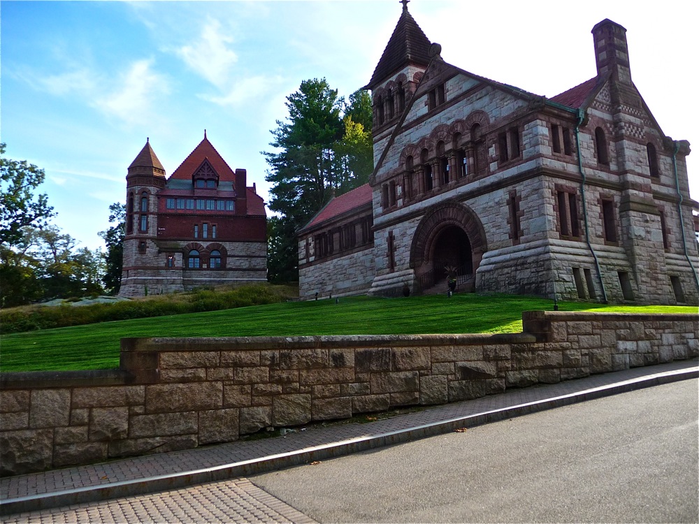
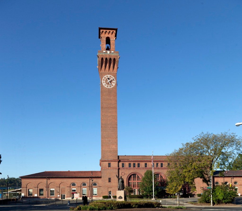
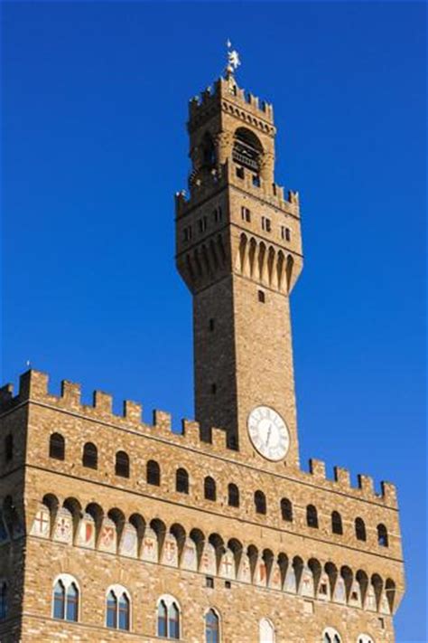
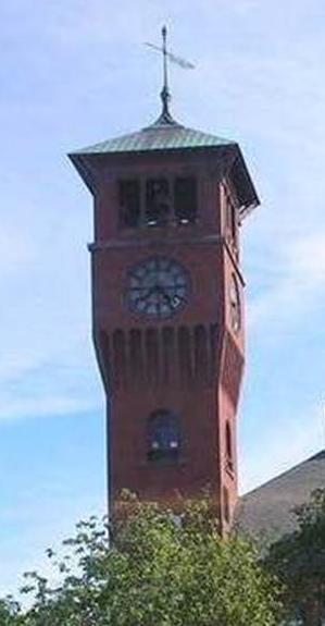
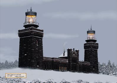
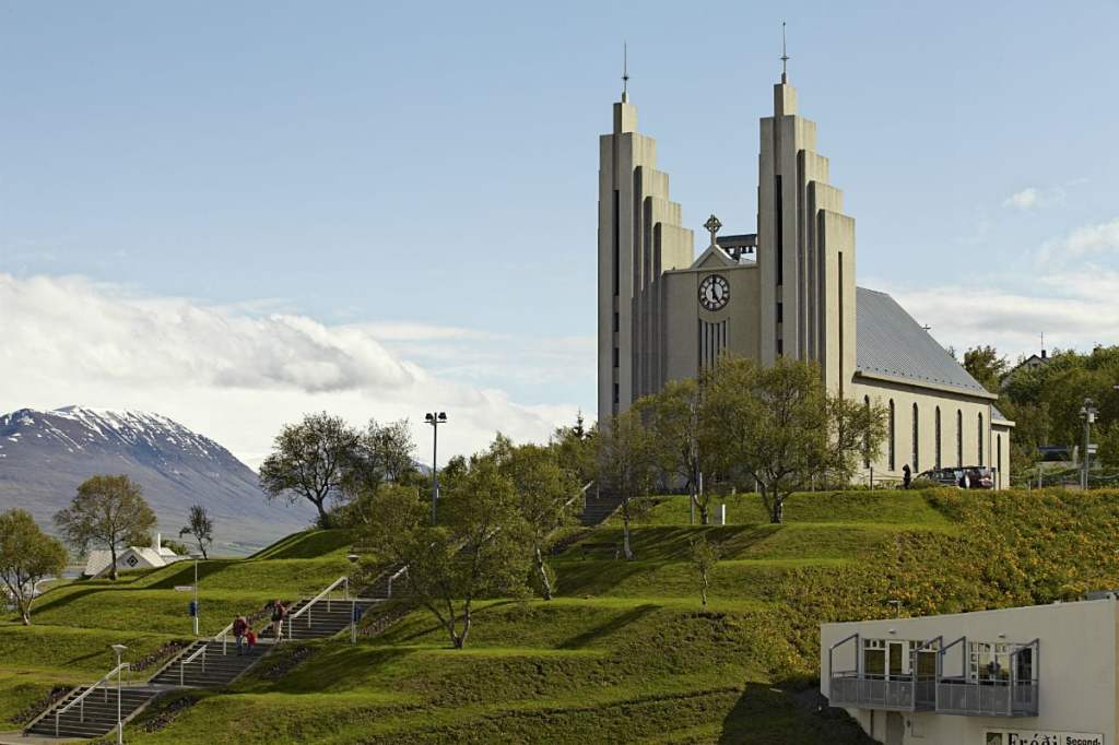
So, for example we have the same basic twin tower design of the Cathedral of Santa Maria seen above and behind the wall of Lugo on the left, in the Celtic province of Galicia, in a country that the Moors are given credit for having ruled for 700 years, ending in 1492; compared in the middle with the twin towers of Einsiedeln Abbey, a major resting place on the Way of St. James in Switzerland for centuries in a country the Spanish weren’t said to be in; and on the right with the twin towers of the oldest operating Mormon Temple in the United States, said to have been built in 1888, located in Manti, Utah in a state that was said to have been built up by Brigham Young and his Mormon settlers.

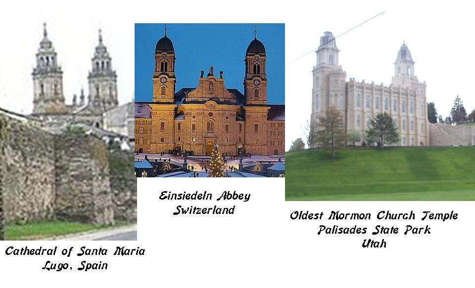
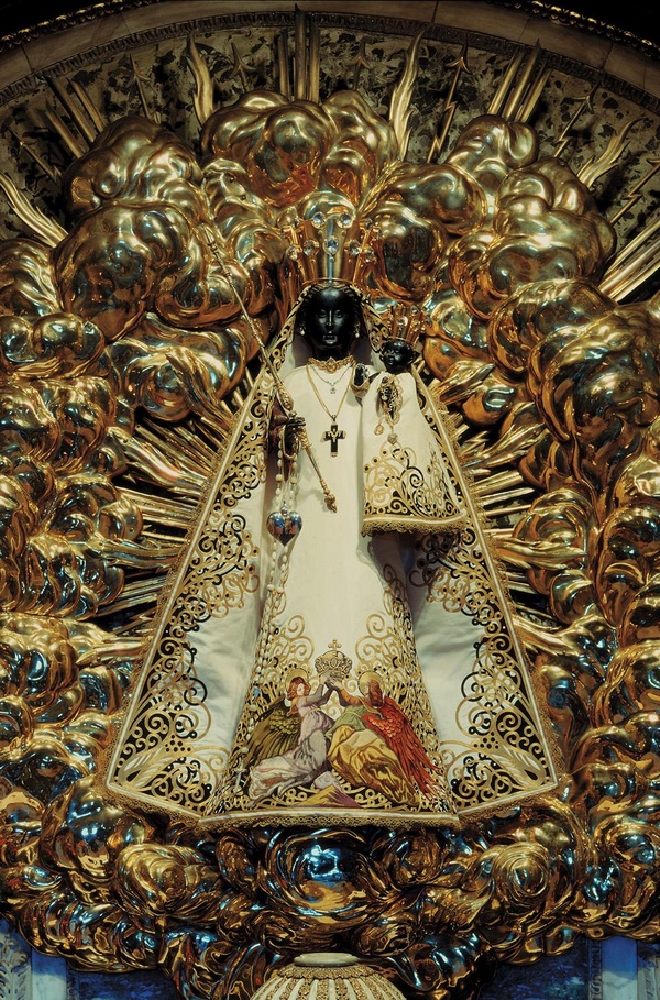
Einsiedeln Abbey, 20 miles southeast of Zurich, is also known for its Black Madonna, to which for more than ten centuries pilgrims from all over the world have travelled here to pay homage.

The Mino, or Minho, River, is the longest river in Galicia, at 40-miles, or 64-kilometers, long. The river forms the border between Galicia and Portugal.

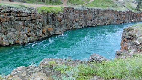
Its source is the Pedregal de Irimia, and looks like this.

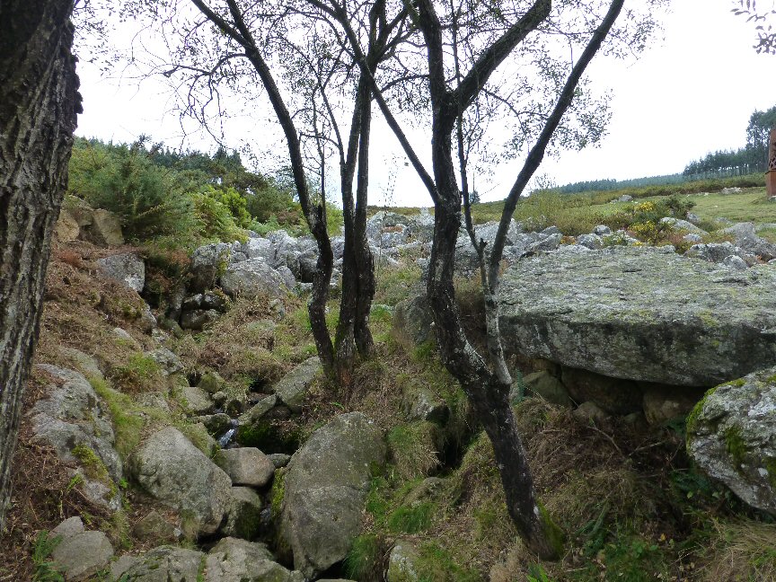
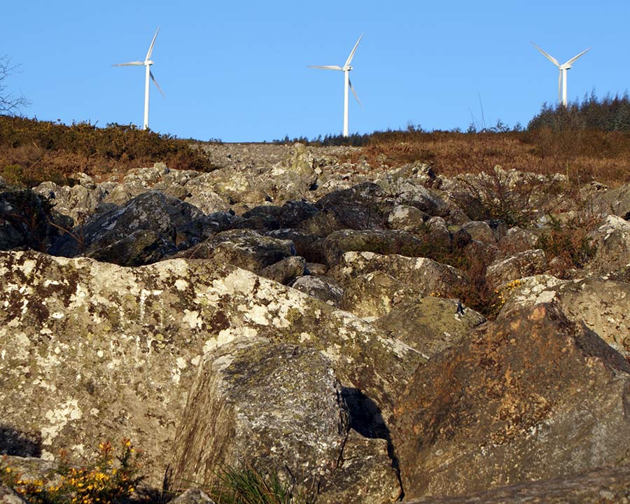
And these wind turbines at the Pedregal de Irimia are another example of finding these along the planetary alignments, causing me to seriously question the idea that turbines like these are wind-powered, and instead are powered by some ancient energy source related to the planetary grid system.

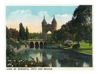
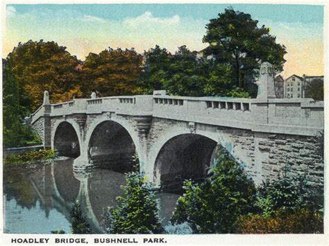
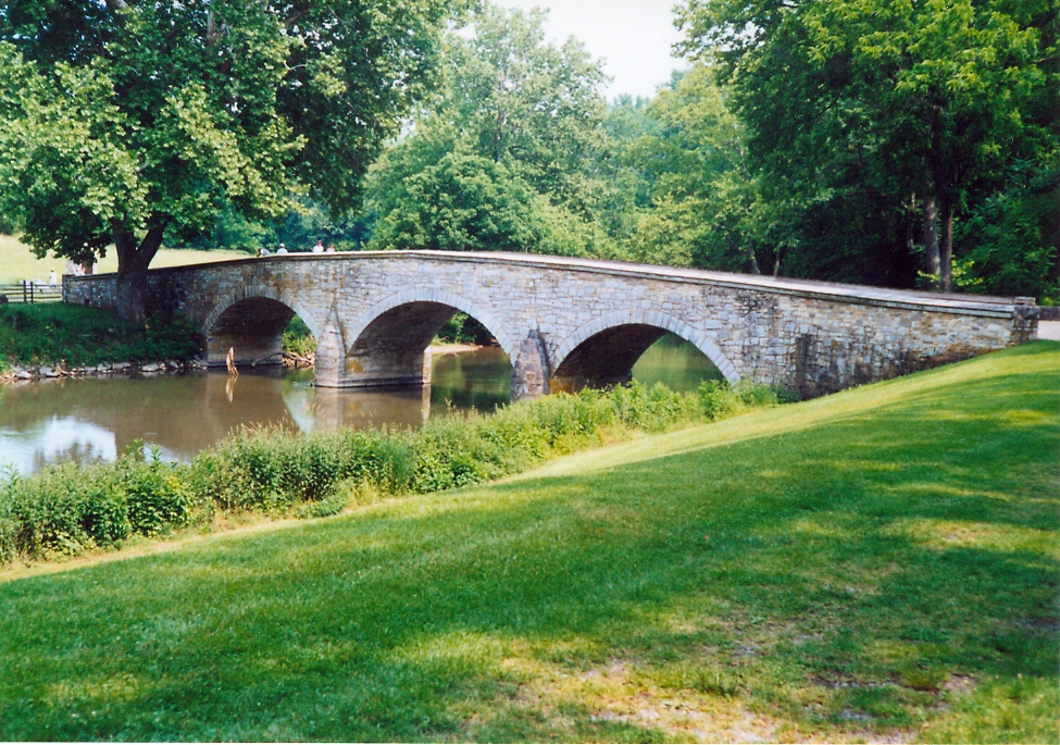
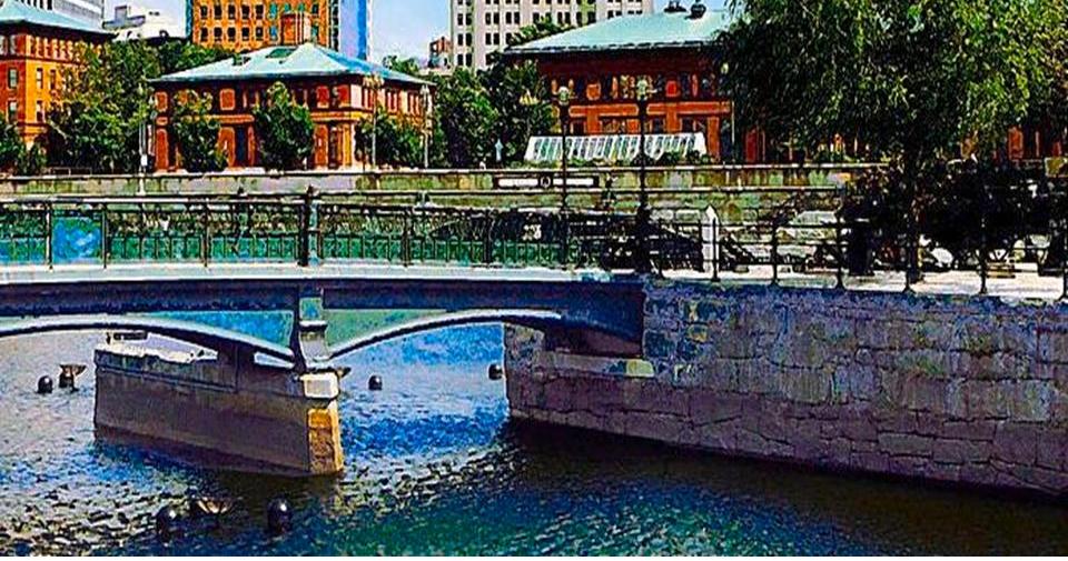
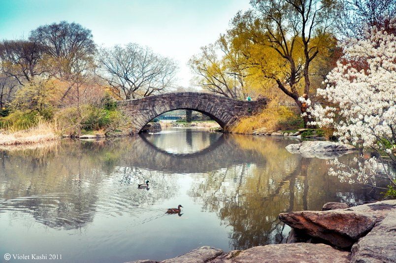
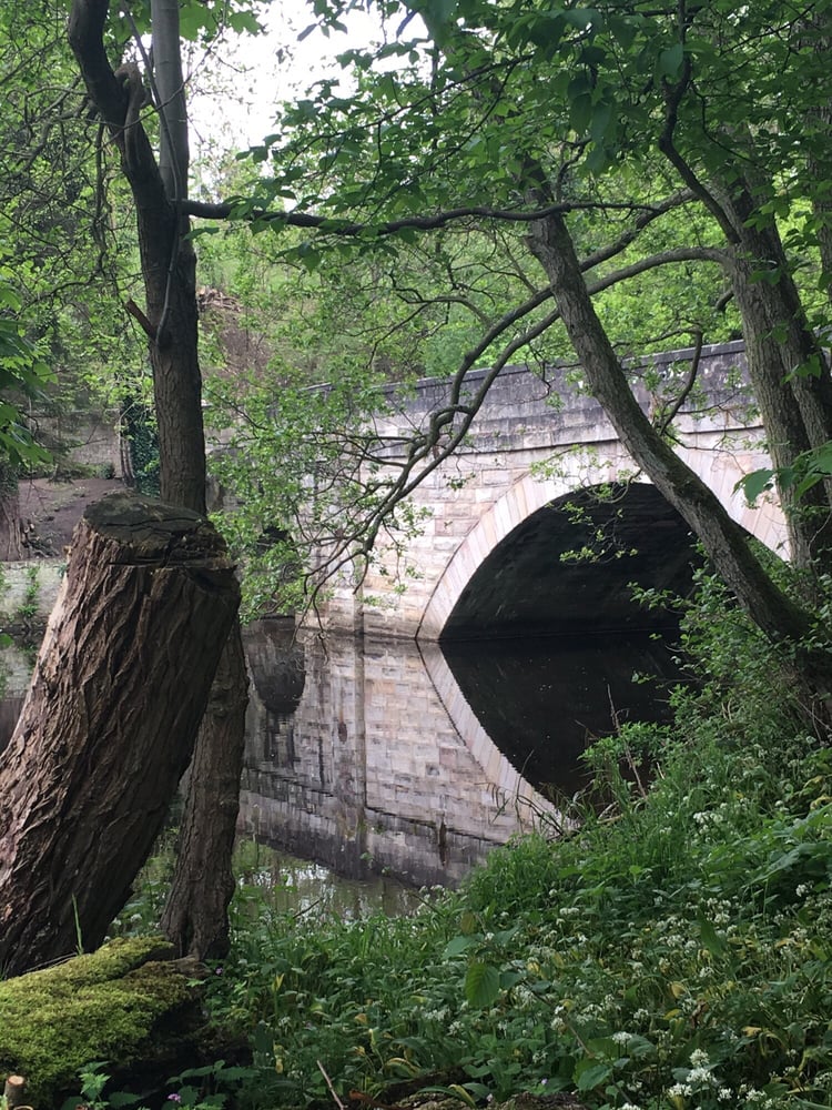
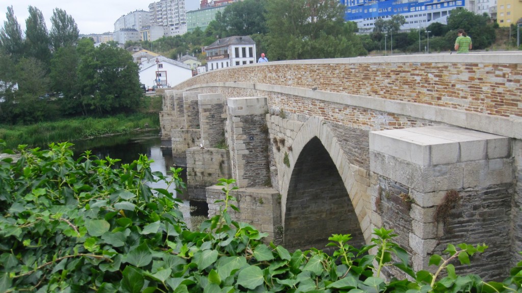
Lugo is along the path of the Camino Primitiva, or the Primitive Way, of the Camino de Santiago. It is thought of as the “Original Way,” because it was the path of the first reported pilgrim, Alfonso II of Asturias in 814 A.D. What is called the Roman Bridge over the Mino River in Lugo is part of the Camino Primitivo.

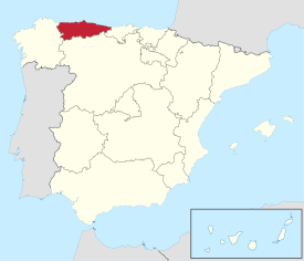
Asturias the province next to Galicia, in northwest Spain, along the Bay of Biscay. Biscay is an old reference to Basques.

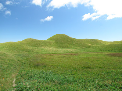
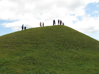
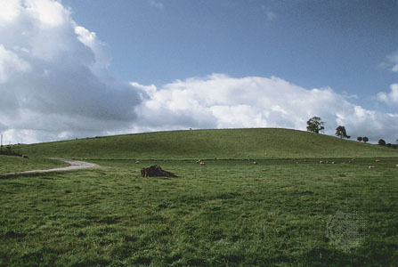
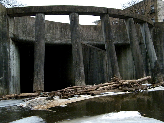
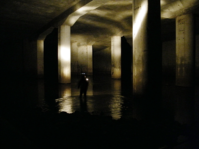
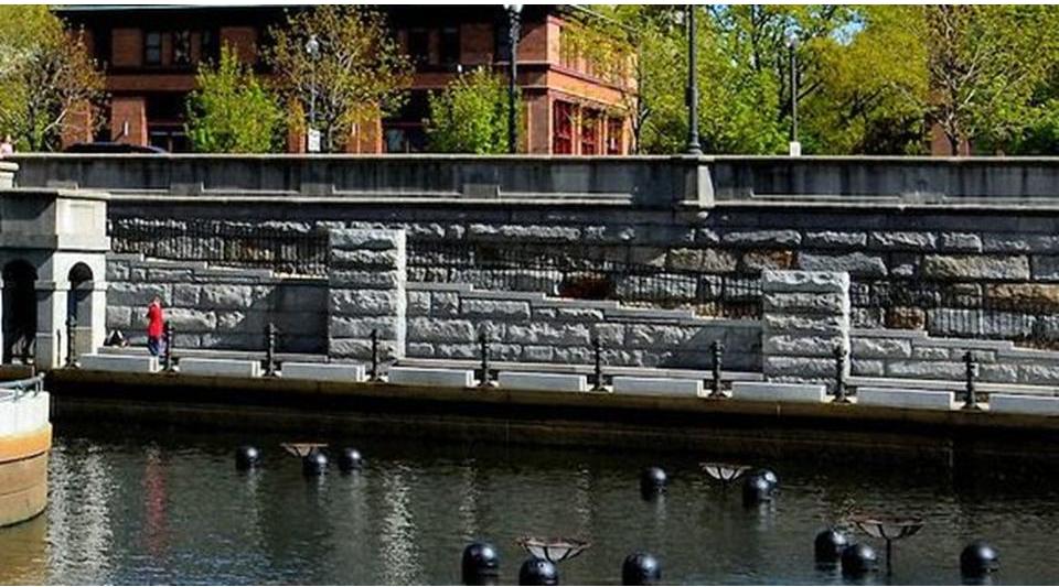
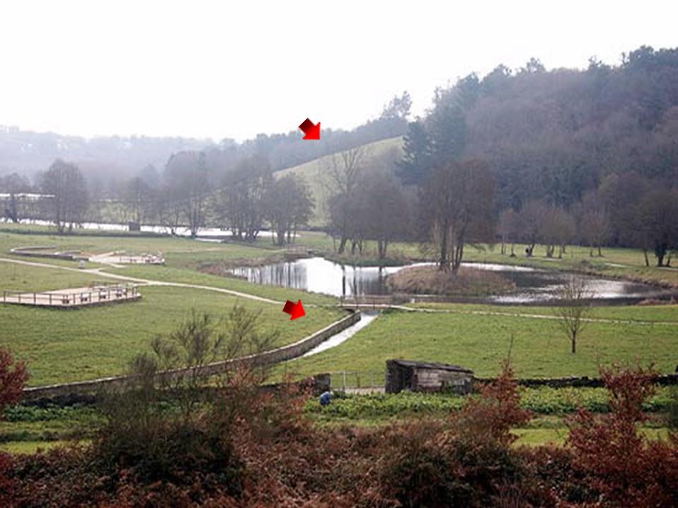
Here are some masonry features of what looks like a narrow canal at the Parque de Mino in Lugo in the foreground, and the smooth shape of what looks like a mound in the background…

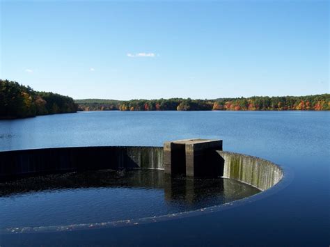
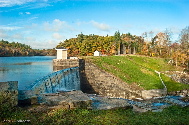
…and also at the Parque de Mino is this canal, not only with masonry banks, but also an engineered waterfall that looks like…

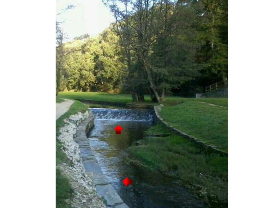
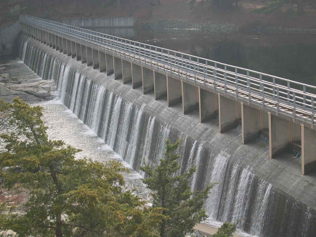
…what you see at the Derwent River in the Derwent River Valley in Derbyshire in England, which is called the birthplace of the Industrial Revolution.

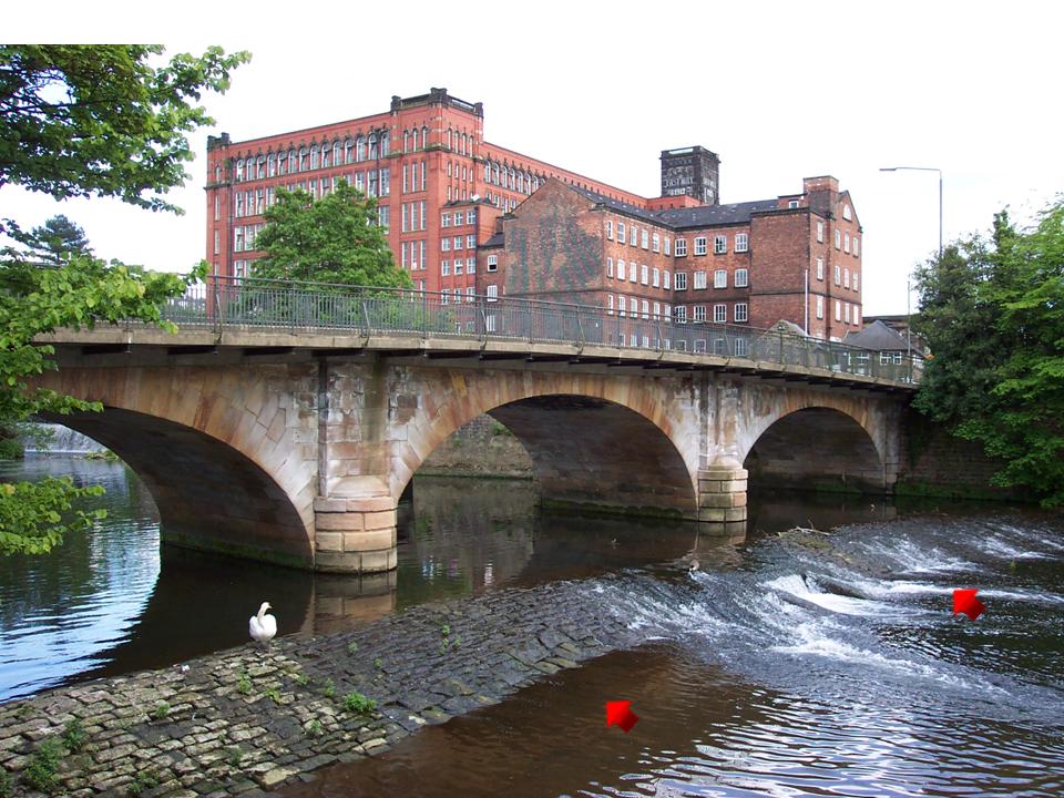
Why does the same hydrology built into these so-called rivers exist in what we are taught are two entirely different countries?

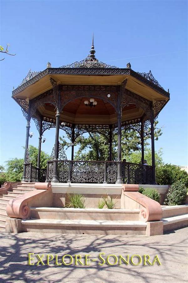
Here is a gazebo at the Parque Rosalia de Castro in Lugo…

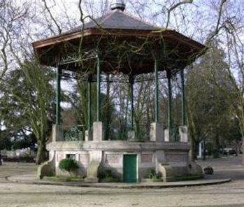
…compared with this gazebo in Prescott, Arizona, on the county courthouse grounds…

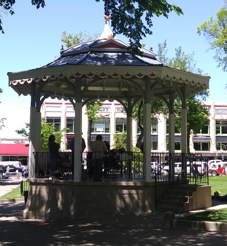
…this gazebo in the city of Dubbo in New South Wales, Australia….

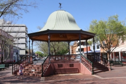
…and what is called the Moorish Kiosk in Hermosillo, Mexico.

The Ancares Mountains of Galicia are shared between the Provinces of Lugo and Leon, on the western side of the Cantabrian Mountain range, which stretches over 180 miles, or 300 kilometers, across northern Spain, from the western limit of the Pyrenees to, along the coast of the Cantabrian Sea, which constitutes the southern part of the Bay of Biscay.

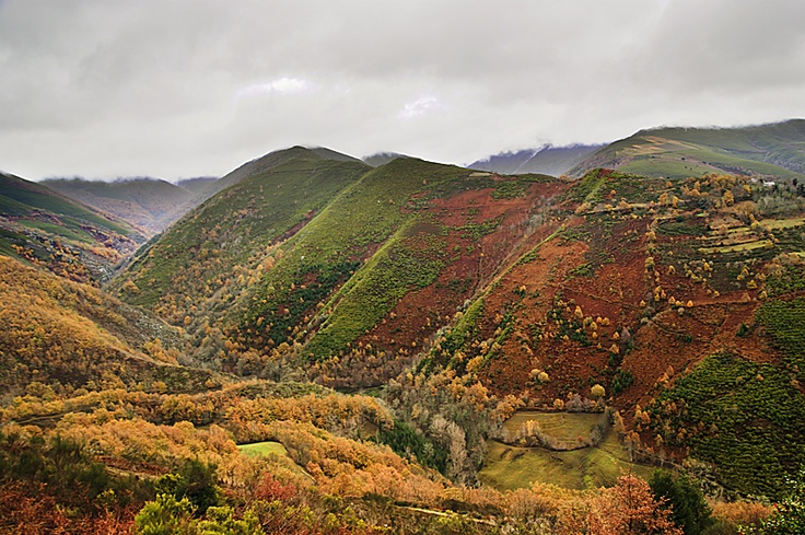
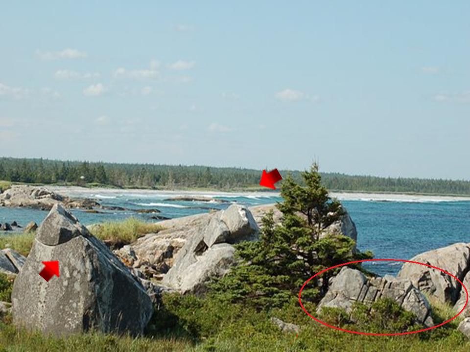
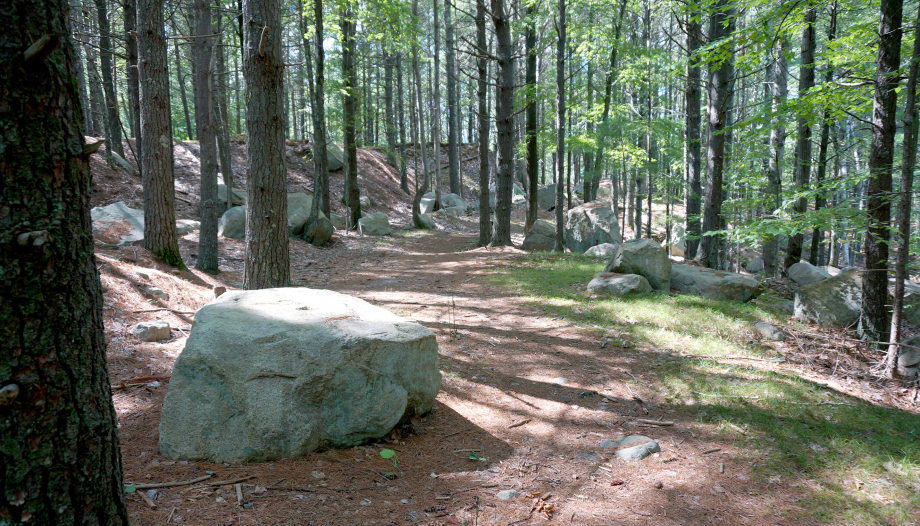
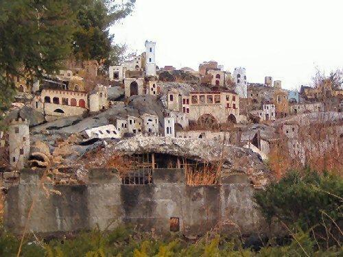
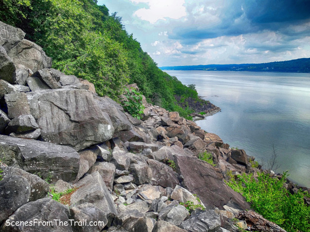
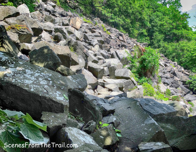
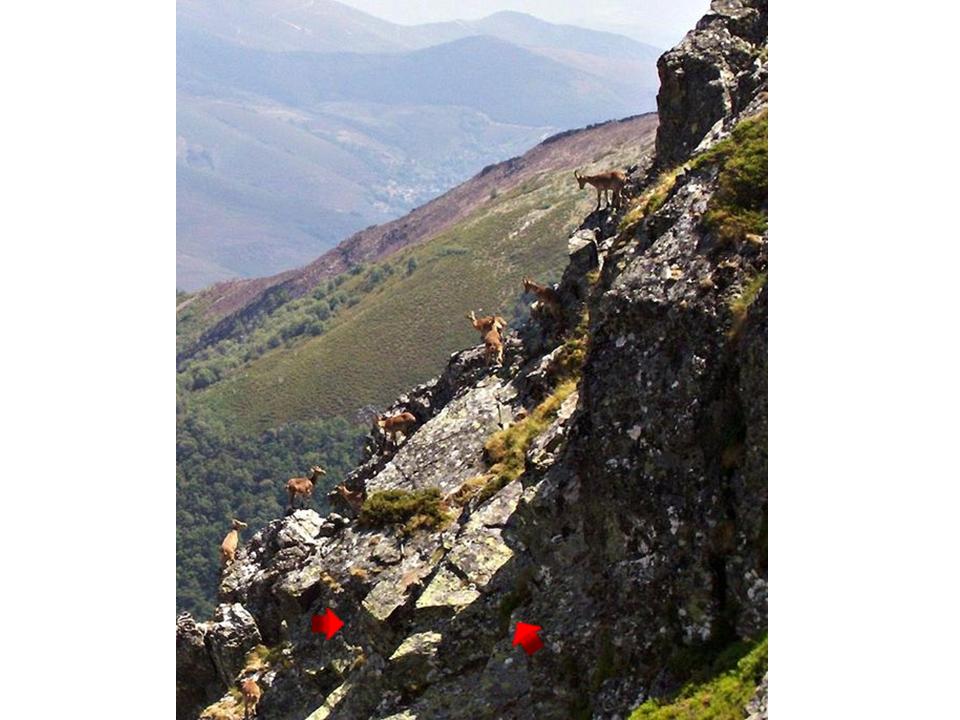
Interesting to note the straight-edges and angles seen on this rocky slope in the Ancares.

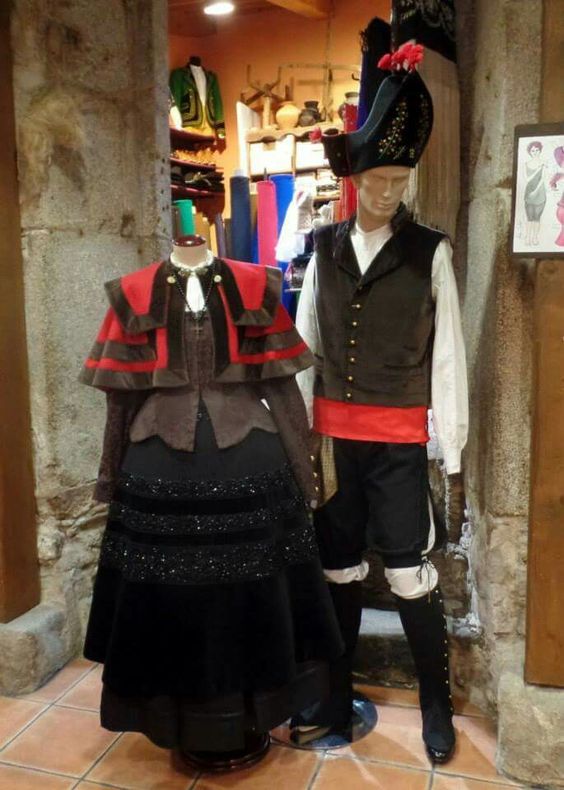
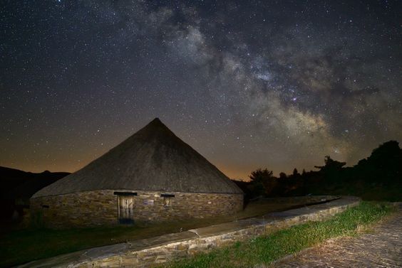
Due to the inaccessibility of the scarce and disbursed population centers of the Galician Ancares, the most traditional features of Galician mountain culture are preserved here, with inhabitants living in direct contact with nature, farming, and gardening. This is a traditional dwelling in the Ancares. Nice view of the Milky Way there too. Hmmm. Might be an ancient connection to all of the pilgrimage routes here….

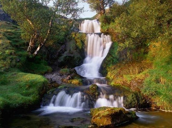
Here is a waterfall found in the Galician Ancares, and as I have indicated in previous posts, I find waterfalls all along these planetary alignments.

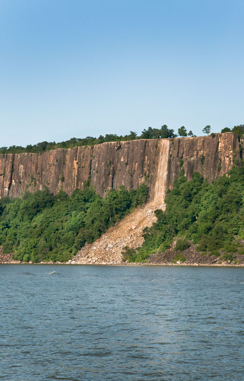
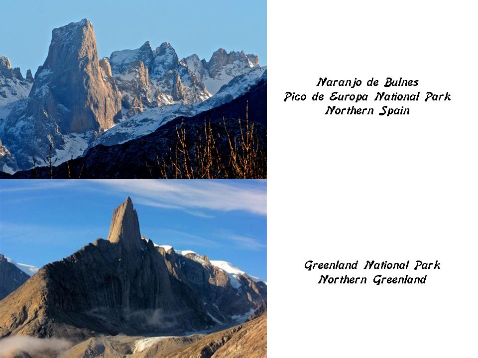
The Picos de Europa National Park is in the Cantabrian Mountains, and also within the boundaries of Castile and Leon, which is the province to where we are headed on the alignment. It was created in 1918 as one of the first national parks in Spain. This is the Naranjo de Bulnes Peak in the Cantabrian Mountains on the top, compared with what you see at the Greenland National Park in northern Greenland on the bottom.

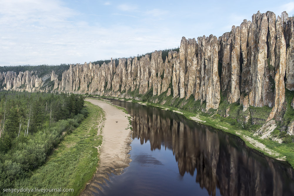
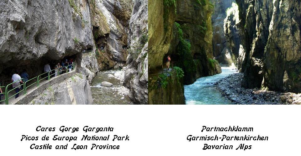
On the left is the Cares Gorge Garganta in the Picos de Europa National Park, known as the “Divine Gorge,” and considered one of the world’s best walk, treks, hikes, and climbs. On the right is the similar-looking Partnachklamm Gorge in the Bavarian Alps of southern Germany, near Garmisch-Partenkirchen.

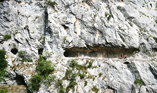
Both places have hiking trails that appear to be carved right out of the rock. This is another view of the Cares Gorge in Spain.

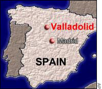
Next on the alignment is the city of Vallodolid, the de facto capital of the autonomous community of Castile and Leon. It is northwestern Spain’s largest city.

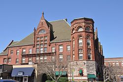
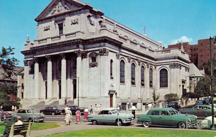
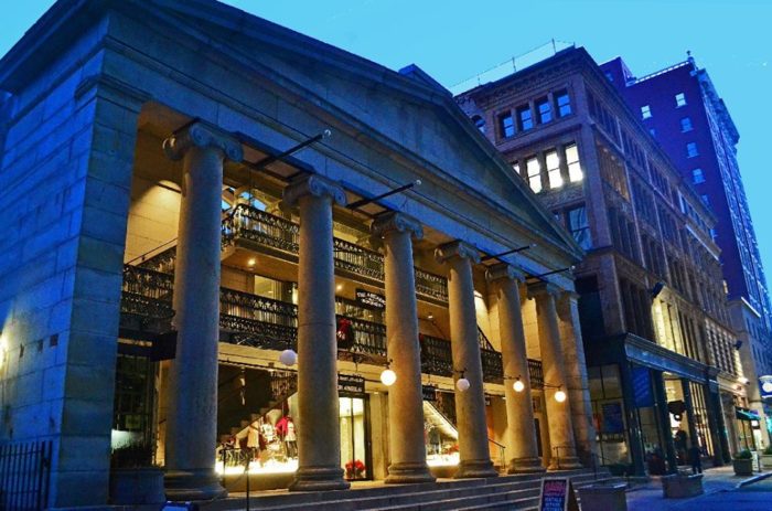
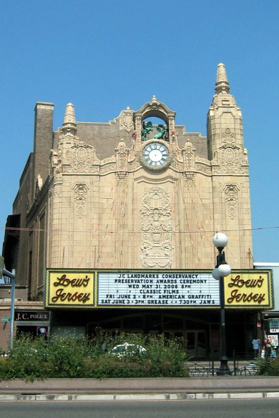
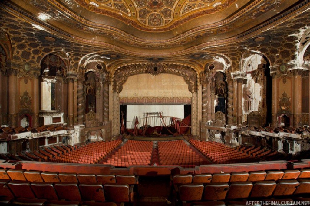
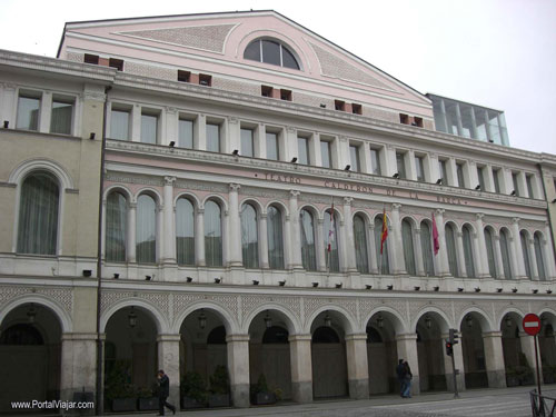
This is the Calderon Theater in Vallodolid, home of the Vallodolid International Film Festival, and named after Pedro Calderon de la Barca, said to be a highly-regarded playwright, poet, and writer of the Spanish Golden Age. He lived between 1600 and 1681. Note the size of the building compared to the people in the street…

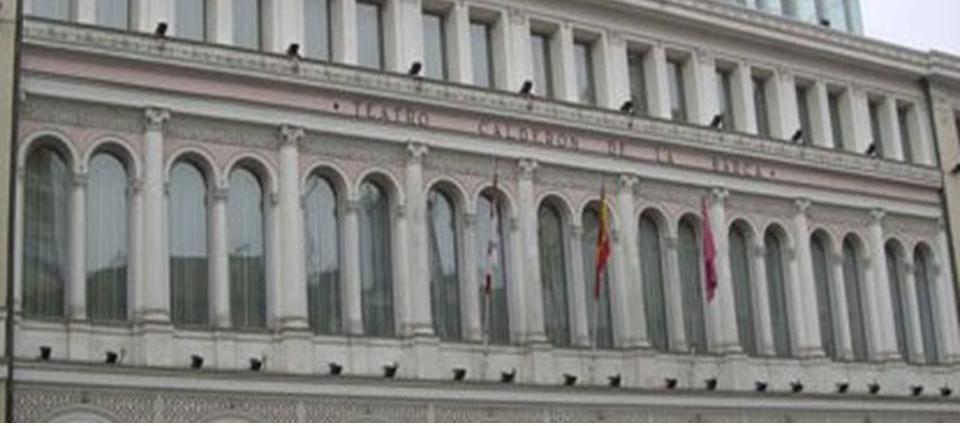
…and the detail of the columns and columned arches on the second floor.

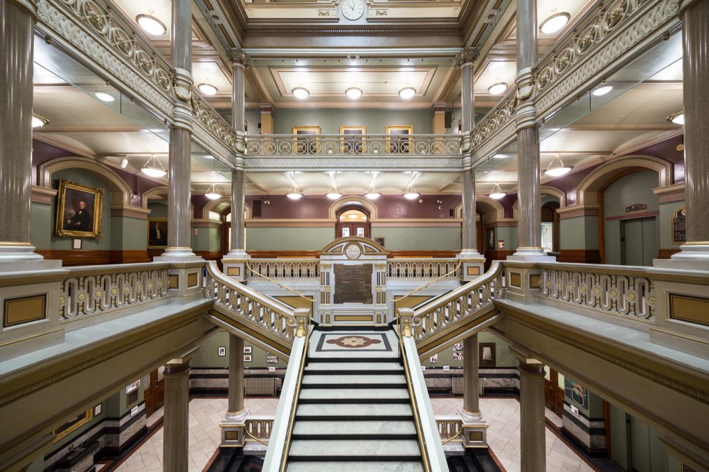
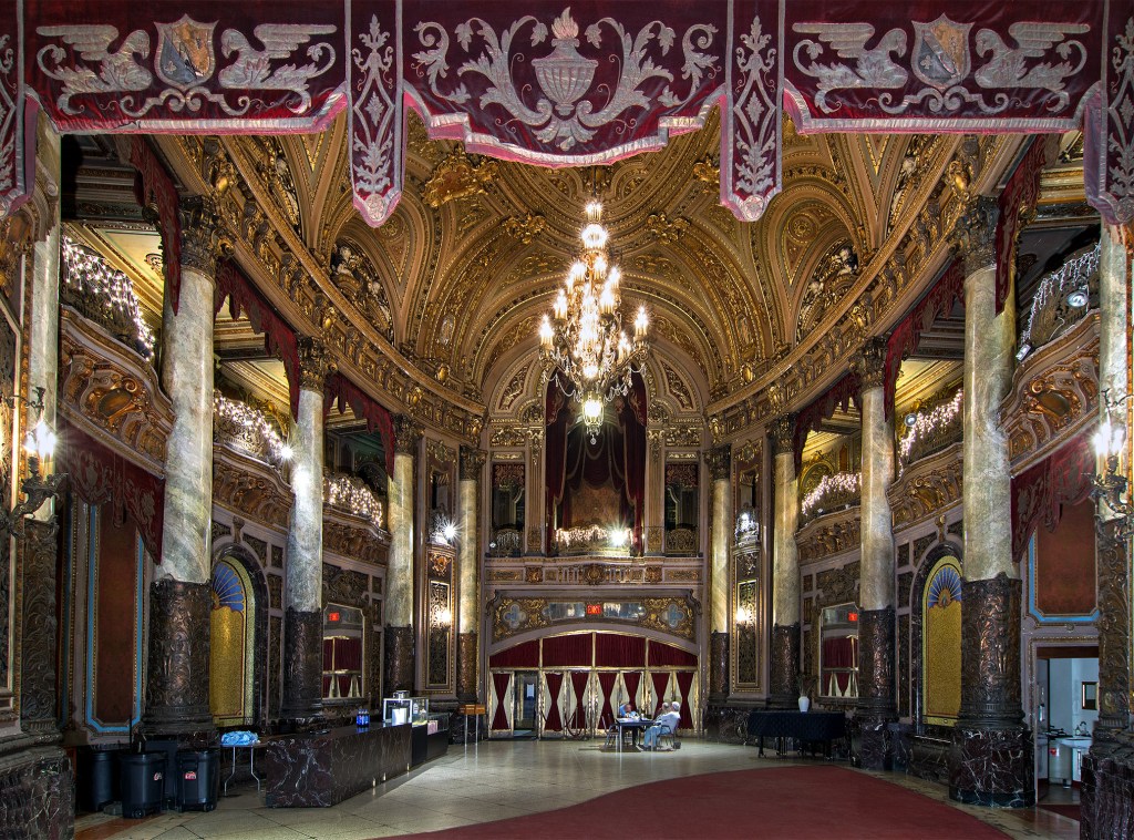
This is the interior of the Calderon Theater.

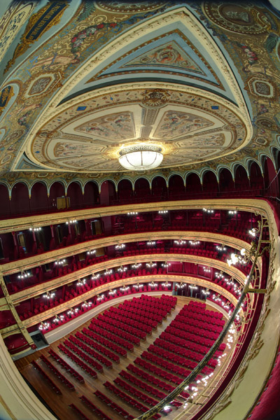
The theater building was said to have been constructed in 1864, on the site of the palace of the Duke of Osuna, a Spanish noble title first awarded by King Phillip II in 1562.

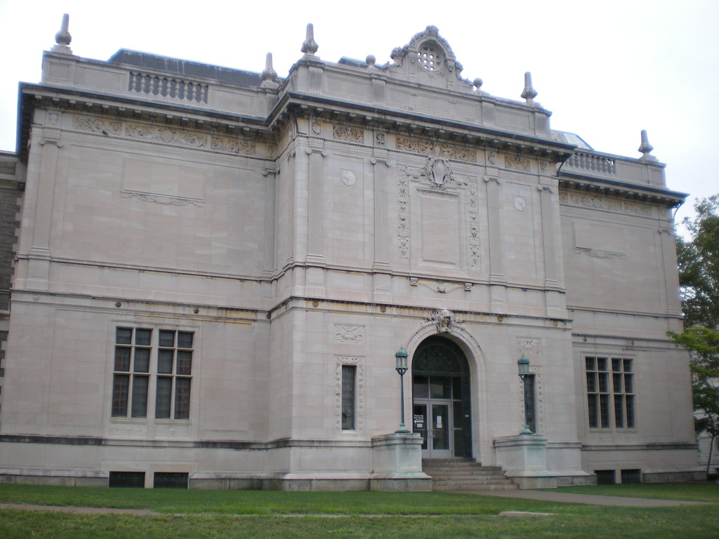
This is the National Museum of Sculpture in Vallodolid. The museum was said to be founded in 1842, in what was the Colegio de San Gregorio, said to have been built in 1487.

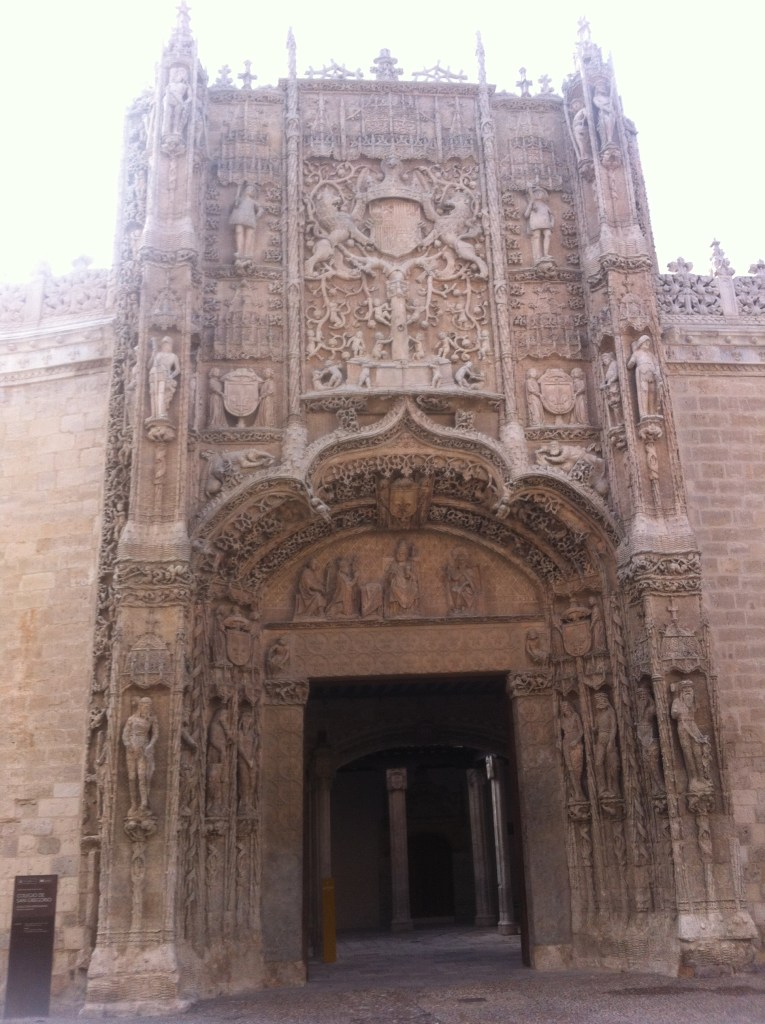
This is a courtyard on the grounds of the museum, with its interesting spiral columns and ornate arched windows…

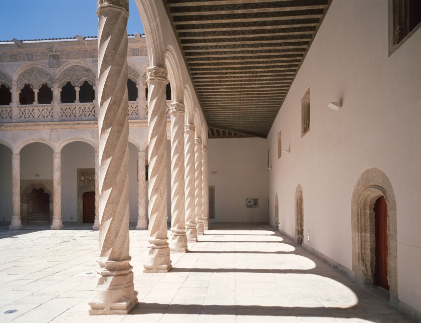
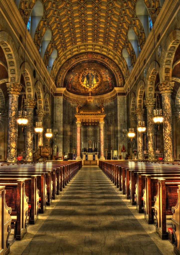
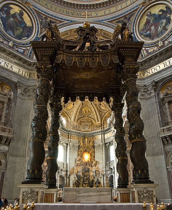
They reminded me of spiralled columns of St. Peter’s Basilica in Rome, called the Baldachin, which is a bronze canopy directly under the dome of the Basilica, and over the high altar, marking the tomb of St. Peter underneath.

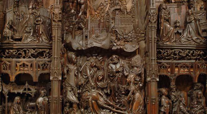
One of the exhibits in the National Museum of Sculpture in Vallodolid is an altar-piece depicting the Life of the Virgin, carved out of walnut wood, dating from 1515 to 1520, and originally in the Convent of San Francisco in Vallodolid.

Campo Grande is a large, triangular public park at the heart of Vallodolid. Its origin as a park is said to date back to 1787.

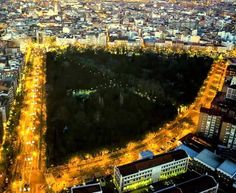
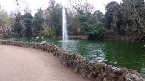
Interesting to note what looks like ancient stones in the wall around the lake in the park with this water fountain.

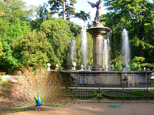
Here is another water-fountain at the lake, and one of the peacocks that the park is known for having on the grounds.

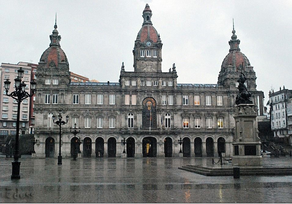
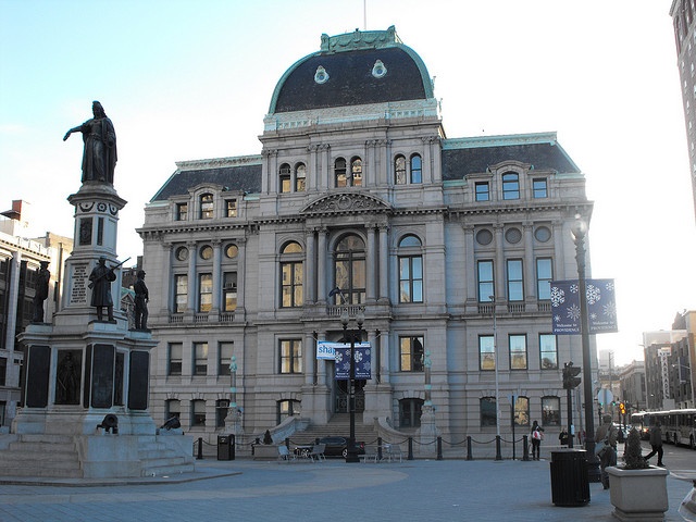
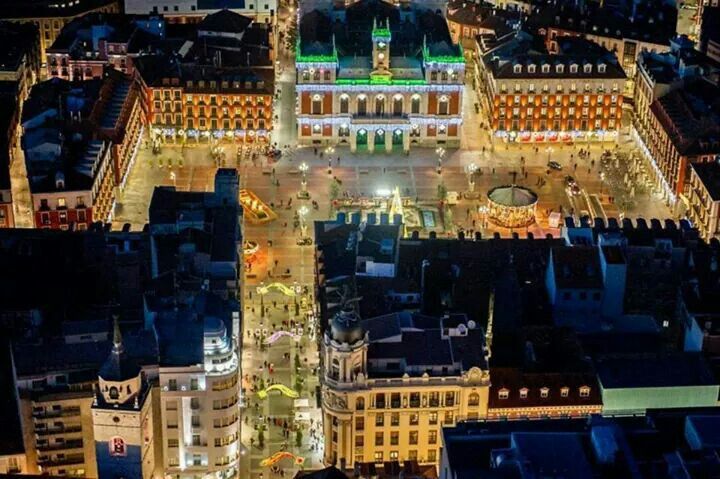
This is an aerial view of the Plaza Major in Vallodolid, with a view of the ornate City Hall in the background.

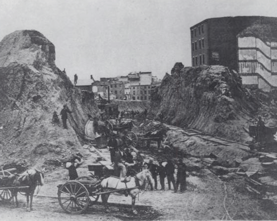
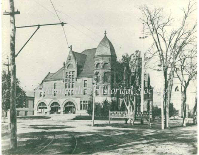
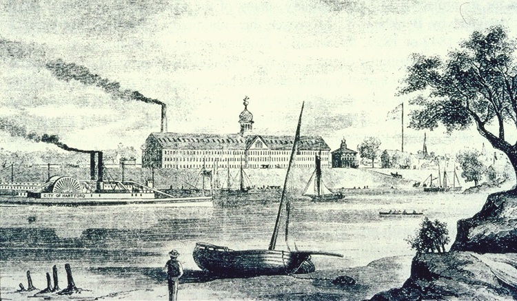
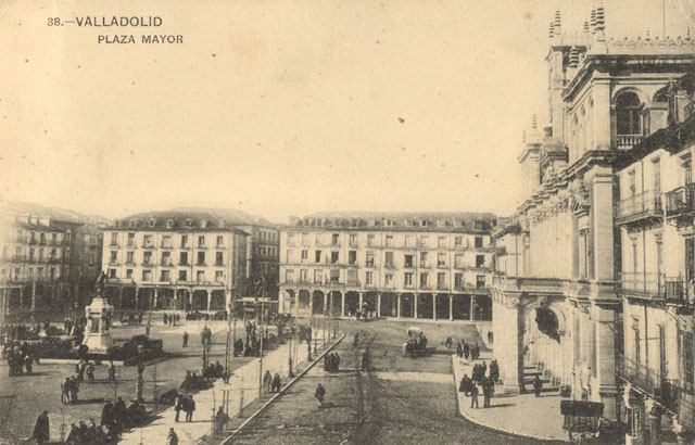
This is an historic picture of the same Plaza Major, with its huge buildings compared to the size of the people in the streets, and not a lot of people here at the time the picture was taken.

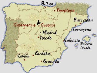
Next on the alignment is Segovia.

The most famous symbol of Segovia is an elevated aqueduct that goes through the center of town…

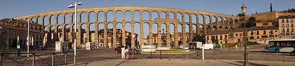
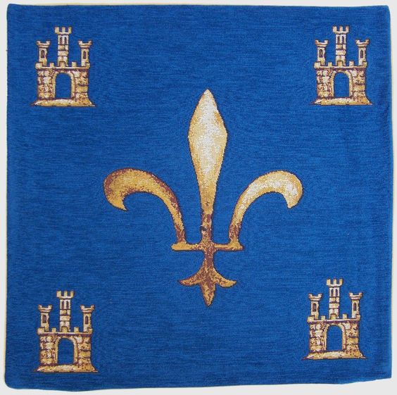
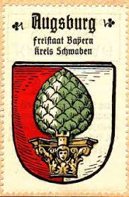
…and is depicted on the city’s Coat-of-Arms.

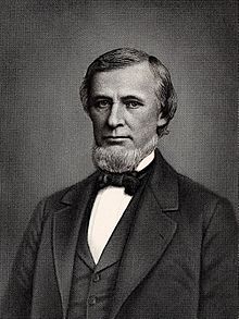
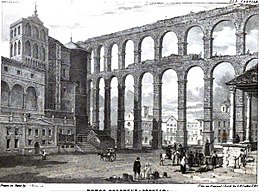
Here is an 1824 drawing of the Segovia Aqueduct by Edward Hawke Locker. Again, note the size of the infrastructure contrasted with the size of the people depicted here, and the rudimentary transportation of the horse-and-buggy.

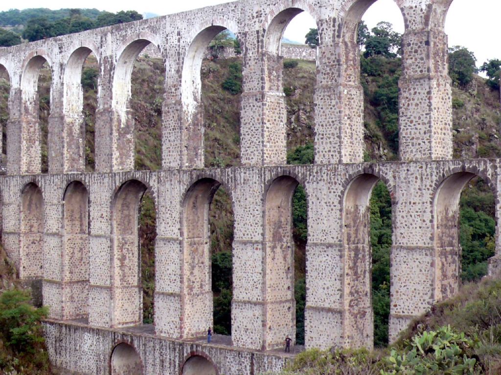
For comparison of style, this is the Xalpa Aqueduct in Tepotzotlan, Mexico. Quite similar in construction style, but as far as I know, the Romans were not in Mexico.

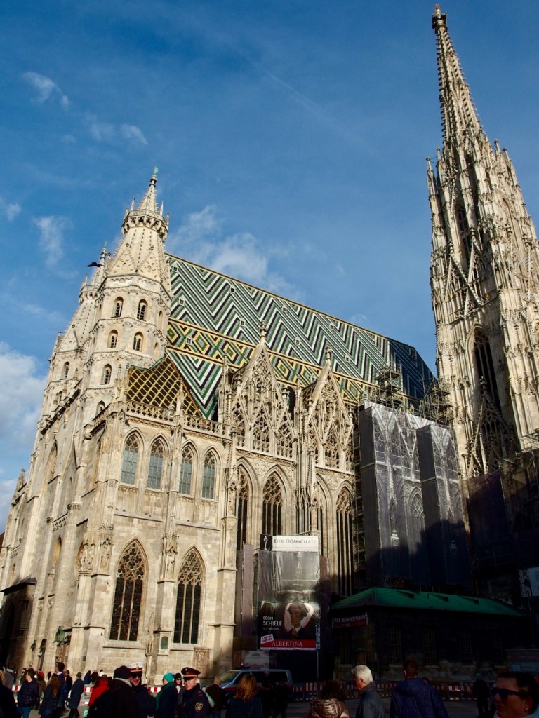
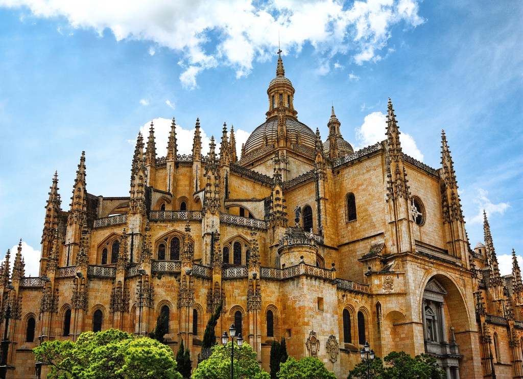
The Segovia Cathedral is said to have been one of the last Gothic Cathedrals said to have been built in Europe, with construction said to have begun in 1525.

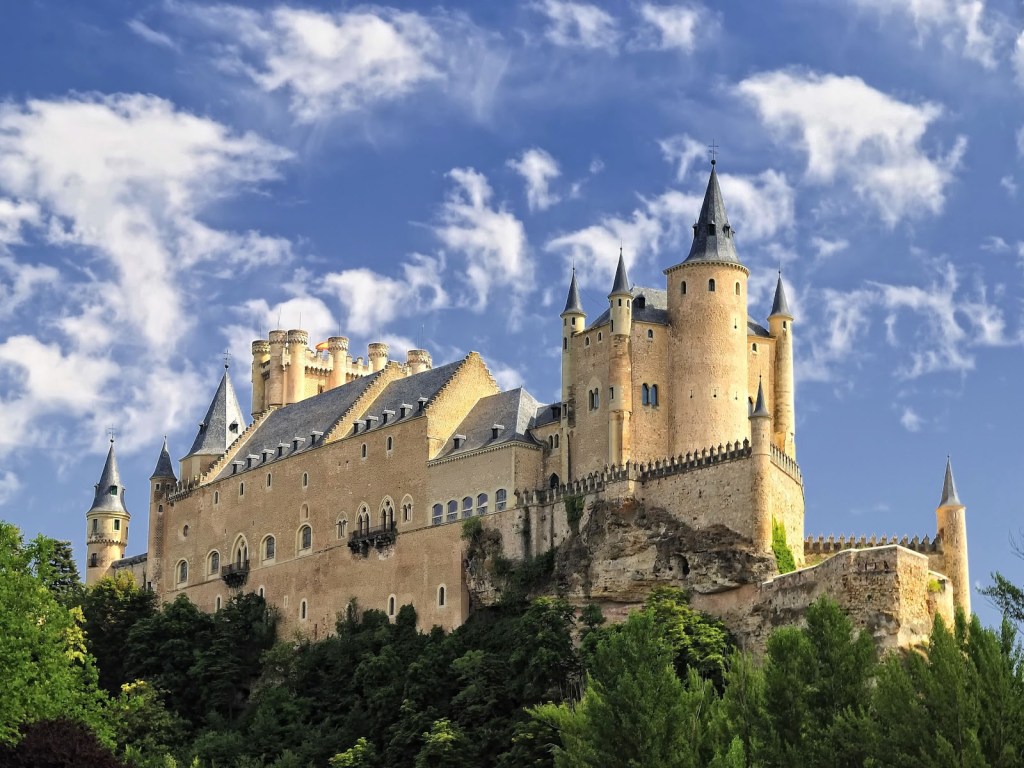
The Alcazar of Segovia is the model for Disney’s Cinderella’s Castle, and rises out of a rocky crag…

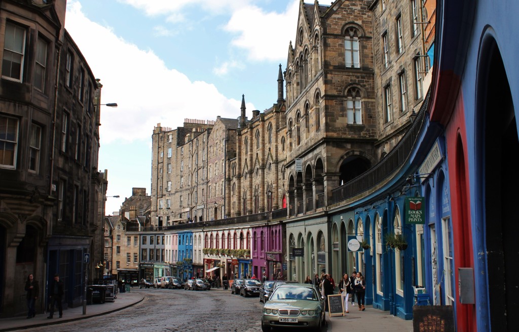
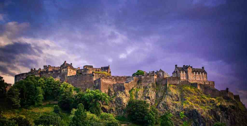
…which is the same thing said about Edinburgh Castle in Scotland – that it is situated on top of a crag-and-tail formation.

The Alcazar Castle is located above the confluence of two rivers near the Sierra de Guadarrama, between Segovia and Madrid, and the eastern range of the Central System of Spain.

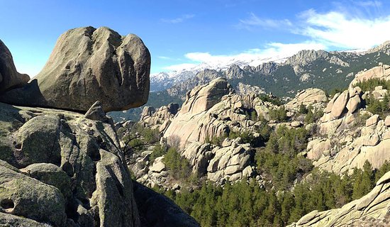
Here is a picture of the Sierra de Guadarrama, with what looks like a balanced rock in the foreground…

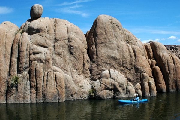
…compared with a picture taken of the Granite Dells in Prescott, Arizona, that also has a balanced rock in it. In the world of geology, that would be called a “glacial erratic.” I am not buying what they are selling.

Balanced Rocks are found everywhere.

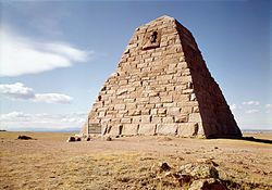
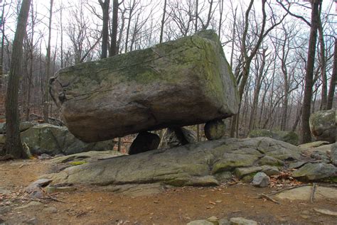
What is called a “glacial erratic,” the product of retreating glacial ice sheets from the Ice Age, like Tripod Rock at the Pyramid Mountain in Kinnelon, New Jersey…

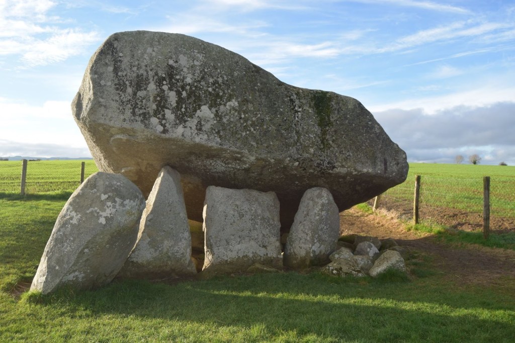
…is called a dolmen everywhere else, like Brownshill Dolmen in Ireland.

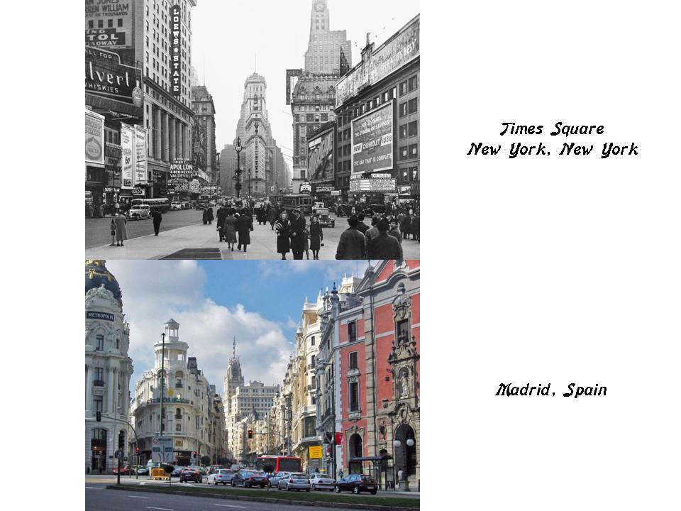
I am going to end this post here, and pick up the alignment in Madrid, Spain in the next post.

Circle Alignment on the Planet Washington, DC – Part 11 Taylor Head, Nova Scotia to A Coruna, Spain

In the last post, I tracked the circle alignment from where it enters Nova Scotia at Cape Sable, and places around the southernmost tip of the Nova Scotia peninsula; up the South Shore through the Port Joli area; Lunenbourg and Mahone Bay, including Oak Island; and places around the Halifax Metropolitan area.

I am picking the alignment in Taylor Head Provincial Park, located southwest of Sheet Harbor, Nova Scotia.

It is touted as one of the most beautiful beaches in Nova Scotia, with beautiful white sand beaches, and walking trails.

When I saw the huge, megalithic-looking stones at Taylor Head pictured on the top, they reminded me of the Hadjar el Gouble, or Stone of the South, at Baalbek in Lebanon, one of the largest, if not the largest, acknowledged stone blocks in the world, on the bottom.

Here are some other photos of what is found at Taylor Head Provincial Park. Nothing to see here, right?

When I saw this particular photo that was taken at Taylor Head on the top left, I was reminded of this photo I took at Lake Arcadia in Edmond, Oklahoma, on the top right; and of what the Gulf of Bothnia looks like between Sweden and Finland here at Pori, Finland on the bottom.

I am going to go ahead an exit Nova Scotia, and follow the alignment where it crosses near the Islands of St. Pierre and Miquelon, off the coast of the Canadian Province of Newfoundland and Labrador.

Interestingly, these two islands are a self-governing territory of France. They are designated together officially as the Overseas Collectivity of St. Pierre and Miquelon.

This is the Coat-of-Arms of St. Pierre and Miquelon. Interesting to note the presence of the Basque flag on the top left, as well as other interesting symbology going on here. The crown definitely looks like it has a nautical theme with what appears to be the frontal view of a ship in-between the sails.

But what looks like the frontal view of a ship on the left, also looks like what is called a Globus Cruciger. Also known as the orb and the cross, it has long been a symbol of Christian authority, and used on coins, iconography, and with a scepter as royal regalia. This is the Danish Globus Cruciger, part of the Danish Crown Regalia, on the right.

This is a 1570 depiction by the Italian painter Titian of Jesus Christ as “Salvator Mundi,” or “Saviour of the World,” a subject in iconography which portrayed Christ with his right hand raised in blessing and his left holding the Globus Cruciger, symbolizing the Earth.

The original meaning of all of this has been quite obscured, and I am just relaying what we are told to explain it.

I think there is much more to the original function of the Globus Cruciger than what I have shared here. Like, that of being a power object in its own right.

On the top left is a land feature off the coast of St. Pierre and Miquelon, compared with a similar one found in the Magdalen Islands further up in the Gulf of St. Lawrence, and part of the Province of Quebec, and on the bottom is at Durholaey, the southernmost point in Iceland.


This is an aerial view of the one municipality of Miquelon and Langlade, connected by the Isthmus of Langlade.

This is a close-up of the Isthmus of Langlade on the top left, compared with similar-looking places on Attu, the far western island of the Aleutian chain; Alter do Chao near Santarem in Brazil; and World’s End near Hingham, Massachusetts.

These are the so-called the dunes of Langlade…

…which look like mounds to me, with their smooth and shaped forms.

It is interesting that these two obscure islands are the only remaining part of New France that remains under French control.

The nearby Magdalen Islands, while not under France, are part of Quebec, originally part of New France.

Basque Country in the Pyrenees is split between Spain and France, and includes the small Pyrenees country of Andorra, which is ruled to this day by an unelected Co-Principality between the Catholic Church, in the person of the Bishop of Urguell, and the French President, whoever that may be.

What is it about the Basques?

I personally believe it has something to do with the name of “Magdalen,” the Moors, and the Merovingian bloodlines, the Merovingians being the ruling monarchy of France before being deposed by the Carolingian Dynasty in 751 A.D.

I include the Catalonians of southern Spain and France in this category as well. This was also Cathar country.

This may not resonate with you, but for some reason French rulers and the Catholic Church have been hell-bent on controlling these people and their land, and whatever they represent, for centuries. Besides my opinion, there are persisting oral legends, books that I have read, and symbology that point in this direction. I didn’t have a real opinion about it, however, until I started to do the research for my blog posts.

For example, here is the previously shown Merovingian textile on the top, compared with the symbols in the Cajun flag, seen in the previous post, on the bottom….

From this part of North America, the alignment crosses the Atlantic Ocean, and enters Spain in the city of A Coruna, also known as La Coruna, a city and municipality of Galicia, Spain. It is also the provincial capital of the province of the same name.

Galicia is an autonomous community of Spain, and an historic nationality under Spanish Law as well. Galician is an official language of the region, along with Spanish. The names shown here are given in both Galician and Spanish.

It is considered the seventh Celtic nation, and the least well-known of the group. The other six include Ireland, Wales, Scotland, Cornwall, the Isle of Man, and Brittany in France.

It has its own traditions, including bagpipes and drums…

…and clothing.


The Tower of Hercules is called an ancient Roman lighthouse, on what was once called Faro Island, that is 1.5-miles, or 2.4-kilometers, from the center of A Coruna. It is 180-feet, or 55-meters, tall. It is called the oldest Roman lighthouse in use today.

Until the 20th-century, it was called the “Farum Brigantium.”

The word “Farum” is derived from the Greek word “pharos” for the lighthouse of Alexandria, Egypt, one of the Seven Wonders of the Ancient World. This is a 1909 drawing by archeologist Hermann Thiersch.

It was said to be 330-feet, or 100-meters, in overall height.

The Ciudad Vieja, or Old Town, is the oldest part of A Coruna.

This is Castillo de San Anton, said to have been built as a defensive structure between the 15th- and 16-the centuries.

This star fort was built on a small island in the Bay of La Coruna.

The Plaza de Maria Pita is the main plaza of A Coruna, and is the location of the Palacio Municpal, the Town hall and Council building, which is described as truly monumental in its scale and incredibly ornate detailing.

A Coruna is a gateway city for the Camino Ingles, one of a network of pilgrimage routes for the Camino de Santiago, or the way of St. James…

…all leading to where his remains said to be buried at the Cathedral of Santiago de Compostela in Galicia.

Of course, there is the possibility of these pilgrimage routes existing long before St. James, but confirmation of this is very difficult to come by in the written historical narrative. But in the past I have read about ancient pilgrimage routes connected, among other things, to the stars….

I am going to end this post here, and pick up the alignment in Lugo, Spain, in the next post.

Circle Alignments on the Planet Washington, DC – Part 10 Cape Sable Island, Nova Scotia to Halifax, Nova Scotia

In the last post, I took a close look at the Boston area, as well as at Hingham and Scituate, Massachusetts, before exiting the United States at a place called Egypt Beach, near Scituate.

The circle alignment enters Nova Scotia at Cape Sable Island, locally referred to as Cape Island, and is the southernmost point of the Nova Scotia Peninsula.

Historically, the Argyle District in Nova Scotia was referred to as Cape Sable, and encompassed a much larger area than Cape Sable Island.

i

The Argyle District included Chebogue, now considered a small fishing and agricultural village.

We are told that Chebogue’s known European history began with the establishment of a permanent Acadian settlement in 1614. In 1758, the entire settlement was destroyed and the Acadian inhabitants deported.

This is a good place to insert a quick re-cap of the history of Nova Scotia that we are taught.

Prior to European settlement, the Mi’kmaq people lived here, a First Nations people primarily indigenous to Nova Scotia, New Brunswick, Prince Edward Island, Newfoundland, and Quebec’s Gaspe Peninsula.

The Mi’kmaq language is an Eastern Algonquin language, and was at one time written in Hieroglyphs. Mi’kmaq hieroglyphic writing is pictured here.

This is the flag of the Mi’kmaq Grand Council, the senior level of government for the Mi’kmaq Nation, and based in Canada.

In 1534, Jacques Cartier started the colonization by France, in the form of the creation of New France, in North America.

New France was ceded to Great Britain and Spain in 1763, under the terms of the Treaty of Paris, which concluded the Franco-British conflicts of the Seven-Years War in North America, also known as the French and Indian Wars.

Acadia was a colony of New France, governed separately from the other Canadian colony of New France, Quebec. As a result, the Acadians and Quebecois have their own distinct French dialect, culture, and history.

According to the history we are taught, French settlers started coming to this region called Acadia in the 17th- and 18th-centuries, primarily from Ile-de-France (Paris-area), Normandy, Brittany, Poitou, and Aquitaine.

So what happened to the Acadians was this: Even though the Acadians by-and-large were neutral about the allegiance during the French and Indian War, British Colonial Officers decided they were a threat to their effort to defeat the French, and Acadians were forcibly removed from their lands during what is called the Great Expulsion between 1755 – 1764.

Approximately 11,500 were deported to various American colonies. This includes Louisiana, where they developed what became known as the Cajun culture.

This is the Cajun flag.

So this is a little bit of written historical background as to the peoples that were living in Nova Scotia.

As far as who we are really talking about, you have to search for evidence beyond what is in writing, like what the existence of the Mi’kmaq hieroglyphs means, and what the symbols in the flags of the Mi’kmaq people and Cajun people might mean in order to find clues to their true identity.

We will also be looking at what is found in the environment here, as well as place names.

For example, with more examples to come, are the Magdalen Islands, part of the Province of Quebec, which are located in the Gulf of the St. Lawrence, situated just north of, and between the coasts of Prince Edward Island and Nova Scotia.

What are we being told that we are not being told in the name of the Magdalen Islands?

It is like the proverbial riddle, wrapped in a mystery, inside an enigma.

This is the Borgot Lighthouse at Etang-du-Nord. There are six working lighthouses in the Magdalen Islands.

But, I digress.

Back to the vicinity of Chebogue, which is north of Cape Sable Island in Yarmouth County, on the Atlantic coast.

This is an aerial view taken near the Chebogue Yacht Club on the top, compared with a similar-looking S-shape in the Ouachita River in Monroe, Louisiana – two examples of many, of the same shapes recurring in the world’s river systems.

Here is another picture taken near the Chebogue Yacht club of a stone wall built with mighty big stones.

While I am relatively close to the entrance of it in Chebogue, I would like to mention the Bay of Fundy, between New Brunswick and Nova Scotia’s North Shore.

It is noteworthy because of its high tidal range. The tides in the Bay of Fundy are semidiurnal, meaning there are two high tides and two low tides each day. The height that the water rises and falls each day is approximately equal.

The result is that the Bay empties out, and re-fills every day, and it looks rather bizarre between the low-tides and high-tides.

Back to Cape Sable Island, which has the tallest lighthouse in Nova Scotia at 101-feet, or 31-meters.

Cape Sable Island is connected to the mainland by the Cape Sable Causeway, otherwise known as the Barrington Causeway.

Here is a ground-view of the same causeway, showing various kinds of stone engineering.

The Argyll District of Nova Scotia, which I mentioned at the beginning of this post, and which used to be referred to as Cape Sable, also includes Cape Negro and Cape Negro Island, in the Barrington Municipal District, and also located on this circle alignment

This is a view Cape Negro Island, with all of its stony-ness.

Why this name?

Just because?

Or is the memory of the people who originally inhabited this land retained in the name….

Just like Cape Sable. One of the definitions for sable is “…the color black, being one of the heraldic colors.”

But then sable can also be claimed to mean a small, furry animal valued for its fur. One of the ways they hide things from us is subtleties in language.

The Thomas H. Raddall Provincial Park is next on the alignment, in the vicinity of Port Joli area, which is a small village approximately 120 miles, or 193 kilometers, southwest of Halifax.

This is a comparison on the left of a land-feature found at this Provincial park, and on the right is a similar land-feature that I highlighted in the last post at World’s End in Hingham, Massachusetts.

Here are some other sights at the Thomas H. Raddall Provincial Park…

…where there clearly are cut-, and shaped-stones, here, as well as what looks like precision-cut grooves in the circled stone.

The Kejimkujik National Park Seaside Adjunct is also in the same general Port Joli-area. I consistently find ancient infrastructure in parks of all kinds.

Here is a comparison of a beach-head at the seaside of Kejimkujik National Park Seaside on the top left; with Grama Bay in Albania on the top right; Green Sand Beach on the Big Island of Hawaii on the bottom left; and Myrtos Beach on the Greek Island of Kefalonia on the bottom right.

And here is a double-beach-head on the Port Joli coast-line on the top left, compared with Casco Cove, where the former U. S. Coast Guard Station was located on Attu Island, the farthest west island of the Aleutian Island chain; and on the bottom, Halawa Bay on the Hawaiian Island of Molokai.

I have found these styles of shaped shore-lines all over the world. These are just a few examples of what looks like coordinated human workmanship, and not randomly-occurring natural occurrences.

Rissers Beach Provincial Park is further up Nova Scotia’s South Shore from the Port Joli area…

…where there are more cut- and shaped-stones…

…and what is called a glacial drumlin, said to have been created by the streamlined movement of glacial ice sheets across rock debris.

Yet the root-word for drumlin, the Gaelic word “druim” is said to mean “mound,” or “rounded hill.”

This is another view of the same drumlin at Rissers Beach that is pictured above.

It has a smooth-, and rounded-, earthwork looking appearance, not haphazard or rough.

Next on the alignment is Lunenbourg, a city in Nova Scotia that was said to be founded in 1773.

It was said to be one of the first places where the British intended to settle Protestants in Nova Scotia intended to displace Mi’kmaqs and Acadians, who lived together peacefully, and said to share kinship and trade.

This is the Lunenbourg Academy, said to have been built between 1894 and 1895.

There was an enigma at St. John’s Anglican Church in Lunenbourg, which burned down as a result of arson on Halloween in 2001 under mysterious circumstances.

When the Parish set upon reconstructing the interior of the church, they sought to reproduce the star pattern of the original church that was on the chancel ceiling over the altar of the church using photographs of the original pattern.

They enlisted the help of a Halifax astronomer to reflect the actual alignment of the heavenly bodies in the night sky.

In so doing, they ultimately discovered using computer software that the star pattern on the chancel ceiling reflected the night sky in what would have been Lunenbourg at the time of Jesus’ birth.

Lunenbourg is situated in what is called a natural harbor on the western side of Mahone Bay, 62-miles, or 100-kilometers, southwest of the Halifax metropolitan area.

Oak Island is in Mahone Bay, northeast of the town of Lunenbourg.

Oak Island is best known as the site of a 212-year-old treasure hunt at a place called the “Money Pit,” which is uniquely engineered with a layer of stones towards the top of the pit, and further down a layer of logs.

In addition to the “Money Pit,” there are other unsolved mysteries on this little island!

Mahone Bay itself has over 300 islands.

Peggy’s Cove is on the alignment as it heads towards Halifax, on the eastern shore of St. Margaret’s Bay. It is 26-miles, or 43-kilometers, southwest of downtown Halifax.

Peggy’s Point Lighthouse at Peggy’s Cove is one of Nova Scotia’s most well-known lighthouses.

I actually know a lot about Nova Scotia because I spent quite a bit of time visiting here in the early 2000s.

This is an acrylic painting I did on a Digby scallop shell of the lighthouse at Peggy’s Cove, long before I woke up to the information I am sharing with you.

Next is Halifax, the capital and largest city of Nova Scotia. It is a major economic center of Atlantic Canada.

This is the Halifax Citadel, the fortified summit of Citadel Hill.

The present citadel was said to have been built between 1828 and 1856.

The Halifax Town Clock was said to have been built in 1803, on the eastern slope of Citadel Hill.

There is another star fort on Georges Island in Halifax Harbor. Fort Charlotte is located here, said to have been built in 1795, and abandoned in 1965.

Georges Island is also being called a drumlin.

There was a Royal Naval Dockyard in Halifax operating between 1759 and 1905. It still serves today as a base for Canadian Forces.

It was the headquarters for the British Navy’s North American Station for 60 years, starting during the Seven Years War between 1756 and 1763.

Before ending this post, I will mention a noteworthy event that took place in Halifax on December 6th, 1917. This was the date of the Halifax Explosion, when a ship collision in the harbor caused a 2.9 kiloton detonation of TNT, killing at least 2,000 people, and injuring 9,000 – the largest man-made explosion prior to the development of nuclear weapons. It devastated the Richmond District of Halifax.

I will pick up the alignment heading out of Nova Scotia across the Atlantic Ocean where it enters Spain at the city of A Coruna in the next post.

Circle Alignments on the Planet Washington, DC – Part 9 Boston, Massachusetts to Egypt Beach, Massachusetts

In the last post, I took a close look at these cities on the alignment in Massachusetts: Easton, Brockton, and Weymouth.

I also looked into details around two legendary folk heroes – John Henry, as well as Paul Bunyan, and his travelling companion, Babe the Blue Ox – as possibly giving us glimpses of information into what has actually taken place here, though portrayed as possibly fiction, possibly real from their larger-than-life deeds.

I am starting this post in Boston, slightly to the northwest of this particular alignment. It is definitely an important place to look at while here.

I am going to start this post in the general vicinity of Beacon Hill.

This is a 1775 map of the Shawmut Peninsula, of which Beacon Hill was the center. Land reclamation has been going on here since 1820, to create land, where there was originally water, around the original peninsula.

The area originally had three hills.

Pemberton Hill and Fort Vernon Hill were near Beacon Hill, and both of these hills were levelled for Beacon Hill development.

Beacon Hill itself was reduced from 130-feet, or 42-meters, to 80-feet, or 24-meters, between 1807 and 1832.

The Massachusetts State House is in the Beacon Hill neighborhood. It was said to have been completed in January of 1798, at a cost of $133,333.

It was said to have been designed by Charles Bulfinch, described as the first native-born American to practice architecture as a profession.

Interestingly, the State House sits on top of earthworks, and is constructed in the huge heavy masonry, and other design features, of what would be considered classical architecture.

Not something that one would think could easily be constructed during this time period right after the American Revolutionary War, and before the Industrial Revolution.

This is a view of Beacon Hill neighborhood from sometime in the 1950s…

…taken from the Suffolk County Courthouse. Now called the John Adams Courthouse, it was said to have been completed in 1894.

It is home to the Massachusetts Supreme Judicial Court.

The Charles River Basin Esplanade is to the west of Beacon Hill, on the riverfront.

Here is a historic depiction of the Charles River Basin Esplanade, circa the time-frame of 1915 – 1930. For some reason, there aren’t many people depicted here.

This is an aerial view of the Charles River Basin before it enters Boston Harbor.

This is a close-up of the Longfellow bridge seen in the aerial view in the middle of the Charles River Basin, with its interesting masonry and towers. In 1927, It was renamed by the Massachusetts General court from the Cambridge Bridge to the Longfellow Bridge in honor of the poet Henry Wadsworth Longfellow, a long-time citizen of Cambridge.

It is described as a steel-rib arch bridge connecting the Beacon Hill neighborhood of Boston, with the Kendall Square neighborhood of Cambridge.

Beacon Hill is just north of the Boston Common, the oldest city park in the United States, dating since 1634.

This is the Parkman Bandstand in the Boston Common…

…said to have been built in 1912, and named after George F. Parkman in honor of a $5 million donation he willed for the care of the Boston Common and other parks.

The Boston Public Garden is north of Beacon Hill as well, and adjacent to the Boston Common. It is considered the first public botanical garden in America.

Here is an idyllic, peaceful autumn scene in the Boston Public Garden, with the beautiful bridge in the background, the stone embankment in the left foreground, and what looks like megalithic masonry in the right foreground.

The Boston Common and the Boston Public Garden are part of what is called the Emerald Necklace. This is a system of parks said to have been designed by Frederick Law Olmstead in the 1870s to connect the Boston Common to Franklin Park.

Copley Square is a public square in the Back Bay neighborhood of Boston, and named for the painter John Singleton Copley.

Copley Square is notable for the number of Boston’s Cultural institutions here, to include the Old South Church pictured here.

We are told that the present building of the Old South Church was completed in 1873.

Old South was a Congregational Church community said to have had three houses of worship, the dates of which are said to be inscribed on the cornerstone shown here. Is it just me, or does that cornerstone look a little rough? It looks plastered over, and is not the same material as the stone surrounding it. And the “16” of the “1670” date sure looks like it was worked with more than once.

The 1730 date is said to represent the Old South Meeting House pictured here, which gained notoriety as the organizing point for the Boston Tea Party.

Trinity Church is also in Copley Square. It was said to be built in the Richardsonian Romanesque style seen in previous posts on this alignment.

Trinity Church is called the birthplace of Richardsonian Romanesque style, including: Clay roofing; polychromy; rough stone; heavy arches; and massive towers…

…and is said to be Henry Hobson Richardson’s most exceptional architectural achievement.

So far in this circle alignment series, architecture attributed to him has popped up in Jersey City, New Jersey; Easton, Massachusetts; Laramie, Wyoming; and now Boston, Massachusetts.

Interestingly, he never finished architecture school in Paris due to loss of financial backing due to the American Civil War, and additionally he is said to have died at the relatively young age of 47.

The Boston Public Library McKim Building is in Copley Square, said to have been built in 1895.

I find the contrast between the huge and stately masonry of the building to the dirt covered road next to it to be stark, as well as noticing an overall lack of people in the depiction here.

One more place before I leave Boston. I am interested in taking a closer look at Fort Point, a neighborhood in Boston where a fort once stood.

Here is the 1775 map of the Shawmut Peninsula, upon which Boston was built that I showed at the beginning of this post, where there is a star fort depicted on the bottom left.

It is long gone, having been removed in 1869, hill and all, to add more room for business facilities.

Another star fort is nearby in Boston Harbor.

Fort Independence is located on Castle Island, a peninsula in South Boston.

There is an obelisk at Fort Independence.

It is called the Donald McKay Obelisk, after the man who is given credit for building famous clipper ships in Boston…

…like the Flying Cloud, said to have been launched in 1851, and set the record for the fastest passage between New York and San Francisco…

…and the Sovereign of the Seas, said to have been built in 1852, and setting the record for the world’s fastest sailing ship.

The monument at Fort Independence, however, is still an obelisk. It is a tall, four-sided, narrow, tapering monument which ends in a pyramid-shape, or pyramidion, at the top, most commonly associated with Egypt, and not clipper ships, or their builders.

Castle Island and Fort Independence was the location where Prince Hall, and fourteen other men of African-American descent, became Freemasons in their initiation into the British Army Lodge 441 of the Irish Registry, after having been declined admittance into the Boston St. John’s Lodge.

He was the founder of Prince Hall Freemasonry, and the African Grand Lodge of North America.

Until Prince Hall found a way in, Moorish Americans were denied admittance into Freemasonry. There are 360-degrees in Moorish Masonry, compared to the 33-degrees of Freemasonry.

Masonry is based on Moorish Science, which also includes the study of natural and spiritual laws, esoteric symbolism, natal and judicial astrology, and zodiac masonry.

With regards to zodiac masonry, this is where the perfect alignments of infrastructure on earth with the sky comes from – the consummate alignment of earth with heaven that is seen around the world – like the lunar roll along the top of this recumbant stone in Crowthie Muir in Scotland…

…and the alignment with the Orion constellation at the ancient stone circle of Nabta Playa in Egypt. These guys knew exactly what they were doing!

Back to Fort Point, this an historic photo of the Fort Point neighborhood circa 1930…

…and here is a picture of Fort Point today, with the heavy masonry banks of the Fort Point Channel clearly visible in the foreground.

Next, I am getting back on the alignment from where I left off at Weymouth, which is located southeast of Boston, and tracking it to the Hingham, Massachusetts area.

There are two places I would like to look at near Hingham. The first is Wompatuck State Park.

Wompatuck State Park is primarily in Hingham, but has portions of it in the neighboring towns of Cohasset, Scituate, and Norwell as well.

The land was said to have originally belonged to Chief Josiah Wompatuck, who for some unknown reason deeded the land to English settlers in 1655.

There just happens to be a lot of huge, block-shaped rocks here.

The park was said to have been built on the Naval Ammunition Depot Annex, which was in operation from 1941 to 1965, and has over 100 decommissioned military bunkers.

I also want to take a closer look at World’s End near Hingham…

…a park and conservation area located on a peninsula in the Hingham area.

World’s end is described as being comprised of four drumlins.

This is an example of a drumlin, said to have been derived from the Gaelic word”druim,” meaning “mound” or “rounded hill.”

In spite of the artificially-made-looking appearance of drumlins, we are told they were formed by the streamlined movement of glacial ice sheets across rock debris.

Here is another land feature on the top left at World’s End in Hingham, compared with one at the Alter do Chao Beach, near Santarem, Brazil on the top right, and another on Attu Island in the Near Island Group at the far western end of the Aleutian Islands on the bottom.

I don’t see these as having formed naturally – I see them as man-made, and the civilization that made them the same worldwide.

Here is another example of a similar-looking land-feature occurring in two very different places.

On the left is Cape Blossom, on Wrangel Island in the East Siberian Sea, off the far northern coast of Siberia; and on the right is the Chesil Beach Causeway on Portland Island, off the southern coast of England.

I am going to exit Massachusetts on the alignment on the coast at Scituate, Massachusetts.

There must be some connection with the name Scituate here, and the Scituate Reservoir I looked at back in Rhode Island, but I am not sure what the direct connection is. Presumably it has something to do with the people who lived here.

First, here is the Lawson Tower in Scituate, which holds the distinction of being the most ostentatious water tower ever created. It was said to have been built in 1902 to enclose a steel water tank.

Then there is Egypt Beach, which I found looking at Tide Station locations doing research for this post.

It is described as rocky and exposed.

The alignment leaves the Massachusetts coast, and heads across the Atlantic for the southernmost point of the Nova Scotia peninsula, where I will be picking up the alignment on Cape Sable Island in the next post.

Circle Alignments on the Planet Washington, DC – Part 8 Easton, Massachusetts to Weymouth, Massachusetts

In the last post, I tracked the alignment from Waterbury, Connecticut; through Hartford; to Providence, Rhode Island.

I am picking up the alignment in Easton, a town in Bristol County, Massachusetts, that was established in 1694, and incorporated in 1725. In addition, it is part of the six-county definition of the Providence Metropolitan Area (MSA) of Rhode Island and Massachusetts.

In 1803, the Ames Shovel Works was established in Easton.

It became nationally known for providing the shovels for the Union Pacific Railroad, which opened the west. It was said to have been the world’s largest supplier of shovels in the 19th-century.

This is the Oakes Ames Memorial Hall, said to have been commissioned by the children of Congressman Oakes Ames as a gift to the town of Easton, and built between 1879 and 1881.

The architecture of the building is called Richardsonian Romanesque, named after 19th-century architect, Henry Hobson Richardson.

Interestingly, Mr. Richardson is said to have never finished his architecture studies in Paris due to the Civil War. He also is said to have died at the age of 47, after having a prolific career in the design of mind-blowingly sophisticated and ornate buildings of heavy masonry.

Here is an interesting detail of the facade of the house. Ornamental designs like this are typically called pine cones…

…like on the Coat-of-Arms of the city of Augsburg, Germany, which is said to depict a Swiss Pine cone.

I’m quite sure is actually a depiction of the human pineal gland, both of which are based on…

… the Fibonacci Sequence, or Spiral.

Also known as the Third Eye, when activated, the pineal gland opens the door to psychic abilities and is our connection to the Divine. Much has been done to keep the Third Eye of people from opening, including the use of fluoride in toothpaste and water which causes the calcification of the pineal gland. 

The original advanced civilization on earth was learning how to raise Kundalini energy from the base of the spine up to the pineal gland, and thus re-connect with the Divine.

Henry Hobson Richardson is also given credit for designing the adjoining Ames Free Library, pictured on the right.

It was said to have been commissioned by the children of Oliver Ames, Jr, after he left money in his will for the construction of a library. The building we are told took place between 1877 and 1879.

Oliver Ames, Jr, (b. 1807 – d. 1877) was a co-owner of the Ames Shovel Shop. He was also the President of the Union Pacific Railroad from when it met the Central Pacific Railroad in Utah for the completion of the first Transcontinental Railroad in North America.

He was co-owner of the Ames Shovel Shop with his brother, Oakes Ames.

Oakes was a member of the U. S. Congress House of Representatives from Massachusetts 2nd District from 1863-1873. He is credited by many as being the most important influence in building the Union Pacific portion of the first Transcontinental Railroad.

He was also noted for his involvement in the Credit-Mobilier Scandal of 1867, regarding the improper sale of stock of the railroad’s construction company.

He was formally censured by Congress in 1873 for this involvement, and he died in the same year.

He was exonerated by the Massachusetts State Legislature on May 10th, 1883, the 10th-Anniversary of the completion of the Transcontinental Railroad.

The cities of Ames, Iowa, and Ames, Nebraska, are both said to be named for Oakes Ames, and were stops on the Union Pacific Railroad.

This is the Ames Monument near Laramie in Wyoming.

This large pyramid was said to have been also designed by Henry Hobson Richardson, and built between 1880 and 1882. It was dedicated to the Ames brothers for their role in financing the Union Pacific Railroad.

This is the Rockery in the center of North Easton, also known as the Memorial Cairn, said to be a unique Civil War memorial designed by Frederick Law Olmstead in 1882.

Next on the alignment is Brockton, one of the two county seats of Plymouth County, along with the city of Plymouth.

This is the Brockton City Hall, said to have been built in the Romanesque architectural style by local architect Wesley Lyng Minor between 1892 and 1894.

Brockton High School, said to have been built in 1870, is the largest high school in Massachusetts, and one of the largest in the United States, with over 4,200 students.

Famous alumni of Brockton High School include boxing legends Rocky Marciano, the only Heavyweight champion to retire undefeated as champion…

…and Marvelous Marvin Hagler (his legal name), the undisputed Middleweight champion between 1980 and 1987.

Brockton partly derives its nickname of “City of Champions” in honor of these two boxing champions.

In the early 1900’s, Brockton was known as “the Shoe City.”

By 1919, there were said to be 39 different shoe manufacturers, employing 13,000 people. Like the George E. Keith Company’s Walk-over Shoes.

Here is the Howard and Foster Shoe Factory in Brockton on the left, and the on the right is the Sessions House of the Bermuda Parliament in Hamilton, Bermuda. Not identical, but there are certainly some similarities going on here.

This an historic depiction of the W. L. Douglas Shoe Factory in Brockton.

On the left is the central architectural feature of this shoe factory, and on the right is Massandra Palace in Yalta, on the Crimean Peninsula. Again not identical, but quite similar-looking.

The R. B. Grover Shoe Factory of Brockton pictured here is associated with a disaster.

In 1905, a boiler-explosion is said to have levelled the building, killing 58 people and injuring 150. This tragedy led to more stringent safety laws and a national code governing the safe operation of steam boilers.

Next on the alignment I am being guided to look closely at Weymouth, said to be the second-oldest settlement in Massachusetts.

It held the distinction of having the oldest continuous town meeting form of government from the time of its founding in 1635 to 1999, when it changed to a city form of government.

John Fogg, a Weymouth boot and shoe manufacturer, had left money for the erection of a building to be used as a library. The Fogg Library on Columbian Square was said to have been built in 1897, and dedicated in 1898.

It is joined on Columbian Square by the Fogg Opera House, said to have been built in 1887 for John Fogg.

It is now just known as the Fogg Building. Looks like its missing a cupola from that tower now. I wonder why it was removed?

Weymouth is bordered by Hingham Bay and Boston Harbor on the north, and its territory includes three of the Boston Harbor Islands Recreation Area – Grape, Slate, and Sheep Islands.

Fort Warren is a star fort on Georges Island in Boston Harbor, named after the Revolutionary War hero Dr. James Warren, said to have been designed by U. S. Army Corps of Engineers Lt. Colonel Sylvanus Thayer, and built between 1834 and 1860.

During the Civil War, it served as a prison for Confederate officers and government officials. This is the Sally Port at Fort Warren, which was the secure and controlled entryway to the prison.

There are a number of lighthouses in the Boston Harbor Islands Recreation Area. Check out the huge masonry blocks in the foreground of this photo, showing the lighthouse in the background.

This is another view of what appears to be the same lighthouse…

…compared with the similar rocky and shaped terrain at Peggy’s Cove Lighthouse in Nova Scotia.

I will be tracking the alignment in the next post through this part of Nova Scotia.

Based on what has come up in the research for this particular post, I want to conclude this post with thoughts on two examples of what we are taught is folklore, but which I think contains glimpses of information about what has taken place here.

The first is the legend of John Henry. This statue of John Henry is at the John Henry Museum in Talcott, West Virginia.

Behind him is the Great Bend Tunnel of the Big Bend of the Greenbrier River in West Virginia. It was said to have been built between 1870 and 1872.

John Henry was said to have worked as a steel-driving man, tasked with hammering a steel drill into rock to make holes for explosives to blast the rock in constructing a railroad tunnel. He was said to have died after winning a race against a steam-powered rock-drilling machine.

This is one of the places that claims to be where this epic contest took place.

This is what the interior of the Great Bend Tunnel looks like, the construction of which we are told started five years after the end of the Civil War.

Why were the Ames Shovel Shop’s shovels so important to the opening of the railroad to the West? One would think you would need way more than shovels, and explosives, to do this kind of sophisticated engineering work.

What if, instead of constructing, they were actually digging already existing infrastructure out of mud?

The other legendary folk hero I would like to address is Paul Bunyan, and his buddy, Babe the Blue Ox .

Here they are at St. Ignace, in the Upper Peninsula of Michigan, with Castle Rock in the background.

Castle Rock even has two turrets!

There is a lot of evidence out there about the existence of giants all over the world, including North America, that has been squelched, secreted away, or destroyed.

Regardless of the accuracy of the physical appearance upon which the legend of Paul Bunyan was based, because it is not representative of the giants who were actually here from ancient times, I can show you evidence for the existence of a creature like Babe the Blue Ox.

This is Blue Babe, said to be a 36,000 year old steppe bison found near Fairbanks, Alaska.  This is an exhibit at the University of Alaska Fairbanks Museum.

Take from this what you will.

One of the places that Paul Bunyan is said to be from is Wausau, Wisconsin. I looked into this place specifically because Wausau, looks like it is connected to Washa, or Washitaw. Variations of the same name.

Wausau was said to have been established in 1852.

There is a suburb of Wausau named Rothschild.

Take from this what you will also….

There are a lot of inconsistencies and holes in the history we have been taught.

I will end this post here, and in the next post will first check out nearby Boston, slightly northwest of the alignment, before tracking the alignment across the Atlantic Ocean to Nova Scotia.

Circle Alignments on Planet Washington, DC – Part 7 Waterbury, Connecticut to Providence, Rhode Island

In the last three posts, I focused on the Lower New York Bay, the Upper New York Bay, and the Lower Hudson River in Manhattan in New York and New Jersey because there was so much to see there.

I am picking up the alignment in this post in Waterbury, the second-largest city in Connecticut, and is nicknamed “The Brass City.”

It is located on the Naugatuck River, which is 40-miles, or 64-kilometers, long in Connecticut.

This is the Union Station Clock Tower in Waterbury…

…compared with the clock tower of the Palazzo Vecchio in the Piazza della Signoria in Florence, Italy…

…this clock tower in Menomonie, Wisconsin…

…and the Great Mosque in El Obeid in the country of Sudan.

Waterbury was the location of Holy Land USA, a theme park inspired by passages from the Bible. It was opened in 1955…

…and closed in 1985. It is in an advanced state of disrepair.

It reminds me a lot of Cappadocia in appearance, an ancient region in Central Anatolia of Turkey.

This is the outside of the Basilica of the Immaculate Conception, with its classical-looking Renaissance Revival architectural style.

This is the inside of the Basilica, and said to have been built between 1924 and 1928…

..and based on the Basilica of Saint Mary Major in Rome, with the present basilica said to date back to the 5th-century AD, and on-going work on it until 1400s and 1500s during the Italian Renaissance.

So let me get this straight – Italian-Renaissance-style architecture was being built in the 1920’s in America? Really?

This is a section of the Waterbury Hospital…

…compared with the interior of the Mezquita in Cordoba, Spain. It is called a notable piece of Moorish architecture, and was named a UNESCO World Heritage Site in 1984.

The next place on the alignment is Hartford the capital, and the fourth-largest city, in the State of Connecticut.

Its nickname is the “Insurance Capital of the World.”

It sits on the Connecticut River, with its masonry banks…

…and the longest River in New England at 406 miles (or 653 Kilometers), going from the United States Border with Quebec to Long Island Sound.

This is an aeriel view of the Connecticut River, the border between Vermont on the left, and New Hampshire on the right. Quite a geometric-looking zig-zag going on here with this river!

I have seen countless examples illustrating that manmade canals are being called rivers and natural to cover-up the advanced ancient civilization.

Hartford has an underground river, named the Park River. It was said to have been built by the U. S. Army Corps of Engineers in the 1940s as a way to control flooding. It is called the Park River Conduit System.

This historic engineering project was said to have been completed in 1943.

This overlaps with the United States’ involvement in World War II, which started in December of 1941. Big public works project like this in war-time?

Bushnell Park is the oldest publicly-funded park in the United States, having been around since 1854.

The Bushnell Park arch was said to have been designed by Hartford architect George Keller to honor Hartford citizens who had served in the Civil War. It is called the Soldiers and Sailors Memorial Arch, with the beautiful bridge nearby.

This is the Stag Statue in Bushnell Park. Symbol of Hartford and Insurance …

…that I remember, somewhere in the deep recesses of my brain, from commercials in the early 1970s.

This was Hoadley Bridge in Bushnell Park. When the Park River was created, it is said to have become a pedestrian entrance to the park. It apparently no longer exists in its historical form.

It is reminiscent of the Burnside Bridge at Antietam, the site of a Civil War battle…

…the old bridge near Loch Sligachan on the Isle of Skye off the coast of Scotland…

…and this old bridge in Ethiopia, northwest of Addis Ababa…

…near the monastery of Debre Libanos. I am including this picture of the monastery showing the proportional and geometric symmetry between the building in the background, and the arch in the foreground, like what I highlighted in the last post in New York City…

…and the same effect is seen in Hartford through the Bushnell Park Memorial Arch…

…and at this mosque in Grozny, Chechnya. The same effect is found worldwide, and is not a random occurrence.

The Connecticut Capitol building is located near Bushnell Park. It was said to have been built between 1872 and 1878.

Within 7- to 12-years of the end of the American Civil War, the capability to build this existed?

The Wadsworth Atheneum is in the vicinity of Bushnell Park and the State Capitol Building.

It is the oldest continually operating public art museum in the United States since its opening in 1844.

This is the Church of the Good Shepherd in Hartford. It is connected to the firearm-manufacturing Colt family, as it is said to have been commissioned in 1866 by the widow of Sam Holt after his death in 1862 as a memorial to him, and four of their children who had died. It was completed in 1869. The Civil War ended in 1865.

For comparison, this is Saint Stephen’s Cathedral in Vienna, Austria.

This was the Colt Armory circa 1857.

…and the Colt Armory today. Wow, that’s one heck of a colonnaded onion dome!

Quite similar to this one at the Pena National Palace in Sintra, Portugal.

Next, the alignment enters the State of Rhode Island.

I read where “Rhode Island” was named for the ancient Greek “Island of Rhodes,” the largest of the Dodecanese Islands in the Aegean Sea pictured here, when Giovanni da Verrazzano likened an island near the mouth of Narragansett Bay to the Island of Rhodes in 1524.

This is the City Gate of the Island of Rhodes, which interestingly, as seen with the statues here, has the same stag symbolism with which Hartford is associated.

In Rhode Island, the alignment crosses over the Scituate watershed and reservoir system. It has six tributary reservoirs, which provide the drinking water for 60% of the state’s population.

This massive public works construction project was said to have gotten underway in about 1915, and was completed by 1925. Interesting to see the low-tech-looking equipment for the project pictured here in 1921, according to the date at the bottom right…

…that we are told was being used to build this…

…this…

…and this. On top of that, World War I was happening at the beginning of that time period.

Next on the alignment is Providence, the capital and largest city of Rhode Island.

It is situated in the mouth of the canal-like Providence River…

…and the head of the Narragansett Bay.

This is the Castle Hill lighthouse in Narragansett Bay…

…and the Pomham Rocks Lighthouse, said to have been built in 1871, and located three-miles from downtown Providence.

South of Providence, at the town of Narragansett, we find the Towers, said to have been built in the 1880’s as a casino. It is also known as the “Twin Towers.”

For comparison, here are the Navesink Twin Lights in northern New Jersey in the Lower New York Bay. Navesink was the name of the Lenni Lenape people who lived there.

The Narragansett people are an Algonquin people of Rhode Island. Here is an historic photo of the Narragansett.

Roger Williams, a religious exile from the Massachusetts Bay Colony & Baptist theologian is given credit in this historical narrative for the founding of Providence in 1636.

This is the outside of the Providence City Hall, said to have been built in 1878…

…and the inside of Providence City Hall.

This is the historic Market House in Providence, which was said to have been designed by Declaration of Independence signer Stephen Hopkins, and local architect Joseph Brown, and built in 1775. It was a meeting place for city business until the construction of the City Hall.

Waterplace Park is an urban park in downtown Providence, situated on the Woonasquatucket River.

Interesting to note is the presence of megalithic masonry at Waterplace Park, which is said to have been finished in 1994.

The meaning of megalith is a large stone used in construction, typically associated with Peru and Egypt, but actually found everywhere around the world. Here is another megalithic wall at Waterplace Park.

And in this view from the water at Waterplace Park…

…I detect earthwork activity here off to the side of the building in the foreground…

…like what you see at Mount Clare in Baltimore, Maryland…

…and the Akureyrikirkja, or church, in Akureyri, Iceland.

Lastly, the oldest shopping mall in America is in Providence. It is called The Arcade Providence, and is described as Greek Revival architecture said to have been built in 1828.

This is a historical depiction of the inside of The Arcade…

…and The Arcade in the present day.

I am going to here, and pick up the alignment in Massachusetts in the next post.

Circle Alignments on the Planet Washington, DC – Part 6 The Lower Hudson River in New York City and New Jersey

I am spending several posts in this part of the world because it is on the alignment, and there is so much to see. I am only scratching the surface of what is here.

I would like to highlight some places in New York City on the east-side of the Hudson River, and New Jersey on the west-side.

This is a view of the Manhattan Bridge in a part of Brooklyn referred to by the syllabic abbreviation of DUMBO, which stands for “Down Under the Manhattan Bridge Overpass.”

You can see the Empire State Building in the center of the bridge’s structural supports.

This happening was not a coincidental or random occurrence.

The Master Builders of the world were Master Engineers, Master Mathematicians & Geometricians, Master Astronomers, Master Hydrologists, so on. They knew what they were doing, and they knew where they were on the planet related to everywhere else.

Compare the perfectly proportioned geometric symmetry of the architecture in Banda Aceh in Indonesia on the left (before it was destroyed on December 26th of 2004 in what is called the Boxing Day Tsunami); with the architecture in Oxford, England in the middle; and that of the Palace of the Kings of Majorca on the right in Perpignan, France.

Another example of this is Manhattanhenge, an annual event during which the setting sun or the rising sun is aligned with the East-West street grid of Manhattan on dates evenly spaced around the summer solstice and winter solstice. 

There are similar alignments with the sun and street plan that occur in other major cities, like Toronto, Baltimore, Chicago, and Montreal. 

This is the historic Stone Street in the Financial District in Lower Manhattan…

…compared with the Casbah in Old Algiers in Algeria…

…the city of Cusco in Peru…

…and the Royal Mile in Edinburgh, Scotland.

Just north of the Financial Districts on the Hudson River, Piers 25 & 26 are part of the the Hudson River Park, a park that is part of the Manhattan Waterfront Greenway that extends from 59th Street South to Battery Park.

Pier 25 has recreational facilities, and Pier 26 has an ecological education and research center.

These two piers are part of the TriBeCa section of the Hudson River Park.

The name TriBeCa is also a syllabic abbreviation, of “Triangle Below Canal Street,” though it is actually a trapezoid bounded by Canal Street, West Street, Broadway, and Chambers Street.

TriBeCa is one of Manhattan’s most desirable and fashionable neighborhoods, and its most expensive.

I have put side-by-side comparisons of this building on the top left in TriBeCa, with a building in Chongjin, a port city in North Korea on the top right; and on the bottom left is the Wako Department Store in the Ginza Shopping District of Tokyo; and the same style of building on the bottom right is in Glasgow, Scotland.

In these next examples are comparisons of design elements in TriBeCa on the top left; the Town Hall of Augsburg Germany on the top right; the Town Hall of Bradford-on-Avon in southern England on the bottom left; and the Moscow State Historical Museum in Russia on the bottom right.

And here is a comparison of examples historic fire departments, with the one in TriBeCa on the left, which has a similar look to this fire department in Los Angeles, all the way across the United States from New York City in the middle; and on the right, the Birmingham fire department in England across the North Atlantic Ocean.

These are just a few examples of essentially the same style for historic fire stations across countries and continents.

Times Square is the next place of interest I am going to look at in Manhattan, a major commercial intersection, destination for tourism, entertainment center, and residential neighborhood.

Here is a comparison of Times Square circa 1900, and Times Square of 2012…

…and a historic view of Times Square in earlier days, with arrows pointing towards onion domes…

…and a presumably more recent historic photo depicting the heavy corporate presence here.

Here is a comparison of a street-corner in Times Square on the top, and a street-corner in Madrid, Spain, on the bottom, like the lay-out was based on the same street-plan.

Spain is the only country, outside of North Africa, that the Moors are openly acknowledged to have been.

Next is Central Park, the most visited urban park in the United States. It was designated as a United States Historic Landmark in 1963, and was placed on the UNESCO World Heritage Site tentative in 2017.

Here is a map of the whole of the Central Park map, which I will review here from the bottom to the top.

This is the 59th Street schist bridge, the Gapstow Bridge on 59th Street at The Pond, said to be the second bridge built here.

For comparison to the Gapstow bridge, this is a stone bridge in the Peak District National Park in Sheffield, England.

While not identical in construction style, very similar in the peaceful effect and reflection in the water.

This is a view of the lake section of Central Park on the left, with a comparison of one of the bridges of the River Aire in Leeds, England.

Next on the map of Central Park is the Great Lawn Circle, which was said to have been a “Hooverville” site for people made homeless during the Great Depression, and then a Works Project Administration (WPA) Project, hence the ball fields. It is the center of Central Park…

…and looks like the Ellipse in front of the White House, which is the center of Washington, DC.

I wonder if the Great Lawn is center to more than Central Park….

Belvedere Castle sits in the southwestern section of the Great Lawn, and is one of many examples of castles in North America. Castles are all over the place, but because they weren’t supposed to be here, we don’t question the narrative.

In the foreground of this picture you see ancient stone work; in the middle Belvedere Castle; and in the background you have a building that looks like a Moorish architectural style.

I don’t believe the castle was built in 1869 as we are told, and it’s also being called a “Folly,” which is defined as a decorative building that doesn’t serve much of a purpose, even if it is meant to look like it does.

Something is being covered up!

Along these same lines is the monumental architecture of the Metropolitan Museum of Art on 5th Avenue, adjacent to Central Park and the Great Lawn.

I mean, we don’t even question how this could have possibly built this for its 1880 opening with the history we have been taught. This is huge, heavy masonry and a colossal engineering feat!

By the way, behind the Museum of Art in the Greywacke Knoll is the location of the third obelisk nicknamed “Cleopatra’s Needle,” along with one in London, and another in Paris, and was said to have been given to the United States in 1879.

The 71-foot, or 22-foot, and 244-ton, or 221 metric ton, obelisk was said to have been shipped from Egypt to Upper New York Harbor…

…and that it took 112-days, or almost 4 months, to move the obelisk from the banks of the Hudson River to its present location. The mode of transportation is described as laborers inching the obelisk on parallel beams aided by roll-boxes and a pile-driver engine.

What is harder to believe ~ that it was shipped, and moved as described, or that it was already there?

The Museum of Natural History is on the other side Central Park, between The Lake and the Great Lawn on 81st Street.

Same idea as the Metropolitan Museum of Art. Amazing architecture!

Makes me wonder about the size of the builders of these places.

Ever wonder about the name of Giants for a New York football franchise?

And giant bones and skulls are frequently uncovered around the world in spite of continuous efforts to make them go away.

Next in Central Park is the Jacqueline Kennedy Onassis Reservoir, said to be a decommissioned reservoir built between 1852 and 1862 (the Civil War took place between 1861 – 1865)…

…to receive water from the Old Croton Aqueduct.

The Old Croton Aqueduct, said to have been built between 1837 and 1842, originates in Croton in Westchester County, and is 41-miles, or 227- kilometers, long.

This is the High Bridge of the Croton Aqueduct, which crosses over the Harlem River, on its way to Central Park…

…which reminded me of the Ribblehead Viaduct in the Yorkshire Dales National Park in northern England, said to have been built for the railroad between 1869 and 1874.

Again, how could they have accomplished these kind of engineering feats in a time period we are taught was low technology?

The last place in Central Park I want to look at is called Harlem Meer, or Harlem Lake.

This rocky formation at Harlem Meer is called a bluff, which is one of the code-words used to cover up ancient infrastructure.

Harlem Meer in Central Park is adjacent to Harlem, in Upper Manhattan.

This is the Ascension Presbyterian Church in the Mount Morris Park Historic District in East Harlem, with its impressive architecture…

…and a historic photo of the Mount Morris Bank Building.

And this is a building in Harlem on the top left, compared with a building in Madrid, Spain on the top right, and one in Andijan, Uzbekhistan on the bottom.

While not identical, the three buildings in very different places share the same rounded building-corner, and angles of lay-out on their respective street corners.

I have found countless identical street-corner configurations like these, and similar to these, all over the world.

Next, I will take a look at some places on the other side of the Lower Hudson River, in New Jersey.

The first place is Cliffside Park, a borough in Bergen County located on top of the Hudson River Palisades…

…and the home of the Palisades Amusement Park, along with the adjacent community of Fort Lee, and one of the most-visited amusement parks in the country from 1898 until its closure in 1971.

While four high-rise luxury apartments now stand where the amusement park was located, there still old stone ruins on the former park’s grounds.

This modern home in Cliffside Park sure has a megalithic-looking stone wall beside it.

Here is an historic photo of the First Baptist Church of Cliffside Park…

…compared with a similar feature at Neuschwanstein Castle in Bavaria in Germany…

…and the same idea at the Dalian Castle in Dalian, China.

This apartment building in Cliffside Park has an interesting stone wall going on…

…and this Cliffside Park apartment building is quite ornate and elegant.

Just a short distance up the Hudson River from Cliffside Park is another city on top of the Palisades, Fort Lee, and the western terminus of the George Washington Bridge crossing over into the Washington Heights neighborhood of Manhattan.

The Fort Lee Historic Park surrounds the base of the bridge.

There are some interesting contrasts going on here.

This wooden structure is on the Fort Lee Historic Park grounds…

…as well as these huge cut-and-shaped-looking stones lining the Hudson River bank. There’s a nice view of the Hudson Palisades in the background.

The Fort Lee Historic Park is part of the Palisades Interstate Park…

…and the Palisades Interstate Park was created in 1900, in a response to the destruction of the Palisades by quarry operators in the late 19th-century.

These are photos taken on the Shore Trail at Closter, New Jersey…

…that leads to what are called the Giant Stairs.

Here is a view of the Palisades from the Hudson River…

…compared with the Lena River Pillars near Yakutsk in Far Eastern Siberia…

…and the Miles Canyon Basalts on the Yukon River, near Whitehorse in the Yukon Territory.

A few thoughts to provide an explanation for what I have found throughout New York and New Jersey in this post, and previous ones.

I am reminded of the last scene from the original “Planet of the Apes” movie, when Charlton Heston realized for the first time in the movie where he actually was the whole time, only in the sense that we do not know where we really are. We are living and working in, and on top of, the infrastructure of an advanced, ancient civilization, without knowing it.

This knowledge has been deliberately removed from our collective memory and awareness.

Who were the Lenni Lenape people, who lived throughout this region before what we are taught was the coming of Europeans?

There is agreement this was their land, and they are described hunter-gatherers, with farming as well. There is just not much written information to find out about the Lenni Lenape.

The wisdom keepers of this ancient civilization that was not only in North America, but around the world…

… know who they really were, as shown in the northeastern part of this map.

The Lenni Lenape people were Moors.

According to George G. M. James in his book “Stolen Legacy”…

… the Moors were the custodians of the Ancient Egyptian mysteries, and they still are.

…and this is the Great Seal of the Moors.

The beauty, harmony, and balance of the global Moorish Civilization, from Antiquity, was replaced by a parasitic system, causing human and environmental degradation…relatively recently.

Now is the time of the Awakening, and claiming the original positive Moorish, and higher, timeline and legacy for Humanity.

I will be picking up the circle alignment in Hartford, Connecticut in the next post.

Circle Alignments on the Planet Washington, DC – Part 5 Upper New York Bay

To this point, I have tracked the circle alignment from Washington, DC; through Baltimore, Maryland; Wilmington, Delaware;Philadelphia, Pennsylvania; Morrisville, Pennsylvania; Trenton, New Jersey; Sayreville, New Jersey; and the Lower New York Bay.

In this post, I am going to only focus on the Upper New York Bay.

Upper New York Bay, also called the New York Harbor, is the traditional heart of the Port of New York and New Jersey.

It is said to be fed by the waters of the Hudson River, coming into the bay between Liberty State Park in New Jersey, and Lower Manhattan.

Upper New York Bay provides passage for the Hudson River via the Anchorage Channel, which is fifty-feet deep, or 15 meters, through the mid-point of the harbor. It is one of the most heavily-used water transportation arteries in the world.

The Gowanus Canal in Brooklyn is connected to the Gowanus Bay of Upper New York Bay. Brooklyn occupies the westernmost part of Long Island. At one time a vital transportation hub, it is now a superfund site due to extensive pollution, with clean-up efforts starting in 2013.

The Upper New York Bay is connected to the Lower New York Bay by the Narrows, described as the tidal strait separating the Boroughs of Staten Island and Brooklyn, and forms the principal channel by which the Hudson River empties into the Atlantic Ocean.

Upper New York Bay is connected to Long Island Sound via the East River. The East River separates Manhattan Island from Brooklyn and Queens, and connects with the Hudson River via the Harlem River at the northern end of Manhattan Island.

The East River is known as the “River of Mighty Bridges,” the best known being the Brooklyn Bridge, a suspension bridge opened in 1883…

…and for comparison is the Sidi M’Cid Bridge, a suspension bridge in Constantine, Algeria said to have opened in 1912. Constantine is referred to as “The City of Bridges.”

Upper New York Bay is connected to the Newark Bay by the Kill Van Kull, what is called a tidal strait between Staten Island, New York, and Bayonne, New Jersey.

The Robbins Reef Lighthouse, no longer in use, stands at the eastern end of the Kill Van Kull. The current lighthouse building was said to have been built in 1883, replacing an octagonal granite tower that was said to have been built in 1839.

At one time, Robbins Reef was said to have one of the largest oyster beds in the world until they were completely contaminated by the end of the 19th-century.

Robbins Reef is located off of Constable Hook in Bayonne, New Jersey. This is the Bayonne Country Club on Constable Hook, complete with its own lighthouse.

I firmly believe golf courses cover-up mound sites.

Bergen Point marks the western end of the Kill Van Kull. This geometrically-shaped point-of-land at one time was at one time the location of a Texaco plant…

…and Bergen Point Lighthouse was nearby in Newark Bay, until we are told it was torn down around 1950.

There are some real inconsistencies in information I read here on the Bergen Point Lighthouse. It was said to have been built in 1849, and already have fallen into disrepair by 1855. As early as 1853, only four years after the given construction date, Major Fraser of the Corps of Engineers, was describing its state as already precarious.

The Bergen Point Lighthouse, with its beautiful masonry, does not look badly built in this picture!

Here is another date inconsistency associated with Bergen Point, concerning the nearby Point Johnston Coal Docks as well.

They were said to have been built in 1864 by the Central Railroad of New Jersey.

What is wrong with that date?

It means that a big infrastructure project like this would have been undertaken during the American Civil War, and an especially intense year at that.

Liberty State Park opened in the Bicentennial Year of 1976, and is located at the mouth of the Hudson River on the New Jersey-side in Jersey City.

It is situated opposite of both Liberty Island, where the Statue of Liberty is located, and Ellis Island, the gateway for immigration between 1892 and 1954. More on these two islands shortly.

The northeastern side of Liberty State Park is bordered by both the Little Basin…

…and the Big Basin of the Morris Canal.

The Morris Canal, 107-miles, or 172-kilometers, long, said to have been completed in 1832 to carry coal across northern New Jersey between the Delaware River and the Hudson River. It was closed in 1924. It was hailed as an ingenious, technological marvel for its use of water-driven, inclined planes.


…with water from the canal coming from Lake Hopatcong, which was dammed in the building of the canal, filling the surrounding landscape with water.

This was a home at Lake Hopatcong, said to have been built in 1895 with imported stones.

The builders of the Morris Canal used a sophisticated power house technology, pictured here, to power the water turbine that was set in motion to raise or lower cradled boats on the inclined planes by means of a cable.

You mean to tell me all of this extremely sophisticated and advanced canal-engineering technology was being implemented prior to the beginning of the Industrial Age, according to the history we are taught.

Seriously?

And, by the way, mules were still needed to be used to pull the canal boats in places on the Morris Canal in spite of all that technology?

Food for thought about the difference between what we are told, and what does not hold up under scrutiny.

One building I want to show you back in Jersey City is the Landmark Loew’s Jersey Theater, said to have opened in 1929. It is lavish on the outside…

…and lavish on the inside.

Preservationists succeeded in saving the building from demolition after it closed in 1986. It is used for special events, and is the primary venue of the annual Golden Door Film Festival since 2011.

One more thing before I leave Liberty State Park and Jersey City. This building is the Central Railroad of New Jersey Terminal. It was the waterfront passenger terminal in Jersey City.

An estimated 10.5 million immigrants processed through here to get to Ellis Island.

The architectural style of the Terminal building is called Richardsonian Romanesque, after architect Henry Hobson Richardson, who first used elements of this style in the Buffalo State Asylum for the Insane in Buffalo, New York, which he is said to have designed in 1870. It is now known as the Richardson Olmstead Complex.

Richardsonian Romanesque is described as a free revival style, incorporating 11th and 12th century southern French, Spanish, Italian Romanesque characteristics.

He had a relatively short career, having died at age 47, and didn’t even complete his architecture school training in Paris because he lost family backing because of the American Civil War.

Among other places, Richardson is also given the credit for designing Trinity Church in Boston.

Like I mentioned previously, Liberty State Park in New Jersey is close to Liberty Island and Ellis Island in the Upper New York Bay.

Liberty Island is described as an exclave of the New York City Borough of Manhattan, as it is in New Jersey waters. It was known as Bedloe’s Island until it was renamed Liberty Island by an Act of Congress in 1956.

Fort Wood, the eleven-pointed star fort the Statue of Liberty sits on top of, was said to have been built between 1806 and 1811…

…and the pedestal in 1886 to receive the Statue of Liberty as a gift from France commemorating the American Centennial of 1876.

And no where is it mentioned that Liberty Island is an artificial island…

…and it is even more obvious that Ellis Island located right next to it is an artificial island, with its geometric shapes.

…even though it is not called one either. It is said to have been largely created through land reclamation though. Hmmm.

This is an aerial of the north side of Ellis Island from Google Earth showing a circular feature on the grounds…

…and this is the street view of that same feature from Google Earth, with a mound-like appearance inside the circle.

Prior to when the current facilities are said to have been, Ellis Island was the location of Fort Gibson, one of forty forts said to have been built as part of the the New York Harbor System between 1794 – 1812. This marker commemorates Fort Gibson…

…on what became known as Ellis Island.

Co-Architects William Alciphron Boring and Edward Lippencott Tilton are given the credit for the architecture seen here today dating from the late 1800s to 1900, and which is currently the museum for Ellis Island.

It is said to be what is called Renaissance Revival architecture.

Ellis Island has been owned by the United States government since 1808, and has been operated by the National Park Service since 1965.

The south-side of the island, which houses the Ellis Island Immigrant Hospital, has been closed to the public since 1954.

Governors Island is also in the the Upper New York Bay, and situated at the confluence of the East River and the Hudson River.

It is 800 yards, or 732 meters, from the southern tip of Manhattan Island, and separated from Brooklyn by the Buttermilk Channel by approximately 400 yards or 366 meters.

The first thing that caught my eye when I was looking at Governors Island on Google Earth was Fort Jay, named after Supreme Court Chief Justice & Founding Father John Jay, and part of the Governors Island National Monument…

…said to have been built in 1794 to defend Upper New York Bay, and an active installation until 1997.

Another feature of the Governors Island National Monument is Castle Williams, part of the New York Harbor System defenses. It is called a circular structure of red sandstone, having been built between 1807 and 1811 under the direction of Lt. Colonel Jonathan Williams of the U. S. Army Corps of Engineers.

A few other places of interest on Governors Island that I found on Google Earth include “The Hills…”

…which, according to this streetview of The Hills at the same location on Google Earth, are no longer there….

This brings me to Battery Park, at the southern tip of Manhattan, the historical location of another star fort, Fort Amsterdam, said to have been surrendered by the Dutch to the British in 1664…

…and Castle Clinton, a circular fort said to have been built of red sandstone between 1808 and 1811, and the first immigration center of the United States before Ellis Island, between 1855 and 1890.

Castle Clinton was also known as the “West Battery,” a complement to Castle Williams as the “East Battery” on Governors Island. More on the use of the word battery shortly.

So far, since I have been looking at the Lower and Upper New York Bays, I can make a case for finding seven star forts. I am not including Fort Gibson on Ellis Island because if there was a star fort there, it is long gone or covered over:

–Fort Hancock on Sandy Hook at the Atlantic Ocean entrance to the Lower New York Bay was a star fort at one time

–Fort Tilden on the Rockaway Peninsula in the Lower New York Bay, north of Fort Hancock and Sandy Hook. It is hard to tell what is here because of the tree cover, but you can make some points out here in this photo

Here is another location on the Fort Tilden site…

…and a similar feature beside it further up the embankment.

–Fort Wadsworth, also known as Battery Weed, located next to the Staten Island side of the Verrazzano-Narrows Bridge, located at The Narrows between the Lower and Upper New York Bays

–Fort Hamilton at the base of the Brooklyn-side of the Verrazzano-Narrows Bridge, where you can see a geometric earthwork point in this photo

–Fort Wood in the Upper New York Bay underneath the Statue of Liberty

–Fort Jay on Governors Island at the convergence of the Hudson and East Rivers

–Fort Amsterdam on what is now called Battery Park.