
In the last post, I tracked the alignment from Ico, in the central part of the Ceara State in Brazil; through Crato, in southern Ceara State, on the northeastern edge of the Chapada , or Plateau, do Araripe on what is known as the Crato Formation; to Palmas, the capital of the Tocantins State of Brazil.
Next on the alignment, there is a place marked Cachimbo.

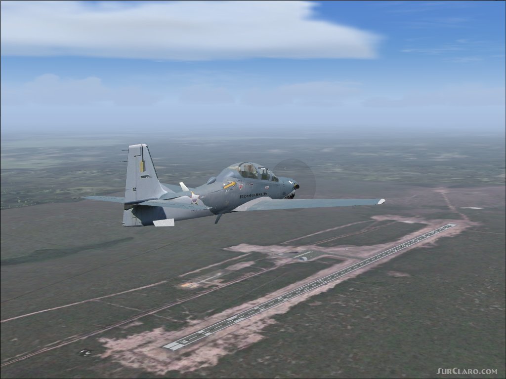
I can’t find much information about it except that there are Brazilian military bases…
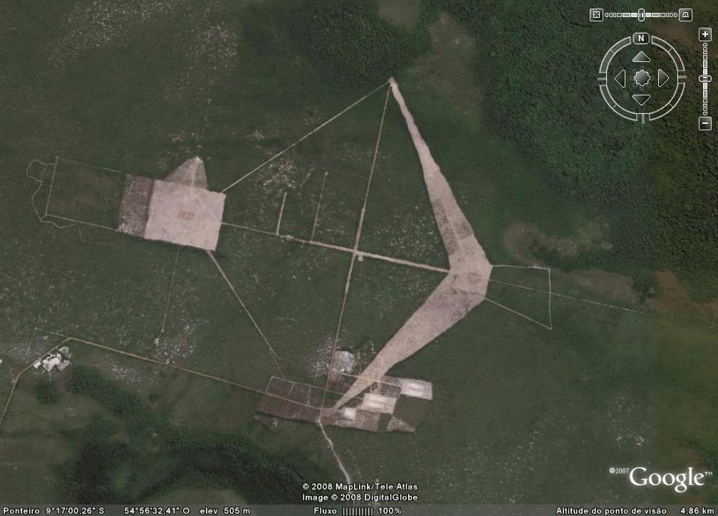
…and a military airport here.
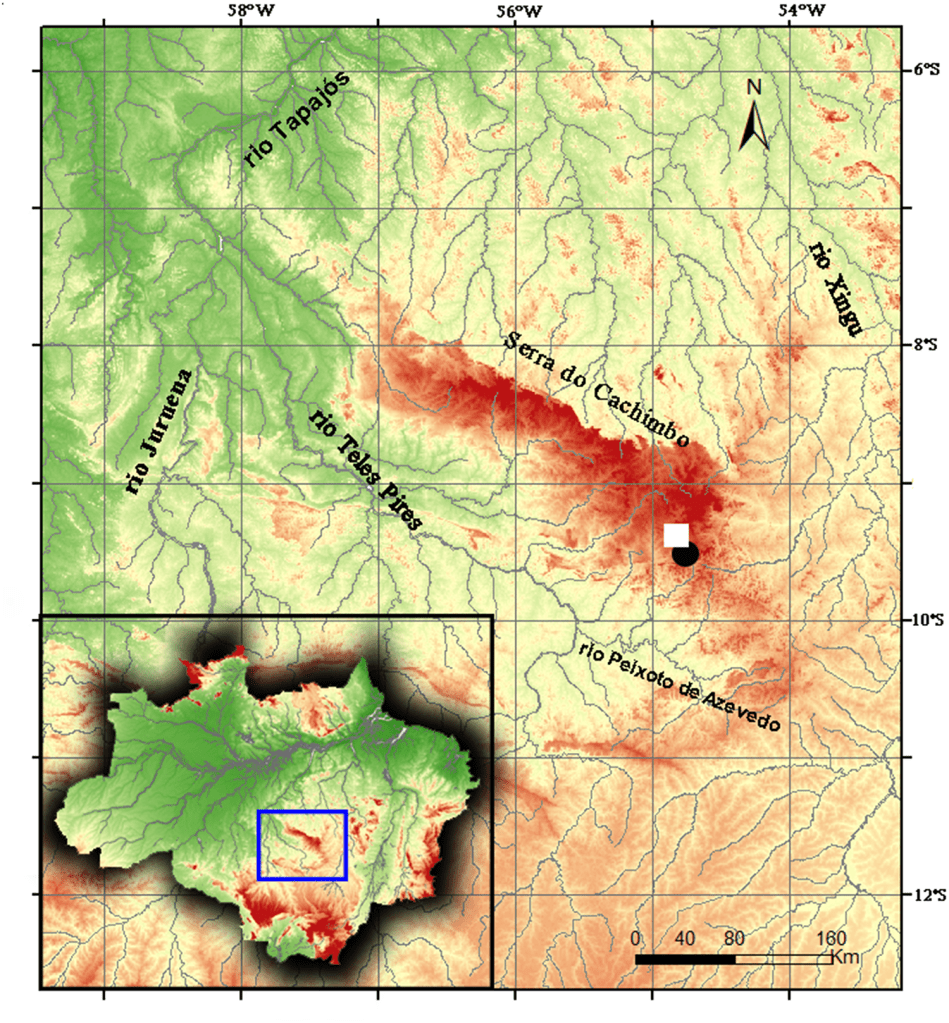
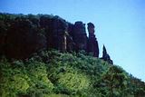
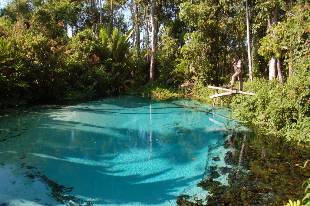
However, Cachimbo is surrounded by the Serra do Cachimbo, described as a continuous mass of mountains with a southwest alignment, partly plateau with flat-bottomed valleys, in the southern part of the State of Para.
The Nascentes da Serra do Cachimbo Biological Reserve is supposed to protect an area of transition between the Cerrado and the Amazon Biomes.
The Cerrado is a vast tropical savanna region of Brazil, with core areas in the plateaus of central Brazil, and has been named by the World Wide Fund for Nature as the biologically richest savanna in the world, with 10,000 plant species, and 10,000 endemic, meaning found no where else, bird species.
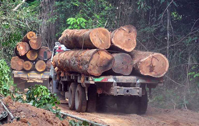
The Nascentes da Serra do Cachimbo Biological Reserve is among the federal conservation units in the Amazon Legal that has suffered the most from deforestation. Its area was cut by half in 2017, and was opened up to agriculture and logging.
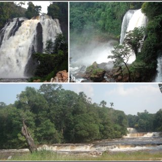
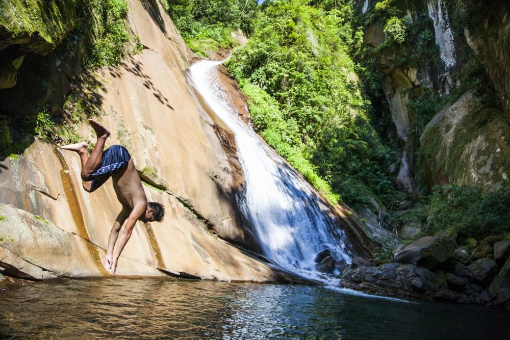
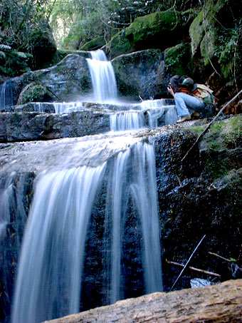
This is a sequence of waterfalls on the Rio Curua in the Serra do Cachimbo region.
It is also interesting to note that the Brazilian Army conducted nuclear testing at a base near Cachimbo from the 1970s to the 1990s.
This is not the first time I have encountered a nuclear test location on a planetary alignment.
Other places include:
Novaya Zemlya, a boomerang shaped island off of the northern coast of Russia. The most powerful nuclear weapon ever, Tsar Bomba, was detonated at Novaya Zemlya in 1961.
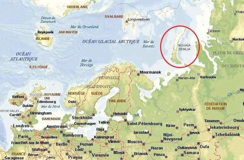
There is a history here of nuclear testing by the Russians, including over 224 nuclear detonations at Novaya Zemlya between 1955 and 1990.
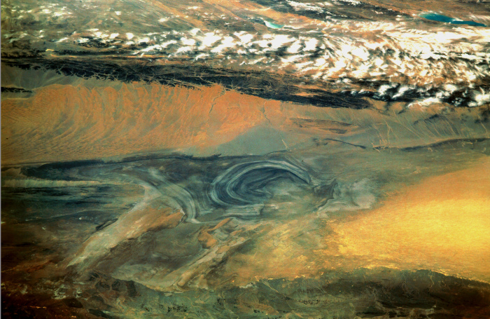
Lop Nur, an ancient salt lake in the Takla Maklan Desert in the Southeastern portion of the Uighur Autonomous Region of Xinjiang in China.
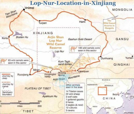
The Chinese Nuclear Weapons Test Base had four nuclear testing zones at Lop Nur, starting in 1959 – with H-Bomb detonation in 1967 – until 1996, with 45 nuclear tests conducted.
Reggane, Algeria. France began its nuclear testing program in Reggane in 1960 – 1961, before Algeria’s independence.
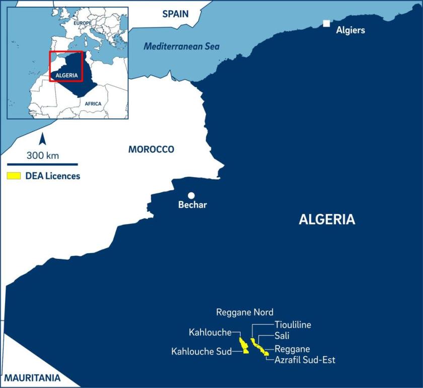
They conducted four atmospheric nuclear tests, which contaminated the Sahara Desert with plutonium, negatively impacting those who live here to this day – not only Reggane, but far beyond.
Between 1960 and 1966, a total of 17 nuclear tests were conducted in the Reggane District of Algeria. It is called Africa’s Hiroshima.
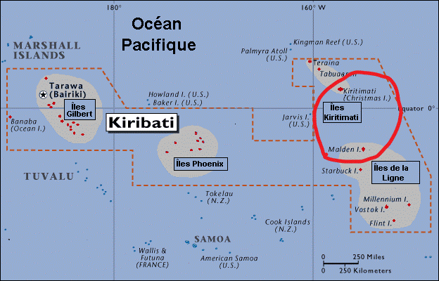
The Christmas and Malden Islands in the Kiribati Islands, where Operation Grapple was conducted. This was the name of four series of British nuclear weapons tests of early atomic bombs and hydrogen bombs carried out in 1957 and 1958.
What is it they say?
Once is chance, twice is coincidence, and the third time is a pattern.
I have provided five examples that I know of regarding nuclear testing on planetary gridlines.
What does this suggest?
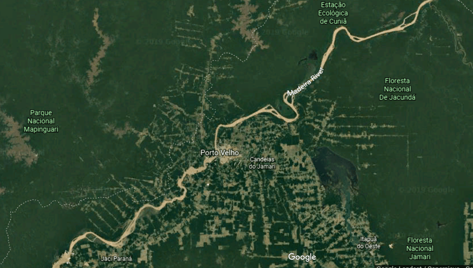
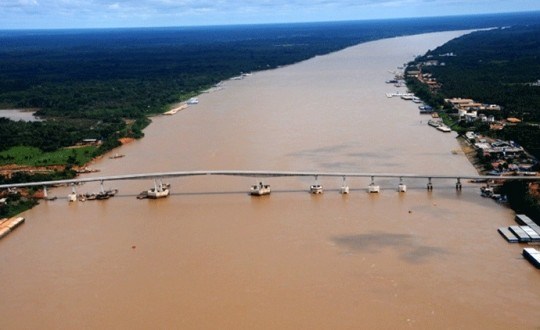
Porto Velho is the next place on the alignment, the capital of the Brazilian State of Rondonia, with a population of over 500,000…
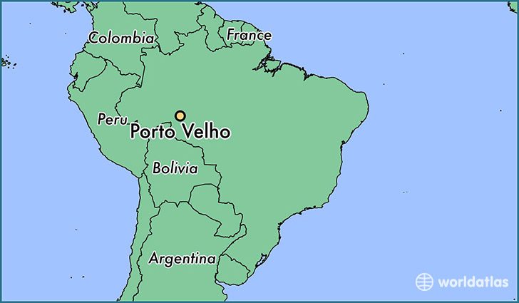
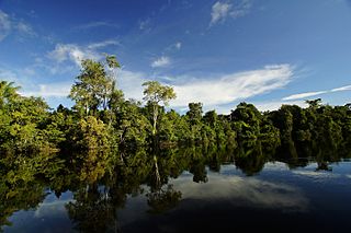
…on the Madeira River in the Upper Amazon Basin.
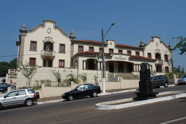
This is the Federal University of Rondonia…
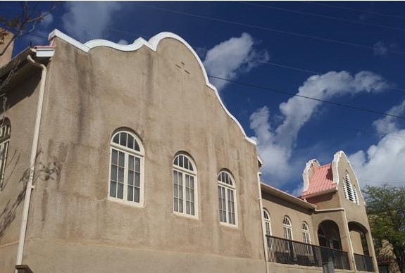
…compared with this building in Jerome, Arizona. Not an exact match, but both have similar design features.
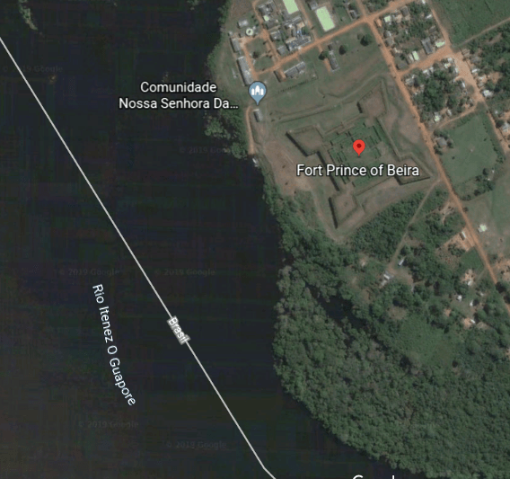
This is the Real Forte Principe da Beira, southwest of Porto Velho, on the Guapore River in Rondonia State.
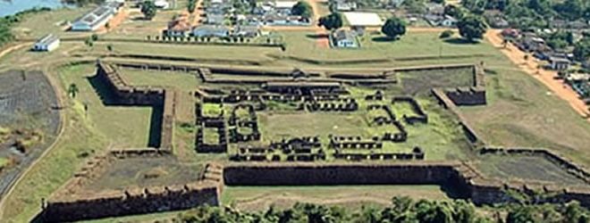
It was said to have been built between 1776 and 1783 by the Portuguese…
…in the middle of nowhere…

…in the Amazon rainforest.
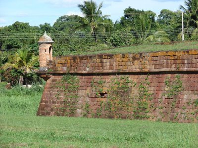
Hmmmm. Sounds fishy to me….

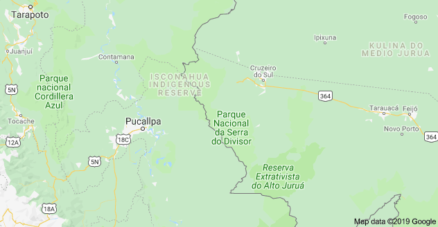
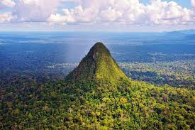
The alignment goes through the Serra do Divisor National Park in Brazil’s Acre State, on the country’s border with Peru.
It is known for its cone-shaped mountains…
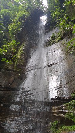
…for its waterfalls, that look like massive walls…
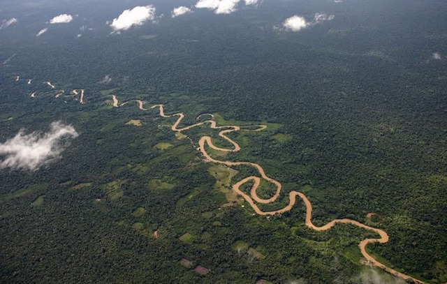
…and look at all the snaky, s-shaped curves in that river in the Serra do Divisor, or Watershed Mountains.
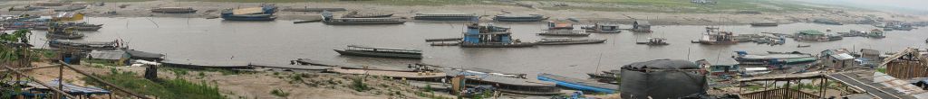
The next place on the alignment is Pucallpa, Peru, and the capital of the Ucayali Region, the Colonel Portillo Province, and the Calleria District.
It is situated on the Ucayali River in the Amazon rainforest of eastern Peru, its main transportation artery.
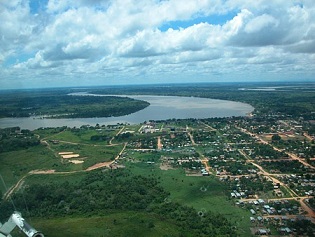
It is the second most important port on the Amazon, after Iquitos in Peru.
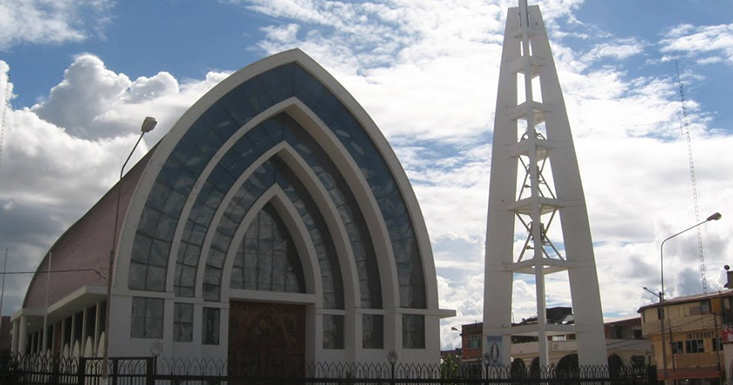
This is the Immaculate Conception Cathedral in the Plaza de Armas, with its arches within arches design.
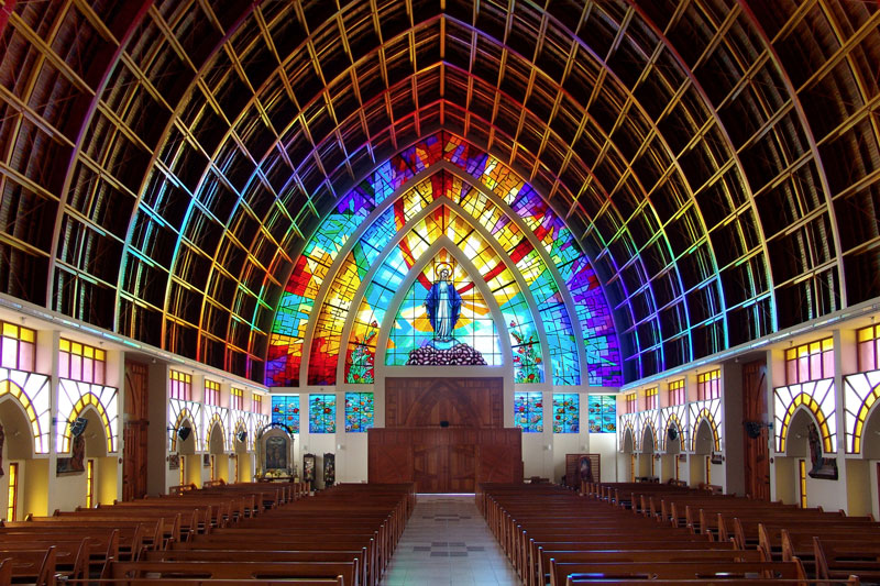
This is what it looks like on the inside, with its beautiful stained glass, and apparent lack of internal pillar supports for the structure.
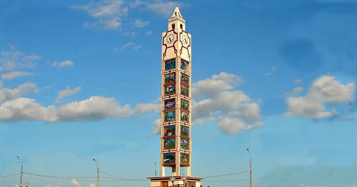
The Clocktower in the Plaza del Reloj is also decorated with stained glass. These are said to portray images of mythical creatures.
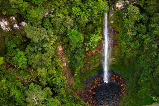
Before ending this post, I want to bring to your attention a national park that is northwest of Pucallpa, and north on the alignment. It is called the Parque Nacional Cordillera Azul.
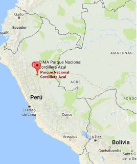
The second largest park in Peru, it is part of the high jungle, in the transition area between the Andes and the Amazon in Peru.
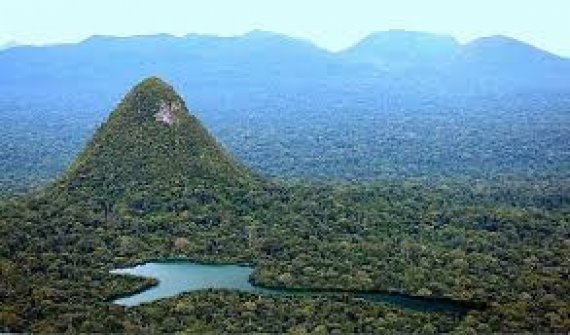
It has similar features to what is found in the previously shown Serra do Divisor National Park in Brazil’s Acre State, like this land feature.
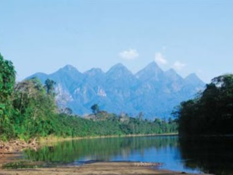
Here’s a whole slew of pointed-peaks in the Cordillera Azul.
There are waterfalls here as well, that also look like massive walls.
I will end this post here, and pick up the alignment in Trujillo, Peru.
