Interesting Comments I have received – Part 2 More Places

In the second-part of this series that will most certainly end-up being longer than two parts, I am going to continue to highlight the physical locations that have been mentioned by readers and viewers in the comments section of my blog and YouTube Channel.

A commenter from Argentina gave the following references about structures there that are questionable for having been done by our current civilization.

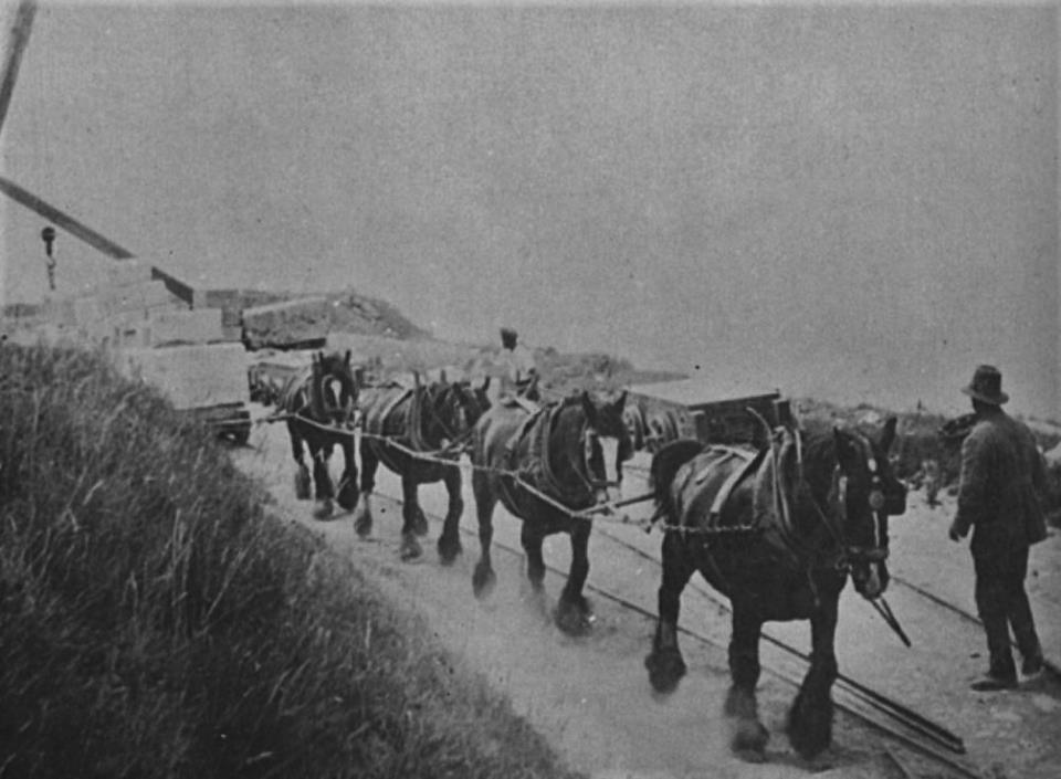
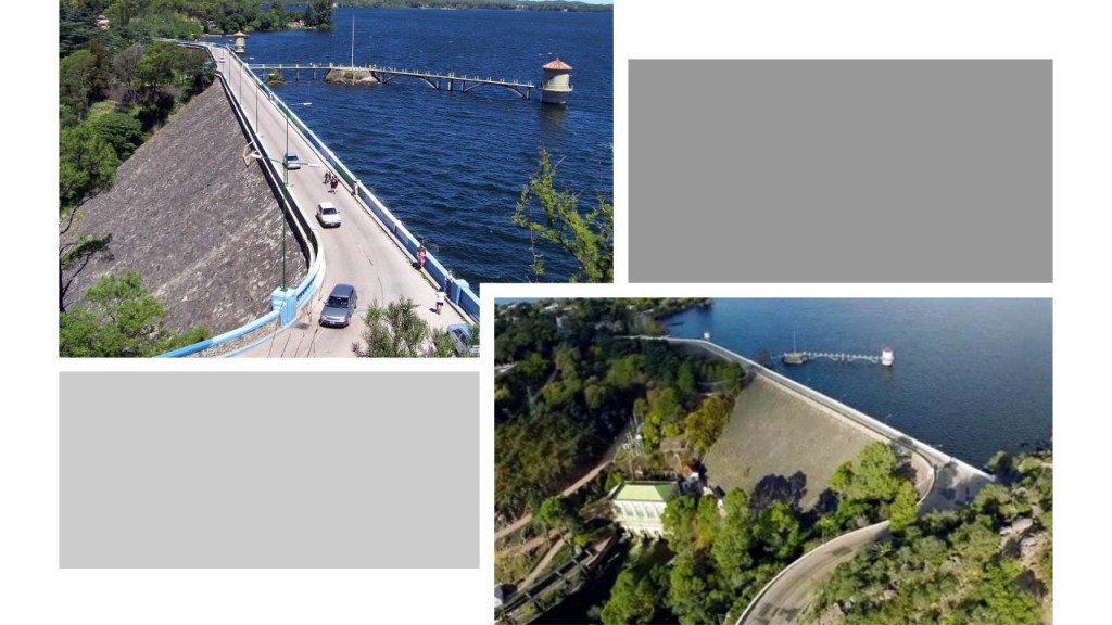
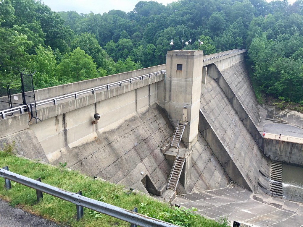
The Dique Los Molinos, a dam in the Cordoba Province of Argentina on the Los Molinos River, was said to have been built between 1948 and 1953, the year it opened.

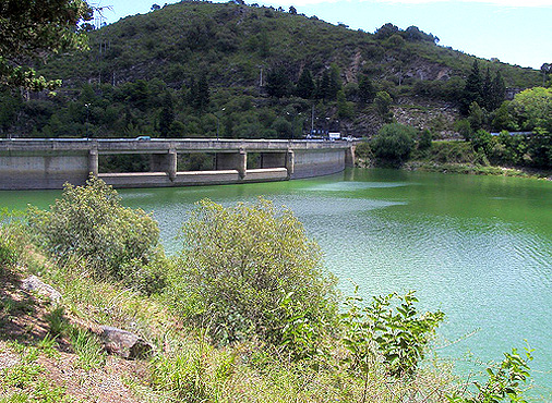
Its primary goals were regulating the flow of the river and the production of hydroelectricity.

The Dique Los Molinos is 200-feet, or 60-meters, high, and 790-feet, or 240-meters, long.

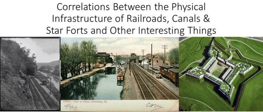
I have a two-part series in which I highlight the advanced engineering of hydroelectric projects around the world, and I seriously question what we are told in our historical narrative about who was said to have built them and when.

I give many examples in this two-part series on the “Advanced Engineering of Reservoirs and Hydro-Electric Projects” as to why I have so many questions about what we are told about these amazing engineering projects.

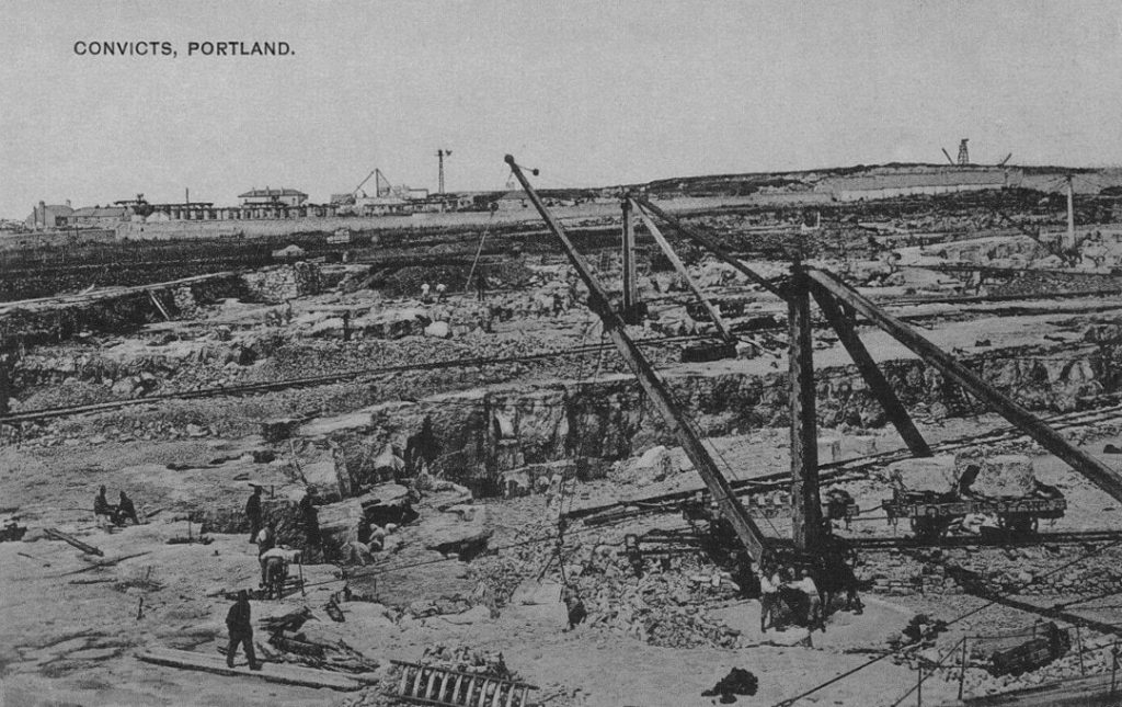
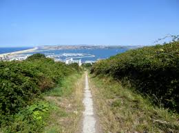
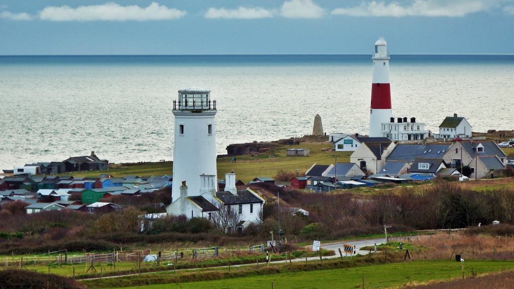
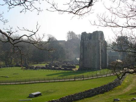
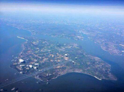
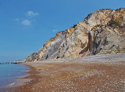
Embalse is a city in Argentina’s Cordoba Province that means “Reservoir,” and indeed it is located on the eastern shore of a large reservoir.

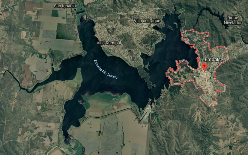
The reservoir was created by the damming of the Rio Tercero.

One of Argentina’s nuclear power plants is located in Embalse on the southern shore of the reservoir.

We are told its construction was completed in 1983.

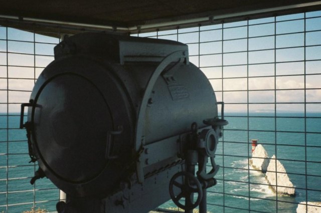
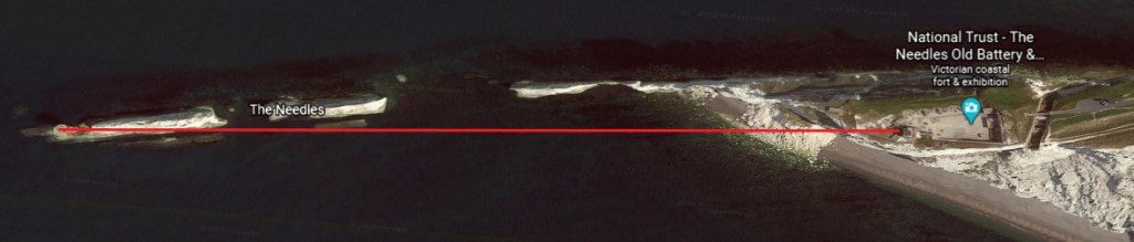
Definitely seeing a man-made canal here! Canal system all over the world were a signature feature of the original civilization.

Embalse is located 74-miles, or 119-kilometers, south-southwest of Cordoba City, the province’s capital and the second-largest city in Argentina after Buenos Aires.

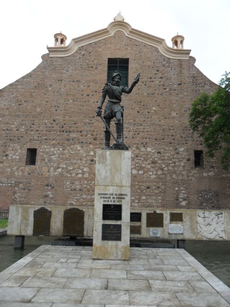
Cordoba was said to have been founded on July 6th of 1573 by Jeronimo Luis de Cabrera, a Spanish conquistador who became a colonial governor over much of what is now northwestern Argentina.

The National University of Cordoba was said to have been founded by the Jesuits in 1613, and is the oldest University in Argentina…

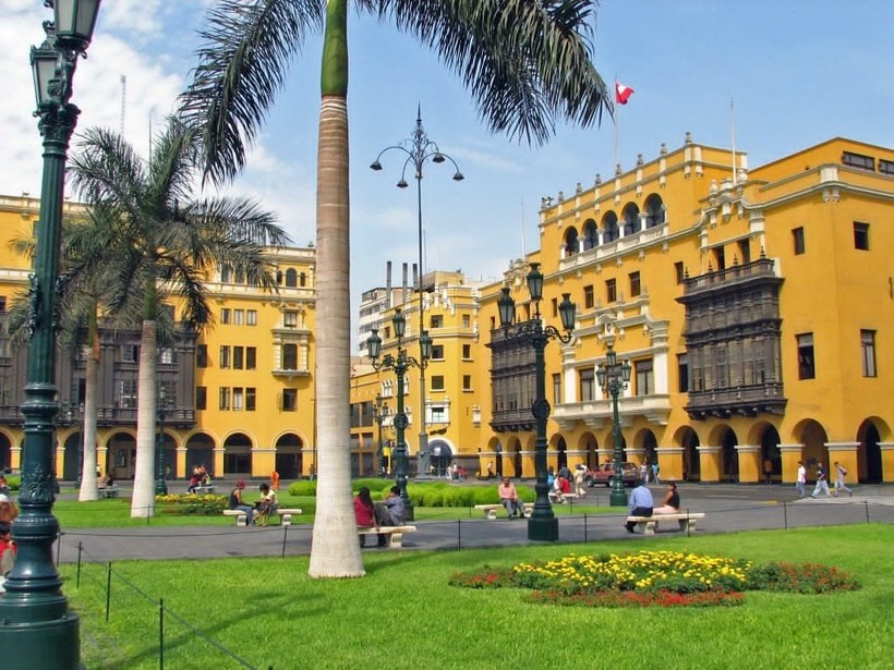
…and the third-oldest in South America, after the National University of San Marcos in Lima, Peru, first chartered in May of 1551 and the oldest continually operating university in the Americas…

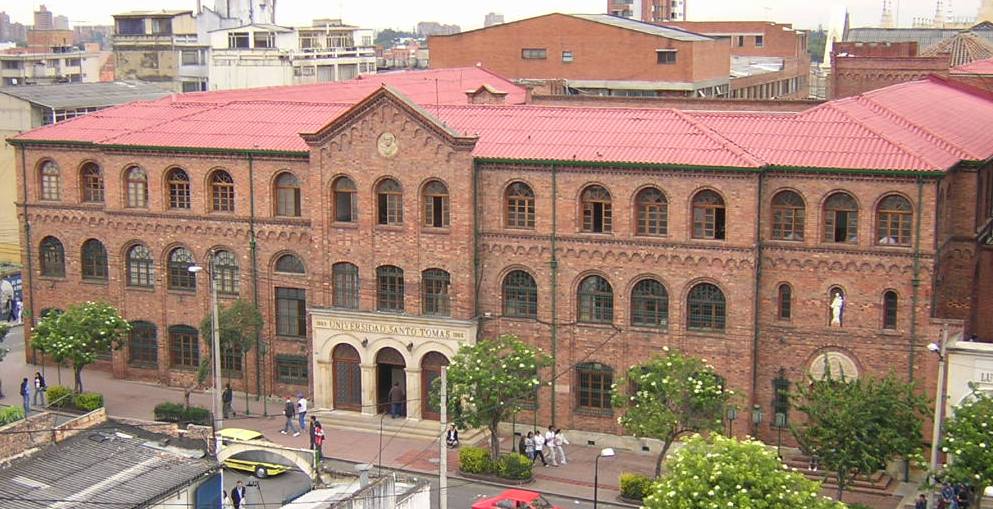
…and St. Thomas Aquinas University in Bogota, the oldest university in Colombia, established in 1580 by the Dominicans.

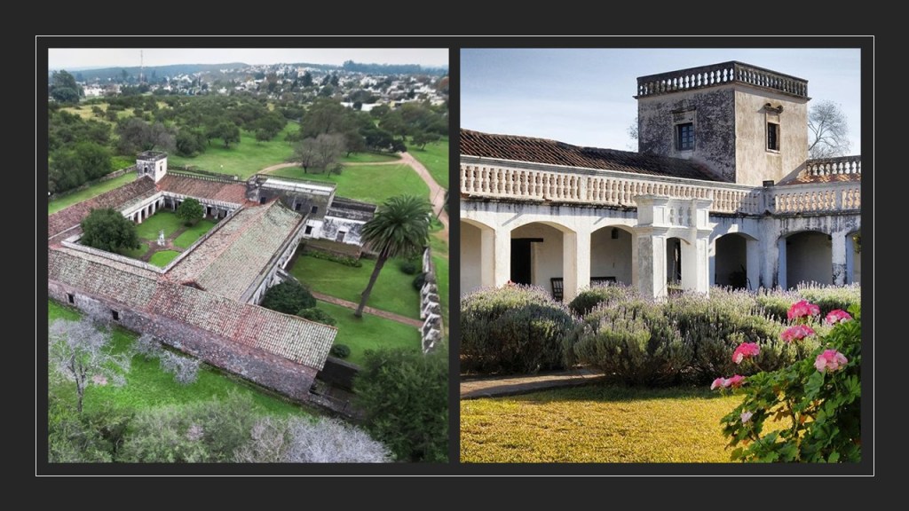
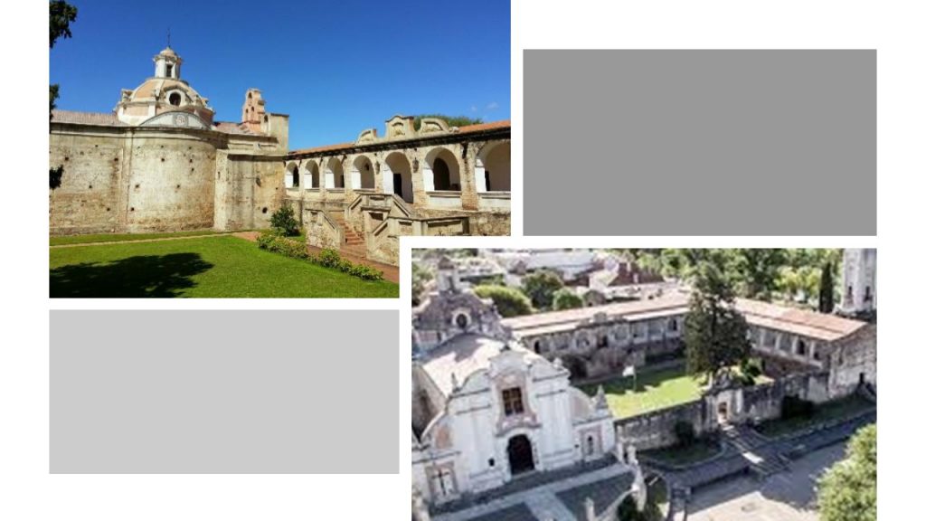
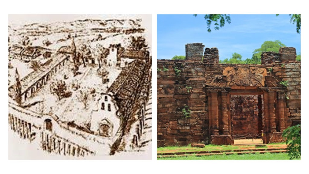
The Jesuit Block in Cordoba was declared a UNESCO World Heritage Site in the year 2000, and consists of what are described as a block of buildings dating back to the 17th-century.

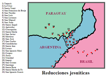
The complex was said to have started by the Jesuits in 1615 as a Jesuit Reduction, which we are told was a type of settlement for indigenous people in Argentina, Brazil, and Paraguay.

Named a “Reduction”? Which also means the act of making something smaller or less in size or amount?

Say what?!

The current Pope Francis is from Argentina, and spent two years in the 1990s in a small room number 5 in the Jesuit Block.

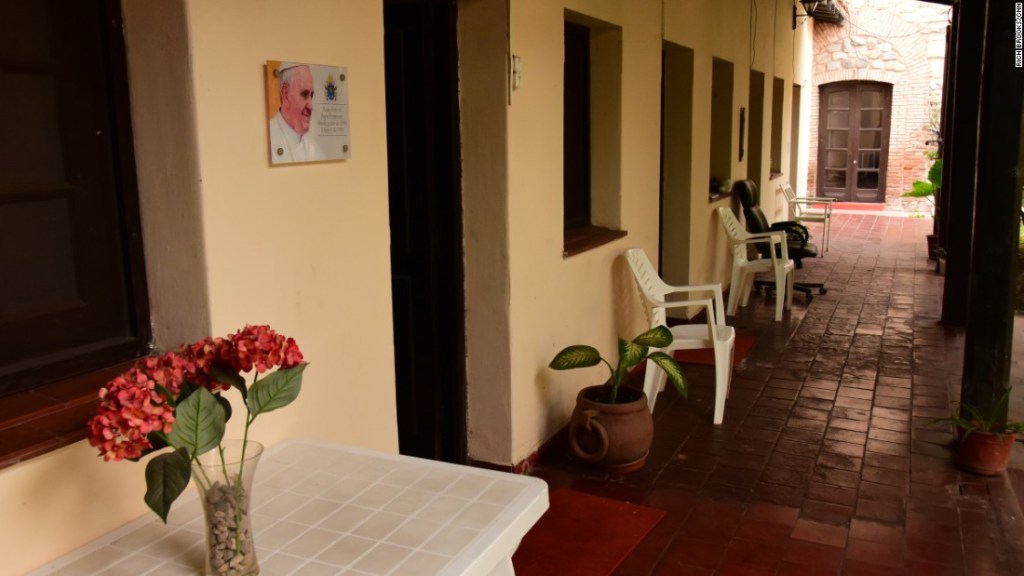
As Jorge Mario Bergoglio, he entered the Jesuit order in 1958, and is the first Jesuit pope.

In addition, the Jesuits operated six, what are called estancias, or residences and ranches, in the region, in:

Caroya in 1616…

…Jesus Maria in 1618…

…Santa Catalina in 1622…

…Alta Gracia around 1643…

…Candelaria in 1683…

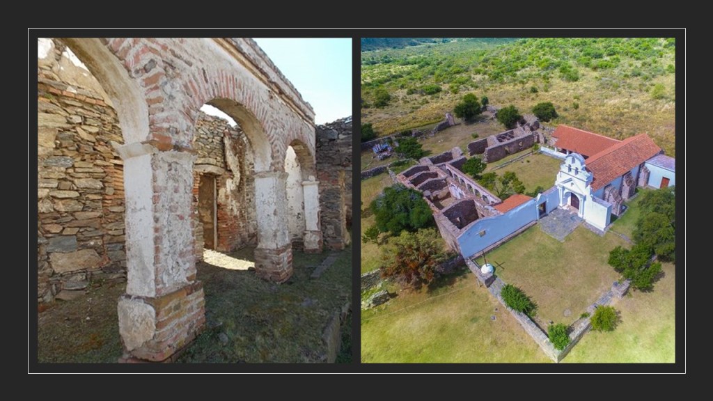
…and San Ignacio at this location in 1696.

It is interesting to note that the Jesuits were expelled from South America by the 1767 Decree of King Charles III of Spain, which was part of the “Suppression of the Society of Jesus,” in which the Jesuits were removed from most of the countries of western Europe and their colonies, we are told for political reasons.

The Suppression began in 1759, and ended in 1814 by Pope Pius VII, in which he restored the Jesuits to their previous provinces, and the Jesuits returned to the Americas in 1853.

And I have read where some folks believe that instead of Hitler committing suicide in a Berlin bunker at the end of World War II…

…he escaped to Argentina in 1945.

What is it about Argentina?

Next, I am going to be looking at places in the Nashville area that were suggested by a commenter.

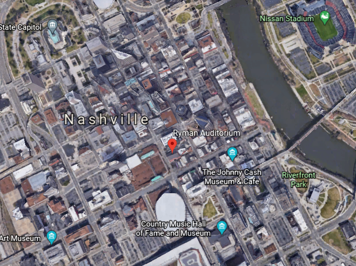
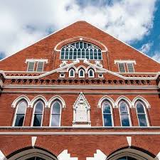
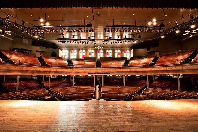
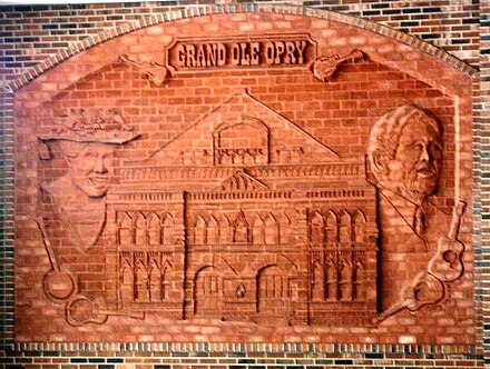
The Ryman Auditorium in downtown Nashville was the home of the Grand Ole Opry from 1943 to 1974.

Its construction was said to have been promoted by Thomas Ryman, a Tennessee business man who was a riverboat captain as well as the owner of a riverboat company…

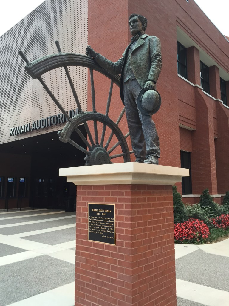
…as an auditorium and tabernacle for Samuel Porter Jones, an influential revivalist of the day, after Ryman was converted to Christianity in 1885 after attending a tent-revival held by Jones.

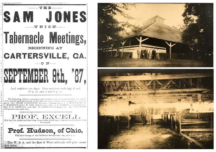
Opening in 1892 as the Union Gospel Tabernacle, it was not only used as a house of worship, it was also rented out as a venue for different types of events, including, but not limited to concerts, speaking engagements, boxing matches.

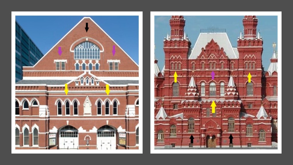
There are two things I would like to point out about the physical appearance of the Ryman Auditorium.

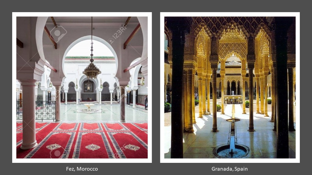
The first is to show the similarity of architectural features of the Ryman Auditorium on the left and the Moscow State Historical Museum in Russia on the right.

In particular the occurrence in both buildings of triple windows (the yellow arrows); double-windows (the purple arrows); and the intricate patterning of sections of windows (the black arrows).

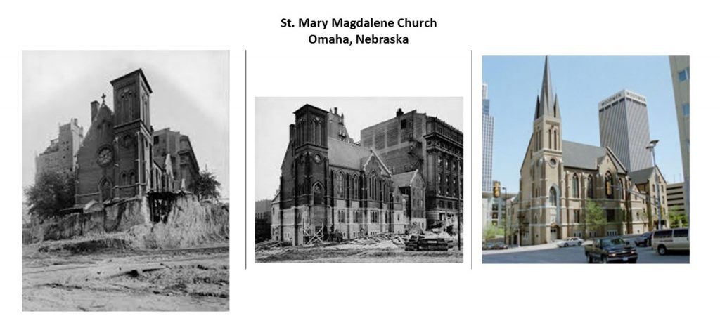
The other thing is the classic mud flood feature of the slanted pavement in front of the building, and the ground-level windows on the side of the building that are level with the not-ground-level windows of the front of the building.

Compare this with the two historic photographs of St. Mary Magdalene Church on the left, in Omaha, Nebraska with the lower part of it having been dug out of the dirt surrounding it, and the same church today on the right with the slanted paved street covering the points at which the lower part of the church had been excavated.

Also known as the “Mother Church of Country Music”…

…the Ryman Auditorium became the home of the “Grand Ole Opry” show in 1943 until March 15th of 1974…

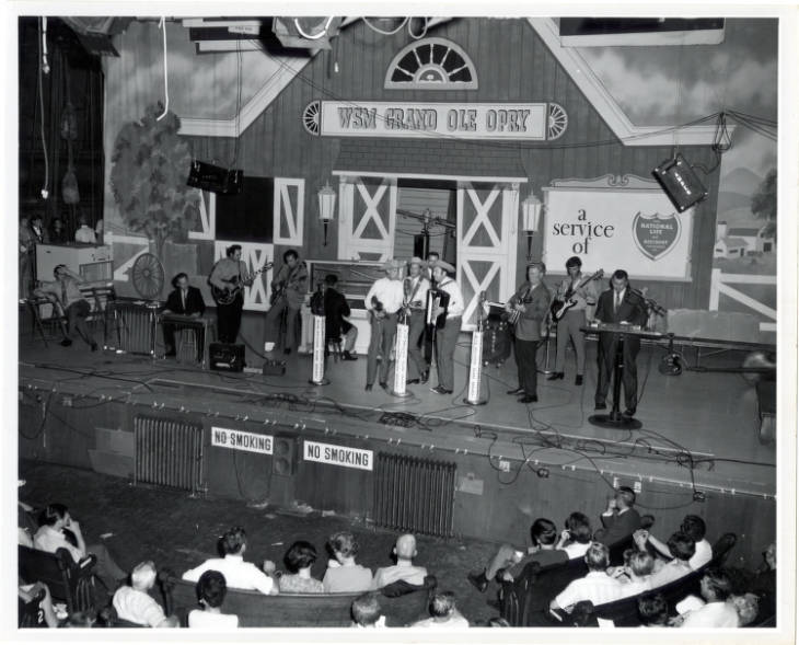
…at which time the “Grand Ole Opry” was moved to its current venue, the massive “Grand Ole Opry House.”

It is interesting to note that the Ryman Auditorium was almost demolished by the owners of the “Grand Ole Opry,” with the reason given that it was in poor condition.

Though it was not demolished because of the outcry against this, the Ryman Auditorium sat dormant until 1989, and has been utilized as an event venue since then.

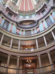
The Tennessee State Capitol building was said to have been designed by architect William Strickland, one of the architects credited with establishing the Greek Revival movement in the United States.

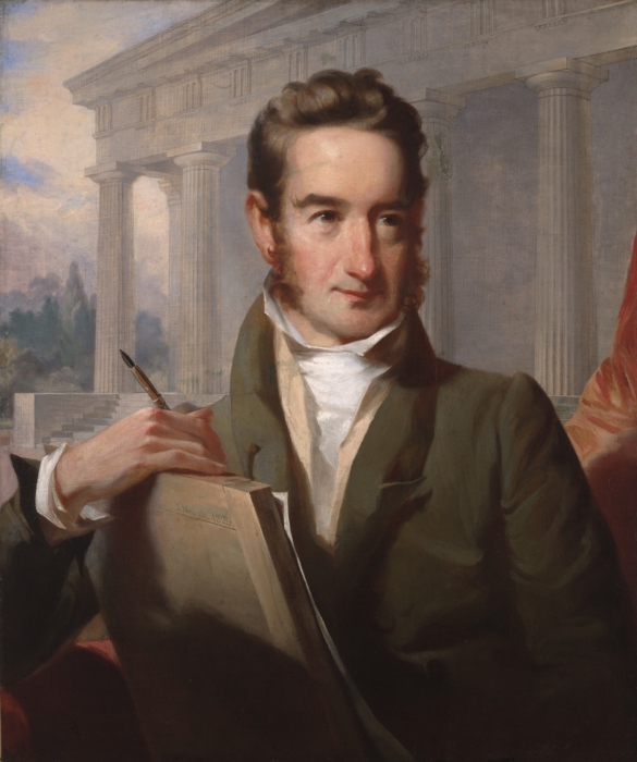
…and built between 1845 and 1859.

It was added to the National Register of Historic Places in 1970, and named a National Historic Landmark in 1971.

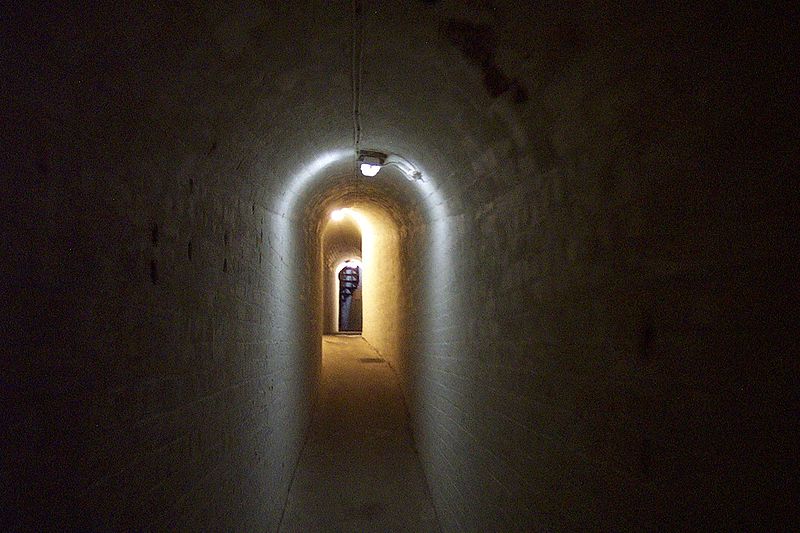
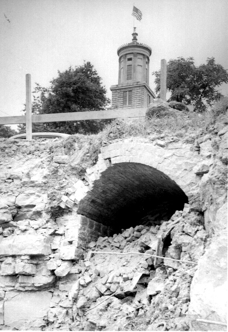
It is interesting to note the entrance to an old tunnel was unearthed near the State Capitol building in 1951, under 6th Street.

Formerly known as the First Presbyterian Church, the Downtown Church in Nashville was also said to have been designed by William Strickland and completed in 1846.

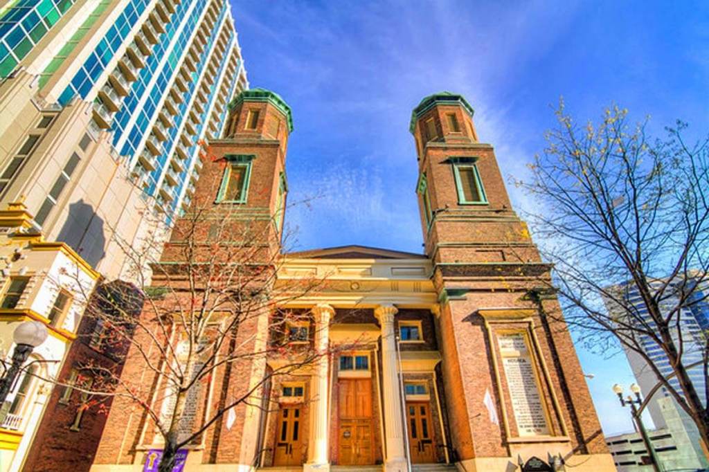
The Downtown Presbyterian Church is considered the best-surviving ecclesiastical example of what is called Egyptian Revival architecture.

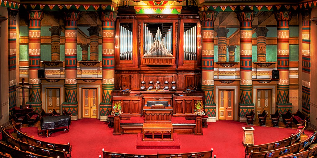
Egyptian Revival architecture too?

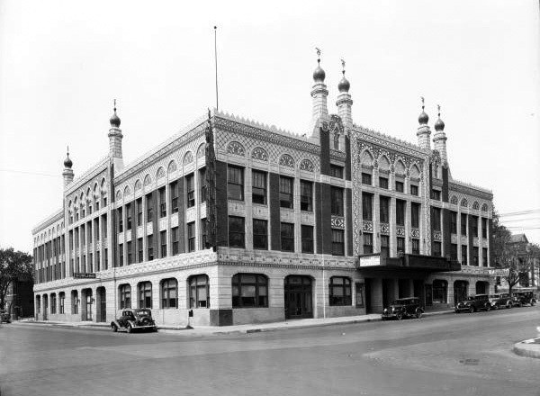
The Knights of Pythias Pavilion is said to be an example of Classical Revival Architecture, yet another type of revival architecture…

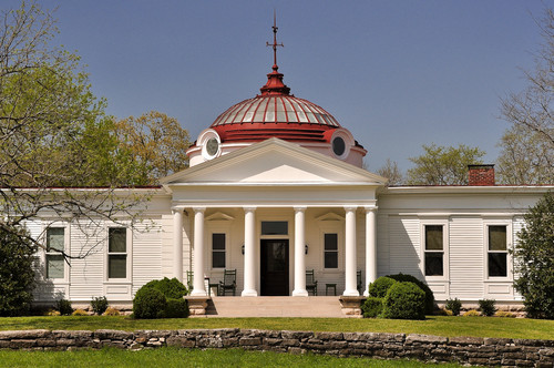
…designed by Henry Gibel for the 1897 Tennessee Centennial Exhibition.

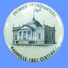
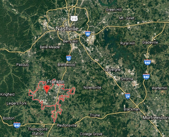
After the Exhibition, it was said to have been purchased, and moved by wagon to its present location off Highway 96 in Franklin, Tennessee.

How’d they manage to transport that building by wagon?

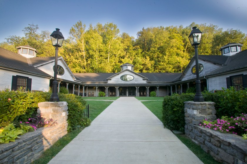
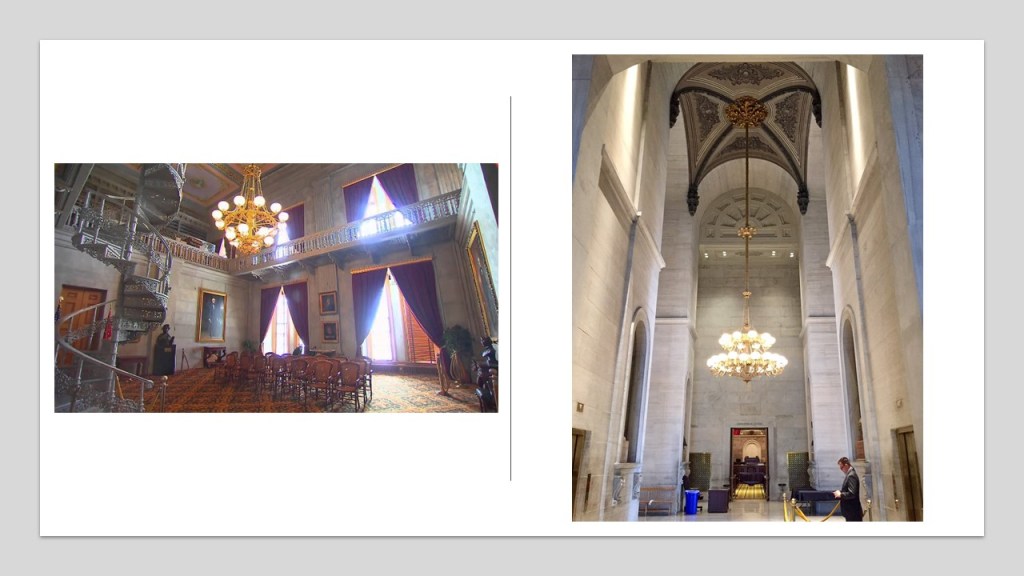
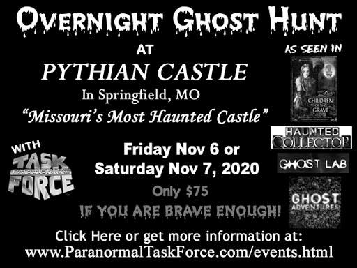
I encountered the Knights of Pythias initially in researching Springfield, Missouri, where there is a Pythian Castle.

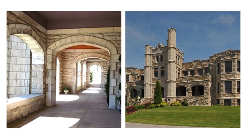
Known as the Pythian Home of Missouri, we are told that it was constructed by the order as a home for needy members of their order, and their widows and children.

The original main floor features things like a grand foyer…
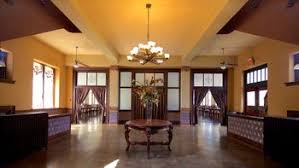
…ballroom…

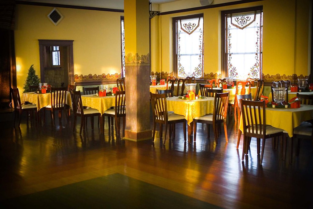
…and sitting parlors.

It also has a reputation as being haunted.

What jumped out at me on learning about the Knights of Pythias is that it was a secret society founded in Washington, D.C in February of 1864.

It was the first fraternal order to receive a charter by an Act of Congress.

It is interesting to note that the Civil War didn’t end until 1865.

For what purpose would Congress charter a fraternal secret society in wartime?

The Nashville Parthenon was also said to have been built for the 1897 Tennessee Centennial Exposition.

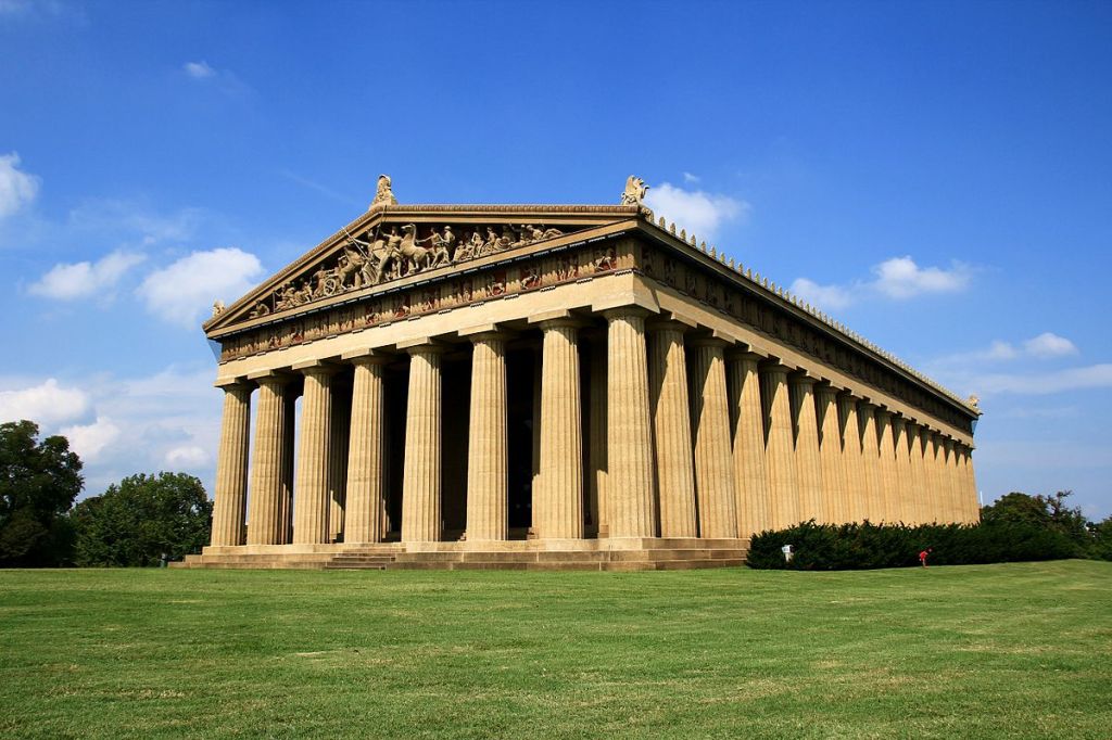
We are told that Nashville’s nickname of “Athens of the South” influenced the choice of an exact replica of the Parthenon in Athens, Greece, as the centerpiece of the Exposition.

The architect of Nashville’s Parthenon was said to be the former confederate soldier, William Crawford Smith.

It was said to have been originally built as a temporary structure out of plaster, wood, and brick, but it was left standing after the Exposition because of its popularity, and that it was rebuilt with concrete in the 1920s.

Here is an old photo of the Exposition, with the Memphis Building next to the Parthenon.

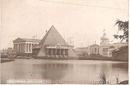
This was said to be the Memphis, Tennessee -Shelby County construction for the Exposition, modelled after Memphis’ namesake in Egypt.

It was also said to have been built out of temporary materials, like plaster and wood, and was demolished after the Exposition.

Now I am going to go quickly through some of the places people have commented about.

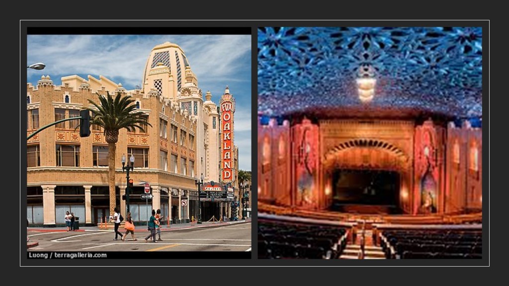
The Fox Theater in Downtown Oakland California, said to have been opened in 1928, and designed by the American architectural firm of Weeks and Day.

In Akron, Ohio, there is the Edison Dam…

…and the trails of the Gorge Metro Park in Akron.

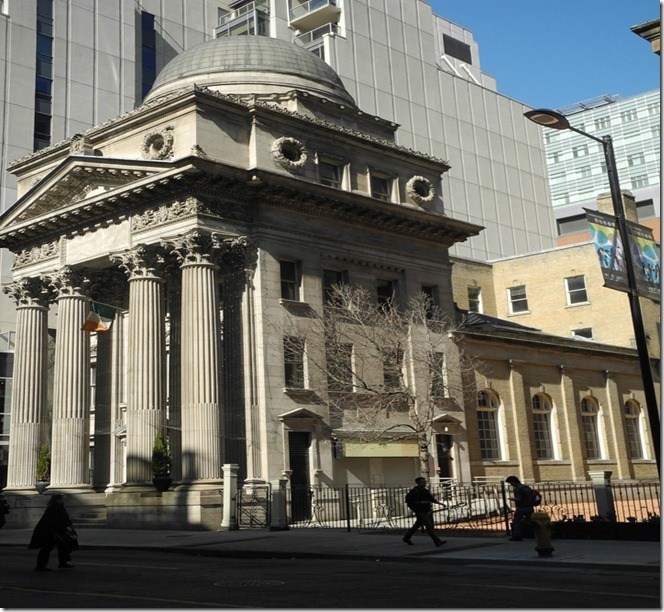
The Buenos Aires Water Company Palace in Argentina was said to have been designed as a water pumping station in 1877 and completed in 1894…

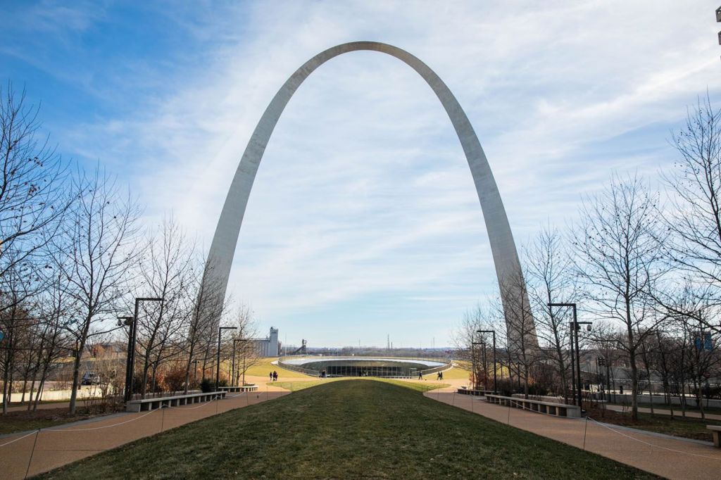
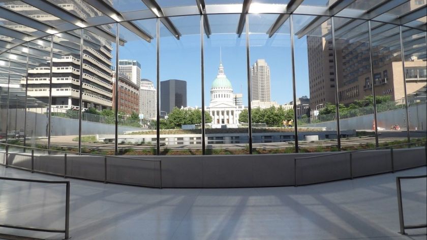
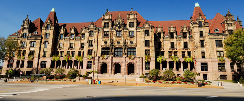
…and the similar-looking St. Louis City Hall in Missouri, said to have been designed in 1898, modeled after the city hall in Paris, France, and completed in time for the St. Louis World’s Fair in 1904.

The Town Creek Indian Mound in North Carolina, attributed to the Pee Dee people of the South Appalachian Mississippian Culture…

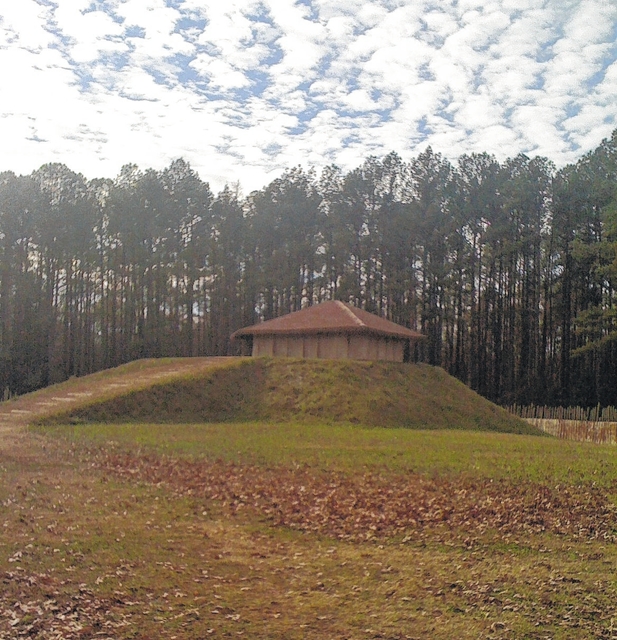
…that thrived in that Pee Dee River region of North and South Carolina before Columbus…

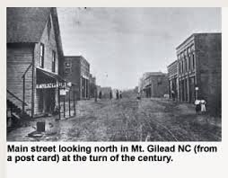
…near the town of Mt. Gilead, North Carolina.

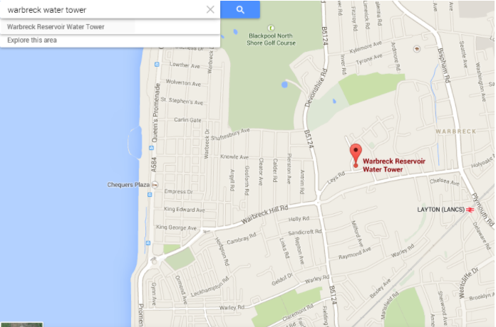
The Warbreck Water Tower in Blackpool, England, said to have been built in 1932 to serve the heavily residential areas of central Blackpool and high-rise homes…

…is located on Leys Road.

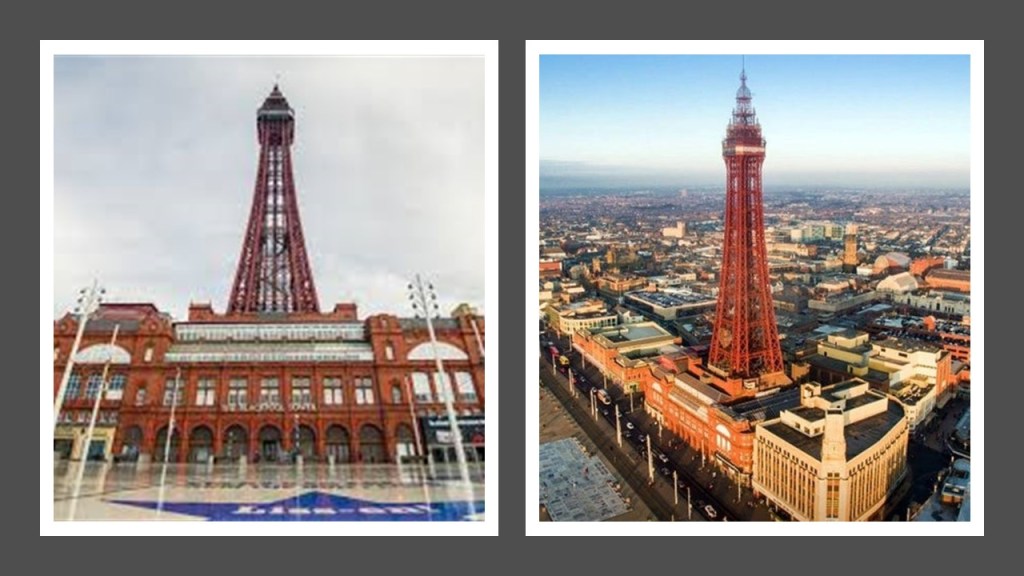
Another tower in Blackpool, the Blackpool Tower, was said to have been inspired by the Eiffel Tower in Paris, and that at the time it was opened to the public in 1894, it was the tallest, man-made structure in the British Empire.

In Cleveland, Ohio, the West Side Market, which is classified as a Neo-Classical/Byzantine building, the construction of which was said to have been completed in 1912…

…and Lakeview Cemetery in Cleveland, with its the dam…

…and the James A. Garfield Memorial, said to have been constructed in a combination of Byzantine, Gothic, and Romanesque Revival styles between 1885 and 1890 for the 20th-President of the United States who was assassinated in 1881 who had expressed a desire to be interred in the Lakeview Cemetery.

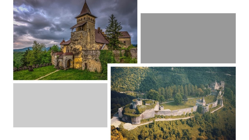
Castle Rushen, the construction of which was said to have started in the 10th-century, in Castletown on the Isle of Man, located in the Irish Sea between England and Ireland…

…and the Ostrozac Castle of Bosnia, a medieval castle called a fairy tale for every visitor.

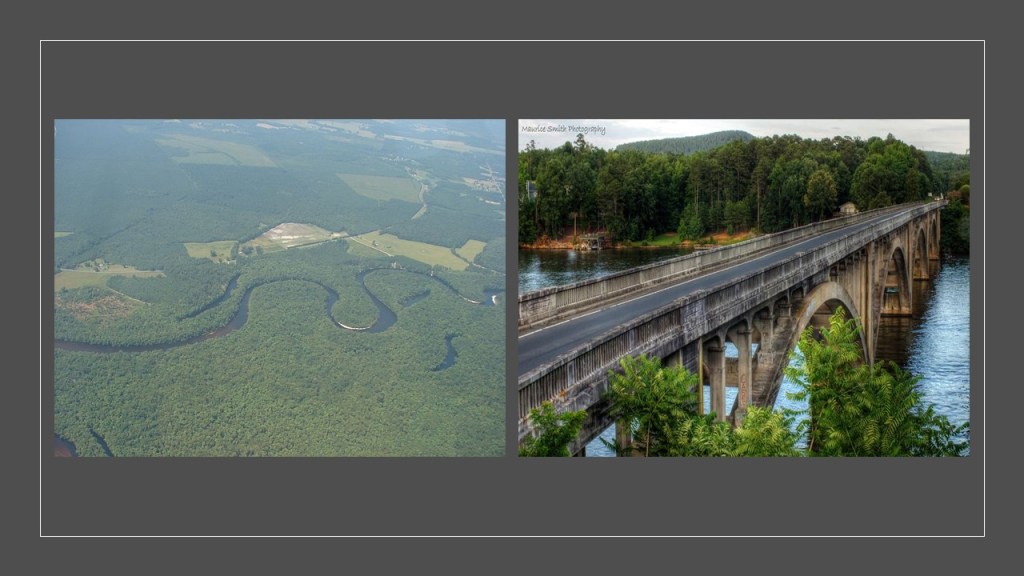
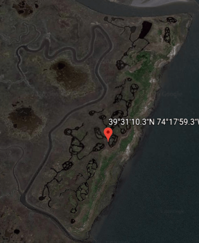
I was asked to look into the Tuckahoe-Corbin City Fish and Wildlife Management Area, located in southern New Jersey…

…at a size of over 17,000 acres, or 6,880-hectares, of marshes, rivers, and Pine Barrens woodland located adjacent to the Great Egg Harbor.

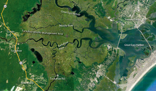
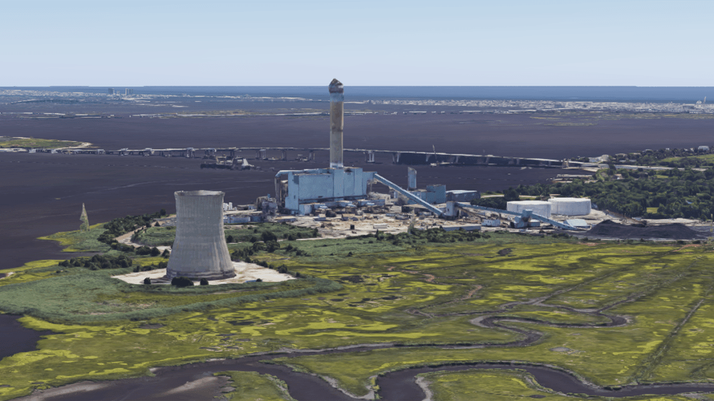
The Beasley Point Generating Station, a coal-fired power-plant which operated from 1961 to 2019, was situated right at the edge of the Wildlife Management area, where several rivers flow into it from the Great Egg Harbor.

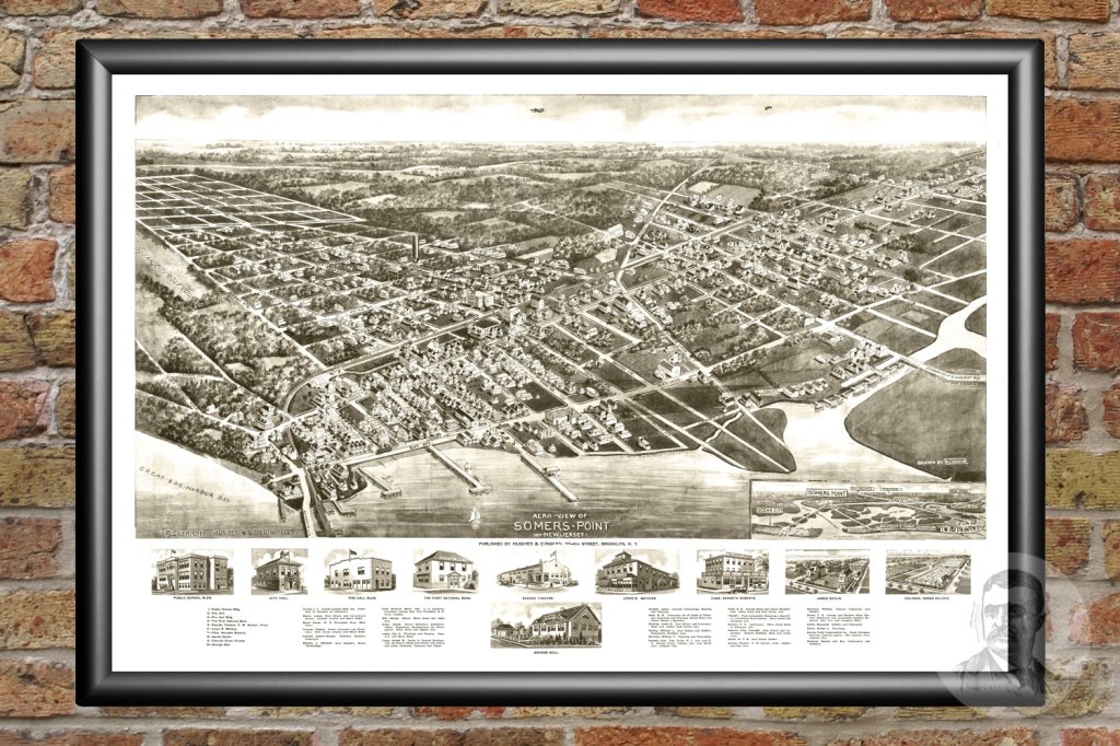
Somers Point, a city located on the other side of Great Egg Harbor from where the power plant was on Beasley Point, is the oldest settlement in Atlantic County, New Jersey, said to have been first settled in 1693 and incorporated as a borough in 1886.

The Atlantic City and Shore Railroad was a type of streetcar system in New Jersey called an interurban that served Somers Point and several other cities between Atlantic City and Ocean City in the years between 1907 and 1948.

One more thing before leaving this part of the world is that I was given the coordinates of 39°31’10.3″N 74°17’59.3″W…

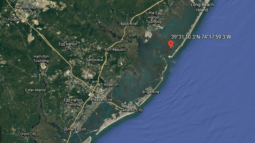
…to look at what appear to be geoglyphs in the landscape, man-made effigies in the ground that are only visible from the air.

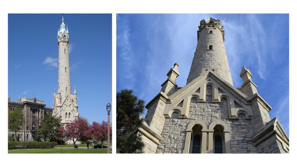
The North Point Water Tower in Milwaukee was said to have been built between 1873 and 1874 in the style of Victorian-Gothic as part of Milwaukee’s first public waterworks…

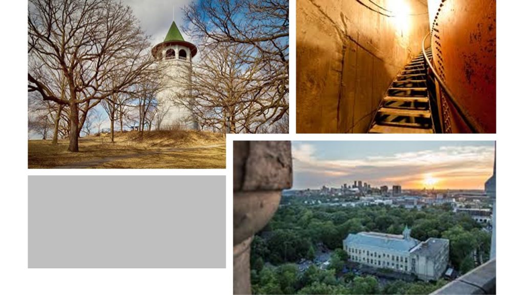
…and the Prospect Point Water Tower in Minneapolis, Minnesota, also known as the Witch’s Hat Tower, was said to have been built on Tower Hill Park in 1913, which was a hilltop park established in 1906.

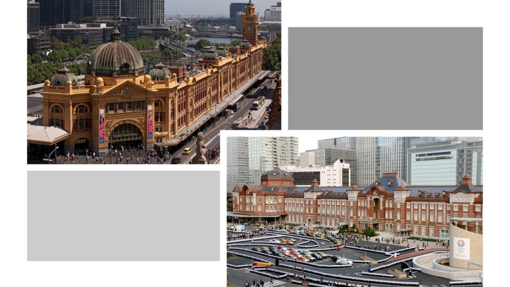
A comment was made to look at the Flinders Street Station in Melbourne, opened in 1854, and the first railway station in Australia on the top left, compared for size and scope with the Marunouchi Station in Tokyo, opened in 1914.

.

These photographs came from a trek across Ebbetts Pass, in the Sierra Nevada range east of Sacramento in California were sent to me from a viewer.

What could have taken place here to create these anomalous appearances?

I received information from a viewer about synagogues to look into the ones in Barbados in the Caribbean, Charleston in South Carolina, and in Providence, Rhode island.

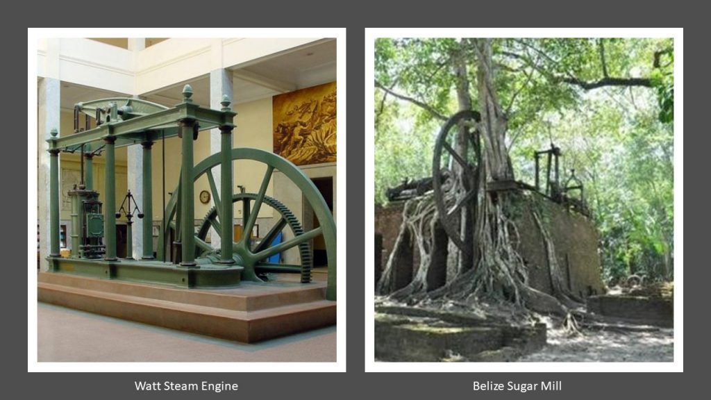
The Nidhe Israel Synagogue in Barbados is said to be one of the oldest synagogues in the western, originally constructed starting in 1654 for the Sephardic Jewish community of Barbados, formed by refugees fleeing from Portuguese Brazil, and who brought with them expertise in the production of sugar cane, leading Barbados to become a major producer of sugar.

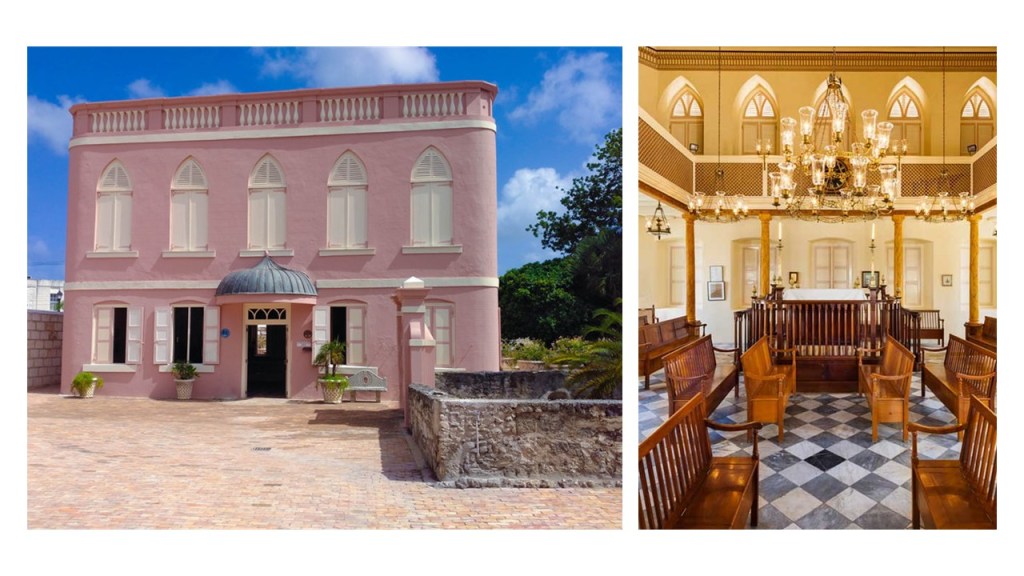
We are told the synagogue was destroyed by a hurricane in 1831, and then rebuilt.

After a period of time fell into disrepair until it was sold in 1929.

Eventually it was turned over to the Barbados National Trust in the 1980s, and the building was renovated and returned to use as a synagogue.

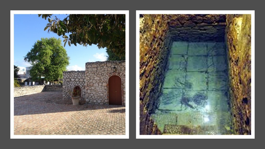
A mikveh, or ritual bath, on the grounds of the synagogue was unearthed from beneath the synagogue’s parking lot by archeologists in 2008.

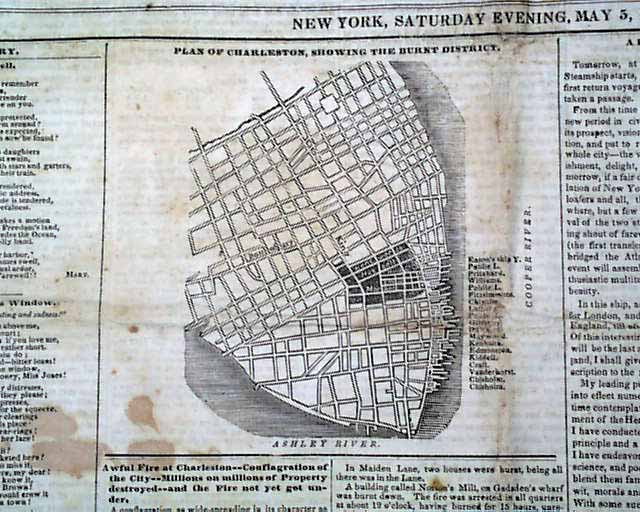
The Kahal Kadosh Beth Elohim Synagogue in Charleston, South Carolina, was founded in 1749, and considered one of the oldest Jewish congregations in the United States.

It is called a Greek Revival synagogue that was designed by New York architect Cyrus L. Warner and built in 1840.

The founding members of the Charleston synagogue were Sephardic Jews from Spain and Portugal, who arrived in Charleston from London.

The congregation’s first synagogue was said to have been destroyed by the Great Fire of Charleston that took place in 1838, which damaged over 1,000 buildings and destroyed one-quarter of the city’s businesses at the time.

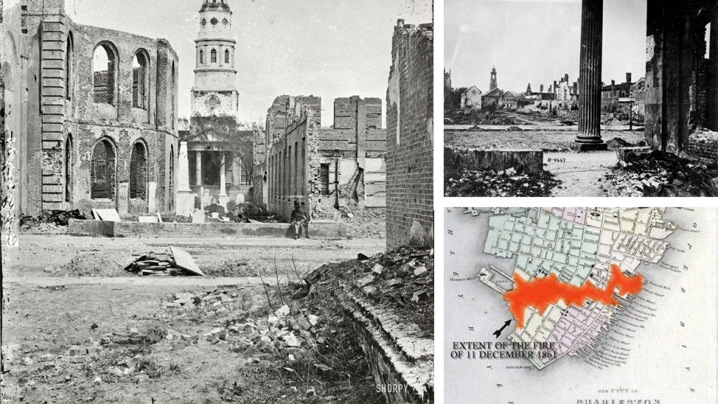
Another devastating Great Fire took place in Charleston in 1861, and which was said to have caused the vast majority of damage and destruction to the city during the American Civil War.

The congregation in Providence, Rhode Island, was founded in 1849 by mostly Ashkenazi Jews from German-speaking areas of Europe.

The Temple Beth El Synagogue in Providence was said to have been built between 1910 and 1911 as a Classical Revival brick structure.

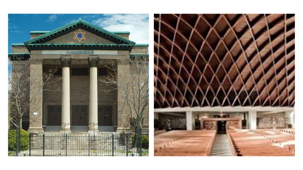
It has been vacant since 2006, suffering vandalism and water damage, and named as one of Providence’s “Most Endangered Buildings” by the Providence Preservation Society.

I have talked about the Leeds Town Hall in Leeds, England, in past posts.

The Leeds Town Hall was one of the first examples I found in my research of the use of contests and competitions to explain how what we would consider relatively modern, monumental architecture came into being.

It was said to have been completed in 1858, and opened by Queen Victoria.

This gentleman, Cuthbert Brodrick, was given the credit for designing it, after winning a design competition for it, when he was 29-years-old, in 1852, and is considered his most famous architectural work.

A commenter from Leeds ordered the map of Leeds from 1847, and said it cuts of just where Leeds town hall should be…

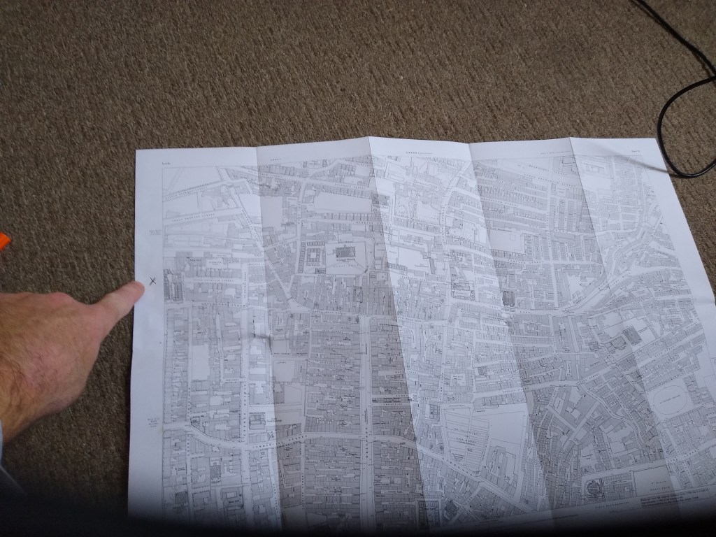
…and also said that the town hall is a main feature of Headrow, so that for the map to be missing this section is a bit of a coincidence.

He also sent me pictures of the entrance of the Leeds Town Hall…
 

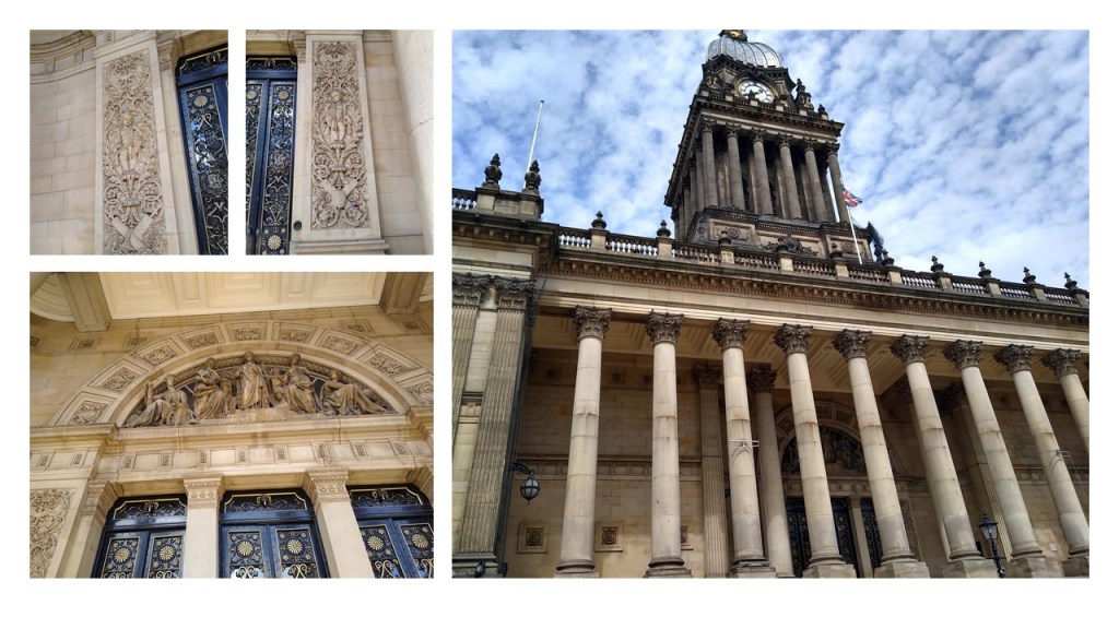
…and said that it is a popular venue for weddings and graduations…


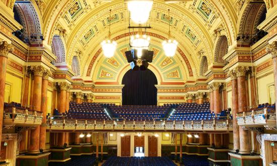
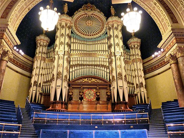
He mentioned that it contains an organ that is considered the biggest musical instrument in the World, with 6,600 pipes weighing 70 tons and 50 feet high!

He also included a photo of the Temple Mill in the Leeds Temple Works Complex,said have been built between 1838 and 1840.

A former flax-spinning mill, when it was completed it was considered to be one of the largest factories in the world, with 7,000 steam-powered spindles.

Next, I was contacted by someone with these photos he had taken in West Dundas, Ontario.

Dundas is a community in Hamilton, Ontario, and was formerly a town in its own right.

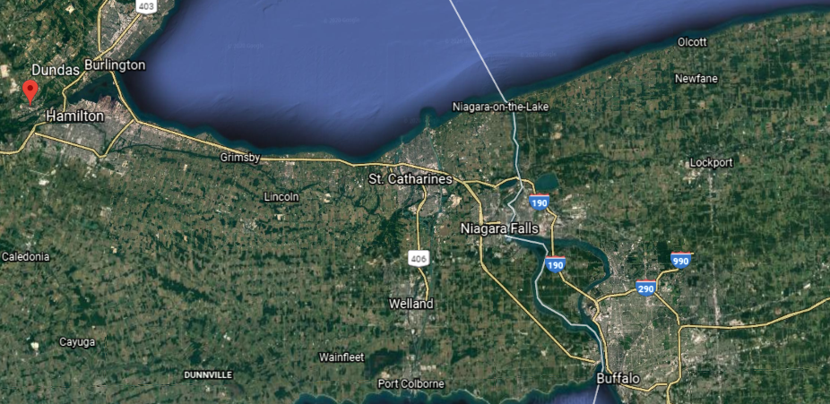
It is at the bottom of the Niagara Escarpment and on the western edge of Lake Ontario.

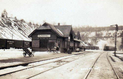
Known originally as “Coote’s Paradise,” the community that had settled here became known as Dundas in 1814, which was incorporated in 1847.

Its construction said to have been authorized in 1823, the Desjardins Canal opened in 1837, and was said to have greatly contributed to the development of the region, until the canal fell into disuse…

…when the Great Western Railway put its line through Dundas in 1853.

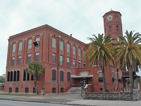
Another commenter directed my attention to the following places in Tampa:

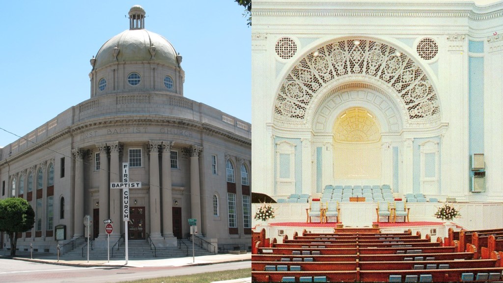
The congregation of the First Baptist Church of Tampa was said to have organized in 1859, and the church at its present-location built in 1923.

Old cigar factories in Tampa, including the Santaella…

…and the historic Pendes & Alvarez Cigar Factory.

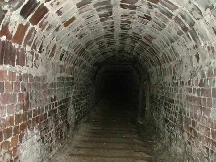
And Ybor City, a historic neighborhood in Tampa said to have been founded in the 1880s by cigar manufacturers…

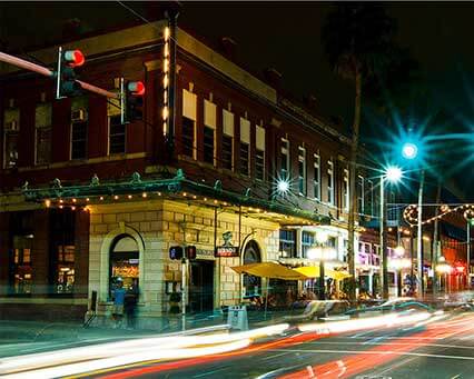
…known to have miles of tunnels running underneath it.

He also asked that I look into the catacombs of Paris, where millions of bones and skulls are neatly stacked underground in tunnels, and catacombs were said to have been created in an effort to eliminate the city’s overflowing cemeteries that was started in 1786.

The Paris Catacombs have been a concert venue since the 19th-century…

…and an Airbnb in the 21st-century.

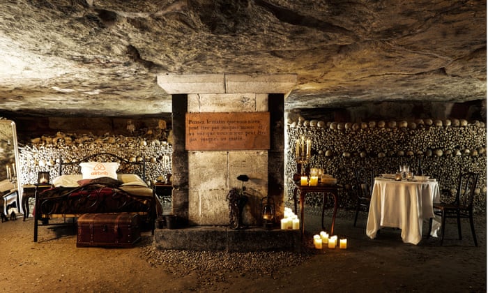
A truly bizarre place that I personally never want to visit, much less sleep in or go to a concert there!

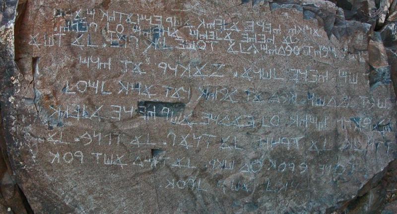
The last thing he asked me to look into was the Los Lunas Decalogue Stone, a large boulder on the side of Hidden Mountain near Los Lunas, about 35-miles south of Albuquerque.

It has an inscription said to be a mix of ancient Hebrew & Greek.

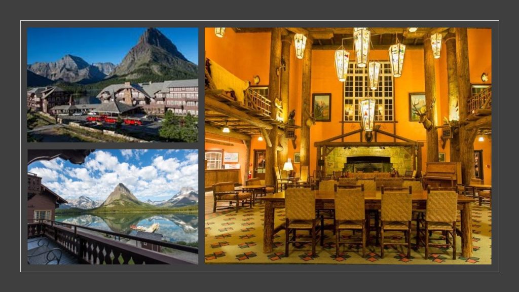
The last place I am going to take a look at from a commenter’s recommendation is Lake McDonald…

This image has an empty alt attribute; its file name is Lake-McDonald-Montana.jpg

…in Montana’s Glacier National Park.

The Going-to-the-Sun Road provides access to many locations and activities within the park…

…including the Lake McDonald Lodge, considered one of the finest examples in the nation of the Swiss-Chalet-Style of architecture, and was said to have been built in 1913.

We are told the mountains of Glacier National Park started forming 170-million years ago, when glaciers forced ancient rocks eastward up and over much younger rock strata.

That’s a beautiful old stone bridge on the Going-to-the-Sun Road!

I am going to end part 2 of this series here in Montana.

In part 3, instead of looking at places, I am going to be looking at other interesting topics, not necessarily places, that commenters have suggested.

Interesting Comments I have received – Part 1 Places

In this new series, I am going to highlight some of the places, concepts, and historical events that people have mentioned in the comments section of my blog and YouTube Channel.

The first part of the series is focused on physical locations that have been suggested by readers and viewers.

More and more what I am finding in my research is pointing to the Victorian Era as the start of the new historical reset timeline, following what I believe was a mud flood cataclysm that was deliberately caused by negative beings who sought absolute power and control over Humanity and the Earth.

After the mud flood, they dug enough infrastructure out of the mud with which to restart civilization, according to a plan these beings already had in mind.

I have already spoken of my belief in past posts that the Great Exhibition of the Works of Industry of All Nations was the official kick-off of the New World Order timeline…

…and held in the Crystal Palace in London, between May 1st and October 15th of 1851.

We are told that it took only 9-months to develop the Great Exhibition, from plans and organization, including the construction of the Crystal Palace itself to house the Exhibition.

Opened by Queen Victoria, the Great Exhibition of 1851 in the Crystal Palace has been characterized as a celebration of modern industrial technology and design.

It is important to note that Queen Victoria’s reign began on June 20th of 1837, and her reign has been described as a period of cultural, industrial, political, scientific, and military change within the United Kingdom, marked by a great expansion of the British Empire…

…lasting for almost 64-years,until her death on January 22nd of 1901.

So I chose the recommendation of the Balmoral Cairns in Scotland as my starting point for this post.

The Balmoral Castle on the Balmoral Estate has been one of the residences of the British Royal Family since 1852, at which time the castle and estate was purchased from the Farquason family by Prince Albert, Queen Victoria’s husband.

There are eleven, what are called “stone cairns,” erected on the Balmoral Estate to commemorate members of the British Royal Family and events in their lives, the majority of which were said to have been erected by Queen Victoria.

At this point, it is really important to get the definition of “cairn” and “pyramid” before I look at some of the “Balmoral Cairns” in Scotland.

A cairn is defined as a “mound or heap of rough stones built as a memorial or landmark on a hilltop or skyline.”

The following examples are identified as cairns:

The definition of a pyramid according to the Merriam-Webster Dictionary (established in 1828) is:

  1. “an ancient massive structure found especially in Egypt having typically a square ground plan, outside walls in the form of four triangles that meet in a point at the top, and inner sepuchral chambers.
  2. “A structure or object of similar form”
  3. “A polyhedron having for its base a polygon, and for faces, triangles with a common vertex.

This is a photo of the Great Pyramid of Giza in Egypt.

Now back to the “Balmoral Cairns.”

We are told that the largest of the “Balmoral Cairns,” shown here, was erected in memory of Queen Victoria’s husband, Prince Albert, after his death on December 14th of 1861.

It certainly looks like the definition of a pyramid!

Look at the all the lichen growing on Prince Albert’s Cairn!

Somewhere in the past I remember hearing that lichen grows very slowly, so I looked it up to be certain.

Other cairns on the Balmoral Estate include:

Princess Helena’s cairn, the fifth child of Victoria and Albert, said to have been erected to commemorate her marriage to the Marquis of Lorne in 1871…

…the cairn of Prince Leopold, the eighth child and youngest son of Victoria and Albert, erected in 1882 to commemorate his marriage.

Born in April of 1853, Prince Leopold was a hemophiliac who died in March of 1884, at the young age of 30.

While considered relatively rare in the general population, hemophilia is an inherited bleeding disorder in which the blood does not clot properly, and is prevalent in Europe’s royal families, thereby gaining the nickname “the royal disease,” with the hemophilia gene said to have passed from Queen Victoria to the ruling families of Russia, Spain, and Germany.

The presence of the hemophilia gene in Queen Victoria was said to have been caused by a spontaneous mutation, as she is considered the source of the disease in modern cases of hemophilia among her descendents.

This is Prince Arthur’s cairn, the seventh-child of Victoria and Albert, said to have been erected to mark his marriage in 1870.

In addition to other cairns marking events in the lives of Queen Victoria’s family, we are told that a cairn was constructed in 2012 on the Balmoral Estate to mark the Diamond Jubilee of Queen Elizabeth II in 2012.

While these last four of the “Balmoral Cairns” seem to have more of the appearance of what are called cairns than what can also be called Prince Albert’s Pyramid, the question becomes this:

Were the “Balmoral Cairns” built when they were said to have been built by who was said to have built them?

Or were they built by an ancient, advanced civilization of Master Builders missing from our collective awareness for purposes unknown to us in the present-day?

I am seeing notation of obelisks as well on the map I just showed of the Balmoral Estates, and one of them is another monument to Queen Victoria’s husband, the Prince-Consort Albert, said to have been erected in 1862, and photographed by George Washington Wilson…

2160360

…a pioneering Scottish photographer, who got his start as a portrait miniaturist in 1849, and switched to portrait photography in 1852, and received the contract to photograph the Royal Family of Queen Victoria and Prince Albert.

What role do photographers and artists play in programming our perception away from what is actually in the environment into seeing only the preferred narrative?

From what I am seeing, photographers and artists play a substantial role in this process of reinventing history.

This is a photo of George Washington Wilson’s of Prince’s Street in Edinburgh, circa 1860, with the contrast of massive, stately columned architecture, cobbled streets and horse-and-buggies in the foreground, and Calton Hill in the background…

…with a view of what is called the Nelson Monument and the National Monument of Scotland.

The Nelson Monument was said to have been built on the highest point on Calton Hill between 1807 to 1816 to commemorate the British Vice-Admiral Horatio Nelson’s victory over the French and Spanish fleets at the Battle of Trafalgar in 1805.

The National Monument of Scotland is a national memorial to the Scottish soldiers and sailors who died fighting in the Napoleonic Wars, which took place between 1803 and 1815.

With a design by Charles Robert Cockerell and William Henry Playfair based on the Parthenon in Athens, construction was said to have started in 1826, and that it was left unfinished in 1829 due to lack of funds.

It is interesting to note that in this view of Calton Hill, you see the Nelson Monument perfectly-framed through the center of the front colonnade of the National Monument.

Another commenter from Scotland mentioned Glasgow in particular.

Glasgow called itself the second city of the British Empire, passing Edinburgh in population by 1821, and that in the 1830s it started to become a major industrial center.

The University of Glasgow, established in 1451, is one of Scotland’s four Ancient Universities, along with Edinburgh, Aberdeen, and St. Andrews.

Universities that receive the designation “Ancient Universities” in Great Britain were founded before the year 1600, and considered among the oldest existing universities in the world.

For some reason, I have consistently found that the word “Ancient” is used to describe places that are not associated with “the far distant past” that the word ancient is defined as.

The oldest, currently functional, universities in the world are in North Africa.

The Al-Karaouine University in Fez, Morocco, dates to 859 AD.

Interesting to note that the archway shown here at the University in Fez on the left frames the larger building in much the same way that the archway does here at the University of Oxford in England on the right.

The University of Oxford was established in 1096, and is the oldest of the Ancient Universities of Great Britain.

Also, the colonnaded courtyard at the University in Fez in Morocco on the left looks very similar in appearance to the courtyard in the Alhambra in Granada, Spain on the right, which is architecture that the Moors are actually given credit for.

Tunisia’s still-functioning University in Kairouan is said to date from between 800 AD and 909 AD.

Back to the University of Glasgow.

James Watt was a mathematical instrument-maker at the University of Glasgow before he became interested in the technology of steam engines.

His improvement of the steam engine invented by Thomas Newcomen in 1712…

…with his Watt steam engine in 1776 was said to have been crucial to the changes brought by the Industrial Revolution in Great Britain and the rest of the world.

You know, I can’t help but wonder about the origin of steam engine technology when I see examples of the big gear-wheel showing on the right, compared with the Watt Steam Engine on the left, at what is called a sugar mill in Belize with what appears to be an ancient tree firmly rooted inside the structure.

Adam Smith was a student at the University of Glasgow.

He was a key figure of the Scottish Enlightenment, a period during the late 18th- and early 19th-centuries during which time there was an outpouring of Scottish intellectual and scientific accomplishments.

Known as “The Father of Capitalism” and “The Father of Economics,” Adam Smith is best known for his famous work on modern economics, the title of which is commonly abbreviated to “The Wealth of Nations.”

“The Wealth of Nations” was first published in 1776, the same year that James Watt brought forward his improved steam engine and the American Colonies declared their independence.

There was even a student who studied Scottish Enlightenment thinkers at the Universities of Glasgow, Edinburgh, and Aberdeen without graduating from college in Scotland, who was a signatory of the American Declaration of Independence, and a major force in drafting the United States Constitution.

His name was James Wilson, a Scotsman who moved to Philadelphia in 1765 when it was still British America.

Upon his arrival in Philadelphia, he petitioned for, and received, his Master of Arts degree where he was tutoring, then teaching, at the Academy and College of Philadelphia, and later received the honorary doctor of law degree of LL.D from the same institution.

He was elected to the Continental College, and was a delegate to the 1787 Philadelphia Convention.

There, he served as one of five-members of the “Committee of Detail,” which produced the first draft of the U. S. Constitution.

In 1789, he became one of the first Justices of the U. S. Supreme Court, and in August of 1798, became the first Supreme Court Justice to die after suffering a stroke.

Two more things about Glasgow before I move on.

The development of places in Glasgow like George Square, named after King George III, was said to have started in the 1820s…

…and we are told that by the 1880s, fine classical buildings, described as statements of power, wealth and confidence, started appearing along fine new streets.

Also, in the same time period in contrast with the proud classical buildings that started to appear in Glasgow, there was a population explosion from natural increase, migration, and boundary extensions as surrounding “burghs” were annexed to Glasgow.

This led to a problem with urban squalor in Glasgow, and public health crises with epidemics of cholera, typhus, and typhoid.

This picture was taken by Thomas Annan in Glasgow’s Saltmarket in 1868.

The last thing I want to bring your attention to that I found in Glasgow is Teacher’s Scotch Whiskey.

William Teacher established his whiskey product in 1830, and by the 1850s, began to open public houses known as “dram shops,” in which customers could drink whiskey.

The main attraction of the “dram shops” was their reputation for providing customers with high quality whiskey.

Jack Daniel’s is a brand of Tennessee Whiskey, and the top-selling American whiskey in the world.

Jack Daniel was said to have been born either in 1849 or 1850, and in the course of the events of his life, he opened his whiskey distillery in Lynchburg, Tennessee, in 1884.

Alcohol is classified as a Central Nervous System depressant, meaning that it slows down brain function and neural activity.

Alcohol proof is the measure of the content of ethanol in an alcoholic beverage.

We’re talking 70-proof and over for the different products made by the Jack Daniel’s Distillery.

There are many other examples of the heavy promotion of drinking alcohol and the use of other addictive substances, like smoking opium in opium dens, that were taking place during this same time period.

I have definitely come to believe that the focus was primarily on the intentional creation and promotion of addictions to keep Humanity stuck in a lower, diminished-level of consciousness, and one way of keeping people from waking up to what has actually taken place here.

An addiction is a compulsive, chronic, physiological or psychological need for a habit-forming substance, behavior, or activity having harmful effects.

The next place I am going to look into from a comment is the isle of Frisland, also known as Frislant, the specific awareness of which is new to me.

The isle of Frisland appeared on virtually all maps of the North Atlantic between the 1560s through the 1660s.

Nonetheless, it has come down to our historical time period as a “phantom island,” meaning that it was removed from later maps as it was proven not to exist.

This is Gerardus Mercator’s depiction of Frisland that a appears on a map that was published in 1606 by Jocodus Hondius, a few years after his death in 1594, in the lower left corner between Iceland to the northeast, and Greenland to the northwest…

…which I found on the National Geographic website seriously doubting Frisland’s existence.

The Zeno map that the article is referring to was said to have been first published in a book 1558, after having been found in the family home, by a direct descendent of the Zeno Brothers, Nicolo and Antonio Zeno, Venetian noblemen famous during the Renaissance for exploring the Arctic in the 1390s with an explorer-prince named Zichmni, a Lord of the islands off the southern coast of Frisland.

We are told that the existence of the isle of Frisland as identified by the Zeno Brothers was given credibility by in manuscript maps in the 1560s by the Genoan Maggiolo family, and accepted by leading cartographers and publishers of the 1500s and 1600s, Mercator and Hondius, even though the charting of Frisland on the Zeno map was later deemed incorrect.

I have my suspicions from my research about the role of cartographers, like Gerardus Mercator, in altering our perception of how we view the world in which we live as contrasted with how the Ancients viewed the world.

This is the Catalan Atlas, which is said to date from 1375, and considered the height of Medieval map work and the most important map of the medieval period in the Catalan language.

Each section of the atlas includes the mapping of the geometric lines and shapes that you see depicted here.

It would seem that the Earth’s grid-lines started to disappear from maps in the 1500s, as Gerardus Mercator, a Flemish geographer, cartographer and cosmographer…

…published a world map in 1569 that is considered to be the first where sailing courses on the sphere were mapped to the plane map, allowing for a “correction of the chart to be more useful for sailors.”

Here is a close-up section of the 1569 map showing the depiction of straight ley-lines in the seas…

…but not on land and sea as were present on the flat projections of the Catalan Atlas.

Not only that, Mercator was also a globe-maker, like this one from 1541.

So Mercator was said to have made a revolutionary flat projection map that corrected the chart for sailors…and the earth as a globe as well?

I have to ask the question – is this information telling us something about what was actually going on here?

While the focus of my research is not about proving or disproving flat earth versus planet, nor am I directed by it, I do find this information about older maps on flat planes with ley-lines to be extremely interesting and noteworthy.

Back to the isle of Frisland.

The isle of Frisland has been identifed with a lost ancient land named Hyberborea by the Greeks, considered to have been in the general vicinity of Greenland; identified as Atland by the Frisians, a Germanic ethnic group indigenous to coastal parts of the Netherlands and northwestern Germany; and, and again, identifed as “Frisland” by Mercator.

In Greek mythology, Hyperborea was a fabulous world of eternal spring located in the far north, beyond the home of the north wind. 

Hyperboreans were giants, with blessed and long lives untouched by war, hard work, old age and disease.

At any rate, there are some interesting similarities between the coastline of the now-called phantom isle of Frisland in Mercator’s depiction on the left, and this depiction I found of the island of Hyperborea on the right.

The Oera Linda Bok, or Book, is a manuscript that is written in Old Frisian, and said to provide historical, mythological, and religious themes of remote antiquity.

Like the doubt about the isle of Frisland itself, the Oera Linda Book is widely considered a hoax.

The manuscript first came into public awareness, we are told, in the 1860s.

The book is still occasionally brought up in esotericism and Atlantis literature.

I received a comment from someone who lives in St. Louis, where there are industries for beer, like the castle-looking Anheuser-Busch Brewery…

…the Aerospace industry, like Boeing…

…and starting in 1942, St. Louis was an integral part of the Manhattan Project, for which Mallinckrodt Chemical Works processed a majority of the uranium needed for the first atomic bomb in their plant north of downtown St. Louis…

…and which continued to process uranium until 1957.

When the chemical company ran out of space to store its nuclear waste on-site, nuclear waste was dumped in places like a site near the St. Louis airport…

…and the West Lake Landfill, a Superfund clean-up site.

Needless to say, St. Louis has a nuclear waste problem.

There was an electric streetcar system in St. Louis that ran from the mid-1800s through the early 1960s, starting with horse-drawn streetcars in the late 1850s.

This is a map depicting the streetcar lines in St. Louis by 1884.

…with the first cable-driven streetcars in 1886, and the first electrified streetcars came to St. Louis in 1889.

The Forest Park Highlands Amusement Park opened as a beer garden in St. Louis in 1896.

…and was on a trolley line.

On July 19th of 1963, all of the Forest Park Highlands Amusement Park was destroyed by fire except for the swimming pool and the frame of the roller coaster.

With regards to streetcars, starting in the early 1930s through the 1960s, the St. Louis Public Service ended all streetcar service, as well as other regional streetcar operators.

The last day of St. Louis streetcar operation was May 21st of 1966.

I will end this post with the Gateway Arch & National Park in St. Louis, the world’s tallest arch at 630-feet, or 192-meters, high, which from one direction very neatly frames…

…the Old St. Louis Courthouse, said to have been built as a Federal-style courthouse, with its construction starting in 1816 and ending in 1864 (which would have been during the American Civil War).

The Old Courthouse is part of the Gateway Arch National Park today.

This is a view of the rotunda inside the courthouse.

From the other direction, the Gateway Arch frames…

…its underground Visitors’ Center…

…which houses offices, mechanical rooms, and waiting areas for the Arch Trams…

…and the Museum of Westward Expansion.

I remember learning about “Manifest Destiny” in secondary school history (I don’t remember if it was Junior High or High School).

Manifest Destiny was a widely held, what is described as “imperialist cultural belief” in the U. S. in the 19th-century that American settlers were destined to expand across North America.

What we are not taught about was the highly advanced, ancient civilization that had already existed in North America.

We are told the Gateway Arch was constructed between 1963 and 1965, at a cost of $13 million at the time, which equalled the value of $80.6 million in 2018, after a history of fundraising difficulties, delays, and lawsuits.

I wonder about the truth about a lot of things that we are told in this historical narrative.

In my next post, I will continue to look into places that have been suggested by commenters.

I already have a long list of places to look into, so if you have places you want to suggest to me, it may have to go on a waiting list for a future post. It just depends. My project to-do list is growing :).

The Channel Islands & the Other Islands of the English Channel – Part 3 The Isles of Portland and Wight & the Iles Chausey

This is the last part of a three-part series on the islands of the English Channel.

In the first-part of the series, I took a close look at the features and history of Alderney Island in the Channel Islands, which are British Crown Dependencies.

In the second-part of the series, I looked at the same on the other main Channel Islands of Jersey, Guernsey, Herm, and Sark.

In this part of the series, I am visiting the Isle of Portland, the Isle of Wight, and the French Iles Chausey in the English Channel, all of which are considered separate from the Channel Islands I just mentioned.

The Isle of Portland is what is called a tied-island in the English Channel, forming the southernmost point in England’s Dorset County.

It is 5-miles, or 8-kilometers, south of the resort town of Weymouth.

A barrier beach called Chesil Beach connects it to the mainland of England.

I found a similar-looking place when I was researching an circle alignment that begins, and ends, in Merida, Mexico, that goes through Wrangel Island that is located in the Arctic Sea between the Siberian Sea and the Chukchi Sea off the coast of northern Russia.

It is called Cape Blossom on Wrangel Island.

They tell us this is natural, but I really wonder about that!

There are similar, shaped-shorelines all over the Earth!

Portland Harbor, located between the Isle of Portland and Weymouth, is considered one of the largest man-made harbors in the world.

We are told that the Admiralty constructed the harbor, as a facility for the Royal Navy, starting in 1849 and completing it in 1872.

We are told that prior to the construction of the Harbor, in the 16th-century, King Henry VIII built Portland Castle on the Isle of Portland between 1539 and 1541…

…and Sandsfoot Castle in Weymouth to defend the original harbor here against French and Spanish invaders, and which had been used as an anchorage for ships for centuries.

We are told construction of the breakwaters of Portland Harbor started in 1849, with Prince Albert, husband of Queen Victoria, laying the foundation stone on June 25th of that year, and were completed in 1872.

Still functioning today as a prison, HM Prison Portland was said to have been established in 1848 to provide convict labor to quarry the stone needed to construct the breakwaters and harbor defenses.

We are told that the tremendous amount of stone needed for all of this construction was quarried by convicts starting in 1849 in the Admiralty Quarry…

…and that railways were built to accommodate the stone-quarrying process.

We are told the Admiralty Incline Railway was built in 1848 and 1849 in order to transport stone from the quarries to the harbor for the construction activity, but when the Admiralty Quarries completely closed in 1936, the incline railway’s tracks were removed, and the incline railway was turned into a road leading into the naval dockyard, known today as Incline Road.

Before the Admiralty Incline Railway’s removal, it would have looked like the currently-operating Lookout Mountain Incline Railway in Chattanooga, Tennessee.

Also known as a funicular railway, it is a transportation system that uses cable-driven cars to connect points along a steep incline, using two counterbalanced cars connected to opposite ends of the same cable.

As a matter of fact, the small isle of Portland has quite a history with its railways…all of which no longer exist.

The Merchant’s Railway, known at the time as the Portland Railway, was said to be the earliest railway in Dorset, opening in 1826 as a horse-drawn first tramway, then incline railway, in order to transport heavy, quarried stone from the northern region of Tophill to Castletown on Portland Harbor, which is the location of Henry VIII’s Portland Castle.

In 1860, we are told, the horses were replaced with cables.

The rails of the Merchant’s Railway were finally removed for scrap in 1956, after the railway had fallen into disuse in 1939 with the increasing use of modern transport methods.

The Portland Branch Railway consisted of two railways, operated by different companies although working as a continuous line.

The Weymouth and Portland Railway was said to have been constructed between 1862 and 1864, and opening in 1865, connecting Weymouth and Easton on Portland.

We are told the construction of the Easton and Church Hope Railway started in 1888, and opened to passenger traffic in September of 1902.

The Isle of Portland is a really good example of what I believe happened as I have put forth in past posts: the ancient, advanced Moorish civilization engineered all of the Earth’s rail infrastructure; it was wiped out by a deliberately-caused cataclysm involving a flood of mud; the negative beings responsible for creating the cataclysm managed to dig out enough infrastructure to re-start civilization, officially kicked-off at London’s Crystal Palace Exhibition in 1851 and presided over by Queen Victoria; horses and mules were used to pull trains and streetcars until a replacement technology was available to power them; and most public, passenger-rail, street-car systems, at one time were worldwide, were retired and removed themselves after the development of gasoline-powered private and mass transit vehicles, which subsequently generated massive wealth concentrated in the hands of a very few.

I have done a considerable amount of research on correlations between the physical infrastructure of railroads, canals & star forts found all over the world.

You can find more detailed information about this subject in one place is my blog post of the same name.

At the end of this blog post, I talk about this photo, which had the caption of “Electric trains operating in the Gare d’Orsay, circa 1900.”

The Gare d’Orsay railroad terminal was said to have opened in Paris in 1900.

This led me to look up the definition of terminal, for which there are two nouns:

  1. The end of a railroad or other transportation route, or a station at such a point
  2. A point of connection for closing an electric circuit

I have come the conclusion through my research that the Master Builders of the Ancient & Advanced Civilization built the physical infrastructure of the planetary grid system, including all transportation systems, which generated and used the free energy that powered this civilization worldwide.

I am talking about a sophisticated electrical circuitry system, of which star forts were a big part of as well.

Along those lines, there are a number star forts on the Isle of Portland as well, like Verne Citadel, located on the highest point in Portland, was said to have been built as Portland’s main defensive fortification between 1857 and 1861.

In 1949, the citadel was turned into a prison, and continues to be used in that capacity today.

With examples like “HM Prison The Verne,” I have come to believe that the infrastructure of the original advanced civilization which was engineered to benefit life was reverse-engineered into human control structures, including, but not limited to, schools like El Paso High School in Texas…

…theaters, like the old Akdar Movie Theater in Tulsa, Oklahoma, said to have been built around 1922 and demolished in the 1970s…

…and banks, like the Old Bank of Toronto.

Located close to Verne Citadel, the Verne High Angle Battery was said to have been built in 1892 to protect Portland Harbor, and a scheduled monument, which is a nationally important archeological site or historic building given protection against unauthorized change, and is protected under the Ancient Monuments and Archeological Areas Act of 1979.

A so-called Victorian era construction protected under an act pertaining to ancient monuments and archeological sites?

My understanding is that the word ancient pertains to the very distant past and not something that would have been built less than 200 years ago.

The tracks seen at the battery were said to have been installed to move missiles.

This battery has become a tourist attraction.

Interestingly, there is a tunnel system at the Verne High Angle Battery that also has tracks for rails.

It was said to have been decommissioned as an artillery battery in 1906, only 14-years after it was constructed, due to the advent of smaller craft like torpedo boats.

Apparently, the “high angle” at which the guns were placed were only effective with larger naval ships.

The East Weare Batteries are called five former gun batteries said to have been constructed starting in 1864, designated by letters A – E, and, we are told, built to protect Portland Harbor.

Yet E Battery became a scheduled monument in 1973…

…and like the Verne High Angle Battery, is protected under the Ancient Monuments and Archeological Areas Act of 1979.

The East Weare batteries of A & B are referred to by locals and urban explorers as the “Forbidden City.”

Then there is Battery C…

…and Battery D.

There is officially no public access to any of the East Weare batteries.

What is the definition of the word “battery”?

One definition is a device that produces electricity that may have several primary or secondary cells arranged in parallel or series, as well as a battery source of energy which provides a push, or a voltage, of energy to get the current flowing in a circuit…

…and that this is the reason there are so many batteries and star forts that are paired together, or even the reason clusters of them are found in the same location.

The second meaning of the word battery is the heavy fire of artillery to saturate an area rather than hit a specific target.

All of these so-called artillery batteries originally functioned as circuitry and batteries for the purpose of producing electricity and/or some form of free energy to power the planetary grid system and the original ancient, advanced civilization.

There is a third definition of battery, which is an assault in which the assailant makes physical contact.

Does the third definition apply here?

I think so, in the sense that a major assault has been committed against the Human Race by all that has taken place here without our knowledge and consent, and removing all of this critical information from our awareness about the True History of Humanity, and so, so much more.

Other so-called military forts on the Isle of Portland include:

The Inner Pierhead Fort, located on the end of the inner breakwater next to the former dockyard of the naval base that was here, and said to have been built between 1859 and 1862…

…the Portland Breakwater Fort, said to have been built between 1868 and 1875, on the outer breakwater…

…Nothe Fort in Weymouth, said to have been built as a coastal defense between 1860 and 1872…

…Upton Battery on the outskirts of Weymouth and northeast of Portland Harbor, described as a coastal artillery battery said to have been built between 1901 and 1903, and decommissioned in 1956…

…and Blacknor Fort, located on the western end of Portland overlooking Lyme Bay, and said to have been built between 1900 and 1902, and also decommissioned in 1956.

The last place on the Isle of Portland that I would like to visit is called the Portland Bill.

The Portland Bill is the southernmost point of England’s Dorset County, and is a narrow promontory at the southern end of the Isle of Portland.

Features of the Portland Bill include:

Pulpit Rock, so-named for the appearance of a bible leaning on a pulpit, which to me looks like very ancient masonry, especially with the rectangular- shape and straight-edges of the “bible” among other things I see here.

We are told that as a “quarrying relic,” Pulpit Rock is similar to Nicodemus Knob, a pillar within the former Admiralty Quarries, mentioned earlier as the quarry we are told that 6 million tons of stone were removed between 1849 and 1872 to build the breakwaters and harbor defenses for Portland Harbor.

The 22-foot, or 7-meter, high Trinity Hill Obelisk was said to have been constructed in 1844 as a daymark, a daytime navigational marker to warn ships off the coast of Portland Bill.

Note the presence of old masonry blocks beside the obelisk.

We are not taught about the advanced, ancient civilization, so we don’t see these stones as anything other than natural when in actuality they have been worked and shaped.

The Portland Bill Lighthouse is located right next to the Trinity House Obelisk.

The Portland Bill Lighthouse was said to have been built between 1903 and 1905…

…to replace two earlier lighthouses on Portland Bill – the Old Higher Lighthouse…

…and the Old Lower Lighthouse, both said to have been originally built in 1716, re-built in 1869…

…and decommissioned after the Portland Bill Lighthouse became operational after it was completed in 1905.

Like always, there is much more to find on the Isle of Portland, but next I am going to visit the Isle of Wight.

I first learned about the Isle of Wight several years ago, before I started doing my own research, in a book I read in 2013 by Gary Biltcliffe called the “The Belinus Line – The Spine of Albion.” 

He and his partner Carolyn uncovered a North-South line that connected seats of power, running from the Isle of Wight at the bottom of England to Faraid Head at the tip of Scotland.

Over the whole length of the Belinus Line, which is also in alignment with the Cygnus constellation, they dowsed the Belinus (male) and Elen (female) dragon lines of energy that criss-crossed 33 nodal points along the way, the same number as that of the number of vertebrae in the human spine.

And…as Gary pointed out in the book…the Isle of Wight roughly has a the shape of the spine’s coccyx bone.

The book contained a picture of Shap Abbey in Shap, England, which immediately brought back a memory of seeing the same place when I drove past it on a trip to England in 2010.

I subsequently realized that I had travelled up the Spine of Albion synchronistically on my trip, visiting places on the alignment and dragon lines mentioned in the book, unbeknownst to myself.

One of the many reasons I feel deeply connected to all of the information I am researching and sharing.

The Isle of Wight is the largest island in England, and its own ceremonial county.

It is separated from the English mainland by a 20-mile, or 32-kilometer, long strait known as the Solent.

The Hurst Spit projects into the Solent Narrows, and is the location of…

…the Hurst Castle.

Like Portland Castle, the Hurst Castle was said to have been built by King Henry VIII in the 16th-century, during the years between 1541 and 1544.

It was said to have been part of a coastal protection program against invasion from France, Spain, and the Holy Roman Empire.

We are told that the Palmerston Forts on the Isle of Wight were a group of forts and associated structures that were built during the Victorian Era in response to a perceived threat of French invasion.

They are called the Palmerston Forts due to their association with Lord Palmerston, the Prime Minister during that time who was said to have promoted the idea.

There were approximately 20 of these Palmerston structures along the west and east coast of the Isle of Wight.

I am going to just look into a few of them.

Fort Victoria was said to have been built in the 1850s to guard the Solent.

It is located on the Isle of Wight in a position opposite from Hurst Castle on the mainland’s Hurst Spit…

…and overlooks the whole of the Needles Passage, the most westerly point of the Isle of Wight.

More on The Needles shortly.

We are told that Fort Victoria’s military use came to an end in 1962, after having been a landing and storage point during both World Wars, and that the rear barracks blocks were demolished in 1969 to provide material for things like sea defenses.

Today, the fort is part of Fort Victoria Country Park.

Fort Albert was said to have been constructed between 1853 and 1856 to defend Needles Passage from the possibility of French attack coming from Emperor Napoleon III.

Fort Albert was said to have been rendered obsolete only two years later, in 1858, with the development of armored ships.

Today it is a privately-owned luxury apartment complex.

The Needles are described as a row of three chalk stacks off the Isle of Wight’s western extremity…

…and so-named because of the former Needle-like pillar called “Lot’s Wife,” which was said to have collapsed in a storm in 1764.

This is an illustration of the Needles which includes “Lot’s Wife” circa 1759.

The Needles Lighthouse, standing 109-feet, or 33-meters, tall on the outermost of the Chalk Pillars, was said to have been built out of granite blocks in 1859 for Trinity House, the official authority for lighthouses England, Wales, the Channel Islands, and Gibraltar.

I find it interesting that the description in this photo says that the lighthouse “is now flat-topped for helicopters to land.”

It’s an active lighthouse, and apparently needed under-pinning work in 2010 to keep it from falling into the sea.

What is described as the world’s first long-distance radio signal was sent by Marconi from Alum Bay beside the Needles in the year 1897.

I wonder what it was about this location that influenced his decision to do his work on wireless communication here.

There is also a popular attraction called the Needles Chairlift, running from the top of the Alum Cliffs to the beach of Alum Bay below, with a great view of the Needles in the distance.

I just found one answer to my question about what influenced Marconi’s decision to do his wireless communication work here – Alum Bay sand includes extremely pure white silica, an important component for enhancing radio frequency transmission.

There are two so-called Palmerston Forts at the Needles.

The Old Needles Battery is situated on a chalk cliff located right above the chalk pillars.

It was said to have been built between 1861 and 1863 as a coastal defense against French Invasion.

The Old Needles Battery has a tunnel leading to…

…its searchlight emplacement…

…in linear alignment with the Needles Lighthouse.

I would love to know exactly how they functioned together in the Earth’s original grid system!

All the Earth’s new controllers needed to do was stick a plaque on what looks to be an old searchlight naming contemporary builders, and what I believe to have been a common practice on infrastructure all over the Earth to hide Earth’s True History.

The Needles New Battery was said to have been completed in 1895, higher up on the same cliff, and said to have been constructed because of concerns about subsidence problems with the old battery and concussion from firing the batteries guns causing the cliffs to crumble.

I would like to briefly mention an isle I was not previously aware of until I started researching the Isle of Wight for this blog post.

The Isle of Purbeck is located between the Isle of Portland and the Isle of Wight.

Though named an isle, it is called a peninsula as it is bordered by water on three sides.

The Isle of Purbeck has significant deposits of what is known as Purbeck Ball Clay.

Ball clay has extensive industrial uses, from tableware, to wall-and-floor tiles, to spark plugs, to hoses, to pharmaceuticals, to kilns.

Large-scale commercial extractions of the ball clay was said to have begun in the middle of the 18th-century, with large quantities ordered in 1771 by Josiah Wedgwood, the English potter and founder of the Wedgwood pottery company who became the world’s first tycoon…

…leading to the construction, we are told, of Dorset’s first railroad in 1806, known as the Middlebere Plateway, and described as a horse-drawn tramway.

This is where the Middlebere Plateway was once-upon-a-time, where it cut across Hartland Moor.

As I find in many places, the memory of the original Moorish people is retained here in the name of the place.

The etiology of the word Moor goes back to Ancient Mu. Mu’ur = Moor, and the ancient, advanced Moorish civilization was world-wide and comprised of many Empires within One Civilization – Tartaria, Barbaria, Washitaw, Mughal, to name a few.

The cliffs on the Isle of Purbeck are considered among the most spectacular in England…

…and its landforms include the Durdle Door, which interestingly aligns with the solstice.

The last place I am going to look at are the French Iles Chausey, the largest island group in Europe.

The Iles Chausey are located in the Bay of Mont Michel, and like with many places I have looked at in this series, experiences a high-range between high-tide and low-tide every day…

…with Mont St. Michel being a tidal island, which I have found throughout the Channel Island.

The Iles Chausey are known for rocky protuberances that resemble something, like Elephant Rock…

In case you might think this resemblance is a work of nature…

…Check out this Elephant Rock on one of Iceland’s small islands.

Other named rocky protuberances in the Iles Chausey include “The Monks”…

…and “The Artichoke.”

Grande Ile is the largest of the Iles Chausey, at about 1-mile, or 1.5-kilometers, long, and less than a half-mile, or .5-kilometers wide, and the only inhabited island…

…where we find the Grand Ile lighthouse, said to have been built in 1847…

…with the nearby Forteresse des Matignon, said to have been constructed in 1559 as a quadrangular fort, with cellars, bakery, and a cattle shed.

Another fort is Le Chateau Renault, the present fort of which was said to have been constructed in 1859 on the order of French Emperor Napoleon III, and completed in 1866.

It became known as the Chateau Renault after the automobile engineer Louis Renault purchased it 1922 and restored it by 1924.

La Semaphore of Grand Ile is a lighthouse on the highest point of Grand Ile, and said to have been built in 1867 and closed down in 1939.

This is called La Pyramide on Grand Ile…

…and it still stands today.

I am going to end this series here.

It is clear to me that the islands of the English Channel were a very powerful and significant place on the Earth’s grid system with all of the physical infrastructure found on these small islands.

I was drawn into looking at this part of the world because I saw a picture of the small Alderney Island in the Channel Islands having a large number of star forts.

And when I look around this region, I find all of the components of the original ancient advanced civilization, as well as the means by which its existence was covered up by the construction of a new false historical narrative and in many cases the active deconstruction of the original infrastructure.

In my next post, I am going to be researching interesting places around the world that people have left me comments about with which to tie into the bigger picture about what I am talking about with regards to the Ancient, Advanced Moorish Civilization, the original timeline of Humanity’s very positive evolutionary course before our timeline was hijacked by beings with a negative agenda for Humanity.