
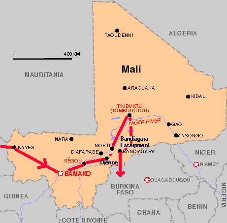
In my last post, this new series started in the ancient city of Algiers in Algeria, and tracked what is found on the alignment across the Atlas Mountains of Algeria, ending in the Tuareg city of Reggane in Algeria.
I indicated that I would be picking up the alignment at El Guettara in Mali because it was on my globe when I did the initial work of finding the alignment in 2016…
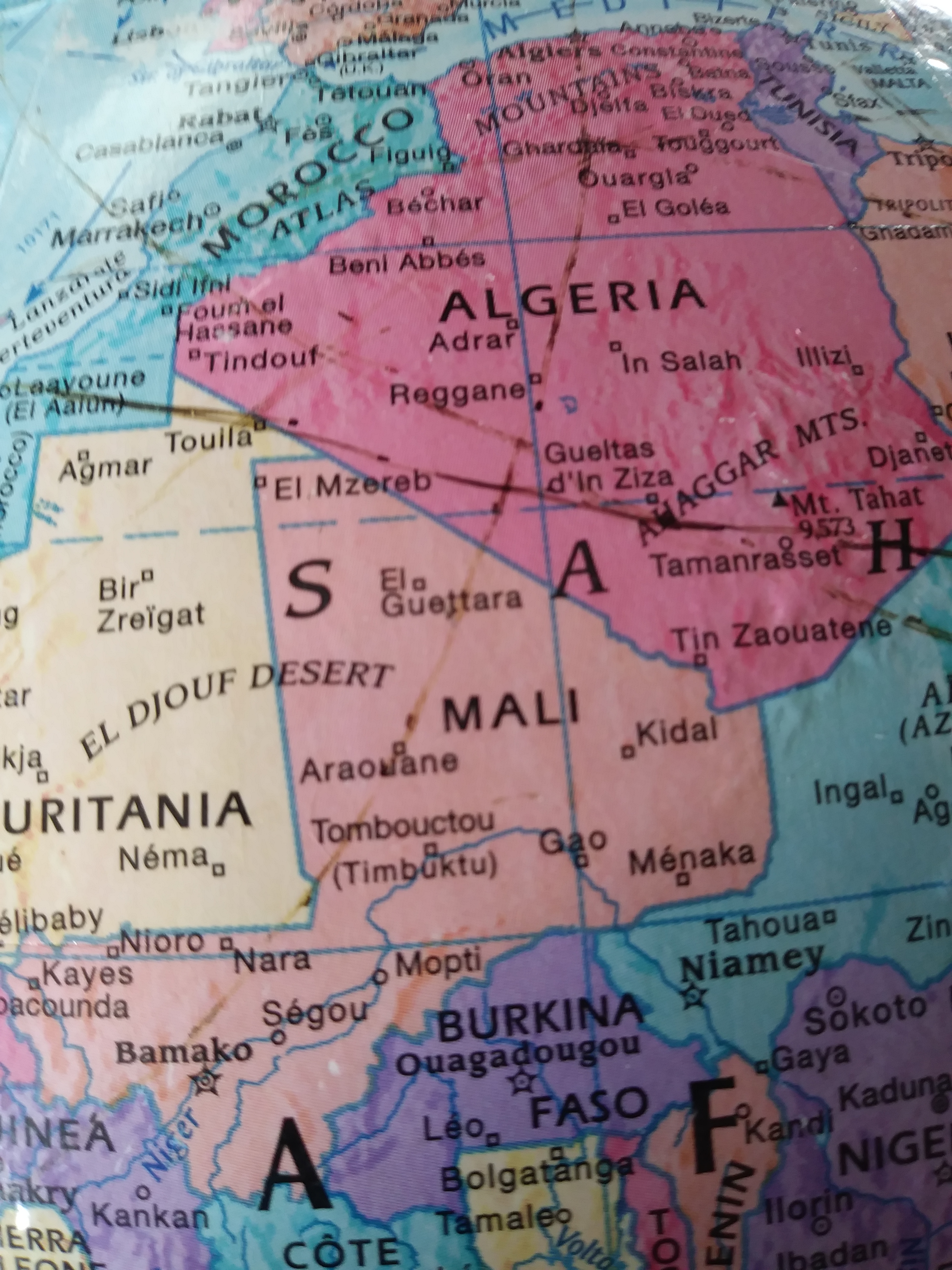
When I started to do the research, however, very, very little pops up about it.
I can’t find a map on the internet of Mali now that even shows El Guettara. So I don’t know what happened to it.
El Guettara is referenced in some internet articles. One said that it is one of the hottest places in the world, as is this whole region of Mali and Algeria in West Africa. Reggane in Algeria is included in that designation as well.
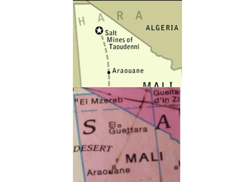
So I will start at the next place I have on my list, and which is directly on this alignment.
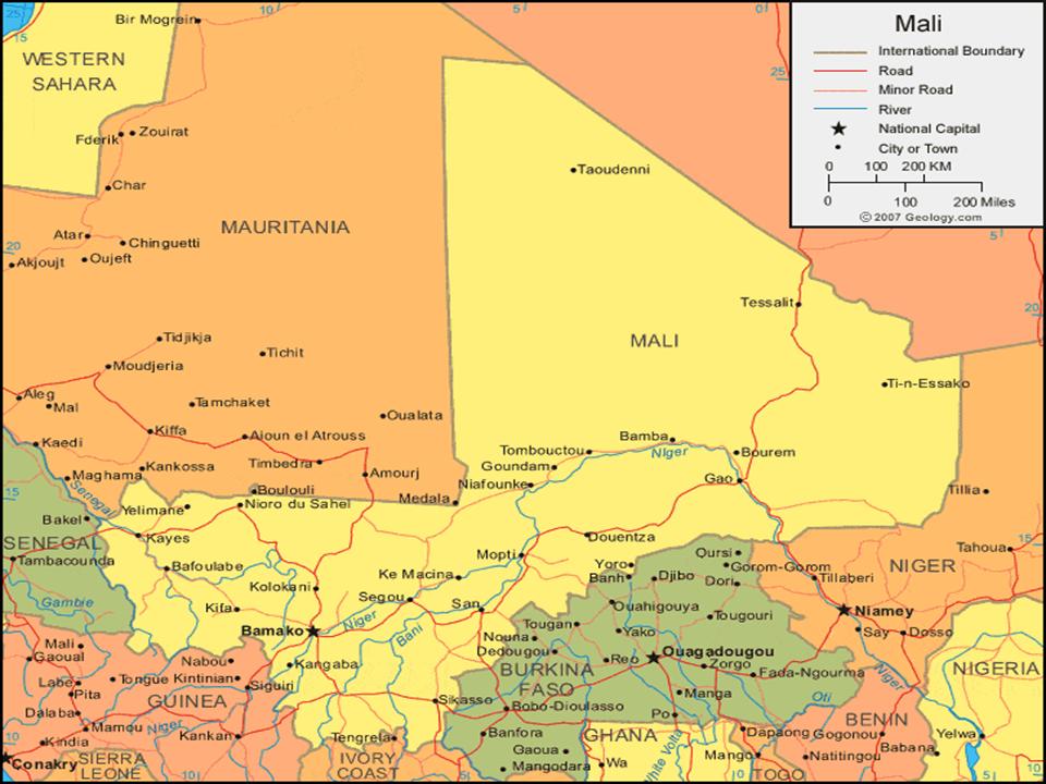
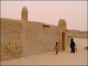
It is called Araouane, or El Arawan, in the Taoudenit Region of Mali.
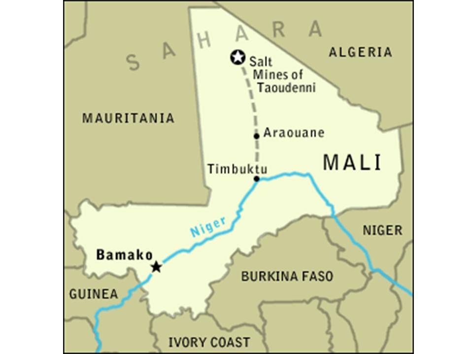
It is located 150 miles north, or 234 kilometers, of Timbuktu.
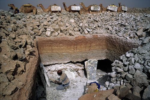
In the present day, it only services caravan trade between Timbuktu and the Salt Mines of Taoudenni in Northern Mali.
Comparing the globe and map, it looks like the salt mines could be located at or near where El Guettara was, but I am still not finding confirmation. Curious as to why this information is not available.
We are told in earlier centuries, Araoune was an important entrepot on the Trans-Saharan Caravan routes pictured here, meaning it served as an import and export trading post.
Today it is a small village of about 45 families.
It has definitely had better days, and moving further along this alignment I will bring forward Mali’s glorious past.
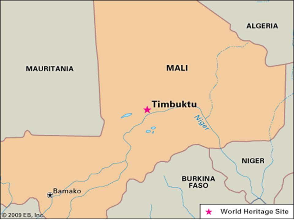
Timbuktu, almost directly south of Araouane, is not directly on the alignment.
It is situated on the Niger River. It is the capital of the Timbuktu Region of Mali.
“Timbuktu” is used in several languages to represent a faraway place.
If you ever wondered where Timbuktu was, or even if it was a real place, it is an ancient city here in Mali.
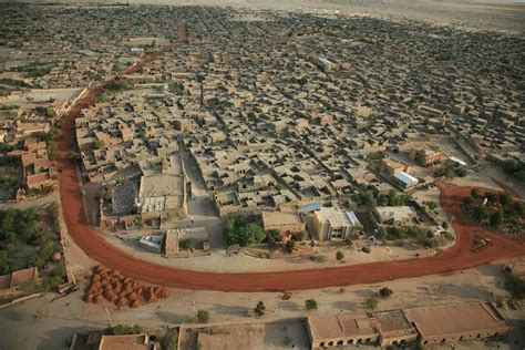
In the 14th-Century it became a part of the Mali Empire.
At its height, the Mali Empire encompassed almost all of what is now Senegal; the northeastern part of Guinea; the northwest corner of the Ivory Coast; the eastern tip of Niger; most of present day Mali; and Southern Mauretania.
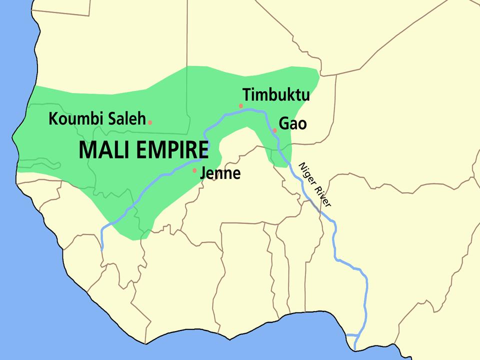
It was founded by Sundiata Keita in 1230 AD, and became renowned for the wealth of its rulers.
He died in 1255 AD.
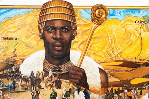
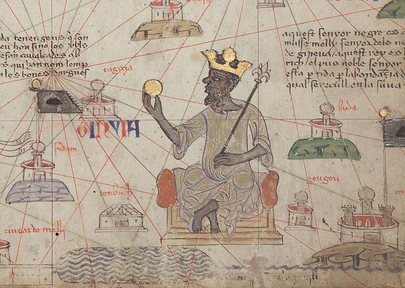
His great-nephew, Mansa Musa, who ruled the Mali Empire from1312 – 1337.
Mansa Musa was one of the richest men in World history, if not the richest. One of his titles was “Lord of the Mines of Wangara.”
During his reign, Mali may have been the largest producer in the world of gold.
On a legendary pilgrimage to Mecca in 1324-1325, its lavish opulence apparently well-documented by contemporary eyewitnesses, Mansa Musa gave so much gold away along the way there that the sudden influx of gold caused its devaluation through the regions he travelled.
He is then said to have taken steps to mitigate the unintended effects of his generosity on his way back by borrowing all the gold he could carry from money-lenders at high interest.
Has the general population ever heard of him?
Does this immense wealth fit the historical narrative we have been given about this part of the world?
The time period of Timbuktu’s Golden Age is said to be between 1464 and 1591, during the years of the Songhai Empire, which replaced the Mali Empire in the region, and was one of the largest African states in history.
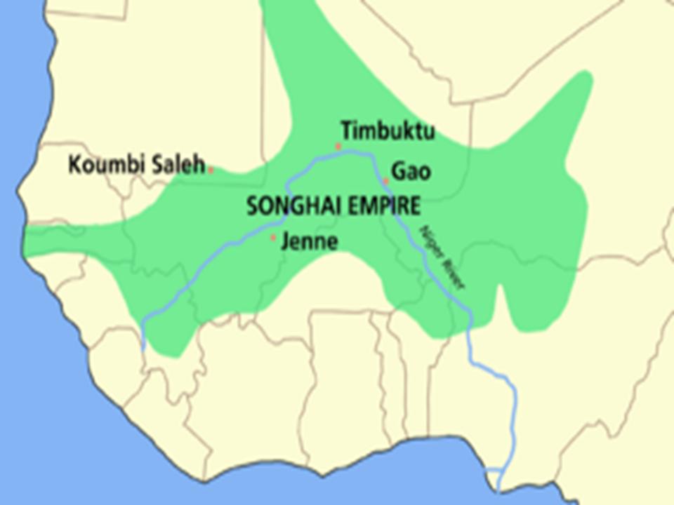
In Timbuktu’s Golden Age, its prominence in the trade networks made a book trade possible, and along with the towns numerous scholars, it became an important scholarly center in Africa.
The Sankore Madrassah, Djinguereber Mosque, and Sidi Yehia compose the University of Timbuktu.
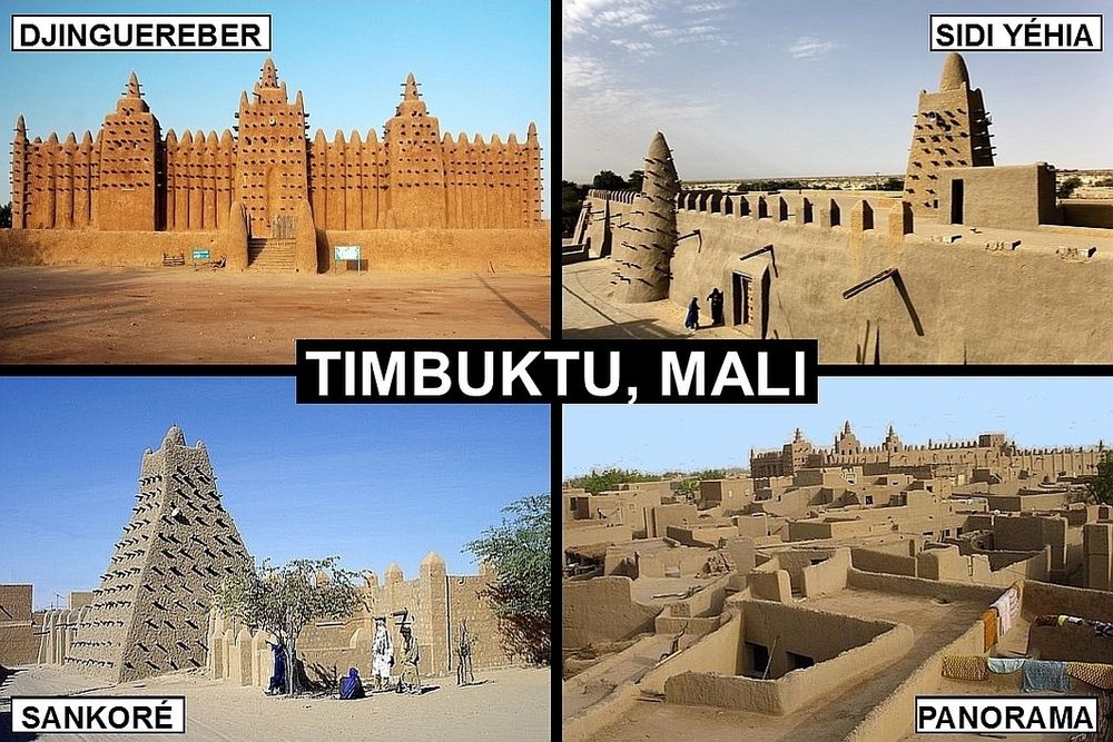
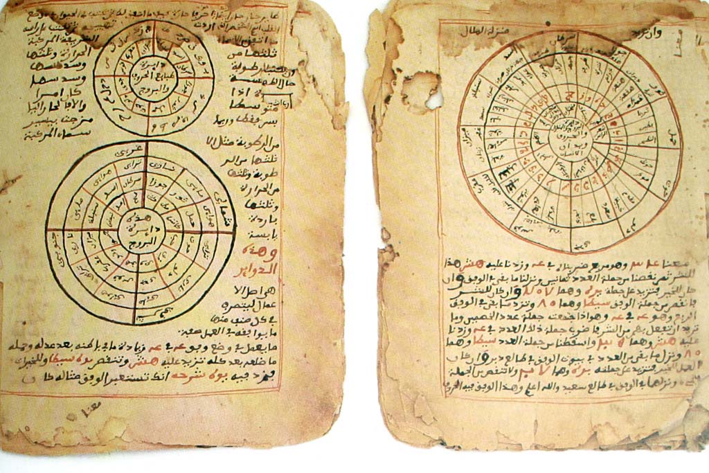
As a center of learning and trade over centuries, hundreds of thousands of manuscripts were collected here.
Called the Timbuktu Manuscripts, approximately 700,000 manuscripts are now in the collections of several libraries in Timbuktu for safekeeping.
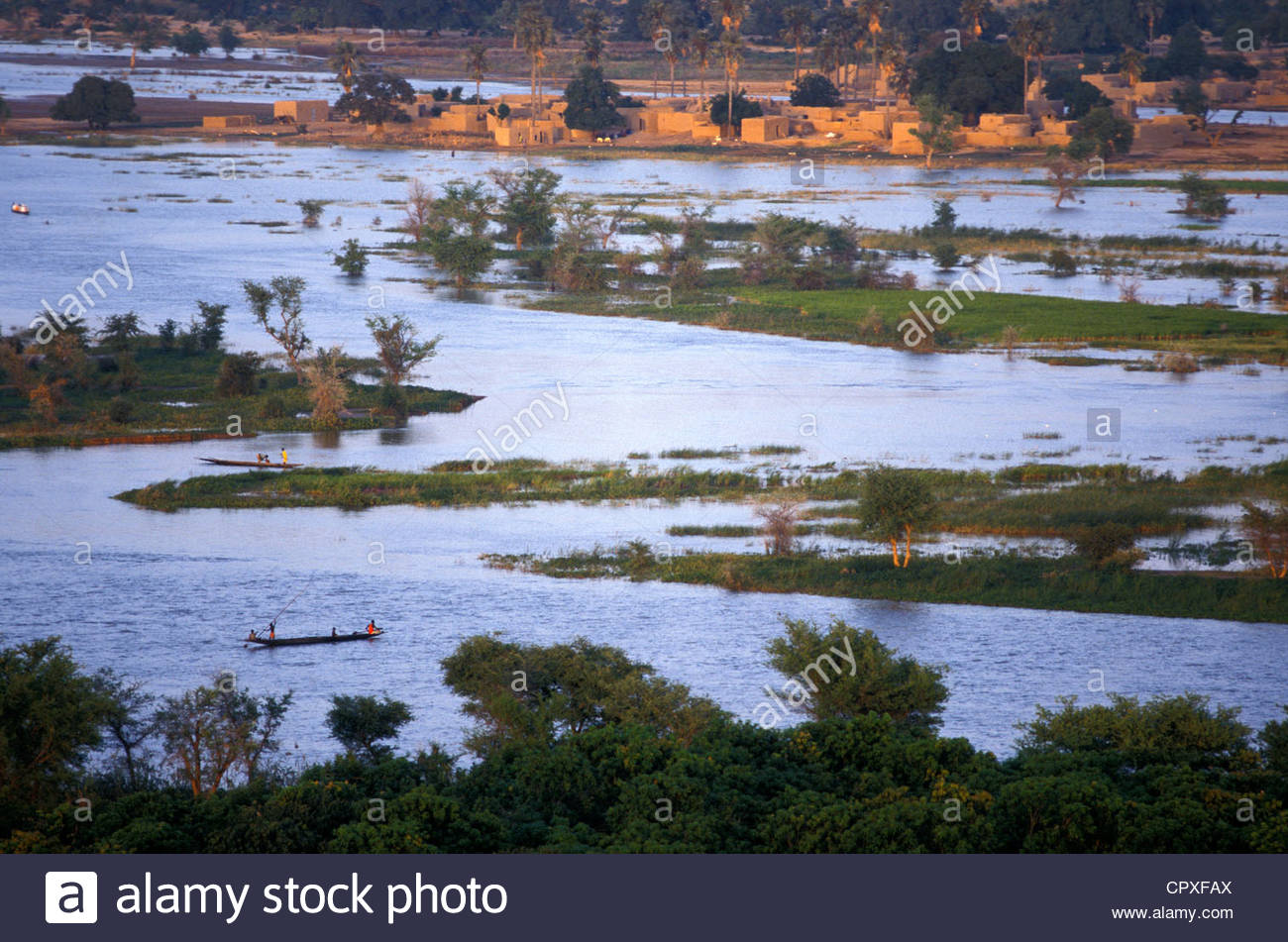
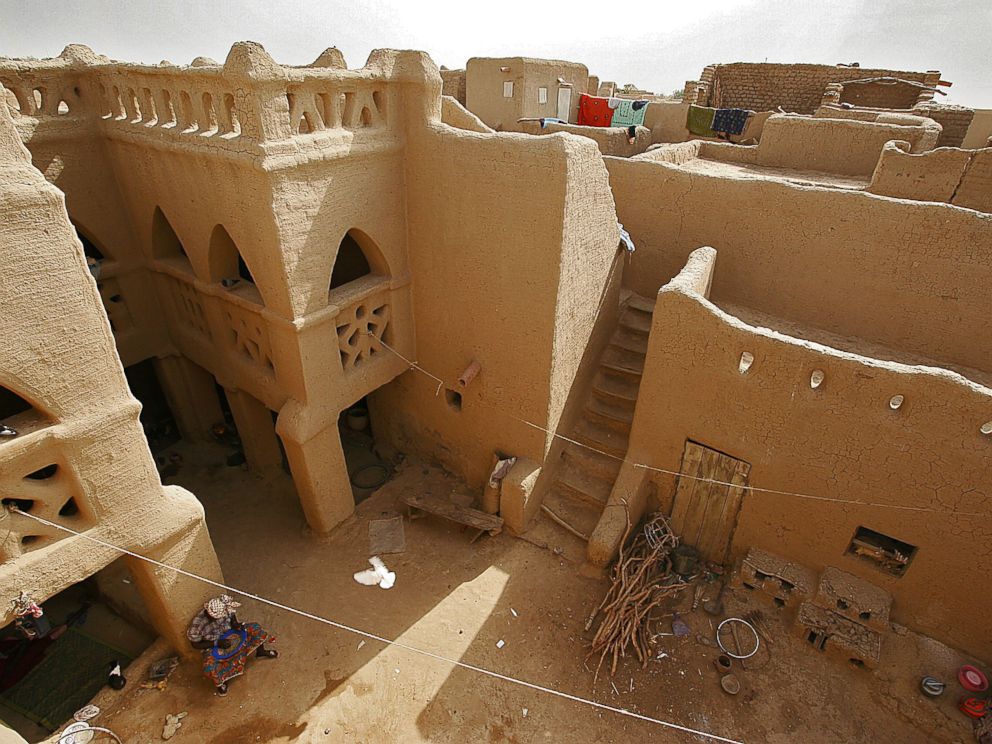
I would also like to talk about Djenne, and while near, is also not directly on the alignment. It is quite noteworthy for several reasons.
It is considered the oldest known town in sub-Saharan Africa. It sits on a flood-plain between the Niger and Bani Rivers…
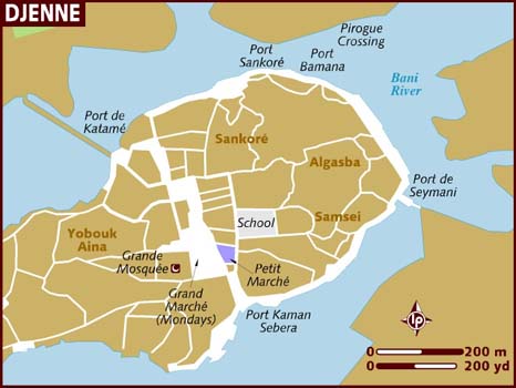
…and during the rainy season from June to September becomes an island that is accessed by causeways.
It is also notable for its adobe (mud-brick) architecture.
Djenne’s masons use a technique called Djennefere using cylindrical, instead of rectangular, bricks as building materials.
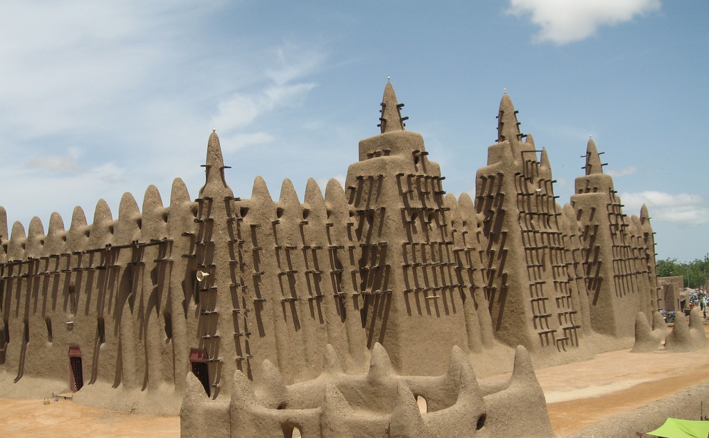
This is the Great Mosque of Djenne, one of the world’s largest mud-brick buildings.
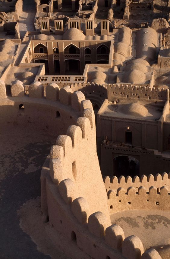
For comparison, this is the Bam Citadel, located near Kerman in Central Iran on a different circle alignment. It is the world’s largest mud-brick building. The mud buildings in Djenne certainly share similar characteristics with the mud-brick Bam Citadel in Iran.
The area around Djenne is also known for a mud-cloth material called bogolan.
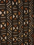
It is a traditional Malian fabric dyed with fermented mud.
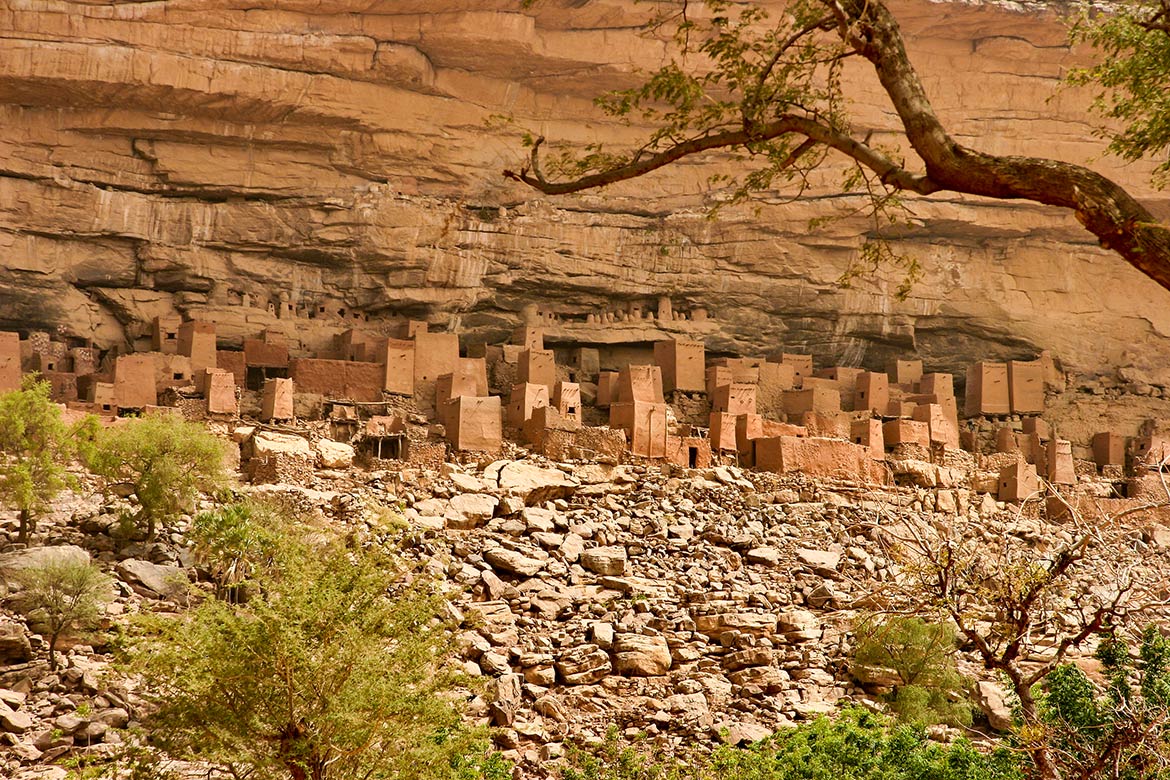
Djenne is also located close to Dogon Country.
This is the Bandiagara Escarpment, one of the homes of the Dogon in Dogon Country.
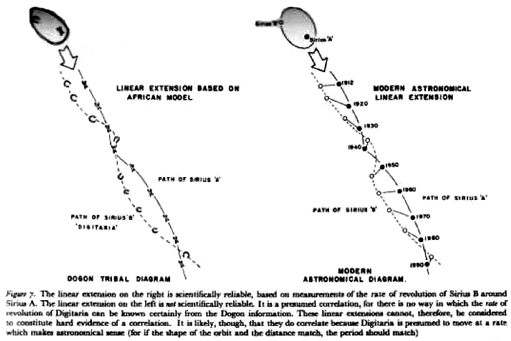
The Dogon have a very sophisticated spiritual, astronomical and calendrical system, as well as extensive anatomical and physiological knowledge. They also have a systematic pharmacopeia, which means directions for compound medications.
Perhaps they are best known for the accurate knowledge they possess about the Sirius star system.
Yet it is mainly an agricultural society.
They say they were visited in the distant past by amphibious beings from Sirius called the Nommo, who were their teachers.
Who is to say they weren’t?
I’m a believer.
The Dogon have such incredibly advanced and sophisticated knowledge that there is no good explanation for it except that they are telling the truth!

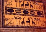
The Dogon perform elaborate ceremonies with masks, headdresses, and dance.
Compare the Dogon headdresses in this ceremony…
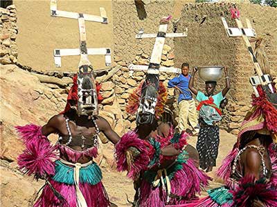
…with the flag of the Tuareg people, who also live in this part of West Africa…
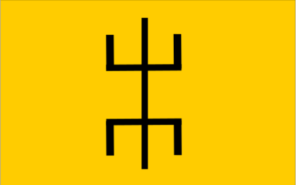
…and with this image on the left, which is a well-documented laboratory electric discharge form of plasma next to a form called the “stickman” that is found in rock art worldwide.

Think the ancient peoples of the earth might know something we don’t?
One more thing before leaving Dogon Country.
I have made the comparison of the similarity between Bandiagara Escarpment and Mesa Verde in Colorado in the past.
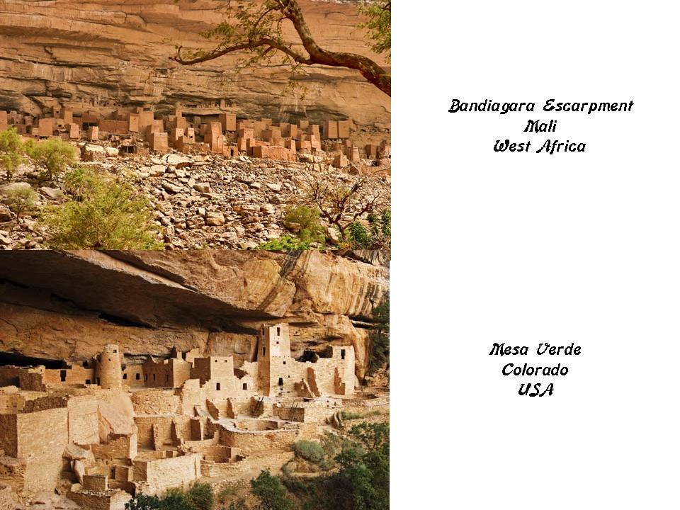
Not only because of this similarity, but other information I have encountered over the years as well, I think that it is highly likely the Dogon played a much more significant role in world history than is presently realized, understood, and acknowledged.
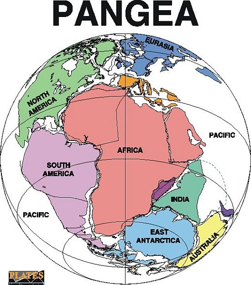
For one thing, this is what the world looked like before whatever caused continental drift, when it was called Pangea, when the west coast of Africa was right next to the east coast of North America, and the northern coast of what is now part of South America, and it is not hard to envision that there were much closer ties between the continents.
Regardless of anything, there are huge chunks of information missing from the historical record that we no longer have access to by conventional means. We just have mind-boggling mysteries that we can’t explain by conventional means.
Next on the alignment we come to Bamako, the current capital of Mali, and its largest city with over 2,000,000 people.
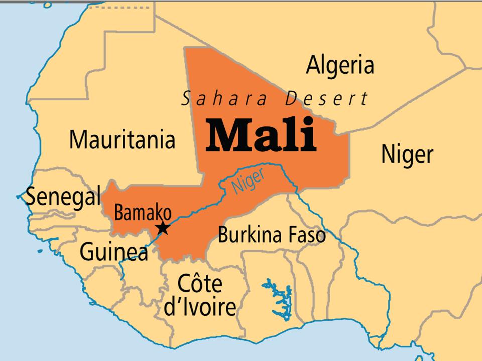
Mali was annexed into French West Africa from 1895, and French rule ended in 1959 when the Republic of Mali was established.
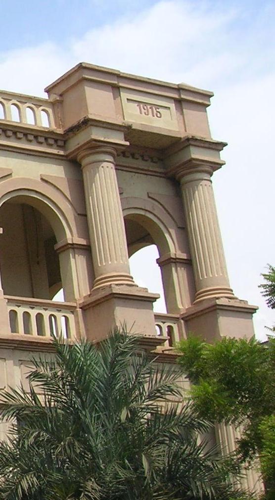
This is the National Post Office in Bamako.
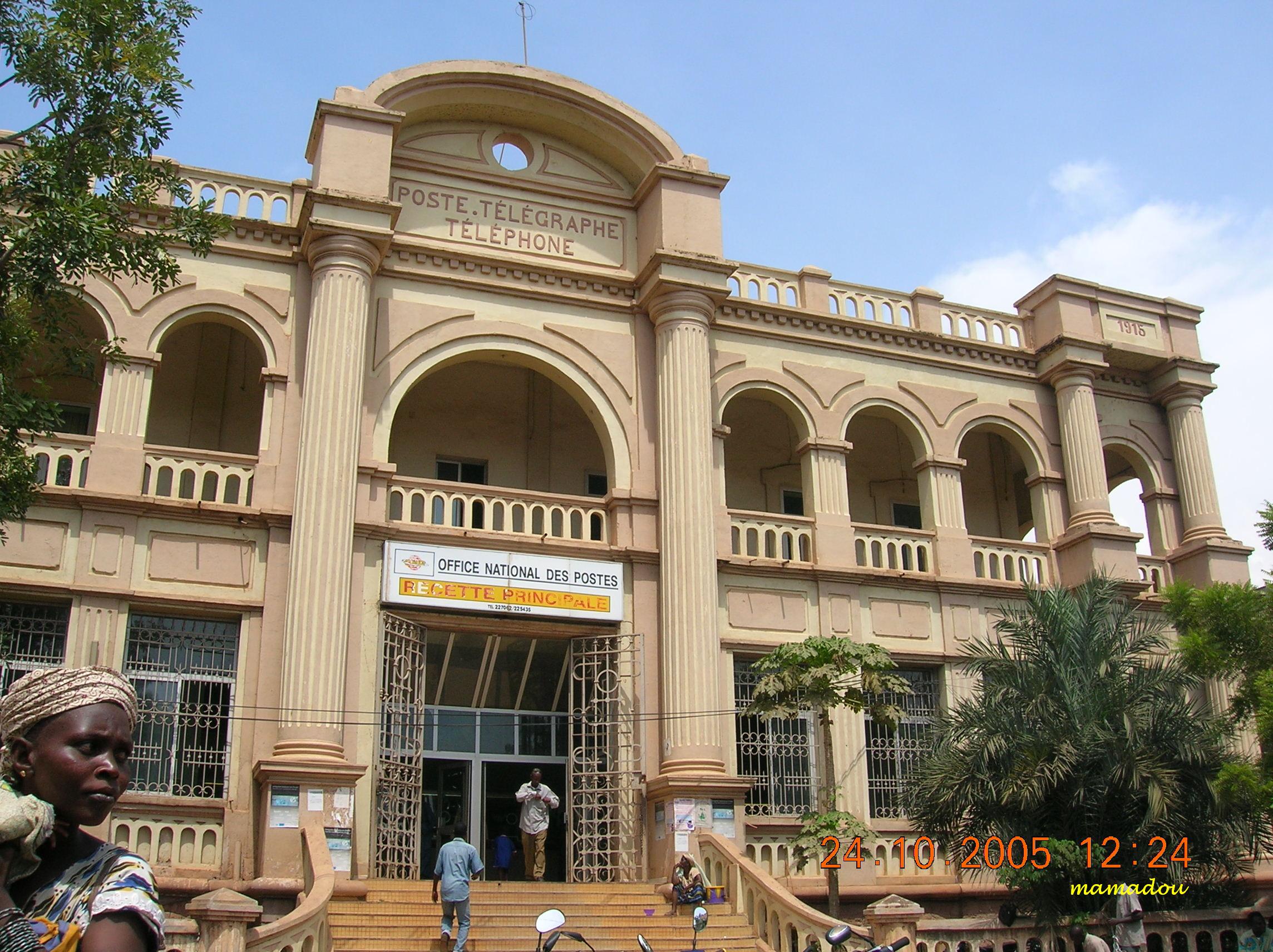
We are given a date of 1915 for its completion at the top of the building on the right-hand side of the photograph.
What was going on in 1915?
World War I.
So while the French Government in France was fighting the deadliest war up to that time in world history, the French government in Mali was building a post office in Mali that looks like this? Does this make sense?
Bamako is situated on the Niger River, near the rapids that divide the upper and middle Niger valleys.
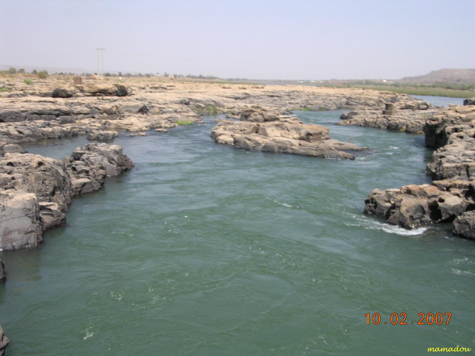
Now, without any other information, we just see these as natural rock formations. Why wouldn’t they be?
This is a photo of the rapids called the First Cataract of the Nile River going through Aswan in Egypt.
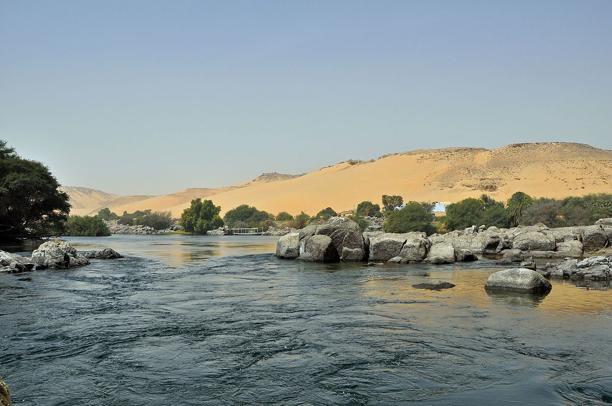
Why would an area of rapids be called a “cataract,” I wonder?
The most well-known definition of a cataract is a clouding of the lens of the eye which leads to a decrease in vision.
Don’t think it couldn’t be that obvious. This cover-up has been inserted right into our language. When I realized this several years ago, I was able to crack the cover of key words that were used to cover-up the ancient civilization by calling them natural features.
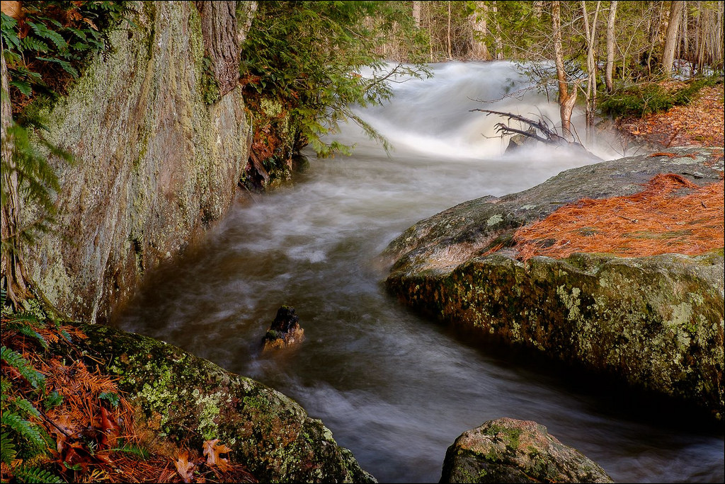
In case you think these big, blocky, shaped rocks could just be coincidental, here is a picture of the Blakeney Rapids on the Mississippi River in Ontario.
They are recurring features of the world’s river systems.
I could go on and find more in Bamako, but I think this is a good stopping place for this post.
I will pick up the alignment in Conakry, Guinea, in the next post.

I think salt like all our metals are not being mined as we are told. Grow or transmuted from one element to another. I can not find any real evidence that shows refining dirt and rock into metals and I think salt is another example. The picture you provide with a man sitting down on stones does not show any real evidence of salt mining. Walter Russell’s periodic chart shows all elements differ only in frequency and I believe he was a high level mason and his work was for people in the know.
LikeLike
I understand what you’re saying. I myself don’t have knowledge of that specifically, but I do know that there is so much more on a higher level that we are not being told.
LikeLike
I think we are being lied to on just about everything and history is a big part of it.
LikeLiked by 1 person
Whenever there is talk about gold and how much there is in the world, the amount is always in terms of the West. African Asian and communist countries gold is never included in the totals. I think we are made to believe that gold is not as common as it is. It seems that we are being lied to about that too.
So many lies and so many things to get to the bottom of.
LikeLike
Yes, it goes deep. We do not equate African countries with wealth and civilization and yet this is far from the truth. Same thing with South America. They got robbed somewhere along the way. In more ways than one.
LikeLike
So true. And when you start adding up the evidence things start to look extra extra crazy. The time line seems to be missing 200 years or so.
I am thinking that the electricity lie is more apparent than ever. The buildings used to be lit from atmospheric electricy hence all the little metal towers on buildings. It has always been that way. The gold cap that used to be on so many pyramids conducted electricity from the air and made so many things possible for early civilizations. Along with the magnetic power and the vibrations allowed for the building of the many walls, and structures that we see remants of today.
LikeLike
The hiding of free energy is also big part of the lies. Gas turbine engines in all commercial aircraft do not use ant liquid fuel. My guess is they are burning the nitrogen in the air once it is compressed. Also Trains and ships also don’t use liquid fuel.
LikeLike
Where can I find out more about this? Any links you recommend? Thanks
LikeLike