
In the second part of this series, I am going to take a close look how through the vehicles of Catholicism, European colonization, and the widespread occurrence of place name changes to obscure true history, were used to create the New World from the Old World.
I will start by focusing on the colonization of the Spanish West Indies and the Spanish East Indies.
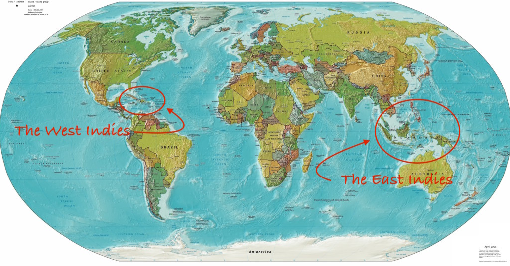
There sure was a lot of colonization going on in the all of these islands and island groups of the East and West Indies on the part of different European colonial powers that I have encountered in tracking earth’s alignments, not just the Spanish!
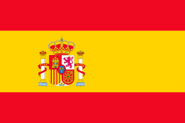
The Spanish West Indies and East Indies were administered by the Council of the Indies, and the crown of Spain held absolute power over the Indies…
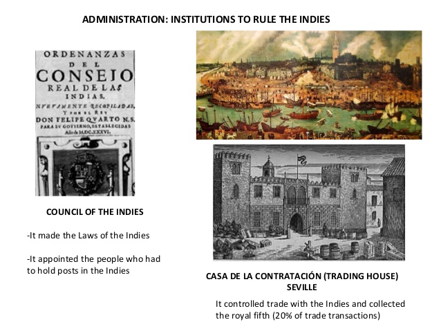
…and the Trading House was the agency which managed expeditions to the New World on behalf of the Spanish crown.from the 16th- to the 18th-century, organized by Queen Isabella in 1503.
Initially, Queen Isabella had granted extensive authority to Christopher Columbus, but then withdrew that authority, instead putting it in the hands of her personal Chaplain, Juan Rodriguez de Fonseca, in 1493.
Fonseca was an archbishop and bureaucrat who not only initially headed the Trading House, but oversaw the expedition of Christopher Columbus.
The Trading House became an instrument of the Spanish Crown’s policy of centralization and imperial control.
The year of 1493 was the year that Pope Alexander VI authorized the land-grab of the Americas in the “Inter Cetera” papal bull.
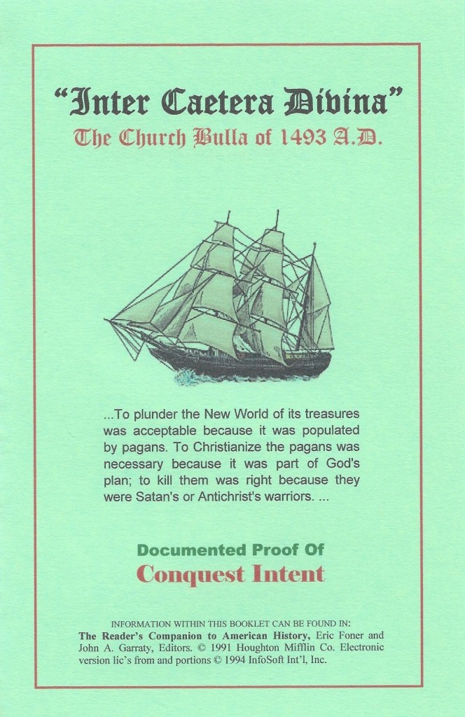
This papal bull became a major document in the development of subsequent legal doctrines regarding claims of empire in the “New World” and assigned to Castile in Spain the exclusive right to acquire territory, to trade in, or even approach the lands laying west of the meridian situated one-hundred leagues west of the Azores and Cape Verde Islands, except for any lands actually possessed by any other Christian prince beyond this meridian prior to Christmas, 1492.
A papal bull is an official papal letter or document, named after the leaden seal, or bulla, used to authenticate it.
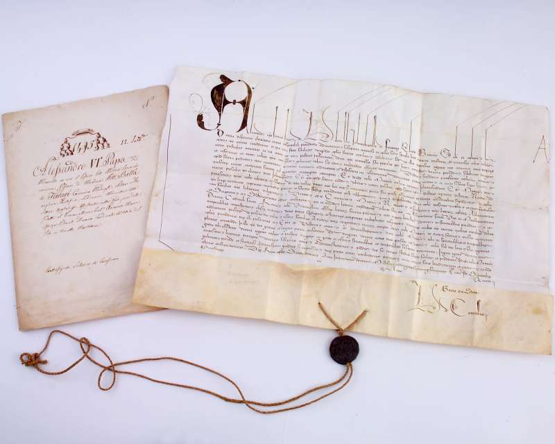
They figure prominently in the effort to authenticate what has taken place on earth in the historical narrative we have been taught, and there will be other ones that I will be mentioning in this post.
Christopher Columbus first set-sail in 1492, which was the same year as the Fall of Grenada, which took place on January 2nd of 1492, and which effectively ended Moorish rule in Spain when Muhammad XII surrendered the Emirate of Grenada to King Ferdinand of Aragon and Queen Isabella of Castile.

I have come to believe through my research that negative beings hijacked the positive timeline that Humanity was originally on by creating a 3D time-loop between 1492 and 1942, and deliberately causing a liquefaction event resulting in a world-wide mud flood which wiped out an advanced civilization of giant humans, and I believe the Philadelphia Experiment, where the USS Eldridge disappeared for 15 minutes in July of 1942,was involved in how they accomplished this.
I talk about why I believe this extensively in my post “My Take on the Mud Flood & Historical Reset Timeline.”
The Council of the Indies began the Archives of the Indies, which contains priceless documents that provide a key to the history of Spain’s relationships with its overseas colonies in the Americas.
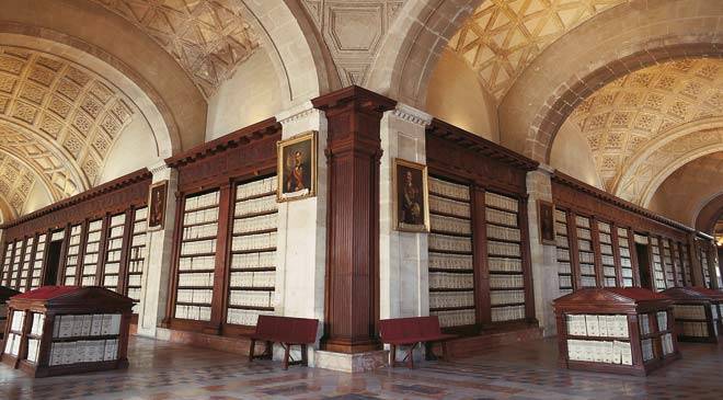
The Archive of the Indies is housed in what is called the Ancient Merchants Exchange of Seville…

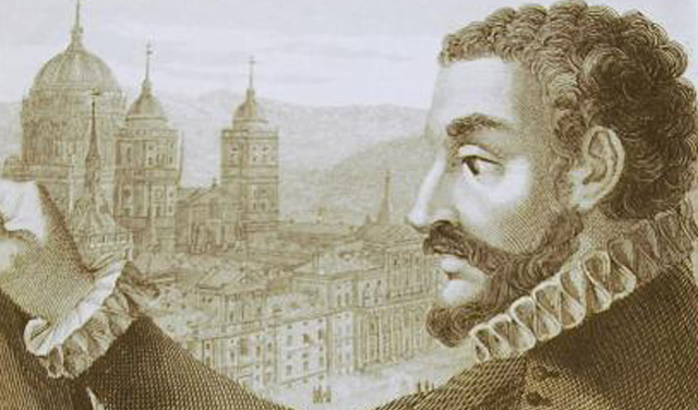
…and the man to whom it was attributed is Juan de Herrera, a Spanish architect, mathematician, and geometrician, with a construction start date of 1584.
The Council of the Indies was said to have been established in 1524 by Charles V, King of Spain, Holy Roman Emperor, and Lord of the Netherlands.
I am just going to put these two different portraits of Charles V that I have found in my research, revealing similar facial structure between the two portraits, the tilt of the chins, the similar clothing, and a similar-looking hand.

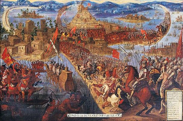
The Council of the Indies was created following the Spanish Conquest of the Aztec Empire in 1521, in the historical narrative we have been given.
In terms of governance of the Spanish Empire, “the Indies” was the designation for all of its overseas territories, and when the Viceroyalty of New Spain was established by the Crown in 1535, the islands of the Caribbean came under its jurisdiction.
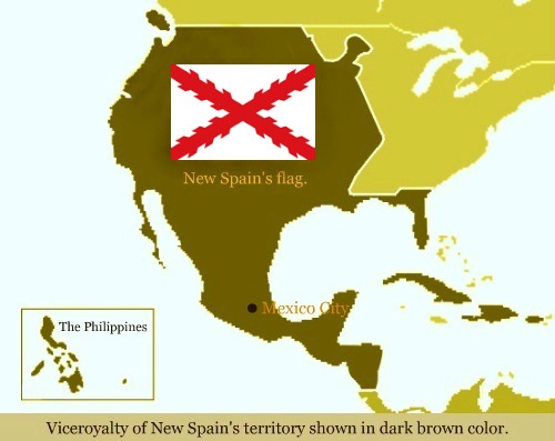
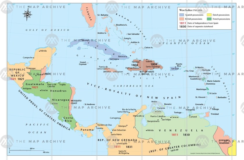
The Spanish West Indies was the collective name for the colonies in the Caribbean.
The islands claimed by Spain were Hispaniola, an island in the Greater Antilles which is divided into the countries of Haiti and the Dominican Republic; Cuba; Puerto Rico; St. Martin; the Virgin Islands; Anguilla; Montserrat; Guadalupe; the Lesser Antilles; Jamaica; the Cayman Islands; Margarita Island; Trinidad & Tobago; and the Bay Islands.
I have chosen to take a look at two of the islands of the Spanish East Indies.
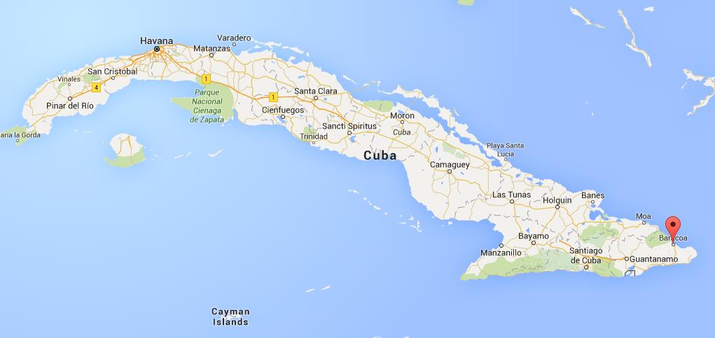
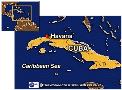
The first is Cuba.
We are told that before Columbus arrived in his first voyage on what became known as Cuba on October 28th of 1492, and claimed its islands for the new Kingdom of Spain, the indigenous inhabitants were the Taino, the Guanahatabey, and the Ciboney people, who were all farmers and hunter-gatherers.

The first Spanish settlement and capital was Baracoa, still a municipality and city to this day in Guantanamo Province, near the eastern tip of Cuba.
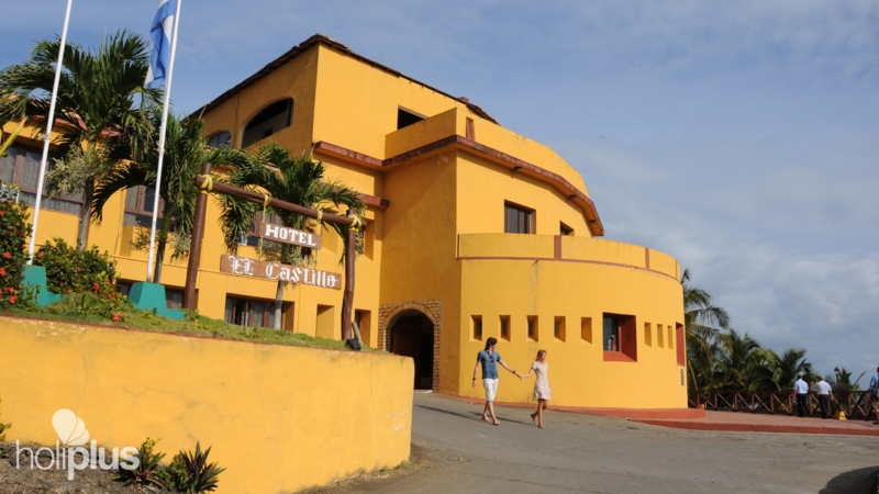
It is notable that we are told that there were three Spanish fortifications here that were built during the eighteenth and nineteenth centuries to protect the city from pirates and privateers.
El Castillo…

…which is now a hotel…
…Matachin fortress…

…and La Punta, which is now a restaurant.

Cuba’s capital today, Havana, was said to have been founded in 1515 as San Cristobal de la Habana.
Due to Havana’s strategic location, it served as a springboard for the Spanish conquest of the Americas, and became a stopping-point, we are told, for the treasure-laden Spanish galleons on the crossings between the New World and the Old World…Treasure-laden…going from the Americas to Spain?
Here are some sights from Old Havana, all claimed by the Spanish as their infrastructure…

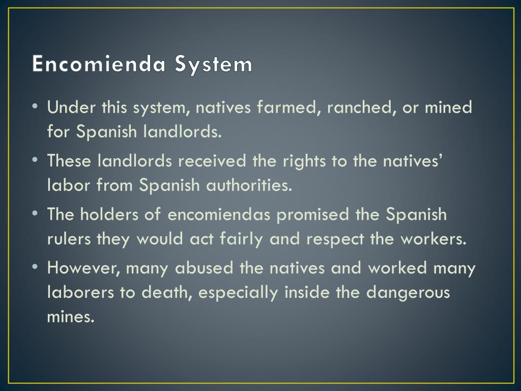
…while, from what we are told in the historical narrative, the indigenous peoples of Cuba were forced to work under the encomienda system, a Spanish labor system that rewarded conquerors with the labor of particular groups of subject people, and applied on a large-scale during the Spanish colonization of the Americas and Philippines…
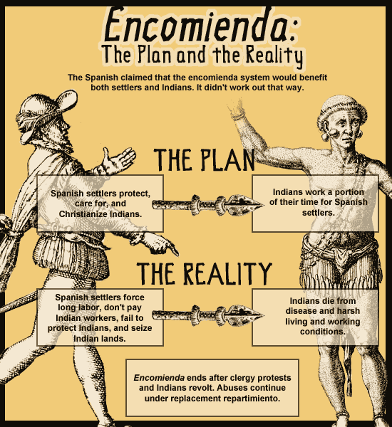
…and the harsh conditions of the repressive colonial subjugation, along with infectious diseases, virtually wiped-out the indigenous population of Cuba within a century.
I also found this information about the original Cubans from past research, which ties their identity to Manasseh, one of the Tribes of Israel.

Next, I am going to look at the island of Hispaniola, the second-largest island, and most populated, in the West Indies.
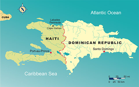
Today’s countries of Haiti and the Dominican Republic are co-located on the island.
This is a painting of what we are told pre-Columbian Hispaniola looked like…

…and that the first permanent European settlements in the Americas were founded on Hispaniola in Christopher Columbus’ first three voyages.

Christopher Columbus was said to have founded Concepcion de la Vega after the Battle of Vega Real took place there on March 27th of 1495, between an indigenous alliance, and Spanish forces commanded by Christopher Columbus, his brother Bartholomew Columbus, and the Spanish conquistador Alonso de Ojeda.
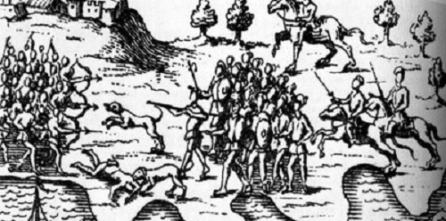
The battle resulted in the defeat and capture of the Taino leader Caonabo, and ended indigenous resistance on Hispaniola.
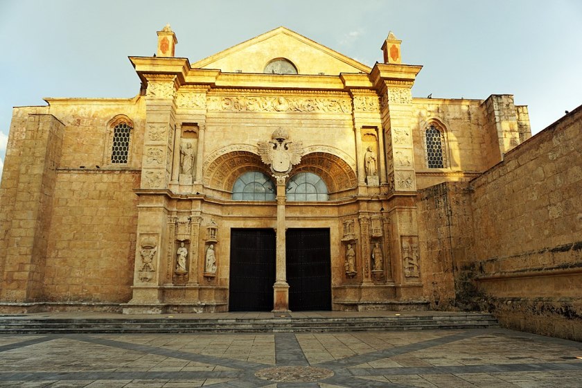
We are told that the city of Santo Domingo on Hispaniola is the oldest continously inhabited European settlement, and the first seat of Spanish Colonial Rule, in the New World, with its first University, in 1538…

…first cathedral, built between 1514 and 1541…

…first fortress, the Ozama fortress, said to have been built by the Spanish between 1502 and 1515…


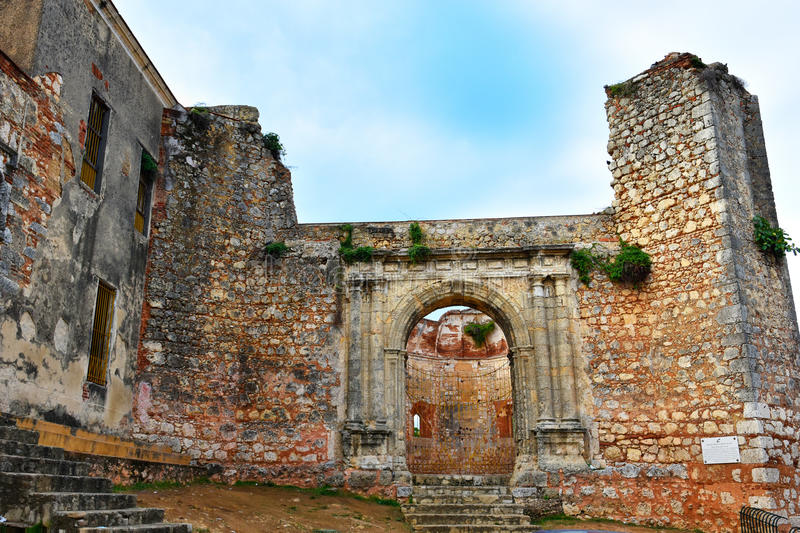
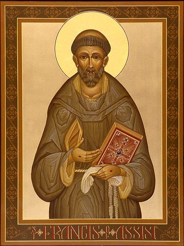
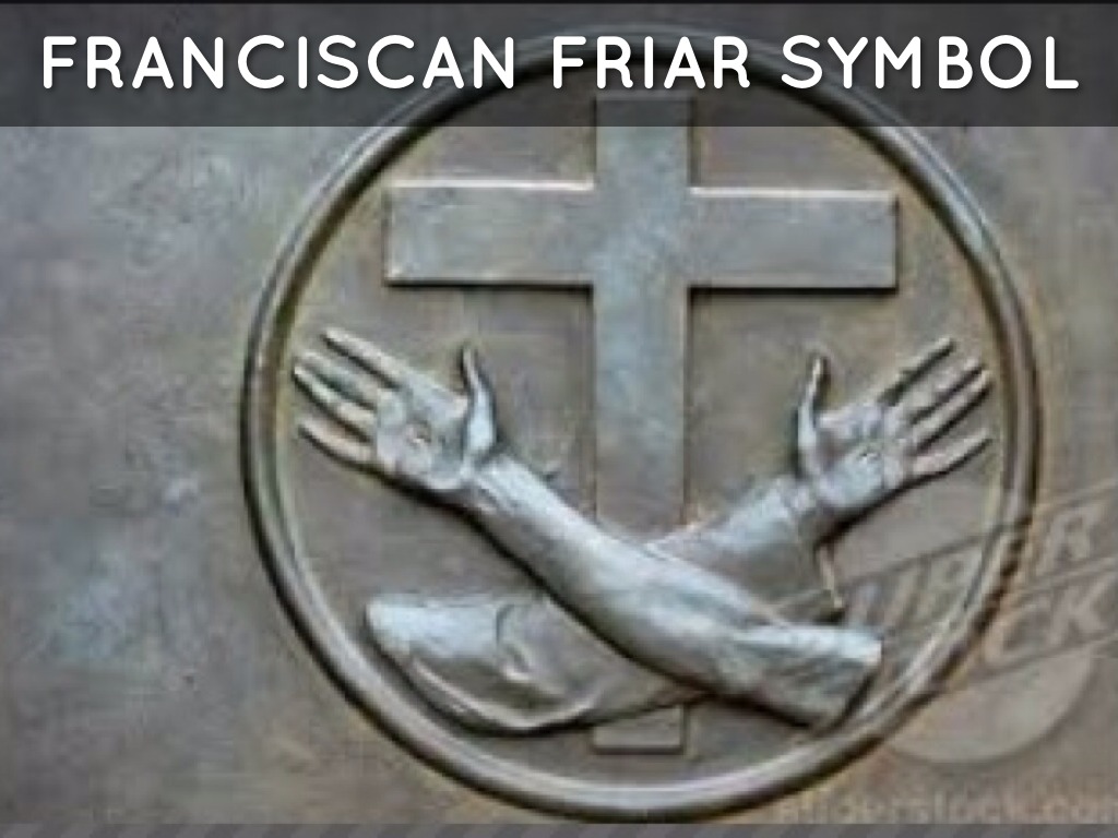
…and the first monastery, the San Francisco Monastery, said to have been built between 1509 -1560 with the arrival of the Franciscan Fathers.
The Franciscans were members of related-religious orders said to have been founded by St. Francis of Assisi in 1209.
Three Franciscan missionaries accompanied Christopher Columbus in his second expedition in 1493, and were sent by a special commission of the Franciscan order in response from royal instructions from the Spanish Crown aimed at bringing the indigenous people of the Americas to Catholicism.
The Franciscans were at the vanguard of missionary activity in the New World, and in 1502, seventeen more Franciscans arrived.
Santo Domingo became the base of operations for countless missionary expeditions to the islands, as well as to the mainlands of North, Central and South America.
Like Cuba, the primary indigenous people on the island of Hispaniola were the Taino people.
When Columbus landed on the coast of present-day Haiti on December 6th of 1492, at a bay he named San Nicolas, the Taino traded more gold with him than he had yet encountered, and learned from them much more could be found inland.
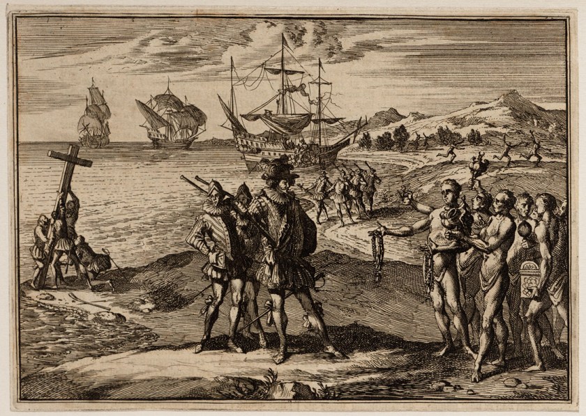
He had to leave Hispaniola before he could explore because his flagship the Santa Maria ran aground on December 24th of 1492.
He left a crew of 21 in a fortified encampment he named “La Navidad.”
Upon his return in his second voyage in 1493, he brought approximately 1,200 men to Hispaniola with then intention of establishing a permanent settlement.
He found the encampment at “La Navidad” had been destroyed and his crew killed.

He established a new settled named “La Isabella” in the present-day Dominican Republic in January of 1494.
The Spanish colonists practiced harsh enslavement practices against the Taino, for labor to search for gold, and later mining, and to grow food to feed the Spanish settlers, as well as redirecting existing food supplies to the Spanish.
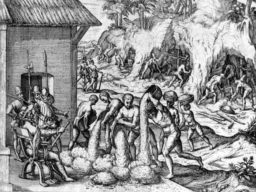
We are told that precious metals played a large role in the history of the island after Columbus’ arrival.
The first find of major significance were large gold nuggets at the lower Haina River in the Cordillera Central in 1496 in what is now the Dominican Republic, resulting in the San Cristobal mines, and eventually becoming known as the Minas Viejas, or “Old Mines.”
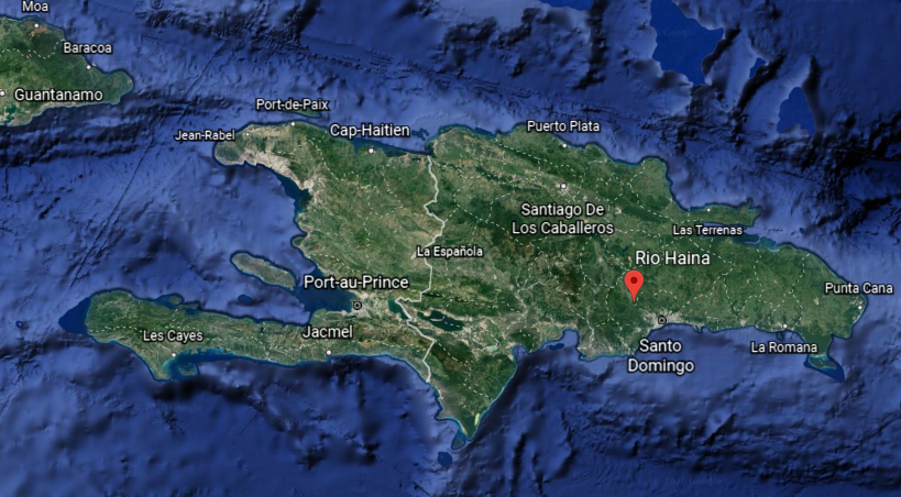
Then in 1499, there was another discovery of gold in the Cordillera Central, called the Minas Nuevas, or “New Mines.”
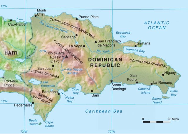
The development of these two major mining areas led to a mining boom, the gold rush of 1500 to 1508.
By 1503, the Spanish Crown legalized the distribution of indigenous people to work the mines through the encomienda system.
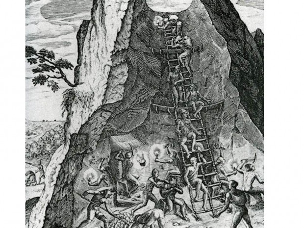
In 1504, the Minas Viejas pit mines became royal mines for King Ferdinand, who reserved the best mines for himself, and almost 1,000 Taino were made to work the mines, supervised by salaried miners.
We are told that as a result of the encomienda system and its harsh, repressive practices, the indigenous population of Hispaniola was reduced from 400,000 in 1508, to 26,334 by 1514.
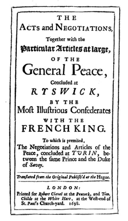
In 1665, French colonization of the island was officially recognized by King Louis XIV, and in 1667, the western third of the island was officially ceded to France by Spain via the Treaty, or Peace, of Ryswick, which ended the “Nine Years War” between France and the Grand Alliance, which included England, Spain, the Holy Roman Empire, and the Dutch Republic.
The French Colony on Hispaniola was named Saint-Domingue, and soon became the richest and most prosperous colony in the West Indies…with a system of slavery used to grow sugar cane during a time when the European demand for sugar was high.

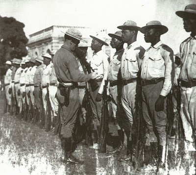
We are told that Haitian slaves were inspired by the message of the French Revolution, which lasted between 1789 and 1799, and rose up in a revolt in 1791…

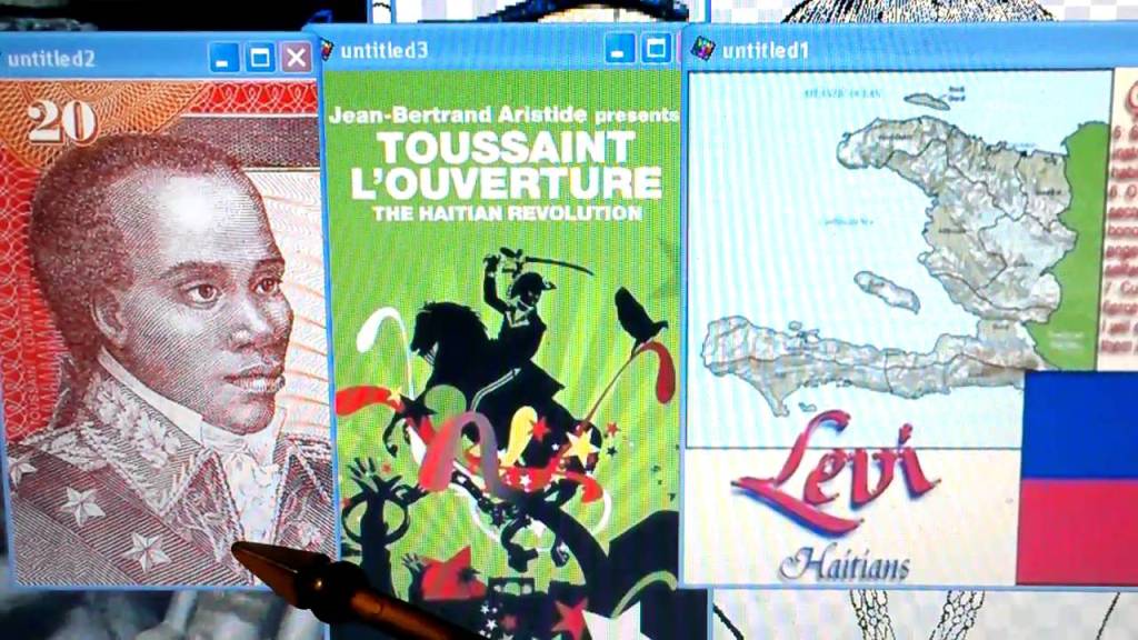
…and established the Republic of Haiti in 1804.

A key leader during the rebellion, Henri Christophe, first became President of the State of Haiti in northern Haiti in 1807, which was separate from the Republic of Haiti in the South.

He was said to have built the mountaintop Citadelle Laferriere in northern Haiti near Cape Haitien, one of the largest fortresses in the Americas…


…as well as the Sans Souci Palace, along with seven other palaces and six chateaux…
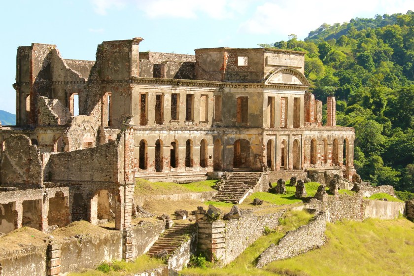
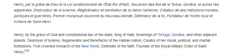
…after he became King of Haiti (still in the North) in 1811, and the first crowned monarch of the New World.
He was said to have taken his own life in 1820…and his son and heir was assassinated ten days later.

Haiti’s history has been quite tumultuous for a variety of reasons, and for simplicity’s sake, I am just going to focus on just a couple of other things that caught my attention.
The first is Faustin Soulouque.
He was said to have been a general in the Haitian army, and was appointed President of Haiti in 1847.

He acquired autocratic powers to purge the army of the ruling elite; install loyalists in administrative positions and the nobility, and created a secret police and personal Army.
Soulouque’s process of obtaining absolute power in Haiti culminated in the formation of the Second Haitian Empire after the Senate and Chamber of Deputies proclaimed him Emperor of Haiti in August of 1849, and he and his wife were officially coronated in 1852.

One of the things that happened during his short reign was a direct confrontation with the United States over the island of Navassa.
This small island is subject to an on-going territorial dispute between the United States and Haiti.

The United State claimed the island since 1857, based on the Guano Islands Act of 1856.

The legislation essentially said that an American could claim an uninhabited, unclaimed island, it contained guano, or bird droppings, which was an effective early fertilizer.

Haiti’s claims over Navassa go back to the Treaty of Ryswick in 1697, which I mentioned previously, establishing French possessions in mainland Hispaniola that were transferred from Spain by the treaty.
Soulouque dispatched warships to the island in response the incursion, but withdrew them after the United States guaranteed Haiti a portion of the revenue from the mining operation there.
This is the deactivated lighthouse on Navassa. This is the only building left of what was previously on Navassa Island…

…possibly including this star fort identified as being in Lulu Town on Navassa, but I can’t confirm this finding because whatever was there isn’t there any more.

Lulu Town was previously situated around Lulu Bay on Navassa Island.

In 1858, a revolution was led against him by another Haitian General, Fabre Geffard, and the army of Emperor Faustin I was defeated in December of that year, and he was exiled to Jamaica with his family after he abdicated his throne on January 15th of 1859, with Fabre Geffard becoming the new President of Haiti.

I was drawn to look into this historical figure in Haiti because the dates of his presidency and imperial reign coincide with 1851, the year I believe marked the official start of the New World historical reset timeline, with “The Great Exhibition of the Works of Industry of All Nations” of 1851, held in the Crystal Palace in London between May 1st and October 15th, and the first in a series of World’s Fairs, exhibitions of culture and industry that became popular in the 19th- and 20th-centuries.

For more information about this subject, see my blog post “Exposing Exhibitsions, Expositions, and World Fairs since 1851.”
These are several other things I would like to bring forward.
There was a small German community in Haiti, of approximately 200 people, in 1910, who wielded a disproportionate amount of economic power, controlling utilities, the main wharf, and rail-lines.
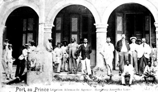
The Germans were said to serve as the principal financiers of the nation’s innumerable revolutions, floating loans at high-interest rates to competing political factions, between 1911 to 1915, when there were six or seven different Haitian presidents, each of whom was killed or forced into exile, said to have been fueled by peasant brigands from the mountains of the north, who were enlisted by these rival political factions with promises of money to be paid after a successful revolution and an opportunity to plunder.
Then in 1915, responding to complaints from American banks, to which Haiti was deeply in debt, President Woodrow Wilson ordered the U. S. occupation of Haiti.
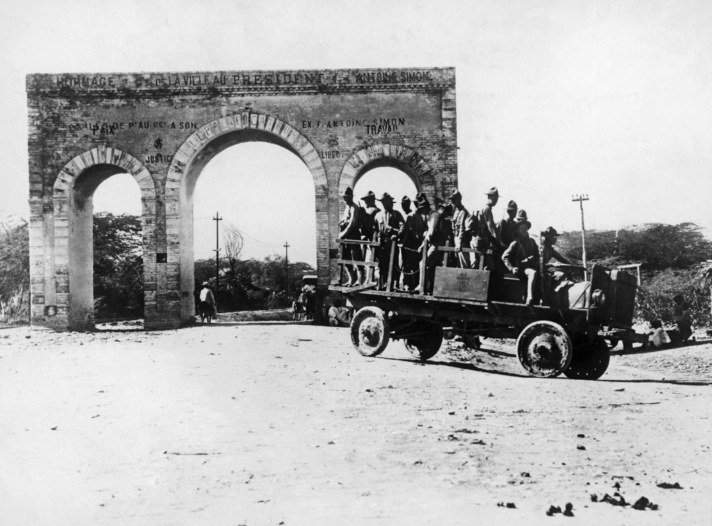
This occupation lasted until 1934, with a new, democratically-elected president and government that had first been installed in 1930.
So, the island of Hispaniola is a study in contrasts.
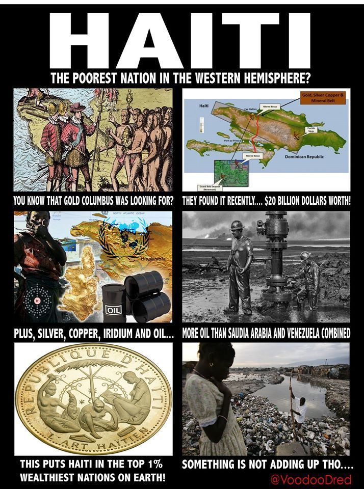
Haiti was saddled with unmanageable debt for decades and became the poorest country in the Americas, while the Dominican Republic gradually developed into one of the largest economies of Central America and the Caribbean.
Here’s the rub. The combined value of all of its mineral and oil resources puts Haiti in the top 1% of the wealthiest nations on Earth.
Then there is this…the Haitians are identified as the Tribe of Levi…
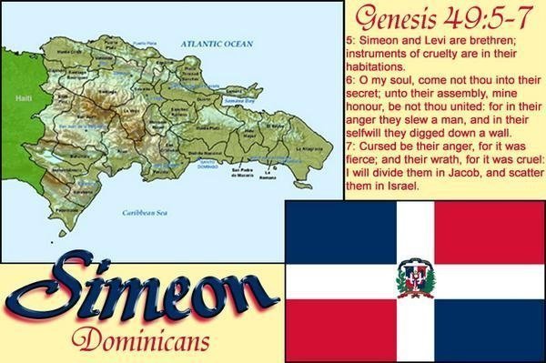
…and the Dominicans as the Tribe of Simeon.
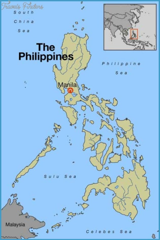
Now moving along to the Spanish East Indies, an overseas territories of the Spanish Empire in Asia and Oceania from 1565 to 1901, governed from Manila in the Spanish Philippines…
…including, besides the Philippines, the Marianas Islands; the Caroline Islands; Palau; Guam; parts of Formosa (now Taiwan); and Sulawesi and the Moluccas in Indonesia.
I will look into two places in the Spanish East Indies.
The first is the Philippines.
The earliest European expedition to the Philippines was led by Portuguese explorer Ferdinand Magellan in the service of the King of Spain in 1521. He made landfall there on Homonhon Island in eastern Samar at the mouth of the Leyte Gulf.
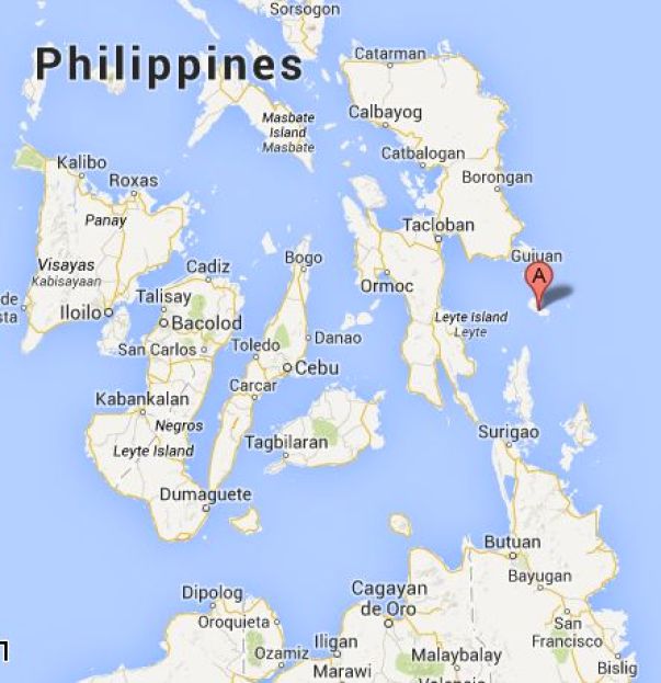
The next day, on March 13th, which was Easter Sunday of the year 1521, Magellan claimed possession of these lands for the King of Spain on what is believed to now be the island of Limasawa in southern Leyte.


Magellan and fourteen of his men died shortly thereafter in the Battle of Mactan, which took place on April 27th of 1521 on the Mactan Island of Cebu.
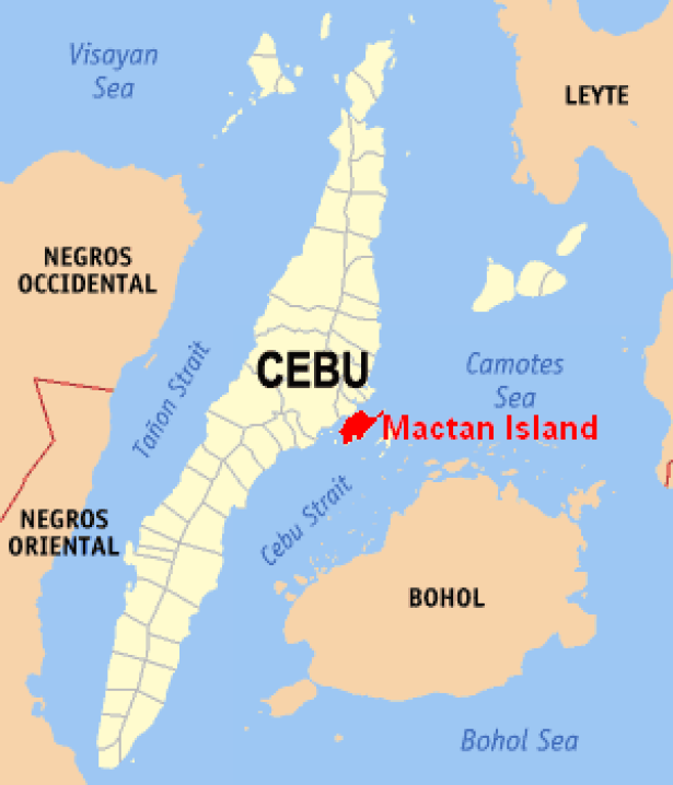
This monument to Magellan was said to have been erected on Mactan Island in 1866, on the spot where he was said to have been killed.


After Magellan’s voyage, five expeditions were sent to the islands.
This is a coin bearing an image of King Phillip II…
In 1543, Ruy Lopez de Villalobos named the islands of Leyte and Samar “Las Islas Filipinas,” after Phillip of Austria, heir-apparent to the throne of Spain, who became King Phillip II in 1556.
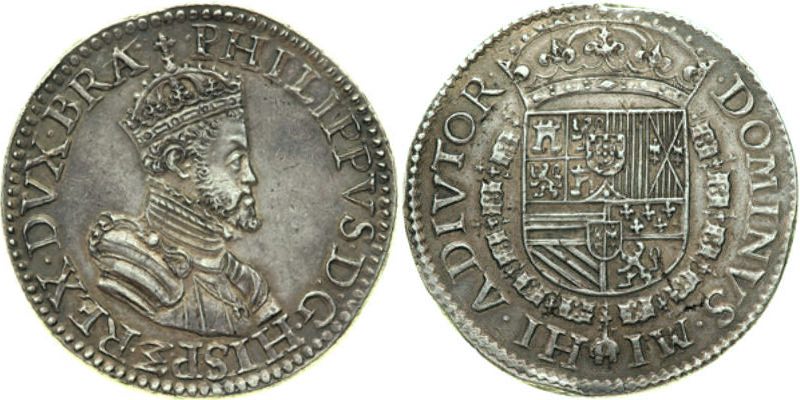
…a bust of King Phillip II by Pompeo Leoni…

…and a portrait that is typical of King Phillip II.

Cebu is the oldest city in the Philippines, as it was said to have been the first Spanish settlement and first capital city.
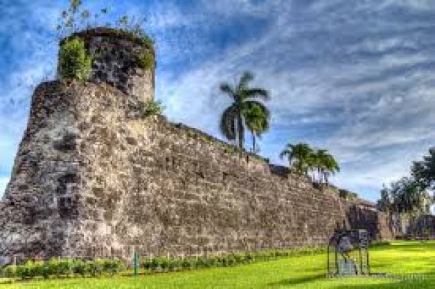
It is important to note that there was a star fort located in Cebu, called the Fort San Pedro.

It was said to have been built by the Spanish starting in 1565.
Manila is the capital of the Philippines, and the most densely populated city in the world within its boundaries.
Manila, alongside Mexico City and Madrid, is considered one of the world’s original global cities, due to Manila’s historic commercial networks connecting Asia with the Americas.
We are told the Spanish city of Manila was founded in 1571 by the conquistador Miguel Lopez de Legazpi. He was the first Governor-General of the Spanish East Indies from 1565 to 1572.

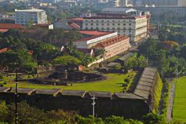
The historic walled city part of Manila is called the Intramuros, said to have been established by the Spaniards in the late 1500s.
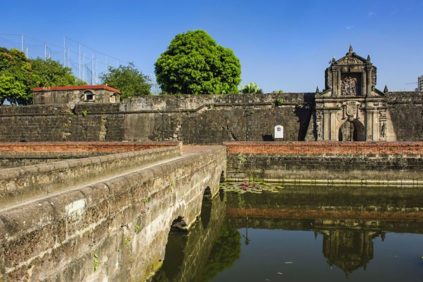
Apparently the Intramuros is a star fort also.
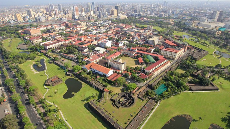
This is a view of a street inside the Intramuros, with cobblestones, colonnades, stone masonry and balconies.

The first University in Manila, Universidad de San Ignacio, was said to have been established in the Intramuros by the Jesuits in 1590.

In 1540, Pope Paul III had issued a papal bull forming the Jesuit Order, under the leadership of Ignatius Loyola, Basque nobleman from the Pyrenees in Northern Spain.
The Jesuit Order included a special vow of obedience to the Pope in matters of mission direction and assignment.
With regards to the efforts to establish one universal, hierarchical, organized religion, in which Humanity was taught it needed an intermediary to reach the Creator, the main Catholic missionaries, besides the Franciscans, were the Jesuits, Benedictines, and Dominicans…
…and most likely involved in many activities of cultural obfuscation, some known, and many more not known.
When I looked up “Philippines, lost Tribe of Israel,” this popped up.
The Philippines is one of the places believed by many to be the biblical wealthy land of Ophir.
Other candidates for Ophir include the Solomon Islands, India, Africa, and the Americas.

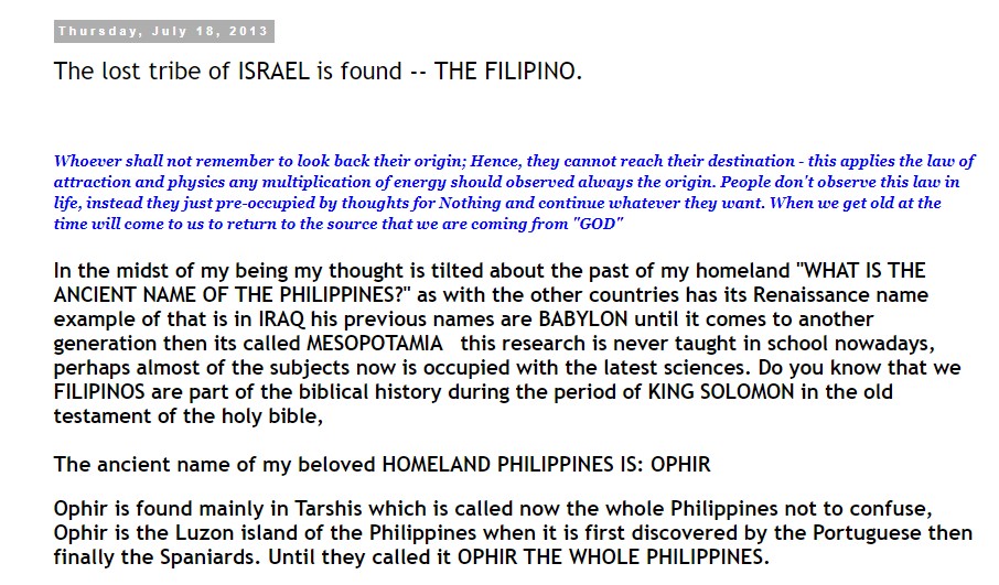
The other place I am going to take a look at in the Spanish East Indies is the Republic of Palau.
Palau was made part of the Spanish East Indies in 1574.
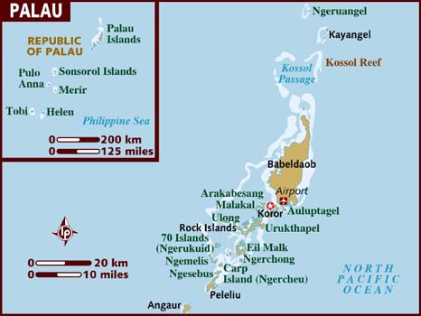
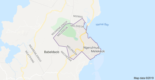
The seat of government of the Republic of Palau is located in Melekeok, and called Ngerulmud.
Melekeok is located in the central east coast of Palau’s Babeldaob Island.
The government was said to have moved here in 2006 from Koror Island, which is the population center of Palau…

…and the capitol buildings were said to have been built in the middle of nowhere just prior to the time of the move.

The Badrulchau Stone Monoliths are located on the northern part of the island of Babeldaob.

There are 52 here, some of them weighing over 5 tons.

These monoliths are said to be made for a type of stone material not found here.
I can’t find a specific Tribe of Israel associated with Palau, but I did find this.

After Spain’s defeat in the Spanish-American War in 1898, the islands Palau were sold to Imperial Germany in 1899 under the terms of the German-Spanish Treaty.

The other islands purchased by Germany as a result of this treaty were the Caroline Islands and the Mariana Islands.
They were all part of German New Guinea, which was part of the German Colonial empire that existed from 1884 to 1919.
German New Guinea ceased to exist after World War I and the Treaty of Versailles.
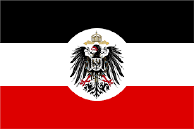
The Germans had previously purchased the Marshall Islands from Spain in 1885, and in 1888, the Germans annexed the island of Nauru to the Marshall Islands protectorate.
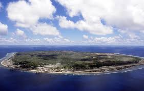
Today, Nauru is the third smallest country in the world, after Vatican City and Monaco.
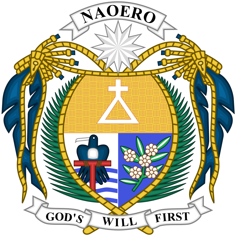
Interestingly, at one time the island Republic of Nauru was the second-richest nation in the world by GDP per capita from the mining of its phosphate reserves.

There is much more to be found in the East Indies and West Indies, but now I am going to skip around bring forward examples of how other ancient countries were subjugated, and controlled, through the processes of western colonialism.
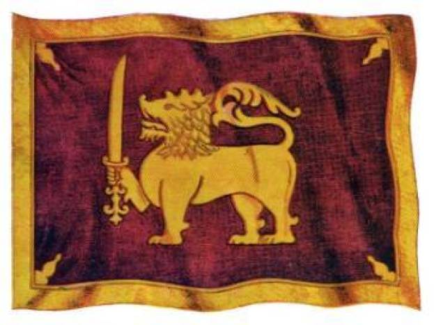
One such is example is the Kingdom of Kandy was said to have been founded in Ceylon in 1469.
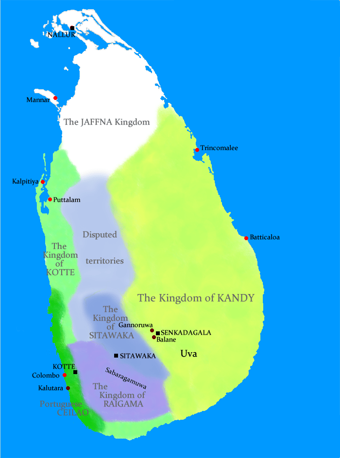
Known as Ceylon since ancient times, it has been known as the island country of Sri Lanka since 1972.
In 1592, Kandy became the capital city of the last remaining independent kingdom in Ceylon after the coast regions had been conquered by the Portuguese.
From that time, the Kingdom of Kandy kept the Portuguese and Dutch East India Company at bay, but succumbed finally to British colonial rule when the kingdom was absorbed into the British Empire as a protectorate via the Kandyan Convention of 1815, an agreement signed between the British and members of the King’s court which ceded the kingdom’s territory to British rule, and the last king was imprisoned.
At this time, Ceylon became British Protectorate until its independence in 1948.
The Kandyan Convention was signed in the Temple of the Sacred Tooth Relic.

Also known simply as the Temple of the Tooth…
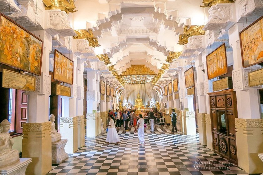
…which houses the tooth of the Buddha, venerated as the Buddha’s only surviving relic.

It is believed that whoever holds the relic, holds the governance of the country.
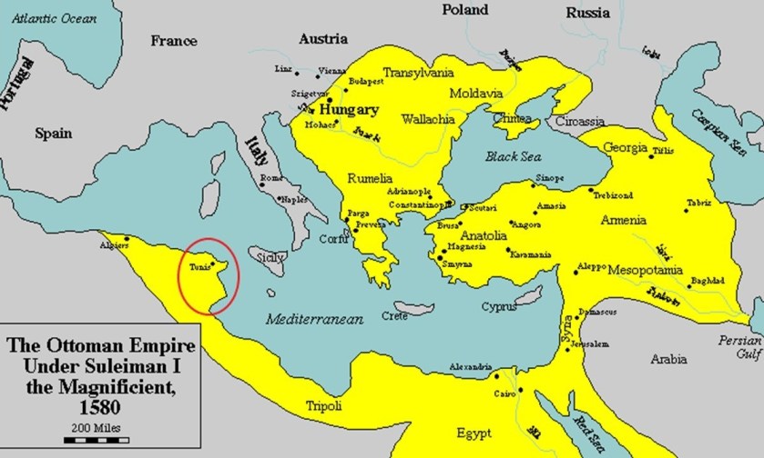
Another example of what happened is with regards to the northern African country of Tunisia, which was the historical location of Carthage, the capital of the ancient and powerful Carthaginian Empire, which was in the same location as its modern capital, Tunis.
At the beginning of the 1800s, Tunisia was described as a quasi-autonomous province of the Ottoman Empire.
Its trade increased dramatically with Europe in the 1800s, with the arrival of western merchants wanting to establish business in the country.
Then, the Bey of Tunis from 1855 to 1859, Muhammad, was forced by the British and French to sign the 1857 Fundamental Pact, which increased freedoms for non-Tunisians.

Then, we are told, in 1861, Tunisia enacted the first constitution in what was called the Arab world, but a move toward a modernizing republic was said to have been hampered by a poor economy and political unrest.

Regardless of the new Constitution, when the Tunisian government couldn’t manage the loans made by foreigners to the government, it declared bankruptcy in 1869.
Then Britain and France cooperated between 1871 and 1878 to prevent Italy from acquiring Tunisia as a colony having investment, and subsequently Britain supported the French interest in Tunisia in exchange for dominion over Cyprus.

Using the pretext of a Tunisian invasion into Algeria, the French invaded Tunisia starting in 1881 with an army of 36,000, which quickly advanced to Tunis, entering by way of places like Sousse on the coast…

…and subsequently occupying Tunis.

Then, the French forced the new Bey, Muhammad III as-Sadiq, to make terms in the form of the 1881 Treaty of Bardo, which gave France control of Tunisian governance and making it a de facto French Protectorate.

The French progressively assumed more of the important administrative positions, and by 1884 they supervised all Tunisian government bureaus dealing with finance, post, education, telegraph, public works, and agriculture.
On March 20th, 1956, Tunisia achieved its independence from France with the establishment of a Constitutional Monarchy…
…with the last Bey of Tunis, Muhammed VIII al-Amin Bey, as the King of Tunisia.
This State of Affairs didn’t last long, as the Prime Minister, Habib Bourguiba, abolished the monarchy in 1957, and proclaimed the Republic of Tunisia the same year, and served as its President for the next thirty-one years.
At the same time the constitutional monarchy of Tunisia was abolished, the Beylik of Tunis was terminated as well, described as a largely autonomous Beylik of the Ottoman Empire.
Another method by which the original civilization’s true history was obscured was by way of historical place name changes.
Here are several examples, of which there are many more, of this practice.
The following were all empires unified within the ancient Moorish civilization, with its roots going back in the far distant past to the time of Mu, also known Lemuria.
Also known as the Barbary Coast and the Maghreb, Barbaria was the name given to a vast region stretching across Northern Africa, to the Canary Islands.
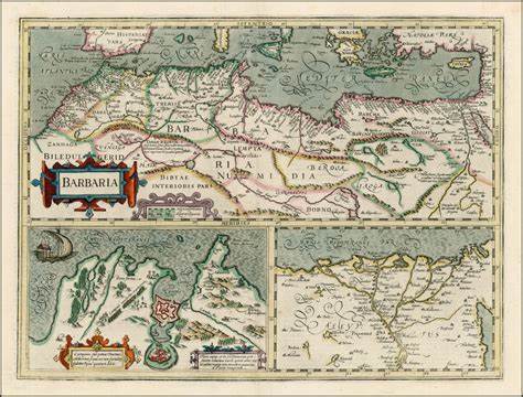
The people who live in that part of northern Africa became known as Berbers instead of Barbars.
What was the historical Tartarian Empire included present-day Korea, Japan, Mongolia, Tibet, and other modern Central Asian countries…
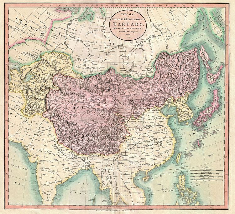
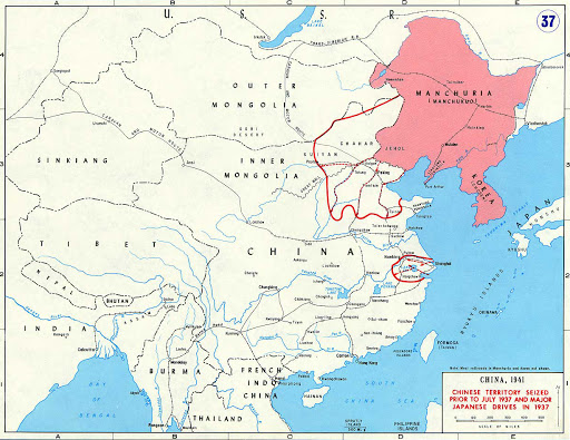
…and a chunk of it became known as Manchuria in northeast Asia in the mid-1800s.
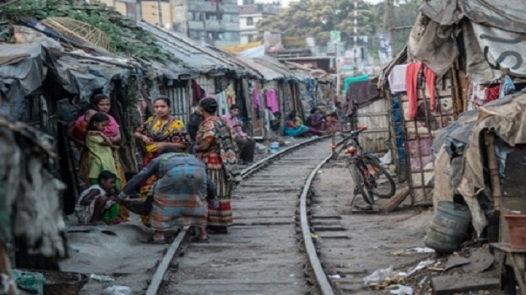
The borders of today’s country of Bangladesh were the major portion of the historic region of Bengal, an ancient civilization said to date back at least 4,000 years.

Mughal Bengal was described as a “Paradise of Nations,” and its inhabitants living standards were among the highest in the world at one time…

…and for comparison, a typical photo of the poverty found in Bangladesh today.
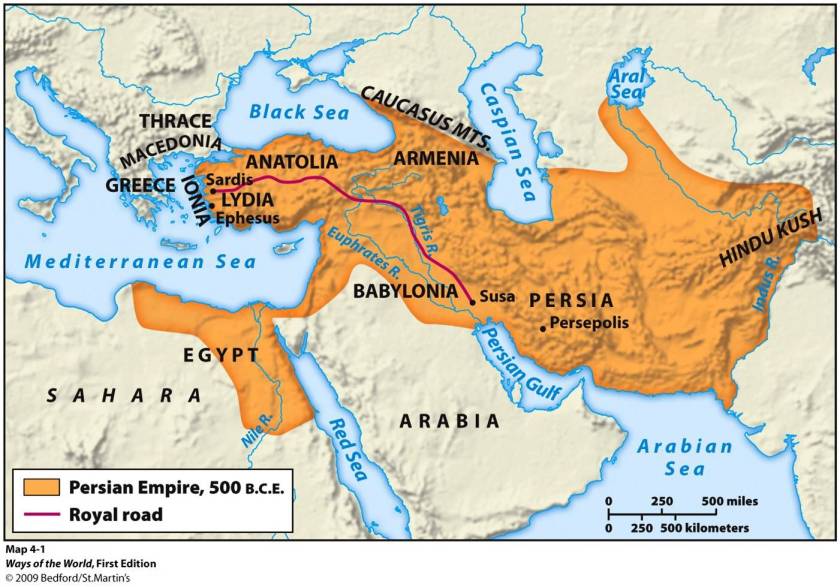
Persia historically was part of the vast Persian Empire, which in more ancient times, as we are told, included all of the following present-day countries: Afghanistan, Armenia, Azerbaijan, Bahrain, Egypt, Georgia, Iraq, Israel, Kazakhstan, Kuwait, Lebanon, Oman, Pakistan, Russia, Tajikistan, Turkmenistan, Turkey, and Uzbekistan.
On the Nowruz, or New Year, of 1935, the Shah of Iran, Reza Shah Pahlavi asked foreign delegates to use the term Iran in formal correspondence.
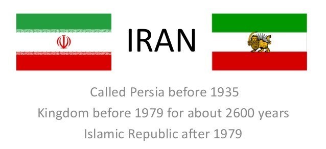
This also changed the usage of the country’s national identity from Persian to Iranian.
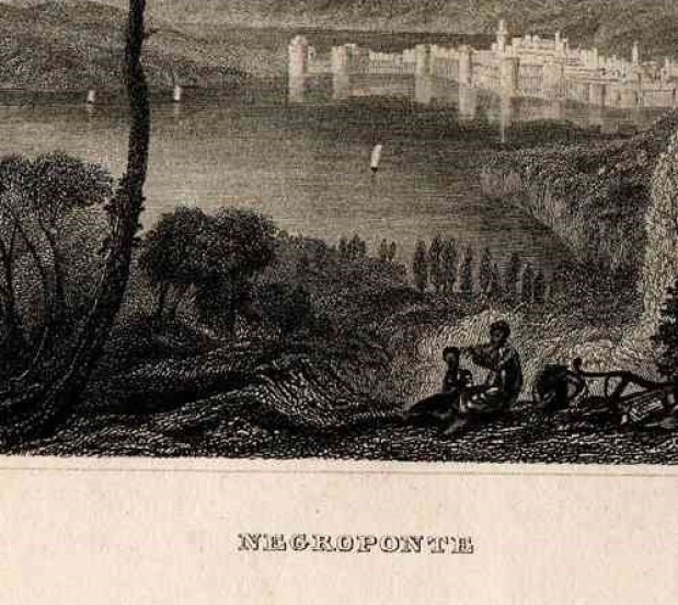
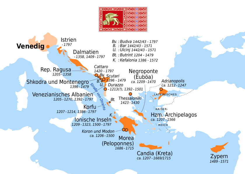
At one time, Euboea, a large island in the Aegean Sea, off the eastern coast of what is now called Greece, was known by another name…Negroponte…

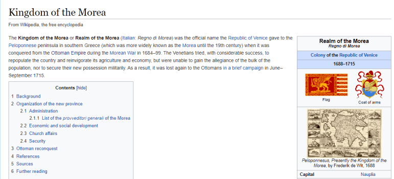
…and part of what was then known as the Kingdom, or Realm, of the Morea, which was the official name of the Peloponnese Peninsula of southern Greece until the 19th-century.
There are other pieces to the puzzle that are important to mention in this post before I conclude it.
The main foundational piece for the Catholic Church’s claims for dominion over all of Humanity was the Unam Sanctum papal bull, which are told was issued by Pope Boniface VIII in 1302.
At the end of it, he writes “Furthermore, we declare, we proclaim, we define that it is absolutely necessary for salvation that every human creature be subject to the Roman Pontiff.”

On December 22, 1216, the Dominican Order was founded by Pope Honorious III via his papal bull called the Religiosam Vitam and gave universal recognition to the order.
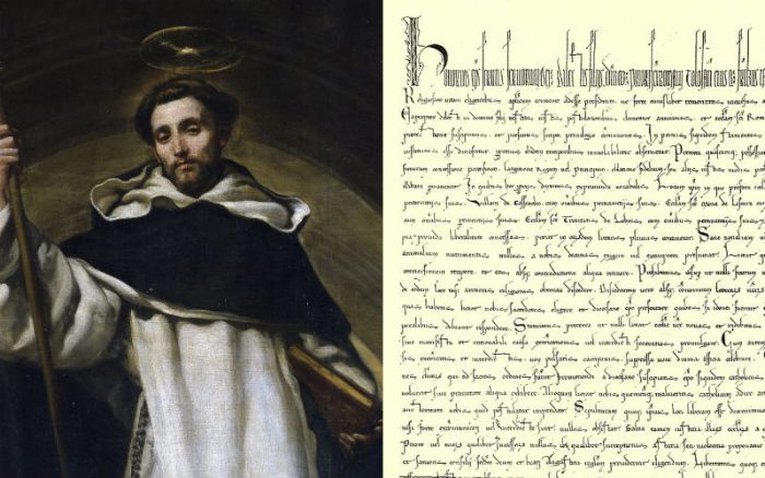
This occurred during the Albigensian or Cathar Crusade in Southern France, and the Dominicans were founded to preach the gospel and oppose the Cathar heresy, and/or any form of what was deemed heresy, which is defined as “the formal denial of the orthodox beliefs of the church, and the adherence to correct or accepted creeds in religion.”
The peaceful gnostic Cathars were brutally massacred in the Albigensian Crusade in southern France and Spain that lasted from 1209 to 1229, as the Cathars were tagged as a heretical sect.

It is interesting to note that the small country of Andorra is located between these two countries in the southern part of the Pyrenees Mountains…
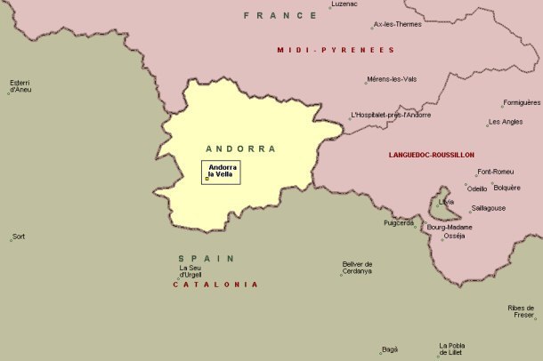
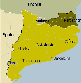
…all of which was part of the historical Catalonia…

…and has been ruled since 1272 to the present-day as a diarchy, a co-principality of unelected Heads-of-State, by whoever is the Catholic Bishop of Urguelle, and whoever is the President of France.

Catalonia was partitioned as a result of the 1659 Treaty of the Pyrenees, ending the Franco-Spanish War which took place between 1635 and 1659, during which time Catalonia revolted.

The Spanish Crown ceded the northern parts of Catalonia to France.
Then in 1714, King Philip V of Spain imposed a unifying administration across Spain via the Nueva Planta decrees…

…which like the other realms of the Crown of Aragon, suppressed the Catalan institutions and rights, as a result of the War of Spanish Succession, when Catalonia changed its loyalty from Philip V to his rival Archduke Charles, whose English allies promised to uphold Catalan charters and institutions.
What is the driving force behind the brutal animosity towards the people of this region, and the desire to control it in perpetuity?
I think there is a very important secret hidden here about the people who live in this region, that surfaces in their oral traditions…and sometimes in literature.
The Inquisition started in the 1200s in France, during the same period of time as the Cathar Albigensian Crusade.

The Inquisition was a group of institutions within the Catholic Church with a stated aim of combating heresy, and under the leadership of the Dominican order.

The Spanish Inquisition was established by King Ferdinand and Queen Isabella in 1478 to maintain Catholic orthodoxy. Called the Tribunal of the Holy Office of the Inquisition, it is particularly known in history for its brutality and torture.

So we are taught that all of this is normal and matter of fact in history in school, like there is nothing out of the ordinary or wrong about the Inquisition…which was, by its very nature, violating basic Human Rights and dignity, including torture in the name of Christianity just for having dissenting views.
The lovely Office of the Inquisition is even still in existence to this day…only now it is called the “Congregation for the Doctrine of the Faith.”

The powers that were didn’t rewrite history from scratch – they rewrote the historical narrative to fit their agenda. And from the new official historical reset year of 1851, we have been immersed in learning their version of history from a very young age.

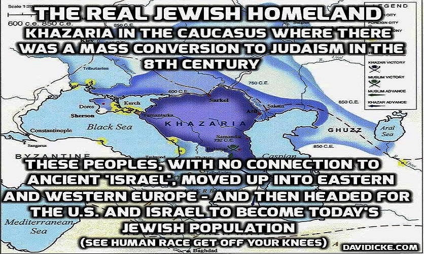
And it sure looks like to me that the identity of the true Israelites was replaced with a false identity and hidden away, and, as we have seen, many were relegated to an existence of slavery, degradation and marginalization, if they weren’t killed.

This subjugation allowed for the identity of the Israelites to be co-opted by the Khazarian Jews and Zionists.
The Rothschilds purchased Jerusalem in 1829, and subsequently acquired considerable land in Palestine in the 1800s and early 1900s.

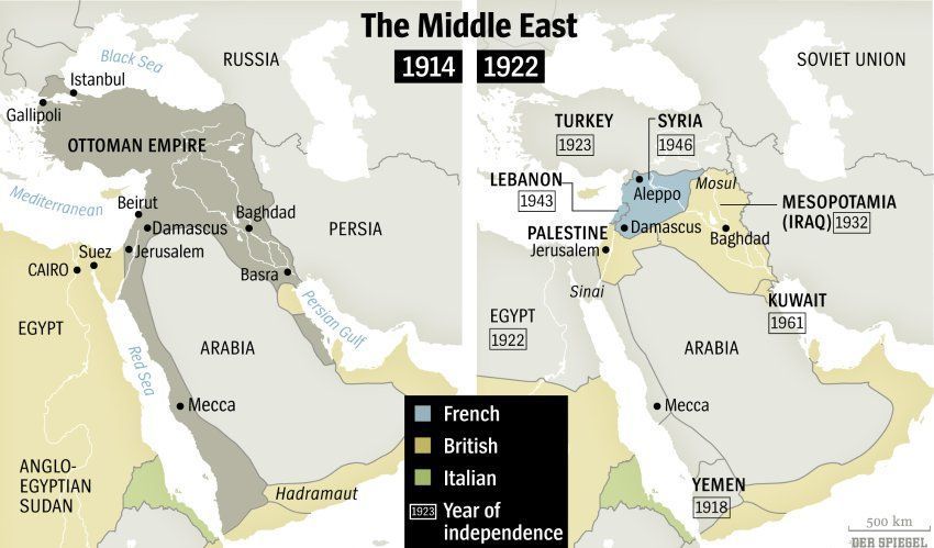
The Balfour Declaration was a public statement issued by the British government in 1917, during World War I, announcing support for the establishment of a national home for the Jewish people in Palestine…
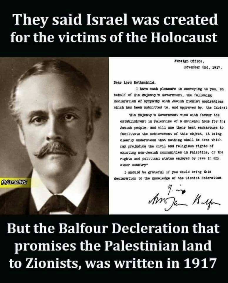
…which was at that time, a region of the Ottoman Empire, an empire which was partitioned at the end of World War I, losing its Middle East holdings, which were divided between the Allied Forces, with Palestine going to the British.
See how that worked?
In the third, and last, part of this series, I will be taking a close look at how the sea voyages of the “Ages of Discovery” tie into the creation of the New World from the Old World.

I’m positive history is changed by the Illuminati. They are in control. They aren’t Human. They have human bodies, but they don’t have Human souls. They have a Reptilian soul, that doesn’t have empathy for others like our souls do. There are about 60,000 of them, with about 630,000 Humans with high paying jobs, that closely work for them, these people give them there power. Learn more at https://www.icheckyoursoul.com/
LikeLike
There is definitely a cover up of history, archeology, anthropology, et al. Your research is such a blessing— so informative and truth telling!! Thanks so much!
LikeLike
Thank you! I definitely feel a drive and urgency to get this information out there as quickly as possible. My YT channel is growing quickly. I convert all my blogposts into videos. You can find it by searching for Michelle Gibson Moors.
LikeLike